B - Coffs Harbour City Council
B - Coffs Harbour City Council
B - Coffs Harbour City Council

Create successful ePaper yourself
Turn your PDF publications into a flip-book with our unique Google optimized e-Paper software.
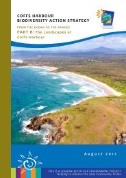
COFFS HARBOUR<br />
BIODIVERSITY ACTION STRATEGY<br />
FROM THE OCEAN TO THE RANGES<br />
PART B: The Landscapes of <strong>Coffs</strong> <strong>Harbour</strong><br />
DRAFT<br />
DRAFT<br />
APRIL 2012<br />
THIS IS A LOOKING AFTER OUR ENVIRONMENT PROJECT 51<br />
Helping to achieve the 2030 Community Vision
BIODIVERSITY<br />
ACTION STRATEGY<br />
TABLE OF CONTENTS<br />
52<br />
B1. INTRODUCTION 53 TABLES<br />
DRAFT<br />
B1.1 An introduction to the<br />
Table B2.1: Coastal plains statistics 59<br />
landscapes of the <strong>Coffs</strong> <strong>Harbour</strong> LGA 53<br />
Table B2.2: Vegetation formations in the<br />
B2. COASTAL PLAINS 59<br />
Coastal Plains 59<br />
B2.1 Landform 59 Table B2.3: Coastal plains threat activities and<br />
ranking 77<br />
B2.2 Geology 59<br />
Table B3.1: Midland hills statistics 82<br />
B2.3 Land use 59<br />
Table B3.2: Vegetation formations of the <strong>Coffs</strong><br />
B2.4 Broad vegetation types 59<br />
<strong>Harbour</strong> midland hills 83<br />
B2.5 Aquatic ecosystems 60 Table B3.3: Midland hills threat activities and<br />
B2.6 Threatened communities, populations<br />
ranking 88<br />
and species 62 Table B4.1: Escarpment ranges statistics 92<br />
B2.7 Threats 76 Table B4.2: Vegetation formations of the <strong>Coffs</strong><br />
B2.8 Landscape connections in the coastal<br />
<strong>Harbour</strong> escarpment ranges 92<br />
plains 79 Table B4.3: Escarpment ranges threat activities<br />
and ranking 96<br />
B3. MIDLAND HILLS 82<br />
B3.1 Landform 82<br />
FIGURES<br />
B3.2 Geology 82<br />
Figure B1.1: Landscapes as a proportion of<br />
<strong>Coffs</strong> <strong>Harbour</strong> LGA 53<br />
B3.4 Broad vegetation 82<br />
Figure B1.2: Landscape units in <strong>Coffs</strong> <strong>Harbour</strong><br />
B3.4 Aquatic ecosystems 83<br />
LGA 55<br />
B3.5 Threatened communities, populations<br />
Figure B1.3: Broad geology groupings in <strong>Coffs</strong><br />
and species 83<br />
<strong>Harbour</strong> LGA 56<br />
B3.6 Threats 87 Figure B1.4: Major land uses in <strong>Coffs</strong> <strong>Harbour</strong><br />
LGA 57<br />
B3.7 Landscape connections in the midland<br />
hills 90 Figure B1.5: Landscape connections in the<br />
<strong>Coffs</strong> <strong>Harbour</strong> LGA 58<br />
B4. ESCARPMENT RANGES 92<br />
Figure B2.1: Marine parks, estuaries and<br />
B4.1 Landform 92<br />
coastal lakes 61<br />
B4.2 Geology 92<br />
Figure B2.2: Endangered coastal Emu population 64<br />
B4.2 Land use 92<br />
Figure B2.3: Little Tern nest sites 65<br />
B4.3 Broad vegetation 92<br />
Figure B2.4: Black Grass-dart and Coastal<br />
Petaltail distribution in <strong>Coffs</strong><br />
B4.4 Aquatic ecosystems 93<br />
<strong>Harbour</strong> LGA 67<br />
B4.5 Threatened species, populations and<br />
Figure B2.5: Floyds Grass distribution in <strong>Coffs</strong><br />
communities 93<br />
<strong>Harbour</strong> LGA 68<br />
B4.6 Threats 94 Figure B2.6: Moonee Quassia distribution in<br />
<strong>Coffs</strong> <strong>Harbour</strong> LGA 69<br />
B4.7 Landscape connections In the<br />
escarpment ranges 99 Figure B2.7: Coast Headland Pea, Headland Zieria<br />
and Orara Boronia 70<br />
Seen Australia ©<br />
Figure B2.8: Flying-fox camp sites 72<br />
Figure B2.9: Koala distribution 73<br />
Figure B3.1: Giant Barred Frog and Stuttering<br />
Frog records 85<br />
Figure B3.2: Rusty Plum, Orara Boronia, Slender<br />
Mardenia records in the <strong>Coffs</strong><br />
<strong>Harbour</strong> LGA 86<br />
Figure B4.1: Parma Wallaby, Rufous Bettong<br />
Front Cover Image<br />
and Squirrel Glider records 95<br />
<strong>Coffs</strong> Coastal landscape - Picture supplied Rob Cleary
The Landscapes of <strong>Coffs</strong> <strong>Harbour</strong><br />
B<br />
B1. INTRODUCTION<br />
B1.1 An introduction to the<br />
landscapes of the <strong>Coffs</strong> <strong>Harbour</strong><br />
LGA<br />
To provide a better understanding of past and<br />
present land-use patterns and threats impacting<br />
biodiversity, the <strong>Coffs</strong> <strong>Harbour</strong> LGA has been divided<br />
into three distinct landscape units:<br />
··<br />
coastal plains<br />
··<br />
midland hills<br />
··<br />
escarpment ranges.<br />
100%<br />
90%<br />
80%<br />
70%<br />
60%<br />
50%<br />
40%<br />
30%<br />
20%<br />
10%<br />
0%<br />
100%<br />
90%<br />
80%<br />
70%<br />
60%<br />
50%<br />
40%<br />
30%<br />
20%<br />
10%<br />
0%<br />
Total Area (hectares)<br />
Escarpment Ranges<br />
37,632 hectares<br />
Midland Hills<br />
47,587 hectares<br />
Coastal Plains<br />
32,152 hectares<br />
National Park Estate<br />
Escarpment Ranges<br />
6,145 hectares<br />
Midland Hills<br />
3,287 hectares<br />
Coastal Plains<br />
5,403 hectares<br />
Total: 117,371 hectares<br />
These landscapes have been based primarily on<br />
topography and elevation. The graphs (Figure B1.1)<br />
below show the area and percentages for each<br />
of the landscapes, and Figure B1.2 is a map of the<br />
landscapes.<br />
This part of the Strategy details the characteristics,<br />
statistics, biodiversity values, landscape connections<br />
and key threats of each of the three landscapes.<br />
Figure B1.1: Landscapes as a proportion of<br />
<strong>Coffs</strong> <strong>Harbour</strong> LGA<br />
100%<br />
90%<br />
80%<br />
70%<br />
60%<br />
50%<br />
40%<br />
30%<br />
20%<br />
10%<br />
0%<br />
100%<br />
90%<br />
80%<br />
70%<br />
60%<br />
50%<br />
40%<br />
30%<br />
20%<br />
10%<br />
0%<br />
% of Total Area<br />
Escarpment Ranges<br />
32%<br />
Midland Hills<br />
41%<br />
Coastal Plains<br />
27%<br />
DRAFT<br />
Total: 14,845 hectares<br />
State Forest Estate<br />
Escarpment Ranges<br />
15,025 hectares<br />
Midland Hills<br />
19,172 hectares<br />
Coastal Plains<br />
6,051 hectares<br />
100%<br />
Total: 40,249 hectares<br />
53
BIODIVERSITY<br />
ACTION STRATEGY<br />
The coastal plains supports a significantly higher<br />
percentage of the human population in the LGA.<br />
This greater population density living near and<br />
adjacent to the coast results in an array of threats<br />
and disturbances to the biodiversity of this fragile<br />
landscape. Conversely the midland hills, and to a<br />
greater extent the escarpment ranges, support<br />
a much lower density of population per square<br />
kilometre. In these landscapes, most people live<br />
in rural areas or villages. Threats to biodiversity in<br />
these areas are often different and lower in intensity<br />
compared to the coast.<br />
The <strong>Coffs</strong> <strong>Harbour</strong> LGA has a varied and complex<br />
geological history. Broad geological groupings in<br />
the LGA are shown in Figure B1.3, including alluvial<br />
sediments, claystones, conglomerates, marine<br />
sediments, granite, mudstones and sandstone.<br />
Major land uses in the LGA vary across the three<br />
landscapes and are broadly depicted in Figure B1.4.<br />
The coastal plains are dominated by urban and rural<br />
residential areas, with some areas of horticulture,<br />
grazing and cropping. The midland hills and<br />
escarpment ranges are mostly rural with grazing and<br />
forestry, and some areas of horticulture (primarily<br />
bananas and blueberries).<br />
B1.2 Landscape connections in<br />
the <strong>Coffs</strong> <strong>Harbour</strong> LGA<br />
We have identified and mapped 20 ‘landscape<br />
connections’ in <strong>Coffs</strong> <strong>Harbour</strong> LGA (see Figure<br />
B1.5). These areas support important conservation<br />
priorities and will be the focus for our biodiversity<br />
conservation efforts. There are:<br />
··<br />
10 in the coastal plains<br />
··<br />
5 in the midland hills<br />
··<br />
5 in the escarpment ranges.<br />
These areas are known to support important<br />
biodiversity values and they also provide overall<br />
habitat connectivity. Parts of these areas are subject<br />
to ongoing and proposed development pressures.<br />
These pressures are associated with urban and<br />
rural–residential subdivisions on the coastal plain,<br />
and with ongoing agricultural and forestry activities<br />
in the midland hills and escarpment ranges.<br />
The biodiversity values in these key areas persist<br />
within remnants of habitat (coastal plains) or<br />
broader swathes of habitat (midland hills and<br />
escarpment ranges). These habitats may have<br />
been modified, but they still retain overall high<br />
conservation values.<br />
A range of conservation mechanisms may be<br />
appropriate to protect and enhance these values,<br />
such as formal reservation, Biobanking and<br />
offsetting, conservation agreements, management<br />
of weeds and pest animals, and enhancement<br />
of riparian areas. Large parts of these areas are<br />
freehold and their protection will depend on a range<br />
of factors such as the willingness of landowners to<br />
be involved in conservation mechanisms, and the<br />
availability of funding for biodiversity management.<br />
These ‘landscape connections’ are significant at<br />
local, regional and state scales because:<br />
··<br />
they support threatened species (TSC Act,<br />
EBPC Act & FM Act), regional core habitats, and<br />
conservation priority fauna (after Gilmore &<br />
Parnaby 1994; NPWS 1994, 1995)<br />
··<br />
they provide critical links between larger, core<br />
habitat areas at a landscape and local level—<br />
these corridors facilitate the movement of genes,<br />
individual plants/animals and species across the<br />
landscape<br />
··<br />
they provide climate change pathways for<br />
biodiversity mitigation and adaptation in the<br />
face of likely climate change impacts on species,<br />
communities and ecosystems.<br />
DRAFT<br />
54<br />
Christmas Bells Blandfordia grandiflora
!.<br />
The Landscapes of <strong>Coffs</strong> <strong>Harbour</strong><br />
B<br />
Figure B1.2: Landscape units in <strong>Coffs</strong> <strong>Harbour</strong> LGA<br />
!.<br />
Coramba<br />
DRAFT<br />
Boambee<br />
<strong>Coffs</strong> <strong>Harbour</strong><br />
!.<br />
!.<br />
!. Sawtell<br />
!.<br />
!.<br />
!.<br />
Arrawarra<br />
Woolgoolga<br />
Red Rock<br />
Coastal Plains<br />
Midland Hills<br />
Escarpment Ranges<br />
0 2 4 8 Kilometres<br />
!<br />
55
!.<br />
BIODIVERSITY<br />
ACTION STRATEGY<br />
Figure B1.3: Broad geology groupings in <strong>Coffs</strong> <strong>Harbour</strong> LGA<br />
!.<br />
Coramba<br />
DRAFT<br />
Boambee<br />
<strong>Coffs</strong> <strong>Harbour</strong><br />
!.<br />
!.<br />
!. Sawtell<br />
!.<br />
!.<br />
!.<br />
Arrawarra<br />
Woolgoolga<br />
Red Rock<br />
Alluvial Sediments<br />
Claystone<br />
Conglomerate<br />
Granite<br />
Marine Sediments<br />
Meta-sediments<br />
Mudstone<br />
Sandstone<br />
Siltstone<br />
0 2 4 8 Kilometres<br />
!<br />
56
!.<br />
The Landscapes of <strong>Coffs</strong> <strong>Harbour</strong><br />
B<br />
Conservation Area - Other<br />
Cropping<br />
Grazing<br />
Horticulture<br />
Intensive Animal Production<br />
Mining & Quarrying<br />
Power Generation<br />
River & Drainage System<br />
Special Category<br />
Transport & Other Corridors<br />
Tree & Shrub Cover<br />
Urban<br />
Wetland<br />
National Park Estate<br />
State Forest Estate<br />
!.<br />
Coramba<br />
DRAFT<br />
Boambee<br />
<strong>Coffs</strong> <strong>Harbour</strong><br />
!.<br />
!.<br />
!. Sawtell<br />
!.<br />
!.<br />
!.<br />
Arrawarra<br />
Woolgoolga<br />
Red Rock<br />
Figure B1.4: Major land uses in <strong>Coffs</strong> <strong>Harbour</strong> LGA<br />
0 2 4 8 Kilometres<br />
!<br />
57
!.<br />
BIODIVERSITY<br />
ACTION STRATEGY<br />
Coastal<br />
Coastal<br />
Plains<br />
Plains<br />
(1) Corindi Estuary - Dirty Creek<br />
(2) Mullaway – Arrawarra – Darlington<br />
(3) Hearnes Lake - Double Crossing Creek<br />
(4) Emerald Beach - Moonee Creek - Wedding Bells<br />
(5) South Moonee Forest - Wedding Bells<br />
(6) Korora - Korora Basin<br />
(7)<br />
DRAFT<br />
<strong>Coffs</strong> Creek – racecourse – North Boambee Beach<br />
(8) South Boambee Beach - airport – Boambee<br />
Red Rock<br />
(9) Bongil Bongil - Bonville - Tuckers Knob<br />
!.<br />
(10) Bongil – Pine Creek<br />
1<br />
Midland Hills Hills<br />
(11) Weddings Bells – Corindi River - Conglomerate<br />
(12) Lower Bucca – Bucca Bucca - Sherwood<br />
Arrawarra<br />
!.<br />
(13) Nana Creek – Coramba – Lower Bucca<br />
11<br />
2<br />
(14) Orara East – Karangi – Orara West<br />
(15) Bongil – Pine Creek – Tuckers Nob<br />
Woolgoolga<br />
!.<br />
3<br />
Coramba<br />
!.<br />
5<br />
6<br />
14<br />
!. 7<br />
<strong>Coffs</strong> <strong>Harbour</strong><br />
Boambee<br />
!.<br />
Escarpment Ranges 8<br />
(16) Gundar – Kangaroo River<br />
15<br />
!. Sawtell<br />
(17) Orara West – Wild Cattle Creek<br />
9<br />
19<br />
17<br />
18<br />
(18) Bindarri – Cascade<br />
(19) Dorrigo – Wild Cattle Creek - Cascade<br />
(20) Bindarri - Dorrigo<br />
20<br />
16<br />
13<br />
Figure B1.5: Landscape connections in the <strong>Coffs</strong> <strong>Harbour</strong> LGA<br />
12<br />
10<br />
4<br />
0 2 4 8 Kilometres<br />
!<br />
58
The Landscapes of <strong>Coffs</strong> <strong>Harbour</strong><br />
B<br />
B2. COASTAL PLAINS<br />
B2.1 Landform<br />
The coastal plains landscape (Figure B1.2) is a lowrelief<br />
landscape with little variation in altitude. The<br />
plains gradually rise from sea level to around 50<br />
metres elevation (the boundary of the midland hills<br />
landscape) which is usually within 10 kilometres of<br />
the coast. Slopes are predominantly flat to gentle<br />
(0–5°), though there are some small hills with<br />
steeper slopes. The coastal plain is characterised by<br />
low-lying alluvial sediments derived from floodplain<br />
deposits and older weathered metasediments of the<br />
Coramba formation. The 80 kilometre-long coastline<br />
features a series of prominent rocky headlands and<br />
beaches.<br />
B2.2 Geology<br />
The coastal plains landscape is dominated by<br />
sedimentary geology. The sedimentary units occur<br />
as younger Quaternary beach sands, silt, mud and<br />
alluvial deposits adjacent to the coastline, creek<br />
lines, estuaries and coastal embayments and infills.<br />
These overlay older Carboniferous-aged consolidated<br />
clastic sediments of the Coramba and Brooklana<br />
formations which tend to predominate towards the<br />
western edge of the coastal plains landscape.<br />
B2.3 Land use<br />
Most urban residential, industrial and rural<br />
residential land in <strong>Coffs</strong> <strong>Harbour</strong> LGA is situated<br />
on the relatively flat and low-lying coastal plain.<br />
These land uses cover about 20% of the coastal<br />
plain, mostly within 5 kilometres of the coast. Urban<br />
residential and commercial/industrial land uses<br />
occur on the eastern side of the coastal plain. Rural<br />
residential allotments are further west, toward the<br />
midland hills.<br />
The coastal plain also contains a significant number<br />
of small horticultural industries. Bananas are<br />
traditionally the primary horticultural crop, however,<br />
some other fruit tree plantations such as blueberries<br />
have been established. Livestock grazing is also<br />
distributed throughout the coastal plain with the<br />
largest grazing areas occurring towards the southern<br />
end of the LGA around Bonville. National park estate<br />
occupies a significant portion of the coastal plain,<br />
with reserves in the south, north and central areas.<br />
B2.4 Broad vegetation types<br />
The vegetation communities in the coastal plains<br />
landscape vary greatly in composition, age and<br />
condition. The coastal plains host 12 different<br />
vegetation formations (Table B2.2). These formations<br />
are based on Keith (2006).<br />
Table B2.1: Coastal plains statistics<br />
Coastal Plains<br />
Almost 40% of the coastal plains landscape has been<br />
cleared of vegetation. Another third is covered with<br />
dry or wet sclerophyll forests or semi-mesic forests.<br />
Table B2.2: Vegetation formations in the Coastal Plains<br />
Formation<br />
% of total<br />
Cleared of vegetation 39<br />
Dry sclerophyll shrub forests 12<br />
Wet sclerophyll forests 11<br />
Semi-mesic forests 10<br />
Swamp sclerophyll forests 9<br />
Plantations 5<br />
Dry sclerophyll shrub/grass forests 5<br />
Sclerophyll grassy woodlands 4<br />
Heathlands 3<br />
Freshwater wetlands 1<br />
Hectares<br />
Total Area of Coastal Plains 32,152<br />
Total Area of EECs 5,564<br />
Percentage EECs 17%<br />
Endangered Ecological Communities *<br />
Coastal Saltmarsh 231<br />
Freshwater Wetlands on coastal<br />
floodplains<br />
Littoral Rainforest 274<br />
Lowland Rainforest 87<br />
Subtropical Coastal Floodplain Forest 2,546<br />
Swamp Oak Floodplain Forest 216<br />
Swamp Sclerophyll Forests on Coastal<br />
Floodplains<br />
Themeda grassland on seacliffs and coastal<br />
headlands<br />
Rainforests
BIODIVERSITY<br />
ACTION STRATEGY<br />
60<br />
The vegetation along the coastal plain is moderately<br />
fragmented, however, there are still some vegetated<br />
corridors between the coast and the midland hills.<br />
The larger corridors occur in the southern, central<br />
and northern parts of the LGA. Corridors are less<br />
frequent in areas of higher population density. The<br />
larger and more contiguous areas of vegetation<br />
are located in the northern parts of the LGA<br />
where the coastal plain is widest and land uses are<br />
predominantly national park, state forest or private<br />
property grazing.<br />
B2.5 Aquatic ecosystems<br />
The coastal plain contains only small- to mediumsized<br />
river and creek systems that flow eastwards<br />
to the ocean. These systems contain critically<br />
important areas of freshwater wetlands and<br />
estuarine habitats. The largest estuaries are in <strong>Coffs</strong>,<br />
Bonville and Pine creeks in the south, and Moonee,<br />
Corindi and Saltwater creeks in the north. These<br />
estuaries provide important habitat for a variety<br />
of waders, shorebirds, fish, crustaceans, other<br />
invertebrates, and marine and estuarine vegetation.<br />
Estuaries are also significant for recreational fishing<br />
and the commercial fishing industry.<br />
Solitary Islands Marine Park<br />
The renowned Solitary Islands Marine Park (Figure<br />
B2.1) stretches over 75 kilometres, from Muttonbird<br />
Island in the south to the Sandon River and Plover<br />
Island in the north. The Park incorporates estuaries<br />
to their tidal limit, foreshores to the mean high<br />
water mark, and it extends offshore to the 3 nautical<br />
mile state waters boundary. The estuaries and creeks<br />
are generally under a Habitat and Protection Zone,<br />
and Saltwater Creek near Red Rock is a Sanctuary<br />
Zone. These zonings are in place to protect and<br />
manage sensitive fish-breeding areas and aquatic<br />
nurseries such as seagrass beds and mangroves.<br />
Researchers have identified a unique biodiversity<br />
within the marine park including over 550 species of<br />
reef fish, 90 species of hard coral and 600 species<br />
of molluscs (shelled animals). Threatened species<br />
include the Grey Nurse Shark Carcharias taurus,<br />
Black Cod Epinephilus damelii, sea turtles, whales,<br />
seabirds, shorebirds and rare marine algae. The local<br />
Aboriginal communities within the Gumbaynggirr<br />
Nation maintain cultural links and are actively<br />
involved in Marine Park conservation planning.<br />
Solitary Islands Marine Reserve<br />
The Solitary Islands Marine Reserve (Commonwealth<br />
Waters) is located off the coast between <strong>Coffs</strong><br />
<strong>Harbour</strong> and Plover Island. Although not actually<br />
part of the <strong>Coffs</strong> <strong>Harbour</strong> LGA, the reserve and<br />
adjacent marine park are considered part of the<br />
<strong>Coffs</strong> community’s environment. The marine reserve<br />
extends from the 3 nautical mile state limit seaward<br />
to the 50 metre depth contour.<br />
Sepia sp.<br />
Chromodoris spendida<br />
DRAFT<br />
Green Turtle Chelonia mydas<br />
The reserve protects and conserves a relatively<br />
undisturbed, distinct and species-rich ecosystem<br />
associated with open ocean, subtidal reef, and<br />
soft sandy habitats. Pimpernel Rock is the most<br />
significant feature in the reserve. It is a submerged<br />
pinnacle that rises from the seabed to within a few<br />
metres of the surface, providing habitat for benthic<br />
communities, pelagic fish, Grey Nurse Sharks, Black<br />
Cod, and marine turtles (DSEWPC 2011).
The Landscapes of <strong>Coffs</strong> <strong>Harbour</strong><br />
B<br />
Legend<br />
Marine Park<br />
ZONE NAME<br />
General Use Zone<br />
Habitat Protection Zone<br />
Habitat Protection Zone (Grey Nurse Shark Key Habitat Restriction / Prohibition on Commercial Fish Trapping)<br />
Habitat Protection Zone (Prohibition on Commercial Fish Trapping)<br />
Habitat Protection Zone (Prohibition on Crab Trapping)<br />
Sanctuary Zone<br />
Special Purpose Zone<br />
Major Rivers & Creeks<br />
Major Rivers & Creeks<br />
SEPP14 Wetlands<br />
SEPP14 Wetlands<br />
!.<br />
Coramba<br />
Boambee<br />
<strong>Coffs</strong> <strong>Harbour</strong><br />
DRAFT<br />
!.<br />
!.<br />
!.<br />
Sawtell<br />
!.<br />
!.<br />
Arrawarra<br />
Woolgoolga<br />
Figure B2.1: Marine parks, estuaries and coastal lakes<br />
!<br />
0 2 4 8 Kilometers<br />
61
BIODIVERSITY<br />
ACTION STRATEGY<br />
62<br />
The reserve is important for marine conservation<br />
and research as it is located in a mixing zone<br />
between tropical and temperate environments.<br />
Many species in the reserve are at, or are close to,<br />
their southern or northern limit. The marine reserve<br />
protects and conserves important features, including<br />
habitat for a number of species that are listed as<br />
endangered or vulnerable under Commonwealth<br />
legislation or international agreements, including<br />
Humpback Whale Megaptera novaeangliae, Grey<br />
Nurse Shark Carcharias taurus, Black Cod Epinephelus<br />
daemelii, Bleekers Devil Fish Paraplesiops bleekeri,<br />
dolphins and many seabirds.<br />
Coastal lakes<br />
Pipeclay Creek, Woolgoolga Lake and Hearnes<br />
Lake—all north of <strong>Coffs</strong> <strong>Harbour</strong>—are coastal lakes<br />
that are likely to or have high conservation values for<br />
aquatic flora and fauna.<br />
Coastal complex habitats<br />
Complex combinations of wetlands, swamp forests,<br />
open forests, coastal heaths, shrublands and<br />
sedgelands along <strong>Coffs</strong> <strong>Harbour</strong>’s coastal plains<br />
support important habitats for a diverse biodiversity<br />
including many threatened species.<br />
The Squirrel Glider appears to be most common<br />
north of <strong>Coffs</strong> <strong>Harbour</strong>. There are known, regionally<br />
important glider habitats around the Garby Nature<br />
Reserve – Arrawarra area and also around Station<br />
Creek in southern Yuraygir National Park.<br />
The Southern Swamp Orchid Phaius australis and<br />
Square-stemmed Spike-rush Eleocharis tetraquetra<br />
are endangered plants that occur in the coastal plain.<br />
<strong>Coffs</strong> <strong>Harbour</strong>’s coastal complex habitats are also<br />
important for other threatened species, including:<br />
Wallum Froglet, Black Bittern Ixobrychus flavicollis,<br />
Common Planigale Planigale maculata, Common<br />
Blossom-bat Syconycteris australis, Eastern Ground<br />
Parrot Pezoporus wallicus wallicus (near Red Rock<br />
– Corindi), and raptors like the Osprey Pandion<br />
haliaetus and Square-tailed Kite Lophoictinia isura.<br />
B2.6 Threatened communities,<br />
populations and species<br />
Threatened ecological communities<br />
The <strong>Coffs</strong> coastal plain supports 11 threatened<br />
ecological communities (TEC). Two of these<br />
communities are isted as critically endangered<br />
under the Environment Protection and Biodiversity<br />
Conservation Act 1994 (EPBC Act):<br />
··<br />
Littoral Rainforest and Coastal Vine Thickets of<br />
eastern Australia.<br />
··<br />
Lowland Rainforest of Subtropical Australia.<br />
A further nine TECs are listed as endangered<br />
ecological communities (EEC) under the NSW<br />
Threatened Species Conservation Act 1997 (TSC Act):<br />
··<br />
Coastal Saltmarsh in the New South Wales North<br />
Coast, Sydney Basin and South East Corner<br />
Bioregions<br />
··<br />
Freshwater Wetlands on Coastal Floodplains of<br />
the New South Wales North Coast, Sydney Basin<br />
and South East Corner Bioregions<br />
··<br />
Littoral Rainforest in the New South Wales<br />
North Coast, Sydney Basin and South East Corner<br />
Bioregions<br />
··<br />
Lowland Rainforest in the NSW North Coast and<br />
Sydney Basin Bioregions<br />
··<br />
Lowland Rainforest on Floodplain in the New<br />
South Wales North Coast Bioregion<br />
··<br />
Subtropical Coastal Floodplain Forest of the New<br />
South Wales North Coast Bioregion<br />
··<br />
Swamp Oak Floodplain Forest of the New South<br />
Wales North Coast, Sydney Basin and South East<br />
Corner Bioregions<br />
··<br />
Swamp Sclerophyll Forest on Coastal Floodplains<br />
of the New South Wales North Coast, Sydney<br />
Basin and South East Corner Bioregions<br />
··<br />
Themeda Grassland on Seacliffs and Coastal<br />
Headlands in the NSW North Coast, Sydney Basin<br />
and South East Corner Bioregions.<br />
Priority areas for threatened ecological<br />
communities<br />
A remnant of littoral rainforest that is of state<br />
significance is located in Bongil Bongil National Park<br />
between Bundagen Headland and the southern<br />
boundary of the LGA. This remnant is the second<br />
largest remaining area of littoral rainforest in the<br />
State.<br />
Lowland Subtropical Rainforest on Floodplain EEC<br />
occurs in the LGA mainly within the Orara Valley.<br />
Endangered populations<br />
The <strong>Coffs</strong> <strong>Harbour</strong> coastal plains support two TSC<br />
Act endangered populations:<br />
··<br />
Coastal Emu endangered population (NSW North<br />
Coast Bioregion and Port Stephens LGA)<br />
··<br />
Zieria smithii endangered population at Diggers<br />
Head<br />
The southern distribution of the endangered coastal<br />
Emu population is located in the northern portion<br />
of the LGA mainly within Yuraygir National Park<br />
and Barcoongere and Newfoundland state forests<br />
(see Figure B2.2). There are also a small number of<br />
historic sightings south of Red Rock, with the latest<br />
record being 2004. Generally, Emu sightings in the<br />
<strong>Coffs</strong> <strong>Harbour</strong> LGA are rare with the population<br />
contracting northwards within Yuraygir National<br />
Park.<br />
The Zieria smithii population found on Diggers Head,<br />
<strong>Coffs</strong> <strong>Harbour</strong> LGA, is distinct from other forms of<br />
the species found elsewhere as it is a low growing<br />
DRAFT
The Landscapes of <strong>Coffs</strong> <strong>Harbour</strong><br />
B<br />
Coast Headland Pea Pultenaea maritima<br />
Pied-Oystercatcher Haematopus longirostris<br />
Headland Zieria Zieria Zieria smithii<br />
Wedge-tailed Shearwater Puffinus pacificus<br />
form. Because of this, it has been listed as an<br />
endangered population under the TSC Act.<br />
Its habitat consists of low heath and Kangaroo Grass<br />
Themeda australis. It is threatened by Bitou Bush, and<br />
can be damaged from trampling. Headland Zieria,<br />
Ziera prostrata and Coast Headland Pea, Pultenaea<br />
maritima all occur within the Themeda Grassland<br />
on Coastal Headlands Endangered Ecological<br />
Community.<br />
Threatened species<br />
Some 28 of the threatened species that occur in<br />
the <strong>Coffs</strong> <strong>Harbour</strong> LGA have the majority of their<br />
habitat within the coastal plains. These species<br />
are associated with the marine and estuarine<br />
environments including beaches, headlands, rivers<br />
and creeks. Many of these species occur only in<br />
the coastal plains, while others occur primarily in<br />
the coastal area, but can also be found in other<br />
landscapes.<br />
Migratory shorebird habitats<br />
The coastal plains support a number of shorebirds<br />
listed as migratory species under the EPBC Act<br />
and/or others listed under migratory shorebird<br />
International agreements (JAMBA and CAMBA).<br />
<strong>Coffs</strong> <strong>Harbour</strong> LGA includes a number of small- to<br />
medium-sized estuaries that support important<br />
populations of migratory shorebirds, including<br />
Corindi River; Station, Arrawarra, Moonee, Boambee<br />
and Bonville creeks; and Hearnes Lake (DECCW<br />
2010d).<br />
Threatened resident and migratory shorebirds<br />
<strong>Coffs</strong> <strong>Harbour</strong>’s rocky headlands, sandy beaches<br />
and estuaries provide important habitats for three<br />
resident threatened shorebirds which all breed in<br />
the area: Beach Stone-curlew Esacus neglectus, Pied<br />
Oystercatcher Haematopus longirostris and Sooty<br />
Oystercatcher H. fuliginosus (DECCW 2010d).<br />
Four threatened Little Tern Sternus albifrons<br />
breeding sites of state significance (Figure B2.3)<br />
occur within the LGA: at Station Creek and Red Rock<br />
within Yuraygir National Park; Hearns Lake in the<br />
north; and on the sand spit near the entrance to<br />
Bonville Creek within Bongil Bongil National Park<br />
in the south. The <strong>Coffs</strong> population represents a<br />
significant proportion of the species’ overall northeast<br />
NSW population.<br />
Muttonbirds<br />
While not listed as a threatened species, the<br />
Wedge-tailed Shearwater (or Muttonbird) Puffinus<br />
pacificus is a migratory bird which is one of the<br />
eight shearwater species found in NSW. These birds<br />
travel thousands of kilometres from South-east Asia,<br />
returning from their annual northerly migration each<br />
August. Thousands of Muttonbirds return to nesting<br />
burrows on Muttonbird Island Nature Reserve, <strong>Coffs</strong><br />
<strong>Harbour</strong>. While these birds use other areas such as<br />
the Lord Howe Island group and sites on Australia’s<br />
63<br />
DRAFT
!.<br />
BIODIVERSITY<br />
ACTION STRATEGY<br />
Figure B2.2: Endangered coastal Emu population<br />
!.<br />
Coramba<br />
DRAFT<br />
Boambee<br />
<strong>Coffs</strong> <strong>Harbour</strong><br />
!.<br />
!.<br />
!. Sawtell<br />
!.<br />
!.<br />
!.<br />
Arrawarra<br />
Woolgoolga<br />
Red Rock<br />
!(<br />
Emu records<br />
Modelled Emu Habitat<br />
Extant Vegetation<br />
National Park Estate<br />
State Forest Estate<br />
0 2 4 8 Kilometres<br />
!<br />
64
!.<br />
The Landscapes of <strong>Coffs</strong> <strong>Harbour</strong><br />
B<br />
Figure B2.3: Little Tern nest sites<br />
!.<br />
Coramba<br />
DRAFT<br />
Boambee<br />
<strong>Coffs</strong> <strong>Harbour</strong><br />
!.<br />
!.<br />
!. Sawtell<br />
!.<br />
!.<br />
!.<br />
Arrawarra<br />
Woolgoolga<br />
Red Rock<br />
Little Tern breeding site<br />
Extant Vegetation<br />
National Park Estate<br />
State Forest Estate<br />
0 2 4 8 Kilometres<br />
!<br />
65
BIODIVERSITY<br />
ACTION STRATEGY<br />
66<br />
east coast, Muttonbird Island is the most significant<br />
Wedge-tailed Shearwater nesting site in the State.<br />
The Muttonbirds are a distinctive local feature over<br />
the summer–autumn period.<br />
Floyds Grass and Black Grass-dart Butterfly<br />
Floyds Grass Alexfloydia repens is a highly restricted<br />
grass with 99% of its known distribution occurring<br />
between Pine Creek and Diggers Headland within the<br />
<strong>Coffs</strong> <strong>Harbour</strong> LGA. Currently only about 30 hectares<br />
of the grass is known to occur. Floyds Grass was<br />
listed as endangered under the TSC Act in 2001. It<br />
was first found by local botanist Alex Floyd near Pine<br />
Creek in 1987.<br />
The Black Grass-dart Butterfly Ocybadistes<br />
knightorum, an invertebrate listed as endangered<br />
in NSW in 2002, was only described in 1994 after it<br />
was found next to Boambee Creek near the Pacific<br />
Highway. It was only in the late 1990s that it was<br />
discovered that Floyds Grass and the Black Grassdart<br />
Butterfly have a special symbiotic relationship.<br />
Floyds Grass is the food plant for the caterpillar<br />
stage of the butterfly’s life cycle. The Black Grassdart<br />
Butterfly also has 99% of its known distribution<br />
occurring within the <strong>Coffs</strong> <strong>Harbour</strong> LGA.<br />
These two endangered species are mostly<br />
distributed patchily through the low-lying swamp<br />
forests of Pine, Bonville, Boambee and Cordwells<br />
creeks (Figures B2.4 and B2.5). The over storey<br />
species in these areas are often dominated by<br />
Swamp Oak and Broad-leaved Paperbark. Floyds<br />
Grass usually forms a dense understorey and appears<br />
to flower mostly in spring. The Black Grass-dart<br />
Butterfly is on the wing from about September to<br />
March and can sometimes be seen in large numbers<br />
flying just above the grass.<br />
While these species generally occur in either Bongil<br />
Bongil National Park or environmental protection<br />
zones, there are still significant threats to their<br />
survival. The most immediate threat is weed<br />
invasion, particularly from Broad-leaved Paspalum<br />
and Lantana. In the longer term, however, sea-level<br />
rise poses a greater threat as the preferred habitat<br />
is found at only 1.6 metres above the mean tide<br />
level. Most of the current habitat will therefore<br />
become too saline should the sea level rise 90 cm, as<br />
predicted to occur by 2100.<br />
Crinia species<br />
The Wallum Froglet Crinia tinnula is found in suitable<br />
low-lying coastal heaths and sedgelands along <strong>Coffs</strong><br />
<strong>Harbour</strong>’s coastal plains. Surveys in the vicinity of<br />
<strong>Coffs</strong> Creek have identified the presence of a number<br />
of threatened species including the Wallum Froglet<br />
and an undescribed Crinia sp. (<strong>Coffs</strong> Creek Crinia)<br />
The undescribed Crinia sp. was recorded calling in<br />
swamp forest to the east of Hogbin Drive on lands<br />
between the northern bank of <strong>Coffs</strong> Creek and<br />
Brodie Drive. The undescribed Crinia sp. is known<br />
from only a small number of records and genetic<br />
Black Grass-dart Butterfly Ocybadistes knightorum<br />
Little Tern Sternula albifrons<br />
DRAFT<br />
Emu Dromaius novaehollandiae
!.<br />
The Landscapes of <strong>Coffs</strong> <strong>Harbour</strong><br />
B<br />
Figure B2.4: Black Grass-dart and Coastal Petaltail distribution in <strong>Coffs</strong> <strong>Harbour</strong> LGA<br />
^_<br />
^_<br />
Coastal Petaltail<br />
Petalura litorea<br />
Black Grass Dart Butterfly<br />
Ocybadistes knightorum<br />
!.<br />
Coramba<br />
DRAFT<br />
!.<br />
^_^_^_^_^_^_^_^_^_^_^_^_^_^_^_^_^_^_^_^_ ^_^_^_^_^_^_^_^_^_^_^_^_^_^_^_^_^_^_^_^_^_^_^_^_^_^_^_^_^_^_^_^_^_^_^_^_^_^_^_<br />
^_^_^_^_^_^_^_^_<br />
^_^_^_^_<br />
^_^_^_^_^_^_^_<br />
^_^_^_^_^_^_^_^_^_^_^_<br />
^_^_^_^_^_^_^_^_^_^_^_^_^_^_^_<br />
^_^_^_^_^_^_^_^_^_^_^_^_^_^_^_^_<br />
^_^_<br />
Boambee<br />
<strong>Coffs</strong> <strong>Harbour</strong><br />
^_^_^_^_^_^_^_^_^_^_^_^_^_^_^_^_^_^_^_^_^_^_^_^_^_^_^_^_^_<br />
!. ^_^_^_^_^_^_<br />
!. Sawtell<br />
!.<br />
!.<br />
!.<br />
Arrawarra<br />
Woolgoolga<br />
Red Rock<br />
Extant Vegetation<br />
National Park Estate<br />
State Forest Estate<br />
0 2 4 8 Kilometres<br />
!<br />
67
!.<br />
BIODIVERSITY<br />
ACTION STRATEGY<br />
Figure B2.5: Floyds Grass distribution in <strong>Coffs</strong> <strong>Harbour</strong> LGA<br />
#0 Floyds Grass<br />
Alexfloydia repens<br />
Extant Vegetation<br />
National Park Estate<br />
State Forest Estate<br />
!.<br />
Coramba<br />
#0#0<br />
<strong>Coffs</strong> <strong>Harbour</strong><br />
!.<br />
#0#0<br />
!.<br />
#0#0<br />
#0#0<br />
#0#0<br />
#0<br />
#0#0#0<br />
#0<br />
#0<br />
#0<br />
#0#0#0#0#0#0#0#0 #0<br />
#0<br />
#0#0<br />
#0<br />
#0<br />
#0<br />
#0<br />
Boambee<br />
!. Sawtell<br />
#0<br />
!.<br />
!.<br />
!.<br />
Arrawarra<br />
Woolgoolga<br />
Red Rock<br />
DRAFT<br />
0 2 4 8 Kilometres<br />
!<br />
68
!.<br />
The Landscapes of <strong>Coffs</strong> <strong>Harbour</strong><br />
B<br />
Figure B2.6: Moonee Quassia distribution in <strong>Coffs</strong> <strong>Harbour</strong> LGA<br />
#0 #0 #0<br />
#0 Milky silkpod<br />
Parsonia dorrigoensis<br />
#0<br />
#0<br />
#0 #0<br />
#0<br />
#0<br />
#0<br />
#0 #0<br />
#0<br />
#0 #0<br />
#0#0<br />
#0<br />
#0#0<br />
#0 #0<br />
#0<br />
#0<br />
#0#0#0<br />
#0#0<br />
#0 #0<br />
#0#0 #0 #0<br />
!.<br />
Coramba<br />
#0<br />
#0 #0<br />
#0 #0#0#0#0#0 #0<br />
#0<br />
DRAFT<br />
Boambee<br />
<strong>Coffs</strong> <strong>Harbour</strong><br />
!.<br />
!.<br />
!. Sawtell<br />
#0<br />
!.<br />
!.<br />
!.<br />
Arrawarra<br />
Woolgoolga<br />
Red Rock<br />
#0<br />
#0<br />
#0<br />
#0 Moonee Quassia<br />
Quassia sp. Mooney Creek<br />
#0<br />
Extant Vegetation<br />
#0<br />
National Park Estate<br />
State Forest Estate<br />
#0<br />
0 2 4 8 Kilometres<br />
!<br />
69
!.<br />
BIODIVERSITY<br />
ACTION STRATEGY<br />
#0<br />
Figure B2.7: Coast Headland Pea, Headland Zieria and Orara Boronia<br />
#0 Coastal Headland Pea<br />
Pultenaea maritima<br />
#0 Headland Zieria<br />
Zieria prostrata<br />
!.<br />
Coramba<br />
Boambee<br />
#0<br />
#0<br />
!. #0#0<br />
#0#0<br />
!.<br />
#0 !. #0 Sawtell<br />
#0<br />
DRAFT<br />
<strong>Coffs</strong> <strong>Harbour</strong><br />
!. #0#0<br />
!. #0#0#0#0<br />
#0 #0<br />
#0 #0<br />
#0#0<br />
#0#0 #0<br />
#0#0#0<br />
!.<br />
Arrawarra<br />
Woolgoolga<br />
Red Rock<br />
#0 Orara Boronia<br />
Boronia umbellata<br />
Extant Vegetation<br />
National Park Estate<br />
State Forest Estate<br />
0 2 4 8 Kilometres<br />
!<br />
70
The Landscapes of <strong>Coffs</strong> <strong>Harbour</strong><br />
B<br />
Green & Golden Bell Frog Litoria aurea<br />
Little Red Flyingfox Pteropus scapulatus<br />
material collected from individuals has indicated<br />
that ‘sampling of Crinia signiferia from throughout<br />
its range revealed what may be a new taxon in the<br />
<strong>Coffs</strong> <strong>Harbour</strong> region of NSW’ (Read et al. 2001).<br />
Further work is required to fully describe and analyse<br />
this possible new species, including determining<br />
its distribution and conservation status. Further<br />
genetic and taxonomic work is needed to clarify this<br />
species’ status and determine its distribution and<br />
conservation status. A potentially new frog species<br />
is of enormous conservation significance.<br />
Giant dragonflies<br />
Two species of giant dragonfly occur in NSW and<br />
both are listed as endangered: the Giant Dragonfly<br />
Petalura gigantea and the Coastal Petaltail Petalura<br />
litorea (Figure B2.4). The <strong>Coffs</strong> <strong>Harbour</strong> region is<br />
the only area where the two species are known to<br />
occur in close proximity. The Giant Dragonfly can be<br />
found in the swamps of Sherwood Nature Reserve,<br />
while the Coastal Petaltail occurs in Bongil Bongil<br />
National Park. This is the known southern range limit<br />
for the Coastal Petaltail and one of only four known<br />
localities for the species in NSW.<br />
The giant dragonflies inhabit coastal swamps and it<br />
is thought that the larvae may live for 10–30 years in<br />
long, chambered burrows around swamp margins.<br />
Adults emerge in October–November and fly until<br />
late January.<br />
Green and Golden Bell Frog<br />
The swamps behind the dunes near Station Creek in<br />
Yuraygir National Park are an important area for the<br />
threatened Green and Golden Bell Frog Litoria aurea.<br />
A number of populations have been recorded in the<br />
freshwater swamps and small creeks in this area.<br />
They appear to be isolated from other populations,<br />
with the nearest records being some 12 kilometres<br />
to the north (Wilsons Headland and Diggers Camp in<br />
the Clarence Valley <strong>Council</strong> LGA).<br />
Moonee Quassia<br />
Moonee Quassia Quassia sp. Moonee Creek is<br />
a primitive flowering plant almost completely<br />
restricted to the <strong>Coffs</strong> <strong>Harbour</strong> area (Figure B2.6).<br />
The only other place it is known is a site east of<br />
Grafton. It is an understorey shrub and mostly<br />
occurs in moist eucalypt forest north from Sapphire<br />
to the hinterland around Woolgoolga. It generally<br />
occurs as scattered small plants. It appears to grow<br />
very slowly and dispersal mechanisms are poorly<br />
understood. Moonee Quassia is threatened by weed<br />
invasion, in particular Lantana, and urban and rural<br />
residential development. It is listed as an endangered<br />
species under the TSC Act.<br />
DRAFT<br />
Moonee Quassia Quassia sp. Moonee Creek<br />
Coastal Petaltail Dragonfly Petalura litorea<br />
71
!.<br />
BIODIVERSITY<br />
ACTION STRATEGY<br />
Figure B2.8: Flying-fox camp sites<br />
$1 Flying Fox Camps<br />
Extant Vegetation<br />
National Park Estate<br />
State Forest Estate<br />
$1<br />
$1<br />
!.<br />
Coramba<br />
Boambee<br />
$1<br />
$1<br />
<strong>Coffs</strong> <strong>Harbour</strong><br />
$1<br />
!.<br />
$1<br />
$1<br />
!.<br />
!. Sawtell<br />
$1<br />
$1<br />
$1<br />
!.<br />
$1<br />
!.<br />
!.<br />
Arrawarra<br />
Woolgoolga<br />
Red Rock<br />
DRAFT<br />
0 2 4 8 Kilometres<br />
!<br />
72
!.<br />
The Landscapes of <strong>Coffs</strong> <strong>Harbour</strong><br />
B<br />
Figure B2.9: Koala distribution<br />
^ ^<br />
^^<br />
!.<br />
^<br />
^^^<br />
^<br />
^<br />
^<br />
^<br />
^<br />
^ ^ ^ ^ ^<br />
^ ^<br />
^<br />
^ ^ ^ ^ ^<br />
^<br />
^<br />
^<br />
^ ^^ ^^^<br />
^ ^ ^<br />
^ ^ ^ ^ ^<br />
^ ^<br />
^<br />
^ ^<br />
^ ^ ^<br />
^ ^<br />
^<br />
^<br />
^ ^<br />
^<br />
^<br />
Coramba<br />
^<br />
!. ^<br />
^<br />
^ ^<br />
^<br />
^ ^<br />
^<br />
^^ ^<br />
^<br />
^<br />
^<br />
^^<br />
^<br />
^<br />
^ ^<br />
^ ^ ^ ^<br />
^^<br />
^ ^ ^ ^ ^<br />
^<br />
^ ^<br />
^<br />
^ ^ ^ ^<br />
^ ^^<br />
^^<br />
^ ^<br />
^ ^ ^<br />
^<br />
^<br />
^ ^<br />
^ ^<br />
^<br />
^^<br />
^^^<br />
^ ^ ^ ^<br />
^<br />
^ ^^<br />
^ ^^ ^^ ^^ ^^^<br />
^ ^^ ^ ^<br />
^^<br />
<strong>Coffs</strong> <strong>Harbour</strong><br />
!. ^<br />
^^<br />
^<br />
^<br />
^<br />
^<br />
^ ^<br />
^<br />
^<br />
^<br />
^<br />
^<br />
^<br />
Boambee<br />
^<br />
^<br />
^<br />
!.<br />
^<br />
^ ^^<br />
^<br />
^ ^<br />
^^^<br />
^ ^<br />
^ ^<br />
^^<br />
^^^<br />
^^<br />
^<br />
^<br />
^<br />
^!. Sawtell<br />
^<br />
^^ ^<br />
^<br />
^<br />
^<br />
^<br />
^^^^^<br />
^ ^<br />
Extant Vegetation<br />
^<br />
^<br />
^ Koala locations since year 2000<br />
National Park Estate<br />
State Forest Estate<br />
^<br />
^<br />
!.<br />
^!.<br />
Arrawarra<br />
Woolgoolga<br />
Red Rock<br />
DRAFT<br />
0 2 4 8 Kilometres<br />
!<br />
73
BIODIVERSITY<br />
ACTION STRATEGY<br />
74<br />
Threatened headland plants<br />
The grassy headlands along <strong>Coffs</strong> <strong>Harbour</strong>’s<br />
coastline support important plant communities<br />
including three threatened species (Figure B2.7):<br />
··<br />
Headland Zieria Zieria prostrata<br />
··<br />
Austral Toadflax Thesium australe<br />
··<br />
Coast Headland Pea Pultenaea maritima.<br />
Headland Zieria, is an endangered population and is<br />
also restricted to just four headlands along the <strong>Coffs</strong><br />
coast. This species grows low to the ground and<br />
forms mats within the coastal heath and Kangaroo<br />
Grass. As with Diggers Head Zieria, it is at risk from<br />
trampling, weed invasion and development.<br />
Coast Headland Pea has significant populations on<br />
many headlands in <strong>Coffs</strong> <strong>Harbour</strong>. Coast Headland<br />
Pea also occurs on headlands between Newcastle<br />
and Byron Bay. It is a low-growing shrub with hairy<br />
stems and yellow pea flowers and, in the <strong>Coffs</strong><br />
<strong>Harbour</strong> LGA, is often found in association with<br />
Headland Zieria. It has only recently been described<br />
and is listed as vulnerable on the TSC Act.<br />
Austral toadflax is found in assocaition with coastal<br />
grasslands and eucalypt woodland where Kangaroo<br />
Grass is the predominant ground cover. Austral<br />
toadflax is listed as vulnerable under the TSC Act.<br />
Camps and critical coastal habitats of the<br />
Grey-headed Flying-fox<br />
<strong>Coffs</strong> <strong>Harbour</strong> LGA supports significant habitat<br />
(including roost and maternity camps) for the<br />
nationally threatened Grey-headed Flying-fox<br />
Pteropus poliocephalus. Important camp sites occur<br />
at <strong>Coffs</strong> Creek and Wooloolga Creek (Figure B2.8).<br />
Abundant nectar food resources are available within<br />
remnant coastal habitats during the critical autumn–<br />
winter period when the vast majority of the northeast<br />
NSW population concentrates its foraging along<br />
coastal plains and foothills.<br />
Other coastal threatened species<br />
Other species strongly associated with the coastal<br />
plains are the Squirrel Glider (Figure B4.1), Common<br />
Blossom Bat, Black Bittern and the Swift Parrot.<br />
Yellow-bellied Gliders have been recorded in the<br />
western parts of the coastal plains in and adjoining<br />
Orara East State Forest and the Koala, whilst<br />
historically occurring throughout the coastal plains,<br />
is now largely confined to habitats south of Korora<br />
with its stronghold being in the Bonville area (Figure<br />
B2.9).<br />
Key fauna<br />
Suites of fauna occur within the habitat mosaics<br />
of the coastal plains including a number of species<br />
listed as endangered or vulnerable under the TSC<br />
Act. Certain fauna species are particularly important<br />
within the context of high value environments<br />
and the corridors footprint in the coastal plains<br />
landscape as they occupy habitats that are largely<br />
Koala Phascolarctos cinereus<br />
Black-necked Stork Stork Ephippiorhynchus australis australis<br />
DRAFT<br />
Coastal Rainforest
The Landscapes of <strong>Coffs</strong> <strong>Harbour</strong><br />
B<br />
Eastern Forest Bat Vespadelus pumilus<br />
Osprey Pandion haliaetus<br />
outside formal reserves, are often found on private<br />
lands and, for some, their core habitats are located<br />
in these areas.<br />
Key fauna species of the <strong>Coffs</strong> <strong>Harbour</strong> coastal plains<br />
include:<br />
··<br />
endanagered coastal Emu Dromaius<br />
novaehollandiae population<br />
··<br />
Wallum Froglet Crinia tinnula<br />
··<br />
Black-necked Stork Ephippiorhynchus asiaticus<br />
··<br />
Brolga Grus rubicunda<br />
··<br />
Eastern Ground Parrot Pezoporus wallicus wallicus<br />
··<br />
Osprey Pandion cristatus<br />
··<br />
Square-tailed Kite Lophoictinia isura<br />
··<br />
Glossy Black-Cockatoo Calyptorhynchys lathami<br />
··<br />
Powerful Owl Ninox strenua<br />
··<br />
Brush-tailed Phascogale Phascogale tapoatafa<br />
··<br />
Common Planigale Planigale maculata<br />
··<br />
Koala Phascolarctos cinereus<br />
··<br />
Squirrel Glider Petaurus norfolcensis<br />
··<br />
Long-nosed Potoroo Potorous tridactylus<br />
··<br />
Grey-headed Flying-fox Pteropus poliocephalus<br />
··<br />
Eastern Blossom-bat Syconycteris australis<br />
··<br />
Little Bent-wing Bat Miniopterus australis<br />
··<br />
Hoary Bat Chalinolobus nigrogriseus<br />
··<br />
Coastal Petaltail Petalura litorea.<br />
Dispersive fauna (nomads and seasonal migrants)<br />
Conservation efforts are typically focussed on<br />
species that are formally listed as threatened.<br />
However, the coastal plains of <strong>Coffs</strong> <strong>Harbour</strong> are also<br />
important to a number of nomadic and migratory<br />
birds, bats and flying-foxes which are not listed as<br />
threatened. These species follow seasonally available<br />
food resources (e.g. nectar and insects associated<br />
with flowering plants) across regions and landscapes<br />
(see Catterall et al. 1998; Gilmore et al. 2007).<br />
Although these are mobile species, they are still<br />
likely to be impacted by habitat loss, degradation<br />
and fragmentation which reduce habitat quality and<br />
availability.<br />
Some of these species, including the threatened<br />
Grey-headed Flying-fox and Swift Parrot, are<br />
extremely vulnerable to the loss of coastal plains<br />
habitats which have traditionally provided foraging<br />
resources over the autumn–winter period when<br />
flowering is reduced elsewhere (e.g. Eby et al.<br />
1999; Catterall et al. 1998; Gilmore et al. 2007). The<br />
protection and enhancement of coastal priority<br />
habitats and linking corridors is critical for these<br />
nomadic and migrantory species.<br />
DRAFT<br />
Boambee Creek<br />
75
BIODIVERSITY<br />
ACTION STRATEGY<br />
76<br />
B2.7 Threats<br />
In the coastal plains of <strong>Coffs</strong> <strong>Harbour</strong>, 64 threat<br />
activities impact on biodiversity. Of these activities,<br />
26 are encompassed by key threatening processes<br />
listed under the TSC Act and is listed under the<br />
Fisheries Management Act 1994 (FM Act). Table B2.3<br />
lists each threat activity and rating (very high to very<br />
low) based on the geographical extent of the activity<br />
and its impact on biodiversity within the coastal<br />
plains landscape.<br />
The coastal plains—in comparison to the two<br />
other landscapes—has the highest number of<br />
threat activities and the most number of threats<br />
unique to a landscape. This reflects the relatively<br />
high population density and diversity of land-use<br />
practices.<br />
The more significant threats in the coastal plains<br />
include:<br />
··<br />
clearing and disturbance of vegetation for urban,<br />
rural-residential and industrial development<br />
(including setbacks for fire protection)<br />
··<br />
invasion from introduced plant species<br />
··<br />
the establishment and spread of Bitou Bush and<br />
Lantana<br />
··<br />
competition and predation by the European Red<br />
Fox<br />
··<br />
inappropriate fire regimes in some locations<br />
··<br />
competition, predation and disease by feral Cats.<br />
While Cane Toads are not yet established in the LGA,<br />
they are a potential threat.<br />
The coastal plains provide an attractive ‘sea<br />
change’ lifestyle for many people seeking to move<br />
out of capital cities. This shift in demographics is<br />
placing a vastly increased pressure on the natural<br />
environment, leading to further clearing and<br />
fragmentation of existing vegetation and habitats<br />
to satisfy an increased demand for urban and rural<br />
residential land, infrastructure and services. As well,<br />
there is an increased risk of fire, weed invasion,<br />
pollution, and predation on wildlife by domestic Cats<br />
and Dogs.<br />
Red fox Vulpes vulpes<br />
Cane Toad bufo marniuss<br />
Many of these threats are cumulative, caused by a<br />
multitude of activities. In some cases they are often<br />
exacerbated by, or are a result of, another threat<br />
activity. For example, invasion by Bitou Bush is the<br />
result of sand mine rehabilitation works along the<br />
coastal foredunes.<br />
Additionally, there are a number of significant future<br />
threats unique to the coastal plains landscape.<br />
These include sea level rise, storm surge and<br />
possible increased storm events due to the impacts<br />
associated with climate change. Inundation of lowlying<br />
areas may fundamentally change the character<br />
of the coastline and estuaries, displacing important<br />
habitats for shorebirds, estuarine species and littoral<br />
rainforest. The ecology of freshwater wetlands is<br />
also likely to change dramatically. An increasing<br />
number of stochastic events—such as cyclones,<br />
storms and floods—may alter or destroy important<br />
coastal habitats.<br />
Due to their location in the landscape, riparian areas<br />
within the coastal plains are constantly reinvaded<br />
by weeds carried downstream during floods. Floods<br />
also increase erosion of degraded stream-banks and,<br />
following heavy rain, low-lying swampy areas that<br />
have been drained can discharge acidic waters which<br />
kill fish.<br />
Waterways in the coastal plains are also impacted<br />
by stormwater run-off and pollution from urban<br />
and industrial lands near estuaries and rivers. The<br />
expanding population also increases the pressure<br />
on the natural environment, for example, from<br />
recreational activities such as boating and fishing.<br />
Many habitats in the coastal plains are highly<br />
disturbed and fragmented, and major roads such<br />
as the Pacific Highway cause significant barriers<br />
to the movement of species. This causes genetic<br />
isolation of populations and an inability for species<br />
to recolonise areas after local extinctions. Flyingfox<br />
camps on the coastal plains are often within or<br />
adjoining urban areas, making them vulnerable to<br />
disturbances and habitat loss.<br />
DRAFT
The Landscapes of <strong>Coffs</strong> <strong>Harbour</strong><br />
B<br />
Table B2.3: Coastal plains threat activities and ranking<br />
Threat group / Threat activity<br />
Clearing and fragmentation 1,2<br />
Clearing for urban and industrial development<br />
Rural residential<br />
Agricultural clearing<br />
Asset protection zones (fire)<br />
Removal of hollow bearing trees<br />
Clearing for plantations 2<br />
Fire<br />
Inappropriate fire regime 2<br />
Weeds<br />
Weed invasion<br />
Invasion of native plant communities by Bitou Bush & Boneseed<br />
Invasion, establishment and spread of Lantana camara 2<br />
Invasion and establishment of exotic vines and scramblers 2<br />
Invasion of native plant communities by exotic perennial grasses 2<br />
Pests<br />
Competition and predation by the European Red Fox (Vulpes vulpes) 1, 2<br />
Competition, predation and disease from feral Cats 1, 2<br />
Competition from introduced birds<br />
Competition, predation and disease from feral Dogs 2<br />
Competition, grazing and land degradation from feral Goats 1, 2<br />
Predation by the Plague Minnow (Gambusia holbrooki) 2<br />
Competition, grazing and degradation from feral Deer 2<br />
Competition, predation, grazing, habitat degradation and disease transmission by feral Pigs (Sus scrofa) 1, 2<br />
Competition, land degradation and grazing from Rabbits 1, 2<br />
Competition, predation and mortality from ingestion of Cane Toad (significant potential threat) 1, 2<br />
Competition and predation from feral fish<br />
Competition from feral Honey Bees 2<br />
Importation of tramp ants into NSW (significant potential threat) 1, 2<br />
Introduction of the Large Earth Bumblebee (Bombus terrestris) (significant potential threat) 2<br />
Predation by introduced rodents<br />
Competition and predation by Pandanus Plant-Hopper<br />
Forestry<br />
Forestry<br />
1 Key Threatening Process listed under EPBC Act 1994<br />
2 Key Threatening Process listed under TSC Act 1995<br />
3 Key Threatening Process listed under FM Act 1994<br />
Rank<br />
Very High<br />
High<br />
Medium<br />
Medium<br />
Medium<br />
Very Low<br />
High<br />
Very High<br />
Very High<br />
High<br />
Medium<br />
Medium<br />
Very High<br />
High<br />
Medium<br />
Low<br />
Very Low<br />
Very Low<br />
Very Low<br />
Very Low<br />
Very Low<br />
Very Low<br />
Very Low<br />
Very Low<br />
Very Low<br />
Very Low<br />
Very Low<br />
Very Low<br />
Low<br />
DRAFT<br />
77
BIODIVERSITY<br />
ACTION STRATEGY<br />
78<br />
Threat group / Threat activity<br />
Hydrology and water quality<br />
Alteration to the natural flow regimes of floodplains from habitat modification and degradation 2<br />
Alteration to the natural flow regimes of wetlands from habitat modification and degradation 2<br />
Pollution from stormwater<br />
Activation of acid sulphate soils<br />
High nutrient loads, sediment loads, contaminant loads and thermal pollution<br />
Alteration to the natural flow regimes of rivers and streams from habitat modification and degradation 2<br />
Altered groundwater hydrology<br />
Siltation/sedimentation<br />
Alteration to the natural flow of coastal lakes and estuaries from habitat modification and degradation<br />
Diseases and pathogens<br />
Infection of amphibians with chytrid fungus resulting in chytridiomycosis 1, 2<br />
Dieback caused by the root-rot fungus (Phytophthora cinnamomi) 1, 2<br />
Human interference<br />
Removal of dead wood and dead trees 2<br />
Irresponsible ownership of domestic pets<br />
Road mortality<br />
Hunting/fishing<br />
Loss or degradation of estuarine nursery habitats<br />
Removal, degradation and disturbance of nests and roosts<br />
Human induced mortality<br />
Human activity by vehicles off road<br />
Impediments to movement of fish<br />
Dead wood removal from stream 3<br />
Human activity by visitors<br />
Collection of seed<br />
Vandalism<br />
Horse recreational use<br />
Entanglement in, or ingestion of anthropogenic debris in marine and estuarine environments 1, 2<br />
Electrocution<br />
Boat mortality<br />
Livestock<br />
Domestic livestock grazing, trampling and competition<br />
Chemicals and waste<br />
DRAFT<br />
Application and pollution from urban, industrial and rural chemicals<br />
Poisoning due to pest control<br />
Illegal rubbish dumping<br />
Rubbish dumping / landfill<br />
Demographic effects and small populations<br />
Demographic effects and small populations<br />
Genetic contamination/hybridisation<br />
Rank<br />
Medium<br />
Medium<br />
Medium<br />
Medium<br />
Low<br />
Low<br />
Very Low<br />
Very Low<br />
Very Low<br />
Low<br />
Very Low<br />
Medium<br />
Medium<br />
Medium<br />
Medium<br />
Medium<br />
Medium<br />
Very Low<br />
Very Low<br />
Very Low<br />
Very Low<br />
Very Low<br />
Very Low<br />
Very Low<br />
Very Low<br />
Very Low<br />
Very Low<br />
Very Low<br />
Low<br />
Medium<br />
Very Low<br />
Very Low<br />
Very Low<br />
Medium<br />
Very Low
The Landscapes of <strong>Coffs</strong> <strong>Harbour</strong><br />
B<br />
Pigface carpobrotus glaucescens<br />
B2.8 Landscape connections in<br />
the coastal plains<br />
(1) Corindi Estuary – Dirty Creek<br />
An area supporting significant estuarine, coastal<br />
lowland and forest habitats including areas of<br />
Subtropical Coastal Floodplain Forest and Swamp<br />
Sclerophyll Forest Endangered Ecological Community<br />
(EEC). Part of this area is mapped as a Regional<br />
Priority Conserve and Repair Area in the Northern<br />
Rivers Regional Biodiversity Management Plan (DECCW<br />
2010a).<br />
The Corindi Estuary supports important shorebirds<br />
including resident species (e.g. Beach Stone-curlew,<br />
Pied Oystercatcher) and migratory species (e.g.<br />
Red-capped Plover, Whimbrel). The area includes<br />
important habitats for threatened species like<br />
Wallum Froglet, Eastern Ground Parrot, Powerful<br />
Owl, Black-necked Stork, Brolga, Squirrel Glider,<br />
Eastern Pygmy-possum, Grey-headed Flying-fox,<br />
Eastern Blossom-bat and Little bent-wing Bat.<br />
Known habitat for the endangered coastal Emu<br />
population extends into this area, but the species<br />
may have disappeared locally. The area may be the<br />
southern range limit for the nationally threatened<br />
Olongburra Frog Litoria olongburensis. Threatened<br />
plant species have been recorded in the area<br />
including Scented Acronychia and Slender Screw<br />
Fern.<br />
(2) Mullaway – Arrawarra – Darlington<br />
This area includes Garby Nature Reserve, the<br />
northern end of <strong>Coffs</strong> Coast Regional Park, and<br />
privately owned habitat remnants linking across the<br />
Pacific Highway to Wedding Bells State Forest. The<br />
area supports EECs including Subtropical Coastal<br />
Floodplain Forest and Swamp Sclerophyll Forest.<br />
The area also includes coastal wetlands, heathlands<br />
and old-growth open forests. Known populations<br />
of threatened fauna include Wallum Froglet, Glossy<br />
Black-cockatoo, Grey-headed Flying-fox, Eastern<br />
Blossom-bat, Little Bent-wing Bat and Hoary<br />
Wattled Bat. A regionally important Squirrel Glider<br />
population occupies the swamp forest – open forest<br />
– coastal complex habitat mosaics.<br />
(3) Hearnes Lake – Double Crossing Creek<br />
This area forms a corridor running from <strong>Coffs</strong> Coast<br />
Regional Park through the Hearnes Lake area to<br />
<strong>Council</strong>-owned lands at Double Crossing Creek, and<br />
on to Wedding Bells State Forest. The association of<br />
coastal complex habitats, wetlands and open forests<br />
becomes fragmented by agricultural lands in the<br />
west.<br />
Hearnes Lake is considered a regionally important<br />
coastal lake in the Northern Rivers Regional<br />
Biodiversity Management Plan (DECCW 2010a) and<br />
is likely to support high conservation value aquatic<br />
habitats. Other important habitats include Swamp<br />
DRAFT<br />
Yellow-faced Whipsnake Demansia psammophis<br />
Park Beach<br />
79
BIODIVERSITY<br />
ACTION STRATEGY<br />
80<br />
Sclerophyll Forest EEC, old-growth coastal forests<br />
and known habitats for threatened fauna including<br />
the Wallum Froglet, Black-necked Stork and Osprey.<br />
The Koala and Squirrel Glider may also occur here.<br />
An important Little Tern nest site occurs at Flat Top<br />
Point.<br />
Threatened plants recorded from the area include<br />
Slender Marsdenia, Rusty Plum and Rainforest<br />
Cassia, west of the Pacific Highway, and there is a<br />
significant population of the Austral Toadflax closer<br />
to the coast.<br />
(4) Emerald Beach – Moonee Creek – Wedding Bells<br />
This area extends from Moonee Beach Nature<br />
Reserve and links through remnant coastal complex<br />
habitats and open forests to Wedding Bells State<br />
Forest. The corridor is fragmented by the settlement<br />
of Emerald Beach and clearing associated with<br />
Moonee Creek. However, it still supports important<br />
remnant coastal heaths, wetlands, Swamp<br />
Sclerophyll Forest EEC and forest areas that are<br />
known to support threatened species.<br />
An important Voluntary Conservation Area<br />
supports a population of the nationally endangered<br />
Giant Barred Frog. A potentially important Koala<br />
population may also persist in the western part of<br />
the area along with plants like the Rusty Plum. The<br />
Wallum Froglet, Common Planigale, Squirrel Glider,<br />
Grey-headed Flying-fox, Eastern Blossom-bat and<br />
Osprey have all been recorded. Part of the area is<br />
mapped as a Regional Priority Conserve and Repair<br />
Area in the Northern Rivers Regional Biodiversity<br />
Management Plan (DECCW 2010a).<br />
(5) South Moonee Forest – Wedding Bells<br />
South Moonee Forest is a highly significant forest<br />
remnant supporting stands of tall open forest,<br />
wetlands and Swamp Sclerophyll Forest EEC and<br />
Subtropical Coastal Floodplain Forest EECs. The<br />
forest is linked to Wedding Bells State Forest<br />
through a corridor of privately owned forest<br />
remnants that are known to support threatened<br />
species.<br />
The area is core habitat for the threatened plant<br />
Moonee Quassia. The Rusty Plum and Slender<br />
Marsdenia also occur locally. Significant fauna<br />
populations also occur including Green-thighed<br />
Frog, Black Bittern, Wompoo Fruit-dove, Glossy<br />
Black-cockatoo, Eastern Blossom-bat, Grey-headed<br />
Flying-fox and Eastern Freetail-bat. The nationally<br />
threatened Swift Parrot occurs seasonally when<br />
nectar resources are suitably abundant.<br />
(6) Korora – Korora Basin<br />
This area is an outlier of <strong>Coffs</strong> <strong>Harbour</strong>’s renowned<br />
tall moist open forests which extend upslope, west<br />
from the Basin. It is comprised largely of habitat<br />
remnants and riparian-based habitat corridors amid<br />
coastal urban and rural-residential areas, but also<br />
includes Kororo Nature Reserve and part of <strong>Coffs</strong><br />
Coast Regional Park.<br />
DRAFT<br />
Mulloway Needle Bush Hakea actites<br />
Fungus<br />
Sundew Drosera spatulata<br />
Boambee Beach
The Landscapes of <strong>Coffs</strong> <strong>Harbour</strong><br />
B<br />
The forests here support a known, small but<br />
important Koala population which extends to Pacific<br />
Bay resort on the coast but is bisected by the Pacific<br />
Highway. Other threatened fauna species include<br />
Stephens’ Banded Snake and Wompoo Fruit-dove.<br />
The Sooty Owl is occasionally heard and threatened<br />
plant species known from the area include Rusty<br />
Plum and Slender Marsdenia.<br />
(7) <strong>Coffs</strong> Creek – racecourse – North Boambee Beach<br />
This habitat complex comprises important remnants<br />
within a largely urbanised landscape. Habitats<br />
include mosaics of Swamp Sclerophyll Forest EEC<br />
and tall open forest along with estuarine wetlands,<br />
mangroves, coastal heaths and coastal complex<br />
areas. The uniquely associated and endangered<br />
Floyd’s Grass and Black Grass-dart Butterfly occur<br />
along with small but important populations of the<br />
Koala and Squirrel Glider.<br />
The Wallum Froglet is associated with low-lying<br />
habitats and a potentially new frog species, ‘<strong>Coffs</strong><br />
Creek Crinia’, has been recorded in the area. A<br />
Grey-headed Flying-fox camp is located further up<br />
<strong>Coffs</strong> Creek. Threatened bats, including Eastern<br />
False Pipistrelle and Little Bent-wing Bat, have<br />
recently been detected. These and other forest<br />
bats may roost in remnant, old eucalypts (especially<br />
Blackbutts) associated with <strong>Coffs</strong> Creek and other<br />
remnants. The Common Planigale, Osprey and Black<br />
Bittern are also known to occur. Threatened plants<br />
persist within these remnants including Southern<br />
Swamp Orchid, Rusty Plum, Tall Knotweed and<br />
Scented Acronychia.<br />
(8) South Boambee Beach – airport – Boambee<br />
Significant estuarine, coastal lowland and forest<br />
habitats are found in this area with known<br />
occurrences of EECs including Subtropical Coastal<br />
Floodplain Forest and Swamp Sclerophyll Forest.<br />
A mapped habitat corridor extends to the west<br />
connecting these coastal plain remnants with open<br />
forest habitats in Boambee State Forest. A locally<br />
important Koala population is associated with the<br />
habitat remnants of this area.<br />
The uniquely associated and endangered Floyd’s<br />
Grass and Black Grass-dart Butterfly are found at<br />
a number of sites along Cordwells and Boambee<br />
creeks. The Wallum Froglet is found in low-lying<br />
heaths and sedgelands and a potentially new frog<br />
species, <strong>Coffs</strong> Creek Crinia, is known from the area.<br />
Known populations of threatened plants include<br />
Southern Swamp Orchid, Tall Knotweed, Scented<br />
Acronychia and Rusty Plum. Other known fauna<br />
species include Eastern Grass Owl, Black-necked<br />
Stork, Common Planigale, Grey-headed Flying-fox,<br />
Eastern Blossom-bat and Little Bent-wing Bat.<br />
(9) Bongil Bongil – Bonville – Tuckers Knob<br />
This is an important area of fragmented habitats<br />
including a mapped habitat corridor that links the<br />
coastal plains to the hinterland. The area extends<br />
Rose Maple Cryptocarya rigida<br />
from the northern end of Bongil Bongil National Park<br />
to the urban area of Bayldon–Toormina then crosses<br />
the Pacific Highway to Bonville and on to Tuckers<br />
Knob State Forest.<br />
Habitat remnants here support combinations of<br />
productive tall open forests and Swamp Sclerophyll<br />
Forest and Subtropical Coastal Floodplain Forest<br />
EECs. Locally important populations of the Koala and<br />
Wallum Froglet occur in the area. Other threatened<br />
fauna that have been recorded include Sooty Owl,<br />
Masked Owl, Glossy Black-cockatoo, Grey-headed<br />
Flying-fox, Greater Broad-nosed Bat and Little Bentwing<br />
Bat. The threatened plants Rusty Plum and<br />
Slender Marsdenia are also known to occur.<br />
(10) Bongil – Pine Creek<br />
This area includes some significant habitat remnants<br />
and an important corridor link from Bongil Bongil<br />
National Park to Pine Creek State Forest. Local<br />
habitats include productive tall open forests and<br />
Subtropical Coastal Floodplain Forest and Swamp<br />
Sclerophyll Forest EECs.<br />
An important Koala population occurs and there is<br />
a significant occurrence of the endangered Floyd’s<br />
Grass and Black Grass-dart Butterfly associated<br />
with low-lying flats along Pine Creek. The nationally<br />
endangered Giant Barred Frog is also known<br />
from Pine Creek. Other threatened fauna species<br />
known to occur include the Osprey, Masked Owl,<br />
Glossy Black-cockatoo, Grey-headed Flying-fox and<br />
Little Bent-wing Bat. The Cryptic Forest Twiner, a<br />
threatened plant species, has also been recorded.<br />
DRAFT<br />
81
BIODIVERSITY<br />
ACTION STRATEGY<br />
B3. MIDLAND HILLS<br />
Table B3.1: Midland hills statistics<br />
Midland Hills<br />
Hectares<br />
Total Area of Midland Hills 47,587<br />
Total Area of EECs 3,772<br />
Percent EECs 8%<br />
Endangered Ecological Communities *<br />
EEC - Freshwater Wetlands on coastal<br />
floodplains<br />
EEC - Lowland Rainforest 3,282<br />
EEC - Subtropical Coastal Floodplain<br />
Forest<br />
EEC - Swamp Sclerophyll Forests on<br />
Coastal Floodplains<br />
B3.1 Landform<br />
25<br />
117<br />
349<br />
* Source: Class 5 vegetation mapping (may be subject to change following<br />
finalisation)<br />
The midland hills include the foothills and low ranges<br />
between the coastal plains and the escarpment<br />
ranges. The western boundary corresponds<br />
approximately to the 250 metre elevation contour.<br />
This landscape unit includes geographic features<br />
associated with the coastal ranges (including<br />
sandstone escarpments in the north-west), and<br />
valleys, creeks and rivers draining northwards to the<br />
Clarence River.<br />
B3.3 Land use<br />
Although there a number of small towns and villages<br />
in the midlands hills landscape, the major land uses<br />
are rural agriculture and forestry. Small areas of<br />
rural residential allotments are located throughout<br />
the area. Bananas are traditionally the primary<br />
horticultural crop, however, blueberries are also<br />
being established. Livestock grazing is also widely<br />
distributed throughout the area with most grazing<br />
along the valley floors and mid slopes. Forestry,<br />
both on private land and Forests NSW estate, occurs<br />
throughout the midland hills.<br />
B3.4 Broad vegetation<br />
The vegetation communities in the midland hills<br />
(see Table B3.2) vary greatly in composition, age and<br />
condition depending on landform, slope and aspect.<br />
On private land, the distribution of vegetation<br />
shows that clearing is strongly linked to slope in the<br />
midland hills. A significant proportion of vegetation<br />
has been cleared or fragmented within the flatter<br />
lower-lying areas of generally less than 5°. Some<br />
riparian vegetation still exists along major drainage<br />
lines. The width of riparian vegetation is generally<br />
narrow and variable and can completely disappear<br />
from one property to another. A greater proportion<br />
of remaining vegetation is on the moderate to<br />
steeper slopes. These forests are generally semimesic<br />
or wet sclerophyll, though there are patches<br />
of rainforest vegetation interspersed through them.<br />
Public land in the midland hills landscape tends<br />
to be located on the higher elevation hills and<br />
slopes. These areas tend to be dominated by wet<br />
sclerophyll forest, semi-mesic forest, rainforest and<br />
some plantation forest in the southern and central<br />
areas. The northern public land areas contain semimesic,<br />
wet sclerophyll, plantation timber with dry<br />
sclerophyll shrub/grass forests occupying the most<br />
northerly portion of public land.<br />
DRAFT<br />
82<br />
B3.2 Geology<br />
The midlands hills encompass a number of geological<br />
formations which run generally east–west across the<br />
LGA. In the north there are areas of Kangaroo Creek<br />
Sandstone interspersed with Walloon Coal Measures.<br />
North-west of <strong>Coffs</strong> <strong>Harbour</strong> there are mainly<br />
Conglomerate formations, and in the south there are<br />
metasediments, mudstone and siltstone.<br />
Creek Sandpaper fig Ficus coronata
The Landscapes of <strong>Coffs</strong> <strong>Harbour</strong><br />
B<br />
Table B3.2: Vegetation formations of the <strong>Coffs</strong> <strong>Harbour</strong><br />
midland hills<br />
Formation<br />
% of total<br />
Wet sclerophyll forests 26<br />
Semi-mesic forests 26<br />
Cleared of vegetation 25<br />
Dry sclerophyll shrub forests 6<br />
Plantations 5<br />
Rainforests 5<br />
Dry sclerophyll shrub/grass forests 4<br />
Swamp sclerophyll forests 2<br />
Freshwater wetlands >1<br />
Heathlands >1<br />
Sclerophyll grassy woodlands >1<br />
Introduced >1<br />
The valley floor vegetation in the midlands hills<br />
landscape has been moderately fragmented by<br />
clearing for agricultural activities such as grazing.<br />
Vegetated corridors remain along many of the ridge<br />
lines and link the coastal plain, midland hills and<br />
escarpment ranges landscapes. Corridors across<br />
valley floors and along creeks and rivers are often<br />
thin and/or fragmented and in some cases may only<br />
comprise scattered paddock trees.<br />
The larger and more contiguous areas of vegetation<br />
are located mostly within public lands, including<br />
Bindarri National Park, Wedding Bells and<br />
Conglomerate state forests and Sherwood Nature<br />
Reserve in the north; and Orara East and Boambee<br />
state forests and Ulidarra National park in the<br />
centre; and Pine Creek State Forest and Bongil Bongil<br />
National Park in the south. |<br />
B3.4 Aquatic ecosystems<br />
The majority of the drainage systems in the<br />
midlands hills flow westward and north into the<br />
Clarence River. A number of small- to medium-sized<br />
creeks and streams—including Bucca Bucca Creek,<br />
Sherwood Creek and Fridays Creek—flow into<br />
the Urumbilum River and the larger Orara River.<br />
These rivers, creeks and streams contain important<br />
freshwater and riparian habitat for a number of<br />
threatened species, including the Giant-barred Frog.<br />
Freshwater wetlands associated with the rivers and<br />
creeks occur in the valley floors. While many are<br />
degraded by grazing or from alterations to their<br />
hydrology, they provide important habitat for a<br />
number of threatened species, including the Blacknecked<br />
Stork, Brolga and Comb-crested Jacana.<br />
The larger streams and the Orara River are<br />
significant habitat for the endangered freshwater<br />
fish, the Eastern Cod.<br />
B3.5 Threatened communities,<br />
populations and species<br />
Threatened ecological communities<br />
The midland hills supports one threatened ecological<br />
community (TEC) listed as endangered under the TSC<br />
Act:<br />
··<br />
Lowland Rainforest in the NSW North Coast and<br />
Sydney Basin Bioregions.<br />
Endangered populations<br />
There are no listed endangered populations in<br />
midland hills landscape.<br />
Threatened species<br />
Many of the species of significance within the<br />
midland hills are associated with the larger tracts<br />
of forests within the national parks and state<br />
forests of this area. The wet sclerophyll forests<br />
and subtropical rainforests of Bruxner Park Flora<br />
Reserve and Bindarri National Park are key areas for<br />
the Giant Barred Frog (Figure B3.1) and Stephen’s<br />
Banded Snake. These areas and other larger tracts<br />
of wet sclerophyll forest and subtropical rainforest<br />
are important habitat for the Rose-crowned Fruitdove,<br />
Superb Fruit-dove and the Wompoo Fruitdove<br />
as well as the large forest owls (Sooty Owl<br />
and Masked Owl). The Koala also occurs widely<br />
across the midland hills landscape, although the<br />
most significant habitats occur generally south of<br />
Sherwood Nature Reserve with the Orara, Fridays<br />
Creek, west Bonville and Bongil Bongil National<br />
Park in the south being the most significant areas.<br />
Other species strongly associated with the midland<br />
hills are the Powerful Owl, Spotted-tailed Quoll,<br />
Yellow-bellied Glider, Glossy Black-cockatoo and a<br />
number of microbats including the Eastern and Little<br />
Bentwing-bats and the Golden-tipped Bat.<br />
DRAFT<br />
83
BIODIVERSITY<br />
ACTION STRATEGY<br />
Mixophyes frogs<br />
The Giant Barred Frog Mixophyes iteratus is<br />
listed as endangered at state and national levels.<br />
It has declined drastically in distribution and<br />
abundance across large parts of its range. The<br />
<strong>Coffs</strong> <strong>Harbour</strong> hinterland is a stronghold for the<br />
species, particularly tall wet and moist open forests<br />
associated with permanent rivers and creeks (Figure<br />
B3.1).<br />
A related species, the Stuttering Frog M. balbus,<br />
is also threatened at state and national levels and<br />
also occurs within the <strong>Coffs</strong> <strong>Harbour</strong> LGA. The<br />
two species can be found in close proximity in the<br />
Bindarri National Park – Urumbilum River – Fridays<br />
Creek area (Figure B3.1).<br />
Stinky Lily<br />
Stinky Lily Typhonium sp. aff. brownii occurs mainly<br />
in moist eucalypt forest in the ranges west of<br />
Woolgoolga and <strong>Coffs</strong> <strong>Harbour</strong>. It is a very restricted<br />
species known from only a few small populations. It<br />
is a deciduous herb about 20 cm tall and it sprouts<br />
a few leaves each year from an underground tuber.<br />
Timber harvesting, road works and weed invasion<br />
are significant threats for this endangered species.<br />
Rusty Plum<br />
Rusty Plum Niemeyera whitei occurs outside the<br />
<strong>Coffs</strong> <strong>Harbour</strong> LGA, but the species’ stronghold is<br />
in the moist forests and rainforests of the <strong>Coffs</strong><br />
<strong>Harbour</strong> area (Figure B3.2). It is a medium sized tree<br />
with firm textured leaves. Rusty Plum is a vulnerable<br />
species and is threatened by weed invasion,<br />
forestry practises and urban and rural residential<br />
development.<br />
Other threatened plants<br />
Other threatened plants that have significant<br />
distributions in the <strong>Coffs</strong> <strong>Harbour</strong> LGA include:<br />
··<br />
Orara Boronia Boronia umbellata (Figure B3.2)<br />
··<br />
Dwarf Heath Casuarina Allocasuarina defungens<br />
··<br />
Milky Silkpod Parsonsia dorrigoensis<br />
··<br />
Sand Spurge Chamaesyce psammogeton<br />
··<br />
Scant Pomaderris Pomaderris queenslandica<br />
··<br />
Slender Marsdenia Marsdenia longiloba (Figure<br />
B3.2)<br />
··<br />
Square-stemmed Spike-rush Eleocharis<br />
tetraquetra.<br />
DRAFT<br />
Giant Barred Frog Mixophyes iteratus<br />
Stink Lily Typhonium sp. aff. brownii<br />
84<br />
Rose Crown Fruit-dove Ptilinopus regina
!.<br />
The Landscapes of <strong>Coffs</strong> <strong>Harbour</strong><br />
B<br />
Figure B3.1: Giant Barred Frog and Stuttering Frog records<br />
^<br />
^<br />
^<br />
^<br />
^^<br />
^<br />
^<br />
^<br />
^<br />
^<br />
!.<br />
^<br />
^<br />
^<br />
^^ ^ ^ !.<br />
^ ^^<br />
^ !.<br />
^^^<br />
^ ^^<br />
^^^ ^^<br />
^<br />
^<br />
^ ^ ^<br />
^<br />
Coramba<br />
^<br />
^ !.<br />
^ ^<br />
^^<br />
^ ^<br />
^<br />
^ ^^<br />
^<br />
^^^<br />
^ ^<br />
^<br />
^ ^ ^ ^<br />
^<br />
<strong>Coffs</strong> <strong>Harbour</strong><br />
^^<br />
!.<br />
^ ^<br />
^ ^<br />
^ ^<br />
^ Boambee<br />
^<br />
^^<br />
^ !.<br />
^ Stuttering Frog<br />
^<br />
Mixophyes balbus<br />
Giant Barred Frog<br />
Mixophyes iteratus<br />
!. Sawtell<br />
Arrawarra<br />
Woolgoolga<br />
Red Rock<br />
DRAFT<br />
Extant Vegetation<br />
National Park Estate<br />
State Forest Estate<br />
Emu Dromaius novaehollandiae<br />
0 2 4 8 Kilometres<br />
!<br />
85
!.<br />
BIODIVERSITY<br />
ACTION STRATEGY<br />
Figure B3.2: Rusty Plum, Orara Boronia, Slender Mardenia records in the <strong>Coffs</strong> <strong>Harbour</strong> LGA<br />
#0<br />
#0<br />
#0<br />
Orara Boronia<br />
Boronia umbellata<br />
#0<br />
#0#0<br />
#0 #0 !.<br />
#0<br />
#0<br />
#0<br />
#0 #0<br />
#0 #0<br />
#0 #0 #0 #0 #0<br />
#0<br />
#0 #0<br />
#0 #0#0 #0<br />
#0#0#0#0#0 #0#0<br />
!.<br />
#0#0 #0#0 #0#0<br />
#0#0<br />
#0 #0 #0<br />
#0 #0 #0<br />
#0 #0<br />
#0#0#0#0#0#0#0#0#0#0#0#0<br />
#0<br />
#0 #0#0<br />
#0#0#0#0<br />
#0<br />
#0<br />
#0 #0<br />
#0 #0 #0<br />
#0 #0 #0<br />
#0<br />
#0<br />
Coramba<br />
#0 #0<br />
#0 !.<br />
#0 #0 #0#0#0#0#0#0<br />
#0 #0 #0<br />
#0<br />
#0 #0<br />
#0<br />
#0<br />
#0#0#0#0#0#0#0 #0 #0<br />
#0 #0 #0#0#0#0<br />
#0<br />
#0#0<br />
#0#0<br />
#0 #0 #0#0 #0 #0#0#0#0#0#0#0#0<br />
#0#0<br />
#0 #0<br />
#0<br />
#0 #0#0<br />
#0 #0<br />
#0 #0#0<br />
#0<br />
#0 #0 <strong>Coffs</strong> <strong>Harbour</strong><br />
!. #0<br />
#0<br />
Boambee<br />
#0#0<br />
#0<br />
!.<br />
#0<br />
#0<br />
#0#0 #0<br />
Slender Marsdenia<br />
Marsdenia longiloba<br />
Rusty Plum<br />
Niemeyera whitei<br />
Extant Vegetation<br />
National Park Estate<br />
State Forest Estate<br />
#0<br />
#0#0#0#0<br />
#0#0#0<br />
#0#0#0#0#0#0#0#0#0#0#0#0#0#0#0#0#0#0#0#0#0#0<br />
#0<br />
#0<br />
#0<br />
!. Sawtell<br />
!.<br />
Arrawarra<br />
Woolgoolga<br />
Red Rock<br />
DRAFT<br />
0 2 4 8 Kilometres<br />
!<br />
86
The Landscapes of <strong>Coffs</strong> <strong>Harbour</strong><br />
B<br />
Habitat Simplification - clearing for grazing<br />
B3.6 Threats<br />
In the midland hills, 60 threat activities impact on<br />
biodiversity. Of these, 23 are encompassed by key<br />
threatening processes listed under the TSC Act<br />
(see Table B3.3) and one is listed under the Fisheries<br />
Management Act 1994 (FM Act).<br />
In comparison to the coastal plains, the midland hills<br />
landscape has less overall threat activities reflecting<br />
the relatively lower population density. Land-use<br />
practices are mainly associated with agricultural<br />
activities, primarily cattle grazing, with some areas<br />
of bananas and blueberry crops. Forestry is also<br />
widespread on both private land and Forests NSW<br />
estate.<br />
The main threats include:<br />
··<br />
clearing and disturbance of vegetation for<br />
agriculture<br />
··<br />
invasion from introduced plant species<br />
··<br />
the establishment and spread of Lantana<br />
··<br />
competition and predation by the European Red<br />
Fox<br />
··<br />
inappropriate fire regimes in some locations<br />
··<br />
competition, predation and disease by feral Cats.<br />
While Cane Toads are not established in the LGA,<br />
they are a potential threat. Some areas are also<br />
subject to urban, rural–residential and industrial<br />
development (including clearing setbacks for fire<br />
protection).<br />
Table B3.3 lists each threat activity and rating (very<br />
high to very low) based on the geographical extent<br />
of the activity and its impact on biodiversity within<br />
the midland hills landscape.<br />
Many of these threats are cumulative, caused by a<br />
multitude of activities. In some cases they are often<br />
exacerbated by, or are a result of, another threat<br />
such as the invasion of Lantana which results from<br />
clearing and disturbance to native vegetation.<br />
The impacts associated with climate change are likely<br />
to be less in the midland hills than in the coastal<br />
plains landscape. There may, however, be impacts<br />
from increased wildfire potential and the invasion<br />
of new weeds and pest species such as the Cane<br />
Toad. Some plant species and the floristics of some<br />
vegetation communities may also change as a result<br />
of changes in temperature and rainfall. Increasing<br />
stochastic events such as cyclones, storms and<br />
floods may also alter or impact important habitats.<br />
Some habitats in the midland hills are highly<br />
disturbed and fragmented and/or have roads or<br />
cleared lands that cause significant barriers to<br />
the movement of species. This can cause genetic<br />
isolation of populations and an inability for species<br />
to recolonise areas after local extinctions.<br />
DRAFT<br />
Vine Weed Infestation<br />
Removal of Hollow-bearing trees<br />
87
BIODIVERSITY<br />
ACTION STRATEGY<br />
Table B3.3: Midland hills threat activities and ranking<br />
Threat group / Threat activity<br />
Clearing and fragmentation 1, 2<br />
Agricultural clearing<br />
Removal of hollow bearing trees<br />
Rural residential<br />
Clearing for plantations 2<br />
Asset protection zones (fire)<br />
Clearing for urban and industrial development<br />
Fire<br />
Inappropriate fire regime 2<br />
Weeds<br />
Weed invasion<br />
Invasion, establishment and spread of Lantana camara 2<br />
Invasion and establishment of exotic vines and scramblers 2<br />
Invasion of native plant communities by exotic perennial grasses 2<br />
Pests<br />
Competition and predation by the European Red Fox (Vulpes vulpes) 1, 2<br />
Competition, predation and disease from feral Cats 1, 2<br />
Competition, land degradation and grazing from Rabbits 1, 2<br />
Competition, predation and disease from feral Dogs 2<br />
Competition from feral Honey Bees 2<br />
Predation by the Plague Minnow (Gambusia holbrooki) 2<br />
Competition, grazing and degradation from feral Deers 2<br />
Competition, predation, grazing, habitat degradation and disease transmission by feral Pigs (Sus scrofa) 1, 2<br />
Competition, grazing and land degradation from feral Goats 1, 2<br />
Competition, predation and mortality from ingestion of Cane Toad (significant potential threat) 1, 2<br />
Competition and predation from feral fish<br />
Competition from introduced birds<br />
Introduction of the Large Earth Bumblebee (Bombus terrestris) (significant potential threat) 2<br />
Predation by introduced rodents<br />
Forestry<br />
Forestry<br />
1 Key Threatening Process listed under EPBC Act 1994<br />
2 Key Threatening Process listed under TSC Act 1995<br />
3 Key Threatening Process listed under FM Act 1994<br />
Rank<br />
High<br />
High<br />
Medium<br />
Low<br />
Low<br />
Very Low<br />
Medium<br />
High<br />
High<br />
Medium<br />
Low<br />
High<br />
High<br />
Medium<br />
Medium<br />
Low<br />
Very Low<br />
Very Low<br />
Very Low<br />
Very Low<br />
Very Low<br />
Very Low<br />
Very Low<br />
Very Low<br />
Very Low<br />
High<br />
DRAFT<br />
88
The Landscapes of <strong>Coffs</strong> <strong>Harbour</strong><br />
B<br />
Threat group / Threat activity<br />
Hydrology and water quality<br />
Alteration to the natural flow regimes of wetlands from habitat modification and degradation 2<br />
Alteration to the natural flow regimes of rivers and streams from habitat modification and degradation 2<br />
Altered groundwater hydrology<br />
Siltation/sedimentation<br />
Diseases and pathogens<br />
Infection of amphibians with chytrid fungus resulting in chytridiomycosis 1, 2<br />
Dieback caused by the root-rot fungus (Phytophthora cinnamomi) 1, 2<br />
Infection by Psittacine circoviral (beak & feather) disease affecting endangered psittacine species 1, 2<br />
Exotic fungi red pored fungi<br />
Phelliuis noxious<br />
Lethal yellowing<br />
Human interference<br />
Removal of dead wood and dead trees 2<br />
Irresponsible ownership of domestic pets<br />
Road mortality<br />
Hunting/fishing<br />
Removal, degradation and disturbance of nests and roosts<br />
Collection illegally<br />
Human induced mortality<br />
Human activity by vehicles off road<br />
Roadside, track and waterway maintenance<br />
Impediments to movement of fish<br />
Dead wood removal from stream 3<br />
Human activity by visitors<br />
Bushrock removal 2<br />
Collection of seed<br />
Vandalism<br />
Horse recreational use<br />
Electrocution<br />
Livestock<br />
Domestic livestock grazing, trampling and competition<br />
Chemicals and waste<br />
DRAFT<br />
Application and pollution from urban, industrial and rural chemicals<br />
Poisoning due to pest control<br />
Illegal rubbish dumping<br />
Rubbish dumping / landfill<br />
Demographic effects and small populations<br />
Demographic effects and small populations<br />
Genetic contamination/hybridisation<br />
Rank<br />
Medium<br />
Low<br />
Very Low<br />
Very Low<br />
Medium<br />
Low<br />
Very Low<br />
Very Low<br />
Very Low<br />
Very Low<br />
Medium<br />
Medium<br />
Low<br />
Low<br />
Low<br />
Very Low<br />
Very Low<br />
Very Low<br />
Very Low<br />
Very Low<br />
Very Low<br />
Very Low<br />
Very Low<br />
Very Low<br />
Very Low<br />
Very Low<br />
Very Low<br />
Medium<br />
Low<br />
Very Low<br />
Very Low<br />
Very Low<br />
Medium<br />
Very Low<br />
89
BIODIVERSITY<br />
ACTION STRATEGY<br />
90<br />
Green Leaf Tree Frog Litoria phyllochroa<br />
Southern Boobook Ninox novaeseelandiae<br />
Fairy Paint Brush Archidendron grandiflorum<br />
B3.7 Landscape connections in<br />
the midland hills<br />
(11) Weddings Bells – Corindi River – Conglomerate<br />
Linking two state forests across the upper Corindi<br />
Valley, this area includes mapped Subtropical Coast<br />
Floodplain Forests EEC and tall open old-growth<br />
and disturbed old-growth forests. The forests<br />
here provide habitat for many threatened species<br />
like Giant Barred Frog, Glossy Black-cockatoo,<br />
Powerful Owl, Masked Owl, Koala and Grey-headed<br />
Flying-fox—all of which are know from the state<br />
forests fringing the valley. The Squirrel Glider may<br />
also occur. The Corindi River floodplain is known<br />
habitat for the Black-necked Stork, and the Brolga is<br />
occasionally seen in the area.<br />
The threatened plant species Moonee Quassia and<br />
Orara Boronia have been recorded at Madmans<br />
Creek Flora Reserve which is in Conglomerate State<br />
Forest in the midland hills. The Rusty Plum is also<br />
known to occur in the general location and other<br />
threatened plant species are likely to occur along the<br />
privately owned floodplains.<br />
(12) Lower Bucca – Bucca Bucca – Sherwood<br />
This habitat corridor is fragmented by clearing<br />
adjacent to Bucca Bucca Creek but still provides a<br />
seemingly functional and important forest-based link<br />
between Sherwood Nature Reserve in the north and<br />
Lower Bucca State Forest in the south. The southern<br />
fall from Sherwood Nature Reserve supports<br />
important stands of rainforest and old-growth wet<br />
and moist tall open forests.<br />
Bucca Bucca Creek is fringed by riparian forest,<br />
including tall stands of Cunningham’s Sheoak. The<br />
remainder of the corridor supports tall open forest<br />
variously dominated by Blackbutt, Tallowwood, Grey<br />
Ironbark and Flooded Gum.<br />
Recent clearing and logging have impacted the<br />
corridor in a number of places but it still retains<br />
connectivity and habitat values for threatened<br />
species including Wompoo Fruit-dove, Koala, Glossy<br />
Black-cockatoo, Greater Broad-nosed Bat and Little<br />
Bent-wing Bat—all of which have been recorded<br />
nearby in Lower Bucca State Forest. The three large<br />
forest owls—Sooty, Masked and Powerful Owls—<br />
have all been recorded in the general area indicating<br />
it to be an important and productive location for<br />
forest fauna. The Yellow-bellied Glider has also been<br />
recorded in the adjacent state forest. The corridor<br />
area is important known habitat for the Orara<br />
Boronia, and other threatened plants like Moonee<br />
Quassia and Rusty Plum are also likely to occur.<br />
(13) Nana Creek – Coramba – Lower Bucca<br />
This habitat corridor is fragmented by large areas<br />
of clearing associated with the Orara River but is<br />
still considered an important link across the Orara<br />
Valley. It includes the Coramba Nature Reserve which<br />
is a known refuge for threatened species including<br />
DRAFT
The Landscapes of <strong>Coffs</strong> <strong>Harbour</strong><br />
B<br />
very high numbers of the nationally threatened<br />
Giant Barred Frog. Subtropical Coastal Floodplain<br />
Forest EEC, including subtropical rainforest, occurs<br />
as remnants along the river. The remainder of<br />
the corridor supports tall open forest variously<br />
dominated by Blackbutt, Tallowwood, Grey Ironbark<br />
and White Mahogany.<br />
A number of threatened fauna species have been<br />
recorded using the remnant habitats of this corridor,<br />
including the Rose-crowned Fruit-dove, Grey-headed<br />
Flying-fox and Koala. It is of great interest that a<br />
Spotted-tailed Quoll was sighted in the area not long<br />
ago. Other species that may occur include Stephens’<br />
Banded Snake, Wompoo Fruit-dove and even the<br />
Parma Wallaby which has been recorded just to west<br />
of this location.<br />
(14) Orara East – Karangi – Orara West<br />
This important area includes a network of corridors<br />
and habitat remnants linking Bindarri National Park,<br />
Ulidarra National Park and Bruxner Flora Reserve in<br />
the north, across Red Hill and Boambee State Forest<br />
and on to the Fridays Creek area and Orara West<br />
State Forest in the south. This area is an important<br />
location for <strong>Coffs</strong> <strong>Harbour</strong>’s signature tall moist<br />
forest habitats and supports a high diversity of<br />
forest ecosystems including stands of old-growth<br />
forest and rainforest.<br />
Many records of threatened fauna have come<br />
from the area, including Stephens’ Banded Snake,<br />
Wompoo Fruit-dove, Rose-crowned Fruit-dove, Sooty<br />
Owl, Koala, Glossy Black-cockatoo and Grey-headed<br />
Flying-fox. A known important population of the<br />
nationally threatened Giant Barred Frog occurs in the<br />
Friday Creek area. There are sporadic reports of the<br />
Long-nosed Potoroo occurring here as well. This area<br />
also appears to be core habitat for the threatened<br />
Rusty Plum for which there are many known records.<br />
(15) Bongil – Pine Creek – Tuckers Nob<br />
This is a privately owned component of a broader<br />
landscape corridor linking Bongil Bongil National<br />
Park through Pine Creek State Forest to Tuckers Nob<br />
State Forest. The area supports mosaics of wet and<br />
moist forest including rainforest patches and stands<br />
variously dominated by Flooded Gum, Tallowwood<br />
and Blackbutt.<br />
This corridor is core habitat for the local Koala<br />
population. It is also known to be important habitat<br />
for the Masked Owl, Sooty Owl and Yellow-bellied<br />
Glider. The nationally threatened Giant Barred Frog is<br />
known from Pine Creek further to the east and from<br />
Tuckers Nob State Forest, and it is likely to occupy<br />
stream habitats in this hotspot. Threatened plants<br />
which have been recorded from the general vicinity<br />
of this hotspot are also likely to occur here, including<br />
Rusty Plum and Ravine Orchid Sarcochilus fitzgeraldii.<br />
Rainforest<br />
DRAFT<br />
Stephens’ Banded Snake Hoplocephalus stephensii<br />
Fungus<br />
91
BIODIVERSITY<br />
ACTION STRATEGY<br />
B4. ESCARPMENT RANGES<br />
92<br />
Table B4.1: Escarpment ranges statistics<br />
Escarpment Ranges<br />
Hectares<br />
Total Area of Escarpment Ranges 37,632<br />
Total Area of EECs 3,841<br />
Percent EECs 10%<br />
Endangered Ecological Communities *<br />
Lowland Rainforest 3,675<br />
Lowland Rainforest on Floodplain 9<br />
White Gum Moist Forest 156<br />
* Source: Class 5 vegetation mapping (may be subject to change following<br />
finalisation)<br />
B4.1 Landform<br />
The escarpment ranges landscape stretches from<br />
the western boundary of the LGA to roughly the 250<br />
metre elevation contour.<br />
The escarpment ranges landscape includes striking<br />
geographic features of the Great Eastern Ranges,<br />
including Mount Moombil (at 1042 metres, the<br />
highest point in the LGA), Tuckers Nob (920 metres),<br />
and Bonville Peak.<br />
Slopes are predominantly moderately steep to very<br />
steep (16–45o) with small areas of precipitous slopes<br />
along some cliffs associated with gorges. Undulating<br />
slopes occur on the elevated plateaus and in the<br />
upper river valleys. The southern boundary of the<br />
escarpment ranges runs along the ridgeline around<br />
the Gleniffer and Crossmaglen valleys.<br />
B4.2 Geology<br />
The geology of the escarpment ranges is complex<br />
and variable. Metasediments, mudstones and<br />
siltstones are the predominant geologies. The area<br />
to the west of <strong>Coffs</strong> <strong>Harbour</strong> and south to Dorrigo<br />
is characterised by the Carboniferous greywacke<br />
metasediments of the Coramba beds, mudstones of<br />
the Brooklana beds and siltstones of the Moombil<br />
beds.<br />
B4.2 Land use<br />
The primary land use on the escarpment ranges<br />
is state forest which occupies almost 40%, or<br />
around 15,000 hectares. National parks account for<br />
approximately 16%. Livestock grazing on pasture<br />
land occupies another 7400 hectares (19.5%),<br />
although some areas under tree cover (9400 ha or<br />
25%) may also be used for grazing. Only a very small<br />
proportion of the escarpment ranges is used for<br />
horticulture or cropping pursuits (less than 0.5%).<br />
The population of the escarpment ranges is sparse<br />
in comparison with the rest of the LGA. Urban or<br />
built-up areas cover about 50 of the 37,600 hectares<br />
of the escarpment ranges. These figures reflect the<br />
large areas of national parks and state forests in the<br />
landscape, together with the rugged topography,<br />
difficult access and relatively greater distances from<br />
urban service centres.<br />
B4.3 Broad vegetation<br />
The forests in the escarpment ranges tend to be<br />
fairly contiguous in comparison with the midland<br />
hills and coastal plains, and there is less evidence of<br />
fragmentation. In the predominantly cleared areas<br />
used for grazing, riparian vegetation adjacent to<br />
creeks and drainage lines tends to be narrow and<br />
discontinuous. Well over half of the vegetation in the<br />
escarpment ranges (Table B4.2) is wet sclerophyll<br />
forest or rainforest.<br />
Table B4.2: Vegetation formations of the <strong>Coffs</strong> <strong>Harbour</strong><br />
escarpment ranges<br />
DRAFT<br />
FORMATION<br />
% of total<br />
Wet sclerophyll forests 37<br />
Rainforests 28<br />
Cleared 17<br />
Semi-mesic forests 11<br />
Dry sclerophyll shrub/grass forests 4<br />
Plantations 3<br />
Swamp sclerophyll forests
The Landscapes of <strong>Coffs</strong> <strong>Harbour</strong><br />
B<br />
B4.4 Aquatic ecosystems<br />
The escarpment ranges contain the upper–middle<br />
reaches of the major rivers and the headwaters<br />
of many small tributaries. Waterfalls, gorges and<br />
cascades feature in the more rugged areas.<br />
As many of the rivers and streams in the area are<br />
within state forest or national parks, they are<br />
considered to have only minimal disturbance and<br />
require only conservation management strategies.<br />
Around a quarter are regarded as having moderate<br />
disturbance and recovery potential. The escarpment<br />
ranges contain many barriers to fish passage,<br />
including some of high priority for remediation. Most<br />
of the riparian areas are in reasonable condition due<br />
to the steep topography and predominance of public<br />
land in this landscape.<br />
The escarpment ranges landscape supports the<br />
habitat of the endangered Eastern Freshwater Cod.<br />
Since the late 1960s, only small numbers have been<br />
caught and only from tributaries of the Clarence<br />
River where some pristine habitat still exists (such<br />
as the Nymboida, Little Nymboida, Guy Fawkes,<br />
Boyd and Mann rivers). The Cod is now considered<br />
extinct in the Richmond River system, and very<br />
rare or absent in the major northern tributaries of<br />
the Clarence River system (the Clarence, Rocky and<br />
Cataract rivers). It is also no longer found in the<br />
Orara River, where it was once very common (DPI<br />
2004).<br />
B4.5 Threatened species,<br />
populations and communities<br />
Threatened ecological communities<br />
The escarpment ranges contains two threatened<br />
ecological communities listed as endangered under<br />
the TSC Act:<br />
··<br />
Montane Peatlands and Swamps of the New<br />
England Tableland, NSW North Coast, Sydney<br />
Basin, South East Corner, South Eastern Highlands<br />
and Australian Alps<br />
··<br />
White Gum Moist Forest in the NSW North Coast<br />
Bioregion<br />
Priority areas for endangered ecological<br />
communities<br />
The north-east foothills of the Dorrigo Plateau,<br />
extending into the <strong>Coffs</strong> <strong>Harbour</strong> LGA to the northwest<br />
of Coramba, support important habitat for the<br />
White Gum Eucalyptus dunnii Moist Forest EEC.<br />
Endangered populations<br />
There are no listed endangered populations in the<br />
escarpment ranges landscape.<br />
Threatened species<br />
Many of the species of significance within the<br />
escarpment ranges are associated with the larger<br />
DRAFT<br />
Black Swan Cygnus atratus<br />
Rose Myrtle Archirhodomyrtus beckleri<br />
Bush-stone Curlew Burhinus grallarius<br />
Rainforest<br />
93
BIODIVERSITY<br />
ACTION STRATEGY<br />
Golden Orb Spider Nephila sp.<br />
Trailing Guinea Flower Hibbertia dentata<br />
tracts of forests across private lands and in national<br />
parks and state forests. For example, a significant<br />
outlier population of the Pouched Frog Assa<br />
darlingtoni occurs along Frontage Creek within Orara<br />
West State Forest in the south-west of the LGA. This<br />
species has a patchy distribution with about five<br />
isolated populations, including one in the Dorrigo<br />
Plateau region. The closest other records are from<br />
Dorrigo National Park, Mount Hyland Nature Reserve<br />
and Wild Cattle Creek State Forest.<br />
The Stuttering Frog also occurs across areas of the<br />
escarpment ranges landscape with records in Wild<br />
Cattle Creek, Orara West and Kangaroo Creek state<br />
forests. It has also been recorded in the headwaters<br />
of the Urumbilum River in Bindarri National Park<br />
(Figure B3.1).<br />
The lower sections of the Urumbilum River are also<br />
significant habitat for the Giant Barred Frog. The<br />
densest population of this species was recorded here<br />
during field surveys for the Urunga – <strong>Coffs</strong> <strong>Harbour</strong><br />
Forest Management Areas (Smith et al. 1995). A total<br />
of 18 individuals were recorded along a 100 metre<br />
stretch of the river.<br />
The Parma Wallaby is a rare species which occurs<br />
as an outlier population in Bindarri National Park<br />
and in Orara West State Forest where it has been<br />
recorded near Coramba Mountain Road (Figure B4.1).<br />
The Rufous Bettong reaches its southern stronghold<br />
distributional limit in the <strong>Coffs</strong> <strong>Harbour</strong> LGA (Figure<br />
B4.1) but is known from a few disjunct locations<br />
further south.<br />
B4.6 Threats<br />
In the escarpment ranges, 29 threat activities impact<br />
on biodiversity. Of these, 19 are encompassed by<br />
listed key threatening processes (Table B4.3). The<br />
number of threats impacting on this landscape is<br />
less than in the midland hills, and significantly less<br />
than in the coastal plains landscape. Threat ratings<br />
are generally also lower in the escarpment ranges.<br />
This reflects the low levels of human settlement,<br />
difficulty of the steep terrain for undertaking<br />
agriculture, and the relatively large area of national<br />
parks and state forests.<br />
The table below lists each threat activity and rating<br />
(very high to very low) based on the geographical<br />
extent of the activity and its impact on biodiversity<br />
within the escarpment ranges landscape.<br />
DRAFT<br />
Purple Coral Pea Hardenbergia violacea<br />
94<br />
Squirrel Glider Petaurus norfolcensis
!.<br />
The Landscapes of <strong>Coffs</strong> <strong>Harbour</strong><br />
B<br />
Figure B4.1: Parma Wallaby, Rufous Bettong and Squirrel Glider records<br />
^<br />
^<br />
^<br />
^<br />
Parma Wallaby<br />
Macropus parma<br />
^ ^^<br />
Rufous Bettong<br />
Aepyprymnus rufescens<br />
Squirrel Glider<br />
Petaurus norfolcensis<br />
Extant Vegetation<br />
National Park Estate<br />
State Forest Estate<br />
^^<br />
^<br />
!.<br />
Coramba<br />
^<br />
^<br />
^<br />
Boambee<br />
^<br />
^<br />
!.<br />
^<br />
^<br />
!.<br />
^^<br />
<strong>Coffs</strong> <strong>Harbour</strong><br />
^<br />
^<br />
!. Sawtell<br />
^^<br />
^<br />
^<br />
^<br />
^^<br />
^^<br />
!.<br />
^<br />
^^<br />
^<br />
^<br />
^^<br />
^<br />
^<br />
!.<br />
!.<br />
Arrawarra<br />
Woolgoolga<br />
Red Rock<br />
DRAFT<br />
0 2 4 8 Kilometres<br />
!<br />
95
BIODIVERSITY<br />
ACTION STRATEGY<br />
Table B4.3: Escarpment ranges threat activities and ranking<br />
Threat group / Threat activity<br />
Clearing and fragmentation 1,2<br />
Agricultural clearing<br />
Removal of hollow bearing trees<br />
Asset protection zones<br />
Rural residential<br />
Clearing for plantations 2<br />
Fire<br />
Inappropriate fire regime 2<br />
Weeds<br />
Weed invasion<br />
Invasion, establishment and spread of Lantana camara 2<br />
Invasion and establishment of exotic vines and scramblers 2<br />
Invasion of native plant communities by exotic perennial grasses 2<br />
Pests<br />
Competition and predation by the European Red Fox (Vulpes vulpes) 1, 2<br />
Competition, predation and disease from feral Cats 1, 2<br />
Competition, predation, grazing, habitat degradation and disease transmission by feral Pigs (Sus scrofa) 1, 2<br />
Competition, grazing and land degradation from feral Goats 1, 2<br />
Competition, predation and mortality from ingestion of Cane Toad 1, 2 (significant potential threat)<br />
Competition, grazing and degradation from feral Deers 2<br />
Competition, land degradation and grazing from Rabbits 1, 2<br />
Competition, predation and disease from feral Dogs 2<br />
Competition from feral Honey Bees 2<br />
Forestry<br />
Forestry<br />
1 Key Threatening Process listed under EPBC Act 1994<br />
2 Key Threatening Process listed under TSC Act 1995<br />
3 Key Threatening Process listed under FM Act 1994<br />
Rank<br />
Medium<br />
Medium<br />
Low<br />
Very Low<br />
Very Low<br />
Medium<br />
High<br />
Medium<br />
Low<br />
Very Low<br />
Medium<br />
Medium<br />
Very Low<br />
Very Low<br />
Very Low<br />
Very Low<br />
Very Low<br />
Very Low<br />
Very Low<br />
Very High<br />
DRAFT<br />
96
The Landscapes of <strong>Coffs</strong> <strong>Harbour</strong><br />
B<br />
Threat group / Threat activity<br />
Rank<br />
Dieback<br />
Forest eucalypt dieback associated with over-abundant Bell Miners and psyllids 2 (significant potential threat)<br />
Hydrology and water quality<br />
Alteration to the natural flow regimes of rivers and streams from habitat modification and degradation 2<br />
Alteration to the natural flow regimes of wetlands from habitat modification and degradation 2<br />
Diseases and pathogens<br />
Infection of amphibians with chytrid fungus resulting in chytridiomycosis 1, 2<br />
Dieback caused by the root-rot fungus (Phytophthora cinnamomi) 1, 2<br />
Human interference<br />
Removal of dead wood and dead trees 2<br />
Hunting/fishing<br />
Human activity by vehicles off road<br />
Livestock<br />
Domestic livestock grazing, trampling and competition<br />
DRAFT<br />
Low<br />
Low<br />
Very Low<br />
Low<br />
Very Low<br />
Low<br />
Very Low<br />
Very Low<br />
Low<br />
97
BIODIVERSITY<br />
ACTION STRATEGY<br />
The escarpment ranges is a dramatically different<br />
landscape to the other landscapes in the region<br />
due largely to the steep, rugged landforms. These<br />
have precluded, in many areas, the extensive<br />
development of land uses that are major threats to<br />
biodiversity in the other landscapes. Larger areas are<br />
also within national park.<br />
Threats to the conservation lands in this landscape,<br />
although much less than threats to other lands,<br />
are still present and include inappropriate fire<br />
regimes as a result of wildfires. These can result in<br />
the burning of large inaccessible areas, including<br />
rainforest under extreme conditions. Inappropriate<br />
fire regimes encompass those that are too frequent,<br />
or not frequent enough, dependent on the<br />
ecosystem. Predation from Foxes, and feral Cats<br />
and Dogs can also occur throughout these areas,<br />
predominantly in disturbed forest areas, along forest<br />
edges and in rural agricultural lands. Feral Goats and<br />
Deer may be an emerging issue in some areas.<br />
Grazing is one of the major industries in the<br />
escarpment ranges. It is limited in area and generally<br />
less intensive than other landscapes. Too-frequent<br />
fires may be a problem on some private land<br />
where graziers burn annually to control shrubs<br />
and promote palatable grasses and seasonal green<br />
pick for stock. This frequent burning may also lead<br />
to increased erosion if burning occurs just prior<br />
to heavy rainfall events. Other threats include<br />
weed invasion, and grazing and trampling of native<br />
vegetation by livestock.<br />
Forestry is the other major industry in the<br />
escarpment ranges and it occurs on both state<br />
forests and private land. Potential threats include<br />
loss of hollow-bearing trees, increased erosion,<br />
inappropriate fire regimes, Bell Miner associated<br />
dieback, firewood collection and increased predation<br />
and human interference. Plantation establishment<br />
occurs in only small areas.<br />
Overall the escarpment ranges are more likely to be<br />
resilient to the potential impacts of climate change<br />
because of the highly variable topography and the<br />
mosaic of vegetation communities. Nevertheless,<br />
restricted vegetation communities such as upland<br />
wetlands, rocky outcrops, dry rainforest and cool<br />
temperate rainforest will be vulnerable to the<br />
consequences of climate change, including extended<br />
dry periods, increased fire and/or storm intensities.<br />
Bell Miner associated dieback is an emerging threat<br />
on the escarpment ranges. Chytrid fungus is another<br />
emerging, serious threat to the frogs that inhabit<br />
the streams and moist forests in the escarpment<br />
ranges. Weed invasion is prevalent in the lower<br />
altitudes where Lantana and exotic vines are the<br />
most widespread. To the north in the Clarence Valley<br />
LGA, Cane Toads are beginning to colonise the<br />
escarpment ranges in the Upper Clarence Valley and<br />
may be an emerging threat over time.<br />
DRAFT<br />
98<br />
Coastal Carpet Python Morelia spilota mcdowelli
The Landscapes of <strong>Coffs</strong> <strong>Harbour</strong><br />
B<br />
B4.7 Landscape connections In<br />
the escarpment ranges<br />
(16) Gundar – Kangaroo River<br />
This area is a broad swath of forested ridges and<br />
slopes linking state forests in the vicinity of Moleton.<br />
The vegetation comprises tall wet and moist forest<br />
variously dominated by Blackbutt, Flooded Gum and<br />
Blue Gum. There are also patches of warm temperate<br />
rainforest.<br />
Many threatened fauna species have been recorded<br />
from the surrounding state forests, including<br />
Stuttering Frog, Giant Barred Frog, Glossy Blackcockatoo,<br />
Sooty Owl, Koala, Yellow-bellied Glider<br />
and Golden-tipped Bat. Many of these are likely to<br />
occupy suitable habitats in this area. The endangered<br />
shrub Creek Triplarina has been recorded growing<br />
adjacent to the Little Nymboida River in the vicinity.<br />
(17) Orara West – Wild Cattle Creek<br />
This is an area of fragmented habitat forming a<br />
stepping stone corridor linking Orara West and Wild<br />
Cattle Creek state forests across the Little Nymboida<br />
Valley. The vegetation comprises mosaics of tall<br />
wet forest interspersed with important stands of<br />
rainforest including warm temperate rainforest and<br />
patches of cool temperate rainforest.<br />
The privately owned forests here are likely to<br />
provide habitats for threatened species such as<br />
Stuttering Frog, Giant Barred Frog and Spottedtailed<br />
Quoll. Others known from the area include<br />
the Sooty Owl, Red-legged Pademelon, Koala and<br />
Yellow-bellied Glider. Threatened plants that are<br />
known from the surrounding state forests and that<br />
are considered likely to occur in this area include the<br />
Milky Silkpod, Slender Marsdenia, Dorrigo Daisy Bush<br />
and Rusty Plum.<br />
(18) Bindarri – Cascade<br />
The rugged ridges and slopes of this area constitute<br />
a habitat corridor linking Bindarri and Cascade<br />
national parks. The vegetation is mainly warm<br />
Crystal Falls, Dorrigo National Park<br />
temperate rainforest with mosaics of wet sclerophyll<br />
forest.<br />
These wet forests provide habitat for many<br />
threatened species including Glandular Frog,<br />
Pouched Frog, Stephens’ Banded Snake, Spottedtailed<br />
Quoll, Parma wallaby, Red-bellied Pademelon,<br />
Eastern Pygmy-possum, Golden-tipped Bat and<br />
Greater Broad-nosed Bat. Threatened plants that are<br />
known to occur in the vicinity include Dorrigo Daisy<br />
Bush, Rusty Plum and Milky Silkpod.<br />
(19) Dorrigo – Wild Cattle Creek – Cascade<br />
This is an important habitat corridor linking Dorrigo<br />
National Park, Wild Cattle Creek State Forest and<br />
Cascade National Park. It is largely comprised of<br />
warm temperate rainforest with patches of tall wet<br />
forest dominated variously by eucalypts like Blue<br />
Gum, Flooded Gum and Tallowwood.<br />
This area constitutes regional core habitat for fauna<br />
that live in wet forest habitats. Examples include<br />
Sooty Owl, Pouched Frog, Glandular Frog, Sphagnum<br />
Frog, Eastern False Pipistrelle. There is also potential<br />
habitat for eastern tablelands species like the Rufous<br />
Scrub-bird and Olive Whistler. The area is also a<br />
regional core habitat area for the threatened Dorrigo<br />
Daisy Bush.<br />
(20) Bindarri – Dorrigo<br />
This is a somewhat remote but highly significant<br />
tract of rainforest and tall wet forest. It includes oldgrowth<br />
forest and contributes to a critical habitat<br />
corridor between Bindarri and Dorrigo national<br />
parks.<br />
This wet forest area provides habitat for a vast<br />
suite of threatened species including Pouched Frog,<br />
Stuttering Frog, Wompoo Fruit-dove, Rose-crowned<br />
Fruit-dove, Sooty Owl, Spotted-tailed Quoll, Eastern<br />
Pygmy-possum, Parma Wallaby and Eastern Bentwing<br />
Bat. This area is also likely to be core habitat for<br />
many threatened plants including Slender Marsdenia,<br />
Milky Silkpod, Dorrigo Daisy Bush and Rusty Plum.<br />
DRAFT<br />
99
BIODIVERSITY<br />
ACTION STRATEGY<br />
REFERENCES<br />
DRAFT<br />
100
The Landscapes of <strong>Coffs</strong> <strong>Harbour</strong><br />
B<br />
Catterall, C.P., Kingston, M.K., Park, K., and Sewell,<br />
Sven. 1998. Deforestation, urbanisation and<br />
seasonality: interacting effects on a regional bird<br />
assemblage. Biological Conservation 84: 65 – 81.<br />
Department of Environment, Climate Change<br />
and Water NSW 2010a. Northern Rivers Regional<br />
Biodiversity Management Plan, National Recovery<br />
Plan for the Northern Rivers Region. Department of<br />
Environment and Climate Change NSW, Sydney.<br />
Department of Environment, Climate Change and<br />
Water NSW 2010d. Shorebirds of Northern New<br />
South Wales, based on a report prepared by D.<br />
Rohweder and funded by the Northern Rivers<br />
Catchment Management Authority, Department<br />
of Environment, Climate Change and Water NSW,<br />
Sydney.<br />
Department of Primary Industries, 2004.<br />
NSW Fisheries 2004, Eastern (freshwater) Cod<br />
(Maccullochella ikei) Recovery Plan, NSW Fisheries,<br />
Nelson Bay.<br />
Department of Sustainability, Water, Populations,<br />
Environment and Communities 2011, Solitary islands<br />
Marine Reserve (Commonwealth Waters). DSEWPC<br />
website http://www.environment.gov.au/coasts/<br />
mpa/solitary/index.html. DSEWPC, Canberra.<br />
Eby, P., Richards, G., Collins, L., & Parry- Jones, K.,<br />
1999, The distribution, abundance and vulnerability<br />
to population reduction of a nomadic nectarivore,<br />
the Grey-headed Flying-fox Pteropus poliocephalus<br />
in New South Wales, during a period of resource<br />
concentration, Australian Zoologist 31(1): 240–53.<br />
Gilmore, A. and Parnaby, H. 1994. Vertabrate Fauna<br />
of Conservation Concern in North-east NSW Forests.<br />
North-East Forests Biodiversity Study Report No.<br />
3e. Unpublished Report, NSW National Parks and<br />
Wildlife Service, <strong>Coffs</strong> <strong>Harbour</strong>.<br />
Gilmore, S., Mackey, B and Berry, S. 2007. The extent<br />
of dispersive movement behaviour in Australian<br />
vertebrate animals, possible causes, and some<br />
implications for conservation. Pacific Conservation<br />
Biology 13(2): 93-103.<br />
Keith, D.A. 2006, Ocean Shores to Desert Dune the<br />
Native Vegetation of NSW and the ACT, Department<br />
of Environment and Climate Change, Hurstville<br />
NSW NPWS 1994. Fauna of North-East NSW Forests.<br />
North-East Forests Biodiversity Study Report No.<br />
3. Unpublished Report, NSW National Parks and<br />
Wildlife Service, <strong>Coffs</strong> <strong>Harbour</strong>.<br />
NSW NPWS 1995. Vertebrates of Upper North<br />
East New South Wales. Unpublished Report to the<br />
Natural Resources Audit <strong>Council</strong>. NSW National Parks<br />
and Wildlife Service, <strong>Coffs</strong> <strong>Harbour</strong>.<br />
Read, K., Keogh,J.S., Scott, I.A.W., Roberts,D.J.<br />
andDoughty, P. 2001, Molecular phylogeny of<br />
the Australian Frog Genera Crinia, Geocrinia, and<br />
allied taxa (Anura: Myobatrachidae). Molecular<br />
Phylogenetics and Evolution 21, 294-308.<br />
Smith, A. P., Andrews, S. P., Gration, S. Quin, D<br />
and Sullivan, B (1995). <strong>Coffs</strong> <strong>Harbour</strong>/Urunga<br />
Management Area EIS, Supporting Document No 4.<br />
Description and Assessment of Forestry Impacts on<br />
Fauna of the Urunga – <strong>Coffs</strong> <strong>Harbour</strong> Management<br />
Area. Report to State Forests of NSW by Austeco Pty<br />
Ltd, Armidale NSW.<br />
DRAFT<br />
101
BIODIVERSITY<br />
ACTION STRATEGY<br />
DRAFT<br />
102