ICOLL MANAGEMENT - BMT Group
ICOLL MANAGEMENT - BMT Group
ICOLL MANAGEMENT - BMT Group

You also want an ePaper? Increase the reach of your titles
YUMPU automatically turns print PDFs into web optimized ePapers that Google loves.
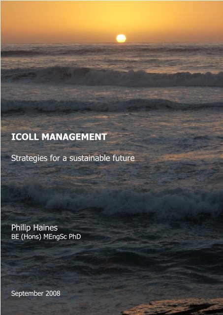
<strong>ICOLL</strong> <strong>MANAGEMENT</strong><br />
Strategies for a sustainable future<br />
Philip Haines<br />
BE (Hons) MEngSc PhD<br />
September 2008
<strong>ICOLL</strong> Management: Strategies for a sustainable future<br />
Philip Haines<br />
Published by:<br />
<strong>BMT</strong> WBM Pty Limited<br />
126 Belford Street<br />
Broadmeadow NSW 2292<br />
© Philip Haines, 2008<br />
Written by Philip Haines<br />
Layout and design by Philip Haines<br />
Cover photo by Philip Haines<br />
Diagrams by Philip Haines unless otherwise noted<br />
Photos courtesy of Department of Environment and Climate Change, unless otherwise<br />
noted<br />
Citation: Haines, P. E. (2008) ‘<strong>ICOLL</strong> Management: Strategies for a sustainable future’<br />
<strong>BMT</strong> WBM Pty Ltd, Broadmeadow NSW<br />
Haines, P. E. page 2<br />
<strong>ICOLL</strong> Management: strategies for a sustainable future
Foreword<br />
Intermittently Closed and Open Lakes and Lagoons (<strong>ICOLL</strong>s) are coastal waterbodies that have an<br />
intermittent connection to the ocean. <strong>ICOLL</strong>s are prominent feature of the New South Wales<br />
coast. Although <strong>ICOLL</strong>s occur elsewhere, their proliferation in NSW creates a range of complex<br />
planning and management issues that confront scientists, engineers, public servants, developers,<br />
environmentalists, community groups and of course politicians.<br />
Even lawyers have had an interest in the distinct character of <strong>ICOLL</strong>s. Chief Justice Street in<br />
1921 in a famous case, Attorney-General v Swan, commented on the episodic opening and<br />
closing of lake entrances.<br />
Knowledge of the biophysical behaviour of these <strong>ICOLL</strong>s has developed considerably over the<br />
past 10 years. So has our understanding of human impacts. This knowledge points to one<br />
conclusion: that <strong>ICOLL</strong>s are very sensitive to human disturbances.<br />
From head of catchment to the sea, there is a connectivity of biophysical processes, which if<br />
disturbed can transform a healthy <strong>ICOLL</strong> into a degraded system. Invaluable work by the Healthy<br />
Rivers Commission demonstrated the range of conditions experienced by <strong>ICOLL</strong>s and other<br />
coastal lakes in NSW.<br />
Some are pristine and require all possible means to protect their natural state. At the other<br />
extreme are <strong>ICOLL</strong>s which are the recipients of polluted runoff and need some form of<br />
remediation. By now we are sufficiently alerted to these different conditions and to system<br />
dynamics to be able to inform users and managers of what might happen to <strong>ICOLL</strong>s if not<br />
managed with care. We also know enough on what should be done to protect their integrity.<br />
This booklet takes a significant step in providing stakeholders with clear directions for<br />
maintaining the health of <strong>ICOLL</strong>s. The author combines his considerable practical experience in<br />
environmental consulting with his scientific understanding of these systems. He has been able to<br />
collate and analyse the pressures, conditions and various responses that are affecting <strong>ICOLL</strong>s<br />
along the entire NSW coast. His work highlights the need for renewed State and local<br />
government action in developing both planning protocols and management practices to ensure<br />
the long-term sustainability of our precious <strong>ICOLL</strong>s.<br />
To assist governments, the author has formulated a set of strategies which if adopted and<br />
implemented will provide the much needed security that <strong>ICOLL</strong>s demand in order to behave in<br />
the future as sustainable and healthy systems. We cannot afford to allow the status quo on<br />
managing <strong>ICOLL</strong>s to continue. New initiatives are required. This booklet offers clear and<br />
practical solutions to on-going and future problems. These new strategies should be thoroughly<br />
considered by all with responsibilities for managing these wonderful natural assets, our <strong>ICOLL</strong>s.<br />
Emeritus Prof. Bruce Thom FIAG FTSE<br />
Member of the Wentworth <strong>Group</strong> of Concerned Scientists<br />
Haines, P. E. page 3<br />
<strong>ICOLL</strong> Management: strategies for a sustainable future
Prologue<br />
This booklet was initiated as an outcome of a PhD by the author undertaken through Griffith<br />
University and as an associate student of the former CRC for Coastal Zone, Estuary and<br />
Waterway Management (Coastal CRC), with support from the author’s employer, <strong>BMT</strong> WBM Pty<br />
Ltd. The booklet aims to convey the key messages from the PhD thesis to the general<br />
community.<br />
The content of this booklet reflects the opinion of the author, and does not represent any<br />
assumed responsibilities by state or local government. This booklet has been prepared as a<br />
guide for sustainable management of <strong>ICOLL</strong>s, and is primarily aimed at natural resource<br />
managers who have authority over such waterways. Not all strategies discussed in this booklet<br />
would be applicable to every <strong>ICOLL</strong>. It is recommended that managers assess the applicability of<br />
all strategies, and adopt whichever is considered most appropriate, and indeed most feasible<br />
given particular circumstance for each system.<br />
Whilst focussing mainly on <strong>ICOLL</strong>s, a number of the processes and strategies discussed herein are<br />
also applicable to other types of estuarine environments.<br />
The NSW State Government is currently embarking on a series of initiatives aimed at reforming<br />
existing coastal zone management. It is hoped that this booklet can assist in this management<br />
reform process by providing some solutions to existing (and future) problems associated with<br />
<strong>ICOLL</strong>s and other similar environment.<br />
2008 Update<br />
Since the initial preparation of this booklet in 2006, there have been a number changes that<br />
affect the long term management of <strong>ICOLL</strong>s. For example, the names, roles and guiding<br />
policies of various statutory authorities have changed. Also, predictions of climate change have<br />
been refined, and the knowledge of the potential impacts of climate change on <strong>ICOLL</strong>s has<br />
advanced.<br />
As a consequence of these changes, some of the outcomes of the original booklet were<br />
considered out of date and impractical. This 2008 update of the booklet aims to make the<br />
outcomes more relevant to the current environmental management and planning landscape.<br />
The update also addresses some initial feedback on the booklet from readers and aims to make<br />
the document as practical and implementable as possible.<br />
Philip Haines BE(Hons) MEngSc PhD<br />
Haines, P. E. page 4<br />
<strong>ICOLL</strong> Management: strategies for a sustainable future
Executive Summary<br />
“Intermittently Closed and Open Lakes and<br />
Lagoons” (<strong>ICOLL</strong>s) are relatively abundant on<br />
the south-east coast of Australia and NSW in<br />
particular. Elsewhere in Australia and across<br />
the world, <strong>ICOLL</strong>s are less common.<br />
Comparable examples can be found in southwest<br />
Western Australia, South Africa, New<br />
Zealand, Mexico and the Atlantic coast of<br />
Brazil and Uruguay.<br />
<strong>ICOLL</strong>s have evolved by marine sands<br />
forming a bar, or barrier, across natural<br />
coastal inlets and embayments when sea<br />
level stabilised some 6000 years ago. For<br />
most of the <strong>ICOLL</strong>s in NSW, the barrier has<br />
completely enclosed these embayments<br />
preventing regular tidal interaction with the<br />
ocean. <strong>ICOLL</strong>s are a unique type of estuary<br />
as they have an intermittent connection to<br />
the ocean (that is, sometimes open and<br />
sometimes closed).<br />
In NSW, most <strong>ICOLL</strong>s are located on the<br />
south coast. This section of the coast<br />
experiences a larger wave environment and<br />
lower rainfall than other parts of the state’s<br />
coastline. Also, this area contains smaller<br />
catchments due to the close proximity of the<br />
Great Dividing Range to the coast in this<br />
area.<br />
<strong>ICOLL</strong>s are recognised as the most sensitive<br />
type of estuary to human intervention due to<br />
their lack of tidal flushing and interaction with<br />
the ocean. Management of <strong>ICOLL</strong>s is<br />
therefore one of the most difficult tasks<br />
facing coastal managers today.<br />
There are many issues potentially<br />
compromising the present and future values<br />
of <strong>ICOLL</strong>s. Increasing coastal population is<br />
no doubt the biggest threat to existing<br />
coastal resources. More than 430,000 people<br />
are expected to move to the nonmetropolitan<br />
NSW coast between 2004 and<br />
2031. In addition to increasing resident<br />
population, the coastal zone continues to be<br />
a major destination for tourists, who impose<br />
a range of pressures on natural coastal<br />
resources, including recreational demands<br />
and increased loads to on-site sewage<br />
systems.<br />
Climate change is expected to have a range<br />
of varying and complex impacts on <strong>ICOLL</strong><br />
processes in the future. In particular,<br />
increasing sea level rise will result in higher<br />
typical water levels within the waterways,<br />
which will exacerbate conflicts with foreshore<br />
landuse and development, or alternatively<br />
intensify the demand for artificial entrance<br />
intervention, which is currently undertaken in<br />
about half of the <strong>ICOLL</strong>s in NSW.<br />
Development around <strong>ICOLL</strong>s and within their<br />
catchments increases pollutant loads and<br />
modifies natural processes, resulting in<br />
degradation of the waterway. There is only<br />
one <strong>ICOLL</strong> in NSW that remains in a pristine<br />
condition (Nadgee Lake), with the lake and<br />
its catchment completely enclosed within a<br />
protected reserve. Existing management of<br />
<strong>ICOLL</strong>s is guided by various policies and<br />
environmental planning instruments.<br />
However, existing management is considered<br />
to place insufficient importance on the unique<br />
and significant differences between <strong>ICOLL</strong>s<br />
and other estuary types. Quoting Healthy<br />
Rivers Commission (2002), “healthier coastal<br />
lakes [including <strong>ICOLL</strong>s] will be achievable<br />
only if there is a fundamental change in the<br />
way [management] decisions are made”.<br />
Good science is at the foundation of good<br />
environmental management. Environmental<br />
systems need to be well understood before<br />
they can be managed in a sustainable way.<br />
Knowledge on <strong>ICOLL</strong> environments has<br />
increased rapidly over the past 10 years. We<br />
now have a good appreciation for the<br />
physical, chemical and biological processes<br />
that determine their condition and are the<br />
basis for their inherent values.<br />
<strong>ICOLL</strong> processes are underpinned by<br />
conditions in the lake’s catchment and the<br />
condition of its entrance. These attributes<br />
control the physical passage of water and<br />
Haines, P. E. page 5<br />
<strong>ICOLL</strong> Management: strategies for a sustainable future
executive summary<br />
sediment through the system. In simple<br />
terms, the physical water and sediment<br />
processes then largely control the chemical<br />
and geochemical processes, which therefore<br />
control the biological response of the system.<br />
When an <strong>ICOLL</strong> entrance is open, the<br />
waterway is tidal, and water is exchanged<br />
with the ocean on a regular basis. When the<br />
entrance is closed, however, a sand bar<br />
separates the lake from the ocean. The<br />
waterway then acts as a reservoir, and<br />
captures 100% of inputs. The entrance of an<br />
<strong>ICOLL</strong> typically opens when the water level in<br />
the lake exceeds the crest level of the<br />
entrance sand bar. Overtopping of the<br />
entrance bar results in massive erosion of the<br />
bar over a period of a few hours, and<br />
produces a significant channel for waters to<br />
flow through.<br />
About 70% of <strong>ICOLL</strong>s in NSW are closed for<br />
the majority of the time, while remaining<br />
<strong>ICOLL</strong>s are mostly open. <strong>ICOLL</strong>s that are<br />
mostly open typically have large catchments<br />
(> 100km 2 ) and/or have entrances that are<br />
well protected from ocean swell waves<br />
and/or have shallow bedrock under the<br />
entrance.<br />
Chemical processes occurring in the<br />
sediments of <strong>ICOLL</strong>s can have a significant<br />
impact on water quality. Organic material<br />
washing off the catchment during rainfall<br />
reaches the bed of <strong>ICOLL</strong>s and is slowly<br />
recycled. When a lake experiences<br />
significant catchment loading (through<br />
extensive catchment development for<br />
example), the recycling processes are<br />
modified, resulting in nutrients being released<br />
directly to the water. Elevated nutrients in<br />
<strong>ICOLL</strong>s can result in algal blooms. Without<br />
regular tidal flushing, these algal blooms can<br />
be sustained for long periods through internal<br />
recycling and reuse of nutrients.<br />
Water quality within <strong>ICOLL</strong>s can change quite<br />
significantly following catchment runoff and<br />
also as a result of an entrance breakout<br />
event. Given the dynamic nature of the<br />
entrance, combined with the intermittent<br />
nature of catchment runoff events, water<br />
quality within <strong>ICOLL</strong>s is highly variable.<br />
The biology of <strong>ICOLL</strong>s can also be subject to<br />
significant change. The variability in water<br />
levels of <strong>ICOLL</strong>s limits potential for extensive<br />
estuarine vegetation. Mangroves in <strong>ICOLL</strong>s<br />
are rare, except for systems that are mostly<br />
open to the ocean. Meanwhile, seagrasses<br />
are virtually absent from most <strong>ICOLL</strong>s that<br />
experience relatively rapid changes in water<br />
level.<br />
Artificial entrance management of <strong>ICOLL</strong>s is<br />
undertaken at about half of the systems<br />
within NSW for the purposes of flood<br />
inundation mitigation. Artificial entrance<br />
management involves opening <strong>ICOLL</strong><br />
entrances at a level lower than the natural<br />
sand bar breakout level. This process, when<br />
undertaken consistently over many years,<br />
can result in a number of environmental<br />
impacts, including drying out and loss of<br />
fringing wetlands, reduced fish habitat and<br />
stock, and increased sand shoaling at the<br />
entrance.<br />
Ten strategies have been developed to<br />
address the sustainable long term<br />
management of <strong>ICOLL</strong>s. These strategies,<br />
presented in Summary Table A, address the<br />
underlying threats to <strong>ICOLL</strong> sustainability by<br />
considering their physical structure and<br />
behaviour, as well as their prevailing<br />
chemical and biological processes.<br />
The ten strategies are not designed to<br />
provide a complete package for <strong>ICOLL</strong><br />
management. Rather, they should be used in<br />
conjunction with existing plans (including<br />
EMPs, CAPs and Regional Strategies), or used<br />
as a basis for developing specific<br />
Management Plans for <strong>ICOLL</strong>s in the future.<br />
Recommendations have also been provided<br />
for possible changes to various environmental<br />
planning instruments, including LEP Zonings,<br />
LEP Provisions, Plans of Management,<br />
Estuary Management Plans, Coastal Zone<br />
Management Manual, Floodplain Risk<br />
Management Plans, Fisheries Management<br />
Act 1994, SEPP (Major Projects) 2005, SEPP<br />
Haines, P. E. page 6<br />
<strong>ICOLL</strong> Management: strategies for a sustainable future
executive summary<br />
(infrastructure) 2007 and Instruction under<br />
S117 of the Local Government Act 1993.<br />
These changes primarily focus on artificial<br />
entrance management of <strong>ICOLL</strong>s.<br />
Summary Table A – Strategies for sustainable future management of <strong>ICOLL</strong>s<br />
1 Development planning to protect waterways<br />
2 Reduce pollutant runoff from existing catchment development<br />
through landuse diminution<br />
3 Revegetate critical areas of catchment landscapes, including<br />
corridors between similar environments, and connections<br />
between different but complementary habitats<br />
4 Establish vertical and horizontal buffers around <strong>ICOLL</strong>s<br />
5 Opportunistically redress at-risk infrastructure around <strong>ICOLL</strong><br />
foreshores to allow a more natural hydrology regime<br />
6 Stricter controls on on-site sewage management in low-lying and<br />
vulnerable areas<br />
7 Prevent dredging in <strong>ICOLL</strong> central basins<br />
8 Aquatic habitat restoration through re-establishing a more natural<br />
hydrology regime<br />
9 Formal entrance policies legally connected to relevant Plans of<br />
Management<br />
10 Artificially open <strong>ICOLL</strong> entrances only in accordance with best<br />
practice procedures<br />
Haines, P. E. page 7<br />
<strong>ICOLL</strong> Management: strategies for a sustainable future
contents<br />
Contents<br />
Foreword .......................................................................................... 3<br />
Prologue ........................................................................................... 4<br />
2008 Update ...................................................................................... 4<br />
Executive Summary.............................................................................. 5<br />
Contents ........................................................................................... 8<br />
Purpose of this booklet ....................................................................... 12<br />
PART A: TECHNICAL REVIEW<br />
Chapter 1: Introduction....................................................................... 14<br />
Background .......................................................................................15<br />
Definitions ........................................................................................16<br />
Origins .............................................................................................16<br />
Listing of <strong>ICOLL</strong>s in South East Australia .....................................................17<br />
Chapter 2: Existing Planning and Management Regimes................................ 20<br />
SEPP 71 / SEPP (Major Projects) 2005 ........................................................22<br />
SEPP (Infrastructure) 2007......................................................................23<br />
Local Environmental Plans......................................................................23<br />
Regional Strategies ..............................................................................23<br />
Estuary Management Program..................................................................23<br />
Catchment Action Plans.........................................................................25<br />
National Parks Management ....................................................................25<br />
Marine Parks Management .....................................................................25<br />
Independent Inquiry into Coastal Lakes (Healthy Rivers Commission) ...................26<br />
Coastal Lakes Management Strategies ........................................................27<br />
How does this booklet fit in? ...................................................................28<br />
Chapter 3: Coastal Pressures and Management Needs.................................. 29<br />
Increasing coastal population ..................................................................30<br />
Tourism............................................................................................30<br />
Catchment development........................................................................31<br />
Flood mitigation via entrance manipulation .................................................32<br />
Climate change...................................................................................33<br />
Chapter 4: Environmental Processes of <strong>ICOLL</strong>s .......................................... 34<br />
Conceptual model of <strong>ICOLL</strong> processes ........................................................36<br />
Entrance processes and morphodynamics ....................................................38<br />
Lake structure and morphometry..............................................................39<br />
Biogeochemical processes ......................................................................41<br />
Nutrient and algal dynamics....................................................................42<br />
Biological processes .............................................................................44<br />
Haines, P. E. page 8<br />
<strong>ICOLL</strong> Management: strategies for a sustainable future
contents<br />
Human impacts on <strong>ICOLL</strong>s ......................................................................45<br />
Chapter 5: Climate Change................................................................... 46<br />
Average temperature............................................................................48<br />
Average rainfall ..................................................................................48<br />
Extreme rainfall events .........................................................................48<br />
Drought frequency ...............................................................................48<br />
Average solar radiation .........................................................................48<br />
Wind speed and direction.......................................................................48<br />
Wave height and direction......................................................................49<br />
Storm surge .......................................................................................49<br />
Sea level rise .....................................................................................49<br />
Impacts on <strong>ICOLL</strong>s ...............................................................................50<br />
Increase in low tide levels......................................................................50<br />
Increase in typical waterway depths..........................................................50<br />
Shoreward translation and increase in berm height at entrance .........................51<br />
Altered entrance morphodynamics............................................................51<br />
Climate change conclusions ....................................................................52<br />
PART B: <strong>MANAGEMENT</strong> OPTIONS<br />
Chapter 6: Strategies for Sustainable Management ..................................... 54<br />
Strategy 1 Development planning to protect waterways...................................57<br />
Strategy 2 Reduce pollutant runoff from existing catchment development ............60<br />
Strategy 3 Revegetate critical areas and wildlife corridors ...............................61<br />
Strategy 4 Establish vertical and horizontal buffers around <strong>ICOLL</strong>s ......................62<br />
Strategy 5 Opportunistically redress at-risk infrastructure around <strong>ICOLL</strong>s..............65<br />
Strategy 6 Stricter controls for on-site sewage systems in vulnerable areas............68<br />
Strategy 7 Prohibit dredging in <strong>ICOLL</strong> central basins .......................................70<br />
Strategy 8 Aquatic habitat restoration through a more natural hydrological regime..71<br />
Strategy 9 Establish entrance management provisions within statutory instruments..73<br />
Strategy 10 Artificially open <strong>ICOLL</strong> entrance only in accord with best practice........77<br />
Chapter 7: Recommended Changes to the Existing Planning Framework........... 79<br />
LEP zonings .......................................................................................80<br />
LEP provisions ....................................................................................81<br />
Plans of Management............................................................................81<br />
Estuary Management Plans .....................................................................82<br />
Coastal Zone Management Manual ............................................................82<br />
Floodplain Risk Management Plans ............................................................82<br />
Fisheries Management Act 1994 ...............................................................83<br />
SEPP (Major Projects) 2005.....................................................................83<br />
SEPP (Infrastructure) 2007......................................................................83<br />
S117 Instruction Local Government Act 1993 ................................................84<br />
Chapter 8: References ........................................................................ 87<br />
Haines, P. E. page 9<br />
<strong>ICOLL</strong> Management: strategies for a sustainable future
contents<br />
Appendix<br />
Acronyms ........................................................................................ 95<br />
Glossary of Terms .............................................................................. 96<br />
List of figures<br />
Figure 1 Pictorial view of a typical coastal lake (Woodroffe, 2002)...............16<br />
Figure 2 Relationship between catchment size and waterway size for NSW<br />
<strong>ICOLL</strong>s (Haines et al., 2006) ..................................................17<br />
Figure 3 Stage of Evolution/Maturity of Coastal lakes (Roy, 1984)................17<br />
Figure 4 NSW Government’s Estuary Management process (adapted from NSW<br />
Government, 1992) ............................................................24<br />
Figure 5 Strategic framework for the Coastal Lakes Management Strategy<br />
(Source: <strong>BMT</strong> WBM, 2008) .....................................................27<br />
Figure 6 Kayaking and other passive watersports are popular in most coastal<br />
lakes (image: <strong>BMT</strong> WBM) ......................................................31<br />
Figure 7 Nadgee Lake, near the Victorian Border – the only truly pristine coastal<br />
lake in NSW......................................................................32<br />
Figure 8 Order of significance for <strong>ICOLL</strong> processes ..................................35<br />
Figure 9 Conceptual Hydrodynamic Model of <strong>ICOLL</strong>s (source: ozcoast.org.au)..36<br />
Figure 10 Simple network-based conceptual model of environmental processes in<br />
<strong>ICOLL</strong>s (shaded cells represent anthropogenic activities)................37<br />
Figure 11 Morphodynamic cycle of <strong>ICOLL</strong> entrance processes .......................38<br />
Figure 12 Early stage of <strong>ICOLL</strong> entrance breakout (AWACS, 1994)..................38<br />
Figure 13 Entrance Closure Indices for most NSW <strong>ICOLL</strong>s (Haines Et al., 2006) ..39<br />
Figure 14 Definition of entrance ocean exposure directional window .............39<br />
Figure 15 Construction of pilot channel at Coila Lake (April 2002)<br />
(Image: <strong>BMT</strong> WBM) .............................................................39<br />
Figure 16 Breakout level vs opening duration for Coila Lake<br />
(Source: ESC, 2001a)...........................................................40<br />
Figure 17 Conceptual waterway shapes of <strong>ICOLL</strong>s.....................................40<br />
Figure 18 Correlation between typical phosphorus concentrations and <strong>ICOLL</strong><br />
catchment condition (measured by degree of disturbance) .............43<br />
Figure 19 Correlations between typical Total Nitrogen and <strong>ICOLL</strong> Catchment<br />
condition when factoring typical entrance condition.....................43<br />
Figure 20 Relationship between the Assimilation Factor (AF) and seagrass<br />
coverage for most NSW <strong>ICOLL</strong>s (Haines et al., 2006) .....................44<br />
Figure 21 Australian average temperature variation, 1910 – 2006 compared to<br />
1961 – 1990 average (Source: BOM, 2007) ..................................47<br />
Figure 22 Global mean sea level rise, as measured by NASA satellites<br />
(Source, Uni of Colorado, 2007)..............................................47<br />
Figure 23 Shoreline response to increasing sea level<br />
(Source, Hanslow et al., 2000) ...............................................51<br />
Figure 24 foreshore profile of an <strong>ICOLL</strong> illustrating the concept of vertical and<br />
horizontal buffers ..............................................................63<br />
Figure 25 Scope and context of recommended Entrance Management Provisions 76<br />
Haines, P. E. page 10<br />
<strong>ICOLL</strong> Management: strategies for a sustainable future
contents<br />
List of tables<br />
Summary Table A Strategies for sustainable future management of <strong>ICOLL</strong>s ........... 7<br />
Table 1 <strong>ICOLL</strong>s in South East Australia (from north to south) .....................18<br />
Table 2 Summary of statutory controls potentially applicable to works within<br />
<strong>ICOLL</strong>s (adapted from Haines et al., 2007) .................................21<br />
Table 3 Population projections for NSW coastal areas (Source: DoP, 2008).....30<br />
Table 4 Morphometric factors for a number of NSW <strong>ICOLL</strong>s .......................41<br />
Table 5 Difference in water quality before and after entrance breakouts ......43<br />
Table 6 Strategies for sustainable management of <strong>ICOLL</strong>s.........................56<br />
Table 7 Ranking of most NSW <strong>ICOLL</strong>s based on suitability for future<br />
development intensification..................................................59<br />
Table 8 Definition of vertical and horizontal buffers around <strong>ICOLL</strong>s .............64<br />
Table 9 Prioritised ranking of manipulated <strong>ICOLL</strong>s for redressing on-going<br />
entrance management issues.................................................67<br />
Table 10 Example Table of Contents for an Entrance Management Operations<br />
Plan...............................................................................78<br />
Table 11 Standard Instrument LEP landuse zonings (NSW Government, 2006) ...80<br />
Table 12 Suggested Entrance Management Provisions for the Standard<br />
Instrument LEP .................................................................85<br />
Haines, P. E. page 11<br />
<strong>ICOLL</strong> Management: strategies for a sustainable future
purpose of this booklet<br />
Purpose of this booklet<br />
This booklet aims to provide guidance to natural coastal resource managers who are responsible<br />
for <strong>ICOLL</strong>s and other coastal lakes. The booklet provides a series of strategies that can be<br />
adopted by government agencies and institutional authorities to achieve more sustainable<br />
outcomes for these sensitive coastal systems. In addition, this booklet provides recommendations<br />
on specific changes to the existing planning framework in NSW to ensure greater sustainability of<br />
<strong>ICOLL</strong>s in the future.<br />
This booklet should be used in concert with other relevant coastal management manuals,<br />
guidelines and planning tools, where available, as well as any location-specific natural resource<br />
management plans, such as Estuary Management Plans, Coastal Lakes Management Strategies,<br />
and Catchment Action Plans. This booklet does not aim to duplicate the broader environmental<br />
management and catchment management objectives of many of these other strategic planning<br />
documents. Rather, this booklet provides recommendations that are specific to <strong>ICOLL</strong>s, their<br />
immediate foreshore areas, and, to a lesser degree, their catchments. This booklet aims to<br />
complement environmental plans and policies already in place and undergoing implementation.<br />
It is expected that in the coming years, a increasing number of Coastal Zone Management Plans /<br />
Estuary Management Plans and / or Coastal Lake Management Strategies will be prepared for<br />
individual <strong>ICOLL</strong>s in NSW under various government programs and initiatives. Other states may<br />
also undertake similar initiatives. It is hoped that this booklet can provide a level of strategic<br />
direction for these future documents that will ensure potentially consistent and a sustainable<br />
outcome for <strong>ICOLL</strong>s across Australia.<br />
Haines, P. E. page 12<br />
<strong>ICOLL</strong> Management: strategies for a sustainable future
PART A<br />
TECHNICAL REVIEW<br />
Haines, P. E. page 13<br />
<strong>ICOLL</strong> Management: strategies for a sustainable future
Haines, P. E. page 14<br />
<strong>ICOLL</strong> Management: strategies for a sustainable future
introduction<br />
Some coastal lakes and lagoons on the<br />
east coast of Australia are intermittently<br />
connected to the ocean. That is,<br />
sometimes they are open and sometimes<br />
closed. These particular types of coastal<br />
lakes are referred to as Intermittently Closed<br />
and Open Lakes and Lagoons (<strong>ICOLL</strong>s).<br />
Background<br />
<strong>ICOLL</strong>s are most prominent in NSW,<br />
however, they can also be found in south<br />
east Queensland, south-west Western<br />
Australia, and some parts of Victoria and<br />
Tasmania. <strong>ICOLL</strong>s are also found in South<br />
Africa, New Zealand, Mexico and the Atlantic<br />
coast of Brazil and Uruguay, but are generally<br />
considered rare on an international scale.<br />
When open, <strong>ICOLL</strong>s are tidal with ocean<br />
water moving into and out of the estuary on<br />
a regular basis. When closed, they do not<br />
interact with the ocean. Instead, water<br />
levels fluctuate according to rainfall and<br />
evaporation. Closed <strong>ICOLL</strong>s are separated<br />
from the ocean by large sand bars, called<br />
berms. The berms are built by waves<br />
pushing beach sand into the entrance.<br />
For some <strong>ICOLL</strong>s, ebbing tides can scour<br />
sand from the entrance channel, which<br />
results in these entrances remaining mostly<br />
open. For others, the tides are too weak to<br />
wash out the sand, and the entrance channel<br />
chokes up and closes completely. Following<br />
heavy rainfall, the water level within a closed<br />
<strong>ICOLL</strong> may overtop the entrance berm,<br />
spilling water to the ocean. The overtopping<br />
of the berm causes an entrance “breakout”,<br />
wherein sand is eroded from the entrance,<br />
re-forming a channel through the berm.<br />
On-going scour caused by the outflowing<br />
water means that this channel progressively<br />
enlarges, allowing more and more water to<br />
discharge from the lagoon, until water levels<br />
within the lagoon are generally the same as<br />
the ocean levels. Depending on the final<br />
depth and dimensions of the entrance<br />
channel, the lagoon may subsequently be<br />
subject to tidal variations with tidal flows<br />
moving in and out of the scoured entrance<br />
channel.<br />
There are about 70 <strong>ICOLL</strong>s in NSW bigger<br />
than 1 hectare. There are a further 20 coastal<br />
lakes that are similar in structure to <strong>ICOLL</strong>s,<br />
but are permanently open, either by natural<br />
processes or through artificial entrance<br />
training works (eg breakwaters) or on-going<br />
management (eg dredging).<br />
Most <strong>ICOLL</strong>s are located south of Sydney due<br />
to the high wave activity, low rainfall and<br />
close proximity of the Great Dividing Range to<br />
the coast. This section of the coast has also<br />
been less exposed to human development,<br />
and contains a number of National Parks. The<br />
NSW south coast contains the greatest density<br />
of <strong>ICOLL</strong>s in Australia, and most likely the<br />
world.<br />
The conditions of an <strong>ICOLL</strong> entrance are<br />
dependent on the relative balance between<br />
coastal processes (acting to infill the entrance<br />
with beach sand) and episodic catchment<br />
runoff processes (acting to scour sand out of<br />
the entrance). Entrance conditions are also<br />
influenced by the ability of an <strong>ICOLL</strong> to sustain<br />
tidal flows through the entrance channel<br />
(Elwany et al., 2003; Roy et al., 2001).<br />
In NSW, about 70% of <strong>ICOLL</strong>s are closed for<br />
the majority of the time. Elsewhere, entrance<br />
conditions tend to be dominated by seasonal<br />
rainfall, being open during wet seasons and<br />
closed during dry periods (this is particularly<br />
true for <strong>ICOLL</strong>s in South Africa and Mexico,<br />
where there are strong seasonal rainfall<br />
patterns).<br />
Coastal lakes, and <strong>ICOLL</strong>s in particular, are<br />
considered to be the most vulnerable type of<br />
estuary to human intervention (HRC, 2002;<br />
Boyd et al., 1992). When they are closed to<br />
the ocean, <strong>ICOLL</strong>s become ‘terminal lakes’<br />
(Haines et al., 2006), capturing and retaining<br />
100% of catchment runoff and pollutants.<br />
Even when they are open, tidal flushing within<br />
the waterways is limited and most catchment<br />
pollutants are retained.<br />
Haines, P. E. page 15<br />
<strong>ICOLL</strong> Management: strategies for a sustainable future
introduction<br />
<strong>ICOLL</strong>s are recognised as one of the most<br />
complex and difficult coastal environments to<br />
manage (Thom, 2004a). <strong>ICOLL</strong>s are<br />
ecotones, or transition areas, between<br />
freshwater and saltwater environments. They<br />
are also home to many vulnerable species of<br />
plants and fauna. The variable condition of<br />
the entrance (ranging from completely open<br />
to completely closed) also influences a range<br />
of environmental processes and conditions,<br />
such as water quality and fish habitat<br />
(Griffiths, 1999; Pollard, 1994a).<br />
Historic management of <strong>ICOLL</strong>s, along with<br />
most other coastal environments, has not<br />
always recognised their natural values. For<br />
more than 50% of <strong>ICOLL</strong>s in NSW, entrances<br />
are artificially opened when water levels get<br />
too high. Artificial opening of <strong>ICOLL</strong> entrances<br />
also occurs elsewhere in Australia, as well as<br />
overseas, and is mainly done to limit the<br />
impacts of flooding and inundation around the<br />
foreshore. Premature opening of an <strong>ICOLL</strong><br />
entrance can have a number of environmental<br />
impacts, including for example drying out of<br />
fringing wetlands, reduced fish habitat and<br />
stock, and increased sand shoaling at the<br />
entrance (Lugg, 1996; Roper, 1998).<br />
Detailed scientific knowledge <strong>ICOLL</strong>s has<br />
advanced significantly over the past 10 years.<br />
Approaches to coastal zone management have<br />
also improved over this period. It is now<br />
considered necessary to transfer our recent<br />
knowledge of these unique coastal systems to<br />
a planning and policy level, so that they can<br />
be managed more effectively in the future, to<br />
provide ecological, social and economic<br />
sustainability in the future.<br />
Definitions<br />
The term “<strong>ICOLL</strong>” is a relatively recent<br />
expression. In the past, these coastal systems<br />
have been given various titles, including<br />
‘saline coastal lakes’ (e.g. Roy, 1984), ‘saline<br />
coastal lagoons’ (e.g. Middleton et al., 1985),<br />
‘blind estuaries’ (e.g. Fairbridge, 1980 cited in<br />
Dyer, 1997), ‘seasonally open tidal inlets’ (e.g.<br />
Ranasinghe & Pattiaratchi, 2003), ‘pocket<br />
lagoons’ (Phleger, 1981 cited in Pollard<br />
1994a,b) or simply ‘coastal lagoons’ (e.g.<br />
Woodroffe, 2002; Kjerfve, 1994; Barnes,<br />
1980; Bell & Edwards, 1980). Most previous<br />
descriptions, however, have made little<br />
distinction between coastal lake systems that<br />
are permanently open to the ocean, and those<br />
that are open only intermittently.<br />
Whilst this booklet focuses on <strong>ICOLL</strong>s, most<br />
management recommendations presented<br />
can indeed be equally applied to those<br />
coastal lakes that are permanently open<br />
(either naturally or artificially).<br />
Origins<br />
<strong>ICOLL</strong>s are a form of ‘barrier estuary’, which<br />
means they are separated from the ocean by<br />
a sand spit or barrier (Figure 1).<br />
Ocean waves that strike the coastline on an<br />
angle create a net transport of sand parallel<br />
to the shoreline (longshore transport), which<br />
Figure 1 Pictorial view of a typical coastal lake (Woodroffe, 2002)<br />
Haines, P. E. page 16<br />
<strong>ICOLL</strong> Management: strategies for a sustainable future
introduction<br />
forms sand spits across coastal inlets and<br />
embayments (Bird, 1994; Woodroffe, 2002).<br />
The sand spits act as natural ‘dams’ and trap<br />
coastal waters behind to form lakes and<br />
lagoons. Elsewhere in the world, particularly<br />
on the east coast USA, coastal lagoons have<br />
also been formed by the shore-normal<br />
landward migration of sand bars over the sea<br />
floor during the most recent sea level rise<br />
(18,000 to 6,000 years ago) (Bird, 1994;<br />
Woodroffe, 2002).<br />
Impoundment by the extensive sand barriers<br />
means that <strong>ICOLL</strong>s become effective<br />
sediment traps, and capture almost<br />
everything that runs off the catchment. Over<br />
time, the lakes slowly fill with sediment. The<br />
rate of shallowing depends on the rate of<br />
sediment erosion within the catchment and<br />
the size of the natural basin behind the<br />
barrier. Big waterways with small<br />
catchments have infilled by a relatively small<br />
amount only. These lakes are considered to<br />
be geologically youthful. In contrast, small<br />
lakes with large catchments have generally<br />
infilled considerably, and are regarded as<br />
more geologically mature (Figure 2).<br />
When an <strong>ICOLL</strong> is fully matured, it becomes<br />
a narrow coastal creek or river, stretching<br />
from the ocean to the hills, and has extensive<br />
floodplains that cover the former basin area<br />
(Figure 3). In this instance, the ocean<br />
entrance is usually permanently open, or at<br />
least open for the majority of the time.<br />
<strong>ICOLL</strong>s in NSW exhibit a range of<br />
evolutionary states, including both mature<br />
and youthful systems.<br />
Listing of <strong>ICOLL</strong>s in South East<br />
Australia<br />
A listing of the recognised <strong>ICOLL</strong>s in Southeast<br />
Australia is provided in Table 1. This<br />
listing includes a relatively broad selection of<br />
100<br />
Geologically youthful<br />
lagoons, with less<br />
relative infilling<br />
10<br />
Waterway Size (km 2 )<br />
1<br />
0.1<br />
Two orders of magnitude variance<br />
Geologically<br />
mature<br />
lagoons, with<br />
more relative<br />
infilling<br />
0.01<br />
0.1 1.0 10.0 100.0 1000.0 10000.0<br />
Catchment Size (km 2 )<br />
Figure 2 Relationship between<br />
catchment size and waterway size for NSW<br />
<strong>ICOLL</strong>s (Haines et al., 2006)<br />
Figure 3 Stages of Evolution /<br />
Maturity of Coastal Lakes (Roy, 1984)<br />
Haines, P. E. page 17<br />
<strong>ICOLL</strong> Management: strategies for a sustainable future
introduction<br />
<strong>ICOLL</strong>s and other coastal waterways that are<br />
similar to <strong>ICOLL</strong>s in their structure and / or<br />
function. Included in the listing are some<br />
coastal lakes and estuaries that may not<br />
necessarily have closed in recent times, but<br />
may theoretically close under the right<br />
conditions (including under future climate<br />
change conditions). For example, Wonboyn<br />
Lake closed for the first time in living memory<br />
during the height of the recent drought.<br />
Not listed are those estuaries that are<br />
predominantly riverine in structure (ie they<br />
represent a fully matured estuarine state),<br />
and those that are generally small and<br />
considered to be a minor coastal creek.<br />
There are literally hundreds of small coastal<br />
creeks along the east coast of Australia that<br />
are intermittently connected to the ocean.<br />
Although at a significantly smaller scale,<br />
some of the recommendations made in this<br />
booklet may still be applied to these systems.<br />
The listing in Table 1 provides an indicative<br />
classification of <strong>ICOLL</strong>s and other similar<br />
waterways into a number of different ‘type’<br />
representing different geomorphic structure<br />
and behaviour. These <strong>ICOLL</strong> types include:<br />
Type I:<br />
Type II:<br />
Regular intermittently open<br />
coastal lake<br />
Smaller intermittently open creeks<br />
– infilled paleo valley<br />
Type III: Smaller intermittently open creeks<br />
– interbarrier swales<br />
Type IV: Open creeks (riverine system), but<br />
may close under particular<br />
conditions (now or in future)<br />
Type V: Permanently open coastal lake /<br />
creek due to entrance training<br />
works<br />
Type VI: Perched freshwater lagoons – no<br />
connection to ocean (although<br />
potential for connection in future<br />
in response to sea level rise and<br />
coastal erosion)<br />
Table 1 <strong>ICOLL</strong>s in South East Australia (from north to south)<br />
<strong>ICOLL</strong> TYPE LGA <strong>ICOLL</strong> TYPE LGA<br />
Cudgen Lake V Tweed Oyster Ck III Bellingen<br />
Cudgera Ck III Tweed Deep Ck IV Nambucca<br />
Moobal Ck V Tweed Saltwater Lagoon I Kempsey<br />
Belongil Ck III Byron Korogoro Ck III Kempsey<br />
Tallow Ck III Byron Killick Ck III Kempsey<br />
Taylors Lake III Byron Goolawah Lagoon VI Kempsey<br />
Lake Ainsworth VI Ballina Cathie / Innes I Hastings/Port Macq<br />
Salty Lagoon III Richmond Valley Khapinghat Ck IV Greater Taree<br />
Jerusalem Ck III Richmond Valley Wallis Lake V Great Lakes<br />
Arragan Lake I Clarence Valley Smiths Lake I Great Lakes<br />
Cakora Lake I Clarence Valley Glenrock Lagoon II Lake Macquarie<br />
Corindi River IV Coffs Harbour Lake Macquarie V Lake Macquarie<br />
Pipe Clay Lake III Coffs Harbour Tuggerah Lakes I Wyong<br />
Arrawarra Ck III Coffs Harbour Wamberal Lagoon I Gosford<br />
Woolgoolga L I Coffs Harbour Terrigal Lagoon I Gosford<br />
Hearnes Lake I Coffs Harbour Avoca Lagoon I Gosford<br />
Moonee Ck IV Coffs Harbour Cockrone Lagoon I Gosford<br />
Coffs Ck V Coffs Harbour Narrabeen Lagoon I Pittwater / Warringah<br />
Boambee Ck IV Coffs Harbour Dee Why Lagoon I Warringah<br />
Bonville Ck IV Coffs Harbour Curl Curl Lagoon II Warringah<br />
Dalhousie Ck III Bellingen Manly Lagoon II Warringah / Manly<br />
Haines, P. E. page 18<br />
<strong>ICOLL</strong> Management: strategies for a sustainable future
introduction<br />
Table 1 cont’d <strong>ICOLL</strong>s in South East Australia (from north to south)<br />
<strong>ICOLL</strong> TYPE LGA <strong>ICOLL</strong> TYPE LGA<br />
Fairy Ck II/III Wollongong Nargal Lake VI Eurobodalla<br />
Lake Illawarra V Wollongong Corunna Lake I Eurobodalla<br />
Elliot Lake III Shellharbour Tilba Tilba Lake I Eurobodalla<br />
Bellambi Lagoon II Kiama Little (Wallaga) Lk I Eurobodalla<br />
Werri Lagoon I Kiama Wallaga Lake I Bega Valley<br />
Crooked River IV Kiama Baragoot Lake I Bega Valley<br />
Wollumboola I Shoalhaven Cuttagee Lake I Bega Valley<br />
St Georges Bas IV Shoalhaven Murrah Lake I Bega Valley<br />
Swan Lake I Shoalhaven Bunga Lake I Bega Valley<br />
Conjola Lake I Shoalhaven Wapengo Lake IV Bega Valley<br />
Narrawallee Inl. IV Shoalhaven Middle (Tanja) Lake I Bega Valley<br />
Burrill Lake I Shoalhaven Nelson Lake I Bega Valley<br />
Tabourie Lake I Shoalhaven Bega River I Bega Valley<br />
Termeil Lake I Shoalhaven Wallagoot Lake I Bega Valley<br />
Meroo Lake I Shoalhaven Bondi Lagoon VI Bega Valley<br />
Willinga Lake I Shoalhaven Bournda Lagoon II/III Bega Valley<br />
Brush Lagoon III Shoalhaven Back Lagoon I Bega Valley<br />
Kioloa Lake III Shoalhaven Merimbula Lake I Bega Valley<br />
Durras Lake I Shoalhaven Pambula Lake IV Bega Valley<br />
Tomaga River IV Eurobodalla Curalo Lake I Bega Valley<br />
Candlagan Ck I Eurobodalla Towamba River IV Bega Valley<br />
Congo Ck II/III Eurobodalla Wonboyn Lake I Bega Valley<br />
Meringo Lake I Eurobodalla Merrica River II Bega Valley<br />
Bingie (Kellys) L. III Eurobodalla Nadgee River II Bega Valley<br />
Coila Lake I Eurobodalla Nadgee Lagoon I Bega Valley<br />
Tuross Lake I Eurobodalla Barracoota Lake VI East Gippsland<br />
Brunderee Lake I Eurobodalla Mallacoota Lake I East Gippsland<br />
Tarourga Lake I Eurobodalla Wingan Inlet I East Gippsland<br />
Brou Lake I Eurobodalla Tamboon Inlet I East Gippsland<br />
Mummuga Lake I Eurobodalla Mud Lake I East Gippsland<br />
Kianga Lake I Eurobodalla Lake Corrigle I East Gippsland<br />
Wagonga Inlet V Eurobodalla Lake Tyers I East Gippsland<br />
Little (Narooma) II Eurobodalla Lake Bunga II East Gippsland<br />
Bullengella Lake I Eurobodalla Gippsland Lakes V East Gippsland<br />
Nangudga Lake I Eurobodalla<br />
Legend<br />
Type I:<br />
Type II:<br />
Type III:<br />
Type IV:<br />
Type V:<br />
Type VI:<br />
Regular intermittently open coastal lake or lagoon<br />
Small intermittently open creek – infilled paleo valley<br />
Small intermittently open creek – interbarrier swale<br />
Open creek (riverine system), but may close under particular conditions (now or in<br />
future)<br />
Permanently open coastal lake / creek due to entrance training works<br />
Perched freshwater lagoon – no connection to ocean (possible connection in future in<br />
response to sea level rise and coastal erosion)<br />
Note: Victorian <strong>ICOLL</strong>s are listed for reference only. This booklet primarily focuses on <strong>ICOLL</strong>s<br />
(Types I - III) in NSW, particularly in relation to existing and proposed planning frameworks and<br />
mechanisms.<br />
Haines, P. E. page 19<br />
<strong>ICOLL</strong> Management: strategies for a sustainable future
existing planning & management regimes<br />
Haines, P. E. page 20<br />
<strong>ICOLL</strong> Management: strategies for a sustainable future
existing planning & management regimes<br />
Historically, <strong>ICOLL</strong>s have been managed<br />
in a typical reactionary manner,<br />
responding primarily to changes in the<br />
environment after the event (eg catchment<br />
clearing, foreshore development or<br />
introduction of jet skis) or changing views or<br />
opinions held by the general community<br />
(Smith et al., 2001).<br />
Until relatively recently, there have been few<br />
controls on development that have aimed to<br />
preserve the natural values of <strong>ICOLL</strong>s. Indeed<br />
within many rural areas, development has<br />
been permitted around <strong>ICOLL</strong>s that focuses on<br />
minimising risks to private and public amenity,<br />
and maximising economic opportunity, at the<br />
expense of natural processes and ecosystems.<br />
Recent population demands along the coast<br />
(discussed further in Chapter 3) have<br />
intensified the conflict between natural and<br />
developed environments and have been the<br />
catalyst for numerous (again reactionary)<br />
controls and strategies that aims to strike a<br />
better balance.<br />
There is now potentially a wide range of<br />
regulatory controls applicable to <strong>ICOLL</strong>S in<br />
NSW. This reflects their ecological, aesthetic<br />
and socio-economic importance, and the<br />
potential for competing uses. It also reflects<br />
their location at the interface between land,<br />
river and sea, where separate legal and<br />
administrative realms are typically<br />
demarcated. This menagerie of controls<br />
means that there is often much confusion over<br />
what is relevant and what takes precedence.<br />
As such, <strong>ICOLL</strong> management can be relegated<br />
as ‘too hard’ or inevitably driven by political<br />
motivations.<br />
Current statutory controls and other<br />
mechanisms for management and land-use<br />
planning of <strong>ICOLL</strong>s and surrounding lands in<br />
NSW are summarised in Table 2 and described<br />
further in this Chapter.<br />
Table 2<br />
Summary of statutory controls potentially applicable to works within <strong>ICOLL</strong>S<br />
(adapted from Haines et al., 2007)<br />
STATUTORY CONTROL APPROVAL OR LICENCE REGULATORY AGENCY<br />
(NSW) Environmental<br />
Planning and Assessment<br />
Act 1979:<br />
Approval under Part 3A<br />
Development consent under<br />
Part 4<br />
Environmental assessment<br />
under Part 5<br />
NSW Dept of Planning (Minister for Planning)<br />
Individual Councils are each a ‘consent<br />
authority’ in relation to their LGAs<br />
Councils, as proponents, are each a<br />
‘determining authority’.<br />
Other (NSW) agencies whose approval is<br />
required will also be a determining authority in<br />
their own right.<br />
(NSW) Threatened Species<br />
Conservation Act 1995:<br />
(Cth) Environment<br />
Protection & Biodiversity<br />
Conservation Act 1999:<br />
Licence under Part 6<br />
(and equivalent provisions in<br />
Part 7A, Fisheries<br />
Management Act 1993<br />
relating to aquatic biota)<br />
Environmental assessment &<br />
approval under Chapter 4<br />
NSW Dept of Environment and Climate Change<br />
(for Part 6 Licence).<br />
Individual Councils as consent authority /<br />
determining authority under EP&A Act<br />
(Commonwealth) Dept of the Environment and<br />
Water Resources<br />
(NSW) Crown Lands Act<br />
1989: Licence under section 45 NSW Dept Lands<br />
Haines, P. E. page 21<br />
<strong>ICOLL</strong> Management: strategies for a sustainable future
existing planning & management regimes<br />
Table 2 cont’d. Summary of statutory controls potentially applicable to works within <strong>ICOLL</strong>S<br />
(adapted from Haines et al., 2007)<br />
STATUTORY CONTROL APPROVAL OR LICENCE REGULATORY AGENCY<br />
(NSW) Fisheries<br />
Management Act 1994:<br />
(NSW) Protection of the<br />
Environment Operations<br />
Act 1997:<br />
(NSW) Coastal Protection<br />
Act 1979:<br />
Permit under sections 200 or<br />
201<br />
Permit under section 205<br />
Permit under section 219<br />
Environment protection<br />
licence under section 48<br />
Environment protection<br />
licence under section 122<br />
Concurrence under sections<br />
38 or 39<br />
NSW Dept Primary Industries<br />
NSW Dept Primary Industries<br />
NSW Dept Primary Industries<br />
NSW Dept of Environment and Climate Change<br />
NSW Dept of Environment and Climate Change<br />
NSW Dept of Environment and Climate Change<br />
(NSW) Coastal Protection<br />
Regulation 2004: Concurrence under clause 7 NSW Dept of Environment and Climate Change<br />
(NSW) Rivers and<br />
Foreshores Improvement<br />
Act 1948:<br />
Permit under Part 3A 1<br />
NSW Dept of Environment and Climate Change<br />
(NSW) Water Act 1912:<br />
Licences & permits under<br />
Part 2 2<br />
Licence under Part 5 3<br />
Approval under Part 8 4<br />
NSW Dept of Water and Energy<br />
NSW Dept of Water and Energy<br />
NSW Dept of Environment and Climate Change<br />
(NSW) National Parks and<br />
Wildlife Act 1974: Consent under section 90 NSW Dept of Environment and Climate Change<br />
Notes<br />
1 To be replaced by controlled activity approvals under the Water Management Act 2000.<br />
2 To be replaced by access licences under the Water Management Act 2000.<br />
3 To be replaced by aquifer interference approvals the Water Management Act 2000.<br />
4 To be replaced by water management work approvals under the Water Management Act 2000.<br />
SEPP-71 / SEPP (Major Projects) 2005<br />
State Environmental Planning Policy (SEPP)<br />
No. 71 – Coastal Protection is a special<br />
planning policy that has been established<br />
under provisions of the Environmental<br />
Planning and Assessment (EP&A) Act 1979.<br />
The aim of SEPP-71 is to ensure that future<br />
development within the NSW coastal zone is<br />
appropriate and suitably located, and<br />
consistent with the principles of Ecologically<br />
Sustainable Development (ESD).<br />
Development proposed within “sensitive<br />
coastal locations” needs to address specific<br />
requirements, and needs to be referred to the<br />
Minister for Planning for comment. SEPP-71<br />
defines sensitive coastal locations, which<br />
includes ‘coastal lakes’, along with all lands<br />
within 100 metres of coastal lake waters.<br />
Schedule 1 of SEPP-71 provides a list of<br />
‘coastal lakes’ in NSW (which is essentially<br />
derived from the 2002 HRC Independent<br />
Inquiry into Coastal Lakes), and includes most<br />
type I <strong>ICOLL</strong>s as listed in Table 1.<br />
Haines, P. E. page 22<br />
<strong>ICOLL</strong> Management: strategies for a sustainable future
existing planning & management regimes<br />
SEPP (Major Projects) 2005 duplicates much<br />
of the provisions contained within SEPP-71 in<br />
respect to development within sensitive<br />
coastal locations and the requirement for<br />
referral to the Minister. SEPP-71 and SEPP<br />
(Major Projects) 2005 do not necessarily<br />
restrict development within and around<br />
<strong>ICOLL</strong>s. Rather, they define an additional<br />
level of assessment for proposed<br />
developments, with the State government<br />
taking a more active role in the process.<br />
SEPP (Infrastructure) 2007<br />
SEPP (Infrastructure) 2007 has been designed<br />
to facilitate the development assessment<br />
process for infrastructure activities undertaken<br />
by public agencies and utility operators. This<br />
allows for certain infrastructure works to be<br />
undertaken without consent, regardless of<br />
other planning provisions, such as LEPs.<br />
However, environmental assessments still<br />
need to be carried under Part 5 of the EP&A<br />
Act (to the extent that the development is<br />
carried out by or requires an approval from a<br />
public authority or minister).<br />
Part 3 of SEPP (Infrastructure) 2007 contains<br />
important provisions that would exclude the<br />
need to obtain development consent for a<br />
large majority of management activities<br />
undertaken within <strong>ICOLL</strong>s, including:<br />
Flood mitigation work<br />
Wharf or boating facilities<br />
<br />
<br />
Stormwater management systems<br />
Waterway or foreshore management<br />
activities, including in-stream management<br />
or dredging to rehabilitate aquatic habitat<br />
or to maintain or restore environmental<br />
flows or tidal flows for ecological purposes.<br />
Local Environmental Plans<br />
Local Environment Plans (LEPs) are prepared<br />
and administered by local councils and guide<br />
planning decisions across local government<br />
areas (LGAs). LEPs typically divide the LGA<br />
into zones and each zone has a list of<br />
objective along with a list of development<br />
types that are permissible with consent,<br />
permissible without consent and prohibited.<br />
The LEP essentially provides the community<br />
with rules on how land can and cannot be<br />
used.<br />
As part of state-wide planning reforms, the<br />
NSW Government has introduced a ‘standard’<br />
LEP to which all LEPs across the state need to<br />
comply. The Standard Instrument LEP uses<br />
standardised zones, objectives, definitions,<br />
clauses and formats. It provides for<br />
mandatory permitted and prohibited uses<br />
within the zones.<br />
Neither the Standard Instrument LEP nor its<br />
associated Planning Circular provide any<br />
guidance or criteria as to how councils are to<br />
zone land. As such, the actual zoning of land<br />
into the prescribed zoning categories is<br />
therefore at the discretion of individual<br />
councils. Most Councils in NSW need to revise<br />
their LEPs to accord to the Standard<br />
Instrument LEP before 2011.<br />
Regional Strategies<br />
Also as part of state-wide planning reform, the<br />
NSW Government has established a series of<br />
Regional Strategies. These strategies are<br />
designed to guide the development of LEPs<br />
and other instruments in a way that allows for<br />
the sustainably coordinate the housing,<br />
employment, and infrastructure requirements<br />
at a regional scale (and typically over a period<br />
of about 25 years).<br />
Regional strategies also provide<br />
recommendations for specific actions and<br />
strategic planning mechanisms to protect the<br />
valuable natural and scenic assets, biodiversity<br />
and unique characters upon which the<br />
economic prosperity of individual regions are<br />
based. The regional strategies also consider<br />
the management of natural hazards at a<br />
regional scale.<br />
Estuary Management Program<br />
To date, strategic management of <strong>ICOLL</strong>s is<br />
mostly guided by individual Management Plans<br />
prepared for each system under the NSW<br />
Government’s Estuary Management Program.<br />
This Program has been developed to meet the<br />
requirements of the NSW Estuary<br />
Haines, P. E. page 23<br />
<strong>ICOLL</strong> Management: strategies for a sustainable future
existing planning & management regimes<br />
Management Policy 1992 and the NSW<br />
Coastal Policy 1997.<br />
The NSW Estuary Management Program is coordinated<br />
through the NSW Department of<br />
Environment and Climate Change (DECC) and<br />
implemented in co-operation with local<br />
government, the relevant Catchment<br />
Management Authority and the community in<br />
accordance with the “Estuary Management<br />
Manual” (NSW Government, 1992). The<br />
program incorporates a sequential process<br />
leading to the preparation and implementation<br />
of a detailed long-term Management Plan for<br />
an estuary (Figure 4). The Plan details<br />
solutions to specific management problems<br />
through a schedule of activities. These<br />
activities can include a combination of onground<br />
works, planning controls, education<br />
programs and monitoring.<br />
The NSW Government is undertaking<br />
initiatives that include modifying the Estuary<br />
Management Program to include the whole<br />
Coastal Zone (ie amalgamated with the<br />
Coastal Management Program). Under the<br />
amended Part 4A of the Coastal Protection Act<br />
1979, a ‘Coastal Zone Management Plan’ is to<br />
be gazetted following approval by the relevant<br />
Minister. This then provides statutory powers<br />
to the gazetted Plan, similar to other<br />
Environmental Planning Instruments held by<br />
Councils.<br />
About 1 in 3 <strong>ICOLL</strong>s in NSW have a formal<br />
Estuary Management Plan, although to date<br />
(July 2008) only one such plan has been<br />
gazetted under the provisions of the amended<br />
Coastal Protection Act 1979 (that it the<br />
Tuggerah Lakes Estuary Management Plan).<br />
A formal Management Plan still does not<br />
ensure that an <strong>ICOLL</strong> is managed in an<br />
efficient and effective manner, nor does it<br />
ensure that the Plan and its objectives are<br />
given due considered when proposed<br />
developments are assessed by authorities.<br />
Implementation of such Management Plans is<br />
subject to funding and resources constraints.<br />
ESTUARY <strong>MANAGEMENT</strong> COMMITTEE<br />
<br />
ASSEMBLY OF EXISTING DATA<br />
Canvass community input<br />
Discover and assemble relevant data<br />
<br />
ESTUARY PROCESS STUDY<br />
Canvass community input<br />
Hydraulics: tidal, freshwater, flushing, salinity,<br />
water quality & sediment behaviour, etc<br />
Biology: habitats, species, populations,<br />
endangered species, etc<br />
Impacts: of human activities on hydraulics & boil.<br />
<br />
ESTUARY <strong>MANAGEMENT</strong> STUDY<br />
Canvass community input<br />
Essential Features: physical, chemical,<br />
ecological, economic, social & aesthetic<br />
Current Uses: activities, land tenure & control,<br />
conflicts of use<br />
Conservation Goals: preservation, key habitats<br />
Remedial Goals: restoration of environ. quality<br />
Development: acceptable commercial & public<br />
works & activities<br />
Management Objectives: identific. & assessment<br />
Management Options: implementation of options<br />
Impacts: of proposed management measures<br />
<br />
ESTUARY <strong>MANAGEMENT</strong> PLAN<br />
Canvass community input<br />
Management objectives<br />
Description of how the estuary will be managed<br />
Recommendations<br />
Schedule of activities to implement<br />
recommendations<br />
<br />
PLAN REVIEW<br />
Public & Government<br />
<br />
IMPLEMENTATION<br />
Local Government Planning Controls<br />
State Government Planning Controls<br />
Remedial Works<br />
Monitoring Programs<br />
Education Programs<br />
Community Services<br />
Monitoring<br />
<br />
MONITORING AND REVIEW OF PREVIOUS<br />
STEPS, WHERE NECESSARY<br />
Figure 4 NSW Government’s Estuary<br />
Management Process (adapted from NSW<br />
Government, 1992)<br />
Haines, P. E. page 24<br />
<strong>ICOLL</strong> Management: strategies for a sustainable future
existing planning & management regimes<br />
For <strong>ICOLL</strong>s without a Plan, strategic planning<br />
decisions are still often made in an ad-hoc<br />
manner, and with a potentially poor<br />
appreciation of environmental processes and<br />
the likely impacts of any actions.<br />
Catchment Action Plans<br />
Catchment Action Plans (CAPs) are prepared<br />
by individual Catchment Management<br />
Authorities (CMAs). The CAPs outline the<br />
actions to be taken by the CMA to achieve<br />
sustainable management of land, water and<br />
vegetation across the applicable regions.<br />
CAPs have been prepared for every CMA,<br />
including the five CMAs along the NSW coast<br />
(viz: Northern Rivers, Hunter – Central Rivers,<br />
Hawkesbury-Nepean, Sydney Metro, and<br />
Southern Rivers). The CAPs cover a wide<br />
range of natural resources including coast and<br />
marine waters, rivers and wetlands, soils,<br />
coastal lakes and estuaries, threatened<br />
species, and native vegetation. Targets are<br />
defined along with specific management<br />
actions that are required in order to meet the<br />
targets (although these actions are generally<br />
broad and not specific to particular areas).<br />
Some CAPs have been based on the NSW<br />
Natural Resource Commission’s (NRC) Statewide<br />
Standards and Targets, which are now<br />
part of the NSW Government’s State Plan.<br />
The NRC has defined 13 state-wide targets,<br />
which address quality practice in natural<br />
resource management and are designed to<br />
apply to natural resource management at all<br />
scales including at the state, regional or<br />
catchment, local and property levels.<br />
The state-wide target applicable to <strong>ICOLL</strong>s<br />
states ‘By 2015 there is an improvement in the<br />
condition of estuaries and coastal lake<br />
ecosystems’. A pilot project is currently being<br />
coordinated by DECC to develop monitoring,<br />
evaluation and reporting frameworks to assess<br />
progress against this target.<br />
The CAPs are considered to play a significant<br />
role in future catchment management for<br />
areas around <strong>ICOLL</strong>s. Not only do the CAPs<br />
drive physical works such as restoration and<br />
revegetation, they are pivotal in helping<br />
councils with strategic landuse planning (eg<br />
rezoing as part of the LEP review process).<br />
The CAPs also provide an essential link<br />
between catchment management initiatives<br />
and the community groups that are largely<br />
responsible for undertaking much of the<br />
environmental rehabilitation espoused by the<br />
CMAs.<br />
National Parks Management<br />
Some <strong>ICOLL</strong>s and/or catchments of <strong>ICOLL</strong>s<br />
(or part thereof) are located within declared<br />
National Parks. Under the National Parks and<br />
Wildlife Act 1974, a management plan needs<br />
to be prepared for each national park. The<br />
plan needs to address the following issues:<br />
The conservation of wildlife and its<br />
habitat;<br />
The preservation of the national park and<br />
its special features, including historic<br />
structures, objects, relics or Aboriginal<br />
places;<br />
The encouragement and regulation of the<br />
appropriated use, understanding and<br />
enjoyment of the national parks; and<br />
The preservation of the national park as a<br />
water catchment area, and protection<br />
against uncontrolled fires and soil erosion.<br />
Marine Parks Management<br />
There are now five (5) Marine Parks along the<br />
NSW Coast (viz: Cape Byron, Solitary Islands,<br />
Port Stephens – Great Lakes, Jervis Bay and<br />
Batemans). These Marine Parks extend into<br />
inland estuarine waters to the tidal limits. As<br />
such, a number of <strong>ICOLL</strong>s, below MHW, are<br />
located within Marine Parks.<br />
Provisions of the Marine Parks Act 1997<br />
require the preparation of a zoning plan and<br />
an operational plan for each of the marine<br />
parks. The zoning plan details the location of<br />
each zone and activities that are permitted in<br />
that zone, while the operation plan details the<br />
management intent in providing conservation<br />
and sustainable use of Marine Park.<br />
Zonings within the Marine Parks include:<br />
Haines, P. E. page 25<br />
<strong>ICOLL</strong> Management: strategies for a sustainable future
existing planning & management regimes<br />
Sanctuary Zones: This zone has the highest<br />
level of environmental protection, and typically<br />
prohibits all fishing;<br />
Habitat Protection Zone: This zone provides a<br />
high level of environmental protection, and<br />
typically prohibits high impact commercial<br />
activities such as trawling, whilst permitting<br />
many recreational activities, including<br />
recreational fishing;<br />
Special Purpose Zone: This covers all areas<br />
with special management requirements such<br />
as oyster leases, scientific study, sites of<br />
significance to Aboriginal communities; and<br />
General Zones: For all areas within the<br />
marine park not subject to other zonings, and<br />
typically allows for a wide range of activities,<br />
including recreation and commercial fishing.<br />
Most <strong>ICOLL</strong>s are protected within the<br />
Sanctuary or Habitat Protection zones.<br />
Independent Inquiry into Coastal<br />
Lakes (Healthy Rivers Commission)<br />
In 2000, the NSW Healthy Rivers Commission<br />
(HRC) initiated an Independent Inquiry into<br />
the Coastal Lakes of NSW. <strong>ICOLL</strong>s were<br />
included in the ‘coastal lakes’ considered by<br />
the HRC, along with other coastal waterways<br />
that are permanently connected and<br />
permanently disconnected from the ocean, as<br />
well as some occluded lakes that are<br />
connected to other estuarine systems.<br />
Following extensive consultation and<br />
investigations, it was concluded by HRC<br />
(2002) that current management practices<br />
did not pay sufficient regard to the unique<br />
characteristics of coastal lakes. HRC<br />
considered that a fundamental change in the<br />
existing management process was required in<br />
order to achieve ‘healthier’ coastal lakes in<br />
NSW in the future.<br />
Community and stakeholder consultation was<br />
a strong focus of the HRC Inquiry.<br />
Supported by desktop investigations, the<br />
consultation confirmed that coastal lakes are<br />
highly valued for their ecological, social and<br />
economic benefits to local and wider<br />
communities. As discussed further in Chapter<br />
3, the HRC also found that pressures placed<br />
on the coastal lakes by past and current<br />
development have caused environmental<br />
degradation to virtually all NSW coastal lakes<br />
(HRC, 2002).<br />
In response to these pressures, the HRC<br />
formulated a series of management<br />
frameworks for the coastal lakes. The NSW<br />
coastal lakes were separated into four (4)<br />
categories based on their perceived values<br />
and future management needs:<br />
Comprehensive Protection: where the<br />
restoration and preservation of all natural<br />
ecosystems is considered paramount. These<br />
lakes generally have pristine or near pristine<br />
catchments, with little modification to the<br />
waterway, and a high conservation value.<br />
Significant Protection: where management<br />
focus should be placed on restoring and<br />
preserving critical natural ecosystem<br />
processes. These lakes generally have largely<br />
unmodified to somewhat modified catchments<br />
and slightly affected waterways. The<br />
recognised conservation value of these lakes<br />
can be moderate to high.<br />
Healthy Modified Condition: where key and/or<br />
highly valued ecosystem processes are to be<br />
rehabilitated and retained. These lakes<br />
generally have modified catchment and<br />
waterway conditions, but can still retain some<br />
recognised conservation value.<br />
Targeted Repair: where a preferred lake<br />
condition is sought through rehabilitation.<br />
These lakes generally have highly modified<br />
catchments, with significant impacts on the<br />
waterways. There is generally little<br />
recognised conservation value of these lakes.<br />
For each separate category, the HRC defined:<br />
management intents and expected<br />
outcomes;<br />
scopes for further assessments;<br />
types of management actions; and<br />
a selection of management ‘tools’ for<br />
implementing actions.<br />
Haines, P. E. page 26<br />
<strong>ICOLL</strong> Management: strategies for a sustainable future
existing planning & management regimes<br />
One of the key recommendations made by<br />
HRC (2002) was for further site-specific<br />
assessments to be carried out for each<br />
coastal lake in the form of Sustainability<br />
Assessment Management Plans (SAMP).<br />
The NSW Government responded to the HRC<br />
Independent Inquiry with a series of<br />
initiatives in 2003, including the preparation<br />
of SAMPs for eight (8) pilot lakes, as a first<br />
stage of implementation of the Coastal Lakes<br />
Strategy.<br />
Coastal Lake Management Strategies<br />
Eight coastal lakes, comprising Cudgen Lake,<br />
Myall Lakes, Lake Wollumboola, Burrill Lake,<br />
Narrawallee Inlet, Coila Lake, Merimbula Lake<br />
and Back Lake (ie five Type I <strong>ICOLL</strong>s) were<br />
chosen as pilot systems for the preparation of<br />
individual SAMPs (as per HRC<br />
recommendations), known as Coastal Lake<br />
Management Strategies, funded under the<br />
Comprehensive Coastal Assessment (CCA)<br />
program.<br />
The process was enhanced by the<br />
development of a Coastal Lake Assessment<br />
and Management (CLAM) tool by ANU<br />
(iCAM). The tool was designed to model<br />
potential impacts on coastal lake<br />
environments under certain management<br />
scenarios. The CLAM tool utilises Bayesian<br />
Decision Network techniques to integrate<br />
social, economic and ecological values for the<br />
catchment and the waterway.<br />
Development of the Coastal Lake<br />
Management Strategies aimed to incorporate<br />
the strategic planning and management<br />
actions of a range of existing plans and<br />
policies relevant to the waterway (refer<br />
Figure 5). Many of these have been described<br />
already in this Chapter.<br />
Figure 5 Strategic Framework for the Coastal Lake Management Strategy (Source: <strong>BMT</strong> WBM, 2008)<br />
Haines, P. E. page 27<br />
<strong>ICOLL</strong> Management: strategies for a sustainable future
existing planning & management regimes<br />
In addition to providing options for mitigating<br />
the impacts of past and existing human<br />
activities, the Coastal Lake Management<br />
Strategies provide recommendations on<br />
restrictions and controls on future activities<br />
and development within the coastal lakes and<br />
their catchment. For different Management<br />
Areas (zones within the catchment), potential<br />
future activities have been categorised as<br />
‘permitted’, ‘prohibited’, or ‘conditional’. It is<br />
envisaged that the Management Areas and<br />
suggested development controls would be<br />
considered by local authorities when<br />
preparing LEP amendments and when<br />
assessing future development applications.<br />
Broad-brush pilot studies are only just being<br />
initiated by government authorities that are<br />
investigating the potential risks on coastal<br />
assets (including natural assets) due to<br />
climate change. It is hoped that this booklet<br />
will facilitate appropriate decision-making in<br />
the interim period until these investigations,<br />
and indeed more locally specific<br />
investigations have been finalised.<br />
How does this booklet fits in ?<br />
In addition to providing a concise overview of<br />
the existing management framework and<br />
technical appreciation of environmental<br />
processes within <strong>ICOLL</strong>s, this booklet<br />
recommends a series of potential future<br />
management initiatives that can be<br />
considered as part of future management<br />
practices for <strong>ICOLL</strong>s and their catchments.<br />
A number of the original initiatives presented<br />
in this booklet have now been incorporated<br />
into the more recent Coastal Lakes<br />
Management Strategies. There is potential<br />
for these initiatives to be applied more<br />
holistically across all <strong>ICOLL</strong>s in NSW, and<br />
indeed across the whole of the country, to<br />
gain improved consistency in resources<br />
management and future development<br />
control.<br />
With the need to review LEPs, now is an<br />
opportune time for local authorities to take<br />
stock of existing <strong>ICOLL</strong> values, and to<br />
implement actions and planning controls that<br />
will ensure these values are maintained, if<br />
not enhanced, in the long term.<br />
Further, this booklet provides significant<br />
information on the management of <strong>ICOLL</strong>s<br />
with respect to future climate change.<br />
Haines, P. E. page 28<br />
<strong>ICOLL</strong> Management: strategies for a sustainable future
Haines, P. E. page 29<br />
<strong>ICOLL</strong> Management: strategies for a sustainable future
Coastal pressures and management needs<br />
This chapter provides more detail about<br />
some of the key pressures facing<br />
<strong>ICOLL</strong>s in the future. Management of<br />
<strong>ICOLL</strong>s must address these pressures<br />
if they are to remain environmentally and<br />
socially sustainable.<br />
Increasing coastal population<br />
Like most coastal areas throughout Australia,<br />
coastal NSW is experiencing unprecedented<br />
population growth (Thom, 2003, Burnley &<br />
Murphy, 2004). This growth, particularly in<br />
non-metropolitan areas, is being driven by socalled<br />
“downshifters”, who are early-retiring<br />
baby-boomers leaving the larger cities for a<br />
“sea change” or a “tree-change” to the coast<br />
(Lipman & Stokes, 2003). De-regulation of<br />
the dairy industry in 2000, combined with<br />
significant improvements to roads and<br />
highways (such as the Pacific Highway), has<br />
fuelled the migration to the coast (Lipman &<br />
Stokes, 2003; Thom, 2004).<br />
Demographers predict that the population of<br />
the non-metropolitan coastal zone of NSW will<br />
increase by some 430,000 between 2004 and<br />
2031 (DoP, 2008), with regional increases in<br />
the order of 20 to 30% (Table 3).<br />
As many existing towns and villages are<br />
located near, or even on the shores of,<br />
<strong>ICOLL</strong>s, it is likely that this population increase<br />
will affect these estuaries. For example,<br />
sewage and stormwater disposal will increase,<br />
while more habitat will be physically disturbed.<br />
“Suburbanisation” of coastal areas throughout<br />
Australia has already fragmented bushland,<br />
introduced exotic plants and fauna, changed<br />
catchment runoff characteristics and<br />
microclimates, increased sediment loads to<br />
estuaries, and introduced urban pollutants<br />
through stormwater drains (Harvey & Caton,<br />
2003).<br />
Without careful planning, the future<br />
population will paradoxically degrade the very<br />
environments that attracted people to the<br />
area initially.<br />
Tourism<br />
Despite 75% of the NSW population living<br />
near the coast and estuaries, the coastal zone<br />
remains a popular destination for domestic<br />
and international tourists (Cheng, 1981;<br />
Harvey & Caton, 2003). Queensland and New<br />
Region<br />
Table 3 Population Projections for NSW coastal areas (source: DoP, 2008)<br />
Richmond-Tweed (incorporating Tweed, Ballina, Byron and<br />
Richmond Valley LGAs)<br />
Mid-North Coast (incorporating Bellingen, Coffs Harbour, Clarence<br />
Valley, Greater Taree, Hastings, Kempsey, and Nambucca LGAs)<br />
2004<br />
population<br />
2031<br />
population<br />
Percentage<br />
population<br />
increase<br />
223,900 290,500 29.8%<br />
291,900 373,700 28.0%<br />
Hunter Balance (incorporating Great Lakes LGA) 98,900 121,100 22.5%<br />
Newcastle (incorporating Lake Macquarie, Newcastle and Port<br />
Stephens LGAs)<br />
Sydney (incorporating Wyong, Gosford, Pittwater, Warringah,<br />
Manly, Woollahra, Waverley, Randwick, Botany, and Sutherland<br />
LGAs)<br />
Wollongong (incorporating Kiama, Shellharbour and Wollongong<br />
LGAs)<br />
505,400 610,200 20.7%<br />
4,232,100 5,290,000 25.0%<br />
274,100 323,100 17.9%<br />
Illawarra Balance (incorporating Shoalhaven LGA) 136,100 184,700 35.7%<br />
South Eastern (incorporating Eurobodalla and Bega Valley LGAs) 200,500 257,000 28.2%<br />
(LGA = Local Government Area)<br />
Haines, P. E. page 30<br />
<strong>ICOLL</strong> Management: strategies for a sustainable future
Coastal pressures and management needs<br />
South Wales account for almost three quarters<br />
of the non-metropolitan coastal tourism in<br />
Australia (Harvey & Caton, 2003). Recent<br />
tourism statistics indicate that the south coast<br />
is emerging as the most popular holiday<br />
destination on the NSW coast.<br />
Tourists are attracted to <strong>ICOLL</strong>s and other<br />
coastal waterbodies as they provide a range of<br />
experiences, and are generally set within<br />
areas of scenic beauty. The quiet and<br />
protected nature of <strong>ICOLL</strong>s is popular for<br />
passive recreation (such as canoeing and<br />
fishing – see Figure 6), which contrasts well<br />
with adjacent coastal beaches that attract<br />
more active recreational pursuits (eg board<br />
and kite surfing). Recreational fishing is also<br />
very popular in most <strong>ICOLL</strong>s. Indeed many<br />
<strong>ICOLL</strong>s were dedicated as Recreational Fishing<br />
Havens in 2001, when the NSW Government<br />
initiated broadscale commercial fishing buyouts<br />
along the coast. These include Conjola,<br />
Burrill, Tabourie, Meroo, Tuross, Brunderee,<br />
Nelson and Wonboyn to name a few.<br />
Populations of popular tourist destinations can<br />
increase by up to six times during the summer<br />
school holidays and over Easter. “Summer<br />
impacts” refers to the detrimental effects that<br />
this temporary increase in population has on<br />
the natural coastal environments, and can<br />
include for example additional usage of septic<br />
systems and piped sewer networks, additional<br />
urban pollutants, additional physical<br />
disturbance of habitats and increased demand<br />
on recreational facilities. Also, the pressure to<br />
optimise conditions for tourists can lead to<br />
artificial management of <strong>ICOLL</strong> entrances,<br />
such as at Lake Cathie, near Port Macquarie<br />
on the NSW mid north coast.<br />
Catchment development<br />
There is only one truly pristine <strong>ICOLL</strong> in NSW,<br />
Nadgee Lake on the far south coast (HRC,<br />
2002), refer Figure 7. All remaining <strong>ICOLL</strong>s<br />
have been affected by catchment<br />
development to varying degrees. Two thirds<br />
of the natural bushland has been cleared from<br />
the catchments of one in four NSW <strong>ICOLL</strong>s,<br />
while over 90% of catchment bushland has<br />
been lost for about 1 in 10 <strong>ICOLL</strong>s.<br />
Impacts of catchment development can be<br />
observed in virtually all aspects of the coastal<br />
environment. <strong>ICOLL</strong>s are particularly sensitive<br />
Figure 6<br />
Kayaking and other passive watersports are popular in most <strong>ICOLL</strong>s<br />
(Image: <strong>BMT</strong> WBM)<br />
Haines, P. E. page 31<br />
<strong>ICOLL</strong> Management: strategies for a sustainable future
Coastal pressures and management needs<br />
to inputs from the catchment. Therefore,<br />
catchment development can have significant<br />
effects on these estuaries, including water<br />
quality. Nutrient runoff loads from even<br />
partially developed catchments can be<br />
substantially higher than under natural<br />
conditions. For example, the Tuross Lakes<br />
with just 13% of the catchment developed<br />
receives nitrogen loads that are 5 times higher<br />
and phosphorus loads that are 25 times higher<br />
than pre-development conditions (Brown and<br />
Root, 2001). Within highly urbanised areas,<br />
nutrient loads from the catchment may be<br />
more than 100 times higher than under<br />
natural conditions (see WBM, 2001).<br />
Some <strong>ICOLL</strong>s have become shallower as a<br />
result of increased sediment runoff from the<br />
catchment, while others have been<br />
purposefully reclaimed (for landfill and waste<br />
disposal in the case of Manly, Dee Why and<br />
Curl Curl Lagoons in Sydney).<br />
Catchment development threatens most<br />
<strong>ICOLL</strong> ecosystems (Webster & Harris, 2004),<br />
and is likely to have already caused significant<br />
and largely irreversible changes to some<br />
(Harris, 2001b). Development of the<br />
catchment not only increases the nutrient<br />
(nitrogen and phosphorus) runoff from the<br />
catchment, but also changes the chemical<br />
composition of the runoff, making it easier for<br />
algal blooms to form.<br />
When an <strong>ICOLL</strong> becomes overloaded from<br />
catchment nutrients, it can become eutrophic,<br />
meaning that the biology of the lake is<br />
dominated by excessive algae within the<br />
water.<br />
Flood mitigation via entrance<br />
manipulation<br />
The natural and significant variability in water<br />
levels of <strong>ICOLL</strong>s means that large areas of<br />
foreshore land can be inundated when water<br />
levels are high. Whilst this situation may<br />
occur only rarely, it can have social and<br />
economic repercussions for owners of the<br />
foreshore land as well as the broader<br />
community. Subsequently, councils and other<br />
authorities are often pressured to resolve this<br />
Figure 7<br />
Nadgee Lake, hidden within National Park near the Victorian border is the<br />
only truly pristine <strong>ICOLL</strong> remaining in NSW<br />
Haines, P. E. page 32<br />
<strong>ICOLL</strong> Management: strategies for a sustainable future
Coastal pressures and management needs<br />
‘flooding’ dilemma. The simplest means of<br />
doing this has been to release the build up of<br />
water within the waterway by creating an<br />
artificial outlet channel through the entrance<br />
berm.<br />
<strong>ICOLL</strong>s are artificially opened by excavating a<br />
relatively small ‘pilot channel’. The high flow<br />
discharge through this channel causes it to<br />
scour, forming a more substantial outlet within<br />
a relatively short timeframe (ie hours).<br />
The demand to artificially open <strong>ICOLL</strong><br />
entrances is usually triggered by the<br />
inundation of public or private land or assets,<br />
including roads, grazing lands, septic systems,<br />
sheds, orchards, backyards and even houses<br />
in some cases. <strong>ICOLL</strong>s are typically opened<br />
when waters are within about 0.5 metres of<br />
their natural breakout level, although in some<br />
cases it can be up to 1.5 metres lower (in the<br />
case of Wallaga Lake).<br />
The artificial opening of <strong>ICOLL</strong>s at levels<br />
continually lower than their natural breakout<br />
conditions has lead to two significant<br />
repercussions.<br />
actions are being undertaken in a number of<br />
<strong>ICOLL</strong>s without appropriate legal authority or<br />
permission. As outlined in Chapter 2, the<br />
statutory framework surrounding <strong>ICOLL</strong>s is<br />
complex. Adding to this complexity is the<br />
wide variety of land tenure that is applicable<br />
to <strong>ICOLL</strong> entrances along the coast.<br />
Depending on the tenure, difference statutory<br />
controls are applicable. For example, in areas<br />
of Crown land with an existing Plan of<br />
Management, the Plan would need to<br />
specifically include provisions for artificial<br />
entrance openings of the <strong>ICOLL</strong> for the works<br />
to be lawful.<br />
Also, for a small number of <strong>ICOLL</strong>s, entrance<br />
channels are sometimes illegally dug by the<br />
community to prevent inundation of private<br />
foreshores or even just to ‘ride the waves’ in<br />
the outflowing discharge.<br />
Climate change<br />
A detailed assessment of the potential<br />
impacts of climate change on <strong>ICOLL</strong>s is<br />
provided in Chapter 5 of this booklet.<br />
1) The lowering of the maximum water level<br />
can modify the ecosystems in fringing<br />
wetlands, which rely on occasional flooding to<br />
rejuvenate the plants and prevent pasture<br />
grasses and weeds from taking over. Further,<br />
continued artificial opening of an <strong>ICOLL</strong><br />
entrance can lead to greater shoaling within<br />
the entrance area and changes to the fish<br />
community structure (Lugg, 1996).<br />
2) More foreshore development has now<br />
encroached onto areas that were periodically<br />
inundated given the artificial control on<br />
maximum water level. There is now therefore<br />
an obligation to continue managing these<br />
entrances in perpetuity to ensure that flood<br />
risks are not increased. This will become<br />
increasingly difficult when adapting to future<br />
climate change (as discussed further in<br />
Chapter 5).<br />
Of significant concern regarding entrance<br />
management of <strong>ICOLL</strong>s is the fact that these<br />
Haines, P. E. page 33<br />
<strong>ICOLL</strong> Management: strategies for a sustainable future
<strong>ICOLL</strong> processes<br />
Haines, P. E. page 34<br />
<strong>ICOLL</strong> Management: strategies for a sustainable future
<strong>ICOLL</strong> processes<br />
“after heavy rains they overflow and break through the beaches, the sea enters,<br />
and thus between them are made lagoons of salt or brackish water. Those<br />
lagoons into which there is a constant drain of fresh water, keep their inlets<br />
always open, but have not force enough at all seasons to clear away from their<br />
mouths the sand that is constantly accumulating there by the washing up of the<br />
surf. Others again, being situated in the neighbourhood of small hills, and having<br />
at dry times, especially, little or no drain of freshes into them, have their outlets,<br />
made in the wet season, very soon choked up by the surf, and in time banked in<br />
even with the rest of the beach”<br />
George Bass, 1798<br />
The passage above, taken from Coltheart<br />
(1997), provides the first description of<br />
the intermittently open and closed<br />
coastal lakes of NSW by a European. The<br />
description is remarkably astute for a number<br />
of reasons:<br />
i. it distinguishes between lakes that are<br />
mostly open to the ocean, and lakes<br />
that are mostly closed;<br />
ii. it notes the key mechanism for<br />
entrance breakout, that is, heavy<br />
rainfall, and<br />
iii. it notes that entrance sand berm levels<br />
can build-up to the same height as the<br />
adjacent beaches.<br />
A good understanding of the processes<br />
controlling environmental behaviour is<br />
considered essential when planning for longterm<br />
sustainable management of natural<br />
resources.<br />
As noted by Dr Daryl Low Choy of Griffith<br />
University, ‘good science is required to direct<br />
future management and planning of coastal<br />
resources to ensure long-term environmental<br />
sustainability, while pro-active and holistic<br />
management approaches are required to<br />
recognise that science is a significant<br />
constraint to future environmental planning’<br />
(pers comm., Sept., 2005).<br />
Few existing estuary management<br />
frameworks across Australia are supported<br />
by, and integrated with, good scientific<br />
research (Smith et al., 2001). This clearly<br />
limits the potential for management actions<br />
to maximise environmental benefits.<br />
This chapter provides a description of the key<br />
environmental processes that control the<br />
behaviour of <strong>ICOLL</strong>s. Management strategies<br />
presented in this booklet have been<br />
underpinned by research and investigations<br />
into <strong>ICOLL</strong>s, as detailed below.<br />
At the most fundamental level, environmental<br />
processes within <strong>ICOLL</strong>s are driven by the<br />
physical transport of water and sediment<br />
through the system. These physical<br />
processes tend to control the chemical and<br />
geochemical properties of the water and<br />
sediment, which in turn tend to control the<br />
biological structure of the system (Figure 8).<br />
Emphasis has therefore been placed on<br />
describing the physical processes of <strong>ICOLL</strong>s,<br />
given their influence on most other<br />
environmental processes.<br />
Physical Processes – Primary order<br />
<br />
Chemical Processes – Secondary order<br />
<br />
Biological Processes – Tertiary Order<br />
Figure 8<br />
Order of significance for<br />
<strong>ICOLL</strong> processes<br />
Haines, P. E. page 35<br />
<strong>ICOLL</strong> Management: strategies for a sustainable future
<strong>ICOLL</strong> processes<br />
Conceptual model of <strong>ICOLL</strong> processes<br />
Golley (1993) states that “Ecosystems are not<br />
only more complex than we think,<br />
ecosystems are more complex than we can<br />
think”.<br />
Models help us decipher and understand the<br />
connections and interactions between various<br />
elements of coastal environments. The most<br />
basic type of model is called a conceptual<br />
model. Conceptual models are useful as<br />
planning and management tools because<br />
they succinctly communicate the complexity<br />
of biophysical environments (Ryan et al.,<br />
2003).<br />
Conceptual models can take the form of a<br />
pictorial representation of environmental<br />
processes (Figure 9), or a network-based<br />
interaction diagram (Figure 10). Pictorial<br />
models, whilst appearing easy to understand,<br />
can tend to over-simplify processes and<br />
interactions. On the other hand, networkbased<br />
models are often too complex to<br />
enable easy interpretation. Pictorial models<br />
are mostly used for consultation purposes,<br />
while network models provide the best tools<br />
for management, as they can be used to<br />
predict likely consequences of actions<br />
(particularly if assisted by computer<br />
programs).<br />
As shown in Figure 10, the physical, chemical<br />
and biological processes occurring within<br />
<strong>ICOLL</strong>s are highly inter-related (Ryan et al.,<br />
2003; Scheltinga et al., 2004). Most<br />
processes, however, are dependent to some<br />
degree on the conditions of the entrance and<br />
the conditions of the catchment, as these<br />
reside at the top of the ‘processes tree’.<br />
Coastal processes at the entrance tend to<br />
apply a relatively constant (press-type)<br />
pressure to <strong>ICOLL</strong>s, while the intermittent<br />
nature of catchment processes apply eventbased<br />
(pulse-type) pressures. Given that both<br />
of these elements can be substantially<br />
modified by anthropogenic activities (eg<br />
construction of training walls, artificial<br />
entrance opening, urbanisation, etc.), there is<br />
potential for virtually all environmental<br />
processes within <strong>ICOLL</strong>s to be influenced by<br />
humans.<br />
Figure 9<br />
Conceptual Hydrodynamic Model of <strong>ICOLL</strong>s (source: Ozcoast.org.au)<br />
Haines, P. E. page 36<br />
<strong>ICOLL</strong> Management: strategies for a sustainable future
<strong>ICOLL</strong> processes<br />
Coastal processes<br />
Artificial entrance<br />
management<br />
Anthropogenic<br />
development<br />
<strong>ICOLL</strong> entrance<br />
conditions<br />
Catchment<br />
condition<br />
Freshwater<br />
extractions<br />
Waterway physical<br />
structure<br />
Evaporation<br />
Oceanic inflows<br />
and outflows<br />
Volumetric<br />
catchment runoff<br />
Direct rainfall<br />
Groundwater<br />
inflows and<br />
outflows<br />
Oceanic inputs and<br />
discharges of<br />
sediment<br />
Catchment<br />
sediment runoff<br />
Hydrodynamics<br />
Atmospheric inputs<br />
and releases of<br />
chemical<br />
constituents<br />
Oceanic inputs and<br />
discharges of<br />
chemical<br />
constituents<br />
Catchment runoff<br />
of chemical<br />
constituents<br />
Groundwater<br />
geochemical inputs<br />
Sedimentology<br />
Water Quality<br />
Catchment runoff<br />
of organic and<br />
inorganic<br />
particulates<br />
Sediment Quality<br />
Oceanic inputs and<br />
outputs of<br />
biological species<br />
Biology<br />
Benthos and<br />
marine vegetation<br />
Microphytobenthos<br />
(Benthic<br />
microalgae)<br />
Mobile oceanic<br />
species (eg fish<br />
and invertebrates)<br />
and marine algae<br />
Pelagic and<br />
epiphytic micro and<br />
macro algae<br />
Figure 10<br />
Simple network-based conceptual model of environmental processes in <strong>ICOLL</strong>s<br />
(shaded cells represent anthropogenic activities)<br />
Haines, P. E. page 37<br />
<strong>ICOLL</strong> Management: strategies for a sustainable future
<strong>ICOLL</strong> processes<br />
Entrance Processes and<br />
Morphodynamics<br />
<strong>ICOLL</strong>s demonstrate two distinctly different<br />
hydrodynamic regimes – one when the<br />
entrance is open, and one when the entrance<br />
is closed (Ranasinghe & Pattiaratchi, 2003).<br />
When the entrance is open, an <strong>ICOLL</strong> will<br />
exhibit regular tidal behaviour. When the<br />
entrance is closed, however, an <strong>ICOLL</strong> will act<br />
more as a reservoir, with water levels<br />
responding to catchment runoff, direct rainfall,<br />
evaporation, and percolation through sand<br />
dunes. When closed, water levels within<br />
<strong>ICOLL</strong>s may vary by up to 3 metres,<br />
depending on the crest level of the entrance<br />
sand berm.<br />
An <strong>ICOLL</strong> moves from one hydrodynamic<br />
regime to the other as a result of entrance<br />
morphodynamics (Figure 11).<br />
Figure 11<br />
Morphodynamic cycle of <strong>ICOLL</strong><br />
entrance processes<br />
The condition of an <strong>ICOLL</strong> entrance is a<br />
function of i) the wave climate, ii) incoming<br />
tidal conditions, iii) ebb tide currents, and iv)<br />
discharge of floodwaters. The first two tend<br />
to wash sand into the entrance and close the<br />
channel, while the latter two tend wash sand<br />
out of the entrance through scour (Gordon,<br />
1990; Hanslow et al., 2000, Elwany et al.,<br />
2003).<br />
<strong>ICOLL</strong> entrances generally breakout by rising<br />
water levels within the lagoon overtopping the<br />
entrance sand berm. Entrance breakouts<br />
therefore mostly occur in response to heavy<br />
rainfall, which result in increasing lagoon<br />
water levels. Breakout involves the initial<br />
development of a small pilot channel across<br />
the berm to the ocean (Figure 12).<br />
Figure 12 Early stage of <strong>ICOLL</strong><br />
entrance breakout (AWACS, 1994)<br />
Over a period of approximately 2.5 to 3 hours<br />
(Gordon, 1990), the high currents flowing<br />
through the pilot channel scour enough sand<br />
to form a sizable channel. The discharge of<br />
waters from the <strong>ICOLL</strong> is then controlled by<br />
the difference in water level (head difference)<br />
between the lagoon and the ocean (Gordon,<br />
1990). Sand scoured from the entrance in<br />
forming the channel is typically deposited in<br />
the surf zone to form an offshore sand bar<br />
(Sheedy, 1996).<br />
Closure on an <strong>ICOLL</strong> entrance involves the<br />
‘recovery’ of the entrance beach berm<br />
following lagoon entrance breakout. If closure<br />
occurs relatively rapidly following breakout, it<br />
is likely that the sediment used to infill the<br />
entrance was the same material that was<br />
scoured out during the previous breakout<br />
(Sheedy, 1996). If closure is delayed,<br />
however, then the offshore sand bar formed<br />
by the entrance breakout is likely to be<br />
reworked onto the adjacent beach, and it<br />
becomes longshore sand transport that then<br />
more responsible for infilling the entrance.<br />
The proportion of time that an <strong>ICOLL</strong> entrance<br />
is closed has been given the new term<br />
Entrance Closure Index (ECI). The ECI is<br />
calculated over a long term period, and as<br />
such, represents typical, average entrance<br />
conditions of an <strong>ICOLL</strong>.<br />
Haines, P. E. page 38<br />
<strong>ICOLL</strong> Management: strategies for a sustainable future
<strong>ICOLL</strong> processes<br />
Frequency (Number of <strong>ICOLL</strong>s)<br />
The majority of NSW <strong>ICOLL</strong>s are mostly closed<br />
(i.e., have an ECI > 0.6), while remaining<br />
<strong>ICOLL</strong>s tend to be mostly open (i.e., have an<br />
ECI < 0.2). Few <strong>ICOLL</strong>s have entrances that<br />
are open and closed for roughly equal<br />
proportions of time, thus resulting in a<br />
distinctive bimodal behaviour of entrance<br />
condition (Figure 13). ECI values can<br />
potentially vary on decadal scales due to<br />
dominant meteorological conditions and shortscale<br />
climate variability. Further, artificial<br />
entrance management of <strong>ICOLL</strong> entrance (see<br />
discussion below) can modify the ECI.<br />
25<br />
20<br />
15<br />
10<br />
5<br />
0<br />
1.0 -<br />
0.9<br />
0.9 -<br />
0.8<br />
0.8 -<br />
0.7<br />
0.7 -<br />
0.6<br />
0.6 -<br />
0.5<br />
0.5 -<br />
0.4<br />
0.4 -<br />
0.3<br />
0.3 -<br />
0.2<br />
Proportion of time lagoon entrance is closed (ECI)<br />
Figure 13 Entrance Closure Indices for<br />
most NSW <strong>ICOLL</strong>s (Haines et al., 2006)<br />
0.2 -<br />
0.1<br />
0.1 -<br />
0.0<br />
(iii)<br />
the entrance channel contains<br />
geomorphic controls (e.g. shallow<br />
bedrock outcrops).<br />
For approximately 50% of <strong>ICOLL</strong>s in NSW,<br />
entrances are artificially opened from time to<br />
time. Artificial <strong>ICOLL</strong> entrance management<br />
also occurs elsewhere in Australia, as well as<br />
overseas (particularly South Africa).<br />
Entrances are primarily opened artificially to<br />
limit the extents of foreshore inundation when<br />
lake levels get too high.<br />
Artificial opening of an <strong>ICOLL</strong> entrance<br />
involves the construction of a pilot channel to<br />
initiate discharge to the ocean (Figure 15).<br />
Outflowing waters quickly scour the channel<br />
and increase its size, as per a natural<br />
breakout. Because lagoon levels at breakout<br />
are typically lower during an artificial breakout<br />
compared to a natural breakout, the energy<br />
‘head’ of water is less, and the channel<br />
generally does not scour as large.<br />
Consequently, the entrance channel does not<br />
last as long before it is once again becomes<br />
infilled by marine sand (Figure 16).<br />
NSW <strong>ICOLL</strong>s tend to be mostly closed unless<br />
one or more of the following conditions are<br />
met:<br />
(i) the catchment is larger than 100km 2 ;<br />
(ii) the entrance is exposed to ocean swell<br />
waves over a directional window of less<br />
than 60 (Figure 14);<br />
Figure 15 Construction of pilot channel<br />
at Coila Lake (April 2002)<br />
(Image: <strong>BMT</strong> WBM)<br />
Lake Structure and Morphometry<br />
Figure 14 Definition of entrance<br />
ocean exposure directional window<br />
Morphometry refers to the physical<br />
characteristics of <strong>ICOLL</strong>s. Morphometric<br />
features of <strong>ICOLL</strong>s can influence the resilience<br />
of the waterway to external loadings (Haines<br />
et al., 2006).<br />
Haines, P. E. page 39<br />
<strong>ICOLL</strong> Management: strategies for a sustainable future
<strong>ICOLL</strong> processes<br />
Opening Duration (weeks)<br />
Some of the most significant morphometric<br />
parameters of <strong>ICOLL</strong>s include the ECI, the<br />
catchment size, the waterway size, and the<br />
waterway shape (Figure 17).<br />
16<br />
14<br />
12<br />
10<br />
8<br />
6<br />
4<br />
2<br />
R 2 = 0.5052<br />
0<br />
1 1.2 1.4 1.6 1.8 2 2.2 2.4<br />
Level (m AHD)<br />
Figure 16 Breakout level vs opening duration<br />
for Coila Lake (Source: ESC, 2001a)<br />
Relatively linear <strong>ICOLL</strong>s have been called<br />
‘displacement-dominated’ systems, because<br />
catchment runoff that enters the waterway<br />
tends to push out, or displace, the resident<br />
water in the system. Relatively circular<br />
<strong>ICOLL</strong>s have been called ‘mixing-dominated’<br />
systems. Catchment runoff that enters a<br />
mixing-dominated <strong>ICOLL</strong> tends to mix with the<br />
resident water before discharging to the<br />
ocean. Mixing in these type of <strong>ICOLL</strong>s is<br />
enhanced by wind-generated circulation<br />
currents.<br />
Three morphometric factors have been<br />
developed by Haines et al. (2006) to describe<br />
the sensitivity of <strong>ICOLL</strong>s to external inputs:<br />
The Evacuation Factor (EF) is a<br />
dimensionless parameter that provides a<br />
relative measure of the ‘tidal flushing<br />
efficiency’ of an <strong>ICOLL</strong>;<br />
EF = [shape function * Tidal Prism Ratio *<br />
(1 – ECI)] -1<br />
The Dilution Factor (DF) describes the<br />
efficiency of a <strong>ICOLL</strong> to receive and<br />
accommodate inputs from the catchment<br />
without significant impact on waterway<br />
conditions;<br />
DF = catchment runoff pollutant load (av.<br />
annual) * waterway volume -1 * ECI<br />
The Assimilation Factor (AF) compares the<br />
catchment runoff volume with the <strong>ICOLL</strong><br />
surface area, and as such, is a de facto<br />
measure of the average annual water level<br />
variation for an <strong>ICOLL</strong>.<br />
AF = catchment runoff volume (av. annual)<br />
* Waterway Area -1 * ECI<br />
Morphometric factors for a select number of<br />
NSW <strong>ICOLL</strong>s have been calculated to provide<br />
an indication of the relative significance of<br />
these factors in determining individual<br />
sensitivities of the <strong>ICOLL</strong>s (refer Table 4).<br />
Displacement-dominated<br />
Mixing-dominated<br />
Figure 17 Conceptual waterway shapes of <strong>ICOLL</strong>s<br />
Haines, P. E. page 40<br />
<strong>ICOLL</strong> Management: strategies for a sustainable future
<strong>ICOLL</strong> processes<br />
Additional morphometric-based factors could<br />
also be developed to describe other aspects of<br />
natural sensitivity to external inputs, including<br />
for example, susceptibility to stratification<br />
(Spooner & Spigel, 2005). DLWC (draft,<br />
2000) also used similar morphometric-based<br />
parameters to describe relative vulnerability of<br />
south coast estuaries to existing and future<br />
development.<br />
Biogeochemical Processes<br />
A significant amount of research has been<br />
carried out on sediment biogeochemistry in<br />
Australian estuaries, including work by CSIRO,<br />
Geoscience Australia, NSW State Government<br />
(DECC), Southern Cross University, and the<br />
University of Canberra to name a few. A<br />
summary of the key biogeochemical processes<br />
likely to occur within <strong>ICOLL</strong>s is described<br />
below.<br />
Dilution Factor 3 Assimilation<br />
Table 4 Morphometric Factors for a number of NSW <strong>ICOLL</strong>s<br />
<strong>ICOLL</strong> ECI 1 Evacuation<br />
Factor 2 Factor 4<br />
Smiths 0.80 32.5 0.10 0.93<br />
Wamberal 0.96 120.1 1.91 4.41<br />
Terrigal 0.70 10.0 10.48 8.28<br />
Avoca 0.90 43.3 3.62 5.06<br />
Cockrone 0.94 65.7 1.82 5.42<br />
Narrabeen 0.16 7.3 0.48 1.24<br />
Dee Why 0.70 4.6 8.78 5.67<br />
Curl Curl 0.80 19.7 32.30 22.78<br />
Wollumboola 0.96 63.9 0.30 1.57<br />
Durras 0.62 30.0 0.14 1.55<br />
Candlagan 0.05 2.8 0.47 0.63<br />
Coila 0.95 89.3 0.20 1.39<br />
Brunderee 0.86 8.0 2.89 4.59<br />
Tarourga 0.94 24.9 1.04 2.52<br />
Brou 0.97 144.0 0.52 2.94<br />
Mummuga 0.64 14.0 0.39 1.72<br />
Kianga 0.92 22.4 7.24 9.09<br />
Nangudga 0.73 12.0 1.80 2.30<br />
Corunna 0.94 113.2 0.72 2.41<br />
Tilba Tilba 0.97 104.9 2.28 3.56<br />
Wallaga 0.20 21.5 0.11 1.08<br />
Baragoot 0.99 170.0 2.22 3.89<br />
Cuttagee 0.83 35.5 1.11 4.77<br />
Murrah 0.10 4.0 2.12 3.74<br />
Bunga 0.84 11.4 18.63 12.92<br />
Wapengo 0.02 5.5 0.01 0.07<br />
Middle (Tanja) 0.93 43.4 6.45 9.19<br />
Nelson 0.02 3.2 0.02 0.07<br />
Wallagoot 0.96 85.3 0.01 1.02<br />
Back Lagoon 0.86 38.6 1.90 9.65<br />
Merimbula 0.01 4.8 0.002 0.01<br />
Pambula 0.01 7.6 0.02 0.14<br />
Curalo 0.80 11.7 3.07 4.70<br />
Wonboyn 0.05 11.5 0.06 0.66<br />
Nadgee 0.80 6.4 1.70 6.08<br />
1. Entrance Closure Index (ECI) – proportion of time entrance is closed (long term averaged)<br />
2. Evacuation Factor, dimensionless unit; higher number = lower tidal flushing potential<br />
3. Dilution Factor, mg/L; higher number = lower potential to self accommodate inputs<br />
4. Assimilation Factor, m; higher number = higher potential for variable water level<br />
Haines, P. E. page 41<br />
<strong>ICOLL</strong> Management: strategies for a sustainable future
<strong>ICOLL</strong> processes<br />
Organic material enters an <strong>ICOLL</strong> from<br />
catchment runoff or from marine ingress.<br />
Bacteria then decompose this material,<br />
remineralising it back into inorganic nutrients<br />
(nitrogen, phosphorus, carbon) (Heggie et al.,<br />
2003).<br />
Bacteria within the sediments can convert<br />
inorganic nitrogen into di-nitrogen gas (N 2 )<br />
(called denitrification), which is then released<br />
to the atmosphere. The efficiency of the<br />
denitrification process is dependent on the<br />
amount of organic load in the sediment, the<br />
availability of oxygen within the sediment pore<br />
water and the presence of macrophytes<br />
(seagrass) and benthic algae in the sediment<br />
(Heggie et al., 2003; Harris, 2001b). Low<br />
denitrification efficiency will result in most of<br />
the organic nitrogen being recycled back into<br />
the water (in the form of ammonia), where it<br />
can lead to algae blooms.<br />
Benthic algae (which are micro and<br />
macroalgae living within the sediment)<br />
sequester (consume) nutrients released from<br />
the sediment, thus reducing nutrient levels<br />
within the water (Eyre & Ferguson, 2000).<br />
Photosynthesis by benthic algae also helps<br />
bacterial decay and denitrification processes<br />
within the sediment. Benthic algae are more<br />
prevalent in the shallow waters around the<br />
edges of <strong>ICOLL</strong>s than the deeper central<br />
basins (WBM, 2002).<br />
In oligotrophic <strong>ICOLL</strong>s, that is, systems that<br />
have a low level of nutrient input, benthic<br />
algae tend to dominate the biological<br />
processes. In eutrophic <strong>ICOLL</strong>s, however,<br />
that is, systems that receive high levels of<br />
nutrient input, phytoplankton (suspended<br />
mircoalgae) dominate the biology, and can<br />
‘shade’ benthic algae from the sun, which<br />
reduces benthic algae productivity, reduces<br />
denitrification efficiencies, and increases<br />
nutrient loads to the water (thus perpetuating<br />
further phytoplankton blooms) (Webster &<br />
Harris, 2004; Gay 2002).<br />
An initial phytoplankton bloom may be<br />
‘seeded’ by a catchment runoff event<br />
discharging inorganic nutrients to the<br />
waterway. Internal recycling of nutrients may<br />
then sustain the algae bloom for weeks to<br />
months after the catchment runoff event. The<br />
original external nutrient inputs may be<br />
recycled many times over before being<br />
removed from the system (Ryan, 2002;<br />
Heggie et al., 2003).<br />
‘Steady state’ water chemistry conditions in an<br />
<strong>ICOLL</strong> are established when nutrients recycled<br />
within the sediment are approximately<br />
balanced by uptake from benthic algae. In<br />
oligotrophic systems, the time to reach ‘steady<br />
state’ conditions would be relatively short,<br />
whereas in eutrophic systems, significant<br />
nutrient removal would first be required (via<br />
relatively inefficient processes). It is therefore<br />
considered that ‘steady state’ conditions may<br />
not be reached in many eutrophic systems<br />
before the next nutrient ‘seeding’ event (e.g.<br />
catchment runoff) (Harris, 1999b).<br />
Nutrient and Algae Dynamics<br />
The biophysical condition of an <strong>ICOLL</strong> is often<br />
in a state of transition, responding to<br />
antecedent catchment runoff events and<br />
continual coastal processes at the entrance.<br />
‘Typical’ water quality conditions in <strong>ICOLL</strong>s are<br />
difficult to define without extensive amounts<br />
of data.<br />
A number of data sources have been compiled<br />
by the author to provide an indication of<br />
“typical” water quality conditions within<br />
<strong>ICOLL</strong>s, including monitoring programs<br />
undertaken by state government as well as<br />
local authorities and university researchers.<br />
Whilst is it recognised that the resulting<br />
database is not extensive, it is considered<br />
reasonable for first-pass, or indicative,<br />
assessments.<br />
Analysis of the data shows that water quality<br />
conditions within <strong>ICOLL</strong>s can be correlated to<br />
the degree of development within the<br />
catchment. For example, ‘typical’ phosphorus<br />
concentrations show a distinct increase as the<br />
proportion of forested land within the<br />
catchment reduces (Figure 18). A similar<br />
correlation exists for chlorophyll-a (a de facto<br />
measure of the amount of phytoplankton<br />
within the water).<br />
Haines, P. E. page 42<br />
<strong>ICOLL</strong> Management: strategies for a sustainable future
<strong>ICOLL</strong> processes<br />
Total Nitrogen (ug/L)<br />
Total Phosphorus (ug/L)<br />
120<br />
100<br />
80<br />
60<br />
40<br />
20<br />
0<br />
y = -112.22x + 117.02<br />
R 2 = 0.5089<br />
0% 10% 20% 30% 40% 50% 60% 70% 80% 90% 100%<br />
Proportion of Catchment Forested<br />
Figure 18 Correlation between typical<br />
phosphorus concentrations and <strong>ICOLL</strong><br />
catchment condition (measured by degree of<br />
disturbance)<br />
2000<br />
1800<br />
1600<br />
1400<br />
1200<br />
1000<br />
Prima facie, typical nitrogen concentrations for<br />
NSW <strong>ICOLL</strong>s show no correlation with the<br />
amount of development within the catchment.<br />
When the data is separated into <strong>ICOLL</strong>s that<br />
are mostly open and <strong>ICOLL</strong>s that are mostly<br />
closed, however, a distinct correlation<br />
emerged for mostly open <strong>ICOLL</strong>s (Figure 19).<br />
For <strong>ICOLL</strong>s that are mostly closed, it appears<br />
that the proportion of development within the<br />
catchment does not significantly affect the<br />
resulting nitrogen concentrations in the water<br />
(Figure 19). Further, the nitrogen<br />
concentrations in mostly closed <strong>ICOLL</strong>s are<br />
relatively high, even for near ‘pristine’<br />
systems, exceeding the ANZECC (2000)<br />
guidelines for NSW estuaries.<br />
800<br />
600<br />
400<br />
Mostly Open <strong>ICOLL</strong>s<br />
200<br />
Mostly Closed <strong>ICOLL</strong>s<br />
y = -970.28x + 1062.2<br />
Linear (Mostly Open<br />
R 2 = 0.8447<br />
0<br />
0% 10% 20% 30% 40% 50% 60% 70% 80% 90% 100%<br />
Percentage of Catchment in Forested Condition<br />
Figure 19 Correlations between typical Total<br />
Nitrogen and <strong>ICOLL</strong> catchment condition when<br />
factoring typical entrance condition<br />
It is therefore concluded that the<br />
predominant, or typical, condition of the<br />
entrance can influence the ‘typical’ water<br />
quality of an <strong>ICOLL</strong> (and nitrogen in<br />
particular).<br />
Water quality within an <strong>ICOLL</strong> can also change<br />
significantly as a result of an entrance<br />
breakout event. Pre and post-breakout data<br />
from a number of water quality investigations<br />
in NSW <strong>ICOLL</strong>s have been assessed, including<br />
the extensive Warringah lagoons database<br />
and university research undertaken by Daniel<br />
Wiecek, University of Wollongong. For most<br />
systems, significant reductions in several<br />
water quality parameters were recorded<br />
following entrance breakout, including total<br />
nitrogen, total phosphorus and chlorophyll-a<br />
(Table 5).<br />
Table 5 Difference in water quality<br />
before and after entrance breakouts<br />
Parameter<br />
Total Nitrogen (g/L)<br />
Oxidised nitrogen (g/L)<br />
Total Phosphorus (g/L)<br />
Chlorophyll-a (g/L)<br />
Median difference<br />
61% reduction<br />
86% reduction<br />
68% reduction<br />
52% reduction<br />
The dynamic nature of the entrance,<br />
combined with the intermittent nature of<br />
catchment runoff events and the variable<br />
interactions with the sediments, means that<br />
water quality within <strong>ICOLL</strong>s is naturally highly<br />
variable. Further, water quality monitoring<br />
typically records only the ‘bits left over’ after<br />
all internal biological and biogeochemical<br />
processes have taken place (Scanes et al.,<br />
2002). Water quality data for <strong>ICOLL</strong>s should<br />
therefore be used with caution, particularly<br />
when used to justify particular management<br />
regimes (artificially opening an entrance for<br />
example).<br />
Haines, P. E. page 43<br />
<strong>ICOLL</strong> Management: strategies for a sustainable future
<strong>ICOLL</strong> processes<br />
Biological Processes<br />
<strong>ICOLL</strong>s are ecotone environments (Vadineanu,<br />
2005) that provide habitat for both saltwater<br />
and freshwater species. Biological<br />
communities within <strong>ICOLL</strong>s are subject to<br />
change, depending on other environmental<br />
conditions. Estuarine vegetation in <strong>ICOLL</strong>s,<br />
given the diversity of water levels, is more<br />
variable than any other estuary type.<br />
Biological data presented by West et al.<br />
(1985) shows that saltmarsh is generally<br />
absent from <strong>ICOLL</strong>s that have substantially<br />
disturbed catchments. It is assumed that<br />
such development has extended to foreshore<br />
areas previously containing saltmarsh<br />
communities.<br />
West et al. (1985) also show that mangroves<br />
in <strong>ICOLL</strong>s are rare. Most mangrove<br />
communities in <strong>ICOLL</strong>s are found in small<br />
numbers, and in systems that are mostly<br />
open. There are some exceptions to this,<br />
however, with a number of mostly closed<br />
<strong>ICOLL</strong>s on the north coast of NSW also<br />
containing mangroves, including Pipe Clay<br />
Lake, Woolgoolga Lake, Deep Creek,<br />
Dalhousie Lake and Hearnes Lake. For some<br />
of these systems, mangrove pneumatophores<br />
(or peg roots / breathing tubes) have grown<br />
to be more an a metre in length (pers.<br />
comms., R. Glover, NRCMA, June 2004; L.<br />
Whetham, Coastcare, July 2005). This is<br />
assumed to be a natural adaptation to the<br />
highly variable water level regime experienced<br />
by these systems.<br />
Seagrass cover within <strong>ICOLL</strong>s is also highly<br />
dynamic. The significant variability in water<br />
levels would change light penetration to<br />
waterway beds, meaning that seagrass<br />
extents would be ever-changing, in response<br />
to changes in light availability. For <strong>ICOLL</strong>s<br />
that experience quite rapid water level<br />
variations (as identified by systems with a<br />
high morphometric-based Assimilation Factor<br />
– see previous discussion), seagrass tends to<br />
be absent (Figure 20). It is hypothesised that<br />
the water level variations are too rapid for<br />
seagrasses to continually adjust to.<br />
<strong>ICOLL</strong>s also tend to exhibit lower fish and<br />
macrofauna species diversity when compared<br />
to permanently open estuaries (Pollard,<br />
1994a; Roy et al., 2001; Williams et al., 2004;<br />
Dye and Barros, 2005), presumably due to the<br />
limited opportunity for migration between the<br />
90.0%<br />
80.0%<br />
Seagrass coverage of <strong>ICOLL</strong> bed<br />
70.0%<br />
60.0%<br />
50.0%<br />
40.0%<br />
30.0%<br />
20.0%<br />
10.0%<br />
Essentially zero seagrass cover for<br />
<strong>ICOLL</strong>s with AF > 10<br />
0.0%<br />
0 10 20 30 40 50 60<br />
Assimilation Factor<br />
Figure 20<br />
Relationship between the Assimilation Factor (AF) and seagrass coverage<br />
for most NSW <strong>ICOLL</strong>s (Haines et al., 2006)<br />
Haines, P. E. page 44<br />
<strong>ICOLL</strong> Management: strategies for a sustainable future
<strong>ICOLL</strong> processes<br />
lake and the ocean when the entrance is<br />
closed.<br />
The state of the entrance (i.e. closed, shoaled<br />
or open) is therefore viewed as the single<br />
most important factor governing the biology of<br />
intermittently open and closed estuaries<br />
(Smakhtin, 2004).<br />
Artificial management of <strong>ICOLL</strong> entrances can<br />
result in a reduction of estuarine vegetation<br />
and wetland communities from foreshore<br />
areas. Truncation of the natural water level<br />
range (meaning that water levels no longer<br />
reach as high as under natural conditions)<br />
prevents the occasional saline inundation that<br />
is required by some estuarine wetland species.<br />
Without this periodic inundation, the wetland<br />
species no longer retain a competitive<br />
advantage over other terrestrial species, and<br />
the foreshore becomes ‘terrestrialised’.<br />
Artificial management of <strong>ICOLL</strong> entrances can<br />
also impact on fish recruitment patterns.<br />
Some attempts have been made in the past to<br />
artificially open <strong>ICOLL</strong> entrances to maximise<br />
juvenile prawn recruitment into the<br />
waterways. This practice is not supported by<br />
the NSW Department of Primary Industries<br />
(Fisheries).<br />
Human impacts on <strong>ICOLL</strong>s<br />
waterway health of <strong>ICOLL</strong>s, as discussed<br />
below:<br />
Catchment runoff has been altered for some<br />
<strong>ICOLL</strong>s by the construction of dams, river<br />
regulation and water extraction (Harris &<br />
Webster, 2004). These can significantly<br />
reduce freshwater inputs and can modify the<br />
natural entrance breakout frequency.<br />
Point source pollution from on-site sewage<br />
(septic) systems can increase nutrient loads<br />
to the waterway. As most <strong>ICOLL</strong>s within<br />
NSW are located in rural areas, on-site<br />
sewage systems surround most waterways.<br />
For <strong>ICOLL</strong>s with variable water levels, some<br />
on-site systems may even become<br />
inundated when <strong>ICOLL</strong>s levels are high<br />
(generally prompting artificial opening of the<br />
entrance as a mitigation measure). The<br />
impacts of many on-site sewage systems<br />
may increase during summer periods when<br />
there is a higher demand due to larger<br />
populations.<br />
Commercial and recreational use of <strong>ICOLL</strong>s<br />
is likely to result in waterway pollution due<br />
to littering (intentional or accidental) and<br />
direct pollutant discharges to the water (e.g.<br />
petro-chemical spills and leaks, 2-stroke<br />
motor use, sullage and holding tank<br />
disposal).<br />
Human impacts on the environmental<br />
processes of <strong>ICOLL</strong>s manifest principally from:<br />
<br />
<br />
Catchment development, and<br />
Entrance modifications<br />
Catchment development increases nutrient<br />
loads to downstream waterways, and modifies<br />
the form of the nutrients to be more readily<br />
available for algal uptake.<br />
Entrance modifications change the chemical<br />
and biogeochemical processes occurring<br />
within <strong>ICOLL</strong>s.<br />
In addition to these two principal drivers of<br />
human impact on <strong>ICOLL</strong>s, there are a number<br />
of other avenues whereby human activities<br />
can influence environmental processes and<br />
Haines, P. E. page 45<br />
<strong>ICOLL</strong> Management: strategies for a sustainable future
Haines, P. E. page 46<br />
<strong>ICOLL</strong> Management: strategies for a sustainable future
climate change<br />
Climate change, as a response to<br />
increased greenhouse gases in the<br />
Earth’s atmosphere, is now a widely<br />
accepted phenomenon. Impacts of a<br />
changing climate are already beginning to<br />
emerge (Steffen, 2006). For example, WMO<br />
(2005) state that, with the exception of 1996,<br />
the 10 years between 1996 & 2005 were the<br />
hottest years on record (globally averaged).<br />
In Australia, 2005 was the hottest year on<br />
record, at a temperature of 1.09C higher<br />
than the 1961-1990 average (BoM, 2007).<br />
The past five years in Australia have been<br />
consistently significantly hotter than the<br />
1961-1990 average (Figure 21).<br />
Figure 21 Australian average<br />
temperature variation, 1910 – 2006<br />
compared to 1961-1990 average, black line<br />
shows running 11 year average (Source:<br />
BoM, 2007)<br />
Mean sea level, on a global scale, has been<br />
increasing over the past century, due<br />
primarily to the thermal expansion of the<br />
oceans as ocean temperature has increased<br />
(Cabanes et al., 2001), as well as glacial<br />
melting (Walsh et al., 2002). Over the past<br />
50 years or so, the widely adopted average<br />
sea level rise has been approximately<br />
1.8mm/yr (Walsh, 2004; Church et al., 2005).<br />
Sea level rise has not occurred consistently,<br />
however, with the most recent trend (since<br />
the early 1990s) having an accelerated rise or<br />
around 3.4 mm/yr, as measured by satellite<br />
data (Figure 22).<br />
Figure 22 Global Mean Sea Level Rise,<br />
as measured by NASA satellites (Source:<br />
University of Colorado, 2007)<br />
The Australian CSIRO and NSW DECC have<br />
been undertaking investigations into the likely<br />
response of the Australian coastal<br />
environment to future climate change. Two<br />
pilot study areas have been targeted in NSW,<br />
the Wooli Wooli estuary on the North Coast,<br />
and Batemans Bay on the South Coast. These<br />
investigations (Macadam et al., 2007; McInnes<br />
et al, 2007) build on a raft of previous<br />
investigations and studies carried out by<br />
scientists across the globe (including IPCC),<br />
giving specific attention to the NSW coastline.<br />
The CSIRO investigations have given<br />
particular attention to the uncertainty of<br />
climate response models. In providing<br />
predicted outcomes, CSIRO adopted the result<br />
of two different regional climate models<br />
(CCM2 and CCM3) that were found to have<br />
distinctly different responses with regard to<br />
wind (considered to be once of the principal<br />
climate variables, as it drives a number of<br />
processes that influence coastal response).<br />
Both regional climate models adopted by<br />
CSIRO adopted a future CO 2 emissions rise<br />
that is considered sufficiently conservative for<br />
a risk averse approach to future decision<br />
making (McInnes et al, 2007).<br />
The outcomes of the CSIRO pilot<br />
investigations are summarised below.<br />
Haines, P. E. page 47<br />
<strong>ICOLL</strong> Management: strategies for a sustainable future
climate change<br />
Average Temperature<br />
Macadam et al (2007) report changes to<br />
average temperature based on previous work<br />
by Holper et al (2006), scaled by global<br />
warming values to produce projections of<br />
change for 2030 and 2070. Using the two<br />
climate models and a range of global warming<br />
values, the daily maximum air temperature is<br />
likely to increase by between 0.5 and 1.5C by<br />
2030, and by between 1.1 and 4.6C by 2070<br />
(annually averaged). The annually averaged<br />
daily minimum air temperature is also likely to<br />
increase, by between 0.5 and 1.4C by 2030,<br />
and by between 1.1 and 4.3C by 2070.<br />
Average Rainfall<br />
As for average temperature, average rainfall<br />
estimates were determined based on work by<br />
Holper et al (2006). The changes in rainfall<br />
are given as the change in total quantity of<br />
rain falling on a unit area over a year.<br />
Macadam et al (2007) reports that at Wooli<br />
average annual rainfall will decrease by<br />
between 0 and 6% by 2030, while by 2070,<br />
annual average rainfall will decrease by<br />
between 0 and 19%. At Batemans Bay,<br />
however, average annual rainfall is likely to<br />
change by -8 to +10% by 2030, and by -23 to<br />
+30% by 2070, depending on the climate<br />
model adopted. The scenarios considered by<br />
Macadam et al (2007) showed considerable<br />
variation, highlighting the lower degree of<br />
certainty associated with future rainfall<br />
projections.<br />
Extreme Rainfall Events<br />
Extreme rainfall events have been considered<br />
previously by CSIRO (Hennessy et al., 2004).<br />
Extreme daily rainfall is predicted to be<br />
modified by future climate change (Walsh<br />
2004a,b; Hennessy et al., 2004) with<br />
potentially greater storm intensity even if<br />
overall precipitation decreases (Walsh,<br />
2004a).<br />
Consideration was given to 1 in 40yr, 1 in<br />
20yr, 1 in 10yr and 1 in 5yr rainfall events.<br />
Changes predicted by Hennessy et al. (2004)<br />
were averaged across return periods to give a<br />
single change for each simulation considered<br />
(Macadam et al., 2007). The intensity of<br />
extreme rainfall events is likely to change by<br />
between -10 and +10% (averaged annually).<br />
Typically the intensity of storms is more likely<br />
to increase during spring and summer, and<br />
decrease during autumn and winter.<br />
Drought Frequency<br />
Macadam et al (2007) refer to investigations<br />
carried out by Mpelasoka et al (2007), using<br />
CSIRO and Canadian Climate Centre<br />
modelling. The results of Mpelasoka et al<br />
(2007) suggest that the Southeast Coast<br />
Drainage Division, containing the NSW<br />
coastline, is likely to have an increase in the<br />
frequency of drought of up to 20% by 2030,<br />
and up to 40% by 2070. Drought is therefore<br />
projected to occur for up to 24% of months<br />
per decade by 2030, and up to 28% of<br />
months per decade by 2070.<br />
Average Solar Radiation<br />
Average solar radiation was assessed by<br />
Macadam et al (2007) based on previous work<br />
by Holper et al (2006). The solar radiation<br />
was defined as the energy transferred to a<br />
unit area by incoming shortwave<br />
electromagnetic radiation from the sun. It<br />
was assessed that the average solar radiation<br />
is likely to increase by between 0.1 and 0.6%<br />
by 2030, and by between 0.2 and 1.8% by<br />
2070 (annually averaged). Considerable<br />
variability in the average solar radiation was<br />
recorded between the different models and<br />
global warming scenarios, with some seasons<br />
reporting significantly greater increases (and<br />
even decreases) compared to the annual<br />
averaged values.<br />
Wind Speed and Direction<br />
McInnes et al (2007) used the CSIRO climate<br />
models to determine winds over 40 year<br />
periods centred on 1980, 2030 and 2070. A<br />
frequency analysis on daily average winds was<br />
carried out based on binned wind directions<br />
and wind speed classes. On an annual<br />
averaged basis, the models showed no<br />
difference in wind direction, indicating that<br />
Haines, P. E. page 48<br />
<strong>ICOLL</strong> Management: strategies for a sustainable future
climate change<br />
any change in wind direction was less than<br />
45 (the resolution of the model). For wind<br />
speed, however, the percentages of time that<br />
winds from the dominant wind direction 1 were<br />
within the different wind classes were<br />
determined (McInnes et al 2007). The model<br />
results indicate only small differences (both<br />
positive and negative) in the percentage of<br />
time within each wind class for both 2030 and<br />
2070, when considered on an annual and a<br />
seasonal basis.<br />
Wave Height and Direction<br />
The wind speed changes calculated by<br />
McInnes et al (2007) were used to estimate<br />
changes to the ocean wave climate. Winds<br />
close to the coast were used to generate a<br />
time series of storm waves, while winds<br />
offshore were used to generate swell waves –<br />
the two time series were then combined.<br />
Storm waves originate most frequently from<br />
the southeasterly and southerly directions.<br />
Considerable variability in the models was<br />
found, with increases and decreases occurring<br />
in both climate models for different directions<br />
and time periods. However, the CCM3 model<br />
predicted an increase in the maximum storm<br />
wave height and period from the southerly,<br />
easterly and southeasterly directions in 2070.<br />
The frequency of occurrence of swell waves<br />
was found to increase, with a clockwise shift<br />
in swell waves by 2070. The average wave<br />
height and period of the swell waves are<br />
typically shown to increase.<br />
Storm Surge<br />
A 50 year return period storm surge level of<br />
0.61m +/- 0.12m was determined for Wooli<br />
and 0.66m +/- 0.13m for Batemans Bay, from<br />
extreme sea level residual data using a<br />
Generalised Pareto Distribution (GPD)<br />
(McInnes et al., 2007). The predicted change<br />
in frequency of storm waves was used to<br />
modify the GPD parameters. For 2070, the 50<br />
yr return period storm surge increased to<br />
0.64m +/- 0.14m using the CCM3 model, but<br />
1 Dominant wind direction is SE (annually), SE (summer),<br />
SE (autumn), S (winter) and N (spring)<br />
decreased to 0.59m +/- 0.11m using the<br />
CCM2 climate model.<br />
Sea Level Rise<br />
While there is a high degree of uncertainty<br />
with respect to projections for future change<br />
to rainfall and wave climate, future sea level<br />
rise is more certain.<br />
IPCC (2007) project an increase in mean sea<br />
level of between 0.18 and 0.59m by the end<br />
of the 21 st century, with the possibility of an<br />
additional 0.1 to 0.2m due to ice sheet flow.<br />
Further, CSIRO has predicted additional<br />
localised sea level rise of up to 0.12m on the<br />
east coast of Australia due to thermal effects<br />
of the East Australian Current (McInnes et<br />
al., 2007).<br />
Based on the trend measured by most recent<br />
satellite observations, it is likely that future<br />
sea level rise will track close to the upper<br />
limit of these projections, while a level of up<br />
to 1.4m above 1990 sea levels may be<br />
possible (Rahmstorf, 2007).<br />
Importantly, we must recognise that sea level<br />
rise will not stop at the end of this century<br />
(the limit of most reasonable projections).<br />
Indeed it is reported that the inertia of<br />
thermal expansion held within the oceans<br />
now will result in continued sea level rise for<br />
many centuries or even millennia, regardless<br />
of any future controls on CO 2 emissions or<br />
global air temperature changes. Thus, sea<br />
levels may be several metres higher than<br />
present before they once again stabilise,<br />
particularly if large land ice masses, such as<br />
Greenland, melt (IPCC, 2007). Such<br />
circumstances would essentially re-start<br />
geomorphic evolutionary processes on the<br />
coast, including the landward transgression<br />
of coastal barriers and the associated<br />
impoundments behind them.<br />
Sea level rise in Australia is also likely to be<br />
affected by the El Nino Southern Oscillation<br />
(ENSO), a decadal cycle characterised by<br />
periods of drought and dryer weather during<br />
the El Nino phase of the cycle, and relatively<br />
high rainfall and wetter weather during the<br />
Haines, P. E. page 49<br />
<strong>ICOLL</strong> Management: strategies for a sustainable future
climate change<br />
La Nina phase. The likely effects of a warmer<br />
climate on the ENSO are not currently well<br />
understood.<br />
Impacts on <strong>ICOLL</strong>s<br />
As outlined before, the environmental<br />
processes of <strong>ICOLL</strong>s are largely driven by the<br />
condition of its entrance. Meanwhile,<br />
entrance behaviour is driven by the dynamic<br />
balance between catchment runoff (rain<br />
events) and ocean wave / beach processes.<br />
Future climate change is expected to change<br />
both rainfall and coastal processes. Climate<br />
change therefore will lead to potentially wide<br />
ranging changes to <strong>ICOLL</strong> environments<br />
(including physical, chemical and ecological<br />
processes that underpin local ecosystems).<br />
Given the uncertain context of climate<br />
change on rainfall and wave climate, the<br />
remainder of this chapter is primarily<br />
focussed on the potential impacts on <strong>ICOLL</strong>s<br />
of projected sea level rise. These impacts<br />
include:<br />
Increase in low tide (and high tide) levels,<br />
Increase in typical waterway depth,<br />
Shoreward translation and increase in<br />
entrance berm height, and<br />
Changes to entrance morphodynamics.<br />
Increase in Low Tide Level<br />
A major change to <strong>ICOLL</strong>s as a result of sea<br />
level rise will be an increase in low tide level.<br />
That is, <strong>ICOLL</strong> water level won’t get as low as<br />
under existing conditions, following breakout<br />
or when subject to normal tidal behaviour.<br />
For <strong>ICOLL</strong>s that are opened artificially (and<br />
assuming no change to the definition of the<br />
existing breakout trigger level), there will be<br />
less potential storage of water within the<br />
lagoon before the trigger level is reached.<br />
This will result in a more frequent need to<br />
artificially open the entrance (ie the trigger<br />
level will be reached more quickly following<br />
rainfall events).<br />
Maintaining a consistent entrance trigger while<br />
sea levels increase will be difficult, and can be<br />
regarded the equivalent as slowly reducing the<br />
trigger level if the sea was to remain static in<br />
time. Rising sea levels will therefore most<br />
likely necessitate more frequent artificial<br />
entrance management intervention.<br />
Further, due to the reduced hydraulic head<br />
across the entrance (ie difference in water<br />
levels between the lagoon and the ocean),<br />
the scouring processes associated with<br />
entrance breakout will be less effective. Less<br />
sand will be scoured from the entrance,<br />
leading to more rapid re-shoaling (and reclosure)<br />
of the entrance channel after the<br />
breakout event.<br />
Upward translation of low tide levels would<br />
potentially ‘drown’ existing fringing<br />
vegetation (eg mangroves in mostly open<br />
<strong>ICOLL</strong>s). Also, the increase in low tide levels<br />
would potentially elevate local groundwater<br />
tables around the lagoon foreshores.<br />
Increase in Typical Waterway Depth<br />
The typical water depth within the <strong>ICOLL</strong> will<br />
increase due to the increase in low tide (and<br />
high tide) levels. This may have impacts on<br />
benthic ecology, which has already adapted<br />
to existing light conditions, and geochemical<br />
processes within the sediments.<br />
Greater typical water depth over marine and<br />
fluvial deltas will likely result in vertical<br />
accretion of these primary deposition areas.<br />
Such accretion is expected to occur<br />
contemporaneously with the rate of sea level<br />
rise (ie, up to ~10mm/yr).<br />
Increased <strong>ICOLL</strong> depths will theoretically<br />
reduce the potential for mixing by wind<br />
driven circulation and stirring of fine bed<br />
sediments. This may lead to a greater<br />
potential for stratification, particularly within<br />
existing deeper areas of the <strong>ICOLL</strong>.<br />
Increased water depths, particularly within<br />
entrance channels, may also diminish the<br />
impact of specific flow controls, such as<br />
shallow rock shelfs and bars. If these<br />
controls currently help maintain a mostly<br />
open entrance condition, then the <strong>ICOLL</strong> may<br />
Haines, P. E. page 50<br />
<strong>ICOLL</strong> Management: strategies for a sustainable future
climate change<br />
adopt a greater tendency for natural closure.<br />
Any changes to the connectivity between the<br />
ocean and the lagoon (because of reduced<br />
breakout frequency) may affect the tidal<br />
flushing capacity of the <strong>ICOLL</strong> and the<br />
oceanic recruitment and dispersal behaviour<br />
for fish, prawns etc.<br />
Shoreward translation and increase in<br />
berm height at entrance<br />
It is well understood that an increase in<br />
mean sea level would result in an upward<br />
and landward translation of ocean beach<br />
profiles (Bruun 1962, Dean and Maurmeyer<br />
1983, Hanslow et al. 2000). With respect to<br />
<strong>ICOLL</strong>s, a sea level rise will cause the<br />
entrance sand berm to move inland and to<br />
build up to a higher level relative to local<br />
topography. The increase in berm height is<br />
expected to match the increase in sea level<br />
rise, given that the berm is built primarily by<br />
wave run-up processes (Figure 23).<br />
The increase in entrance berm heights would<br />
be most apparent for mostly closed <strong>ICOLL</strong>s.<br />
For such systems, water levels would<br />
therefore need to reach a higher level before<br />
inducing a natural breakout to the ocean (in<br />
the absence of artificial intervention) (Haines<br />
and Thom, 2007). This may prompt an<br />
increased demand for artificial entrance<br />
manipulation in order to limit foreshore<br />
inundation, even for <strong>ICOLL</strong>s that currently<br />
are not subject to artificial entrance<br />
management.<br />
As the foreshores around <strong>ICOLL</strong>s are<br />
generally flat, the lagoon would actually store<br />
more water before a breakout occurs (as<br />
there is a non-linear relationship between<br />
<strong>ICOLL</strong> volume and water level). Therefore,<br />
ceteris paribus, the frequency of breakouts<br />
would reduce. Potentially exacerbating this<br />
outcome would be an increased evaporation<br />
from an <strong>ICOLL</strong> given its larger water surface<br />
area, and the higher air temperatures<br />
resulting from future climate change.<br />
Elevated water levels within <strong>ICOLL</strong>s, as a<br />
consequence of higher entrance berm levels,<br />
or higher tide levels, will potentially result in<br />
a landward migration of fringing lagoon<br />
vegetation. If vegetation communities cannot<br />
migrate upslope, however, due to<br />
obstructions or topography, then the<br />
vegetation communities may be lost<br />
altogether.<br />
Altered Entrance Morphodynamics<br />
An increased mean sea level will alter the<br />
existing dynamic balance of <strong>ICOLL</strong> entrances,<br />
which may change the proportion of time<br />
that the <strong>ICOLL</strong> is open or closed. Depending<br />
on the position of the entrance within the<br />
coastal compartment (ie at northern end,<br />
middle, or southern end), broadscale<br />
responses of adjacent ocean beaches to sea<br />
level rise may result in more, or less, sand<br />
availability within the entrance channel. An<br />
overall increase in water level is also likely to<br />
induce accretion, and possible landward<br />
progradation, of the marine flood tide delta.<br />
The tidal range within an <strong>ICOLL</strong>, when the<br />
entrance is open, is dependent on the flow<br />
constrictions imposed by the entrance.<br />
Under a higher sea level, and hence a higher<br />
lagoon level, the same tidal prism (ie the<br />
total volume of water held between low tide<br />
and high tide, which moves into and out of<br />
the lagoon) can be met by a smaller lagoon<br />
tidal range (given the larger lagoon surface<br />
area under higher water level conditions).<br />
Therefore, an increase in mean sea level will<br />
Figure 23 Shoreline response to increasing sea level (Source: Hanslow et al., 2000)<br />
Haines, P. E. page 51<br />
<strong>ICOLL</strong> Management: strategies for a sustainable future
climate change<br />
not automatically translate to an equivalent<br />
increase in <strong>ICOLL</strong> water level.<br />
Entrance morphodynamic processes involve a<br />
complex interplay between beach processes<br />
(in particular, longshore sediment transport<br />
processes), tidal flows, and episodic rainfallinduced<br />
breakout or entrance scouring<br />
events. Consequences of sea level rise and<br />
indeed the broader climate change variables,<br />
on all these processes is difficult to predict<br />
and will most likely involve site-specific<br />
responses.<br />
Climate change conclusion<br />
Climate change is expected to have a wide<br />
range of impacts on <strong>ICOLL</strong>s. Sea level rise is<br />
arguably one of the most predictable climate<br />
change variables. Future sea level rise of up<br />
to 0.91m (McInnes et al., 2007), or even up<br />
to 1.4m (Rahmstorf, 2007) could be expected<br />
by the end of this century. Climate change,<br />
and sea level in particular, will have notable<br />
impacts on the behaviour of <strong>ICOLL</strong> entrances,<br />
which will potentially affect the fundamental<br />
structure of the lagoon ecosystem.<br />
Whilst it is relatively straightforward to assess<br />
the ‘theoretical’ impact of sea level rise on<br />
<strong>ICOLL</strong>s, it is more difficult to quantify the<br />
potential magnitudes of change. When<br />
considering all climate change variable, it<br />
may be possible that the impact of one<br />
climate variable could offset the impact of<br />
another, resulting in a net no change; or<br />
indeed that the impact of one variable may<br />
exaggerate the impact of another, making<br />
the result much worse than initially projected.<br />
As such, it is difficult, if not impossible, to<br />
predict the likely result on <strong>ICOLL</strong> processes<br />
once all factors are taken into consideration.<br />
Overall, it can be concluded that climate<br />
change is likely to have a significant and<br />
fundamental impact on <strong>ICOLL</strong>s in a range of<br />
different ways. Quantifying such impacts,<br />
however, would require site specific analysis,<br />
and a better appreciation of the likely change<br />
to some climate parameters as such changes<br />
start to manifest in the future.<br />
Haines, P. E. page 52<br />
<strong>ICOLL</strong> Management: strategies for a sustainable future
PART B<br />
<strong>MANAGEMENT</strong> OPTIONS<br />
Haines, P. E. page 53<br />
<strong>ICOLL</strong> Management: strategies for a sustainable future
Haines, P. E. page 54<br />
<strong>ICOLL</strong> Management: strategies for a sustainable future
strategies for sustainable management<br />
Aseries of management strategies have<br />
been developed to address the key<br />
management issues facing <strong>ICOLL</strong>s<br />
today (Table 6).<br />
The strategies target the four key areas of<br />
Catchment Management, Foreshore<br />
Management, Waterway Management, and<br />
Entrance Management. Strategies have been<br />
arranged to either involve works (eg, onground<br />
activities), or strategic planning (aimed<br />
at controlling future landuse). The different<br />
approaches to management primarily reflect<br />
the different organisations and institutions<br />
that have a role in <strong>ICOLL</strong> management. For<br />
example, Catchment Management Authorities<br />
and Natural Resources Departments within<br />
Councils would be responsible for works<br />
strategies, while Department of Planning,<br />
DECC and Strategic Planning Departments of<br />
Councils would be responsible for the Planning<br />
Strategies.<br />
in the following chapter, as a supplement to<br />
these management strategies. This includes<br />
changes to LEPs in light of the Standard<br />
Instrument LEP and intended reviews over the<br />
next couple of years.<br />
A total of ten (10) strategies have been<br />
developed, and are presented in detail in this<br />
chapter. These strategies target the physical,<br />
chemical and biological processes that<br />
dominate the structure and function of <strong>ICOLL</strong>s<br />
and their wider landscapes.<br />
There are many other strategies that can also<br />
be applied to <strong>ICOLL</strong>s and their catchments,<br />
including a wide range of conservation,<br />
natural resource management, indigenous<br />
management and education strategies. Many<br />
of these strategies are documented within a<br />
range of existing Plans, such as Catchment<br />
Action Plans or Plans of Management for<br />
National Parks. This booklet does not attempt<br />
to replicate these more general environmental<br />
strategies, but rather, provides largely unique<br />
strategies that specifically target the unique<br />
environments presented by <strong>ICOLL</strong>s.<br />
As well as addressing long-term sustainability<br />
of <strong>ICOLL</strong>s, the ten strategies attempt to<br />
redress some of the constraints and limitation<br />
that have hampered effective management of<br />
<strong>ICOLL</strong>s in the past.<br />
Recommendations regarding possible changes<br />
to specific planning instruments are provided<br />
Haines, P. E. page 55<br />
<strong>ICOLL</strong> Management: strategies for a sustainable future
strategies for sustainable management<br />
Table 6<br />
Strategies for sustainable management of <strong>ICOLL</strong>s<br />
Catchment<br />
Management<br />
Planning<br />
1. Development planning to protect<br />
waterways<br />
Works<br />
2. Reduce pollutant runoff from<br />
existing catchment development<br />
through landuse diminution<br />
3. Revegetate critical areas of<br />
catchment landscapes, including<br />
corridors between similar<br />
environments, and connections<br />
between different but<br />
complementary habitats<br />
Foreshore<br />
Management<br />
4. Establish vertical and horizontal<br />
buffers around <strong>ICOLL</strong>s<br />
5. Opportunistically redress at-risk<br />
infrastructure around <strong>ICOLL</strong><br />
foreshores to allow a more natural<br />
hydrology regime<br />
6. Stricter controls on on-site<br />
sewage management in low-lying<br />
and vulnerable areas<br />
Waterway<br />
Management<br />
7. Prevent dredging in <strong>ICOLL</strong><br />
central basins<br />
8. Aquatic habitat restoration<br />
through re-establishing a more<br />
natural hydrology regime<br />
Entrance<br />
Management<br />
9. Formal entrance policies legally<br />
connected to relevant Plans of<br />
Management<br />
10. Artificially open <strong>ICOLL</strong><br />
entrances only in accordance with<br />
best practice procedures<br />
Haines, P. E. page 56<br />
<strong>ICOLL</strong> Management: strategies for a sustainable future
strategies for sustainable management<br />
Strategy 1. Development planning to protect waterways<br />
As for most situations, prevention is a more<br />
economic solution than treatment. Therefore,<br />
one of the most important duties of current<br />
<strong>ICOLL</strong> managers is to ensure that currently<br />
good to reasonable <strong>ICOLL</strong>s do not degrade<br />
any further. In order to conserve <strong>ICOLL</strong><br />
environments that are currently in good<br />
condition, future development that potentially<br />
would increase pollutant loads and<br />
anthropogenic pressures should be limited<br />
within catchments of these more natural<br />
and/or highly valued <strong>ICOLL</strong>s.<br />
Some <strong>ICOLL</strong>s are in good condition and retain<br />
significant natural ecological value, while<br />
many other <strong>ICOLL</strong>s have experienced some<br />
catchment development, but as yet have not<br />
suffered significant environmental<br />
degradation. These <strong>ICOLL</strong>s may be ‘on the<br />
brink’ of degradation, and should be protected<br />
to avoid the systems falling into a downward<br />
spiral. Water quality data for NSW <strong>ICOLL</strong>s<br />
show that environmental conditions within an<br />
<strong>ICOLL</strong> notably deteriorate once natural<br />
vegetation is lost from more than half of the<br />
catchment.<br />
HRC (2002) provided a ranking of coastal<br />
lakes in NSW (including most <strong>ICOLL</strong>s) based<br />
on management needs. Lakes identified for<br />
‘Comprehensive Protection’ were<br />
recommended for the highest level of<br />
protection, while lakes identified as ‘Significant<br />
Protection’ were also regarded as requiring<br />
substantial conservation and management.<br />
For this strategy, the management ranking of<br />
HRC has been combined with the<br />
morphometric weighting for <strong>ICOLL</strong>s, as<br />
discussed previously (in particular the<br />
entrance closure index, as a surrogate for<br />
sensitivity to catchment inputs), to give a<br />
refined ranking of NSW <strong>ICOLL</strong>s for<br />
conservation purposes (Table 7).<br />
specifying where future development is<br />
considered most appropriate, and where<br />
future development should be limited. The<br />
Strategies aim to protect the valuable natural<br />
and scenic assets, biodiversity and unique<br />
character upon which the economic prosperity<br />
of the separate regions of NSW are based. In<br />
general, the Strategies recommend urban<br />
consolidation and continued development of<br />
land around existing urban centres, while<br />
minimising urban development around<br />
environmentally sensitive locations and<br />
productive agricultural land.<br />
The South Coast Regional Strategy is most<br />
relevant to the conservation of <strong>ICOLL</strong>s, as this<br />
area of the NSW coast contains the greatest<br />
number of <strong>ICOLL</strong>s, particularly those <strong>ICOLL</strong>s<br />
that have significant conservation potential.<br />
The South Coast Regional Strategy identifies a<br />
series of coastal lakes and estuaries (shown<br />
on Map 2 of the Strategy, but not listed) for<br />
which future urban or rural-residential<br />
development is not permitted (unless suitable<br />
water quality runoff from the development can<br />
be assured). The South Coast Regional<br />
Strategy also advises local councils to review<br />
the planning controls on both urban and<br />
undeveloped lands across the catchments of<br />
nominated coastal lakes (provided as<br />
Appendix 4 of the Strategy). On balance, the<br />
list of coastal lakes in Appendix 4 of the<br />
Strategy largely corresponds with the top two<br />
classifications of Table 7, with only a few<br />
exceptions, namely Kiah, Coila and Pambula<br />
Lakes.<br />
It is expected that the restrictions imposed on<br />
development within <strong>ICOLL</strong> catchments, as<br />
detailed below, can be incorporated into LEPs<br />
and DCPs as appropriate. Further<br />
recommendations for zonings around <strong>ICOLL</strong>s<br />
in accordance with the Standard Instrument<br />
LEP are provided in Chapter 7.<br />
Future development, at a regional scale, is<br />
guided by a series of Regional Strategies,<br />
which have been prepared by the Department<br />
of Planning over the past two years. These<br />
strategies are to inform future LEPs by<br />
Haines, P. E. page 57<br />
<strong>ICOLL</strong> Management: strategies for a sustainable future
strategies for sustainable management<br />
This strategy recommends the following:<br />
For <strong>ICOLL</strong>s identified as Category A in Table 7, no further intensification of development be<br />
permitted anywhere within the <strong>ICOLL</strong> catchments. This would include for example, converting rural<br />
land to rural-residential land; small holdings to urban lots; forested land to cleared agricultural land;<br />
and general agriculture to improved or intensive agriculture.<br />
For <strong>ICOLL</strong>s identified as Category B in Table 7, any future intensification of development must<br />
demonstrate a neutral or beneficial impact on pollutant runoff to the <strong>ICOLL</strong>. This may be potentially<br />
achieved through pollutant offsets within the catchment. Development within the catchments of<br />
these <strong>ICOLL</strong>s would preferentially occur in areas that are already degraded, as this would represent<br />
the easiest opportunities for achieving a neutral or beneficial impact. Alternatively, any offsets<br />
offered against future intensification of development would likely address some of the impacts of<br />
existing degraded sections of the catchment. The offsets would operate similar to the recently<br />
introduced bio-diversity-based Biobanking scheme, except that the offsets would target catchment<br />
pollutant runoff specifically in order to maintain or improve the health of the <strong>ICOLL</strong> receiving water.<br />
For <strong>ICOLL</strong>s identified as Category C in Table 7, any future development must accord with best<br />
practice for pollutant runoff treatment and reduction. Best practice should incorporate stormwater<br />
management and total water cycle management. Water Sensitive Urban Design (WSUD) and<br />
Integrated Water Cycle Management (IWCM), which include practices such as water harvesting from<br />
rainwater tanks, dual reticulation systems, stormwater infiltration and greywater effluent reuse<br />
(WSUD, 2006; Engineers Australia, 2005), are regarded as current best practice for stormwater and<br />
urban water management. Pollutant runoff from developments that incorporate these water<br />
management principles can be reduced by up to 70% compared to standard urban development<br />
(Engineers Australia, 2005).<br />
Haines, P. E. page 58<br />
<strong>ICOLL</strong> Management: strategies for a sustainable future
strategies for sustainable management<br />
Table 7<br />
Ranking of most NSW <strong>ICOLL</strong>s based on suitability for future development<br />
intensification<br />
Category A:<br />
(No further catchment<br />
development<br />
intensification)<br />
Arragan a<br />
Bondi a<br />
Baragoot b<br />
Bournda a<br />
Brou a<br />
Brunderee a<br />
Bunga b<br />
Durras a<br />
Kiah a<br />
Meroo a<br />
Nadgee a<br />
Nelson a<br />
Tarourga a<br />
Termeil a<br />
Wollumboola a<br />
Category B:<br />
(No increase in pollutants<br />
from the catchment)<br />
Back Lagoon b<br />
Bingie (Kellys) b<br />
Cakora b<br />
Candlagan b<br />
Cockrone c<br />
Coila c<br />
Congo c<br />
Conjola b<br />
Corunna b<br />
Curl Curl d<br />
Cuttagee b<br />
Dalhousie b<br />
Deep b<br />
Meringo b<br />
Middle (Tanja) b<br />
Mummuga b<br />
Oyster b<br />
Nargal b<br />
Pambula b<br />
Pipe Clay Lake d<br />
Smiths b<br />
Swan b<br />
Tabourie b<br />
Wallagoot b<br />
Wamberal c<br />
Wapengo b<br />
Willinga b<br />
Wonboyn b<br />
Category C:<br />
(Catchment development<br />
to best practice)<br />
Ainsworth d<br />
Avoca c<br />
Bellambi d<br />
Brush (Swan) c<br />
Bullengella c<br />
Burrill c<br />
Cudgen c<br />
Curalo c<br />
Dee Why d<br />
Hearnes c<br />
Illawarra d<br />
Kianga c<br />
Kioloa c<br />
Little (Narooma) d<br />
Little (Wallaga) c<br />
Macquarie d<br />
Manly d<br />
Merimbula c<br />
Murrah c<br />
Nangudga c<br />
Narrabeen c<br />
Narrawallee c<br />
Saltwater Lagoon c<br />
St Georges Basin c<br />
Terrigal d<br />
Tilba Tilba c<br />
Tuggerah d<br />
Tuross c<br />
Wagonga c<br />
Wallaga c<br />
Wallis c<br />
Werri c<br />
Woolgoolga c<br />
a: Classified as Comprehensive Protection in HRC (2002)<br />
b: Classified as Significant Protection in HRC (2002)<br />
c: Classified as Healthy Modified Conditions in HRC (2002)<br />
d: Classified as Targeted Repair in HRC (2002)<br />
Note, refer to Table 1 for full listing of <strong>ICOLL</strong>s and <strong>ICOLL</strong> definition / types.<br />
Haines, P. E. page 59<br />
<strong>ICOLL</strong> Management: strategies for a sustainable future
strategies for sustainable management<br />
Strategy 2. Reduce pollutant runoff from existing catchment development through<br />
landuse diminution<br />
For an <strong>ICOLL</strong> that has unfortunately already<br />
become degraded, it is likely that significant<br />
efforts at catchment pollutant reduction will be<br />
required in order to have notable effects on<br />
the waterway environment (as a consequence<br />
of a ‘hysteresis’ effect; see Webster & Harris,<br />
2004).<br />
Usual options for reducing catchment<br />
pollutants typically include stormwater<br />
management (eg artificial wetlands), sediment<br />
ponds, improved farm management practices,<br />
vegetated buffer strips etc. However, most of<br />
these treatments generally target smaller<br />
catchment runoff events. Given their large<br />
storage volume, water quality within <strong>ICOLL</strong>s<br />
tends to be dominated by large rainfall and<br />
runoff events. It is these events that provide<br />
the nutrient ‘seed’ for algal growth and more<br />
general environmental degradation. Reducing<br />
catchment pollutant runoff during the big<br />
events is much more challenging, as<br />
traditional pollutant reduction methods rely on<br />
detention, infiltration and biological uptake<br />
(which all have a relatively slow response<br />
time).<br />
It is considered that the only effective means<br />
of addressing existing pollutant runoff to<br />
<strong>ICOLL</strong>s is to address existing landuse within<br />
the catchments of the <strong>ICOLL</strong>s. There is a<br />
weight of evidence demonstrating that<br />
intensification of landuse results in increasing<br />
pollutant loads (ie: forested < rural < ruralresidential<br />
< residential < industrial /<br />
commercial). It is posited therefore that to<br />
reduce catchment pollutants to <strong>ICOLL</strong>s a<br />
general diminution of landuse intensity will be<br />
required.<br />
In reality, the only diminution of landuse that<br />
is potentially feasible is to revert general<br />
farming / cleared land back to forested land.<br />
Once land has been developed with significant<br />
infrastructure (eg dwellings), any<br />
opportunities for landuse reversion are<br />
extremely limited.<br />
Revegetation of existing rural lands should be<br />
undertaken in accordance with individual<br />
Property Vegetation Plans (PVPs). Catchment<br />
Management Authorities are responsible for<br />
administering PVPs. It is considered that one<br />
of the key mechanisms for instigating<br />
revegetation of existing rural lands is the<br />
recently enacted Biobanking scheme. This<br />
scheme is based on establishing biodiversity<br />
offsets for proposed development that has a<br />
heavy environmental footprint. Another<br />
mechanism that may drive revegetation and<br />
reforestation of critical areas is carbon<br />
offsetting. Planting of native trees is currently<br />
one of the primary methods for offsetting<br />
carbon emissions (eg Greenfleet).<br />
This strategy recommends the following:<br />
<br />
<br />
<br />
Governments and government authorities actively pursue opportunities for native revegetation<br />
as formal offsets for carbon emissions as part of any future statutory or non-statutory<br />
requirements,<br />
Revegetation schemes associated with biodiversity and carbon offsetting target catchments of<br />
<strong>ICOLL</strong>s that have become degraded due to past landuse intensification. A key advantage of<br />
the revegetation within these areas would be a reduction in pollutant runoff to naturally highly<br />
vulnerable waterways, as well as increasing local (and regional) biodiversity,<br />
CMAs work with private landholders within <strong>ICOLL</strong> catchments to establish PVPs that include<br />
significant revegetation / reforestation. All possible opportunities for balancing the loss of<br />
economic productivity of the land associated with revegetation should be explored (including<br />
financing from carbon offsetting, Biobanking, trading of development rights etc).<br />
Haines, P. E. page 60<br />
<strong>ICOLL</strong> Management: strategies for a sustainable future
strategies for sustainable management<br />
Strategy 3. Revegetate critical areas of catchment landscapes, including wildlife<br />
corridors between similar environments, and connections between different but<br />
complementary habitats<br />
This strategy involves the re-establishment of<br />
i) foreshore vegetation around individual<br />
<strong>ICOLL</strong>s, and ii) vegetated wildlife corridors<br />
across catchment landscapes to reconnect the<br />
lake environment with other habitat types,<br />
including other nearby estuarine environments<br />
as well as upslope habitats.<br />
Riparian vegetation plays a significant role in<br />
the ecosystem of an <strong>ICOLL</strong>, providing food<br />
and shelter for aquatic fauna when inundated,<br />
as well as a source of nutrients for ecological<br />
productivity. Riparian vegetation also provides<br />
habitat and refugia for wading birds (some of<br />
which may be threatened, eg Black Bittern)<br />
and other fauna, as it acts as a corridor for<br />
wildlife movement around the waterway<br />
fringe. Regeneration of <strong>ICOLL</strong> foreshores<br />
should consider any potential future change in<br />
typical lake water level, particularly if there is<br />
to be a change in standard entrance breakout<br />
level (refer Strategy 9).<br />
Vegetated wildlife corridors enable movement<br />
of species between primary habitats. This has<br />
potential advantages for food, shelter, genetic<br />
diversity, and providing access to alternative<br />
habitat during times of drought and bushfire.<br />
Wildlife corridors will also enable migration of<br />
species as they adapt to future changes in<br />
climate.<br />
Corridors should be at least 100 metres wide<br />
to maximise their use by wildlife, and to<br />
overcome ‘edge effects’. Even larger corridors<br />
would allow for greater utilisation by a wider<br />
range of species, especially macrofauna.<br />
Regional Strategies have identified some<br />
potential wildlife corridors as part of Regional<br />
Conservation Plans. A number of these<br />
corridors link <strong>ICOLL</strong> foreshores with nearby<br />
National Parks.<br />
Revegetation of <strong>ICOLL</strong> foreshores and<br />
potential wildlife corridors across catchments<br />
is most likely to be best facilitated through<br />
Private Vegetation Plan (PVP) agreements<br />
between individual property owners and the<br />
CMAs.<br />
This strategy recommends the following:<br />
<br />
<br />
<br />
Opportunities for creation of wildlife corridors that specifically link <strong>ICOLL</strong>s to other habitats<br />
(similar and complementary) are explored in detail. This should build on works already<br />
conducted as part of Regional Conservation Plans to ensure that <strong>ICOLL</strong>s specifically are<br />
connected to other highly valued habitats wherever possible. These corridors need to be<br />
‘earmarked’ (as per the corridors in the Regional Strategy) for consideration by future planning<br />
mechanisms and development opportunities,<br />
Priority is given to revegetation of <strong>ICOLL</strong> foreshores and other areas of critical importance that<br />
would enable wildlife passage between <strong>ICOLL</strong> foreshore and other habitats and environments,<br />
As for Strategy 2, CMAs work with private landholders within <strong>ICOLL</strong> catchments to establish<br />
PVPs that include significant revegetation / reforestation, with an emphasis on foreshore areas<br />
and areas that would create wildlife corridors. All possible opportunities for balancing the loss<br />
of economic productivity of the land associated with revegetation should be explored (including<br />
financing from carbon offsetting, biobanking, trading of development rights etc),<br />
Haines, P. E. page 61<br />
<strong>ICOLL</strong> Management: strategies for a sustainable future
strategies for sustainable management<br />
Strategy 4. Establish vertical and horizontal buffers around <strong>ICOLL</strong>s<br />
Development around the foreshores of <strong>ICOLL</strong>s<br />
should be kept a sufficient distance away from<br />
the waterway to allow it to maintain natural<br />
functionality. <strong>ICOLL</strong>s have a significantly<br />
different water regime compared to other<br />
estuary types. Specific development buffers<br />
around <strong>ICOLL</strong>s are recommended, which cater<br />
for the natural processes causing foreshore<br />
inundation, and accommodate expected<br />
responses by the waterways to future climate<br />
change.<br />
Increasing coastal populations in the future<br />
will result in pressure to develop lands close to<br />
<strong>ICOLL</strong>s. When this pressure is combined with<br />
the potential physical response of coastal<br />
lakes to future climate change, the natural<br />
foreshores of <strong>ICOLL</strong>s will be ‘squeezed out’,<br />
significantly limiting their habitat and<br />
environmental values.<br />
Foreshore areas of <strong>ICOLL</strong>s are also likely to be<br />
relatively rich in Aboriginal cultural values and<br />
sites of significance. Establishing generous<br />
buffers around <strong>ICOLL</strong> foreshores is expected<br />
to provide an increased level of conservation<br />
for Aboriginal sites and associated relics.<br />
Similarly, the establishment of buffers for<br />
development around <strong>ICOLL</strong> foreshores is likely<br />
to reduce the potential for issues arising from<br />
exposure and disturbance of Acid Sulfate Soils<br />
(ASS).<br />
Future development buffers around <strong>ICOLL</strong><br />
foreshores should based on a number of<br />
fundamental management principles:<br />
The <strong>ICOLL</strong> should be permitted to<br />
experience a full natural range of water<br />
level conditions;<br />
Water levels in the <strong>ICOLL</strong> will increase in<br />
the future as a natural response to<br />
increasing sea levels, and associated<br />
increases in entrance berm conditions;<br />
Groundwater levels will increase in<br />
response to sea level rise (Bird, 2002),<br />
which may compromise the existing<br />
functionality of foreshore landuses;<br />
<br />
<br />
<br />
Buffers should be provided around the<br />
<strong>ICOLL</strong> foreshores, beyond the natural<br />
range of water level conditions, to allow<br />
for natural ecosystem functioning,<br />
including an environmental corridor and<br />
adequate interaction between estuarine<br />
and terrestrial environments;<br />
Buffers around <strong>ICOLL</strong>s should be<br />
vegetated to maximize opportunities for<br />
ecological processes and for dissipating /<br />
assimilating the impacts of adjacent<br />
development; and<br />
Some <strong>ICOLL</strong>s are more sensitive than<br />
others, and thus may require additional<br />
buffering between the development and<br />
the waterway.<br />
When defining appropriate development<br />
setbacks, consideration should be given to two<br />
separate buffers (Figure 24). First, a vertical<br />
buffer should be established to allow for the<br />
natural expansion and contraction of the<br />
waterway, and for allowance of future sealevel<br />
rise. Second, a horizontal buffer should<br />
be established, landward from the lateral<br />
extents of the vertical buffer, to maintain<br />
riparian ecosystems, and to protect the<br />
waterway environment from the potential<br />
impacts of development. Instructions for<br />
establishing vertical and horizontal buffers are<br />
presented in Table 8.<br />
The concept of vertical and horizontal buffers<br />
around <strong>ICOLL</strong>s has been successfully applied<br />
by Coffs Harbour City Council at Hearnes<br />
Lake. Development buffers based on setbacks<br />
from the RL 3.5m AHD contour were<br />
prescribed within a site-specific DCP and LEP<br />
amendment.<br />
Haines, P. E. page 62<br />
<strong>ICOLL</strong> Management: strategies for a sustainable future
strategies for sustainable management<br />
This strategy recommends the following:<br />
<br />
<br />
Local Environment Plans should be adjusted to prohibit future development within an<br />
appropriate buffer zone from <strong>ICOLL</strong>s. The buffer zone is to be determined giving consideration<br />
to firstly the vertical limit of water levels within the <strong>ICOLL</strong> within a reasonable planning horizon<br />
(say 100 years) and secondly to the minimum lateral requirement for an environmental buffer<br />
at the maximum water level.<br />
Appropriate buffer zones give consideration to the sensitivity and natural value of the <strong>ICOLL</strong>.<br />
In this regard:<br />
For <strong>ICOLL</strong>s identified as Category A in Table 7, no development should be permitted within 200<br />
metres of the <strong>ICOLL</strong>’s expected maximum water level in 100 years,<br />
For <strong>ICOLL</strong>s identified as Category B in Table 7, no development should be permitted within 100<br />
metres of the <strong>ICOLL</strong>’s expected maximum water level in 100 years,<br />
For <strong>ICOLL</strong>s identified as Category C in Table 7, no development should be permitted within 50<br />
metres of the <strong>ICOLL</strong>’s expected maximum water level in 100 years<br />
<br />
<br />
Buffer zones should be revegetated, as recommended by Strategy 3, using a range of<br />
opportunities and underpinned by PVPs,<br />
Buffer zones around <strong>ICOLL</strong>s should be returned to public ownership.<br />
Total buffer between water and<br />
development<br />
Horizontal buffer<br />
Vertical buffer<br />
Max. <strong>ICOLL</strong> WL<br />
Buffer to provide for<br />
ecological function<br />
around waterway<br />
foreshores<br />
Buffer to allow for<br />
the natural<br />
expansion of the<br />
<strong>ICOLL</strong> with time<br />
Figure 24<br />
Foreshore profile of an <strong>ICOLL</strong> illustrating the concept of vertical and<br />
horizontal buffers<br />
Haines, P. E. page 63<br />
<strong>ICOLL</strong> Management: strategies for a sustainable future
strategies for sustainable management<br />
Table 8<br />
Definition of vertical and horizontal buffers around <strong>ICOLL</strong>s<br />
Defining a vertical buffer<br />
The vertical buffer should be defined as a specific<br />
level above a standard datum such as Australian<br />
Height Datum (AHD). The vertical buffer is to<br />
represent the approximate maximum water level of<br />
the <strong>ICOLL</strong> at the end of an appropriate planning<br />
horizon (ie 100 years). In this regard, the buffer<br />
incorporates two components, (i) a maximum water<br />
level, assuming no artificial entrance manipulation,<br />
which is determined by the maximum berm height at<br />
the entrance, and (ii) a factor for future sea-level rise.<br />
Maximum berm heights for <strong>ICOLL</strong> entrances in NSW<br />
are typically between RL 2m and 3m AHD (Gordon,<br />
1990; Hanslow et al., 2000), while current projections<br />
for future sea level rise suggest an increase in mean<br />
sea level of up to 0.91m (refer Chapter 5).<br />
As a default value, a vertical buffer of RL 3.5m AHD<br />
should be applied to all NSW <strong>ICOLL</strong>s, subject to more<br />
detailed site-specific assessments.<br />
Defining a horizontal buffer<br />
A horizontal buffer, beyond the lateral limit of the<br />
vertical buffer, is provided to maintain ecological<br />
functioning of the <strong>ICOLL</strong> and foreshore environments.<br />
Clearly, the larger the horizontal buffer the greater the<br />
protection of the <strong>ICOLL</strong> from catchment development.<br />
As a minimum, the horizontal buffer should be 50<br />
metres, consistent with an environmental corridor<br />
within the NSW Government’s methodology for<br />
“Strategic Assessments of Riparian Corridors”.<br />
For <strong>ICOLL</strong>s that are considered more sensitive or<br />
require more protection, the horizontal buffer should<br />
be increased. Table 7 should be used as a guide for<br />
different horizontal buffer widths. That is, Category C<br />
<strong>ICOLL</strong>s in Table 7 should have a 50m horizontal<br />
buffer, Category B <strong>ICOLL</strong>s in Table 7 should have a<br />
100m horizontal buffer, and Category A <strong>ICOLL</strong>s in<br />
Table 7 should have a 200m horizontal buffer.<br />
The horizontal buffer is to be measured landward from<br />
the lateral extents of the vertical buffer (eg typically<br />
the 3.5m AHD contour based on the default value).<br />
For periods when <strong>ICOLL</strong> water levels are not at their<br />
maximum, the buffer width would be larger than the<br />
minimum defined here.<br />
Haines, P. E. page 64<br />
<strong>ICOLL</strong> Management: strategies for a sustainable future
strategies for sustainable management<br />
Strategy 5. Opportunistically redress at-risk infrastructure around <strong>ICOLL</strong> foreshores<br />
to allow a more natural hydrology regime<br />
This strategy is only applicable to <strong>ICOLL</strong>s that<br />
are currently subject to artificial entrance<br />
manipulation. For most <strong>ICOLL</strong>s that are<br />
artificially manipulated, assets, infrastructure<br />
and private lands have been established<br />
within the extents of natural inundation.<br />
Trigger levels for artificially opening entrances<br />
have subsequently been determined based on<br />
the level of potential risk or damage to these<br />
assets and infrastructure.<br />
Inevitably, future sea level rise will result in<br />
impacts on most low-lying infrastructure<br />
around <strong>ICOLL</strong>s and other coastal waterways.<br />
Appropriate forward planning for foreshore<br />
and fringing infrastructure and its on-going<br />
maintenance will be a fundamental<br />
component of future climate change<br />
mitigation and adaptation plans for local<br />
authorities and other land management<br />
authorities.<br />
This strategy recommends the opportunistic<br />
removal, relocation or flood-proofing of public<br />
and private assets and infrastructure so that<br />
trigger levels for entrance manipulation can be<br />
progressively increased in the future.<br />
Changes to assets and infrastructure should<br />
be carried out as the structures progressively<br />
require maintenance and/or redesign and/or<br />
replacement. In some instance, however, it<br />
may be appropriate to pro-actively modify<br />
assets and infrastructure to precipitate the<br />
opportunities for modifying entrance<br />
management regimes.<br />
Minimising the impacts of existing entrance<br />
management practices should initially target<br />
<strong>ICOLL</strong>s that are in a mostly good condition<br />
and/or contain significant habitat value. An<br />
indicative priority ranking of NSW <strong>ICOLL</strong>s that<br />
should reduce their reliance on artificial<br />
entrance management has been developed<br />
(Table 9). This priority ranking is based on<br />
the rankings provided in Table 7, but contains<br />
just those <strong>ICOLL</strong>s that are artificially<br />
manipulated.<br />
It is recognised that significant existing<br />
development (eg residential housing) may<br />
prohibit the complete return to natural water<br />
level regimes in some <strong>ICOLL</strong>s. In these<br />
circumstances, it may be acceptable that a full<br />
return to natural opening regime is<br />
unachievable. Nonetheless, there are<br />
substantial advantages to raising the opening<br />
trigger level as much as possible, including<br />
gaining some capacity to accommodate a<br />
degree of future sea level rise.<br />
Haines, P. E. page 65<br />
<strong>ICOLL</strong> Management: strategies for a sustainable future
strategies for sustainable management<br />
This strategy recommends that the following steps be taken to restore a more natural entrance<br />
opening regime:<br />
1. Using land survey information, determine the <strong>ICOLL</strong> inundation extents based on i) the current<br />
entrance trigger level, and ii) the natural entrance breakout level (assuming no artificial<br />
intervention). If the natural entrance breakout level is not known, adopt as an interim default a<br />
level of RL 2m AHD for <strong>ICOLL</strong>s where entrances are located immediately adjacent to rocky<br />
headland, and RL 3m AHD for <strong>ICOLL</strong>s where entrances are located midway along a beach<br />
compartment.<br />
2. Itemise all public and private infrastructure located within <strong>ICOLL</strong> inundation extents determined<br />
at Step 1. Where available, ground levels associated with the infrastructure should be<br />
documented, along with the condition of the infrastructure and expected remaining lifespan.<br />
3. Prioritise public and private infrastructure identified at Step 2. Infrastructure that is lower, is in<br />
poorer condition, and has a shorter remaining lifespan should be given a higher priority for<br />
removal and/or re-location to higher ground.<br />
4. Progressively remove and/or re-locate prioritised infrastructure on an opportunity basis as the<br />
infrastructure becomes due for maintenance and/or replacement.<br />
For public infrastructure, the public authority should be required to relocate assets considered atrisk,<br />
particularly if a viable alternative location is available. These requirements could be<br />
incorporated into a Plan of Management, or similar, for the <strong>ICOLL</strong>, such as an Estuary<br />
Management Plan, Coastal Lake Management Strategy, or Floodplain Risk Management Plan.<br />
For private infrastructure, the requirement for re-location or modification to an asset would need<br />
to be tied to a special development control. As such, the <strong>ICOLL</strong> inundation extents determined<br />
at Step 1 would need to be incorporated into local planning instruments to map the area affected<br />
by the proposed restrictions on future development. Councils could define the inundation<br />
extents within a ‘planning overlay’ as part of their new LEPs to define them as areas having<br />
particular environmental qualities requiring special consideration,<br />
5. When the lowest lying infrastructure around an <strong>ICOLL</strong> becomes redressed, or is considered<br />
tolerable to periodic inundation, increase accordingly the artificial entrance trigger value<br />
(avoiding impacts on the next lowest critical infrastructure).<br />
6. If low-lying existing infrastructure is in good condition (and unlikely to require replacement within<br />
the next 10 years or so), investigate opportunities for modifying the infrastructure to make it<br />
tolerable to periodic inundation (eg raising road levels, flood-proofing pump stations etc).<br />
Haines, P. E. page 66<br />
<strong>ICOLL</strong> Management: strategies for a sustainable future
strategies for sustainable management<br />
Table 9<br />
Prioritised ranking of manipulated <strong>ICOLL</strong>s in NSW for redressing ongoing<br />
entrance management issues<br />
Category A:<br />
Bournda a<br />
Brou a<br />
Durras a<br />
Termeil a<br />
Wollumboola a<br />
Category B:<br />
Back Lagoon b<br />
Cakora b<br />
Cockrone c<br />
Coila c<br />
Congo c<br />
Conjola b<br />
Corunna b<br />
Curl Curl d<br />
Middle (Tanja) b<br />
Mummuga b<br />
Smiths b<br />
Swan b<br />
Tabourie b<br />
Wallagoot b<br />
Wamberal c<br />
Category C:<br />
Avoca c<br />
Burrill c<br />
Curalo c<br />
Dee Why d<br />
Kianga c<br />
Manly d<br />
Narrabeen c<br />
Saltwater Lagoon c<br />
Terrigal d<br />
Tuggerah d<br />
Wallaga c<br />
Werri c<br />
Woolgoolga c<br />
a: Classified as Comprehensive Protection in HRC (2002)<br />
b: Classified as Significant Protection in HRC (2002)<br />
c: Classified as Healthy Modified Conditions in HRC (2002)<br />
d: Classified as Targeted Repair in HRC (2002)<br />
Note: Other <strong>ICOLL</strong>s not listed above may also be artificially managed from time to time.<br />
Haines, P. E. page 67<br />
<strong>ICOLL</strong> Management: strategies for a sustainable future
strategies for sustainable management<br />
Strategy 6. Stricter controls for on-site sewage systems in low-lying and vulnerable<br />
areas<br />
In an assessment on conditions of septic<br />
systems in coastal NSW, Codd (1997, cited in<br />
Geary, 2003) reports failure of some 50-90%<br />
of systems investigated. The mostly rural<br />
landscape surrounding most <strong>ICOLL</strong>s in NSW<br />
means that there are many potentially failing<br />
on-site sewage systems that could be<br />
affecting and contaminating <strong>ICOLL</strong> waters.<br />
When the entrance of an <strong>ICOLL</strong> is closed, all<br />
inputs, including leachate from on-site<br />
systems, are retained within the waterway.<br />
Elevated concentrations of bacteria, other<br />
pathogens and algae can represent a<br />
significant public health risk. Paradoxically,<br />
the greatest risks of on-site sewage<br />
contamination are likely to occur during peak<br />
holiday seasons (with maximum load on onsite<br />
systems), when demands on recreational<br />
amenity of the <strong>ICOLL</strong> are also a maximum.<br />
of the maximum inundation extents of the<br />
<strong>ICOLL</strong>, or have a ground elevation within 2<br />
vertical metres of the maximum inundation<br />
level. For circumstances whereby the<br />
inundation extents are progressively expanded<br />
due to an increase in breakout level (as<br />
recommended by Strategy 9), the area of<br />
stricter compliance should also be expanded<br />
with time.<br />
Where repairs to existing on-site systems<br />
cannot meet the stricter compliance<br />
requirements, property owners should replace<br />
existing systems with more eco-friendly<br />
alternatives, such as Aerated Wastewater<br />
Treatment Systems (AWTS), sand filters,<br />
biological filters, reverse osmosis or microfiltration<br />
filters, waterless composting toilets<br />
and greywater reuse systems.<br />
It is considered that the low-lying lands<br />
immediately surrounding <strong>ICOLL</strong>s are largely<br />
unsuitable for on-site sewage systems that<br />
rely on infiltration and absorption, given the<br />
variable water levels, and hence variable<br />
groundwater levels. Further, for some<br />
<strong>ICOLL</strong>s, artificial entrance breakouts are<br />
initiated inter alia because of flooding on-site<br />
sewage systems.<br />
Local Councils are generally responsible for<br />
the periodic inspection of on-site systems,<br />
with compliance requirements prescribed in<br />
various Council policies and other planning<br />
instruments. This strategy aims to reduce the<br />
potential for leachate and contamination from<br />
on-site systems to affect <strong>ICOLL</strong> waters by<br />
ensuring that on-site systems in low-lying and<br />
vulnerable areas meet the highest standard<br />
for effectiveness and minimal environmental<br />
impact.<br />
As an initial guide, and in the absence of a<br />
more detailed hydrogeological vulnerability<br />
assessment, it is suggested that critical areas<br />
that should meet an enhance level of<br />
compliance would be those areas within 500m<br />
Haines, P. E. page 68<br />
<strong>ICOLL</strong> Management: strategies for a sustainable future
strategies for sustainable management<br />
This strategy recommends the following:<br />
<br />
<br />
<br />
<br />
A minimum standard compliance criteria be developed by individual councils in consultation<br />
with DECC. In the absence of site-specific soil details, this should be based on “typical” alluvial<br />
soil conditions around <strong>ICOLL</strong>s, and assuming shallow groundwater tables.<br />
The revised compliance criteria should be applied to all on-site systems within 500 metres, or<br />
within 2 vertical metres, of the maximum inundation extents of an <strong>ICOLL</strong>. All non-compliant<br />
systems should be repaired, or replaced as necessary, in order to meet the new criteria.<br />
For new developments, no on-site systems that rely on infiltration or absorption should be<br />
permitted within the critical areas surrounding an <strong>ICOLL</strong>.<br />
The critical area surrounding an <strong>ICOLL</strong> should be increased appropriately if the maximum<br />
water level of the <strong>ICOLL</strong> is permitted to increase in the future.<br />
Haines, P. E. page 69<br />
<strong>ICOLL</strong> Management: strategies for a sustainable future
strategies for sustainable management<br />
Strategy 7. Prevent dredging in <strong>ICOLL</strong> central basins<br />
<strong>ICOLL</strong>s are natural depositionary<br />
environments (Roy et al., 2001). Their<br />
physical structure has generally been<br />
established over the past 6000 years, in<br />
response to catchment and coastal sediment<br />
processes. Most larger <strong>ICOLL</strong>s contain three<br />
distinct zone: the fluvial delta, the central mud<br />
basin, and the flood tide delta (Roy et al.,<br />
2001). The fluvial delta is where coarse<br />
sediments from the catchment are deposited.<br />
The central mud basin is where fine sediments<br />
from the catchment are deposited, and the<br />
flood tide delta contains marine sands washed<br />
in by flood tide processes.<br />
The flood tide delta is highly dynamic, and can<br />
be washed out and then rebuilt following<br />
every entrance breakout event. The fluvial<br />
delta also is quite dynamic due to the higher<br />
velocities associated with catchment inflows.<br />
The central mud basins, however, are<br />
essentially large silt traps, with generally slow<br />
accumulation of fine sediment. Wind driven<br />
circulation within these basins can result in an<br />
even settlement pattern, thus giving a flat<br />
bottom profile to <strong>ICOLL</strong>s (especially <strong>ICOLL</strong>s<br />
that are more circular in shape - ie are ‘mixing<br />
dominated’ systems – see Figure 17).<br />
It is considered that modifying the bathymetry<br />
of an <strong>ICOLL</strong> through dredging can influence a<br />
number of knock-on processes, including<br />
sedimentation, water quality and benthic<br />
ecology. For example, dredging within the<br />
central mud basin will lead to preferential<br />
sedimentation with the dredged area due to<br />
the reduced water circulation. Further, given<br />
the fine grained bed material within the basin,<br />
existing sediment would be readily mobilised<br />
and transported into the dredge hole resulting<br />
in accelerated rates of infill. Depending on the<br />
depth of the works, dredging may also lead to<br />
stratification, which in turn may influence<br />
localised biogeochemical processes (which<br />
may be exacerbated further if the dredge hole<br />
preferentially accumulates organic matter and<br />
other detritus).<br />
Dredging within the flood tide delta is<br />
considered less of a concern given its natural<br />
dynamic state, while dredging within the<br />
fluvial delta may have some environmental<br />
impacts, but is generally considered not as<br />
significant as dredging within the central mud<br />
basin.<br />
This strategy recommends the following:<br />
<br />
<br />
<br />
Provisions be included within local planning instruments that prohibit dredging (of any sort)<br />
from within the central mud basins of <strong>ICOLL</strong>s. This would most conveniently be included as a<br />
provision within new LEPs based on the specific waterway zoning given to the <strong>ICOLL</strong><br />
waterbody.<br />
Amendments be made to SEPP (Infrastructure) 2007 that currently allow ‘environmental’<br />
dredging without the need for consent under standard LEP provisions within the central mud<br />
basins of <strong>ICOLL</strong>s.<br />
All new Coastal Zone Management Plans (CZMPs) for <strong>ICOLL</strong>s specifically recommend against<br />
dredging within the central mud basins. To facilitate this, it is recommended that the draft<br />
Coastal Zone Management Manual be amended to standardise future CZMPs for <strong>ICOLL</strong>s to<br />
include this particular provision.<br />
Haines, P. E. page 70<br />
<strong>ICOLL</strong> Management: strategies for a sustainable future
strategies for sustainable management<br />
Strategy 8. Aquatic habitat restoration through re-establishing a more natural<br />
hydrology regime<br />
The bathymetry of <strong>ICOLL</strong>s is generally quite<br />
simple. With a large flat bottom and relatively<br />
small fluvial and marine deltas, the aquatic<br />
habitat complexity of <strong>ICOLL</strong>s is driven<br />
primarily by variability in water levels.<br />
As outlined in Strategy 7, physical changes to<br />
the bathymetry of an <strong>ICOLL</strong> would be counterproductive.<br />
Improvements to the complexity<br />
and diversity of aquatic habitats should<br />
therefore be derived by re-establishing a more<br />
natural and variable water level regime.<br />
For <strong>ICOLL</strong>s that are artificially managed, the<br />
range of water levels is restricted. This means<br />
that there is a commensurate restriction in the<br />
extents of inundation around the <strong>ICOLL</strong><br />
foreshores, and thus a restriction in the<br />
shallow, ephemeral and ecologically diverse<br />
habitats that exist around the foreshores.<br />
In an assessment of macrofauna within<br />
<strong>ICOLL</strong>s, Dye and Barros (2005) demonstrate<br />
that the central mud basins contain lower<br />
fauna diversity and abundance than the<br />
waterway fringes. Although mostly open<br />
<strong>ICOLL</strong>s contain greater diversity of aquatic<br />
species than mostly closed <strong>ICOLL</strong>s (Pollard,<br />
1994a; Roy et al., 2001; Williams et al., 2004,<br />
Dye and Barros, 2005), water level variability<br />
is generally more restricted in mostly open<br />
<strong>ICOLL</strong>s, resulting in relatively confined<br />
ephemeral (intertidal) zones around the<br />
foreshores.<br />
period between breakouts therefore allows<br />
these processes to become more mature and<br />
thus more complex in their interactions and<br />
knock-on influences.<br />
It is recommended that improved potential for<br />
aquatic habitat within <strong>ICOLL</strong>s be achieved by:<br />
i. Reducing the frequency of artificially<br />
opening an <strong>ICOLL</strong>; and<br />
ii.<br />
Increasing the artificial breakout trigger<br />
and thus increasing the potential for<br />
periodic foreshore inundation.<br />
These steps are preferred when compared to<br />
the introduction of artificial structural works<br />
within an <strong>ICOLL</strong> waterway, such as ‘reef balls’,<br />
or ‘environmental dredging’. Consideration<br />
should also be given to removing existing<br />
structures that currently degrade aquatic<br />
habitats, such as jetties that shade seagrass<br />
beds, or swing moorings that completely<br />
scarify bed surfaces through dragging of slack<br />
mooring chains.<br />
As outlined previously, <strong>ICOLL</strong>s that have a<br />
highly dynamic water level (and thus a large<br />
Assimilation Factor) tend to be absent of<br />
seagrasses. It is hypothesised that the<br />
changes in water level within these <strong>ICOLL</strong>s<br />
occur too rapidly for the seagrasses to<br />
continually adapt to the varying light<br />
conditions (given the varying depths of water)<br />
and the potential frequency of desiccation.<br />
Also, it is considered that some ecological<br />
processes essentially ‘reset’ each time an<br />
<strong>ICOLL</strong> breaks out, which causes draining and<br />
exposure of bed sediments. Extending the<br />
Haines, P. E. page 71<br />
<strong>ICOLL</strong> Management: strategies for a sustainable future
strategies for sustainable management<br />
For <strong>ICOLL</strong>s that are artificially opened from time to time, this strategy recommends the following:<br />
<br />
<br />
<br />
<br />
<br />
Increase the permissible range of water levels within the <strong>ICOLL</strong> by increasing the trigger level<br />
for artificial breakouts. The additional storage within the <strong>ICOLL</strong> that would be achieved by this<br />
change would reduce the need to undertake artificial breakout activities, and thus would<br />
reduce the frequency of breakouts for the <strong>ICOLL</strong>.<br />
Change to the artificial entrance breakout procedures would need to be incorporated into a<br />
formal entrance management plan (refer Strategy 9).<br />
Infrastructure inhibiting the ability to increase the artificial breakout trigger should be removed,<br />
relocated or flood-proofed (refer Strategy 5).<br />
Physical works within an <strong>ICOLL</strong> waterbody to improve aquatic habitat should be considered<br />
only when changes to the hydrology regime cannot be practically achieved.<br />
A desire to improve aquatic habitats within <strong>ICOLL</strong>s that already experience a natural hydrology<br />
regime should be scientifically justified, recognising that <strong>ICOLL</strong>s (and in particular mostly<br />
closed <strong>ICOLL</strong>s) contain a naturally lower diversity of aquatic species than other estuary types.<br />
Haines, P. E. page 72<br />
<strong>ICOLL</strong> Management: strategies for a sustainable future
strategies for sustainable management<br />
Strategy 9. Establish entrance management provisions within statutory planning<br />
instruments<br />
The entrances of more than half of the <strong>ICOLL</strong>s<br />
in NSW are artificially opened from time to<br />
time. Artificial entrance manipulation has<br />
been adopted as a ‘quick fix’ to manage the<br />
issue of inappropriate landuse planning<br />
around waterway foreshores in the past.<br />
Interestingly, few of these <strong>ICOLL</strong>s have<br />
specified plans or policies that aim to control<br />
such activities, and fewer still actually hold<br />
legal status. For example, even if a council<br />
has an entrance management policy, if the<br />
entrance is located on Crown land with a Plan<br />
of Management, unless artificial entrance<br />
management is included within the Plan of<br />
Management, it is deemed an illegal activity.<br />
To the author’s knowledge, entrance<br />
management provisions are not included in<br />
any Plan of Management for a Crown reserve.<br />
Clearly it is not feasible to simply prohibit<br />
entrance management activities in those<br />
systems that are reliant upon it for flood<br />
mitigation and asset protection. Rather,<br />
formal entrance management provisions<br />
should be incorporated into statutory<br />
instruments, such as Plans of Management for<br />
Crown reserves as well as Local Environment<br />
Plans (LEPs). To stream-line future entrance<br />
management activities it is recommended that<br />
special local provisions are included within<br />
LEPs. Given that all LEPs across NSW are<br />
currently undergoing review to accord to a<br />
Standard Instrument LEP, an opportunity<br />
exists to standardise entrance management<br />
provisions as part of the LEP template (see<br />
Figure 25). Example LEP provisions regarding<br />
entrance management are provided and<br />
discussed further in Chapter 7.<br />
Since entrance management activities are<br />
usually required to be carried out at short<br />
notice, in response to rapidly changing<br />
environmental conditions, the development<br />
consent process under Part 4 of the EP&A Act<br />
is not an ideal mechanism for environmental<br />
assessment and authorisation. For this<br />
reason, it is recommended that any special<br />
entrance management provisions exclude the<br />
need to obtain development consent, thereby<br />
bringing the activities under Part 5 of the<br />
EP&A Act. This concession should only apply<br />
where the activities are specifically authorised<br />
by provisions (termed ‘entrance management<br />
provisions’) contained within an applicable<br />
Plan of Management that is adopted under<br />
relevant legislation relating to various<br />
categories of public land (Crown Lands Act,<br />
Local Government Act, etc).<br />
The effect of the entrance management<br />
provisions is that prior consideration will need<br />
to be given to entrance management when<br />
developing (or updating / modifying) the<br />
applicable Plan of Management. Any prior<br />
consideration would need to include address<br />
issues such as environmental impacts,<br />
consistency with sustainability and risk<br />
management principles, statutory approvals,<br />
climate change impacts, public consultation,<br />
notification procedures and periodic<br />
evaluation and review.<br />
Entrance management provisions should<br />
therefore include (for example, as an<br />
appendix or a supporting volume) a formal<br />
Review of Environmental Factors (REF),<br />
covering all works authorised by the<br />
provisions. The REF should be suitable for<br />
assessment under Part 5 of the EP&A Act,<br />
and applied whenever entrance management<br />
works are required. However, it is important<br />
that the REF be applied having regard to any<br />
change in conditions that has or is likely to<br />
have occurred during the intervening period.<br />
The entrance management provisions should<br />
provide detailed instructions on when and<br />
how to manage the <strong>ICOLL</strong> entrance, in<br />
response to a range of potential public health<br />
risks, property damage risks, and<br />
environmental risks (Figure 25). In addition<br />
to the management of maximum water levels<br />
(as per the historical approach), <strong>ICOLL</strong><br />
entrances may also be managed for water<br />
quality improvement, with specific water<br />
quality triggers defined to initiate opening<br />
protocols. Water quality triggers should<br />
relate to demonstrable public health and<br />
Haines, P. E. page 73<br />
<strong>ICOLL</strong> Management: strategies for a sustainable future
strategies for sustainable management<br />
safety risks, and may vary during the year<br />
depending on the risks to the public (eg<br />
higher risks during summer when utilised<br />
more).<br />
provide consistency with the state-based<br />
approach as directed by the SEPP.<br />
Given the broad application of artificial<br />
entrance management of <strong>ICOLL</strong>s across the<br />
NSW coast, special entrance management<br />
provisions (as presented in Chapter 7) should<br />
ideally be considered for inclusion as optional<br />
provisions within the Standard Instrument<br />
LEP. This would promote a consistent Statewide<br />
approach to entrance management. The<br />
provisions could also be broadened to<br />
encompass a wider range of management<br />
activities undertaken by public authorities on<br />
public land within the coastal zone.<br />
On 1 st January 2008, SEPP (Infrastructure)<br />
2007 came into effect. As outlined in<br />
Chapter 2, SEPP (Infrastructure) 2007<br />
provides for exception of development<br />
consent for a range of activities applicable to<br />
<strong>ICOLL</strong>s, including flood mitigation works.<br />
This SEPP can therefore be used as a<br />
statutory basis for artificially opening an<br />
<strong>ICOLL</strong> entrance, providing those works are<br />
for flood mitigation. In applying the<br />
provisions of SEPP (Infrastructure) 2007, a<br />
council would still be required to fulfil<br />
obligations under Pt 5 of the EP&A Act 1979,<br />
including preparation of an REF.<br />
It is considered that the recommendations<br />
made above in respect to the Standard<br />
Instrument LEP should be equally applied to<br />
SEPP (Infrastructure) 2007 (Figure 25). That<br />
is, the instrument should be amended to<br />
require entrance management works in<br />
<strong>ICOLL</strong>s to be exempt from development<br />
consent only if the works comply with special<br />
entrance management provisions included<br />
within an approved Plan of Management.<br />
As the existing provisions of SEPP<br />
(infrastructure) 2007 only relate to flood<br />
mitigation works, it is considered that<br />
proposed provisions still be incorporated into<br />
future LEPs to allow for future entrance<br />
works under a wider range of environmental<br />
objectives. Changes to the LEP would also<br />
Haines, P. E. page 74<br />
<strong>ICOLL</strong> Management: strategies for a sustainable future
strategies for sustainable management<br />
This strategy recommends the following:<br />
<br />
Standard provisions be included within LEPs and SEPP (Infrastructure) 2007 that allow specific<br />
<strong>ICOLL</strong> entrance management activities to be exempt from development consent. These<br />
activities must be included within special ‘entrance management provisions’ documented as<br />
part of statutory Plans of Management of the lands covering <strong>ICOLL</strong> entrances.<br />
For lands covered by an existing Plan of Management, these provisions need to be inserted as<br />
an amendment to the Plan,<br />
For lands not covered by an existing Plan of Management, an entirely new Plan will need to be<br />
prepared incorporating the special entrance management provisions.<br />
<br />
<br />
<br />
<br />
<br />
The Plans of Management will need to identify all the potential statutory approvals required to<br />
undertake the entrance management activities. A range of approvals may be required given<br />
potentially different land tenures, zonings etc, including a Crown lands licence (refer Part 4,<br />
Division 4 of the NSW Crown Lands Act 1989), a fisheries dredging permit (refer Division 3,<br />
Part 7 of the NSW Fisheries Management Act 1994), or other approvals / licences under the<br />
National Parks and Wildlife Act 1974 or the Marine Parks Act 1997.<br />
An REF be prepared to accompany the Plan of Management that identifies and addresses any<br />
potential environmental impact of the entrance management activities.<br />
Appropriate agency and public consultation be undertaken in developing (or amending) the<br />
Plan of Management.<br />
Entrance management provisions should contain specific requirements for periodic review (say<br />
every 5 years), including a re-evaluation of environmental impacts, and updating of the<br />
accompanying REF<br />
A notice under Section 117 of the EP&A Act be issued requiring councils to include entrance<br />
management provisions for <strong>ICOLL</strong>s within their LEPs and to amend or create as appropriate<br />
Plans of Management for the lands at <strong>ICOLL</strong> entrance that incorporate these entrance<br />
management provisions within the appropriate statutory framework.<br />
Haines, P. E. page 75<br />
<strong>ICOLL</strong> Management: strategies for a sustainable future
strategies for sustainable management<br />
CZMM – instructions<br />
S733 Notification<br />
Standardized LEP /<br />
SEPP (Infrastructure)<br />
2007<br />
Entrance<br />
Management<br />
Provisions<br />
Management<br />
Plan<br />
Review of<br />
Environmental<br />
Factors<br />
Entrance<br />
Mgt Activities:<br />
How, when, who etc<br />
Stat. authorisations,<br />
Consultation, review<br />
Climate change, especially<br />
sea level rise<br />
Figure 25<br />
Scope and Context of Recommended Entrance Management Provisions<br />
Haines, P. E. page 76<br />
<strong>ICOLL</strong> Management: strategies for a sustainable future
strategies for sustainable management<br />
Strategy 10. Artificially open <strong>ICOLL</strong> entrances only in accordance with best practice<br />
procedures<br />
In addition to the Entrance Management<br />
Provisions discussed in Strategy 9, it is<br />
recommended that any entrance management<br />
activities are conducted in strict compliance<br />
with a pre-defined set of procedures. These<br />
procedures should be established as bestpractice<br />
for each individual <strong>ICOLL</strong>, and should<br />
be derived from i) a detailed understanding of<br />
the environmental processes within the<br />
<strong>ICOLL</strong>s, and ii) experience in undertaking<br />
artificial entrance openings at the <strong>ICOLL</strong> in the<br />
past (ie what works, what doesn’t).<br />
Entrance opening procedures should be<br />
outlined in an Entrance Management<br />
Operational Plan (EMOP). The EMOP should<br />
stipulate when and how to open the <strong>ICOLL</strong><br />
entrance, giving specific trigger values for<br />
water levels etc, and concurrent desirable<br />
environmental conditions, such as tides, wave<br />
conditions, anticipated rainfall etc. It should<br />
also provide for a check on local shorebird<br />
activity (roosting / breeding).<br />
The EMOP would be comparable to existing<br />
Entrance Management Plans / Policies, and<br />
would specify who is responsible and who has<br />
delegated authority for undertaking the works.<br />
It should detail monitoring requirements,<br />
trigger levels for action, and detailed steps of<br />
how to open the <strong>ICOLL</strong> entrance (including<br />
specifications for pilot channel width depth,<br />
location and how to construct, eg from the<br />
ends inwards leaving a narrow plug to be<br />
removed quickly at the end). Depending on<br />
the environmental conditions at the time of<br />
opening, follow-up excavation works within<br />
the entrance channel may be required to<br />
ensure that it achieves the desired objectives.<br />
The EMOP should also outline measures to<br />
preserve the safety of workers and the public<br />
during and following the entrance opening<br />
works, as well as a monitoring program to<br />
obtain information and gain a better<br />
appreciation of the entrance behaviour<br />
following entrance breakout.<br />
Triggers defined within the EMOP should be<br />
given as a range of water levels (or range of<br />
water quality parameters if this is desired),<br />
rather than an absolute value. This would<br />
give the opportunity to be more flexible in<br />
delaying excavation works until more desirable<br />
environmental conditions are available (eg<br />
tides, waves etc). A range of breakout levels<br />
would also enable the <strong>ICOLL</strong> to reach different<br />
maximum water levels each time. This would<br />
prompt greater diversity in habitat around the<br />
foreshore compared to having a single<br />
maximum water level.<br />
This strategy recommends the following:<br />
<br />
<br />
<br />
<br />
Councils and other authorities responsible for <strong>ICOLL</strong> entrance management should prepare<br />
EMOPs for each <strong>ICOLL</strong> that requires artificial entrance manipulation. An example table of<br />
contents for an EMOP is provided in Table 10.<br />
Councils and other relevant authorities undertake entrance management of <strong>ICOLL</strong>s in strict<br />
compliance to the EMOPs only.<br />
EMOPs should undergo periodic review, taking into account outcomes from additional research,<br />
monitoring and experience in undertaking the entrance management works.<br />
A notice under Section 117 of the EP&A Act be issued requiring councils to prepare EMOPs and<br />
undertake entrance management of <strong>ICOLL</strong>s only in strict compliance with the EMOPs. This<br />
notice would be tied to the S117 notice requiring councils to include entrance management<br />
provisions within appropriate planning instruments, as recommended in Strategy 9.<br />
Haines, P. E. page 77<br />
<strong>ICOLL</strong> Management: strategies for a sustainable future
strategies for sustainable management<br />
Table 10 Example Table of Contents for an Entrance Management Operations Plan (EMOP)<br />
1. Preliminaries<br />
- Purpose of document<br />
- Objectives / justification for works<br />
- Responsibilities<br />
- Contacts<br />
- Approvals / licences<br />
- Plans of Management / Entrance Management Provisions<br />
- Document review<br />
- Definitions<br />
2. Triggers<br />
- Monitoring requirements (water levels, water quality variables, other environmental triggers)<br />
- Specification of trigger ‘range’ for different variables (eg water levels, water quality, etc). Triggers may be<br />
different depending on season.<br />
- Measurables against objectives (to determine if works are successful or not)<br />
3. Responses<br />
- Actions when lower bound of ‘range’ is reached (eg prepare for opening, but delay until most desirable<br />
concurrent environmental conditions are available). Actions may be different depending on season.<br />
- Actions when upper bound of ‘range’ is reached (eg open entrance immediately regardless of concurrent<br />
environmental conditions). Actions may be different depending on season.<br />
- Actions / contingencies if objectives of opening are still not met (determined through measurables)<br />
4. Desirable Concurrent Environmental Conditions<br />
- stage of diurnal tide (ie high / low)<br />
- stage within fortnightly tidal cycle (ie spring / neap)<br />
- ocean conditions (waves, storm surge)<br />
- seasonality (eg breeding / roosting of shorebirds)<br />
- rainfall (including predicted)<br />
5. Opening Procedures<br />
- channel location<br />
- channel dimensions<br />
- order of excavation works<br />
- Access<br />
- Spoil disposal<br />
- OH&S / safety measures<br />
6. Closing Procedures (as relevant)<br />
- source of material<br />
- order of infill works<br />
7. Other Considerations (as relevant)<br />
- seaweed ingress into channel<br />
- odour and organic decay following breakout<br />
- mosquitoes and biting midge<br />
- Caleurpa taxifolia<br />
8. Record of Entrance Openings<br />
- dates, times, environmental conditions, triggers, channel dimensions, staff involved, photos<br />
- post-opening recovery / entrance re-closure<br />
9. Document Amendments Record<br />
Haines, P. E. page 78<br />
<strong>ICOLL</strong> Management: strategies for a sustainable future
Haines, P. E. page 79<br />
<strong>ICOLL</strong> Management: strategies for a sustainable future
ecommended changes to the planning framework<br />
Presented below are a series of<br />
recommended changes to a number of<br />
NSW environmental planning<br />
instruments that would potentially improve the<br />
long term sustainability of <strong>ICOLL</strong>s.<br />
LEP Zonings<br />
Presented below are recommendations for<br />
landuse zonings within and around <strong>ICOLL</strong>s in<br />
accordance with the Standard Instrument LEP<br />
(refer Table 11). These zonings<br />
recommendations should be considered by<br />
councils as part of proposed LEP reviews.<br />
Waterways<br />
Many studies have been carried out on the<br />
ecological values of <strong>ICOLL</strong>s in NSW, which<br />
conclude that they play a significant role in the<br />
total fisheries value of the state and adjacent<br />
coastal waters (eg Pollard, 1994a; Pease,<br />
1999). With respect to conservation, Jones<br />
and West (2005) suggest that measures to<br />
protect fish diversity within <strong>ICOLL</strong>s should be<br />
carried out at a ‘whole-of-lake’ scale, rather<br />
than selective ‘sanctuary’ areas within the<br />
waterway. In recognition of this, <strong>ICOLL</strong><br />
waterways should be zoned W1 – natural<br />
waterways. The landward limit of this zoning<br />
should be the maximum landward extent of<br />
inundation when the <strong>ICOLL</strong> is at maximum<br />
water level. For artificially opened <strong>ICOLL</strong>s,<br />
this would correspond to the maximum level<br />
that the <strong>ICOLL</strong> is permitted to reach before<br />
intervention. For natural systems, the<br />
landward limit would correspond to maximum<br />
inundation behind a natural berm height<br />
(typically between RL 2 and 3m AHD). The<br />
opportunity exists for the definition of the<br />
waterway zoning to incorporate provisions for<br />
future sea level rise (ie increase the lateral<br />
extents beyond existing inundation areas to<br />
cater for a future increase in maximum water<br />
levels).<br />
The entrance area of <strong>ICOLL</strong>s subject to<br />
artificial opening should be included within the<br />
W1 – natural waterways zoning.<br />
Foreshores<br />
Surrounding the <strong>ICOLL</strong> should be a riparian<br />
conservation area, zoned E2 – environmental<br />
conservation. The width of this conservation<br />
zone should correspond to the recommended<br />
buffer, as outlined in Strategy 4. That is,<br />
Category C <strong>ICOLL</strong>s in Table 7 should have a<br />
50m conservation zone, Category B <strong>ICOLL</strong>s in<br />
Table 7 should have a 100m conservation<br />
zone, and Category A <strong>ICOLL</strong>s in Table 7<br />
should have a 200m conservation zone.<br />
Table 11 Standard Instrument LEP landuse zonings (NSW Government, 2006)<br />
Rural Zones Residential Zones Business Zones Industrial Zones<br />
RU1 – primary production R1 – general residential B1 – neighbourhood centre IN1 – general industrial<br />
RU2 – rural landscape R2 – low density<br />
B2 – local centre IN2 – light industrial<br />
RU3 – forestry<br />
residential<br />
B3 – commercial core<br />
IN3 – heavy industrial<br />
RU4 – rural small holdings R3 – medium density B4 – mixed use IN4 – working waterfront<br />
RU5 – village<br />
residential<br />
B5 – business development<br />
RU6 - transition<br />
R4 – high density<br />
residential<br />
R5 – large lot residential<br />
B6 – enterprise corridor<br />
B7 – business park<br />
Special Purposes Recreation Environmental Protection Waterways<br />
SP1 – special activities RE1 – public recreation E1 – National Parks and Nature W1 – natural waterways<br />
SP2 – infrastructure RE2 – private recreation<br />
Reserves<br />
W2 – recreational<br />
SP3 - tourist<br />
E2 – environmental conservation<br />
waterways<br />
E3 – environmental management<br />
E4 – environmental living<br />
W3 – working waterways<br />
Haines, P. E. page 80<br />
<strong>ICOLL</strong> Management: strategies for a sustainable future
ecommended changes to the planning framework<br />
Catchment<br />
Within the catchments of <strong>ICOLL</strong>s areas of<br />
substantial vegetation on public or private<br />
land should be zoned for environmental<br />
protection. Of particular importance are<br />
existing wildlife corridors, which should be<br />
zoned E2 – environmental conservation, while<br />
potential corridors subject to revegetation<br />
(refer Strategy 3) should be zoned E3 –<br />
environmental management.<br />
Other areas within the catchment should be<br />
zoned according to existing landuses, with due<br />
consideration to recommendations for future<br />
intensification of catchment development as<br />
outlined in Strategy 1. This includes no<br />
further allowance for future intensification of<br />
development within the catchments of<br />
Category A <strong>ICOLL</strong>s in Table 7.<br />
LEP Provisions<br />
Strategy 9 recommends the inclusion of<br />
specific provisions within individual LEPs that<br />
address entrance management of <strong>ICOLL</strong>s, and<br />
streamline the process for undertaking<br />
entrance management works. Suggested<br />
entrance management provisions have been<br />
drafted and are presented in Table 12. It is<br />
recommended that these provisions be<br />
included within the Standard Instrument LEP<br />
or within individual LEPs for LGAs that<br />
contain <strong>ICOLL</strong>s.<br />
The provisions exclude to need to obtain<br />
development consent for entrance<br />
management works, providing that the works<br />
are specifically authorised by provisions<br />
(termed ‘entrance management provisions’)<br />
contained within an applicable plan of<br />
management that is adopted under relevant<br />
legislation relating to various categories of<br />
public land (Crown Lands Act, Local<br />
Government Act, etc).<br />
It should be noted that the entrance<br />
management provisions do not prevail over<br />
any requirement for approval under Part 3A<br />
of the EP&A Act (for example, where the<br />
works constitute an ‘extractive industry’),<br />
nor any requirement for development<br />
consent under various State Environmental<br />
Planning Policies. Approval requirements<br />
under other legislation are also unaffected by<br />
the provisions.<br />
Plans of Management<br />
As outlined above, the recommended LEP<br />
provisions allow entrance management<br />
activities that are explicitly authorised by<br />
‘entrance management provisions’<br />
contained within an adopted plan of<br />
management for an <strong>ICOLL</strong>. This may include<br />
any plan of management prepared for the<br />
<strong>ICOLL</strong> and surrounding land made under the<br />
provisions of:<br />
• Division 2 of Part 2 of Chapter 6 of the<br />
Local Government Act 1993 (relating to<br />
community land), or<br />
• Division 6 of Part 5 of the Crown Lands<br />
Act 1989 (relating to a Crown reserve),<br />
or<br />
• Section 197A of the Fisheries<br />
Management Act 1994 (relating to an<br />
aquatic reserve), or<br />
• Part 5 of the National Parks and<br />
Wildlife Act 1974 (relating to certain<br />
lands that are dedicated or reserved<br />
under that Act)<br />
• Part 4A of the Coastal Protection Act<br />
1979 (relating to land or waters within<br />
the coastal zone), or<br />
Consequently, it is recommended that<br />
entrance management provisions be inserted<br />
in existing plans of management. Where<br />
there are no current plans of management<br />
covering specific <strong>ICOLL</strong>s, preparation of an<br />
entirely new plan of management is<br />
recommended that includes the entrance<br />
management provisions.<br />
Sub-section (5) of the suggested new LEP<br />
provision (as presented in Table 12) outlines<br />
the requirements for the entrance<br />
management provisions to be included as<br />
part of Plans of Management. This generally<br />
includes an environmental impact<br />
assessment, an outline of how the works<br />
would be undertaken, all statutory<br />
requirements, consultation, provisions for<br />
climate change, and if appropriate, a longterm<br />
strategy for reducing the need for<br />
artificial entrance management of the <strong>ICOLL</strong><br />
Haines, P. E. page 81<br />
<strong>ICOLL</strong> Management: strategies for a sustainable future
ecommended changes to the planning framework<br />
(ie redressing at-risk property and<br />
infrastructure through alternative means)<br />
(see also Figure 25). Details on how the<br />
works are to be carried out would best be<br />
described as part of a formal Entrance<br />
Management Operational Plan, as<br />
recommended by Strategy 10.<br />
Estuary Management Plans<br />
In 2002, amendments were made to the<br />
Coastal Protection Act 1979 that requires<br />
Coastal Zone Management Plans to be<br />
prepared for parts of the NSW coastal zone.<br />
<strong>ICOLL</strong>s, and indeed all estuaries, are included<br />
within the definition of the coastal zone, and<br />
thus, Estuary Management Plans can be<br />
regarded as Coastal Zone Management Plans<br />
for the purposes of this Act. Under provisions<br />
of the Act, Coastal Zone Management Plans<br />
are required to be approved by the Minister<br />
prior to being gazetted by Councils. Thus, all<br />
new Estuary Management Plans are<br />
essentially required to be gazetted. New<br />
Estuary Management Plans for <strong>ICOLL</strong>s, once<br />
gazetted, will therefore have a statutory role<br />
in the management of an <strong>ICOLL</strong>.<br />
Importantly, regulations provided within the<br />
Plan need to be complied with by future<br />
development and activities within the lands<br />
covered by the Plan (for Estuary Management<br />
Plans, this typically covers the waterway and<br />
all areas of the catchment that have a<br />
potential impact on estuary condition). In<br />
the absence of a Plan of Management for the<br />
Crown land reserve, it would be appropriate<br />
for a gazetted Estuary Management Plan to<br />
specify entrance management provisions, as<br />
outlined above.<br />
To date (2008) only one Estuary Management<br />
Plan for an <strong>ICOLL</strong> has been gazetted –<br />
Tuggerah Lakes. It is recommended that all<br />
existing Estuary Management Plans for <strong>ICOLL</strong>s<br />
across NSW be reviewed and amended as<br />
necessary (to include appropriate entrance<br />
management provisions for example along<br />
with other changes in line with concurrent<br />
regional and local initiatives such as CMA<br />
CAPS and Regional Strategies), and then<br />
submitted to the Minister for approval prior<br />
to gazettal by the relevant councils.<br />
Coastal Zone Management Manual<br />
Preparation of new Coastal Zone Management<br />
Plans (CZMPs) is to be guided by the Coastal<br />
Zone Management Manual. This document is<br />
yet to be released by DECC, however, it is<br />
essentially an amalgamation of the existing<br />
Estuary Management and Coastline<br />
Management Manuals.<br />
It is recommended that the Coastal Zone<br />
Management Manual incorporates all of the<br />
strategies and recommendations made within<br />
this booklet in respect to CZMPs made for<br />
<strong>ICOLL</strong>s. In particular, the Manual should<br />
outline the requirements for inclusion of<br />
entrance management provisions for <strong>ICOLL</strong>s<br />
as discussed above. The Manual should also<br />
provide strategic direction regarding the<br />
long-term management of <strong>ICOLL</strong> entrances in<br />
accordance with current best practice and<br />
scientific knowledge.<br />
It is also recommended that the Coastal Zone<br />
Management Manual be notified by the<br />
Minister for Planning under Section 733 of the<br />
Local Government Act 1993. This would<br />
mean that all works carried out by<br />
authorities that are consistent with the<br />
notified Manual carry a statutory exemption<br />
from civil liability.<br />
Floodplain Risk Management Plans<br />
It is noted that the NSW Government’s<br />
Floodplain Development Manual is already<br />
notified under Section 733 of the LG Act<br />
1993, giving exemption of civil liability to<br />
works undertaken in accordance with the<br />
Manual. Most entrance management works<br />
are undertaken for flood mitigation purposes,<br />
however, the Manual does not specifically<br />
advocate entrance management of <strong>ICOLL</strong>s for<br />
flood risk mitigation. Therefore, unless a<br />
Floodplain Risk Management Plan has been<br />
prepared for the <strong>ICOLL</strong> and specifically<br />
details entrance management as a flood risk<br />
strategy, exemption from civil liability may<br />
not be valid under S733.<br />
It is recommended that all existing Floodplain<br />
Risk Management Plans for <strong>ICOLL</strong>s across NSW<br />
be reviewed and amended as necessary to<br />
include appropriate entrance management<br />
Haines, P. E. page 82<br />
<strong>ICOLL</strong> Management: strategies for a sustainable future
ecommended changes to the planning framework<br />
provisions, as appropriate. For <strong>ICOLL</strong>s (and<br />
specifically <strong>ICOLL</strong>s that are subject to<br />
periodic entrance management) that do not<br />
have a Floodplain Risk Management Plan, it is<br />
recommended that such a Plan be developed<br />
as a matter of priority.<br />
Fisheries Management Act 1994<br />
Key Threatening Process<br />
It is recommended that a new Key<br />
Threatening Process (KTP) be added to the<br />
Act. This KTP should be known as “temporary<br />
or permanent artificial opening of <strong>ICOLL</strong><br />
entrances at levels consistently lower than<br />
natural breakout levels”.<br />
Artificial manipulation of <strong>ICOLL</strong> entrances is<br />
considered justified as a KTP because it meets<br />
the necessary requirements as specified in<br />
Section 220F (6) of the Fisheries Management<br />
Act 1994. That is, it adversely affects two or<br />
more threatened species, populations or<br />
ecological communities, or could cause<br />
species, populations or ecological communities<br />
that are not threatened to become<br />
threatened.<br />
The listing of artificial entrance works as a KTP<br />
would not legally prohibit entrance<br />
manipulation works. However, it would add<br />
weight to the requirement for a detailed<br />
management plan covering entrance<br />
management provisions.<br />
Habitat Protection Plan<br />
It is recommended that a new Habitat<br />
Protection Plan (HPP) be added to the Act.<br />
This new HPP, prepared under the provisions<br />
of Part 7, Division 1 of the Act, would<br />
specifically relate to <strong>ICOLL</strong>s. Three HPPs have<br />
been prepared to date; the first is a general<br />
Plan, the second addresses conservation of<br />
seagrass beds, and the third relates<br />
specifically to the Hawkesbury-Nepean River<br />
system. Under Clause 192 (2) of the Act, a<br />
Habitat Protection Plan:<br />
(a) may relate to habitat that is essential for<br />
spawning, shelter or other reason, and<br />
(b) may apply generally or to particular areas<br />
or fish, and<br />
(c) is to describe the importance of particular<br />
habitat features to which it applies, and<br />
(d) may set out practical methods for the<br />
protection of any such habitat features,<br />
and<br />
(e) may contain any other matter concerning<br />
the protection of the habitat of fish that<br />
the Minister considers appropriate.<br />
Given the outcomes of recent and more<br />
historic studies (e.g., Pollard, 1994a; Griffiths,<br />
1999; Williams et al., 2004; Jones and West,<br />
2005; Dye, 2005; Dye and Barros, 2005), it is<br />
considered that a HPP specifically covering<br />
<strong>ICOLL</strong>s is justified given their significance to<br />
regional and state-wide fisheries and their<br />
relatively unique habitat structure.<br />
SEPP (Major Projects) 2005<br />
State Environmental Planning Policy (SEPP)<br />
(Major Projects) 2005 contains provisions that<br />
were previously held in the now repealed<br />
SEPP 35 - Dredging of Tidal Waterways. A<br />
survey of <strong>ICOLL</strong> entrance managers<br />
undertaken by the author revealed that a<br />
number of artificial opening works have been<br />
carried out in the past, inappropriately, using<br />
SEPP 35 provisions.<br />
It is recommended that an amendment be<br />
made to the definition of tidal waterways in<br />
the SEPP to specifically exclude waterways<br />
that are intermittently non-tidal. This way, it<br />
will be absolutely clear that the maintenance<br />
dredging provisions of this SEPP are not<br />
applicable to <strong>ICOLL</strong>s, and <strong>ICOLL</strong> entrance<br />
management in particular.<br />
SEPP (Infrastructure) 2007<br />
SEPP (Infrastructure) 2007 allows flood<br />
mitigation works to be carried out without the<br />
need for development consent under Pt 4 of<br />
the EP&A Act 1979. Theoretically, this would<br />
include artificially opening <strong>ICOLL</strong> entrances<br />
providing it is done for flood mitigation<br />
purposes (which is the case for the vast<br />
majority of openings to date).<br />
Haines, P. E. page 83<br />
<strong>ICOLL</strong> Management: strategies for a sustainable future
ecommended changes to the planning framework<br />
It is recommended that SEPP (Infrastructure)<br />
2007 quality the exemption of development<br />
consent by stating clearly that <strong>ICOLL</strong> entrance<br />
management works are included in the SEPP<br />
provisions only if the works are undertaken in<br />
strict compliance with “entrance management<br />
provisions” included within an approved plan<br />
of management. Reference should be made<br />
to Table 12 for example provisions that could<br />
be included within SEPP (Infrastructure) in<br />
respect to <strong>ICOLL</strong> entrance management.<br />
Inclusions of entrance management works<br />
within SEPP (Infrastructure) 2007 would<br />
achieve a state-wide consistent approach to<br />
<strong>ICOLL</strong> entrance management, which may not<br />
necessarily be achieved through the LEP<br />
process alone, given that individual councils<br />
are responsible for creating their own LEPs.<br />
S117 Instruction, Local Government<br />
Act 1993<br />
As outlined in Strategy 10, it is recommended<br />
that an instruction be issued to all coastal<br />
councils in NSW, under the provision of<br />
Section 117 of the EP&A Act, requiring<br />
councils to prepare Entrance Management<br />
Operation Plans (EMOPs) for <strong>ICOLL</strong>s that are<br />
artificially managed. The instruction should<br />
continue to state that entrance management<br />
of <strong>ICOLL</strong>s can only occur in strict compliance<br />
with these EMOPs and associated provisions<br />
within an approved Plan of Management.<br />
Haines, P. E. page 84<br />
<strong>ICOLL</strong> Management: strategies for a sustainable future
ecommended changes to the planning framework<br />
Table 12<br />
Suggested Entrance Management Provisions for the Standard Instrument LEP<br />
39 Entrance management of <strong>ICOLL</strong>s<br />
(1) Land to which clause applies<br />
This clause applies to:<br />
(a)<br />
(b)<br />
(c)<br />
a selection of Intermittently Closed and Open Lakes and Lagoons (<strong>ICOLL</strong>s) in NSW<br />
that require artificial entrance management to reduce risks and damage to existing<br />
infrastructure when water levels are high, as listed in Annexure X (2) , and<br />
adjacent coastal foreshores, and<br />
adjacent coastal waters of the State, to the extent that such waters are taken to be within<br />
the Council’s area under section 205 of the Local Government Act 1993.<br />
(2) Objectives<br />
The objective of this clause is to enable entrances of select <strong>ICOLL</strong>s to be managed in a<br />
timely, cost effective and environmentally responsible manner in response to changing<br />
environmental conditions, and in particular:<br />
(a)<br />
(b)<br />
(c)<br />
(d)<br />
(e)<br />
(3) Definitions<br />
In this clause:<br />
to provide a uniform assessment regime for entrance management activities, and<br />
to simplify and rationalise planning controls applicable to entrance management<br />
activities, by providing that such activities may be undertaken without development<br />
consent where they are authorised by an adopted plan of management, and<br />
to ensure that all environmental impacts of entrance management activities are<br />
adequately considered in advance at the plan of management stage, and<br />
to set minimum requirements for entrance management provisions contained within an<br />
adopted plan of management, including matters relating to the assessment of proposed<br />
activities, consistency with sustainability and risk management principles, consultation<br />
with interested bodies, statutory approvals, notification procedures and periodic review,<br />
and<br />
to ensure that the circumstances, extent and manner of entrance management activities<br />
follow best practice and are documented within an entrance management operational<br />
plan.<br />
adopted plan of management means a document having the status of:<br />
(a)<br />
a plan of management adopted under Division 2 of Part 2 of Chapter 6 of the Local<br />
Government Act 1993 (relating to community land), or<br />
(b) a plan of management adopted under Division 6 of Part 5 of the Crown Lands Act 1989<br />
(relating to a Crown reserve), or<br />
(c)<br />
a management plan that is in force under section 197A of the Fisheries Management Act<br />
1994 (relating to an aquatic reserve), or<br />
(d) a plan of management adopted under Part 5 of the National Parks and Wildlife Act 1974<br />
(relating to certain lands that are dedicated or reserved under that Act)<br />
(e)<br />
(f)<br />
a coastal zone management plan adopted under Part 4A of the Coastal Protection Act<br />
1979 (relating to land or waters within the coastal zone), or<br />
any combination of the matters referred to in paragraphs (a) - (e).<br />
entrance management activities means works or land management activities undertaken to<br />
artificially manipulate the connection between an <strong>ICOLL</strong> and the sea, whether for any of the<br />
following purposes:<br />
2 specific <strong>ICOLL</strong>s within each applicable LGA can be listed here.<br />
Haines, P. E. page 85<br />
<strong>ICOLL</strong> Management: strategies for a sustainable future
ecommended changes to the planning framework<br />
Table 12 cont’d.<br />
LEP Entrance Management Provisions<br />
(a)<br />
(b)<br />
(c)<br />
(d)<br />
(e)<br />
(f)<br />
managing flood risk, or<br />
managing coastal risk, or<br />
managing hydrology or water quality, or<br />
managing terrestrial, riparian, aquatic, estuarine or marine ecosystems, or<br />
managing public health, safety or amenity, or<br />
undertaking scientific research or land management evaluation,<br />
and includes the erection of warning and information signs, temporary fencing and any other<br />
minor ancillary structures that are necessary for or incidental to undertaking the works or land<br />
management activities.<br />
entrance management operational plan means a document that describes when, how, by<br />
whom, and by what authority entrance management activities would be carried out.<br />
entrance management provisions means provisions contained within an adopted plan of<br />
management that incorporate the matters specified in subclause (5).<br />
(4) Consent not required for authorised entrance management activities<br />
A public authority may, without consent, undertake entrance management activities that are<br />
authorised by applicable entrance management provisions.<br />
(5) Requirements for entrance management provisions<br />
Entrance management provisions must incorporate each of the following matters with<br />
specific reference to the coastal lake to which it applies:<br />
(a)<br />
(b)<br />
(c)<br />
(d)<br />
(e)<br />
(f)<br />
(g)<br />
(h)<br />
(i)<br />
a statement of objectives for entrance management activities, and<br />
a review and assessment of proposed alternatives, and<br />
a description and review of environmental factors of entrance management activities<br />
proposed to be undertaken during the management period, and<br />
an assessment of the consistency of proposed entrance management activities with:<br />
(i)<br />
(ii)<br />
the principles of ecologically sustainable development, and<br />
the NSW Coastal Policy, and<br />
(iii) principles contained in manuals notified under section 733 of the Local<br />
Government Act 1993 relating to the management of flood liable land and<br />
coastlines, and<br />
(iv) any relevant catchment action plan, floodplain risk management plan, coastline<br />
management plan, estuary management plan, habitat protection plan, recovery<br />
plan, threat abatement plan or similar natural resource management plan, and<br />
details of consultation held with public authorities, public utility operators, indigenous<br />
groups, community bodies and individuals likely to be affected by or have an interest in<br />
the proposed entrance management activities, and the outcomes of that consultation, and<br />
details of the circumstances, extent and manner in which entrance management<br />
activities are authorised to be carried out during the management period, and<br />
details of all statutory approvals that are required to be obtained for the proposed<br />
entrance management activities, and<br />
details of procedures relating to the notification of public authorities or other bodies<br />
prior to the initiation of entrance management activities, and<br />
a program of periodic review to evaluate the implementation, effectiveness and impacts<br />
of entrance management activities during the management period.<br />
Haines, P. E. page 86<br />
<strong>ICOLL</strong> Management: strategies for a sustainable future
eferences<br />
Haines, P. E. page 87<br />
<strong>ICOLL</strong> Management: strategies for a sustainable future
eferences<br />
ANZECC & AGMCANZ (2000) “Australia and New Zealand guidelines for fresh and marine water,<br />
Volume 1: The Guidelines”. National Water Quality Management Strategy Paper No. 4, Australian<br />
and New Zealand Environment and Conservation Council / Agriculture and Resource Management<br />
Council of Australia and New Zealand<br />
Barnes, R. S. K. (1980) “Coastal lagoons: the natural history of a neglected habitat” Cambridge<br />
University Press, Cambridge<br />
Bell, F. C. & Edwards, A. R. (1980) “An environmental inventory of estuaries and coastal lagoons in<br />
New South Wales”, Total Environment Centre, Sydney<br />
Bird, E.C.F. (1994) “Physical setting and geomorphology of coastal lagoons” In: B. Kjerfve, ed.<br />
Coastal lagoon processes Amsterdam: Elsevier, 9-39<br />
Bird, E. (2002) “The effects of a rising sea level on the Gippsland Lakes” in Gippsland Coastal Board,<br />
Gippsland Lakes Shore Erosion and Revegetation Strategy, Final Report June 2002<br />
<strong>BMT</strong> WBM (2008) “Merimbula Lake Sustainability Assessment and Management Strategy” Prepared<br />
for NSW Department of Environment and Climate Change by <strong>BMT</strong> WBM Pty Ltd, Newcastle NSW<br />
Boyd, R., Dalrymple, R., and Zaitlin, B. A. (1992) “Classification of clastic coastal depositional<br />
environments” Sedimentary Geology. 80, pp 139-150.<br />
Brown and Root (2001) “Tuross Estuary and Coila Lake Estuary Processes Study – Volume 1 –<br />
Report” Prepared for Eurobodalla Shire Council by Brown & Root Services Asia Pacific Pty Ltd.,<br />
Sydney<br />
Bureau of Meteorology (BoM) (2007) “Time-series Australia climate variability and change” [online]<br />
Available http://www.bom.gov.au/cgi-bin/silo/reg/cli_chg/timeseries.cgi [accessed 24 September<br />
2007]. Bureau of Meteorology, Australian Government<br />
Burnley, I. and Murphy, P. (2004) “Sea change movement from Metropolitan to Arcadian Australia”<br />
UNSW Press<br />
Cabanes, C., Cazenave, A., Le Provost, C. (2001) “Sea level rise during the past 40 years<br />
determined from satellite and in situ observations” Science 294, 840-842, 26 Oct., 2001<br />
Cheng, D. M. H. (1981) “Coastal lagoons in New South Wales” Wetlands (Australia) 1(1): pp. 21-23<br />
Church, J. A., White, N. J., Arblaster, J. M. (2005) “Significant decadal-scale impact of volcanic<br />
eruptions on sea level and ocean heat content” Nature 438, 74-77 (3 Nov., 2005)<br />
Coastal Council of NSW (1998) “Outcomes and recommendations from the <strong>ICOLL</strong>s forum held 17-18<br />
September 1998” NSW Coastal Council, Sydney<br />
Coltheart, L. (1997) “Between wind and water: a history of the ports and waterways of New South<br />
Wales” Hale & Iremonger, Sydney<br />
Department of Infrastructure, Planning and Natural Resources (2004) “New South Wales State and<br />
Regional Population Projections 2001 – 2051 (2004 release)” NSW Department of Infrastructure,<br />
Planning and Natural Resources, Transport and Population Data Centre, NSW Government, Sydney,<br />
ISBN 0 7313 2828 0, Report 2004/01 May 2004, 78pp.<br />
Haines, P. E. page 88<br />
<strong>ICOLL</strong> Management: strategies for a sustainable future
eferences<br />
Department of Land and Water Conservation (2000) “Vulnerability Assessment of Estuaries in<br />
Eurobodalla and Bega Valley Shires – Draft for Comment” Prepared for Eurobodalla and Bega<br />
Valley Shire Councils by NSW Department of Land and Water Conservation, Sydney / South Coast<br />
Region, Wollongong<br />
Dye, A. H. (2005) “Meiobenthos of intermittently open/closed coastal lakes in New South Wales:<br />
spatial and temporal patterns in densities of major taxa” Marine and Freshwater Research 56 (8),<br />
1055-1067<br />
Dye, A. and Barros, F. (2005) “Spatial patterns of macrofaunal assemblages in intermittently<br />
closed/open coastal lakes in New South Wales, Australia” Estuarine, Coastal and Shelf Science 64 (2-<br />
3), 357-371<br />
Dyer, K. R. (1997) “Estuaries: A physical introduction” 2 nd ed., John Wiley & Sons, Chichester<br />
Elwany, M. H. S., Flick, R. E. and Hamilton, M. M. (2003) “Effect of a small southern Californian<br />
lagoon entrance on adjacent beaches” Estuaries Vol 26:3 June 2003, pp. 700-708<br />
Engineers Australia (2005) “Australian Runoff Quality” Draft, Australia's National Committee on<br />
Water Engineering, Engineers Australia, Canberra<br />
Eyre, B. and Ferguson, A. (2000) “Benthic nutrient fluxes, denitrification and sediment<br />
biogeochemistry in the Manly, Curl Curl and Dee Why Lagoons” Report prepared by the Centre for<br />
Coastal Management, Southern Cross University, Lismore<br />
Flannery, T. (2005) “The weather makers: The history and future impact of climate change”, Text<br />
publishing, Melbourne<br />
Gay, J. (2002) “Pelagic and Benthic Metabolism in Three Sub-tropical Australian Estuaries” PhD<br />
thesis, Southern Cross University, Lismore<br />
Geary, P. M. (2003) “On-site treatment system failure and shellfish contamination in Port Stephens,<br />
NSW” Report prepared for the NSW Dept of Local Government. University of Newcastle, Septicsafe<br />
Enhancement Grant Project E08<br />
Golley, F.B. (1993) “A History of the Ecosystem Concept in Ecology: More than the Sum of the<br />
Parts” Yale University Press, New Haven, Connecticut<br />
Gordon, A. D. (1990) “Coastal lagoon entrance dynamics” Coastal Engineering – 1990, pp.2880-<br />
2893<br />
Griffiths, S. P. (1999) “Consequences of artificially opening coastal lagoons in their fish<br />
assemblages” Int. Jnl Salt Lake Res. 8 (4): 307 – 327<br />
Haines P. E., Tomlinson R. B, and Thom B. G. (2006) “Morphometric assessment of intermittently<br />
open/closed coastal lagoons in New South Wales, Australia” Estuarine, Coastal and Shelf Science 67<br />
(1-2) 321-332<br />
Haines P. E. and Thom B. G. (2007) “Climate change impacts on entrance processes and behaviour<br />
of intermittently open/closed coastal lagoons in NSW, Australia”. Journal of Coastal Research SI 50<br />
(ICS 2007 proceedings) 242-246<br />
Haines, P. E. page 89<br />
<strong>ICOLL</strong> Management: strategies for a sustainable future
eferences<br />
Haines PE, Gale EJ, Donovan I, Dickinson T (2007) “Entrance management policies and their<br />
integration into the new standardized Local Environmental Plan (LEP)” Proc. 16 th Annual NSW<br />
Coastal conference, Yamba<br />
Hanslow, D. J., Davis, G. A., You, B. Z. and Zastawny, J. (2000) “Berm height at coastal lagoon<br />
entrances in NSW” Proc. 10 th ann. NSW coast. conf., Yamba<br />
Harris, G. P. (1999b) “The response of Australian estuaries and coastal embayments to increased<br />
nutrient loadings and changes in hydrology” In Smith S. V. & Crossland C. J. Australasian Estuarine<br />
Systems: Carbon, Nitrogen and Phosphorus Fluxes LOICZ Reports and Studies No. 12 LOICZ,<br />
Texel, The Netherlands<br />
Harris, G. P. (2001b) “Biogeochemistry of nitrogen and phosphorus in Australian catchments, rivers<br />
and estuaries: effects of land use and flow regulation and comparisons with global patterns” Mar.<br />
Freshwater Res., 2001, 52, pp. 139-149<br />
Harvey, N. and Caton, B. (2003) “Coastal Management in Australia” Meridian Series, Oxford<br />
University Press, South Melbourne<br />
Healthy Rivers Commission (2002) “Independent Inquiry into Coastal Lakes – Final Report”, Sydney<br />
Heggie, D., Skyring, G., Smith, C. and Murray, E. (2003) “Management of N inputs, trophic states<br />
and stability in estuaries and coastal lakes” Proc. 12 th ann. NSW coast. conf., Port Macquarie, 4 – 7<br />
Nov., pp 81-86<br />
Holper, P., Lucy, C., Nolan, M., Senese, C., Hennessy, K. (2006) “Infrastructure and climate change<br />
risk assessment for Victoria” CSIRO Consultancy report by CSIRO Marine and Atmospheric<br />
Research, Maunsell Australia and Phillips Fox<br />
IPCC (2007) Contributions of Working <strong>Group</strong> I to the Fourth Assessment Report: “The Physical<br />
Science Basis”<br />
Jones, M. V. and West, R. J. (2005) “Spatial and temporal variability of seagrass fishes in<br />
intermittently closed and open coastal lakes in south-eastern Australia” Estuarine, Coastal and Shelf<br />
Science 64:277-288<br />
Kjerfve, B. (1994) “Coastal lagoon processes” Amsterdam: Elsevier<br />
Laffoley, D. d’A., Maltby, E., Vincent, M. A., Mee, L., Dunn, E., Gilliland, P., Hamer, J. P., Mortimer,<br />
D, and Pound, D. (2004) “The ecosystem approach. Coherent actions for marine and coastal<br />
environments” A report to the UK Government. Peterborough, English Nature. 65pp<br />
Lipman, Z. and Stokes, R. (2003) “Shifting sands – The implications of climate change and a<br />
changing coastline for private interests and public authorities in relation to waterfront land”<br />
Environmental Planning and Law Journal 20 (2003): 406-422<br />
Lord, D., Gibbs, J., McLuckie, D. (2005) “A year after the day after tomorrow – the application of<br />
climate change to coastal zone management in NSW” Proc. 14 th ann. NSW coast. conf., Narooma, 8<br />
– 11 Nov. 2005<br />
Haines, P. E. page 90<br />
<strong>ICOLL</strong> Management: strategies for a sustainable future
eferences<br />
Lugg A. (1996) “Artificial Opening of Intermittently-Opening Estuarine Lagoons” Proc. 6 th Annual<br />
NSW Coastal Management Conference, Ulladulla<br />
Macadam, I., McInnes, K and O’Grady, J. (2007) “Climate change projections for the Wooli Wooli<br />
Estuary and Batemans Bay”, CSIRO, prepared for NSW Dept of Environment and Climate Change<br />
McInnes, K., Abbs, D., O’Farrell, S., Macadam, I., O’Grady, J., Ranasinghe, R. (2007) “Projected<br />
changes in climatic forcing for coastal erosion in NSW” CSIRO, prepared for the NSW Department of<br />
Environment and Climate Change<br />
Middleton, M. J., Williams, R. J. and Pollard, D. A. (Eds.) (1985) “Estuarine habitat management<br />
guidelines” Fisheries Research Institute, NSW Agriculture and Fisheries<br />
NSW Fisheries (1999) “Policy and Guidelines: Aquatic habitat management and fish conservation”<br />
(Eds. A.K. Smith and D.A. Pollard) NSW Fisheries, Port Stephens Research Centre, 86pp<br />
NSW Government (1992) “Estuary Management Manual”, draft October 1992, Sydney<br />
NSW Government (2005a) “Standard Instrument (Local Environmental Plans) Order 2005 - draft”<br />
Department of Planning, September 2005<br />
NSW Government (2005b) “Floodplain Development Manual” Department of Infrastructure,<br />
Planning and Natural Resources, Sydney<br />
NSW Government (2006) “Standard Instrument (Local Environmental Plans) Order 2005”<br />
Department of Planning<br />
Pease, B. C. (1999) “A spatial oriented analysis of estuaries and their associated commercial fisheries<br />
in New South Wales, Australia” Fisheries Research 42 (1999), pp. 67-86<br />
Pollard, D. A. (1994a) “A comparison of fish assemblages and fisheries in intermittently open and<br />
permanently open coastal lagoons on the south coast of New South Wales, south-eastern Australia”<br />
Estuaries 17:3, Sept. 1994, pp. 631-646<br />
Pollard, D. A. (1994b) “Opening regimes and salinity characteristics of intermittently opening and<br />
permanently open coastal lagoons on the south coast of New South Wales” Wetlands (Australia)<br />
13, 1994, pp 16-35<br />
Rahmstorf (2007) “A semi-empirical approach to projecting future sea level rise” Science 315 (5810)<br />
368-370, 19 Jan. 2007<br />
Ranasinghe, R. and Pattiaratchi, C. (2003) “The seasonal closure of tidal inlets: causes and effects”<br />
Coastal Engg Jnl, 45 (4) pp 601 – 627 World Scientific Publishing<br />
Roper, A. (1998) “Best practice guidelines for estuary management strategies” Proc. 8 th ann. NSW<br />
coast. conf., Batemans Bay<br />
Roy, P. S. (1984) “NSW Estuaries: Their Origin and Evolution” in Thom ed. (1984) Coastal<br />
Geomorphology in Australia, Academic Press, Sydney<br />
Haines, P. E. page 91<br />
<strong>ICOLL</strong> Management: strategies for a sustainable future
eferences<br />
Roy, P. S., Williams, R. J., Jones, A. R., Yassini, I., Gibbs, P. J., Coates, B., West, R. J., Scanes, P. R.,<br />
Hudson, J. P. and Nichol, S. (2001) “Structure and function of Southeast Australian Estuaries”<br />
Estuarine, Coastal and Shelf Science 53:351-384<br />
Ryan, D. (2002) “Conceptual models of Australian Estuaries & Coastal Waterways”, AusGeo News,<br />
65. March/April<br />
Ryan, D. A., Heap, A. D., Radke, L., and Heggie, D. T. (2003) “Conceptual models of Australia’s<br />
estuaries and coastal waters: applications for coastal resource management” Geoscience Australia<br />
Record 2003/09, Geoscience Australia, Canberra<br />
Scanes, P., Coade, G. and Potts, J. (2002) “Load ‘em up? Linking loads of nutrients from catchments<br />
to ecological outcomes in coastal lakes” Proc. Coast to Coast 2002, Aust. Nat. Coast. Conf., Tweed<br />
Heads, 4 – 8 Nov., pp 420-423<br />
Scheltinga, D. M., Counihan, R., Moss, A., Cox, M. and Bennett, J. (2004) “Estuarine, coastal and<br />
marine indicators for regional NRM monitoring” Report to DEH, MEWG, ICAG. Coastal CRC,<br />
Indooroopilly<br />
Sheedy, D. P. (1996) “The spatial and temporal variability of berms” Honours thesis, Bach. Sci., Uni.<br />
of Sydney, Sydney<br />
Smakhtin, V. U. (2004) “Simulating the hydrology and mouth conditions of small, temporarily<br />
closed/open estuaries” Wetlands, 24: 1, pp. 123-132<br />
Smith, T. F., Sant, M. and Thom B. (2001) “Australian estuaries: A framework for management”<br />
Cooperative Research Centre for Coastal Zone, Estuary and Waterway Management, Indooroopilly<br />
Spooner, D. and Spigel, B. (2005) “Coastal lake sediments do breathe, and freshwater inflows can<br />
be suffocating” Proc. 14 th ann. NSW coastal conf., Narooma, 8 – 11 November<br />
Thom, B.G. (2003) “Beach protection in NSW: new measures to secure the environment and<br />
amenity of NSW beaches”, Environmental Planning and Law Journal 20 (2003): 325-358<br />
Thom, B.G. (2004) “Geography, planning and the law: a coastal perspective” Australian<br />
Geographer, Vol. 35, No. 1, pp 3-16<br />
Vadineanu, A. (2005) “Identification of the lagoon ecosystems” In Coastal Lagoons: Ecosystem<br />
Processes and Modeling for Sustainable Use and Development (Gönenç, I. E. and Wolflin, J. P. eds.)<br />
CRC Press, Boca Raton<br />
Walsh, K. (2004b) “Climate change and the coast: Science and adaptation” Proc. Coast to Coast<br />
2004, Aust. nat. coastal conf., Hobart, 19-23 April<br />
WBM Oceanics Australia (2001) “Narrabeen Lagoon Estuary Processes Study” Final report prepared<br />
for Warringah and Pittwater Councils by WBM Pty Ltd., Newcastle NSW<br />
WBM Oceanics Australia (2002) “Lake Illawarra Estuary Processes Study” Final report prepared for<br />
the Lake Illawarra Authority by WBM Pty Ltd., Spring Hill, QLD<br />
Haines, P. E. page 92<br />
<strong>ICOLL</strong> Management: strategies for a sustainable future
eferences<br />
Webster, I. T. and Harris, G. P. (2004) “Anthropogenic impacts on the ecosystems of coastal<br />
lagoons: modeling fundamental biogeochemical processes and management implications” Mar.<br />
Freshwater Res. 2004 55, pp. 67-78<br />
West, R. J., Thorogood, C., Walford, T., Williams, R. J. (1985) “An estuarine inventory for New South<br />
Wales, Australia” Fisheries Bulletin. 2 Department of Agriculture, New South Wales<br />
Williams, R. J., Louden, B., and Jones, M. (2004) “Fish biodiversity in Lake Illawarra: A review of<br />
three recent surveys” Wetlands (Australia) 21(2) pp 163-176<br />
Woodroffe C. D. (2002) “Coasts: form, processes and evolution” Cambridge University Press,<br />
Cambridge UK, 623pp<br />
WSUD (2006) “Water sensitive urban design in the Sydney region” [online], Available:<br />
http://www.wsud.org/planning.htm [accessed 12 February, 2006]<br />
Haines, P. E. page 93<br />
<strong>ICOLL</strong> Management: strategies for a sustainable future
Haines, P. E. page 94<br />
<strong>ICOLL</strong> Management: strategies for a sustainable future
acronyms<br />
Acronyms<br />
AHD<br />
ASS<br />
AWTS<br />
CAP<br />
CMA<br />
CRC<br />
CSIRO<br />
CZMM<br />
CZMP<br />
DCP<br />
DECC<br />
DPI<br />
DoP<br />
ECI<br />
EIS<br />
EMC<br />
EMOP<br />
EPBC<br />
ESD<br />
GIS<br />
HPP<br />
HRC<br />
<strong>ICOLL</strong><br />
ICZM<br />
IPCC<br />
IWCM<br />
KTP<br />
LEP<br />
LES<br />
LGA<br />
NPWS<br />
NRM<br />
NSW<br />
PVP<br />
REF<br />
RL<br />
SAMP<br />
SEPP<br />
TN<br />
TP<br />
WSUD<br />
Australian Height Datum<br />
Acid Sulfate Soils<br />
Aerated Wastewater Treatment System<br />
Catchment Action Plan<br />
Catchment Management Authority<br />
Co-operative Research Centre<br />
Commonwealth Science and Investigation Research Organisation<br />
Coastal Zone Management Manual<br />
Coastal Zone Management Plan<br />
Development Control Plan<br />
NSW Department of Environment and Climate Change<br />
NSW Department of Primary Industries<br />
NSW Department of Planning<br />
Entrance Closure Index<br />
Environmental Impact Statement<br />
Estuary Management Committee<br />
Entrance Management Operational Plan<br />
Environmental Protection and Biodiversity Conservation<br />
Ecologically Sustainable Development<br />
Geographical Information System<br />
Habitat Protection Plan<br />
Healthy Rivers Commission of NSW (now disbanded)<br />
Intermittently Closed and Open Lake or Lagoon<br />
Integrated Coastal Zone Management<br />
Inter-governmental Panel on Climate Change<br />
Integrated Water Cycle Management<br />
Key Threatening Process<br />
Local Environmental Plan<br />
Local Environmental Study<br />
Local Government Area<br />
National Parks and Wildlife Service (part of DECC)<br />
Natural Resources Management<br />
New South Wales<br />
Property Vegetation Plan<br />
Review of Environmental Factors<br />
Reduced Level<br />
Sustainability Assessment and Management Plan<br />
NSW State Environmental Planning Policy<br />
Total Nitrogen<br />
Total Phosphorus<br />
Water Sensitive Urban Design<br />
Haines, P. E. page 95<br />
<strong>ICOLL</strong> Management: strategies for a sustainable future
Glossary of terms<br />
Glossary of terms<br />
Anthropogenic Relating to humans<br />
ANZECC guidelines Guidelines for water and sediment quality, prepared by the<br />
Australian and New Zealand Environmental Conservation Council<br />
Benthic metabolism Where organic material is broken down within the sediments<br />
Benthic algae Micro and macro algae that reside within bed sediments<br />
Berm Sand bar at the entrance of an <strong>ICOLL</strong>. Can completely close the<br />
entrance.<br />
Biobanking A system of compensatory habitat and biodiversity provisions<br />
established by the NSW Government that is to be considered when<br />
developing land (particularly if habitat is to be lost as a result of the<br />
development)<br />
Biogeochemistry Relating to the interaction of biological and chemical processes<br />
within a soil matrix<br />
Catchment The land surface area (watershed) where runoff drains to a common<br />
point (eg river, lake)<br />
Catchment runoff The flow of water across the ground surface within a catchment<br />
following rainfall<br />
Chlorophyll-a A measure of green plant material abundance and biomass in the<br />
water and is considered to be a good surrogate measure for<br />
phytoplankton productivity within the water.<br />
Denitrification Process of converting dissolved oxidised nitrogen to di-nitrogen gas<br />
Ebb tide Outflowing tide (flowing seaward)<br />
Ecotone Transition area between two adjacent ecological communities<br />
(ecosystems)<br />
Eutrophic Water that is characterized by large nutrient concentrations and<br />
high productivity (ie algae). (see also oligotrophic)<br />
Flood tide Incoming tide (flowing landward)<br />
Flood tide delta A shoal located immediately inside the mouth of an estuary, which<br />
has developed from landward sediment transport during flood tide<br />
conditions.<br />
Fluvial shoal Sediment shoal that has formed by deposition of sediment washed<br />
off the catchment<br />
Geochemical Relating to the chemistry of soils<br />
Geomorphology Study of landforms, including their origin and evolution, and the<br />
processes that shape them<br />
Hydrodynamics The movement of water<br />
Integrated Water Cycle Integration between water supply, wastewater and stormwater to<br />
Management minimise water demands and optimise system efficiencies<br />
Longshore transport The movement of sand parallel to the coast within the active wave<br />
zone. Also called alongshore transport as it is move along the<br />
shoreline.<br />
Macroalgae Marine algae visible to the naked eye<br />
Macrophytes Aquatic plants, growing in or near water that are emergent,<br />
submergent, or floating. Examples include seagrass.<br />
Marine ingress Progressive movement of oceanic water into an estuary or <strong>ICOLL</strong><br />
Marine sand Sands derived from the ocean (typical of beach sand)<br />
Haines, P. E. page 96<br />
<strong>ICOLL</strong> Management: strategies for a sustainable future
Glossary of terms<br />
Marine shoal Sand shoal that has formed by the deposition of marine sands as they<br />
enter an estuary or <strong>ICOLL</strong>.<br />
Microalgae Marine algae that is not visible to the naked eye (requires<br />
microscopic identification)<br />
Microclimate Area where climate differs from surrounding areas due to local<br />
geographical features, such as hills, lakes, escarpments<br />
Morphological Relating to the form or surface features of the earth (more correctly<br />
known as ‘geomorphological’)<br />
Morphodynamics The process in which geomorphological changes take place in<br />
response to changing water flows, wave forces etc.<br />
Morphometry The key physical characteristics of <strong>ICOLL</strong>s<br />
Nutrients An element or simple compound necessary for the health and<br />
survival of an organism. Mostly refers to Carbon, Phosphorus, and<br />
Nitrogen.<br />
Oligotrophic Water characterized by extremely low nutrient concentrations,<br />
resulting in limited productivity within the water column.<br />
On-site sewage system Individual sewage management system designed to treat a single<br />
dwelling (eg septic tank, envirocycle unit) without connection to a<br />
reticulated sewerage system.<br />
Photosynthesis The conversion of sunlight to energy by plants (including algae)<br />
producing oxygen as a byproduct<br />
Phytoplankton Tiny, free-floating, photosynthetic organisms in water (usually unicellular<br />
algae)<br />
Pneumatophores Peg roots of some mangrove species through which the tree<br />
breathes. Pneumatophores are usually submerged for some of the<br />
time in tidal areas.<br />
Remineralise Conversion of organic nutrients back into inorganic nutrients<br />
Riparian vegetation Vegetation that grows in close proximity to a waterway.<br />
Salinity Measure of the amount of dissolved salts within water<br />
Saltmarsh An area that is colonised by salt-adapted (‘halophytic’) plants<br />
Sediment nutrient flux The transfer of dissolved nutrients between the sediment and the<br />
water column<br />
Tidal prism The volume of water that is conveyed during a tide. Can be<br />
measured at any point within the estuary as the total volume passing<br />
between low water slack and high water slack<br />
Tidal prism ratio The ratio of tidal prism volume to resident low tide volume within an<br />
estuary or <strong>ICOLL</strong><br />
Water Sensitive Urban<br />
Design<br />
Integration of water cycle management into urban planning and<br />
urban landscape design<br />
Haines, P. E. page 97<br />
<strong>ICOLL</strong> Management: strategies for a sustainable future
<strong>BMT</strong> WBM Brisbane Level 11, 490 Upper Edward Street Brisbane 4000<br />
PO Box 203 Spring Hill QLD 4004<br />
Tel +61 7 3831 6744 Fax +61 7 3832 3627<br />
Email wbm@wbmpl.com.au<br />
Web www.wbmpl.com.au<br />
<strong>BMT</strong> WBM Denver 14 Inverness Drive East, #B132<br />
Englewood Denver Colorado 80112 USA<br />
Tel +1 303 792 9814 Fax +1 303 792 9742<br />
Email wbmdenver@wbmpl.com.au<br />
Web www.wbmpl.com.au<br />
<strong>BMT</strong> WBM Melbourne Level 5, 99 King Street Melbourne 3000<br />
PO Box 604 Collins Street West VIC 8007<br />
Tel +61 3 9614 6400 Fax +61 3 9614 6966<br />
Email wbmmelbourne@wbmpl.com.au<br />
Web www.wbmpl.com.au<br />
<strong>BMT</strong> WBM Morwell Cnr Hazelwood Drive & Miners Way Morwell 3840<br />
PO Box 888 Morwell VIC 3840<br />
Tel +61 3 5135 3400 Fax +61 3 5135 3444<br />
Email wbmmorwell@wbmpl.com.au<br />
Web www.wbmpl.com.au<br />
<strong>BMT</strong> WBM Newcastle 126 Belford Street Broadmeadow 2292<br />
PO Box 266 Broadmeadow NSW 2292<br />
Tel +61 2 4940 8882 Fax +61 2 4940 8887<br />
Email wbmnewcastle@wbmpl.com.au<br />
Web www.wbmpl.com.au<br />
<strong>BMT</strong> WBM Perth 1 Brodie Hall Drive Technology Park Bentley 6102<br />
Tel +61 8 9328 2029 Fax +61 8 9486 7588<br />
Email wbmperth@wbmpl.com.au<br />
Web www.wbmpl.com.au<br />
<strong>BMT</strong> WBM Sydney Suite 206, 118 Great North Road Five Dock 2046<br />
PO Box 129 Five Dock NSW 2046<br />
Tel +61 2 9713 4836 Fax +61 2 9713 4890<br />
Email wbmsydney@wbmpl.com.au<br />
Web www.wbmpl.com.au<br />
<strong>BMT</strong> WBM Vancouver<br />
1190 Melville Street #700 Vancouver<br />
British Columbia V6E 3W1 Canada<br />
Tel +1 604 683 5777 Fax +1 604 608 3232<br />
Email wbmvancouver@wbmpl.com.au<br />
Web www.wbmpl.com.au