Geotec SpA Company Presentation
Geotec SpA Company Presentation
Geotec SpA Company Presentation

Create successful ePaper yourself
Turn your PDF publications into a flip-book with our unique Google optimized e-Paper software.
14 | <strong>Company</strong> presentation<br />
<strong>Geotec</strong> S.p.A.<br />
8<br />
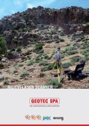
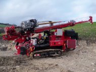
Laser Scanning<br />
RIEGL_VZ400 Laser scanner<br />
Z+F MAGER 5010 Laser scanner<br />
3D Scanning<br />
<strong>Geotec</strong> S.p.A. can also supply clients with 3D Scanning services.<br />
3D scanning is a technology that captures the shape of physical objects digitally.<br />
3D laser scanners create “point clouds” of data from the surface of an object which<br />
are geo-referenced and geometrically correct. A vast amount of high quality data is<br />
generated in a very short period, producing in this way a high resolution survey<br />
with a lot of extra information. The accuracy of the laser together with the precision<br />
of the photographic images makes laser scanning surveys realistic and complete.<br />
3D laser scanning technology can provide a detailed S.p.A.tial representation of<br />
particularly complex objects, in unreachable and inaccessible survey locations.<br />
Particularly useful in the survey of cultural artefacts and historical sites and<br />
buildings and in situations which would be otherwise difficult to research.<br />
The raw point cloud data acquired can be used:<br />
To automatically obtain plane sections and generate plans and section views<br />
as well as axonometric projections<br />
To produce high resolution Digital Terrain Models (DTM)<br />
To create orthophotos<br />
With mathematical equations to identify meshes, volume, contours, break<br />
lines and aspect ratio<br />
For environmental, structural, infrastructural and archaeological monitoring<br />
To easily integrate the surveys with topography and photogrammetry<br />
To navigate virtually<br />
To simulate possible solutions, changes and alterations to brightness and<br />
colour<br />
For conservation and deterioration analysis<br />
This technology is being applied across a wide variety of sectors including:<br />
environmental engineering, civil engineering, architecture (buildings and<br />
infrastructure), urban topography, archeology and crime scenes.<br />
RIEGL LMS-Z390 Laser scanner<br />
For projects carried out in the Centre and Abruzzo area for ANAS S.p.A. - GENERAL<br />
TECHNICAL HEADQUARTERS - RESEARCH AND INNOVATION DEPARTMENT, the use<br />
of the innovative Laser Scanning technology proved to be of great importance.<br />
This technique ensured that an accurate survey and a 3D reconstruction was carried<br />
out on works that did not have any plans or designs. Approximately 200 works,<br />
flyovers, bridges and buildings were involved.<br />
SOIL INVESTIGATIONS & LAND SURVEYING