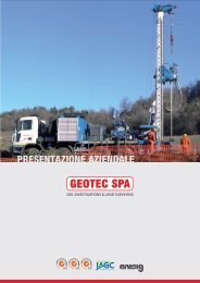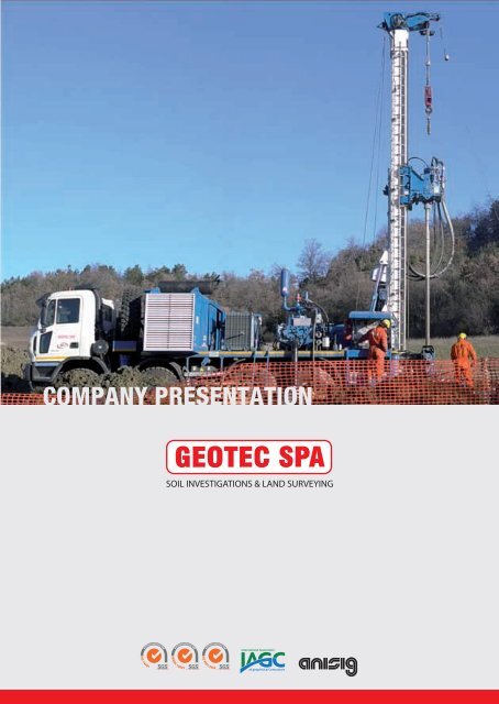
Geotec SpA Company Presentation
Geotec SpA Company Presentation
Geotec SpA Company Presentation

You also want an ePaper? Increase the reach of your titles
YUMPU automatically turns print PDFs into web optimized ePapers that Google loves.
COMPANY PRESENTATION<br />
ISO 14001<br />
OHSAS 18001<br />
ISO 9001:2000
<strong>Company</strong> presentation 2013
Contents<br />
1 About us<br />
<strong>Company</strong> organisation chart<br />
2 Location<br />
2<br />
3<br />
4<br />
3<br />
4<br />
5<br />
6<br />
7<br />
8<br />
9<br />
Certification and management systems<br />
Personnel<br />
Qualified and Skilled staff<br />
Soil investigations<br />
Equipment<br />
Drilling rigs<br />
Seismic surveys<br />
Structural engineering and seismic vulnerability<br />
Laser scanning<br />
Surveying<br />
5<br />
6<br />
7<br />
8<br />
9<br />
10<br />
12<br />
13<br />
14<br />
15<br />
10 Vehicles and equipment<br />
17<br />
Completed projects - Projects in progress<br />
Seismic surveys<br />
Other services<br />
19<br />
20
2 | <strong>Company</strong> presentation<br />
<strong>Geotec</strong> S.p.A.<br />
1<br />
About us<br />
<strong>Geotec</strong> S.p.A. , known as TPS in 1974, has been working for approximately 20<br />
years primarily in the geophysical industry. Since it was founded in 1986, <strong>Geotec</strong><br />
S.p.A. has been providing surveying and drilling services to important authorities<br />
and geophysical Companies, such as the National Research Council, the Ministry<br />
of Education, ENI, Western Geophysical, CGG (Compagnie Generale de Geophysique),<br />
Prakla-SCHLUMBERGER and OGS (Osservatorio Geofisico Sperimentale) the<br />
Experimental Geophysical Observatory of Trieste. In 1996, <strong>Geotec</strong> S.p.A. took<br />
over Discovery Geophysical Services S.p.A., a company founded in 1991 by the<br />
Experimental Geophysical Observatory of Trieste.<br />
It is from this moment on that these two companies, together with Simec Srl, a<br />
mechanical engineering workshop also part of the group, reinforce their operational<br />
status on the market, providing a wide range of services in a variety of<br />
geographical, social and cultural contexts not just on national territory but also<br />
abroad. The group can offer geophysical services through the use of complex 2D<br />
and 3D methods for geological knowledge of the subsurface, for mineral exploration,<br />
and for engineering purposes.<br />
The past ten years have seen <strong>Geotec</strong> S.p.A. grow and develop continuously and<br />
extend its field of activity into other important sectors such as civil engineering.<br />
<strong>Geotec</strong> S.p.A. is able to provide solutions regarding geognostic and geotechnical<br />
investigations, the characterization of contaminated sites, seismic risk<br />
assessment and 3D laser scanning.<br />
In December 2005 a merger took place and Discovery Geophysical Services was<br />
acquired by <strong>Geotec</strong> S.p.A.. In 2012, <strong>Geotec</strong> S.p.A. tookover SO.RI.GE, a long<br />
standing company based in Parma specialized in deep slim hole drilling. With<br />
SO.RI.GE’s know-how and <strong>Geotec</strong>’s recent investments, the two companies are<br />
capable of offering professionalism, expertise and experience in geognostic<br />
drilling using the wire-line method up to a depth of 1200m.<br />
SOIL INVESTIGATIONS & LAND SURVEYING
3 | <strong>Company</strong> presentation<br />
<strong>Geotec</strong> S.p.A.<br />
<strong>Company</strong> organisation chart<br />
President & CEO<br />
Luigi Di Marzo<br />
Special power of attorney<br />
Director of Human Resources<br />
Francesco Di Marzo<br />
Management<br />
representative Quality<br />
assurance manager<br />
Micaela De Lucrezia<br />
Chief engineer<br />
Technical manager<br />
Nicolino Testa<br />
Procurement & contracts<br />
Stefania Martino<br />
Luisa Zeolla<br />
Human resources<br />
Marisa Filippone<br />
Assistant Quality<br />
assurance manager<br />
<strong>Company</strong> HSE<br />
Workers’ health and<br />
safety representative<br />
Cosmo Di Bartolomeo<br />
Environmental<br />
system manager<br />
safety system manager<br />
Roberto Scauzilli<br />
<strong>Company</strong> Doctor<br />
Nicola rinaldi<br />
Health and<br />
Safety Manager<br />
Roberto Scauzilli<br />
Safety Information<br />
technology services<br />
Nicola Guglielmi<br />
HSE Advisor<br />
Emergency team<br />
in company offices<br />
Emergency team<br />
in the crew<br />
Seismic crew<br />
Planning & design<br />
Soil investigations<br />
Surveying<br />
Laser scanning<br />
Project manager<br />
Data processing<br />
Project manger<br />
Roberto Scauzilli<br />
Draughtsmen<br />
Roberto Scauzilli<br />
Antonio Di Lecce<br />
Gianna Iannetta<br />
Daniele LAndolfi<br />
Antonello Reale<br />
Laboratory manager<br />
Antonello Reale<br />
Head of sales<br />
Giovanni DI Costoncelli<br />
Site manager<br />
Francesco Palladino<br />
Alessandra Ciafardini<br />
Aaronne DI Colagrossi<br />
Specialized surveyor<br />
Sergio Battaglia<br />
Nicola Longo<br />
Laser scanning surveys<br />
Lorenzo Fuschino<br />
Daniela Mignognia<br />
Surveying<br />
Authorizations<br />
Recording<br />
Head of department<br />
Surveyor<br />
Assistant surveyor<br />
Surveying driver<br />
Head of department<br />
Person in charge of<br />
obtaining authorizations<br />
Person in charge of data<br />
recording/Observer<br />
Cable checker<br />
Cable layer drivers<br />
and cable layers<br />
Cable crossing personnel<br />
Shooters and helpers<br />
Drillers<br />
Antonio Arcari<br />
Marco Cogotti<br />
Cosmo Di Bartolomeo<br />
Donato Iacampo<br />
Crescenzo Morena<br />
Constantin Rosca<br />
Erennio Santoro<br />
Antonio Silvestre<br />
Angelo Turano<br />
Gino Zurlo<br />
Seismic source<br />
Vibroseis<br />
Vibrator coordinator<br />
Vibrator drivers<br />
Road signs<br />
Vibrator mechanic
4 | <strong>Company</strong> presentation<br />
<strong>Geotec</strong> S.p.A.<br />
2<br />
Location<br />
<strong>Geotec</strong> S.p.A.’s headquarters are located in the Molise region, in the city of<br />
Campobasso, a strategic position in central Italy. An area of 20,000 sq. metres<br />
houses administrative and technical offices, laboratories, a mechanical<br />
workshop and a warehouse for the storage of equipment and vehicles. <strong>Geotec</strong><br />
S.p.A. has also recently acquired further headquarters in Traversetolo, 20km from<br />
Parma and has a branch in Albania and a subsidiary in Sicily.<br />
<strong>Geotec</strong>’s headquarters and branches<br />
Traversetolo (Parma)<br />
Tirana (Albania)<br />
Campobasso<br />
S. Caterina Villarmosa (Caltanissetta)<br />
Head office operational headquarters Albania Branch Subsidiary company<br />
SOIL INVESTIGATIONS & LAND SURVEYING
5 | <strong>Company</strong> presentation<br />
<strong>Geotec</strong> S.p.A.<br />
3<br />
Certifications and management systems<br />
<strong>Geotec</strong> S.p.A. prides itself on the high standards it has achieved with regard to<br />
Management Systems. In order to implement important policies regarding<br />
occupational health and safety, the environment and social responsibility,<br />
<strong>Geotec</strong> works intensely to improve the quality, effectiveness and efficiency of its<br />
procedures as well as trying to reduce and prevent, as far as possible, the negative<br />
impacts on the health, safety and environment of employees.<br />
In fact, <strong>Geotec</strong> has attained the following certifications:<br />
Decree number 6527 dated 07/07/2011 “Authorization to carry out and<br />
certify geognostic surveys, the recovery of core samples and on site testing.”<br />
SOA Certification for the following categories:OS 20-A Class. IV<br />
OS 20-B Class. VIII<br />
OS 21 Class. II<br />
Management systems<br />
OHSAS 18001 Certification<br />
ISO 14001 Certification<br />
ISO 9001 Certification<br />
SOIL INVESTIGATIONS & LAND SURVEYING
6 | <strong>Company</strong> presentation<br />
<strong>Geotec</strong> S.p.A.<br />
4<br />
Personnel<br />
<strong>Geotec</strong>’s staff is highly qualified and with many years of experience. Members of<br />
staff include: environmental engineers, building engineers, electrical and<br />
electronic engineers, geologists, architects and surveyors.<br />
Drilling staff is highly skilled and qualified and can boast over 20 years of<br />
experience in the use of wire line technology. All our drillers possess the slim<br />
hole drilling licence obtained from authorized national agencies.<br />
Staff is fully involved in company activities and are continuously trained and<br />
updated on all aspects of their job which is aimed primarily at improving the<br />
quality of services provided.<br />
Moreover, <strong>Geotec</strong> pays particular attention to the protection of workers’ health<br />
and safety, through the use of preventive rather than proactive measures and by<br />
enforcing health and safety legislation. The safety of employees is very important<br />
to <strong>Geotec</strong> management and it is for this reason that measures and legislation<br />
are constantly implemented.<br />
SOIL INVESTIGATIONS & LAND SURVEYING
7 | <strong>Company</strong> presentation<br />
<strong>Geotec</strong> S.p.A.<br />
Qualified and Skilled staff<br />
Name<br />
Job Education Qualification<br />
Designing<br />
Structural vulnerability assessment<br />
Scauzilli Roberto<br />
Di lecce Antonio<br />
Iannetta Gianna<br />
Landolfi Daniele<br />
Reale Antonello<br />
Di lallo Giovanni<br />
Delli Carpini Antonio<br />
Pietrunti Luigi<br />
Project manager<br />
Structural engineer<br />
Structural engineer<br />
Architect<br />
Geologist<br />
Geologist<br />
Draughtsman<br />
Draughtsman<br />
Degree in engineering<br />
Degree in engineering<br />
Degree in engineering<br />
Degree in engineering<br />
Degree in geological sciences<br />
Degree in geological sciences<br />
Diploma in surveying<br />
Diploma in surveying<br />
engineer<br />
engineer<br />
engineer<br />
architect<br />
geologist<br />
geologist<br />
# # #<br />
surveyor<br />
<strong>Geotec</strong>hnical and geognosctic investigations<br />
Applied geophysics<br />
Mignogna Daniele<br />
Reale Antonello<br />
Costoncelli Giovanni<br />
Scauzilli Roberto<br />
Ciafardini Alessandra<br />
Palladino Francesco<br />
Colagrossi Aaronne<br />
Draughtsman<br />
Geological manager<br />
Head of sales<br />
Technician and geophysical data processing<br />
Site manager for soil investigations<br />
Technician and geophysical data processing<br />
Site manager for soil investigations<br />
Technician and geophysical data processing<br />
Site manager for soil investigations<br />
Degree in the scien. of cult. and environ. herit.<br />
Degree in geological sciences<br />
High school diploma<br />
Degree in engineering<br />
Degree in geological sciences<br />
Degree in geological sciences<br />
Degree in geological sciences<br />
# # #<br />
geologist<br />
###<br />
engineer<br />
geologist<br />
geologist<br />
# # #<br />
Seismic surveys<br />
Deep seismic reflection<br />
Virgilio Nicola<br />
Fricke Rolf<br />
Ciafardini Alessandra<br />
Palladino Francesco<br />
Di lecce Antonio<br />
Cilia Crocifisso<br />
Moffa Michele<br />
Domesle Josef<br />
Project Manager<br />
Project Manager<br />
Technician and geophysical data processing<br />
MESA Technician/operator<br />
(checks real-time seismic coverage)<br />
Geophysical technician<br />
Geophysical technician<br />
Geophysical technician<br />
Instrumentation and electronic<br />
equipment specialist<br />
Diploma in surveying<br />
Degree in engineering<br />
Degree in geological sciences<br />
Degree in geological sciences<br />
Degree in engineering<br />
Middle school diploma<br />
Middle school diploma<br />
Diploma in electromechanics<br />
# # #<br />
# # #<br />
geologist<br />
geologist<br />
engineer<br />
# # #<br />
# # #<br />
# # #<br />
Surveying<br />
Laser scanning<br />
Battaglia Sergio<br />
Longo Nicola<br />
Fuschino Lorenzo<br />
Mignogna Daniele<br />
Pietrunti Luigi<br />
Surveyor<br />
Surveyor<br />
Laser scanning technician<br />
Laser scanning technician<br />
Draughtsman<br />
Diploma from the artistic high school<br />
Diploma in surveying<br />
Degree in environmental sciences<br />
Diploma in surveying<br />
# # #<br />
# # #<br />
# # #<br />
# # #<br />
surveyor<br />
Name Job Years of experience Licence<br />
Staff employed in geotechnical and soil investigation sector<br />
Arcari Antonio<br />
Cogotti Marco<br />
Di Bartolomeo Antonio Cosmo<br />
Iacampo Donato<br />
Morena Crescenzo<br />
Rosca Constantin<br />
Santoro Rennio<br />
Silvestre Antonio<br />
Turano Angelo<br />
Zurlo Gino<br />
Ben Fraj Naim<br />
Cipria Francesco<br />
Danciu Pedrica<br />
Fontana Gianluca<br />
Giordano Carmine<br />
Pardo Angelo<br />
Mbaye Modou Diop<br />
Russo Cosimo<br />
Sylla Mouhamadou<br />
Zurlo Enzo<br />
Driller<br />
Driller<br />
Driller<br />
Driller<br />
Driller<br />
Assistant driller<br />
Driller<br />
Driller<br />
Driller<br />
Driller<br />
Assistant driller<br />
Assistant driller<br />
Assistant driller<br />
Assistant driller<br />
Assistant driller<br />
Assistant driller<br />
Assistant driller<br />
Assistant driller<br />
Assistant driller<br />
Assistant driller<br />
< 10<br />
> 20<br />
> 20<br />
> 20<br />
> 10<br />
< 10<br />
> 20<br />
> 25<br />
> 20<br />
> 25<br />
> 10<br />
> 20<br />
< 10<br />
< 10<br />
> 20<br />
> 20<br />
> 10<br />
> 10<br />
> 10<br />
< 10<br />
Slim hole drilling licence<br />
Slim hole drilling licence<br />
Slim hole drilling licence<br />
Slim hole drilling licence<br />
Slim hole drilling licence<br />
# # #<br />
Slim hole drilling licence<br />
# # #<br />
Slim hole drilling licence<br />
Slim hole drilling licence<br />
# # #<br />
# # #<br />
# # #<br />
# # #<br />
# # #<br />
# # #<br />
# # #<br />
# # #<br />
# # #<br />
# # #
8 | <strong>Company</strong> presentation<br />
<strong>Geotec</strong> S.p.A.<br />
5<br />
Soil investigations<br />
Amongst the numerous geotechnical investigations and geognostic surveys<br />
carried out over the years by <strong>Geotec</strong>, importance must be given to the tender<br />
awarded by BBT SE, the Brenner Base Tunnel SE for geotechnical and hydrogeological<br />
investigations in the project area.<br />
The Brenner Base Tunnel, BBT SE is the company designing and planning the<br />
Brenner Base Tunnel which will run between Innsbruck and Fortezza for approximately<br />
55 km and which is part of engineering works being carried out on the<br />
Munich to Verona route.<br />
Deep borheole drilling (Provveditorato OO.PP. year 2011)<br />
During construction works of the Brenner Base Tunnel, <strong>Geotec</strong> performed<br />
geognostic surveys in the town of Fortezza and more specifically in the residential<br />
area of Mezzaselva, where structural works will need to be carried out for the<br />
River Isarco underpass.<br />
Skilled drillers from the former company SO.RI.GE. S.r.l., are now part of <strong>Geotec</strong>’s<br />
workforce. This qualified personnel has worked on the most important and<br />
difficult jobs and projects carried out in Italy in the last decade. These include<br />
geological prospecting for the planning and design of the bridge over the strait<br />
of Messina, overhead power lines in Favazzina for Terna S.p.A., the Bologna-<br />
Florence high speed/capacity railway line (Consorzio Cavet), the Milan – Genoa<br />
high speed/capacity railway line (Consorzio Cociv) etc.<br />
This new know-how together with multiple years of experience and a vast<br />
vehicle fleet puts <strong>Geotec</strong> at the top of the national market.<br />
Deep borheole drilling (BBT_SE year 2009)<br />
<strong>Geotec</strong> S.p.A. has the equipment and personnel to collect undisturbed soil<br />
samples and to carry out Dynamic penetration tests S.P.T., Permeability testing –<br />
Lugeon, Lefranc etc. and downhole tests to a depth of 200 metres.<br />
<strong>Geotec</strong> uses the DAC TEST method (all drilling rigs are already equipped) and<br />
<strong>Geotec</strong> is the only Italian company capable of reaching a depth of 1200m using<br />
the Wire Line rotary coring technique.<br />
SOIL INVESTIGATIONS & LAND SURVEYING
9 | <strong>Company</strong> presentation<br />
<strong>Geotec</strong> S.p.A.<br />
Soil investigations<br />
Equipment<br />
Availability<br />
Drilling<br />
Drilling rods with conical threads: Ø est=60÷76mm<br />
Standard core barrel T1 Ø 131 mm<br />
Standard core barrel T1 Ø 127 mm<br />
Standard core barrel T1 Ø 101 mm<br />
Double core barrel T6 Ø 116 mm<br />
Double core barrel T6 Ø 101 mm<br />
Double core barrel T2 Ø 101 mm<br />
Double core barrel T6 S Ø 101 mm<br />
Complete wire line drilling system (Atlas Copco)<br />
SQ Diameter<br />
PQ Diameter<br />
HQ Diameter<br />
NQ Diameter<br />
WIRE LINE System – Mori Srl 101 mm (internal Core barrel)<br />
24 m casing Ø 300 mm<br />
30 m casing Ø 219 mm<br />
150 m casing Ø 178 mm<br />
210 m casing Ø 152 mm<br />
360 m casing Ø 127 mm<br />
Dynamic penetration tests SPT<br />
Shelby samplers<br />
Mazier samplers<br />
Osterburg samplers<br />
Water level indicator length 150m<br />
Water level indicator length 500m<br />
Down the hole hammer, tricone rock bits various diameters<br />
Diamond core bit<br />
Hard metal core bit<br />
Hard metal core bit CORBORIT<br />
vast number<br />
8<br />
16<br />
24<br />
16<br />
16<br />
16<br />
16<br />
240 m<br />
2400 m<br />
4000 m<br />
5600 m<br />
2 x 600 m<br />
24<br />
40<br />
24<br />
16<br />
16<br />
8<br />
Various diameters<br />
Various diameters for T6s-T6-T2-T1 core barrels<br />
Various diameters for T6s-T6-T2-T1 core barrels<br />
Various diameters for T6 T1 core barrels<br />
<strong>Geotec</strong>hnical laboratory testing<br />
<strong>Geotec</strong>hnical laboratory testing of soil and rocks will be carried out by authorized laboratories according to article 59, comma 2, of the DPR 6.6.2001 n. 380, or<br />
other authorized laboratories which conform to the regulations set out in the circular letter 16.12.1999 number 349/STC of the Ministry of Public Works which<br />
are also part of the list of official labs indicated by the Central Technical Service of the Ministry of Infrastructure and Transport.<br />
Permeability testing<br />
Flowmeters used to measure linear, non linear, mass or volumetric flow rate of a liquid or a gas.<br />
Single packer<br />
Double packer<br />
Pressure gauge<br />
meter<br />
Hydraulic pipes<br />
Hydraulic pump<br />
Underwater electric pump<br />
Geophysical surveys (downhole)<br />
DAQ LINK II seismograph 24 bit and 24 channels<br />
Geostuff Triaxial BHG-3 geophone adjustable, 200m cable length<br />
Ambrogeo Triaxial geophone 150 m<br />
Source system used to generate P and S waves<br />
Geophysical surveys (Seismic refraction prospecting)<br />
DAQ LINK II seismograph 24 bit and 24 channels<br />
Horizontal geophone SM-6/HB 4.5 Hz<br />
Vertical geophone SM-6/VB 10 Hz<br />
Source system used to generate P and S waves<br />
2<br />
1<br />
1<br />
1<br />
2<br />
vast number<br />
1<br />
3<br />
2<br />
2<br />
2<br />
vast number<br />
2<br />
24<br />
24<br />
vast number<br />
Geophysical surveys (logging)<br />
Sensors to measure thrust, pull and rotation, utensil speed, liquid pressure and flow rate, rotation velocity of utensils.<br />
Control unit for acquisition, recording and processing and continuous data return in remote control.
10 | <strong>Company</strong> presentation<br />
<strong>Geotec</strong> S.p.A.<br />
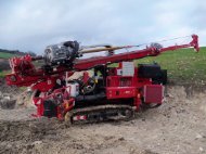
Drilling rigs<br />
EK650 CAN - ELETTARI<br />
Model:<br />
Type of vehicle:<br />
Strokes of rotary head:<br />
Extraction force:<br />
Crowd force:<br />
Maximum winch strength:<br />
Rotation speed:<br />
Maximum torque:<br />
Equipped with:<br />
Number of rigs available:<br />
EK 650 CAN – ELLETTARI<br />
SAME 130 HP 4x4 wheeled tractor<br />
3600 mm<br />
5000 kg<br />
5000 kg<br />
500 kg<br />
0-250 rpm<br />
650 kgm<br />
mud pump, tilting head.<br />
15<br />
MAGIRUS EK1000<br />
Model:<br />
Type of vehicle:<br />
Strokes of rotary head:<br />
Extraction force:<br />
Crowd force:<br />
Maximum winch strength:<br />
Rotation speed:<br />
Maximum torque:<br />
Equipped with:<br />
Number of rigs available:<br />
MAGIRUS EK 1000<br />
MAGIRUS DEUTZ 4x4 TRUCK<br />
5500 mm<br />
8000 kg<br />
8000 kg<br />
2000 kg<br />
0-300 rpm<br />
1000 kgm<br />
mud pump, tilting head<br />
2<br />
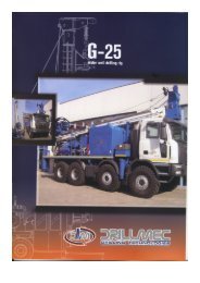
DRILLMEC G25<br />
Model:<br />
Type of vehicle:<br />
Strokes of rotary head:<br />
Extraction force:<br />
Crowd force:<br />
Maximum winch strength:<br />
Rotation speed:<br />
Maximum torque:<br />
Equipped with:<br />
Number of rigs available:<br />
DRILLMEC G25<br />
ASTRA 6x8 TRUCK<br />
6800 mm<br />
24000 kg<br />
10000 kg<br />
24000 kg<br />
0-750 rpm<br />
1350 kgm<br />
mud pump, tilting head,<br />
optional rotary head<br />
with reverse fluid circulation<br />
(1700kgmx60rpm),<br />
1200mt. wireline winch<br />
1<br />
CASAGRANDE C8<br />
Model:<br />
Type of vehicle:<br />
Strokes of rotary head:<br />
Extraction force:<br />
Crowd force:<br />
Maximum winch strength:<br />
Rotation speed:<br />
Maximum torque:<br />
Equipped with:<br />
Number of rigs available:<br />
CASAGRANDE C8<br />
Crawler drilling rig<br />
8000 mm<br />
12000 kg<br />
7850 kg<br />
2000 kg<br />
0‐1000 rpm<br />
920 kgm<br />
wireline winch<br />
1
11 | <strong>Company</strong> presentation<br />
<strong>Geotec</strong> S.p.A.<br />
Drilling rigs<br />
ATLAS COPCO MUSTANG S-52<br />
Model:<br />
Type of vehicle:<br />
Strokes of rotary head:<br />
Extraction force:<br />
Crowd force:<br />
Maximum winch strength:<br />
Rotation speed:<br />
Maximum torque:<br />
Equipped with:<br />
Number of rigs available:<br />
ATLAS COPCO MUSTANG S-52<br />
Crawler drilling rig<br />
3700 mm<br />
8000 kg<br />
8000 kg<br />
2200 kg<br />
0-630 rpm<br />
1000 kgm<br />
Sdrillmatic<br />
1<br />
EGT VD 315<br />
Model:<br />
Type of vehicle:<br />
Strokes of rotary head:<br />
Extraction force:<br />
Crowd force:<br />
Maximum winch strength:<br />
Rotation speed:<br />
Maximum torque:<br />
Equipped with:<br />
Number of rigs available:<br />
EGT VD 315<br />
Crawler drilling rig<br />
3400 mm<br />
12000 kg<br />
10000 kg<br />
1500 kg<br />
0-600 rpm<br />
1000 kgm<br />
Dac test, wireline winch,<br />
rotopercussion<br />
1<br />
EGT VD 700<br />
Model:<br />
Type of vehicle:<br />
Strokes of rotary head:<br />
Extraction force:<br />
Crowd force:<br />
Maximum winch strength:<br />
Rotation speed:<br />
Maximum torque:<br />
Equipped with:<br />
Number of rigs available:<br />
EGT VD 700<br />
Crawler drilling rig<br />
3400 mm<br />
12000 kg<br />
10000 kg<br />
1500 kg<br />
0-600 rpm<br />
1000 kgm<br />
Dac test, wireline winch,<br />
rotopercussion<br />
1
12 | <strong>Company</strong> presentation<br />
<strong>Geotec</strong> S.p.A.<br />
6<br />
Seismic surveys<br />
<strong>Geotec</strong> S.p.A. specializes in onshore seismic acquisition for geophysical research<br />
and geological knowledge of the subsurface for oil and gas exploration and<br />
scientific aims or purposes. <strong>Geotec</strong> S.p.A. is a national leader when carrying out<br />
geophysical surveys using the 2D/3D seismic reflection method. It is equipped<br />
with the most up to date, high-tech equipment and has at its disposal a vast fleet<br />
of vehicles (over 230) operated by highly qualified, experienced staff.<br />
Deep borehole drilling (Provveditorato OO.PP. year 2011)<br />
Possible applications:<br />
Stratigraphic reconstruction<br />
To identify bedrock depths<br />
For Lithostratigraphic correlations<br />
For construction in earthquake prone areas and studies regarding microzonation<br />
For the study of landslides<br />
To determine elastic constants (Young’s modulus, bulk’s modulus, stiffness,<br />
Poisson’s ratio)<br />
Deep borehole drilling (BBT_SE year 2009)<br />
SOIL INVESTIGATIONS & LAND SURVEYING
13 | <strong>Company</strong> presentation<br />
<strong>Geotec</strong> S.p.A.<br />
7<br />
Structural engineering<br />
and seismic vulnerability<br />
<strong>Geotec</strong> S.p.A. has a great interest in the seismic vulnerability assessment of<br />
important buildings and structures.<br />
<strong>Geotec</strong> S.p.A. is specialised in seismic risk assessment through the use of mathematical<br />
calculations -static and dynamic, linear and non linear analysis - according<br />
to recent Italian codes.<br />
MIDAS-CIVIL modeling<br />
The following engineering services can be offered by <strong>Geotec</strong> S.p.A.:<br />
Inspection and assessment of concrete, steel, reinforced concrete and masonry<br />
buildings in order to check earthquake safety levels.<br />
Inspection and assessment of bridges and other civil engineering structures in<br />
order to check earthquake safety levels.<br />
Consideration and subsequent presentation of possible solutions regarding<br />
the improvement of earthquake safety levels.<br />
MIDAS-CIVIL modeling<br />
<strong>Geotec</strong> S.p.A. examines buildings, bridges and other civil engineering s<br />
tructures according to the following stages:<br />
Gathering of existing data;<br />
Geological, geognostic and geophysical investigations carried out on the<br />
Foundation soil in order to determine the characteristics and essential features<br />
of the building;<br />
Structural monitoring through the use of destructive and non-destructive<br />
testing;<br />
Processing of gathered data, vulnerability assessment and summary of results<br />
obtained;<br />
Research into possible solutions aimed at improving earthquake safety levels.<br />
Structural engineering and seismic vulnerability<br />
In 2010 <strong>Geotec</strong> S.p.A. worked for ANAS S.p.A. – National Autonomous Roads<br />
corporation - GENERAL TECHNICAL HEADQUARTERS - RESEARCH AND INNOVA-<br />
TION DEPARTMENT examining the seismic vulnerability of approximately 200<br />
flyovers and 10 buildings as required by the new Italian Building Code NTC2008.<br />
SOIL INVESTIGATIONS & LAND SURVEYING
14 | <strong>Company</strong> presentation<br />
<strong>Geotec</strong> S.p.A.<br />
8<br />
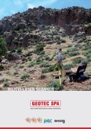
Laser Scanning<br />
RIEGL_VZ400 Laser scanner<br />
Z+F MAGER 5010 Laser scanner<br />
3D Scanning<br />
<strong>Geotec</strong> S.p.A. can also supply clients with 3D Scanning services.<br />
3D scanning is a technology that captures the shape of physical objects digitally.<br />
3D laser scanners create “point clouds” of data from the surface of an object which<br />
are geo-referenced and geometrically correct. A vast amount of high quality data is<br />
generated in a very short period, producing in this way a high resolution survey<br />
with a lot of extra information. The accuracy of the laser together with the precision<br />
of the photographic images makes laser scanning surveys realistic and complete.<br />
3D laser scanning technology can provide a detailed S.p.A.tial representation of<br />
particularly complex objects, in unreachable and inaccessible survey locations.<br />
Particularly useful in the survey of cultural artefacts and historical sites and<br />
buildings and in situations which would be otherwise difficult to research.<br />
The raw point cloud data acquired can be used:<br />
To automatically obtain plane sections and generate plans and section views<br />
as well as axonometric projections<br />
To produce high resolution Digital Terrain Models (DTM)<br />
To create orthophotos<br />
With mathematical equations to identify meshes, volume, contours, break<br />
lines and aspect ratio<br />
For environmental, structural, infrastructural and archaeological monitoring<br />
To easily integrate the surveys with topography and photogrammetry<br />
To navigate virtually<br />
To simulate possible solutions, changes and alterations to brightness and<br />
colour<br />
For conservation and deterioration analysis<br />
This technology is being applied across a wide variety of sectors including:<br />
environmental engineering, civil engineering, architecture (buildings and<br />
infrastructure), urban topography, archeology and crime scenes.<br />
RIEGL LMS-Z390 Laser scanner<br />
For projects carried out in the Centre and Abruzzo area for ANAS S.p.A. - GENERAL<br />
TECHNICAL HEADQUARTERS - RESEARCH AND INNOVATION DEPARTMENT, the use<br />
of the innovative Laser Scanning technology proved to be of great importance.<br />
This technique ensured that an accurate survey and a 3D reconstruction was carried<br />
out on works that did not have any plans or designs. Approximately 200 works,<br />
flyovers, bridges and buildings were involved.<br />
SOIL INVESTIGATIONS & LAND SURVEYING
15 | <strong>Company</strong> presentation<br />
<strong>Geotec</strong> S.p.A.<br />
9<br />
Surveying<br />
<strong>Geotec</strong> S.p.A. provides surveying services using the GPS system and electrooptical<br />
instrumentation.<br />
Surveys are carried out by <strong>Geotec</strong> S.p.A. using market-leading Leica Geosystems<br />
S.p.A surveying equipment.<br />
SOIL INVESTIGATIONS & LAND SURVEYING
16 | <strong>Company</strong> presentation<br />
<strong>Geotec</strong> S.p.A.<br />
Surveying<br />
Services<br />
GPS instrumentation<br />
Structural engineering<br />
Structural vulnerability assessment<br />
Surveying support in seismic surveys<br />
Line pegging for seismic surveys<br />
Geodetic framing of the project area<br />
Production of local networks and new benchmarks<br />
Cadastral surveys<br />
Parcelling out of land, property subdivision and possible Industrial estate sites<br />
Road subdivision, railway subdivision, cycle lanes and dirt tracks<br />
Property registration<br />
Surveying for new sewage, hydraulic and water systems:<br />
New sewage systems<br />
Water pipelines<br />
Rock armouring<br />
Piers and docks<br />
River restoration<br />
Riverbed surveying<br />
Engineering surveys for building works and the parcelling out of land<br />
Private and industrial areas<br />
For private landowners<br />
Shopping centres<br />
Territorial planning<br />
Planimetric and altimetric surveys<br />
Earth moving<br />
Landslides<br />
Caves<br />
Landfill sites<br />
Water purification plants<br />
Verticality surveys of chimneys and towers<br />
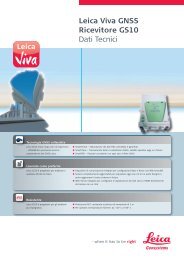
Leica Receiver GNSS - GS10<br />
Leica Receiver GNSS - GS15<br />
2 receivers<br />
9 receivers<br />
Electro-optical instrumentation<br />
Leica TPS 1200<br />
1 station<br />
Leica Viva Controller CS10<br />
2 receivers<br />
Qualifica<br />
Esperienza (anni)<br />
TRIMBLE 5001 DR200+<br />
1 station<br />
Leica Viva Controller CS15<br />
9 receivers
17 | <strong>Company</strong> presentation<br />
<strong>Geotec</strong> S.p.A.<br />
10<br />
Vehicles and equipment<br />
<strong>Geotec</strong> S.p.A. has at its disposal a wide range of automobiles and<br />
industrial vehicles (over 230):<br />
Off-road vehicles such as Land Rover, Nissan, Toyota, Mercedes.<br />
Trucks such as Mercedes Benz Unimog, Fiat Iveco, Magirus Deutz, Magirus Iveco,<br />
Fiat OM 50, 70, 90, 110,<br />
Lorries with trailers and semi - trailers.<br />
Drilling rigs assembled on Same, Buffalo, Laser and Antares tractors,<br />
Track mounted drilling rigs such as the EGT 315 VD, Casagrande C8 drilling rig,<br />
Atlas Copco Mustang, Drillmec G25 drilling rig<br />
Prakkla-Seismos vibrators.<br />
From small lightweight conventional drilling rigs to heavy duty rigs, helitransportable<br />
rigs, LIA drilling rigs - Limitato Impatto Ambientale – Limited Environmental<br />
Impact (length 3 metres, width 1.10 metres and height 1.80 metres), hand held<br />
drilling rigs for pattern drilling in inaccessible areas.<br />
Drilling rigs are used in different jobs: deep and standard geognostic surveys,<br />
special foundations and in geophysical prospecting.<br />
LIA drilling rigs, designed by <strong>Geotec</strong> S.p.A. and manufactured by Simec Srl, assembled<br />
on 30-50-70 HP tracked or tyre tractors, are capable of drilling holes between<br />
the rows of a vineyard and between the trees of an orchard to a depth of between<br />
15-20 metres using water and air.<br />
All the tracked drilling rigs, together with the Drillmec G-25 are equipped with a<br />
triplex pump and wire line winches for deep surveys from 500 to 1200 metres.<br />
SOIL INVESTIGATIONS & LAND SURVEYING
18 | <strong>Company</strong> presentation<br />
<strong>Geotec</strong> S.p.A.<br />
Vehicles and equipment<br />
Model<br />
Number ov veichles availabile<br />
Off road vehicles<br />
Mitsubishi Pick up/Toyota/Land Rover/Isuzu – Fiat Panda 4x4<br />
80<br />
Model<br />
Mercedes - Unimog<br />
Number ov veichles availabile<br />
3<br />
Volkswagen vans<br />
15<br />
Iveco - Turbo Star Truck<br />
1<br />
SCAM 4<br />
Helitransported drilling rig<br />
20<br />
Iveco – Cursor<br />
1<br />
Vibroseis with Silent pack<br />
6<br />
Q Esperienza (anni) Patentino in possesso<br />
Magirus<br />
3 (1 with crane)<br />
Vibrators<br />
8
19 | <strong>Company</strong> presentation<br />
<strong>Geotec</strong> S.p.A.<br />
Completed projects - Projects in progress<br />
Seismic surveys<br />
Client Type of Project Location Year<br />
Energy source<br />
Acquisition details<br />
Enel Longagnesi Developments Srl<br />
3D Seismic Survey<br />
San Marco<br />
Exploration Permit<br />
Ravenna<br />
(Italy)<br />
2013<br />
Vibroseis & Dynamite<br />
VP 65 SqKm 3000 VP/SP<br />
Edison Stoccaggio<br />
3D Seismic Acquisition S. Potito<br />
and Cotignola<br />
Ravenna<br />
(Italy)<br />
2013<br />
Vibroseis & Dynamite<br />
120 SqKm 5500 VP/SP<br />
Jv Petromanas Albania Gmbh Shell<br />
2D Seismic Acquisition project<br />
Blocks 2 and 3 Albania<br />
Berat<br />
(Albania)<br />
2013<br />
Dynamite<br />
400 Km 11000 SP 35%<br />
Conventional 65%<br />
Heliportable<br />
Aleanna Resources Llc<br />
3D Seismic Acquisition Project<br />
"Ponte dei Grilli"<br />
Ferrara<br />
(Italy)<br />
2012<br />
Vibroseis<br />
VP 4000 100Kmq<br />
Edison S.p.A.<br />
2D Seismic Acquisition Project<br />
Torrent Parma<br />
Ferrara<br />
(Italy)<br />
2012<br />
Dynamite<br />
20 Km<br />
Stogit S.p.A.<br />
3D Seismic Survey "Sabbioncello<br />
Gas Storage"<br />
Ferrara<br />
(Italy)<br />
2011/12<br />
Dynamite<br />
960 channels<br />
About SP 4127<br />
53,07km²<br />
Eni S.p.A.<br />
TESTS for WIRELESS SYSTEM in<br />
3D Seismic Survey "Sabbioncello<br />
Gas Storage"<br />
Ferrara<br />
(Italy)<br />
2011/12<br />
For wireless<br />
960 channels<br />
About SP 2270<br />
37.97 km²<br />
Stogit S.p.A.<br />
3D Seismic Survey "Minerbio"<br />
Gas Storage"<br />
Bologna<br />
(Italy)<br />
2010/11<br />
Dynamite/<br />
Vibroseis<br />
576 channels<br />
SP and VP: 6020<br />
53.64 Km²Full Fold<br />
78.80 Km² Single Fold<br />
Po Valley<br />
2D Seismic Survey "San<br />
Vincenzo" & "Podere Gallina"<br />
Ferrara<br />
(Italy)<br />
2011<br />
Vibroseis<br />
1108 & 491 channels<br />
VP 1150<br />
Petromanas Energy Inc<br />
2D Seismic Survey<br />
Test Line<br />
Block 2&3<br />
Berat<br />
(Albania)<br />
2010/11<br />
Dynamite20% Conventional 80%<br />
Heliportable<br />
300 channels<br />
SP 1604 - 192 Km<br />
Aleanna Resources Llc<br />
3D Seismic Acquisition Project<br />
"Ponte del Diavolo"<br />
Ferrara<br />
(Italy)<br />
2011<br />
Vibroseis<br />
2016 channels<br />
VP 6199 - 150 Km²<br />
Enelgreenpower S.p.A.<br />
2D Seismic Survey "P.R. Murci e<br />
Boccheggiano"<br />
Tuscany<br />
(Italy)<br />
2011<br />
Vibroseis<br />
240 channels<br />
VP 1700 - 103 km<br />
Saras S.p.A.<br />
Sardinia 2D Gas Project<br />
Sardinia<br />
(Italy)<br />
2010<br />
Vibrators with transition zone in<br />
swamp area<br />
240 channels<br />
14 000 VP - 165 Km<br />
Petromanas Energy Inc.<br />
2D Seismic<br />
Acquisition Project Block E<br />
Tirana & Elbasan<br />
(Albania)<br />
2010<br />
Dynamite<br />
10% conventional 90% Heliportable<br />
300 channels<br />
SP 1322 - 170 Km<br />
Edison S.p.A.<br />
2D Seismic Survey Paternò<br />
Sicily near ETNA<br />
2008/09<br />
Dynamite<br />
100% conventional<br />
320 channels<br />
SP: 700<br />
Enel Green Power<br />
3D Seismic Survey Chiusino Sud<br />
Tuscany<br />
(Italy)<br />
2009<br />
Dynamite<br />
50% conventional 50% Heliportable<br />
720 channels<br />
SP: 1500<br />
Full Fold 1600%<br />
Stogit S.p.A.<br />
3D Seismic Survey "Alfonsine Gas<br />
Storage"<br />
Ravenna<br />
(Italy)<br />
2008<br />
Dynamite<br />
100% conventional<br />
960 channels<br />
SP: 12000 - 143 Km²<br />
Full Fold<br />
212 Km² Single Fold<br />
DMT GmbH & <strong>Company</strong> c/oRAG<br />
Rohol-Aufsuchungs AG<br />
2D Teisendorf<br />
,Bavaria<br />
(Germany)<br />
2008<br />
Vibroseis 705 channels<br />
55Km 1960 VPS<br />
Carbosulcis S.p.A.<br />
2D Seismic data acquisition<br />
Coal bed methane and<br />
enhanced coal bed methane<br />
recovery and CO2 geological<br />
storage performance assessment<br />
Sulcis Basin<br />
2007/08<br />
Vibroseis<br />
967 VPS
20 | <strong>Company</strong> presentation<br />
<strong>Geotec</strong> S.p.A.<br />
Completed projects - Projects in progress<br />
Other services<br />
Client<br />
Project<br />
Year<br />
Type of project<br />
STOGIT S.p.A. -Part of ENI Group<br />
Additional borehole drilling for piezometer and extensometer installation at<br />
Stogit sites in Italy.<br />
2013/14<br />
Geognostic surveys/soil investigation<br />
Province of Agrigento<br />
Geognostic investigations and laboratory testing for the planning of works to be<br />
carried out on roads connecting the SS 189, SS 118 and SS 115<br />
2013<br />
Geognostic surveys/soil investigation<br />
Ministry of Infrastructure and Transport –<br />
Interregional Public works office Campania-<br />
Molise<br />
Geological and geotechnical investigations aimed at assessing the characteristics<br />
of rock types for the construction of the new barracks for the Guardia di Finanza<br />
of Termoli with an additional nautical department<br />
2013<br />
Geognostic surveys/soil investigation<br />
Ministry of Infrastructure and Transport –<br />
Interregional Public works office Campania-<br />
Molise<br />
Geological and geotechnical investigations aimed at assessing the characteristics<br />
of rock types for the construction of a new fire station in Termoli<br />
2013<br />
Geognostic surveys/soil investigation<br />
TOTO S.p.A. Costruzioni Generali<br />
Subcontracted services for the carrying out of deep drilling for construction<br />
works of the second Cefalu-Ogliastrillo-Castelbuono track part of the Palermo-<br />
Messina line for RFI-ITALFERR<br />
2013<br />
Geognostic surveys/soil investigation<br />
and deep drilling<br />
SIRJO S.C.p.A.<br />
A services contract with SIRJO S.C.p.A. (temporary association of companies) for<br />
geological and geotechnical surveys in situ: DG41 Construction of the 3rd mega<br />
lot of SS 106 Jonica, from the crossroads between the S.S. 534 (km 365 +150) to<br />
Roseto Capo Spulico (km 400 +000)<br />
2012/13<br />
Geognostic surveys/soil investigation<br />
and deep drilling<br />
Consorzio Infrastrutture<br />
Subcontract together with Landi Stefano Pozzi Chiarugi & C. Sas (a temporary<br />
association of companies) for specialized drilling for geological investigations, as<br />
part of a bigger job to complete the connections of the rivers Serieri and<br />
Sciolabino to the reservoir of the Olivo dam.<br />
2013<br />
Deep geognostic drilling<br />
SINA S.p.A.<br />
Supplementary deep drilling and geognostic surveys as part of the detailed<br />
design of constructive Lot 1 Line AV / AC Milan - Genoa III Giovi Pass<br />
2012/13<br />
Geognostic surveys/soil investigation<br />
and deep drilling<br />
Temporary association of companies: REGGIO<br />
CALBRIA-SCILLA Società Consortile per Azioni,<br />
Impregilo S.p.A. and SICA S.p.A.<br />
Supplementary Geognostic surveys, to be carried out in G.N. Paci north of the A3<br />
2012<br />
Geognostic/soil investigation and sub<br />
horizontal drilling<br />
Province of Campobasso<br />
Geognostic investigations in order to study the phenomenon of hydrogeological<br />
instability affecting part of the SP 149 road in the town of Monacilioni (CB)<br />
2012<br />
Geognostic surveys/soil investigation<br />
Anas S.p.A.<br />
Registration and inspection, using surveying and laser scanning, of works of art,<br />
artifacts and tunnel installations present along trunk roads under the authority of<br />
ANAS, being managed by the Abruzzo road network (trunk roads including<br />
junctions and the NSA).<br />
2012<br />
Registration and inspection and laser<br />
scanning surveys<br />
San Benedetto Val Di Sambro S.c.a.r.l.<br />
The carrying out of deep drillings in the vicinity of the Sparvo tunnel<br />
A1Motorway: Milan Naples<br />
2012 Deep borehole drilling for gas research<br />
National institute of geophysics and vulcan.<br />
Destructive drilling of 3 holes part of the European project called "GLASS".<br />
2011<br />
Deep drilling for a total of 670m<br />
Anas S.p.A (Roma)<br />
Registration and inspection, using surveying and laser scanning, of works of art,<br />
artifacts and tunnel installations present along trunk roads under the authority of<br />
ANAS, being managed by the Abruzzo road network (trunk roads including<br />
junctions and the NSA).<br />
2011<br />
Registration and inspection and<br />
laser scanning surveys<br />
Special Commissioner Interregional<br />
Public works office Campania-Molise<br />
Construction of the road connecting f.v. Tappino (SS 645)-Riccia-Collotorto-San<br />
Giuliano di Puglia, former. S.S. 376, to the Santa Croce di Magliano junction-ss 87<br />
(Piana di Larino) through the western bank of Lake Occhito (lake surroundings) -<br />
1st lot<br />
2011<br />
Geognostic surveys/soil investigation,<br />
geophysical surveys and deep<br />
borehole drilling<br />
The Brenner Base Tunnel Basistunnel BBT SE<br />
Engineering works carried out on the Munich to Verona railway line. Shallow core<br />
drilling – Geological, geognostic, geotechnical, geophysical surveys and large<br />
diameter drilling.<br />
2011<br />
Geognostic surveys/soil investigation,<br />
geophysical surveys and deep<br />
borehole drilling<br />
Anas S.p.A. (Roma)<br />
Services for the carrying out of the project aimed at checking seismic safety<br />
standards -geological geognostic, geotechnical, geophysical surveys on<br />
foundations and structural monitoring using destructive and non-destructive<br />
tests O.P.C.M. 3274/2003 and O.P.C.M. 3362/2004 and subsequent amendments -<br />
Area 2 CENTER<br />
2010/13 Structural surveys, Geognostic surveys<br />
/soil investigation, geophysical down<br />
hole surveys for a total of 182 down<br />
hole surveys equivalent to 6333 metres<br />
Anas S.p.A. General Management – Central<br />
Management<br />
Design – Specialized engineering area: Support services in the drafting of a final<br />
project for the new Eboli intersection of the SA-RC motorway.<br />
2011<br />
Geognostic surveys/soil investigation,<br />
geophysical down hole surveys<br />
Pizzarotti S.p.A.<br />
Supplementary drilling for planning of the BBM project: BRE. BE. MI. BBM slip road<br />
– motorway connection between the cities of Brescia, Bergamo and Milan -<br />
Geological, geognostic, geotechnical, geophysical surveys<br />
2011<br />
Geognostic surveys/soil investigation,<br />
geophysical down hole surveys<br />
Ismes: Divisione Ambiente eTerritorio<br />
Cesi S.p.A.<br />
Geognostic and environmental investigations at the ENEL thermoelectric power<br />
station in Mercure – Laino Borgo (CS)<br />
2009/10<br />
Geognostic/soil investigation<br />
Anas S.p.A. General Management – Central<br />
Management<br />
Support services in the preparing of a final project in the integrated contract for<br />
the “New Tunnel of Colle di Tenda” in the town of Vernante (CN)<br />
2008<br />
Geological surveys<br />
ISMES: Divisione Ambiente eTerritorio<br />
Cesi S.p.A.<br />
Geognostic/soil investigations for the characterization of sites for a wind farm<br />
near Monterosso and Serre<br />
2008<br />
Geognostic surveys/soil investigation<br />
and geophysical surveys
Note
<strong>Geotec</strong> S.p.A.<br />
Head office<br />
Via G. Barbato, 20<br />
86100 Campobasso, Italy<br />
Tel. +39 0874 481868<br />
Fax +39 0874 69088<br />
www.geotecspa.com<br />
info@geotecspa.com<br />
Registered in the Court of Campobasso No.1962<br />
Registered in Chamber of Commerce Campobasso No. 75777<br />
VAT No. IT 007 1263 0706