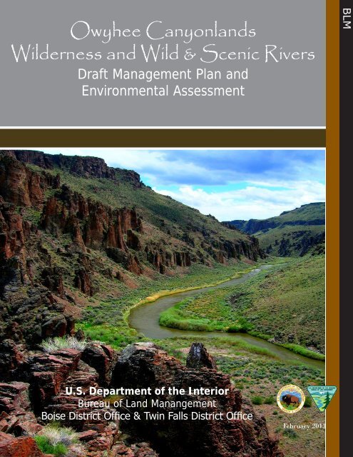
Owyhee Canyonlands Wilderness and Wild & Scenic Rivers
Owyhee Canyonlands Wilderness and Wild & Scenic Rivers
Owyhee Canyonlands Wilderness and Wild & Scenic Rivers

You also want an ePaper? Increase the reach of your titles
YUMPU automatically turns print PDFs into web optimized ePapers that Google loves.
<strong>Owyhee</strong> <strong>Canyonl<strong>and</strong>s</strong><br />
<strong><strong>Wild</strong>erness</strong> <strong>and</strong> <strong>Wild</strong> & <strong>Scenic</strong> <strong>Rivers</strong><br />
Draft Management Plan <strong>and</strong><br />
Environmental Assessment<br />
BLM<br />
U.S. Department of the Interior<br />
Bureau of L<strong>and</strong> Manangement<br />
Boise District Office & Twin Falls District Office<br />
February 2013
Boise District BLM<br />
3948 Development Ave<br />
Boise, ID 83705<br />
Twin Falls District BLM<br />
2536 Kimberly Road<br />
Twin Falls, ID 83301<br />
Cover Photo: South Fork <strong>Owyhee</strong> WSR, <strong>Owyhee</strong> <strong><strong>Wild</strong>erness</strong>
Draft Management Plan <strong>and</strong><br />
Environmental Assessment<br />
Table of Contents <br />
iii<br />
_ 1. <strong>Owyhee</strong> <strong>Canyonl<strong>and</strong>s</strong> <strong><strong>Wild</strong>erness</strong> <strong>and</strong> <strong>Wild</strong> & <strong>Scenic</strong> <strong>Rivers</strong> Management Plan ............. 1 <br />
_ 1.1. Management Plan Introduction ....................................................................................... 1 <br />
_ 1.2. Purpose of <strong>and</strong> Need for the WMP ................................................................................. 5 <br />
1.2.1. Compliance with Existing Laws <strong>and</strong> Regulations ................................................. 5 <br />
1.2.2. Conformance to BLM policy manuals <strong>and</strong> h<strong>and</strong>books .......................................... 5 <br />
1.2.3. Consistency with Existing BLM L<strong>and</strong> Use Plans .................................................. 6 <br />
_ 1.3. <strong><strong>Wild</strong>erness</strong> Overview ...................................................................................................... 7 <br />
1.3.1. <strong><strong>Wild</strong>erness</strong> Character ............................................................................................. 7 <br />
1.3.2. Descriptions of the <strong>Owyhee</strong> <strong>Canyonl<strong>and</strong>s</strong> <strong><strong>Wild</strong>erness</strong> Areas ................................ 8 <br />
1.3.2.1. Big Jacks Creek <strong><strong>Wild</strong>erness</strong> ...................................................................... 11 <br />
1.3.2.2. Bruneau-Jarbidge <strong>Rivers</strong> <strong><strong>Wild</strong>erness</strong> ........................................................ 13 <br />
1.3.2.3. Little Jacks Creek <strong><strong>Wild</strong>erness</strong> ................................................................... 16 <br />
1.3.2.4. North Fork <strong>Owyhee</strong> <strong><strong>Wild</strong>erness</strong> ............................................................... 18 <br />
1.3.2.5. <strong>Owyhee</strong> River <strong><strong>Wild</strong>erness</strong> ........................................................................ 20 <br />
1.3.2.6. Pole Creek <strong><strong>Wild</strong>erness</strong> .............................................................................. 23 <br />
1.3.3. <strong><strong>Wild</strong>erness</strong> Issues Being Addressed .................................................................... 25 <br />
1.3.3.1. Protecting <strong>and</strong> preserving the untrammeled, undeveloped, <strong>and</strong> natural <br />
appearance of wilderness areas .................................................................. 25 <br />
1.3.3.2. Management of non-conforming l<strong>and</strong> uses allowed by Section 4(d) of <br />
the <strong><strong>Wild</strong>erness</strong> Act ..................................................................................... 27 <br />
_ 1.4. <strong>Wild</strong> <strong>and</strong> <strong>Scenic</strong> River (WSR) Overview ..................................................................... 27 <br />
1.4.1. WSR Designation ................................................................................................. 27 <br />
1.4.2. WSR Descriptions ................................................................................................ 28 <br />
1.4.2.1. WSR Outst<strong>and</strong>ingly Remarkable Values (ORVs) ..................................... 30 <br />
1.4.3. WSR Issues to be Addressed ............................................................................... 36 <br />
_ 1.5. <strong><strong>Wild</strong>erness</strong> <strong>and</strong> WSR Management Strategy ................................................................ 37 <br />
1.5.1. <strong><strong>Wild</strong>erness</strong> Management Goals <strong>and</strong> Objectives ................................................... 37 <br />
1.5.1.1. <strong><strong>Wild</strong>erness</strong> Goal 1 ..................................................................................... 37 <br />
1.5.1.2. <strong><strong>Wild</strong>erness</strong> Goal 2 ..................................................................................... 37 <br />
1.5.1.3. <strong><strong>Wild</strong>erness</strong> Goal 3 ..................................................................................... 38 <br />
1.5.2. WSR Management Goals <strong>and</strong> Objectives ............................................................ 39 <br />
1.5.2.1. <strong>Wild</strong> River Goal ........................................................................................ 39 <br />
1.5.2.2. Recreational River Goal ............................................................................ 39 <br />
1.5.3. <strong><strong>Wild</strong>erness</strong> <strong>and</strong> WSR Management Actions ........................................................ 39 <br />
1.5.3.1. Fire Management ...................................................................................... 39 <br />
1.5.3.2. Emergency Stabilization <strong>and</strong> Rehabilitation (ES&R) ............................... 42 <br />
1.5.3.3. Noxious Weeds <strong>and</strong> Non-Native Invasive Plants ..................................... 43 <br />
1.5.3.4. Livestock Management ............................................................................. 45 <br />
1.5.3.5. Research <strong>and</strong> Monitoring ....................................................................... 48 <br />
1.5.3.6. Mining-related Reclamation ..................................................................... 49 <br />
1.5.3.7. <strong>Wild</strong>life <strong>and</strong> Fisheries Management ......................................................... 49 <br />
1.5.3.8. Recreation Management ........................................................................... 51 <br />
1.5.3.9. Education <strong>and</strong> Interpretation ..................................................................... 59 <br />
1.5.3.10. Military Operations ................................................................................. 60 <br />
1.5.3.11. Management Action Tables ..................................................................... 60 <br />
February 2013<br />
Table of Contents
iv<br />
Draft Management Plan <strong>and</strong><br />
Environmental Assessment<br />
_ 1.6. Monitoring Program ...................................................................................................... 64 <br />
1.6.1. WSR Monitoring .................................................................................................. 66 <br />
1.6.2. Law Enforcement ................................................................................................. 67 <br />
_ 1.7. Plan Evaluation ............................................................................................................. 67 <br />
_ 1.8. Activities Associated with Plan Implementation .......................................................... 67 <br />
_ 2. Environmental Assessment — <strong>Owyhee</strong> <strong>Canyonl<strong>and</strong>s</strong> <strong><strong>Wild</strong>erness</strong> <strong>and</strong> <strong>Wild</strong> <strong>and</strong> <br />
<strong>Scenic</strong> <strong>Rivers</strong> Management Plan DOI-BLM-ID-B000-2011-0001-EA ......................... 69 <br />
_ 2.1. Introduction <strong>and</strong> Background ....................................................................................... 71 <br />
2.1.1. Purpose of <strong>and</strong> Need for the Proposed Action ..................................................... 71 <br />
2.1.2. Decision to be Made ............................................................................................ 72 <br />
2.1.3. Compliance with Laws, Regulations, Executive Orders, <strong>and</strong> State Statutes ....... 73 <br />
2.1.4. Conformance to BLM Policy Manuals <strong>and</strong> H<strong>and</strong>books ...................................... 73 <br />
2.1.5. Consistency with Existing BLM L<strong>and</strong> Use Plans ................................................ 73 <br />
2.1.6. Scoping <strong>and</strong> Alternative Development ................................................................ 73 <br />
_ 2.2. Description of Alternatives ........................................................................................... 74 <br />
2.2.1. Management Actions Common to Both Alternatives .......................................... 75 <br />
2.2.2. Alternative A – Minimal Management ................................................................ 78 <br />
2.2.3. Alternative B – Proposed Action ......................................................................... 78 <br />
2.2.3.1. .................................................................................................................... 79 <br />
2.2.3.2. Emergency Stabilization <strong>and</strong> Rehabilitation (ES&R) ............................... 79 <br />
2.2.3.3. Noxious Weeds <strong>and</strong> Non-Native Invasive Plant Management ................. 80 <br />
2.2.3.4. Livestock Management-Related Activities ............................................... 81 <br />
2.2.3.5. Research <strong>and</strong> Monitoring .......................................................................... 82 <br />
2.2.3.6. Mining-related Reclamation ..................................................................... 82 <br />
2.2.3.7. <strong>Wild</strong>life <strong>and</strong> Fisheries Management ......................................................... 83 <br />
2.2.3.8. Recreation ................................................................................................. 83 <br />
_ 2.3. Affected Environment ................................................................................................... 85 <br />
_ 2.4. Environmental Consequences ....................................................................................... 85 <br />
2.4.1. Resources/Concerns Considered for Analysis ..................................................... 85 <br />
_ 2.5. Fire Management .......................................................................................................... 87 <br />
_ 2.6. Emergency Stabilization <strong>and</strong> Rehabilitation (ES&R) ................................................... 91 <br />
_ 2.7. Noxious Weeds <strong>and</strong> Non-native Invasive Plants .......................................................... 92 <br />
_ 2.8. Livestock Grazing-related Activities ............................................................................ 94 <br />
_ 2.9. Recreation Management ............................................................................................... 96 <br />
_ 2.10. Research <strong>and</strong> Monitoring ............................................................................................ 98 <br />
_ 2.11. Mining-related Reclamation ....................................................................................... 99 <br />
_ 2.12. <strong>Wild</strong>life <strong>and</strong> Fisheries Management ......................................................................... 100 <br />
_ 2.13. Cumulative Effects .................................................................................................... 100 <br />
_ 2.14. Consultation <strong>and</strong> Coordination ................................................................................. 103 <br />
2.14.1. List of Preparers ............................................................................................... 103 <br />
2.14.2. List of Reviewers ............................................................................................. 103 <br />
_ 2.15. Public Involvement ................................................................................................... 105 <br />
_ 2.16. Agencies <strong>and</strong> Persons Consulted .............................................................................. 105 <br />
Appendix A. Literature Cited ................................................................................................... 107 <br />
Table of Contents February 2013
Draft Management Plan <strong>and</strong> <br />
Environmental Assessment <br />
v<br />
Appendix B. Glossary ................................................................................................................ 109 <br />
Appendix C. Fire Approvals ...................................................................................................... 113 <br />
Appendix D. <strong><strong>Wild</strong>erness</strong> Range Project Inventory Report .................................................... 123 <br />
Appendix E. Water Quality ....................................................................................................... 163 <br />
Appendix F. Traffic Counter Summary Data .......................................................................... 169 <br />
February 2013<br />
Table of Contents
This page intentionally<br />
left blank
Draft Management Plan <strong>and</strong><br />
Environmental Assessment<br />
vii<br />
List of Figures <br />
Figure 1.1. Sage-Grouse Preliminary General <strong>and</strong> Priority Habitats ............................................... 9 <br />
Figure 1.2. Bighorn Sheep Range <strong>and</strong> Lambing Areas ................................................................. 10 <br />
Figure 1.3. All <strong><strong>Wild</strong>erness</strong> Other Species of Concern ................................................................... 34 <br />
Figure 2.1. Fire Frequency 1957–2012 .......................................................................................... 89 <br />
Figure 2.2. <strong>Owyhee</strong> <strong><strong>Wild</strong>erness</strong> Areas National Vegetation Classification St<strong>and</strong>ard Macrogroups 90 <br />
February 2013<br />
List of Figures
This page intentionally<br />
left blank
Draft Management Plan <strong>and</strong><br />
Environmental Assessment<br />
ix<br />
List of Maps<br />
Map 1.1. <strong>Owyhee</strong> <strong><strong>Wild</strong>erness</strong> Map Series Overview <strong>and</strong> Legend .................................................. 4 <br />
Map 1.2. Big Jacks Creek <strong><strong>Wild</strong>erness</strong> Including <strong>Wild</strong> <strong>and</strong> <strong>Scenic</strong> <strong>Rivers</strong> .................................... 12 <br />
Map 1.3. Bruneau-Jarbidge <strong>Rivers</strong> <strong><strong>Wild</strong>erness</strong> (North) Including <strong>Wild</strong> <strong>and</strong> <strong>Scenic</strong> <strong>Rivers</strong> ......... 14 <br />
Map 1.4. Bruneau-Jarbidge <strong>Rivers</strong> <strong><strong>Wild</strong>erness</strong> (South) Including <strong>Wild</strong> <strong>and</strong> <strong>Scenic</strong> <strong>Rivers</strong> ......... 15 <br />
Map 1.5. Little Jacks Creek <strong><strong>Wild</strong>erness</strong> Including <strong>Wild</strong> <strong>and</strong> <strong>Scenic</strong> <strong>Rivers</strong> ................................. 17 <br />
Map 1.6. North Fork <strong>Owyhee</strong> <strong><strong>Wild</strong>erness</strong> Including <strong>Wild</strong> <strong>and</strong> <strong>Scenic</strong> <strong>Rivers</strong> .............................. 19 <br />
Map 1.7. <strong>Owyhee</strong> River <strong><strong>Wild</strong>erness</strong> (West) Including <strong>Wild</strong> <strong>and</strong> <strong>Scenic</strong> <strong>Rivers</strong> ............................ 21 <br />
Map 1.8. <strong>Owyhee</strong> River <strong><strong>Wild</strong>erness</strong> (East) Including <strong>Wild</strong> <strong>and</strong> <strong>Scenic</strong> <strong>Rivers</strong> ............................. 22 <br />
Map 1.9. Pole Creek <strong><strong>Wild</strong>erness</strong> .................................................................................................... 24 <br />
Map 1.10. <strong>Owyhee</strong> <strong>Canyonl<strong>and</strong>s</strong> <strong><strong>Wild</strong>erness</strong> Areas ACECs, RNAs, <strong>and</strong> ONAs .......................... 26 <br />
February 2013<br />
List of Maps
This page intentionally<br />
left blank
Draft Management Plan <strong>and</strong><br />
Environmental Assessment<br />
xi<br />
List of Tables <br />
Table 1.1. Acreage of <strong>Owyhee</strong> <strong>Canyonl<strong>and</strong>s</strong> <strong><strong>Wild</strong>erness</strong> Areas .................................................... 11 <br />
Table 1.2. <strong>Wild</strong> <strong>and</strong> <strong>Scenic</strong> <strong>Rivers</strong> with identified ORVs grouped by <strong><strong>Wild</strong>erness</strong> Area ............... 28 <br />
Table 1.3. Delegation of Authority for Approving Fire Management Related Activities in <br />
<strong><strong>Wild</strong>erness</strong> Areas ................................................................................................................ 41 <br />
Table 1.4. Grazing Allotments Located Wholly or Partially Within <strong><strong>Wild</strong>erness</strong> Areas ................ 45 <br />
Table 1.5. Summary of <strong><strong>Wild</strong>erness</strong> Range Management Projects ................................................. 46 <br />
Table 1.6. Combined Commercial <strong>and</strong> Private (Non-commercial) Visitor Use Capacity of <br />
Floatable WSR Segments ................................................................................................... 55 <br />
Table 1.7. Design Specifications for <strong><strong>Wild</strong>erness</strong> Trails ................................................................. 58 <br />
Table 1.8. Proposed <strong><strong>Wild</strong>erness</strong> Use Restrictions .......................................................................... 60 <br />
Table 1.9. Proposed BLM <strong><strong>Wild</strong>erness</strong> <strong>and</strong> WSR Management Decisions .................................... 62 <br />
Table 2.1. Issues Discussed in the <strong><strong>Wild</strong>erness</strong> Management Plan ................................................. 74 <br />
Table 2.2. Resources/Concerns Considered for Analysis .............................................................. 85 <br />
February 2013<br />
List of Tables
This page intentionally<br />
left blank
Chapter 1. <strong>Owyhee</strong> <strong>Canyonl<strong>and</strong>s</strong> <strong><strong>Wild</strong>erness</strong> <br />
<strong>and</strong> <strong>Wild</strong> & <strong>Scenic</strong> <strong>Rivers</strong> Management Plan
This page intentionally<br />
left blank
Draft Management Plan <strong>and</strong><br />
Environmental Assessment<br />
1<br />
1.1. Management Plan Introduction<br />
On March 30, 2009, Congress passed the Omnibus Public L<strong>and</strong> Management Act (OPLMA)<br />
(Public Law 111-11). Section 1503 of the OPLMA designated the following six wilderness areas<br />
in <strong>Owyhee</strong> County, Idaho:<br />
1. Big Jacks Creek <strong><strong>Wild</strong>erness</strong> Area,<br />
2. Bruneau-Jarbidge <strong>Rivers</strong> <strong><strong>Wild</strong>erness</strong> Area,<br />
3. Little Jacks Creek <strong><strong>Wild</strong>erness</strong> Area,<br />
4. North Fork <strong>Owyhee</strong> <strong><strong>Wild</strong>erness</strong> Area,<br />
5. <strong>Owyhee</strong> River <strong><strong>Wild</strong>erness</strong> Area, <strong>and</strong><br />
6. Pole Creek <strong><strong>Wild</strong>erness</strong> Area<br />
The six wilderness areas total approximately 517,000 acres <strong>and</strong> are collectively <strong>and</strong> informally<br />
known as the <strong>Owyhee</strong> <strong>Canyonl<strong>and</strong>s</strong> <strong><strong>Wild</strong>erness</strong> Areas.<br />
Section 1504 of the OPLMA designated the 16 wild <strong>and</strong> scenic river (WSR) segments<br />
listed in Table 1.2, “<strong>Wild</strong> <strong>and</strong> <strong>Scenic</strong> <strong>Rivers</strong> with identified ORVs grouped by <strong><strong>Wild</strong>erness</strong><br />
Area” (p. 28) which total approximately 325 miles 1 (see Map 1.1, “<strong>Owyhee</strong> <strong><strong>Wild</strong>erness</strong> Map<br />
Series Overview <strong>and</strong> Legend” (p. 4)).<br />
All but about six miles of the designated WSRs are contained within the above wilderness<br />
areas. An approximate five mile long section of the North Fork <strong>Owyhee</strong> WSR extends from the<br />
westernmost edge of the North Fork <strong>Owyhee</strong> <strong><strong>Wild</strong>erness</strong> Area to the Idaho-Oregon border.<br />
In addition, the entire length of the <strong>Owyhee</strong> WSR in Idaho is contained within the <strong>Owyhee</strong><br />
River <strong><strong>Wild</strong>erness</strong> with the exception of a 1.3 mile-long segment extending downstream from<br />
the Northwest Pipeline crossing. The map referenced in Section 1503(a)(1)(E) of the OPLMA<br />
shows the <strong>Owyhee</strong> River to be the wilderness boundary along this 1.3 mile-long stretch. The<br />
map, however, is not drawn with sufficient detail to show whether the wilderness boundary is<br />
located in the middle of the river or along one of its banks. To address situations such as this,<br />
Section 1.6D.1.a. of BLM Manual 6340 (Management of Designated <strong><strong>Wild</strong>erness</strong> Areas - Public)<br />
states in pertinent part the following:<br />
“Where [wilderness] boundaries are not specified in law or specific direction is<br />
not provided by Congress on setbacks, <strong>and</strong> legislative history gives no indication<br />
of the intended boundary, the following guidelines will apply…<br />
iii. Where the boundary follows a water course, the boundary will be assumed to<br />
be the near (the wilderness side of the water) ordinary high water mark or line<br />
of mean high tide, with no setback.”<br />
Given the above direction, the <strong>Owyhee</strong> WSR <strong>and</strong> the westerly portion of the <strong>Owyhee</strong> WSR<br />
corridor lie outside of the <strong>Owyhee</strong> River <strong><strong>Wild</strong>erness</strong> for a distance of approximately 1.3 miles<br />
downstream from the Northwest Pipeline crossing.<br />
1Based on the beginning <strong>and</strong> ending points described in Section 1504 of the OPLMA, the length in miles of the various<br />
WSR segments has been revised to reflect the more accurate 1:24,000-scale geometry in the National Hydrography<br />
Database GIS data.<br />
Chapter 1 <strong>Owyhee</strong> <strong>Canyonl<strong>and</strong>s</strong> <strong><strong>Wild</strong>erness</strong> <strong>and</strong><br />
<strong>Wild</strong> & <strong>Scenic</strong> <strong>Rivers</strong> Management Plan<br />
February 2013<br />
Management Plan Introduction
2 Draft Management Plan <strong>and</strong><br />
Environmental Assessment<br />
Each of the designated wilderness areas <strong>and</strong> many of the designated WSRs contain private <strong>and</strong>/or<br />
state-owned inholding properties within their boundaries. <strong><strong>Wild</strong>erness</strong> <strong>and</strong> WSR designation,<br />
however, neither prohibits development on, nor gives the federal government control over, private<br />
or state inholdings. Recreation, agricultural practices, residential development, <strong>and</strong> other uses<br />
may occur on these private <strong>and</strong> state l<strong>and</strong>s.<br />
According to OPLMA Section 1503(b)(10)(a), “The designation of a wilderness area…shall not<br />
create any protective perimeter or buffer zone around the wilderness” Section 1503(b)(10)(b)<br />
states: “The fact that non-wilderness activities or uses can be seen or heard from areas within<br />
a wilderness area…shall not preclude the conduct of those activities outside the boundary of<br />
the wilderness area.” Thus, while activities occurring outside wilderness can affect wilderness<br />
character (i.e., solitude, naturalness, etc.), they will neither be regulated nor monitored.<br />
The OPLMA states that designated wilderness areas shall be managed in accordance with the<br />
<strong><strong>Wild</strong>erness</strong> Act of September 3, 1964 (16 U.S.C. 1131-1136). Section 4(b) of the <strong><strong>Wild</strong>erness</strong> Act<br />
sets forth BLM’s responsibilities in administering wilderness areas, with the primary m<strong>and</strong>ate<br />
being the preservation of wilderness character. In relevant part, the <strong><strong>Wild</strong>erness</strong> Act states:<br />
“Except as otherwise provided…, each agency administering any area designated as wilderness<br />
shall be responsible for preserving the wilderness character of the area.”<br />
Section 4(c) of the <strong><strong>Wild</strong>erness</strong> Act describes uses that are generally prohibited in order to preserve<br />
wilderness character, as follows:<br />
“Except as specifically provided for in this Act, <strong>and</strong> subject to existing private<br />
rights, there shall be no commercial enterprise <strong>and</strong> no permanent road within<br />
any wilderness area designated by this Act <strong>and</strong>, except as necessary to meet<br />
minimum requirements for the administration of the area for the purpose of this<br />
Act (including measures required in emergencies involving the health <strong>and</strong> safety<br />
of persons within the area), there shall be no temporary road, no use of motor<br />
vehicles, motorized equipment or motorboats, no l<strong>and</strong>ing of aircraft, no other form<br />
of mechanical transport, <strong>and</strong> no structure or installation within any such area.”<br />
Because the above-described uses are prohibited as a rule, limited (rare <strong>and</strong> occasional) exceptions<br />
to the rule must meet the rigorous test of being the minimum necessary to administer the areas for<br />
the purposes of the <strong><strong>Wild</strong>erness</strong> Act, <strong>and</strong> in a manner that preserves wilderness character.<br />
Section 4(d) of the <strong><strong>Wild</strong>erness</strong> Act sets forth “special provisions” for managing certain uses in<br />
wilderness areas that may impair wilderness character.<br />
<strong><strong>Wild</strong>erness</strong> Background<br />
The National <strong><strong>Wild</strong>erness</strong> Preservation System was established by the <strong><strong>Wild</strong>erness</strong> Act to ensure<br />
that an increasing population, accompanied by exp<strong>and</strong>ing settlement <strong>and</strong> growing mechanization,<br />
does not occupy <strong>and</strong> modify all areas of the United States. The <strong><strong>Wild</strong>erness</strong> Act defines wilderness<br />
characteristics, the uses of wilderness, <strong>and</strong> the activities prohibited within its boundaries.<br />
Congress designates wilderness areas to protect <strong>and</strong> preserve the l<strong>and</strong>s in their natural state. As<br />
such, wilderness areas provide a contrast to l<strong>and</strong>s where human activities dominate the l<strong>and</strong>scape.<br />
<strong><strong>Wild</strong>erness</strong> areas are managed for the use <strong>and</strong> enjoyment of the American people in a manner<br />
that will:<br />
Chapter 1 <strong>Owyhee</strong> <strong>Canyonl<strong>and</strong>s</strong> <strong><strong>Wild</strong>erness</strong> <strong>and</strong> <strong>Wild</strong><br />
& <strong>Scenic</strong> <strong>Rivers</strong> Management Plan<br />
Management Plan Introduction February 2013
Draft Management Plan <strong>and</strong><br />
Environmental Assessment<br />
3<br />
1. leave them unimpaired for future use <strong>and</strong> enjoyment as wilderness,<br />
2. protect <strong>and</strong> preserve wilderness character, <strong>and</strong><br />
3. allow for the gathering <strong>and</strong> dissemination of information regarding their use <strong>and</strong> enjoyment<br />
as wilderness.<br />
<strong>Wild</strong> <strong>and</strong> <strong>Scenic</strong> River Background<br />
The <strong>Wild</strong> <strong>and</strong> <strong>Scenic</strong> <strong>Rivers</strong> Act (WSR Act) of 1968 (16 U.S.C. 1271-1287) was established to<br />
protect some of our Nation’s rivers in their free-flowing condition. Section 10(a) of the WSR<br />
Act states:<br />
“Each component of the national wild <strong>and</strong> scenic rivers system shall be<br />
administered in such manner as to protect <strong>and</strong> enhance the values which caused it<br />
to be included in said system without, insofar as is consistent therewith, limiting<br />
other uses that do not substantially interfere with public use <strong>and</strong> enjoyment of<br />
these values. In such administration primary emphasis shall be given to protecting<br />
its esthetic, scenic, historic, archaeologic, <strong>and</strong> scientific features. Management<br />
plans for any such component may establish varying degrees of intensity for its<br />
protection <strong>and</strong> development, based on the special attributes of the area.”<br />
<strong>Owyhee</strong> River <strong><strong>Wild</strong>erness</strong><br />
February 2013<br />
Chapter 1 <strong>Owyhee</strong> <strong>Canyonl<strong>and</strong>s</strong> <strong><strong>Wild</strong>erness</strong> <strong>and</strong><br />
<strong>Wild</strong> & <strong>Scenic</strong> <strong>Rivers</strong> Management Plan<br />
Management Plan Introduction
Chapter 1 <strong>Owyhee</strong> <strong>Canyonl<strong>and</strong>s</strong> <strong><strong>Wild</strong>erness</strong> <strong>and</strong> <strong>Wild</strong><br />
& <strong>Scenic</strong> <strong>Rivers</strong> Management Plan<br />
Management Plan Introduction February 2013<br />
Map 1.1. <strong>Owyhee</strong> <strong><strong>Wild</strong>erness</strong> Map Series Overview <strong>and</strong> Legend<br />
4 Draft Management Plan <strong>and</strong><br />
Environmental Assessment
Draft Management Plan <strong>and</strong><br />
Environmental Assessment<br />
5<br />
1.2. Purpose of <strong>and</strong> Need for the WMP<br />
BLM Manual 8561 (<strong><strong>Wild</strong>erness</strong> Management Plans) requires that wilderness areas be managed<br />
pursuant to a specific management plan. In addition, Section 3(d)(1) of the WSR Act requires<br />
that a Comprehensive River Management Plan be prepared to provide for the management<br />
<strong>and</strong> protection of WSR values. In fulfillment of the above requirements, the Bureau of L<strong>and</strong><br />
Management (BLM) Boise <strong>and</strong> Twin Falls Districts (BDO <strong>and</strong> TFDO, respectively) have<br />
prepared this <strong><strong>Wild</strong>erness</strong> <strong>and</strong> <strong>Wild</strong> <strong>and</strong> <strong>Scenic</strong> River Management Plan (WMP) to address<br />
future management of the six wilderness areas <strong>and</strong> 16 WSR segments. A consolidated plan was<br />
determined appropriate for the areas due to their relative proximity, comparable natural <strong>and</strong><br />
cultural resources <strong>and</strong> values, <strong>and</strong> similar management issues.<br />
As noted in Section 302 of the Federal L<strong>and</strong> Policy <strong>and</strong> Management Act (FLPMA) of 1976:<br />
“The Secretary shall manage the public l<strong>and</strong>s under the principles of multiple<br />
use <strong>and</strong> sustained yield...except that where a tract of such public l<strong>and</strong> has been<br />
dedicated to specific uses according to any other provisions of law it shall be<br />
managed in accordance with such law.”<br />
Based on the above-cited FLPMA direction, WMP decisions will be guided by requirements of<br />
the <strong><strong>Wild</strong>erness</strong> Act, the WSR Act, <strong>and</strong> the OPLMA. Based on requirements of law <strong>and</strong> regulation,<br />
or by decisions reached through this planning process, some uses will be restricted or excluded on<br />
certain l<strong>and</strong>s to protect <strong>and</strong> preserve wilderness character <strong>and</strong> to protect <strong>and</strong> enhance WSR values.<br />
This WMP describes the existing environment in each of the wilderness areas <strong>and</strong> WSR segments.<br />
The plan proposes management actions to address specific management issues or concerns. The<br />
Environmental Assessment (EA) that follows the WMP describes <strong>and</strong> analyzes potential effects<br />
of imposing different levels of management to wilderness character <strong>and</strong> WSR outst<strong>and</strong>ingly<br />
remarkable values. This WMP is analyzed as the Proposed Action, which is usually compared to<br />
a No Action Alternative, normally defined as the continuation of current management. However,<br />
in this instance, a true No Action Alternative cannot exist, since BLM is required to manage<br />
designated wilderness areas <strong>and</strong> WSRs according to st<strong>and</strong>ards that were not in effect when the<br />
designated areas were being managed as multiple use public l<strong>and</strong>s under FLPMA. Thus, what<br />
would normally have been a No Action Alternative is being termed a Minimal Management<br />
Alternative because it incorporates the minimum l<strong>and</strong> use restrictions considered necessary to<br />
protect <strong>and</strong> preserve wilderness character <strong>and</strong> to protect <strong>and</strong> enhance WSR values. The Minimal<br />
Management Alternative includes no discretionary management actions.<br />
1.2.1. Compliance with Existing Laws <strong>and</strong> Regulations<br />
The WMP complies with the <strong><strong>Wild</strong>erness</strong> Act, the WSR Act, <strong>and</strong> the enabling OPLMA, as well<br />
as numerous other applicable laws, regulations, <strong>and</strong> executive orders, including 43 CFR Parts<br />
6300 <strong>and</strong> 8560.<br />
1.2.2. Conformance to BLM policy manuals <strong>and</strong> h<strong>and</strong>books<br />
The WMP conforms to the requirements <strong>and</strong> management direction contained in the following<br />
BLM <strong>and</strong> Departmental policy manuals <strong>and</strong> h<strong>and</strong>books:<br />
● BLM Manual 1626 - Travel <strong>and</strong> Transportation Manual<br />
Chapter 1 <strong>Owyhee</strong> <strong>Canyonl<strong>and</strong>s</strong> <strong><strong>Wild</strong>erness</strong> <strong>and</strong><br />
<strong>Wild</strong> & <strong>Scenic</strong> <strong>Rivers</strong> Management Plan<br />
February 2013<br />
Purpose of <strong>and</strong> Need for the WMP
6 Draft Management Plan <strong>and</strong><br />
Environmental Assessment<br />
●<br />
●<br />
BLM Manual 6220 - National Monuments, National Conservation Areas, <strong>and</strong> Similar <br />
Designations (Public) <br />
BLM Manual 6340 - Management of Designated <strong><strong>Wild</strong>erness</strong> Areas.<br />
●<br />
BLM Manual 6400 - <strong>Wild</strong> <strong>and</strong> <strong>Scenic</strong> River Policy <strong>and</strong> Program Direction for Identification,<br />
Evaluation, Planning <strong>and</strong> Management<br />
●<br />
●<br />
●<br />
BLM Manual 8561 - <strong><strong>Wild</strong>erness</strong> Management Plans.<br />
BLM H<strong>and</strong>book H1742-1 - Burned Area Emergency Stabilization <strong>and</strong> Rehabilitation<br />
Departmental Manual 620 DM 3 - <strong>Wild</strong>l<strong>and</strong> Fire Management Burned Area Emergency <br />
Stabilization <strong>and</strong> Rehabilitation <br />
1.2.3. Consistency with Existing BLM L<strong>and</strong> Use Plans<br />
The WMP conforms to BLM wilderness management policy, as well as applicable goals,<br />
objectives, <strong>and</strong> decisions of the Bruneau Management Framework Plan (1983), the Jarbidge<br />
Resource Management Plan (1987), <strong>and</strong> the <strong>Owyhee</strong> Resource Management Plan (1999). The<br />
plan is also consistent with the goals <strong>and</strong> objectives being proposed in the Revised Jarbidge<br />
Resource Management Plan, currently under development.<br />
Specific decisions from the above l<strong>and</strong> use plans that are consistent with the wilderness <strong>and</strong> WSR<br />
management direction contained herein include the following:<br />
Bruneau MFP:<br />
●<br />
Retain in federal ownership all public l<strong>and</strong>s within wilderness areas <strong>and</strong> wild <strong>and</strong> scenic <br />
river corridors. <br />
<strong>Owyhee</strong> RMP:<br />
●<br />
Retain l<strong>and</strong>s in public ownership in wilderness areas <strong>and</strong> wild <strong>and</strong> scenic river corridors,<br />
●<br />
Manage designated wilderness in accordance with enabling legislation <strong>and</strong> other applicable<br />
federal legislation <strong>and</strong> policies.<br />
●<br />
Prohibit the construction of new rangel<strong>and</strong> (livestock, watershed, <strong>and</strong> wildlife) facilities <br />
within the primitive settings of the Special Recreation Management Areas (SRMA) l<strong>and</strong>s <br />
associated with the <strong>Owyhee</strong> River system, except for a maximum of one linear mile of gap <br />
fence if needed to exclude livestock from river corridors. The affected SRMAs are: <br />
1. North Fork Canyon SRMA.<br />
2. North Fork <strong>Owyhee</strong> Backcountry SRMA.<br />
3. <strong>Owyhee</strong> <strong>Canyonl<strong>and</strong>s</strong> SRMA<br />
4. Deep Creek SRMA.<br />
Chapter 1 <strong>Owyhee</strong> <strong>Canyonl<strong>and</strong>s</strong> <strong><strong>Wild</strong>erness</strong> <strong>and</strong> <strong>Wild</strong><br />
& <strong>Scenic</strong> <strong>Rivers</strong> Management Plan<br />
Consistency with Existing BLM L<strong>and</strong> Use Plans February 2013
Draft Management Plan <strong>and</strong><br />
Environmental Assessment<br />
7<br />
●<br />
●<br />
Protect <strong>and</strong> enhance California bighorn sheep habitat <strong>and</strong> populations within the boundaries<br />
of the <strong>Owyhee</strong> River Bighorn Sheep Habitat Area ACEC through continued implementation<br />
of the ACEC Management Plan.<br />
Provide appropriate management response (for wildfire), considering resource values,<br />
fire-fighter safety, costs, allowing natural fire to burn to meet resource objectives, in closely<br />
monitored opportunities, on all natural <strong>and</strong> human caused fires to meet established suppression<br />
st<strong>and</strong>ards. When prescriptive criteria are developed fires may be managed to meet resource<br />
objectives.<br />
●<br />
Use rehabilitation techniques that are least damaging to wilderness resources, including:<br />
1. Staggered or irregular seedings to blend with the l<strong>and</strong>scape.<br />
2. H<strong>and</strong> or aerially-applied native seed species to restore natural vegetation.<br />
3. Watershed reclamation to prevent soil erosion <strong>and</strong> to avoid impacts to wilderness values.<br />
●<br />
Restrict the use of heavy equipment for wilderness fireline construction.<br />
Jarbidge RMP:<br />
●<br />
●<br />
●<br />
Manage wilderness areas in conformance with BLM wilderness management policy.<br />
Manage designated WSRs to protect their outst<strong>and</strong>ingly remarkable values.<br />
Manage wilderness areas <strong>and</strong> WSRs as right-of-way exclusion areas.<br />
●<br />
●<br />
Retain public ownership of all federal l<strong>and</strong>s in wilderness areas <strong>and</strong> WSR corridors.<br />
1.3. <strong><strong>Wild</strong>erness</strong> Overview<br />
1.3.1. <strong><strong>Wild</strong>erness</strong> Character<br />
The <strong><strong>Wild</strong>erness</strong> Act defines wilderness <strong>and</strong> m<strong>and</strong>ates that the primary management direction is<br />
to preserve wilderness character. The definition of wilderness is found in Section 2(c) of the<br />
<strong><strong>Wild</strong>erness</strong> Act, <strong>and</strong> the qualities of wilderness character are commonly described as follows<br />
(Arthur Carhart National <strong><strong>Wild</strong>erness</strong> Training Center, 2011):<br />
Untrammeled - The "earth <strong>and</strong> its community of life" are essentially unhindered <strong>and</strong> free<br />
from modern human control or manipulation in wilderness areas, "in contrast with those areas<br />
where man <strong>and</strong> his own works dominate the l<strong>and</strong>scape." This quality is important because it<br />
helps insure that wilderness management respects the autonomy of nature that allows a place<br />
to be wild <strong>and</strong> free. This quality is impaired by human activities or actions that control or<br />
manipulate the components or processes of wilderness ecological systems.<br />
● Natural - <strong><strong>Wild</strong>erness</strong> ecological systems are substantially free from the effects of modern<br />
civilization. Preserving this quality ensures that indigenous species, patterns <strong>and</strong> ecological<br />
processes are protected <strong>and</strong> allows us to underst<strong>and</strong> <strong>and</strong> learn from natural features. This<br />
quality is impaired by human actions or activities that leave scars on the l<strong>and</strong>scape that would<br />
not be there naturally, like roads, trails, <strong>and</strong> seeded areas.<br />
Chapter 1 <strong>Owyhee</strong> <strong>Canyonl<strong>and</strong>s</strong> <strong><strong>Wild</strong>erness</strong> <strong>and</strong><br />
<strong>Wild</strong> & <strong>Scenic</strong> <strong>Rivers</strong> Management Plan<br />
February 2013<br />
<strong><strong>Wild</strong>erness</strong> Overview
8 Draft Management Plan <strong>and</strong><br />
Environmental Assessment<br />
●<br />
●<br />
●<br />
Undeveloped - <strong><strong>Wild</strong>erness</strong> retains its "primeval character <strong>and</strong> influence," <strong>and</strong> is essentially<br />
"without permanent improvements" or modern human occupation. Preserving this quality<br />
keeps areas free from “exp<strong>and</strong>ing settlement <strong>and</strong> growing mechanization” <strong>and</strong> “with the<br />
imprint of man’s work substantially unnoticeable” as required by the <strong><strong>Wild</strong>erness</strong> Act. Human<br />
developments, such as fences, water troughs, springs, etc., degrade this quality.<br />
Outst<strong>and</strong>ing opportunities for solitude or a primitive <strong>and</strong> unconfined type of recreation -<br />
The <strong><strong>Wild</strong>erness</strong> Act provides individuals with opportunities to experience primitive recreation,<br />
natural sights <strong>and</strong> sounds, solitude, freedom, risk, the physical <strong>and</strong> mental challenges of<br />
self-discovery <strong>and</strong> self-reliance, <strong>and</strong> to use traditional skills free from the constraints of<br />
modern culture. This quality is impaired by the sight <strong>and</strong> sound of motorized <strong>and</strong> mechanized<br />
vehicles <strong>and</strong> equipment.<br />
Unique, Supplemental, or Other Features - The <strong><strong>Wild</strong>erness</strong> Act states that wilderness areas<br />
“may also contain ecological, geological, or other features of scientific, educational, scenic, or<br />
historical value.” Though these supplemental values need not be present for an area to meet<br />
the definition of wilderness, where they are present they are part of that area’s wilderness<br />
character, <strong>and</strong> must be protected as rigorously as any of the four required qualities.<br />
1.3.2. Descriptions of the <strong>Owyhee</strong> <strong>Canyonl<strong>and</strong>s</strong> <strong><strong>Wild</strong>erness</strong> Areas<br />
The six <strong><strong>Wild</strong>erness</strong> Areas lie within the Northern Basin <strong>and</strong> Range, an elevated plateau with<br />
mountains separated by canyons draining into the Pacific Ocean via the Snake <strong>and</strong> Columbia<br />
rivers. The area lies within the broad regional l<strong>and</strong>form <strong>and</strong> vegetative classification known<br />
as the Intermontane Sagebrush Province/Sagebrush Steppe Ecosystem. The area contains<br />
diverse l<strong>and</strong>forms <strong>and</strong> vegetation types, ranging from salt desert shrub communities in lower<br />
elevations to sagebrush-covered plateaus cut by rugged canyons to rolling juniper <strong>and</strong> mountain<br />
mahogany savannas in higher elevations. <strong><strong>Wild</strong>erness</strong> Areas are managed under Visual Resource<br />
Management (VRM) Class I Management Objectives, generally defined as pristine l<strong>and</strong>scape<br />
with few or no human developments.<br />
The wilderness areas are generally located within a two to four hour drive from Boise, Idaho’s<br />
largest metropolitan area. Although annual visitation is difficult to quantify across such a<br />
large area, traffic counter data collected thus far (see Appendix F, Traffic Counter Summary<br />
Data (p. 169)) reflects low visitor numbers. Year round visitation is possible, but the wilderness<br />
areas’ remoteness <strong>and</strong> ruggedness have historically prohibited high levels of human use <strong>and</strong><br />
development. Visitation is also limited during winter when snow is common, <strong>and</strong> in summer<br />
when temperatures often exceed 100°F.<br />
The areas exhibit characteristics valued for wilderness designation. Visitors will experience very<br />
low levels of human impacts, abundant solitude, <strong>and</strong> may enjoy several primitive recreational<br />
opportunities, including river floating, backpacking, hiking, fishing, hunting, camping, rock<br />
climbing, enjoying scenery, <strong>and</strong> nature study. The remote canyons, rugged mountain areas, <strong>and</strong><br />
WSR segments offer destinations for virtually every type of recreational user.<br />
The wilderness areas provide opportunities to experience a sense of remoteness <strong>and</strong> isolation.<br />
The numerous canyons, draws, ravines, rocky outcrops, <strong>and</strong> ridges create secluded locales<br />
that provide outst<strong>and</strong>ing opportunities for solitude, when combined with the large size of the<br />
wilderness areas <strong>and</strong> the low visitor numbers. However, flat topography, sparse vegetation, <strong>and</strong><br />
Chapter 1 <strong>Owyhee</strong> <strong>Canyonl<strong>and</strong>s</strong> <strong><strong>Wild</strong>erness</strong> <strong>and</strong> <strong>Wild</strong><br />
& <strong>Scenic</strong> <strong>Rivers</strong> Management Plan<br />
Descriptions of the <strong>Owyhee</strong> <strong>Canyonl<strong>and</strong>s</strong> <strong><strong>Wild</strong>erness</strong><br />
Areas February 2013
Draft Management Plan <strong>and</strong><br />
Environmental Assessment<br />
9<br />
periodic sights <strong>and</strong> sounds of vehicles in adjacent l<strong>and</strong>s, as well as aircraft flying overhead,<br />
may decrease experiences of solitude.<br />
<strong>Wild</strong>life populations characteristic of the Basin <strong>and</strong> Range are supported by the diverse habitat<br />
types found in these wilderness areas. Key habitats include sagebrush steppe, cliffs <strong>and</strong><br />
canyons, riparian areas, <strong>and</strong> lower montane woodl<strong>and</strong>s. All of the wilderness areas, with the<br />
exception of the North Fork <strong>Owyhee</strong> <strong><strong>Wild</strong>erness</strong>, provide Preliminary Priority Habitat for the<br />
greater sage-grouse (Centrocercus urophasianus), a c<strong>and</strong>idate species, as shown on Figure 1.1,<br />
“Sage-Grouse Preliminary General <strong>and</strong> Priority Habitats” (p. 9) below.<br />
Figure 1.1. Sage-Grouse Preliminary General <strong>and</strong> Priority Habitats<br />
The wilderness areas also support habitat <strong>and</strong> lambing areas for about 10% of the world’s<br />
population of California bighorn sheep (Ovis canadensis californiana), as shown on Figure 1.2,<br />
“Bighorn Sheep Range <strong>and</strong> Lambing Areas” (p. 10).<br />
February 2013<br />
Chapter 1 <strong>Owyhee</strong> <strong>Canyonl<strong>and</strong>s</strong> <strong><strong>Wild</strong>erness</strong> <strong>and</strong><br />
<strong>Wild</strong> & <strong>Scenic</strong> <strong>Rivers</strong> Management Plan<br />
Descriptions of the <strong>Owyhee</strong> <strong>Canyonl<strong>and</strong>s</strong><br />
<strong><strong>Wild</strong>erness</strong> Areas
10 Draft Management Plan <strong>and</strong><br />
Environmental Assessment<br />
Figure 1.2. Bighorn Sheep Range <strong>and</strong> Lambing Areas<br />
Hunting <strong>and</strong> shed antler collection occurs in wilderness areas, which overlap Idaho Hunt Units<br />
40, 41, 42, <strong>and</strong> 46, <strong>and</strong> the <strong>Owyhee</strong>-South Hills Elk Zone. Trophy California bighorn sheep<br />
hunts also periodically take place in the area.<br />
The wilderness areas are located within the Southwest Furbearer Region, <strong>and</strong> trapping occurs in<br />
the area subject to applicable state <strong>and</strong> federal laws <strong>and</strong> regulations. Trapping has historically been<br />
targeted to small game <strong>and</strong> furbearers in the area, including American badger, red fox, bobcat,<br />
Northern river otter, American beaver, mink, muskrat, <strong>and</strong> coyote. Nongame species of mammals,<br />
reptiles, <strong>and</strong> birds are diverse <strong>and</strong> provide the prey base for the predators of the area. Because<br />
the <strong><strong>Wild</strong>erness</strong> Act precludes commercial enterprises in wilderness, trapping in wilderness that<br />
involves the commercial sale of fur, hides, or other animal parts would be prohibited.<br />
All of the wilderness areas support livestock grazing, Table 1.5, “Summary of <strong><strong>Wild</strong>erness</strong><br />
Range Management Projects” (p. 46) lists the number <strong>and</strong> type of range projects located in<br />
each of the wilderness areas. Locations of each project <strong>and</strong> information about who is liable for<br />
continued project maintenance are included in Appendix D, <strong><strong>Wild</strong>erness</strong> Range Project Inventory<br />
Report (p. 123).<br />
Federally listed species within or near designated <strong><strong>Wild</strong>erness</strong> Areas include the endangered<br />
Bruneau hot springsnail <strong>and</strong> threatened bull trout, both of which are discussed in more detail<br />
in the WSR section.<br />
Table 1.1, “Acreage of <strong>Owyhee</strong> <strong>Canyonl<strong>and</strong>s</strong> <strong><strong>Wild</strong>erness</strong> Areas” (p. 11) <strong>and</strong> the following<br />
paragraphs provide brief descriptions of each wilderness area. Section 1503(a)(2) of the OPLMA,<br />
Chapter 1 <strong>Owyhee</strong> <strong>Canyonl<strong>and</strong>s</strong> <strong><strong>Wild</strong>erness</strong> <strong>and</strong> <strong>Wild</strong><br />
& <strong>Scenic</strong> <strong>Rivers</strong> Management Plan<br />
Descriptions of the <strong>Owyhee</strong> <strong>Canyonl<strong>and</strong>s</strong> <strong><strong>Wild</strong>erness</strong><br />
Areas February 2013
Draft Management Plan <strong>and</strong><br />
Environmental Assessment<br />
11<br />
<strong>and</strong> BLM Manual 6120 require official wilderness boundary surveys that result in Congressional<br />
wilderness maps <strong>and</strong> l<strong>and</strong> descriptions that are signed by the BLM State Director.<br />
The acreage of the Big Jacks Creek <strong>and</strong> Little Jacks Creek <strong><strong>Wild</strong>erness</strong> Areas differs from that<br />
showing in Section 1503 of the OPLMA. The acreage of these two wilderness areas was<br />
corrected following boundary surveys approved by the BLM Idaho Chief Cadastral Surveyor, <strong>and</strong><br />
following development of the official Congressional maps <strong>and</strong> l<strong>and</strong> descriptions signed by the<br />
BLM Idaho State Director on October 24, 2011. Acreage for the remaining wilderness areas will<br />
be corrected if needed as boundary surveys are completed. In addition, wilderness acres may<br />
increase following acquisition of State or private l<strong>and</strong>s located within or adjacent to wilderness<br />
areas, as provided for under Section 1505(b) of the OPLMA.<br />
Table 1.1. Acreage of <strong>Owyhee</strong> <strong>Canyonl<strong>and</strong>s</strong> <strong><strong>Wild</strong>erness</strong> Areas<br />
Name<br />
Acres<br />
Big Jacks Creek <strong><strong>Wild</strong>erness</strong> 52,684<br />
Bruneau-Jarbidge <strong>Rivers</strong> <strong><strong>Wild</strong>erness</strong> 89,996<br />
Little Jacks Creek <strong><strong>Wild</strong>erness</strong> 51,491<br />
North Fork <strong>Owyhee</strong> <strong><strong>Wild</strong>erness</strong> 43,413<br />
<strong>Owyhee</strong> River <strong><strong>Wild</strong>erness</strong> 267,328<br />
Pole Creek <strong><strong>Wild</strong>erness</strong> 12,533<br />
Approximately 30 cherrystem routes provide public access to or through the six wilderness areas.<br />
cherrystem routes are usually defined as dead-end routes where the boundary of the wilderness<br />
extends up one side of the route, around its terminus, <strong>and</strong> down the other side. However, the<br />
OPLMA also designated cherrystem routes that cross entirely through the Big Jacks Creek,<br />
Bruneau-Jarbidge <strong>Rivers</strong>, <strong>and</strong> <strong>Owyhee</strong> River <strong><strong>Wild</strong>erness</strong> Areas, effectively splitting them into<br />
smaller subunits. Non-wilderness cherrystem routes will be addressed by the Boise <strong>and</strong> Twin<br />
Falls Districts as they individually prepare Travel Management Plans for non-wilderness public<br />
l<strong>and</strong>s in their respective areas, in accordance with Section 1507 of the OPLMA. To ensure that<br />
wilderness areas are not affected by vehicular use of cherrystem routes, turn-arounds at the end of<br />
cherrystem routes will be limited to the 60 foot total width of the cherrystem.<br />
1.3.2.1. Big Jacks Creek <strong><strong>Wild</strong>erness</strong><br />
The area consists of deep canyons, cold-water streams, <strong>and</strong> upl<strong>and</strong>s that provide habitat for<br />
several sensitive species, including greater sage-grouse, California bighorn sheep, <strong>and</strong> redb<strong>and</strong><br />
trout (Oncorhynchus mykiss) (a sensitive species adapted to high desert regions of Idaho, Nevada,<br />
<strong>and</strong> Oregon).<br />
The wilderness contains four WSR segments, including Big Jacks, Wickahoney, Duncan, <strong>and</strong><br />
Cottonwood creeks. Table 1.2, “<strong>Wild</strong> <strong>and</strong> <strong>Scenic</strong> <strong>Rivers</strong> with identified ORVs grouped by<br />
<strong><strong>Wild</strong>erness</strong> Area” (p. 28) provides a summary of the WSR segments, including their attributes,<br />
classification, <strong>and</strong> recognized Outst<strong>and</strong>ingly Remarkable Values (ORVs). In the southern portion<br />
of the wilderness, the Hill Pasture cherrystem route runs through <strong>and</strong> splits the wilderness (see<br />
Map 1.2, “Big Jacks Creek <strong><strong>Wild</strong>erness</strong> Including <strong>Wild</strong> <strong>and</strong> <strong>Scenic</strong> <strong>Rivers</strong>” (p. 12)).<br />
Approximately one mile of an old two track route, the Parker Trail, extends from the eastern<br />
wilderness boundary to the Big Jacks Creek Canyon. This provides recreational access to the<br />
canyon. The route has been partially reclaimed <strong>and</strong> rehabilitated, which will improve naturalness<br />
Chapter 1 <strong>Owyhee</strong> <strong>Canyonl<strong>and</strong>s</strong> <strong><strong>Wild</strong>erness</strong> <strong>and</strong><br />
<strong>Wild</strong> & <strong>Scenic</strong> <strong>Rivers</strong> Management Plan<br />
Descriptions of the <strong>Owyhee</strong> <strong>Canyonl<strong>and</strong>s</strong><br />
February 2013<br />
<strong><strong>Wild</strong>erness</strong> Areas
12 Draft Management Plan <strong>and</strong><br />
Environmental Assessment<br />
by fostering new plant growth <strong>and</strong> enhancing vegetation communities <strong>and</strong> wildlife habitat, as<br />
well as enhancing the visitor’s sense of entering a wilderness.<br />
Map 1.2. Big Jacks Creek <strong><strong>Wild</strong>erness</strong> Including <strong>Wild</strong> <strong>and</strong> <strong>Scenic</strong> <strong>Rivers</strong><br />
Chapter 1 <strong>Owyhee</strong> <strong>Canyonl<strong>and</strong>s</strong> <strong><strong>Wild</strong>erness</strong> <strong>and</strong> <strong>Wild</strong><br />
& <strong>Scenic</strong> <strong>Rivers</strong> Management Plan<br />
Descriptions of the <strong>Owyhee</strong> <strong>Canyonl<strong>and</strong>s</strong> <strong><strong>Wild</strong>erness</strong><br />
Areas February 2013
Draft Management Plan <strong>and</strong><br />
Environmental Assessment<br />
13<br />
1.3.2.2. Bruneau-Jarbidge <strong>Rivers</strong> <strong><strong>Wild</strong>erness</strong><br />
This wilderness is principally comprised of the canyons of the main Bruneau, West Fork of the<br />
Bruneau, <strong>and</strong> Jarbidge rivers, <strong>and</strong> the lower portion of Sheep Creek. All or portions of these rivers<br />
have been designated as WSRs (see Table 1.2, “<strong>Wild</strong> <strong>and</strong> <strong>Scenic</strong> <strong>Rivers</strong> with identified ORVs<br />
grouped by <strong><strong>Wild</strong>erness</strong> Area” (p. 28)). The canyons are habitat for a population of approximately<br />
200 California bighorn sheep (IDFG. 2010). The Bruneau <strong>and</strong> Jarbidge <strong>Rivers</strong> are designated<br />
critical habitat for the threatened bull trout (Salvelinus confluentus). Specific hot springs along<br />
the lower one-half mile of the Bruneau River in the wilderness area are also habitat for the<br />
endangered Bruneau hot springsnail (Pyrgulopsis bruneauensis). Additionally, the Bruneau<br />
River Canyon is habitat for the Bruneau River prickly phlox (Linanthus glabrum), an endemic<br />
sensitive plant. The WSRs <strong>and</strong> wilderness area are nationally renowned for their exceptional<br />
scenic beauty <strong>and</strong> challenging Class III <strong>and</strong> IV whitewater, which accounts for large increases of<br />
boaters during the short spring runoff period.<br />
Designated cherrystem routes provide access to the Bruneau River Indian Hot Springs put-in site<br />
from the east <strong>and</strong> the west, effectively splitting the wilderness in half. Access to the Jarbidge<br />
River put-in site is via the Murphy Hot Springs road (see Map 1.3, “Bruneau-Jarbidge <strong>Rivers</strong><br />
<strong><strong>Wild</strong>erness</strong> (North) Including <strong>Wild</strong> <strong>and</strong> <strong>Scenic</strong> <strong>Rivers</strong>” (p. 14) <strong>and</strong> Map 1.4, “Bruneau-Jarbidge<br />
<strong>Rivers</strong> <strong><strong>Wild</strong>erness</strong> (South) Including <strong>Wild</strong> <strong>and</strong> <strong>Scenic</strong> <strong>Rivers</strong>” (p. 15)).<br />
February 2013<br />
Bruneau Jarbidge River<br />
Chapter 1 <strong>Owyhee</strong> <strong>Canyonl<strong>and</strong>s</strong> <strong><strong>Wild</strong>erness</strong> <strong>and</strong><br />
<strong>Wild</strong> & <strong>Scenic</strong> <strong>Rivers</strong> Management Plan<br />
Descriptions of the <strong>Owyhee</strong> <strong>Canyonl<strong>and</strong>s</strong><br />
<strong><strong>Wild</strong>erness</strong> Areas
14 Draft Management Plan <strong>and</strong><br />
Environmental Assessment<br />
Map 1.3. Bruneau-Jarbidge <strong>Rivers</strong> <strong><strong>Wild</strong>erness</strong> (North) Including <strong>Wild</strong> <strong>and</strong> <strong>Scenic</strong> <strong>Rivers</strong><br />
Chapter 1 <strong>Owyhee</strong> <strong>Canyonl<strong>and</strong>s</strong> <strong><strong>Wild</strong>erness</strong> <strong>and</strong> <strong>Wild</strong><br />
& <strong>Scenic</strong> <strong>Rivers</strong> Management Plan<br />
Descriptions of the <strong>Owyhee</strong> <strong>Canyonl<strong>and</strong>s</strong> <strong><strong>Wild</strong>erness</strong><br />
Areas February 2013
Draft Management Plan <strong>and</strong><br />
Environmental Assessment<br />
15<br />
Map 1.4. Bruneau-Jarbidge <strong>Rivers</strong> <strong><strong>Wild</strong>erness</strong> (South) Including <strong>Wild</strong> <strong>and</strong> <strong>Scenic</strong> <strong>Rivers</strong><br />
February 2013<br />
Chapter 1 <strong>Owyhee</strong> <strong>Canyonl<strong>and</strong>s</strong> <strong><strong>Wild</strong>erness</strong> <strong>and</strong><br />
<strong>Wild</strong> & <strong>Scenic</strong> <strong>Rivers</strong> Management Plan<br />
Descriptions of the <strong>Owyhee</strong> <strong>Canyonl<strong>and</strong>s</strong><br />
<strong><strong>Wild</strong>erness</strong> Areas
16 Draft Management Plan <strong>and</strong><br />
Environmental Assessment<br />
1.3.2.3. Little Jacks Creek <strong><strong>Wild</strong>erness</strong><br />
The Little Jacks Creek area is popular for hiking, backpacking, fishing <strong>and</strong> nature observation.<br />
Little Jacks Creek is the closest BLM wilderness to Boise <strong>and</strong> the urban areas of the Treasure<br />
Valley in southwest Idaho, <strong>and</strong> receives a higher volume of recreational use than the other<br />
wilderness areas (see Map 1.5, “Little Jacks Creek <strong><strong>Wild</strong>erness</strong> Including <strong>Wild</strong> <strong>and</strong> <strong>Scenic</strong><br />
<strong>Rivers</strong>” (p. 17)).<br />
The Little Jacks Creek <strong><strong>Wild</strong>erness</strong> supports a population of California bighorn sheep <strong>and</strong> contains<br />
a WSR segment of the same name (see Table 1.2, “<strong>Wild</strong> <strong>and</strong> <strong>Scenic</strong> <strong>Rivers</strong> with identified ORVs<br />
grouped by <strong><strong>Wild</strong>erness</strong> Area” (p. 28)).<br />
Little Jacks Creek <strong><strong>Wild</strong>erness</strong><br />
Chapter 1 <strong>Owyhee</strong> <strong>Canyonl<strong>and</strong>s</strong> <strong><strong>Wild</strong>erness</strong> <strong>and</strong> <strong>Wild</strong><br />
& <strong>Scenic</strong> <strong>Rivers</strong> Management Plan<br />
Descriptions of the <strong>Owyhee</strong> <strong>Canyonl<strong>and</strong>s</strong> <strong><strong>Wild</strong>erness</strong><br />
Areas February 2013
Draft Management Plan <strong>and</strong><br />
Environmental Assessment<br />
17<br />
Map 1.5. Little Jacks Creek <strong><strong>Wild</strong>erness</strong> Including <strong>Wild</strong> <strong>and</strong> <strong>Scenic</strong> <strong>Rivers</strong><br />
February 2013<br />
Chapter 1 <strong>Owyhee</strong> <strong>Canyonl<strong>and</strong>s</strong> <strong><strong>Wild</strong>erness</strong> <strong>and</strong><br />
<strong>Wild</strong> & <strong>Scenic</strong> <strong>Rivers</strong> Management Plan<br />
Descriptions of the <strong>Owyhee</strong> <strong>Canyonl<strong>and</strong>s</strong><br />
<strong><strong>Wild</strong>erness</strong> Areas
18 Draft Management Plan <strong>and</strong><br />
Environmental Assessment<br />
1.3.2.4. North Fork <strong>Owyhee</strong> <strong><strong>Wild</strong>erness</strong><br />
This wilderness exhibits some of the most diverse habitats in Southwest Idaho, including riparian<br />
areas, grassl<strong>and</strong>, sagebrush upl<strong>and</strong>s, <strong>and</strong> juniper woodl<strong>and</strong>s. The wilderness also supports known<br />
occurrences of three BLM special status plants - short-lobed penstemon (Penstemon seorsus),<br />
dimeresia (Dimeresia howellii), <strong>and</strong> thinleaf goldenhead (Pyrrocoma linearis). Pleasant Valley<br />
Creek cuts a canyon northwesterly through the middle of the Pleasant Valley Table as it drains to<br />
the North Fork <strong>Owyhee</strong> River. The wilderness also contains the 300-foot deep Current Creek<br />
canyon that flows south into Deep Creek <strong>and</strong> the <strong>Owyhee</strong> River Canyon (see Map 1.6, “North<br />
Fork <strong>Owyhee</strong> <strong><strong>Wild</strong>erness</strong> Including <strong>Wild</strong> <strong>and</strong> <strong>Scenic</strong> <strong>Rivers</strong>” (p. 19)).<br />
The North Fork <strong>Owyhee</strong> WSR flows through <strong>and</strong> extends southwesterly outside of this wilderness<br />
area to the Idaho–Oregon border (see Table 1.2, “<strong>Wild</strong> <strong>and</strong> <strong>Scenic</strong> <strong>Rivers</strong> with identified<br />
ORVs grouped by <strong><strong>Wild</strong>erness</strong> Area” (p. 28)). The principal river access site is the North Fork<br />
Campground, located along Juniper Mountain Road.<br />
North Fork <strong>Owyhee</strong> <strong><strong>Wild</strong>erness</strong><br />
Chapter 1 <strong>Owyhee</strong> <strong>Canyonl<strong>and</strong>s</strong> <strong><strong>Wild</strong>erness</strong> <strong>and</strong> <strong>Wild</strong><br />
& <strong>Scenic</strong> <strong>Rivers</strong> Management Plan<br />
Descriptions of the <strong>Owyhee</strong> <strong>Canyonl<strong>and</strong>s</strong> <strong><strong>Wild</strong>erness</strong><br />
Areas February 2013
Draft Management Plan <strong>and</strong><br />
Environmental Assessment<br />
19<br />
Map 1.6. North Fork <strong>Owyhee</strong> <strong><strong>Wild</strong>erness</strong> Including <strong>Wild</strong> <strong>and</strong> <strong>Scenic</strong> <strong>Rivers</strong><br />
Chapter 1 <strong>Owyhee</strong> <strong>Canyonl<strong>and</strong>s</strong> <strong><strong>Wild</strong>erness</strong> <strong>and</strong><br />
<strong>Wild</strong> & <strong>Scenic</strong> <strong>Rivers</strong> Management Plan<br />
Descriptions of the <strong>Owyhee</strong> <strong>Canyonl<strong>and</strong>s</strong><br />
February 2013<br />
<strong><strong>Wild</strong>erness</strong> Areas
20 Draft Management Plan <strong>and</strong><br />
Environmental Assessment<br />
1.3.2.5. <strong>Owyhee</strong> River <strong><strong>Wild</strong>erness</strong><br />
The canyons <strong>and</strong> upl<strong>and</strong>s of this expansive wilderness provide good habitat for greater sage-grouse<br />
<strong>and</strong> a large herd of California bighorn sheep. The area has high scenic values <strong>and</strong> is a popular<br />
hiking area. The area contains intact reference shrub communities <strong>and</strong> provides habitat for several<br />
special status plant species. One species of particular note is the <strong>Owyhee</strong> forget-me-not (Hackelia<br />
ophiobia), an endemic plant species restricted to deep canyons of the <strong>Owyhee</strong> River system.<br />
The wilderness contains six WSR segments, including <strong>Owyhee</strong> <strong>and</strong> South Fork <strong>Owyhee</strong> rivers,<br />
<strong>and</strong> Battle, Deep, Dickshooter, <strong>and</strong> Red Canyon creeks. Table 1.2, “<strong>Wild</strong> <strong>and</strong> <strong>Scenic</strong> <strong>Rivers</strong> with<br />
identified ORVs grouped by <strong><strong>Wild</strong>erness</strong> Area” (p. 28) provides a summary of the recognized<br />
attributes <strong>and</strong> ORVs of these WSR segments. The wilderness has eleven cherrystem routes,<br />
five of which cross through the wilderness, splitting it into six subunits. Also unique is that the<br />
easterly edge of the <strong>Owyhee</strong> River forms the wilderness boundary for a distance of 1.3 miles<br />
downstream from the Northwest Pipeline right-of-way. Thus, the westerly portion of the WSR<br />
corridor lies outside of the wilderness area along this 1.3 mile river stretch (see Map 1.7, “<strong>Owyhee</strong><br />
River <strong><strong>Wild</strong>erness</strong> (West) Including <strong>Wild</strong> <strong>and</strong> <strong>Scenic</strong> <strong>Rivers</strong>” (p. 21) <strong>and</strong> Map 1.8, “<strong>Owyhee</strong> River<br />
<strong><strong>Wild</strong>erness</strong> (East) Including <strong>Wild</strong> <strong>and</strong> <strong>Scenic</strong> <strong>Rivers</strong>” (p. 22)).<br />
Principal access points to the <strong>Owyhee</strong> River <strong><strong>Wild</strong>erness</strong> Area include the following:<br />
●<br />
45 Ranch cherrystem on the South Fork <strong>Owyhee</strong> River, which includes access from both <br />
the east <strong>and</strong> the west. <br />
●<br />
Access road to the Garat Crossing put-in on the west side of the <strong>Owyhee</strong> River downstream<br />
from the Northwest Pipeline crossing.<br />
●<br />
●<br />
●<br />
●<br />
●<br />
Crutcher Crossing cherrystem on the <strong>Owyhee</strong> River, which includes access from both the <br />
north <strong>and</strong> the south. <br />
Rickert cherrystem (with 1/8 mile trail to the river) on the north side of the <strong>Owyhee</strong> River.<br />
Battle Creek cherrystem on the north side of the <strong>Owyhee</strong> River. This provides access to <br />
private l<strong>and</strong> along the river, but does not provide public access to the river. <br />
Wiley Ranch cherrystem on the south side of the <strong>Owyhee</strong> River. This provides access to <br />
private l<strong>and</strong> along the river, but does not provide public access to the river. <br />
Coyote Hole cherrystem on the east side of the South Fork <strong>Owyhee</strong> River. This provides <br />
access to private l<strong>and</strong> along the river, but does not provide public access to the river. <br />
● Pump Station cherrystem on the east side of the <strong>Owyhee</strong> River along the Northwest Pipeline.<br />
This route ends at the canyon rim above the river.<br />
Chapter 1 <strong>Owyhee</strong> <strong>Canyonl<strong>and</strong>s</strong> <strong><strong>Wild</strong>erness</strong> <strong>and</strong> <strong>Wild</strong><br />
& <strong>Scenic</strong> <strong>Rivers</strong> Management Plan<br />
Descriptions of the <strong>Owyhee</strong> <strong>Canyonl<strong>and</strong>s</strong> <strong><strong>Wild</strong>erness</strong><br />
Areas February 2013
Draft Management Plan <strong>and</strong><br />
Environmental Assessment<br />
21<br />
Map 1.7. <strong>Owyhee</strong> River <strong><strong>Wild</strong>erness</strong> (West) Including <strong>Wild</strong> <strong>and</strong> <strong>Scenic</strong> <strong>Rivers</strong><br />
February 2013<br />
Chapter 1 <strong>Owyhee</strong> <strong>Canyonl<strong>and</strong>s</strong> <strong><strong>Wild</strong>erness</strong> <strong>and</strong><br />
<strong>Wild</strong> & <strong>Scenic</strong> <strong>Rivers</strong> Management Plan<br />
Descriptions of the <strong>Owyhee</strong> <strong>Canyonl<strong>and</strong>s</strong><br />
<strong><strong>Wild</strong>erness</strong> Areas
22 Draft Management Plan <strong>and</strong><br />
Environmental Assessment<br />
Map 1.8. <strong>Owyhee</strong> River <strong><strong>Wild</strong>erness</strong> (East) Including <strong>Wild</strong> <strong>and</strong> <strong>Scenic</strong> <strong>Rivers</strong><br />
Chapter 1 <strong>Owyhee</strong> <strong>Canyonl<strong>and</strong>s</strong> <strong><strong>Wild</strong>erness</strong> <strong>and</strong> <strong>Wild</strong><br />
& <strong>Scenic</strong> <strong>Rivers</strong> Management Plan<br />
Descriptions of the <strong>Owyhee</strong> <strong>Canyonl<strong>and</strong>s</strong> <strong><strong>Wild</strong>erness</strong><br />
Areas February 2013
Draft Management Plan <strong>and</strong><br />
Environmental Assessment<br />
23<br />
1.3.2.6. Pole Creek <strong><strong>Wild</strong>erness</strong><br />
The Pole Creek <strong><strong>Wild</strong>erness</strong> Area contains historic, cultural, scenic, <strong>and</strong> wildlife values, but no<br />
WSR segment. Many of the historic sites are associated with early homesteading <strong>and</strong> Basque<br />
settlement. The wilderness area incorporates portions of the National Register Camas <strong>and</strong> Pole<br />
Creeks Archaeological District. The area also supports various sensitive species, including<br />
populations of Columbia spotted frog (Rana luteiventris), greater sage-grouse, Mud Flat milkvetch<br />
(Astragalus yoder-williamsii), <strong>and</strong> Bacigalupi’s downingia (Downingia bacigalupii). Portions of<br />
Pole Creek contain pristine riparian communities (see Map 1.9, “Pole Creek <strong><strong>Wild</strong>erness</strong>” (p. 24)).<br />
Camas Creek<br />
February 2013<br />
Chapter 1 <strong>Owyhee</strong> <strong>Canyonl<strong>and</strong>s</strong> <strong><strong>Wild</strong>erness</strong> <strong>and</strong><br />
<strong>Wild</strong> & <strong>Scenic</strong> <strong>Rivers</strong> Management Plan<br />
Descriptions of the <strong>Owyhee</strong> <strong>Canyonl<strong>and</strong>s</strong><br />
<strong><strong>Wild</strong>erness</strong> Areas
24 Draft Management Plan <strong>and</strong><br />
Environmental Assessment<br />
Map 1.9. Pole Creek <strong><strong>Wild</strong>erness</strong><br />
Chapter 1 <strong>Owyhee</strong> <strong>Canyonl<strong>and</strong>s</strong> <strong><strong>Wild</strong>erness</strong> <strong>and</strong> <strong>Wild</strong><br />
& <strong>Scenic</strong> <strong>Rivers</strong> Management Plan<br />
Descriptions of the <strong>Owyhee</strong> <strong>Canyonl<strong>and</strong>s</strong> <strong><strong>Wild</strong>erness</strong><br />
Areas February 2013
Draft Management Plan <strong>and</strong><br />
Environmental Assessment<br />
25<br />
1.3.3. <strong><strong>Wild</strong>erness</strong> Issues Being Addressed<br />
This WMP was prepared to address issues identified through internal agency <strong>and</strong> public scoping.<br />
Interested publics were involved in this process during public meetings <strong>and</strong> through letters, email,<br />
the BLM website, <strong>and</strong> personal contact. Initial public scoping meetings were held during the<br />
Spring of 2011 in Boise, Gr<strong>and</strong>view, Murphy, Nampa, <strong>and</strong> Twin Falls, Idaho. Issues <strong>and</strong> concerns<br />
raised during scoping were considered during development of this WMP <strong>and</strong> are described in<br />
the following sections.<br />
1.3.3.1. Protecting <strong>and</strong> preserving the untrammeled, undeveloped, <strong>and</strong><br />
natural appearance of wilderness areas<br />
●<br />
Structures associated with historic <strong>and</strong> valid existing l<strong>and</strong> uses may not be conducive to or <br />
compatible with preservation of wilderness character <strong>and</strong> WSR values. <br />
●<br />
●<br />
●<br />
<strong>Wild</strong>fire suppression <strong>and</strong> post-fire rehabilitation may affect the “natural” <strong>and</strong> “undeveloped”<br />
wilderness character by disturbing soil <strong>and</strong> changing vegetative composition <strong>and</strong> structure.<br />
The configuration of the wilderness areas resulted in unusually long perimeters compared to<br />
the area within their boundaries. Long boundary perimeters increase the amount of wilderness<br />
that may be impacted by human-influenced changes to vegetative structure <strong>and</strong> composition in<br />
areas immediately adjacent to the wilderness areas, especially following large-scale wildfires,<br />
such as the 2012 Jacks Fire.<br />
Human activities may increase the establishment of noxious <strong>and</strong> invasive plant species; in<br />
particular, cheatgrass (Bromus tectorum), whitetop (Cardaria draba), perennial pepperweed<br />
(Lepidium latifolium), Scotch thistle (Onopordum acanthium), Canada thistle (Cirsium<br />
arvense), Russian olive (Elaeagnus angustifolia), tamarisk (Tamarix parviflora), spotted<br />
knapweed (Centaurea maculosa), <strong>and</strong> rush skeletonweed (Lygodesmia juncea).<br />
●<br />
Numbers of visitors to wilderness areas may increase, which could result in site-specific <br />
impacts to wilderness character <strong>and</strong>/or WSR values. <br />
●<br />
The notoriety <strong>and</strong> popularity of wilderness areas resulting from their designation may increase<br />
visitation to a level that poses a risk to designated Areas of Critical Environmental Concern<br />
(ACEC), Outst<strong>and</strong>ing Natural Areas (ONA), or Research Natural Areas (RNA) (Map 1.10,<br />
“<strong>Owyhee</strong> <strong>Canyonl<strong>and</strong>s</strong> <strong><strong>Wild</strong>erness</strong> Areas ACECs, RNAs, <strong>and</strong> ONAs” (p. 26)), including:<br />
○<br />
○<br />
○<br />
○<br />
○<br />
The Tules RNA (<strong>Owyhee</strong> River <strong><strong>Wild</strong>erness</strong>),<br />
California bighorn sheep habitat ACEC (<strong>Owyhee</strong> River <strong><strong>Wild</strong>erness</strong>),<br />
North Fork Juniper Woodl<strong>and</strong> ONA (North Fork <strong>Owyhee</strong> <strong><strong>Wild</strong>erness</strong>),<br />
Pleasant Valley Table RNA (North Fork <strong>Owyhee</strong> <strong><strong>Wild</strong>erness</strong>),<br />
Cottonwood Creek ACEC (Big Jacks Creek <strong><strong>Wild</strong>erness</strong>).<br />
○ Bruneau/Jarbidge River ACEC (only in the Jarbidge Field Office portion of the<br />
Bruneau-Jarbidge <strong>Rivers</strong> <strong><strong>Wild</strong>erness</strong>)<br />
Chapter 1 <strong>Owyhee</strong> <strong>Canyonl<strong>and</strong>s</strong> <strong><strong>Wild</strong>erness</strong> <strong>and</strong><br />
<strong>Wild</strong> & <strong>Scenic</strong> <strong>Rivers</strong> Management Plan<br />
February 2013<br />
<strong><strong>Wild</strong>erness</strong> Issues Being Addressed
26<br />
Draft Management Plan <strong>and</strong><br />
Environmental Assessment<br />
Chapter 1 <strong>Owyhee</strong> <strong>Canyonl<strong>and</strong>s</strong> <strong><strong>Wild</strong>erness</strong> <strong>and</strong> <strong>Wild</strong><br />
& <strong>Scenic</strong> <strong>Rivers</strong> Management Plan<br />
<strong><strong>Wild</strong>erness</strong> Issues Being Addressed February 2013<br />
Map 1.10. <strong>Owyhee</strong> <strong>Canyonl<strong>and</strong>s</strong> <strong><strong>Wild</strong>erness</strong> Areas ACECs, RNAs, <strong>and</strong> ONAs
Draft Management Plan <strong>and</strong><br />
Environmental Assessment<br />
27<br />
1.3.3.2. Management of non-conforming l<strong>and</strong> uses allowed by Section 4(d)<br />
of the <strong><strong>Wild</strong>erness</strong> Act<br />
Continued livestock grazing-related activities, including access to <strong>and</strong> maintenance of existing<br />
structures (i.e., springs, pipelines, fences, reservoirs, etc.), may adversely affect naturalness <strong>and</strong><br />
undeveloped wilderness character <strong>and</strong> WSR values.<br />
Mineral exploration <strong>and</strong> extraction activities within valid existing mining claims may adversely<br />
affect naturalness, <strong>and</strong> untrammeled <strong>and</strong> undeveloped wilderness character <strong>and</strong> WSR values.<br />
1.4. <strong>Wild</strong> <strong>and</strong> <strong>Scenic</strong> River (WSR) Overview<br />
1.4.1. WSR Designation<br />
Congress established the WSR system to protect rivers (or river segments) in their free flowing<br />
condition. In addition to free flowing, a river must have one or more “outst<strong>and</strong>ingly remarkable<br />
values” (ORVs), including scenic, recreational, geologic, fish <strong>and</strong> wildlife, historic, cultural or<br />
other similar values.<br />
<strong>Rivers</strong> are classified as wild, scenic, or recreational according to the following criteria:<br />
●<br />
●<br />
●<br />
<strong>Wild</strong>— <strong>Rivers</strong> or sections thereof that are free of impoundments <strong>and</strong> generally inaccessible<br />
except by trail, with watersheds or shorelines essentially primitive <strong>and</strong> waters unpolluted.<br />
<strong>Scenic</strong>— <strong>Rivers</strong> or sections thereof that are free of impoundments, with shorelines or<br />
watersheds still largely primitive <strong>and</strong> shorelines largely undeveloped, but accessible in places<br />
by roads. None of the river segments in this area are designated as <strong>Scenic</strong>.<br />
Recreational— <strong>Rivers</strong> or sections thereof that are readily accessible by road or railroad, that<br />
may have some development along their shorelines, <strong>and</strong> that may have undergone some<br />
impoundment or diversion in the past. <strong>Rivers</strong> classified as Recreational do not necessarily<br />
have to possess a Recreation ORV.<br />
The WSR Act encourages river management that crosses political boundaries <strong>and</strong> promotes public<br />
participation in developing goals for river protection. Designated river segments need not include<br />
the entire river <strong>and</strong> may include tributaries.<br />
Section 1504(b) of the OPLMA provides specific guidance on interim WSR corridors, <strong>and</strong> states<br />
that the boundary of a designated WSR segment shall extend not more than the shorter of –<br />
1. An average distance of ¼ mile from the high water mark on both sides of the river, or<br />
2. The distance to the nearest confined canyon rim.<br />
BLM surveys will establish official corridor boundaries along each of the WSR segments. The<br />
boundary surveys will result in development of official maps <strong>and</strong> legal descriptions for each WSR<br />
segment. These documents will be certified by the BLM Idaho Chief Cadastral Surveyor <strong>and</strong> the<br />
BLM Idaho State Director, per Section 12.E.1 of BLM Manual 6120.<br />
Streamflows are not well defined for 14 of the 16 river segments. High <strong>and</strong> low streamflows <strong>and</strong><br />
their seasonality must be determined (<strong>and</strong> then protected through water right claims) in order<br />
Chapter 1 <strong>Owyhee</strong> <strong>Canyonl<strong>and</strong>s</strong> <strong><strong>Wild</strong>erness</strong> <strong>and</strong><br />
<strong>Wild</strong> & <strong>Scenic</strong> <strong>Rivers</strong> Management Plan<br />
February 2013<br />
<strong>Wild</strong> <strong>and</strong> <strong>Scenic</strong> River (WSR) Overview
28 Draft Management Plan <strong>and</strong><br />
Environmental Assessment<br />
to ensure that WSR management decisions protect <strong>and</strong> enhance the recognized ORVs that are<br />
tied to the various flows. Based on stream gauge data collected by the U.S. Geological Survey<br />
(USGS), calculated streamflows will become the basis for federal water right claims that BLM<br />
will file with the state of Idaho to protect the identified ORVs.<br />
High flows maintain the habitat (channel scouring <strong>and</strong> cleaning, deposition of nutrients into<br />
riparian areas, etc.) that supports the viability of the fish populations. High flows also provide<br />
recreational opportunities that support public use <strong>and</strong> enjoyment, primarily through boating. Low<br />
flows are necessary to support cold water biota during the dry, summer season by providing the<br />
habitat (i.e., pools, substrate, hiding cover) needed for the year-long survival of aquatic species.<br />
This is particularly important for the Bruneau <strong>and</strong> Jarbidge rivers, which are designated critical<br />
habitat for the threatened bull trout.<br />
1.4.2. WSR Descriptions<br />
Table 1.2, “<strong>Wild</strong> <strong>and</strong> <strong>Scenic</strong> <strong>Rivers</strong> with identified ORVs grouped by <strong><strong>Wild</strong>erness</strong> Area” (p. 28) lists<br />
the WSRs designated within each of the affected wilderness areas, <strong>and</strong> identifies the outst<strong>and</strong>ingly<br />
remarkable values (ORVs) recognized in each of the segments. Thirteen of the river segments,<br />
totaling about 317 miles, are designated as wild, while three segments, totaling about eight miles,<br />
are designated as recreational.<br />
Table 1.2. <strong>Wild</strong> <strong>and</strong> <strong>Scenic</strong> <strong>Rivers</strong> with identified ORVs grouped by <strong><strong>Wild</strong>erness</strong> Area<br />
River<br />
Name<br />
<strong>Wild</strong>life<br />
Wickahoney<br />
Creek<br />
Big Jacks<br />
Creek<br />
Cottonwood<br />
Creek<br />
Duncan<br />
Creek<br />
Bruneau<br />
River<br />
West Fork<br />
Bruneau<br />
River<br />
Sheep<br />
Creek<br />
Jarbidge<br />
River<br />
Length<br />
(Miles<br />
a )<br />
38.8 <strong>Wild</strong><br />
0.6<br />
Recre-<br />
ational<br />
Recre-<br />
ational<br />
Geo-<br />
logic<br />
Fish<br />
Big Jacks Creek <strong><strong>Wild</strong>erness</strong><br />
Classification<br />
<strong>Scenic</strong><br />
Cultural/<br />
Historical<br />
Other b<br />
1.5 <strong>Wild</strong> X NA NA X X NA NA<br />
36.2 <strong>Wild</strong> X X NA X X NA X<br />
2.5 <strong>Wild</strong> X X NA X X NA X<br />
0.9 <strong>Wild</strong> X X NA X X NA NA<br />
Bruneau-Jarbidge <strong>Rivers</strong> <strong><strong>Wild</strong>erness</strong><br />
X X X X X X X<br />
0.3 <strong>Wild</strong> X X X X X X NA<br />
26.2 <strong>Wild</strong> X X X X X X NA<br />
29.6 <strong>Wild</strong> X X X X X X X<br />
Little Jacks Creek <strong><strong>Wild</strong>erness</strong><br />
Little<br />
Jacks 12.4 <strong>Wild</strong> X X NA X X NA X<br />
Creek<br />
Chapter 1 <strong>Owyhee</strong> <strong>Canyonl<strong>and</strong>s</strong> <strong><strong>Wild</strong>erness</strong> <strong>and</strong> <strong>Wild</strong><br />
& <strong>Scenic</strong> <strong>Rivers</strong> Management Plan<br />
WSR Descriptions February 2013
Draft Management Plan <strong>and</strong><br />
Environmental Assessment<br />
29<br />
Len-<br />
River gth Classifica- Sce- Recre- Geo- <strong>Wild</strong>-<br />
Cultural/<br />
Fish<br />
Name (Mil-<br />
tion nic ational logic<br />
life Historical<br />
Other b<br />
es a )<br />
North Fork <strong>Owyhee</strong> <strong><strong>Wild</strong>erness</strong><br />
North 16.1 <strong>Wild</strong><br />
Fork<br />
Recre-<br />
X X X X X X X<br />
<strong>Owyhee</strong> 5.8<br />
ational<br />
River<br />
<strong>Owyhee</strong> River <strong><strong>Wild</strong>erness</strong><br />
<strong>Owyhee</strong> 69.7 <strong>Wild</strong><br />
River<br />
X X X X X NA X<br />
South 30.6 <strong>Wild</strong><br />
Fork 1.2 Recre-<br />
<strong>Owyhee</strong><br />
ational<br />
X X X X X X NA<br />
River<br />
Red 4.7 <strong>Wild</strong><br />
Canyon<br />
X X X X X NA NA<br />
Creek<br />
Deep 13.6 <strong>Wild</strong><br />
Creek<br />
X X X X X NA NA<br />
Battle 24.3 <strong>Wild</strong><br />
Creek<br />
X X X X X NA X<br />
Dickshooter<br />
9.5 <strong>Wild</strong><br />
NA X X X X NA NA<br />
Creek<br />
Pole Creek <strong><strong>Wild</strong>erness</strong><br />
Pole Creek <strong><strong>Wild</strong>erness</strong> contains no WSR Segments<br />
Total 324.5 Miles<br />
aRiver miles are rounded to the nearest tenth mile. <br />
bBruneau River prickly phlox along the Bruneau <strong>and</strong> Jarbidge <strong>Rivers</strong>; <strong>Owyhee</strong> River forget-me-not along the <strong>Owyhee</strong> <br />
River <strong>and</strong> some tributaries. <br />
Two apparent inconsistencies appear in Section 1504 of the OPLMA, which describes the<br />
beginning <strong>and</strong> ending points of designated WSR segments.<br />
Section 1504(a)(190)(A) of the OPLMA describes the recreational segment of the North Fork<br />
<strong>Owyhee</strong> River as:<br />
“The 5.7 mile segment from the Idaho-Oregon State border to the upstream<br />
boundary of the private l<strong>and</strong> at the Juniper Mt. Road crossing, as a recreational<br />
river.”<br />
The only private l<strong>and</strong> crossed by the North Fork <strong>Owyhee</strong> River is the former Hanley property,<br />
which BLM acquired in 2011. The OPLMA appears to describe the upstream boundary of this<br />
property as being at the Juniper Mountain Road crossing, when in fact the Juniper Mountain<br />
Road crossing is located near the downstream end of the property. However, since the upstream<br />
boundary of this parcel is located approximately 5.7 miles from the Oregon border, we have no<br />
doubt that this is the described property. As such, WSR maps (refer to Map 1.6, “North Fork<br />
<strong>Owyhee</strong> <strong><strong>Wild</strong>erness</strong> Including <strong>Wild</strong> <strong>and</strong> <strong>Scenic</strong> <strong>Rivers</strong>” (p. 19)) show the recreational river<br />
segment extending from the Idaho-Oregon border to the upstream boundary of the former Hanley<br />
property.<br />
Section 1504(a)(194)(B) of the OPLMA describes the recreational segment of the South Fork<br />
<strong>Owyhee</strong> River as:<br />
Chapter 1 <strong>Owyhee</strong> <strong>Canyonl<strong>and</strong>s</strong> <strong><strong>Wild</strong>erness</strong> <strong>and</strong><br />
<strong>Wild</strong> & <strong>Scenic</strong> <strong>Rivers</strong> Management Plan<br />
February 2013<br />
WSR Descriptions
30 Draft Management Plan <strong>and</strong><br />
Environmental Assessment<br />
“…the 1.2-mile segment of the South Fork of the <strong>Owyhee</strong> River from the point at<br />
which the river enters the southernmost boundary to the point at which the river<br />
exits the northernmost boundary of private l<strong>and</strong> in sec. 25 <strong>and</strong> 26, T. 14 S., R. 5<br />
W., Boise Meridian…”<br />
Since no private l<strong>and</strong> exists in section 26, but does exist in section 36 <strong>and</strong> is contiguous to that<br />
in section 25, this description reflects a simple typographical error, <strong>and</strong> should read “…private<br />
l<strong>and</strong> in sec. 25 <strong>and</strong> 36, T. 14 S., R. 5 W., Boise Meridian…” As such, WSR maps show this<br />
recreational river segment extending through the private l<strong>and</strong> in sections 25 <strong>and</strong> 36.<br />
1.4.2.1. WSR Outst<strong>and</strong>ingly Remarkable Values (ORVs)<br />
Designated WSRs possess one or more ORVs that are considered unique, rare, or exemplary<br />
at a comparative regional or national scale, including scenic, recreational, geologic, fish <strong>and</strong><br />
wildlife, historic, cultural or other similar values. The area of consideration may vary by resource;<br />
it may be all BLM-administered l<strong>and</strong>s within a state, a portion of a state, or an appropriately<br />
scaled physiographic or hydrologic unit. The following ORVs have been identified for the 16<br />
WSR segments designated by the OPLMA:<br />
<strong>Scenic</strong> Values: L<strong>and</strong>scape forms throughout the <strong>Owyhee</strong> <strong>Canyonl<strong>and</strong>s</strong> vary from broad, open<br />
sagebrush steppes to narrow canyons, some exceeding 800 feet in depth. The canyons are<br />
dominated by a mixture of high, vertical lines <strong>and</strong> forms of coarse-textured, red, brown, or<br />
blackish eroded cliffs, often glazed with yellow to light green micro-flora. Intertwined with<br />
the vertical features are some very steep diagonal lines that frame triangular forms associated<br />
with talus slopes. The slopes have a mosaic of medium-textured, yellow <strong>and</strong> subdued green<br />
sagebrush-bunchgrass communities <strong>and</strong>/or dark green juniper, as well as either medium-textured,<br />
reddish rhyolite rubble fields or coarse-textured, blackish basalt rubble fields. In some areas,<br />
colorful rhyolite spires <strong>and</strong> rock pinnacles (“hoodoos”) line the canyons <strong>and</strong> provide vivid<br />
contrast to the deep green of the dense riparian ribbons that flank the stream channels.<br />
Spring rains result in medium-textured, rich green riparian vegetation that follows the me<strong>and</strong>ering<br />
lines of fast moving streams that run brownish in high flows. Large boulders <strong>and</strong> whitewater<br />
rapids are interspersed to varying degrees between the calm reaches. During summer months,<br />
sparkling pools <strong>and</strong> slow-moving water tinted with green <strong>and</strong> brown channel colors reflect blue<br />
sky <strong>and</strong> a blend of forms, colors, <strong>and</strong> lines from surrounding cliffs <strong>and</strong> steep slopes. Receding<br />
waters also expose whitish, medium-textured stream-bottom gravel <strong>and</strong> boulders.<br />
Although basalt <strong>and</strong> rhyolite canyon/riparian associations are widespread over southwest Idaho,<br />
the associations found along the <strong>Owyhee</strong>, Bruneau, <strong>and</strong> Jarbidge WSR segments are among the<br />
best representations of this l<strong>and</strong>scape in the region. The combinations of line, form, color, <strong>and</strong><br />
texture found amidst this close association of l<strong>and</strong>forms, water, <strong>and</strong> vegetation create exceptional<br />
l<strong>and</strong>scapes that possess outst<strong>and</strong>ingly remarkable scenic values.<br />
Each WSR segment is managed under Visual Resource Management (VRM) Class I Management<br />
Objectives, generally defined as pristine l<strong>and</strong>scape with few or no human developments, <strong>and</strong> thus<br />
represents scenic quality.<br />
Recreational Values: Outst<strong>and</strong>ingly remarkable recreational values along the designated<br />
river segments relate primarily to the availability of outst<strong>and</strong>ing float boating <strong>and</strong> associated<br />
experiences. The Bruneau <strong>and</strong> Jarbidge River canyons have a national reputation among kayakers<br />
Chapter 1 <strong>Owyhee</strong> <strong>Canyonl<strong>and</strong>s</strong> <strong><strong>Wild</strong>erness</strong> <strong>and</strong> <strong>Wild</strong><br />
& <strong>Scenic</strong> <strong>Rivers</strong> Management Plan<br />
WSR Descriptions February 2013
Draft Management Plan <strong>and</strong><br />
Environmental Assessment<br />
31<br />
for offering challenging whitewater (Class III, IV, <strong>and</strong> V) affording a multi-day river trip in a<br />
remote desert canyon.<br />
The <strong>Owyhee</strong> River <strong>and</strong> its major tributaries are generally rated as Class II whitewater, although<br />
several Class III or IV rapids exist on the South Fork, <strong>and</strong> several Class IV through VI sections<br />
exist in the Lambert <strong>and</strong> Garat Gorges. Despite recent drought years, the <strong>Owyhee</strong> River system<br />
has become regionally <strong>and</strong> nationally recognized for offering one of the nation’s best open<br />
canoe float opportunities.<br />
Along many stream segments, the float boating experience is enhanced by outst<strong>and</strong>ing day-hiking<br />
opportunities. It is possible to hike from canyon rims to the stream in many locations, especially<br />
during low-water periods. Due to their me<strong>and</strong>ering character, diversity of l<strong>and</strong>forms, <strong>and</strong><br />
topographic screening, the canyons provide exceptional opportunities for solitude <strong>and</strong> for<br />
primitive <strong>and</strong> physically challenging activities, including hiking, wildlife viewing, photography,<br />
floating, fishing, <strong>and</strong> camping.<br />
Boating opportunities <strong>and</strong> activities are supported, only briefly, by seasonally high water<br />
flows during Spring <strong>and</strong> Summer. High flows maintain channel diversity, riparian habitat,<br />
<strong>and</strong> streamside campsites. While some low-flow (canoe <strong>and</strong> kayak) floating opportunities are<br />
available later in the season, the majority of use occurs during peak flows in the Spring.<br />
Outst<strong>and</strong>ingly remarkable recreational values in the balance of the wilderness areas are attributed<br />
to their solitude <strong>and</strong> untrammeled character.<br />
Geologic Values: Designated WSR segments are located in the <strong>Owyhee</strong> Upl<strong>and</strong>s sub-province<br />
of the Columbia Intermontane geologic province, informally known as the <strong>Owyhee</strong> volcanic<br />
field. The Bruneau <strong>and</strong> Jarbidge River canyons, <strong>and</strong> the canyons of the <strong>Owyhee</strong> River <strong>and</strong> its<br />
tributaries, possess predominately Miocene Era volcanic formations. Of the two exposed rock<br />
units, the Little Jacks Creek Tuff is the older, lower unit. It is a flow-layered, ledge-forming<br />
rhyolite tuff that may have a thickness of over 1,000 feet. The tuff is over-lain by a thin veneer of<br />
younger Banbury Basalt. The two units are separated by a thin section of poorly consolidated<br />
sedimentary rock <strong>and</strong> silicic ash.<br />
The canyons have been eroded to depths of 200 to over 800 feet. If overlying basalt is present, the<br />
rhyolite formations are nestled in the rubble slopes below vertical walls of basalt. Weathering<br />
<strong>and</strong> erosion have carved immense monolithic cliffs <strong>and</strong> numerous sculptured pinnacles known as<br />
“hoodoos.” The oxbow canyon of “The Tules” on the <strong>Owyhee</strong> River is a rare geologic formation<br />
in the desert environments of the western United States. The only known locatable mineral<br />
activity within the WSR corridors includes one small-scale jasper mining claim in the vicinity<br />
of Indian Hot Springs in the Bruneau River Canyon, most of which lies within the Recreational<br />
segment of the Bruneau WSR corridor.<br />
The <strong>Owyhee</strong>, Bruneau, <strong>and</strong> Jarbidge river systems provide the largest concentration of<br />
sheer-walled rhyolite/basalt canyons in the western United States. Though not unique to<br />
southwest Idaho, the presence of these geologic formations in such great abundance <strong>and</strong> aerial<br />
extent makes the designated river segments geologically unique from a national perspective.<br />
Fisheries <strong>and</strong> Aquatic Species Values: Outst<strong>and</strong>ingly remarkable fisheries values are defined<br />
as the ability of a given stream segment to support populations of endangered, threatened, or<br />
BLM sensitive fish species. The ability to support these species is reflected by their presence in<br />
Chapter 1 <strong>Owyhee</strong> <strong>Canyonl<strong>and</strong>s</strong> <strong><strong>Wild</strong>erness</strong> <strong>and</strong><br />
<strong>Wild</strong> & <strong>Scenic</strong> <strong>Rivers</strong> Management Plan<br />
February 2013<br />
WSR Descriptions
32 Draft Management Plan <strong>and</strong><br />
Environmental Assessment<br />
the stream(s). WSRs each support sensitive redb<strong>and</strong> trout populations, while the Bruneau <strong>and</strong><br />
Jarbidge rivers support populations of the threatened bull trout.<br />
The Jarbidge River has outst<strong>and</strong>ingly remarkable fisheries value because it supports the<br />
southernmost population of bull trout in North America (USFWS 2012b). The threatened bull<br />
trout is the only fish in the <strong>Owyhee</strong> <strong>Canyonl<strong>and</strong>s</strong> that is federally listed under the Endangered<br />
Species Act. The Jarbidge River contains one of six bull trout populations identified for recovery.<br />
Genetic analysis indicates that Jarbidge River bull trout have a shared evolutionary history with<br />
populations in the upper Columbia River <strong>and</strong> Snake River, but are genetically distinct. For over<br />
100 years, Jarbidge River bull trout have been geographically isolated from other populations by<br />
more than 150 miles (240 km) of marginally suitable habitat <strong>and</strong> several impassable hydroelectric<br />
dams on the Snake River <strong>and</strong> diversion dams on the lower Bruneau River.<br />
Jarbidge River bull trout are important because they occupy a unique <strong>and</strong> unusual semi-arid desert<br />
ecological setting, <strong>and</strong> their loss would result in a substantial modification of the species’ range.<br />
Bull trout critical habitat consisting of a Rocky Mountain juniper-dominated riparian zone is<br />
unique to the area. The majority of occupied bull trout habitat north of the Snake River Plain is<br />
in coniferous forest types (i.e. Douglas fir, Engelmann spruce, <strong>and</strong> others). Although bull trout<br />
spawn in upstream portions of the Jarbidge River in Nevada, the Jarbidge WSR segment contains<br />
bull trout over-wintering <strong>and</strong> migratory habitat, which is maintained by bank-full flows that move<br />
the river bed materials downstream <strong>and</strong> the silts <strong>and</strong> s<strong>and</strong>s to the upper channel banks between<br />
bank-full <strong>and</strong> floodplain levels. The bull trout <strong>and</strong> redb<strong>and</strong> trout populations also rely on low<br />
flows that maintain hiding pools that hold water throughout dryer seasons.<br />
In Idaho Instruction Memor<strong>and</strong>um No. ID-96-010, the BLM Idaho State Director instituted the<br />
Interim Bull Trout Habitat Conservation Strategy, which has as its foundation the PACFISH<br />
strategy for conserving anadromous fish species in the Northwest. Among other things, the<br />
strategy established a Riparian Habitat Conservation Area (RHCA) corridor along the Bruneau<br />
<strong>and</strong> Jarbidge <strong>Rivers</strong>, which extends 300 feet from the high water mark on each side of the river.<br />
The purpose for the RHCA is to maintain or restore riparian habitat, water quality, stream<br />
channel integrity <strong>and</strong> processes, in-stream flows, <strong>and</strong> diversity <strong>and</strong> productivity of native <strong>and</strong><br />
desirable non-native plant communities. Requirements of the <strong><strong>Wild</strong>erness</strong> Act <strong>and</strong> the WSR<br />
Act that are incorporated in this WMP fulfill the goals <strong>and</strong> objectives of the Interim Bull Trout<br />
Habitat Conservation Strategy.<br />
The lower (northern) approximate two miles of the Bruneau River near Hot Creek is habitat for<br />
the endangered Bruneau hot springsnail (Pyrgulopsis bruneauensis), as well as the California<br />
floater (Anodonta californiensis), another mollusk species of concern. The principal threat to the<br />
Bruneau hot springsnail is the reduction <strong>and</strong>/or elimination of its geothermal habitats as a result<br />
of groundwater withdrawal, primarily for agriculture (USFWS 2012a). Although the California<br />
floater may be locally common in the Snake River <strong>and</strong> its major tributaries, which includes the<br />
Bruneau River, its population status is currently unknown (Frest 1999, Frest <strong>and</strong> Johannes 2000).<br />
Little Jacks, Big Jacks, Cottonwood, <strong>and</strong> Duncan Creeks are outst<strong>and</strong>ingly remarkable, both from<br />
a fisheries population <strong>and</strong> habitat st<strong>and</strong>point. These streams are among the 17% of desert streams<br />
in the Northern Basin <strong>and</strong> Range identified as aquatic-habitat strongholds for redb<strong>and</strong> trout, a<br />
BLM sensitive species <strong>and</strong> a state of Idaho species of special concern (Thurow et al. 1997).<br />
Little Jacks Creek’s good water quality, a well-shaded riparian vegetative canopy, <strong>and</strong> long-term<br />
protection from livestock grazing have produced the highest densities of redb<strong>and</strong> trout of any<br />
surveyed stream in southwest Idaho (Zoellick et al. 2005).<br />
Chapter 1 <strong>Owyhee</strong> <strong>Canyonl<strong>and</strong>s</strong> <strong><strong>Wild</strong>erness</strong> <strong>and</strong> <strong>Wild</strong><br />
& <strong>Scenic</strong> <strong>Rivers</strong> Management Plan<br />
WSR Descriptions February 2013
Draft Management Plan <strong>and</strong><br />
Environmental Assessment<br />
33<br />
Although redb<strong>and</strong> trout are found in the <strong>Owyhee</strong> River <strong>and</strong> its tributaries, including North <strong>and</strong><br />
South Fork <strong>Owyhee</strong> River, Battle Creek, Deep Creek, Dickshooter Creek, <strong>and</strong> Red Canyon Creek,<br />
warmer summer water temperatures are insufficient to support productive redb<strong>and</strong> fisheries. The<br />
seasonal migration of smallmouth bass into the <strong>Owyhee</strong> River system over the past several<br />
decades suggests that conditions may favor the development of a cool water fishery. There is<br />
competition for food <strong>and</strong> space between smallmouth bass <strong>and</strong> trout in many <strong>Owyhee</strong> tributaries.<br />
Current habitat conditions <strong>and</strong> water quality parameters favor smallmouth bass. Habitat <strong>and</strong> water<br />
quality improvements could allow a smallmouth bass population to prosper, which would be a<br />
unique situation for local streams, <strong>and</strong> could result in an outst<strong>and</strong>ingly remarkable cool water<br />
fishery.<br />
The success of fisheries in these systems depends on appropriate flows during key life stages.<br />
These WSRs exhibit typical flashy, desert streamflows to which the resident fish species are<br />
adapted. In summer <strong>and</strong> early fall, low flows are sufficient to maintain st<strong>and</strong>ing pools for fish<br />
survival. The high flows that may occur only every few years are integral to the maintenance of<br />
channels that support pool depths <strong>and</strong> channel diversity also necessary for fish survival.<br />
<strong>Wild</strong>life Values: Deep canyon habitats are important to wildlife species in desert <strong>and</strong> semi-desert<br />
environments in the western United States, especially when the canyons possess a large diversity<br />
of plant species, such as those that exist along the streams of the <strong>Owyhee</strong>, Bruneau, <strong>and</strong> Jarbidge<br />
river systems. The <strong>Owyhee</strong> <strong>Canyonl<strong>and</strong>s</strong> provide upl<strong>and</strong> <strong>and</strong> riparian habitats for a number<br />
of wildlife species common to Southwest Idaho. Big game commonly found in the <strong>Owyhee</strong><br />
<strong>Canyonl<strong>and</strong>s</strong> include California bighorn sheep, elk, mule deer, <strong>and</strong> pronghorn.<br />
California bighorn sheep generally prefer isolation from human disturbance, conditions typically<br />
provided in the wilderness <strong>and</strong> WSR areas. Steep cliffs <strong>and</strong> alcoves along the canyons provide<br />
key critical lambing <strong>and</strong> escape habitat for bighorn sheep. The <strong>Owyhee</strong> River, in combination<br />
with Battle Creek, Deep Creek, Duncan Creek, <strong>and</strong> Wickahoney Creek, supports the majority of<br />
the bighorn sheep population in the <strong>Owyhee</strong> <strong>Canyonl<strong>and</strong>s</strong>, which is about 10% of the species’<br />
population. Although California bighorn sheep are not genetically distinct from Rocky Mountain<br />
bighorn sheep, the IDFG bighorn management plan (IDFG 2010) manages bighorns south of<br />
Interstate-84 as a California bighorn sheep “trophy class.”<br />
Common large <strong>and</strong> mid-sized predators in the area include cougar, bobcat, coyote, badger <strong>and</strong>,<br />
raccoon. Small mammals include rodents (mice, kangaroo rats, voles, squirrels, chipmunks),<br />
rabbits, shrews, bats, weasels, <strong>and</strong> skunks. The waters along the entire <strong>Owyhee</strong> <strong>and</strong> Bruneau<br />
River systems <strong>and</strong> their tributaries are considered outst<strong>and</strong>ing habitat for river otter because of<br />
adequate year-long flows <strong>and</strong> a good prey base (fisheries).<br />
A variety of bird species are present including songbirds, waterfowl, shorebirds, owls, <strong>and</strong><br />
raptors. The high, well fractured <strong>and</strong> eroded canyon cliffs are considered outst<strong>and</strong>ing habitat for<br />
cliff nesting raptors, a small number of which occasionally winter along the canyon walls of the<br />
upper <strong>Owyhee</strong> River system <strong>and</strong> its major tributaries. Other wildlife includes several snake <strong>and</strong><br />
lizard species as well as a few amphibians (frogs, toads, <strong>and</strong> salam<strong>and</strong>ers).<br />
Listed, C<strong>and</strong>idate, <strong>and</strong> BLM Sensitive <strong>Wild</strong>life Values: The only threatened or endangered<br />
species known to inhabit designated WSR segments are the threatened bull trout in the Bruneau<br />
<strong>and</strong> Jarbidge river systems <strong>and</strong> the endangered Bruneau hot springsnail in the Bruneau River (see<br />
Figure 1.3, “All <strong><strong>Wild</strong>erness</strong> Other Species of Concern ” (p. 34)).<br />
Chapter 1 <strong>Owyhee</strong> <strong>Canyonl<strong>and</strong>s</strong> <strong><strong>Wild</strong>erness</strong> <strong>and</strong><br />
<strong>Wild</strong> & <strong>Scenic</strong> <strong>Rivers</strong> Management Plan<br />
February 2013<br />
WSR Descriptions
34 Draft Management Plan <strong>and</strong><br />
Environmental Assessment<br />
Figure 1.3. All <strong><strong>Wild</strong>erness</strong> Other Species of Concern<br />
All but the North Fork <strong>Owyhee</strong> <strong><strong>Wild</strong>erness</strong> Area is considered Preliminary Priority Habitat<br />
for greater sage-grouse (Section 1.3.2, “Descriptions of the <strong>Owyhee</strong> <strong>Canyonl<strong>and</strong>s</strong> <strong><strong>Wild</strong>erness</strong><br />
Areas” (p. 8)), a Federal C<strong>and</strong>idate species <strong>and</strong> a BLM sensitive species. Idaho BLM sensitive<br />
species are also known or expected to occur along designated river corridors, including bald eagle<br />
(Haliaeetus leucocephalus), yellow-billed cuckoo (Coccyzus americanus), prairie falcon (Falco<br />
mexicanus), ferruginous hawk (Buteo regalis), several neotropical migratory bird species, several<br />
bat species, Columbia spotted frog, western toad (Bufo boreas), <strong>and</strong> redb<strong>and</strong> trout. Cliffs also<br />
support spotted <strong>and</strong> Townsend's big-eared bats, both Idaho BLM sensitive species (Doering<br />
<strong>and</strong> Keller 1998). In Idaho, although some of the WSR corridors could have once supported<br />
mountain quail (Oreotyx pictus) populations, mountain quail are currently restricted in their range<br />
to areas of west–central Idaho, with remnant population strongholds in the Riggins area (Vogel<br />
<strong>and</strong> Reese 1995; Crawford 2000).<br />
Upl<strong>and</strong> habitats within the <strong>Owyhee</strong> River system, including many topographically isolated slopes<br />
nestled amid cliffs, are in good to excellent ecological condition. A canyon system of such large<br />
size, <strong>and</strong> containing good to pristine habitat, possesses outst<strong>and</strong>ing wildlife values. When the<br />
<strong>Owyhee</strong> River is considered in concert with the South <strong>and</strong> North Forks, <strong>and</strong> Deep Creek, where<br />
additional riparian <strong>and</strong> upl<strong>and</strong> vegetation species diversity exists, the <strong>Owyhee</strong> <strong>Canyonl<strong>and</strong>s</strong><br />
system as a whole is a wildlife habitat area of national, if not international, importance.<br />
Cultural Values: The Cultural Resource Density Predictive Model (Young 1984) developed for<br />
the Boise District Class II Cultural Resource Inventory suggests that many of the designated WSR<br />
corridor segments in the <strong>Owyhee</strong> <strong>Canyonl<strong>and</strong>s</strong> may contain cultural resource values. Many of the<br />
designated stream corridors were the major locations of permanent water, fuel, <strong>and</strong> varied animal<br />
Chapter 1 <strong>Owyhee</strong> <strong>Canyonl<strong>and</strong>s</strong> <strong><strong>Wild</strong>erness</strong> <strong>and</strong> <strong>Wild</strong><br />
& <strong>Scenic</strong> <strong>Rivers</strong> Management Plan<br />
WSR Descriptions February 2013
Draft Management Plan <strong>and</strong><br />
Environmental Assessment<br />
35<br />
<strong>and</strong> vegetable materials for early Native Americans in the harsh Southwest Idaho environment,<br />
<strong>and</strong> as such, could have supported campsites. Few sites have yet been designated as eligible for<br />
inclusion in the National Register of Historic Places. Relatively few recent cultural inventories<br />
have been conducted in the area <strong>and</strong> eligibility determinations have not been made for many of<br />
the known sites.<br />
In areas where inventories have been conducted, sites have been located that provide evidence of<br />
past <strong>and</strong> present occupation <strong>and</strong>/or use by Native Americans. Numerous historic <strong>and</strong> prehistoric<br />
archaeological sites <strong>and</strong>/or artifacts have been discovered along rimrock areas <strong>and</strong> on surrounding<br />
plateau l<strong>and</strong>s. Rock shelters have been located in canyons within which cultural deposits have<br />
accumulated over an unknown expanse of time. These shelters contain datable organic materials<br />
<strong>and</strong> other fragile remnants of the past. Although some rock shelters are associated with open sites<br />
on terraces, most are tucked away at the base of cliffs. Other sites may have existed adjacent<br />
to rivers, but frequent springtime floods <strong>and</strong> the continual realignment of me<strong>and</strong>ering stream<br />
channels may have long since destroyed these. Inventories in the Bruneau <strong>and</strong> Jarbidge River<br />
canyons have revealed the presence of archaeological sites on almost all river terraces large<br />
enough to camp on. Continued surveys along these river systems may reveal additional sites or<br />
resources that reflect values of regional or national significance.<br />
Historic Values: River corridors with historic ORVs are generally defined as those that contain a<br />
site(s) or feature(s) (usually at least 50 years old) associated with a significant event, an important<br />
person, or a past cultural activity that was rare or one-of-a-kind in the region. Historic sites that<br />
reflect European-American settlement <strong>and</strong> development of southeast Oregon <strong>and</strong> southwest<br />
Idaho are present within the <strong>Owyhee</strong> <strong>Canyonl<strong>and</strong>s</strong> area. Evidence of wagon <strong>and</strong> military roads,<br />
homesteads, <strong>and</strong> sheep <strong>and</strong> livestock driveways dating back to the 1800s exist throughout the area<br />
<strong>and</strong> provide insight into when <strong>and</strong> how the area was settled <strong>and</strong> developed.<br />
Numerous historic sites <strong>and</strong> artifacts are scattered throughout the <strong>Owyhee</strong> <strong>Canyonl<strong>and</strong>s</strong> <strong>and</strong><br />
along designated stream segments. These include a water wheel, a historic CCC roadbed, rock<br />
cairns, stone corrals, <strong>and</strong> ruins of stone <strong>and</strong>/or log buildings that are representative of those<br />
constructed in the late-19th <strong>and</strong> early-20th centuries. These sites occupy both federal <strong>and</strong> private<br />
l<strong>and</strong>, <strong>and</strong> are typical of historic sites found throughout southwest Idaho. The sites have not been<br />
individually evaluated for their eligibility for inclusion on the National Register of Historic<br />
Places (NRHP). However, when viewed collectively with other sites scattered throughout the<br />
<strong>Owyhee</strong> <strong>Canyonl<strong>and</strong>s</strong>, they could possibly qualify for inclusion on the NRHP as contributing<br />
elements of a Historic Site District centered on early ranching within the various tributaries of<br />
the <strong>Owyhee</strong>, Bruneau, <strong>and</strong> Jarbidge <strong>Rivers</strong>.<br />
Although historic sites are an important resource that contributes to the recreational experience<br />
along the various river corridors, individual sites are not of outst<strong>and</strong>ingly remarkable historical<br />
value when compared to historic resources in southwest Idaho as a whole. However, these sites<br />
may still be eligible for inclusion on the NRHP<br />
Other Values: Several of the designated WSR corridors support rare plant species or unique<br />
vegetation assemblages that serve as exceptional reference areas for managers <strong>and</strong> researchers.<br />
<strong>Owyhee</strong> River forget-me-not (Hackelia ophiobia) is a regionally endemic plant known to exist<br />
only along the <strong>Owyhee</strong> River <strong>and</strong> several of its tributaries, including Battle Creek.<br />
The Bruneau River prickly phlox (Linanthus glabrum), which colonizes vertical <strong>and</strong> overhanging<br />
rhyolite canyon walls, is an endemic plant found nearly exclusively in the Bruneau-Jarbidge river<br />
system, with one additional confirmed location in Nevada.<br />
Chapter 1 <strong>Owyhee</strong> <strong>Canyonl<strong>and</strong>s</strong> <strong><strong>Wild</strong>erness</strong> <strong>and</strong><br />
<strong>Wild</strong> & <strong>Scenic</strong> <strong>Rivers</strong> Management Plan<br />
February 2013<br />
WSR Descriptions
36 Draft Management Plan <strong>and</strong><br />
Environmental Assessment<br />
A dense, nearly impenetrable thicket of riparian vegetation along about two miles of Cottonwood<br />
Creek has a nearly complete complement of potential natural plant communities. These are used<br />
as a reference area by the Idaho Conservation Data Center for describing riparian <strong>and</strong> wetl<strong>and</strong><br />
communities of southwestern Idaho (Moseley 1998).<br />
The main Little Jacks Creek Canyon <strong>and</strong> portions of upper Big Jacks Creek Canyon support<br />
riparian communities that are also sterling examples of potential natural riparian communities.<br />
Additionally, several segments of the middle portion of Big Jacks Creek Canyon support<br />
representative examples of black cottonwood communities that were much more widespread<br />
prior to European settlement.<br />
The North Fork <strong>Owyhee</strong> River Canyon is an excellent example of the Montane Western Juniper<br />
Woodl<strong>and</strong> Subtheme for the Western Juniper Woodl<strong>and</strong> Theme in the Northern Basin <strong>and</strong><br />
Range Natural Region, based upon illustrative character, condition, diversity, rarity, <strong>and</strong> value<br />
for science <strong>and</strong> education.<br />
1.4.3. WSR Issues to be Addressed<br />
The WSR Act provides federal protection for designated free-flowing rivers, <strong>and</strong> preserves them<br />
<strong>and</strong> their immediate environment for the use <strong>and</strong> enjoyment of present <strong>and</strong> future generations<br />
(BLM Manual 6400). Designated rivers or segments thereof are classified as <strong>Wild</strong>, <strong>Scenic</strong>, or<br />
Recreational. Section 10(a) of the WSR Act states that:<br />
“Each component of the National <strong>Wild</strong> <strong>and</strong> <strong>Scenic</strong> <strong>Rivers</strong> System shall be<br />
administered in such a manner as to protect <strong>and</strong> enhance the values which caused<br />
it to be included in said system without, insofar as is consistent therewith, limiting<br />
other uses that do not substantially interfere with public use <strong>and</strong> enjoyment of these<br />
values. In such administration, primary emphasis shall be given to protecting<br />
its esthetic, scenic, historic, archeologic, <strong>and</strong> scientific features. Management<br />
plans for any such component may establish varying degrees of intensity for its<br />
protection <strong>and</strong> development, based on the special attributes of the area.”<br />
Like the wilderness issues, the following WSR issues were identified through scoping:<br />
●<br />
●<br />
Streamflows within each of the wild <strong>and</strong> scenic rivers may be at risk from upstream <br />
developments. Upstream water rights that may be issued in the future could reduce <br />
streamflows needed to protect ORVs identified for affected river segments. <br />
Increased visitor use may result in resource impacts that would conflict with wilderness <br />
character <strong>and</strong> ORVs associated with river segments. <br />
●<br />
Continued livestock grazing-related activities, including access to <strong>and</strong> maintenance of existing<br />
structures (i.e., springs, pipelines, fences, reservoirs, etc.), may adversely affect naturalness<br />
<strong>and</strong> undeveloped wilderness character <strong>and</strong> WSR values<br />
● Mineral exploration <strong>and</strong> extraction activities within valid existing mining claims may <br />
adversely affect naturalness <strong>and</strong> undeveloped wilderness character <strong>and</strong> WSR values. <br />
Chapter 1 <strong>Owyhee</strong> <strong>Canyonl<strong>and</strong>s</strong> <strong><strong>Wild</strong>erness</strong> <strong>and</strong> <strong>Wild</strong><br />
& <strong>Scenic</strong> <strong>Rivers</strong> Management Plan<br />
WSR Issues to be Addressed February 2013
Draft Management Plan <strong>and</strong><br />
Environmental Assessment<br />
37<br />
1.5. <strong><strong>Wild</strong>erness</strong> <strong>and</strong> WSR Management Strategy<br />
The management strategy for the designated <strong><strong>Wild</strong>erness</strong> Areas <strong>and</strong> WSRs is to manage human<br />
use in a manner that protects <strong>and</strong> preserves the natural, untrammeled, <strong>and</strong> undeveloped wilderness<br />
character, as well as the opportunities for solitude <strong>and</strong> primitive experience. Management<br />
will also serve to protect or enhance the ORVs that are recognized for each WSR. In addition,<br />
as opportunities arise, discretionary actions may be taken to address the effects of natural <strong>and</strong><br />
human-caused disturbances.<br />
This WMP considers existing resource <strong>and</strong> management issues within the wilderness areas <strong>and</strong><br />
WSRs. Management actions describe resource protection to ensure conformity with wilderness<br />
<strong>and</strong> WSR management goals <strong>and</strong> objectives. WSR resources would be managed according<br />
to wilderness values except where WSR management requirements are more stringent. One<br />
exception to this is the portion of the Recreational section of the North Fork <strong>Owyhee</strong> WSR that<br />
extends outside of the North Fork <strong>Owyhee</strong> <strong><strong>Wild</strong>erness</strong> Area. A second exception involves the 1.3<br />
mile long section of the <strong>Owyhee</strong> WSR that lies outside of the <strong>Owyhee</strong> River <strong><strong>Wild</strong>erness</strong> Area<br />
downstream from the Northwest Pipeline. These two short sections of WSR would be managed<br />
strictly according to the WSR Act.<br />
1.5.1. <strong><strong>Wild</strong>erness</strong> Management Goals <strong>and</strong> Objectives<br />
This section outlines the goals <strong>and</strong> objectives that guide this WMP. The goals, along with related<br />
laws, regulations, <strong>and</strong> BLM policies, provide broad management direction <strong>and</strong> are refined into<br />
specific objectives. Objectives are statements of desired conditions stemming from current<br />
situations <strong>and</strong> assumptions about the future. Management actions proposed to meet these<br />
objectives are described in Section 1.5.3, “<strong><strong>Wild</strong>erness</strong> <strong>and</strong> WSR Management Actions” (p. 39).<br />
1.5.1.1. <strong><strong>Wild</strong>erness</strong> Goal 1<br />
Provide for the long-term protection <strong>and</strong> preservation of wilderness character.<br />
1.5.1.1.1. Objectives<br />
●<br />
Preserve the natural <strong>and</strong> untrammeled character <strong>and</strong> influence of wilderness areas by allowing<br />
fire to function in its natural role of disturbance <strong>and</strong> succession, except where life, property,<br />
<strong>and</strong>/or high value resources are threatened.<br />
●<br />
Protect <strong>and</strong> preserve wildlife habitat to support healthy, viable, <strong>and</strong> naturally distributed <br />
wildlife populations to retain the wilderness areas’ natural <strong>and</strong> undeveloped character. <br />
●<br />
Maintain the natural wilderness character by reducing or eliminating infestations of noxious<br />
weeds <strong>and</strong> non-native invasive species.<br />
1.5.1.2. <strong><strong>Wild</strong>erness</strong> Goal 2<br />
Manage wilderness areas for visitor use <strong>and</strong> enjoyment in a manner that leaves them unimpaired<br />
for future use <strong>and</strong> enjoyment. The protection <strong>and</strong> preservation of wilderness character must be<br />
dominant in all decisions regarding the promotion or management of visitor use.<br />
Chapter 1 <strong>Owyhee</strong> <strong>Canyonl<strong>and</strong>s</strong> <strong><strong>Wild</strong>erness</strong> <strong>and</strong><br />
<strong>Wild</strong> & <strong>Scenic</strong> <strong>Rivers</strong> Management Plan<br />
February 2013<br />
<strong><strong>Wild</strong>erness</strong> <strong>and</strong> WSR Management Strategy
38 Draft Management Plan <strong>and</strong><br />
Environmental Assessment<br />
1.5.1.2.1. Objectives<br />
●<br />
●<br />
Manage wilderness areas using the minimum tool, equipment, structure or method necessary<br />
to accomplish the objective. The chosen tool, equipment, structure or method should be the<br />
one that least degrades wilderness character <strong>and</strong> values temporarily or permanently.<br />
Eliminate redundant special l<strong>and</strong> use designations <strong>and</strong> allocations (i.e., ACEC, RNA, SRMA,<br />
ONA, etc.) during future l<strong>and</strong> use plan revisions, <strong>and</strong> revoke associated withdrawals wherever<br />
the designations afford no more protection than is provided by the withdrawal language<br />
attached to the wilderness <strong>and</strong> WSR designations.<br />
●<br />
Minimize the number of visitor use regulations to enhance outst<strong>and</strong>ing opportunities for <br />
primitive recreation <strong>and</strong> solitude, while ensuring protection of other wilderness character. <br />
●<br />
●<br />
Utilize education <strong>and</strong> interpretation as a proactive approach to address agency decisions <strong>and</strong><br />
visitor activities that may impact wilderness character.<br />
Prevent unauthorized use of motorized <strong>and</strong> mechanized vehicles <strong>and</strong> equipment by managing<br />
vehicle access points, posting appropriate boundary <strong>and</strong> informational signs, <strong>and</strong> blocking <strong>and</strong><br />
rehabilitating unauthorized routes.<br />
●<br />
Ensure that user-created trails (those created by hikers <strong>and</strong> equestrians) that access popular <br />
areas do not degrade natural wilderness character <strong>and</strong> values. <br />
1.5.1.3. <strong><strong>Wild</strong>erness</strong> Goal 3<br />
Manage non-conforming uses permitted by the <strong><strong>Wild</strong>erness</strong> Act <strong>and</strong> subsequent laws to preserve<br />
wilderness character.<br />
1.5.1.3.1. Objectives<br />
●<br />
Authorize special provisions permitted by the enabling legislation in a manner that preserves<br />
wilderness character by minimizing developments, degradation of naturalness, <strong>and</strong> other<br />
impacts to wilderness character <strong>and</strong> values.<br />
●<br />
Close or limit access to specific areas when resources, such as soils, vegetation, sensitive <br />
plant or animal populations or habitat, or cultural resources are being negatively affected <br />
by visitor activities. <br />
●<br />
●<br />
Maintain or enhance the natural wilderness character by removing unnecessary facilities <strong>and</strong><br />
minimizing or reclaiming human-caused surface disturbances.<br />
Authorize commercial services (i.e., outfitters <strong>and</strong> guides, etc.) in wilderness areas to entities<br />
that educate their customers about l<strong>and</strong> use practices that protect <strong>and</strong> preserve wilderness<br />
character.<br />
● Ensure that the current Fire Management Plans are consistent with the goals of this WMP <strong>and</strong><br />
current <strong><strong>Wild</strong>erness</strong> <strong>and</strong> WSR management policies.<br />
Chapter 1 <strong>Owyhee</strong> <strong>Canyonl<strong>and</strong>s</strong> <strong><strong>Wild</strong>erness</strong> <strong>and</strong> <strong>Wild</strong><br />
& <strong>Scenic</strong> <strong>Rivers</strong> Management Plan<br />
<strong><strong>Wild</strong>erness</strong> Management Goals <strong>and</strong> Objectives February 2013
Draft Management Plan <strong>and</strong><br />
Environmental Assessment<br />
39<br />
1.5.2. WSR Management Goals <strong>and</strong> Objectives<br />
1.5.2.1. <strong>Wild</strong> River Goal<br />
Manage for the protection <strong>and</strong> enhancement of each river’s ORVs while providing river-related<br />
outdoor recreation opportunities in a wild setting.<br />
1.5.2.1.1. <strong>Wild</strong> River Objectives<br />
●<br />
●<br />
Permit minor structures, if needed for research or monitoring purposes (i.e., streamflow, water<br />
quality, bull <strong>and</strong> redb<strong>and</strong> trout research, etc.), following a Minimum Requirements Analysis,<br />
described in BLM Manual 6340, Appendix B-1.<br />
Maintain portage trails around unnavigable river reaches to a minimum st<strong>and</strong>ard necessary to<br />
provide safe boater passage. Portages must be compatible with the wild river setting <strong>and</strong> the<br />
surrounding wilderness character.<br />
●<br />
Preserve the health <strong>and</strong> function of riparian <strong>and</strong> floodplain areas while providing for visitor <br />
use by developing a required permit system when visitor use volume is within one year of <br />
exceeding the designated user capacity of the rivers. <br />
1.5.2.2. Recreational River Goal<br />
Manage use levels to protect <strong>and</strong> enhance the exceptional primitive recreational opportunities<br />
within the three recreational river corridors consistent with protecting <strong>and</strong> enhancing other ORVs.<br />
1.5.2.2.1. Recreational River Objectives<br />
●<br />
●<br />
Develop only the minimum recreation facilities within recreational river corridors while <br />
minimizing adverse effects to wilderness character <strong>and</strong>/or ORVs. <br />
Provide for visitor services immediately outside the wilderness areas <strong>and</strong> WSR corridors, <br />
including maintaining or repairing access roads to a high clearance st<strong>and</strong>ard. <br />
1.5.3. <strong><strong>Wild</strong>erness</strong> <strong>and</strong> WSR Management Actions<br />
1.5.3.1. Fire Management<br />
The overall goal of wilderness fire management is to emphasize protection <strong>and</strong> preservation of<br />
wilderness character <strong>and</strong> protection <strong>and</strong> enhancement of WSR values. This goal requires BLM to<br />
facilitate the operation of natural processes <strong>and</strong> ecological change by allowing fire to function<br />
in its natural role of disturbance <strong>and</strong> succession, except where life, property, <strong>and</strong>/or high value<br />
resources are threatened. An integral part of this process is ensuring that Fire Management Plans<br />
(FMPs) are consistent with <strong><strong>Wild</strong>erness</strong> <strong>and</strong> WSR legislative requirements <strong>and</strong> BLM management<br />
policies, as well as the goals <strong>and</strong> objectives of this WMP. The goals <strong>and</strong> objectives of this WMP<br />
would be incorporated into future FMP revisions.<br />
Chapter 1 <strong>Owyhee</strong> <strong>Canyonl<strong>and</strong>s</strong> <strong><strong>Wild</strong>erness</strong> <strong>and</strong><br />
<strong>Wild</strong> & <strong>Scenic</strong> <strong>Rivers</strong> Management Plan<br />
February 2013<br />
WSR Management Goals <strong>and</strong> Objectives
40 Draft Management Plan <strong>and</strong><br />
Environmental Assessment<br />
In addition to the <strong><strong>Wild</strong>erness</strong> Act, fire suppression <strong>and</strong> rehabilitation activities would be consistent<br />
with current National Interagency St<strong>and</strong>ards for Fire <strong>and</strong> Fire Aviation Operations (NIFC 2011),<br />
<strong>and</strong> FMPs <strong>and</strong> L<strong>and</strong> Use Plans. Where feasible, fire management activities within wilderness<br />
areas would utilize Minimum Impact Suppression Tactics (MIST) (USDI 2010b).<br />
Response to a wildl<strong>and</strong> fire in or near wilderness would consider the full range of fire management<br />
strategies <strong>and</strong> tactics to achieve multiple objectives (ranging from monitoring to full suppression).<br />
BLM staff would define the set of multiple objectives to protect <strong>and</strong>/or enhance wilderness<br />
character <strong>and</strong> WSR ORVs, while considering situational factors, such as fuel loading, fire<br />
behavior, <strong>and</strong> threats to human life <strong>and</strong> property.<br />
Off-road travel <strong>and</strong> development of new access routes would not be authorized for fire suppression.<br />
1.5.3.1.1. Fire Suppression Actions<br />
Pursuant to Section 4(c) of the <strong><strong>Wild</strong>erness</strong> Act, otherwise prohibited uses may be authorized<br />
in wilderness areas only when they are determined to be “…necessary to meet minimum<br />
requirements for the administration of the area for the purpose of this Act…” While administrative<br />
activities should be accomplished with economic efficiency, both the <strong><strong>Wild</strong>erness</strong> Act <strong>and</strong> the<br />
agency’s wilderness policy direct managers away from using either the cost or the time required<br />
for implementation as over-riding considerations when evaluating the potential use of otherwise<br />
prohibited activities. Table 1.3, “Delegation of Authority for Approving Fire Management Related<br />
Activities in <strong><strong>Wild</strong>erness</strong> Areas” (p. 41) lists the authorized officers with current (as of 2012)<br />
delegated authority to approve the use of motorized <strong>and</strong> mechanized vehicles <strong>and</strong> equipment, as<br />
well as other fire management related “Prohibited Uses” (including ES&R) in wilderness.<br />
An evaluation <strong>and</strong> approval template for emergency actions that functions as a Minimum<br />
Requirements Analysis (Appendix B-1 of BLM Manual 6340) is included in Appendix C, Fire<br />
Approvals (p. 113). Revisions to this approval process would be consistent across BLM District<br />
boundaries, as well as with this WMP.<br />
The approval process outlined in Appendix C, Fire Approvals (p. 113) would be used to evaluate<br />
the following actions (<strong>and</strong> any others) that may be considered during development of a proposed<br />
emergency fire response.<br />
●<br />
●<br />
Assign a resource advisor with knowledge <strong>and</strong> experience in wilderness stewardship to the <br />
firefighting team to assist in identifying <strong>and</strong> protecting wilderness character. <br />
Prevent the establishment of noxious weeds <strong>and</strong> invasive species to preserve the natural <br />
wilderness character <br />
○<br />
○<br />
Inspect <strong>and</strong> wash suppression equipment prior to wilderness entry, but locate wash-down<br />
sites outside of wilderness areas.<br />
Where practical, locate base camps <strong>and</strong> supporting operations, such as helibases <strong>and</strong><br />
vehicle <strong>and</strong> equipment staging areas outside of wilderness areas <strong>and</strong> away from areas<br />
infested by noxious weeds <strong>and</strong> invasive species.<br />
○ Use WSRs as the priority water source for suppressing fires in WSR corridors <strong>and</strong><br />
wilderness areas to prevent cross-contamination <strong>and</strong>/or spread of aquatic invasive species.<br />
Chapter 1 <strong>Owyhee</strong> <strong>Canyonl<strong>and</strong>s</strong> <strong><strong>Wild</strong>erness</strong> <strong>and</strong> <strong>Wild</strong><br />
& <strong>Scenic</strong> <strong>Rivers</strong> Management Plan<br />
<strong><strong>Wild</strong>erness</strong> <strong>and</strong> WSR Management Actions February 2013
Draft Management Plan <strong>and</strong><br />
Environmental Assessment<br />
41<br />
○ When WSRs are unavailable or their use is impractical, avoid using water sources<br />
containing invasive species for suppressing fires in WSR corridors <strong>and</strong> wilderness areas.<br />
●<br />
Use Minimum Impact Suppression Tactics (MIST) when feasible, as long as the safety of <br />
firefighters, human life <strong>and</strong> property is protected. <br />
●<br />
Prohibited uses, including motorized or mechanized vehicles <strong>and</strong> equipment, may be utilized<br />
to protect life <strong>and</strong> property, <strong>and</strong> important wilderness resources, including vegetative<br />
composition <strong>and</strong> structure that supports habitat for greater sage-grouse, bighorn sheep, <strong>and</strong><br />
threatened, endangered, or sensitive species.<br />
●<br />
Remove or rehabilitate evidence of human intervention to the maximum extent possible.<br />
○<br />
○<br />
Plan <strong>and</strong> implement rehabilitation or restoration actions immediately following<br />
containment <strong>and</strong> prior to the suppression incident organization demobilization.<br />
Repairs to damaged sites or resources may occur with the same type of equipment that<br />
was used for suppression. For example, if motorized, earth-moving equipment was<br />
used to construct fire lines, then the same type of equipment may be used to contour<br />
<strong>and</strong> rehabilitate.<br />
The appropriate delegated authority must document their approval of otherwise prohibited uses,<br />
<strong>and</strong> the documentation must be included in periodic wilderness monitoring reports.<br />
Table 1.3. Delegation of Authority a for Approving Fire Management b Related Activities<br />
in <strong><strong>Wild</strong>erness</strong> Areas<br />
Type of Prohibited Use Requested<br />
Helicopter Bucket Work, Dip sites, <strong>and</strong> Water Delivery<br />
Motorized Water Pumps<br />
Aerial Retardant Application<br />
Air Transport/Personnel Shuttle (l<strong>and</strong>ings) <strong>and</strong> Supply Drops<br />
Erosion Control Treatment (biodegradable material such as mulch)<br />
Fence (Facility) Repair or Temporary Fence Installation<br />
Chainsaws<br />
Motor Vehicles<br />
Approval Authority in Emergency<br />
Field Office Manager<br />
● Engines<br />
● Transports<br />
● Crew Trucks<br />
District Manager<br />
● UTV/ATV<br />
Helispot Construction (major ground disturbance)<br />
Monitoring Facility Installation (temporary ES&R)<br />
Erosion Control Installations (check dams, wattles, includes stakes, wire,<br />
or other semi-permanent materials)<br />
Other St<strong>and</strong>ard Emergency Stabilization Treatments (Seeding, Planting,<br />
Weed treatments (including chemicals, other)<br />
Heavy Equipment (equipment associated with major ground disturbance,<br />
i.e. bulldozers, excavators)<br />
State Director<br />
Post-fire drill seeding or other major ground disturbing ES&R activities.<br />
a BLM wilderness manual 6340 requires that managers complete wilderness stewardship training prior to their being<br />
delegated authority to authorize prohibited uses in wilderness.<br />
Chapter 1 <strong>Owyhee</strong> <strong>Canyonl<strong>and</strong>s</strong> <strong><strong>Wild</strong>erness</strong> <strong>and</strong><br />
<strong>Wild</strong> & <strong>Scenic</strong> <strong>Rivers</strong> Management Plan<br />
February 2013<br />
<strong><strong>Wild</strong>erness</strong> <strong>and</strong> WSR Management Actions
42 Draft Management Plan <strong>and</strong><br />
Environmental Assessment<br />
b This table guides approvals for any emergency action (suppression, stabilization, <strong>and</strong> rehabilitation). Potentially<br />
ground-disturbing management actions not listed in Table 1.3, “Delegation of Authority for Approving Fire Management<br />
Related Activities in <strong><strong>Wild</strong>erness</strong> Areas” (p. 41) require additional analysis <strong>and</strong> approval.<br />
1.5.3.1.2. WSR Specific Actions<br />
Due to the confined spaces <strong>and</strong> the limited ingress <strong>and</strong> egress for personnel <strong>and</strong> equipment, safety<br />
of visitors <strong>and</strong> fire personnel would be of prime importance when considering potential fire<br />
management actions in WSR canyons.<br />
1.5.3.2. Emergency Stabilization <strong>and</strong> Rehabilitation (ES&R)<br />
The overall goal of the wilderness ES&R program is to maintain the natural wilderness character<br />
by facilitating the natural recovery of burned areas, while minimizing or precluding noxious weed<br />
<strong>and</strong> non-native invasive species infestations.<br />
Pursuant to BLM Manual 6340, ES&R activities should be conducted as part of the fire incident<br />
<strong>and</strong> in accordance with current Department of Interior policy (Departmental Manual 620 DM 3 -<br />
<strong>Wild</strong>l<strong>and</strong> Fire Management Burned Area Emergency Stabilization <strong>and</strong> Rehabilitation) <strong>and</strong> BLM<br />
ES&R policy (H-1742-1 - Burned Area Emergency Stabilization <strong>and</strong> Rehabilitation H<strong>and</strong>book).<br />
Stabilization, rehabilitation, <strong>and</strong> restoration activities may be intensive when post-fire processes<br />
threaten ecological integrity or wilderness character. ES&R activities within wilderness or WSR<br />
corridors must follow the guidance below:<br />
1. Natural recovery of native plant species is preferable to all other treatments.<br />
2. Seeding or planting would be used when objectives for natural recovery cannot otherwise<br />
be accomplished <strong>and</strong> there is a threat to wilderness character <strong>and</strong> values if no action is<br />
taken. The use of native weed-free materials, preferably of local or regional genetic stock,<br />
would be first priority.<br />
3. Non-native weed-free materials may be seeded or planted if no native species are available<br />
<strong>and</strong> the non-native species are part of an assisted succession program, which promotes<br />
the rehabilitation of native vegetation. The proposed action must meet at least one of the<br />
following criteria:<br />
a. the natural biological diversity of the treated area would not be diminished; or<br />
b. exotic <strong>and</strong> naturalized species can be confined within the treated area, or<br />
c. ecological site inventory information indicates that a site would not support<br />
reestablishment of a species that was historically a part of the natural environment.<br />
The authorized officer may approve the following prohibited uses for ES&R projects on a<br />
case-by-case basis subject to a Minimum Requirements Analysis (see Table 1.3, “Delegation of<br />
Authority for Approving Fire Management Related Activities in <strong><strong>Wild</strong>erness</strong> Areas” (p. 41)).<br />
The analysis <strong>and</strong> approval process would be the same as discussed in Section 1.5.3.1, “Fire<br />
Management” (p. 39):<br />
● Use motorized/mechanized equipment similar to that used during suppression.<br />
Chapter 1 <strong>Owyhee</strong> <strong>Canyonl<strong>and</strong>s</strong> <strong><strong>Wild</strong>erness</strong> <strong>and</strong> <strong>Wild</strong><br />
& <strong>Scenic</strong> <strong>Rivers</strong> Management Plan<br />
<strong><strong>Wild</strong>erness</strong> <strong>and</strong> WSR Management Actions February 2013
Draft Management Plan <strong>and</strong><br />
Environmental Assessment<br />
43<br />
●<br />
●<br />
●<br />
●<br />
Install temporary structures (i.e., fences or hydrologic monitoring devices deemed essential to<br />
post-fire emergency actions).<br />
Apply st<strong>and</strong>ard erosion control techniques that prevent or minimize soil movement <strong>and</strong> loss<br />
(i.e., straw bales, wattles, mulch, etc.).<br />
Repair or replace facilities <strong>and</strong> developments burned or damaged by wildfire or suppression<br />
activities (i.e., fences, boundary signs, water control structures, corrals, water developments,<br />
trails, etc.).<br />
Stabilize <strong>and</strong> mitigate post-fire related degradation to cultural resources including<br />
archaeological sites, cultural l<strong>and</strong>scapes, traditional cultural properties, <strong>and</strong> historic structures.<br />
1.5.3.3. Noxious Weeds <strong>and</strong> Non-Native Invasive Plants<br />
The goal of management is to protect <strong>and</strong> preserve the natural wilderness character by sustaining<br />
native plant communities, <strong>and</strong> reducing or eliminating infestations of noxious weeds <strong>and</strong><br />
non-native invasive species.<br />
The Restoration <strong>and</strong> Vegetation Management section (Section 1.6.C.15.) of BLM Manual 6340<br />
outlines the protocol <strong>and</strong> approval process for vegetation treatments in wilderness. Noxious weeds<br />
in Idaho are classified by Title 22 – Chapter 24 of Idaho Statutes. Current noxious weeds <strong>and</strong><br />
invasive plant infestations in wilderness areas include, but are not limited to whitetop, perennial<br />
pepperweed, Scotch thistle, Canada thistle, tamarisk, spotted knapweed, rush skeletonweed,<br />
Russian olive, <strong>and</strong> cheatgrass. The potential exists for further infestations of these <strong>and</strong> other<br />
species from surrounding areas.<br />
The <strong>Owyhee</strong> <strong>Canyonl<strong>and</strong>s</strong> <strong><strong>Wild</strong>erness</strong> Areas are configured along canyons that result in unusually<br />
long perimeters compared to the area within their boundaries. These long wilderness boundaries<br />
increase the potential for the spread of noxious weeds <strong>and</strong> non-native invasive plants from<br />
surrounding areas. The wilderness areas must be managed to maintain the degree of wilderness<br />
character that existed prior to their designation. Manipulation of vegetation through any one or<br />
a combination of prescribed fire, chemical application, mechanical treatment, or introduced<br />
biological agents may be permitted in wilderness areas only to preserve wilderness character <strong>and</strong><br />
values. While these activities may have short- or long-term effects on vegetative species or<br />
communities, the ultimate goal is to facilitate improvement in ecological condition, <strong>and</strong> thus, the<br />
natural quality <strong>and</strong> character of the affected wilderness.<br />
Although weed prevention is the ultimate objective, three primary types of restoration may help<br />
to preserve wilderness character (BLM Manual 6340– Management of Designated <strong><strong>Wild</strong>erness</strong><br />
Areas):<br />
1. Site-specific disturbance - Restoration normally includes site-specific treatments to restore<br />
the appearance <strong>and</strong> promote regrowth of native vegetation on disturbed site(s).<br />
2. Control of non-native vegetation - Non-native vegetation that interferes with ecosystem<br />
function may be controlled using the most effective method(s) while causing the least<br />
damage to non-target species. Native species may be reseeded or replanted following weed<br />
treatment where natural seeding is inadequate <strong>and</strong> to prevent reestablishment of non-native<br />
vegetation.<br />
Chapter 1 <strong>Owyhee</strong> <strong>Canyonl<strong>and</strong>s</strong> <strong><strong>Wild</strong>erness</strong> <strong>and</strong><br />
<strong>Wild</strong> & <strong>Scenic</strong> <strong>Rivers</strong> Management Plan<br />
February 2013<br />
<strong><strong>Wild</strong>erness</strong> <strong>and</strong> WSR Management Actions
44 Draft Management Plan <strong>and</strong><br />
Environmental Assessment<br />
3. Large-scale l<strong>and</strong>scape function - In some areas, human disturbance has changed the<br />
vegetative composition, density, <strong>and</strong> structure, with impacts to soil stability, watershed<br />
function, <strong>and</strong> wildlife habitat. Although these areas cannot be returned to a natural state<br />
without intervention, management should determine whether the required type, extent, <strong>and</strong><br />
level of intervention is feasible <strong>and</strong> practical.<br />
If, through a Minimum Requirements Analysis, the BLM authorized officer determines that weed<br />
treatment is necessary, emphasis would be placed on controlling small (
Draft Management Plan <strong>and</strong><br />
Environmental Assessment<br />
45<br />
1.5.3.4. Livestock Management<br />
The overall goal of livestock management is to provide for continued livestock grazing<br />
in wilderness areas in a manner that minimizes impacts to the natural, undeveloped, <strong>and</strong><br />
untrammeled wilderness character.<br />
Section 4(d)(4)(2) of the <strong><strong>Wild</strong>erness</strong> Act <strong>and</strong> Section 1503(b)(3)(A) of the OPLMA provide for<br />
continued livestock grazing where it existed prior to wilderness designation, subject to reasonable<br />
regulations deemed necessary by the Secretary of Interior. Section 10(a) of the WSR Act allows<br />
for livestock grazing in WSR corridors that does not conflict with the primary emphasis of<br />
protection <strong>and</strong> enhancement of ORVs.<br />
A total of 33 grazing allotments are located wholly or partially within one or more of the six<br />
wilderness areas. Over 30,000 Animal Unit Months (AUMs 2 ) of livestock grazing are currently<br />
authorized within the wilderness portions of the allotments (See Table 1.4, “Grazing Allotments<br />
Located Wholly or Partially Within <strong><strong>Wild</strong>erness</strong> Areas” (p. 45)).<br />
Table 1.4. Grazing Allotments Located Wholly or Partially Within <strong><strong>Wild</strong>erness</strong> Areas<br />
Allotment Name Approximate Acres a Approximate AUMs b <strong><strong>Wild</strong>erness</strong> Area<br />
within <strong><strong>Wild</strong>erness</strong> within <strong><strong>Wild</strong>erness</strong><br />
Battle Creek 26,030 1987 Little Jacks Creek<br />
Big Springs 51,986 4493 <strong>Owyhee</strong> River, Little Jacks Creek, Pole<br />
Creek<br />
Black FFR 290 8 Pole Creek<br />
Blackstone 3,044 96 Bruneau-Jarbidge <strong>Rivers</strong><br />
Bogus Creek FFR 306 1 North Fork <strong>Owyhee</strong><br />
Bruneau Canyon 2,537 306 Bruneau-Jarbidge <strong>Rivers</strong><br />
Bull Basin 21,929 1074 <strong>Owyhee</strong> River<br />
Burghardt c 11,479 0 North Fork <strong>Owyhee</strong><br />
Burghardt FFR 3 0 North Fork <strong>Owyhee</strong><br />
Castlehead / Lambert 8,684 598 <strong>Owyhee</strong> River<br />
China Creek 50 2 Big Jacks Creek<br />
Cliffs 12,810 540 North Fork <strong>Owyhee</strong><br />
Diamond A 21,990 1,843 Bruneau-Jarbidge <strong>Rivers</strong><br />
East Canyon View 143 36 Bruneau-Jarbidge <strong>Rivers</strong><br />
East Castle Creek 6,685 558 Little Jacks Creek<br />
45 47,045 1425 <strong>Owyhee</strong> River<br />
Garat 49,653 4618 <strong>Owyhee</strong> River<br />
Garat Individual 760 1611 <strong>Owyhee</strong> River<br />
Indian Meadows 1,325 50 North Fork <strong>Owyhee</strong><br />
Miller Table Seeding 8 1 Bruneau-Jarbidge <strong>Rivers</strong><br />
Nahas FFR 309 11 Pole Creek<br />
Nickel Creek 22,173 1535 North Fork <strong>Owyhee</strong>, <strong>Owyhee</strong> River<br />
Nickel Creek FFR 182 2 <strong>Owyhee</strong> River<br />
Northwest 50,436 2740 Little Jacks Creek, Big Jacks Creek<br />
Owens 11,006 698 Little Jacks Creek<br />
Pleasant Valley 3,947 291 North Fork <strong>Owyhee</strong><br />
Poison Butte 8,678 746 Bruneau-Jarbidge <strong>Rivers</strong><br />
Riddle 21,297 2020 <strong>Owyhee</strong> River<br />
2An AUM equals the amount of forage that a cow <strong>and</strong> unweaned calf consume in one month; usually considered to be<br />
about 900 pounds (air dry).<br />
Chapter 1 <strong>Owyhee</strong> <strong>Canyonl<strong>and</strong>s</strong> <strong><strong>Wild</strong>erness</strong> <strong>and</strong><br />
<strong>Wild</strong> & <strong>Scenic</strong> <strong>Rivers</strong> Management Plan<br />
February 2013<br />
<strong><strong>Wild</strong>erness</strong> <strong>and</strong> WSR Management Actions
46 Draft Management Plan <strong>and</strong><br />
Environmental Assessment<br />
Allotment Name Approximate Acres a Approximate AUMs b <strong><strong>Wild</strong>erness</strong> Area<br />
within <strong><strong>Wild</strong>erness</strong> within <strong><strong>Wild</strong>erness</strong><br />
Seventy-One Desert 10,089 924 Bruneau-Jarbidge <strong>Rivers</strong><br />
Sheep Creek SE 12,616 1143 Bruneau-Jarbidge <strong>Rivers</strong><br />
Tent Creek 35,846 808 <strong>Owyhee</strong> River<br />
Trout Springs 1,233 140 North Fork <strong>Owyhee</strong><br />
Winter Camp 131 6 Bruneau-Jarbidge <strong>Rivers</strong><br />
aApproximate acreage was calculated using GIS. <br />
bApproximate AUMs were based on an assumed constant stocking rate across the allotment. <br />
cThe grazing permit for the Burghardt Allotment was voluntarily relinquished, <strong>and</strong> the allotment was officially closed to <br />
livestock grazing in November 2011.<br />
Range management projects in the wilderness portion of grazing allotments are identified in<br />
the <strong><strong>Wild</strong>erness</strong> Range Management Projects Inventory Report Appendix D, <strong><strong>Wild</strong>erness</strong> Range<br />
Project Inventory Report (p. 123). Table 1.5, “Summary of <strong><strong>Wild</strong>erness</strong> Range Management<br />
Projects” (p. 46) lists the number of range projects by general type in each wilderness area.<br />
Table 1.5. Summary of <strong><strong>Wild</strong>erness</strong> Range Management Projects<br />
<strong><strong>Wild</strong>erness</strong> Area Fences a Corrals<br />
<strong>and</strong> other<br />
structures<br />
Reservoirs,<br />
Ponds, Lakes<br />
<strong>and</strong> Dugouts<br />
Water<br />
Developments<br />
(Troughs,<br />
Guzzlers Wells<br />
<strong>and</strong> Springs)<br />
Total<br />
Projects<br />
Big Jacks Creek 17 0 3 0 20<br />
Bruneau – Jarbidge<br />
0 2 1 20<br />
17<br />
<strong>Rivers</strong><br />
Little Jacks Creek 10 0 5 3 18<br />
North Fork <strong>Owyhee</strong> 24 2 10 4 40<br />
<strong>Owyhee</strong> River 50 3 56 7 116<br />
Pole Creek 3 0 4 0 7<br />
Total 121 5 80 15 221<br />
aThe “Fences” category includes 8 exclosures. Fences total approximately 120 miles.<br />
Livestock grazing in wilderness areas <strong>and</strong> WSR corridors will be administered pursuant to the<br />
Idaho St<strong>and</strong>ards for Rangel<strong>and</strong> Health <strong>and</strong> Guidelines for Livestock Grazing Management (BLM<br />
1997) so long as the grazing does not conflict with the preservation of wilderness character or with<br />
the protection <strong>and</strong> enhancement of WSR ORVs. For instance, overgrazing of riparian vegetation<br />
in a WSR corridor, or livestock management resulting in manure-scattered streambanks or bank<br />
shearing <strong>and</strong> trampling would conflict with BLM’s requirement to protect <strong>and</strong> enhance the scenic<br />
<strong>and</strong> fish ORVs that are recognized for all of the designated WSRs except for Dickshooter Creek,<br />
which does not have a scenic ORV.<br />
Section 4(c) of the <strong><strong>Wild</strong>erness</strong> Act requires activities in wilderness areas to be accomplished<br />
without motorized or mechanized vehicles <strong>and</strong> equipment unless truly necessary to administer the<br />
area, or when specifically permitted by other provisions of the <strong><strong>Wild</strong>erness</strong> Act.<br />
Section 2 of the Congressional Grazing Guidelines (Appendix A of House Report 101-405, 1990)<br />
provides the following direction for maintenance of livestock grazing-related facilities <strong>and</strong> the<br />
occasional use of motorized equipment in wilderness:<br />
“The maintenance of supporting facilities, existing in an area prior to its<br />
classification as wilderness (including fences, line cabins, water wells <strong>and</strong> lines,<br />
stock tanks, etc.) is permissible in wilderness. Where practical alternatives do not<br />
Chapter 1 <strong>Owyhee</strong> <strong>Canyonl<strong>and</strong>s</strong> <strong><strong>Wild</strong>erness</strong> <strong>and</strong> <strong>Wild</strong><br />
& <strong>Scenic</strong> <strong>Rivers</strong> Management Plan<br />
<strong><strong>Wild</strong>erness</strong> <strong>and</strong> WSR Management Actions February 2013
Draft Management Plan <strong>and</strong><br />
Environmental Assessment<br />
47<br />
exist, maintenance or other activities may be accomplished through the occasional<br />
use of motorized equipment...Such occasional use of motorized equipment should<br />
be expressly authorized in the grazing permits for the area involved. The use<br />
of motorized equipment should be based on a rule of practical necessity <strong>and</strong><br />
reasonableness...Moreover, under the rule of reasonableness, occasional use of<br />
motorized equipment should be permitted where practical alternatives are not<br />
available <strong>and</strong> such use would not have a significant adverse impact on the natural<br />
environment. Such motorized equipment uses will normally only be permitted in<br />
those portions of a wilderness area where they had occurred prior to the area’s<br />
designation as wilderness or are established by prior agreement.”<br />
Routine livestock management activities in wilderness areas, including project inspection <strong>and</strong><br />
maintenance (e.g. minor fence repairs or small quantity salt distribution) would normally be<br />
accomplished by non-motorized, non-mechanized means.<br />
Requests by grazing permittees for occasional use of motorized or mechanized vehicles <strong>and</strong><br />
equipment will be evaluated on a case-by-case basis through a Minimum Requirements Analysis<br />
to determine whether they are the minimum tool necessary for administration of the area as<br />
wilderness.<br />
The viability <strong>and</strong> usefulness of existing wilderness range projects would be evaluated, in<br />
consultation with the permittee, during the permit renewal process. If a range project or other<br />
structure is determined to be ab<strong>and</strong>oned <strong>and</strong> not of historical or cultural value, it would be<br />
removed by the permittee, BLM staff, or authorized volunteers. Ground disturbing activities<br />
associated with project removal would be subject to prior National Historic Preservation Act<br />
Section 106 consultation.<br />
Proposals for new livestock water or other developments would not be approved unless they are<br />
determined to be the minimum necessary to protect or preserve wilderness character. New project<br />
proposals would require both an environmental analysis <strong>and</strong> a Minimum Requirements Analysis.<br />
Administrative access routes would not be maintained or repaired except on a site-specific<br />
basis with BLM authorization. Prior to authorizing route maintenance, the affected BLM Field<br />
Office would complete a Minimum Requirements Analysis to ensure that the minimum tool<br />
necessary was to be used to accomplish the objective. If necessary, a gate or bollard, signed as<br />
administrative access, would be installed at the entrance to an administrative route to prevent<br />
unauthorized motorized access.<br />
Permittees would be authorized to use motorized vehicles during emergency situations, such<br />
as rescuing sick or str<strong>and</strong>ed animals. A permittee would not need prior authorization for<br />
emergency vehicular access, though they would be required to notify the BLM authorized officer<br />
immediately afterward. Authorization for emergency access would be included as a term <strong>and</strong><br />
condition of the grazing permit.<br />
Subject to specific BLM authorization following a Minimum Requirements Analysis, motorized<br />
<strong>and</strong> mechanized vehicles <strong>and</strong> equipment may be utilized, as described below, to carry out<br />
livestock grazing-related activities. Specific wilderness access requirements <strong>and</strong> schedules would<br />
be included as terms <strong>and</strong> conditions in affected grazing permits. Terms <strong>and</strong> conditions would<br />
specify the timeframe during which vehicular access would be authorized, as well as the specific<br />
administrative route(s) <strong>and</strong> the type(s) of vehicles to be used.<br />
Chapter 1 <strong>Owyhee</strong> <strong>Canyonl<strong>and</strong>s</strong> <strong><strong>Wild</strong>erness</strong> <strong>and</strong><br />
<strong>Wild</strong> & <strong>Scenic</strong> <strong>Rivers</strong> Management Plan<br />
February 2013<br />
<strong><strong>Wild</strong>erness</strong> <strong>and</strong> WSR Management Actions
48 Draft Management Plan <strong>and</strong><br />
Environmental Assessment<br />
1. Salt <strong>and</strong> mineral supplement may be delivered into wilderness areas via motor vehicle in<br />
quantities sufficient to ensure only one motorized entry annually. Subsequent distribution of<br />
stockpiled salt would be accomplished by foot, horseback, or pack stock.<br />
2. Motorized <strong>and</strong> mechanized activities for range project inspection <strong>and</strong> maintenance may<br />
occur one time per year prior to livestock entry. Where the project is a let-down fence, one<br />
additional entry would be authorized following livestock removal. Maintenance would be<br />
accomplished as needs are discovered (i.e., during project inspection) using a pick-up or<br />
off-highway vehicle carrying larger quantities of supplies into the wilderness. For larger<br />
repair or reconstruction projects, motorized vehicles may be authorized to stockpile supplies<br />
at distribution points in the wilderness, thereafter distributed by pack stock. Requests for<br />
additional motorized access to complete larger projects would be evaluated through a<br />
Minimum Requirements Analysis.<br />
3. Reservoir maintenance <strong>and</strong> repair may occur within wilderness areas as necessary to<br />
prevent or respond to existing or impending failure <strong>and</strong> associated resource damage. Since<br />
frequency of reservoir repairs may range from 10 to 50 years, permittees would be required<br />
to request specific authorization on an as-needed basis for each instance of reservoir<br />
maintenance or repair. Maintenance or repairs would be limited to the previously disturbed<br />
site <strong>and</strong> would not increase storage capacity from historic levels.<br />
The use of motor vehicles for livestock monitoring, herding, <strong>and</strong> gathering is prohibited, as are<br />
off-road <strong>and</strong> over-snow travel <strong>and</strong> development of new routes.<br />
1.5.3.5. Research <strong>and</strong> Monitoring<br />
One of the goals of wilderness management is to respond to the need for scientific investigation<br />
<strong>and</strong> discovery, while minimizing or precluding adverse impacts associated with the activities.<br />
1.5.3.5.1. Research <strong>and</strong> Climate Monitoring<br />
Research <strong>and</strong> climate/weather monitoring activities would not be permitted in wilderness if<br />
they can be accommodated outside of wilderness. If wilderness areas are required for research<br />
or monitoring, the activities would be conducted without motorized or mechanized vehicles or<br />
equipment, <strong>and</strong> without installation of structures or improvements that would affect the natural,<br />
undeveloped or untrammeled wilderness character. Proposals would be subject to a Minimum<br />
Requirements Analysis <strong>and</strong> environmental analysis, <strong>and</strong> if authorized, would be subject to the<br />
requirements of the <strong><strong>Wild</strong>erness</strong> Act <strong>and</strong> WSR Act, as well as relevant guidelines in this WMP.<br />
1.5.3.5.2. Water Monitoring<br />
BLM must file federal water right claims on each of the 16 designated WSR segments to ensure<br />
that sufficient streamflow is protected to support recognized WSR values, such as fisheries <strong>and</strong><br />
recreation, that may require differing flow levels. The maintenance of minimum flow is important<br />
to support both riparian <strong>and</strong> vertebrate wildlife habitat. Riparian vegetative growth <strong>and</strong> survival<br />
is highly dependent on instream flow levels, particularly in arid environments. Stromberg <strong>and</strong><br />
Patten (1990) found that a four to five-fold increase in streamflow doubled the width of growth<br />
rings in cottonwood (Populus trichocarpa). Increased growth means greater riparian structure to<br />
provide habitat for wildlife.<br />
Chapter 1 <strong>Owyhee</strong> <strong>Canyonl<strong>and</strong>s</strong> <strong><strong>Wild</strong>erness</strong> <strong>and</strong> <strong>Wild</strong><br />
& <strong>Scenic</strong> <strong>Rivers</strong> Management Plan<br />
<strong><strong>Wild</strong>erness</strong> <strong>and</strong> WSR Management Actions February 2013
Draft Management Plan <strong>and</strong><br />
Environmental Assessment<br />
49<br />
Only three of the 16 WSRs have streamflow gauges either within the designated segment or<br />
within close enough proximity to allow reliable streamflow estimates. As such, a Minimum<br />
Requirements Analysis has determined that additional temporary water monitoring devices are<br />
necessary to aid in calculating streamflows on ungauged WSR segments. Water monitoring<br />
devices may be authorized in wilderness for the purpose of providing stream flow data if they do<br />
not obstruct the “free-flowing” character of the affected WSR. Once necessary data is collected,<br />
authorized monitoring devices would be removed.<br />
1.5.3.6. Mining-related Reclamation<br />
One active mining claim exists along the Bruneau River near Indian Hot Springs in the<br />
Bruneau-Jarbidge <strong>Rivers</strong> <strong><strong>Wild</strong>erness</strong>. Five additional mining claims in the same area were<br />
recently relinquished, which leaves BLM responsible for reclaiming associated soil <strong>and</strong><br />
vegetation disturbance, most of which occurs within the cherrystem access point on the east<br />
side of the Bruneau River. Necessary resource surveys <strong>and</strong> consultation would be completed to<br />
determine whether reclamation is feasible, or if the reclamation activities themselves would cause<br />
additional soil <strong>and</strong> vegetation disturbance, <strong>and</strong> simply add to the problem of noxious weeds<br />
<strong>and</strong> non-native invasive plant establishment. If reclamation is determined to be appropriate, a<br />
Minimum Requirements Analysis would be conducted to decide the best <strong>and</strong> most compatible<br />
course of action.<br />
Although none are currently known, ab<strong>and</strong>oned mine adits or shafts in wilderness areas would be<br />
filled in or otherwise closed to preserve wilderness character <strong>and</strong> enhance public safety.<br />
1.5.3.7. <strong>Wild</strong>life <strong>and</strong> Fisheries Management<br />
The overall goal of wildlife <strong>and</strong> fisheries management in wilderness areas is to protect, preserve,<br />
<strong>and</strong> where appropriate, enhance habitat to retain the wilderness areas’ natural character, <strong>and</strong> to<br />
support healthy, viable, <strong>and</strong> naturally distributed wildlife populations. To facilitate these efforts,<br />
the current BLM-Idaho Department of Fish <strong>and</strong> Game (IDFG) Memor<strong>and</strong>um of Underst<strong>and</strong>ing<br />
(MOU) No. ID-0253 would be reviewed for compatibility with the goals <strong>and</strong> objectives of<br />
this WMP.<br />
While states have a primary <strong>and</strong> critical role in fish <strong>and</strong> wildlife population management (43 CFR<br />
24), fish <strong>and</strong> wildlife management activities in wilderness would be administered in conformance<br />
with the <strong><strong>Wild</strong>erness</strong> Act's purpose of securing an "enduring resource of wilderness" for the<br />
American people through the preservation of wilderness character. It is expected that nature, not<br />
human intervention, would play the dominant role. Therefore, to be authorized in wilderness<br />
areas, proposed wildlife actions would need to be determined necessary to protect or preserve<br />
wilderness character or to protect or enhance WSR values.<br />
The BLM would manage wilderness areas to protect known populations of threatened,<br />
endangered, c<strong>and</strong>idate, <strong>and</strong> sensitive species, <strong>and</strong> to aid their recovery in previously occupied<br />
habitat. Over the life of this WMP, some or all of the following wildlife management activities<br />
may be implemented, if deemed necessary for the administration of the wilderness area(s) for the<br />
purposes of the <strong><strong>Wild</strong>erness</strong> Act following a Minimum Requirements Analysis.<br />
● Facility development <strong>and</strong> habitat alteration needed to address adverse impacts of human <br />
activities on fish or wildlife populations. <br />
Chapter 1 <strong>Owyhee</strong> <strong>Canyonl<strong>and</strong>s</strong> <strong><strong>Wild</strong>erness</strong> <strong>and</strong><br />
<strong>Wild</strong> & <strong>Scenic</strong> <strong>Rivers</strong> Management Plan<br />
February 2013<br />
<strong><strong>Wild</strong>erness</strong> <strong>and</strong> WSR Management Actions
50 Draft Management Plan <strong>and</strong><br />
Environmental Assessment<br />
●<br />
Research on fish <strong>and</strong> wildlife, their habitats, <strong>and</strong> the effect(s) of recreational use <strong>and</strong> livestock<br />
grazing on these resources.<br />
●<br />
●<br />
<strong>Wild</strong>life population surveys, including the use of motorized equipment, l<strong>and</strong>ing of aircraft <br />
(including dropping material from aircraft), or the temporary use of a structure. <br />
<strong>Wild</strong>life <strong>and</strong> fish population management.<br />
Use of prohibited tools such as motorized equipment <strong>and</strong> installations would be rare <strong>and</strong><br />
temporary, <strong>and</strong> would be the minimum tool necessary to preserve wilderness character. Although<br />
wilderness overflights are not precluded by the OPLMA, every effort would be made to<br />
coordinate with wildlife managers <strong>and</strong> researchers so that overflights minimize disturbance to<br />
both wildlife <strong>and</strong> visitors.<br />
1.5.3.7.1. <strong>Wild</strong>life-Related Facilities<br />
Similar to livestock permittees, the IDFG, U.S. Fish <strong>and</strong> <strong>Wild</strong>life Service, or other state or federal<br />
agency may request administrative access into a wilderness area(s) with motorized vehicles <strong>and</strong>/or<br />
equipment for wildlife or fisheries management purposes or to complete facility maintenance<br />
<strong>and</strong>/or repairs. Requests for motorized access must include the following information:<br />
●<br />
●<br />
●<br />
●<br />
●<br />
●<br />
Name of the wilderness area<br />
Reason for the requested access<br />
Type of motorized <strong>and</strong> mechanized equipment required<br />
Proposed access dates<br />
Estimated number of persons involved<br />
Estimated number of l<strong>and</strong>ings, if helicopters are proposed<br />
The BLM Field Manager would work with the requesting agency to complete a Minimum<br />
Requirements Analysis that documents the evaluation of the agency’s request. For requests<br />
involving only the management of a wildlife population(s) <strong>and</strong>/or that involve no ground<br />
disturbance, the Minimum Requirements Analysis <strong>and</strong> a letter of authorization with associated<br />
terms <strong>and</strong> conditions would suffice as approval. An environmental analysis, Minimum<br />
Requirements Analysis, <strong>and</strong> associated decision document would be needed for proposals<br />
involving ground disturbance.<br />
An existing wildlife guzzler in the Little Jacks Creek <strong><strong>Wild</strong>erness</strong> would be maintained by IDFG<br />
or BLM using non-motorized/non-mechanized methods. If repair, reconstruction, removal, or<br />
modification are proposed, the authorized officer would complete a Minimum Requirements<br />
Analysis to determine what the minimum necessary tool(s) is for administering the area as<br />
wilderness. New wildlife water developments would not be authorized.<br />
The effects of non-ground disturbing operations for wildlife <strong>and</strong> fisheries management in<br />
wilderness areas are analyzed in the accompanying environmental analysis for this WMP. An<br />
annual report would be completed by the BLM to document any l<strong>and</strong>ings <strong>and</strong> other motorized<br />
<strong>and</strong> mechanized access for maintenance <strong>and</strong> repairs. This documentation would be incorporated<br />
into wilderness monitoring reports.<br />
Chapter 1 <strong>Owyhee</strong> <strong>Canyonl<strong>and</strong>s</strong> <strong><strong>Wild</strong>erness</strong> <strong>and</strong> <strong>Wild</strong><br />
& <strong>Scenic</strong> <strong>Rivers</strong> Management Plan<br />
<strong><strong>Wild</strong>erness</strong> <strong>and</strong> WSR Management Actions February 2013
Draft Management Plan <strong>and</strong><br />
Environmental Assessment<br />
51<br />
1.5.3.7.2. <strong>Wild</strong>life Relocation<br />
<strong>Wild</strong>life <strong>and</strong> fish transplants (i.e., removal, augmentation, or reintroduction) may be permitted<br />
if deemed necessary to perpetuate or recover a threatened, endangered, or sensitive species<br />
eliminated or reduced by human disturbance. <strong>Wild</strong>life transplants would occur first outside<br />
of wilderness boundaries, if reasonable. If suitable transplant sites are unavailable outside<br />
wilderness, transplant proposals would be considered in wilderness areas.<br />
Proposed transplant projects would require a Minimum Requirements Analysis <strong>and</strong> environmental<br />
analysis. If motorized or mechanized activities are authorized, staging would occur outside of<br />
wilderness. When feasible, project implementation would occur during periods when visitor<br />
use is low (for example, weekdays). In order to inform visitors of impending activity, dates of<br />
proposed activity would be posted on the BLM <strong>and</strong> IDFG websites at least two weeks in advance.<br />
1.5.3.7.3. <strong>Wild</strong>life Damage Management<br />
<strong>Wild</strong>life interactions occasionally impact federally listed threatened, endangered, or c<strong>and</strong>idate<br />
species, transmit diseases or parasites that affect wildlife <strong>and</strong> humans, or cause serious losses of<br />
domestic livestock. <strong>Wild</strong>life damage control in wilderness may be necessary to prevent one or<br />
more of these impacts. Although hunting in wilderness areas is permitted for big game, upl<strong>and</strong><br />
game, <strong>and</strong> other species during IDFG-regulated seasons, killing or otherwise controlling a native<br />
wildlife species to reduce conflicts with other native species is not permitted, unless consistent<br />
with preservation of wilderness character. In wilderness, agencies would use the minimum control<br />
necessary to conduct wildlife damage control activities.<br />
Proposals that involve uses generally prohibited under Section 4(c) of the <strong><strong>Wild</strong>erness</strong> Act<br />
would be evaluated through a Minimum Requirements Analysis. The BLM would consider the<br />
following criteria (in order of importance) when reviewing wildlife damage control proposals<br />
within wilderness areas:<br />
●<br />
Is the target wildlife population or individual adversely affecting a federally listed threatened,<br />
endangered, or c<strong>and</strong>idate species?<br />
●<br />
Is the target wildlife population or individual non-native, domestic, or feral?<br />
●<br />
Would removal of the target wildlife population or individual prevent transmission of diseases<br />
or parasites to humans or other wildlife populations?<br />
●<br />
Is the target wildlife population or individual responsible for serious losses of domestic <br />
livestock? <br />
Acceptable control measures would be determined through coordination <strong>and</strong> associated analysis<br />
conducted by the agencies involved. Activities in wilderness would be conducted on foot or with<br />
riding <strong>and</strong> pack stock, unless BLM determines through a Minimum Requirements Analysis that<br />
the use of motorized <strong>and</strong>/or mechanized vehicles <strong>and</strong> equipment is the minimum tool necessary<br />
for the protection of wilderness character.<br />
1.5.3.8. Recreation Management<br />
Solitude <strong>and</strong> primitive <strong>and</strong> unconfined recreational opportunities exist in all six wilderness areas.<br />
One of the main goals of wilderness management is to provide for visitor use <strong>and</strong> enjoyment<br />
Chapter 1 <strong>Owyhee</strong> <strong>Canyonl<strong>and</strong>s</strong> <strong><strong>Wild</strong>erness</strong> <strong>and</strong><br />
<strong>Wild</strong> & <strong>Scenic</strong> <strong>Rivers</strong> Management Plan<br />
February 2013<br />
<strong><strong>Wild</strong>erness</strong> <strong>and</strong> WSR Management Actions
52 Draft Management Plan <strong>and</strong><br />
Environmental Assessment<br />
in a manner that leaves wilderness areas unimpaired for future use <strong>and</strong> enjoyment. Thus, the<br />
protection <strong>and</strong> preservation of wilderness character, <strong>and</strong> the protection <strong>and</strong> enhancement of WSR<br />
values would be dominant in all decisions regarding the promotion or management of visitor use.<br />
Supplemental rules will be published in the Federal Register for all wilderness-related visitor use<br />
requirements established in the WMP, as specified in 43 CFR 8365.1-6. Visitor use requirements<br />
for WSR corridors are exempt from the Federal Register publication process, <strong>and</strong> thus, will only<br />
be published locally, as specified in 43 CFR 8351.2-1 (Special Rules). BLM would use public<br />
outreach <strong>and</strong> education about Tread Lightly! <strong>and</strong> Leave No Trace l<strong>and</strong> use ethics to encourage<br />
minimum impact l<strong>and</strong> use practices to accomplish wilderness recreation goals.<br />
No permits are required for the general public to visit the <strong>Owyhee</strong> <strong>Canyonl<strong>and</strong>s</strong> wilderness areas.<br />
While BLM would aim to minimize limitations or controls on visitor use in wilderness areas, the<br />
following general visitor use st<strong>and</strong>ards are designed to minimize effects to resources <strong>and</strong> maintain<br />
compliance with wilderness <strong>and</strong> WSR policy.<br />
1.5.3.8.1. Camping in <strong><strong>Wild</strong>erness</strong> or WSR Corridors<br />
Campgrounds <strong>and</strong> campsites would not be developed or improved in wilderness areas. Therefore,<br />
the following restrictions would be imposed on dispersed <strong>and</strong> unmanaged camping to preclude<br />
effects to health <strong>and</strong> safety, <strong>and</strong> minimize potential effects to wilderness character, including<br />
impacts to soils, vegetation, <strong>and</strong> water quality, <strong>and</strong> conflicts with wildlife <strong>and</strong> livestock.<br />
●<br />
●<br />
●<br />
Upl<strong>and</strong> camping would be allowed at any one location for up to 14 days. Visitors camping<br />
longer than 14 days within any of the <strong>Owyhee</strong> <strong>Canyonl<strong>and</strong>s</strong> <strong><strong>Wild</strong>erness</strong> Areas must relocate<br />
their camp a minimum of 5 miles from the previous site.<br />
Upl<strong>and</strong> campsites (those located outside of a WSR corridor) must be located at least 300 feet<br />
from natural springs or developed upl<strong>and</strong> water sources (e.g., troughs, reservoirs, etc.) to limit<br />
potential conflicts with wildlife <strong>and</strong> livestock.<br />
Campers in upl<strong>and</strong> sites must either: 1) use a water-tight, portable toilet, the contents of which<br />
must be deposited in an Environmental Protection Agency (EPA)-approved dump station<br />
at the end of the trip, or 2) bury human waste in cat-holes dug at least 6” to 8” deep <strong>and</strong><br />
200 feet from water, trails, <strong>and</strong> campsites. Proper disposal of human waste will minimize<br />
pollution of water sources, avoid the possibility of someone else finding it, <strong>and</strong> minimize the<br />
potential to spread disease.<br />
●<br />
Campers must use pack-in/pack-out l<strong>and</strong> use ethics to reduce noxious odors, insects <strong>and</strong>/or <br />
unwanted animal encounters. <br />
●<br />
●<br />
To protect <strong>and</strong> sustain the primitive experience of wilderness for future generations,<br />
individuals may not dig, dam, or otherwise alter the natural flow <strong>and</strong> appearance of hot springs.<br />
To reduce or prevent damage to the soils <strong>and</strong> native vegetation, WSR campers must contain<br />
campfires in a metal fire pan or on a fire blanket raised off the ground. All unburned contents<br />
of the fire, including ash, must be removed from the river corridor.<br />
● To reduce impacts to limited streamside campsites from odors, unwanted animal encounters,<br />
<strong>and</strong> impacts to vegetation, hikers, campers, <strong>and</strong> floaters are strongly encouraged to urinate<br />
directly into the river (not in or around campsites).<br />
Chapter 1 <strong>Owyhee</strong> <strong>Canyonl<strong>and</strong>s</strong> <strong><strong>Wild</strong>erness</strong> <strong>and</strong> <strong>Wild</strong><br />
& <strong>Scenic</strong> <strong>Rivers</strong> Management Plan<br />
<strong><strong>Wild</strong>erness</strong> <strong>and</strong> WSR Management Actions February 2013
Draft Management Plan <strong>and</strong><br />
Environmental Assessment<br />
53<br />
● To minimize water pollution <strong>and</strong> protect fish habitat, WSR campers must use biodegradable<br />
soap for personal use <strong>and</strong> dishwashing. Strain all dish <strong>and</strong> rinse water before scattering water<br />
broadly onto vegetated soil at least 200 feet from water, if possible.<br />
1.5.3.8.2. Boating<br />
WSR boaters must adhere to the following requirements:<br />
●<br />
●<br />
●<br />
●<br />
To enhance river management <strong>and</strong> visitor safety, groups <strong>and</strong> individuals embarking on single<br />
or multi-day river trips must complete a BLM registration form located at the put-in site, or<br />
from the BLM website. The trip leader must retain a copy of the form throughout the trip, <strong>and</strong><br />
must present the form to a BLM employee or Idaho Fish <strong>and</strong> Game officer upon request.<br />
Owners of non-motorized boats in Idaho (i.e., canoe, kayak, raft, driftboat, etc.) must display<br />
an Idaho Invasive Species Fund sticker on their vessel(s). Inflatable vessels under 10 feet in<br />
length are exempt from this requirement. If traveling into Oregon on the <strong>Owyhee</strong> River,<br />
a state of Oregon Aquatic Invasive Species Prevention permit is required for watercraft<br />
exceeding 10 feet in length.<br />
All boaters, including kayakers, must carry <strong>and</strong> use a water-tight, portable toilet for both<br />
human <strong>and</strong> pet waste. Waste must be deposited in an Environmental Protection Agency<br />
(EPA)-approved dump station at the end of the trip. Any other system of disposing of waste<br />
must comply with current EPA regulations. Proper disposal of waste protects water quality<br />
<strong>and</strong> minimizes potential to spread disease.<br />
1.5.3.8.3. Hunting <strong>and</strong> Trapping<br />
Private or commercially-guided hunting (refer to Section 1.5.3.8.4, “Special Recreation<br />
Permits” (p. 53) for commercial services) for big game, upl<strong>and</strong> game, <strong>and</strong> other species would<br />
be permitted in wilderness areas on foot or horseback subject to state <strong>and</strong> federal laws.<br />
●<br />
Pursuant to Section 4(c) of the <strong><strong>Wild</strong>erness</strong> Act, commercial trapping is prohibited in <br />
wilderness areas. Commercial trapping is defined as trapping that involves the sale of furs, <br />
hides, or other animal body parts. <br />
●<br />
●<br />
●<br />
Personal, non-commercial trapping would be permitted, subject to applicable state <strong>and</strong> federal<br />
laws <strong>and</strong> regulations. Access to traps would be limited to foot or horseback.<br />
Section 4(c) of the <strong><strong>Wild</strong>erness</strong> Act precludes structures <strong>and</strong> installations in wilderness areas.<br />
As such, permanent blinds for hunting, photography, or other purposes are prohibited.<br />
Temporary, portable or “pop-up” blinds would be permitted for hunting, photography, wildlife<br />
observation or similar purposes only while occupied.<br />
1.5.3.8.4. Special Recreation Permits<br />
Section 4(c) of the <strong><strong>Wild</strong>erness</strong> Act precludes most commercial enterprises in wilderness areas<br />
other than valid rights that existed prior to wilderness designation. Section 4(d)(6) of the<br />
<strong><strong>Wild</strong>erness</strong> Act , however, provides an exception for commercial services that are deemed<br />
“…proper for realizing the recreational or other wilderness purposes of the areas.” Commercial<br />
enterprises that are wilderness-dependent, contribute to Leave No Trace or environmental<br />
Chapter 1 <strong>Owyhee</strong> <strong>Canyonl<strong>and</strong>s</strong> <strong><strong>Wild</strong>erness</strong> <strong>and</strong><br />
<strong>Wild</strong> & <strong>Scenic</strong> <strong>Rivers</strong> Management Plan<br />
February 2013<br />
<strong><strong>Wild</strong>erness</strong> <strong>and</strong> WSR Management Actions
54 Draft Management Plan <strong>and</strong><br />
Environmental Assessment<br />
education, <strong>and</strong> that do not degrade wilderness character are considered proper for realizing the<br />
recreational purposes of the areas, including commercial outfitting <strong>and</strong> guide services, <strong>and</strong> riding<br />
<strong>and</strong> pack stock rentals.<br />
Commercial outfitters <strong>and</strong> guides are integral for WSR recreational floating due to the physical<br />
limitations imposed on vehicles accessing river put-in <strong>and</strong> take-out sites, <strong>and</strong> the need for long<br />
distance vehicle shuttles around canyons. Currently, six licensed commercial outfitters <strong>and</strong> guides<br />
hold BLM Special Recreation Permits (SRPs) for river floating in the <strong>Owyhee</strong> River system,<br />
<strong>and</strong> four licensed commercial outfitters <strong>and</strong> guides hold SRPs for river floating in the Bruneau<br />
River system. See Table 1.6, “Combined Commercial <strong>and</strong> Private (Non-commercial) Visitor Use<br />
Capacity of Floatable WSR Segments” (p. 55) for a description of the WSR segments contained<br />
in the Bruneau <strong>and</strong> <strong>Owyhee</strong> river systems. Permitted outfitters are required to hold a commercial<br />
outfitter <strong>and</strong> guide license issued by the Idaho Outfitter <strong>and</strong> Guides Licensing Board (IOGLB).<br />
Current visitor use levels along WSRs have resulted in no known user conflicts, although impacts<br />
to some higher-use campsites are apparent, including trampled vegetation, scattered trash <strong>and</strong><br />
litter, human waste, trees <strong>and</strong> shrubs with cut or broken branches (presumably used for firewood),<br />
partially burned wood <strong>and</strong> ash, fire-scarred soil, etc. Responsible parties have not been identified.<br />
Approximately four SRPs are issued annually for commercially guided big game hunts in areas<br />
affecting most of the wilderness areas, including trophy bighorn sheep hunts. BLM would<br />
continue to issue SRPs to licensed commercial outfitters <strong>and</strong> guides for activities involving<br />
the following activities as long as they provide services deemed necessary for realizing the<br />
recreational values of the wilderness areas, <strong>and</strong> as long as they operate within the terms <strong>and</strong><br />
conditions of their SRP:<br />
●<br />
●<br />
●<br />
●<br />
●<br />
●<br />
●<br />
Hunting,<br />
Fishing,<br />
Pack trips,<br />
Hiking,<br />
Camping,<br />
Nature viewing,<br />
Still photography.<br />
SRPs would also be issued to the following on an as needed basis:<br />
●<br />
●<br />
Entities whose message includes an emphasis on wilderness ethics, Tread Lightly!, Leave <br />
No Trace, or environmental education, <strong>and</strong> <br />
Entities whose primary purpose is to support individuals with disabilities.<br />
SRPs for outfitter <strong>and</strong> guide operations (new or changes to previously held permits) within<br />
wilderness areas may or may not require environmental analysis, depending on the scope <strong>and</strong><br />
scale of their proposals. The number of commercial outfitter <strong>and</strong> guide licenses issued by the<br />
IOGLB would not exceed the number of SRPs permitted under this WMP.<br />
Chapter 1 <strong>Owyhee</strong> <strong>Canyonl<strong>and</strong>s</strong> <strong><strong>Wild</strong>erness</strong> <strong>and</strong> <strong>Wild</strong><br />
& <strong>Scenic</strong> <strong>Rivers</strong> Management Plan<br />
<strong><strong>Wild</strong>erness</strong> <strong>and</strong> WSR Management Actions February 2013
Draft Management Plan <strong>and</strong><br />
Environmental Assessment<br />
55<br />
1.5.3.8.5. Visitor Use Capacity<br />
Due to their remoteness <strong>and</strong> primitive access routes, the six wilderness areas exhibit outst<strong>and</strong>ing<br />
opportunities for solitude <strong>and</strong> primitive recreational experiences, with relatively few visitors.<br />
Therefore, with the exception of the floatable WSR segments discussed below, wilderness access<br />
permits would not be required, <strong>and</strong> no need exists to establish numeric st<strong>and</strong>ards for frequency<br />
of visitor encounters or group size limits in wilderness areas. If future monitoring shows that<br />
solitude, primitive recreational experiences, or other wilderness characters are adversely affected<br />
by increased visitor numbers or encounters, visitor use capacity limits would be re-evaluated<br />
where necessary.<br />
Non-motorized (float) boating would be permitted along all WSR segments, even though some of<br />
the smaller tributary WSRs are deemed unfloatable. The Bruneau, Jarbidge, <strong>and</strong> <strong>Owyhee</strong> rivers<br />
(<strong>and</strong> some of their tributaries) provide multi-day canoe, kayak, <strong>and</strong> raft float trip opportunities<br />
predominately in Spring, when flows are of sufficient volume. Visitor use of these WSRs is often<br />
described as self-managing due to their highly variable annual flow regimes, unpredictable <strong>and</strong><br />
often cold weather during the typical Spring use season, remote <strong>and</strong> primitive river access routes,<br />
<strong>and</strong> the lack of suitable campsites along some river sections. These factors should maintain<br />
visitor use indefinitely at or near current levels.<br />
WSRs would be managed as pristine natural environments with outst<strong>and</strong>ing opportunities for<br />
solitude. Visitors to the <strong>Owyhee</strong> River or its tributaries would not likely observe other groups<br />
while on the river or at riverside campsites during their trip. Visitors to the Bruneau River may<br />
encounter one or more individuals or groups while on the river or at campsites. More encounters<br />
would no doubt occur on the Bruneau River during three-day weekend holidays, like Memorial<br />
Day. Encounters with individuals or groups along other WSR segments would be rare due to<br />
inherent limitations imposed by a river’s difficulty rating, <strong>and</strong> by the ruggedness <strong>and</strong> remoteness<br />
of the canyonl<strong>and</strong>s. The goal of management is to maintain current recreational expectations<br />
as the designated capacity.<br />
Table 1.6, “Combined Commercial <strong>and</strong> Private (Non-commercial) Visitor Use Capacity of<br />
Floatable WSR Segments” (p. 55) reflects proposed commercial <strong>and</strong> private (non-commercial)<br />
visitor use capacities along floatable WSR segments that would maintain current <strong>and</strong> expected<br />
future recreational expectations. BLM would manage for these capacity numbers for the life of<br />
the plan by: 1) tracking the number of river floater registration permits issued or completed, 2)<br />
performing periodic visitor counts at put-in <strong>and</strong> take-out sites, <strong>and</strong> 3) performing in-person<br />
river <strong>and</strong> campsite patrols. If a substantial increase in visitor use is observed for any specific<br />
WSR segment, or if visitor use is causing unacceptable impacts to wilderness character or WSR<br />
values, visitor use capacities would be adjusted to address the issue. BLM would adjust the<br />
distribution of visitor use capacities to address the issue(s). This could affect the allocation<br />
between commercial <strong>and</strong> private users.<br />
Table 1.6. Combined Commercial <strong>and</strong> Private (Non-commercial) Visitor Use Capacity of<br />
Floatable WSR Segments<br />
Management Category Limitations for each Category<br />
Group Size<br />
15 persons maximum<br />
Launches/day Three (3) launches per river segment, no more than one of which may<br />
be commercial.<br />
February 2013<br />
Two additional private launches for the Bruneau River.<br />
Chapter 1 <strong>Owyhee</strong> <strong>Canyonl<strong>and</strong>s</strong> <strong><strong>Wild</strong>erness</strong> <strong>and</strong><br />
<strong>Wild</strong> & <strong>Scenic</strong> <strong>Rivers</strong> Management Plan<br />
<strong><strong>Wild</strong>erness</strong> <strong>and</strong> WSR Management Actions
56 Draft Management Plan <strong>and</strong><br />
Environmental Assessment<br />
Management Category<br />
Guide Permits<br />
Administered<br />
Limitations for each Category<br />
Up to 6 (<strong>Owyhee</strong> River System)<br />
Up to 6 (Bruneau River System)<br />
These limitations apply to both river systems:<br />
1. <strong>Owyhee</strong> River System (<strong>Owyhee</strong> River, North Fork <strong>Owyhee</strong> River, South Fork <strong>Owyhee</strong><br />
River, Deep Creek, <strong>and</strong> Battle Creek),<br />
2. Bruneau River System (Bruneau River, West Fork Bruneau River, Sheep Creek, <strong>and</strong> Jarbidge<br />
River).<br />
Smaller WSR segments not listed in Table 1.6, “Combined Commercial <strong>and</strong> Private<br />
(Non-commercial) Visitor Use Capacity of Floatable WSR Segments” (p. 55) either have<br />
streamflows insufficient to support floating in most years, or have topography <strong>and</strong>/or dense<br />
riparian vegetation that render floating impossible on all but a very few days a year. Therefore,<br />
these WSR segments have not been analyzed for capacity since visitation is considered extremely<br />
low (zero to less than five known visitors or groups per year). Dispersed use of these WSR<br />
segments occurs primarily in the Spring by individuals seeking hiking, photography, <strong>and</strong><br />
backpacking related recreation. Hunting is common in the Fall throughout the wilderness areas<br />
for big game <strong>and</strong> upl<strong>and</strong> bird species. Due to the remoteness <strong>and</strong> ruggedness of the canyons,<br />
visitor use is not expected to increase substantially, <strong>and</strong> therefore, should not adversely affect<br />
existing ORVs or wilderness character.<br />
Current <strong>and</strong> foreseeable recreational use levels along floatable WSR segments do not warrant<br />
significant facility construction. Installation of restroom facilities <strong>and</strong> informational <strong>and</strong><br />
educational kiosks may be appropriate at certain staging areas, including river put-in <strong>and</strong> take-out<br />
sites, canyon overlooks, <strong>and</strong> cherrystem routes, all of which are located outside of wilderness<br />
boundaries. An Americans with Disabilities Act (ADA) facility is being planned to enhance<br />
public access to the Bruneau Canyon Overlook, subject to funding.<br />
BLM may temporarily close campsites along floatable WSR segments on a rotating basis to<br />
prevent or mitigate damage to ORVs or wilderness character. Maintenance of river access roads<br />
may be required to address ongoing erosion <strong>and</strong> safety concerns. Maintenance of cherrystem <strong>and</strong><br />
other river access routes would be addressed in the <strong>Owyhee</strong> Travel Management Plan or affected<br />
resource management plan.<br />
1.5.3.8.6. Other Visitor Use<br />
●<br />
Traditional geocaching <strong>and</strong> letterboxing are prohibited to reduce soil <strong>and</strong> vegetation <br />
disturbance caused by object burial. <br />
●<br />
Goats would not be permitted as pack stock to reduce the potential for disease transmission to<br />
bighorn sheep populations.<br />
● To reduce weed transport <strong>and</strong> infestation within the wilderness areas, supplemental feed <br />
for riding <strong>and</strong> pack stock must be certified weed-free, as defined by Idaho Department of <br />
Agriculture Administrative Rules (IDAPA 02.06.31 - Noxious Weed Free Forage & Straw <br />
Certification Rules). <br />
Chapter 1 <strong>Owyhee</strong> <strong>Canyonl<strong>and</strong>s</strong> <strong><strong>Wild</strong>erness</strong> <strong>and</strong> <strong>Wild</strong><br />
& <strong>Scenic</strong> <strong>Rivers</strong> Management Plan<br />
<strong><strong>Wild</strong>erness</strong> <strong>and</strong> WSR Management Actions February 2013
Draft Management Plan <strong>and</strong><br />
Environmental Assessment<br />
57<br />
●<br />
Pursuant to Section 4(c) of the <strong><strong>Wild</strong>erness</strong> Act, commercial enterprises are prohibited in <br />
wilderness, including the collection of any resource, including shed antlers, for the purpose <br />
of commercial sale. <br />
●<br />
●<br />
●<br />
Casual collection on foot or horseback (surface only, no digging) of small quantities (
58<br />
Draft Management Plan <strong>and</strong><br />
Environmental Assessment<br />
2. Tindall Trail (west side of Bruneau-Jarbidge <strong>Rivers</strong> <strong><strong>Wild</strong>erness</strong>, Map 1.4, “Bruneau-Jarbidge<br />
<strong>Rivers</strong> <strong><strong>Wild</strong>erness</strong> (South) Including <strong>Wild</strong> <strong>and</strong> <strong>Scenic</strong> <strong>Rivers</strong>” (p. 15)) 0.5 mi<br />
3. Roberson Trail - East (east side of Bruneau-Jarbidge <strong>Rivers</strong> <strong><strong>Wild</strong>erness</strong>, Map 1.3,<br />
“Bruneau-Jarbidge <strong>Rivers</strong> <strong><strong>Wild</strong>erness</strong> (North) Including <strong>Wild</strong> <strong>and</strong> <strong>Scenic</strong> <strong>Rivers</strong>” (p. 14))<br />
0.7 mi<br />
4. Roberson Trail - West (west side of Bruneau-Jarbidge <strong>Rivers</strong> <strong><strong>Wild</strong>erness</strong>, Map 1.3,<br />
“Bruneau-Jarbidge <strong>Rivers</strong> <strong><strong>Wild</strong>erness</strong> (North) Including <strong>Wild</strong> <strong>and</strong> <strong>Scenic</strong> <strong>Rivers</strong>” (p. 14))<br />
0.7 mi<br />
5. Little Jacks Creek Trail (northern end of Little Jacks Creek <strong><strong>Wild</strong>erness</strong>, Map 1.5, “Little <br />
Jacks Creek <strong><strong>Wild</strong>erness</strong> Including <strong>Wild</strong> <strong>and</strong> <strong>Scenic</strong> <strong>Rivers</strong>” (p. 17)) 6.1 mi <br />
6. Jarbidge River Trail (east side of Bruneau-Jarbidge <strong>Rivers</strong> <strong><strong>Wild</strong>erness</strong>, Map 1.3,<br />
“Bruneau-Jarbidge <strong>Rivers</strong> <strong><strong>Wild</strong>erness</strong> (North) Including <strong>Wild</strong> <strong>and</strong> <strong>Scenic</strong> <strong>Rivers</strong>” (p. 14))<br />
(below the Forks CG) approx. 1.0 mi.<br />
Designated trails would have a continuous, discernible tread that is narrow <strong>and</strong> usually rough,<br />
<strong>and</strong> would be managed according to the design specifications listed in Table 1.7, “Design<br />
Specifications for <strong><strong>Wild</strong>erness</strong> Trails” (p. 58). Trails would consist of native materials with<br />
common obstacles intended to maintain a primitive experience. Vegetation would be allowed to<br />
encroach into a trail, but rock-fall or tree-fall would be cleared if needed to facilitate public safety,<br />
to define the route, or to protect resources. Bridges or water crossings would not be constructed,<br />
but erosion control structures would be installed at the minimum design level if needed to protect<br />
the trail infrastructure or resources. Route signing or markers would exist only at the trail entrance.<br />
Subject to appropriate environmental analysis, designated trails may be rehabilitated, rerouted,<br />
improved, or maintained according to the trail design specifications in Table 1.7, “Design<br />
Specifications for <strong><strong>Wild</strong>erness</strong> Trails” (p. 58). An environmental analysis would be necessary<br />
to designate new wilderness trails. New trails would be subject to the design parameters in<br />
Table 1.7, “Design Specifications for <strong><strong>Wild</strong>erness</strong> Trails” (p. 58).<br />
Table 1.7. Design Specifications for <strong><strong>Wild</strong>erness</strong> Trails<br />
Design Parameter Measure Maximum<br />
Trail Tread Width 18 inches<br />
Surface Type Description Native, ungraded, <strong>and</strong> continuously<br />
rough<br />
Surface Protrusions Height 24 inches<br />
Surface Protrusions Description May be common <strong>and</strong> continuous<br />
Surface Obstacles Max. Height allowable 24 inches<br />
Grade (Target) Percent 18%<br />
Grade (Short Pitch Maximum) Percent 40%<br />
Grade (Maximum Pitch Density) Percent of total length of trail up to 40% of trail<br />
Cross Slope (Target) Hillslope as a percent Natural (no maximum)<br />
Clearing (Height) Height of cleared vegetation 7 feet<br />
Clearing (Width) Width of cleared vegetation 48 inches<br />
Clearing Description Some light vegetation may encroach into<br />
clearing area<br />
Clearing (Trail Shoulder) Distance from edge of trail 12 inches<br />
Turns (Switchbacks) Radius of turn 6 feet<br />
Chapter 1 <strong>Owyhee</strong> <strong>Canyonl<strong>and</strong>s</strong> <strong><strong>Wild</strong>erness</strong> <strong>and</strong> <strong>Wild</strong><br />
& <strong>Scenic</strong> <strong>Rivers</strong> Management Plan<br />
<strong><strong>Wild</strong>erness</strong> <strong>and</strong> WSR Management Actions February 2013
Draft Management Plan <strong>and</strong><br />
Environmental Assessment<br />
59<br />
Design Parameter Measure Maximum<br />
Signage Location Beginning (trailhead)<br />
Off-trail Paths<br />
Other paths parallel or tributary to<br />
main trail<br />
Exist only when other destinations exist<br />
Three portage trails exist along the Jarbidge River <strong>and</strong> two exist along the <strong>Owyhee</strong> River<br />
(see Map 1.4, “Bruneau-Jarbidge <strong>Rivers</strong> <strong><strong>Wild</strong>erness</strong> (South) Including <strong>Wild</strong> <strong>and</strong> <strong>Scenic</strong><br />
<strong>Rivers</strong>” (p. 15) <strong>and</strong> Map 1.7, “<strong>Owyhee</strong> River <strong><strong>Wild</strong>erness</strong> (West) Including <strong>Wild</strong> <strong>and</strong> <strong>Scenic</strong><br />
<strong>Rivers</strong>” (p. 21). Portage trails are considered integral to a safe <strong>and</strong> successful boating experience.<br />
If needed, these trails would be maintained, repaired, or rerouted to a minimum safety st<strong>and</strong>ard<br />
similar to that listed in Table 1.7, “Design Specifications for <strong><strong>Wild</strong>erness</strong> Trails” (p. 58).<br />
Except for the five existing portage trails referenced above, new trail construction would not be<br />
permitted within WSR corridors that are within wilderness areas. Within Recreational WSR<br />
river corridors located outside of wilderness areas, roads, trails, bridges <strong>and</strong> crossings may be<br />
maintained, repaired, or replaced as needed to meet public access needs.<br />
1.5.3.9. Education <strong>and</strong> Interpretation<br />
General interpretive information regarding natural <strong>and</strong> cultural resources <strong>and</strong> recreation<br />
opportunities in wilderness would be located on kiosks outside of wilderness, in brochures, on<br />
BLM recreation maps, <strong>and</strong> on the BLM Idaho State Office, <strong>and</strong> the Boise, Twin Falls, Vale<br />
<strong>and</strong> possibly Elko <strong>and</strong> Winnemucca District websites. <strong><strong>Wild</strong>erness</strong> maps would include area<br />
descriptions, designated trails, interpretive information, <strong>and</strong> information on wilderness ethics<br />
<strong>and</strong> Leave No Trace principles. Leave No Trace ethics would also be emphasized in classes<br />
<strong>and</strong> workshops presented at local schools <strong>and</strong> in the field. Interpretive trails would not exist<br />
in wilderness areas.<br />
In all publications, visitors to wilderness areas <strong>and</strong> WSRs would be advised to pack in/pack out,<br />
<strong>and</strong> to respect private property rights.<br />
When feasible, interpretive <strong>and</strong> informational materials would be developed in collaboration with<br />
other agencies, tribes, non-governmental organizations, <strong>and</strong> interested individuals.<br />
<strong><strong>Wild</strong>erness</strong> boundary signs would be simple installations (e.g., carsonite or metal posts) used<br />
to delineate wilderness boundaries from adjacent non-wilderness, <strong>and</strong> would be located in<br />
accordance with BLM Manual 6220, Section 1.6.D.6.<br />
Key entrance signs would identify the name of the wilderness <strong>and</strong>/or WSR corridor, <strong>and</strong> would<br />
be placed where visitors are likely to contact the wilderness or WSR boundary. Entrance signs<br />
would be larger than the boundary markers. Designated trails would not be signed except at the<br />
trailhead outside of the wilderness.<br />
Kiosks containing one or two-paneled informational <strong>and</strong> interpretive signs would exist at access<br />
points, river put-ins <strong>and</strong> take-outs, along major roads, or at future staging areas. These signs<br />
would provide local <strong>and</strong> regional information about wilderness, WSR corridors, natural <strong>and</strong><br />
cultural resources, regulatory information, <strong>and</strong> interpretation. Some of the kiosks may also<br />
include updated information <strong>and</strong> announcements, as well as visitor surveys with collection boxes.<br />
Redesigned interpretive <strong>and</strong> educational signs are planned for river put-in <strong>and</strong> take-out sites in FY<br />
2013. Additional signs would be installed as visitor needs warrant <strong>and</strong> as funding permits.<br />
Chapter 1 <strong>Owyhee</strong> <strong>Canyonl<strong>and</strong>s</strong> <strong><strong>Wild</strong>erness</strong> <strong>and</strong><br />
<strong>Wild</strong> & <strong>Scenic</strong> <strong>Rivers</strong> Management Plan<br />
February 2013<br />
<strong><strong>Wild</strong>erness</strong> <strong>and</strong> WSR Management Actions
60 Draft Management Plan <strong>and</strong><br />
Environmental Assessment<br />
1.5.3.10. Military Operations<br />
According to Section 1503(b)(11) of the OPLMA, military overflights of wilderness areas,<br />
including low-level overflights, are not precluded or restricted. Ground-based military maneuvers<br />
<strong>and</strong> associated activities would not be permitted in wilderness areas except in support of<br />
emergency actions.<br />
1.5.3.11. Management Action Tables<br />
One of BLM’s goals for wilderness management is to provide opportunities for solitude <strong>and</strong><br />
primitive <strong>and</strong> unconfined recreation by limiting the number <strong>and</strong> type of l<strong>and</strong> use restrictions<br />
that visitors must follow, while still maintaining compliance with wilderness <strong>and</strong> WSR policy.<br />
To that end, <strong>and</strong> pursuant to the discussions in the WMP, Table 1.8, “Proposed <strong><strong>Wild</strong>erness</strong><br />
Use Restrictions” (p. 60) contains a consolidated list of legislatively-required actions <strong>and</strong><br />
proposed visitor use requirements, <strong>and</strong> indicates whether described actions or activities: 1)<br />
are a use restriction, 2) are authorized without further requirements, 3) require specific BLM<br />
authorization, or 4) are prohibited. Table 1.9, “Proposed BLM <strong><strong>Wild</strong>erness</strong> <strong>and</strong> WSR Management<br />
Decisions” (p. 62) contains wilderness management decisions not specifically related to use<br />
regulation.<br />
Table 1.8. Proposed <strong><strong>Wild</strong>erness</strong> Use Restrictions<br />
Management<br />
Restriction<br />
Category<br />
Use is authorized<br />
Use is authorized<br />
Use is authorized<br />
Use is authorized<br />
Use is restricted<br />
Use is restricted<br />
Use is restricted<br />
Use is restricted<br />
Use is restricted<br />
Use is restricted<br />
Restrictions/Stipulations<br />
Motorized or mechanized vehicles <strong>and</strong> equipment (including helicopters) may be used in<br />
wilderness areas during emergencies involving search <strong>and</strong> rescue, the health or safety of<br />
individuals, or the rescuing of sick or str<strong>and</strong>ed animals. Individuals must notify the BLM<br />
authorized officer immediately following completion of emergency activities. The removal<br />
of downed airplanes (or other vehicle accidents) <strong>and</strong> associated equipment, parts, or debris<br />
is not considered an emergency, <strong>and</strong> would require prior BLM authorization subject to a<br />
Minimum Requirements Analysis.<br />
Temporary, portable or “pop-up” blinds would be permitted only while occupied.<br />
Casual non-commercial surface collection (no digging) of small quantities (
Draft Management Plan <strong>and</strong><br />
Environmental Assessment<br />
61<br />
Management<br />
Restriction<br />
Category<br />
Use is restricted<br />
Use is restricted<br />
Use is restricted<br />
Use is restricted<br />
Use is restricted<br />
Use is restricted<br />
Use is restricted<br />
Use is restricted<br />
Use is restricted<br />
Use requires<br />
authorization<br />
Use requires<br />
authorization<br />
Restrictions/Stipulations<br />
Campers in upl<strong>and</strong> sites must either: 1) use a water-tight, portable toilet, the contents of which<br />
must be deposited in an Environmental Protection Agency (EPA)-approved dump station at the<br />
end of the trip, or 2) bury human waste in cat-holes dug at least 6” to 8” deep <strong>and</strong> 200 feet<br />
from water, trails, <strong>and</strong> campsites.<br />
All boaters, including kayakers, must carry <strong>and</strong> use a water-tight, portable toilet for both<br />
human <strong>and</strong> pet waste. Waste must be deposited in an Environmental Protection Agency<br />
(EPA)-approved dump station at the end of the trip. Any other system of disposing of waste<br />
must comply with current EPA regulations.<br />
WSR campers, hikers, <strong>and</strong> floaters are strongly encouraged to urinate directly into the river<br />
(not in or around campsites) to reduce impacts to limited streamside campsites.<br />
WSR campers must contain campfires in a metal fire pan or on a fire blanket raised off the<br />
ground. All unburned contents of the fire, including ash, must be removed from the river<br />
corridor.<br />
WSR campers must use biodegradable soap for personal use <strong>and</strong> dishwashing. Strain all dish<br />
<strong>and</strong> rinse water before scattering water broadly onto vegetated soil at least 200 feet from<br />
water, if possible.<br />
Groups <strong>and</strong> individuals embarking on single or multi-day float trips must complete a BLM<br />
registration form. Forms may be obtained at the river launch site, or from the BLM website:<br />
http://web.blm.gov/. The trip leader must retain a copy of the registration form throughout<br />
the trip, <strong>and</strong> must present the form to a BLM employee or Idaho Fish <strong>and</strong> Game officer upon<br />
request.<br />
Groups floating any of the WSRs would be limited to a maximum of 15 persons.<br />
Daily river launches would be limited to three (3) per WSR segment, no more than one of<br />
which may be commercially guided. Two additional private (non-commercial) launches would<br />
be permitted each day on the Bruneau River.<br />
Owners of non-motorized boats in Idaho (i.e., canoe, kayak, raft, driftboat, etc.) must display<br />
an Idaho Invasive Species Fund sticker on their vessel(s). Inflatable vessels under 10 feet in<br />
length are exempt from this requirement. If traveling into Oregon on the <strong>Owyhee</strong> River, a State<br />
of Oregon Aquatic Invasive Species Prevention permit is required for watercraft exceeding 10<br />
feet in length.<br />
Administrative access routes may not be maintained or repaired without BLM authorization.<br />
Motorized or mechanized vehicles <strong>and</strong> equipment may be authorized in wilderness areas<br />
following a Minimum Requirements Analysis for:<br />
1. <strong>Wild</strong>life management projects;<br />
2. <strong>Wild</strong>fire suppression;<br />
3. Emergency stabilization <strong>and</strong> rehabilitation; <strong>and</strong><br />
Use requires<br />
authorization<br />
Use requires<br />
authorization<br />
Use requires<br />
authorization<br />
Use requires<br />
authorization<br />
Use requires<br />
authorization<br />
Use requires<br />
authorization<br />
February 2013<br />
4. Weed control projects.<br />
Vertebrate fossils <strong>and</strong> cultural, archaeological, <strong>and</strong> historic sites <strong>and</strong> artifacts, including<br />
arrowheads, may not be damaged or removed without BLM authorization.<br />
Recreational developments would be constructed, maintained, or repaired by BLM (as needed)<br />
along the North Fork <strong>Owyhee</strong> WSR outside of the <strong><strong>Wild</strong>erness</strong> Area.<br />
Reclamation of surface disturbances associated with the one mining claim in the Bruneau<br />
Canyon would be authorized subject to Federal regulations at 43 CFR 3809.<br />
Research <strong>and</strong> monitoring activities <strong>and</strong> devices may be authorized subject to a Minimum<br />
Requirements Analysis if the information cannot be collected outside of wilderness.<br />
New water or other developments could be permitted for livestock management or wildlife<br />
purposes if they are determined to be the minimum necessary to protect or preserve wilderness<br />
character.<br />
<strong>Wild</strong>life management proposals may be authorized subject to a Minimum Requirements<br />
Analysis.<br />
Chapter 1 <strong>Owyhee</strong> <strong>Canyonl<strong>and</strong>s</strong> <strong><strong>Wild</strong>erness</strong> <strong>and</strong><br />
<strong>Wild</strong> & <strong>Scenic</strong> <strong>Rivers</strong> Management Plan<br />
<strong><strong>Wild</strong>erness</strong> <strong>and</strong> WSR Management Actions
62 Draft Management Plan <strong>and</strong><br />
Environmental Assessment<br />
Management<br />
Restriction<br />
Category<br />
Use is prohibited<br />
Use is prohibited<br />
Use is prohibited<br />
Use is prohibited<br />
Use is prohibited<br />
Use is prohibited<br />
Use is prohibited<br />
Use is prohibited<br />
Use is prohibited<br />
Use is prohibited<br />
Use is prohibited<br />
Restrictions/Stipulations<br />
Motor vehicles are prohibited for livestock monitoring, herding, <strong>and</strong> gathering.<br />
Motorized <strong>and</strong> mechanized travel <strong>and</strong> equipment are prohibited in wilderness areas, including,<br />
but not limited to: off-highway, over-snow, <strong>and</strong> other vehicles, chainsaws, power drills,<br />
suction dredges, generators, motorboats, bicycles, game carts, wagons, <strong>and</strong> wheelbarrows.<br />
Development of new access routes is also prohibited.<br />
Livestock grazing is prohibited in burned areas until vegetative recovery objectives are met.<br />
Personal property not associated with an active campsite may not be left unattended, including<br />
temporary blinds.<br />
Traditional geocaching <strong>and</strong> letterboxing activities are prohibited.<br />
Goats would not be permitted as pack stock to reduce the potential for disease transmission to<br />
bighorn sheep.<br />
Collection of any resource, including shed antlers, for the purpose of commercial sale is<br />
prohibited.<br />
Trapping that includes the commercial sale of fur, hides, or other animal products is prohibited.<br />
Permanent hunting or photography blinds are prohibited.<br />
Individuals may not dig, dam, or otherwise alter the flow <strong>and</strong> appearance of hot springs.<br />
Ground-based military maneuvers <strong>and</strong> associated activities are prohibited except in support of<br />
emergency actions, as previously described.<br />
Table 1.9. Proposed BLM <strong><strong>Wild</strong>erness</strong> <strong>and</strong> WSR Management Decisions<br />
Management Actions<br />
BLM would continue to authorize livestock grazing in wilderness areas, <strong>and</strong> grazing would be administered subject<br />
to the Idaho St<strong>and</strong>ards for Rangel<strong>and</strong> Health <strong>and</strong> Guidelines for Livestock Grazing Management.<br />
BLM would authorize livestock-related administrative access according to guidelines defined in Section 1.5.3.4,<br />
“Livestock Management” (p. 45) of the WMP. Authorizations would be subject to a Minimum Requirements<br />
Analysis, <strong>and</strong> if approved, would be added as terms <strong>and</strong> conditions to existing grazing permits.<br />
1. Grazing permittees may be authorized motorized wilderness access for stockpiling of livestock salt <strong>and</strong>/or<br />
supplement.<br />
2. Grazing permittees may be authorized to utilize motorized <strong>and</strong> mechanized vehicles <strong>and</strong> equipment for project<br />
or facility inspection, maintenance, or repair, including stockpiling of supplies.<br />
3. Grazing permittees must be authorized to utilize motorized <strong>and</strong> mechanized vehicles <strong>and</strong> equipment for reservoir<br />
maintenance <strong>and</strong> repair on a case-by-case basis.<br />
BLM would temporarily close or limit access to specific campsites or areas (at its discretion) when recreational or<br />
other activities are negatively affecting wilderness character or WSR values.<br />
BLM would consider commercial enterprises proper for realizing wilderness recreational purposes if the enterprises:<br />
1) are wilderness-dependent, 2) contribute to Leave No Trace or environmental education, <strong>and</strong> 3) do not degrade<br />
wilderness character. Enterprises currently meeting these criteria include commercial outfitting <strong>and</strong> guide services,<br />
<strong>and</strong> riding <strong>and</strong> pack stock rentals.<br />
BLM would not place signs <strong>and</strong> structures in wilderness unless a Minimum Requirements Analysis determines that<br />
they are the minimum necessary for administration of the area as wilderness.<br />
BLM would remove any unauthorized structures when encountered.<br />
Chapter 1 <strong>Owyhee</strong> <strong>Canyonl<strong>and</strong>s</strong> <strong><strong>Wild</strong>erness</strong> <strong>and</strong> <strong>Wild</strong><br />
& <strong>Scenic</strong> <strong>Rivers</strong> Management Plan<br />
<strong><strong>Wild</strong>erness</strong> <strong>and</strong> WSR Management Actions February 2013
Draft Management Plan <strong>and</strong><br />
Environmental Assessment<br />
63<br />
Management Actions<br />
BLM would designate the following trails for both pedestrian <strong>and</strong> equestrian use:<br />
●<br />
●<br />
●<br />
●<br />
●<br />
●<br />
Parker Trail (east side of Big Jacks Creek <strong><strong>Wild</strong>erness</strong>, Map 1.2, “Big Jacks Creek <strong><strong>Wild</strong>erness</strong> Including <strong>Wild</strong> <strong>and</strong><br />
<strong>Scenic</strong> <strong>Rivers</strong>” (p. 12)) 1.2 mi<br />
Tindall Trail (west side of Bruneau-Jarbidge <strong>Rivers</strong> <strong><strong>Wild</strong>erness</strong>, Map 1.4, “Bruneau-Jarbidge <strong>Rivers</strong> <strong><strong>Wild</strong>erness</strong><br />
(South) Including <strong>Wild</strong> <strong>and</strong> <strong>Scenic</strong> <strong>Rivers</strong>” (p. 15)) 0.5 mi<br />
Roberson Trail - East (east side of Bruneau-Jarbidge <strong>Rivers</strong> <strong><strong>Wild</strong>erness</strong>, Map 1.3, “Bruneau-Jarbidge <strong>Rivers</strong><br />
<strong><strong>Wild</strong>erness</strong> (North) Including <strong>Wild</strong> <strong>and</strong> <strong>Scenic</strong> <strong>Rivers</strong>” (p. 14)) 0.7 mi<br />
Roberson Trail - West (west side of Bruneau-Jarbidge <strong>Rivers</strong> <strong><strong>Wild</strong>erness</strong>, Map 1.3, “Bruneau-Jarbidge <strong>Rivers</strong><br />
<strong><strong>Wild</strong>erness</strong> (North) Including <strong>Wild</strong> <strong>and</strong> <strong>Scenic</strong> <strong>Rivers</strong>” (p. 14)) 0.7 mi<br />
Little Jacks Creek Trail (northern end of Little Jacks Creek <strong><strong>Wild</strong>erness</strong>, Map 1.5, “Little Jacks Creek <strong><strong>Wild</strong>erness</strong><br />
Including <strong>Wild</strong> <strong>and</strong> <strong>Scenic</strong> <strong>Rivers</strong>” (p. 17)) 6.1 mi<br />
Jarbidge River Trail (east side of Bruneau-Jarbidge <strong>Rivers</strong> <strong><strong>Wild</strong>erness</strong>, Map 1.3, “Bruneau-Jarbidge <strong>Rivers</strong><br />
<strong><strong>Wild</strong>erness</strong> (North) Including <strong>Wild</strong> <strong>and</strong> <strong>Scenic</strong> <strong>Rivers</strong>” (p. 14)) (below the Forks CG) approx. 1.0 mi.<br />
Designated trails would have a continuous, discernible tread consisting of native materials with common obstacles<br />
intended to maintain a primitive experience. Bridges or water crossings would not exist, but erosion control structures<br />
would be installed at the minimum design level if needed to protect the trail infrastructure or resources. Subject to<br />
environmental analysis, designated trails may be rehabilitated, rerouted, or improved according to the trail design<br />
specifications in Table 1.7, “Design Specifications for <strong><strong>Wild</strong>erness</strong> Trails” (p. 58).<br />
BLM would maintain, repair, or reroute three (3) portage trails along the Jarbidge River <strong>and</strong> two (2) portage trails<br />
along the <strong>Owyhee</strong> River, as needed, according to the minimum (primitive) safety st<strong>and</strong>ards in Table 1.7, “Design<br />
Specifications for <strong><strong>Wild</strong>erness</strong> Trails” (p. 58).<br />
BLM would prohibit new trail construction (other than portage trails) along WSR corridors within wilderness areas.<br />
BLM managers may consider the full range of fire management strategies <strong>and</strong> tactics (ranging from monitoring to<br />
full suppression) to protect multiple values.<br />
Avoid using water sources containing invasive species for suppressing fires in WSR corridors <strong>and</strong> wilderness areas.<br />
Use WSRs as the priority water source for suppressing fires in WSR corridors <strong>and</strong> wilderness areas to prevent<br />
cross-contamination <strong>and</strong>/or spread of aquatic invasive species.<br />
Repairs to burned facilities or resources may be accomplished with the same or similar type of equipment that<br />
was authorized for suppression.<br />
The following activities may be authorized during ES&R subject to a Minimum Requirements Analysis:<br />
1. Install temporary emergency structures (i.e., fences, hydrologic monitoring devices).<br />
2. Install erosion control (i.e., straw bales, wattles, mulch, etc.).<br />
3. Repair or replace burned or damaged facilities (i.e., fences, boundary signs, water control structures, corrals,<br />
water developments, trails, etc.).<br />
4. Stabilize <strong>and</strong> mitigate post-fire related degradation to cultural <strong>and</strong> historic sites <strong>and</strong> resources.<br />
Authorized weed treatments would emphasize the control of small (
64 Draft Management Plan <strong>and</strong><br />
Environmental Assessment<br />
Management Actions<br />
BLM would continue to issue SRPs to the following entities, as long as they provide services deemed necessary<br />
for realizing the recreational values of the wilderness areas, <strong>and</strong> as long as they operate within the terms <strong>and</strong><br />
conditions of their SRP:<br />
1. Licensed commercial outfitters <strong>and</strong> guides for activities involving:<br />
a. Hunting,<br />
b. Fishing,<br />
c. Pack trips,<br />
d. Hiking,<br />
e. Camping, <strong>and</strong><br />
f. Nature viewing.<br />
2. Entities whose mission includes the promotion of wilderness ethics, Tread Lightly!, Leave No Trace, or<br />
environmental education, <strong>and</strong><br />
3. Entities whose primary purpose is to support individuals with disabilities.<br />
Up to a total of twelve (12) Special Recreation Permits (SRPs) would be issued to licensed commercial outfitters<br />
<strong>and</strong> guides for river floating, including a maximum of six (6) SRPs for the Bruneau River system <strong>and</strong> a maximum<br />
of six (6) SRPs for the <strong>Owyhee</strong> River system, as defined inTable 1.6, “Combined Commercial <strong>and</strong> Private<br />
(Non-commercial) Visitor Use Capacity of Floatable WSR Segments” (p. 55) of the WMP. The SRPs would restrict<br />
commercial launches to one per day on each WSR.<br />
If a substantial increase in visitor use is observed for any specific WSR, or if visitor use is causing unacceptable<br />
impacts to wilderness character or WSR values, BLM would adjust the distribution of visitor use capacities to address<br />
the issue(s). This could affect the allocation between commercial <strong>and</strong> private users.<br />
BLM will impose or adjust visitor use restrictions if monitoring shows a substantial increase in visitor use <strong>and</strong>/or<br />
indicates visitor use is causing unacceptable impacts to wilderness character or WSR values.<br />
BLM would remove existing structures <strong>and</strong> installations if they: 1) are not associated with a valid existing right,<br />
2) are not of historical or cultural value, or 3) are not the minimum necessary for the administration of the area as<br />
wilderness.<br />
BLM would treat surface disturbances subject to a Minimum Requirements Analysis, using methods that have the<br />
least impact to wilderness character <strong>and</strong> WSR values.<br />
1.6. Monitoring Program<br />
Permitted livestock grazing in wilderness is administered under the Idaho St<strong>and</strong>ards for Rangel<strong>and</strong><br />
Health <strong>and</strong> Guidelines for Livestock Grazing Management (BLM 1997). Field offices would<br />
continue to monitor rangel<strong>and</strong> health as a process separate <strong>and</strong> apart from wilderness character<br />
monitoring; however, the results of rangel<strong>and</strong> health monitoring would be included in the periodic<br />
(every five year) wilderness character monitoring report. Rangel<strong>and</strong> health monitoring would<br />
measure <strong>and</strong> track actual livestock use, as well as ecological condition <strong>and</strong> trend. BLM range<br />
monitoring staff would be restricted to non-motorized <strong>and</strong> non-mechanized access. The effects to<br />
wilderness character from activities associated with range project maintenance <strong>and</strong> related access<br />
would be evaluated as part of the wilderness monitoring process.<br />
The current wilderness monitoring strategy (BLM Manual 6340, Appendix C) evaluates impacts<br />
to the four wilderness qualities identified in the <strong><strong>Wild</strong>erness</strong> Act - “untrammeled,” “natural,”<br />
“undeveloped,” <strong>and</strong> “solitude or a primitive <strong>and</strong> unconfined type of recreation.” These wilderness<br />
characters form the foundation of the monitoring protocol, <strong>and</strong> each character is divided into<br />
Chapter 1 <strong>Owyhee</strong> <strong>Canyonl<strong>and</strong>s</strong> <strong><strong>Wild</strong>erness</strong> <strong>and</strong> <strong>Wild</strong><br />
& <strong>Scenic</strong> <strong>Rivers</strong> Management Plan<br />
Monitoring Program February 2013
Draft Management Plan <strong>and</strong><br />
Environmental Assessment<br />
65<br />
monitoring questions, indicators, <strong>and</strong> measures to allow measurement of trends (L<strong>and</strong>res, Barns,<br />
Dennis, et al., 2008).<br />
<strong><strong>Wild</strong>erness</strong> monitoring activities would assess the effects to wilderness character <strong>and</strong> WSR values<br />
from visitor use, activities conducted under a valid existing right, activities conducted under BLM<br />
permit, natural disasters (i.e., wildfire, floods, insects, etc.), <strong>and</strong> management decisions. A single<br />
activity may affect several wilderness qualities or WSR values. For example, an activity such<br />
as weed control is intended to restore natural conditions over the long-term, but may diminish<br />
the untrammeled condition of the wilderness in the short-term. These two separate outcomes,<br />
the improvement of “naturalness” <strong>and</strong> decreased “untrammeled nature,” would be monitored<br />
separately.<br />
Separate activities undertaken for different purposes may cumulatively diminish the same<br />
qualities of wilderness character. For example, a trail may be designated to control visitor impacts<br />
on vegetation. In the same vicinity, a barrier may be constructed to protect sensitive resources<br />
from recreational impacts. Though the two activities are unrelated, both activities may adversely<br />
affect the “undeveloped” quality of wilderness character. Monitoring the effects of activities to<br />
multiple qualities of wilderness character would improve underst<strong>and</strong>ing of the overall effects on<br />
wilderness character.<br />
The monitoring program would provide a greater underst<strong>and</strong>ing of the condition of each<br />
wilderness area. Effects of intentional, unintentional, <strong>and</strong> unauthorized activities would be<br />
captured. Information generated during wilderness monitoring would help managers determine:<br />
●<br />
●<br />
●<br />
●<br />
the current state of wilderness character;<br />
if <strong>and</strong> how wilderness character is changing over time;<br />
if <strong>and</strong> how stewardship actions are affecting wilderness character; <strong>and</strong><br />
what stewardship priorities <strong>and</strong> decisions would best preserve <strong>and</strong> sustain wilderness character.<br />
Monitoring would provide wilderness managers with information that would improve their<br />
evaluation of ongoing activities, as well as future proposals. Monitoring would not be used to<br />
compare conditions <strong>and</strong> changes in these six wilderness areas with other wilderness areas in the<br />
National <strong><strong>Wild</strong>erness</strong> Preservation System or with each other.<br />
Current BLM policy requires a wilderness character monitoring report to be prepared for each<br />
wilderness area at least every five years to assess trend(s) in wilderness character. While the<br />
enabling legislation is the same for all six wilderness areas, trends for each wilderness can only<br />
be evaluated relative to its unique natural features <strong>and</strong> special administrative provisions. At<br />
a minimum, the following items would be monitored to ensure that wilderness management<br />
decisions <strong>and</strong> authorized visitor use are not adversely affecting wilderness character or WSR<br />
values, <strong>and</strong> that undue impacts to other resources are occurring:<br />
● designated trails,<br />
●<br />
●<br />
user-created trails,<br />
weed infestations <strong>and</strong> treatments,<br />
● the effects of wildfire, fire suppression, <strong>and</strong> associated ES&R activities,<br />
Chapter 1 <strong>Owyhee</strong> <strong>Canyonl<strong>and</strong>s</strong> <strong><strong>Wild</strong>erness</strong> <strong>and</strong><br />
<strong>Wild</strong> & <strong>Scenic</strong> <strong>Rivers</strong> Management Plan<br />
February 2013<br />
Monitoring Program
66 Draft Management Plan <strong>and</strong><br />
Environmental Assessment<br />
●<br />
●<br />
●<br />
●<br />
●<br />
●<br />
the use of administrative routes for range project maintenance <strong>and</strong> salt delivery,<br />
reclamation of small-scale surface disturbances, including mining claims,<br />
recreational use of river portages for conformance to visual quality objectives <strong>and</strong> visitor <br />
safety, <br />
unauthorized use of motorized or mechanized vehicles <strong>and</strong> equipment,<br />
the effectiveness of existing signage <strong>and</strong> education, <strong>and</strong><br />
expansion <strong>and</strong> dispersion of wilderness recreational activities.<br />
Due to the remoteness of the six wilderness areas, <strong>and</strong> the fact that surrounding areas are<br />
predominately public l<strong>and</strong>, are sparsely inhabited, <strong>and</strong> are managed principally for agricultural<br />
purposes, air quality would not be monitored.<br />
If monitoring reveals that visitor use is damaging cultural resources, BLM staff, with Tribal<br />
<strong>and</strong> SHPO consultation, would develop a management strategy to minimize further damage,<br />
including, but not limited to education, signage, <strong>and</strong> natural barriers.<br />
All field reports, photographs, <strong>and</strong> monitoring data would be maintained in the official file for<br />
each wilderness at the BLM Boise <strong>and</strong> Twin Falls District Offices.<br />
1.6.1. WSR Monitoring<br />
Since the WSR segments flow through designated wilderness areas, the WSR corridors would be<br />
monitored as part of the overall wilderness monitoring process. Monitoring of WSR corridors<br />
would include monitoring of water quality, as well as resource <strong>and</strong> recreation impacts. Water<br />
quality would be monitored at points upstream of <strong>and</strong> within designated corridors. Baseline water<br />
quality data was collected for all WSR segments in 2011 (Appendix E, Water Quality (p. 163)).<br />
This data will be compared to Idaho Department of Environmental Quality (IDEQ) water quality<br />
st<strong>and</strong>ards to determine the need for water quality mitigation actions.<br />
Baseline streamflow monitoring began in 2012 <strong>and</strong> data will be used to develop federal water<br />
right claims, <strong>and</strong> will guide management decisions about the protection <strong>and</strong> enhancement of<br />
ORVs. It may be necessary to continue streamflow monitoring to refine calculations <strong>and</strong> ensure<br />
that flow levels adequately support ORVs. It should be noted that streamflow on the <strong>Owyhee</strong><br />
River is regulated by a reservoir on the Duck Valley Indian Reservation, <strong>and</strong> flow on the South<br />
Fork <strong>Owyhee</strong> River is regulated upstream in Nevada by reservoirs <strong>and</strong> irrigation diversions.<br />
Visitor use monitoring is integral to the protection <strong>and</strong> enhancement of the WSR ORVs.<br />
Monitoring would be designed to indicate whether ORVs are being impacted <strong>and</strong> guide actions<br />
that would be taken before visitor use capacities 3 are reached. If monitoring shows that visitor use<br />
is causing adverse effects to a WSR corridor(s), BLM could increase visitor use management,<br />
including but not limited to: 1) exp<strong>and</strong>ed outreach <strong>and</strong> education programs, 2) increased river<br />
patrol frequency, <strong>and</strong> 3) a m<strong>and</strong>atory permit system for all boaters.<br />
3The maximum visitor use capacity is intended to protect the primitive <strong>and</strong> unconfined recreational setting <strong>and</strong> provide<br />
visitors with exceptional opportunities for solitude. It is also intended to protect the ORV’s <strong>and</strong> the biophysical resource. It<br />
should measure social attributes such as the type <strong>and</strong> number of recreation users, visitor expectations, <strong>and</strong> encounters<br />
during a finite period.<br />
Chapter 1 <strong>Owyhee</strong> <strong>Canyonl<strong>and</strong>s</strong> <strong><strong>Wild</strong>erness</strong> <strong>and</strong> <strong>Wild</strong><br />
& <strong>Scenic</strong> <strong>Rivers</strong> Management Plan<br />
WSR Monitoring February 2013
Draft Management Plan <strong>and</strong><br />
Environmental Assessment<br />
67<br />
1.6.2. Law Enforcement<br />
BLM law enforcement rangers would enforce federal laws <strong>and</strong> regulations in wilderness areas.<br />
State <strong>and</strong> local law enforcement, BLM staff, contractors, <strong>and</strong> volunteers may indirectly assist<br />
BLM law enforcement by providing information regarding wilderness-related violations. Law<br />
enforcement rangers <strong>and</strong> other BLM staff would patrol the wilderness perimeter with motorized<br />
vehicles, <strong>and</strong> would conduct patrols within wilderness on foot or horseback. Motorized vehicles<br />
<strong>and</strong> equipment, including helicopters <strong>and</strong> fixed wing aircraft, may be used for temporary<br />
emergencies involving search <strong>and</strong> rescue operations, violations of law, <strong>and</strong>/or the pursuit of<br />
fugitives, <strong>and</strong> would be immediately followed up with notification to the appropriate BLM field<br />
manager.<br />
1.7. Plan Evaluation<br />
The WMP is a working document that would be reviewed periodically. The plan uses an adaptive<br />
management strategy that allows for plan revision when prescribed management actions or a<br />
change in the existing situation no longer meets wilderness management objectives. A revision<br />
of the WMP would be accomplished with public input. Minor corrections of typographic or<br />
cartographic errors would be made without public input by inserting an errata sheet. To the extent<br />
possible, affected l<strong>and</strong> use plans would be amended as needed to conform to the legislative,<br />
regulatory, <strong>and</strong> policy requirements contained herein. Where it would not conflict with the<br />
enabling legislation or other pertinent laws <strong>and</strong> regulations, the WMP may be revised if necessary<br />
to conform to future l<strong>and</strong> use planning documents or revisions.<br />
1.8. Activities Associated with Plan Implementation<br />
The following list reflects the implementation priority for management actions identified in this<br />
WMP. Actual implementation would be subject to staff <strong>and</strong> funding availability outside the<br />
control of this plan.<br />
Ongoing Activities<br />
●<br />
●<br />
●<br />
Maintenance of boundary <strong>and</strong> road closure signs.<br />
Visitor information <strong>and</strong> education.<br />
<strong><strong>Wild</strong>erness</strong> <strong>and</strong> WSR monitoring:<br />
○<br />
○<br />
○<br />
○<br />
Visitor use monitoring.<br />
Resource condition monitoring.<br />
Trail condition monitoring.<br />
<strong><strong>Wild</strong>erness</strong> character <strong>and</strong> WSR ORV monitoring.<br />
Future Activities<br />
February 2013<br />
Chapter 1 <strong>Owyhee</strong> <strong>Canyonl<strong>and</strong>s</strong> <strong><strong>Wild</strong>erness</strong> <strong>and</strong><br />
<strong>Wild</strong> & <strong>Scenic</strong> <strong>Rivers</strong> Management Plan<br />
Law Enforcement
68 Draft Management Plan <strong>and</strong><br />
Environmental Assessment<br />
The following list of activities must be part of the plan implementation; however, project-specific<br />
environmental analysis may not be required because they are analyzed in the EA associated<br />
with this WMP:<br />
●<br />
Reclamation:<br />
○<br />
○<br />
○<br />
○<br />
Vehicle routes not used for authorized administrative access.<br />
Undesirable or highly impacted campsites.<br />
Mining claim-related disturbance.<br />
Unauthorized vehicular impacts.<br />
●<br />
Signs:<br />
○<br />
○<br />
○<br />
Trailheads,<br />
Vehicle access points, <strong>and</strong><br />
Off-site information signs.<br />
●<br />
●<br />
●<br />
Consider implementing non-ground disturbing wildlife management activities.<br />
Maintain, modify, or remove unused or unnecessary livestock developments or other <br />
structures, including the metal granary on the north side of Crutcher Crossing. <br />
Control infestations of noxious weeds <strong>and</strong> non-native invasive plant species.<br />
●<br />
Monitor noxious weeds <strong>and</strong> non-native invasive plant infestations <strong>and</strong> proactively treat small<br />
infestations to prevent large-scale l<strong>and</strong>scape changes.<br />
●<br />
Publish supplemental rules for visitor use st<strong>and</strong>ards established in the WMP.<br />
●<br />
●<br />
Issue Special Recreation Permits to permitted numbers of licensed commercial outfitters <strong>and</strong><br />
guides for river floating.<br />
Issue an unlimited number of Special Recreation Permits to licensed outfitters <strong>and</strong> guides for<br />
hunting, fishing, <strong>and</strong> other commercial <strong>and</strong> group activities on an as-needed basis.<br />
Subsequent Environmental Analysis<br />
If in the future, conditions change sufficiently to warrant subsequent actions not already addressed<br />
in this WMP, additional environmental analysis may be required.<br />
Chapter 1 <strong>Owyhee</strong> <strong>Canyonl<strong>and</strong>s</strong> <strong><strong>Wild</strong>erness</strong> <strong>and</strong> <strong>Wild</strong><br />
& <strong>Scenic</strong> <strong>Rivers</strong> Management Plan February 2013
Chapter 2. Environmental Assessment <br />
— <strong>Owyhee</strong> <strong>Canyonl<strong>and</strong>s</strong> <strong><strong>Wild</strong>erness</strong> <strong>and</strong> <br />
<strong>Wild</strong> <strong>and</strong> <strong>Scenic</strong> <strong>Rivers</strong> Management Plan <br />
DOI-BLM-ID-B000-2011-0001-EA
This page intentionally<br />
left blank
Draft Management Plan <strong>and</strong><br />
Environmental Assessment<br />
71<br />
2.1. Introduction <strong>and</strong> Background<br />
Section 1503 of the Omnibus Public L<strong>and</strong> Management Act (OPLMA) of 2009 (16 U.S.C. 7202)<br />
designated approximately 517,000 acres of wilderness in <strong>Owyhee</strong> County, Idaho, including the<br />
Big Jacks Creek, Little Jacks Creek, Bruneau-Jarbidge <strong>Rivers</strong>, North Fork <strong>Owyhee</strong>, <strong>Owyhee</strong><br />
River, <strong>and</strong> Pole Creek <strong><strong>Wild</strong>erness</strong> Areas. In addition, Section 1504 of the OPLMA designated 16<br />
wild & scenic river (WSR) segments, totaling about 325 miles, all but about six miles of which lie<br />
within the boundaries of the designated wilderness areas. The OPLMA requires the wilderness<br />
areas to be managed in accordance with the <strong><strong>Wild</strong>erness</strong> Act of 1964 (16 U.S.C. 7202).<br />
<strong><strong>Wild</strong>erness</strong> <strong>and</strong> WSR management actions described in the <strong><strong>Wild</strong>erness</strong> Management Plan (WMP)<br />
form the Proposed Action analyzed herein. The Proposed Action will be analyzed against an<br />
alternative that would normally be considered a continuation of current management; however,<br />
that is not the case in this instance. Section 4(b) of the <strong><strong>Wild</strong>erness</strong> Act requires administering<br />
agencies to preserve wilderness character. Likewise, Section 10(a) of the <strong>Wild</strong> <strong>and</strong> <strong>Scenic</strong><br />
<strong>Rivers</strong> Act (WSR Act) of 1968 (16 U.S.C. 1271) requires agencies to administer designated<br />
WSR corridors in a manner that protects <strong>and</strong> enhances the outst<strong>and</strong>ingly remarkable values that<br />
resulted in their designation. L<strong>and</strong> uses <strong>and</strong> activities that are inconsistent with this legislative<br />
guidance are prohibited within the designated areas.<br />
BLM is required to manage the wilderness areas <strong>and</strong> WSRs according to st<strong>and</strong>ards that were not<br />
in effect when the l<strong>and</strong>s were previously managed under FLPMA for multiple use. As such, a No<br />
Action Alternative (continuation of current management) does not exist, since new requirements<br />
were legislatively imposed through wilderness <strong>and</strong> WSR designation. As such, Alternative A is<br />
being termed the Minimal Management Alternative because it contains the minimum l<strong>and</strong> use<br />
restrictions deemed necessary to protect <strong>and</strong> preserve wilderness character <strong>and</strong> WSR values,<br />
<strong>and</strong> to comply with applicable laws <strong>and</strong> regulations. Alternative A contains no discretionary<br />
management actions. Most of the management actions contained in the Minimal Management<br />
Alternative are also contained in the Proposed Action Alternative. The greatest difference<br />
between the two alternatives is that the Proposed Action contains discretionary actions that are<br />
not a part of the Minimal Management Alternative.<br />
The analysis in this EA will focus mainly on the Proposed Action’s discretionary management<br />
actions to determine: 1) whether the actions individually <strong>and</strong> cumulatively fulfill legislative<br />
requirements to protect <strong>and</strong> preserve wilderness character, <strong>and</strong> to protect <strong>and</strong> enhance WSR values,<br />
<strong>and</strong> 2) whether the actions individually or cumulatively involve significant environmental effects.<br />
2.1.1. Purpose of <strong>and</strong> Need for the Proposed Action<br />
The purpose of the WMP is to implement guidelines <strong>and</strong> actions designed to preserve wilderness<br />
character <strong>and</strong> protect <strong>and</strong> enhance WSR Outst<strong>and</strong>ingly Remarkable Values (ORVs) by identifying<br />
conditions <strong>and</strong> opportunities that will be managed for over at least the next ten years, or as<br />
changes in wilderness character, WSR values, <strong>and</strong>/or resource conditions require.<br />
The need for the Proposed Action stems from Section 4(b) of the <strong><strong>Wild</strong>erness</strong> Act, which requires<br />
administering agencies to preserve wilderness character. In furtherance of this m<strong>and</strong>ate,<br />
Section 1.4.C. of BLM Manual 6340 (Management of Designated <strong><strong>Wild</strong>erness</strong> Areas) requires<br />
BLM District <strong>and</strong> Field Managers, among other things, to develop <strong>and</strong> implement l<strong>and</strong> use<br />
<strong>and</strong> activity-level plans addressing wilderness areas that conform to the <strong><strong>Wild</strong>erness</strong> Act, the<br />
establishing legislation, <strong>and</strong> BLM wilderness policies <strong>and</strong> guidance.<br />
Chapter 2 Environmental Assessment —<br />
<strong>Owyhee</strong> <strong>Canyonl<strong>and</strong>s</strong> <strong><strong>Wild</strong>erness</strong> <strong>and</strong><br />
<strong>Wild</strong> <strong>and</strong> <strong>Scenic</strong> <strong>Rivers</strong> Management Plan<br />
DOI-BLM-ID-B000-2011-0001-EA<br />
February 2013<br />
Introduction <strong>and</strong> Background
72 Draft Management Plan <strong>and</strong><br />
Environmental Assessment<br />
Section 3(d)(1) of the WSR Act requires administering agencies to prepare a comprehensive<br />
management plan to protect WSR values. The WSR Act requires the management plan to address<br />
resource protection, development of l<strong>and</strong>s <strong>and</strong> facilities, user capacities, <strong>and</strong> any other necessary<br />
or desirable management practices.<br />
According to Section 10(b) of the WSR Act, any portion of a WSR that is located within a<br />
wilderness area shall be subject to the provisions of both the <strong><strong>Wild</strong>erness</strong> Act <strong>and</strong> the WSR Act,<br />
<strong>and</strong> in case of conflict between the provisions of the two Acts, the more restrictive provision(s)<br />
shall apply.<br />
Based on the analysis herein, the BLM authorized officer will decide whether to manage the<br />
wilderness areas <strong>and</strong> WSR corridors strictly according to legislative <strong>and</strong> regulatory requirements,<br />
or whether to implement a management plan that provides heightened management <strong>and</strong><br />
discretionary opportunities to ensure adequate protection <strong>and</strong> preservation of resources <strong>and</strong><br />
values, as well as mitigation for existing <strong>and</strong> future impacts to those resources <strong>and</strong> values.<br />
2.1.2. Decision to be Made<br />
The WMP implements legislative <strong>and</strong> regulatory direction from the <strong><strong>Wild</strong>erness</strong> Act, the WSR<br />
Act, <strong>and</strong> the OPLMA. Management actions common to both alternatives consist of restrictions on<br />
activities that could potentially affect wilderness character <strong>and</strong>/or WSR values. Use restrictions<br />
common to both alternatives implement legislative <strong>and</strong> regulatory direction to preserve wilderness<br />
character <strong>and</strong> to protect <strong>and</strong> enhance WSR values, <strong>and</strong> as such, will not be analyzed herein.<br />
The following management categories contain discretionary management actions that address<br />
issues identified during scoping:<br />
● <strong>Wild</strong>fire management,<br />
●<br />
●<br />
●<br />
●<br />
●<br />
●<br />
●<br />
Emergency stabilization <strong>and</strong> rehabilitation,<br />
Noxious weed <strong>and</strong> non-native invasive plant management,<br />
Livestock grazing-related activities,<br />
Recreation management,<br />
Research <strong>and</strong> monitoring,<br />
Mining-related reclamation,<br />
<strong>Wild</strong>life <strong>and</strong> fisheries management.<br />
The EA will focus on the potential environmental effects of discretionary management actions, as<br />
well as their effect on wilderness character <strong>and</strong> WSR values. Based on their potential effects, the<br />
authorized officer will decide whether to implement some or all of the proposed discretionary<br />
actions.<br />
Chapter 2 Environmental Assessment —<br />
<strong>Owyhee</strong> <strong>Canyonl<strong>and</strong>s</strong> <strong><strong>Wild</strong>erness</strong> <strong>and</strong><br />
<strong>Wild</strong> <strong>and</strong> <strong>Scenic</strong> <strong>Rivers</strong> Management Plan<br />
DOI-BLM-ID-B000-2011-0001-EA<br />
Decision to be Made February 2013
Draft Management Plan <strong>and</strong><br />
Environmental Assessment<br />
73<br />
2.1.3. Compliance with Laws, Regulations, Executive Orders,<br />
<strong>and</strong> State Statutes<br />
Management actions contained in the WMP comply with requirements of the <strong><strong>Wild</strong>erness</strong> Act,<br />
the WSR Act, <strong>and</strong> the enabling OPLMA, as well as other applicable laws, regulations, <strong>and</strong><br />
executive orders.<br />
2.1.4. Conformance to BLM Policy Manuals <strong>and</strong> H<strong>and</strong>books<br />
The WMP conforms to the requirements <strong>and</strong> management direction contained in the following<br />
BLM <strong>and</strong> Departmental policy manuals <strong>and</strong> h<strong>and</strong>books:<br />
●<br />
●<br />
●<br />
BLM Manual 1626 - Travel <strong>and</strong> Transportation Manual<br />
BLM Manual 6220 - National Monuments, National Conservation Areas, <strong>and</strong> Similar <br />
Designations (Public) <br />
BLM Manual 6340 - Management of Designated <strong><strong>Wild</strong>erness</strong> Areas.<br />
●<br />
BLM Manual 6400 - <strong>Wild</strong> <strong>and</strong> <strong>Scenic</strong> River Policy <strong>and</strong> Program Direction for Identification,<br />
Evaluation, Planning <strong>and</strong> Management<br />
●<br />
●<br />
BLM Manual 8561 - <strong><strong>Wild</strong>erness</strong> Management Plans<br />
BLM H<strong>and</strong>book H1742-1 - Burned Area Emergency Stabilization <strong>and</strong> Rehabilitation<br />
● Departmental Manual 620 DM 3 - <strong>Wild</strong>l<strong>and</strong> Fire Management Burned Area Emergency <br />
Stabilization <strong>and</strong> Rehabilitation <br />
2.1.5. Consistency with Existing BLM L<strong>and</strong> Use Plans<br />
As discussed in Section 1.2.3, “Consistency with Existing BLM L<strong>and</strong> Use Plans ” (p. 6) of the<br />
WMP, the Proposed Action conforms to the goals, objectives, <strong>and</strong> decisions of the Bruneau<br />
Management Framework Plan (1983), the Jarbidge Resource Management Plan (1987), <strong>and</strong><br />
the <strong>Owyhee</strong> Resource Management Plan (1999). The plan is also consistent with the goals<br />
<strong>and</strong> objectives being proposed in the Revised Jarbidge Resource Management Plan, currently<br />
under development.<br />
2.1.6. Scoping <strong>and</strong> Alternative Development<br />
In June 2011, public meetings were held in Boise, Gr<strong>and</strong>view, Murphy, Nampa, <strong>and</strong> Twin Falls,<br />
Idaho, to present <strong><strong>Wild</strong>erness</strong> <strong>and</strong> WSR policy <strong>and</strong> BLM management objectives for these areas.<br />
The meetings provided a forum for public input regarding specific wilderness <strong>and</strong> WSR issues.<br />
The BLM also published several newsletters discussing <strong><strong>Wild</strong>erness</strong> <strong>and</strong> WSR policy <strong>and</strong> the<br />
development of the WMP. BLM also posted information on multiple websites about the planning<br />
process, which provided the public with another venue for submitting comments or information<br />
regarding their use of <strong>and</strong> interest in these areas. Additionally, BLM staff consulted directly with<br />
affected livestock operators <strong>and</strong> other individuals <strong>and</strong> organizations interested in wilderness <strong>and</strong><br />
WSR issues. The proposed action addresses relevant internal <strong>and</strong> public issues <strong>and</strong> concerns. See<br />
Chapter 2 Environmental Assessment —<br />
<strong>Owyhee</strong> <strong>Canyonl<strong>and</strong>s</strong> <strong><strong>Wild</strong>erness</strong> <strong>and</strong><br />
<strong>Wild</strong> <strong>and</strong> <strong>Scenic</strong> <strong>Rivers</strong> Management Plan<br />
DOI-BLM-ID-B000-2011-0001-EA<br />
Compliance with Laws, Regulations, Executive<br />
February 2013<br />
Orders, <strong>and</strong> State Statutes
74 Draft Management Plan <strong>and</strong><br />
Environmental Assessment<br />
the WMP (Section 1.3.3, “<strong><strong>Wild</strong>erness</strong> Issues Being Addressed” (p. 25) <strong>and</strong> Section 1.4.3, “WSR<br />
Issues to be Addressed ” (p. 36)) for a detailed description of the issues identified.<br />
Based on an analysis of the issues raised during public <strong>and</strong> internal scoping, the BLM<br />
Interdisciplinary Team identified nine significant issues that are summarized in Table 2.1, “Issues<br />
Discussed in the <strong><strong>Wild</strong>erness</strong> Management Plan” (p. 74).<br />
Table 2.1. Issues Discussed in the <strong><strong>Wild</strong>erness</strong> Management Plan<br />
Issue Statement<br />
Resolution<br />
Structures associated with historic <strong>and</strong> valid existing Authorized in Proposed Action <strong>and</strong> includes mine<br />
l<strong>and</strong> uses may not preserve wilderness character or WSR reclamation <strong>and</strong> the removal of unneeded range<br />
ORVs.<br />
improvements <strong>and</strong> an existing historic granary.<br />
Management actions associated with wildfire may affect Management guidelines included in Proposed Action.<br />
wilderness characteristics.<br />
Long boundary perimeters increase the amount of Management guidelines included in Proposed Action.<br />
wilderness that may be impacted by human-influenced<br />
changes to vegetative structure <strong>and</strong> composition in areas<br />
immediately adjacent to the wilderness areas, especially<br />
following large-scale wildfires.<br />
Human activities may increase noxious weed <strong>and</strong> Management guidelines included in Proposed Action.<br />
invasive plant infestation <strong>and</strong> spread.<br />
Numbers of wilderness visitors may increase, resulting Management guidelines included in Proposed Action.<br />
in site-specific impacts to wilderness character <strong>and</strong>/or<br />
WSR values.<br />
The notoriety <strong>and</strong> popularity of wilderness areas resulting Management guidelines included in Proposed Action.<br />
from their designation may increase visitation to a Guidelines within wilderness <strong>and</strong> WSRs are usually more<br />
level that poses a risk to designated Areas of Critical stringent than these designated areas.<br />
Environmental Concern (ACEC), Outst<strong>and</strong>ing Natural<br />
Areas (ONA), or Research Natural Areas (RNA).<br />
Upstream water rights that may be issued in the future<br />
could reduce streamflows needed to protect ORVs<br />
identified for affected river segments.<br />
Continued livestock grazing-related activities, including<br />
access to <strong>and</strong> maintenance of existing structures (i.e.,<br />
springs, pipelines, fences, reservoirs, etc.), may adversely<br />
affect naturalness <strong>and</strong> undeveloped wilderness character<br />
<strong>and</strong> WSR values.<br />
Mineral exploration <strong>and</strong> extraction activities within valid<br />
existing mining claims may adversely affect naturalness<br />
<strong>and</strong> undeveloped wilderness character <strong>and</strong> WSR values.<br />
2.2. Description of Alternatives<br />
Management guidelines included in Proposed Action.<br />
Claims for instream flow were filed with the state of<br />
Idaho in December 2012.<br />
Management guidelines included in Proposed Action <strong>and</strong><br />
provided for in the OPLMA.<br />
Management guidelines included in Proposed Action.<br />
<strong><strong>Wild</strong>erness</strong> areas <strong>and</strong> WSRs are designated by Congress for the purpose of protecting <strong>and</strong><br />
preserving wilderness character <strong>and</strong> protecting <strong>and</strong> enhancing WSR values. BLM must manage<br />
various l<strong>and</strong> uses <strong>and</strong> activities consistent with the purposes for which the <strong><strong>Wild</strong>erness</strong> Areas <strong>and</strong><br />
WSRs were designated. L<strong>and</strong> uses <strong>and</strong> activities that are inconsistent with guidance provided by<br />
the <strong><strong>Wild</strong>erness</strong> Act, the WSR Act, the OPLMA, <strong>and</strong> House Report No. 101-405 are prohibited<br />
within the affected areas.<br />
Based on the above guidance, a true No Action Alternative cannot exist, since BLM is required to<br />
manage designated wilderness areas <strong>and</strong> WSRs according to st<strong>and</strong>ards that were not in effect<br />
prior to their designation. Alternative A is described as the Minimal Management Alternative<br />
Chapter 2 Environmental Assessment —<br />
<strong>Owyhee</strong> <strong>Canyonl<strong>and</strong>s</strong> <strong><strong>Wild</strong>erness</strong> <strong>and</strong><br />
<strong>Wild</strong> <strong>and</strong> <strong>Scenic</strong> <strong>Rivers</strong> Management Plan<br />
DOI-BLM-ID-B000-2011-0001-EA<br />
Description of Alternatives February 2013
Draft Management Plan <strong>and</strong><br />
Environmental Assessment<br />
75<br />
because it contains the minimum l<strong>and</strong> use restrictions deemed necessary to protect <strong>and</strong> preserve<br />
wilderness character <strong>and</strong> WSR values, <strong>and</strong> to comply with applicable laws <strong>and</strong> regulations.<br />
Alternative A contains no discretionary management actions. Most of the l<strong>and</strong> use restrictions<br />
are also incorporated in the Proposed Action Alternative. The difference between the two<br />
alternatives is that the Proposed Action includes discretionary management actions designed to<br />
preserve wilderness character <strong>and</strong> protect <strong>and</strong> enhance WSR ORVs, including: 1) addressing the<br />
effects of past human activities, 2) managing or responding to natural processes, such as wildfire,<br />
<strong>and</strong> their effects on wilderness character, <strong>and</strong> 3) providing limited authorizations for otherwise<br />
prohibited activities.<br />
2.2.1. Management Actions Common to Both Alternatives<br />
The following management actions are either expressly authorized by the enabling legislation<br />
or are baseline l<strong>and</strong> use authorizations <strong>and</strong>/or restrictions deemed necessary for the proper<br />
management of the designated wilderness areas <strong>and</strong> WSRs. As such, the actions are incorporated<br />
in both alternatives. Table 1.8, “Proposed <strong><strong>Wild</strong>erness</strong> Use Restrictions” (p. 60) contains a<br />
consolidated list of legislatively-required actions <strong>and</strong> proposed visitor use restrictions, <strong>and</strong><br />
indicates whether a use: 1) is authorized without further requirements, 2) is authorized, but<br />
restricted in some manner, 3) requires prior BLM authorization, or 4) is prohibited. Table 1.9,<br />
“Proposed BLM <strong><strong>Wild</strong>erness</strong> <strong>and</strong> WSR Management Decisions” (p. 62) contains BLM wilderness<br />
management decisions not specifically related to use regulation.<br />
1. Pursuant to OPLMA Section 1503(b)(3), livestock grazing would continue to be authorized<br />
in allotments located wholly or partially in wilderness areas at the approximate stocking<br />
level that existed prior to designation, consistent with Section 4(d)4 of the <strong><strong>Wild</strong>erness</strong> Act<br />
<strong>and</strong> the guidelines in Appendix A of House Report 101-405. Grazing would continue to<br />
be administered subject to the Idaho St<strong>and</strong>ards for Rangel<strong>and</strong> Health <strong>and</strong> Guidelines for<br />
Livestock Grazing Management.<br />
2. Reservoir maintenance <strong>and</strong> repair using motorized <strong>and</strong> mechanized vehicles <strong>and</strong> equipment<br />
would be authorized in wilderness areas on a case-by-case basis to prevent or respond to<br />
existing or impending reservoir failure <strong>and</strong> associated resource damage that would degrade<br />
wilderness character. Permittees would be required to request specific authorization for each<br />
instance of reservoir maintenance or repair.<br />
3. Motorized or mechanized vehicles <strong>and</strong> equipment (including helicopters) may be used in<br />
wilderness areas during emergencies involving search <strong>and</strong> rescue, the health or safety of<br />
individuals, or the rescuing of sick or str<strong>and</strong>ed animals. Individuals must notify the BLM<br />
authorized officer immediately following completion of emergency activities. The removal<br />
of downed airplanes (or other vehicle accidents) <strong>and</strong> associated equipment, parts, or debris<br />
is not considered an emergency, <strong>and</strong> would require prior BLM authorization subject to a<br />
Minimum Requirements Analysis.<br />
4. Pursuant to Section 4(c) of the <strong><strong>Wild</strong>erness</strong> Act, the use of motor vehicles for livestock <br />
monitoring, herding, <strong>and</strong> gathering is prohibited. <br />
5. Livestock grazing would be prohibited in burned areas until vegetative recovery objectives<br />
are met.<br />
Chapter 2 Environmental Assessment —<br />
<strong>Owyhee</strong> <strong>Canyonl<strong>and</strong>s</strong> <strong><strong>Wild</strong>erness</strong> <strong>and</strong><br />
<strong>Wild</strong> <strong>and</strong> <strong>Scenic</strong> <strong>Rivers</strong> Management Plan<br />
DOI-BLM-ID-B000-2011-0001-EA<br />
February 2013<br />
Management Actions Common to Both Alternatives
76 Draft Management Plan <strong>and</strong><br />
Environmental Assessment<br />
6. Existing structures <strong>and</strong> developments would be removed if they: 1) are not associated with<br />
a valid existing right, 2) are not of historical or cultural value, or 3) are not the minimum<br />
necessary for the administration of the area as wilderness.<br />
7. Personal property not associated with an active campsite may not be left unattended.<br />
8. Traditional geocaching <strong>and</strong> letterboxing would be prohibited.<br />
9. Supplemental feed for riding <strong>and</strong> pack stock must be certified weed-free, as defined by<br />
Idaho Department of Agriculture Administrative Rules (IDAPA 02.06.31 - Noxious Weed<br />
Free Forage & Straw Certification Rules).<br />
10. Goats would not be permitted as pack stock to reduce the potential for disease transmission<br />
to California bighorn sheep.<br />
11. Collection of any resource, including shed antlers, for the purpose of commercial sale <br />
would be prohibited. <br />
12. Casual non-commercial surface collection (no digging) of small quantities (
Draft Management Plan <strong>and</strong><br />
Environmental Assessment<br />
77<br />
21. BLM would continue to issue SRPs to the following entities, as long as they provide<br />
services deemed necessary for realizing the recreational values of the wilderness areas, <strong>and</strong><br />
as long as they operate within the terms <strong>and</strong> conditions of their SRP:<br />
a. Licensed commercial outfitters <strong>and</strong> guides for activities involving:<br />
i. Hunting,<br />
ii. Fishing,<br />
iii. Pack trips,<br />
iv. Hiking,<br />
v. Camping, <strong>and</strong><br />
vi. Nature viewing.<br />
b. Entities whose mission includes the promotion of wilderness ethics, Tread Lightly!,<br />
Leave No Trace, or environmental education, <strong>and</strong><br />
c. Entities whose primary purpose is to support individuals with disabilities.<br />
22. Ground-based military maneuvers <strong>and</strong> associated activities are prohibited except in support<br />
of emergency actions, as described in #3 above.<br />
23. Groups <strong>and</strong> individuals embarking on single or multi-day float trips must complete a<br />
BLM registration form. Forms may be obtained at the river launch site, or from the BLM<br />
website: http://web.blm.gov/. The trip leader must retain a copy of the registration form<br />
throughout the trip, <strong>and</strong> must present the form to a BLM employee or Idaho Fish <strong>and</strong> Game<br />
officer upon request.<br />
24. Groups floating designated WSRs are limited to a maximum of 15 persons.<br />
25. Owners of non-motorized boats in Idaho (i.e., canoe, kayak, raft, driftboat, etc.) must<br />
display an Idaho Invasive Species Fund sticker on their vessel(s). Inflatable vessels under<br />
10 feet in length are exempt from this requirement. If traveling into Oregon on the <strong>Owyhee</strong><br />
River, a State of Oregon Aquatic Invasive Species Prevention permit is required for<br />
watercraft exceeding 10 feet in length.<br />
26. All boaters, including kayakers, must carry <strong>and</strong> use a water-tight, portable toilet for both<br />
human <strong>and</strong> pet waste. Waste must be deposited in an Environmental Protection Agency<br />
(EPA)-approved dump station at the end of the trip. Any other system of disposing of waste<br />
must comply with current EPA regulations.<br />
27. Individuals may not dig, dam, or otherwise alter the natural flow <strong>and</strong> appearance of hot<br />
springs.<br />
28. To reduce impacts to limited streamside campsites, visitors are strongly encouraged to<br />
urinate directly into the river, not in or around campsites.<br />
29. WSR campers must use biodegradable soap for personal use <strong>and</strong> dishwashing. Strain all<br />
dish <strong>and</strong> rinse water before scattering water broadly onto vegetated soil at least 200 feet<br />
from water, if possible.<br />
Chapter 2 Environmental Assessment —<br />
<strong>Owyhee</strong> <strong>Canyonl<strong>and</strong>s</strong> <strong><strong>Wild</strong>erness</strong> <strong>and</strong><br />
<strong>Wild</strong> <strong>and</strong> <strong>Scenic</strong> <strong>Rivers</strong> Management Plan<br />
DOI-BLM-ID-B000-2011-0001-EA<br />
February 2013<br />
Management Actions Common to Both Alternatives
78 Draft Management Plan <strong>and</strong><br />
Environmental Assessment<br />
30. WSR campers must pack-in/pack-out all food, trash, waste, burned material, etc.<br />
31. WSR campers must contain campfires in a metal fire pan or on a fire blanket raised off the<br />
ground to protect the soil from scarring <strong>and</strong> ash. All unburned contents of the fire, including<br />
ash, must be removed from the river corridor.<br />
2.2.2. Alternative A – Minimal Management<br />
The Minimal Management Alternative represents the baseline condition of managing designated<br />
wilderness areas <strong>and</strong> WSRs with the fewest restrictions possible consistent with legislatively<br />
authorized activities, as well as those deemed necessary to protect <strong>and</strong> preserve wilderness<br />
character <strong>and</strong> protect <strong>and</strong> enhance WSR ORVs. Requirements or restrictions imposed in this<br />
alternative are those that are either: 1) specifically m<strong>and</strong>ated by legislation, or 2) are designed to<br />
preclude or minimize, but not treat, the impacts of human use on wilderness areas <strong>and</strong> WSRs.<br />
Alternative A includes the following management actions in addition to the common<br />
management actions identified in Section 2.2.1, “Management Actions Common to Both<br />
Alternatives” (p. 75) above:<br />
1. Off-road <strong>and</strong> over-snow travel <strong>and</strong> development of new routes would be prohibited, <strong>and</strong><br />
existing administrative routes would not be maintained or repaired.<br />
2. Motorized or mechanized vehicles <strong>and</strong> equipment would not be authorized for:<br />
a. Project or facility inspection, maintenance, or repair;<br />
b. Delivery of livestock salt <strong>and</strong>/or supplement;<br />
c. <strong>Wild</strong>life management proposals;<br />
d. <strong>Wild</strong>fire suppression;<br />
e. Emergency stabilization <strong>and</strong> rehabilitation; <strong>and</strong><br />
f. Weed control projects.<br />
3. Pedestrian or equestrian trails would not be designated, maintained, or repaired.<br />
4. No new water or other developments would be permitted for livestock or wildlife purposes.<br />
5. Research <strong>and</strong> monitoring structures <strong>and</strong> devices would not be authorized.<br />
2.2.3. Alternative B – Proposed Action<br />
The <strong><strong>Wild</strong>erness</strong> Management Plan (WMP) is the Proposed Action <strong>and</strong> incorporates the common<br />
management actions identified in Section 2.2.1, “Management Actions Common to Both<br />
Alternatives” (p. 75). In addition, the Proposed Action incorporates discretionary management<br />
actions, discussed in Section 2.2.3.1, “ ” (p. 79) through Section 2.2.3.8, “Recreation” (p. 83),<br />
to address otherwise prohibited uses in a manner that best preserves wilderness character <strong>and</strong><br />
protects <strong>and</strong> enhances WSR ORVs. Future proposals not discussed herein would be evaluated<br />
through a Minimum Requirements Analysis (Arthur Carhart National <strong><strong>Wild</strong>erness</strong> Training Center<br />
Chapter 2 Environmental Assessment —<br />
<strong>Owyhee</strong> <strong>Canyonl<strong>and</strong>s</strong> <strong><strong>Wild</strong>erness</strong> <strong>and</strong><br />
<strong>Wild</strong> <strong>and</strong> <strong>Scenic</strong> <strong>Rivers</strong> Management Plan<br />
DOI-BLM-ID-B000-2011-0001-EA<br />
Alternative A – Minimal Management February 2013
Draft Management Plan <strong>and</strong><br />
Environmental Assessment<br />
79<br />
2011) to determine if they utilize the minimum tools needed to protect or enhance wilderness<br />
character or WSR values.<br />
2.2.3.1. Fire Management<br />
In response to wildl<strong>and</strong> fire, managers would consider the full range of fire management strategies<br />
<strong>and</strong> tactics to achieve multiple objectives, based on factors such as fuel loading <strong>and</strong> fire behavior,<br />
the safety of human life <strong>and</strong> property, <strong>and</strong> protection <strong>and</strong>/or enhancement of wilderness character<br />
<strong>and</strong> WSR ORVs.<br />
Fire management activities would be implemented according to BLM Manual 6340, Section<br />
1.6.C.7.b.i-iii, which provides for management flexibility according to the applicable RMP <strong>and</strong><br />
Fire Management Plan, but limits the goals of those activities to the protection of wilderness<br />
character <strong>and</strong> the maintenance or reestablishment of the natural role of fire. <strong>Wild</strong>fire would be<br />
managed to meet fire management objectives using minimum impact suppression techniques<br />
(MIST) wherever possible, while providing for the safety of firefighters <strong>and</strong> the public. Where<br />
feasible, fire would be managed without motorized or mechanized vehicles or equipment.<br />
Prescribed fire could be used to reestablish the natural role of fire in the ecosystem, as described<br />
in BLM Manual 6340, Section 1.6.C.7.c. It might also be authorized, where warranted by the<br />
U.S. Fish <strong>and</strong> <strong>Wild</strong>life Service, to enhance habitat for threatened, endangered, <strong>and</strong> c<strong>and</strong>idate<br />
species. Both of the following conditions must be met prior to approving prescribed fire in a<br />
wilderness area:<br />
●<br />
●<br />
The natural role of fire cannot be returned solely by reliance on wildfire, or, relying on <br />
wildfires might create unacceptable risks to life, property, or natural resources outside the <br />
wilderness; <strong>and</strong> <br />
The use of fire or other fuel reduction treatments outside of wilderness is not sufficient to <br />
reduce the risks from wildfire within the wilderness to life, property, or natural resources <br />
outside the wilderness. <br />
Motorized or mechanized vehicles <strong>and</strong> equipment may be authorized to meet fire management<br />
objectives following the approval process outlined in Section 1.5.3.1.1, “Fire Suppression<br />
Actions” (p. 40). The authorized officer’s approval must be documented in wilderness monitoring<br />
reports. Support operations, such as helibases, helispots, <strong>and</strong> staging areas would normally be<br />
located outside of wilderness, unless BLM grants specific authorization following a Minimum<br />
Requirements Analysis.<br />
2.2.3.2. Emergency Stabilization <strong>and</strong> Rehabilitation (ES&R)<br />
ES&R activities in burned areas would be conducted as part of the fire incident, where possible.<br />
If authorized fire suppression activities result in resource damage, repair of the damage would<br />
generally be planned <strong>and</strong> implemented by the suppression incident organization prior to<br />
demobilization. Repairs to damaged sites or resources may occur with the same or similar type of<br />
equipment that was used for suppression. For example, if motorized, earth-moving equipment<br />
was used to construct fire lines, then similar equipment would be authorized to recontour <strong>and</strong><br />
rehabilitate the area.<br />
Chapter 2 Environmental Assessment —<br />
<strong>Owyhee</strong> <strong>Canyonl<strong>and</strong>s</strong> <strong><strong>Wild</strong>erness</strong> <strong>and</strong><br />
<strong>Wild</strong> <strong>and</strong> <strong>Scenic</strong> <strong>Rivers</strong> Management Plan<br />
DOI-BLM-ID-B000-2011-0001-EA<br />
February 2013<br />
Alternative B – Proposed Action
80 Draft Management Plan <strong>and</strong><br />
Environmental Assessment<br />
ES&R activities in wilderness would follow the guidance below, <strong>and</strong> may be more intensive when<br />
post-fire processes threaten ecological integrity or wilderness character.<br />
1. While natural recovery of native plant species is preferable, planting or seeding would be<br />
used when objectives to protect wilderness character or WSR ORVs cannot be successfully<br />
accomplished through natural recovery.<br />
2. The first priority when seeding or planting would be to use native weed-free materials that<br />
match site potential as described by ecological site descriptions or complementary reference<br />
sites. When native material of local or regional genetic stock is unavailable or would not<br />
accomplish objectives, then other options may be evaluated.<br />
3. If native species are unavailable, non-natives weed-free materials would be considered for<br />
emergency stabilization if the site was previously dominated by invasive species <strong>and</strong> an<br />
assisted succession pathway towards natives is planned <strong>and</strong> implemented, which promotes<br />
the rehabilitation of native vegetation <strong>and</strong> meets at least one of the following three criteria:<br />
a. the natural biological diversity of the treated area would not be diminished; or<br />
b. exotic <strong>and</strong> naturalized species can be confined within the treated area; or<br />
c. ecological site inventory information, if available, indicates that a site would not<br />
support reestablishment of a species that was historically a part of the natural<br />
environment.<br />
The authorized officer may approve the following otherwise prohibited activities on a<br />
case-by-case basis following a Minimum Requirements Analysis:<br />
●<br />
The use of motorized/mechanized equipment similar to that used during suppression.<br />
●<br />
Installation of temporary post-fire emergency structures (i.e., fences, hydrologic monitoring<br />
devices).<br />
●<br />
Erosion control techniques that prevent or minimize soil movement <strong>and</strong> loss (i.e., straw <br />
bales, wattles, mulch, etc.). <br />
●<br />
●<br />
Repair or replacement of facilities or structures that were burned or damaged by wildfire or<br />
suppression activities (i.e., fences, boundary signs, water control structures, corrals, water<br />
developments, trails, etc.).<br />
Stabilization <strong>and</strong> mitigation of post-fire related degradation to cultural resources including<br />
archaeological sites, cultural l<strong>and</strong>scapes, traditional cultural properties, <strong>and</strong> historic structures.<br />
2.2.3.3. Noxious Weeds <strong>and</strong> Non-Native Invasive Plant Management<br />
When a vegetation treatment is deemed appropriate following an environmental analysis <strong>and</strong><br />
a Minimum Requirements Analysis, management activities would emphasize protection <strong>and</strong><br />
enhancement of wilderness character.<br />
According to Section 1.6.C.15.f. of BLM Manual 6340, BLM would implement management<br />
actions designed to move toward natural vegetative composition <strong>and</strong> processes that reflect what<br />
would likely have developed with minimal human influence, including manipulation of vegetation<br />
Chapter 2 Environmental Assessment —<br />
<strong>Owyhee</strong> <strong>Canyonl<strong>and</strong>s</strong> <strong><strong>Wild</strong>erness</strong> <strong>and</strong><br />
<strong>Wild</strong> <strong>and</strong> <strong>Scenic</strong> <strong>Rivers</strong> Management Plan<br />
DOI-BLM-ID-B000-2011-0001-EA<br />
Alternative B – Proposed Action February 2013
Draft Management Plan <strong>and</strong><br />
Environmental Assessment<br />
81<br />
through prescribed fire, chemical or mechanical treatments, or introduced biological agents.<br />
Actions considered would include those needed to: 1) recover a federally listed endangered,<br />
threatened, or c<strong>and</strong>idate species, 2) control non-native species, <strong>and</strong> 3) restore degraded areas<br />
where natural processes alone would not recover the area from the effects of past human<br />
intervention.<br />
Noxious <strong>and</strong> invasive weed treatments would emphasize the control of small (
82 Draft Management Plan <strong>and</strong><br />
Environmental Assessment<br />
3. Reservoir maintenance <strong>and</strong> repair may occur within wilderness areas as necessary to<br />
prevent or respond to existing or impending failure <strong>and</strong> associated resource damage. Since<br />
frequency of repairs may range from 10 to 50 years, permittees would be required to request<br />
specific authorization for each instance of reservoir maintenance or repair. Maintenance<br />
or repairs would be limited to the previously disturbed site <strong>and</strong> would not increase storage<br />
capacity from historic levels.<br />
The use of motorized or mechanized vehicles <strong>and</strong> equipment for livestock herding, monitoring, or<br />
gathering would be prohibited, as would cross-country <strong>and</strong> over-snow vehicular travel.<br />
No new water or other developments would be permitted for livestock management purposes<br />
unless they are determined (through an environmental analysis <strong>and</strong> a Minimum Requirements<br />
Analysis) to be the minimum necessary to protect or preserve wilderness character.<br />
2.2.3.5. Research <strong>and</strong> Monitoring<br />
Following a Minimum Requirements Analysis, research <strong>and</strong> monitoring activities <strong>and</strong> devices may<br />
be authorized if: 1) the required information cannot be collected outside of wilderness, <strong>and</strong> 2) the<br />
activities are restricted to non-motorized, non-mechanized, <strong>and</strong> non-ground disturbing methods.<br />
Water monitoring devices have been determined to be necessary to calculate <strong>and</strong> describe flows<br />
on ungauged WSR stream segments that are critical to the support of flow-dependent WSR<br />
values, such as fisheries <strong>and</strong> recreation. Water monitoring devices would be authorized if they do<br />
not obstruct the “free-flowing” character of the affected WSR. The devices would be installed for<br />
the purpose of providing data to help refine streamflow measurements needed by the Department<br />
of Justice to file <strong>and</strong> refine federal water right claims. Once necessary data is collected, authorized<br />
monitoring devices would be removed.<br />
2.2.3.6. Mining-related Reclamation<br />
Surface disturbances related to the one remaining mining claim in the Bruneau Canyon near Indian<br />
Hot Springs would be addressed subject to the requirements of 43 CFR Subpart 3809 (Surface<br />
Management), which regulates the types <strong>and</strong> amounts of surface disturbance <strong>and</strong> reclamation that<br />
occur within mining claims. Pursuant to 43 CFR 3809.11(c), mining claimants must file a Plan of<br />
Operations prior to conducting surface disturbing operations. BLM resource specialists would<br />
review the Plan of Operations to ensure that it incorporates appropriate measures to minimize<br />
<strong>and</strong> treat the effects to wilderness character <strong>and</strong> WSR values.<br />
Soil <strong>and</strong> vegetation disturbance associated with five recently relinquished mining claims in<br />
the same area would be addressed pursuant to requirements in the above ES&R <strong>and</strong> weed<br />
management sections. Resource surveys <strong>and</strong> consultation would first be completed to determine<br />
whether reclamation is feasible, or if the reclamation activities themselves would simply cause<br />
additional soil <strong>and</strong> vegetation disturbance <strong>and</strong> thus add to the problem of noxious weeds <strong>and</strong><br />
non-native invasive plant establishment. If reclamation is determined to be appropriate, a<br />
Minimum Requirements Analysis would be conducted to decide the best <strong>and</strong> most compatible<br />
course of action. All necessary care would be taken to ensure the least impacts to wilderness<br />
character <strong>and</strong> WSR values.<br />
Chapter 2 Environmental Assessment —<br />
<strong>Owyhee</strong> <strong>Canyonl<strong>and</strong>s</strong> <strong><strong>Wild</strong>erness</strong> <strong>and</strong><br />
<strong>Wild</strong> <strong>and</strong> <strong>Scenic</strong> <strong>Rivers</strong> Management Plan<br />
DOI-BLM-ID-B000-2011-0001-EA<br />
Alternative B – Proposed Action February 2013
Draft Management Plan <strong>and</strong><br />
Environmental Assessment<br />
83<br />
2.2.3.7. <strong>Wild</strong>life <strong>and</strong> Fisheries Management<br />
<strong>Wild</strong>life management proposals would be evaluated through a Minimum Requirements Analysis<br />
to determine if they are necessary for the administration of the area(s) for the purpose of the<br />
<strong><strong>Wild</strong>erness</strong> Act. The following activities would be permitted to correct unnatural conditions<br />
resulting from human influence, but only when they contribute to the preservation of wilderness<br />
character.<br />
● Facility maintenance or repairs.<br />
●<br />
●<br />
●<br />
●<br />
Habitat enhancement to address impacts of human activities on fish or wildlife populations.<br />
Research on fish <strong>and</strong> wildlife populations <strong>and</strong> habitats.<br />
<strong>Wild</strong>life population surveys.<br />
<strong>Wild</strong>life transplants (i.e., removal, augmentation, or reintroduction).<br />
●<br />
<strong>Wild</strong>life damage control to address: 1) impacts to federally listed endangered, threatened, or<br />
c<strong>and</strong>idate species, 2) transmission of diseases or parasites that affect wildlife <strong>and</strong> humans, or<br />
3) serious livestock damage.<br />
Authorized activities would be conducted on foot or with riding <strong>and</strong> pack stock, unless BLM<br />
determines through a Minimum Requirements Analysis that the use of motorized or mechanized<br />
vehicles <strong>and</strong> equipment is the minimum tool necessary for the preservation of wilderness<br />
character. An environmental analysis <strong>and</strong> associated decision document would be needed for<br />
proposals involving ground disturbance or the temporary use of a structure.<br />
2.2.3.8. Recreation<br />
2.2.3.8.1. Visitor Use Capacity<br />
To reduce potential conflicts between private <strong>and</strong> commercial river use, daily river launches<br />
would be limited to three (3) groups per WSR segment, no more than one of which may be<br />
commercial. Two additional private (non-commercial) launches would be permitted each day<br />
on the Bruneau River.<br />
Groups floating any of the WSRs would be limited to a maximum of 15 persons.<br />
2.2.3.8.2. Special Recreation Permits<br />
Up to a total of twelve (12) Special Recreation Permits (SRPs) would be issued at any one time to<br />
licensed commercial outfitters <strong>and</strong> guides for river floating, including a maximum of six (6) SRPs<br />
for the Bruneau River system <strong>and</strong> a maximum of six (6) SRPs for the <strong>Owyhee</strong> River system.<br />
SRPs would restrict commercial river launches to one per day on each WSR. If a substantial<br />
increase in visitor use is observed for any specific WSR, or if visitor use is causing unacceptable<br />
impacts to wilderness character or WSR values, BLM would adjust the distribution of visitor<br />
use capacities to address the issue(s). This could affect the allocation between commercial <strong>and</strong><br />
private users.<br />
Chapter 2 Environmental Assessment —<br />
<strong>Owyhee</strong> <strong>Canyonl<strong>and</strong>s</strong> <strong><strong>Wild</strong>erness</strong> <strong>and</strong><br />
<strong>Wild</strong> <strong>and</strong> <strong>Scenic</strong> <strong>Rivers</strong> Management Plan<br />
DOI-BLM-ID-B000-2011-0001-EA<br />
February 2013<br />
Alternative B – Proposed Action
84 Draft Management Plan <strong>and</strong><br />
Environmental Assessment<br />
BLM would continue to issue SRPs to the following entities, as long as they provide services<br />
deemed necessary for realizing the recreational values of the wilderness areas, <strong>and</strong> as long as they<br />
operate within the terms <strong>and</strong> conditions of their SRP:<br />
1. Licensed commercial outfitters <strong>and</strong> guides for activities involving:<br />
a. Hunting,<br />
b. Fishing,<br />
c. Pack trips,<br />
d. Hiking,<br />
e. Camping, <strong>and</strong><br />
f. Nature viewing.<br />
2. Entities whose mission includes the promotion of wilderness ethics, Tread Lightly!, Leave<br />
No Trace, or environmental education, <strong>and</strong><br />
3. Entities whose primary purpose is to support individuals with disabilities.<br />
SRPs for outfitter <strong>and</strong> guide operations (new, renewed, or amended) within wilderness areas may<br />
or may not require environmental analysis, depending on the scope <strong>and</strong> scale of their proposals.<br />
At BLM’s discretion, SRPs that have not been used within a 3-year period would be revoked.<br />
2.2.3.8.3. Trail Designation <strong>and</strong> Management<br />
The following trails would be designated for both pedestrian <strong>and</strong> equestrian use to enhance<br />
visitor use <strong>and</strong> experience:<br />
1. Parker Trail - east side of Big Jacks Creek <strong><strong>Wild</strong>erness</strong>, Map 1.2, “Big Jacks Creek <br />
<strong><strong>Wild</strong>erness</strong> Including <strong>Wild</strong> <strong>and</strong> <strong>Scenic</strong> <strong>Rivers</strong>” (p. 12), 1.2 miles <br />
2. Tindall Trail - west side of Bruneau-Jarbidge <strong>Rivers</strong> <strong><strong>Wild</strong>erness</strong>, Map 1.4, “Bruneau-Jarbidge<br />
<strong>Rivers</strong> <strong><strong>Wild</strong>erness</strong> (South) Including <strong>Wild</strong> <strong>and</strong> <strong>Scenic</strong> <strong>Rivers</strong>” (p. 15), 0.5 miles<br />
3. Roberson Trail East - east side of Bruneau-Jarbidge <strong>Rivers</strong> <strong><strong>Wild</strong>erness</strong>, Map 1.3,<br />
“Bruneau-Jarbidge <strong>Rivers</strong> <strong><strong>Wild</strong>erness</strong> (North) Including <strong>Wild</strong> <strong>and</strong> <strong>Scenic</strong> <strong>Rivers</strong>” (p. 14),<br />
0.7 miles<br />
4. Roberson Trail West - west side of Bruneau-Jarbidge <strong>Rivers</strong> <strong><strong>Wild</strong>erness</strong>, Map 1.3,<br />
“Bruneau-Jarbidge <strong>Rivers</strong> <strong><strong>Wild</strong>erness</strong> (North) Including <strong>Wild</strong> <strong>and</strong> <strong>Scenic</strong> <strong>Rivers</strong>” (p. 14),<br />
0.7 miles<br />
5. Little Jacks Creek Trail - northern end of Little Jacks Creek <strong><strong>Wild</strong>erness</strong>, Map 1.5, “Little <br />
Jacks Creek <strong><strong>Wild</strong>erness</strong> Including <strong>Wild</strong> <strong>and</strong> <strong>Scenic</strong> <strong>Rivers</strong>” (p. 17), 6.1 miles <br />
6. Jarbidge River Trail - east side of Bruneau-Jarbidge <strong>Rivers</strong> <strong><strong>Wild</strong>erness</strong>, Map 1.3,<br />
“Bruneau-Jarbidge <strong>Rivers</strong> <strong><strong>Wild</strong>erness</strong> (North) Including <strong>Wild</strong> <strong>and</strong> <strong>Scenic</strong> <strong>Rivers</strong>” (p. 14),<br />
(below the Forks CG) approx. 1.0 miles<br />
Chapter 2 Environmental Assessment —<br />
<strong>Owyhee</strong> <strong>Canyonl<strong>and</strong>s</strong> <strong><strong>Wild</strong>erness</strong> <strong>and</strong><br />
<strong>Wild</strong> <strong>and</strong> <strong>Scenic</strong> <strong>Rivers</strong> Management Plan<br />
DOI-BLM-ID-B000-2011-0001-EA<br />
Alternative B – Proposed Action February 2013
Draft Management Plan <strong>and</strong><br />
Environmental Assessment<br />
85<br />
Trails would be natural <strong>and</strong> unmodified, consisting of native materials with common obstacles<br />
intended to maintain a primitive experience. Trail blockages from rock-fall or tree-fall would<br />
be cleared periodically if they pose a public safety hazard. Structures, such as waterbars, would<br />
be installed at the minimum necessary design level if needed to protect the trail infrastructure<br />
<strong>and</strong> resources from significant erosion or sloughing. Bridges or water crossings would not<br />
be constructed. Route signs or markers would exist only at trailheads outside of wilderness<br />
boundaries.<br />
Three portage trails along the Jarbidge River <strong>and</strong> two along the <strong>Owyhee</strong> River would be<br />
maintained, repaired, or rerouted, as needed to a minimum (primitive) safety st<strong>and</strong>ard.<br />
2.3. Affected Environment<br />
The affected environments in the six wilderness areas <strong>and</strong> 16 WSR segments are described<br />
in Section 1.3.2, “Descriptions of the <strong>Owyhee</strong> <strong>Canyonl<strong>and</strong>s</strong> <strong><strong>Wild</strong>erness</strong> Areas” (p. 8) <strong>and</strong><br />
Section 1.4.2, “WSR Descriptions” (p. 28) of the <strong><strong>Wild</strong>erness</strong> Management Plan.<br />
2.4. Environmental Consequences<br />
2.4.1. Resources/Concerns Considered for Analysis<br />
Table 2.2, “Resources/Concerns Considered for Analysis” (p. 85) identifies issues that have<br />
been evaluated for potential direct, indirect, or cumulative impacts due to implementation of the<br />
Proposed Action. Some of these items are being considered to ensure compliance with laws,<br />
Executive Orders, or regulations that impose requirements on all federal actions. Other items<br />
are relevant to the management of public l<strong>and</strong>s in general, <strong>and</strong> to the BLM Boise <strong>and</strong> Twin<br />
Falls Districts in particular.<br />
Table 2.2. Resources/Concerns Considered for Analysis<br />
Resource or Concern Analyzed Rationale for Dismissal from Analysis or Issue(s) Requiring<br />
Detailed Analysis<br />
(Y/N)<br />
Air Quality N Proposed action would not increase air pollutant concentrations.<br />
Cultural Resources N Proposed ground-disturbing projects would be subject to a<br />
Minimum Requirements Analysis, as well as a National Historic<br />
Preservation Act, Section 106 review, including SHPO <strong>and</strong> Tribal<br />
consultation. Affected areas would be inventoried to identify<br />
possible cultural resources, <strong>and</strong> if approved, activities must avoid<br />
cultural resources.<br />
Environmental Justice N No minority or low-income groups would be affected by<br />
disproportionately high <strong>and</strong> adverse health or environmental<br />
effects.<br />
Fire Management Y Fire suppression <strong>and</strong> management actions may affect wilderness.<br />
Fish <strong>and</strong> <strong>Wild</strong>life Y Proposed Action may affect fish <strong>and</strong> wildlife populations or<br />
habitat.<br />
Rangel<strong>and</strong> Health N The three Idaho Resource Advisory Councils developed the<br />
1997 Idaho St<strong>and</strong>ards for Rangel<strong>and</strong> Health <strong>and</strong> Guidelines<br />
for Livestock Grazing Management. The Range program is<br />
responsible for ensuring that authorized livestock grazing is<br />
administered consistent with the approved st<strong>and</strong>ards, including<br />
determination of appropriate stocking rates <strong>and</strong> seasons of use.<br />
Chapter 2 Environmental Assessment —<br />
<strong>Owyhee</strong> <strong>Canyonl<strong>and</strong>s</strong> <strong><strong>Wild</strong>erness</strong> <strong>and</strong><br />
<strong>Wild</strong> <strong>and</strong> <strong>Scenic</strong> <strong>Rivers</strong> Management Plan<br />
DOI-BLM-ID-B000-2011-0001-EA<br />
February 2013<br />
Affected Environment
86 Draft Management Plan <strong>and</strong><br />
Environmental Assessment<br />
Resource or Concern<br />
Livestock Grazing-related<br />
Activities<br />
Analyzed<br />
(Y/N)<br />
Y<br />
Rationale for Dismissal from Analysis or Issue(s) Requiring<br />
Detailed Analysis<br />
The OPLMA provides for continued livestock grazing in<br />
wilderness areas. Appendix A of House Report 101-405 describes<br />
allowable uses <strong>and</strong> maintenance of range developments in<br />
wilderness.<br />
Noxious Weeds <strong>and</strong> Non-native Y<br />
Invasive Plants<br />
L<strong>and</strong> Uses N L<strong>and</strong> uses are affected by <strong><strong>Wild</strong>erness</strong> <strong>and</strong> WSR designation, not<br />
the WMP.<br />
Migratory Birds N Following BLM’s management guidance for the Migratory Bird<br />
Treaty Act would prevent or diminish impacts.<br />
Mineral Resources Y Five mining claims were recently relinquished in the<br />
Bruneau-Jarbidge <strong>Rivers</strong> <strong><strong>Wild</strong>erness</strong>, leaving BLM liable for<br />
potential reclamation. Activities within the one remaining mining<br />
claim are subject to 43 CFR 3809 regulations.<br />
Actions incorporated in the Proposed Action would allow noxious<br />
<strong>and</strong> invasive weeds to be treated to reduce the potential for spread.<br />
Native American Religious N<br />
No specific concerns are known.<br />
Concerns<br />
Paleontologic Resources N No sites of high scientific value are known.<br />
Recreation Uses Y Proposed user restrictions <strong>and</strong> trail designation may affect<br />
recreational use of the areas.<br />
Special Designations Other<br />
Than <strong><strong>Wild</strong>erness</strong><br />
Y<br />
The Camas <strong>and</strong> Pole Creeks Archaeological District affects a<br />
portion of the Pole Creek <strong><strong>Wild</strong>erness</strong>. Other wilderness areas are<br />
affected by ACEC, ONA, <strong>and</strong> WSR designations.<br />
Special Status Animal Species Y The endangered Bruneau hot springsnail <strong>and</strong> the threatened bull<br />
trout exist within the Bruneau-Jarbidge <strong>Rivers</strong> <strong><strong>Wild</strong>erness</strong>. Other<br />
state-listed sensitive species <strong>and</strong> their habitats also exist in one or<br />
more of the six wilderness areas, including greater sage-grouse,<br />
California bighorn sheep, Columbia spotted frog, <strong>and</strong> pygmy<br />
rabbit.<br />
Special Status Plant Species Y A number of BLM <strong>and</strong> state-listed special status plants exist in<br />
the wilderness areas.<br />
Vegetation/Soils/Watershed Y Fire management, ES&R, weed management, reclamation, <strong>and</strong><br />
recreational activities may affect soils <strong>and</strong> vegetation.<br />
Vegetative Resources (Forest or<br />
Seed Products)<br />
N<br />
The <strong><strong>Wild</strong>erness</strong> Act does not allow forest or seed products to be<br />
sold. It is not possible to track or measure individual gathering<br />
impacts.<br />
VRM N The proposed action is consistent with VRM Class I management<br />
objectives for wilderness. The proposed action would not result<br />
in a level of change to the l<strong>and</strong>scape that would be noticeable<br />
from access roads.<br />
Hazardous or Solid Wastes N No hazardous or solid wastes are known or anticipated.<br />
Water Quality (Drinking Water) N<br />
Water Resources (Water Rights) N<br />
No effect. Herbicides potentially used for tamarisk control are<br />
approved for use in aquatic areas.<br />
BLM is subject to state of Idaho water right laws.<br />
The <strong><strong>Wild</strong>erness</strong> Act requires l<strong>and</strong> managers to preserve wilderness character. Likewise, the<br />
WSR Act requires managers to protect <strong>and</strong> enhance WSR ORVs. As such, both alternatives<br />
contain basic <strong>and</strong> requisite l<strong>and</strong> use restrictions designed to carry out this legislative direction<br />
by precluding or minimizing, but not treating, the effects of human use on wilderness areas <strong>and</strong><br />
WSRs. The Proposed Action includes discretionary measures designed to address the effects of<br />
natural <strong>and</strong> human-caused impacts on these areas.<br />
This environmental analysis focuses on the environmental effects of the discretionary actions<br />
described in Alternative B, while also describing their effect on wilderness character <strong>and</strong> WSR<br />
Chapter 2 Environmental Assessment —<br />
<strong>Owyhee</strong> <strong>Canyonl<strong>and</strong>s</strong> <strong><strong>Wild</strong>erness</strong> <strong>and</strong><br />
<strong>Wild</strong> <strong>and</strong> <strong>Scenic</strong> <strong>Rivers</strong> Management Plan<br />
DOI-BLM-ID-B000-2011-0001-EA<br />
Resources/Concerns Considered for Analysis February 2013
Draft Management Plan <strong>and</strong><br />
Environmental Assessment<br />
87<br />
ORVs. Since wilderness character <strong>and</strong> WSR ORVs reflect the natural <strong>and</strong> undeveloped nature<br />
of designated areas, they are representative of the resources that would normally be considered<br />
in the effects analysis section of an environmental document.<br />
The cumulative effects analysis considers the past, current, <strong>and</strong> potential future conditions of<br />
resources affected by a given action as the result of past, ongoing, <strong>and</strong> future foreseeable actions.<br />
The enabling legislation limits the management of wilderness character <strong>and</strong> WSR ORVs to the<br />
areas incorporated within the designated boundaries. Environmental Impact Statements (EIS)<br />
associated with BLM’s wilderness suitability recommendations include detailed environmental<br />
effects analyses that have been incorporated into this analysis. The referenced EIS analyses<br />
include: <strong>Owyhee</strong> <strong><strong>Wild</strong>erness</strong> Plan Amendment, 1983; <strong>Owyhee</strong> Proposed MFP Amendment –<br />
<strong><strong>Wild</strong>erness</strong>, 1986; Jarbidge <strong><strong>Wild</strong>erness</strong>, 1987; <strong>and</strong> Jacks Creek <strong><strong>Wild</strong>erness</strong>, 1989.<br />
The effects analysis is in a question <strong>and</strong> answer format to better focus on the potential effects<br />
of proposed actions on wilderness character <strong>and</strong> WSR ORVs. Specifically, the analysis will<br />
determine if discretionary actions proposed in the WMP will affect WSR ORVs or the natural,<br />
untrammeled, <strong>and</strong> undeveloped character of wilderness, including associated opportunities for<br />
solitude or primitive <strong>and</strong> unconfined recreation.<br />
2.5. Fire Management<br />
What are the potential effects of managing wildfire in wilderness areas <strong>and</strong> WSRs?<br />
Impacts that result from managing wildfire within wilderness areas or WSR corridors are<br />
complex. If approved, wildfire management would be based on situational factors <strong>and</strong> would<br />
begin with activities that are the minimum necessary to accomplish objectives. As such, MIST<br />
would be used whenever possible to minimize impacts to wilderness character, ORVs, <strong>and</strong><br />
environmental/social resources. If more aggressive actions were deemed necessary (including<br />
prohibited uses) (see Table 1.3, “Delegation of Authority for Approving Fire Management<br />
Related Activities in <strong><strong>Wild</strong>erness</strong> Areas” (p. 41) of WMP), there would be an expected increase in<br />
disturbance to soils, vegetation, <strong>and</strong> wildlife. Localized impacts to vegetation <strong>and</strong> soils would<br />
occur from motorized suppression activities. Dozers or other heavy equipment would normally<br />
be used only when there is an immediate threat to life <strong>and</strong> property. It is expected that retardant<br />
would be used more frequently. Retardant would impact aesthetics in the short-term, but would<br />
reduce the need for surface disturbance <strong>and</strong> the long-term effects from fireline construction.<br />
The Minimal Management Alternative would not allow prohibited uses within a wilderness<br />
area or WSR, which would eliminate the impacts associated with normal suppression tactics.<br />
However, limiting suppression to the use of MIST would substantially increase fire size, which<br />
would increase the spread of invasive species or noxious weeds. As seen in Figure 2.1, “Fire<br />
Frequency 1957–2012” (p. 89), multiple fires have occurred in the northern most portions<br />
of the Bruneau-Jarbidge <strong>Rivers</strong> <strong>and</strong> Big Jacks Creek wilderness areas. This fire history<br />
correlates to Figure 2.2, “<strong>Owyhee</strong> <strong><strong>Wild</strong>erness</strong> Areas National Vegetation Classification St<strong>and</strong>ard<br />
Macrogroups” (p. 90) that illustrates the presence of exotic annual grasses (cheatgrass) in similar<br />
locations.<br />
Natural: Fire suppression detracts from the natural role of fire as an ecological process.<br />
Suppression activities impact soils, vegetation, wildlife, <strong>and</strong> possibly cultural resources. Fireline<br />
construction, even using MIST, would disturb soils <strong>and</strong> displace vegetation, <strong>and</strong> would change<br />
the natural course of a wildfire. Although, fire suppression <strong>and</strong> fireline construction degrade the<br />
Chapter 2 Environmental Assessment —<br />
<strong>Owyhee</strong> <strong>Canyonl<strong>and</strong>s</strong> <strong><strong>Wild</strong>erness</strong> <strong>and</strong><br />
<strong>Wild</strong> <strong>and</strong> <strong>Scenic</strong> <strong>Rivers</strong> Management Plan<br />
DOI-BLM-ID-B000-2011-0001-EA<br />
February 2013<br />
Fire Management
88 Draft Management Plan <strong>and</strong><br />
Environmental Assessment<br />
natural character, the activity would reduce the infestation <strong>and</strong> spread of noxious weeds <strong>and</strong><br />
non-native invasive plants. The degree of effect would depend on the current ecological condition<br />
of the affected area(s). The use of MIST would limit suppression-related impacts to soil <strong>and</strong><br />
vegetation, <strong>and</strong> thus better balance the degradation to naturalness by minimizing the spread <strong>and</strong><br />
density of noxious or invasive weeds <strong>and</strong> maintaining native vegetation diversity.<br />
Untrammeled: Activities associated with fire suppression, including road blading to facilitate<br />
access, cause trammeling. When compared to the range of possible trammeling actions, the use of<br />
MIST would be the minimum requirement once a decision to suppress a fire to preserve other<br />
wilderness characteristics is made. A reduction in ground-disturbing actions that aggressively<br />
manipulate ecological processes would minimize trammeling effects.<br />
Undeveloped: Using MIST would minimize or eliminate the use of equipment that would modify<br />
the environment. MIST would specifically eliminate the use of motorized <strong>and</strong> mechanized<br />
vehicles <strong>and</strong> equipment within wilderness. The undeveloped character would not be substantially<br />
affected by managing fire using MIST. The use of fire suppression equipment <strong>and</strong> activities<br />
would degrade this character.<br />
Outst<strong>and</strong>ing opportunities for solitude <strong>and</strong> primitive <strong>and</strong> unconfined recreation: The<br />
presence of fire suppression resources, even those using MIST, would reduce solitude in the<br />
short-term. Area closures that may be instituted during <strong>and</strong> following a wildfire would adversely<br />
affect unconfined recreation.<br />
What are the potential effects of using prohibited uses (motorized <strong>and</strong> mechanized, l<strong>and</strong>ing<br />
aircraft) to manage wildfire in wilderness areas <strong>and</strong> WSRs?<br />
<strong>Wild</strong>fire management effects are complex, <strong>and</strong> would be approved based on situational factors.<br />
Management would begin with activities that are the minimum necessary to accomplish<br />
objectives. If more aggressive actions are deemed necessary (including prohibited uses)<br />
(Table 1.3, “Delegation of Authority for Approving Fire Management Related Activities in<br />
<strong><strong>Wild</strong>erness</strong> Areas” (p. 41) of WMP), there would be an expected increase in effects to resources<br />
such as vegetation, wildlife, soils, <strong>and</strong> weeds. The use of motorized <strong>and</strong> mechanized vehicles <strong>and</strong><br />
equipment for suppression would cause localized, but long-term impacts to soils <strong>and</strong> vegetation.<br />
Table 1.3, “Delegation of Authority for Approving Fire Management Related Activities in<br />
<strong><strong>Wild</strong>erness</strong> Areas” (p. 41) of the WMP identifies possible suppression-related activities with<br />
increasing impacts. Fire retardant would impact aesthetics, but would reduce surface disturbance,<br />
thus improving vegetative recovery.<br />
The Minimal Management Alternative would not authorize actions considered a prohibited use,<br />
<strong>and</strong> would thus preclude impacts associated with normal, motorized suppression tactics. The<br />
tradeoff would be an expected increase in burned acreage inside <strong>and</strong> outside wilderness. The<br />
consequence of increased fire size is the higher risk for the spread of invasive species or noxious<br />
weeds. As seen in Figure 2.1, “Fire Frequency 1957–2012” (p. 89), the fire history illustrates that<br />
multiple fires have occurred in the northern portions of the Bruneau <strong>and</strong> Big Jacks wilderness<br />
areas. This fire history correlates to Figure 2.2, “<strong>Owyhee</strong> <strong><strong>Wild</strong>erness</strong> Areas National Vegetation<br />
Classification St<strong>and</strong>ard Macrogroups” (p. 90) that illustrates the presence of exotic annual grasses<br />
(cheatgrass) in similar locations.<br />
Natural: Fire suppression detracts from the natural role of fire as an ecological process.<br />
Motorized <strong>and</strong> mechanized vehicles <strong>and</strong> equipment would have localized, short-term impacts<br />
to naturalness. However, the use of motorized <strong>and</strong> mechanized vehicles <strong>and</strong> equipment would<br />
Chapter 2 Environmental Assessment —<br />
<strong>Owyhee</strong> <strong>Canyonl<strong>and</strong>s</strong> <strong><strong>Wild</strong>erness</strong> <strong>and</strong><br />
<strong>Wild</strong> <strong>and</strong> <strong>Scenic</strong> <strong>Rivers</strong> Management Plan<br />
DOI-BLM-ID-B000-2011-0001-EA<br />
Fire Management February 2013
Draft Management Plan <strong>and</strong><br />
Environmental Assessment<br />
89<br />
reduce fire size <strong>and</strong> intensity, thereby reducing effects to native vegetation, <strong>and</strong> reducing the<br />
infestation <strong>and</strong> spread of noxious weeds or invasive plants. The suppression of natural fire to<br />
preserve other important natural characteristics provides a balance that would minimize impacts<br />
to vegetation community composition <strong>and</strong> structure <strong>and</strong> hasten recovery of affected vegetation<br />
communities that support important special status species’ habitats.<br />
Untrammeled: Fire suppression causes trammeling. Prohibited uses, including vehicles <strong>and</strong><br />
equipment, are more efficient, but aggressively manipulate ecological processes that cause<br />
longer-term trammeling effects.<br />
Undeveloped: Preserving this quality keeps areas free from growing mechanization <strong>and</strong> prevents<br />
a noticeable imprint of “man’s work”. The use of any prohibited, motorized, or mechanized<br />
activity degrades this characteristic even though there may be benefits to another wilderness<br />
character.<br />
Outst<strong>and</strong>ing opportunities for solitude <strong>and</strong> primitive <strong>and</strong> unconfined recreation: The use<br />
of motorized <strong>and</strong> mechanized vehicles <strong>and</strong> equipment adversely affect solitude <strong>and</strong> primitive<br />
experiences in the short-term. These actions would also be a movement away from the use of<br />
traditional skills. Prohibited uses (specialized equipment) would be more efficient at minimizing<br />
the intensity <strong>and</strong> size of the fire, which in turn, would minimize the exposure of visitors to an<br />
interruption in their solitude <strong>and</strong> primitive wilderness experience.<br />
Figure 2.1. Fire Frequency 1957–2012<br />
February 2013<br />
Chapter 2 Environmental Assessment —<br />
<strong>Owyhee</strong> <strong>Canyonl<strong>and</strong>s</strong> <strong><strong>Wild</strong>erness</strong> <strong>and</strong><br />
<strong>Wild</strong> <strong>and</strong> <strong>Scenic</strong> <strong>Rivers</strong> Management Plan<br />
DOI-BLM-ID-B000-2011-0001-EA<br />
Fire Management
90 Draft Management Plan <strong>and</strong><br />
Environmental Assessment<br />
Figure 2.2. <strong>Owyhee</strong> <strong><strong>Wild</strong>erness</strong> Areas National Vegetation Classification St<strong>and</strong>ard<br />
Macrogroups<br />
Chapter 2 Environmental Assessment —<br />
<strong>Owyhee</strong> <strong>Canyonl<strong>and</strong>s</strong> <strong><strong>Wild</strong>erness</strong> <strong>and</strong><br />
<strong>Wild</strong> <strong>and</strong> <strong>Scenic</strong> <strong>Rivers</strong> Management Plan<br />
DOI-BLM-ID-B000-2011-0001-EA<br />
Fire Management February 2013
Draft Management Plan <strong>and</strong><br />
Environmental Assessment<br />
91<br />
2.6. Emergency Stabilization <strong>and</strong> Rehabilitation (ES&R)<br />
What are the potential effects of implementing ES&R actions following wildfire?<br />
The Normal Fire Emergency Stabilization <strong>and</strong> Rehabilitation Plan (NFRP) <strong>and</strong> associated<br />
Environmental Assessment (EA) describe the goal of ES&R, which is to emulate pre-fire<br />
ecosystem structure, function (including the re-establishment of the natural fire cycle), diversity,<br />
resiliency, <strong>and</strong> dynamics consistent with approved management plans, or to establish a stable<br />
ecosystem in which native species are well represented. The purpose for the NFRP is to<br />
streamline development <strong>and</strong> implementation of ES&R plans, actions, <strong>and</strong> procedures to facilitate<br />
orderly <strong>and</strong> timely treatments that are consistent with the urgent nature of wildl<strong>and</strong> fire protection<br />
priorities. Potential environmental effects of implementing st<strong>and</strong>ard ES&R actions are fully<br />
described in the NFRP <strong>and</strong> associated EA (or subsequent documents), which encompass the<br />
<strong>Owyhee</strong> <strong>Canyonl<strong>and</strong>s</strong> wilderness areas.<br />
The Proposed Action provides guidance for implementing ES&R treatments in wilderness.<br />
ES&R actions would:<br />
1. reduce erosion <strong>and</strong> soil loss,<br />
2. minimize the spread of noxious <strong>and</strong> invasive weeds,<br />
3. enhance vegetative recovery to support special status species,<br />
4. protect resources from the effects of livestock grazing during recovery,<br />
5. repair, replace, or construct facilities that are essential to public health <strong>and</strong> safety, livestock<br />
management, or cultural sites, <strong>and</strong><br />
6. ensure that treatments are considered that minimize threats to downstream values.<br />
The Minimal Management Alternative would not allow ES&R treatments in wilderness areas<br />
unless needed to reduce threats to human life or property. Vegetation would be allowed to<br />
recover naturally. The Proposed Action would potentially minimize the spread of noxious weeds<br />
<strong>and</strong> invasive plant infestations, while the Minimal Management Alternative would result in an<br />
increase in weed populations, with associated effects to vegetation <strong>and</strong> wildlife habitat. The<br />
Minimal Management Alternative would protect the untrammeled <strong>and</strong> undeveloped wilderness<br />
character, <strong>and</strong> the outst<strong>and</strong>ing opportunities for solitude <strong>and</strong> primitive <strong>and</strong> unconfined recreation,<br />
but would degrade soils, vegetation, <strong>and</strong> other natural <strong>and</strong> social resources usually associated<br />
with the natural wilderness character.<br />
Natural: The Proposed Action would degrade the natural character by imposing actions (some<br />
of which would be motorized or mechanized) to stabilize or improve ecological conditions.<br />
The desert-like conditions in the wilderness areas would result in a slower ecological response.<br />
Depending on the current ecological health of affected areas, some qualities of the natural<br />
character would be degraded, while other qualities could be improved. For example, protecting<br />
soil productivity would preserve vegetative health, protect against weed infestations, <strong>and</strong> hasten<br />
native plant <strong>and</strong> animal recovery.<br />
The Minimal Management Alternative would prohibit most ES&R activities, which would result<br />
in greater degradation to the natural wilderness character through loss of soil productivity,<br />
Chapter 2 Environmental Assessment —<br />
<strong>Owyhee</strong> <strong>Canyonl<strong>and</strong>s</strong> <strong><strong>Wild</strong>erness</strong> <strong>and</strong><br />
<strong>Wild</strong> <strong>and</strong> <strong>Scenic</strong> <strong>Rivers</strong> Management Plan<br />
DOI-BLM-ID-B000-2011-0001-EA<br />
February 2013<br />
Emergency Stabilization <strong>and</strong> Rehabilitation (ES&R)
92 Draft Management Plan <strong>and</strong><br />
Environmental Assessment<br />
increased risk of noxious weed <strong>and</strong> invasive species infestation <strong>and</strong> spread, <strong>and</strong> damage to<br />
cultural sites.<br />
Untrammeled: Because ES&R projects manipulate the ecosystem, the Proposed Action would<br />
degrade the untrammeled wilderness character. The greatest <strong>and</strong> longest-lasting trammeling<br />
effects would occur from ground disturbance, such as blading, drill seeding, planting, fence<br />
construction, motorized herbicide application, etc. Aerial seeding <strong>and</strong> herbicide application<br />
would have few trammeling effects. The Minimal Management Alternative would prohibit most<br />
ES&R activities <strong>and</strong> thus have few or no trammeling effects.<br />
Undeveloped: ES&R actions would temporarily degrade the undeveloped character. Specific<br />
actions may include applying ground cover or seed, installing or repairing fences to preclude<br />
human <strong>and</strong> livestock use of treated areas, constructing erosion control devices, <strong>and</strong> other st<strong>and</strong>ard<br />
treatments.<br />
Outst<strong>and</strong>ing opportunities for solitude <strong>and</strong> primitive <strong>and</strong> unconfined recreation: ES&R<br />
actions would include multiple temporary impacts to solitude during work activities. Construction<br />
of temporary fences to close treated areas to humans <strong>and</strong> livestock to enhance rehabilitation would<br />
cause short-term impacts to primitive <strong>and</strong> unconfined recreational experiences.<br />
2.7. Noxious Weeds <strong>and</strong> Non-native Invasive Plants<br />
What are the potential effects of managing noxious weeds <strong>and</strong> non-native invasive plants<br />
in wilderness areas <strong>and</strong> WSRs?<br />
In general, the management actions would apply st<strong>and</strong>ard operating procedures (BLM 2007) that<br />
focus on preventing the spread of weeds by vehicles <strong>and</strong> equipment. Noxious weed <strong>and</strong> invasive<br />
plant detection would be enhanced over the Minimal Management Alternative through both<br />
a greater emphasis on regular monitoring <strong>and</strong> the allowance of greater flexibility in using a<br />
variety of tools for treatment. The Proposed Action incorporates decisions <strong>and</strong> methods to treat<br />
weeds or invasive species through a step-down procedure that becomes increasingly aggressive<br />
depending on the situation.<br />
The Proposed Action would enhance BLM’s ability to control, contain, or eliminate certain<br />
invasive grasses <strong>and</strong> prevent an annual grass fire cycle that could further harm native vegetation.<br />
If post-fire ES&R activities should fail, then noxious <strong>and</strong> invasive weeds may increase in burned<br />
areas. However, successful projects would minimize post-fire weed establishment <strong>and</strong> expansion.<br />
The ongoing <strong>and</strong> anticipated increase in recreational activities may contribute to the spread of<br />
noxious <strong>and</strong> invasive species. Limiting the supplemental feeding of riding <strong>and</strong> pack stock to<br />
certified, weed-free feed would decrease their contribution to weed infestation problems.<br />
Rehabilitating small-scale surface disturbances would include methods such as soil decompaction,<br />
scarification, <strong>and</strong> pitting that could stimulate the growth of noxious <strong>and</strong> invasive weeds.<br />
Vegetation restoration projects may cause small, local disturbances that increase noxious<br />
<strong>and</strong> invasive weed populations. Motorized access could be authorized for ES&R, wildlife<br />
management, range project maintenance, or fire management; all of which could exacerbate weed<br />
establishment <strong>and</strong> spread.<br />
Although healthy rangel<strong>and</strong>s are less vulnerable to weed infestations, livestock can carry <strong>and</strong><br />
disseminate noxious <strong>and</strong> invasive weed seeds. Monitoring of high risk areas, including salt licks<br />
Chapter 2 Environmental Assessment —<br />
<strong>Owyhee</strong> <strong>Canyonl<strong>and</strong>s</strong> <strong><strong>Wild</strong>erness</strong> <strong>and</strong><br />
<strong>Wild</strong> <strong>and</strong> <strong>Scenic</strong> <strong>Rivers</strong> Management Plan<br />
DOI-BLM-ID-B000-2011-0001-EA<br />
Noxious Weeds <strong>and</strong> Non-native Invasive Plants February 2013
Draft Management Plan <strong>and</strong><br />
Environmental Assessment<br />
93<br />
<strong>and</strong> watering sites, would help to identify possible infestations <strong>and</strong> allow for timely actions to<br />
minimize their effects. Livestock would normally be excluded from burned <strong>and</strong> reseeded areas<br />
to prevent livestock from trampling <strong>and</strong> grazing young plants until recovery objectives have<br />
been met (BLM 2008b).<br />
The adaptive management provided for in the Proposed Action for managing weeds <strong>and</strong> invasive<br />
plants, combined with proper grazing management, would optimize the protection <strong>and</strong> restoration<br />
of wildlife habitat. Vegetation treatments <strong>and</strong> proper grazing management would help re-establish<br />
<strong>and</strong> maintain a balanced mixture of vegetation age classes <strong>and</strong> types essential for the habitat needs<br />
of wildlife species within the wilderness areas.<br />
Natural: The Proposed Action incorporates guidelines to minimize or prevent the spread of<br />
noxious weeds <strong>and</strong> invasive species in wilderness areas. Successful implementation of these<br />
guidelines should substantially minimize the effects of modern civilization, thus preserving the<br />
natural wilderness character <strong>and</strong> protecting the ORVs.<br />
The Minimal Management Alternative would neither prevent nor treat the infestation <strong>and</strong> spread<br />
of weeds <strong>and</strong> invasive species, <strong>and</strong> therefore, would neither preserve the natural wilderness<br />
character nor protect the ORVs.<br />
Untrammeled: Noxious <strong>and</strong> invasive weed control activities would cause trammeling. The<br />
greatest <strong>and</strong> longest-lasting trammeling effects would occur from projects that include ground<br />
disturbance, such as blading, drill seeding, planting, motorized herbicide application, etc. Aerial<br />
seeding <strong>and</strong> herbicide application would have little or no trammeling effect.<br />
The Minimal Management Alternative would cause few or no trammeling effects because<br />
prohibited uses identified in the <strong><strong>Wild</strong>erness</strong> Act would be precluded.<br />
Undeveloped: The Proposed Action would allow for larger treatment areas, thus having a greater<br />
positive effect on controlling weed <strong>and</strong> invasive plant populations. Motorized or mechanized<br />
activities, including motorized aerial <strong>and</strong> ground-based herbicide delivery, <strong>and</strong> mechanized<br />
equipment, would degrade the undeveloped character. Weed treatments that use backpack or<br />
horsepack delivery would not degrade this character.<br />
While the Minimal Management Alternative would not adversely affect the undeveloped<br />
character, it would severely limit the number of acres that could be treated. This would likely<br />
result in a greater influx of noxious <strong>and</strong> invasive weeds, thus requiring more aggressive methods at<br />
a later date that include prohibited uses, which would further degrade the undeveloped character.<br />
Outst<strong>and</strong>ing opportunities for solitude <strong>and</strong> primitive <strong>and</strong> unconfined recreation: Noxious<br />
weed <strong>and</strong> invasive species treatments would temporarily impair opportunities for solitude <strong>and</strong><br />
primitive <strong>and</strong> unconfined recreation. The use of any detect <strong>and</strong> destroy methods would include<br />
employees <strong>and</strong>/or equipment in the wilderness, which would degrade this character.<br />
The Minimal Management Alternative would not impair this character as frequently, however,<br />
non-motorized <strong>and</strong> non-mechanized treatments of larger infestations may reflect a more obvious<br />
human intervention that has a longer-lasting effect. The Minimal Management Alternative<br />
would include employees <strong>and</strong>/or equipment in the wilderness every five years as opposed to<br />
the Proposed Action that is expected to include detect <strong>and</strong> destroy activities annually for very<br />
short periods of time.<br />
Chapter 2 Environmental Assessment —<br />
<strong>Owyhee</strong> <strong>Canyonl<strong>and</strong>s</strong> <strong><strong>Wild</strong>erness</strong> <strong>and</strong><br />
<strong>Wild</strong> <strong>and</strong> <strong>Scenic</strong> <strong>Rivers</strong> Management Plan<br />
DOI-BLM-ID-B000-2011-0001-EA<br />
February 2013<br />
Noxious Weeds <strong>and</strong> Non-native Invasive Plants
94 Draft Management Plan <strong>and</strong><br />
Environmental Assessment<br />
2.8. Livestock Grazing-related Activities<br />
What are the potential effects of authorizing continued livestock grazing in wilderness<br />
areas <strong>and</strong> WSRs?<br />
Section 1503(b)(3) of the OPLMA provides for continued livestock grazing “…subject to such<br />
reasonable regulations, policies, <strong>and</strong> practices as the Secretary considers necessary…”<br />
Section 1 of Appendix A of House Report 101-405 states in pertinent part the following:<br />
“There shall be no curtailment of grazing in wilderness areas simply because an<br />
area is…designated as wilderness…Any adjustments in the numbers of livestock<br />
permitted to graze in wilderness areas should be made as a result of revisions in<br />
the normal grazing <strong>and</strong> l<strong>and</strong> management planning <strong>and</strong> policy setting process,<br />
giving consideration to legal m<strong>and</strong>ates, range condition, <strong>and</strong> the protection of<br />
the range resources from deterioration.<br />
It is anticipated that the numbers of livestock permitted to graze in wilderness<br />
would remain at the approximate levels existing at the time an area enters the<br />
wilderness system…”<br />
Since the WMP requires that livestock grazing be administered consistent with the Idaho<br />
St<strong>and</strong>ards for Rangel<strong>and</strong> Health <strong>and</strong> Guidelines for Livestock Management, the Proposed Action<br />
should not cause a change in the condition of the vegetative resources. While we recognize<br />
that ecological conditions in some areas could be improved, adherence to the Idaho rangel<strong>and</strong><br />
health st<strong>and</strong>ards would include periodic monitoring to ensure that livestock are not adversely<br />
affecting the ecosystem. Both alternatives prohibit the use of motorized or mechanized vehicles<br />
<strong>and</strong> equipment for livestock monitoring, herding, <strong>and</strong> gathering. As such, livestock grazing that<br />
meets Idaho rangel<strong>and</strong> health st<strong>and</strong>ards is consistent <strong>and</strong> compatible with the protection <strong>and</strong><br />
preservation of wilderness character <strong>and</strong> with the protection <strong>and</strong> enhancement of WSR ORVs.<br />
Grazing within WSR corridors would be held to a higher st<strong>and</strong>ard to ensure that grazing does not<br />
adversely effect ORVs, including scenic, fish, <strong>and</strong> recreation.<br />
Limited vegetation treatments integrated with proper grazing management would improve the<br />
overall ecological condition of sagebrush-bunchgrass sites as well as the understory vegetation of<br />
climax juniper sites in the North Fork <strong>Owyhee</strong> <strong><strong>Wild</strong>erness</strong>. Soil <strong>and</strong> vegetation disturbance would<br />
decrease from reduced use of motor vehicles.<br />
Though constraints on vehicles <strong>and</strong> equipment would not prohibit maintenance of existing<br />
facilities or response to emergency situations, it would hinder livestock monitoring <strong>and</strong><br />
management by both operators <strong>and</strong> BLM staff. Both alternatives would inhibit the trend toward<br />
mechanization <strong>and</strong> efficiency in livestock monitoring <strong>and</strong> management. The Proposed Action<br />
would allow for the minimum motorized access needed for livestock grazing-related purposes,<br />
but the Minimal Management Alternative would provide no allowance except in emergencies.<br />
The lack of motorized access for project maintenance or salt delivery under the Minimal<br />
Management Alternative would make it difficult for permittees to support the same number of<br />
AUMs without impacts to the vegetative resources within their allotments, which would impact<br />
the economic viability of their operations.<br />
Chapter 2 Environmental Assessment —<br />
<strong>Owyhee</strong> <strong>Canyonl<strong>and</strong>s</strong> <strong><strong>Wild</strong>erness</strong> <strong>and</strong><br />
<strong>Wild</strong> <strong>and</strong> <strong>Scenic</strong> <strong>Rivers</strong> Management Plan<br />
DOI-BLM-ID-B000-2011-0001-EA<br />
Livestock Grazing-related Activities February 2013
Draft Management Plan <strong>and</strong><br />
Environmental Assessment<br />
95<br />
Natural: Livestock grazing conducted within rangel<strong>and</strong> health st<strong>and</strong>ards should have minimal<br />
effects to naturalness, except for the long-term effects around livestock concentration areas,<br />
such as salt licks <strong>and</strong> water sources.<br />
Under either alternative, livestock grazing that occurs within constrained river canyon areas,<br />
limited though it may be, could result in overgrazing of riparian vegetation, incised “cow paths”<br />
along the banks, manure-strewn streamside campsites, <strong>and</strong> streambank trampling <strong>and</strong> shearing,<br />
all of which degrade WSR ORVs, including recreation, fish <strong>and</strong> scenic values. Due to lack<br />
of motorized access for livestock monitoring, vegetation may tend to be locally overgrazed,<br />
especially around riparian <strong>and</strong> wetl<strong>and</strong> areas.<br />
There is a potential for livestock to continually transport weed seeds into wilderness. Because<br />
of the “edge effect” discussed in the WMP, this risk is likely to increase over time. The only<br />
difference between the two alternatives is that the Proposed Action would seek to treat weed<br />
infestations.<br />
Untrammeled: Livestock grazing, salt delivery, <strong>and</strong> project maintenance manipulate the<br />
environment <strong>and</strong> cause trammeling effects, especially along administrative travel routes <strong>and</strong><br />
at livestock concentration points. Since grazing occurred long before wilderness designation,<br />
trammeling should not increase substantially, but the effect would be greater in the Proposed<br />
Action due to more vehicular use.<br />
Undeveloped: Under either alternative, grazing should not affect the undeveloped wilderness<br />
character; however, the presence of grazing-related structures <strong>and</strong> improvements (i.e., fences,<br />
springs, reservoirs, pipelines, water troughs, etc.) detracts from the undeveloped wilderness<br />
character. Permanent structures <strong>and</strong> projects would have the same adverse effect in both<br />
alternatives.<br />
Outst<strong>and</strong>ing opportunities for solitude <strong>and</strong> primitive <strong>and</strong> unconfined recreation: Livestock<br />
are regarded by some individuals as being unnatural intruders on the native ecosystem, <strong>and</strong> thus,<br />
an impact to their solitude. This effect is aggravated at livestock concentration areas. These<br />
effects would be similar in both alternatives <strong>and</strong> would be considered localized, temporary, <strong>and</strong><br />
recurring effects specific to the grazing season <strong>and</strong> to the affected pasture(s). Temporary effects<br />
would include livestock-related impacts within WSR corridors that detract from both solitude <strong>and</strong><br />
unconfined primitive recreation, while also degrading recreation, fish, <strong>and</strong> scenic WSR ORVs.<br />
What are the potential effects of authorizing occasional <strong>and</strong> limited use of motorized <strong>and</strong><br />
mechanized vehicles <strong>and</strong> equipment for livestock grazing-related activities in wilderness<br />
areas?<br />
The Proposed Action provides specific guidance for the maintenance <strong>and</strong> repair of livestock<br />
grazing-related facilities. Regular maintenance of range improvements <strong>and</strong> facilities would be<br />
distinguished from emergency operations. The Proposed Action is a result of efforts to work with<br />
wilderness grazing permittees under the guidance of Section 2 of the Congressional Grazing<br />
Guidelines (Appendix A of House Report 101-405, 1990) to identify <strong>and</strong> define the “rare <strong>and</strong><br />
temporary” use of motorized vehicles that is considered the minimum necessary to support the<br />
livestock grazing activities provided for by the OPLMA.<br />
Constraints on the use of vehicles <strong>and</strong> equipment under both alternatives would hinder livestock<br />
monitoring <strong>and</strong> management by both permittees <strong>and</strong> BLM staff, <strong>and</strong> would inhibit the trend<br />
toward mechanization <strong>and</strong> efficiency in livestock management. The Proposed Action would<br />
Chapter 2 Environmental Assessment —<br />
<strong>Owyhee</strong> <strong>Canyonl<strong>and</strong>s</strong> <strong><strong>Wild</strong>erness</strong> <strong>and</strong><br />
<strong>Wild</strong> <strong>and</strong> <strong>Scenic</strong> <strong>Rivers</strong> Management Plan<br />
DOI-BLM-ID-B000-2011-0001-EA<br />
February 2013<br />
Livestock Grazing-related Activities
96 Draft Management Plan <strong>and</strong><br />
Environmental Assessment<br />
allow for the minimum required motorized access for livestock grazing-related purposes, but the<br />
Minimal Management Alternative would provide no allowance except in emergencies. This<br />
would potentially reduce the number of AUMs that could be supported in affected allotments<br />
without adverse effects to vegetative resources, which would adversely affect the economic<br />
viability of some operations.<br />
Natural: The use of motorized <strong>and</strong> mechanized vehicles <strong>and</strong> equipment for salt delivery <strong>and</strong><br />
range project maintenance on existing administrative routes would cause short-term, localized,<br />
<strong>and</strong> minor impacts to the natural character by leaving tire tracks <strong>and</strong> ruts, <strong>and</strong> by suppressing<br />
vegetative establishment in the tracks. Vehicles would introduce non-native <strong>and</strong> weedy species<br />
into the wilderness, which could aggravate ongoing long-term <strong>and</strong> region-wide ecological impacts<br />
to native plant communities <strong>and</strong> habitat. Although, the Minimal Management Alternative would<br />
provide an avenue for weed infestation <strong>and</strong> spread through the use of horses, the level of influence<br />
on natural vegetation would be less (possibly much less) than the Proposed Action. Horses would<br />
also cause less soil compaction than vehicles.<br />
Untrammeled: The use of motorized <strong>and</strong> mechanized vehicles <strong>and</strong> equipment for salt delivery<br />
<strong>and</strong> range project maintenance on existing routes would be considered a continued <strong>and</strong> long-term,<br />
but minor trammeling effect. Although legislatively protected, livestock management reflects<br />
man’s influence on the l<strong>and</strong>scape. The Minimal Management Alternative’s greater restriction on<br />
vehicles <strong>and</strong> equipment would have fewer trammeling effects.<br />
Undeveloped: The continued use of motorized <strong>and</strong> mechanized vehicles <strong>and</strong> equipment for salt<br />
delivery <strong>and</strong> range project maintenance under the Proposed Action would inhibit revegetation<br />
of administrative routes, <strong>and</strong> would maintain ongoing temporary <strong>and</strong> short-term effects to the<br />
undeveloped character for as long as permittees continue their current operations. The Minimal<br />
Management Alternative would have less short- <strong>and</strong> long-term impact due to much more limited<br />
use of motorized/mechanized vehicles <strong>and</strong> equipment.<br />
Outst<strong>and</strong>ing opportunities for solitude <strong>and</strong> primitive <strong>and</strong> unconfined recreation: The<br />
Proposed Action’s allowance of motorized <strong>and</strong> mechanized vehicles <strong>and</strong> equipment would result<br />
in localized short-term <strong>and</strong> recurring effects to wilderness solitude. Limiting the use of motorized<br />
<strong>and</strong> mechanized vehicles <strong>and</strong> equipment to the minimum necessary would increase the reliance on<br />
primitive skills, including the use of riding <strong>and</strong> pack stock. The Minimal Management Alternative<br />
would protect this character more than the Proposed Action.<br />
2.9. Recreation Management<br />
What are the potential effects of designating, maintaining, <strong>and</strong> repairing trails?<br />
Designated trails minimize environmental impacts <strong>and</strong> safety hazards, but reduce primitive<br />
<strong>and</strong> unconfined recreational experiences <strong>and</strong> outst<strong>and</strong>ing opportunities for solitude by creating<br />
focused areas of concentrated public use. The six upl<strong>and</strong> trails <strong>and</strong> five portage trails designated<br />
in the Proposed Action are currently used at levels high enough to warrant maintenance to protect<br />
resources <strong>and</strong> enhance visitor safety. The Parker <strong>and</strong> Roberson East trails each currently have<br />
erosion-based issues that warrant repair, which would be addressed pursuant to design criteria<br />
contained in the Proposed Action. The Minimal Management Alternative would leave the trails<br />
in their current degraded state, thus continuing <strong>and</strong> possibly exacerbating ongoing resource<br />
damage <strong>and</strong> safety concerns.<br />
Chapter 2 Environmental Assessment —<br />
<strong>Owyhee</strong> <strong>Canyonl<strong>and</strong>s</strong> <strong><strong>Wild</strong>erness</strong> <strong>and</strong><br />
<strong>Wild</strong> <strong>and</strong> <strong>Scenic</strong> <strong>Rivers</strong> Management Plan<br />
DOI-BLM-ID-B000-2011-0001-EA<br />
Recreation Management February 2013
Draft Management Plan <strong>and</strong><br />
Environmental Assessment<br />
97<br />
Two of the upl<strong>and</strong> trails reflect the expectation for the system. The Tindall Trail has an estimated<br />
73 visits per year based on 502 days of data collection. The Roberson East Trail has an estimated<br />
226 visits per year based on 537 days of data collection. It is estimated that the other trails receive<br />
use levels similar to or less than these two trails. Maintenance <strong>and</strong> repair of the trails supports<br />
this level of use in a sustainable <strong>and</strong> safe way.<br />
The Minimal Management Alternative would not designate trails. As such, visitors would<br />
continue to use their preferred routes. However, unmanaged trail use would create braided trails<br />
in response to eroded <strong>and</strong> muddy conditions, resulting in increased impacts to water quality,<br />
riparian health, <strong>and</strong> cultural resources. Also, BLM could be found wholly or partially liable for<br />
injuries incurred by persons using eroded or otherwise damaged trails (designated or not).<br />
Natural: Trail designation would not affect broader ecological processes within wilderness areas.<br />
Site-specific emergency repairs, including construction of water bars, would have a long-term,<br />
localized <strong>and</strong> minor effect to the natural character. Trail maintenance would protect <strong>and</strong> preserve<br />
WSR recreation <strong>and</strong> fisheries ORVs by reducing erosion <strong>and</strong> resulting effects to off-site areas<br />
<strong>and</strong> water quality. The Minimal Management Alternative would continue the status quo <strong>and</strong><br />
would not address resource issues such as excessive soil erosion due to a poorly located trail or<br />
lack of sufficient drainage.<br />
Untrammeled: Trail maintenance that is limited to removal of fallen trees or rocks that pose<br />
safety hazards would not cause trammeling. Site-specific repairs, including construction of water<br />
bars, would impose a trammeling effect. The effect(s), however, would be negligible, <strong>and</strong> repairs<br />
would protect <strong>and</strong> preserve WSR recreation <strong>and</strong> fisheries ORVs by reducing erosion <strong>and</strong> resulting<br />
effects to off-site areas <strong>and</strong> water quality. Both alternatives would negatively affect this character<br />
because of the ongoing human influences on the environment. The effects of the Proposed Action<br />
would result from trail maintenance <strong>and</strong> repairs, while effects of the Minimal Management<br />
Alternative would result from eroding trails that result in trail braiding by users.<br />
Undeveloped: Construction of waterbars would cause negligible to minor effects to the<br />
undeveloped wilderness character. The Minimal Management Alternative would have no effect<br />
on the undeveloped character.<br />
Outst<strong>and</strong>ing opportunities for solitude <strong>and</strong> primitive <strong>and</strong> unconfined recreation: Designated<br />
trails reduce primitive recreational experiences for visitors. They may also reduce opportunities<br />
for solitude by focusing visitor use into smaller areas.<br />
What are the potential effects of restricting visitor activities in wilderness areas <strong>and</strong> WSRs?<br />
Human activities, of whatever nature, have impacts on natural resources. Resource degradation<br />
adversely affects wilderness character <strong>and</strong> WSR ORVs. Without some level of management,<br />
visitor activities would cause increasing effects to wilderness <strong>and</strong> WSR values as activity levels<br />
increase. In both alternatives, visitor restrictions would reduce impacts to resources, <strong>and</strong> thus<br />
preserve <strong>and</strong> protect wilderness character <strong>and</strong> WSR values. Setting visitor capacity limits on<br />
floatable WSR segments in the Proposed Action would reduce crowding <strong>and</strong> help prevent user<br />
conflicts. These capacity limits sustain public access <strong>and</strong> enjoyment of the wilderness or WSRs<br />
while protecting or managing impacts to natural resources.<br />
Natural: Visitor concentration areas would cause a negligible <strong>and</strong> localized effect to the natural<br />
wilderness character.<br />
Chapter 2 Environmental Assessment —<br />
<strong>Owyhee</strong> <strong>Canyonl<strong>and</strong>s</strong> <strong><strong>Wild</strong>erness</strong> <strong>and</strong><br />
<strong>Wild</strong> <strong>and</strong> <strong>Scenic</strong> <strong>Rivers</strong> Management Plan<br />
DOI-BLM-ID-B000-2011-0001-EA<br />
February 2013<br />
Recreation Management
98 Draft Management Plan <strong>and</strong><br />
Environmental Assessment<br />
Untrammeled: Both alternatives impose use restrictions that reduce trammeling effects. By<br />
restricting the size <strong>and</strong> number of groups floating the WSRs, the Proposed Action would minimize<br />
soil <strong>and</strong> vegetation trampling <strong>and</strong> disturbance in streamside campsites in the short-term. By not<br />
setting visitor capacity limits, the Minimal Management Alternative would exacerbate user<br />
conflicts <strong>and</strong> related resource damage, potentially increasing trammeling effects.<br />
Undeveloped: No effect.<br />
Outst<strong>and</strong>ing opportunities for solitude <strong>and</strong> primitive <strong>and</strong> unconfined recreation: Restrictions<br />
on visitor use in both alternatives would negatively affect primitive <strong>and</strong> unconfined recreation.<br />
Limits on group size <strong>and</strong> numbers in the Proposed Action would aid in preserving solitude<br />
by ensuring that river floaters experience fewer user contacts <strong>and</strong> conflicts. Limits on visitor<br />
numbers would also minimize related effects to wildlife, <strong>and</strong> would protect WSR water quality<br />
<strong>and</strong> outst<strong>and</strong>ingly remarkable fisheries <strong>and</strong> scenic values. Within WSR corridors, outst<strong>and</strong>ing<br />
opportunities for solitude <strong>and</strong> primitive recreation would be adversely affected by increasing<br />
visitor numbers in the Minimal Management Alternative.<br />
2.10. Research <strong>and</strong> Monitoring<br />
What are the potential effects of authorizing research or monitoring?<br />
Watersheds upstream from the WSRs lie in three states (Idaho, Nevada, <strong>and</strong> Oregon) <strong>and</strong><br />
consist of multiple jurisdictions, including private, state, <strong>and</strong> federal l<strong>and</strong>s. Future upstream<br />
water developments would impair streamflows that support the identified WSR ORVs. High<br />
flows maintain the habitat (channel scouring <strong>and</strong> cleaning, deposition of nutrients into riparian<br />
areas, etc.) that supports the viability of fish populations. High flows also support recreational<br />
opportunities, primarily through boating. Low flows are necessary to support cold water biota<br />
during the dry, summer season by providing the habitat (i.e., pools, substrate, hiding cover)<br />
needed for the year-long survival of aquatic species. This is particularly important for the Bruneau<br />
<strong>and</strong> Jarbidge rivers, which are designated critical habitat for the threatened bull trout.<br />
The biological needs for sufficient instream flow extend beyond the needs of fish. Other<br />
aquatic life <strong>and</strong> terrestrial wildlife depend on adequate instream flow to fulfill their biological<br />
requirements. Tennant (1976) found that maintaining 10% of the average flow provides for<br />
short-term survival of most aquatic life forms; maintaining 30% base flow provides good survival<br />
conditions for most aquatic life forms; <strong>and</strong> maintaining 60% base flow provides excellent to<br />
outst<strong>and</strong>ing habitat for most aquatic life forms while they grow.<br />
Aquatic macroinvertebrate survival is dependent on the extent, persistence, <strong>and</strong> quality of habitat<br />
(Waddle <strong>and</strong> Holmquist 2011). The extent, persistence, <strong>and</strong> quality of habitat is dependent on<br />
the volume of water in a stream. In their modeling effort, Waddle <strong>and</strong> Holmquist (2011) showed<br />
a loss of 26% of the wetted area as the discharge decreased from 0.085 to 0.014 m3/s. They<br />
also found clear, small decreases in percent of fauna represented by mayflies, stoneflies, <strong>and</strong><br />
caddis flies <strong>and</strong> stonefly abundance with decreasing discharge <strong>and</strong> velocity, but change rates were<br />
greatest at low discharge. They did not find a change in the expected number of species with<br />
changes in discharge <strong>and</strong> velocity.<br />
Natural: Information gained from research <strong>and</strong> monitoring would enhance decision-making<br />
regarding the effects of recreation <strong>and</strong> livestock grazing to naturalness to protect <strong>and</strong> preserve<br />
ecological patterns <strong>and</strong> processes. For instance, collecting streamflow data in the 16 WSR<br />
Chapter 2 Environmental Assessment —<br />
<strong>Owyhee</strong> <strong>Canyonl<strong>and</strong>s</strong> <strong><strong>Wild</strong>erness</strong> <strong>and</strong><br />
<strong>Wild</strong> <strong>and</strong> <strong>Scenic</strong> <strong>Rivers</strong> Management Plan<br />
DOI-BLM-ID-B000-2011-0001-EA<br />
Research <strong>and</strong> Monitoring February 2013
Draft Management Plan <strong>and</strong><br />
Environmental Assessment<br />
99<br />
segments would allow BLM to protect fish populations <strong>and</strong> aquatic habitat by establishing a<br />
priority claim to the waters of the state of Idaho that would prevent future water developments<br />
from diminishing required stream flows. This, in turn, would protect wildlife populations <strong>and</strong><br />
habitats that rely on the existing aquatic systems.<br />
Untrammeled: Installation of monitoring devices would impose a trammeling effect in the<br />
short-term. Information gained from water monitoring would aid in developing water right claims<br />
that would preserve minimum flows needed to support ORVs, <strong>and</strong> indirectly keep wilderness<br />
areas free from the effects of modern human control <strong>and</strong> manipulation from upstream water<br />
developments.<br />
Undeveloped: The installation of monitoring devices would temporarily disturb the undeveloped<br />
wilderness character. The effect would be mitigated by the requirement that the devices be<br />
installed in a manner that is unobtrusive. Information gained from monitoring would aid BLM in<br />
protecting <strong>and</strong> preserving other wilderness <strong>and</strong> WSR values.<br />
Outst<strong>and</strong>ing opportunities for solitude <strong>and</strong> primitive <strong>and</strong> unconfined recreation: The<br />
Proposed Action allows research <strong>and</strong> monitoring activities when they benefit wilderness<br />
management. Research <strong>and</strong> monitoring activities may adversely affect solitude <strong>and</strong> primitive<br />
recreation temporarily during installation <strong>and</strong> operation. However, information gained from the<br />
activities would be used to improve overall wilderness <strong>and</strong> WSR management.<br />
2.11. Mining-related Reclamation<br />
What are the potential effects of mining-related reclamation activities in wilderness?<br />
Natural: Soils <strong>and</strong> vegetation have been disturbed by past mineral exploration <strong>and</strong> development.<br />
Affected areas contain infestations of noxious <strong>and</strong> invasive weeds, as well as structures <strong>and</strong><br />
discarded equipment, all of which detract from the natural character. Soil <strong>and</strong> vegetation<br />
disturbance associated with potential reclamation activities would continue adverse effects to the<br />
natural character, at least in the short-term. Successful restoration would improve naturalness<br />
in the long-term. Due to the potential for additional weed establishment <strong>and</strong> spread, however,<br />
improvement to the natural character would be minor <strong>and</strong> localized.<br />
Untrammeled: Treatments aimed at removing ab<strong>and</strong>oned structures <strong>and</strong> equipment, closing the<br />
mining claim access road, <strong>and</strong> rehabilitating mining-related soil <strong>and</strong> vegetation disturbance would<br />
impose trammeling effects in the short-term, but would serve to restore the untrammeled character<br />
in the long-term by removing or minimizing the effects of man dominating the l<strong>and</strong>scape.<br />
Positive effects would take years to realize.<br />
Undeveloped: The equipment necessary to restore the natural topography <strong>and</strong> condition of the<br />
l<strong>and</strong>scape would degrade the undeveloped quality temporarily during the work. Closing <strong>and</strong><br />
rehabilitating the mining claim access road <strong>and</strong> removing ab<strong>and</strong>oned structures <strong>and</strong> equipment<br />
would help to restore the undeveloped character.<br />
Outst<strong>and</strong>ing opportunities for solitude <strong>and</strong> primitive <strong>and</strong> unconfined recreation:<br />
Reclamation activities would temporarily degrade wilderness solitude; however, a fully reclaimed<br />
site would improve visitor safety <strong>and</strong> increase opportunities for primitive <strong>and</strong> unconfined<br />
recreational experiences.<br />
Chapter 2 Environmental Assessment —<br />
<strong>Owyhee</strong> <strong>Canyonl<strong>and</strong>s</strong> <strong><strong>Wild</strong>erness</strong> <strong>and</strong><br />
<strong>Wild</strong> <strong>and</strong> <strong>Scenic</strong> <strong>Rivers</strong> Management Plan<br />
DOI-BLM-ID-B000-2011-0001-EA<br />
February 2013<br />
Mining-related Reclamation
100 Draft Management Plan <strong>and</strong><br />
Environmental Assessment<br />
2.12. <strong>Wild</strong>life <strong>and</strong> Fisheries Management<br />
What are the potential effects of authorizing wildlife management activities in wilderness<br />
areas?<br />
Natural: In general, wildlife management activities, including transplants (i.e., removal,<br />
augmentation, or reintroduction) would have a short-term effect on the natural wilderness<br />
character. <strong>Wild</strong>life actions, however, would be designed to preserve the diversity of wildlife <strong>and</strong><br />
the resilience of special status species, <strong>and</strong> as such, would serve to protect <strong>and</strong> preserve the<br />
natural character in the long-term.<br />
Untrammeled: Habitat alteration needed to address adverse impacts of human activities on fish<br />
or wildlife populations would cause trammeling effects. The time period would depend on the<br />
type of alteration <strong>and</strong> how quickly the affected area responded to the treatment. The use of<br />
motorized equipment <strong>and</strong> l<strong>and</strong>ing of aircraft would also cause short-term trammeling.<br />
Undeveloped: The use of motorized equipment, the l<strong>and</strong>ing of aircraft, <strong>and</strong> the development<br />
of facilities would degrade the undeveloped character in the short- or long-term, depending<br />
on the type of facility or structure.<br />
Outst<strong>and</strong>ing opportunities for solitude <strong>and</strong> primitive <strong>and</strong> unconfined recreation: The use of<br />
motorized equipment, l<strong>and</strong>ing of aircraft, or the temporary use of a structure would adversely<br />
affect wilderness solitude in the short-term. Installations would affect the primitive wilderness<br />
experience of visitors.<br />
2.13. Cumulative Effects<br />
The purpose of the cumulative effects analysis for the Proposed Action is to evaluate the<br />
combined, incremental effects of human activity within the scope of the project. The Council<br />
on Environmental Quality (CEQ) regulations define scope <strong>and</strong> state that connected actions,<br />
cumulative actions, <strong>and</strong> similar actions should be included in the effects analysis (40 CFR<br />
1508.25). With the exception of wildfire suppression, noxious weed <strong>and</strong> invasive species<br />
management, <strong>and</strong> emergency stabilization <strong>and</strong> rehabilitation, the scope of the cumulative<br />
effects analysis will be restricted to an area that includes a one-mile buffer around each of the<br />
wilderness areas. The one-mile distance equates to the proximity of human activities that may<br />
affect wilderness character. This distance was chosen to represent the visual <strong>and</strong> sound intrusion<br />
that could be carried to <strong>and</strong> from canyon edges due to topography, as well as the heightened<br />
risk of wildfire, weed invasion, <strong>and</strong> non-native seedings that are currently in close proximity to<br />
the wilderness.<br />
Actions related to wildfire suppression, noxious weed <strong>and</strong> invasive species management, <strong>and</strong><br />
emergency stabilization <strong>and</strong> rehabilitation will include a scope that encompasses l<strong>and</strong>s within the<br />
Lower Snake River region that pose a threat to wilderness character.<br />
The 1997 CEQ H<strong>and</strong>book Guidelines for Assessing <strong>and</strong> Documenting Cumulative Impacts<br />
states that the cumulative effects analysis can be focused on issues <strong>and</strong> resource values identified<br />
during scoping that are of major importance. Relevant issues identified for this project include<br />
the following:<br />
Past actions (includes activities that have occurred since designation in 2009):<br />
Chapter 2 Environmental Assessment —<br />
<strong>Owyhee</strong> <strong>Canyonl<strong>and</strong>s</strong> <strong><strong>Wild</strong>erness</strong> <strong>and</strong><br />
<strong>Wild</strong> <strong>and</strong> <strong>Scenic</strong> <strong>Rivers</strong> Management Plan<br />
DOI-BLM-ID-B000-2011-0001-EA<br />
<strong>Wild</strong>life <strong>and</strong> Fisheries Management February 2013
Draft Management Plan <strong>and</strong><br />
Environmental Assessment<br />
101<br />
●<br />
●<br />
●<br />
●<br />
●<br />
●<br />
●<br />
●<br />
●<br />
●<br />
Large wildfires that threaten wilderness <strong>and</strong> non-wilderness<br />
Jacks Fire Suppression <strong>and</strong> ESR (Big <strong>and</strong> Little Jacks Creek <strong><strong>Wild</strong>erness</strong>)<br />
East Rock Fire Suppression <strong>and</strong> ESR (Bruneau-Jarbidge <strong><strong>Wild</strong>erness</strong>)<br />
Kinyon Road Fire Suppression <strong>and</strong> ESR (Bruneau-Jarbidge <strong><strong>Wild</strong>erness</strong>)<br />
Grasshopper Fire Suppression <strong>and</strong> ESR (North Fork <strong>Owyhee</strong> <strong><strong>Wild</strong>erness</strong>)<br />
Fence repair <strong>and</strong> construction<br />
Livestock grazing operations<br />
Sign installation<br />
Streamflow monitoring device installation<br />
Whickney Tree Communication Site removal<br />
Current <strong>and</strong> ongoing activities:<br />
●<br />
●<br />
●<br />
●<br />
●<br />
Livestock grazing operations<br />
Monitoring (USGS <strong>and</strong> BLM)<br />
Commercial outfitting <strong>and</strong> guiding<br />
River floating <strong>and</strong> camping<br />
Hunting <strong>and</strong> fishing<br />
Future actions (includes those that are reasonably foreseeable within the project area):<br />
● Large wildfires that threaten wilderness <strong>and</strong> non-wilderness values<br />
●<br />
●<br />
●<br />
●<br />
●<br />
●<br />
Inholding acquisitions<br />
Upstream water development<br />
Development of a parking area along Mud Flat Road near Little Jacks Creek <strong><strong>Wild</strong>erness</strong><br />
Fuel treatments <strong>and</strong> fire breaks<br />
Travel Management Plan for <strong>Owyhee</strong> County<br />
Maintenance <strong>and</strong> repair of river access routes.<br />
There are few activities in the Proposed Action that, when combined with other activities, result<br />
in a cumulative impact. These include:<br />
1. Actions that may include motorized incursions.<br />
2. Actions that may disturb soils, vegetation, or other natural or cultural resources.<br />
3. Actions pertaining to l<strong>and</strong> acquisition, <strong>and</strong> private <strong>and</strong> state l<strong>and</strong> access <strong>and</strong> development.<br />
Chapter 2 Environmental Assessment —<br />
<strong>Owyhee</strong> <strong>Canyonl<strong>and</strong>s</strong> <strong><strong>Wild</strong>erness</strong> <strong>and</strong><br />
<strong>Wild</strong> <strong>and</strong> <strong>Scenic</strong> <strong>Rivers</strong> Management Plan<br />
DOI-BLM-ID-B000-2011-0001-EA<br />
February 2013<br />
Cumulative Effects
102 Draft Management Plan <strong>and</strong><br />
Environmental Assessment<br />
Motorized wilderness incursions cause direct <strong>and</strong> indirect effects usually associated with noise<br />
<strong>and</strong>/or visitor experience <strong>and</strong> may affect untrammeled, undeveloped, solitude, <strong>and</strong> primitive<br />
wilderness character. Such operations pertain to grazing, mining, emergency access situations,<br />
wildfire suppression, emergency stabilization <strong>and</strong> rehabilitation, treatment of large weed<br />
infestations, or vegetation manipulation. An example of the direct effect would be a permittee<br />
entering a pasture to repair fence damage or for a large salt delivery. An estimated average of 200<br />
incursions per year would occur within the wilderness areas, <strong>and</strong> the impact would be localized<br />
or limited in scope to the affected pasture(s) <strong>and</strong> area adjacent to the pasture (effects would not<br />
be realized outside of an estimated one-mile radius from the motorized activity, <strong>and</strong> no more<br />
than one mile from the wilderness boundary).<br />
Cumulative impact may result from activities that occur simultaneously even when separated by<br />
space (up to one mile). However, there is a low probability for this cumulative impact to occur<br />
due to the low frequency of motorized incursions into the wilderness. The impact is considered<br />
negligible <strong>and</strong> is related mostly to authorized livestock operations. An example of the cumulative<br />
impact would be a hunter traveling within a mile from the permittee at the same time <strong>and</strong> just<br />
outside the wilderness. The combined actions would result in an annual cumulative effect within<br />
a localized portion of wilderness (pasture).<br />
Authorized actions in wilderness may involve disturbance to soils, vegetation, or other natural<br />
or cultural resources. Actions considered for their contribution to cumulative impacts to natural<br />
resources include wildfire suppression, emergency stabilization <strong>and</strong> rehabilitation, large weed<br />
treatments, <strong>and</strong> livestock concentration areas. An example of the direct effect would be the<br />
application of sagebrush seed to 200 acres of wilderness to improve habitat for greater sage grouse.<br />
A cumulative impact would only occur when two activities overlap in both time <strong>and</strong> space. There<br />
is a low probability for that to occur because such actions occurring within wilderness or WSR<br />
must be authorized by BLM. In addition, livestock grazing operations must adhere to the Idaho<br />
Rangel<strong>and</strong> Health St<strong>and</strong>ards designed to prevent effects to vegetation community <strong>and</strong> ecosystem<br />
health. The cumulative effect could be described through an example in which a livestock<br />
concentration area is located within the same 200-acre seeding project area.<br />
Other actions within wilderness that may have a direct effect include l<strong>and</strong> acquisition, <strong>and</strong><br />
private <strong>and</strong> state l<strong>and</strong> access <strong>and</strong> development. An example of the direct effect would be the<br />
acquisition of l<strong>and</strong> that contains a tributary stream to one of the WSRs. BLM’s acquisition of<br />
this property reduces or eliminates the likelihood of subsequent water development that would<br />
reduce streamflow.<br />
A cumulative impact may only occur if the two activities overlap in time <strong>and</strong> are connected<br />
through space. An example would involve a water right claim to develop a substantial<br />
water source upstream from the wilderness or WSR. The combination of an upstream water<br />
development <strong>and</strong> the acquisition of a property along the same WSR would cumulatively impact<br />
the streamflow needed to protect ORVs. By design, BLM taking action to secure water rights,<br />
monitor streamflow, etc. would help sustain wilderness <strong>and</strong> WSR values for future generations.<br />
The WMP does not allow water developments or l<strong>and</strong> acquisitions without an environmental<br />
analysis that would reduce to a negligible level the potential for a cumulative effect.<br />
In conclusion, cumulative impacts associated with past, present, or reasonably foreseeable actions<br />
within the analysis area would have an estimated negligible, but positive effect. When added<br />
to other foreseeable actions in the analysis area, management actions included in the Proposed<br />
Chapter 2 Environmental Assessment —<br />
<strong>Owyhee</strong> <strong>Canyonl<strong>and</strong>s</strong> <strong><strong>Wild</strong>erness</strong> <strong>and</strong><br />
<strong>Wild</strong> <strong>and</strong> <strong>Scenic</strong> <strong>Rivers</strong> Management Plan<br />
DOI-BLM-ID-B000-2011-0001-EA<br />
Cumulative Effects February 2013
Draft Management Plan <strong>and</strong><br />
Environmental Assessment<br />
103<br />
Action Alternative would preclude, minimize, or mitigate natural <strong>and</strong> human-caused impacts to<br />
natural resources <strong>and</strong> wilderness character.<br />
2.14. Consultation <strong>and</strong> Coordination<br />
2.14.1. List of Preparers<br />
TJ Clifford, Outdoor Recreation Planner, Boise District<br />
Casey Steenhoven, Park Ranger, Boise District<br />
Seth Flanigan, NEPA Specialist, Boise District<br />
John Sullivan, Supervisory Resource Management Specialist, Boise District<br />
Gabriella Bermudez-Koch, Writer/Editor, Boise District<br />
2.14.2. List of Reviewers<br />
Arnie Pike, Field Manager, Bruneau Field Office<br />
Brian Davis, Field Manager, Jarbidge Field Office<br />
Loretta Ch<strong>and</strong>ler, Field Manager, <strong>Owyhee</strong> Field Office<br />
Aimee Betts, Assistant Field Manager, Bruneau Field Office<br />
Codie Martin, Assistant Field Manager, Jarbidge Field Office<br />
Michele McDaniel, Assistant Field Manager, <strong>Owyhee</strong> Field Office<br />
Dave Draheim, Outdoor Recreation Planner, Bruneau Field Office<br />
Max Yingst, Outdoor Recreation Planner, Jarbidge Field Office<br />
Ryan Homan, Outdoor Recreation Planner, <strong>Owyhee</strong> Field Office<br />
Evan Worthington, Park Ranger, Boise District<br />
Shane Wilson, Park Ranger, Jarbidge Field Office<br />
Bruce Schoeberl, <strong>Wild</strong>life Biologist, Bruneau Field Office<br />
Michael Haney, <strong>Wild</strong>life Biologist, Jarbidge Field Office<br />
Jim Klott, <strong>Wild</strong>life Biologist, Jarbidge Field Office<br />
Brad Jost, <strong>Wild</strong>life Biologist, <strong>Owyhee</strong> Field Office<br />
Dave Mays, Fisheries Biologist, Bruneau Field Office<br />
Kate Forster, Fisheries Biologist, Jarbidge Field Office<br />
Lois Palmgren, Archaeologist, Bruneau Field Office<br />
February 2013<br />
Chapter 2 Environmental Assessment —<br />
<strong>Owyhee</strong> <strong>Canyonl<strong>and</strong>s</strong> <strong><strong>Wild</strong>erness</strong> <strong>and</strong><br />
<strong>Wild</strong> <strong>and</strong> <strong>Scenic</strong> <strong>Rivers</strong> Management Plan<br />
DOI-BLM-ID-B000-2011-0001-EA<br />
Consultation <strong>and</strong> Coordination
104 Draft Management Plan <strong>and</strong><br />
Environmental Assessment<br />
Jeff Ross, Archaeologist, Jarbidge Field Office<br />
Kelli Barnes, Archaeologist, <strong>Owyhee</strong> Field Office<br />
Thomas Stewart, Botanist, Jarbidge Field Office<br />
Holly Beck, Natural Resource Specialist, Bruneau Field Office<br />
Elizabeth Corbin, Natural Resource Specialist, <strong>Owyhee</strong> Field Office<br />
Richard Jackson, Natural Resource Specialist, <strong>Owyhee</strong> Field Office<br />
Kavi Koleini, Ecologist, Bruneau Field Office<br />
David Keeler, Geologist, Bruneau Field Office<br />
Forrest Griggs, Geologist, <strong>Owyhee</strong> Field Office<br />
Mike Boltz, Rangel<strong>and</strong> Management Specialist, Bruneau Field Office<br />
Jon Haupt, Rangel<strong>and</strong> Management Specialist, Bruneau Field Office<br />
Ken Crane, Supervisory Rangel<strong>and</strong> Management Specialist, Jarbidge Field Office<br />
Erik Kriwox, Rangel<strong>and</strong> Management Specialist, Jarbidge Field Office<br />
Krystle Pehrson, Rangel<strong>and</strong> Management Specialist, Jarbidge Field Office<br />
Tina Ruffing, Supervisory Rangel<strong>and</strong> Management Specialist, <strong>Owyhee</strong> Field Office<br />
Lisa Claxton, Realty Specialist, Jarbidge Field Office<br />
Justin Boeck, Lead Range Technician (Fire), Boise District<br />
Br<strong>and</strong>on Brown, Supervisory Fire Management Specialist, Twin Falls District<br />
Julie Hilty, Fire Ecologist, Twin Falls District<br />
Dan Young, L<strong>and</strong> Surveyor, Boise District<br />
Stan French, Supervisory L<strong>and</strong> Surveyor, Idaho State Office<br />
Dick Todd, Realty Specialist, Idaho State Office<br />
Fred Price, Water Rights Specialist, Idaho State Office<br />
Robin Fehlau, Outdoor Recreation Planner, Idaho State Office<br />
Terry Heslin, Outdoor Recreation Planner, Idaho State Office<br />
Eric Mayes, NEPA Specialist, Idaho State Office<br />
Judy Zuckert, Natural Resource Specialist, BLM Washington Office<br />
Chapter 2 Environmental Assessment —<br />
<strong>Owyhee</strong> <strong>Canyonl<strong>and</strong>s</strong> <strong><strong>Wild</strong>erness</strong> <strong>and</strong><br />
<strong>Wild</strong> <strong>and</strong> <strong>Scenic</strong> <strong>Rivers</strong> Management Plan<br />
DOI-BLM-ID-B000-2011-0001-EA<br />
List of Reviewers February 2013
Draft Management Plan <strong>and</strong><br />
Environmental Assessment<br />
105<br />
2.15. Public Involvement<br />
Public meetings were hosted by the BLM in the summer of 2011 to inform the public of the<br />
policies <strong>and</strong> regulations associated with <strong><strong>Wild</strong>erness</strong> <strong>and</strong> <strong>Wild</strong> & <strong>Scenic</strong> River management. Input<br />
was solicited during these meetings <strong>and</strong> for several weeks afterward concerning wilderness-related<br />
issues <strong>and</strong> concerns, as well as the development of alternatives <strong>and</strong> management actions proposed<br />
in the WMP.<br />
Additionally, the BLM consulted with affected livestock grazing permittees regarding their needs<br />
for access to manage livestock <strong>and</strong> maintain currently-authorized range improvement projects in<br />
wilderness allotments. These meetings resulted in the proposed actions associated with Livestock<br />
Management (Section 2.2.3.4, “Livestock Management-Related Activities” (p. 81)) in the WMP.<br />
2.16. Agencies <strong>and</strong> Persons Consulted<br />
The following agencies, organizations, <strong>and</strong> individuals were briefed or consulted with during<br />
preparation of the Draft WMP:<br />
U.S. Geological Survey<br />
Shoshone-Paiute Tribes<br />
<strong>Owyhee</strong> Initiative Inc. Board of Directors<br />
<strong>Owyhee</strong> County Commissioners<br />
The grazing permittees in the grazing allotments discussed in Appendix D, <strong><strong>Wild</strong>erness</strong> Range<br />
Project Inventory Report (p. 123) were consulted during development of the <strong><strong>Wild</strong>erness</strong> Range<br />
Project Inventory Report.<br />
Additional coordination or consultation with agencies, organization, <strong>and</strong> tribes will occur prior to<br />
the publication of the final decision.<br />
February 2013<br />
Chapter 2 Environmental Assessment —<br />
<strong>Owyhee</strong> <strong>Canyonl<strong>and</strong>s</strong> <strong><strong>Wild</strong>erness</strong> <strong>and</strong><br />
<strong>Wild</strong> <strong>and</strong> <strong>Scenic</strong> <strong>Rivers</strong> Management Plan<br />
DOI-BLM-ID-B000-2011-0001-EA<br />
Public Involvement
This page intentionally<br />
left blank
Draft Management Plan <strong>and</strong><br />
Environmental Assessment 107<br />
Appendix A. Literature Cited <br />
Arthur Carhart National <strong><strong>Wild</strong>erness</strong> Training Center. 2011. "Minimum Requirements Analysis."<br />
<strong><strong>Wild</strong>erness</strong>.net. 30/07/2012. .<br />
(October 3, 2012).<br />
BLM. 1997. Idaho St<strong>and</strong>ards for Rangel<strong>and</strong> Health <strong>and</strong> Guidelines for Livestock Grazing<br />
Management - Final. Bureau of L<strong>and</strong> Management, Idaho State Office, Boise, ID.<br />
BLM/ID/PT-97/002+4120 rev 8/97. 18 p.<br />
BLM. 1998. State Protocol Agreement between the BLM Idaho State Director <strong>and</strong> the Idaho State<br />
Historic Preservation Office regarding the manner in which the BLM will meet its responsibilities<br />
under the National Historic Preservation Act. Bureau of L<strong>and</strong> Management, Idaho State Office,<br />
Boise, Idaho. 24 p.<br />
BLM. 2007. Noxious <strong>and</strong> Invasive Weed Treatment in the BLM Boise District <strong>and</strong> Jarbidge Field<br />
Office. Environmental Assessment No. ID-100-2005-265. Decision Record signed February 6,<br />
2007. Bureau of L<strong>and</strong> Management, Boise District, Boise, Idaho.<br />
BLM. 2011. <strong>Owyhee</strong>, Bruneau, <strong>and</strong> Jarbidge <strong>Rivers</strong> Boating Guide. U.S. Department of Interior,<br />
Bureau of L<strong>and</strong> Management, Boise <strong>and</strong> Twin Falls, Idaho; Elko, Nevada; <strong>and</strong> Vale, Oregon<br />
District Offices. Publication No. BLM/ID/GI-95/006+8350/Rev. 2011. 69 p.<br />
Christensen, G.C. 1996. Chukar (Alectoris chukar). In The Birds of North America, No. 258 (A.<br />
Poole <strong>and</strong> F. Gill, eds.). The Academy of Natural Sciences, Philadelphia, PA, <strong>and</strong> The American<br />
Ornithologists Union, Washington, D.C.<br />
Connelly, J.W., W.L. Wakkinen, A.D. Apa, <strong>and</strong> K.P. Reese. 1991. Sage grouse use of nest sites in<br />
southeastern Idaho. J. <strong>Wild</strong>l. Manage. 55:521-524.<br />
Doering, R. W. <strong>and</strong> B. L. Keller. 1998. A survey of bat species of the Bruneau-Jarbidge River<br />
area of southwestern Idaho with special reference to the occurrence of the spotted bat (Euderma<br />
maculatum). Idaho Bureau of L<strong>and</strong> Management Technical Bulletin No. 98-18, Boise, ID.<br />
Frest, T.J. 1999. A Review of the l<strong>and</strong> <strong>and</strong> freshwater Mollusks of Idaho. Final report to the Idaho<br />
Conservation Data Center, Idaho Department of Fish <strong>and</strong> Game, 600 South Walnut, P.O. Box 25,<br />
Boise, Idaho 83707. 281 p. plus appendices.<br />
Frest, T.J. <strong>and</strong> E.J. Johannes. 2000. An annotated checklist of Idaho l<strong>and</strong> <strong>and</strong> freshwater<br />
mollusks. Journal of the Idaho Academy of Science 36(2):1-51.<br />
Idaho Department of Fish <strong>and</strong> Game (IDFG). 2010. Bighorn sheep management plan 2010. Idaho<br />
Department of Fish <strong>and</strong> Game, Boise, Idaho.<br />
L<strong>and</strong>res, P., C. Barns, J. Dennis, T. Devine, P. Geissler, C. McCasl<strong>and</strong>, L. Merigliano, J.<br />
Seastr<strong>and</strong>, <strong>and</strong> R. Swain. 2008. Keeping it <strong>Wild</strong>: an interagency strategy to monitor trends<br />
in wilderness character across the National <strong><strong>Wild</strong>erness</strong> Preservation System. Gen. Tech Rep.<br />
RMRS-GTR-212. Fort Collins, CO: U.S. Department of Agriculture, Forest Service, Rocky<br />
Mountain Research Station. 77 p.<br />
February 2013<br />
Appendix A Liturature Cited
108<br />
Draft Management Plan <strong>and</strong><br />
Environmental Assessment<br />
Moseley, R.K. 1998. Ute ladies' tresses (Spiranthes diluvialis) in Idaho: 1997 <strong>and</strong> 1998 status<br />
reports. Bureau of L<strong>and</strong> Management Technical Bulletin No. 98-16 (December). 74 pp.<br />
(BLM/ID/PT-99/05+1150).<br />
NIFC. 2011. Interagency St<strong>and</strong>ards for Fire <strong>and</strong> Fire Aviation Operations. National Fire<br />
Equipment System (NFES) Publication 2724. Produced by the Federal Fire <strong>and</strong> Aviation Task<br />
Group, National Interagency Fire Center, Boise, Idaho.<br />
Thurow, R. F., D. C. Lee, <strong>and</strong> B. E. Rieman. 1997. Distribution <strong>and</strong> status of seven native<br />
salmonids in the Interior Columbia River Basin <strong>and</strong> portions of the Klamath River <strong>and</strong> Great<br />
Basins. North American Journal of Fisheries Management 17:1094–1110.<br />
USDI. 2005. Normal Fire Emergency Stabilization <strong>and</strong> Rehabilitation Plan <strong>and</strong> associated EA<br />
#ID-090-2004-050. Unpublished document prepared for the U.S. Department of Interior, Bureau<br />
of L<strong>and</strong> Management, Boise District <strong>and</strong> Jarbidge Field Office under contract by North Wind<br />
Inc., Salmon, Idaho.<br />
USDI. 2007. Record of Decision – Vegetation Treatments Using Herbicides on Bureau of<br />
L<strong>and</strong> Management L<strong>and</strong>s in 17 Western States. U.S. Department of Interior, Bureau of L<strong>and</strong><br />
Management, Washington D.C.<br />
USDI. 2010a. Southwestern Idaho Fire Planning Unit Fire Management Plan. U.S. Department<br />
of Interior, Bureau of L<strong>and</strong> Management, Boise District, Boise, Idaho. Originally prepared under<br />
contract by North Wind, Inc., Salmon, Idaho.<br />
USDI. 2010b. Incident Response Pocket Guide 2010. National <strong>Wild</strong>fire Coordinating Group,<br />
Product Management System #461. < http://www.nwcg.gov/pms/pubs/pubs.htm>. (October<br />
3, 2012).<br />
USFWS. 2012a. Species Profile for Bruneau Hot springsnail (Pyrgulopsis bruneauensis), n.d.<br />
Web. 2012. .<br />
(October 3, 2012).<br />
USFWS. 2012b. Species Profile for Bull trout (Salvelinus confluentus), n.d. Web 2012.<br />
. (October 3,<br />
2012).<br />
Young, J. M. 1984. Class II Cultural Resource Inventory of the <strong>Owyhee</strong>, Bruneau, <strong>and</strong> Jarbidge<br />
Resource Areas, Boise District BLM. Unpublished Report. U.S. Department of the Interior,<br />
Bureau of L<strong>and</strong> Management, Boise District, Boise, Idaho. 160 p.<br />
Zoellick, B. W., D. B. Allen, <strong>and</strong> B. J. Flatter. 2005. A long-term comparison of redb<strong>and</strong> trout<br />
distribution, density, size structure in Southwestern Idaho. North American Journal of Fisheries<br />
Management 25:1179-1190.<br />
Appendix A Liturature Cited February 2013
Draft Management Plan <strong>and</strong><br />
Environmental Assessment 109<br />
Appendix B. Glossary<br />
Aircraft. Any means of transportation through the air, whether or not it is motorized or remotely<br />
controlled.<br />
Assisted Succession. A two-phase approach used to prevent an area from being dominated<br />
by invasive annual grasses or for manipulating an area that is already dominated by invasive<br />
annual grasses. In the first phase, a pattern of perennial plants is established. This pattern may be<br />
established using less desirable perennial species such as non-native species, or native species that<br />
are not locally adapted. In the second phase, the less desirable perennial plants are replaced or<br />
augmented with more desirable perennial plants. The second phase may or may not require active<br />
management to remove the less desirable perennials or to introduce more desirable natives. If the<br />
less desirable perennials are short lived, sterile, unable to reproduce successfully on the site, or<br />
would not compete well with more desirable natives when those plants become established, then<br />
management intervention may not be necessary to remove the less desirable perennials. If native<br />
recruitment of more desirable perennials occurs, then secondary seeding may not be necessary. In<br />
some cases, selective removal of less desirable species or secondary seeding may be necessary.<br />
Selective removal projects would follow guidelines presented in the Noxious <strong>and</strong> Non-Native<br />
Invasive Weeds section. This procedure must be closely monitored to determine whether steps<br />
need repeating to achieve full success.<br />
Casual Collection. Gathering, without a permit, of a reasonable amount of a common resource<br />
for non-commercial personal use, either by h<strong>and</strong> or the use of non-motorized h<strong>and</strong> tools resulting<br />
in only negligible disturbance to the Earth’s surface <strong>and</strong> other resources.<br />
Cherrystemmed Route. Usually defined as a dead-end route where the boundary of the<br />
wilderness extends up one side of the route, around its terminus, <strong>and</strong> down the other side.<br />
However, the Omnibus Public L<strong>and</strong> Management Act of 2009 also designated cherrystem<br />
routes that cross entirely through the Big Jacks Creek, Bruneau-Jarbidge <strong>Rivers</strong>, <strong>and</strong> <strong>Owyhee</strong><br />
River <strong><strong>Wild</strong>erness</strong> Areas.<br />
Clearing Limit. The area over <strong>and</strong> beside the trail tread that is cleared of trees, limbs, <strong>and</strong><br />
other obstructions.<br />
• Clearing Height. The height of the clearing limit measured vertically from the trail tread.<br />
• Clearing Width. The width of the clearing limit measured perpendicular to the trail.<br />
Commercial Enterprise. Any use or activity undertaken for the purpose of the sale of products<br />
or services, for the generation of funds or revenue, or for the promotion of a product, individual or<br />
business, regardless of whether the use or activity is intended to produce a profit, including any<br />
use or activity where an entry or participation fee is charged.<br />
Clearing. The clearing limit determined to be appropriate to accommodate the Managed Uses<br />
of a trail.<br />
• Clearing Height. The minimum clearing height determined to be appropriate to accommodate<br />
the Managed Uses of a trail.<br />
• Clearing Width. The minimum clearing width determined to be appropriate to accommodate<br />
the Managed Uses of a trail.<br />
February 2013<br />
Appendix B Glossary
110<br />
Draft Management Plan <strong>and</strong><br />
Environmental Assessment<br />
• Shoulder Clearance. The minimum horizontal <strong>and</strong> vertical clearance of obstructions immediately<br />
adjacent to the shoulders of a trail that is determined to be appropriate to accommodate the<br />
Manages Uses of the trail.<br />
• Maximum Cross Slope. The steepest cross slope that is determined to be appropriate based on<br />
the Managed Uses of a trail <strong>and</strong> that exceeds the target cross slope of the trail.<br />
Design Grade. The trail grade determined to be appropriate to accommodate the Managed<br />
Uses of a trail.<br />
• Target Grade. The trail grade that is determined to be appropriate over most of a trail to<br />
accommodate its Managed Uses.<br />
• Short Pitch Maximum. The steepest grade that is determined to be appropriate based on the<br />
Managed Uses of a trail, that generally occurs for a distance of no more than 200 feet, <strong>and</strong> that<br />
does not exceed the maximum pitch density.<br />
• Maximum Pitch Density. The maximum percentage of a trail with grades that exceed the Target<br />
Grade <strong>and</strong> that are less than or equal to the short pitch maximum, which is determined to be<br />
appropriate based on the Managed Uses of the trail.<br />
Design Parameters. Technical guidelines for the survey, design, construction, maintenance, <strong>and</strong><br />
assessment of a trail, based on its Designed Use <strong>and</strong> Trail Class.<br />
Design Surface. The trail tread surface, defined in terms of surface type, surface protrusions,<br />
<strong>and</strong> surface obstacles, that is determined to be appropriate to accommodate the Managed Uses<br />
of a trail.<br />
1. Surface Type. A characteristic of the design surface expressed in terms of material type,<br />
grading, compaction, <strong>and</strong> roughness of the trail tread. • Native. A surface composed of soil, rock<br />
or other naturally occurring materials found on or near the trail.<br />
2. Surface Protrusions. Trail tread imperfections, such as rock, roots, holes, stumps, steps, <strong>and</strong><br />
structures, that are within the acceptable range of tread roughness <strong>and</strong> challenge level for the trail<br />
<strong>and</strong> that do not obstruct the Managed Uses of the trail.<br />
3. Surface Obstacles. Trail tread imperfections, such as rocks, roots, holes, stumps, steps, downed<br />
logs, <strong>and</strong> structures, that are beyond the acceptable range of tread roughness <strong>and</strong> challenge level<br />
for the trail <strong>and</strong> that obstruct one or more Managed Uses of the trail.<br />
Emergency. A situation that requires immediate action because of imminent danger to the health<br />
or safety of people or livestock.<br />
Geocaching: the outdoor sport or game of searching for hidden objects or locations by using<br />
Global Positioning System (GPS) coordinates posted on the Internet.<br />
Hillslope. The cross slope determined to be appropriate to accommodate the Managed Uses<br />
of a trail.<br />
Inholding. L<strong>and</strong> owned or managed by an entity other than a wilderness-managing agency that is<br />
surrounded by the designated wilderness boundary. If two or more contiguous parcels owned by<br />
different parties are completely surrounded by designated wilderness except for their common<br />
borders, each is considered an inholding.<br />
Appendix B Glossary February 2013
Draft Management Plan <strong>and</strong><br />
Environmental Assessment 111<br />
Installation. Anything made by humans that is not intended for human occupation <strong>and</strong> is left<br />
behind when the installer leaves the wilderness.<br />
Managed Use. A mode of travel that is actively managed <strong>and</strong> appropriate on a trail, based on<br />
its design <strong>and</strong> management.<br />
Mechanical Transport. Any vehicle, device, or contrivance for moving people or material in or<br />
over l<strong>and</strong>, water, snow, ice, or air that has moving parts as essential components of the transport<br />
<strong>and</strong> which apply a mechanical advantage, regardless of power source. (Wheelchairs or other<br />
mobility devices that meet the definition of "wheelchair" in the Americans with Disabilities Act,<br />
Section 508(c) are not prohibited in wilderness.)<br />
Motor Vehicle. Any means of transportation over l<strong>and</strong>, snow, or ice that is powered by a motor,<br />
engine, or other non-living power source.<br />
Motorized Equipment. Any machine that applies force by transferring energy from a motor,<br />
engine, or other non-living power source.<br />
Natural. Free from the effects of modern civilization.<br />
Off-Highway Vehicle (OHV). Any motor vehicle designed for or capable of cross-country<br />
travel on or immediately over l<strong>and</strong>, water, s<strong>and</strong>, snow, ice, marsh, swampl<strong>and</strong>, or other natural<br />
terrain (36 CFR 212.1).<br />
Recreation, Primitive. Activities that provide dispersed, undeveloped recreation <strong>and</strong> do not<br />
require facilities or motorized equipment.<br />
Recreation, Unconfined. Activities enjoyed without unnecessary management restriction.<br />
Road, Permanent. A route used by motor vehicles or mechanical transport over an indefinite<br />
period of time.<br />
Road, Temporary. A route used by motor vehicles or mechanical transport over a finite period of<br />
time.<br />
Solitude. The state of being alone or remote from habitations or the sights <strong>and</strong> sounds of other<br />
people; the experience of a lonely, unfrequented, or secluded place.<br />
Species, Native. With respect to a particular ecosystem, a species that, other than as a result of an<br />
introduction, historically occurred or currently occurs in that ecosystem.<br />
Species, Naturalized. A non-native species that is capable of surviving <strong>and</strong> reproducing without<br />
human intervention for an indefinite period.<br />
Species, Non-Native. With respect to a particular ecosystem, a species (sometime referred to as<br />
"alien"), including its seeds eggs, spores, or other biological material capable of propagating that<br />
species, that is not native to that ecosystem.<br />
Structure. Anything made by humans that is intended for human occupation <strong>and</strong> is left behind<br />
when the builder leaves the wilderness.<br />
February 2013<br />
Appendix B Glossary
112<br />
Draft Management Plan <strong>and</strong><br />
Environmental Assessment<br />
Switchback. A reverse in direction of the trail grade with a level l<strong>and</strong>ing that is used to change<br />
elevation on a steep slope <strong>and</strong> that usually involves special treatment of approaches, barriers,<br />
<strong>and</strong> drainages.<br />
Trail A linear route managed for human-powered or stock use, or for historic or heritage values.<br />
Trail Class. The prescribed scale of development for a trail, representing its intended design<br />
<strong>and</strong> management st<strong>and</strong>ards.<br />
Trail Cross Slope. The percentage of rise when measuring the trail tread from edge to edge<br />
perpendicular to the direction of travel.<br />
Trailhead. A site designed <strong>and</strong> developed to provide staging for trail use <strong>and</strong> does not include:<br />
• Junctions between trails where there is no other access; or<br />
• Intersections where a trail crosses a road or users have developed an access point, but no<br />
improvements have been provided beyond minimal signage for public safety.<br />
Trail Tread. The portion of a trail upon which traffic moves.<br />
Undeveloped. Retaining its primeval character <strong>and</strong> influence; without permanent improvement or<br />
modern human occupation.<br />
Unique, Supplemental, or Other Features. Attributes not required of or found in every<br />
wilderness that reflect the character of a specific wilderness.<br />
Untrammeled. Unhindered <strong>and</strong> free from modern human control or manipulation.<br />
Valid Existing Rights. Any valid lease, permit, patent, right-of-way, or other l<strong>and</strong> use right or<br />
authorization in existence at the time of wilderness designation.<br />
Wheelchair. A device that is designed solely for use by a mobility-impaired person for<br />
locomotion, <strong>and</strong> that is suitable for use in an indoor pedestrian area.<br />
<strong><strong>Wild</strong>erness</strong> Character. The combination of biophysical, experiential, <strong>and</strong> ideals that<br />
distinguishes wilderness from other l<strong>and</strong>s. The five qualities of wilderness character are<br />
Untrammeled, Undeveloped, Natural, Solitude or Primitive <strong>and</strong> Unconfined Recreation, <strong>and</strong><br />
Unique, Supplemental, or Other Features.<br />
Appendix B Glossary February 2013
Draft Management Plan <strong>and</strong><br />
Environmental Assessment 113<br />
Appendix C. Fire Approvals<br />
February 2013<br />
Appendix C Fire Approvals
114<br />
Draft Management Plan <strong>and</strong><br />
Environmental Assessment<br />
In Reply Refer To:<br />
8560/9210 (916) I<br />
United States Department of the Interior<br />
EMS TRANSMISSION<br />
Instruction Memor<strong>and</strong>um No. ID-2012-052<br />
Expires: 09/30/2013<br />
BUREAU OF LAND MANAGEMENT<br />
Idaho State Office<br />
1387 South Vinnell Way<br />
Boise, Idaho 83709-1657<br />
June 15, 2012<br />
To:<br />
From:<br />
Boise <strong>and</strong> Twin Falls District Managers<br />
State Director<br />
Subject: Interim Guidance for Fire Management in <strong>Owyhee</strong> <strong>Canyonl<strong>and</strong>s</strong> <strong><strong>Wild</strong>erness</strong><br />
Program Area: Fire Management<br />
Purpose: This Instruction Memor<strong>and</strong>um (IM) provides interim guidance for fire management in<br />
<strong><strong>Wild</strong>erness</strong> areas <strong>and</strong> <strong>Wild</strong> <strong>and</strong> <strong>Scenic</strong> River (WSR) corridors designated by the Omnibus Public<br />
L<strong>and</strong> Management Act (OPLMA) of 2009 (P.L. 111-11). This guidance outlines the authority<br />
<strong>and</strong> approval process for fire suppression activities that utilize motorized equipment <strong>and</strong><br />
mechanical transport within the <strong>Owyhee</strong> <strong>Canyonl<strong>and</strong>s</strong> <strong><strong>Wild</strong>erness</strong> until the Bureau of L<strong>and</strong><br />
Management (BLM) completes a <strong><strong>Wild</strong>erness</strong> Management Plan. The <strong>Owyhee</strong> <strong>Canyonl<strong>and</strong>s</strong><br />
<strong><strong>Wild</strong>erness</strong> consists of the Bruneau-Jarbidge <strong>Rivers</strong>, Big Jacks Creek, Little Jacks Creek, Pole<br />
Creek, <strong>Owyhee</strong> River, <strong>and</strong> North Fork <strong>Owyhee</strong> River <strong><strong>Wild</strong>erness</strong> areas.<br />
Policy/Action: The OPLMA of March 30, 2009 designated approximately 517,000 acres of<br />
<strong><strong>Wild</strong>erness</strong> <strong>and</strong> 318 miles of WSR in Southwest Idaho. Many of these areas were previously<br />
managed as <strong><strong>Wild</strong>erness</strong> Study Areas (WSA) or rivers <strong>and</strong> streams suitable for <strong>Wild</strong>, <strong>Scenic</strong> or<br />
Recreational designation. Section 1503 (b)(9) of the OPLMA states, “[c]onsistent with section<br />
4(d)(1) of the <strong><strong>Wild</strong>erness</strong> Act (16 U.S.C. 1133(d)(1)), the Secretary may take any measures that<br />
the Secretary determines to be necessary to control fire, insects, <strong>and</strong> diseases, including, as the<br />
Secretary determines appropriate, the coordination of those activities with a State or local<br />
agency.”<br />
Fire suppression <strong>and</strong> suppression rehabilitation activities will follow BLM Manual 6340 -<br />
Management of Designated <strong><strong>Wild</strong>erness</strong> Areas, 43 CFR Part 6300, current National Interagency<br />
St<strong>and</strong>ards for Fire <strong>and</strong> Fire Aviation Operations (Red Book), the <strong><strong>Wild</strong>erness</strong> Act of 1964, current<br />
Fire Management Plans, <strong>and</strong> current L<strong>and</strong> Use Plans. Managing fires for multiple objectives will<br />
Appendix C Fire Approvals February 2013
Draft Management Plan <strong>and</strong><br />
Environmental Assessment 115<br />
be addressed in the <strong><strong>Wild</strong>erness</strong> Management Plan if not already included in current L<strong>and</strong> Use<br />
Plans. Fire suppression activities within designated <strong><strong>Wild</strong>erness</strong> should always utilize Minimum<br />
Impact Suppression Tactics (Incident Response Pocket Guide 2010; NFES #1077) while<br />
providing for the protection <strong>and</strong> safety of firefighters <strong>and</strong> the public.<br />
<strong>Wild</strong>l<strong>and</strong> Fire Operations<br />
The following table lists the authorized officials designated to approve the use of motorized<br />
equipment, mechanical transport, <strong>and</strong> other suppression related activites that are normally<br />
“Prohibited Uses” in <strong><strong>Wild</strong>erness</strong> areas (CFR 6302.20). All emergency actions should be<br />
determined utilizing the minimum tool, equipment, or structure necessary to successfully, safely,<br />
<strong>and</strong> economically accomplish the objective. Pursuant to Section 4(c) of the <strong><strong>Wild</strong>erness</strong> Act,<br />
otherwise prohibited uses may be authorized in <strong><strong>Wild</strong>erness</strong> areas only when they are determined<br />
to be “…necessary to meet minimum requirements for the administration of the area for the<br />
purpose of this Act…” Thus, managers should avoid selecting an alternative based primarily on<br />
costs <strong>and</strong> the amount of time needed for implementation. While administrative activities should<br />
always be accomplished with economic efficiency, both the <strong><strong>Wild</strong>erness</strong> Act <strong>and</strong> the agency’s<br />
wilderness policy direct us away from using either the cost or the time required for<br />
implementation as over-riding considerations when evaluating the potential use of otherwise<br />
prohibited activities.<br />
Equipment/Transport Request<br />
Approving Official<br />
Helicopter Bucket Work, Dip<br />
sites, <strong>and</strong> Water Delivery<br />
Motorized Water Pumps<br />
Aerial Retardant Application<br />
Field Office Manager<br />
Air Transport/Personnel Shuttle<br />
(l<strong>and</strong>ings) <strong>and</strong> Supply Drops<br />
Chainsaws<br />
Motor Vehicles<br />
Engines<br />
Transports<br />
Crew Trucks<br />
UTV/ATV<br />
District Manager<br />
Helispot Construction (major<br />
ground disturbance)<br />
Heavy Equipment<br />
State Director<br />
Authorities:<br />
The <strong><strong>Wild</strong>erness</strong> Act of 1964 (16 U.S.C. § 1131-1136), as amended.<br />
February 2013<br />
Appendix C Fire Approvals
116<br />
Draft Management Plan <strong>and</strong><br />
Environmental Assessment<br />
BLM Manual 6340 – Management of Designated <strong><strong>Wild</strong>erness</strong>.<br />
Omnibus Public L<strong>and</strong> Management Act of 2009 [Section 1503(b)(9)].<br />
Pre-season meetings should be conducted to clarify the approval process outlined in this IM <strong>and</strong><br />
address pertinent issues regarding fire operations in <strong><strong>Wild</strong>erness</strong> areas. A post-incident <strong>and</strong>/or<br />
post-season after action review is also recommended to evaluate lessons learned.<br />
The chosen tool, equipment, or structure should be the one that least degrades wilderness values<br />
temporarily or permanently. Attachment 1 to this IM provides the request <strong>and</strong> approval process,<br />
which consists of two forms:<br />
<br />
<br />
Form I. Specific Request for Use of Motorized Equipment or Mechanical Transport<br />
Form II. Decision Rationale <strong>and</strong> Project Authorization<br />
It is the responsibility of the Approving Official to gain the necessary assistance from the<br />
District’s Fire Management Staff <strong>and</strong> a Resource Advisor (READ)/Technical Specialist (THSP)<br />
to complete the forms. A rationale will be provided as to why the use of motorized equipment<br />
or mechanical transport is necessary, <strong>and</strong> why the request was approved or denied. This<br />
documentation <strong>and</strong> rationale will be the Record of Approval. In the interest of time, the<br />
authorized officer may provide initial verbal approval as long as all supporting documentation<br />
<strong>and</strong> rationale is provided in the Record of Approval within 48 hours. Consultation with a<br />
READ/THSP will be conducted for any ground-disturbing activity <strong>and</strong>/or the use of a water dip<br />
site within a <strong><strong>Wild</strong>erness</strong> area or <strong>Wild</strong> <strong>and</strong> <strong>Scenic</strong> River corridor.<br />
State Director (or Acting) approval will be required when major ground-disturbing actions (i.e.<br />
line construction using heavy equipment) are deemed to be the minimum tool necessary. This<br />
approval will include a clear rationale of why the action is necessary. If the State Director’s<br />
initial approval is verbal, all supporting documentation <strong>and</strong> rationale will be submitted for the<br />
State Director’s signature within 48 hours.<br />
If dozer line is being constructed adjacent to <strong><strong>Wild</strong>erness</strong>, a mechanism needs to be in place to<br />
ensure line construction does not encroach on the <strong><strong>Wild</strong>erness</strong>. This may be accomplished with a<br />
mobile or h<strong>and</strong>held Global Positioning System device, a set of maps with <strong><strong>Wild</strong>erness</strong> boundary<br />
layers, <strong>and</strong>/or prior consultation with a resource advisor.<br />
All appropriate documentation <strong>and</strong> rationale should be filed with the official <strong><strong>Wild</strong>erness</strong><br />
monitoring records. Additionally, copies of this documentation <strong>and</strong> rationale should be filed<br />
with the official fire incident report <strong>and</strong> the <strong>Wild</strong>l<strong>and</strong> Fire Decision Support System if a<br />
published decision is required.<br />
Timeframe: Guidance is effective immediately.<br />
Appendix C Fire Approvals February 2013
Draft Management Plan <strong>and</strong><br />
Environmental Assessment 117<br />
Background: The first BLM – administered <strong><strong>Wild</strong>erness</strong> areas in Idaho were designated by the<br />
OPLMA of 2009 (P.L. 111-11). Currently there are no adopted guidelines for fire suppression<br />
within the <strong>Owyhee</strong> <strong>Canyonl<strong>and</strong>s</strong> <strong><strong>Wild</strong>erness</strong> areas. Until a <strong><strong>Wild</strong>erness</strong> Management Plan is<br />
developed that identifies wildfire management guidelines for these areas, fire suppression <strong>and</strong><br />
suppression rehabilitation activities will follow BLM Manual 6340 - Management of Designated<br />
<strong><strong>Wild</strong>erness</strong> Areas, 43 CFR Part 6300, current National Interagency St<strong>and</strong>ards for Fire <strong>and</strong> Fire<br />
Aviation Operations (Red Book), the <strong><strong>Wild</strong>erness</strong> Act of 1964, current Fire Management Plans,<br />
<strong>and</strong> current L<strong>and</strong> Use Plans. This IM <strong>and</strong> attached Record of Approval provide guidance for<br />
documenting the minimum requirements analysis for the administration of fire suppression<br />
activities within <strong><strong>Wild</strong>erness</strong>.<br />
Manual/H<strong>and</strong>book Sections Affected: None.<br />
Coordination: Boise <strong>and</strong> Twin Falls District Fire & Aviation <strong>and</strong> Management; <strong>Owyhee</strong><br />
<strong><strong>Wild</strong>erness</strong> Project Lead; Idaho State <strong><strong>Wild</strong>erness</strong> Lead; Idaho State Fire Management Specialist<br />
Contact: For questions regarding this action/guidance, contact John Sullivan, <strong><strong>Wild</strong>erness</strong><br />
Project Leader, Boise District Office, at (208) 384-3338.<br />
Boise District with Union: Management is reminded to notify <strong>and</strong> satisfy any bargaining<br />
requirements prior to implementation<br />
Signed by:<br />
Steven A. Ellis<br />
Authenticated by:<br />
Susanna M. Henry<br />
Fire Program Assistant (ID-916)<br />
1 Attachment:<br />
1 – Record of Approval for Motorized Equipment or Mechanical Transport in <strong><strong>Wild</strong>erness</strong> (5 pp)<br />
February 2013<br />
Appendix C Fire Approvals
118<br />
Draft Management Plan <strong>and</strong><br />
Environmental Assessment<br />
Record of Approval<br />
For Motorized Equipment or Mechanical Transport in <strong><strong>Wild</strong>erness</strong><br />
Introduction<br />
The following forms will be used to document approval for utilizing motorized equipment or<br />
mechanical transport for fire suppression activities in <strong><strong>Wild</strong>erness</strong>. They are intended to assist the<br />
Approving Official (Table 1) with the decision process. The Approving Official may choose to<br />
consult a Resource Advisor (READ)/Technical Specialist (THSP) <strong>and</strong> Fire Management Staff to<br />
compare the motorized/mechanized action(s) to its alternative (non-motorized/non-mechanized)<br />
to ensure consideration of only the minimum required tools.<br />
Authority in Emergency<br />
Table 1 lists the authorized officials who can approve the use of motorized equipment,<br />
mechanical transport, <strong>and</strong> other suppression related activities that are normally “Prohibited Uses”<br />
in designated <strong><strong>Wild</strong>erness</strong> Areas. In the interest of time, the authorized officer may provide initial<br />
verbal approval as long as all supporting documentation <strong>and</strong> rationale is provided in the Record<br />
of Approval within 48 hours.<br />
Table #1: Delegation Level of Authority<br />
Equipment/Transport Request<br />
Approving Official<br />
Helicopter Bucket Work, Dip<br />
sites, <strong>and</strong> Water Delivery<br />
Motorized Water Pumps<br />
Aerial Retardant Application<br />
Field Office Manager<br />
Air Transport/Personnel Shuttle<br />
(l<strong>and</strong>ings) <strong>and</strong> Supply Drops<br />
Chainsaws<br />
Motor Vehicles<br />
Engines<br />
Transports<br />
Crew Trucks<br />
UTV/ATV<br />
District Manager<br />
Helispot Construction (major<br />
ground disturbance)<br />
Heavy Equipment<br />
State Director<br />
Authorities:<br />
The <strong><strong>Wild</strong>erness</strong> Act of 1964 (16 U.S.C. § 1131-1136), as amended.<br />
BLM Manual 6340 – Management of Designated <strong><strong>Wild</strong>erness</strong>.<br />
Omnibus Public L<strong>and</strong> Management Act of 2009 [Section 1503(b)(9)].<br />
Attachment 1 - 1<br />
Appendix C Fire Approvals February 2013
Draft Management Plan <strong>and</strong><br />
Environmental Assessment 119<br />
Evaluating Alternatives<br />
A rationale for the use of any motorized/mechanized action must be prepared to identify <strong>and</strong><br />
evaluate the potential impact to wilderness characteristics. The action <strong>and</strong> its potential impact to<br />
wilderness characteristics (Table 2) must be evaluated in comparison with a non-motorized/nonmechanized<br />
alternative. Table 2 is included as a reference when considering suppression actions<br />
within <strong><strong>Wild</strong>erness</strong>, especially those actions that are normally prohibited. Consider any of the<br />
following questions that may be applicable when completing the rationale:<br />
<br />
<br />
<br />
Why is the use of motorized or mechanized equipment in <strong><strong>Wild</strong>erness</strong> the minimum tool<br />
required to achieve fire management objectives?<br />
What are the circumstances that prompt the need to consider using motorized or<br />
mechanized equipment in <strong><strong>Wild</strong>erness</strong>?<br />
o Define potential threats to life, property, or resources (including threatened,<br />
endangered, <strong>and</strong> sensitive species habitat).<br />
o Is action necessary to meet the requirements of other laws? Laws that do not<br />
directly address <strong><strong>Wild</strong>erness</strong> (such as the Endangered Species Act or National<br />
Historic Preservation Act) may influence the need for actions in <strong><strong>Wild</strong>erness</strong>.<br />
o Is it feasible to utilize existing routes as firelines in or outside of <strong><strong>Wild</strong>erness</strong>?<br />
How will the <strong><strong>Wild</strong>erness</strong> resource be protected?<br />
o<br />
Is action necessary to preserve any of the qualities of <strong><strong>Wild</strong>erness</strong> character?<br />
Taking action in <strong><strong>Wild</strong>erness</strong> may be necessary to preserve one or more of the<br />
qualities of <strong><strong>Wild</strong>erness</strong> character, or the public purposes associated with them.<br />
Project Authorization<br />
The Approving Official will use Forms I <strong>and</strong> II to document details about the request <strong>and</strong><br />
provide a rationale for utilizing motorized/mechanized equipment in <strong><strong>Wild</strong>erness</strong>. Form I is used<br />
to document the details of the fire situation <strong>and</strong> the equipment/transport requested, identify the<br />
specific use or objective, <strong>and</strong> provide the time period <strong>and</strong> location for tactic implementation.<br />
Form II will be used to provide the rationale for approval/denial <strong>and</strong> any expected impacts to the<br />
<strong><strong>Wild</strong>erness</strong>. The location <strong>and</strong> time period will facilitate the inventory of potential impacts for<br />
rehabilitation efforts. These processes will not only help document decisions made in<br />
<strong><strong>Wild</strong>erness</strong>, they will also be included in the monitoring record that is required every 5 years.<br />
February 2013<br />
Attachment 1 - 2<br />
Appendix C Fire Approvals
120<br />
Draft Management Plan <strong>and</strong><br />
Environmental Assessment<br />
Form I. Specific Request for Use of Motorized Equipment or Mechanical Transport<br />
FIRE ORIGIN:<br />
Fire Name/Number:<br />
<strong><strong>Wild</strong>erness</strong> Area(s):<br />
CURRENT SITUATION:<br />
Date/Time:<br />
Authorization<br />
Requested by:<br />
SPECIFIC REQUEST:<br />
Motorized Equip.<br />
Equipment/Mech Request<br />
anical Transport (Check)<br />
Start Date/Time:<br />
General Location:<br />
Current Size:<br />
Resource<br />
Advisor<br />
Specific Use or Objective<br />
(Check blank or provide specific information)<br />
Helicopter L<strong>and</strong>ing for Initial attack; Extended attack<br />
Bucket Drops to support Initial attack,<br />
Extended attack<br />
Approved water source(s)/dip site(s):<br />
Water sources to avoid:<br />
Portable Pump Support to: Initial attack; Extended attack,<br />
<strong>and</strong>/or Mop Up.<br />
Approved water source(s):<br />
Water sources to avoid:<br />
Lat./UTM:<br />
Long./UTM:<br />
Authorized Time Period<br />
<strong>and</strong> Specific Area of<br />
Fire<br />
Aerial Retardant<br />
Application<br />
Chainsaw<br />
Support to: Initial attack; Extended attack.<br />
Fell Trees/snags posing a threat to the integrity of<br />
the fireline.<br />
Fell Trees/snags posing a threat to firefighter<br />
safety.<br />
Clearing fireline of brush/limbs to control spread.<br />
Bucking logs posing threat to integrity of fireline.<br />
Motor Vehicles<br />
(Engines<br />
Transports<br />
Crew Trucks<br />
UTV/ATV )<br />
Helispot<br />
Construction<br />
Heavy<br />
Equipment<br />
Other<br />
Support to: Initial attack; Extended attack,<br />
<strong>and</strong>/or Mop Up.<br />
Engine (Qty. <strong>and</strong> Type)<br />
Transport (Qty.)<br />
Crew Truck (Qty.)<br />
UTV (Qty.) ATV (Qty.)<br />
Major ground disturbance in support of multiday:<br />
crew delivery; supply/equip. delivery<br />
Attachment 1 - 3<br />
Appendix C Fire Approvals February 2013
Draft Management Plan <strong>and</strong><br />
Environmental Assessment 121<br />
Form II. Decision Rationale <strong>and</strong> Project Authorization<br />
Decision Rationale for Approval of Motorized Equipment or Mechanical Transport in <strong><strong>Wild</strong>erness</strong><br />
Note - Identify why the action was approved or not approved. Identify why this action is the minimum<br />
necessary requirement. Describe effects to wilderness characteristics. Note any changes to the determination<br />
of impacts from Table #1.<br />
Helicopter Bucket Work (Identify if dip sites are included in approval)<br />
This action (s) is Approved/Not Approved for the following reasons:<br />
Portable Pump<br />
This action is Approved/Not Approved for the following reasons:<br />
Aerial Retardant Application<br />
This action is Approved/Not Approved for the following reasons:<br />
Helicopter L<strong>and</strong>ings<br />
This action is Approved/Not Approved for the following reasons:<br />
Chainsaw<br />
This action is Approved/Not Approved for the following reasons:<br />
Motor Vehicles (Engines, Transports, Crew Trucks, UTV/ATV)<br />
This action is Approved/Not Approved for the following reasons (Specify Type of Motor Vehicle(s)):<br />
Helispot Construction (major ground disturbance)<br />
This action is Approved/Not Approved for the following reasons:<br />
Heavy Equipment<br />
This action is Approved/Not Approved for the following reasons:<br />
Other (Specify):<br />
This action is Approved/Not Approved for the following reasons:<br />
Authorized By: Title: Date:<br />
Approving Official<br />
February 2013<br />
Attachment 1 - 4<br />
Appendix C Fire Approvals
122<br />
Draft Management Plan <strong>and</strong><br />
Environmental Assessment<br />
Table #2. Reference for Evaluating Suppression Actions in <strong><strong>Wild</strong>erness</strong><br />
Motorized Action<br />
Non-motorized Alternative<br />
Motorized Equipment/Mechanical Transport<br />
Note: Pre-season determination of impacts are listed<br />
below each action <strong>and</strong> defined below*<br />
Helicopter dip sites<br />
Temporal = T<br />
<strong><strong>Wild</strong>erness</strong> Characteristics = UD, SPU, N<br />
Helicopter water drops<br />
Non-Motorized Equipment/Non-mechanized<br />
Transport<br />
Utilize natural water sources outside of <strong><strong>Wild</strong>erness</strong>.<br />
Consider utilizing portable water tanks located outside<br />
<strong><strong>Wild</strong>erness</strong>.<br />
Use backpack pumps, gravity fed hose lays, or dry mop<br />
Temporal = T<br />
<strong><strong>Wild</strong>erness</strong> Characteristics = UD, SPU, N<br />
Helicopter sling loads<br />
Temporal = T<br />
<strong><strong>Wild</strong>erness</strong> Characteristics = UD, SPU<br />
Para-cargo drops<br />
Temporal = T<br />
<strong><strong>Wild</strong>erness</strong> Characteristics = UD, SPU<br />
Helicopter l<strong>and</strong>ings<br />
(each considered separately)<br />
Temporal = T<br />
<strong><strong>Wild</strong>erness</strong> Characteristics = UD, SPU<br />
Motorized Water pumps<br />
Temporal = T<br />
<strong><strong>Wild</strong>erness</strong> Characteristics = UT, UD, SPU<br />
Aerial retardant application<br />
Temporal = T/ST<br />
<strong><strong>Wild</strong>erness</strong> Characteristics = UT, UD, N, SPU, UAOF<br />
Chainsaws<br />
Temporal = T/ST/LT<br />
<strong><strong>Wild</strong>erness</strong> Characteristics = UT, UD, N, SPU<br />
Motor Vehicles (Engines, Transports, Crew Trucks,<br />
UTV/ATV)<br />
Temporal = T/ST<br />
<strong><strong>Wild</strong>erness</strong> Characteristics = UT, UD, SPU<br />
Helispot construction (major ground disturbance) (each<br />
considered separately)<br />
Temporal = T/ST/LT<br />
<strong><strong>Wild</strong>erness</strong> Characteristics = UT, UD, SPU, UAOF<br />
Heavy Equipment<br />
Temporal = T/ST/LT<br />
<strong><strong>Wild</strong>erness</strong> Characteristics = UT, UD, N, SPU, UAOF<br />
Other:<br />
Pack or float materials in or out<br />
Pack or float materials in or out<br />
Personnel <strong>and</strong> materials are packed or floated in or out<br />
Use backpack pumps, gravity fed hose lays, dry mop<br />
Manage fire using natural features <strong>and</strong> fuel breaks.<br />
Consider utilizing water in place of chemical retardant.<br />
Use cross-cut saws, locate line to avoid or minimize need<br />
for cutting, avoid or isolate hazard trees<br />
Manage fire using natural features, fuel breaks, <strong>and</strong><br />
burnout. Utilize aerial reconnaissance.<br />
Use natural openings<br />
Manage fire using natural features, fuel breaks, <strong>and</strong><br />
burnout<br />
Temporal =<br />
<strong><strong>Wild</strong>erness</strong> Characteristics =<br />
*The following codes are used to list each impact to wilderness characteristics: UT=Untrammeled; UD=Undeveloped;<br />
N=Natural; SPU=Outst<strong>and</strong>ing Opportunities for Solitude or Primitive <strong>and</strong> Unconfined Recreation; UAOF=Unique<br />
Attributes or Other Features;<br />
Temporal Scale of impact: T=Temporary (3 years).<br />
Attachment 1 - 5<br />
Appendix C Fire Approvals February 2013
Draft Management Plan <strong>and</strong><br />
Environmental Assessment 123<br />
Appendix D. <strong><strong>Wild</strong>erness</strong> Range Project<br />
Inventory Report<br />
February 2013<br />
Appendix D <strong><strong>Wild</strong>erness</strong> Range Project<br />
Inventory Report
124<br />
Draft Management Plan <strong>and</strong><br />
Environmental Assessment<br />
OMNIBUS PUBLIC LAND MANAGEMENT ACT OF 2009<br />
Inventory Report<br />
<strong><strong>Wild</strong>erness</strong> Range Management Projects<br />
August 2012<br />
Boise District Office<br />
BLM<br />
Appendix D <strong><strong>Wild</strong>erness</strong> Range Project<br />
Inventory Report<br />
February 2013
Draft Management Plan <strong>and</strong><br />
Environmental Assessment 125<br />
Table of Contents<br />
Table of Contents<br />
INTRODUCTION AND BACKGROUND...................................................................................................................... 1<br />
MAPS AND LEGAL DESCRIPTIONS .......................................................................................................................... 4<br />
COORDINATION..................................................................................................................................................... 4<br />
FINDINGS............................................................................................................................................................... 5<br />
APPENDIX A - WILDERNESS RANGE MANAGEMENT PROJECTS..................................................................... 6<br />
APPENDIX B - WILDERNESS RANGE PROJECT MAPS..................................................................................... 15<br />
Cover photo<br />
© Jerry Kencke Photography / Mountain Home, ID<br />
February 2013<br />
Appendix D <strong><strong>Wild</strong>erness</strong> Range Project<br />
Inventory Report
126<br />
Draft Management Plan <strong>and</strong><br />
Environmental Assessment<br />
Introduction <strong>and</strong> Background<br />
Sections 1503 <strong>and</strong> 1504 of the Omnibus Public L<strong>and</strong> Management Act (OPLMA) of 2009<br />
designated six wilderness areas (approximately 517,000 acres) <strong>and</strong> 16 wild <strong>and</strong> scenic river<br />
segments (approximately 325 miles) in <strong>Owyhee</strong> County, Idaho (see Table 1 <strong>and</strong> Map 1). These<br />
designated areas are managed by the Bureau of L<strong>and</strong> Management (BLM) Boise <strong>and</strong> Twin Falls<br />
Districts. Section 1503(b)(3)(B) of the OPLMA states that:<br />
“... the Secretary [of the Interior] shall conduct an inventory of existing<br />
facilities <strong>and</strong> improvements associated with grazing activities in the<br />
wilderness <strong>and</strong> wild <strong>and</strong> scenic rivers designated by this subtitle.”<br />
In January 2011, the BLM Boise District published the initial Inventory Report - <strong><strong>Wild</strong>erness</strong><br />
Range Management Projects, which identified over 250 range projects within the six wilderness<br />
areas. The inventory was based on discussions with permittees, as well as BLM staff locating<br />
<strong>and</strong> GPSing specific projects in the field. In April <strong>and</strong> May of 2011, BLM acquired three<br />
wilderness in-holding properties that contained additional range projects. Also, additional<br />
meetings with permittees <strong>and</strong> stakeholders resulted in corrections <strong>and</strong> revisions to previous<br />
data.<br />
The project inventory has been revised to incorporate projects located in newly acquired l<strong>and</strong>s,<br />
<strong>and</strong> to correct errors that were based on incorrect information or the location of previously<br />
unidentified projects. About 40 reservoir <strong>and</strong> fence projects from the original inventory report<br />
were deleted based on more accurate information.<br />
This Range Project Inventory Report incorporates the latest information regarding wilderness<br />
range projects. The report describes range projects located wholly or partially within<br />
wilderness areas generally depicted on the legislative maps accompanying the OPLMA. As we<br />
complete wilderness boundary surveys, some range projects or portions thereof may later be<br />
found to be outside of a wilderness boundary. Also, a few range projects may still exist within<br />
wilderness areas that have not as yet been located.<br />
Appendix A consists of a spreadsheet listing the inventoried range projects. The list is broken<br />
down first by wilderness area, <strong>and</strong> then by allotment. Appendix B includes: 1) overview maps<br />
of each wilderness area, <strong>and</strong> 2) maps showing range projects in greater detail by allotment.<br />
In compliance with applicable laws, regulations, <strong>and</strong> policies, including the <strong><strong>Wild</strong>erness</strong> Act of<br />
1964 <strong>and</strong> BLM’s wilderness grazing guidelines, this project information will be used to help<br />
Appendix D <strong><strong>Wild</strong>erness</strong> Range Project<br />
Inventory Report<br />
February 2013
Draft Management Plan <strong>and</strong><br />
Environmental Assessment 127<br />
develop decisions regarding when, where, <strong>and</strong> in what manner motorized or mechanized<br />
vehicles or equipment may be authorized within wilderness areas for the purpose of occasional<br />
range project maintenance or repair.<br />
February 2013<br />
Appendix D <strong><strong>Wild</strong>erness</strong> Range Project<br />
Inventory Report
D<br />
D<br />
D<br />
J<br />
J<br />
J<br />
J<br />
J<br />
J<br />
J<br />
J<br />
J<br />
JJ<br />
J<br />
J<br />
J<br />
J<br />
D<br />
J<br />
J<br />
J<br />
D<br />
J<br />
J<br />
J<br />
J J<br />
J<br />
J<br />
J<br />
D<br />
D<br />
J<br />
J<br />
J<br />
J<br />
J<br />
J J<br />
J<br />
J<br />
J<br />
D<br />
D<br />
D<br />
D<br />
D<br />
J<br />
D<br />
J<br />
DD<br />
J<br />
J<br />
J<br />
D<br />
D<br />
J<br />
D<br />
D<br />
J<br />
J<br />
J<br />
J<br />
D<br />
J<br />
J<br />
J<br />
D<br />
J<br />
J<br />
D<br />
DD<br />
J<br />
J<br />
JJ<br />
J<br />
J<br />
J<br />
J<br />
J<br />
J<br />
J<br />
J<br />
J<br />
DD<br />
J<br />
J<br />
J<br />
J<br />
J<br />
J<br />
D<br />
J<br />
D<br />
J<br />
D<br />
D<br />
DD<br />
J<br />
J<br />
J<br />
J<br />
J<br />
J<br />
D<br />
D<br />
J<br />
D<br />
D<br />
J<br />
J<br />
D<br />
D<br />
D<br />
J<br />
OREGON<br />
D<br />
D<br />
D<br />
DD<br />
D<br />
D<br />
D<br />
D<br />
D<br />
Mud<br />
Flat Rd<br />
Mud<br />
Flat Rd<br />
b b<br />
±<br />
D<br />
D<br />
D<br />
D<br />
D<br />
Jbb<br />
±<br />
D<br />
D<br />
D<br />
b<br />
bb<br />
b<br />
Jb<br />
J<br />
b<br />
b<br />
b<br />
D<br />
D<br />
D<br />
±<br />
D<br />
D<br />
D<br />
±<br />
±<br />
Jb<br />
b<br />
b<br />
D<br />
D<br />
b<br />
b<br />
D<br />
D<br />
D<br />
D<br />
D<br />
D<br />
D<br />
D<br />
D<br />
D<br />
D<br />
D<br />
D<br />
b<br />
b<br />
b<br />
b<br />
bJ<br />
b<br />
D<br />
D<br />
b<br />
b<br />
D<br />
b<br />
D<br />
D<br />
D<br />
D<br />
D<br />
D<br />
D<br />
D<br />
D D<br />
D<br />
D<br />
D<br />
D<br />
D<br />
b<br />
b b<br />
b<br />
b<br />
b<br />
b<br />
Jb<br />
b<br />
b<br />
b<br />
b<br />
b<br />
D<br />
D<br />
D<br />
D<br />
D<br />
D<br />
±<br />
D<br />
D<br />
D<br />
D<br />
D<br />
D<br />
D<br />
D<br />
DD<br />
D<br />
D<br />
D<br />
D<br />
D<br />
D<br />
D<br />
D<br />
D<br />
D<br />
D<br />
D<br />
D<br />
D<br />
D<br />
±<br />
D<br />
D<br />
D<br />
D<br />
Jb<br />
b<br />
b<br />
b<br />
b<br />
b<br />
Jb<br />
b<br />
Jb<br />
b<br />
b<br />
b<br />
b b b<br />
b<br />
b<br />
b b<br />
b b<br />
b<br />
North Fork<br />
<strong>Owyhee</strong><br />
<strong><strong>Wild</strong>erness</strong><br />
±<br />
±<br />
±<br />
b<br />
bJ<br />
D<br />
D<br />
!<br />
D<br />
D<br />
D<br />
D<br />
b<br />
b<br />
b<br />
D<br />
<strong>Owyhee</strong><br />
River<br />
<strong><strong>Wild</strong>erness</strong><br />
J<br />
b<br />
! ! !<br />
D<br />
b<br />
J<br />
b<br />
DD<br />
D<br />
D<br />
bJ<br />
! ! ! !<br />
D<br />
! ! !<br />
b b<br />
b<br />
!<br />
!<br />
Mud<br />
!! ! !<br />
Flat Rd<br />
Pole Creek<br />
<strong><strong>Wild</strong>erness</strong><br />
b<br />
! !<br />
Little<br />
Jacks<br />
Creek<br />
<strong><strong>Wild</strong>erness</strong><br />
b<br />
b<br />
!<br />
D<br />
b<br />
! !<br />
!<br />
!!<br />
DD<br />
!<br />
b<br />
!<br />
!<br />
D<br />
!<br />
! !<br />
D<br />
D<br />
D<br />
D<br />
! ! ! !<br />
! !<br />
D<br />
b<br />
! !<br />
D<br />
b<br />
±<br />
D<br />
!<br />
D<br />
b<br />
! ! ! !<br />
Mud<br />
Duck Valley<br />
Indian<br />
Reservation<br />
Flat Rd<br />
D<br />
!<br />
¬«51<br />
NEVADA<br />
! ! ! ! !<br />
D<br />
b<br />
D<br />
RIDDLE<br />
!<br />
!<br />
D<br />
D<br />
D<br />
D<br />
D<br />
D<br />
!<br />
b<br />
D<br />
D<br />
D<br />
!!<br />
D<br />
!<br />
!<br />
Big<br />
Jacks<br />
Creek<br />
<strong><strong>Wild</strong>erness</strong><br />
¬«51<br />
! ! ! !<br />
Wickahoney<br />
Rd<br />
¬«51<br />
¬« 51<br />
¬« 51<br />
¬«78<br />
! ! ! !<br />
GRASMERE<br />
!<br />
!!<br />
!!<br />
!<br />
BRUNEAU<br />
!<br />
D<br />
b<br />
D<br />
b<br />
b<br />
D<br />
b<br />
D<br />
Saylor<br />
Creek<br />
Range<br />
Bruneau-<br />
Jarbidge<br />
<strong>Rivers</strong><br />
<strong><strong>Wild</strong>erness</strong><br />
D<br />
All <strong><strong>Wild</strong>erness</strong>es<br />
Legend<br />
±<br />
b<br />
D<br />
D<br />
D<br />
D<br />
Trough<br />
Reservoir<br />
Fence<br />
Range Allotment<br />
Map Date: 8/16/2012<br />
MAP 1<br />
Range Allotments<br />
<strong>and</strong> Improvements<br />
the Bureau of L<strong>and</strong> Management.<br />
The accuracy, reliability, or completeness<br />
of these data for individual use<br />
or aggregate use with other data<br />
is not guaranteed.<br />
This map series cannot be made<br />
Section 508 compliant.<br />
For help with its data or information,<br />
please contact<br />
the BLM Idaho State Office webmaster<br />
at (208) 373-4000.<br />
0 10 20<br />
Miles<br />
No warranty is made by<br />
^_<br />
Boise<br />
Map<br />
Location<br />
in<br />
Idaho<br />
U.S. Department of the Interior<br />
Bureau of L<strong>and</strong> Management, Idaho<br />
Boise District, Boise ID
Draft Management Plan <strong>and</strong><br />
Environmental Assessment 129<br />
Maps <strong>and</strong> Legal Descriptions<br />
In October 2011, the BLM Idaho State Director approved official maps <strong>and</strong> legal descriptions of<br />
the Big Jacks Creek <strong>and</strong> Little Jacks Creek <strong><strong>Wild</strong>erness</strong> Areas based on boundary surveys<br />
completed by the BLM Idaho Cadastral Survey Unit. Boundary surveys will continue until maps<br />
<strong>and</strong> legal descriptions are completed for all six wilderness areas, which may take 5 to 10 years<br />
due principally to the size, configuration, <strong>and</strong> remoteness of the <strong>Owyhee</strong> River <strong>and</strong> the<br />
Bruneau-Jarbidge <strong>Rivers</strong> wilderness areas. When approved by the BLM Idaho State Director,<br />
official wilderness maps <strong>and</strong> legal descriptions are forwarded to the BLM Washington Office for<br />
submittal to the Committee on Energy <strong>and</strong> Natural Resources of the Senate <strong>and</strong> the Committee<br />
on Natural Resources of the House of Representatives.<br />
With the exception of the Little Jacks Creek <strong>and</strong> Big Jacks Creek <strong><strong>Wild</strong>erness</strong> areas, wilderness<br />
boundaries used in this report reflect the boundaries generally depicted on the legislative maps<br />
referenced in the OPLMA.<br />
Coordination<br />
In 2009, BLM Boise District staff initiated the range project inventory process by first examining<br />
existing range project files to formulate a list of authorized facilities within wilderness<br />
boundaries. In 2011 <strong>and</strong> 2012 staff continued the inventory process by reviewing topographic<br />
maps <strong>and</strong> aerial imagery to identify visible range facilities. BLM staff met with grazing<br />
permittees in the field <strong>and</strong> in the office to review <strong>and</strong> verify data gathered during the inventory.<br />
Follow-up meetings with permittees were conducted in early 2012. Discussion topics during<br />
these meetings included the wilderness management planning process, as well as an overall<br />
review <strong>and</strong> clarification of the permittees’ proposed motorized access needs.<br />
Methods<br />
During the project inventory, BLM staff walked the length of each fence <strong>and</strong> visited each spring,<br />
pipeline, reservoir, or other improvement. The location of each range project was recorded<br />
using a Trimble Juno SB Global Positioning System (GPS) unit. The GPS data averaged 2 to 5<br />
meter accuracy after differential correction. The data dictionary used to collect field data was<br />
created <strong>and</strong> approved by the BLM Idaho GPS Committee, <strong>and</strong> the collected attributes<br />
conformed to BLM Idaho statewide st<strong>and</strong>ards. Table 1 reflects the types <strong>and</strong> numbers of range<br />
projects identified during the survey.<br />
February 2013<br />
Appendix D <strong><strong>Wild</strong>erness</strong> Range Project<br />
Inventory Report
130<br />
Draft Management Plan <strong>and</strong><br />
Environmental Assessment<br />
Findings<br />
Table 1. <strong><strong>Wild</strong>erness</strong> Range Management Projects.<br />
<strong><strong>Wild</strong>erness</strong> Area Fences a <strong>and</strong> other<br />
Corrals<br />
structures<br />
Reservoirs,<br />
Ponds,<br />
Lakes <strong>and</strong><br />
Dugouts<br />
Water<br />
Developments<br />
(Troughs,Guzzlers<br />
Wells <strong>and</strong><br />
Springs)<br />
Total<br />
Projects<br />
Big Jacks Creek 17 0 3 0 20<br />
Bruneau – Jarbidge<br />
<strong>Rivers</strong><br />
17 0 2 1 20<br />
Little Jacks Creek 10 0 5 3 18<br />
North Fork <strong>Owyhee</strong> 24 2 10 4 40<br />
<strong>Owyhee</strong> River 50 3 56 7 116<br />
Pole Creek 3 0 4 0 7<br />
Total 121 5 80 15 221<br />
a<br />
The “Fences” category includes eight exclosures. Fence projects total approximately 120 miles.<br />
Appendix A provides information for all known wilderness range projects. The spreadsheet is<br />
organized first by wilderness area, then by the allotment(s) within the wilderness. Permittee<br />
names, maintenance responsibility, <strong>and</strong> Rangel<strong>and</strong> Improvement Project System (RIPS)<br />
numbers were included where known. Legal descriptions denote Township (T), Range (R),<br />
Section (Sec), <strong>and</strong> Subsection (Sub). Where specific project names were unknown, a l<strong>and</strong>mark<br />
name or other identifiable characteristic was used to reference the project. Projects<br />
highlighted in blue have either been added or contain new information since the original (2011)<br />
inventory report.<br />
Appendix B includes maps of the wilderness areas <strong>and</strong> the affected grazing allotments. Every<br />
effort has been made to portray on the maps the location of each range project identified<br />
during the inventory. However, due to page size limitations, <strong>and</strong> in the interest of generating<br />
readable maps, some projects located in close proximity to one another were grouped <strong>and</strong> are<br />
shown as one project. In addition, to enhance map readability, a legend is located at the front<br />
of Appendix B that pertains to all of the maps, thus negating the need for separate legends on<br />
each map.<br />
Appendix D <strong><strong>Wild</strong>erness</strong> Range Project<br />
Inventory Report<br />
February 2013
Draft Management Plan <strong>and</strong><br />
Environmental Assessment 131<br />
Appendix A - <strong><strong>Wild</strong>erness</strong> Range Management Projects<br />
February 2013<br />
Appendix D <strong><strong>Wild</strong>erness</strong> Range Project<br />
Inventory Report
132<br />
Draft Management Plan <strong>and</strong><br />
Environmental Assessment<br />
RIPS# PROJECTS T R SEC SUB Permittee<br />
Big Jacks Creek <strong><strong>Wild</strong>erness</strong><br />
Projects in Northwest Allotment 808<br />
Maintenance<br />
Responsibility<br />
Amount in<br />
<strong><strong>Wild</strong>erness</strong><br />
300243 Harvey Canyon Reservoir 10 S. 3 E. 30 SWNE Simplot Livestock Permittee All<br />
301627 Sugar Loaf Fence/Twin Lakes Drift Fence 10 S. 2 E. 23 SE Simplot Livestock Permittee Part<br />
301627 Sugar Loaf Fence/Twin Lakes Drift Fence 10 S. 2 E. 23 NW Simplot Livestock Permittee Part<br />
306842 Big Jack Creek Gap Fence 9 S. 4 E. 29 SENE Simplot Livestock BLM All<br />
306842 Upper Al Sadie Gap Fence 8 S. 4 E. 8 SESW Simplot Livestock BLM All<br />
Big Jacks Private Boundary Fence 8 S. 4 E. 8 N1/2 Simplot Livestock Permittee Part<br />
308064 Big Jack Gap Fence (Alt 1) 10 S. 4 E. 17, 18 Simplot Livestock BLM Part<br />
308064 Big Jack Gap Fence (A) 9 S. 4 E. 28 NWSW Simplot Livestock BLM All<br />
308064 Big Jack Gap Fence (B-Parker Trail) 10 S. 4 E. 4 NWNE Simplot Livestock BLM All<br />
308210 Big Hill Flat Reservoir #1 9 S. 4 E. 17 SENE Simplot Livestock Permittee All<br />
Big Hill Flat Reservoir #2 9 S. 4 E. 18 NESE Simplot Livestock Permittee<br />
Fenceline 9 S. 3 E. 15 SWSW Simplot Livestock Permittee Part<br />
306842 Wickahoney Gap Fence 10 S. 4 E. 16 NWNE Simplot Livestock BLM State Section<br />
Holman Trail Gap Fence 10 S. 3 E. 12 SESE Simplot Livestock Permittee All<br />
Cottonwood Gap Fence 10 S. 3 E. 34 NWNE Simplot Livestock Permittee All<br />
Harvey Fence 10 S. 3 E. 35 SWNE Simplot Livestock Permittee All<br />
Boundary Fence by Zeno Canyon 11 S. 4 E. 6, 7 W1/2 Simplot Livestock Permittee Part<br />
Buncel Fence 10 S. 4 E. 19, 20 S1/2 Simplot Livestock Permittee Part<br />
Center Division Fence/ N orthwest/China<br />
Creek Boundary Fence 10 S. 4 E. 28, 29, 31 Simplot Livestock Permittee Part<br />
Northwest Pasture Division Fence 9 S. 4 E. 7, 8, 9 N1/2 Simplot Livestock Permittee Part<br />
306842 Wickahoney Gap Fence 10 S. 4 E. 9 NESW Simplot Livestock BLM All<br />
1342 Wickahoney Fence 11 S. 3 E. 1 SESE Simplot Livestock Permittee Part<br />
Projects in China Creek Allotment 883<br />
Center Division Fence/ N orthwest/China<br />
Creek Boundary Fence 10 S. 4 E. 28, 29, 31 Simplot Livestock Permittee Part<br />
Little Jacks Creek <strong><strong>Wild</strong>erness</strong><br />
Projects in Battle Creek Allotment 802<br />
301075 Hilltop Reservoir 8 S. 2 E. 28 SESW Simplot Livestock Permittee Part<br />
301086 Antelope Trail Reservoir 8 S. 2 E. 27 SWNW Simplot Livestock Permittee All<br />
301088 Nipple Reservoir 8 S. 2 E. 23 WSE Simplot Livestock Permittee All<br />
9573 Shoofly Creek Gap Fence 8 S. 2 E. 3 SE Simplot Livestock Permittee/BLM All<br />
East Castle Creek/Battle Creek Allotment Fence 8 S. 1 E. 13 Multiple Simplot Livestock Permittee All<br />
O X Lake 9 S. 2 E. 16 NWSE Simplot Livestock Permittee State Section<br />
Little Twin Lake 9 S. 2 E. 9 NWNE Simplot Livestock Permittee All<br />
Perjue Fence by Keck Property 8 S. 2 E. 9 N1/2 Simplot Livestock Permittee All<br />
Little Jacks Fence on State L<strong>and</strong> 8 S. 3 E. 16 SENW Simplot Livestock Permittee State Section<br />
8282 Halfway Gulch Gap Fence 8 S. 2 E. 13 NWSE BLM All<br />
Appendix D <strong><strong>Wild</strong>erness</strong> Range Project<br />
Inventory Report<br />
February 2013
Draft Management Plan <strong>and</strong><br />
Environmental Assessment 133<br />
RIPS# PROJECTS T R SEC SUB Permittee<br />
Projects in Owens Allotment 1348<br />
301528 Big Tigert Spring 9 S. 2 E. 14 SWSW<br />
308549 Rattlesnake Gap Fence 9 S. 3 E. 17 SESE<br />
Fenceline (also in Big Jacks <strong><strong>Wild</strong>erness</strong>) 9 S. 3 E. 20 NENE<br />
309529 O X Prong Water Gap 9 S. 2 E. 17 NWNE<br />
Projects in East Castle Creek Allotment 893<br />
Maintenance<br />
Responsibility<br />
Amount in<br />
<strong><strong>Wild</strong>erness</strong><br />
Selman/ Lahtinen/<br />
Uriquidi Permittee All<br />
Selman/ Lahtinen/<br />
Uriquidi BLM All<br />
Selman/ Lahtinen/<br />
Uriquidi<br />
Permittee<br />
Selman/ Lahtinen/<br />
Uriquidi Permittee All<br />
East Castle Creek/Battle Creek Allotment Fence 8 S. 1 E. 13 Multiple Simplot Livestock Permittee All<br />
Idaho Fish <strong>and</strong><br />
Little Jacks <strong>Wild</strong>life Guzzler 7S. 2E. 32 NESW N/A<br />
Game<br />
All<br />
Little Jacks Fence between Pasture 8b <strong>and</strong> 12 8 S. 1 E. 1, 12 W1/2 Anchustegui/ King Permittee Part<br />
Anchustegui's Private Property Exclosure 8 S. 1 E. 11, 13, 14 Anchustegui Permittee Part<br />
Shoofly Creek Gap Fence 8 S. 2 E. 3 NWSW Anchustegui/ Simplot Permittee All<br />
9963 Little Jacks Creek WSA Restoration Fence 9 S. 3 E.<br />
Projects in Northwest Allotment 808<br />
5<br />
8<br />
Pole Creek <strong><strong>Wild</strong>erness</strong><br />
Projects in Big Springs Allotment 803<br />
SE<br />
NE BLM BLM All<br />
305518 Nahas Black Boundary Fence 10 S. 2 W. 21 NWNW Black/Baker Permittee All<br />
4031 White Cabin Fence 10 S. 2 W. 5 Craig Baker Permittee Part<br />
D Bar Reservoir 10 S. 2 W. 7 NESE Craig Baker Permittee All<br />
Reservoir in State 10 S. 2 W. 36 NWNW Black Permittee State Section<br />
Johnston Reservoir 10 S. 1 W. 30 NWNW Black Permittee All<br />
Black FFR Fence 10 S. 2 W. 9 NW Black Permittee Part<br />
Projects in Nahas FFR Allotment 892<br />
Bullhead Reservoir 10 S. 2 W. 6 NWSE Craig Baker Permittee All<br />
Bruneau - Jarbidge <strong>Rivers</strong> <strong><strong>Wild</strong>erness</strong> (Boise District Portion)<br />
Projects in Miller Table Allotment 812<br />
304002 Miller Table Fence 8 S. 6 E. 12 SW Simplot Livestock Permittee Part<br />
Projects in Sheep Creek SE Allotment 898<br />
306659 JP Point Division Fence 12 S. 6 E. 33 SWSW Simplot Livestock Permittee Part<br />
306659 Fence 12 S. 6 E. 36 SESE Simplot Livestock Permittee State Section<br />
305258 JP Water Development 12 S. 7 E. 9 SENW Simplot Livestock Permittee All<br />
NWSWS<br />
305259 JP Water Development Reservoir 11 S. 7 E. 28 E Simplot Livestock Permittee All<br />
Gap Fence (Cedar Tree Trail) 13 S. 6 E. 12 SWNW Simplot Livestock Permittee All<br />
308941 JP Point Fence 12 S. 7 E. 32 SWNW Simplot Livestock Permittee Part<br />
Gap Fence(top of Indian Hot springs Grade<br />
West) 12 S. 7 E. 32 SWNW Simplot Livestock Permittee All<br />
Fence in Bruneau by Twin Lakes 13 S. 6 E.<br />
25,26,35,3<br />
6 Simplot Livestock Permittee Part<br />
February 2013<br />
Appendix D <strong><strong>Wild</strong>erness</strong> Range Project<br />
Inventory Report
134<br />
Draft Management Plan <strong>and</strong><br />
Environmental Assessment<br />
RIPS# PROJECTS T R SEC SUB Permittee<br />
Projects in Bruneau Canyon Allotment 857<br />
Maintenance<br />
Responsibility<br />
Amount in<br />
<strong><strong>Wild</strong>erness</strong><br />
Gap Fence in Bruneau River Canyon by Private 13 S. 7 E. 5 SWSW Simplot Livestock Permittee All<br />
Gap Fence (Hot Springs Bench) 13 S. 7 E. 5, 6 NWNW,NEN Simplot Livestock Permittee All<br />
Bruneau - Jarbidge <strong>Rivers</strong> <strong><strong>Wild</strong>erness</strong> (Twin Falls District Portion)<br />
Projects in Poison Butte Allotment 1050<br />
002090 Crawfish - Jarbidge Management Fence 15 S. 8 E. 12 SESE CE Cattle Company Permittee All<br />
002090 Crawfish - Jarbidge Management Fence 15 S. 8 E. 12 SWSE CE Cattle Company Permittee All<br />
002090 Crawfish - Jarbidge Management Fence 15 S. 8 E. 13 NENW CE Cattle Company Permittee All<br />
002090 Crawfish - Jarbidge Management Fence 15 S. 8 E. 13 NWNW CE Cattle Company Permittee All<br />
002090 Crawfish - Jarbidge Management Fence 15 S. 9 E. 7 SESW CE Cattle Company Permittee All<br />
002090 Crawfish - Jarbidge Management Fence 15 S. 9 E. 7 SWSE CE Cattle Company Permittee Part<br />
002190 Poison Butte Allotment Fence 14 S. 8 E. 25 SESW CE Cattle Company Permittee Part<br />
002190 Poison Butte Allotment Fence 16 S. 9 E. 3 SENW CE Cattle Company Permittee Part<br />
002935 Poison Creek Burn Fence 14 S. 8 E. 3 NENW CE Cattle Company Permittee Part<br />
002797 71 Division Fence 13 S. 7 E. 14<br />
N1/2NE,<br />
NWSE CE Cattle Company Permittee All<br />
Projects in Seventy-One Desert Allotment 1051<br />
002157 France, Ray, Bilboa, Nileson Division Fence 11 S. 7 E. 14 NESE Simplot Livestock Permittee Part<br />
002157 France, Ray, Bilboa, Nileson Division Fence 11 S. 7 E. 14 NWSE Simplot Livestock Permittee All<br />
Gap Fence (Top of Indian Hotsprings East) 12 S. 7 E. 34 SWSE Simplot Livestock Permittee Part<br />
NWSE,<br />
002868 Indian Spring Protective Fence 12 S. 7 E. 14 N1/2SW Simplot Livestock Permittee All<br />
002868 Indian Spring Protective Fence 12 S. 7 E. 15 NESE Simplot Livestock Permittee All<br />
002797 71 Division Fence 13 S. 7 E. 14<br />
N1/2NE,<br />
NWSE Simplot Livestock Permittee All<br />
Projects in Winter Camp Allotment 1064<br />
N1/2,<br />
Echo 1 Gap Exclosure 10 S. 8 E. 8, 9 W1/2 BLM BLM Part<br />
<strong>Owyhee</strong> River <strong><strong>Wild</strong>erness</strong><br />
Projects in Northwest Allotment 808<br />
Dollar Butte Basin Fence 12 S. 1 E. 20 NESE Simplot Livestock Permittee All<br />
Projects in Big Springs Allotment 803<br />
300306 Jus Reservoir 13 S. 2 W. 2 NENW Chris Black Permittee All<br />
300662 Kincaid Reservoir 13 S. 2 W. 9 NENE Chris Black Permittee All<br />
300665 White Rock Reservoir 13 S. 2 W. 20 SWNE Chris Black Permittee All<br />
300667 Black Canyon Reservoir 12 S. 2 W. 34 NESW Chris Black Permittee All<br />
305313 Prospect Reservoir 12 S. 2 W. 9 SWNW Craig Baker Permittee All<br />
305318 Angus Reservoir 12 S. 2 W. 17 NESW Craig Baker Permittee All<br />
306004 Joes Reservoir (Dickshooter Crossing Reservoir) 12 S. 2 W. 22 NESW Chris Black Permittee All<br />
306009 Wiley Reservoir 13 S. 2 W. 35 SWSW Chris Black Permittee All<br />
Appendix D <strong><strong>Wild</strong>erness</strong> Range Project<br />
Inventory Report<br />
February 2013
Draft Management Plan <strong>and</strong><br />
Environmental Assessment 135<br />
RIPS# PROJECTS T R SEC SUB Permittee<br />
Maintenance<br />
Responsibility<br />
Amount in<br />
<strong><strong>Wild</strong>erness</strong><br />
306010 Rock Point Reservoir (305908) 13 S. 2 W. 34 NWSW Chris Black Permittee All<br />
306011 Dead Tree Reservoir 13 S. 2 W. 28 SWSW Chris Black Permittee All<br />
306012 Warmspring Reservoir 13 S. 2 W. 30 NWNE Chris Black Permittee All<br />
306013 !Y! Reservoir 13 S. 2 W. 22 SWNE Chris Black Permittee All<br />
Dickshooter Ridge Gap Fence/Warm Springs<br />
30 S1/2<br />
Point Fence 13 S. 2 W. 31 N1/2 Chris Black Permittee All<br />
Gap Fence (by Wiley Ranch off of Battle Cr) 14 S. 2 W. 1 NWSE Chris Black Permittee All<br />
Wiley Gap Fence 13 S. 2 W. 35 SESE Chris Black Permittee All<br />
Gap Fence along River by Wiley Ranch<br />
(historic) 14 S. 2 W. 2 NESE Chris Black Permittee All<br />
Gap Fence 13 S. 3 W. 31 32 Chris Black Permittee All<br />
Unnamed Reservoir (Grapefruit Res) 13 S. 2 W. 16<br />
NWSWS<br />
E Chris Black Permittee All<br />
305307 Blacks Creek Reservoir 12 S. 2 W. 20 NWSW Craig Baker Permittee All<br />
1, 2, 12,<br />
Chris Black/Simplot<br />
308670 Black/Owen Division Fence South 13 S. 2 W. 13, 24<br />
Livestock Permittee All<br />
Dickshooter Crossing Pond 12 S. 2 W. 14 NESW Chris Black Permittee All<br />
Wire Trap/ Lovre Trap 13 S. 1 W. 8 SWNE Simplot Livestock Permittee All<br />
Projects in Riddle Allotment 805<br />
305758 Jarvis Spring 14 S. 1 W. 5 SWNE Riddle Ranches Permittee All<br />
NWNWN<br />
300012 Long Dam Reservoir (was Sec 4 TGA) 13 S. 1 W. 13 W Riddle Ranches Permittee Part<br />
I-1-587 (A-6) Jarvis Pasture Reservoir No 2 14 S. 1 W. 34 SESW Riddle Ranches Permittee All<br />
5728 Battle Creek Lakes (was Sec 4 TGA) 13 S. 1 W. 26 NWNE Riddle Ranches Permittee All<br />
S-14 Sec 4<br />
TGA Big Point Reservoir (Battle Creek Res.) 13 S. 1 W. 31 NWNE Riddle Ranches Permittee All<br />
Battle Creek Lakes L<strong>and</strong>ing Strip Br<strong>and</strong>ing Lot 13 S. 1 W. 25 SW Riddle Ranches Permittee All<br />
0936 Battle Creek Basin Fence/ Riddle Gap Fence 13 S. 1 E. 4 N1/2 Riddle Ranches Permittee Part<br />
E1/2<br />
305897 Dollar Butte Basin Fence/Vaught Riddle Fence 12 S. 1 E. 20 21 W1/2 Riddle Ranches Permittee Part<br />
Dollar Butte Basin Fence 12 S. 1 E. 20 NESE Riddle Ranches Permittee All<br />
Exclosure South of Jarvis Spring 14 S. 1 W. 5 SESE Riddle Ranches Permittee All<br />
Duck Valley Indian Reservation North Boundary<br />
Fence 15 S. 1 W. 1 E1/2 Riddle Ranches Permittee Part<br />
Projects in Bull Basin Allotment 540<br />
303534 Field Creek Reservoir/Swisher Creek Res. 13 S. 5 W. 14 NWSE C Ranch Permittee All<br />
303535 Bald Mountain Reservoir 13 S. 5 W. 9 NENE C Ranch Permittee All<br />
306750 Bull Basin Camp Fence 12 S. 5 W. 27 C Ranch Permittee Out<br />
303530, 303531 Dukes V Spring Development <strong>and</strong> Exclosure 13 S. 5 W. 8<br />
SWNWN<br />
E C Ranch Permittee All<br />
303532, 303533 Rock Spring Dev <strong>and</strong> Exclosure (Crevice) 12 S. 6 W. 35 SENE C Ranch Permittee All<br />
305184 Crutcher's Fence (Swisher) 13 S. 4 W. 18, 23, 24 C Ranch Permittee All<br />
304049 Bull Basin Fence 12 S. 5 W. 28, 29, 32<br />
NOT<br />
LISTED C Ranch Permittee Part<br />
306381 Twin Reservoir 12 S. 5 W. 31 SENE C Ranch Permittee All<br />
309849 Crutcher's Fence Recon (Nothing in File) C Ranch Permittee All<br />
Sec 4 TGA Dennis Swisher Fence 13 S. 5 W. 25 C Ranch Permittee Part<br />
3, 10, 11,<br />
Sec 4 TGA Wm. Ross Fence/ Stateline Fence 12 S. 6 W. 14, 15, 22 C Ranch Permittee Part<br />
February 2013<br />
Appendix D <strong><strong>Wild</strong>erness</strong> Range Project<br />
Inventory Report
136<br />
Draft Management Plan <strong>and</strong><br />
Environmental Assessment<br />
Maintenance<br />
Responsibility<br />
Amount in<br />
<strong><strong>Wild</strong>erness</strong><br />
RIPS# PROJECTS T R SEC SUB Permittee<br />
Wm. Ross Fence at Bull Basin Camp/ FFR<br />
0151 Fence 12 S. 5 W. 26, 34, 35 C Ranch Permittee Part<br />
Cavieta Pond 12 S 6 W. 25 SWSE C Ranch Permittee All<br />
Cavieta spring dugout (north of Cavieta Spring) 12 S 6 W. 26 NENW C Ranch Permittee All<br />
Cavieta spring 12 S 6 W. 26 NWSE C Ranch Permittee All<br />
Bull Basin Creek Gap Fences/ FFR Fence 0151 12 S. 5 W. 35 W1/2 C Ranch Permittee All<br />
Twin Reservoir 2 12 S. 5 W. 32 NWNW C Ranch Permittee All<br />
South Bald Mtn. Br<strong>and</strong>ing Lot 12 S. 5 W. 32 SESW C Ranch Permittee All<br />
Projects in the 45 Allotment 629<br />
007081 Long Pull Reservoir 13 S. 5 W. 19 SESW 45 Ranch Permittee All<br />
007085 Bull Lake Reservoir 13 S. 6 W. 26 NWNE 45 Ranch Permittee All<br />
305029 Butch Reservoir 14 S. 6 W. 11 SWNE 45 Ranch Permittee All<br />
306609 45 Division Fence 14 S. 5 W.<br />
17, 18, 20,<br />
21, 28, 29 45 Ranch Permittee All<br />
306609 45 Division Fence 14 S. 6 W.<br />
10, 11, 13,<br />
14 45 Ranch Permittee All<br />
306609 45 Division Fence 16 S. 5 W. 2, 3 N1/2 45 Ranch Permittee Part<br />
306757 Desolation Reservoir 14 S. 6 W. 3 NWSE 45 Ranch Permittee All<br />
007082 South <strong>Owyhee</strong> Reservoir (4037) 15 S. 4 W. 17 SWSW 45 Ranch Permittee All<br />
007088 John G Reservoir 15 S. 4 W. 17 NENW 45 Ranch Permittee All<br />
301785 Bull Camp Reservoir 16 S. 4 W. 23 SESE 45 Ranch Permittee All<br />
Bull Camp Basin Gap Fence 16 S. 4 W. 11 NE 45 Ranch Permittee All<br />
300301 Westside of South Fork <strong>Owyhee</strong> Stateline Fence 16 S. 3W. 30 Multiple 45 Ranch Permittee Part<br />
Fence/ Spring Dev./tank/trough/pipeline 14 S. 5 W. 16 NWSE 45 Ranch Permittee State Section<br />
Pothole Reservoir 15 S. 4 W. 18 NENENW 45 Ranch Permittee All<br />
Spring Creek Lake Pit 14 S. 5 W. 18 NNESE 45 Ranch Permittee All<br />
<strong>Owyhee</strong> River Drift Fence 13 S. 6 W. 13 45 Ranch Permittee All<br />
Juniper Basin Gap Fence 13 S. 5 W. 28 SENE 45 Ranch Permittee All<br />
3 W. 30 N1/2<br />
South Fence (State Boundary) 16 S. 4 W. 25, 26 N1/2 45 Ranch Permittee Part<br />
45 Ranch Boundary Fence 14 S. 5 W. 25 W1/2 45 Ranch Permittee Part<br />
45 Ranch Fence 14 S. 5 W. 36 SENW 45 Ranch Permittee All<br />
Gap Fence on 45 Main Rd 15 S. 5 W. 1 NWNW 45 Ranch Permittee All<br />
Gap Fence on Little <strong>Owyhee</strong> River 14 S. 5 W. 36 NESW 45 Ranch Permittee All<br />
45 Ranch Boundary Fence by Crossing 14 S. 5 W. 36 SWNE 45 Ranch Permittee All<br />
12/ 13/14<br />
ORW Boundary Fence/OR Stateline<br />
S. 6 W. multiple 45 Ranch Permittee All<br />
Projects in Castlehead/Lambert Allotment 634<br />
308539 Red Canyon Electric Gap Fence 12 S. 4 W. 31 NENE 06 Livestock/ Collins Permittee Part<br />
Red Canyon Allotment Fence 12 S. 4 W. 31 NESE 06 Livestock/ Collins Permittee Part<br />
305251 Spear Point Reservoir 13 S. 3 W 30 NESW 06 Livestock/ Collins Permittee All<br />
303553 Red Canyon Fence 13 S. 4 W. 6, 7 06 Livestock/ Collins Permittee All<br />
3521 Warm Springs Reservoir 13 S. 3 W. 29 NWNW 06 Livestock/ Collins Permittee All<br />
Appendix D <strong><strong>Wild</strong>erness</strong> Range Project<br />
Inventory Report<br />
February 2013
Draft Management Plan <strong>and</strong><br />
Environmental Assessment 137<br />
RIPS# PROJECTS T R SEC SUB Permittee<br />
Maintenance<br />
Responsibility<br />
Amount in<br />
<strong><strong>Wild</strong>erness</strong><br />
Lambert Table Gap fence/ corral 13 S. 4 W. 10 S1/2 06 Livestock/ Collins Permittee Part<br />
Cherry Basin Gap Fence 13 S. 3 W. 31,32 06 Livestock/ Collins Permittee All<br />
Ryegrass Gap Fence #1 (2 Sections) 13 S. 3 W. 28 SWNE 06 Livestock/ Collins Permittee All<br />
Ryegrass Gap Fence #2 13 S. 3 W. 21 SESW 06 Livestock/ Collins Permittee All<br />
Ryegrass Gap Fence #3 (4 Sections) 13 S. 3 W. 21 SENE 06 Livestock/ Collins Permittee All<br />
Red Basin Creek Gap Fence 13 S. 4 W. 7 SESE 06 Livestock/ Collins Permittee All<br />
Projects in Garat Allotment 584<br />
301247 Dry Lake Fence 13 S. 4 W. 34 E1/2 Petan Co. Permittee All<br />
301247 Dry Lake Fence 14 S. 4 W. 3 E1/2 Petan Co. Permittee Part<br />
300350 Reservoir 14/ Jackrabbit Res. 14 S. 4 W. 18 NWNW Petan Co. Permittee All<br />
300328 Reservoir 5/Big Hole Res. 14 S. 3 W. 2 NENE Petan Co. Permittee All<br />
300845 Beta Reservoir 9/ Hidden Res. 14 S. 2 W. 12 NESW Petan Co. Permittee All<br />
Little Hidden Res. 14 S. 2 W. 11 SESE Petan Co. Permittee All<br />
300325 Reservoir 2A 14 S. 2 W. 7 NESE Petan Co. Permittee All<br />
300096 Petan Piute Basin Fence 14 S. 2 W. 10 WSE Petan Co. Permittee Part<br />
0068 Sewell Fence 14 S. 2 W. 5, 6 N1/2 Petan Co. Permittee All<br />
Division Fence by 45 Ranch 14 S. 4 W. 19 NE Petan Co. Permittee Part<br />
Sec 4 TGA Dennis Swisher Fence 13 S. 4 W. 30, 31 Petan Co. Permittee Part<br />
Division Fence (Coyote Hole) 15 S. 4 W. 22, 23, 24 N1/2 Petan Co. Permittee Part<br />
SWSWS<br />
Gap Fence at Garat Crossing 14 S. 1 W. 19 W Petan Co. Permittee All<br />
Division Fence by Duck Valley 15 S. 1 W. 24 S1/2 Petan Co. Permittee Part<br />
Wiley Ranch Access Gap Fence 14 S. 2 W. 2 SESW Petan Co. Permittee All<br />
Boundary Fence (Duck Valley/BLM) 15 S. 1 W. 24 E1/2 Petan Co. Permittee Part<br />
Projects in Garat Individual Allotment 524<br />
Sec 4 TGA Burton Brown Fence 14 S. 4 W. 19, 30 45 Ranch Permittee All<br />
Unnamed Reservoir by 45 l<strong>and</strong>ing strip 14 S. 4 W. 30 SWNW 45 Ranch Permittee All<br />
Projects in Tent Creek Allotment 661<br />
007083 Inside Reservoir 14 S. 6 W. 23 SWNW 45 Ranch Permittee All<br />
306758 Hope Reservoir 14 S. 6 W. 24 NWSE 45 Ranch Permittee All<br />
306765 South 45 Reservoir 15 S. 5 W. 28 NWSW 45 Ranch Permittee All<br />
306764 Hop Sage Reservoir 15 S. 5 W. 3 NENE 45 Ranch Permittee All<br />
306763 Big John Reservoir 15 S. 6 W. 13 SWNW 45 Ranch Permittee All<br />
SESE<br />
007182 Sorrell Reservoir 15 S. 6 W. 13 24 NENE 45 Ranch Permittee All<br />
007086 Spring Creek Reservoir 14 S. 5 W. 18 SESW 45 Ranch Permittee All<br />
Projects in Nickel Creek Allotment 548<br />
306300 Antelope Pond 13 S. 3 W. 11 NWNW Juniper Grazing Assn Permittee All<br />
306301 Little White Cow Pond 13 S. 3 W. 15 NESENE Juniper Grazing Assn Permittee All<br />
February 2013<br />
Appendix D <strong><strong>Wild</strong>erness</strong> Range Project<br />
Inventory Report
138<br />
Draft Management Plan <strong>and</strong><br />
Environmental Assessment<br />
RIPS# PROJECTS T R SEC SUB Permittee<br />
Maintenance<br />
Responsibility<br />
Amount in<br />
<strong><strong>Wild</strong>erness</strong><br />
306302 Antelope Spring Reservoir/ Kimball Res. 13 S. 3 W. 1 NENESE Juniper Grazing Assn Permittee All<br />
306366 Sheep Hills Fence 13 S. 3 W. 10, 11, 12 Juniper Grazing Assn Permittee All<br />
Water Development Trough <strong>and</strong> Headbox 13 S. 3 W. 12 NENW Juniper Grazing Assn Permittee All<br />
Sec 4 TGA Henry Rubelt Fence (near Rickard Crossing) 13 S. 3 W. 15, 21, 22 Juniper Grazing Assn Permittee All<br />
3523 Twain Spring (Ryegrass Spring) 13 S. 3 W. 21 SESE Juniper Grazing Assn Permittee All<br />
White Cow Reservoir 13 S. 3 W. 12 SWSESW Juniper Grazing Assn Permittee All<br />
Antelope Spring Dugout 13 S. 3 W. 1 SWSWSE Juniper Grazing Assn Permittee All<br />
SESWN<br />
Unnamed Reservoir by Sheep Spring 13 S. 3 W. 2 W Juniper Grazing Assn Permittee All<br />
North Fork <strong>Owyhee</strong> <strong><strong>Wild</strong>erness</strong><br />
Projects in Burghardt Allotment 599 (closed to livestock effective November 1, 2011)<br />
309623 Current Creek Exclosure #3 Rebuild 9 S. 4 W. 1, 2 N/A BLM Part<br />
306814 Burghardt Drift Fence/ Old Frank Meir 9 S. 3 W. 32,33 N1/2 N/A BLM Part<br />
306141 Burghardt Pasture Fence 9 S. 4 W. 1 N/A Permittee Part<br />
Langdon Fence 9 S. 3 W. multiple N/A Paula Ashby Part<br />
Projects in Bogus Creek FFR Allotment 577<br />
Bogus Creek Fence/ Old Frank Meir Fence 9 S. 3 W. 6 NWNW David Rutan Permittee All<br />
Projects in Cliffs Allotment 501<br />
008551 Noon Creek Recon (9938) 9 S. 4 W.<br />
1, 2, 4, 5,<br />
9, 10, 11<br />
301143 North Fork Fence 9 S. 4 W. 10 NWNW<br />
301278 Cliff Burn Reservoir 2 9 S. 5 W. 35 SENE<br />
305357 Mesa Spring 9 S. 5 W. 28 NESE<br />
SWNWN<br />
305360 Kirshner Spring 9 S. 5 W. 34 E<br />
Gap Fence (South of Kirshner Spring) 9 S. 5 W. 34 SWNE<br />
Noon Creek Gap Fence 9 S. 5 W. 36 NWNE<br />
305857 Cliffs Bound Fence 9 S. 4 W. 10 SWSW<br />
Big Springs Cabin 9 S. 4 W. 20 NWSE<br />
Anderson, Lowry,<br />
Stanford Permittee All<br />
Anderson, Lowry,<br />
Stanford Permittee All<br />
Anderson, Lowry,<br />
Stanford Permittee All<br />
Anderson, Lowry,<br />
Stanford Permittee All<br />
Anderson, Lowry,<br />
Stanford Permittee All<br />
Anderson, Lowry,<br />
Stanford Permittee All<br />
Anderson, Lowry,<br />
Stanford Permittee All<br />
Anderson, Lowry,<br />
Stanford Permittee All<br />
Anderson, Lowry,<br />
Stanford Permittee All<br />
306108 Headcut Spring Exclosure 9 S. 4 W. 20 NWSE BLM BLM All<br />
306108 Headcut Spring Corral 9 S. 4 W. 20 NWSE<br />
Anderson, Lowry,<br />
Stanford Permittee All<br />
306814 Burghardt Drift Fence 9 S. 3 W. 32, 33<br />
Anderson, Lowry,<br />
Stanford Permittee All<br />
North Fork North Side Fence/Hanley's aquired 9 S. 6 W. 36<br />
Anderson, Lowry,<br />
Stanford Permittee State Section<br />
Fence around the North end of M Stanford FFR 9 S. 5 W. 31, 32 N<br />
Anderson, Lowry,<br />
Stanford<br />
Permittee<br />
Holding fence around Headcut Spring 9 S. 4 W. 20<br />
Anderson, Lowry,<br />
Stanford<br />
Permittee<br />
Fence around South end of M Stanford FFR 9S. 5W. 31 S 1/2<br />
Unnamed Fence in T9S R4W Sec19 9 S. 4 W. 19 W1/2<br />
Projects in Trout Springs Allotment 539<br />
Anderson, Lowry,<br />
Stanford Permittee Part<br />
301671 North Fork Rim Spring 10 S. 5 W. 5 NWNW Hanley Ranch Permittee All<br />
Appendix D <strong><strong>Wild</strong>erness</strong> Range Project<br />
Inventory Report<br />
February 2013
Draft Management Plan <strong>and</strong><br />
Environmental Assessment 139<br />
RIPS# PROJECTS T R SEC SUB Permittee<br />
Maintenance<br />
Responsibility<br />
Amount in<br />
<strong><strong>Wild</strong>erness</strong><br />
Fence around the South end of M Stanford FFR 9 S. 5 W. 31 S 1/2 Hanley Ranch Permittee<br />
Gap fence in bottom of North Fork part of<br />
Allotment boundary fence 9 S. 5 W. 33 SWNE Payne Family LLC Permittee<br />
Juniper Creek Gap Fence at North Fork 9 S. 5 W. 32 NWNE Hanley Ranch Permittee<br />
Gap Fence 9 S. 5 W. 32 SWNE Hanley Ranch Permittee<br />
Allotment boundary fence between Trout 9 S./ 10<br />
Springs <strong>and</strong> Pleasant Valley<br />
S 5 W. 33, 4 Payne Family LLC Permittee All<br />
Projects in Pleasant Valley Allotment 546<br />
305195 Totorica Drift Fence 10 S. 5 W. 2, 11 E1/2 Payne Family LLC Permittee Part<br />
306401 Pleasant Valley Reservoir/North Fork Res. 10 S. 4 W. 5 NWNW Payne Family LLC Permittee All<br />
306402 Bedrock Reservoir/ Rim Reservoir 10 S. 5 W. 1 NESE Payne Family LLC Permittee All<br />
304053 Battlegrounds Fence (Rubelt/Totorica) 10 S. 4 W. 4, 5, 8, 9 Juniper Grazing Assn Permittee All<br />
Allotment boundary fence between Trout 9 S./<br />
Springs <strong>and</strong> Pleasant Valley<br />
10 S 5 W. 33, 4 E1/2 Payne Family LLC Permittee All<br />
Bob's Reservoir 9 S. 5 W. 36 SESWSW Payne Family LLC Permittee State Section<br />
Projects in Nickel Creek Allotment 548<br />
008551 Noon Creek Recon (9938) 9 S. 4 W.<br />
1, 2, 4, 5,<br />
9, 10, 11 Juniper Grazing Assn Permittee All<br />
300753 Currant Creek Fence 9 S. 4 W. 14 NENE Juniper Grazing Assn Permittee All<br />
306451 Mountain View Reservoir 10 S. 4 W. 11 SESE Juniper Grazing Assn Permittee All<br />
306452 Horseshoe Reservoir 10 S. 4 W. 12 NENW Juniper Grazing Assn Permittee All<br />
306453 Hungry Reservoir 10 S. 4 W. 10 SENE Juniper Grazing Assn Permittee All<br />
305970 Battleground Boundary Fence 9 S. 4 W. 2 S1/2 Juniper Grazing Assn Permittee Part<br />
304053 Battlegrounds Fence (Rubelt/Totorica) 10 S. 4 W. 4, 5, 8, 9 Juniper Grazing Assn Permittee All<br />
306489 Boni Reservoir 10 S. 4 W. 9<br />
NWSEN<br />
W Juniper Grazing Assn Permittee All<br />
306488 Indian Battleground Reservoir 9 S. 4 W. 35 SENW Juniper Grazing Assn Permittee All<br />
306455 Lower Battleground Reservoir 10 S. 4 W. 3 SENW Juniper Grazing Assn Permittee All<br />
Sec 4 TGA Henry Rubelt fence (Short sections of fence) 10 S. 4 W. 9, 14 Juniper Grazing Assn Permittee Part<br />
Water Trough 10 S. 4 W. 1 NENE Juniper Grazing Assn Permittee All<br />
301143 North Fork Gap Fences 9 S. 4 W. 10 NWNW Juniper Grazing Assn Permittee All<br />
Unnamed Fence by Nickel Creek Table/<br />
Refrigerator Gate Fence 10 S. 4 W. 1 NENE Juniper Grazing Assn Permittee All<br />
Projects in Indian Meadows Allotment 520<br />
008551 Noon Creek Recon (9938) 9 S. 4 W.<br />
1, 2, 4, 5,<br />
9, 10, 11 Bob Bruce Permittee All<br />
February 2013<br />
Appendix D <strong><strong>Wild</strong>erness</strong> Range Project<br />
Inventory Report
140<br />
Draft Management Plan <strong>and</strong><br />
Environmental Assessment<br />
Appendix B - <strong><strong>Wild</strong>erness</strong> Range Project Maps <br />
Appendix D <strong><strong>Wild</strong>erness</strong> Range Project<br />
Inventory Report<br />
February 2013
J<br />
Map Series Information<br />
Every effort has been made to portray on the enclosed maps the location of each range management<br />
project identified during the inventory. However, due to page size limitations, <strong>and</strong> in the interest of generating<br />
a readable map, some projects that are located in close proximity are shown as one improvement. Some of these<br />
projects will be shown in greater detail for permittee-specific discussions.<br />
Legend<br />
Range Improvements<br />
HORSE CAMP<br />
"6 CORRAL/OUTBUILDING<br />
±<br />
b<br />
SPRING/TROUGH<br />
RESERVOIR<br />
Ï Ï FENCE<br />
RANGE ALLOTMENT<br />
RANGE PASTURE<br />
DISCLAIMER FOR ALL MAPS:<br />
No warranty is made by the Bureau of L<strong>and</strong> Management.<br />
The accuracy, reliability, or completeness of these date for<br />
individual use or aggregate use with other data is not<br />
guaranteed. The following (map) cannot be made Section<br />
508 compliant. For help with its data or information,<br />
please contact the BLM Idaho State Office Webmaster<br />
at 208-373-4000<br />
SOURCE OF DATA LAYERS FOR ALL MAPS<br />
The sources of the data are from Idaho-BLM<br />
Corporate Data, <strong>and</strong> the USGS.<br />
Map Date: 10/3/2012
Battle<br />
Creek Rd<br />
D<br />
J<br />
J<br />
J<br />
J<br />
D<br />
D<br />
D<br />
J<br />
D<br />
D<br />
!!<br />
142<br />
Big Jacks Creek <strong><strong>Wild</strong>erness</strong><br />
Range Allotments <strong>and</strong> Improvements<br />
Draft Management Plan <strong>and</strong><br />
Environmental Assessment<br />
R 1 E<br />
R 2 E<br />
R 3 E<br />
R 4 E<br />
R 5 E<br />
T 10 S T 8 S<br />
T 11 S T 9 S<br />
!(<br />
!(<br />
East Castle<br />
Creek<br />
Allotment<br />
Between<br />
the Creeks<br />
!(<br />
D<br />
D<br />
Crab<br />
Spring<br />
Butte<br />
D<br />
! ! !<br />
!<br />
D<br />
Blue Creek<br />
O<br />
!<br />
D<br />
X Prong<br />
! !<br />
!(<br />
!<br />
b<br />
! ! ! ! ! !<br />
D<br />
!(<br />
D<br />
b<br />
Little Jacks<br />
Creek Basin<br />
D<br />
Battle<br />
Creek<br />
Allotment<br />
Creek Rd<br />
LittleJ a cks<br />
!(<br />
Battle<br />
! !<br />
!(<br />
±<br />
D<br />
D<br />
! ! ! ! ! !<br />
b<br />
!(<br />
Little<br />
Jacks Creek<br />
<strong><strong>Wild</strong>erness</strong><br />
C reek<br />
Owens<br />
Allotment<br />
The Hat<br />
Sagebrush The<br />
Basin Falls<br />
Tigert<br />
Spring Rd<br />
Big<br />
Halfway<br />
Gulch<br />
!(<br />
! ! ! !<br />
D<br />
DD<br />
D<br />
Rattles nake C reek<br />
Sugarloaf<br />
Jacks Creek<br />
Willies Creek<br />
! !<br />
C ottonwood<br />
! ! ! ! ! ! ! ! ! ! ! !<br />
Creek<br />
Rattlesnake Rd<br />
D<br />
b<br />
Willies<br />
Canyon<br />
!(<br />
!( Willies<br />
Point<br />
Little<br />
Horse<br />
Basin Gap<br />
!(<br />
!(<br />
!(<br />
Dry<br />
Canyon<br />
!(<br />
Harvey<br />
Point<br />
Hill<br />
D<br />
Pasture Rd<br />
Big Horse<br />
Basin Gap<br />
D<br />
!(<br />
!(<br />
!(<br />
Du ncan Cree k<br />
!(<br />
!<br />
Hill<br />
Pasture<br />
Zeno<br />
Canyon<br />
Duncan<br />
Creek<br />
Crossing<br />
The<br />
Isl<strong>and</strong><br />
D<br />
!<br />
! ! !<br />
D<br />
D<br />
D<br />
D<br />
D<br />
D<br />
D<br />
D<br />
D<br />
D<br />
D<br />
!(<br />
D<br />
D<br />
D<br />
!<br />
b<br />
Big Jacks<br />
Wickahoney Rd<br />
D<br />
D<br />
!<br />
D<br />
D<br />
D<br />
!<br />
D<br />
D<br />
Cr eek<br />
Hill<br />
Pasture<br />
Point<br />
D<br />
DD<br />
Lower<br />
Loop Rd<br />
D D<br />
! !<br />
Lower<br />
East Rd<br />
China Creek<br />
Allotment<br />
!(<br />
!(<br />
Northwest<br />
Allotment<br />
Wickahoney<br />
Crossing<br />
W<br />
ickahoney Creek<br />
Hole in<br />
Rock<br />
Deadman !(<br />
Gulch<br />
Black<br />
Rocks<br />
¯<br />
!(<br />
¬«51<br />
Miles<br />
0 1.5 3<br />
U.S. Department of the Interior<br />
Bureau of L<strong>and</strong> Management, Idaho<br />
Boise District<br />
Map Date: 10/3/2012<br />
Appendix D <strong><strong>Wild</strong>erness</strong> Range Project<br />
Inventory Report<br />
No warranty is made by the Bureau of L<strong>and</strong> Management.<br />
The accuracy, reliability, or completeness of these data for<br />
individual use or aggregate use with other data is not guaranteed.<br />
This map cannot be made Section 508 compliant.<br />
For help with its data or information, please contact the<br />
BLM Idaho State Office webmaster at (208) 373-4000.<br />
February 2013
J<br />
J<br />
D<br />
D<br />
D<br />
D<br />
Draft Management Plan <strong>and</strong><br />
Environmental Assessment 143<br />
R 5 E<br />
Bruneau-Jarbidge <strong>Rivers</strong> <strong><strong>Wild</strong>erness</strong> (North)<br />
Range Allotments <strong>and</strong> Improvements<br />
R 6 E<br />
R 7 E<br />
R 8 E<br />
R 9 E<br />
T 8 S<br />
Northwest<br />
Allotment<br />
Horse<br />
Hill<br />
!(<br />
Twin<br />
Buttes<br />
!(<br />
B runeau River<br />
D<br />
Miller Table<br />
Seeding<br />
Allotment<br />
Canyon View<br />
Allotment<br />
B runeau<br />
look<br />
O ver<br />
R d<br />
Browns<br />
Creek<br />
Saylor<br />
Creek<br />
Range<br />
!(<br />
Three Creek-Clover Crossing Rd<br />
Lower Black<br />
Butte<br />
!(<br />
Crossing<br />
!( Sailor<br />
W Saylor Cap Butte<br />
Pot Hole<br />
Butte Creek<br />
!( Allotment<br />
!(<br />
Pot Hole<br />
Creek Dam<br />
Pot Hole Cre ek<br />
T 12 S T 11 S T 10 S<br />
T 9 S<br />
¬«51<br />
!(<br />
!(<br />
S ugarCreek<br />
Center<br />
Allotment<br />
!(<br />
Gedney<br />
Butte<br />
Crab Creek<br />
Allotment<br />
Creek<br />
Nit<br />
Blackstone<br />
Allotment<br />
B ro ke n W a g on<br />
Big Hill<br />
!(<br />
Blacksto ne<br />
Ho<br />
t Cree k<br />
Table<br />
Butte<br />
!(<br />
Table<br />
Butte<br />
Allotment<br />
Louse<br />
Creek<br />
Allotment<br />
Rd<br />
M<br />
Flat Rd<br />
iller<br />
!(<br />
!(<br />
Water<br />
Louse Cre ek<br />
Broken<br />
Wagon<br />
Flat<br />
Strickl<strong>and</strong><br />
Dam<br />
Sheep<br />
Creek SE<br />
Allotment<br />
West Canyon<br />
View<br />
Allotment<br />
!(<br />
Miller<br />
Water<br />
Table<br />
East<br />
Canyon View<br />
Allotment<br />
Shee pCr eek<br />
Black<br />
stone<br />
Rd<br />
!(<br />
!(<br />
Twin<br />
Butte<br />
!(<br />
Blackstone<br />
Desert<br />
Monument<br />
Butte<br />
Bruneau Hill<br />
Allotment<br />
!(<br />
Austin<br />
Butte<br />
!(<br />
!(<br />
Catholic<br />
Butte<br />
b<br />
b<br />
Sheep<br />
Windy<br />
Point<br />
Clo ver<br />
C r eek<br />
!(<br />
Bruneau River<br />
D<br />
Creek<br />
Trail<br />
J-P<br />
Point<br />
Long<br />
Butte<br />
!(<br />
Flat Top<br />
Winter<br />
Allotment<br />
Camp<br />
Butte<br />
Winter Camp<br />
Allotment<br />
!(<br />
D<br />
In dian<br />
!(<br />
Lookout<br />
Butte<br />
Seventy-One<br />
Desert<br />
Allotment<br />
Inside<br />
Desert<br />
Allotment<br />
H ot S pr<br />
Antelope<br />
Butte N<br />
Allotment<br />
in gs<br />
Echo Hammett<br />
Livestock<br />
Allotment<br />
Rd<br />
Echo 5<br />
Allotment<br />
Clover<br />
Crossing<br />
Allotment<br />
¯<br />
Poison<br />
Butte<br />
Miles<br />
Allotment 0 1.5 3<br />
February 2013<br />
U.S. Department of the Interior<br />
Bureau of L<strong>and</strong> Management, Idaho<br />
Boise District<br />
Map Date: 10/3/2012<br />
No warranty is made by the Bureau of L<strong>and</strong> Management.<br />
The accuracy, reliability, or completeness of these data for<br />
individual use or aggregate use with other data is not guaranteed.<br />
This map cannot be made Section 508 compliant.<br />
For help with its data or information, please contact the<br />
BLM Idaho State Office webmaster at (208) 373-4000.<br />
Appendix D <strong><strong>Wild</strong>erness</strong> Range Project<br />
Inventory Report
D<br />
D<br />
D<br />
D<br />
D<br />
J<br />
J<br />
D<br />
D<br />
D<br />
D<br />
D<br />
J<br />
D<br />
D<br />
D<br />
D<br />
T 14 S T 13 S<br />
T 12 S<br />
Rowl<strong>and</strong> Rd<br />
144<br />
Louse Creek<br />
Allotment<br />
Marys Creek<br />
Highway<br />
Field<br />
Allotment<br />
Tindall<br />
Reservoir<br />
Field Allotment<br />
North Sheep<br />
!( Creek Seeding<br />
Allotment<br />
R 6 E<br />
Blackstone<br />
Allotment<br />
Big Lake<br />
!(<br />
Draw<br />
S<br />
he epCre ek<br />
Bruneau-Jarbidge <strong>Rivers</strong> <strong><strong>Wild</strong>erness</strong> (South)<br />
Range Allotments <strong>and</strong> Improvements<br />
b<br />
Sheep<br />
Creek SE<br />
Allotment<br />
b<br />
!(<br />
Hot<br />
Springs<br />
Bench<br />
!(<br />
Long<br />
Draw<br />
!(<br />
Long<br />
Draw<br />
D<br />
D<br />
b<br />
Bru neau River<br />
D<br />
Draw Rd<br />
!(<br />
Long<br />
D<br />
Seventy-One<br />
Desert<br />
Allotment<br />
Lookout<br />
Point<br />
D<br />
D<br />
Diamond<br />
A Desert<br />
!(<br />
Indian Hot<br />
Springs Rd<br />
!(<br />
Inside<br />
Desert<br />
J arbidge River<br />
!(<br />
Poison<br />
Butte<br />
Allotment<br />
Arch<br />
Canyon<br />
!(<br />
The Arch<br />
D<br />
Idaho Centennial<br />
Trail<br />
Draft Management Plan <strong>and</strong><br />
Environmental Assessment<br />
R 5 E R 7 E R 8 E<br />
R 9 E<br />
Inside<br />
Desert<br />
Allotment<br />
Clover<br />
Butte<br />
!(<br />
Juniper<br />
Ranch<br />
Allotment<br />
Juniper<br />
Draw<br />
Allotment<br />
Juniper<br />
Butte<br />
Allotment<br />
Rock Corral Rd<br />
Antelope<br />
Field<br />
Allotment<br />
Cat Creek<br />
Crossing<br />
!(<br />
J-P<br />
Desert !(<br />
BruneauRiver<br />
Bruneau<br />
Canyon<br />
Allotment<br />
Diamond A<br />
Allotment<br />
Crater<br />
Hole<br />
!(<br />
Arch<br />
Table<br />
!(<br />
D<br />
Poison<br />
Butte<br />
!(<br />
Poiso n Creek<br />
!(<br />
Post Office<br />
Crossing<br />
D<br />
T 15 S<br />
T 16 S<br />
Black Leg<br />
Box Canyon<br />
!(<br />
Pole<br />
Alder Creek<br />
Cr<br />
ek<br />
Blackleg/Bull<br />
Creek Trap<br />
Allotment !(<br />
!(<br />
Rowl<strong>and</strong> Rd<br />
Billings<br />
Dam<br />
Rattlesnake<br />
Draw<br />
Cat Creek<br />
Black<br />
Stone<br />
!(<br />
Alzola<br />
Allotment<br />
Simplot<br />
Miles<br />
0 1.5 Field 3<br />
Allotment<br />
Slaughterhouse Creek<br />
!(<br />
Black<br />
Rock<br />
Pocket<br />
!(<br />
Cedar<br />
Draw<br />
Black<br />
Rock<br />
!(<br />
Blackrock<br />
Pocket<br />
Allotment<br />
Cougar Creek<br />
Black<br />
Rock<br />
Rizzi<br />
Crossing<br />
Table<br />
!( Diamond A<br />
!(<br />
Bruneau Canyon<br />
Allotment<br />
Triplet<br />
¯<br />
Triplet<br />
Bernards<br />
Canyon<br />
!(<br />
Bedground<br />
Canyon Triplet<br />
!(<br />
Diamond A<br />
Scott Table !( Butte Taylor Pocket<br />
Allotment Allotment<br />
Diamond<br />
A Dam<br />
!(<br />
The Arch Rd<br />
Dorsey<br />
Creek<br />
Dorsey<br />
Table<br />
!(<br />
Jarbidge<br />
River<br />
Creek<br />
Columbet<br />
Dishpan<br />
!(<br />
Jarbidge<br />
River Rd<br />
D<br />
Jarbidge<br />
Canyon<br />
D<br />
!(<br />
Wilkins<br />
Isl<strong>and</strong><br />
Allotment<br />
U.S. Department of the Interior<br />
Bureau of L<strong>and</strong> Management, Idaho<br />
Boise District<br />
Map Date: 10/3/2012<br />
Appendix D <strong><strong>Wild</strong>erness</strong> Range Project<br />
Inventory Report<br />
No warranty is made by the Bureau of L<strong>and</strong> Management.<br />
The accuracy, reliability, or completeness of these data for<br />
individual use or aggregate use with other data is not guaranteed.<br />
This map cannot be made Section 508 compliant.<br />
For help with its data or information, please contact the<br />
BLM Idaho State Office webmaster at (208) 373-4000.<br />
February 2013
D<br />
D<br />
D<br />
D<br />
D<br />
D<br />
DD<br />
D<br />
J<br />
J<br />
J<br />
Draft Management Plan <strong>and</strong><br />
Environmental Assessment 145<br />
Little Jacks Creek <strong><strong>Wild</strong>erness</strong><br />
Range Allotments <strong>and</strong> Improvements<br />
R 1 E<br />
R 2 E<br />
R 3 E<br />
T 10 S T 9 S T 8 S<br />
T 7 S<br />
Little Half<br />
Moon Pass<br />
!(<br />
Mud<br />
Flat Rd<br />
B attle<br />
D<br />
D<br />
!(<br />
D<br />
D<br />
D<br />
D<br />
D<br />
Snow Creek<br />
Jacks<br />
Creek Rd<br />
Buck<br />
Gulch<br />
Creek<br />
D<br />
D<br />
D<br />
D<br />
D<br />
D<br />
D<br />
D<br />
D<br />
Mud<br />
Flat Rd<br />
D<br />
D<br />
!(<br />
Poison Creek<br />
Mud Flat Rd<br />
t<br />
Eas<br />
D<br />
D<br />
D<br />
D<br />
D<br />
D<br />
D<br />
N<br />
â<br />
WestFo rk Shoo fly Creek<br />
Between<br />
the Creeks<br />
Battle<br />
Creek Rd<br />
OX Prong<br />
D<br />
!(<br />
D<br />
b<br />
D<br />
D<br />
ForkShooflyCre ekShoofl y<br />
Battle<br />
Creek Rd<br />
Jacks<br />
Creek Rd<br />
East Castle<br />
Creek<br />
Allotment<br />
Battle<br />
Battle<br />
Creek<br />
Allotment<br />
b<br />
Creek Rd<br />
Little Jacks<br />
Creek Basin<br />
Creek<br />
D<br />
Owens<br />
Allotment<br />
The Hat<br />
!(<br />
Li<br />
ttle<br />
±<br />
b<br />
JacksCre ek<br />
Spring Rd<br />
Tigert<br />
! ! ! ! !<br />
Halfway<br />
Gulch<br />
!(<br />
Rattlesnak e<br />
!(<br />
! ! ! ! !<br />
Cre ek<br />
Sugarloaf<br />
¯ 0<br />
D<br />
D<br />
DD<br />
D<br />
! ! !<br />
! ! ! ! ! ! ! ! ! ! ! ! ! !<br />
Rattlesnake Rd<br />
D<br />
D<br />
Little<br />
Horse<br />
Basin Gap<br />
b<br />
!(<br />
Northwest<br />
Allotment<br />
Big Horse<br />
Basin Gap<br />
!(<br />
Creek<br />
<strong><strong>Wild</strong>erness</strong><br />
J<br />
Big Jacks<br />
Miles<br />
1 2<br />
February 2013<br />
U.S. Department of the Interior<br />
Bureau of L<strong>and</strong> Management, Idaho<br />
Boise District<br />
Map Date: 10/3/2012<br />
No warranty is made by the Bureau of L<strong>and</strong> Management.<br />
The accuracy, reliability, or completeness of these data for<br />
individual use or aggregate use with other data is not guaranteed.<br />
This map cannot be made Section 508 compliant.<br />
For help with its data or information, please contact the<br />
BLM Idaho State Office webmaster at (208) 373-4000.<br />
Appendix D <strong><strong>Wild</strong>erness</strong> Range Project<br />
Inventory Report
Mud Flat Rd<br />
146<br />
North Fork <strong>Owyhee</strong> <strong><strong>Wild</strong>erness</strong><br />
Range Allotments <strong>and</strong> Improvements<br />
Draft Management Plan <strong>and</strong><br />
Environmental Assessment<br />
Cherry Creek<br />
Hardesty-Cherry<br />
Creek<br />
Dam<br />
Garten Cre ek<br />
Juniper Creek<br />
Cabin Creek<br />
Indian<br />
Meadows<br />
Allotment<br />
Current Creek<br />
Bogus<br />
Creek FFR<br />
Allotment<br />
Nip <strong>and</strong><br />
Tuck<br />
Creek<br />
Anne Valley Creek<br />
Corral Creek<br />
Cliffs<br />
L<strong>and</strong>ing<br />
Strip<br />
Fol<strong>and</strong><br />
Dam<br />
W<br />
il sonCreek<br />
DoughertyCree k<br />
Gertrudes<br />
Meadow<br />
Hardisty <strong>and</strong><br />
Wilson Dam<br />
Juniper<br />
Creek Dam<br />
Corral C reek<br />
NoonCre ek<br />
Burghardt<br />
Allotment<br />
M Stanford<br />
FFR<br />
Cliffs Allotment<br />
Allotment<br />
¯<br />
Squaw Creek<br />
Nor<br />
t h<br />
Trout<br />
Springs<br />
Allotment<br />
F ork O wyheeRiver<br />
Cottonwood<br />
Creek Rd<br />
Cottonwo od Creek<br />
Miles<br />
0 1 2<br />
Grave Creek<br />
Mud<br />
Flat Rd<br />
Pleasant<br />
Valley V<br />
Pleasant<br />
Valley<br />
Allotment<br />
Pleasant Vall eyCreek<br />
Pleasant<br />
Valley<br />
N orth<br />
For kO wyhee River<br />
Pleasant<br />
Valley<br />
Table<br />
Mud Flat Rd<br />
NickelCreek<br />
Dons Creek<br />
Tobacco<br />
Meadow<br />
Nickel<br />
Creek<br />
Allotment<br />
Nickel<br />
Creek<br />
Table<br />
Nickel Creek<br />
FFR Allotment<br />
Stoneman Creek<br />
Burghardt<br />
Hagberry Dam FFR<br />
Allotment<br />
Mud<br />
Flat Rd<br />
Dee p Creek<br />
Hidden<br />
Valley<br />
Nahas FFR<br />
Allotment<br />
Slack<br />
Mountain<br />
Big Springs<br />
Allotment<br />
U.S. Department of the Interior<br />
Bureau of L<strong>and</strong> Management, Idaho<br />
Boise District<br />
Map Date: 11/1/2012<br />
Appendix D <strong><strong>Wild</strong>erness</strong> Range Project<br />
Inventory Report<br />
No warranty is made by the Bureau of L<strong>and</strong> Management.<br />
The accuracy, reliability, or completeness of these data for<br />
individual use or aggregate use with other data is not guaranteed.<br />
This map cannot be made Section 508 compliant.<br />
For help with its data or information, please contact the<br />
BLM Idaho State Office webmaster at (208) 373-4000.<br />
February 2013
T 15 S<br />
T 15 S T 14 S<br />
T 13 S<br />
T 12 S<br />
T 11 S<br />
CarterCreek<br />
Trap<br />
Creek<br />
Nickel Castro<br />
Creek Table<br />
Allotment<br />
Brace<br />
Dam<br />
P orcupine Creek<br />
The Dome<br />
Cherry<br />
Gulch<br />
<strong>Owyhee</strong><br />
Draft Management Plan <strong>and</strong><br />
Environmental Assessment 147<br />
Long M eadow Creek<br />
Castlehead/Lambert<br />
Allotment<br />
Star<br />
Ranch Rd<br />
R<br />
iver<br />
Ben Mills<br />
Flat Bull<br />
Gulch<br />
Nickel<br />
Creek FFR<br />
Allotment<br />
Brace<br />
Flat<br />
Grasshopper Rd<br />
Deep Cre ek<br />
45 Ranch Rd<br />
Sheep<br />
Hills<br />
White Cow<br />
Basin<br />
Piute<br />
Creek<br />
Little<br />
Horse<br />
Basin<br />
<strong>Owyhee</strong> River <strong><strong>Wild</strong>erness</strong> (East)<br />
Range Allotments <strong>and</strong> Improvements<br />
R 3 W R 2 W R 1 W<br />
R 1 E<br />
Deep Creek<br />
Big<br />
Point<br />
Black<br />
Canyon<br />
Piute<br />
Basin<br />
Garat<br />
Allotment<br />
Piute<br />
Butte<br />
Whitehorse<br />
Butte<br />
D<br />
Dickshooter<br />
Ridge<br />
Kimbal<br />
Basin<br />
ickshooterCreek<br />
Lookout<br />
Butte<br />
Squaw<br />
Meadows<br />
Freshwater<br />
Draw<br />
The<br />
Tules<br />
Windy<br />
Point<br />
J un<br />
Kelly<br />
Park<br />
iper Creek<br />
D Bar<br />
Basin<br />
Jarvis<br />
Pasture<br />
Hole Up<br />
Canyon<br />
Garat Crossing Rd<br />
Juniper<br />
Basin<br />
Frying<br />
Pan Basin<br />
Cottonwood<br />
Draw<br />
Riddle<br />
Allotment<br />
Yatahone y<br />
Holdup<br />
Canyon<br />
Creek<br />
Big Springs Lost<br />
Allotment Valley<br />
Twin<br />
Bridges<br />
Battle<br />
Cree k<br />
Duck Valley<br />
Indian Reservation<br />
<strong>Owyhee</strong><br />
Northwest<br />
Allotment<br />
Dollar<br />
Butte<br />
River<br />
Bybee Rd<br />
Shoofly<br />
Dam<br />
¯<br />
Miles<br />
0 1.5 3<br />
Ross Slo u gh<br />
February 2013<br />
U.S. Department of the Interior<br />
Bureau of L<strong>and</strong> Management, Idaho<br />
Boise District<br />
Map Date: 10/3/2012<br />
No warranty is made by the Bureau of L<strong>and</strong> Management.<br />
The accuracy, reliability, or completeness of these data for<br />
individual use or aggregate use with other data is not guaranteed.<br />
This map cannot be made Section 508 compliant.<br />
For help with its data or information, please contact the<br />
BLM Idaho State Office webmaster at (208) 373-4000.<br />
Appendix D <strong><strong>Wild</strong>erness</strong> Range Project<br />
Inventory Report
148<br />
R 6 W<br />
Rockflat Rd<br />
Cavieta<br />
Hill<br />
Oregon<br />
Lake<br />
Bull<br />
Lake<br />
Rock<br />
Flat<br />
Bald<br />
Mountain<br />
Bull Basin<br />
Allotment<br />
<strong>Owyhee</strong><br />
R<br />
iver<br />
B ull<br />
Bas<br />
Dukes<br />
R 5 W<br />
<strong>Owyhee</strong> River <strong><strong>Wild</strong>erness</strong> (West)<br />
Range Allotments <strong>and</strong> Improvements<br />
Juniper<br />
Mountain Rd<br />
in Creek<br />
Bald<br />
Mountain<br />
Canyon<br />
Wilson<br />
Pasture<br />
Pete s Creek<br />
Cow<br />
Meadow<br />
Bull<br />
Basin<br />
Crutchers<br />
Crossing<br />
Red<br />
The<br />
Tongue<br />
Basin Creek<br />
Big Tree<br />
East Fork<br />
Red Canyon<br />
West Fork<br />
Red Canyon<br />
Chilly<br />
Gulch<br />
Carter<br />
Creek<br />
Red<br />
Basin<br />
Castlehead/Lambert<br />
Allotment<br />
Red<br />
Canyon<br />
R 4 W<br />
Defeat<br />
Ridge<br />
Ryan<br />
Pasture<br />
Nickel<br />
Creek FFR<br />
Allotment<br />
The<br />
Badl<strong>and</strong>s<br />
Trap Creek<br />
Lambert<br />
Table<br />
P o<br />
rcupine Creek<br />
R 3 W<br />
B e aver Creek<br />
Grasshopper Rd<br />
Draft Management Plan <strong>and</strong><br />
Environmental Assessment<br />
Brace<br />
Flat<br />
Nickel<br />
Creek<br />
Allotment Sheep<br />
Hills<br />
White Cow<br />
Basin<br />
Deep Creek<br />
R 2 W<br />
Creek<br />
Dickshooter<br />
Black<br />
Canyon<br />
Big Springs<br />
Allotment<br />
T 12 S<br />
T 13 S<br />
Spring<br />
Butte<br />
<strong>Owyhee</strong> River<br />
The Dome<br />
Cherry<br />
Gulch<br />
Spring<br />
C reek<br />
Spring<br />
Creek<br />
Basin<br />
Garat<br />
Indvidual<br />
Allotment<br />
Grassy<br />
Ridge<br />
Coyote<br />
Flat<br />
PiuteCr eek<br />
Piute<br />
Basin<br />
T 14 S<br />
45 Hill<br />
Halogeton<br />
Flat<br />
Garat<br />
Allotment<br />
45 Ranch Rd<br />
South<br />
Fork Rd<br />
Tent<br />
Creek<br />
Tent Creek<br />
Allotment<br />
Nougue<br />
Dam<br />
LittleO w yhee River<br />
45 Allotment<br />
Coyote<br />
Hole<br />
Little<br />
Horse<br />
Basin<br />
Whitehorse<br />
Butte<br />
T 15 S<br />
Tent<br />
Creek<br />
Point<br />
Walcot<br />
Basin<br />
Y P<br />
Desert<br />
Star<br />
Valley<br />
T 16 S<br />
Miles<br />
0 1.5 3<br />
¯<br />
South For k<br />
<strong>Owyhee</strong> River<br />
Bull Camp<br />
Butte<br />
Pipeline Rd<br />
U.S. Department of the Interior<br />
Bureau of L<strong>and</strong> Management, Idaho<br />
Boise District<br />
Map Date: 10/3/2012<br />
Appendix D <strong><strong>Wild</strong>erness</strong> Range Project<br />
Inventory Report<br />
No warranty is made by the Bureau of L<strong>and</strong> Management.<br />
The accuracy, reliability, or completeness of these data for<br />
individual use or aggregate use with other data is not guaranteed.<br />
This map cannot be made Section 508 compliant.<br />
For help with its data or information, please contact the<br />
BLM Idaho State Office webmaster at (208) 373-4000.<br />
February 2013
PoleCreek<br />
J<br />
J<br />
D<br />
D<br />
D<br />
D<br />
D<br />
D<br />
D<br />
D<br />
Draft Management Plan <strong>and</strong><br />
Environmental Assessment 149<br />
Bennett<br />
Allotment<br />
Burton !( Bull<br />
Dam !( Basin<br />
!(<br />
D<br />
D<br />
D<br />
D<br />
Bullhead<br />
Basin<br />
b<br />
D<br />
D<br />
D<br />
D<br />
D<br />
D<br />
Pole Creek <strong><strong>Wild</strong>erness</strong><br />
Range Allotments <strong>and</strong> Improvements<br />
D<br />
Nahas FFR<br />
Allotment<br />
D<br />
D<br />
Mud Flat Rd<br />
D<br />
Hurry Back<br />
Creek<br />
Black FFR<br />
Allotment<br />
Pole Cr eek<br />
West Castle<br />
Creek<br />
Allotment<br />
Camas Creek<br />
Pocket<br />
Allotment<br />
D<br />
D<br />
D<br />
D<br />
D<br />
D<br />
D<br />
D<br />
D<br />
D<br />
b<br />
Avery<br />
Table<br />
!(<br />
D<br />
D<br />
D<br />
D<br />
D<br />
D<br />
D<br />
D<br />
D<br />
Camel<br />
Falls Rd<br />
D<br />
D<br />
Camel<br />
Falls<br />
!(<br />
D<br />
Camel<br />
Creek<br />
Sunshine<br />
Valley Creek<br />
Spencer<br />
Butte Rd<br />
Hawes<br />
Pasture<br />
!(<br />
Spencer<br />
!(<br />
Butte<br />
D<br />
D<br />
D<br />
D<br />
D<br />
Henley<br />
Basin<br />
!(<br />
Pole Creek<br />
Camas<br />
Creek<br />
Big Springs<br />
Allotment<br />
Wagon Box<br />
Basin<br />
!(<br />
Antelope<br />
Basin<br />
!(<br />
Box<br />
Canyon<br />
!(<br />
¯<br />
0<br />
Miles<br />
0.5 1<br />
February 2013<br />
U.S. Department of the Interior<br />
Bureau of L<strong>and</strong> Management, Idaho<br />
Boise District<br />
Map Date: 10/3/2012<br />
No warranty is made by the Bureau of L<strong>and</strong> Management.<br />
The accuracy, reliability, or completeness of these data for<br />
individual use or aggregate use with other data is not guaranteed.<br />
This map cannot be made Section 508 compliant.<br />
For help with its data or information, please contact the<br />
BLM Idaho State Office webmaster at (208) 373-4000.<br />
Appendix D <strong><strong>Wild</strong>erness</strong> Range Project<br />
Inventory Report
Creek<br />
150<br />
Big Springs Allotment (South)<br />
Range Allotments <strong>and</strong> Improvements<br />
Draft Management Plan <strong>and</strong><br />
Environmental Assessment<br />
Star Ranch Rd<br />
Star<br />
Ranch Rd<br />
R 3 W<br />
Deep Cre ek<br />
01<br />
06<br />
Big<br />
Point<br />
R 2 W<br />
01<br />
R 1 W<br />
06 01<br />
Dic kshooter<br />
Cre ek<br />
Gr<strong>and</strong> View<br />
Division<br />
(inactive)<br />
B attle<br />
R 1 E<br />
Dollar<br />
Butte<br />
T 14 S T 13 S<br />
T 12 S<br />
Tr ap<br />
Creek<br />
Brace<br />
Dam<br />
Grasshopper Rd<br />
Porcupine<br />
The Dome<br />
Cherry<br />
Gulch<br />
Creek<br />
Beaver Creek<br />
Brace<br />
Flat<br />
<strong>Owyhee</strong> River<br />
01<br />
Sheep<br />
Hills<br />
White Cow<br />
Basin<br />
06<br />
06<br />
Black<br />
Canyon<br />
36 31<br />
36<br />
<strong>Owyhee</strong><br />
River<br />
<strong><strong>Wild</strong>erness</strong><br />
Dickshooter<br />
Ridge<br />
Big Springs<br />
Allotment<br />
36 31<br />
36<br />
01<br />
Owy heeRiver<br />
01<br />
01<br />
ttle<br />
Ba<br />
31<br />
06<br />
31<br />
06<br />
Squaw<br />
Meadows<br />
Kelly<br />
Park<br />
Freshwater<br />
Draw<br />
Cottonwood<br />
Draw<br />
¯ 0<br />
36<br />
01 06<br />
36<br />
01<br />
31<br />
31<br />
06<br />
Creek<br />
Miles<br />
1 2<br />
Yatah oney Creek<br />
U.S. Department of the Interior<br />
Bureau of L<strong>and</strong> Management, Idaho<br />
Boise District<br />
Appendix D <strong><strong>Wild</strong>erness</strong> Range Map Project Date: 10/3/2012<br />
Inventory Report<br />
No warranty is made by the Bureau of L<strong>and</strong> Management.<br />
The accuracy, reliability, or completeness of these data for<br />
individual use or aggregate use with other data is not guaranteed.<br />
This map cannot be made Section 508 compliant.<br />
For help with its data or information, please contact the<br />
February 2013<br />
BLM Idaho State Office webmaster at (208) 373-4000.
J<br />
J<br />
J<br />
J<br />
J<br />
J<br />
J<br />
J<br />
J<br />
J<br />
J<br />
J<br />
Draft Management Plan <strong>and</strong><br />
Environmental Assessment 151<br />
Bull Basin Allotment<br />
Range Allotments <strong>and</strong> Improvements<br />
R 6 W<br />
R 5 W<br />
R 4 W<br />
¯<br />
0<br />
Rentile<br />
Field<br />
Oregon<br />
Lake<br />
Rockflat Rd<br />
Cavieta<br />
Hill<br />
Berry<br />
Gulch<br />
T12S 6W<br />
b<br />
±<br />
Bull<br />
Lake<br />
b<br />
36<br />
01<br />
36<br />
01<br />
b<br />
FieldCreek<br />
Dukes<br />
Cree k<br />
Rock<br />
Flat<br />
<strong>Owyhee</strong><br />
River<br />
<strong><strong>Wild</strong>erness</strong> b<br />
Miles<br />
0.85 1.7<br />
31<br />
06<br />
Bull Basin<br />
Allotment<br />
31<br />
06<br />
b<br />
Middle Fo rk <strong>Owyhee</strong> River<br />
b<br />
b<br />
Owyh<br />
The<br />
Buttes<br />
Bald<br />
Mountain<br />
e River<br />
Sum mit Sprin gs<br />
±<br />
Dukes<br />
Creek<br />
Bull<br />
BasinCreek<br />
Herds V<br />
T12S 5W<br />
b<br />
Bald<br />
Mountain<br />
Canyon<br />
Juniper<br />
Mountain Rd<br />
T13S 5W<br />
Wilson<br />
Pasture<br />
Bedstead<br />
Ridge<br />
Cow Creek<br />
Crutchers<br />
Crossing<br />
Cow<br />
Meadow<br />
b<br />
Bull<br />
Basin<br />
b<br />
Petes Creek<br />
36<br />
01<br />
36<br />
Bear Cree k<br />
Petes Creek<br />
01<br />
b<br />
31<br />
06<br />
b<br />
Bear<br />
Creek<br />
Point<br />
<strong>Owyhee</strong> River<br />
Chilly<br />
Gulch<br />
Big Tree<br />
East Fork<br />
West Fork<br />
Red Canyon<br />
Red Canyon<br />
31<br />
06<br />
The<br />
Tongue<br />
Red Basin Creek<br />
Red<br />
Canyon<br />
T 13 S T 12 S<br />
T 11 S<br />
February 2013<br />
U.S. Department of the Interior<br />
Bureau of L<strong>and</strong> Management, Idaho<br />
Boise District<br />
Map Date: 10/3/2012<br />
No warranty is made by the Bureau of L<strong>and</strong> Management.<br />
The accuracy, reliability, or completeness of these data for<br />
individual use or aggregate use with other data is not guaranteed.<br />
This map cannot be made Section 508 compliant.<br />
For help with its data or information, please contact the<br />
BLM Idaho State Office webmaster at (208) 373-4000.<br />
Appendix D <strong><strong>Wild</strong>erness</strong> Range Project<br />
Inventory Report
W<br />
152<br />
Burghardt Allotment (historical)<br />
Range Allotments <strong>and</strong> Improvements<br />
Draft Management Plan <strong>and</strong><br />
Environmental Assessment<br />
R 4 W<br />
R 3 W<br />
R 2 W<br />
Bogus Creek<br />
Rose Creek<br />
ickiup<br />
Josephine Creek<br />
T 8 S<br />
Indian<br />
Meadows<br />
Creek<br />
Anne Valley Creek<br />
Curre ntCreek<br />
Indian<br />
Creek<br />
36<br />
31<br />
36<br />
01<br />
Nip <strong>and</strong><br />
06<br />
01<br />
Tuck Creek<br />
Corral Creek<br />
Crooked Creek<br />
Burghardt<br />
Allotment<br />
T 9 S<br />
th<br />
Nor<br />
ForkO wyhee River<br />
Dons Creek<br />
North Fork<br />
<strong>Owyhee</strong><br />
<strong><strong>Wild</strong>erness</strong><br />
T9S 3W<br />
Pleasant Valley Creek<br />
Hurry B ack Creek<br />
Tobacco<br />
Meadow<br />
36<br />
31<br />
Hagberry<br />
Dam<br />
Anne<br />
Valley<br />
36<br />
Mud Flat Rd<br />
Mud<br />
Flat Rd<br />
Current<br />
Creek<br />
T 10 S<br />
¯ 0<br />
Nickel<br />
Creek<br />
Table<br />
01<br />
Miles<br />
0.75 1.5<br />
06<br />
Stoneman<br />
Creek<br />
Hidden<br />
Valley<br />
DeepCreek<br />
Slack<br />
Mountain<br />
Cougar<br />
Canyon<br />
West Fork<br />
Cougar<br />
Canyon<br />
Pole Creek<br />
<strong><strong>Wild</strong>erness</strong><br />
Spencer<br />
01<br />
Butte Rd<br />
Camel Creek<br />
U.S. Department of the Interior<br />
Bureau of L<strong>and</strong> Management, Idaho<br />
Boise District<br />
Map Date: 11/1/2012<br />
Appendix D <strong><strong>Wild</strong>erness</strong> Range Project<br />
Inventory Report<br />
No warranty is made by the Bureau of L<strong>and</strong> Management.<br />
The accuracy, reliability, or completeness of these data for<br />
individual use or aggregate use with other data is not guaranteed.<br />
This map cannot be made Section 508 compliant.<br />
For help with its data or information, please contact the<br />
BLM Idaho State Office webmaster at (208) 373-4000.<br />
February 2013
Draft Management Plan <strong>and</strong><br />
Environmental Assessment 153<br />
Castlehead Lambert Allotment <strong>and</strong> Nickel Creek FFR<br />
Range Allotments <strong>and</strong> Improvements<br />
R 5 W<br />
R 4 W<br />
R 3 W<br />
T 12 S<br />
36<br />
31<br />
Red<br />
Basin<br />
36<br />
31<br />
36<br />
Petes Creek<br />
Red Basin Creek<br />
01 06<br />
01<br />
06<br />
01<br />
Grasshopper Rd<br />
Defeat<br />
Ridge<br />
Lambert<br />
Table<br />
Porcupine Creek<br />
Sheep<br />
Hills<br />
T 14 S T 13 S<br />
Crutchers<br />
Crossing<br />
Crutchers<br />
Crossing<br />
¯<br />
0<br />
<strong>Owyhee</strong><br />
River<br />
<strong><strong>Wild</strong>erness</strong><br />
<strong>Owyhee</strong> River<br />
36 31<br />
01<br />
06<br />
The<br />
Tongue<br />
Crossing<br />
Chilly<br />
Gulch<br />
Crutchers<br />
Red<br />
Canyon<br />
Miles<br />
0.7 1.4<br />
<strong>Owyhee</strong><br />
River<br />
<strong><strong>Wild</strong>erness</strong><br />
T13S 4W<br />
Ryan<br />
Pasture<br />
<strong>Owyhee</strong> River<br />
Castlehead/Lambert<br />
Allotment<br />
36 31<br />
01<br />
06<br />
Nickel<br />
Creek FFR<br />
Allotment<br />
T13S 3W<br />
The Dome<br />
Cherry<br />
Gulch<br />
<strong>Owyhee</strong><br />
River<br />
36<br />
01<br />
February 2013<br />
U.S. Department of the Interior<br />
Bureau of L<strong>and</strong> Management, Idaho<br />
Boise District<br />
Map Date: 10/3/2012<br />
No warranty is made by the Bureau of L<strong>and</strong> Management.<br />
The accuracy, reliability, or completeness of these data for<br />
individual use or aggregate use with other data is not guaranteed.<br />
This map cannot be made Section 508 compliant.<br />
For help with its data or information, please contact the<br />
BLM Idaho State Office webmaster at (208) 373-4000.<br />
Appendix D <strong><strong>Wild</strong>erness</strong> Range Project<br />
Inventory Report
Mud Flat Rd<br />
154<br />
Cliffs, Pleasant Valley, <strong>and</strong> Trout Springs Allotments<br />
Range Allotments <strong>and</strong> Improvements<br />
Draft Management Plan <strong>and</strong><br />
Environmental Assessment<br />
R 6 W<br />
36<br />
R 5 W<br />
31<br />
R 5 W<br />
R 5 W<br />
36<br />
R 4 W<br />
01<br />
Cherry Creek<br />
G arten Creek<br />
06<br />
Cabin C ree k<br />
01<br />
06<br />
Current Cr eek<br />
01<br />
T 9 S<br />
Cliffs<br />
L<strong>and</strong>ing<br />
Strip<br />
Fol<strong>and</strong><br />
Dam<br />
Wilso n Creek<br />
DoughertyCreek<br />
Gertrudes<br />
Meadow<br />
Hardisty <strong>and</strong><br />
Wilson Dam<br />
Juniper<br />
Creek Dam<br />
Juniper Creek<br />
T9S 5W<br />
Corr al Creek<br />
NoonCreek<br />
T9S 4W<br />
N o rth Fork Ow yhee River<br />
36<br />
North<br />
31<br />
F ork<br />
<strong>Owyhee</strong><br />
River<br />
Cottonwood<br />
Creek Rd<br />
Pleasant<br />
Pleasant<br />
Valley V<br />
36<br />
31<br />
Cliffs<br />
Allotment<br />
North Fork<br />
<strong>Owyhee</strong><br />
<strong><strong>Wild</strong>erness</strong><br />
Dons Creek<br />
Tobacco<br />
Meadow<br />
36<br />
T 10 S<br />
¯ 0<br />
01<br />
Trout Springs<br />
Valley Creek<br />
06 Allotment<br />
Pleasant<br />
01<br />
Valley<br />
Allotment<br />
Miles<br />
0.7 1.4<br />
06<br />
Pleasant<br />
Valley<br />
Table<br />
Nickel<br />
01<br />
Creek<br />
Table<br />
U.S. Department of the Interior<br />
Bureau of L<strong>and</strong> Management, Idaho<br />
Boise District<br />
Map Date: 11/1/2012<br />
Appendix D <strong><strong>Wild</strong>erness</strong> Range Project<br />
Inventory Report<br />
No warranty is made by the Bureau of L<strong>and</strong> Management.<br />
The accuracy, reliability, or completeness of these data for<br />
individual use or aggregate use with other data is not guaranteed.<br />
This map cannot be made Section 508 compliant.<br />
For help with its data or information, please contact the<br />
BLM Idaho State Office webmaster at (208) 373-4000.<br />
February 2013
D<br />
D<br />
D<br />
D<br />
D<br />
D<br />
DD<br />
D<br />
J<br />
J<br />
J<br />
J<br />
Draft Management Plan <strong>and</strong><br />
Environmental Assessment 155<br />
East Castle Creek, Battle Creek, <strong>and</strong> Owens Allotments<br />
Range Allotments <strong>and</strong> Improvements<br />
R 1 E<br />
R 2 E<br />
R 3 E<br />
R 4 E<br />
T7S 1E<br />
T7S 2E<br />
!(<br />
Purjue<br />
Canyon<br />
T7S 3E<br />
T 10 S T 9 S T 8 S<br />
T 7 S<br />
FallCr eek<br />
!(<br />
T8S 1E<br />
Bald<br />
Mountain<br />
Battle Cr eek<br />
!(<br />
T9S 1E<br />
Little Half<br />
Moon Pass<br />
D<br />
!(<br />
Jacks<br />
Creek Rd<br />
D<br />
D<br />
D<br />
D<br />
D<br />
D<br />
Poison Creek<br />
Snow Creek<br />
Buck<br />
Gulch<br />
D<br />
D<br />
D<br />
East Castle<br />
Creek<br />
Allotment<br />
36<br />
31<br />
01<br />
D<br />
Between<br />
the Creeks<br />
D<br />
36<br />
01<br />
36<br />
01<br />
!(<br />
Battle<br />
Creek Rd<br />
Battle<br />
CreekRd<br />
Jacks<br />
West<br />
Creek Rd<br />
D<br />
D<br />
D<br />
EastFor k Shoofly<br />
06<br />
06<br />
31<br />
06<br />
Fork<br />
31<br />
D<br />
D<br />
D<br />
Mud Flat Rd<br />
Shoofly Creek<br />
D<br />
Creek<br />
O X Pron g<br />
U.S. Department of the Interior<br />
Bureau of L<strong>and</strong> Management, Idaho<br />
Boise District<br />
Map Date: 10/3/2012<br />
!(<br />
D<br />
b<br />
D<br />
T8S 2E<br />
b<br />
T9S 2E<br />
Little Jacks<br />
Creek Basin<br />
Creek<br />
Shoofly<br />
D<br />
Creek Rd<br />
!(<br />
Little<br />
Jacks Creek<br />
<strong><strong>Wild</strong>erness</strong><br />
Battle<br />
Creek b<br />
Allotment<br />
Battle<br />
L<br />
Owens<br />
Allotment<br />
ittle Jack s<br />
±<br />
The Hat<br />
! ! ! ! ! ! !<br />
01<br />
Creek<br />
36<br />
01<br />
36<br />
01<br />
36<br />
Halfway<br />
Gulch<br />
!(<br />
06<br />
Rattlesnake<br />
Tiger<br />
Spring Rd<br />
!(<br />
! ! ! ! !<br />
31<br />
06<br />
31<br />
06<br />
31<br />
Creek<br />
D<br />
Sugarloaf<br />
DD<br />
D<br />
! !<br />
!(<br />
! ! ! ! ! ! ! ! ! ! ! ! !<br />
Willies<br />
Canyon<br />
Rattlesnake Rd<br />
D<br />
T8S 3E<br />
D<br />
¯<br />
0<br />
Big Horse<br />
!(<br />
Little Basin Gap<br />
!(<br />
Horse<br />
Basin Gap<br />
b<br />
01<br />
!<br />
! ! ! ! !<br />
Big Jacks<br />
Creek<br />
<strong><strong>Wild</strong>erness</strong><br />
36<br />
01<br />
36<br />
01<br />
36<br />
Bi gJacks Creek<br />
!(<br />
Chalk<br />
Hills<br />
Miles<br />
0.95 1.9<br />
No warranty is made by the Bureau of L<strong>and</strong> Management.<br />
The accuracy, reliability, or completeness of these data for<br />
individual use or aggregate use with other data is not guaranteed.<br />
This map cannot be made Section 508 compliant.<br />
For help with its data or information, please contact the<br />
BLM Idaho State Office webmaster at (208) 373-4000.<br />
06<br />
31<br />
31<br />
06<br />
06<br />
31<br />
D<br />
February 2013<br />
Appendix D <strong><strong>Wild</strong>erness</strong> Range Project<br />
Inventory Report
156<br />
Garat Allotment<br />
Range Allotments <strong>and</strong> Improvements<br />
Draft Management Plan <strong>and</strong><br />
Environmental Assessment<br />
T 16 S T 15 S<br />
T 14 S T 13 S<br />
Wilson<br />
Pasture<br />
Bald<br />
Mountain<br />
Canyon<br />
wyhee<br />
River<br />
derness<br />
Tent<br />
Creek<br />
Point<br />
R 5 W<br />
Spring<br />
Creek<br />
Basin<br />
LittleO w yhee River<br />
¯ 0<br />
The Tongue<br />
Crutchers<br />
Crossing<br />
Crutchers<br />
Crossing<br />
Halogeton<br />
Flat<br />
Crutchers<br />
Crossing<br />
31<br />
06<br />
Walcot<br />
Basin<br />
R 4 W<br />
Red<br />
Canyon<br />
Chilly<br />
Gulch<br />
Grassy<br />
Ridge<br />
Ryan<br />
Pasture<br />
South<br />
Fork Rd<br />
South<br />
Fork Rd<br />
Coyote<br />
Flat<br />
Coyote<br />
Hole<br />
<strong>Owyhee</strong> River<br />
Piute<br />
Garat<br />
Allotment<br />
36 31<br />
36 31<br />
36 31<br />
36<br />
Holdup<br />
31<br />
36<br />
Canyon<br />
Hole Up<br />
01<br />
01<br />
06<br />
01 06<br />
06<br />
01<br />
Canyon<br />
06<br />
01<br />
South<br />
F o rk <strong>Owyhee</strong>R<br />
45 Ranch Rd<br />
iver<br />
The Dome<br />
Y P<br />
Desert<br />
Creek<br />
Bull Camp<br />
Butte<br />
Little<br />
Horse<br />
Basin<br />
Piute<br />
Basin<br />
Pipeline Rd<br />
Piute<br />
Butte<br />
Whitehorse<br />
Butte<br />
Horse<br />
Basin<br />
Kimbal<br />
Basin<br />
Lookout<br />
Butte<br />
Battle Creek<br />
The<br />
Tules<br />
Crossing Rd<br />
Windy<br />
Point<br />
Garat<br />
Kelly<br />
Park<br />
Freshwater<br />
Draw<br />
Cherry<br />
36 31<br />
36 31 36 31<br />
36 31<br />
36<br />
31<br />
36<br />
Gulch<br />
01 06<br />
01 06<br />
01 06<br />
01 06<br />
01 06<br />
01<br />
36<br />
01<br />
36<br />
31<br />
36<br />
01 06 01 06<br />
01<br />
Miles<br />
2 4<br />
31<br />
R 3 W<br />
36<br />
31<br />
06<br />
R 2 W<br />
36<br />
01<br />
31<br />
06<br />
Juniper Creek<br />
R 1 W<br />
Jarvis<br />
Pasture<br />
Garat Crossing Rd<br />
Juniper<br />
Basin<br />
Slack<br />
Dam<br />
Yatahoney<br />
36<br />
01<br />
C reek<br />
Ow yhee<br />
R<br />
ive r<br />
31<br />
06<br />
R 1 E<br />
Bybee Rd<br />
Shoofly<br />
Dam<br />
Ross<br />
Bybee Rd<br />
Slough<br />
Bybee<br />
Dam<br />
31<br />
06<br />
Mud Flat<br />
31<br />
06<br />
Pleasant<br />
Valley<br />
36<br />
01<br />
R 2 E<br />
31<br />
06<br />
U.S. Department of the Interior<br />
Bureau of L<strong>and</strong> Management, Idaho<br />
Boise District<br />
Map Date: 10/3/2012<br />
Appendix D <strong><strong>Wild</strong>erness</strong> Range Project<br />
Inventory Report<br />
No warranty is made by the Bureau of L<strong>and</strong> Management.<br />
The accuracy, reliability, or completeness of these data for<br />
individual use or aggregate use with other data is not guaranteed.<br />
This map cannot be made Section 508 compliant.<br />
For help with its data or information, please contact the<br />
BLM Idaho State Office webmaster at (208) 373-4000.<br />
February 2013
Nahas FFR, Black FFR, <strong>and</strong> Big Springs Allotment (north half)<br />
Range Allotments <strong>and</strong> Improvements<br />
Draft Management Plan <strong>and</strong><br />
Environmental Assessment 157<br />
R 3 W<br />
R 2 W<br />
R 1 W<br />
T 11 S T 10 S<br />
T 9 S<br />
Hurry Back<br />
Deep<br />
Creek<br />
Creek<br />
Slack Creek<br />
Mud Flat Rd<br />
Nahas FFR<br />
Allotment<br />
Cougar<br />
Canyon<br />
West Fork<br />
Cougar<br />
Canyon<br />
Slack<br />
Mountain<br />
Sunshine<br />
Valley<br />
36<br />
01<br />
Sunshi ne Valley<br />
36<br />
01<br />
Camel<br />
Falls Rd<br />
Camel Creek<br />
Creek<br />
Bull<br />
Basin 31<br />
Burton<br />
Dam<br />
06<br />
Spencer<br />
Butte Rd<br />
Pol e Creek<br />
Bullhead Basin<br />
Camel<br />
Falls<br />
Hawes<br />
Pasture<br />
Spencer<br />
Butte<br />
31<br />
06<br />
Avery<br />
Table<br />
Mud Flat Rd<br />
Henley<br />
Basin<br />
Mud<br />
Flat Rd<br />
Black FFR<br />
Allotment<br />
Ca masCree k<br />
PoleCreek<br />
Pole Creek<br />
<strong><strong>Wild</strong>erness</strong><br />
Wagon Box<br />
Basin<br />
36<br />
01<br />
Big Springs<br />
Allotment<br />
36<br />
01<br />
31<br />
06<br />
31<br />
¯06<br />
0<br />
Cam asCreek<br />
Miles<br />
0.75 1.5<br />
February 2013<br />
U.S. Department of the Interior<br />
Bureau of L<strong>and</strong> Management, Idaho<br />
Boise District<br />
Map Date: 10/3/2012<br />
No warranty is made by the Bureau of L<strong>and</strong> Management.<br />
The accuracy, reliability, or completeness of these data for<br />
individual use or aggregate use with other data is not guaranteed.<br />
This map cannot be made Section 508 compliant.<br />
For help with its data or information, please contact the<br />
Appendix D <strong><strong>Wild</strong>erness</strong> Range Project<br />
BLM Idaho State Office webmaster at (208) 373-4000.<br />
Inventory Report
Cu rrent Creek<br />
158<br />
Nickel Creek Allotment (north half)<br />
Range Allotments <strong>and</strong> Improvements<br />
Draft Management Plan <strong>and</strong><br />
Environmental Assessment<br />
R 5 W<br />
R 4 W<br />
R 3 W<br />
01<br />
06<br />
North<br />
Fork<strong>Owyhee</strong>River<br />
01<br />
06<br />
Nip <strong>and</strong>Tuck Creek<br />
Anne Valley Creek<br />
Creek<br />
Corral<br />
Corral Creek<br />
T 9 S<br />
N oon Creek<br />
North Fork<br />
<strong>Owyhee</strong><br />
<strong><strong>Wild</strong>erness</strong><br />
Dons Creek<br />
Tobacco<br />
Meadow<br />
Hagberry<br />
Dam<br />
North Fo r k <strong>Owyhee</strong><br />
36<br />
31<br />
River<br />
36<br />
31<br />
Current<br />
01<br />
06<br />
Pleasant<br />
Valley<br />
Table<br />
Nickel<br />
Creek<br />
Allotment<br />
Nickel<br />
Creek<br />
Table<br />
01<br />
06<br />
Creek<br />
MudFlat Rd<br />
Stoneman<br />
Creek<br />
T 10 S<br />
Pleasant Valley Creek<br />
Pleasant<br />
Valley<br />
East Fork Ple asant Valley<br />
C reek<br />
Mud<br />
Flat Rd<br />
Nickel Creek<br />
Boni<br />
Table<br />
¯<br />
0<br />
Hidden<br />
ValleyCreek<br />
D eepCreek<br />
Cow<br />
Cow Valley<br />
Valley<br />
Canyon<br />
Hidden<br />
Valley<br />
Jackass Creek<br />
Miles<br />
0.75 1.5<br />
U.S. Department of the Interior<br />
Bureau of L<strong>and</strong> Management, Idaho<br />
Boise District<br />
Map Date: 11/7/2012<br />
No warranty is made by the Bureau of L<strong>and</strong> Management.<br />
The accuracy, reliability, or completeness of these data for<br />
individual use or aggregate use with other data is not guaranteed.<br />
This map cannot be made Section 508 compliant.<br />
For help with its data or information, please contact the<br />
BLM Idaho State Office webmaster at (208) 373-4000.<br />
Appendix D <strong><strong>Wild</strong>erness</strong> Range Project<br />
Inventory Report<br />
February 2013
Draft Management Plan <strong>and</strong><br />
Environmental Assessment 159<br />
Nickel Creek Allotment (South)<br />
Range Allotments <strong>and</strong> Improvements<br />
R 4 W<br />
R 3 W<br />
R 2 W<br />
T 13 S T 12 S<br />
Red<br />
Basin<br />
Creek<br />
The<br />
Badl<strong>and</strong>s<br />
36<br />
01<br />
Lambert<br />
Table<br />
31<br />
06<br />
D<br />
D<br />
D<br />
D<br />
D<br />
Porcupine Creek<br />
D<br />
±<br />
D<br />
D<br />
D<br />
D<br />
D<br />
D<br />
DD<br />
Grasshopper Rd<br />
Brace<br />
Flat<br />
Nickel<br />
Creek<br />
Allotment<br />
<strong>Owyhee</strong><br />
River<br />
<strong><strong>Wild</strong>erness</strong><br />
36<br />
Sheep<br />
Hills<br />
01<br />
White Cow<br />
Basin<br />
31<br />
06<br />
Black<br />
Canyon<br />
Ryan<br />
Pasture<br />
The Dome<br />
<strong>Owyhee</strong><br />
River<br />
¯<br />
0<br />
36 31<br />
Miles<br />
0.7 1.4<br />
<strong>Owyhee</strong> River<br />
Cherry<br />
Gulch<br />
01 06<br />
01<br />
U.S. Department of the Interior<br />
Bureau of L<strong>and</strong> Management, Idaho<br />
Boise District<br />
Map Date: 10/3/2012<br />
February 2013<br />
36<br />
31<br />
06<br />
No warranty is made by the Bureau of L<strong>and</strong> Management.<br />
The accuracy, reliability, or completeness of these data for<br />
individual use or aggregate use with other data is not guaranteed.<br />
This map cannot be made Section 508 compliant.<br />
For help with its data or information, please contact the<br />
BLM Idaho State Office webmaster at (208) 373-4000.<br />
Appendix D <strong><strong>Wild</strong>erness</strong> Range Project<br />
Inventory Report
Cot ton wood Creek<br />
160<br />
Northwest Allotment<br />
Range Allotments <strong>and</strong> Improvements<br />
Draft Management Plan <strong>and</strong><br />
Environmental Assessment<br />
R 2 E<br />
01<br />
Halfway<br />
Gulch<br />
R 3 E<br />
R 4 E<br />
Black<br />
Rocks<br />
R 5 E<br />
T 10 S T 9 S<br />
T 8 S<br />
O X<br />
Prong<br />
Battle<br />
Creek Rd<br />
Little Jac ks Creek<br />
Little Jacks<br />
Creek Basin<br />
Sagebrush<br />
Basin<br />
Little<br />
Jacks Creek<br />
<strong><strong>Wild</strong>erness</strong><br />
The Hat<br />
The<br />
Falls<br />
01<br />
Ratt<br />
Big<br />
06<br />
31<br />
lesnakeCre e k<br />
Jacks Creek<br />
Willies Creek<br />
Rattlesnake Rd<br />
Little<br />
Horse<br />
Basin Gap Big Horse<br />
Basin Gap<br />
36 31<br />
36<br />
01<br />
36<br />
06<br />
Sugarloaf<br />
Willies<br />
Canyon<br />
Dry<br />
Willies Canyon<br />
Point Harvey<br />
Point<br />
01<br />
36<br />
Big Jacks<br />
Creek<br />
<strong><strong>Wild</strong>erness</strong><br />
Hill<br />
Pasture<br />
06<br />
Bi g Jacks<br />
31<br />
31<br />
Cree k<br />
Hill<br />
Pasture<br />
Point<br />
Lower<br />
Loop Rd<br />
Lower<br />
East Rd<br />
Northwest<br />
Allotment<br />
Hole in<br />
Rock<br />
01 06<br />
01 06<br />
Wickahoney Rd<br />
Wickahoney<br />
Crossing<br />
01<br />
36<br />
36<br />
06<br />
31<br />
31<br />
Broken Wagon<br />
Flat Rd<br />
¬«51<br />
S u g arC reek<br />
Wickahoney Creek<br />
Blue Creek<br />
T 11 S<br />
36<br />
01<br />
31<br />
06<br />
Hill<br />
Pasture Rd<br />
36<br />
Zeno<br />
Canyon<br />
01<br />
The<br />
Isl<strong>and</strong><br />
DuncanCre ek<br />
31<br />
06<br />
36<br />
01<br />
31<br />
06<br />
Creek<br />
Sugar<br />
Gedney<br />
Butte<br />
Duncan<br />
Creek<br />
Crossing<br />
36<br />
31<br />
¯ 0<br />
Miles<br />
1.5 3<br />
36<br />
31<br />
U.S. Department of the Interior<br />
Bureau of L<strong>and</strong> Management, Idaho<br />
Boise District<br />
Map Date: 10/3/2012<br />
Appendix D <strong><strong>Wild</strong>erness</strong> Range Project<br />
Inventory Report<br />
No warranty is made by the Bureau of L<strong>and</strong> Management.<br />
The accuracy, reliability, or completeness of these data for<br />
individual use or aggregate use with other data is not guaranteed.<br />
This map cannot be made Section 508 compliant.<br />
For help with its data or information, please contact the<br />
BLM Idaho State Office webmaster at (208) 373-4000.<br />
February 2013
Draft Management Plan <strong>and</strong><br />
Environmental Assessment 161<br />
Riddle Allotment<br />
Range Allotments <strong>and</strong> Improvements<br />
R 2 W<br />
R 1 W<br />
R 1 E<br />
Dickshooter<br />
Ridge<br />
01<br />
06<br />
Cottonwood<br />
Draw<br />
01 06<br />
T 14 S T 13 S<br />
Piute<br />
Butte<br />
O wyhee River<br />
Kimbal<br />
Basin<br />
<strong>Owyhee</strong><br />
River<br />
<strong><strong>Wild</strong>erness</strong><br />
36<br />
01<br />
ttle<br />
Ba<br />
Creek<br />
31<br />
06<br />
The<br />
Tules<br />
Windy<br />
Point<br />
Kelly<br />
Park<br />
Freshwater<br />
Draw<br />
Yatahoney<br />
Riddle<br />
Allotment<br />
Creek<br />
36<br />
01<br />
31<br />
06<br />
Jarvis<br />
Pasture<br />
36<br />
31<br />
"6<br />
36<br />
31<br />
PiuteCreek<br />
Lookout<br />
Butte<br />
01<br />
06<br />
Crossing Rd<br />
Garat<br />
Hole Up<br />
Canyon<br />
Holdup<br />
Canyon<br />
<strong>Owyhee</strong><br />
River<br />
<strong><strong>Wild</strong>erness</strong><br />
01<br />
06<br />
T 15 S<br />
Whitehorse<br />
Butte<br />
Jun iper C reek<br />
Crossing Rd<br />
Garat<br />
<strong>Owyhee</strong><br />
River<br />
Miles<br />
0 0.8 1.6<br />
¯<br />
February 2013<br />
U.S. Department of the Interior<br />
Bureau of L<strong>and</strong> Management, Idaho<br />
Boise District<br />
Map Date: 10/3/2012<br />
No warranty is made by the Bureau of L<strong>and</strong> Management.<br />
The accuracy, reliability, or completeness of these data for<br />
individual use or aggregate use with other data is not guaranteed.<br />
This map cannot be made Section 508 compliant.<br />
For help with its data or information, please contact the<br />
BLM Idaho State Office webmaster at (208) 373-4000.<br />
Appendix D <strong><strong>Wild</strong>erness</strong> Range Project<br />
Inventory Report
D<br />
D<br />
D<br />
D<br />
D<br />
D<br />
D<br />
D<br />
J<br />
J<br />
J<br />
J<br />
J<br />
J<br />
JJ<br />
J<br />
J<br />
J<br />
J<br />
J<br />
J<br />
J<br />
D<br />
D<br />
J<br />
J<br />
J<br />
J<br />
J<br />
J<br />
J<br />
J<br />
J<br />
J<br />
J<br />
D<br />
D<br />
D<br />
D<br />
D<br />
D<br />
D<br />
D<br />
D<br />
J<br />
J<br />
D<br />
D<br />
D<br />
JJ<br />
J<br />
D<br />
J<br />
D<br />
D<br />
162<br />
45 <strong>and</strong> Tent Creek Allotments<br />
Range Allotments <strong>and</strong> Improvements<br />
Draft Management Plan <strong>and</strong><br />
Environmental Assessment<br />
Toppin Creek<br />
South<br />
Fork<br />
Toppin Creek<br />
Oregon<br />
Lake<br />
Oregon Lake<br />
!(<br />
D<br />
Creek<br />
D<br />
D<br />
D<br />
D<br />
D<br />
D<br />
D<br />
b<br />
D<br />
D<br />
D<br />
D<br />
D<br />
R 6 W<br />
D<br />
Bull<br />
Lake<br />
!(<br />
b<br />
b<br />
01<br />
<strong>Owyhee</strong>River<br />
D<br />
D<br />
D<br />
D<br />
D<br />
b<br />
J<br />
b<br />
45 Allotment<br />
01<br />
Spring<br />
b<br />
36<br />
C<br />
b<br />
b<br />
J<br />
b<br />
D<br />
!(<br />
D<br />
!(<br />
D<br />
06 b 01<br />
b<br />
06<br />
reek<br />
b<br />
31<br />
b<br />
D<br />
!(<br />
D<br />
±<br />
Dukes<br />
Spring<br />
Butte<br />
D<br />
D<br />
D<br />
D<br />
DD<br />
b<br />
!(<br />
D<br />
DD<br />
D<br />
<strong>Owyhee</strong><br />
River<br />
<strong><strong>Wild</strong>erness</strong><br />
!(<br />
!(<br />
D<br />
!(<br />
DD<br />
D<br />
D<br />
D<br />
D<br />
D<br />
D<br />
01 06<br />
b 01<br />
45 Hill<br />
Tent Creek<br />
Allotment<br />
R 5 W<br />
Bald<br />
Mountain<br />
Canyon<br />
Wilson<br />
Pasture<br />
Crutchers<br />
Crossing<br />
Spring<br />
Creek<br />
Basin<br />
b<br />
D<br />
b<br />
Crutchers<br />
Crossing<br />
D<br />
b<br />
b<br />
D<br />
D<br />
Halogeton<br />
Flat<br />
06<br />
D<br />
D<br />
b<br />
D D<br />
Red BasinCreek<br />
!(<br />
!(<br />
The !(<br />
Red<br />
Tongue Canyon<br />
!(<br />
Chilly<br />
Gulch<br />
36 31<br />
01<br />
36<br />
06<br />
31<br />
06<br />
Crossing<br />
b<br />
Crutchers<br />
b<br />
b<br />
b<br />
!(<br />
!(<br />
Defeat<br />
Ridge<br />
b<br />
Grassy<br />
Ridge<br />
R 4 W<br />
D<br />
!(<br />
South<br />
Fork Rd<br />
b<br />
Sout hFo rk <strong>Owyhee</strong><br />
Coyote<br />
Hole<br />
Ryan<br />
Pasture<br />
South<br />
Fork Rd<br />
D<br />
!(<br />
D<br />
!(<br />
River<br />
D<br />
D<br />
D<br />
D<br />
D<br />
D<br />
b<br />
!(<br />
b<br />
<strong>Owyhee</strong> River<br />
Coyote<br />
Flat<br />
01<br />
Lambert<br />
Table<br />
01<br />
06<br />
P orcupine Creek<br />
b<br />
36 31<br />
01<br />
36<br />
06<br />
31<br />
06<br />
D<br />
R 3 W<br />
b<br />
The Dome<br />
45 Ranch Rd<br />
!(<br />
!(<br />
Grasshopper Rd<br />
D<br />
Cherry<br />
Gulch<br />
D<br />
D<br />
D<br />
D<br />
D<br />
D<br />
D<br />
D<br />
D<br />
±<br />
T 15 S T 14 S<br />
T 13 S<br />
b<br />
Tent C reek<br />
36<br />
01<br />
31<br />
!(<br />
Nougue<br />
Dam<br />
!(<br />
Tent<br />
Creek<br />
Point<br />
!(<br />
Star<br />
Valley<br />
Littl e <strong>Owyhee</strong>River<br />
D<br />
D<br />
36<br />
!(<br />
Walcot<br />
Basin<br />
45 Allotment<br />
06 01 06<br />
01 06<br />
b<br />
36<br />
31<br />
Y P<br />
Desert<br />
±<br />
!(<br />
T 16 S<br />
D<br />
D<br />
D<br />
Willow Creek<br />
Calico Creek<br />
¯ 0<br />
Miles<br />
1.5 3<br />
U.S. Department of the Interior<br />
Bureau of L<strong>and</strong> Management, Idaho<br />
Boise District<br />
Map Date: 10/3/2012<br />
Appendix D <strong><strong>Wild</strong>erness</strong> Range Project<br />
Inventory Report<br />
No warranty is made by the Bureau of L<strong>and</strong> Management.<br />
The accuracy, reliability, or completeness of these data for<br />
individual use or aggregate use with other data is not guaranteed.<br />
This map cannot be made Section 508 compliant.<br />
For help with its data or information, please contact the<br />
BLM Idaho State Office webmaster at (208) 373-4000.<br />
February 2013
163<br />
Appendix E. Water Quality <br />
February 2013<br />
Appendix E Water Quality
164<br />
Appendix 5. Water Quality Sampling of <strong>Wild</strong> & <strong>Scenic</strong> River Segments<br />
Water quality samples were collected along designated <strong>Wild</strong> & <strong>Scenic</strong> River segments during low flow <strong>and</strong> high flow periods to<br />
form baseline water quality data against which subsequent <strong>Wild</strong> & <strong>Scenic</strong> River monitoring could be evaluated, as required by the<br />
<strong>Wild</strong> <strong>and</strong> <strong>Scenic</strong> <strong>Rivers</strong> Act of 1968. The following parameters were selected for sampling based on research conducted on the<br />
Selway <strong>and</strong> Middle Fork of the Salmon <strong>Rivers</strong> by the Idaho Department of Environmental Quality (IDEQ), <strong>and</strong> consistent with<br />
guidelines developed by the Interagency <strong>Wild</strong> <strong>and</strong> <strong>Scenic</strong> <strong>Rivers</strong> Coordinating Council:<br />
• Conductivity: Measures the ability of water to pass an electrical current, which indicates the presence of inorganic dissolved<br />
solids in water, such as chloride, nitrate, sulfate, <strong>and</strong> phosphate anions (negative ions) or sodium, magnesium, calcium, iron,<br />
<strong>and</strong> aluminum cations (positive ions). Conductivity is measured in micromhos per centimeter (µmhos/cm) or microsiemens<br />
per centimeter (µS/cm).<br />
• pH: The measure of acidity or alkalinity, with 7.0 being neutral. Measures above 7.0 are increasingly basic (alkaline), <strong>and</strong><br />
measures below 7.0 are increasingly acidic. Optimum values should be within the range of 6.5 to 9.0.<br />
• Dissolved Oxygen: The measure of the amount of oxygen dissolved in the water, usually expressed in milligrams per liter<br />
(mg/L). Measurements should exceed 6 mg/L at all times for aquatic systems.<br />
• Ammonia + Nitrate + Nitrite: Ammonia in most waters is a product of the biological degradation of nitrogenous organic<br />
matter. Nitrate is formed from the complete oxidation of ammonium by certain micro-organisms in which nitrite is an<br />
intermediate product.<br />
• Total Phosphorus: Phosphorus is an essential nutrient for plant <strong>and</strong> animal development. However, too much of the nutrient<br />
can cause accelerated plant growth, algae blooms, <strong>and</strong> increase the amount of material available for decomposition (which<br />
lowers dissolved oxygen). An acceptable range for total phosphorus is 10 µg/L to 40 µg/L.<br />
• Total Suspended Solids (TSS): The measure (mg/L) of undissolved organic <strong>and</strong> inorganic matter suspended in surface water.<br />
TSS can be measured by the level of conductivity (see above).<br />
• Turbidity: A measure of the clarity of water; how much the suspended material absorbs <strong>and</strong>/or scatters light rays - usually<br />
determined by measuring light diffraction [reported in Nephelometric Turbidity Units (NTU)]. Materials that increase<br />
turbidity (reduce clarity) are suspended clay, silt, s<strong>and</strong>, algae, plankton, microbes, <strong>and</strong> other substances.<br />
Appendix E Water Quality February 2013
165<br />
• Temperature: The degrees, in Centigrade <strong>and</strong>/or Farenheit, of the water column in a stream. Aquatic systems require water<br />
temperatures of 22°C or less with a maximum daily average of no greater than 19°C. Waters supporting salmonid spawning<br />
require temperatures of 13°C or less, with a maximum daily average no greater than 9°C.<br />
Protocol for collecting low flow water quality data <strong>and</strong> samples:<br />
• Bring water kit from lab with sealed containers.<br />
• Take water sample upstream of disturbances (i.e., road, bridge, trail crossing, etc.) in a location that is representative of the<br />
sampled stream segment.<br />
• Place container into the water column near the middle of the stream, ensuring you are st<strong>and</strong>ing downstream of the sample.<br />
Do not collect sample from a pool or slow moving water.<br />
• Record water temperature <strong>and</strong> observations of turbidity (clarity) of water, as well as stream segment name in the field using<br />
a Trimble Juno GPS unit.<br />
• Keep collected samples in a cooler with ice <strong>and</strong> deliver to the lab within 24 hours.<br />
Protocol for collecting high flow water quality data (High flow data was collected with the Scout II probe <strong>and</strong> the HANNA probe<br />
instruments, which were only capable of reading temperature, dissolved oxygen, pH, <strong>and</strong> conductivity):<br />
• Place the data collection probe in moving water, allowing 2-3 minutes for the setting <strong>and</strong> instrument to adjust.<br />
• Record data from display screen both in a notebook <strong>and</strong> in a Trimble Juno GPS unit.<br />
• Take a photo point to ensure that data collection point is recorded.<br />
• Note time of day <strong>and</strong> weather conditions.<br />
February 2013<br />
Appendix E Water Quality
166<br />
High (H) <strong>and</strong> low (L) flow water quality sampling results (2011) for the 16 <strong>Wild</strong> <strong>and</strong> <strong>Scenic</strong> River segments.<br />
Water Segment/<br />
Collection dates<br />
Seasonal Cold<br />
Water Biota<br />
St<strong>and</strong>ards<br />
Battle Creek L <br />
11/04/10<br />
Battle Creek<br />
H - 4/13/2011<br />
Bruneau River<br />
L - 11/16/2010<br />
Bruneau River<br />
H<br />
Big Jacks Creek.<br />
L - 12/16/2010<br />
Big Jacks Creek.<br />
H - 4/28/2011<br />
W. Fork Bruneau<br />
L -11/17/2010<br />
W. Fork Bruneau<br />
H<br />
Deep Creek<br />
L - 11/2/2012<br />
Deep Creek<br />
H - 4/13/2011<br />
Cottonwood<br />
Creek<br />
L - 2/8/2011<br />
Cottonwood<br />
Creek<br />
Temp °C/°F<br />
5mg/l Calculation varies BO
167<br />
Water Segment/<br />
Collection dates<br />
H - 5/4/2011<br />
Duncan Creek L<br />
- 12/16/2010<br />
Duncan Creek H<br />
- 4/28/2011<br />
Jarbidge River<br />
(top)<br />
L - 11/09/2010<br />
Jarbidge River<br />
(end)<br />
L - 11/17/2010<br />
Jarbidge Rvr<br />
H<br />
Little Jacks<br />
Creek<br />
L - 2/7/2011<br />
Little Jacks<br />
Creek<br />
H - 6/15/2011<br />
North Fork<br />
<strong>Owyhee</strong> Rvr<br />
L - 11/2/2010<br />
North Fork<br />
<strong>Owyhee</strong> Rvr<br />
H - 4/17/2011<br />
<strong>Owyhee</strong> Rvr<br />
L-11/04/2010<br />
<strong>Owyhee</strong> Rvr<br />
H - 4/12/2011<br />
Temp °C/°F<br />
Conductivity<br />
(μS/cm)<br />
pH<br />
Dissolved<br />
Oxygen<br />
(mg/L)<br />
Ammonia/<br />
Nitrate/<br />
Nitrite<br />
TSS/total<br />
suspended<br />
solids<br />
(mg/L)<br />
3°C/37°F n/a 7.8 n/a 0.26/
<br />
<br />
<br />
<br />
168<br />
Water Segment/<br />
Collection dates<br />
Red Canyon<br />
Creek L<br />
11/03/2010<br />
Red Canyon<br />
Creek H<br />
Sheep Creek L<br />
11/18/2010<br />
Temp °C/°F<br />
Conductivity<br />
(μS/cm)<br />
pH<br />
Dissolved<br />
Oxygen<br />
(mg/L)<br />
Ammonia/<br />
Nitrate/<br />
Nitrite<br />
TSS/total<br />
suspended<br />
solids<br />
(mg/L)<br />
10°C/50°F 83.8 n/a n/a
Draft Management Plan <strong>and</strong><br />
Environmental Assessment 169<br />
Appendix F. Traffic Counter Summary Data<br />
February 2013<br />
Appendix F Traffic Counter Summary Data
170<br />
Draft Management Plan <strong>and</strong><br />
Environmental Assessment<br />
Appendix 6. Traffic Counter Data <br />
<strong><strong>Wild</strong>erness</strong> Area<br />
TRAFx Counter<br />
Days<br />
with<br />
data<br />
Annual Average<br />
Daily Traffic 1<br />
(AADT)<br />
Estimated<br />
Weekly<br />
Total<br />
Estimated<br />
Monthly<br />
Total 2<br />
Estimated<br />
Yearly<br />
Total 3<br />
Big Jacks Creek Wickahoney Road 91 4.011 28 120 1,464<br />
Bruneau <strong>Scenic</strong> Overlook 294 10.313 72 309 3,764<br />
Roberson East Trail 537 0.620 4 19 226<br />
Tindal Trail 502 0.200 1 6 73<br />
Bruneau – Jarbidge Bruneau River Put-in 180 2.389 17 72 872<br />
<strong>Rivers</strong> JP Desert Twin Lakes 133 0.519 4 16 189<br />
Sheep Creek 368 0.958 7 29 350<br />
Arch Canyon 194 1.340 9 40 489<br />
Murphy Hot Springs 523 7.75 54 233 2,829<br />
Little Jacks Creek<br />
Mud Flat Rd /Poison Creek 166 34.030 238 1,021 12,421<br />
Little Jacks Creek 167 0.180 1 5 65<br />
North Fork <strong>Owyhee</strong><br />
Cherry stem (west) 328 0.128 1 4 47<br />
Cherry stem (east) 113 0.062 0 2 23<br />
Crutchers Crossing 588 0.233 2 7 85<br />
<strong>Owyhee</strong> River<br />
Rickert 263 0.212 1 6 77<br />
Garat 436 0.193 1 6 70<br />
South Fork Pipeline 434 0.296 2 9 108<br />
Pole Creek Pole Creek 334 0.039 0 1 14<br />
Totals 5,651 Average = 3.526 442 1,905 23,166<br />
Note: Weekly, monthly <strong>and</strong> yearly totals have been rounded to the nearest whole number.<br />
1 AADT is calculated by dividing the total counts for a given year by the number of days in which data was gathered during that year<br />
2 All months are assumed to be 30 days long.<br />
3 Estimated yearly totals for counters with less than one complete year’s data are calculated by multiplying the !!DT by 365<br />
Appendix F Traffic Counter Summary Data February 2013