At a Glance - icrisat
At a Glance - icrisat At a Glance - icrisat
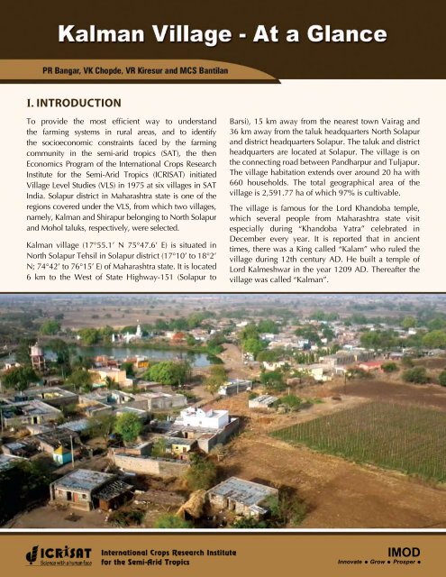
I. Introduction To provide the most efficient way to understand the farming systems in rural areas, and to identify the socioeconomic constraints faced by the farming community in the semi-arid tropics (SAT), the then Economics Program of the International Crops Research Institute for the Semi-Arid Tropics (ICRISAT) initiated Village Level Studies (VLS) in 1975 at six villages in SAT India. Solapur district in Maharashtra state is one of the regions covered under the VLS, from which two villages, namely, Kalman and Shirapur belonging to North Solapur and Mohol taluks, respectively, were selected. Kalman village (17°55.1’ N 75°47.6’ E) is situated in North Solapur Tehsil in Solapur district (17°10’ to 18°2’ N; 74°42’ to 76°15’ E) of Maharashtra state. It is located 6 km to the West of State Highway-151 (Solapur to Barsi), 15 km away from the nearest town Vairag and 36 km away from the taluk headquarters North Solapur and district headquarters Solapur. The taluk and district headquarters are located at Solapur. The village is on the connecting road between Pandharpur and Tuljapur. The village habitation extends over around 20 ha with 660 households. The total geographical area of the village is 2,591.77 ha of which 97% is cultivable. The village is famous for the Lord Khandoba temple, which several people from Maharashtra state visit especially during “Khandoba Yatra” celebrated in December every year. It is reported that in ancient times, there was a King called “Kalam” who ruled the village during 12th century AD. He built a temple of Lord Kalmeshwar in the year 1209 AD. Thereafter the village was called “Kalman”. IMOD Innovate Grow Prosper
- Page 2 and 3: The village falls within the semi-a
- Page 4 and 5: 1957. This PACS is attached to the
- Page 6 and 7: 6. Classification of households: Ma
- Page 8: 11. Agricultural input shops: Input
I. Introduction<br />
To provide the most efficient way to understand<br />
the farming systems in rural areas, and to identify<br />
the socioeconomic constraints faced by the farming<br />
community in the semi-arid tropics (SAT), the then<br />
Economics Program of the International Crops Research<br />
Institute for the Semi-Arid Tropics (ICRISAT) initiated<br />
Village Level Studies (VLS) in 1975 at six villages in SAT<br />
India. Solapur district in Maharashtra state is one of the<br />
regions covered under the VLS, from which two villages,<br />
namely, Kalman and Shirapur belonging to North Solapur<br />
and Mohol taluks, respectively, were selected.<br />
Kalman village (17°55.1’ N 75°47.6’ E) is situated in<br />
North Solapur Tehsil in Solapur district (17°10’ to 18°2’<br />
N; 74°42’ to 76°15’ E) of Maharashtra state. It is located<br />
6 km to the West of State Highway-151 (Solapur to<br />
Barsi), 15 km away from the nearest town Vairag and<br />
36 km away from the taluk headquarters North Solapur<br />
and district headquarters Solapur. The taluk and district<br />
headquarters are located at Solapur. The village is on<br />
the connecting road between Pandharpur and Tuljapur.<br />
The village habitation extends over around 20 ha with<br />
660 households. The total geographical area of the<br />
village is 2,591.77 ha of which 97% is cultivable.<br />
The village is famous for the Lord Khandoba temple,<br />
which several people from Maharashtra state visit<br />
especially during “Khandoba Yatra” celebrated in<br />
December every year. It is reported that in ancient<br />
times, there was a King called “Kalam” who ruled the<br />
village during 12th century AD. He built a temple of<br />
Lord Kalmeshwar in the year 1209 AD. Thereafter the<br />
village was called “Kalman”.<br />
IMOD<br />
Innovate Grow Prosper
The village falls within the semi-arid tropics with a<br />
normal annual rainfall of 550 mm which is, however,<br />
erratic in nature. The village has evolved over decades<br />
in terms of agricultural advancement and economic<br />
development. Poverty still haunts the village. Kalman<br />
has good infrastructure. It is well connected by roads<br />
to important cities and towns. A railway station exists<br />
20 km away from the village. Main roads in the village<br />
are cemented. Nearly 85% of the households have<br />
access to electricity. About 60% of the households<br />
have pucca/semi-pucca houses. Nearly 40% of the<br />
households access safe drinking water through tap<br />
connections while the remaining households meet their<br />
water requirement through 4 electric motor-operated<br />
borewells, 5 hand pumps and 3 public taps connected<br />
to 3 water tanks.<br />
II. HISTORICAL BACKGROUND/<br />
DEVELOPMENT OF THE VILLAGE<br />
During the last three decades, Kalman village has<br />
progressed, in varying degrees, in terms of social, political,<br />
economic, technological, institutional, infrastructural,<br />
educational and religious advancement.<br />
Social: About four decades ago, people in the village<br />
lived isolated based on caste groups. In other words, the<br />
houses were segregated by major caste groups; the socalled<br />
forward caste people lived in the middle of the<br />
village while the backward caste people lived on the<br />
periphery. Presently, the situation has changed – they<br />
live together; the houses of the forward and backward<br />
castes are interspersed. Due to population growth, the<br />
villagers have purchased private residential plots or<br />
occupied gram panchayat land, constructed houses and<br />
are living together.<br />
The households in the village belong to 22 castes.<br />
As of 2010, the Maratha caste is the dominant caste<br />
in the village, accounting for 224 of the 660 resident<br />
2<br />
households (34 percent), followed by Dhangar (14<br />
percent), Mali (13 percent), Mahar or Navboudha (9<br />
percent), Koshti (6 percent), Wani (5 percent), Muslim<br />
(4 percent), Chambhar (4 percent), Sutar and Wadar<br />
(2 percent each). Though the caste-wise composition<br />
of households during the mid-1970s was almost the<br />
same as compared to the present, the number of Mali<br />
caste households has significantly increased from 38<br />
to 86 accounting for 126 percent growth, whereas the<br />
Dhangar, Mahar/Navboudha and Maratha castes grew<br />
at 84 percent, 66 percent and 63 percent, respectively.<br />
Another important element of social transformation<br />
is the sourcing of drinking water. As of now, every<br />
household draws drinking water from the same water<br />
source unlike the earlier practice of dedicated wells for<br />
the households of scheduled castes/tribes owing to the<br />
practice of “untouchability”.<br />
Political: In 1970s, the village was ruled by people of<br />
the Maratha caste with the support of people of other<br />
castes. However, over time, through several legislations,<br />
the government has provided opportunities for people of<br />
different caste groups and also for women. This has led<br />
to political empowerment of weaker sections, namely,<br />
backward castes and women.<br />
There is a Gram Panchayat in the village with eleven<br />
members. These panchayat members are elected<br />
by the villagers every five years. The present Gram<br />
Panchayat is headed by a woman from forward caste<br />
(Maratha). This gram panchayat is hosted in the “Mini-<br />
Assembly” building that was constructed in 2001. In<br />
this village, one Agricultural Assistant/Gram Sevak<br />
is attached to the village panchayat and he works as<br />
Secretary to the gram panchayat and also as extension<br />
official of Block Development Office.<br />
There are two strong politically rival groups in the<br />
village that are affiliated to the national/regional<br />
political parties. During election periods, hectic<br />
political activity and tension are visible in the village.<br />
Kalman Village - <strong>At</strong> a <strong>Glance</strong>
Economic: The village witnessed economic development<br />
due to increase in livelihood options including salaried<br />
jobs, petty business, out-migration for labor earnings,<br />
small-scale industries, etc. The main driver of this<br />
economic development is agricultural development. In<br />
1970s, villagers predominantly depended on agriculture<br />
for their livelihood and very few had salaried jobs.<br />
Farmers were following traditional agricultural practices.<br />
Some large farmers and money lenders in the village<br />
provided loans to small peasants at exorbitant interest<br />
rates. Of late, farmers have started adopting improved<br />
agricultural technologies including machinery. This<br />
resulted in increased farm-credit needs of farmers.<br />
Presently, sufficient institutional credit facilities are<br />
available in the village, which cater to the farmers’ credit<br />
needs at reasonable interest rates. The government also<br />
supports them with several subsidies on, for example,<br />
credit (waive-off), interest on borrowing, purchase of<br />
machinery, etc. The number of salaried people has<br />
increased over time.<br />
the village that supply improved seeds, fertilizers and<br />
pesticides. Farmers also use sprinkler and drip irrigation<br />
to increase the efficiency of available limited water.<br />
There are more than 45 sprinkler sets and 30 drip sets<br />
in the village. Use of tractor is common for threshing<br />
grains, land preparation and transportation of farm<br />
produce. There are a total of 11 tractors and 7 threshers<br />
in the village. Threshers are being used for threshing<br />
wheat, sorghum, mungbean, pigeonpea, chickpea, etc.<br />
An agriculture extension service center was opened in<br />
2006. Presently, there are 16 computers in the village.<br />
Almost every household in the village has mobile phone<br />
connectivity, which is one of the important media<br />
available to access agricultural information.<br />
Technological: The agricultural development has taken<br />
place through technological advancement in terms<br />
of adoption of improved varieties, access to inputs<br />
and machinery at village level, increased irrigation<br />
facility through sprinkler and drip, and crop/farm<br />
diversification.<br />
Institutional: Institutionally, the village has developed<br />
over time. Presently, there is a post office, BSNL telephone<br />
office, veterinary hospital, Primary Health Centre, Bank<br />
of Maharashtra and District Central Cooperative bank,<br />
four educational institutions and two fair price shops in<br />
the village.<br />
The village has a branch of District Central Cooperative<br />
(DCC) Bank established in 1985 as well as that of Bank of<br />
Maharashtra established in 1983. It also has a registered<br />
Primary Agricultural Credit Society (PACS), which is<br />
functioning satisfactorily since its establishment in<br />
More than 50% of the farmers now use improved/hybrid<br />
seeds, chemical fertilizers, weedicides and fungicides<br />
to increase farm productivity and enhance their net<br />
incomes. More than 90 percent farmers are using<br />
Maldandi variety of sorghum. In case of pigeonpea,<br />
farmers have adopted improved and hybrid pigeonpea<br />
cultivars like ICPL 87119 and ICPH 2671.<br />
The use of chemical fertilizers and pesticides has<br />
increased, while the farm yard manure (FYM) usage<br />
has declined. There are two agriculture input shops in<br />
Kalman Village - <strong>At</strong> a <strong>Glance</strong> 3
1957. This PACS is attached to the DCC Bank, Kalman<br />
branch. The village has three private milk dairies.<br />
A Primary Health Centre (PHC) was established in<br />
the village in the year 1985. Since then, it has been<br />
providing novel health care service to the villagers in<br />
terms of family planning, immunization, vaccination,<br />
food for pregnant women and newly born babies, etc.<br />
These services of PHC are implemented by an Auxiliary<br />
Nurse and Midwife (ANM). In addition, a Multi-Purpose<br />
Worker (MPW) supported by the Gram Panchayat is<br />
attached to PHC for facilitating these activities. Besides,<br />
there are five private doctors providing necessary<br />
medical care to the villagers on payment basis. There is<br />
one private medical store in the village.<br />
Infrastructural: The infrastructure in the village has<br />
grown tremendously over time. The village was<br />
electrified in 1967 for providing electricity for domestic<br />
and commercial purposes. Electricity is used for running<br />
flour mills, lifting water for irrigation, and for domestic<br />
purposes. Street lights are provided by the panchayat on<br />
all the village roads. About 85% of the houses have been<br />
electrified. The villagers were provided tap connections<br />
for drinking water supply in 1983. The village has an<br />
approach road to the city. The village has access to<br />
the State Road Transport Corporation Bus service, with<br />
buses passing through the village about 5 times a day. In<br />
addition, private jeeps and minibuses are also available<br />
in the village. There is a weekly market on Saturday in<br />
the village, which was started way back in the 1960s.<br />
The other infrastructure facilities available in the village<br />
include cement roads, mini-assembly, medical stores,<br />
agricultural inputs and machinery shops and flour mills,<br />
among others.<br />
increased household incomes. The literacy rate amongst<br />
males is 89 percent while that of females is 81 percent,<br />
the overall being 86.5 percent (2001 Census).<br />
In Kalman, the exact date of establishment of the school<br />
is not known but facilities were available for voluntary<br />
education since 1870. As of now, the education facility<br />
available in the village is up to Standard 12. There are<br />
four Anganwadis and one each of Primary School (started<br />
in 1962), Secondary School (1962), Higher Secondary<br />
School (1966) and Junior College (up to Standard 12)<br />
(2007). The present enrolment (2010-11) in all the<br />
aforesaid schools put together is 928 (474 males and<br />
454 females). There are two “Gram Shikshana Samithis”<br />
(Village Education Committees) in the village started<br />
in 1995; one for the primary school and the other for<br />
secondary and higher secondary schools together. The<br />
high schools and higher secondary schools are run by<br />
Education Societies, whereas the primary school is run<br />
by Zilla Parishad, Solapur under the supervision of these<br />
“Gram Shikshana Samithis”.<br />
Religious: One old temple of Lord Khandoba was built in<br />
1664, and another temple dates back to the 13 th century.<br />
There are nine temples and one mosque in the village in<br />
addition to three bhajan mandals.<br />
Educational: Literacy and educational status of the<br />
villagers has improved significantly due to provision<br />
of higher education facility in the village coupled with<br />
4<br />
Kalman Village - <strong>At</strong> a <strong>Glance</strong>
III. BASIC STATISTICS OF THE VILLAGE<br />
A) LOCATION / ACCESSIBILITY<br />
1. Village: Kalman 2. Taluka: North Solapur 3. District: Solapur<br />
4. State: Maharashtra 5. PIN: 413222<br />
6. GPS values: (a) Latitude: 17°55.1’ N (b) Longitude: 75°47.6’ E (c) Altitude (m): 491<br />
7. Nearest town: (a) Name: Vairag (b) Distance from village (km): 15<br />
8. Nearest State Highway: (a) Number: SH 151 (b) Distance from village (km): 6<br />
9. Nearest National Highway: (a) Number: NH 9 (b) Distance from village (km): 35<br />
10. Name of the Village Panchayat in which the village falls: Kalman<br />
11. Details of the Sarpanch/Village Panchayat President:<br />
(a) Name: Ms Shobhabai Bhujing Lambe (b) Cell No.: 08975446663<br />
12. Details of the Gram Sevak/Agricultural Assistant:<br />
(a) Name: Mr Nitin Bhimashankar Chaudhari (b) Cell No.: 09850130089<br />
B) DEMOGRAPHY (as on 1 September 2007)<br />
1. Population (No): 3,344 2. Households (No): 660 3. Voters (No): 2,837 4. Farmer accounts/Khatas (No): 691<br />
5. Classification of population:<br />
Category No. Farm Size* No. Religion No. Caste No. Literacy No. Gender No.<br />
SC 304 Landless 644 Hindu 3193 Maratha 1118 Illiterates (
6. Classification of households:<br />
Male headed (No.): 644 Female headed (No.): 16<br />
Category No. Farm Size* No. Caste No. Religion No. Main occupation No.<br />
SC 58 Landless 160 Maratha 224 Hindu 632 Farming 261<br />
ST 29 Marginal 96 Shepherd 90 Muslim 28 Agril.labor 160<br />
OBC 281 Small 169 Mali 86 Non-agril.labor 72<br />
General 292 Medium 146 Navboudha 58 Caste occupation 25<br />
Large 89 Koshti 40 Others$ 142<br />
Wani 33<br />
Muslim 28<br />
Cobbler 26<br />
Carpenter 17<br />
Wadar 15<br />
Barber 9<br />
Potter 8<br />
Washerman 6<br />
Brahmin 5<br />
Koli 4<br />
Berad 3<br />
Jangam 3<br />
Gosavi 1<br />
Swami 1<br />
Blacksmith 1<br />
Sonar 1<br />
Teli 1<br />
Total 660 660 660 660 660<br />
$ include salaried, money lenders, middlemen, service sector, etc. * As defined in B(5) overleaf.<br />
C) LAND USE PATTERN (2009-10)<br />
1. Distribution of Geographical Area: Ha 2. Cropped Area Acres<br />
Agricultural land 2,511 Kharif 3,113<br />
Permanent fallow 17 Rabi 2,835<br />
Grazing lands 21 Summer 180<br />
Land used for roads, buildings & non-agril. purposes 19 Annual/Perennial crops 62<br />
Gawthan (used for Government housing schemes) 17 Gross Cropped Area 6,190<br />
Current fallow 7 3. Irrigated Area Acres<br />
Kharif 310<br />
Rabi 950<br />
Summer 180<br />
Annual/Perennial crops 62<br />
Total Geographical Area 2,592 Gross Irrigated Area 1,502<br />
D) LAND RESOURCES<br />
1. Soil distribution 2. Irrigation sources (as on 31 December 2010)<br />
Soil type % area Sources Total No. Working No. Approx. depth (ft) of<br />
working wells<br />
Irrigable area<br />
(Ac/year)<br />
Deep black 7 Borewells 190 165 340 600<br />
Medium black 23 Open wells 315 300 58 902<br />
Shallow black 47 Approx. land area<br />
Loam soil 8<br />
covered (ac)<br />
Murrum 13 Ponds 3 0 0.4 0<br />
Problematic 2 Tanks 3 0 2.1 0<br />
3. Rainfall: (a) Quantity (mm/year): Normal: 550 Actual (Jun’09-May’10): 637<br />
(b) No. of rainy days: Normal: 30 Actual (Jun’09-May’10): 45<br />
6 Kalman Village - <strong>At</strong> a <strong>Glance</strong>
E) CROP PRODUCTION (2009-10)<br />
Kharif Rabi Summer Annual/Perennial Crops<br />
Crops Area(ac) Crops Area(ac) Crops Area(ac) Crops Area(ac)<br />
Pigeonpea 2,050 Sorghum 2,155 Groundnut 50 Grape 33<br />
Maize 212 Chickpea 138 Fodder 25 Citrus 12<br />
Sunflower 175 Maize 112 Vegetables 88 Banana 12<br />
Groundnut 75 Wheat 102 Others 17 Coconut 3<br />
Vegetables 300 Sunflower 88 Pomegranate 1<br />
Other pulses 150 Vegetables 152 Guava 1<br />
Others 151 Others 88<br />
Total 3,113 Total 2,835 Total 180 Total 62<br />
F) ASSETS (as on 1 June 2010)<br />
1. Productive Assets: 2. Consumer Assets: 3. Buildings:<br />
Livestock Heavy machinery Type No. Type No.<br />
Type No. Type No. Television 223 Houses-Pucca 570<br />
Cow (indigenous) 106 Tractor 11 Refrigerator 24 Houses-Kuchcha 90<br />
Cow (exotic) 190 Thresher 7 Air-Conditioner 2 Cattle sheds 196<br />
Buffalo 155 Bullock Cart 61 Washing machine 4 Irrigation pump houses 245<br />
Bullock 270 Auto 1 LPG connection 165 Storage godowns 2<br />
Sheep 97 Van 9 Dish Antenna 9<br />
Goat 387 Jeep 4 Motorbike/Scooty 182<br />
Poultry 624 Tum-Tum 11 Car/Jeep 4<br />
Flour mill 8 Computer 16<br />
Milk sale (lt/day) 560 CGM# 3<br />
Others 11<br />
#Chilli Grinding Machine.<br />
G) BASIC NEEDS (as on 31 December 2010)<br />
1. Type of food (# of households): (a) Vegetarian: 214 (b) Non-vegetarian: 446<br />
2. Type of clothes: (a) Men: Pant-Shirt, Dhoti-Shirt (b) Women: Sari and blouse<br />
3. Type of houses: (a) Pucca: 570 (b) Kuchcha: 90<br />
H) INFRASTRUCTURE (as on 31 December 2010)<br />
1. Village electrification: Yes No. of houses having access to electricity: 582<br />
2. Is there a Tar/metal/cement road to village? Yes<br />
3. Is there a tar/metal/cement road inside the village? Yes Length of the road (m): 425<br />
4. Public transport facility:<br />
Public/private bus facility to village available?: Yes No.of trips/day from town to village: 3<br />
Other modes of travel available? Yes Available modes: Auto, Jeep, Tum Tum<br />
5. Drinking water facility: Yes Source(s): Open well/Bore well<br />
Tap connections available? Yes No. of connections: 268<br />
6. Public toilet/urinal facility: Yes No. of toilets: 5<br />
7. Public health facility: Yes No. of PHC: 1 Private Doctors: 4<br />
8. Veterinary health facility: Yes<br />
9. Banking facility: Yes No. of PACS: 1 Commercial Bank: 1 Pvt. Bank: 1<br />
10. Educational facilities:<br />
Level Number of institutions Enrolment (number)<br />
Male<br />
Female<br />
Pre-primary (Anganwadi) 4 101 99<br />
Primary (1-4 years) 1 123 123<br />
Secondary (5-7 years) 1 116 99<br />
Higher Secondary (8-10 years) 1 129 102<br />
College (11-12 years) 1 5 31<br />
Kalman Village - <strong>At</strong> a <strong>Glance</strong><br />
7
11. Agricultural input shops:<br />
Input Available in village? If no, nearest available place Distance from village (km)<br />
Seed<br />
Yes<br />
Fertilizer<br />
Yes<br />
Pesticide<br />
Yes<br />
Machinery – Purchase No Solapur, Barshi 40 km each<br />
Machinery – Custom hiring<br />
Yes<br />
12. Agricultural output market:<br />
Weekly shandy in the village? Yes Which day? Saturday<br />
No. of wholesale traders/commission agents in the/visiting the village: 5<br />
13. Storage godowns/warehouses: Yes Total capacity of all (tons): 10<br />
14. Other business units (number):<br />
Grocery shop: 18 PDS Shop: 2 Kerosene shop: 1<br />
Hotel/Canteen: 4 Flour Mill: 8 Chilli/spices grinding shop: 5<br />
Meat shop: 2 Liquor shop: 4 Pan shop: 7<br />
Carpenter: 5 Blacksmith: 1 Goldsmith: 2 (Weekly)<br />
Cobbler: 2 Potter: 2 Mason: 25<br />
TV/Radio mechanic: 7 Cycle repair shop: 4 Motorcycle repair shop: 3<br />
Money lenders: 5<br />
15. Other institutions (number):<br />
SHG/Sakhi Mandal: 25 Milk Dairies: 3 Post Office: 1<br />
Dispute Resolution Committee: 1 Youth Club: 1 Bhajan Mandal: 3<br />
Drama Mandal: 3 Chit Fund: 7 Community Hall: 1<br />
Mini Assembly: 1<br />
16. Place of worship (No): Temple: 9 Mosque: 1<br />
I) GOVERNMENT WELFARE PROGRAMS / POLICIES (as on 31 December 2010)<br />
1. Government programs recently implemented/ongoing and beneficiaries:<br />
SN Name of the Government Program Beneficiaries (No. of households)<br />
1 Public Distribution System 660 (Ration Cards – 947)<br />
2 Old Age Pension 70<br />
3 Widow Pension 5<br />
4 Indira Awas Yojana 14<br />
5 Family Planning 15<br />
6 Self Help Groups 277<br />
7 Subsidies on Farm Well (BPL households) 2<br />
About ICRISAT<br />
The International Crops Research Institute for the Semi-Arid Tropics (ICRISAT) is a non-profit, non-political organization that conducts agricultural research for<br />
development in Asia and sub-Saharan Africa with a wide array of partners throughout the world. Covering 6.5 million square kilometers of land in 55 countries,<br />
the semi-arid tropics have over 2 billion people, and 644 million of these are the poorest of the poor. ICRISAT and its partners help empower these poor people to<br />
overcome poverty, hunger, malnutrition and a degraded environment through better and more resilient agriculture.<br />
ICRISAT is headquartered in Hyderabad, Andhra Pradesh, India, with two regional hubs and four country offices in sub-Saharan Africa. It belongs to the Consortium<br />
of Centers supported by the Consultative Group on International Agricultural Research (CGIAR).<br />
ICRISAT-Patancheru<br />
Patancheru 502 324, Andhra Pradesh, India<br />
Tel +91 40 30713071 Fax +91 40 30713074<br />
<strong>icrisat</strong>@cgiar.org<br />
www.<strong>icrisat</strong>.org<br />
Citation: Bangar PR, Chopde VK, Kiresur VR and Bantilan MCS. 2011. Kalman Village - <strong>At</strong> a <strong>Glance</strong>.<br />
Patancheru 502 324, Andhra Pradesh, India: International Crops Research Institute for the Semi-Arid Tropics.


