Denford Park, Kintbury - Hungerford Virtual Museum
Denford Park, Kintbury - Hungerford Virtual Museum
Denford Park, Kintbury - Hungerford Virtual Museum

Create successful ePaper yourself
Turn your PDF publications into a flip-book with our unique Google optimized e-Paper software.
<strong>Denford</strong><strong>Park</strong>. Kintburv, Berkshire<br />
2. Outline History<br />
2.1 <strong>Denford</strong><br />
<strong>Denford</strong> <strong>Park</strong> sits on higher ground overlooking the valley of the Kennet just to the<br />
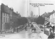
north-east of the ancient market town of <strong>Hungerford</strong> in western Berkshire, close to the<br />
county border with Wiltshire. The rather scattered settlement of <strong>Denford</strong> is in the<br />
northern and western part of the modern parish of <strong>Kintbury</strong>, consisting of a riverside<br />
core and rising land to the north.<br />
There is considerable evidence of prehistoric settlement in this area of the Kennet<br />
valley and traces of a probably Roman road, perhaps part of the Iknield Street, have<br />
been identified to the north of <strong>Denford</strong> <strong>Park</strong>; there is mention of a road called Iknield<br />
Street and another called Coleway in deeds of circa 1252 and the site of a Roman<br />
building has been identified in <strong>Kintbury</strong> itself. 2<br />
In about 93 5AD the estate of <strong>Denford</strong>a, then in Wessex, was bequeathed by Wulgar<br />
to Athelstan and Cynestan, providing that they obeyed him until he died; they could<br />
have been his kinsmen. 3 Although tempting, the possibility that the name refers to the<br />
'Dane's Ford' over the Kennet seems unlikely; instead the name probably derives<br />
from the 'ford' in a valley - denu - the valley probably being the small side valley<br />
that leads up to the position of the present <strong>Denford</strong> <strong>Park</strong>.<br />
In the late Saxon period Daneford was in <strong>Kintbury</strong> Hundred and held by Alweard<br />
immediately prior to the Norman Conquest of 1066; it was then assessed at 10 hides<br />
and was worth 100 shillings a year. 5 Sometime after the Conquest it was given to a<br />
Norman, William de Eu; at the time of the Domesday Survey of 1086 it was assessed<br />
at just 5 hides but was worth £4 a year. 6<br />
It was then a small village, with four villans, four bordars and three slaves 3 slaves,<br />
and it had a church. 7 The church is mentioned as being a chapel of <strong>Kintbury</strong> in deeds<br />
of 1179, 1199 and 1270 but there are no subsequent surviving references to it until a<br />
new one was built at the start of the 19 th century. 8<br />
In 1095 William de Eu took part in a failed rebellion against William II and although<br />
not executed, was, in January 1196, condemned to be blinded and mutilated and lost<br />
his lands. 9<br />
2 Page, W, Ditchfield, P H, & Cope, J Hautenville (eds.), 1972, The Victoria County History of<br />
Berkshire, Vol. IV, 206<br />
3 VCH, op. cit., 212-3; Gelling, M, 1974, The Place-Names of Berkshire, Part II, 314<br />
4 Gelling, qp. cit., 314<br />
5 Williams, A, & Martin, G H (eds.), 2002, Domesday Book: A Complete Translation, 150<br />
6 ibid<br />
7 ibid<br />
8 VCH, op. cit., 216-1<br />
9 VCH, op. cit., 212<br />
-4-<br />
Richard K Morriss & Associates, Historic Buildings Consultants, Bromlow House, Bromlow, Shropshire, SYS OEA