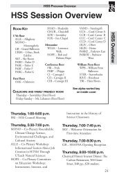
2000 HSS/PSA Program 1 - History of Science Society
2000 HSS/PSA Program 1 - History of Science Society
2000 HSS/PSA Program 1 - History of Science Society

You also want an ePaper? Increase the reach of your titles
YUMPU automatically turns print PDFs into web optimized ePapers that Google loves.
Matthew␣ H. Edney University <strong>of</strong> Southern Maine<br />
<strong>HSS</strong> Abstracts<br />
Mapping Eighteenth-Century Intersections<br />
<strong>of</strong> Scientific and Cartographic Practices<br />
Cartographic practices have always featured, sometimes prominently, in general<br />
histories <strong>of</strong> Enlightenment science. They are most obvious in accounts <strong>of</strong><br />
eighteenth-century attempts to measure the size and shape <strong>of</strong> the earth and to<br />
determine the longitude at sea they provide a persistent context for all<br />
reconnaissance expeditions from the metropolitan centers to the European and<br />
colonial margins and they served as a conceptual device for organizing and<br />
rationalizing observations <strong>of</strong> spatial phenomena. The relationship between<br />
cartography and science can thus be approached in a number <strong>of</strong> different ways,<br />
and at different scales: the individual (e.g., astronomers who happened also to<br />
make maps) the institutional (e.g., scientific academies) the social (e.g., the<br />
marketplace within which scientific and cartographic texts were disseminated and<br />
sold) and, the cultural (e.g., the use <strong>of</strong> “map” as a metaphor for botanical taxonomy).<br />
This paper provides, from the standpoint <strong>of</strong> cartographic history, a preliminary<br />
framework within which to organize these many different elements. Recognizing<br />
that there is nothing essential about either “science” or “cartography,” this paper<br />
will begin by exploring the principal modes <strong>of</strong> eighteenth-century cartography<br />
(defined in terms <strong>of</strong> their spatial conceptions, technologies, social institutions, and<br />
cultural expectations). From there the task will be to determine the most significant<br />
intersections—in practices (e.g., instrumentation) and attitudes (e.g., the<br />
“quantifying spirit” )—<strong>of</strong> mapping activities with those <strong>of</strong> the sciences. At worst,<br />
discussion, with historians <strong>of</strong> science, <strong>of</strong> the flaws in this (admittedly ambitious)<br />
framework, will stimulate a much needed interdisciplinary exchange. At best, this<br />
framework will provide a basis for further explorations in the intermingling practices<br />
and ideals <strong>of</strong> mapping and science.<br />
H<br />
S<br />
S<br />
Joann Eisberg Independent Scholar/Citrus College<br />
Making a <strong>Science</strong> <strong>of</strong> Observational Cosmology:<br />
The Cautious Optimism <strong>of</strong> Beatrice Tinsley<br />
Until recent decades, cosmology has seemed to all but its advocates to be a<br />
game rather than a science. Many astronomers complained that it was all theory<br />
and no data. The problem was that cosmological effects were expected to manifest<br />
themselves only at distances too great to be observed. From the 1950s and 1960s,<br />
however, a subset <strong>of</strong> the astronomy and physics communities argued that certain<br />
very bright objects—galaxies and quasars—could be seen to such great distances<br />
that they might eventually serve as cosmological benchmarks to measure the<br />
universe as a whole. Most workers agreed, however, that galaxies and quasars<br />
were so poorly understood that any attempt to apply their observation to<br />
77