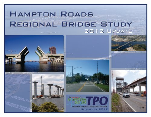
Hampton Roads Regional Bridge Study
Hampton Roads Regional Bridge Study
Hampton Roads Regional Bridge Study

Create successful ePaper yourself
Turn your PDF publications into a flip-book with our unique Google optimized e-Paper software.
<strong>Hampton</strong> <strong>Roads</strong><br />
<strong>Regional</strong> <strong>Bridge</strong> <strong>Study</strong><br />
2012 Update<br />
the heartbeat of<br />
H MPT O<br />
N<br />
ROR<br />
O DS<br />
TRANSPORTATION PLANNING ORGANIZATION<br />
November 2012<br />
T12-14
VOTING MEMBERS:<br />
HAMPTON ROADS TRANSPORTATION PLANNING ORGANIZATION<br />
Dwight L. Farmer<br />
Executive Director/Secretary<br />
CHESAPEAKE JAMES CITY COUNTY PORTSMOUTH<br />
Alan P. Krasnoff Mary K. Jones Kenneth I. Wright<br />
GLOUCESTER COUNTY NEWPORT NEWS SUFFOLK<br />
Christopher A. Hutson McKinley Price Linda T. Johnson<br />
HAMPTON NORFOLK VIRGINIA BEACH<br />
Molly J. Ward Paul D. Fraim William D. Sessoms, Jr.<br />
ISLE OF WIGHT COUNTY POQUOSON WILLIAMSBURG<br />
Delores Dee-Dee Darden W. Eugene Hunt, Jr. Clyde Haulman<br />
MEMBERS OF THE VIRGINIA SENATE<br />
The Honorable Thomas K. Norment, Jr.<br />
The Honorable Frank W. Wagner<br />
MEMBERS OF THE VIRGINIA HOUSE OF DELEGATES<br />
The Honorable John A. Cosgrove<br />
The Honorable Christopher P. Stolle<br />
TRANSPORTATION DISTRICT COMMISSION OF HAMPTON ROADS<br />
William E. Harrell, President/Chief Executive Officer<br />
WILLIAMSBURG AREA TRANSIT AUTHORITY<br />
Kevan Danker, Executive Director<br />
VIRGINIA DEPARTMENT OF TRANSPORTATION<br />
Dennis W. Heuer, District Administrator – <strong>Hampton</strong> <strong>Roads</strong> District<br />
VIRGINIA DEPARTMENT OF RAIL AND PUBLIC TRANSPORTATION<br />
Thelma Drake, Director<br />
VIRGINIA PORT AUTHORITY<br />
Vacant<br />
YORK COUNTY<br />
Thomas G. Shepperd, Jr.
NON-VOTING MEMBERS:<br />
HAMPTON ROADS TRANSPORTATION PLANNING ORGANIZATION<br />
CHESAPEAKE ISLE OF WIGHT COUNTY NORFOLK SUFFOLK WILLIAMSBURG<br />
Amar Dwarkanath W. Douglas Caskey Marcus Jones Selena Cuffee-Glenn Jackson C. Tuttle<br />
GLOUCESTER COUNTY JAMES CITY COUNTY POQUOSON VIRGINIA BEACH YORK COUNTY<br />
Brenda G. Garton Robert C. Middaugh J. Randall Wheeler James K. Spore James O. McReynolds<br />
HAMPTON NEWPORT NEWS PORTSMOUTH<br />
Mary Bunting Neil A. Morgan Brannon Godfrey<br />
FEDERAL HIGHWAY ADMINISTRATION<br />
FEDERAL TRANSIT ADMINISTRATION<br />
Irene Rico, Division Administrator, Virginia Division Brigid Hynes-Cherin, Acting <strong>Regional</strong> Administrator, Region 3<br />
FEDERAL AVIATION ADMINISTRATION<br />
Jeffrey W. Breeden, Airport Planner, Washington Airports Office District<br />
PENINSULA AIRPORT COMMISSION<br />
Ken Spirito, Executive Director<br />
CITIZEN TRANSPORTATION ADVISORY COMMITTEE<br />
William W. Harrison, Jr., Chair<br />
MILITARY LIAISONS<br />
David A. Culler, Captain, U.S. Navy<br />
John Little, Captain, U.S. Coast Guard<br />
Korvin D. Auch, Colonel, Langley<br />
Thomas R. Wetherington, Colonel, Langley<br />
VIRGINIA DEPARTMENT OF AVIATION<br />
Randall P. Burdette, Director<br />
NORFOLK AIRPORT AUTHORITY<br />
Wayne E. Shank, Executive Director<br />
FREIGHT TRANSPORTATION ADVISORY COMMITTEE<br />
William Bell, Co-Chair (Nonvoting Board Member)<br />
Robert Barclay, Co-Chair (Alternate Voting Board Member)<br />
INVITED PARTICIPANTS<br />
HRTPO PROJECT STAFF<br />
Hollis D. Ellis, Commonwealth Transportation Board Camelia Ravanbakht, Ph.D. Deputy Executive Director, HRTPO<br />
Aubrey L. Layne, Jr., Commonwealth Transportation Board Robert B. Case, P.E. Principal Transportation Engineer<br />
W. Shepperd Miller, III, Commonwealth Transportation Board Keith Nichols, P.E. Senior Transportation Engineer<br />
Kathlene Grauberger<br />
Administrative Assistant II<br />
Mike Long<br />
General Services Manager<br />
Christopher Vaigneur<br />
Assistant General Services Manager
HAMPTON ROADS<br />
REGIONAL BRIDGE STUDY<br />
2012 UPDATE<br />
PREPARED BY:<br />
NOVEMBER 2012<br />
T12-14
REPORT DOCUMENTATION ii<br />
TITLE:<br />
<strong>Hampton</strong> <strong>Roads</strong> <strong>Regional</strong> <strong>Bridge</strong> <strong>Study</strong> – 2012 Update<br />
AUTHORS:<br />
Keith M. Nichols, P.E.<br />
Robert B. Case, P.E., P.T.O.E.<br />
PROJECT MANAGER:<br />
Robert B. Case, P.E., P.T.O.E.<br />
ABSTRACT<br />
<strong>Bridge</strong>s are a prominent part of the <strong>Hampton</strong> <strong>Roads</strong> landscape. Because<br />
of the importance of bridges to the regional transportation system and<br />
concerns about the condition and funding of bridges, the <strong>Hampton</strong><br />
<strong>Roads</strong> Transportation Planning Organization in 2007 began analyzing<br />
regional bridges. The 2007 <strong>Hampton</strong> <strong>Roads</strong> <strong>Regional</strong> <strong>Bridge</strong> <strong>Study</strong> for<br />
the first time provided a regional analysis of bridge topics such as bridge<br />
inspections and ratings, deficient bridges, bridge funding and projects,<br />
and the impacts that the closure of major bridges would have on<br />
<strong>Hampton</strong> <strong>Roads</strong> travel patterns.<br />
This 2012 update of the <strong>Hampton</strong> <strong>Roads</strong> <strong>Regional</strong> <strong>Bridge</strong> <strong>Study</strong> builds on<br />
the previous study. Sections regarding bridge definitions, regional<br />
summaries, bridge inspections and ratings, deficient bridges, fracture and<br />
scour critical bridges, sufficiency ratings, health indices, bridge funding,<br />
and bridge projects are included in this update. In many sections of this<br />
report, comparisons are made between the condition of bridges in<br />
<strong>Hampton</strong> <strong>Roads</strong> and those in other large metropolitan areas throughout<br />
the country. Included for the first time in this study is an analysis of the<br />
anticipated cost of sustaining bridge connections in <strong>Hampton</strong> <strong>Roads</strong><br />
through the year 2040.<br />
REPORT DATE:<br />
November 2012<br />
ORGANIZATION CONTACT INFORMATION<br />
<strong>Hampton</strong> <strong>Roads</strong> Transportation Planning Organization<br />
723 Woodlake Drive<br />
Chesapeake, Virginia 23320<br />
(757) 420-8300<br />
www.hrtpo.org<br />
ACKNOWLEDGMENTS<br />
This document was prepared by the <strong>Hampton</strong> <strong>Roads</strong> Transportation<br />
Planning Organization (HRTPO) in cooperation with the U.S.<br />
Department of Transportation (USDOT), Federal Highway Administration<br />
(FHWA), Federal Transit Administration (FTA), Virginia Department of<br />
Transportation (VDOT), Virginia Department of Rail and Public<br />
Transportation (DRPT), and the local jurisdictions and transit agencies<br />
within the <strong>Hampton</strong> <strong>Roads</strong> metropolitan planning area. The contents of<br />
this report reflect the views of the HRTPO. The HRTPO staff is<br />
responsible for the facts and the accuracy of the data presented herein.<br />
The contents do not necessarily reflect the official views or policies of the<br />
FHWA, FTA, VDOT or DRPT. This report does not constitute a standard,<br />
specification, or regulation. FHWA, FTA, VDOT or DRPT acceptance of<br />
this report as evidence of fulfillment of the objectives of this program<br />
does not constitute endorsement/approval of the need for any<br />
recommended improvements nor does it constitute approval of their<br />
location and design or a commitment to fund any such improvements.<br />
Additional project level environmental impact assessments and/or studies<br />
of alternatives may be necessary.<br />
NON-DISCRIMINATION<br />
The HRTPO assures that no person shall, on the ground of race, color,<br />
national origin, handicap, sex, age, or income status as provided by Title<br />
VI of the Civil Rights Act of 1964 and subsequent authorities, be<br />
excluded from participation in, be denied the benefits of, or be otherwise<br />
subject to discrimination under any program or activity. The HRTPO Title<br />
VI Plan provides this assurance, information about HRTPO<br />
responsibilities, and a Discrimination Complaint Form.<br />
HAMPTON James City/Williamsburg/York ROADS REGIONAL Transportation BRIDGE STUDY <strong>Study</strong>
TABLE OF CONTENTS iii<br />
TABLE OF CONTENTS<br />
Introduction ...................................................................................... 1<br />
<strong>Bridge</strong> Definitions ............................................................................. 3<br />
<strong>Bridge</strong> Types ............................................................................. 3<br />
<strong>Regional</strong> <strong>Bridge</strong> Summary ................................................................ 5<br />
Total <strong>Bridge</strong>s ............................................................................ 5<br />
<strong>Bridge</strong>s by Ownership .............................................................. 6<br />
<strong>Bridge</strong>s by Type of Service ........................................................ 6<br />
<strong>Bridge</strong>s by Length/Area ............................................................. 7<br />
<strong>Bridge</strong>s by Age ......................................................................... 7<br />
<strong>Bridge</strong> Inspections and Ratings ......................................................... 9<br />
<strong>Bridge</strong> Funding ............................................................................... 37<br />
Federal <strong>Bridge</strong> Funding .......................................................... 37<br />
State <strong>Bridge</strong> Funding .............................................................. 39<br />
<strong>Regional</strong>/Local <strong>Bridge</strong> Funding .............................................. 41<br />
Tolls ....................................................................................... 42<br />
<strong>Bridge</strong> Projects ............................................................................... 43<br />
Cost of Sustaining <strong>Bridge</strong> Connections through 2040 ..................... 47<br />
Similar Work by Others.......................................................... 47<br />
Method of Forecasting <strong>Bridge</strong> Costs ....................................... 47<br />
Calculating Historical Allocation Rates .................................. 50<br />
Future Allocations .................................................................. 52<br />
Deficient <strong>Bridge</strong>s ............................................................................ 11<br />
Structurally Deficient <strong>Bridge</strong>s ................................................. 12<br />
Functionally Obsolete <strong>Bridge</strong>s ................................................ 16<br />
Deficient <strong>Bridge</strong>s .................................................................... 26<br />
Weight-Posted <strong>Bridge</strong>s ............................................................ 28<br />
Fracture and Scour Critical <strong>Bridge</strong>s ................................................. 30<br />
Conclusions ................................................................................... 54<br />
Appendix A – Glossary of <strong>Bridge</strong> Terms ......................................... 55<br />
Appendix B – <strong>Bridge</strong> Component Rating Basics ............................. 57<br />
Appendix C – Sufficiency Rating Formula ...................................... 65<br />
Appendix D – <strong>Regional</strong> <strong>Bridge</strong> Inventory ....................................... 71<br />
Appendix E – Closed <strong>Bridge</strong>s in <strong>Hampton</strong> <strong>Roads</strong> ......................... 113<br />
Sufficiency Rating ........................................................................... 31<br />
Health Index ................................................................................... 36<br />
HAMPTON James City/Williamsburg/York ROADS REGIONAL Transportation BRIDGE STUDY <strong>Study</strong>
TABLE OF CONTENTS iv<br />
LIST OF FIGURES<br />
LIST OF MAPS<br />
Figure 1 – <strong>Bridge</strong> Types .................................................................................... 4 Map 1 – Deficient .......................... <strong>Bridge</strong>s in <strong>Hampton</strong> <strong>Roads</strong> ............................................... 27<br />
Figure 2 – Total <strong>Bridge</strong>s in Comparable Metropolitan Areas ............................. 5<br />
Figure 3 – <strong>Hampton</strong> <strong>Roads</strong> <strong>Bridge</strong>s by Ownership ........................................... 6 LIST OF TABLES<br />
Figure 4 – <strong>Bridge</strong>s in <strong>Hampton</strong> <strong>Roads</strong> by Type of Service ................................. 6<br />
Table 1 – <strong>Bridge</strong>s in <strong>Hampton</strong> <strong>Roads</strong> Jurisdictions by Year Built ...................... 8<br />
Figure 5 – Total <strong>Bridge</strong> Area in Comparable Metropolitan Areas ...................... 7<br />
Table 2 – Structurally Deficient <strong>Bridge</strong>s in <strong>Hampton</strong> <strong>Roads</strong> by Jurisdiction and<br />
Figure 6 – <strong>Bridge</strong>s in <strong>Hampton</strong> <strong>Roads</strong> by Year Built ......................................... 7<br />
Maintenance Responsibility ........................................................................... 13<br />
Figure 7 – Median <strong>Bridge</strong> Age in Comparable Metropolitan Areas ................... 8<br />
Table 3 – Structurally Deficient <strong>Bridge</strong>s in <strong>Hampton</strong> <strong>Roads</strong> ........................... 14<br />
Figure 8 – Structurally Deficient <strong>Bridge</strong>s in Comparable Metropolitan Areas .. 13<br />
Table 4 – Functionally Obsolete <strong>Bridge</strong>s in <strong>Hampton</strong> <strong>Roads</strong> by Jurisdiction and<br />
Figure 9 – Functionally Obsolete <strong>Bridge</strong>s in Comparable Metropolitan Areas 17 Maintenance Responsibility ........................................................................... 17<br />
Figure 10 – Deficient <strong>Bridge</strong>s in Comparable Metropolitan Areas .................. 26 Table 5 – Functionally Obsolete <strong>Bridge</strong>s in <strong>Hampton</strong> <strong>Roads</strong> .......................... 18<br />
Figure 11 – Sufficiency Rating Factors and Components ................................ 31 Table 6 – Weight-Posted <strong>Bridge</strong>s in <strong>Hampton</strong> <strong>Roads</strong> ..................................... 29<br />
Figure 12 – <strong>Bridge</strong> Sufficiency Ratings in <strong>Hampton</strong> <strong>Roads</strong> ............................. 32 Table 7 – Fracture Critical <strong>Bridge</strong>s in <strong>Hampton</strong> <strong>Roads</strong> ................................... 30<br />
Figure 13 – Median <strong>Bridge</strong> Sufficiency Rating in Comparable Metropolitan Table 8 – <strong>Bridge</strong> Sufficiency Ratings in <strong>Hampton</strong> <strong>Roads</strong> by Jurisdiction ......... 32<br />
Areas ............................................................................................................. 33<br />
Table 9 – <strong>Bridge</strong>s in <strong>Hampton</strong> <strong>Roads</strong> with Sufficiency Ratings Less Than 50 .. 34<br />
Figure 14 – <strong>Bridge</strong>s with Sufficiency Ratings of Less Than 50 in Comparable<br />
Table 10 – VDOT-Maintained <strong>Bridge</strong>s in <strong>Hampton</strong> <strong>Roads</strong> with the Lowest<br />
Metropolitan Areas ........................................................................................ 33<br />
Health Indices ............................................................................................... 36<br />
Figure 15 – Highway <strong>Bridge</strong> Program Apportionments ................................... 38<br />
Table 11 – Dedicated <strong>Bridge</strong> Fund Priority List, <strong>Hampton</strong> <strong>Roads</strong> District ....... 40<br />
Figure 16 – Funding for Structurally Deficient <strong>Bridge</strong>s in <strong>Hampton</strong> <strong>Roads</strong> ...... 46<br />
Table 12 – <strong>Bridge</strong>s Constructed or Rehabilitated in <strong>Hampton</strong> <strong>Roads</strong>,<br />
Figure 17 – <strong>Bridge</strong>s in <strong>Hampton</strong> <strong>Roads</strong> by Decade Built ................................ 48 2003-2012 .................................................................................................... 44<br />
Figure 18 – <strong>Bridge</strong>s in <strong>Hampton</strong> <strong>Roads</strong> by Age Group ................................... 48 Table 13 – <strong>Bridge</strong> Projects in <strong>Hampton</strong> <strong>Roads</strong> Included in the Current SYIP .. 45<br />
Figure 19 – <strong>Bridge</strong> Replacement Cost by Age Group ...................................... 48 Table 14 – First-Year Allocations from Recent SYIPs to Aging <strong>Bridge</strong> Projects in<br />
<strong>Hampton</strong> <strong>Roads</strong> ............................................................................................. 50<br />
Figure 20 – Replacement Projects with NBI Cost Estimates, FY13 SYIP .......... 49<br />
Table 15 – Recent Allocations to Aging <strong>Bridge</strong>s in <strong>Hampton</strong> <strong>Roads</strong>, by Age<br />
Figure 21 – Age of <strong>Hampton</strong> <strong>Roads</strong> <strong>Bridge</strong>s, Forecast through 2040 .............. 52 Group ............................................................................................................ 51<br />
Figure 22 – <strong>Hampton</strong> <strong>Roads</strong> <strong>Bridge</strong>s Age 70+, Forecast through 2040 ........... 52 Table 16 – Replacement Costs for <strong>Bridge</strong>s in <strong>Hampton</strong> <strong>Roads</strong>, by Age Group 51<br />
Figure 23 – Cost of Sustaining <strong>Bridge</strong> Connections, 2013 Dollars .................. 52 Table 17 – Allocation Rates for Aging <strong>Bridge</strong>s in <strong>Hampton</strong> <strong>Roads</strong>, by Age<br />
Group ............................................................................................................ 51<br />
Table 18 – Cost of Sustaining <strong>Bridge</strong> Connections in <strong>Hampton</strong> <strong>Roads</strong> ........... 53<br />
Table 19 – Summary of <strong>Hampton</strong> <strong>Roads</strong> <strong>Bridge</strong> Conditions ........................... 54<br />
HAMPTON James City/Williamsburg/York ROADS REGIONAL Transportation BRIDGE STUDY <strong>Study</strong>
INTRODUCTION 1<br />
INTRODUCTION<br />
<strong>Bridge</strong>s are a prominent part of the <strong>Hampton</strong> <strong>Roads</strong> landscape. Major<br />
spans such as the Coleman <strong>Bridge</strong>, James River <strong>Bridge</strong>, and High Rise<br />
<strong>Bridge</strong> provide a connection between distinct areas of the region. <strong>Bridge</strong>s<br />
on the Interstate system create a limited access network designed to<br />
improve mobility into and throughout the region. Other bridges provide a<br />
grade separation that allows traffic to cross intersections without stopping.<br />
And smaller structures such as culverts span the myriad of creeks,<br />
swamps, and waterways in our region.<br />
As bridges both in <strong>Hampton</strong> <strong>Roads</strong> and throughout the country age,<br />
maintaining these structures has been difficult. The costs of constructing<br />
bridges can be four to six times higher than typical urban roadway<br />
reconstruction costs according to VDOT planning level estimates. This<br />
additional cost has contributed to funding not keeping up with bridge<br />
maintenance needs. As of 2009, FHWA estimated 1 that $71 billion was<br />
needed to address the national backlog of nearly 150,000 deficient<br />
bridges.<br />
Because of the importance of bridges to the regional transportation system<br />
and concerns about the condition and funding of bridges, the <strong>Hampton</strong><br />
<strong>Roads</strong> Transportation Planning Organization in 2007 began analyzing<br />
factors impacting regional bridges. The <strong>Hampton</strong> <strong>Roads</strong> <strong>Regional</strong> <strong>Bridge</strong><br />
<strong>Study</strong> for the first time provided a regional analysis of bridge topics such<br />
as bridge inspections and ratings, deficient bridges, bridge funding and<br />
projects, and the impacts that the closure of major bridges would have on<br />
<strong>Hampton</strong> <strong>Roads</strong> travel patterns.<br />
This 2012 update of the <strong>Hampton</strong> <strong>Roads</strong> <strong>Regional</strong> <strong>Bridge</strong> <strong>Study</strong> builds on<br />
the previous study. Sections in this update include:<br />
<br />
<strong>Bridge</strong> Definitions – This section includes the definition of a<br />
bridge used in this study and details the different types of bridges.<br />
1 FHWA, Computation of Apportionment of the Highway <strong>Bridge</strong> Program Funds for Fiscal Year 2009.<br />
Accessed from http://www.fhwa.dot.gov/safetealu/revfy09comptables.pdf.<br />
Virginia Port Authority<br />
JAMES RIVER BRIDGE VDOT<br />
<strong>Regional</strong> <strong>Bridge</strong> Summary – This section includes summaries of<br />
bridges in <strong>Hampton</strong> <strong>Roads</strong> by ownership, type of service,<br />
length/area, and year built.<br />
<strong>Bridge</strong> Inspections and Ratings – Based on detailed inspections,<br />
bridge inspectors assign ratings to various components of each<br />
bridge. This section describes these components and how each<br />
of them is rated.<br />
Deficient <strong>Bridge</strong>s – This section describes how bridges become<br />
classified as structurally deficient or functionally obsolete and<br />
includes a summary of those bridges in <strong>Hampton</strong> <strong>Roads</strong> that are<br />
deficient. Details are also included on bridges with posted<br />
weight limits.<br />
Fracture and Scour Critical <strong>Bridge</strong>s – This section defines fracture<br />
critical and scour critical bridges, and details those bridges in<br />
<strong>Hampton</strong> <strong>Roads</strong> that are classified as fracture or scour critical.<br />
Sufficiency Ratings – Sufficiency ratings are numerical<br />
assessments given to each bridge based on a variety of factors.<br />
This section describes sufficiency ratings and provides a summary<br />
of <strong>Hampton</strong> <strong>Roads</strong> bridges with low sufficiency ratings.<br />
HAMPTON James City/Williamsburg/York ROADS REGIONAL Transportation BRIDGE STUDY <strong>Study</strong>
INTRODUCTION 2<br />
<br />
<br />
<br />
<br />
<br />
<br />
Health Index – This section details the <strong>Bridge</strong> Health Index,<br />
which is a measure of the physical condition of each bridge that<br />
provides a ranking system for bridge maintenance.<br />
<strong>Bridge</strong> Funding – This section details federal, state, and local<br />
bridge funding sources and levels, and upcoming changes to<br />
these funding mechanisms.<br />
<strong>Bridge</strong> Projects – This section includes bridges built and<br />
rehabilitated in <strong>Hampton</strong> <strong>Roads</strong> over the last decade, and future<br />
programmed bridge projects.<br />
Cost of Sustaining <strong>Bridge</strong> Connections Through 2040 – The<br />
resources needed to maintain bridges in <strong>Hampton</strong> <strong>Roads</strong> will<br />
continue to increase as many bridges age beyond their expected<br />
life spans in future decades. <strong>Regional</strong> bridge funding needs out to<br />
the year 2040 are examined in this section.<br />
Conclusions<br />
Appendices – The Appendices contain a glossary of bridge terms,<br />
definitions of bridge component ratings, a description and<br />
example of sufficiency rating calculations, and bridge condition<br />
information for each jurisdiction.<br />
BERKLEY BRIDGE VDOT<br />
location, design type, geometric characteristics, traffic volumes, condition<br />
and appraisal ratings, inspection dates, etc.<br />
In many sections of this report, comparisons are made between the<br />
condition of bridges in <strong>Hampton</strong> <strong>Roads</strong> and those in other metropolitan<br />
areas. These comparisons are made between <strong>Hampton</strong> <strong>Roads</strong> and the 34<br />
other metropolitan areas throughout the United States with populations<br />
between one and three million people.<br />
The information included in the report is based on HRTPO’s analysis of<br />
bridge data obtained largely from the Virginia Department of<br />
Transportation’s (VDOT) Structure and <strong>Bridge</strong> Division. In addition, data<br />
for the 33 federally-maintained bridges in <strong>Hampton</strong> <strong>Roads</strong> and bridges in<br />
the 34 other comparable metropolitan areas was obtained from the<br />
Federal Highway Administration’s (FHWA) National <strong>Bridge</strong> Inventory<br />
(NBI) database.<br />
The bridge data analyzed in this report was obtained in August 2012. The<br />
VDOT data represents bridge conditions as of August 2012, and the NBI<br />
data represents 2011 conditions. <strong>Bridge</strong>s are inspected on a regular basis,<br />
and bridge ratings are constantly updated based on these inspections. As<br />
such, bridges may currently have different ratings and classifications than<br />
shown in this report due to recent inspections. Up-to-date bridge<br />
information and ratings are available on VDOT’s bridge website at<br />
http://virginiadot.org/info/<strong>Bridge</strong>.asp and FHWA’s NBI website at<br />
http://www.fhwa.dot.gov/bridge/nbi.htm.<br />
Both the VDOT and NBI databases contain a vast amount of data that is<br />
collected and rated for each bridge. Over 100 types of information are<br />
required by federal regulations for each structure. Examples of<br />
information included for each bridge in these databases are bridge<br />
HAMPTON James City/Williamsburg/York ROADS REGIONAL Transportation BRIDGE STUDY <strong>Study</strong>
BRIDGE DEFINITIONS 3<br />
BRIDGE DEFINITIONS<br />
As part of the <strong>Regional</strong> <strong>Bridge</strong> <strong>Study</strong>, producing a definition of the term<br />
“bridge” was necessary to determine which structures to include in the<br />
analysis. <strong>Hampton</strong> <strong>Roads</strong> Transportation Planning Organization (HRTPO)<br />
staff relied on the National <strong>Bridge</strong> Inspection Standards (NBIS) definition<br />
of a bridge, which is used to determine those structures that are included<br />
in the National <strong>Bridge</strong> Inventory (NBI). The NBIS definition of a bridge is<br />
as follows:<br />
“A structure including supports erected over a depression or an<br />
obstruction, such as water, highway, or railway, and having a track<br />
or passageway for carrying traffic or other moving loads, and having<br />
an opening measured along the center of the roadway of more than<br />
20 feet between under copings of abutments or spring lines of<br />
arches, or extreme ends of openings for multiple boxes; it may also<br />
include multiple pipes, where the clear distance between openings is<br />
less than half of the smaller contiguous opening.”<br />
inspection procedures are included in this study, but tunnels are<br />
not included in report statistics since many of the metrics used to<br />
measure bridge conditions do not apply to tunnels.<br />
BRIDGE TYPES<br />
<strong>Bridge</strong>s vary greatly in design, from small culverts to mile long suspension<br />
bridges. FHWA uses 22 classes to categorize structures based on the<br />
predominant type of design and construction. Figure 1 on page 4<br />
describes each bridge type and includes the number of each type of<br />
bridge in <strong>Hampton</strong> <strong>Roads</strong>.<br />
Using the NBIS definition as a guide, HRTPO staff determined that the<br />
following conditions should apply for each bridge to be included in this<br />
study:<br />
<br />
<br />
<br />
<br />
Location – The bridge must be located on roadways open to the<br />
general public. <strong>Bridge</strong>s owned and maintained by local, state,<br />
and federal government agencies apply, as do bridges owned and<br />
maintained by private operators so long as they are open for<br />
public use. <strong>Bridge</strong>s located within the security perimeter of<br />
military bases are not included in this study, although they are<br />
generally included in the NBI.<br />
Length – The bridge must be more than 20 feet (6.1 meters) in<br />
length per the NBIS. Culverts are included, so long as the<br />
opening in the culvert is more than 20 feet in length.<br />
Service – The bridge must carry a roadway. Structures that carry<br />
only railroad or pedestrian traffic are not covered by NBIS<br />
regulations and are not included in this study.<br />
Tunnels – Tunnels are not considered bridges by the NBIS.<br />
Information regarding <strong>Hampton</strong> <strong>Roads</strong> tunnels and tunnel<br />
JAMES RIVER BRIDGE VDOT<br />
HAMPTON James City/Williamsburg/York ROADS REGIONAL Transportation BRIDGE STUDY <strong>Study</strong>
BRIDGE DEFINITIONS 4<br />
1 - SLAB<br />
99 bridges<br />
A slab bridge is a structure where the slab serves as both<br />
the superstructure and the deck of the bridge. This type<br />
of bridge is well-suited for shorter spans.<br />
13 - SUSPENSION<br />
0 bridges<br />
A suspension bridge is a structure where the deck is<br />
supported by cables. These cables transfer loads over<br />
two towers to anchorages at either end of the bridge.<br />
2 – STRINGER/<br />
MULTI-BEAM OR<br />
GRIDER<br />
802 bridges<br />
This type of bridge uses three or more parallel beams or<br />
girders that transfer the load between the deck and the<br />
substructure. This type of bridge is commonly used on<br />
the Interstate system.<br />
14 – STAYED<br />
GIRDER<br />
0 bridges<br />
A stayed girder bridge is a structure where the deck is<br />
supported by cables that are attached to one or more<br />
towers.<br />
3 – GIRDER AND<br />
FLOORBEAM<br />
SYSTEM<br />
7 bridges<br />
This type of bridge uses two girders parallel to the<br />
roadway, with the deck on top of floorbeams that are<br />
connected to the griders. The roadway can be located<br />
either above or through the griders.<br />
15 – MOVABLE -<br />
LIFT<br />
1 bridge<br />
A movable lift bridge is a type of bridge where the span<br />
is raised vertically to allow for passage below. The lifted<br />
span remains parallel to the roadway deck.<br />
4 – TEE BEAM<br />
42 bridges<br />
A tee beam bridge is similar to other beam bridges<br />
except that the concrete beams are shaped in the form of<br />
a “T”. Other beam bridges are typically shaped in the<br />
form of an “I”.<br />
16 – MOVABLE -<br />
BASCULE<br />
7 bridges<br />
A movable bascule bridge is a type of bridge where<br />
portions of the bridge deck rotate upward to allow for<br />
passage below.<br />
5/6 – BOX BEAM<br />
OR GIRDER<br />
43 bridges<br />
A box beam or girder bridge is similar to other beam and<br />
girder bridges except that the beams or girders have a<br />
void in the middle.<br />
17 – MOVABLE -<br />
SWING<br />
4 bridges<br />
A movable swing bridge is a type of bridge where<br />
segments of the bridge deck rotate horizontally to allow<br />
for passage below.<br />
7 - FRAME<br />
3 bridges<br />
A frame bridge is a structure where the piers and deck<br />
are one integrated solid structure.<br />
18 - TUNNEL<br />
10 total*<br />
Tunnels are underground roadway passages. 8 tunnels in<br />
<strong>Hampton</strong> <strong>Roads</strong> are underwater crossings, plus tunnels at<br />
Naval Station Norfolk and Colonial Williamsburg.<br />
* - Tunnels are not included in the statistics shown throughout this study.<br />
9 – DECK TRUSS<br />
0 bridges<br />
A truss bridge (which is a simple skeletal structure that<br />
uses a series of triangles to transfer loads from the deck<br />
to the piers) where the roadway surface is located above<br />
the truss.<br />
19 - CULVERT<br />
195 total<br />
(only those >20’)<br />
A culvert is a channel that allows water to flow under a<br />
roadway. Culverts are often used for smaller streams<br />
and drainage canals.<br />
10 – THROUGH<br />
TRUSS<br />
3 bridges<br />
A truss bridge where the deck is located below the truss<br />
and traffic travels through the truss system.<br />
21 – SEGMENTAL<br />
BOX GIRDER<br />
2 bridges<br />
A segmental box girder bridge has a deck that is<br />
supported by a closed box formed from two sloping side<br />
walls that are attached on the bottom with a slab. This<br />
closed box acts as a beam.<br />
11 – DECK ARCH<br />
10 bridges<br />
An arch bridge (which is a bridge that spans an opening<br />
with a curved structure member) where the roadway<br />
surface is located above the arch.<br />
22 – CHANNEL<br />
BEAM<br />
0 bridges<br />
A channel beam bridge is constructed with precast<br />
beams that resemble inverted channels. They are similar<br />
in appearance to tee beam bridges.<br />
12 – THROUGH<br />
ARCH<br />
3 bridges<br />
An arch bridge where the deck is hung from a segment<br />
of the arch that rises above the deck.<br />
UNCLASSIFIED<br />
2 bridges<br />
FIGURE 1 - BRIDGE TYPES Source: HRTPO analysis of VDOT and FHWA data. Data for <strong>Hampton</strong> <strong>Roads</strong> bridges as of August 2012. Definitions of terms used in this figure are included in Appendix A.<br />
HAMPTON James City/Williamsburg/York ROADS REGIONAL Transportation BRIDGE STUDY <strong>Study</strong>
REGIONAL BRIDGE SUMMARY 5<br />
REGIONAL BRIDGE SUMMARY<br />
This section includes a summary of bridges in <strong>Hampton</strong> <strong>Roads</strong>, and<br />
comparisons between bridges in <strong>Hampton</strong> <strong>Roads</strong> and bridges in other<br />
metropolitan areas. Topics described in this section include:<br />
<br />
<br />
<br />
<br />
<br />
Total <strong>Bridge</strong>s<br />
<strong>Bridge</strong>s by Ownership<br />
<strong>Bridge</strong>s by Type of Service<br />
<strong>Bridge</strong>s by Length/Area<br />
<strong>Bridge</strong>s by Age<br />
REGIONAL BRIDGE SUMMARY<br />
Total bridges in <strong>Hampton</strong> <strong>Roads</strong>, and<br />
<strong>Hampton</strong> <strong>Roads</strong> rank among comparable<br />
metropolitan areas in terms of total bridges<br />
Total area of bridges in <strong>Hampton</strong> <strong>Roads</strong>, and<br />
<strong>Hampton</strong> <strong>Roads</strong> rank among comparable<br />
metropolitan areas in terms of total bridge<br />
area<br />
1,223<br />
25 th highest of<br />
35 areas<br />
2,621,997m 2<br />
8 th highest of<br />
35 areas<br />
TOTAL BRIDGES<br />
Based on the definition of a bridge described in the previous section, there<br />
are a total of 1,223 bridges in <strong>Hampton</strong> <strong>Roads</strong> 2 as of August 2012. This<br />
number does not include bridges and culverts shorter than or equal to 20<br />
feet in length, bridges on private property, locations that are not open to<br />
the general public such as military bases, pedestrian and railroad<br />
overpasses that are not shared by a roadway, and tunnels.<br />
6,000<br />
Median age of bridges in <strong>Hampton</strong> <strong>Roads</strong>,<br />
and <strong>Hampton</strong> <strong>Roads</strong> rank among<br />
comparable metropolitan areas in terms of<br />
median bridge age<br />
37 years<br />
21 st highest of<br />
35 areas<br />
As shown in Figure 1 on the previous page, the most prevalent<br />
structure type in <strong>Hampton</strong> <strong>Roads</strong> is beam or girder bridges,<br />
comprising 802 (66%) of all bridges as defined in this study.<br />
Culverts are the second most common type of structure in<br />
<strong>Hampton</strong> <strong>Roads</strong>, comprising 195 bridges (16%).<br />
Compared to other metropolitan areas, <strong>Hampton</strong> <strong>Roads</strong> has fewer<br />
bridges. Among 35 comparable metropolitan areas with<br />
populations between one and three million people, <strong>Hampton</strong><br />
<strong>Roads</strong> ranks 25th highest in terms of total bridges (Figure 2).<br />
Some areas, such as Kansas City and St. Louis, have more than<br />
four times as many bridges as <strong>Hampton</strong> <strong>Roads</strong>.<br />
Total Number of <strong>Bridge</strong>s<br />
5,000<br />
4,000<br />
3,000<br />
2,000<br />
1,000<br />
0<br />
2 “<strong>Hampton</strong> <strong>Roads</strong>” in this study includes areas within the HRTPO boundary, rural areas included in the<br />
<strong>Hampton</strong> <strong>Roads</strong> Planning District Commission, and structures on the boundaries with adjacent areas.<br />
FIGURE 2 – TOTAL BRIDGES IN COMPARABLE METROPOLITAN AREAS<br />
Source: HRTPO analysis of VDOT and FHWA data. Data for <strong>Hampton</strong> <strong>Roads</strong> bridges as of August 2012, other areas as of 2011.<br />
HAMPTON James City/Williamsburg/York ROADS REGIONAL Transportation BRIDGE STUDY <strong>Study</strong>
REGIONAL BRIDGE SUMMARY 6<br />
BRIDGES BY OWNERSHIP<br />
<strong>Bridge</strong>s in <strong>Hampton</strong> <strong>Roads</strong> are owned and maintained by various<br />
jurisdictions. <strong>Bridge</strong>s that are part of the Interstate system and bridges that<br />
are located in counties are mostly owned and maintained by the Virginia<br />
Department of Transportation (VDOT). <strong>Bridge</strong>s located within cities<br />
(except for bridges on the Interstate system) are generally owned and<br />
maintained by those cities. The Federal Government also owns and<br />
maintains bridges in <strong>Hampton</strong> <strong>Roads</strong> via the National Park System (such<br />
as bridges on the Colonial Parkway, Jamestown Island Tour Road, and<br />
Yorktown Battlefield Tour Road) and the Army Corps of Engineers (two<br />
drawbridges). A few bridges are also owned and maintained by the<br />
private sector or state commissions, such as the South Norfolk Jordan<br />
<strong>Bridge</strong> and the Chesapeake Bay <strong>Bridge</strong>-Tunnel.<br />
Of the 1,223 bridges in <strong>Hampton</strong> <strong>Roads</strong>, 768 (63%) are owned and<br />
maintained by VDOT (Figure 3). Cities own and maintain 405 bridges<br />
(33%), the Federal Government owns and maintains 33 bridges (3%), 12<br />
bridges are part of the Chesapeake Bay <strong>Bridge</strong>-Tunnel, and the remaining<br />
5 bridges are owned by the private sector.<br />
FIGURE 3 – HAMPTON ROADS BRIDGES BY OWNERSHIP<br />
Source: HRTPO analysis of VDOT and FHWA data. Data for <strong>Hampton</strong> <strong>Roads</strong> bridges as of August 2012.<br />
BRIDGES BY TYPE OF SERVICE<br />
Figure 4 shows the number and percentage of bridges in <strong>Hampton</strong> <strong>Roads</strong><br />
by what they span, which is also referred to as type of service. Due to the<br />
topography of <strong>Hampton</strong> <strong>Roads</strong>, the majority of bridges in the region span<br />
waterways. Of the 1,223 bridges in <strong>Hampton</strong> <strong>Roads</strong>, 730 bridges (60%)<br />
involve roadways spanning a waterway. Roadways spanning over other<br />
roadways comprise 452 bridges (37%) in <strong>Hampton</strong> <strong>Roads</strong>.<br />
FIGURE 4 – BRIDGES IN HAMPTON ROADS BY TYPE OF SERVICE<br />
Source: HRTPO analysis of VDOT and FHWA data. Data for <strong>Hampton</strong> <strong>Roads</strong> bridges as of August 2012.<br />
HAMPTON James City/Williamsburg/York ROADS REGIONAL Transportation BRIDGE STUDY <strong>Study</strong>
REGIONAL BRIDGE SUMMARY 7<br />
BRIDGES BY LENGTH/AREA<br />
Although the number of bridges in <strong>Hampton</strong> <strong>Roads</strong> is low<br />
compared to other metropolitan areas, bridges in <strong>Hampton</strong> <strong>Roads</strong><br />
are typically much longer than those in other areas. In fact,<br />
among the 35 metropolitan areas in the United States with<br />
populations between one and three million people, <strong>Hampton</strong><br />
<strong>Roads</strong> has the second longest average bridge length behind only<br />
New Orleans.<br />
The 1,223 bridges in <strong>Hampton</strong> <strong>Roads</strong> span 565,000 feet, or an<br />
average of 460 feet for each bridge. At over 107 miles, if bridges<br />
in <strong>Hampton</strong> <strong>Roads</strong> were laid end to end, they would stretch all<br />
the way from the Virginia Beach Oceanfront to the west side of<br />
Richmond.<br />
Total Deck Area of <strong>Bridge</strong>s (Square Meters)<br />
7,000,000<br />
6,000,000<br />
5,000,000<br />
4,000,000<br />
3,000,000<br />
2,000,000<br />
1,000,000<br />
0<br />
Due to these long bridges, the total area of bridges in <strong>Hampton</strong><br />
<strong>Roads</strong> is high. The total deck area of bridges in <strong>Hampton</strong> <strong>Roads</strong><br />
is 28,227,000 square feet, or 2,622,000 square meters, as of<br />
August 2012. This ranks <strong>Hampton</strong> <strong>Roads</strong> 8th highest among the<br />
35 comparable metropolitan areas (Figure 5). Since bridge<br />
maintenance costs are significantly higher than typical roadway<br />
maintenance costs, the high total bridge area compared to other<br />
metropolitan areas means more funding is needed in <strong>Hampton</strong><br />
<strong>Roads</strong> to maintain these structures.<br />
FIGURE 5 – TOTAL BRIDGE AREA IN COMPARABLE METROPOLITAN AREAS<br />
Source: HRTPO analysis of VDOT and FHWA data. Data for <strong>Hampton</strong> <strong>Roads</strong> bridges as of August 2012, other areas as of 2011.<br />
300<br />
250<br />
BRIDGES BY AGE<br />
Aging infrastructure is a concern throughout the United States,<br />
whether it is power grids, dams, drinking water systems, or<br />
highways. <strong>Bridge</strong>s are no exception – the median bridge age in<br />
the United States is 40 years as of 2011, and nearly one out of<br />
every three bridges in the country is more than 50 years old. In<br />
Virginia, the median bridge age is 41 years according to federal<br />
data, slightly higher than the national figure.<br />
<strong>Bridge</strong>s by Year Built<br />
200<br />
150<br />
100<br />
50<br />
0<br />
< 1930 1930 -<br />
1939<br />
1940 -<br />
1949<br />
1950 -<br />
1959<br />
1960 -<br />
1969<br />
1970 -<br />
1979<br />
1980 -<br />
1989<br />
1990 -<br />
1999<br />
2000+<br />
FIGURE 6 – BRIDGES IN HAMPTON ROADS BY YEAR BUILT<br />
Source: HRTPO analysis of VDOT and FHWA data. Data for <strong>Hampton</strong> <strong>Roads</strong> bridges as of August 2012.<br />
HAMPTON James City/Williamsburg/York ROADS REGIONAL Transportation BRIDGE STUDY <strong>Study</strong>
REGIONAL BRIDGE SUMMARY 8<br />
<strong>Bridge</strong>s in <strong>Hampton</strong> <strong>Roads</strong> are not as old as national and<br />
statewide structures, with the median bridge age in <strong>Hampton</strong><br />
<strong>Roads</strong> being 37 years as of August 2012. However, many<br />
bridges in <strong>Hampton</strong> <strong>Roads</strong> are much older, with 88 bridges built<br />
prior to 1940, 35 bridges built between 1940 and 1949, and 97<br />
bridges built between 1950 and 1959 (Figure 6 on page 7).<br />
Combined, one out of every six bridges in <strong>Hampton</strong> <strong>Roads</strong> (18%)<br />
was built prior to 1960.<br />
Table 1 shows bridges by year built for each jurisdiction in<br />
<strong>Hampton</strong> <strong>Roads</strong>. Williamsburg has the highest median bridge<br />
age of any <strong>Hampton</strong> <strong>Roads</strong> jurisdiction at 52 years. Surry<br />
County, Gloucester County, York County, Southampton<br />
County/Franklin, and Isle of Wight County all have median<br />
bridge ages greater than 40 years.<br />
Total<br />
Number<br />
Number of <strong>Bridge</strong>s by Year Built<br />
Median<br />
<strong>Bridge</strong><br />
Jurisdiction<br />
of<br />
<strong>Bridge</strong>s<br />
Prior to<br />
1930<br />
1930 -<br />
1939<br />
1940 -<br />
1949<br />
1950 -<br />
1959<br />
1960 -<br />
1969<br />
1970 -<br />
1979<br />
1980 -<br />
1989<br />
1990 -<br />
1999<br />
2000-<br />
2012<br />
Age<br />
(Years)<br />
CHESAPEAKE 166 - 7 2 3 21 16 39 46 32 25<br />
GLOUCESTER 24 - 5 2 3 4 5 - 3 2 48.5<br />
HAMPTON 83 1 2 - 15 6 10 35 3 11 29<br />
ISLE OF WIGHT 85 - 3 10 20 8 14 8 14 8 42<br />
JAMES CITY 62 - 7 2 9 5 19 - 16 4 37<br />
NEWPORT NEWS 87 1 4 1 2 24 3 22 24 6 27<br />
NORFOLK 188 - 1 3 7 56 49 26 43 3 38<br />
POQUOSON 0 - - - - - - - - - -<br />
PORTSMOUTH 41 - - 1 2 14 4 4 4 12 34<br />
SOUTHAMPTON/FRANKLIN 138 3 24 4 7 31 31 18 13 7 42.5<br />
SUFFOLK 135 3 4 8 11 18 36 14 24 17 38<br />
SURRY 32 1 8 - 7 5 6 1 2 2 50.5<br />
VIRGINIA BEACH 118 - 3 - 1 43 13 22 26 10 33<br />
WILLIAMSBURG 12 - 4 1 1 1 3 - 1 1 52<br />
YORK 52 1 6 1 9 19 9 1 3 3 47<br />
HAMPTON ROADS 1,223 10 78 35 97 255 218 190 222 118 37<br />
TABLE 1 – BRIDGES IN HAMPTON ROADS JURISDICTIONS BY YEAR BUILT<br />
Source: HRTPO analysis of VDOT and FHWA data. Data for <strong>Hampton</strong> <strong>Roads</strong> bridges as of August 2012.<br />
60<br />
50<br />
Median <strong>Bridge</strong> Age<br />
40<br />
30<br />
20<br />
HUNTINGTON AVENUE BRIDGE (BUILT 1899) BING<br />
10<br />
The age of bridges in <strong>Hampton</strong> <strong>Roads</strong> is slightly lower than those<br />
in other metropolitan areas. Among the 35 comparable<br />
metropolitan areas in the United States with populations between<br />
one and three million people, <strong>Hampton</strong> <strong>Roads</strong> ranked 21st<br />
highest in median bridge age in 2011 (Figure 7).<br />
0<br />
FIGURE 7 – MEDIAN BRIDGE AGE IN COMPARABLE METROPOLITAN AREAS<br />
Source: HRTPO analysis of VDOT and FHWA data. Data represents median age as of 2011 for all areas including <strong>Hampton</strong> <strong>Roads</strong>. Data for<br />
<strong>Hampton</strong> <strong>Roads</strong> bridges as of August 2012, other areas as of 2011.<br />
HAMPTON James City/Williamsburg/York ROADS REGIONAL Transportation BRIDGE STUDY <strong>Study</strong>
BRIDGE INSPECTIONS AND RATINGS 9<br />
BRIDGE INSPECTIONS AND RATINGS<br />
<strong>Bridge</strong>s must be inspected on a regular basis to ensure that they can<br />
safely remain in use. <strong>Bridge</strong>s throughout Virginia and the United States<br />
are inspected based on the National <strong>Bridge</strong> Inspection Standards (NBIS).<br />
In accordance with federal law, the NBIS sets the national standards for<br />
the proper inspection and evaluation of all highway bridges included in<br />
the National <strong>Bridge</strong> Inventory (NBI). These standards include bridge<br />
inspection procedures, frequency of inspections, the components that<br />
must be inspected, qualifications of bridge inspectors, and reporting<br />
procedures.<br />
Federal law currently requires that inspections be performed on most<br />
bridges at least once every two years. Certain bridges, based on their<br />
condition or design, are inspected more frequently. For example,<br />
bridges that are classified as structurally deficient or fracture critical (both<br />
of which are described later in this report) are inspected on an annual<br />
basis to assure they can remain in service. Underwater inspections are<br />
also performed at least once every five years on those structures where it<br />
is necessary.<br />
In Virginia, VDOT is responsible for the inspections of VDOT-maintained<br />
bridges, while cities are responsible for inspecting bridges that they<br />
maintain within their boundaries. VDOT conducts over 10,000 bridge<br />
inspections each year on state-maintained structures. To conduct these<br />
inspections, VDOT employs more than 100 people and also uses qualified<br />
consultants. VDOT spends approximately $18 million annually to<br />
conduct these inspections on state-maintained bridges throughout<br />
Virginia.<br />
Inspections on city-maintained bridges are also done in accordance with<br />
National <strong>Bridge</strong> Inspection Standards, with VDOT District Structure and<br />
<strong>Bridge</strong> Engineers being responsible to ensure that bridge inspection<br />
requirements are met by each city. Although VDOT does not provide<br />
funding specifically for bridge inspections, Urban Maintenance Program<br />
funds can be used for each city’s bridge inspection costs.<br />
BRIDGE INSPECTIONS VDOT<br />
In each inspection, bridge inspectors measure and observe various<br />
components of each bridge. Based on these measurements and<br />
observations, bridge inspectors assign multiple ratings to describe the<br />
existing condition of each bridge. These ratings are divided into general<br />
condition ratings and appraisal ratings.<br />
General condition ratings are used to assess the physical condition of the<br />
existing structure. General condition ratings are given to three<br />
components of each bridge:<br />
<br />
<br />
<br />
Deck – The overall condition rating of the bridge’s driving<br />
surface.<br />
Superstructure – The physical condition of all of the bridge’s<br />
structural members such as beams and girders.<br />
Substructure – The physical condition of all of the bridge’s piers,<br />
abutments, piles, footings, and other components of the bridge’s<br />
foundation.<br />
HAMPTON James City/Williamsburg/York ROADS REGIONAL Transportation BRIDGE STUDY <strong>Study</strong>
BRIDGE INSPECTIONS AND RATINGS 10<br />
Each of these components is rated by the bridge inspector from 0 to 9,<br />
with 9 representing a component in excellent condition and 0<br />
representing a failed condition or a closed bridge. For culverts, a single<br />
rating is given in place of the deck, superstructure, and substructure<br />
ratings to assess the general condition of the entire culvert.<br />
Appraisal ratings are used to evaluate a bridge in relation to the level of<br />
service it provides on the highway system it is located on. Each bridge is<br />
compared to a structure that is built to current design standards for that<br />
type of roadway. Appraisal ratings are given to each bridge for the<br />
following items:<br />
<br />
<br />
<br />
<br />
<br />
Structural Evaluation – This rating is generally equal to the lowest<br />
condition rating among the superstructure and substructure<br />
ratings. The structural evaluation rating, however, can be lower<br />
based on the capacity of the bridge and the volume of traffic it<br />
carries. The structural evaluation rating is also called the<br />
structural condition rating.<br />
Deck Geometry – The width of the bridge as well as the vertical<br />
clearance over the bridge roadway.<br />
Vertical and Lateral Underclearances – The height from the<br />
transversed roadway to the bottom of the structure, and the<br />
horizontal distance between the transversed roadway and the<br />
bridge supports.<br />
Waterway Adequacy – The ability of the bridge opening to allow<br />
water to flow through the passage, and the frequency of water<br />
overtopping the bridge.<br />
Approach Roadway Alignment – The alignment of the roadway<br />
approaches to the bridge as compared to the general roadway<br />
alignment for the section of roadway that the bridge is located on.<br />
Similar to general condition ratings, each appraisal rating item is rated by<br />
the bridge inspector from 0 to 9, with 9 representing an item in excellent<br />
condition and 0 representing a closed bridge.<br />
These general condition and appraisal ratings are used in a variety of<br />
ways. Based on these ratings, bridges are classified as structurally<br />
deficient or functionally obsolete, sufficiency ratings are calculated,<br />
funding levels are determined, and potential bridge projects are<br />
prioritized.<br />
More detailed descriptions of each of these general condition and<br />
appraisal ratings are included in Appendix B.<br />
On July 6, 2012, a new federal surface transportation funding and<br />
authorization bill was signed into law. The Moving Ahead for Progress in<br />
the 21st Century Act (MAP-21) includes various regulations that aim to<br />
improve the existing highway bridge inspection program. These<br />
regulations include inspections and inventory of all highway bridges on<br />
public roads, collecting element level data for bridges on the National<br />
Highway System, creating data risk based inspections and inspection<br />
intervals, establishing procedures for reporting critical findings, requiring<br />
inspector training certifications, and establishing minimum standards for<br />
statewide bridge conditions.<br />
MAP-21 also establishes a National Tunnel Inventory, which will be<br />
similar to the existing National <strong>Bridge</strong> Inventory. The law authorizes<br />
national tunnel inspection standards, which will require the development<br />
of a training program for tunnel inspectors.<br />
Guidance regarding these new regulations will be issued by federal<br />
agencies in future months. Deadlines, however, are established in MAP-<br />
21 for certain requirements. More detailed data regarding the condition<br />
of each bridge on the National Highway System must be reported within<br />
two years of the enactment of MAP-21 (October 1, 2014). As part of this<br />
requirement, federal officials will also conduct a study regarding the<br />
implications of collecting this detailed data for bridges that are not on the<br />
National Highway System. New rules regarding the methodology and<br />
frequency of bridge and tunnel inspections must be established within<br />
three years of the enactment of MAP-21 (October 1, 2015), as must rules<br />
regarding the training and qualifications of bridge inspectors.<br />
More information regarding MAP-21 is included in the <strong>Bridge</strong> Funding<br />
section of this report.<br />
HAMPTON James City/Williamsburg/York ROADS REGIONAL Transportation BRIDGE STUDY <strong>Study</strong>
DEFICIENT BRIDGES 11<br />
DEFICIENT BRIDGES<br />
<strong>Bridge</strong>s can be considered deficient for a variety of reasons. Some bridges<br />
are deficient based on the condition of elements of the bridge, while<br />
others are deficient based on the bridge’s design. This section includes<br />
the following topics regarding deficient bridges:<br />
<br />
<br />
<br />
<br />
Structurally Deficient – This section details how bridges become<br />
classified as structurally deficient, those bridges in <strong>Hampton</strong><br />
<strong>Roads</strong> that are classified as structurally deficient, and how<br />
<strong>Hampton</strong> <strong>Roads</strong> compares to other metropolitan areas in terms of<br />
structurally deficient bridges.<br />
Functionally Obsolete – This section details how bridges become<br />
classified as functionally obsolete, those bridges in <strong>Hampton</strong><br />
<strong>Roads</strong> that are classified as functionally obsolete, and how<br />
<strong>Hampton</strong> <strong>Roads</strong> compares to other metropolitan areas in terms of<br />
functionally obsolete bridges.<br />
Deficient <strong>Bridge</strong>s – This section details all deficient bridges,<br />
which is defined as the combination of structurally deficient<br />
bridges and functionally obsolete bridges. Federal bridge funding<br />
levels are impacted by this number of deficient bridges.<br />
Weight-posted <strong>Bridge</strong>s – This section includes a summary of<br />
those structures in <strong>Hampton</strong> <strong>Roads</strong> that have weight limits posted<br />
so that they can safely remain in service, and how the percentage<br />
of weight-posted bridges in <strong>Hampton</strong> <strong>Roads</strong> compares to other<br />
metropolitan areas.<br />
CENTERVILLE TURNPIKE BRIDGE HRTPO<br />
In addition to the deficient bridges included in this section, two prominent<br />
bridges in <strong>Hampton</strong> <strong>Roads</strong> have been closed due to their deteriorated<br />
condition. More information on these two structures—the Jordan <strong>Bridge</strong><br />
and Kings Highway <strong>Bridge</strong>—is included in Appendix E.<br />
HAMPTON James City/Williamsburg/York ROADS REGIONAL Transportation BRIDGE STUDY <strong>Study</strong>
DEFICIENT BRIDGES 12<br />
STRUCTURALLY DEFICIENT BRIDGES<br />
A structurally deficient bridge is a structure with elements that need to be<br />
monitored and/or repaired. Structurally deficient bridges typically require<br />
maintenance and eventually need to be rehabilitated or replaced to<br />
address deficiencies.<br />
STRUCTURALLY DEFICIENT BRIDGES SUMMARY<br />
<strong>Bridge</strong>s in <strong>Hampton</strong> <strong>Roads</strong> that are classified<br />
as structurally deficient<br />
77/6.3%<br />
(54/4.4% in 2007)<br />
In spite of these deficiencies, structurally deficient bridges are not<br />
necessarily unsafe. <strong>Bridge</strong> inspectors will close or impose weight limits<br />
on bridges they feel are unsafe. In order to assure the safety of<br />
structurally deficient bridges, they are inspected more frequently<br />
(generally on an annual basis) and more thoroughly than other bridges.<br />
<strong>Hampton</strong> <strong>Roads</strong> rank among comparable<br />
metropolitan areas in terms of the<br />
percentage of bridges that are classified as<br />
structurally deficient<br />
25 th highest<br />
of 35 areas<br />
<strong>Bridge</strong>s are classified as structurally deficient if at least one of the<br />
following conditions is true:<br />
Component<br />
Rating<br />
Deck Condition Rating ≤ 4<br />
Superstructure Condition Rating ≤ 4<br />
Substructure Condition Rating ≤ 4<br />
Culvert Condition Rating ≤ 4<br />
Structural Condition Rating ≤ 2<br />
Waterway Adequacy Rating ≤ 2<br />
For definitions of these terms and ratings, see Appendix B.<br />
By rule, bridges built or reconstructed within the last ten years can not be<br />
classified as structurally deficient, regardless of the condition of the<br />
bridge. This stipulation, known as the Ten Year Rule, prevents a bridge<br />
from continuing to receive federal funding after major reconstruction as<br />
described further in the <strong>Bridge</strong> Funding section of this report. None of the<br />
bridges built or reconstructed within the last ten years in <strong>Hampton</strong> <strong>Roads</strong><br />
would qualify as structurally deficient.<br />
LESNER BRIDGE HRTPO<br />
HAMPTON James City/Williamsburg/York ROADS REGIONAL Transportation BRIDGE STUDY <strong>Study</strong>
DEFICIENT BRIDGES 13<br />
There are a total of 77 bridges in <strong>Hampton</strong> <strong>Roads</strong> classified as<br />
structurally deficient as of August 2012. These bridges are<br />
shown in Table 3 on pages 14 and 15 and in Map 1 on page<br />
27. Among the most traveled structurally deficient bridges in<br />
<strong>Hampton</strong> <strong>Roads</strong> are the Churchland <strong>Bridge</strong> (High Street over<br />
the Western Branch of the Elizabeth River), the Denbigh<br />
Boulevard bridge over I-64, the I-264 bridge over Lynnhaven<br />
Parkway, the eastbound and westbound Lesner <strong>Bridge</strong> (Shore<br />
Drive), and one of the eastbound bridges at the <strong>Hampton</strong> <strong>Roads</strong><br />
<strong>Bridge</strong>-Tunnel.<br />
Number Percentage Locality VDOT Other<br />
Total Number Structurally Deficient <strong>Bridge</strong>s Maintenance Responsibility<br />
Jurisdiction<br />
of <strong>Bridge</strong>s<br />
3 Virginia Dept. of Transportation, State of the Structures & <strong>Bridge</strong>s Report, July 2011.<br />
CHESAPEAKE 166 7 4.2% 7 - -<br />
GLOUCESTER 24 7 29.2% - 7 -<br />
HAMPTON 83 3 3.6% 1 1 1<br />
ISLE OF WIGHT 85 9 10.6% - 9 -<br />
JAMES CITY 62 2 3.2% - 2 -<br />
NEWPORT NEWS 87 2 2.3% 1 1 -<br />
NORFOLK 188 3 1.6% 1 2 -<br />
POQUOSON 0 0 - - - -<br />
PORTSMOUTH 41 2 4.9% 2 - -<br />
SOUTHAMPTON/FRANKLIN 138 16 11.6% - 15 1<br />
Table 2 shows structurally deficient bridges in <strong>Hampton</strong> <strong>Roads</strong><br />
SUFFOLK 135 18 13.3% 18 - -<br />
by jurisdiction and maintenance responsibility. Suffolk (18<br />
SURRY 32 2 6.3% - 2 -<br />
VIRGINIA BEACH 118 5 4.2% 4 1 -<br />
bridges) and Southampton County (16 bridges) have the highest<br />
WILLIAMSBURG 12 0 0.0% - - -<br />
number of structurally deficient bridges; nearly half of all YORK 52 1 1.9% - - 1<br />
structurally deficient bridges in the region are located in these HAMPTON ROADS 1,223 77 6.3% 34 (8.4%) 40 (5.2%) 3 (6.0%)<br />
two localities.<br />
TABLE 2 – STRUCTURALLY DEFICIENT BRIDGES IN HAMPTON ROADS BY JURISDICTION AND<br />
MAINTENANCE RESPONSIBILITY<br />
The 77 bridges that are classified as structurally deficient Source: HRTPO analysis of VDOT and FHWA data. Data for <strong>Hampton</strong> <strong>Roads</strong> bridges as of August 2012.<br />
comprise 6.3% of the 1,223 bridges in <strong>Hampton</strong> <strong>Roads</strong>. This is<br />
lower than the 8.9% of NBI bridges throughout Virginia that are 30.0%<br />
structurally deficient as of August 2012 and the 8% statewide<br />
goal that VDOT has established 3 . This percentage is also lower 25.0%<br />
than the percentage seen in other metropolitan areas<br />
throughout the country. Among the 35 metropolitan areas with 20.0%<br />
populations between one and three million people, <strong>Hampton</strong><br />
<strong>Roads</strong> has the 25th highest percentage of bridges that are 15.0%<br />
classified as structurally deficient (Figure 8).<br />
10.0%<br />
The number of structurally deficient bridges in <strong>Hampton</strong> <strong>Roads</strong><br />
has increased since the previous <strong>Regional</strong> <strong>Bridge</strong> <strong>Study</strong>. In<br />
5.0%<br />
August 2007, 54 bridges were classified as structurally<br />
deficient, comprising 4.4% of all bridges in <strong>Hampton</strong> <strong>Roads</strong>.<br />
0.0%<br />
Of these 54 bridges, 28 were still classified as structurally<br />
deficient in August 2012.<br />
HAMPTON James City/Williamsburg/York ROADS REGIONAL Transportation BRIDGE STUDY <strong>Study</strong><br />
Percent <strong>Bridge</strong>s Classified as Structurally Deficient<br />
FIGURE 8 – STRUCTURALLY DEFICIENT BRIDGES IN COMPARABLE METROPOLITAN AREAS<br />
Source: HRTPO analysis of VDOT and FHWA data. Data for <strong>Hampton</strong> <strong>Roads</strong> bridges as of August 2012, other areas as of 2011.
DEFICIENT BRIDGES 14<br />
Federal<br />
Structure<br />
ID Route Facility Crossing<br />
Deck<br />
Condition<br />
Rating<br />
Super-<br />
Structure<br />
Condition<br />
Rating<br />
Sub-<br />
Structure<br />
Condition<br />
Rating<br />
Culvert<br />
Condition<br />
Rating<br />
Year Year<br />
SD in<br />
Jurisdiction<br />
Built Recnst Ownership<br />
2007?<br />
CHESAPEAKE 21879 166 22ND STREET SEABOARD AVENUE & NS R/R 1938 - City 4 3 4 N YES<br />
CHESAPEAKE 21797 - CENTERVILLE TURNPIKE CHESAPEAKE & ALBEMARLE CANAL 1955 1990 City 6 4 6 N NO<br />
CHESAPEAKE 21829 13 GILMERTON BRIDGE S BR ELIZABETH RIVER 1938 1958 City 4 3 5 N YES<br />
CHESAPEAKE 21799 - INDIAN CREEK ROAD INDIAN CREEK 1972 - City 6 7 4 N YES<br />
CHESAPEAKE 21827 13 MILITARY HIGHWAY BAINBRIDGE BLVD & NS R/R 1948 1960 City 4 4 5 N YES<br />
CHESAPEAKE 21830 13 MILITARY HIGHWAY NORFOLK SOUTHERN R/R 1938 - City 3 5 5 N YES<br />
CHESAPEAKE 21937 460 RAMP TO BAINBRIDGE BLVD & NS R/R BAINBRIDGE BLVD 1948 1960 City 6 4 6 N NO<br />
GLOUCESTER 10588 14 ADNER ROAD PORPOTANK CREEK 1938 - VDOT 4 5 5 N NO<br />
GLOUCESTER 8552 662 ALLMONDSVILLE ROAD FOX CREEK 1937 - VDOT 7 4 5 N NO<br />
GLOUCESTER 8535 602 BURKE'S POND ROAD BURKES POND 1940 - VDOT 6 4 4 N YES<br />
GLOUCESTER 8545 627 CUNNINGHAM LANE WILSON CREEK 1963 - VDOT 6 4 4 N YES<br />
GLOUCESTER 8533 198 DUTTON ROAD HARPER CREEK 1941 - VDOT 4 5 7 N NO<br />
GLOUCESTER 8538 610 OLD PINETTA ROAD BLAND CREEK 1960 - VDOT 7 4 5 N NO<br />
GLOUCESTER 8548 641 TIDEMILL ROAD NORTHWEST BR SARAH CREEK 1974 - VDOT 7 4 6 N NO<br />
HAMPTON J50170 - BETHEL PARK RD BETHEL RESERVOIR 1935 - Federal 5 4 4 N NO<br />
HAMPTON 20294 - BRIDGE STREET SALTERS CREEK 1934 1996 City 4 5 5 N YES<br />
HAMPTON 20352 64 HAMPTON ROADS BRIDGE-TUNNEL EB HAMPTON ROADS 1974 - VDOT 5 4 6 N NO<br />
ISLE OF WIGHT 10365 58 CARRSVILLE HWY OLD MYRTLE ROAD & CSX R/R 1936 1956 VDOT 3 3 4 N YES<br />
ISLE OF WIGHT 10427 646 GARRISON DRIVE BURNT MILL SWAMP 1945 1978 VDOT 5 5 7 N YES<br />
ISLE OF WIGHT 10414 637 JONES TOWN DRIVE RATTLESNAKE CREEK 1945 - VDOT 7 4 6 N NO<br />
ISLE OF WIGHT 10415 637 ORBIT ROAD GREAT SWAMP BRANCH 1945 - VDOT 6 4 6 N YES<br />
ISLE OF WIGHT 10416 637 ORBIT ROAD CARBELL SWAMP 1972 - VDOT N N N 4 NO<br />
ISLE OF WIGHT 10371 258 ROUTE 258 CHAMPION SWAMP 1932 1976 VDOT 5 5 4 N YES<br />
ISLE OF WIGHT 10438 680 STALLINGS CREEK DRIVE STALLINGS CREEK 1952 - VDOT 6 4 5 N NO<br />
ISLE OF WIGHT 10445 692 UZZELL CHURCH ROAD CHAMPION SWAMP 1951 1979 VDOT 5 4 4 N NO<br />
ISLE OF WIGHT 29488 662 WHIPPINGHAM PARKWAY RAGGED ISLAND CREEK 1970 - VDOT N N N 4 NO<br />
JAMES CITY 24057 31 GLASS HOUSE FERRY JAMES RIVER 1994 1995 VDOT 6 4 5 N NO<br />
JAMES CITY 10476 31 JAMESTOWN ROAD POWHATAN CREEK 1957 - VDOT 5 5 4 N NO<br />
NEWPORT NEWS 20727 173 DENBIGH BLVD I-64 & CSX R/R 1965 1977 VDOT 5 5 4 N YES<br />
NEWPORT NEWS 20679 60 WARWICK BLVD LAKE MAURY 1931 1960 City 5 4 5 N YES<br />
NORFOLK 20858 64 I-64 EB NORTHAMPTON BLVD 1967 1977 VDOT 5 4 5 N NO<br />
NORFOLK 20856 64 I-64 EB RAMP NORTHAMPTON BLVD 1967 - VDOT 6 4 6 N NO<br />
NORFOLK 20939 168 TIDEWATER DRIVE NORFOLK SOUTHERN R/R 1960 - City 5 4 6 N NO<br />
PORTSMOUTH 21199 17 HIGH STREET W BR ELIZABETH RIVER 1951 1975 City 5 5 4 N YES<br />
PORTSMOUTH 21217 239 VICTORY BLVD PARADISE CREEK 1944 - City 5 5 4 N NO<br />
SOUTHAMPTON 17785 615 ADAMS GROVE ROAD BROWNS BRANCH 1932 - VDOT 5 4 5 N NO<br />
SOUTHAMPTON 17821 640 BEREA CHURCH ROAD BRANCH 1932 - VDOT 7 7 4 N YES<br />
SOUTHAMPTON 17841 653 CARYS BRIDGE ROAD NOTTOWAY RIVER 1954 - VDOT 5 5 4 N NO<br />
SOUTHAMPTON 17854 665 CROSS KEYS ROAD DEAL SWAMP 1975 - VDOT N N N 4 NO<br />
SOUTHAMPTON 17865 671 GENERAL THOMAS HWY NOTTOWAY RIVER 1960 - VDOT 4 4 4 N NO<br />
Source: HRTPO analysis of VDOT and FHWA data. Data for <strong>Hampton</strong> <strong>Roads</strong> bridges as of August 2012.<br />
TABLE 3 – STRUCTURALLY DEFICIENT BRIDGES IN HAMPTON ROADS<br />
HAMPTON James City/Williamsburg/York ROADS REGIONAL Transportation BRIDGE STUDY <strong>Study</strong>
DEFICIENT BRIDGES 15<br />
Federal<br />
Structure<br />
ID Route Facility Crossing<br />
Source: HRTPO analysis of VDOT and FHWA data. Data for <strong>Hampton</strong> <strong>Roads</strong> bridges as of August 2012.<br />
TABLE 3 – STRUCTURALLY DEFICIENT BRIDGES IN HAMPTON ROADS (CONTINUED)<br />
Deck<br />
Condition<br />
Rating<br />
Super-<br />
Structure<br />
Condition<br />
Rating<br />
Sub-<br />
Structure<br />
Condition<br />
Rating<br />
Culvert<br />
Condition<br />
Rating<br />
Year Year<br />
SD in<br />
Jurisdiction<br />
Built Recnst Ownership<br />
2007?<br />
SOUTHAMPTON 17812 634 INDIAN BRANCH LANE INDIAN BRANCH 1932 - VDOT 5 4 5 N NO<br />
SOUTHAMPTON 9139 730 LITTLE TEXAS ROAD MEHERRIN RIVER 1953 - VDOT 7 5 4 N NO<br />
SOUTHAMPTON 17724 35 MEHERRIN ROAD NOTTOWAY RIVER 1929 - VDOT 4 4 5 N NO<br />
SOUTHAMPTON 17845 657 OLD PLACE ROAD TARRARA CREEK 1988 - VDOT N N N 4 NO<br />
SOUTHAMPTON 17773 609 POPES STATION ROAD BRANCH 1979 - VDOT N N N 4 NO<br />
SOUTHAMPTON 17727 35 ROUTE 35 TARRARA CREEK 1946 - VDOT 4 4 4 N NO<br />
SOUTHAMPTON 17729 58 ROUTE 58 EB NOTTOWAY SWAMP 1930 1978 VDOT 6 6 4 N YES<br />
SOUTHAMPTON 17755 189 SOUTH QUAY ROAD BLACKWATER RIVER 1940 1962 VDOT 5 4 4 N YES<br />
SOUTHAMPTON 17853 663 THE HALL ROAD FLAT SWAMP 1968 - VDOT 7 7 4 N YES<br />
SOUTHAMPTON 17757 308 THREE CREEK ROAD THREE CREEK 1948 - VDOT 4 4 5 N YES<br />
SOUTHAMPTON 17813 635 TUCKER SWAMP ROAD NORFOLK SOUTHERN R/R 1915 - Other 5 4 5 N NO<br />
SUFFOLK 22131 643 ARTHUR DRIVE LANGSTON SWAMP 1945 - City 6 6 6 N NO<br />
SUFFOLK 22130 643 ARTHUR DRIVE SPIVEY SWAMP 1960 - City 5 5 5 N NO<br />
SUFFOLK 22154 674 BADGER ROAD WASHINGTON DITCH 1945 - City 5 5 5 N NO<br />
SUFFOLK 22139 662 BOX ELDER ROAD NORFLEETS SWAMP 1958 1994 City 7 5 6 N NO<br />
SUFFOLK 22027 32 CAROLINA ROAD CYPRESS SWAMP 1924 1972 City 5 4 5 N YES<br />
SUFFOLK 22110 613 ELWOOD ROAD KINGSALE SWAMP 1962 - City 5 5 6 N NO<br />
SUFFOLK 22148 668 FREEMAN MILL ROAD SPIVEY SWAMP 1954 1976 City 6 4 6 N NO<br />
SUFFOLK 22121 639 LAKE CAHOON ROAD SBD SYS & NS R/R 1962 1974 City 4 5 6 N YES<br />
SUFFOLK 22137 660 LONGSTREET LANE SOMERTON CREEK 1968 - City 6 4 4 N NO<br />
SUFFOLK 22132 643 MANNING BRIDGE ROAD STREAM 1945 - City 4 5 5 N NO<br />
SUFFOLK 22111 616 MINERAL SPRINGS ROAD JONES SWAMP 1955 1977 City 5 4 5 N NO<br />
SUFFOLK 22091 337 NANSEMOND PARKWAY BEAMONS MILL POND 1920 - City 5 4 5 N YES<br />
SUFFOLK 22105 607 OLD MILL ROAD COHOON CREEK 1955 1981 City 5 4 6 N NO<br />
SUFFOLK 22150 668 PITTMANTOWN ROAD MILL SWAMP 1950 - City 6 5 7 N NO<br />
SUFFOLK 22151 669 ROBBIE ROAD MILL SWAMP 1955 - City 5 5 4 N YES<br />
SUFFOLK 22107 608 SIMONS DRIVE COHOON CREEK 1945 - City 7 4 5 N NO<br />
SUFFOLK 22138 661 SOUTHWESTERN BLVD CHAPEL SWAMP 1956 - City 5 5 5 N NO<br />
SUFFOLK 22159 688 TURLINGTON ROAD BR KILBY CREEK-SPILLWAY 1957 - City 5 4 5 N YES<br />
SURRY 18187 604 GOODRICH FORK ROAD TERRAPIN SWAMP 1932 - VDOT 7 5 4 N NO<br />
SURRY 18304 603 THREE BRIDGES ROAD BLACKWATER RIVER 1932 - VDOT 5 4 5 N NO<br />
VA BEACH 22228 264 I-264 LYNNHAVEN PARKWAY 1967 1986 VDOT 7 4 5 N NO<br />
VA BEACH 22252 58 LASKIN ROAD LINKHORN BAY 1938 1956 City 5 4 4 N YES<br />
VA BEACH 22260 60 SHORE DRIVE EB LYNNHAVEN INLET 1958 - City 6 4 5 N YES<br />
VA BEACH 22264 60 SHORE DRIVE WB LYNNHAVEN INLET 1967 - City 6 4 5 N YES<br />
VA BEACH 22187 - SOUTH LYNNHAVEN ROAD LONDON BRIDGE CREEK 1966 - City 5 6 4 N NO<br />
YORK 4290002 - YORKTOWN BATTLEFIELD TOUR ROAD BEAVERDAM CREEK 1975 - Federal 6 6 4 N NO<br />
HAMPTON James City/Williamsburg/York ROADS REGIONAL Transportation BRIDGE STUDY <strong>Study</strong>
DEFICIENT BRIDGES 16<br />
FUNCTIONALLY OBSOLETE BRIDGES<br />
A functionally obsolete bridge is a structure that was built to geometric<br />
standards that are no longer used today. Functionally obsolete bridges do<br />
not have adequate lane widths, shoulder widths, or vertical clearances to<br />
serve current traffic volumes or meet current geometric standards.<br />
Functionally obsolete bridges also may occasionally be flooded or have<br />
approaches that are difficult to navigate.<br />
In spite of these deficiencies, functionally obsolete bridges are not<br />
inherently unsafe. <strong>Bridge</strong> inspectors will close or impose weight limits<br />
on bridges that they feel are unsafe.<br />
FUNCTIONALLY OBSOLETE BRIDGES SUMMARY<br />
<strong>Bridge</strong>s in <strong>Hampton</strong> <strong>Roads</strong> that are classified<br />
as functionally obsolete<br />
<strong>Hampton</strong> <strong>Roads</strong> rank among comparable<br />
metropolitan areas in terms of the<br />
percentage of bridges that are classified as<br />
functionally obsolete<br />
379/31.0%<br />
284/22.9% in 2007<br />
2 nd highest of<br />
35 areas<br />
<strong>Bridge</strong>s are classified as functionally obsolete if at least one of the<br />
following conditions is true:<br />
Component<br />
Rating<br />
Structural Condition Rating = 3<br />
Waterway Adequacy Rating = 3<br />
Deck Geometry Rating ≤ 3<br />
Underclearances Rating ≤ 3<br />
Approach Roadway Alignment Rating ≤ 3<br />
For definitions of these terms and ratings, see Appendix B.<br />
By rule, any structure that is classified as structurally deficient can not also<br />
be classified as functionally obsolete. Structures that have ratings that<br />
would qualify the bridge to be classified as both structurally deficient and<br />
functionally obsolete are classified as structurally deficient.<br />
Similar to structurally deficient bridges, structures built or reconstructed<br />
within the last ten years can not be classified as functionally obsolete,<br />
regardless of the design of the bridge. This rule (the Ten Year Rule) is<br />
described further in the <strong>Bridge</strong> Funding section of this report.<br />
HICKS ISLAND ROAD IN JAMES CITY COUNTY VDOT<br />
HAMPTON James City/Williamsburg/York ROADS REGIONAL Transportation BRIDGE STUDY <strong>Study</strong>
DEFICIENT BRIDGES 17<br />
There are a total of 379 bridges in <strong>Hampton</strong> <strong>Roads</strong> classified as<br />
functionally obsolete as of August 2012. These bridges are<br />
shown in Table 5 on pages 18-25 and Map 1 on page 27.<br />
Table 4 shows functionally obsolete bridges in <strong>Hampton</strong> <strong>Roads</strong><br />
by jurisdiction and maintenance responsibility. Norfolk (74<br />
bridges) and Southampton County (56 bridges) have the highest<br />
number of functionally obsolete bridges. Most of the bridges in<br />
<strong>Hampton</strong> <strong>Roads</strong> that are functionally obsolete (75%) are owned<br />
and maintained by VDOT, and the percentage of bridges<br />
maintained by VDOT that are functionally obsolete (37.0%) is<br />
nearly double the percentage of functionally obsolete bridges<br />
maintained by localities (19.3%).<br />
The 379 bridges that are classified as functionally obsolete<br />
comprise 31.0% of the 1,223 bridges in <strong>Hampton</strong> <strong>Roads</strong>. This<br />
percentage is higher than the percentage of NBI bridges<br />
throughout Virginia that are classified as functionally obsolete<br />
(23.5% as of August 2012), and is high compared to other<br />
metropolitan areas. Among the 35 metropolitan areas with<br />
populations between one and three million people, <strong>Hampton</strong><br />
<strong>Roads</strong> has the second highest percentage of bridges that are<br />
classified as functionally obsolete (Figure 9).<br />
The number of functionally obsolete bridges in <strong>Hampton</strong><br />
<strong>Roads</strong> has increased since the previous <strong>Regional</strong> <strong>Bridge</strong> <strong>Study</strong>.<br />
In August 2007, 284 bridges in <strong>Hampton</strong> <strong>Roads</strong> were classified<br />
as functionally obsolete.<br />
Total Number Functionally Obsolete <strong>Bridge</strong>s Maintenance Responsibility<br />
Jurisdiction<br />
of <strong>Bridge</strong>s Number Percentage Locality VDOT Other<br />
CHESAPEAKE 166 25 15.1% 8 16 1<br />
GLOUCESTER 24 4 16.7% - 4 -<br />
HAMPTON 83 26 31.3% 8 15 3<br />
ISLE OF WIGHT 85 39 45.9% - 39 -<br />
JAMES CITY 62 20 32.3% - 16 4<br />
NEWPORT NEWS 87 21 24.1% 7 14 -<br />
NORFOLK 188 74 39.4% 15 59 -<br />
POQUOSON 0 0 - - - -<br />
PORTSMOUTH 41 12 29.3% - 12 -<br />
SOUTHAMPTON/FRANKLIN 138 56 40.6% - 56 -<br />
SUFFOLK 135 40 29.6% 35 5 -<br />
SURRY 32 19 59.4% - 19 -<br />
VIRGINIA BEACH 118 17 14.4% 5 12 -<br />
WILLIAMSBURG 12 4 33.3% - 1 3<br />
YORK 52 22 42.3% - 16 6<br />
HAMPTON ROADS 1,223 379 31.0% 78 (19.3%) 284 (37.0%) 17 (34.0%)<br />
TABLE 4 – FUNCTIONALLY OBSOLETE BRIDGES IN HAMPTON ROADS BY JURISDICTION AND<br />
MAINTENANCE RESPONSIBILITY<br />
Source: HRTPO analysis of VDOT and FHWA data. Data for <strong>Hampton</strong> <strong>Roads</strong> bridges as of August 2012.<br />
Percent <strong>Bridge</strong>s Classified as Functinoally Obsolete<br />
35.0%<br />
30.0%<br />
25.0%<br />
20.0%<br />
15.0%<br />
10.0%<br />
5.0%<br />
0.0%<br />
FIGURE 9 – FUNCTIONALLY OBSOLETE BRIDGES IN COMPARABLE METROPOLITAN AREAS<br />
Source: HRTPO analysis of VDOT and FHWA data. Data for <strong>Hampton</strong> <strong>Roads</strong> bridges as of August 2012, other areas as of 2011.<br />
HAMPTON James City/Williamsburg/York ROADS REGIONAL Transportation BRIDGE STUDY <strong>Study</strong>
DEFICIENT BRIDGES 18<br />
Jurisdiction<br />
Federal<br />
Structure<br />
ID Route Facility Crossing<br />
Year<br />
Built<br />
Year<br />
Recnst Ownership<br />
CHESAPEAKE 21881 166 BAINBRIDGE BLVD NORFOLK SOUTHERN R/R 1938 1947 City<br />
CHESAPEAKE 21824 - ELBOW ROAD STUMPY LAKE SPILLWAY 1975 - City<br />
CHESAPEAKE 1818 17 GEORGE WASHINGTON HWY DISMAL SWAMP CANAL 1934 - Federal<br />
CHESAPEAKE 21836 17 GEORGE WASHINGTON HWY I-64 1969 - VDOT<br />
CHESAPEAKE 21891 168 GREAT BRIDGE BYPASS CHESAPEAKE & ALBEMARLE CANAL 1981 - City<br />
CHESAPEAKE 21868 64 HIGH RISE BRIDGE S BR ELIZ RIVER & SR 166 1969 1991 VDOT<br />
CHESAPEAKE 21862 64 I-64 EB MILITARY HIGHWAY 1969 - VDOT<br />
CHESAPEAKE 21920 64 I-64 EB N/S R/R & ROTUNDA AVE 1969 1993 VDOT<br />
CHESAPEAKE 21922 64 I-64 WB N/S R/R & ROTUNDA AVE 1969 1993 VDOT<br />
CHESAPEAKE 21858 64 I-64 EB N/S R/R & YADKIN ROAD 1969 - VDOT<br />
CHESAPEAKE 21860 64 I-64 WB N/S R/R & YADKIN ROAD 1969 - VDOT<br />
CHESAPEAKE 21854 64 I-64 WB SHELL ROAD 1969 - VDOT<br />
CHESAPEAKE 21925 264 I-264 EB I-64 EB 1963 1993 VDOT<br />
CHESAPEAKE 21918 264 I-264 WB RAMP I-64 1969 - VDOT<br />
CHESAPEAKE 21943 464 I-464 SB I-64 1967 - VDOT<br />
CHESAPEAKE 21956 464 I-464 SB MILLDAM CREEK 1986 - VDOT<br />
CHESAPEAKE 23037 664 I-664 BR DRUM POINT CREEK 1991 - VDOT<br />
CHESAPEAKE 23103 664 I-664 SB GOOSE CREEK 1991 - VDOT<br />
CHESAPEAKE 21935 407 INDIAN RIVER ROAD INDIAN RIVER 1974 - City<br />
CHESAPEAKE 21908 191 JOLLIFF ROAD I-664 1991 - VDOT<br />
CHESAPEAKE 21798 - LAND OF PROMISE ROAD POCATY CREEK 1971 - City<br />
CHESAPEAKE 21816 - NUMBER TEN LANE LINDSEY DRAINAGE CANAL 1979 - City<br />
CHESAPEAKE 21934 337 PORTSMOUTH BLVD W BR ELIZABETH RIVER 1983 - City<br />
CHESAPEAKE 23038 - SERVICE ROAD BR DRUM POINT CREEK 1991 - VDOT<br />
CHESAPEAKE 21875 17 STEEL BRIDGE (DOMINION BLVD) S BR ELIZABETH RIVER 1962 - City<br />
GLOUCESTER 8544 616 BELROI ROAD FOX MILL RUN 1958 - VDOT<br />
GLOUCESTER 12085 17 GEORGE WASHINGTON HWY NB DRAGON RUN 1931 - VDOT<br />
GLOUCESTER 12086 17 GEORGE WASHINGTON HWY SB DRAGON RUN 1957 - VDOT<br />
GLOUCESTER 8528 17 MAIN STREET NB FOX MILL RUN 1964 - VDOT<br />
HAMPTON 20295 - ABERDEEN ROAD NEWMARKET CREEK 1981 - City<br />
HAMPTON 20291 - BEACH ROAD LONG CREEK 1958 - City<br />
HAMPTON 20287 - BIG BETHEL ROAD I-64 1989 - VDOT<br />
HAMPTON 20362 152 CUNNINGHAM DRIVE EB I-64 1974 - City<br />
HAMPTON 20364 152 CUNNINGHAM DRIVE WB I-64 1974 - City<br />
HAMPTON P1113 - EAST GATE ROAD EAST CROSSING OF MOAT 1950 - Federal<br />
HAMPTON 20339 64 HAMPTON ROADS BRIDGE-TUNNEL EB HAMPTON ROADS 1974 - VDOT<br />
HAMPTON 20353 64 HAMPTON ROADS BRIDGE-TUNNEL WB HAMPTON ROADS 1957 - VDOT<br />
HAMPTON 20355 64 HAMPTON ROADS BRIDGE-TUNNEL WB HAMPTON ROADS 1957 1999 VDOT<br />
HAMPTON 20302 - HAMPTON ROADS CENTER PKWY BILLY WOOD CANAL 1989 - VDOT<br />
HAMPTON 20314 64 I-64 EB E. BRANCH HAMPTON RIVER 1958 1987 VDOT<br />
HAMPTON 20318 64 I-64 KING STREET 1959 1984 VDOT<br />
HAMPTON 20326 64 I-64 LASALLE AVENUE 1959 1984 VDOT<br />
HAMPTON 20316 64 I-64 EB PEMBROKE AVENUE & HAMPTON RIVER 1958 1987 VDOT<br />
HAMPTON 20346 64 I-64 WB PEMBROKE AVENUE & HAMPTON RIVER 1985 - VDOT<br />
HAMPTON 20399 64 I-64 RAMPS NEWMARKET CREEK 1982 - VDOT<br />
HAMPTON 20391 664 I-664 QUEEN STREET 1982 - VDOT<br />
HAMPTON 20398 664 I-664 RAMP NEWMARKET CREEK 1982 - VDOT<br />
HAMPTON 20328 664 I-664 SB RAMP I-64 & NEWMARKET CREEK 1981 - VDOT<br />
HAMPTON 20366 167 LASALLE AVENUE TIDE MILL CREEK 1965 - City<br />
HAMPTON 20361 143 MELLEN STREET MILL CREEK 1961 1982 City<br />
HAMPTON James City/Williamsburg/York ROADS REGIONAL Transportation BRIDGE STUDY <strong>Study</strong><br />
TABLE 5 – FUNCTIONALLY OBSOLETE BRIDGES IN HAMPTON ROADS<br />
Source: HRTPO analysis of VDOT and FHWA data. Data for <strong>Hampton</strong> <strong>Roads</strong> bridges as of August 2012.
DEFICIENT BRIDGES 19<br />
Jurisdiction<br />
Federal<br />
Structure<br />
ID Route Facility Crossing<br />
Year<br />
Built<br />
Year<br />
Recnst Ownership<br />
HAMPTON 20383 258 MERCURY BLVD EB HAMPTON CREEK 1971 - City<br />
HAMPTON P1051 - NORTH GATE ROAD NORTH CROSSING OF MOAT 1975 1996 Federal<br />
HAMPTON 20296 - POWHATAN PKWY I-664 1983 - VDOT<br />
HAMPTON P1049 - RUCKMAN ROAD WEST CROSSING OF MOAT 1952 - Federal<br />
HAMPTON 20310 60 SETTLERS LANDING ROAD HAMPTON RIVER 1985 - City<br />
ISLE OF WIGHT 10392 614 BALLARD ROAD CORROWAUGH SWAMP 1945 - VDOT<br />
ISLE OF WIGHT 10419 641 BARRETT TOWN ROAD ANTIOCH SWAMP 1955 1984 VDOT<br />
ISLE OF WIGHT 10386 603 BLACKWATER ROAD BLACKWATER RIVER 1970 - VDOT<br />
ISLE OF WIGHT 10423 644 BOWLING GREEN ROAD GREAT SWAMP 1972 - VDOT<br />
ISLE OF WIGHT 10420 641 BOWS & ARROWS ROAD DUCKS SWAMP 1952 - VDOT<br />
ISLE OF WIGHT 10401 620 BROADWATER ROAD BLACKWATER RIVER 1964 - VDOT<br />
ISLE OF WIGHT 10431 654 CARROLL BRIDGE ROAD CHAMPION SWAMP 1966 - VDOT<br />
ISLE OF WIGHT 22613 626 CARY STREET ROUTE 10 BYPASS 1972 - VDOT<br />
ISLE OF WIGHT 10421 641 COLOSSE ROAD CORROWAUGH SWAMP 1955 1992 VDOT<br />
ISLE OF WIGHT 10440 681 COMET ROAD COMET SWAMP 1955 1991 VDOT<br />
ISLE OF WIGHT 10378 600 DEER PATH TRAIL ENNIS POND 1956 - VDOT<br />
ISLE OF WIGHT 10441 683 DEWS PLANTATION ROAD STALLINGS CREEK 1954 - VDOT<br />
ISLE OF WIGHT 10442 690 ENNIS MILL ROAD ENNIS POND 1961 - VDOT<br />
ISLE OF WIGHT 10424 644 FIRE TOWER ROAD POPE SWAMP 1948 1979 VDOT<br />
ISLE OF WIGHT 10389 612 FREEMAN DRIVE CORROWAUGH SWAMP 1954 - VDOT<br />
ISLE OF WIGHT 10404 623 GREEN LEVEL ROAD POUCHES SWAMP 1971 - VDOT<br />
ISLE OF WIGHT 10422 641 HARVEST DRIVE KINGSALE SWAMP 1955 - VDOT<br />
ISLE OF WIGHT 10364 17 JAMES RIVER BRIDGE JAMES RIVER 1980 - VDOT<br />
ISLE OF WIGHT 10394 615 JENKINS MILL ROAD KINGSALE SWAMP 1964 1978 VDOT<br />
ISLE OF WIGHT 10413 637 JONES TOWN DRIVE BR. RATTLESNAKE SWAMP 1945 - VDOT<br />
ISLE OF WIGHT 10409 630 LAWERENCE DRIVE STREAM 1956 - VDOT<br />
ISLE OF WIGHT 10382 602 LONGVIEW DRIVE CHUCKATUCK CREEK 1951 - VDOT<br />
ISLE OF WIGHT 10383 602 LONGVIEW DRIVE PAGAN CREEK 1945 - VDOT<br />
ISLE OF WIGHT 10417 638 MILL CREEK ROAD BURNT MILL SWAMP 1951 1979 VDOT<br />
ISLE OF WIGHT 10403 621 MILL SWAMP ROAD MILL SWAMP 1952 1987 VDOT<br />
ISLE OF WIGHT 10407 626 MILL SWAMP ROAD MOUNT HOLLY CREEK 1957 - VDOT<br />
ISLE OF WIGHT 10402 621 MILL SWAMP ROAD PASSENGER SWAMP 1945 1979 VDOT<br />
ISLE OF WIGHT 10406 626 MILL SWAMP ROAD STALLINGS CREEK 1945 - VDOT<br />
ISLE OF WIGHT 10405 625 MODEST NECK ROAD RATTLESNAKE SWAMP 1970 - VDOT<br />
ISLE OF WIGHT 10400 620 MUDDY CROSS DRIVE CYPRESS CREEK 1987 - VDOT<br />
ISLE OF WIGHT 22618 10 ROUTE 10 BYPASS CYPRESS CREEK 1973 - VDOT<br />
ISLE OF WIGHT 22617 10 ROUTE 10 BYPASS PAGAN RIVER 1973 - VDOT<br />
ISLE OF WIGHT 10370 258 ROUTE 258 GREAT SWAMP 1952 1980 VDOT<br />
ISLE OF WIGHT 10377 460 ROUTE 460 BLACKWATER RIVER 1987 - VDOT<br />
ISLE OF WIGHT 10398 620 SCOTTS FACTORY ROAD CHAMPION SWAMP 1976 - VDOT<br />
ISLE OF WIGHT 10384 603 SHILOH DRIVE ENNIS POND 1955 - VDOT<br />
ISLE OF WIGHT 22615 10 SOUTH CHURCH STREET CYPRESS CREEK 1975 - VDOT<br />
ISLE OF WIGHT 10393 614 THOMAS WOODS TRAIL BLACKWATER RIVER 1970 - VDOT<br />
ISLE OF WIGHT 10381 600 WOODLAND DRIVE GREAT SWAMP 1967 - VDOT<br />
JAMES CITY 10518 601 BARNES ROAD I-64 1971 - VDOT<br />
JAMES CITY 10474 30 CROAKER ROAD SB I-64 1979 - VDOT<br />
JAMES CITY 10516 601 HICKS ISLAND ROAD DIASCUND CREEK 1932 1974 VDOT<br />
JAMES CITY 10489 64 I-64 EB NAVAL WEAPONS STATION ACCESS 1965 1982 VDOT<br />
JAMES CITY 10491 64 I-64 WB NAVAL WEAPONS STATION ACCESS 1965 1982 VDOT<br />
JAMES CITY 10493 64 I-64 SKIFFES CREEK 1965 - VDOT<br />
TABLE 5 – FUNCTIONALLY OBSOLETE BRIDGES IN HAMPTON ROADS (CONTINUED)<br />
Source: HRTPO analysis of VDOT and FHWA data. Data for <strong>Hampton</strong> <strong>Roads</strong> bridges as of August 2012.<br />
HAMPTON James City/Williamsburg/York ROADS REGIONAL Transportation BRIDGE STUDY <strong>Study</strong>
DEFICIENT BRIDGES 20<br />
Jurisdiction<br />
Federal<br />
Structure<br />
ID Route Facility Crossing<br />
Year<br />
Built<br />
Year<br />
Recnst Ownership<br />
JAMES CITY 10496 64 I-64 EB SIX MT ZION ROAD 1975 - VDOT<br />
JAMES CITY 10498 64 I-64 WB SIX MT ZION ROAD 1975 - VDOT<br />
JAMES CITY 4290029 - JAMESTOWN ISLAND TOUR ROAD CREEK 1957 2001 Federal<br />
JAMES CITY 4290030 - JAMESTOWN ISLAND TOUR ROAD CREEK 1957 2001 Federal<br />
JAMES CITY 4290031 - JAMESTOWN ISLAND TOUR ROAD KINGSMILL CREEK 1957 - Federal<br />
JAMES CITY 4290028 - JAMESTOWN ISLAND TOUR ROAD PITCH AND TAR SWAMP 1957 2001 Federal<br />
JAMES CITY 10464 5 JOHN TYLER HWY POWHATAN CREEK 1937 1978 VDOT<br />
JAMES CITY 10468 30 ROUTE 30 NB I-64 1971 - VDOT<br />
JAMES CITY 10486 60 ROUTE 60 EB CSX R/R 1964 - VDOT<br />
JAMES CITY 10487 60 ROUTE 60 WB CSX R/R 1968 - VDOT<br />
JAMES CITY 25198 199 ROUTE 199 BRANCH 1999 - VDOT<br />
JAMES CITY 25209 199 ROUTE 199 BRANCH 1999 - VDOT<br />
JAMES CITY 10510 199 ROUTE 199 WB COLLEGE CREEK 1976 - VDOT<br />
JAMES CITY 10515 600 SIX MOUNT ZION ROAD WARE CREEK SPILLWAY 1932 - VDOT<br />
NEWPORT NEWS 20651 - 26TH STREET I-664 & CSX R/R 1987 - VDOT<br />
NEWPORT NEWS 20658 - CHESTNUT AVE NEWMARKET CREEK 1960 - City<br />
NEWPORT NEWS 20721 105 FORT EUSTIS BLVD CSX R/R 1960 - City<br />
NEWPORT NEWS 20720 105 FORT EUSTIS BLVD NEWPORT NEWS RESERVOIR 1960 1985 City<br />
NEWPORT NEWS 20661 - HUNTINGTON AVENUE FORMER SHIPYARD R/R SPUR 1899 - City<br />
NEWPORT NEWS 20710 64 I-64 EB FORT EUSTIS BLVD 1965 - VDOT<br />
NEWPORT NEWS 20712 64 I-64 WB FORT EUSTIS BLVD 1965 - VDOT<br />
NEWPORT NEWS 20706 64 I-64 EB INDUSTRIAL PARK DRIVE & R/R 1965 1982 VDOT<br />
NEWPORT NEWS 20708 64 I-64 WB INDUSTRIAL PARK DRIVE & R/R 1965 1982 VDOT<br />
NEWPORT NEWS 20698 64 I-64 EB JEFFERSON AVENUE @ YORK CL 1965 1981 VDOT<br />
NEWPORT NEWS 20700 64 I-64 WB JEFFERSON AVENUE @ YORK CL 1965 1981 VDOT<br />
NEWPORT NEWS 20697 64 I-64 WB NEWPORT NEWS RESERVOIR 1965 - VDOT<br />
NEWPORT NEWS 20719 64 I-64 EB STONEY RUN 1965 - VDOT<br />
NEWPORT NEWS 20702 64 I-64 EB YORKTOWN ROAD 1965 - VDOT<br />
NEWPORT NEWS 20704 64 I-64 WB YORKTOWN ROAD 1965 - VDOT<br />
NEWPORT NEWS 20750 664 I-664 TERMINAL AVENUE 1990 - VDOT<br />
NEWPORT NEWS 20731 312 J CLYDE MORRIS BLVD NB CSX R/R 1975 - City<br />
NEWPORT NEWS 20752 664 MONITOR-MERRIMAC BRIDGE-TUNNEL NB HAMPTON ROADS-JAMES RIVER 1990 - VDOT<br />
NEWPORT NEWS 20753 664 MONITOR-MERRIMAC BRIDGE-TUNNEL SB HAMPTON ROADS-JAMES RIVER 1990 - VDOT<br />
NEWPORT NEWS 20684 60 WARWICK BLVD GOVERNMENT DITCH 1931 - City<br />
NEWPORT NEWS 20659 - WASHINGTON AVENUE FORMER SHIPYARD R/R SPUR 1946 - City<br />
NORFOLK 20943 247 26TH STREET LAFAYETTE RIVER 1938 - City<br />
NORFOLK 21021 337 ADMIRAL TAUSSIG BLVD I-564 RAMPS 1977 - VDOT<br />
NORFOLK 20805 58 BRAMBLETON AVENUE WB HAMPTON BLVD 1962 - VDOT<br />
NORFOLK 20936 460 CAMPOSTELLA ROAD E BR ELIZABETH RIVER 1986 - City<br />
NORFOLK 20773 - COLLEY AVENUE LAFAYETTE RIVER 1978 - City<br />
NORFOLK 20764 - FRONTAGE ROAD I-264 1967 - VDOT<br />
NORFOLK 21040 460 GRANBY STREET LAFAYETTE RIVER 1979 - City<br />
NORFOLK 21034 460 GRANBY STREET TIDEWATER DRIVE 1958 - City<br />
NORFOLK 21024 337 HAMPTON BLVD NB LAFAYETTE RIVER 1970 - City<br />
NORFOLK 21019 337 HAMPTON BLVD SB RAMP HAMPTON BLVD NB 1962 - VDOT<br />
NORFOLK 20931 64 I-64 EB 4TH VIEW STREET 1975 - VDOT<br />
NORFOLK 20929 64 I-64 WB 4TH VIEW STREET 1975 - VDOT<br />
NORFOLK 20909 64 I-64 EB 13TH VIEW STREET 1972 - VDOT<br />
NORFOLK 20911 64 I-64 WB 13TH VIEW STREET 1972 - VDOT<br />
NORFOLK 20831 64 I-64 EB AZALEA GARDEN ROAD 1966 - VDOT<br />
TABLE 5 – FUNCTIONALLY OBSOLETE BRIDGES IN HAMPTON ROADS (CONTINUED)<br />
Source: HRTPO analysis of VDOT and FHWA data. Data for <strong>Hampton</strong> <strong>Roads</strong> bridges as of August 2012.<br />
HAMPTON James City/Williamsburg/York ROADS REGIONAL Transportation BRIDGE STUDY <strong>Study</strong>
DEFICIENT BRIDGES 21<br />
Jurisdiction<br />
Federal<br />
Structure<br />
ID Route Facility Crossing<br />
Year<br />
Built<br />
Year<br />
Recnst Ownership<br />
NORFOLK 20833 64 I-64 WB AZALEA GARDEN ROAD 1966 - VDOT<br />
NORFOLK 20921 64 I-64 EB BAY VIEW BLVD 1974 - VDOT<br />
NORFOLK 20919 64 I-64 WB BAY VIEW BLVD 1974 - VDOT<br />
NORFOLK 20866 64 I-64 EB BAY COAST RAILROAD 1967 - VDOT<br />
NORFOLK 20867 64 I-64 WB BAY COAST RAILROAD 1967 - VDOT<br />
NORFOLK 20821 64 I-64 WB CHESAPEAKE BLVD 1965 1977 VDOT<br />
NORFOLK 20887 64 I-64 EB CURLEW DR & HRT LIGHT RR 1968 - VDOT<br />
NORFOLK 20889 64 I-64 WB CURLEW DR & HRT LIGHT RR 1968 1992 VDOT<br />
NORFOLK 20925 64 I-64 EB EVANS STREET 1974 - VDOT<br />
NORFOLK 20923 64 I-64 WB EVANS STREET 1974 - VDOT<br />
NORFOLK 20850 64 I-64 EB FIRST VIEW STREET 1975 - VDOT<br />
NORFOLK 20839 64 I-64 WB FIRST VIEW STREET 1975 - VDOT<br />
NORFOLK 20881 64 I-64 WB I-264 WB 1968 1992 VDOT<br />
NORFOLK 20862 64 I-64 EB KEMPSVILLE RD 1967 1986 VDOT<br />
NORFOLK 20864 64 I-64 WB KEMPSVILLE RD 1967 1991 VDOT<br />
NORFOLK 20892 64 I-64 EB LITTLE CREEK ROAD 1971 - VDOT<br />
NORFOLK 20928 64 I-64 EB MASON CREEK 1974 - VDOT<br />
NORFOLK 20927 64 I-64 WB MASON CREEK 1974 - VDOT<br />
NORFOLK 20825 64 I-64 EB MASON CREEK ROAD 1975 - VDOT<br />
NORFOLK 20823 64 I-64 WB MASON CREEK ROAD 1975 - VDOT<br />
NORFOLK 20837 64 I-64 WB MILITARY HWY 1966 - VDOT<br />
NORFOLK 20917 64 I-64 EB NEW GATE ROAD 1974 - VDOT<br />
NORFOLK 20915 64 I-64 WB NEW GATE ROAD 1974 - VDOT<br />
NORFOLK 20860 64 I-64 WB NORTHAMPTON BLVD 1967 1977 VDOT<br />
NORFOLK 20854 64 I-64 WB RAMP FROM NORTHAMPTON BLVD 1964 1977 VDOT<br />
NORFOLK 20827 64 I-64 EB ROBIN HOOD ROAD 1966 - VDOT<br />
NORFOLK 20829 64 I-64 WB ROBIN HOOD ROAD 1966 - VDOT<br />
NORFOLK 20815 64 I-64 EB SEWELLS POINT ROAD 1965 1977 VDOT<br />
NORFOLK 20817 64 I-64 WB SEWELLS POINT ROAD 1965 - VDOT<br />
NORFOLK 20841 64 I-64 EB TIDEWATER DRIVE 1967 1977 VDOT<br />
NORFOLK 20843 64 I-64 WB TIDEWATER DRIVE 1967 1985 VDOT<br />
NORFOLK 20875 64 I-64 EB VA BEACH BLVD 1968 1986 VDOT<br />
NORFOLK 20877 64 I-64 WB VA BEACH BLVD 1968 1992 VDOT<br />
NORFOLK 20913 64 I-64 EB WILLOUGHBY BAY 1972 - VDOT<br />
NORFOLK 20914 64 I-64 WB WILLOUGHBY BAY 1972 - VDOT<br />
NORFOLK 20947 264 I-264 WB E BR ELIZABETH RIVER 1952 1991 VDOT<br />
NORFOLK 20992 264 I-264 EB HOLT STREET & NS R/R 1972 1990 VDOT<br />
NORFOLK 21008 264 I-264 EB HRT LIGHT R/R 1968 - VDOT<br />
NORFOLK 21009 264 I-264 WB HRT LIGHT R/R 1968 - VDOT<br />
NORFOLK 20983 264 I-264 EB INGLESIDE ROAD 1967 - VDOT<br />
NORFOLK 21006 264 I-264 EB NORFOLK SOUTHERN R/R 1968 - VDOT<br />
NORFOLK 20813 64 I-264 EB RAMP I-264 WB & I-64 1985 - VDOT<br />
NORFOLK 20953 264 I-264 EB & I-464 NB I-264 & I-464 RAMPS 1986 - VDOT<br />
NORFOLK 21059 464 I-464 NB I-464 SB RAMP 1987 - VDOT<br />
NORFOLK 21055 464 I-464 SB BERKLEY AVENUE 1988 - VDOT<br />
NORFOLK 21074 564 I-564 NB GRANBY STREET 1972 - VDOT<br />
NORFOLK 21068 564 I-564 RAMP I-64 & I-564 1990 - VDOT<br />
NORFOLK 21028 406 INT TERMINAL BLVD EB I-564 & NS R/R 1975 - VDOT<br />
NORFOLK 21026 406 INT TERMINAL BLVD WB I-564 & NS R/R 1975 - VDOT<br />
NORFOLK 20934 165 LITTLE CREEK ROAD TIDEWATER DRIVE 1959 - City<br />
HAMPTON James City/Williamsburg/York ROADS REGIONAL Transportation BRIDGE STUDY <strong>Study</strong><br />
TABLE 5 – FUNCTIONALLY OBSOLETE BRIDGES IN HAMPTON ROADS (CONTINUED)<br />
Source: HRTPO analysis of VDOT and FHWA data. Data for <strong>Hampton</strong> <strong>Roads</strong> bridges as of August 2012.
DEFICIENT BRIDGES 22<br />
Jurisdiction<br />
Federal<br />
Structure<br />
ID Route Facility Crossing<br />
Year<br />
Built<br />
Year<br />
Recnst Ownership<br />
NORFOLK 20787 13 MILITARY HIGHWAY BRANCH OF BROAD CREEK 1945 - City<br />
NORFOLK 20777 - NORTH SHORE ROAD BRANCH OF LAFAYETTE RIVER 1979 - City<br />
NORFOLK 20778 - NORTH SHORE ROAD BRANCH OF LAFAYETTE RIVER 1979 - City<br />
NORFOLK 26010 - NORVIEW AVENUE RINDA CREEK 1999 - City<br />
NORFOLK 20811 60 OCEAN VIEW AVENUE EB TIDEWATER DRIVE 1958 - City<br />
NORFOLK 20767 - ROBIN HOOD ROAD NORFOLK WATER SUPPLY CANAL 1944 1987 City<br />
NORFOLK 20774 337 SR 337 NB & RAMP ADJACENT TO STRUCTURE #21000 1972 1990 VDOT<br />
NORFOLK 24148 58 VA BEACH BLVD NORFOLK SOUTHERN R/R 1995 - City<br />
NORFOLK 20776 - WILLOW WOOD DRIVE BRANCH OF LAFAYETTE RIVER 1987 - City<br />
PORTSMOUTH 21244 264 I-264 ELM AVENUE 1966 1985 VDOT<br />
PORTSMOUTH 21229 264 I-264 FREDERICK BLVD 1964 1979 VDOT<br />
PORTSMOUTH 21224 264 I-264 NORFOLK & PORTSMOUTH R/R 1964 1980 VDOT<br />
PORTSMOUTH 21225 264 I-264 PORTSMOUTH BLVD 1964 1978 VDOT<br />
PORTSMOUTH 21231 264 I-264 PORTSMOUTH BLVD RAMP 1964 1979 VDOT<br />
PORTSMOUTH 21235 264 I-264 RAMP FROM FREDERICK BLVD 1964 1979 VDOT<br />
PORTSMOUTH 21237 264 I-264 VICTORY BLVD 1963 1979 VDOT<br />
PORTSMOUTH 21242 264 I-264 WB RAMP FROM EFFINGHAM STREET 1966 1985 VDOT<br />
PORTSMOUTH 21222 264 I-264 EB RAMP FREDERICK BLVD 1964 - VDOT<br />
PORTSMOUTH 21246 264 I-264 WB ON RAMP RAMP FROM I-264 WB 1985 - VDOT<br />
PORTSMOUTH 21206 164 ROUTE 164 WB FORMER COAST GUARD BLVD 1991 - VDOT<br />
PORTSMOUTH 21215 164 ROUTE 164 W BR ELIZABETH RIVER 1978 - VDOT<br />
SOUTHAMPTON 17786 615 ADAMS GROVE ROAD THREE CREEK 1957 - VDOT<br />
SOUTHAMPTON 17835 652 BARHAMS HILL ROAD ANGELICO CREEK 1932 - VDOT<br />
SOUTHAMPTON 17838 652 BUCKHORN QUARTER ROAD BUCKHORN SWAMP 1963 - VDOT<br />
SOUTHAMPTON 17797 619 BURDETTE ROAD BLACK CREEK 1932 1983 VDOT<br />
SOUTHAMPTON 17901 743 BURNT REED ROAD TARRARA CREEK 1932 1997 VDOT<br />
SOUTHAMPTON 17862 668 CLARKSBURY ROAD ROSA SWAMP 1973 - VDOT<br />
SOUTHAMPTON 17861 668 CLARKSBURY ROAD TARRARA CREEK 1969 - VDOT<br />
SOUTHAMPTON 17796 618 CRUMPLER ROAD TERRAPIN SWAMP 1962 - VDOT<br />
SOUTHAMPTON 17889 687 DELAWARE ROAD ROUTE 58 1979 - VDOT<br />
SOUTHAMPTON 17767 607 FARMERS BRIDGE ROAD ASSAMOOSIC SWAMP 1932 - VDOT<br />
SOUTHAMPTON 17780 612 FORTSVILLE ROAD APPLE WHITE SWAMP 1975 - VDOT<br />
SOUTHAMPTON 17864 671 GENERAL THOMAS HWY BRANCH 1977 - VDOT<br />
SOUTHAMPTON 17866 671 GENERAL THOMAS HWY NOTTOWAY RIVER OVERFLOW 1960 - VDOT<br />
SOUTHAMPTON 17827 646 GOVERNOR DARDEN ROAD BRANCH NOTTOWAY RIVER 1972 - VDOT<br />
SOUTHAMPTON 17754 186 HUGO ROAD MEHERRIN RIVER 1936 - VDOT<br />
SOUTHAMPTON 17752 186 HUGO ROAD OVERFLOW MEHERRIN RIVER 1937 1993 VDOT<br />
SOUTHAMPTON 17791 616 IVOR ROAD BRANCH 1976 - VDOT<br />
SOUTHAMPTON 17792 616 IVOR ROAD BR ROUND HILL SWAMP 1975 - VDOT<br />
SOUTHAMPTON 17793 616 IVOR ROAD SEACOCK SWAMP 1960 - VDOT<br />
SOUTHAMPTON 17763 601 KELLOS MILL ROAD LIGHTWOOD SWAMP 1963 - VDOT<br />
SOUTHAMPTON 17840 653 LITTLE TEXAS ROAD FLAT SWAMP 1971 - VDOT<br />
SOUTHAMPTON 17882 683 MARY HUNT ROAD COKEMOKE CREEK 1981 - VDOT<br />
SOUTHAMPTON 17728 35 MEHERRIN ROAD OVERFLOW, NOTTOWAY RIVER 1979 - VDOT<br />
SOUTHAMPTON 17768 608 MILL NECK ROAD RACOON SWAMP 1932 - VDOT<br />
SOUTHAMPTON 17769 608 MILL NECK ROAD RACOON SWAMP 1932 1985 VDOT<br />
SOUTHAMPTON 17809 631 MISSION CHURCH ROAD BLACK CREEK 1962 - VDOT<br />
SOUTHAMPTON 17863 670 NUMBER 8 SCHOOL HOUSE ROAD TARRARA CREEK 1956 - VDOT<br />
SOUTHAMPTON 17800 621 OLD BLACKWATER ROAD BLACKWATER RIVER 1963 - VDOT<br />
SOUTHAMPTON 17726 35 PLANK ROAD BRANCH 1932 1971 VDOT<br />
TABLE 5 – FUNCTIONALLY OBSOLETE BRIDGES IN HAMPTON ROADS (CONTINUED)<br />
Source: HRTPO analysis of VDOT and FHWA data. Data for <strong>Hampton</strong> <strong>Roads</strong> bridges as of August 2012.<br />
HAMPTON James City/Williamsburg/York ROADS REGIONAL Transportation BRIDGE STUDY <strong>Study</strong>
DEFICIENT BRIDGES 23<br />
Jurisdiction<br />
Federal<br />
Structure<br />
ID Route Facility Crossing<br />
Year<br />
Built<br />
Year<br />
Recnst Ownership<br />
SOUTHAMPTON 17895 714 PRETLOW ROAD ROUTE 58 1980 - VDOT<br />
SOUTHAMPTON 17790 616 PROCTORS BRIDGE ROAD HICKANECK SWAMP 1990 - VDOT<br />
SOUTHAMPTON 17787 616 PROCTORS BRIDGE ROAD PROCTOR SWAMP 1987 - VDOT<br />
SOUTHAMPTON 17830 647 RIVER ROAD CUSCORA BRANCH 1972 - VDOT<br />
SOUTHAMPTON 17779 612 RIVER'S MILL ROAD RIVERS MILL 1971 - VDOT<br />
SOUTHAMPTON 17730 58 ROUTE 58 WB ANGELICO CREEK 1948 1981 VDOT<br />
SOUTHAMPTON 17740 58 ROUTE 58 WB ARMORY DRIVE 1979 - VDOT<br />
SOUTHAMPTON 17742 58 ROUTE 58 WB CSX R/R 1979 - VDOT<br />
SOUTHAMPTON 23609 58 ROUTE 58 WB NOTTOWAY RIVER 1993 - VDOT<br />
SOUTHAMPTON 17739 58 ROUTE 58 WB NOTTOWAY SWAMP 1966 - VDOT<br />
SOUTHAMPTON 23630 58 ROUTE 58 OVERFLOW NOTTOWAY RIVER 1993 - VDOT<br />
SOUTHAMPTON 17795 618 SADLER ROAD BAR B Q RUN 1932 - VDOT<br />
SOUTHAMPTON 17811 633 SAINT LUKES ROAD HORSE PEN RUN 1962 - VDOT<br />
SOUTHAMPTON 17874 674 SANDS ROAD DARDEN MILL RUN 1932 2000 VDOT<br />
SOUTHAMPTON 17784 614 SEACOCK CHAPEL ROAD BLACKWATER RIVER 1971 - VDOT<br />
SOUTHAMPTON 17782 614 SEACOCK CHAPEL ROAD BRANCH 1932 - VDOT<br />
SOUTHAMPTON 17783 614 SEACOCK CHAPEL ROAD ROUND HILL SWAMP 1967 - VDOT<br />
SOUTHAMPTON 17781 614 SEACOCK CHAPEL ROAD SEACOCK SWAMP 1953 - VDOT<br />
SOUTHAMPTON 17756 258 SMITHS FERRY ROAD NOTTOWAY RIVER 1960 - VDOT<br />
SOUTHAMPTON 17859 667 SYKES FARM ROAD TARRARA CREEK 1972 - VDOT<br />
SOUTHAMPTON 17826 645 TRINITY CHURCH ROAD INDIAN BRANCH 1932 - VDOT<br />
SOUTHAMPTON 17817 635 TUCKER SWAMP ROAD BRANCH 1960 - VDOT<br />
SOUTHAMPTON 17764 603 UNITY ROAD WHITEFIELD MILL 1966 - VDOT<br />
SOUTHAMPTON 17849 659 VICKS MILLPOND ROAD FLAT SWAMP 1932 - VDOT<br />
SOUTHAMPTON 17855 665 WHITE MEADOW ROAD TARRARA CREEK 1974 - VDOT<br />
SOUTHAMPTON 17806 626 WOMBLE MILL ROAD WADE MILL POND 1968 - VDOT<br />
SOUTHAMPTON 17881 682 WOODLAND ROAD BR DARDEN MILL RUN 1932 - VDOT<br />
SUFFOLK 22023 17 BRIDGE ROAD EB BENNETTS CREEK 1969 - City<br />
SUFFOLK 22025 17 BRIDGE ROAD WB BENNETTS CREEK 1969 - City<br />
SUFFOLK 22024 17 BRIDGE ROAD NANSEMOND RIVER 1981 - City<br />
SUFFOLK 22026 17 CARROLLTON BLVD CHUCKATUCK CREEK 1988 - VDOT<br />
SUFFOLK 22155 675 CYPRESS CHAPEL ROAD TRIB TO CYPRESS SWAMP 1991 - City<br />
SUFFOLK 22093 603 EVERETTS ROAD W BR NANSEMOND RIVER 1963 - City<br />
SUFFOLK 22108 611 GARDNER LANE LAKE PRINCE 1967 - City<br />
SUFFOLK 22162 759 GATES ROAD SOMERTON CREEK 1985 - City<br />
SUFFOLK 22153 673 GATES RUN ROAD ADAMS SWAMP 1970 - City<br />
SUFFOLK 22102 605 GIRL SCOUT ROAD EXCHANGE CREEK 1962 - City<br />
SUFFOLK 22030 58 HOLLAND ROAD LAKE MEADE 1942 1958 City<br />
SUFFOLK 22112 616 HOLY NECK ROAD CHAPEL SWAMP 1967 - City<br />
SUFFOLK 23095 664 I-664 NB ROUTES 17 & 164 EB RAMP 1991 - VDOT<br />
SUFFOLK 23092 664 I-664 SB ROUTE 164 1991 - VDOT<br />
SUFFOLK 22160 736 JOSHUA LANE LAKE CAHOON 1967 - City<br />
SUFFOLK 22116 634 KINGS FORK ROAD LAKE COHOON 1961 - City<br />
SUFFOLK 22118 637 LAKE MEADE DRIVE LAKE COHOON 1961 - City<br />
SUFFOLK 22099 604 LAKE PRINCE DRIVE LAKE PRINCE 1954 - City<br />
SUFFOLK 22002 10 MAIN STREET NANSEMOND RIVER 1935 1987 City<br />
SUFFOLK 21998 - PINNER STREET N/S, SBD, & CNW R/R 1984 - City<br />
SUFFOLK 22097 604 PITCHKETTLE ROAD LAKE MEADE 1973 - City<br />
SUFFOLK 22098 604 PITCHKETTLE ROAD LAKE MEADE 1969 - City<br />
SUFFOLK 22143 664 RAMP TO SB I-664 STREETER CREEK 1990 - VDOT<br />
HAMPTON James City/Williamsburg/York ROADS REGIONAL Transportation BRIDGE STUDY <strong>Study</strong><br />
TABLE 5 – FUNCTIONALLY OBSOLETE BRIDGES IN HAMPTON ROADS (CONTINUED)<br />
Source: HRTPO analysis of VDOT and FHWA data. Data for <strong>Hampton</strong> <strong>Roads</strong> bridges as of August 2012.
DEFICIENT BRIDGES 24<br />
Jurisdiction<br />
Federal<br />
Structure<br />
ID Route Facility Crossing<br />
Year<br />
Built<br />
Year<br />
Recnst Ownership<br />
SUFFOLK 22113 616 ROUNTREE CRESCENT CYPRESS SWAMP 1980 - City<br />
SUFFOLK 22029 58 ROUTE 58 WB BLACKWATER RIVER 1981 - VDOT<br />
SUFFOLK 22034 58 ROUTE 58 EB QUAKER SWAMP 1939 1976 City<br />
SUFFOLK 22037 58 RURITAN BLVD KINGSALE SWAMP 1923 1975 City<br />
SUFFOLK 22047 13 SUFFOLK BYPASS EB N.F.& D. R/R 1974 - City<br />
SUFFOLK 22048 13 SUFFOLK BYPASS WB N.F.& D. R/R 1973 - City<br />
SUFFOLK 22043 13 SUFFOLK BYPASS EB NANSEMOND PKWY 1973 - City<br />
SUFFOLK 22045 13 SUFFOLK BYPASS WB NANSEMOND PKWY 1973 - City<br />
SUFFOLK 22039 13 SUFFOLK BYPASS EB NANSEMOND RIVER 1972 - City<br />
SUFFOLK 22061 13 SUFFOLK BYPASS EB NORFOLK SOUTHERN R/R 1974 2002 City<br />
SUFFOLK 22053 13 SUFFOLK BYPASS EB PRUDEN BLVD 1973 - City<br />
SUFFOLK 22049 13 SUFFOLK BYPASS EB WILROY ROAD 1973 - City<br />
SUFFOLK 22051 13 SUFFOLK BYPASS WB WILROY ROAD 1973 - City<br />
SUFFOLK 22016 13 SUFFOLK BYP RAMP TO PORTSMOUTH BLVD SUFFOLK BYPASS 1973 - City<br />
SUFFOLK 22158 688 TURLINGTON ROAD KILBY CREEK 1973 - City<br />
SUFFOLK 22088 337 WASHINGTON STREET JERICO CANAL 1932 - City<br />
SUFFOLK 22129 642 WHITE MARSH ROAD SHINGLE CREEK 1972 1984 City<br />
SURRY 18216 634 ALLIANCE ROAD COLLEGE RUN 1932 2003 VDOT<br />
SURRY 18206 626 BEAVERDAM ROAD SUNKEN MEADOW CREEK 1932 - VDOT<br />
SURRY 18208 626 BEECHLAND ROAD TRIB. MOORES SWAMP 1956 - VDOT<br />
SURRY 18221 783 CHIPPOKES PARK ROAD COLLEGE RUN CREEK 1982 - VDOT<br />
SURRY 18179 10 COLONIAL TRAIL LOWER CHIPPOKES CREEK 1932 1951 VDOT<br />
SURRY 18173 10 COLONIAL TRAIL MILL RUN 1920 1971 VDOT<br />
SURRY 18181 10 COLONIAL TRAIL UPPER CHIPPOKES CREEK 1932 1971 VDOT<br />
SURRY 18189 607 HUNTINGTON ROAD OTTERDAM SWAMP 1953 - VDOT<br />
SURRY 18301 602 LAUREL SPRINGS ROAD BLACKWATER RIVER 1974 - VDOT<br />
SURRY 18209 626 LEBANON ROAD GRAYS CREEK 1954 - VDOT<br />
SURRY 18213 630 LOAFERS OAK ROAD CYPRESS SWAMP 1932 - VDOT<br />
SURRY 18185 40 MLK HWY OTTERDAM SWAMP 1954 - VDOT<br />
SURRY 14080 600 MONTPELIER ROAD UPPER CHIPPOKES CREEK 1977 - VDOT<br />
SURRY 18197 616 NEW DESIGN ROAD JOHNCHECOHUNK CREEK 1968 - VDOT<br />
SURRY 18182 31 ROLFE HIGHWAY BLACKWATER RIVER 1958 - VDOT<br />
SURRY 23137 31 SCOTLAND WHARF JAMES RIVER 1991 1995 VDOT<br />
SURRY 18204 618 SOUTHWARK ROAD GRAYS CREEK 1954 - VDOT<br />
SURRY 18200 617 WHITE MARSH ROAD BLACKWATER RIVER 1979 - VDOT<br />
SURRY 18201 617 WHITE MARSH ROAD MILL SWAMP 1959 - VDOT<br />
VA BEACH 22176 - ELBOW ROAD NORTH LANDING RIVER 1960 - City<br />
VA BEACH 22196 - GREENWICH ROAD DRAINAGE CANAL 1932 - City<br />
VA BEACH 22267 64 I-64 EB E BR ELIZABETH RIVER 1967 1992 VDOT<br />
VA BEACH 22265 64 I-64 WB E BR ELIZABETH RIVER 1967 1992 VDOT<br />
VA BEACH 22243 264 I-264 BIRDNECK ROAD 1967 1996 VDOT<br />
VA BEACH 22239 264 I-264 FIRST COLONIAL ROAD 1967 1986 VDOT<br />
VA BEACH 22222 264 I-264 INDEPENDENCE BLVD 1967 1992 VDOT<br />
VA BEACH 22232 264 I-264 LONDON BRIDGE ROAD 1967 1982 VDOT<br />
VA BEACH 22219 264 I-264 NORFOLK SOUTHERN R/R 1967 1992 VDOT<br />
VA BEACH 22226 264 I-264 PLAZA TRAIL 1967 1977 VDOT<br />
VA BEACH 22224 264 I-264 ROSEMONT ROAD 1967 1977 VDOT<br />
VA BEACH 22237 264 I-264 VA BEACH BLVD 1967 1982 VDOT<br />
VA BEACH 22220 264 I-264 WITCHDUCK ROAD 1967 1992 VDOT<br />
VA BEACH 22170 - INDIAN RIVER ROAD WEST NECK CREEK 1975 - City<br />
TABLE 5 – FUNCTIONALLY OBSOLETE BRIDGES IN HAMPTON ROADS (CONTINUED)<br />
Source: HRTPO analysis of VDOT and FHWA data. Data for <strong>Hampton</strong> <strong>Roads</strong> bridges as of August 2012.<br />
HAMPTON James City/Williamsburg/York ROADS REGIONAL Transportation BRIDGE STUDY <strong>Study</strong>
DEFICIENT BRIDGES 25<br />
Jurisdiction<br />
Federal<br />
Structure<br />
ID Route Facility Crossing<br />
Year<br />
Built<br />
Year<br />
Recnst Ownership<br />
VA BEACH 23579 - INDIAN RIVER ROAD I-64 1993 - VDOT<br />
VA BEACH 25480 - INLET ROAD INLET OF LYNNHAVEN RIVER 1982 - City<br />
VA BEACH 22183 - SANDBRIDGE ROAD HELLS POINT CREEK 1961 - City<br />
WILLIAMSBURG 4290019 - LAFAYETTE STREET COLONIAL PARKWAY 1936 - Federal<br />
WILLIAMSBURG 22342 321 MONTICELLO AVENUE STREAM 1963 - VDOT<br />
WILLIAMSBURG 4290020 - NEWPORT AVENUE COLONIAL PARKWAY 1957 - Federal<br />
WILLIAMSBURG 4290018 - PAGE STREET COLONIAL PARKWAY 1936 - Federal<br />
YORK 19870 600 BIG BETHEL ROAD BIG BETHEL RESERVOIR 1931 1986 VDOT<br />
YORK 19824 17 COLEMAN BRIDGE YORK RIVER 1952 1996 VDOT<br />
YORK 4290009 - COLONIAL PARKWAY NAVAL WEAPONS ROAD 1931 1981 Federal<br />
YORK 4290008 - COLONIAL PARKWAY NORTH PIER ACCESS ROAD 1962 - Federal<br />
YORK 19819 17 GEORGE WASHINGTON HWY NB POQUOSON RIVER 1965 - VDOT<br />
YORK 19818 17 GEORGE WASHINGTON HWY SB POQUOSON RIVER 1924 1952 VDOT<br />
YORK 19834 64 I-64 EB LAKES HEAD DRIVE 1965 - VDOT<br />
YORK 19828 64 I-64 EB PENNIMAN ROAD 1965 1977 VDOT<br />
YORK 19830 64 I-64 WB PENNIMAN ROAD 1965 1977 VDOT<br />
YORK 19842 64 I-64 EB QUEENS CREEK 1965 - VDOT<br />
YORK 19843 64 I-64 WB QUEENS CREEK 1965 - VDOT<br />
YORK 19827 64 I-64 SKIMINO CREEK 1956 1979 VDOT<br />
YORK 19856 134 MAGRUDER BLVD EB BRICK KILN CREEK 1973 - VDOT<br />
YORK 19855 134 MAGRUDER BLVD WB BRICK KILN CREEK 1930 - VDOT<br />
YORK 19853 134 MAGRUDER BLVD ROUTE 17 1965 - VDOT<br />
YORK 4290007 - OLD WILLIAMSBURG ROAD COLONIAL PARKWAY 1956 - Federal<br />
YORK 19857 143 ROUTE 143 I-64 1965 - VDOT<br />
YORK 19860 143 ROUTE 143 QUEENS CREEK 1941 1944 VDOT<br />
YORK 19875 631 WATERVIEW ROAD VEPCO INTAKE CANAL 1955 1974 Other<br />
YORK 19884 716 WEST QUEENS DRIVE I-64 1965 - VDOT<br />
YORK 4290003 - YORKTOWN BATTLEFIELD TOUR ROAD CRAWFORD ROAD 1956 - Federal<br />
YORK 4290004 - YORKTOWN BATTLEFIELD TOUR ROAD ROUTE 17 1959 1968 Federal<br />
TABLE 5 – FUNCTIONALLY OBSOLETE BRIDGES IN HAMPTON ROADS (CONTINUED)<br />
Source: HRTPO analysis of VDOT and FHWA data. Data for <strong>Hampton</strong> <strong>Roads</strong> bridges as of August 2012.<br />
HAMPTON James City/Williamsburg/York ROADS REGIONAL Transportation BRIDGE STUDY <strong>Study</strong>
DEFICIENT BRIDGES 26<br />
DEFICIENT BRIDGES<br />
Deficient bridges, which are defined as the combination of structurally<br />
deficient bridges and functionally obsolete bridges, have historically been<br />
used to determine eligibility for federal funding and total federal bridge<br />
funding levels (as described further in the <strong>Bridge</strong> Funding section). Based<br />
on 77 bridges that are classified as structurally deficient and another 379<br />
bridges that are classified as functionally obsolete, there are a total of 456<br />
bridges in <strong>Hampton</strong> <strong>Roads</strong> that are deficient as of August 2012. These<br />
deficient bridges are shown in Map 1 on page 27.<br />
DEFICIENT BRIDGES SUMMARY<br />
<strong>Bridge</strong>s in <strong>Hampton</strong> <strong>Roads</strong> that are deficient<br />
(i.e. classified as structurally deficient or<br />
functionally obsolete)<br />
<strong>Hampton</strong> <strong>Roads</strong> rank among comparable<br />
metropolitan areas in terms of the<br />
percentage of bridges that are deficient<br />
456/37.3%<br />
338/27.3% from 2007<br />
3 rd highest of<br />
35 areas<br />
The 456 bridges that are deficient in <strong>Hampton</strong> <strong>Roads</strong> comprise 37.3% of<br />
the 1,223 structures in the region. This percentage is higher than the<br />
32.4% of NBI bridges throughout Virginia that are deficient as of<br />
August 2012. Among the 35 metropolitan areas with<br />
populations between one and three million people, <strong>Hampton</strong><br />
<strong>Roads</strong> has the third highest percentage of bridges that are<br />
deficient, behind only Providence and Pittsburgh (Figure 10).<br />
The number of deficient bridges has increased since the previous<br />
<strong>Regional</strong> <strong>Bridge</strong> <strong>Study</strong>. In August 2007, 338 bridges were<br />
deficient throughout <strong>Hampton</strong> <strong>Roads</strong>.<br />
Percent Deficient <strong>Bridge</strong>s<br />
60.0%<br />
50.0%<br />
40.0%<br />
30.0%<br />
20.0%<br />
10.0%<br />
0.0%<br />
FIGURE 10 – DEFICIENT BRIDGES IN COMPARABLE METROPOLITAN AREAS<br />
Source: HRTPO analysis of VDOT and FHWA data. Data for <strong>Hampton</strong> <strong>Roads</strong> bridges as of August 2012, other areas as of 2011.<br />
HAMPTON James City/Williamsburg/York ROADS REGIONAL Transportation BRIDGE STUDY <strong>Study</strong>
DEFICIENT BRIDGES 27<br />
MAP 1<br />
DEFICIENT BRIDGES<br />
IN HAMPTON ROADS<br />
Ü<br />
LEGEND<br />
Structurally Deficient <strong>Bridge</strong>s<br />
Functionally Obsolete bridges<br />
Non-Deficient bridges<br />
Data sources: VDOT, FHWA. Data as of August 2012.<br />
HAMPTON James City/Williamsburg/York ROADS REGIONAL Transportation BRIDGE STUDY <strong>Study</strong>
DEFICIENT BRIDGES 28<br />
WEIGHT-POSTED BRIDGES<br />
A weight-posted bridge is defined as a structure that has a rated loadcarrying<br />
capacity that is less than the designated legal truck weights in the<br />
state of Virginia. In Virginia, the maximum legal truck weight is 27 tons<br />
for a three-axle single unit vehicle and 40 tons for trucks with semitrailers.<br />
Structures are also posted if they have weight restrictions for fiveaxle,<br />
45 ton vehicles that can obtain blanket operating permits, which are<br />
DMV-issued permits that allow an overweight truck to travel on any<br />
designated route throughout the state. <strong>Bridge</strong> inspectors impose weight<br />
restrictions on bridges as necessary for the structure to remain safely in<br />
service.<br />
WEIGHT-POSTED BRIDGES SUMMARY<br />
<strong>Bridge</strong>s in <strong>Hampton</strong> <strong>Roads</strong> that have posted<br />
weight restrictions<br />
<strong>Hampton</strong> <strong>Roads</strong> rank among comparable<br />
metropolitan areas in terms of the<br />
percentage of bridges that have weight limits<br />
posted<br />
102/8.3%<br />
119/9.6% in 2007<br />
11 th highest<br />
of 35 areas<br />
A total of 102 of the 1,223 bridges (8.3%) in <strong>Hampton</strong> <strong>Roads</strong> have weight<br />
limits posted. These bridges are shown in Table 6 on page 29. Many of<br />
these weight-posted bridges are on lesser traveled roadways; the only<br />
weight-posted bridges that carry over 10,000 vehicles per day are the<br />
Gilmerton <strong>Bridge</strong> and the Sunray <strong>Bridge</strong> (Military Highway over the<br />
Norfolk Southern Railroad near Bowers Hill in Chesapeake). Of the 102<br />
weight-posted bridges, 22 are on Federal roadways such as the Colonial<br />
Parkway, Jamestown Tour Road, and Yorktown Tour Road.<br />
The number of weight-posted bridges in <strong>Hampton</strong> <strong>Roads</strong> has decreased<br />
since the previous <strong>Regional</strong> <strong>Bridge</strong> <strong>Study</strong>. In August 2007, 119 bridges in<br />
<strong>Hampton</strong> <strong>Roads</strong> had weight restrictions posted, which is 17 more bridges<br />
than are posted with weight restrictions as of August 2012.<br />
Compared to other metropolitan areas, <strong>Hampton</strong> <strong>Roads</strong> has a high<br />
percentage of weight-posted bridges. At 8.3%, <strong>Hampton</strong> <strong>Roads</strong> has the<br />
11 th highest percentage of weight-posted bridges among the 35<br />
metropolitan areas with populations between one and three million<br />
people.<br />
SUNRAY BRIDGE IN CHESAPEAKE HRTPO<br />
HAMPTON James City/Williamsburg/York ROADS REGIONAL Transportation BRIDGE STUDY <strong>Study</strong>
DEFICIENT BRIDGES 29<br />
Posted Weight<br />
Limits (tons)<br />
Posted Weight<br />
Limits (tons)<br />
Jurisdiction<br />
Federal<br />
Structure<br />
ID Route Facility Crossing<br />
CHESAPEAKE 21879 166 22ND STREET SEABOARD AVENUE & NS R/R - 5 5<br />
CHESAPEAKE 21829 13 GILMERTON BRIDGE S BR ELIZABETH RIVER - 14 20<br />
CHESAPEAKE 21830 13 MILITARY HIGHWAY NORFOLK SOUTHERN R/R - 19 31<br />
GLOUCESTER 8552 662 ALLMONDSVILLE ROAD FOX CREEK 3 - -<br />
GLOUCESTER 8535 602 BURKE'S POND ROAD BURKES POND 7 - -<br />
GLOUCESTER 8545 627 CUNNINGHAM LANE WILSON CREEK 17 - -<br />
GLOUCESTER 8538 610 OLD PINETTA ROAD BLAND CREEK 7 - -<br />
HAMPTON J50170 - BETHEL PARK RD BETHEL RESERVOIR<br />
N/A<br />
HAMPTON 20294 - BRIDGE STREET SALTERS CREEK 8 - -<br />
HAMPTON P1113 - EAST GATE ROAD EAST CROSSING OF MOAT<br />
N/A<br />
HAMPTON P1049 - RUCKMAN ROAD WEST CROSSING OF MOAT<br />
N/A<br />
ISLE OF WIGHT 10392 614 BALLARD ROAD CORROWAUGH SWAMP 10 - -<br />
ISLE OF WIGHT 10419 641 BARRETT TOWN ROAD ANTIOCH SWAMP 18 - -<br />
ISLE OF WIGHT 10420 641 BOWS & ARROWS ROAD DUCKS SWAMP 12 - -<br />
ISLE OF WIGHT 10431 654 CARROLL BRIDGE ROAD CHAMPION SWAMP 18 - -<br />
ISLE OF WIGHT 10365 58 CARRSVILLE HWY OLD MYRTLE ROAD & CSX R/R - 27 40<br />
ISLE OF WIGHT 10421 641 COLOSSE ROAD CORROWAUGH SWAMP 12 - -<br />
ISLE OF WIGHT 10378 600 DEER PATH TRAIL ENNIS POND 15 - -<br />
ISLE OF WIGHT 10441 683 DEWS PLANTATION ROAD STALLINGS CREEK 16 - -<br />
ISLE OF WIGHT 10442 690 ENNIS MILL ROAD ENNIS POND 15 - -<br />
ISLE OF WIGHT 10389 612 FREEMAN DRIVE CORROWAUGH SWAMP 10 - -<br />
ISLE OF WIGHT 10427 646 GARRISON DRIVE BURNT MILL SWAMP 10 - -<br />
ISLE OF WIGHT 10422 641 HARVEST DRIVE KINGSALE SWAMP 18 - -<br />
ISLE OF WIGHT 10394 615 JENKINS MILL ROAD KINGSALE SWAMP 18 - -<br />
ISLE OF WIGHT 10413 637 JONES TOWN DRIVE BR. RATTLESNAKE SWAMP 9 - -<br />
ISLE OF WIGHT 10414 637 JONES TOWN DRIVE RATTLESNAKE CREEK 9 - -<br />
ISLE OF WIGHT 10409 630 LAWERENCE DRIVE STREAM 10 - -<br />
ISLE OF WIGHT 10382 602 LONGVIEW DRIVE CHUCKATUCK CREEK 15 - -<br />
ISLE OF WIGHT 10383 602 LONGVIEW DRIVE PAGAN CREEK 10 - -<br />
ISLE OF WIGHT 10403 621 MILL SWAMP ROAD MILL SWAMP 14 - -<br />
ISLE OF WIGHT 10402 621 MILL SWAMP ROAD PASSENGER SWAMP 12 - -<br />
ISLE OF WIGHT 10406 626 MILL SWAMP ROAD STALLINGS CREEK 18 - -<br />
ISLE OF WIGHT 10415 637 ORBIT ROAD GREAT SWAMP BRANCH 10 - -<br />
ISLE OF WIGHT 10429 647 POPE SWAMP TRAIL POPE SWAMP 17 - -<br />
ISLE OF WIGHT 10384 603 SHILOH DRIVE ENNIS POND 12 - -<br />
ISLE OF WIGHT 10438 680 STALLINGS CREEK DRIVE STALLINGS CREEK 18 - -<br />
ISLE OF WIGHT 10445 692 UZZELL CHURCH ROAD CHAMPION SWAMP 17 - -<br />
ISLE OF WIGHT 10381 600 WOODLAND DRIVE GREAT SWAMP 15 - -<br />
JAMES CITY 4290026 - COLONIAL PARKWAY BACK RIVER<br />
N/A<br />
JAMES CITY 4290023 - COLONIAL PARKWAY COLLEGE CREEK<br />
N/A<br />
JAMES CITY 4290022 - COLONIAL PARKWAY HALFWAY CREEK<br />
N/A<br />
JAMES CITY 4290024 - COLONIAL PARKWAY MILL CREEK<br />
N/A<br />
JAMES CITY 24057 31 GLASS HOUSE FERRY JAMES RIVER - 16 28<br />
JAMES CITY 10533 629 HICKORY SIGNPOST ROAD MILL CREEK 18 - -<br />
JAMES CITY 10516 601 HICKS ISLAND ROAD DIASCUND CREEK 15 - -<br />
JAMES CITY 4290029 - JAMESTOWN ISLAND TOUR ROAD CREEK<br />
N/A<br />
JAMES CITY 4290030 - JAMESTOWN ISLAND TOUR ROAD CREEK<br />
N/A<br />
JAMES CITY 4290031 - JAMESTOWN ISLAND TOUR ROAD KINGSMILL CREEK<br />
N/A<br />
JAMES CITY 4290028 - JAMESTOWN ISLAND TOUR ROAD PITCH AND TAR SWAMP<br />
N/A<br />
JAMES CITY 10515 600 SIX MOUNT ZION ROAD WARE CREEK SPILLWAY 22 - -<br />
NEWPORT NEWS 20659 - WASHINGTON AVENUE FORMER SHIPYARD R/R SPUR - 18 28<br />
All Vehicles<br />
SU Trucks<br />
Semi-Trailers<br />
TABLE 6 – WEIGHT-POSTED BRIDGES IN HAMPTON ROADS<br />
Federal<br />
Structure<br />
Jurisdiction ID Route Facility Crossing<br />
SOUTHAMPTON 17785 615 ADAMS GROVE ROAD BROWNS BRANCH 10 - -<br />
SOUTHAMPTON 17838 652 BUCKHORN QUARTER ROAD BUCKHORN SWAMP 18 - -<br />
SOUTHAMPTON 17797 619 BURDETTE ROAD BLACK CREEK 14 - -<br />
SOUTHAMPTON 17846 658 CEDAR VIEW ROAD ANGELICO CREEK 15 - -<br />
SOUTHAMPTON 17820 638 DRAKE ROAD JOHNSONS MILL 14 - -<br />
SOUTHAMPTON 17767 607 FARMERS BRIDGE ROAD ASSAMOOSIC SWAMP 10 - -<br />
SOUTHAMPTON 17812 634 INDIAN BRANCH LANE INDIAN BRANCH 11 - -<br />
SOUTHAMPTON 17724 35 MEHERRIN ROAD NOTTOWAY RIVER - 23 28<br />
SOUTHAMPTON 17768 608 MILL NECK ROAD RACOON SWAMP 9 - -<br />
SOUTHAMPTON 17811 633 SAINT LUKES ROAD HORSE PEN RUN 21 - -<br />
SOUTHAMPTON 17874 674 SANDS ROAD DARDEN MILL RUN 24 - -<br />
SOUTHAMPTON 17782 614 SEACOCK CHAPEL ROAD BRANCH 19 - -<br />
SOUTHAMPTON 17781 614 SEACOCK CHAPEL ROAD SEACOCK SWAMP 21 - -<br />
SOUTHAMPTON 17755 189 SOUTH QUAY ROAD BLACKWATER RIVER - 22 28<br />
SOUTHAMPTON 17813 635 TUCKER SWAMP ROAD NORFOLK SOUTHERN R/R 11 - -<br />
SOUTHAMPTON 17849 659 VICKS MILLPOND ROAD FLAT SWAMP 20 - -<br />
SUFFOLK 22131 643 ARTHUR DRIVE LANGSTON SWAMP 9 - -<br />
SUFFOLK 22130 643 ARTHUR DRIVE SPIVEY SWAMP 6 - -<br />
SUFFOLK 22154 674 BADGER ROAD WASHINGTON DITCH 8 - -<br />
SUFFOLK 22139 662 BOX ELDER ROAD NORFLEETS SWAMP 13 - -<br />
SUFFOLK 22110 613 ELWOOD ROAD KINGSALE SWAMP 6 - -<br />
SUFFOLK 22148 668 FREEMAN MILL ROAD SPIVEY SWAMP 23 - -<br />
SUFFOLK 22099 604 LAKE PRINCE DRIVE LAKE PRINCE 18 - -<br />
SUFFOLK 22137 660 LONGSTREET LANE SOMERTON CREEK 17 - -<br />
SUFFOLK 22132 643 MANNING BRIDGE ROAD STREAM 10 - -<br />
SUFFOLK 22111 616 MINERAL SPRINGS ROAD JONES SWAMP 8 - -<br />
SUFFOLK 22105 607 OLD MILL ROAD COHOON CREEK 27 - -<br />
SUFFOLK 22163 759 PINEVIEW ROAD CHAPEL SWAMP - 27 38<br />
SUFFOLK 22150 668 PITTMANTOWN ROAD MILL SWAMP 8 - -<br />
SUFFOLK 22151 669 ROBBIE ROAD MILL SWAMP 12 - -<br />
SUFFOLK 22107 608 SIMONS DRIVE COHOON CREEK 14 - -<br />
SUFFOLK 22138 661 SOUTHWESTERN BLVD CHAPEL SWAMP 9 - -<br />
SUFFOLK 22159 688 TURLINGTON ROAD BR KILBY CREEK-SPILLWAY 19 - -<br />
SURRY 18206 626 BEAVERDAM ROAD SUNKEN MEADOW CREEK 15 - -<br />
SURRY 18187 604 GOODRICH FORK ROAD TERRAPIN SWAMP 23 - -<br />
SURRY 18213 630 LOAFERS OAK ROAD CYPRESS SWAMP 8 - -<br />
SURRY 23137 31 SCOTLAND WHARF JAMES RIVER - 16 28<br />
SURRY 18304 603 THREE BRIDGES ROAD BLACKWATER RIVER 8 - -<br />
WILLIAMSBURG 4290019 - LAFAYETTE STREET COLONIAL PARKWAY<br />
N/A<br />
WILLIAMSBURG 4290020 - NEWPORT AVENUE COLONIAL PARKWAY<br />
N/A<br />
YORK 4290011 - COLONIAL PARKWAY FELGATE'S CREEK<br />
N/A<br />
YORK 4290010 - COLONIAL PARKWAY INDIAN FIELD CREEK<br />
N/A<br />
YORK 4290012 - COLONIAL PARKWAY KINGS CREEK<br />
N/A<br />
YORK 4290009 - COLONIAL PARKWAY NAVAL WEAPONS ROAD<br />
N/A<br />
YORK 4290013 - COLONIAL PARKWAY PENNIMAN ROAD<br />
N/A<br />
YORK 4290006 - COLONIAL PARKWAY ROUTE 17<br />
N/A<br />
YORK 4290005 - COLONIAL PARKWAY YORKTOWN CREEK<br />
N/A<br />
YORK 19883 716 EAST QUEENS DRIVE QUEENS CREEK - SPILLWAY 11 - -<br />
YORK 19860 143 ROUTE 143 QUEENS CREEK - 19 30<br />
YORK 4290002 - YORKTOWN BATTLEFIELD TOUR ROAD BEAVERDAM CREEK<br />
N/A<br />
YORK 4290004 - YORKTOWN BATTLEFIELD TOUR ROAD ROUTE 17<br />
N/A<br />
Source: HRTPO analysis of VDOT and FHWA data. Data for <strong>Hampton</strong> <strong>Roads</strong> bridges as of August 2012. SU = Single Unit trucks. The specific weight limits on federal bridges was not included in the NBI data.<br />
All Vehicles<br />
SU Trucks<br />
Semi-Trailers<br />
HAMPTON James City/Williamsburg/York ROADS REGIONAL Transportation BRIDGE STUDY <strong>Study</strong>
FRACTURE AND SCOUR CRITICAL BRIDGES 30<br />
FRACTURE AND SCOUR CRITICAL BRIDGES<br />
Certain structures, due to their design or location, require more<br />
monitoring than typical bridges. Two types of structures that require this<br />
additional monitoring are fracture critical bridges and bridges that are<br />
vulnerable to scouring.<br />
Most bridges are designed so that loads can be redistributed to other<br />
structural members if any one structural member loses its ability to<br />
distribute loads. However, fracture critical bridges are structures that are<br />
designed with few or no redundant supporting elements and are in danger<br />
of collapsing if a key structural member fails. Despite this lack of<br />
redundant elements, fracture critical bridges are not necessarily unsafe.<br />
<strong>Bridge</strong> inspectors will close or impose limits on structures that they feel<br />
are unsafe. In order to assure the safety of fracture critical bridges, they<br />
undergo more extensive and more frequent inspections, usually on an<br />
annual basis.<br />
Examples of fracture critical bridges include most truss bridges,<br />
drawbridges, and those beam or girder bridges designed without<br />
redundant elements. A total of 38 bridges in <strong>Hampton</strong> <strong>Roads</strong> are<br />
classified as fracture critical as of August 2012 (Table 7), with notable<br />
examples including the Coleman <strong>Bridge</strong>, James River <strong>Bridge</strong>, and Berkley<br />
<strong>Bridge</strong>. Based on their design, all 12 drawbridges in <strong>Hampton</strong> <strong>Roads</strong> are<br />
classified as fracture critical.<br />
<strong>Bridge</strong>s with underwater substructure sections may be vulnerable to<br />
scouring, or the exposure of portions of the substructure due to changes in<br />
the river bed. In cases where a bridge is at risk of failure due to scouring,<br />
the bridge is classified as scour critical.<br />
Underwater substructure sections are<br />
inspected regularly (usually every five years)<br />
to assure that bridges that could potentially be<br />
vulnerable to scouring do not become scour<br />
critical. Currently, no bridges in <strong>Hampton</strong><br />
<strong>Roads</strong> are classified as scour critical.<br />
Jurisdiction<br />
Federal<br />
Structure<br />
ID Route Facility Crossing<br />
CHESAPEAKE 27874 168 BATTLEFIELD BLVD CHESAPEAKE & ALBEMARLE CANAL<br />
CHESAPEAKE 21797 - CENTERVILLE TURNPIKE CHESAPEAKE & ALBEMARLE CANAL<br />
CHESAPEAKE 1818 17 GEORGE WASHINGTON HWY DISMAL SWAMP CANAL<br />
CHESAPEAKE 21829 13 GILMERTON BRIDGE S BR ELIZABETH RIVER<br />
CHESAPEAKE 21868 64 HIGH RISE BRIDGE S BR ELIZ RIVER & SR 166<br />
CHESAPEAKE 26355 64 I-64 EB COLLECTOR ROAD OVER BATTLEFIELD BLVD RAMP<br />
CHESAPEAKE 26354 64 I-64 WB COLLECTOR ROAD OVER GREENBRIER PKWY RAMP<br />
CHESAPEAKE 21915 664 I-664 RAMP ROUTE 58 & 460 EB<br />
CHESAPEAKE 21875 17 STEEL BRIDGE (DOMINION BLVD) S BR ELIZABETH RIVER<br />
HAMPTON 20314 64 I-64 EB E. BRANCH HAMPTON RIVER<br />
HAMPTON 20346 64 I-64 WB PEMBROKE AVENUE & HAMPTON RIVER<br />
HAMPTON 20399 64 I-64 RAMPS NEWMARKET CREEK<br />
HAMPTON 20396 664 I-664 NB I-64 RAMP & NEWMARKET CREEK<br />
HAMPTON 20328 664 I-664 SB RAMP I-64 & NEWMARKET CREEK<br />
ISLE OF WIGHT 10364 17 JAMES RIVER BRIDGE JAMES RIVER<br />
JAMES CITY 24057 31 GLASS HOUSE FERRY JAMES RIVER<br />
JAMES CITY 10516 601 HICKS ISLAND ROAD DIASCUND CREEK<br />
NEWPORT NEWS 20750 664 I-664 TERMINAL AVENUE<br />
NEWPORT NEWS 20754 664 I-664 ON RAMP TERMINAL AVENUE & CSX R/R<br />
NEWPORT NEWS 20761 664 I-664 RAMP TERMINAL AVENUE<br />
NORFOLK 23191 64 I-64 HOV LANES I-64 WB<br />
NORFOLK 23214 64 I-64 HOV LANES I-564 & LITTLE CREEK ROAD<br />
NORFOLK 23186 64 I-64 HOV RAMP I-64 WB & I-264 & RAMPS<br />
NORFOLK 20962 264 I-264 EB E BR ELIZABETH RIVER<br />
NORFOLK 20971 264 I-264 EB I-264 EB RAMP<br />
NORFOLK 20979 264 I-264 WB CITY HALL AVENUE<br />
NORFOLK 20947 264 I-264 WB E BR ELIZABETH RIVER<br />
NORFOLK 21000 264 I-264 WB HOLT STREET & NS R/R<br />
PORTSMOUTH 21242 264 I-264 WB RAMP FROM EFFINGHAM STREET<br />
PORTSMOUTH 21208 164 ROUTE 164 EB FORMER COAST GUARD BLVD<br />
PORTSMOUTH 21206 164 ROUTE 164 WB FORMER COAST GUARD BLVD<br />
SOUTHAMPTON 17724 35 MEHERRIN ROAD NOTTOWAY RIVER<br />
SOUTHAMPTON 17755 189 SOUTH QUAY ROAD BLACKWATER RIVER<br />
SOUTHAMPTON 26972 680 SUNBEAM ROAD COKEMOKE MILL<br />
SOUTHAMPTON 17813 635 TUCKER SWAMP ROAD N&W R/R<br />
SURRY 23137 31 SCOTLAND WHARF JAMES RIVER<br />
VIRGINIA BEACH 12752 13 CBBT NB CHESAPEAKE BAY<br />
YORK 19824 17 COLEMAN BRIDGE YORK RIVER<br />
TABLE 7 – FRACTURE CRITICAL BRIDGES IN HAMPTON ROADS<br />
Source: HRTPO analysis of VDOT and FHWA data. Data for <strong>Hampton</strong> <strong>Roads</strong> bridges as of August 2012.<br />
HAMPTON James City/Williamsburg/York ROADS REGIONAL Transportation BRIDGE STUDY <strong>Study</strong>
SUFFICIENCY RATING 31<br />
SUFFICIENCY RATING<br />
Sufficiency ratings are numerical ratings for each bridge based on its<br />
structural evaluation, design and function, and public importance. These<br />
components are used to obtain a numeric value between 0% and 100%,<br />
with a sufficiency rating of 100% representing an entirely sufficient<br />
bridge. Similar to structurally deficient bridges, however, it must be<br />
emphasized that those bridges with low sufficiency ratings are not<br />
necessarily unsafe.<br />
Sufficiency ratings are often misunderstood as solely reflecting the<br />
condition of a bridge. Instead, the Federal Highway Administration<br />
(FHWA) designed sufficiency ratings to cover many aspects of the bridge<br />
(including condition) in order to prioritize federal bridge funds for<br />
allocation. Deficient bridges with sufficiency ratings of less than 50<br />
qualify for federal bridge replacement funds, while deficient bridges with<br />
sufficiency ratings greater than 50 and less than or equal to 80 qualify for<br />
federal bridge rehabilitation funds. This is described in more detail in the<br />
<strong>Bridge</strong> Funding section of this report.<br />
The sufficiency rating is comprised of three weighted components totaling<br />
100%, plus one component for special reductions. The four components,<br />
which are shown in Figure 11, are:<br />
SUFFICIENCY RATING SUMMARY<br />
<strong>Bridge</strong>s in <strong>Hampton</strong> <strong>Roads</strong> with a sufficiency<br />
rating of less than 50<br />
<strong>Hampton</strong> <strong>Roads</strong> rank among comparable<br />
metropolitan areas in terms of the<br />
percentage of bridges with a sufficiency<br />
rating of less than 50<br />
STRUCTURAL ADEQUACY AND SAFETY<br />
(55% MAXIMUM)<br />
Superstructure<br />
Substructure<br />
Culverts<br />
Inventory Rating<br />
86/7.0%<br />
75/6.1% in 2007<br />
17 th highest<br />
of 35 areas<br />
<br />
<br />
<br />
<br />
Structural Adequacy and Safety (55%) – This includes the<br />
condition of the superstructure, substructure, or culvert.<br />
Serviceability and Functional Obsolescence (30%) – This<br />
includes thirteen factors related to the design and function of the<br />
bridge.<br />
Essentiality for Public Use (15%) – This includes traffic volumes<br />
carried on the structure, detour length, and the importance of the<br />
route carried by the structure for military deployment.<br />
Special Reductions (up to 13% reduction) – The sufficiency<br />
rating can be reduced based on the type of structure, safety<br />
features on the bridge, and detour length.<br />
SERVICEABILITY AND<br />
FUNCTIONAL OBSOLESCENCE<br />
(30% MAXIMUM)<br />
Lanes on structure<br />
Traffic Volumes<br />
Appr. Roadway Width<br />
Structure Type<br />
Deck Condition<br />
Deck Geometry<br />
Underclearances<br />
Structural Evaluation<br />
Waterway Adequacy<br />
<strong>Bridge</strong> Roadway Width<br />
STRAHNET designation<br />
Approach Roadway Align.<br />
Vertical Clear. Over Deck<br />
ESSENTIALITY FOR<br />
PUBLIC USE<br />
(15% MAXIMUM)<br />
STRAHNET designation<br />
Detour Length<br />
Traffic Volumes<br />
SPECIAL<br />
REDUCTIONS<br />
(UP TO 13%<br />
MAX. REDUCTION)<br />
Detour Length<br />
Safety Features<br />
Structure Type<br />
FIGURE 11 – SUFFICIENCY RATING FACTORS AND COMPONENTS<br />
HAMPTON James City/Williamsburg/York ROADS REGIONAL Transportation BRIDGE STUDY <strong>Study</strong>
SUFFICIENCY RATING 32<br />
The method for calculating bridge sufficiency ratings is complex.<br />
Scores for each of the four components are determined based on the<br />
variety of factors shown in Figure 11. The method for calculating bridge<br />
sufficiency ratings and an example for calculating the sufficiency rating<br />
of the High Rise <strong>Bridge</strong> is shown in Appendix C.<br />
The median sufficiency rating for bridges in <strong>Hampton</strong> <strong>Roads</strong> is 83.9 as<br />
of August 2012. Among the 1,223 bridges in <strong>Hampton</strong> <strong>Roads</strong>, 86<br />
bridges (7.0%) have a sufficiency rating of less than 50 (Figure 12).<br />
Another 428 bridges (35.0%) in <strong>Hampton</strong> <strong>Roads</strong> have a sufficiency<br />
rating between 50 and 80.<br />
FIGURE 12 – BRIDGE SUFFICIENCY RATINGS IN HAMPTON ROADS<br />
Source: HRTPO analysis of VDOT and FHWA data. Data for <strong>Hampton</strong> <strong>Roads</strong> bridges as of August 2012.<br />
22 ND STREET BRIDGE HRTPO<br />
Table 8 shows the bridge sufficiency ratings by jurisdiction. Suffolk (17<br />
bridges), Isle of Wight County (16), and Southampton County/Franklin<br />
(15) have the highest number of bridges with sufficiency ratings less<br />
than 50. Combined, these three jurisdictions have more than half of all<br />
bridges in <strong>Hampton</strong> <strong>Roads</strong> with sufficiency ratings less than 50.<br />
The number of bridges in <strong>Hampton</strong> <strong>Roads</strong> with a sufficiency rating of<br />
less than 50 has increased since the previous <strong>Regional</strong> <strong>Bridge</strong> <strong>Study</strong>. In<br />
August 2007, 75 bridges in <strong>Hampton</strong> <strong>Roads</strong> had a sufficiency rating of<br />
less than 50, comprising 6.1% of all bridges.<br />
Total Number<br />
Sufficiency Rating<br />
Jurisdiction<br />
of <strong>Bridge</strong>s 0 - 49.9 50.0 - 80.0 80.1 - 100 N/A<br />
CHESAPEAKE 166 12 32 121 1<br />
GLOUCESTER 24 4 9 11 -<br />
HAMPTON 83 3 37 43 -<br />
ISLE OF WIGHT 85 16 35 34 -<br />
JAMES CITY 62 4 26 32 -<br />
NEWPORT NEWS 87 3 35 49 -<br />
NORFOLK 188 2 60 126 -<br />
POQUOSON 0 - - - -<br />
PORTSMOUTH 41 2 13 26 -<br />
SOUTHAMPTON/FRANKLIN 138 15 49 74 -<br />
SUFFOLK 135 17 33 85 -<br />
SURRY 32 1 15 16 -<br />
VIRGINIA BEACH 118 6 52 60 -<br />
WILLIAMSBURG 12 - 6 6 -<br />
YORK 52 1 26 25 -<br />
HAMPTON ROADS 1,223 86 428 708 1<br />
TABLE 8 – BRIDGE SUFFICIENCY RATINGS IN HAMPTON ROADS BY JURISDICTION<br />
Source: HRTPO analysis of VDOT and FHWA data. Data for <strong>Hampton</strong> <strong>Roads</strong> bridges as of August 2012.<br />
HAMPTON James City/Williamsburg/York ROADS REGIONAL Transportation BRIDGE STUDY <strong>Study</strong>
SUFFICIENCY RATING 33<br />
Compared to other areas, bridges in <strong>Hampton</strong> <strong>Roads</strong> have<br />
lower sufficiency ratings. The median bridge sufficiency rating<br />
in <strong>Hampton</strong> <strong>Roads</strong> (83.9) ranks 5th lowest among the 35<br />
comparable metropolitan areas with populations between one<br />
and three million people (Figure 13). It should be noted,<br />
however, that the median bridge sufficiency rating in <strong>Hampton</strong><br />
<strong>Roads</strong> is not much lower than the median metropolitan area<br />
(Kansas City at 87.0).<br />
When looking at bridges with sufficiency ratings of less than<br />
50, however, <strong>Hampton</strong> <strong>Roads</strong> ranks in the middle compared to<br />
other metropolitan areas. At 7.0%, <strong>Hampton</strong> <strong>Roads</strong> ranks 17th<br />
highest among the 35 comparable metropolitan areas in the<br />
percentage of bridges with sufficiency ratings of less than 50<br />
(Figure 14).<br />
Table 9 on pages 34-35 lists all 86 bridges in <strong>Hampton</strong> <strong>Roads</strong><br />
with sufficiency ratings of less than 50. The bridge with the<br />
lowest sufficiency rating in the region is the 22 nd Street <strong>Bridge</strong><br />
over Seaboard Avenue/Norfolk Southern Railroad in<br />
Chesapeake at 2.0. The next lowest sufficiency ratings are the<br />
Gilmerton <strong>Bridge</strong> (3.0), Turlington Road over a branch of Kilby<br />
Creek in Suffolk (5.0), Route 35 over the Meherrin River near<br />
Courtland (10.4), and Route 189 over the Blackwater River on<br />
the Suffolk/Southampton County Line (10.7).<br />
Median <strong>Bridge</strong> Sufficiency Rating<br />
Percent <strong>Bridge</strong>s with Sufficiency Rating < 50<br />
100.0<br />
90.0<br />
80.0<br />
70.0<br />
60.0<br />
50.0<br />
40.0<br />
30.0<br />
20.0<br />
10.0<br />
0.0<br />
FIGURE 13 – MEDIAN BRIDGE SUFFICIENCY RATING IN COMPARABLE METROPOLITAN AREAS<br />
Source: HRTPO analysis of VDOT and FHWA data. Data for <strong>Hampton</strong> <strong>Roads</strong> bridges as of August 2012, other areas as of 2011.<br />
20.0%<br />
18.0%<br />
16.0%<br />
14.0%<br />
12.0%<br />
10.0%<br />
8.0%<br />
6.0%<br />
4.0%<br />
2.0%<br />
0.0%<br />
FIGURE 14 – BRIDGES WITH SUFFICIENCY RATINGS OF LESS THAN 50 IN<br />
COMPARABLE METROPOLITAN AREAS<br />
Source: HRTPO analysis of VDOT and FHWA data. Data for <strong>Hampton</strong> <strong>Roads</strong> bridges as of August 2012, other areas as of 2011.<br />
HAMPTON James City/Williamsburg/York ROADS REGIONAL Transportation BRIDGE STUDY <strong>Study</strong>
SUFFICIENCY RATING 34<br />
Jurisdiction<br />
Federal<br />
Structure<br />
ID Route Facility Crossing<br />
HAMPTON James City/Williamsburg/York ROADS REGIONAL Transportation BRIDGE STUDY <strong>Study</strong><br />
Year<br />
Built<br />
Year<br />
Recnst<br />
SD/FO<br />
Sufficiency<br />
Rating<br />
CHESAPEAKE 21879 166 22ND STREET SEABOARD AVENUE & NS R/R 1938 - SD 2.0<br />
CHESAPEAKE 21829 13 GILMERTON BRIDGE S BR ELIZABETH RIVER 1938 1958 SD 3.0<br />
SUFFOLK 22159 688 TURLINGTON ROAD BR KILBY CREEK-SPILLWAY 1957 - SD 5.0<br />
SOUTHAMPTON 17724 35 MEHERRIN ROAD NOTTOWAY RIVER 1929 - SD 10.4<br />
SOUTHAMPTON 17755 189 SOUTH QUAY ROAD BLACKWATER RIVER 1940 1962 SD 10.7<br />
SOUTHAMPTON 17865 671 GENERAL THOMAS HWY NOTTOWAY RIVER 1960 - SD 11.8<br />
SUFFOLK 22111 616 MINERAL SPRINGS ROAD JONES SWAMP 1955 1977 SD 15.1<br />
ISLE OF WIGHT 10415 637 ORBIT ROAD GREAT SWAMP BRANCH 1945 - SD 15.4<br />
SUFFOLK 22091 337 NANSEMOND PARKWAY BEAMONS MILL POND 1920 - SD 15.4<br />
CHESAPEAKE 1826 165 MOUNT PLEASANT ROAD CHESAPEAKE & ALBEMARLE CANAL 1951 2010 - 17.5*<br />
PORTSMOUTH 21217 239 VICTORY BLVD PARADISE CREEK 1944 - SD 18.3<br />
NEWPORT NEWS 20727 173 DENBIGH BLVD I-64 & CSX R/R 1965 1977 SD 18.5<br />
SUFFOLK 22130 643 ARTHUR DRIVE SPIVEY SWAMP 1960 - SD 18.6<br />
HAMPTON J50170 - BETHEL PARK RD BETHEL RESERVOIR 1935 - SD 18.9<br />
SOUTHAMPTON 17813 635 TUCKER SWAMP ROAD NORFOLK SOUTHERN R/R 1915 - SD 19.7<br />
NEWPORT NEWS 20659 - WASHINGTON AVENUE FORMER SHIPYARD R/R SPUR 1946 - FO 19.9<br />
SUFFOLK 22110 613 ELWOOD ROAD KINGSALE SWAMP 1962 - SD 20.0<br />
SUFFOLK 22154 674 BADGER ROAD WASHINGTON DITCH 1945 - SD 20.1<br />
SUFFOLK 22138 661 SOUTHWESTERN BLVD CHAPEL SWAMP 1956 - SD 20.2<br />
CHESAPEAKE 21797 - CENTERVILLE TURNPIKE CHESAPEAKE & ALBEMARLE CANAL 1955 1990 SD 21.2<br />
GLOUCESTER 8535 602 BURKE'S POND ROAD BURKES POND 1940 - SD 24.3<br />
SOUTHAMPTON 17785 615 ADAMS GROVE ROAD BROWNS BRANCH 1932 - SD 25.3<br />
ISLE OF WIGHT 10414 637 JONES TOWN DRIVE RATTLESNAKE CREEK 1945 - SD 25.9<br />
SUFFOLK 22131 643 ARTHUR DRIVE LANGSTON SWAMP 1945 - SD 26.1<br />
SUFFOLK 22139 662 BOX ELDER ROAD NORFLEETS SWAMP 1958 1994 SD 26.7<br />
CHESAPEAKE 21811 - BELLS MILL ROAD BELLS MILL CREEK 2012 - - 26.8*<br />
YORK 4290002 - YORKTOWN BATTLEFIELD TOUR ROAD BEAVERDAM CREEK 1975 - SD 27.5<br />
SOUTHAMPTON 17866 671 GENERAL THOMAS HWY NOTTOWAY RIVER OVERFLOW 1960 - FO 28.2<br />
ISLE OF WIGHT 10427 646 GARRISON DRIVE BURNT MILL SWAMP 1945 1978 SD 28.3<br />
CHESAPEAKE 21802 - BEAVER DAM ROAD DRAINAGE DITCH 2012 - - 29.0*<br />
ISLE OF WIGHT 10438 680 STALLINGS CREEK DRIVE STALLINGS CREEK 1952 - SD 30.5<br />
SUFFOLK 22107 608 SIMONS DRIVE COHOON CREEK 1945 - SD 31.0<br />
NEWPORT NEWS 20679 60 WARWICK BLVD LAKE MAURY 1931 1960 SD 31.8<br />
CHESAPEAKE 21830 13 MILITARY HIGHWAY NORFOLK SOUTHERN R/R 1938 - SD 31.8<br />
SUFFOLK 22105 607 OLD MILL ROAD COHOON CREEK 1955 1981 SD 32.3<br />
SUFFOLK 22150 668 PITTMANTOWN ROAD MILL SWAMP 1950 - SD 32.9<br />
SOUTHAMPTON 17812 634 INDIAN BRANCH LANE INDIAN BRANCH 1932 - SD 34.5<br />
VA BEACH 22264 60 SHORE DRIVE WB LYNNHAVEN INLET 1967 - SD 34.9<br />
VA BEACH 22183 - SANDBRIDGE ROAD HELLS POINT CREEK 1961 - FO 35.2<br />
SUFFOLK 22151 669 ROBBIE ROAD MILL SWAMP 1955 - SD 35.9<br />
JAMES CITY 24057 31 GLASS HOUSE FERRY JAMES RIVER 1994 1995 SD 37.0<br />
JAMES CITY 10476 31 JAMESTOWN ROAD POWHATAN CREEK 1957 - SD 37.2<br />
SOUTHAMPTON 17781 614 SEACOCK CHAPEL ROAD SEACOCK SWAMP 1953 - FO 38.4<br />
VA BEACH 22260 60 SHORE DRIVE EB LYNNHAVEN INLET 1958 - SD 39.0<br />
TABLE 9 – BRIDGES IN HAMPTON ROADS WITH SUFFICIENCY RATINGS OF LESS THAN 50<br />
Source: HRTPO analysis of VDOT and FHWA data. Data for <strong>Hampton</strong> <strong>Roads</strong> bridges as of August 2012. SD=Structurally Deficient, FO=Functionally Obsolete. * - Recently rebuilt or reconstructed bridges where sufficiency ratings have not yet been updated.
SUFFICIENCY RATING 35<br />
Jurisdiction<br />
Federal<br />
Structure<br />
ID Route Facility Crossing<br />
Year<br />
Built<br />
Year<br />
Recnst SD/FO<br />
Sufficiency<br />
Rating<br />
SOUTHAMPTON 17727 35 ROUTE 35 TARRARA CREEK 1946 - SD 39.1<br />
SOUTHAMPTON 9139 730 LITTLE TEXAS ROAD MEHERRIN RIVER 1953 - SD 39.1<br />
VA BEACH 22252 58 LASKIN ROAD LINKHORN BAY 1938 1956 SD 40.3<br />
SOUTHAMPTON 17752 186 HUGO ROAD OVERFLOW MEHERRIN RIVER 1937 1993 FO 40.4<br />
SURRY 18304 603 THREE BRIDGES ROAD BLACKWATER RIVER 1932 - SD 40.9<br />
GLOUCESTER 8538 610 OLD PINETTA ROAD BLAND CREEK 1960 - SD 41.0<br />
GLOUCESTER 8552 662 ALLMONDSVILLE ROAD FOX CREEK 1937 - SD 41.1<br />
HAMPTON P1113 - EAST GATE ROAD EAST CROSSING OF MOAT 1950 - FO 41.3<br />
ISLE OF WIGHT 10413 637 JONES TOWN DRIVE BR. RATTLESNAKE SWAMP 1945 - FO 41.7<br />
ISLE OF WIGHT 10384 603 SHILOH DRIVE ENNIS POND 1955 - FO 42.8<br />
CHESAPEAKE 21875 17 STEEL BRIDGE (DOMINION BLVD) S BR ELIZABETH RIVER 1962 - FO 44.0<br />
SOUTHAMPTON 17757 308 THREE CREEK ROAD THREE CREEK 1948 - SD 44.4<br />
SUFFOLK 22099 604 LAKE PRINCE DRIVE LAKE PRINCE 1954 - FO 44.5<br />
ISLE OF WIGHT 10389 612 FREEMAN DRIVE CORROWAUGH SWAMP 1954 - FO 44.9<br />
ISLE OF WIGHT 10424 644 FIRE TOWER ROAD POPE SWAMP 1948 1979 FO 45.1<br />
JAMES CITY 10516 601 HICKS ISLAND ROAD DIASCUND CREEK 1932 1974 FO 45.4<br />
ISLE OF WIGHT 10422 641 HARVEST DRIVE KINGSALE SWAMP 1955 - FO 46.0<br />
SUFFOLK 22132 643 MANNING BRIDGE ROAD STREAM 1945 - SD 46.0<br />
ISLE OF WIGHT 10365 58 CARRSVILLE HWY OLD MYRTLE ROAD & CSX R/R 1936 1956 SD 46.3<br />
NORFOLK 21039 460 GRANBY STREET MASONS CREEK 2012 - - 46.4*<br />
ISLE OF WIGHT 10402 621 MILL SWAMP ROAD PASSENGER SWAMP 1945 1979 FO 46.5<br />
NORFOLK 20787 13 MILITARY HIGHWAY BRANCH OF BROAD CREEK 1945 - FO 46.7<br />
HAMPTON 20294 - BRIDGE STREET SALTERS CREEK 1934 1996 SD 46.8<br />
ISLE OF WIGHT 10382 602 LONGVIEW DRIVE CHUCKATUCK CREEK 1951 - FO 47.2<br />
ISLE OF WIGHT 10383 602 LONGVIEW DRIVE PAGAN CREEK 1945 - FO 47.3<br />
GLOUCESTER 8527 17 MAIN STREET SB FOX MILL RUN 2012 - - 47.4*<br />
SOUTHAMPTON 17767 607 FARMERS BRIDGE ROAD ASSAMOOSIC SWAMP 1932 - FO 47.9<br />
PORTSMOUTH 21199 17 HIGH STREET W BR ELIZABETH RIVER 1951 1975 SD 47.9<br />
ISLE OF WIGHT 10406 626 MILL SWAMP ROAD STALLINGS CREEK 1945 - FO 48.0<br />
CHESAPEAKE 21799 - INDIAN CREEK ROAD INDIAN CREEK 1972 - SD 48.6<br />
ISLE OF WIGHT 10420 641 BOWS & ARROWS ROAD DUCKS SWAMP 1952 - FO 48.7<br />
SOUTHAMPTON 17849 659 VICKS MILLPOND ROAD FLAT SWAMP 1932 - FO 48.7<br />
CHESAPEAKE 21809 - FENTRESS AIRFIELD ROAD POCATY CREEK 2012 - - 48.8*<br />
CHESAPEAKE 21827 13 MILITARY HIGHWAY BAINBRIDGE BLVD & NS R/R 1948 1960 SD 48.9<br />
SUFFOLK 22137 660 LONGSTREET LANE SOMERTON CREEK 1968 - SD 49.0<br />
VA BEACH 22228 264 I-264 LYNNHAVEN PARKWAY 1967 1986 SD 49.0<br />
ISLE OF WIGHT 10442 690 ENNIS MILL ROAD ENNIS POND 1961 - FO 49.1<br />
JAMES CITY 4290022 - COLONIAL PARKWAY HALFWAY CREEK 1942 - - 49.1<br />
SOUTHAMPTON 17797 619 BURDETTE ROAD BLACK CREEK 1932 1983 FO 49.3<br />
VA BEACH 22187 - SOUTH LYNNHAVEN ROAD LONDON BRIDGE CREEK 1966 - SD 49.5<br />
CHESAPEAKE 21806 - LAKE DRUMMOND CAUSEWAY LEAD DITCH 2012 - - 49.7*<br />
SUFFOLK 22163 759 PINEVIEW ROAD CHAPEL SWAMP 1949 - - 49.7<br />
TABLE 9 – BRIDGES IN HAMPTON ROADS WITH SUFFICIENCY RATINGS OF LESS THAN 50 (CONTINUED)<br />
Source: HRTPO analysis of VDOT and FHWA data. Data for <strong>Hampton</strong> <strong>Roads</strong> bridges as of August 2012. SD=Structurally Deficient, FO=Functionally Obsolete. * - Recently rebuilt or reconstructed bridges where sufficiency ratings have not yet been updated.<br />
HAMPTON James City/Williamsburg/York ROADS REGIONAL Transportation BRIDGE STUDY <strong>Study</strong>
HEALTH INDEX 36<br />
HEALTH INDEX<br />
As described in the previous section, sufficiency ratings were<br />
created by FHWA as a means of prioritizing federal bridge funds for<br />
allocation. Although sufficiency ratings reflect many factors such as<br />
functional adequacy and essentiality for public use, they are often<br />
misunderstood as reflecting only the physical condition of a bridge.<br />
In addition, sufficiency ratings reflect the entire structure, rather<br />
than the condition of individual elements of each bridge. This<br />
makes sufficiency ratings difficult to use for prioritizing bridge<br />
maintenance. Therefore, VDOT and many other state DOTs use<br />
another measure, the Health Index, to measure the physical<br />
condition of the bridge and provide a reliable ranking system for<br />
bridge maintenance.<br />
The Health Index is determined based on the condition of various<br />
elements of the bridge – such as railings, joints, and girders – which<br />
are each rated from “new condition” to “serious or badly<br />
deteriorated condition”. These elements are then assigned a dollar<br />
value based on their condition relative to a new structure. Each<br />
element is assigned a weight and the elements are combined to<br />
determine a current dollar value of the entire structure. The Health<br />
Index of a structure is calculated by dividing this current dollar<br />
value by the sum of the total value of all the structure’s elements in<br />
new condition. A Health Index of 100% indicates that all of the<br />
elements of the structure are in the best possible condition, while a<br />
Health Index of 0% indicates that all of the elements are in the<br />
worst possible condition. A low health index, however, does not<br />
mean that the bridge is unsafe. <strong>Bridge</strong> inspectors will close or<br />
impose weight limits on bridges that they feel are unsafe.<br />
Federal<br />
Structure<br />
ID Route Facility Crossing<br />
VDOT<br />
Health<br />
Index<br />
Jurisdiction<br />
ISLE OF WIGHT 29488 662 WHIPPINGHAM PARKWAY RAGGED ISLAND CREEK 47.44<br />
JAMES CITY 10510 199 ROUTE 199 WB COLLEGE CREEK 48.96<br />
SOUTHAMPTON 17854 665 CROSS KEYS ROAD DEAL SWAMP 49.41<br />
ISLE OF WIGHT 10365 58 CARRSVILLE HWY OLD MYRTLE ROAD & CSX R/R 49.50<br />
GLOUCESTER 8535 602 BURKE'S POND ROAD BURKES POND 51.65<br />
NORFOLK 20805 58 BRAMBLETON AVENUE WB HAMPTON BLVD 55.50<br />
SOUTHAMPTON 17813 635 TUCKER SWAMP ROAD NORFOLK SOUTHERN R/R 55.81<br />
SOUTHAMPTON 17755 189 SOUTH QUAY ROAD BLACKWATER RIVER 56.14<br />
YORK 19818 17 GEORGE WASHINGTON HWY SB POQUOSON RIVER 58.72<br />
SURRY 18206 626 BEAVERDAM ROAD SUNKEN MEADOW CREEK 59.32<br />
YORK 19875 631 WATERVIEW ROAD VEPCO INTAKE CANAL 60.49<br />
NORFOLK 20813 64 I-264 EB RAMP I-264 WB & I-64 61.02<br />
SURRY 14080 600 MONTPELIER ROAD UPPER CHIPPOKES CREEK 61.11<br />
SOUTHAMPTON 17864 671 GENERAL THOMAS HWY BRANCH 61.13<br />
HAMPTON 20330 64 I-64 WB NEWMARKET CREEK 61.83<br />
YORK 19855 134 MAGRUDER BLVD WB BRICK KILN CREEK 62.25<br />
NEWPORT NEWS 20727 173 DENBIGH BLVD I-64 & CSX R/R 63.35<br />
SOUTHAMPTON 17780 612 FORTSVILLE ROAD APPLE WHITE SWAMP 63.36<br />
HAMPTON 20302 - HAMPTON ROADS CENTER PKWY BILLY WOOD CANAL 63.62<br />
GLOUCESTER 8538 610 OLD PINETTA ROAD BLAND CREEK 63.99<br />
SOUTHAMPTON 17865 671 GENERAL THOMAS HWY NOTTOWAY RIVER 64.00<br />
NEWPORT NEWS 20663 - 28TH STREET I-664/WARWICK BLVD/CSX R/R 64.05<br />
YORK 19857 143 ROUTE 143 I-64 64.60<br />
YORK 19884 716 WEST QUEENS DRIVE I-64 64.89<br />
TABLE 10 – VDOT-MAINTAINED BRIDGES IN HAMPTON ROADS WITH THE<br />
LOWEST HEALTH INDICES<br />
Source: HRTPO analysis of VDOT and FHWA data. Data for <strong>Hampton</strong> <strong>Roads</strong> bridges as of August 2012. Table only includes those bridges<br />
owned and maintained by VDOT.<br />
VDOT includes Health Index data in its databases for VDOTmaintained<br />
structures. VDOT-maintained bridges in <strong>Hampton</strong><br />
<strong>Roads</strong> with the lowest Health Indices are shown in Table 10.<br />
HAMPTON James City/Williamsburg/York ROADS REGIONAL Transportation BRIDGE STUDY <strong>Study</strong>
BRIDGE FUNDING 37<br />
BRIDGE FUNDING<br />
Similar to other aspects of transportation, funds for constructing and<br />
maintaining bridges are limited. Funding for bridge projects comes from a<br />
variety of federal, state, and local sources. In some cases tolls are also<br />
used to fund bridge construction projects. This section details each of<br />
these bridge funding sources.<br />
FEDERAL BRIDGE FUNDING<br />
On July 6, 2012, the new federal surface transportation funding and<br />
authorization bill was signed into law. The Moving Ahead for Progress in<br />
the 21st Century Act (MAP-21) will change how bridge rehabilitation and<br />
reconstruction is funded on the federal level.<br />
The primary federal program for funding bridge projects prior to MAP-21<br />
was the Highway <strong>Bridge</strong> Program. This program, which was created by<br />
Congress in 1978 as the Highway <strong>Bridge</strong> Replacement and Rehabilitation<br />
Program (HBRRP), provided dedicated funding to states to enable them to<br />
improve the condition of highway bridges.<br />
Recent federal funding for the Highway <strong>Bridge</strong> Program was determined<br />
by the Safe, Accountable, Flexible, Efficient Transportation Equity Act: A<br />
Legacy for Users (SAFETEA-LU) legislation. Between $4.6 and $6.0<br />
billion was authorized each year to the Highway <strong>Bridge</strong> Program over the<br />
life of SAFETEA-LU and its extensions. This includes the base<br />
apportionment and additional apportionments provided to the Highway<br />
<strong>Bridge</strong> Program from Equity Bonus Distributions, which are described<br />
further later in this section.<br />
Allocating federal bridge funds to each state was done through a complex<br />
formula. The amount of Highway <strong>Bridge</strong> Program funding allocated from<br />
the base apportionment to each state was determined by each state’s<br />
relative share of the total costs to rehabilitate or replace all eligible<br />
deficient bridges. <strong>Bridge</strong>s are considered eligible for federal bridge<br />
replacement funds if they are classified as structurally deficient or<br />
functionally obsolete and have a sufficiency rating of less than 50.0, and<br />
are considered eligible for federal bridge rehabilitation funds if they are<br />
classified as structurally deficient or functionally obsolete and have a<br />
sufficiency rating between 50.0 and 80.0. <strong>Bridge</strong>s that have been<br />
constructed or had a major rehabilitation within the last ten years,<br />
however, are not eligible for Highway <strong>Bridge</strong> Program funds since they<br />
cannot be classified as structurally deficient or functionally obsolete (the<br />
Ten Year Rule).<br />
<strong>Bridge</strong>s eligible for federal funding throughout each state were divided<br />
into one of four groups based on whether it was eligible for replacement<br />
or rehabilitation and whether the bridge was on a federal-aid route, which<br />
generally includes all roadways that are not classified as local or rural<br />
minor collector roadways.<br />
For each of these four bridge groups – federal-aid route eligible for<br />
replacement, federal-aid route eligible for rehabilitation, non-federal-aid<br />
route eligible for replacement, and non-federal-aid route eligible for<br />
rehabilitation – the total deck area of all bridges throughout the state was<br />
summed together and multiplied by the state’s three-year average unit<br />
construction cost for each group. According to FHWA, Virginia’s average<br />
unit cost for each group in Federal Fiscal Years (FFY) 2008 – 2010 was:<br />
<br />
<br />
BRIDGE FUNDING SUMMARY<br />
Highway <strong>Bridge</strong> Program funding apportioned<br />
to the state of Virginia in 2012.<br />
($113 million in 2007)<br />
Virginia rank among the 50 states and D.C.<br />
in terms of Highway <strong>Bridge</strong> Program<br />
apportionments in 2012.<br />
$134 million<br />
15 th highest<br />
of 51<br />
Federal-aid route eligible for replacement – $187 per square foot<br />
Federal-aid route eligible for rehabilitation – $127 per square<br />
foot<br />
HAMPTON James City/Williamsburg/York ROADS REGIONAL Transportation BRIDGE STUDY <strong>Study</strong>
BRIDGE FUNDING 38<br />
Non-federal-aid route eligible for replacement - $149<br />
per square foot<br />
Non-federal-aid route eligible for rehabilitation -<br />
$101 per square foot<br />
These four groups of bridges were combined to produce a<br />
statewide total cost that would be needed to rehabilitate or<br />
replace all eligible bridges. Using Federal Fiscal Year 2009 as<br />
an example, Virginia’s total cost to replace or rehabilitate all<br />
eligible bridges was over $1.5 billion according to FHWA.<br />
This represented 2.2% of the total $71 billion needed to<br />
replace or rehabilitate all eligible bridges nationwide in Federal<br />
Fiscal Year 2009; therefore Virginia received 2.2% of the total<br />
Highway <strong>Bridge</strong> Program base apportionment that year.<br />
In addition to the base apportionment, Virginia and other states<br />
received funding for the Highway <strong>Bridge</strong> Program from the<br />
Equity Bonus Distributions program. This program provides<br />
additional apportionments to certain states to ensure that their<br />
apportionments are within a set percentage of their<br />
contributions to the Highway Trust Fund.<br />
Figure 15 shows the total amount of national Highway <strong>Bridge</strong> Program<br />
apportionments over the last decade, and the total amount of Highway<br />
<strong>Bridge</strong> Program apportionments allocated to Virginia. The values in<br />
Figure 15 include both the base apportionments and Equity Bonus<br />
Distributions. Between Federal Fiscal Years 2003 and 2012, $1.2 billion<br />
was apportioned to Virginia through the Highway <strong>Bridge</strong> Program, with<br />
higher levels apportioned to Virginia in later years. At $134 million,<br />
Virginia received the 15th highest apportionment among the 50 states and<br />
the District of Columbia in FFY 2012, or 31st highest per capita.<br />
Each state largely controlled how they allocated federal bridge funding<br />
under the Highway <strong>Bridge</strong> Program, and this is described further in the<br />
State <strong>Bridge</strong> Funding section.<br />
As stated previously, the federal funding mechanism for surface<br />
transportation funding is changing with the enactment of the Moving<br />
Virginia Total <strong>Bridge</strong> Apportionment<br />
$160,000,000<br />
$140,000,000<br />
$120,000,000<br />
$100,000,000<br />
$80,000,000<br />
$60,000,000<br />
$40,000,000<br />
$20,000,000<br />
$0<br />
VA Total Apportionment<br />
National Total Apportionment<br />
2003 2004 2005 2006 2007 2008 2009 2010 2011 2012<br />
Federal Fiscal Year<br />
FIGURE 15 – HIGHWAY BRIDGE PROGRAM APPORTIONMENTS<br />
Source: HRTPO analysis of FHWA data. Note: Virginia transferred $35 million from this fund in FFY 2004.<br />
$7,000,000,000<br />
$6,000,000,000<br />
$5,000,000,000<br />
$4,000,000,000<br />
$3,000,000,000<br />
$2,000,000,000<br />
$1,000,000,000<br />
Ahead for Progress in the 21 st Century Act (MAP-21) legislation. MAP-21<br />
extended the current funding mechanism (SAFETEA-LU) for the remainder<br />
of Federal Fiscal Year 2012, with new provisions taking effect on October<br />
1, 2012. MAP-21 spans two years, with total funding levels maintained<br />
near FFY 2012 levels at approximately $105 billion for Federal Fiscal<br />
Years 2013 and 2014 combined.<br />
The number of programs from SAFETEA-LU will be reduced in MAP-21<br />
through consolidation, including the Highway <strong>Bridge</strong> Program. A total of<br />
six primary programs are included in MAP-21: the National Highway<br />
Performance Program ($43.7 billion of funding for the two year period),<br />
Surface Transportation Program ($20.1 billion), Highway Safety<br />
Improvement Program ($4.8 billion), Congestion Mitigation and Air<br />
Quality Program ($4.4 billion), Transportation Alternatives Program ($1.6<br />
billion), and Metropolitan Planning ($0.6 billion). The existing Highway<br />
<strong>Bridge</strong> Program will be moved into two of these programs: the National<br />
Highway Performance Program (NHPP) and the Surface Transportation<br />
Program (STP).<br />
$0<br />
National Total <strong>Bridge</strong> Apportionment<br />
HAMPTON James City/Williamsburg/York ROADS REGIONAL Transportation BRIDGE STUDY <strong>Study</strong>
BRIDGE FUNDING 39<br />
The National Highway Performance Program will provide funding for the<br />
condition and performance of the National Highway System (NHS), and<br />
for the construction of new facilities on the NHS. This includes funding<br />
for the construction, replacement, rehabilitation, preservation, and<br />
protection of bridges and tunnels on the NHS. The NHS, it should be<br />
noted, is being expanded under MAP-21 to include all roadways classified<br />
as principal arterial and above. <strong>Bridge</strong> and tunnel inspections for<br />
structures on the NHS, as well as the training of bridge and tunnel<br />
inspectors, are also eligible under the NHPP.<br />
A major change in MAP-21 is the emphasis on performance measures and<br />
targets, particularly in regards to the National Highway System. States<br />
and MPOs will be required to report on the progress of achieving<br />
performance targets to the FHWA. In terms of bridges, MAP-21<br />
establishes a threshold where no more than 10 percent of the total deck<br />
area of bridges on the NHS in a state can be classified as structurally<br />
deficient. If a state has more than 10 percent of the total deck area of<br />
bridges on the NHS classified as structurally deficient over three<br />
consecutive years, an amount equal to 50 percent of that state’s Federal<br />
Fiscal Year 2009 bridge apportionment shall be devoted from the state’s<br />
NHPP apportionment to bridges on the NHS each year until the threshold<br />
is met. No additional funds are provided to the state to improve bridges<br />
to the threshold.<br />
The Surface Transportation Program will continue to exist under MAP-21,<br />
providing flexible funding that may be used for federal-aid highway<br />
projects, facilities for nonmotorized transportation, transit capital projects,<br />
and public bus terminals and facilities. In addition, the replacement,<br />
rehabilitation, preservation, and protection of all bridges on public<br />
roadways may be funded through the STP, whether or not they are on the<br />
National Highway System.<br />
A funding requirement that existed in the Highway <strong>Bridge</strong> Program for<br />
bridges not on federal-aid highways will continue in MAP-21. A portion<br />
of each state’s STP funds equal to 15 percent of the state’s Federal Fiscal<br />
Year 2009 Highway <strong>Bridge</strong> Program apportionment is to be set aside for<br />
bridges not on federal-aid highways (also referred to as off-system<br />
bridges), unless federal officials determine that the State has insufficient<br />
needs to justify this amount.<br />
MAP-21 also includes changes to the bridge and tunnel inspection and<br />
inventory process, as shown in the <strong>Bridge</strong> Inspections and Ratings section<br />
of this report.<br />
STATE BRIDGE FUNDING<br />
Most federal roadway and bridge funding sources require that the state<br />
provide matching funds. Under the previous Highway <strong>Bridge</strong> Program,<br />
up to 80 percent of the cost for each bridge project could be funded by<br />
Highway <strong>Bridge</strong> Program allocations, while the state provided the<br />
remaining 20 percent in matching funds. For the Interstate system, federal<br />
Highway <strong>Bridge</strong> Program funds could be used for up to 90 percent of<br />
each bridge project. There was also the requirement that at least 15% of<br />
the Highway <strong>Bridge</strong> Program apportionments must be spent for bridges<br />
that do not carry federal-aid routes.<br />
Each state largely gets to decide how to allocate their federal bridge funds.<br />
In Virginia, Highway <strong>Bridge</strong> Program funds have been distributed through<br />
the Dedicated <strong>Bridge</strong> Fund. The Dedicated <strong>Bridge</strong> Fund was created after<br />
the Virginia General Assembly legislated in 2004 that Highway <strong>Bridge</strong><br />
Program funds must be allocated based on sufficiency and deficiency<br />
ratings, rather than through formulas used for other roadway projects.<br />
To be eligible for funding from the Dedicated <strong>Bridge</strong> Fund, bridges must<br />
qualify for Highway <strong>Bridge</strong> Program replacement funds. This means that<br />
eligible bridges must be classified as structurally deficient or functionally<br />
obsolete and also have a sufficiency rating of less than 50.0. The<br />
estimated cost of each bridge project must also be less than $20 million to<br />
be eligible for Dedicated <strong>Bridge</strong> Fund allocations, and bridges that are<br />
part of the Interstate system are not funded using this program.<br />
Under the Dedicated <strong>Bridge</strong> Fund, eligible deficient bridges are scored<br />
using a methodology that takes into account various factors. These factors<br />
include traffic volumes, truck percentages, detour length, age, weight<br />
HAMPTON James City/Williamsburg/York ROADS REGIONAL Transportation BRIDGE STUDY <strong>Study</strong>
BRIDGE FUNDING 40<br />
restrictions, sufficiency rating, general condition ratings, and width of<br />
each bridge. Classifications including structurally deficient, fracture<br />
critical, and scour critical are also taken into account. Points are assigned<br />
based on each of these factors, and those deficient bridges with the<br />
highest score have the highest priority for receiving allocations from the<br />
Dedicated <strong>Bridge</strong> Fund.<br />
The Dedicated <strong>Bridge</strong> Fund is allocated on a district by district basis,<br />
meaning that bridges are only ranked within each VDOT district, not on a<br />
statewide basis. Each VDOT district receives Dedicated <strong>Bridge</strong> Fund<br />
allocations from the statewide fund based on the share of the total deck<br />
area of all deficient bridges within the district. <strong>Bridge</strong>s that are not on the<br />
federal-aid highway system must receive at least 15% of all Dedicated<br />
<strong>Bridge</strong> Fund allocations since Highway <strong>Bridge</strong> Program funds are used,<br />
and as mentioned previously this set aside will continue under MAP-21.<br />
The Dedicated <strong>Bridge</strong> Fund priority list for the <strong>Hampton</strong> <strong>Roads</strong> VDOT<br />
District is shown in Table 11. Many of these bridges have received<br />
allocations for improvements, as shown in the <strong>Bridge</strong> Projects section of<br />
this report.<br />
In addition to the Dedicated <strong>Bridge</strong> Fund, funds are annually allocated to<br />
cities and eligible towns for street and bridge maintenance, construction,<br />
and reconstruction via the Urban Maintenance Program and Urban<br />
Construction Program. Urban Maintenance Program funds can be used<br />
for any eligible roadway maintenance activity, and in terms of bridges this<br />
includes substructure and superstructure repair, culvert repair,<br />
waterproofing bridge decks, and paying for the operational expenses<br />
related to drawbridges. Urban Maintenance Program funds can also be<br />
used by cities for bridge inspections, since they are responsible for<br />
inspecting the bridges that they own and maintain.<br />
The formula used to allocate Urban Maintenance Program funds does not<br />
take into account the number or condition of bridges in each city; funds<br />
are allocated based on the number of lane-miles of roadway by functional<br />
classification that each locality maintains. One exception is the City of<br />
Chesapeake, which receives an additional $1 million annually from the<br />
Urban Maintenance Program for bridge operations and maintenance due<br />
TOP 20 BRIDGES ON THE FEDERAL-AID HIGHWAY SYSTEM<br />
Federal<br />
Structure<br />
# Jurisdiction ID Rte Facility Crossing<br />
1 SOUTHAMPTON 17755 189 SOUTH QUAY RD BLACKWATER RIVER<br />
2** CHESAPEAKE 21829 13 GILMERTON BRIDGE S BR ELIZABETH RIVER<br />
3* SUSSEX 18282 301 BLUE STAR HWY NOTTOWAY RIVER<br />
4 SOUTHAMPTON 17724 35 MEHERRIN ROAD NOTTOWAY RIVER<br />
5 CHESAPEAKE 21797 - CENTERVILLE TURNPIKE CHESAPEAKE & ALBEMARLE CANAL<br />
6* GREENSVILLE 9057 301 SUSSEX DRIVE SBL CSX R/R<br />
7 CHESAPEAKE 21879 - 22ND STREET SEABOARD AVENUE & NS R/R<br />
8 JAMES CITY 24057 31 GLASS HOUSE FERRY JAMES RIVER<br />
9 SOUTHAMPTON 17865 671 GENERAL THOMAS HWY NOTTOWAY RIVER<br />
10 CHESAPEAKE 21830 13 MILITARY HIGHWAY NORFOLK SOUTHERN R/R<br />
11 SOUTHAMPTON 17727 35 ROUTE 35 TARRARA CREEK<br />
12* EMPORIA 20221 - HALIFAX STREET METCALF CREEK<br />
13 PORTSMOUTH 21217 239 VICTORY BLVD PARADISE CREEK<br />
14 SUFFOLK 22159 688 TURLINGTON ROAD BR KILBY CREEK-SPILLWAY<br />
15 ISLE OF WIGHT 10365 58 CARRSVILLE HWY OLD MYRTLE ROAD & CSX R/R<br />
16 ISLE OF WIGHT 10402 621 MILL SWAMP ROAD PASSENGER SWAMP<br />
17 JAMES CITY 10476 31 JAMESTOWN ROAD POWHATAN CREEK<br />
18 CHESAPEAKE 21827 13 MILITARY HIGHWAY BAINBRIDGE BLVD & NS R/R<br />
19 SUFFOLK 22091 337 NANSEMOND PARKWAY BEAMONS MILL POND<br />
20 ISLE OF WIGHT 10443 691 JAMESTOWN LANE CSX RAILROAD<br />
TOP 15 BRIDGES NOT ON THE FEDERAL-AID HIGHWAY SYSTEM<br />
Federal<br />
Structure<br />
# Jurisdiction ID Rte Facility Crossing<br />
1 SOUTHAMPTON 17813 635 TUCKER SWAMP ROAD NORFOLK SOUTHERN R/R<br />
2* SUSSEX 18305 603 TRIPLE BRIDGE RD BLACKWATER RIVER<br />
3* ACCOMACK 399 1306 SCHOOL LANE WEST RIDGE CREEK<br />
4 ISLE OF WIGHT 10415 637 ORBIT ROAD GREAT SWAMP BRANCH<br />
5 ISLE OF WIGHT 10414 637 JONES TOWN DRIVE RATTLESNAKE CREEK<br />
6 SOUTHAMPTON 17785 615 ADAMS GROVE ROAD BROWNS BRANCH<br />
7 SUFFOLK 22111 616 MINERAL SPRINGS ROAD JONES SWAMP<br />
8 JAMES CITY 10516 601 HICKS ISLAND ROAD DIASCUND CREEK<br />
9* SUSSEX 18353 635 STOKES ROAD MAGUS MILL POND<br />
10* SUSSEX 18364 642 COMANS WELL ROAD BR HUNTING QUARTER CREEK<br />
11 ISLE OF WIGHT 10427 646 GARRISON DRIVE BURNT MILL SWAMP<br />
12 SOUTHAMPTON 17812 634 INDIAN BRANCH LANE INDIAN BRANCH<br />
13 SOUTHAMPTON 17849 659 VICKS MILLPOND ROAD FLAT SWAMP<br />
14 HAMPTON 20294 - BRIDGE STREET SALTERS CREEK<br />
15 NEWPORT NEWS 20659 - WASHINGTON AVENUE FORMER SHIPYARD R/R SPUR<br />
TABLE 11 – DEDICATED BRIDGE FUND PRIORITY LIST,<br />
HAMPTON ROADS VDOT DISTRICT<br />
Source: VDOT. Data as of September 2012.<br />
* - <strong>Bridge</strong>s located outside of the <strong>Regional</strong> <strong>Bridge</strong> <strong>Study</strong> boundary.<br />
** - Although the cost of the Gilmerton <strong>Bridge</strong> is over $20 million, federal bridge funds were allocated to the project prior to the<br />
Dedicated <strong>Bridge</strong> Fund.<br />
HAMPTON James City/Williamsburg/York ROADS REGIONAL Transportation BRIDGE STUDY <strong>Study</strong>
BRIDGE FUNDING 41<br />
to the high number of movable bridges owned and maintained by the city.<br />
This funding, however, only covers half of the $1.9 million that<br />
Chesapeake budgeted in Fiscal Year 2013 to cover bridge operations and<br />
maintenance.<br />
Urban Construction Program funds can be used by cities and eligible<br />
towns for new transportation projects. Historically, 30% of federal and<br />
state funds available for systems construction was apportioned to the<br />
Urban Construction Program, which were then allocated to cities and<br />
eligible towns based on each locality’s population. For most projects<br />
funded from the Urban Construction Program, localities provided 2% of<br />
the total project cost. Urban Construction Program funds have been<br />
allocated to various bridge projects in <strong>Hampton</strong> <strong>Roads</strong> through the years,<br />
including high profile projects such as the Pinners Point Interchange,<br />
Great <strong>Bridge</strong> <strong>Bridge</strong>, and the Gilmerton <strong>Bridge</strong>.<br />
In Fiscal Year 2013, cities and towns in <strong>Hampton</strong> <strong>Roads</strong> received $159<br />
million from the Urban Maintenance Program, but no funding was<br />
available for distribution to cities through the Urban Construction<br />
Program. As reported in the previous <strong>Regional</strong> <strong>Bridge</strong> <strong>Study</strong>, <strong>Hampton</strong><br />
<strong>Roads</strong> cities and towns received $138 million in Urban Maintenance<br />
Program funds and $58 million in Urban Construction Program funds<br />
respectively in Fiscal Year 2008.<br />
PINNERS POINT INTERCHANGE VDOT<br />
Specifics regarding the impact of MAP-21 on the state bridge funding<br />
allocation process in Virginia are unknown as of the publication of this<br />
report. Guidance regarding MAP-21 is expected to be issued by the state<br />
in the following months.<br />
REGIONAL/LOCAL BRIDGE FUNDING<br />
In addition to state and federal funding sources, transportation funding is<br />
also available on the regional level through the <strong>Regional</strong> Surface<br />
Transportation Program (RSTP). RSTP funds are federal funds (with a state<br />
match) that are allocated by each region’s Metropolitan Planning<br />
Organization (MPO). Many completed bridge projects in <strong>Hampton</strong> <strong>Roads</strong><br />
were at least partially funded with RSTP funds, including the Great <strong>Bridge</strong><br />
HAMPTON James City/Williamsburg/York ROADS REGIONAL Transportation BRIDGE STUDY <strong>Study</strong>
BRIDGE FUNDING 42<br />
<strong>Bridge</strong>, Pinners Point Interchange, and Rescue Road <strong>Bridge</strong> in Isle of<br />
Wight County. Projects currently underway with RSTP funding<br />
allocations include the Gilmerton <strong>Bridge</strong> and the Middle Ground<br />
Boulevard project. RSTP funding is also allocated to the upcoming<br />
Dominion Boulevard/Steel <strong>Bridge</strong> project.<br />
Each city also provides funds for bridge construction and maintenance.<br />
Local funds are required as matching funds for certain projects, and some<br />
cities construct bridge projects entirely through Capital Improvement<br />
Plan/Program (CIP) allocations. Many smaller bridges and culverts are<br />
replaced using city funds. Recent examples include the Granby Street<br />
<strong>Bridge</strong> over Mason Creek in Norfolk and the Beaver Dam Road, Fentress<br />
Airfield Road, and Lake Drummond Causeway bridges in Chesapeake.<br />
TOLLS<br />
NEW SOUTH NORFOLK JORDAN BRIDGE HRTPO<br />
Tolls are also used as a mechanism for funding bridge construction and<br />
maintenance costs in some instances. Existing toll bridges in <strong>Hampton</strong><br />
<strong>Roads</strong> include the Coleman <strong>Bridge</strong>, Chesapeake Bay <strong>Bridge</strong>-Tunnel, and<br />
the recently constructed South Norfolk Jordan <strong>Bridge</strong>.<br />
Some facilities in <strong>Hampton</strong> <strong>Roads</strong> were constructed with bonds that were<br />
repaid with toll revenue. These facilities include the <strong>Hampton</strong> <strong>Roads</strong><br />
<strong>Bridge</strong>-Tunnel, Downtown Tunnel, Midtown Tunnel, and I-264 in Virginia<br />
Beach.<br />
Tolls will help fund the Midtown Tunnel/Downtown Tunnel/MLK Freeway<br />
project, Dominion Boulevard/Steel <strong>Bridge</strong> project, and the Relocated<br />
Route 460 project. It should also be noted that MAP-21 permits the use of<br />
federal funds in the reconstruction or replacement of an existing toll-free<br />
bridge or tunnel that is converted to a toll facility.<br />
HAMPTON James City/Williamsburg/York ROADS REGIONAL Transportation BRIDGE STUDY <strong>Study</strong>
BRIDGE PROJECTS 43<br />
BRIDGE PROJECTS<br />
Over the last decade, 75 bridges throughout <strong>Hampton</strong> <strong>Roads</strong> were built,<br />
replaced, or underwent a major rehabilitation (Table 12 on page 44). Of<br />
these 75 bridges, 40 are replacements of existing bridges, 30 are new<br />
structures where bridges did not exist previously, and 5 are major<br />
rehabilitations of existing bridges. Notable examples of bridges built or<br />
replaced in <strong>Hampton</strong> <strong>Roads</strong> over the last decade include the Great <strong>Bridge</strong><br />
<strong>Bridge</strong>, Pinners Point Interchange, Route 5 <strong>Bridge</strong> (Dresser <strong>Bridge</strong>) over<br />
the Chickahominy River, and the South Norfolk Jordan <strong>Bridge</strong>.<br />
In addition, a number of bridges in <strong>Hampton</strong> <strong>Roads</strong> are currently under<br />
construction. This list includes the Gilmerton <strong>Bridge</strong>, Southbound Main<br />
Street <strong>Bridge</strong> in Gloucester, Middle Ground Boulevard Extension in<br />
Newport News (which includes a new bridge over the CSX Railroad), and<br />
a new railroad overpass of <strong>Hampton</strong> Boulevard at Norfolk International<br />
Terminals. Construction has also begun on the Downtown<br />
Tunnel/Midtown Tunnel/MLK Freeway Extension project, which not only<br />
includes an additional tube at the Midtown Tunnel but also many bridges<br />
related to the extension of the MLK Freeway in Portsmouth.<br />
A number of bridge projects planned for <strong>Hampton</strong> <strong>Roads</strong> are included in<br />
two transportation programming documents: the <strong>Hampton</strong> <strong>Roads</strong><br />
Transportation Improvement Program (TIP) and VDOT’s Six-Year<br />
Improvement Program (SYIP). The TIP is a federally mandated, fiscally<br />
constrained regional document that identifies the programming of<br />
transportation funds over a four year period. It lists all projects for which<br />
federal funds are anticipated, along with non-federally funded projects<br />
that are determined to be regionally significant. The TIP may be amended<br />
as needed in order to add new projects, delete projects, and update or<br />
change project information.<br />
By comparison, the SYIP is a statewide document through which the<br />
Virginia Commonwealth Transportation Board (CTB) allocates funds for<br />
the construction, development, or study of transportation projects. Per its<br />
name, the Six-Year Improvement Program includes information on<br />
funding allocations for each project over the course of the upcoming six<br />
state fiscal years. The SYIP is developed annually by VDOT and the CTB,<br />
GILMERTON BRIDGE CONSTRUCTION VDOT<br />
and most projects included in the TIP are also included in the SYIP and<br />
vice-versa.<br />
A total of 34 existing bridges in <strong>Hampton</strong> <strong>Roads</strong> are programmed for<br />
replacement in the current Six-Year Improvement Program 4 (Table 13 on<br />
page 45). All 34 of these bridges are classified as structurally deficient (21<br />
bridges) or functionally obsolete (13 bridges). Four projects involving new<br />
bridges – Route 58 at the Route 58 Business intersection east of Courtland<br />
and the aforementioned Middle Ground Boulevard, NIT railroad overpass,<br />
and Downtown Tunnel/Midtown Tunnel/MLK Freeway Extension projects<br />
– are also included in the SYIP, as are many roadway widening and<br />
construction projects that will involve constructing new and replacement<br />
bridges.<br />
4 FY 2013-2018 Six-Year Improvement Program, Commonwealth Transportation Board, June 2012.<br />
HAMPTON James City/Williamsburg/York ROADS REGIONAL Transportation BRIDGE STUDY <strong>Study</strong>
BRIDGE PROJECTS 44<br />
Federal<br />
Structure<br />
Source: HRTPO analysis of VDOT and FHWA data.<br />
Year of<br />
Improvement<br />
Jurisdiction ID Rte Facility Crossing Improvement<br />
CHESAPEAKE 27874 BATTLEFIELD BLVD CHESAPEAKE & ALBEMARLE CANAL Replacement 2004<br />
CHESAPEAKE 28148 BATTLEFIELD BLVD C & A CANAL INLET Replacement 2005<br />
CHESAPEAKE 27047 168 BATTLEFIELD BLVD I-64 Replacement 2008<br />
CHESAPEAKE 21802 BEAVER DAM ROAD DRAINAGE DITCH Replacement 2012<br />
CHESAPEAKE 21811 BELLS MILL ROAD BELLS MILL CREEK Replacement 2012<br />
CHESAPEAKE 29532 BLACKWATER ROAD POCATY CREEK Replacement 2010<br />
CHESAPEAKE 28514 CEDAR ROAD LINDSEY DRAINAGE CANAL Replacement 2006<br />
CHESAPEAKE 29507 CEDAR ROAD NEW MILL CREEK Replacement 2007<br />
CHESAPEAKE 29385 DIRT ROAD STREAM Replacement 2010<br />
CHESAPEAKE 21809 FENTRESS AIRFIELD ROAD POCATY CREEK Replacement 2012<br />
CHESAPEAKE 29531 GEORGE WASHINGTON HWY DEEP CREEK Replacement 2011<br />
CHESAPEAKE 26355 64 I-64 EB COLLECTOR ROAD BATTLEFIELD BLVD RAMP New <strong>Bridge</strong> 2008<br />
CHESAPEAKE 26357 64 I-64 EB COLLECTOR ROAD NORFOLK SOUTHERN R/R New <strong>Bridge</strong> 2008<br />
CHESAPEAKE 26354 64 I-64 WB COLLECTOR ROAD GREENBRIER PKWY RAMP New <strong>Bridge</strong> 2008<br />
CHESAPEAKE 26356 64 I-64 WB COLLECTOR ROAD NORFOLK SOUTHERN R/R New <strong>Bridge</strong> 2008<br />
CHESAPEAKE 21806 LAKE DRUMMOND CAUSEWAY LEAD DITCH Replacement 2012<br />
CHESAPEAKE 28523 165 MOSES GRANDY TRAIL NEW MILL CREEK New <strong>Bridge</strong> 2006<br />
CHESAPEAKE 1826 165 MOUNT PLEASANT ROAD CHESAPEAKE & ALBEMARLE CANAL Rehabilitation 2010<br />
CHESAPEAKE 27402 17 ROUTE 17 RELOCATED STREAM New <strong>Bridge</strong> 2006<br />
CHESAPEAKE 27231 17 ROUTE 17 RELOCATED NB WETLANDS New <strong>Bridge</strong> 2005<br />
CHESAPEAKE 27232 17 ROUTE 17 RELOCATED SB WETLANDS New <strong>Bridge</strong> 2005<br />
CHESAPEAKE 29359 SAINT BRIDES ROAD LEAD DITCH Replacement 2009<br />
CHESAPEAKE - SOUTH NORFOK JORDAN BR SO BRANCH ELIZABETH RIVER Replacement 2012<br />
GLOUCESTER 26610 614 HICKORY FORK ROAD CARTERS CREEK Replacement 2006<br />
HAMPTON 26349 134 ARMISTEAD AVENUE NEWMARKET CREEK Replacement 2004<br />
HAMPTON 27473 172 COMMANDER SHEPARD BLVD MAGRUDER BLVD Replacement 2011<br />
HAMPTON 26145 64 I-64 MERCURY BLVD Replacement 2005<br />
HAMPTON 20331 64 I-64 EB NEWMARKET CREEK Rehabilitation 2005<br />
HAMPTON 26146 64 I-64 RAMP MERCURY BLVD New <strong>Bridge</strong> 2005<br />
HAMPTON 26143 134 MAGRUDER BLVD I-64 Replacement 2004<br />
HAMPTON 26148 64 MERCURY BLVD RAMP I-64 New <strong>Bridge</strong> 2005<br />
HAMPTON 26150 64 MERCURY BLVD RAMP I-64 RAMP New <strong>Bridge</strong> 2005<br />
HAMPTON 26149 64 MERCURY BLVD RAMP MERCURY BLVD New <strong>Bridge</strong> 2005<br />
HAMPTON 26382 351 PEMBROKE AVENUE HAMPTON CREEK Replacement 2003<br />
ISLE OF WIGHT 26753 704 RESCUE ROAD JONES CREEK Replacement 2004<br />
ISLE OF WIGHT 27434 704 RESCUE ROAD STREAM Replacement 2004<br />
ISLE OF WIGHT 26650 258 ROUTE 258 TRIB BEAVERDAM SWAMP New <strong>Bridge</strong> 2003<br />
JAMES CITY 28011 5 JOHN TYLER HWY CHICKAHOMINY RIVER Replacement 2009<br />
Federal<br />
Structure<br />
TABLE 12 – BRIDGES CONSTRUCTED OR REHABILITATED IN HAMPTON ROADS, 2003-2012<br />
Year of<br />
Improvement<br />
Jurisdiction ID Rte Facility Crossing Improvement<br />
JAMES CITY 27254 199 ROUTE 199 EB COLLEGE CREEK New <strong>Bridge</strong> 2004<br />
NEWPORT NEWS 26128 HAMPTON ROADS CENTER PKWY EB NEWMARKET CREEK New <strong>Bridge</strong> 2003<br />
NEWPORT NEWS 26129 HAMPTON ROADS CENTER PKWY WB NEWMARKET CREEK New <strong>Bridge</strong> 2003<br />
NEWPORT NEWS 28191 SHELLABARGER RD WARWICK RIVER New <strong>Bridge</strong> 2005<br />
NORFOLK 21039 460 GRANBY ST MASON CREEK Replacement 2012<br />
NORFOLK 20938 168 TIDEWATER DRIVE LAFAYETTE RIVER Rehabilitation 2007<br />
NORFOLK 20937 168 TIDEWATER DRIVE WAYNE CREEK Rehabilitation 2003<br />
PORTSMOUTH 26832 CLIFFORD STREET BAINES CREEK Replacement 2005<br />
PORTSMOUTH 26653 58 MLK FREEWAY CLEVELAND STREET & CSX R/R Replacement 2005<br />
PORTSMOUTH 28239 164 ROUTE 164 EB APM BLVD New <strong>Bridge</strong> 2006<br />
PORTSMOUTH 28384 164 ROUTE 164 EB PORTSMOUTH MARINE TERM. New <strong>Bridge</strong> 2006<br />
PORTSMOUTH 27133 164 ROUTE 164 EB W BR ELIZABETH RIVER New <strong>Bridge</strong> 2006<br />
PORTSMOUTH 28349 164 ROUTE 164 EB RAMP TO CLEVELAND ST PORTSMOUTH MARINE TERM. New <strong>Bridge</strong> 2006<br />
PORTSMOUTH 28396 164 ROUTE 164 EB RAMP TO EB MIDTOWN TUNNEL MLK FREEWAY WB & PMT New <strong>Bridge</strong> 2006<br />
PORTSMOUTH 28348 164 ROUTE 164 RAMP FROM WB ROUTE 58 PORTSMOUTH MARINE TERM. New <strong>Bridge</strong> 2006<br />
PORTSMOUTH 28241 164 ROUTE 164 WB APM BLVD New <strong>Bridge</strong> 2006<br />
PORTSMOUTH 28376 164 ROUTE 164 WB MLK & WESTERN FREEWAY & PMT New <strong>Bridge</strong> 2006<br />
PORTSMOUTH 28217 164 ROUTE 164 WB W BR ELIZABETH RIVER New <strong>Bridge</strong> 2006<br />
PORTSMOUTH 28350 164 ROUTE 164 WB RAMP FROM CLEVELAND ST MLK FREEWAY & PMT New <strong>Bridge</strong> 2006<br />
SOUTHAMPTON 29234 58B CAMP PARKWAY BLACKWATER RIVER Replacement 2009<br />
SOUTHAMPTON 29357 607 FARMERS BRIDGE ROAD ASSAMOOSIC SWAMP Replacement 2009<br />
SOUTHAMPTON 29358 688 ROSE VALLEY ROAD BRANCH Replacement 2010<br />
SUFFOLK 28594 17 BRIDGE ROAD COMMONWEALTH RAILWAY New <strong>Bridge</strong> 2009<br />
SUFFOLK 29441 667 CORINTH CHAPEL ROAD MARCH SWAMP Replacement 2010<br />
SUFFOLK 29212 641 HARVEST DRIVE KINGSALE SWAMP Replacement 2009<br />
SUFFOLK 27625 642 WILROY ROAD BURNETTS MILL CREEK Replacement 2003<br />
SUFFOLK 27627 642 WILROY ROAD MAGNOLIA CREEK Replacement 2003<br />
SURRY 18216 634 ALLIANCE ROAD COLLEGE RUN Rehabilitation 2003<br />
SURRY 28616 40 MLK HWY BLACKWATER RIVER Replacement 2008<br />
VIRGINIA BEACH 29370 CONSTITUTION DRIVE THALIA CREEK New <strong>Bridge</strong> 2010<br />
VIRGINIA BEACH 28472 DAM NECK ROAD CANAL 4 New <strong>Bridge</strong> 2006<br />
VIRGINIA BEACH 29371 166 DIAMOND SPRINGS ROAD NB WATERWORKS CANAL Replacement 2009<br />
VIRGINIA BEACH 29367 166 DIAMOND SPRINGS ROAD SB WATERWORKS CANAL Replacement 2010<br />
VIRGINIA BEACH 28706 LYNNHAVEN PARKWAY DRAINAGE CANAL Replacement 2010<br />
VIRGINIA BEACH 29369 LYNNHAVEN PARKWAY DRAINAGE CANAL Replacement 2010<br />
VIRGINIA BEACH 28622 SHIPS CORNER ROAD DRAINAGE LYNH IN Replacement 2006<br />
WILLIAMSBURG 4290040 COLONIAL PARKWAY PAPERMILL CREEK Replacement 2007<br />
HAMPTON James City/Williamsburg/York ROADS REGIONAL Transportation BRIDGE STUDY <strong>Study</strong>
BRIDGE PROJECTS 45<br />
Federal<br />
<strong>Bridge</strong><br />
# Juris Facility Type<br />
Year<br />
Built<br />
Suff.<br />
Rating SD/FO<br />
UPC<br />
Code<br />
Construction<br />
Start|End<br />
Estimated Project<br />
Cost<br />
Allocations Prior<br />
to FY 2013<br />
Notes<br />
21829 CHES Gilmerton <strong>Bridge</strong> Replacement 1938 3.0 SD 1904 Underway|2014 $175,391,000 $154,321,000 $16,030,000 $5,040,000 - Y<br />
21875 CHES Steel <strong>Bridge</strong> Replacement 1962 44.0 FO 56187 2012|2016 $411,869,000 $72,405,000 $97,241,000 $246,815,000 - - Toll project, cost for entire corridor.<br />
8552 GLO Allmondsville Rd (Rte 662) over Fox Creek Replacement 1937 41.1 SD 98807 2017|2018 $1,615,000 $550,000 - $352,000 $712,000 Y<br />
8535 GLO Burkes Pond Rd (Rte 602) over Burkes Pond Replacement 1940 24.3 SD 96681 2014|2015 $1,520,000 $500,000 $459,000 $372,000 $189,000 Y<br />
8527 GLO Main St SB (Bus Rte 17) over Fox Mill Run Replacement 1917 47.4 FO 55039 Underway|2012 $3,248,000 $3,962,000 - - - Y<br />
8538 GLO Old Pinetta Rd (Rte 610) over Bland Creek Replacement 1960 41.0 SD 102701 Not scheduled $1,282,000 - - $286,000 $996,000 Y<br />
20294 HAM <strong>Bridge</strong> St over Salters Creek Replacement 1934 46.8 SD 93081 2014|2016 $3,136,000 $1,018,000 $203,000 $682,000 $1,233,000 Y<br />
10365 IW Carrsville Hwy (Bus Rte 58) over Route 632 and CSX R/R Replacement 1936 46.3 SD 81435 2014|2016 $4,078,000 $650,000 $1,170,000 $2,259,000 - Y<br />
10383 IW Longview Dr (Rte 602) over Pagan Creek Replacement 1945 47.3 FO 100952 2012|2013 $866,000 $1,321,000 - - - Y<br />
10402 IW Mill Swamp Rd (Rte 621) over Passenger Swamp Replacement 1945 46.5 FO 100951 2015|2016 $1,079,000 $188,000 $846,000 - $46,000 Y<br />
10415 IW Orbit Rd (Rte 637) over Great Swamp Branch Replacement 1945 15.4 SD 91168 2013|2015 $976,000 $280,000 $188,000 $529,000 - Y<br />
10438 IW Stallings Creek Dr (Rte 680) over Stallings Creek Replacement 1952 30.5 SD 93080 2015|2016 $469,000 - $456,000 $96,000 - Y<br />
10516 JCC Hicks Island Rd (Rte 601) over Diascund Creek Replacement 1932 45.4 FO 98823 2018|2019 $726,000 $281,000 - $638,000 - Y<br />
20727 NN Denbigh Blvd over I-64/CSX Railroad Replacement 1965 18.5 SD 93077 2016|2018 $30,534,000 $2,422,000 - $28,112,000 - -<br />
20721 NN Fort Eustis Blvd over CSX Railroad Replacement 1960 63.8 FO 91687 2012|2014 $4,090,000 $2,200,000 $1,750,000 - $140,000 -<br />
- NN Middle Ground Blvd over CSX Railroad New - - - 11816 Underway|2014 $69,988,000 $38,971,000 $31,016,000 - - - Cost includes entire corridor.<br />
20679 NN Warwick Blvd over Lake Maury Replacement 1931 31.8 SD 101279 2013|2016 $3,719,000 $1,750,000 $1,969,000 - - -<br />
20659 NN Washington Avenue over NNS Railroad Replacement 1946 19.9 FO 85955 2013|2014 $1,486,000 $864,000 $187,000 $434,000 - Y<br />
20934 NOR Little Creek Rd over Tidewater Dr Replacement 1959 82.9 FO 101247 2013|2015 $4,875,000 $2,438,000 $2,438,000 - - -<br />
20777 NOR North Shore Rd over Branch of Lafayette River Replacement 1979 60.3 FO 102717 2012|2014 $1,500,000 - $1,500,000 - - -<br />
20778 NOR North Shore Rd over Branch of Lafayette River Replacement 1979 60.3 FO 102716 2012|2014 $1,500,000 - $1,500,000 - - -<br />
- NOR R/R over <strong>Hampton</strong> Boulevard at NIT North Entrance New - - - 14672 Underway|2013 $88,718,000 $85,360,000 $3,358,000 - - -<br />
var. NOR/PORTMidtown Tunnel/Downtown Tunnel/MLK Fwy Project New & Rehab var. - - var. Underway|2018 $2,384,457,000 $1,810,352,000 $49,377,000 $455,950,000 $68,778,000 - PPTA project<br />
21199 PORT High St over Western Branch Elizabeth River Replacement 1951 47.9 SD 102715 2014|2017 $29,500,000 - $2,500,000 - $27,000,000 -<br />
17865 SH General Thomas Hwy (Rte 671) over Nottoway River Replacement 1960 11.8 SD<br />
101495 2019|2021 $10,290,000 $650,000 $150,000 $3,121,000 $6,369,000 Y One project to replace both bridges.<br />
17866 SH General Thomas Hwy (Rte 671) over Nottoway Overflow Replacement 1960 28.2 FO<br />
17768 SH Mill Neck Rd (Rte 608) over Racoon Swamp Replacement 1932 56.2 FO 100949 2016|2017 $184,000 - - $667,000 - Y<br />
17724 SH Route 35 over Nottoway River Replacement 1929 10.4 SD 81457 2015|2017 $13,082,000 $5,018,000 $2,627,000 $5,437,000 - Y<br />
17727 SH Route 35 over Tarrara Creek Replacement 1946 39.1 SD 101493 2016|2018 $2,000,000 $150,000 $250,000 $1,600,000 - Y<br />
- SH Route 58 Business over Route 58 east of Courtland New - - - 17728 2014|2016 $28,617,000 $3,963,000 $10,000,000 $14,655,000 - -<br />
17757 SH Three Creek Rd (Rte 308) over Three Creek Replacement 1948 44.4 SD T11969 2017|2019 $3,354,000 - - $3,354,000 - Y<br />
17813 SH Tucker Swamp Rd (Rte 635) over N/S Railroad Replacement 1915 19.7 SD 93078 2016|2017 $350,000 - - $1,720,000 - Y<br />
17849 SH Vicks Millpond Rd (Rte 659) over Flat Swamp Replacement 1932 48.7 FO 93079 2014|2016 $1,665,000 $302,000 - $207,000 $1,156,000 Y<br />
17755 SUF/SH Route 189 over Blackwater River Replacement 1940 10.7 SD 98813 2012|2013 $7,846,000 $716,000 $1,506,000 $4,758,000 $866,000 Y<br />
18213 SUR Loafers Oak Rd (Rte 630) over Cypress Swamp Replacement 1932 52.3 FO 85947 2012|2013 $448,000 $521,000 $67,000 - - Y<br />
18304 SUR Three <strong>Bridge</strong>s Rd (Rte 603) over Blackwater River Replacement 1932 40.9 SD T11970 2018|2020 $4,613,000 - $1,541,000 $2,161,000 $911,000 Y Project includes 2 other bridges.<br />
22260 VB Lesner <strong>Bridge</strong> WB Replacement 1958 39.0 SD<br />
22264 VB Lesner <strong>Bridge</strong> EB Replacement 1967 34.9 SD<br />
FY 2013<br />
Allocations<br />
FY 2014 -<br />
FY 2018<br />
Allocations<br />
Allocations<br />
Required<br />
After FY<br />
2018<br />
97737 2013|2016 $100,757,000 $40,750,000 $30,000,000 $14,140,000 $15,867,000 -<br />
TABLE 13 – BRIDGE PROJECTS IN HAMPTON ROADS INCLUDED IN THE CURRENT SIX-YEAR IMPROVEMENT PROGRAM (FY 2013-2018)<br />
Fed<br />
<strong>Bridge</strong><br />
Funds<br />
Included<br />
One project to replace both bridges.<br />
Source: HRTPO analysis of VDOT data.<br />
HAMPTON James City/Williamsburg/York ROADS REGIONAL Transportation BRIDGE STUDY <strong>Study</strong>
BRIDGE PROJECTS 46<br />
A total of $781 million is allocated in the current SYIP to the 34 bridge<br />
replacement projects. Of this total, $293 million was allocated in<br />
previous years, $165 million is allocated in the current Fiscal Year (FY<br />
2013), and $323 million is allocated in future years out to Fiscal Year<br />
2018. However, the total estimated cost to replace these 34 bridges is<br />
$828 million dollars, leaving a shortfall that will require additional<br />
allocations.<br />
In spite of these bridge projects, most deficient bridges in <strong>Hampton</strong> <strong>Roads</strong><br />
have no funding in place for rehabilitation or replacement projects.<br />
Looking at the 77 bridges in <strong>Hampton</strong> <strong>Roads</strong> classified as structurally<br />
deficient, only 20 bridges (26%) are included in the current SYIP for<br />
replacement (Figure 16). Of these 20 bridges, construction on two<br />
bridges is currently underway or expected to begin by the end of 2012,<br />
construction on 16 bridges is expected to begin before the end of the<br />
current SYIP in 2018, and the remaining two bridges are not expected to<br />
begin construction by 2018. The other 57 structurally deficient bridges<br />
(74%) in <strong>Hampton</strong> <strong>Roads</strong> have no funding included in the current SYIP.<br />
FIGURE 16 – FUNDING FOR STRUCTURALLY DEFICIENT BRIDGES<br />
IN HAMPTON ROADS<br />
Source: HRTPO analysis of VDOT and FHWA data. Data for <strong>Hampton</strong> <strong>Roads</strong> bridges as of August 2012. Data reflects projects<br />
included in the FY2013-2018 VDOT Six-Year Improvement Program (SYIP).<br />
HAMPTON James City/Williamsburg/York ROADS REGIONAL Transportation BRIDGE STUDY <strong>Study</strong>
COST OF SUSTAINING BRIDGE CONNECTIONS THROUGH 2040 47<br />
COST OF SUSTAINING BRIDGE CONNECTIONS THROUGH<br />
2040<br />
Given the expense of recent replacements of aging bridges, the concern<br />
that a large cohort of bridges will reach replacement age in the<br />
foreseeable future, and the 2017 forecast of the end of Virginia’s ability to<br />
fund roadway construction 5 , HRTPO staff estimated the future cost of<br />
sustaining bridge connections in <strong>Hampton</strong> <strong>Roads</strong>. In order to coincide<br />
with the next Long-Range Transportation Plan (LRTP), the horizon year<br />
2040 was used. “Sustaining” a bridge connection means rehabilitating<br />
and/or replacing an existing bridge in order to sustain the ability of users<br />
(drivers, pedestrians, etc.) to cross the given obstacle (river, creek, other<br />
roadway, etc.).<br />
SIMILAR WORK BY OTHERS<br />
In order to inform the methods used in this effort—and to compare its<br />
results with those of existing efforts—a review was conducted of work<br />
done by others on the cost of sustaining bridge connections.<br />
Through a search of the Transportation Research International<br />
Documentation (TRID) database, the topic of “bridge management” was<br />
examined. According to an article in Construction Management &<br />
Economics, bridge management is “the decision-making process for<br />
selecting and prioritizing the actions necessary to maintain a bridge within<br />
acceptable limits of safety and serviceability.” 6 To manage the thousands<br />
of bridges it owns, VDOT uses “Pontis”, a database processing system<br />
developed by FHWA. Pontis makes recommendations concerning which<br />
bridge projects to put in a capital plan for “maximum benefit from limited<br />
funds”. 7 VDOT uses Pontis to determine the actions (maintenance,<br />
5 Bacque, Peter. State highway construction funds could run out in 5 years. In Richmond Times-Dispatch,<br />
published October 6, 2011.<br />
6 Dabous, Saleh Abu, and Sabah Alkass. Decision support method for multi-criteria selection of bridge<br />
rehabilitation strategy. In Construction Management & Economics. Vol. 26, issue 8, 2008, abstract.<br />
7 www.aashtoware.org/pages/pontis.aspx<br />
rehabilitation, replacement) to perform on given bridges (and the timing of<br />
same) in order to minimize costs.<br />
Similarly, decision support software known as “OPBRIDGE” has been<br />
developed for NCDOT. On a bridge system level, OPBRIDGE estimates<br />
the total cost of an optimal program of work over a forecasting horizon.<br />
Perhaps either Pontis or OBRIDGE could be configured to estimate a cost<br />
of bridge work through 2040 for <strong>Hampton</strong> <strong>Roads</strong>, but such output would<br />
be based on a recommended program, making the output susceptible to<br />
criticism as being the cost of a “wish list”. Consequently, staff developed<br />
a method of estimating future costs based on recent actual costs.<br />
METHOD OF FORECASTING BRIDGE COSTS<br />
In order to calculate a reasonable estimate of the cost of sustaining bridge<br />
connections through 2040, staff developed a forecasting model based on<br />
actual recent allocations to “Aging <strong>Bridge</strong>” projects in <strong>Hampton</strong> <strong>Roads</strong> in<br />
the first year of VDOT’s nine most recent (FY05 thru FY13) Six-Year<br />
Improvement Programs (SYIP). Aging <strong>Bridge</strong> projects are those projects<br />
for work necessitated by the aging of existing bridges (rehabilitation,<br />
replacement, etc.), excluding therefore bridge replacement for the purpose<br />
of widening. The current replacement of the Gilmerton <strong>Bridge</strong> is an<br />
example of an Aging <strong>Bridge</strong> project. The proposed replacement of the<br />
Steel <strong>Bridge</strong> on Dominion Blvd is a widening and therefore not an Aging<br />
<strong>Bridge</strong> project.<br />
The method of forecasting the cost of sustaining bridge connections based<br />
on recent allocations related to Aging <strong>Bridge</strong>s follows:<br />
Group recent allocations by age of bridge at time of allocation.<br />
For each recent SYIP, calculate Allocation Rate by age group,<br />
where: Allocation Rate = (allocations in age group) / (cost to<br />
replace all bridges in age group)<br />
Calculate average Allocation Rate for each age group (i.e. average<br />
over recent SYIPs).<br />
Forecast future costs, year by year, by aging the existing bridge<br />
inventory and applying above Allocation Rates by age group.<br />
HAMPTON ROADS REGIONAL BRIDGE STUDY
COST OF SUSTAINING BRIDGE CONNECTIONS THROUGH 2040 48<br />
Note that the regional bridge inventory of 1,223 bridges used in the<br />
preceding portions of this document was modified for this forecast by<br />
excluding bridges located on federal property and bridges located outside<br />
of the HRTPO boundary. The resulting modified inventory contains 1,010<br />
bridges. The inventory contains VDOT data (e.g. year built) and FHWA<br />
data (e.g. replacement cost 8 ) for use in the forecasting model.<br />
The above forecasting method is based on the following assumptions:<br />
Recent SYIP allocations have been adequate to sustain existing<br />
bridge connections.<br />
Any changes in bridge construction and maintenance over the<br />
years have not changed the expected longevity of bridges. For<br />
example, a bridge built in 1960 will have the same likelihood of<br />
requiring replacement at age 70 (i.e. in 2030) as did a bridge built<br />
in 1940 when it reached age 70 (i.e. in 2010).<br />
As shown in Figures 17, 18, and 19, most of the bridges in <strong>Hampton</strong><br />
<strong>Roads</strong> have not yet reached the age of 50 years.<br />
Number of <strong>Bridge</strong>s in Age Group<br />
300<br />
250<br />
200<br />
150<br />
100<br />
50<br />
0<br />
0's 10's 20's 30's 40's 50's 60's 70's 80's 90's 100's 110's<br />
<strong>Bridge</strong> Age Group<br />
FIGURE 18 – BRIDGES IN HAMPTON ROADS BY AGE GROUP<br />
Source: HRTPO analysis of VDOT and FHWA data as of Aug. 2012, representing modified inventory of 1,010 bridges.<br />
Number of <strong>Bridge</strong>s Built in Decade<br />
250<br />
200<br />
150<br />
100<br />
50<br />
0<br />
1890's 1910's 1920's 1930's 1940's 1950's 1960's 1970's 1980's 1990's 2000's 2010's<br />
FIGURE 17 – BRIDGES IN HAMPTON ROADS BY DECADE BUILT<br />
Source: HRTPO analysis of VDOT and FHWA data as of Aug. 2012, representing modified inventory of 1,010 bridges.<br />
Total Replacement Cost of Age Group<br />
$800,000,000<br />
$700,000,000<br />
$600,000,000<br />
$500,000,000<br />
$400,000,000<br />
$300,000,000<br />
$200,000,000<br />
$100,000,000<br />
$0<br />
0's 10's 20's 30's 40's 50's 60's 70's 80's 90's 100's 110's<br />
<strong>Bridge</strong> Age Group<br />
FIGURE 19 – BRIDGE REPLACEMENT COST BY AGE GROUP<br />
Source: HRTPO analysis of VDOT and FHWA data as of Aug. 2012,representing modified inventory of 1,010 bridges.<br />
8 Where replacement costs were not available in the FHWA National <strong>Bridge</strong> Inventory (NBI), staff<br />
estimated the cost using length, area, and functional class of the subject bridge and cost factors from a<br />
linear regression of the data for those bridges which did have replacement costs in the NBI.<br />
HAMPTON ROADS REGIONAL BRIDGE STUDY
COST OF SUSTAINING BRIDGE CONNECTIONS THROUGH 2040 49<br />
Note that the replacement costs coming from, or being based on, the<br />
FHWA National <strong>Bridge</strong> Inventory (NBI) appear to be low. Examining<br />
projects from the FY13-18 SYIP, the replacement estimates found in the<br />
SYIP are approximately 7 times larger than the NBI estimates, as shown in<br />
Figure 20. Fortunately, the forecasting method employed herein estimates<br />
future Aging <strong>Bridge</strong> allocations using the same set of replacement cost<br />
estimates it used to calculate historical allocation rates, thereby providing<br />
appropriately normalized results that account for the low replacement<br />
cost estimates.<br />
Replacement Cost<br />
$200,000,000<br />
$180,000,000<br />
$160,000,000<br />
$140,000,000<br />
$120,000,000<br />
$100,000,000<br />
$80,000,000<br />
$60,000,000<br />
$40,000,000<br />
$20,000,000<br />
$0<br />
Estimate, FY13-18 SYIP<br />
Estimate, National <strong>Bridge</strong> Inventory (2012 $'s)<br />
FIGURE 20 – REPLACEMENT PROJECTS WITH NBI COST ESTIMATES, FY13-18 SYIP<br />
Source: HRTPO analysis of VDOT and FHWA data.<br />
HAMPTON ROADS REGIONAL BRIDGE STUDY
COST OF SUSTAINING BRIDGE CONNECTIONS THROUGH 2040 50<br />
CALCULATING HISTORICAL ALLOCATION RATES<br />
As discussed above, in order to calculate the rate of allocations to Aging <strong>Bridge</strong> Projects in recent SYIP’s, the dollars allocated to such bridges were gathered<br />
from the first-year allocations of the nine most recent SYIP’s as shown in Table 14 below.<br />
Allocations in SYIP, $1,000s<br />
<strong>Bridge</strong> UPC Work Locality Built FY05 FY06 FY07 FY08 FY09 FY10 FY11 FY12 FY13<br />
<strong>Bridge</strong> St over Salters Cr 93081 Replacement Hamp 1934 $494 $524 $203<br />
Chickahominy <strong>Bridge</strong> 71883 Replacement JCC 1939 $1,600 $3,400 $117<br />
Churchland <strong>Bridge</strong> 102715 Replacement Ports 1951 $2,500<br />
Clifford St over Baines Cr 17545 Replacement Ports 1957 $127 $496<br />
Ft Eustis Blvd over CSX R/R 91687 Replacement NN 1960 $1,750<br />
Gilmerton <strong>Bridge</strong> 1904 Replacement Ches 1938 $9,185 $10,888 $14,019 $8,539 $25,530 $21,841 $13,509 $15,522 $16,030<br />
<strong>Hampton</strong> Hwy over Brick Kiln Cr 77358 Replacement Ha/Yk 1930 $104<br />
HRBT <strong>Bridge</strong> Deck 12827 Rehabilitation Hamp 1957 $2,141 $4,433<br />
Kings Highway <strong>Bridge</strong> 60560 Location <strong>Study</strong> Suf 1928 $703<br />
Lesner <strong>Bridge</strong> 97737 Replacement VB 1958 $40,000 $30,000<br />
Lesner <strong>Bridge</strong> T9409 Replacement VB 1958 $750<br />
Little Creek Rd over Tidewater Dr 101247 Reconstruction Nor 1959 $2,438 $2,438<br />
London Blvd over NPBL R/R 56466 Painting/Repair Ports 1971 $254<br />
Long <strong>Bridge</strong> over Deep Creek 83509 Replacement Ches 1933 $2,528<br />
Longview Dr over Pagan Cr 100952 Replacement IW 1945 $1,321<br />
Main St over Fox Mill Run 55039 Replacement Glo 1917 $592<br />
Merrimac Trail over Queens Cr 77357 Replacement Wg/Yk 1941 $299<br />
Mill Swamp Rd over Passenger Sw 100951 Replacement IW 1945 $188 $846<br />
Orbit Rd over Great Swamp Branch 91168 Replacement IW 1945 $280 $141 $188<br />
Pembroke Ave over <strong>Hampton</strong> Riv 13431 Replacement Hamp 1939 $523 $210<br />
Rescue Road over Jones Cr 8322 Replacement IW 1937 $239<br />
Second Ave over Blackwater Riv 17142 Replacement Fr/IW 1932 $2,318 $1,600 $2,917 $647<br />
Shore Drive over Pretty Lake 4388 Replacement Nor 1929 $120<br />
Stallings Cr Dr over Stallings Cr 93080 Replacement IW 1952 $456<br />
US Bus 58 over CSX R/R Carrsville 81435 Replacement IW 1936 $1,875 $1,170<br />
Warwick Blvd over Lake Maury 101279 Replacement NN 1931 $1,750 $1,969<br />
Washington Ave over NNS R/R 85955 Replacement NN 1946 $90 $123 $272 $380 $187<br />
total: $13,935 $22,702 $16,022 $14,101 $26,267 $22,244 $15,758 $63,998 $57,737<br />
Source: HRTPO analysis of VDOT and FHWA data.<br />
TABLE 14 – FIRST-YEAR ALLOCATIONS FROM RECENT SYIPS TO AGING BRIDGE PROJECTS IN HAMPTON ROADS<br />
HAMPTON ROADS REGIONAL BRIDGE STUDY
COST OF SUSTAINING BRIDGE CONNECTIONS THROUGH 2040 51<br />
Categorizing the above allocations by bridge age group rendered the results shown in Table 15 below.<br />
<strong>Bridge</strong> Age<br />
Group<br />
Allocations,<br />
FY05<br />
Allocations,<br />
FY06<br />
Allocations,<br />
FY07<br />
Allocations,<br />
FY08<br />
Allocations,<br />
FY09<br />
Allocations,<br />
FY10<br />
Allocations,<br />
FY11<br />
Allocations,<br />
FY12<br />
Allocations,<br />
FY13<br />
30's $0 $254,000 $0 $0 $0 $0 $0 $0 $0<br />
40's $2,268,000 $4,929,000 $0 $0 $0 $0 $0 $0 $0<br />
50's $0 $0 $0 $0 $0 $0 $750,000 $42,438,000 $34,188,000<br />
60's $11,547,000 $14,498,000 $14,318,000 $117,000 $90,000 $403,000 $413,000 $1,889,000 $4,177,000<br />
70's $120,000 $3,021,000 $1,704,000 $13,984,000 $26,177,000 $21,841,000 $14,003,000 $17,921,000 $17,403,000<br />
80's $0 $0 $0 $0 $0 $0 $0 $1,750,000 $1,969,000<br />
90's $0 $0 $0 $0 $0 $0 $592,000 $0 $0<br />
total $13,935,000 $22,702,000 $16,022,000 $14,101,000 $26,267,000 $22,244,000 $15,758,000 $63,998,000 $57,737,000<br />
TABLE 15 – RECENT ALLOCATIONS TO AGING BRIDGES IN HAMPTON ROADS, BY AGE GROUP<br />
Source: HRTPO analysis of VDOT and FHWA data.<br />
Adjusting the replacement costs discussed above to reflect the subject year using the historical long-term annual inflation rate (4%), and categorizing them in<br />
the age groups of the allocations in Table 2, rendered the results shown in Table 16 below.<br />
<strong>Bridge</strong> Age<br />
Group<br />
Replacement<br />
Cost, 2005<br />
Replacement<br />
Cost, 2006<br />
Replacement<br />
Cost, 2007<br />
Replacement<br />
Cost, 2008<br />
Replacement<br />
Cost, 2009<br />
Replacement<br />
Cost, 2010<br />
Replacement<br />
Cost, 2011<br />
Replacement<br />
Cost, 2012<br />
Replacement<br />
Cost, 2013<br />
30's $479,691,446 $488,989,385 $373,369,070 $368,203,776 $355,198,956 $470,187,078 $502,503,245 $469,395,796 $502,548,880<br />
40's $272,767,891 $307,220,654 $444,327,535 $488,550,752 $542,570,383 $567,295,488 $620,195,017 $700,404,850 $736,745,162<br />
50's $62,743,595 $67,050,685 $93,987,446 $118,732,960 $137,112,760 $156,647,778 $153,790,513 $124,621,546 $143,649,569<br />
60's $36,117,866 $36,465,438 $39,035,834 $14,771,392 $15,421,714 $16,173,030 $32,548,579 $87,674,056 $87,084,763<br />
70's $13,077,656 $15,162,012 $16,242,395 $45,282,225 $47,320,291 $48,801,102 $48,517,651 $44,138,661 $50,068,603<br />
80's $2,263,245 $2,353,775 $877,601 $912,705 $1,020,174 $1,329,766 $5,317,628 $12,113,172 $12,208,989<br />
90's $0 $0 $1,570,325 $1,633,138 $1,698,463 $1,909,617 $1,986,002 $2,065,442 $2,536,770<br />
TABLE 16 – REPLACEMENT COSTS FOR BRIDGES IN HAMPTON ROADS, BY AGE GROUP<br />
Source: HRTPO analysis of VDOT and FHWA data.<br />
Dividing the figures in Table 15 by those in Table 16 rendered Allocation Rates as shown in Table 17 below. The average Allocation Rate to be used in<br />
forecasting is shown in the right-hand column.<br />
<strong>Bridge</strong> Age<br />
Group<br />
Allocation<br />
Rate, FY05<br />
Allocation<br />
Rate, FY06<br />
Allocation<br />
Rate, FY07<br />
Allocation<br />
Rate, FY08<br />
Allocation<br />
Rate, FY09<br />
Allocation<br />
Rate, FY10<br />
Allocation<br />
Rate, FY11<br />
Allocation<br />
Rate, FY12<br />
Allocation<br />
Rate, FY13<br />
Average<br />
Allocation<br />
Rate<br />
30's 0% 0.05% 0% 0% 0% 0% 0% 0% 0% 0%<br />
40's 1% 2% 0% 0% 0% 0% 0% 0% 0% 0%<br />
50's 0% 0% 0% 0% 0% 0% 0.49% 34% 24% 6%<br />
60's 32% 40% 37% 1% 1% 2% 1% 2% 5% 13%<br />
70's 1% 20% 10% 31% 55% 45% 29% 41% 35% 30%<br />
80's 0% 0% 0% 0% 0% 0% 0% 14% 16% 3%<br />
90's 0% 0% 0% 0% 0% 0% 30% 0% 0% 3%<br />
TABLE 17 – ALLOCATION RATES FOR AGING BRIDGES IN HAMPTON ROADS, BY AGE GROUP<br />
Source: HRTPO analysis of VDOT and FHWA data.<br />
HAMPTON ROADS REGIONAL BRIDGE STUDY
COST OF SUSTAINING BRIDGE CONNECTIONS THROUGH 2040 52<br />
FUTURE ALLOCATIONS<br />
The next Long-Range Transportation Plan (LRTP) having a forecast year of<br />
2040, staff used that year as the last year of its aging bridge cost forecast.<br />
As discussed above, future allocations are estimated by adjusting the age<br />
of each bridge in the inventory (i.e. a bridge that is 26 years old this year<br />
will be 27 years old next year), re-categorizing the bridges by resulting<br />
age group, and applying the age-group-based Allocation Rates developed<br />
above from recent SYIPs.<br />
By simply adding years, the bridge ages in the inventory were calculated<br />
for the future as shown in Figure 21 below.<br />
Number of <strong>Bridge</strong>s Age 70+<br />
400<br />
350<br />
300<br />
250<br />
200<br />
150<br />
100<br />
50<br />
0<br />
year2012<br />
year2013<br />
year2014<br />
year2015<br />
year2016<br />
year2017<br />
year2018<br />
year2019<br />
year2020<br />
year2021<br />
year2022<br />
year2023<br />
year2024<br />
year2025<br />
year2026<br />
year2027<br />
year2028<br />
year2029<br />
year2030<br />
year2031<br />
year2032<br />
year2033<br />
year2034<br />
year2035<br />
year2036<br />
year2037<br />
year2038<br />
year2039<br />
year2040<br />
FIGURE 22 – HAMPTON ROADS BRIDGES AGE 70+, FORECAST THRU 2040<br />
Source: HRTPO.<br />
FIGURE 21 – AGE OF HAMPTON ROADS BRIDGES, FORECAST THRU 2040<br />
Source: HRTPO.<br />
Extracting only those bridges age 70+ (the highest Allocation Rate<br />
calculated above is for the 70-79 age group), Figure 22 (at right) shows<br />
that the number of old bridges is expected to increase rapidly after 2034.<br />
Applying the average annual Allocation Rates (right-hand column of Table<br />
17, previous page) to the replacement costs of the bridges in the inventory<br />
aged in accordance with Figure 21 (above) renders the forecast of bridge<br />
costs shown in Figure 23 (at right). Expected costs rise steadily with the<br />
aging of the inventory.<br />
Recent and Forecasted Allocations to<br />
Aging <strong>Bridge</strong>s, 2013 $'s<br />
FIGURE 23 – COST OF SUSTAINING BRIDGE CONNECTIONS, 2013 $’S<br />
Source: HRTPO.<br />
$350,000,000<br />
$300,000,000<br />
$250,000,000<br />
$200,000,000<br />
$150,000,000<br />
$100,000,000<br />
$50,000,000<br />
$0<br />
SYIP FY2012<br />
SYIP FY2013<br />
Year 2014<br />
Year 2015<br />
Year 2016<br />
Year 2017<br />
Year 2018<br />
Year 2019<br />
Year 2020<br />
Year 2021<br />
Year 2022<br />
Year 2023<br />
Year 2024<br />
Year 2025<br />
Year 2026<br />
Year 2027<br />
Year 2028<br />
Year 2029<br />
Year 2030<br />
Year 2031<br />
Year 2032<br />
Year 2033<br />
Year 2034<br />
Year 2035<br />
Year 2036<br />
Year 2037<br />
Year 2038<br />
Year 2039<br />
Year 2040<br />
HAMPTON ROADS REGIONAL BRIDGE STUDY
COST OF SUSTAINING BRIDGE CONNECTIONS THROUGH 2040 53<br />
The recent and forecasted annual costs can be found in Table 18 at right.<br />
The first nine rows of the table show actual allocations to Aging <strong>Bridge</strong>s<br />
from recent SYIPs; the remaining rows show forecasts developed using the<br />
method described above.<br />
For the purposes of the 2040 Long Range Transportation Plan (LRTP),<br />
totals are provided at the bottom of the table for the expected study period<br />
of that plan, based on an expected plan publish date of 2016.<br />
<br />
It is estimated that it will cost $8 billion over the study period to<br />
sustain existing bridge connections in <strong>Hampton</strong> <strong>Roads</strong>.<br />
Note that the $8 billion estimated cost of sustaining bridge connections<br />
exceeds the $7.3 billion cost of all the construction projects in the recent<br />
2034 LRTP (bridge projects, road widenings, new roads, train stations,<br />
etc.). 9<br />
9 The $12.35 billion VDOT forecasted for maintenance in the 2034 LRTP covers the routine maintenance<br />
(e.g. repavings) included annually under “Maintenance & Operations” in the SYIPs; it does not cover the<br />
cost of sustaining bridge connections.<br />
Allocations to<br />
Aging <strong>Bridge</strong>s,<br />
2013 $'s<br />
Allocations to<br />
Aging <strong>Bridge</strong>s,<br />
YOE $'s<br />
SYIP FY05 $19,071,010 $13,935,000<br />
SYIP FY06 $29,874,283 $22,702,000<br />
SYIP FY07 $20,272,941 $16,022,000<br />
SYIP FY08 $17,156,023 $14,101,000<br />
SYIP FY09 $30,728,675 $26,267,000<br />
SYIP FY10 $25,021,475 $22,244,000<br />
SYIP FY11 $17,043,853 $15,758,000<br />
SYIP FY12 $66,557,920 $63,998,000<br />
SYIP FY13 $57,737,000 $57,737,000<br />
Year 2014 $48,115,704 $50,040,332<br />
Year 2015 $52,845,633 $57,157,837<br />
Year 2016 $54,778,945 $61,618,863<br />
Year 2017 $69,037,790 $80,764,449<br />
Year 2018 $66,347,277 $80,721,607<br />
Year 2019 $71,042,151 $89,890,985<br />
Year 2020 $73,728,499 $97,021,675<br />
Year 2021 $79,664,589 $109,026,491<br />
Year 2022 $94,913,652 $135,091,721<br />
Year 2023 $96,286,845 $142,528,052<br />
Year 2024 $113,240,288 $174,328,220<br />
Year 2025 $121,490,100 $194,509,564<br />
Year 2026 $125,578,957 $209,098,194<br />
Year 2027 $144,973,057 $251,046,428<br />
Year 2028 $155,447,477 $279,952,125<br />
Year 2029 $163,520,521 $306,270,869<br />
Year 2030 $176,174,498 $343,170,393<br />
Year 2031 $179,218,792 $363,064,389<br />
Year 2032 $174,265,190 $367,150,471<br />
Year 2033 $180,418,485 $395,319,118<br />
Year 2034 $215,067,804 $490,089,645<br />
Year 2035 $233,987,170 $554,530,591<br />
Year 2036 $243,002,345 $598,931,656<br />
Year 2037 $272,199,311 $697,729,628<br />
Year 2038 $281,100,930 $749,369,073<br />
Year 2039 $290,309,659 $804,874,758<br />
Year 2040 $311,095,830 $897,003,939<br />
Total, Yr2016 thru Yr2040 $3,986,890,162 $8,473,102,905<br />
Total, Yr2016 thru Yr2040,<br />
rounded $4,000,000,000 $8,000,000,000<br />
TABLE 18 – COST OF SUSTAINING BRIDGE CONNECTIONS IN HAMPTON ROADS<br />
Source: HRTPO.<br />
HAMPTON ROADS REGIONAL BRIDGE STUDY
CONCLUSIONS 54<br />
CONCLUSIONS<br />
Based on the analyses included in this study, the following<br />
conclusions are made concerning bridges in <strong>Hampton</strong> <strong>Roads</strong>:<br />
At 1,223 bridges (based on the definition of a bridge used in this<br />
study), <strong>Hampton</strong> <strong>Roads</strong> has a low number of bridges compared to<br />
other areas, ranking only 25 th highest among the 35 metropolitan<br />
areas in the United States with populations between one and three<br />
million people. <strong>Hampton</strong> <strong>Roads</strong>, however, does have longer<br />
bridges than most other areas, with the 2 nd longest average bridge<br />
length among the 35 comparable metropolitan areas and the 8 th<br />
highest total bridge area.<br />
As of 2012, the median age of bridges in <strong>Hampton</strong> <strong>Roads</strong> is 37<br />
years. This is typical to other metropolitan areas, ranking 21 st<br />
highest among the 35 comparable metropolitan areas.<br />
The number of bridges in <strong>Hampton</strong> <strong>Roads</strong> classified as structurally<br />
deficient is increasing. There are 77 bridges in <strong>Hampton</strong> <strong>Roads</strong> that<br />
are classified as structurally deficient as of August 2012, up from 54<br />
bridges in August 2007.<br />
The percentage of structurally deficient bridges in <strong>Hampton</strong> <strong>Roads</strong><br />
(6.3%) is low compared to other areas. <strong>Hampton</strong> <strong>Roads</strong> ranks only<br />
25 th highest among the 35 metropolitan areas with populations<br />
between one and three million people in terms of the percentage of<br />
bridges that are classified as structurally deficient.<br />
The percentage of functionally obsolete bridges in <strong>Hampton</strong> <strong>Roads</strong>,<br />
however, is high compared to other areas. With 31.0% of all bridges<br />
in the region being classified as functionally obsolete, <strong>Hampton</strong> <strong>Roads</strong><br />
has the 2 nd highest percentage of functionally obsolete bridges among<br />
the 35 metropolitan areas with populations between one and three<br />
million people.<br />
In total, 37.3% of all bridges in <strong>Hampton</strong> <strong>Roads</strong> are considered<br />
deficient when structurally deficient and functionally obsolete bridges<br />
are combined. This ranks 3 rd highest among the 35 comparable<br />
metropolitan areas.<br />
As of August 2012, 102 bridges in <strong>Hampton</strong> <strong>Roads</strong> (8.3%) have weight<br />
limits posted. This number has decreased by 17 bridges since August<br />
2007, but <strong>Hampton</strong> <strong>Roads</strong> still has the 11 th highest percentage of<br />
HAMPTON ROADS REGIONAL BRIDGE STUDY<br />
Component<br />
Number in<br />
<strong>Hampton</strong> <strong>Roads</strong><br />
(August 2012)<br />
Change in<br />
Number in<br />
<strong>Hampton</strong> <strong>Roads</strong><br />
since August 2007<br />
Percentage of<br />
Total <strong>Bridge</strong>s in<br />
<strong>Hampton</strong> <strong>Roads</strong><br />
(August 2012)<br />
Rank Among 35<br />
Metro Areas with<br />
Populations between<br />
1 and 3 Million<br />
Structurally Deficient <strong>Bridge</strong>s 77 +23 6.3% 25th highest<br />
Functionally Obsolete <strong>Bridge</strong>s 379 +95 31.0% 2nd highest<br />
Deficient <strong>Bridge</strong>s 456 +118 37.3% 3rd highest<br />
<strong>Bridge</strong>s with Posted Weight Limits 102 -17 8.3% 11th highest<br />
Sufficiency Rating < 50 86 +11 7.0% 17th highest<br />
TABLE 19 – SUMMARY OF HAMPTON ROADS BRIDGE CONDITIONS<br />
Source: HRTPO analysis of VDOT and FHWA data.<br />
bridges with posted weight limits among the 35 comparable<br />
metropolitan areas.<br />
A total of 86 bridges in <strong>Hampton</strong> <strong>Roads</strong> have sufficiency ratings of less<br />
than 50 as of August 2012. This number has increased by 11 bridges<br />
since August 2007.<br />
At 7.0%, the percentage of bridges in <strong>Hampton</strong> <strong>Roads</strong> with a<br />
sufficiency rating less than 50 ranks 17 th highest among the 35<br />
metropolitan areas with populations between one and three million<br />
people.<br />
The Highway <strong>Bridge</strong> Program provided $134 million in funding for<br />
bridges in Virginia in Federal Fiscal Year 2012, up from $113 million<br />
when the last <strong>Regional</strong> <strong>Bridge</strong> <strong>Study</strong> was released during Federal Fiscal<br />
Year 2007. The $134 million ranked Virginia 15 th highest in the nation<br />
for apportionments from the Highway <strong>Bridge</strong> Program.<br />
The number of old bridges in the region is expected to increase,<br />
especially after 2034. It is estimated that it will cost $8 billion over the<br />
study period of the 2040 <strong>Hampton</strong> <strong>Roads</strong> Long-Range Transportation<br />
Plan (2016 to 2040) to sustain existing bridge connections in the<br />
region.<br />
The $8 billion needed to sustain existing regional bridge connections is<br />
roughly equivalent to the entire revenue forecasted for new<br />
construction in the recently published 2034 <strong>Hampton</strong> <strong>Roads</strong> Long-<br />
Range Transportation Plan.
APPENDIX A 55<br />
GLOSSARY OF BRIDGE TERMS<br />
Many terms are used throughout this study to describe various<br />
components and aspects of bridges. This section includes a glossary of<br />
selected terms used throughout this study.<br />
<strong>Bridge</strong> – For the purposes of this study,<br />
the definition of a bridge is similar to the<br />
definition used for bridges in the National<br />
<strong>Bridge</strong> Inventory. A bridge is defined as<br />
any structure carrying a roadway open to<br />
the general public with a length of more<br />
than 20 feet. <strong>Bridge</strong>s less than or equal to 20 feet in length are not<br />
included in this report, nor are bridges on secure areas of military bases<br />
and tunnels. More details on the definition of a bridge are included on<br />
page 3.<br />
most truss bridges and drawbridges.<br />
Despite the lack of redundancy, fracture critical bridges are not inherently<br />
unsafe. Fracture critical bridges undergo more frequent and more<br />
extensive inspections than non-fracture critical bridges, and inspectors<br />
will close or impose limits on bridges that they feel are unsafe.<br />
Functionally Obsolete – A functionally obsolete<br />
bridge is a structure that was built to standards<br />
that are no longer used today. Functionally<br />
obsolete bridges are not inherently unsafe; they<br />
are bridges that do not have adequate lane<br />
widths, shoulder widths, or vertical clearances<br />
to serve current traffic volumes or meet current<br />
geometric standards.<br />
Deck – The portion of the<br />
bridge that directly supports<br />
motorized and pedestrian<br />
traffic.<br />
Culvert – A culvert is a smaller drainage structure,<br />
such as a drain, pipe, or channel, which allows<br />
water to pass under a roadway. Culverts are<br />
included in this report if the opening is more than<br />
20 feet.<br />
Fracture Critical – A fracture critical bridge is a<br />
structure that is designed with few or no<br />
redundant supporting elements. If a key<br />
structural member fails in a fracture critical<br />
bridge, the structure is in danger of collapsing.<br />
Examples of fracture critical bridges include<br />
Inventory Rating – The inventory rating is the load level that can safely<br />
utilize an existing structure for an indefinite period of time. This is based<br />
on the type of vehicle used in the rating.<br />
Health Index – The Health Index is a measure of the physical condition of<br />
a bridge, which provides a reliable ranking system for bridge<br />
maintenance. The Health Index of a structure is calculated by dividing<br />
the sum of this current dollar value of all the structure’s elements by the<br />
sum of the total value of all the structure’s elements in new condition. A<br />
Health Index of 100% indicates that all of the elements of the structure are<br />
in the best possible condition, while a Health Index of 0% indicates that<br />
all of the elements are in the worst possible condition.<br />
National <strong>Bridge</strong> Inspection Standards (NBIS) – Federal regulations that<br />
establish the requirements for all facets of bridge inspections and<br />
reporting.<br />
HAMPTON ROADS REGIONAL BRIDGE STUDY
APPENDIX A 56<br />
National <strong>Bridge</strong> Inventory (NBI) – A database compiled by FHWA<br />
containing bridge characteristics for all structures that meet the previously<br />
shown definition of a bridge.<br />
Operating Rating – The operating rating is the maximum permissible load<br />
level that can safely utilize an existing structure. This is based on the type<br />
of vehicle used in the rating.<br />
Scour Critical – A scour critical bridge is a<br />
structure that could fail or become<br />
structurally unstable due to scouring, or the<br />
exposure of portions of the bridge’s<br />
substructure due to changes in the river bed.<br />
Structurally Deficient – A structurally deficient bridge is a structure with<br />
elements that need to be monitored and/or repaired. A structurally<br />
deficient bridge is not necessarily unsafe; bridge inspectors will close or<br />
impose limits on bridges they feel are unsafe.<br />
Substructure – The parts of a<br />
bridge, such as the piers,<br />
abutments, piles, and footings,<br />
which support the<br />
superstructure of the bridge.<br />
Superstructure – The structural<br />
members of a bridge, such as the<br />
beams and girders, which carry the<br />
load from the deck to the<br />
substructure.<br />
Ten year rule – By regulation, any bridges built or reconstructed within<br />
the last ten years cannot be classified as structurally deficient or<br />
functionally obsolete. This is to prevent recently constructed bridges from<br />
being eligible to receive additional federal funding.<br />
Underclearances – The height and the<br />
width of the underside of a bridge that<br />
passes over a road and/or a railroad. The<br />
underclearance rating evaluates the<br />
adequacy of these heights and widths.<br />
Waterway Adequacy – The ability of a<br />
waterway under a bridge to handle<br />
floodwaters, and the potential for these<br />
floodwaters to overtop the bridge.<br />
Sufficiency Rating – A sufficiency rating is a numerical rating of a bridge<br />
based on its structural adequacy and safety, essentiality for public use,<br />
and its serviceability and functional obsolescence. Sufficiency ratings<br />
range from 0 to 100%, with a sufficiency rating of 100% representing an<br />
entirely sufficient bridge. Sufficiency ratings do not directly reflect the<br />
structural condition of the bridge but rather were created by FHWA to<br />
primarily be used to prioritize bridges for federal funding.<br />
HAMPTON ROADS REGIONAL BRIDGE STUDY
APPENDIX B 57<br />
BRIDGE COMPONENT RATING BASICS<br />
Several components of each bridge are graded based on factors such as<br />
the design of the bridge, the type of roadway carried by the bridge, traffic<br />
volumes, and the observations of bridge inspectors. These rated<br />
components include:<br />
<br />
<br />
<br />
<br />
<br />
<br />
<br />
<br />
Deck, Superstructure, and Substructure Condition<br />
Culvert Condition<br />
Inventory Rating<br />
Structural Evaluation<br />
Deck Geometry<br />
Underclearances<br />
Waterway Adequacy<br />
Approach Roadway Alignment<br />
These general condition and appraisal ratings are used in a variety of ways<br />
to determine the overall existing condition of the structure. These ways<br />
include determining if a bridge is classified as structurally deficient or<br />
functionally obsolete, calculating the sufficiency rating for each bridge,<br />
and prioritizing funding levels and projects. This appendix describes in<br />
detail how each of these ratings are produced.<br />
HAMPTON ROADS REGIONAL BRIDGE STUDY
APPENDIX B 58<br />
DECK, SUPERSTRUCTURE, AND SUBSTRUCTURE GENERAL CONDITION<br />
RATINGS<br />
These items describe the overall condition of the bridge’s roadway surface<br />
(bridge deck), the physical condition of all of the bridge’s structural<br />
members such as beams and girders (superstructure), and the physical<br />
condition of the piers, abutments, piles, fenders, and footings<br />
(substructure).<br />
The condition of the deck, superstructure, and substructure are rated<br />
based on the descriptions listed to the right. If the structure is a culvert,<br />
the general conditions will be rated as “N” for each of these three<br />
components.<br />
DECK<br />
SUPERSTRUCTURE<br />
SUBSTRUCTURE<br />
Condition<br />
Rating<br />
N<br />
9<br />
8<br />
7<br />
6<br />
5<br />
4<br />
3<br />
2<br />
1<br />
0<br />
Description<br />
Not Applicable<br />
Excellent Condition<br />
Very Good Condition<br />
No problems noted.<br />
Good Condition<br />
Some minor problems.<br />
Satisfactory Condition<br />
Structural elements show some minor deterioration.<br />
Fair Condition<br />
All primary structural elements are sound but may have some minor section loss,<br />
cracking, spalling or scour.<br />
Poor Condition<br />
Advanced section loss, deterioration, spalling or scour.<br />
Serious Condition<br />
Loss of section, deterioration, spalling or scour have seriously affected primary structural<br />
components. Local failures are possible. Fatigue cracks in steel or shear cracks in<br />
concrete may be present.<br />
Critical Condition<br />
Advanced deterioration of primary structural elements. Fatigue cracks in steel or shear<br />
cracks in concrete may be present or scour may have removed substructure support.<br />
Unless closely monitored it may be necessary to close the bridge until corrective action<br />
is taken.<br />
"Imminent" Failure Condition<br />
Major deterioration or section loss present in critical structural components or obvious<br />
vertical or horizontal movement affecting structure stability. <strong>Bridge</strong> is closed to traffic<br />
but corrective action may put it back in light service.<br />
Failed Condition<br />
Out of service - beyond corrective action.<br />
GENERAL CONDITION RATINGS AND DESCRIPTIONS FOR DECKS,<br />
SUPERSTRUCTURES, AND SUBSTRUCTURES<br />
Source: FHWA.<br />
HAMPTON ROADS REGIONAL BRIDGE STUDY
APPENDIX B 59<br />
CULVERT GENERAL CONDITION RATINGS<br />
The culvert general condition rating evaluates the alignment, settlement,<br />
joints, structural condition, scour, and all other items associated with<br />
culverts. The rating code is intended to be an overall condition<br />
evaluation of the culvert. If the structure is not a culvert, this general<br />
condition rating will be rated as “N”.<br />
Condition<br />
Rating<br />
N<br />
9<br />
8<br />
7<br />
6<br />
5<br />
4<br />
3<br />
2<br />
1<br />
0<br />
Description<br />
Not Applicable. Use if structure is not a culvert.<br />
No deficiencies.<br />
No noticeable or noteworthy deficiencies which affect the condition of the culvert.<br />
Insignificant scrape marks caused by drift.<br />
Shrinkage cracks, light scaling, and insignificant spalling which does not expose<br />
reinforcing steel. Insignificant damage caused by drift with no misalignment and not<br />
requiring corrective action. Some minor scouring has occurred near curtain walls,<br />
wingwalls, or pipes. Metal culverts have a smooth symmetrical curvature with superficial<br />
corrosion and no pitting.<br />
Deterioration or initial disintegration, minor chloride contamination, cracking with some<br />
leaching, or spalls on concrete or masonry walls and slabs. Local minor scouring at<br />
curtain walls, wingwalls, or pipes. Metal culverts have a smooth curvature, nonsymmetrical<br />
shape, significant corrosion or moderate pitting.<br />
Moderate to major deterioration or disintegration, extensive cracking and leaching, or<br />
spalls on concrete or masonry walls and slabs. Minor settlement or misalignment.<br />
Noticeable scouring or erosion at curtain walls, wingwalls, or pipes. Metal culverts have<br />
significant distortion and deflection in one section, significant corrosion or deep pitting.<br />
Large spalls, heavy scaling, wide cracks, considerable efflorescence, or opened<br />
construction joint permitting loss of backfill. Considerable settlement or misalignment.<br />
Considerable scouring or erosion at curtain walls, wingwalls, or pipes. Metal culverts<br />
have significant distortion and deflection throughout, extensive corrosion or deep pitting.<br />
Any condition described in Condition Rating 4 but which is excessive in scope. Severe<br />
movement or differential settlement of the segments, or loss of fill. Holes may exist in<br />
walls or slabs. Integral wingwalls nearly severed from culvert. Severe scour or erosion at<br />
curtain walls, wingwalls or pipes. Metal culverts have extreme distortion and deflection<br />
in one section, extensive corrosion, or deep pitting with scattered perforations.<br />
Integral wingwalls collapsed, severe settlement of roadway due to loss of fill. Section of<br />
culvert may have failed and can no longer support embankment. Complete undermining<br />
at curtain walls and pipes. Corrective action required to maintain traffic. Metal culverts<br />
have extreme distortion and deflection throughout with extensive perforations due to<br />
corrosion.<br />
<strong>Bridge</strong> closed. Corrective action may put back in light service.<br />
<strong>Bridge</strong> closed. Replacement necessary.<br />
GENERAL CONDITION RATINGS AND DESCRIPTIONS FOR CULVERTS<br />
Source: FHWA.<br />
HAMPTON ROADS REGIONAL BRIDGE STUDY
APPENDIX B 60<br />
INVENTORY RATING<br />
The inventory rating is the load level that can safely utilize an existing<br />
structure for an indefinite period of time. This is currently done in<br />
Virginia using HS loading procedures (in tons) as defined by AASHTO,<br />
with HS representing the type of vehicles a bridge can accommodate.<br />
For inventory ratings using HS loading, the first number indicates the type<br />
of loading and the last two numbers represent the load level in tons.<br />
Using an inventory rating of 231 as an example, the 2 represents HS<br />
loading procedures, and the load level that the bridge can safely utilize for<br />
an indefinite period of time is 31 tons.<br />
MS loading is the metric equivalent of HS loading. Converting the last<br />
two numbers of the HS loading inventory ratings from tons to metric tons<br />
produces the MS loading inventory rating.<br />
STRUCTURAL EVALUATION<br />
This item evaluates the structural condition of the bridge based on the<br />
superstructure, substructure, and culvert general condition ratings,<br />
inventory rating, and average daily traffic volumes.<br />
For structures other than culverts, the lowest value among the<br />
superstructure condition rating, substructure condition rating, and the<br />
value in the table to the right is used to determine the structural evaluation<br />
rating. For culverts, the lowest value among the culvert condition rating<br />
and the value in the table to the right is used to determine the structural<br />
evaluation rating.<br />
Structural<br />
Evaluation<br />
Rating Code<br />
9<br />
8<br />
7<br />
6<br />
5<br />
4<br />
Source: FHWA.<br />
Inventory Rating<br />
Average Daily Traffic (ADT)<br />
0-500 501-5000 > 5000<br />
> 236 (HS) or<br />
> 32.4 (MS)<br />
236 (HS) or<br />
32.4 (MS)<br />
231 (HS) or<br />
27.9 (MS)<br />
223 (HS) or<br />
20.7 (MS)<br />
218 (HS) or<br />
16.2 (MS)<br />
212 (HS) or<br />
10.8 (MS)<br />
> 236 (HS) or<br />
> 32.4 (MS)<br />
236 (HS) or<br />
32.4 (MS)<br />
231 (HS) or<br />
27.9 (MS)<br />
225 (HS) or<br />
22.5 (MS)<br />
220 (HS) or<br />
18.0 (MS)<br />
214 (HS) or<br />
12.6 (MS)<br />
> 236 (HS) or<br />
> 32.4 (MS)<br />
236 (HS) or<br />
32.4 (MS)<br />
231 (HS) or<br />
27.9 (MS)<br />
227 (HS) or<br />
24.3 (MS)<br />
222 (HS) or<br />
19.8 (MS)<br />
218 (HS) or<br />
16.2 (MS)<br />
Inventory rating less than value in rating code of 4 and<br />
3<br />
requiring corrective action.<br />
Inventory rating less than value in rating code of 4 and<br />
2<br />
requiring replacement.<br />
0 <strong>Bridge</strong> closed.<br />
STRUCTURAL EVALUATION RATING<br />
(BASED ON ADT AND INVENTORY RATING)<br />
Notes: 1) Use the lower rating code for values between those listed in the table.<br />
2) HS loading represents the load level which can safely utilize an existing structure for an indefinite period<br />
of time. MS loading is the metric equivalent of the HS loading.<br />
3) All bridges coded with a functional class of Interstate, Freeway, or Expressway shall be evaluated using<br />
the ADT column of > 5000 vehicles per day, regardless of the actual ADT on the bridge.<br />
If the superstructure, substructure, or culvert ratings are equal to one, the<br />
structural evaluation rating is equal to zero, regardless of whether the<br />
structure is actually closed.<br />
HAMPTON ROADS REGIONAL BRIDGE STUDY
APPENDIX B 61<br />
DECK GEOMETRY<br />
This item evaluates the deck geometry of the structure based on the bridge<br />
width and the minimum vertical clearance over the bridge roadway.<br />
The lower of the deck geometry ratings among the bridge width and<br />
vertical clearance tables shall be used as the deck geometry rating. When<br />
an individual table lists several deck geometry rating codes for the same<br />
roadway width under a specific ADT, the lower rating code is used. For<br />
values between those listed in the tables, the lower code is used.<br />
Deck Geometry<br />
Rating Code<br />
All Routes Except as<br />
noted for Urban<br />
Areas<br />
Minimum Vertical Clearance<br />
Functional Class<br />
Interstate and Other Freeways<br />
Undesignated Routes,<br />
Urban Areas*<br />
Other Principal and<br />
Minor Arterials<br />
Major and Minor<br />
Collectors and Locals<br />
9 >17'-0" >16'-6" >16'-6" >16'-6"<br />
8 17'-0" 16'-6" 16'-6" 16'-6"<br />
7 16'-9" 15'-6" 15'-6" 15'-6"<br />
6 16'-6" 14'-6" 14'-6" 14'-6"<br />
5 15'-9" 14'-3" 14'-3" 14'-3"<br />
4 15'-0" 14'-0" 14'-0" 14'-0"<br />
3<br />
2<br />
0<br />
Vertical clearance less than value in rating code 4 and requiring corrective action.<br />
Vertical clearance less than value in rating code 4 and requiring replacement.<br />
<strong>Bridge</strong> closed.<br />
DECK GEOMETRY RATING BASED ON MINIMUM VERTICAL CLEARANCE<br />
Source: FHWA.<br />
OVER BRIDGE ROADWAY<br />
Notes: * Use for routes in highly developed urban areas only when there is an alternative Interstate, freeway or expressway<br />
facility with a minimum of 16’-0” clearance.<br />
1) Use the lower rating code for values between those listed in the table.<br />
TABLE A<br />
<strong>Bridge</strong> Roadway Width<br />
2 Lanes; 2 Way Traffic<br />
TABLE B<br />
<strong>Bridge</strong> Roadway Width<br />
1 Lane; 2 Way Traffic<br />
Deck Geometry<br />
ADT - Both Directions<br />
ADT - Both Directions<br />
Rating Code 0-100 100-400 401-1000 1001-2000 2001-5000 >5000 0-100 >100<br />
9 >32' >36' >40' >44' >44' >44' - -<br />
8 32' 36' 40' 44' 44' 44' 15'-11" -<br />
7 28' 32' 36' 40' 44' 44' 15' -<br />
6 24' 28' 30' 34' 40' 44' 14' -<br />
5 20' 24' 26' 28' 34' 38' 13' -<br />
4 18' 20' 22' 24' 28' 32' (28'*) 12' -<br />
3 16' 18' 20' 22' 26' 30' (26'*) 11' 15'-11"<br />
2<br />
0<br />
Any width less than required for a code of 3 & structure open.<br />
<strong>Bridge</strong> closed.<br />
Source: FHWA.<br />
4 34' (29')<br />
3 33' (28')<br />
11N + 12'<br />
(11N+7)*<br />
11N + 11'<br />
(11N+6)*<br />
DECK GEOMETRY RATING BASED ON BRIDGE ROADWAY WIDTH<br />
TABLE C<br />
TABLE D<br />
<strong>Bridge</strong> Roadway Width<br />
<strong>Bridge</strong> Roadway Width<br />
2 or More Lanes Each Direction<br />
1 Way Traffic<br />
Interstate and Other Divided Other Multilane Divided<br />
Deck Geometry<br />
Freeways<br />
Facilities<br />
Ramps Only<br />
Rating Code 2 Lanes 3 or more 2 Lanes 3 or more 1 Lane 2 or more<br />
9 >42' >12N + 24' >42' >12N + 18' >26' >12N + 12'<br />
8 42' 12N + 24' 42' 12N + 18' 26' 12N + 12'<br />
7 40' 12N + 20' 38' 12N + 15' 24' 12N + 10'<br />
6 38' 12N + 16' 36' 12N + 12' 22' 12N + 8'<br />
5 36' 12N + 14' 33' 11N + 10' 20' 12N + 6'<br />
2<br />
0<br />
Any width less than required for a code of 3 & structure open.<br />
<strong>Bridge</strong> closed.<br />
30' 11N + 6' 18' 12N + 4'<br />
27' 11N + 5' 16' 12N + 2'<br />
Notes: * Use the value in parentheses for bridges longer than 200 feet.<br />
1) Use the lower rating code for values between those listed in the table.<br />
2) For one lane of one-way traffic use Table A.<br />
3) One-lane bridges 16 feet and greater in width, which are not ramps, are evaluated using Table A.<br />
4) N = Number of lanes<br />
5) Use Table C, Other Multilane Divided Facilities, for 3 or more undivided lanes of 2-way traffic.<br />
HAMPTON ROADS REGIONAL BRIDGE STUDY
APPENDIX B 62<br />
UNDERCLEARANCES<br />
This item evaluates the adequacy of the vertical and lateral<br />
underclearances of the structure. Although bridges are seldom closed due<br />
to deficient underclearances, they are often candidates for rehabilitation<br />
or replacement.<br />
The lower of the vertical and lateral underclearance ratings shall be used<br />
as the structure’s underclearance rating.<br />
Underclearance<br />
Rating Code<br />
Minimum Vertical Underclearance<br />
Functional Class<br />
Interstate and Other Freeways<br />
All Routes Except as<br />
noted for Urban<br />
Areas<br />
Undesignated Routes, Other Principal and Major and Minor<br />
Urban Areas* Minor Arterials Collectors and Locals Railroad<br />
9 >17'-0" >16'-6" >16'-6" >16'-6" >23'-0"<br />
8 17'-0" 16'-6" 16'-6" 16'-6" 23'-0"<br />
7 16'-9" 15'-6" 15'-6" 15'-6" 22'-6"<br />
6 16'-6" 14'-6" 14'-6" 14'-6" 22'-0"<br />
5 15'-9" 14'-3" 14'-3" 14'-3" 21'-0"<br />
4 15'-0" 14'-0" 14'-0" 14'-0" 20'-0"<br />
3<br />
2<br />
0<br />
Vertical clearance less than value in rating code 4 and requiring corrective action.<br />
Vertical clearance less than value in rating code 4 and requiring replacement.<br />
<strong>Bridge</strong> closed.<br />
Source: FHWA.<br />
VERTICAL UNDERCLEARANCE RATING<br />
Notes: 1) Use the lower rating code for values between those listed in the table.<br />
2) The roadway functional classification of the underpassing route shall be used in the evaluation. If an “under” record<br />
is not coded, the underpassing route shall be considered a major or minor collector or a local road.<br />
Lateral<br />
Vertical<br />
Minimum Lateral Underclearance<br />
Functional Class<br />
1-Way Traffic<br />
2-Way Traffic<br />
Interstate, Freeways, or Expressways Other Principal Major & Minor<br />
Underclearance Main Line<br />
Ramp<br />
and Minor Collectors and<br />
Rating Code Left Right Left Right Arterials<br />
Locals Railroad<br />
9 >30' >30' >4' >10' >30' >12' >20'<br />
8 30' 30' 4' 10' 30' 12' 20'<br />
7 18' 21' 3' 9' 21' 11' 17'<br />
6 6' 12' 2' 8' 12' 10' 14'<br />
5 5' 11' 2' 6' 10' 8' 11'<br />
4 4' 10' 2' 4' 8' 6' 8'<br />
3<br />
2<br />
0<br />
Lateral clearance less than value in rating code 4 and requiring corrective action.<br />
Lateral clearance less than value in rating code 4 and requiring replacement.<br />
<strong>Bridge</strong> closed.<br />
Source: FHWA.<br />
LATERAL UNDERCLEARANCE RATING<br />
Notes: 1) Use the lower rating code for values between those listed in the table.<br />
2) When acceleration or deceleration lanes or ramps are provided under 2-way traffic, use the value from the right ramp column.<br />
3) The roadway functional classification of the underpassing route shall be used in the evaluation. If an “under” record is not<br />
coded, the underpassing route shall be considered a major or minor collector or a local road.<br />
HAMPTON ROADS REGIONAL BRIDGE STUDY
APPENDIX B 63<br />
WATERWAY ADEQUACY<br />
This item evaluates the adequacy of the waterway opening with<br />
respect to the passage of water flow under the bridge. In some<br />
cases, site conditions may warrant higher or lower ratings than<br />
are indicated in the table.<br />
Principal Arterials,<br />
Interstates,<br />
Freeways, or<br />
Expressways<br />
Roadway Functional Classification<br />
Other Principal and<br />
Minor Arterials and<br />
Major Collectors<br />
Minor Collectors<br />
and Locals<br />
Waterway Adequacy Rating Code<br />
Description<br />
N N N <strong>Bridge</strong> not over a waterway.<br />
9 9 9<br />
<strong>Bridge</strong> deck and roadway approaches above floodwater elevations<br />
(high water). Chance of overtopping is remote.<br />
8 8 8<br />
<strong>Bridge</strong> deck above roadway approaches. Slight chance of<br />
overtopping roadway approaches.<br />
6 6 7 Slight chance of overtopping bridge deck and roadway approaches.<br />
4 5 6<br />
<strong>Bridge</strong> deck above roadway approaches. Occasional overtopping of<br />
roadway approaches with insignificant traffic delays.<br />
3 4 5<br />
<strong>Bridge</strong> deck above roadway approaches. Occasional overtopping of<br />
roadway approaches with significant traffic delays.<br />
2 3 4<br />
Occasional overtopping of bridge deck and roadway approaches with<br />
significant traffic delays.<br />
2 2 3<br />
Frequent overtopping of bridge deck and roadway approaches with<br />
significant traffic delays.<br />
2 2 2<br />
Occasional or frequent overtopping of bridge deck and roadway<br />
approaches with severe traffic delays.<br />
0 0 0 <strong>Bridge</strong> closed.<br />
WATERWAY ADEQUACY RATING<br />
Source: FHWA.<br />
Note: In the above table, the descriptions for chances of overtopping mean the following:<br />
Remote: Greater than 100 years<br />
Slight: 11 to 100 years<br />
Occasional: 3 to 10 years<br />
Frequent: Less than 3 years<br />
Adjectives in this table describing traffic delay mean the following:<br />
Insignificant: Minor inconvenience. Highway passable in a matter of hours.<br />
Significant: Traffic delay of up to several days.<br />
Severe: Long term delay to traffic with resulting hardship.<br />
HAMPTON ROADS REGIONAL BRIDGE STUDY
APPENDIX B 64<br />
APPROACH ROADWAY ALIGNMENT<br />
This item evaluates the adequacy of the approach roadway alignment and<br />
identifies those bridges that do not function properly or adequately due to<br />
the alignment of the approaches. This rating differs from the previously<br />
listed ratings in that it is not intended that the approach roadway<br />
alignment be compared to current standards but rather to the existing<br />
highway alignment.<br />
Each individual structure shall be rated in accordance with the general<br />
appraisal ratings listed in the table. The approach roadway alignment<br />
should only be rated intolerable (a rating code of 3 or less) if the<br />
horizontal or vertical curvature require a substantial reduction in speed<br />
from the prevailing speed on the highway section. A very minor speed<br />
reduction should be rated a 6, and when speed reduction is not necessary<br />
the approach roadway alignment should be rated an 8. Additional ratings<br />
between these general values may be selected.<br />
Speed reductions due to the width of the structure rather than the<br />
alignment approaching the structure shall not be considered in evaluating<br />
this item.<br />
Rating Code Description<br />
N Not Applicable<br />
9 Superior to present desirable criteria<br />
8 Equals present desirable criteria<br />
7 Better than present desirable criteria<br />
6 Equal to present desirable criteria<br />
5 Somewhat better than minimum adequacy to tolerate being left in place as is<br />
4 Meets minimum tolerable limits to be left in place as is<br />
3 Basically intolerable requiring high priority of corrective action<br />
2 Basically intolerable requiring high priority of replacement<br />
0 <strong>Bridge</strong> Closed<br />
APPROACH ROADWAY ALIGNMENT RATING<br />
Source: FHWA.<br />
HAMPTON ROADS REGIONAL BRIDGE STUDY
APPENDIX C 65<br />
SUFFICIENCY RATING FORMULA<br />
Sufficiency ratings are numerical ratings for each bridge based on its<br />
structural evaluation, design and function, and public importance. These<br />
components are used to obtain a numeric value between 0% and 100%,<br />
with a sufficiency rating of 100% representing an entirely sufficient<br />
bridge.<br />
Four components are assigned a specific percentage towards the overall<br />
sufficiency rating for each bridge. The four components are:<br />
STRUCTURAL ADEQUACY AND SAFETY<br />
(55% MAXIMUM)<br />
Superstructure<br />
Substructure<br />
Culverts<br />
Inventory Rating<br />
<br />
<br />
<br />
<br />
Structural Adequacy and Safety (55%) – This includes the<br />
condition of the superstructure, substructure, or culvert.<br />
Serviceability and Functional Obsolescence (30%) – This<br />
includes thirteen factors related to the design and function of the<br />
bridge.<br />
Essentiality for Public Use (15%) – This includes traffic volumes<br />
carried on the structure, detour length, and the importance of the<br />
route carried by the structure for military deployment.<br />
Special Reductions (up to 13% reduction) – The sufficiency<br />
rating can be reduced based on the type of structure, safety<br />
features on the bridge, and detour length.<br />
SERVICEABILITY AND<br />
FUNCTIONAL OBSOLESCENCE<br />
(30% MAXIMUM)<br />
Lanes on structure<br />
Traffic Volumes<br />
Appr. Roadway Width<br />
Structure Type<br />
Deck Condition<br />
Deck Geometry<br />
Underclearances<br />
Structural Evaluation<br />
Waterway Adequacy<br />
<strong>Bridge</strong> Roadway Width<br />
STRAHNET designation<br />
Approach Roadway Align.<br />
Vertical Clear. Over Deck<br />
ESSENTIALITY FOR<br />
PUBLIC USE<br />
(15% MAXIMUM)<br />
STRAHNET designation<br />
Detour Length<br />
Traffic Volumes<br />
The structure’s sufficiency rating is determined by the following equation:<br />
Structure Sufficiency Rating = Structural Adequacy and Safety<br />
Component + Serviceability and Functional Obsolescence Component +<br />
Essentiality for Public Use Component – Special Reductions Component<br />
SPECIAL REDUCTIONS<br />
(UP TO 13% MAX. REDUCTION)<br />
Detour Length<br />
Safety Features<br />
Structure Type<br />
The following pages show the formulas used to calculate each bridge’s<br />
sufficiency rating. The sufficiency rating calculation for the High Rise<br />
<strong>Bridge</strong> is also included as an example.<br />
SUFFICIENCY RATING COMPONENTS AND FACTORS<br />
HAMPTON ROADS REGIONAL BRIDGE STUDY
APPENDIX C 66<br />
COMPONENT #1 – STRUCTURAL ADEQUACY AND SAFETY<br />
Structural Adequacy and Safety Component = 55% - (Factor A + Factor B)<br />
(0% minimum, 55% maximum)<br />
Two factors make up the structural adequacy and safety rating, referred to<br />
here as Factor A and Factor B:<br />
Factor A – Factor A is based on the superstructure, substructure, and<br />
culvert condition ratings of the bridge.<br />
If the lower of the Superstructure and Substructure Condition Ratings is:<br />
Rating Factor A<br />
≤2 55%<br />
3 40%<br />
4 25%<br />
5 10%<br />
>5 0%<br />
If both the Superstructure and Substructure Condition Ratings are “N”,<br />
then the above table applies to the Culvert Rating instead.<br />
Factor B – Factor B is based on the Inventory Rating of the bridge. The<br />
Inventory Rating is calculated based on the load level in metric tons that<br />
can safely utilize a bridge for an indefinite period of time.<br />
Factor B is calculated using the following equation:<br />
Factor B = (32.4 – Inventory Rating) 1.5 x 0.3254<br />
If the Inventory Rating is ≥ 32.4, then Factor B = 0%.<br />
HIGH RISE BRIDGE SUFFICIENCY RATING EXAMPLE<br />
All relevant information used in the sufficiency rating calculation is<br />
located below. For definitions of the terms and ratings used, see<br />
Appendix A – Glossary of <strong>Bridge</strong> Terms and Appendix B – <strong>Bridge</strong><br />
Component Rating Basics.<br />
Deck Condition Rating = 5<br />
Superstructure Condition Rating = 5<br />
Substructure Condition Rating = 5<br />
Culvert Condition Rating = N<br />
Inventory Rating = 45.9 metric tons<br />
Average Daily Traffic Volume =<br />
68,091 vehicles (VDOT data)<br />
Structural Evaluation Rating = 5<br />
Waterway Adequacy Rating = 8<br />
Deck Geometry Rating = 4<br />
Underclearances Rating = 4<br />
Approach Roadway Alignment<br />
Rating = 8<br />
Lanes on Roadway = 4<br />
High Rise <strong>Bridge</strong> Information<br />
Approach Roadway Width = 82 feet =<br />
25.0 meters<br />
<strong>Bridge</strong> Roadway Width = 60 feet = 18.3<br />
meters<br />
Main Span Structure Type = 16 (movable<br />
bridge - bascule)<br />
Approach Span Structure Type = 2 (girder)<br />
Vertical Clearance Over Deck = 18 feet =<br />
5.48 meters<br />
STRAHNET Designation = 1 (STRAHNET<br />
route)<br />
Detour Length = 9 miles = 14.5 km<br />
Safety Features = 0/0/0/1 (only approach<br />
guardrail ends meet currently acceptable<br />
standards).<br />
COMPONENT #1 – STRUCTURAL ADEQUACY AND SAFETY<br />
Structural Adequacy and Safety Component = 55% - (Factor A + Factor B)<br />
Factor A = 10% since the lower of the Superstructure and Substructure<br />
Condition Rating is 5.<br />
Factor B = 0% since the Inventory Rating (45.9 metric tons) is greater than<br />
32.4 metric tons.<br />
Structural Adequacy and Safety Component = 55% - (Factor A + Factor B)<br />
= 55% - (10% + 0%)<br />
= 45.0%<br />
Structural Adequacy and Safety Component = 45.0%<br />
HAMPTON ROADS REGIONAL BRIDGE STUDY
APPENDIX C 67<br />
COMPONENT #2 – SERVICEABILITY AND FUNCTIONAL OBSOLESCENCE<br />
Serviceability and Functional Obsolescence Component = 30% - (Factor C +<br />
Factor D + Factor E)<br />
(0% minimum, 30% maximum)<br />
Three factors make up the serviceability and functional obsolescence<br />
rating, referred to here as Factor C, Factor D, and Factor E:<br />
Factor C – Factor C is comprised of rating reductions based on the deck<br />
condition, structural evaluation, deck geometry, underclearances,<br />
waterway adequacy, and approach roadway alignment.<br />
Each element of Factor C is scored based on the ratings as shown below:<br />
Deck<br />
Condition<br />
Structural<br />
Evaluation<br />
Deck<br />
Geometry<br />
Underclearances<br />
Waterway<br />
Adequacy<br />
Approach<br />
Roadway<br />
Alignment<br />
Rating Factor C DC Factor C SE Factor C DG Factor C U Factor C WA Factor C RA<br />
≤3 5% 4% 4% 4% 4% 4%<br />
4 3% 2% 2% 2% 2% 2%<br />
5 1% 1% 1% 1% 1% 1%<br />
>5 0% 0% 0% 0% 0% 0%<br />
Factor DA:<br />
For all bridges that are not culverts:<br />
If (<strong>Bridge</strong> Roadway Width + 0.6 m) < Approach Roadway Width then<br />
Factor DA = 5%. Otherwise Factor DA = 0%.<br />
For culverts:<br />
Factor DA = 0%.<br />
Factor DB:<br />
For 1-lane bridges, Factor DB is determined based on the following table:<br />
Y<br />
Factor D B<br />
< 4.3 15%<br />
≥ 4.3 and < 5.5 12.5 x [5.5-Y]%<br />
≥ 5.5 0%<br />
Factor C = CDC + CSE + CDG + CU + CWA + CRA. However, Factor C shall<br />
not be less than 0% or greater than 13%.<br />
For 2 or more lane bridges, Factor DB = 0% if any of the following four<br />
conditions apply:<br />
Factor D – Factor D is based on insufficiency due to the width of the<br />
roadway. Factors used to calculate this component include Average Daily<br />
Traffic (ADT) volumes, number of lanes, bridge roadway width, and<br />
approach roadway width.<br />
For this section, X = Average Daily Traffic volume/Number of Lanes<br />
Y = <strong>Bridge</strong> Roadway Width/Number of Lanes<br />
# of lanes Y<br />
2 ≥ 4.9<br />
3 ≥ 4.6<br />
4 ≥ 4.3<br />
≥ 5 ≥ 3.7<br />
HAMPTON ROADS REGIONAL BRIDGE STUDY
APPENDIX C 68<br />
If none of those four conditions apply, then Factor DB is determined based<br />
on the following table:<br />
X Y Factor D B<br />
≤ 50 < 2.7 7.5%<br />
≤ 50 ≥ 2.7 0%<br />
> 50 and ≤ 125 < 3.0 15%<br />
> 50 and ≤ 125 ≥ 3.0 and < 4.0 15 x [4-Y]%<br />
> 50 and ≤ 125 ≥ 4.0 0%<br />
> 125 and ≤ 375 < 3.4 15%<br />
> 125 and ≤ 375 ≥ 3.4 and < 4.3 15 x [4.3-Y]%<br />
> 125 and ≤ 375 ≥ 4.3 0%<br />
> 375 and ≤ 1350 < 3.7 15%<br />
> 375 and ≤ 1350 ≥ 3.7 and < 4.9 12.5 x [4.9-Y]%<br />
> 375 and ≤ 1350 ≥ 4.9 0%<br />
> 1350 < 4.6 15%<br />
> 1350 ≥ 4.6 and < 4.9 12.5 x [4.9-Y]%<br />
> 1350 ≥ 4.9 0%<br />
Factor D = DA + DB. However, Factor D shall not be less than 0% or<br />
greater than 15%.<br />
Factor E – Factor E is based on insufficiency due to the vertical clearance<br />
of the roadway. Factors used to calculate this component include the<br />
vertical clearance over the deck and whether the structure is part of the<br />
Strategic Highway Network (STRAHNET), which is used for military<br />
deployment.<br />
Factor E is determined based on the following table:<br />
STRAHNET<br />
Designation<br />
(0=no, >0 = yes)<br />
Vertical<br />
Clearance<br />
Over Deck<br />
Factor E<br />
0 ≥ 4.26 meters 0%<br />
0 < 4.26 meters 2%<br />
> 0 ≥ 4.87 meters 0%<br />
> 0 < 4.87 meters 2%<br />
HIGH RISE BRIDGE SUFFICIENCY RATING EXAMPLE<br />
CONTINUED<br />
COMPONENT #2 – SERVICEABILITY AND FUNCTIONAL OBSOLESCENCE<br />
Serviceability and Functional Obsolescence Component = 30% - (Factor C<br />
+ Factor D + Factor E)<br />
Factor C = CDC + CSE + CDG + CU + CWA + CRA<br />
CDC = 1% since the Deck Condition Rating is 5.<br />
CSE = 1% since the Structural Evaluation Rating is 5.<br />
CDG = 2% since the Deck Geometry Rating is 4.<br />
CU = 2% since the Underclearances Rating is 4.<br />
CWA = 0% since the Waterway Adequacy Rating is 8.<br />
CRA = 0% since the Appraoach Roadway Alignment Rating is 8.<br />
Factor C = CDC + CSE + CDG + CU + CWA + CRA<br />
= 1% + 1% + 2% + 2% + 0% + 0% = 6%<br />
Factor D = DA + DB<br />
DA = 5% since the <strong>Bridge</strong> Roadway Width (18.3 m) + 0.6 m is less than the<br />
Approach Roadway Width (25.0 m).<br />
DB = 0% since the number of lanes = 4 and Y = 4.57 ≥ 4.3.<br />
Factor D = DA + DB = 5% + 0% = 5%<br />
Factor E = 0% since the High Rise <strong>Bridge</strong> is designated as a STRAHNET<br />
route and the Vertical Clearance Over Deck is 5.48 m ≥ 4.87 m.<br />
Serviceability and Functional Obsolescence Component = 30% - (Factor C +<br />
Factor D + Factor E)<br />
= 30% - (6% + 5% + 0%)<br />
= 19.0%<br />
Serviceability and Functional Obsolescence Component = 19.0%<br />
HAMPTON ROADS REGIONAL BRIDGE STUDY
APPENDIX C 69<br />
COMPONENT #3 – ESSENTIALITY FOR PUBLIC USE<br />
Essentiality for Public Use Component = 15% - (Factor F + Factor G)<br />
(0% minimum, 15% maximum)<br />
Two factors make up the essentiality for public use rating, referred to here<br />
as Factor F and Factor G.<br />
Factor F – Factor F determines the essentiality for public use based on the<br />
previous two components (Component #1 – Structural Adequacy and<br />
Safety and Component #2 – Serviceability and Functional Obsolescence)<br />
as well as the Average Daily Traffic volume and detour length.<br />
Factor F is calculated using the following equation:<br />
Factor F = 15 x Average Daily Traffic x Detour Length<br />
320000 x [(Component #1 + Component #2)/85]<br />
Factor F shall not be less than 0% or greater than 15%.<br />
Factor G – Factor G determines the essentiality for public use based on<br />
the Strategic Highway Network (STRAHNET) designation.<br />
Factor G is determined based on the following table:<br />
STRAHNET<br />
Designation<br />
(0=no, >0 = yes)<br />
Factor G<br />
0 0%<br />
> 0 2%<br />
HIGH RISE BRIDGE SUFFICIENCY RATING EXAMPLE<br />
CONTINUED<br />
COMPONENT #3 – ESSENTIALITY FOR PUBLIC USE<br />
Essentiality for Public Use Component = 15% - (Factor F + Factor G)<br />
Factor F = 15 x Average Daily Traffic x Detour Length<br />
320000 x [(Component #1 + Component #2)/85]<br />
= 15 x 68091 x 14.5 km<br />
320000 x [(45.0% + 19.0%)/85)]<br />
= 14809793<br />
240941<br />
= 61.5%<br />
However, the maximum value Factor F can have is 15%, therefore Factor F =<br />
15%.<br />
Factor G = 2% since the High Rise <strong>Bridge</strong> is designated as a STRAHNET<br />
route.<br />
Essentiality for Public Use Component = 15% - (Factor F + Factor G)<br />
= 15% - (15% +2%)<br />
= -2%<br />
However, the minimum value that any component can have is 0%, therefore<br />
the Essentiality for Public Use Component = 0%.<br />
Essentiality for Public Use Component = 0%<br />
HAMPTON ROADS REGIONAL BRIDGE STUDY
APPENDIX C 70<br />
COMPONENT #4 – SPECIAL REDUCTIONS<br />
Special Reductions Component = Factor H + Factor I + Factor J<br />
(0% minimum, 13% maximum reduction)<br />
HIGH RISE BRIDGE SUFFICIENCY RATING EXAMPLE<br />
CONTINUED<br />
The Special Reductions Component only applies when the three previous<br />
components added together are greater than or equal to 50%. Three<br />
factors make up the special reductions rating, referred to here as Factor H,<br />
Factor I, and Factor J.<br />
Factor H – Factor H is based on the detour length.<br />
Factor H is calculated using the following equation:<br />
Factor H = [Detour Length] 4 x [7.9 x 10 -9 ]<br />
Factor I – Factor I is based on the structure type.<br />
Factor I = 5% if the Structure Type is one of the types listed below.<br />
Otherwise, Factor I = 0%.<br />
Type 10 – Thru Truss Type 14 – Stayed Girder Type 16 – Movable Bascule<br />
Type 12 – Thru Arch Type 15 – Movable Lift Type 17 - Movable Swing<br />
Type 13 – Suspension<br />
Factor J – Factor J is based on four safety features of the structure: bridge<br />
railings, transitions, approach guardrails, and approach guardrail ends.<br />
Factor J is determined based on the number of safety features that are<br />
required and not provided or do not meet currently acceptable standards,<br />
as determined from the following table:<br />
Safety Features Not<br />
Provided or Not Meeting<br />
Current Standards<br />
Factor J<br />
0 0%<br />
1 0%<br />
2 1%<br />
3 2%<br />
4 3%<br />
COMPONENT #4 – SPECIAL REDUCTIONS<br />
Special Reductions Component = Factor H + Factor I + Factor J<br />
The Special Reductions Component applies when the three previous<br />
components added together are greater than or equal to 50%. For the High<br />
Rise <strong>Bridge</strong>, Component #1 + Component #2 + Component #3 = 64%, so<br />
the Special Reductions Component applies.<br />
Factor H = [Detour Length] 4 x [7.9 x 10 -9 ]<br />
= (14.5 km) 4 x [7.9 x 10 -9 ]<br />
= 0.0%<br />
Factor I = 5% since the High Rise <strong>Bridge</strong> is a Movable Bascule bridge (Type<br />
16).<br />
Factor J = 2% since only approach guardrail ends meet currently acceptable<br />
standards at the High Rise <strong>Bridge</strong>.<br />
Special Reductions Component = Factor H + Factor I + Factor J<br />
= 0% +5% +2%<br />
= 7%<br />
Special Reductions Component = 7%<br />
HIGH RISE BRIDGE SUFFICIENCY RATING<br />
Sufficiency Rating = Component #1 (Structural Adequacy and Safety) +<br />
Component #2 (Serviceability and Functional Obsolescence) + Component<br />
#3 (Essentiality for Public Use) – Component #4 (Special Reductions)<br />
Sufficiency Rating = 45.0% + 19.0% + 0% - 7.0% = 57.0%<br />
High Rise <strong>Bridge</strong> Sufficiency Rating = 57.0%<br />
HAMPTON ROADS REGIONAL BRIDGE STUDY
APPENDIX D 71<br />
REGIONAL BRIDGE INVENTORY<br />
Appendix D contains an inventory of the 1,223 bridges in <strong>Hampton</strong><br />
<strong>Roads</strong>, broken down by jurisdiction. Maps and tables describing details<br />
of each bridge are included. The data included in this appendix is<br />
described below:<br />
1<br />
2<br />
3<br />
4<br />
Federal Structure ID – A unique number designated for each<br />
bridge. This is different than the Virginia <strong>Bridge</strong> ID.<br />
Span Type – This column describes the type of bridge design.<br />
Descriptions of each span type and the codes used in this column<br />
are shown on page 4.<br />
Structurally Deficient (SD)/Functionally Obsolete (FO) – This<br />
column indicates if a bridge is classified as structurally deficient<br />
(SD) or functionally obsolete (FO).<br />
<strong>Bridge</strong> Ratings – General condition ratings are included for each<br />
bridge. These ratings include the deck condition, superstructure<br />
condition, substructure condition, and culvert condition (if<br />
applicable). Descriptions of each of these bridge ratings are<br />
included in Appendix B.<br />
5<br />
6<br />
7<br />
Sufficiency Rating – This column includes each bridge’s sufficiency<br />
rating. The method for calculating sufficiency ratings is included in<br />
Appendix C.<br />
Fracture Critical – This column indicates whether the bridge is<br />
classified as a fracture critical bridge. Fracture critical bridges are<br />
bridges that are designed with few or no redundant supporting<br />
elements, and the bridge is in danger of collapse if a key structural<br />
member fails.<br />
Posted Weight Limit – This column lists the posted weight limit of<br />
the bridge in tons. The posted weight limit of the bridge is shown<br />
as 20/29/39, with the first number representing the posted weight<br />
limit for all vehicles, the second number representing the posted<br />
weight limit for single unit trucks, and the third number<br />
representing the posted weight limit for trucks with semi-trailers. A<br />
‘-‘ indicates that there is no posted weight limit on the bridge for<br />
that type of vehicle. For federally-maintained bridges, the NBI data<br />
only specifies whether weight limits are in place, not specific<br />
weight limit levels.<br />
1 2 3 4 5 6 7<br />
Federal<br />
Structure<br />
ID Route Facility Crossing<br />
Span Year Year<br />
Sufficiency Fracture<br />
Jurisdiction<br />
Type Built Reconst Ownership<br />
Rating Critical (tons)<br />
CHESAPEAKE 21879 166 22ND STREET SEABOARD AVENUE & NS R/R 2 1938 - City SD 4 3 4 N 2.0 - -/5/5<br />
CHESAPEAKE 21840 58 AIRLINE BLVD BR GOOSE CREEK 1 1932 - City - 6 6 6 N 70.6 - -<br />
CHESAPEAKE 25186 168 ATLANTIC AVENUE N/S R/R AND SB RAMP 2 1998 - City - 7 7 7 N 98.2 - -<br />
CHESAPEAKE 25182 168 ATLANTIC AVENUE NORFOLK SOUTHERN R/R 2 1999 - City - 7 8 7 N 94.9 - -<br />
CHESAPEAKE 23762 166 BAINBRIDGE BLVD MAINS CREEK 5 1993 - City - 7 7 6 N 75.6 - -<br />
CHESAPEAKE 21882 166 BAINBRIDGE BLVD MILLDAM CREEK 1 1985 - City - 7 6 6 N 96.9 - -<br />
CHESAPEAKE 21881 166 BAINBRIDGE BLVD NORFOLK SOUTHERN R/R 2 1938 1947 City FO 7 7 5 N 77.1 - -<br />
CHESAPEAKE 21813 BALLAHACK ROAD NEWLAND SWAMP 2 1974 - City - 7 7 7 N 80.3 - -<br />
Structurally Deficient (SD)/<br />
Functionally Obsolete (FO)<br />
Deck Condition<br />
<strong>Bridge</strong> Condition Ratings<br />
Superstructure<br />
Condition<br />
Substructure<br />
Condition<br />
Culvert Condition<br />
Posted<br />
Weight<br />
Limit<br />
HAMPTON ROADS REGIONAL BRIDGE STUDY
APPENDIX D 72<br />
Ü<br />
CHESAPEAKE BRIDGES<br />
LEGEND<br />
Structurally Deficient <strong>Bridge</strong>s<br />
Functionally Obsolete bridges<br />
Non-Deficient bridges<br />
<strong>Bridge</strong>s with a Sufficiency Rating<br />
less than 50<br />
Data sources: VDOT, FHWA. Data as of August 2012.<br />
HAMPTON ROADS REGIONAL BRIDGE STUDY
APPENDIX D 73<br />
Federal<br />
Structure<br />
ID Route Facility Crossing<br />
Span Year Year<br />
Sufficiency Fracture<br />
Jurisdiction<br />
Type Built Reconst Ownership<br />
Rating Critical (tons)<br />
CHESAPEAKE 21879 166 22ND STREET SEABOARD AVENUE & NS R/R 2 1938 - City SD 4 3 4 N 2.0 - -/5/5<br />
CHESAPEAKE 21840 58 AIRLINE BLVD BR GOOSE CREEK 1 1932 - City - 6 6 6 N 70.6 - -<br />
CHESAPEAKE 25186 168 ATLANTIC AVENUE N/S R/R AND SB RAMP 2 1998 - City - 7 7 7 N 98.2 - -<br />
CHESAPEAKE 25182 168 ATLANTIC AVENUE NORFOLK SOUTHERN R/R 2 1999 - City - 7 8 7 N 94.9 - -<br />
CHESAPEAKE 23762 166 BAINBRIDGE BLVD MAINS CREEK 5 1993 - City - 7 7 6 N 75.6 - -<br />
CHESAPEAKE 21882 166 BAINBRIDGE BLVD MILLDAM CREEK 1 1985 - City - 7 6 6 N 96.9 - -<br />
CHESAPEAKE 21881 166 BAINBRIDGE BLVD NORFOLK SOUTHERN R/R 2 1938 1947 City FO 7 7 5 N 77.1 - -<br />
CHESAPEAKE 21813 BALLAHACK ROAD NEWLAND SWAMP 2 1974 - City - 7 7 7 N 80.3 - -<br />
CHESAPEAKE 24840 BALLAHACK ROAD LEAD DITCH 19 1997 - City - N N N 6 99.1 - -<br />
CHESAPEAKE 25081 BALLAHACK ROAD LEAD DITCH 19 1997 - City - N N N 7 98.1 - -<br />
CHESAPEAKE 21819 BARNES ROAD I-464 2 1983 - VDOT - 7 6 6 N 99.0 - -<br />
CHESAPEAKE 27874 168 BATTLEFIELD BLVD CHESAPEAKE & ALBEMARLE CANAL 16 2004 - City - 8 8 8 N 86.8 Y -<br />
CHESAPEAKE 26940 168 BATTLEFIELD BLVD CHESAPEAKE EXPRESSWAY 2 2001 - City - 7 8 7 N 99.8 - -<br />
CHESAPEAKE 28148 168 BATTLEFIELD BLVD INLET OF C&A CANAL 5 2005 - City - 7 7 7 N 87.6 - -<br />
CHESAPEAKE 21885 168 BATTLEFIELD BLVD MILITARY HIGHWAY 2 1990 - City - 6 7 7 N 89.0 - -<br />
CHESAPEAKE 26887 168 BATTLEFIELD BLVD NB NORTHWEST RIVER 2 2001 - City - 7 7 7 N 98.2 - -<br />
CHESAPEAKE 21887 168 BATTLEFIELD BLVD SB NORTHWEST RIVER 2 1987 - City - 7 7 6 N 78.7 - -<br />
CHESAPEAKE 27047 168 BATTLEFIELD BLVD I-64 2 2008 - VDOT - 7 7 7 N 85.0 - -<br />
CHESAPEAKE 24003 168 BATTLEFIELD BLVD POPLAR BRANCH 1 1993 - City - 7 7 7 N 97.3 - -<br />
CHESAPEAKE 21802 BEAVER DAM ROAD DRAINAGE DITCH 2 2012 - City - 8 8 8 N 29.0 - -<br />
CHESAPEAKE 21811 BELLS MILL ROAD BELLS MILL CREEK 2 2012 - City - 8 8 8 N 26.8 - -<br />
CHESAPEAKE 21803 BENEFIT ROAD BRANCH NORTHWEST RIVER 1 1986 - City - 7 7 7 N 94.3 - -<br />
CHESAPEAKE 26883 BENEFIT ROAD CHESAPEAKE EXPRESSWAY 2 2001 - City - 7 8 7 N 94.9 - -<br />
CHESAPEAKE 21804 BENEFIT ROAD LEAD DITCH 2 1958 1976 City - 7 6 7 N 73.6 - -<br />
CHESAPEAKE 24257 BENEFIT ROAD LEAD DITCH 19 1993 - City - N N N 7 99.0 - -<br />
CHESAPEAKE 29532 BLACKWATER ROAD POCATY CREEK 2 2010 - City - 8 8 8 N 93.4 - -<br />
CHESAPEAKE 24704 BUNCH WALNUTS ROAD NORTHWEST RIVER 12 1996 - City - 7 7 7 N 92.7 - -<br />
CHESAPEAKE 21791 CAMPOSTELLA ROAD I-464 2 1966 - VDOT - 6 7 7 N 76.2 - -<br />
CHESAPEAKE 21884 168 CAMPOSTELLA ROAD NORFOLK SOUTHERN R/R 2 1938 1985 City - 7 6 6 N 87.9 - -<br />
CHESAPEAKE 25185 168 CAMPOSTELLA ROAD SB RAMP NORFOLK SOUTHERN R/R 2 2000 - City - 7 8 7 N 81.9 - -<br />
CHESAPEAKE 26696 165 CEDAR ROAD BELLS MILL CREEK 5 1999 - City - 7 7 7 N 86.1 - -<br />
CHESAPEAKE 28514 CEDAR ROAD LINDSEY DRAINAGE CANAL 19 2006 - City - N N N 8 76.8 - -<br />
CHESAPEAKE 29507 165 CEDAR ROAD NEW MILL CREEK 19 2007 - City - N N N 8 96.7 - -<br />
CHESAPEAKE 21797 CENTERVILLE TURNPIKE CHESAPEAKE & ALBEMARLE CANAL 17 1955 1990 City SD 6 4 6 N 21.2 Y -<br />
CHESAPEAKE 26885 168 CHESAPEAKE EXPRESSWAY NB BATTLEFIELD BLVD SOUTH 2 2001 - City - 8 7 7 N 98.9 - -<br />
CHESAPEAKE 26886 168 CHESAPEAKE EXPRESSWAY SB BATTLEFIELD BLVD SOUTH 2 2001 - City - 7 7 7 N 98.9 - -<br />
CHESAPEAKE 26881 168 CHESAPEAKE EXPRESSWAY NB HILLCREST PARKWAY 2 2001 - City - 7 7 7 N 89.8 - -<br />
CHESAPEAKE 26882 168 CHESAPEAKE EXPRESSWAY SB HILLCREST PARKWAY 2 2001 - City - 7 7 7 N 91.7 - -<br />
CHESAPEAKE 24206 168 CHESAPEAKE EXPRESSWAY NB POPLAR BRANCH 5 1993 - City - 7 7 7 N 94.0 - -<br />
CHESAPEAKE 24207 168 CHESAPEAKE EXPRESSWAY SB POPLAR BRANCH 5 1993 - City - 7 7 7 N 97.1 - -<br />
CHESAPEAKE 29385 DIRT ROAD STREAM 2 2010 - VDOT - 7 8 6 N 85.0 - -<br />
CHESAPEAKE 21812 DOCK LANDING ROAD BAILEY CREEK 2 1970 - City - 6 7 7 N 77.5 - -<br />
CHESAPEAKE 23104 663 DOCK LANDING ROAD I-664 2 1991 - VDOT - 6 6 7 N 99.0 - -<br />
CHESAPEAKE 21824 ELBOW ROAD STUMPY LAKE SPILLWAY 2 1975 - City FO 5 6 6 N 70.0 - -<br />
CHESAPEAKE 21822 ETHERIDGE ROAD COOPERS DITCH 2 1989 - City - 7 7 7 N 98.8 - -<br />
CHESAPEAKE 21805 ETHERIDGE MANOR BLVD COOPERS DITCH 1 1990 - City - 7 7 7 N 79.6 - -<br />
CHESAPEAKE 21809 FENTRESS AIRFIELD ROAD POCATY CREEK 2 2012 - City - 5 5 5 N 48.8 - -<br />
CHESAPEAKE 21810 FENTRESS AIRFIELD ROAD POCATY CREEK 2 1963 - City - 6 7 6 N 69.1 - -<br />
CHESAPEAKE 24202 FOREST ROAD COOPERS DITCH 1 1993 - City - 7 7 7 N 93.0 - -<br />
CHESAPEAKE 29531 17 GEORGE WASHINGTON HWY DEEP CREEK 2 2011 2010 City - 9 9 9 N 92.6 - -<br />
CHESAPEAKE BRIDGES<br />
Structurally Deficient (SD)/<br />
Functionally Obsolete (FO)<br />
Deck Condition<br />
<strong>Bridge</strong> Condition Ratings<br />
Superstructure<br />
Condition<br />
Substructure<br />
Condition<br />
Culvert Condition<br />
Posted<br />
Weight<br />
Limit<br />
Source: HRTPO analysis of VDOT and FHWA data. Data for <strong>Hampton</strong> <strong>Roads</strong> bridges as of August 2012. A description of codes used in this table is included on page 71.<br />
HAMPTON ROADS REGIONAL BRIDGE STUDY
APPENDIX D 74<br />
Federal<br />
Structure<br />
ID Route Facility Crossing<br />
Span Year Year<br />
Sufficiency Fracture<br />
Jurisdiction<br />
Type Built Reconst Ownership<br />
Rating Critical (tons)<br />
CHESAPEAKE 1818 17 GEORGE WASHINGTON HWY DISMAL SWAMP CANAL 16 1934 - Federal FO 7 6 7 N 57.9 Y -<br />
CHESAPEAKE 21836 17 GEORGE WASHINGTON HWY I-64 2 1969 - VDOT FO 6 5 6 N 77.1 - -<br />
CHESAPEAKE 21833 17 GEORGE WASHINGTON HWY ST JULIANS CREEK 1 1985 - City - 7 6 6 N 93.3 - -<br />
CHESAPEAKE 21838 17 GEORGE WASHINGTON HWY YADKINS ROAD & NS R/R 2 1992 1992 City - 7 7 7 N 94.3 - -<br />
CHESAPEAKE 21829 13 GILMERTON BRIDGE S BR ELIZABETH RIVER 16 1938 1958 City SD 4 3 5 N 3.0 Y -/14/20<br />
CHESAPEAKE 21906 190 GREAT BRIDGE BLVD I-64 2 1967 - VDOT - 7 6 6 N 73.5 - -<br />
CHESAPEAKE 25566 168 GREAT BRIDGE BYPASS NB BATTLEFIELD BLVD 2 1998 - City - 7 7 7 N 92.7 - -<br />
CHESAPEAKE 21898 168 GREAT BRIDGE BYPASS SB BATTLEFIELD BLVD 2 1981 - City - 6 7 7 N 92.7 - -<br />
CHESAPEAKE 21891 168 GREAT BRIDGE BYPASS CHESAPEAKE & ALBEMARLE CANAL 2 1981 - City FO 5 5 5 N 79.0 - -<br />
CHESAPEAKE 21900 168 GREAT BRIDGE BYPASS NB KEMPSVILLE RD 2 1981 - City - 7 7 6 N 85.5 - -<br />
CHESAPEAKE 21902 168 GREAT BRIDGE BYPASS SB KEMPSVILLE RD 2 1981 - City - 7 7 6 N 85.5 - -<br />
CHESAPEAKE 21894 168 GREAT BRIDGE BYPASS NB MOUNT PLEASANT ROAD 2 1981 - City - 7 7 7 N 89.9 - -<br />
CHESAPEAKE 21896 168 GREAT BRIDGE BYPASS SB MOUNT PLEASANT ROAD 2 1981 - City - 7 7 7 N 89.9 - -<br />
CHESAPEAKE 21793 GREENBRIER PARKWAY I-64 2 1978 - VDOT - 7 7 6 N 95.0 - -<br />
CHESAPEAKE 23021 GUM COURT DRUM POINT CREEK 19 1991 - VDOT - N N N 7 93.8 - -<br />
CHESAPEAKE 25696 HANBURY ROAD CHESAPEAKE EXPRESSWAY 2 1998 - City - 7 8 7 N 95.9 - -<br />
CHESAPEAKE 21868 64 HIGH RISE BRIDGE S BR ELIZ RIVER & SR 166 16 1969 1991 VDOT FO 5 5 5 N 57.0 Y -<br />
CHESAPEAKE 21823 HILLWELL ROAD POPLAR BRANCH 2 1989 - City - 7 6 7 N 90.4 - -<br />
CHESAPEAKE 21844 64 I-64 CANAL 19 1967 - VDOT - N N N 6 70.4 - -<br />
CHESAPEAKE 21862 64 I-64 EB MILITARY HIGHWAY 2 1969 - VDOT FO 7 6 5 N 81.1 - -<br />
CHESAPEAKE 21864 64 I-64 WB MILITARY HIGHWAY 2 1969 - VDOT - 7 6 6 N 88.6 - -<br />
CHESAPEAKE 25192 64 I-64 NORFOLK SOUTHERN R/R 2 1998 - VDOT - 7 8 7 N 85.0 - -<br />
CHESAPEAKE 21920 64 I-64 EB N/S R/R & ROTUNDA AVE 2 1969 1993 VDOT FO 7 5 6 N 81.1 - -<br />
CHESAPEAKE 21922 64 I-64 WB N/S R/R & ROTUNDA AVE 2 1969 1993 VDOT FO 6 6 5 N 82.5 - -<br />
CHESAPEAKE 21858 64 I-64 EB N/S R/R & YADKIN ROAD 2 1969 - VDOT FO 6 7 5 N 65.4 - -<br />
CHESAPEAKE 21860 64 I-64 WB N/S R/R & YADKIN ROAD 2 1969 - VDOT FO 6 7 5 N 66.2 - -<br />
CHESAPEAKE 21856 64 I-64 EB SHELL ROAD 2 1969 - VDOT - 6 7 6 N 95.3 - -<br />
CHESAPEAKE 21854 64 I-64 WB SHELL ROAD 2 1969 - VDOT FO 7 7 5 N 83.3 - -<br />
CHESAPEAKE 26355 64 I-64 EB COLLECTOR ROAD BATTLEFIELD BLVD RAMP 2 2008 - VDOT - 7 7 8 N 89.0 Y -<br />
CHESAPEAKE 26354 64 I-64 WB COLLECTOR ROAD GREENBRIER PKWY RAMP 2 2008 - VDOT - 7 7 8 N 80.0 Y -<br />
CHESAPEAKE 26357 64 I-64 EB COLLECTOR ROAD NORFOLK SOUTHERN R/R 2 2008 - VDOT - 7 8 8 N 85.9 - -<br />
CHESAPEAKE 26356 64 I-64 WB COLLECTOR ROAD NORFOLK SOUTHERN R/R 2 2008 - VDOT - 7 8 7 N 95.3 - -<br />
CHESAPEAKE 21870 64 I-64 EB RAMP CANAL 19 1978 - VDOT - N N N 7 99.6 - -<br />
CHESAPEAKE 21871 64 I-64 WB RAMP CANAL 19 1978 - VDOT - N N N 7 99.6 - -<br />
CHESAPEAKE 21872 64 I-64 EB RAMP CANAL 19 1978 - VDOT - N N N 7 97.6 - -<br />
CHESAPEAKE 21873 64 I-64 WB RAMP CANAL 19 1978 - VDOT - N N N 7 99.6 - -<br />
CHESAPEAKE 21925 264 I-264 EB I-64 EB 2 1963 1993 VDOT FO 5 6 5 N 83.8 - -<br />
CHESAPEAKE 21927 264 I-264 EB I-64 RAMP 2 1963 1993 VDOT - 6 6 6 N 96.2 - -<br />
CHESAPEAKE 21918 264 I-264 WB RAMP I-64 2 1969 - VDOT FO 5 6 5 N 82.3 - -<br />
CHESAPEAKE 21945 464 I-464 NB BAINBRIDGE BLVD 2 1984 - VDOT - 6 6 7 N 91.1 - -<br />
CHESAPEAKE 21947 464 I-464 SB BAINBRIDGE BLVD 2 1984 - VDOT - 6 6 6 N 91.2 - -<br />
CHESAPEAKE 21957 464 I-464 NB FREEMAN AVENUE 2 1987 - VDOT - 7 7 7 N 96.0 - -<br />
CHESAPEAKE 21959 464 I-464 SB FREEMAN AVENUE 2 1987 - VDOT - 7 7 6 N 97.0 - -<br />
CHESAPEAKE 21961 464 I-464 NB GILLIGAN CREEK & NS R/R 2 1987 - VDOT - 6 6 7 N 94.0 - -<br />
CHESAPEAKE 21962 464 I-464 SB GILLIGAN CREEK & NS R/R 2 1987 - VDOT - 6 6 7 N 96.0 - -<br />
CHESAPEAKE 21941 464 I-464 NB I-64 2 1967 - VDOT - 6 6 6 N 72.8 - -<br />
CHESAPEAKE 21943 464 I-464 SB I-64 2 1967 - VDOT FO 6 6 5 N 74.9 - -<br />
CHESAPEAKE 21963 464 I-464 NB JONES CREEK 2 1987 - VDOT - 6 7 7 N 97.0 - -<br />
CHESAPEAKE 21964 464 I-464 SB JONES CREEK 2 1987 - VDOT - 7 7 7 N 97.0 - -<br />
CHESAPEAKE 21965 464 I-464 NB JONES CREEK 2 1987 - VDOT - 6 7 7 N 97.0 - -<br />
CHESAPEAKE BRIDGES<br />
Structurally Deficient (SD)/<br />
Functionally Obsolete (FO)<br />
Deck Condition<br />
<strong>Bridge</strong> Condition Ratings<br />
Superstructure<br />
Condition<br />
Substructure<br />
Condition<br />
Culvert Condition<br />
Posted<br />
Weight<br />
Limit<br />
Source: HRTPO analysis of VDOT and FHWA data. Data for <strong>Hampton</strong> <strong>Roads</strong> bridges as of August 2012. A description of codes used in this table is included on page 71.<br />
HAMPTON ROADS REGIONAL BRIDGE STUDY
APPENDIX D 75<br />
Federal<br />
Structure<br />
ID Route Facility Crossing<br />
Span Year Year<br />
Sufficiency Fracture<br />
Jurisdiction<br />
Type Built Reconst Ownership<br />
Rating Critical (tons)<br />
CHESAPEAKE 21966 464 I-464 SB JONES CREEK 2 1987 - VDOT - 7 7 7 N 97.0 - -<br />
CHESAPEAKE 21949 464 I-464 NB MILITARY HWY 2 1984 - VDOT - 6 6 7 N 97.0 - -<br />
CHESAPEAKE 21951 464 I-464 SB MILITARY HWY 2 1984 - VDOT - 6 6 7 N 97.0 - -<br />
CHESAPEAKE 21955 464 I-464 NB MILLDAM CREEK 2 1986 - VDOT - 6 7 6 N 97.0 - -<br />
CHESAPEAKE 21956 464 I-464 SB MILLDAM CREEK 2 1986 - VDOT FO 5 7 7 N 96.0 - -<br />
CHESAPEAKE 21953 464 I-464 NB NS R/R & BR MILLDAM CREEK 2 1984 - VDOT - 7 6 6 N 96.0 - -<br />
CHESAPEAKE 21954 464 I-464 SB NS R/R & BR MILLDAM CREEK 2 1984 - VDOT - 7 6 7 N 96.0 - -<br />
CHESAPEAKE 21967 464 I-464 NB SOUTH NORFOLK BASIN 2 1980 - VDOT - 7 7 7 N 93.9 - -<br />
CHESAPEAKE 21968 464 I-464 SB SOUTH NORFOLK BASIN 2 1980 - VDOT - 6 7 7 N 98.0 - -<br />
CHESAPEAKE 21969 464 I-464 SB SOUTH NORFOLK BASIN 2 1980 - VDOT - 6 7 7 N 93.0 - -<br />
CHESAPEAKE 23105 664 I-664 NB BAILEY CREEK 2 1991 - VDOT - 7 8 7 N 93.9 - -<br />
CHESAPEAKE 23106 664 I-664 SB BAILEY CREEK 2 1991 - VDOT - 7 8 7 N 87.4 - -<br />
CHESAPEAKE 23037 664 I-664 BR DRUM POINT CREEK 19 1991 - VDOT FO N N N 5 59.0 - -<br />
CHESAPEAKE 23017 664 I-664 DRUM POINT CREEK 19 1991 - VDOT - N N N 7 70.0 - -<br />
CHESAPEAKE 23102 664 I-664 NB GOOSE CREEK 2 1991 - VDOT - 6 7 6 N 90.1 - -<br />
CHESAPEAKE 23103 664 I-664 SB GOOSE CREEK 2 1991 - VDOT FO 5 8 7 N 86.3 - -<br />
CHESAPEAKE 23109 664 I-664 NB NORFOLK SOUTHERN R/R 2 1991 - VDOT - 6 7 7 N 94.3 - -<br />
CHESAPEAKE 23110 664 I-664 SB NORFOLK SOUTHERN R/R 2 1991 - VDOT - 6 6 7 N 87.1 - -<br />
CHESAPEAKE 23014 664 I-664 NB ROUTE 13/58/460 2 1991 - VDOT - 6 7 7 N 98.0 - -<br />
CHESAPEAKE 23015 664 I-664 SB ROUTE 13/58/460 2 1991 - VDOT - 6 7 7 N 98.0 - -<br />
CHESAPEAKE 21911 664 I-664 NB W MILITARY HWY & CSX R/R 2 1983 - VDOT - 6 6 6 N 89.6 - -<br />
CHESAPEAKE 21913 664 I-664 SB W MILITARY HWY & CSX R/R 2 1983 - VDOT - 6 6 6 N 83.4 - -<br />
CHESAPEAKE 21915 664 I-664 RAMP ROUTE 58 & 460 EB 2 1983 - VDOT - 6 6 6 N 98.0 Y -<br />
CHESAPEAKE 26884 INDIAN CREEK ROAD CHESAPEAKE EXPRESSWAY 2 2001 - City - 7 8 7 N 99.3 - -<br />
CHESAPEAKE 21799 INDIAN CREEK ROAD INDIAN CREEK 2 1972 - City SD 6 7 4 N 48.6 - -<br />
CHESAPEAKE 21935 407 INDIAN RIVER ROAD INDIAN RIVER 2 1974 - City FO 6 6 5 N 65.2 - -<br />
CHESAPEAKE 25188 407 INDIAN RIVER ROAD NORFOLK SOUTHERN R/R 2 1998 - City - 6 7 7 N 90.5 - -<br />
CHESAPEAKE 21908 191 JOLLIFF ROAD I-664 2 1991 - VDOT FO 5 8 7 N 99.0 - -<br />
CHESAPEAKE 21806 LAKE DRUMMOND CAUSEWAY LEAD DITCH 2 2012 - City - 5 5 5 N 49.7 - -<br />
CHESAPEAKE 21798 LAND OF PROMISE ROAD POCATY CREEK 2 1971 - City FO 7 7 5 N 64.5 - -<br />
CHESAPEAKE 21800 LONG RIDGE ROAD POCATY CREEK 2 1973 - City - 7 7 6 N 81.8 - -<br />
CHESAPEAKE 24742 LURAY STREET DISMAL SWAMP CANAL SPLWY 5 1996 - City - 7 7 7 N 72.3 - -<br />
CHESAPEAKE 21827 13 MILITARY HIGHWAY BAINBRIDGE BLVD & NS R/R 4 1948 1960 City SD 4 4 5 N 48.9 - -<br />
CHESAPEAKE 21826 13 MILITARY HIGHWAY NORFOLK SOUTHERN R/R 2 1990 - City - 6 7 7 N 97.1 - -<br />
CHESAPEAKE 21830 13 MILITARY HIGHWAY NORFOLK SOUTHERN R/R 2 1938 - City SD 3 5 5 N 31.8 - -/19/31<br />
CHESAPEAKE 24180 MILLSTONE ROAD COOPERS DITCH 1 1993 - City - 7 7 7 N 100.0 - -<br />
CHESAPEAKE 28523 165 MOSES GRANDY TRAIL NEW MILL CREEK 1 2006 - City - 7 8 8 N 92.7 - -<br />
CHESAPEAKE 1826 165 MOUNT PLEASANT ROAD CHESAPEAKE & ALBEMARLE CANAL 17 1951 2010 Federal - 6 6 5 N 17.5 - -<br />
CHESAPEAKE 21877 165 MOUNT PLEASANT ROAD COOPERS DITCH 1 1985 - City - 6 7 7 N 95.6 - -<br />
CHESAPEAKE 21816 NUMBER TEN LANE LINDSEY DRAINAGE CANAL 2 1979 - City FO 5 5 7 N 59.1 - -<br />
CHESAPEAKE 23020 OLD JOLIFF ROAD BR BAILEY CREEK 19 1991 - VDOT - N N N 8 99.0 - -<br />
CHESAPEAKE 26701 PEACEFUL ROAD CHESAPEAKE EXPRESSWAY 2 2001 - City - 8 8 7 N 94.8 - -<br />
CHESAPEAKE 21932 337 POINDEXTER STREET I-464 2 1980 - VDOT - 6 6 7 N 90.5 - -<br />
CHESAPEAKE 23107 337 PORTSMOUTH BLVD EB I-664 2 1992 - VDOT - 6 6 6 N 93.1 - -<br />
CHESAPEAKE 23108 337 PORTSMOUTH BLVD WB I-664 2 1992 - VDOT - 6 6 6 N 93.1 - -<br />
CHESAPEAKE 24256 337 PORTSMOUTH BLVD TRIB BAILEY'S CREEK 19 1990 - City - N N N 6 75.4 - -<br />
CHESAPEAKE 21934 337 PORTSMOUTH BLVD W BR ELIZABETH RIVER 2 1983 - City FO 7 7 5 N 69.9 - -<br />
CHESAPEAKE 21795 PROVIDENCE ROAD BRANCH OF INDIAN RIVER 19 1970 - City - N N N 7 94.9 - -<br />
CHESAPEAKE 21796 PROVIDENCE ROAD BRANCH OF INDIAN RIVER 19 1970 - City - N N N 7 93.9 - -<br />
CHESAPEAKE 23039 659 PUGHSVILLE ROAD BR DRUM POINT CREEK 19 1991 - VDOT - N N N 6 85.0 - -<br />
CHESAPEAKE BRIDGES<br />
Structurally Deficient (SD)/<br />
Functionally Obsolete (FO)<br />
Deck Condition<br />
<strong>Bridge</strong> Condition Ratings<br />
Superstructure<br />
Condition<br />
Substructure<br />
Condition<br />
Culvert Condition<br />
Posted<br />
Weight<br />
Limit<br />
Source: HRTPO analysis of VDOT and FHWA data. Data for <strong>Hampton</strong> <strong>Roads</strong> bridges as of August 2012. A description of codes used in this table is included on page 71.<br />
HAMPTON ROADS REGIONAL BRIDGE STUDY
APPENDIX D 76<br />
Federal<br />
Structure<br />
ID Route Facility Crossing<br />
Span Year Year<br />
Sufficiency Fracture<br />
Jurisdiction<br />
Type Built Reconst Ownership<br />
Rating Critical<br />
CHESAPEAKE 23112 659 PUGHSVILLE ROAD I-664 2 1991 - VDOT - 6 6 7 N 99.0 - -<br />
CHESAPEAKE 21937 460 RAMP TO BAINBRIDGE BLVD & NS R/R BAINBRIDGE BLVD 2 1948 1960 City SD 6 4 6 N 51.0 - -<br />
CHESAPEAKE 25570 168 RAMP TO DOMINION BLVD I-464 & OAK GROVE CONN 2 1999 - VDOT - 7 7 7 N 97.7 - -<br />
CHESAPEAKE 21817 ROSEMONT AVENUE I-464 2 1983 - VDOT - 7 7 6 N 96.5 - -<br />
CHESAPEAKE 21821 ROTUNDA AVENUE TRIB GOOSE CREEK 2 1969 - City - 6 7 7 N 95.9 - -<br />
CHESAPEAKE 27402 17 ROUTE 17 STREAM 19 2006 - City - N N N 7 79.0 - -<br />
CHESAPEAKE 27231 17 ROUTE 17 NB WETLANDS 2 2005 - City - 7 7 7 N 92.5 - -<br />
CHESAPEAKE 27232 17 ROUTE 17 SB WETLANDS 2 2005 - City - 7 7 7 N 92.5 - -<br />
CHESAPEAKE 25567 168 ROUTE 168 NB RAMP TO I-64 WB 2 1999 - VDOT - 7 7 7 N 95.7 - -<br />
CHESAPEAKE 25568 168 ROUTE 168 SB DOMINION BLVD AND RAMPS 2 1998 - VDOT - 7 7 7 N 85.6 - -<br />
CHESAPEAKE 25569 168 ROUTE 168 SB RAMP DOMINION BLVD AND RAMPS 2 1999 - VDOT - 7 7 7 N 97.6 - -<br />
CHESAPEAKE 29359 SAINT BRIDES ROAD LEAD DITCH 19 2009 - City - N N N 8 92.2 - -<br />
CHESAPEAKE 23038 SERVICE ROAD BR DRUM POINT CREEK 19 1991 - VDOT FO N N N 5 82.9 - -<br />
CHESAPEAKE 21931 SOUTH NORFOLK JORDAN BRIDGE SOUTHERN BRANCH ELIZABETH RIVER 21 2012 - Other - - - - - N/A - -<br />
CHESAPEAKE 21875 17 STEEL BRIDGE (DOMINION BLVD) S BR ELIZABETH RIVER 16 1962 - City FO 6 5 5 N 44.0 Y -<br />
CHESAPEAKE 24203 WOODLAKE DRIVE DRAINAGE CHANNEL 19 1975 1988 City - N N N 7 81.2 - -<br />
CHESAPEAKE BRIDGES<br />
Structurally Deficient (SD)/<br />
Functionally Obsolete (FO)<br />
Deck Condition<br />
<strong>Bridge</strong> Condition Ratings<br />
Superstructure<br />
Condition<br />
Substructure<br />
Condition<br />
Culvert Condition<br />
Posted<br />
Weight<br />
Limit<br />
(tons)<br />
Source: HRTPO analysis of VDOT and FHWA data. Data for <strong>Hampton</strong> <strong>Roads</strong> bridges as of August 2012. A description of codes used in this table is included on page 71.<br />
HAMPTON ROADS REGIONAL BRIDGE STUDY
APPENDIX D 77<br />
Ü<br />
GLOUCESTER COUNTY BRIDGES<br />
LEGEND<br />
Structurally Deficient <strong>Bridge</strong>s<br />
Functionally Obsolete bridges<br />
Non-Deficient bridges<br />
<strong>Bridge</strong>s with a Sufficiency Rating<br />
less than 50<br />
Data sources: VDOT, FHWA. Data as of August 2012.<br />
HAMPTON ROADS REGIONAL BRIDGE STUDY
APPENDIX D 78<br />
Federal<br />
Structure<br />
ID Route Facility Crossing<br />
Span Year Year<br />
Sufficiency Fracture<br />
Jurisdiction<br />
Type Built Reconst Ownership<br />
Rating Critical (tons)<br />
GLOUCESTER 10588 14 ADNER ROAD PORPOTANK CREEK 1 1938 - VDOT SD 4 5 5 N 58.0 - -<br />
GLOUCESTER 8552 662 ALLMONDSVILLE ROAD FOX CREEK 2 1937 - VDOT SD 7 4 5 N 41.1 - 3/-/-<br />
GLOUCESTER 8544 616 BELROI ROAD FOX MILL RUN 19 1958 - VDOT FO N N N 5 86.6 - -<br />
GLOUCESTER 8535 602 BURKE'S POND ROAD BURKES POND 2 1940 - VDOT SD 6 4 4 N 24.3 - 7/-/-<br />
GLOUCESTER 8545 627 CUNNINGHAM LANE WILSON CREEK 2 1963 - VDOT SD 6 4 4 N 65.8 - 17/-/-<br />
GLOUCESTER 8532 198 DUTTON ROAD FERRY CREEK 5 1938 1999 VDOT - 8 8 7 N 90.1 - -<br />
GLOUCESTER 8533 198 DUTTON ROAD HARPER CREEK 4 1941 - VDOT SD 4 5 7 N 54.9 - -<br />
GLOUCESTER 8537 606 FARYS MILL ROAD BEAVERDAM SWAMP 19 1964 - VDOT - N N N 7 97.8 - -<br />
GLOUCESTER 12085 17 GEORGE WASHINGTON HWY NB DRAGON RUN 4 1931 - VDOT FO 6 5 6 N 56.2 - -<br />
GLOUCESTER 12086 17 GEORGE WASHINGTON HWY SB DRAGON RUN 4 1957 - VDOT FO 7 5 6 N 68.0 - -<br />
GLOUCESTER 8530 17 GEORGE WASHINGTON HWY NB FOX MILL RUN 19 1972 - VDOT - N N N 6 99.1 - -<br />
GLOUCESTER 8529 17 GEORGE WASHINGTON HWY SB FOX MILL RUN 19 1972 - VDOT - N N N 7 98.1 - -<br />
GLOUCESTER 8534 198 GLENNS ROAD CARVERS CREEK 19 1950 - VDOT - N N N 7 97.9 - -<br />
GLOUCESTER 26610 614 HICKORY FORK ROAD CARTERS CREEK 2 2006 - VDOT - 8 8 8 N 99.0 - -<br />
GLOUCESTER 8524 3 JOHN CLAYTON HWY BEAVERDAM SWAMP 19 1974 - VDOT - N N N 6 69.0 - -<br />
GLOUCESTER 8523 3 JOHN CLAYTON HWY EB COW CREEK 4 1938 - VDOT - 7 8 7 N 68.5 - -<br />
GLOUCESTER 8525 3 JOHN CLAYTON HWY WB COW CREEK 19 1974 - VDOT - N N N 7 100.0 - -<br />
GLOUCESTER 8528 17 MAIN STREET NB FOX MILL RUN 1 1964 - VDOT FO 6 6 5 N 87.0 - -<br />
GLOUCESTER 8527 17 MAIN STREET SB FOX MILL RUN 1 2012 - VDOT - 5 5 5 N 47.4 - -<br />
GLOUCESTER 8538 610 OLD PINETTA ROAD BLAND CREEK 2 1960 - VDOT SD 7 4 5 N 41.0 - 7/-/-<br />
GLOUCESTER 8547 636 PROVIDENCE ROAD TIMBERNECK CREEK 19 1990 - VDOT - N N N 7 99.8 - -<br />
GLOUCESTER 8546 636 PROVIDENCE ROAD TRIB. OF TIMBERNECK CREEK 19 1990 - VDOT - N N N 6 99.5 - -<br />
GLOUCESTER 23898 616 ROARING SPRINGS ROAD BEAVERDAM SWAMP 1 1993 - VDOT - 7 7 7 N 79.0 - -<br />
GLOUCESTER 8548 641 TIDEMILL ROAD NORTHWEST BR SARAH CREEK 2 1974 - VDOT SD 7 4 6 N 68.2 - -<br />
GLOUCESTER COUNTY BRIDGES<br />
Structurally Deficient (SD)/<br />
Functionally Obsolete (FO)<br />
Deck Condition<br />
<strong>Bridge</strong> Condition Ratings<br />
Superstructure<br />
Condition<br />
Substructure<br />
Condition<br />
Culvert Condition<br />
Posted<br />
Weight<br />
Limit<br />
Source: HRTPO analysis of VDOT and FHWA data. Data for <strong>Hampton</strong> <strong>Roads</strong> bridges as of August 2012. A description of codes used in this table is included on page 71.<br />
HAMPTON ROADS REGIONAL BRIDGE STUDY
APPENDIX D 79<br />
Ü<br />
HAMPTON/POQUOSON BRIDGES<br />
LEGEND<br />
Structurally Deficient <strong>Bridge</strong>s<br />
Functionally Obsolete bridges<br />
Non-Deficient bridges<br />
<strong>Bridge</strong>s with a Sufficiency Rating<br />
less than 50<br />
Data sources: VDOT, FHWA. Data as of August 2012.<br />
HAMPTON ROADS REGIONAL BRIDGE STUDY
APPENDIX D 80<br />
Federal<br />
Structure<br />
ID Route Facility Crossing<br />
Span Year Year<br />
Sufficiency Fracture<br />
Jurisdiction<br />
Type Built Reconst Ownership<br />
Rating Critical (tons)<br />
HAMPTON 20295 ABERDEEN ROAD NEWMARKET CREEK 5 1981 - City FO 5 5 7 N 85.4 - -<br />
HAMPTON 20299 ARMISTEAD AVENUE BILLY WOOD CANAL 5 1987 - City - 7 7 7 N 90.8 - -<br />
HAMPTON 26349 134 ARMISTEAD AVENUE NEWMARKET CREEK 2 2004 - City - 7 7 7 N 94.8 - -<br />
HAMPTON 20300 ARMISTEAD AVENUE TIDE MILL CREEK 1 1987 - City - 7 7 7 N 89.5 - -<br />
HAMPTON 20291 BEACH ROAD LONG CREEK 2 1958 - City FO 6 5 5 N 54.5 - -<br />
HAMPTON J50170 BETHEL PARK RD BETHEL RESERVOIR 1 1935 - Federal SD 5 4 4 N 18.9 - Posted<br />
HAMPTON 20287 BIG BETHEL ROAD I-64 2 1989 - VDOT FO 7 5 7 N 58.8 - -<br />
HAMPTON 20293 BIG BETHEL ROAD NEWMARKET CREEK 5 1970 - City - 6 6 7 N 79.4 - -<br />
HAMPTON 20294 BRIDGE STREET SALTERS CREEK 2 1934 1996 City SD 4 5 5 N 46.8 - 8/-/-<br />
HAMPTON 20373 167 CHESAPEAKE AVENUE INDIAN RIVER 1 1985 - City - 7 7 6 N 97.7 - -<br />
HAMPTON 27473 172 COMMANDER SHEPARD BLVD MAGRUDER BLVD 2 2011 - City - 8 8 8 N 97.6 - -<br />
HAMPTON 20362 152 CUNNINGHAM DRIVE EB I-64 2 1974 - City FO 5 6 6 N 75.6 - -<br />
HAMPTON 20364 152 CUNNINGHAM DRIVE WB I-64 2 1974 - City FO 5 6 6 N 75.4 - -<br />
HAMPTON P1113 EAST GATE ROAD EAST CROSSING OF MOAT 2 1950 - Federal FO 6 6 7 N 41.3 - Posted<br />
HAMPTON 20339 64 HAMPTON ROADS BRIDGE-TUNNEL EB HAMPTON ROADS 2 1974 - VDOT FO 5 5 5 N 81.3 - -<br />
HAMPTON 20355 64 HAMPTON ROADS BRIDGE-TUNNEL WB HAMPTON ROADS 2 1957 1999 VDOT FO 6 5 5 N 82.7 - -<br />
HAMPTON 20352 64 HAMPTON ROADS BRIDGE-TUNNEL EB HAMPTON ROADS 2 1974 - VDOT SD 5 4 6 N 63.9 - -<br />
HAMPTON 20353 64 HAMPTON ROADS BRIDGE-TUNNEL WB HAMPTON ROADS 2 1957 - VDOT FO 5 5 5 N 81.0 - -<br />
HAMPTON 20302 HAMPTON ROADS CENTER PKWY BILLY WOOD CANAL 19 1989 - VDOT FO N N N 5 60.4 - -<br />
HAMPTON 20283 HAMPTON ROADS CENTER PKWY EB I-64 2 1989 - VDOT - 7 6 7 N 94.0 - -<br />
HAMPTON 20281 HAMPTON ROADS CENTER PKWY WB I-64 2 1989 - VDOT - 7 7 7 N 94.0 - -<br />
HAMPTON 20303 HAMPTON ROADS CENTER PKWY EB MAGRUDER BLVD 2 1989 - City - 7 7 7 N 99.0 - -<br />
HAMPTON 20305 HAMPTON ROADS CENTER PKWY WB MAGRUDER BLVD 2 1989 - City - 7 7 7 N 100.0 - -<br />
HAMPTON 26131 HAMPTON ROADS CENTER PKWY EB OVER VERNAL POOL/DEPRESS 1 2001 - City - 7 8 8 N 99.9 - -<br />
HAMPTON 26130 HAMPTON ROADS CENTER PKWY WB OVER VERNAL POOL/DEPRESS 1 2001 - City - 7 8 8 N 99.9 - -<br />
HAMPTON 20307 HAMPTON ROADS CENTER PKWY STREAM 19 1989 - City - N N N 6 75.9 - -<br />
HAMPTON 20348 HAMPTON ROADS CENTER PKWY RAMP BILLY WOOD CANAL 19 1989 - VDOT - N N N 6 98.2 - -<br />
HAMPTON 20349 HAMPTON ROADS CENTER PKWY RAMP BILLY WOOD CANAL 19 1989 - VDOT - N N N 7 97.9 - -<br />
HAMPTON 20324 64 I-64 ARMISTEAD AVENUE 2 1957 1986 VDOT - 6 6 6 N 78.0 - -<br />
HAMPTON 20337 64 I-64 EB BILLY WOOD CANAL 2 1959 1989 VDOT - 7 6 6 N 89.8 - -<br />
HAMPTON 20336 64 I-64 WB BILLY WOOD CANAL 2 1959 1989 VDOT - 7 6 6 N 82.5 - -<br />
HAMPTON 20312 64 I-64 COUNTY STREET 2 1987 - VDOT - 6 6 6 N 96.0 - -<br />
HAMPTON 20314 64 I-64 EB E. BRANCH HAMPTON RIVER 3 1958 1987 VDOT FO 5 5 5 N 67.9 Y -<br />
HAMPTON 20344 64 I-64 JOHNS CREEK 19 1985 - VDOT - N N N 7 75.0 - -<br />
HAMPTON 20318 64 I-64 KING STREET 5 1959 1984 VDOT FO 6 5 5 N 72.0 - -<br />
HAMPTON 20326 64 I-64 LASALLE AVENUE 2 1959 1984 VDOT FO 5 5 5 N 66.0 - -<br />
HAMPTON 26145 64 I-64 MERCURY BLVD 2 2005 - VDOT - 7 7 7 N 79.0 - -<br />
HAMPTON 20331 64 I-64 EB NEWMARKET CREEK 2 1959 2005 VDOT - 7 7 7 N 85.0 - -<br />
HAMPTON 20330 64 I-64 WB NEWMARKET CREEK 2 1959 1981 VDOT - 7 6 6 N 85.0 - -<br />
HAMPTON 20316 64 I-64 EB PEMBROKE AVENUE & HAMPTON RIVER 2 1958 1987 VDOT FO 5 6 5 N 69.0 - -<br />
HAMPTON 20346 64 I-64 WB PEMBROKE AVENUE & HAMPTON RIVER 2 1985 - VDOT FO 5 5 6 N 73.0 Y -<br />
HAMPTON 20320 64 I-64 RIP RAP ROAD 2 1959 1984 VDOT - 6 6 6 N 76.0 - -<br />
HAMPTON 20345 64 I-64 RAMPS JOHNS CREEK 19 1985 - VDOT - N N N 6 98.6 - -<br />
HAMPTON 26146 64 I-64 RAMP MERCURY BLVD 2 2005 - VDOT - 6 7 7 N 95.8 - -<br />
HAMPTON 20399 64 I-64 RAMPS NEWMARKET CREEK 2 1982 - VDOT FO 6 5 6 N 79.4 Y -<br />
HAMPTON 20342 64 I-64 EB OFF RAMP POND 2 1985 - VDOT - 6 6 7 N 90.8 - -<br />
HAMPTON 20343 64 I-64 EB ON RAMP RAMP F OVER POND 2 1985 - VDOT - 6 7 7 N 97.5 - -<br />
HAMPTON 20393 664 I-664 ABERDEEN ROAD 2 1983 - VDOT - 6 6 6 N 96.0 - -<br />
HAMPTON 20395 664 I-664 CSX R/R SPUR 2 1983 - VDOT - 6 6 6 N 82.6 - -<br />
HAMPTON 20396 664 I-664 NB I-64 RAMP & NEWMARKET CREEK 2 1982 - VDOT - 6 6 6 N 94.4 Y -<br />
HAMPTON/POQUOSON BRIDGES<br />
Source: HRTPO analysis of VDOT and FHWA data. Data for <strong>Hampton</strong> <strong>Roads</strong> bridges as of August 2012. A description of codes used in this table is included on page 71.<br />
Structurally Deficient (SD)/<br />
Functionally Obsolete (FO)<br />
Deck Condition<br />
<strong>Bridge</strong> Condition Ratings<br />
Superstructure<br />
Condition<br />
Substructure<br />
Condition<br />
Culvert Condition<br />
Posted<br />
Weight<br />
Limit<br />
HAMPTON ROADS REGIONAL BRIDGE STUDY
APPENDIX D 81<br />
Federal<br />
Structure<br />
ID Route Facility Crossing<br />
Span Year Year<br />
Sufficiency Fracture<br />
Jurisdiction<br />
Type Built Reconst Ownership<br />
Rating Critical (tons)<br />
HAMPTON 20391 664 I-664 QUEEN STREET 2 1982 - VDOT FO 6 5 6 N 68.0 - -<br />
HAMPTON 20400 664 I-664 VPA R/R SPUR 7 1983 - VDOT - 6 6 6 N 82.6 - -<br />
HAMPTON 20398 664 I-664 RAMP NEWMARKET CREEK 2 1982 - VDOT FO 7 5 5 N 74.0 - -<br />
HAMPTON 20328 664 I-664 SB RAMP I-64 & NEWMARKET CREEK 2 1981 - VDOT FO 6 6 5 N 76.4 Y -<br />
HAMPTON 25293 167 LASALLE AVENUE NB MERCURY BLVD 2 1998 - City - 7 8 7 N 74.4 - -<br />
HAMPTON 25292 167 LASALLE AVENUE SB MERCURY BLVD 2 1998 - City - 7 8 7 N 75.3 - -<br />
HAMPTON 20367 167 LASALLE AVENUE NB NEWMARKET CREEK 2 1965 - City - 7 6 6 N 76.8 - -<br />
HAMPTON 20368 167 LASALLE AVENUE SB NEWMARKET CREEK 2 1965 - City - 7 6 6 N 75.9 - -<br />
HAMPTON 20366 167 LASALLE AVENUE TIDE MILL CREEK 5 1965 - City FO 6 6 5 N 54.6 - -<br />
HAMPTON 20358 134 MAGRUDER BLVD BILLY WOOD CANAL 4 1963 1990 City - 6 6 6 N 86.2 - -<br />
HAMPTON 26143 134 MAGRUDER BLVD I-64 5 2004 - VDOT - 7 7 7 N 81.6 - -<br />
HAMPTON 20279 MALLORY STREET I-64 2 1985 - VDOT - 7 6 6 N 96.0 - -<br />
HAMPTON 20298 MALLORY STREET JOHNS CREEK 19 1985 - City - N N N 6 98.6 - -<br />
HAMPTON 20361 143 MELLEN STREET MILL CREEK 5 1961 1982 City FO 5 5 6 N 63.5 - -<br />
HAMPTON 20383 258 MERCURY BLVD EB HAMPTON CREEK 4 1971 - City FO 7 7 5 N 68.7 - -<br />
HAMPTON 20380 258 MERCURY BLVD WB HAMPTON CREEK 2 1983 - City - 7 7 7 N 82.5 - -<br />
HAMPTON 20384 258 MERCURY BLVD EB KING ST 2 1971 - City - 7 7 6 N 87.3 - -<br />
HAMPTON 20386 258 MERCURY BLVD WB KING ST 2 1971 - City - 7 7 6 N 87.1 - -<br />
HAMPTON 20381 258 MERCURY BLVD MILL CREEK (NORTHERN BRIDGE) 2 1989 - City - 7 7 7 N 76.6 - -<br />
HAMPTON 20382 258 MERCURY BLVD MILL CREEK (SOUTHERN BRIDGE) 2 1989 - City - 7 7 6 N 77.6 - -<br />
HAMPTON 25127 258 MERCURY BLVD NEWMARKET CREEK 2 1998 - City - 7 7 7 N 90.2 - -<br />
HAMPTON 26148 64 MERCURY BLVD RAMP I-64 2 2005 - VDOT - 7 7 7 N 93.9 - -<br />
HAMPTON 26150 64 MERCURY BLVD RAMP I-64 RAMP 2 2005 - VDOT - 6 8 7 N 96.9 - -<br />
HAMPTON 26149 64 MERCURY BLVD RAMP MERCURY BLVD 2 2005 - VDOT - 6 6 7 N 93.9 - -<br />
HAMPTON P1051 NORTH GATE ROAD NORTH CROSSING OF MOAT 2 1975 1996 Federal FO 6 5 5 N 62.6 - -<br />
HAMPTON 26382 351 PEMBROKE AVENUE HAMPTON CREEK 2 2003 - City - 7 7 7 N 79.4 - -<br />
HAMPTON 20285 PINE CHAPEL ROAD I-64 2 1978 - VDOT - 6 7 6 N 95.1 - -<br />
HAMPTON 20390 415 POWER PLANT PKWY NEWMARKET CREEK 5 1962 - City - 6 6 7 N 74.2 - -<br />
HAMPTON 20296 POWHATAN PKWY I-664 2 1983 - VDOT FO 6 5 6 N 67.0 - -<br />
HAMPTON 20292 POWHATAN PKWY INDIAN RIVER 1 1929 - City - 7 7 6 N 77.9 - -<br />
HAMPTON P1049 RUCKMAN ROAD WEST CROSSING OF MOAT 4 1952 - Federal FO 5 5 5 N 51.3 - Posted<br />
HAMPTON 20310 60 SETTLERS LANDING ROAD HAMPTON RIVER 2 1985 - City FO 7 6 5 N 73.1 - -<br />
HAMPTON 20378 172 WYTHE CREEK ROAD BRICK KILN CREEK 4 1981 - City - 6 6 6 N 85.7 - -<br />
HAMPTON/POQUOSON BRIDGES<br />
Source: HRTPO analysis of VDOT and FHWA data. Data for <strong>Hampton</strong> <strong>Roads</strong> bridges as of August 2012. A description of codes used in this table is included on page 71.<br />
Structurally Deficient (SD)/<br />
Functionally Obsolete (FO)<br />
Deck Condition<br />
<strong>Bridge</strong> Condition Ratings<br />
Superstructure<br />
Condition<br />
Substructure<br />
Condition<br />
Culvert Condition<br />
Posted<br />
Weight<br />
Limit<br />
HAMPTON ROADS REGIONAL BRIDGE STUDY
APPENDIX D 82<br />
Ü<br />
ISLE OF WIGHT COUNTY BRIDGES<br />
LEGEND<br />
Structurally Deficient <strong>Bridge</strong>s<br />
Functionally Obsolete bridges<br />
Non-Deficient bridges<br />
<strong>Bridge</strong>s with a Sufficiency Rating<br />
less than 50<br />
Data sources: VDOT, FHWA. Data as of August 2012.<br />
HAMPTON ROADS REGIONAL BRIDGE STUDY
APPENDIX D 83<br />
Federal<br />
Structure<br />
ID Route Facility Crossing<br />
Span Year Year<br />
Sufficiency Fracture<br />
Jurisdiction<br />
Type Built Reconst Ownership<br />
Rating Critical (tons)<br />
ISLE OF WIGHT 10392 614 BALLARD ROAD CORROWAUGH SWAMP 2 1945 - VDOT FO 7 5 6 N 56.9 - 10/-/-<br />
ISLE OF WIGHT 10419 641 BARRETT TOWN ROAD ANTIOCH SWAMP 2 1955 1984 VDOT FO 6 5 6 N 58.2 - 18/-/-<br />
ISLE OF WIGHT 10418 641 BARRETT TOWN ROAD BURNT MILL SWAMP 19 1958 - VDOT - N N N 6 99.9 - -<br />
ISLE OF WIGHT 23874 646 BEALE PLACE DRIVE POPE CREEK 1 1994 - VDOT - 7 7 8 N 90.2 - -<br />
ISLE OF WIGHT 24600 630 BEAVERDAM ROAD BEAVERDAM SWAMP 1 1996 - VDOT - 8 8 8 N 95.9 - -<br />
ISLE OF WIGHT 10386 603 BLACKWATER ROAD BLACKWATER RIVER 2 1970 - VDOT FO 7 5 6 N 58.1 - -<br />
ISLE OF WIGHT 10385 603 BLACKWATER ROAD HORSE SWAMP 19 1968 - VDOT - N N N 6 99.4 - -<br />
ISLE OF WIGHT 10423 644 BOWLING GREEN ROAD GREAT SWAMP 19 1972 - VDOT FO N N N 5 88.5 - -<br />
ISLE OF WIGHT 10420 641 BOWS & ARROWS ROAD DUCKS SWAMP 2 1952 - VDOT FO 7 5 7 N 48.7 - 12/-/-<br />
ISLE OF WIGHT 10401 620 BROADWATER ROAD BLACKWATER RIVER 5 1964 - VDOT FO 5 5 6 N 68.7 - -<br />
ISLE OF WIGHT 23500 620 BROADWATER ROAD VILLINES SWAMP 1 1992 - VDOT - 8 8 8 N 92.0 - -<br />
ISLE OF WIGHT 26218 691 BUTLER FARM ROAD BEAVERDAM SWAMP 2 1999 - VDOT - 6 8 8 N 61.0 - -<br />
ISLE OF WIGHT 10431 654 CARROLL BRIDGE ROAD CHAMPION SWAMP 2 1966 - VDOT FO 5 5 5 N 65.2 - 18/-/-<br />
ISLE OF WIGHT 10365 58 CARRSVILLE HWY OLD MYRTLE ROAD & CSX R/R 4 1936 1956 VDOT SD 3 3 4 N 46.3 - -/27/40<br />
ISLE OF WIGHT 22613 626 CARY STREET ROUTE 10 BYPASS 2 1972 - VDOT FO 6 5 7 N 74.0 - -<br />
ISLE OF WIGHT 10421 641 COLOSSE ROAD CORROWAUGH SWAMP 2 1955 1992 VDOT FO 7 5 7 N 53.8 - 12/-/-<br />
ISLE OF WIGHT 10440 681 COMET ROAD COMET SWAMP 2 1955 1991 VDOT FO 8 5 7 N 66.8 - -<br />
ISLE OF WIGHT 10408 629 DARDENS MILL ROAD CORROWAUGH SWAMP 19 1976 - VDOT - N N N 7 99.0 - -<br />
ISLE OF WIGHT 10378 600 DEER PATH TRAIL ENNIS POND 2 1956 - VDOT FO 7 5 6 N 55.1 - 15/-/-<br />
ISLE OF WIGHT 10441 683 DEWS PLANTATION ROAD STALLINGS CREEK 2 1954 - VDOT FO 7 5 6 N 54.8 - 16/-/-<br />
ISLE OF WIGHT 10442 690 ENNIS MILL ROAD ENNIS POND 2 1961 - VDOT FO 5 5 5 N 49.1 - 15/-/-<br />
ISLE OF WIGHT 25069 710 FAIRWAY DRIVE ROUTE 10 BYPASS 2 1997 - VDOT - 7 8 7 N 93.3 - -<br />
ISLE OF WIGHT 10424 644 FIRE TOWER ROAD POPE SWAMP 2 1948 1979 VDOT FO 7 5 5 N 45.1 - -<br />
ISLE OF WIGHT 10389 612 FREEMAN DRIVE CORROWAUGH SWAMP 2 1954 - VDOT FO 6 5 5 N 44.9 - 10/-/-<br />
ISLE OF WIGHT 10427 646 GARRISON DRIVE BURNT MILL SWAMP 2 1945 1978 VDOT SD 5 5 7 N 28.3 - 10/-/-<br />
ISLE OF WIGHT 24777 1190 GATLING POINTE PARKWAY BRANCH 0 1996 - VDOT - 8 8 8 N 88.2 - -<br />
ISLE OF WIGHT 10404 623 GREEN LEVEL ROAD POUCHES SWAMP 2 1971 - VDOT FO 8 5 7 N 74.0 - -<br />
ISLE OF WIGHT 10422 641 HARVEST DRIVE KINGSALE SWAMP 2 1955 - VDOT FO 5 5 6 N 46.0 - 18/-/-<br />
ISLE OF WIGHT 10364 17 JAMES RIVER BRIDGE JAMES RIVER 15 1980 - VDOT FO 5 5 6 N 53.2 Y -<br />
ISLE OF WIGHT 10443 691 JAMESTOWN LANE CSX RAILROAD 4 1938 - VDOT - 6 6 6 N 74.7 - -<br />
ISLE OF WIGHT 10394 615 JENKINS MILL ROAD KINGSALE SWAMP 2 1964 1978 VDOT FO 6 5 6 N 55.5 - 18/-/-<br />
ISLE OF WIGHT 10413 637 JONES TOWN DRIVE BR. RATTLESNAKE SWAMP 2 1945 - VDOT FO 6 5 7 N 41.7 - 9/-/-<br />
ISLE OF WIGHT 10414 637 JONES TOWN DRIVE RATTLESNAKE CREEK 2 1945 - VDOT SD 7 4 6 N 25.9 - 9/-/-<br />
ISLE OF WIGHT 10388 611 JOYNER'S BRIDGE ROAD BLACKWATER RIVER 2 1984 - VDOT - 6 8 7 N 98.7 - -<br />
ISLE OF WIGHT 24659 611 JOYNER'S BRIDGE ROAD CORROWAUGH SWAMP 1 1996 - VDOT - 7 7 7 N 91.3 - -<br />
ISLE OF WIGHT 10409 630 LAWERENCE DRIVE STREAM 2 1956 - VDOT FO 6 5 6 N 68.2 - 10/-/-<br />
ISLE OF WIGHT 10397 616 LEE'S MILL ROAD BEAVERDAM SWAMP 2 1982 - VDOT - 7 7 7 N 92.0 - -<br />
ISLE OF WIGHT 26637 616 LEE'S MILL ROAD STREAM 19 2001 - VDOT - N N N 7 99.4 - -<br />
ISLE OF WIGHT 10382 602 LONGVIEW DRIVE CHUCKATUCK CREEK 2 1951 - VDOT FO 7 5 6 N 47.2 - 15/-/-<br />
ISLE OF WIGHT 10383 602 LONGVIEW DRIVE PAGAN CREEK 2 1945 - VDOT FO 6 5 6 N 47.3 - 10/-/-<br />
ISLE OF WIGHT 25742 600 LOVERS LANE ENNIS POND 19 1998 - VDOT - N N N 7 99.9 - -<br />
ISLE OF WIGHT 10417 638 MILL CREEK ROAD BURNT MILL SWAMP 2 1951 1979 VDOT FO 5 5 5 N 69.8 - -<br />
ISLE OF WIGHT 10403 621 MILL SWAMP ROAD MILL SWAMP 2 1952 1987 VDOT FO 5 5 7 N 52.7 - 14/-/-<br />
ISLE OF WIGHT 10407 626 MILL SWAMP ROAD MOUNT HOLLY CREEK 4 1957 - VDOT FO 5 5 6 N 69.5 - -<br />
ISLE OF WIGHT 10402 621 MILL SWAMP ROAD PASSENGER SWAMP 2 1945 1979 VDOT FO 6 5 7 N 46.5 - 12/-/-<br />
ISLE OF WIGHT 10406 626 MILL SWAMP ROAD STALLINGS CREEK 2 1945 - VDOT FO 5 5 5 N 48.0 - 18/-/-<br />
ISLE OF WIGHT 10405 625 MODEST NECK ROAD RATTLESNAKE SWAMP 4 1970 - VDOT FO 7 7 5 N 87.0 - -<br />
ISLE OF WIGHT 10400 620 MUDDY CROSS DRIVE CYPRESS CREEK 19 1987 - VDOT FO N N N 5 88.0 - -<br />
ISLE OF WIGHT 10435 669 NIKE PARK ROAD JONES CREEK 5 1961 - VDOT - 6 6 6 N 73.2 - -<br />
ISLE OF WIGHT 23090 10 NORTH CHURCH STREET PAGAN RIVER 2 1991 - VDOT - 6 7 7 N 79.5 - -<br />
ISLE OF WIGHT COUNTY BRIDGES<br />
Source: HRTPO analysis of VDOT and FHWA data. Data for <strong>Hampton</strong> <strong>Roads</strong> bridges as of August 2012. A description of codes used in this table is included on page 71.<br />
Structurally Deficient (SD)/<br />
Functionally Obsolete (FO)<br />
Deck Condition<br />
<strong>Bridge</strong> Condition Ratings<br />
Superstructure<br />
Condition<br />
Substructure<br />
Condition<br />
Culvert Condition<br />
Posted<br />
Weight<br />
Limit<br />
HAMPTON ROADS REGIONAL BRIDGE STUDY
APPENDIX D 84<br />
Federal<br />
Structure<br />
ID Route Facility Crossing<br />
Span Year Year<br />
Sufficiency Fracture<br />
Jurisdiction<br />
Type Built Reconst Ownership<br />
Rating Critical (tons)<br />
ISLE OF WIGHT 10411 632 OLD MYRTLE ROAD STREAM 2 1953 - VDOT - 7 7 7 N 66.2 - -<br />
ISLE OF WIGHT 26219 10 OLD STAGE HIGHWAY LAWNES CREEK 5 1999 - VDOT - 8 8 8 N 90.4 - -<br />
ISLE OF WIGHT 25258 636 OLD SUFFOLK ROAD STREAM 19 1997 - VDOT - N N N 7 98.9 - -<br />
ISLE OF WIGHT 10416 637 ORBIT ROAD CARBELL SWAMP 19 1972 - VDOT SD N N N 4 72.6 - -<br />
ISLE OF WIGHT 10415 637 ORBIT ROAD GREAT SWAMP BRANCH 2 1945 - VDOT SD 6 4 6 N 15.4 - 10/-/-<br />
ISLE OF WIGHT 10429 647 POPE SWAMP TRAIL POPE SWAMP 2 1952 - VDOT - 7 6 7 N 88.4 - 17/-/-<br />
ISLE OF WIGHT 10446 696 PRUDEN ROAD BEAVERDAM SWAMP 19 1977 - VDOT - N N N 7 99.9 - -<br />
ISLE OF WIGHT 24466 681 RAYNOR ROAD RATTLESNAKE SWAMP 5 1996 - VDOT - 8 8 8 N 96.0 - -<br />
ISLE OF WIGHT 26753 704 RESCUE ROAD JONES CREEK 2 2004 - VDOT - 8 8 8 N 83.2 - -<br />
ISLE OF WIGHT 27434 704 RESCUE ROAD STREAM 1 2004 - VDOT - 8 8 8 N 91.8 - -<br />
ISLE OF WIGHT 24214 614 RIVER RUN TRAIL DUCKS SWAMP 1 1995 - VDOT - 7 7 7 N 98.8 - -<br />
ISLE OF WIGHT 22618 10 ROUTE 10 BYPASS CYPRESS CREEK 2 1973 - VDOT FO 5 5 5 N 71.3 - -<br />
ISLE OF WIGHT 22617 10 ROUTE 10 BYPASS PAGAN RIVER 2 1973 - VDOT FO 5 5 5 N 71.6 - -<br />
ISLE OF WIGHT 26640 258 ROUTE 258 BEAVERDAM SWAMP 2 2002 - VDOT - 7 8 7 N 99.9 - -<br />
ISLE OF WIGHT 26643 258 ROUTE 258 BEAVERDAM SWAMP 2 2002 - VDOT - 7 8 7 N 99.9 - -<br />
ISLE OF WIGHT 10371 258 ROUTE 258 CHAMPION SWAMP 1 1932 1976 VDOT SD 5 5 4 N 56.4 - -<br />
ISLE OF WIGHT 10370 258 ROUTE 258 GREAT SWAMP 2 1952 1980 VDOT FO 6 5 5 N 66.7 - -<br />
ISLE OF WIGHT 26651 258 ROUTE 258 LEE'S MILL ROAD 2 2002 - VDOT - 7 8 7 N 97.9 - -<br />
ISLE OF WIGHT 26649 258 ROUTE 258 NORFOLK SOUTHERN R/R 2 2001 - VDOT - 7 8 7 N 99.9 - -<br />
ISLE OF WIGHT 26650 258 ROUTE 258 TRIB BEAVERDAM SWAMP 19 2003 - VDOT - N N N 8 99.9 - -<br />
ISLE OF WIGHT 10377 460 ROUTE 460 BLACKWATER RIVER 1 1987 - VDOT FO 5 5 6 N 57.0 - -<br />
ISLE OF WIGHT 10398 620 SCOTTS FACTORY ROAD CHAMPION SWAMP 2 1976 - VDOT FO 7 5 7 N 65.4 - -<br />
ISLE OF WIGHT 10384 603 SHILOH DRIVE ENNIS POND 2 1955 - VDOT FO 7 5 5 N 42.8 - 12/-/-<br />
ISLE OF WIGHT 22615 10 SOUTH CHURCH STREET CYPRESS CREEK 2 1975 - VDOT FO 6 5 7 N 75.9 - -<br />
ISLE OF WIGHT 10438 680 STALLINGS CREEK DRIVE STALLINGS CREEK 2 1952 - VDOT SD 6 4 5 N 30.5 - 18/-/-<br />
ISLE OF WIGHT 10390 614 THOMAS WOODS TRAIL ANTIOCH SWAMP 2 1987 - VDOT - 7 7 7 N 84.5 - -<br />
ISLE OF WIGHT 10393 614 THOMAS WOODS TRAIL BLACKWATER RIVER 19 1970 - VDOT FO N N N 5 88.2 - -<br />
ISLE OF WIGHT 10434 668 TITUS CREEK DRIVE TITUS CREEK 5 1966 - VDOT - 6 6 6 N 78.1 - -<br />
ISLE OF WIGHT 10430 649 TOMLIN HILL ROAD POPE CREEK 19 1999 - VDOT - N N N 8 99.6 - -<br />
ISLE OF WIGHT 10373 656 UNION CAMP DRIVE BEAVERDAM SWAMP 1 1986 - VDOT - 7 7 7 N 63.0 - -<br />
ISLE OF WIGHT 10445 692 UZZELL CHURCH ROAD CHAMPION SWAMP 2 1951 1979 VDOT SD 5 4 4 N 57.3 - 17/-/-<br />
ISLE OF WIGHT 29488 662 WHIPPINGHAM PARKWAY RAGGED ISLAND CREEK 19 1970 - VDOT SD N N N 4 71.9 - -<br />
ISLE OF WIGHT 10381 600 WOODLAND DRIVE GREAT SWAMP 2 1967 - VDOT FO 7 5 5 N 60.7 - 15/-/-<br />
ISLE OF WIGHT 10436 677 WRENNS MILL ROAD WRENNS MILL SPILLWAY 2 1946 1987 VDOT - 7 6 6 N 89.2 - -<br />
ISLE OF WIGHT 10426 645 YELLOW HAMMER ROAD NORFOLK SOUTHERN R/R 2 1984 - VDOT - 6 6 6 N 98.8 - -<br />
ISLE OF WIGHT COUNTY BRIDGES<br />
Source: HRTPO analysis of VDOT and FHWA data. Data for <strong>Hampton</strong> <strong>Roads</strong> bridges as of August 2012. A description of codes used in this table is included on page 71.<br />
Structurally Deficient (SD)/<br />
Functionally Obsolete (FO)<br />
Deck Condition<br />
<strong>Bridge</strong> Condition Ratings<br />
Superstructure<br />
Condition<br />
Substructure<br />
Condition<br />
Culvert Condition<br />
Posted<br />
Weight<br />
Limit<br />
HAMPTON ROADS REGIONAL BRIDGE STUDY
APPENDIX D 85<br />
Ü<br />
JAMES CITY/WILLIAMSBURG BRIDGES<br />
LEGEND<br />
Structurally Deficient <strong>Bridge</strong>s<br />
Functionally Obsolete bridges<br />
Non-Deficient bridges<br />
<strong>Bridge</strong>s with a Sufficiency Rating<br />
less than 50<br />
Data sources: VDOT, FHWA. Data as of August 2012.<br />
HAMPTON ROADS REGIONAL BRIDGE STUDY
APPENDIX D 86<br />
Federal<br />
Structure<br />
ID Route Facility Crossing<br />
Span Year Year<br />
Sufficiency Fracture<br />
Jurisdiction<br />
Type Built Reconst Ownership<br />
Rating Critical (tons)<br />
JAMES CITY 10518 601 BARNES ROAD I-64 2 1971 - VDOT FO 5 6 6 N 72.0 - -<br />
JAMES CITY 4290026 COLONIAL PARKWAY BACK RIVER 2 1956 - Federal - 6 7 7 N 61.0 - Posted<br />
JAMES CITY 4290023 COLONIAL PARKWAY COLLEGE CREEK 2 1956 - Federal - 7 7 6 N 74.2 - Posted<br />
JAMES CITY 4290022 COLONIAL PARKWAY HALFWAY CREEK 4 1942 - Federal - 6 6 5 N 49.1 - Posted<br />
JAMES CITY 4290024 COLONIAL PARKWAY MILL CREEK 2 1956 - Federal - 6 7 7 N 70.1 - Posted<br />
JAMES CITY 4290025 COLONIAL PARKWAY POWHATAN CREEK 1 1956 - Federal - 5 6 6 N 80.9 - -<br />
JAMES CITY 10523 607 CROAKER ROAD CSX R/R 2 1979 - VDOT - 6 6 6 N 82.7 - -<br />
JAMES CITY 10472 30 CROAKER ROAD NB I-64 2 1979 - VDOT - 6 6 6 N 57.3 - -<br />
JAMES CITY 10474 30 CROAKER ROAD SB I-64 2 1979 - VDOT FO 6 5 6 N 75.8 - -<br />
JAMES CITY 24057 31 GLASS HOUSE FERRY JAMES RIVER 3 1994 1995 VDOT SD 6 4 5 N 37.0 Y -/16/28<br />
JAMES CITY 10533 629 HICKORY SIGNPOST ROAD MILL CREEK 2 1932 1997 VDOT - 7 8 6 N 77.9 - 18/-/-<br />
JAMES CITY 10516 601 HICKS ISLAND ROAD DIASCUND CREEK 3 1932 1974 VDOT FO 6 5 5 N 45.4 Y 15/-/-<br />
JAMES CITY 10494 64 I-64 EB FRANCE SWAMP 19 1975 - VDOT - N N N 6 95.4 - -<br />
JAMES CITY 10495 64 I-64 WB FRANCE SWAMP 19 1975 - VDOT - N N N 6 95.9 - -<br />
JAMES CITY 10489 64 I-64 EB NAVAL WEAPONS STATION ACCESS 2 1965 1982 VDOT FO 7 5 6 N 78.8 - -<br />
JAMES CITY 10491 64 I-64 WB NAVAL WEAPONS STATION ACCESS 2 1965 1982 VDOT FO 7 5 6 N 73.6 - -<br />
JAMES CITY 10496 64 I-64 EB SIX MT ZION ROAD 2 1975 - VDOT FO 6 5 6 N 84.0 - -<br />
JAMES CITY 10498 64 I-64 WB SIX MT ZION ROAD 2 1975 - VDOT FO 6 5 5 N 84.6 - -<br />
JAMES CITY 10493 64 I-64 SKIFFES CREEK 19 1965 - VDOT FO N N N 5 59.0 - -<br />
JAMES CITY 10488 64 I-64 TRIBUTARY OLD MILL POND 19 1932 1979 VDOT - N N N 6 70.0 - -<br />
JAMES CITY 4290029 JAMESTOWN ISLAND TOUR ROAD CREEK 2 1957 2001 Federal FO 7 7 6 N 58.9 - Posted<br />
JAMES CITY 4290030 JAMESTOWN ISLAND TOUR ROAD CREEK 2 1957 2001 Federal FO 7 7 7 N 58.9 - Posted<br />
JAMES CITY 4290031 JAMESTOWN ISLAND TOUR ROAD KINGSMILL CREEK 2 1957 - Federal FO 7 7 6 N 58.9 - Posted<br />
JAMES CITY 4290028 JAMESTOWN ISLAND TOUR ROAD PITCH AND TAR SWAMP 2 1957 2001 Federal FO 7 7 7 N 58.8 - Posted<br />
JAMES CITY 26215 31 JAMESTOWN ROAD LAKE POWELL 5 1999 - VDOT - 7 7 8 N 96.6 - -<br />
JAMES CITY 10476 31 JAMESTOWN ROAD POWHATAN CREEK 2 1957 - VDOT SD 5 5 4 N 37.2 - -<br />
JAMES CITY 28011 5 JOHN TYLER HWY CHICKAHOMINY RIVER 2 2009 - VDOT - 8 8 8 N 86.7 - -<br />
JAMES CITY 10464 5 JOHN TYLER HWY POWHATAN CREEK 2 1937 1978 VDOT FO 7 5 5 N 68.1 - -<br />
JAMES CITY 25978 612 LONGHILL ROAD CHISEL RUN 19 1999 - VDOT - N N N 6 78.9 - -<br />
JAMES CITY 25207 612 LONGHILL ROAD ROUTE 199 2 1999 - VDOT - 6 7 6 N 92.3 - -<br />
JAMES CITY 25054 1221 MILL POND RUN MILL SWAMP 4 1997 - VDOT - 6 7 7 N 100.0 - -<br />
JAMES CITY 26142 5000 MONTICELLO AVENUE POWHATAN CREEK 2 2001 - VDOT - 7 7 7 N 94.6 - -<br />
JAMES CITY 26141 5000 MONTICELLO AVENUE SHELLBANK CREEK 19 2001 - VDOT - N N N 7 99.8 - -<br />
JAMES CITY 10524 608 MOUNT LAUREL ROAD FRANCE SWAMP 19 1975 - VDOT - N N N 6 100.0 - -<br />
JAMES CITY 10536 646 NEWMAN ROAD SKIMINO CREEK 19 1976 - VDOT - N N N 7 99.4 - -<br />
JAMES CITY 10530 613 NEWS ROAD POWHATAN SWAMP TRIBUTARY 19 1974 - VDOT - N N N 6 94.8 - -<br />
JAMES CITY 25206 658 OLDE TOWNE ROAD ROUTE 199 2 1999 - VDOT - 6 7 6 N 97.2 - -<br />
JAMES CITY 25198 199 ROUTE 199 BRANCH 19 1999 - VDOT FO N N N 5 68.0 - -<br />
JAMES CITY 25202 199 ROUTE 199 BRANCH 19 1999 - VDOT - N N N 6 75.2 - -<br />
JAMES CITY 25209 199 ROUTE 199 BRANCH 19 1999 - VDOT FO N N N 5 82.3 - -<br />
JAMES CITY 27254 199 ROUTE 199 EB COLLEGE CREEK 2 2004 - VDOT - 6 7 7 N 96.1 - -<br />
JAMES CITY 10510 199 ROUTE 199 WB COLLEGE CREEK 2 1976 - VDOT FO 5 5 5 N 84.2 - -<br />
JAMES CITY 24108 199 ROUTE 199 EB COLONIAL PKWY 11 1976 - VDOT - 7 6 6 N 89.3 - -<br />
JAMES CITY 10508 199 ROUTE 199 WB COLONIAL PKWY 11 1976 - VDOT - 7 6 6 N 87.3 - -<br />
JAMES CITY 25210 199 ROUTE 199 LONG HILL SWAMP 19 1999 - VDOT - N N N 6 80.3 - -<br />
JAMES CITY 25512 199 ROUTE 199 NB MONTICELLO AVENUE 2 1999 - VDOT - 7 7 7 N 98.9 - -<br />
JAMES CITY 25513 199 ROUTE 199 SB MONTICELLO AVENUE 2 1999 - VDOT - 7 7 7 N 78.1 - -<br />
JAMES CITY 25201 199 ROUTE 199 OVER BRANCH 19 1999 - VDOT - N N N 6 72.7 - -<br />
JAMES CITY 24224 199 ROUTE 199 NB ROUTES 60 & 603 & CSX R/R 2 1995 - VDOT - 6 7 7 N 95.0 - -<br />
JAMES CITY 24228 199 ROUTE 199 SB ROUTES 60 & 603 & CSX R/R 2 1995 - VDOT - 6 7 7 N 93.0 - -<br />
JAMES CITY COUNTY/WILLIAMSBURG BRIDGES<br />
Source: HRTPO analysis of VDOT and FHWA data. Data for <strong>Hampton</strong> <strong>Roads</strong> bridges as of August 2012. A description of codes used in this table is included on page 71.<br />
Structurally Deficient (SD)/<br />
Functionally Obsolete (FO)<br />
Deck Condition<br />
<strong>Bridge</strong> Condition Ratings<br />
Superstructure<br />
Condition<br />
Substructure<br />
Condition<br />
Culvert Condition<br />
Posted<br />
Weight<br />
Limit<br />
HAMPTON ROADS REGIONAL BRIDGE STUDY
APPENDIX D 87<br />
Federal<br />
Structure<br />
ID Route Facility Crossing<br />
Span Year Year<br />
Sufficiency Fracture<br />
Jurisdiction<br />
Type Built Reconst Ownership<br />
Rating Critical (tons)<br />
JAMES CITY 25208 199 ROUTE 199 STREAM 19 1999 - VDOT - N N N 7 82.0 - -<br />
JAMES CITY 10511 199 ROUTE 199 EB TOUR ROAD 1 1976 - VDOT - 6 6 6 N 86.0 - -<br />
JAMES CITY 10513 199 ROUTE 199 WB TOUR ROAD 1 1976 - VDOT - 6 7 7 N 86.0 - -<br />
JAMES CITY 10468 30 ROUTE 30 NB I-64 2 1971 - VDOT FO 5 6 6 N 98.7 - -<br />
JAMES CITY 10470 30 ROUTE 30 SB I-64 2 1971 - VDOT - 6 6 6 N 97.9 - -<br />
JAMES CITY 10486 60 ROUTE 60 EB CSX R/R 2 1964 - VDOT FO 6 5 5 N 67.0 - -<br />
JAMES CITY 10487 60 ROUTE 60 WB CSX R/R 2 1968 - VDOT FO 5 5 5 N 67.0 - -<br />
JAMES CITY 12656 60 ROUTE 60 EB DIASCUND CREEK 2 1947 1994 VDOT - 7 7 6 N 94.8 - -<br />
JAMES CITY 12655 60 ROUTE 60 WB DIASCUND CREEK 2 1978 - VDOT - 7 7 7 N 94.8 - -<br />
JAMES CITY 10515 600 SIX MOUNT ZION ROAD WARE CREEK SPILLWAY 2 1932 - VDOT FO 7 5 5 N 55.3 - 22/-/-<br />
JAMES CITY 10531 622 STEWARTS ROAD BRANCH OF DIASCUND CREEK 2 1937 1997 VDOT - 6 7 7 N 77.9 - -<br />
JAMES CITY 10532 622 STEWARTS ROAD DIASCUND CREEK 2 1937 1997 VDOT - 7 7 6 N 77.9 - -<br />
Structurally Deficient (SD)/<br />
Functionally Obsolete (FO)<br />
Deck Condition<br />
<strong>Bridge</strong> Condition Ratings<br />
Superstructure<br />
Condition<br />
Substructure<br />
Condition<br />
Culvert Condition<br />
Posted<br />
Weight<br />
Limit<br />
Federal<br />
Structure<br />
ID Route Facility Crossing<br />
Span Year Year<br />
Sufficiency Fracture<br />
Jurisdiction<br />
Type Built Reconst Ownership<br />
Rating Critical (tons)<br />
WILLIAMSBURG 22335 60 BYPASS ROAD CSX R/R 2 1934 1981 City - 7 8 7 N 91.6 - -<br />
WILLIAMSBURG 22328 CAPITOL LANDING ROAD CSX R/R 1 1977 - City - 8 8 8 N 79.3 - -<br />
WILLIAMSBURG 4290040 COLONIAL PARKWAY PAPERMILL CREEK 19 2007 - Federal - N N N 6 100.0 - -<br />
WILLIAMSBURG 22337 132 HENRY STREET SOUTH PAPER MILL CREEK 19 1976 - City - N N N 8 97.0 - -<br />
WILLIAMSBURG 4290019 LAFAYETTE STREET COLONIAL PARKWAY 11 1936 - Federal FO N 6 7 N 53.2 - Posted<br />
WILLIAMSBURG 22338 143 MERRIMAC TRAIL COLONIAL PARKWAY 11 1948 - City - 8 8 8 N 79.1 - -<br />
WILLIAMSBURG 22342 321 MONTICELLO AVENUE STREAM 2 1963 - VDOT FO 5 5 6 N 89.2 - -<br />
WILLIAMSBURG 4290020 NEWPORT AVENUE COLONIAL PARKWAY 11 1957 - Federal FO N 6 7 N 51.2 - Posted<br />
WILLIAMSBURG 4290018 PAGE STREET COLONIAL PARKWAY 11 1936 - Federal FO N 6 7 N 65.3 - -<br />
WILLIAMSBURG 22336 60 PAGE STREET CSX R/R 2 1935 1967 City - 8 8 7 N 91.8 - -<br />
WILLIAMSBURG 4290016 PARKWAY DRIVE COLONIAL PARKWAY 11 1972 - Federal - N 7 7 N 78.3 - -<br />
WILLIAMSBURG 23768 QUARTERPATH ROAD TUTTERS NECK POND 5 1993 - City - 8 8 8 N 80.9 - -<br />
JAMES CITY COUNTY/WILLIAMSBURG BRIDGES<br />
Structurally Deficient (SD)/<br />
Functionally Obsolete (FO)<br />
Deck Condition<br />
<strong>Bridge</strong> Condition Ratings<br />
Superstructure<br />
Condition<br />
Substructure<br />
Condition<br />
Culvert Condition<br />
Posted<br />
Weight<br />
Limit<br />
Source: HRTPO analysis of VDOT and FHWA data. Data for <strong>Hampton</strong> <strong>Roads</strong> bridges as of August 2012. A description of codes used in this table is included on page 71.<br />
HAMPTON ROADS REGIONAL BRIDGE STUDY
APPENDIX D 88<br />
Ü<br />
NEWPORT NEWS BRIDGES<br />
LEGEND<br />
Structurally Deficient <strong>Bridge</strong>s<br />
Functionally Obsolete bridges<br />
Non-Deficient bridges<br />
<strong>Bridge</strong>s with a Sufficiency Rating<br />
less than 50<br />
Data sources: VDOT, FHWA. Data as of August 2012.<br />
HAMPTON ROADS REGIONAL BRIDGE STUDY
APPENDIX D 89<br />
Federal<br />
Structure<br />
ID Route Facility Crossing<br />
Span Year Year<br />
Sufficiency Fracture<br />
Jurisdiction<br />
Type Built Reconst Ownership<br />
Rating Critical<br />
NEWPORT NEWS 23751 16TH STREET SALTERS CREEK 1 1993 - City - 7 7 7 N 99.7 - -<br />
NEWPORT NEWS 25086 20TH STREET SALTERS CREEK 1 1997 - City - 7 7 7 N 99.9 - -<br />
NEWPORT NEWS 20653 23RD-25TH STREET I-664/WARWICK BLVD/CSX R/R 2 1988 - VDOT - 6 6 6 N 79.9 - -<br />
NEWPORT NEWS 25396 60 25TH STREET SALTERS CREEK 1 1997 - City - 8 8 8 N 98.4 - -<br />
NEWPORT NEWS 29307 664 26TH STREET I-664 2 1988 - VDOT - 7 7 6 N 93.6 - -<br />
NEWPORT NEWS 20651 26TH STREET I-664 & CSX R/R 2 1987 - VDOT FO 7 7 5 N 85.4 - -<br />
NEWPORT NEWS 20663 28TH STREET I-664/WARWICK BLVD/CSX R/R 2 1980 - VDOT - 6 6 6 N 82.2 - -<br />
NEWPORT NEWS 20647 34TH STREET EB I-664/WARWICK BLVD/CSX R/R 2 1988 - VDOT - 6 7 6 N 96.6 - -<br />
NEWPORT NEWS 20649 34TH STREET WB I-664/WARWICK BLVD/CSX R/R 2 1988 - VDOT - 6 7 7 N 76.6 - -<br />
NEWPORT NEWS 20732 351 39TH STREET JEFFERSON AVENUE 2 1984 - City - 7 6 6 N 87.4 - -<br />
NEWPORT NEWS 25650 351 39TH STREET WARWICK BLVD & CSX R/R 2 2001 - City - 7 7 7 N 82.3 - -<br />
NEWPORT NEWS 23552 BEECHMONT DRIVE STONEY RUN 2 1992 - City - 7 7 7 N 99.4 - -<br />
NEWPORT NEWS 20668 BLAND BLVD I-64 & CSX R/R 2 1991 - City - 7 7 7 N 77.6 - -<br />
NEWPORT NEWS 20670 BLAND BLVD LUCAS CREEK 19 1991 - City - N N N 6 81.6 - -<br />
NEWPORT NEWS 20666 BOXLEY BLVD DEEP CREEK BRANCH 19 1978 - City - N N N 7 81.5 - -<br />
NEWPORT NEWS 20669 CAMPBELL ROAD LUCAS CREEK 19 1991 - City - N N N 7 96.7 - -<br />
NEWPORT NEWS 20658 CHESTNUT AVE NEWMARKET CREEK 19 1960 - City FO N N N 5 73.0 - -<br />
NEWPORT NEWS 20727 173 DENBIGH BLVD I-64 & CSX R/R 2 1965 1977 VDOT SD 5 5 4 N 18.5 - -<br />
NEWPORT NEWS 20721 105 FORT EUSTIS BLVD CSX R/R 2 1960 - City FO 7 5 5 N 63.8 - -<br />
NEWPORT NEWS 20720 105 FORT EUSTIS BLVD NEWPORT NEWS RESERVOIR 1 1960 1985 City FO 7 5 7 N 71.9 - -<br />
NEWPORT NEWS 26128 HAMPTON ROADS CENTER PKWY EB NEWMARKET CREEK 2 2003 - City - 7 8 7 N 97.7 - -<br />
NEWPORT NEWS 26129 HAMPTON ROADS CENTER PKWY WB NEWMARKET CREEK 2 2003 - City - 7 7 7 N 99.9 - -<br />
NEWPORT NEWS 20641 HARPERSVILLE ROAD I-64 2 1960 2000 VDOT - 7 7 6 N 76.5 - -<br />
NEWPORT NEWS 20661 HUNTINGTON AVENUE FORMER SHIPYARD R/R SPUR 3 1899 - City FO 6 5 6 N 78.4 - -<br />
NEWPORT NEWS 20710 64 I-64 EB FORT EUSTIS BLVD 2 1965 - VDOT FO 6 5 5 N 72.4 - -<br />
NEWPORT NEWS 20712 64 I-64 WB FORT EUSTIS BLVD 2 1965 - VDOT FO 7 5 5 N 73.2 - -<br />
NEWPORT NEWS 20706 64 I-64 EB INDUSTRIAL PARK DRIVE & R/R 2 1965 1982 VDOT FO 5 5 5 N 75.7 - -<br />
NEWPORT NEWS 20708 64 I-64 WB INDUSTRIAL PARK DRIVE & R/R 2 1965 1982 VDOT FO 5 5 6 N 77.1 - -<br />
NEWPORT NEWS 24246 64 I-64 J CLYDE MORRIS BLVD 2 1996 - VDOT - 6 6 6 N 84.0 - -<br />
NEWPORT NEWS 20698 64 I-64 EB JEFFERSON AVENUE @ YORK CL 2 1965 1981 VDOT FO 5 5 5 N 74.3 - -<br />
NEWPORT NEWS 20700 64 I-64 WB JEFFERSON AVENUE @ YORK CL 2 1965 1981 VDOT FO 6 5 5 N 74.8 - -<br />
NEWPORT NEWS 20696 64 I-64 EB NEWPORT NEWS RESERVOIR 2 1965 - VDOT - 7 6 6 N 88.9 - -<br />
NEWPORT NEWS 20697 64 I-64 WB NEWPORT NEWS RESERVOIR 2 1965 - VDOT FO 5 7 5 N 76.5 - -<br />
NEWPORT NEWS 20719 64 I-64 EB STONEY RUN 19 1965 - VDOT FO N N N 5 82.1 - -<br />
NEWPORT NEWS 20716 64 I-64 WB STONEY RUN 19 1965 - VDOT - N N N 6 94.1 - -<br />
NEWPORT NEWS 20702 64 I-64 EB YORKTOWN ROAD 2 1965 - VDOT FO 6 6 5 N 77.5 - -<br />
NEWPORT NEWS 20704 64 I-64 WB YORKTOWN ROAD 2 1965 - VDOT FO 7 6 5 N 77.1 - -<br />
NEWPORT NEWS 20740 664 I-664 39TH STREET 2 1987 - VDOT - 6 6 6 N 83.0 - -<br />
NEWPORT NEWS 20736 664 I-664 CHESTNUT AVENUE 2 1983 - VDOT - 6 7 6 N 83.3 - -<br />
NEWPORT NEWS 20742 664 I-664 JEFFERSON AVENUE & CSX R/R 2 1987 - VDOT - 6 6 6 N 91.7 - -<br />
NEWPORT NEWS 20738 664 I-664 ROANOKE AVENUE 2 1985 - VDOT - 7 7 6 N 76.0 - -<br />
NEWPORT NEWS 20750 664 I-664 TERMINAL AVENUE 2 1990 - VDOT FO 6 5 5 N 73.0 Y -<br />
NEWPORT NEWS 20746 664 I-664 SB ON RAMP CSX R/R 2 1988 - VDOT - 7 7 7 N 96.4 - -<br />
NEWPORT NEWS 29306 664 I-664 SB OFF RAMP I-664 AND RAMP E 2 1988 - VDOT - 7 7 6 N 96.0 - -<br />
NEWPORT NEWS 29305 664 I-664 SB OFF RAMP I-664 RAMP P & CSX RR 2 1988 - VDOT - 7 7 6 N 99.3 - -<br />
NEWPORT NEWS 20744 664 I-664 NB ON RAMP JEFFERSON AVENUE & CSX R/R 2 1987 - VDOT - 7 6 6 N 95.9 - -<br />
NEWPORT NEWS 20748 664 I-664 SB OFF RAMP JEFFERSON AVENUE & CSX R/R 2 1987 - VDOT - 6 7 6 N 95.9 - -<br />
NEWPORT NEWS 20759 664 I-664 RAMP RAMP A 2 1990 - VDOT - 6 6 6 N 95.5 - -<br />
NEWPORT NEWS 20756 664 I-664 OFF RAMP RAMP B 2 1990 - VDOT - 6 6 7 N 99.6 - -<br />
NEWPORT NEWS 20757 664 I-664 SB ON RAMP RAMP GH 2 1990 - VDOT - 6 7 7 N 96.7 - -<br />
NEWPORT NEWS BRIDGES<br />
Source: HRTPO analysis of VDOT and FHWA data. Data for <strong>Hampton</strong> <strong>Roads</strong> bridges as of August 2012. A description of codes used in this table is included on page 71.<br />
Structurally Deficient (SD)/<br />
Functionally Obsolete (FO)<br />
Deck Condition<br />
<strong>Bridge</strong> Condition Ratings<br />
Superstructure<br />
Condition<br />
Substructure<br />
Condition<br />
Culvert Condition<br />
Posted<br />
Weight<br />
Limit<br />
(tons)<br />
HAMPTON ROADS REGIONAL BRIDGE STUDY
APPENDIX D 90<br />
Federal<br />
Structure<br />
ID Route Facility Crossing<br />
Span Year Year<br />
Sufficiency Fracture<br />
Jurisdiction<br />
Type Built Reconst Ownership<br />
Rating Critical (tons)<br />
NEWPORT NEWS 20761 664 I-664 RAMP TERMINAL AVENUE 2 1990 - VDOT - 7 7 6 N 95.6 Y -<br />
NEWPORT NEWS 20754 664 I-664 ON RAMP TERMINAL AVENUE & CSX R/R 2 1990 - VDOT - 6 6 7 N 99.9 Y -<br />
NEWPORT NEWS 20678 17 J CLYDE MORRIS BLVD BIG BETHEL RESERVOIR 19 1932 1949 City - N N N 7 68.0 - -<br />
NEWPORT NEWS 20731 312 J CLYDE MORRIS BLVD NB CSX R/R 2 1975 - City FO 5 6 6 N 70.3 - -<br />
NEWPORT NEWS 20729 312 J CLYDE MORRIS BLVD SB CSX R/R 2 1958 1975 City - 6 6 6 N 71.4 - -<br />
NEWPORT NEWS 20730 312 J CLYDE MORRIS BLVD LAKE MAURY TRIB 19 1958 1975 City - N N N 7 72.7 - -<br />
NEWPORT NEWS 20677 17 JEFFERSON AVENUE GOVERNMENT DITCH 19 1966 - City - N N N 6 77.5 - -<br />
NEWPORT NEWS 25809 143 JEFFERSON AVENUE I-64 2 2000 - VDOT - 7 7 7 N 90.1 - -<br />
NEWPORT NEWS 25178 143 JEFFERSON AVENUE TRIB STONEY RUN 19 1997 - City - N N N 7 80.4 - -<br />
NEWPORT NEWS 26954 LUCAS CREEK ROAD LUCAS CREEK 2 2001 - City - 7 7 7 N 91.3 - -<br />
NEWPORT NEWS 20725 152 MAIN STREET NEWMARKET CREEK 19 1968 - City - N N N 6 80.8 - -<br />
NEWPORT NEWS 20671 17 MERCURY BLVD EB CSX R/R 2 1938 1967 City - 6 6 7 N 68.5 - -<br />
NEWPORT NEWS 20672 17 MERCURY BLVD WB CSX R/R 2 1967 - City - 7 7 7 N 75.0 - -<br />
NEWPORT NEWS 20673 17 MERCURY BLVD EB WARWICK ROAD 2 1967 - City - 6 6 6 N 72.9 - -<br />
NEWPORT NEWS 20675 17 MERCURY BLVD WB WARWICK ROAD 2 1967 - City - 7 6 6 N 75.0 - -<br />
NEWPORT NEWS 20752 664 MONITOR-MERRIMAC BR-TUNNEL NB HAMPTON ROADS-JAMES RIVER 2 1990 - VDOT FO 6 6 5 N 95.3 - -<br />
NEWPORT NEWS 20753 664 MONITOR-MERRIMAC BR-TUNNEL SB HAMPTON ROADS-JAMES RIVER 2 1990 - VDOT FO 6 5 6 N 83.0 - -<br />
NEWPORT NEWS 24986 OLD COURTHOUSE WAY STONEY RUN 12 1997 - City - 7 7 7 N 75.2 - -<br />
NEWPORT NEWS 20643 OLD OYSTER POINT ROAD I-64 2 1991 - VDOT - 6 8 6 N 83.7 - -<br />
NEWPORT NEWS 20667 OYSTER POINT ROAD CSX R/R 2 1981 - City - 6 6 6 N 80.0 - -<br />
NEWPORT NEWS 20645 171 OYSTER POINT ROAD I-64 2 1990 - VDOT - 7 7 6 N 93.4 - -<br />
NEWPORT NEWS 29406 RAMP H CSX RR & I-664 S RAMP G 2 1996 - VDOT - 6 7 6 N 96.0 - -<br />
NEWPORT NEWS 29494 RAMP K RAMP P 2 1996 - VDOT - 7 7 7 N 98.0 - -<br />
NEWPORT NEWS 29493 RAMP M RAMP P 2 1996 - VDOT - 6 7 7 N 98.0 - -<br />
NEWPORT NEWS 29495 RAMP N 35TH STREET 2 1996 - VDOT - 7 6 6 N 98.0 - -<br />
NEWPORT NEWS 20747 664 RAMP TO 35TH STREET CSX R/R 2 1987 - VDOT - 6 7 6 N 97.5 - -<br />
NEWPORT NEWS 28191 SHELLABARGER RD WARWICK RIVER 2 2005 - City - 7 7 7 N 92.7 - -<br />
NEWPORT NEWS 20685 60 WARWICK BLVD BR DEEP CREEK 19 1974 - City - N N N 7 68.0 - -<br />
NEWPORT NEWS 20687 60 WARWICK BLVD EB FORT EUSTIS BLVD 2 1984 - City - 7 7 6 N 95.6 - -<br />
NEWPORT NEWS 20681 60 WARWICK BLVD WB FORT EUSTIS BLVD 2 1960 1985 City - 7 6 6 N 92.5 - -<br />
NEWPORT NEWS 20684 60 WARWICK BLVD GOVERNMENT DITCH 19 1931 - City FO N N N 5 68.2 - -<br />
NEWPORT NEWS 20679 60 WARWICK BLVD LAKE MAURY 4 1931 1960 City SD 5 4 5 N 31.8 - -<br />
NEWPORT NEWS 20686 60 WARWICK BLVD LUCAS CREEK 19 1981 - City - N N N 7 70.0 - -<br />
NEWPORT NEWS 20683 60 WARWICK BLVD STONEY RUN 19 1968 - City - N N N 6 79.3 - -<br />
NEWPORT NEWS 20680 60 WARWICK BLVD WARWICK RIVER 19 1984 - City - N N N 7 79.6 - -<br />
NEWPORT NEWS 20689 60 WARWICK BLVD EB WARWICK WB RAMP TO FT EUSTIS 2 1984 - City - 7 6 6 N 97.5 - -<br />
NEWPORT NEWS 20659 WASHINGTON AVENUE FORMER SHIPYARD R/R SPUR 3 1946 - City FO 5 5 5 N 19.9 - -/18/28<br />
NEWPORT NEWS BRIDGES<br />
Source: HRTPO analysis of VDOT and FHWA data. Data for <strong>Hampton</strong> <strong>Roads</strong> bridges as of August 2012. A description of codes used in this table is included on page 71.<br />
Structurally Deficient (SD)/<br />
Functionally Obsolete (FO)<br />
Deck Condition<br />
<strong>Bridge</strong> Condition Ratings<br />
Superstructure<br />
Condition<br />
Substructure<br />
Condition<br />
Culvert Condition<br />
Posted<br />
Weight<br />
Limit<br />
HAMPTON ROADS REGIONAL BRIDGE STUDY
APPENDIX D 91<br />
Ü<br />
NORFOLK/PORTSMOUTH BRIDGES<br />
LEGEND<br />
Structurally Deficient <strong>Bridge</strong>s<br />
Functionally Obsolete bridges<br />
Non-Deficient bridges<br />
<strong>Bridge</strong>s with a Sufficiency Rating<br />
less than 50<br />
Data sources: VDOT, FHWA. Data as of August 2012.<br />
HAMPTON ROADS REGIONAL BRIDGE STUDY
APPENDIX D 92<br />
Federal<br />
Structure<br />
ID Route Facility Crossing<br />
Span Year Year<br />
Sufficiency Fracture<br />
Jurisdiction<br />
Type Built Reconst Ownership<br />
Rating Critical<br />
NORFOLK 20943 247 26TH STREET LAFAYETTE RIVER 1 1938 - City FO 5 6 6 N 75.1 - -<br />
NORFOLK 21021 337 ADMIRAL TAUSSIG BLVD I-564 RAMPS 2 1977 - VDOT FO 6 7 5 N 75.7 - -<br />
NORFOLK 20781 407 BERKLEY AVENUE EB NORFOLK SOUTHERN R/R 2 1985 - City - 6 6 7 N 80.6 - -<br />
NORFOLK 20782 BERKLEY AVENUE WB NORFOLK SOUTHERN R/R 2 1985 - City - 6 6 7 N 80.6 - -<br />
NORFOLK 20961 264 BERKLEY AVENUE RAMP EMERGENCY VEHICLE RAMP 2 1988 - VDOT - 7 8 7 N 94.0 - -<br />
NORFOLK 20805 58 BRAMBLETON AVENUE WB HAMPTON BLVD 2 1962 - VDOT FO 5 5 5 N 59.2 - -<br />
NORFOLK 20804 58 BRAMBLETON AVENUE SMITH CREEK @ THE HAGUE 2 1962 - City - 7 6 7 N 79.0 - -<br />
NORFOLK 20936 460 CAMPOSTELLA ROAD E BR ELIZABETH RIVER 2 1986 - City FO 5 5 6 N 66.0 - -<br />
NORFOLK 20944 247 CHESAPEAKE BLVD WAYNE CREEK 19 1978 - City - N N N 6 81.5 - -<br />
NORFOLK 20773 COLLEY AVENUE LAFAYETTE RIVER 2 1978 - City FO 6 5 6 N 85.6 - -<br />
NORFOLK 20768 FIRST VIEW STREET TIDEWATER DRIVE 2 1958 - City - 6 6 6 N 69.4 - -<br />
NORFOLK 20764 FRONTAGE ROAD I-264 2 1967 - VDOT FO 5 5 6 N 64.4 - -<br />
NORFOLK 20770 GOVERNMENT AVENUE TIDEWATER DRIVE 2 1956 - City - 6 6 7 N 83.7 - -<br />
NORFOLK 21040 460 GRANBY STREET LAFAYETTE RIVER 2 1979 - City FO 6 5 5 N 68.0 - -<br />
NORFOLK 21039 460 GRANBY STREET MASONS CREEK 19 2012 - City - N N N 4 46.4 - -<br />
NORFOLK 21034 460 GRANBY STREET TIDEWATER DRIVE 2 1958 - City FO 5 6 6 N 63.8 - -<br />
NORFOLK 21024 337 HAMPTON BLVD NB LAFAYETTE RIVER 5 1970 - City FO 6 5 5 N 63.1 - -<br />
NORFOLK 21023 337 HAMPTON BLVD SB LAFAYETTE RIVER 5 1994 - City - 6 7 6 N 69.9 - -<br />
NORFOLK 21019 337 HAMPTON BLVD SB RAMP HAMPTON BLVD NB 2 1962 - VDOT FO 6 6 5 N 67.1 - -<br />
NORFOLK 20931 64 I-64 EB 4TH VIEW STREET 2 1975 - VDOT FO 6 5 6 N 85.0 - -<br />
NORFOLK 20929 64 I-64 WB 4TH VIEW STREET 2 1975 - VDOT FO 6 5 6 N 85.0 - -<br />
NORFOLK 20909 64 I-64 EB 13TH VIEW STREET 2 1972 - VDOT FO 5 5 5 N 77.3 - -<br />
NORFOLK 20911 64 I-64 WB 13TH VIEW STREET 2 1972 - VDOT FO 5 5 5 N 77.2 - -<br />
NORFOLK 20831 64 I-64 EB AZALEA GARDEN ROAD 2 1966 - VDOT FO 6 5 5 N 77.2 - -<br />
NORFOLK 20833 64 I-64 WB AZALEA GARDEN ROAD 2 1966 - VDOT FO 7 5 5 N 76.5 - -<br />
NORFOLK 23067 64 I-64 HOV LANES AZALEA GARDEN ROAD 2 1992 - VDOT - 7 7 7 N 97.2 - -<br />
NORFOLK 20866 64 I-64 EB BAY COAST RAILROAD 2 1967 - VDOT FO 5 5 6 N 77.8 - -<br />
NORFOLK 20867 64 I-64 WB BAY COAST RAILROAD 2 1967 - VDOT FO 5 5 5 N 78.1 - -<br />
NORFOLK 23073 64 I-64 HOV LANES BAY COAST RAILROAD 2 1992 - VDOT - 7 7 7 N 98.0 - -<br />
NORFOLK 20921 64 I-64 EB BAY VIEW BLVD 2 1974 - VDOT FO 6 5 6 N 77.1 - -<br />
NORFOLK 20919 64 I-64 WB BAY VIEW BLVD 2 1974 - VDOT FO 6 5 7 N 77.1 - -<br />
NORFOLK 20819 64 I-64 EB CHESAPEAKE BLVD 2 1965 1977 VDOT - 6 6 6 N 84.4 - -<br />
NORFOLK 20821 64 I-64 WB CHESAPEAKE BLVD 2 1965 1977 VDOT FO 5 6 6 N 84.4 - -<br />
NORFOLK 23134 64 I-64 HOV LANES CHESAPEAKE BLVD 2 1992 - VDOT - 6 7 7 N 97.4 - -<br />
NORFOLK 20887 64 I-64 EB CURLEW DR & HRT LIGHT R/R 2 1968 - VDOT FO 6 6 5 N 77.2 - -<br />
NORFOLK 20889 64 I-64 WB CURLEW DR & HRT LIGHT R/R 2 1968 1992 VDOT FO 7 6 5 N 81.3 - -<br />
NORFOLK 23342 64 I-64 HOV LANES CURLEW DR & HRT LIGHT R/R 2 1992 - VDOT - 7 7 7 N 90.3 - -<br />
NORFOLK 20925 64 I-64 EB EVANS STREET 2 1974 - VDOT FO 6 5 5 N 81.3 - -<br />
NORFOLK 20923 64 I-64 WB EVANS STREET 2 1974 - VDOT FO 6 5 5 N 75.2 - -<br />
NORFOLK 20850 64 I-64 EB FIRST VIEW STREET 2 1975 - VDOT FO 6 5 6 N 82.8 - -<br />
NORFOLK 20839 64 I-64 WB FIRST VIEW STREET 2 1975 - VDOT FO 7 5 5 N 75.7 - -<br />
NORFOLK 20902 64 I-64 EB GRANBY STREET 2 1971 1991 VDOT - 7 7 6 N 88.5 - -<br />
NORFOLK 20904 64 I-64 WB GRANBY STREET 2 1971 - VDOT - 6 6 6 N 92.5 - -<br />
NORFOLK 23133 64 I-64 HOV LANES GRANBY STREET 2 1992 - VDOT - 7 7 7 N 91.3 - -<br />
NORFOLK 23191 64 I-64 HOV LANES I-64 WB 2 1992 - VDOT - 7 7 6 N 96.0 Y -<br />
NORFOLK 20883 64 I-64 EB I-264 EB 2 1968 - VDOT - 6 6 6 N 84.9 - -<br />
NORFOLK 20885 64 I-64 WB I-264 EB 2 1968 1992 VDOT - 6 6 7 N 85.8 - -<br />
NORFOLK 23306 64 I-64 HOV LANES I-264 EB 2 1992 - VDOT - 7 7 7 N 90.0 - -<br />
NORFOLK 20879 64 I-64 EB I-264 WB 2 1968 1985 VDOT - 6 6 6 N 87.1 - -<br />
NORFOLK 20881 64 I-64 WB I-264 WB 2 1968 1992 VDOT FO 5 6 5 N 73.6 - -<br />
NORFOLK/PORTSMOUTH BRIDGES<br />
Source: HRTPO analysis of VDOT and FHWA data. Data for <strong>Hampton</strong> <strong>Roads</strong> bridges as of August 2012. A description of codes used in this table is included on page 71.<br />
Structurally Deficient (SD)/<br />
Functionally Obsolete (FO)<br />
Deck Condition<br />
<strong>Bridge</strong> Condition Ratings<br />
Superstructure<br />
Condition<br />
Substructure<br />
Condition<br />
Culvert Condition<br />
Posted<br />
Weight<br />
Limit<br />
(tons)<br />
HAMPTON ROADS REGIONAL BRIDGE STUDY
APPENDIX D 93<br />
Federal<br />
Structure<br />
ID Route Facility Crossing<br />
Span Year Year<br />
Sufficiency Fracture<br />
Jurisdiction<br />
Type Built Reconst Ownership<br />
Rating Critical<br />
NORFOLK 23304 64 I-64 HOV LANES I-264 WB 2 1992 - VDOT - 7 8 7 N 90.0 - -<br />
NORFOLK 20900 64 I-64 EB I-564 NB 2 1971 - VDOT - 6 6 6 N 73.0 - -<br />
NORFOLK 23214 64 I-64 HOV LANES I-564 & LITTLE CREEK ROAD 2 1992 - VDOT - 6 6 7 N 92.0 Y -<br />
NORFOLK 20862 64 I-64 EB KEMPSVILLE ROAD 2 1967 1986 VDOT FO 6 5 5 N 73.2 - -<br />
NORFOLK 20864 64 I-64 WB KEMPSVILLE ROAD 2 1967 1991 VDOT FO 7 5 5 N 73.7 - -<br />
NORFOLK 23284 64 I-64 HOV LANES KEMPSVILLE ROAD 2 1992 - VDOT - 7 8 7 N 91.0 - -<br />
NORFOLK 20871 64 I-64 LAKE TAYLOR 19 1966 - VDOT - N N N 7 70.0 - -<br />
NORFOLK 20892 64 I-64 EB LITTLE CREEK ROAD 2 1971 - VDOT FO 6 6 5 N 77.6 - -<br />
NORFOLK 20894 64 I-64 WB LITTLE CREEK ROAD 2 1971 - VDOT - 6 6 6 N 85.8 - -<br />
NORFOLK 20928 64 I-64 EB MASON CREEK 2 1974 - VDOT FO 5 6 6 N 93.0 - -<br />
NORFOLK 20927 64 I-64 WB MASON CREEK 2 1974 - VDOT FO 5 5 6 N 80.6 - -<br />
NORFOLK 20825 64 I-64 EB MASON CREEK ROAD 2 1975 - VDOT FO 6 5 5 N 82.8 - -<br />
NORFOLK 20823 64 I-64 WB MASON CREEK ROAD 2 1975 - VDOT FO 6 5 5 N 82.1 - -<br />
NORFOLK 20835 64 I-64 EB MILITARY HWY 2 1966 - VDOT - 6 6 6 N 89.9 - -<br />
NORFOLK 20837 64 I-64 WB MILITARY HWY 2 1966 - VDOT FO 5 6 5 N 71.4 - -<br />
NORFOLK 23068 64 I-64 HOV LANES MILITARY HWY 2 1992 - VDOT - 7 7 7 N 96.0 - -<br />
NORFOLK 20917 64 I-64 EB NEW GATE ROAD 2 1974 - VDOT FO 6 5 6 N 80.3 - -<br />
NORFOLK 20915 64 I-64 WB NEW GATE ROAD 2 1974 - VDOT FO 6 5 6 N 80.6 - -<br />
NORFOLK 20858 64 I-64 EB NORTHAMPTON BLVD 2 1967 1977 VDOT SD 5 4 5 N 54.8 - -<br />
NORFOLK 20860 64 I-64 WB NORTHAMPTON BLVD 2 1967 1977 VDOT FO 5 6 5 N 73.6 - -<br />
NORFOLK 23074 64 I-64 HOV LANES NORTHAMPTON BLVD 2 1992 - VDOT - 7 7 7 N 93.4 - -<br />
NORFOLK 20873 64 I-64 EB OASTS CREEK & BAY AVE 2 1975 - VDOT - 6 6 6 N 93.3 - -<br />
NORFOLK 20869 64 I-64 WB OASTS CREEK & BAY AVE 2 1975 - VDOT - 6 6 6 N 93.8 - -<br />
NORFOLK 20852 64 I-64 EB RAMP FROM NORTHAMPTON BLVD 2 1967 1977 VDOT - 7 6 6 N 86.6 - -<br />
NORFOLK 20854 64 I-64 WB RAMP FROM NORTHAMPTON BLVD 2 1964 1977 VDOT FO 5 6 6 N 85.8 - -<br />
NORFOLK 23132 64 I-64 HOV LANES RAMP FROM NORTHAMPTON BLVD 2 1992 - VDOT - 7 8 7 N 93.4 - -<br />
NORFOLK 20845 64 I-64 EB RAMP FROM NB TIDEWATER DRIVE 2 1967 - VDOT - 6 6 6 N 81.0 - -<br />
NORFOLK 23302 64 I-64 HOV LANES RAMP FROM TIDEWATER DRIVE 2 1992 - VDOT - 6 6 7 N 91.0 - -<br />
NORFOLK 20827 64 I-64 EB ROBIN HOOD ROAD 2 1966 - VDOT FO 6 6 5 N 72.8 - -<br />
NORFOLK 20829 64 I-64 WB ROBIN HOOD ROAD 2 1966 - VDOT FO 6 6 5 N 73.2 - -<br />
NORFOLK 23061 64 I-64 HOV LANES ROBIN HOOD ROAD 2 1992 - VDOT - 7 8 7 N 96.0 - -<br />
NORFOLK 20815 64 I-64 EB SEWELLS POINT ROAD 2 1965 1977 VDOT FO 5 5 6 N 74.3 - -<br />
NORFOLK 20817 64 I-64 WB SEWELLS POINT ROAD 2 1965 - VDOT FO 5 5 5 N 75.8 - -<br />
NORFOLK 23059 64 I-64 HOV LANES SEWELLS POINT ROAD 2 1992 - VDOT - 6 6 7 N 94.0 - -<br />
NORFOLK 20841 64 I-64 EB TIDEWATER DRIVE 2 1967 1977 VDOT FO 7 6 5 N 75.5 - -<br />
NORFOLK 20843 64 I-64 WB TIDEWATER DRIVE 2 1967 1985 VDOT FO 7 5 5 N 78.6 - -<br />
NORFOLK 23217 64 I-64 HOV LANES TIDEWATER DRIVE 2 1992 - VDOT - 6 7 7 N 93.0 - -<br />
NORFOLK 20875 64 I-64 EB VA BEACH BLVD 2 1968 1986 VDOT FO 6 5 5 N 51.0 - -<br />
NORFOLK 20877 64 I-64 WB VA BEACH BLVD 2 1968 1992 VDOT FO 6 5 5 N 73.7 - -<br />
NORFOLK 23272 64 I-64 HOV LANES VA BEACH BLVD 2 1992 - VDOT - 6 7 7 N 91.6 - -<br />
NORFOLK 20913 64 I-64 EB WILLOUGHBY BAY 2 1972 - VDOT FO 5 5 6 N 81.5 - -<br />
NORFOLK 20914 64 I-64 WB WILLOUGHBY BAY 2 1972 - VDOT FO 5 5 6 N 80.9 - -<br />
NORFOLK 23186 64 I-64 HOV RAMP I-64 WB & I-264 & RAMPS 2 1992 - VDOT - 6 6 6 N 98.0 Y -<br />
NORFOLK 20898 64 I-64 EB RAMP I-64 WB RAMP AT TIDEWATER DR 2 1971 - VDOT - 7 6 7 N 95.0 - -<br />
NORFOLK 20994 264 I-64 EB RAMP I-264 EB 2 1968 - VDOT - 6 6 6 N 93.3 - -<br />
NORFOLK 20996 264 I-64 WB RAMP I-264 WB 2 1968 - VDOT - 7 6 6 N 91.7 - -<br />
NORFOLK 20856 64 I-64 EB RAMP NORTHAMPTON BLVD 2 1967 - VDOT SD 6 4 6 N 55.0 - -<br />
NORFOLK 20896 64 I-64 EB RAMP THOLE STREET 2 1972 - VDOT - 7 6 6 N 96.3 - -<br />
NORFOLK 20906 64 I-64 EB RAMP TRIB. OF LAFAYETTE RIVER 19 1967 - VDOT - N N N 6 97.5 - -<br />
NORFOLK 20847 64 I-64 WB RAMP TRIB. OF LAFAYETTE RIVER 19 1967 - VDOT - N N N 6 94.3 - -<br />
NORFOLK/PORTSMOUTH BRIDGES<br />
Source: HRTPO analysis of VDOT and FHWA data. Data for <strong>Hampton</strong> <strong>Roads</strong> bridges as of August 2012. A description of codes used in this table is included on page 71.<br />
Structurally Deficient (SD)/<br />
Functionally Obsolete (FO)<br />
Deck Condition<br />
<strong>Bridge</strong> Condition Ratings<br />
Superstructure<br />
Condition<br />
Substructure<br />
Condition<br />
Culvert Condition<br />
Posted<br />
Weight<br />
Limit<br />
(tons)<br />
HAMPTON ROADS REGIONAL BRIDGE STUDY
APPENDIX D 94<br />
Federal<br />
Structure<br />
ID Route Facility Crossing<br />
Span Year Year<br />
Sufficiency Fracture<br />
Jurisdiction<br />
Type Built Reconst Ownership<br />
Rating Critical<br />
NORFOLK 21002 264 I-264 EB BALLENTINE AVENUE 2 1968 - VDOT - 6 6 6 N 94.0 - -<br />
NORFOLK 21004 264 I-264 WB BALLENTINE AVENUE 2 1968 - VDOT - 6 7 6 N 94.0 - -<br />
NORFOLK 20998 264 I-264 BRAMBLETON AVENUE 2 1968 - VDOT - 6 6 6 N 84.0 - -<br />
NORFOLK 20981 264 I-264 EB BROAD CREEK 2 1967 - VDOT - 6 7 6 N 92.1 - -<br />
NORFOLK 20982 264 I-264 WB BROAD CREEK 2 1967 2000 VDOT - 6 6 6 N 92.8 - -<br />
NORFOLK 20979 264 I-264 WB CITY HALL AVENUE 2 1991 - VDOT - 7 6 7 N 93.3 Y -<br />
NORFOLK 21011 264 I-264 CLAIBORNE AVENUE 2 1972 - VDOT - 6 6 6 N 80.0 - -<br />
NORFOLK 20962 264 I-264 EB E BR ELIZABETH RIVER 16 1990 - VDOT - 6 6 6 N 86.4 Y -<br />
NORFOLK 20947 264 I-264 WB E BR ELIZABETH RIVER 16 1952 1991 VDOT FO 6 6 5 N 51.2 Y -<br />
NORFOLK 20992 264 I-264 EB HOLT STREET & NS R/R 2 1972 1990 VDOT FO 5 6 6 N 84.0 - -<br />
NORFOLK 21000 264 I-264 WB HOLT STREET & NS R/R 2 1972 1991 VDOT - 6 6 6 N 83.0 Y -<br />
NORFOLK 21008 264 I-264 EB HRT LIGHT R/R 2 1968 - VDOT FO 6 6 5 N 79.2 - -<br />
NORFOLK 21009 264 I-264 WB HRT LIGHT R/R 2 1968 - VDOT FO 6 6 5 N 81.0 - -<br />
NORFOLK 20971 264 I-264 EB I-264 EB RAMP 2 1990 - VDOT - 7 7 6 N 90.9 Y -<br />
NORFOLK 20953 264 I-264 EB & I-464 NB I-264 & I-464 RAMPS 2 1986 - VDOT FO 7 8 5 N 83.0 - -<br />
NORFOLK 20955 264 I-264 WB I-264 & I-464 RAMPS 2 1988 - VDOT - 7 7 6 N 94.0 - -<br />
NORFOLK 20983 264 I-264 EB INGLESIDE ROAD 2 1967 - VDOT FO 6 7 5 N 80.3 - -<br />
NORFOLK 20985 264 I-264 WB INGLESIDE ROAD 2 1967 - VDOT - 7 7 6 N 92.4 - -<br />
NORFOLK 20795 264 I-264 EB KEMPSVILLE ROAD 2 1967 1983 VDOT - 7 6 6 N 78.6 - -<br />
NORFOLK 20793 264 I-264 WB KEMPSVILLE ROAD 2 1967 1992 VDOT - 6 6 6 N 84.2 - -<br />
NORFOLK 20963 264 I-264 EB MAIN STREET 2 1990 - VDOT - 6 7 7 N 89.5 - -<br />
NORFOLK 20797 264 I-264 NEWTOWN ROAD 2 1967 1983 VDOT - 7 6 6 N 78.0 - -<br />
NORFOLK 21006 264 I-264 EB NORFOLK SOUTHERN R/R 2 1968 - VDOT FO 7 5 5 N 80.3 - -<br />
NORFOLK 21007 264 I-264 WB NORFOLK SOUTHERN R/R 2 1968 - VDOT - 7 7 6 N 91.6 - -<br />
NORFOLK 21013 264 I-264 PARK AVENUE 2 1972 1989 VDOT - 7 7 7 N 85.0 - -<br />
NORFOLK 20975 264 I-264 WB SR 337 SB 2 1972 1990 VDOT - 6 6 6 N 91.8 - -<br />
NORFOLK 20969 264 I-264 RAMP CITY HALL AVENUE 2 1990 - VDOT - 7 6 7 N 93.7 - -<br />
NORFOLK 20977 264 I-264 RAMP CITY HALL AVENUE 2 1972 1990 VDOT - 6 7 7 N 92.0 - -<br />
NORFOLK 20978 264 I-264 WB RAMP CITY HALL AVENUE 2 1991 - VDOT - 7 7 7 N 97.6 - -<br />
NORFOLK 23046 460 I-264 WB RAMP CITY HALL AVENUE 2 1952 1991 VDOT - 6 6 6 N 88.9 - -<br />
NORFOLK 21032 460 I-264 EB RAMP EAST STREET 2 1990 - VDOT - 6 7 7 N 98.4 - -<br />
NORFOLK 20957 264 I-264 & I-464 RAMPS I-264 EB 2 1986 - VDOT - 6 8 6 N 94.0 - -<br />
NORFOLK 20959 264 I-264 WB RAMP I-264 WB 2 1988 - VDOT - 6 8 6 N 94.0 - -<br />
NORFOLK 21030 460 I-264 NB RAMP I-264 WB & CITY HALL AVENUE 2 1990 - VDOT - 7 8 6 N 90.4 - -<br />
NORFOLK 20813 64 I-264 EB RAMP I-264 WB & I-64 5 1985 - VDOT FO 5 6 6 N 92.9 - -<br />
NORFOLK 20967 264 I-264 EB RAMP MAIN STREET 2 1990 - VDOT - 7 7 7 N 95.5 - -<br />
NORFOLK 21037 460 I-264 RAMP WATERSIDE DRIVE 2 1990 - VDOT - 7 7 6 N 94.9 - -<br />
NORFOLK 21053 464 I-464 NB BERKLEY AVENUE 2 1988 - VDOT - 6 7 6 N 75.0 - -<br />
NORFOLK 21055 464 I-464 SB BERKLEY AVENUE 2 1988 - VDOT FO 6 7 5 N 87.0 - -<br />
NORFOLK 21045 464 I-464 NB BUCHANAN ST & N&P R/R 2 1988 - VDOT - 7 6 6 N 92.8 - -<br />
NORFOLK 21047 464 I-464 SB BUCHANAN ST & N&P R/R 2 1988 - VDOT - 7 7 7 N 93.0 - -<br />
NORFOLK 21065 464 I-464 SB EMERGENCY VEHICLE RAMP 2 1988 - VDOT - 7 8 6 N 94.0 - -<br />
NORFOLK 21057 464 I-464 SB I-264 EB 2 1987 - VDOT - 7 8 6 N 93.0 - -<br />
NORFOLK 21061 464 I-464 SB I-264 WB 2 1989 - VDOT - 7 7 6 N 94.0 - -<br />
NORFOLK 21063 464 I-464 SB I-264 WB RAMP 2 1988 - VDOT - 7 7 6 N 92.7 - -<br />
NORFOLK 21051 464 I-464 SB I-264 & I-464 RAMPS 2 1988 - VDOT - 7 8 7 N 94.0 - -<br />
NORFOLK 21059 464 I-464 NB I-464 SB RAMP 2 1987 - VDOT FO 6 8 5 N 80.3 - -<br />
NORFOLK 21041 464 I-464 NB SOUTH MAIN STREET 2 1988 - VDOT - 7 7 6 N 97.0 - -<br />
NORFOLK 21043 464 I-464 SB SOUTH MAIN STREET 2 1988 - VDOT - 7 7 6 N 98.0 - -<br />
NORFOLK 21049 464 I-464 RAMP I-464 SB RAMP 2 1989 - VDOT - 7 8 7 N 93.5 - -<br />
NORFOLK/PORTSMOUTH BRIDGES<br />
Source: HRTPO analysis of VDOT and FHWA data. Data for <strong>Hampton</strong> <strong>Roads</strong> bridges as of August 2012. A description of codes used in this table is included on page 71.<br />
Structurally Deficient (SD)/<br />
Functionally Obsolete (FO)<br />
Deck Condition<br />
<strong>Bridge</strong> Condition Ratings<br />
Superstructure<br />
Condition<br />
Substructure<br />
Condition<br />
Culvert Condition<br />
Posted<br />
Weight<br />
Limit<br />
(tons)<br />
HAMPTON ROADS REGIONAL BRIDGE STUDY
APPENDIX D 95<br />
Federal<br />
Structure<br />
ID Route Facility Crossing<br />
Span Year Year<br />
Sufficiency Fracture<br />
Jurisdiction<br />
Type Built Reconst Ownership<br />
Rating Critical<br />
NORFOLK 21067 564 I-564 BOUSH CREEK 19 1977 - VDOT - N N N 7 70.0 - -<br />
NORFOLK 21074 564 I-564 NB GRANBY STREET 2 1972 - VDOT FO 5 6 6 N 85.3 - -<br />
NORFOLK 21072 564 I-564 SB GRANBY STREET 2 1972 1991 VDOT - 7 7 6 N 93.5 - -<br />
NORFOLK 21070 564 I-564 NB LITTLE CREEK ROAD 2 1971 - VDOT - 6 6 6 N 91.1 - -<br />
NORFOLK 23216 564 I-564 HOV LANES LITTLE CREEK ROAD 2 1992 - VDOT - 7 7 7 N 85.2 - -<br />
NORFOLK 21068 564 I-564 RAMP I-64 & I-564 2 1990 - VDOT FO 5 6 6 N 95.5 - -<br />
NORFOLK 25187 407 INDIAN RIVER ROAD STEAMBOAT CREEK 2 1998 - City - 6 7 7 N 91.7 - -<br />
NORFOLK 21028 406 INT TERMINAL BLVD EB I-564 & NS R/R 2 1975 - VDOT FO 6 6 5 N 59.3 - -<br />
NORFOLK 21026 406 INT TERMINAL BLVD WB I-564 & NS R/R 2 1975 - VDOT FO 5 5 5 N 54.2 - -<br />
NORFOLK 20934 165 LITTLE CREEK ROAD TIDEWATER DRIVE 2 1959 - City FO 5 6 5 N 82.9 - -<br />
NORFOLK 20787 13 MILITARY HIGHWAY BRANCH OF BROAD CREEK 19 1945 - City FO N N N 5 46.7 - -<br />
NORFOLK 20790 13 MILITARY HIGHWAY CURLEW DR & HRT LIGHT R/R 2 1943 1967 City - 6 6 6 N 95.6 - -<br />
NORFOLK 24817 13 MILITARY HIGHWAY NB E BR ELIZABETH RIVER 2 1996 - City - 6 8 7 N 80.7 - -<br />
NORFOLK 24819 13 MILITARY HIGHWAY SB E BR ELIZABETH RIVER 2 1996 - City - 6 8 7 N 80.7 - -<br />
NORFOLK 26334 13 MILITARY HIGHWAY I-264 2 2000 - VDOT - 7 7 7 N 62.0 - -<br />
NORFOLK 25327 13 MILITARY HIGHWAY VA BEACH BLVD 21 1999 - City - 6 6 6 N 91.8 - -<br />
NORFOLK 20777 NORTH SHORE ROAD BRANCH OF LAFAYETTE RIVER 1 1979 - City FO 5 5 6 N 60.3 - -<br />
NORFOLK 20778 NORTH SHORE ROAD BRANCH OF LAFAYETTE RIVER 1 1979 - City FO 5 5 5 N 60.3 - -<br />
NORFOLK 24432 13 NORTHAMPTON BLVD NB LAKE WRIGHT 2 1995 - City - 7 8 7 N 80.8 - -<br />
NORFOLK 24433 13 NORTHAMPTON BLVD SB LAKE WRIGHT 2 1995 - City - 7 8 7 N 80.8 - -<br />
NORFOLK 23313 247 NORVIEW AVENUE I-64 2 1992 - VDOT - 6 7 6 N 84.0 - -<br />
NORFOLK 20775 NORVIEW AVENUE LAKE WHITEHURST 2 1975 - City - 6 6 6 N 91.3 - -<br />
NORFOLK 26010 NORVIEW AVENUE RINDA CREEK 2 1999 - City FO 5 6 7 N 93.2 - -<br />
NORFOLK 20811 60 OCEAN VIEW AVENUE EB TIDEWATER DRIVE 2 1958 - City FO 5 5 5 N 69.4 - -<br />
NORFOLK 20767 ROBIN HOOD ROAD NORFOLK WATER SUPPLY CANAL 4 1944 1987 City FO 6 5 5 N 67.4 - -<br />
NORFOLK 20809 60 SHORE DRIVE LAKE WHITEHURST 19 1984 - City - N N N 6 70.0 - -<br />
NORFOLK 26314 60 SHORE DRIVE LITTLE CREEK 2 2002 - City - 6 7 7 N 85.4 - -<br />
NORFOLK 20774 337 SR 337 NB & RAMP ADJACENT TO STRUCTURE #21000 2 1972 1990 VDOT FO 5 7 5 N 98.3 - -<br />
NORFOLK 20766 THOLE STREET BRANCH OF LAFAYETTE RIVER 19 1967 - City - N N N 6 93.1 - -<br />
NORFOLK 20938 168 TIDEWATER DRIVE LAFAYETTE RIVER 1 1985 2007 City - 7 8 7 N 76.6 - -<br />
NORFOLK 20939 168 TIDEWATER DRIVE NORFOLK SOUTHERN R/R 2 1960 - City SD 5 4 6 N 55.0 - -<br />
NORFOLK 20942 168 TIDEWATER DRIVE TRIB OF LAFAYETTE RIVER 19 1967 - VDOT - N N N 7 75.3 - -<br />
NORFOLK 20937 168 TIDEWATER DRIVE WAYNE CREEK 1 1985 2003 City - 6 7 7 N 93.2 - -<br />
NORFOLK 24793 58 VA BEACH BLVD BROAD CREEK 2 1996 - City - 7 6 7 N 81.9 - -<br />
NORFOLK 24148 58 VA BEACH BLVD NORFOLK SOUTHERN R/R 2 1995 - City FO 5 6 6 N 88.6 - -<br />
NORFOLK 20949 WATERSIDE DRIVE EB EAST MAIN STREET 2 1972 1990 VDOT - 7 6 6 N 94.6 - -<br />
NORFOLK 20776 WILLOW WOOD DRIVE BRANCH OF LAFAYETTE RIVER 2 1987 - City FO 6 6 5 N 77.2 - -<br />
NORFOLK/PORTSMOUTH BRIDGES<br />
Source: HRTPO analysis of VDOT and FHWA data. Data for <strong>Hampton</strong> <strong>Roads</strong> bridges as of August 2012. A description of codes used in this table is included on page 71.<br />
Structurally Deficient (SD)/<br />
Functionally Obsolete (FO)<br />
Deck Condition<br />
<strong>Bridge</strong> Condition Ratings<br />
Superstructure<br />
Condition<br />
Substructure<br />
Condition<br />
Culvert Condition<br />
Posted<br />
Weight<br />
Limit<br />
(tons)<br />
HAMPTON ROADS REGIONAL BRIDGE STUDY
APPENDIX D 96<br />
Federal<br />
Structure<br />
ID Route Facility Crossing<br />
Span Year Year<br />
Sufficiency Fracture<br />
Jurisdiction<br />
Type Built Reconst Ownership<br />
Rating Critical<br />
PORTSMOUTH 21197 CEDAR LANE ROUTE 164 2 1989 - VDOT - 6 7 6 N 100.0 - -<br />
PORTSMOUTH 26832 CLIFFORD STREET BAINES CREEK 2 2005 - City - 8 9 9 N 92.8 - -<br />
PORTSMOUTH 21193 COURT STREET I-264 WB 1 1951 1990 VDOT - 7 7 7 N 75.8 - -<br />
PORTSMOUTH 21190 GREENWOOD DRIVE I-264 2 1976 - VDOT - 6 6 6 N 85.2 - -<br />
PORTSMOUTH 21199 17 HIGH STREET W BR ELIZABETH RIVER 2 1951 1975 City SD 5 5 4 N 47.9 - -<br />
PORTSMOUTH 21233 264 I-264 DES MOINES AVENUE 2 1964 1979 VDOT - 6 6 6 N 85.0 - -<br />
PORTSMOUTH 21240 264 I-264 EFFINGHAM STREET 2 1966 1985 VDOT - 6 6 6 N 79.3 - -<br />
PORTSMOUTH 21244 264 I-264 ELM AVENUE 2 1966 1985 VDOT FO 6 6 5 N 69.0 - -<br />
PORTSMOUTH 21229 264 I-264 FREDERICK BLVD 2 1964 1979 VDOT FO 6 5 5 N 80.0 - -<br />
PORTSMOUTH 21220 264 I-264 MCLEAN AVENUE 2 1964 1979 VDOT - 6 6 6 N 79.7 - -<br />
PORTSMOUTH 21224 264 I-264 NORFOLK & PORTSMOUTH R/R 2 1964 1980 VDOT FO 5 5 5 N 68.0 - -<br />
PORTSMOUTH 21225 264 I-264 PORTSMOUTH BLVD 2 1964 1978 VDOT FO 6 5 5 N 68.0 - -<br />
PORTSMOUTH 21231 264 I-264 PORTSMOUTH BLVD RAMP 2 1964 1979 VDOT FO 6 6 5 N 68.0 - -<br />
PORTSMOUTH 21235 264 I-264 RAMP FROM FREDERICK BLVD 2 1964 1979 VDOT FO 6 5 6 N 80.0 - -<br />
PORTSMOUTH 21218 264 I-264 RODMAN AVENUE 2 1964 - VDOT - 6 6 6 N 71.1 - -<br />
PORTSMOUTH 21237 264 I-264 VICTORY BLVD 2 1963 1979 VDOT FO 5 6 6 N 91.0 - -<br />
PORTSMOUTH 21242 264 I-264 WB RAMP FROM EFFINGHAM STREET 2 1966 1985 VDOT FO 6 5 5 N 64.0 Y -<br />
PORTSMOUTH 21222 264 I-264 EB RAMP FREDERICK BLVD 2 1964 - VDOT FO 5 6 5 N 68.0 - -<br />
PORTSMOUTH 21227 264 I-264 EB RAMP PORTSMOUTH BLVD 2 1964 - VDOT - 6 6 6 N 90.8 - -<br />
PORTSMOUTH 21246 264 I-264 WB ON RAMP RAMP FROM I-264 WB 2 1985 - VDOT FO 5 6 5 N 88.0 - -<br />
PORTSMOUTH 21248 264 I-264 EB OFF RAMP RAMP TO EB DOWNTOWN TUNNEL 2 1985 - VDOT - 7 6 6 N 99.0 - -<br />
PORTSMOUTH 21202 58 LONDON BOULEVARD MLK FREEWAY 2 1971 - City - 7 6 7 N 88.3 - -<br />
PORTSMOUTH 21200 58 LONDON BOULEVARD N&P R/R & VIRGINIA AVE 2 1971 - City - 7 6 8 N 87.5 - -<br />
PORTSMOUTH 26653 58 MLK FREEWAY CLEVELAND STREET & CSX R/R 2 2005 - VDOT - 7 8 6 N 91.6 - -<br />
PORTSMOUTH 28239 164 ROUTE 164 EB APM BLVD 2 2006 - VDOT - 6 7 8 N 98.0 - -<br />
PORTSMOUTH 28241 164 ROUTE 164 WB APM BLVD 2 2006 - VDOT - 6 8 8 N 96.9 - -<br />
PORTSMOUTH 21208 164 ROUTE 164 EB FORMER COAST GUARD BLVD 2 1991 - VDOT - N 7 N N 84.0 Y -<br />
PORTSMOUTH 21206 164 ROUTE 164 WB FORMER COAST GUARD BLVD 2 1991 - VDOT FO 7 5 6 N 84.0 Y -<br />
PORTSMOUTH 28376 164 ROUTE 164 WB MLK & WESTERN FREEWAY & PMT 2 2006 - VDOT - 7 7 7 N 95.8 - -<br />
PORTSMOUTH 28384 164 ROUTE 164 EB PORTSMOUTH MARINE TERM. 2 2006 - VDOT - 7 7 7 N 94.6 - -<br />
PORTSMOUTH 21215 164 ROUTE 164 W BR ELIZABETH RIVER 2 1978 - VDOT FO 6 5 6 N 69.0 - -<br />
PORTSMOUTH 27133 164 ROUTE 164 EB W BR ELIZABETH RIVER 2 2006 - VDOT - 7 7 7 N 81.4 - -<br />
PORTSMOUTH 28217 164 ROUTE 164 WB W BR ELIZABETH RIVER 2 2006 - VDOT - 7 7 7 N 81.4 - -<br />
PORTSMOUTH 21210 164 ROUTE 164 EB W. NORFOLK ROAD & NS R/R 2 1991 - VDOT - 6 7 6 N 92.0 - -<br />
PORTSMOUTH 21212 164 ROUTE 164 WB W. NORFOLK ROAD & NS R/R 2 1991 - VDOT - 6 7 6 N 92.0 - -<br />
PORTSMOUTH 28396 164 ROUTE 164 EB RAMP TO EB MIDTOWN TUNNEL MLK FREEWAY WB & PMT 2 2006 - VDOT - 7 7 7 N 95.3 - -<br />
PORTSMOUTH 28350 164 ROUTE 164 WB RAMP FROM CLEVELAND ST MLK FREEWAY & PMT 2 2006 - VDOT - 7 7 7 N 90.8 - -<br />
PORTSMOUTH 28348 164 ROUTE 164 RAMP FROM WB ROUTE 58 PORTSMOUTH MARINE TERM. 2 2006 - VDOT - 7 7 7 N 99.5 - -<br />
PORTSMOUTH 28349 164 ROUTE 164 EB RAMP TO CLEVELAND ST PORTSMOUTH MARINE TERM. 2 2006 - VDOT - 7 7 7 N 88.6 - -<br />
PORTSMOUTH 21195 TOWN POINT ROAD ROUTE 164 2 1989 - VDOT - 6 6 6 N 98.0 - -<br />
PORTSMOUTH 21217 239 VICTORY BLVD PARADISE CREEK 1 1944 - City SD 5 5 4 N 18.3 - -<br />
NORFOLK/PORTSMOUTH BRIDGES<br />
Structurally Deficient (SD)/<br />
Functionally Obsolete (FO)<br />
Deck Condition<br />
<strong>Bridge</strong> Condition Ratings<br />
Superstructure<br />
Condition<br />
Substructure<br />
Condition<br />
Culvert Condition<br />
Posted<br />
Weight<br />
Limit<br />
(tons)<br />
Source: HRTPO analysis of VDOT and FHWA data. Data for <strong>Hampton</strong> <strong>Roads</strong> bridges as of August 2012. A description of codes used in this table is included on page 71.<br />
HAMPTON ROADS REGIONAL BRIDGE STUDY
APPENDIX D 97<br />
SOUTHAMPTON/FRANKLIN BRIDGES<br />
LEGEND<br />
Structurally Deficient <strong>Bridge</strong>s<br />
Ü<br />
Functionally Obsolete bridges<br />
Non-Deficient bridges<br />
<strong>Bridge</strong>s with a Sufficiency Rating<br />
less than 50<br />
Data sources: VDOT, FHWA. Data as of August 2012.<br />
HAMPTON ROADS REGIONAL BRIDGE STUDY
APPENDIX D 98<br />
Federal<br />
Structure<br />
ID Route Facility Crossing<br />
Span Year Year<br />
Sufficiency Fracture<br />
Jurisdiction<br />
Type Built Reconst Ownership<br />
Rating Critical (tons)<br />
SOUTHAMPTON 17785 615 ADAMS GROVE ROAD BROWNS BRANCH 2 1932 - VDOT SD 5 4 5 N 25.3 - 10/-/-<br />
SOUTHAMPTON 17786 615 ADAMS GROVE ROAD THREE CREEK 4 1957 - VDOT FO 7 7 5 N 81.4 - -<br />
SOUTHAMPTON 17804 626 APPLETON ROAD ROUND HILL SWAMP 19 1978 - VDOT - N N N 6 100.0 - -<br />
SOUTHAMPTON 17835 652 BARHAMS HILL ROAD ANGELICO CREEK 2 1932 - VDOT FO 7 7 5 N 68.9 - -<br />
SOUTHAMPTON 17877 677 BARNS CHURCH CIR BRANCH 2 1932 - VDOT - 7 6 6 N 79.2 - -<br />
SOUTHAMPTON 17801 622 BELL ROAD SEACOCK SWAMP 2 1963 - VDOT - 7 7 6 N 92.0 - -<br />
SOUTHAMPTON 17821 640 BEREA CHURCH ROAD BRANCH 2 1932 - VDOT SD 7 7 4 N 70.0 - -<br />
SOUTHAMPTON 17815 635 BLACK CREEK ROAD BLACK CREEK 4 1956 - VDOT - 7 7 6 N 79.8 - -<br />
SOUTHAMPTON 17816 635 BLACK CREEK ROAD BRANCH 5 1983 - VDOT - 7 7 6 N 92.3 - -<br />
SOUTHAMPTON 17847 658 BLACKHEAD SIGNPOST ROAD MILL SWAMP 5 1965 - VDOT - 7 7 6 N 81.5 - -<br />
SOUTHAMPTON 25493 655 BRANDY POND ROAD HORNET SWAMP 19 1998 - VDOT - N N N 7 100.0 - -<br />
SOUTHAMPTON 17843 655 BRANDY POND ROAD THREE CREEK 1 1973 - VDOT - 7 7 7 N 97.6 - -<br />
SOUTHAMPTON 17838 652 BUCKHORN QUARTER ROAD BUCKHORN SWAMP 2 1963 - VDOT FO 7 5 6 N 64.3 - 18/-/-<br />
SOUTHAMPTON 17797 619 BURDETTE ROAD BLACK CREEK 2 1932 1983 VDOT FO 7 5 5 N 49.3 - 14/-/-<br />
SOUTHAMPTON 17798 619 BURDETTE ROAD BLACKWATER RIVER 2 1983 - VDOT - 7 7 7 N 99.7 - -<br />
SOUTHAMPTON 17901 743 BURNT REED ROAD TARRARA CREEK 2 1932 1997 VDOT FO 7 5 6 N 55.5 - -<br />
SOUTHAMPTON 26227 606 CABIN POINT ROAD BRANCH 19 2000 - VDOT - N N N 7 100.0 - -<br />
SOUTHAMPTON 17892 702 CABIN POND ROAD BRANCH ROSA SWAMP 19 1972 - VDOT - N N N 6 98.9 - -<br />
SOUTHAMPTON 29234 58 CAMP PARKWAY BLACKWATER RIVER 2 2009 - VDOT - 7 8 7 N 68.0 - -<br />
SOUTHAMPTON 17841 653 CARYS BRIDGE ROAD NOTTOWAY RIVER 2 1954 - VDOT SD 5 5 4 N 52.3 - -<br />
SOUTHAMPTON 17839 653 CARYS BRIDGE ROAD OVERFLOW NOTTOWAY RIVER 19 1969 - VDOT - N N N 6 98.6 - -<br />
SOUTHAMPTON 17846 658 CEDAR VIEW ROAD ANGELICO CREEK 2 1932 - VDOT - 8 8 6 N 66.5 - 15/-/-<br />
SOUTHAMPTON 17862 668 CLARKSBURY ROAD ROSA SWAMP 19 1973 - VDOT FO N N N 5 86.8 - -<br />
SOUTHAMPTON 17861 668 CLARKSBURY ROAD TARRARA CREEK 2 1969 - VDOT FO 7 7 5 N 71.5 - -<br />
SOUTHAMPTON 17802 623 CLAYTON ROAD SEACOCK SWAMP 2 1968 - VDOT - 7 6 7 N 98.9 - -<br />
SOUTHAMPTON 17823 642 COBB ROAD BRANCH 19 1978 - VDOT - N N N 6 99.0 - -<br />
SOUTHAMPTON 17831 649 COUNTRY CLUB ROAD BRANCH 19 1976 - VDOT - N N N 6 99.1 - -<br />
SOUTHAMPTON 17832 649 COUNTRY CLUB ROAD NOTTOWAY SWAMP 2 1965 - VDOT - 7 8 6 N 76.3 - -<br />
SOUTHAMPTON 17854 665 CROSS KEYS ROAD DEAL SWAMP 19 1975 - VDOT SD N N N 4 72.7 - -<br />
SOUTHAMPTON 17796 618 CRUMPLER ROAD TERRAPIN SWAMP 2 1962 - VDOT FO 7 5 7 N 70.2 - -<br />
SOUTHAMPTON 17824 643 DARDEN SCOUT ROAD BRANCH 19 1974 - VDOT - N N N 7 99.0 - -<br />
SOUTHAMPTON 17825 643 DARDEN SCOUT ROAD BRANCH 19 1975 - VDOT - N N N 6 98.9 - -<br />
SOUTHAMPTON 17856 665 DAVIS LANE VICKS CREEK 1 1987 - VDOT - 7 7 7 N 91.0 - -<br />
SOUTHAMPTON 17889 687 DELAWARE ROAD ROUTE 58 2 1979 - VDOT FO 7 5 6 N 80.1 - -<br />
SOUTHAMPTON 24615 600 DOLES ROAD BRANCH 19 1996 - VDOT - N N N 6 100.0 - -<br />
SOUTHAMPTON 17820 638 DRAKE ROAD JOHNSONS MILL 2 1961 - VDOT - 6 6 6 N 68.4 - 14/-/-<br />
SOUTHAMPTON 29357 607 FARMERS BRIDGE ROAD ASSAMOOSIC SWAMP 19 2009 - VDOT - N N N 7 98.9 - -<br />
SOUTHAMPTON 17767 607 FARMERS BRIDGE ROAD ASSAMOOSIC SWAMP 2 1932 - VDOT FO 7 5 5 N 47.9 - 10/-/-<br />
SOUTHAMPTON 17776 611 FLAGGY RUN ROAD FLAGGY RUN 2 1967 - VDOT - 7 8 6 N 86.6 - -<br />
SOUTHAMPTON 17780 612 FORTSVILLE ROAD APPLE WHITE SWAMP 19 1975 - VDOT FO N N N 5 88.0 - -<br />
SOUTHAMPTON 26570 612 FORTSVILLE ROAD BROWNS BRANCH 19 2000 - VDOT - N N N 7 99.9 - -<br />
SOUTHAMPTON 24456 612 FORTSVILLE ROAD RAWLINGS SWAMP 19 1996 - VDOT - N N N 7 100.0 - -<br />
SOUTHAMPTON 17851 659 FORTSVILLE ROAD THREE CREEK 1 1967 - VDOT - 6 6 7 N 91.5 - -<br />
SOUTHAMPTON 17864 671 GENERAL THOMAS HWY BRANCH 19 1977 - VDOT FO N N N 5 81.7 - -<br />
SOUTHAMPTON 17865 671 GENERAL THOMAS HWY NOTTOWAY RIVER 5 1960 - VDOT SD 4 4 4 N 11.8 - -<br />
SOUTHAMPTON 17866 671 GENERAL THOMAS HWY NOTTOWAY RIVER OVERFLOW 5 1960 - VDOT FO 5 5 5 N 28.2 - -<br />
SOUTHAMPTON 17827 646 GOVERNOR DARDEN ROAD BRANCH NOTTOWAY RIVER 19 1972 - VDOT FO N N N 5 88.7 - -<br />
SOUTHAMPTON 17828 646 GOVERNOR DARDEN ROAD DARDEN MILL POND 2 1968 - VDOT - 7 8 7 N 80.3 - -<br />
SOUTHAMPTON 17872 673 GRAY'S SHOP ROAD STREAM 2 1932 - VDOT - 7 7 7 N 78.5 - -<br />
SOUTHAMPTON 17754 186 HUGO ROAD MEHERRIN RIVER 4 1936 - VDOT FO 6 6 5 N 74.9 - -<br />
SOUTHAMPTON COUNTY/FRANKLIN BRIDGES<br />
Source: HRTPO analysis of VDOT and FHWA data. Data for <strong>Hampton</strong> <strong>Roads</strong> bridges as of August 2012. A description of codes used in this table is included on page 71.<br />
Structurally Deficient (SD)/<br />
Functionally Obsolete (FO)<br />
Deck Condition<br />
<strong>Bridge</strong> Condition Ratings<br />
Superstructure<br />
Condition<br />
Substructure<br />
Condition<br />
Culvert Condition<br />
Posted<br />
Weight<br />
Limit<br />
HAMPTON ROADS REGIONAL BRIDGE STUDY
APPENDIX D 99<br />
Federal<br />
Structure<br />
ID Route Facility Crossing<br />
Span Year Year<br />
Sufficiency Fracture<br />
Jurisdiction<br />
Type Built Reconst Ownership<br />
Rating Critical (tons)<br />
SOUTHAMPTON 17752 186 HUGO ROAD OVERFLOW MEHERRIN RIVER 4 1937 1993 VDOT FO 7 7 5 N 40.4 - -<br />
SOUTHAMPTON 17812 634 INDIAN BRANCH LANE INDIAN BRANCH 2 1932 - VDOT SD 5 4 5 N 34.5 - 11/-/-<br />
SOUTHAMPTON 17834 651 INDIAN TOWN ROAD BUCKHORN SWAMP 1 1986 - VDOT - 7 7 7 N 86.9 - -<br />
SOUTHAMPTON 17788 616 IVOR ROAD BARLOW MILL RUN 19 1973 - VDOT - N N N 7 99.1 - -<br />
SOUTHAMPTON 17791 616 IVOR ROAD BRANCH 19 1976 - VDOT FO N N N 5 88.1 - -<br />
SOUTHAMPTON 17792 616 IVOR ROAD BR ROUND HILL SWAMP 19 1975 - VDOT FO N N N 5 86.7 - -<br />
SOUTHAMPTON 17789 616 IVOR ROAD LIGHTWOOD SWAMP 19 1976 - VDOT - N N N 7 99.0 - -<br />
SOUTHAMPTON 17793 616 IVOR ROAD SEACOCK SWAMP 5 1960 - VDOT FO 5 5 5 N 62.5 - -<br />
SOUTHAMPTON 17822 641 JOHNSON'S MILL ROAD JOHNSONS MILL 1 1989 - VDOT - 7 7 7 N 99.8 - -<br />
SOUTHAMPTON 17763 601 KELLOS MILL ROAD LIGHTWOOD SWAMP 2 1963 - VDOT FO 7 7 5 N 65.4 - -<br />
SOUTHAMPTON 17840 653 LITTLE TEXAS ROAD FLAT SWAMP 2 1971 - VDOT FO 7 7 5 N 73.9 - -<br />
SOUTHAMPTON 9139 730 LITTLE TEXAS ROAD MEHERRIN RIVER 2 1953 - VDOT SD 7 5 4 N 39.1 - -<br />
SOUTHAMPTON 17882 683 MARY HUNT ROAD COKEMOKE CREEK 5 1981 - VDOT FO 5 5 6 N 79.3 - -<br />
SOUTHAMPTON 17724 35 MEHERRIN ROAD NOTTOWAY RIVER 10 1929 - VDOT SD 4 4 5 N 10.4 Y -/23/28<br />
SOUTHAMPTON 17728 35 MEHERRIN ROAD OVERFLOW, NOTTOWAY RIVER 19 1979 - VDOT FO N N N 5 82.1 - -<br />
SOUTHAMPTON 24961 35 MEHERRIN ROAD ROUTE 58 2 1997 - VDOT - 7 7 7 N 99.6 - -<br />
SOUTHAMPTON 17768 608 MILL NECK ROAD RACOON SWAMP 2 1932 - VDOT FO 6 5 5 N 56.2 - 9/-/-<br />
SOUTHAMPTON 17769 608 MILL NECK ROAD RACOON SWAMP 2 1932 1985 VDOT FO 5 5 6 N 83.0 - -<br />
SOUTHAMPTON 17809 631 MISSION CHURCH ROAD BLACK CREEK 2 1962 - VDOT FO 7 5 5 N 72.3 - -<br />
SOUTHAMPTON 17885 684 MONROE ROAD DARDEN MILL RUN 2 1982 - VDOT - 7 6 7 N 97.8 - -<br />
SOUTHAMPTON 25627 684 MONROE ROAD NOTTOWAY RIVER 2 1999 - VDOT - 6 6 7 N 98.6 - -<br />
SOUTHAMPTON 17863 670 NUMBER 8 SCHOOL HOUSE ROAD TARRARA CREEK 4 1956 - VDOT FO 6 6 5 N 67.2 - -<br />
SOUTHAMPTON 26226 652 OLD BELFIELD ROAD PLEASANT CREEK 19 2000 - VDOT - N N N 6 99.9 - -<br />
SOUTHAMPTON 17800 621 OLD BLACKWATER ROAD BLACKWATER RIVER 5 1963 - VDOT FO 6 6 5 N 71.6 - -<br />
SOUTHAMPTON 17857 666 OLD BRANCHVILLE ROAD TARRARA CREEK 1 1969 - VDOT - 6 6 6 N 93.5 - -<br />
SOUTHAMPTON 17852 661 OLD CHURCH ROAD BELLYACHE SWAMP 19 1964 - VDOT - N N N 7 98.9 - -<br />
SOUTHAMPTON 17845 657 OLD PLACE ROAD TARRARA CREEK 19 1988 - VDOT SD N N N 4 73.0 - -<br />
SOUTHAMPTON 17721 35 PLANK ROAD ASSAMOOSICK CREEK 2 1980 - VDOT - 6 7 6 N 97.5 - -<br />
SOUTHAMPTON 17726 35 PLANK ROAD BRANCH 1 1932 1971 VDOT FO 6 6 5 N 87.3 - -<br />
SOUTHAMPTON 17722 35 PLANK ROAD MILL RUN 2 1921 1998 VDOT - 6 7 7 N 96.9 - -<br />
SOUTHAMPTON 17773 609 POPES STATION ROAD BRANCH 19 1979 - VDOT SD N N N 4 72.9 - -<br />
SOUTHAMPTON 17772 609 POPES STATION ROAD BUCKHORN SWAMP 2 1978 - VDOT - 7 7 7 N 81.5 - -<br />
SOUTHAMPTON 17774 609 POPES STATION ROAD THREE CREEK 2 1965 - VDOT - 7 6 7 N 92.9 - -<br />
SOUTHAMPTON 17895 714 PRETLOW ROAD ROUTE 58 2 1980 - VDOT FO 7 5 5 N 88.4 - -<br />
SOUTHAMPTON 17790 616 PROCTORS BRIDGE ROAD HICKANECK SWAMP 19 1990 - VDOT FO N N N 5 88.9 - -<br />
SOUTHAMPTON 17787 616 PROCTORS BRIDGE ROAD PROCTOR SWAMP 19 1987 - VDOT FO N N N 5 99.9 - -<br />
SOUTHAMPTON 17899 731 RIDLEY ROAD MILL SWAMP 19 1968 - VDOT - N N N 6 98.9 - -<br />
SOUTHAMPTON 17829 647 RIVER ROAD ASSAMOOSICK SWAMP 2 1971 - VDOT - 7 7 6 N 98.9 - -<br />
SOUTHAMPTON 17830 647 RIVER ROAD CUSCORA BRANCH 19 1972 - VDOT FO N N N 5 88.9 - -<br />
SOUTHAMPTON 17779 612 RIVER'S MILL ROAD RIVERS MILL 2 1971 - VDOT FO 5 5 5 N 70.9 - -<br />
SOUTHAMPTON 29358 688 ROSE VALLEY ROAD BRANCH 19 2010 - VDOT - N N N 7 99.9 - -<br />
SOUTHAMPTON 17727 35 ROUTE 35 TARRARA CREEK 4 1946 - VDOT SD 4 4 4 N 39.1 - -<br />
SOUTHAMPTON 17731 58 ROUTE 58 EB ANGELICO CREEK 2 1990 - VDOT - 7 7 7 N 89.1 - -<br />
SOUTHAMPTON 17730 58 ROUTE 58 WB ANGELICO CREEK 5 1948 1981 VDOT FO 7 7 5 N 81.1 - -<br />
SOUTHAMPTON 23647 58 ROUTE 58 EB ARMORY DRIVE 2 1993 - VDOT - 7 7 7 N 89.9 - -<br />
SOUTHAMPTON 17740 58 ROUTE 58 WB ARMORY DRIVE 2 1979 - VDOT FO 7 6 5 N 76.8 - -<br />
SOUTHAMPTON 17732 58 ROUTE 58 BRANCH 19 1988 - VDOT - N N N 6 77.2 - -<br />
SOUTHAMPTON 17733 58 ROUTE 58 BRANCH 19 1988 - VDOT - N N N 7 70.5 - -<br />
SOUTHAMPTON 23715 58 ROUTE 58 EB CSX R/R 2 1993 - VDOT - 7 7 6 N 91.9 - -<br />
SOUTHAMPTON 17742 58 ROUTE 58 WB CSX R/R 2 1979 - VDOT FO 6 5 5 N 78.9 - -<br />
SOUTHAMPTON COUNTY/FRANKLIN BRIDGES<br />
Source: HRTPO analysis of VDOT and FHWA data. Data for <strong>Hampton</strong> <strong>Roads</strong> bridges as of August 2012. A description of codes used in this table is included on page 71.<br />
Structurally Deficient (SD)/<br />
Functionally Obsolete (FO)<br />
Deck Condition<br />
<strong>Bridge</strong> Condition Ratings<br />
Superstructure<br />
Condition<br />
Substructure<br />
Condition<br />
Culvert Condition<br />
Posted<br />
Weight<br />
Limit<br />
HAMPTON ROADS REGIONAL BRIDGE STUDY
APPENDIX D 100<br />
Federal<br />
Structure<br />
ID Route Facility Crossing<br />
Span Year Year<br />
Sufficiency Fracture<br />
Jurisdiction<br />
Type Built Reconst Ownership<br />
Rating Critical (tons)<br />
SOUTHAMPTON 17749 58 ROUTE 58 EB NOTTOWAY RIVER 2 1984 - VDOT - 7 7 6 N 97.2 - -<br />
SOUTHAMPTON 23609 58 ROUTE 58 WB NOTTOWAY RIVER 2 1993 - VDOT FO 7 6 5 N 86.0 - -<br />
SOUTHAMPTON 17729 58 ROUTE 58 EB NOTTOWAY SWAMP 2 1930 1978 VDOT SD 6 6 4 N 64.5 - -<br />
SOUTHAMPTON 17739 58 ROUTE 58 WB NOTTOWAY SWAMP 5 1966 - VDOT FO 7 7 5 N 67.6 - -<br />
SOUTHAMPTON 17750 58 ROUTE 58 OVERFLOW NOTTOWAY RIVER 2 1984 - VDOT - 7 7 7 N 96.2 - -<br />
SOUTHAMPTON 23630 58 ROUTE 58 OVERFLOW NOTTOWAY RIVER 2 1993 - VDOT FO 7 7 5 N 86.0 - -<br />
SOUTHAMPTON 23648 58 ROUTE 58 EB ROUTE 258 2 1993 - VDOT - 7 7 7 N 97.0 - -<br />
SOUTHAMPTON 17744 58 ROUTE 58 WB ROUTE 258 2 1980 - VDOT - 7 6 6 N 97.0 - -<br />
SOUTHAMPTON 17795 618 SADLER ROAD BAR B Q RUN 2 1932 - VDOT FO 7 7 5 N 68.5 - -<br />
SOUTHAMPTON 17811 633 SAINT LUKES ROAD HORSE PEN RUN 2 1962 - VDOT FO 7 5 5 N 76.1 - 21/-/-<br />
SOUTHAMPTON 17874 674 SANDS ROAD DARDEN MILL RUN 2 1932 2000 VDOT FO 7 7 5 N 70.3 - 24/-/-<br />
SOUTHAMPTON 17887 686 SANDY RIDGE ROAD MILL CREEK 4 1970 - VDOT - 6 7 6 N 97.8 - -<br />
SOUTHAMPTON 17784 614 SEACOCK CHAPEL ROAD BLACKWATER RIVER 2 1971 - VDOT FO 7 7 5 N 79.1 - -<br />
SOUTHAMPTON 17782 614 SEACOCK CHAPEL ROAD BRANCH 2 1932 - VDOT FO 6 5 5 N 57.6 - 19/-/-<br />
SOUTHAMPTON 17783 614 SEACOCK CHAPEL ROAD ROUND HILL SWAMP 1 1967 - VDOT FO 7 7 5 N 85.3 - -<br />
SOUTHAMPTON 17781 614 SEACOCK CHAPEL ROAD SEACOCK SWAMP 2 1953 - VDOT FO 5 5 6 N 38.4 - 21/-/-<br />
SOUTHAMPTON 17756 258 SMITHS FERRY ROAD NOTTOWAY RIVER 2 1960 - VDOT FO 5 6 6 N 61.1 - -<br />
SOUTHAMPTON 17755 189 SOUTH QUAY ROAD BLACKWATER RIVER 17 1940 1962 VDOT SD 5 4 4 N 10.7 Y -/22/28<br />
SOUTHAMPTON 17833 650 STORYS STATION ROAD FLAGGY RUN 2 1932 - VDOT - 7 7 7 N 77.5 - -<br />
SOUTHAMPTON 17775 611 STORYS STATION ROAD NOTTOWAY SWAMP 2 1966 - VDOT - 7 7 6 N 90.0 - -<br />
SOUTHAMPTON 26972 680 SUNBEAM ROAD COKEMOKE MILL 10 2002 - VDOT - 7 7 7 N 94.0 Y -<br />
SOUTHAMPTON 17810 632 SYCAMORE AVENUE BRANCH 19 1974 - VDOT - N N N 6 98.9 - -<br />
SOUTHAMPTON 17859 667 SYKES FARM ROAD TARRARA CREEK 2 1972 - VDOT FO 7 5 6 N 73.4 - -<br />
SOUTHAMPTON 17853 663 THE HALL ROAD FLAT SWAMP 4 1968 - VDOT SD 7 7 4 N 64.8 - -<br />
SOUTHAMPTON 17900 735 THREE CREEK ROAD HORNET SWAMP 1 1985 - VDOT - 7 7 7 N 95.8 - -<br />
SOUTHAMPTON 17757 308 THREE CREEK ROAD THREE CREEK 4 1948 - VDOT SD 4 4 5 N 44.4 - -<br />
SOUTHAMPTON 17826 645 TRINITY CHURCH ROAD INDIAN BRANCH 2 1932 - VDOT FO 8 8 5 N 68.9 - -<br />
SOUTHAMPTON 17817 635 TUCKER SWAMP ROAD BRANCH 2 1960 - VDOT FO 7 8 5 N 77.3 - -<br />
SOUTHAMPTON 17813 635 TUCKER SWAMP ROAD NORFOLK SOUTHERN R/R 3 1915 - Other SD 5 4 5 N 19.7 Y 11/-/-<br />
SOUTHAMPTON 17814 635 TUCKER SWAMP ROAD SEACOCK SWAMP 4 1956 - VDOT - 6 6 6 N 74.5 - -<br />
SOUTHAMPTON 17764 603 UNITY ROAD WHITEFIELD MILL 2 1966 - VDOT FO 7 7 5 N 76.0 - -<br />
SOUTHAMPTON 17849 659 VICKS MILLPOND ROAD FLAT SWAMP 2 1932 - VDOT FO 7 7 5 N 48.7 - 20/-/-<br />
SOUTHAMPTON 17848 659 VICKS MILLPOND ROAD VICKS CREEK 2 1932 - VDOT - 7 7 7 N 77.6 - -<br />
SOUTHAMPTON 17855 665 WHITE MEADOW ROAD TARRARA CREEK 2 1974 - VDOT FO 7 7 5 N 78.3 - -<br />
SOUTHAMPTON 17898 730 WHITEHEAD ROAD FLAT SWAMP 1 1988 - VDOT - 7 7 6 N 99.9 - -<br />
SOUTHAMPTON 17805 626 WOMBLE MILL ROAD WADE BRANCH 19 1999 - VDOT - N N N 6 97.9 - -<br />
SOUTHAMPTON 17806 626 WOMBLE MILL ROAD WADE MILL POND 19 1968 - VDOT FO N N N 5 88.9 - -<br />
SOUTHAMPTON 17881 682 WOODLAND ROAD BR DARDEN MILL RUN 2 1932 - VDOT FO 7 5 5 N 66.8 - -<br />
SOUTHAMPTON COUNTY/FRANKLIN BRIDGES<br />
Structurally Deficient (SD)/<br />
Functionally Obsolete (FO)<br />
Deck Condition<br />
<strong>Bridge</strong> Condition Ratings<br />
Superstructure<br />
Condition<br />
Substructure<br />
Condition<br />
Culvert Condition<br />
Posted<br />
Weight<br />
Limit<br />
Source: HRTPO analysis of VDOT and FHWA data. Data for <strong>Hampton</strong> <strong>Roads</strong> bridges as of August 2012. A description of codes used in this table is included on page 71.<br />
HAMPTON ROADS REGIONAL BRIDGE STUDY
APPENDIX D 101<br />
SUFFOLK BRIDGES<br />
LEGEND<br />
Structurally Deficient <strong>Bridge</strong>s<br />
Ü<br />
Functionally Obsolete bridges<br />
Non-Deficient bridges<br />
<strong>Bridge</strong>s with a Sufficiency Rating<br />
less than 50<br />
Data sources: VDOT, FHWA. Data as of August 2012.<br />
HAMPTON ROADS REGIONAL BRIDGE STUDY
APPENDIX D 102<br />
Federal<br />
Structure<br />
ID Route Facility Crossing<br />
Span Year Year<br />
Sufficiency Fracture<br />
Jurisdiction<br />
Type Built Reconst Ownership<br />
Rating Critical (tons)<br />
SUFFOLK 22123 642 ADAMS SWAMP ROAD ADAMS SWAMP 19 1970 - City - N N N 7 98.7 - -<br />
SUFFOLK 21996 810 ARMISTEAD ROAD I-664 2 1988 - VDOT - 6 6 7 N 100.0 - -<br />
SUFFOLK 22131 643 ARTHUR DRIVE LANGSTON SWAMP 2 1945 - City SD 6 6 6 N 26.1 - 9/-/-<br />
SUFFOLK 22130 643 ARTHUR DRIVE SPIVEY SWAMP 2 1960 - City SD 5 5 5 N 18.6 - 6/-/-<br />
SUFFOLK 22154 674 BADGER ROAD WASHINGTON DITCH 2 1945 - City SD 5 5 5 N 20.1 - 8/-/-<br />
SUFFOLK 22139 662 BOX ELDER ROAD NORFLEETS SWAMP 2 1958 1994 City SD 7 5 6 N 26.7 - 13/-/-<br />
SUFFOLK 22023 17 BRIDGE ROAD EB BENNETTS CREEK 2 1969 - City FO 5 7 6 N 86.7 - -<br />
SUFFOLK 22025 17 BRIDGE ROAD WB BENNETTS CREEK 2 1969 - City FO 5 7 6 N 86.7 - -<br />
SUFFOLK 28594 17 BRIDGE ROAD COMMONWEALTH RAILWAY 2 2009 - City - 7 8 8 N 99.3 - -<br />
SUFFOLK 22024 17 BRIDGE ROAD NANSEMOND RIVER 2 1981 - City FO 6 5 5 N 62.0 - -<br />
SUFFOLK 24841 0 BROAD STREET SBD & NS R/R 5 1997 - City - 7 7 7 N 95.1 - -<br />
SUFFOLK 22161 745 CAMP POND ROAD SOMERTON CREEK 1 1988 - City - 7 7 7 N 99.9 - -<br />
SUFFOLK 22027 32 CAROLINA ROAD CYPRESS SWAMP 2 1924 1972 City SD 5 4 5 N 68.2 - -<br />
SUFFOLK 22026 17 CARROLLTON BLVD CHUCKATUCK CREEK 2 1988 - VDOT FO 6 5 6 N 73.0 - -<br />
SUFFOLK 22157 678 CHERRY GROVE ROAD STREAM 19 1971 - City - N N N 7 96.9 - -<br />
SUFFOLK 22082 135 COLLEGE DRIVE I-664 2 1991 - VDOT - 6 7 7 N 100.0 - -<br />
SUFFOLK 22080 135 COLLEGE DRIVE ROUTE 164 2 1991 - VDOT - 6 7 7 N 99.0 - -<br />
SUFFOLK 22147 667 CORINTH CHAPEL ROAD CHAPEL SWAMP 19 1973 - City - N N N 5 87.9 - -<br />
SUFFOLK 29441 667 CORINTH CHAPEL ROAD MARCH SWAMP 19 2010 - City - N N N 8 99.9 - -<br />
SUFFOLK 22155 675 CYPRESS CHAPEL ROAD TRIB TO CYPRESS SWAMP 19 1991 - City FO N N N 5 88.9 - -<br />
SUFFOLK 22096 604 DESERT ROAD CYPRESS SWAMP 2 1981 - City - 7 7 7 N 95.9 - -<br />
SUFFOLK 22095 604 DESERT ROAD MOSS SWAMP 19 1975 - City - N N N 7 99.8 - -<br />
SUFFOLK 22110 613 ELWOOD ROAD KINGSALE SWAMP 2 1962 - City SD 5 5 6 N 20.0 - 6/-/-<br />
SUFFOLK 22093 603 EVERETTS ROAD W BR NANSEMOND RIVER 2 1963 - City FO 6 6 5 N 63.6 - -<br />
SUFFOLK 22104 606 EXETER DRIVE LAKE PRINCE 1 1967 - City - 7 7 6 N 88.7 - -<br />
SUFFOLK 22148 668 FREEMAN MILL ROAD SPIVEY SWAMP 2 1954 1976 City SD 6 4 6 N 65.2 - 23/-/-<br />
SUFFOLK 22108 611 GARDNER LANE LAKE PRINCE 1 1967 - City FO 5 5 6 N 77.9 - -<br />
SUFFOLK 24215 666 GATES ROAD MARCH SWAMP 19 1995 - City - N N N 8 99.4 - -<br />
SUFFOLK 22162 759 GATES ROAD SOMERTON CREEK 2 1985 - City FO 5 7 7 N 89.0 - -<br />
SUFFOLK 22153 673 GATES RUN ROAD ADAMS SWAMP 2 1970 - City FO 6 5 6 N 70.6 - -<br />
SUFFOLK 22103 605 GIRL SCOUT ROAD BR LAKE PRINCE 2 1990 - City - 7 8 7 N 88.9 - -<br />
SUFFOLK 22102 605 GIRL SCOUT ROAD EXCHANGE CREEK 2 1962 - City FO 5 5 7 N 68.9 - -<br />
SUFFOLK 26220 10 GODWIN BLVD CHUCKATUCK CREEK 5 1999 - City - 7 7 7 N 89.8 - -<br />
SUFFOLK 22004 10 GODWIN BLVD SUFFOLK BYPASS 2 1973 - City - 6 6 6 N 91.0 - -<br />
SUFFOLK 22001 10 GODWIN BLVD W BR NANSEMOND RIVER 2 1984 - City - 6 6 6 N 89.6 - -<br />
SUFFOLK 29212 641 HARVEST DRIVE KINGSALE SWAMP 19 2009 - City - N N N 7 99.8 - -<br />
SUFFOLK 22136 653 HOLLAND CORNER ROAD STREAM 19 1987 - City - N N N 6 98.9 - -<br />
SUFFOLK 22030 58 HOLLAND ROAD LAKE MEADE 4 1942 1958 City FO 5 5 5 N 62.0 - -<br />
SUFFOLK 22112 616 HOLY NECK ROAD CHAPEL SWAMP 19 1967 - City FO N N N 5 87.9 - -<br />
SUFFOLK 23099 664 I-664 NB COMMONWEALTH RAILWAY 2 1991 - VDOT - 6 7 6 N 98.0 - -<br />
SUFFOLK 23095 664 I-664 NB ROUTES 17 & 164 EB RAMP 2 1991 - VDOT FO 5 7 7 N 96.0 - -<br />
SUFFOLK 23096 664 I-664 SB ROUTES 17 & 164 EB RAMP 2 1991 - VDOT - 6 7 7 N 97.0 - -<br />
SUFFOLK 23091 664 I-664 NB ROUTE 164 2 1991 - VDOT - 6 7 6 N 97.0 - -<br />
SUFFOLK 23092 664 I-664 SB ROUTE 164 2 1991 - VDOT FO 7 5 6 N 97.0 - -<br />
SUFFOLK 22142 664 I-664 STREETER CREEK 19 1990 - VDOT - N N N 6 83.0 - -<br />
SUFFOLK 23097 664 I-664 RAMP ROUTE 17 2 1991 - VDOT - 6 6 6 N 95.0 - -<br />
SUFFOLK 23093 664 I-664 RAMP ROUTE 164 2 1991 - VDOT - 7 7 6 N 92.9 - -<br />
SUFFOLK 22144 664 I-664 RAMP STREETER CREEK 19 1990 - VDOT - N N N 7 100.0 - -<br />
SUFFOLK 22160 736 JOSHUA LANE LAKE CAHOON 19 1967 - City FO N N N 5 88.9 - -<br />
SUFFOLK 22117 634 KINGS FORK ROAD COHOON CREEK 2 1968 - City - 7 6 7 N 82.6 - -<br />
SUFFOLK BRIDGES<br />
Source: HRTPO analysis of VDOT and FHWA data. Data for <strong>Hampton</strong> <strong>Roads</strong> bridges as of August 2012. A description of codes used in this table is included on page 71.<br />
Structurally Deficient (SD)/<br />
Functionally Obsolete (FO)<br />
Deck Condition<br />
<strong>Bridge</strong> Condition Ratings<br />
Superstructure<br />
Condition<br />
Substructure<br />
Condition<br />
Culvert Condition<br />
Posted<br />
Weight<br />
Limit<br />
HAMPTON ROADS REGIONAL BRIDGE STUDY
APPENDIX D 103<br />
Federal<br />
Structure<br />
ID Route Facility Crossing<br />
Span Year Year<br />
Sufficiency Fracture<br />
Jurisdiction<br />
Type Built Reconst Ownership<br />
Rating Critical (tons)<br />
SUFFOLK 22116 634 KINGS FORK ROAD LAKE COHOON 5 1961 - City FO 5 5 6 N 71.0 - -<br />
SUFFOLK 22121 639 LAKE CAHOON ROAD SBD SYS & NS R/R 2 1962 1974 City SD 4 5 6 N 57.0 - -<br />
SUFFOLK 22118 637 LAKE MEADE DRIVE LAKE COHOON 1 1961 - City FO 5 5 6 N 80.6 - -<br />
SUFFOLK 22099 604 LAKE PRINCE DRIVE LAKE PRINCE 2 1954 - City FO 5 5 6 N 44.5 - 18/-/-<br />
SUFFOLK 22152 673 LIBERTY SPRING ROAD CYPRESS SWAMP 19 1970 - City - N N N 7 98.8 - -<br />
SUFFOLK 22137 660 LONGSTREET LANE SOMERTON CREEK 2 1968 - City SD 6 4 4 N 49.0 - 17/-/-<br />
SUFFOLK 22018 13 MAIN STREET HALL AVE, POPLAR AVE, & NS R/R 2 1978 - City - 6 6 6 N 97.0 - -<br />
SUFFOLK 22002 10 MAIN STREET NANSEMOND RIVER 2 1935 1987 City FO 5 7 5 N 53.0 - -<br />
SUFFOLK 22132 643 MANNING BRIDGE ROAD STREAM 2 1945 - City SD 4 5 5 N 46.0 - 10/-/-<br />
SUFFOLK 22111 616 MINERAL SPRINGS ROAD JONES SWAMP 2 1955 1977 City SD 5 4 5 N 15.1 - 8/-/-<br />
SUFFOLK 22114 616 MINERAL SPRINGS ROAD SPIVEY SWAMP 19 1975 - City - N N N 6 100.0 - -<br />
SUFFOLK 22119 638 MURPHY'S MILL ROAD SUFFOLK BYPASS 2 1974 - City - 7 6 7 N 99.9 - -<br />
SUFFOLK 22091 337 NANSEMOND PARKWAY BEAMONS MILL POND 2 1920 - City SD 5 4 5 N 15.4 - -<br />
SUFFOLK 22109 612 O'KELLY DRIVE CHAPEL SWAMP 19 1989 - City - N N N 6 99.9 - -<br />
SUFFOLK 22105 607 OLD MILL ROAD COHOON CREEK 2 1955 1981 City SD 5 4 6 N 32.3 - 27/-/-<br />
SUFFOLK 22115 632 OLD MYRTLE ROAD COHOON CREEK 2 1949 1980 City - 8 7 7 N 86.3 - -<br />
SUFFOLK 22163 759 PINEVIEW ROAD CHAPEL SWAMP 4 1949 - City - 6 7 6 N 49.7 - -/27/38<br />
SUFFOLK 21998 0 PINNER STREET N/S, SBD, & CNW R/R 2 1984 - City FO 6 6 5 N 69.2 - -<br />
SUFFOLK 22097 604 PITCHKETTLE ROAD LAKE MEADE 2 1973 - City FO 6 6 5 N 79.7 - -<br />
SUFFOLK 22098 604 PITCHKETTLE ROAD LAKE MEADE 1 1969 - City FO 5 5 5 N 74.5 - -<br />
SUFFOLK 22100 604 PITCHKETTLE ROAD SUFFOLK BYPASS 2 1974 - City - 7 6 7 N 92.6 - -<br />
SUFFOLK 22150 668 PITTMANTOWN ROAD MILL SWAMP 2 1950 - City SD 6 5 7 N 32.9 - 8/-/-<br />
SUFFOLK 22012 13 PORTSMOUTH BLVD SHINGLE CREEK 1 1963 1976 City - 6 6 6 N 78.2 - -<br />
SUFFOLK 22143 664 RAMP TO SB I-664 STREETER CREEK 19 1990 - VDOT FO N N N 5 89.0 - -<br />
SUFFOLK 22151 669 ROBBIE ROAD MILL SWAMP 2 1955 - City SD 5 5 4 N 35.9 - 12/-/-<br />
SUFFOLK 22113 616 ROUNTREE CRESCENT CYPRESS SWAMP 19 1980 - City FO N N N 5 85.9 - -<br />
SUFFOLK 23301 58 ROUTE 58 EB BLACKWATER RIVER 2 1992 - VDOT - 6 7 7 N 97.0 - -<br />
SUFFOLK 22029 58 ROUTE 58 WB BLACKWATER RIVER 2 1981 - VDOT FO 6 5 6 N 69.0 - -<br />
SUFFOLK 22068 58 ROUTE 58 WB BUS ROUTE 58 EB 2 1976 - City - 6 6 6 N 92.0 - -<br />
SUFFOLK 22032 58 ROUTE 58 LAKE KILBY 19 1932 - City - N N N 7 69.0 - -<br />
SUFFOLK 22071 58 ROUTE 58 EB NORFOLK SOUTHERN R/R 2 1976 - City - 7 6 6 N 97.1 - -<br />
SUFFOLK 22070 58 ROUTE 58 WB NORFOLK SOUTHERN R/R 2 1976 - City - 6 6 6 N 92.0 - -<br />
SUFFOLK 22072 58 ROUTE 58 EB OLD DUTCH ROAD 2 1976 - City - 7 6 6 N 92.0 - -<br />
SUFFOLK 22074 58 ROUTE 58 WB OLD DUTCH ROAD 2 1976 - City - 7 6 6 N 95.0 - -<br />
SUFFOLK 22034 58 ROUTE 58 EB QUAKER SWAMP 1 1939 1976 City FO 5 5 6 N 76.8 - -<br />
SUFFOLK 22077 58 ROUTE 58 TRIB BLACKWATER RIVER 19 1981 - City - N N N 6 85.0 - -<br />
SUFFOLK 23094 164 ROUTE 164 EB COMMONWEALTH RAILWAY 2 1991 - VDOT - 7 7 7 N 88.3 - -<br />
SUFFOLK 23098 164 ROUTE 164 EB ROUTE 17 2 1991 - VDOT - 7 7 6 N 96.0 - -<br />
SUFFOLK 22085 189 ROUTE 189 DUCKS CREEK 19 1986 - City - N N N 6 98.4 - -<br />
SUFFOLK 23300 189 ROUTE 189 ROUTE 58 2 1992 - City - 6 7 6 N 98.2 - -<br />
SUFFOLK 22037 58 RURITAN BLVD KINGSALE SWAMP 4 1923 1975 City FO 6 5 5 N 82.5 - -<br />
SUFFOLK 22107 608 SIMONS DRIVE COHOON CREEK 2 1945 - City SD 7 4 5 N 31.0 - 14/-/-<br />
SUFFOLK 22166 1310 SOUTH 6TH STREET SHINGLE CREEK 19 1960 - City - N N N 7 77.2 - -<br />
SUFFOLK 25658 13 SOUTHWEST SUFFOLK BYPASS NB CAROLINA ROAD 2 2002 - City - 7 8 7 N 93.0 - -<br />
SUFFOLK 25663 13 SOUTHWEST SUFFOLK BYPASS NB LAKE KILBY 2 2002 - City - 7 7 7 N 97.5 - -<br />
SUFFOLK 25664 13 SOUTHWEST SUFFOLK BYPASS SB LAKE KILBY 2 2002 - City - 7 7 7 N 97.5 - -<br />
SUFFOLK 25661 13 SOUTHWEST SUFFOLK BYPASS NB NORFOLK SOUTHERN R/R 2 2002 - City - 7 8 7 N 97.5 - -<br />
SUFFOLK 25662 13 SOUTHWEST SUFFOLK BYPASS SB NORFOLK SOUTHERN R/R 2 2002 - City - 7 8 7 N 97.5 - -<br />
SUFFOLK 25667 13 SOUTHWEST SUFFOLK BYPASS SB ROUTE 58 2 2002 - City - 7 8 7 N 93.8 - -<br />
SUFFOLK 27252 13 SOUTHWEST SUFFOLK BYPASS STREAM 19 2002 - City - N N N 7 77.5 - -<br />
SUFFOLK BRIDGES<br />
Source: HRTPO analysis of VDOT and FHWA data. Data for <strong>Hampton</strong> <strong>Roads</strong> bridges as of August 2012. A description of codes used in this table is included on page 71.<br />
Structurally Deficient (SD)/<br />
Functionally Obsolete (FO)<br />
Deck Condition<br />
<strong>Bridge</strong> Condition Ratings<br />
Superstructure<br />
Condition<br />
Substructure<br />
Condition<br />
Culvert Condition<br />
Posted<br />
Weight<br />
Limit<br />
HAMPTON ROADS REGIONAL BRIDGE STUDY
APPENDIX D 104<br />
Federal<br />
Structure<br />
ID Route Facility Crossing<br />
Span Year Year<br />
Sufficiency Fracture<br />
Jurisdiction<br />
Type Built Reconst Ownership<br />
Rating Critical (tons)<br />
SUFFOLK 25668 13 SOUTHWEST SUFFOLK BYPASS NB TURLINGTON ROAD 2 2002 - City - 7 8 8 N 93.8 - -<br />
SUFFOLK 25669 13 SOUTHWEST SUFFOLK BYPASS SB TURLINGTON ROAD 2 2002 - City - 7 8 7 N 95.5 - -<br />
SUFFOLK 25671 13 SOUTHWEST SUFFOLK BYPASS RAMP HOLLAND ROAD 2 2002 - City - 7 7 8 N 96.2 - -<br />
SUFFOLK 27256 58 SOUTHWEST SUFFOLK BYPASS RAMP ROUTE 58 2 2002 - City - 7 8 7 N 96.9 - -<br />
SUFFOLK 25670 13 SOUTHWEST SUFFOLK BYPASS RAMP TURLINGTON ROAD 2 2002 - City - 8 7 7 N 96.3 - -<br />
SUFFOLK 22138 661 SOUTHWESTERN BLVD CHAPEL SWAMP 2 1956 - City SD 5 5 5 N 20.2 - 9/-/-<br />
SUFFOLK 22055 13 SUFFOLK BYPASS EB LAKE COHOON ROAD 2 1974 - City - 7 6 6 N 96.3 - -<br />
SUFFOLK 22057 13 SUFFOLK BYPASS WB LAKE COHOON ROAD 2 1974 - City - 6 6 6 N 96.3 - -<br />
SUFFOLK 22059 13 SUFFOLK BYPASS EB LAKE MEADE 2 1974 - City - 6 6 6 N 90.8 - -<br />
SUFFOLK 22060 13 SUFFOLK BYPASS WB LAKE MEADE 2 1974 - City - 6 6 7 N 90.8 - -<br />
SUFFOLK 22047 13 SUFFOLK BYPASS EB N.F.& D. R/R 2 1974 - City FO 7 6 5 N 69.0 - -<br />
SUFFOLK 22048 13 SUFFOLK BYPASS WB N.F.& D. R/R 2 1973 - City FO 7 5 6 N 69.0 - -<br />
SUFFOLK 22043 13 SUFFOLK BYPASS EB NANSEMOND PKWY 2 1973 - City FO 6 5 5 N 79.1 - -<br />
SUFFOLK 22045 13 SUFFOLK BYPASS WB NANSEMOND PKWY 2 1973 - City FO 6 5 5 N 79.1 - -<br />
SUFFOLK 22039 13 SUFFOLK BYPASS EB NANSEMOND RIVER 2 1972 - City FO 6 5 6 N 83.9 - -<br />
SUFFOLK 22040 13 SUFFOLK BYPASS WB NANSEMOND RIVER 2 1972 - City - 6 6 7 N 85.0 - -<br />
SUFFOLK 22061 13 SUFFOLK BYPASS EB NORFOLK SOUTHERN R/R 2 1974 2002 City FO 6 5 7 N 79.1 - -<br />
SUFFOLK 22062 13 SUFFOLK BYPASS WB NORFOLK SOUTHERN R/R 2 1974 2002 City - 6 6 6 N 91.1 - -<br />
SUFFOLK 22053 13 SUFFOLK BYPASS EB PRUDEN BLVD 2 1973 - City FO 7 6 5 N 78.7 - -<br />
SUFFOLK 22063 13 SUFFOLK BYPASS WB PRUDEN BLVD 2 1974 - City - 7 6 6 N 96.2 - -<br />
SUFFOLK 22049 13 SUFFOLK BYPASS EB WILROY ROAD 2 1973 - City FO 5 5 5 N 75.0 - -<br />
SUFFOLK 22051 13 SUFFOLK BYPASS WB WILROY ROAD 2 1973 - City FO 5 5 5 N 65.5 - -<br />
SUFFOLK 22016 13 SUFFOLK BYPASS RAMP TO PORTSMOUTH BLV SUFFOLK BYPASS 2 1973 - City FO 6 5 6 N 98.0 - -<br />
SUFFOLK 23086 658 TOWN POINT ROAD EB I-664 2 1991 - VDOT - 6 6 6 N 99.0 - -<br />
SUFFOLK 23087 658 TOWN POINT ROAD WB I-664 2 1991 - VDOT - 6 6 6 N 98.0 - -<br />
SUFFOLK 22159 688 TURLINGTON ROAD BR KILBY CREEK-SPILLWAY 2 1957 - City SD 5 4 5 N 5.0 - 19/-/-<br />
SUFFOLK 22158 688 TURLINGTON ROAD KILBY CREEK 19 1973 - City FO N N N 5 87.8 - -<br />
SUFFOLK 22088 337 WASHINGTON STREET JERICO CANAL 1 1932 - City FO 6 5 6 N 78.4 - -<br />
SUFFOLK 22008 13 WHALEYVILLE BLVD SPIVEY SWAMP 1 1945 1975 City - 7 7 7 N 87.2 - -<br />
SUFFOLK 22128 642 WHITE MARSH ROAD CYPRESS SWAMP 4 1959 - City - 7 7 6 N 82.8 - -<br />
SUFFOLK 22129 642 WHITE MARSH ROAD SHINGLE CREEK 19 1972 1984 City FO N N N 5 84.7 - -<br />
SUFFOLK 23524 642 WHITE MARSH ROAD WASHINGTON DITCH 5 1992 - City - 7 8 8 N 90.4 - -<br />
SUFFOLK 27625 642 WILROY ROAD BURNETTS MILL CREEK 1 2003 - City - 7 7 8 N 71.8 - -<br />
SUFFOLK 27627 642 WILROY ROAD MAGNOLIA CREEK 1 2003 - City - 7 7 8 N 70.6 - -<br />
SUFFOLK 22125 642 WILROY ROAD SHINGLE CREEK 1 1958 - City - 7 7 6 N 67.9 - -<br />
SUFFOLK BRIDGES<br />
Source: HRTPO analysis of VDOT and FHWA data. Data for <strong>Hampton</strong> <strong>Roads</strong> bridges as of August 2012. A description of codes used in this table is included on page 71.<br />
Structurally Deficient (SD)/<br />
Functionally Obsolete (FO)<br />
Deck Condition<br />
<strong>Bridge</strong> Condition Ratings<br />
Superstructure<br />
Condition<br />
Substructure<br />
Condition<br />
Culvert Condition<br />
Posted<br />
Weight<br />
Limit<br />
HAMPTON ROADS REGIONAL BRIDGE STUDY
APPENDIX D 105<br />
Ü<br />
SURRY COUNTY BRIDGES<br />
LEGEND<br />
Structurally Deficient <strong>Bridge</strong>s<br />
Functionally Obsolete bridges<br />
Non-Deficient bridges<br />
<strong>Bridge</strong>s with a Sufficiency Rating<br />
less than 50<br />
Data sources: VDOT, FHWA. Data as of August 2012.<br />
HAMPTON ROADS REGIONAL BRIDGE STUDY
APPENDIX D 106<br />
Federal<br />
Structure<br />
ID Route Facility Crossing<br />
Span Year Year<br />
Sufficiency Fracture<br />
Jurisdiction<br />
Type Built Reconst Ownership<br />
Rating Critical (tons)<br />
SURRY 18216 634 ALLIANCE ROAD COLLEGE RUN 2 1932 2003 VDOT FO 7 8 5 N 56.6 - -<br />
SURRY 18206 626 BEAVERDAM ROAD SUNKEN MEADOW CREEK 2 1932 - VDOT FO 7 7 5 N 58.9 - 15/-/-<br />
SURRY 18208 626 BEECHLAND ROAD TRIB. MOORES SWAMP 1 1956 - VDOT FO 6 6 5 N 75.9 - -<br />
SURRY 23585 613 CABIN POINT ROAD UPPER CHIPPOKES CREEK 19 1993 - VDOT - N N N 7 98.6 - -<br />
SURRY 18221 783 CHIPPOKES PARK ROAD COLLEGE RUN CREEK 2 1982 - VDOT FO 6 5 6 N 77.4 - -<br />
SURRY 18179 10 COLONIAL TRAIL LOWER CHIPPOKES CREEK 1 1932 1951 VDOT FO 6 6 5 N 74.1 - -<br />
SURRY 18173 10 COLONIAL TRAIL MILL RUN 4 1920 1971 VDOT FO 5 5 5 N 81.0 - -<br />
SURRY 18178 10 COLONIAL TRAIL TRIB CHIPPOKES CREEK 1 1932 1971 VDOT - 6 6 6 N 93.4 - -<br />
SURRY 18181 10 COLONIAL TRAIL UPPER CHIPPOKES CREEK 1 1932 1971 VDOT FO 5 5 7 N 76.9 - -<br />
SURRY 26713 647 CYPRESS SWAMP LANE CYPRESS SWAMP 19 2001 - VDOT - N N N 7 93.6 - -<br />
SURRY 18187 604 GOODRICH FORK ROAD TERRAPIN SWAMP 2 1932 - VDOT SD 7 5 4 N 61.7 - 23/-/-<br />
SURRY 18220 650 HOG ISLAND ROAD VEPCO DISCHARGE CANAL 2 1969 - VDOT - 6 6 6 N 62.0 - -<br />
SURRY 18205 618 HOLLY BUSH ROAD BR CYPRESS SWAMP 19 1974 - VDOT - N N N 6 99.0 - -<br />
SURRY 18189 607 HUNTINGTON ROAD OTTERDAM SWAMP 4 1953 - VDOT FO 7 6 5 N 84.7 - -<br />
SURRY 18301 602 LAUREL SPRINGS ROAD BLACKWATER RIVER 2 1974 - VDOT FO 7 6 5 N 88.5 - -<br />
SURRY 18212 628 LAWNES DRIVE LAWNES CREEK 2 1975 - VDOT - 7 7 7 N 99.9 - -<br />
SURRY 18209 626 LEBANON ROAD GRAYS CREEK 19 1954 - VDOT FO N N N 5 87.6 - -<br />
SURRY 18213 630 LOAFERS OAK ROAD CYPRESS SWAMP 2 1932 - VDOT FO 6 5 5 N 52.3 - 8/-/-<br />
SURRY 28616 40 MLK HWY BLACKWATER RIVER 1 2008 - VDOT - 7 8 8 N 93.9 - -<br />
SURRY 18185 40 MLK HWY OTTERDAM SWAMP 2 1954 - VDOT FO 5 5 5 N 67.8 - -<br />
SURRY 14080 600 MONTPELIER ROAD UPPER CHIPPOKES CREEK 19 1977 - VDOT FO N N N 5 87.9 - -<br />
SURRY 18199 616 NEW DESIGN ROAD CYPRESS SWAMP 1 1965 - VDOT - 6 6 6 N 92.9 - -<br />
SURRY 18197 616 NEW DESIGN ROAD JOHNCHECOHUNK CREEK 19 1968 - VDOT FO N N N 5 88.0 - -<br />
SURRY 18218 637 PLEASANT POINT ROAD CROUCHES CREEK 1 1964 - VDOT - 6 6 6 N 92.4 - -<br />
SURRY 18182 31 ROLFE HIGHWAY BLACKWATER RIVER 1 1958 - VDOT FO 5 5 5 N 65.7 - -<br />
SURRY 18184 31 ROLFE HIGHWAY CYPRESS SWAMP 4 1969 - VDOT - 6 6 7 N 92.8 - -<br />
SURRY 23137 31 SCOTLAND WHARF JAMES RIVER 3 1991 1995 VDOT FO 5 5 5 N 52.6 Y -/16/28<br />
SURRY 18204 618 SOUTHWARK ROAD GRAYS CREEK 4 1954 - VDOT FO 5 5 5 N 76.9 - -<br />
SURRY 18214 630 SPRATELY MILL ROAD JOHNCHECOHUNK SWAMP 2 1970 - VDOT - 8 8 8 N 90.7 - -<br />
SURRY 18304 603 THREE BRIDGES ROAD BLACKWATER RIVER 2 1932 - VDOT SD 5 4 5 N 40.9 - 8/-/-<br />
SURRY 18200 617 WHITE MARSH ROAD BLACKWATER RIVER 2 1979 - VDOT FO 6 5 6 N 79.6 - -<br />
SURRY 18201 617 WHITE MARSH ROAD MILL SWAMP 4 1959 - VDOT FO 6 6 5 N 70.5 - -<br />
SURRY COUNTY BRIDGES<br />
Source: HRTPO analysis of VDOT and FHWA data. Data for <strong>Hampton</strong> <strong>Roads</strong> bridges as of August 2012. A description of codes used in this table is included on page 71.<br />
Structurally Deficient (SD)/<br />
Functionally Obsolete (FO)<br />
Deck Condition<br />
<strong>Bridge</strong> Condition Ratings<br />
Superstructure<br />
Condition<br />
Substructure<br />
Condition<br />
Culvert Condition<br />
Posted<br />
Weight<br />
Limit<br />
HAMPTON ROADS REGIONAL BRIDGE STUDY
APPENDIX D 107<br />
VIRGINIA BEACH BRIDGES<br />
LEGEND<br />
Structurally Deficient <strong>Bridge</strong>s<br />
Ü<br />
Functionally Obsolete bridges<br />
Non-Deficient bridges<br />
<strong>Bridge</strong>s with a Sufficiency Rating<br />
less than 50<br />
Data sources: VDOT, FHWA. Data as of August 2012.<br />
SOUTHERN VIRGINIA BEACH INSET<br />
SEE INSET<br />
HAMPTON ROADS REGIONAL BRIDGE STUDY
APPENDIX D 108<br />
Federal<br />
Structure<br />
ID Route Facility Crossing<br />
Span Year Year<br />
Sufficiency Fracture<br />
Jurisdiction<br />
Type Built Reconst Ownership<br />
Rating Critical<br />
VA BEACH 22178 BLACKWATER ROAD BLACKWATER CREEK 1 1975 - City - 6 6 7 N 85.0 - -<br />
VA BEACH 23523 BLACKWATER ROAD MILLDAM CREEK 1 1992 - City - 8 8 7 N 79.5 - -<br />
VA BEACH 22189 BONNEY ROAD THALIA CREEK 19 1982 - City - N N N 6 82.1 - -<br />
VA BEACH 28047 BOW CREEK BLVD DRAINAGE CANAL 19 2000 - City - N N N 7 78.0 - -<br />
VA BEACH 28049 BOW CREEK BLVD DRAINAGE CANAL 19 2000 - City - N N N 6 80.0 - -<br />
VA BEACH 24508 BOW CREEK BLVD LONDON BRIDGE CREEK 1 1996 - City - 7 7 7 N 96.9 - -<br />
VA BEACH 12750 13 CBBT NB CHESAPEAKE BAY 2 1964 - CBBT - 8 7 7 N 78.5 - -<br />
VA BEACH 26075 13 CBBT SB CHESAPEAKE BAY 2 1998 - CBBT - 8 8 8 N 99.6 - -<br />
VA BEACH 12755 13 CBBT NB CHESAPEAKE BAY 4 1964 - CBBT - 8 7 7 N 78.0 - -<br />
VA BEACH 26628 13 CBBT SB CHESAPEAKE BAY 2 1998 - CBBT - 8 8 8 N 99.6 - -<br />
VA BEACH 12752 13 CBBT NB CHESAPEAKE BAY 10 1964 - CBBT - 8 7 7 N 68.4 Y -<br />
VA BEACH 26721 13 CBBT SB CHESAPEAKE BAY 2 1999 - CBBT - 8 8 8 N 91.5 - -<br />
VA BEACH 12754 13 CBBT NB CHESAPEAKE BAY 4 1964 - CBBT - 8 7 8 N 78.0 - -<br />
VA BEACH 26630 13 CBBT SB CHESAPEAKE BAY 2 1998 - CBBT - 8 8 8 N 91.5 - -<br />
VA BEACH 12747 13 CBBT NB CHESAPEAKE BAY & LOOKOUT RD 4 1964 - CBBT - 8 7 7 N 76.5 - -<br />
VA BEACH 26056 13 CBBT SB CHESAPEAKE BAY & LOOKOUT RD 2 1998 - CBBT - 8 8 8 N 87.5 - -<br />
VA BEACH 26631 13 CBBT NB FISHERMAN'S INLET 2 1998 - CBBT - 8 8 8 N 92.5 - -<br />
VA BEACH 12753 13 CBBT SB FISHERMAN'S INLET 2 1964 - CBBT - 8 7 7 N 78.5 - -<br />
VA BEACH 28045 CLUB HOUSE ROAD DRAINAGE CANAL 19 2000 - City - N N N 6 94.1 - -<br />
VA BEACH 29370 CONSTITUTION DRIVE THALIA CREEK 2 2010 - City - 9 8 9 N 99.6 - -<br />
VA BEACH 28050 CULVER LANE DRAINAGE CANAL 0 1989 - City - N 7 7 N 76.0 - -<br />
VA BEACH 28472 DAM NECK ROAD CANAL 4 12 2006 - City - N 8 8 N 82.7 - -<br />
VA BEACH 22167 DAM NECK ROAD DRAINAGE CANAL 1 1991 - City - 6 6 7 N 61.0 - -<br />
VA BEACH 23548 DAM NECK ROAD EB WEST NECK CREEK 2 1992 - City - 7 7 7 N 96.4 - -<br />
VA BEACH 23549 DAM NECK ROAD WB WEST NECK CREEK 2 1992 - City - 7 7 7 N 96.4 - -<br />
VA BEACH 29371 166 DIAMOND SPRINGS ROAD NB WATERWORKS CANAL 1 2009 - City - 8 8 8 N 86.5 - -<br />
VA BEACH 29367 166 DIAMOND SPRINGS ROAD SB WATERWORKS CANAL 1 2010 - City - 7 7 8 N 95.8 - -<br />
VA BEACH 22210 DORCHESTER LANE DRAINAGE CANAL 2 1986 - City - 7 7 7 N 82.5 - -<br />
VA BEACH 22202 E GREEN GARDEN CIR SUNSET CANAL 1 1973 - City - 7 7 7 N 84.8 - -<br />
VA BEACH 22176 ELBOW ROAD NORTH LANDING RIVER 2 1960 - City FO 5 5 5 N 64.1 - -<br />
VA BEACH 22211 FERRELL PARKWAY DRAINAGE CANAL 19 1976 1989 City - N N N 7 77.1 - -<br />
VA BEACH 23668 FERRELL PARKWAY DRAINAGE CANAL 2 1993 - City - 7 7 7 N 91.2 - -<br />
VA BEACH 23694 FERRELL PARKWAY PRINCESS ANNE ROAD 2 1993 - City - 7 7 6 N 95.1 - -<br />
VA BEACH 23667 FERRELL PARKWAY EB SALEM ROAD 2 1993 - City - 7 7 7 N 96.2 - -<br />
VA BEACH 23666 FERRELL PARKWAY WB SALEM ROAD 2 1993 - City - 7 7 7 N 96.2 - -<br />
VA BEACH 24173 GENERAL BOOTH BLVD NB RUDEE INLET 2 1995 - City - 7 7 7 N 75.6 - -<br />
VA BEACH 22191 GENERAL BOOTH BLVD SB RUDEE INLET 5 1968 - City - 6 6 6 N 77.7 - -<br />
VA BEACH 22280 279 GREAT NECK ROAD NB BROAD BAY ROAD & LONG CREEK 2 1988 - City - 7 7 7 N 77.3 - -<br />
VA BEACH 22278 279 GREAT NECK ROAD SB BROAD BAY ROAD & LONG CREEK 2 1988 - City - 7 7 7 N 77.3 - -<br />
VA BEACH 22282 279 GREAT NECK ROAD WOLFSNARE CREEK 19 1979 - City - N N N 6 77.5 - -<br />
VA BEACH 22196 GREENWICH ROAD DRAINAGE CANAL 19 1932 - City FO N N N 5 85.1 - -<br />
VA BEACH 22177 HEAD OF RIVER ROAD BLACKWATER RIVER 19 1979 - City - N N N 7 98.8 - -<br />
VA BEACH 22169 HOLLAND ROAD DRAINAGE CANAL 19 1985 - City - N N N 6 73.1 - -<br />
VA BEACH 22267 64 I-64 EB E BR ELIZABETH RIVER 2 1967 1992 VDOT FO 7 7 5 N 75.4 - -<br />
VA BEACH 22265 64 I-64 WB E BR ELIZABETH RIVER 2 1967 1992 VDOT FO 6 7 5 N 87.1 - -<br />
VA BEACH 22243 264 I-264 BIRDNECK ROAD 2 1967 1996 VDOT FO 6 5 5 N 75.3 - -<br />
VA BEACH 22239 264 I-264 FIRST COLONIAL ROAD 2 1967 1986 VDOT FO 7 5 6 N 79.0 - -<br />
VA BEACH 22242 264 I-264 GREAT NECK CREEK 2 1967 1982 VDOT - 6 7 6 N 87.8 - -<br />
VA BEACH 22222 264 I-264 INDEPENDENCE BLVD 2 1967 1992 VDOT FO 6 5 5 N 70.0 - -<br />
VA BEACH 22230 264 I-264 LONDON BRIDGE CREEK 2 1967 1986 VDOT - 6 6 6 N 85.0 - -<br />
VIRGINIA BEACH BRIDGES<br />
Source: HRTPO analysis of VDOT and FHWA data. Data for <strong>Hampton</strong> <strong>Roads</strong> bridges as of August 2012. A description of codes used in this table is included on page 71.<br />
Structurally Deficient (SD)/<br />
Functionally Obsolete (FO)<br />
Deck Condition<br />
<strong>Bridge</strong> Condition Ratings<br />
Superstructure<br />
Condition<br />
Substructure<br />
Condition<br />
Culvert Condition<br />
Posted<br />
Weight<br />
Limit<br />
(tons)<br />
HAMPTON ROADS REGIONAL BRIDGE STUDY
APPENDIX D 109<br />
Federal<br />
Structure<br />
ID Route Facility Crossing<br />
Span Year Year<br />
Sufficiency Fracture<br />
Jurisdiction<br />
Type Built Reconst Ownership<br />
Rating Critical<br />
VA BEACH 22232 264 I-264 LONDON BRIDGE ROAD 2 1967 1982 VDOT FO 6 5 5 N 65.0 - -<br />
VA BEACH 22228 264 I-264 LYNNHAVEN PARKWAY 2 1967 1986 VDOT SD 7 4 5 N 49.0 - -<br />
VA BEACH 22219 264 I-264 NORFOLK SOUTHERN R/R 2 1967 1992 VDOT FO 6 5 5 N 74.0 - -<br />
VA BEACH 22231 264 I-264 NORFOLK SOUTHERN R/R 2 1967 1982 VDOT - 7 7 6 N 79.0 - -<br />
VA BEACH 22226 264 I-264 PLAZA TRAIL 2 1967 1977 VDOT FO 6 5 6 N 67.0 - -<br />
VA BEACH 22224 264 I-264 ROSEMONT ROAD 2 1967 1977 VDOT FO 6 5 6 N 67.0 - -<br />
VA BEACH 22241 264 I-264 THALIA CREEK 19 1967 - VDOT - N N N 7 70.0 - -<br />
VA BEACH 22249 264 I-264 TRIB E BR ELIZABETH RIVER 19 1967 1985 VDOT - N N N 6 70.0 - -<br />
VA BEACH 22251 264 I-264 TRIB THALIA CREEK 19 1967 - VDOT - N N N 7 70.0 - -<br />
VA BEACH 22236 264 I-264 TRIB WOLFSNARE CREEK 19 1967 1967 VDOT - N N N 6 75.1 - -<br />
VA BEACH 22237 264 I-264 VA BEACH BLVD 2 1967 1982 VDOT FO 7 7 5 N 64.0 - -<br />
VA BEACH 22220 264 I-264 WITCHDUCK ROAD 2 1967 1992 VDOT FO 7 5 5 N 74.0 - -<br />
VA BEACH 22217 264 I-264 EB RAMP BAXTER ROAD 2 1990 - VDOT - 6 7 6 N 81.0 - -<br />
VA BEACH 22234 264 I-264 EB RAMP TO LASKIN ROAD I-264 2 1967 - VDOT - 7 6 6 N 95.7 - -<br />
VA BEACH 22194 INDEPENDENCE BLVD DRAINAGE CANAL 1 1990 - City - 6 6 7 N 93.4 - -<br />
VA BEACH 22274 225 INDEPENDENCE BLVD NB NORTHAMPTON BLVD 2 1969 - City - 6 7 7 N 77.4 - -<br />
VA BEACH 22276 225 INDEPENDENCE BLVD SB NORTHAMPTON BLVD 2 1969 - City - 6 7 7 N 77.4 - -<br />
VA BEACH 22209 INDIAN LAKES BLVD DRAINAGE CANAL 19 1974 - City - N N N 6 81.8 - -<br />
VA BEACH 22172 INDIAN RIVER ROAD DRAINAGE CANAL 19 1987 - City - N N N 6 85.0 - -<br />
VA BEACH 23579 INDIAN RIVER ROAD I-64 2 1993 - VDOT FO 6 7 5 N 83.0 - -<br />
VA BEACH 25101 INDIAN RIVER ROAD NORTH LANDING RIVER 1 1997 - City - 7 8 7 N 97.4 - -<br />
VA BEACH 22170 INDIAN RIVER ROAD WEST NECK CREEK 2 1975 - City FO 5 5 6 N 67.0 - -<br />
VA BEACH 25480 INLET ROAD INLET OF LYNNHAVEN RIVER 2 1982 - City FO 6 5 5 N 50.4 - -<br />
VA BEACH 22212 INTERNATIONAL PARKWAY EB DRAINAGE CANAL #2 2 1987 - City - 7 7 7 N 79.2 - -<br />
VA BEACH 26138 INTERNATIONAL PARKWAY WB DRAINAGE CANAL #2 2 1997 - City - 7 8 7 N 80.2 - -<br />
VA BEACH 22273 190 KEMPSVILLE ROAD DRAINAGE DITCH 19 1969 - City - N N N 7 71.7 - -<br />
VA BEACH 22252 58 LASKIN ROAD LINKHORN BAY 2 1938 1956 City SD 5 4 4 N 40.3 - -<br />
VA BEACH 25189 LONDON BRIDGE ROAD DRAINAGE CANAL 19 1996 - City - N N N 7 79.4 - -<br />
VA BEACH 22206 LORD DUNMORE DRIVE DRAINAGE DITCH 19 1932 - City - N N N 6 85.0 - -<br />
VA BEACH 28706 LYNNHAVEN PARKWAY DRAINAGE CANAL 5 2010 - City - 7 7 7 N 94.2 - -<br />
VA BEACH 22203 LYNNHAVEN PARKWAY DRAINAGE CANAL 1 1989 - City - 7 7 6 N 78.3 - -<br />
VA BEACH 29369 LYNNHAVEN PARKWAY DRAINAGE CANAL 19 2010 - City - N N N 7 85.3 - -<br />
VA BEACH 22195 LYNNHAVEN PARKWAY GREEN RUN DRAINAGE CANAL 19 1982 - City - N N N 6 68.0 - -<br />
VA BEACH 22198 LYNNHAVEN PARKWAY NB LONDON BRIDGE CREEK 1 1974 1982 City - 7 7 7 N 80.2 - -<br />
VA BEACH 22199 LYNNHAVEN PARKWAY SB LONDON BRIDGE CREEK 5 1974 1982 City - 7 7 7 N 79.7 - -<br />
VA BEACH 22174 MUDDY CREEK ROAD BRANCH NORTH BAY 1 1985 - City - 7 7 7 N 93.9 - -<br />
VA BEACH 22171 NANNEYS CREEK ROAD NANNEY CREEK 1 1982 - City - 7 7 7 N 97.9 - -<br />
VA BEACH 22213 13 NORTHAMPTON BLVD NB SHORE DRIVE 2 1963 - City - 6 7 6 N 76.8 - -<br />
VA BEACH 22215 13 NORTHAMPTON BLVD SB SHORE DRIVE 2 1963 - City - 6 7 6 N 76.6 - -<br />
VA BEACH 22186 POTTERS ROAD LONDON BRIDGE CREEK 2 1977 - City - 7 6 7 N 75.3 - -<br />
VA BEACH 22270 165 PRINCESS ANNE ROAD TIDAL STREAM 19 1969 - City - N N N 6 81.6 - -<br />
VA BEACH 24949 149 PRINCESS ANNE ROAD WEST NECK CREEK 1 1997 - City - 7 7 7 N 69.5 - -<br />
VA BEACH 22287 PROVIDENCE ROAD EB I-64 2 1967 - VDOT - 6 6 6 N 75.5 - -<br />
VA BEACH 22285 PROVIDENCE ROAD WB I-64 2 1967 - VDOT - 6 6 6 N 77.6 - -<br />
VA BEACH 22190 PUNGO FERRY ROAD NORTH LANDING RIVER 2 1991 - City - 7 7 7 N 99.4 - -<br />
VA BEACH 22256 58 RAMP TO LASKIN ROAD VA BEACH BLVD 2 1967 - VDOT - 7 6 7 N 95.4 - -<br />
VA BEACH 22200 ROSEMONT ROAD SUNSET CANAL 1 1975 1989 City - 7 7 6 N 90.6 - -<br />
VA BEACH 22185 SALEM ROAD DRAINAGE CANAL 19 1980 - City - N N N 6 98.0 - -<br />
VA BEACH 22208 SANDBRIDGE ROAD DRAINAGE DITCH 19 1984 - City - N N N 6 95.8 - -<br />
VA BEACH 22183 SANDBRIDGE ROAD HELLS POINT CREEK 5 1961 - City FO 5 5 7 N 35.2 - -<br />
VIRGINIA BEACH BRIDGES<br />
Source: HRTPO analysis of VDOT and FHWA data. Data for <strong>Hampton</strong> <strong>Roads</strong> bridges as of August 2012. A description of codes used in this table is included on page 71.<br />
Structurally Deficient (SD)/<br />
Functionally Obsolete (FO)<br />
Deck Condition<br />
<strong>Bridge</strong> Condition Ratings<br />
Superstructure<br />
Condition<br />
Substructure<br />
Condition<br />
Culvert Condition<br />
Posted<br />
Weight<br />
Limit<br />
(tons)<br />
HAMPTON ROADS REGIONAL BRIDGE STUDY
APPENDIX D 110<br />
Federal<br />
Structure<br />
ID Route Facility Crossing<br />
Span Year Year<br />
Sufficiency Fracture<br />
Jurisdiction<br />
Type Built Reconst Ownership<br />
Rating Critical<br />
VA BEACH 28622 SHIPS CORNER ROAD DRAINAGE LYNNHAVEN INLET 2 2006 - City - N 8 8 N 97.8 - -<br />
VA BEACH 22262 60 SHORE DRIVE BAY COAST RAILROAD 2 1986 - City - 7 7 7 N 91.9 - -<br />
VA BEACH 22261 60 SHORE DRIVE LAKE SMITH SPILLWAY 19 1987 - City - N N N 7 68.0 - -<br />
VA BEACH 22260 60 SHORE DRIVE EB LYNNHAVEN INLET 2 1958 - City SD 6 4 5 N 39.0 - -<br />
VA BEACH 22264 60 SHORE DRIVE WB LYNNHAVEN INLET 2 1967 - City SD 6 4 5 N 34.9 - -<br />
VA BEACH 22173 SOUTH BOULEVARD THALIA CREEK 19 1985 - City - N N N 6 96.9 - -<br />
VA BEACH 22187 SOUTH LYNNHAVEN ROAD LONDON BRIDGE CREEK 2 1966 - City SD 5 6 4 N 49.5 - -<br />
VA BEACH 23693 SOUTH PLAZA TRAIL DRAINAGE CANAL 1 1992 - City - 7 7 7 N 91.3 - -<br />
VA BEACH 22255 58 VA BEACH BLVD I-264 WB RAMP 2 1967 - VDOT - 7 7 6 N 89.7 - -<br />
VA BEACH 22253 58 VA BEACH BLVD LYNNHAVEN RIVER 2 1989 - City - 7 7 7 N 92.5 - -<br />
VA BEACH 22254 58 VA BEACH BLVD THALIA CREEK 2 1987 - City - 7 7 7 N 96.5 - -<br />
VA BEACH 22258 58 VA BEACH BLVD TRIB WOLFSNARE CREEK 19 1967 - VDOT - N N N 7 81.3 - -<br />
VA BEACH 22168 WARE NECK DRIVE NORTH LANDING RIVER 19 1988 - City - N N N 7 99.0 - -<br />
VA BEACH 22197 WESLEYAN DRIVE DRAINAGE CANAL 19 1985 - City - N N N 6 82.4 - -<br />
VA BEACH 22180 W GREAT NECK ROAD LONG CREEK & BROAD BAY ROAD 2 1961 - City - 6 6 6 N 74.2 - -<br />
VA BEACH 22201 W GREEN GARDEN CIR SUNSET CANAL 1 1973 - City - 7 7 7 N 84.9 - -<br />
VA BEACH 23664 WEST NECK ROAD WEST NECK CREEK 2 1993 - City - 7 7 7 N 94.3 - -<br />
VA BEACH 22204 WOLFSNARE ROAD WOLFSNARE CREEK 19 1979 - City - N N N 6 81.1 - -<br />
VIRGINIA BEACH BRIDGES<br />
Source: HRTPO analysis of VDOT and FHWA data. Data for <strong>Hampton</strong> <strong>Roads</strong> bridges as of August 2012. A description of codes used in this table is included on page 71.<br />
Structurally Deficient (SD)/<br />
Functionally Obsolete (FO)<br />
Deck Condition<br />
<strong>Bridge</strong> Condition Ratings<br />
Superstructure<br />
Condition<br />
Substructure<br />
Condition<br />
Culvert Condition<br />
Posted<br />
Weight<br />
Limit<br />
(tons)<br />
HAMPTON ROADS REGIONAL BRIDGE STUDY
APPENDIX D 111<br />
Ü<br />
YORK COUNTY BRIDGES<br />
LEGEND<br />
Structurally Deficient <strong>Bridge</strong>s<br />
Functionally Obsolete bridges<br />
Non-Deficient bridges<br />
<strong>Bridge</strong>s with a Sufficiency Rating<br />
less than 50<br />
Data sources: VDOT, FHWA. Data as of August 2012.<br />
HAMPTON ROADS REGIONAL BRIDGE STUDY
APPENDIX D 112<br />
Federal<br />
Structure<br />
ID Route Facility Crossing<br />
Span Year Year<br />
Sufficiency Fracture<br />
Jurisdiction<br />
Type Built Reconst Ownership<br />
Rating Critical (tons)<br />
YORK 19871 604 BARLOW ROAD I-64 7 1979 - VDOT - 6 6 6 N 93.8 - -<br />
YORK 19870 600 BIG BETHEL ROAD BIG BETHEL RESERVOIR 6 1931 1986 VDOT FO 6 6 5 N 76.1 - -<br />
YORK 19826 60 BYPASS ROAD TRIB QUEENS CREEK 19 1968 - VDOT - N N N 6 79.2 - -<br />
YORK 19824 17 COLEMAN BRIDGE YORK RIVER 17 1952 1996 VDOT FO 6 6 5 N 62.3 Y -<br />
YORK 4290011 COLONIAL PARKWAY FELGATE'S CREEK 2 1981 - Federal - 6 7 6 N 57.0 - Posted<br />
YORK 4290014 COLONIAL PARKWAY HUBBARD'S LANE 1 1964 - Federal - 7 7 7 N 70.5 - -<br />
YORK 4290010 COLONIAL PARKWAY INDIAN FIELD CREEK 2 1933 1981 Federal - 6 5 5 N 55.9 - Posted<br />
YORK 4290012 COLONIAL PARKWAY KINGS CREEK 2 1933 1981 Federal - 6 5 5 N 58.8 - Posted<br />
YORK 4290009 COLONIAL PARKWAY NAVAL WEAPONS ROAD 1 1931 1981 Federal FO 6 6 7 N 70.6 - Posted<br />
YORK 4290008 COLONIAL PARKWAY NORTH PIER ACCESS ROAD 1 1962 - Federal FO 6 6 7 N 88.0 - -<br />
YORK 4290013 COLONIAL PARKWAY PENNIMAN ROAD 1 1964 - Federal - 6 6 7 N 69.6 - Posted<br />
YORK 4290006 COLONIAL PARKWAY ROUTE 17 2 1956 - Federal - 5 5 7 N 64.3 - Posted<br />
YORK 4290005 COLONIAL PARKWAY YORKTOWN CREEK 2 1955 - Federal - 6 6 6 N 69.1 - Posted<br />
YORK 19883 716 EAST QUEENS DRIVE QUEENS CREEK - SPILLWAY 2 1932 1997 VDOT - 7 7 6 N 77.9 - 11/-/-<br />
YORK 19819 17 GEORGE WASHINGTON HWY NB POQUOSON RIVER 4 1965 - VDOT FO 5 5 5 N 83.2 - -<br />
YORK 19818 17 GEORGE WASHINGTON HWY SB POQUOSON RIVER 4 1924 1952 VDOT FO 5 5 5 N 62.3 - -<br />
YORK 19820 17 GEORGE WASHINGTON HWY NB YORKTOWN BATTLEFIELD TOUR ROAD 1 1968 - VDOT - 6 6 6 N 91.9 - -<br />
YORK 19822 17 GEORGE WASHINGTON HWY SB YORKTOWN BATTLEFIELD TOUR ROAD 1 1968 - VDOT - 6 6 6 N 91.9 - -<br />
YORK 25281 64 GROVE INTERCHANGE I-64 2 2002 - VDOT - 6 7 7 N 93.9 - -<br />
YORK 25282 64 GROVE INTERCHANGE I-64 RAMP 2 2002 - VDOT - 7 8 6 N 93.5 - -<br />
YORK 25283 64 GROVE INTERCHANGE ROUTES 60 & 143 AND CSX R/R 2 2002 - VDOT - 6 7 7 N 100.0 - -<br />
YORK 19838 64 I-64 EB COLONIAL PKWY 11 1965 - VDOT - 6 6 7 N 85.9 - -<br />
YORK 19840 64 I-64 WB COLONIAL PKWY 11 1965 - VDOT - 6 6 7 N 91.5 - -<br />
YORK 19834 64 I-64 EB LAKES HEAD DRIVE 2 1965 - VDOT FO 6 5 6 N 78.6 - -<br />
YORK 19836 64 I-64 WB LAKES HEAD DRIVE 2 1965 - VDOT - 6 6 6 N 90.5 - -<br />
YORK 19828 64 I-64 EB PENNIMAN ROAD 2 1965 1977 VDOT FO 6 5 5 N 81.7 - -<br />
YORK 19830 64 I-64 WB PENNIMAN ROAD 2 1965 1977 VDOT FO 6 5 5 N 82.2 - -<br />
YORK 19842 64 I-64 EB QUEENS CREEK 2 1965 - VDOT FO 5 5 5 N 64.8 - -<br />
YORK 19843 64 I-64 WB QUEENS CREEK 2 1965 - VDOT FO 5 5 5 N 65.4 - -<br />
YORK 19827 64 I-64 SKIMINO CREEK 19 1956 1979 VDOT FO N N N 5 59.0 - -<br />
YORK 19832 64 I-64 EB WB RAMP TO ROUTE 143 2 1965 1982 VDOT - 7 7 6 N 85.4 - -<br />
YORK 19856 134 MAGRUDER BLVD EB BRICK KILN CREEK 1 1973 - VDOT FO 5 6 6 N 97.7 - -<br />
YORK 19855 134 MAGRUDER BLVD WB BRICK KILN CREEK 4 1930 - VDOT FO 5 5 5 N 63.9 - -<br />
YORK 19853 134 MAGRUDER BLVD ROUTE 17 2 1965 - VDOT FO 5 5 5 N 78.6 - -<br />
YORK 4290007 OLD WILLIAMSBURG ROAD COLONIAL PARKWAY 11 1956 - Federal FO N 7 7 N 61.8 - -<br />
YORK 19851 132 ROUTE 132 QUEENS CREEK 1 1996 - VDOT - 7 7 7 N 97.8 - -<br />
YORK 19857 143 ROUTE 143 I-64 2 1965 - VDOT FO 5 5 5 N 75.2 - -<br />
YORK 19860 143 ROUTE 143 QUEENS CREEK 2 1941 1944 VDOT FO 5 5 5 N 55.4 - -/19/30<br />
YORK 19866 199 ROUTE 199 EB I-64 2 1977 - VDOT - 6 6 6 N 96.7 - -<br />
YORK 19868 199 ROUTE 199 WB I-64 2 1977 - VDOT - 7 7 6 N 95.7 - -<br />
YORK 25213 199 ROUTE 199 NB MOORETOWN ROAD 2 1999 - VDOT - 6 7 6 N 98.3 - -<br />
YORK 25212 199 ROUTE 199 SB MOORETOWN ROAD 2 1999 - VDOT - 6 7 6 N 99.3 - -<br />
YORK 19862 199 ROUTE 199 NB ROUTES 60 & 143 & CSX R/R 2 1977 - VDOT - 7 6 6 N 94.5 - -<br />
YORK 19864 199 ROUTE 199 SB ROUTES 60 & 143 & CSX R/R 2 1977 - VDOT - 7 6 6 N 94.5 - -<br />
YORK 19877 646 ROUTE 199/NEWMAN ROAD EB I-64 2 1979 - VDOT - 6 6 6 N 98.6 - -<br />
YORK 19879 646 ROUTE 199/NEWMAN ROAD WB I-64 2 1979 - VDOT - 6 6 6 N 98.6 - -<br />
YORK 19874 631 WATERVIEW ROAD VEPCO DISCHARGE CANAL 19 1955 - Other - N N N 6 90.7 - -<br />
YORK 19875 631 WATERVIEW ROAD VEPCO INTAKE CANAL 2 1955 1974 Other FO 5 5 6 N 62.1 - -<br />
YORK 19884 716 WEST QUEENS DRIVE I-64 2 1965 - VDOT FO 6 5 5 N 56.2 - -<br />
YORK 4290002 YORKTOWN BATTLEFIELD TOUR ROAD BEAVERDAM CREEK 2 1975 - Federal SD 6 6 4 N 27.5 - Posted<br />
YORK 4290003 YORKTOWN BATTLEFIELD TOUR ROAD CRAWFORD ROAD 7 1956 - Federal FO 6 7 7 N 74.1 - -<br />
YORK 4290004 YORKTOWN BATTLEFIELD TOUR ROAD ROUTE 17 2 1959 1968 Federal FO 6 6 7 N 58.4 - Posted<br />
HAMPTON ROADS REGIONAL BRIDGE STUDY<br />
YORK COUNTY BRIDGES<br />
Source: HRTPO analysis of VDOT and FHWA data. Data for <strong>Hampton</strong> <strong>Roads</strong> bridges as of August 2012. A description of codes used in this table is included on page 71.<br />
Structurally Deficient (SD)/<br />
Functionally Obsolete (FO)<br />
Deck Condition<br />
<strong>Bridge</strong> Condition Ratings<br />
Superstructure<br />
Condition<br />
Substructure<br />
Condition<br />
Culvert Condition<br />
Posted<br />
Weight<br />
Limit
APPENDIX E 113<br />
CLOSED BRIDGES IN HAMPTON ROADS<br />
Two bridges in <strong>Hampton</strong> <strong>Roads</strong> have been closed in recent years due to<br />
their deteriorating condition. These two structures are the Jordan <strong>Bridge</strong><br />
and the Kings Highway <strong>Bridge</strong>.<br />
JORDAN BRIDGE<br />
The Jordan <strong>Bridge</strong> was a structure that spanned the Southern Branch of the<br />
Elizabeth River between Chesapeake and Portsmouth. The bridge opened<br />
as the Norfolk-Portsmouth <strong>Bridge</strong> in 1928 as a privately-owned toll<br />
facility, creating a convenient fixed route between Norfolk and points to<br />
the west. Ownership of the bridge was transferred to Chesapeake in<br />
1977.<br />
By the middle of last decade, the Jordan <strong>Bridge</strong> was the oldest operating<br />
drawbridge in the state of Virginia, and was falling into disrepair despite<br />
undergoing maintenance through the years. The weight limit was<br />
restricted to three tons in order to remain in service, meaning only<br />
passenger vehicles could use the bridge. On November 8, 2008, the City<br />
of Chesapeake closed the Jordan <strong>Bridge</strong> to traffic.<br />
In January 2009, the Chesapeake City Council approved a proposal from<br />
Figg <strong>Bridge</strong> Developers for a privately-funded, tolled structure to replace<br />
the Jordan <strong>Bridge</strong>. The new South Norfolk Jordan <strong>Bridge</strong> opened to traffic<br />
on October 29, 2012. With a 145-foot vertical clearance, the new<br />
structure is the tallest bridge in <strong>Hampton</strong> <strong>Roads</strong>.<br />
KINGS HIGHWAY BRIDGE<br />
The Kings Highway <strong>Bridge</strong> was a structure that carried Virginia Route 125<br />
across the Nansemond River near the village of Chuckatuck in the City of<br />
Suffolk. Similar to the Jordan <strong>Bridge</strong>, the Kings Highway <strong>Bridge</strong> opened to<br />
traffic in 1928 as a privately-owned toll facility. VDOT purchased the<br />
bridge in 1963 and maintained the bridge as a toll-free facility.<br />
OLD JORDAN BRIDGE HRTPO<br />
KINGS HIGHWAY BRIDGE VDOT<br />
In 2002, the Kings Highway <strong>Bridge</strong> carried 2,700 vehicles each day. By<br />
this time, however, the bridge was falling into disrepair. Load limits were<br />
implemented which prohibited heavy vehicles, including school buses<br />
and emergency vehicles, from using the bridge. Finally, on March 19,<br />
2005, the Kings Highway <strong>Bridge</strong> was closed to all traffic. This created a<br />
16-mile detour from one side of the bridge to the other, since the adjacent<br />
bridges are five miles to the north (<strong>Bridge</strong> Road) and five miles to the<br />
south (Suffolk Bypass). Because rehabilitation costs were prohibitive, the<br />
Kings Highway <strong>Bridge</strong> was demolished in early 2008.<br />
According to city officials, the cost to replace the Kings Highway <strong>Bridge</strong><br />
was estimated to be between $26 million and $29 million in the middle of<br />
the last decade. Partial funding was allocated for a replacement to the<br />
Kings Highway <strong>Bridge</strong> early in the 2000s. However, this funding was<br />
transferred to other projects. There is currently no funding in place for the<br />
project, nor is it included in the <strong>Hampton</strong> <strong>Roads</strong> Transportation<br />
Improvement Program or <strong>Hampton</strong> <strong>Roads</strong> 2034 Long-Range<br />
Transportation Plan.<br />
HAMPTON ROADS REGIONAL BRIDGE STUDY