The Antonine Wall Management Plan 2013-18 - Glasgow City Council
The Antonine Wall Management Plan 2013-18 - Glasgow City Council
The Antonine Wall Management Plan 2013-18 - Glasgow City Council

Create successful ePaper yourself
Turn your PDF publications into a flip-book with our unique Google optimized e-Paper software.
Frontiers of the Roman Empire World Heritage Site<br />
<strong>The</strong> <strong>Antonine</strong> <strong>Wall</strong><br />
<strong>Management</strong> <strong>Plan</strong> <strong>2013</strong>-<strong>18</strong> – Consultation Draft
Frontiers of the Roman Empire World Heritage Site<br />
<strong>The</strong> <strong>Antonine</strong> <strong>Wall</strong><br />
<strong>Management</strong> <strong>Plan</strong> <strong>2013</strong>-<strong>18</strong> – Consultation Draft<br />
COVER: Rough Castle © Crown Copyright: RCAHMS<br />
Unless otherwise specified, images are © Crown Copyright reproduced courtesy of Historic Scotland. www.historicscotlandimages.gov.uk
CONTENTS<br />
chapter one<br />
Introduction 3<br />
Chapter two<br />
Requirement for a <strong>Management</strong> <strong>Plan</strong> 4<br />
chapter three<br />
Preparation of the Consultative Draft 5<br />
chapter four<br />
Consultation Process 6<br />
chapter five<br />
Responses to this consultation 7<br />
chapter six<br />
Handling your response 8<br />
chapter seven<br />
<strong>The</strong> Statement of Outstanding Universal Value 9<br />
chapter eight<br />
Managing the World Heritage Site 13<br />
chapter nine<br />
Delivery of the 2007-12 <strong>Management</strong> <strong>Plan</strong> <strong>18</strong><br />
chapter ten<br />
Looking Forward 23<br />
10.1 A Vision for the <strong>Antonine</strong> <strong>Wall</strong> World Heritage Site<br />
10.2 Long-Term Aims: <strong>2013</strong>-43<br />
10.3 Current Issues and Medium-Term Objectives<br />
Appendices<br />
Appendix A Statement of Outstanding Universal Value 36<br />
Appendix B Bibliography 37<br />
Appendix C Report on the Consultation Workshops 39<br />
Appendix D Strategic Environmental Assessment: Environmental Report 44<br />
Appendix E Respondent Information Form 90<br />
Appendix F Scottish Government Consultation Response 93<br />
Appendix G Governance Model for the <strong>Antonine</strong> <strong>Wall</strong> World Heritage Site 94<br />
Appendix H Glossary 95<br />
LEFT: Seabegs<br />
1
Chapter one<br />
introduction<br />
1.1 This <strong>Management</strong> <strong>Plan</strong> provides a broad<br />
framework for the management, conservation<br />
and enhancement of the Frontiers of the Roman<br />
Empire (<strong>Antonine</strong> <strong>Wall</strong>) World Heritage Site,<br />
henceforth referred to as the <strong>Antonine</strong> <strong>Wall</strong>, in<br />
accordance with its Outstanding Universal Value<br />
(OUV – see Appendix A). It does so by setting<br />
out aims and objectives to guide those who<br />
are involved in making decisions affecting the<br />
management of the Site. <strong>The</strong> <strong>Management</strong> <strong>Plan</strong><br />
is not intended to be prescriptive but does rely<br />
on all stakeholders working in partnership to<br />
achieve the management aims and objectives.<br />
1.2 <strong>The</strong> Frontiers of the Roman Empire World<br />
Heritage Site (FREWHS) is a serial transnational<br />
World Heritage Site (WHS). It currently<br />
comprises Hadrian’s <strong>Wall</strong> (inscribed in 1987),<br />
the German Limes (inscribed in 2005) and<br />
the <strong>Antonine</strong> <strong>Wall</strong> (inscribed in 2008). <strong>The</strong>se<br />
Partners work internationally to protect and<br />
promote the FREWHS. In Scotland, a partnership<br />
of key local authorities and government<br />
agencies delivers strategic and operational<br />
functions specifically for the <strong>Antonine</strong> <strong>Wall</strong>.<br />
1.4 It summarises the actions delivered from the<br />
2007-12 <strong>Management</strong> <strong>Plan</strong>, outlines a long-term<br />
vision for the Site, identifies key issues for the<br />
forthcoming <strong>Management</strong> <strong>Plan</strong>, and proposes<br />
aims and objectives to tackle these over the<br />
next five-year period.<br />
1.5 <strong>The</strong> <strong>Antonine</strong> <strong>Wall</strong> Draft <strong>Management</strong> <strong>Plan</strong><br />
does not provide a comprehensive contextual<br />
history or physical analysis of the <strong>Antonine</strong><br />
<strong>Wall</strong> and its surroundings. This detailed<br />
information can be found in a range of other<br />
documents, publications and references<br />
including the Nomination of the <strong>Antonine</strong><br />
<strong>Wall</strong> for Inscription in the World Heritage List<br />
(Historic Scotland, 2007). An update of the work<br />
that has been undertaken during the period of<br />
the first <strong>Management</strong> <strong>Plan</strong> can be found in the<br />
bibliography in Appendix B.<br />
1.3 <strong>The</strong> first <strong>Management</strong> <strong>Plan</strong> for the <strong>Antonine</strong><br />
<strong>Wall</strong> covered the five-year period from<br />
nomination (2007-12). This draft, five-year<br />
<strong>Management</strong> <strong>Plan</strong> for <strong>2013</strong>-<strong>18</strong> draws on the<br />
work that has already been delivered and builds<br />
on the aspirations of the Partners and other<br />
stakeholders.<br />
Map illustrating the boundary of the Roman empire during the<br />
second century AD<br />
LEFT: Nomination documents 2007<br />
3
chapter two<br />
Requirement for a<br />
<strong>Management</strong> <strong>Plan</strong><br />
2.1 <strong>The</strong> UK has obligations under the World<br />
Heritage Convention (WHC) in relation to<br />
the effective management of World Heritage<br />
Sites which require that every Site has an<br />
appropriate management structure in<br />
place. Although <strong>Management</strong> <strong>Plan</strong>s are not<br />
a statutory requirement in the UK, national<br />
policy encourages their use as best practice.<br />
As working documents they should follow<br />
the advice in the ‘Operational Guidelines for<br />
the Implementation of the World Heritage<br />
Convention’ and should be regularly reviewed,<br />
evaluated, monitored and updated.<br />
2.2 <strong>The</strong> key purpose of a <strong>Management</strong> <strong>Plan</strong><br />
is to provide a framework for the overall<br />
management of the WHS in a manner specific to<br />
its character and needs to ensure maintenance<br />
of its Outstanding Universal Value. <strong>The</strong> plan’s<br />
aims and objectives are thus based on an<br />
analysis of the Site’s significance and the issues<br />
which currently affect it, ensuring that solutions<br />
are identified to Site specific problems. A<br />
<strong>Management</strong> <strong>Plan</strong> is, therefore, a means by<br />
which a Site can demonstrate to the United<br />
National Educational, Scientific and Cultural<br />
Organisation (UNESCO) that it has adequate<br />
management mechanisms in place to ensure<br />
the Site’s conservation for future generations.<br />
2.3 <strong>Management</strong> <strong>Plan</strong>s depend, for their<br />
effectiveness, on consensus and commitment<br />
from the key Partners and stakeholders. For this<br />
reason the <strong>Antonine</strong> <strong>Wall</strong> <strong>Management</strong> <strong>Plan</strong> will<br />
be endorsed by those bodies and individuals<br />
responsible for its implementation. This plan<br />
will be the framework for long-term detailed<br />
decision making on the conservation and<br />
enhancement of the WHS and the maintenance<br />
of its OUV. <strong>The</strong> plan’s vision, aims and objectives<br />
should be, wherever possible, incorporated<br />
into other relevant local guidance, plans and<br />
strategies.<br />
2.4 <strong>The</strong> <strong>Antonine</strong> <strong>Wall</strong> <strong>Management</strong> <strong>Plan</strong> will cover<br />
a five-year period from <strong>2013</strong> to 20<strong>18</strong> after<br />
which it will be further reviewed in line with the<br />
International <strong>Council</strong> on Monument and Sites<br />
(ICOMOS) guidance.<br />
Lilia, Rough Castle, Falkirk<br />
4
Chapter three<br />
Preparation of the<br />
Consultative Draft<br />
3.1 <strong>The</strong> <strong>Antonine</strong> <strong>Wall</strong> Draft <strong>Management</strong> <strong>Plan</strong> has<br />
been developed by the <strong>Antonine</strong> <strong>Wall</strong> World<br />
Heritage Site Co-ordinator and the Partners<br />
involved in managing the WHS. <strong>The</strong> Partners<br />
are East Dunbartonshire <strong>Council</strong> (EDC), Falkirk<br />
<strong>Council</strong> (FC), <strong>Glasgow</strong> <strong>City</strong> <strong>Council</strong> (GCC),<br />
Historic Scotland (HS), North Lanarkshire<br />
<strong>Council</strong> (NLC), and West Dunbartonshire<br />
<strong>Council</strong> (WDC). <strong>The</strong> preparation of the plan<br />
has been guided at every stage by the Partners<br />
and has been informed by discussions with key<br />
stakeholders.<br />
3.2 <strong>The</strong> Draft <strong>Management</strong> <strong>Plan</strong> seeks the views<br />
of the local and wider community including<br />
residents, businesses, organisations with an<br />
interest in the Site and any other parties. It<br />
should be regarded not as a finished article but<br />
as a discussion document which seeks further<br />
input from a range of stakeholders and users.<br />
3.3 After the twelve-week period of public<br />
consultation has ended, all comments provided<br />
on the draft will be analysed to inform the<br />
development of the finalised <strong>Management</strong> <strong>Plan</strong><br />
which will seek to further refine the proposed<br />
aims and objectives as necessary.<br />
5
chapter four<br />
Consultation Process<br />
4.1 This Draft <strong>Management</strong> <strong>Plan</strong> has been<br />
developed following an initial period of<br />
stakeholder and public consultation, in the<br />
form of a series of workshops held between<br />
July and November 2012. <strong>The</strong>se were led by an<br />
independent facilitator and a report of the full<br />
process can be read at Appendix C.<br />
4.2 An initial Visioning workshop with the<br />
partnership Steering Group identified a shared<br />
vision, key aims and issues for the long-term<br />
management of the <strong>Antonine</strong> <strong>Wall</strong>. <strong>The</strong>se aims<br />
and issues were then discussed and refined<br />
through three stakeholder workshops, involving<br />
representatives from government agencies,<br />
local authorities and other organisations. This<br />
produced the six Long-Term Aims and a key issues<br />
list, with associated draft objectives, which were<br />
then taken to a series of five public workshops,<br />
one in each of the local authority areas along the<br />
<strong>Antonine</strong> <strong>Wall</strong>. <strong>The</strong>se public workshops sought<br />
to refine the draft objectives, and learn of local<br />
concerns and priorities for action.<br />
4.3 <strong>The</strong> results of those workshops have been used<br />
to draft the Issues and Objectives sections<br />
of this document. This consultative Draft<br />
<strong>Management</strong> <strong>Plan</strong> for the <strong>Antonine</strong> <strong>Wall</strong> WHS<br />
now invites wider views on how it should be<br />
managed over the next five years.<br />
4.4 <strong>The</strong> time period for the public consultation<br />
exercise is twelve weeks.<br />
4.5 Your comments will inform the revision of the<br />
draft plan prior to its finalisation and adoption.<br />
4.6 A ‘Strategic Environmental Assessment’ (SEA)<br />
of this draft has been undertaken in accordance<br />
with the requirements of the Environmental<br />
Assessment (Scotland) Act 2005. <strong>The</strong><br />
Environmental Report accompanying this draft<br />
<strong>Management</strong> <strong>Plan</strong> can be found in Appendix D.<br />
4.7 <strong>The</strong> draft <strong>Management</strong> <strong>Plan</strong> and Environmental<br />
Report are available to download from<br />
the consultation web pages of the Historic<br />
Scotland website at: www.historic-scotland.<br />
gov.uk/index/about/consultations/<br />
currentconsultations.htm. Printed copies<br />
of the plan are also available to view in East<br />
Dunbartonshire <strong>Council</strong> at the Kirkintilloch<br />
Community Hub, William Patrick Library,<br />
2 West High Street, Kirkintilloch G66 1AD;<br />
Falkirk <strong>Council</strong>’s Development Services at<br />
Abbotsford House, David’s Loan, Falkirk<br />
FK2 7YZ; <strong>Glasgow</strong> <strong>City</strong> <strong>Council</strong>’s Development<br />
and Regeneration Services, 231 George Street,<br />
<strong>Glasgow</strong> G1 1RX; Historic Scotland’s office at<br />
Longmore House, Salisbury Place, Edinburgh<br />
EH9 1SH; North Lanarkshire <strong>Council</strong>’s <strong>Plan</strong>ning<br />
& Development Service at Fleming House,<br />
2 Tryst Road, Cumbernauld G67 1JW; and<br />
West Dunbartonshire <strong>Council</strong>’s Forward<br />
<strong>Plan</strong>ning Department at Rosebery Place,<br />
Clydebank G81 1TG.<br />
Kelvin Valley from the <strong>Antonine</strong> <strong>Wall</strong><br />
6
Chapter five<br />
Responses to this<br />
consultation<br />
5.1 We are inviting written responses to the<br />
questions set out in this consultative Draft<br />
<strong>Management</strong> <strong>Plan</strong> and the SEA Environmental<br />
Report by 28 June <strong>2013</strong>. We should be grateful<br />
if you could clearly indicate in your response<br />
to which parts of the consultative draft plan<br />
or Environmental Report you are responding,<br />
as this will aid our analysis of the responses<br />
received. A copy of the Respondent Form is<br />
available at Appendix E.<br />
5.2 Please send your response:<br />
By email: hs.awconsultation@scotland.gsi.gov.uk<br />
By post: Patricia Weeks, <strong>Antonine</strong> <strong>Wall</strong> World<br />
Heritage Site Co-ordinator,<br />
c/o Historic Scotland,<br />
Longmore House, Edinburgh EH9 1SH<br />
5.3 Alternatively you can hand in your response<br />
to the service or reception desks at any of<br />
the following locations: FAO Ian Arnott, East<br />
Dunbartonshire <strong>Council</strong>, at the Kirkintilloch<br />
Community Hub, William Patrick Library,<br />
2 West High Street, Kirkintilloch G66 1AD;<br />
FAO Alan Rodger at Falkirk <strong>Council</strong>’s<br />
Development Service Department at Abbotsford<br />
House, David’s Loan, Falkirk FK2 7YZ; FAO Gillian<br />
Dick at <strong>Glasgow</strong> <strong>City</strong> <strong>Council</strong>’s Development<br />
and Regeneration Services, 231 George Street,<br />
<strong>Glasgow</strong> G1 1RX; FAO Patricia Weeks at Historic<br />
Scotland’s office at Longmore House, Salisbury<br />
Place, Edinburgh EH9 1SH; FAO Lorna Bowden<br />
at North Lanarkshire <strong>Council</strong>’s <strong>Plan</strong>ning &<br />
Development Service at Fleming House, 2 Tryst<br />
Road, Cumbernauld G67 1JW, and FAO Alan<br />
Williamson at West Dunbartonshire <strong>Council</strong>’s<br />
Forward <strong>Plan</strong>ning Department at Rosebery<br />
Place, Clydebank G81 1TG.<br />
5.4 If you have any queries, please contact Patricia<br />
Weeks on 0131 668 8600.<br />
7
chapter six<br />
Handling your<br />
response<br />
6.1 We need to know how you wish your response<br />
to be handled and, in particular, whether you<br />
are happy for your response to be made public.<br />
Please complete and return the Respondent<br />
Information Form enclosed with this<br />
consultation paper as this will ensure that we<br />
treat your response appropriately. If you<br />
ask for your response not to be published we<br />
will regard it as confidential and we will treat<br />
it accordingly.<br />
6.2 All respondents should be aware, however, that<br />
Historic Scotland, as an agency of the Scottish<br />
Government, is subject to the provisions of the<br />
Freedom of Information (Scotland) Act 2002<br />
and the Environmental Information (Scotland)<br />
Regulations 2004 and would therefore have to<br />
consider any request made to it under these<br />
Acts for information relating to responses made<br />
to this consultation exercise.<br />
6.3 Where respondents have given permission for<br />
their response to be made public and, after we<br />
have checked that they contain no potentially<br />
defamatory material, responses will be made<br />
available to the public.<br />
6.4 Following the closing date, all responses will be<br />
analysed and considered along with any other<br />
available evidence. A final version of the <strong>Antonine</strong><br />
<strong>Wall</strong> <strong>Management</strong> <strong>Plan</strong> and its SEA post-adoption<br />
statement/consultation report will be published<br />
as soon as possible thereafter and will be<br />
available through the Historic Scotland website<br />
(www.historic-scotland.gov.uk).<br />
6.5 If you have any comments about how this<br />
consultation exercise has been conducted,<br />
please send them to Patricia Weeks as detailed<br />
above. Further information about the Scottish<br />
Government consultation process which<br />
Historic Scotland follows can be found in<br />
Appendix F.<br />
8
Chapter seven<br />
<strong>The</strong> Statement of<br />
Outstanding<br />
Universal Value<br />
7.1 <strong>The</strong> <strong>Antonine</strong> <strong>Wall</strong> is protected and managed in<br />
accordance with its Statement of Outstanding<br />
Universal Value (SOUV). <strong>The</strong> World Heritage<br />
Committee has asked that an SOUV is developed<br />
for every World Heritage Site. This defines the<br />
elements within a Site which make it important<br />
and which should be protected in order to<br />
maintain its significance. <strong>The</strong> Committee and<br />
their advisory bodies use this document to assess<br />
any potential threats to the WHS.<br />
7.2 <strong>The</strong>re are strict guidelines governing the<br />
development of an SOUV which can only<br />
include the elements for which the Site was<br />
originally inscribed. OUV is defined in paragraph<br />
49 of the UNESCO Operational Guidelines as<br />
‘cultural and/or natural significance which is so<br />
exceptional as to transcend national boundaries<br />
and to be of common importance for present<br />
and future generations of humanity. As such,<br />
the permanent protection of this heritage is<br />
of the highest importance to the international<br />
community as a whole’. What this actually<br />
means is that the range of values a property<br />
displays must be considered to go beyond<br />
national borders and has significance for<br />
everyone in the world now, and in the future.<br />
A Site is deemed to have Outstanding Universal<br />
Value if it can be shown to satisfy at least one<br />
of the ten criteria for assessment as set out in<br />
Section 77 of the Operational Guidelines.<br />
7.3 <strong>The</strong> current SOUV for the <strong>Antonine</strong> <strong>Wall</strong> can<br />
be found at Appendix A. This was adopted<br />
upon inscription in 2008. It is, however, likely<br />
to change over the period of the <strong>2013</strong>-<strong>18</strong><br />
<strong>Management</strong> <strong>Plan</strong> as one SOUV for the entire<br />
FREWHS is developed and submitted to<br />
UNESCO for adoption by the World Heritage<br />
Committee.<br />
Significance<br />
7.4 <strong>The</strong> <strong>Antonine</strong> <strong>Wall</strong> is one part of a much larger<br />
World Heritage Site. <strong>The</strong> Roman Empire, in<br />
its territorial extent, was one of the greatest<br />
empires the world has known. Enclosing the<br />
Mediterranean world and surrounding areas,<br />
it was protected by a network of frontiers<br />
stretching from the Atlantic Coast in the<br />
west, to the Black Sea in the east; from central<br />
Scotland in the north to the northern fringes<br />
of the Sahara Desert in the south. It was largely<br />
constructed in the second century AD when the<br />
Empire reached its greatest extent. Together, the<br />
inscribed remains, and those to be nominated<br />
<strong>The</strong> base of the <strong>Antonine</strong> <strong>Wall</strong> visible in New Kilpatrick Cemetery<br />
Bar Hill Fort: bath-house<br />
9
chapter seven<br />
in the future, form an extensive relict cultural<br />
landscape which displays the unifying character<br />
of the Roman Empire, through its common<br />
culture, but also its distinctive responses to<br />
local geography and political and economic<br />
conditions. Each component part is a substantial<br />
reflection of the way resources were deployed<br />
in a particular part of the Empire.<br />
7.5 <strong>The</strong> FRE as a whole has an extraordinarily high<br />
cultural value. It was the border of one of the<br />
most extensive civilizations in human history,<br />
which has continued to affect the western world<br />
and its peoples till today. It had an important<br />
effect on urbanisation and on the spread of<br />
cultures among remote regions. <strong>The</strong> scope<br />
and extent of the frontier reflects the unifying<br />
impact of the Roman Empire on the wider<br />
Mediterranean world, an impact that persisted<br />
long after the empire had collapsed, while the<br />
frontiers are the largest single monument to the<br />
Roman civilization.<br />
7.6 <strong>The</strong> FRE illustrate and reflect the complex<br />
technological and organisational abilities of<br />
the Roman Empire which allowed it to plan,<br />
create and protect a frontier of some 5000 km<br />
in length, with a garrison of tens of thousands of<br />
men, and to manage the social, economic and<br />
military implications of this frontier. <strong>The</strong> frontier<br />
demonstrates the variety and sophistication<br />
of the response to topography and political,<br />
military and social circumstances which include<br />
walls, banks, rivers, and sea.<br />
7.7 <strong>The</strong> <strong>Antonine</strong> <strong>Wall</strong> formed the most northwest<br />
part of the Empire’s general system of defence<br />
or Limes. In use for only a generation, this barrier<br />
incorporated several technical and design<br />
components not seen on earlier frontiers and<br />
was one of the last of the linear frontiers to be<br />
built by the Romans.<br />
7.8 <strong>The</strong> contribution of this part of the Frontier to<br />
the Outstanding Universal Value of the WHS<br />
FRE is expressed as follows: <strong>The</strong> <strong>Antonine</strong> <strong>Wall</strong><br />
Section through Rough Castle<br />
10
<strong>The</strong> Statement of Outstanding Universal Value<br />
<strong>The</strong> line of the <strong>Antonine</strong> <strong>Wall</strong> across Scotland<br />
bears testimony to the maximum extension<br />
of the power of the Roman Empire, by the<br />
consolidation of its frontiers in the north of the<br />
British Isles, in the middle of the second century<br />
AD. <strong>The</strong> property is a physical manifestation of<br />
change in Roman imperial foreign policy at the<br />
time. <strong>The</strong> <strong>Antonine</strong> <strong>Wall</strong> is one of the significant<br />
elements of the Roman Limes present in Europe,<br />
the Middle East and North Africa. It exhibits<br />
important interchanges of cultural values at<br />
the apogee of the Roman Empire. <strong>The</strong> <strong>Antonine</strong><br />
<strong>Wall</strong> fully illustrates the effort of building the<br />
Limes on the frontiers of the Roman Empire.<br />
It embodies a high degree of expertise in the<br />
technical mastery of stone and turf defensive<br />
constructions, in the construction of a<br />
strategic system of forts and camps, and in the<br />
general military organisation of the Limes. <strong>The</strong><br />
<strong>Antonine</strong> <strong>Wall</strong> is an outstanding example of the<br />
technological development of Roman military<br />
architecture and frontier defence.<br />
Integrity<br />
7.9 <strong>The</strong> property includes all the upstanding and<br />
buried remains necessary for understanding its<br />
outstanding universal value and to demonstrate<br />
why it is an exceptional example of the use of<br />
artificial barriers as an aspect of the overall<br />
military frontier system of the Roman Empire.<br />
As a primarily earthen monument,<br />
environmental concerns and potential impacts<br />
of development offer a particular challenge<br />
to managing the Site, and balancing access<br />
and conservation is addressed within the<br />
<strong>Management</strong> <strong>Plan</strong>.<br />
7.10 <strong>The</strong> property is of adequate size to ensure the<br />
complete representation of the features and<br />
process which convey the significance of the<br />
property; all the archaeological remains of the<br />
monument, within present understanding of<br />
the Site, are contained within the property. <strong>The</strong><br />
Buffer Zone of the property provides protection<br />
for the setting of the monument. Although<br />
the monument sits in a highly varied modern<br />
urban and rural landscape, the setting of the<br />
monument has been largely retained across the<br />
length of the <strong>Wall</strong> allowing the mindset of the<br />
Roman engineers to be envisaged and its scale<br />
and setting appreciated.<br />
Authenticity<br />
7.11 <strong>The</strong> property has a high level of authenticity.<br />
All remains of the property are known and<br />
proven through archaeological investigations<br />
as authentic Roman constructions, erected<br />
during the reign of Antoninus Pius. It is visible as<br />
a sometimes impressive feature in the modern<br />
landscape for over one-third of its total length,<br />
while archaeological excavations undertaken<br />
over the last 100 years, have demonstrated that<br />
the rest survives well as buried archaeology<br />
beneath both fields and urban areas.<br />
7.12 Given the short duration of the frontier system,<br />
the materials are highly authentic to the primary<br />
use of the monument in the mid to late second<br />
century AD. Currently displayed elements of the<br />
frontier have been undertaken on the basis of<br />
full documentation through modern excavation.<br />
Recent interventions are conservationorientated<br />
and kept to a minimum.<br />
11
Chapter eight<br />
Managing the World<br />
Heritage Site<br />
8.1 This section sets out the roles and responsibilities<br />
of those involved in the management of the<br />
<strong>Antonine</strong> <strong>Wall</strong> WHS including the UK and<br />
Scottish Governments, the Partners who take<br />
an active role in day-to-day management, and<br />
the diverse range of stakeholders who have an<br />
interest in the Site. A governance model for the<br />
<strong>Antonine</strong> <strong>Wall</strong> is available at Appendix G.<br />
8.2 <strong>The</strong> process of developing a <strong>Management</strong> <strong>Plan</strong><br />
involves bringing together all key Partners and<br />
stakeholders to agree a common vision for the<br />
future of the Site. <strong>The</strong> implementation of the<br />
<strong>Management</strong> <strong>Plan</strong> then relies on the effective<br />
co-operation and commitment of Partners and<br />
other key stakeholders to take actions forward.<br />
8.3 All management roles are delivered within<br />
a clear management structure and context,<br />
defined internationally by UNESCO and refined<br />
at local level.<br />
State Party<br />
8.4 State Parties are countries which have ratified<br />
the UNESCO World Heritage Convention. Since<br />
International Treaties are reserved under the<br />
Scotland Act 1998 the UK government is State<br />
Party to the Convention. <strong>The</strong> Department of<br />
Culture, Media and Sport (DCMS) is responsible<br />
for the UK’s overall policy on World Heritage<br />
Sites but since management of the historic<br />
environment is devolved, Scottish Ministers<br />
are responsible for selecting Scottish sites for<br />
nomination, for ensuring that World Heritage<br />
Sites in Scotland are well managed, and that<br />
the Outstanding Universal Value of each Site<br />
is protected. In Scotland, Historic Scotland<br />
undertakes that role on their behalf.<br />
FREWHS International Partners<br />
8.5 As a serial transnational World Heritage Site,<br />
the FREWHS presently includes Partners in<br />
Scotland, England and Germany. <strong>The</strong> number<br />
of international Partners could grow further<br />
in the future as other countries with sections<br />
of the second century Roman frontier submit<br />
nomination bids to UNESCO. Co-ordination<br />
and delivery of this complicated international<br />
management arrangement is undertaken at<br />
several levels within the partnership, from<br />
strategic to operational.<br />
8.6 At a strategic level, the Inter Governmental<br />
Committee (IGC) meets annually and consists<br />
of delegations of the State Parties from the<br />
countries already inscribed. Delegations include<br />
at least one member of the administration in<br />
charge of the national section(s) of the FREWHS<br />
as well as at least one archaeological expert. <strong>The</strong><br />
rules and function of the IGC are approved and<br />
accepted by all the participating State Parties<br />
in the FREWHS, and the IGC is responsible for<br />
the co-ordination of the joint international<br />
management of the FREWHS and for maintaining<br />
compliance with WHC obligations. Delegations<br />
of State Parties caring for a section of the Roman<br />
frontier not yet inscribed are welcomed as<br />
observers, particularly if considering nomination,<br />
or already on the tentative list.<br />
8.7 At an academic level, a panel of international<br />
experts (the Bratislava Group) meets annually,<br />
and advises the FREWHS IGC on all cultural<br />
heritage management issues. This group forms<br />
a key link for passing on ‘lessons learned’ from<br />
inscribed sections to those on the tentative list<br />
or considering nomination.<br />
8.8 At an operational level, co-ordinators and Site<br />
managers (the Hexham Group) meet at least once<br />
a year, usually more often, to discuss monitoring<br />
issues and share best practice approaches to Site<br />
management and presentation.<br />
LEFT: Watling Lodge<br />
13
chapter eight<br />
FRE (<strong>Antonine</strong> <strong>Wall</strong>) WHS Scottish<br />
Partners<br />
8.9 Within Scotland, there are six signatory Partners<br />
to the <strong>Antonine</strong> <strong>Wall</strong> <strong>Management</strong> <strong>Plan</strong>. <strong>The</strong>se<br />
Partners are accountable for ensuring that the<br />
aims and objectives within the <strong>Management</strong><br />
<strong>Plan</strong> are delivered appropriately.<br />
<strong>The</strong>se six Partners are:<br />
East Dunbartonshire <strong>Council</strong><br />
East Dunbartonshire <strong>Council</strong> is part landowner of the<br />
<strong>Antonine</strong> <strong>Wall</strong> (2.2 km/17 ha, including Kirkintilloch<br />
Fort and New Kilpatrick Cemetery) with responsibility<br />
for the East Dunbartonshire Leisure and Culture<br />
trust, an arms-length Trust whose remit includes the<br />
management of Auld Kirk Museum in Kirkintilloch. <strong>The</strong><br />
Museum, situated next to the line of the <strong>Wall</strong> in the<br />
neighbouring Peel Park, has a small Roman display and<br />
runs outreach events for schools and the community.<br />
<strong>The</strong> <strong>Council</strong> is responsible for a wide range of services<br />
which are relevant to the management of the <strong>Antonine</strong><br />
<strong>Wall</strong>. <strong>The</strong>se include planning, economic development,<br />
tourism, roads and education. Archaeological services<br />
are provided to the <strong>Council</strong> by Rathmell Archaeology.<br />
<strong>The</strong> <strong>Antonine</strong> <strong>Wall</strong> runs through Peel Park, Kirkintilloch<br />
Falkirk <strong>Council</strong><br />
Falkirk <strong>Council</strong> has responsibility for a wide range<br />
of services, related to the management of the WHS,<br />
which include planning, economic development,<br />
tourism, roads and education. <strong>The</strong> <strong>Council</strong> is also<br />
partial landowner of the Site (about 5.4 km/40 ha<br />
including Kinneil fortlet and a section at Polmont) and<br />
has responsibility for an arms-length Community Trust<br />
which provides archaeological advice to the <strong>Council</strong><br />
and manages the Callendar House Museum and Kinneil<br />
Museum, both of which have Roman displays and run<br />
outreach events. <strong>The</strong> Trust also acts as advisor to the<br />
<strong>Council</strong> on collections management and heritage<br />
interpretation.<br />
Kinneil Fortlet, Falkirk<br />
<strong>Glasgow</strong> <strong>City</strong> <strong>Council</strong><br />
<strong>Glasgow</strong> <strong>City</strong> <strong>Council</strong> <strong>Council</strong> has the smallest<br />
landholding of the Partners, with responsibility for<br />
0.07 km/0.16 ha at Cleddans Burn but is also<br />
responsible for a wide range of services which are<br />
important to the wider management of the WHS.<br />
<strong>The</strong>se include planning, economic development,<br />
tourism, roads and education. Archaeology Services<br />
are provided to the <strong>Council</strong> by West of Scotland<br />
Archaeology Services. Museums services are delivered<br />
through a Trust, <strong>Glasgow</strong> Life.<br />
Historic Scotland<br />
Historic Scotland is an executive agency of the Scottish<br />
Government responsible for advising Scottish Ministers<br />
on the protection and presentation of Scotland’s<br />
historic environment and promoting its understanding<br />
and enjoyment. In regard to the <strong>Antonine</strong> <strong>Wall</strong>: the<br />
agency’s Policy Group carry out Scotland’s State Party<br />
function on behalf of Scottish Ministers; the agency<br />
directly manages 7.7 km/72 ha of the WHS (including<br />
Rough Castle, Bar Hill and Bearsden Bath-house) as<br />
Properties in Care on behalf of Scottish Ministers;<br />
and the agency’s Heritage <strong>Management</strong> Directorate<br />
considers scheduled monument applications on<br />
behalf of Scottish Ministers, provides advice to local<br />
planning authorities on listed building/conservation<br />
Bearsden Bath-house<br />
14
managing the World Heritage Site<br />
area consent applications and planning applications,<br />
and is also a consultee, through Scottish Government,<br />
on Environmental Impact Assessments and Strategic<br />
Environmental Assessments.<br />
North Lanarkshire <strong>Council</strong><br />
North Lanarkshire <strong>Council</strong> are also partial landowners<br />
of the Site with responsibility for 0.6 km/12.5 ha at<br />
Garnhall, Castlecary which is let for seasonal grazing. <strong>The</strong><br />
<strong>Council</strong> is responsible for a wide range of services which<br />
contribute to the wider management of the <strong>Antonine</strong><br />
<strong>Wall</strong> WHS. <strong>The</strong>se include planning, regeneration,<br />
tourism, roads and education. Archaeology services<br />
are provided to the <strong>Council</strong> by Rathmell Archaeology.<br />
<strong>The</strong> <strong>Council</strong> runs several museums as well as outreach<br />
activities on Roman themes.<br />
West Dunbartonshire <strong>Council</strong><br />
West Dunbartonshire <strong>Council</strong> is responsible for a<br />
wide range of services which are relevant to the<br />
management of the Site. <strong>The</strong>se include planning,<br />
economic development, tourism, heritage, roads,<br />
education and museums. <strong>The</strong> <strong>Council</strong> is also<br />
partial landowner of the Site (0.8 km/ 4.8 ha) with<br />
responsibility for Golden Hill Park which is the site of<br />
Duntocher Fort and fortlet. Archaeology services are<br />
provided by West of Scotland Archaeology Service.<br />
8.11 <strong>The</strong> Stakeholders<br />
A wide range of other individuals, organisations and<br />
groups have an interest, and a role to play, in how the<br />
<strong>Antonine</strong> <strong>Wall</strong> is managed and promoted. Stakeholders<br />
are crucial to the development of a <strong>Management</strong><br />
<strong>Plan</strong> that works and is successful. <strong>The</strong>y can help by<br />
identifying the relevant issues to be addressed and<br />
by supporting the achievement of objectives. <strong>The</strong><br />
Partners intend to engage the opinions and input<br />
of stakeholders regularly and ensure that they feel<br />
involved in decisions about the WHS that affect them.<br />
Stakeholders for the <strong>Antonine</strong> <strong>Wall</strong> WHS can be<br />
broadly grouped as follows:<br />
Landowners<br />
<strong>The</strong>re are a number of other public and private<br />
landowners who have a sizeable stake in the <strong>Antonine</strong><br />
<strong>Wall</strong> WHS. Many of the issues facing the Site, including<br />
land management and rural issues, will be shared by<br />
these landowners and it is vital that they have a say in<br />
decisions which affect their landholdings or properties.<br />
Local Community<br />
Goodwill, community responsibility and stewardship<br />
are vital in order to ensure that the Site and the area<br />
around it are managed appropriately. People who<br />
live and work in and around the <strong>Antonine</strong> <strong>Wall</strong> WHS<br />
have a vested interest in the ongoing preservation of<br />
the Site, how access (both physical and intellectual)<br />
is provided to it, and how the planning process deals<br />
with development proposals that relate to the setting<br />
of the Site. Many local community groups and societies<br />
already actively engage with the <strong>Antonine</strong> <strong>Wall</strong> –<br />
running events and facilitating wider public access. <strong>The</strong><br />
relationship between the <strong>Antonine</strong> <strong>Wall</strong> WHS Partners<br />
and the community is important. <strong>The</strong> community<br />
Golden Hill Park, Duntocher<br />
8.10 To facilitate delivery of the <strong>Management</strong> <strong>Plan</strong><br />
aims and objectives, a governance structure<br />
(Appendix G) has been established for the<br />
<strong>Antonine</strong> <strong>Wall</strong> WHS, led by the <strong>Management</strong><br />
<strong>Plan</strong> Steering Group. This group includes one<br />
representative of each of the Scottish Partners<br />
named above, and directs the work of a suite<br />
of delivery groups. <strong>The</strong>se delivery groups<br />
include key operational staff from the partner<br />
organisations as well as representatives from<br />
wider stakeholder organisations, such as<br />
Forestry Commission Scotland, Scottish Canals<br />
and Scottish Natural Heritage.<br />
Ministerial visit to the <strong>Antonine</strong> <strong>Wall</strong><br />
15
chapter eight<br />
<strong>The</strong> <strong>Antonine</strong> <strong>Wall</strong> runs through many highly populated areas,<br />
as here at Callendar Park, Falkirk © Crown Copyright: RCAHMS<br />
must be aware of the importance of protecting the<br />
Site’s OUV and feel that they can make an effective<br />
contribution to management decisions.<br />
Education and Research<br />
Many schools, universities and further education<br />
organisations use, or could use, the <strong>Antonine</strong> <strong>Wall</strong> WHS<br />
as part of their learning programmes. Representatives<br />
from several Scottish Universities currently sit on the<br />
Research Group as do representatives from specialist<br />
bodies such as the Society of Antiquaries of Scotland,<br />
the Scottish Archaeological Research Framework and<br />
<strong>Glasgow</strong> Archaeological Society.<br />
Tourism, Access and Local Business<br />
Local and national transport operators provide<br />
the key facilities for visitors to reach many of the<br />
individual sites and monuments along the <strong>Antonine</strong><br />
<strong>Wall</strong> WHS but, to date, have not been widely involved<br />
in the delivery of <strong>Management</strong> <strong>Plan</strong> objectives. Visit<br />
Scotland is currently represented on the Access and<br />
Interpretation group for national tourism input, but<br />
there are also individual service providers in the<br />
hospitality and tourism sectors who have a significant<br />
role to play in the wider success of the <strong>Management</strong><br />
<strong>Plan</strong> at a more local level. <strong>The</strong>se can range from<br />
B&B’s, hotels and restaurants, to local tour guiding<br />
companies, craftspeople and leisure activity providers<br />
across central Scotland.<br />
Culture and Natural Heritage<br />
Heritage and environment bodies are keen to know<br />
how the cultural assets of the <strong>Antonine</strong> <strong>Wall</strong> WHS<br />
and its immediate surroundings are maintained; how<br />
access is provided to them; and how issues of climate,<br />
sustainability and ecosystems management are being<br />
considered. Key stakeholders in this field include<br />
Forestry Commission Scotland, Scottish Natural<br />
Heritage, Central Scotland Green Network/Central<br />
Scotland Forest Trust, Scottish Canals, Archaeology<br />
Scotland, the Hunterian Museum, Scottish Geological<br />
Society, Scottish Wildlife Trust, SEPA and the Royal<br />
Society for the Protection of Birds.<br />
<strong>The</strong> Forth and Clyde Canal running alongside the <strong>Antonine</strong> <strong>Wall</strong> at Seabegs<br />
16
managing the World Heritage Site<br />
Question one<br />
Have we fully identified all key stakeholders<br />
or can you identify others?<br />
FRE (<strong>Antonine</strong> <strong>Wall</strong>) WHS Co-ordination<br />
8.12 <strong>The</strong> scale and complexity of the <strong>Antonine</strong> <strong>Wall</strong><br />
WHS, with both national and international<br />
involvement, requires there to be a strong degree<br />
of co-ordination between the Partners. During<br />
the period of the first <strong>Plan</strong>, an <strong>Antonine</strong> <strong>Wall</strong><br />
WHS Co-ordinator was appointed to co-ordinate<br />
the implementation of actions and objectives in<br />
the 2007-12 <strong>Management</strong> <strong>Plan</strong>, to help lead the<br />
review of the 2007-12 <strong>Management</strong> <strong>Plan</strong> and to<br />
prepare the <strong>2013</strong>-<strong>18</strong> version.<br />
8.13 <strong>The</strong> Co-ordinator has been responsible for<br />
managing and facilitating the various meeting<br />
cycles for the Steering Group and delivery<br />
groups, assisting Partners with project planning,<br />
and arranging appropriate marketing and<br />
promotional work. This co-ordination function<br />
is an important one: bringing together the<br />
work of the International and Scottish Partners;<br />
maintaining and enhancing relationships with<br />
other organisations and individuals who have<br />
an interest in the management of the WHS;<br />
and ensuring that all stakeholders are aware<br />
of the importance of the Site and feel they can<br />
contribute effectively to its management.<br />
8.15 Projects between national Partners will<br />
continue to benefit from central co-ordination,<br />
ensuring that there is an overall awareness<br />
of the achievements and progress being<br />
made with <strong>Management</strong> <strong>Plan</strong> objectives. <strong>The</strong><br />
benefit of having a single point of contact for<br />
managing the ‘front end’ of the WHS, such as<br />
public enquiries and community engagement;<br />
general administrative duties which include<br />
managing meetings, marketing and promotion,<br />
and advisory work, is central to the effective<br />
management of the Site. Dedicated<br />
co-ordination supports partner organisations<br />
and facilitates a single approach to key matters.<br />
At a time of limited resources and funds, this is<br />
a sensible approach that benefits all Partners.<br />
8.16 Effective co-ordination also enables delivery<br />
of much of the day-to-day requirements as set<br />
out by UNESCO: these include producing action<br />
plans, monitoring reports and further versions<br />
of the <strong>Management</strong> <strong>Plan</strong>, all of which amount to<br />
significant amounts of work, especially for a site<br />
of the nature of the <strong>Antonine</strong> <strong>Wall</strong>.<br />
8.17 However it is achieved, successful co-ordination<br />
is a necessity for a complicated Site that requires<br />
the maintaining of a variety of relationships on<br />
local, regional, national and international levels.<br />
<strong>The</strong> loss of this function would significantly<br />
hinder the successful implementation of the<br />
<strong>2013</strong>-<strong>18</strong> <strong>Plan</strong> and is therefore considered as a<br />
potential risk for the Site.<br />
8.14 Central to the successful implementation of the<br />
<strong>2013</strong>-<strong>18</strong> <strong>Plan</strong>, will be continued and effective<br />
co-ordination. <strong>The</strong>re are clear benefits in the<br />
continuation of a dedicated Co-ordinator’s<br />
post/function. It will aid continued collaboration<br />
with international Partners (currently both<br />
Hadrian’s <strong>Wall</strong> and the German Limes have<br />
co-ordinators who meet regularly to discuss<br />
joint working) which is crucial in ensuring<br />
alignment between the Sites.<br />
<strong>The</strong> <strong>Antonine</strong> <strong>Wall</strong> across Croy Hill<br />
17
Chapter nine Delivery of the 2007-12<br />
<strong>Management</strong> <strong>Plan</strong><br />
9.1 <strong>The</strong> 2007-12 <strong>Plan</strong> period saw a review of the<br />
governance model for the <strong>Antonine</strong> <strong>Wall</strong><br />
WHS, in line with changes within local and<br />
national government. Originally an overarching<br />
<strong>Management</strong> <strong>Plan</strong> Steering Group included<br />
both Partners and stakeholders. Three original<br />
delivery groups covered Protection, Research,<br />
and Access and Interpretation. An originally<br />
constituted Landscape group had not met for<br />
many years. <strong>The</strong>se groups were considered<br />
sufficient to meet the inaugural needs of the<br />
delivery of the 2007-12 <strong>Management</strong> <strong>Plan</strong>.<br />
9.2 During 2012, this structure was further<br />
developed and refined to enable greater<br />
accountability and quicker decision making.<br />
<strong>The</strong> <strong>Management</strong> <strong>Plan</strong> Steering Group was<br />
slimmed down to the six key Partners plus<br />
the chairs of the delivery groups. <strong>The</strong> delivery<br />
groups remained as they were, but an Education<br />
and Learning Group was established and a new<br />
Conservation and Landscape group is planned.<br />
This structure will allow the Steering Group<br />
to take a strategic overview of the work of<br />
the delivery groups, each of which will deliver<br />
operationally on specific aims and objectives in<br />
the <strong>Management</strong> <strong>Plan</strong>.<br />
9.3 To further facilitate discussion within Partner<br />
organisations, a series of internal working groups<br />
have been, or are being, established within the<br />
five local authorities and Historic Scotland to<br />
ensure cross departmental working and resource<br />
allocation is as effective as possible.<br />
9.4 For the Access and Interpretation Group, key<br />
successes over the last five-year plan period<br />
have included: the joint development of an<br />
Interpretation <strong>Plan</strong> and Access Strategy to guide<br />
the work of all Partners and stakeholders; the<br />
development by the group of a ‘brand identity’<br />
and design guidelines for the <strong>Antonine</strong> <strong>Wall</strong><br />
which is now being rolled out on all signage<br />
and advertising materials; the completion by<br />
North Lanarkshire <strong>Council</strong> of a series of path<br />
and signage improvements to the stretch of<br />
the <strong>Antonine</strong> <strong>Wall</strong> running through the local<br />
authority; work by West Dunbartonshire<br />
<strong>Council</strong> to install a series of markers along<br />
the line of the <strong>Antonine</strong> <strong>Wall</strong> and interpretive<br />
signage at Golden Hill Park; Falkirk <strong>Council</strong>’s<br />
project with Bo’ness Community <strong>Council</strong> to<br />
create and erect a replica of the Bridgeness<br />
slab; Friends of Kinneil’s annual Big Roman<br />
Week; and the commencement of a project<br />
by East Dunbartonshire <strong>Council</strong> to improve<br />
access to Bar Hill by constructing a car park at<br />
Twechar and developing associated interpretive<br />
materials. In March 2012, North Lanarkshire<br />
<strong>Council</strong> will develop the first signage strategy<br />
for the <strong>Antonine</strong> <strong>Wall</strong>, covering the section in<br />
their care and preceding physical improvements<br />
to signage over the course of the <strong>2013</strong>-<strong>18</strong> <strong>Plan</strong><br />
period while <strong>Glasgow</strong> <strong>Council</strong> have prepared a<br />
council-specific Interpretation and Action <strong>Plan</strong><br />
which will be carried forward during <strong>2013</strong>-14.<br />
Bridgeness Slab © National Museums of Scotland<br />
<strong>18</strong>
Grass management to reveal Duntocher Fort, Golden Hill Park © Crown Copyright: RCAHMS<br />
9.5 <strong>The</strong> Protection Group, during the first <strong>Plan</strong> period,<br />
have worked on producing Supplementary<br />
<strong>Plan</strong>ning Guidance (SPG) for the WHS. This<br />
has been an immense achievement as it was<br />
produced collaboratively by planning and<br />
development staff in all five local authorities and<br />
adopted by all five planning committees. This<br />
represents a tremendous engagement by both<br />
elected members and officers in the commitment<br />
to protection of the <strong>Antonine</strong> <strong>Wall</strong> WHS.<br />
9.6 <strong>The</strong> Research group have been working on<br />
identifying the research gaps in relation to the<br />
<strong>Antonine</strong> <strong>Wall</strong> and will use this information to<br />
develop a Research Strategy for the Site over<br />
the period of the <strong>2013</strong>-<strong>18</strong> <strong>Plan</strong>. Although there<br />
are many visible remains of the <strong>Antonine</strong> <strong>Wall</strong>,<br />
a large part of it is buried underground. This<br />
offers incredible preservation and research<br />
opportunities but also poses particular<br />
challenges with regard to presentation and<br />
management. <strong>The</strong> Research Strategy will thus<br />
need to marry with, and feed into, the work of the<br />
access and conservation focused working groups.<br />
9.7 <strong>The</strong> Education and Learning Group have<br />
commissioned an audit of education provision<br />
along the <strong>Antonine</strong> <strong>Wall</strong> and a survey into<br />
views of current and potential educational<br />
users. <strong>The</strong> results of this work will be fed into<br />
the development and delivery of an education<br />
strategy for the <strong>Antonine</strong> <strong>Wall</strong> WHS over the<br />
period of the new <strong>Management</strong> <strong>Plan</strong>.<br />
19
delivery of the 2007-12 management plan<br />
9.8 During the first <strong>Plan</strong> period one of the<br />
key stakeholders, the Hunterian Museum,<br />
completed work on the redevelopment of their<br />
<strong>Antonine</strong> <strong>Wall</strong> Gallery.<br />
9.9 On behalf of all the Partners, national and<br />
international, two websites were created to<br />
promote the FREWHS (www.romanfrontiers.<br />
org) generally and the <strong>Antonine</strong> <strong>Wall</strong> (www.<br />
antoninewall.org) specifically. Unfortunately,<br />
due to staff resourcing issues, these have not<br />
been updated or redeveloped for some time,<br />
but still provide a good level of background<br />
information on the <strong>Antonine</strong> <strong>Wall</strong> WHS for the<br />
general public.<br />
9.10 As well as the <strong>Management</strong> <strong>Plan</strong> having<br />
deliverable objectives, it is also designed to<br />
allow reaction to other wider developments<br />
and projects that relate to the <strong>Antonine</strong> <strong>Wall</strong>.<br />
Examples of such projects that have emerged<br />
during the first <strong>Plan</strong> period are the Helix<br />
project in Falkirk and the John Muir Trail<br />
across central Scotland. Both projects will<br />
include sections of the <strong>Antonine</strong> <strong>Wall</strong> in their<br />
development and Partners have been involved<br />
in contributing to this.<br />
Lessons Learned During the 2007-12<br />
<strong>Management</strong> <strong>Plan</strong> period<br />
Managing the WHS<br />
9.11 As a relatively new WHS, the <strong>Antonine</strong> <strong>Wall</strong> is<br />
still in a period of developing and confirming<br />
policy approaches; establishing effective<br />
engagement with and communication between<br />
Partners and Stakeholders; and developing<br />
projects that contribute to sustainable growth.<br />
Based on an appreciation of the work of<br />
International Partners to date, it is important to<br />
recognise that this is an ongoing process that<br />
will continue beyond the lifetime of this <strong>Plan</strong>.<br />
9.12 <strong>The</strong> scale of the <strong>Antonine</strong> <strong>Wall</strong> WHS (including<br />
the international dimension), coupled with the<br />
complexity of interests in it, make its effective<br />
management inherently challenging. It is<br />
essential to have a clear governance structure<br />
which all Partners support, and with clearly<br />
defined responsibilities for development and<br />
delivery of projects, initiatives and programmes.<br />
9.13 To assist in the clear setting of annual targets, and<br />
the successful overall delivery of the <strong>Management</strong><br />
<strong>Plan</strong> objectives, appropriate systems of<br />
monitoring and review need to be established.<br />
9.14 A strong research framework and a clear<br />
conservation approach are necessary to underpin<br />
all work, and need to be accepted and applied<br />
equally by all Partners and key stakeholders.<br />
Resourcing the WHS<br />
9.15 Resourcing the delivery of the <strong>Management</strong> <strong>Plan</strong>,<br />
in terms of financial input and staff time, requires<br />
a staged delivery, with clear prioritisation and<br />
step-by-step incremental growth.<br />
9.16 For successful delivery, projects need to be<br />
embedded in all Partners’ annual planning<br />
frameworks and suitably, and sustainably,<br />
resourced.<br />
Rough Castle, Falkirk where an improved access<br />
path links the site with the Falkirk Wheel<br />
9.17 Collaborative working/partnership delivery<br />
of projects is likely to become increasingly<br />
important to seek and secure external funding,<br />
perhaps in some instances from more creative<br />
than traditional sources.<br />
LEFT: Bar Hill Fort, a focus for partnership projects between East Dunbartonshire <strong>Council</strong>, Historic Scotland and Forestry Commission Scotland<br />
21
chapter nine<br />
9.<strong>18</strong> <strong>The</strong> <strong>Antonine</strong> <strong>Wall</strong> has not yet achieved<br />
its potential in the areas of sustainable<br />
economic development, education, research<br />
or ecosystems management. To achieve<br />
growth in these areas, investment in physical<br />
improvements such as signage, paths,<br />
interpretive materials and educational resources<br />
will be important.<br />
Question two<br />
Have we fully summarised the projects<br />
delivered, and lessons learned from the first<br />
<strong>Management</strong> <strong>Plan</strong>, or are there projects/<br />
lessons we have missed?<br />
9.19 Active co-ordination is vital to ensure that there<br />
is consistency across the WHS, that appropriate<br />
contacts and relationships are maintained, not<br />
only locally and nationally, but internationally,<br />
and that delivery of key aims and objectives is<br />
monitored.<br />
Promoting the WHS<br />
9.20 Greater engagement with, and more effective<br />
communication between, all relevant<br />
stakeholders is important.<br />
9.21 Wider public understanding of the importance<br />
and values of the <strong>Antonine</strong> <strong>Wall</strong> WHS remains<br />
limited; public surveys show an awareness of<br />
where and what the <strong>Antonine</strong> <strong>Wall</strong> is but not<br />
why it is important to preserve and present it.<br />
9.22 Multiple ownership of sections of the <strong>Wall</strong>,<br />
plus the fact that it is invisible (surviving below<br />
ground) for significant sections, offer particular<br />
challenges to ensuring a coherent approach to<br />
promoting access to, and understanding of, the<br />
monument as a whole.<br />
9.22 <strong>The</strong> <strong>Antonine</strong> <strong>Wall</strong> WHS needs to be<br />
appreciated both as a linear entity, linking<br />
Scotland to its international Partners, and also<br />
as a set of individual places and artefacts that<br />
are valuable in their own right.<br />
22
chapter ten<br />
looking forward<br />
ICOMOS advises that <strong>Management</strong> <strong>Plan</strong>s for World<br />
Heritage Sites should be based on a strategic view<br />
over 20-30 years. This allows the development of a<br />
framework of longer term aims, which in turn inform<br />
the priorities for medium-term objectives, based on<br />
the analysis of key current issues. <strong>The</strong>se medium-term<br />
objectives can then be used to construct annual action<br />
plans to deliver specific projects.<br />
10.2 Long-Term Aims: <strong>2013</strong>-43<br />
<strong>The</strong> six long-term aims to guide future decision making<br />
have been identified as follows:<br />
1. Safeguard and enhance the Outstanding<br />
Universal Value of the World Heritage Site by<br />
managing, conserving and protecting the Site<br />
and its cultural and natural landscape setting<br />
2. Promote awareness and understanding of this<br />
Outstanding Universal Value to local, regional,<br />
national and global audiences by improving<br />
physical and intellectual accessibility<br />
3. Realise the World Heritage Site’s full potential<br />
as an education and learning resource<br />
4. Build strong structural and organisational<br />
partnerships with local, national and<br />
international organisations; strengthen<br />
engagement with local communities; and<br />
contribute to sustainable economic growth<br />
Rough Castle<br />
10.1 A Vision for the <strong>Antonine</strong> <strong>Wall</strong><br />
World Heritage Site<br />
<strong>The</strong> 30-year vision for the <strong>Antonine</strong> <strong>Wall</strong> is as follows:<br />
<strong>The</strong> <strong>Antonine</strong> <strong>Wall</strong> will be a World Heritage Site<br />
that is well maintained and sustainably managed to<br />
safeguard its Outstanding Universal Value; a property<br />
that is established as a world-class visitor experience;<br />
a catalyst to connect and transform communities<br />
locally, nationally and internationally; a focus to<br />
realise sustainable benefits economically, socially<br />
and environmentally for locals and visitors alike;<br />
and a resource for inspiring learning and creating<br />
opportunity for participation and discovery.<br />
Question three<br />
Is the vision appropriate or is anything<br />
missing from it?<br />
5. Balance wider environmental concerns in<br />
the sustainable management of the World<br />
Heritage Site<br />
6. Increase research opportunities nationally<br />
and internationally and use this new research<br />
to underpin work to protect and promote the<br />
World Heritage Site<br />
Question four<br />
Are there any other strategic, long-term<br />
aims which you think should have been<br />
considered?<br />
10.3 Current Issues and Medium-Term<br />
Objectives<br />
Drawing on the longer term, strategic, aims as laid<br />
out above, the next step considers the key issues for<br />
each of them and identifies medium-term objectives<br />
to meet the longer term aims. <strong>The</strong>se medium-term<br />
23
chapter ten<br />
objectives will form the core management of the<br />
<strong>Antonine</strong> <strong>Wall</strong> WHS for the five-year period between<br />
<strong>2013</strong> and 20<strong>18</strong>.<br />
<strong>The</strong> <strong>Antonine</strong> <strong>Wall</strong>, as a recently inscribed WHS, has<br />
only been through one five-year management plan<br />
period, which focused on achieving nomination and<br />
putting in place policy and governance foundations.<br />
<strong>The</strong> next plan period will need to build on this,<br />
delivering more on an operational level, but also<br />
completing some of the strategic planning work that<br />
is required to underpin operational work and project<br />
delivery. By necessity, this will include several aims<br />
and objectives to bring the <strong>Antonine</strong> <strong>Wall</strong> to a similar<br />
point on certain key issues as the other international<br />
Partners, whose <strong>Management</strong> <strong>Plan</strong>ning is several years<br />
in advance due to earlier inscription. While it will not<br />
achieve complete parity within the five years, this<br />
will go some way to aligning the <strong>Antonine</strong> <strong>Wall</strong> more<br />
closely with other sections of the FREWHS.<br />
For the Scottish Partners, the aims and objectives also<br />
take account of central and local government priorities<br />
and the effective delivery of appropriate outcomes,<br />
both individually and collectively. Overall, the<br />
principle of sustainability must run through all aspects<br />
of the management, protection and promotion of the<br />
WHS, and in realising its potential to contribute to<br />
economic growth.<br />
aim one<br />
Safeguard and enhance the Outstanding<br />
Universal Value of the World Heritage Site by<br />
managing, conserving and protecting the Site<br />
and its cultural and natural landscape setting<br />
Issue<br />
<strong>The</strong> <strong>Antonine</strong> <strong>Wall</strong> WHS and its Buffer Zone<br />
<strong>The</strong> boundary of the <strong>Antonine</strong> <strong>Wall</strong> WHS was defined<br />
during the nomination process as a 50m wide corridor,<br />
except where scheduled parts of the monument<br />
extend beyond this corridor, in which case the<br />
boundaries of the Site are coeval with the limits of the<br />
scheduled area. <strong>The</strong> corridor includes: the rampart;<br />
ditch and upcast mound; Military Way; forts, fortlets,<br />
expansions and small enclosures; civilian settlements;<br />
and labour camps. <strong>The</strong> Buffer Zone was defined, on<br />
behalf of the Partners, by Land Use Consultants, using<br />
existing mapped features to protect the amenity and<br />
setting of the monument. It was envisaged in the<br />
first <strong>Management</strong> <strong>Plan</strong>, that any future amendments<br />
to the boundary or Buffer Zone of the WHS would<br />
be minor in scale, and this is still the case. However,<br />
should archaeological investigations, development<br />
work, or wider research programmes alter the<br />
understanding of the boundary or Buffer Zone (by<br />
changing our understanding of the location or scale<br />
of archaeological sites for example), then it may be<br />
necessary to amend these.<br />
Objective 1.1<br />
<strong>The</strong> boundary of the <strong>Antonine</strong> <strong>Wall</strong> WHS and its<br />
Buffer Zone will be kept under review to ensure that<br />
its outstanding universal significance is adequately<br />
protected<br />
<strong>The</strong> <strong>Antonine</strong> <strong>Wall</strong> and its Buffer Zone<br />
Issue<br />
Legislative and regulatory process of protection<br />
Nationally, the period of the first <strong>Management</strong> <strong>Plan</strong><br />
has seen the development of the Scottish Historic<br />
Environment Policy (SHEP) and the review of the 1979<br />
Ancient Monuments and Archaeological Areas Act and<br />
emerging powers of enforcement. <strong>The</strong> development<br />
of the Supplementary <strong>Plan</strong>ning Guidance (SPG) for<br />
the <strong>Antonine</strong> <strong>Wall</strong> has been the key product of the<br />
<strong>Plan</strong>ning and Protection delivery group during 2011<br />
and it was adopted formally by all Partners in 2012.<br />
From <strong>2013</strong> onwards, monitoring its implementation<br />
and use will be an important target for the <strong>Plan</strong>ning<br />
and Protection group along with awareness-raising<br />
through training programmes, initially for<br />
Development <strong>Plan</strong>ning and <strong>Management</strong> staff in the<br />
local authorities but with the possibility of extending<br />
this to elected members and staff in partner agencies.<br />
Regionally, local authorities are in the process of<br />
producing revised strategic and local development<br />
plans, and it will be critical that Partners continue to<br />
feed into the review of local authority planning policy<br />
as it continues over the next few years. <strong>The</strong> SPG will<br />
also need to be ‘re-adopted’ by all local authorities as<br />
Supplementary Guidance as part of this process.<br />
24
looking forward<br />
Objective 1.2<br />
Include the <strong>Antonine</strong> <strong>Wall</strong> WHS in all relevant planning,<br />
regulatory and policy documents prepared by central<br />
and local government<br />
Objective 1.3<br />
Monitor the effectiveness of the SPG in planning<br />
and protection decision making across all Partners’<br />
organisations<br />
Objective 1.4<br />
Capacity Building to ensure that knowledge and<br />
understanding of the OUV of the World Heritage Site<br />
remains current amongst decision makers<br />
Issue<br />
Risk Preparedness<br />
<strong>The</strong>re is a range of risks (physical, intellectual,<br />
organisational) that affects the <strong>Antonine</strong> <strong>Wall</strong> WHS.<br />
Physical risks include: threats to the fabric of the<br />
earthwork monument, particularly from erosion;<br />
changes to (mainly beneficial) traditional farming<br />
practices; potential impacts on setting from nearby<br />
development; and issues around managing visitor<br />
access to the WHS. Recent physical issues affecting<br />
the <strong>Antonine</strong> <strong>Wall</strong> include old mining collapse in<br />
the North Lanarkshire area, issues of poaching by<br />
cattle on pathways on the line of the WHS, and deep<br />
ploughing without consent of a section of bank and<br />
ditch. To date, there is still no agreed partnership<br />
approach to condition survey and monitoring, and the<br />
development of such a framework will be important<br />
in the period of this new <strong>Management</strong> <strong>Plan</strong>.<br />
Intellectual risks include public apathy and /or lack<br />
of awareness or understanding of the <strong>Antonine</strong><br />
<strong>Wall</strong> WHS. <strong>The</strong> delivery of several Partners’ projects<br />
during the period of the last <strong>Management</strong> <strong>Plan</strong>,<br />
such as North Lanark’s access project in 2011 and<br />
West Dunbartonshire’s signage project, has seen the<br />
mitigation of some access related risks, improving<br />
access for the general public and raising awareness of<br />
World Heritage Site status. It will also be important to<br />
facilitate access by as many Partners and stakeholders<br />
as possible to all <strong>Antonine</strong> <strong>Wall</strong> WHS documentation<br />
in order to avoid loss of institutional memory.<br />
Organisational risks include poor change management,<br />
lack of co-ordination, lack of succession planning<br />
around key staffing, and economic risk locally and<br />
nationally. A risk specific to the FREWHS is that all<br />
international Partners are bound by risk across the<br />
three Sites; any identified risk that threatens World<br />
Heritage Status in one country also puts the others at<br />
risk. Thus international co-operation and management<br />
of the sections of the FREWHS in line with best practice<br />
will be essential.<br />
Objective 1.5<br />
Development of a risk strategy, and associated<br />
mitigation measures<br />
Objective 1.6<br />
Development of an agreed approach, nationally<br />
and internationally, to gathering and monitoring<br />
information on condition survey, and for implementing<br />
appropriate plans to counter any emergent problems<br />
Cattle poaching can damage the site<br />
Issue<br />
A conservation framework for the <strong>Antonine</strong><br />
<strong>Wall</strong> WHS<br />
<strong>The</strong> <strong>Antonine</strong> <strong>Wall</strong> WHS runs through both farmland<br />
and urban areas, with differing pressures and potential<br />
threats caused by each. Large swathes include, or lie<br />
adjacent to, both native woodland and commercial<br />
forestry plantation (much of which is now nearing the<br />
end of its life). <strong>The</strong> size of the <strong>Antonine</strong> <strong>Wall</strong> means that<br />
there are multiple owners, ranging from public bodies<br />
to private individuals. It is primarily an earthwork<br />
monument, but there are some consolidated stone<br />
elements that require a different conservation<br />
approach.<br />
Excavations have revealed that in areas where little<br />
may be visible above ground, there is still a good<br />
state of preservation of the archaeological remains<br />
below ground. As land management approaches on<br />
and around the <strong>Antonine</strong> <strong>Wall</strong> may alter over time,<br />
there needs to be a focus by the Partners on ensuring<br />
that such change does not affect the OUV or impact<br />
adversely on the Site and its setting. Integrating and<br />
25
chapter ten<br />
managing both cultural and natural heritage concerns<br />
may warrant further discussion between Partners<br />
and wider stakeholders on topics such as land use,<br />
mowing regimes, landscape character, and ecosystems<br />
management.<br />
Objective 1.7<br />
<strong>The</strong> development of an agreed conservation<br />
framework, to assist in the management of change in<br />
the landscape of the <strong>Antonine</strong> <strong>Wall</strong> WHS<br />
Objective 1.8<br />
Encourage farmers and landowners to enter<br />
into schemes that benefit the conservation and<br />
sustainability of the <strong>Antonine</strong> <strong>Wall</strong> WHS<br />
Objective 1.9<br />
<strong>The</strong> development of agreed management plans,<br />
especially for sections of the Site in multiple<br />
ownership/management, that will seek to integrate<br />
cultural and natural heritage<br />
Issue<br />
Monitoring and regulation frameworks<br />
<strong>The</strong>re are several potential requirements for<br />
monitoring frameworks for the <strong>Antonine</strong> <strong>Wall</strong>: for<br />
UNESCO, an exercise known as Periodic Reporting<br />
must be undertaken every six years; nationally<br />
and internationally, there are issues that must be<br />
considered for the <strong>Antonine</strong> <strong>Wall</strong> as part of the<br />
FREWHS to ensure the long-term future of World<br />
Heritage Site status; in Scotland, there is a need for<br />
Partners to monitor and evaluate the implementation<br />
of both <strong>Management</strong> <strong>Plan</strong> objectives and their local<br />
action plans that flow from this.<br />
A strong monitoring framework should include<br />
carefully chosen and applied monitoring variables,<br />
monitoring methodologies and key indicators.<br />
Ideally, rather than just being project related, it<br />
will also include technical conservation measures,<br />
environmental monitoring and consideration of<br />
tourism and development pressures. During the life<br />
of the first <strong>Management</strong> <strong>Plan</strong>, as no single monitoring<br />
framework has existed, individual Partners have<br />
undertaken monitoring reports ‘as and when’<br />
necessary; for example HS monument wardens have<br />
produced monitoring reports of scheduled sites but<br />
these have not been deliberately tailored to fit the<br />
<strong>Antonine</strong> <strong>Wall</strong>.<br />
Objective 1.10<br />
<strong>The</strong> establishment of a joint monitoring and evaluation<br />
framework for the <strong>Management</strong> <strong>Plan</strong>, to include<br />
monitoring indicators that will allow meaningful<br />
comparison with international FREWHS Partners<br />
Objective 1.11<br />
<strong>The</strong> development of a set of management principles<br />
for the use of the international community on the<br />
identification, recording, research, protection,<br />
conservation, management, presentation and<br />
understanding of the Roman frontier<br />
Issue<br />
Implementing the <strong>Management</strong> <strong>Plan</strong><br />
All Partner bodies (and some key stakeholders) have<br />
contributed various resources to the successful<br />
delivery of objectives from the first <strong>Management</strong><br />
<strong>Plan</strong>; staff time, organisational resources and financial<br />
contributions to specific projects have all helped to<br />
improve protection, conserve the monument and<br />
facilitate public access. Joint working and identifying<br />
shared priorities for delivery have been, and will<br />
continue to be, important.<br />
<strong>The</strong> evolving governance model will hopefully make<br />
it simpler to identify lead groups and organisations<br />
for specific projects, but the Steering Group and<br />
delivery groups will undoubtedly have to work more<br />
creatively in a difficult economic climate. While<br />
this <strong>Management</strong> <strong>Plan</strong> sets out specific Aims and<br />
Objectives for the <strong>Antonine</strong> <strong>Wall</strong> as an entire entity,<br />
successful delivery will rely on individual Partners and<br />
stakeholders transferring the relevant actions to their<br />
own corporate frameworks and recording relevant<br />
outcomes, indicators and targets.<br />
During the period of the first <strong>Management</strong> <strong>Plan</strong>, threeyear<br />
funding for a Co-ordinator post has been provided<br />
by Historic Scotland, with office facilities provided by<br />
North Lanarkshire <strong>Council</strong>. This has been an important<br />
role, providing a single point of contact for the public,<br />
and a support to the Partners in the delivery and<br />
co-ordination of disparate projects. A key concern for<br />
the period of the <strong>2013</strong>-<strong>18</strong> <strong>Management</strong> <strong>Plan</strong> will be for<br />
Partners to determine how the co-ordination function<br />
is to be delivered, and whether the Co-ordinator role<br />
will continue. Without a clear mechanism in place,<br />
there is a risk to the successful co-ordination and<br />
delivery of the <strong>Management</strong> <strong>Plan</strong> objectives.<br />
26
looking forward<br />
Objective1.12<br />
<strong>The</strong> <strong>Management</strong> <strong>Plan</strong> Steering Group, assisted by<br />
the delivery groups, will oversee the implementation,<br />
co-ordination and monitoring of the objectives in the<br />
<strong>Management</strong> <strong>Plan</strong>, in consultation and partnership<br />
with other stakeholders where appropriate<br />
Objective 1.13<br />
<strong>The</strong> integration of actions into Partners’ corporate<br />
planning frameworks<br />
Objective 1.14<br />
<strong>The</strong> <strong>Management</strong> <strong>Plan</strong> Steering Group will be<br />
responsible for drawing up annual action plans derived<br />
from the medium-term objectives<br />
Objective 1.15<br />
<strong>The</strong> Partners will keep under review financial and<br />
economic impacts, specifically approaches by Partners<br />
to capital and revenue spend, that will affect delivery of<br />
the <strong>Management</strong> <strong>Plan</strong> objectives<br />
Issue<br />
Capacity Building<br />
A key component to the successful longer term<br />
delivery of <strong>Management</strong> <strong>Plan</strong> aims, lies in building<br />
the capacity of both Partners and stakeholders to<br />
engage in and undertake specific tasks and projects.<br />
Critical to this is sharing expertise, knowledge and<br />
training as enhanced workforce development will<br />
enable more successful implementation of objectives;<br />
areas identifiable in this <strong>Management</strong> <strong>Plan</strong> include<br />
conservation and management, site interpretation,<br />
landscape conservation, monitoring methodologies,<br />
integrated management strategies (such as<br />
fundraising), placemaking, communication strategies<br />
and participating mechanisms.<br />
Objective 1.16<br />
To determine a strategy for building capacity across<br />
the <strong>Antonine</strong> <strong>Wall</strong> WHS<br />
Question five<br />
Have we identified the key objectives to<br />
manage, conserve and protect the <strong>Antonine</strong><br />
<strong>Wall</strong> WHS?<br />
aim two<br />
Promote awareness and understanding of this<br />
Outstanding Universal Value to local, regional,<br />
national and global audiences by improving<br />
physical and intellectual accessibility<br />
Issue<br />
Ensuring a strong visitor experience on site<br />
An Interpretation <strong>Plan</strong> and Access Strategy was written<br />
during the period of the first <strong>Management</strong> <strong>Plan</strong>, with<br />
part of the work including an audience survey to<br />
determine public perceptions of the wall and to gather<br />
evidence of needs and expectations from visitors. It<br />
highlighted a suite of works along the length of the<br />
<strong>Wall</strong> that should be undertaken to optimise visitors’<br />
experiences, enhance enjoyment and understanding<br />
for both local people and other visitors, and extend<br />
overall appreciation of the universal significance and<br />
status of the <strong>Antonine</strong> <strong>Wall</strong> WHS and its setting. As<br />
part of the process a new ‘brand identity’ was created<br />
for the <strong>Wall</strong> with a logo and guidance for all Partners<br />
on the standardised production of interpretive and<br />
promotional materials. Following a public consultation<br />
exercise the plan has been adopted by all Partners and<br />
they are now drawing up action plans to deliver key<br />
elements of these proposals.<br />
North Lanarkshire <strong>Council</strong> have already completed<br />
a substantial project to improve pathways on, and<br />
access points to, the <strong>Antonine</strong> <strong>Wall</strong>. <strong>The</strong> new branding<br />
has been used and focal point ‘gateways’ created to<br />
attract attention to the Site. In West Dunbartonshire,<br />
approaches have focused on improving the visibility<br />
of the <strong>Antonine</strong> <strong>Wall</strong> – careful land management and<br />
presentation regimes such as the mowing regime at<br />
Duntocher to pick out the line of the ramparts of fort<br />
and fortlet have been used alongside plaques to mark<br />
the <strong>Wall</strong> line in urban areas. In Bridgeness, in a project<br />
run by Falkirk <strong>Council</strong> and Bo’ness community council,<br />
a scanned stone replica of the distance slab has been<br />
created, and was erected in 2012, offering a focal<br />
point for visitors at the eastern end of the <strong>Antonine</strong><br />
<strong>Wall</strong>. Other initiatives in Falkirk include signposting by<br />
the <strong>Council</strong> rangers from the Falkirk Wheel to Rough<br />
Castle, the delivery of an annual events programme<br />
in Bo’ness for Big Roman Week, and the inclusion of<br />
the Mumrills fort site in the planning for the new Helix<br />
development.<br />
27
chapter ten<br />
In East Dunbartonshire, work is underway at Bar Hill<br />
to improve car parking and interpretation. This will<br />
enhance visitor experience and link with, and expand<br />
on, the work completed on the adjoining North<br />
Lanarkshire section and Forestry Commission Scotland<br />
path works in and around Croy Hill. Meanwhile,<br />
<strong>Glasgow</strong> <strong>Council</strong> have prepared a council specific<br />
Interpretation <strong>Plan</strong>, with associated actions to be<br />
carried forward through <strong>2013</strong>-14. Opportunities<br />
remain, however, along the length of the <strong>Antonine</strong><br />
<strong>Wall</strong> WHS to improve physical access, visitor facilities,<br />
and interpretation, as well as more closely integrating<br />
cultural and natural (biodiversity and geodiversity<br />
focused) site interpretation to improve the breadth<br />
of the visitor experience and allow a deeper<br />
understanding of a ‘sense of place’.<br />
Objective 2.1<br />
To implement key recommendations in the approved<br />
interpretation plan and access strategy: improving<br />
signage, interpretation, visitor information, access<br />
routes and visitor facilities at individual sites along<br />
the <strong>Wall</strong><br />
Objective 2.2<br />
To promote and enhance the use of the <strong>Antonine</strong> <strong>Wall</strong><br />
WHS as a long-distance route and visitor facility that<br />
links communities across central Scotland<br />
Objective 2.3<br />
To consider sustainable transportation opportunities<br />
around the WHS and build business partnerships<br />
to facilitate access for visitors in and around the<br />
<strong>Antonine</strong> <strong>Wall</strong><br />
Objective 2.4<br />
To develop and foster links and partnerships with local<br />
tourism providers and other businesses, to provide an<br />
enhanced visitor experience and develop collaborative<br />
business opportunities<br />
<strong>The</strong> <strong>Antonine</strong> <strong>Wall</strong> Logo, inspired by the Bridgeness slab<br />
Historic signposting at Castlecary<br />
Issue<br />
Digital technologies and digital resources<br />
Increasingly, digital technology can offer an improved<br />
visitor experience at cultural heritage attractions<br />
both on and off site. Internationally, the German<br />
Limes have produced an app for visitors, and Hadrian’s<br />
<strong>Wall</strong> has dedicated online resources that encompass<br />
a wide range of visitor needs. In 2008 websites were<br />
created for both the FREWHS and the <strong>Antonine</strong> <strong>Wall</strong>,<br />
but due to staffing difficulties, have not been actively<br />
updated or developed for some time. Each of the<br />
Scottish Partners has a webpage or multiple pages<br />
on their own organisation’s website, but there is little<br />
consistency between them on content or links from<br />
one to the other.<br />
To create an effective virtual gateway to the <strong>Antonine</strong><br />
<strong>Wall</strong>, relevant information needs to be included in a<br />
redeveloped website. As one of five Scottish World<br />
Heritage Sites, the <strong>Antonine</strong> <strong>Wall</strong> has been included in<br />
the government’s ‘Scottish Ten’ project – a campaign<br />
to digitally scan and record the Scottish Sites alongside<br />
five international World Heritage Sites. <strong>The</strong> first stage<br />
of the <strong>Antonine</strong> <strong>Wall</strong> project has seen LiDAR scanning<br />
completed of the whole <strong>Wall</strong>, and further work<br />
will be undertaken over the course of the <strong>2013</strong>-<strong>18</strong><br />
<strong>Management</strong> <strong>Plan</strong>.<br />
28
looking forward<br />
Objective 2.5<br />
To develop and improve the web presence for the<br />
<strong>Antonine</strong> <strong>Wall</strong><br />
Objective 2.6<br />
To explore new opportunities for digital interpretation<br />
both on and off site<br />
Objective 2.7<br />
To make use of the work of the Scottish Ten scanning of<br />
the <strong>Antonine</strong> <strong>Wall</strong><br />
Issue<br />
Museum Collections and Intangible Heritage<br />
Alongside the physical remains of the <strong>Antonine</strong> <strong>Wall</strong> in<br />
the Scottish landscape, the artefactual evidence held<br />
in museum collections, and the intangible cultural<br />
heritage such as folklore or personal stories and<br />
recollections, form an important part of the interpretive<br />
story of the <strong>Antonine</strong> <strong>Wall</strong> WHS. Several museums<br />
exist along the length of the WHS, operated by local<br />
authorities, a university, and central government, which<br />
curate and display artefacts found on the <strong>Antonine</strong> <strong>Wall</strong>.<br />
In <strong>Glasgow</strong>, the Hunterian Museum’s <strong>Antonine</strong> <strong>Wall</strong><br />
redisplay opened in September 2011 and other<br />
museums with Roman interpretation exist at Callendar<br />
House in Falkirk, the National Museum of Scotland in<br />
Edinburgh, the Auld Kirk Museum in Kirkintilloch, and<br />
Kinneil Museum in Bo’ness. Other public and private<br />
bodies also run interpretive programmes or displays,<br />
which are non-collections based, related to the<br />
<strong>Antonine</strong> <strong>Wall</strong>, such as the Falkirk Wheel, Croy Miners<br />
Welfare, and Lambhill Stables in <strong>Glasgow</strong>.<br />
Within the international context of the FREWHS, a<br />
number of very successful projects have seen the<br />
development of new museum displays and community<br />
based projects both on Hadrian’s <strong>Wall</strong> and across the<br />
German Limes. Further opportunities exist over the<br />
term of this <strong>Management</strong> <strong>Plan</strong> to better integrate<br />
site and collections based interpretive work, and<br />
to facilitate greater joint working between the<br />
organisations listed above.<br />
Objective 2.8<br />
To explore greater partnership working, both within<br />
Scotland and internationally across the FREWHS,<br />
between museum, and heritage centre, partners.<br />
Objective 2.9<br />
To encourage wider community engagement and<br />
participation with collections and intangible heritage<br />
related to the <strong>Antonine</strong> <strong>Wall</strong><br />
<strong>The</strong> Falkirk Wheel lies adjacent to Rough Castle<br />
Issue<br />
Marketing, Tourism and Communications<br />
<strong>The</strong> development of the Interpretation <strong>Plan</strong> and<br />
Access Strategy has included a small number of visitor<br />
studies, focusing mainly on qualitative data. <strong>The</strong><br />
implementation of elements from this document will<br />
allow the development of an improved visitor ‘offering’<br />
but more work is required on gathering quantitative<br />
data; on events development, management and<br />
delivery; on monitoring and tracking visitors to the<br />
Site; on consultation (owners, managers and users,<br />
businesses and communities); and on market analysis,<br />
segmentation and profiling.<br />
Awareness and understanding of the archaeological,<br />
historical and other values of the <strong>Antonine</strong> <strong>Wall</strong> can<br />
be undertaken through publications of all types, and<br />
through increased promotion via the media, museums,<br />
on-site interpretation and digital resources. To date<br />
such work has been carried out on an ad hoc basis by<br />
Partners as new resources have been developed, and in<br />
a slightly more structured way through the use of the<br />
<strong>Antonine</strong> <strong>Wall</strong> website.<br />
In 2011 and 2012, small-scale events to mark World<br />
Heritage Day on the <strong>Wall</strong> sought to raise the profile of<br />
the <strong>Antonine</strong> <strong>Wall</strong> WHS. A suite of information leaflets<br />
and display boards on Scottish World Heritage Sites<br />
produced by Historic Scotland, includes versions for<br />
the <strong>Antonine</strong> <strong>Wall</strong>, in Gaelic and German as well as<br />
29
chapter ten<br />
English. Falkirk <strong>Council</strong> and North Lanarkshire <strong>Council</strong><br />
have both produced walking guides to the <strong>Antonine</strong><br />
<strong>Wall</strong> in their areas.<br />
Going forward, it is proposed that a more targeted<br />
media and communications approach be adopted,<br />
in the form of a formal plan. It is also proposed that<br />
greater links with national and international tourism<br />
bodies be developed to identify and target key<br />
markets and audiences that may not be captured<br />
through the implementation of the Interpretation<br />
<strong>Plan</strong> and Access Strategy.<br />
Objective 2.10<br />
A visitor profile will be developed for each section of<br />
the <strong>Antonine</strong> <strong>Wall</strong> where public access is facilitated<br />
Objective 2.11<br />
A Tourism and Marketing Strategy will be developed<br />
that takes into account the need for a sustainable<br />
approach to Site development<br />
Objective 2.12<br />
A Media and Communications <strong>Plan</strong> will be developed<br />
Objective 2.13<br />
<strong>The</strong> <strong>Antonine</strong> <strong>Wall</strong> branding will be consistently used<br />
by all Partners and Stakeholders for relevant projects<br />
aim three<br />
Realise the World Heritage Site’s full potential<br />
as an education and learning resource<br />
Issue<br />
Strengthening the use of the <strong>Antonine</strong> <strong>Wall</strong><br />
WHS in formal education<br />
Over the period of the last five-year <strong>Management</strong> <strong>Plan</strong>,<br />
several projects have been undertaken to promote<br />
educational use of the <strong>Antonine</strong> <strong>Wall</strong> WHS by schools.<br />
Work has taken place with schools in <strong>Glasgow</strong>, in<br />
association with the Village Storytelling Centre, on<br />
a project where secondary school pupils mentored<br />
primary school pupils to explore cultural identity<br />
and the <strong>Antonine</strong> <strong>Wall</strong>. Ranger services, from local<br />
authorities and agencies along the <strong>Antonine</strong> <strong>Wall</strong>, have<br />
delivered programmes for pupils but have cited a need<br />
for more supplementary resources and training in<br />
cultural heritage. <strong>The</strong> <strong>Antonine</strong> <strong>Wall</strong> was represented<br />
by schools at the World Heritage Education Conference<br />
in New Lanark in September 2010 and World Heritage<br />
Day 2011 saw an event for primary pupils at Callendar<br />
Park in Falkirk. Individual museums offer Roman<br />
themed workshops in East Dunbartonshire, <strong>Glasgow</strong>,<br />
North Lanarkshire and Falkirk, while National Museums<br />
Scotland also runs an outreach programme.<br />
tion<br />
.romanfrontiers.org<br />
House, Salisbury Place,<br />
istoric-scotland.gov.uk<br />
Bernard Terrace,<br />
rcahms.gov.uk<br />
IL, Development and Enterprise,<br />
th Road, Kirkintilloch G66 1TF<br />
astdunbartonshire.gov.uk<br />
Service, Abbotsford House,<br />
2 7YZ<br />
lkirk.gov.uk<br />
pment and Regeneration Services,<br />
George Street, <strong>Glasgow</strong> G1 1RX<br />
lasgow.gov.uk<br />
Environmental Services,<br />
ernauld G67 1JW<br />
orthlan.gov.uk<br />
IL, <strong>Plan</strong>ning, Housing,<br />
velopment, <strong>Council</strong> Offices, Rosebery<br />
est-dunbarton.gov.uk<br />
Heritage, East Peterel Field,<br />
umberland NE46 2JT<br />
fo@hadrians-wall.org<br />
ommissionen,<br />
50 Bad Homburg<br />
onen.de<br />
Avenue, <strong>Glasgow</strong> G12 8QQ<br />
unterian-enquiries@glasgow.ac.uk<br />
ND, Chambers Street, Edinburgh EH1 1JF<br />
ms.ac.uk www.nms.ac.uk<br />
Bo’ness EH51 0PR. Tel: (+44) 01506 778530<br />
llendar House, Callendar Park,<br />
03770<br />
g/heritage<br />
irkintilloch G66 1AB<br />
.gov.uk<br />
otherwise specified<br />
n Copyright: RCAHMS.<br />
oin of Antoninus Pius and Distance Slab<br />
World Heritage Site<br />
A need for universal resources available at key points<br />
along the <strong>Antonine</strong> <strong>Wall</strong> WHS for use both on site and<br />
in the classroom has been flagged by many individual<br />
organisations who have limited materials to draw<br />
on themselves, and by teachers responding to the<br />
Education Audit commissioned by the Education<br />
delivery group. <strong>The</strong> Hunterian Museum’s redisplay<br />
now offers opportunities to develop education<br />
material to link with the new displays, and a focus for<br />
tertiary and continuing education. Going forward,<br />
the development of closer contacts between the<br />
protection and conservation bodies, museums,<br />
schools, universities and other educational bodies will<br />
be important in building educational use. <strong>The</strong> results<br />
of the Education audit are now being used to develop<br />
an Education Strategy for the <strong>Antonine</strong> <strong>Wall</strong>.<br />
Promotional leaflet using new branding<br />
Question six<br />
Have we identified the key objectives to<br />
promote awareness and understanding of<br />
the <strong>Antonine</strong> <strong>Wall</strong> WHS?<br />
For the period of the <strong>2013</strong>-<strong>18</strong> <strong>Management</strong> <strong>Plan</strong>, a<br />
key focus must be to raise awareness of the European<br />
dimension of the FREWHS and the UNESCO values<br />
relating to World Heritage Sites.<br />
Objective 3.1<br />
To develop and implement an education strategy for<br />
the <strong>Antonine</strong> <strong>Wall</strong> WHS<br />
30
looking forward<br />
Objective 3.2<br />
To promote UNESCO WHS values<br />
Objective 3.3<br />
To strengthen international education links between<br />
FREWHS Partners<br />
Objective 3.4<br />
To encourage CPD opportunities for education staff, to<br />
build capacity in teaching about the <strong>Antonine</strong> <strong>Wall</strong> WHS<br />
Fortlet at Kinneil, in Bo’ness, where community events take<br />
place annually<br />
Question seven<br />
Have we identified the key objectives to<br />
realise the educational potential of the<br />
<strong>Antonine</strong> <strong>Wall</strong> WHS?<br />
aim four<br />
Meeting a Roman soldier<br />
Issue<br />
Strengthening use of the <strong>Antonine</strong> <strong>Wall</strong> WHS<br />
in informal education and outreach<br />
As well as being a focus for formal educational use,<br />
the <strong>Antonine</strong> <strong>Wall</strong> is also regularly used for informal<br />
education work, by communities and for outreach<br />
events. In 2012, a World Heritage Day event was held at<br />
Croy, which linked communities from all five Scottish<br />
World Heritage Sites, and an annual community led<br />
event, Big Roman Week, runs in the Falkirk <strong>Council</strong><br />
area. Healthy lifestyle walking groups in the <strong>Glasgow</strong>,<br />
North Lanarkshire, East Dunbartonshire, and Falkirk<br />
<strong>Council</strong> areas use sections of the wall for weekly events,<br />
while community development at Lambhill Stables<br />
in <strong>Glasgow</strong> has seen the <strong>Antonine</strong> <strong>Wall</strong> included in a<br />
walking map for the area, and in planning for future<br />
interpretive and outreach work. Ranger services,<br />
based in various organisations along the <strong>Antonine</strong><br />
<strong>Wall</strong>, regularly lead events related to both natural and<br />
cultural heritage, using the WHS as a venue.<br />
Objective 3.5<br />
To support local communities to use the <strong>Antonine</strong> <strong>Wall</strong><br />
WHS in informal education and outreach initiatives<br />
Objective 3.6<br />
To build a programme of events and activities for<br />
families, special interest groups and the general public<br />
Build strong structural and organisational<br />
partnerships with local, national and<br />
international organisations, strengthen<br />
engagement with local communities, and<br />
contribute to sustainable economic growth<br />
Issue<br />
International partnerships<br />
As well as being a monument of international<br />
importance in its own right, the <strong>Antonine</strong> <strong>Wall</strong> is<br />
also part of the wider Roman frontier, a monument<br />
stretching over 5000km from the Atlantic Ocean to<br />
the Black Sea, from Egypt to the Atlantic coast of Africa.<br />
Although at present there are only three international<br />
partners in the FREWHS, this could increase in future<br />
years as other countries who care for sections of<br />
this frontier seek to join. <strong>The</strong> international Partners<br />
to the FREWHS are interdependent on one another<br />
for the long-term existence of the World Heritage<br />
Site; if one country has a part of its section placed on<br />
the endangered list, then the whole FREWHS is also<br />
included. A high degree of cooperation is therefore<br />
required between the international Partners to ensure<br />
best practice approaches to the conservation and<br />
management of the FREWHS are in place and that<br />
information and skills are shared between one another.<br />
For other countries who may be interested in joining<br />
the FREWHS, academic and professional links with<br />
existing international Partners are maintained through<br />
the Bratislava group, giving the opportunity to discuss<br />
31
chapter ten<br />
future development of the FREWHS. <strong>The</strong> period of<br />
the last <strong>Management</strong> <strong>Plan</strong> has seen the <strong>Antonine</strong> <strong>Wall</strong><br />
successfully integrate into the pre-existing partnership<br />
between Hadrian’s <strong>Wall</strong> and the German Limes. <strong>The</strong><br />
next five-year <strong>Management</strong> <strong>Plan</strong> will need to focus on<br />
the development of these relationships, the sharing of<br />
best practice approaches between all three Partners,<br />
and the alignment of visions, aims and objectives to<br />
support collaborative working.<br />
Objective 4.1<br />
To maintain and enhance appropriate international<br />
links, sharing best practice in governance and<br />
management of the FREWHS<br />
Objective 4.2<br />
To contribute to the development of management<br />
principles for the international community on the<br />
identification, recording, research, protection,<br />
conservation, management, presentation and<br />
understanding of the Roman frontier<br />
At a local and regional level, critical projects could not<br />
be delivered without the support and engagement of<br />
a wide range of stakeholders, from other government<br />
agencies and universities, to individual businesses and<br />
charitable organisations. Successful implementation of<br />
many of the objectives in this <strong>Management</strong> <strong>Plan</strong><br />
will rely on these partnerships continuing to grow<br />
and strengthen.<br />
More widely, the <strong>Antonine</strong> <strong>Wall</strong> is one of five World<br />
Heritage Sites in Scotland, and an important element<br />
of national partnership working over the <strong>2013</strong>-<strong>18</strong><br />
period should be focused on strengthening and<br />
promoting the <strong>Antonine</strong> <strong>Wall</strong> in this context.<br />
Objective 4.3<br />
To maintain and strengthen strong working<br />
relationships between the Scottish <strong>Antonine</strong> <strong>Wall</strong><br />
Partners<br />
Objective 4.4<br />
To build and develop a close working relationship<br />
between the <strong>Antonine</strong> <strong>Wall</strong> and Hadrian’s <strong>Wall</strong><br />
Objective 4.5<br />
To develop closer links with other Scottish World<br />
Heritage Sites<br />
International partners from the <strong>Antonine</strong> <strong>Wall</strong>, Hadrian’s <strong>Wall</strong> and<br />
the German Limes<br />
Issue<br />
Local, regional and national partnerships<br />
<strong>The</strong> nomination and first <strong>Management</strong> <strong>Plan</strong> were<br />
steered and adopted by a Partnership of five local<br />
authorities (through which the <strong>Antonine</strong> <strong>Wall</strong> runs),<br />
Historic Scotland, and the Royal Commission on<br />
Ancient and Historical Monuments of Scotland. This<br />
Partnership is now the driving force behind this<br />
consultation on, and revision of, the <strong>Management</strong> <strong>Plan</strong>.<br />
Critical also to the successful delivery of <strong>Management</strong><br />
<strong>Plan</strong> objectives, is the relationship with the other UK<br />
Partner to the FREWHS, Hadrian’s <strong>Wall</strong>. Hadrian’s <strong>Wall</strong><br />
has the longest experience of managing an individual<br />
section of the FREWHS, having been inscribed in 1987<br />
and is thus well placed to offer support and advice to<br />
the <strong>Antonine</strong> <strong>Wall</strong> as a UK Partner facing many similar<br />
regional and national issues.<br />
Issue<br />
Engagement with local communities<br />
Key challenges remain in relation to ongoing<br />
management and engagement of the Site,<br />
particularly with regard to how to devise and agree<br />
a structure for the monitoring of the <strong>Management</strong><br />
<strong>Plan</strong> which engages all stakeholders in the process.<br />
<strong>The</strong> strengthening and cohesion of stakeholder<br />
partnerships and local relationships is essential to the<br />
success of the Site and for improving outcomes for<br />
communities. Improved communication should aid<br />
all stakeholders’ understanding of the management<br />
issues affecting the Site in its entirety.<br />
<strong>The</strong> physical diversity and disparate nature of the Site<br />
makes engagement with the wider local community<br />
challenging, so a positive, long-term and sustainable<br />
way to deliver this needs to be identified. Links have<br />
been established between many Partners and their local<br />
communities, including but not exclusively, Croy Miners<br />
Welfare, Lambhill Stables, and Bo’ness Community<br />
<strong>Council</strong>. In 2012, World Heritage Day events focused<br />
on engaging communities and saw a successful event<br />
held in Croy. This project could, in future years, offer<br />
a medium to advance and strengthen links between<br />
communities and World Heritage.<br />
32
looking forward<br />
Objective 4.6<br />
To maintain and develop strong partnerships between<br />
Partners and local and regional stakeholders and<br />
improve local mechanisms for consultation and<br />
engagement<br />
Objective 4.7<br />
Strengthen links with local interest groups to create<br />
positive partnerships<br />
Question eight<br />
Have we identified the key objectives to<br />
improve partnership working across the<br />
<strong>Antonine</strong> <strong>Wall</strong> WHS?<br />
aim five<br />
Balance wider environmental concerns in<br />
the sustainable management of the World<br />
Heritage Site<br />
Issue<br />
Balancing cultural and natural heritage<br />
Although the <strong>Antonine</strong> <strong>Wall</strong> WHS runs through the<br />
highly urbanised and industrialised central belt of<br />
Scotland, large areas of it still remain in rural or non<br />
urban settings. <strong>The</strong>se areas may include protected<br />
habitats or species, important geological sites, or sites<br />
with natural heritage designations as well as cultural<br />
heritage designations. Balancing the needs of both<br />
can sometimes prove challenging for Partners and<br />
stakeholders. Land management regimes, for example,<br />
that benefit the cultural heritage and landscape,<br />
may not meet biodiversity needs, and could even<br />
be harmful for certain species or habitats. Similarly,<br />
managing the impact of nature on the archaeological<br />
resource, in terms of land use/maintenance and animal<br />
activity, poses specific pressures at different areas<br />
of the Site. Agricultural activity such as ploughing or<br />
stock control issues may require discussion on land<br />
management approaches.<br />
Woodland and trees form an important part of the<br />
landscape of the <strong>Antonine</strong> <strong>Wall</strong>, and can make both a<br />
positive and negative contribution to Site management.<br />
Felling and replanting regimes offer opportunities<br />
for Partners to influence and improve the planting in<br />
and around the WHS. Local authorities are developing<br />
Woodland <strong>Management</strong> <strong>Plan</strong>s and these should include<br />
provisions to safeguard the OUV of the <strong>Antonine</strong> <strong>Wall</strong>.<br />
During the course of the <strong>2013</strong>-<strong>18</strong> <strong>Management</strong> <strong>Plan</strong>,<br />
Forestry Commission Scotland will be thinning areas of<br />
woodland at Bar Hill which will create opportunities for<br />
re-assessing visitor experience and Site presentation.<br />
Across the <strong>Antonine</strong> <strong>Wall</strong> WHS, new planting schemes<br />
should consider the OUV for the Site, and not be<br />
permitted to detract from open areas of landscape<br />
where this is the dominant character.<br />
Environmental bodies including Forestry Commission<br />
Scotland and Scottish Natural Heritage are already<br />
involved as key stakeholders to the delivery of the<br />
<strong>Antonine</strong> <strong>Wall</strong> <strong>Management</strong> <strong>Plan</strong>, but more work<br />
remains to be done on a site by site basis with<br />
regard to balancing the natural and cultural heritage<br />
interests. Indeed there may even be specific benefits<br />
for the <strong>Antonine</strong> <strong>Wall</strong> WHS flowing from the more<br />
effective integration of ecosystems management<br />
into cultural heritage management and encouraging<br />
the development of greener services. To this end,<br />
the development of a sustainability checklist for the<br />
evaluation of actions stemming from the <strong>Management</strong><br />
<strong>Plan</strong> should be considered.<br />
Objective 5.1<br />
Develop a sustainable and holistic approach to the<br />
inclusion of natural heritage issues within policies,<br />
plans and checklists for the <strong>Antonine</strong> <strong>Wall</strong><br />
Objective 5.2<br />
Identify, prioritise and review areas of specific<br />
natural heritage concern across the <strong>Antonine</strong> <strong>Wall</strong>,<br />
and implement sustainable approaches to Site<br />
management to mitigate against future damage<br />
Objective 5.3<br />
Develop guidance for the maintenance and<br />
enhancement of woodland on, and adjacent to, the line<br />
of the <strong>Antonine</strong> <strong>Wall</strong> WHS<br />
Objective 5.4<br />
Integrate the <strong>Antonine</strong> <strong>Wall</strong> into Partners’ and<br />
Stakeholders’ emerging woodland management plans<br />
Bar Hill, East Dunbartonshire<br />
33
chapter ten<br />
Issue<br />
Impact of climate change<br />
An emerging issue of concern for the cultural<br />
heritage sector is the impact of climate change on the<br />
management of the archaeological resource. This is a<br />
global issue and one that UNESCO is concerned about<br />
for its effects on World Heritage Sites. As the <strong>Antonine</strong><br />
<strong>Wall</strong> is primarily an earthwork structure, and one<br />
which provides important ecosystems services, it is at<br />
significant risk from a variety of factors including, but<br />
not necessarily limited to: torrential rain and flooding;<br />
fluvial erosion; changes to wetting and drying cycles;<br />
changes to flora and fauna; and changes to farming<br />
practice which can have a subsequent effect on the<br />
<strong>Antonine</strong> <strong>Wall</strong> WHS. <strong>The</strong>se factors can also compound<br />
the effects of visitor erosion or livestock issues such as<br />
poaching by cattle, potentially damaging fragile areas<br />
of the WHS. <strong>The</strong> growth of green/alternative energy<br />
approaches also has the potential to impact on the<br />
wider setting of the monument.<br />
Objective 5.5<br />
Identify areas of the Site at risk from climate change<br />
and integrate monitoring, mitigation and adaptation<br />
measures<br />
Objective 5.6<br />
Implement and monitor measures to improve<br />
sustainability and energy efficiency in relation to Site<br />
management<br />
Question nine<br />
Have we identified the key objectives to<br />
balancing wider environmental issues<br />
across the <strong>Antonine</strong> <strong>Wall</strong> WHS?<br />
aim six<br />
Increase research opportunities nationally<br />
and internationally and use this new<br />
research to underpin work to protect and<br />
promote the World Heritage Site<br />
Issue<br />
Developing a Research Strategy<br />
In 2010 the Research delivery group was established,<br />
with representatives from universities, museums,<br />
and Partner organisations. An initial meeting was<br />
held which set out a timetable and objectives for<br />
the development of a Research Strategy. Members<br />
of the group will identify gaps in existing knowledge,<br />
and hold a workshop to discuss potential research<br />
themes. <strong>The</strong> Research Strategy will adopt the format<br />
of that already developed for Hadrian’s <strong>Wall</strong> while also<br />
drawing on the strategies developed by the Scottish<br />
Archaeological Research Framework (SCARF). This<br />
will give the greatest value to the proposals and avoid<br />
duplication of effort whilst ensuring relevancy across<br />
the FREWHS.<br />
<strong>The</strong> Research Strategy is not intended to be<br />
prescriptive or to control the nature of research<br />
undertaken on the <strong>Antonine</strong> <strong>Wall</strong> WHS. Rather it<br />
will seek to encourage research by highlighting key<br />
areas of consensus in the archaeological community<br />
for future development, and prioritising areas that<br />
could maximise academic and public benefit. More<br />
widely, opportunities will be encouraged that seek to<br />
explore, and better understand, the effects of climate<br />
change on the WHS and the ecosystems services<br />
that the <strong>Antonine</strong> <strong>Wall</strong> provides. As it is an earthwork<br />
monument there is research that could be undertaken<br />
that would not only lead to a better understanding of<br />
the <strong>Antonine</strong> <strong>Wall</strong>, but also contribute substantially to<br />
effective management of the Site.<br />
Objective 6.1<br />
A strategy for research on the <strong>Antonine</strong> <strong>Wall</strong> will be<br />
prepared. This will be taken forward in conjunction<br />
with all bodies undertaking research on the <strong>Antonine</strong><br />
<strong>Wall</strong> in universities, museums, archaeological societies<br />
and commercial archaeological units<br />
Ditch at Callendar Park, Falkirk<br />
Objective 6.2<br />
A programme for ongoing survey, fieldwork and<br />
analytical research will be developed, derived from the<br />
priorities identified in the Research Strategy<br />
34
looking forward<br />
Objective 6.3<br />
Opportunities for international collaboration will be<br />
sought, to link wider Roman frontier studies and the<br />
<strong>Antonine</strong> <strong>Wall</strong><br />
<strong>Antonine</strong> <strong>Wall</strong> WHS to ensure that the highest standards<br />
of knowledge, excavation and recording are maintained.<br />
Objective 6.4<br />
Information provided publicly about the <strong>Antonine</strong><br />
<strong>Wall</strong> by Partners will be peer reviewed as appropriate<br />
by the Access and Research groups to ensure<br />
acceptable standards<br />
Objective 6.5<br />
<strong>The</strong> results of research will be disseminated as<br />
widely as possible, and the results communicated in<br />
accessible, inclusive, informative and imaginative ways<br />
Question ten<br />
1959 Excavations at Tentfield <strong>Plan</strong>tation<br />
Issue<br />
Disseminating information from Research<br />
It will be important that the Research Strategy, once<br />
complete, is shared and applied widely by Partner<br />
organisations and stakeholders and that knowledge<br />
acquired is kept up to date. It will also be important to<br />
apply the Strategy uniformly across the length of the<br />
Have we identified the key objectives to<br />
increasing research across the <strong>Antonine</strong><br />
<strong>Wall</strong> WHS?<br />
Question eleven<br />
Do you agree with the results of the<br />
Environmental Assessment in Appendix D<br />
and have the key issues associated with the<br />
environmental implications of the draft<br />
<strong>Plan</strong> been identified?<br />
<strong>Plan</strong> of 1923-24 excavations of Old Kilpatrick Fort<br />
35
APpendix a<br />
Statement of<br />
Outstanding<br />
Universal Value<br />
<strong>The</strong> <strong>Antonine</strong> <strong>Wall</strong>, as a Roman Frontier, is a physical<br />
and visual testimony to the former extent of one<br />
of the world’s greatest states, the Roman empire. It<br />
formed part of a frontier system which surrounded and<br />
protected that empire.<br />
<strong>The</strong> <strong>Antonine</strong> <strong>Wall</strong> has a particular value in being the<br />
most highly developed frontier of the Roman empire: it<br />
stands at the end of a long period of development over<br />
the previous hundred years and therefore facilitates a<br />
better understanding of the development of Roman<br />
frontiers in Britain and beyond. It is one of only three<br />
artificial barriers along the 5000 km European, North<br />
African and Middle Eastern frontiers of the Roman<br />
empire. <strong>The</strong>se systems are unique to Britain and<br />
Germany, though more fragmentary linear barriers<br />
are known in Algeria and Romania. Built following an<br />
invasion of what is now Scotland during 139-142 and<br />
occupied for possibly only 20 years, it served as the<br />
most northerly frontier of the Roman empire at the<br />
high point of its power and influence in the ancient<br />
world. It has many unique features which demonstrate<br />
the versatility of the Roman army, while its short life<br />
is of considerable value in offering a snap-shot of a<br />
Roman frontier in its most advanced state. As the most<br />
northerly frontier, it stands as an example of Rome’s<br />
stated intention to rule the world.<br />
<strong>The</strong> <strong>Antonine</strong> <strong>Wall</strong> has a distinctive value as a unique<br />
physical testimony to the nature of the constitution<br />
of the Roman empire and the requirement of the<br />
emperor for military prestige. <strong>The</strong> abandonment of<br />
Hadrian’s <strong>Wall</strong> and the construction of a new northern<br />
frontier at the behest of a new emperor reflects the<br />
realities of power politics in Rome during Edward<br />
Gibbon’s ‘Golden Age’. It also stands as a physical<br />
manifestation of the statements of writers flourishing<br />
during the reign of Antoninus Pius about the measures<br />
which Rome took to protect its inhabitants, even those<br />
living in its most distant province.<br />
<strong>The</strong> <strong>Antonine</strong> <strong>Wall</strong> is of significant value in terms<br />
of its rarity, scale, preservation, and historical and<br />
archaeological value; the engineering and planning<br />
skills of its builders; the understanding of Roman<br />
frontier policy and management, and its influence on<br />
the landscape and history of local peoples during the<br />
Roman period and beyond; and also in terms of its<br />
contribution to the economic, educational and social<br />
values of today’s society.<br />
Criteria under which Property is<br />
nominated<br />
ii on the basis that the <strong>Antonine</strong> <strong>Wall</strong> is the most<br />
complex and developed of all Roman frontiers;<br />
iii as the most northerly frontier of the Roman empire,<br />
the <strong>Antonine</strong> <strong>Wall</strong> reflects the wish of Rome to rule the<br />
world; and is a physical manifestation of a change in<br />
Roman imperial foreign policy following the death of<br />
the emperor Hadrian in 138;<br />
iv on the basis that the <strong>Antonine</strong> <strong>Wall</strong> was constructed<br />
at the time when writers were extolling the virtues<br />
of Roman frontiers; that it bears an exceptional<br />
testimony to the military traditions of Rome; and is an<br />
exceptional example of the methods developed by the<br />
Romans to protect their empire.<br />
36
APpendix B<br />
bibliography<br />
This bibliography lists publications/legislation updates<br />
for the period 2007 to 2012.<br />
Extensive bibliographies for the <strong>Antonine</strong> <strong>Wall</strong> pre<br />
2007 exist online at the Royal Commission on the<br />
Ancient and Historical Monuments of Scotland, and in<br />
the <strong>Antonine</strong> <strong>Wall</strong> <strong>Management</strong> <strong>Plan</strong> 2007-12.<br />
Books<br />
Breeze, D J. (2008) Edge of Empire, Rome’s Scottish<br />
Frontier, the <strong>Antonine</strong> <strong>Wall</strong>.<br />
Breeze, D J. & Jilek, S. (eds) (2008) Frontiers of the<br />
Roman Empire, <strong>The</strong> European Dimension of a World<br />
Heritage Site.<br />
Breeze, D J., Jilek, S. & Thiel, A. (2009) Frontiers of<br />
the Roman Empire, <strong>The</strong> <strong>Antonine</strong> <strong>Wall</strong>, A World<br />
Heritage Site.<br />
Breeze, D J. (2011) <strong>The</strong> Frontiers of Imperial Rome.<br />
Barnsley.<br />
Coupar, S A. & Bateson, D. (2012) Hunterian Treasures:<br />
<strong>The</strong> <strong>Antonine</strong> <strong>Wall</strong> An Illustrated Guide.<br />
Jones, R H. (2011) Roman Camps in Scotland.<br />
Jones, R H. (2012) Roman Camps in Britain.<br />
Keppie, L. (2012) <strong>The</strong> Antiquarian Rediscovery of the<br />
<strong>Antonine</strong> <strong>Wall</strong>.<br />
Poulter, J. (2010) <strong>The</strong> <strong>Plan</strong>ning of Roman Roads and<br />
<strong>Wall</strong>s in Northern Britain. Stroud<br />
Articles<br />
Bailey, G. (2010) ‘An early <strong>Antonine</strong> fort at Mumrills’<br />
in Proceedings of the Society of Antiquaries of<br />
Scotland 140, 93-103<br />
Breeze, D J. & Jilek, S. (2008) ‘<strong>The</strong> Frontiers of the<br />
Roman Empire World Heritage Site’ in Breeze, D J.<br />
& Jilek, S. (eds) Frontiers of the Roman Empire,<br />
<strong>The</strong> European Dimension of a World Heritage Site.<br />
Breeze, D J. & Young, C. (2008) ‘Frontiers of the Roman<br />
Empire Summary Nomination Statement’ in Breeze,<br />
D J. & Jilek, S. (eds) Frontiers of the Roman Empire,<br />
<strong>The</strong> European Dimension of a World Heritage Site.<br />
Breeze, D J. (2009) ‘<strong>The</strong> <strong>Antonine</strong> <strong>Wall</strong>’ in H Swain and<br />
P Ottaway (eds), <strong>Glasgow</strong>, the <strong>Antonine</strong> <strong>Wall</strong> and Argyll,<br />
Royal Archaeological Institute,11-8, 30-9<br />
Breeze, D J. (2009) ‘<strong>The</strong> <strong>Antonine</strong> <strong>Wall</strong>’, in N Hodgson<br />
(compiler), Roman Scotland, 14-36. Newcastle upon Tyne<br />
Breeze, D J. (2011) ‘<strong>The</strong> <strong>Antonine</strong> <strong>Wall</strong> – the Making of<br />
a World Heritage Site’ in Scottish Geographical Journal<br />
Vol 127 issue 2, 87-93<br />
Devine, J. (2008) ‘Open frontiers: accessing the <strong>Antonine</strong><br />
<strong>Wall</strong> through multimedia technologies’ in Breeze,<br />
D J. & Jilek, S. (eds) Frontiers of the Roman Empire, <strong>The</strong><br />
European Dimension of a World Heritage Site, <strong>18</strong>1-<strong>18</strong>5<br />
Dower, B. (2008) ‘<strong>The</strong> <strong>Antonine</strong> <strong>Wall</strong>: the definition<br />
of buffer zones’ in Breeze, D J. & Jilek, S. (eds) Frontiers<br />
of the Roman Empire, <strong>The</strong> European Dimension of a<br />
World Heritage Site, 112-117<br />
Hodgson, N (2009) ‘<strong>The</strong> abandonment of <strong>Antonine</strong><br />
Scotland: its date and causes’ in Hanson, W S (ed)<br />
<strong>The</strong> army and frontiers of Rome (Journal of Roman<br />
Archaeology Supplementary series 74), <strong>18</strong>5-93.<br />
Hodson, Y. (2011) ‘<strong>The</strong> Lucubrations of his Leisure<br />
Hours: William Roy’s Military Antiquities of the Romans<br />
in Britain 1793’ in Scottish Geographical Journal<br />
Vol 127 issue 2, 117-132<br />
Jones, R H. & Breeze, D J. (2012) ‘Der Antoninuswall:<br />
Roms Nordwestgrenze’ in Der Limes (Nachrichtenblatt<br />
der deutschen limeskommission) 6/2012 Heft, 28-31<br />
Jones, R H. & McKeague, P. (2011) ‘Mapping the<br />
<strong>Antonine</strong> <strong>Wall</strong>’ in Scottish Geographical Journal<br />
Vol 127 issue 2, 146-162<br />
37
appendix b<br />
Jones R H. & Thiel A. (2008) ‘Guidelines for the mapping<br />
of archaeological monuments along the frontiers of<br />
the Roman empire in preparation for their nomination<br />
as a World Heritage Site’ in Breeze, D J. & Jilek, S.<br />
(eds) Frontiers of the Roman Empire, <strong>The</strong> European<br />
Dimension of a World Heritage Site, 99-105<br />
Keppie, L. (2007) ‘<strong>The</strong> garrison of the <strong>Antonine</strong> <strong>Wall</strong>:<br />
endangered species or disappearing asset’ in Morillo,<br />
A., Hanel, N. & Martin, E. (eds.), <strong>The</strong> XXth International<br />
Conference of Roman Frontiers Studies, 1135-46<br />
Keppie, L. (2009) ‘<strong>The</strong> <strong>Antonine</strong> <strong>Wall</strong> at New Kilpatrick<br />
cemetery, Bearsden’ in Scottish Archaeological<br />
Journal 31, 49–60<br />
Keppie, L. (2011) ‘Early Mapping of the <strong>Antonine</strong> <strong>Wall</strong>’<br />
in Scottish Geographical Journal Vol 127 issue 2, 94-107<br />
Leslie, A., Macgregor, G. & Duffy, P. (2007) ‘Excavations<br />
of the defensives ditches at Balmuildy Roman fort,<br />
<strong>Glasgow</strong> 1999’ in Scottish Archaeological Journal 29.2,<br />
113-54.<br />
Poulter, J. (2009) Surveying Roman Military Landscapes<br />
across Northern Britain. <strong>The</strong> <strong>Plan</strong>ning of Roman<br />
Dere Street, Hadrian’s <strong>Wall</strong> and the Vallum, and the<br />
<strong>Antonine</strong> <strong>Wall</strong> in Scotland. British Archaeological<br />
Reports British Series 492. Oxford<br />
Poulter, J. (2011) ‘<strong>The</strong> Use of Maps to Help Diagnose the<br />
Processes by Which the Romans May Have <strong>Plan</strong>ned <strong>The</strong>ir<br />
Roads and <strong>Wall</strong>s in Northern Britain, with Particular<br />
Reference to the <strong>Antonine</strong> <strong>Wall</strong> in Scotland’ in Scottish<br />
Geographical Journal Vol 127 issue 2, 133-145.<br />
Rohl, D J. (2011) ‘<strong>The</strong> chorographic tradition and<br />
seventeenth- and eighteenth-century Scottish<br />
antiquaries’ in Journal of Art History 5, 1-<strong>18</strong>.<br />
http://www.scottishheritagehub.com/, accessed<br />
21 February <strong>2013</strong><br />
Maps<br />
Jones, B H., Breeze D J. & Devine, J. (2008) 1:25000 map,<br />
<strong>The</strong> <strong>Antonine</strong> <strong>Wall</strong>. Edinburgh<br />
Legislation, Policy and Guidance<br />
<strong>The</strong> Town and Country <strong>Plan</strong>ning Act (Scotland) 1997<br />
as amended by <strong>The</strong> <strong>Plan</strong>ning etc. (Scotland) Act 2006.<br />
From 3 August 2009 the majority of the 2006 Act came<br />
into force<br />
Scottish <strong>Plan</strong>ning Policy (2010)<br />
<strong>Plan</strong>ning Advice Note 2/2011 <strong>Plan</strong>ning and<br />
Archaeology<br />
Historic Environment (Amendment) Scotland Act 2011<br />
<strong>The</strong> Act amends three pieces of primary legislation:<br />
• <strong>The</strong> Historic Buildings and Ancient Monuments<br />
Act 1953;<br />
• <strong>The</strong> Ancient Monuments and Archaeological<br />
Areas Act 1979; and,<br />
• <strong>The</strong> <strong>Plan</strong>ning (Listed Buildings and Conservation<br />
Areas) (Scotland) Act 1997.<br />
Scottish Historic Environment Policy (SHEP),<br />
December 2011<br />
Managing Change in the Historic Environment<br />
Guidance Notes, Historic Scotland, various dates<br />
Supplementary <strong>Plan</strong>ning Guidance for the <strong>Antonine</strong><br />
<strong>Wall</strong> World Heritage Site, 2012<br />
Stephens, C., Jones R.E. & Gater, J. (2008) ‘Geophysical<br />
survey on the <strong>Antonine</strong> <strong>Wall</strong>’ in Breeze, D J. & Jilek, S.<br />
(eds) Frontiers of the Roman Empire, <strong>The</strong> European<br />
Dimension of a World Heritage Site, 79-93.<br />
Woolliscroft, D J 2008 ‘Excavations at Garnhall on the<br />
line of the <strong>Antonine</strong> <strong>Wall</strong>’, Proceedings of the Society<br />
of Antiquaries of Scotland 138, 129-76.<br />
38
APpendix C<br />
Report on the<br />
Consultation<br />
Workshops<br />
MANAGEMENT PLAN <strong>2013</strong>-<strong>18</strong><br />
FACILITATION AND PUBLIC CONSULTATION<br />
EXERCISE<br />
MAIN REPORT<br />
Introduction<br />
1. <strong>The</strong> <strong>Antonine</strong> <strong>Wall</strong> is a very special place in<br />
Scotland. It formed the North-West Frontier<br />
of the vast Roman Empire, a complex part of a<br />
frontier system extending for 5000km through<br />
Europe, the Middle East and North Africa. It<br />
stretches from the Forth to the Clyde, and was<br />
only occupied for a generation, but it remains<br />
Scotland’s largest and most important Roman<br />
monument.<br />
2. Its importance was recognised by UNESCO<br />
in 2008 as part of the Frontiers of the Roman<br />
Empire World Heritage Site, joining Hadrian’s<br />
<strong>Wall</strong> and the German Limes, and together<br />
forming a trans-national WHS. It is therefore a<br />
young WHS, even though nearly 2000 years old.<br />
3. Responsibility for its management lies with a<br />
Partnership of the 5 Local Authorities on the<br />
line of the <strong>Wall</strong> (West Dunbartonshire, <strong>Glasgow</strong>,<br />
East Dunbartonshire, North Lanarkshire and<br />
Falkirk), together with Historic Scotland and the<br />
Royal Commission on the Ancient and Historical<br />
Monuments of Scotland. <strong>The</strong> requirements<br />
for a <strong>Management</strong> <strong>Plan</strong> are set out in UNESCO<br />
Guidelines. <strong>The</strong> first 5-year plan is now coming<br />
to an end, and so a new plan for <strong>2013</strong>-<strong>18</strong> is being<br />
prepared, to be completed in <strong>2013</strong>.<br />
4. This new plan has to be subject to public<br />
consultation. <strong>The</strong> consultation process was<br />
undertaken by an independent facilitator<br />
working alongside the <strong>Antonine</strong> <strong>Wall</strong> WHS<br />
Co-ordinator. This report summarises the<br />
process and its main outcomes; it also includes<br />
an assessment by the independent facilitator.<br />
Detailed records of each stage of the process<br />
supplement this report, and have been lodged<br />
with the Co-ordinator.<br />
<strong>The</strong> Consultation Process<br />
5. <strong>The</strong> consultation process was conducted in<br />
three carefully planned stages:<br />
• An initial Visioning Exercise with the<br />
Partnership Steering Group held in<br />
Edinburgh on 31 July 2012. <strong>The</strong> aim was to<br />
identify the key issues for the long-term<br />
future potential for the <strong>Wall</strong>.<br />
• Three Stakeholder Workshops with key<br />
stakeholders from government agencies,<br />
local authorities and other organisations,<br />
held in <strong>Glasgow</strong> and Edinburgh on 28-29<br />
August and 10 October 2012. <strong>The</strong> aim of<br />
these sessions was to identify the issues<br />
which the new plan should address, and<br />
complement these by suggestions of<br />
practical actions.<br />
• Five Public Consultation events, each open<br />
to a wide range of participants, one held in<br />
each local authority area over the period<br />
20-29 November 2012. A draft list of issues,<br />
objectives and actions for the new <strong>Plan</strong>, based<br />
on the previous two stages, was circulated<br />
to all participants. <strong>The</strong>se workshops sought<br />
reactions to this draft, and to learn of local<br />
concerns and priorities for action.<br />
<strong>The</strong>se three stages are to be followed by a<br />
further opportunity for consultation on the<br />
draft <strong>Management</strong> <strong>Plan</strong> as part of the Strategic<br />
Environmental Assessment (SEA) process.<br />
6. In all, over 150 participants from a wide range<br />
of organisations and communities from<br />
across the Central Belt of Scotland took part<br />
in the 9 events. Each event included briefing<br />
presentations on the WHS and the stage<br />
reached in the consultation. Breakout groups<br />
then explored the more strategic issues and<br />
the practical actions which participants would<br />
like to see in the new <strong>Management</strong> <strong>Plan</strong>. At<br />
the conclusion of each event there was an<br />
opportunity for a brief summary of the progress<br />
made. To supplement group discussions, short<br />
individual questionnaires were completed<br />
within the events, so that everyone had a further<br />
39
appendix c<br />
opportunity to contribute. A high response rate<br />
was achieved, with 37 completed questionnaires<br />
from the Stakeholder Workshops and a further<br />
64 from the Public Consultation.<br />
7. <strong>The</strong> consultation process did not start from<br />
a blank canvas. <strong>The</strong> briefing presentations<br />
made clear that the consultation did not cover<br />
the format for the new <strong>Plan</strong>, the Statement of<br />
Outstanding Universal Value or governance<br />
arrangements, all of which are already<br />
determined. <strong>The</strong> new <strong>Plan</strong> also takes into<br />
account the legacy of the 2007-12 plan and<br />
its achievements and experiences. What the<br />
consultation does cover is all other aspects of<br />
the new <strong>Management</strong> <strong>Plan</strong>.<br />
Outcomes<br />
<strong>The</strong> Visioning Session<br />
8. This event with the Partnership Steering<br />
Group set the scene for the consultation by<br />
re-affirming the long-term aspiration for the<br />
<strong>Antonine</strong> <strong>Wall</strong>. <strong>The</strong>y identified 5 key facets:<br />
•<br />
•<br />
•<br />
•<br />
•<br />
Protecting, maintaining and enhance<br />
the value of the heritage resource and its<br />
environmental context<br />
Building strong partnerships and<br />
engagement with local communities<br />
Raising awareness and understanding about<br />
the <strong>Antonine</strong> <strong>Wall</strong><br />
Enabling public access and enjoyment,<br />
including enhancing visualisation of the<br />
heritage resource<br />
Realising the <strong>Wall</strong>’s potential as an<br />
educational and research resource.<br />
9. Two other aspects were also identified as essential:<br />
•<br />
•<br />
<strong>The</strong> <strong>Wall</strong> needs to be appreciated both as a<br />
linear entity, linking across Scotland and to<br />
its wider Scottish and international context,<br />
and also as a set of individual places and<br />
artefacts that are valuable in themselves and<br />
should benefit local communities.<br />
All the above facets are inter-dependent.<br />
<strong>The</strong> paramount aim of protection of the<br />
heritage resource will only be secured if<br />
the <strong>Wall</strong> is understood and valued. In turn,<br />
the enjoyment, research and educational<br />
roles can only take place if the <strong>Wall</strong> is there,<br />
protected and accessible. <strong>The</strong>se factors need<br />
to be locked together in a learning process<br />
so they become mutually supportive and<br />
provide multiple benefits.<br />
10. In support of this vision, the Steering Group<br />
wanted to see:<br />
•<br />
•<br />
•<br />
•<br />
A clear vision for the future of the <strong>Wall</strong>, to<br />
enable the effective targeting of resources<br />
An effective Partnership, with annual Actions<br />
<strong>Plan</strong>s, to deliver this vision, including reaching<br />
agreement on funding the Co-ordinator post<br />
Raising awareness and visibility of the <strong>Wall</strong><br />
(not least at its Western end), but also not<br />
raising its profile and expectations beyond<br />
its capacity to deliver<br />
<strong>The</strong> development of tools and products,<br />
especially for education and enhancing the<br />
visitor experience.<br />
<strong>The</strong> Stakeholder Workshops<br />
11. <strong>The</strong> three stakeholder workshops endorsed the<br />
outcomes from the Steering Group. In terms<br />
of the emerging draft <strong>Management</strong> <strong>Plan</strong>, these<br />
were set out as 6 aims which are, in summary:<br />
1. Safeguard and enhance the Outstanding<br />
Universal Value of the WHS<br />
2. Promote awareness and understanding<br />
3. Realise the WHS’s full potential as an<br />
education and learning resource<br />
4. Build strong partnerships and strengthen<br />
community engagement<br />
5. Balance wider environmental concerns in<br />
sustainable management of the WHS<br />
6. Increase research opportunities & use to<br />
protect and promote the WHS.<br />
12. In discussion, and particularly in the<br />
questionnaire responses, stakeholders<br />
tended to focus most on aims 1, 2 and 4. <strong>The</strong><br />
other aims were not seen as unimportant,<br />
but more the province of those particularly<br />
involved in them. Many aspects of promoting<br />
awareness and understanding were explored,<br />
including improved interpretation, signage<br />
and access, digital and traditional media, and<br />
communications. Holding an annual research<br />
or networking seminar was suggested.<br />
Stakeholders recognised that the <strong>Wall</strong> is of<br />
international as well as local importance, a point<br />
stressed in the questionnaires received from the<br />
FRE Partners at Hadrian’s <strong>Wall</strong> and the Limes.<br />
40
eport on the consultation workshops<br />
13. It was also acknowledged that the <strong>Wall</strong> can<br />
be difficult to appreciate, especially when<br />
in places it is either not visible, or the most<br />
evident remains are not a wall but a ditch. <strong>The</strong><br />
need for clarity in marketing, and not raising<br />
unrealistic expectations, was stressed. Because<br />
of this lack of visibility, there is a role for both<br />
quality reconstruction (with a potential role for<br />
experimental archaeology) to convey the scale<br />
of the <strong>Wall</strong>, and for one or more Visitor Centres –<br />
themes discussed further in the public sessions.<br />
Those who raised these matters thought that<br />
public funding would be unlikely to be available<br />
during the management plan period, but argued<br />
that preparatory work should be undertaken.<br />
It was also noted that if a single centre could be<br />
seen as drawing people away from other parts<br />
of the <strong>Wall</strong>, it would be unlikely to command<br />
Partnership support.<br />
14. Prominent amongst the practical actions<br />
advocated by stakeholders were:<br />
•<br />
•<br />
•<br />
Having a well-linked up to date website.<br />
It was thought this should link to local<br />
authority web pages; to specialist sites; and<br />
to guidance for visitors.<br />
Development of a path or trail network<br />
along the length of the <strong>Wall</strong>, enabling a<br />
variety of visitor experiences, from circular<br />
walks to being able to traverse the length<br />
of the monument. Developing a forestry,<br />
habitat & landscape strategy was also<br />
advocated.<br />
Foster links with private landowners,<br />
establishing who owns what and access<br />
arrangements. This could extend to<br />
supporting landowners to access funds<br />
which could lead to enhancing the <strong>Wall</strong> and<br />
its environment, and business opportunities<br />
related to visitors (and exploring the<br />
business development potential of the <strong>Wall</strong><br />
more generally).<br />
<strong>The</strong> Public Consultations<br />
15. Each of the five public consultation events had<br />
its own character and emphasis, and added new<br />
ideas. A strong case was made for wanting more,<br />
i.e. more visible, <strong>Wall</strong> in West Dunbartonshire;<br />
they also supported having a long-distance<br />
route which would make Kilpatrick a<br />
destination. It was argued here (and elsewhere)<br />
that we should tell the story of the <strong>Wall</strong>, but<br />
also link to local history and peoples, and to<br />
the nearby canal. In <strong>Glasgow</strong> an emphasis was<br />
‘do more with the resources we have’, such as<br />
better links between the sites and the artefacts<br />
held in collections. <strong>The</strong>y also pressed the need<br />
for facilities for visitors – transport, car parks,<br />
toilets – and better signage and interpretation.<br />
At Kirkintilloch in East Dunbartonshire,<br />
communication was a theme, including the<br />
potential for knowledge exchange about who<br />
is doing what along the <strong>Wall</strong>, the need to train<br />
planners and monitor decisions, and to<br />
establish dialogue with farmers and landowners.<br />
In both North Lanarkshire and Falkirk, there was<br />
evident enthusiasm of groups from Twechar,<br />
Croy, Kinneil House, and the <strong>Antonine</strong> Guard.<br />
Again the case for an <strong>Antonine</strong> <strong>Wall</strong> longdistance<br />
route and for one or more visitor<br />
centres was made.<br />
16. <strong>The</strong>se emphases were in the context of<br />
comprehensive discussions at each event.<br />
Overall, participants supported the draft list of<br />
issues, objectives and actions which had been<br />
informed by the previous workshops. <strong>The</strong>re<br />
were some valuable additions: for example,<br />
at Kirkintilloch a strong case was made for<br />
inclusion of geodiversity alongside biodiversity.<br />
<strong>The</strong>re were numerous suggestions for practical<br />
actions, both in the discussion groups and on<br />
questionnaire responses. For example, a strong<br />
case was made for better access to Bar Hill.<br />
Amongst the many evocative suggestions were<br />
the need to bring the <strong>Wall</strong> to life, with<br />
re-enactments, stories and hands-on experiences<br />
(such as sampling Roman cooking), and marking<br />
the line of the <strong>Wall</strong> with beacons or more replicas<br />
of the <strong>Wall</strong>’s unique distance slabs.<br />
17. <strong>The</strong> responses to the individual questionnaires<br />
showed that the greatest benefit of the <strong>Wall</strong><br />
is seen as being an educational resource for all<br />
age groups. This is followed by its historic and<br />
heritage value; the opportunities it provides for<br />
recreation and walking; its scenic and landscape<br />
value; and its potential for tourism. By far the<br />
greatest use made of the <strong>Wall</strong> is for walking and<br />
recreation, followed by education including<br />
school visits. Its uses for tourism, community<br />
activities, history and heritage, and open space<br />
and natural heritage were also frequently cited.<br />
<strong>18</strong>. In terms of the actions participants would like<br />
to see in the new <strong>Plan</strong>, 6 groups stood out above<br />
the others:<br />
41
appendix c<br />
• Signage and improved interpretation<br />
•<br />
•<br />
•<br />
•<br />
•<br />
Assessment<br />
<strong>The</strong> need for one or more Visitor Centres and<br />
reconstructions, with more use of existing<br />
centres as a starting point<br />
A range of paths, including a long-distance<br />
route, with improved access, transport and<br />
facilities<br />
Better digital and information resources<br />
Networking and co-ordination of public<br />
bodies and interest groups, including<br />
drawing on voluntary resources<br />
Archaeology, preservation and research:<br />
monitoring and securing the heritage, but<br />
also making more it visible, e.g. at Kinneil<br />
Fortlet, Rough Castle, Castle Cary or Kilpatrick.<br />
<strong>The</strong> Consultation Process<br />
19. This was an unusually extensive and interactive<br />
consultation process. It was extensive because<br />
the <strong>Antonine</strong> <strong>Wall</strong> spans across Scotland. It<br />
affects many places and communities of interest,<br />
running through 5 local authorities with both<br />
rural and urban areas, which present different<br />
challenges. As the report shows, there many<br />
aspects to consider, including the protection and<br />
enhancement of the heritage, and its education,<br />
research, recreation, tourism and environmental<br />
dimensions. This required a substantial<br />
consultation process if these different interests<br />
were to be taken into account.<br />
20. It was also an interactive process, not seeking<br />
responses to an already prepared draft<br />
plan. Instead it sought to develop ideas in<br />
consultation with the many affected and<br />
relevant interests. <strong>The</strong> aim was not only to<br />
enable people to contribute, but also hope that<br />
they will feel it is, in part at least, ‘their’ plan.<br />
This kind of process takes time, and while direct<br />
costs may be modest, there is a considerable<br />
staff time involved, particularly for the<br />
Co-ordinator and the local authority officers<br />
who hosted events in their area. However, this<br />
is likely to be worthwhile if the result does<br />
secure a wide sense of ownership of the<br />
emerging <strong>Management</strong> <strong>Plan</strong>.<br />
21. It also took time to arrange the meetings<br />
and ensure that a wide range of people and<br />
organisations were informed. While the<br />
attendance and venues varied from <strong>Council</strong><br />
Chambers to village halls, the numbers<br />
attending each event (10-25) were sufficient<br />
to generate good discussion, yet small enough<br />
for everyone to have a chance to contribute.<br />
<strong>The</strong>re was no sign that holding 9 events led<br />
to diminishing returns: each event produced<br />
additional ideas, and hopefully enabled people<br />
to feel part of the process.<br />
<strong>The</strong> Responses<br />
22. <strong>The</strong> consistent character of all the sessions was<br />
that participants were positive, knowledgeable,<br />
enthusiastic, yet at the same time realistic<br />
about what might be achievable in the<br />
current economic situation. Collectively, they<br />
represented a significant potential resource in<br />
support of the WHS.<br />
23. Overall, there was also a clear consensus<br />
of support for the framework set out by<br />
the Steering Group, which advocates a<br />
comprehensive approach to the management<br />
of the <strong>Wall</strong>. <strong>The</strong> only exception was that a few<br />
people thought that most importance should<br />
be attached to community engagement. <strong>The</strong><br />
public sessions suggested that this aspect<br />
should take as its starting point the local history<br />
and amenity societies, and other voluntary<br />
resources, who contributed to the consultation.<br />
24. <strong>The</strong>re will be some significant choices to be<br />
made, particularly relating to the prospects<br />
for one or more visitor centres. Here again,<br />
participants were realistic that it was unlikely<br />
that major funding would be available in the<br />
short term. <strong>The</strong>y therefore advocated both<br />
that more use should be made of existing<br />
facilities, and that preparatory work should<br />
be undertaken to assess the best longer-term<br />
options. Every session championed its own<br />
area, though for very different reasons: West<br />
Dumbarton arguing because they have little of<br />
the <strong>Wall</strong> currently visible; North Lanarkshire and<br />
Falkirk arguing that they have some of the best<br />
visible remains.<br />
25. This pragmatic, phased and realistic approach<br />
characterised the discussions, which often<br />
suggested modest first steps to start to move<br />
to more strategic objectives. For example,<br />
the objective of a path network, including an<br />
<strong>Antonine</strong> Way route across Scotland, should<br />
start with improved signage and markers for<br />
the route of the <strong>Wall</strong>, and build on existing<br />
42
eport on the consultation workshops<br />
initiatives such as the John Muir Way and<br />
link to walks along the canal. Identifying, in<br />
consultation with landowners, potential routes<br />
and access agreements might come next.<br />
Managing the Complexity<br />
26. One of the key challenges in managing the<br />
<strong>Antonine</strong> <strong>Wall</strong> is handling the many different<br />
aspects, and trying to co-ordinate the myriad<br />
of agencies and groups with relevant interests.<br />
At present there are many separate strategies<br />
relating to aspects of the management of the<br />
WHS, already prepared or underway. As well as<br />
securing a common framework so that these<br />
component parts support one another, it will be<br />
essential to delegate responsibilities – in the way<br />
that the Supplementary <strong>Plan</strong>ning Guidance has<br />
become part of the Development <strong>Plan</strong> of each<br />
local authority.<br />
27. For the <strong>Management</strong> <strong>Plan</strong> itself, the risk with a<br />
logical hierarchical approach to planning is that<br />
with 6 main Aims, each of which is then fleshed<br />
out with successive layers of Issues, Objectives,<br />
and Actions, the result is a vast number of things<br />
to try to do simultaneously. When the core<br />
resource for the <strong>Antonine</strong> <strong>Wall</strong> is just one<br />
Co-ordinator, there is a need to try to find more<br />
of a focus.<br />
28. Following the themes of the Steering Group<br />
and Stakeholder sessions to be realistic about<br />
likely resource levels, and where possible to<br />
secure multiple benefits from the actions taken,<br />
the following suggestions distilled from the<br />
workshops illustrate a range of potential early<br />
action priorities:<br />
•<br />
•<br />
•<br />
A Long-Distance Walking route: start with<br />
signs marking the full route of the <strong>Wall</strong>, and<br />
existing and proposed path networks; then<br />
explore the further potential in consultation<br />
with landowners, with a view to access<br />
agreements, and improving access and<br />
facilities along the <strong>Wall</strong>.<br />
Visitor centres: start with existing facilities,<br />
and the scope for more replicas following<br />
the success of the Bridgeness Slab. Relate<br />
to the history of the locality, and explain<br />
the timelines, and include the potential for<br />
reconstructions.<br />
Improved communications: start by updating<br />
the current website, then examine<br />
a range of digital and traditional media to<br />
enhance how to share and disseminate<br />
information.<br />
• Networking: start with an annual event –<br />
a seminar for both researchers and interest<br />
groups to exchange ideas and information;<br />
explore options such as setting up a Friends<br />
of the <strong>Antonine</strong> <strong>Wall</strong>, and a Facebook page.<br />
•<br />
Education: produce a pack for teachers;<br />
and develop the potential for school visits,<br />
especially drawing on volunteer resources<br />
to enable lively and memorable hands-on<br />
experiences, and telling a Scottish as well<br />
as a Roman story.<br />
Criteria for Project Selection<br />
29. In the last consultation sessions, participants<br />
noted that projects might come forward<br />
which had not been envisaged as part of the<br />
<strong>Management</strong> <strong>Plan</strong>. While it was not formally<br />
discussed, the tenor of the consultation<br />
responses make it feasible to suggest the kind<br />
of criteria which would be appropriate to guide<br />
project design and selection. <strong>The</strong> questions<br />
to ask are whether a proposed project would<br />
contribute to the WHS by:<br />
•<br />
•<br />
•<br />
•<br />
•<br />
•<br />
Securing its protection and enhancement<br />
Improving its visibility and interpretation<br />
Aiding communication and its educational<br />
and research roles<br />
Enhancing facilities for recreation, enjoyment<br />
and tourism<br />
Being economically sustainable (in terms of<br />
benefits and maintenance costs)<br />
Strengthening connections, both locally and<br />
further afield.<br />
Acknowledgements<br />
30. Thanks are due to everyone who took part in<br />
this consultation process. This includes everyone<br />
from public bodies who came to contribute and<br />
to listen, including those who hosted the various<br />
events; and the members of the public and a<br />
wide range of community organisations who<br />
gave up an evening or an afternoon to contribute<br />
to the discussions. Inevitably this report has had<br />
to be selective, but it is hoped that it reflects the<br />
main points and the supportive mood which<br />
pervaded this whole process.<br />
Tim Birley<br />
12 December 2012<br />
43
APpendix D<br />
Strategic Environmental<br />
Assessment:<br />
Environmental Report<br />
Contents<br />
1. Non-technical summary<br />
1. Non-Technical Summary<br />
2. Introduction<br />
2.1 Background<br />
2.2 Content and Purpose of the <strong>Plan</strong><br />
2.3 <strong>The</strong> SEA Process<br />
3. Context<br />
3.1 Other <strong>Plan</strong>s, Programmes and Strategies<br />
3.2 Environmental Baseline<br />
3.3 Environmental Issues<br />
4. Assessment Approach and Methods<br />
4.1 Scope and Level of Detail of the<br />
Environmental Assessment<br />
4.2 Scoping the Parts of the Consultation<br />
Document to be included in the assessment<br />
4.3 Evolution of the environment in the<br />
absence of the <strong>Plan</strong><br />
4.4 How was the Consultation Document<br />
assessed?<br />
4.5 Alternatives considered during the<br />
preparation of the <strong>Plan</strong><br />
5. Assessment Findings<br />
5.1 Summary<br />
Table 5 – Overarching Objectives<br />
Table 6 – Strategic Actions<br />
Table 7 – Sustainability Checklist<br />
5.2 Cumulative, secondary and synergistic<br />
effects<br />
6. Mitigation and Monitoring<br />
7. Appropriate Assessment<br />
8. Next Steps<br />
Annex A – Assessment matrices<br />
Annex B – Other relevant plans, programmes<br />
& environmental objectives<br />
Annex C – Environmental Baseline<br />
1.1 Introduction<br />
In July 2008 the <strong>Antonine</strong> <strong>Wall</strong> achieved international<br />
recognition by being inscribed as part of the Frontiers<br />
of the Roman Empire World Heritage Site. World<br />
Heritage Sites are places of outstanding universal<br />
significance.<br />
<strong>The</strong> first <strong>Management</strong> <strong>Plan</strong> for the <strong>Antonine</strong> <strong>Wall</strong><br />
covered the five-year period from nomination<br />
(2007-12). We are now consulting on draft five-year<br />
<strong>Management</strong> <strong>Plan</strong> for <strong>2013</strong>-<strong>18</strong> which draws on the<br />
work that has already been delivered and builds on<br />
the aspirations of the partners and other stakeholders.<br />
It summarises the actions delivered from the 2007-12<br />
<strong>Management</strong> <strong>Plan</strong>, outlines a long-term strategy for<br />
the site, identifies key issues for the forthcoming<br />
<strong>Management</strong> <strong>Plan</strong>, and proposes aims and objectives<br />
to tackle these over the next five-year period.<br />
<strong>Plan</strong>s, programmes and strategies with the potential<br />
to have significant environmental effects are to<br />
be subject to environmental assessment prior to<br />
adoption. This is called ‘strategic environmental<br />
assessment’ – or ‘SEA’. Historic Scotland considered<br />
that the <strong>Antonine</strong> <strong>Wall</strong> World Heritage Site<br />
<strong>Management</strong> <strong>Plan</strong> <strong>2013</strong>-<strong>18</strong> has the potential to result<br />
in significant environmental effects and so have<br />
undertaken an assessment. This report documents<br />
the assessment process and our findings.<br />
1.2 What is Strategic Environmental<br />
Assessment (SEA)?<br />
SEA is a systematic method for considering the likely<br />
environmental effects of certain plans, programmes<br />
and strategies. SEA aims to:<br />
• integrate environmental factors into plan<br />
preparation and decision-making<br />
• improve strategies and enhance environmental<br />
protection<br />
• increase public participation in decision-making<br />
• facilitate openness and transparency<br />
44
SEA is required by the Environmental Assessment<br />
(Scotland) Act 2005. <strong>The</strong> key stages involve:<br />
Stage<br />
Screening<br />
Scoping<br />
Assessment,<br />
mitigation &<br />
enhancement<br />
Environmental<br />
Report<br />
Adoption &<br />
monitoring<br />
Activity<br />
Determining whether the <strong>Plan</strong><br />
is likely to have significant<br />
environmental effects and<br />
whether an SEA is required.<br />
Deciding on the scope and level<br />
of detail for the assessment and<br />
the consultation period. This<br />
is done in liaison with Scottish<br />
Natural Heritage (SNH) and the<br />
Scottish Environment Protection<br />
Agency (SEPA).<br />
Testing the contents of the <strong>Plan</strong><br />
as it is developed, identifying<br />
mitigation measures and looking<br />
at ways to enhance positive<br />
effects.<br />
Publishing an Environmental<br />
Report on the findings of the<br />
assessment and consulting on<br />
that report and the <strong>Plan</strong>.<br />
Providing information on the<br />
adopted <strong>Plan</strong>, how consultation<br />
comments have been taken<br />
into account and methods<br />
for monitoring the significant<br />
environmental effects arising<br />
from its implementation.<br />
<strong>The</strong> assessment process is structured around SEA topic<br />
areas. <strong>The</strong>se topic areas are the range of environmental<br />
issues which should be explored through the<br />
assessment. <strong>The</strong>y include biodiversity, flora and fauna,<br />
population and human health, water, soil, air, climate,<br />
material assets, cultural heritage and landscape.<br />
This Environmental Report:<br />
• describes the context of the <strong>Management</strong> <strong>Plan</strong><br />
• describes the relevant aspects of the<br />
environmental baseline<br />
• explains how the environmental assessment<br />
was carried out and which parts of the plan<br />
were assessed<br />
• sets out the findings of the environmental<br />
assessment<br />
• makes recommendations for improving the<br />
positive effects and mitigating the negative<br />
effects of the plan<br />
• proposes indicators for monitoring significant<br />
or unknown effects<br />
SEPA and SNH were consulted on the approach taken<br />
to the environmental assessment. <strong>The</strong> environmental<br />
report shows how their views have been taken into<br />
account.<br />
1.3 Context<br />
One of the early stages of the SEA process is to<br />
consider the relationship of the <strong>Plan</strong> to other relevant<br />
policies, plans, strategies (PPS) and environmental<br />
objectives. This allows key environmental protection<br />
objectives to be identified for consideration during its<br />
preparation. It is also important to identify both the<br />
plans and strategies that will influence the <strong>Plan</strong> and<br />
those that will be influenced by it. An understanding<br />
of the context and the hierarchy that the <strong>Management</strong><br />
<strong>Plan</strong> sits within is also useful for giving early thought<br />
to mitigation measures and where they may be best<br />
implemented. Annex A sets out in more detail the PPS<br />
which have relevance to the <strong>Management</strong> <strong>Plan</strong>.<br />
We also considered, in consultation with SNH &<br />
SEPA, the scope of our assessment. We decided to<br />
focus upon six topics – biodiversity, flora and fauna,<br />
material assets, cultural heritage and landscape and<br />
geodiversity. Section 4 sets out our reasoning for this.<br />
In order to help consider the effects of the <strong>Plan</strong><br />
we gathered information for each of the five Local<br />
Authorities that contain a section of the <strong>Wall</strong>. Section<br />
3 and Annex B of the Environmental Report summarise<br />
the environmental baseline.<br />
45
appendix D<br />
1.4 Assessment of the environmental<br />
effects of the draft <strong>Antonine</strong> <strong>Wall</strong> WHS<br />
<strong>Management</strong> <strong>Plan</strong><br />
A set of questions, called SEA objectives, were used<br />
to help predict the environmental effects of the <strong>Plan</strong>.<br />
<strong>The</strong>se are shown in Table 4. This is a common way of<br />
assessing the environmental effects of plans, and helps<br />
to make the assessment systematic and consistent.<br />
Overall the vision, aims and objectives of the draft<br />
<strong>Plan</strong> were found to have generally neutral or positive<br />
effects for the majority of the environmental topics<br />
with significant positive effects in particular arising<br />
for cultural heritage, due to this being the core driver<br />
of the <strong>Plan</strong>. <strong>The</strong>re is the potential for some minor<br />
negative effects associated with increased access and<br />
potential compromise between natural and cultural<br />
heritage priorities. Potential to increase positive<br />
effects for natural heritage, including landscape and<br />
geodiversity, have been identified and will be delivered<br />
through use of a Sustainability Checklist during the<br />
delivery of objectives. <strong>The</strong> checklist will help to identify<br />
opportunities to increase positive effects, and also to<br />
implement mitigation where appropriate.<br />
1.5 Mitigation measures/recommendations/<br />
monitoring<br />
A key part of the environmental assessment is to<br />
identify mitigation measures and these can be<br />
achieved in a number of different ways. It can involve<br />
making changes to the <strong>Plan</strong> itself e.g. amending our<br />
priorities, adding environmental priorities to the <strong>Plan</strong><br />
to strengthen the inclusion of environmental issues<br />
or proposing more detailed measures that should be<br />
considered as the <strong>Plan</strong> is implemented.<br />
No significant negative effects were predicted during<br />
the course of the assessment which would require<br />
specific mitigation measures to be identified. In<br />
some cases, alternative wording was identified which<br />
would increase positive effects. In most cases this was<br />
identified during the development of the <strong>Plan</strong>, and the<br />
changed wording has already been implemented. In<br />
carrying out the assessment it became apparent that<br />
the negative, neutral or uncertain effects predicted<br />
were likely to be of a nature and scale that could be<br />
mitigated or enhanced in the implementation of<br />
objectives and actions. In light of this the assessment<br />
has recommended that many of the objectives,<br />
and actions related to them, should be subject to a<br />
Sustainability Checklist that can embed consideration<br />
of environmental objectives into detailed delivery of<br />
the <strong>Plan</strong>, and mitigate accordingly. <strong>The</strong> information<br />
gathered from these checklists will also aid in the<br />
monitoring of the effects of the <strong>Plan</strong>.<br />
In addition to what is set out within this report,<br />
we would also welcome your views on any other<br />
environmental matters which you think we should<br />
consider in finalising the <strong>Management</strong> <strong>Plan</strong>.<br />
1.6 Consultation<br />
This Environmental Report accompanies the<br />
<strong>Management</strong> <strong>Plan</strong> Consultation Document for a<br />
twelve-week period of public consultation which will<br />
run until 28 June <strong>2013</strong>, and any comments that you<br />
would like to make on either document are welcomed.<br />
We would be grateful if you could clearly indicate<br />
in your response which parts of the Consultation<br />
Document and/or Environmental Report you are<br />
responding to, as this will aid our analysis of the<br />
responses received. You may wish to respond to the<br />
questions provided within the Response Form but<br />
please do not restrict comments to these if there<br />
are any other matters you want to raise. Section 5 of<br />
the draft <strong>Plan</strong> provides more information on how to<br />
respond to this consultation.<br />
2. Introduction<br />
2.1 Background<br />
<strong>The</strong> <strong>Antonine</strong> <strong>Wall</strong> is the most substantial and<br />
important Roman monument in Scotland. Built on<br />
the orders of the Emperor Antoninus Pius in the years<br />
following 140 AD, it extends for some 60 kilometres<br />
across central Scotland from Bo’ness on the River Forth<br />
to Old Kilpatrick on the River Clyde and marked the<br />
north western frontier of the Roman Empire.<br />
<strong>The</strong> <strong>Wall</strong> functioned both as a frontier control and<br />
military defence. It comprised a substantial turf<br />
rampart built on a solid stone base fronted to the<br />
north by a broad, deep ditch and outer mound.<br />
To the south of the rampart was a road, the Military<br />
Way, which permitted the movement of troops, goods<br />
and materials and connected the series of permanent<br />
stone built forts which occur at roughly two mile<br />
intervals along its length. Between some of the forts<br />
there are smaller fortlets. Camps used by the troops<br />
building the <strong>Wall</strong> also occur at regular distances along<br />
the frontier.<br />
<strong>The</strong> <strong>Antonine</strong> <strong>Wall</strong> represents one of many sections<br />
of a massive military system which stretched over<br />
5000 km from northern Britain, through Europe to the<br />
Black Sea, and from there to the Red Sea and across<br />
North Africa to the Atlantic coast. This frontier helped<br />
46
Strategic Environmental Assessment: Environmental Report<br />
to protect – and define – the Roman Empire, one of<br />
the greatest states ever to have existed. <strong>The</strong> <strong>Antonine</strong><br />
<strong>Wall</strong> was the most northerly frontier of the Empire, the<br />
last of a series of planned frontiers built in the second<br />
century AD and, at the time, the most complex ever<br />
constructed by the Romans.<br />
2.2 Content and Purpose of the<br />
<strong>Management</strong> <strong>Plan</strong><br />
In July 2008 the <strong>Antonine</strong> <strong>Wall</strong> achieved international<br />
recognition by being inscribed as part of the Frontiers<br />
of the Roman Empire World Heritage Site (FREWHS).<br />
World Heritage Sites are places of outstanding<br />
universal significance. <strong>The</strong> Frontiers of the Roman<br />
Empire World Heritage Site (FREWHS) is a serial<br />
transnational World Heritage Site (WHS). It currently<br />
comprises Hadrian’s <strong>Wall</strong> (inscribed in 1987), the<br />
German Limes (inscribed in 2005) and the <strong>Antonine</strong><br />
<strong>Wall</strong> (inscribed in 2008). <strong>The</strong>se partners work<br />
internationally to protect and promote the FREWHS.<br />
In Scotland, a partnership of key local authorities and<br />
government agencies deliver strategic and operational<br />
functions specifically for the <strong>Antonine</strong> <strong>Wall</strong>.<br />
<strong>The</strong> key purpose of a <strong>Management</strong> <strong>Plan</strong> is to provide<br />
for the overall management of the WHS in a manner<br />
specific to its character and needs to ensure<br />
maintenance of its Outstanding Universal Value.<br />
<strong>The</strong> <strong>Plan</strong>’s aims and objectives are thus based on an<br />
analysis of the site’s significance and the issues which<br />
currently face it, ensuring that solutions are identified<br />
to site specific problems. A <strong>Management</strong> <strong>Plan</strong> is,<br />
therefore, a means by which a site can demonstrate<br />
to the United National Educational, Scientific and<br />
Cultural Organisation (UNESCO) that it has adequate<br />
management mechanisms in place to ensure the Site’s<br />
conservation for future generations.<br />
<strong>The</strong> first <strong>Management</strong> <strong>Plan</strong> for the <strong>Antonine</strong> <strong>Wall</strong> WHS<br />
covered the five-year period from nomination (2007-12).<br />
This draft five-year <strong>Management</strong> <strong>Plan</strong> for <strong>2013</strong>-<strong>18</strong><br />
draws on the work that has already been delivered<br />
and builds on the aspirations of the partners and other<br />
stakeholders. It summarises the actions delivered<br />
from the 2007-12 <strong>Management</strong> <strong>Plan</strong>, outlines a long<br />
term vision for the site, identifies key issues for the<br />
forthcoming <strong>Management</strong> <strong>Plan</strong>, and proposes aims and<br />
objectives to tackle these over the next five-year period.<br />
Table 1 sets out the key facts about the <strong>Plan</strong> including the area it covers and its purpose.<br />
Responsible Authority Historic Scotland (on behalf of the <strong>Antonine</strong> <strong>Wall</strong> <strong>Management</strong> Group)<br />
Title of PPS <strong>The</strong> <strong>Antonine</strong> <strong>Wall</strong> WHS: <strong>Management</strong> <strong>Plan</strong> <strong>2013</strong>-<strong>18</strong><br />
PPS subject<br />
Historic environment<br />
Period covered by the plan Five years<br />
What prompted the plan? <strong>The</strong> UK has obligations under the World Heritage Convention 1972 in relation to<br />
effective management of WHSs which require that every site has an appropriate<br />
management structure in place. It is UK policy that every World Heritage Site<br />
should have an up to date management plan.<br />
Frequency of updates Every 5 years<br />
Area covered by the plan <strong>The</strong> plan relates to the entire length of the <strong>Antonine</strong> <strong>Wall</strong> which spans five Local<br />
Authority areas.<br />
Purpose of plan<br />
A management plan is required by UNESCO to specify how the outstanding<br />
universal value of the World Heritage Site will be protected and managed for<br />
future generations. <strong>The</strong> <strong>Management</strong> <strong>Plan</strong> will provide a strategic framework for<br />
achieving the protection and management of the cultural and natural assets in<br />
the WHS and will identify specific aims & objectives for implementation of the<br />
framework within the WHS.<br />
Contact point for queries Patricia Weeks<br />
<strong>Antonine</strong> <strong>Wall</strong> World Heritage Site Co-ordinator<br />
Historic Scotland<br />
Longmore House<br />
Salisbury Place<br />
Edinburgh EH9 1SH<br />
47
appendix D<br />
2.3 <strong>The</strong> Strategic Environmental Assessment<br />
process<br />
<strong>The</strong> requirement for SEA comes from the<br />
Environmental Assessment (Scotland) Act 2005.<br />
<strong>The</strong> purpose of SEA is to ensure that information on<br />
the environmental effects of a plan or programme<br />
is gathered and made available to plan-makers and<br />
decision takers as it is prepared and implemented.<br />
In light of this an environmental assessment has been<br />
undertaken of the <strong>Antonine</strong> <strong>Wall</strong> WHS <strong>Management</strong><br />
<strong>Plan</strong> <strong>2013</strong>-<strong>18</strong> (the <strong>Plan</strong>). This report documents and<br />
presents the findings of our assessment.<br />
Under section 5(3) of the above Act, plans,<br />
programmes and strategies with the potential to have<br />
significant environmental effects are to be subject to<br />
environmental assessment prior to adoption. As part<br />
of the SEA process, the environmental assessment<br />
was ‘scoped’ and SNH and SEPA were consulted on the<br />
proposed scope and level of detail of the assessment.<br />
In general, both SEPA and SNH were content to agree<br />
with approach to the scope of the assessment. In the<br />
scoping report we specifically requested SEPA’s views<br />
on the scope of the assessment in relation to the<br />
consideration of effects on air, soil and water as part<br />
of the assessment. We welcome the views offered<br />
by SEPA on this and in view of these we have scoped<br />
these topics out of the assessment. Further details<br />
on this are documented within section 4 of this<br />
Environmental Report.<br />
Following on from the scoping stage, we undertook<br />
an environmental assessment of the vision, long-term<br />
aims and medium term objectives of the <strong>Plan</strong>. This<br />
report presents the results of that environmental<br />
assessment, sets out the measures proposed to<br />
mitigate the potentially adverse effects of the <strong>Plan</strong><br />
and provides further detail regarding our intentions<br />
for the monitoring of those effects.<br />
Following the closing date, all responses will be<br />
analysed and considered along with any other<br />
available evidence. We will finalise the <strong>Management</strong><br />
<strong>Plan</strong> and prepare an SEA Post-Adoption statement<br />
which, amongst other things, will summarise the<br />
representations received during the consultation<br />
process. We aim to finalise the <strong>Plan</strong> and SEA Statement<br />
within the next few months at which point it will<br />
become available through the Historic Scotland<br />
website: www.historic-scotland.gov.uk<br />
3. Context<br />
3.1 Other plans, programmes, strategies<br />
and environmental objectives<br />
One of the early stages of the SEA process is to consider<br />
the relationship of the <strong>Plan</strong> to other relevant policies,<br />
plans, strategies and environmental objectives.<br />
This allows key environmental protection objectives<br />
to be identified for consideration during the plan<br />
preparation process. It is also important to identify<br />
both the plans and strategies that will influence the<br />
<strong>Management</strong> <strong>Plan</strong> and those that will be influenced by<br />
it. An understanding of the context and the hierarchy<br />
that the <strong>Management</strong> <strong>Plan</strong> sits within is also useful for<br />
giving early thought to mitigation measures and where<br />
they may be best implemented.<br />
<strong>The</strong> key environmental objectives identified from the<br />
review of legislation, policies, plans and strategies are<br />
illustrated here:<br />
<strong>The</strong> Environmental Report accompanies the<br />
Consultation Document for a twelve-week period of<br />
public consultation which will run until 28 June <strong>2013</strong>.<br />
<strong>The</strong> Response Form that accompanies the Consultation<br />
Document provides details of how to make comments<br />
on the Consultation Document and the Environmental<br />
Report and will help to structure your response.<br />
48
Strategic Environmental Assessment: Environmental Report<br />
What are the key environmental drivers?<br />
National<br />
Scenic Areas<br />
Programme<br />
Scottish<br />
Biodiversity<br />
Strategy<br />
Improving health<br />
in Scotland –<br />
the challenge<br />
Scottish Forestry<br />
Strategy<br />
Scottish Soil<br />
Framework<br />
Scottish Historic<br />
Environment<br />
Policy<br />
Central Scotland<br />
Green Network<br />
Local<br />
Development<br />
<strong>Plan</strong>s<br />
Land Use<br />
Strategy<br />
<strong>Antonine</strong> <strong>Wall</strong><br />
Supplementary<br />
<strong>Plan</strong>ning<br />
Guidance<br />
<strong>Antonine</strong> <strong>Wall</strong><br />
Interpretation<br />
<strong>Plan</strong> & Access<br />
Strategy<br />
Core Path <strong>Plan</strong>s<br />
<strong>Antonine</strong><br />
<strong>Wall</strong> WHS<br />
<strong>Management</strong><br />
<strong>Plan</strong> <strong>2013</strong>-<strong>18</strong><br />
Issues to consider & objectives we can help deliver?<br />
protect and enhance the water environment (with a<br />
requirement to ensure that the status of all waters are<br />
protected from deterioration)<br />
manage access appropriately to avoid damage to archaeological<br />
sites or habitats, and disturbance to wildlife, especially breeding<br />
birds, by heavy public use of sensitive areas<br />
enhance and, where appropriate, restore landscape character,<br />
local distinctiveness and scenic value<br />
promote and encourage opportunities for people of all abilities<br />
to enjoy access to wildlife and the countryside<br />
protect and where appropriate enhance the historic<br />
environment – specifically, protecting the archaeological<br />
remains, the line and the setting of the <strong>Antonine</strong> <strong>Wall</strong> (an<br />
ancient monument of international importance)<br />
halt the loss of biodiversity and continue to reverse previous<br />
losses through targeted action for species and habitats<br />
protect and enhance species and habitats<br />
minimise the impact of recreational access on other areas of<br />
natural and semi-natural vegetation<br />
promote sustainable development<br />
contribute towards the Central Scotland Green Network/<br />
John Muir Trail<br />
reduce the exposure of sensitive receptors to poor air quality<br />
protect landscape character, local distinctiveness and<br />
scenic value<br />
protect soil resources and promote soil function<br />
reduce our contribution to climate change and be positioned<br />
to respond to the predicted effects of climate change<br />
increase awareness, understanding and enjoyment of the<br />
natural and historic environment<br />
49
appendix D<br />
3.2 Environmental Baseline<br />
In order to establish the environmental effects of the<br />
<strong>Plan</strong> it is necessary to understand the environmental<br />
baseline of the area that is likely to be affected.<br />
Schedule 3 of the Act lists the environmental topics<br />
that should be considered in SEA. As stated in the<br />
scoping report, due to the very wide geographic<br />
coverage of the <strong>Plan</strong> and the large number of<br />
environmental assets potentially affected, it is not<br />
possible to go down to a very detailed level. This<br />
description of the environmental baseline and a list of<br />
data sources can be found in Annex B.<br />
<strong>The</strong> following summarises the gaps and/or unreliability<br />
of the SEA baseline data, and how they were minimised:<br />
• <strong>The</strong> <strong>Antonine</strong> <strong>Wall</strong> WHS and buffer zone is a<br />
specific linear feature which occupies a small<br />
area of land within each local authority area. <strong>The</strong><br />
environmental baseline information available<br />
across the SEA topic areas is typically produced<br />
at a local authority level, and therefore wider<br />
trends have had to be extrapolated as relevant<br />
to <strong>Antonine</strong> <strong>Wall</strong> WHS and buffer zone.<br />
• <strong>The</strong>re is a lack of information on landscape<br />
trends and the implications of climate change<br />
on the landscape and townscape, or historic<br />
environment. SNH is currently undertaking<br />
research to explore the landscape implications<br />
of climate change.<br />
• <strong>The</strong>re is limited information on local amenity,<br />
which can be extrapolated to some extent from<br />
the results of open space audits, which reflect<br />
the quality of open spaces. However although<br />
open space audits are underway or completed<br />
in the local authorities in question the results of<br />
the analysis are not widely available.<br />
3.3 Environmental Issues<br />
<strong>The</strong>re are a number of environmental trends and issues<br />
involved with the management and promotion of the<br />
<strong>Antonine</strong> <strong>Wall</strong> WHS. <strong>The</strong> <strong>Antonine</strong> <strong>Wall</strong> is an extensive<br />
linear monument with varying degrees of above and<br />
below ground remains along its length, and passes<br />
through urban, suburban, semi rural and rural areas,<br />
requiring its management to be flexible and responsive<br />
to changing circumstances along its length. In terms<br />
of biodiversity, there is some continued habitat loss,<br />
fragmentation and deterioration. Woodland and trees<br />
form an important part of the landscape of the <strong>Antonine</strong><br />
<strong>Wall</strong> WHS, and also have value in terms of biodiversity<br />
and the management of soil erosion and water flow.<br />
Developing land and woodland management regimes<br />
which balance the sometimes conflicting priorities<br />
of the natural and historic environments is a key<br />
challenge for the <strong>Plan</strong>. For example, land and woodland<br />
management schemes which would have positive<br />
impacts on the historic environment and landscape<br />
of the <strong>Antonine</strong> <strong>Wall</strong> WHS could potentially have<br />
negative impacts on biodiversity, flora and fauna and<br />
geodiversity. <strong>The</strong> effect of climate change is an emerging<br />
issue of concern for the cultural heritage sector, and<br />
is also a key issue across several other environmental<br />
areas. In many areas, including the historic environment,<br />
understanding of potential impacts and mitigation<br />
options is at an early stage. <strong>The</strong>re is potential for<br />
climate change mitigation actions to have cross-cutting<br />
environmental benefits, but there may also be tensions<br />
and conflict between mitigation actions which focus on<br />
impacts in one area, but which could have negative sideeffects<br />
on other environmental topics.<br />
4. Assessment Approach and Methods<br />
4.1 Scope and Level of Detail of the<br />
Environmental Assessment<br />
A key part of the scoping process in SEA is to identify<br />
whether the environmental parameters set out in<br />
schedule 3 of the Act are likely to be affected by the <strong>Plan</strong>.<br />
This can lead to some environmental parameters being<br />
‘scoped out’ of the assessment. <strong>The</strong> scoping process<br />
helps to focus the SEA on the key significant issues.<br />
An initial assessment was undertaken to identify the<br />
environmental parameters that are likely to be affected<br />
by the <strong>Plan</strong> and this is set out in Table 2. Following<br />
consultation with SEPA and SNH the scope of the<br />
assessment was confirmed. We particularly sought<br />
SEPA’s views regarding effects on air, water and soil.<br />
SEPA agreed that significant effects on these topics<br />
were not likely, and consequently these topics have<br />
been scoped out of the assessment.<br />
50
Strategic Environmental Assessment: Environmental Report<br />
Table 2: Scoping In/Out<br />
Environmental<br />
parameter<br />
Biodiversity,<br />
Flora and Fauna<br />
Population and<br />
Human Health<br />
Scoped<br />
in/out<br />
In<br />
Out<br />
Potential issues arising from the <strong>Plan</strong> and justification for scoping in/out<br />
<strong>The</strong>re is potential for elements of the <strong>Plan</strong>, particularly those which set a<br />
framework for physical interventions, to have negative impacts upon biodiversity<br />
(e.g. through removal of trees or through site management actions). Conversely,<br />
there is also the potential for positive effects through establishment of a<br />
conservation framework and management regimes which integrate natural<br />
environment issues and priorities.<br />
<strong>The</strong> <strong>Plan</strong> will include some objectives and actions relating to increasing<br />
opportunities for outdoor recreation and access, providing both physical and<br />
mental health benefits, improved social inclusion and reduced levels of isolation<br />
linked. However, these elements of the <strong>Plan</strong> are set out in the <strong>Antonine</strong> <strong>Wall</strong><br />
Interpretation and Access Strategy, which has recently (2011-12) been through<br />
the SEA process. As the <strong>Management</strong> <strong>Plan</strong> is not expected to have any significant<br />
additional effects in this area, Population and Human Health have been scoped out.<br />
Soil Out <strong>The</strong> management of the <strong>Antonine</strong> <strong>Wall</strong>, particularly in relation to the approach<br />
to tree and woodland management, has the potential for effects on soil erosion<br />
rates. Landscape management restraints relating to farming practices may also<br />
have positive or negative effects on soil. We do not envisage that these effects are<br />
likely to be significant, and SEPA’s scoping response agreed that any effects would<br />
be likely to be localised and not significant. Consequently, soil has been scoped<br />
out of the assessment.<br />
Water Out We have not identified any interactions between the <strong>Plan</strong> and coastal water or<br />
groundwater quality. None of the objectives will involve water abstraction or<br />
activities that may alter the groundwater table or discharge contaminants to it.<br />
However, there is potential for the approach to tree and woodland management<br />
to have effects on soil erosion rates, which in turn may have impacts on<br />
groundwater flow and management. We do not envisage that these effects are<br />
likely to be significant, and SEPA’s scoping response agreed that any effects would<br />
be likely to be localised and not significant. Consequently, soil has been scoped<br />
out of the assessment.<br />
Air Out We have not identified any interactions between the <strong>Plan</strong> and air quality, other<br />
than those connected with objectives to increase and/or manage access to the<br />
<strong>Antonine</strong> <strong>Wall</strong>. <strong>The</strong> majority of these elements of the <strong>Plan</strong> are set out in the<br />
<strong>Antonine</strong> <strong>Wall</strong> Interpretation and Access Strategy, which has recently (2011-12)<br />
been through the SEA process. However, other objectives relating to public<br />
transport have the potential for both negative (increase in services to specific<br />
locations with localised effects on air) and positive (increased use of public rather<br />
than private transport with localised effects on air) effects. We do not envisage<br />
that these effects are likely to be significant, and SEPA’s scoping response agreed<br />
with this view. Consequently, soil has been scoped out of the assessment.<br />
Climatic Factors Out It is considered that the <strong>Plan</strong> will not have a significant effect on climate change in<br />
terms of emission of greenhouse gases. As with Air, the plan might affect the mode<br />
of transport chosen by visitors to come to visit the <strong>Antonine</strong> <strong>Wall</strong>, but it is unlikely<br />
that this will have a significant effect on climatic factors. In view of this, we intend to<br />
scope effects from the <strong>Plan</strong> on climatic factors out of the assessment.<br />
<strong>The</strong> effects of climatic change on the <strong>Antonine</strong> <strong>Wall</strong> and their relevance to the<br />
<strong>Plan</strong> will be considered under the relevant environmental topics.<br />
51
appendix D<br />
Material Assets In We consider that the <strong>Plan</strong> has the potential for significant effects on tourism<br />
resources and forestry. Effects relating to public transport could be considered<br />
under the air parameter, if considered likely to be significant (see Air above).<br />
Where possible, we will seek to encourage the use of local and sustainable<br />
materials and in development of recreation infrastructure (e.g. as set out in<br />
Historic Scotland’s Corporate <strong>Plan</strong> and accompanying SEA).<br />
Cultural Heritage In We consider that the <strong>Plan</strong> should have positive effects for the promotion and<br />
conservation of the <strong>Antonine</strong> <strong>Wall</strong> and other heritage features. <strong>The</strong>re is the<br />
possibility of conflicts between the priorities of cultural and natural heritage,<br />
with the potential to reduce positive effects.<br />
Landscape and<br />
geodiversity<br />
In<br />
Establishment of land management strategies and guidance could potentially<br />
have negative and/or positive effects on landscape and scenic value, and<br />
geodiversity; the assessment process will allow identification and mitigation<br />
of any potential conflicts between cultural heritage priorities, including those<br />
relating to the landscape setting of the <strong>Antonine</strong> <strong>Wall</strong> WHS, and broader<br />
landscape priorities.<br />
4.2 Scoping the parts of the Consultation Document to be included in the assessment<br />
In the scoping report we noted that the assessment would be undertaken at a level of detail that enabled<br />
us to broadly predict the likely significant effects. Table 3 clarifies which elements of the consultative draft<br />
<strong>Management</strong> <strong>Plan</strong> we have assessed.<br />
Table 3: Sections of Consultation Document to be assessed<br />
Section/s Assessed Y/N Reasons<br />
1. Introduction No <strong>The</strong>se sections set the context of both<br />
2. Requirement for a management plan<br />
<strong>Plan</strong> and assessment, and describe the<br />
consultation process.<br />
3. Consultative draft<br />
4. Consultation<br />
5. Responses to this consultation<br />
6. Handling your response<br />
7. Managing the World Heritage Site No This section sets out the roles and<br />
responsibilities of those involved in the<br />
management of the <strong>Antonine</strong> <strong>Wall</strong> WHS,<br />
and the range of stakeholders who have an<br />
interest in the site.<br />
8. Delivery of the 2007-12 <strong>Management</strong> <strong>Plan</strong> No This section reviews achievements and<br />
developments over the life of the 2007-12<br />
<strong>Management</strong> <strong>Plan</strong>, and draws out lessons<br />
learnt over this period.<br />
9. Looking Forward Yes This section introduces the vision and long-term<br />
aims of the <strong>Plan</strong>, and sets out underlying issues<br />
and medium-term objectives; the content of<br />
this section will underpin all outcomes from the<br />
<strong>Management</strong> <strong>Plan</strong>.<br />
52
Strategic Environmental Assessment: Environmental Report<br />
4.3 Evolution of the environment in the<br />
absence of the <strong>Plan</strong><br />
If the <strong>Plan</strong> were not developed, it is considered that<br />
the likely future changes to the area could include:<br />
• fewer people would enjoy, understand and<br />
value the cultural and natural heritage of the<br />
<strong>Antonine</strong> <strong>Wall</strong> WHS and its landscape;<br />
• continuing risk of negative impacts on cultural<br />
and natural heritage through land management<br />
actions;<br />
• more conflicts between cultural heritage and<br />
natural heritage through land management<br />
actions;<br />
• less understanding of the impacts of climate<br />
change on the <strong>Antonine</strong> <strong>Wall</strong> WHS and its<br />
landscape, and consequently less likelihood<br />
of mitigating those impacts; and<br />
• some negative effects possible from the lack<br />
of a proactive approach to site management/<br />
monitoring (lack of a coordinated effort).<br />
4.4 How was the Consultation Document<br />
assessed?<br />
We identified a series of questions designed to focus<br />
the assessment on those aspects of the <strong>Plan</strong> that<br />
will potentially lead to significant environmental<br />
effects. <strong>The</strong>se questions were formulated through<br />
consideration of the environmental parameters<br />
that have been scoped into the assessment and the<br />
existing environmental baseline. In developing the<br />
questions we have sought to ensure that they are<br />
able to identify potential for maximising positive<br />
impacts as well as identifying negative impacts and<br />
opportunities for mitigation.<br />
53
appendix D<br />
Table 4: Assessment Questions<br />
Environmental<br />
Parameter<br />
Biodiversity,<br />
Flora and Fauna<br />
SEA Objective<br />
Will the aim/objective/action…<br />
• Prevent damage and encourage favourable<br />
condition to designated sites and protected<br />
species and undesignated biodiversity, flora<br />
and fauna?<br />
• Promote and enhance where appropriate<br />
enjoyment and understanding of the site<br />
from a natural heritage perspective?<br />
• Contribute to effective adaptation to<br />
potential impacts of climate change on<br />
natural heritage?<br />
Material Assets • Maintain or enhance (where appropriate)<br />
the tourism resource of the WHS and the<br />
wider area?<br />
• Support national forestry policy?<br />
Cultural Heritage • Protect and where appropriate enhance the<br />
historic environment?<br />
• Promote positive effects for the historic<br />
environment through land management?<br />
• Promote and enhance where appropriate<br />
enjoyment and understanding of the site<br />
from a cultural heritage perspective?<br />
• Contribute to effective adaptation to<br />
potential impacts of climate change on<br />
cultural heritage?<br />
Landscape and<br />
Geodiversity<br />
• Protect and enhance the landscape and<br />
geodiversity value of the WHS?<br />
• Promote positive effects for the landscape<br />
through land management?<br />
• Contribute to effective adaptation to<br />
potential impacts of climate change on<br />
the landscape?<br />
• Promote and enhance where appropriate<br />
enjoyment and understanding of the<br />
landscape value and geodiversity of the site?<br />
SEA Criteria<br />
How will the plan affect…<br />
…SSSIs<br />
…protected species<br />
…ancient Woodland and veteran<br />
species<br />
…wider biodiversity<br />
…the quality and quantity of tourism<br />
resource provided by the WHS and<br />
wider area<br />
…existing and future areas of forestry<br />
…the <strong>Antonine</strong> <strong>Wall</strong> WHS and its<br />
setting<br />
…historic environment features and<br />
their setting<br />
…the landscape value (including<br />
natural, aesthetic and cultural) of<br />
the WHS<br />
…the landscape value of the wider<br />
landscape<br />
…the geodiversity and geological<br />
value of the WHS<br />
4.5 Alternatives considered during<br />
preparation of the <strong>Plan</strong><br />
SEA requires the consideration of reasonable<br />
alternatives – including the ‘do nothing’ scenario.<br />
At the highest level, we do not consider the ‘do<br />
nothing’ alternative (i.e. not to have a <strong>Management</strong><br />
<strong>Plan</strong>) to be reasonable in this case. This is because<br />
the UK has obligations under the World Heritage<br />
Convention 1972 in relation to effective management<br />
of World Heritage Sites which require that every site<br />
has an appropriate management structure in place.<br />
It is UK policy that every World Heritage Site should<br />
have an up to date <strong>Management</strong> <strong>Plan</strong>.<br />
<strong>The</strong> SEA has assessed all reasonable alternatives which<br />
are identified in the course of developing the vision,<br />
aims and objectives which will be set out in the plan.<br />
At the highest level, we assessed the vision statement<br />
which underpins the subsequent aims and objectives.<br />
At the next level, we assessed alternative approaches<br />
(retention of current management aims or development<br />
54
Strategic Environmental Assessment: Environmental Report<br />
of amended aims) to establishing the overarching aims<br />
of the <strong>Plan</strong>. At the more detailed level of objectives<br />
alternatives were generated by consideration of the key<br />
issues related to each overarching aim, in conjunction<br />
with the relevant environmental baseline and issues,<br />
and predominantly took the form of alternative wording<br />
or phrasing of objectives. <strong>The</strong> majority of alternatives<br />
took the form of minor wording alterations which were<br />
identified and implemented during the iteration of the<br />
<strong>Management</strong> <strong>Plan</strong>.<br />
5. Assessment Findings<br />
This assessment was carried out using a matrix<br />
approach of considering the vision, aims and<br />
objectives against a set of defined environmental<br />
questions. <strong>The</strong> matrix also includes a summary, and<br />
identifies mitigation options where relevant. <strong>The</strong><br />
detailed findings of the assessment can be found in<br />
matrix tables provided in annex A. In addition to text<br />
commentary, scoring symbols have also been used:<br />
Table 5: Scoring Key<br />
Significant positive effect<br />
Minor positive effect<br />
Neutral effect<br />
Minor negative effect<br />
Significant negative effect<br />
?<br />
Uncertain effects<br />
5.1 Summary of Findings<br />
Vision<br />
<strong>The</strong> assessment found that whilst the vision naturally<br />
focuses on a positive outcome for the <strong>Antonine</strong> <strong>Wall</strong><br />
WHS from a cultural heritage perspective, it is also<br />
worded in such a way as to provide scope for the <strong>Plan</strong><br />
to have broader environmental benefits.<br />
Whilst developing the vision, it was recognised that<br />
inclusion of an emphasis on sustainability in the<br />
management of the site, and a recognition of the<br />
environmental benefits which the site can provide,<br />
would result in more positive environmental outcomes<br />
than the alternative of focusing solely on the historic<br />
environment aspect of the site. However, the level<br />
of benefit will depend on the aims and objectives<br />
at lower levels of the plan. No negative effects were<br />
identified. Matrix 1 in Annex A provides the detailed<br />
assessment findings for the vision.<br />
Long-term aims<br />
<strong>The</strong> assessment of options for long-term aims found<br />
that, whilst neither option was likely to have negative<br />
impacts, the revised aims offered greater certainty<br />
and scope for potential positive effects across the<br />
environmental topics. This is the preferred option<br />
which has been taken forward to the consultative draft<br />
<strong>Management</strong> <strong>Plan</strong>. Matrix 2 in Annex A provides the<br />
detailed assessment findings for the long-term aims.<br />
Medium-Term Objectives<br />
Whilst the majority of significant positive effects<br />
were on cultural heritage objectives, the assessment<br />
found that there were some positive effects for<br />
other environmental factors, and that in many cases,<br />
there was the potential to increase these benefits<br />
through consideration of wider environmental<br />
factors in the delivery of objectives. Consequently, in<br />
many cases the assessment has recommended that<br />
a sustainability checklist should be applied to the<br />
delivery of objectives and actions which stem from<br />
them. More detail on the sustainability checklist is<br />
provided in the section on mitigation, below. No<br />
significant negative effects were identified, although<br />
the potential for minor, localised negative effects were<br />
identified. <strong>The</strong> assessment found that the likelihood<br />
of reduced positive effects, or minor negative effects,<br />
for the historic environment was increased by the<br />
proposal to integrate a commitment to balancing<br />
wider environmental concerns in the sustainable<br />
management of the WHS. At this level it is not possible<br />
to identify these effects in any detail, but use of the<br />
sustainability checklist will provide a mechanism for<br />
identifying and mitigating these effects as objectives<br />
are delivered. Matrix 3 in Annex A provides the detailed<br />
assessment findings for the medium-term objectives.<br />
5.2 Cumulative, secondary and synergistic<br />
effects<br />
<strong>The</strong> cumulative and synergistic effects of the <strong>Plan</strong> for<br />
the environment as a whole are likely to be positive.<br />
<strong>The</strong>re will also be synergistic positive effects when the<br />
outcome of this <strong>Plan</strong> are combined with the outcomes<br />
of other relevant PPS, for instance Local Development<br />
<strong>Plan</strong>s, the <strong>Antonine</strong> <strong>Wall</strong> SPG or Core Path <strong>Plan</strong>s. We<br />
have also looked at the effects on the key ‘benefits and<br />
uses’ of the site which were identified by stakeholders<br />
during the plan making process which did not fit<br />
neatly into the SEA topics because of their crosscutting<br />
55
appendix D<br />
nature. Matrix 4 in Annex A shows how the <strong>Plan</strong> is<br />
expected to affect these benefits and uses; in general,<br />
the overall trend is for cumulative positive effects.<br />
6. Mitigation and Monitoring<br />
<strong>The</strong> development and use of a sustainability checklist<br />
has been recommended in relation to several groups of<br />
objectives within the plan, in order to ensure that the<br />
potential for achieving positive effects, and mitigating<br />
negative effects, is embedded within the process<br />
for delivering the plan objectives. <strong>The</strong> sustainability<br />
checklist will be developed from the environmental<br />
objectives and criteria which have been used in this<br />
assessment, and will be published as part of the Post<br />
Adoption Statement.<br />
Although no significant negative effects have been<br />
predicted through the assessment it will still be<br />
important to understand how the guidance is affecting<br />
the environment once it is being implemented. This<br />
will help to identify any effects arising which were<br />
not predicted through the assessment and allow<br />
appropriate mitigation to be sought. Monitoring of the<br />
environmental effects will be incorporated into overall<br />
monitoring strategy for the <strong>Plan</strong> (see objective 1.10).<br />
<strong>The</strong> Sustainability Checklist will play an important role<br />
in monitoring the identified effects. Our approach to<br />
monitoring will be considered further and outlined in<br />
our Post Adoption Statement.<br />
7. Appropriate Assessment<br />
<strong>The</strong> plan qualifies as a land use plan to which<br />
Appropriate Assessment is applicable, in order to<br />
comply with Article 6 of the Habitats Directive.<br />
<strong>The</strong> <strong>Antonine</strong> <strong>Wall</strong> and buffer zone adjoin the Firth<br />
of Forth SPA within the Falkirk <strong>Council</strong> area. As<br />
such, consideration has been given to the potential<br />
requirement for an Appropriate Assessment of the<br />
content of the plan.<br />
8. Next Steps<br />
<strong>The</strong> public consultation period on the consultative<br />
Draft <strong>Management</strong> <strong>Plan</strong> and the SEA Environmental<br />
Report will run for twelve weeks until 28 June <strong>2013</strong>.<br />
Information on how to provide comments on this<br />
Environmental Report, and the draft <strong>Management</strong><br />
<strong>Plan</strong> itself, can be found at section 5 of the main <strong>Plan</strong><br />
document.<br />
A final version of the <strong>Management</strong> <strong>Plan</strong> will be<br />
prepared following the consultation period to take into<br />
account comments made. All changes will be screened<br />
to consider if they raise significant environmental<br />
issues that have not already been considered in<br />
the environmental assessment. If the potential for<br />
significant environmental effects is identified, an<br />
assessment will be undertaken of their impact, and<br />
reported in the SEA Post Adoption Statement. This will<br />
be published along with the finalised <strong>Plan</strong>.<br />
<strong>The</strong> SEA Post Adoption Statement, which will be<br />
published along with the final version of the plan,<br />
will demonstrate how the ER (and all the comments<br />
expressed on it) have been taken into account<br />
in the adopted <strong>Management</strong> <strong>Plan</strong>. <strong>The</strong> SEA Post<br />
Adoption Statement will also include a final version<br />
of the Sustainability Checklist to take into account<br />
comments made, and set out the monitoring strategy<br />
in further detail.<br />
Contact point for queries:<br />
Patricia Weeks<br />
<strong>Antonine</strong> <strong>Wall</strong> World Heritage Site Co-ordinator<br />
Historic Scotland<br />
Longmore House<br />
Salisbury Place<br />
Edinburgh, EH9 1SH<br />
0131 668 8853 / patricia.weeks@scotland.gsi.gov.uk<br />
However, given that the role of the <strong>Management</strong> <strong>Plan</strong><br />
is to protect the status and setting of the <strong>Antonine</strong><br />
<strong>Wall</strong> and its buffer zone (in particular, its OUV) and it<br />
is not a means for promoting development, there is no<br />
clear connectivity between this role and the qualifying<br />
interests of the Firth of Forth SPA. <strong>The</strong>refore it is unlikely<br />
that the <strong>Plan</strong> or the actions flowing from it would<br />
undermine the conservation objectives of the site,<br />
nor have a significant effect on any qualifying interests<br />
either directly or indirectly. We are therefore of the view<br />
that an Appropriate Assessment is not required.<br />
56
Strategic Environmental Assessment: Environmental Report<br />
Annex A – Assessment matrices<br />
Matrix 1: Assessment of the Vision for the <strong>Antonine</strong> <strong>Wall</strong> WHS <strong>Management</strong> <strong>Plan</strong> <strong>2013</strong>-<strong>18</strong><br />
SEA topics Biodiversity, flora and fauna Material assets Cultural heritage Landscape and geodiversity Summary and mitigation<br />
will the overarching<br />
vision….<br />
Vision wording<br />
• prevent damage and<br />
encourage favourable<br />
condition to designated sites<br />
and protected species and<br />
undesignated biodiversity,<br />
flora and fauna?<br />
• promote and enhance where<br />
appropriate enjoyment<br />
and understanding of the<br />
site from a natural heritage<br />
perspective?<br />
• contribute to effective<br />
adaptation to potential<br />
impacts of climate change<br />
on natural heritage?<br />
• maintain or enhance (where<br />
appropriate) the tourism<br />
resource of the WHS and the<br />
wider area?<br />
• support national forestry<br />
policy?<br />
• protect and where<br />
appropriate enhance the<br />
historic environment?<br />
• promote positive effects for<br />
the historic environment<br />
through land management?<br />
• promote and enhance where<br />
appropriate enjoyment and<br />
understanding of the site<br />
from a cultural heritage<br />
perspective?<br />
• contribute to effective<br />
adaptation to potential<br />
impacts of climate change<br />
on cultural heritage?<br />
• protect and enhance the<br />
landscape and geodiversity<br />
value of the WHS?<br />
• promote positive effects for<br />
the landscape through land<br />
management?<br />
• contribute to effective<br />
adaptation to potential<br />
impacts of climate change<br />
on the landscape?<br />
• promote and enhance where<br />
appropriate enjoyment<br />
and understanding of<br />
the landscape value and<br />
geodiversity of the site?<br />
<strong>The</strong> <strong>Antonine</strong> <strong>Wall</strong> will<br />
be: a World Heritage Site<br />
that is well maintained<br />
and sustainably<br />
managed to safeguard its<br />
Outstanding Universal<br />
Value; a property that is<br />
established as a world<br />
class visitor experience;<br />
a catalyst to connect and<br />
transform communities<br />
locally, nationally and<br />
internationally; a focus to<br />
realise sustainable benefits<br />
economically, socially<br />
and environmentally<br />
for locals and visitors<br />
alike; and a resource for<br />
inspiring learning and<br />
creating opportunity<br />
for participation and<br />
discovery.<br />
/<br />
<strong>The</strong> wording of the vision,<br />
particularly the inclusion of a<br />
commitment to sustainable<br />
management and to realising<br />
environmental benefits,<br />
provides scope within<br />
the management plan to<br />
have positive impacts for<br />
biodiversity, flora and fauna.<br />
<strong>The</strong> emphasis on creating<br />
opportunity for participation<br />
and discovery is not limited<br />
to focusing on the cultural<br />
heritage aspects of the site,<br />
and therefore has the flexibility<br />
contributed to promotion and<br />
enhancement of the site from<br />
a natural heritage perspective.<br />
However, the level of benefit<br />
will depend on aims and<br />
objectives at lower levels of the<br />
plan.<br />
<strong>The</strong> vision contains an<br />
explicit commitment to<br />
substantially enhancing the<br />
visitor experience of the site;<br />
this will be an enhancement<br />
of the tourism resource with<br />
potentially significant benefits.<br />
Whilst the vision does not<br />
specifically refer to commercial<br />
forestry, there is scope within<br />
it to ensure that forestry policy<br />
is supported. At this level, the<br />
vision is likely to have a neutral<br />
effect in respect of this criteria.<br />
<strong>The</strong> vision is underpinned by<br />
a commitment to protect and<br />
enhance the site from a historic<br />
environment perspective. <strong>The</strong><br />
introduction of commitments<br />
to consider the sustainable<br />
management of the site provide<br />
scope for the lower levels of<br />
the plan to address issues of<br />
climate change adaptation in a<br />
positive manner. However, the<br />
introduction of a commitment<br />
to realise sustainable benefits<br />
economically, socially<br />
and environmentally has<br />
the potential to require<br />
compromise where tensions<br />
arise between different<br />
sectors; this is unlikely to have<br />
negative impacts, although it<br />
could potentially temper the<br />
level of positive benefit for the<br />
historic environment in some<br />
circumstances.<br />
/<br />
<strong>The</strong> wording of the vision,<br />
particularly the inclusion of a<br />
commitment to sustainable<br />
management and to realising<br />
environmental benefits,<br />
provides scope within the<br />
management plan to have<br />
positive impacts for landscape<br />
and geodiversity. <strong>The</strong> emphasis<br />
on creating opportunity for<br />
participation and discovery<br />
is not limited to focusing on<br />
the cultural heritage aspects<br />
of the site, and therefore has<br />
the flexibility contributed to<br />
promotion and enhancement of<br />
the site from a landscape value<br />
and geodiversity perspective.<br />
However, the level of benefit<br />
will depend on aims and<br />
objectives at lower levels of the<br />
plan.<br />
Whilst developing the<br />
vision, it was considered<br />
that introduction of an<br />
emphasis on sustainability<br />
in the management of the<br />
site, and a recognition of the<br />
environmental benefits which<br />
the site can provide, would<br />
provide scope for the plan to<br />
have broader environmental<br />
benefits, rather than focusing<br />
solely on the historic<br />
environment aspect of the site.<br />
In general, the vision is likely<br />
to have an overall positive<br />
environmental effect, although<br />
the level of benefit will depend<br />
to some extent on the content<br />
of aims and objectives at lower<br />
levels of the plan. No specific<br />
mitigation is recommended in<br />
respect of the vision.<br />
57
appendix D<br />
Matrix 2: Assessment of Options for establishing Long-Term Aims for the <strong>Antonine</strong> <strong>Wall</strong> <strong>Management</strong> <strong>Plan</strong> <strong>2013</strong>-<strong>18</strong><br />
SEA topics Biodiversity, flora and fauna Material assets<br />
will the management plan objective…<br />
• prevent damage and encourage<br />
favourable condition to designated sites<br />
and protected species and undesignated<br />
biodiversity, flora and fauna?<br />
• promote and enhance where appropriate<br />
enjoyment and understanding of the site<br />
from a natural heritage perspective?<br />
• contribute to effective adaptation to<br />
potential impacts of climate change on<br />
natural heritage?<br />
• maintain or enhance (where appropriate)<br />
the tourism resource of the WHS and the<br />
wider area?<br />
• support national forestry policy?<br />
Options for establishing long-term aims<br />
Option 1: carry forward existing long-term<br />
aims as set out in existing (2007-12) ?<br />
<strong>Management</strong> <strong>Plan</strong><br />
<strong>The</strong> existing aims do not incorporate any<br />
explicit consideration of biodiversity, flora<br />
and fauna. As the aims focus principally on<br />
the site (and its associated landscape) as<br />
a heritage asset, the potential impacts on<br />
biodiversity, flora and fauna are uncertain.<br />
<strong>The</strong> aims incorporate an aspiration to<br />
improve access to, and presentation of,<br />
the site. <strong>The</strong> focus is principally on the<br />
<strong>Wall</strong> and its immediate environs rather<br />
than the wider area. <strong>The</strong>re could therefore<br />
be a minor positive effect for the tourism<br />
resource provided by the site itself.<br />
?<br />
Forestry and woodland issues are not<br />
explicitly referenced in the aims, and so the<br />
effects here are uncertain.<br />
Option 2: use a revised set of long-term<br />
aims for the <strong>2013</strong>-<strong>18</strong> <strong>Plan</strong><br />
One of the revised aims focuses on<br />
balancing wider environmental concerns<br />
in the sustainable management of the<br />
WHS. This aim encompasses biodiversity,<br />
flora and fauna, but does not refer to them<br />
specifically; to ensure that the potential<br />
positive effects of this aim are optimised,<br />
and negative impacts from conflicts of<br />
priority are avoided, lower level objectives<br />
and actions related to the plan should<br />
incorporate more specific reference to<br />
incorporation of these issues into the<br />
balanced management of the WHS.<br />
/<br />
<strong>The</strong> aims include aspirations to protect and<br />
enhance the WHS, and improve physical and<br />
intellectual accessibility. This should have<br />
a positive effect on the WHS as a tourism<br />
resource. <strong>The</strong> focus remains on the WHS<br />
itself, and so impacts on wider tourism are<br />
likely to be neutral.<br />
As with the existing aims, forestry and<br />
woodland issues are not explicitly<br />
referenced in the revised aims; however,<br />
they have the potential for neutral or<br />
positive effects relating to national forestry<br />
strategy. This could be enhanced by<br />
ensuring that at a lower level measures are<br />
in place for the consideration of this issue.<br />
58
Strategic Environmental Assessment: Environmental Report<br />
Matrix 2: Continued<br />
Cultural heritage Landscape and geodiversity Summary and mitigation<br />
• protect and where appropriate enhance<br />
the historic environment?<br />
• promote positive effects for the historic<br />
environment through land management?<br />
• promote and enhance where appropriate<br />
enjoyment and understanding of the site<br />
from a cultural heritage perspective?<br />
• contribute to effective adaptation to<br />
potential impacts of climate change on<br />
cultural heritage?<br />
• protect and enhance the landscape and<br />
geodiversity value of the WHS?<br />
• promote positive effects for the<br />
landscape through land management?<br />
• contribute to effective adaptation to<br />
potential impacts of climate change on<br />
the landscape?<br />
• promote and enhance where<br />
appropriate enjoyment and<br />
understanding of the landscape value<br />
and geodiversity of the site?<br />
/<br />
<strong>The</strong> aims focus on positive management<br />
of the <strong>Antonine</strong> <strong>Wall</strong> and its landscape,<br />
and also on increasing knowledge and<br />
awareness of the <strong>Wall</strong>. <strong>The</strong> aims focus on<br />
the <strong>Wall</strong> and its immediate environs, and<br />
so whilst there would be localised positive<br />
effects, the effects on wider cultural<br />
heritage are likely to be neutral. <strong>The</strong> aims<br />
do not indicate any potential consideration<br />
or adaption to climate change, and so the<br />
effects in that area are uncertain.<br />
/<br />
As with the existing aims, the revised<br />
aims focus on the positive management<br />
of the WHS and its landscape, and also on<br />
increasing knowledge and understanding.<br />
However, the revised aims contain a more<br />
explicit commitment to the safeguarding<br />
and enhancing the Outstanding Universal<br />
Value of the WHS. <strong>The</strong> introduction of<br />
an aim to balance wider environmental<br />
concerns with the management of the<br />
WHS has the potential to reduce positive<br />
impacts, however, this is not likely to have<br />
a significant impact on the overall positive<br />
effects of this option. An emphasis on<br />
sustainable management provides scope for<br />
consideration of climate change adaptation<br />
measures at lower levels of the plan.<br />
<strong>The</strong> aims focus on the WHS itself, and so<br />
they are likely to have a neutral effect on the<br />
wider cultural heritage.<br />
?<br />
<strong>The</strong> aims include some elements which<br />
address landscape, which could potentially<br />
have positive effects. However, there could<br />
also be potential for ‘historic’ landscape<br />
priorities to outweigh and conflict with<br />
other landscape values such as aesthetic<br />
and natural. <strong>The</strong> aims do not explicitly<br />
address enjoyment and understanding, or<br />
adaptation to climate change, with regard<br />
to landscape and geodiversity, so the effect<br />
on these SEA objectives is uncertain.<br />
<strong>The</strong> revised aims contain explicit reference<br />
to the management, conservation and<br />
protection of the natural landscape of the<br />
WHS. To ensure that positive effects are<br />
optimised, geodiversity could be explicitly<br />
referenced at the lower level of objectives/<br />
actions.<br />
Overall, there are positive effects for<br />
site in an historic environment and<br />
tourism context, but the impact on wider<br />
environmental topics is uncertain as the<br />
aims do not indicate whether or how these<br />
may be taken into account in achieving the<br />
plan’s aims.<br />
Recommendation: the aims should<br />
acknowledge that the site provides<br />
environmental benefits beyond tourism<br />
and the historic environment, and should<br />
provide more certainty about how these<br />
will be taken into consideration through<br />
implementation of the aims and at lower<br />
levels of the plan.<br />
<strong>The</strong>re are predominantly positive effects<br />
across the environmental topics. <strong>The</strong> aims<br />
are worded to provide scope for the level of<br />
positivity to be increased at lower levels of<br />
the plan, where more detailed objectives<br />
will be set, that will lead to specific actions<br />
and outcomes.<br />
Recommendation: consideration should<br />
be given to how positive benefits for more<br />
biodiversity, flora and fauna, forestry<br />
and woodland issues, and landscape and<br />
geodiversity might be enhanced at the<br />
lower levels of the plan.<br />
59
appendix D<br />
Matrix 3: Assessment of Medium-Term Objectives for the <strong>Antonine</strong> <strong>Wall</strong> WHS <strong>Management</strong> <strong>Plan</strong> <strong>2013</strong>-<strong>18</strong>:<br />
AIM 1: SAFEGUARD AND ENHANCE THE OUTSTANDING UNIVERSAL VALUE OF THE WORLD HERITAGE SITE BY MANAGING, CONSERVING AND PROTECTING ITS CULTURAL AND<br />
NATURAL LANDSCAPE<br />
SEA topics Biodiversity, flora and fauna Material assets Cultural heritage Landscape and geodiversity Summary and mitigation<br />
will the management plan<br />
objective…<br />
Medium-term issues/<br />
objectives<br />
• prevent damage and<br />
encourage favourable<br />
condition to designated sites<br />
and protected species and<br />
undesignated biodiversity,<br />
flora and fauna?<br />
• promote and enhance where<br />
appropriate enjoyment<br />
and understanding of the<br />
site from a natural heritage<br />
perspective?<br />
• contribute to effective<br />
adaptation to potential<br />
impacts of climate change on<br />
natural heritage?<br />
• maintain or enhance (where<br />
appropriate) the tourism<br />
resource of the WHS and the<br />
wider area?<br />
• support national forestry<br />
policy?<br />
• protect and where<br />
appropriate enhance the<br />
historic environment?<br />
• promote positive effects for<br />
the historic environment<br />
through land management?<br />
• promote and enhance where<br />
appropriate enjoyment and<br />
understanding of the site<br />
from a cultural heritage<br />
perspective?<br />
• contribute to effective<br />
adaptation to potential<br />
impacts of climate change on<br />
cultural heritage?<br />
• protect and enhance the<br />
landscape and geodiversity<br />
value of the WHS?<br />
• promote positive effects for<br />
the landscape through land<br />
management?<br />
• contribute to effective<br />
adaptation to potential<br />
impacts of climate change on<br />
the landscape?<br />
• promote and enhance where<br />
appropriate enjoyment<br />
and understanding of<br />
the landscape value and<br />
geodiversity of the site?<br />
Issue: <strong>The</strong> ANTONINE WALL WHS and its Buffer Zone<br />
Objective 1.1<br />
<strong>The</strong> boundary of the<br />
ANTONINE WALL WHS and<br />
its buffer zone will be kept<br />
under review to ensure that<br />
its outstanding universal<br />
significance is adequately<br />
protected<br />
Changes to the boundary and<br />
buffer would be determined<br />
in reference to the OUV, rather<br />
than biodiversity, flora and fauna<br />
issues. Any changes would be<br />
likely to be minor in scale, and<br />
would be unlikely to have any<br />
impact on the level of protection<br />
for biodiversity, flora and fauna<br />
Changes to the boundary and<br />
buffer would be determined<br />
in reference to the OUV, rather<br />
than tourism or forestry issues.<br />
Any changes would be likely to<br />
be minor in scale, and would be<br />
unlikely to have any significant<br />
impact on these factors.<br />
Changes to the boundary and<br />
buffer would primarily be<br />
determined in reference to the<br />
OUV, which focuses on historic<br />
environment and landscape.<br />
Although any changes would<br />
be likely to be minor in scale,<br />
this alternative would provide<br />
flexibility to ensure the altered<br />
understanding of the site can<br />
influence its protection and<br />
management.<br />
<strong>The</strong> preferred option, which<br />
will keep the boundary and<br />
buffer under review, will overall<br />
have more positive effects<br />
than the alternative. No further<br />
mitigation is recommended.<br />
Alternative<br />
<strong>The</strong> boundary of the<br />
ANTONINE WALL WHS and<br />
its buffer zone will remain<br />
unaltered<br />
This alternative would have no<br />
effect on biodiversity, flora and<br />
fauna objectives<br />
This alternative would have no<br />
effect on material objectives.<br />
This alternative would limit the<br />
ability of the plan to react to<br />
changes in understanding of<br />
the site, and could potentially<br />
reduce ability to achieve cultural<br />
heritage objectives.<br />
This alternative would limit the<br />
ability of the plan to react to<br />
changes in understanding of the<br />
site, and could potentially reduce<br />
ability to achieve landscape<br />
objectives.<br />
60
Strategic Environmental Assessment: Environmental Report<br />
Issue: Legislative and regulatory process of protection<br />
Objective 1.2<br />
Ongoing inclusion of the<br />
ANTONINE WALL WHS<br />
in the preparation and<br />
implementation of all<br />
planning, regulatory and<br />
policy documents by central<br />
and local government,<br />
which may affect it<br />
Objective 1.3<br />
Monitoring the<br />
effectiveness of the SPG in<br />
planning and protection<br />
decision making across all<br />
Partners’ organisations<br />
This group of objectives focus<br />
on protecting the OUV of the<br />
site, and will be neutral in terms<br />
effects on biodiversity, flora<br />
and fauna. <strong>The</strong> objectives are<br />
not expected to affect the way<br />
in which other PPS might deliver<br />
positive effects for this SEA topic.<br />
Objective 1.4<br />
Capacity Building to<br />
ensure that knowledge and<br />
understanding of the OUV<br />
of the World Heritage Site<br />
remains current amongst<br />
decision makers<br />
Issue: Risk Preparedness<br />
Objective 1.5<br />
Development of a risk<br />
strategy, and associated<br />
mitigation measures<br />
Objective 1.6<br />
Development of an agreed<br />
approach, nationally<br />
and internationally, to<br />
gathering and monitoring<br />
information on<br />
condition survey, and for<br />
implementing appropriate<br />
plans to counter any<br />
emergent problems<br />
?<br />
This group of objectives does<br />
not specify the scope of the<br />
risk strategy or approach to<br />
monitoring, and so the extent<br />
to which there might be effects<br />
on biodiversity, flora and fauna<br />
is uncertain.<br />
This group of objectives focus on<br />
protecting the OUV of the site,<br />
and will be neutral in terms of<br />
effects on these material asset<br />
objectives. <strong>The</strong> objectives are<br />
not expected to affect the way<br />
in which other PPS might deliver<br />
positive effects for this SEA topic.<br />
?<br />
This group of objectives does<br />
not specify the scope of the<br />
risk strategy or approach to<br />
monitoring, and so the extent to<br />
which there might be effects on<br />
these material asset objectives<br />
is uncertain.<br />
This group of objectives will<br />
have a positive effect on the<br />
protection of the cultural<br />
heritage of the site, and will<br />
promote appreciation and<br />
understanding. However, it is not<br />
anticipated that effects will be<br />
significantly more positive than<br />
the current baseline situation in<br />
this context.<br />
It is known that the historic<br />
environment (including historic<br />
landscape) values of the site<br />
are key drivers for this group of<br />
objectives. <strong>The</strong> level of positive<br />
benefit will depend to some<br />
extent on the level of risk: the<br />
greater the risks, the more<br />
significant the benefit of risk<br />
preparedness.<br />
This group of objectives will<br />
have a positive effect on the<br />
protection of the historic<br />
landscape value of the site, and<br />
will promote appreciation and<br />
understanding. However, it is not<br />
anticipated that effects will be<br />
significantly more positive than<br />
the current baseline situation in<br />
this context.<br />
/ ?<br />
It is known that the historic<br />
environment (including historic<br />
landscape) values of the site<br />
are key drivers for this group of<br />
objectives and so positive effects<br />
are expected for the historic<br />
aspect of landscape. <strong>The</strong> level<br />
of positive benefit will depend<br />
to some extent on the level of<br />
risk: the greater the risks, the<br />
more significant the benefit of<br />
risk preparedness. <strong>The</strong> extent to<br />
which there would be effects on<br />
other aspects of landscape and<br />
geodiversity are less clear.<br />
<strong>The</strong> overall effects of this group<br />
of objectives will be neutral to<br />
minor positive. No reasonable<br />
alternative objectives or<br />
mitigation options related to this<br />
issue were identified during the<br />
plan making process.<br />
This group of objectives will<br />
have risk preparedness for the<br />
historic environment at its core,<br />
so positive effects are predicted<br />
for cultural heritage objectives<br />
and some aspects of landscape.<br />
<strong>The</strong> level of significance of these<br />
effects is not yet clear, and may<br />
change over time.<br />
<strong>The</strong>re is potential for<br />
positive effects on the other<br />
environmental topics, provided<br />
that they are taken into<br />
consideration as the risk strategy<br />
and monitoring approach are<br />
developed.<br />
Recommendation: the<br />
sustainability checklist should be<br />
applied to actions which ensue<br />
from these objectives.<br />
61
appendix D<br />
Issue: A conservation framework for the ANTONINE WALL WHS<br />
Objective 1.7<br />
<strong>The</strong> development of an<br />
agreed conservation<br />
framework, to assist in the<br />
management of change<br />
in the landscape of the<br />
ANTONINE WALL WHS<br />
Objective 1.8<br />
Encourage farmers and<br />
landowners to enter into<br />
schemes that benefit<br />
the conservation and<br />
sustainability of the<br />
ANTONINE WALL WHS<br />
Objective 1.9<br />
<strong>The</strong> development of<br />
agreed management plans,<br />
especially for sections<br />
of the site in multiple<br />
ownership / management,<br />
that will seek to integrate<br />
cultural and natural<br />
heritage<br />
/<br />
This group of objectives<br />
originally focused on the OUV<br />
of the site. This limited the<br />
scope of the objectives to<br />
incorporate benefits for other<br />
environmental factors. <strong>The</strong><br />
assessment process identified<br />
that potential for positive<br />
effects on biodiversity, flora<br />
and fauna could be increased<br />
by removing the specific focus<br />
on the OUV in developing the<br />
conservation framework. This<br />
will allow a more balanced<br />
approach which will benefit<br />
from the collaborative<br />
approach to conservation<br />
which is promoted by this<br />
group of objectives. <strong>The</strong><br />
degree of positive benefit<br />
will depend on the extent to<br />
which the objectives relating to<br />
biodiversity, flora and fauna are<br />
embedded within the process of<br />
delivering these MP objectives.<br />
/<br />
This group of objectives<br />
originally focused on the<br />
OUV of the site. This limited<br />
the scope of the objectives<br />
to incorporate benefits for<br />
other environmental factors.<br />
<strong>The</strong> assessment process<br />
identified that potential for<br />
positive effects in the context<br />
of supporting forestry strategy<br />
could be increased by removing<br />
the specific focus on the OUV<br />
in developing the conservation<br />
framework. This will allow<br />
a more balanced approach<br />
which will benefit from the<br />
collaborative approach to<br />
conservation which is promoted<br />
by this group of objectives.<br />
<strong>The</strong> degree of positive benefit<br />
will depend on the extent to<br />
which the objectives relating to<br />
forestry strategy are embedded<br />
within the process of delivering<br />
these MP objectives. No specific<br />
benefits to the tourism resource<br />
are anticipated.<br />
/<br />
Widening the scope of the<br />
conservation framework<br />
to incorporate wider<br />
environmental issues may<br />
in some circumstances lead<br />
to compromise in terms of<br />
positive effects on cultural<br />
heritage. However, the<br />
historic environment will<br />
remain the key driver for this<br />
group of objectives, and the<br />
collaborative approach to<br />
conservation which is promoted<br />
by this group of objectives will<br />
have positive effects, some of<br />
which may be significant.<br />
/<br />
<strong>The</strong> wording of the objectives<br />
allows scope for benefits for<br />
aspects of landscape value<br />
beyond the historic, and also for<br />
geodiversity. <strong>The</strong> assessment<br />
process identified that potential<br />
for positive effects on landscape<br />
value and geodiversity could<br />
be increased by removing the<br />
specific focus on the OUV in<br />
developing the conservation<br />
framework. This will allow<br />
a more balanced approach<br />
which will benefit from the<br />
collaborative approach to<br />
conservation which is promoted<br />
by this group of objectives.<br />
<strong>The</strong> degree of positive benefit<br />
will depend on the extent to<br />
which the objectives relating to<br />
landscape and geodiversity are<br />
embedded within the process of<br />
delivering these MP objectives.<br />
As this group of MP objectives<br />
developed, it was identified<br />
that a focus on conservation<br />
the OUV of the site would<br />
limit scope to achieve positive<br />
benefits for environmental<br />
areas beyond historic<br />
environment and landscape,<br />
and could potentially lead to<br />
negative effects. <strong>The</strong> wording<br />
was amended and there is now<br />
scope for consideration of<br />
natural heritage issues.<br />
Overall, the effect of these<br />
objectives is likely to be neutral<br />
– positive; the level of positivity<br />
will depend on how well natural<br />
heritage issues are integrated<br />
as the objectives are taken<br />
forward.<br />
Recommendation: the<br />
sustainability checklist<br />
should be applied to actions<br />
which ensue from these MP<br />
objectives, to ensure that wider<br />
environmental objectives are<br />
embedded at a lower level of<br />
the plan.<br />
62
Strategic Environmental Assessment: Environmental Report<br />
Issue: Monitoring and regulation frameworks<br />
Objective 1.10<br />
<strong>The</strong> establishment of<br />
a joint monitoring and<br />
evaluation framework for<br />
the <strong>Management</strong> <strong>Plan</strong>,<br />
to include monitoring<br />
indicators that will allow<br />
meaningful comparison<br />
with international FREWHS<br />
Partners<br />
Objective 1.11<br />
<strong>The</strong> creation of a set of<br />
management principles<br />
for the use of the<br />
international community<br />
on the identification,<br />
recording, research,<br />
protection, conservation,<br />
management, presentation<br />
and understanding of the<br />
Roman frontier.<br />
It is intended that the<br />
monitoring frameworks<br />
will incorporate monitoring<br />
on wider environmental<br />
factors, leading to a better<br />
understanding of trends and<br />
risks for the biodiversity, flora<br />
and fauna of the site, including<br />
in the context of climate<br />
change. In the short term<br />
effects are likely to be neutral,<br />
moving to minor positive in<br />
the medium – long term, as<br />
the findings of monitoring and<br />
evaluation are used to inform<br />
future PPS affecting the site.<br />
It is intended that the<br />
monitoring frameworks<br />
will incorporate monitoring<br />
on wider environmental<br />
factors, leading to a better<br />
understanding of trends and<br />
risks for the tourism resource<br />
of the site. In the short term<br />
effects are likely to be neutral,<br />
moving to minor positive in<br />
the medium – long term, as<br />
the findings of monitoring and<br />
evaluation are used to inform<br />
future PPS affecting the site.<br />
/<br />
Introduction of a more<br />
co-ordinated approach to<br />
management principles across<br />
the Roman frontier will have<br />
positive effects not only for<br />
the site, but also for wider<br />
cultural heritage, nationally and<br />
internationally.<br />
It is intended that the<br />
monitoring frameworks<br />
will incorporate monitoring<br />
on wider environmental<br />
factors, leading to a better<br />
understanding of trends and<br />
risks for the landscape value and<br />
geodiversity of the site, including<br />
in the context of climate change.<br />
In the short term effects are<br />
likely to be neutral, moving to<br />
minor positive in the medium<br />
– long term, as the findings of<br />
monitoring and evaluation<br />
are used to inform future PPS<br />
affecting the site.<br />
Overall, the effects of these MP<br />
objectives are likely to be neutral<br />
in the short term, developing to<br />
minor positive as opportunities<br />
to act on the monitoring and<br />
evaluation findings develop<br />
over time. Positive effects are<br />
stronger for cultural heritage<br />
as it will be at the core of the<br />
framework, and the introduction<br />
of international principles will<br />
bring additional advantages.<br />
Recommendation: the<br />
sustainability checklist should be<br />
applied to actions which ensue<br />
from these MP objectives, to<br />
ensure that wider environmental<br />
objectives are embedded at a<br />
lower level of the plan.<br />
Issue: Implementing the <strong>Management</strong> <strong>Plan</strong><br />
Objective 1.12<br />
<strong>The</strong> <strong>Management</strong> <strong>Plan</strong> Steering Group, assisted by the delivery groups, will oversee the implementation, co-ordination and monitoring of the objectives in the <strong>Management</strong> <strong>Plan</strong>, in consultation and<br />
partnership with other stakeholders where appropriate<br />
Objective 1.13<br />
<strong>The</strong> integration of actions into Partners’ corporate planning frameworks<br />
Objective 1.14<br />
<strong>The</strong> <strong>Management</strong> <strong>Plan</strong> Steering Group will be responsible for drawing up annual action plans derived from the medium-term objectives<br />
Objective 1.15<br />
<strong>The</strong> Partners will keep under review financial and economic impacts, specifically approaches by Partners to capital and revenue spend, that will affect delivery of the <strong>Management</strong> <strong>Plan</strong> objectives<br />
<strong>The</strong>se objectives focus on procedure, with no strong links to effects on the environmental objectives.<br />
Issue: Capacity Building<br />
Objective 1.16<br />
To determine a strategy for building capacity across the ANTONINE WALL WHS<br />
This objective focuses on procedure, with no strong links to effects on the environmental objectives.<br />
63
appendix D<br />
AIM 2: PROMOTE AWARENESS AND UNDERSTANDING OF THIS OUTSTANDING UNIVERSAL VALUE TO LOCAL, REGIONAL, NATIONAL AND GLOBAL AUDIENCES BY IMPROVING<br />
PHYSICAL AND INTELLECTUAL ACCESSIBILITY<br />
SEA topics Biodiversity, flora and fauna Material assets Cultural heritage Landscape and geodiversity Summary and mitigation<br />
will the management plan objective… • prevent damage and<br />
encourage favourable<br />
condition to designated sites<br />
and protected species and<br />
undesignated biodiversity,<br />
flora and fauna?<br />
Medium-term issues/objectives<br />
• promote and enhance where<br />
appropriate enjoyment<br />
and understanding of the<br />
site from a natural heritage<br />
perspective?<br />
• contribute to effective<br />
adaptation to potential<br />
impacts of climate change on<br />
natural heritage?<br />
• maintain or<br />
enhance (where<br />
appropriate) the<br />
tourism resource<br />
of the WHS and the<br />
wider area?<br />
• support national<br />
forestry policy?<br />
• protect and where<br />
appropriate enhance the<br />
historic environment?<br />
• promote positive effects for<br />
the historic environment<br />
through land management?<br />
• promote and enhance where<br />
appropriate enjoyment and<br />
understanding of the site<br />
from a cultural heritage<br />
perspective?<br />
• contribute to effective<br />
adaptation to potential<br />
impacts of climate change on<br />
cultural heritage?<br />
• protect and enhance the<br />
landscape and geodiversity<br />
value of the WHS?<br />
• promote positive effects for<br />
the landscape through land<br />
management?<br />
• contribute to effective<br />
adaptation to potential<br />
impacts of climate change on<br />
the landscape?<br />
• promote and enhance where<br />
appropriate enjoyment<br />
and understanding of<br />
the landscape value and<br />
geodiversity of the site?<br />
Issue: Ensuring a strong visitor experience on site<br />
Objective 2.1<br />
To implement key recommendations<br />
in the approved interpretation plan<br />
and access strategy: improving signage,<br />
interpretation, visitor information,<br />
access routes and visitor facilities at<br />
individual sites along the <strong>Wall</strong>.<br />
Objective 2.2<br />
To promote and enhance use of the<br />
ANTONINE WALL WHS as a longdistance<br />
route and visitor facility that<br />
links communities across central<br />
Scotland.<br />
Objective 2.3<br />
To consider transportation<br />
infrastructure more widely around the<br />
WHS and build business partnerships<br />
to facilitate access for visitors in and<br />
around the ANTONINE WALL WHS.<br />
Objective 2.4<br />
To develop and foster links and<br />
partnerships with local tourism<br />
providers and other businesses, to<br />
provide an enhanced service for visitors.<br />
/ /<br />
<strong>The</strong> SEA of the Interpretation and<br />
Access Strategy indicates that<br />
objective 2.1 has the potential<br />
for negative effects through<br />
actions which have direct<br />
impacts, but also for positive<br />
effects in terms of promotion of<br />
understanding and enjoyment of<br />
the site from a natural heritage<br />
perspective.<br />
At this level it is difficult to<br />
identify to any specific degree<br />
the nature of these negative<br />
effects, but in many cases,<br />
effects are likely to be minimal<br />
and localised. <strong>The</strong> remainder<br />
of this group of objectives is<br />
considered to have the potential<br />
for similar effects.<br />
This group of<br />
objectives is directly<br />
related to the<br />
enhancement of the<br />
tourism resource<br />
of the site, and is<br />
consequently likely<br />
to have a significant<br />
positive effect in<br />
this area.<br />
<strong>The</strong>re are no strong<br />
links to forestry<br />
strategy, so the<br />
effects here are likely<br />
to be neutral.<br />
<strong>The</strong> SEA of the Interpretation and<br />
Access Strategy indicates overall<br />
positive effects for the historic<br />
environment from objective 2.1.<br />
<strong>The</strong> remainder of this group of<br />
objectives is considered to have<br />
the potential for similar effects.<br />
/ /<br />
<strong>The</strong> SEA of the Interpretation and<br />
Access Strategy indicates that<br />
objective 2.1 has the potential<br />
for negative effects through<br />
actions which have direct<br />
impacts, but also for positive<br />
effects in terms of promotion of<br />
understanding and enjoyment of<br />
the site from a landscape value<br />
and geodiversity perspective.<br />
At this level it is difficult to<br />
identify to any specific degree<br />
the nature of these negative<br />
effects, but in many cases,<br />
effects are likely to be minimal<br />
and localised. <strong>The</strong> remainder<br />
of this group of objectives is<br />
considered to have the potential<br />
for similar effects.<br />
This group of objectives<br />
has the potential for<br />
mixed effects; use of the<br />
sustainability checklist<br />
is already embedded for<br />
those actions stem from<br />
the interpretation plan and<br />
access strategy, and should<br />
identify and help to mitigate<br />
negative effects at lower<br />
levels of the plan.<br />
Recommendation: the<br />
sustainability checklist<br />
should be applied to actions<br />
which ensue from these MP<br />
objectives, to ensure that wider<br />
environmental objectives are<br />
embedded at a lower level of<br />
the plan.<br />
64
Strategic Environmental Assessment: Environmental Report<br />
Issue: Digital technologies and digital resources<br />
Objective 2.5<br />
To develop and improve the web<br />
presence for the <strong>Antonine</strong> <strong>Wall</strong><br />
Objective 2.6<br />
To explore new opportunities for<br />
digital interpretation both on and<br />
off site<br />
Objective 2.7<br />
To make use of the Scottish Ten<br />
scanning of the <strong>Antonine</strong> <strong>Wall</strong><br />
<strong>The</strong>re are no strong links<br />
between this group of MP<br />
objectives and the biodiversity,<br />
flora and fauna objectives.<br />
Although there may be the<br />
opportunity for positive impacts<br />
through being able to use digital<br />
interpretation to reduce or<br />
replace access to fragile areas of<br />
the site, these will likely be minor<br />
and localised; overall the effect<br />
is expected to be neutral.<br />
Issue: Museum Collections and Intangible Heritage<br />
Objective 2.8<br />
To explore greater partnership<br />
working, both within Scotland and<br />
internationally across the FREWHS,<br />
between museum, and heritage<br />
centre, partners<br />
Objective 2.9<br />
To encourage wider community<br />
engagement and participation with<br />
collections and intangible heritage<br />
related to the ANTONINE WALL WHS<br />
<strong>The</strong>re are no strong links<br />
between this group of MP<br />
objectives and the biodiversity,<br />
flora and fauna objectives.<br />
This group of<br />
objectives will<br />
contribute to an<br />
improvement of the<br />
visitor experience<br />
on the site. However,<br />
there will be a neutral<br />
effect on the physical<br />
tourism resource of<br />
the site.<br />
<strong>The</strong>re are no strong<br />
links between this<br />
group of MP objectives<br />
and the forestry<br />
strategy objective,<br />
so the effect will be<br />
neutral.<br />
<strong>The</strong>re are no strong<br />
links between this<br />
group of MP objectives<br />
and the tourism<br />
resource and forestry<br />
strategy objectives.<br />
This group of objectives relates<br />
directly to the promotion and<br />
enhancement of the site from<br />
a cultural heritage perspective.<br />
<strong>The</strong>re may also be minor,<br />
localised positive impacts<br />
through being able to use digital<br />
interpretation to reduce or<br />
replace access to fragile areas<br />
of the site.<br />
This group of objectives relates<br />
directly to the promotion and<br />
enhancement of the site from a<br />
cultural heritage perspective.<br />
<strong>The</strong>re are no strong links<br />
between this group of MP<br />
objectives and the landscape<br />
value and geodiversity<br />
objectives. Although there may<br />
be the opportunity for positive<br />
impacts through being able<br />
to use digital interpretation<br />
to reduce or replace access to<br />
fragile areas of the site, these will<br />
likely be minor and localised;<br />
overall the effect is expected<br />
to be neutral.<br />
<strong>The</strong>re are no strong links<br />
between this group of MP<br />
objectives and the landscape<br />
value and geodiversity<br />
objectives.<br />
As this group of objectives is<br />
likely to focus on the historic<br />
environment value of the site,<br />
neutral effects are likely for<br />
the majority of environmental<br />
objectives.<br />
As this group of objectives is<br />
likely to focus on the historic<br />
environment value of the site,<br />
neutral effects are likely for<br />
the majority of environmental<br />
objectives.<br />
65
appendix D<br />
Issue: Marketing, Tourism and Communications<br />
Objective 2.10<br />
A visitor profile will be developed for<br />
each section of the <strong>Antonine</strong> <strong>Wall</strong><br />
where public access is facilitated<br />
Objective 2.11<br />
A Tourism and Marketing Strategy will<br />
be developed that takes into account<br />
the need for a sustainable approach to<br />
site development<br />
Objective 2.12<br />
A Media and Communications <strong>Plan</strong> will<br />
be developed<br />
This group of MP objectives has<br />
the potential to contribute to<br />
an increased understanding<br />
and enjoyment of the natural<br />
heritage values of the site.<br />
However, the degree to which<br />
this might occur is not clear at<br />
this level, and the effects are<br />
likely to be neutral without<br />
further measures to ensure<br />
this objective is embedded in<br />
delivery of these MP objectives.<br />
This group of MP<br />
objectives will<br />
contribute to an<br />
improvement of the<br />
visitor experience on<br />
the site. However,<br />
there will be a neutral<br />
effect on the physical<br />
tourism resource of<br />
the site.<br />
<strong>The</strong>re are no strong<br />
links between<br />
this group of MP<br />
objectives and the<br />
forestry strategy<br />
objective, so the<br />
effect will be neutral.<br />
This group of MP objectives<br />
relates directly to the<br />
promotion and enhancement of<br />
enjoyment and understanding<br />
of the site from a cultural<br />
heritage perspective.<br />
This group of MP objectives has<br />
the potential to contribute to<br />
an increased understanding and<br />
enjoyment of the landscape and<br />
geodiversity values of the site.<br />
However, the degree to which<br />
this might occur is not clear at<br />
this level, and the effects are<br />
likely to be neutral without<br />
further measures to ensure<br />
this objective is embedded in<br />
delivery of these MP objectives.<br />
As this group of objectives is<br />
likely to focus on the historic<br />
environment value of the site,<br />
neutral effects are likely for<br />
the majority of environmental<br />
objectives.<br />
Recommendation: the<br />
sustainability checklist<br />
should be applied to actions<br />
which contribute to these<br />
MP objectives, to ensure<br />
that wider environmental<br />
objectives are embedded in<br />
the delivery of the plan.<br />
66
Strategic Environmental Assessment: Environmental Report<br />
AIM 3: REALISE THE WORLD HERITAGE SITE’S FULL POTENTIAL AS AN EDUCATION AND LEARNING RESOURCE<br />
SEA topics Biodiversity, flora and fauna Material assets Cultural heritage Landscape and geodiversity Summary and mitigation<br />
will the management plan<br />
objective…<br />
Medium-term issues/<br />
objectives<br />
• prevent damage and<br />
encourage favourable<br />
condition to designated sites<br />
and protected species and<br />
undesignated biodiversity,<br />
flora and fauna?<br />
• promote and enhance where<br />
appropriate enjoyment<br />
and understanding of the<br />
site from a natural heritage<br />
perspective?<br />
• contribute to effective<br />
adaptation to potential<br />
impacts of climate change on<br />
natural heritage?<br />
• maintain or enhance (where<br />
appropriate) the tourism<br />
resource of the WHS and the<br />
wider area?<br />
• support national forestry<br />
policy?<br />
• protect and where<br />
appropriate enhance the<br />
historic environment?<br />
• promote positive effects for<br />
the historic environment<br />
through land management?<br />
• promote and enhance where<br />
appropriate enjoyment and<br />
understanding of the site<br />
from a cultural heritage<br />
perspective?<br />
• contribute to effective<br />
adaptation to potential<br />
impacts of climate change on<br />
cultural heritage?<br />
• protect and enhance the<br />
landscape and geodiversity<br />
value of the WHS?<br />
• promote positive effects for<br />
the landscape through land<br />
management?<br />
• contribute to effective<br />
adaptation to potential<br />
impacts of climate change on<br />
the landscape?<br />
• promote and enhance where<br />
appropriate enjoyment<br />
and understanding of<br />
the landscape value and<br />
geodiversity of the site?<br />
Issue: Strengthening the use of the ANTONINE WALL WHS in formal education<br />
Objective 3.1<br />
To develop and implement<br />
an education strategy for<br />
the ANTONINE WALL WHS<br />
Objective 3.2<br />
To promote UNESCO WHS<br />
values<br />
Objective 3.3<br />
To strengthen international<br />
education links between<br />
FRE Partners<br />
Objective 3.4<br />
To encourage CPD<br />
opportunities for<br />
education staff, to build<br />
capacity in teaching about<br />
the ANTONINE WALL WHS<br />
This group of MP objectives has<br />
the potential to contribute to<br />
an increased understanding<br />
and enjoyment of the natural<br />
heritage values of the site.<br />
However, the degree to which<br />
this might occur is not clear at<br />
this level, and the effects are<br />
likely to be neutral without<br />
further measures to ensure<br />
this objective is embedded in<br />
delivery of these MP objectives.<br />
<strong>The</strong>re are no strong links<br />
between this group of MP<br />
objectives and the tourism<br />
resource and forestry strategy<br />
objective, so the effect will be<br />
neutral.<br />
This group of MP objectives<br />
relates directly to the promotion<br />
and enhancement of enjoyment<br />
and understanding of the<br />
site from a cultural heritage<br />
perspective.<br />
This group of MP objectives has<br />
the potential to contribute to<br />
an increased understanding and<br />
enjoyment of the landscape and<br />
geodiversity values of the site.<br />
However, the degree to which<br />
this might occur is not clear at<br />
this level, and the effects are<br />
likely to be neutral without<br />
further measures to ensure<br />
this objective is embedded in<br />
delivery of these MP objectives.<br />
As this group of objectives is<br />
likely to focus on the historic<br />
environment values of the site,<br />
neutral effects are likely for<br />
the majority of environmental<br />
objectives. However, there is<br />
potential to introduce positive<br />
effects for other aspects of the<br />
environment.<br />
Recommendation: the<br />
sustainability checklist<br />
should be applied to actions<br />
which contribute to these MP<br />
objectives, to ensure that wider<br />
environmental objectives are<br />
embedded in the delivery of<br />
the plan.<br />
67
appendix D<br />
Issue: Strengthening use of the <strong>Wall</strong> in informal education and outreach<br />
Objective 3.5<br />
To support local<br />
communities to use the<br />
ANTONINE WALL WHS in<br />
informal education and<br />
outreach initiatives<br />
Objective 3.6<br />
To build a programme of<br />
events and activities for<br />
families, special interest<br />
groups and the general<br />
public<br />
This group of MP objectives has<br />
the potential to contribute to<br />
an increased understanding<br />
and enjoyment of the natural<br />
heritage values of the site.<br />
However, the degree to which<br />
this might occur is not clear at<br />
this level, and the effects are<br />
likely to be neutral without<br />
further measures to ensure<br />
this objective is embedded in<br />
delivery of these MP objectives.<br />
<strong>The</strong>re are no strong links<br />
between this group of MP<br />
objectives and the tourism<br />
resource and forestry strategy<br />
objective, so the effect will be<br />
neutral.<br />
This group of MP objectives<br />
relates directly to the<br />
promotion and enhancement of<br />
enjoyment and understanding<br />
of the site from a cultural<br />
heritage perspective.<br />
This group of MP objectives has<br />
the potential to contribute to<br />
an increased understanding and<br />
enjoyment of the landscape and<br />
geodiversity values of the site.<br />
However, the degree to which<br />
this might occur is not clear at<br />
this level, and the effects are<br />
likely to be neutral without<br />
further measures to ensure<br />
this objective is embedded in<br />
delivery of these MP objectives.<br />
As this group of objectives is<br />
likely to focus on the historic<br />
environment values of the site,<br />
neutral effects are likely for<br />
the majority of environmental<br />
objectives. However, there is<br />
potential to introduce positive<br />
effects for other aspects of the<br />
environment.<br />
Recommendation: the<br />
sustainability checklist<br />
should be applied to actions<br />
which contribute to these MP<br />
objectives, to ensure that wider<br />
environmental objectives are<br />
embedded in the delivery of<br />
the plan.<br />
68
Strategic Environmental Assessment: Environmental Report<br />
AIM 4: BUILD STRONG STRUCTURAL AND ORGANISATIONAL PARTNERSHIPS WITH LOCAL, NATIONAL AND INTERNATIONAL ORGANISATIONS AND STRENGTHEN ENGAGEMENT<br />
WITH LOCAL COMMUNITIES, AND CONTRIBUTE TO SUSTAINABLE ECONOMIC GROWTH<br />
SEA topics Biodiversity, flora and fauna Material assets Cultural heritage Landscape and geodiversity Summary and mitigation<br />
will the management plan<br />
objective…<br />
Medium-term issues/<br />
objectives<br />
• prevent damage and encourage<br />
favourable condition to<br />
designated sites and protected<br />
species and undesignated<br />
biodiversity, flora and fauna?<br />
• promote and enhance where<br />
appropriate enjoyment and<br />
understanding of the site from a<br />
natural heritage perspective?<br />
• contribute to effective adaptation<br />
to potential impacts of climate<br />
change on natural heritage?<br />
• maintain or<br />
enhance (where<br />
appropriate) the<br />
tourism resource<br />
of the WHS and the<br />
wider area?<br />
• support national<br />
forestry policy?<br />
• protect and where appropriate<br />
enhance the historic<br />
environment?<br />
• promote positive effects for the<br />
historic environment through<br />
land management?<br />
• promote and enhance where<br />
appropriate enjoyment and<br />
understanding of the site from a<br />
cultural heritage perspective?<br />
• contribute to effective adaptation<br />
to potential impacts of climate<br />
change on cultural heritage?<br />
• protect and enhance the<br />
landscape and geodiversity value<br />
of the WHS?<br />
• promote positive effects for<br />
the landscape through land<br />
management?<br />
• contribute to effective adaptation<br />
to potential impacts of climate<br />
change on the landscape?<br />
• promote and enhance where<br />
appropriate enjoyment and<br />
understanding of the landscape<br />
value and geodiversity of the site?<br />
Issue: International partnerships<br />
Objective 4.1<br />
To maintain and enhance appropriate international links, sharing best practice in governance and management of the FREWHS<br />
Objective 4.2<br />
To contribute to the development of management principles for the international community on the identification, recording, research, protection, conservation, management, presentation and<br />
understanding of the Roman frontier<br />
<strong>The</strong>se objectives focus on methods of working, with no strong links to effects on the environmental objectives.<br />
Issue: Local, Regional And National Partnerships<br />
Objective 4.3<br />
To maintain and build strong working relationships between the Scottish Partners<br />
Objective 4.4<br />
To build and develop a close working relationship between the <strong>Antonine</strong> <strong>Wall</strong> and Hadrian’s <strong>Wall</strong><br />
<strong>The</strong>se objectives focus on methods of working, with no strong links to effects on the environmental objectives.<br />
Issue: Engagement with local communities<br />
Objective 4.5<br />
To maintain and develop strong partnerships between Partners and local and regional stakeholders and improve local mechanisms for consultation and engagement<br />
Objective 4.6<br />
Strengthen links with local interest groups to create positive partnerships<br />
<strong>The</strong>se objectives focus on methods of working, with no strong links to effects on the environmental objectives.<br />
69
appendix D<br />
AIM 5: BALANCE WIDER ENVIRONMENTAL CONCERNS IN THE SUSTAINABLE MANAGEMENT OF THE WORLD HERITAGE SITE<br />
SEA topics Biodiversity, flora and fauna Material assets Cultural heritage Landscape and geodiversity Summary and<br />
mitigation<br />
will the management plan<br />
objective…<br />
Medium-term issues/<br />
objectives<br />
• prevent damage and<br />
encourage favourable<br />
condition to designated sites<br />
and protected species and<br />
undesignated biodiversity,<br />
flora and fauna?<br />
• promote and enhance where<br />
appropriate enjoyment<br />
and understanding of the<br />
site from a natural heritage<br />
perspective?<br />
• contribute to effective<br />
adaptation to potential<br />
impacts of climate change<br />
on natural heritage?<br />
• maintain or enhance (where<br />
appropriate) the tourism<br />
resource of the WHS and<br />
the wider area?<br />
• support national forestry<br />
policy?<br />
• protect and where<br />
appropriate enhance the<br />
historic environment?<br />
• promote positive effects for<br />
the historic environment<br />
through land management?<br />
• promote and enhance<br />
where appropriate<br />
enjoyment and<br />
understanding of the site<br />
from a cultural heritage<br />
perspective?<br />
• contribute to effective<br />
adaptation to potential<br />
impacts of climate change<br />
on cultural heritage?<br />
• protect and enhance the<br />
landscape and geodiversity<br />
value of the WHS?<br />
• promote positive effects for<br />
the landscape through land<br />
management?<br />
• contribute to effective<br />
adaptation to potential<br />
impacts of climate change on<br />
the landscape?<br />
• promote and enhance where<br />
appropriate enjoyment<br />
and understanding of<br />
the landscape value and<br />
geodiversity of the site?<br />
Issue: Balancing cultural and natural heritage<br />
Objective 5.1<br />
Develop a sustainable and holistic<br />
approach to the inclusion of<br />
natural heritage issues within<br />
policies, plans and checklists for<br />
the <strong>Antonine</strong> <strong>Wall</strong><br />
Objective 5.2<br />
Identify, prioritise and review areas<br />
of specific natural heritage concern<br />
across the <strong>Antonine</strong> <strong>Wall</strong>, and<br />
implement sustainable approaches<br />
to site management to mitigate<br />
against future damage<br />
Objective 5.3<br />
Develop guidance for the<br />
maintenance and enhancement of<br />
woodland on, and adjacent to, the<br />
line of the <strong>Antonine</strong> <strong>Wall</strong> WHS<br />
Objective 5.4<br />
Integrate the <strong>Antonine</strong> <strong>Wall</strong><br />
into Partners’ and Stakeholders’<br />
emerging woodland management<br />
plans<br />
This group of MP objectives<br />
directly relates to the<br />
biodiversity, flora and fauna<br />
objectives, and aims to embed<br />
consideration of them within<br />
both this plan and others<br />
relating to the site.<br />
?<br />
This group of MP objectives<br />
directly relates to the forestry<br />
strategy objective. At this<br />
stage, it is not clear how far<br />
objectives 5.3 and 5.4 might<br />
go towards supporting the<br />
national forestry strategy,<br />
although significant negative<br />
effects are not likely. <strong>The</strong>re may<br />
however be conflicts between<br />
the priorities of the various<br />
environmental topics<br />
in this context.<br />
<strong>The</strong>re are not expected to be<br />
any notable effects on the<br />
tourism resource of the site.<br />
/ /<br />
In committing to balance the<br />
cultural and natural heritage,<br />
there is the potential that some<br />
management actions may<br />
reduce the level of positive<br />
effect on cultural heritage,<br />
as there will be an increased<br />
likelihood of compromise<br />
where tensions between<br />
cultural and natural heritage<br />
priorities occur. However,<br />
there is also likelihood of<br />
neutral and positive effects, as<br />
many actions will be mutually<br />
beneficial, or will not impact<br />
on the historic environment<br />
values of the site.<br />
This group of MP objectives<br />
directly relates to the landscape<br />
value and geodiversity<br />
objectives, and aims to embed<br />
consideration of them within<br />
both this plan and others<br />
relating to the site.<br />
Whilst there is potential for a<br />
reduction in positive effects<br />
for the historic environment<br />
through these MP objectives,<br />
the overall effects are likely<br />
to be positive.<br />
Recommendation: ensure<br />
that delivery of objectives<br />
5.3 and 5.4 is informed by an<br />
understanding of national<br />
forestry strategy.<br />
70
Strategic Environmental Assessment: Environmental Report<br />
Issue: Impact of climate change<br />
Objective 5.5<br />
Identify areas of the site at risk<br />
from climate change and integrate<br />
monitoring, mitigation and<br />
adaptation measures<br />
Objective 5.6<br />
Implement and monitor measures<br />
to improve sustainability and<br />
energy efficiency in relation to site<br />
management<br />
<strong>The</strong>se MP objectives will allow<br />
the plan to contribute to<br />
effective adaptation to potential<br />
impacts of climate change on<br />
natural heritage.<br />
<strong>The</strong>re are no strong links<br />
between these MP objectives<br />
and the material assets<br />
objectives.<br />
<strong>The</strong>se MP objectives will<br />
allow the plan to contribute<br />
to effective adaptation to<br />
potential impacts of climate<br />
change on cultural heritage.<br />
<strong>The</strong>se MP objectives will allow<br />
the plan to contribute to<br />
effective adaptation to potential<br />
impacts of climate change on<br />
landscape value and geodiversity<br />
Overall, the effects of these<br />
objectives will be positive.<br />
Recommendation: the<br />
sustainability checklist<br />
should be applied to actions<br />
which contribute to these<br />
MP objectives, to ensure<br />
that a holistic environmental<br />
approach is taken to their<br />
delivery.<br />
71
appendix D<br />
AIM 6: INCREASE RESEARCH OPPORTUNITIES NATIONALLY AND INTERNATIONALLY AND USE THIS NEW RESEARCH TO UNDERPIN WORK TO PROTECT AND PROMOTE THE<br />
WORLD HERITAGE SITE<br />
SEA topics Biodiversity, flora and<br />
fauna<br />
will the management plan<br />
objective…<br />
Medium-term issues/<br />
objectives<br />
• prevent damage and<br />
encourage favourable<br />
condition to designated<br />
sites and protected<br />
species and undesignated<br />
biodiversity, flora and<br />
fauna?<br />
• promote and enhance<br />
where appropriate<br />
enjoyment and<br />
understanding of the site<br />
from a natural heritage<br />
perspective?<br />
• contribute to effective<br />
adaptation to potential<br />
impacts of climate change<br />
on natural heritage?<br />
Material assets Cultural heritage Landscape and<br />
geodiversity<br />
• maintain or enhance (where<br />
appropriate) the tourism<br />
resource of the WHS and<br />
the wider area?<br />
• support national forestry<br />
policy?<br />
• protect and where<br />
appropriate enhance the<br />
historic environment?<br />
• promote positive effects for<br />
the historic environment<br />
through land management?<br />
• promote and enhance<br />
where appropriate<br />
enjoyment and<br />
understanding of the site<br />
from a cultural heritage<br />
perspective?<br />
• contribute to effective<br />
adaptation to potential<br />
impacts of climate change<br />
on cultural heritage?<br />
• protect and enhance the<br />
landscape and geodiversity<br />
value of the WHS?<br />
• promote positive effects for<br />
the landscape through land<br />
management?<br />
• contribute to effective<br />
adaptation to potential<br />
impacts of climate change<br />
on the landscape?<br />
• promote and enhance<br />
where appropriate<br />
enjoyment and<br />
understanding of the<br />
landscape value and<br />
geodiversity of the site?<br />
Summary and mitigation<br />
Issue: Developing a Research Strategy<br />
Objective 6. 1<br />
A strategy for research on the<br />
<strong>Antonine</strong> <strong>Wall</strong> will be prepared. This<br />
will be taken forward in conjunction<br />
with all bodies undertaking research<br />
on the <strong>Antonine</strong> <strong>Wall</strong> in universities,<br />
museums, archaeological societies<br />
and commercial archaeological<br />
units.<br />
Objective 6.2<br />
A programme for ongoing survey,<br />
fieldwork and analytical research<br />
will be developed, derived from the<br />
priorities identified in the Research<br />
Strategy<br />
Objective 6.3<br />
Opportunities for international<br />
collaboration will be sought, to link<br />
wider Roman frontier studies and<br />
the ANTONINE WALL WHS<br />
<strong>The</strong>se MP objectives will<br />
focus on the historic<br />
environment values of the<br />
site, and consequently there<br />
are no strong links with the<br />
biodiversity, flora and fauna<br />
objectives. However, there may<br />
be opportunity for research to<br />
increase understanding of the<br />
effects of climate change on<br />
these aspects of the site.<br />
<strong>The</strong>se MP objectives will focus<br />
on the historic environment<br />
values of the site, and<br />
consequently there are no<br />
strong links with the material<br />
assets objectives.<br />
<strong>The</strong>se objectives will<br />
contribute to understanding<br />
and enjoyment of the site.<br />
<strong>The</strong>re is also potential for an<br />
increased understanding of<br />
the effects of climate change<br />
on the cultural heritage on the<br />
site, which would increase the<br />
positive effects.<br />
<strong>The</strong>se MP objectives will focus<br />
on the historic environment<br />
values of the site, and<br />
consequently there are no<br />
strong links with the landscape<br />
and geodiversity objectives.<br />
However, there may be<br />
opportunity for research to<br />
increase understanding of the<br />
effects of climate change on<br />
these aspects of the site.<br />
With the exception of<br />
cultural heritage, which<br />
forms the focus of these<br />
objectives, the overall effect<br />
on wider environmental<br />
factors is expected to be<br />
neutral. However, there is<br />
an opportunity to increase<br />
positive effects though<br />
consideration of incorporation<br />
of research relating to climate<br />
change impacts.<br />
Recommendation: the<br />
research strategy objectives<br />
should consider the potential<br />
for increased understanding<br />
of climate change impacts on<br />
the site, in the context of both<br />
cultural and natural heritage.<br />
72
Strategic Environmental Assessment: Environmental Report<br />
Issue: Disseminating information from Research<br />
Objective 6.5<br />
Information provided publicly<br />
about the <strong>Antonine</strong> <strong>Wall</strong> will<br />
be accurate and to the highest<br />
standards<br />
Objective 6.6<br />
Decisions about excavation and<br />
recording of sites on the <strong>Wall</strong>, and<br />
conservation and publications of<br />
finds should be informed both by<br />
appropriate legislative frameworks,<br />
and by the <strong>Antonine</strong> <strong>Wall</strong> Research<br />
Strategy<br />
<strong>The</strong>se MP objectives will focus on<br />
the historic environment values<br />
of the site, and consequently<br />
there are no strong links with<br />
the biodiversity, flora and fauna<br />
objectives.<br />
Objective 6.7<br />
Research discoveries, old and<br />
new, will be disseminated as<br />
widely as possible, and the results<br />
communicated in accessible,<br />
inclusive, informative and<br />
imaginative ways<br />
<strong>The</strong>se MP objectives will focus<br />
on the historic environment<br />
values of the site, and<br />
consequently there are no<br />
strong links with the material<br />
assets objectives.<br />
<strong>The</strong>se objectives will<br />
contribute to understanding<br />
and enjoyment of the site from<br />
a cultural heritage perspective.<br />
<strong>The</strong>se MP objectives will focus on<br />
the historic environment values<br />
of the site, and consequently<br />
there are no strong links with<br />
the landscape and geodiversity<br />
objectives.<br />
With the exception of<br />
cultural heritage, which<br />
forms the focus of these<br />
objectives, the overall effect<br />
on wider environmental<br />
factors is expected to be<br />
neutral.<br />
73
appendix D<br />
Matrix 4: Assessment of effects on key ‘benefits and uses’ from the aims of the <strong>Antonine</strong> <strong>Wall</strong> WHS <strong>Management</strong> <strong>Plan</strong> <strong>2013</strong>-<strong>18</strong>:<br />
Aims of the <strong>Plan</strong> Aim 1:<br />
Crosscutting benefits<br />
and uses of the <strong>Antonine</strong><br />
<strong>Wall</strong> WHS (identified<br />
by stakeholders during<br />
development of the <strong>Plan</strong>)<br />
Safeguard and enhance<br />
the Outstanding<br />
Universal Value of the<br />
World Heritage Site by<br />
managing, conserving and<br />
protecting the site and<br />
its cultural and natural<br />
landscape setting<br />
Aim 2:<br />
Promote awareness and<br />
understanding of this<br />
Outstanding Universal<br />
Value to local, regional,<br />
national and global<br />
audiences by improving<br />
physical and intellectual<br />
accessibility<br />
Aim 3:<br />
Realise the World<br />
Heritage Site’s full<br />
potential as an education<br />
and learning resource<br />
Aim 4:<br />
Build strong structural<br />
and organisational<br />
partnerships with local,<br />
national and international<br />
organisations, strengthen<br />
engagement with local<br />
communities, and<br />
contribute to sustainable<br />
economic growth<br />
Aim 5:<br />
Balance wider<br />
environmental concerns<br />
in the sustainable<br />
management of the World<br />
Heritage Site<br />
Aim 6:<br />
Increase research<br />
opportunities nationally<br />
and internationally and<br />
use this new research to<br />
underpin work to protect<br />
and promote the World<br />
Heritage Site<br />
Educational resource/<br />
outdoor classroom<br />
Historical connections to<br />
Europe and beyond<br />
Recreation/leisure/<br />
contribution to healthy<br />
lifestyle<br />
Local pride/community<br />
focus and cohesion/<br />
sense of place<br />
Inspiration/arts<br />
(e.g photography)<br />
Foraging<br />
/ /<br />
Summary and recommendation<br />
No significant negative effects were identified for the crosscutting benefits and uses. <strong>The</strong>re is some potential for the foraging uses of the site to be negatively impacted if they are not taken into account in the<br />
delivery of Aim 5 objectives. Aim 2 is strongest in achieving accumulated positive effects on these topics. <strong>The</strong> majority of the benefits and uses are expected to receive positive effects from an accumulation<br />
through the delivery of the objectives connected with Aim 5, but education and community have greatest accumulation of likely positive effects.<br />
Recommendation: that in delivery of aim 5, consideration is given to the value of the site for foraging; this could be done through the sustainability checklist.<br />
74
Strategic Environmental Assessment: Environmental Report<br />
Annex B – Other relevant plans, programmes and environmental objectives<br />
SEA Parameter Summary of Environmental Objectives <strong>Plan</strong>, Programme or <strong>Plan</strong><br />
Biodiversity,<br />
Flora & Fauna<br />
Population &<br />
Human Health<br />
Soil<br />
Water<br />
Air<br />
Climatic factors<br />
Cultural heritage<br />
Biodiversity policies from international to local<br />
levels aim in particular to conserve habitats,<br />
species and ecosystems. Halting the decline of<br />
key species is important, and where possible<br />
remedial action and enhancement should be<br />
implemented in degraded areas. Policies also<br />
note the importance of an ecosystem approach<br />
– a holistic, landscape approach to biodiversity<br />
conservation that goes beyond the traditional<br />
emphasis on protecting individual sites.<br />
Policy outlines the need to seek to improve<br />
health and quality of life.<br />
Policies on soil seek to protect resources from<br />
a range of impacts, including soil sealing by<br />
development, increased susceptibility to erosion,<br />
soil pollution and compaction.<br />
Water related policies aim to protect water<br />
resources, and achieve an improvement in their<br />
ecological condition where appropriate. River<br />
Basin <strong>Management</strong> <strong>Plan</strong>s, which were prepared<br />
under the Water Framework Directive and WEWS<br />
Act set specific objectives for the protection and<br />
improvement of water resources within each<br />
river basin.<br />
Air quality targets have been set at the European<br />
and UK levels. <strong>The</strong> Air Quality Strategy for<br />
England, Scotland, Wales and Northern Ireland<br />
sets objectives for Particulate Matter (PM), oxides<br />
of nitrogen (NO x<br />
), sulphur dioxide (SO 2<br />
) and<br />
ozone (O 3<br />
) amongst others. Good progress is<br />
being made towards meeting them.<br />
Policies focus on the need to cut greenhouse<br />
gas emissions. National targets are for an 80%<br />
reduction by 2050 making a contribution to<br />
climate change abatement targets set at the UK,<br />
EU and international levels. Energy policy highlights<br />
the importance of energy efficiency, and the need<br />
to achieve a shift from fossil fuels to renewable<br />
sources of energy. In addition the importance of<br />
adequate, planned adaptation to future climates<br />
is noted in order to increase the resilience of<br />
communities, and natural and economic systems.<br />
Historic environment policies aim to identify<br />
and protect historic buildings and sites from<br />
inappropriate development and damage. Policies<br />
extend beyond specific designated sites to reflect<br />
the value of wider townscapes, the setting of<br />
monuments and historic buildings, and wider<br />
cultural landscapes.<br />
<strong>Council</strong> Directive 79/409/EEC on the conservation<br />
of wild birds<br />
<strong>Council</strong> 92/43/EEC the conservation of natural<br />
habitats and of wild fauna and flora<br />
Wildlife and Countryside Act 1981<br />
Conservation (Natural habitats &c.) Amendment<br />
(Scotland) Regulations 2007<br />
Nature Conservation (Scotland) Act 2007<br />
UK Biodiversity Action <strong>Plan</strong><br />
Scotland’s Biodiversity – It’s In Your Hands<br />
Improving Health in Scotland – the Challenge<br />
Scottish Soil Framework (2009)<br />
<strong>The</strong> State of Scotland’s Soil [a report prompted by<br />
the Scottish Soil Framework 2009]<br />
Water Framework Directive 2000/60/EC<br />
Water Environment and Water Services<br />
(Scotland) Act 2003 (WEWS) Act<br />
Scotland River Basin <strong>Management</strong> <strong>Plan</strong> (2009)<br />
2008/50/EC Directive on ambient air quality and<br />
cleaner air for Europe<br />
<strong>The</strong> Air Quality Strategy for England, Scotland,<br />
Wales and Northern Ireland (2007)<br />
UK Climate Change Act 2008<br />
Climate Change (Scotland) Act 2009<br />
Climate Change Delivery <strong>Plan</strong> (2009)<br />
Climate Change Adaptation Framework (2009)<br />
UK Low Carbon Transition <strong>Plan</strong> (2009)<br />
Conserve and Save: Consultation on the Energy<br />
Efficiency Action <strong>Plan</strong> (2009)<br />
Scottish Historic Environment Policy (SHEP) 2011<br />
Scottish <strong>Plan</strong>ning Policy (SPP)<br />
Managing Change in the Historic Environment<br />
Guidance Notes<br />
FRE (<strong>Antonine</strong> <strong>Wall</strong>) WHS <strong>Management</strong> <strong>Plan</strong><br />
Convention Concerning the Protection of the<br />
World Cultural and Natural Heritage (1972)<br />
75
appendix D<br />
SEA Parameter Summary of Environmental Objectives <strong>Plan</strong>, Programme or <strong>Plan</strong><br />
Landscape and<br />
Geodiversity<br />
Material assets<br />
Landscape policies aim to not only safeguard<br />
protected areas, but to recognise and conserve<br />
wider landscapes. <strong>The</strong>se may not be formally<br />
designated but make an important contribution<br />
to the quality of environment.<br />
Geodiversity is an integral and vital part of our<br />
environment. Scotland’s Geodiversity Charter<br />
aims to maintain and enhance our geodiversity<br />
and increase understanding and awareness of<br />
its importance.<br />
Agricultural and forestry policies promote<br />
sustainable land use, environmental protection<br />
and stewardship, and emphasise the importance<br />
of delivering public goods out with market<br />
mechanisms. Policy sets a target of increasing<br />
forest cover to 25% of land cover. <strong>The</strong> planning<br />
system highlights the need to allow the<br />
development of high quality, well designed,<br />
energy efficient housing. Efficient design will<br />
contribute to climate change abatement targets,<br />
as will transport emission reductions.<br />
Scotland’s Zero Waste <strong>Plan</strong> (2010) sets out key<br />
actions, including new targets, to tackle the near<br />
20 million tonnes of waste produced by Scotland<br />
every year. <strong>The</strong> two new targets that will apply<br />
to all waste are 70 per cent target recycle and<br />
maximum five per cent sent to landfill, both<br />
by 2025. Action 10 of the <strong>Plan</strong> recognises that<br />
energy from waste has an important role to play<br />
in the delivery of the Low Carbon Strategy and<br />
states that the Scottish Government will ‘support<br />
the utilisation of renewable energy generated<br />
from resource management facilities thereby<br />
contributing to Scotland’s renewable energy<br />
targets’. Energy from waste could contribute up<br />
to 31% of Scotland’s renewable heat target and up<br />
to 4.3% of Scotland’s renewable electricity target.<br />
<strong>Council</strong> of Europe, European Landscape<br />
Convention (2000)<br />
SNH Natural Heritage Futures<br />
Section 263A of the Town & Country <strong>Plan</strong>ning<br />
(Scotland) Act 1997 [legislative framework for<br />
the National Scenic Areas Programme]<br />
Landscape Character Assessment reports<br />
for Scotland<br />
National <strong>Plan</strong>ning Framework 2 [strategic<br />
landscape objectives/Central Green Network]<br />
Scotland’s Geodiversity Charter (2012)<br />
Scottish Forestry Strategy<br />
Strategic Transport Review Project<br />
National Transport <strong>Plan</strong><br />
Local Housing Strategy<br />
Scottish <strong>Plan</strong>ning Policy<br />
A Vision for Scottish Agriculture<br />
<strong>The</strong> Zero Waste <strong>Plan</strong> for Scotland<br />
76
Strategic Environmental Assessment: Environmental Report<br />
Annex C – Baseline Information<br />
<strong>The</strong> following sections highlight the key baseline information we have reviewed in determining the scope of our<br />
assessment. Information relating to all local authorities has been grouped under the environmental parameter.<br />
We refer to Buffer Zones throughout this section. <strong>The</strong> Buffer Zones along the <strong>Antonine</strong> <strong>Wall</strong> have been defined<br />
in relation to local circumstances, including the landscape and modern features such as towns and villages, roads<br />
and railways. <strong>The</strong> aim is to protect the setting of the monument and, in this case, continue to allow understanding<br />
of why the <strong>Antonine</strong> <strong>Wall</strong> was erected in a particular location. <strong>The</strong> Buffer Zone is shown below in Figure 1.<br />
Figure 1: <strong>Antonine</strong> <strong>Wall</strong> and its Buffer Zone in the context of the local authority areas through which it runs<br />
Biodiversity, Flora and Fauna<br />
Although covering a relatively small land area, Falkirk <strong>Council</strong> has a diverse range of habitats and species. <strong>The</strong><br />
Local Biodiversity Action <strong>Plan</strong> identifies 6 priority habitats and 24 priority species. Predominant habitats within<br />
the area include rivers and streams, canals and other wetlands, quarries, spoil heaps, bogs and urban greenspace.<br />
Internationally important habitats within the area are the estuarine mudflats and salt marsh which form part<br />
of the Firth of Forth SPA, which is of international importance for wintering birds. <strong>The</strong> Forth and Clyde Canal has<br />
wildlife site status and the Union Canal has a number of Sites of Special Scientific Interest (SSSI) along its length.<br />
Species of importance include wintering waders and wildfowl (such as bean geese, pink footed geese, shelduck,<br />
teal, dunlin, knot, redshank, curlew, and great crested grebe) and various other species in decline locally and<br />
nationally such as the water vole and skylark.<br />
77
appendix D<br />
Designated Sites within Falkirk<br />
Designation No. of Details<br />
sites<br />
Special Areas of 1 Black Loch Moss<br />
Conservation (SAC)<br />
Ramsar Site 1 Firth of Forth (adjacent<br />
to Buffer Zone 1)<br />
Special Protection<br />
Area<br />
1 Firth of Forth (adjacent<br />
to Buffer Zone 1)<br />
Proposed SPA 1 Slamannan plateau<br />
(managed mainly for<br />
Bean Geese)<br />
Sites of Special<br />
Scientific Interest<br />
(SSSI)<br />
8 Avon Gorge SSSI within<br />
Buffer Zone 6<br />
Wildlife Sites 65 Numerous sites<br />
within Buffer Zones,<br />
particularly 9 and 12<br />
Sites of Importance<br />
for Nature<br />
Conservation<br />
(SINC)<br />
28 Milnquarter SINC<br />
Buffer Zone 11.<br />
Glenyards SINC Buffer<br />
Zone 12.<br />
<strong>The</strong>re is no comprehensive information on the trends<br />
in the biodiversity resource, although Falkirk <strong>Council</strong><br />
Sustainability Indicators (2004) indicate that for<br />
biodiversity there has been a trend or movement<br />
away from sustainable development. Threats to the<br />
resource in urban and urban fringe locations include<br />
development, predominantly housing and retail, and<br />
within more rural areas agricultural practices and<br />
tourism and recreational activities.<br />
North Lanarkshire has a diverse range of habitats<br />
with a series of designated sites of European, national<br />
and local importance. <strong>The</strong> Local Biodiversity Action<br />
<strong>Plan</strong> (LBAP) identifies four habitats and 15 species of<br />
particular importance for conservation. <strong>The</strong> diversity<br />
of the ecological resource within North Lanarkshire<br />
is influenced by the variety in the geography and<br />
topography of the <strong>Council</strong> area.<br />
Designated Sites within North Lanarkshire 1<br />
Designation No. of sites Ha<br />
Special Areas of Conservation 4 211<br />
(SAC)<br />
Special Protection Area 1 520<br />
Sites of Special Scientific 13 1004<br />
Interest (SSSI)<br />
Local Nature Reserves (LNR) 3 115<br />
Country Parks 3 934<br />
Sites of Importance for 358 6257<br />
Nature Conservation (SNC)<br />
RSPB Reserves 2 344<br />
Scottish Wildlife Trust 5 344<br />
Reserves<br />
Wildlife Sites (2 of which are<br />
SWT reserves and 8 of which<br />
are SSSI)<br />
22 911<br />
Designated Sites within the WHS Buffer Zone:<br />
• Dullatur Marsh SSSI and SWT Reserve are within<br />
the buffer zone (this marsh is a remnant of the<br />
once extensive Kelvin Valley marshes, adjacent<br />
to the Forth and Clyde Canal);<br />
• Dumbreck Marsh LNR is within the buffer zone<br />
(this is an area of grassland and woodland);<br />
• <strong>The</strong>re are several SINCS within the buffer area and<br />
the scheduled areas including Nethercroy SINC<br />
and Westerwood Ponds and Heath SINC; and<br />
• Floodplain grazing marsh (which includes<br />
Dullatur Marsh SSSI and Dumbreck Marsh LNR)<br />
is identified as a priority habitat within North<br />
Lanarkshire and a Priority Action <strong>Plan</strong> has been<br />
drawn up to reverse further habitat loss and<br />
increase habitat area.<br />
<strong>The</strong> following have been identified in the North<br />
Lanarkshire Biodiversity Action <strong>Plan</strong> and are relevant<br />
to the WHS area and Buffer Zone:<br />
• Barn Owl: <strong>The</strong> SAP estimates that there are<br />
less than five pairs thought to remain within<br />
the countryside of North Lanarkshire, mostly<br />
located within the Kelvin Valley. In particular,<br />
for foraging, Barn Owls favour grassland and<br />
hedgerows.<br />
• Bluebell: <strong>The</strong> SAP identifies that Bluebells are<br />
indicator species for woodland growing best on<br />
brown forest types on clay.<br />
1 North Lanarkshire State of the Environment 2005<br />
78
Strategic Environmental Assessment: Environmental Report<br />
A survey undertaken by North Lanarkshire <strong>Council</strong><br />
in 1997 involving observations from members of the<br />
public revealed the plant to be most common in the<br />
Clyde Valley (Motherwell, Wishaw and Overtown), in<br />
relict woodlands in the Gartcosh/Coatbridge/Airdrie<br />
area, and in the glens around Cumbernauld and in the<br />
Kelvin Valley.<br />
• Daubenton Bat: <strong>The</strong> SAP identifies that these<br />
bats are widely spread through river valleys<br />
within North Lanarkshire and are primarily<br />
associated with slow flowing water courses<br />
with wooded bankside vegetation.<br />
• Great Crested Newts: Great crested newts<br />
favour standing water. A 1999 study reportedly<br />
found great crested newts present at nine<br />
waterbodies in North Lanarkshire, three main<br />
locations being Gartcosh Industrial Park,<br />
Drumcavel Quarry and Croy Hill.<br />
• Otter: Otters are commonly found in almost all<br />
wetland habitats including lochs, rivers, burns,<br />
ditches, reedbeds and marshes. Otters require<br />
clean water with a plentiful supply of food and<br />
bankside vegetation.<br />
• Small Pearl-bordered Fritillary: <strong>The</strong> SAP<br />
identifies that the preferred habitats are rushy<br />
grassland and wet rides or glades at the edges of<br />
moorland/woodland. Concentrations are noted<br />
from Kilsyth Hills to Harthill and around Croy<br />
Hill/Dullatur, to the south of Cumbernauld and<br />
in the Caldercruix-Hillend Reservoir area.<br />
<strong>The</strong>re are no European designated sites (i.e. SPAs,<br />
SACs) or Ramsar sites in East Dunbartonshire.<br />
However, the area contains a rich, diverse tapestry<br />
of locally important landscape features and wildlife<br />
habitats, including:<br />
• 6 Sites of Special Scientific Interest (SSSI) (Cadder<br />
Wilderness SSSI is within Buffer Zone 14);<br />
• 17 Gardens and Designed Landscapes;<br />
• 66 Sites of Importance for Nature Conservation<br />
(SINCs) (Buffer Zones 13 and 15) ;<br />
• A network of wildlife corridors and<br />
undesignated open spaces of varying size<br />
(Important Wildlife Corridors within Buffer<br />
Zone 13 include: route of the Forth and Clyde<br />
Canal; River Kelvin and tributaries; route of<br />
dismantled railway; Buffer Zone 14: River Kelvin;<br />
Cadder Wilderness; Forth and Clyde Canal).<br />
<strong>The</strong> East Dunbartonshire Local Biodiversity Action<br />
<strong>Plan</strong> (LBAP) identifies 23 priority species and 13 broad<br />
habitats for conservation action. <strong>The</strong> habitats include<br />
farmland (general, hedgerows, arable), the Forth<br />
and Clyde Canal, golf courses, urban, wetlands and<br />
woodland. <strong>The</strong> plan also identifies a further 4 habitats<br />
of conservation concern (blanket bog, quarries, bings,<br />
sandpits, reedbed and scrub).<br />
<strong>The</strong> network of green and open spaces within <strong>Glasgow</strong><br />
supports a range of biodiversity. <strong>The</strong> biodiversity<br />
resource includes:<br />
• 5 sites of special scientific interest (SSSI);<br />
• 11 corridors of wildlife and/or landscape<br />
importance;<br />
• 5 local nature reserves (LNR);<br />
• 36 citywide sites of importance for nature<br />
conservation (C-SINC);<br />
• 39 local sites of importance for nature<br />
conservation (L-SINC);<br />
• Areas of ancient, long established or seminatural<br />
woodland and numerous tree<br />
preservation orders; and<br />
• 3 historic gardens and designed landscapes.<br />
Within Buffer Zone 14 there is the River Kelvin<br />
Landscape and Wildlife Corridor, the Millichen Flood<br />
SINC and the Summerston Site of Special Landscape<br />
Importance. Within Buffer Zone 15 there is Garscadden<br />
Wood SINC and part of the Garscadden Wood Proposed<br />
LNR. <strong>The</strong> Garscadden Wood area is also within the<br />
boundary of a Site of Special Landscape Importance.<br />
Designated sites within West Dunbartonshire:<br />
Designation<br />
No. of sites<br />
Special Protection Area 1<br />
Ramsar Site 1<br />
Sites of Special Scientific<br />
Interest (SSSI)<br />
Local Nature Reserves (LNR) 1<br />
Sites of Importance for 48<br />
Nature Conservation (SNC)<br />
8 (Buffer Zone 17:<br />
Hawcraigs SSSI and<br />
Glenarbuck SSSI)<br />
Additionally, the Kilpatrick hills (Buffer Zone 17) with<br />
Dumbarton Muir to their north provide a large area<br />
of upland moorland for a variety of species. <strong>The</strong> map<br />
below illustrates the location of designated sites in<br />
relation to the <strong>Antonine</strong> <strong>Wall</strong> and Buffer Zone for all<br />
local authority areas.<br />
79
appendix D<br />
Figure 2: <strong>The</strong> <strong>Antonine</strong> <strong>Wall</strong> in relation to heritage assets<br />
Reproduced by permission of Ordnance Survey on behalf of HMSO. © Crown copyright and database (2011). All rights reserved. Ordnance Survey Licence number 160017609.<br />
80
Strategic Environmental Assessment: Environmental Report<br />
Landscape and Geodiversity<br />
Scotland has a rich variety of landscapes, not limited<br />
to places where there has been no development.<br />
More than one million hectares are designated as<br />
National Scenic Areas, reflecting areas of the highest<br />
landscape value and National and Regional Parks afford<br />
protection to scenic areas of national and regional<br />
importance, respectively. Landscapes are dynamic,<br />
shaped by the interaction of natural processes and<br />
human activities. <strong>The</strong>y can be strongly influenced by<br />
built development and land management.<br />
Landscapes are a key part of our cultural heritage<br />
having huge economic potential and are a vital part<br />
of our sense of place and general well being. Scottish<br />
<strong>Plan</strong>ning Policy requires consideration of development<br />
impacts on landscapes and emphasises the importance<br />
of a sympathetic approach. Consideration should be<br />
given to landscapes outwith designated areas and<br />
should be managed to safeguard and enhance their<br />
distinct identity. Designated areas should be managed<br />
in such ways that are consistent with safeguarding<br />
their scenic value. <strong>The</strong> <strong>Antonine</strong> <strong>Wall</strong> stretches from<br />
the coastal landscape at Bo’ness through the broad<br />
valleys and agricultural farmland, to <strong>Glasgow</strong> and<br />
West Dunbartonshire. Three Areas of Great Landscape<br />
Value (AGLV) cover the surrounding upland and<br />
valley landscapes of the <strong>Antonine</strong> <strong>Wall</strong> within Falkirk<br />
council area. <strong>The</strong> pace and scale of landscape change<br />
has increased with technological progress. Pressures<br />
on the landscape include insensitive development,<br />
development pressure in the urban fringe (particularly<br />
Falkirk and North Lanarkshire) and wide scale visual<br />
effects such as wind farms.<br />
Geodiversity is a vital and integral part of our natural<br />
heritage and environment, and is important in<br />
maintaining and enhancing many other elements of<br />
Scotland’s natural resources, including biodiversity,<br />
soil and landscape. <strong>The</strong> geological diversity which<br />
is found along the length of the <strong>Antonine</strong> <strong>Wall</strong> WHS<br />
has value in terms of the role it plays in the functions<br />
of the natural environment as a whole, and in terms<br />
of the educational opportunities it offers. Scotland’s<br />
Geodiversity Charter sets out future actions for<br />
increasing conservation, enhancement, understanding<br />
and awareness of Scotland’s rich geodiversity resource.<br />
Cultural Heritage<br />
Scotland has five 2 World Heritage Sites, over 47,000<br />
listed buildings and more than 600 conservation areas.<br />
386 sites are currently identified in the Inventory of<br />
Gardens and Designed Landscapes. <strong>The</strong> actual extent<br />
of archaeological remains in Scotland is unknown<br />
with 8,151 Scheduled Monuments representing only a<br />
small proportion of the archaeological sites for which<br />
the Royal Commission on the Ancient and Historical<br />
Monuments of Scotland (RCAHMS) holds records<br />
and the myriad of unrecorded and unknown sites<br />
throughout the country.<br />
Designation helps to protect important aspects of our<br />
cultural and historic environment by ensuring that<br />
they are considered in the management of change<br />
introduced by development. It is important that<br />
consideration goes beyond the designated buildings<br />
and sites to reflect the value of wider townscapes,<br />
the setting of historic resources and wider cultural<br />
landscapes, including the <strong>Antonine</strong> <strong>Wall</strong>.<br />
In July 2008, the international cultural and<br />
archaeological importance of the <strong>Antonine</strong> <strong>Wall</strong> was<br />
recognised when the World Heritage Committee of<br />
UNESCO 3 inscribed the site as Scotland’s fifth World<br />
Heritage Site (WHS). <strong>The</strong> <strong>Antonine</strong> <strong>Wall</strong> then became<br />
an extension of the trans-national Frontiers of the<br />
Roman Empire World Heritage Site (FREWHS) which<br />
already includes Hadrian’s <strong>Wall</strong> in England and the<br />
Upper Raetian German Limes. <strong>The</strong> intention is that the<br />
WHS will eventually include all surviving sections of<br />
the frontiers of the Romans in Europe, Africa and the<br />
Middle East.<br />
<strong>The</strong> <strong>Antonine</strong> <strong>Wall</strong> is of great significance for a number<br />
of reasons. It represents one of many sections of a<br />
massive military system which stretched over 5000<br />
km from northern Britain, through Europe to the Black<br />
Sea, and from there to the Red Sea and across North<br />
Africa to the Atlantic coast. This frontier helped to<br />
protect – and define – the Roman Empire, one of the<br />
greatest states ever to have existed. <strong>The</strong> <strong>Antonine</strong> <strong>Wall</strong><br />
was the most northerly frontier of the Empire, the<br />
last of a series of planned frontiers built in the second<br />
century AD and, at the time, the most complex ever<br />
constructed by the Romans.<br />
81<br />
2 New Lanark, Edinburgh Old and New Towns, St Kilda,<br />
<strong>The</strong> Heart of Neolithic Orkney, <strong>The</strong> Frontiers of the Roman<br />
Empire (<strong>Antonine</strong> <strong>Wall</strong>)<br />
3 United Nations Educational, Scientific and Cultural<br />
Organisation
appendix D<br />
<strong>The</strong> <strong>Antonine</strong> <strong>Wall</strong> runs through the northern part of<br />
North Lanarkshire, from Castlecary in the east to Croy<br />
Hill in the west. This is one of the most visible sections<br />
of the <strong>Wall</strong>, as it passes along the south side of the<br />
Kelvin valley and over the hills. As a result, the <strong>Wall</strong> has<br />
a particularly strong presence in the surrounding area.<br />
Other features of interest include the Forth and Clyde<br />
Canal, colliery pits and a foundry. <strong>The</strong>re are numerous<br />
listed buildings, including a number within the buffer<br />
zones of the <strong>Antonine</strong> <strong>Wall</strong>.<br />
<strong>The</strong> parts of the <strong>Antonine</strong> <strong>Wall</strong> in Falkirk include the<br />
best surviving stretches of the rampart, ditch, outer<br />
mound and Military Way, the best surviving fort and<br />
annexe earthworks, some visible remains of the stonewalled<br />
fort at Castle Cary (the only visible fortlet).<br />
<strong>The</strong> area also includes nine Conservation Areas and<br />
numerous listed buildings, many of which are within<br />
the WHS buffer zones.<br />
Within East Dunbartonshire the <strong>Antonine</strong> <strong>Wall</strong> and<br />
the Roman Bathhouse in Bearsden are two of the most<br />
important Roman relics. <strong>The</strong> best evidence of the wall<br />
can be seen at New Kilpatrick Cemetery, Bearsden,<br />
where the stone base is clearly visible. <strong>The</strong> ditch to the<br />
north of the rampart can be seen to best effect at Bar<br />
Hill, Twechar. <strong>The</strong> <strong>Antonine</strong> <strong>Wall</strong> buffer zone includes<br />
listed buildings, conservation areas and townscape<br />
protection areas.<br />
<strong>The</strong> <strong>Antonine</strong> <strong>Wall</strong> can be found in two locations in<br />
<strong>Glasgow</strong> to the northern edge of the <strong>City</strong> boundary<br />
at Summerston and Drumchapel. Other sites of<br />
importance include the Forth and Clyde Canal. West<br />
Dunbartonshire contains the western terminus of<br />
the <strong>Antonine</strong> <strong>Wall</strong>. <strong>The</strong> area of the wall within West<br />
Dunbartonshire runs from Cleddans Burn in the<br />
east, to Duntocher and ends in Old Kilpatrick at the<br />
Gavinburn Roman fort. Other sites of importance<br />
include the Forth and Clyde Canal.<br />
With World Heritage Site status comes a commitment<br />
to protect the exceptional cultural significance of<br />
the <strong>Antonine</strong> <strong>Wall</strong> and Outstanding Universal Values<br />
(OUV) for which the site was inscribed. It is imperative<br />
that development does not compromise the values<br />
for which the <strong>Antonine</strong> <strong>Wall</strong> was inscribed as a World<br />
Heritage Site, nor its authenticity or integrity.<br />
Population and Human Health<br />
<strong>The</strong> environment provides a variety of services that are<br />
beneficial to human health including opportunities<br />
for education and recreation. Access to historic<br />
environment sites, forests, woodlands and nature<br />
conservation sites as well as the wider environment<br />
can help to promote healthier lifestyles having positive<br />
effects on both physical and mental health.<br />
<strong>The</strong> <strong>Antonine</strong> <strong>Wall</strong> is therefore an important resource<br />
for education, recreation and tourism, allowing<br />
visitors to experience and understand the site first<br />
hand. <strong>The</strong> quality of the environment in which we<br />
live can also impact on our quality of life. High quality<br />
urban environments, including natural landscapes<br />
can create a sense of place, influencing well being. For<br />
these values to be retained the <strong>Antonine</strong> <strong>Wall</strong> needs<br />
to be managed in a sustainable way to ensure that the<br />
positive and distinctive contribution it can make to our<br />
landscape, sense of history and identity, sense of place<br />
and well being can be realised.<br />
<strong>The</strong> FRE (<strong>Antonine</strong> <strong>Wall</strong>) WHS and buffer zone is<br />
typically close to fairly densely populated areas.<br />
Recently, the area close to the <strong>Antonine</strong> <strong>Wall</strong> in North<br />
Lanarkshire has experienced change through recent<br />
releases of housing land. This has resulted in some<br />
significant population increases at Croy, Gartcosh and<br />
Dullatur. Unemployment is below the Scottish average<br />
in Falkirk and East Dunbartonshire, but with higher<br />
than average levels in North Lanarkshire, <strong>Glasgow</strong> and<br />
West Dunbartonshire. This trend is reflected for the<br />
local authorities in lower average life expectancy, and<br />
higher levels of poor health and multiple deprivation.<br />
Soil<br />
Soils are an important natural asset on which life<br />
depends. <strong>The</strong>y perform a wide range of essential<br />
environmental, social and economic functions, such<br />
as growing food, controlling the quality and quantity<br />
of water flow, and storing carbon 4 . Scottish soils are<br />
distinguished by their high organic content, water<br />
content and leached character 5 . Soil also protects<br />
archaeological remains and provides a record within<br />
it of previous cultivation and improvement and,<br />
therefore, of the historical development of landscapes<br />
and societies.<br />
82<br />
4 <strong>The</strong> State of Scotland’s Soils, SEPA Report (2011):<br />
www.sepa.org.uk/land/soil.aspx<br />
5 Scottish Soil Framework: www.scotland.gov.uk/<br />
Publications/2009/05/20145602/13
Strategic Environmental Assessment: Environmental Report<br />
Within Falkirk the soil resource varies from higher<br />
quality agricultural land in the valley lowlands to the<br />
poorer soils of the more elevated areas. For example,<br />
the large rural area of the Slamannan plateau and<br />
smaller outliers around Denny, to the north at<br />
Airth and east of Polmont, support a largely open<br />
agricultural landscape. To the west, the soils are<br />
typically of lower quality for agriculture. <strong>The</strong>re is a high<br />
percentage of agricultural land considered to be of<br />
high quality with land capability for agriculture classes<br />
2 to 4 (wide to narrow ranges of crops) occurring<br />
throughout the lower lying areas of the Forth estuary<br />
and Carron Valley.<br />
All of the local authority areas have a long history of<br />
industrial activity. Each has a legacy of vacant, derelict<br />
and contaminated land to varying degrees. Trends in<br />
the quantities of vacant and derelict land are uncertain,<br />
as there have been recent phases of re-development.<br />
Development pressure (including agricultural land<br />
management, forestry and industrial operations) is<br />
identified as the key threat to soils.<br />
Water<br />
<strong>The</strong> new framework as a result of the Water Framework<br />
Directive 2007 and the Water Environment and Water<br />
Services (Scotland) Act 2003 has resulted in greater<br />
protection and an improvement in water quality. This<br />
includes new regulatory regimes and a new monitoring<br />
and classification system along with River Basin<br />
<strong>Management</strong> <strong>Plan</strong>s to ensure environmental objectives<br />
for all water bodies.<br />
<strong>The</strong>re are over 220 km of rivers, streams and ditches<br />
with flowing water in the area. <strong>The</strong>re are two major<br />
river catchments – the River Carron and the River Avon.<br />
<strong>The</strong> two canals (the Forth and Clyde and the Union)<br />
also perform a significant land drainage function.<br />
Other considerable bodies of open water include<br />
the Black Loch, Loch Ellrig, and artificial reservoirs at<br />
Drumbowie and Denny.<br />
Coastal flooding is an issue along the estuary,<br />
with particular implications for the Falkirk area<br />
(Grangemouth and Bo’ness) given the prospect of sea<br />
level rise (Buffer Zones 1 and 3). <strong>The</strong>re are localised<br />
flooding problems associated with a number of other<br />
watercourses in the area including the River Avon<br />
around Polmont and the Bonny Water (Buffer Zone 12)<br />
and Forth and Clyde Canal around Bonnybridge,<br />
Haggs and Longcroft. SUDS are now routinely used<br />
for surface water treatment and/or attenuation in<br />
new development.<br />
Restoration work on the Forth & Clyde and Union<br />
Canals involved their dredging and decontamination,<br />
and a consequent improvement in quality.<br />
North Lanarkshire lies predominately within the<br />
River Clyde catchment with part of the area draining<br />
eastwards to the Firth of Forth. North Lanarkshire<br />
<strong>Council</strong>’s flooding report (2003) notes that there are<br />
approximately 89 rivers and burns, two main canals<br />
and 35 lochs and reservoirs.<br />
Pollution of surface waters within North Lanarkshire is<br />
also likely due to the extensive historical underground<br />
coal mine industry and the potential for rising mine<br />
water levels associated with cessation of mine water<br />
pumping. Within North Lanarkshire flood risk areas<br />
are identified mainly along River Kelvin, North Calder<br />
Water and South Calder Water.<br />
East Dunbartonshire is bisected by the River Kelvin, its<br />
tributaries and the Forth & Clyde Canal. <strong>The</strong> Kelvin is a<br />
tributary of the River Clyde. <strong>The</strong> main tributaries of the<br />
Kelvin include the Glazert, the Luggie and the Allander<br />
Waters. <strong>The</strong>re are no SEPA groundwater monitoring<br />
boreholes within East Dunbartonshire, however there<br />
are several groundwater bodies intersected by this<br />
area. <strong>The</strong> primary pressure on groundwater in this<br />
area is diffuse pollution from agriculture. <strong>The</strong>re are 45<br />
stretches of water monitored by SEPA for water quality<br />
of around 137km.<br />
East Dunbartonshire has suffered from flooding over a<br />
number of years. <strong>The</strong> most recent significant flooding<br />
event was in January 2005, caused by very heavy rain.<br />
<strong>The</strong> main concern for flooding in East Dunbartonshire<br />
<strong>Council</strong> is the River Kelvin (and occasionally tributaries<br />
– the Glazert and Luggie Waters). <strong>The</strong> River Kelvin<br />
floodplain takes up much of the central area of<br />
buffer zone 14. <strong>The</strong>re is an identified potential risk of<br />
flooding where the River Kelvin crosses the route of<br />
the <strong>Antonine</strong> <strong>Wall</strong> on the A807 and on the watercourse<br />
which crosses the <strong>Antonine</strong> <strong>Wall</strong> at Cadder.<br />
East Dunbartonshire <strong>Council</strong> has completed a strategic<br />
flood defence scheme at the Kelvin, Luggie and Glazert<br />
river systems. <strong>The</strong>se have been designed as a minimum<br />
to protect existing built up areas from the effects of<br />
a predicted ‘100 year flood event’. In most areas the<br />
defence scheme has actually been designed to more<br />
than accommodate a ‘200 year flood event’, such as<br />
that seen in the area in 1994. <strong>The</strong> Milngavie reservoirs<br />
and Woodburn reservoir are of significant value and<br />
there are a number of small dams throughout the area.<br />
83
appendix D<br />
<strong>The</strong> main bodies of water and watercourses in <strong>Glasgow</strong><br />
<strong>City</strong> are the River Clyde (which is tidal up to the Weir at<br />
<strong>Glasgow</strong> Green), the Forth and Clyde Canal, the White<br />
Cart Water and the River Kelvin. <strong>The</strong> water quality of<br />
the rivers and Canal is regularly monitored by SEPA.<br />
<strong>The</strong> major watercourse in West Dunbartonshire is the<br />
River Leven, an important wildlife corridor linking the<br />
Clyde Estuary into Loch Lomond and beyond into the<br />
Highlands. Feeding into the Clyde Estuary, the Leven<br />
is tidal from around Dumbarton Golf Course and is<br />
a nationally important migration route for Atlantic<br />
Salmon, Sea Trout and Sea Lamprey. On the lower<br />
reaches of the River Leven and Clyde Estuary, mudflats<br />
are exposed at low tide and extend along until Milton<br />
(on the north side). <strong>The</strong>se have been designated as a<br />
Site of Special Scientific Interest (SSSI), Ramsar Site<br />
and Special Protection Area (SPA). <strong>The</strong> Forth & Clyde<br />
Canal has its westerly point in West Dunbartonshire<br />
and is a key wildlife corridor in the area, along with the<br />
Cochno and Duntocher Burns. Duntocher Burn, which<br />
runs close to Buffer Zone 16, was classified in 2011 as<br />
having overall poor ecological value. <strong>The</strong> SEPA flood<br />
map also indicates that there is a risk of flooding from<br />
the Duntocher Burn.<br />
Air Quality and Climatic Factors<br />
Information provided within the Department of<br />
Environment, Food and Rural Affairs (DEFRA) Inventory<br />
of Greenhouse Gases provides a summary of the key<br />
trends in emissions that have occurred between 1990<br />
and 2002 for the key main greenhouse gases. Overall<br />
there has been a decrease in greenhouse gas emissions<br />
across the United Kingdom with the majority of<br />
greenhouse gas emissions decreasing within Scotland.<br />
No figures are presented on emissions within different<br />
areas of Scotland.<br />
Although Government targets for some pollutants<br />
have been met within the Falkirk <strong>Council</strong> area, several<br />
have been exceeded and these include sulphur dioxide,<br />
nitrogen dioxide and also particles of PM 10<br />
. Air quality<br />
is largely affected by the industries in Grangemouth,<br />
although air quality is monitored carefully in this area,<br />
and Longannet Power Station which can produce<br />
high sulphur dioxide levels depending on the wind<br />
direction. An increase in car ownership and the impact<br />
of traffic on the two motorways that traverse the<br />
<strong>Council</strong> area also have an effect. <strong>The</strong> Sustainable Falkirk<br />
Indicators (2004) however show a trend or movement<br />
towards sustainable development for air quality.<br />
<strong>The</strong> air quality varies across North Lanarkshire with<br />
predicted background concentrations of the key air<br />
pollutants highest in the urban areas and key transport<br />
routes. Road traffic emissions play an important role<br />
in the air quality and North Lanarkshire <strong>Council</strong> have<br />
identified three areas as Air Quality <strong>Management</strong> Areas<br />
where further monitoring and action is required, these<br />
being parts of Airdrie, Chapelhall and Motherwell.<br />
<strong>The</strong>re are a range of emissions sources that contribute<br />
to local air quality within North Lanarkshire. In<br />
summary these include:<br />
• Vehicle Emissions;<br />
• Other Transport Emissions (such as railways, rail<br />
depots and airports);<br />
• Domestic Fuel Burning;<br />
• Industrial Activities (including quarries etc); and<br />
• Regional, National and Global Sources (including<br />
nearby conurbations such as <strong>Glasgow</strong>).<br />
<strong>The</strong> contribution from traffic sources is generally<br />
considered to be the most significant and data exists<br />
within North Lanarkshire for traffic figures on the main<br />
road network.<br />
Overall air quality in East Dunbartonshire is good.<br />
However, a corridor along the A803 through<br />
Bishopbriggs has been designated as an Air Quality<br />
<strong>Management</strong> Area (AQMA). This is currently the only<br />
AQMA in East Dunbartonshire, having the highest<br />
predicted level of PM 10<br />
and Nitrogen Dioxide. In<br />
common with most local authorities, the main source<br />
of air pollution in East Dunbartonshire is transport<br />
related. Correspondingly the ‘hotspots’ for air pollution<br />
are located at busy road junctions. <strong>The</strong> busiest roads<br />
that are of concern in relation to air quality are the<br />
A803 and B812 at Bishopbriggs; the A81 through<br />
Milngavie; the A809 and A739 through Bearsden.<br />
Locally, there are a number of factors that contribute<br />
to climate change, particularly transport emissions<br />
and energy consumption. In 2006-07, the <strong>Council</strong>’s<br />
carbon footprint was 34,991 tonnes 6 . While the<br />
<strong>Council</strong> already takes various actions to reduce the<br />
use of energy and fuel in its own activities, there are<br />
opportunities for doing significantly more to cut<br />
carbon emissions and associated costs. <strong>The</strong> indicators<br />
for consumption within East Dunbartonshire are<br />
higher than the Scottish average and the travel to work<br />
method is predominantly the private car.<br />
6 www.sustainable-scotland.net/documents/6991_East_<br />
Dunbartonshire_<strong>Council</strong>_SIP.pdf<br />
84
Strategic Environmental Assessment: Environmental Report<br />
<strong>The</strong> increase in traffic volumes is creating issues<br />
concerning air quality is some parts of <strong>Glasgow</strong> <strong>City</strong>.<br />
In the <strong>City</strong> Centre, nitrogen dioxide and particulate<br />
matter emissions exceed recommended levels. As a<br />
consequence, and as required under the Regulations,<br />
the <strong>City</strong> Centre has been declared an Air Quality<br />
<strong>Management</strong> Area (AQMA). An Air Quality Action<br />
<strong>Plan</strong> has been prepared by the <strong>Council</strong>. This sets out<br />
actions to achieve a reduction in the emission levels<br />
in this area. <strong>The</strong>se measures include local transport<br />
management schemes, implementation of quality bus<br />
corridors and the development of travel plans.<br />
<strong>The</strong> SEA undertaken for the Joint Structure <strong>Plan</strong><br />
Alteration 2006 indicates that <strong>Glasgow</strong>’s ecological<br />
footprint compares reasonably favourably with other<br />
UK cities, and is better than all the other Scottish cities.<br />
<strong>The</strong> <strong>Council</strong> is committed to promoting renewable<br />
energy projects but as <strong>Glasgow</strong> is predominantly<br />
urban, it is likely that most renewable energy sources<br />
within the <strong>City</strong> will be small-scale wind, solar, waste<br />
biomass and hydro projects.<br />
<strong>The</strong>re are two permanent air monitoring stations<br />
in West Dunbartonshire. <strong>The</strong> West Dunbartonshire<br />
<strong>Council</strong> Air Quality Progress Report 2008 (based on<br />
2007 monitoring) states that air quality within the<br />
West Dunbartonshire <strong>Council</strong> area remains good<br />
with only one nitrogen dioxide result breaching the<br />
National Objective levels (this was at Milton) 7 .<br />
In terms of climate, transport contributes significantly<br />
to greenhouse gas emissions from the West<br />
Dunbartonshire area. Traffic congestion is also a major<br />
problem in the WD area particularly in town centres<br />
and on the A82 – the main trunk road in the area.<br />
Material Assets (Minerals)<br />
Mineral extraction has diminished in recent times,<br />
with activity currently limited to hard rock quarrying<br />
in the west, sand and gravel extraction in the Falkirk<br />
area (near Polmont) and some peat extraction at<br />
Letham Moss. However, there are still exploitable coal<br />
reserves within Falkirk.<br />
Deep coal has been mined in the area, under the<br />
Forth from Longannet Mine Complex however this,<br />
the last deep mine in Scotland, closed in 2002. <strong>The</strong>re<br />
are no active opencast workings in the area, although<br />
significant reserves of shallow opencast coal areas<br />
remain. Overall this activity has subsided since the<br />
1980s when 13 sites in the <strong>Council</strong> area were being<br />
worked simultaneously. Sand and gravel is worked near<br />
Polmont (Avondale Quarry – this is within Buffer Zone<br />
6), but resources are limited. <strong>The</strong>re is a good supply<br />
of hard rock aggregates found in the west of the area<br />
and this is worked near Denny (Northfield Quarry and<br />
the Boards Quarry), and Banknock near Bonnybridge<br />
(Cowdenhill Quarry).<br />
<strong>The</strong>re are two mineral working sites in East<br />
Dunbartonshire: Inchbelly, sand quarry, (Buffer Zone<br />
13) and Douglas Muir (sand and gravel quarry) to the<br />
west of the area.<br />
<strong>The</strong> legacy of the minerals industry and old industrial<br />
workings affects many areas in <strong>Glasgow</strong>. This includes<br />
shallow stoop and room mine workings that are<br />
rapidly decaying, leading to subsidence, contaminated<br />
land (particularly in infilled quarries), and polluted<br />
groundwater. Old mine workings have been capped.<br />
(Source: British Geological Survey Natural Environment<br />
<strong>Council</strong> – www.bgs.ac.uk). <strong>The</strong>re is evidence of disused<br />
workings within Buffer Zone 14 at Balmuildy.<br />
<strong>The</strong>re are a number of quarries (disused and active) in<br />
West Dunbartonshire such as Bonhill Quarry, Dalreoch<br />
Quarry, North Lodge Quarry, Carman Muir Quarry,<br />
Dumbain Quarry and former sites at Dalmonach and<br />
Drumkinnon. <strong>The</strong>se mainly supply aggregates.<br />
<strong>The</strong> geology of North Lanarkshire provides a range<br />
of natural resources that are and have been mined<br />
and worked. This includes reserves of coal along with<br />
deposits of gravels. Key areas for underground mining<br />
included the northern area along the River Kelvin<br />
valley around Kilsyth. <strong>The</strong> Land Use Survey undertaken<br />
by North Lanarkshire <strong>Council</strong> in 2004 identified<br />
1,814 ha of mineral workings and quarries – this is<br />
approximately 4% of North Lanarkshire’s area (however<br />
this does not specify which sites are active). <strong>The</strong>re are<br />
several disused quarries within and surrounding the<br />
WHS buffer zone. Aggregate quarrying takes place at<br />
Croy Quarry which is within the buffer zone.<br />
7 West Dunbartonshire <strong>Council</strong> Air Quality Progress Report<br />
20085 (online)<br />
85
appendix D<br />
Material Assets (Energy)<br />
At present there are no large-scale commercial<br />
renewable energy developments within the Falkirk<br />
area and the Falkirk <strong>Council</strong> Renewable Energy Study<br />
(2003) concluded that there is limited potential<br />
for large scale renewables generation in the area.<br />
Key findings included the potential for small scale<br />
commercial and community projects subject to key<br />
constraints (e.g. migratory birds). For wind energy<br />
of approximately 10kw the following locations<br />
were identified: the Denny Hills, Slamannan Plateau<br />
(avoiding the Bean geese migrating population) and<br />
Letham Moss. In addition it was identified that biomass<br />
may have commercial potential and hydro has very<br />
limited community scale potential (e.g. micro-HEP<br />
project at Muiravonside). A number of smaller scale<br />
carbon management projects are however underway<br />
and these include:<br />
• Callendar house district heating scheme;<br />
• Limeriggs woodchip/biomass project;<br />
• Grangemouth district heating scheme; and<br />
• Avondale landfill site methane harvesting.<br />
<strong>The</strong> Sustainable Falkirk Indicators (2004) noted no<br />
discernable change or an unclear trend in the Climate<br />
Change Renewable Energy Indicator based on data<br />
from 1998-2003.<br />
With the exception of Black Law wind farm, there are<br />
no major energy generation projects within North<br />
Lanarkshire and therefore the majority of energy<br />
supply is obtained from plants outwith the area.<br />
<strong>The</strong>re are a number of small scale projects including<br />
landfill sites producing energy from landfill gas and the<br />
consideration of biofuel generation. It is likely that the<br />
supply of energy from renewable sources will continue<br />
and areas to the south and east of North Lanarkshire<br />
have been identified as providing potential for wind<br />
energy generation (this is not within the WHS area).<br />
<strong>The</strong> aim of the East Dunbartonshire Carbon<br />
<strong>Management</strong> Programme Strategy and Implementation<br />
<strong>Plan</strong> is to achieve a 25% reduction in carbon emissions<br />
between 2008 and <strong>2013</strong>. Carbon cutting actions include<br />
a number of individual renewables projects and these<br />
include a private dwelling air source heat pump; a school<br />
wind turbine and consideration of ground-source heat<br />
pump or wood chip boiler for remote educational<br />
establishment 8 .<br />
8 www.sustainable-scotland.net/documents/6991_East_<br />
Dunbartonshire_<strong>Council</strong>_SIP.pdf<br />
Despite <strong>Glasgow</strong>’s urban nature, potential exists<br />
for renewable energy generation particularly<br />
through small-scale wind, hydro and geothermal<br />
projects. Some examples of the type project under<br />
consideration in <strong>Glasgow</strong> are:<br />
• wind projects such as the development of<br />
buildings integrated wind turbines;<br />
• investigation/trial of alternative vehicle fuels<br />
from renewable sources.<br />
Energy capture takes place at the Summerston<br />
Landfill site within Buffer Zone 14. <strong>The</strong> power<br />
generated from the utilization of the landfill gas is<br />
supplied to Scottish Power 9 .<br />
<strong>The</strong>re are no major energy generation projects within<br />
West Dunbartonshire, however the potential for wind<br />
generation is acknowledged. <strong>The</strong> Local <strong>Plan</strong> states<br />
that any proposals must not be to the detriment of<br />
key environmental resources such as the Kilpatrick<br />
Hills. <strong>The</strong> West Dunbartonshire Local <strong>Plan</strong> also states<br />
that ‘proposals for micro-renewable technologies to<br />
reduce predicted CO 2<br />
emissions in new developments<br />
will be encouraged where they can be satisfactorily<br />
accommodated into their surroundings without<br />
adverse impact on residential amenity and the historic<br />
and built environment’. 10<br />
Material Assets (waste)<br />
In terms of waste production, figures from 1996-97<br />
to 2003-04 show a marked increase (21% over a<br />
7-year period, or an annual increase of 3%). <strong>The</strong> bulk<br />
of household and commercial/industrial waste is<br />
landfilled with only 7.3% of household waste being<br />
recycled in 2001-02. Rates of recycling however did<br />
increase by 4% between 2002-03 and 2003-04.<br />
<strong>The</strong> main waste management sites in the Falkirk area are:<br />
• Kinneil Kerse – an unlined site that has accepted<br />
a range of active, inert and liquid waste. Now<br />
restricted to inert material as part of long-term<br />
restoration plan (north of Buffer Zone 6).<br />
• Avondale – a modern lined facility and is<br />
licensed for household, commercial, industrial<br />
and some special wastes. It involves the infilling<br />
of land formerly used for sand and gravel<br />
quarrying (within Buffer Zone 6).<br />
9 www.esru.strath.ac.uk/EandE/Web_sites/04-05/landfill/<br />
case_study22.html<br />
10 West Dunbartonshire Local <strong>Plan</strong> Finalised Draft<br />
(August 2007).<br />
86
Strategic Environmental Assessment: Environmental Report<br />
• West Carron – accepts commercial and<br />
industrial waste.<br />
• Roughmute transfer facility.<br />
<strong>The</strong> Sustainable Falkirk Indicators (2004) show that for<br />
the indicator of Waste Production and Recycling Rates<br />
there was a trend towards sustainable development<br />
based on data from 1996-97 – 2003-04.<br />
Data on Municipal Solid Waste (MSW) arisings within<br />
North Lanarkshire comes from the Audit Scotland<br />
report on Local Authority Performance Indicators for<br />
2003-04 (Issued February 2005). This identifies that in<br />
2003-04 North Lanarkshire <strong>Council</strong> collected 200,000<br />
tonnes of household, commercial and industrial<br />
waste, of this 14.7% was recycled and composted<br />
which compares with the Scottish average of 12.3% for<br />
the same period. <strong>The</strong> remaining 85.3% was disposed<br />
to landfill. Data relating to Non-Municipal Wastes<br />
(construction and demolition, waste tyres, end of<br />
life vehicles) is limited as there is no requirement for<br />
organisations to report non-municipal waste to SEPA.<br />
<strong>The</strong> network of waste management facilities within<br />
North Lanarkshire includes two municipal landfill sites<br />
which also receive waste from other areas (at Auchinlea<br />
and Greengairs), a recycling centre (also at Auchinlea),<br />
70 recycling points and an extensive kerbside recycling<br />
scheme for paper, garden waste and glass. In addition<br />
there are also 57 closed landfills within North<br />
Lanarkshire. None of the principal waste management<br />
facilities however are within the WHS buffer zone.<br />
Overall, figures show that there has been a steady<br />
increase in the quantities of Municipal Solid Waste<br />
being generated within North Lanarkshire; however<br />
it is likely that increased recycling rates required by<br />
legislative targets will help diversion from landfill.<br />
East Dunbartonshire <strong>Council</strong> currently exports most of<br />
the household and commercial waste that it collects to<br />
landfill sites outside the <strong>Council</strong> area. <strong>The</strong> only active<br />
landfill site is the former sand quarry at Inchbelly,<br />
Kirkintilloch (Buffer Zone 13). Under the requirements<br />
of the EU Directives and the Area Waste <strong>Management</strong><br />
<strong>Plan</strong>, the <strong>Council</strong> is seeking to increase the amount<br />
of waste that is recycled or reused within the local<br />
area, by reducing the waste that is produced and by<br />
providing improved recycling facilities.<br />
<strong>Glasgow</strong> disposes of its waste mainly at the Cathkin<br />
Landfill site, located in South Lanarkshire. This facility<br />
has planning consent until <strong>2013</strong>. <strong>The</strong> <strong>Council</strong> operates<br />
four civic amenity waste transfer stations in <strong>Glasgow</strong>,<br />
located at Dawsholm, Easter Queenslie, Polmadie<br />
and Shieldhall. <strong>The</strong> Polmadie plant also deals with<br />
reclamation and processes up to a maximum of 25,000<br />
tonnes of material annually, such as paper, food and<br />
drink cans. In addition, there are around 300 multipurpose<br />
recycling sites located throughout the <strong>City</strong>.<br />
<strong>The</strong>se provide recycling facilities to dispose of items,<br />
such as paper, magazines, cans, glass, garden waste,<br />
batteries and textiles. <strong>The</strong> amount of recycling in<br />
<strong>Glasgow</strong> is increasing. <strong>The</strong> Summerston landfill site,<br />
which closed in 2002, lies within Buffer Zone 14.<br />
Landfill gas is recovered at the site.<br />
According to the SEPA Waste Data Flow Annual<br />
Report for West Dunbartonshire 2007-08 a total of<br />
40,573 tonnes was landfilled by or on behalf of West<br />
Dunbartonshire <strong>Council</strong> in 2007-08, no incineration or<br />
energy recovery took place. <strong>The</strong>re are 2 landfill sites in<br />
operation within the West Dunbartonshire boundary.<br />
<strong>The</strong> recycling and composting rate for West<br />
Dunbartonshire <strong>Council</strong> in 2007-08 was 32.4 %. West<br />
Dunbartonshire <strong>Council</strong> operates 45 recycling points<br />
and 3 recycling centres within the local authority area.<br />
Material Assets (tourism)<br />
<strong>The</strong> importance of the tourism sector in Falkirk has<br />
grown over recent years. Key attractions are the Falkirk<br />
Wheel (Buffer Zone 9) and both of the canals. Other<br />
attractions include stately homes (Kinneil House,<br />
Buffer Zone 6 and Callendar Park Buffer Zone 8),<br />
museums and the Bo’ness and Kinneil Railway (Buffer<br />
Zone 6). <strong>The</strong> Sustainable Falkirk Indicators (2004) show<br />
a growth in tourism numbers between 2002 and 2003,<br />
most likely due to new attractions such as the Falkirk<br />
Wheel and the canal infrastructure.<br />
<strong>The</strong> tourism resource in North Lanarkshire includes<br />
museums and parks, gardens and country parks.<br />
Within the WHS area the Kilsyth Hills and Kelvin Valley<br />
are key recreation resources. <strong>The</strong> Kilsyth Hills provide<br />
a resource to the local communities and also the<br />
wider population of North Lanarkshire. Woodlands<br />
and forests are also an important community facility<br />
for access to open space, health and wellbeing. <strong>The</strong><br />
extent of access to woodlands and forests varies<br />
however there are many locations where public<br />
access is provided and actively facilitated. <strong>The</strong> Country<br />
Parks in North Lanarkshire are particular locations<br />
where extensive woodland has public access through<br />
networks of footpaths. <strong>The</strong> Central Scotland Forest<br />
Trust is also working to increase the woodland cover of<br />
North Lanarkshire and public access is a key objective<br />
for all woodlands.<br />
87
appendix D<br />
<strong>The</strong> canal is also important community resources<br />
through its role as accessible open space and for the<br />
recreation, health and wellbeing role. Footpaths along<br />
both canals are managed and the Forth and Clyde Canal<br />
forms part of the millennium link between <strong>Glasgow</strong> and<br />
Edinburgh. Urban parks comprise a key part of the local<br />
recreation resource and within North Lanarkshire there<br />
are 43 urban parks, this includes Auchinstarry Quarry<br />
which is within the WHS buffer zone.<br />
Tourism in East Dunbartonshire is based largely<br />
around attractions such as the West Highland Way,<br />
the Campsie Fells, Roman heritage and the Forth &<br />
Clyde Canal. <strong>The</strong> Auld Kirk Museum in Kirkintilloch<br />
has interpretation relating to the Roman heritage<br />
of the <strong>Antonine</strong> <strong>Wall</strong>. <strong>The</strong>se attractions are some of<br />
the area’s key selling points and form the basis of its<br />
tourism product. East Dunbartonshire is also popular<br />
for weekend and short breaks due to its proximity to<br />
<strong>Glasgow</strong> and other major centres such as Stirling and<br />
East Dunbartonshire.<br />
<strong>The</strong> West Dunbartonshire <strong>Council</strong>’s Tourism and<br />
Hospitality Strategy states that tourism in West<br />
Dunbartonshire generates an estimated £94.46<br />
million and attracts approximately 968,000 visitors<br />
per annum. Visitors to the area tend to be typically<br />
transient visitors or short break visitors with families.<br />
Important tourism resources include those relating to<br />
heritage themes such as the Clyde Waterfront. Other<br />
recreation resources include National Cycle Route No 7,<br />
the Forth and Clyde Canal and the Kilpatrick Hills.<br />
Tourism within <strong>Glasgow</strong> includes a variety of culture<br />
related activities such as museums, galleries,<br />
architecture and history. <strong>The</strong> Hunterian Museum has<br />
a dedicated <strong>Antonine</strong> <strong>Wall</strong> display which re-opened in<br />
September 2011. <strong>The</strong> parks and gardens of the city are<br />
also popular for recreation. <strong>The</strong> Kelvin Walkway longdistance<br />
route goes through Summerston in Buffer<br />
Zone 14.<br />
Woodland/Forestry<br />
Overall woodland cover is 8% of land area with<br />
broadleaved woodland contributing 3.35%. This<br />
relatively rare resource is locally important and occurs<br />
in small, fragmented pockets. <strong>The</strong> Central Scotland<br />
Forest covers the entire area, and while tree coverage<br />
is presently small in area, planting is actively promoted.<br />
<strong>The</strong>re are limited, but significant, areas of ancient or<br />
long-established woodland which include:<br />
• 27 Ancient Woodlands (including those within<br />
Buffer Zone 6 and 9);<br />
• 5 Long established woodlands (semi-natural<br />
origin);<br />
• 26 Long established woodlands (plantation<br />
origin); and<br />
• <strong>The</strong>re are 49 designated Tree Preservation<br />
Orders (TPOs).<br />
<strong>The</strong>re is a range in the nature and extent of forestry<br />
and woodland within North Lanarkshire. This includes<br />
commercial plantations and natural native woodland<br />
with significance for nature conservation. Within<br />
the central belt of Scotland there is extensive forest /<br />
woodland cover with the Central Scotland Forest Trust<br />
(CSFT) and the Forestry Commission (FC) undertaking<br />
to manage and promote woodland for a range of social,<br />
economic and environmental purposes. Significantly,<br />
much of the WHS lies within areas identified as being<br />
significant components of the Forest Habitat Network.<br />
Throughout North Lanarkshire there are urban areas,<br />
many villages and towns having been established<br />
alongside industrial activities such as coal mining and<br />
steel making. Large settlements are now focussed<br />
in the south-western and central parts of North<br />
Lanarkshire generally on areas of lower lying land.<br />
Growth of urban areas has also been affected by<br />
the use of North Lanarkshire’s towns as commuter<br />
settlements for <strong>Glasgow</strong> in particular. <strong>The</strong> <strong>Glasgow</strong> and<br />
Clyde Valley Structure <strong>Plan</strong> identifies an anticipated<br />
rise in household numbers.<br />
<strong>The</strong> Forest Habitat Network (FHN) is extensive within<br />
East Dunbartonshire. Within Buffer Zone 13 Barr Hill<br />
wood and the Kelvin/Forth and Clyde canal corridors<br />
are major aspects of the forest habitat network in<br />
the buffer zone. Much of the WHS lies within areas<br />
identified as being part of the FHN. Within Buffer Zone<br />
14 significant areas are also part of the FHN including<br />
Cadder Wilderness.<br />
Significant areas of Buffer Zone 14 are included within<br />
the Forest Habitat Network most notably within the<br />
<strong>Glasgow</strong> <strong>City</strong> boundary, these are: West Barmuildy and<br />
route of the Kelvin. Garscadden Wood (Buffer Zone 15)<br />
is also within the Forest Habitat Network. Buffer Zone<br />
14 is also a preferred area for woodland expansion in<br />
the GCV Structure <strong>Plan</strong> indicative forestry strategy.<br />
88
Strategic Environmental Assessment: Environmental Report<br />
<strong>The</strong> broadleaved woodlands of West Dunbartonshire<br />
have undergone a dramatic transformation in recent<br />
times due to agricultural and developmental pressures.<br />
In upper valleys, extensive woodland has been reduced<br />
to patches along river banks and streams, while<br />
lower valley forests have suffered as a result of urban<br />
development. Buffer Zone 17 includes significant<br />
components of the Forest Habitat Network (FHN);<br />
however these are more fragmented in the immediate<br />
vicinity of the wall.<br />
Large scale afforestation has not occurred within<br />
the Falkirk area although recent years have seen an<br />
increasing number of woodland initiatives including<br />
the Forestry Commission’s Forest Habitat Network<br />
and the Central Scotland Forest. <strong>The</strong> Forest Habitat<br />
Network is well spread throughout the Falkirk <strong>Council</strong><br />
area and includes large areas of Buffer Zones 3, 6 and 9.<br />
Buffer Zone 6 also lies within the Falkirk Structure <strong>Plan</strong><br />
Potential Area for Forest Expansion.<br />
89
APpendix E<br />
Respondent<br />
Information Form<br />
Draft <strong>Antonine</strong> <strong>Wall</strong><br />
<strong>Management</strong> <strong>Plan</strong> <strong>2013</strong>-<strong>18</strong><br />
Consultation Response Form<br />
Your Details<br />
Title<br />
Organisation/Agent<br />
(if applicable)<br />
Representing<br />
(if applicable)<br />
Postal Address<br />
First<br />
Name<br />
Last Name<br />
Job Title<br />
(if applicable)<br />
Post Code<br />
Email<br />
Signature<br />
Phone No.<br />
Date<br />
If you are submitting this form electronically and unable to include an electronic signature,<br />
by ticking this box you are confirming that you are the person detailed above.<br />
(double-click box to edit)<br />
Returning Your Response<br />
By Email hs.awconsultation@scotland.gsi.gov.uk<br />
By Post<br />
Patricia Weeks, Historic Scotland, Longmore House, Salisbury Place, Edinburgh EH9 1SH<br />
<strong>The</strong> closing date for responses is 28 June <strong>2013</strong><br />
For more information<br />
If you have any questions about the consultation paper or accompanying documents, please contact<br />
Patricia Weeks by phoning 0131 668 8600 or by email at the above address.<br />
Q1 Have we fully identified all key stakeholders or can you identify others?<br />
Comment:<br />
90
Q2 Have we fully summarised the projects delivered, and lessons learned from the first <strong>Management</strong><br />
<strong>Plan</strong>, or are there projects/lessons we have missed?<br />
Comment:<br />
Q3 Is the vision appropriate or is anything missing from it?<br />
Comment:<br />
Q4 Are there any other strategic, long-term aims which you think should have been considered?<br />
Comment:<br />
Q5 Have we identified the key objectives to manage, conserve and protect the <strong>Antonine</strong> <strong>Wall</strong> WHS?<br />
Comment:<br />
Q6 Have we identified the key objectives to promote awareness and understanding of the <strong>Antonine</strong><br />
<strong>Wall</strong> WHS?<br />
Comment:<br />
Q7 Have we identified the key objectives to realise the educational potential of the <strong>Antonine</strong> <strong>Wall</strong> WHS?<br />
Comment:<br />
Q8 Have we identified the key objectives to improve partnership working across the <strong>Antonine</strong> <strong>Wall</strong> WHS?<br />
Comment:<br />
Q9 Have we identified the key objectives to balancing wider environmental issues across the <strong>Antonine</strong><br />
<strong>Wall</strong> WHS?<br />
Comment:<br />
Q10 Have we identified the key objectives to increasing research across the <strong>Antonine</strong> <strong>Wall</strong> WHS?<br />
Comment:<br />
91
appendix E<br />
Q11 Do you agree with the results of the Environmental Assessment in Appendix D and have the key<br />
issues associated with the environmental implications of the draft <strong>Plan</strong> been identified?<br />
Comment:<br />
Important – how do you want us to handle your response?<br />
Freedom of Information (Scotland) Act 2002, Environmental Information (Scotland) Regulations 2004<br />
and Data Protection Act 1998<br />
Your comments will inform the preparation of the finalised <strong>Antonine</strong> <strong>Wall</strong> <strong>Management</strong> <strong>Plan</strong> <strong>2013</strong>-<strong>18</strong>.<br />
<strong>The</strong> information you provide, including personal details, will be recorded by Historic Scotland. This will be<br />
used to send you notification and updates in relation to the consultation paper and will be retained on a<br />
database for approximately five years.<br />
Following consultation, a report containing a summary of all the responses, which may include your<br />
personal details, will be published on our website. Copies of the responses will be available to the public<br />
on request. We will assume that you agree to your response being made public, but shall endeavour to<br />
withhold your personal data from the public domain. If you do not wish your personal data to be made<br />
publicly available, please tick the box below and we will redact or omit your personal data if your response<br />
is requested. However you should be aware that Historic Scotland is subject to the Freedom of Information<br />
(Scotland) Act 2002 and the Environmental Information (Scotland) Regulations 2004, and we will have to<br />
consider any requests to see full responses made under the terms of this legislation, regardless of whether<br />
or not respondents have asked for their personal data to be treated as confidential.<br />
Do you agree to your response being made available to the public?<br />
(made available in Historic Scotland/<strong>The</strong> Scottish Government library and/or websites)<br />
yes<br />
No<br />
Where confidentiality is not requested, we will make your responses available to the public on the<br />
following basis.<br />
Please tick ONE of the following boxes<br />
Yes, make my response, name and address all available<br />
Yes, make my response available, but not my name and address<br />
Yes, make my response available, but not my address<br />
We will share your response internally with other Scottish Government policy teams who may be<br />
addressing the issues you have mentioned. <strong>The</strong>y may wish to contact you again in the future, but we<br />
require your permission to do so.<br />
Are you content for Historic Scotland/<strong>The</strong> Scottish Government to contact you again<br />
in relation to this consultation exercise?<br />
yes<br />
No<br />
92
APpendix F<br />
SCOTTISH GOVERNMENT<br />
CONSULTATION PROCESS<br />
Consultation is an essential and important aspect of<br />
Scottish Government working methods. Given the<br />
wide ranging areas of work of the Scottish Government,<br />
there are many varied types of consultation. However,<br />
in general, Scottish Government consultation exercises<br />
aim to provide opportunities for all those who wish to<br />
express their opinions on a proposed area of work to<br />
do so in ways which will inform and enhance that work.<br />
<strong>The</strong> Scottish Government encourages consultation<br />
that is thorough, effective and appropriate to the<br />
issue under consideration and the nature of the<br />
target audience.<br />
Consultation exercises take account of a wide range of<br />
factors, and no two exercises are likely to be the same.<br />
Typically, Scottish Government consultations involve<br />
a written paper inviting answers to specific questions<br />
or more general views about the material presented.<br />
Written papers are distributed to organisations and<br />
individuals with an interest in the issue and they are<br />
also placed on the Scottish Government website<br />
enabling a wider audience to access the paper and<br />
submit their responses. Consultation exercises may<br />
also involve seeking views through public meetings,<br />
focus groups or questionnaire exercises.<br />
Copies of all the written responses received to<br />
a consultation exercise (except those where the<br />
individual or organisation requested confidentiality)<br />
are placed in the Scottish Government library. All<br />
Scottish Government consultation papers and related<br />
publications (e.g. analysis of response reports) can<br />
be accessed at: Scottish Government consultations<br />
(www.scotland.gov.uk/consultations).<br />
<strong>The</strong> views and suggestions detailed in consultation<br />
responses are analysed and used as part of the<br />
decision-making process. Final decisions on the<br />
issues under consideration will also take account of<br />
a range of other factors, including other available<br />
information and research evidence. While details<br />
of particular circumstances described in a response<br />
to a consultation exercise may usefully inform the<br />
<strong>Management</strong> <strong>Plan</strong> process, consultation exercises<br />
cannot address individual concerns and comments.<br />
<strong>The</strong>se should be directed to the relevant public body.<br />
93
APpendix G<br />
GOVERNANCE MODEL FOR<br />
THE ANTONINE WALL WHS<br />
KEY<br />
UNESCO<br />
Strategic<br />
Operational<br />
SCOTTISH<br />
GOVERNMENT/<br />
HISTORIC SCOTLAND<br />
DCMS<br />
ENGLISH HERITAGE<br />
ICOMOS<br />
ICOMOS UK<br />
Advisory<br />
FRONTIERS OF THE<br />
ROMAN EMPIRE<br />
INTER-GOVERNMENTAL<br />
COMMITTEE<br />
AWWHS MANAGEMENT PLAN STEERING GROUP<br />
(East Dunbartonshire <strong>Council</strong>, Falkirk <strong>Council</strong>, <strong>Glasgow</strong> <strong>City</strong><br />
<strong>Council</strong>, Historic Scotland, RCAHMS, North Lanarkshire<br />
<strong>Council</strong> and West Dunbartonshire <strong>Council</strong>)<br />
HS Line Manager<br />
BRATISLAVA<br />
GROUP<br />
ANTONINE WALL WHS CO-ORDINATOR<br />
hexham group<br />
PROTECTION<br />
GROUP<br />
ACCESS<br />
GROUP<br />
EDUCATION<br />
GROUP<br />
RESEARCH<br />
GROUP<br />
LANDSCAPE<br />
GROUP<br />
UK NATIONAL<br />
COMMISSION FOR<br />
UNESCO includes:<br />
Historic Scotland<br />
Internal Liaison<br />
Group<br />
North<br />
Lanarkshire<br />
<strong>Council</strong> Internal<br />
Liaison Group<br />
East Dunbartonshire<br />
<strong>Council</strong><br />
Internal Liaison<br />
Group<br />
West<br />
Dunbartonshire<br />
<strong>Council</strong> Internal<br />
Liaison Group<br />
Falkirk <strong>Council</strong><br />
Internal Liaison<br />
Group<br />
<strong>Glasgow</strong> <strong>City</strong><br />
<strong>Council</strong> Internal<br />
Liaison Group<br />
– CULTURE COMMITTEE<br />
AND WORKING GROUP<br />
– SCOTLAND COMMITTEE<br />
AND ADVISORY<br />
NETWORK<br />
94
APpendix H<br />
GLOSSARY<br />
<strong>Antonine</strong> <strong>Wall</strong><br />
<strong>The</strong> Roman Empire frontier system running across<br />
central Scotland from the Firth of Forth to the Clyde<br />
Estuary, constructed c AD 142 on the orders of the<br />
Emperor Antoninus Pius. Inscribed as part of the<br />
Frontiers of the Roman Empire World Heritage Site in<br />
July 2008.<br />
Authenticity<br />
Depending on the type of cultural heritage, and its<br />
cultural context, properties may be understood to<br />
meet the conditions of authenticity if their cultural<br />
values (as recognized in the nomination criteria<br />
proposed) are truthfully and credibly expressed<br />
through a variety of attributes including: form and<br />
design; materials and substance; use and function;<br />
traditions, techniques and management systems;<br />
location and setting; language, and other forms of<br />
intangible heritage; spirit and feeling; and other<br />
internal and external factors.<br />
Biodiversity<br />
<strong>The</strong> variety of plant and animal life in the world or in<br />
a particular habitat, a high level of which is usually<br />
considered to be important and desirable.<br />
Brand Identity<br />
This is a means/method by which an organisation can<br />
promote itself to customers, for example by the use<br />
of a name, trademark or logo, communications, and<br />
visual appearance, that clearly distinguish it from other<br />
organisations.<br />
Buffer Zone<br />
For the purposes of effective protection of the<br />
nominated property, a buffer zone is an area<br />
surrounding the nominated property which has<br />
complementary legal and/or customary restrictions<br />
placed on its use and development to give an added<br />
layer of protection to the property. This should include<br />
the immediate setting of the nominated property,<br />
important views and other areas or attributes that are<br />
functionally important as a support to the property<br />
and its protection. <strong>The</strong> area constituting the buffer<br />
zone should be determined in each case through<br />
appropriate mechanisms.<br />
Capacity Building<br />
Capacity building is a participatory process through<br />
which individuals, groups, organizations and societies<br />
enhance their ability to identify and meet challenges<br />
themselves, through improving knowledge, skills and<br />
resources.<br />
Criteria for selection of World Heritage Sites<br />
To be included on the World Heritage List, Sites<br />
must be of outstanding universal value and meet at<br />
least one out of ten selection criteria. <strong>The</strong>se criteria<br />
are explained in the Operational Guidelines for the<br />
Implementation of the World Heritage Convention<br />
which, besides the text of the Convention, is the<br />
main working tool on World Heritage. <strong>The</strong> criteria<br />
are regularly revised by the Committee to reflect the<br />
evolution of the World Heritage concept itself.<br />
Earthwork<br />
A bank or mound of earth used as a rampart or<br />
fortification.<br />
Ecosystems<br />
A biological community of interacting organisms and<br />
their physical environment. Ecosystems are defined<br />
by the network of interactions among organisms, and<br />
between organisms and their environment. Ecosystem<br />
services can be defined as the benefits people obtain<br />
from ecosystems.<br />
Environmental Report<br />
An Environmental Report is the culmination of a<br />
Strategic Environmental Assessment. It sets out how<br />
the plan has been assessed, and how that assessment<br />
has influenced plan-making process (usually through<br />
recommended changes or mitigation). Consultation<br />
on an Environmental Report, alongside consultation<br />
on the plan itself, is a formal stage required for all plans<br />
likely to have significant environmental effects.<br />
Geodiversity<br />
Geodiversity is the variety of rocks, minerals, fossils,<br />
landforms, sediments and soils, together with the<br />
natural processes which form and alter them.<br />
95
appendix H<br />
German Limes (Obergermanisch Raetische Limes)<br />
<strong>The</strong> Roman frontier system developed under the<br />
Emperors Hadrian and Antoninus Pius between the<br />
Rhine and the Danube in south-western Germany,<br />
inscribed as part of the Frontiers of the Roman Empire<br />
World Heritage Site in 2005.<br />
Governance Model<br />
A governance model sets out the way an organisation<br />
is steered and controlled identifying, for example,<br />
roles and responsibilities as well as reporting and<br />
management structures.<br />
Hadrian’s <strong>Wall</strong><br />
<strong>The</strong> complex of frontier systems originally built on<br />
the orders of Emperor Hadrian in AD 122 and including<br />
its subsequent Roman modifications. Also used to<br />
refer to the linear stone and earthwork barrier itself.<br />
<strong>The</strong> Site was originally inscribed in 1987, becoming<br />
part of the Frontiers of the Roman Empire World<br />
Heritage Site in 2005.<br />
ICOMOS<br />
<strong>The</strong> International <strong>Council</strong> on Monuments and Sites,<br />
a non-governmental organization, was founded in<br />
1965 after the adoption of the Charter of Venice, in<br />
order to promote the doctrine and the techniques of<br />
conservation. ICOMOS provides the World Heritage<br />
Committee with evaluations of properties with<br />
cultural values proposed for inscription on the World<br />
Heritage List, as well as with comparative studies,<br />
technical assistance and reports on the state of<br />
conservation of inscribed properties.<br />
ICOMOS UK<br />
ICOMOS UK is the UK national committee of ICOMOS<br />
and is an independent charity that advises on aspects<br />
of World Heritage and sites for nomination across<br />
the UK. It promotes and supports best practice in the<br />
conservation, care and understanding of the historic<br />
environment.<br />
Inscription<br />
<strong>The</strong> formal process through which the World Heritage<br />
Committee decides whether a property should or<br />
should not be added to the World Heritage List. When<br />
deciding to inscribe a property on the World Heritage<br />
List, the Committee, guided by the Advisory Bodies,<br />
adopts a Statement of Outstanding Universal Value<br />
for the property. At the time of inscription, the<br />
Committee may also make other recommendations<br />
concerning the protection and management of the<br />
World Heritage property.<br />
Intangible heritage<br />
Intangible cultural heritage is the practices, expressions,<br />
knowledge and skills that communities, groups and<br />
sometimes individuals recognise as part of their cultural<br />
heritage. Also called living cultural heritage, it is usually<br />
expressed in one of the following forms: oral traditions;<br />
performing arts; social practices, rituals and festive<br />
events; knowledge and practices concerning nature<br />
and the universe; and traditional craftsmanship.<br />
Integrity<br />
Integrity is a measure of the wholeness and intactness<br />
of the natural and/or cultural heritage and its attributes.<br />
Examining the conditions of integrity, therefore requires<br />
assessing the extent to which the property: includes all<br />
elements necessary to express its Outstanding Universal<br />
Value; is of adequate size to ensure the complete<br />
representation of the features and processes which<br />
convey the property’s significance; suffers from adverse<br />
effects of development and/or neglect.<br />
Landscape Character<br />
<strong>The</strong> distinct and recognisable pattern of elements that<br />
occurs consistently in a particular type of landscape.<br />
LiDAR Survey<br />
Light Detection And Ranging Survey is undertaken by<br />
attaching a 3D laser scanner to an aircraft or helicopter.<br />
A cloud of measurement points across the landscape<br />
is produced as the laser-beam is fired at the ground<br />
and measured when it is reflected back to the sensor<br />
on the scanner on board the aircraft. Detailed terrain<br />
models can then be produced from this data, allowing<br />
mapping and identification of archaeological features,<br />
even those which are barely visible above ground.<br />
Limes<br />
<strong>The</strong> Latin term for ‘frontier’<br />
Nomination<br />
Countries (or States Parties) that have signed the<br />
World Heritage Convention, pledging to protect their<br />
natural and cultural heritage, can submit nomination<br />
proposals for properties on their territory to be<br />
considered for inclusion in UNESCO’s World Heritage<br />
List. Nominations to the World Heritage List are<br />
not considered unless the nominated property has<br />
already been included on the State Party’s Tentative<br />
List. If the Committee determines, based on the<br />
recommendations of its Advisory Bodies (ICOMOS and<br />
IUCN), that the nomination meets at least one of the<br />
necessary criteria, then the property proposed by the<br />
State Party is inscribed on the World Heritage List.<br />
96
Glossary<br />
Outstanding Universal Value<br />
Outstanding Universal Value means cultural and/<br />
or natural significance which is so exceptional as to<br />
transcend national boundaries and to be of common<br />
importance for present and future generations of<br />
all humanity. As such, the permanent protection<br />
of this heritage is of the highest importance to the<br />
international community as a whole. At the time of<br />
inscription of a property on the World Heritage List,<br />
the World Heritage Committee adopts a Statement<br />
of Outstanding Universal Value which will be the<br />
key reference for the future effective protection and<br />
management of the property.<br />
Partner<br />
Organisations that have formally agreed to work<br />
together to deliver the WHS management plan.<br />
Periodic Reporting<br />
States Parties are requested to submit reports, every<br />
six years, to the UNESCO General Conference through<br />
the World Heritage Committee on the legislative and<br />
administrative provisions they have adopted and other<br />
actions which they have taken for the application of the<br />
Convention, including the state of conservation of the<br />
World Heritage properties located on their territories.<br />
Periodic Reporting serves four main purposes: to provide<br />
an assessment of the application of the World Heritage<br />
Convention by the State Party; to provide an assessment<br />
as to whether the Outstanding Universal Value of the<br />
properties inscribed on the World Heritage List is being<br />
maintained over time; to provide up-dated information<br />
about the World Heritage properties to record the<br />
changing circumstances and state of conservation of the<br />
properties; to provide a mechanism for regional cooperation<br />
and exchange of information and experiences<br />
between States Parties concerning the implementation<br />
of the Convention and World Heritage conservation.<br />
Placemaking<br />
Placemaking describes the process of planning,<br />
designing and managing public spaces which are<br />
inviting to communities and create a sense of<br />
ownership and involvement.<br />
Poaching<br />
<strong>The</strong> churning up of ground by livestock.<br />
Post Adoption Statement<br />
Once the consultation for a plan, programme or<br />
strategy is complete, a post-adoption statement is<br />
completed which will set out how environmental<br />
considerations have been integrated into the<br />
plan, programme or strategy. <strong>The</strong> statement will<br />
normally cover: how the environmental report and<br />
consultation responses have been taken into account;<br />
the reasons for choosing the selected approach over<br />
the alternatives considered; and the arrangements for<br />
monitoring the significant environmental effects of<br />
the plan, programme or strategy.<br />
Scottish Ten<br />
<strong>The</strong> Scottish Ten is a five-year project using cuttingedge<br />
3D technologies to create exceptionally accurate<br />
digital models of Scotland’s five World Heritage Sites<br />
and five international heritage sites in order to better<br />
conserve and manage them. It primarily uses 3D laser<br />
scanning to record sites on the ground and from the<br />
air (see LiDAR Survey).<br />
Serial Property<br />
Serial properties include two or more component<br />
parts related by clearly defined links. Component<br />
parts should reflect cultural, social or functional links<br />
over time that provide, where relevant, landscape,<br />
ecological, evolutionary or habitat connectivity. Each<br />
component part should contribute to the Outstanding<br />
Universal Value of the property as a whole in a<br />
substantial, scientific, readily defined and discernible<br />
way, and may include, amongst other things, intangible<br />
attributes. <strong>The</strong> resulting Outstanding Universal Value<br />
should be easily understood and communicated. A<br />
serial nominated property may occur on the territory<br />
of a single State Party (serial national property); or<br />
within the territory of different States Parties, which<br />
need not be contiguous (serial transnational property).<br />
Significance<br />
Importance, distinctiveness, why a place is valued<br />
Stakeholder<br />
A person/organisation/business with an interest or<br />
concern in the WHS<br />
States Parties<br />
States Parties are countries which have ratified<br />
the World Heritage Convention. <strong>The</strong>y identify and<br />
nominate sites on their national territory to be<br />
considered for inscription on the World Heritage List.<br />
States Parties have the responsibility to protect the<br />
World Heritage values of the sites inscribed and report<br />
periodically on their condition.<br />
Strategic and Local Development <strong>Plan</strong>s<br />
Strategic Development <strong>Plan</strong>s are prepared by<br />
‘Strategic Development <strong>Plan</strong>ning Authorities’ (SDPAs)<br />
to cover the four largest city regions around Aberdeen,<br />
Dundee, Edinburgh and <strong>Glasgow</strong>. <strong>The</strong> Strategic<br />
Development <strong>Plan</strong> is a ‘visionary’ document which<br />
97
appendix H<br />
sets out a long-term strategy for the development of<br />
the city region so that it can be used when preparing<br />
Local Development <strong>Plan</strong>s.<br />
Local Development <strong>Plan</strong>s cover a smaller area than<br />
Strategic Development <strong>Plan</strong>s and are more detailed<br />
in terms of policies and land uses. <strong>The</strong>y include a<br />
spatial strategy and a vision statement outside SDP<br />
areas. For example, they will identify the locations<br />
for housing, business and retail development. All<br />
planning authorities are required to produce a Local<br />
Development <strong>Plan</strong>, which must cover the whole of<br />
the authority area. This includes authorities who are<br />
covered by a Strategic Development <strong>Plan</strong>. A planning<br />
authority may also produce more than one Local<br />
Development <strong>Plan</strong> if it is required for a different<br />
purpose, such as a Minerals <strong>Plan</strong>.<br />
Strategic Environmental Assessment<br />
Strategic Environmental Assessment (SEA) is a<br />
systematic process for identifying, predicting, reporting,<br />
mitigating and monitoring the environmental effects<br />
(positive and negative) of plans, programmes, strategies<br />
and policies (abbreviated to PPS). SEA applies to all<br />
public bodies, and aims to ensure that information on<br />
the significant environmental effects of a PPS is available<br />
to decision makers, so that they can make a decision in<br />
full knowledge of the environmental effects. SEA is not<br />
separate from the PPS-making process, and should be<br />
thought of as a tool that can be used to help influence<br />
and improve it.<br />
Sustainable<br />
Able to be maintained at a certain rate or level.In the<br />
context of sustainable development and management,<br />
it can be described as meeting ‘the needs of the<br />
present without compromising the ability of future<br />
generations to meet their own needs’ (Brundtland<br />
Commission, United Nations, 1983.)<br />
Sustainability Checklist<br />
A checklist containing a series of questions which can<br />
be applied to a proposed action or project, to ensure<br />
that all localised environmental effects are identified<br />
and considered, before choosing any given option.<br />
<strong>The</strong> checklist can also be used to identify options for<br />
the mitigation of potential environmental effects.<br />
Tentative List<br />
<strong>The</strong> first step a States Party must take in proposing a<br />
site for the World Heritage List is to make an ‘inventory’<br />
of the important natural and cultural heritage sites<br />
located within its boundaries, that it considers to be<br />
of outstanding universal value. This is known as the<br />
Tentative List, and provides a forecast of the properties<br />
that a State Party may decide to submit for inscription<br />
in the next five to ten years and which may be updated<br />
at any time. It is an important step since the World<br />
Heritage Committee cannot consider a nomination<br />
for inscription on the World Heritage List unless the<br />
property has already been included on the State<br />
Party’s Tentative List.<br />
Transboundary/Transnational Property<br />
A nominated property may occur on the territory of<br />
all concerned States Parties having adjacent borders.<br />
Extensions to an existing World Heritage property<br />
located in one State Party may be proposed to become<br />
transboundary properties.<br />
UNESCO<br />
<strong>The</strong> United Nations Organization for Education,<br />
Science and Culture (UNESCO) was founded on<br />
16 November 1945. UNESCO has 195 Members<br />
and eight Associate Members. As defined by the<br />
Constitution, the purpose of the Organization is:<br />
‘to contribute to peace and security by promoting<br />
collaboration among nations through education,<br />
science and culture in order to further universal<br />
respect for justice, for the rule of law and for the<br />
human rights and fundamental freedoms which<br />
are affirmed for the peoples of the world, without<br />
distinction of race, sex, language or religion, by the<br />
Charter of the United Nations’.<br />
World Heritage Centre<br />
<strong>The</strong> World Heritage Centre is responsible for the<br />
day-to-day management of the Convention and for<br />
the administration of the World Heritage Fund.<br />
World Heritage Committee<br />
<strong>The</strong> World Heritage Committee meets once a year, and<br />
consists of representatives from 21 of the States Parties<br />
to the Convention elected for terms up to six years. <strong>The</strong><br />
Committee is responsible for the implementation of the<br />
World Heritage Convention, allocates financial assistance<br />
from the World Heritage Fund and has the final say on<br />
whether a site is inscribed on the World Heritage List.<br />
It examines reports on the state of conservation of<br />
inscribed sites and decides on the inscription or removal<br />
of Sites on the List of World Heritage in Danger.<br />
World Heritage Convention<br />
<strong>The</strong> Convention Concerning the Protection of<br />
the World Cultural and Natural Heritage is an<br />
international agreement that was adopted by the<br />
General Conference of UNESCO in 1972. It is based<br />
on the premise that certain places on Earth are of<br />
98
Glossary<br />
outstanding universal value and should therefore<br />
form part of the common heritage of mankind. <strong>The</strong><br />
countries who ratify the Convention (States Parties)<br />
have become part of an international community,<br />
united in a common mission to identify and<br />
safeguard our world’s most outstanding natural and<br />
cultural heritage. While fully respecting the national<br />
sovereignty, and without prejudice to property rights<br />
provided by national legislation, the States Parties<br />
recognize that the protection of the World Heritage is<br />
the duty of the international community as a whole.<br />
<strong>The</strong> UNESCO World Heritage Convention is a treaty<br />
that has become, over the past 30 years, the foremost<br />
international legal tool in support of the conservation<br />
of the world’s cultural and natural heritage. Today,<br />
<strong>18</strong>7 countries (called States Parties) have ratified the<br />
Convention, making it an almost universally accepted<br />
set of principles and framework of action.<br />
World Heritage List<br />
In general, the World Heritage Committee adds about<br />
25-30 Sites per year to the list. Today there are 911 Sites<br />
on the list, located in 151 countries around the world.<br />
99
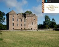
![Elgin Cathedral Wedding Brochure [pdf, 544kb] - Historic Scotland](https://img.yumpu.com/22301571/1/190x151/elgin-cathedral-wedding-brochure-pdf-544kb-historic-scotland.jpg?quality=85)