Sources - HCV Resource Network
Sources - HCV Resource Network
Sources - HCV Resource Network
You also want an ePaper? Increase the reach of your titles
YUMPU automatically turns print PDFs into web optimized ePapers that Google loves.
for a living planet<br />
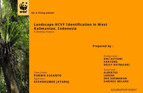
Landscape <strong>HCV</strong>F Identification in West<br />
Kalimantan, Indonesia<br />
A Desktop Analysis<br />
Prepared by :<br />
Ecology team: :<br />
DWI ASTIANI<br />
HARYONO<br />
DESSY RATNASARI<br />
Team Leader:<br />
PURWO SUSANTO<br />
Supervisor :<br />
KISHOKUMAR JEYARAJ<br />
Social team:<br />
ALBERTUS<br />
LORENS<br />
EKO DARMAWAN<br />
SABINUS MELANO<br />
KALIMANTAN BARAT
INTRODUCTION<br />
High Conservation Value Forests (<strong>HCV</strong>F) are defined as areas<br />
where critically important ecological attributes, ecosystem<br />
services and social functions are identified.<br />
(Principle<br />
9 –FSC Principles and Criteria for forest certification(1999)<br />
<strong>HCV</strong>F : 6 High Conservation Values (<strong>HCV</strong>s)- attributes<br />
<strong>HCV</strong>1: Forest areas containing globally, regionally or nationally significant<br />
concentrations of biodiversity values (e.g. endemism, endangered<br />
species, refugia).<br />
<strong>HCV</strong>2: Forest areas containing globally, regionally or nationally significant<br />
large landscape level forests, contained within, or containing the<br />
management unit, where viable populations of most if not all<br />
naturally occurring species exist in natural patterns of distribution<br />
and abundance.<br />
<strong>HCV</strong>3: Forest areas that are in or contain rare, threatened or endangered<br />
ecosystems.<br />
<strong>HCV</strong>4: Forest areas that provide basic services of nature in critical situations<br />
(e.g. watershed protection, erosion control).<br />
<strong>HCV</strong>5: Forest areas fundamental to meeting basic needs of local communities<br />
(e.g. subsistence, health)<br />
<strong>HCV</strong>6: Forest areas critical to local communities’ traditional cultural identity<br />
(areas of cultural, ecological, economic or religious significance<br />
identified in cooperation with such local communities).
Indonesia Facts And Figures
PROCESS<br />
• Collating data from<br />
various sources<br />
• Consultative exercise<br />
• Multidisciplinary<br />
team-analysis<br />
• Spatial analysis<br />
• Internal WWF review<br />
workshop<br />
• Consultation with<br />
provincial government<br />
• Wider stakeholder<br />
consultation<br />
• Acceptance and<br />
utilization by<br />
stakeholders<br />
• Ground testing and<br />
refinement<br />
• Continuous review<br />
SUB-OBJECTIVES<br />
• Guiding land use policy formulation and<br />
decision making by the West Kalimantan<br />
provincial government<br />
• Guiding Spatial planning for the province<br />
• Raising conservation awareness in West<br />
Kalimantan and guiding conservation priorities<br />
• Promoting and recognising sustainable local<br />
community dependence on forests<br />
• PROVINCIAL LEVEL CAPACITY BUILDING
Challenges<br />
Consolidation of literature from varying sources<br />
Satellite imagery interpretation and source (latest<br />
unavailable-2000 but updated to 2003)<br />
• Lack of basic field data and information<br />
• Varied information sources and differing map<br />
quality and scales<br />
• Biodiversity information in forested areas<br />
lacking and<br />
• Minimum size of forest cover areas is 1,000 ha<br />
due to satellite image resolution<br />
• Social <strong>HCV</strong>s, 3 local community groups selected<br />
based on their language difference, population<br />
distribution and size<br />
• dependency level of indigenous communities<br />
could not be analyzed quantitatively
Overview of study area<br />
West Kalimantan Province<br />
Total extent: 17,88 m ha<br />
Total population (2004): 4.073.304 peoples<br />
Administrative: 10 districts dan 2 cities<br />
Protected areas: 3.872.336,21 ha<br />
Forest cover (2000): 6.906.043,63 ha<br />
Soil: Organosol, Gley dan Humus (OGH), Aluvial,<br />
Regosol, Podsolik Red Yellow (PRY), Podsolik dan<br />
Latosol. (PRY) total area 10,5 m ha (17,28 %)<br />
Hydrology: 19 Main Drainage Basins (Water Catchments)
Finding <strong>HCV</strong> 1:Forests areas containing globally, regionally and nationally<br />
<strong>HCV</strong>1.1<br />
significant<br />
:<br />
large concentrations of biodiversity values e.g. endemism,<br />
Identification endangered species, of protected and refugia. areas<br />
Data <strong>HCV</strong> Components <strong>Sources</strong> : identified are:<br />
•Protected <strong>HCV</strong> # 1.1 areas Protected data Areas. in West Group Kalimantan (Forestry Size Dept, (ha) 2000)<br />
•Basic<br />
1<strong>HCV</strong> Nature<br />
Map 1.2 Endangered Tourism<br />
of West<br />
Sanctuary<br />
Kalimantan Species. (6 NTS)<br />
(Bakosurtanal 1:250,000)<br />
29.297,32<br />
•Satellite 2<strong>HCV</strong> National 1.3 Imagery Concentration Park (4 NP) Landsat of 7 Endangered ETM (2000), Threatened 1.124.988,38 and Endemic<br />
3 Wild Life Sanctuary (1 WS)<br />
146.851,30<br />
4species<br />
Nature Preserves (4 NPr)<br />
130.946,59<br />
5<strong>HCV</strong> Protection 1.4 Significant Forest (146 Temporal PF) Concentrations 2.440.252,62<br />
Total Protected Areas 3.872.336,21*<br />
<strong>Sources</strong> : GIS Analysis Protected Areas Map of Forestry Department, 2000<br />
Catatan : * Not include Karimata Marine Preserve
Finding :<br />
Out of 3.872.336,21 ha of identified protected areas (excluding<br />
marine reserves), only some 3.011.605,17 Ha (77,77%) are<br />
forested. Approximately 860.073,26 ha (22,23 %) have lost<br />
forest cover.
<strong>HCV</strong> 1.2<br />
Finding:<br />
• 5 species of birds,<br />
• 10 species of<br />
mammal,<br />
• 1<br />
<strong>Sources</strong>:<br />
species of fish,<br />
• 11 species of reptil<br />
• 3 species of<br />
Alcedo meninting Blue-eared Kingfisher Menintin<br />
Identification of endangered species according to Appendix I, CITES<br />
Polyplectron schleiermacheri Bornean Peacockpheasant<br />
and IUCN Redlist Criteria Endangered/Critically Endangered.<br />
Hylobates lar Lar Gibbon Owa Serundung<br />
• Distribution Map of Protected Hylobates muelleri Species in West Bornean Gibon Kalimantan Kelampiau (various<br />
Kalimantan<br />
Nasalis larvatus Proboscis Monkey Bekantan<br />
sources).<br />
Neofelis nebulosa Clouded Leopard Macan dahan<br />
• Appendix I CITES (data Pardofelis download marmorata on 20 December Marbled Cat 2005 Kucing and batu valid<br />
Pongo pygmaeus pygmaeus Orang Utan Orang Utan<br />
until 23 June 2005).<br />
Prionailurus bengalis Leopard Cat Kucing kuwuk<br />
Prionailurus planiceps Flat-headed Cat Kucing tandang<br />
• IUCN Redlist (Download data 20 December 2005)<br />
PISCES Scleropages formosus Dragon fish Ikan Arwana Merah<br />
• Ecology of Kalimantan REPTIL (2000).<br />
Batagur baska River Terrapin Tuntong<br />
Caretta caretta Red Brown Longger Heat Penyu Tempayan<br />
• South East Asian Orchids (1994).<br />
Chelonia mydas Green Turtle Penyu Hijau<br />
• Orangutan Population and Chitra Habitat indica Viability Giant Assessment Freshwater Turtle Labi-labi (2004) Besar<br />
Dermochelys coriacea Leather Back Turtle Penyu Belimbing<br />
• Distribution Map of Orangutan (WCMC, 2004).<br />
Eretmochelys imbricata Hawksbill Turtle Penyu Sisik<br />
Lepidochelys olivacea Grey Olive Longger Heat Penyu Ridel/Lekang<br />
• Data on Forests with elevation under 200 meters.<br />
Manouria emys<br />
Asian Brown Tortoise<br />
• Data on Forests with elevation Orlitia borneensis under 500 meters.<br />
Aquatic Tortoise Kura-kura Gading<br />
orchids<br />
Class Species name English name Indonesia name<br />
AVES Alcedo euryzona Blue-banded Kingfisher Raja Udang Biinti<br />
Ciconia stromi Storm’s stork Bangau Hutan Rawa<br />
Kuau Kerdil Borneo<br />
Rhinoplax vigil Helmeted Hornbill Enggang Gading<br />
MAMMAL Helarctos malayanus Sun Bear Beruang Madu<br />
Hylobates agilis Agile Gibon Ungko Tangan-hitam/ Owa<br />
Python molurus Rock Pyton Sanca Bodo<br />
Tomistoma schlegelii Malayan Gavial Buaya Sapit/ Senyulong<br />
ORCHID Paphiopedilum bullenianum Anggrek Kantong Semar<br />
Paphiopedilum kolopakingii<br />
Anggrek Kantong Semar<br />
Paphiopedilum stonei<br />
Anggrek Kantong Semar<br />
Sumber : kompilasi data dari berbagai literatur keanekaragaman jenis di berbagai kawasan di Kalimantan Barat
Orangutan distribution areas<br />
As the flagship species
<strong>HCV</strong> 1.3<br />
Identification of Concentrations of Endangered, Threatened<br />
or Endemic species<br />
Finding :<br />
Data sources:<br />
Protected species *<br />
Endemic species<br />
• Species research data<br />
Number<br />
Number<br />
• Map of designated of Forest Remarks Areas in West of Kalimantan Remarks<br />
# Name of Area<br />
species<br />
species<br />
(Baplan Dephut,<br />
112000)<br />
2 aves, 6 mammal, 1<br />
• NPEndemic Birds Areas pisces, (Birdlife, 2 reptil 2005)<br />
• Ecology of Kalimantan<br />
15 5 aves,<br />
(2000)<br />
9 mammal, 1<br />
• NPITTO Borneo Biodiversity reptil Expedition (1999)<br />
13 4 aves, 5 mammal, 1<br />
• Other publications and scientific literature<br />
1 Betung Kerihun<br />
2 Gunung Palung<br />
3 Danau Sentarum<br />
NP<br />
4 Bukit Baka Bukit<br />
Raya NP<br />
5 Kendawangan<br />
GR<br />
6 Kep. Karimata<br />
NR<br />
7 Nyiut Penrinsen<br />
NR<br />
8 Belimbing<br />
(Selimpai) NTS<br />
pisces, 3 reptil<br />
24 15 aves, 8<br />
mammal, 1<br />
orchid<br />
19 10 aves, 9<br />
mammal<br />
11 5 aves, 2<br />
mammal, 3 flora<br />
8 2 aves, 6 mammal 5 2 aves, 3<br />
mammal<br />
16 3 aves, 4 mammal, 1<br />
pisces, 8 reptil<br />
10 1 aves, 1 mammal, 8<br />
reptil<br />
12 4 aves, 4 mammal, 3<br />
orchid, 1 reptil<br />
10 1 aves, 2 mammal, 7<br />
reptil<br />
3 1 aves, 2<br />
mammal<br />
1 1 mammal<br />
25 11 aves, 10<br />
mammal, 4<br />
orchid<br />
1 1 mammal<br />
Notes : * Protected as in Appendix I CITES and/or Endangered IUCN Redlist catagory
<strong>HCV</strong> 1.4<br />
Identification of Significant Temporal Concentrations<br />
<strong>Sources</strong>:<br />
• Map of West Kalimantan Forest Cover Peta 2003 (Baplan Dephut, 2005)<br />
• Important Birds Areas, BirdLife International (2005)<br />
• Ecology of Kalimantan (2000)<br />
Finding :<br />
As recorded by BirdLife, there are 8 identified locations significant for<br />
birds.<br />
# Location IBA criteria<br />
1 Kendawangan GR A1, A2, A3<br />
2 Betung Kerihun NP A1, A2, A3<br />
3 Danau Sentarum NP A1, A2, A3<br />
4 Gunung Palung NP A1, A2, A3<br />
5 Rawa Di Pesisir Paloh A3<br />
6 Rawa Di Pesisir Kapuas A3<br />
7 GN. Nyiut – Poteng NR A1, A2, A3<br />
8 Bukit Baka – Bukit Raya NP A1, A2, A3<br />
Keterangan :<br />
(A1), Species of global<br />
conservation concern<br />
(A2), Restricted-range species<br />
(A3) Biome-restricted species
Threats toward <strong>HCV</strong> 1:<br />
Threats on conservation areas such as illegal logging, forests fires, and<br />
land-use alteration (HPH, HTI, Transmigration, and oil palm plantations).
<strong>HCV</strong> 2<br />
Forest areas containing globally, regionally or nationally<br />
significant large landscape level forests, contained within, or<br />
containing the management unit (MU), where viable<br />
populations of most if not all naturally occur species exist in<br />
natural patterns of distribution and abundance.<br />
<strong>HCV</strong> Components identified are:<br />
•<strong>HCV</strong> 2.1 Forest areas containing large landscape level<br />
•<strong>HCV</strong> 2.2 Integral part of forest areas containing large<br />
landscape level<br />
•<strong>HCV</strong> 2.3 Maintaining viable populations of naturally<br />
occur species
Landscape Blocks in West Kalimantan<br />
# Group of forest containing large landscape Size (Hektare)<br />
1. Forest group 1 (Kelompok Taman Nasional Betung Kerihun, bersambungan dengan HL. Pangihan<br />
Lambuanak, Taman Nasional Bukit Baka Bukit Raya, 14 HL lain, 6 HPH, 2 HTI dan kawasan hutan<br />
sekitarnya)<br />
2. Forest group 2 (Kelompok HL. BT. Malintang, HL. BT. Salok, HL. BT. Penintin, HL. BT. Rirang, HL. BT.<br />
Mancung, 1 HPH, 3 HTI dan kawasan hutan sekitarnya)<br />
3. Forest group 3 (Kelompok HL. S Kiyungkang, HL. BT. Penintin, 24 HL lain, 15 HPH, 4 HTI, 4 kebun dan<br />
kawasan hutan sekitarnya)<br />
4. Forest group 4 (Kelompok Taman Nasional Gunung Palung, 9 HL lain, kawasan hutan rawa gambut<br />
S.Putri/S.Tolak dan kawasan hutan sekitarnya)<br />
5. Forest group 5 (Kelompok hutan di P. Maya Karimata meliputi HL. G. Berantak, HL. G. Besar, HL. S.<br />
Kapar Kecil dan HL. S. Sandawalan)<br />
6. Forest group 6 (Kelompok HL. T. Batang, HL. S Kuwalan, HL . S Jenu, 2 HTI, 2 kebun dan kawasan<br />
hutan sekitarnya)<br />
7. Forest group 7 (Kelompok HL. S. Medawak, HL. S. Ambangah, HL. S. Tebedak, HL. P. Limbung, 2 HTI,<br />
3 kebun dan kawasan hutan sekitarnya)<br />
8. Forest group 8 (Kelompok HL. G Sangiyangan, CA Mandor, 1 HTI, 4 kebun dan kawasan hutan<br />
sekitarnya<br />
9. Forest roup 9 (Kelompok TWA Melintang, TWA Gunung Asuansang HL. Bentarang, 5 HL dan TWA lain,<br />
6 kebun dan kawasan hutan sekitarnya)<br />
10. Forest group 10 (Kelompok CA GN Nyiut Penrinsen, HL. Penrinsen dan kawasan hutan sekitarnya, 1<br />
kebun)<br />
11. Forest group 11 (Kelompok CA Nyiut Penrinsen, HL. G. Bentuang, HL. G Pejapa, HL. G Ceramin, HL.<br />
Menjang dan kawasan hutan sekitarnya, 1 HTI)<br />
2.660.209,856<br />
82.030,243<br />
1.189.289,097<br />
320.776,124<br />
83.039,650<br />
248.411,543<br />
231.568,902<br />
117.720,309<br />
220.433,848<br />
67.560,744<br />
77.070,423<br />
12. Forest group 12 (Kelompok HL. G. Kemuha, H.L Kumbu dan kawasan hutan sekitarnya, 1 HTI) 87.098,651<br />
13. Forest group 13 (Kelompok HL. Lanjak, Taman Nasional Danau Sentarum, HL. Bt. Kumpai, 1 HPH, 1<br />
HTI, 1 kebun dan kawasan hutan sekitarnya)<br />
308.993,768<br />
Total forest group containing large landscape 5.694.203,158<br />
Sumber : Hasil Pengukuran GIS dari Peta Penutupan Lahan Kalimantan Barat (Tim Ekologi <strong>HCV</strong>F Kalimantan Barat, 2005/2006)
<strong>HCV</strong> 3<br />
Forest Areas that are in or Contain Rare, Threatened or Endangered Ecosystems.<br />
<strong>Sources</strong>:<br />
• Map of West Kalimantan Forests Cover by 2003 (Baplan Dephut, 2005)<br />
• Map of Designated Forests Areas in West Kalimantan (Baplan Dephut, 2000)<br />
• Land-uses in West Kalimantan RTRWP (BAPPEDA of West Kalimantan, 2004)<br />
• Map of West Kalimantan Ecoregion (WCMC)<br />
• Map of RePPProt (2000)<br />
Findings:<br />
According to Map of West Kalimantan Ecoregion (WCMC), there are 6 ecoregions<br />
across the province:<br />
Kerangas Forest<br />
Mangrove Forests<br />
Type of Forests<br />
Maximum Estimated Size of Each<br />
Forest Type<br />
(in hectare)<br />
Forest Size<br />
in 2003<br />
(in hectare)<br />
Percentage of<br />
Forest Size by Maximum<br />
Size of Each Forest Type<br />
(%)<br />
1,822,311.84 272,441.42 14.95%<br />
454,459.24 148,343.67 32.64%<br />
Fresh-water Swamp Forests 1,149,717.30 406,520.49 35.36%<br />
Lowland Rain Forests 7,016,181.83 2,801.08 39.68%<br />
Peat Swamp Forests 2,159,860.19 993,325.86 45.99%<br />
Montane Forests 2,045,958.19 1,962,994.65 95.95%<br />
No data - 8,731.55 -<br />
Total 14,693,488.59 6,594,189.72 44.88%
<strong>HCV</strong> 4<br />
Forest areas that Provide Basic Services of Nature in Critical Situation (e.g.<br />
watershed protection, erosion control).<br />
Components of <strong>HCV</strong> identified are:<br />
• <strong>HCV</strong> 4.1 Unique water springs for daily needs<br />
• <strong>HCV</strong> 4.2 Forest areas significant as watershed protection and erosion control<br />
• <strong>HCV</strong> 4.3 Forest areas significant to block up severe fires<br />
• <strong>HCV</strong> 4.4 Forest areas significant to agriculture, aquaculture, and fishery<br />
<strong>Sources</strong>:<br />
• Map of West Kalimantan River Currents<br />
• Map of West Kalimantan DAS<br />
• Map of West Kalimantan Lakes<br />
• Map of Mangrove Ecosystem<br />
• Map of West Kalimantan Forests Cover (2003)<br />
• Map of West Kalimantan Settlement Distribution<br />
• Basic Map of West Kalimantan
<strong>HCV</strong> 5<br />
Forest areas around the community settlements<br />
Forest areas fundamental to meeting basic needs of local<br />
communities (e.g. subsistence, health)<br />
Components of <strong>HCV</strong> identified are:<br />
• <strong>HCV</strong> 5.1 Local communities with high dependency to forest<br />
areas in and around.<br />
• <strong>HCV</strong> 5.2. Basic needs or subsistence (carbohydrate, protein,<br />
vitamin, and Mmineral), medicinal substances, firewoods,<br />
house-building construction materials of local community in<br />
and around forest areas
Identification <strong>HCV</strong> 5.1<br />
Identification of Local Communities Live in and around Forest Areas with<br />
High Forest Dependency.<br />
Identify community groups and forests areas of a radius of 15 Km away<br />
from the nearest community settlements. For very isolated groups with<br />
high forest-dependency level, i.e. Dayak Punan and Bukat in Kapuas Hulu,<br />
and Bidayuh on the feet of Mt. Nyiut Penrinsen, identifying of forests areas<br />
are applied within a radius of 20 Km from the nearest community<br />
settlement.<br />
<strong>Sources</strong>:<br />
•Map of Community Groups of West Kalimantan based on the Language<br />
Atlas (Wurm, S.A. & S. Hatorri, 1983)<br />
•Map of West Kalimantan Settlement Distribution Peta<br />
•Map of Community Land-uses (PPSDAK – Pancur Kasih)<br />
•Map of West Kalimantan Forests Cover by 2003 (Baplan Dephut, 2005)<br />
•Map of Designated Forests Areas in West Kalimantan (Baplan Dephut,<br />
2000)<br />
Findings<br />
As discussed earlier in introduction, this study applies linguistic approach which<br />
have been developed by Wurm and Hatorri (1983). Models or samples are of<br />
local communities with the highest distribution across the province.
<strong>HCV</strong> 5.2.<br />
Identification of Basic Needs or Subsistence (carbohydrate,<br />
protein, vitamin and mineral), Medicinal Substances,<br />
Firewoods, and House-Building Construction Materials of<br />
Local Community in and around Forest Areas<br />
<strong>Sources</strong>:<br />
• Various literature on forests-uses pattern by community<br />
groups of Dayak Kanayant, Bidayuh, and Iban<br />
• Map of Natural <strong>Resource</strong>s Utilization by Local Community<br />
(PPSDAK - Pancur Kasih)<br />
Findings:<br />
Land-use models are indicators of local community forestry<br />
practice. The land-use model describes how the communities have<br />
managed and utilized the land. The land-use pattern has been<br />
continued to exist for a thousand years andis developed from<br />
community interaction mechanisms. The land-use patterns are<br />
varied and get more complicated depending on history of the local<br />
social interaction and the forest management.
<strong>HCV</strong> 6<br />
Forests Areas Critical to Local Communities’ Traditional Cultural Identity (Areas of<br />
Cultural, Ecological, Economic or Religious Significance in Cooperation with such Local<br />
Communities)<br />
<strong>HCV</strong>. 6.1<br />
Communities around Forest Areas who are Isolated, Self-governed (with active traditional<br />
laws system), and primarily forest-dependant<br />
<strong>Sources</strong>:<br />
• Forest Management Patterns of Dayak Kanayatn, Bidayuh, and Iban (various<br />
sources)<br />
• Language Atlas of West Kalimantan (Wurm, S.A. & S. Hattori, 1983)<br />
• Map of Settlement Distribution in West Kalimantan<br />
• Map of Forest Cover in West Kalimantan (2003)<br />
• Basic Map of West Kalimantan<br />
Findings:<br />
The three community groups sampled, i.e. Dayak Kanayatn, Bidayuh, and Iban, occupy<br />
mostly areas adjacent to the forests. Some of them inhabit remote areas , e.g. mountaneous ,<br />
such as communities living around the Nature Preserve of Nyiut Penrinsen and the Betung<br />
Kerihun National Park.<br />
Dayak Kanayatn, Bidayuh, and Iban people reside traditional territories called Binua or<br />
Banoe.<br />
Due to minimum external influence and contact with outside world, “several” sub-groups of<br />
Dayak Kanayatn, Bidayuh, and Iban still adhere to their pure customs. In addition, some<br />
social events in West Kalimantan promote adherence to their tradition and customary law.
<strong>HCV</strong> 6.2<br />
Identification of Customary Systems, Tradition, and Traditional Laws of Dayak Community as<br />
Cultural Identity with regard to Forests<br />
Findings:<br />
• Custom, tradition, and traditional laws are included in non-codification rules but bound to the<br />
people to manage life and behavior of traditional communities.<br />
• All activities that connected to natural resources management are always performed along<br />
with certain traditional ceremonies.<br />
• Activities for forest and natural resources management as to cultural identity i.e. field<br />
cultivation, religious, and oral tradition activities.<br />
• All rituals and traditional ceremonies mentioned give forest-depent communities’ cultural<br />
identity.
Main threats toward forest areas which provide local communities basic needs<br />
(subsistence), among which are:<br />
- High population while forest areas are constant, the environment capacity therefore tends to be narrower<br />
- Capitalism economic paradigm which emphasizes on high production level causes exploitation on forest<br />
natural resources<br />
- Environmental support capacity is getting lower due to forest-use for short indigenous cultivation (previously<br />
in 10-15 years cycle, at present only 4-5 years cycle)<br />
- Illegal burning at forest areas<br />
- High level of community consumerism<br />
Direct impact of the threats are:<br />
- Rapid forest clearing<br />
- Expanding of palm oil plantation, HPH, HTI, mining companies, etc<br />
- Local communities should change suddenly their lifestyle and behaviour<br />
- Competition in enhancing life standard has influenced community to exploit forest<br />
- Reducing of environmental capacity<br />
- Consumerism as global impact, brings its consequence in social changes at macro level
<strong>HCV</strong>1<br />
<strong>HCV</strong>2<br />
<strong>HCV</strong>3<br />
<strong>HCV</strong>4<br />
<strong>HCV</strong>5+6<br />
Resume Analisis <strong>HCV</strong>F Secara Lansekap di Kalbar
Terima<br />
Kasih<br />
Thank you<br />
Mandor Protected Forest, Photo by Ryo


