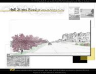
A Transportation Plan for the Greenleaf Terrace Neighborhood
A Transportation Plan for the Greenleaf Terrace Neighborhood
A Transportation Plan for the Greenleaf Terrace Neighborhood

Create successful ePaper yourself
Turn your PDF publications into a flip-book with our unique Google optimized e-Paper software.
Existing Conditions: Conclusions<br />
The data above presents a picture of a neighborhood that, while not suffering from acute<br />
traffic issues, is certainly in need of basic traffic-calming measures, as well as a<br />
coordinated, cohesive ef<strong>for</strong>t to improve access to and connections between pedestrian,<br />
biking and public transportation modes.<br />
The neighborhood survey provides a useful albeit somewhat limited view of<br />
transportation mode use in <strong>Greenleaf</strong> <strong>Terrace</strong>. The high level of vehicle access certainly<br />
discourages some use of o<strong>the</strong>r transportation modes, although <strong>the</strong> census data would<br />
suggest that <strong>the</strong> vast majority of biking and walking that takes place in <strong>the</strong> neighborhood<br />
is recreational in nature. Several of <strong>the</strong> residents fur<strong>the</strong>r explained that <strong>the</strong>y felt unsafe<br />
biking in <strong>the</strong> neighborhood, a perception that may be largely responsible <strong>for</strong> <strong>the</strong> low<br />
percentage of bikers. Likewise, a number of residents fur<strong>the</strong>r explained <strong>the</strong>ir lack of<br />
public transportation patronage, citing infrequent service and a lack of service to <strong>the</strong><br />
locations <strong>the</strong>y need to travel as major factors.<br />
Although an origin-destination study was not feasible given <strong>the</strong> time constraints of <strong>the</strong><br />
study, traffic volume measurements throughout <strong>Greenleaf</strong> <strong>Terrace</strong> suggest that cutthrough<br />
traffic from surrounding collector and arterial roads is occurring. The volumes<br />
on Well<strong>for</strong>d and Ox<strong>for</strong>d Roads indicate, as mentioned previously, that Well<strong>for</strong>d and<br />
Ox<strong>for</strong>d Roads may be serving as a route to avoid <strong>the</strong> busy intersections of Barracks and<br />
Rugby Roads and Rugby Road at Rugby Avenue. It would also appear (pending receipt<br />
of fur<strong>the</strong>r traffic counts on Rose Hill Drive and Gentry Lane) that Rose Hill Drive is<br />
heavily used in conjunction with <strong>Greenleaf</strong> and Oakleaf Lanes, Del Mar Drive and<br />
Gentry Lane to provide access through <strong>the</strong> neighborhood, most likely <strong>for</strong> vehicles going<br />
to and from Walker Elementary School.<br />
The speed data acquired in <strong>Greenleaf</strong> <strong>Terrace</strong> supports <strong>the</strong> implementation of traffic<br />
calming measures to reduce vehicle speeds to a level more appropriate <strong>for</strong> a residential<br />
neighborhood in which vehicles may easily come into conflict with pedestrian and<br />
bicycle traffic. The speeds observed also support <strong>the</strong> need <strong>for</strong> improved pedestrian and<br />
bicycle accommodations to ensure walking and biking safety.<br />
A review of accident data does not reveal any major issues. Accidents are most<br />
predominant at intersections in areas of high traffic volumes, as one would expect.<br />
However, <strong>the</strong> cluster of accidents along <strong>the</strong> Rose Hill Drive corridor are troublesome and<br />
may indicate high traffic volume in an area directly adjacent to <strong>Greenleaf</strong> Park and thus<br />
to an area of increased pedestrian traffic.