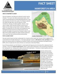
Hanford Site National Environmental Policy Act (NEPA) - Pacific ...
Hanford Site National Environmental Policy Act (NEPA) - Pacific ...
Hanford Site National Environmental Policy Act (NEPA) - Pacific ...

You also want an ePaper? Increase the reach of your titles
YUMPU automatically turns print PDFs into web optimized ePapers that Google loves.
the 100-F Area and westward across the <strong>Site</strong> north of Gable Mountain. As a result of the fire that<br />
occurred during 2000, temporary dunes have formed along State Route 240 east to the 200 West Area<br />
and Army Loop Road. These burnt areas are in various stages of recovery.<br />
The <strong>Hanford</strong> dunes, located on the eastern border of the <strong>Site</strong>, provide habitat for mule deer,<br />
burrowing owls, and coyotes as well as many transient species. In contrast, the dunes in west central<br />
<strong>Hanford</strong>, formed as a result of the fire in June 2000, may be temporary and could disappear once<br />
vegetation is reestablished. The sparseness of vegetative cover in the dunes puts many small animals<br />
at risk of predation.<br />
Columbia River Islands. (a) Island habitat accounts for an area of approximately 4.74 km 2<br />
(1.8 mi 2 ) (Hanson and Browning 1959) and 64.3 km (39.9 mi) of river shoreline within the main<br />
channel of the <strong>Hanford</strong> Reach (Figure 4.5-3). DOE owns and administers the upland portions of<br />
Locke Island (RM 371-373.5) and Wooded Island (RM 348-351). The Washington State Department<br />
of Natural Resources manages the shorelines of Locke and Wooded islands. Landslides caused by<br />
rotational slumping in the White Bluffs area caused accelerated erosion of Locke Island by the<br />
Columbia River. Shoreline riparian vegetation on the islands includes willow, poplar, Russian olive,<br />
and mulberry. Before regulation of river flows by dams, trees were generally not found along river<br />
shoreline habitat, with the exception of small willows and a few juniper trees near the 100-B/C Area<br />
and Riverlands. The most common tree to establish itself along the shoreline is mulberry. Species<br />
occurring on the island interior include buckwheat, lupine, mugwort, thickspike wheatgrass, giant<br />
wildrye, yarrow, and cheatgrass (Warren 1980).<br />
Islands provide resting, nesting, and escape habitat for waterfowl and shorebirds. Use of islands<br />
for nesting by Canada geese has been monitored since 1950. The suitability of habitat for nesting<br />
Canada geese is attributed to restricted human use of islands during the nesting season, suitable<br />
substrate, and adequate forage and cover for broods (Eberhardt et al. 1989). The nesting population<br />
fluctuates annually. Since the early 1990s, geese have used the downstream islands in the <strong>Hanford</strong><br />
Reach for nesting as a result of coyote predation in the upper Reach islands. Islands also<br />
accommodate colonial nesting species including California gulls (Larus californicus), ring-billed<br />
gulls (Larus delawarensis), and Forster’s terns (Sterna forsteri). Island areas ranging from 0.1 to<br />
0.2 km 2 (0.05 to 0.08 mi 2 ) accommodate colonial nesting species that may range in population size up<br />
to 2,000 individuals. Mule deer have used Columbia River islands for birthing of fawns. Coyotes<br />
have been known to swim to the islands to prey on mule deer fawns and nests of Canada geese.<br />
<strong>Hanford</strong> Operational Facilities and Retired Reactor Areas. Yearly vegetation surveys are<br />
conducted around many of the <strong>Hanford</strong> <strong>Site</strong> operational facilities and retired reactor areas including<br />
facilities in the 100, 200, and 300 Areas (Figure 4.0-1). In addition, there have been several studies<br />
examining the vegetation on the 200 Area Plateau and vegetation north of the 300 Area<br />
(Sackschewsky et al. 2001; Brandt et al. 1993).<br />
(a) Management of these islands is the responsibility of the island owners, which include DOE, USFWS, and the<br />
U.S. Bureau of Land Management. Island ownership descriptions pertain to status prior to national<br />
monument designation and are subject to change with agreements among the agencies.<br />
4.96