Printable Copy of the Field Study Guide (PDF)
Printable Copy of the Field Study Guide (PDF)
Printable Copy of the Field Study Guide (PDF)

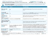
Create successful ePaper yourself
Turn your PDF publications into a flip-book with our unique Google optimized e-Paper software.
Station #1: Gradient vs. Velocity<br />
Elevation: _200.6 meters Latitude: _42 o 34’29” N_ Longitude: _73 o 57’50” W_<br />
Factors Affecting Transportation <strong>of</strong> Sediments<br />
Running water is <strong>the</strong> primary agent <strong>of</strong> erosion on Earth. Most running water is found in<br />
streams and rivers. There are many factors that affect <strong>the</strong> movement <strong>of</strong> sediments in a<br />
stream. Gradient (slope), discharge, and channel shape influence a stream’s velocity.<br />
Sediments carried by a stream become rounded due to <strong>the</strong> grinding action <strong>of</strong> <strong>the</strong> water on<br />
<strong>the</strong> rocks, a process called abrasion. The average velocity (speed) <strong>of</strong> a stream depends<br />
on its slope and discharge, which in turn help to explain <strong>the</strong> carrying power <strong>of</strong> a stream.<br />
As <strong>the</strong> velocity <strong>of</strong> <strong>the</strong> stream water increases, <strong>the</strong> size <strong>of</strong> <strong>the</strong> particles carried in <strong>the</strong><br />
stream also increases, a direct relationship.<br />
Streams carry materials in 4 distinct ways:<br />
Floatation - floating <strong>of</strong> particles less dense than water<br />
Solution - dissolved particles<br />
Suspension - tiny particles can travel within <strong>the</strong> water without touching <strong>the</strong> stream bed<br />
Bed Load - bouncing (saltation) and dragging (traction) <strong>of</strong> sediments along <strong>the</strong> stream<br />
bed<br />
View <strong>the</strong> following:<br />
Powerpoint <strong>of</strong> Jake stick Use<br />
Video <strong>of</strong> Eye Level<br />
Station 1 Photos from <strong>the</strong> <strong>Field</strong> Trip<br />
Activities<br />
1) In this activity students measure <strong>the</strong> velocity and gradient <strong>of</strong> <strong>the</strong> stream at two<br />
different locations. Location A is <strong>the</strong> upstream location. The table on <strong>the</strong> next page must<br />
be completed in its entirety using <strong>the</strong> steps in this process and <strong>the</strong> data given.<br />
Each student is assigned to ei<strong>the</strong>r <strong>the</strong> Location A team or <strong>the</strong> Location B team.<br />
You are assigned to <strong>the</strong> Location A team.<br />
(a) Determine <strong>the</strong> gradient <strong>of</strong> <strong>the</strong> stream for location A – Students will determine <strong>the</strong><br />
gradient using jake sticks, sight levels, and a tape measure.<br />
1. Using <strong>the</strong> tape measure <strong>the</strong> students assigned to Location A determine <strong>the</strong><br />
horizontal distance between <strong>the</strong> two canisters representing <strong>the</strong> start and finish points to<br />
be 25.8 meters. Enter this data in <strong>the</strong> table below in <strong>the</strong> appropriate space.<br />
2. The student with <strong>the</strong> sight level determines <strong>the</strong>ir eye height to be 155 cm for <strong>the</strong><br />
Location A team. Enter this data as <strong>the</strong> starting elevations in <strong>the</strong> appropriate space.<br />
3. The student with <strong>the</strong> sight level stands at <strong>the</strong> starting point while <strong>the</strong> student with<br />
<strong>the</strong> jake stick stands at <strong>the</strong> finish point. The person with <strong>the</strong> sight level determines <strong>the</strong><br />
new jake stick reading to be 209 cm. Enter this data as <strong>the</strong> finish elevation in <strong>the</strong> table.<br />
4. Complete <strong>the</strong> calculation for change in elevation and stream gradient (use <strong>the</strong><br />
formula found on <strong>the</strong> front cover <strong>of</strong> <strong>the</strong> Earth Science Reference Tables) and enter <strong>the</strong>m<br />
into <strong>the</strong> table. The first four columns <strong>of</strong> line one in <strong>the</strong> table should now be complete.