Printable Copy of the Field Study Guide (PDF)
Printable Copy of the Field Study Guide (PDF)
Printable Copy of the Field Study Guide (PDF)

Create successful ePaper yourself
Turn your PDF publications into a flip-book with our unique Google optimized e-Paper software.
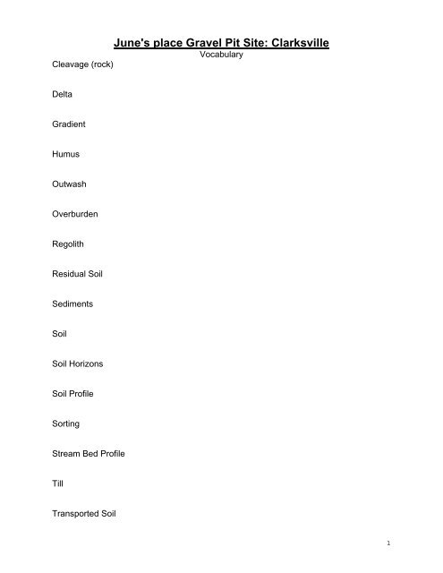
June's place Gravel Pit Site: Clarksville<br />
Vocabulary<br />
Cleavage (rock)<br />
Delta<br />
Gradient<br />
Humus<br />
Outwash<br />
Overburden<br />
Regolith<br />
Residual Soil<br />
Sediments<br />
Soil<br />
Soil Horizons<br />
Soil Pr<strong>of</strong>ile<br />
Sorting<br />
Stream Bed Pr<strong>of</strong>ile<br />
Till<br />
Transported Soil<br />
1
Elevation: 227.7 meters Latitude: 42° 34’’ 39’N<br />
Longitude: 73° 57’ 57’’W<br />
Activities<br />
1) Write a description <strong>of</strong> <strong>the</strong> five rock samples provided in <strong>the</strong> kit. Focus on size,<br />
shape, texture, color, and any unique features <strong>of</strong> <strong>the</strong> rock sample.<br />
Sample 1 Sample 2 Sample 3 Sample 4 Sample 5<br />
2) Identify what agent <strong>of</strong> erosion (Water, Wind, or Glacier) deposited <strong>the</strong> following soil<br />
samples:<br />
Sample #1 -<br />
Sample # 2-<br />
Sample #3-<br />
Sample #4-<br />
Sample #5-<br />
3) Referring to <strong>the</strong> vocabulary words for “till” and “transported soil”, what explains <strong>the</strong><br />
diverse origins <strong>of</strong> rock samples located in June’s Gravel Pit?<br />
4) Looking at pictures from <strong>the</strong> <strong>Field</strong> <strong>Study</strong> Site in Clarksville determine what agent <strong>of</strong><br />
erosion (water, wind, or glacier) deposited <strong>the</strong> sediments in different parts <strong>of</strong> June’s<br />
Gravel Pit.<br />
Gravel Pit Location #1-<br />
Gravel Pit Location #2-<br />
2
5) Describe <strong>the</strong> series <strong>of</strong> events that occurred to created Gravel Pit Location #3.<br />
6) Make a sketch <strong>of</strong> sorted sediments and unsorted sediments.<br />
Sorted<br />
Unsorted<br />
7) A typical soil pr<strong>of</strong>ile is created from <strong>the</strong> bedrock at an average rate <strong>of</strong> 1cm per 400<br />
years. When a soil pr<strong>of</strong>ile is complete it is called mature. A mature soil pr<strong>of</strong>ile has<br />
an A-horizon at <strong>the</strong> top with humus and minerals, a B-horizon with only minerals,<br />
and a C-horizon with no organic or mineral content.<br />
In New York State because <strong>of</strong> <strong>the</strong> relatively recent Ice Age, our soil pr<strong>of</strong>ile is<br />
immature, missing <strong>the</strong> B-Horizon.<br />
Sketch and label <strong>the</strong> layers <strong>of</strong> <strong>the</strong> soil pr<strong>of</strong>ile (1+2) from June’s Gravel Pit.<br />
June’s G.P. Sketch<br />
3
Onesquethaw Creek Stations 1 through 6<br />
Vocabulary<br />
Abrasion<br />
Anticline<br />
Bedrock<br />
Carbonic Acid<br />
Caves (Joint)<br />
Chemical Wea<strong>the</strong>ring<br />
Chert<br />
Cross Section<br />
Differential Wea<strong>the</strong>ring<br />
Fault (geology)<br />
Fold<br />
Fossil<br />
Joint (geology)<br />
Physical Wea<strong>the</strong>ring<br />
Outcrop<br />
Potholes (geology)
Relative Age<br />
Ripple Marks<br />
Root Wedging<br />
Solution Channels<br />
Strata (geology)<br />
Stream Bed<br />
Superposition (Principle <strong>of</strong>)<br />
Syncline<br />
Uniformitarianism
Station #1: Gradient vs. Velocity<br />
Elevation: _200.6 meters Latitude: _42 o 34’29” N_ Longitude: _73 o 57’50” W_<br />
Factors Affecting Transportation <strong>of</strong> Sediments<br />
Running water is <strong>the</strong> primary agent <strong>of</strong> erosion on Earth. Most running water is found in<br />
streams and rivers. There are many factors that affect <strong>the</strong> movement <strong>of</strong> sediments in a<br />
stream. Gradient (slope), discharge, and channel shape influence a stream’s velocity.<br />
Sediments carried by a stream become rounded due to <strong>the</strong> grinding action <strong>of</strong> <strong>the</strong> water on<br />
<strong>the</strong> rocks, a process called abrasion. The average velocity (speed) <strong>of</strong> a stream depends<br />
on its slope and discharge, which in turn help to explain <strong>the</strong> carrying power <strong>of</strong> a stream.<br />
As <strong>the</strong> velocity <strong>of</strong> <strong>the</strong> stream water increases, <strong>the</strong> size <strong>of</strong> <strong>the</strong> particles carried in <strong>the</strong><br />
stream also increases, a direct relationship.<br />
Streams carry materials in 4 distinct ways:<br />
Floatation - floating <strong>of</strong> particles less dense than water<br />
Solution - dissolved particles<br />
Suspension - tiny particles can travel within <strong>the</strong> water without touching <strong>the</strong> stream bed<br />
Bed Load - bouncing (saltation) and dragging (traction) <strong>of</strong> sediments along <strong>the</strong> stream<br />
bed<br />
View <strong>the</strong> following:<br />
Powerpoint <strong>of</strong> Jake stick Use<br />
Video <strong>of</strong> Eye Level<br />
Station 1 Photos from <strong>the</strong> <strong>Field</strong> Trip<br />
Activities<br />
1) In this activity students measure <strong>the</strong> velocity and gradient <strong>of</strong> <strong>the</strong> stream at two<br />
different locations. Location A is <strong>the</strong> upstream location. The table on <strong>the</strong> next page must<br />
be completed in its entirety using <strong>the</strong> steps in this process and <strong>the</strong> data given.<br />
Each student is assigned to ei<strong>the</strong>r <strong>the</strong> Location A team or <strong>the</strong> Location B team.<br />
You are assigned to <strong>the</strong> Location A team.<br />
(a) Determine <strong>the</strong> gradient <strong>of</strong> <strong>the</strong> stream for location A – Students will determine <strong>the</strong><br />
gradient using jake sticks, sight levels, and a tape measure.<br />
1. Using <strong>the</strong> tape measure <strong>the</strong> students assigned to Location A determine <strong>the</strong><br />
horizontal distance between <strong>the</strong> two canisters representing <strong>the</strong> start and finish points to<br />
be 25.8 meters. Enter this data in <strong>the</strong> table below in <strong>the</strong> appropriate space.<br />
2. The student with <strong>the</strong> sight level determines <strong>the</strong>ir eye height to be 155 cm for <strong>the</strong><br />
Location A team. Enter this data as <strong>the</strong> starting elevations in <strong>the</strong> appropriate space.<br />
3. The student with <strong>the</strong> sight level stands at <strong>the</strong> starting point while <strong>the</strong> student with<br />
<strong>the</strong> jake stick stands at <strong>the</strong> finish point. The person with <strong>the</strong> sight level determines <strong>the</strong><br />
new jake stick reading to be 209 cm. Enter this data as <strong>the</strong> finish elevation in <strong>the</strong> table.<br />
4. Complete <strong>the</strong> calculation for change in elevation and stream gradient (use <strong>the</strong><br />
formula found on <strong>the</strong> front cover <strong>of</strong> <strong>the</strong> Earth Science Reference Tables) and enter <strong>the</strong>m<br />
into <strong>the</strong> table. The first four columns <strong>of</strong> line one in <strong>the</strong> table should now be complete.
5. Since only one reading for <strong>the</strong> gradient is taken, no average needs to be<br />
calculated. Therefore, enter <strong>the</strong> same data for columns 1-4 on line 4 <strong>of</strong> <strong>the</strong> table as well.<br />
b) Determine <strong>the</strong> velocity <strong>of</strong> <strong>the</strong> stream for location A – Students will determine <strong>the</strong><br />
velocity <strong>of</strong> <strong>the</strong> stream using ping pong balls, a timer, and a net. The same distance will<br />
be used as determined for <strong>the</strong> gradient.<br />
1. The velocity <strong>of</strong> <strong>the</strong> stream is determined over <strong>the</strong> same distance as for <strong>the</strong><br />
gradient. Convert <strong>the</strong> distance measured (25.8 meters) to centimeters and enter that<br />
data in <strong>the</strong> table on lines 1-4 since it remains <strong>the</strong> same for all three trials.<br />
2. A student drops a ping pong ball (or orange) into <strong>the</strong> fastest moving part <strong>of</strong> <strong>the</strong><br />
stream at <strong>the</strong> starting point. A student simultaneously starts <strong>the</strong> timer.<br />
3. When <strong>the</strong> ping pong ball (or orange) reaches <strong>the</strong> finish point <strong>the</strong> timer is<br />
stopped and <strong>the</strong> ping pong ball is caught in a net.<br />
4. This process is repeated with two more ping pong balls.<br />
5. The times are as follows: Trial 1 = 23.90 seconds<br />
Trial 2 = 25.32 seconds<br />
Trial 3 = 26.25 seconds<br />
Enter this data as <strong>the</strong> travel times on lines 1-3 <strong>of</strong> <strong>the</strong> table.<br />
Determine <strong>the</strong> stream velocity for each <strong>of</strong> <strong>the</strong> three trials using <strong>the</strong> rate <strong>of</strong> change formula<br />
found on <strong>the</strong> front cover <strong>of</strong> <strong>the</strong> Earth Science Reference Tables.<br />
Complete line four <strong>of</strong> <strong>the</strong> table by finding <strong>the</strong> average values for trials 1-3.<br />
c) Complete <strong>the</strong> table for Location B using <strong>the</strong> data provided.<br />
elev.<br />
start<br />
(cm)<br />
elev.<br />
finish<br />
(cm)<br />
change<br />
in elev<br />
(cm)<br />
distance<br />
(horiz.)<br />
(m)<br />
stream<br />
gradient<br />
(cm/m)<br />
travel time<br />
(sec)<br />
distance<br />
(horiz.)<br />
in cm. !!<br />
stream<br />
velocity<br />
(cm/sec)<br />
location A / 1<br />
location A / 2 XXXX XXXX XXXX XXXX XXXX<br />
location A / 3 XXXX XXXX XXXX XXXX XXXX<br />
location A<br />
(average)<br />
location B / 1 160 275 30.24 13.90<br />
location B / 2 XXXX XXXX XXXX XXXX XXXX 11.55<br />
location B / 3 XXXX XXXX XXXX XXXX XXXX 12.35<br />
location B<br />
(average)
2) (a) Using <strong>the</strong> data from your chart on <strong>the</strong> previous page, and <strong>the</strong> Earth<br />
Science Reference Table page 6 “Relationship <strong>of</strong> Transported Particle Size to<br />
Water Velocity” graph, determine <strong>the</strong> size <strong>of</strong> <strong>the</strong> sediment <strong>the</strong> stream could carry<br />
at locations A and B. Record both sizes below:<br />
Size <strong>of</strong> particle that should be carried in location A: _________ cm<br />
Size <strong>of</strong> particle that should be carried in location B: _________ cm<br />
Draw to scale a sediment with <strong>the</strong> maximum size that could be transported at<br />
Location A and Location B in <strong>the</strong> space below<br />
Location A<br />
Location B<br />
(b) Using a ruler <strong>the</strong> students found pieces <strong>of</strong> sediment <strong>of</strong> <strong>the</strong> approximate<br />
sizes that <strong>the</strong> chart showed could be transported. They took <strong>the</strong> sediment<br />
samples to <strong>the</strong> stream, dropped <strong>the</strong>m in one at a time and observed what<br />
happened.<br />
Here are <strong>the</strong>ir results:<br />
Location A: Of two particles, one particle failed to move, <strong>the</strong> o<strong>the</strong>r bounced<br />
downstream along <strong>the</strong> bottom.<br />
Location B: Of two particles, one particle failed to move, <strong>the</strong> o<strong>the</strong>r rolled<br />
downstream along <strong>the</strong> bottom.
Questions - Station #1<br />
1) (a) How did <strong>the</strong> velocity <strong>of</strong> <strong>the</strong> stream at Location A compare to Location B?<br />
(b) The stream discharge at both locations is <strong>the</strong> same. In light <strong>of</strong> this, explain<br />
<strong>the</strong> difference in <strong>the</strong> velocities below.<br />
2) (a) How did <strong>the</strong> size <strong>of</strong> <strong>the</strong> sediment that could be carried by <strong>the</strong> stream at<br />
location A compare to location B?<br />
(b) Explain <strong>the</strong> difference in <strong>the</strong> size <strong>of</strong> sediment that can be transported.<br />
3) (a) Did all <strong>the</strong> sediments dropped in <strong>the</strong> stream keep moving?<br />
(b) Assuming that <strong>the</strong> student calculations and measurements were correct,<br />
what factors might account for sediments that were not carried? (Hint: Carefully<br />
examine ESRT page 6)<br />
(c) By what method did sediments <strong>of</strong> <strong>the</strong> maximize size that were transported<br />
at Locations A and B move?<br />
Location A:<br />
Location B:<br />
4) State <strong>the</strong> relationship that exists between:<br />
a) gradient and velocity:<br />
b) velocity and particle size carried by stream:
Station #2: Swirls and Cracks<br />
Activities<br />
1) Make both a rubbing and a sketch <strong>of</strong> <strong>the</strong> swirls from <strong>the</strong> bedrock sample. (sample<br />
provided in <strong>the</strong> kit) Label your results (Zoophycus- Schoharie grit worm).<br />
Rubbing:<br />
Sketch:<br />
1
2) Make several observations to describe <strong>the</strong> properties <strong>of</strong> <strong>the</strong> solid bedrock you see at<br />
this station: (o<strong>the</strong>r examples- Solid bedrock, Bedrock)<br />
3) Measure and record <strong>the</strong> acute angle(on <strong>the</strong> picture) between <strong>the</strong> joint cracks with a<br />
protractor.<br />
_______°<br />
4) a) Watch <strong>the</strong> Acid Demo (here)<br />
Remember-Marble is made from Limestone which is made from Calcite(CaCO 3 )<br />
Dolostone is made from Dolomite*<br />
b) Perform an acid test on <strong>the</strong> back <strong>of</strong> <strong>the</strong> hand sample in <strong>the</strong> kit.<br />
____ Acid bubbled right away with lots <strong>of</strong> bubbles<br />
____ Needed to be scratched with a nail to get it to bubble, minor bubbling<br />
____ Never bubbled<br />
CaCO 3 + 2HCl → CaCl 2 + CO 2 + H 2 O<br />
Calcite Hydrochloric Calcium Carbon Water<br />
(Calcium Carbonate) Acid Chloride Dioxide<br />
CaMg(CO 3 ) 2 + 4HCl → CaCl 2 + MgCl 2 + 2CO 2 + 2H 2 O<br />
Dolomite<br />
(Magnesium/Calcium Carbonate)<br />
magnesium<br />
chloride<br />
5) What is <strong>the</strong> difference between a trace fossil and a body fossil?<br />
6) Is <strong>the</strong> fossil evidence observed at this station a trace fossil or a body fossil?<br />
Questions - Station #2<br />
2
1) What do you think <strong>the</strong> swirls are?<br />
2) How were <strong>the</strong> swirls created (starting with loose sediments and ending with solid<br />
rock with swirls)?<br />
3) Compare and contrast <strong>the</strong> rocks you observed at <strong>the</strong> gravel pit by June’s Place<br />
with <strong>the</strong> rocks at this site (<strong>the</strong> creek- station 2: swirls).<br />
(a) After observing some <strong>of</strong> <strong>the</strong> rocks at <strong>the</strong> gravel pit and <strong>the</strong> rock here at Station 2,<br />
do you think <strong>the</strong> sediment at <strong>the</strong> gravel pit is transported or residual? (See Definitions)<br />
(b) Support your answer:<br />
Where is <strong>the</strong> overburden at <strong>the</strong> creek - station 2 (swirls)?<br />
Explain your answer.<br />
6) (a) Which site, <strong>the</strong> gravel pit at June’s Place or <strong>the</strong> swirls by <strong>the</strong> creek is older?<br />
(b) Explain how you infer this:<br />
7) (a) What is <strong>the</strong> name for <strong>the</strong> long cracks in <strong>the</strong> bedrock at this site (swirls)?<br />
3
(b) Suggest how <strong>the</strong>se cracks were formed:<br />
8) View this document and use page 7 on <strong>the</strong> Earth Science Reference Tables-<br />
(a) Suggest a possible rock group, subgroup, and name for <strong>the</strong> bedrock at <strong>the</strong><br />
creek - station 2 (example: metamorphic, foliated, gneiss):<br />
(b) Why did you choose that type (hint: look at grain size or texture)?<br />
4
Station #3: Boulder and Tree<br />
Activities<br />
Link to <strong>the</strong> following photos <strong>of</strong> <strong>the</strong> boulders located at Station #3.<br />
Sketch drawings for each photo in <strong>the</strong> space provided.<br />
The boulder contains both light and dark materials. The dark material is composed <strong>of</strong><br />
chert. Be sure to show both materials in your drawing.<br />
Top <strong>of</strong> Boulder<br />
Close up <strong>of</strong> solution channel
Side <strong>of</strong> Boulder<br />
Fossil in Boulder
Perform an acid test on <strong>the</strong> hand sample from <strong>the</strong> boulder. Test both <strong>the</strong><br />
chert (dark colored) and <strong>the</strong> lighter colored material.<br />
(a) Which <strong>of</strong> <strong>the</strong> following occurred on <strong>the</strong> chert?<br />
____ Acid bubbled right away with lots <strong>of</strong> bubbles<br />
____ Needed to be scratched with a knife/nail to get it to bubble, minor bubbling<br />
____ Never bubbled<br />
(b) Which <strong>of</strong> <strong>the</strong> following occurred on <strong>the</strong> light colored material?<br />
____ Acid bubbled right away with lots <strong>of</strong> bubbles<br />
____ Needed to be scratched with a knife/nail to get it to bubble, minor bubbling<br />
____ Never bubbled<br />
What do <strong>the</strong> results indicate about <strong>the</strong> composition <strong>of</strong> each <strong>of</strong> <strong>the</strong> materials?<br />
What do <strong>the</strong> results indicate about each material’s resistance to wea<strong>the</strong>ring?<br />
Read <strong>the</strong> following information on acid rain. Use this information to give a<br />
detailed explanation for how <strong>the</strong> solution channels formed on <strong>the</strong> boulder.
5) Make several detailed observations <strong>of</strong> <strong>the</strong> tree (Sketch it here as viewed<br />
looking downstream):<br />
Questions - Station 3<br />
1) Give a detailed explanation for <strong>the</strong> formation <strong>of</strong> solution channels.<br />
Visit <strong>the</strong> following sites to see an animation <strong>of</strong> cave formation:<br />
http://www.classzone.com/books/earth_science/terc/content/visualizations/es140<br />
5/es1405page01.cfm?chapter_no=visualization<br />
http://www.pbs.org/wgbh/nova/caves/form.html<br />
2) How does your explanation for question 1 (above) and <strong>the</strong> animation, help to<br />
explain <strong>the</strong> formation <strong>of</strong> <strong>the</strong> many caves in this area?
3) (a) How is chert nodule formation similar to how stalactites are formed?<br />
(b) Using <strong>the</strong> boulder with <strong>the</strong> nodules, explain <strong>the</strong> concept <strong>of</strong> differential<br />
wea<strong>the</strong>ring.<br />
Cephalopod Reading:<br />
Cephalopods are an ancient group that appeared some time in <strong>the</strong> late Cambrian<br />
period several million years before <strong>the</strong> first primitive fish began swimming in <strong>the</strong><br />
ocean. Scientists believe that <strong>the</strong> ancestors <strong>of</strong> modern cephalopods (Subclass<br />
Coleoidea: octopus, squid, and cuttlefish) diverged from <strong>the</strong> primitive externallyshelled<br />
Nautiloidea (Nautilus) very early - perhaps in <strong>the</strong> Ordovician, some 438<br />
million years ago. How long ago was this? To put this into perspective, this is<br />
before <strong>the</strong> first mammals appeared, before vertebrates invaded land and even<br />
before <strong>the</strong>re were fish in <strong>the</strong> ocean and upright plants on land! Thus, nautilus is<br />
very different from modern cephalopods in terms <strong>of</strong> morphology and life history.<br />
-http://www.<strong>the</strong>cephalopodpage.org/<br />
(a) Identify <strong>the</strong> fossil in <strong>the</strong> boulder.<br />
(b) What does <strong>the</strong> fossil tell you about <strong>the</strong> environment in which <strong>the</strong> rock was<br />
formed?<br />
(c) What does this fossil tell you about <strong>the</strong> type <strong>of</strong> rock in which it’s found?
5) (a) Why do <strong>the</strong> tree roots appear to grow out in mid air along <strong>the</strong> stream walls?<br />
(b) Why are some <strong>of</strong> <strong>the</strong>se roots flattened?<br />
6) List and describe <strong>the</strong> wea<strong>the</strong>ring and erosional processes that are taking place<br />
with <strong>the</strong> bedrock containing <strong>the</strong> tree roots in <strong>the</strong> table below.<br />
Physical Wea<strong>the</strong>ring Chemical Wea<strong>the</strong>ring Erosional Processes
Station #4: Pot holes / Pr<strong>of</strong>iles / Groundwater<br />
At this location on <strong>the</strong> field trip, students observe potholes that have been carved<br />
in <strong>the</strong> streambed by <strong>the</strong> action <strong>of</strong> moving water. Begin by viewing <strong>the</strong> pothole picture<br />
show. The first picture is a view <strong>of</strong> station 4 with potholes visible in <strong>the</strong> streambed as we<br />
approach it from downstream. Pictures 2, 3, 4, and 5 are close ups <strong>of</strong> <strong>the</strong> potholes.<br />
Water running downstream provides enough force to begin a whirling motion <strong>of</strong><br />
rock fragments that fall into a small depression. As <strong>the</strong> rock fragments are swirled and<br />
bump into each o<strong>the</strong>r, <strong>the</strong>y carve <strong>the</strong> bedrock <strong>of</strong> <strong>the</strong> streambed, making <strong>the</strong> depression<br />
deeper and larger. If you look carefully through <strong>the</strong> glare <strong>of</strong> picture 5 in <strong>the</strong> above link,<br />
you can see <strong>the</strong> rock fragments (called scouring stones) presently caught in <strong>the</strong> pothole.<br />
New rock fragments tumble into <strong>the</strong> pothole as older ones move on or are worn away,<br />
enabling <strong>the</strong> grinding process to continue. At this location, <strong>the</strong> water is only flowing fast<br />
enough for <strong>the</strong> scouring stones to be swirled when <strong>the</strong> water in <strong>the</strong> stream is very high.<br />
In <strong>the</strong> pictures, <strong>the</strong> stream is not moving fast enough for pothole formation to be taking<br />
place.<br />
Pothole Activities<br />
These activities attempt to mimic <strong>the</strong> process <strong>of</strong> pothole formation:<br />
1) a) In <strong>the</strong> lower margin <strong>of</strong> this page, move your pen around in a 1/4" diameter circle<br />
for 1 minute and describe what happens below:<br />
How many layers <strong>of</strong> paper did your pen tear through?<br />
b) Get two pieces <strong>of</strong> rock – one pebble and one cobble. This time rub <strong>the</strong> pebble in<br />
a small circle on <strong>the</strong> cobble for 1 minute. Describe <strong>the</strong> results below:<br />
Water Sources at this station Examine picture 6 in <strong>the</strong> pothole picture show. In this<br />
picture <strong>the</strong> stream is seen in <strong>the</strong> foreground. If you look at <strong>the</strong> far side <strong>of</strong> <strong>the</strong> stream<br />
<strong>the</strong>re is a tree with a hollow at its base near <strong>the</strong> center <strong>of</strong> <strong>the</strong> photo. Look carefully and<br />
you will see that water from an underground stream flows onto <strong>the</strong> surface from this<br />
small cave.<br />
Looking at picture 6 estimate <strong>the</strong> percentage <strong>of</strong> water entering <strong>the</strong> stream from <strong>the</strong><br />
spring.
Pr<strong>of</strong>ile Activities<br />
_________ %<br />
Using <strong>the</strong> techniques learned at school, students determined <strong>the</strong> pr<strong>of</strong>ile <strong>of</strong> <strong>the</strong> stream<br />
bed at this station. They started approximately 5 meters before <strong>the</strong> pothole section up<br />
to about 5 meters past <strong>the</strong> point where <strong>the</strong>y end. Students took 4 readings: <strong>the</strong> starting<br />
point, <strong>the</strong> base <strong>of</strong> <strong>the</strong> pothole section, <strong>the</strong> top <strong>of</strong> <strong>the</strong> pothole section, and <strong>the</strong> finish point.<br />
(see diagram below). Readings were taken in cm/m (centimeters per meter). Actual<br />
student data has been recorded in <strong>the</strong> data chart on <strong>the</strong> following page for you to use.<br />
Reading<br />
3<br />
Reading<br />
4<br />
Reading<br />
1<br />
Start<br />
Reading<br />
2<br />
Pothole<br />
section<br />
begins<br />
Pothole<br />
section<br />
ends<br />
Finish<br />
3) a) Complete <strong>the</strong> table<br />
Flag<br />
#<br />
Distance<br />
From<br />
Previous<br />
Flag (m)<br />
Total<br />
Distance<br />
(m)<br />
1 0 0<br />
Jakestick<br />
Reading (cm)<br />
166<br />
Reference Level =<br />
Eye Height <strong>of</strong> Viewer<br />
2 9.2 48<br />
3 5.3 74<br />
4 2.4 92<br />
Change In Jake<br />
Stick Reading<br />
From Reference<br />
(cm)<br />
Difference in<br />
Elevation from<br />
Last Reading<br />
(cm)<br />
Elevation <strong>of</strong> this<br />
Location (cm)<br />
N/A N/A 19,659
3) b) Draw <strong>the</strong> pr<strong>of</strong>ile for <strong>the</strong> data represented by <strong>the</strong> table using an appropriate scale.<br />
Be sure to properly label <strong>the</strong> axes.<br />
Questions- Station #4<br />
1) (a) What does <strong>the</strong> paper represent in <strong>the</strong> pothole activity?<br />
(b) What does <strong>the</strong> pen represent?<br />
2) Describe <strong>the</strong> process by which potholes are created.<br />
3) What evidence do you observe for this process having taken place?<br />
4) From completing activity 1b, what might you infer about <strong>the</strong> length <strong>of</strong>
time it takes to form a pothole?<br />
Explain:<br />
5) (a) Calculate <strong>the</strong> gradient between flag 1 and flag 4 at Station 4 in <strong>the</strong> space below:<br />
(Show all work and units)<br />
(b) Record <strong>the</strong> gradients calculated for <strong>the</strong> stream at Station 1 below.<br />
Station 1, location A gradient ____________________<br />
Station 1, location B gradient ____________________<br />
(c) How do <strong>the</strong>se differences in gradient between Stations 1 and 4 help explain <strong>the</strong><br />
presence <strong>of</strong> potholes at Station 4 and <strong>the</strong>ir absence at Station 1?<br />
6) (a) Does <strong>the</strong> surface water from <strong>the</strong> stream account for all <strong>of</strong> <strong>the</strong> water in <strong>the</strong><br />
pothole area?<br />
(b) Based on your observations <strong>of</strong> <strong>the</strong> running water at this station, where is this<br />
water coming from?
Station #5: The “Stadium”<br />
Activities<br />
1) Link to <strong>the</strong> following photos <strong>of</strong> <strong>the</strong> “Stadium”.<br />
2) Sketch drawings for each photo in <strong>the</strong> space provided.<br />
Sketch and label section <strong>of</strong> <strong>the</strong> outcrop showing a multiple fold, with an anticline and<br />
syncline
Sketch a cross-section across <strong>the</strong> stream through <strong>the</strong> center <strong>of</strong> <strong>the</strong> stadium as you look<br />
downstream
2) (a) Using your field study packet, apply a force that would create <strong>the</strong> same<br />
folding pattern as you’ve seen in <strong>the</strong> rocks at this station.<br />
(b) Make a drawing that shows how forces cause this type <strong>of</strong> folding.<br />
3) Find <strong>the</strong> large limestone block on <strong>the</strong> far right side <strong>of</strong> <strong>the</strong> stadium (as you<br />
face <strong>the</strong> high wall). Suggest how it got to its present position and orientation:<br />
Questions- Station #5:<br />
1) Based on your sketches, teacher discussions, and your knowledge <strong>of</strong> rock<br />
formation, describe <strong>the</strong> terms below and explain how each has played a role in<br />
<strong>the</strong> stadium’s formation and appearance today (ex: if you found mudcracks that<br />
might indicate <strong>the</strong>re was once water present, silt or mud was deposited, <strong>the</strong><br />
temperature rose evaporating<br />
<strong>the</strong> water, etc.):<br />
(a) <strong>the</strong> limestone:<br />
(b) ripples:<br />
(c) faulting:<br />
(d) folds:<br />
(e) erosional agents.
2) Relative date <strong>the</strong> following from oldest (1) to youngest (3):<br />
____faulting and folding ____strata formation ____ joint caves<br />
3) Explain how joint caves are formed. Include a sequential diagram in your<br />
explanation:
Station #6: Upstream Cracks<br />
Activities<br />
1) Describe, with as much detail as possible, <strong>the</strong> appearance <strong>of</strong> <strong>the</strong> cracks in<br />
<strong>the</strong> bedrock at this station:<br />
2) Perform an acid test on <strong>the</strong> rock sample in <strong>the</strong> kit from this site: Which <strong>of</strong> <strong>the</strong><br />
following occurred:<br />
____ Acid bubbled right away with lots <strong>of</strong> bubbles<br />
____ Needed to be scratched with a nail to get it to bubble, minor bubbling<br />
____ Never bubbled<br />
Questions- Station #6<br />
1) Compare each <strong>of</strong> <strong>the</strong> following to those at Station 2 (swirls):<br />
Site Number Station 2 Station 6<br />
Crack Widths<br />
Crack Depths<br />
Acid Test Results<br />
Rock Type<br />
3) (a) How do <strong>the</strong> angle, width, and depth measurements <strong>of</strong> <strong>the</strong> cracks in <strong>the</strong><br />
bedrock at Stations 2 & 6 compare to each o<strong>the</strong>r?<br />
(b) How do you explain <strong>the</strong>se results?<br />
3) What evidence do you see around this station or from o<strong>the</strong>r stations that<br />
suggest humans have an impact on <strong>the</strong> area?