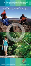
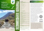
Kaimanawa Forest Park DOC Brochure - Lake Taupo
Kaimanawa Forest Park DOC Brochure - Lake Taupo
Kaimanawa Forest Park DOC Brochure - Lake Taupo

You also want an ePaper? Increase the reach of your titles
YUMPU automatically turns print PDFs into web optimized ePapers that Google loves.
<strong>Kaimanawa</strong><br />
<strong>Forest</strong> <strong>Park</strong><br />
Central North Island
Contents<br />
Welcome to <strong>Kaimanawa</strong> <strong>Forest</strong> <strong>Park</strong> 1<br />
Natural history 1<br />
Access 5<br />
Safety 6<br />
Other activities 8<br />
Accomodation 9<br />
Walking and tramping 12<br />
Tracks and marked routes 13<br />
From Clements Mill and Taharua Roads 13<br />
From Kiko Road 15<br />
From <strong>Kaimanawa</strong> Road 16<br />
From Waipākihi Road 17<br />
From the Desert Road summit 18<br />
Short walks and bike rides 19<br />
From Kiko Road 19<br />
From <strong>Kaimanawa</strong> Road 19<br />
From Tree Trunk Gorge Road 21<br />
Further information 21<br />
Welcome to <strong>Kaimanawa</strong> <strong>Forest</strong> <strong>Park</strong><br />
<strong>Kaimanawa</strong> <strong>Forest</strong> <strong>Park</strong> is made up of four mountain ranges<br />
dissected by a number of large river systems. It lies south-east<br />
of <strong>Lake</strong> Taupō, between Tongariro National <strong>Park</strong> to the west,<br />
and Kaweka <strong>Forest</strong> <strong>Park</strong> to the east. Altitudes vary from 560<br />
metres in the north, to the highest point Makorako at 1727<br />
metres in the centre of the park.<br />
The <strong>Forest</strong> <strong>Park</strong> (77, 348 hectares) was gazetted in 1969 and is<br />
managed by the Department of Conservation (<strong>DOC</strong>).<br />
Natural history<br />
Geology<br />
The ranges of <strong>Kaimanawa</strong> <strong>Forest</strong> <strong>Park</strong> are composed of uplifted<br />
fractured greywacke, (coarse-grained sedimentary sandstone)<br />
that formed 300 - 145 million years ago. Volcanic materials<br />
from various Taupō eruptions blanket some of the ridges and<br />
terraces, (Ignimbrite Saddle on the Middle Range is a good<br />
example) and are the basis of most of the park’s soils.<br />
Plants<br />
Temperature, rainfall, soil fertility and drainage all play their<br />
part in determining what plants grow where within the park.<br />
History is also an important factor, with some species such<br />
as silver, red and mountain beech not yet reaching their full<br />
potential distributions, following the devastating Taupō 232 AD<br />
eruption. In general, the vegetation of the park conforms to the<br />
following patterns; red and silver beech dominate the North,<br />
podocarp broadleaved forest (rimu, mataī, miro and kāmahi)<br />
occurs at lower altitude in the west, and mountain beech is<br />
abundant in the south. <strong>Forest</strong> gives way to scrub, tussock<br />
and alpine herb fields at the tree line (which ranges between<br />
1300 to 1500 m above<br />
sea level) and in the<br />
interior valleys where<br />
cold air ponding<br />
prevents tall forest<br />
establishment.<br />
Human induced fire<br />
has also affected parts<br />
of the south and east<br />
of the park.<br />
Cover photo: Urchin Track. Photo: J Carman.<br />
Waipākihi headwater bog plants with beech forest<br />
beyond. Photo: N. Singers.<br />
1
Giant snails, birds and bats<br />
Powelliphanta marchanti, an indigenous land snail, is found<br />
in the headwaters of the Rangitīkei River. <strong>DOC</strong> is putting<br />
particular effort into protecting these large, unique creatures<br />
which are very vulnerable to predation by possums and rats.<br />
Insect life is diverse but is most noticeable above the bushline.<br />
Introduced animals<br />
Sika and red deer are present in the park. The sika herd,<br />
which also inhabits neighbouring Kaweka <strong>Forest</strong> <strong>Park</strong> and<br />
the Ahimanawa area, is the only wild herd in the southern<br />
hemisphere. The northern part of <strong>Kaimanawa</strong> <strong>Forest</strong> <strong>Park</strong> is a<br />
Recreational Hunting Area where recreational hunting is the<br />
primary means of deer control.<br />
Possums are found throughout the park and permits to poison<br />
or trap them are issued on a block basis. Applications for<br />
possum permits should be made to the <strong>DOC</strong> office in Turangi.<br />
Other animal pest species present include rats, feral cats,<br />
stoats, ferrets and weasels. All these animal pests pose a major<br />
threat to the park’s native plants or animals.<br />
Brown and rainbow trout are established in most of the park’s<br />
larger river systems.<br />
Giant snail eating earthworm. Photo: A. Paget.<br />
The most common native birds here are the kererū (NZ<br />
pigeon), fantail (pīwakawaka), bellbird (korimako), rifleman<br />
(tītipounamu), North Island robin (toutouwai), grey warbler<br />
(riroriro), whitehead (pōpōkotea), kākāriki (parakeet) and<br />
morepork (ruru). Falcon (kāreraea), pipit (pīhoihoi), tūī, fernbird<br />
(mātātā), kākā, and black and pied shags (kawau tuawhenua<br />
and kāruhiruhi) are present in lesser numbers. In summer you<br />
might hear shining or long-tailed cuckoos (pīpīwharauroa or<br />
koekoeā) which fly in each year from wintering grounds in the<br />
Pacific. The rare blue duck (whio) are especially adapted to<br />
fast flowing rivers; they camouflage well, but can be spotted by<br />
following the male's whistle call. Low numbers of kiwi remain<br />
in the park. All birdlife is protected. Please remember that dogs<br />
are a real threat to many bird species (particularly kiwi and blue<br />
duck) and must be kept under control at all times.<br />
Small colonies of short-tailed and<br />
long-tailed bats occur in northern<br />
and western parts of the park.<br />
Long-tailed bats can sometimes<br />
be seen at dusk flitting around in<br />
search of insects.<br />
Whio / blue duck. Photo: A. Reith.<br />
Sika stag. Photo: M. Cleaver.<br />
History<br />
The name <strong>Kaimanawa</strong> is derived from the words of<br />
Hapekituarangi. On his travels he met Ngātoro-i-rangi of<br />
the waka Te Arawa who asked him why he was in such a cold<br />
and barren country. Hapekituarangi looked towards the<br />
<strong>Kaimanawa</strong> Ranges and replied “My breath (manawa) is my<br />
food (kai).” Māori travelled widely through this area along<br />
traditional routes and camps and settlements existed in several<br />
sites.<br />
Europeans began exploring and surveying the area from the<br />
mid 1800s. Following in the footsteps of these adventurers<br />
were gold miners who sank several shafts and searched for the<br />
elusive metal in all the main rivers and most of the streams<br />
flowing towards <strong>Lake</strong> Taupō.<br />
2 3
Access<br />
Permits<br />
Entry into <strong>Kaimanawa</strong> <strong>Forest</strong> <strong>Park</strong> is unrestricted unless you<br />
take a dog, or a firearm it then becomes necessary to obtain a<br />
permit from <strong>DOC</strong>.<br />
Sid Stanfield's hut about 1960. The hut had to be removed in 2009 due to being in immediate<br />
danger of being lost in the next flood. Photo: Stanfield family.<br />
At the same time sheep were introduced into the ranges, most<br />
notably in the area around where Boyd Hut is now located. By<br />
the 1920s this venture was uneconomical and it was the turn of<br />
the timber industry to try its luck in the area. Between 1937 and<br />
1972, more than 4500 hectares of red and silver beech in the<br />
northern and eastern regions were logged, mainly for splitting<br />
into fencing material.<br />
Commercial deer hunting and government-managed deer<br />
culling operations occurred in the park during the 1950s and<br />
60s - and it was these operations that laid the foundation of the<br />
current track system.<br />
CLEAN<br />
DRY CHECK<br />
BETWEEN WATERWAYS<br />
Check, Clean, Dry<br />
Stop the spread of didymo and other freshwater pests.<br />
Remember to Check, Clean, Dry all footwear, bicycles,<br />
vehicles, fishing equipment and other items before<br />
entering, and when moving between, waterways.<br />
For more information and cleaning guidelines go to<br />
www.biosecurity.govt.nz/didymo or www.doc.govt.nz/stopthespread<br />
Vehicle access to tracks<br />
Vehicles may not be driven off formed and maintained roads.<br />
Do not leave valuables in vehicles parked at the roadends:<br />
thefts sometimes occur.<br />
Aircraft access<br />
One airstrip and a number of helipads allow light aircraft and<br />
helicopter access into the park. A permit is required to land at<br />
Boyd Airstrip and designated helicopter landing sites (see map,<br />
pages 10 - 11). To apply for a permit, please contact the <strong>DOC</strong><br />
office in Turangi, phone +64 7 384 7106, email tnat@doc.govt.nz<br />
Private land<br />
Large blocks of private land dissect the park. If you intend to<br />
cross private land you must first obtain a permit from the<br />
appropriate landowner. Hunting permits from <strong>DOC</strong> do not<br />
confer right of access across private land.<br />
• The lower Oamaru Valley (south-east bank); the upper<br />
Ngaruroro River including the Mingimingi and Te Wai o<br />
Tupuritia Streams; the headwaters of the Rangītikei and<br />
Tauranga-Taupō Rivers. East Taupō Lands block. Private<br />
Land. No access. Enquiries to Tongariro Aviation, phone<br />
+64 7 386 6580 or +64 21 072 4782<br />
• The large tract of land south of the Mangamingi Stream<br />
between the Ngaruroro and Mangamaire rivers. Contact<br />
Helisika, phone +64 7 384 2816<br />
• The southern bank of the Waipākihi River below the<br />
Waipākihi Gorge to Waikato Stream and extending south<br />
into the ‘Needles Block’. Contact <strong>Kaimanawa</strong> 3B2A and<br />
3B2B Trust, Danny Loughlin, phone +64 7 376 0092 or<br />
email Danny@blackburnegroup.co.nz<br />
• The Rangipō Blocks north of Waikato Stream and east of<br />
the Desert Road. Contact Tūwharetoa Māori Trust Board<br />
phone +64 7 386 8832<br />
• South of the Rangitīkei River and Makahikatoa confluence<br />
on the true left bank. Contact Ngamatea Station, phone<br />
+64 6 388 0883<br />
4 5
Safety<br />
Weather<br />
The weather in the park is extremely changeable and visitors<br />
should be prepared for cold wet conditions even in summer.<br />
Frosts and snow are likely on high ground throughout the year.<br />
River levels can rise very quickly during and after heavy rain.<br />
Check the forecasts before you leave: www.metservice.co.nz<br />
Maps<br />
The maps required for longer trips into the <strong>Kaimanawa</strong> Ranges<br />
are NZTopo50 map sheets:<br />
• BH35 Turangi<br />
• BH36 Motutere<br />
• BH37 Rangitaiki<br />
• BJ35 Waiouru<br />
• BJ37 Kuripapango<br />
Communication<br />
Be aware that in many parts of the park there is no signal for<br />
cell phones and VHF radio contact can be marginal. The most<br />
reliable communication is by the Mountain Radio Service. The<br />
Central North Island booking office, phone +64 7 345 9687 or<br />
email cnimrs@clear.net.nz<br />
Conditions can change rapidly. Be prepared!<br />
Essential gear<br />
• A good raincoat and over-trousers<br />
• Warm clothing (wool or polypropylene)<br />
• Strong, comfortable tramping boots or shoes for shorter<br />
walks<br />
• A first aid kit<br />
• Food and water<br />
• Sunscreen, sunglasses, sunhat, gloves and a warm hat<br />
• For tramping trips you will need other items such as a cooker,<br />
plenty of food and drink, a good map and compass or GPS.<br />
Intentions<br />
Check the route with <strong>DOC</strong> staff before you leave and obtain<br />
up-to-date information on the area.<br />
Tell someone responsible where you are going and your<br />
estimated time of arrival back. Use the online intention system:<br />
www.adventuresmart.org.nz/outdoors-intentions<br />
River crossings<br />
Rivers can rise rapidly during<br />
heavy rain and caution is<br />
advised particularly when<br />
crossing larger rivers such<br />
as the Mohaka, Oamaru,<br />
Ngaruroro and Waipākihi<br />
Rivers. Genesis advises<br />
flows on the Waipākihi River,<br />
phone +64 7 386 8113 or<br />
search ‘River Flow’ on<br />
www.genesisenergy.co.nz<br />
Fire<br />
During periods of extreme fire danger the lighting of fires in<br />
the open may be prohibited. Portable stoves are preferable to<br />
open fires. If you must use a wood fire, obtain firewood from<br />
dead trees only.<br />
Water<br />
Due to the risk of exposure to Giardia we recommend that all<br />
drinking water be treated or boiled.<br />
6 7
Other activities<br />
Hunting<br />
The sika herd in the <strong>Kaimanawa</strong> <strong>Forest</strong> <strong>Park</strong> is internationally<br />
recognised and the world class trophy antlers are keenly sought.<br />
The Recreational Hunting Area in the northern part of the park<br />
is one of the most popular in the country, and with sika venison<br />
being highly regarded, hunting pressure is constant throughout<br />
the year, especially in the more accessible areas. During the<br />
roar and over holiday periods even the more remote areas are<br />
intensively used. Sika deer are elusive and difficult to hunt.<br />
To find out more about hunting sika in the <strong>Kaimanawa</strong> <strong>Forest</strong><br />
<strong>Park</strong> visit www.doc.govt.nz/huntsika. Hunting permits are now<br />
available on line http://huntingpermits.doc.govt.nz and from<br />
the <strong>DOC</strong> office in Turangi. Permits are issued for 4 month<br />
periods.<br />
Fishing<br />
Most rivers in the park contain trout: some have both brown and<br />
rainbow trout (Rangitīkei, Mohaka and Ngaruroro), while others<br />
have only rainbow (Waipākihi). You must have a Taupō fishery<br />
licence to fish the rivers forming the <strong>Lake</strong> Taupō watershed. The<br />
remainder of the forest park is covered by Fish and Game Council<br />
licences. Fishing licences are available from sports shops.<br />
Rafting and kayaking<br />
The most popular river for both commercial and private rafters<br />
and kayakers is the Tongariro. The main access point within<br />
the park is at Poutu Intake off <strong>Kaimanawa</strong> Road. Fly-in access<br />
to the more remote Mohaka, Ngaruroro and Rangitīkei rivers<br />
is possible. All these rivers require a high level of skill and<br />
experience to negotiate.<br />
Accomodation<br />
Hunter takes aim on the U2U ridge. Photo: K. Turia.<br />
Dogs<br />
Hunters and trampers must obtain a permit to take a dog into<br />
the <strong>Kaimanawa</strong> <strong>Forest</strong> <strong>Park</strong>. Hunters can apply to take more<br />
than one dog. Permits are available from the <strong>DOC</strong> office in<br />
Turangi.<br />
Mountain bikes<br />
The park offers some opportunities for mountain biking (see<br />
pages 13, 19 - 21). Horses, trail bikes, four wheel drives and offroad<br />
vehicles are not permitted on walking tracks or off formed<br />
roads. Please contact the <strong>DOC</strong> office in Turangi to find out<br />
where these activities are available.<br />
Roadend camping<br />
A pleasant vehicle-accessible campground is located off<br />
<strong>Kaimanawa</strong> Road at the start of the Tree Trunk Gorge<br />
Track. Other sites are located alongside Waikoko Stream off<br />
<strong>Kaimanawa</strong> Road and along Clements Mill Road. They are basic<br />
and only some have toilets.<br />
Huts<br />
• Boyd Hut (16 bunks)<br />
• Oamaru Hut (12 bunks)<br />
• Waipākihi Hut (12 bunks)<br />
• Cascade Hut (6 bunks)<br />
The four huts in the park<br />
operate on a first-come, firstserved<br />
basis. Each is equipped<br />
with a coal/wood range, an axe, shovel and<br />
bunks with mattresses.<br />
To preserve the vegetation around the huts solid fuel is supplied.<br />
Please use sparingly. Before leaving extinguish the fire, ensure<br />
the hut is clean and tidy, doors and windows are secured,<br />
firewood restocked, tools are inside and food is secured from<br />
vermin. Take all rubbish out with you.<br />
Waipākihi Hut. Photo: J. Johnson.<br />
Hut fees<br />
Backcountry hut tickets or annual passes, available from <strong>DOC</strong><br />
offices and local information centres, should be purchased before<br />
your trip.<br />
8 9
Map Reference<br />
<strong>Kaimanawa</strong> <strong>Forest</strong> <strong>Park</strong><br />
<strong>DOC</strong> Tracks / Routes<br />
5<br />
Other Public Conservation Land<br />
Public Access Road<br />
Access Road over Private Land<br />
Poronui Access Track<br />
<strong>DOC</strong> Hut<br />
<strong>DOC</strong> Campsite<br />
Helicopter Landing Site<br />
Airstrip<br />
Waitahanui River<br />
Taharua Road<br />
<strong>Lake</strong> Taupō<br />
Tauranga - Taupō River<br />
41<br />
Turangi<br />
1<br />
Clements Mill Road<br />
Waimarino River<br />
Kiko Road<br />
47<br />
Tiraki<br />
Stream<br />
1<br />
Waiotaka River<br />
Tongariro River<br />
<strong>Lake</strong><br />
Rotoaira<br />
46<br />
Waiotaka<br />
River<br />
16<br />
7<br />
Cascade<br />
Hut<br />
5<br />
6<br />
Kaipō River<br />
2<br />
Taharua River<br />
Tongariro<br />
National<br />
<strong>Park</strong><br />
See<br />
Enlargement<br />
1<br />
21<br />
9<br />
10<br />
8<br />
11<br />
13<br />
12<br />
Waipākihi<br />
Hut<br />
14<br />
Thunderbolt<br />
Tops<br />
Pox<br />
Clearing<br />
East Taupō Lands block<br />
(Private land)<br />
Mangamaire River<br />
Boyd<br />
Hut<br />
4<br />
Ngaruroro<br />
River<br />
3<br />
Oamaru River<br />
Kaweka<br />
<strong>Forest</strong> <strong>Park</strong><br />
Oamaru<br />
Hut<br />
Rangipō Intake<br />
Road<br />
Waipākihi Road<br />
12<br />
Waipākihi River<br />
Remote Experience Zone<br />
Enlargement<br />
1<br />
<strong>Kaimanawa</strong> Road<br />
River<br />
8<br />
21<br />
17<br />
18<br />
Rangitīkei River<br />
1<br />
15<br />
Tree Trunk Gorge Road<br />
Tongariro<br />
20<br />
19<br />
9<br />
10 11
EXPERT<br />
Walking and tramping<br />
Track standards<br />
Tracks described in this booklet are classified as follows:<br />
Short walks: are well formed for up to an hour’s easy<br />
walking with few if any steps. They may be suitable<br />
for people with limited mobility.<br />
Walking tracks: are well defined reasonably easy<br />
extended walks for up to a full-day return. Major<br />
water courses are bridged and track entrances and<br />
junctions are sign posted.<br />
Tramping tracks: generally follow the lie of the<br />
land with an unformed surface. They are marked<br />
with directional markers, poles or cairns. Tracks are<br />
suitable for backcountry visitors with moderate to<br />
high level backcountry skills and experience. Major<br />
watercourse bridges may be 3-wire crossings.<br />
Routes: are unformed and may have a rough surface.<br />
Routes are suitable only for people with high level<br />
backcountry navigation and river-crossing skills and<br />
experience. Marking with cairns, poles or triangle<br />
markers is provided.<br />
Mountain biking: The mountain bike grading system<br />
was developed in liaison with key stakeholders;<br />
Grade 2: Mostly flat with some gentle<br />
climbs on smooth track with easily<br />
EASY<br />
avoidable obstacles such as rocks and<br />
potholes.<br />
Grade 3: Steep slopes and/or avoidable<br />
obstacles possibly on narrow track and/or<br />
INTERMEDIATE<br />
with poor traction. There may be exposure<br />
at the tracks outside edge.<br />
Grade 5: Technically challenging. Giant<br />
climbs, narrow track and numerous hazards<br />
including dangerous drop-offs, sharp<br />
EXPERT<br />
corners and difficult obstacles. Expect<br />
walking and possibly bike carrying.<br />
Track times<br />
The times listed in the following section are considered<br />
feasible for a moderately fit person carrying a normal amount<br />
of equipment. They do not include stopping times.<br />
Tracks and marked routes<br />
From Clements Mill and Taharua Roads<br />
Road access: 27 km east of Taupō. Turn right off State<br />
Highway 5 (Napier-Taupō Road) into Taharua Road. After 9.5 km<br />
either turn right onto Clements Mill Road (21 km to the road<br />
end) or continue to the end of Taharua Road (10 km).<br />
1. Clements Mill Road to Oamaru Hut via Te Iringa - 19 km<br />
6 to 8 hours<br />
4 to 6 hours*<br />
This shared tramping/mountain bike track leaves from the car<br />
park 5 km along Clements Mill Road. It climbs to a clearing<br />
where the Te Iringa Hut used to be (1 - 2 hours), then skirts<br />
around Mt Te Iringa (1241 m), before dropping down to the<br />
Tikitiki Stream/Kaipō River junction, where the track forks at a<br />
swingbridge. Take the main track straight ahead and follow the<br />
true right of the Kaipō River down to Oamaru Hut (12 bunks),<br />
situated near the confluence of the Kaipō and Oamaru rivers.<br />
* Mountain bike use of this<br />
track is under trial. Mountain<br />
bike access is a return trip<br />
only. Absolutely no access<br />
through Poronui Station or<br />
other tracks in the area.<br />
NB: Te Iringa Hut has<br />
burnt down and will not be<br />
replaced. It may show on<br />
older maps.<br />
2. Taharua roadend to Oamaru Hut - 12 km<br />
4 hours<br />
<strong>Park</strong> in the car park beside the helicopter hanger at the<br />
Taharua roadend. Follow the poled route through Poronui<br />
Station. From near the Mohaka River a new track links from<br />
the end of the poled route to Oamaru Hut via a crossing of the<br />
Kaipō River.<br />
As a condition of access through Poronui Station absolutely<br />
no hunting or mountain bikes allowed. Hunters must remove<br />
rifle bolts. Fishing is allowed with marked side tracks to the<br />
Taharua River.<br />
12 13
3. Oamaru Hut to Boyd Hut - 16 km<br />
4 to 6 hours<br />
From Oamaru Hut the track follows the true left bank of the<br />
Oamaru River before crossing the headwaters and following<br />
the Waitawhero Stream up to a saddle. At this point the track<br />
emerges at the forest edge of the upper Ngaruroro. Across the<br />
valley the Boyd airstrip can be seen. Boyd Hut is obscured by<br />
beech forest behind the airstrip.<br />
4. Boyd Hut to Cascade Hut via Maungaorangi - 18 km<br />
8 to 10 hours<br />
This strenuous track from Boyd Hut follows the track<br />
over Waitawhero Saddle towards Oamaru Hut. Near the<br />
confluence of the Waitawhero and Oamaru streams the route<br />
turns left onto a long, steep ridge up Maungaorangi. On the<br />
tops the route is marked with poles. It then descends to Te<br />
Waiotupuritia Saddle and on down to Cascade Hut. A map and<br />
compass are essential. GPS are recommended.<br />
5. Cascade Hut to Clements Mill Road end<br />
(Hinemaiaia Track) - 12 km<br />
4 to 5 hours<br />
The track follows the open river flats of the Tauranga-Taupō<br />
River downstream before climbing away from the river up a<br />
prominent beech-covered ridge. The track drops back down to<br />
the Clements Mill roadend following the Hinemaiaia Stream<br />
and its tributaries.<br />
6. Upper Kaipō Valley Route (Kaipō Track) - 11.5 km<br />
6 to 9 hours<br />
A marked route runs from the swingbridge on the Te Iringa/<br />
Oamaru Track (see 1) to Cascade Hut. In the upper reaches<br />
of the Kaipō River there are numerous river crossings and log<br />
jams to negotiate, so be aware that this is a time-consuming<br />
section. The track then climbs to a ridge just south of Kaipō<br />
Saddle. Descend off the ridge to Cascade Stream and the track<br />
junction. The right-hand track heads downstream for another<br />
30 minutes to Cascade Hut.<br />
Cascade Stream. Photo: J. Johnson.<br />
From Kiko Road<br />
Kiko Road turns off State Highway 1, 10 km north of Turangi.<br />
Kiko Road runs 17 km through the privately owned <strong>Lake</strong> Taupō<br />
<strong>Forest</strong> to the park boundary.<br />
7. Ngāpuketūrua Hunting Access - 9 km<br />
4 to 5 hours<br />
This track once led from Kiko Road over Ngāpuketūrua to<br />
Cascade hut, but now access ends at the park boundary, about<br />
5.5 km from Kiko Road. The first section of this track is wellbenched<br />
and graded, but after about 30 minutes it begins<br />
to climb steeply through beech forest giving access to good<br />
hunting country below the Ngāpuketūrua bush line.<br />
Cascade Hut. Photo: J. Mytton.<br />
14 15
From <strong>Kaimanawa</strong> Road<br />
<strong>Kaimanawa</strong> Road turns off State Highway 1, 15 km south of<br />
Turangi.<br />
8. Umukarikari Track to Waipākihi Hut - 14 km<br />
6 to 8 hours<br />
The track climbs steadily through beech forest to the treeline.<br />
From there poles mark the route along the Umukarikari Range<br />
before dropping down to Waipākihi Hut (12 bunks). The walk<br />
along the tops can offer wonderful views but conditions can<br />
change quickly. In bad weather the route is very exposed and<br />
visibility can be reduced to a few metres. Be prepared for all<br />
weather conditions.<br />
9. Urchin Trig return - 6.6 km<br />
3 to 4 hours<br />
The track climbs steadily up through beech forest and above<br />
the bush line to the Urchin Trig (1391 m). The upper section<br />
of the track has an interesting array of alpine plants and a<br />
wide vista of <strong>Lake</strong> Taupō and the volcanoes of the Tongariro<br />
National <strong>Park</strong>.<br />
Urchin Trig. Photo: K. Turia.<br />
11. U2U: Urchin to Umukarikari loop - 18.5 km<br />
8.5 - 10 hours<br />
Starting on the Urchin track, climb up onto the tops, but<br />
instead of dropping down to the Waipākihi River Valley, carry<br />
on straight ahead towards Sharp Cone (1481 m) following a<br />
bushed ridge line. Once you meet the Umukarikari track, the<br />
track carries on west along the tops and then drops down to<br />
the Umukarikari carpark. This has become a popular long one<br />
day loop, but please note a car shuttle is required, as there is a<br />
distance between Urchin and Umukarikari carparks.<br />
U2U track. Photo: K. Turia.<br />
From Waipākihi Road<br />
Waipākihi Road turns off State Highway 1, 38 km south of<br />
Turangi.<br />
12. Waipākihi Roadend to Waipākihi Hut - 23 km<br />
8 to 12 hours<br />
This valley provides relatively easy walking and excellent<br />
hunting. The valley is accessible from Waipākihi Road to the<br />
south and over either the Urchin or Umukarikari Track further<br />
upstream. There is no defined track and frequent river crossings<br />
are necessary. There are many good campsites along the river.<br />
10. Urchin Track to Waipākihi Valley - 7 km<br />
Waipākihi Road crosses private land and the true left of the<br />
river, upstream from Waikato Stream, is also private land. See<br />
3 to 4 hours<br />
page 5 for information about access over private land.<br />
This track gives access to the mid reaches of Waipākihi River<br />
Valley. The track climbs steadily up to Urchin Summit (1391 m) NB: River levels can rise rapidly during and after heavy rain<br />
then travels for about 2 km across open tops before dropping<br />
and knowledge of proper river crossing techniques is required<br />
sharply down to the river valley. There are many great<br />
when the river is high. Waipākihi normal flow is 8 - 10 cumecs,<br />
places to camp in the valley or you can continue upstream to<br />
high is 13 and over.<br />
Waipākihi Hut near the top of the valley (an additional 5 - 6<br />
For the latest updates please call the Flow Phone: +64 7 386 8113<br />
hours walk. See 12).<br />
or search ‘River Flow’ on www.genesisenergy.co.nz<br />
16 17
13. Thunderbolt Route - 1.3 km<br />
1 hour<br />
This is a popular hunting access route from the Waipākihi River<br />
to gain access to the Thunderbolt tops. It is a short steep climb.<br />
View from Thunderbolt tops. Photo: M. Deudal.<br />
14. Waipākihi Middle Range Route - 0.8 km<br />
30min to 1 hour<br />
Follow the blue poles downstream from the hut to the bush edge<br />
and climb through the bush to gain access to Middle Range tops.<br />
From the Desert Road summit<br />
15. Rangitīkei River Access / Southern Access Corridor -<br />
21.5 km<br />
10 to 12 hours<br />
42 km south of Turangi, near the Desert Road summit, a car<br />
park and signpost indicate the start of the access corridor.<br />
The route is poled as far as the bushline above Otamateanui<br />
Stream. A marked track descends through the beech forest<br />
steeply into Otamateanui Stream. Carry on down the stream<br />
7 km to its confluence with the Rangitīkei River. Beware most<br />
of this route follows the army land boundary, so please keep to<br />
this route for your own safety.<br />
Unmarked Backcountry Routes<br />
There are many opportunities in <strong>Kaimanawa</strong> <strong>Forest</strong> <strong>Park</strong> for<br />
backcountry travel along untracked river valleys and open<br />
tops. However, these routes are not marked and those using<br />
them need to be experienced, well-prepared and familiar with<br />
navigation in isolated country. The options are not described<br />
in this booklet but more information can be obtained from the<br />
<strong>DOC</strong> office in Turangi.<br />
Short walks and bike rides<br />
From Kiko Road<br />
Kiko Road turns off State Highway 1, 10 km north of Turangi.<br />
Kiko Road runs 17 km through the privately owned <strong>Lake</strong><br />
Taupō <strong>Forest</strong> to the park boundary.<br />
16. Kiko Road Loop Track - 3.8 km<br />
1 to 1½ hours<br />
45 minutes<br />
This combined walking/mountain bike track leaves from<br />
the end of Kiko Road. Travelling clockwise the track passes<br />
through podocarp forest that merges into red and silver beech.<br />
After 40 to 50 minutes the junction with the Ngāpuketūrua<br />
Track is reached. Turn right and take the gently undulating<br />
track back to the car park.<br />
From <strong>Kaimanawa</strong> Road<br />
<strong>Kaimanawa</strong> Road turns off State Highway 1, 15 km south of<br />
Turangi.<br />
17. Pillars of Hercules Lookout<br />
This spectacular ravine can be viewed from a 40 m long<br />
suspension bridge beside the car park.<br />
18 19<br />
EASY<br />
View from swingbridge looking down on the Pillars of Hercules. Photo: A. McKnight.
18. Pillars of Hercules to Urchin Camping Area - 1.5 km<br />
30 minutes one way<br />
INTERMEDIATE<br />
15 minutes one way<br />
From the Pillars of Hercules car park this pleasant dual-use<br />
track wends its way up to the Urchin campground through<br />
kāmahi and beech forest with the occasional tōtara. It’s<br />
generally well graded but there are a couple of short steeper<br />
sections.<br />
19. <strong>Kaimanawa</strong> <strong>Forest</strong> Loop Walk - 1.1 km<br />
20 minutes<br />
Starts and finishes beside the Urchin Camping Area, 3 km<br />
along <strong>Kaimanawa</strong> Road. This is an easy loop walk through<br />
beautiful forest dominated by red beech.<br />
20. Tree Trunk Gorge Track - 4.6 km<br />
1½ hours one way<br />
INTERMEDIATE<br />
1 hour one way<br />
This combined walking/mountain bike track can be accessed<br />
from either the Urchin Camping Area off <strong>Kaimanawa</strong> Road or<br />
from Tree Trunk Gorge Road. Either way it is generally well<br />
graded as it follows the line of an old road associated with the<br />
Tongariro Power Scheme. Red beech surrounds the track for<br />
most of the way but close to the Tree Trunk Gorge end an open<br />
ridge provides good<br />
views out to Tongariro<br />
National <strong>Park</strong>. There are<br />
several small streams<br />
to cross and one larger<br />
one 15 minutes from the<br />
southern exit/entrance.<br />
Most are fairly easy to<br />
negotiate unless there<br />
has been recent heavy<br />
rain.<br />
Admiring one of the big native trees on the<br />
<strong>Kaimanawa</strong> <strong>Forest</strong> Loop Walk.<br />
Photo: A. McKnight.<br />
This is a dual-use<br />
track; mountain bikers<br />
must watch for and<br />
be considerate of<br />
pedestrians.<br />
From Tree Trunk Gorge Road<br />
Tree Trunk Gorge Road turns off State Highway 1, 23 km south<br />
of Turangi. Access to the Tongariro River and the Tree Trunk<br />
Gorge Track (19).<br />
21. Tree Trunk Gorge / Desert Road Loop - 17 km<br />
3 to 4 hours<br />
INTERMEDIATE<br />
2 to 4 hours<br />
This enjoyable route is generally fairly well graded and can be<br />
ridden in either direction but is described here from the Tree<br />
Trunk Gorge Road end. The first downhill can be slippery and<br />
at the bottom of the descent is a small river which can become<br />
impassable after rain but is generally rideable. Carry on along<br />
the track to the Urchin Camping Area, then follow the Pillars<br />
of Hercules to Urchin Camping Area Track (18) to reach the<br />
Pillars of Hercules suspension bridge. Cross to the 4WD road<br />
and follow this up and out to State Highway 1 (about 25 to 40<br />
minutes). From here it is a 2.5 km cycle up the highway and 4.5 km<br />
down Tree Trunk Gorge Road to the starting point.<br />
Further information<br />
About the Department of Conservation<br />
The Department of Conservation is the government<br />
department charged with conserving New Zealand’s natural<br />
and historic heritage for all to enjoy now and in the future. It<br />
has a range of functions with a particular emphasis on:<br />
• Managing threatened species and ecosystems and<br />
minimising biosecurity risks<br />
• Restoration, maintenance, protection and interpretation of<br />
important historic and cultural sites on public conservation<br />
land<br />
• Promoting appropriate recreation and increasing public<br />
enjoyment of protected places<br />
• Developing partnerships with the community and tangata<br />
whenua.<br />
20 21
Contacts:<br />
Department of Conservation<br />
Taupō-nui-ā-Tia Area Office<br />
Turanga Place<br />
Private Bag 2<br />
Turangi 3353<br />
Phone: +64 7 384 7106<br />
Email: tnat@doc.govt.nz<br />
Waipākihi River. Photo: J. Johnson.<br />
• Protect plants and animals<br />
• Remove rubbish<br />
• Bury toilet waste<br />
• Keep streams and lakes clean<br />
• Take care with fires<br />
• Camp carefully<br />
• Keep to the track<br />
• Consider others<br />
• Respect cultural heritage<br />
Enjoy your visit and Toitu te whenua / leave the land undisturbed<br />
Published by<br />
Department of Conservation<br />
Taupō-nui-ā-Tia Area Office<br />
Private Bag 2<br />
Turangi 3353<br />
New Zealand<br />
August 2012<br />
22<br />
9 421005 171754 >