nature's great escape - Lake Taupo
nature's great escape - Lake Taupo
nature's great escape - Lake Taupo

Create successful ePaper yourself
Turn your PDF publications into a flip-book with our unique Google optimized e-Paper software.
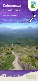
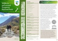
A Guide to walks and hikes around<br />
the Great <strong>Lake</strong> Taupö District<br />
$3.00<br />
nature’s <strong>great</strong> <strong>escape</strong><br />
Rocky Road Nature’s Path<br />
Great<strong>Lake</strong><strong>Taupo</strong>.com
The Great <strong>Lake</strong> Taupö region has<br />
some of the finest examples of<br />
untouched, unspoilt, uncrowded<br />
country in New Zealand.<br />
WELCOME<br />
Nau mai, haere mai. Welcome to the Great <strong>Lake</strong><br />
Taupö District.<br />
Many outdoor activities are available here. Some of<br />
the most popular are walking, hiking and cycling.<br />
This brochure gives a brief outline of walks and<br />
tracks around <strong>Lake</strong> Taupö - from the town of Taupö<br />
to Turangi; from Kinloch to the Kaimanawas. They<br />
cover a range of environments from lake and river<br />
walks to tracks in thermal and historic areas. Cycling<br />
opportunities included in this brochure are shared<br />
with pedestrians. A dedicated cycle brochure is also<br />
available from local visitor information centres.<br />
As the Taupö area continues to grow more walking<br />
and cycling tracks will develop.<br />
This brochure is jointly produced by the Taupö<br />
District Council, Destination Great <strong>Lake</strong> Taupö and<br />
the Department of Conservation.<br />
Cover Images: Kaimanawa Ranges & Hukafalls Walkway<br />
Left: Sunset over the mountains from Southern <strong>Lake</strong> Taupö beach<br />
Just south of Great <strong>Lake</strong> Taupö is the Tongariro<br />
National Park, New Zealand’s first national park<br />
and a World Heritage Area. On the western side of<br />
the lake, the Pureora Conservation Park is home to<br />
such rare creatures as the shy Kaka or bush parrot.<br />
To the east of the lake, the Kaimanawa Ranges<br />
contain vast ancient beech forests. And at the<br />
lake’s southern end is one of the world’s most<br />
famous trout rivers, the Tongariro.<br />
This brochure provides a guide to some of the<br />
more popular walks and hikes in these and other<br />
areas of this beautiful region.<br />
Ora Garden - Taupö Museum<br />
1
CONTENTS<br />
Beginnings 3<br />
General information 4<br />
Track information 6<br />
Taupö town walks 8<br />
Walks close to Taupö town 15<br />
Walks further out of town 22<br />
West Taupö walks 28<br />
Walks near Turangi 31<br />
Kaimanawa Forest Park walks 41<br />
BEGINNINGS<br />
The Taupö area owes its spectacular scenery to its<br />
location in an active volcanic zone. Violent eruptions<br />
have occurred over millions of years creating the<br />
caldera (collapsed volcano) filled by the waters<br />
of <strong>Lake</strong> Taupö, extensive lava plateaux and other<br />
volcanic landforms such as Mt Tauhara. Ash layers,<br />
ignimbrite cliffs, pumice and carbonised wood<br />
fragments provide constant reminders of a history of<br />
volcanic upheaval.<br />
Attracted by the lake and thermal resources, the<br />
area was settled by Maori in the late 14th century,<br />
becoming a stronghold for the Ngati Tuwharetoa<br />
people. European visitors came to the scenic heart<br />
of the North Island in the middle of the 19th century<br />
and settled here from about 1860.<br />
<strong>Lake</strong> Taupö:<br />
• Is 622 km 2 in size<br />
• Reaches 160 m in depth<br />
• Occupies a series of old volcanic craters<br />
• The most recent eruption occurred about 1800<br />
years ago when 60 km 3 of debris was blasted out<br />
of a single vent<br />
• Its full name is Taupö-nui-a-Tia (the <strong>great</strong> cloak of Tia).<br />
Tia was a chief and explorer from the waka Arawa<br />
2<br />
2<br />
3
For Further Information<br />
Taupö i-SITE Visitor Centre<br />
Tongariro Street, <strong>Taupo</strong><br />
Phone: 0800 LAKE TAUPO (525 382)<br />
Email: taupovc@<strong>great</strong>laketaupo.com<br />
Text: 027 GREATLK (4732858)<br />
Turangi i-SITE Visitor Centre<br />
Ngawaka Place, Turangi<br />
Phone: 0800 TURANGI (288 726)<br />
Email: turangivc@<strong>great</strong>laketaupo.com<br />
Taupö District Council<br />
Rifle Range Road, Taupö<br />
Phone: 07 376 0899<br />
Email: info@taupo.govt.nz<br />
www.taupo.govt.nz<br />
Department of Conservation<br />
Taupö Field Centre<br />
PO Box 528, <strong>Taupo</strong> 3351<br />
Phone: 07 378 3885<br />
Tongariro/Taupö Conservancy<br />
Turanga Place, Turangi<br />
Phone: 07 386 8607<br />
Pureora Field Centre<br />
RD7 Te Kuiti<br />
Phone: 07 878 1080<br />
www.doc.govt.nz<br />
Bike Taupö<br />
www.biketaupo.org.nz<br />
Additional Publications<br />
• Kaimanawa Forest Park Map and Brochure<br />
• Tongariro National Park Map<br />
• NZMS 260 Maps: Tongariro, Ruapehu, Kaimanawa<br />
and Pureora<br />
• Pureora Forest Park Brochure<br />
• Wairakei Forest Track System Mountain Bike Map<br />
Available from i-SITE Visitor Centres in the region,<br />
Department of Conservation offices and some sports<br />
shops.<br />
Great <strong>Lake</strong> Taupö Online<br />
Visit us before you arrive. Check out the<br />
following website for more ideas on what to see<br />
and do around Great <strong>Lake</strong> Taupö.<br />
www.Great<strong>Lake</strong><strong>Taupo</strong>.com<br />
Email: info@<strong>great</strong>laketaupo.com<br />
Tongariro River Walkway<br />
4<br />
5
TRACK INFORMATION<br />
CLASSIFICATION<br />
Short walk: well formed track with easy grades.<br />
Constructed to ‘shoe’ standard. Suitable for<br />
people of all ages and abilities.<br />
Walking track: A defined, formed track.<br />
Constructed to ‘shoe’ standard. Suitable for<br />
people of most ages and abilities.<br />
Tramping track: limited track formation, often<br />
with steep grades. ‘Boot’ standard. Suitable for<br />
experienced, well prepared people.<br />
TRACK TIMES AND CONDITION<br />
Times given are approximate. Contact Taupö or<br />
Turangi I-site Visitor Centres or the Department of<br />
Conservation to check on current track and weather<br />
conditions.<br />
DOGS<br />
Dogs, on a leash, are allowed on some tracks<br />
but certain conditions may apply. Contact the<br />
Taupö District Council for a brochure and further<br />
information. Remove all dog droppings.<br />
SYMBOLS USED IN THE BROCHURE<br />
ESSENTIAL GEAR LIST<br />
The following should always be carried<br />
• Waterproof raincoat and warm clothing<br />
• Suncream and sunglasses<br />
• Sunhat and a warm hat<br />
• Drinking water and food<br />
THINK SAFE<br />
• Let a reliable person know your walking plans.<br />
Check in with them on your return. If you are<br />
overdue they should call the police<br />
• Always lock your car and don’t leave valuables<br />
inside it<br />
• Drive with extra care on unsealed or icy roads<br />
ENVIRONMENTAL CARE CODE<br />
Protect plants and animals<br />
Remove rubbish<br />
Bury toilet waste<br />
Keep streams and lakes clean<br />
Take care with fire<br />
Keep to the track<br />
Wheelchair<br />
accessible<br />
Dogs allowed<br />
on leads<br />
Views<br />
Bikes<br />
permitted<br />
Toilet(s)<br />
BBQ<br />
facilities<br />
Picnic<br />
facilities<br />
Information<br />
signs<br />
Swimming Fishing<br />
Historic<br />
site<br />
Boat ramp<br />
Camping<br />
No Fires<br />
allowed<br />
Consider others<br />
Respect our cultural heritage<br />
Enjoy your visit<br />
Toitu te whenua (Leave the land undisturbed)<br />
A white line through a symbol indicates that the<br />
activity is not permitted (e.g. ‘no fires’ see above)<br />
6<br />
7
TAUPÖ TOWN WALKS<br />
At the time of early European settlement (late 1860’s<br />
and 1870’s), Taupö was known as Tapuaeharuru and<br />
was considered by the government of the time to be<br />
strategically important as it stood at ‘the crossroads’<br />
of the North Island. Traditional Maori tracks from<br />
all around the central North Island converged here.<br />
These tracks made up a communication network the<br />
government thought prudent to control.<br />
Today you can enjoy a walk around some historically<br />
significant sites and more recently added attractions<br />
within the CBD. Start at the Taupö i-SITE Visitor<br />
Centre and look out for commemorative plaques at<br />
some locations.<br />
1. <strong>Lake</strong>front Seat<br />
To commemorate Miss Margaret Sweeney’s swim<br />
across Great <strong>Lake</strong> Taupö on 29 January 1955 from<br />
Tokaanu to the foreshore (in front of the seat) a<br />
distance of 42 kilometres.<br />
2. Maori Carvings<br />
These carvings are part of the ‘Reid Carvings’ - a<br />
collection of 51 pieces, mostly located at the Taupö<br />
Museum. They were presented to the people of the<br />
Great <strong>Lake</strong> Taupö Region for safe keeping by the late<br />
Mrs Lucy Rongoheikume Reid, daughter of Joseph<br />
Rickit, one of the original Armed Constabulary<br />
members that settled <strong>Lake</strong> Taupö. The carvings are<br />
the work of master carver, Tene Waitere, a survivor<br />
of the 1886 Mt Tarawera eruption.<br />
3. <strong>Lake</strong>front Lookout<br />
In 1961 the Taupö Lions Club built this lookout which<br />
provides visitors with an expansive view of the lake<br />
and Tongariro National Park (World Heritage Area)<br />
at the southern end of <strong>Lake</strong> Taupö.<br />
4. Electric Trout<br />
The first ‘electric trout’ was created in 1985 for the<br />
Dawn Walker International Trout Fishing Tournament.<br />
In 1999 the Taupö District Council commissioned this<br />
replacement. It was designed and constructed by<br />
Callum Guillemont, a local electrician and craftsman.<br />
Reid Carvings - Taupö Museum.<br />
8<br />
9
5. Pakeke Lions Cobb & Co Express<br />
The monorail train on the South Domain is owned by<br />
the Pakeke Lions Club and operates as a fundraising<br />
venture. The train, locally designed and built, began<br />
operating in 1993.<br />
6. South Domain Gardens and Carvings<br />
In 1993 the Taupö District Council constructed and<br />
developed gardens and a sculpture park in the South<br />
Domain.<br />
7. Auntie Ku’s Garden<br />
This garden is dedicated to Auntie Ku (Miss Ellen<br />
Rickit, 1882-1958) in recognition of her years of<br />
service to the people of Taupö.<br />
8. Taupö Bowling Club<br />
The first school in Taupö was built on land that is now<br />
home to the Taupö Bowling Club. The private school<br />
quickly became too small for the growing population<br />
and in 1894 a new public school was built in Ruapehu<br />
Street.<br />
9. BBQ and seating area<br />
Located at the Yacht Club carpark, this coin operated<br />
BBQ was built by the Taupö Lions Club in 1991. The<br />
small seating area at the river end of the carpark<br />
was constructed by Pakeke Lions in memory of past<br />
members.<br />
10. Petersen Wharf<br />
The Petersen Wharf was constructed by the<br />
Department of Internal Affairs in memory of Lt-<br />
Cmdr Peter Petersen RNZNVR (Great <strong>Lake</strong> Taupö<br />
Harbourmaster from 1955 to 1978).<br />
11. Boat Harbour<br />
Whale boats, used by the Armed Constabulary, were<br />
the first European boats on <strong>Lake</strong> Taupö. The largest<br />
boat on the lake before 1900 was 15m long and<br />
operated a regular passenger service across the lake<br />
to Tokaanu.<br />
12. Taupö Rose Garden<br />
The rose garden was established on the original<br />
Armed Constabulary dump site in a project initiated<br />
by the Rose Society in 1979. The garden is maintained<br />
by the Taupö District Council and is a popular venue<br />
for weddings and picnics.<br />
13. Great <strong>Lake</strong> Taupö Museum and Art Gallery<br />
The Great <strong>Lake</strong> Taupö Museum and Art Gallery<br />
occupy part of the original Post Office building which<br />
was constructed in 1911. This building housed the<br />
Taupö Library until December 1991. Outside the<br />
museum rests an old mill steam engine. The Museum<br />
and Art Gallery display a comprehensive collection<br />
of historical artefacts and a permanent art collection.<br />
Visiting exhibitions are a regular feature.<br />
14. Women’s Suffrage Garden<br />
This garden honours the women, like Kate Sheppard,<br />
who led the campaign for votes for women in 1893.<br />
The garden was created as a centennial project in<br />
1993.<br />
15. Old Oak Tree<br />
This tree was planted in Story Place at least 80 years<br />
ago for John Seddon (New Zealand’s Prime Minister<br />
from 1890 to 1912).<br />
16. Totara Trees<br />
These three totara trees were planted in memory of<br />
New Zealand Prime Minister Norman Kirk (1923 - 1974).<br />
10<br />
11
17. Library and Information Centre<br />
The Taupö Library was opened in 1991. The first<br />
library was established in the 1880s by the Armed<br />
Constabulary Unit near the Redoubt. Since then the<br />
library has always been located in the vicinity of Story<br />
Place (named after Taupö’s first mayor - Joseph Story).<br />
18. Great <strong>Lake</strong> Centre<br />
This centre was opened in 1992 and contains a<br />
hall, theatre, multi-purpose dressing rooms and<br />
ancillary facilities. The Great <strong>Lake</strong> Centre Library<br />
and Information Centre were designed to reflect<br />
the mountains in Tongariro National Park (World<br />
Heritage area). The buildings contain columns with<br />
timber branches and canopies to reflect trees and<br />
much of the planting around the building has blue<br />
flowers to mirror the colour of <strong>Lake</strong> Taupö.<br />
19. Landmark Canoe<br />
(Adjacent to the Taupö Police Station)<br />
This landmark canoe was found in the Opepe area<br />
when the land was being cleared for farming. The<br />
landmark canoe was brought to this site in 1967.It is<br />
the property of the Rutene family who allowed the<br />
canoe to be moved from its historic site.<br />
20. The Armed Constabulary Hall/Old<br />
Courthouse<br />
The Courthouse was built by the Armed Constabulary<br />
in 1881 and was called the Armed Constabulary<br />
Hall before becoming the Courthouse. Discussions<br />
leading to the formation of Tongariro National Park<br />
were held here in the mid 1880s. The building was<br />
originally sited behind the present Magistrate’s Court<br />
until its relocation in 1966. The building is under the<br />
protection of the Historic Places Trust and is currently<br />
home to a local Te Kohanga Reo (a pre-school facility<br />
focusing on Maori language and culture).<br />
21. Redoubt and Powder Magazine<br />
The Tapuaeharuru Redoubt, built around 1870 by<br />
the Armed Constabulary (AC), housed about 30<br />
men. The AC was used to ‘put down rebellion, quell<br />
disturbances, preserve the peace, prevent robberies<br />
and other felonies, and apprehend offenders against<br />
the peace’. Their presence provided the foundation<br />
for the establishment of Taupö township. Vegetable<br />
gardens, soldiers’ tents, the mess etc were all located<br />
around the redoubt in what is now the Domain. In<br />
1877, with the establishment of a new constabulary<br />
force, the AC went out of existence. However, the<br />
Redoubt, the trenches and a powder magazine<br />
(restored in 1966) still exist.<br />
22. Waikato River Lookout<br />
Breathtaking lake, river, boat harbour and mountain<br />
views. The lookout was constructed by the Taupö<br />
District Council and designed by the NZ Institute of<br />
Architects during their conference in 1993 held at<br />
the Great <strong>Lake</strong> Centre.<br />
23. Waikato River<br />
This is New Zealand’s longest river (425 km) and the<br />
only outlet for <strong>Lake</strong> Taupö.<br />
24. Scented Garden<br />
The scented garden was donated by the Soroptomist<br />
International of Taupö with the assistance of the<br />
Taupö Lions Club.<br />
12<br />
13
25. Control Gates<br />
Built across the Waikato River, the Control Gates<br />
were completed in 1942. The gates control the<br />
flow of water to eight hydro electric power stations<br />
situated on the Waikato River. On average 180 m 3 of<br />
water flows through the gates every second.<br />
26. Settler’s Cemetery<br />
This is the original Settler’s Cemetery. Amongst those<br />
who rest here are Thomas Balfour Noble, a long time<br />
proprietor of the <strong>Lake</strong> Hotel and surgeon Samuel<br />
Walker, who served with the Armed Constabulary.<br />
27. Taupö Primary School<br />
In 1894 the first building of the present Taupö<br />
Primary School was built. It still stands today - one<br />
of the few remaining historic buildings in the Great<br />
<strong>Lake</strong> Taupö Region. By 1914 the number of children<br />
in the area had grown so dramatically that some had<br />
to be taught in an old shed on the school site.<br />
WALKS CLOSE TO TAUPÖ TOWN<br />
Walkways link many of <strong>Lake</strong> Taupö’s residential<br />
streets, gullies and reserves – look out for the<br />
‘Walkway’ signs.<br />
Waipahihi Botanical Reserve<br />
Map: page 18. Follow SH 1 south from Taupö and<br />
turn left onto Shepherd Road (second left after the<br />
Napier/SH 5 turn-off).<br />
The reserve (35 ha) was formed in 1966 to create a<br />
park of forest trees and plants and to be a refuge<br />
for birdlife. Of special interest are the alpine garden,<br />
lemonwood walk and the 2000 rhododendrons,<br />
azaleas and camellias. There are walkways, beautiful<br />
lake and mountain views and attractive picnic areas.<br />
Great <strong>Lake</strong> Walkway<br />
Taupö to Wharewaka Point<br />
Time: varies depending on which exit you take. Map:<br />
page 18.<br />
This walkway is part of what may eventually become<br />
a track around all of <strong>Lake</strong> Taupö.<br />
From the Great <strong>Lake</strong> Taupö Yacht Club follow the<br />
path beside <strong>Lake</strong> Terrace to the Taharepa Road<br />
Reserve where a paved track skirts the lake edge to<br />
Two Mile Bay then Wharewaka Point. Ideal picnic<br />
and swimming spots can be found along the way.<br />
Toilets can be found in all of the bays and there is<br />
a children’s playground and barbecue facility at<br />
Wharewaka. Return via the same track or arrange<br />
transport back to town.<br />
Taupö Boat Harbour<br />
14<br />
15
Great <strong>Lake</strong> Walkway<br />
Wharewaka Point to Five Mile Bay<br />
Map: page 18. Drive south on SH 1 for about 6 km<br />
and turn off at Wharewaka Point. The walk begins at<br />
the reserve and follows a formed track on a terrace<br />
above the lake edge for 1 km, then passes through<br />
several paddocks to the Five Mile Bay <strong>Lake</strong>front<br />
Reserve.<br />
Control Gates Bridge to Spa Thermal Park<br />
Time: 1 hour<br />
Map: page 18. From the Control Gates bridge follow<br />
the true right of the Waikato River. Pass the waste<br />
treatment station on the right and at the end of the<br />
entrance road take a sharp left. Turn right after 20 m<br />
and follow the path to Cherry Island. Head along the<br />
river to the steps up to Taupö Bungy. From the top it<br />
is only 200 m to Spa Thermal Park.<br />
Huka Falls Walkway<br />
Time: 2 hours return via the same track.<br />
Map: page 18. Turn right off Tongariro Street into<br />
Spa Road at the northern end of Taupö, then left<br />
into County Avenue and drive into Spa Thermal Park.<br />
Following the signs, walk for five minutes across the<br />
park to the Waikato River.<br />
Near the start of the walkway, a bridge crosses a<br />
natural hot stream. The well-defined track winds<br />
along the riverbank and offers lovely views on the<br />
way. The walk finishes at the spectacular Huka Falls,<br />
where the Waikato River is confined to a deep rock<br />
channel. The river emerges with a rush at the northern<br />
end to form the falls.<br />
same track or arrange transport from Huka Falls<br />
carpark (across the bridge). This walk can be linked<br />
with the Aratiatia Rapids Walk.<br />
Rotary Ride: Spa Thermal Park to Huka Falls<br />
Time: 2 hours return via the same track<br />
Map: page 18. This is a shared bike track where<br />
walkers give way to bikes.<br />
Follow the signs from the end of County Ave (off<br />
Spa Road). The track crosses the Otumuheke Stream<br />
approximately 200 m upstream from the Waikato River.<br />
From here the track meanders through gullies, twists<br />
around trees, runs alongside open farmland, crosses<br />
two bridged streams, passes through culverts and has<br />
<strong>great</strong> views of the Waikato River and open valleys.<br />
Huka Falls to Aratiatia Rapids Walking Track<br />
Time: 4 hours return via the same track<br />
Map: page 18. Follow SH 1 north from Taupö for<br />
about 1.6 km, turn right into Huka Falls Road and<br />
follow the signs to Huka Falls. A refreshment kiosk<br />
and pay toilets are located in the carpark.<br />
The track begins across the bridge. Head left to<br />
the last viewing area over Huka Falls. At the back<br />
of the viewing area the track climbs onto the cliff<br />
tops with magnificent views of the river. It then<br />
gradually descends and continues along the river to<br />
the Aratiatia hydro dam and rapids. Try to finish the<br />
walk when the control gates are due to open (see<br />
note in next section). Return via this route or arrange<br />
transport from Aratiatia.<br />
A pleasant walk for the whole family. Return via the<br />
16<br />
17
Aratiatia Rapids Viewpoint<br />
A short track to three lookouts over the Aratiatia Rapids<br />
begins 50 metres from the bridge on the true right of<br />
the river. The dam’s control gates are opened several<br />
times a day to allow the rapids to flow - a spectacular<br />
sight. Check times with the Taupö Visitor Centre.<br />
Craters of the Moon Walking Track<br />
Time: 1 hour loop track - Entrance fee applies<br />
Map: page 18. Follow SH 1 north from Taupö for<br />
approximately 6 km. Turn left into Karapiti Road.<br />
Continue for 1.5 km to the Craters of the Moon carpark.<br />
This is a walk with a difference in a lunar-like landscape.<br />
It is a dynamic thermal area formed when drilling<br />
began nearby at the Wairakei Geothermal field in<br />
the 1950s. The walk features sizzling and bubbling<br />
craters, mud pools and steam vents. Keep to the<br />
boardwalks as constant changes in thermal activity<br />
can make the ground unstable and dangerous.<br />
Cycling is not permitted on this track but is allowed on<br />
the adjacent Craters of the Moon Mountainbike Tracks.<br />
Craters of the Moon Walking Track<br />
18<br />
19
Waikato River Walking Track<br />
Time: 1 hour one way<br />
Map: page 18. This walk begins at the Huka Falls<br />
carpark and ends at Otupo Flat. Return on the same<br />
track or arrange return transport.<br />
Five minutes down the track there is a grassed area<br />
with a good view back to the falls. From here there<br />
is a short steep climb up to a road then the track<br />
drops again to the river and ambles along through<br />
a variety of terrain and vegetation. There are several<br />
short side tracks to points of interest along the way.<br />
Rangatira Point Walking Track<br />
Time: 1.5 hours return<br />
Map: page 22. Follow Acacia Bay Road past the boat<br />
ramp and on for another 2 km. The track starts at the<br />
first carpark on the left.<br />
The track leads around the lakeshore to Totara Bay.<br />
There is a large group of pines at Te Karaka Point<br />
at the far end of the bay. A side track from this<br />
point leads back to Acacia Bay Road. The main track<br />
continues to Rangatira Point then loops back to meet<br />
the road. Excellent lake views. Vehicle access to both<br />
ends of this track.<br />
Acacia Bay Beach Walking Track<br />
Time: Varies depending on the route taken.<br />
Map: page 22. Follow SH 1 north across the Control<br />
Gates, turn left onto Norman Smith Street, then left<br />
into Acacia Bay Road. Turn left into Te Kopua Street<br />
and park at the end of the cul-de-sac.<br />
Walk through patches of native bush to the lake shore<br />
then up to the reserve again. Veer right and wander<br />
through native bush until the track climbs steeply to<br />
Acacia Bay Road. The walk follows the lakeshore and<br />
is marked with Scenic Walk signs. The beach walk is<br />
also accessible from other points along Acacia Bay<br />
Road and can be linked with Little Acacia Bay Walk.<br />
Whakamoenga Walking Track<br />
Time: 1 hour return via the same track<br />
Follow Acacia Bay Road to the roadend carpark.<br />
Map: page 22. Begin on the Rangatira Point Track.<br />
Turn right at the first junction. An easy graded track<br />
runs through the bush beside the lake around to<br />
Whakamoenga Point. There are good views across<br />
the lake from many points along the walkway.<br />
Please respect adjacent private property by staying<br />
on the track.<br />
Note: The Rangatira and Whakamoenga Point Tracks<br />
can be walked together (2.5 hours return).<br />
Little Acacia Bay Walking Track<br />
Map: page 22. Starts about 1 km past Te Kopua<br />
Street, heading towards Acacia Bay. The track leads<br />
downhill and then to the lake edge through native<br />
bush and opens out at Little Acacia Bay.<br />
Mapara Walkway<br />
Time: 20 minutes return<br />
Connects Mapara Road to the end of Brunette<br />
Drive. A boardwalked track through native planting<br />
restoration areas. Magnificent views.<br />
20<br />
21
WALKS FURTHER OUT OF TOWN<br />
Kawakawa Bay Walking Track<br />
Time: 4 hours return<br />
Travel north from Taupö on SH 1 over the Waikato<br />
River. At the top of the hill turn left into Poihipi Road<br />
and follow signs to Kinloch (24 km). Go past the boat<br />
marina to a parking area by the beach in Nisbett<br />
Terrace.<br />
The track to Kawakawa Bay begins at the western<br />
end of the beach to the right of the parking area. The<br />
track entrance is signposted.<br />
Glorious views feature as the track climbs from<br />
Whangamata Bay and sidles along the top of a broad<br />
cliff. The bush is dominated by rewarewa but look<br />
out for the giant matai too. Once you reach the rocky<br />
lookout the track drops down to Kawakawa Bay.<br />
Whakaipo Bay to Kinloch Track (W2K)<br />
Time: 4.5 hours one way<br />
Map: page 22. Take SH 1 north out of Taupö, cross<br />
the Control Gates, turn left onto Norman Smith<br />
Street, left onto Acacia Bay Road, and right onto<br />
Mapara Road. Follow this for 6.7 km then turn left<br />
onto the unsealed Whakaipo Bay Road. Head down<br />
towards the beach then veer right to the main car<br />
park.<br />
This track begins by climbing over the stile and<br />
following the directional boards and track markers. It<br />
is a fairly easy family friendly 14km tramp, with hills and<br />
undulations. There are no streams to cross but there<br />
are some steep edges where care must be taken, and<br />
there are several picnic stops along the way.<br />
“The Headland” is an additional 10km track suited to<br />
fitter walkers which can be added on. A good way to<br />
do this walk is to split the party and have vehicles at<br />
either end of the route.<br />
Note: This track is a share mountain bike/walking<br />
track, and there are blind corners, summits and<br />
bends where bikes can travel up to 30kms per hour,<br />
so caution is needed.<br />
Headlands<br />
Loop Track<br />
W2K Track<br />
Tahunatara Point Walking Track<br />
Time: 1.5 hours return<br />
Map: page 22. Take SH 1 north out of Taupö, cross<br />
the Control Gates, turn left onto Norman Smith<br />
Street, left onto Acacia Bay Road, and right onto<br />
Mapara Road. Follow this for 6.7 km then turn left<br />
onto the unsealed Whakaipo Bay Road. Head down<br />
towards the beach then veer left to the track signs.<br />
Park beside the fence.<br />
22<br />
23
The track begins across the Mapara Stream bridge.<br />
Cross the stile to the right of the bridge and follow<br />
the track markers past the boat ramp and along the<br />
lakeshore through regenerating bush. It’s an easy<br />
walk on level ground - ideal for families. There are<br />
several picnic and fishing spots along the way.<br />
At the end of the track there are views over the lake<br />
to Karangahape cliffs and the Tongariro National<br />
Park volcanoes. Walk a further five minutes to view<br />
Tahunatara Point. Return via the same route.<br />
Enduro Hike <strong>Lake</strong>side Stroll<br />
Note: This track crosses private land leased by the<br />
department from the trustees of the ID2 Maori Land<br />
Trust. Please respect the landowners wishes and stay<br />
on the track.<br />
Opepe Graves and Northern Walking Track<br />
Time: 30 - 45 minutes, loop track<br />
Map: page 18. Follow the Napier/Taupö Highway<br />
(SH 5) 17 km fro m Taupö. The highway bisects<br />
Opepe Scenic and Historic Reserve and there are car<br />
parks on both sides of the road.<br />
On the northern side a short walk brings you to a<br />
graveyard where members of the Bay of Plenty<br />
Cavalry, who died in an engagement with followers<br />
of the Maori warrior Te Kooti, were buried. Later,<br />
residents of Opepe Township and the Armed<br />
Constabulary were also buried there.<br />
Continue around the bush loop track through<br />
mature podocarp (rimu, matai, miro) forest - unusual<br />
in this region as so much was destroyed by the<br />
Taupö eruption of 186AD and later by fires and the<br />
woodman’s axe.<br />
24<br />
25
Opepe Southern Walking Track<br />
Time: 1 - 1.5 hours, loop track<br />
Map: page 18. This track is situated on the southern<br />
side of SH5. Taking the track to the right from the<br />
car park you have the option of walking to a pitsaw<br />
pit and returning (20 minutes return) or continuing<br />
around the loop.<br />
Approximately 20 minutes past the pitsaw pit is an<br />
historic water trough and totara fence, relics of the<br />
old township. As you continue up the track to the<br />
site of Opepe township you cross the original Napier<br />
Taupö Road. At one time Opepe Township had a<br />
hotel, a store and several dwellings. The remains of<br />
water wells can still be seen. An Armed Constabulary<br />
stockade, occupied from 1869 to 1885, was situated<br />
on the western escarpment.<br />
Waitahanui River Walking Tracks<br />
Time: Varies depending on entry and exit points<br />
Map: page 18. Drive 12 km south from Taupö on SH<br />
1 to Waitahanui. Park at the carpark near Waitahanui<br />
Bridge on the lake-side of the road. The track begins<br />
on the true left of the river on the opposite side of<br />
the road from the lake and meanders alongside the<br />
Waitahanui River.<br />
Fishing Access<br />
Under the Maori Land Amendment and Maori<br />
Land Claims Adjustment Act 1926 an angler<br />
who is the holder of a current Taupö District<br />
fishing licence is entitled to walk within a 20<br />
metre right of way along the banks of the main<br />
fishing rivers flowing into <strong>Lake</strong> Taupö. For the<br />
most part this access is across privately owned<br />
Maori land and the access rights do not include<br />
access for vehicles. On some rivers the right of<br />
way extends from the mouth, upstream for a<br />
defined distance and on other rivers all the way<br />
to their source. For more information check the<br />
angling information signs located at key access<br />
points on the major fishing rivers.<br />
A Taupö District fishing licence is required for<br />
Great <strong>Lake</strong> Taupö and its tributaries. A fishing<br />
licence purchased for other parts of New<br />
Zealand is not valid in this area. Licences can be<br />
obtained from sports shops and various motels,<br />
shops and service stations.<br />
These tracks are for fishing access. Be aware of<br />
anglers casting their lines in the numerous trout<br />
pools. The track upstream on the true left of the river<br />
is in scenic reserve as far as the third footbridge and<br />
is open to the public. All other tracks are on private<br />
land and are open to angling licence holders only.<br />
Fly Fishing - <strong>Lake</strong> Taupö<br />
26<br />
27
WEST TAUPÖ WALKS<br />
Rimu Walking Track<br />
Time: 30 minutes for the circuit<br />
Map: see below. A pleasant loop track though<br />
stunning podocarp forest. Cross the bridge at the<br />
Kakaho Campground and follow the river around to<br />
a <strong>great</strong> swimming hole. From here there is a climb<br />
up to a lookout with good views of Mount Pureora<br />
then you circle back to join the road just above the<br />
campground.<br />
Waihora Lagoon Walking Track<br />
Time: 20 minutes return<br />
Map: see below. Drive up Waihora Road off SH 32.<br />
Follow the signs to the Waihora Lagoon carpark.<br />
It’s an easy, flat walk in to the small rain-fed lake<br />
surrounded by immensely tall kahikatea and rimu<br />
trees. After heavy rain the lagoon can flood into the<br />
surrounding forest effectively blocking off access to<br />
the edge of the clearing.<br />
Waihaha Tramping Track / Waihaha Hut<br />
Time: 3 hours to the hut / campsite<br />
Map: page 28. The track starts on SH 32 beside the<br />
Waihaha River. The grade is generally easy with a few<br />
short steep sections. Initially you meander through<br />
regenerating bush before sidling upwards along the<br />
edge of the Waihaha Gorge. At the top of the gorge<br />
the track diverts away from the river and climbs over<br />
a low hill to Pokaiora Clearing - a large heathland<br />
covered in tussocks and monoao. At the far end of<br />
the clearing you enter the forest again for a 20 minute<br />
stroll through to the hut. The hut sleeps 10 and there<br />
are good tent sites in the clearing around the hut.<br />
Most people return to the carpark on the same track<br />
but there are longer routes available that follow the<br />
main Hauhangaroa Range. Talk to the Department of<br />
Conservation for more information.<br />
Bog Inn Tramping Track / Bog Inn Hut<br />
45 minutes to the hut<br />
Map: page 28. It’s a convoluted route to the start<br />
of the track but worth the effort. Take Kakaho Road<br />
off SH 32. Turn left just past the campground onto<br />
Tihoi Rd. After 7½ km turn right at the T-junction,<br />
then after 1½ km left on to Bog Inn Rd. Park by the<br />
timber bridge.<br />
It’s a steady, easily graded climb to a ridge where the<br />
track south to Weraroa and Waihaha Hut turns off<br />
to the left. Five minutes on, another track branches<br />
off to the right, this time to Pureora. The main track<br />
carries on straight ahead for 10 minutes then skirts<br />
28<br />
29
around the edge of an open boggy area to the fourbunk<br />
hut which is nestled into a small forest clearing.<br />
A short track from the hut leads out to the edge of<br />
the bog.<br />
Staying the night<br />
To stay overnight in either of these huts you<br />
will need to pre-purchase hut tickets. The<br />
charge is from $5.00 per night for adults.<br />
Tickets are available from most Department of<br />
Conservation offices and information centres.<br />
Other walks in Pureora Forest Park<br />
There are many other good walks in the park<br />
(e.g. Mt Pureora, the Totara Walk) but they are<br />
further away from Taupö. For more information<br />
pick up a Pureora Forest Park brochure.<br />
WALKS NEAR TURANGI<br />
Motutere/Waipehi Walking Track<br />
Time: 1.5 hours return via the same track<br />
Map: page 32. Located approximately 22 km north<br />
of Turangi on SH 1. After passing Hallett’s Bay, then<br />
Jellicoe Point, get ready to park on the left opposite<br />
the north end of the Motutere motor camp.<br />
The track climbs through regenerating bush above<br />
SH 1. Along the way there are <strong>great</strong> views of<br />
Motutere Bay in the south, Motutaiko Island and<br />
Jellicoe Point to the north. The track descends<br />
through large kanuka trees, groves of young matipo<br />
and passes beside cliffs of volcanic ignimbrite from<br />
the Great <strong>Lake</strong> Taupö volcano. For a short time the<br />
track follows an old man-made terrace, once part<br />
of the main road, then crosses the Waipehi Stream.<br />
There are toilets and picnic areas at the lakeshore<br />
reserve of Jellicoe Point just across the road from the<br />
end of the track.<br />
Walkers are advised to return via the track to<br />
Motutere or arrange to be picked up at your finishing<br />
point. This section of the main road is too busy and<br />
narrow to safely walk along.<br />
Motuoapa Cliff Lookout Walking Track<br />
Time: 15 - 20 minutes, return via same track<br />
Map: page 32. Begins beside northern end of<br />
Motuoapa Lodge in Motuoapa, 10 km north of<br />
Turangi on SH 1.<br />
Waihaha Hut - Photo: K. Broome<br />
The track heads up to the volcanic cliffs behind<br />
Motuoapa to a wooden viewing platform. The<br />
lookout offers excellent views of Stump Bay,<br />
Motuoapa Peninsula, the South Taupö wetlands<br />
and <strong>Lake</strong> Taupö. Please treat with respect as it is of<br />
30<br />
31
cultural importance to Ngati Tuwharetoa.<br />
Return via the same track, or for a slight variation<br />
during the descent, continue along a path which<br />
leads to the north end of the settlement and return<br />
alongside the state highway to the track entrance.<br />
Tauranga/Taupö River Walking Track<br />
Time: 30 minutes, return via same track<br />
Map: see below. Park on the south side of the<br />
Tauranga/Taupö River (about 12 km north of Turangi<br />
on SH 1). Cross the bridge, the track entrance is<br />
marked on the left at the corner.<br />
This track follows the tranquil Tauranga/Taupö<br />
River for 15 minutes to the shore of <strong>Lake</strong> Taupö.<br />
The beach is a <strong>great</strong> spot for picnicking, fishing and<br />
swimming. Enjoy panoramic views of the Western<br />
Bays, Motutaiko Island, Taupö town and Mt Tauhara.<br />
Those wanting a longer walk can continue on along<br />
the foreshore toward the lakefront settlement of<br />
Waitetoko. The first public access to SH 1 is at Mac’s<br />
Road 10-15 minutes along the beach.<br />
Tauranga/Taupö Reserve Walking Track<br />
Time: 30 minutes, return via same track<br />
Map: page 32. Turn off SH 1 onto Heuheu Parade<br />
on the south side of the Tauranga/Taupö River at<br />
Oruatua, 12 km north of Turangi. Then turn left into<br />
Kopua Street and follow the unpaved one way road<br />
to a grassy lakeside clearing. A sign at the clearing’s<br />
entrance marks the start of this track which winds<br />
through the bush reserve towards Oruatua. After<br />
about 10 minutes the track branches. The options are<br />
to continue on to Oruatua Avenue (5 minutes) or take<br />
the right branch and walk for 15 minutes to the lake.<br />
The main track leads to Oruatua Avenue. From here,<br />
either return via the same track or follow the road<br />
500 m to the beach at Oruatua. Shade trees make<br />
this a popular picnic spot in summer.<br />
The track can also be walked south to north from Oruatua<br />
Avenue through to the river. From SH 1 it is less than<br />
100 m down Oruatua Avenue to the grassed accessway<br />
on the right leading to the track entrance. Once the<br />
northern end of the track is reached it is a short walk<br />
along the beach to the Tauranga/Taupö River mouth.<br />
32<br />
33
Te Hapua<br />
Time: 45 minutes to walk to the bay<br />
Map: page 38. Access by boat or from Karangahape<br />
Road (off SH 32) along a poled easement through<br />
farmland to the reserve.<br />
Te Hapua (or ‘Scenic Bay’) on the western shore of<br />
Great <strong>Lake</strong> Taupö is ideally reached by boat. From<br />
the lake edge it takes 15 minutes to walk up to a<br />
viewpoint just below the farmland, or 10 minutes<br />
to reach a bay to the south. Te Hapua Reserve is<br />
intended for day visitors.<br />
Pukawa Bush Walking Track<br />
Time: 45 minutes, loop track<br />
Map: page 38. Begins on Hauraki Terrace (off Pukawa<br />
Road); the entrance is just past Rereao Lane. The<br />
track is usually walked in an anti-clockwise direction.<br />
The track climbs up through Pukawa Bush above the<br />
village on a well graded route. A short way up there<br />
is a lookout with views over the village and lake. The<br />
lush podocarp forest contains large rimu, matai and<br />
totara trees. Birdlife is a feature of this area; bellbirds<br />
and tui in particular frequent this part of the bush.<br />
Pukawa to Omori Walking Track<br />
Time: 1 hour 20 minutes, return via same track<br />
Map: page 38. Begins at end of Kaiuru Avenue in<br />
Pukawa village (15 minutes drive west of Turangi –<br />
signposted to the right off SH 41).<br />
The track wanders through the bush along the edge<br />
of <strong>Lake</strong> Taupö. Bellbird and tui may be seen in the<br />
trees above and from time to time there are glimpses<br />
of nearby <strong>Lake</strong> Taupö. The track emerges onto the<br />
shingle beach and picnic area at Omori Reserve.<br />
The reserve is notable for kowhai trees which create<br />
a splash of bright yellow when flowering. Aluminium<br />
bands have been placed around some kohuhu trees<br />
to prevent possums from climbing up to eat the<br />
palatable native mistletoe.<br />
The track continues on over the Omori Stream where<br />
in winter spawning trout may be seen. Another 10<br />
minute walk sees the end of the track at the Omori<br />
Boat Ramp.<br />
The bush gradually changes to a rewarewa/kamahi<br />
forest and near the top opens out to a magnificent<br />
view of Great <strong>Lake</strong> Taupö and the surrounding<br />
countryside. Descending again, the last part of the<br />
track follows the route of the old Pukawa Road. The<br />
track ends on Rereao Lane which you can follow back<br />
to your starting point.<br />
Pukawa to Omori - Photo: J.Johnson<br />
34<br />
35
Tokaanu Thermal Walk<br />
Time: 20 minutes, loop track<br />
Begins from Tokaanu Thermal Pools complex (6 km<br />
from Turangi on SH 41).<br />
Map: page 38. This short walk provides an interesting<br />
glimpse of a natural thermal area. See steaming hot<br />
mineral pools set in sinter basins and spluttering<br />
mud pools amidst the native bush. Thermal areas are<br />
changeable by nature so please keep to the track.<br />
Children should be supervised at all times.<br />
For hundreds of years, Maori have used the<br />
geothermal resources of this area for cooking,<br />
bathing and leisure. Share in this tradition by having a<br />
therapeutic and relaxing swim at the nearby Tokaanu<br />
Thermal Pools. Rainbow trout can often be seen in<br />
the cold Tokaanu Stream beside the thermal area.<br />
Maunganamu Walking Track<br />
Time: 40 minutes, return via same track<br />
Map: page 38. About 4 km from Turangi, turn off SH<br />
41 into the Maunganamu Scenic Reserve beside the<br />
Tokaanu Tailrace bridge. Drive along the gravel road<br />
for nearly 1 km. Veer left at the intersection and park<br />
in the grassy clearing.<br />
The track begins at the bush edge and leads around<br />
the hill and up to a lookout near the summit (490 m).<br />
The views of Tokaanu, across to Waihi, and southern<br />
Great <strong>Lake</strong> Taupö are excellent. Maunganamu<br />
(‘Mosquito Hill’) is an old volcanic dome composed<br />
of rhyolite rock.<br />
Rotopounamu Walking Track<br />
Time: 30 minutes walk to the lake, one way or 2<br />
hours to and around the lake loop track (5 km)<br />
Map: page 38. 11 km from Turangi off SH 47, carpark<br />
signposted on the south side of Te Ponanga Saddle.<br />
Rotopounamu (‘Greenstone <strong>Lake</strong>’) nestles on the<br />
side of Mt Pihanga. This beautiful lake is a special<br />
favorite of tree lovers, birdwatchers, walkers and<br />
swimmers.<br />
Beginning opposite the carpark the track winds<br />
gently uphill. At the junction the track to the left goes<br />
to Ten Minute Beach which is a pleasant picnic and<br />
swimming spot in summer. To walk around the lake<br />
turn right at the junction and follow a short section of<br />
metalled track before dropping down towards Five<br />
Minute Beach. Here a broad tree stump provides<br />
a good spot to view the lake. Rotopounamu was<br />
formed by a landslide about 10,000 years ago. It is<br />
nine metres deep and covers one square kilometre.<br />
Long Beach sweeps along the eastern side of the<br />
lake and is an ideal spot for a picnic or rest stop.<br />
There is a toilet here. From here the track continues<br />
to the northern shore where three of Rotopounamu’s<br />
four tributary streams enter the lake. The lake has no<br />
visible outflow and possibly drains via an underground<br />
stream or seepage.<br />
Continuing on, you will pass Ten Minute Beach and<br />
soon return to the track junction. From here it is<br />
downhill to the carpark. Take care crossing the road<br />
back to your vehicle.<br />
36<br />
37
Tongariro River Lookout Track<br />
Time: 1 hour, loop track<br />
Begin at the SH 1 bridge or the Major Jones<br />
footbridge, Koura Street, Turangi.<br />
Map: page 32. This loop track can be walked in either<br />
direction. It is described here from the SH 1 access<br />
point. Walk up to the first lookout on the northern<br />
side of the bridge. From here the track climbs<br />
steeply to a viewpoint over the Tongariro River, a<br />
trout fishery of international renown. Mt Pihanga,<br />
and the eroded volcanoes of the northern range of<br />
Tongariro National Park form a backdrop to the town<br />
of Turangi. The track wanders through bush to the<br />
Major Jones footbridge at the southernmost point<br />
of the track.<br />
Cross the bridge and continue the loop following<br />
the track downstream. This side is an easy flat walk<br />
in a more urban setting. It passes through a narrow<br />
stretch of public land alongside the river.<br />
Tongariro River Walkway - Photo: S Frimmel<br />
38<br />
39
Tongariro River Walkway<br />
Time: 3 hours, return via same track. Or 1 hour 30<br />
minutes one way (arrange return transport)<br />
Map: page 32. Begins at Major Jones footbridge,<br />
Koura Street, Turangi; or Red Hut footbridge, 5 km<br />
south of Turangi, off SH 1.<br />
This popular walk follows the Tongariro River south<br />
of Turangi. There are good views of the river’s calm<br />
pools and rippling rapids as you walk along the high<br />
banks above the river. The walk passes through<br />
native bush on the river edge and along the edge<br />
of private farmland. Keep an eye out for trout in the<br />
river pools.<br />
Tongariro National Trout Centre<br />
5 km south of Turangi off SH 1.<br />
Open 10am - 4pm (1 Sept - 30 April) 10 am - 3pm (1<br />
May to 30 Nov).<br />
KAIMANAWA FOREST PARK<br />
Kiko Road Walking Track<br />
Time: 1 to 1 hour 30 minutes, loop track<br />
Map: page 32. Drive 10 km north of Turangi on SH<br />
1. Turn right into Kiko Road and continue for another<br />
17 km to the Kaimanawa Forest Park carpark. Do not<br />
deviate from the main Kiko Road into the adjacent<br />
privately owned pine forest.<br />
A feature of this track is the variety of forest types<br />
seen during the walk. The western aspect is a<br />
podocarp forest of matai, miro and rimu (pictured<br />
below). The bush to the northwest was milled right up<br />
to the track and is now regenerating. In the distance<br />
there is a view of <strong>Lake</strong> Taupö. Further around to the<br />
northeast the forest changes, red/silver beech and<br />
kamahi dominate with an understorey of crown fern.<br />
From the Ngapuketurua junction it is 15 minutes<br />
back to the carpark and picnic area.<br />
Map: page 32. A pleasant half-hour walk passes<br />
through the Tongariro National Trout Centre<br />
facilities beside the Tongariro River. Display panels<br />
explain the management of the Taupö Fishery while<br />
a viewing chamber provides underwater views of<br />
rainbow trout. A ranger is present during open hours<br />
for guidance and answering questions.<br />
Tongariro National Trout Centre<br />
40<br />
41
Pillars of Hercules Walk<br />
Time: 10 minutes, return via same track<br />
Map: see page 42. Begins at the end of a short<br />
access road, signposted off Kaimanawa Road about<br />
2 km from SH 1.<br />
A short walk brings you to the gorge known as the<br />
Pillars of Hercules. Take care on the steep steps at the<br />
beginning of the walk. This deep gorge was formed<br />
as the river eroded a narrow channel through ancient<br />
lava flows (350,000 years and older) of andesite and<br />
ignimbrite rock. It looks even more spectacular from<br />
the air as the Tongariro River can be seen to suddenly<br />
narrow as it passes through this chasm.<br />
Urchin Camp - Pillars of Hercules Walking<br />
Track<br />
Time: 1 hour, return via same track, or along the<br />
road<br />
Begins from the Urchin Camping Area.<br />
Kaimanawa Road<br />
The following short walks lie south of Turangi in<br />
Kaimanawa Forest Park. Drive 15 km down the<br />
Desert Road (SH 1) to Kaimanawa Road. Further<br />
to the south, off SH 1, the Tree Trunk Gorge Road<br />
also provides access to some of these walks. For<br />
more information ask at information centres for a<br />
Kaimanawa Forest Park pamphlet or map.<br />
3 km along Kaimanawa Road or from the Pillars of<br />
Hercules carpark.<br />
A pleasant walk through kamahi forest with occasional<br />
views down to the river.<br />
42<br />
43
Kaimanawa Road Forest Walk<br />
Time: 20 minutes, loop track<br />
Begins from the Urchin camping area 3 km along<br />
Kaimanawa Road<br />
A gently sloping, easy walk through beautiful native<br />
bush. There is a notable variety of forest types to be<br />
found on this short walk.<br />
Tree Trunk Gorge Walking Track<br />
Time: 2 hours 30 minutes, return via same track<br />
Begins from Urchin camping area on Kaimanawa<br />
Road; or from Tree Trunk Gorge Road where the<br />
track begins about 200 m past the Tongariro River<br />
bridge on the left.<br />
A stroll through a range of native forest along an old<br />
Tongariro Power Scheme road. The track climbs to<br />
a ridge where you can look out over the Tongariro<br />
River. On a clear day there are views of Tongariro<br />
National Park. A stream crossing near the confluence<br />
with the Tongariro River makes a good rest stop.<br />
The use of mountain bikes is permitted on this track.<br />
Bikers should be considerate of walkers.<br />
Aratiatia Rapids<br />
This brochure has been developed in partnership<br />
with the Taupö District Council, Department of<br />
Conservation (Tongariro Taupö Conservancy), and<br />
Destination Great <strong>Lake</strong> Taupö.<br />
Tongariro Taupö Conservancy Office<br />
Turanga Place, Turangi<br />
Ph +64 7 386 8607<br />
Web www.doc.govt.nz<br />
44<br />
45
Need more information?<br />
Make your first stop the Taupö or<br />
Turangi i-SITE Visitor Centres for<br />
friendly advice and bookings. Contact<br />
us in advance for all your booking<br />
requirements.<br />
Taupö i-SITE Visitor Centre<br />
Tongariro Street, <strong>Taupo</strong><br />
Ph +64 7 376 0027<br />
0800 LAKE TAUPO (525 382)<br />
Text 027 GREATLK (4732858)<br />
Email: taupovc@Great<strong>Lake</strong><strong>Taupo</strong>.com<br />
Turangi i-SITE Visitor Centre<br />
Ngawaka Place, Turangi<br />
Ph +64 7 386 8999<br />
0800 TURANGI (288 726)<br />
Email: turangivc@Great<strong>Lake</strong><strong>Taupo</strong>.com<br />
Visit us at Great<strong>Lake</strong><strong>Taupo</strong>.com for<br />
all the region’s sightseeing attractions,<br />
adventure activities, accommodation<br />
options and a calendar of events.<br />
Email: info@Great<strong>Lake</strong><strong>Taupo</strong>.com<br />
C023007<br />
Great<strong>Lake</strong><strong>Taupo</strong>.com<br />
46