Wamberal Cemetery Plan of Management - Gosford City Council
Wamberal Cemetery Plan of Management - Gosford City Council
Wamberal Cemetery Plan of Management - Gosford City Council

Create successful ePaper yourself
Turn your PDF publications into a flip-book with our unique Google optimized e-Paper software.
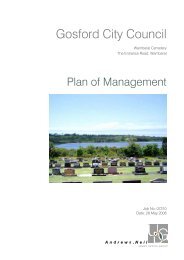
<strong>Gosford</strong> <strong>City</strong> <strong>Council</strong><br />
<strong>Wamberal</strong> <strong>Cemetery</strong><br />
The Entrance Road, <strong>Wamberal</strong><br />
<strong>Plan</strong> <strong>of</strong> <strong>Management</strong><br />
Job No: 07210<br />
Date: 28 May 2008
[<strong>Plan</strong> <strong>of</strong> <strong>Management</strong> – <strong>Wamberal</strong> <strong>Cemetery</strong>, The Entrance Road <strong>Wamberal</strong>]<br />
Issue Date Description Author Reviewed By<br />
5/12/07 Draft Ian Grant<br />
A 13/5/08 Draft Ian Grant Client<br />
B 27/5/08 Final Fiona Morrison<br />
PO Box 1476 <strong>Gosford</strong> NSW 2250<br />
•<br />
Level 3, 19-21 Watt St <strong>Gosford</strong> NSW 2250<br />
T 02 4324 3633 • F 02 4324 3771 • E info@andrewsneil.com.au • W www.andrewsneil.com.au<br />
Andrews Neil Pty Ltd as Trustee for The Andrews Neil Group Unit Trust • ABN 55 633 432 460 • Andrew Dickson Nominated Architect (Registration No. 7657)
Executive Summary<br />
<strong>Wamberal</strong> <strong>Cemetery</strong> is the <strong>City</strong> <strong>of</strong> <strong>Gosford</strong>’s second major necropolis and is a heritage<br />
item identified in the <strong>City</strong>’s <strong>Plan</strong>ning Scheme Ordinance. Under the Local Government<br />
Act, it is classified as “Operational Land. An effective <strong>Plan</strong> <strong>of</strong> <strong>Management</strong> must reflect<br />
comprehensive analysis <strong>of</strong> all constraints and opportunities and; for <strong>Council</strong> to<br />
accommodate emerging trends and demands for the use <strong>of</strong> the land.<br />
This <strong>Plan</strong> <strong>of</strong> <strong>Management</strong> is based on analysis <strong>of</strong> all available background data and on<br />
a detailed Site Analysis and Landscape Masterplan prepared by Andrews Neil Urban<br />
Design. The document identifies the principal natural and built features <strong>of</strong> the<br />
<strong>Cemetery</strong>, as well as the key components <strong>of</strong> its phases <strong>of</strong> development. It integrates<br />
both into a series <strong>of</strong> suggested actions which also take full account <strong>of</strong> the staging<br />
requirements and staffing resources advised by <strong>Council</strong>.<br />
The principal recommendations <strong>of</strong> the Landscape Masterplan and this <strong>Plan</strong> <strong>of</strong><br />
<strong>Management</strong> relate to:<br />
Environmental Conservation:<br />
• Avoid construction <strong>of</strong> new structures in any location which will compromise the<br />
dramatic landform <strong>of</strong> and views from the <strong>Cemetery</strong><br />
• Harvest on-site stormwater to create attractive water feature on creek line.<br />
<strong>Cemetery</strong> Capacity<br />
• Identification <strong>of</strong> possible tree removal and additional ground areas to increase<br />
the burial capacity <strong>of</strong> the <strong>Cemetery</strong> into the future.<br />
Design and Function<br />
• Re-design <strong>of</strong> internal driveways and pathways to better link all areas <strong>of</strong> the<br />
<strong>Cemetery</strong><br />
• Addition <strong>of</strong> plantings to better design specific places<br />
• Supplementation <strong>of</strong> sheltered contemplative spaces in advantageous lections<br />
• Additional parking capacity located to avoid adverse virtual impact<br />
• Addition <strong>of</strong> viewing contemplation platform and creek-line water features<br />
Interpretation<br />
• Creation <strong>of</strong> centralised, sheltered, information and interpretation space<br />
• Improved external identification<br />
Sustainability <strong>of</strong> Operation<br />
• Onsite water harvesting, to ensure capacity for future servicing <strong>of</strong> gardens and<br />
lawns<br />
Preventative <strong>Management</strong><br />
• Installation <strong>of</strong> access controls at entry from The Entrance Road to prevent right<br />
turn access<br />
The document confirms that the site has the capacity to provide more Lawn <strong>Cemetery</strong><br />
grave sites and that <strong>Wamberal</strong> <strong>Cemetery</strong> can be improved to ensure its reliance and<br />
sustainability into the future.<br />
i
Contents<br />
1.0 Introduction – <strong>Management</strong> Issues in a <strong>Cemetery</strong> ....................................................... 1<br />
2.0 <strong>Management</strong> <strong>Plan</strong> Sections........................................................................................... 1<br />
2.1 Introduction........................................................................................................ 1<br />
2.1.1 Location and Formal Description .................................................................. 1<br />
2.1.2 Status <strong>of</strong> Land ............................................................................................... 1<br />
2.1.3 Current Heritage Listings .............................................................................. 2<br />
2.1.4 <strong>Cemetery</strong> <strong>Management</strong> and Current Operating Policies .............................. 2<br />
2.1.5 Location and Title details .............................................................................. 2<br />
2.2 Historical Development <strong>of</strong> the <strong>Cemetery</strong>........................................................... 3<br />
2.2.1 Main or Notable Periods <strong>of</strong> Use .................................................................... 5<br />
2.3 Survey <strong>of</strong> Condition <strong>of</strong> Elements ....................................................................... 5<br />
2.3.1 Current Description <strong>of</strong> the <strong>Cemetery</strong> and its <strong>Plan</strong> ........................................ 5<br />
2.3.2 Alterations and Adaptations to the <strong>Cemetery</strong> ............................................... 5<br />
2.3.3 Grave Types and Condition .......................................................................... 6<br />
2.3.4 Buildings, Structures & Signage ................................................................... 6<br />
2.4 Survey <strong>of</strong> Landscape and Vegetation ............................................................... 6<br />
2.4.1 Landscape <strong>Plan</strong> and <strong>Plan</strong>ting within the <strong>Cemetery</strong> ...................................... 6<br />
2.4.2 Context and Setting....................................................................................... 6<br />
2.4.3 Existing Landscape and Vegetation <strong>Management</strong> Systems......................... 6<br />
2.5 Conservation ..................................................................................................... 6<br />
2.5.1 Comprehensive Conservation Policies for the <strong>Cemetery</strong> as a Whole .......... 6<br />
2.5.2 Recommendations for Special Areas............................................................ 6<br />
2.5.3 <strong>Plan</strong> / Layout <strong>of</strong> the <strong>Cemetery</strong> ...................................................................... 7<br />
2.5.4 Conservation Techniques for Historic Graves and Monuments, including<br />
Headstones, Iron Work, Kerbing, Grave Tops and Ledgers ....................................... 7<br />
2.5.5 New Monumentation / Memorialisation on Existing Graves and within<br />
Historic Areas .............................................................................................................. 7<br />
2.5.6 Building and Structures................................................................................. 7<br />
2.6 Landscape Masterplan ...................................................................................... 7<br />
2.7 Traffic and Circulation........................................................................................ 7<br />
2.7.1 Internal Roads and Paving............................................................................ 7<br />
2.7.2 Access, Vehicle and Pedestrian Circulation and Parking for Visitors........... 7<br />
2.8 Maintenance ...................................................................................................... 7<br />
2.8.1 General Maintenance.................................................................................... 7<br />
2.8.2 Maintenance or Reinstatement <strong>of</strong> original ground levels.............................. 7<br />
2.8.3 Landscape Maintenance and Mowing .......................................................... 7<br />
2.8.4 Weed and Animal Pest Control..................................................................... 7<br />
2.8.5 Control <strong>of</strong> floral and other tributes on Graves............................................... 8<br />
2.8.6 Care <strong>of</strong> War Graves, responsibility and contacts.......................................... 8<br />
2.9 General <strong>Management</strong> Issues ............................................................................ 8<br />
2.9.1 Opportunities for expansion and types <strong>of</strong> Burials ......................................... 8<br />
2.9.2 Security ......................................................................................................... 8<br />
2.10 Continuing Use Policy ....................................................................................... 9<br />
2.11 Interpretation and Community Involvement ...................................................... 9<br />
2.11.1 Consultation and Communication with Stakeholders ................................... 9<br />
2.11.2 Options for Interpretation .............................................................................. 9<br />
2.11.3 Friends Groups / Volunteers – <strong>Management</strong>, Briefing and Supervision....... 9<br />
2.11.4 Tourism Potential .......................................................................................... 9<br />
2.11.5 Marketing and Cultural Development.......................................................... 10<br />
2.11.6 Consultation and communication with all stakeholders .............................. 10<br />
2.12 Distribution and Review <strong>of</strong> <strong>Cemetery</strong> <strong>Management</strong> <strong>Plan</strong>................................ 10<br />
Appendix A Analysis, Opportunities and Constraints <strong>Plan</strong> ................................................... 11<br />
Appendix B Landscape (and Development) Masterplan ...................................................... 12<br />
iAndrews Neil Pty Ltd<br />
Urban Design.Architecture.<strong>Plan</strong>ning.Landscape Architecture.Ecology.Heritage.Graphic Design<br />
i
1.0 Introduction – <strong>Management</strong> Issues in a <strong>Cemetery</strong><br />
Public Cemeteries are:<br />
• Places for remembrance, reflection and contemplation<br />
• A repository <strong>of</strong> historical / cultural information<br />
• Potential resources for interpreting the cultural histories <strong>of</strong> villages, towns and cites.<br />
The cemetery is partly Crown Land subject to the provisions <strong>of</strong> the Crown Lands Act 1989.<br />
The Principles <strong>of</strong> Crown land management are:<br />
• That environmental protection principles be observed in relation to the management and<br />
administration <strong>of</strong> Crown land.<br />
• That the natural resources <strong>of</strong> Crown land (including water, soil, flora, fauna and scenic quality) be<br />
conserved wherever possible.<br />
• That public use and enjoyment <strong>of</strong> appropriate Crown land be encouraged.<br />
• That, where appropriate, multiple use <strong>of</strong> Crown land be encouraged.<br />
• That, where appropriate, Crown land should be used and managed in such a way that both the land<br />
and its resources are sustained in perpetuity.<br />
• That Crown land be occupied, used, sold, leased, licensed or otherwise dealt with in the best interest<br />
<strong>of</strong> the State consistent with the above principles.<br />
<strong>Management</strong> <strong>of</strong> such resources should have the following local objectives:<br />
• To ensure the availability <strong>of</strong> sufficient culturally – appropriate burial opportunities for all community<br />
groups into the future.<br />
• To provide appropriate spaces for contemplation and reflection.<br />
• To accommodate appropriate levels <strong>of</strong> on-site car parking as well as access for hearses.<br />
• To provide toilet facilities for visitors.<br />
• To provide adequate levels <strong>of</strong> on-site signage and interpretive information.<br />
• To allow for pedestrian circulation without compromising existing and potential burial sites / areas.<br />
• To be appropriately landscaped according to a pre-determined or already – established theme.<br />
• To provide appropriate levels <strong>of</strong> overall security and protection for burial sites.<br />
• To provide an appropriate level <strong>of</strong> maintenance and facilities upgrading to ensure that current levels <strong>of</strong><br />
visual appeal are at the very least, maintained.<br />
2.0 <strong>Management</strong> <strong>Plan</strong> Sections<br />
2.1 Introduction<br />
2.1.1 Location and Formal Description<br />
The <strong>Wamberal</strong> <strong>Cemetery</strong> is located on the eastern side <strong>of</strong> The Entrance Road, some 100m south <strong>of</strong> the<br />
roundabout at Tumbi Road. The <strong>Cemetery</strong> extends east from The Entrance Road to <strong>Wamberal</strong> Lagoon.<br />
2.1.2 Status <strong>of</strong> Land<br />
<strong>Wamberal</strong> <strong>Cemetery</strong> is classified “Operational Land” under the Local Government Act 1993. It is one <strong>of</strong> only<br />
two operating public cemeteries under the care <strong>of</strong> <strong>Gosford</strong> <strong>City</strong> <strong>Council</strong>.<br />
<strong>Gosford</strong> <strong>City</strong> <strong>Council</strong>, <strong>Plan</strong> <strong>of</strong> <strong>Management</strong> <strong>Wamberal</strong> <strong>Cemetery</strong> Page 1<br />
Andrews Neil Pty Ltd<br />
FM/07210/051207RevB
<strong>Wamberal</strong> <strong>Cemetery</strong> is functional to the extent that, while the old denominational sections <strong>of</strong> the <strong>Cemetery</strong><br />
are closed, burials can still be carried out in pre-reserved sites which retain the capacity for further burials or<br />
placements <strong>of</strong> ashes. The <strong>Cemetery</strong> has remained operational since 1881.<br />
Clearing <strong>of</strong> native vegetation is permitted only by the Exclusions listed in Section 25 <strong>of</strong> The Native Vegetation<br />
Act 2003.<br />
The full list <strong>of</strong> Crown lots on our records that comprise part <strong>of</strong> <strong>Wamberal</strong> <strong>Cemetery</strong> are:<br />
LOT DP DEDICATION NOTIFIED OWNER<br />
170 755234 D1014788 23 September 1881 Crown Land – GCC Trustee<br />
171 755234 D1014788 23 September 1881 Crown Land – GCC Trustee<br />
172 755234 D1014788 23 September 1881 Crown Land – GCC Trustee<br />
173 755234 D1014788 23 September 1881 Crown Land – GCC Trustee<br />
199 755234 D1014788 23 September 1881 Crown Land – GCC Trustee<br />
303 755234 D1014788 23 September 1881 Crown Land – GCC Trustee<br />
304 755234 D1014788 23 September 1881 Crown Land – GCC Trustee<br />
455 755234 D1014788 23 September 1881 Crown Land – GCC Trustee<br />
2.1.3 Current Heritage Listings<br />
Unlike Point Clare <strong>Cemetery</strong>, <strong>Wamberal</strong> <strong>Cemetery</strong> is listed in the Heritage Schedule to the <strong>Gosford</strong> <strong>Plan</strong>ning<br />
Scheme Ordinance. The listing does not indicate the <strong>Cemetery</strong>’s level <strong>of</strong> heritage significance. The<br />
assessment for the place was completed in 1997 and an Inventory Sheet was prepared at that time.<br />
2.1.4 <strong>Cemetery</strong> <strong>Management</strong> and Current Operating Policies<br />
<strong>Wamberal</strong> <strong>Cemetery</strong> is currently managed by way <strong>of</strong> a series <strong>of</strong> Procedures, Requirements and Permits,<br />
administered by <strong>Council</strong>’s <strong>Cemetery</strong> Officer and implemented by a part-time <strong>Cemetery</strong> Officer, two full-time,<br />
on site staff, one the Zone Supervisor <strong>of</strong> Cemeteries and one, a Labourer/Gardener.<br />
The purpose <strong>of</strong> <strong>Council</strong>’s “Requirements for Works within <strong>Council</strong> Cemeteries” document is to describe<br />
<strong>Council</strong>’s requirements in relation to the Occupational Health and Safety Act 2000 and the Occupational<br />
Health and Safety Legislation 2001 and associated legislation, for when activities are to be carried out by<br />
external agents, their employees or subcontractors. Any work undertaken within the <strong>Cemetery</strong> must have<br />
been authorised by Permit. <strong>Council</strong>’s <strong>Cemetery</strong> Officer’s day-to-day management responsibilities include:<br />
issue <strong>of</strong> permits; managing <strong>Council</strong>’s Cemeteries with safety and consideration; maintaining a management<br />
system capable <strong>of</strong> ensuring continuous maintenance <strong>of</strong> the requirements; and maintaining pro<strong>of</strong> <strong>of</strong><br />
compliance, and reporting to <strong>Council</strong>.<br />
The activities covered by the “Requirements” are: funeral services; maintenance and construction <strong>of</strong><br />
structures and monuments, excavation, landscaping and site restoration; lifting, transport and disposal <strong>of</strong><br />
surplus materials.<br />
Mowing is to be undertaken by <strong>Council</strong>.<br />
The principal management issues in relation to the <strong>Cemetery</strong> are: ensuring future grave site capacity and;<br />
physical enhancement to increase usage and visitation. The resultant land management issues are: where to<br />
locate future burial sites and; what implications that has for tree and vegetation management / clearing.<br />
2.1.5 Location and Title details<br />
All activities conducted in <strong>Council</strong>’s Cemeteries must comply with the requirements <strong>of</strong> the Occupational<br />
Health and Safety Act 2000 and the Occupational Health and Safety Regulation 2001 and associated<br />
legislation.<br />
Cemeteries in New South Wales, are governed by a range <strong>of</strong> legislation, including:<br />
• The Environmental <strong>Plan</strong>ning and Assessment Act 1979.<br />
Most cemeteries are zoned “Special Uses (<strong>Cemetery</strong>)” under current environmental planning legislation. This<br />
zoning affords the cemetery statutory protection against other uses or development on the site.<br />
<strong>Gosford</strong> <strong>City</strong> <strong>Council</strong>, <strong>Plan</strong> <strong>of</strong> <strong>Management</strong> <strong>Wamberal</strong> <strong>Cemetery</strong> Page 2<br />
Andrews Neil Pty Ltd<br />
FM/07210/051207RevB
Many cemeteries are identified as “items <strong>of</strong> heritage significance” in the relevant <strong>Council</strong>’s Local<br />
Environmental <strong>Plan</strong> (LEP). The inclusion <strong>of</strong> a cemetery within the “heritage schedule” <strong>of</strong> a LEP (or a<br />
subsidiary development Control <strong>Plan</strong>) identifies it as an area <strong>of</strong> heritage importance which is to be<br />
conserved. This usually requires specific approval by the local <strong>Council</strong> for any work other than routine<br />
maintenance, whether or not the <strong>Council</strong> is the actual controlling authority for the cemetery.<br />
While the Heritage Inventory sheet (1997) for the place recommends appropriately that an Assessment <strong>of</strong><br />
heritage impact should be required for all future proposals for works which may have potential to adversely<br />
impact on the significance <strong>of</strong> the <strong>Cemetery</strong>, the form lacks significant supporting commentary and requires<br />
upgrading. This is a management issue. The Heritage Inventory Sheet does not include a detailed site<br />
history, statement <strong>of</strong> significance, locality diagram, or assessment against the standard Evaluation Criteria. It<br />
also omits mention <strong>of</strong> important areas and graves. To allow for future Statements <strong>of</strong> Heritage Impact to be<br />
based on the significance <strong>of</strong> the place, it is considered important to upgrade the information available on the<br />
Heritage Inventory form. For this to occur, it may be necessary for <strong>Council</strong> to prepare a detailed survey <strong>of</strong> all<br />
grave sites.<br />
2.2 Historical Development <strong>of</strong> the <strong>Cemetery</strong><br />
“<strong>Cemetery</strong> Survey 1991 by Carol Anne Jordan”<br />
Australia’s population comes from a diverse range <strong>of</strong> cultural backgrounds, Many buried at <strong>Wamberal</strong>, come<br />
from the United Kingdom.<br />
• As at 1997, the number <strong>of</strong> unmarked burials was approximately 2,473 with 1,731 monuments and<br />
2,206 marked burials. Most monuments are made <strong>of</strong> granite.<br />
• Earliest burial 1888.<br />
• Original <strong>Plan</strong> surveyed in September 1880, provided for the cemetery to be divided into following<br />
sections: Church <strong>of</strong> England, Roman Catholic, Wesleyan, Presbyterian, Independents and General.<br />
• Dedicated 23 September 1881.<br />
• Present day cemetery does not contain Wesleyan, Presbyterian or independent sections. (The area<br />
originally set aside for them was an unpaved carpark as at 1991). Parts <strong>of</strong> the Roman Catholic and<br />
General Sections were never cleared <strong>of</strong> scrub.<br />
• The area originally designated for Church <strong>of</strong> England burials was not fully used by 1967 when control<br />
passed to <strong>Gosford</strong> <strong>Council</strong>. Area still available became General Lawn <strong>Cemetery</strong> in 1970.<br />
• Burial records lost – possibly in 1926 fire – but this does not account for the absence <strong>of</strong> records from<br />
that date onwards. Because <strong>of</strong> inaccuracies <strong>of</strong> the existing plan, old sections were being (1991)<br />
closed to prevent unintentional exhumation <strong>of</strong> corpses.<br />
• All plots have been standardised in size.<br />
• <strong>Wamberal</strong> is one <strong>of</strong> only two operational cemeteries.<br />
• Most common headstone is “slab and desk” made <strong>of</strong> concrete. In the newer Lawn <strong>Cemetery</strong>,<br />
concrete slabs are replaced by lawn and the ‘desk’ is usually <strong>of</strong> pink or black granite, but the format<br />
remains standard.<br />
• One obelisk and one sarcophagus.<br />
• Several graves <strong>of</strong> people over 100 years… Mary Aime Pratt 1887 – 1990.<br />
• Reason for the location <strong>of</strong> the lone white cross identifying “Kayla Shedden” is a mystery. Not old.<br />
• It is unclear whether the area <strong>of</strong> the cross was ever used for the interment <strong>of</strong> still –born babies.<br />
• Dumbrell <strong>of</strong> <strong>Gosford</strong> and McMurtrie, are the principal stonemasons.<br />
• Some very early monuments appear to have been brought in from Sydney – marble with lead lettering.<br />
These are rare in this cemetery, and therefore distinctive. Would have been costly.<br />
• Generally ornamented concrete prior to 1970 and then solid chunks <strong>of</strong> pink or black granite.<br />
• There are a number <strong>of</strong> unusual monuments including that <strong>of</strong> Dudley Kippax.<br />
• Earliest burial is reported to have been in 1888 - probably one <strong>of</strong> the graves in the general section – or<br />
possibly one <strong>of</strong> the unmarked graves. Earliest fully – legible gravestone is Gladys Dorothy Swadling<br />
12/01/1905, but the illegible gravestone may be earlier. The Swadling and Gleeson families are well<br />
represented, both pioneering families.<br />
<strong>Gosford</strong> <strong>City</strong> <strong>Council</strong>, <strong>Plan</strong> <strong>of</strong> <strong>Management</strong> <strong>Wamberal</strong> <strong>Cemetery</strong> Page 3<br />
Andrews Neil Pty Ltd<br />
FM/07210/051207RevB
• Monument <strong>of</strong> special interest include:<br />
- Original ANZAC Jack Christie – 18/10/1964<br />
- To the families <strong>of</strong> Gleeson, Swadling, Christie, Smith, Ward, Brooks, Scott, Towell, Whitehead<br />
and Nunn.<br />
- Yim Cheung Wong 1986 – only Asian monument at 1991.<br />
- Another is the only Greek inscription to a Scotsman, David Grace.<br />
• The fact that <strong>Wamberal</strong> wasn’t opened until 1861 suggests little local organised settlement before<br />
then. Borne out in inscriptions referring to ‘pioneers” during the period 1900-1930.<br />
• Significant increases in burials each decade after 1930. There are mainly Anglo-Saxon and few<br />
Roman Catholic burials.<br />
• The majority <strong>of</strong> headstones are modest, reflecting socio-economic pr<strong>of</strong>ile.<br />
• <strong>Wamberal</strong> <strong>Cemetery</strong> is a valuable historical resource and should be maintained as a monument to the<br />
people <strong>of</strong> the area.<br />
• The largest number <strong>of</strong> burials are in the Lawn <strong>Cemetery</strong> section, opened in 1970.<br />
• Most burials are Church <strong>of</strong> England and the war periods are reflected in increased male graves.<br />
The following information is drawn principally from the publication “Six Brisbane Water Cemeteries. A<br />
Heritage Tour: by Jillian Baxter and supplemented by the <strong>Cemetery</strong> Survey undertaken in 1991 by Anne<br />
Jordan.<br />
The <strong>Cemetery</strong> was drawn up on Survey September 1880. The <strong>Plan</strong> <strong>of</strong> Survey provided for the <strong>Cemetery</strong> to<br />
be divided into the following sections: Church <strong>of</strong> England, Roman Catholic, Wesleyan, Presbyterian,<br />
Independent and General.<br />
The fact that the <strong>Cemetery</strong> was not dedicated and opened before 1881, suggests little local organised<br />
settlement before then. This is borne out in inscriptions referring to the deceased having been local are<br />
“pioneers” during the first few decades <strong>of</strong> the 20 th Century.<br />
The trend obviously continued until as late as the end <strong>of</strong> the 1960’s, because the largest number <strong>of</strong> burials in<br />
the <strong>Cemetery</strong>, are in the Lawn <strong>Cemetery</strong> section, operational only after 1970. However, compared with the<br />
very early years, there were significant increases in burials each decade after 1930, mainly <strong>of</strong> Anglo-Saxons<br />
(Protestants) and few Roman Catholics.<br />
Most burials are <strong>of</strong> Church <strong>of</strong> England people and the war periods 1914-1918 and 1939- 1945 are reflected<br />
in increased male graves during those periods. The majority <strong>of</strong> headstone were (and remain) modest,<br />
accurately reflecting the socio-economic pr<strong>of</strong>ile <strong>of</strong> the area.<br />
The <strong>Cemetery</strong> was dedicated the following year, but the earliest burial occurred in 1888. The exact location<br />
<strong>of</strong> the first grave is not known but it is probably one <strong>of</strong> the graves in the General section or possibly one <strong>of</strong><br />
the unmarked graves. Parts <strong>of</strong> the Roman Catholic and General Sections were never cleared <strong>of</strong> scrub and<br />
the present day <strong>Cemetery</strong> does not contain Wesleyan, Presbyterian or Independent section. The area<br />
originally set aside for them was an unpaved carpark in 1991 and is now (2007). However, many <strong>of</strong> the dead<br />
were born in the United Kingdom.<br />
Even by 1967 when control and responsibility for management <strong>of</strong> the cemetery passed to <strong>Gosford</strong> <strong>Council</strong>,<br />
the area originally designated for Church <strong>of</strong> England burials, was not fully used. IN 1970 the remaining area<br />
was converted to Lawn <strong>Cemetery</strong> use.<br />
The earliest, fully legible gravestone is that <strong>of</strong> Gladys Dorothy Swadling 12 January 1905, but the illegible<br />
gravestones may be <strong>of</strong> older dates. If is known that both the Swadling and Gleeson families were local<br />
pioneers. Both families are well represented in the <strong>Cemetery</strong>. Other families <strong>of</strong> likely early social significance<br />
are those <strong>of</strong>: Gleeson, Christie, Smith, Ward, Brooks, Scott, Towell, Whitehead and Nunn, as various <strong>of</strong> their<br />
number have monuments erected to them.<br />
There is only one obelisk and one sarcophagus in the <strong>Cemetery</strong>. The headstones are generally ornamented<br />
concrete prior to 1970 and then (Lawn <strong>Cemetery</strong> mainly), they are generally chunks <strong>of</strong> pink or black granite.<br />
However, there are a few unusual and interesting monuments. They include:<br />
• The early ones which are <strong>of</strong> marble with lead lettering - rare in this <strong>Cemetery</strong> and appear to have been<br />
brought in from Sydney. They are distinctive and would probably have been costly.<br />
• That honouring an original ANZAC Jack Christie, who died on 18 October 1964.<br />
<strong>Gosford</strong> <strong>City</strong> <strong>Council</strong>, <strong>Plan</strong> <strong>of</strong> <strong>Management</strong> <strong>Wamberal</strong> <strong>Cemetery</strong> Page 4<br />
Andrews Neil Pty Ltd<br />
FM/07210/051207RevB
• That to a Scotsman David Grace, but continuing the only Greek inscription in the <strong>Cemetery</strong>.<br />
• That to Yim Chung Wong 1986, the only monument to an Asian.<br />
Dumbrell <strong>of</strong> <strong>Gosford</strong> and McMurtrie are the principle Stonemasons represented by the <strong>Cemetery</strong>’s<br />
headstones.<br />
There is a lone white cross identifying “Kayla Shedden”. The name indicates a recent death (1989) which is<br />
now identified as the stillborn section, but the reason for the location <strong>of</strong> the cross in not known. The cross is<br />
now located Section 1 Row 2 Grave1.<br />
Several <strong>of</strong> the graves are <strong>of</strong> centenarians, Mary Ann Pratt being the earliest born <strong>of</strong> these (1887-1990).<br />
One <strong>of</strong> the major reasons for the need for <strong>Plan</strong> <strong>of</strong> <strong>Management</strong> for <strong>Wamberal</strong>, is that earlier burial records<br />
were lost in 1926, possibly in the 1926 fire. However, record-keeping since that date has been poor, with the<br />
result that as at 2001, old sections <strong>of</strong> the <strong>Cemetery</strong> were closed to prevent unintentional exhumation <strong>of</strong><br />
corpses. Theis situation has now been overcome through concentrating burials in the Lawn cemetery area.<br />
In 1997, there were:<br />
• Approximately 2206 marked graves<br />
• Approximately 2473 unmarked graves<br />
• Approximately 1731 monuments. Most monuments are made <strong>of</strong> granite.<br />
The other principal reason for the need for a <strong>Plan</strong> <strong>of</strong> <strong>Management</strong> for <strong>Wamberal</strong> <strong>Cemetery</strong> is that it, with<br />
Point Clare, is one <strong>of</strong> only two operational cemeteries in the local government area and it is a valuable<br />
resource <strong>of</strong> local area history and should be maintained appropriately as a monument to the families <strong>of</strong> the<br />
area.<br />
2.2.1 Main or Notable Periods <strong>of</strong> Use<br />
1881 – 1930 Establishment phase “Pioneer” burial period.<br />
Post 1930’s – 1970 Rapid expansion compared with earlier period. Traditional grave sites, generally in<br />
easterly sector, closer to water.<br />
Post 1970 – 2000<br />
Post 2000<br />
Establishment <strong>of</strong> Lawn <strong>Cemetery</strong>. Rapid expansion in local area populations.<br />
Increased demand for Lawn <strong>Cemetery</strong> space and for design for sustainability into the<br />
future.<br />
2.3 Survey <strong>of</strong> Condition <strong>of</strong> Elements<br />
2.3.1 Current Description <strong>of</strong> the <strong>Cemetery</strong> and its <strong>Plan</strong><br />
Current Description <strong>of</strong> the <strong>Cemetery</strong> and its <strong>Plan</strong>.<br />
Graves:<br />
Roads:<br />
Grassed Areas:<br />
Trees:<br />
Toilet Block Signs<br />
In general, the graves are in good condition. However, there are some damaged<br />
slabs and some titled graves on the southern boundary. This damage is indicative <strong>of</strong><br />
either subsidence or soil movement, possible caused by wet clayey soil.<br />
The surface <strong>of</strong> the internal driveways is generally poor – and patched. The road<br />
edges are loosely gravelled.<br />
Generally well maintained.<br />
In good condition. Some recent removal in the upper central portion <strong>of</strong> the site.<br />
In sound condition.<br />
There are no gates at the entry from the Entrance Road.<br />
2.3.2 Alterations and Adaptations to the <strong>Cemetery</strong><br />
Apart from the surfacing <strong>of</strong> the internal road, installation <strong>of</strong> timber car barriers and the construction <strong>of</strong> the<br />
toilet block (c1980’s) there have been few changes to the cemetery. There is a new retaining wall being built<br />
along the boundary on The Entrance Road.<br />
<strong>Gosford</strong> <strong>City</strong> <strong>Council</strong>, <strong>Plan</strong> <strong>of</strong> <strong>Management</strong> <strong>Wamberal</strong> <strong>Cemetery</strong> Page 5<br />
Andrews Neil Pty Ltd<br />
FM/07210/051207RevB
2.3.3 Grave Types and Condition<br />
See Section 2.2 for grave types and Section 2.31 for condition <strong>of</strong> graves. There are a number <strong>of</strong> illegible<br />
early headstones, but little evidence (if any) <strong>of</strong> vandalism.<br />
2.3.4 Buildings, Structures & Signage<br />
The only notable building is the toilet block. The only other structures are the Information Board and the<br />
vehicle barriers. The Board and the Section Signs are very understated. The Toilet Block is too imposing and<br />
badly located.<br />
2.4 Survey <strong>of</strong> Landscape and Vegetation<br />
2.4.1 Landscape <strong>Plan</strong> and <strong>Plan</strong>ting within the <strong>Cemetery</strong><br />
Refer to the Landscape (and Development) <strong>Management</strong> <strong>Plan</strong> in Appendix A <strong>of</strong> this document.<br />
2.4.2 Context and Setting<br />
The <strong>Wamberal</strong> <strong>Cemetery</strong> is beautifully sited on east-sloping ground providing views over the Lagoon. It is<br />
accessed via a climbing internal driveway from The Entrance Road. The <strong>Cemetery</strong> is separated from the<br />
edge <strong>of</strong> the Lagoon, by swamp vegetation. There is bushland immediately to the north and bush and a creek<br />
along its southern boundary. Beyond the creekline is residential development. The Entrance Road is a busy<br />
arterial road, currently being upgraded.<br />
2.4.3 Existing Landscape and Vegetation <strong>Management</strong> Systems<br />
As per service agreement.<br />
2.5 Conservation<br />
2.5.1 Comprehensive Conservation Policies for the <strong>Cemetery</strong> as a Whole<br />
The range <strong>of</strong> policies required to provide for comprehensive conservation and management <strong>of</strong> <strong>Wamberal</strong><br />
<strong>Cemetery</strong> into the future, must respond to the following:<br />
• Retention <strong>of</strong> the identified heritages values <strong>of</strong> the site.<br />
• Retention and conservation <strong>of</strong> all component/s elements identified as contributing to the significance<br />
<strong>of</strong> the significance <strong>of</strong> the <strong>Cemetery</strong>.<br />
• Policy for the gradual removal <strong>of</strong> all components / elements identified as being “intrusive” ie<br />
compromising the significance <strong>of</strong> the site.<br />
• Policies for general maintenance, and reconstruction based on avoiding any unnecessary intervention<br />
into the site.<br />
• Policy to address changes <strong>of</strong> function / use <strong>of</strong> any space within the <strong>Cemetery</strong>.<br />
• Policies for signage and interpretation, both internal and external to the site.<br />
• Policies for special areas such as entrances, denominational areas, dedicated memorial sections and<br />
still born baby sections.<br />
2.5.2 Recommendations for Special Areas<br />
The areas identified for special attention (refer to Masterplan) are:<br />
• Boundary wall to the Entrance Road – special identification signage.<br />
• New “Information/Interpretation space.<br />
• Internal approach driveway and arrival point.<br />
• New Amenities location and carpark.<br />
• New seating and covered contemplative spaces.<br />
• New Stillborn graves area detail.<br />
• New observation deck / contemplative space.<br />
<strong>Gosford</strong> <strong>City</strong> <strong>Council</strong>, <strong>Plan</strong> <strong>of</strong> <strong>Management</strong> <strong>Wamberal</strong> <strong>Cemetery</strong> Page 6<br />
Andrews Neil Pty Ltd<br />
FM/07210/051207RevB
2.5.3 <strong>Plan</strong> / Layout <strong>of</strong> the <strong>Cemetery</strong><br />
The layout <strong>of</strong> the <strong>Cemetery</strong> is as described above and on the new Landscape (and Development)<br />
Masterplan. The layout is generally as it has been since 1970, when the Lawn <strong>Cemetery</strong> section was added.<br />
2.5.4 Conservation Techniques for Historic Graves and Monuments, including Headstones, Iron Work,<br />
Kerbing, Grave Tops and Ledgers<br />
<strong>Cemetery</strong> headstones are not owned by <strong>Council</strong>. Therefore, maintenance <strong>of</strong> headstones are not maintained<br />
<strong>Council</strong>. Where headstones are damaged, <strong>Council</strong> will contact the family owners. If any headstone becomes<br />
a listed heritage item, and where funds are available, local funding assistance can be provided.<br />
2.5.5 New Monumentation / Memorialisation on Existing Graves and within Historic Areas<br />
As per <strong>Council</strong> Guidelines.<br />
2.5.6 Building and Structures<br />
See previously and see recommendations for alterations, on Landscape (and Development) Masterplan.<br />
Relocation <strong>of</strong> the Toilet Block is recommended along with the addition <strong>of</strong> a centralised Information /<br />
Interpretation space. A covered contemplative space is also recommended as a component <strong>of</strong> the<br />
proposed viewing platform.<br />
2.6 Landscape Masterplan<br />
Issues <strong>of</strong> lighting, electrical supply, water supply, stormwater control and drainage, storage sheds and<br />
rubbish areas, amenities, signs and markers are included in the Landscape Masterplan (see Appendix A).<br />
2.7 Traffic and Circulation<br />
2.7.1 Internal Roads and Paving<br />
Works currently being undertaken by external contractors, include resurfacing and extension as indicated on<br />
the Masterplan.<br />
2.7.2 Access, Vehicle and Pedestrian Circulation and Parking for Visitors<br />
Refer to Masterplan for all proposed alterations and upgrades. The work will included installation <strong>of</strong> security<br />
access gates at the entry fro the Entrance Road.<br />
2.8 Maintenance<br />
2.8.1 General Maintenance<br />
• In order to maintain the cemetery safely, efficiently and within budget, maintenance standards and<br />
priorities as detailed in the Service Agreement with the providers will be reviewed on an ongoing<br />
basis.<br />
• All service providers are required to adhere to <strong>Council</strong>'s Occupational Health and Safety regulations.<br />
• <strong>Council</strong> aims to optimise the use <strong>of</strong> water, fertilisers, pesticides and herbicides according to the<br />
principles <strong>of</strong> environmentally sustainable development.<br />
2.8.2 Maintenance or Reinstatement <strong>of</strong> original ground levels<br />
As per Service Agreement – Refer Section 2.8.1 above.<br />
2.8.3 Landscape Maintenance and Mowing<br />
As per Service Agreement – Refer to Section 2.8.1 above.<br />
2.8.4 Weed and Animal Pest Control<br />
Retain all littoral and endemic vegetation where possible. Reduce loss <strong>of</strong> old habitat trees.<br />
<strong>Gosford</strong> <strong>City</strong> <strong>Council</strong>, <strong>Plan</strong> <strong>of</strong> <strong>Management</strong> <strong>Wamberal</strong> <strong>Cemetery</strong> Page 7<br />
Andrews Neil Pty Ltd<br />
FM/07210/051207RevB
Rehabilitate site edges meeting <strong>Wamberal</strong> Lagoon Nature Reserve through removal <strong>of</strong> weed species<br />
(Lantana, Bitou Bush, Asparagus Fern, etc) and re-plant/landscape using only endemic species <strong>of</strong> the area.<br />
(<strong>Wamberal</strong> Lagoon Conservation Society may be utilised to rehabilitate area around proposed viewing<br />
deck).<br />
Minimal use <strong>of</strong> fertilisers onsite to reduce risk <strong>of</strong> Lagoon contamination, minimal tree removal and<br />
rehabilitation / revegetation <strong>of</strong> adjacent reserve drainage channel.<br />
* Note regarding rabbits, foxes and dogs/cats being the main pests (fauna) onsite but there is little evidence.<br />
2.8.5 Control <strong>of</strong> floral and other tributes on Graves<br />
As per <strong>Council</strong> Standards.<br />
2.8.6 Care <strong>of</strong> War Graves, responsibility and contacts<br />
The Office <strong>of</strong> Australian War Graves (OAWG) is part <strong>of</strong> the Department <strong>of</strong> Veterans’ Affairs. It has three<br />
distinct roles:<br />
• To maintain war cemeteries and individual war graves within Australia and the region, as agents <strong>of</strong> the<br />
Commonwealth War Graves Commission;<br />
• To <strong>of</strong>ficially commemorate eligible veterans who have died post-war and whose deaths are accepted<br />
as being caused by war service;<br />
• To provide and maintain national memorials overseas.<br />
They can be contacted at the Office <strong>of</strong> Australian War Graves, PO Box 21, Woden, ACT, 2606 Phone 6289<br />
6517.<br />
2.9 General <strong>Management</strong> Issues<br />
2.9.1 Opportunities for expansion and types <strong>of</strong> Burials<br />
The main driver behind the preparation <strong>of</strong> the <strong>Wamberal</strong> <strong>Plan</strong> <strong>of</strong> <strong>Management</strong> was, also like for Point Clare<br />
<strong>Cemetery</strong>, the need to ensure availability <strong>of</strong> grave sites into the future. However, this need is somewhat more<br />
urgent at <strong>Wamberal</strong> <strong>Cemetery</strong> because the residual land area is not as great and poses somewhat greater<br />
access and circulation management. <strong>Wamberal</strong> <strong>Cemetery</strong> is not as flat or open as Point Clare and the land<br />
available for potential expansion, is not as easy to adapt.<br />
Again, like Point Clare, <strong>Wamberal</strong> needs to provide shelter for visitors and needs better facilities, addition car<br />
parking spaces and on-site interpretation.<br />
The only area available for additional Lawn <strong>Cemetery</strong> plots is the western side adjacent to The Entrance<br />
Road. When the <strong>City</strong>wide comprehensive LEP is adopted next year the two lots <strong>Council</strong>l has acquired from<br />
the Crown will be rezoned for burials.<br />
Because <strong>of</strong> the great views <strong>of</strong> the water from the top <strong>of</strong> the site, locating any additional car parking spaces<br />
within the view frame should be avoided. Hence it is desirable to contain any new areas <strong>of</strong> car parking to the<br />
land BEHIND the viewer. That is, additional car parking spaces should be concealed within the area <strong>of</strong><br />
sparsely-planted trees, in the area <strong>of</strong> the middle <strong>of</strong> the site, against the road boundary.<br />
The physical advantage <strong>of</strong> the entry access road at <strong>Wamberal</strong> <strong>Cemetery</strong>, is that it emerges into the open at<br />
the top <strong>of</strong> the rise and at a point providing the best possible view over the <strong>Cemetery</strong> and on to the lake. It<br />
also takes the visitor to the intersection <strong>of</strong> the two short branches <strong>of</strong> the internal roads. At this point, there is<br />
currently ample space for an Interpretation and Signage board and for a shelter for contemplation.<br />
Installation <strong>of</strong> these facilities at this point is recommended, along with centralised toilet facilities.<br />
Because <strong>of</strong> the “stillness” and isolation <strong>of</strong> the site and the beautiful water view from the sloping site, spaces<br />
for contemplation can be located in many spots. An opportunity which presents itself, is that <strong>of</strong> extending the<br />
road down the slope, to a point where a viewing platform, possible covered, can be built, with seating<br />
oriented towards the lake.<br />
2.9.2 Security<br />
It is recommended that security gates be installed at the entry from The Entrance Road and the opening and<br />
<strong>Gosford</strong> <strong>City</strong> <strong>Council</strong>, <strong>Plan</strong> <strong>of</strong> <strong>Management</strong> <strong>Wamberal</strong> <strong>Cemetery</strong> Page 8<br />
Andrews Neil Pty Ltd<br />
FM/07210/051207RevB
closing <strong>of</strong> the gates and regular security patrols be included in <strong>Council</strong>’s security contract.<br />
2.10 Continuing Use Policy<br />
The principal purpose <strong>of</strong> the <strong>Wamberal</strong> <strong>Cemetery</strong> <strong>Plan</strong> <strong>of</strong> <strong>Management</strong>, is to provide the basis for<br />
appropriate future managed development and therefore to ensure its relevance and continuing use into the<br />
future.<br />
<strong>Council</strong> intends to remove insignificant vegetation and to stage future development <strong>of</strong> additional grave site.<br />
In addition, <strong>Council</strong> intends to make the site more interesting, attractive and educational to visitors, through<br />
undertaking: a range <strong>of</strong> interpretive work, including reinstatement <strong>of</strong> front entry identifications; new,<br />
consistently designed directional and site signage, and additional <strong>of</strong> sheltered and contemplative areas.<br />
2.11 Interpretation and Community Involvement<br />
2.11.1 Consultation and Communication with Stakeholders<br />
No amount <strong>of</strong> physical upgrading and Interpretation <strong>of</strong> the <strong>Cemetery</strong> will be <strong>of</strong> value if no-one knows about<br />
it. Further, worthwhile interpretation requires comprehensive background information and an understanding<br />
<strong>of</strong> local community aspirations – especially <strong>of</strong> the aspirations <strong>of</strong> the principal interest groups.<br />
It is appropriate for the local community to be advised <strong>of</strong> <strong>Council</strong>’s initiatives by way <strong>of</strong> invitations to all key<br />
interest groups to review <strong>Council</strong>’s Draft <strong>Plan</strong> <strong>of</strong> <strong>Management</strong>. The <strong>Plan</strong> <strong>of</strong> <strong>Management</strong> sets the context for<br />
and identifies all proposed interventions and proposed means <strong>of</strong> interpreting the place.<br />
These should be reviewed and commented on by the community so that nothing important is missed and so<br />
that the <strong>Cemetery</strong> retains its cultural significance and relevance for future generations. Both individual and<br />
group inputs should be accepted and reviewed by <strong>Council</strong>, with all respondents being given an opportunity<br />
to confirm the accuracy <strong>of</strong> the final document before its adoption by <strong>Council</strong>.<br />
2.11.2 Options for Interpretation<br />
Proposals to enhance internal <strong>Cemetery</strong> interpretation are as indicated on the Masterplan.<br />
All unusual grave sites (previously identified) should be identified on the new Interpretation Board and should<br />
be identified at the Section itself.<br />
2.11.3 Friends Groups / Volunteers – <strong>Management</strong>, Briefing and Supervision<br />
<strong>Wamberal</strong> <strong>Cemetery</strong> is currently managed by <strong>Council</strong> though the dedication <strong>of</strong> one part-time <strong>Cemetery</strong><br />
Officer and two full-time ground staff.<br />
Opportunities for Friends Groups / Volunteers fall most readily into the areas <strong>of</strong> general maintenance and<br />
fund raising. Possible volunteer general maintenance activities could include: community day rubbish; graffiti<br />
removal; passive surveillance and reporting; gravestone general cleaning and hedge trimming and removal<br />
<strong>of</strong> fallen branches. <strong>Management</strong> <strong>of</strong> the inputs <strong>of</strong> all volunteers should remain with <strong>Council</strong>’s nominated staff<br />
who should have authority to order any volunteer to cease any potentially harmful intervention.<br />
2.11.4 Tourism Potential<br />
There are no Cemeteries identified in the Central Coast Tourism Strategy and this is to be expected.<br />
Cemeteries are generally <strong>of</strong> interest only to: locals who know where they are; visitors who have an interest in<br />
local history and; special interest group such as National Trust members.<br />
Although the <strong>Cemetery</strong> has very limited tourism potential, well-conceived, appropriate interpretation and<br />
upgrading <strong>of</strong> it, can be expected to result in greater visitation / use by locals and their guests. This in turn<br />
can be expected to result in increased positive word-<strong>of</strong>-mouth comments about its value/ attractiveness.<br />
<strong>Gosford</strong> <strong>City</strong> <strong>Council</strong>, <strong>Plan</strong> <strong>of</strong> <strong>Management</strong> <strong>Wamberal</strong> <strong>Cemetery</strong> Page 9<br />
Andrews Neil Pty Ltd<br />
FM/07210/051207RevB
2.11.5 Marketing and Cultural Development<br />
Improved interpretation <strong>of</strong> Cemeteries in-situ, along with <strong>Plan</strong>s <strong>of</strong> <strong>Management</strong> which: incorporate<br />
appropriate interpretation and; are available on <strong>Council</strong>’s website, will automatically improve the availability<br />
<strong>of</strong> valuable cultural development data. The availability <strong>of</strong> improved information on the internet can only have<br />
positive benefits, no matter how small the initial impact. With the availability <strong>of</strong> improved historical and<br />
interpretive data, adding the information to local Tourism <strong>Plan</strong>s / Strategies, would not be unreasonable. It<br />
would also be appropriate for <strong>Council</strong> to provide and have available free for all visitors to <strong>Council</strong> <strong>of</strong>fices and<br />
libraries, small flyers on its Cemeteries. These could also be made available to other Central Coast and<br />
Hunter libraries and to special interest groups such as the National Trust and Historic House Trust.<br />
2.11.6 Consultation and communication with all stakeholders<br />
The initiative for this action rests with <strong>Gosford</strong> <strong>City</strong> <strong>Council</strong>. <strong>Council</strong> could initiate discussion based on the<br />
information compressed into the flyers. Educating the community about the historic and cultural content <strong>of</strong><br />
Point Clare and <strong>Wamberal</strong> cemeteries, should start with Primary School children. Local Primary Schools<br />
could be encouraged to take on voluntary carer roles, with regular visits for maintenance <strong>of</strong> the grounds.<br />
Children could be educated about specific important graves and be rewarded academically for appropriate<br />
care <strong>of</strong> specific sites and for documenting their involvement and understanding.<br />
In the bigger picture, the history <strong>of</strong> the Cemeteries could readily be incorporated into the Local History<br />
syllabus <strong>of</strong> Primary or Secondary Schools.<br />
2.12 Distribution and Review <strong>of</strong> <strong>Cemetery</strong> <strong>Management</strong> <strong>Plan</strong><br />
The <strong>Wamberal</strong> <strong>Cemetery</strong> <strong>Plan</strong> <strong>of</strong> <strong>Management</strong> should become an integral component <strong>of</strong> <strong>Gosford</strong> <strong>City</strong><br />
<strong>Council</strong>’s Business <strong>Plan</strong> to ensure that the budgetary and other recommendations are addressed in the<br />
same way as all other <strong>Council</strong> infrastructure management responsibilities. Copies <strong>of</strong> the <strong>Plan</strong> <strong>of</strong><br />
<strong>Management</strong> should be distributed to:<br />
• <strong>Council</strong>’s Director, Corporate Services<br />
• The <strong>Cemetery</strong> Officer, and<br />
• The Cemeteries Staff Supervisor.<br />
In addition to the above, the document should be accessible on <strong>Council</strong>’s website, with its addition to the<br />
website being advised in all local newspapers.<br />
The <strong>Plan</strong> <strong>of</strong> <strong>Management</strong> should be reviewed every time <strong>Council</strong> reviews its Business <strong>Plan</strong>.<br />
REFERENCES<br />
“<strong>Cemetery</strong> Survey 1991 by Carol Anne Jordan”<br />
<strong>Gosford</strong> <strong>City</strong> <strong>Council</strong>, <strong>Plan</strong> <strong>of</strong> <strong>Management</strong> <strong>Wamberal</strong> <strong>Cemetery</strong> Page 10<br />
Andrews Neil Pty Ltd<br />
FM/07210/051207RevB
Appendix A<br />
Analysis, Opportunities<br />
and Constraints <strong>Plan</strong><br />
<strong>Gosford</strong> <strong>City</strong> <strong>Council</strong>, <strong>Plan</strong> <strong>of</strong> <strong>Management</strong> <strong>Wamberal</strong> <strong>Cemetery</strong><br />
Andrews Neil Pty Ltd<br />
FM/07210/051207RevB
LANDSCAPE ZONES<br />
1<br />
2<br />
3<br />
4<br />
5<br />
6<br />
7<br />
NORTHERN BOUNDARY<br />
This boundary is defined by dense coastal vegetation adjacent to the<br />
lawn burial area. No formal fenceline exists. There is an opportunity<br />
to create a formal pathway that travels the length <strong>of</strong> this edge to<br />
encourage circulation around the entire site as most pedestrian<br />
movement occurs across the length <strong>of</strong> and through the graves.<br />
EASTERN BOUNDARY<br />
Thick coastal vegetation bounds the eastern portion <strong>of</strong> the site and marks<br />
the lowest point within the cemetery. This dense vegetation covers the<br />
land to the edge <strong>of</strong> <strong>Wamberal</strong> Lagoon. Selective clearing <strong>of</strong> some <strong>of</strong> this<br />
vegetation presents opportunities to create stronger views <strong>of</strong> the Lagoon<br />
from the elevated portions <strong>of</strong> the site. An opportunity also exists to create<br />
a viewing platform that takes in views <strong>of</strong> <strong>Wamberal</strong> Lagoon.<br />
SOUTHERN BOUNDARY<br />
The southern edge <strong>of</strong> the site is defined by native and exotic vegetation.<br />
The middle portion <strong>of</strong> this boundary directly adjoins the edge <strong>of</strong> an existing<br />
lawn burial area whereas above and below this section open lawn and<br />
a gravel drive provides distance between the boundary and the burial<br />
areas. Informal paths move through the boundary and into the adjoining<br />
public reserve. Opportunities exist to create stronger links between the<br />
cemetery and the adjoining public reserve.<br />
WESTERN PORTION<br />
This area is defined by a gentle batter that slopes down towards The<br />
Entrance Road and to the edge <strong>of</strong> current RTA roadworks. Bounded by a<br />
new concrete wall and a bike path, this portion <strong>of</strong> the site is relatively open<br />
with large stands <strong>of</strong> existing Eucalypts and an open understorey. Current<br />
RTA site <strong>of</strong>fices and stockpile areas are located in this area and their<br />
affect on the site soil and vegetation will need to be mitigated through the<br />
proposed landscape plan.<br />
CEMETERY ENTRY<br />
Due to a lack <strong>of</strong> signage and the current RTA works along The Entrance<br />
Road the cemetery entry is easily overlooked. No defining signs or<br />
directions guide visitors into the site and opportunities exist to formalise<br />
the entry with plantings and signage in order to give the cemetery a<br />
defining road presence and identity. Large stands <strong>of</strong> existing Eucalypts<br />
instantly give the entry road a unique character and future plantings<br />
should compliment and extend on this informal avenue feel.<br />
SOUTHERN OPEN SPACE<br />
This area is characterised by open lawn space interspersed with stands<br />
<strong>of</strong> Eucalypts and a cluster <strong>of</strong> shrubs and grasses at the base <strong>of</strong> their<br />
trunks. The elevation <strong>of</strong> this area provides strong panoramic views across<br />
<strong>Wamberal</strong> Lagoon and in some locations the ocean can be seen. This<br />
area presents opportunities for lawn burials that retain existing stands <strong>of</strong><br />
trees for shaded seating and reflective spaces.<br />
NORTHERN OPEN SPACE<br />
This area is mainly open lawn with its edge defined by stands <strong>of</strong> Eucalypts.<br />
Opportunities exist in this area to extend the lower lawn burial areas whilst<br />
maintaining the enclosing vegetation to create a large garden room. The<br />
top <strong>of</strong> this area within the existing vegetation presents an ideal location<br />
for a small reflective space with seating that takes in the views across the<br />
cemetery.<br />
OPPORTUNITY TO FORMALISE SITE ENTRY<br />
THRESHOLD THROUGH SIGNAGE AND<br />
PLANTING<br />
EXISTING BIKE PATH<br />
RTA INSTALLED RETAINING WALL<br />
CURRENT AREA OF<br />
RTA SITE OFFICES AND<br />
INFORMAL CARPARKING.<br />
AREA SUFFERING FROM<br />
COMPACTION AND IS IDEAL<br />
LOCATION FOR CEMETERY<br />
CARPARK<br />
POTENTIAL KEY SIGNAGE<br />
AND GATHERING AREA<br />
ONSITE DUE TO LOCATION<br />
AND PROSPECT<br />
POTENTIAL AREA FOR<br />
COUNCIL STOCKPILING<br />
AS BATTER DEEMS<br />
IT UNSUITABLE FOR<br />
BURIALS<br />
THE ENTRANCE ROAD<br />
4<br />
5<br />
THICK COASTAL<br />
VEGETATION<br />
CURRENT<br />
RTA<br />
STOCKPILE<br />
OPPORTUNITY FOR<br />
REFLECTIVE SPACE WITHIN<br />
CANOPY OF EXISTING TREES<br />
6<br />
7<br />
EXISTING<br />
DIRECTION<br />
BOARD<br />
VIEWS TO<br />
WAMBERAL<br />
LAGOON AND<br />
OCEAN<br />
VIEWS TO<br />
WAMBERAL<br />
LAGOON AND<br />
OCEAN<br />
EXISTING LAWN<br />
BURIALS<br />
EXISTING LAWN<br />
BURIALS<br />
EXISTING PARKING<br />
EXISTING TOILETS<br />
VIEWS TO<br />
WYRRABALONG<br />
NATIONAL PARK<br />
AND HEADLANDS<br />
EXISTING LAWN<br />
BURIALS<br />
EXISTING LAWN<br />
BURIALS<br />
8<br />
1<br />
EXISTING LAWN<br />
BURIALS<br />
9<br />
10<br />
EXISTING LAWN BURIALS<br />
FILTERED VIEWS<br />
TO WAMBERAL<br />
LAGOON<br />
EXISTING LAWN<br />
BURIALS<br />
EXISTING LAWN<br />
BURIALS<br />
THICK COASTAL<br />
VEGETATION<br />
2<br />
THICK COASTAL<br />
VEGETATION<br />
POTENTIAL TO<br />
EXTEND EXISTING<br />
MEMORIAL GARDENS<br />
TO ENCOMPASS<br />
LARGE EXISTING<br />
TREES<br />
POTENTIAL FOR<br />
WALKWAY AND<br />
VIEWING PLATFORM AT<br />
EDGE OF LAGOON<br />
CHILDRENS LAWN<br />
BURIAL<br />
8<br />
NORTHERN GRAVE SITES<br />
A mix <strong>of</strong> old and new graves, this area is predominantly turf with a few<br />
scattered exotic shrub species. The lower older grave section is in need<br />
<strong>of</strong> restoration with weeds and some grave subsidence. Opportunities<br />
exist to restore older graves and include interpretation if any graves within<br />
this area are significant.<br />
APPROXIMATE LOCATION OF<br />
EXISTING DRAINAGE LINE<br />
3<br />
EXISTING INFORMAL<br />
ACCESS INTO<br />
PUBLIC RESERVE<br />
9<br />
SOUTHERN GRAVE SITES<br />
The upper and lower portions <strong>of</strong> this lawn burial area are<br />
predominantly older graves with the lower portion containing some<br />
<strong>of</strong> the oldest burials. The central portion contains relatively newer<br />
burials and headstones all set within an open lawn. From the<br />
southern grave sites there are clear panoramic views <strong>of</strong> <strong>Wamberal</strong><br />
Lagoon.<br />
NEIGHBOURING RESIDENTIAL PROPERTIES<br />
11<br />
TO WAMBERAL<br />
LAGOON<br />
10<br />
11<br />
ACCESS ROAD<br />
The existing asphalt access road through the Cememtery is in poor<br />
condition and in need <strong>of</strong> upgrading. Opportunities exist to use<br />
different pavement types throughout the cemetery to differentiate<br />
areas and to increase the aesthetics <strong>of</strong> the site. There is also the<br />
opportunity to install a consistent edge to the road through guttering<br />
or kerbs.<br />
PUBLIC RESERVE<br />
The land adjoining the southern site boundary is currently a densly<br />
vegetated public reserve with a small and degraded drainage line<br />
flowing into <strong>Wamberal</strong> Lagoon. Informal tracks and drainage line<br />
crossings pass from the cemetery to the neighbouring properties.<br />
An opportunity exists to utilise the reserve space for a small section<br />
<strong>of</strong> path that allows pedestrian access around a section <strong>of</strong> graves<br />
that currently adjoin the southern site boundary.<br />
LOCATION MAP<br />
LEGEND<br />
POTENTIAL REFLECTIVE /<br />
MEMORIAL SPACE<br />
POINT OF PROSPECT WITH<br />
GOOD VIEWS<br />
CLEAR DISTANT VIEWS<br />
FILTERED DISTANT VIEWS<br />
EXISTING TURF<br />
EXISTING TREES<br />
EXISTING LOW POST AND<br />
RAIL FENCE<br />
DRAINAGE LINE<br />
INFORMAL PATH<br />
EDGE OF EXISTING THICK<br />
COASTAL VEGETATION<br />
RESERVE PATH OPPORTUNITY<br />
<strong>Wamberal</strong> <strong>Cemetery</strong><br />
The Entrance Road, <strong>Wamberal</strong><br />
Analysis, Opportunities and Constraints <strong>Plan</strong><br />
07210 March 2008<br />
TN<br />
SCALE 1:750 @ A1<br />
SCALE 1:750<br />
0 10 25<br />
50m<br />
0 10 25<br />
50m
Appendix B<br />
Landscape (and Development)<br />
Masterplan<br />
<strong>Gosford</strong> <strong>City</strong> <strong>Council</strong>, <strong>Plan</strong> <strong>of</strong> <strong>Management</strong> <strong>Wamberal</strong> <strong>Cemetery</strong><br />
Andrews Neil Pty Ltd<br />
FM/07210/051207RevB
PROPOSED LANDSCAPE SPACES<br />
LOCATION MAP<br />
THE ENTRANCE ROAD<br />
EXISTING BIKE PATH<br />
EXISTING BIKE PATH<br />
15<br />
3<br />
16<br />
COUNCIL<br />
STOCKPILE<br />
2<br />
A<br />
8<br />
1<br />
5<br />
4<br />
APPROX 1190<br />
LAWN PLOTS<br />
APPROX 1180<br />
LAWN PLOTS<br />
12<br />
6<br />
EXISTING PUBLIC RESERVE<br />
EXISTING PARKING<br />
EXISTING BURIALS<br />
EXISTING THICK COASTAL VEGETATION<br />
EXISTING BURIALS<br />
EXISTING GRAVEL DRIVE<br />
EXISTING BURIALS<br />
EXISTING GRAVEL DRIVE<br />
LAWN AREA<br />
PREPARED FOR<br />
FUTURE BURIALS<br />
13<br />
EXISTING<br />
BURIALS<br />
11<br />
7<br />
14<br />
9<br />
B<br />
EXISTING<br />
THICK<br />
COASTAL<br />
VEGETATION<br />
EXISTING<br />
THICK<br />
COASTAL<br />
VEGETATION<br />
10<br />
VIEWS ACROSS<br />
WAMBERAL<br />
LAGOON<br />
1<br />
2<br />
3<br />
4<br />
5<br />
6<br />
SITE ARRIVAL SIGNAGE AND<br />
DIRECTION BOARD:<br />
Curving sandstone walls guide motorists<br />
into the carpark area and exhibit interactive<br />
site information such as cemetery history,<br />
grave locations and directions. The<br />
area behind the walls becomes a quiet,<br />
reflective seating space utilising the clear<br />
views to <strong>Wamberal</strong> Lagoon and the ocean.<br />
Opportunities exist to include a weather<br />
shelter and bench seats within the wall<br />
structure as well as lighting to highlight the<br />
shelter structure and signage at night.<br />
OVERFLOW CARPARK AND<br />
AMENITIES BLOCK:<br />
Additional carparking will be provided at<br />
the current location <strong>of</strong> the RTA site <strong>of</strong>fice.<br />
Existing trees will be retained and the<br />
parking will work with the existing landform<br />
and tree locations. The existing amenities<br />
block is to be upgraded and relocated to a<br />
more central position between the parking<br />
and main signage area to open up stronger<br />
views across the site towards the Lagoon.<br />
SITE ENTRY FROM THE<br />
ENTRANCE ROAD:<br />
Sandstone walls mark the entry into<br />
<strong>Wamberal</strong> <strong>Cemetery</strong> and low mass<br />
plantings create an avenue feel within<br />
the informality <strong>of</strong> the existing Eucalypts.<br />
Resurfacing <strong>of</strong> all roads within the cemetery<br />
will help to reinforce public roads and those<br />
designated for hearse. Entry road will be<br />
gated and opened and closed daily.<br />
PROPOSED LAWN BURIAL<br />
AREA 1 :<br />
Dense plantings around the edge <strong>of</strong> the<br />
burial lawn creates the sense <strong>of</strong> a large<br />
scale garden room. A central avenue allows<br />
hearse access and a looping path provides<br />
pedestrian access. Approximately 2350<br />
new lawn burial plots will be created across<br />
both lawn burial areas.<br />
PROPOSED LAWN BURIAL<br />
AREA 2 :<br />
Open lawn burial area with central hearse<br />
access. Mass feature plantings and small<br />
shade trees along the western edge creates<br />
a backdrop for bench seating and creates<br />
an informal reflective space taking in views<br />
across the site and towards <strong>Wamberal</strong><br />
Lagoon. A gravel path provides access<br />
around the lawn graves and links in with the<br />
path circuiting the site.<br />
CIRCUIT PATH:<br />
A decomposed granite path circuits the<br />
site allowing the cemetery to be used by<br />
nearby residents for passive recreation<br />
and to allow for a sequential and easily<br />
accessed experience <strong>of</strong> spaces. Along<br />
the southern edge the path diverts into the<br />
edge <strong>of</strong> the neighbouring reserve in order<br />
to pass existing graves hard against the<br />
southern site boundary.<br />
7<br />
8<br />
9<br />
10<br />
11<br />
12<br />
13<br />
14<br />
15<br />
16<br />
FORMALISED TURNING CIRCLE:<br />
Terminating central drive with large feature<br />
tree and plantings.<br />
MEMORIAL GARDEN ROOM:<br />
Overlooking new lawn burial area with<br />
reflective feature pond and seating.<br />
CREMAINS / MEMORIAL<br />
GARDEN ROOM:<br />
Winding through clearings in existing<br />
coastal vegetation providing a private and<br />
reflective space. Cremain plaques to be<br />
positioned on randomly placed sandstone<br />
slabs within native grasses.<br />
VIEWING DECK:<br />
A quiet, reflective space overlooking<br />
<strong>Wamberal</strong> Lagoon and terminating the<br />
central drive. Adjoins the loop track that<br />
circles the cemetery. Opportunity to place<br />
water tank beneath decking.<br />
CHILDRENS MEMORIAL<br />
GARDEN:<br />
Sandstone boulders, seating, feature trees<br />
and dense planting creates an enclosed and<br />
reflective ‘room’ and provides an opportunity<br />
for memorial plaque installation.<br />
UPGRADE OF EXISTING<br />
CREMAIN / MEMORIAL<br />
GARDENS:<br />
Extending on the existing gardens and<br />
upgrading them to match in with the<br />
natural, coastal aesthetics <strong>of</strong> the proposed<br />
landscaping.<br />
EXTENSION TO EXISTING<br />
MEMORIAL GARDENS:<br />
Utilising large existing trees to extend on<br />
the current memorial gardens.<br />
CREMAINS GARDEN BELOW<br />
OLDER RESTORED BURIALS<br />
WESTERN SITE BOUNDARY<br />
FACING THE ENTRANCE ROAD:<br />
The existing RTA wall to be retr<strong>of</strong>itted with<br />
materials and signage that link into the<br />
signage system proposed for within the<br />
cemetery. Signage, materials and planting<br />
along this western edge will provide the<br />
cemetery with a greater roadside presence<br />
and a stronger sense <strong>of</strong> identity.<br />
COUNCIL STOCKPILE<br />
Storage area for council soils and mulches<br />
screened from cemetery and road by<br />
existing vegetation.<br />
B<br />
LEGEND<br />
A<br />
EXISTING TREES<br />
PROPOSED TIMBER SEAT<br />
SANDSTONE SLABS<br />
HARDWOOD SLATS<br />
PROPOSED TREES<br />
EXISTING VEGETATION<br />
PROPOSED FEATURE<br />
PLANTINGS<br />
PROPOSED CEMETERY<br />
DIRECTION AND HISTORY BOARD<br />
PROPOSED FORMAL<br />
PAVED AREA<br />
PROPOSED ORNAMENTAL<br />
GRASSES<br />
PROPOSED GATE<br />
PROPOSED COUNCIL SOIL<br />
STOCKPILE<br />
PROPOSED FEATURE<br />
SIGNAGE WALLS<br />
CREMAINS GARDEN CONCEPT:<br />
Use <strong>of</strong> sandstone slabs to display cremation plaques<br />
within a s<strong>of</strong>t and natural landscape setting.<br />
MEMORIAL POND<br />
INFORMAL CREMAINS GARDEN<br />
INDICATIVE CHARACTER OF AMENITY<br />
BLOCK AND WEATHER SHELTER OVER<br />
MAIN SIGNAGE AREA<br />
PROPOSED SECTION SIGNAGE<br />
PROPOSED SANDSTONE<br />
PLAQUE SLABS<br />
PROPOSED REFLECTION<br />
POND<br />
NOTE: All recommendations in this Masterplan are subject to relevant agencies approval.<br />
ENTRY ROAD PERSPECTIVE LOOKING TOWARDS FEATURE SIGNAGE WALL:<br />
Mass native planting amongst existing Eucalypts reinforces the entry experience and focal signage<br />
wall guides traffic into the heart <strong>of</strong> the site.<br />
<strong>Wamberal</strong> <strong>Cemetery</strong><br />
The Entrance Road, <strong>Wamberal</strong><br />
<strong>Cemetery</strong> Masterplan<br />
07210 March 2008<br />
TN<br />
SCALE 1:750@ A1<br />
SCALE 1:750<br />
0 10 25<br />
50m<br />
0 10 25<br />
50m