

REDUCTION OF FLOOD RISK IN ULAANBAATAR CITY - GFDRR
REDUCTION OF FLOOD RISK IN ULAANBAATAR CITY - GFDRR
REDUCTION OF FLOOD RISK IN ULAANBAATAR CITY - GFDRR

You also want an ePaper? Increase the reach of your titles
YUMPU automatically turns print PDFs into web optimized ePapers that Google loves.
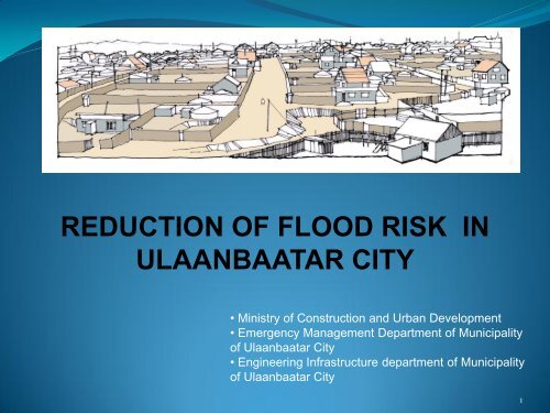
<strong>REDUCTION</strong> <strong>OF</strong> <strong>FLOOD</strong> <strong>RISK</strong> <strong>IN</strong><br />
<strong>ULAANBAATAR</strong> <strong>CITY</strong><br />
• Ministry of Construction and Urban Development<br />
• Emergency Management Department of Municipality<br />
of Ulaanbaatar City<br />
• Engineering Infrastructure department of Municipality<br />
of Ulaanbaatar City<br />
1
CONTENTS<br />
General information about Ulaanbaatar city<br />
Information about flood risk<br />
Challenges<br />
Evaluation of flood risk in Ulaanbaatar<br />
Existing status of flood protection facilities<br />
Utilization and reconstruction of infrastructure for flood<br />
protection<br />
Trainings and rehearsals<br />
Further actions for the nearest future
General information about<br />
Ulaanbaatar city
• The territory of Ulaanbaatar city is 0.3% and its<br />
urban settlement is 40% of whole population.<br />
• 162 residents inhabit for per km of the capital city<br />
territory,<br />
• 2011 the number of residents became 247 and<br />
the population density has been increased about<br />
12%.<br />
• Disaster types :<br />
‣Flash floods<br />
‣Earthquake<br />
‣Forest and building fire.
Expansion of “GER” area<br />
‣ Increased resettlements in ger area<br />
‣ Unplanned structure<br />
‣ Expansion of territory increased two times<br />
‣ 9752.0 hectare which territory is 59.2
THE HOUSEHOLDS WHO HAVE SETTLED <strong>IN</strong> THE AREA <strong>OF</strong> <strong>FLOOD</strong> <strong>RISK</strong><br />
410<br />
households<br />
420<br />
households<br />
467<br />
households<br />
755 households<br />
13<br />
households<br />
208<br />
households<br />
2260 households of 6 districts.<br />
We have sent warnings, remarks and<br />
announcement to 1912 households in 2012.<br />
6
•Population density, inferior buildings and<br />
structures cause the danger of<br />
earthquake.<br />
‣ Area 25% - a 6.0 on the Richter scale<br />
‣ Area 52% - a 7.0 on the Richter scale<br />
‣ Area 23% - an 8.0 on the Richter scale.
Challenges
Challenges<br />
Challenges and lacks about decreasing danger of a disaster and<br />
adjusting to climate change:<br />
‣ Legal system<br />
‣ Structure of urban planning system<br />
‣ Cohesion and regulation between related ministries and institutions<br />
‣ Source of finance and budget<br />
‣ Measuring and controlling of disaster risk<br />
‣ Educational system, trainings and advertisements
The condition of flood risk and affecting factors<br />
• Floods in 1778, 1915, 1966, 1982, 2000, 2003, 2004.<br />
• 14 times of thunderstorms and downhill floods - death of 15 people.<br />
• Reasons of increasing the risk of flood:<br />
‣ The frequency of risk of flood<br />
‣ Climate change<br />
‣ Environmental pollution<br />
‣ Rise of the population in the area of<br />
ecosystem<br />
‣ Centralization and urbanization<br />
‣ Inadequacy of the structure of flood<br />
protection and associated system<br />
5/25/2013 10
Evaluation of flood risk<br />
in Ulaanbaatar
56km of dams, 36km of canals, 77km canals of rainrunoff,<br />
1 pump station, 11km canals for ground-water<br />
runoff.<br />
Bayanazurh district flooded<br />
zone - 67% of emergency calls<br />
Downhill floods caused the death of 15 people and 1.679<br />
billion tugriks in damage. The dates are: 2003.07.18,<br />
2005.07.29, 2006.07.07, 2008.06.29, 2009.07.17,<br />
2009.07.21.<br />
12
The number of households who settled in<br />
the flood risk zones (by districts)<br />
Налайх<br />
Сүхбаатар<br />
Чингэлтэй<br />
Сонгинохайрхан<br />
Хан-Уул<br />
Багануур<br />
Багахангай<br />
Баянзүрх<br />
Баянгол<br />
0 200 400 600 800 1000 1200
Evaluation of flood risk where population may experience<br />
the danger in Ulaanbaatar<br />
Name of districts<br />
Population<br />
of districts<br />
Level of<br />
danger 1]<br />
(HR)<br />
Evaluation of territory<br />
Sensitivity<br />
of territory<br />
(AV)<br />
% of<br />
population<br />
%<br />
sensitivity<br />
of<br />
population<br />
(PV)<br />
Evaluation of flood risk<br />
Possibility<br />
of damage<br />
to people<br />
Possibility<br />
of death<br />
Khan-Uul 112055 1.24 6 0.07 0.10 1 х10 -3 4 х10 -4<br />
Bayangol 185104 1.33 6 0.08 0.15 2 х10 -2 6 х10 -4<br />
Chingeltei 147438 1.34 6 0.08 0.63 1 х10 -2 3 х10 -3<br />
Songinokhairkhan 252264 1.43 6 0.09 0.06 9 х10 -2 3 х10 -4<br />
Suhbaatar 136917 1.21 6 0.07 0.13 2 х10 -2 4 х10 -4<br />
Bayanzurh 265997 1.35 6 0.08 0.12 2 х10 -2 5 х10 -4<br />
The number of<br />
population and<br />
evaluation<br />
average of 6<br />
districts<br />
1099775 1.32 6 0.07 0.19 3 x 10 -2 8 x 10 -4<br />
[1]<br />
average which matrices of danger may occur to people, by determining the deepness and speed of flood.<br />
14
Picture of flood risk, which<br />
population density settled in<br />
the flood risk zones by<br />
khoroo. (scale 1:200000)<br />
Picture of flood risk by<br />
districts (scale 1:380000)<br />
15
80 thousands of urban<br />
population’s living standard<br />
may disturb due to danger<br />
of flood.
Possibilities of urban population:<br />
‣Damage: 2 х 10 -2 , which is 200 people<br />
‣ Death: 7 x 10 -4 , which is 10 people<br />
Ice cover created on the flood protection channel and surrounding areas.
After flood
Evaluation of flood risk in Ulaanbaatar<br />
Embankment in river Tuul<br />
Flood protection in Chingeltei<br />
• The hot spots: Tuul, Selbe, Uliastai<br />
• Rivers, coulees and water stream: Tolgoit, Bayangol<br />
• Mobility of migration in peri-urban ger area causes the<br />
danger of flood risk.<br />
Flood protection in Denjyn 1000<br />
Earth embankment/dyke in Western Naran
Existing status of flood<br />
protection facilities
General Scheme of UB City Flood Protection<br />
Facilities
Planning draft of infrastructure for flood<br />
protection of Ulaanbaatar
• Existing status of Denjyn 1000<br />
flood protection facilities<br />
• Concrete slabs of the channel are<br />
damaged and washed off by flood
Utilization and reconstruction<br />
of infrastructure for flood<br />
protection
• Flood protection facilities have been constructed in<br />
Ulaanbaatar city since 1960s. Since then a total of<br />
more than 130km flood protection facilities of various<br />
design have been constructed during different<br />
timeframes.<br />
No. Design / structure of Flood protection Facilities Length , km<br />
1 Concrete channels 47,8 km<br />
2 Earth channels 9,8 km<br />
3 Stone (finishing) channels 3,5 km<br />
4 Embankments and protection facilities in river Tuul, Selbe<br />
and Dund<br />
64 km
Utilization and reconstruction of infrastructure for<br />
flood protection of Ulaanbaatar<br />
• Flood dam and Public engineering construction system has been built<br />
since 1960<br />
• 70 % of flood protection dam were obsoleted<br />
• Due to increasing of population and resettlement, the MUB is<br />
reconstructing flood dam and establishing new flood construction<br />
• The country, from year of 1990 to present time, with low capabilities of<br />
the country and economy, has not invested in protected infrastructure for<br />
flood risk.
Local households<br />
constructed a channel and<br />
embankment to prevent<br />
from flood hazards.
• Between 1966 – 2002 years:<br />
‣ 120 km of structure in 21 flood<br />
‣ 5.2 km of drainage network and 1 pump station for ground-water runoff<br />
‣ 68.3 km of hidden and outdoor engineering drainage network for streets and areas<br />
‣ 934 of filtering water hole<br />
‣ 709 of surveying water hole.<br />
30
• Between 2003-2011 years in 6 districts:<br />
‣ 138 km of structure in 21 flood<br />
‣ 13.8 km of drainage network and 1 pump station for ground-water<br />
runoff<br />
‣ 77.3 km of hidden and outdoor engineering drainage network for<br />
streets and areas<br />
‣ 1838 of filtering water hole<br />
‣ 1300 of surveying of water hole for repairing
• Since 2012, 9 protected infrastructure for flood risk:<br />
‣ 25 km protected infrastructures rebuilt<br />
‣ 23 km rehabilitated<br />
• The forward planning until 2018:<br />
‣ 40% of rehabilitated construction<br />
‣ 60% construction of new infrastructures and buildings.
The plan of “General development planning for<br />
Ulaanbaatar city until 2020” aimed to get the standard of<br />
GIS system :<br />
‣Operate flood dams,<br />
‣System of rainfall-runoff,<br />
‣Rehabilitation of pump station,<br />
‣Slip-rope of network,<br />
‣Surveying and filtering water hole.
Training and rehearsal
Community based disaster preparedness training<br />
and rehearsal in 9 districts<br />
‣ Students of secondary<br />
schools, college and<br />
University<br />
‣ Training for employees of<br />
enterprises, private<br />
companies and plants<br />
‣ Training for employees of<br />
office and business centers<br />
‣ Training for citizen of flood<br />
vulnerable residents<br />
‣ Total number of participants<br />
– 380.000
‣Employees of office, business centers and<br />
citizen of flood vulnerable residents
‣Training for administrations and vocational class
‣Students, employees, private companies and<br />
plants
Further actions for<br />
the nearest future
Further actions are needed to be implemented<br />
in the nearest future<br />
• Revision and improvement of legal system in DRR & CCA context (local<br />
government rule, finance resource, public participation, responsibility,<br />
revision of Urban Development Law, City Redevelopment Law, Law on<br />
Greening, etc), improvement of planning & building norms and standards<br />
• Establishment of integrated education system on DRR & CCA (national<br />
cirriculum, preparation of teachers, development of Media, etc)<br />
• Improvement of linkage and coordination between related ministries,<br />
institutions & organizations (sharing of information, integrated planning,<br />
etc)<br />
• Implementation of programs and projects under international technical<br />
assistance and support<br />
• Establishment of DRR & CCA Information Management System<br />
(research studies, training activities)<br />
• International best practice and information and knowledge sharing with<br />
East Asian countries such as South Korea, Vietnam, Philippine,<br />
Indonesia, Cambodia , Nepal.
THANK YOU FOR YOUR<br />
ATTENTION<br />
41


