Windermere ASP Consolidation - City of Edmonton
Windermere ASP Consolidation - City of Edmonton
Windermere ASP Consolidation - City of Edmonton

You also want an ePaper? Increase the reach of your titles
YUMPU automatically turns print PDFs into web optimized ePapers that Google loves.
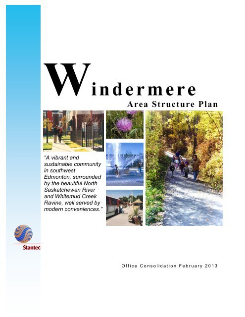
Wi n d e r m ere<br />
Area Structure Plan<br />
“A vibrant and<br />
sustainable community<br />
in southwest<br />
<strong>Edmonton</strong>, surrounded<br />
by the beautiful North<br />
Saskatchewan River<br />
and Whitemud Creek<br />
Ravine, well served by<br />
modern conveniences.”<br />
O f f i c e C o n s o l i d a t i o n F e b r u a r y 2 0 1 3
<strong>Windermere</strong> Area Structure Plan<br />
Office <strong>Consolidation</strong> February 2013<br />
Prepared by:<br />
Current Planning Branch<br />
Sustainable Development<br />
<strong>City</strong> <strong>of</strong> <strong>Edmonton</strong><br />
Bylaw 13717 was adopted by Council in May 2004. In February 2013, this document was<br />
consolidated by virtue <strong>of</strong> the incorporation <strong>of</strong> the following bylaws, which were amended to<br />
the original Bylaw 13717:<br />
Bylaw 13717 Approved May 25, 2004 - to adopt the <strong>Windermere</strong> Area Structure Plan<br />
Bylaw 15010 Approved September 10, 2008 – to redesignate a portion <strong>of</strong> the community<br />
commercial site to public utility uses in the <strong>Windermere</strong> Neighbourhood<br />
Bylaw 15423 Approved June 7, 2010 - to realign Ellerslie Rd, amend the neighbourhood<br />
boundaries <strong>of</strong> <strong>Windermere</strong> and Keswick and reconfigure the SWMF and<br />
community commercial site in the south-central portion <strong>of</strong> the <strong>ASP</strong> area<br />
Bylaw 15513 Approved July 19, 2010 – to update land uses within Keswick neighbourhood<br />
boundaries, to add two parks, conceptually illustrate the location <strong>of</strong> all SWMFs,<br />
introduce a third Mixed Use – Residential/Institutional site, introduce a new<br />
Mixed Use – Residential/Commercial land designation, and update figures and<br />
statistics based on the associated Keswick NSP<br />
Bylaw 15825 Approved July 4, 2011 – to update the land use statistics to reflect the more<br />
detailed planning that has been undertaken and approved within the <strong>ASP</strong> area<br />
Bylaw 15802 Approved July 4, 2011 – to divide Neighbourhood 4 into 2 neighbourhoods,<br />
Glenrriding Heights and Glenridding Ravine, adjust the boundaries <strong>of</strong> Ambleside<br />
and Glenrriding Heights, reconfigure the District Park and SWMF in Glenridding<br />
Heights, relocate the southern Transite Centre and updates figures and statistics<br />
Bylaw 15805 Approved July 18, 2011 – to relocate a community commercial site and add a<br />
SWMF within the SW portion <strong>of</strong> Ambleside and update the land use statistics *<br />
Bylaw 15808 Approved July 18, 2011 – to identify the location <strong>of</strong> a fire station in Ambleside<br />
and update the land use statistics and figures accordingly<br />
Bylaw 16003 Approved February 2012 – to revise road right-<strong>of</strong>-way requirements for 170<br />
Street and Hiller Road<br />
Bylaw 16072 Approved April 16, 2012 – to update the land use statistics and <strong>ASP</strong> map to<br />
reflect land use changes from non-residential to residential in the Ambleside NSP<br />
Bylaw 16090 Approved May 14, 2012 – to update land use and population statistics and figures<br />
to reflect reconfiguration <strong>of</strong> a SWMF and to redesignate mixed uses along<br />
Ellerslie Road to residential in the associated <strong>Windermere</strong> NSP<br />
Bylaw 16130 Approved June 18, 2012 – to update land use and population statistics to<br />
accommodate an additional commercial area and to incorporate changes as a<br />
result <strong>of</strong> Bylaw 16090<br />
Bylaw 16177 Approved July 16, 2012 – to redesignate a portion <strong>of</strong> the upland area from Natural<br />
Area to Large Lot Residential in the <strong>Windermere</strong> NSP and update the land use<br />
statistics and figures accordingly<br />
Bylaw 16291 Approved November 13, 2012 - to amend the neighbourhood statistics and<br />
relevant figure associated with the associated amendment (Bylaw 16292) to the<br />
Glenridding Heights Neighbourhood Structure Plan.
Editor’s Note:<br />
This is an <strong>of</strong>fice consolidation edition <strong>of</strong> the <strong>Windermere</strong> Area Structure Plan, Bylaw 13717, as<br />
approved by <strong>City</strong> Council on May 25, 2004.<br />
This edition contains all amendments and additions to Bylaw 16177. For the sake <strong>of</strong> clarity, new<br />
maps and a standardised format were utilised in this Plan. All names <strong>of</strong> <strong>City</strong> departments have<br />
been standardised to reflect their present titles. Private owners’ names have been removed in<br />
accordance with the Freedom <strong>of</strong> Information and Protection <strong>of</strong> Privacy Act. Furthermore, all<br />
reasonable attempts were made to accurately reflect the original Bylaws. All text changes are<br />
noted in the right margin and are italicised where applicable.<br />
This <strong>of</strong>fice consolidation is intended for convenience only. In case <strong>of</strong> uncertainty, the reader is<br />
advised to consult the original Bylaws, available at the <strong>of</strong>fice <strong>of</strong> the <strong>City</strong> Clerk.<br />
<strong>City</strong> <strong>of</strong> <strong>Edmonton</strong><br />
Sustainable Development<br />
* All references to “9 Avenue NW” have been deleted and replaced with “<strong>Windermere</strong> Boulevard”
Bylaw 16177, July 16, 2012
TABLE 1<br />
WINDERMERE AREA STRUCTURE PLAN<br />
LAND USE AND POPULATION STATISTICS<br />
BYLAW 16291<br />
Area (ha)<br />
% <strong>of</strong> GDA<br />
Gross Area 1,801<br />
Pipeline / Power Line Corridors 6<br />
Creeks / Ravine Lands (ER) 15<br />
Major Arterials 77<br />
Existing Uses – Country Residential 70<br />
Gross Developable Area 1,633 100<br />
Public Utility 31 1.9%<br />
Parks and Schools 129 7.9%<br />
Circulation 325 19.9%<br />
Public Open Space 3 0.2%<br />
Stormwater Management Facilities 84 5.1%<br />
Net Developable Area 1,061 65.0%<br />
Business Commercial 76 4.7%<br />
Major Commercial 48 2.9%<br />
Community Commercial 40 2.4%<br />
Mixed-Use Institutional / Residential 16 1.0%<br />
Mixed-Use Residential / Commercial 1 0.1%<br />
Golf Course 14 0.9%<br />
Total Non-Residential 195 11.9%<br />
Total Residential 867 53.1%<br />
% <strong>of</strong> Total<br />
Units<br />
Units<br />
Population<br />
Low Density 15,128 57.4% 44,265<br />
Medium Density 9,005 34.2% 20,403<br />
High Density 1,752 6.6% 2,575<br />
Large Lot (Country Residential) 491 1.9% 1,375<br />
Total Residential 26,376 100.0% 68,618<br />
Density: 38.1 persons per gross hectare<br />
30.4 units per net residential hectare<br />
*Includes land potentially releasable from the R.D.A.<br />
(Bylaw 16291, November 13, 2012)
CONTENTS (Amended by Editor)<br />
1.0 INTRODUCTION 1<br />
1.1 Vision 1<br />
1.2 Purpose 1<br />
1.3 Background 1<br />
1.4 Definition <strong>of</strong> Plan Area 5<br />
1.5 Land Ownership 7<br />
1.6 Public Consultation Process 7<br />
2.0 STATUTORY PLAN AND POLICY CONTEXT 9<br />
2.1 <strong>Edmonton</strong> Municipal Development Plan 9<br />
2.2 Airport Protection Overlay – <strong>Edmonton</strong> International Airport 16<br />
2.3 Suburban Neighbourhood Design Principles 16<br />
2.4 Environmental Policies and Practices 16<br />
2.5 Smart Choices (Smart Growth) 19<br />
3.0 SITE CONTEXT AND DEVELOPMENT CONSIDERATIONS 21<br />
3.1 Existing Land Uses 21<br />
3.2 Surrounding Land Uses 23<br />
3.4 Environmental Resources 24<br />
3.5 Environmental Site Assessments 27<br />
3.6 Heritage Resources 29<br />
3.7 Energy and Natural Resources 30<br />
4.0 DEVELOPMENT GOALS, OBJECTIVES & PRINCIPLES 33<br />
4.1 Goals 33<br />
4.2 Development Objectives 33
4.3 Development Principles 34<br />
5. 0 DEVELOPMENT CONCEPT 42<br />
5.1 Land Use Concept 42<br />
5.2 Neighbourhood Units 45<br />
5.3 Business / Commercial 47<br />
5.4 Potential Economic Activity Centre 50<br />
5.5 Mixed Use 52<br />
5.5.3 Intent: Mixed Use – Residential / Commercial 54<br />
5.5.4 Concept: Mixed Use – Residential/Commercial 54<br />
5.6 Residential 55<br />
5.7 Educational Facilities, Parks and Open Space 59<br />
5.8 Urban Services 66<br />
5.9 Circulation 69<br />
6.0 TRANSPORTATION 72<br />
6.1 Regional Network Accessibility 72<br />
6.2 External Roadway Circulation 72<br />
6.3 Internal Roadway Circulation 74<br />
6.4 Truck Route 75<br />
6.5 Transit / Pedestrian Networks 75<br />
7.0 ENGINEERING SERVICES 78<br />
7.1 Water Servicing 78<br />
7.2 Stormwater Servicing 79<br />
7.3 Sanitary Service 80<br />
7.4 Shallow Utilities 80
8.0 IMPLEMENTATION 81<br />
8.1 Plan Implementation Initiatives 81<br />
8.2 Development Staging 81<br />
8.3 <strong>Windermere</strong> Neighbourhood Design Concepts 83<br />
8.4 Rezoning and Subdivision 84<br />
8.5 Summary and Recommendations 84<br />
9.0 APPENDICES 86<br />
Appendix 1 – Land Ownership (as amended by Editor) 87<br />
Appendix 2 – Land Use and Population Statistics 88<br />
Appendix 4 – References 91<br />
LIST OF FIGURES<br />
PAGE<br />
FIGURE 1.0 SOUTHWEST DEVELOPMENT PATTERN 3<br />
FIGURE 2.0 CONTEXT PLAN 6<br />
FIGURE 3.0 LAND OWNERSHIP 8<br />
FIGURE 4.0 SITE FEATURES 18<br />
FIGURE 5.0 OPPORTUNITIES AND CONSTRAINTS 22<br />
FIGURE 6.0 NEIGHBOURHOOD UNITS 43<br />
FIGURE 7.0 DEVELOPMENT CONCEPT 44<br />
FIGURE 8.0 INTEGRATED COMMUNITY CIRCULATION SYSTEM 61<br />
FIGURE 9.0 TRANSPORTATION NETWORK 73<br />
FIGURE 10.0 RECOMMENDED DEVELOPMENT PHASING 82
1.0 INTRODUCTION<br />
1.1 Vision<br />
The <strong>Windermere</strong> Area Structure Plan<br />
(<strong>ASP</strong>) seeks to establish a vibrant and<br />
sustainable community in Southwest<br />
<strong>Edmonton</strong> where people choose to live,<br />
learn, work, and play throughout their life.<br />
Surrounded by the North Saskatchewan<br />
River, Anthony Henday Drive and<br />
Whitemud Creek Ravine, <strong>Windermere</strong><br />
will nurture such a community through<br />
the careful integration <strong>of</strong> the natural and<br />
built environment, centres <strong>of</strong> activity and<br />
services.<br />
1.2 Purpose<br />
1.3 Background<br />
The purpose <strong>of</strong> this Area Structure Plan<br />
is to establish a framework for land use<br />
planning, the provision <strong>of</strong> municipal<br />
infrastructure, services and amenities,<br />
within established planning policies,<br />
objectives and requirements.<br />
Development <strong>of</strong> these lands represents<br />
an efficient, contiguous pattern <strong>of</strong> urban<br />
development. The long-term intent is to<br />
establish a vibrant and sustainable<br />
community in Southwest <strong>Edmonton</strong><br />
where people choose to live, learn, work,<br />
and play throughout their lives.<br />
<strong>Windermere</strong> is located in the southwest<br />
sector <strong>of</strong> the <strong>City</strong> <strong>of</strong> <strong>Edmonton</strong> and<br />
comprises approximately 1800 hectares<br />
(4448 acres). This area is bounded by<br />
Anthony Henday Drive / Transportation<br />
and Utility Corridor (TUC) to the north,<br />
Whitemud Creek ravine to the east, 41<br />
Avenue SW (<strong>City</strong> <strong>of</strong> <strong>Edmonton</strong> limits)<br />
along the south and North<br />
Saskatchewan River to the west.<br />
The <strong>Windermere</strong> Area Structure Plan<br />
(<strong>ASP</strong>) was identified in Plan <strong>Edmonton</strong> –<br />
<strong>Edmonton</strong>’s Municipal Development Plan (1998), as<br />
Suburban. This designation provides the statutory<br />
framework for future development <strong>of</strong> this area.<br />
<strong>Windermere</strong> <strong>ASP</strong> November 2012 Office <strong>Consolidation</strong><br />
1
Since the designation <strong>of</strong> these lands as a Suburban Area,<br />
a number <strong>of</strong> key planning, transportation and development<br />
factors have influenced the need to prepare a strategic<br />
plan for the development <strong>of</strong> lands in southwest <strong>Edmonton</strong>.<br />
A summary <strong>of</strong> these key factors are briefly discussed<br />
below:<br />
1. The construction and scheduled completion <strong>of</strong> the<br />
Southwest leg <strong>of</strong> Anthony Henday Drive by 2006.<br />
The implication <strong>of</strong> Anthony Henday Drive as an economic<br />
catalyst for <strong>Edmonton</strong>, and in particular southwest<br />
<strong>Edmonton</strong> through which it passes, is far reaching.<br />
Construction <strong>of</strong> the bridge across the North Saskatchewan<br />
River and the 170 Street/Anthony Henday Drive<br />
intersections provide excellent access to new commercial<br />
trade areas west and north <strong>of</strong> <strong>Windermere</strong>, and the<br />
opportunity to provide services omitted from the southwest<br />
sector <strong>of</strong> <strong>Edmonton</strong>.<br />
2. Strong urban growth in Southwest <strong>Edmonton</strong><br />
Strong economic growth in <strong>Edmonton</strong> in the last several<br />
years has translated into exceptional growth opportunities<br />
in population, employment income and urban growth in<br />
southwest <strong>Edmonton</strong>.<br />
Population forecast supplied by <strong>City</strong> Departments predicts<br />
that the <strong>City</strong> will rise by 26% from 657,511 in 2000 to<br />
827,612 in 2025. Growth is expected to occur in all<br />
quadrants <strong>of</strong> the <strong>City</strong> with the majority occurring in<br />
suburban areas such as <strong>Windermere</strong>. During this period,<br />
suburban areas are projected to grow by 49% with some <strong>of</strong><br />
the largest population increases expected to occur in the<br />
Southwest. It is expected that demand for single family,<br />
duplex, multi-family and higher density housing will grow in<br />
relation to the rise in population forecasted for southwest<br />
<strong>Edmonton</strong>.<br />
The southwest sector, because <strong>of</strong> its desirability, has seen<br />
the highest level <strong>of</strong> urban growth in the <strong>City</strong> compared to<br />
other parts. Analysis suggests that remaining lands within<br />
Terwillegar will be significantly absorbed within 6 to 10<br />
years based on the demand experienced in the southwest<br />
area over the past 5 years (see Figure 1.0 – Southwest<br />
Development Pattern). If new neighbourhoods (i.e.<br />
housing opportunities) are not timed to be available to<br />
meet this need, demand may shift to adjacent or outlying<br />
areas. This may include other neighbourhoods, sectors <strong>of</strong><br />
the <strong>City</strong> or nearby municipalities.<br />
<strong>Windermere</strong> <strong>ASP</strong> November 2012 Office <strong>Consolidation</strong><br />
2
<strong>Windermere</strong> <strong>ASP</strong> November 2012 Office <strong>Consolidation</strong><br />
3
Based on conservative modelling, employment is expected<br />
to grow by 33% to 471,000 by 2025, with approximately<br />
one-third <strong>of</strong> new jobs locating within <strong>Edmonton</strong>’s suburban<br />
areas. As the economy continues to grow, demand for<br />
housing in southwest <strong>Edmonton</strong> over this forecast period is<br />
also expected to increase. This growth presents the<br />
opportunity to provide both local and regional commercial<br />
and business employment opportunities within the plan in<br />
keeping with the concept <strong>of</strong> sustainable development<br />
practices.<br />
3. The planned extension <strong>of</strong> storm, sewer, water and<br />
shallow utility service into the study area.<br />
Responding to Plan <strong>Edmonton</strong>’s Planned Growth Strategy<br />
to accommodate suburban growth in an orderly, serviced<br />
manner, and in light <strong>of</strong> SW <strong>Edmonton</strong>’s population,<br />
economic forecasts and land absorption rates, several<br />
departments and agencies have pro-actively began<br />
preparing strategic servicing plans for some time now. The<br />
Southwest Area Drainage Master Plan covering<br />
<strong>Windermere</strong> and the undeveloped areas west <strong>of</strong> the North<br />
Saskatchewan River has been prepared. Plans are<br />
currently underway to extend the South East Sanitary<br />
System-south west trunk- west to 170 Street by 2007,<br />
<strong>Windermere</strong> <strong>ASP</strong> November 2012 Office <strong>Consolidation</strong><br />
4
making it possible to bring adjacent neighbourhoods on<br />
stream for development.<br />
4. The completion <strong>of</strong> necessary engineering,<br />
environmental and other studies required for future<br />
development <strong>of</strong> the <strong>Windermere</strong> area.<br />
In 2000, as part <strong>of</strong> the plan preparation process for the<br />
Heritage Valley SCDB, the natural areas assessment for<br />
<strong>Windermere</strong> was also done.<br />
In support <strong>of</strong> the planned development concept elaborated<br />
later on in Chapter 5, and as required by various <strong>City</strong><br />
Departments and Agencies, a number <strong>of</strong> additional studies<br />
have been undertaken, including:<br />
<br />
<br />
<br />
<br />
A Retail Market Opportunity Assessment for the SW<br />
<strong>Edmonton</strong> Sector<br />
Transportation Impact Assessment<br />
Environmental Assessment Phase 1 for all affected<br />
landowners<br />
Geotechnical studies for areas adjacent to the River<br />
Valley and Ravine systems.<br />
These additional studies, reports and assessments<br />
represent a strong financial commitment to the growth and<br />
fiscal health <strong>of</strong> the <strong>City</strong> by the developers and property<br />
owners for long-term management <strong>of</strong> development in the<br />
suburbs.<br />
1.4 Definition <strong>of</strong> Plan Area<br />
The <strong>Windermere</strong> Area Structure Plan includes all <strong>of</strong><br />
Sections 16-51-25-W4M and 21-51-25-W4M, and portions<br />
<strong>of</strong> Sections 15, 17, 20, 22, 23, 26, 27, 28, 29, 34 and 33-<br />
51-25-W4M. As shown on Figure 2.0 – Context Plan, the<br />
<strong>Windermere</strong> <strong>ASP</strong> is defined by the following general<br />
boundaries:<br />
<br />
<br />
<br />
<br />
Northern Boundary – Transportation Utilities Corridor<br />
/ Anthony Henday Drive<br />
Western Boundary – Top <strong>of</strong> North Saskatchewan<br />
River Ravine<br />
Eastern Boundary – Top <strong>of</strong> Whitemud Creek Ravine<br />
Southern Boundary – 41 Avenue South-West / <strong>City</strong><br />
Limits<br />
<strong>Windermere</strong> <strong>ASP</strong> November 2012 Office <strong>Consolidation</strong><br />
5
<strong>Windermere</strong> <strong>ASP</strong> November 2012 Office <strong>Consolidation</strong><br />
6
1.5 Land Ownership<br />
Current land ownership is shown on Figure 3.0 – Land<br />
Ownership. A more detailed listing is provided on Table 1<br />
– Land Ownership in Appendix 1.<br />
1.6 Public Consultation Process<br />
In preparation <strong>of</strong> the <strong>Windermere</strong> <strong>ASP</strong>, a series <strong>of</strong> pre-plan<br />
preparation meetings and information sessions were held<br />
with various Civic Departments, Agencies and land owners<br />
in order to identify information needs, opportunities,<br />
constraints, and overall planning approach. This included<br />
Ward Councillors, representatives from the <strong>City</strong> <strong>of</strong><br />
<strong>Edmonton</strong> Sustainable Development, Transportation<br />
Services, Infrastructure Services, EPCOR, <strong>Edmonton</strong><br />
Public and Separate School Boards, local landowners and<br />
the County <strong>of</strong> Leduc Planning Department.<br />
Two open house format information sessions were held on<br />
April 7, 2003 and April 23, 2003. These were attended by<br />
Ward Councillors, various landowners and residents (and<br />
or their agents). A Public Meeting was held on November<br />
20, 2003 to provide an overview <strong>of</strong> the Plan for area<br />
residents.<br />
The meeting and scheduled information sessions provided<br />
stakeholders opportunity to voice their interest, comments,<br />
concerns and support regarding the <strong>ASP</strong> early in its<br />
preparation. The information obtained from these sessions<br />
has been incorporated into this planning document where<br />
practicable.<br />
<strong>Windermere</strong> <strong>ASP</strong> November 2012 Office <strong>Consolidation</strong><br />
7
Bylaw 16177, July 16, 2012<br />
<strong>Windermere</strong> <strong>ASP</strong> November 2012 Office <strong>Consolidation</strong><br />
8
2.0 STATUTORY PLAN AND POLICY CONTEXT<br />
2.1 <strong>Edmonton</strong> Municipal Development Plan<br />
The Way We Grow – The <strong>Windermere</strong> <strong>ASP</strong> was<br />
approved under Plan <strong>Edmonton</strong> which was<br />
adopted by Council in 1998. In May 2010, <strong>City</strong><br />
Council approved a new MDP titled The Way We<br />
Grow. The Way We Grow is a comprehensive<br />
plan which provides direction <strong>of</strong> development and<br />
implementation <strong>of</strong> more specific and detailed<br />
plans by the industry/private landowners and the<br />
<strong>City</strong>.<br />
Bylaw 15805<br />
July 18, 2011<br />
The land within the <strong>Windermere</strong> <strong>ASP</strong> is<br />
designated in The Way We Grow as Developing,<br />
Planned and Future Neighbourhoods. The<br />
<strong>Windermere</strong> <strong>ASP</strong> complies with The Way We<br />
Grow policies including, but not limited to:<br />
MDP Policy 3.1.1.1 – Integrate higher<br />
density development with Light Rail<br />
Transit (LRT) stations and transit<br />
centres.<br />
MDP Policy 3.1.1.3 – Focus land<br />
development activity and the provision<br />
<strong>of</strong> civic infrastructure to ensure<br />
developing neighbourhoods are<br />
completed from the perspective <strong>of</strong> the<br />
number <strong>of</strong> homes built in an<br />
established population threshold<br />
reached, and the civic facilities and<br />
services provided.<br />
MDP Policy 3.2.1.3 – Achieve a<br />
balance between residential, industrial,<br />
commercial, institutional, natural and<br />
recreational land uses in the <strong>City</strong><br />
through land development policies and<br />
decisions.<br />
MDP Policy 3.2.2.2 – Acquire land<br />
necessary for <strong>City</strong> services and<br />
operations including emergency<br />
services facilities, yards, garages and<br />
storage facilities.<br />
MDP Policy 3.3.1.1 – Promote medium<br />
and higher density residential and<br />
employment growth around LRT<br />
stations and transit centres to support<br />
Higher density residential uses<br />
have been planned in proximity<br />
to the Transit Station in the<br />
Ambleside Neighbourhood.<br />
The <strong>Windermere</strong> <strong>ASP</strong> provides<br />
the basis and direction for the<br />
development <strong>of</strong> several<br />
complete neighbourhoods, in<br />
terms <strong>of</strong> number <strong>of</strong> homes built,<br />
an established population<br />
threshold reached, and civic<br />
facilities and services provided.<br />
The <strong>Windermere</strong> <strong>ASP</strong> provides<br />
a balance <strong>of</strong> land uses including<br />
residential, commercial,<br />
institutional, industrial, natural<br />
and recreational.<br />
The <strong>Windermere</strong> <strong>ASP</strong><br />
designates lands for <strong>City</strong><br />
services, such as emergency<br />
response facilities, public<br />
utilities as well as the <strong>City</strong> <strong>of</strong><br />
<strong>Edmonton</strong> Integrated Service<br />
Yard.<br />
The <strong>Windermere</strong> <strong>ASP</strong><br />
designates medium and high<br />
density residential as well as<br />
employment growth near<br />
Bylaw 15805<br />
July 18, 2011<br />
Bylaw 15805<br />
July 18, 2011<br />
<strong>Windermere</strong> <strong>ASP</strong> November 2012 Office <strong>Consolidation</strong><br />
9
and ensure the viability <strong>of</strong> transit<br />
services.<br />
proposed transit stations.<br />
MDP Policy 3.6.1.6 – Support<br />
contiguous development and<br />
infrastructure in order to accommodate<br />
growth in an orderly and economical<br />
fashion.<br />
MDP Policy 4.3.1.9 – Ensure that<br />
public facilities are located to be<br />
accessible by a variety <strong>of</strong> modes <strong>of</strong><br />
transportation, including public transit.<br />
MDP Policy 4.4.1.1 – Provide a broad<br />
and varied housing choice,<br />
incorporating housing for various<br />
demographic and income groups in all<br />
neighbourhoods.<br />
MDP Policy 4.6.1.2 – Ensure active<br />
transportation opportunities are<br />
included in plans and development<br />
proposals.<br />
The <strong>Windermere</strong> <strong>ASP</strong><br />
represents contiguous growth in<br />
southwest <strong>Edmonton</strong>, as the<br />
surrounding neighbourhoods<br />
develop concurrently.<br />
The <strong>Windermere</strong> <strong>ASP</strong><br />
designates lands for public<br />
facilities such as schools, along<br />
collector roadways which also<br />
serve as public transit routes.<br />
Pedestrian linkages through<br />
multi-use trails, walkways, and<br />
sidewalks provide access to<br />
public facilities for a variety <strong>of</strong><br />
modes <strong>of</strong> transportation (i.e.<br />
walking, cycling, etc.).<br />
The <strong>Windermere</strong> <strong>ASP</strong> allows for<br />
the development <strong>of</strong> a variety <strong>of</strong><br />
housing choices, including Low<br />
Density Residential (single and<br />
semi-detached), Medium<br />
Density Residential (rowhousing<br />
and low rise/medium density<br />
housing) and High Density<br />
Residential (medium to high rise<br />
units).<br />
The <strong>Windermere</strong> <strong>ASP</strong> provides<br />
a well integrated pedestrian<br />
network <strong>of</strong> multi-use trails,<br />
walkways and sidewalks to<br />
provide for a variety <strong>of</strong> modes <strong>of</strong><br />
active transportation<br />
Plan <strong>Edmonton</strong> was adopted by <strong>City</strong> Council in 1998 and<br />
provides a framework for future land use and planning<br />
direction for the preparation <strong>of</strong> the <strong>Windermere</strong> Area<br />
Structure Plan. (Editor’s note: This paragraph must be<br />
deleted with<br />
The land within the <strong>Windermere</strong> <strong>ASP</strong> is designated in the<br />
<strong>City</strong> <strong>of</strong> <strong>Edmonton</strong>’s Municipal Development Plan (MDP) as<br />
Suburban Area.<br />
Numerous strategies are in the MDP regarding policies<br />
that encourage: orderly and cost-effective growth; efficient<br />
use <strong>of</strong> land and provision <strong>of</strong> services through contiguous<br />
development; provision <strong>of</strong> varied housing types and<br />
<strong>Windermere</strong> <strong>ASP</strong> November 2012 Office <strong>Consolidation</strong><br />
10
densities; functional and aesthetically pleasing residential<br />
and business land uses; accessible recreational and open<br />
space opportunities; and, protection <strong>of</strong> the natural<br />
environment. The plan was prepared with respect to the<br />
following strategies.<br />
2.1.1 Planned Growth – Land Development Philosophy<br />
“Develop and utilise a land development philosophy that<br />
meets the <strong>City</strong>’s long-term development needs and<br />
achieves the optimal balance between residential,<br />
industrial, commercial, institutional and recreational land<br />
use.”<br />
Strategy 1.1.1 – Provide for choices regarding the types <strong>of</strong><br />
developments in which people want to live and do<br />
business.<br />
The <strong>Windermere</strong> <strong>ASP</strong> provides for a range <strong>of</strong> low, medium<br />
and high density residential development opportunities,<br />
employment generating business land uses and an<br />
opportunity for commercial to locate in a highly visible,<br />
accessible and growing sector <strong>of</strong> <strong>Edmonton</strong>. The <strong>ASP</strong><br />
encourages contiguous, compact, high quality, sustainable<br />
development that will enhance community lifestyle and<br />
image in Southwest <strong>Edmonton</strong>.<br />
Strategy 1.1.2 – Address compatibility <strong>of</strong> land use in the<br />
development and review <strong>of</strong> land use plans and<br />
development proposals.<br />
The <strong>Windermere</strong> <strong>ASP</strong> proposes the integration <strong>of</strong> existing<br />
residential land uses and urban service through the<br />
application <strong>of</strong> sustainable development principles relating<br />
to Smart Growth and Future School Sites Study. Land use<br />
compatibility will be achieved through the introduction <strong>of</strong><br />
transitional and low density housing near existing acreage<br />
communities <strong>of</strong> <strong>Windermere</strong>, <strong>Windermere</strong> Ridge and<br />
Westpoint Estates. Commercial, medium and higher<br />
density residential land uses are contemplated along<br />
Terwillegar Drive and Anthony Henday Drive forming more<br />
active and intense mixed land use nodes.<br />
In addition, careful attention to planning and design will be<br />
paid to addressing the urban interface between<br />
neighbouring residential communities developing in<br />
Terwillegar Heights and Heritage Valley, transportation<br />
facilities (i.e. Anthony Henday Drive, Terwillegar Drive, 41<br />
Avenue SW, 184 Street, 156 Street), power right-<strong>of</strong>-way<br />
and pipeline corridors along Ellerslie Road, and plan<br />
boundaries south <strong>of</strong> the TUC, along North Saskatchewan<br />
River Valley and Whitemud Creek top-<strong>of</strong>-bank.<br />
<strong>Windermere</strong> <strong>ASP</strong> November 2012 Office <strong>Consolidation</strong><br />
11
Strategy 1.1.12 – Place a high priority on the effective and<br />
efficient use <strong>of</strong> land.<br />
The <strong>Windermere</strong> <strong>ASP</strong> plans for a balanced mix <strong>of</strong><br />
business, commercial, residential, institutional and<br />
recreational land uses in an efficient land use pattern that<br />
can be economically serviced and developed on a staged<br />
basis in step with market demands. Both the <strong>ASP</strong> design<br />
and development concept support Smart Growth principles<br />
by incorporating contiguous staged growth, existing or<br />
planned infrastructure services and facilities (e.g. Anthony<br />
Henday Drive, future transit terminal), transit oriented<br />
developments, compact land use patterns, higher<br />
residential densities, diverse land uses and mobility<br />
options (i.e. walkability, transit), the mitigation <strong>of</strong><br />
environmental impacts and provision <strong>of</strong> sustainable<br />
community benefits through new school/park concepts<br />
(proposed under Future School Sites Study and models).<br />
Strategy 1.1.13 – Plan for urban development which is<br />
environmentally friendly and fiscally sustainable in the long<br />
term, based on the <strong>City</strong>’s financing, infrastructure and<br />
environmental strategies.<br />
<strong>Windermere</strong> will be encouraged to develop in as<br />
environmentally responsible a manner as possible. The<br />
boundary <strong>of</strong> the <strong>ASP</strong> has been designed coincidental to<br />
that <strong>of</strong> the North Saskatchewan River Valley Area<br />
Redevelopment Plan (ARP) boundary and proposes no<br />
infringements.<br />
Residential densities within the <strong>ASP</strong> will be relatively high<br />
at concentrated points / activity nodes along Terwillegar<br />
Drive south <strong>of</strong> Anthony Henday Drive. This will encourage<br />
compact land use patterns, shared infrastructure and<br />
maximise overall land use efficiency.<br />
Neighbourhood parks, open spaces, pedestrian corridors<br />
and greenways have been designed to provide direct<br />
access and promote use (i.e. effectiveness). A transit<br />
terminal has been identified strategically within the<br />
northern portion <strong>of</strong> the <strong>ASP</strong>. This approach to urban<br />
development will strengthen alternative transportation<br />
options (i.e. walking, cycling, transit use) available to local<br />
residents, lessen auto dependency and demands on<br />
roadway infrastructure provision and maintenance.<br />
The <strong>Windermere</strong> <strong>ASP</strong> will incorporate necessary<br />
stormwater management facility design elements to<br />
enhance stormwater run<strong>of</strong>f quality and reduce potential<br />
environmental impacts and water treatment costs.<br />
<strong>Windermere</strong> <strong>ASP</strong> November 2012 Office <strong>Consolidation</strong><br />
12
Thoughtful design <strong>of</strong> neighbourhood stormwater facilities<br />
will contribute to available visual and passive recreational<br />
amenities for residents.<br />
Strategy 1.1.14 – Maintain the integrity <strong>of</strong> pipelines and<br />
utility corridors while planning for growth and development.<br />
The <strong>Windermere</strong> <strong>ASP</strong> contains very few pipeline and utility<br />
corridors; these have been integrated into the plan and,<br />
where appropriate, will be integrated in the open space<br />
and walkway system.<br />
2.1.2 Planned Growth – Utilization <strong>of</strong> Existing Infrastructure<br />
“Encourage maximum development around <strong>City</strong><br />
infrastructure.”<br />
Strategy 1.3.3 – Support contiguous development that is<br />
adjacent to existing development in order to accommodate<br />
growth in an orderly and economical fashion.<br />
In support <strong>of</strong> contiguous development, the <strong>Windermere</strong><br />
<strong>ASP</strong> represents a logical extension <strong>of</strong> infrastructure in<br />
Southwest <strong>Edmonton</strong>. Completion <strong>of</strong> Anthony Henday<br />
Drive in 2005-2006 will provide superior east-west<br />
connectivity and carrying capacity between south and west<br />
<strong>Edmonton</strong>. This major transportation facility will<br />
significantly benefit <strong>Windermere</strong>, Terwillegar Heights and<br />
Heritage Valley.<br />
Strategy 1.3.4 – Promote intensification <strong>of</strong> development<br />
around transportation corridors and employment areas.<br />
The <strong>Windermere</strong> <strong>ASP</strong> has clustered higher density<br />
residential, commercial and business land uses<br />
immediately south <strong>of</strong> Anthony Henday Drive along<br />
Terwillegar Drive and Ellerslie Road.<br />
Careful attention has been paid to locating higher density<br />
residential uses in close proximity to commercial, business,<br />
and (potential) major transit nodes along Terwillegar Drive.<br />
High and medium density residential land uses will be<br />
located in proximity to commercial services, school/park<br />
and open space amenities. Direct access to the Integrated<br />
Community Circulation System will be provided.<br />
<strong>Windermere</strong> <strong>ASP</strong> November 2012 Office <strong>Consolidation</strong><br />
13
2.1.4 Planned Growth – Preservation and Enhancement <strong>of</strong><br />
the Natural Environment and Open Spaces<br />
“Preserve and enhance the river valley, natural areas and<br />
open space within the urban landscape; recognise these<br />
areas as critical aspects <strong>of</strong> successful planned growth <strong>of</strong><br />
the <strong>City</strong>; and, link them to the extent possible.”<br />
Strategy 1.6.1 – Develop a comprehensive, integrated<br />
plan for the river valley, natural areas and open space<br />
lands that encourages the conservation and integration <strong>of</strong><br />
natural areas that are sustainable and feasible.<br />
The <strong>Windermere</strong> <strong>ASP</strong> borders (i.e. North Saskatchewan<br />
River Valley ARP) and contains a series <strong>of</strong> environmental<br />
resources identified under the <strong>City</strong> <strong>of</strong> <strong>Edmonton</strong> Table<br />
Lands Inventory <strong>of</strong> Environmentally Sensitive and<br />
Significant Natural Areas (1993). Environmental resources<br />
bordering the <strong>ASP</strong> within the North Saskatchewan River<br />
Valley ARP include the North Saskatchewan River Ravine<br />
and Whitemud Creek Ravine systems.<br />
Opportunities to integrate identified natural and open<br />
space areas will be provided within the <strong>Windermere</strong> <strong>ASP</strong>.<br />
Natural and open space areas will be linked via a series <strong>of</strong><br />
integrated pedestrian, greenway, and multi-use trail and<br />
corridor connections. This will contribute to more effective<br />
open space usage, alternative transportation options,<br />
greater recreational opportunities and separation <strong>of</strong> natural<br />
areas from more intensive land uses.<br />
2.1.5 Planned Growth – Managing Suburban Growth<br />
“Manage suburban growth in a manner that ensures<br />
adequate infrastructure and services and maintains a<br />
balance <strong>of</strong> residential, commercial, industrial and<br />
recreational land uses.”<br />
Strategy 1.7.1 – Accommodate growth in an orderly,<br />
serviced and cost-effective manner.<br />
The <strong>Windermere</strong> <strong>ASP</strong> represents the next logical location<br />
in south <strong>Edmonton</strong> for the extension <strong>of</strong> commercial,<br />
business and residential land uses, particularly in light <strong>of</strong><br />
the <strong>City</strong> <strong>of</strong> <strong>Edmonton</strong>’s population and economic forecasts,<br />
and current rate <strong>of</strong> land absorption.<br />
Services can be extended into this area in a cost-effective<br />
manner. Under the <strong>ASP</strong>, efficient, cost effective and coordinated<br />
delivery <strong>of</strong> services will be provided. Existing<br />
water services will be extended and constructed at the cost<br />
<strong>of</strong> the developer pending detailed engineering. Stormwater<br />
<strong>Windermere</strong> <strong>ASP</strong> November 2012 Office <strong>Consolidation</strong><br />
14
will be detained onsite and discharged at predevelopment<br />
rates via a series <strong>of</strong> stormwater management facilities in<br />
accordance with the Southwest Area Drainage Master<br />
Plan.<br />
Strategy 1.7.2 – Provide for a range <strong>of</strong> housing types and<br />
densities in each residential neighbourhood.<br />
Smart Growth encourages the provision <strong>of</strong> a variety <strong>of</strong><br />
housing options that allow for mixed densities, types and<br />
income levels (i.e. affordable housing). Neighbourhoods in<br />
the <strong>Windermere</strong> <strong>ASP</strong> will allow for a range <strong>of</strong> low, medium<br />
and high density residential development to take place.<br />
Opportunities for a range <strong>of</strong> innovative housing types,<br />
alternative site designs and unique building sites will be<br />
encouraged that contribute to compact, affordable,<br />
pedestrian friendly development.<br />
The <strong>Windermere</strong> <strong>ASP</strong> will encourage (where feasible)<br />
innovative housing options (e.g. “Grow Homes”) and<br />
development options while remaining flexible to market<br />
demands and changes in community lifecycle. This will<br />
become increasingly important as the <strong>City</strong>’s economy and<br />
population continues to grow and stimulate demand for<br />
housing in Southwest <strong>Edmonton</strong>. Residential densities for<br />
neighbourhoods in <strong>Windermere</strong> are outlined in Appendix 2.<br />
More specific residential and unit densities will be<br />
established at the Neighbourhood Structure Plan stage.<br />
Strategy 1.7.3 – Encourage flexibility in creating attractive<br />
and functional residential neighbourhoods and business<br />
areas.<br />
Given the long-term nature <strong>of</strong> this Plan and the direction <strong>of</strong><br />
development, the Plan recognises the opportunity <strong>of</strong><br />
providing an employment node in the proximity <strong>of</strong> 170<br />
Street, between 25 Avenue and 41 Avenue. Subject to a<br />
favourable market demand study and appropriate planning<br />
considerations, this area may be converted into a Business<br />
Employment Area.<br />
Strategy 1.7.4 – Ensure availability and access to<br />
recreational opportunities and open spaces.<br />
Through the use <strong>of</strong> environmental reserves, municipal<br />
reserves, and existing recreational opportunities, the<br />
<strong>Windermere</strong> <strong>ASP</strong> contains several open space /<br />
recreational areas including integrated stormwater<br />
management facility greenways, pedestrian linkages,<br />
opportunities for smaller passive parks and viewpoints,<br />
<strong>Windermere</strong> <strong>ASP</strong> November 2012 Office <strong>Consolidation</strong><br />
15
neighbourhood parks, community knowledge campuses,<br />
and district park campus.<br />
2.2 Airport Protection Overlay – <strong>Edmonton</strong><br />
International Airport<br />
The <strong>Windermere</strong> <strong>ASP</strong> lies entirely outside the<br />
<strong>Edmonton</strong> International Airport Vicinity Protection<br />
Area; there is no restriction on residential<br />
development within the plan area arising from this<br />
regulation.<br />
2.3 Suburban Neighbourhood Design Principles<br />
The <strong>City</strong> <strong>of</strong> <strong>Edmonton</strong>’s Suburban Neighbourhood Design<br />
Principles (1996) report describes a series <strong>of</strong> general principles<br />
used to guide the sustainable design <strong>of</strong> suburban<br />
neighbourhoods. These principles cover infrastructure, community<br />
facilities, roadways, bicycle and pedestrian linkages, transit<br />
service, institutional and school / park sites, housing, population<br />
projection and student generation as they relate to suburban<br />
neighbourhoods in <strong>Edmonton</strong>. The <strong>Windermere</strong> <strong>ASP</strong> has been<br />
designed and planned to incorporate these principles as they<br />
relate to concepts <strong>of</strong> Smart Growth, Transit and Pedestrian<br />
Oriented Development. Subsequent Neighbourhood Structure<br />
Plans (NSPs) will incorporate the Suburban Neighbourhood<br />
Design Principles.<br />
2.4 Environmental Policies and Practices<br />
The <strong>City</strong> <strong>of</strong> <strong>Edmonton</strong>’s Inventory <strong>of</strong><br />
Environmentally Sensitive and Significant Natural<br />
Areas (1993) identifies four Local Environmentally<br />
Sensitive Areas within the <strong>Windermere</strong> <strong>ASP</strong><br />
(SW1, SW2, SW 40 and SW 51). Accordingly, in<br />
accordance with <strong>City</strong> Policy C-467, Conservation<br />
<strong>of</strong> Natural Sites in <strong>Edmonton</strong>’s Table Lands, a<br />
Stage 2 Detailed Natural Site Assessment (NSA)<br />
must be completed for these areas prior to the<br />
approval <strong>of</strong> any neighbourhood structure plans.<br />
Phase I Environmental Site Assessments (ESA) have been<br />
prepared for portions <strong>of</strong> the Plan area, particularly areas north <strong>of</strong><br />
Ellerslie Road. Further site assessments will be required for the<br />
remaining areas upon submission <strong>of</strong> Neighbourhood Structure<br />
Plans.<br />
For areas <strong>of</strong> the Plan that are adjacent to the North Saskatchewan<br />
River, the Whitemud Creek and other tributaries, the policies<br />
contained in the North Saskatchewan River Valley Area<br />
Development Plan, Bylaw 7188 shall apply. In accordance with<br />
regulations <strong>of</strong> the Municipal Government Act and the <strong>City</strong>’s Top<strong>of</strong>-the<br />
Bank Public Roadway Policy in effect, these lands will be<br />
<strong>Windermere</strong> <strong>ASP</strong> November 2012 Office <strong>Consolidation</strong><br />
16
protected as Environmental Reserve and zoned A – Metropolitan<br />
Recreation Zone in the future.<br />
The stated purpose <strong>of</strong> the <strong>City</strong> <strong>of</strong> <strong>Edmonton</strong>’s Top-<strong>of</strong>-Bank (TOB)<br />
Roadway Policy is tw<strong>of</strong>old. The first is to ensure the provision <strong>of</strong><br />
open space between river and ravine systems (i.e. North<br />
Saskatchewan River Valley System and Whitemud Creek Ravine)<br />
and urban development; second, is to ensure public access to<br />
river and ravine systems is provided. As shown on Figure 4.0 –<br />
Site Features, it is proposed that urban development backing<br />
onto ravine systems be setback from the TOB by a 7.5 m open<br />
space pending geotechnical investigation. Opportunity exists to<br />
integrate viewpoints within the <strong>ASP</strong> that are accessible via open<br />
space system and roadway circulation.<br />
The need for scenic routes and alignment for Top <strong>of</strong> the<br />
Bank roads or walkways will be determined at the<br />
neighbourhood plan stage pending analysis <strong>of</strong> required<br />
geo-technical studies.<br />
<strong>Windermere</strong> <strong>ASP</strong> November 2012 Office <strong>Consolidation</strong><br />
17
<strong>Windermere</strong> <strong>ASP</strong> November 2012 Office <strong>Consolidation</strong><br />
18
2.5 Smart Choices (Smart Growth)<br />
The Smart Choices for Developing Our Community –<br />
Recommendations was approved by <strong>City</strong> Council on<br />
March 23, 2004. These principles incorporate a number <strong>of</strong><br />
“smart growth” ideas from the Smart Choice Catalogue <strong>of</strong><br />
Ideas that has recently been prepared by the <strong>City</strong> <strong>of</strong><br />
<strong>Edmonton</strong>. Smart Growth refers to the comprehensive<br />
planning, design and development <strong>of</strong> communities to<br />
encourage community sense <strong>of</strong> place, preservation and<br />
enhancement <strong>of</strong> natural and cultural resources, equitable<br />
distribution <strong>of</strong> development costs and benefits, an<br />
expanded range <strong>of</strong> employment, housing and<br />
transportation choices that are fiscally responsible. The<br />
<strong>Windermere</strong> <strong>ASP</strong> utilises Smart Growth principles to foster<br />
mixed use developments, contiguous urban development,<br />
the efficient use <strong>of</strong> infrastructure and services, alternative<br />
transportation modes, and employing environmental<br />
design in building communities. Of the nine ideas<br />
presented in this document, three are relevant to new<br />
suburban development and are applicable to <strong>Windermere</strong>.<br />
The following Smart Choices approach are supported and<br />
form the underlying structure <strong>of</strong> the <strong>Windermere</strong> <strong>ASP</strong>.<br />
Transit Oriented Development (TOD) encourages the<br />
comprehensive planning, design and development <strong>of</strong><br />
pedestrian friendly environments built within easy walking<br />
distance <strong>of</strong> a transit station. The development concept for<br />
<strong>Windermere</strong> focuses higher density development around<br />
transit facilities and commercial / employment nodes,<br />
dispersing lower densities progressively outward. The<br />
intent is to encourage a range <strong>of</strong> land uses that support<br />
affordable housing choices, local employment<br />
opportunities, commercial / retail services and amenities,<br />
and alternative transportation options that are integrated<br />
and mutually self-supporting.<br />
Mixed Use Node / Development encourages the<br />
integration and mix <strong>of</strong> higher intensity land uses at<br />
strategic transportation focal points (e.g. major roadway<br />
intersections). The framework <strong>of</strong> the <strong>Windermere</strong> <strong>ASP</strong> is<br />
designed to encourage compact development patterns,<br />
sharing <strong>of</strong> common infrastructure, services and facilities,<br />
effective land use transitioning, and development <strong>of</strong> local<br />
synergies (e.g. vibrant local economy, social activity,<br />
supportive community). The mixed-use development will<br />
provide a range <strong>of</strong> affordable housing options, commercial<br />
services and amenities, transportation modes, employment<br />
opportunities, entertainment, culture and attractive urban<br />
settings conducive to the creation <strong>of</strong> healthy, vibrant and<br />
sustainable urban communities.<br />
<strong>Windermere</strong> <strong>ASP</strong> November 2012 Office <strong>Consolidation</strong><br />
19
Multi-Use Trail Corridors and Mixed Use Development<br />
refers to the use <strong>of</strong> abandoned rail corridors and utility<br />
rights <strong>of</strong> way by pedestrians and cyclists. This form <strong>of</strong><br />
urban space <strong>of</strong>fers considerable opportunity to provide<br />
enhanced access within a community that is safe,<br />
convenient and attractive. The <strong>Windermere</strong> <strong>ASP</strong><br />
encourages the use <strong>of</strong> existing utility corridors where<br />
feasible within the plan area to link into the regional<br />
system. As illustrated in the Open Space Plan, corridors<br />
and / or connections are established to link with the North<br />
Saskatchewan River Valley and Whitemud Creek Ravine<br />
systems, TUC, major pipeline utility rights <strong>of</strong> way.<br />
<strong>Windermere</strong> <strong>ASP</strong> November 2012 Office <strong>Consolidation</strong><br />
20
3.0 SITE CONTEXT AND DEVELOPMENT<br />
CONSIDERATIONS<br />
3.1 Existing Land Uses<br />
The land uses within the study area are<br />
dominated by agricultural activities with<br />
large residential estates, country<br />
residences, and recreational facilities<br />
concentrated to the northwest along the<br />
North Saskatchewan River Valley.<br />
Electrical transmission towers traverse the<br />
study area south at approximately 149<br />
Street and along the northwest within the<br />
TUC.<br />
The <strong>Windermere</strong> <strong>ASP</strong> contains a number<br />
<strong>of</strong> existing land uses as shown on Figure<br />
5.0 – Opportunities and Constraints. In<br />
general, agricultural uses dominate the<br />
plan area and include grain crops,<br />
hayfields, pastured land and small country<br />
residences. In the north-western portion <strong>of</strong><br />
the <strong>ASP</strong>, large residential estates (i.e.<br />
<strong>Windermere</strong>, <strong>Windermere</strong> Ridge and<br />
Westpoint Estates) are located along the<br />
top <strong>of</strong> bank <strong>of</strong> the North Saskatchewan<br />
River Ravine. Major recreational sites<br />
such as River Ridge and <strong>Windermere</strong> Golf<br />
and Country Club(s) are located along the<br />
North Saskatchewan River Valley.<br />
In the eastern portion <strong>of</strong> the plan, the<br />
Jagare Ridge golf club is located at the<br />
eastern boundary <strong>of</strong> the <strong>ASP</strong> directly<br />
south <strong>of</strong> Ellerslie Road and west <strong>of</strong> the<br />
Whitemud Creek Ravine. This recreational<br />
area is bisected by electrical transmission<br />
towers traversing north-south across the<br />
plan area at approximately 149 Street.<br />
Slightly west <strong>of</strong> the electrical transmission<br />
lines on lands<br />
owned by the <strong>City</strong> <strong>of</strong> <strong>Edmonton</strong> a snow dump exists on the<br />
north side <strong>of</strong> Ellerslie Road. A private corporation’s micro<br />
-cell tower is located north <strong>of</strong> Ellerslie Road along 156 Street.<br />
Amended by<br />
Editor<br />
In the southern portion <strong>of</strong> the <strong>ASP</strong>, three Canadian<br />
Broadcasting Corporation communication aerials are<br />
located in the NW1/4 <strong>of</strong> Section 15-51-25-W4M.<br />
<strong>Windermere</strong> <strong>ASP</strong> November 2012 Office <strong>Consolidation</strong><br />
21
Bylaw 16177, July 16, 2012<br />
<strong>Windermere</strong> <strong>ASP</strong> November 2012 Office <strong>Consolidation</strong><br />
22
The remainder <strong>of</strong> the lands are cleared and under<br />
cultivation. None <strong>of</strong> these uses pose any particular<br />
constraints to future urban development. However, future<br />
development <strong>of</strong> any and all properties within the study area<br />
is the option <strong>of</strong> the respective landowners.<br />
3.2 Surrounding Land Uses<br />
The <strong>ASP</strong> area is bound by Anthony Henday Drive on the<br />
north, east by Whitemud Creek, south by 41 Avenue SW<br />
and North Saskatchewan River Ravine Top-<strong>of</strong>-Bank on the<br />
west. The surrounding land use north <strong>of</strong> Anthony Henday<br />
Drive is the developing residential neighbourhoods <strong>of</strong><br />
Haddow and Terwillegar Towne and<br />
planned neighbourhoods <strong>of</strong> Terwillegar<br />
Gardens and South Terwillegar. East <strong>of</strong><br />
Whitemud Creek future neighbourhoods<br />
within Heritage Valley are contemplated.<br />
South <strong>of</strong> 41 Avenue SW lies the<br />
Intermunicipal Fringe composed primarily<br />
<strong>of</strong> cultivated agricultural land and farm<br />
residences. West <strong>of</strong> the Top-<strong>of</strong>-Bank lies<br />
the North Saskatchewan River Ravine<br />
System, <strong>Windermere</strong> and River Ridge<br />
Golf and Country Clubs.<br />
Directly south <strong>of</strong> the <strong>Windermere</strong> <strong>ASP</strong> is<br />
agricultural land located within the Leduc County<br />
/ <strong>Edmonton</strong> Intermunicipal Fringe Area. This<br />
area <strong>of</strong> Leduc County has been experiencing<br />
increasing development pressure prompting the<br />
County to commission an Area Structure Plan for<br />
these lands. In January <strong>of</strong> 2003, terms <strong>of</strong><br />
reference were established for the Leduc County<br />
North Area Structure Plan which includes a<br />
portion <strong>of</strong> north-east Leduc County and those<br />
lands located near / adjacent to the <strong>City</strong> <strong>of</strong><br />
<strong>Edmonton</strong> (that includes <strong>Windermere</strong>), Nisku<br />
Business Park, Town <strong>of</strong> Beaumont, and<br />
Strathcona County.<br />
The Leduc County North Area Structure Plan will identify<br />
key land use issues, opportunities and constraints, engage<br />
and consult with relevant stakeholders, and develop a<br />
“Preferred Planning Concept”. The intent is to establish<br />
planning goals, objectives, and policies that will guide<br />
future planning and development for the area over the next<br />
20 years. This document should be consulted regarding<br />
future urban development interface within the Leduc<br />
County / <strong>Edmonton</strong> Intermunicipal Fringe Area.<br />
<strong>Windermere</strong> <strong>ASP</strong> November 2012 Office <strong>Consolidation</strong><br />
23
3.3 Topography, Soils and Hydrology<br />
The <strong>Windermere</strong> landscape is level to slightly undulating<br />
with gentle sloping, downward, to the north-east. The<br />
highest elevation point is 701m located east <strong>of</strong> 184 Street<br />
north <strong>of</strong> 41 Avenue SW (see Figure 5.0). Steep inclinations<br />
scored into the tablelands by the North Saskatchewan<br />
River and Whitemud Creek ravine bound the study area to<br />
the west and east respectively.<br />
Soils within the <strong>Windermere</strong> Area are generally silty loam.<br />
As such, the soil conditions do not pose any impediment to<br />
urban development. Small low-lying depressions are<br />
located near the North Saskatchewan River and Whitemud<br />
Creek ravine systems. Water retention in these areas is<br />
seasonal with more established depressions retaining<br />
water throughout the year. Formalised drainage channels<br />
are generally not apparent.<br />
3.4 Environmental Resources<br />
The <strong>City</strong> <strong>of</strong> <strong>Edmonton</strong> Table Lands Inventory <strong>of</strong><br />
Environmentally Sensitive and Significant Natural Areas<br />
(1993) identifies a series <strong>of</strong> prominent environment<br />
resources within the <strong>Windermere</strong> area. As shown on<br />
Figure 5.0, these include North Saskatchewan River<br />
Valley, Whitemud Creek, 41 Avenue SW – 184 Street SW<br />
Woodland (SW1), Southwest Wetland (SW2), and two<br />
forested natural areas (SW40 and SW51).<br />
Characteristics <strong>of</strong> these environmental resources are<br />
further documented by Westworth Associates<br />
Environmental Ltd. for the <strong>City</strong> <strong>of</strong> <strong>Edmonton</strong> Sustainable<br />
Development under a by a Stage One Preliminary Natural<br />
Site Assessment entitled A Conservation-Based Approach<br />
to Urban Development in the Heritage Valley Area (2000).<br />
The basic purpose <strong>of</strong> a Stage One Preliminary NSA is to<br />
screen the natural site to identify important environmental<br />
issues and implications for development. Descriptions <strong>of</strong><br />
these sites follow below.<br />
3.4.1 North Saskatchewan River Valley and Associated<br />
Ravines<br />
The North Saskatchewan River Valley borders the west boundary<br />
<strong>of</strong> the <strong>Windermere</strong> <strong>ASP</strong> and spans over 200 hectares between the<br />
TUC and 41 Avenue SW. The area within the river valley is<br />
relatively flat and composed <strong>of</strong> discontinuous lengths <strong>of</strong><br />
floodplains and terraces (see Figure 5.0). Relatively large<br />
undisturbed forest composed <strong>of</strong> aspen, balsam poplar and birch<br />
support a wide diversity <strong>of</strong> plant species contributing to this site's<br />
self-sustainability. Furthermore, a well-developed understory<br />
<strong>Windermere</strong> <strong>ASP</strong> November 2012 Office <strong>Consolidation</strong><br />
24
provides critical wildlife habitat and movement corridor linking<br />
local significant natural areas and table lands in south-west<br />
<strong>Edmonton</strong>.<br />
Given the river valley’s history as a travel corridor, the<br />
archaeological potential for this area is high. In addition, six coal<br />
mines are identified as historic sites within the North<br />
Saskatchewan River Valley ravine system. Surrounding area land<br />
uses include <strong>Windermere</strong> and River Ridge golf courses, a few<br />
country residences, and residential developments <strong>of</strong> <strong>Windermere</strong>,<br />
<strong>Windermere</strong> Ridge and Westpoint Estates.<br />
3.4.2 Whitemud Creek Ravine<br />
This environmental resource is located outside and adjacent to the<br />
east boundary <strong>of</strong> the <strong>Windermere</strong> <strong>ASP</strong>. This area is set within a<br />
steep-banked ravine with unstable slopes sensitive to natural<br />
widening <strong>of</strong> the channels. This ravine system supports a wide<br />
variety <strong>of</strong> plant communities providing a diversity <strong>of</strong> habitat for<br />
local bird species and larger mammalian wildlife (e.g. deer,<br />
coyotes). Similar to the North Saskatchewan River Valley, this<br />
area provides an important wildlife corridor to interior table lands.<br />
The potential for historical resources is high within the Whitemud<br />
Creek area given the history <strong>of</strong> coal mining in the area. Four coal<br />
mines are identified along the Whitemud Creek Ravine system.<br />
The current physical condition <strong>of</strong> these mine locations has not<br />
been evaluated. The predominant surrounding land use is<br />
agricultural (e.g. grain crops and pasture) with Jagare Ridge Golf<br />
Course bordering a portion <strong>of</strong> these lands along the east boundary<br />
<strong>of</strong> the plan area.<br />
3.4.3 Significant Natural Area: 41 Avenue SW – 184 Street<br />
SW Woodland (SW1)<br />
This identified environmental resource is classified as a significant<br />
natural area and encompasses 2.14 hectares in the southwest<br />
portion (SW ¼ Section 16-51-25-W4M) <strong>of</strong> the <strong>ASP</strong>. The woodland<br />
area is bound by 184 Street to the west, grain crops to the north<br />
and east portion <strong>of</strong> the site, and 41 Avenue SW to the south (see<br />
Figure 5.0). This site is characterized by undisturbed old-growth<br />
balsam poplar aspen forest uncommon to this area with welldeveloped<br />
and diverse shrub understory providing supporting<br />
habitat for wildlife commonly found in <strong>Edmonton</strong>. This site<br />
provides an important supporting linkage between upland habitats<br />
and river valley. No observations <strong>of</strong> historical resources were<br />
made at the time <strong>of</strong> the preliminary site assessment although due<br />
to this site’s proximity to the North Saskatchewan River and ravine<br />
system, a moderate potential for archaeological or historical<br />
resources exists.<br />
<strong>Windermere</strong> <strong>ASP</strong> November 2012 Office <strong>Consolidation</strong><br />
25
3.4.4 Environmentally Sensitive Area: Southwest Wetland<br />
(SW2)<br />
This wetland area is listed as a local environmentally sensitive<br />
area in southwest <strong>Windermere</strong> (1.5 km north <strong>of</strong> 41 Avenue SW on<br />
the east side <strong>of</strong> 184 Street, NW ¼ Section 16-51-25-W4M). The<br />
site is approximately 3.25 hectares in size and is subject to cycles<br />
<strong>of</strong> wet and dry conditions. Vegetation is comprised <strong>of</strong> extensive<br />
beds <strong>of</strong> sedge centrally with willow largely bordering the periphery.<br />
This site is used extensively by deer and to a lesser extent by<br />
moose as forage and cover. This site provides ecological linkages<br />
between river valley and upland areas and is considered<br />
marginally sustainable. No historical resources were observed and<br />
this site is considered to have low potential given its poorly<br />
drained soils.<br />
This environmental resource contributes to the balance <strong>of</strong> local<br />
hydrology and is considered to be ecologically viable. Further<br />
study to integrate this wetland will be pursued at the<br />
neighbourhood development stage.<br />
3.4.5 Natural Areas<br />
The <strong>Windermere</strong> area is predominantly agricultural land with the<br />
exception <strong>of</strong> existing residential and recreational land uses.<br />
Hedges and windbreaks line a considerable portion <strong>of</strong> cultivated<br />
land and roadway network with the North Saskatchewan River<br />
and Whitemud Creek Ravine systems bordering the study area to<br />
the west and east respectively.<br />
Natural areas present within <strong>Windermere</strong> are identified by the <strong>City</strong><br />
<strong>of</strong> <strong>Edmonton</strong> Table Lands Inventory <strong>of</strong> Environmentally Sensitive<br />
and Significant Natural Areas (1993), and A Conservation-Based<br />
Approach to Urban Development in the Heritage Valley Area<br />
(2000). These documents, in conjunction with Development<br />
Setbacks from River Valley/Ravine Crests (2002), provide<br />
additional information regarding potential environmental resources<br />
in <strong>Windermere</strong>. A short description <strong>of</strong> natural areas within the <strong>ASP</strong><br />
follows.<br />
Natural Area: 170 Street Immature/Mature Balsam Aspen<br />
Poplar Forest (SW 40)<br />
The Inventory identifies approximately 4.0 hectares <strong>of</strong><br />
woodlot within the southwest area <strong>of</strong> Neighbourhood One<br />
(see Figure 5.0) as a natural area. This area is composed<br />
<strong>of</strong> a relatively open balsam aspen forest <strong>of</strong> immature and<br />
mature trees. No significant changes were apparent on the<br />
Site in terms <strong>of</strong> human developments or successional<br />
changes. The SW 40 natural area has no significant<br />
environmental elements and is judged to have a low<br />
environmental sensitivity with moderate conservation<br />
priority (Westworth Associates Environmental, 2000). As<br />
<strong>Windermere</strong> <strong>ASP</strong> November 2012 Office <strong>Consolidation</strong><br />
26
such, consideration should be given to retention <strong>of</strong> a<br />
portion <strong>of</strong> this area where feasible.<br />
Natural Area: Mature Aspen Poplar Forest (SW51)<br />
This natural area is surrounded by hay land and is located<br />
to the southeast <strong>of</strong> <strong>Windermere</strong> Boulevard and 170 Street<br />
(NW ¼ Section 27-51-25-W4M) within the <strong>ASP</strong>. This area<br />
comprises approximately 2.0 hectares <strong>of</strong> mainly<br />
undisturbed mature aspen forest. Shrub and herbaceous<br />
understory are well developed and, with a number <strong>of</strong><br />
snags and some downfall, contribute to a relatively diverse<br />
assemblage <strong>of</strong> bird species. Evidence <strong>of</strong> deer and coyote<br />
browsing was identified. This area has a moderate<br />
potential for historical resources (although none were<br />
identified during reconnaissance) given this areas relatively<br />
flat and well-drained land. It is suggested that<br />
consideration be given to retaining portions <strong>of</strong> this area<br />
and that appropriate studies be conducted at the NSP<br />
stage.<br />
3.5 Environmental Site Assessments<br />
Descriptions <strong>of</strong> Environmental Site Assessments conducted on<br />
lands within the <strong>ASP</strong> are provided following<br />
Table 2 – <strong>Windermere</strong> <strong>ASP</strong> Environmental Site Assessments.<br />
TABLE 2<br />
WINDERMERE <strong>ASP</strong><br />
ENVIRONMENTAL SITE ASSESSMENTS<br />
Location Phase 1 Phase 2 Comments<br />
Ptn. South ½ <strong>of</strong> Section 34-51-25-W4M<br />
North ½ <strong>of</strong> Section 27-51-25-W4M<br />
Yes<br />
No<br />
No further<br />
investigation<br />
required at<br />
this time<br />
Ptn. NW ¼ Section 15-51-25-W4M Yes Yes<br />
No further<br />
investigation<br />
required at<br />
this time<br />
3.5.1 Phase I ESA – Ptn. South ½ <strong>of</strong> Section 34-51-2 5-W4M,<br />
North ½ <strong>of</strong> Section 27-51-25-W4M<br />
A Phase I Environmental Site Assessment (ESA) has been<br />
undertaken for those lands located east <strong>of</strong> 170 Street and<br />
north <strong>of</strong> 9 Avenue SW. The property is legally described as<br />
<strong>Windermere</strong> <strong>ASP</strong> November 2012 Office <strong>Consolidation</strong><br />
27
portions <strong>of</strong> the south half <strong>of</strong> Section 34-51-25 W4M and<br />
the north half <strong>of</strong> Section 27-51-25-W4M. These lands have<br />
been used primarily for agricultural purposes. This report<br />
has been submitted under separate cover.<br />
Based on the findings and recommendations <strong>of</strong> the Phase<br />
I ESA, no areas <strong>of</strong> immediate environmental concern were<br />
identified on or in the vicinity <strong>of</strong> the Subject Property.<br />
3.5.2 Phase II ESA – Ptn. South ½ <strong>of</strong> Section 27-51- 25-W4M<br />
A Phase II Environmental Site Assessment (ESA) was<br />
conducted by CT & Associates Engineering Inc. for the<br />
property located at the north-east corner <strong>of</strong> the intersection<br />
<strong>of</strong> 170 Street and existing Ellerslie Road. This property is<br />
legally described as the south half, SW ¼ Section 27-51-<br />
25-W4M (excepting thereout a 2.42 hectare property<br />
located along the south boundary <strong>of</strong> the site). This report<br />
has been submitted under separate cover.<br />
Bylaw 15805<br />
July 18, 2011<br />
The Phase I portion <strong>of</strong> the assessment included a review<br />
<strong>of</strong> historical records and site reconnaissance <strong>of</strong> the subject<br />
site and surrounding areas to provide information<br />
pertaining to previous and current operations on the<br />
subject property and surrounding areas which may be <strong>of</strong><br />
environmental concern. The results <strong>of</strong> the Phase I ESA<br />
portion identified a former oil well (drilled and abandoned)<br />
within the east half <strong>of</strong> the subject site. No other evidence <strong>of</strong><br />
environmental or other potential sources <strong>of</strong> contamination<br />
(via waste management practice(s) or current operations)<br />
were identified.<br />
Following identification <strong>of</strong> a former oil well within the<br />
subject property, a Phase II ESA was conducted to confirm<br />
the subsurface soil conditions in the vicinity <strong>of</strong> the<br />
abandoned oil well. No evidence <strong>of</strong> impact on subsurface<br />
soil conditions was found. Based on findings and<br />
recommendations <strong>of</strong> the Phase II ESA, the subject site<br />
meets required CCME Residential Land Use Criteria and<br />
no further investigation is required at this time.<br />
3.5.3 Non-Participating Land Owners<br />
No other Phase I or II Environmental Site Assessments<br />
have been undertaken on the remaining lands within the<br />
<strong>Windermere</strong> <strong>ASP</strong>. In light <strong>of</strong> this, the Environmental<br />
Planning Group <strong>of</strong> the Sustainable Development typically<br />
recommend that ESAs or disclosure statements be<br />
provided by the minority land owners at the rezoning stage.<br />
<strong>Windermere</strong> <strong>ASP</strong> November 2012 Office <strong>Consolidation</strong><br />
28
3.6 Heritage Resources<br />
Assessment <strong>of</strong> Heritage Resources within the <strong>ASP</strong> are<br />
provided in Table 3 – <strong>Windermere</strong> <strong>ASP</strong> Historical<br />
Resources Overview / Impact Assessments followed by<br />
further description.<br />
TABLE 3<br />
WINDERMERE <strong>ASP</strong><br />
HISTORICAL RESOURCES OVERVIEW / IMPACT ASSESSMENTS<br />
Location HRO HRIA Comments<br />
NW 1/4 <strong>of</strong> Section 27-51-25-W4M<br />
Ptn. NE 1/4 <strong>of</strong> Section 27-51-25-<br />
W4M,<br />
NE 1/4 <strong>of</strong> Section 28-51-25-W4M,<br />
Yes<br />
No<br />
No further investigation<br />
required at this time<br />
Ptn. NW 1/4 <strong>of</strong> Section 28-51-25-<br />
W4M<br />
3.6.1 Known Archaeological and Historic Sites<br />
No archaeological sites have been recorded within the<br />
<strong>Windermere</strong> <strong>ASP</strong> area (Westworth Associates<br />
Environmental, 2000). It is anticipated that further<br />
archaeological study will be required along, above and<br />
within high potential locations such as Whitemud Creek<br />
and North Saskatchewan River Valley ravine systems.<br />
Historically, agriculture and coal mining have been the<br />
primary economic activities within the <strong>Windermere</strong> area.<br />
Consequently, three coal mines, a schoolhouse and prison<br />
lands are identified as historic resources within the<br />
<strong>Windermere</strong> <strong>ASP</strong>.<br />
Prior to neighbourhood plan approval, Historical Resources<br />
Overview(s) (HRO) must be completed. Geotechnical<br />
studies will be required for lands adjacent to the North<br />
Saskatchewan River Valley and Ravine System prior to the<br />
subdivision stage <strong>of</strong> development, and top-<strong>of</strong>-bank<br />
roadways will be implemented in accordance with the Top<strong>of</strong>-Bank<br />
Policy<br />
Two coal mines are identified within Neighbourhood Four<br />
within the <strong>ASP</strong>. The first coal mine (#1628 operated by<br />
Blue Pointe Mine from 1944 to 1954), is located along the<br />
eastern boundary <strong>of</strong> the neighbourhood (NE ¼ Section 23-<br />
51-25-W4M). The second, mine (#1204 operated by J.D.<br />
McMillian from 1925 to 1928) is located in the south portion<br />
<strong>Windermere</strong> <strong>ASP</strong> November 2012 Office <strong>Consolidation</strong><br />
29
<strong>of</strong> the neighbourhood (SW ¼ Section 15-51-25-W4M). A<br />
third coal mine is identified within Neighbourhood Three <strong>of</strong><br />
the <strong>ASP</strong>. Coal mine #838 was operated by Falvo Mine A<br />
from 1920-1927 and is located north <strong>of</strong> Natural area SW2<br />
(SW ¼ Section 21-51-25-W4M).<br />
According to the South <strong>Edmonton</strong> Papaschase Historical<br />
Society (1984), an historic school site is located in<br />
Neighbourhood Four <strong>of</strong> the <strong>Windermere</strong> <strong>ASP</strong>. This site is<br />
identified as Whitemud School (still retaining its original log<br />
structure) and reportedly relocated to a portion <strong>of</strong> NW ¼<br />
Section 15-51-25-W4M in 1919.<br />
Located in Neighbourhood Two in Section 33-51-25-W4M<br />
a prison farm was operated by the <strong>City</strong> <strong>of</strong> <strong>Edmonton</strong> from<br />
1913 to 1917. As <strong>of</strong> 1983, two cement buildings remained<br />
along <strong>Windermere</strong> Drive.<br />
3.6.2 Historical Resources Overview – Ptn. Sections 27 &<br />
28-51-25-W4M<br />
A Historical Resources Overview (HRO) was conducted by<br />
Stantec Consulting Ltd. for portions <strong>of</strong> lands legally<br />
described as the north half <strong>of</strong> Section 27-51-25-W4M and<br />
north half <strong>of</strong> Section 28-51-25-W4M. This report has been<br />
submitted under separate cover. These lands have been<br />
used primarily for agricultural purposes.<br />
Based on the findings and recommendations <strong>of</strong> the HRO, it<br />
is anticipated that suburban development will not impact<br />
any significant historical resources and that no further<br />
investigation is required at this time.<br />
3.7 Energy and Natural Resources<br />
Oil and gas activity in <strong>Windermere</strong> remains significantly<br />
limited reflecting the relatively small size and productivity <strong>of</strong><br />
oil and gas reserves in the area. A history <strong>of</strong> dry and<br />
abandoned oil and gas wells located in south and<br />
southwest <strong>Windermere</strong> (as shown on Figure 5.0)<br />
characterise this area’s limited potential for resource<br />
extraction.<br />
In accordance with the <strong>City</strong> <strong>of</strong> <strong>Edmonton</strong> policies, adoption<br />
<strong>of</strong> the <strong>ASP</strong> will provide clear direction for the development<br />
<strong>of</strong> lands within <strong>Windermere</strong> and discourage further oil and<br />
gas exploration.<br />
3.7.1 Non-Producing Oil and Gas Well Sites<br />
No actively producing oil or gas wells are located within the<br />
plan area or recently licensed within the <strong>ASP</strong>. As shown on<br />
Figure 5.0, there are 14 dry and abandoned wells, 2<br />
<strong>Windermere</strong> <strong>ASP</strong> November 2012 Office <strong>Consolidation</strong><br />
30
abandoned oil wells and one non-producing gas well<br />
located within the <strong>Windermere</strong> <strong>ASP</strong>. A description <strong>of</strong> sites<br />
within the <strong>ASP</strong> is provided in Table 4 – <strong>Windermere</strong> <strong>ASP</strong><br />
Non-Producing Oil and Gas Well Sites.<br />
During the NSP stage, these sites will require identification<br />
and confirmation that they have been suitably abandoned<br />
and decommissioned for future urban development.<br />
TABLE 4<br />
WINDERMERE <strong>ASP</strong><br />
NON-PRODUCING OIL AND GAS WELL SITES<br />
Location Substance Status<br />
NE ¼ Section 15-51-25-W4M Oil Abandoned<br />
NW ¼ Section 15-51-25-W4M Natural Gas Dry and Abandoned<br />
NE ¼ Section 16-51-25-W4M<br />
(2 well sites)<br />
SE ¼ Section 16-51-25-W4M<br />
(3 well sites)<br />
Natural Gas<br />
Natural Gas<br />
Dry and Abandoned<br />
Dry and Abandoned<br />
NE ¼ Section 20-51-25-W4M Natural Gas Dry and Abandoned<br />
NW ¼ Section 20-51-25-W4M<br />
(2 well sites)<br />
Natural Gas<br />
Dry and Abandoned<br />
NE ¼ Section 21-51-25-W4M Natural Gas Dry and Abandoned<br />
NE ¼ Section 21-51-25-W4M Natural Gas Held by Production<br />
NW ¼ Section 21-51-25-W4M Natural Gas Dry and Abandoned<br />
SE ¼ Section 27-51-25-W4M Natural Gas Dry and Abandoned<br />
SW ¼ Section 27-51-25-W4M Oil Abandoned<br />
SW ¼ Section 27-51-25-W4M Natural Gas Dry and Abandoned<br />
SE ¼ Section 33-51-25-W4M Natural Gas Dry and Abandoned<br />
3.7.2 Pipeline Rights-<strong>of</strong>-Way and Facilities<br />
A review <strong>of</strong> information provided by the Alberta Energy & Utilities<br />
Board (AEUB) has indicated that three pipeline transmission<br />
facilities are located within the <strong>ASP</strong> study area (see Figure 5.0).<br />
The first pipeline right-<strong>of</strong>-way (7231) consists <strong>of</strong> a high pressure<br />
gas line originating at a regulating station located centrally within<br />
the plan area at existing Ellerslie Road and 170 Street. This<br />
pipeline travels north along the east side <strong>of</strong> Terwillegar Drive until<br />
turning eastward around a small parcel <strong>of</strong> land located in the NW<br />
¼ <strong>of</strong> Section 27-51-25-W4M. This pipeline exits the plan area east<br />
terminating at a regulating station at the tip <strong>of</strong> LSD 4 in the SW ¼<br />
<strong>of</strong> Section 35-51-25-W4M.<br />
<strong>Windermere</strong> <strong>ASP</strong> November 2012 Office <strong>Consolidation</strong><br />
Bylaw 15805<br />
July 18, 2011<br />
31
Transecting the <strong>ASP</strong> are two distribution pipelines that form an<br />
east-west pipeline corridor immediately adjacent to existing<br />
Ellerslie Road. These pipelines run parallel with each other<br />
entering the study boundary from the east along the north side <strong>of</strong><br />
Ellerslie Road. At 156 Street, pipeline 15440 crosses south<br />
continuing parallel with pipeline 37844 on the north side <strong>of</strong><br />
Ellerslie Road. Both pipelines 15440 and 37844 exit the western<br />
boundary <strong>of</strong> the <strong>ASP</strong>.<br />
Bylaw 15805<br />
July 18, 2011<br />
The Alberta Energy and Utilities Board Pipeline License Register<br />
identifies these pipeline transmission licenses within the<br />
<strong>Windermere</strong> <strong>ASP</strong> boundary (summarised on Table 5 – Existing<br />
Pipeline Transmission Facilities). Since these pipeline corridors<br />
travel the northeast and central east-west portions <strong>of</strong> the<br />
<strong>Windermere</strong> <strong>ASP</strong>, any future development will have to be<br />
integrated.<br />
TABLE 5 (as amended by Editor)<br />
WINDERMERE <strong>ASP</strong><br />
EXISTING PIPELINE TRANSMISSION FACILITIES<br />
Company<br />
Substance<br />
H 2 S Content<br />
(mol/kmol) 1<br />
Max. Operating<br />
Pressure (kPa) 2<br />
Max. Outside<br />
Diameter (mm) 3<br />
Private<br />
Corporation<br />
(7231)<br />
Private<br />
Corporation<br />
(37844)<br />
Private<br />
Corporation<br />
(15440)<br />
Natural Gas<br />
Natural Gas<br />
Natural Gas<br />
0.00<br />
0.00<br />
0.02<br />
6,200<br />
6,070<br />
6,070<br />
60.3<br />
219.1<br />
323.9<br />
1 sour natural gas occurs when the H 2 S content is greater than 10.0 mol/kmol<br />
2 a high pressure line has a maximum operating pressure greater than or equal to<br />
3,475 kPa<br />
3 a high pressure line has an outside diameter greater than or equal to 323.9 mm<br />
The <strong>City</strong> <strong>of</strong> <strong>Edmonton</strong>’s Policy Guidelines for the<br />
Integration <strong>of</strong> Transmission Pipelines and Urban<br />
Development (1985) and any other relevant Provincial<br />
legislation will be employed when considering rezoning<br />
and subdivision applications near or adjacent to the above<br />
noted pipelines. There are no sour gas wells in the study<br />
area.<br />
<strong>Windermere</strong> <strong>ASP</strong> November 2012 Office <strong>Consolidation</strong><br />
32
4.0 DEVELOPMENT GOALS,<br />
OBJECTIVES & PRINCIPLES<br />
The vibrancy and health <strong>of</strong> a new community<br />
rests in its’ relationship to the surrounding region<br />
as well as the diverse opportunities it affords its’<br />
residents throughout their daily lives and stages<br />
<strong>of</strong> life. Accordingly, the <strong>Windermere</strong> <strong>ASP</strong><br />
recognises the need for development that is<br />
sustainable within an <strong>Edmonton</strong> context that<br />
“meets the needs <strong>of</strong> the present without<br />
compromising the ability <strong>of</strong> future generations to<br />
meet their own needs” (United Nations<br />
Brundtland Commission, 1987).<br />
The <strong>Windermere</strong> <strong>ASP</strong> therefore embraces a new<br />
way <strong>of</strong> thinking about Southwest <strong>Edmonton</strong>, one<br />
that focuses on the long-term synergistic interconnections<br />
between economic, social and environmental systems to develop<br />
a sustainable community.<br />
4.1 Goals<br />
The <strong>Windermere</strong> Area Structure Plan (<strong>ASP</strong>) seeks to establish a<br />
vibrant and sustainable community in southwest <strong>Edmonton</strong> where<br />
people choose to live, learn, work, and play throughout their life.<br />
Surrounded by the North Saskatchewan River, Anthony Henday<br />
Drive and Whitemud Creek Ravine, <strong>Windermere</strong> will nurture such<br />
a community through a diversity <strong>of</strong> planning approaches and the<br />
careful integration <strong>of</strong> the natural and built environment.<br />
4.2 Development Objectives<br />
The <strong>Windermere</strong> <strong>ASP</strong> has been comprehensively planned taking<br />
advantage <strong>of</strong> the natural topography, existing major transportation<br />
corridors, utility and pipeline corridors, and locational attributes <strong>of</strong><br />
the area. The main objectives <strong>of</strong> the <strong>ASP</strong> are as follows:<br />
<br />
<br />
<br />
To develop a plan consistent with the general intent<br />
and purpose <strong>of</strong> the <strong>City</strong> <strong>of</strong> <strong>Edmonton</strong> Municipal<br />
Development Plan.<br />
To provide a framework to deliver a high quality,<br />
comprehensively planned community by defining the<br />
general pattern and composition <strong>of</strong> land uses and<br />
activities, access, linkages, servicing designs and<br />
development staging.<br />
To address and accommodate existing uses (i.e. other<br />
property and existing residential development) within<br />
the plan.<br />
<strong>Windermere</strong> <strong>ASP</strong> November 2012 Office <strong>Consolidation</strong><br />
33
To ensure implementation <strong>of</strong> the <strong>ASP</strong> on an orderly<br />
staged basis.<br />
A long-term commitment to the implementation <strong>of</strong> the <strong>Windermere</strong><br />
<strong>ASP</strong> is necessary in order to ensure that the overall vision,<br />
development concept and objectives are met within a framework<br />
<strong>of</strong> sustainable development. The following development principles<br />
have been established to assist in achieving those objectives.<br />
4.3 Development Principles<br />
The following statements have been established as key principles<br />
for the design and development <strong>of</strong> the <strong>Windermere</strong> area. These<br />
guiding principles and concepts, as illustrated on the Framework<br />
Plan (at the end <strong>of</strong> Section 4) will be used to guide the preparation<br />
and subsequent development <strong>of</strong> future neighbourhood plans.<br />
These principles incorporate a number <strong>of</strong> “Smart Growth” ideas<br />
from the Smart Choice Catalogue <strong>of</strong> Ideas recently approved by<br />
the <strong>City</strong> <strong>of</strong> <strong>Edmonton</strong>. The following “Smart Growth” ideas have<br />
been incorporated into key principles supported under the<br />
<strong>Windermere</strong> <strong>ASP</strong>:<br />
<br />
<br />
<br />
<br />
<br />
<br />
<br />
<br />
Innovative and compact neighbourhood design<br />
Life long learning and local employment opportunities<br />
Mixed Use and Transit Oriented Development<br />
A range <strong>of</strong> housing choices for a variety <strong>of</strong> income<br />
levels<br />
A range <strong>of</strong> transportation options including greenways<br />
and corridor connections<br />
Pedestrian friendly neighbourhoods<br />
Efficient, contiguous and staged urban infrastructure<br />
Preservation and enhancement <strong>of</strong> natural areas and<br />
open spaces<br />
4.3.1 Community Design and Enhancement<br />
Significant opportunity exists to further assert <strong>Edmonton</strong>’s<br />
Suburban Neighbourhood Design Principles at the local<br />
community level. This is particularly relevant to creating and<br />
maintaining neighbourhoods and communities that are<br />
sustainable. Community enhancements represent a unique<br />
approach to increasing the value <strong>of</strong> communities through a series<br />
<strong>of</strong> negotiated “trade-<strong>of</strong>fs” between municipality and developer(s).<br />
<strong>Windermere</strong> <strong>ASP</strong> November 2012 Office <strong>Consolidation</strong><br />
34
Community enhancements refer not only to buildings, and their<br />
interface to the streets / squares, but to the design, development<br />
and or servicing <strong>of</strong> special landscape features that add value and<br />
meaning to neighbourhoods and communities. These may<br />
include:<br />
<br />
<br />
<br />
<br />
Establish a unique character and sense <strong>of</strong> place for<br />
each neighbourhood. Provide unique entrances or<br />
gateways, landscaped transportation corridors,<br />
identifiable streetscapes, distinctive neighbourhood<br />
boundaries and districts, innovative natural and open<br />
spaces, landmarks and / or focal points within a<br />
community. These elements, patterns and connections<br />
will continue to evolve over time as the community<br />
(re)creates its’ own authentic image, character and<br />
sense <strong>of</strong> place.<br />
Ensure that each neighbourhood is designed with a<br />
focal point. A neighbourhood centre, park or school<br />
that <strong>of</strong>fers a range <strong>of</strong> convenience commercial uses,<br />
services and/or amenities can function as a gathering<br />
place for neighbourhood residents. The focal point<br />
should be activity oriented and combine uses and<br />
services that draw people to the area.<br />
Design for an attractive environment. High quality<br />
building design and streetscaping enhance local urban<br />
design. A variety <strong>of</strong> urban spaces, landscaped areas<br />
and architecturally designed features contributes to a<br />
rich human scale living environment. The <strong>Windermere</strong><br />
<strong>ASP</strong> encourages high quality urban design in concert<br />
with Transit Oriented Design, pedestrian environments<br />
and Mixed Use Nodes that support attractive,<br />
innovative building design and street amenities.<br />
Urban design / Crime Prevention Through<br />
Environmental Design (CPTED) features (e.g.<br />
consideration <strong>of</strong> enhanced shelters, strategic lighting,<br />
wayfinding features, viewpoints, universal design<br />
devices).<br />
4.3.2 Sustainable Local Employment Area(s)<br />
Commerce and business provides local employment opportunities<br />
and broadens the base <strong>of</strong> the local economy. Jobs within a<br />
community also contribute to its sustainability and residents’<br />
quality <strong>of</strong> life, while reducing traffic levels and the environmental<br />
costs associated with commuting long distances. The <strong>ASP</strong> has<br />
been designed to support a wide range <strong>of</strong> commercial and retail<br />
businesses, as well as <strong>of</strong>fice, pr<strong>of</strong>essional and other local<br />
employment uses that support the local and surrounding areas.<br />
The following principles support employment opportunities in<br />
<strong>Windermere</strong>:<br />
<strong>Windermere</strong> <strong>ASP</strong> November 2012 Office <strong>Consolidation</strong><br />
35
Designate business areas in location with well-linked<br />
transportation connections and good visibility to<br />
strengthen their vitality.<br />
Place employment centres along major transportation<br />
corridors, and integrate complementary uses in the<br />
vicinity such as housing options, entertainment and<br />
transit facilities that help link the community together.<br />
Locate a transit centre in the principal commercial<br />
area(s) to provide linkages throughout the community.<br />
Develop commercial and mixed-use areas that are<br />
safe, comfortable and attractive to pedestrians.<br />
4.3.3 Mixed Use, Transit Oriented Development<br />
Mixed Use and Transit Oriented Development (TOD) is an<br />
important planning concept. Combined, this form <strong>of</strong> development<br />
is defined as, “… a mixed use residential and commercial area<br />
designed to maximise use <strong>of</strong> transit and non-motorised<br />
transportation, and are commonly referred to as transit villages.”<br />
The <strong>Windermere</strong> <strong>ASP</strong> incorporates this type <strong>of</strong> development by<br />
providing opportunities for:<br />
<br />
<br />
<br />
<br />
<br />
Comprehensive planning, design and development <strong>of</strong><br />
pedestrian friendly environments built within easy<br />
walking distance <strong>of</strong> a transit station.<br />
Higher density development around a central transit<br />
facility dispersing lower densities progressively<br />
outward.<br />
A range <strong>of</strong> land uses that support local employment<br />
opportunities, commercial / retail services and<br />
amenities, and alternative transportation options that<br />
are integrated and mutually self-supporting.<br />
Mixed Use Nodes / Development that provides a range<br />
<strong>of</strong> affordable housing options, commercial services and<br />
amenities, transportation modes, employment<br />
opportunities, entertainment, culture and attractive<br />
urban settings.<br />
A “complete community” concept based on a<br />
harmonious range <strong>of</strong> mixed uses within easy walking<br />
distance. The <strong>Windermere</strong> <strong>ASP</strong> includes higher<br />
residential densities at strategic transportation nodes<br />
served by commercial, retail, business employment,<br />
entertainment and open space opportunities and transit<br />
service(s).<br />
<strong>Windermere</strong> <strong>ASP</strong> November 2012 Office <strong>Consolidation</strong><br />
36
Strategic placement, design and development <strong>of</strong> transit<br />
facilities having regard for the surrounding area. The<br />
<strong>ASP</strong> encourages placement <strong>of</strong> transit facilities within<br />
400 m walking distance <strong>of</strong> residential areas that<br />
includes a range <strong>of</strong> housing types and income levels.<br />
4.3.4 Balanced Transportation Network<br />
Providing future <strong>Windermere</strong> residents with a choice <strong>of</strong> travel<br />
modes is a key component <strong>of</strong> the Plan. Smart Choices identifies<br />
walkability as a key component in the promotion <strong>of</strong> sustainable<br />
compact development. Successful incorporation <strong>of</strong> community<br />
walkability requires, “high building and population density, mixed<br />
land use, a quality public transportation system, and high-quality<br />
public spaces.”<br />
Walkable communities bring a number <strong>of</strong> benefits including<br />
alternative transportation options and pedestrian routes, better<br />
personal health and economic cost savings, improved sense <strong>of</strong><br />
community and perception <strong>of</strong> safety in public, greater public transit<br />
use, cleaner environment, reduces urban sprawl, and enhanced<br />
service and amenity accessibility.<br />
The following principles support a balanced transportation system<br />
in <strong>Windermere</strong>:<br />
<br />
<br />
<br />
<br />
<br />
Provide a transportation network that reflects the<br />
character <strong>of</strong> intended developments and meets the<br />
unique demands <strong>of</strong> each neighbourhood, as well as the<br />
<strong>City</strong>’s wider transportation objectives.<br />
Provide a logical, safe and efficient transportation<br />
system within the plan area to address the pedestrian,<br />
bicycle and vehicular transportation needs <strong>of</strong> residents<br />
moving to, from and within the <strong>Windermere</strong> area.<br />
Provide opportunity to initiate transit service early in<br />
development.<br />
Explore opportunities to partner with the <strong>City</strong> <strong>of</strong><br />
<strong>Edmonton</strong> on the development <strong>of</strong> transit facilities (e.g.<br />
Transit Centre / Station; attractive stops and<br />
comfortable waiting areas).<br />
Plan for the provision <strong>of</strong> transit service within 400 m <strong>of</strong><br />
residential areas that include a range <strong>of</strong> housing<br />
densities, types and choices.<br />
<br />
Provide an attractive pedestrian environment<br />
connected by streets with a high degree <strong>of</strong><br />
connectivity. The <strong>ASP</strong> design conceives an Integrated<br />
Community Circulation System composed <strong>of</strong> parks,<br />
greenways, and multi-use trails that support pedestrian<br />
<strong>Windermere</strong> <strong>ASP</strong> November 2012 Office <strong>Consolidation</strong><br />
37
connectivity, options, and movement throughout the<br />
community.<br />
<br />
<br />
<br />
Establish an Integrated Community Circulation System<br />
<strong>of</strong> parks, greenways, Multi-Use Corridor Trails and or<br />
connections that encourages pedestrian connectivity,<br />
activity and social contact.<br />
Integrate existing transportation, utility and pipeline<br />
corridors into the <strong>ASP</strong> making use <strong>of</strong> potential<br />
greenways and pedestrian linkages while having<br />
regard for the safe, ongoing operation <strong>of</strong> these<br />
transmission facilities.<br />
Provide Multi-Use Trail Corridors and connections that<br />
include the North Saskatchewan River Valley and<br />
Whitemud Creek Ravine systems, Transportation /<br />
Utility Corridor, major pipeline utility rights <strong>of</strong> way.<br />
4.3.5 Life Long Learning and Education<br />
The <strong>Windermere</strong> <strong>ASP</strong> recognises the vision and model set out<br />
under the Future School Sites Study. This study has been initiated<br />
in response to longstanding vacant school sites in <strong>Edmonton</strong> and<br />
increasing concern over the provision <strong>of</strong> schools in newly<br />
developing neighbourhoods. The intent is to enhance the overall<br />
effectiveness <strong>of</strong> school site delivery and service provided to<br />
existing and future residents.<br />
Through multi-stakeholder collaboration, a new vision and model<br />
<strong>of</strong> school delivery in <strong>Edmonton</strong> was reached. The vision for future<br />
schools sites in <strong>Edmonton</strong> states:<br />
“School sites in communities <strong>of</strong> the future will be<br />
centrally located, multi-use ”community knowledge<br />
campuses” that serve students and learners <strong>of</strong> all<br />
ages and house a range <strong>of</strong> complementary<br />
recreational, community and public services. They<br />
will be “beacons” at the heart <strong>of</strong> the community<br />
that are relevant, adaptive, flexible and accessible.”<br />
The <strong>Windermere</strong> <strong>ASP</strong> strategically locates a series <strong>of</strong><br />
Neighbourhood Parks and Community Knowledge Campus (CKC)<br />
sites throughout the plan area along with a District Park Campus<br />
centrally within the plan. These areas are further integrated with<br />
an overall open space system composed <strong>of</strong> natural areas,<br />
greenways and open spaces. The location <strong>of</strong> Neighbourhood<br />
Parks, CKCs and District Park Campus have been planned to:<br />
<br />
Allow for early servicing in the development <strong>of</strong><br />
neighbourhoods and maximal coverage within the<br />
broader community catchment area.<br />
<strong>Windermere</strong> <strong>ASP</strong> November 2012 Office <strong>Consolidation</strong><br />
38
Provide flexible site and facility design to accommodate<br />
a full range <strong>of</strong> life-long learning and recreational needs<br />
within the community.<br />
Encourage sharing <strong>of</strong> common infrastructure.<br />
Opportunities to enhance the place-making role <strong>of</strong> freestanding<br />
school / park sites and facilities as community<br />
focal points within the <strong>ASP</strong> will be additionally<br />
explored.<br />
Allow for localised / disbursed park sites at the subneighbourhood<br />
level (e.g. tot lot, parkette, common<br />
green / garden, view point) that add to available<br />
recreation and open space opportunities.<br />
Provide opportunity for public services via Public<br />
Private Partnerships (P3s) or municipal lease option<br />
(e.g. Emergency Medical Services; Fire and or Police<br />
Station, Public Library).<br />
4.3.6 Sustainable Infrastructure<br />
The <strong>Windermere</strong> <strong>ASP</strong> will promote sustainable infrastructure that<br />
is efficient, affordable and innovative as an integral component <strong>of</strong><br />
servicing the community. The provision <strong>of</strong> infrastructure within the<br />
<strong>Windermere</strong> area aims to:<br />
<br />
<br />
<br />
<br />
Encourage extension <strong>of</strong> services into the <strong>Windermere</strong><br />
area in a co-ordinated, efficient and cost-effective<br />
manner.<br />
Encourage compact land use patterns and shared<br />
infrastructure that optimise land use and building<br />
efficiency.<br />
Incorporate necessary stormwater management facility<br />
design elements to enhance stormwater run<strong>of</strong>f quality,<br />
mitigate potential environmental impacts and reduce<br />
water treatment costs.<br />
Integrate pipeline and utility corridors within the plan<br />
and, where appropriate, integrate corridors with<br />
pedestrian linkages, greenways, multi-use trails /<br />
corridors, and open space areas.<br />
4.3.7 Preservation and Enhancement <strong>of</strong> the Environment<br />
<strong>Windermere</strong> will be encouraged to develop in as environmentally<br />
responsible a manner as possible. The following principles<br />
support the preservation and enhancement <strong>of</strong> the natural<br />
environment:<br />
<strong>Windermere</strong> <strong>ASP</strong> November 2012 Office <strong>Consolidation</strong><br />
39
Preserve and enhance its environmental resources.<br />
<strong>Windermere</strong> will continue to preserve and enhance its<br />
environmental resources for the benefit <strong>of</strong> future<br />
residents.<br />
Protect and enhance significant natural features <strong>of</strong> the<br />
community when designing and planning facilities and<br />
services. Natural features such as riparian areas, old<br />
growth forests, and identified significant / sensitive<br />
environmental areas should be protected and<br />
enhanced for their biological and scenic / aesthetic<br />
values.<br />
Incorporate existing natural features in the design <strong>of</strong><br />
neighbourhoods. Planning with nature rather than<br />
against it saves money, energy, materials,<br />
maintenance requirements and enhances site<br />
amenities. Incorporating natural drainage patterns into<br />
new developments results in continued natural<br />
drainage and less demand for extensive storm sewer<br />
systems. Planning with existing views / vistas and<br />
minimising the amount <strong>of</strong> vegetation cleared during<br />
initial construction adds to the aesthetic quality <strong>of</strong> an<br />
area. Where feasible, use natural features such as<br />
drainage courses to provide linkages between and<br />
within neighbourhoods. Natural areas should be used<br />
as linkages within the plan area. Integration <strong>of</strong> these<br />
natural features to accommodate bikeways and<br />
pedestrian linkages from housing to the school, or to<br />
focal points within the community will reinforce the<br />
need to protect natural areas.<br />
<strong>Windermere</strong> <strong>ASP</strong> November 2012 Office <strong>Consolidation</strong><br />
40
<strong>Windermere</strong> Preliminary<br />
Conceptual Framework<br />
<strong>Windermere</strong> <strong>ASP</strong> November 2012 Office <strong>Consolidation</strong><br />
41
5. 0 DEVELOPMENT CONCEPT<br />
5.1 Land Use Concept<br />
The <strong>Windermere</strong> <strong>ASP</strong> is designed using a number <strong>of</strong><br />
planning principles and best practices to evolve the<br />
proposed land use concept. The concept reflects the<br />
influences <strong>of</strong> the river valley systems and the location<br />
opportunities provided by the freeways and arterials, in<br />
particular 170 Street that forms a north/south central spine<br />
in the community. The design principle is based on a<br />
series <strong>of</strong> nodes at intersecting arterials that provide the<br />
opportunity for Transit Oriented Developments, where<br />
higher density housing will radiate to lower densities<br />
surrounding the nodes and corridors.<br />
Using five neighbourhoods as the basic organizing<br />
principle to deliver planning services (see Figure 6.0 –<br />
Neighbourhood Units), the Plan provides for a mix <strong>of</strong><br />
business, employment and higher density residential uses<br />
in a pattern intended to support higher transit use and<br />
provide balanced mixed use developments. The proposed<br />
plan is anchored by a sectoral retail centre / business<br />
employment area located immediately south <strong>of</strong> Anthony<br />
Henday Drive, east <strong>of</strong> 170 Street west <strong>of</strong> 156 Street and by<br />
a hierarchical system <strong>of</strong> roadways and pedestrian linkages,<br />
trails and open spaces. This major activity node is<br />
anticipated to serve the residents <strong>of</strong> <strong>Windermere</strong> as well as<br />
the southwest <strong>Edmonton</strong> sector, and will be designed to<br />
incorporate a mix <strong>of</strong> community uses including civic,<br />
economic, transportation and social functions. The area is<br />
proposed to contain public parks and squares, pedestrian<br />
friendly streets and a broad mix <strong>of</strong> supported activities<br />
including shopping, entertainment, working and living.<br />
The total plan area is approximately 1,801 hectares. The<br />
area, number <strong>of</strong> dwelling units, and population attribution<br />
<strong>of</strong> these uses is illustrated in Figure 7.0 – Development<br />
Concept.<br />
Bylaw 15802<br />
July 4, 2011<br />
The <strong>Windermere</strong> <strong>ASP</strong> has been prepared recognising a<br />
number <strong>of</strong> planning concepts that include Smart Growth<br />
and Transit Oriented Development. As such, the plan<br />
encourages a mix <strong>of</strong> business, employment and higher<br />
density residential uses in a pattern intended to support<br />
<strong>Windermere</strong> <strong>ASP</strong> November 2012 Office <strong>Consolidation</strong><br />
42
Bylaw 16177, July 16, 2012<br />
<strong>Windermere</strong> <strong>ASP</strong> November 2012 Office <strong>Consolidation</strong><br />
43
Bylaw 16177, July 16, 2012<br />
<strong>Windermere</strong> <strong>ASP</strong> November 2012 Office <strong>Consolidation</strong><br />
44
higher transit use and provide balanced mixed-use<br />
developments.<br />
Neighbourhoods will be designed as distinct, compact<br />
pedestrian friendly communities with focal points that<br />
create a sense <strong>of</strong> place. The location <strong>of</strong> environmental and<br />
municipal reserve, the layout <strong>of</strong> the roads and the<br />
recommended location <strong>of</strong> major infrastructure and multifamily<br />
land uses have been designed to protect the<br />
ravines, old growth forests, and other significant<br />
biophysical features in the community. The following<br />
sections pertain to the <strong>Windermere</strong> <strong>ASP</strong> development<br />
concept and it’s associated statistics.<br />
5.2 Neighbourhood Units<br />
The <strong>Windermere</strong> <strong>ASP</strong> will provide identifiable<br />
neighbourhood units (i.e. districts) in which gateways,<br />
activity nodes and focal points may encourage a sense <strong>of</strong><br />
community, character and place.<br />
5.2.1 Intent<br />
that opportunity.<br />
Accommodate the<br />
continuing use <strong>of</strong> existing<br />
neighbouring facilities<br />
and residential<br />
development while<br />
allowing for future redevelopment<br />
<strong>of</strong> these<br />
lands if and when the<br />
owners choose to pursue<br />
Develop compact, pedestrian oriented neighbourhoods that<br />
contain a complimentary mix <strong>of</strong> land uses.<br />
Design neighbourhoods that are distinct, establish a<br />
unique character and sense <strong>of</strong> place.<br />
5.2.2 Concept<br />
The <strong>Windermere</strong> <strong>ASP</strong> is comprised <strong>of</strong> six (6) logical<br />
neighbourhood units within the plan area as shown on<br />
Figure 6.0 – Neighbourhood Units. The boundaries <strong>of</strong> the<br />
six neighbourhoods are generally divided by the system <strong>of</strong><br />
existing and proposed arterial roadways (see Figure 6.0).<br />
They are designed as unique and distinctive areas within<br />
the <strong>City</strong> <strong>of</strong> <strong>Edmonton</strong> and incorporate existing land uses,<br />
natural features, school/parks, transportation, and<br />
infrastructure and utility right-<strong>of</strong>-ways.<br />
Bylaw 15802<br />
July 4, 2011<br />
<strong>Windermere</strong> <strong>ASP</strong> November 2012 Office <strong>Consolidation</strong><br />
45
Moreover, neighbourhood units have been designed to<br />
share common infrastructure, inter-neighbourhood facilities<br />
and services centralised along Terwillegar Drive and in<br />
proximity to developing neighbourhoods in south<br />
<strong>Edmonton</strong>. Infrastructure to service neighbourhood units<br />
within the plan area is part <strong>of</strong> a larger system to service<br />
lands south <strong>of</strong> Anthony Henday Drive in southwest<br />
<strong>Edmonton</strong>. This includes existing roadways such as<br />
Ellerslie Road and Terwillegar Drive that will be upgraded<br />
and widened as required with the overall pace <strong>of</strong><br />
development and completion <strong>of</strong> Anthony Henday Drive in<br />
2005-2006. In addition, this provides greater pedestrian<br />
and transit accessibility to focal points within and between<br />
neighbourhoods that channel more intense land uses away<br />
from existing residential and natural areas (i.e. North<br />
Saskatchewan River, Whitemud Creek Ravine).<br />
Residential densities range from 16 units per net<br />
residential hectare (upnrha) for low density residential, to<br />
45 upnrha for medium density residential, and 225 upnrha<br />
for high density residential. The five neighbourhoods are<br />
defined as follows:<br />
Neighbourhood One is approximately 314 hectares and is<br />
bound by Anthony Henday Drive to the north, Whitemud<br />
Creek to the east, Ellerslie Road to the south and<br />
Terwillegar Drive (170 Street) to the west.<br />
Neighbourhood Two is approximately 467 hectares and<br />
is bound by Anthony Henday Drive to the north, Terwillegar<br />
Drive (170 Street) to the east, Ellerslie Road to the south<br />
and the North Saskatchewan River Ravine to the west.<br />
Neighbourhood Three is approximately 330 hectares and<br />
is bound by Ellerslie Road to the north, Terwillegar Drive<br />
(170 Street) to the east, south boundary <strong>of</strong> Section 21-51-<br />
25-W4M to the south and the North Saskatchewan River<br />
Ravine to the west.<br />
Neighbourhood Four A is approximately 160 hectares<br />
and is bound by Ellerslie Road to the north, 170 Street<br />
S.W. to the west and Rabbit Hill Road to the east and<br />
south.<br />
Neighbourhood Four B is approximately 223 hectares<br />
and is bound by Ellerslie Road and Rabbit Hill Road to the<br />
north, Whitemud Creek to the east, 41 Avenue S.W. to the<br />
south, and Rabbit Hill Road and 170 Street S.W. to the<br />
west.<br />
Neighbourhood Five is approximately 306 hectares and<br />
is bound by the northern boundary <strong>of</strong> Sections 16-51-25-<br />
W4M and 17-51-25-W4M to the north, Terwillegar Drive<br />
<strong>Windermere</strong> <strong>ASP</strong> November 2012 Office <strong>Consolidation</strong><br />
Bylaw 15805<br />
July 18, 2011<br />
Bylaw 15805<br />
July 18, 2011<br />
Bylaw 15423<br />
June 7, 2010<br />
Bylaw 15423<br />
June 7, 2010<br />
Bylaw 15802<br />
July 4, 2011<br />
Bylaw 15805<br />
July 18, 2011<br />
46
(170 Street) to the east, 41 Avenue SW (<strong>City</strong> Limits) to the<br />
south, and the North Saskatchewan River Ravine to the<br />
west.<br />
The consideration <strong>of</strong> smaller sub-neighbourhoods may be<br />
advanced, pending available services and warranted<br />
demand (e.g. ravine locations), if planned as unique<br />
developments (e.g. New Urbanist communities).<br />
The conceptualisation and design <strong>of</strong> neighbourhood units<br />
within the <strong>Windermere</strong> <strong>ASP</strong> support sustainable<br />
development. Neighbourhood units acknowledge adjacent<br />
planning boundaries, integrate existing landscape features,<br />
and are <strong>of</strong> sufficient size to provide a range <strong>of</strong> future<br />
housing, employment and community opportunities. As<br />
well, neighbourhood units have been designed in<br />
consideration <strong>of</strong> surrounding communities and available<br />
infrastructure and servicing that is contiguous and efficient.<br />
Combined, these elements contribute proactively to a<br />
unique and sustainable community in Southwest<br />
<strong>Edmonton</strong>.<br />
5.3 Business / Commercial<br />
<strong>Windermere</strong> will provide a<br />
diversity <strong>of</strong> commercial and<br />
business opportunities that<br />
add to the vibrancy, image<br />
and sustainability <strong>of</strong> the<br />
community.<br />
5.3.1 Intent<br />
<br />
<br />
<br />
<br />
Provide business and shopping centre commercial<br />
development to serve the needs (including<br />
employment) <strong>of</strong> residents located within the<br />
<strong>Windermere</strong> Area Structure Plan and region.<br />
Locate and orient business and commercial sites along<br />
arterial and / or collector roadways to ensure high<br />
visibility and to provide convenient access<br />
opportunities for both transit and vehicles.<br />
Provide convenient pedestrian linkages to business<br />
employment and commercial areas and transit nodes.<br />
Provide neighbourhood convenience, shopping centre<br />
commercial, and major commercial development<br />
opportunities and services within the <strong>Windermere</strong> <strong>ASP</strong>.<br />
<br />
Ensure that the impact <strong>of</strong> business and commercial<br />
development on adjacent land uses is minimised<br />
<strong>Windermere</strong> <strong>ASP</strong> November 2012 Office <strong>Consolidation</strong><br />
47
through the use <strong>of</strong> transitional land uses, orientation <strong>of</strong><br />
development and the application <strong>of</strong> setbacks/buffering<br />
available through the <strong>Edmonton</strong> Zoning Bylaw.<br />
<br />
<br />
Establish a Sectoral Street-Oriented Retail Centre to<br />
serve as the heart <strong>of</strong> the community and as a regional<br />
gathering place.<br />
Integrate Sectoral Street-Oriented Retail specialty,<br />
shopping and dining experiences within the local<br />
community providing seamless co-existence <strong>of</strong><br />
pedestrian, vehicular and transit modes <strong>of</strong> travel and<br />
circulation.<br />
5.3.2 Concept<br />
Within the <strong>ASP</strong>, commercial and business land uses have<br />
been concentrated in the northeast portion <strong>of</strong> <strong>Windermere</strong><br />
and along Terwillegar Drive (see Figure 7.0). Given the<br />
level <strong>of</strong> exposure and access to both Anthony Henday<br />
Drive and Terwillegar Drive, this area will act as a regional<br />
focal point for surrounding neighbourhoods contributing to<br />
a wide range <strong>of</strong> amenities and services, employment and<br />
recreational opportunities.<br />
The inclusion <strong>of</strong> business and commercial land uses within<br />
the <strong>Windermere</strong> <strong>ASP</strong> directly supports economic<br />
development in southwest <strong>Edmonton</strong>. More specifically,<br />
the <strong>Windermere</strong> <strong>ASP</strong> responds to emerging consumer<br />
markets, sustained housing growth and construction <strong>of</strong><br />
new transportation facilities (e.g. Anthony Henday Drive)<br />
within the region. The thoughtful integration <strong>of</strong> a wide<br />
range <strong>of</strong> businesses, commercial services and amenities<br />
encourages economic diversification, employability and<br />
attraction <strong>of</strong> viable development. Furthermore, the location<br />
and configuration <strong>of</strong> commercial and business land uses<br />
harness available transportation infrastructure, support<br />
Transit / Pedestrian Oriented Development at strategic<br />
focal points, and encourage alternative transportation<br />
modes / opportunities. As a result, the <strong>Windermere</strong> <strong>ASP</strong><br />
will strengthen local markets, <strong>City</strong> economy and regional<br />
competitiveness.<br />
As a requirement <strong>of</strong> the <strong>ASP</strong> submission, Thomas<br />
Consultants prepared a Retail Market Assessment for the<br />
<strong>Windermere</strong> area. The purpose <strong>of</strong> this report was to<br />
ensure that an adequate supply <strong>of</strong> retail space is provided<br />
to meet the demands <strong>of</strong> future residents. The report<br />
estimated <strong>Windermere</strong> could support over 1.8 million<br />
square feet <strong>of</strong> retail and commercial floorspace at full build<br />
out. The majority <strong>of</strong> this commercial space will be located<br />
in the northern portion <strong>of</strong> the plan area. This commercial<br />
area is considered integral to the development <strong>of</strong> the<br />
<strong>Windermere</strong> <strong>ASP</strong> November 2012 Office <strong>Consolidation</strong><br />
48
community and is anticipated to contain a cohesive<br />
grouping <strong>of</strong> <strong>of</strong>fice and service commercial uses that are<br />
well integrated with complimentary uses such as high<br />
density residential, transit centre, school / park sites,<br />
greenways, and pedestrian linkages.<br />
High visibility and well-connected access from the Anthony<br />
Henday Drive / 170 Street interchange, 156 Street and<br />
Ellerslie Road are essential elements in the strategic<br />
location <strong>of</strong> this employment area. Depending on the rate<br />
<strong>of</strong> absorption in this area, retail shopping and<br />
entertainment uses will be phased in as demand warrants.<br />
A transportation impact study has indicated that access to<br />
this area will be provided from either 170 Street or 156<br />
Street with direct access taken from <strong>Windermere</strong><br />
Boulevard. Roadways will be sized to accommodate dual<br />
left turns into this area and reduce any possible queuing<br />
concerns.<br />
In support <strong>of</strong> transit oriented developments, the proposed<br />
commercial centre will have a transit centre to provide<br />
linkages throughout the community. As well, the<br />
commercial area is proposed to contain public parks and<br />
squares, people friendly streets and a broad mix <strong>of</strong><br />
activities including shopping, entertainment, working and<br />
living. Pedestrian linkages to this area will be encouraged.<br />
Major commercial located immediately south <strong>of</strong> Anthony<br />
Henday Drive east <strong>of</strong> Terwillegar Drive within<br />
Neighbourhood One is based on a hybrid sectoral centre<br />
that includes a street-oriented retail component. This site<br />
will provide specialty, entertainment and value-added retail<br />
opportunities that establish a gathering place for<br />
Southwest <strong>Edmonton</strong> communities (e.g. <strong>Windermere</strong>,<br />
Heritage Valley, Cameron Heights, The Grange and<br />
Terwillegar Heights). This life-style oriented retail centre<br />
will integrate shopping and dining experiences with the<br />
surrounding community creating a pleasurable and relaxed<br />
“urban feel”. This includes a positive urban interface with<br />
housing densities, employment centres, transit centre,<br />
public facilities and pedestrian friendly walkways /<br />
greenways. A “seamless” pedestrian, transit and vehicle<br />
circulation system providing convenient and more<br />
sustainable travel options is encouraged throughout the<br />
site.<br />
The location and orientation <strong>of</strong> smaller, community<br />
commercial sites along Terwillegar Drive and (to a lesser<br />
degree) arterial roadways will ensure high visibility and<br />
convenient access opportunities via collector roadways.<br />
Opportunity exists to integrate commercial land uses with<br />
business employment, entertainment and higher residential<br />
<strong>Windermere</strong> <strong>ASP</strong> November 2012 Office <strong>Consolidation</strong><br />
49
areas that support compact, convenient and attractive<br />
development. Appropriate setbacks, land use transitioning<br />
and buffering will be utilised to enhance commercial<br />
amenity and service integration along strategic Mixed Use<br />
Nodes on Terwillegar Drive. The specific location <strong>of</strong><br />
convenience centres, limited to less than 2 hectares,<br />
should be determined at the neighbourhood planning<br />
stage. Pedestrian and vehicular traffic should be<br />
considered in determining these locations. That at the<br />
stage <strong>of</strong> the approval <strong>of</strong> the Neighbourhood Structure Plan,<br />
market studies be completed on proposed commercial<br />
development in the trading area.<br />
5.4 Potential Economic Activity Centre<br />
5.4.1 Intent<br />
<strong>Windermere</strong> will promote<br />
economic opportunities<br />
based on sound market<br />
research that contribute to<br />
economic prosperity,<br />
innovation, and<br />
sustainability.<br />
<br />
<br />
<br />
<br />
<br />
Promote sustainable regional growth by adapting to<br />
changing economic and employment markets and new<br />
technology.<br />
Encourage and support sustainable development,<br />
business and employment opportunities.<br />
Promote strategic economic development advantages<br />
within the <strong>City</strong> <strong>of</strong> <strong>Edmonton</strong> and Capital Region.<br />
Encourage innovative partnerships between the public<br />
and private sector.<br />
Develop sustainable employment areas that minimize<br />
the impact on the natural ecosystem.<br />
5.4.2 Concept<br />
Opportunity exists to support a potential economic activity<br />
centre <strong>of</strong> approximately 108 ha within a southern portion <strong>of</strong><br />
the <strong>Windermere</strong> <strong>ASP</strong> (see Figure 7.0). The intent is to<br />
provide an optional land use that may be pursued in<br />
response to future economic development needs and<br />
market aspirations. However, this land use option is<br />
contingent upon demonstrated demand and market<br />
research in support <strong>of</strong> an economic / employment node<br />
within the proposed plan area. Where insufficient demand<br />
<strong>Windermere</strong> <strong>ASP</strong> November 2012 Office <strong>Consolidation</strong><br />
50
or information exists, the <strong>Windermere</strong> <strong>ASP</strong> contemplates<br />
the affected lands as residential.<br />
This unique land use provision provides a number <strong>of</strong><br />
potential benefits including:<br />
<br />
<br />
<br />
<br />
<br />
Adaptability to changing economic markets and<br />
employability, technology, and regional growth;<br />
Attraction and support <strong>of</strong> new development, business,<br />
and employment opportunities;<br />
Innovative partnerships between businesses and<br />
institutions;<br />
Promotion <strong>of</strong> strategic advantages linked to economic<br />
development within the <strong>City</strong> <strong>of</strong> <strong>Edmonton</strong> and Capital<br />
Region; and<br />
Maximising the locational attributes <strong>of</strong> 41 Avenue SW,<br />
170 Street (Terwillegar Drive) intersection as a<br />
secondary employment node.<br />
From an urban design perspective, location <strong>of</strong> the potential<br />
economic activity centre between 25 Avenue SW and 41<br />
Avenue SW along Terwillegar Drive provides inherent<br />
advantages. The location provides superior transportation<br />
access via Terwillegar Drive / 170 Street (i.e. north-south<br />
expressway and truck route) and 25 Avenue SW and 41<br />
Avenue SW (i.e. major east-west arterial roadways). In<br />
terms <strong>of</strong> urban interface, the location would enhance the<br />
balance <strong>of</strong> land uses in southern <strong>Windermere</strong> as well as<br />
facilitate opportunities to integrate the CBC lands east<br />
along Terwillegar Drive and District Campus site further<br />
east. Where this option is pursued, an update to the<br />
<strong>Windermere</strong> Transportation Impact Assessment will be<br />
required along with more specific information on<br />
transitional planning elements at the Neighbourhood<br />
Structure Plan (NSP) stage.<br />
Inclusion <strong>of</strong> a potential economic activity centre within the<br />
<strong>Windermere</strong> <strong>ASP</strong> supports sustainable development at<br />
both the <strong>City</strong> and regional level. Principles established<br />
under the <strong>Windermere</strong> <strong>ASP</strong> encourage innovative<br />
partnerships, sound research and understanding in<br />
adapting to economic shifts and advances in technology.<br />
This future-oriented (i.e. sustainable) approach recognises<br />
the importance <strong>of</strong> flexibility in maintaining a successful<br />
local economy while attracting regional development<br />
opportunities. Only residential development, parks,<br />
amenity areas, trails and roadways will be allowed within<br />
33 metres <strong>of</strong> the top-<strong>of</strong>-bank line <strong>of</strong> the Whitemud ravine<br />
within both economic development areas.<br />
<strong>Windermere</strong> <strong>ASP</strong> November 2012 Office <strong>Consolidation</strong><br />
51
5.5 Mixed Use<br />
<strong>Windermere</strong> will provide<br />
opportunities for a range<br />
<strong>of</strong> mixed use<br />
developments that<br />
contribute to economic,<br />
social and or<br />
environmental<br />
sustainability.<br />
5.5.1 Intent: Mixed Use – Institutional / Residential<br />
Bylaw 15513<br />
July 19, 2010<br />
<br />
<br />
<br />
<br />
<br />
Direct non-residential uses to the neighbourhood focal<br />
points or along arterial or collector roads.<br />
Arrange mixed use developments in appropriate<br />
locations in accordance with neighbourhood design<br />
type and objectives.<br />
Encourage a high quality <strong>of</strong> life through life long<br />
learning and healthy living.<br />
Support local community and innovative health care<br />
facilities and services.<br />
Promote opportunities to experience social and cultural<br />
events and activities.<br />
5.5.2 Concept: Mixed Use – Institutional / Residential<br />
Opportunity exists to promote a vibrant and healthy<br />
lifestyle within the <strong>Windermere</strong> <strong>ASP</strong> through the inclusion<br />
<strong>of</strong> mixed-use development.<br />
Bylaw 15513<br />
July 19, 2010<br />
The <strong>Windermere</strong> <strong>ASP</strong> supports a healthy, vibrant, and sustainable<br />
community. It promotes a high quality <strong>of</strong> life for residents as well<br />
as providing a range <strong>of</strong> growth opportunities that are flexible and<br />
adaptive to changing community needs and lifecycles. As such,<br />
the <strong>Windermere</strong> <strong>ASP</strong> takes a leadership role in providing life-long<br />
learning opportunities, innovative health care facilities,<br />
neighbourhood services, and opportunities for personal and<br />
community growth. Furthermore, the <strong>Windermere</strong> <strong>ASP</strong> supports<br />
the development <strong>of</strong> local sense <strong>of</strong> place, meaningful community<br />
relationships and investment in local place-making. In doing, the<br />
<strong>Windermere</strong> <strong>ASP</strong> is designed to grow with people in place<br />
throughout its entire community lifecycle.<br />
<strong>Windermere</strong> <strong>ASP</strong> November 2012 Office <strong>Consolidation</strong><br />
52
Introduction <strong>of</strong> mixed-uses within the<br />
<strong>ASP</strong> provides opportunity to pursue<br />
innovative facilities / services, unique<br />
social and cultural events, and<br />
convenient neighbourhood oriented<br />
services that support <strong>Windermere</strong>’s<br />
vision <strong>of</strong> a healthy, vibrant and<br />
sustainable community. Potential uses<br />
may include:<br />
Multi-disciplinary Clinic – facility and services<br />
designed to deliver specialised local community<br />
health care. Emphasis is on improved access<br />
and delivery <strong>of</strong> unique services through an<br />
assembled team <strong>of</strong> specialists (e.g. MRI clinic).<br />
Healthcare Centre – providing residents access<br />
to the latest in health services and facilities for<br />
acute, chronic and palliative care throughout<br />
their life in the community.<br />
Assisted Living Facility – designed to provide<br />
personal care and support services for<br />
individuals who do not require skilled nursing<br />
care. Facilities may vary with level <strong>of</strong> care<br />
<strong>of</strong>fered (e.g. Boarding, Hospitality, Ageing-inplace<br />
and Specialised Care Models).<br />
Adult Day Care Facility – providing participants<br />
short-term care services, social and passive<br />
recreational opportunities and caregiver support.<br />
Hospice Facility – end-<strong>of</strong>-life care provided for<br />
individuals with terminal illness in the end stages<br />
<strong>of</strong> life and their families. Services are non-intrusive and manage<br />
symptoms based on a combination <strong>of</strong> medical, social, emotional<br />
and spiritual support delivered by physicians, nurses, social<br />
workers, therapists and volunteers.<br />
Educational Centre / Institute – an institution providing life-long<br />
learning and educational opportunities at the community, regional<br />
and/or national level (e.g. post-secondary satellite campus; centre<br />
<strong>of</strong> excellence).<br />
Arts / Performance Centre – a facility providing opportunities to<br />
explore local, regional and national artistic and cultural exhibitions,<br />
exchanges and life rewarding experiences (e.g. Interpretive<br />
centre, museum exhibit, concert performances).<br />
Neighbourhood Commercial – community oriented commercial<br />
retail services intended to support the above uses to meet the<br />
day-to-day life needs <strong>of</strong> local residents.<br />
<strong>Windermere</strong> <strong>ASP</strong> November 2012 Office <strong>Consolidation</strong><br />
Bylaw 15513<br />
July 5319, 2010
Three Mixed Use – Institutional / Residential parcels are<br />
contemplated within the <strong>ASP</strong> as shown in Figure 7.0. The first is<br />
located in the western portion <strong>of</strong> Neighbourhood One (Ambleside),<br />
north central within the <strong>ASP</strong>. This site is bound by Terwillegar<br />
Drive to the west, arterial roadway and Major Commercial to the<br />
north, residential to the east, and right-in/right-out collector<br />
roadway immediately south. A second mixed use parcel is<br />
centrally located within the <strong>ASP</strong> in southwest Neighbourhood Two<br />
(<strong>Windermere</strong>) immediately north <strong>of</strong> Ellerslie Road and west <strong>of</strong><br />
Terwillegar Drive. A third mixed use parcel is west-centrally<br />
located in Neighbourhood Three (Keswick) immediately east <strong>of</strong><br />
184 Street S.W. and approximately 1.0 km south <strong>of</strong> Ellerslie Road.<br />
Each <strong>of</strong> these sites provides superior visibility, convenience (e.g.<br />
neighbourhood commercial), presence (i.e. focal point), vehicle<br />
access/egress via collector roadway, and proximity to higher<br />
residential densities. While these three mixed use sites are<br />
contemplated at this time, additional sites, comprehensively<br />
planned, will be encouraged to strengthen the concepts <strong>of</strong> social<br />
integration and mixed use neighbourhoods.<br />
Bylaw 15513<br />
July 19, 2010<br />
5.5.3 Intent: Mixed Use – Residential / Commercial<br />
Promote a mix <strong>of</strong> residential and neighbourhood commercial uses at<br />
the corner <strong>of</strong> 184 Street S.W. and 25 Avenue S.W. to serve the<br />
neighbourhood and which is compatible with surrounding<br />
development.<br />
Bylaw 15513<br />
July 19, 2010<br />
5.5.4 Concept: Mixed Use – Residential/Commercial<br />
One Mixed Use – Residential / Commercial site is identified within<br />
the <strong>ASP</strong> as shown on Figure 7.0, adjacent to 184 Street S.W. and<br />
25 Avenue S.W. The site provides excellent visibility, convenience<br />
(e.g. corner <strong>of</strong> two arterials), has presence (i.e. focal point), is<br />
transit-supportive (e.g. corner <strong>of</strong> two arterials), has vehicle<br />
access/egress via arterial roadways, is well-connected to the<br />
surrounding community and is in proximity to adjacent residential<br />
areas.<br />
Bylaw 15513<br />
July 19, 2010<br />
The site will be comprehensively planned and will provide for<br />
residential and neighbourhood commercial development<br />
opportunities, mixed vertically and/or horizontally, to further<br />
promote and strengthen neighbourhood character and identity and<br />
provide for an integrated and pedestrian-oriented development.<br />
<strong>Windermere</strong> <strong>ASP</strong> November 2012 Office <strong>Consolidation</strong><br />
54
Residential<br />
<strong>Windermere</strong> will provide opportunities for<br />
a range <strong>of</strong> residential densities, innovative<br />
housing types, alternative site designs and<br />
unique building sites that contribute to a<br />
sustainable residential land use pattern<br />
and form.<br />
5.6.1 Intent<br />
Creating liveable and sustainable communities is an important<br />
goal <strong>of</strong> the <strong>City</strong> <strong>of</strong> <strong>Edmonton</strong>. To accomplish this goal, Plan<br />
<strong>Edmonton</strong> recommends that new development be environmentally<br />
and fiscally sustainable, include a range <strong>of</strong> housing types and<br />
densities and use urban design principles to enhance the quality<br />
<strong>of</strong> the urban environment.<br />
<br />
<br />
<br />
<br />
<br />
<br />
Provide for residential development within the five<br />
neighbourhoods in <strong>Windermere</strong> to allow for a variety <strong>of</strong><br />
housing types and options consistent with consumer<br />
preferences and in conformance with municipal<br />
standards and policies.<br />
Employ applicable design principles from the Suburban<br />
Neighbourhood Design Principles report within the<br />
residential areas.<br />
Establish sufficient overall residential densities within<br />
<strong>Windermere</strong> to support the efficient provision <strong>of</strong><br />
educational facilities, recreational facilities and<br />
municipal services.<br />
Locate residential development so as to take<br />
advantage <strong>of</strong> natural and man-made features such as<br />
stormwater management facilities, walkways and park<br />
space.<br />
Orient higher density residential land uses toward the<br />
collector and/or arterial road system to provide easy<br />
access and, where appropriate, to provide a<br />
transitional land use or mitigating measures between<br />
adjacent single family development and major roads<br />
and commercial uses.<br />
Develop land in an efficient and harmonious manner<br />
and encourage appropriate intensive development.<br />
5.6.2 Concept<br />
The residential development concept for the <strong>ASP</strong> supports Plan<br />
<strong>Edmonton</strong> (1999), The Way We Grow (2010), <strong>Edmonton</strong>’s<br />
<strong>Windermere</strong> <strong>ASP</strong> November 2012 Office <strong>Consolidation</strong><br />
55
Suburban Neighbourhood Design Principles (1999) and ideas<br />
documented under Smart Choices (2003). Accordingly, the<br />
<strong>Windermere</strong> <strong>ASP</strong> encourages a variety <strong>of</strong> sustainable residential<br />
land use patterns.<br />
Bylaw 15805<br />
July 18, 2011<br />
The development concept responds to the need for hybrid (i.e.<br />
innovative) residential development patterns and will encourage a<br />
range <strong>of</strong> housing densities, types, and choices. Hybrid residential<br />
development will establish land use patterns that are flexible to<br />
changes in market demand, community lifecycle, preference,<br />
affordable housing and innovation in sustainable design (e.g.<br />
Green Building / Communities). This residential form <strong>of</strong>fers future<br />
market flexibility that will become increasingly important as the<br />
<strong>City</strong>’s economy and population continues to grow and stimulate<br />
demand for housing in Southwest <strong>Edmonton</strong>. As well, hybrid<br />
residential development <strong>of</strong>fers to stimulate additional consumer<br />
interest and support for more sustainable building / community<br />
markets.<br />
As shown on Figure 7.0, the majority <strong>of</strong> land within the<br />
<strong>Windermere</strong> <strong>ASP</strong> is intended for residential development. The<br />
area, number <strong>of</strong> dwelling units and population attributed to each<br />
form <strong>of</strong> development is shown in Section 9.0 Appendices.<br />
Development plans for the lands adjoining the existing residences<br />
shall provide for the timely, economical and efficient servicing <strong>of</strong><br />
the affected residences. A mix <strong>of</strong> low, medium and high density<br />
residential dwelling units will be implemented, based on market<br />
conditions and consumer preferences at the time <strong>of</strong> development.<br />
In preparation <strong>of</strong> the <strong>ASP</strong>, population and unit density factors were<br />
reassessed in order to provide more accurate up-to-date planning<br />
forecasts for the <strong>Windermere</strong> area. This involved a comparative<br />
assessment <strong>of</strong> statutory plan population and unit forecasts with<br />
actual census data for established suburban neighbourhoods in<br />
south <strong>Edmonton</strong>. Findings were then incorporated into new<br />
generation factors for the <strong>Windermere</strong> <strong>ASP</strong>. Residential densities<br />
for the neighbourhoods range from 16 upnrha (low density<br />
residential, also referred to as single/semi-detachedl) to 225<br />
upnrha (high density residential, also referred to as medium to<br />
high-rise units), reflecting the housing mix and intensity <strong>of</strong><br />
development.<br />
Bylaw 15802<br />
July 4, 2011<br />
Bylaw 15423<br />
June 7, 2010<br />
Bylaw 15805<br />
July 18, 2011<br />
Residential densities for neighbourhoods in <strong>Windermere</strong> are<br />
outlined in Appendix 2. More specific residential and unit densities<br />
will be established at the Neighbourhood Structure Plan (NSP)<br />
stage.<br />
Large Lot Residential (LLR)<br />
The <strong>Windermere</strong> <strong>ASP</strong> acknowledges existing<br />
country residential housing located in<br />
<strong>Windermere</strong>, <strong>Windermere</strong> Ridge and<br />
Westpoint Estates. Under the <strong>ASP</strong>, Large Lot<br />
<strong>Windermere</strong> <strong>ASP</strong> November 2012 Office <strong>Consolidation</strong><br />
56
Residential is established as a transitional land use along the<br />
eastern boundary <strong>of</strong> these acreage communities. Single detached<br />
housing with lot sizes <strong>of</strong> comparable width and character are<br />
envisioned in maintaining the estate ambiance.<br />
Where existing lots front onto <strong>Windermere</strong> Drive, adjacent<br />
lots will also front on within<br />
the transitional area to<br />
ensure a similar<br />
streetscape. In other areas<br />
where an existing flanking<br />
or backing-on condition<br />
exists, new development<br />
lots in the transition area<br />
may flank or back on.<br />
These principles will be<br />
further refined through the<br />
NSP stage. The area,<br />
number <strong>of</strong> dwelling units<br />
and population attributed to LLR development is shown in<br />
Appendix 2.<br />
Low Density Residential (LDR)<br />
Consideration has been given to locating Low Density<br />
Residential (LDR), also referred to as Single/Semi-<br />
Detached, development in proximity to commercial<br />
services and business employment, Neighbourhood Parks,<br />
Community Knowledge Campuses, potential greenways,<br />
and storm water management facilities <strong>of</strong>fering superior<br />
amenity opportunities. Within the plan, low density<br />
residential housing forms will be predominantly single and<br />
semi-detached housing catering to a variety <strong>of</strong> lot and<br />
house sizes for a wide demographic population.<br />
Bylaw 15805<br />
July 18, 2011<br />
Low density residential development will be<br />
planned in precincts/cells to create safe and<br />
accessible pedestrian environments that<br />
provide a sense <strong>of</strong> identity, community and<br />
place. The area, number <strong>of</strong> dwelling units<br />
and population attributed to LDR<br />
development is shown in Appendix 2.<br />
Medium Density Residential (MDR)<br />
Medium or multi-family density housing provides affordable<br />
housing for a wide spectrum <strong>of</strong> the population from<br />
students to seniors. Opportunities exist within the<br />
<strong>Windermere</strong> <strong>ASP</strong> November 2012 Office <strong>Consolidation</strong><br />
57
<strong>Windermere</strong> <strong>ASP</strong> for a variety <strong>of</strong> medium density housing<br />
forms and densities including townhouses, stacked<br />
townhouses and low rise apartment buildings. Future<br />
market demands will determine the type <strong>of</strong> Medium<br />
Density Residential (MDR) pursued in each particular<br />
circumstance.<br />
Medium Density Residential (MDR), also referred to as<br />
Rowhousing or Low-Rise/Medium Density Housing, will be<br />
integrated within the <strong>ASP</strong> through attention to land use<br />
transitioning, sensitive streetscape design and<br />
landscaping. Medium density housing will provide a<br />
transitional land use between higher and lower intensity<br />
land uses. This may include major roadways, commercial<br />
and residential development (e.g. Low and High Density<br />
Residential).<br />
Bylaw 15805<br />
July 18, 2011<br />
Medium Density Residential sites will be encouraged within<br />
easy walking distance <strong>of</strong> open spaces, Neighbourhood<br />
Parks, CKCs and regional amenities (i.e. District Park)<br />
where opportunity exists.<br />
The area, number <strong>of</strong> dwelling units and<br />
population attributed to MDR development<br />
is shown in Appendix 2.<br />
A concentration <strong>of</strong> MDR sites may be<br />
located along Terwillegar Drive or its major<br />
transportation nodes providing direct access to major<br />
roadways and transit facilities, additional housing market<br />
choices and proximity to commercial amenities, services,<br />
employment, education and recreation centres (i.e. interneighbourhood<br />
focal points).<br />
High Density Residential (HDR)<br />
The <strong>Windermere</strong> <strong>ASP</strong> encourages intensification at<br />
or around major transit nodes / facilities,<br />
community focal points, and higher density<br />
residential areas. Examples may include Transit<br />
Terminal(s), south Terwillegar Drive – Anthony<br />
Henday Drive Interchange, intensifying arterials, commercial<br />
services, entertainment / employment centres and institutional<br />
facilities. Highrise apartments will not be sited adjacent to the<br />
North Saskatchewan River Valley or the Whitemud Creek. The<br />
area, number <strong>of</strong> dwelling units and population attributed to HDR,<br />
also referred to as Medium to High Rise Units, development is<br />
shown in Appendix 2.<br />
The <strong>Windermere</strong> <strong>ASP</strong> supports sustainable development by<br />
establishing a range <strong>of</strong> housing densities, forms and types. More<br />
<strong>Windermere</strong> <strong>ASP</strong> November 2012 Office <strong>Consolidation</strong><br />
Bylaw 15805<br />
July 18, 2011<br />
58
specifically, the <strong>ASP</strong> encourages strategic densification at key<br />
transportation nodes providing superior accessibility and proximity<br />
to commercial services, amenities and employment opportunities.<br />
This includes the location <strong>of</strong> higher densities along Terwillegar<br />
Drive that support the creation <strong>of</strong> a transitional density corridor in<br />
support <strong>of</strong> Smart Growth principles. This serves to mitigate conflict<br />
with lower density residential areas while optimizing land use,<br />
shared infrastructure and services.<br />
Sustainable development is also supported through the provision<br />
<strong>of</strong> a range <strong>of</strong> innovative housing forms within <strong>Windermere</strong>. These<br />
support hybrid development (e.g. New Urbanism, Green Building,<br />
mixed use, TOD), innovative site / building design, distinctive<br />
streetscaping and mixed income levels. Readily available and<br />
accessible housing, connection to commercial services,<br />
community amenities, employment and recreational opportunities<br />
all contribute to a liveable and more sustainable community.<br />
5.7 Educational Facilities, Parks and<br />
Open Space<br />
<strong>Windermere</strong> supports a new vision <strong>of</strong> community wellness in<br />
Southwest <strong>Edmonton</strong> that is responsive to current and<br />
changing community needs, flexible to new ideas and<br />
demands, and is sustainable over time.<br />
5.7.1 Intent<br />
<br />
<br />
<br />
<br />
<br />
Provide sites for educational facilities through the<br />
dedication <strong>of</strong> municipal reserves.<br />
Locate and size these sites to address the student<br />
populations generated within designated catchment<br />
areas through consultation with the Public and<br />
Separate School Boards and the <strong>City</strong>.<br />
Design educational and community facilities that<br />
will foster life-long learning opportunities and sense<br />
<strong>of</strong> community.<br />
Provide dispersed park space within the plan area<br />
to provide open space and opportunities for<br />
localized recreation for residents.<br />
Retain portions <strong>of</strong> natural areas for environmental,<br />
aesthetic and educational benefits where possible<br />
and economically viable and sustainable.<br />
<br />
Preserve and enhance natural areas by integrating<br />
them into the built form <strong>of</strong> <strong>Windermere</strong> <strong>ASP</strong> and<br />
linking them to other open spaces where possible.<br />
<strong>Windermere</strong> <strong>ASP</strong> November 2012 Office <strong>Consolidation</strong><br />
59
Develop land in an efficient and harmonious<br />
manner and encourage intensive development.<br />
Encourage naturalized landscaping on public and<br />
private lands to minimise environmental and<br />
economic costs associated with their maintenance.<br />
5.7.2 Concept<br />
The <strong>ASP</strong> vision is guided by concepts derived from the Future<br />
School Sites Study to strengthen the delivery, adaptability and<br />
future sustainability <strong>of</strong> school / park sites in Southwest <strong>Edmonton</strong>.<br />
Linked by a system <strong>of</strong> walkways corridors and green spaces, the<br />
concept will evolve into an impressive recreational amenity for<br />
existing and future generations.<br />
Within the <strong>ASP</strong>, a hierarchy <strong>of</strong> community facilities and services<br />
are located throughout the plan area in order to optimize the<br />
effective delivery <strong>of</strong> schools sites, recreation facilities and interneighbourhood<br />
focal points. These include neighbourhood parks,<br />
community knowledge campuses, a district campus and series <strong>of</strong><br />
intra- and inter-community open space connections. These<br />
provide significant place-making opportunities for neighbourhood,<br />
community and district focal-points to emerge from park sites,<br />
schools, playgrounds and sports fields.<br />
Four community catchment areas connected by a series <strong>of</strong><br />
integrated open space linkages comprise the plan area (see<br />
Figure 8.0 – Integrated Community Circulation System). These<br />
consist <strong>of</strong> a series <strong>of</strong> Neighbourhood Parks and a Community<br />
Knowledge Campus. A District Campus is envisioned centrally<br />
within <strong>Windermere</strong> located along Terwillegar Drive at 25 Avenue<br />
SW. The <strong>Windermere</strong> <strong>ASP</strong> encourages Joint Use Site<br />
opportunities that enhance school-community bonds, support<br />
collaborative planning <strong>of</strong> shared sites, and increase the overall<br />
efficiency and effectiveness <strong>of</strong> community resources.<br />
<strong>Windermere</strong> <strong>ASP</strong> November 2012 Office <strong>Consolidation</strong><br />
60
Bylaw 16177, July 16, 2012<br />
<strong>Windermere</strong> <strong>ASP</strong> November 2012 Office <strong>Consolidation</strong><br />
61
Neighbourhood Park<br />
The <strong>Windermere</strong> Area Structure Plan provides an array <strong>of</strong> open<br />
space opportunities supportive <strong>of</strong> the overall community vision,<br />
Future School Sites Study and Model, and <strong>City</strong> <strong>of</strong> <strong>Edmonton</strong><br />
Suburban Neighbourhood Design Principles. The number <strong>of</strong><br />
Neighbourhood Parks in <strong>Windermere</strong> contributes to resident<br />
positive health (e.g. passive / active recreation), alternative<br />
transportation options (e.g. walking, cycling) and enjoyment <strong>of</strong><br />
high quality <strong>of</strong> life.<br />
The location <strong>of</strong> Neighbourhood Parks throughout the plan further<br />
enhances development timing and delivery <strong>of</strong> services capable <strong>of</strong><br />
responding to the community’s changing needs (see Figure 8.0).<br />
These have been further designed to encourage walkable,<br />
convenient and safe educational and recreational opportunities<br />
within the community.<br />
Future opportunity exists for Neighbourhood<br />
Parks to be transformed into future school sites<br />
(i.e. CKCs) should the demand warrant it.<br />
<strong>Windermere</strong> supports the Future Schools Site<br />
Study’s Vision and Model concept that community<br />
facilities and services should be adaptive and<br />
flexible to future needs <strong>of</strong> the community.<br />
Accordingly, a series <strong>of</strong> Neighbourhood Parks<br />
have been strategically located within each<br />
community catchment area to optimally serve the<br />
recreational / social / educational needs <strong>of</strong><br />
<strong>Windermere</strong> residents.<br />
The integration <strong>of</strong> the Neighbourhood Park<br />
concept within the <strong>ASP</strong> facilitates a number <strong>of</strong><br />
suburban neighbourhood design principles and<br />
immediate benefits including:<br />
Smaller focal points<br />
provide local<br />
convenience and<br />
amenities as well as a shared public amenity (unique<br />
or specialized sites may provide for interneighbourhood<br />
focal points);<br />
<br />
A variety <strong>of</strong> parks encourage a diverse range <strong>of</strong> uses<br />
further enhancing open space and educational<br />
opportunities;<br />
<strong>Windermere</strong> <strong>ASP</strong> November 2012 Office <strong>Consolidation</strong><br />
62
Serve as accessible pedestrian and cycling destination<br />
points within the community resulting in higher user<br />
satisfaction and safety;<br />
Strategically located so that they may be consolidated<br />
throughout neighbourhood development and<br />
comprehensively planned in relation to current<br />
community realities;<br />
Afford a number <strong>of</strong> complimentary and adaptable<br />
community uses;<br />
Optimising land use and capital requirements through<br />
joint-use capability in terms <strong>of</strong> shared parking, minor<br />
playfields, passive / active recreation opportunities; and<br />
Creates significant opportunity for an Integrated<br />
Community Circulation System including stormwater<br />
management facilities, parks, schools, greenways.<br />
Additional opportunity exists within the <strong>ASP</strong> to provide localized<br />
open spaces within neighbourhood units. These smaller,<br />
dispersed open spaces provide for the local recreational needs <strong>of</strong><br />
residents as well as those within the greater catchment area.<br />
Smaller open spaces such as tot lots, parkettes and viewpoints<br />
may be created from municipal reserves at the subdivision stage<br />
and linked through an open space connection system (e.g.<br />
pedestrian walkways). The scale and intensity <strong>of</strong> neighbourhood<br />
parks and localized open spaces are to be determined at the<br />
neighbourhood development stage.<br />
Community Knowledge Campus<br />
Within each community catchment area in <strong>Windermere</strong>, a<br />
Community Knowledge Campus (CKC) is designated. These<br />
multi-functional facilities are intended to provide life-long learning<br />
opportunities that will enhance community well-being. Primary use<br />
focuses on education (e.g. Kindergarten to Grade<br />
12) but may also include other community needs<br />
that develop over time including: post-secondary<br />
education, trades, distance learning, community<br />
library, day care and seniors’ drop-in services.<br />
<strong>Windermere</strong> <strong>ASP</strong> November 2012 Office <strong>Consolidation</strong><br />
63
As such, CKCs within <strong>Windermere</strong> provide<br />
opportunities to respond to contemporary<br />
learning needs / demands, are flexible to new<br />
ideas and innovation (i.e. Joint Use Sites /<br />
Agreements, educational philosophies,<br />
technology), and capable <strong>of</strong> serving a<br />
community throughout its entire lifecycle.<br />
The design <strong>of</strong> Community Knowledge<br />
Campuses within <strong>Windermere</strong> provides a<br />
number <strong>of</strong> neighbourhood design opportunities including:<br />
<br />
<br />
<br />
<br />
<br />
<br />
<br />
<br />
Working with a number <strong>of</strong> stakeholders and creating<br />
effective partnerships (e.g. Public-Private Partnerships<br />
(P3s)) in the successful delivery <strong>of</strong> community<br />
resources.<br />
Promotion <strong>of</strong> sustainable development and design<br />
through sharing <strong>of</strong> common infrastructure, facilities and<br />
services among neighbourhoods. This leads to<br />
improved site serviceability early in the development<br />
process and raising overall land use efficiency.<br />
Provision <strong>of</strong> learning centres that are centralized and<br />
enhance the community as an attractive and integrated<br />
focal point for pedestrian linkages and transit service.<br />
Opportunity to consolidate CKCs early in the<br />
development <strong>of</strong> neighbourhoods either through<br />
dedicated sites or neighbourhood park conversion to<br />
meet community needs.<br />
Opportunity to enhance CKCs as focal points via local<br />
enhancements and further define their place-making<br />
role at the neighbourhood level.<br />
Locations and designs that are multi-functional and<br />
adaptable to other uses over time that serve the life<br />
long learning and social needs <strong>of</strong> community members.<br />
Opportunity to establish passive and active open space<br />
opportunities integrated (where feasible) with<br />
neighbourhood parks, greenways and natural areas.<br />
Optimize land use and shared capital requirements via<br />
shared parking, structures, play fields, amenity areas,<br />
and stormwater management facilities among Joint<br />
Use Partners (e.g. schools, community leagues,<br />
churches, public / private organisations).<br />
<strong>Windermere</strong> <strong>ASP</strong> November 2012 Office <strong>Consolidation</strong><br />
64
The design and location <strong>of</strong> CKCs in <strong>Windermere</strong> is responsive to<br />
community needs, encourages opportunities that are viable and<br />
innovative, and supports the long-term sustainability <strong>of</strong> community<br />
resources. A School Needs Assessment will be conducted at the<br />
neighbourhood development stage in further determination <strong>of</strong><br />
CKC scale and intensity <strong>of</strong> uses.<br />
<strong>Windermere</strong> District Park Campus<br />
<strong>Windermere</strong> will include a campus / district park<br />
within the study area. A preliminary site is<br />
identified centrally within the plan located east <strong>of</strong><br />
170 Street (see Figure 8.0). The District Park<br />
Campus will provide regional life-long educational<br />
and recreational opportunities that can be adapted<br />
over time. It will be designed to share common<br />
neighbourhood infrastructure, facilities and interneighbourhood<br />
focal point(s) that strengthen the<br />
sustainability and liveability <strong>of</strong> <strong>Windermere</strong> and<br />
region.<br />
The proposed site’s location provides excellent<br />
regional vehicle and transit access along as well<br />
as inter-neighbourhood options to further enhance<br />
pedestrian connectivity. Transit services with<br />
appropriate transit stops and transfer points will be<br />
incorporated providing residents alternative and<br />
accessible mobility options. Innovative site design,<br />
development and orientation <strong>of</strong> facilities will<br />
optimize lands adjacent to CBC lands that further<br />
add to the District Park Campus’ place-making role<br />
(e.g. a place to go to learn in an attractive<br />
environment, recreate, maintain a healthy lifestyle,<br />
build strong relationships throughout one’s<br />
lifetime).<br />
Details regarding the campus will be determined pending<br />
discussions with <strong>Edmonton</strong> Public and Separate Schools along<br />
with relevant <strong>City</strong> <strong>of</strong> <strong>Edmonton</strong> civic departments and agencies via<br />
NSP process.<br />
Additional regional open space amenities and recreational<br />
facilities located within the study area include the North<br />
Saskatchewan River, River Ridge and <strong>Windermere</strong> Golf & County<br />
Club in the west and Whitemud Creek ravine and Jagare Ridge<br />
Golf Club in the east.<br />
<strong>Windermere</strong> <strong>ASP</strong> November 2012 Office <strong>Consolidation</strong><br />
65
The <strong>Windermere</strong> <strong>ASP</strong> encourages a sustainable<br />
community through innovative partnerships, efficient<br />
and effective facilities and services, and placemaking<br />
opportunities. Under the Future School Sites<br />
Study vision and model, significant potential exists<br />
to establish successful partnerships in the delivery<br />
<strong>of</strong> life-long education and recreation opportunities.<br />
The location <strong>of</strong> school / park sites and facilities<br />
within <strong>Windermere</strong> have therefore been located in<br />
consultation with Community Services and <strong>Edmonton</strong> School<br />
Boards. These encourage early consolidation <strong>of</strong> lands prior to<br />
development, potential for shared infrastructure / services and<br />
respect for the natural environment.<br />
Proposed school / park sites within the <strong>Windermere</strong> <strong>ASP</strong> will be <strong>of</strong><br />
sufficient size to accommodate CKC and community program<br />
requirements. Should the requirements <strong>of</strong> designated<br />
Neighbourhood Park and or CKC sites change over time, the<br />
parcels are <strong>of</strong> sufficient size to accommodate other land uses on<br />
all or a portion <strong>of</strong> these lands. In addition, sites are optimized<br />
within the plan to provide accessible focal points within each<br />
neighbourhood and encourage multi-functional facilities designed<br />
to accommodate a wide range <strong>of</strong> community needs. This further<br />
supports opportunities for local / regional place-making and the<br />
shaping <strong>of</strong> distinct and meaningful community facilities and<br />
services. The <strong>Windermere</strong> <strong>ASP</strong> therefore supports a high quality<br />
<strong>of</strong> life for residents, sense <strong>of</strong> community and its future<br />
sustainability.<br />
5.7.3. Any exiting parcels designated MR (Municipal<br />
Reserve) or presently zoned AP (Park) shall be retained in<br />
subsequent plans.<br />
5.8 Urban Services<br />
A full range <strong>of</strong> community facilities and<br />
services are envisioned for potentially<br />
60,000 to 70,000 residents in<br />
<strong>Windermere</strong>.<br />
5.8.1 Intent<br />
<br />
To provide urban services opportunity to evolve with<br />
the changing needs <strong>of</strong> the community through publicprivate<br />
partnerships and provision <strong>of</strong> phased facilities<br />
and services.<br />
<br />
To integrate, within the plan area, where possible, the<br />
existing utility rights <strong>of</strong> way.<br />
<strong>Windermere</strong> <strong>ASP</strong> November 2012 Office <strong>Consolidation</strong><br />
66
To re-create the natural drainage patterns <strong>of</strong> lands<br />
within the <strong>Windermere</strong> <strong>ASP</strong> and utilize this natural<br />
pattern to provide storm drainage service to the urban<br />
environment.<br />
To perform minimal grading to ensure the natural<br />
topography is maintained to the fullest extent.<br />
To provide a servicing system and phasing system<br />
based on the extension <strong>of</strong> <strong>City</strong> roads, services and<br />
utilities, which is economical and efficient.<br />
5.8.2 Concept<br />
The provision <strong>of</strong> innovative and efficient urban services supports<br />
sustainable development within the <strong>Windermere</strong> <strong>ASP</strong>. More<br />
specifically, the plan encourages public-private partnerships and<br />
innovative approaches to efficient and effective public<br />
infrastructure and service delivery over the life-cycle <strong>of</strong> the<br />
community. This includes the development <strong>of</strong> flexible and<br />
adaptable emergency response facilities in the plan area that will<br />
ensure sustainable emergency services over the long-term.<br />
Other required urban services (e.g. Police, Fire Rescue Services,<br />
Emergency Medical Services, Library) have been considered in<br />
this plan. As more detailed information becomes available through<br />
the NSP stage, public-private partnerships (P3s) opportunities will<br />
be explored. According to the Canadian Council for Public-Private<br />
Partnerships (2004), P3s respond to the growing need for local<br />
governments’ to find new ways <strong>of</strong> financing infrastructure and<br />
delivering public services. By engaging private sector expertise<br />
and capital, public infrastructure and services may be provided<br />
more efficiently and effectively.<br />
This is encouraged through innovative partnerships, achieved<br />
through stakeholder consensus and development “trade-<strong>of</strong>fs”, and<br />
directly supported by the <strong>Windermere</strong> <strong>ASP</strong>. As illustrated in<br />
Section 4.2.3 (Community Enhancements), significant opportunity<br />
exists to customize urban solutions at the neighbourhood<br />
development stage through development negotiated “trade-<strong>of</strong>fs”.<br />
Examples may include areas related to transportation (e.g. Transit<br />
Centre / Station, integrated Multi-use Trails), urban design (e.g.<br />
land use patterns) and community amenities (e.g. CKC and<br />
Neighbourhood Park sites).<br />
<strong>Windermere</strong> <strong>ASP</strong> November 2012 Office <strong>Consolidation</strong><br />
67
Within the <strong>Windermere</strong> <strong>ASP</strong>, opportunity<br />
exists to provide emergency response<br />
facilities on an interim and permanent<br />
basis that will evolve with the community.<br />
More specifically, an interim Emergency<br />
Response Facility make provision for Fire<br />
Rescue Services and Emergency<br />
Medical Services may be located north <strong>of</strong><br />
Ellerslie Road east <strong>of</strong> Terwillegar Drive<br />
adjacent to / within business commercial<br />
or CKC site. Enhanced fire protection<br />
and life-saving medical services would be<br />
provided for existing residents (i.e.<br />
<strong>Windermere</strong>, <strong>Windermere</strong> Ridge and<br />
Westpoint Estates) and the developing<br />
community <strong>of</strong> South Terwillegar<br />
immediately to the north. As the<br />
community develops, this interim Facility would be shifted to a<br />
more permanent site within the plan area along providing optimal<br />
future service coverage at full build-out (see Figure 7.0).<br />
Innovation, flexibility and future site adaptability characterize this<br />
beneficial approach toward provision <strong>of</strong> urban services in<br />
<strong>Windermere</strong>.<br />
These and other urban services should be located in close<br />
proximity to collector or arterial roadways to provide ease <strong>of</strong><br />
access / egress to reduce the volume <strong>of</strong> traffic moving through<br />
residential areas. Where complimentary land uses / services exist,<br />
opportunity may exist to optimize or share common facilities (e.g.<br />
playfields, open space, parking). Appropriate land use separation,<br />
buffer and landscaping will be used to plan, design and develop<br />
urban services within the <strong>Windermere</strong> <strong>ASP</strong> where feasible.<br />
As identified on Figure 8.0, there is an existing snow storage<br />
facility located between 156 Street and 149 Street on the north<br />
side <strong>of</strong> Ellerslie Road owned and operated by the <strong>City</strong> <strong>of</strong><br />
<strong>Edmonton</strong> Transportation Services. According to Planning and<br />
Development, an application has been submitted to convert this<br />
facility into an Integrated Yard. As a result, this facility is<br />
recognized within the plan and will be integrated into surrounding<br />
development through the Neighbourhood Structure Plan design<br />
and / or subdivision design stage.<br />
The <strong>Windermere</strong> <strong>ASP</strong> also seeks to provide efficient urban<br />
services by minimizing the use <strong>of</strong> public utility lots and maximizing<br />
the use <strong>of</strong> easements for underground services not located in road<br />
rights-<strong>of</strong>-way. This principle is recommended for use at the<br />
detailed design phase and can be best implemented at the<br />
subdivision and engineering design stage. Furthermore, the use <strong>of</strong><br />
easements for drainage facilities is intended to be minimized<br />
where it is best to make use <strong>of</strong> road right <strong>of</strong> ways for sewers,<br />
whenever possible. The immediate benefit <strong>of</strong> this approach is that<br />
<strong>Windermere</strong> <strong>ASP</strong> November 2012 Office <strong>Consolidation</strong><br />
68
it bundles urban services together optimizing land resources and<br />
reducing local environmental impacts.<br />
Where opportunity exists to conserve the natural drainage<br />
patterns and local topography <strong>of</strong> an area, alternative SWM<br />
techniques and grading may be considered. Examples include<br />
constructed wetlands or greenway ditches / trenches where<br />
appropriate, and will be pursued at the<br />
subdivision stage to the satisfaction <strong>of</strong> the Drainage<br />
Services Branch. Phasing and staged development within<br />
the <strong>Windermere</strong> <strong>ASP</strong> will further contribute to logical,<br />
contiguous and efficient servicing <strong>of</strong> lands (i.e. Smart<br />
Growth) and sustainable community in Southwest<br />
<strong>Edmonton</strong>.<br />
Amended by<br />
Editor<br />
5.9 Circulation<br />
The <strong>Windermere</strong> <strong>ASP</strong> will provide an<br />
integrated circulation system that<br />
supports the safe, efficient, and<br />
effective movement <strong>of</strong> people and<br />
goods within the plan area.<br />
5.9.1 Intent<br />
<br />
<br />
<br />
<br />
<br />
<br />
Provide a logical, safe and efficient transportation<br />
systems within the plan area to address the pedestrian,<br />
bicycle and vehicular transportation needs <strong>of</strong> residents<br />
moving to, from and within the <strong>Windermere</strong> area.<br />
Integrate existing transportation, utility and pipeline<br />
corridors into the <strong>ASP</strong> making use <strong>of</strong> potential<br />
greenways and pedestrian linkages while having<br />
regard for the safe, ongoing operation <strong>of</strong> these<br />
transmission facilities.<br />
Create an efficient and convenient interconnected<br />
circulation and pedestrian network.<br />
Design collector roadways so as to enhance<br />
neighbourhood continuity and connectivity and provide<br />
neighbourhood transit service within 400 m <strong>of</strong><br />
residences.<br />
Employ applicable design principles from the Suburban<br />
Neighbourhood Design Principles report to the design<br />
<strong>of</strong> the transportation and circulation network.<br />
Enhance the visual aesthetics <strong>of</strong> the Terwillegar Drive<br />
corridor through design guidelines emphasizing the<br />
<strong>Windermere</strong> <strong>ASP</strong> November 2012 Office <strong>Consolidation</strong><br />
69
appropriate landscaping and screening <strong>of</strong> parking,<br />
service and storage areas from freeway view.<br />
5.9.2 Concept<br />
The <strong>Windermere</strong> <strong>ASP</strong> is served by a number <strong>of</strong> existing and<br />
proposed arterial and collector roadways. As shown on Figure 8.0,<br />
access into <strong>Windermere</strong> is currently available from 16 Avenue,<br />
Ellerslie Road, 41 Avenue SW, 184 Street, 170 Street, and 156<br />
Street. Where possible, these major roadways take advantage <strong>of</strong><br />
the existing grid pattern. Neighbourhood roadways will be<br />
designed to provide a mixture <strong>of</strong> collector and local roadways.<br />
Principles <strong>of</strong> Transit / Pedestrian Oriented Development and<br />
adjacent land uses will assist in the determination <strong>of</strong> appropriate<br />
road right-<strong>of</strong>-way widths and cross sections. From a transit<br />
perspective, safe, convenient and accessible neighbourhood<br />
transit service will be encouraged utilizing arterial, collector and<br />
local roadways where appropriate. Terwillegar Drive will provide<br />
direct access to a major transit terminal located adjacent to major<br />
commercial and business employment centres within the northcentral<br />
portion <strong>of</strong> the plan as well as the district campus north <strong>of</strong><br />
25 Avenue SW. In addition, bicycle and pedestrian movement<br />
throughout and beyond the plan area will be provided.<br />
Connections include arterial, collector and local roadways, intra<br />
neighbourhood pedestrian linkages, and the Integrated<br />
Community Circulation System (see Figure 8.0). Regional bicycle<br />
and pedestrian movement will be facilitated via interneighbourhood;<br />
multi-use trail and corridor connection points to<br />
locations outside <strong>Windermere</strong>.<br />
Completion <strong>of</strong> Anthony Henday Drive and bridge crossing <strong>of</strong> the<br />
North Saskatchewan River by 2006 will provide superior east-west<br />
access along the northern boundary <strong>of</strong> <strong>Windermere</strong> and tie in 170<br />
Street to Anthony Henday with a major interchange. Completion <strong>of</strong><br />
this transportation facility will provide Terwillegar residents<br />
additional route options during peak commuting times as well as<br />
enhanced north-south access into the <strong>Windermere</strong> via 170 Street<br />
(Terwillegar Drive) and 156 Street interchanges. In addition to<br />
Ellerslie Road, direct access for Heritage Valley will be provided<br />
along 25 Avenue arterial, crossing the Whitemud Creek. The<br />
change from a north/south to an east/west emphasis due to the<br />
156 Street realignment south <strong>of</strong> Ellerslie Road will require an<br />
amendment to the Heritage Valley SCDB in the future. Additional<br />
east-west access along the southern portion <strong>of</strong> the <strong>ASP</strong> is<br />
contemplated over the long-term with a possible bridge crossing <strong>of</strong><br />
the North Saskatchewan River at 41 Avenue.<br />
The <strong>Windermere</strong> <strong>ASP</strong> supports sustainable development through<br />
an integrated circulation system that provides superior<br />
<strong>Windermere</strong> <strong>ASP</strong> November 2012 Office <strong>Consolidation</strong><br />
70
connectivity and transportation alternatives throughout the plan.<br />
The design establishes efficient travel patterns and the movement<br />
<strong>of</strong> goods throughout a hierarchy <strong>of</strong> roadways and pedestrian<br />
connections that are safe and convenient. Integration <strong>of</strong> open<br />
spaces and incorporation <strong>of</strong> natural areas (where feasible), storm<br />
water management facilities, localized recreational spaces,<br />
neighbourhood parks, CKCs, district campus, greenways and<br />
multi-use trail and corridor connection points ensure more<br />
sustainable means <strong>of</strong> travel are provided within the <strong>ASP</strong>.<br />
Additional opportunity exists to incorporate localized recreational<br />
spaces, inter-neighbourhood linkages, and transit station to<br />
provide residents access to recreational, commercial services,<br />
business employment and alternative transportation options that<br />
are compact, pedestrian oriented and sustainable.<br />
<strong>Windermere</strong> <strong>ASP</strong> November 2012 Office <strong>Consolidation</strong><br />
71
6.0 TRANSPORTATION<br />
Plan <strong>Edmonton</strong>, as well as the Transportation Master Plan,<br />
establishes the integrated movement <strong>of</strong> people and goods<br />
effectively, efficiently and safely throughout <strong>Edmonton</strong> and beyond<br />
as a key priority. The <strong>Windermere</strong> Area Structure Plan supports<br />
this directive through the creation <strong>of</strong> an interconnected<br />
hierarchical transportation system as depicted in Figure 9.0 –<br />
Transportation Network. A Transportation Impact Assessment<br />
(TIA) has been submitted by Bunt & Associates under separate<br />
cover as a companion document (Report # 3052.02, February<br />
2004) in support <strong>of</strong> the <strong>Windermere</strong> <strong>ASP</strong>.<br />
6.1 Regional Network Accessibility<br />
The <strong>Windermere</strong> <strong>ASP</strong> will provide superior access to the <strong>City</strong>, to<br />
the greater metropolitan area, the County <strong>of</strong> Leduc and <strong>Edmonton</strong><br />
International Airport by virtue <strong>of</strong> its close proximity to a number <strong>of</strong><br />
existing and proposed major express and arterial roadways.<br />
According to the <strong>City</strong> <strong>of</strong> <strong>Edmonton</strong> Transportation Master Plan<br />
(2000), these include:<br />
<br />
<br />
<br />
<br />
Anthony Henday Drive<br />
Terwillegar Drive / 170 Street<br />
156 Street<br />
Ellerslie Road (9 Avenue SW)<br />
The scheduled completion <strong>of</strong> Anthony Henday Drive in 2005-2006<br />
will include an interchange at Terwillegar Drive. The completion <strong>of</strong><br />
this interchange will improve accommodation <strong>of</strong> existing traffic<br />
outside the plan area (i.e. Terwillegar Heights, Riverbend) and<br />
that generated within <strong>Windermere</strong>.<br />
6.2 External Roadway Circulation<br />
The <strong>Windermere</strong> study area is bounded to the northeast by<br />
Anthony Henday Drive, or the provincial Transportation Utility<br />
Corridor (TUC). Anthony Henday Drive will include a standard free<br />
flow limited access freeway roadway system with two<br />
interchanges ultimately tying in Terwillegar Drive / 170 Street and<br />
156 Street from the plan area. Each <strong>of</strong> these roads intersecting<br />
sections <strong>of</strong> Anthony Henday Drive would provide northern access<br />
and egress from the study area. That at the time <strong>of</strong> the NSP,<br />
Administration bring forward enhanced landscaping and building<br />
design standards for those lands adjacent to Anthony Henday<br />
<strong>Windermere</strong> <strong>ASP</strong> November 2012 Office <strong>Consolidation</strong><br />
72
Bylaw 16177, July 16, 2012<br />
<strong>Windermere</strong> <strong>ASP</strong> November 2012 Office <strong>Consolidation</strong><br />
73
Drive. Eastern access to <strong>Windermere</strong> will be provided via 25<br />
Avenue, Ellerslie Road and 41 Avenue SW. Located within the<br />
northern portion <strong>of</strong> the plan, <strong>Windermere</strong> Boulevard will provide<br />
arterial access into the <strong>ASP</strong> with a major intersection at<br />
Terwillegar Drive. Ellerslie Road will serve as an arterial roadway<br />
providing access from the east to the business industrial area as<br />
well as to the whole study area. The mid study area access from<br />
Heritage Valley will be on 25 Avenue where a crossing <strong>of</strong> the<br />
Whitemud Creek will provide for the conveyance <strong>of</strong> traffic. Fortyfirst<br />
Avenue SW will also provide eastern access to <strong>Windermere</strong><br />
along its southern boundary and will also function as a future<br />
major arterial roadway connecting with Highway 2 (Calgary Trail).<br />
Principal access from the west is anticipated following completion<br />
<strong>of</strong> the North Saskatchewan River bridge crossing at Anthony<br />
Henday Drive scheduled for 2006.<br />
Forty-first Avenue SW will also provide eastern access to<br />
<strong>Windermere</strong> along its southern boundary and will also function as<br />
a future major arterial roadway connecting with Queen Elizabeth II<br />
Highway.<br />
Bylaw 15805<br />
July 18, 2011<br />
6.3 Internal Roadway Circulation<br />
Within the study area, the following roads provide access to the<br />
external or boundary roads previously described.<br />
<strong>Windermere</strong> Boulevard will serve as an arterial roadway with a<br />
split intersection south <strong>of</strong> the Terwillegar Drive – Anthony Henday<br />
Drive interchange at 170 Street / Terwillegar Drive and connecting<br />
to 156 Street.<br />
25 Avenue SW is an arterial road extending from 184 Street east<br />
through a major channelized intersection with 170 Street then<br />
northeasterly through the Ellerslie Road intersection and on to tie<br />
into the interchange at 156 Street / Anthony Henday Drive. The<br />
Avenue also splits at a tee intersection and crosses Whitemud<br />
Creek to tie in with the 25 th Avenue arterial road in Heritage<br />
Valley. Secondary accesses <strong>of</strong> sufficient spacing can be provided<br />
between major intersections.<br />
Bylaw 15805<br />
July 18, 2011<br />
41 Avenue SW will ultimately function as a major arterial roadway<br />
with access generally limited to major road intersections (i.e. 170<br />
Street and 184 Street).<br />
170 Street will serve as an urban freeway and truck route within<br />
central <strong>Windermere</strong>. Freeway access <strong>of</strong>f <strong>of</strong> Anthony Henday Drive<br />
and major intersections located at <strong>Windermere</strong> Boulevard<br />
(westerly access to <strong>Windermere</strong> Neighbourhood and easterly<br />
access to the major commercial area in Ambleside); Ellerslie<br />
Road, 25 Avenue SW, and 41 Avenue SW will enable efficient and<br />
convenient north-south access through the study area.<br />
Bylaw 15805<br />
July 18, 2011<br />
<strong>Windermere</strong> <strong>ASP</strong> November 2012 Office <strong>Consolidation</strong><br />
74
The 170 Street S.W. Conceptual Planning Study is currently<br />
underway for the <strong>City</strong> and is expected to be completed in 2010.<br />
The ‘Area <strong>of</strong> Influence’ as shown on Figure 9.0 – Transportation<br />
Network identifies the lands adjacent to the 170 Street S.W.<br />
corridor and future interchanges where road right-<strong>of</strong>-way<br />
requirements have not yet been identified. Subdivision <strong>of</strong> lands<br />
within this area shall not proceed until completion <strong>of</strong> this study.<br />
Bylaw 15513<br />
July 19, 2010<br />
184 Street will be a minor arterial roadway providing north-south<br />
access to western portions <strong>of</strong> <strong>Windermere</strong>. Sufficiently separated<br />
secondary access points can be provided between arterial<br />
intersections at Ellerslie Road, 25 Avenue SW and 41 Avenue<br />
SW.<br />
A scenic roadway will be provided south <strong>of</strong> Ellerslie Road along<br />
the North Saskatchewan River Top-<strong>of</strong>-Bank at the NSP stage with<br />
final alignment to be determined at the subdivision stage. Several<br />
viewpoint parks will be provided at the Neighbourhood Structure<br />
Plan stage, and these parks shall be provided with roadway<br />
access.<br />
6.4 Truck Route<br />
Under the <strong>Windermere</strong> <strong>ASP</strong>, Terwillegar Drive / 170 Street is<br />
designated as a truck route connecting the major boundary roads<br />
<strong>of</strong> Anthony Henday Drive and 41 Avenue SW which are<br />
designated truck routes. In addition the business park will need to<br />
be serviced by a truck route and the extension <strong>of</strong> the existing<br />
route on Ellerslie Road from Heritage Valley to 170 Street is<br />
anticipated to provide this connection.<br />
6.5 Transit / Pedestrian Networks<br />
6.5.1 Transit Connectivity<br />
The <strong>Windermere</strong> <strong>ASP</strong> will provide a range <strong>of</strong> transit services to<br />
residents, workers and visitors. This includes major / minor transit<br />
terminal(s), waiting areas, and stops. Collector roadways will be<br />
developed to a suitable standard to accommodate transit service<br />
and will provide readily accessible service to all neighbourhood<br />
areas. This directly supports the development <strong>of</strong> sustainable<br />
transportation options within the <strong>Windermere</strong> <strong>ASP</strong>.<br />
Within the plan, a major transit terminal is identified within the<br />
north-central portion <strong>of</strong> the plan. More specifically, this site is<br />
located east <strong>of</strong> Terwillegar Drive south <strong>of</strong> Anthony Henday Drive<br />
and integrated with a mixture <strong>of</strong> land uses (i.e. commercial,<br />
residential). This terminal will establish Transit Oriented<br />
Development within Neighbourhood One providing an attractive,<br />
pedestrian oriented environment within easy walking distance <strong>of</strong><br />
transit services. The benefits <strong>of</strong> this location and <strong>of</strong> TOD include:<br />
superior access by virtue <strong>of</strong> its proximity to Anthony Henday Drive<br />
and Terwillegar Drive, facilities supported by higher intensity land<br />
<strong>Windermere</strong> <strong>ASP</strong> November 2012 Office <strong>Consolidation</strong><br />
75
uses (commercial retail, business employment) and residential<br />
densities throughout the day, and access to pedestrian /<br />
Integrated Community Circulation System connections. To ensure<br />
that the transit corridor is protected, at the NSP Bylaw stages,<br />
rights <strong>of</strong> way adjacent to 170 Street and 25 Avenue will be<br />
identified and protected in the text and on the map, ensuring the<br />
opportunity for this linkage to future LRT stations or other major<br />
transit centres.<br />
Bylaw 15805<br />
July 18, 2011<br />
A second potential future transit centre is identified immediately<br />
east <strong>of</strong> Terwillegar Drive and north <strong>of</strong> 25 Avenue SW integrated<br />
with the District Park Campus. This location provides opportunity<br />
to combine sustainable transportation with regional facilities and<br />
services. Future development will incorporate Transit / Pedestrian<br />
Oriented Development principles that encourage increased transit<br />
ridership, use <strong>of</strong> recreational facilities and programs, pedestrian /<br />
trail connections, and linked commercial services within an<br />
attractive and comfortable pedestrian environment.<br />
Initial transit service will be encouraged through the provision <strong>of</strong><br />
attractive, comfortable and convenient transit waiting areas and<br />
stops. Introduction <strong>of</strong> these facilities with the development <strong>of</strong> each<br />
neighbourhood increases the probability <strong>of</strong> extensive use <strong>of</strong> public<br />
transportation modes. Opportunity exists to incorporate additional<br />
transit terminals within the <strong>ASP</strong> as future demand warrants.<br />
6.5.2 Pedestrian Connectivity<br />
Pedestrian connectivity is strongly encouraged throughout the<br />
<strong>Windermere</strong> <strong>ASP</strong> utilizing Transit / Pedestrian Oriented Design<br />
principles. The intent is to enhance the open space system to<br />
provide a rich quality <strong>of</strong> life for the residents. The provision <strong>of</strong><br />
attractive bicycle and pedestrian trails and linear parks linking the<br />
neighbourhood amenities and open spaces, as well as the<br />
regional trail network along the utility corridors and ravine system,<br />
will encourage the use <strong>of</strong> ”green” modes <strong>of</strong> travel for short trips or<br />
recreational purposes. Emphasis on pedestrian connectivity within<br />
the <strong>Windermere</strong> <strong>ASP</strong> therefore supports sustainable development<br />
through enhanced accessibility and travel modes, attention to<br />
urban interface / design, and respect for the natural landscape.<br />
Sidewalks will be provided along all arterial roadways, collector<br />
and internal local roadways in accordance with <strong>City</strong> policies and<br />
practices. As shown on Figure 8.0, pedestrian linkages and or<br />
walkways will be provided to connect sidewalks along the internal<br />
roadway network with stormwater management areas, utility rights<br />
<strong>of</strong> way, commercial, business and public facilities. The<br />
<strong>Windermere</strong> <strong>ASP</strong> will encourage connection to multi-use trail<br />
corridors where feasible and sufficient width exists (i.e. at least 2.5<br />
m).<br />
Additional opportunity exists within the <strong>Windermere</strong> <strong>ASP</strong> to<br />
establish community greenways at the Neighbourhood Structure<br />
Plan stage. Greenways, or linear open space corridors, provide<br />
<strong>Windermere</strong> <strong>ASP</strong> November 2012 Office <strong>Consolidation</strong><br />
76
esidents accessible mobility options (i.e. walking, running,<br />
cycling) while encouraging a healthy lifestyle and high quality <strong>of</strong><br />
life. These may incorporate roadways or buffers, utility rights <strong>of</strong><br />
way, school / neighbourhood parks, stormwater ponds / lakes and<br />
land near top <strong>of</strong> bank. As a result, greenways provide<br />
opportunities to: integrate / add wildlife habitat and corridors,<br />
enhance natural areas, access recreation and open space<br />
amenities, integrate pipelines, drainage courses and stormwater<br />
management facilities, maximize undevelopable land, and provide<br />
convenient pedestrian linkages within and outside the plan area.<br />
<strong>Windermere</strong> <strong>ASP</strong> November 2012 Office <strong>Consolidation</strong><br />
77
7.0 ENGINEERING SERVICES<br />
Efficient infrastructure and servicing will<br />
be provided to elicit accurate development<br />
costs, necessary upgrades, and future<br />
maintenance options that are safe,<br />
affordable, sustainable and innovative<br />
The <strong>Windermere</strong> <strong>ASP</strong> supports Plan<br />
<strong>Edmonton</strong>’s Infrastructure Development<br />
and Maintenance priority and outlines the<br />
following infrastructure services below.<br />
7.1 Water Servicing<br />
The population projections, land use<br />
designations and the proposed<br />
development staging, together with the<br />
arterial and collector road layout<br />
described in the Area Structure Plan<br />
(<strong>ASP</strong>) provide the basis for the<br />
development <strong>of</strong> a concept for the ultimate<br />
water supply network for the <strong>Windermere</strong><br />
area.<br />
The ultimate network will be analyzed to<br />
show that it meets all <strong>of</strong> the water supply<br />
needs for peak hour demand, and fire<br />
flows at critical locations under maximum<br />
day demand conditions. The ultimate<br />
network requires at least two routes for<br />
supply into the area, and sufficient looping<br />
<strong>of</strong> mains within the area to provide two routes to feed all<br />
commercial, industrial or institutional customers, and each<br />
grouping <strong>of</strong> thirty or more single family residential<br />
customers. Approval <strong>of</strong> the Water Network Analysis for the<br />
ultimate network in <strong>Windermere</strong> is required prior to<br />
submission <strong>of</strong> the first Neighbourhood Structure Plan<br />
(NSP) for approval.<br />
Water supply to the new area may require new water<br />
storage and transmission facilities together with additions<br />
or upgrades to existing water treatment, storage and<br />
transmission facilities. New facilities, additions or<br />
upgrades may be required at locations within or adjacent<br />
to the new area, or at existing facilities outside the new<br />
area, or at other locations in the water transmission<br />
network, between the water source and the new area.<br />
EPCOR will develop and analyze concepts for such<br />
additions or upgrades following approval <strong>of</strong> the water<br />
network analysis for the ultimate network.<br />
<strong>Windermere</strong> <strong>ASP</strong> November 2012 Office <strong>Consolidation</strong><br />
78
The first water transmission connection for the area will be<br />
extended from the 450 mm Water Transmission Main in<br />
the adjacent Terwillegar Area. This main is located on 142<br />
Street. It currently (February, 2004) terminates at<br />
approximately 15 Avenue, about 1.7 km north <strong>of</strong> the TUC.<br />
The main will need to be extended approximately 2.5 km<br />
along the proposed route <strong>of</strong> 142 Street, and across the<br />
TUC to provide a connection point at the boundary <strong>of</strong> the<br />
<strong>Windermere</strong> area. Provision <strong>of</strong> a second Water<br />
Transmission connection may require the construction <strong>of</strong> a<br />
new feedmain from the E. L. Smith Water Treatment Plant,<br />
and a booster station to provide secondary zone pressure.<br />
Concepts for water supply to the initial development stages<br />
will be developed and analyzed using the<br />
first transmission connection, and<br />
applicable portions <strong>of</strong> the ultimate water<br />
network for the <strong>Windermere</strong> area.<br />
Approval <strong>of</strong> the Water Network Analysis<br />
for the first neighbourhood in the<br />
<strong>Windermere</strong> area will be required prior to<br />
submission <strong>of</strong> the first Neighbourhood<br />
Structure Plan (NSP). Approval <strong>of</strong> a<br />
Water Network Analysis for each stage <strong>of</strong><br />
development will be required prior to<br />
approval <strong>of</strong> the Subdivision Application.<br />
7.2 Stormwater Servicing<br />
The topography <strong>of</strong> <strong>Windermere</strong> is<br />
generally level throughout with slight<br />
undulations and gentle sloping to the<br />
northeast. The catchment areas are split<br />
in a southwest-northeast direction from 41 Avenue SW at<br />
approximately 177 Street to Ellerslie Road and 156 Street.<br />
The east drainage basin flows to Whitemud Creek with the<br />
balance flowing west into the North Saskatchewan River.<br />
Stormwater management facilities (i.e. stormwater ponds)<br />
in <strong>Windermere</strong> will be incorporated into communal open<br />
spaces providing controlled stormwater run-<strong>of</strong>f and quality.<br />
Servicing and gravity stormwater flows to the wet ponds<br />
will be accommodated as a part <strong>of</strong> the urban design and<br />
development process. Furthermore, all stormwater ponds<br />
will be designed to discharge flow at a controlled rate into<br />
the North Saskatchewan River or Whitemud Creek.<br />
Outfalls generally will be concentrated at strategic<br />
locations in order to minimize disturbance <strong>of</strong> the ravines<br />
and to avoid potential bank erosion. Lastly, the <strong>ASP</strong> storm<br />
servicing concept reflects the latest approved edition <strong>of</strong> the<br />
AMP (October 2002). Proposed stormwater servicing<br />
concepts and stormwater quality management in future<br />
neighbourhood structure plans would incorporate the<br />
principles <strong>of</strong> the Drainage Master Plan 2004 to 2014 and<br />
<strong>Windermere</strong> <strong>ASP</strong> November 2012 Office <strong>Consolidation</strong><br />
79
the Sewers Bylaw 9425 provisions for discharges<br />
upstream <strong>of</strong> the E. L. Smith Water Treatment Plant.<br />
7.3 Sanitary Service<br />
A sanitary sewage collection system will<br />
service lands within <strong>Windermere</strong> and<br />
connect into the <strong>City</strong> <strong>of</strong> <strong>Edmonton</strong>’s SESS<br />
(South <strong>Edmonton</strong> Sanitary Service)<br />
system. The sanitary servicing concept<br />
for the <strong>ASP</strong> reflects the latest approved<br />
edition <strong>of</strong> the AMP (October 2002).<br />
Details will be provided by Neighbourhood<br />
Design Reports submitted concurrently with<br />
Neighbourhood Structure Plans. Current sanitary servicing<br />
is provided for <strong>Windermere</strong> Ridge from servicing extended<br />
from Terwillegar Heights. No additional connections shall<br />
be allowed to the <strong>Windermere</strong> Ridge temporary sewer line.<br />
7.4 Shallow Utilities<br />
Power, gas and telecommunication<br />
services are all located within close<br />
proximity to the <strong>Windermere</strong> <strong>ASP</strong> and will<br />
be extended as required.<br />
<strong>Windermere</strong> <strong>ASP</strong> November 2012 Office <strong>Consolidation</strong><br />
80
8.0 IMPLEMENTATION<br />
The <strong>Windermere</strong> <strong>ASP</strong> has been divided into five neighbourhood<br />
areas. Rezoning and subdivision within the plan will require the<br />
preparation <strong>of</strong> more detailed neighbourhood plans.<br />
8.1 Plan Implementation Initiatives<br />
The <strong>Windermere</strong> area is expected to develop over the next 20 to<br />
30 years. The following section outlines the recommended<br />
implementation sequence and rationale for neighbourhood unit<br />
development. The development sequence for <strong>Windermere</strong> is<br />
illustrated on Figure 10.0 – Recommended Development<br />
Phasing.<br />
8.2 Development Staging<br />
The initial development <strong>of</strong> <strong>Windermere</strong> Neighbourhoods One and<br />
Two will proceed through a series <strong>of</strong> phases. Initial development<br />
phasing <strong>of</strong> Neighbourhood’s One and Two will be located in the<br />
northern portion <strong>of</strong> the neighbourhood with primary access<br />
radiating from Terwillegar Drive via Anthony Henday Drive and<br />
Ellerslie Road.<br />
Under the proposed phasing program, the first stages <strong>of</strong><br />
development will include neighbourhoods One and Two south <strong>of</strong><br />
Anthony Henday Drive, reflecting the extension <strong>of</strong> major services.<br />
Major sanitary sewer servicing is available to the <strong>Windermere</strong><br />
area through the extension <strong>of</strong> the South <strong>Edmonton</strong> Sanitary<br />
Sewer (SESS) system. Based on the commencement <strong>of</strong> the<br />
SESS project, immediately following the approval <strong>of</strong> the<br />
<strong>Windermere</strong> <strong>ASP</strong>, the SESS project will be available to provide<br />
service to the <strong>Windermere</strong> community by the spring <strong>of</strong> 2007. This<br />
will provide permanent sanitary servicing connection to the<br />
<strong>Windermere</strong> <strong>ASP</strong>; hence, no temporary servicing will be utilized.<br />
As a result, house construction in the first neighbourhoods <strong>of</strong><br />
<strong>Windermere</strong> will co-ordinate with the availability <strong>of</strong> SESS.<br />
Infrastructure to service the initial stages <strong>of</strong> this area will be<br />
extended into these neighbourhoods as per detailed engineering<br />
at the neighbourhood development stage.<br />
As shown on Figure 10.0, the initial stages <strong>of</strong> development are<br />
intended to begin with the concurrent development <strong>of</strong><br />
Neighbourhood One and Two. Depending on the demands<br />
<strong>Windermere</strong> <strong>ASP</strong> November 2012 Office <strong>Consolidation</strong><br />
81
Bylaw 16177, July 16, 2012<br />
<strong>Windermere</strong> <strong>ASP</strong> November 2012 Office <strong>Consolidation</strong><br />
82
<strong>of</strong> the market and aspirations <strong>of</strong> the respective landowners,<br />
development will generally proceed in a southwest fashion.<br />
8.3 <strong>Windermere</strong> Neighbourhood Design Concepts<br />
The planning <strong>of</strong> the study area begins with the initial<br />
development <strong>of</strong> <strong>Windermere</strong> Neighbourhoods One and<br />
Two. A preliminary Neighbourhood Structure Plan<br />
prepared for <strong>Windermere</strong> Neighbourhood One supports<br />
the objectives and principles <strong>of</strong> the <strong>ASP</strong> as with<br />
Neighbourhood Two, which is anticipated to be submitted<br />
concurrently.<br />
8.3.1 Staging Concept – <strong>Windermere</strong> Neighbourhood One<br />
<strong>Windermere</strong> Neighbourhood One provides a starting point<br />
and stage from which the overall community vision,<br />
objectives and principles <strong>of</strong> the <strong>ASP</strong> may be realised. The<br />
study area located within the northeast portion <strong>of</strong> the plan<br />
is composed <strong>of</strong> approximately 314 hectares (775.9 acres)<br />
with a projected population <strong>of</strong> approximately 9,377<br />
Bylaw 16072<br />
April 16, 2012<br />
Bylaw 15805<br />
July 18, 2011<br />
This neighbourhood supports an integrated community<br />
concept for <strong>Windermere</strong> and illustrates opportunities to<br />
incorporate a diverse range <strong>of</strong> residential housing,<br />
commercial, retail, business employment, joint use sites<br />
and natural areas within its’ boundaries.<br />
8.3.2 Staging Concept – <strong>Windermere</strong> Neighbourhood Two<br />
<strong>Windermere</strong> Neighbourhood Two strengthens and<br />
supports the <strong>ASP</strong>’s overall vision, objectives and<br />
principles. The study area located within the northwest<br />
portion <strong>of</strong> the plan is composed <strong>of</strong> approximately 467<br />
hectares (1,153 acres) with a projected population <strong>of</strong><br />
approximately 16,738.<br />
Bylaw 15423<br />
June 7, 2010<br />
Bylaw 16003<br />
Feburary 13, 2012<br />
This neighbourhood establishes positive urban interface<br />
with existing residential land uses to the west such as<br />
<strong>Windermere</strong>, <strong>Windermere</strong> Ridge, Westpoint Estates.<br />
Thoughtful planning and design will incorporate principles<br />
<strong>of</strong> Smart Growth including a diversity <strong>of</strong> housing,<br />
commercial, open space, and institutional opportunities as<br />
well as integrated transportation network. Combined with<br />
<strong>Windermere</strong> <strong>ASP</strong> November 2012 Office <strong>Consolidation</strong><br />
83
Neighbourhood One, these attributes will support Smart<br />
Growth, Transit / Pedestrian Oriented Development, Mixed<br />
Use Nodes, and Integrated Community Circulation System<br />
in south <strong>Edmonton</strong>. Neighbourhood Two will establish an<br />
integrated community concept for <strong>Windermere</strong>.<br />
8.3.3 Staging Infrastructure & Servicing<br />
Each development phase will include stormwater<br />
management facilities in addition to necessary <strong>of</strong>f-site<br />
water and sewer mains appropriately located within and<br />
adjacent to the study area.<br />
Extending existing utilities from the north and east will<br />
provide shallow utility servicing including electric,<br />
telephone, cable television and gas.<br />
The proposed build-out for <strong>Windermere</strong> Neighbourhoods<br />
One and Two will generally be as shown on the Phasing<br />
Plan, following future servicing extensions within the<br />
neighbourhood.<br />
Ultimately, development phasing will be determined<br />
through detailed review and modification <strong>of</strong> the preliminary<br />
conceptual plan design in consideration <strong>of</strong> contemporary<br />
market demand.<br />
8.4 Rezoning and Subdivision<br />
The vast majority <strong>of</strong> land within the <strong>Windermere</strong> <strong>ASP</strong> is<br />
currently districted as Agricultural Zone (AG). Rezoning<br />
and subdivision <strong>of</strong> the land to conform with the land uses<br />
designated in the <strong>ASP</strong> and subsequent NSPs will be<br />
undertaken when necessary.<br />
8.5 Summary and Recommendations<br />
The vision and design concept for the <strong>Windermere</strong> <strong>ASP</strong><br />
establishes an innovative and sustainable planning<br />
framework for lands in Southwest <strong>Edmonton</strong>. This<br />
document will provide future direction as to land use<br />
planning, provision <strong>of</strong> infrastructure, services and<br />
amenities, as well as a means <strong>of</strong> responding to land<br />
owners’ aspirations having regard for planning policies and<br />
requirements. The <strong>Windermere</strong> <strong>ASP</strong> therefore provides<br />
landowners a means <strong>of</strong> facilitating further discussions that<br />
include adjacent landowners, Municipal authorities, and<br />
surrounding communities.<br />
The design concept for the <strong>Windermere</strong> <strong>ASP</strong> supports<br />
principles <strong>of</strong> Smart Growth, Transit / Pedestrian Oriented<br />
Development, Mixed Use Nodes and Integrated<br />
Community Circulation System. Furthermore, the <strong>ASP</strong> has<br />
<strong>Windermere</strong> <strong>ASP</strong> November 2012 Office <strong>Consolidation</strong><br />
84
identified the communities <strong>of</strong> <strong>Windermere</strong> Neighbourhood<br />
One and Two as initial developments in the planning<br />
process and provides logical planning boundaries for each<br />
Neighbourhood Structure Plan to be initiated within the<br />
area.<br />
To realize the vision <strong>of</strong> a sustainable community, it is<br />
necessary to conduct regular monitoring <strong>of</strong> the<br />
<strong>Windermere</strong> <strong>ASP</strong> and ongoing development to assess<br />
effectiveness <strong>of</strong> policies, to ensure goals and objectives<br />
are met, and to provide justification for Plan amendments.<br />
<strong>Windermere</strong> <strong>ASP</strong> November 2012 Office <strong>Consolidation</strong><br />
85
9.0 APPENDICES<br />
<strong>Windermere</strong> <strong>ASP</strong> November 2012 Office <strong>Consolidation</strong><br />
86
Appendix 1 – Land Ownership (as amended by Editor)<br />
WINDERMERE AREA STRUCTURE PLAN<br />
(April 2004)<br />
1 Private Owner SE ¼ 16-51-25-4 64.7<br />
2 Private Corporation NE ¼ 22-51-25-4 64.7<br />
3 Private Corporation NE ¼ 28-51-25-4 64.7<br />
4 Private Corporation Ptn. SE ¼ 28-51-25-4 63.0<br />
5 Private Corporation Ptn. SW ¼ 22-51-25-4 62.7<br />
6 Private Corporation Ptn. NW ¼ 27-51-25-4 62.7<br />
7 Private Corporation Ptn. SW ¼ 21-51-25-4 61.3<br />
8 Private Corporation Ptn. SE ¼ 21-51-25-4, 50% Interest 60.6<br />
9 Private Corporation Ptn. SW ¼ 16-51-25-4 48.5<br />
10<br />
Private Corporation<br />
Private Corporation<br />
Plan 2301MC Lot 1, 90% Interest<br />
Plan 2301MC Lot 1, 10% Interest 45.0<br />
11 Private Corporation Ptn. SE ¼ 20-51-25-4 41.6<br />
12 Private Corporation Ptn. SW ¼ 34-51-25-4 41.6<br />
13 Private Corporation Ptn. NE ¼ 27-51-25-4 40.1<br />
14 Private Owner (s) Plan 8922649 Lot D 31.7<br />
15 Private Corporation Ptn. NE ¼ 17-51-25-4 33.6<br />
16 Private Corporation Ptn. NW ¼ 15-51-25-4 33.5<br />
17 Private Corporation N. Ptn. NE ¼ 16-51-25-4 32.9<br />
18 Private Owner (s) Plan 8223027 Lot 1 32.5<br />
19 Private Owner (s) Plan 8223027 Lot 2 32.5<br />
20 Private Corporation Ptn. SW ¼ 27-51-25-4 32.5<br />
21 Private Owner LSD 13, 14 - 16-51-25-4 32.4<br />
22 Private Owner LSD 11, 12 - 16-51-25-5 32.4<br />
23 Private Owner S. Ptn. NE ¼ 16-51-25-4 32.4<br />
24 Private Corporation Plan 806TR Lot A 32.4<br />
25 Private Corporation Ptn. NW ¼ 22-51-25-4 32.4<br />
26 Private Owner Ptn. NW ¼ 22-51-25-4 32.4<br />
27 Private Corporation Ptn. NE ¼ 21-51-25-4 32.3<br />
28 Private Owner (s) N. Ptn. NE ¼ 20-51-25-4 31.4<br />
Sub-total 1208.5<br />
Smaller Holdings (less than 32 ha)<br />
29 Private Owner (s) S. Ptn. NE ¼ 20-51-25-4 30.9<br />
30 Private Corporation Ptn. SW ¼ 27-51-25-4 30.1<br />
31 Private Corporation Ptn. SW ¼ 28-51-25-4 26.6<br />
32 Canadian Broadcasting Corporation Plan 4791TR 24.7<br />
33 Private Owner Plan 2296RS Lot 2 24.4<br />
34 Private Owner (s) Plan 2296RS Lot 3 24.4<br />
35 Private Corporation W 1/2. Ptn. NW ¼ 23-51-25-4 21.2<br />
36 Private Owner (s) Plan 5069NY Lot A 18.9<br />
37 Her Majesty The Queen in right <strong>of</strong> Alberta Ptn. SE ¼ 26-51-25-4 18.7<br />
38 Private Owner (s) Ptn. SW ¼ 26-51-25-4 18.2<br />
39<br />
Private Corporation<br />
Private Corporation<br />
Plan 3050RS Lot A, 40% Interest<br />
Plan 3050RS Lot A, 60% Interest 16.2<br />
40 Private Owner Plan 8922649 Lot C 15.0<br />
41 Private Corporation Ptn. NW, SW 1/4 28-51-25-4 14.2<br />
42 Private Owner Ptn. SW ¼ 15-51-25-4 14.1<br />
43 Private Corporation Ptn. NW ¼ 34-51-25-4 13.8<br />
44 <strong>City</strong> <strong>of</strong> <strong>Edmonton</strong> Ptn. SW ¼ 26-51-25-4 13.2<br />
45 Private Owner (s) Ptn. SE ¼ 20-51-25-4 12.4<br />
46 Private Corporation Plan 2296RS Lot 1 12.2<br />
47 Private Owner Ptn. NE ¼ 15-51-25-4 12.2<br />
48 Private Corporation E 1\2. Ptn. NW ¼ 23-51-25-4 11.1<br />
49 Private Corporation Plan 9823163 Lot 1 10.4<br />
50 Private Owner (s) Ptn. SE ¼ 17-51-25-4 9.7<br />
51 Private Owner (s) Plan 6082MC Block 1 Lot 1 8.3<br />
52 Private Owner (s) Plan 1045NY Block 1 Lot 2 8.1<br />
53 Private Corporation Ptn. NE ¼ 23-51-25-4 8.1<br />
Sub-total 416.9<br />
Remainder <strong>of</strong> Small Holdings (less than 8 ha)<br />
Sub-total 175.0<br />
Total Area 1800.4<br />
<strong>Windermere</strong> <strong>ASP</strong> November 2012 Office <strong>Consolidation</strong><br />
87
Appendix 2 – Land Use and Population Statistics<br />
NEIGHBOURHOOD<br />
NHBD<br />
1<br />
NHBD<br />
2<br />
NHBD<br />
3<br />
NHBD<br />
4A<br />
NHBD<br />
4B<br />
NHBD<br />
5<br />
TOTAL<br />
(ha)<br />
GROSS STUDY AREA (ha) 314 467 331 160 223 306 1801<br />
Pipeline / Power Line Corridors ROW 3 2 1 6<br />
Creeks / Ravine Lands (ER) 9 6 15<br />
Major Arterial / Road ROW 12 11 16 20 4 14 77<br />
Existing Uses<br />
Country Residential 70 70<br />
GROSS DEVELOPABLE AREA 299 375 309 140 219 292 1634<br />
Public Utility 3 4 24 31<br />
Municipal Reserve<br />
School/Park 20 29 19 43 3 14 128<br />
Business Employment 69 1 6 76<br />
Major Commercial Centre 48 48<br />
Commercial 5 16 9 1 11 42<br />
Mixed Uses – Residential/Commercial 1 1<br />
Mixed Uses – Institutional/Residential 8 3 4 15<br />
Golf Course 14 14<br />
Circulation * @ 25% 25 89 63 29 51 73 330<br />
Stormwater Management Facility 15 23 22 8 4 12 84<br />
Public Open Space 3 3<br />
TOTAL NON-RESIDNETIAL LAND USES 195 165 119 80 113 99 771<br />
Percentage <strong>of</strong> GDA 65% 45% 37% 57% 53% 34% 47%<br />
NET RESIDENTIAL AREA 104 210 190 61 102 193 859<br />
Percentage <strong>of</strong> GDA 35% 56% 62% 44% 47% 66% 53%<br />
Notes:<br />
Total area is approximately 1800 ha<br />
District Park is 37 ha<br />
*Circulation for NHBD 1 is approximately 20% <strong>of</strong> Net Residential Area; NHBD 2 &3 are approximately 20% <strong>of</strong> GDA<br />
Calculation for Neighbourhoods area estimates only. Detailed calculation will be prepared during NSP approval<br />
stage<br />
Total Potential Economic Activity Centre area is approximately 108ha (NBHD 4B – 51ha; NBHD 5-57ha)<br />
(Bylaw 16291, November 13, 2012)<br />
<strong>Windermere</strong> <strong>ASP</strong> November 2012 Office <strong>Consolidation</strong><br />
88
<strong>Windermere</strong> Area Structure Plan – Housing Units and Population<br />
Neighbourhood NBHD1 NHBD2 NHBD3 NHBD4A NHBD4B NHBD5 TOTAL<br />
NET RESIDENTIAL AREA (ha) 102 210 190 61 110 193 866<br />
Area Units Area Units Area Units Area Units Area Units Area Units Area Units<br />
Housing Units<br />
Low Density Residential 84 2,023 164 4,111 159 3,987 51 1,264 79 1,210 135 2,450 671 15,045<br />
Medium Density Residential 17 1,295 24 1,861 30 2,183 10 710 21 1,021 38 1,914 141 8,990<br />
High Density Residential 2 563 1 225 1 180 2 380 2 380 8 1,728<br />
*Large Lot Residential 21 141 21 141<br />
Existing Country Residential 70 350 70 350<br />
Neighbourhood Total 103 3,881 280 6,601 190 6,350 61 1,974 102 2,611 175 4,744 910 26,221<br />
LDR/MDR Unit Ratio 53%/32% 62%/28% 63%/34% 64%/36% 46%/39% 55%/42% 59%/41%<br />
Population<br />
Low Density Population 5,928 11,551 11,165 3,540 4,068 8,084 44,274<br />
Medium Density Population 2,563 3,634 4,119 1,455 2,993 5,493 20,256<br />
High Density Population 881 297 270 543 543 2,534<br />
*Large Lot Residential 395 395<br />
Existing Country Residential 980 980<br />
Neighbourhood Total 9,372 16,817 15,554 4,995 7,604 14,120 68,460<br />
Assumptions:<br />
1. Unit Density: 16 upha LDR, 50 upha MDR, 190 upha HDR<br />
2. Persons per household: 3.30 LDR: 2.87 MDR; 1.43 HDR<br />
*Large Lot Residential area assumes 7 upha and 3.30 ppu<br />
3. Nbhd 3 Unit Density : 25 upha LDR; (8 ha @45upha and 23 ha@ 90 upha) MDR; 225 upha HDR<br />
Nbhd 3 Persons per household; 2.80 & 2.20 LDR (Singles/Semi & Rowhousing respectively) 1.80 MDR; 1.50 HDR<br />
4. Nbhd 1 & 4a Unit Density : 25 upha LDR; 45 / 90 upha MDR; 225 upha HDR<br />
Nbhd 1 & 4a Persons per household: 2.80 LDR; 2.80 / 1.80 MDR; 1.50 HDR<br />
(Bylaw 16291 November 13, 2012)<br />
<strong>Windermere</strong> Area Structure Plan – Student Generation (Total Unit Based)<br />
NEIGHBOURHOOD<br />
Gross<br />
Public School Board<br />
Developable<br />
Area (ha) Elementary Junior/Senior<br />
High<br />
Elementary<br />
Separate School Board<br />
Junior<br />
High<br />
Senior<br />
High<br />
Neighbourho<br />
od Sub-total<br />
Neighbourhood 1 300 600 600 300 150 150 1800<br />
Neighbourhood 2 445 888 888 444 222 222 2664<br />
Neighbourhood 3 309 617 617 247 123 123 1728<br />
Neighbourhood 4A 140 280 280 140 70 70 840<br />
Neighbourhood 4B 218 436 436 218 109 109 1308<br />
Neighbourhood 5 292 584 584 234 117 117 1635<br />
TOTAL GDA 1,704<br />
TOTAL STUDENT POPULATION 3,405 3,405 1,583 791 791 9,975<br />
School age populations are calculated based upon Neighbourhood GDA<br />
These calculations do not take into account neighbourhood life cycles and changing<br />
Provision and necessity <strong>of</strong> school sites should be determined during NSP preparation.<br />
Nbhds 1, 4A &4B: Separate School Board student generation calculations are based on GDA *1: Elementary; GDA*05 = Junior & Senior<br />
High<br />
Bylaw 16003, February 13, 2012)<br />
<strong>Windermere</strong> <strong>ASP</strong> November 2012 Office <strong>Consolidation</strong><br />
89
Appendix 3 – Proposed School / Park Site Characteristics<br />
SCHOOL / PARK SITES*<br />
Designed to provide life-long learning opportunities within the broader community.<br />
Site size (ha): 2.8 - 10.2 ha / 6.9 - 26.0 ac<br />
SITE FEATURE<br />
BLDG SITE PLAY FIELDS TOTAL<br />
Ha Ac Ha Ac Ha Ac<br />
Public Elementary 1.2 3.0 2.0 5.0 3.2 8.0<br />
Public Elementary/Junior High 2.6 6.5 4.1 10.0 5.7 16.5<br />
Public Junior High 1.4 3.5 4.1 10.0 5.5 13.5<br />
Public Senior High 4.1 10.0 6.1 15.0 10.2 26.0<br />
Catholic Elementary 0.8 2.0 2.0 5.0 2.8 7.0<br />
Catholic Elementary/Junior High 1.6 4.0 2.4 6.0 4.0 10.0<br />
Catholic Junior High 1.2 3.0 2.4 8.0 3.6 9.0<br />
Catholic Senior High 2.4 6.0 4.1 10.0 6.5 16.0<br />
* may include Community League, add 0.8 ha / 2.0 ac extra<br />
NEIGHBOURHOOD PARK SITES*<br />
Designed to provide a range <strong>of</strong> recereational opportunities and facilities to the local neighbourhood.<br />
Site features may be organised to meet desired needs / opportunities. Site size (ha): 3.0 - 4.0 ha / 7.4 - 9.9 ac<br />
SITE FEATURE<br />
PARK SITE<br />
Ha Ac<br />
Turf area for soccor, touch football, field hockey 1.2 3.0<br />
Hard surface area for court games (e.g. Tennis, 0.2 0.5<br />
Open space for active play / games (e.g. winter 0.2 0.5<br />
Open space area for passive activities (e.g. rest, 0.2 0.5<br />
Play lot (large) with equipment, turfed area, 0.2 0.5<br />
Natural areas 0.2 0.5<br />
* may include Community League, add 0.8 ha /<br />
DISBURSED PARK SITES<br />
Designed to provide a localised recereational opportunities to neighbourhood sub-areas.<br />
Site features may be organised to meet desired needs / opportunities. Site size (ha): 0.2 - 0.8 ha<br />
SITE FEATURE<br />
PARK SITE<br />
Ha Ac<br />
Play lot (small) with equipment, turfed area, 0.08 0.20<br />
Tot lot with turfed area (small), passive open 0.04 0.10<br />
Natural areas 0.04 0.10<br />
<strong>Windermere</strong> <strong>ASP</strong> November 2012 Office <strong>Consolidation</strong><br />
90
Appendix 4 – References<br />
The following land use documents have been identified and their policies and<br />
guidelines used in preparation <strong>of</strong> this Area Structure Plan. Accordingly,<br />
Neighbourhood Structure Plans, subdivision and development plans must review<br />
these policies, guidelines, and requirements where relevant. As these documents<br />
may be amended or added to over time, land owners and developers should<br />
contact the respective civic agencies for new requirements.<br />
Alberta Government. Alberta Ministry <strong>of</strong> Health & Wellness. Innovative clinics<br />
improve access to specialists. http://www.gov.ab.ca/acn/200401/15771.html<br />
Alberta Infrastructure, Learning and Housing Facilities Branch. March 2002.<br />
Minister’s Symposium on Schools: “Learning Facilities for Tomorrow’s<br />
Communities” Summary Report. Alberta, Canada.<br />
Applications Management Consulting Ltd. November 2001. <strong>Edmonton</strong> Population<br />
and Employment Allocation Forecast 2000-2025 Summary Report. Prepared for<br />
the <strong>City</strong> <strong>of</strong> <strong>Edmonton</strong> Planning and Development Department and Transportation<br />
and Streets Department. <strong>Edmonton</strong>, Alberta, Canada.<br />
<strong>City</strong> <strong>of</strong> <strong>Edmonton</strong>, Community Services Department. January 2000. Towards<br />
2010 A New Perspective – An Integrated Service Strategy. <strong>Edmonton</strong>, Alberta,<br />
Canada.<br />
<strong>City</strong> <strong>of</strong> <strong>Edmonton</strong>, Planning and Development Department, Planning Services<br />
South Section. March 2002. Development Setbacks from River Valley/Ravine<br />
Crests. <strong>Edmonton</strong>, Alberta, Canada.<br />
<strong>City</strong> <strong>of</strong> <strong>Edmonton</strong>, Planning and Development Department. 1996. <strong>Edmonton</strong><br />
Suburban Neighbourhood Design Principles. <strong>Edmonton</strong>, Alberta, Canada.<br />
<strong>City</strong> <strong>of</strong> <strong>Edmonton</strong>, Planning and Development Department. August 1998. Plan<br />
<strong>Edmonton</strong>: <strong>Edmonton</strong>’s Municipal Development Plan, Bylaw 11777. <strong>Edmonton</strong>,<br />
Alberta, Canada.<br />
<strong>City</strong> <strong>of</strong> <strong>Edmonton</strong>, Planning and Development Department. February 2001.<br />
Heritage Valley Servicing Concept Design Brief. <strong>Edmonton</strong>, Alberta, Canada.<br />
<strong>City</strong> <strong>of</strong> <strong>Edmonton</strong>, Planning and Development Department. June 2003. Smart<br />
Choices. <strong>Edmonton</strong>, Alberta, Canada.<br />
<strong>City</strong> <strong>of</strong> <strong>Edmonton</strong>, Transportation and Streets Department. April 1999.<br />
Transportation Master Plan, Bylaw # 11778. <strong>Edmonton</strong>, Alberta, Canada.<br />
County <strong>of</strong> Leduc, Planning and Development Department. March 2000. Leduc<br />
County Municipal Development Plan. Leduc, Alberta, Canada.<br />
EDA Collaborative Inc. October 2001. Multi-use Trail Corridor Study. Prepared<br />
for the <strong>City</strong> <strong>of</strong> <strong>Edmonton</strong> Transportation and Streets Department. <strong>Edmonton</strong>,<br />
Alberta, Canada.<br />
<strong>Windermere</strong> <strong>ASP</strong> November 2012 Office <strong>Consolidation</strong><br />
91
GEOWEST Environmental Consultants Ltd. 1993. Inventory <strong>of</strong> Environmentally<br />
Sensitive and Significant Natural Areas. Prepared for the <strong>City</strong> <strong>of</strong> <strong>Edmonton</strong><br />
Planning and Development Department. <strong>Edmonton</strong>, Alberta, Canada.<br />
South <strong>Edmonton</strong> Papaschase Historical Society. 1984. South <strong>Edmonton</strong> Saga.<br />
<strong>Edmonton</strong>, Alberta.<br />
The Canadian Council for Public-Private Partnerships.<br />
http://www.pppcouncil.ca/aboutPPP_definition.asp<br />
UMA Engineering Ltd. March 1999. <strong>City</strong> <strong>of</strong> <strong>Edmonton</strong> Sanitary Servicing Plan for<br />
New Development Areas – Phase II. <strong>Edmonton</strong>, Alberta, Canada.<br />
UMA Engineering Ltd. October 2002. <strong>City</strong> <strong>of</strong> <strong>Edmonton</strong> Southwest Area Master<br />
Plan Sanitary Servicing Report. <strong>Edmonton</strong>, Alberta, Canada.<br />
UMA Engineering Ltd. October 2002. <strong>City</strong> <strong>of</strong> <strong>Edmonton</strong> Southwest Area Master<br />
Plan Storm Servicing – Workshop. <strong>Edmonton</strong>, Alberta, Canada.<br />
United Nations. 1987. Brundtland Commission.<br />
http://www.sdinfo.gc.ca/what_is_sd/index_e.cfm<br />
Westworth Associates Environmental Ltd. June 2000. A Conservation-Based<br />
Approach to Urban Development in the Heritage Valley Area. Prepared for the<br />
<strong>City</strong> <strong>of</strong> <strong>Edmonton</strong> Planning and Development Department. <strong>Edmonton</strong>, Alberta,<br />
Canada.<br />
<strong>Windermere</strong> <strong>ASP</strong> November 2012 Office <strong>Consolidation</strong><br />
92