St. Joseph Park and Parkway System - Missouri Department of ...
St. Joseph Park and Parkway System - Missouri Department of ...
St. Joseph Park and Parkway System - Missouri Department of ...

You also want an ePaper? Increase the reach of your titles
YUMPU automatically turns print PDFs into web optimized ePapers that Google loves.
NFS Form 10-900<br />
(Oct 1990)<br />
OMB No. 10024-0018<br />
United <strong>St</strong>ates <strong>Department</strong> <strong>of</strong> the Interior<br />
National <strong>Park</strong> Service<br />
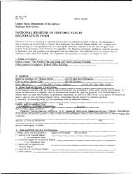
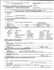
National Register <strong>of</strong> Historic Places<br />
Registration Form<br />
1. Name <strong>of</strong> Property<br />
historic name <strong>St</strong>. <strong>Joseph</strong> <strong>Park</strong> <strong>and</strong> <strong>Park</strong>way <strong>System</strong><br />
other names/site number N/A<br />
2. Location<br />
<strong>St</strong>reet & number Krug, Corby, Athletic Field. Bartlett, South, King Hill, Hyde <strong>Park</strong>s; Fairview; NE, NW, Corby, SW. &<br />
A Pkwys; Noyes Blvd____________________________________________<br />
[N/A]not for publication<br />
city or town <strong>St</strong>. <strong>Joseph</strong><br />
[N/A] vicinity<br />
<strong>St</strong>ate <strong>Missouri</strong> code MO county Buchanan code 021<br />
zip codes 64501, 64503. 64504, 64505. 64506. 64507<br />
3. <strong>St</strong>ate/Federal Agency Certification<br />
As the designated authority under the National Historic Preservation Act, as amended, I hereby certify that this 0 nomination<br />
Q] request for determination <strong>of</strong> eligibility meets the documentation st<strong>and</strong>ards for registering properties in the National Register<br />
<strong>of</strong> Historic Places <strong>and</strong> meets the procedural <strong>and</strong> pr<strong>of</strong>essional requirements set forth in 36 CFR Part 60. In my opinion, the<br />
property Qc] meets |~~| does not meet the National Register criteria. I recommend that this property be considered significant<br />
Q nationally Q statewide[x] locally.<br />
( See ccritinwation sheet for additional comment<br />
Signature <strong>of</strong> certifying <strong>of</strong>ficial/Title ciaire F. Biackweii, Deputy SHPO<br />
<strong>Department</strong> <strong>of</strong> Natural Resources <strong>and</strong> <strong>St</strong>ate Historic Preservation Officer<br />
<strong>St</strong>ate or Federal agency <strong>and</strong> bureau<br />
Date<br />
In my opinion, the property Q meets Q does not meet the National Register criteria.<br />
(See continuation sheet for additional comment<br />
Signature <strong>of</strong> certifying <strong>of</strong>ficial/Title<br />
Date<br />
<strong>St</strong>ate or Federal agency <strong>and</strong> bureau<br />
4. National <strong>Park</strong> Service Certification<br />
I hereby certify that the property is:<br />
ri entered in the National Regis<br />
See continuation sheet I<br />
|] determined eligible for the '<br />
National Register . ,<br />
. . See continuation sheet!_I.<br />
I_| determined not eligible for the<br />
_ National Register.<br />
| | removed from the<br />
. . National Register<br />
I_I other, explain , ,<br />
See continuation sheet I_I.<br />
Signature <strong>of</strong> the Keeper<br />
Date
5. Classification<br />
Ownership <strong>of</strong> Property<br />
private<br />
public-local<br />
public-<strong>St</strong>ate<br />
public-Federal<br />
object<br />
Category <strong>of</strong> Property<br />
building(s)<br />
district<br />
site<br />
structure<br />
Number <strong>of</strong> Resources within Property<br />
Contributing<br />
Noncontributing<br />
2<br />
1.5<br />
9<br />
0<br />
24<br />
15<br />
0<br />
0<br />
35 30<br />
buildings<br />
sites<br />
structures<br />
objects<br />
Total<br />
Name <strong>of</strong> related multiple property listing.<br />
Historic Resources <strong>of</strong><br />
<strong>St</strong>. <strong>Joseph</strong>, Buchanan<br />
County, <strong>Missouri</strong><br />
Number <strong>of</strong> contributing resources<br />
previously listed in the National<br />
Register.<br />
6. Function or Use<br />
Historic Function<br />
RECREATION/outdoor recreation<br />
RECREATION/sports facility<br />
TRANSPORTATION/road-related<br />
LANDSCAPE/park<br />
LANDSCAPE/forest<br />
Current Functions<br />
RECREATION/outdoor recreation<br />
RECREATION/sports facility<br />
TRANSPORTATION/road-related<br />
LANDSCAPE/park<br />
LANDSCAPE/forest<br />
7. Description<br />
Architectural Classification<br />
LATE 19TH AND EARLY 20TH CENTURY<br />
REVIVALS/Italian Renaissance<br />
Materials<br />
foundation STONE/limestone<br />
walls BRICK<br />
ro<strong>of</strong> CERAMIC TILE<br />
other<br />
Narrative Description<br />
(Describe the historic <strong>and</strong> current condition <strong>of</strong> the property on one or more continuation sheets.)
8-<strong>St</strong>atement <strong>of</strong> Significance<br />
Applicable National Register Criteria<br />
Kl A Property is associated with events that have made<br />
a significant contribution to the broad patterns <strong>of</strong> our<br />
history.<br />
|~| B Property is associated with the lives <strong>of</strong> persons<br />
significant in our past.<br />
[X] C Property embodies the distinctive characteristics <strong>of</strong><br />
a type, period, or method <strong>of</strong> construction or<br />
represents the work <strong>of</strong> a master, or possesses high<br />
artistic values, or represents a significant <strong>and</strong><br />
distinguishable entity whose components lack<br />
individual distinction.<br />
l~l D Property has yielded, or is likely to yield,<br />
information important in prehistory or history.<br />
Criteria Considerations<br />
Property is:<br />
D A owned by a religious institution or used for religious<br />
purposes.<br />
Q B removed from its original location,<br />
n C a birthplace or grave.<br />
D D a cemetery.<br />
D E a reconstructed building, object, or structure.<br />
D F a commemorative property.<br />
D G less than 50 years <strong>of</strong> age or achieved significance<br />
within the past 50 years.<br />
Areas <strong>of</strong> Significance<br />
COMMUNITY PLANNING AND DEVELOPMENT<br />
LANDSCAPE ARCHITECTURE___________<br />
ARCHITECTURE____________________<br />
ENGINEERING<br />
Periods <strong>of</strong> Significance<br />
1912-1943___________________<br />
Significant Dates<br />
N/A______________________<br />
Significant Person(s)<br />
N/A_________________________<br />
Cultural Affiliation<br />
N/A_________________________<br />
Architect/Builder<br />
ROBINSON, CHARLES MULFORD<br />
KESSLER, GEORGE__________<br />
BURNAP, GEORGE_____________<br />
SEITZ. WILLIAM_____________<br />
Narrative <strong>St</strong>atement <strong>of</strong> Significance<br />
(Explain the significance <strong>of</strong> the property on one or more continuation sheets.) Section 8 starts on page 26<br />
9. Major Bibliographic References_________________________________________<br />
Bibliography<br />
(Cite the books, articles <strong>and</strong> other sources used in preparing this form on one or more continuation sheets.)<br />
Previous documentation on file (NPS):<br />
D preliminary determination <strong>of</strong> individual<br />
listing (36 CFR 67) has been requested<br />
D previously listed in the National Register<br />
D previously determined eligible by the<br />
National Register<br />
D designated a National Historic L<strong>and</strong>mark<br />
D recorded by Historic American Buildings<br />
Survey #________________________<br />
Q recorded by Historic American<br />
Engineering Record # _______<br />
Primary location <strong>of</strong> additional data:<br />
Q <strong>St</strong>ate Historic Preservation Office<br />
D Other <strong>St</strong>ate Agency<br />
G Federal Agency<br />
[>3 Local Government<br />
n University<br />
D Other:<br />
Name <strong>of</strong> repository: <strong>St</strong>. <strong>Joseph</strong> City Hall; <strong>St</strong>. <strong>Joseph</strong><br />
<strong>Park</strong>s <strong>Department</strong><br />
Section 9 starts on Page 44
10. Geographical Data<br />
Acreage <strong>of</strong> Property 983<br />
t-<br />
UTM References<br />
Zone Easting Northing<br />
A. 15 341405 4407300<br />
C. 15 343750 4405620<br />
Zone Easting Northing<br />
B. 15 344410 4406500<br />
D. J 5 344650 44O1 2RO<br />
ee continuation sheet<br />
Verbal Boundary Description<br />
(Describe the boundaries <strong>of</strong> the property on a continuation sheet.) See page 46.<br />
Boundary Justification<br />
(Explain why the boundaries were selected on a continuation sheet.) See page 46.<br />
11. Form Prepared By<br />
name/title Peon K. Wolfenbarger, Preservation Consultant<br />
organization Three Gables Preservation<br />
<strong>St</strong>reet & number 9550 N.E. Cookingham Drive<br />
date April 8, 1994<br />
telephone 816/792-1275<br />
City or town Kansas City_____________ state MO zip code 64157<br />
Additional Documentation<br />
Submit the following items with the completed form:<br />
Continuation Sheets<br />
Maps<br />
A USGS map (7.5 or 15 minute series) indicating the property's location.<br />
A Sketch map for historic districts <strong>and</strong> properties having large acreage or numerous resources.<br />
Photographs<br />
Representative black <strong>and</strong> white photographs <strong>of</strong> the property. See page 47.<br />
Additional Items<br />
(Check with the SHPO or FPO for any additional items)<br />
Property Owner<br />
(Complete this item at the request <strong>of</strong> SHPO or FPO.)<br />
name<br />
street & number<br />
city or town<br />
state<br />
telephone_____<br />
zip code
UPS Form 10-900-a OMB Approval No. 1024-0018<br />
;8-86)<br />
United <strong>St</strong>ates <strong>Department</strong> <strong>of</strong> the Interior<br />
National <strong>Park</strong> Service<br />
^<br />
NATIONAL REGISTER OF HISTORIC PLACES<br />
CONTINUATION SHEET<br />
Section 7 Page 1<br />
<strong>St</strong>. <strong>Joseph</strong> <strong>Park</strong> <strong>and</strong> <strong>Park</strong>way <strong>System</strong>, Buchanan County, <strong>Missouri</strong><br />
SUMMARY<br />
The <strong>St</strong>. <strong>Joseph</strong> <strong>Park</strong> <strong>and</strong> <strong>Park</strong>way <strong>System</strong> historic district is located within the city limits <strong>of</strong> <strong>St</strong>.<br />
<strong>Joseph</strong>, Buchanan County, <strong>Missouri</strong>. The nominated district contains nearly 600 acres in park<br />
l<strong>and</strong>, with additional l<strong>and</strong> covered by the parkways giving the district a total <strong>of</strong> 983 acres. There<br />
are over eleven <strong>and</strong> a half miles <strong>of</strong> parkways <strong>and</strong> boulevards, <strong>and</strong> approximately three additional<br />
miles <strong>of</strong> drives within the parks themselves. It is primarily a linear system, extending from Krug<br />
<strong>Park</strong> at the northernmost boundary <strong>of</strong> the city (south <strong>of</strong> Cook Road) to Hyde <strong>Park</strong> at nearly the<br />
southernmost boundary (near <strong>Joseph</strong> E. Galvin Road). The historic district lies between King<br />
Hill Avenue <strong>and</strong> 2nd <strong>St</strong>reet Road on the west, <strong>and</strong> 36th <strong>St</strong>reet on the east. The overall design <strong>of</strong><br />
the park system is generally reflective <strong>of</strong> the American Romantic movement hi l<strong>and</strong>scape<br />
architecture, although the Italian Renaissance style is found in a portion <strong>of</strong> Krug <strong>Park</strong>. The<br />
numerous outdoor recreation areas are typically functional hi their plans. Section F <strong>of</strong><br />
amendment #2 to the multiple property submission "Historic Resources <strong>of</strong> <strong>St</strong>. <strong>Joseph</strong>, Buchanan<br />
County, <strong>Missouri</strong>" (herein referred to as MPS "Historic Resources <strong>of</strong> <strong>St</strong>. <strong>Joseph</strong> ") defines two<br />
property types within the park system parks <strong>and</strong> park system drives. There are seven parks<br />
within the historic district (Krug <strong>Park</strong>, Corby Grove, Noyes Athletic Field, Bartlett <strong>Park</strong>,<br />
Commercial <strong>Park</strong> [now called "South <strong>Park</strong>"], King Hill Overlook, <strong>and</strong> Hyde <strong>Park</strong>) <strong>and</strong> seven<br />
park system drives (Northwest <strong>Park</strong>way, Northeast <strong>Park</strong>way, Corby Grove <strong>Park</strong>way/Maple Leaf,<br />
Noyes Boulevard, <strong>Park</strong>way A, King Hill Drive, <strong>and</strong> Southwest <strong>Park</strong>way). In addition, the park<br />
system contains a historic municipal golf course that is not defined as a property type. 1 Within<br />
the entire historic park system district, there are nine contributing sites, twenty-three contributing<br />
structures, <strong>and</strong> two contributing buildings, for a total <strong>of</strong> thirty-four contributing resources. There<br />
are fourteen non-contributing structures <strong>and</strong> thirteen non-contributing buildings, for a total <strong>of</strong><br />
twenty-seven non-contributing resources. Each park is counted as a site, <strong>and</strong> each parkway as a<br />
structure, with both types <strong>of</strong> resources contributing to the overall significance <strong>of</strong> the interrelated<br />
designed park system. Within the individual parks <strong>and</strong> parkways, some additional resources are<br />
counted, but only those that are substantial in size <strong>and</strong> scale, as required in NFS Bulletin 16A.<br />
Smaller designed or natural features, such as stone walls, pathways, or groupings <strong>of</strong> trees, are not<br />
counted separately from the site (park) or structure (parkway). This does not reflect on their<br />
significance as designed or natural elements <strong>of</strong> each park or parkway, but only on their smaller<br />
size or scale, especially when viewed from within the much larger park system. The count for<br />
each park <strong>and</strong> parkway is summarized in the descriptions that follow. A previously listed site-<br />
King's Hill Archaeological Site (NRHP 1969)-is located within the boundaries <strong>of</strong> King Hill<br />
Overlook.<br />
1 As noted in Bulletin 16B, unique or rare resources do not require property type analysis as the information can<br />
appear on the registration form. Fairview Golf Course is the only municipal golf course in the City <strong>of</strong> <strong>St</strong>. <strong>Joseph</strong> <strong>and</strong>/or<br />
within the park system.
NFS Form 10-900-a OMB Approval No. 1024-0018<br />
(8-86)<br />
United <strong>St</strong>ates <strong>Department</strong> <strong>of</strong> the Interior<br />
National <strong>Park</strong> Service<br />
fe-<br />
NATIONAL REGISTER OF HISTORIC PLACES<br />
CONTINUATION SHEET<br />
Section 7 Page 2<br />
<strong>St</strong>. <strong>Joseph</strong> <strong>Park</strong> <strong>and</strong> <strong>Park</strong>way <strong>System</strong>, Buchanan County, <strong>Missouri</strong><br />
ELABORATION<br />
The <strong>St</strong>. <strong>Joseph</strong> <strong>Park</strong> <strong>and</strong> <strong>Park</strong>way <strong>System</strong><br />
The <strong>St</strong>. <strong>Joseph</strong> <strong>Park</strong> <strong>and</strong> <strong>Park</strong>way <strong>System</strong> is a connected group <strong>of</strong> parks <strong>and</strong> park system drives,<br />
running generally north/south from Krug <strong>Park</strong> on the north to Hyde <strong>Park</strong> on the south. The<br />
entire city-wide park system <strong>of</strong> <strong>St</strong>. <strong>Joseph</strong> includes additional parks <strong>and</strong> plazas, but this historic<br />
district contains only those resources connected to this linear system, which runs between<br />
approximately 2nd <strong>St</strong>reet Road on the west <strong>and</strong> 36th <strong>St</strong>reet on the east (see Figure 1). The<br />
nominated resources are all connected, <strong>and</strong> as a whole, operate as a circulation system (albeit<br />
more recreational rather than purely functional). They not only share this physical connection,<br />
but also share associative historic characteristics discussed in Section 8.<br />
There are seven examples <strong>of</strong> the "parks" property type, as defined in the amendment #2 to the<br />
MPS "Historic Resources <strong>of</strong> <strong>St</strong>. <strong>Joseph</strong>, " which range in size from 13 acres to 162 acres. Most<br />
<strong>of</strong> the open ground within the parks is "naturalistic" in appearance, <strong>and</strong> contains numerous st<strong>and</strong>s<br />
<strong>of</strong> mature trees flanking grassy areas. The remainder <strong>of</strong> the parks have several outdoor recreation<br />
areas. In addition, Krug <strong>Park</strong> has resources which combine the formality <strong>of</strong> Italian Renaissance<br />
villa design with the pastoral allusions <strong>of</strong> the American Romantic movement.<br />
The seven examples <strong>of</strong> the "park system drives" property type range in length from .25 mile to<br />
almost 5 miles in length. Most <strong>of</strong> these are parkways, <strong>and</strong> thus contain park l<strong>and</strong> acreage in<br />
addition to that covered by the roadway itself. The parkways are curving, <strong>and</strong> traverse a variety<br />
<strong>of</strong> topographical changes in the approximately eight miles parkway system length from the<br />
northernmost Krug <strong>Park</strong> to Hyde <strong>Park</strong> on the south. Noyes Boulevard, however, is a formal<br />
boulevard which has just a slightly wider than normal right-<strong>of</strong>-way, when compared to other city<br />
streets. Maple Leaf Boulevard, the western end <strong>of</strong> Corby <strong>Park</strong>way, is also formal, but contains<br />
additional l<strong>and</strong> on the west between the road itself <strong>and</strong> the railroad right-<strong>of</strong>-way. King Hill Drive<br />
is a straight road as well, <strong>and</strong> serves as the entrance to King Hill Overlook <strong>of</strong>f <strong>of</strong> Southwest<br />
<strong>Park</strong>way.<br />
The following list <strong>of</strong> contributing <strong>and</strong> non-contributing resources'is categorized by sites,<br />
structures, <strong>and</strong> buildings. If the resource is a property type (i.e., a park or park system drive as<br />
defined in the MPS "Historic Resources <strong>of</strong> <strong>St</strong>. <strong>Joseph</strong> "), it is capitalized, <strong>and</strong> the resource type<br />
appears after the name. Also included is the date <strong>of</strong> acquisition <strong>and</strong>/or major construction (with<br />
the realization that minor alterations have occurred over the years). If the resource is not one <strong>of</strong><br />
the defined property types, but is instead a feature located within a park or parkway, that is so<br />
noted.
JPS Form 10-900-a OMB Approval No. 1024-0018<br />
8-86)<br />
United <strong>St</strong>ates <strong>Department</strong> <strong>of</strong> the Interior " ^<br />
National <strong>Park</strong> Service<br />
NATIONAL REGISTER OF HISTORIC PLACES<br />
CONTINUATION SHEET<br />
Section 7 Page 3<br />
<strong>St</strong>. <strong>Joseph</strong> <strong>Park</strong> <strong>and</strong> <strong>Park</strong>way <strong>System</strong>, Buchanan County, <strong>Missouri</strong><br />
Contributing Sites<br />
KRUGPARK. <strong>Park</strong>. 1902; 1919-37.<br />
CORBY GROVE. <strong>Park</strong>. 1924.<br />
Corby Grove Pond (at Corby Grove). n.d.<br />
NOYES ATHLETIC FIELD. <strong>Park</strong>. 1923-1933.<br />
BARTLETT PARK. <strong>Park</strong>. 1908; 1921.<br />
FAIRVIEW GOLF COURSE. 1922-1924. 1958.<br />
COMMERCIAL PARK. <strong>Park</strong>. 1921. 1937.<br />
KING HILL OVERLOOK. <strong>Park</strong>. 1927-28. 1935.<br />
HYDE PARK. <strong>Park</strong>. 1915. 1921-43. 1950.<br />
Contributing <strong>St</strong>ructures<br />
NORTHWEST PARKWAY. <strong>Park</strong> system drive. 1921. 1926-27.<br />
Lover's Lane Bridge (at Northwest <strong>Park</strong>way). 1926-27.<br />
Woodburn Road Bridge (at Northwest <strong>Park</strong>way). 1926-27.<br />
NORTHEAST PARKWAY. <strong>Park</strong> system drive. 1921. 1926-27.<br />
CORBY PARKWAY/MAPLE LEAF BOULEVARD. <strong>Park</strong> system drive. 1921. 1924. 1926-27.<br />
22nd <strong>St</strong>reet Bridge (at Corby <strong>Park</strong>way). 1926-27.<br />
18th <strong>St</strong>reet/Lover's Lane Bridge (at Corby <strong>Park</strong>way). 1926-27.<br />
13th <strong>St</strong>reet Bridge (at Corby <strong>Park</strong>way). 1926-27.<br />
llth <strong>St</strong>reet Bridge (at Corby <strong>Park</strong>way). 1926-27.<br />
NOYES BOULEVARD. <strong>Park</strong> system drive. 1912. 1914. 1921.<br />
PARKWAY A. <strong>Park</strong> system drive. 1912-1914. 1923.<br />
SOUTHWEST PARKWAY. <strong>Park</strong> system drive. 1921. 1926-27.<br />
Bridge (connecting Walnut <strong>St</strong>reet to Southwest <strong>Park</strong>way). 1926-27.Bridge (culvert, at extension<br />
<strong>of</strong> Plattsburg Road). 1926-1927.<br />
Phil Welch <strong>St</strong>adium (at Southwest <strong>Park</strong>way). 1937-38.<br />
KING HILL DRIVE. <strong>Park</strong> system drive. 1921. 1927-31.<br />
2nd <strong>St</strong>reet Bridge (at King Hill Drive.) 1928.<br />
Krug <strong>Park</strong> Drive (at Krug <strong>Park</strong>). 1928.<br />
Children's Circus (at Krug <strong>Park</strong>). 1921-22.<br />
Krug <strong>Park</strong> Lagoon (at Krug <strong>Park</strong>). 1928.<br />
Krug <strong>Park</strong> Amphitheater [bowl] (at Krug <strong>Park</strong>). 1926.<br />
Krug <strong>Park</strong> Tunnel (at Krug <strong>Park</strong>). 1928.<br />
<strong>St</strong>adium & track (at Noyes Athletic Field). 1930-38.<br />
Hyde <strong>Park</strong> Drive (at Hyde <strong>Park</strong>), ca. 1925-28.<br />
Contributing Buildings<br />
The Refectory (at Krug <strong>Park</strong>). 1922.<br />
Tennis Building (at Noyes Athletic Field), ca. 1935.
NFS Form 10-900-a<br />
(8-86)<br />
OMB Approval No. 1024-0018<br />
United <strong>St</strong>ates <strong>Department</strong> <strong>of</strong> the Interior<br />
National <strong>Park</strong> Service<br />
NATIONAL REGISTER OF HISTORIC PLACES<br />
CONTINUATION SHEET<br />
Section 7 Page 4<br />
<strong>St</strong>. <strong>Joseph</strong> <strong>Park</strong> <strong>and</strong> <strong>Park</strong>way <strong>System</strong>, Buchanan County, <strong>Missouri</strong><br />
Non-contributing <strong>St</strong>ructures<br />
7 Picnic Shelters (2 at Krug <strong>Park</strong>, 1 at Barlett <strong>Park</strong>, <strong>and</strong> 4 at Hyde <strong>Park</strong>).<br />
2 Swimming Pools (1 at Noyes Athletic Field, 1 at Hyde <strong>Park</strong>).<br />
Great Western Railway Bridge (at Northwest <strong>Park</strong>way).<br />
Gene Field Road Bridge (at Northeast <strong>Park</strong>way).<br />
Highway 36 Bridge (at Southwest <strong>Park</strong>way).<br />
Burlington Northern Railway Bridge (at Southwest <strong>Park</strong>way).<br />
Interstate 229 Bridge (at Southwest <strong>Park</strong>way).<br />
Suspension bridge (at Hyde <strong>Park</strong>).<br />
Non-contributing Buildings<br />
Krug <strong>Park</strong> Amphitheater Building (at Krug <strong>Park</strong>).<br />
Horse barn (at Krug <strong>Park</strong>)<br />
4 Restroom facilities (1 at Krug <strong>Park</strong>, 1 at Bartlett <strong>Park</strong>, 1 at Commercial <strong>Park</strong>, <strong>and</strong> 1 at Hyde<br />
<strong>Park</strong>).<br />
3 Concession buildings (1 at Commercial <strong>Park</strong>, 1 at Bartlett <strong>Park</strong>, <strong>and</strong> 1 at Hyde <strong>Park</strong>).<br />
2 Swimming Pool Bathhouses (1 at Noyes Athletic Field, 1 at Hyde <strong>Park</strong>).<br />
Field House (at Noyes Athletic Field).<br />
Fairview Clubhouse (at Fainiew Golf Course).<br />
Bode Ice Arena (at Southwest <strong>Park</strong>way).<br />
Maintenance building (at Hyde <strong>Park</strong>).<br />
Several <strong>of</strong> the individual sites (the parks) <strong>and</strong> structures (park system drives) may be individually<br />
eligible for listing on the National Register <strong>of</strong> Historic Places in the area <strong>of</strong> L<strong>and</strong>scape<br />
Architecture. However, the "tout ensemble" the <strong>St</strong>. <strong>Joseph</strong> <strong>Park</strong> <strong>and</strong> <strong>Park</strong>way <strong>System</strong> has<br />
additional significance in the area <strong>of</strong> community development <strong>and</strong> planning, <strong>and</strong> it is for this<br />
reason that the entire linear system is nominated as a district comprised <strong>of</strong> contributing resources.<br />
However, the resources in the system are generally experienced "one at a time," <strong>and</strong> are<br />
therefore described in further detail below, in the order one would view them if traversing the<br />
system from north to south.<br />
Krug <strong>Park</strong><br />
Krug <strong>Park</strong> is the northernmost park in the <strong>St</strong>. <strong>Joseph</strong> park system, <strong>and</strong> is an example <strong>of</strong> a "park"<br />
resource type as defined in the MPS "Historic Resources <strong>of</strong> <strong>St</strong>. <strong>Joseph</strong>. " It is located in the<br />
northwest corner <strong>of</strong> the 1993 city limits. Although few streets serve as actual boundaries, it is<br />
generally located west <strong>of</strong> 2nd <strong>St</strong>reet Road, south <strong>of</strong> Cook Road (if extended to the west), east <strong>of</strong><br />
<strong>St</strong>. <strong>Joseph</strong> Avenue, <strong>and</strong> north <strong>of</strong> Roosevelt Avenue. The irregularly bounded 161.8 acre park is<br />
comprised <strong>of</strong> various sections, which are the result <strong>of</strong> l<strong>and</strong> acquisitions over several years. The<br />
greatest number <strong>of</strong> designed features are in the southeast quarter, which are also the earliest<br />
sections donated as park l<strong>and</strong>. The majority <strong>of</strong> acreage in Krug <strong>Park</strong>, however, is still in a
NFS Form 10-900-a<br />
(8-86)<br />
OMB Approval No. 1024-0018<br />
United <strong>St</strong>ates <strong>Department</strong> <strong>of</strong> the Interior<br />
National <strong>Park</strong> Service<br />
NATIONAL REGISTER OF HISTORIC PLACES<br />
CONTINUATION SHEET<br />
Section 7 Page 5<br />
<strong>St</strong>. <strong>Joseph</strong> <strong>Park</strong> <strong>and</strong> <strong>Park</strong>way <strong>System</strong>, Buchanan County, <strong>Missouri</strong><br />
natural state, <strong>and</strong> is contained in the 100 acre section donated by Henry Krug Jr. in 1936. Dense<br />
native vegetation st<strong>and</strong>s <strong>and</strong> steep topography are the primary attributes <strong>of</strong> this section, which<br />
lies northwest <strong>of</strong> the developed section <strong>of</strong> the park. The entire park, in fact, is noted for its<br />
varying topography.<br />
The main vehicular entrance to the park is on Krug Drive from <strong>St</strong>. <strong>Joseph</strong> Avenue on the east.<br />
Krug Drive here is a short, east/west boulevard lined with maples which leads from <strong>St</strong>. <strong>Joseph</strong><br />
Avenue through a historic residential neighborhood to the eastern boundary <strong>of</strong> park itself. Once<br />
inside the park boundaries, Krug Drive leads into a circular entrance which directs traffic one<br />
way to the right (north). The drive remains one-way throughout the entire park as it curves<br />
around the southwest quarter <strong>of</strong> the park <strong>and</strong> returns to the point <strong>of</strong> beginning at the circular<br />
entrance. In this developed section <strong>of</strong> the park, mature deciduous <strong>and</strong> evergreen groups <strong>of</strong> trees<br />
surround grassy open spaces. A number <strong>of</strong> sugar maples line Krug Drive, providing for a<br />
spectacular fall color display.<br />
Immediately west <strong>of</strong> the circular entrance is the lagoon, an irregularly-bounded, shallow water<br />
feature. At the eastern end <strong>of</strong> the lagoon, a semi-circular stone wall with metal railing lines the<br />
parking at the circular entrance to the park. The remainder <strong>of</strong> the lagoon is edged with native<br />
limestone carefully arranged hi a seemingly naturalistic manner. The lagoon covers<br />
approximately 3.5 acres, <strong>and</strong> has a maximum depth <strong>of</strong> around 4.5 feet. Ducks <strong>and</strong> fish are fed by<br />
the public in the warm weather months, <strong>and</strong> it is used for ice skating in the winter. A paddleboat<br />
dock is at the western edge <strong>of</strong> the lagoon, <strong>and</strong> in wet weather, water falls from a limestone "cliff'<br />
at the northernmost tip.<br />
Krug Drive is a curving, one-way drive which leads from the circular entrance through the oldest,<br />
developed portion <strong>of</strong> the park that section which was under control <strong>of</strong> the park board by 1928.<br />
Most <strong>of</strong> the historic features <strong>of</strong> the park are visible from this roadway. As it curves around the<br />
northern tip <strong>of</strong> the lagoon, it turns back south <strong>and</strong> then west to border the formal rose garden <strong>and</strong><br />
Krug Bowl. The formal garden is directly west <strong>of</strong> the dock end <strong>of</strong> the lagoon, <strong>and</strong> is in a valley<br />
bounded by Krug Drive on both the north <strong>and</strong> south. In 1990, a circular wooden gazebo <strong>and</strong> four<br />
wooden pergola structures, all painted white, were added to the formal garden. South <strong>of</strong> the<br />
garden is an asphalt path leading from Krug Bowl to the southern edge <strong>of</strong> the lagoon. The<br />
southern edge <strong>of</strong> the path has a stone retaining wall.<br />
The Krug Bowl is directly west <strong>of</strong> the formal garden in a partly man-made depression which<br />
rises to the west, north, <strong>and</strong> south. Krug Drive encircles the entire bowl area (see Krug <strong>Park</strong><br />
map), serving as a boundary for three-quarters <strong>of</strong> its circumference. At the westernmost edge,<br />
the ground slopes down approximately twenty feet from Krug drive in a semi-circular pattern to<br />
a level area about fifty feet wide. At the eastern edge <strong>of</strong> this level area is a stone retaining wall<br />
with clipped yew hedges in front. The ground again slopes down another thirty feet in elevation
NPSForm10-900-a<br />
(8-86)<br />
OMB Approval No. 1024-0018<br />
United <strong>St</strong>ates <strong>Department</strong> <strong>of</strong> the Interior<br />
National <strong>Park</strong> Service<br />
NATIONAL REGISTER OF HISTORIC PLACES<br />
CONTINUATION SHEET<br />
Section 7 Page 6<br />
<strong>St</strong>. <strong>Joseph</strong> <strong>Park</strong> <strong>and</strong> <strong>Park</strong>way <strong>System</strong>, Buchanan County, <strong>Missouri</strong><br />
to the seating area. This portion <strong>of</strong> the amphitheater/bowl has a concrete pad with plastic molded<br />
seating on metal poles. Pedestrian paths lead from the north <strong>and</strong> south sides <strong>of</strong> the<br />
amphitheater/seating area west to Krug Drive. East <strong>of</strong> the seating is the stage, which is concrete<br />
with a semi-circular stone retaining wall. Tall wood panels flank either side <strong>of</strong> the stage. To the<br />
rear (east) <strong>of</strong> the stage is a modernistic, geometric concrete building topped with two metal poles.<br />
A concrete balcony with metal railing overlooking the garden area <strong>and</strong> lagoon is east <strong>of</strong> the Krug<br />
Bowl building. The elevation <strong>of</strong> the ground drops on the eastern side <strong>of</strong> the building, revealing<br />
the basement level which contains several doors leading to rooms below the stage. <strong>St</strong>eps lead<br />
around from each side <strong>of</strong> the stage to this lower area. North <strong>of</strong> the building, a st<strong>and</strong> <strong>of</strong> mature<br />
pine trees shades the stage area on the ground which rises to Krug Drive.<br />
A large parking lot is located <strong>of</strong>f <strong>of</strong> Krug Drive just west <strong>of</strong> the Krug Bowl amphitheater, with<br />
grassed medians dividing the lot. An extension <strong>of</strong> the drive leads west <strong>of</strong> this lot, following a<br />
ridge which provides a lookout over much <strong>of</strong> the surrounding l<strong>and</strong>scape to the west towards the<br />
<strong>Missouri</strong> River. A circular turn-around <strong>and</strong> parking area here is the highest elevation in the park.<br />
Also west <strong>of</strong> the parking lot are two small connected wooden buildings which provide the<br />
starting point for the horse trails. A small storage shed with extended shed ro<strong>of</strong> has rough log<br />
siding, <strong>and</strong> another open shed supported by poles provides the waiting area for horse <strong>and</strong> rider.<br />
The trail leads west from these structures down to lower elevations. To the southeast <strong>of</strong> the<br />
horseback riding area is another lot bounded by tall, chain link fencing for animals. Both the<br />
horseback riding area <strong>and</strong> animal enclosure area are marked by steep topography <strong>and</strong> mature<br />
deciduous trees.<br />
After Krug Drive circles around the amphitheater area <strong>of</strong> Krug Bowl, it heads to the south <strong>and</strong><br />
encircles a ridge in the southernmost section <strong>of</strong> the park. A picnic area is located on this high<br />
ground, which is fairly level <strong>and</strong> shaded with large oak trees. The picnic area has several picnic<br />
tables, ovens, playground equipment, restroom facilities, <strong>and</strong> two picnic shelters, all non-historic.<br />
The picnic shelters are rectangular with hip ro<strong>of</strong>s supported by simple square posts with angled<br />
supports. Historic appearing light st<strong>and</strong>ards (uncertain construction date) have metal fluted<br />
bases, slender round columns, crook necks, <strong>and</strong> ornamental globes. Most <strong>of</strong> the other light<br />
st<strong>and</strong>ards along Krug Drive are non-historic.<br />
In the southwest corner <strong>of</strong> Krug <strong>Park</strong>, there is another vehicular entrance, featuring stone<br />
columns <strong>and</strong> iron fencing forming a gate, which is typically closed. Just after this former<br />
entrance, Krug Drive turns back to the northeast, going under an arched tunnel <strong>of</strong> coursed rubble<br />
construction, before finally heading east <strong>and</strong> south to circle around the Refectory (described<br />
below). Attached to the Refectory on the north is a tall, curving, r<strong>and</strong>om ashlar stone retaining<br />
wall, which is topped with an iron fence. Krug Drive heads south under the Refectory itself<br />
under another stone tunnel to a small parking area south <strong>of</strong> the building. Southwest <strong>of</strong> the
NPS Form 10-900-a OMB Approval No. 1024-0018<br />
(8-86)<br />
United <strong>St</strong>ates <strong>Department</strong> <strong>of</strong> the Interior<br />
National <strong>Park</strong> Service<br />
" ^<br />
NATIONAL REGISTER OF HISTORIC PLACES<br />
CONTINUATION SHEET<br />
Section 7 Page 7<br />
<strong>St</strong>. <strong>Joseph</strong> <strong>Park</strong> <strong>and</strong> <strong>Park</strong>way <strong>System</strong>, Buchanan County, <strong>Missouri</strong><br />
Refectory is the Children's Circus, a semi-circular, outdoor recreation area bounded on the east<br />
with a pergola.<br />
A historic pedestrian entrance <strong>and</strong> a non-historic parking lot are located at the southeastern edge<br />
<strong>of</strong> the park. Here the park boundary is defined by both historic cast iron fencing <strong>and</strong> r<strong>and</strong>om<br />
ashlar, quarry-faced limestone walls along Clark <strong>St</strong>reet. The pedestrian entrance features quarryfaced<br />
limestone slabs, which form steps leading up to a concrete pad backed by a low stone wall<br />
on the west. The wall has low square stone pillars on both ends <strong>and</strong> a stone plaque with the<br />
words "Krug <strong>Park</strong>." From this entry, pedestrian walks lead both to the southwest towards the<br />
Children's Circus, or northwest to the lagoon on a concrete path under an arched stone bridge.<br />
The path to the southwest has been largely covered by grass, although some stone steps still<br />
remain. This southeast corner <strong>of</strong> Krug <strong>Park</strong> contains very large, old deciduous <strong>and</strong> evergreen<br />
tree specimens. Along with the historic cast iron fencing, these are probably the only remnants<br />
from the park's Victorian era. The asphalt parking lot <strong>of</strong>f <strong>of</strong> Clark <strong>St</strong>reet has two small interior<br />
grass areas with concrete edging, but is terminated on the west with a low limestone wall. The<br />
elevation <strong>of</strong> the parking lot is much lower than the area immediately to the west. This<br />
depression, coupled with plant materials along the drive, renders the parking lot nearly invisible<br />
from the rest <strong>of</strong> the park.<br />
The Refectory, a contributing building, is currently referred to as "The Castle" (not to be<br />
confused with an earlier entry gate structure from Krug <strong>Park</strong>'s Victorian era, which was also<br />
called the "Castle"). The Refectory retains a high degree <strong>of</strong> integrity in location, setting,<br />
materials, workmanship, feeling <strong>and</strong> association. Although the construction was never<br />
completed <strong>and</strong> some aspects <strong>of</strong> the design never carried out, it nonetheless retains a good degree<br />
<strong>of</strong> integrity in design. It is a two-story red brick structure <strong>of</strong> Italian Renaissance design,<br />
prominently sited against an east facing slope on a large stone foundation. At first glance, the<br />
building appears to be symmetrical, although the south <strong>and</strong> north elevations differ as they adapt<br />
to the great variance in topography. It has a basic "T"-shaped plan, modified by one-story<br />
pavilions on the north, south, <strong>and</strong> east ends. The central portion <strong>of</strong> the building has a lowpitched<br />
hip ro<strong>of</strong> <strong>of</strong> green tiles. The widely overhanging boxed eaves have square modillions<br />
underneath on a wide cornice b<strong>and</strong>. There are cross gable ro<strong>of</strong>s on the west end <strong>of</strong> the structure,<br />
forming the "T." The east pavilion has a flat ro<strong>of</strong>, with short brick piers projecting above the<br />
ro<strong>of</strong> line above each column. An iron rail balustrade is between the brick piers. The south <strong>and</strong><br />
north pavilions are open (no ro<strong>of</strong>s).<br />
The pavilions on south <strong>and</strong> north elevation are rectangular in plan, while the larger east end<br />
pavilion is five sided with angled corners. The north <strong>and</strong> south pavilions are identical <strong>and</strong> are<br />
five bays wide <strong>and</strong> one bay deep. The central three bays are demarcated by round columns with<br />
Doric capitals supporting a flat stone architrave, while each end bay has a semi-circular arched
NPS Form 10-900-a<br />
(8-86)<br />
OMB Approval No. 1024-0018<br />
United <strong>St</strong>ates <strong>Department</strong> <strong>of</strong> the Interior<br />
National <strong>Park</strong> Service<br />
NATIONAL REGISTER OF HISTORIC PLACES<br />
CONTINUATION SHEET<br />
Section 7 Page 8<br />
<strong>St</strong>. <strong>Joseph</strong> <strong>Park</strong> <strong>and</strong> <strong>Park</strong>way <strong>System</strong>, Buchanan County, <strong>Missouri</strong><br />
lintel with a double row <strong>of</strong> brick voussoirs. There are metal steps on the south pavilion to the<br />
east.<br />
The east pavilion is much larger, <strong>and</strong> is five bays across the east elevation, <strong>and</strong> one bay each on<br />
the north <strong>and</strong> south (not including the angled corners). The north <strong>and</strong> south bays are flanked by<br />
two square, engaged columns with Ionic capitals. The angled corners are slightly narrower, <strong>and</strong><br />
are marked by the wide brick corners <strong>of</strong> the pavilion. The three eastern bays have round Ionic<br />
columns. All bays have semi-circular arches with double rows <strong>of</strong> brick voussoirs, forming an<br />
arcade. The flooring <strong>of</strong> the east pavilion is asphalt. In the interior <strong>of</strong> the pavilion are plain<br />
square concrete support columns, arranged in a square. The original design called for the aviary<br />
to have been placed within these four columns. Tall iron railing serves as the balustrade between<br />
the arched openings on the east pavilion; a lower railing is on the north <strong>and</strong> south pavilions.<br />
The foundation <strong>and</strong> basement portion <strong>of</strong> the Refectory is constructed <strong>of</strong> r<strong>and</strong>om work, quarry<br />
faced stone. The structure is set into an east-facing slope, thus exposing the foundation/basement<br />
level on the east <strong>and</strong> south end. A tunnel containing Krug Drive runs underneath the east end <strong>of</strong><br />
the central portion <strong>of</strong> the building. The keystone in the tunnel's south arch has the date "1922."<br />
Above the basement-level stone tunnel is another "pass-through" on the first level. It has<br />
segmental arched openings on both the north <strong>and</strong> south ends, <strong>and</strong> glazed tiles on the walls.<br />
Doors <strong>and</strong> openings in this hall were originally planned to lead to a kitchen for a restaurant, <strong>and</strong> a<br />
stairway to the downstairs foyer. The hall was to have been the main access to the restaurant.<br />
On the south elevation, first floor <strong>of</strong> the building are three metal doors. One leads to the<br />
women's restroom, <strong>and</strong> one to the stairway up to the <strong>Park</strong>s <strong>Department</strong> <strong>of</strong>fices. The men's<br />
restroom is located on the south retaining wall.<br />
The rectangular windows are currently dark glass with aluminum frames <strong>and</strong> metal bars. A<br />
round molded stone course surrounds the central portion <strong>of</strong> the building just above the second<br />
story windows. Decorative metal brackets near the ro<strong>of</strong> line hold modern light fixtures.<br />
The excellent stone craftsmanship <strong>of</strong> the foundation extends south <strong>of</strong> the Refectory <strong>and</strong> connects<br />
with the foundation <strong>of</strong> the Children's Circus, <strong>and</strong> on the north for a large stone retaining wall.<br />
The north retaining wall has an arched opening which leads to storage underneath, <strong>and</strong> a level<br />
area above with iron railing.<br />
The Children's Circus is located south <strong>of</strong> the Refectory. It is a large, semi-circular bowl, facing<br />
east, with the flat end <strong>of</strong> the semi-circle (east side) over 250 feet long. To the west, a curved<br />
slope rises in three distinct terraces <strong>and</strong> fills a natural hollow in the hills. The east side is an<br />
imposing fifteen foot high retaining wall constructed <strong>of</strong> native limestone, topped with a central<br />
concrete pavilion flanked by a colonnade. The pavilion is one bay wide <strong>and</strong> seven bays long,<br />
with a hip ro<strong>of</strong> <strong>of</strong> green tiles. Repeating the design <strong>of</strong> the south <strong>and</strong> north pavilions <strong>of</strong> the
MRS Form 10-900-a<br />
8-86)<br />
OMB Approval No. 1024-0018<br />
Jnited <strong>St</strong>ates <strong>Department</strong> <strong>of</strong> the Interior<br />
Rational <strong>Park</strong> Service<br />
NATIONAL REGISTER OF HISTORIC PLACES<br />
CONTINUATION SHEET<br />
Section 7 Page 9<br />
<strong>St</strong>. <strong>Joseph</strong> <strong>Park</strong> <strong>and</strong> <strong>Park</strong>way <strong>System</strong>, Buchanan County, <strong>Missouri</strong><br />
Refectory, the central bays have round columns with Doric capitals supporting a flat architrave,<br />
while the end bays have round arched openings. The pavilion is flanked on the north <strong>and</strong> south<br />
by a row <strong>of</strong> round, concrete columns with Doric capitals, which supports a wood architrave.2<br />
There is a concrete walkway on top <strong>of</strong> the stone wall with iron balustrade on both sides. This<br />
walkway has approaches from steps on both the north <strong>and</strong> south ends. At the south end, the steps<br />
lead down the slope to a stone retaining wall <strong>and</strong> basin grotto, which formerly contained water<br />
<strong>and</strong> planted areas. The concrete in the pavilion <strong>and</strong> pergola is in fan- condition, but the stone<br />
foundation remains in very good condition. The Children's Circus retains integrity hi location,<br />
setting, association, <strong>and</strong> to a good extent, design <strong>and</strong> workmanship as well.<br />
Just west <strong>of</strong> the pavilion in the Children's Circus is a semi-circular concrete basin (formerly<br />
filled with water) surrounded by a concrete walk. A level gravel play area extends westward in a<br />
semi-circle, <strong>and</strong> is the same width as the two pergolas. The play area contains modern play<br />
equipment. Surrounding the circular end <strong>of</strong> the play area, the elevation rises to a grassy terrace<br />
above. A dirt <strong>and</strong> gravel path runs the length <strong>of</strong> the terrace, with access on the north from stairs<br />
by the Refectory. A parallel set <strong>of</strong> stone stairs also rises from the center <strong>of</strong> the west edge <strong>of</strong> the<br />
play area to this terrace. In between the steps are exposed stone ledges, formerly the location <strong>of</strong><br />
the "bump-the-bump" slides. This second level terrace is surrounded on the western edge by a<br />
high limestone retaining wall. Directly opposite the pavilion <strong>and</strong> the stone stairs up the grassy<br />
slope, an inset arch built <strong>of</strong> rough stone contains a cascading fountain. West <strong>of</strong> the stone<br />
retaining wall, a grassy lawn continues to slope upwards, with stone steps leading west to a<br />
wooded area.<br />
The resource count at Krug <strong>Park</strong> is as follows: one contributing site (the park); 5 contributing<br />
structures (Krug <strong>Park</strong> Drive, the bowl at the amphitheater, the lagoon, the Children's Circus, <strong>and</strong><br />
the Krug <strong>Park</strong> Drive tunnel); one contributing building (the Refectory); 2 non-contributing<br />
structures (picnic shelters); <strong>and</strong> 3 non-contributing buildings (restroom facilities, the<br />
amphitheater building, <strong>and</strong> the horse barn).<br />
Northwest <strong>Park</strong>way<br />
Northwest <strong>Park</strong>way is an example <strong>of</strong> the "park system drive" property type, as defined in the<br />
MPS "Historic Resources <strong>of</strong> <strong>St</strong>. <strong>Joseph</strong>." It extends from its northern terminus on <strong>St</strong>. <strong>Joseph</strong><br />
Avenue, just east <strong>of</strong> the entrance to Krug <strong>Park</strong>, in a southeasterly direction to Corby Grove,<br />
where it intersects with Northeast <strong>Park</strong>way at approximately 26th <strong>St</strong>reet just south <strong>of</strong> Marion. At<br />
this point, the two parkways join <strong>and</strong> travel a short distance to a "Y" intersection with Corby<br />
<strong>Park</strong>way (see Figure 1). From here, Northwest <strong>and</strong> Corby join <strong>and</strong> travel southeasterly to finally<br />
link up with Noyes Boulevard. Including this section, Northwest <strong>Park</strong>way is approximately 2 1A<br />
2 Being reconstructed in 1994.
NPS Form 10-900-a<br />
(8-86)<br />
United <strong>St</strong>ates <strong>Department</strong> <strong>of</strong> the Interior<br />
National <strong>Park</strong> Service<br />
OMB Approval No. 1024-0018<br />
NATIONAL REGISTER OF HISTORIC PLACES<br />
CONTINUATION SHEET<br />
Section 7 Page 10<br />
<strong>St</strong>. <strong>Joseph</strong> <strong>Park</strong> <strong>and</strong> <strong>Park</strong>way <strong>System</strong>, Buchanan County, <strong>Missouri</strong><br />
- fcmiles<br />
in length; to the first intersection with Northeast <strong>Park</strong>way, it is approximately 1 '/2 miles<br />
from Krug <strong>Park</strong>. Northwest <strong>Park</strong>way contains a curving road within a wide strip <strong>of</strong> varying<br />
width <strong>of</strong> park l<strong>and</strong>. The driving experience along its relatively short length presents a variety a<br />
views, from steep topography to gently rolling l<strong>and</strong>, <strong>and</strong> from dense native growth to wide grassy<br />
areas dotted with mature shade trees. Northwest <strong>Park</strong>way is in excellent condition, <strong>and</strong> retains a<br />
high degree <strong>of</strong> integrity in all areas <strong>of</strong> consideration.<br />
At the northern terminus <strong>of</strong> the parkway, across <strong>St</strong>. <strong>Joseph</strong> Avenue from Krug <strong>Park</strong>, is the<br />
Northside Complex. This 25-acre site extends from Karnes Road to R<strong>and</strong>olph on the south, <strong>and</strong><br />
lies between <strong>St</strong>. <strong>Joseph</strong> Avenue <strong>and</strong> the former railroad tracks on the east. This developed<br />
outdoor recreational area across from Krug <strong>Park</strong> contains concession st<strong>and</strong>s <strong>and</strong> restrooms,<br />
swimming pool, 3 lighted tennis courts, 2 lighted h<strong>and</strong>ball courts, a lighted s<strong>of</strong>tball field, 2<br />
unlighted ballfields, 2 shuffleboard courts, 4 horseshoe courts, playground area, <strong>and</strong> parking lots.<br />
These are all non-historic features which were not present during the period <strong>of</strong> significance, <strong>and</strong><br />
are therefore excluded from this historic district.<br />
Northwest <strong>Park</strong>way begins in the Northside complex, <strong>and</strong> at this point appears visually to serve<br />
more as drive for the complex rather than a parkway. After crossing over the non-historic bridge<br />
over the former Great Western railroad tracks, the parkway takes on its true appearance. For a<br />
very short distance, it heads northeast to a " Y" intersection with Ferndale. Mature evergreens<br />
provide screening along a portion <strong>of</strong> the drive. Up through this point, this section <strong>of</strong> the parkway<br />
is sometimes referred to as "Krug <strong>Park</strong> Avenue." Northwest <strong>Park</strong>way heads due south from this<br />
intersection around a high ridge, then back to a general southeasterly direction. The high ridge<br />
north <strong>of</strong> the parkway, contained in a forty acre tract <strong>of</strong> park l<strong>and</strong>, is native woodl<strong>and</strong>. A trail<br />
leads through the woods to various high points <strong>and</strong> past limestone outcroppings. South <strong>of</strong> the<br />
parkway, the l<strong>and</strong> drops <strong>of</strong>f dramatically, <strong>and</strong> views <strong>of</strong> <strong>St</strong>. <strong>Joseph</strong> can be seen through occasional<br />
breaks in the trees.<br />
A low, stone retaining wall is on the east side <strong>of</strong> the drive at the southern end <strong>of</strong> the wooded area.<br />
After Northwest <strong>Park</strong>way passes this high ridge <strong>of</strong> woodl<strong>and</strong>, the vegetation opens ug to reveal<br />
grassy slopes on the northeast, presenting an open, park-like appearance. The slopes lead up to<br />
the rear yards <strong>of</strong> residences. These yards are unfenced, <strong>and</strong> l<strong>and</strong>scaped in a manner which<br />
complements the parkway, giving the appearance <strong>of</strong> a larger, open park area.<br />
Northwest <strong>Park</strong>way continues under the Lover's Lane concrete bridge, a historic, concrete bridge<br />
with a flattened, triangular arch, <strong>and</strong> curves more directly to the south. From this point, the<br />
vegetation alternates between wooded areas adjacent to the road on the west <strong>and</strong> grassy slopes<br />
with groupings <strong>of</strong> various ornamental <strong>and</strong> shade trees. A grassed swale on the west provides<br />
drainage in wet weather. A short distance south <strong>of</strong> the Lover's Lane bridge, the <strong>Park</strong>way travels
NPS Form 10-900-a<br />
(8-86)<br />
United <strong>St</strong>ates <strong>Department</strong> <strong>of</strong> the Interior<br />
National <strong>Park</strong> Service<br />
OMB Approval No. 1024-0018<br />
-- t<br />
NATIONAL REGISTER OF HISTORIC PLACES<br />
CONTINUATION SHEET<br />
Section 7 Page 11<br />
<strong>St</strong>. <strong>Joseph</strong> <strong>Park</strong> <strong>and</strong> <strong>Park</strong>way <strong>System</strong>, Buchanan County, <strong>Missouri</strong><br />
under another historic bridge. The Woodburn Road bridge is a historic metal bridge, with round<br />
metal columns beneath.<br />
At the northern edge <strong>of</strong> Corby Grove, the woods become more dense as Northwest <strong>Park</strong>way joins<br />
up with Northeast <strong>Park</strong>way at a "Y" intersection. Northwest <strong>Park</strong>way continues in a<br />
southwestern direction at this point to another "Y" intersection just north <strong>of</strong> Corby Lake. Along<br />
the drive in Corby Grove are several very old deciduous trees, primarily oak. The street lights<br />
are tall, modern st<strong>and</strong>ards, <strong>and</strong> there is no curbing on the road edge.<br />
There are three contributing structures in Northwest parkway: the parkway itself, Lover's Lane<br />
Bridge, <strong>and</strong> Woodburn Road bridge. There is one non-contributing structure, the Great Western<br />
Railway bridge.<br />
Northeast <strong>Park</strong>way<br />
Northeast <strong>Park</strong>way is a curving parkway just under a mile in length, <strong>and</strong> is an example <strong>of</strong> the<br />
"park system drive" property type as defined hi the MPS "Historic Resources <strong>of</strong> <strong>St</strong>. <strong>Joseph</strong>." Its<br />
southwestern terminus is hi Corby Grove, where it intersects with Northwest <strong>Park</strong>way at<br />
approximately 26th <strong>St</strong>reet, just south <strong>of</strong> Marion. As indicated by its name, Northeast <strong>Park</strong>way<br />
heads in a northeasterly direction for eight tenths <strong>of</strong> a mile to Ashl<strong>and</strong> Avenue, between Dale <strong>and</strong><br />
Summit. The curving roadbed is situated in a draw, with the l<strong>and</strong> sloping upwards on either side.<br />
The curving <strong>and</strong> dipping roadway presents a variety <strong>of</strong> driving experiences hi its short distance.<br />
In some areas, the woodl<strong>and</strong> is maintained right up to the road edge, with the large deciduous<br />
trees providing a shady overhang. In other areas, the woods open up to gentle grassy slopes with<br />
occasional large trees scattered about. The street lights are tall, modern st<strong>and</strong>ards, but are fairly<br />
widely spaced. There is no curbing on the road edge. A few houses are visible along the drive,<br />
but on the whole, the scenery is quite pastoral in feeling. Northeast <strong>Park</strong>way is in excellent<br />
condition, <strong>and</strong> retains a high degree <strong>of</strong> integrity in all areas <strong>of</strong> consideration.<br />
The lowest point <strong>of</strong> elevation in Northeast <strong>Park</strong>way is at the intersection with Northwest<br />
<strong>Park</strong>way; the road rises approximately 100 feet to the Ashl<strong>and</strong> Avenue intersection. As the road<br />
heads northeasterly from the intersection with Northwest <strong>Park</strong>way, the vegetation on the<br />
southeast is dense woodl<strong>and</strong>. Between Carper <strong>and</strong> Cornell <strong>St</strong>reets, residential yards adjoin the<br />
parkway on the northwest. North <strong>of</strong> Cornell, the houses become less visible, shielded by the<br />
rising slope to the northwest <strong>and</strong> the mature deciduous trees.<br />
The Gene Field Road bridge is a modern, concrete <strong>and</strong> steel structure. As with most bridges on<br />
the parkway system, the roadway curves on either side <strong>of</strong> the bridge, in addition to changing in<br />
elevation, thus preventing a complete view <strong>of</strong> the road ahead. Northeast <strong>of</strong> the Gene Field Road<br />
bridge, the parkway widens to feature grassy slopes with mature shade trees. A swale southeast
NPS Form 10-900-a<br />
(8-86)<br />
OMB Approval No. 1024-0018<br />
United <strong>St</strong>ates <strong>Department</strong> <strong>of</strong> the Interior<br />
National <strong>Park</strong> Service<br />
NATIONAL REGISTER OF HISTORIC PLACES<br />
CONTINUATION SHEET<br />
Section 7 Page 12<br />
<strong>St</strong>. <strong>Joseph</strong> <strong>Park</strong> <strong>and</strong> <strong>Park</strong>way <strong>System</strong>, Buchanan County, <strong>Missouri</strong><br />
<strong>of</strong> the road h<strong>and</strong>les water run-<strong>of</strong>f in rainy seasons. As the parkway approaches Ashl<strong>and</strong> Avenue,<br />
the vegetation becomes quite dense, with mature deciduous trees overhanging the roadbed.<br />
There is one contributing structure (the parkway itself), <strong>and</strong> one non-contributing structure (the<br />
Gene Field Road bridge).<br />
Corby Grove<br />
Corby Grove is a 105 acre park located in the northwest quarter <strong>of</strong> <strong>St</strong>. <strong>Joseph</strong>, between Marion<br />
<strong>and</strong> Osage, from 22nd on the west to east <strong>of</strong> 26th <strong>St</strong>reet. It is an example <strong>of</strong> the "park" property<br />
type, as defined in the MPS "Historic Resources <strong>of</strong> <strong>St</strong>. <strong>Joseph</strong>." The majority <strong>of</strong> the l<strong>and</strong> is<br />
covered with native woodl<strong>and</strong> vegetation, a mature oak forest with undergrowth. Dogwoods<br />
<strong>and</strong> redbuds serve as decorative understory trees along the three parkways within its boundaries.<br />
The right-<strong>of</strong>-ways <strong>of</strong> the three parkways are planted in grass, with mature deciduous trees<br />
scattered across the open areas. Corby Pond is in the south half <strong>of</strong> the park, <strong>and</strong> is a popular<br />
recreational spot in all seasons. Corby Grove not only retains a high degree <strong>of</strong> integrity in all<br />
areas <strong>of</strong> consideration from its period <strong>of</strong> significance, but also contains sections <strong>of</strong> "virgin" forest<br />
l<strong>and</strong>.<br />
Northwest <strong>Park</strong>way enters Corby Grove at approximately the center <strong>of</strong> the north park boundary,<br />
<strong>and</strong> joins with Northeast <strong>Park</strong>way which enters from the northeast corner <strong>of</strong> the park. The two<br />
parkways serve as park drives in the north section. They join <strong>and</strong> lead to nearly the center <strong>of</strong> the<br />
park, intersecting with Corby <strong>Park</strong>way. Corby <strong>Park</strong>way travels northeast from the southwest<br />
corner to this junction, then angles back to the southeast corner, ending at the intersection <strong>of</strong><br />
Ashl<strong>and</strong> <strong>and</strong> Noyes Boulevard.<br />
The topography <strong>of</strong> Corby Grove is varied. Several dry creek beds dot the l<strong>and</strong>scape, leading<br />
down to <strong>and</strong> following the parkway drives. The l<strong>and</strong> generally rises from the roadbeds,<br />
occasionally forming small mounds or berms. Corby Pond is approximately twenty feet lower in<br />
elevation than the parkways, located just south <strong>of</strong> the triangular intersection <strong>of</strong> Corby <strong>Park</strong>way<br />
<strong>and</strong> Northwest <strong>Park</strong>way. The four acre pond has an undulating shoreline, with gently sloping<br />
grassy banks on the north <strong>and</strong> west sides. The southeast shore is slightly steeper with dense<br />
vegetation. Towards the southwest end <strong>of</strong> the pond is a wooden fishing dock with metal railings<br />
<strong>and</strong> a gravel pull-<strong>of</strong>f parking area.
NPS Form 10-900-a OMB Approval No. 1024-0018<br />
(8-86)<br />
United <strong>St</strong>ates <strong>Department</strong> <strong>of</strong> the Interior<br />
National <strong>Park</strong> Service<br />
" fc<br />
NATIONAL REGISTER OF HISTORIC PLACES<br />
CONTINUATION SHEET<br />
Section 7 Page 13<br />
<strong>St</strong>. <strong>Joseph</strong> <strong>Park</strong> <strong>and</strong> <strong>Park</strong>way <strong>System</strong>, Buchanan County, <strong>Missouri</strong><br />
At the southwest comer <strong>of</strong> the park are three asphalt tennis courts. The only other active<br />
recreational facilities provided are two ball fields on the north boundary. Picnic areas are located<br />
in some <strong>of</strong> the cleared areas, <strong>and</strong> a nature trail is cleared through parts <strong>of</strong> the woods.<br />
There are two contributing sites in Corby Grove the park itself, <strong>and</strong> Corby Grove Pond.<br />
Corby <strong>Park</strong>way/Maple Leaf Boulevard<br />
Corby <strong>Park</strong>way <strong>and</strong> Maple Leaf Boulevard are different sections <strong>of</strong> one continuous road, each<br />
with differing treatments or design intents. It is an example <strong>of</strong> the "park system drive" property<br />
type, as defined in the MPS "Historic Resources <strong>of</strong> <strong>St</strong>. <strong>Joseph</strong>. " Corby <strong>Park</strong>way leads from the<br />
eastern edge <strong>of</strong> Corby Grove park west to the 10th <strong>St</strong>reet Bridge, where the road becomes Maple<br />
Leaf Boulevard. Maple Leaf Boulevard was intended to link the parkway system with<br />
downtown; therefore its southern terminus is found at a "Y" intersection at 4th <strong>and</strong> Poulin. It<br />
heads northeast hi a straight line (in a boulevard manner), eventually curving until it crosses<br />
under the 10th <strong>St</strong>reet bridge. The section known as Corby <strong>Park</strong>way evidences its parkway<br />
treatment with its naturalistic alignment combined with a wide, park-like right-<strong>of</strong>-way. Corby<br />
<strong>Park</strong>way heads in a general east/west direction, with the eastern end <strong>of</strong> its 1.8 mile length lying<br />
within the boundaries <strong>of</strong> Corby Grove park. Although the Maple Leaf Boulevard section <strong>of</strong> the<br />
roadway is not as well maintained (<strong>and</strong> has suffered a loss <strong>of</strong> integrity hi materials), it<br />
nonetheless retains integrity <strong>of</strong> location, setting, association, <strong>and</strong> design. Combined with the<br />
virtually intact Corby <strong>Park</strong>way section, the park system drive as a whole retains a high degree <strong>of</strong><br />
integrity in all areas <strong>of</strong> consideration.<br />
Corby <strong>Park</strong>way enters Corby Grove from the west under the 22nd <strong>St</strong>reet bridge. The road curves<br />
on either side <strong>of</strong> the 22nd <strong>St</strong>reet bridge, which is a concrete structure featuring r<strong>and</strong>om-work,<br />
quarry-faced limestone walls on either side. From the 22nd <strong>St</strong>reet bridge to the west, the<br />
roadway follows a former creek bed, which me<strong>and</strong>ers in general east/west direction. In some<br />
sections, the parkway l<strong>and</strong> rises fairly dramatically on both sides, giving the feeling <strong>of</strong> being in a<br />
small valley. Several other bridges provide overhead crossings for the higher surrounding city<br />
streets. These historic concrete bridges each differ in design from the others. The 18th <strong>St</strong>reet<br />
(Lover's Lane) bridge has a solid balustrade above with recessed panels, <strong>and</strong> a fiat arch below<br />
with semi-elliptical corners. The 13th <strong>St</strong>reet bridge has a castellated balustrade, <strong>and</strong> the 11th<br />
<strong>St</strong>reet bridge has balusters with arched openings. The roadway curves on either side <strong>of</strong> the<br />
bridges, so the traveller doesn't get a full view <strong>of</strong> the scenery ahead. Areas <strong>of</strong> native woods are<br />
contrasted with openings <strong>of</strong> grass <strong>and</strong> large shade trees. The well-kept turf <strong>and</strong> tree groupings<br />
give the effect <strong>of</strong> riding through a linear park.<br />
Inside <strong>of</strong> Corby <strong>Park</strong>, the parkway serves as the park drive. Just to the north <strong>of</strong> Corby Pond,<br />
Corby <strong>Park</strong>way joins a "Y" intersection with Northwest <strong>Park</strong>way. Joined, the parkway continues
NPS Form 10-900-a<br />
(8-86)<br />
OMB Approval No. 1024-0018<br />
United <strong>St</strong>ates <strong>Department</strong> <strong>of</strong> the Interior<br />
National <strong>Park</strong> Service<br />
NATIONAL REGISTER OF HISTORIC PLACES<br />
CONTINUATION SHEET<br />
Section 7 Page 14<br />
<strong>St</strong>. <strong>Joseph</strong> <strong>Park</strong> <strong>and</strong> <strong>Park</strong>way <strong>System</strong>, Buchanan County, <strong>Missouri</strong><br />
to the southeast. As the parkway nears the end <strong>of</strong> Corby Grove park, it splits into two one-way<br />
roads with a median between, containing a small valley <strong>of</strong> native woodl<strong>and</strong>. These two roads<br />
join back together at the eastern terminus <strong>of</strong> the parkway at Ashl<strong>and</strong> Avenue. On the east side <strong>of</strong><br />
Ashl<strong>and</strong> Avenue, the parkway links up with Noyes Boulevard.<br />
From the intersection in the center <strong>of</strong> Corby Grove park to the split roadway, the l<strong>and</strong> drops <strong>of</strong>f<br />
to the south, <strong>and</strong> rises in elevation to the north. Near the lake, a limestone retaining wall has<br />
been recently constructed on the north side <strong>of</strong> the road. The woods through which the parkway<br />
traverses contain many large deciduous trees, primarily oak. The undergrowth contains<br />
dogwoods <strong>and</strong> redbuds, providing flowering interest along the drive in the spring.<br />
At the western end, Maple Leaf Boulevard parallels the railroad right-<strong>of</strong>-way, overlooking a light<br />
industrial area <strong>of</strong> <strong>St</strong>. <strong>Joseph</strong>. It is lined on the west side with evergreen trees, <strong>and</strong> on the east<br />
with deciduous trees. A paved, semi-circular parking area edged with boulders is at the northeast<br />
curve in the boulevard. Across the street to the west is a grassy, shaded area with modern play<br />
equipment. Another recreational area, containing a ball diamond surrounded by chain link fence,<br />
is south <strong>of</strong> Corby <strong>Park</strong>way between the 10th <strong>and</strong> 11th <strong>St</strong>reet bridges. At the south end <strong>of</strong> this<br />
recreational lot is a stone <strong>and</strong> concrete retaining wall.<br />
There are five contributing structures in Corby Grove <strong>Park</strong>way the parkway itself, <strong>and</strong> the<br />
bridges at 22nd <strong>St</strong>reet, Lover's Lane/18th <strong>St</strong>reet, 13th <strong>St</strong>reet, <strong>and</strong> 11th <strong>St</strong>reet.<br />
Noyes Boulevard<br />
Noyes Boulevard is a north/south road approximately one <strong>and</strong> three quarters miles in length, <strong>and</strong><br />
is an example <strong>of</strong> a "park system drive" property type, as defined in the MPS "Historic Resources<br />
<strong>of</strong> <strong>St</strong>. <strong>Joseph</strong>. " It is divided into two sections, interrupted by <strong>Park</strong>way A in its southern third.<br />
Noyes Boulevard extends from the north at Sherman Avenue, at approximately the junction <strong>of</strong><br />
Corby <strong>Park</strong>way <strong>and</strong> Ashl<strong>and</strong> Avenue, to Locust on the south. In this section, Noyes Boulevard<br />
follows 28th <strong>St</strong>reet, <strong>and</strong> is approximately 1% miles long. At Locust, <strong>Park</strong>way A jogs to the<br />
southeast to 31st <strong>St</strong>reet. Noyes Boulevard then extends south <strong>of</strong> <strong>Park</strong>way A to Renick for<br />
approximately 1A mile, leading into Bartlett <strong>Park</strong>. It has suffered some loss <strong>of</strong> integrity in<br />
materials, with the natural death <strong>of</strong> street trees (elms in the past). However, these trees are in a<br />
program <strong>of</strong> replacement, <strong>and</strong> the well-maintained boulevard still retains integrity <strong>of</strong> location,<br />
setting, association, <strong>and</strong> design. Noyes Boulevard counts as one contributing structure.<br />
With the exception <strong>of</strong> the small west extension <strong>of</strong> Corby <strong>Park</strong>way (Maple Leaf Boulevard),<br />
Noyes is the parks system's only formal boulevard. Unlike the parkways, it fits in with the<br />
existing grid system <strong>of</strong> streets imposed on <strong>St</strong>. <strong>Joseph</strong>'s topography. The block from Sherman<br />
Avenue to Frederick Avenue contains impressive residential structures <strong>of</strong> varying revival styles
NPSForm10-900-a<br />
(8-86)<br />
OMB Approval No. 1024-0018<br />
United <strong>St</strong>ates <strong>Department</strong> <strong>of</strong> the Interior<br />
National <strong>Park</strong> Service<br />
NATIONAL REGISTER OF HISTORIC PLACES<br />
CONTINUATION SHEET<br />
Section 7 Page 15<br />
<strong>St</strong>. <strong>Joseph</strong> <strong>Park</strong> <strong>and</strong> <strong>Park</strong>way <strong>System</strong>, Buchanan County, <strong>Missouri</strong><br />
popular during the 1920's. The two-story houses are set back from the street on large lots.<br />
Historic street light st<strong>and</strong>ards are still extant on this block. From Frederick Avenue to Union, the<br />
homes date from approximately the same period. The residences on the east side are large <strong>and</strong><br />
set back from the street, while the ones on the west are more modest. Modern street light<br />
st<strong>and</strong>ards are found along Noyes south <strong>of</strong> Frederick.<br />
There is a slight jog to the east on Noyes at Union, <strong>and</strong> on-street parking is allowed for a short<br />
distance here. Heading south, there is a drop in grade at Clay. The residences in this area<br />
include early twentieth century bungalow types on the east side, <strong>and</strong> two-story foursquare<br />
buildings on the west From Sherman Avenue south to Clay, the boulevard is lined with one row<br />
<strong>of</strong> regularly spaced, medium-sized elms. At this point, the street trees thin out in some places.<br />
Small saplings have been planted as replacements in several spots.<br />
South <strong>of</strong> Jules, the residences date from post World War II. At Edmond south to Messanie,<br />
Noyes Athletic Field is on the west side <strong>of</strong> the boulevard. After the athletic field, the visual<br />
characteristics <strong>of</strong> the boulevard disappear in the right-<strong>of</strong>-way, with a recently constructed gas<br />
station/market. The only visual clue that the parkway system continues is a blue "Scenic Tour<br />
Route" sign pointing to the east at approximately Locust.<br />
At this point, <strong>Park</strong>way A heads southeast to 31st <strong>St</strong>reet. For a short time during the development<br />
<strong>of</strong> the parks system, this was considered a part <strong>of</strong> Noyes Boulevard. Today, however, Noyes<br />
begins again at the intersection <strong>of</strong> <strong>Park</strong>way A <strong>and</strong> 31st <strong>St</strong>reet. It heads south for four-tenths <strong>of</strong> a<br />
mile to the entrance <strong>of</strong> Bartlett <strong>Park</strong>.<br />
Noyes Athletic Field<br />
Noyes Athletic Field is a 23 acre site bounded by Edmond on the north, Noyes Boulevard on the<br />
east, Messanie on the south, <strong>and</strong> approximately 26th <strong>St</strong>reet on the west. It is an example <strong>of</strong> the<br />
"park" property type, as defined in the MPS "Historic Resources <strong>of</strong> <strong>St</strong>. <strong>Joseph</strong>. " The majority <strong>of</strong><br />
the site is flat, except for the northwest corner which contains a steep bank leading up to a school<br />
on 25th <strong>St</strong>reet. The site is basically "L-shaped," <strong>and</strong> has retained its original design intent that<br />
<strong>of</strong> providing grounds for outdoor recreation. A modern pool, located in the western section <strong>of</strong><br />
the park, is in the same location as the original, The north section <strong>of</strong> Noyes Athletic Field along<br />
Noyes Boulevard has retained an even greater degree <strong>of</strong> integrity, serving its original design<br />
intent. This section contains a contributing building <strong>and</strong> structure. Overall, the site retains its<br />
integrity <strong>of</strong> location, setting, <strong>and</strong> association, <strong>and</strong> is a contributing element <strong>of</strong> the <strong>St</strong>. <strong>Joseph</strong> <strong>Park</strong><br />
<strong>and</strong> <strong>Park</strong>way <strong>System</strong>.<br />
The northeast corner <strong>of</strong> Noyes Athletic Field contains twelve lighted asphalt tennis courts,<br />
surrounded by a high chain link fence. At the southwest corner <strong>of</strong> the courts is a historic one-
NPS Form 10-900-a<br />
(8-86)<br />
OMB Approval No. 1024-0018<br />
United <strong>St</strong>ates <strong>Department</strong> <strong>of</strong> the Interior<br />
National <strong>Park</strong> Service<br />
NATIONAL REGISTER OF HISTORIC PLACES<br />
CONTINUATION SHEET<br />
Section 7 Page 16<br />
<strong>St</strong>. <strong>Joseph</strong> <strong>Park</strong> <strong>and</strong> <strong>Park</strong>way <strong>System</strong>, Buchanan County, <strong>Missouri</strong><br />
story glazed red brick field house <strong>and</strong> tournament center for tennis. The flat-ro<strong>of</strong>ed structure,<br />
originally constructed for toilets <strong>and</strong> lockers for the tennis courts, is divided into three portions<br />
containing Art Deco design features. At the north <strong>and</strong> south ends are square wings. The east<br />
side <strong>of</strong> both wings has a central bay featuring a multi-light window. The window on the south<br />
wing is glass block; the north wing window has metal bars without the blocks. Both window<br />
openings are set within a decorative concrete panel which rises from ground level to above the<br />
ro<strong>of</strong>line, forming a parapet finish. Flanking this central bay near the cornice line are decorative<br />
panels featuring crossed tennis rackets. The ro<strong>of</strong>line itself has concrete coping. Between the two<br />
wings is a central portion whose ro<strong>of</strong>line is set slightly lower than either end. The central portion<br />
has seven square windows <strong>of</strong> glass block with concrete sills. In addition, this section also<br />
contains three doors. A metal awning (not original) extends from the ro<strong>of</strong>line to the east.<br />
West <strong>of</strong> the tennis courts is the football stadium <strong>and</strong> oval track. Between the tennis courts <strong>and</strong><br />
the track is a narrow strip <strong>of</strong> l<strong>and</strong> which contains metal bleachers for waiting tennis players. A<br />
playground with modern equipment is at the very north end <strong>of</strong> this strip, along Edmond. The<br />
stadium complex is surrounded by a high chain link fence. A turnstile opening is at the southeast<br />
end, near the tennis building. A cinder track surrounds the lighted football field. On the west<br />
side <strong>of</strong> the field, bleachers are constructed on the side <strong>of</strong> a steep slope, which leads up to the<br />
school. At the top <strong>of</strong> the bleachers is a restroom/press box building.<br />
A parking lot with an entrance <strong>and</strong> exit <strong>of</strong>f <strong>of</strong> Noyes Boulevard is immediately south <strong>of</strong> the<br />
tennis courts. At the southwest corner <strong>of</strong> the parking lot is a small, rectangular shed with vertical<br />
wood siding <strong>and</strong> gable ro<strong>of</strong>. South <strong>of</strong> this parking lot are the Ray Cavin Horseshoe Courts,<br />
featuring 16 courts within a low, chain link fence. Associated with the horseshoe courts is a<br />
small, square concrete block shed with shed ro<strong>of</strong>. A few trees surround the courts <strong>and</strong> provide<br />
shade.<br />
The southern half <strong>of</strong> the park is quite level <strong>and</strong> is primarily a large, grassy field. An entry drive<br />
<strong>of</strong>f <strong>of</strong> Messanie at approximately 27th <strong>St</strong>reet divides this portion into two halves, <strong>and</strong> serves as<br />
the boundary for the nominated portion <strong>of</strong> Noyes Athletic Field. This drive leads to a parking lot<br />
near the center <strong>of</strong> the park. A modern rectangular brick building, the field house, has a flat ro<strong>of</strong><br />
<strong>and</strong> extended metal cornice, <strong>and</strong> is at the north end <strong>of</strong> this parking lot. Just to the east <strong>of</strong> this<br />
structure is a fenced <strong>and</strong> lighted youth baseball diamond. A large level grassy field is at the<br />
southwest corner <strong>of</strong> the park <strong>and</strong> the Noyes Swimming Pool is at approximately 26th <strong>St</strong>reet <strong>and</strong><br />
Angelique. This modern pool has a rectangular, flat-ro<strong>of</strong>ed bathhouse with an extended awning<br />
on the southeast side. The pool is encircled by a 12' concrete sidewalk <strong>and</strong> chain link fence. The<br />
outline <strong>of</strong> the original pool can still be seen near the location <strong>of</strong> the present day pool, especially<br />
from aerial views. The historic pool was larger, with a curving edge <strong>and</strong> s<strong>and</strong> bottom.
WPS Form 10-900-a OMB Approval No. 1024-0018<br />
(8-86)<br />
United <strong>St</strong>ates <strong>Department</strong> <strong>of</strong> the Interior<br />
National <strong>Park</strong> Service<br />
NATIONAL REGISTER OF HISTORIC PLACES<br />
CONTINUATION SHEET<br />
Section 7 Page 17<br />
<strong>St</strong>. <strong>Joseph</strong> <strong>Park</strong> <strong>and</strong> <strong>Park</strong>way <strong>System</strong>, Buchanan County, <strong>Missouri</strong><br />
Not included in the park's boundaries is a residential structure located at the northwest corner <strong>of</strong><br />
the junction <strong>of</strong> Noyes Boulevard <strong>and</strong> Messanie. Immediately behind the house (to the west) are<br />
two playing fields, one with small bleachers.<br />
The resource count at Noyes Athletic Field is as follows: one contributing site (the park); one<br />
contributing building (the tennis building); one contributing structure (the stadium/track); two<br />
non-contributing buildings (the pool bathhouse <strong>and</strong> the field house); <strong>and</strong> one non-contributing<br />
structure (the pool).<br />
<strong>Park</strong>way A<br />
<strong>Park</strong>way A is a short east/west parkway which connects two separate sections <strong>of</strong> Noyes<br />
Boulevard. It is a thirteen <strong>and</strong> a half acre strip <strong>of</strong> l<strong>and</strong> extending from 28th (Noyes) <strong>and</strong> Locust<br />
southeast to 31st (also Noyes) just north <strong>of</strong> Olive, <strong>and</strong> is an example <strong>of</strong> the "park system drive"<br />
property type, as defined in the MPS "Historic Resources <strong>of</strong> <strong>St</strong>. <strong>Joseph</strong>." The length <strong>of</strong> the<br />
roadway between these two intersections is approximately four-tenths <strong>of</strong> a mile, although the<br />
section from 28th to 30th is only a quarter <strong>of</strong> a mile. From 28th to 30th <strong>St</strong>reet, the roadway is<br />
curving <strong>and</strong> is flanked by a wide right-<strong>of</strong>-way, typical <strong>of</strong> the other parkway designs in <strong>St</strong>. <strong>Joseph</strong>.<br />
The block from 30th to 31st is straight, with residential development, sidewalks, <strong>and</strong> driveways<br />
abutting the street. An elementary school is at the eastern terminus <strong>of</strong> the road (31 st <strong>St</strong>reet).<br />
<strong>Park</strong>way A is in excellent condition, <strong>and</strong> retains integrity <strong>of</strong> location, setting, association, feeling,<br />
<strong>and</strong> design. <strong>Park</strong>way A counts as one contributing structure.<br />
The roadbed <strong>of</strong> the curving section <strong>of</strong> <strong>Park</strong>way A is set within a former creek bed, with the l<strong>and</strong><br />
gently rising on both sides (the north slope was formerly raised railway tracks). Surrounded by<br />
the wide right-<strong>of</strong>-way, the traveller has the impression <strong>of</strong> driving through a park. A bike path<br />
follows the north edge <strong>of</strong> the road, <strong>and</strong> the topography is steep enough in another area to be used<br />
as a sledding hill by neighborhood children in the winter. South <strong>of</strong> the drive, a grass ball<br />
diamond with backstop is situated in a level area. The majority <strong>of</strong> the parkway l<strong>and</strong> is wellclipped<br />
grass with mature deciduous trees scattered throughout, although a dense line <strong>of</strong> trees<br />
follows the northern boundary <strong>of</strong> the parkway.<br />
Bartlett <strong>Park</strong><br />
Bartlett <strong>Park</strong> is the midway point, north <strong>and</strong> south, in the <strong>St</strong>. <strong>Joseph</strong> <strong>Park</strong> <strong>and</strong> <strong>Park</strong>way <strong>System</strong>,<br />
<strong>and</strong> is an example <strong>of</strong> the "park" property type, as defined in the MPS "Historic Resources <strong>of</strong> <strong>St</strong>.<br />
<strong>Joseph</strong>. " It is a twenty-four acre tract bounded by Renick on the north, 32nd <strong>St</strong>reet on the east to<br />
Monterey, Monterey <strong>and</strong> Duncan on the south, <strong>and</strong> 30th <strong>St</strong>reet on the west. The boundaries form<br />
a rectangle, with a five acre section missing out <strong>of</strong> the southeast corner. The park has had some
NPS Form 10-900-a<br />
(8-86)<br />
OMB Approval No. 1024-0018<br />
United <strong>St</strong>ates <strong>Department</strong> <strong>of</strong> the Interior<br />
National <strong>Park</strong> Service<br />
NATIONAL REGISTER OF HISTORIC PLACES<br />
CONTINUATION SHEET<br />
Section 7 Page 18<br />
<strong>St</strong>. <strong>Joseph</strong> <strong>Park</strong> <strong>and</strong> <strong>Park</strong>way <strong>System</strong>, Buchanan County, <strong>Missouri</strong><br />
recent outdoor recreational equipment added, <strong>and</strong> has suffered some loss <strong>of</strong> plant materials over<br />
the years. However, it has retained sufficient integrity <strong>of</strong> location, setting, <strong>and</strong> association to<br />
remain a contributing site to the historic district.<br />
Noyes Boulevard leads into the main park entrance on the north. Bartlett Drive, the north/south<br />
curving drive through the park, connects Noyes Boulevard with Southwest <strong>Park</strong>way on the south.<br />
At the north entrance, a stone retaining wall follows a portion <strong>of</strong> the curve on the east side <strong>of</strong> the<br />
drive. Behind (east) the wall, the topography rises to a plateau containing a ball diamond <strong>and</strong><br />
outbuilding. From the ball diamond, the ground slopes down to the southeast corner <strong>of</strong> Monterey<br />
<strong>and</strong> 32nd <strong>St</strong>reet. Surrounding the ball field are several mature deciduous trees.<br />
West <strong>of</strong> Bartlett Drive to 30th <strong>St</strong>reet (<strong>and</strong> north <strong>of</strong> Monterey) is a small, grassy valley. Several<br />
mature evergreen <strong>and</strong> deciduous trees line Renick <strong>and</strong> 30th <strong>St</strong>reet. A limestone outcropping<br />
follows 30th <strong>St</strong>reet at the northwest corner <strong>of</strong> the park. A recent small garden plot containing<br />
annual <strong>and</strong> perennial plants surround a bench at the west edge <strong>of</strong> the park.<br />
The 1921 addition to Bartlett <strong>Park</strong> is from 30th <strong>St</strong>reet east to just past Bartlett Drive, between<br />
Monterey <strong>and</strong> Duncan. Off-street parking is along Monterey, 30th <strong>St</strong>reet, <strong>and</strong> Duncan. There is<br />
a fairly level grassy area, with a few deciduous trees scattered about. The primary feature in this<br />
section <strong>of</strong> the park is a large, modern playground complex. A small restroom building is<br />
adjacent to the play area. A picnic shelter <strong>and</strong> picnic tables are also located here. A small<br />
section <strong>of</strong> the park lies east <strong>of</strong> Bartlett Drive between Monterey <strong>and</strong> Duncan. This consists <strong>of</strong> a<br />
grassy slope, with a line <strong>of</strong> flowering crab apple trees providing screening from the houses to the<br />
east. South <strong>of</strong> Duncan is a lighted ball field which is typically associated with Bartlett <strong>Park</strong>, but<br />
which actually is a part <strong>of</strong> Southwest <strong>Park</strong>way.<br />
Barlett <strong>Park</strong> counts as one contributing site. There are also two non-contributing buildings-restroom<br />
facilities <strong>and</strong> a concession st<strong>and</strong>, <strong>and</strong> a non-contributing structure (picnic shelter).<br />
Southwest <strong>Park</strong>way<br />
Southwest <strong>Park</strong>way is the longest parkway in the <strong>St</strong>. <strong>Joseph</strong> system <strong>of</strong> drives <strong>and</strong> parks. As<br />
such, it provides a variety <strong>of</strong> scenic experiences as it passes several <strong>of</strong> the outdoor recreational<br />
areas in the city-wide park system. It is an example <strong>of</strong> the "park system drive" property type, as<br />
defined in the MPS "Historic Resources <strong>of</strong> <strong>St</strong>. <strong>Joseph</strong>. " The northern terminus begins at Bartlett<br />
Drive (approximately 31st <strong>St</strong>reet). It curves <strong>and</strong> me<strong>and</strong>ers almost four <strong>and</strong> a half miles to the<br />
southwest until it ends at Hyde <strong>Park</strong>, at 3rd <strong>St</strong>reet <strong>and</strong> Hyde <strong>Park</strong> Avenue. The parkway itself is<br />
relatively intact, although some alterations have occurred on l<strong>and</strong> immediately adjacent to the<br />
parkway. However, the parkway is well-maintained, <strong>and</strong> retains a high degree <strong>of</strong> integrity in
NPS Form 10-900-a OMB Approval No. 1024-0018<br />
(8-86)<br />
United <strong>St</strong>ates <strong>Department</strong> <strong>of</strong> the Interior<br />
National <strong>Park</strong> Service<br />
NATIONAL REGISTER OF HISTORIC PLACES<br />
CONTINUATION SHEET<br />
Section 7 Page 19<br />
<strong>St</strong>. <strong>Joseph</strong> <strong>Park</strong> <strong>and</strong> <strong>Park</strong>way <strong>System</strong>, Buchanan County, <strong>Missouri</strong><br />
design, location, feeling, <strong>and</strong> association. A number <strong>of</strong> elements <strong>of</strong> the parkway retain integrity<br />
<strong>of</strong> materials as well.<br />
At the northern terminus <strong>of</strong> the parkway, just south <strong>of</strong> Duncan <strong>and</strong> west <strong>of</strong> Southwest <strong>Park</strong>way, a<br />
ball diamond is sited hi a level area. This is usually considered part <strong>of</strong> Bartlett <strong>Park</strong>. This open<br />
field has a line <strong>of</strong> trees to the west, which exp<strong>and</strong>s to the edge <strong>of</strong> the road on the south. The road<br />
curves at this point, hiding the view <strong>of</strong> the non-historic Highway 36 bridge. Just south <strong>of</strong> the<br />
highway <strong>and</strong> east <strong>of</strong> the parkway, the l<strong>and</strong> rises to Fairview Golf Course. As the road me<strong>and</strong>ers<br />
to the southwest, the vegetation opens up in areas to reveal grass meadows.<br />
As Southwest <strong>Park</strong>way is the longest parkway hi <strong>St</strong>. <strong>Joseph</strong>, there are occasional egresses<br />
provided for the surrounding residential neighborhoods. A small historic bridge allows Walnut<br />
street to connect with Southwest <strong>Park</strong>way over a small creek. The bridge has metal railings with<br />
square concrete post. The drive on Southwest <strong>Park</strong>way is also interrupted as it intersects with<br />
28th <strong>St</strong>reet. After a very short block to the south, the <strong>Park</strong>way begins again, heading to the west.<br />
H<strong>of</strong>fman Field, Bode Ice Arena, <strong>and</strong> Phil Welch <strong>St</strong>adium are north <strong>of</strong> the parkway at this point.<br />
This recreational complex ends at 22nd <strong>St</strong>reet. As Southwest <strong>Park</strong>way continues to the west,<br />
Commercial <strong>Park</strong> is north <strong>of</strong> the road, <strong>and</strong> south is a large field planted hi prairie vegetation.<br />
Southwest <strong>Park</strong>way then curves back to the southwest, over a non-historic bridge spanning<br />
Garfield Avenue <strong>and</strong> Burlington Northern Railroad.<br />
Another curve finds the road heading due south to the top <strong>of</strong> a ridge hi an area <strong>of</strong> native timber,<br />
then back down in elevation to 11th <strong>St</strong>reet. Here the parkway heads west in a level area<br />
containing nearby residences. Southwest <strong>Park</strong>way then curves again to the south <strong>and</strong> travels<br />
under the 1-229 bridge (non-historic). Just south <strong>of</strong> the interstate bridge is an open field area<br />
edged with large evergreen trees. A drainage swale west <strong>of</strong> the road here has a concrete basin.<br />
For the next two-thirds <strong>of</strong> a mile, the parkway travels through native woods with dense<br />
underbrush. A historic limestone retaining wall on the east follows the road for a short distance.<br />
As the parkway leaves the woods, it enters a hairpin curve in a large, open grassy area rimmed<br />
with evergreens on the south. A short distance later, another hairpin curve leads the road back to<br />
the southwest at Mansfield. At this point, the parkway overlooks an open valley to the<br />
southwest. There is a three-way "Y" intersection, with Southwest <strong>Park</strong>way <strong>and</strong> Benton Drive<br />
heading southwest with a grassed median in between. To the west is King Hill Drive, leading to<br />
King Hill Overlook.<br />
Just east <strong>of</strong> 4th <strong>St</strong>reet, Benton Drive rejoins with Southwest <strong>Park</strong>way. West <strong>of</strong> 4th at Fleeman,<br />
Southwest <strong>Park</strong>way splits into two one-way strips, with south-bound traffic next to 3rd <strong>St</strong>reet,<br />
<strong>and</strong> north-bound traffic next to 4th <strong>and</strong> passing in front <strong>of</strong> Benton High School. In between the<br />
two roadbeds is a parkway median with dry creek bed. At the northern end, <strong>and</strong> throughout the
NFS Form 10-900-a<br />
(8-86)<br />
OMB Approval No. 1024-0018<br />
United <strong>St</strong>ates <strong>Department</strong> <strong>of</strong> the Interior<br />
National <strong>Park</strong> Service<br />
NATIONAL REGISTER OF HISTORIC PLACES<br />
CONTINUATION SHEET<br />
Section 7 Page 20<br />
<strong>St</strong>. <strong>Joseph</strong> <strong>Park</strong> <strong>and</strong> <strong>Park</strong>way <strong>System</strong>, Buchanan County, <strong>Missouri</strong><br />
edges <strong>of</strong> the parkway median, flowering trees have been planted. In the lower elevations <strong>of</strong> the<br />
creek bed are larger, native deciduous trees.<br />
The parkway then terminates at Hyde <strong>Park</strong> Avenue <strong>and</strong> the entrance to Hyde <strong>Park</strong>. As with the<br />
majority <strong>of</strong> the parkways, the street lights have tall, modern st<strong>and</strong>ards. There is concrete curbing<br />
along some sections <strong>of</strong> the parkway, but the major portion <strong>of</strong> the drive has no curbs. There is a<br />
variety <strong>of</strong> vegetation - from native deciduous woodl<strong>and</strong>s, to mature groupings <strong>of</strong> evergreen trees,<br />
to scattered deciduous shade trees, to low-growing ornamental trees serving as specimen<br />
plantings or as focal points.<br />
The parkway counts as a contributing structure, as does the bridge connecting to Walnut <strong>St</strong>reet, <strong>and</strong> a<br />
culvert bridge just southwest <strong>of</strong> this. Phil Welch <strong>St</strong>adium is a contributing structure. Three bridges<br />
count as non-contributing structures the Burlington Northern Railway, Highway 36, <strong>and</strong> Interstate<br />
229 bridges. The Bode Ice Arena is a non-contributing building.<br />
Fairview Golf Course<br />
Fairview Golf Course is a well-maintained, 18-hole public golf course, located southeast <strong>of</strong><br />
Highway 36 <strong>and</strong> Southwest <strong>Park</strong>way. As a unique resource within the <strong>St</strong>. <strong>Joseph</strong> park system, it<br />
is not represented by a property type in the MPS "Historic Resources <strong>of</strong> <strong>St</strong>. <strong>Joseph</strong>.. "3 The par<br />
72 course has eight par 4's, five par 5's, <strong>and</strong> five par 3's. The main entrance is <strong>of</strong>f Southwest<br />
<strong>Park</strong>way, with the entry drive leading from the northwest corner <strong>of</strong> the site to the clubhouse<br />
(non-historic). The course itself is sited on hilly terrain, with fairway designs taking advantage<br />
<strong>of</strong> the topography. With the exception <strong>of</strong> two holes (which were replaced with new holes after<br />
losing two in 1958 due to the construction <strong>of</strong> Highway 36), the course has retained its integrity <strong>of</strong><br />
location, setting, feeling, <strong>and</strong> association. Materials <strong>and</strong> design integrity are retained in the<br />
original sixteen holes as well. The course is very well-maintained, considering its status as a<br />
public course.<br />
The most prominent extant historic features <strong>of</strong> the golf course are the tree-lined, watered<br />
fairways. These present difficult side-hill lies on several holes. Hole #4, for example, presents<br />
trouble on both the right <strong>and</strong> left. On most holes, either the tee or the green are usually elevated.<br />
In some cases, the golfer hits from an elevated tee across a downhill fairway back up to an<br />
elevated green, as in #8. Most holes feature double-tiered greens, although #6 green is tripletiered.<br />
An example <strong>of</strong> one <strong>of</strong> the more difficult holes (h<strong>and</strong>icap 2) is #5. The tee is in the woods,<br />
with a dogleg left <strong>and</strong> trees lining the left making the green hidden from the tee. The fairway<br />
slopes right to left, leaving a long second shot down to the green.<br />
National Register Bulletin 16B, p. 14.
NFS Form 10-900-a OMB Approval No. 1024-0018<br />
(8-86)<br />
United <strong>St</strong>ates <strong>Department</strong> <strong>of</strong> the Interior<br />
National <strong>Park</strong> Service<br />
NATIONAL REGISTER OF HISTORIC PLACES<br />
CONTINUATION SHEET<br />
Section 7 Page 21<br />
<strong>St</strong>. <strong>Joseph</strong> <strong>Park</strong> <strong>and</strong> <strong>Park</strong>way <strong>System</strong>, Buchanan County, <strong>Missouri</strong><br />
There are few s<strong>and</strong> bunkers, as these tend to slow up play too much for a municipal course. In<br />
addition, these are probably unnecessary as the varying terrain presents enough problems for<br />
golfers. Currently, water ponds present hazards on most <strong>of</strong> the back nine. There ponds are<br />
altered from a former ditch, which was longer <strong>and</strong> deeper, yet allowed for shots out. A spring<br />
was also present near #12 green at one time. The former course was thought by many to be a<br />
better course, although today Fairview still retains a reputation for its difficulty. However, it has<br />
a course rating <strong>of</strong> 69.5, <strong>and</strong> a slope index <strong>of</strong> 116.<br />
The non-historic clubhouse (1958) is a one-story, T-shaped brick building with cross-gable ro<strong>of</strong>.<br />
Exposed protruding beams are under the overhanging boxed eaves. A shed-ro<strong>of</strong> porch is on the<br />
southwest corner, providing protection for golfers waiting to tee <strong>of</strong>f. Northwest <strong>of</strong> the clubhouse<br />
are two asphalt parking lots, separated by a short drive. Leading east out <strong>of</strong> the parking lot is<br />
another drive to a secondary entrance/exit on 33rd <strong>St</strong>reet. To the east <strong>of</strong> the clubhouse is the<br />
greenskeeper's residence. The site contains many mature trees, <strong>and</strong> is surrounded by chain link<br />
fence. The putting green is southeast <strong>of</strong> the clubhouse, <strong>and</strong> the practice range is between hole #1<br />
<strong>and</strong> #6 green. Asphalt cart paths lead from the clubhouse in all directions.<br />
The golf course counts as a contributing site, <strong>and</strong> the clubhouse as a non-contributing building.<br />
Commercial <strong>Park</strong><br />
Commercial <strong>Park</strong> is the historic name for South <strong>Park</strong>. Also referred to as Drake Field, it is<br />
located between Southwest <strong>Park</strong>way <strong>and</strong> Commercial between 19th <strong>and</strong> 22nd <strong>St</strong>reet, <strong>and</strong> is an<br />
example <strong>of</strong> the "park" property type, as defined hi the MPS "Historic Resources <strong>of</strong> <strong>St</strong>. <strong>Joseph</strong>. "<br />
Although a total <strong>of</strong> 40 acres have been condemned for use as park l<strong>and</strong> by the city, the<br />
recreational development all occurs on the original \2 1A acre tract. The rest <strong>of</strong> the l<strong>and</strong> gives the<br />
appearance <strong>of</strong> being a part <strong>of</strong> Southwest <strong>Park</strong>way, which forms the southern border <strong>of</strong> the park.<br />
The park, having always served as an outdoor recreation site, retains its integrity <strong>of</strong> location,<br />
setting, association, <strong>and</strong> design intent, in spite <strong>of</strong> changes in materials. Commercial <strong>Park</strong> counts<br />
as one contributing site within the entire historic district; the concession st<strong>and</strong> <strong>and</strong> restrooms<br />
count as two non-contributing buildings.<br />
Commercial <strong>St</strong>reet forms the north boundary <strong>of</strong> the park, <strong>and</strong> is five to ten feet higher in<br />
elevation than the playing fields in the park. A steep bank lines Commercial street on the south;<br />
at the bottom <strong>of</strong> the embankment is a gravel drive which runs along the entire north boundary <strong>of</strong><br />
the park, providing access to the recreational facilities (there is no egress to Commercial <strong>St</strong>reet).<br />
A large asphalt parking lot is at the northeast corner <strong>of</strong> the park, with entrances <strong>of</strong>f 22nd <strong>St</strong>reet.<br />
The parking is adjacent to Drake Ball Field, a lighted s<strong>of</strong>tball field with metal <strong>and</strong> wood<br />
bleachers having seating capacity for 200. A small concrete block concession st<strong>and</strong> has a "press
NFS Form 10-900-a<br />
(8-86)<br />
OMB Approval No. 1024-0018<br />
United <strong>St</strong>ates <strong>Department</strong> <strong>of</strong> the Interior<br />
National <strong>Park</strong> Service<br />
NATIONAL REGISTER OF HISTORIC PLACES<br />
CONTINUATION SHEET<br />
Section 7 Page 22<br />
<strong>St</strong>. <strong>Joseph</strong> <strong>Park</strong> <strong>and</strong> <strong>Park</strong>way <strong>System</strong>, Buchanan County, <strong>Missouri</strong><br />
box" above covered with plywood sheeting. The restrooms are constructed <strong>of</strong> concrete block as<br />
well.<br />
West <strong>of</strong> the lighted ball field is a "youth baseball" field. There are two small bleachers, <strong>and</strong><br />
another concrete block concession st<strong>and</strong>. To the west <strong>of</strong> this field, in the northwest corner <strong>of</strong> the<br />
park, are three lighted asphalt tennis courts. The gravel drive widens at this point <strong>and</strong> provides<br />
parking for the tennis courts. A viaduct over the railroad tracks is at the southwest corner <strong>of</strong> the<br />
park. Another ball field (grass) with backstop is located in this corner as well.<br />
King Hill Drive<br />
King Hill Drive serves as the approach leading to King Hill Overlook, <strong>and</strong> is representative <strong>of</strong><br />
the "park system drive" property type, as defined in the MPS "Historic Resources <strong>of</strong> <strong>St</strong>. <strong>Joseph</strong>."<br />
It is six-tenths <strong>of</strong> a mile in length, running directly west from Southwest <strong>Park</strong>way, nearly even<br />
with Mansfield Drive. <strong>Park</strong> records show that King Hill Overlook contains a total <strong>of</strong> 8.5 acres,<br />
but only about four <strong>and</strong> a half acres are at the actual overlook. The remainder are associated with<br />
King Hill Drive. The park system drive retains integrity in all areas <strong>of</strong> consideration, <strong>and</strong> counts<br />
as one contributing structure. The bridge over 2nd street also counts as one contributing<br />
structure.<br />
King Hill Drive is lined with deciduous shade trees. In this aspect <strong>and</strong> in its straight alignment,<br />
the drive is designed more like a boulevard. However, there is no residential driveway access to<br />
the street, which is typical <strong>of</strong> the parkway designs in <strong>St</strong>. <strong>Joseph</strong> (although 4th <strong>and</strong> 5th <strong>St</strong>reet do<br />
intersect with the drive). There is a historic concrete bridge over 2nd <strong>St</strong>reet, with simple square<br />
concrete rails, posts, <strong>and</strong> coping. Just past the bridge, the drive enters the park itself, <strong>and</strong> serves<br />
vehicular transportation within the small overlook park.<br />
King Hill Overlook<br />
King Hill Overlook is a 4.5 acre site at the top <strong>of</strong> a high hill, situated at approximately 1st <strong>St</strong>reet<br />
<strong>and</strong> King Hill Drive. It is an example <strong>of</strong> the "park" property type, as defined in the MPS<br />
"Historic Resources <strong>of</strong> <strong>St</strong>. <strong>Joseph</strong>. " <strong>Park</strong> records indicate thirteen acres are associated with the<br />
park, which also take into account King Hill Drive. Only that portion which is associated with<br />
park use is nominated (see King Hill Overlook map for boundaries). The park is not as well<br />
maintained as other sections <strong>of</strong> the <strong>St</strong>. <strong>Joseph</strong> <strong>Park</strong> <strong>and</strong> <strong>Park</strong>way <strong>System</strong>, but still retains its<br />
historic associations which make it a contributing element to the historic district. Integrity <strong>of</strong><br />
location <strong>and</strong> setting remains as well. Situated within the boundaries <strong>of</strong> the King Hill Overlook is<br />
the King's Hill Archeological Site, which has been previously listed on the National Register <strong>of</strong>
NPS Form 10-900-a<br />
(8-86)<br />
OMB Approval No. 1024-0018<br />
United <strong>St</strong>ates <strong>Department</strong> <strong>of</strong> the Interior<br />
National <strong>Park</strong> Service<br />
NATIONAL REGISTER OF HISTORIC PLACES<br />
CONTINUATION SHEET<br />
Section 7 Page 23<br />
<strong>St</strong>. <strong>Joseph</strong> <strong>Park</strong> <strong>and</strong> <strong>Park</strong>way <strong>System</strong>, Buchanan County, <strong>Missouri</strong><br />
Historic Places. It is located on the slope <strong>of</strong> the hill, near the crest. Some <strong>of</strong> the site has been<br />
pr<strong>of</strong>essionally excavated. Artifacts found from the Kansa tribe were proven significant.<br />
King Hill Drive serves as the approach to the overlook, <strong>and</strong> continues through the park as it<br />
enters west <strong>of</strong> the 2nd <strong>St</strong>reet bridge. It curves around the hill first to the southwest, then to the<br />
northwest, then back around to the southwest hi an "S" fashion, leading up the hill. At the point<br />
where the driveway curve begins, dirt vehicular tracks lead straight (west) up the hill. Nearing<br />
the top <strong>of</strong> the hill, a concrete retaining wall on the west side <strong>of</strong> the drive rises several feet.<br />
At the top <strong>of</strong> the overlook, the drive circles around to form a large parking lot. The west edge <strong>of</strong><br />
the parking lot is edged with limestone boulders <strong>and</strong> metal fencing. At the very north end <strong>of</strong> the<br />
lot/drive, a free-st<strong>and</strong>ing limestone wall is constructed. A flagpole sits in the middle <strong>of</strong> the<br />
parking lot. A portion <strong>of</strong> the hill is still used by the water company, <strong>and</strong> two large, circular water<br />
storage tanks are situated to the southeast <strong>of</strong> the parking lot, at a slightly lower elevation.<br />
However, this portion is not included within the boundaries <strong>of</strong> the district. A road leads to the<br />
tanks from the lot, <strong>and</strong> is lined with metal poles. Also located at the top <strong>of</strong> the overlook is a<br />
transmission tower. Except for the drive, parking lot, <strong>and</strong> water tank area, the entire site is<br />
covered with trees. The lower portion <strong>of</strong> the hill (just west <strong>of</strong> the bridge) has had the underbrush<br />
cleared out <strong>and</strong> grass installed.<br />
The view from the top <strong>of</strong> the overlook is quite expansive. In addition to most <strong>of</strong> the industrial<br />
section <strong>of</strong> <strong>St</strong>. <strong>Joseph</strong>, one can view Atchison to the south, <strong>and</strong> many miles up the river to the<br />
north. King Hill Overlook counts as one contributing site.<br />
Hyde <strong>Park</strong><br />
Hyde <strong>Park</strong> is a nearly 100 acre site which serves as the southernmost terminus to the <strong>St</strong>. <strong>Joseph</strong><br />
<strong>Park</strong> <strong>and</strong> <strong>Park</strong>way <strong>System</strong>. It lies near the southwest edge <strong>of</strong> the city limits <strong>of</strong> city, <strong>and</strong> is an<br />
irregularly bounded tract <strong>of</strong> l<strong>and</strong>, with Hyde <strong>Park</strong> Avenue (Highway 752) serving as the<br />
northernmost boundary. It is representative <strong>of</strong> the "park" property type, as defined in the MPS<br />
"Historic Resources <strong>of</strong> <strong>St</strong>. <strong>Joseph</strong>. " The northwestern third <strong>of</strong> the park retains integrity <strong>of</strong><br />
setting, location, association, <strong>and</strong> design from the period <strong>of</strong> significance. The eastern section <strong>of</strong><br />
the park contains modern recreational facilities, which replace similar earlier features (e.g., the<br />
present day swimming pool is in the same location as the former historic pool). Thus the eastern<br />
section retains integrity in design intent <strong>and</strong> spatial relationships, which are associated with the<br />
overall integrity <strong>of</strong> design.<br />
Hyde <strong>Park</strong> Drive is the drive located within the park, <strong>and</strong> begins at the northwest corner entrance<br />
just south <strong>of</strong> where South <strong>Park</strong>way intersects with Hyde <strong>Park</strong> Avenue. The drive rises up <strong>and</strong><br />
curves to the east, where it follows a limestone outcropping on the north. A stone retaining wall
NPS Form 10-900-a OMB Approval No. 1024-0018<br />
(8-86)<br />
United <strong>St</strong>ates <strong>Department</strong> <strong>of</strong> the Interior<br />
National <strong>Park</strong> Service<br />
NATIONAL REGISTER OF HISTORIC PLACES<br />
CONTINUATION SHEET<br />
Section 7 Page 24<br />
<strong>St</strong>. <strong>Joseph</strong> <strong>Park</strong> <strong>and</strong> <strong>Park</strong>way <strong>System</strong>, Buchanan County, <strong>Missouri</strong><br />
lines a portion <strong>of</strong> this drive. Part <strong>of</strong> this drive travels over a stone bridge over a natural<br />
depression. <strong>St</strong>one steps serve pedestrians under the bridge. Immediately to the south <strong>of</strong> the<br />
outcropping (the northwest section <strong>of</strong> the park) is a picnic area in a grassy swale. Modern picnic<br />
tables <strong>and</strong> shelters are situated among the mature deciduous trees. Also dotted throughout this<br />
area are numerous low square <strong>and</strong> circular brick structures with concrete caps. Modern play<br />
equipment is located at approximately the terminus <strong>of</strong> 7th <strong>St</strong>reet, close to two parking areas.<br />
South <strong>of</strong> the picnic area, the western edge <strong>of</strong> the park is dominated by a steep grassy hill rising<br />
nearly 100' above the playing fields to the east.<br />
Hyde <strong>Park</strong> drive forms a "T" intersection hi the approximate center <strong>of</strong> the park. From the<br />
northwest entrance <strong>of</strong> the park to the "T," the drive is one-way; the remainder serves two-way<br />
traffic. To the south, the drive leads to the modern, outdoor recreational area <strong>of</strong> the park which is<br />
not included hi this nomination. Included in this section are ballfields, tennis courts, horseshoe<br />
courts, <strong>and</strong> a swimming pool. North <strong>of</strong> the pool is a large parking lot which provides egress<br />
from the park to Hyde <strong>Park</strong> Avenue. At the southwest corner <strong>of</strong> the parking lot is a very large<br />
oak tree, designated the "Liberty Tree 1776-1976" with a granite marker. Near the Liberty Tree<br />
are restroom facilities, located in a one-story, rectangular brick structure with flat ro<strong>of</strong>.<br />
At the northwest corner <strong>of</strong> this parking lot, Hyde <strong>Park</strong> Drive curves back to the east <strong>and</strong> follows<br />
the northern boundary <strong>of</strong> the park. The drive at this point is several feet below the grade <strong>of</strong> the<br />
picnic area <strong>of</strong> the park. It travels under a 56' steel span pedestrian bridge, which provides access<br />
to the park from the north. The bridge has steel wire suspension cables, metal balustrade, <strong>and</strong><br />
limestone foundations.4<br />
The resource count for Hyde <strong>Park</strong> is as follows: one contributing site (Hyde <strong>Park</strong>); one<br />
contributing structure (Hyde <strong>Park</strong> drive); 6 non-contributing structures (4 shelter houses, 1 pool,<br />
<strong>and</strong> the suspension bridge); <strong>and</strong> four non-contributing buildings (one bathhouse/concession building,<br />
one restroom facility, one maintenance building, <strong>and</strong> one concession building).<br />
CONCLUSION<br />
Many <strong>of</strong> the individual sites (parks) <strong>and</strong> structures (parkways) are individually eligible for the<br />
National Register <strong>of</strong> Historic Places. However, their historic associations with the development<br />
4 The suspension bridge was constructed in 1949, <strong>and</strong> in 1994 is considered non-historic. However, once it is over<br />
fifty years in age, it should be considered as a contributing structure.
NPS Form 10-900-a<br />
(8-86)<br />
OMB Approval No. 1024-0018<br />
United <strong>St</strong>ates <strong>Department</strong> <strong>of</strong> the Interior<br />
National <strong>Park</strong> Service<br />
NATIONAL REGISTER OF HISTORIC PLACES<br />
CONTINUATION SHEET<br />
Section 7 Page 25<br />
<strong>St</strong>. <strong>Joseph</strong> <strong>Park</strong> <strong>and</strong> <strong>Park</strong>way <strong>System</strong>, Buchanan County, <strong>Missouri</strong><br />
<strong>of</strong> <strong>St</strong>. <strong>Joseph</strong>, as well as their original design program (which intended the entire system to<br />
function as a unit), compel the observer to view the system as a whole. As a district, the <strong>St</strong>.<br />
<strong>Joseph</strong> <strong>Park</strong> <strong>and</strong> <strong>Park</strong>way <strong>System</strong> today conveys a historic sense <strong>of</strong> time <strong>and</strong> place, in spite <strong>of</strong><br />
changes over time which typically occur with historic l<strong>and</strong>scapes. The spatial relationships <strong>of</strong><br />
key use areas <strong>and</strong> design features remain intact from the period <strong>of</strong> significance. Many historic<br />
materials remain, which hi turn provide testimony to the excellent workmanship found in much<br />
<strong>of</strong> the system's man-made features. Finally, the setting <strong>and</strong> location remain as they were the<br />
result <strong>of</strong> careful selection <strong>and</strong> planning by nationally significant designers.
NPSForm10-900-a<br />
(8-86)<br />
OMB Approval No. 1024-0018<br />
United <strong>St</strong>ates <strong>Department</strong> <strong>of</strong> the Interior<br />
National <strong>Park</strong> Service<br />
NATIONAL REGISTER OF HISTORIC PLACES<br />
CONTINUATION SHEET<br />
Sf <strong>Joseph</strong>Tark <strong>and</strong> <strong>Park</strong>way <strong>System</strong>, Buchanan County, <strong>Missouri</strong><br />
SUMMARY<br />
The <strong>St</strong>. <strong>Joseph</strong> <strong>Park</strong> <strong>and</strong> <strong>Park</strong>way <strong>System</strong> is significant under Criterion A hi the area <strong>of</strong><br />
COMMUNITY PLANNING AND DEVELOPMENT, <strong>and</strong> Criterion C in the area <strong>of</strong><br />
LANDSCAPE ARCHITECTURE. In addition, some contributing resources are significant<br />
under Criterion C in the areas <strong>of</strong> ARCHITECTURE or ENGINEERING. The district is an<br />
excellent representative <strong>of</strong> how city-wide park systems affected the physical development <strong>of</strong><br />
cities. In <strong>St</strong>. <strong>Joseph</strong>, as in many communities, the planning <strong>of</strong> the park system represented the<br />
first true planning efforts <strong>of</strong> the city. Any "l<strong>and</strong> planning" prior to this date occurred on a private<br />
basis within small-scale plats or additions. The park system is the first effort <strong>of</strong> the City <strong>of</strong> <strong>St</strong>.<br />
<strong>Joseph</strong> to plan its development on a large, city-wide scale. Although the initial objective <strong>of</strong> the<br />
park system was the aesthetic improvement <strong>of</strong> the city, it [the system] eventually affected the<br />
entire development <strong>of</strong> the eastern side <strong>of</strong> <strong>St</strong>. <strong>Joseph</strong>. The historic district is also significant as an<br />
example <strong>of</strong> early twentieth century park <strong>and</strong> parkway design. The seven examples <strong>of</strong> the "park"<br />
property type (as defined hi the MPS "Historic Resources <strong>of</strong> <strong>St</strong>. <strong>Joseph</strong> ") differ in their design<br />
treatment, varying from formal elements evocative <strong>of</strong> Italian garden villa design, to influences <strong>of</strong><br />
the American Romantic as well as the City Beautiful movement, to simple, functional outdoor<br />
recreational areas. The parkways are the result <strong>of</strong> the dissemination <strong>of</strong> the large scale, twentieth<br />
century "parkway" movement hi the United <strong>St</strong>ates, as adapted to a smaller urban context. The<br />
historic district is also a rare instance <strong>of</strong> a planned park system that was completely implemented<br />
basically as it was designed. Most other cities hi the early twentieth century were only able to<br />
execute a portion <strong>of</strong> the city-wide plans. The <strong>St</strong>. <strong>Joseph</strong> <strong>Park</strong> <strong>and</strong> <strong>Park</strong>way system is also<br />
noteworthy as the work <strong>of</strong> master l<strong>and</strong>scape architect George Burnap. Other significant<br />
l<strong>and</strong>scape architects <strong>and</strong> city planners are associated with the system George E. Kessler <strong>and</strong><br />
Charles Mulford Robinson. Finally, the entire connected park <strong>and</strong> parkway system historic<br />
district is the single most significant representative <strong>of</strong> the defined historic context "The Jewels <strong>of</strong><br />
<strong>St</strong>. <strong>Joseph</strong>: The <strong>Park</strong> <strong>and</strong> <strong>Park</strong>way <strong>System</strong>, 1910-1943" (see amendment #2 to MPS "Historic<br />
Resources <strong>of</strong> <strong>St</strong>. <strong>Joseph</strong> "). It is one <strong>of</strong> the most intact historic designed park systems in the state<br />
<strong>of</strong> <strong>Missouri</strong>, <strong>and</strong> has long been recognized nationally as well. The period <strong>of</strong> significance begins<br />
with initial construction on the first element <strong>of</strong> the park system Noyes Boulevard. Although<br />
some <strong>of</strong> the parks in the historic district, such as Krug <strong>and</strong> Bartlett, were actually owned by the<br />
city prior to this date, they would eventually undergo drastic redesigns in conjunction with the<br />
development <strong>of</strong> the entire system. Their present day appearances reflect these alterations, which<br />
occurred after 1912. The arbitrary fifty-year rule is used for the end <strong>of</strong> the period <strong>of</strong> significance,<br />
although this coincides approximately with the ending <strong>of</strong> P.W.A. funded work. The last major<br />
period <strong>of</strong> construction on the park system did not occur within the historic period <strong>of</strong> significance.<br />
It was funded by the Bode Trust, <strong>and</strong> occurred in the 1970's.
NPS Form 10-900-a<br />
(8-86)<br />
OMB Approval No. 1024-0018<br />
United <strong>St</strong>ates <strong>Department</strong> <strong>of</strong> the Interior<br />
National <strong>Park</strong> Service<br />
NATIONAL REGISTER OF HISTORIC PLACES<br />
CONTINUATION SHEET<br />
<strong>St</strong>. <strong>Joseph</strong>Tark <strong>and</strong> <strong>Park</strong>way <strong>System</strong>, Buchanan County, <strong>Missouri</strong><br />
ELABORATION<br />
The history <strong>of</strong> the <strong>St</strong>. <strong>Joseph</strong> <strong>Park</strong> <strong>and</strong> <strong>Park</strong>way system comprises virtually the entire defined<br />
historic context "The Jewels <strong>of</strong> <strong>St</strong>. <strong>Joseph</strong>: The <strong>Park</strong> <strong>and</strong> <strong>Park</strong>way <strong>System</strong>, 1910-1943."<br />
Although there are other city parks within the boundaries <strong>of</strong> <strong>St</strong>. <strong>Joseph</strong>, a few <strong>of</strong> which may be<br />
eligible for the National Register, the historic district is clearly the resource most closely<br />
associated with this context (see amendment #2 to MPS "Historic Resources <strong>of</strong> <strong>St</strong>. <strong>Joseph</strong> ").<br />
A summary <strong>of</strong> the histories <strong>of</strong> the individual contributing resources follows. Several <strong>of</strong> the<br />
parks' beginnings predated the development <strong>of</strong> the system as a whole, <strong>and</strong> have a portion <strong>of</strong> thenhistory<br />
separate from the city-wide system. With the exception <strong>of</strong> Krug <strong>Park</strong>, however, they were<br />
not fully developed until after the implementation <strong>of</strong> the system in the 1920s. The parkways, on<br />
the other h<strong>and</strong>, share a common history, as they were basically developed at the same time.<br />
Their history is summarized together, with brief notes on individual parkways where necessary.<br />
The park <strong>and</strong> parkway system <strong>of</strong> <strong>St</strong>. <strong>Joseph</strong> was the subject <strong>of</strong> survey conducted hi 1990-1991.<br />
Individual survey forms, developed by the American Society <strong>of</strong> L<strong>and</strong>scape Architects, were<br />
completed for thirteen resources. The histories <strong>of</strong> the individual resources were summarized<br />
from these forms. The complete copies are available for review hi the Community Development<br />
<strong>Department</strong> <strong>of</strong> the City <strong>of</strong> <strong>St</strong>. <strong>Joseph</strong>, as well as the Historic Preservation Program, <strong>Missouri</strong><br />
<strong>Department</strong> <strong>of</strong> Natural Resources.<br />
Krug <strong>Park</strong><br />
Krug <strong>Park</strong> is <strong>of</strong>ten referred to as <strong>St</strong>. <strong>Joseph</strong>'s oldest park. Although other areas had been given to<br />
the city for public use earlier, Krug <strong>Park</strong> was the first public outing area under the jurisdiction <strong>of</strong><br />
the Board <strong>of</strong> <strong>Park</strong> Commissioners which received public expenditure. On February 26, 1890,<br />
Henry <strong>and</strong> Louise Krug, with William Krug, donated 20 acres to the City for use exclusively as a<br />
park, on the conditions "that no intoxicating liquors shall ever be kept, sold or disposed <strong>of</strong> in or<br />
upon said premises ... nor shall any gambling or gambling devices be permitted." The City was<br />
to keep the park in good condition, under police control, <strong>and</strong> expend annually at least $2000.00<br />
under the direction <strong>of</strong> the park commissioners. There is evidence that the l<strong>and</strong> was used<br />
informally as a park, or at least advertised as such, for a short time before the Krugs' donation.<br />
An 1888 advertisement for the expansion <strong>of</strong> an electric trolley line by the Union Railway<br />
company included a story about Krug <strong>Park</strong> at the terminus <strong>of</strong> the line5 (Weeks, 1993).<br />
The Krug family were the main financial backers <strong>of</strong> the Union Railway Company. It was typical <strong>of</strong> trolley companies to promote or develop<br />
amusement parks along the routes or at the ends <strong>of</strong> their lines, thereby increasing ridership. However, the Krugs were circumspect about what type<br />
<strong>of</strong> park would be developed on their property. The New Ulm Beer Garden <strong>and</strong> Brewery was located just a few blocks south <strong>of</strong> Krug <strong>Park</strong>. Krug<br />
disliked this type <strong>of</strong> establishment, hence the restriction on alcoholic beverages in Krug <strong>Park</strong> (Weeks, 1993).
NPSForm10-900-a<br />
(8-86)<br />
OMB Approval No. 1024-0018<br />
United <strong>St</strong>ates <strong>Department</strong> <strong>of</strong> the Interior<br />
National <strong>Park</strong> Service<br />
NATIONAL REGISTER OF HISTORIC PLACES<br />
CONTINUATION SHEET<br />
ec lo<br />
<strong>and</strong> <strong>Park</strong>way <strong>System</strong>, Buchanan County, <strong>Missouri</strong><br />
As <strong>St</strong>. <strong>Joseph</strong>'s only developed public space, Krug <strong>Park</strong> became the "catch-all" for everything<br />
that the public seemed to desire. It appears that the City quickly spent in excess <strong>of</strong> the required<br />
$2000.00 per year. The park was <strong>of</strong>ficially open to the public on May 6, 1902, with an<br />
impressive stone gateway called the "Castle." <strong>Park</strong> Superintendent Rudolph G. Rau seemed<br />
particularly fond <strong>of</strong> flower displays <strong>and</strong> formally designed beds, <strong>and</strong> Krug <strong>Park</strong> boasted many<br />
such spectacular displays. It also had at one time a zoo, greenhouses, botanical gardens, gazebos,<br />
the Robidoux cabin, a fountain, <strong>and</strong> a lily pond. In short, it was a typical Victorian era<br />
conglomeration <strong>of</strong> features.<br />
At the time Charles Mulford Robinson was brought to <strong>St</strong>. <strong>Joseph</strong> by the Ad Club, Krug <strong>Park</strong> had<br />
approximately twenty acres, which in Robinson's mind was not only too small to serve its<br />
purpose, but far too small to contain all the features that had already been crowded into the park.<br />
Robinson's own words best explain his impression <strong>of</strong> Krug <strong>Park</strong> in 1910.<br />
As to Krug <strong>Park</strong>, one must forgive a good deal when he remembers that into its hilly<br />
twenty acres there had to be crowded all the park ideas <strong>and</strong> aspirations <strong>of</strong> a city <strong>of</strong><br />
more than a hundred thous<strong>and</strong> population. Of course there is congestion, <strong>and</strong><br />
inevitably strange incongruities are numerous. You can't crowd boulevards <strong>and</strong><br />
mountain drives, <strong>and</strong> German flower gardens <strong>and</strong> zoos <strong>and</strong> music courts, <strong>and</strong><br />
formalism <strong>and</strong> naturalism, <strong>and</strong> the spirit <strong>of</strong> war <strong>and</strong> the spirit <strong>of</strong> love, <strong>and</strong> water scenes<br />
<strong>and</strong> historic souvenirs <strong>and</strong> a superintendent's house <strong>and</strong> picnic groves <strong>and</strong> service barns<br />
into twenty little acres without sacrificing l<strong>and</strong>scape principles, <strong>and</strong> getting a result<br />
more suggestive <strong>of</strong> moving pictures than <strong>of</strong> the tranquillity <strong>and</strong> beauty <strong>of</strong> repose which<br />
ought to characterize a city's park. (Robinson, 1910)<br />
Robinson called for the expansion <strong>of</strong> Krug <strong>Park</strong>, as did George Kessler after he was subsequently<br />
hired as the consulting l<strong>and</strong>scape architect for the Board <strong>of</strong> <strong>Park</strong> Commissioners. He felt that the<br />
topography <strong>of</strong> Krug <strong>Park</strong> did not permit a large enough area <strong>of</strong> level ground "for even the<br />
ordinary pleasure grounds as distinguished from the distinctive playground." In order for the<br />
park to serve a greater number <strong>of</strong> the population, he recommended acquiring some l<strong>and</strong> at least to<br />
the north <strong>of</strong> the existing park. As Kessler put it, "Fortunately the donors <strong>of</strong> the present park,<br />
after whom it was named, are the owners <strong>of</strong> the property to be included <strong>and</strong> they are citizens <strong>of</strong><br />
the highest type." (Kessler Files; 1910-1912)<br />
The Krugs indeed proved to be the type <strong>of</strong> citizens that Kessler imagined, for in 1914 Henry<br />
Krug Jr. <strong>and</strong> Selma Krug donated 32 acres. This included l<strong>and</strong> to the west as well as to the north.<br />
It is fortunate that the Krugs were able to donate the l<strong>and</strong> at this time, as the Board <strong>of</strong> <strong>Park</strong><br />
Commissioners had its h<strong>and</strong>s full fighting the court battles over the condemnation <strong>of</strong> Prospect<br />
<strong>Park</strong>. This eventual loss in the courts, coupled with the outbreak <strong>of</strong> World War I, slowed most<br />
development <strong>of</strong> the park system in <strong>St</strong>. <strong>Joseph</strong>. However, due to the expansion through donated<br />
l<strong>and</strong>, Krug <strong>Park</strong> was set to become the showcase <strong>of</strong> the new park system as envisioned by the
NPS Form 10-900-a<br />
(8-86)<br />
OMB Approval No. 1024-0018<br />
United <strong>St</strong>ates <strong>Department</strong> <strong>of</strong> the Interior<br />
National <strong>Park</strong> Service<br />
NATIONAL REGISTER OF HISTORIC PLACES<br />
CONTINUATION SHEET<br />
Section 8 P3Q6 29<br />
<strong>St</strong>. <strong>Joseph</strong> <strong>Park</strong> <strong>and</strong> <strong>Park</strong>way <strong>System</strong>, Buchanan County, <strong>Missouri</strong><br />
next designer, George Burnap in 1918. Burnap not only was the final l<strong>and</strong>scape architect<br />
responsible for the plan for the entire park system, but for the master plan <strong>of</strong> Krug <strong>Park</strong>, the<br />
Children's Circus, <strong>and</strong> the architectural plans for the Refectory (now called the Castle) as well.<br />
Burnap's goal was to convert Krug park into a recreation spot, something which it formerly<br />
could not serve due to its rugged topography. With the addition <strong>of</strong> acreage, Burnap was able to<br />
plan for more places for outdoor recreation. The entrance was changed, <strong>and</strong> the greenhouses <strong>and</strong><br />
zoo were removed. An irregularly shaped lagoon was planned in the vicinity <strong>of</strong> the greenhouses,<br />
<strong>and</strong> an outdoor stage <strong>and</strong> natural amphitheater in the area where the animals were kept.<br />
Vehicular drives, pedestrian walkways, courts for games, a refectory, picnic areas, <strong>and</strong> a<br />
children's circus were also features <strong>of</strong> his gr<strong>and</strong>iose plan. The majority <strong>of</strong> Burnap's plan was<br />
eventually implemented, <strong>and</strong> Krug <strong>Park</strong> today is the site which has the greatest significance as<br />
the work <strong>of</strong> a master George Burnap. The only portions <strong>of</strong> Burnap's plan not implemented<br />
were rental cottages for workers on the north, <strong>and</strong> tennis <strong>and</strong> game courts on the southwest.<br />
As with the rest <strong>of</strong> the proposed system for <strong>St</strong>. <strong>Joseph</strong>, there were detractors to the changes<br />
Burnap proposed for Krug <strong>Park</strong>. An editorial hi a <strong>St</strong>. <strong>Joseph</strong> newspaper in 1919 called for<br />
readers to rally against the plans. They especially seemed to dislike the artist's renderings <strong>of</strong> the<br />
proposed park (which were not executed by Burnap), saying that the drawings had "ghastly<br />
colors <strong>and</strong> grotesque figures hi horrible <strong>and</strong> humorous combinations." They saved most <strong>of</strong> thenvenom<br />
for Burnap, however.<br />
Some months ago a walking cane led a monocled gentlemen from Washington, D.C.,<br />
into <strong>St</strong>. <strong>Joseph</strong> <strong>and</strong> forthwith showed him the short route to the cash box. He was no<br />
ordinary working man but a l<strong>and</strong>scape architect whatever that means... He<br />
quarreled with nature over the way she shaped the face <strong>of</strong> the ground hi Krug <strong>Park</strong> <strong>and</strong><br />
forthwith devised a plan for spending something like $75,000 in giving that resort such<br />
an overhauling that Dame Nature would not know her own child if she met it in the<br />
road (City <strong>of</strong> <strong>St</strong>. <strong>Joseph</strong>, <strong>Park</strong>s <strong>Department</strong>; Newspaper clippings books; 31 January<br />
1919)6 .<br />
Burnap's plans did seem to find favor with the majority <strong>of</strong> <strong>St</strong>. <strong>Joseph</strong>'s citizens, however, as it<br />
was his designs which were finally able to convince voters to pass bonds for construction <strong>and</strong><br />
acquisition <strong>of</strong> the entire system. The Children's Circus was the first part <strong>of</strong> Burnap's plan for the<br />
park which was executed. Work began in 1921, <strong>and</strong> was completed the next year. In 1922, work<br />
began on the Refectory. Grading for the outdoor theater was completed in 1925, <strong>and</strong> most <strong>of</strong> the<br />
work on the "bowl" was finished by 1926. The grading for the bowl uncovered native limestone,<br />
which was used to construct two walls which surrounded the upper levels around the bowl. The<br />
6 Hereafter, this source will be abbreviated to "Clippings".
NPS Form 10-900-a<br />
(8-86)<br />
OMB Approval No. 1024-0018<br />
United <strong>St</strong>ates <strong>Department</strong> <strong>of</strong> the Interior<br />
National <strong>Park</strong> Service<br />
NATIONAL REGISTER OF HISTORIC PLACES<br />
CONTINUATION SHEET<br />
ec ions|J Josgphpark <strong>and</strong> <strong>Park</strong>way <strong>System</strong>, Buchanan County, <strong>Missouri</strong><br />
entrance to the park was changed in 1927-1928. Most <strong>of</strong> the lagoon <strong>and</strong> its accompanying<br />
stonework were completed by 1928. Although the depression halted much work on the park<br />
system, by that time the majority <strong>of</strong> Burnap's plan had already been constructed in King <strong>Park</strong>.<br />
The Refectory, although constructed, was never completed <strong>and</strong> put into its original planned use<br />
due to the depression.<br />
Krug <strong>Park</strong>'s boundaries were further exp<strong>and</strong>ed in 1928 when the Krugs donated a 6 acre tract<br />
adjoining the southwest corner <strong>of</strong> the park, <strong>and</strong> again in 1936 when 100 acres were donated hi<br />
memory <strong>of</strong> Selma Krug to the northwest. An additional .94 acre tract containing a quarry was<br />
purchased from Agnes Kennedy in 1936, <strong>and</strong> another 2.34 acres condemned later. In 1980, the<br />
park underwent a major renovation, <strong>and</strong> today again enjoys its status as the crowning jewel in <strong>St</strong>.<br />
<strong>Joseph</strong>'s <strong>Park</strong> <strong>and</strong> <strong>Park</strong>way system.<br />
Corby Grove<br />
Although Corby Grove has long enjoyed a reputation as one <strong>of</strong> the finest oak groves in the state,<br />
<strong>and</strong> was informally used by <strong>St</strong>. <strong>Joseph</strong> citizens for recreational purposes, it wasn't until George<br />
Burnap's plan <strong>of</strong> 1916 that the tract was actually considered for acquisition as a park. George<br />
Kessler, in his report <strong>of</strong> 1912, did plan for three parkways to intersect hi the area <strong>of</strong> Corby Grove.<br />
Although he recognized the scenic qualities in the area, he did not recommend including the site<br />
as a park.<br />
In 1921, when the Board <strong>of</strong> <strong>Park</strong> Commissioners again took up the plans for a city-wide system<br />
<strong>of</strong> parks <strong>and</strong> boulevards, Corby Grove was the first l<strong>and</strong> acquisition proposed. The Board had<br />
increased the acreage they were consider to nearly 100, rather than the 40-60 acres shown on<br />
Burnap's 1916 plan. In general, when the Board presented the park system plans in 1921, they<br />
were very favorably received, except for the plans for Corby Grove. While the majority <strong>of</strong> the<br />
citizens had no problem with the proposal to acquire Corby Grove, the affected property owners<br />
strenuously objected. Their primary objection was with the amount <strong>of</strong> money they were to<br />
receive for their properties. In 1922, the city valued the l<strong>and</strong> at $1000.00 per acre, which was<br />
confirmed by a judge's ruling as fair market value. The two primary l<strong>and</strong> owners, Isaac T. Curd<br />
<strong>and</strong> the Corby estate, continued to object, thereby delaying development <strong>of</strong> not only Corby<br />
Grove, but <strong>of</strong> all other park projects.<br />
Newspaper sentiment ran strongly in favor <strong>of</strong> acquiring the l<strong>and</strong> for the park system, calling<br />
Corby Grove the "heart" <strong>of</strong> the plan, <strong>and</strong> Holman <strong>St</strong>reet "the main artery." (Clippings; 19<br />
September 1921). All <strong>of</strong> the connections to the remainder <strong>of</strong> the system were planned to run<br />
through Corby Grove. Without the acquisition <strong>of</strong> this site, it was feared the success <strong>of</strong> the entire<br />
parks system would be greatly diminished. "Noyes Boulevard would be the backbone, but with<br />
the heart <strong>of</strong> the North End stricken out, Noyes Boulevard would fail <strong>of</strong> its purpose, as its<br />
connections to the north would be broken." (Clippings).
NPS Form 10-900-a OMB Approval No. 1024-0018<br />
(8-86)<br />
United <strong>St</strong>ates <strong>Department</strong> <strong>of</strong> the Interior %.<br />
National <strong>Park</strong> Service<br />
NATIONAL REGISTER OF HISTORIC PLACES<br />
CONTINUATION SHEET<br />
ec iong|$ Josgphpark <strong>and</strong> <strong>Park</strong>way <strong>System</strong>, Buchanan County, <strong>Missouri</strong><br />
It wasn't until 1924 that the city won the legal case regarding the assessment. The property<br />
owners were determined to have the last word in the matter, however. A few days after the<br />
decision was announced, 150-200 giant forest trees were destroyed on the properties owned by<br />
Isaac Curd <strong>and</strong> Mrs. Q. <strong>St</strong>igers. The majority <strong>of</strong> the trees were oaks <strong>and</strong> locusts, some<br />
determined to be over 200 years old. The City then contended that the removal <strong>of</strong> the trees<br />
depreciated the property, as most <strong>of</strong> the ones removed were coincidentally along the proposed<br />
boulevard drives. The Corby estate lost an additional injunction case against the city just a<br />
month later, <strong>and</strong> work finally began hi improving the 60-acre tract.<br />
The matter wasn't completely settled in 1925, however. In February, park certificates were sold<br />
on all <strong>of</strong> the park projects except for Corby Grove, as the matter was still deemed too<br />
controversial. Later that year, a new charter bill contained an amendment concerning the park<br />
department. While the plan for condemning the l<strong>and</strong> remained the same, the method <strong>of</strong> paying<br />
for it changed by discarding the l<strong>and</strong> assessment scheme. As no law suits were filed over this,<br />
one can assume the property owners must not have objected as much to this method. Feeling<br />
more confident on the issue, the <strong>Park</strong> Board then recommended that the Corby Grove tract be<br />
enlarged from 60 acres to 100 acres.<br />
In Burnap's scheme for the <strong>St</strong>. <strong>Joseph</strong> park system, each <strong>of</strong> the major parks focused on a single<br />
theme. Corby was the "natural woodl<strong>and</strong>" park in the system, providing all <strong>of</strong> the benefits<br />
attributed to experiencing the great outdoors. Corby Grove was left in its present state as much<br />
as possible, with a few recreational features added over the years. The small existing natural<br />
lake/pond was drained, repaired, <strong>and</strong> "reconstructed" after sewer lines were laid in 1928. Other<br />
than that, many sections <strong>of</strong> it remain as it was before the city was established. The peaceful<br />
qualities associated with Corby Grove's pastoral setting contrast with the intense <strong>and</strong> prolonged<br />
litigation over the city's right to condemn the l<strong>and</strong> for park purposes. Corby Grove is thus<br />
significant not only for its design program hi the overall scheme for the park system, but for its<br />
historic associations with the struggle to establish a park system for <strong>St</strong>. <strong>Joseph</strong>.<br />
Noyes Athletic Field<br />
One <strong>of</strong> the glaring needs in <strong>St</strong>. <strong>Joseph</strong> in 1910, according to Charles Mulford Robinson, was<br />
community athletic playing fields. This need was especially pronounced hi <strong>St</strong>. <strong>Joseph</strong> by the<br />
lack <strong>of</strong> fields provided by the public schools. He recommended three sites, one <strong>of</strong> which was<br />
just a few blocks north <strong>of</strong> the present Athletic Field. The natural amphitheater between 26th <strong>and</strong><br />
29th <strong>St</strong>reets, south <strong>of</strong> Faraon about on the line <strong>of</strong> Felix <strong>and</strong> Francis, presented a site where it<br />
would be possible to "create athletic grounds that would be close to many homes, <strong>and</strong> yet not too<br />
close ... a large open space that will serve its neighborhood." (Robinson, 1910).
NPS Form 10-900-a<br />
(8-86)<br />
OMB Approval No. 1024-0018<br />
United <strong>St</strong>ates <strong>Department</strong> <strong>of</strong> the Interior<br />
National <strong>Park</strong> Service<br />
NATIONAL REGISTER OF HISTORIC PLACES<br />
CONTINUATION SHEET<br />
ec ions|i Jg<br />
anc( parkway <strong>System</strong>, Buchanan County, <strong>Missouri</strong><br />
Neither George Kessler or George Burnap noted Noyes Athletic Field as the site <strong>of</strong> active<br />
recreation facilities in their overall schemes for the city-wide system. By the time the parks<br />
department actually purchased the l<strong>and</strong>, however, the site had been utilized for recreational<br />
purposes for several years. In 1921, city funds were used to install playground apparatus next to<br />
an existing wading pool <strong>and</strong> s<strong>and</strong> courts. In addition, already existing tennis courts <strong>and</strong> an<br />
automobile drive opened that same year. The field was leased to the City in 1922, but it was not<br />
until 1933 that the present tract <strong>of</strong> approximately 23 acres was finally purchased.<br />
Plans were made in 1923 for a 1/4 mile track, a football field, baseball diamonds, tennis courts,<br />
<strong>and</strong> a swimming pool "at least one hundred feet long." Designs for a club house with showers<br />
<strong>and</strong> a stadium overlooking the football field still needed to be worked out. By 1924, grading for<br />
a majority <strong>of</strong> the site had begun, <strong>and</strong> construction was pushed that year. The opening <strong>of</strong> the pool<br />
at the field in 1925 was widely covered by the local newspapers. The surface area was over an<br />
acre, <strong>and</strong> it featured four diving boards, slides, water horses, <strong>and</strong> water basketball goals. Ten<br />
foot diving ladders, "the latest thing in diving apparatus," were also provided (Clippings; 27<br />
August 1925). The setting for the pool at 26th <strong>and</strong> Angelique was considered particularly<br />
striking because <strong>of</strong> the high banks on the north side. Although a high wire fence was to be<br />
erected around the pool, it was to be set 40 to 50 feet back, leaving a "parkway" for l<strong>and</strong>scaping.<br />
Tennis court construction began in 1926. A Chamber <strong>of</strong> Commerce committee was formed in<br />
1930 to raise funds for erecting a "civic stadium" near 27th <strong>and</strong> Messanie streets (Clippings; 11<br />
February 1930). That same year, the city became <strong>of</strong> member <strong>of</strong> the Western League <strong>of</strong> baseball,<br />
<strong>and</strong> the stadium was proposed to host games for a farm team from the <strong>St</strong>. Louis Cardinals. The<br />
ballpark gr<strong>and</strong>st<strong>and</strong> was designed by Eugene Meier <strong>and</strong> Everett Johns. The contract was granted<br />
to Lawhon Construction Company in 1930, although funds were still being raised for its construction<br />
(Clippings; <strong>St</strong>. <strong>Joseph</strong> Gazette, 21 March 1930). Apparently the stadium was not completed at<br />
mis time, as W.P.A. funds were used in the late 1930s to finish construction (Clippings;<br />
<strong>St</strong>. <strong>Joseph</strong> Gazette, 13 April 1938; <strong>St</strong>. <strong>Joseph</strong> News-Press, 1 August 1939).<br />
Bartlett <strong>Park</strong><br />
Bartlett <strong>Park</strong> was owned by the City <strong>of</strong> <strong>St</strong>. <strong>Joseph</strong> before plans for a city-wide park system were<br />
made. The majority <strong>of</strong> the present-day park had been donated by the Bartlett Brothers<br />
Investment Company in 1908. Some construction had already begun at the site by the time<br />
Charles Mulford Robinson presented his plan for a parks system to the Ad Club <strong>of</strong> <strong>St</strong>. <strong>Joseph</strong>.<br />
The drive through the park at that time contained what Robinson felt to be "some dangerously<br />
sharp curves." The open meadow on the crest contained a storage room <strong>and</strong> "comfort station." It<br />
was his recommendation that these be moved to the east. Overall though, he felt Bartlett <strong>Park</strong> to<br />
be "extremely well planned."
NPS Form 10-900-a OMB Approval No. 1024-0018<br />
(8-86)<br />
United <strong>St</strong>ates <strong>Department</strong> <strong>of</strong> the Interior -.<br />
National <strong>Park</strong> Service<br />
NATIONAL REGISTER OF HISTORIC PLACES<br />
CONTINUATION SHEET<br />
ec ions|J JQ| ||5n^?ark an(j parkway <strong>System</strong>, Buchanan County, <strong>Missouri</strong><br />
The open meadow on the crest will make a beautiful play field for little children, <strong>and</strong> in<br />
fancy one can see it dotted with May poles <strong>and</strong>, through all the summer months that<br />
follow, a fairyl<strong>and</strong> <strong>of</strong> delight. It should always be as open <strong>and</strong> free as it is to-day. . . if<br />
a b<strong>and</strong> must play occasionally in Bartlett <strong>Park</strong>, I would give the musicians chairs on the<br />
turf rather than mar by a st<strong>and</strong> that open meadow (Robinson, 1910).<br />
As Bartlett <strong>and</strong> Krug parks were the only parks owned by the City <strong>of</strong> <strong>St</strong>. <strong>Joseph</strong> at the time<br />
Robinson was hired, he naturally felt that the existing size <strong>of</strong> twenty acres was too small to meet<br />
the future needs <strong>of</strong> the city. He recommended extending the park to the north one block to<br />
Mitchell Avenue. At that time, all <strong>of</strong> the l<strong>and</strong> was vacant, a condition which Robinson did not<br />
expect to continue, given Mitchell Avenue's future importance in the city street system.<br />
Although he recommended that the park be nearly doubled in size, only an additional four acres<br />
would eventually be purchased in 1921 through condemnation.<br />
In George Kessler's 1912 report to the Board <strong>of</strong> <strong>Park</strong> Commissioners, he noted that Bartlett <strong>Park</strong><br />
was "hardly <strong>of</strong> sufficient size for satisfactory use by the much greater population which will<br />
center hi that region." He suggested acquiring unimproved tracts <strong>of</strong>ten acres each to the north<br />
<strong>and</strong> south, thereby increasing Bartlett to 40 acres. He recommended that the park be used both<br />
for "pleasure <strong>and</strong> playground combined." (Kessler Files; 1910-1912). Unfortunately, the City<br />
was so preoccupied with the legal action involving the acquisition <strong>of</strong> Prospect <strong>Park</strong> that the plans<br />
for exp<strong>and</strong>ing Bartlett fell through, <strong>and</strong> were never carried out. Improvements to the existing<br />
property, however, were begun at this time. From 1910 to 1913, $14,509.00 were spent on<br />
Bartlett <strong>Park</strong>.<br />
George Burnap's plans from 1916 do not call for enlarging Bartlett <strong>Park</strong>. In his scheme for the<br />
<strong>St</strong>. <strong>Joseph</strong> park system, each <strong>of</strong> the major parks focused on single theme. Bartlett was to be the<br />
"horticultural" park in the system, with provisions for floral displays. By 1921, several species<br />
<strong>of</strong> flowering shrubs were planted, as well as rows <strong>of</strong> Lombardy poplar <strong>and</strong> white birches.<br />
It appears that over the years, Bartlett <strong>Park</strong> has served the role envisioned for it by all three<br />
prominent planners. The open meadow which delighted Robinson has been retained, <strong>and</strong><br />
Kessler's idea <strong>of</strong> Bartlett serving as both pleasure <strong>and</strong> playground continues today. Although<br />
many <strong>of</strong> the original plant materials installed after Burnap's plan are no longer extant, Bartlett<br />
today boasts a collection <strong>of</strong> large deciduous shade <strong>and</strong> evergreen trees, small flowering trees, <strong>and</strong><br />
flower displays. More significant is its association with the development <strong>of</strong> the entire park<br />
system. As one <strong>of</strong> only two parks owned by the city at the time the plans were being developed,<br />
it (along with Krug <strong>Park</strong>) determined the location <strong>of</strong> the linking parkways. Had Bartlett <strong>Park</strong> not<br />
been included, it is likely that the parkway system would have taken a different route.
NPS Form 10-900-a<br />
(8-86)<br />
OMB Approval No. 1024-0018<br />
United <strong>St</strong>ates <strong>Department</strong> <strong>of</strong> the Interior<br />
National <strong>Park</strong> Service<br />
NATIONAL REGISTER OF HISTORIC PLACES<br />
CONTINUATION SHEET<br />
Section 8 Paoe 34<br />
<strong>St</strong> <strong>Joseph</strong><strong>Park</strong> <strong>and</strong> <strong>Park</strong>way <strong>System</strong>, Buchanan County, <strong>Missouri</strong><br />
Fairview Golf Course<br />
Prior to the development <strong>of</strong> Fairview Golf Course, the city <strong>of</strong> <strong>St</strong>. <strong>Joseph</strong> had a municipal golf<br />
course at approximately 29th <strong>and</strong> Doniphan. Once the l<strong>and</strong> was condemned for the new parkway<br />
system in 1921, though, citizens rallied to have the golf course moved so that it was part <strong>of</strong> the<br />
system. Perhaps the most notable resident working towards this end was Frank Wickizer, an<br />
editor known as "Mr. Municipal Golf <strong>of</strong> <strong>St</strong>. <strong>Joseph</strong>." The Rotary Club also got into the act,<br />
adopting a resolution in 1922 requesting the park board to establish a free municipal golf course.<br />
The pressure to move the municipal golf course adjacent to Southwest <strong>Park</strong>way succeeded,<br />
although the l<strong>and</strong> for the new golf course was not immediately available for purchase. In a hurry<br />
to make the course available for play, the city decided to lease the l<strong>and</strong> at first until other<br />
arrangements could be made.<br />
The first tract <strong>of</strong> l<strong>and</strong> leased was south <strong>of</strong> Pacific <strong>St</strong>reet near 36th. The city engineer, W.K. Seitz,<br />
prepared the layout <strong>of</strong> the nine holes hi May <strong>of</strong> 1922. This proved to be inadequate for the<br />
number <strong>of</strong> players, <strong>and</strong> another tract <strong>of</strong> l<strong>and</strong> was added to the east, making a total <strong>of</strong> 117 acres.<br />
A five-year lease <strong>and</strong> purchase option was arranged for $70,500.00. Each year from 1923 to<br />
1927, the city appropriated $14,000.00 for the purchase. Eventually, an 18-hole course was laid<br />
out. Approximately 70 acres were already hi turf, making almost half the eventual course<br />
immediately available for players.<br />
Nine new holes were added in 1924, which then constituted the front nine. Additional acreage<br />
was placed into turf that year. There was a clubhouse by this time, with "all the modern<br />
conveniences for men <strong>and</strong> women." Also in 1924, 33rd <strong>St</strong>reet was paved to the entrance <strong>of</strong> the<br />
golf course. Work continued rapidly on the course, with permanent greens underway in 1925.<br />
Already, the course was gaining a favorable reputation, <strong>and</strong> was "pronounced among the finest in<br />
the country by experts who have gone over them." (Clippings)<br />
In addition to the high maintenance needs <strong>of</strong> a golf course, the course needed other occasional<br />
work. In 1937, a $7,200.00 federal grant was received to complete work <strong>of</strong> rebuilding the<br />
course. For the most part however, the course remained unchanged until Highway 36 was<br />
constructed. In anticipation <strong>of</strong> the highway, in 1957 the city purchased three tracts <strong>of</strong> l<strong>and</strong> to the<br />
south, totaling 35.8 acres at a cost <strong>of</strong> $2,628.00. Then in 1958, it sold 17.34 acres to the <strong>St</strong>ate<br />
Highway <strong>Department</strong> for $220,000.00.<br />
The construction <strong>of</strong> the highway resulted in the loss <strong>of</strong> holes number 10 <strong>and</strong> 13, the demolition<br />
<strong>of</strong> the clubhouse, <strong>and</strong> the removal <strong>of</strong> the maintenance shop/pro residence to its present site east<br />
<strong>of</strong> the current clubhouse. Improvements were made to this structure, which today houses the<br />
greenskeeper. After the loss <strong>of</strong> holes 10 <strong>and</strong> 13 in 1958, the course was redesigned by the club<br />
pro, Everett Owens. For the most part, the fairways remained the same <strong>and</strong> most <strong>of</strong> the historic
IPS Form 10-900-a OMB Approval No. 1024-0018<br />
3-86)<br />
Jnited <strong>St</strong>ates <strong>Department</strong> <strong>of</strong> the Interior<br />
National <strong>Park</strong> Service<br />
^<br />
MATIONAL REGISTER OF HISTORIC PLACES<br />
CONTINUATION SHEET<br />
Section 8 PSQQ 35<br />
<strong>St</strong> <strong>Joseph</strong><strong>Park</strong> <strong>and</strong> <strong>Park</strong>way <strong>System</strong>, Buchanan County, <strong>Missouri</strong><br />
trees were retained. Some holes were renumbered, the two missing holes were added, <strong>and</strong><br />
several greens were moved. Since that time, the front <strong>and</strong> back nines have switched a few times.<br />
After Everett Owens, another club pro, Greg Wood (also known as Craig), redesigned a few<br />
greens. During the 1970's <strong>and</strong> '80's, a course member planted several trees on the course. The<br />
former ditch hazard was altered to ponds, reducing the difficulty <strong>of</strong> the course. Despite the<br />
constant maintenance <strong>and</strong> alterations required for a golf course, Fairview Golf Course today<br />
retains an appearance <strong>of</strong> a historic course due to its difficult fairways <strong>and</strong> mature trees. More<br />
importantly, it still serves its original function as a public golf course. Under the jurisdiction <strong>of</strong><br />
the city parks department, it plays an important role in the provision <strong>of</strong> outdoor recreation for the<br />
citizens <strong>of</strong> <strong>St</strong>. <strong>Joseph</strong>. Fairview's primary significance is not dependent upon its design as a<br />
historic golf course, but rather on its function.<br />
Commercial <strong>Park</strong><br />
Known also today as "South <strong>Park</strong>," the site originally was a twelve <strong>and</strong> a half acre tract<br />
belonging to the railroad. Located in an industrial center <strong>of</strong> <strong>St</strong>. <strong>Joseph</strong>, it was historically<br />
referred to as Commercial <strong>Park</strong>. A packing house, brickyards, cement sewer pipe works <strong>and</strong><br />
other various industries were nearby, as were the residences <strong>of</strong> the industrial <strong>and</strong> railroad<br />
workers. For many years, this site provided the only recreational activities hi this predominantly<br />
industrial area <strong>of</strong> <strong>St</strong>. <strong>Joseph</strong>. Kessler's plans show a boulevard coming by the site, but his<br />
proposed neighborhood park was located further to the west at 11th <strong>St</strong>reet. George Burnap's<br />
proposed park system plans from 1916 indicate a park closer to the present site, but situated on<br />
the east side <strong>of</strong> 22nd <strong>St</strong>reet, rather than the west.<br />
By the tune the Board <strong>of</strong> <strong>Park</strong> Commissioners renewed their commitment to the <strong>St</strong>. <strong>Joseph</strong> park<br />
system in 1921, their plans recommended a park in the present location. Photographs from 1921<br />
reveal that small wooden buildings were located in the field, <strong>and</strong> reports indicated that the<br />
railroad had no special use for the tract. However, that did not stop a protest by the railroad<br />
against the valuation. Although the property was condemned in 1921, in 1922 hearings were<br />
conducted on the condemnation proceedings for South park. The city valued the l<strong>and</strong> at<br />
$2,500.00, while the <strong>St</strong>allard-Schmidt Company placed the value at $9,000.00, most <strong>of</strong> which<br />
was damage to business.<br />
The differences were eventually settled, <strong>and</strong> by 1923, nearby residents were requesting input into<br />
the proposed improvements for South <strong>Park</strong>. Most <strong>of</strong> their requests centered around the need for<br />
recreational facilities. It wasn't until the bond issue passed that any money was available for<br />
development, however. In 1925, construction on the sewer began, which allowed for the<br />
eventual development <strong>of</strong> the low-lying l<strong>and</strong>. A new lighted ball diamond at "South <strong>Park</strong>" was<br />
dedicated in 1937, <strong>and</strong> pronounced "one <strong>of</strong> the best s<strong>of</strong>tball plants in the middle west." From its<br />
time <strong>of</strong> development, Commercial (or South <strong>Park</strong> as it is called today) has remained an important<br />
recreational field for the nearby working-class residents. It is also reflective <strong>of</strong> the class
NPS Form 10-900-a OMB Approval No. 1024-0018<br />
(8-86)<br />
United <strong>St</strong>ates <strong>Department</strong> <strong>of</strong> the Interior<br />
National <strong>Park</strong> Service<br />
^<br />
NATIONAL REGISTER OF HISTORIC PLACES<br />
CONTINUATION SHEET<br />
<strong>St</strong>? <strong>Joseph</strong> <strong>Park</strong> <strong>and</strong> <strong>Park</strong>way <strong>System</strong>, Buchanan County, <strong>Missouri</strong><br />
distinctions found in city services. The park's level <strong>of</strong> development clearly indicates a disparity<br />
in the amount <strong>of</strong> expenditure for various parts <strong>of</strong> the city. As such, it is significant for its<br />
associations with the development <strong>of</strong> the city, <strong>and</strong> the park system as a whole.<br />
King Hill Overlook<br />
King Hill has the historical reputation <strong>of</strong> being variously an Native American lookout spot,<br />
meeting place, <strong>and</strong> burial ground. It was named for John King, a fur trader <strong>and</strong> trapper for<br />
<strong>Joseph</strong> Robidoux. Prior to the development <strong>of</strong> any park plans for <strong>St</strong>. <strong>Joseph</strong>, the l<strong>and</strong> was used<br />
for the south side reservoir for the municipal water department. Charles Mulford Robinson<br />
describes King Hill as one <strong>of</strong> "the three hills" in his 1910 report. These hills were park sites in<br />
his "inner zone" <strong>of</strong> parks. By the time <strong>of</strong> his report, the water company had already <strong>of</strong>fered the<br />
use <strong>of</strong> the l<strong>and</strong> for park purposes. Robinson felt that the site was ideally situated for a park,<br />
especially since it was surrounded by crowded homes <strong>of</strong> the stockyard <strong>and</strong> packing house<br />
workers. "If a social worker with fairy w<strong>and</strong> that would grant him any single wish..., doubtless<br />
his wish would be for just such a hill as this." Robinson's recommendation for using the water<br />
company's site as park l<strong>and</strong> included exp<strong>and</strong>ing the acreage <strong>and</strong> removing or altering the existing<br />
feature an "unescapable dominating soap sign." (Robinson, 1910)<br />
George Kessler's plans <strong>of</strong> 1912 also show King Hill as a proposed park site, connected with the<br />
rest <strong>of</strong> the parks system. However, his report does not refer to it, <strong>and</strong> instead concentrates on<br />
another site owned by the water department the waterworks site north <strong>of</strong> town. George<br />
Burnap's plans <strong>of</strong> 1916 include King Hill in the system <strong>of</strong> parks <strong>and</strong> drives, but he goes into<br />
more detail for its proposed development. Not only did he propose a parkway from the east,<br />
but also one to the south, connecting eventually with Hyde <strong>Park</strong>. Artistic renderings were<br />
prepared <strong>of</strong> King Hill <strong>and</strong> the water tower, showing the tank enclosed in a stone tower.<br />
When the Board <strong>of</strong> <strong>Park</strong>s Commissioners took up the parks cause in 1921, King Hill was<br />
mentioned as serving as an outlook point. However, the parks system plans printed in the paper<br />
in 1926 prior to the bond elections <strong>of</strong>ten did not include King Hill. This may have been because<br />
it was not necessary to purchase the l<strong>and</strong> for the park. In addition, the l<strong>and</strong> for the roadway was,<br />
for the most part, already purchased by 1921. Therefore, there was not much need for the <strong>Park</strong>s<br />
Board to justify the inclusion <strong>of</strong> King Hill in the system. It was regarded almost as a bonus: "The<br />
other big surprise will be the view from the top <strong>of</strong> King Hill, . . . [which] almost equals the view<br />
from an airplane. All <strong>of</strong> south <strong>St</strong>. <strong>Joseph</strong>, with the packing <strong>and</strong> milling district, 'lies at the feet'<br />
<strong>of</strong> the view, <strong>and</strong> the business district district to the north" (Clippings; 4 April 1925).<br />
The park was not "<strong>of</strong>ficial" until 1927, when a contract between the <strong>St</strong>. <strong>Joseph</strong> Water Company<br />
<strong>and</strong> the parks department granted the city the use <strong>of</strong> the site "in perpetuity" for park purposes.<br />
That same year, a road was constructed on the property. In 1928, a bridge was constructed,<br />
allowing travel to the top <strong>of</strong> the hill. Cave-ins <strong>and</strong> earth slides hampered construction in 1929,
NPS Form 10-900-a OMB Approval No. 1024-0018<br />
(8-86)<br />
United <strong>St</strong>ates <strong>Department</strong> <strong>of</strong> the Interior s-<br />
National <strong>Park</strong> Service<br />
NATIONAL REGISTER OF HISTORIC PLACES<br />
CONTINUATION SHEET<br />
ec ions|J jQ!|e)n'YJar|< ancj parkway <strong>System</strong>, Buchanan County, <strong>Missouri</strong><br />
<strong>and</strong> the "mound" was rebuilt in 1938 by the federal government work force. In 1969, the King's<br />
Hill Archeological Site was listed in the National Register <strong>of</strong> Historic Places under Criterion D.<br />
Vantage, or "overlook" sites were typical features <strong>of</strong> late nineteenth <strong>and</strong> early twentieth century<br />
park systems in cities which had the proper topography. For a river city such as <strong>St</strong>. <strong>Joseph</strong>, such<br />
a park would have been nearly a necessity. However, due to the city's late start in developing a<br />
park system, most <strong>of</strong> the hills <strong>of</strong> <strong>St</strong>. <strong>Joseph</strong> had already been developed as residential<br />
neighborhoods. The one prime site overlooking the river, first proposed as Prospect <strong>Park</strong>, faced<br />
overwhelming opposition when it was first announced. Thus King's Hill (as it was first called)<br />
was left to provide scenic views in the park system. It is significant for this, <strong>and</strong> for its role in<br />
the development <strong>of</strong> the city-wide system as a whole.<br />
Hyde <strong>Park</strong><br />
Hyde <strong>Park</strong> has historically served as the south anchor for the system <strong>of</strong> parks <strong>and</strong> boulevards in<br />
<strong>St</strong>. <strong>Joseph</strong>. The park system plans by both George Kessler <strong>and</strong> George Burnap do not indicate<br />
that much thought was given to this southernmost park. Its projected size was relatively small,<br />
but this was more than adequate for the population in the area at the time. As the growth <strong>of</strong> <strong>St</strong>.<br />
<strong>Joseph</strong> continued southward, however, Hyde <strong>Park</strong>'s significance to the system grew.<br />
Charles Mulford Robinson first recommended the acquisition <strong>of</strong> Hyde <strong>Park</strong>, an area which by<br />
1910 was already informally used as a park. He felt that south <strong>St</strong>. <strong>Joseph</strong>, being a densely<br />
populated area, needed some other park provision other than "a steep hill" (King Hill Overlook).<br />
For however beautiful the views may be from the hill, there are among the residents<br />
many who are old <strong>and</strong> many who are young <strong>and</strong> many who are frail - the three classes<br />
that most need the ministrations <strong>of</strong> a restful park - who cannot climb. For all <strong>of</strong> these,<br />
as well as for the strong, a very beautiful park site is that which is already informally<br />
used on Hyde <strong>Park</strong> Avenue. This is at street grade, hi easy walking distance <strong>of</strong><br />
numbers <strong>of</strong> the homes, <strong>and</strong> there is the charm <strong>of</strong> water, <strong>of</strong> great trees, <strong>of</strong> copse <strong>and</strong><br />
glade <strong>and</strong> even <strong>of</strong> hill if one wants it. To lose the opportunity to use this park, would<br />
mean to South <strong>St</strong>. <strong>Joseph</strong> the loss <strong>of</strong> a community birthright (Robinson, 1910).<br />
In George Kessler's 1912 report to the Board <strong>of</strong> <strong>Park</strong> Commissioners, he does not appear to have<br />
given much thought to the development <strong>of</strong> Hyde <strong>Park</strong>, although he noted that it was a "model<br />
tract" <strong>and</strong> that the owner <strong>of</strong> the property was "friendly" to the project. He felt that the acquisition<br />
cost would be quite reasonable. In fact, Calvin Hyde eventually donated ten acres in 1915. Thus<br />
by the time George Burnap began working on the <strong>St</strong>. <strong>Joseph</strong> park system, Hyde <strong>Park</strong> had already<br />
been donated to the city. At the time that the Board <strong>of</strong> <strong>Park</strong> Commissioners accepted the<br />
donation, it also asked City Council for $10,000 to purchase an additional 10 acres to the east<br />
<strong>and</strong> for another $5,000 for improvements. Burnap's earliest plans reflect only these occurrences.
NPS Form 10-900-a OMB Approval No. 1024-0018<br />
(8-86)<br />
United <strong>St</strong>ates <strong>Department</strong> <strong>of</strong> the Interior<br />
National <strong>Park</strong> Service<br />
^<br />
NATIONAL REGISTER OF HISTORIC PLACES<br />
CONTINUATION SHEET<br />
<strong>St</strong>. <strong>Joseph</strong><strong>Park</strong> <strong>and</strong> <strong>Park</strong>way <strong>System</strong>, Buchanan County, <strong>Missouri</strong><br />
However, by 1921 Buraap <strong>and</strong> the Board recommended enlarging Hyde <strong>Park</strong> to nearly 94 acres<br />
by acquiring l<strong>and</strong> to the south <strong>and</strong> east.<br />
It took nearly four years to convince the public <strong>of</strong> the plan's worth <strong>and</strong> to begin the<br />
condemnation <strong>and</strong> purchase <strong>of</strong> the rest <strong>of</strong> the l<strong>and</strong> for Hyde <strong>Park</strong>. In 1926, the final payment for<br />
the Hyde <strong>Park</strong> property was made, <strong>and</strong> its boundaries have remained intact since that time.<br />
One <strong>of</strong> the selling points for the entire parks system was the provision for a zoo. Hyde <strong>Park</strong> was<br />
the proposed location <strong>of</strong> this zoo. However, not wishing to alienate the surrounding residents,<br />
the Board was quick to point out that Hyde <strong>Park</strong> would "also contain ample provision for<br />
playgrounds." It is somewhat interesting to note that these early discussions <strong>of</strong> the zoo<br />
emphasized that there would not be a great variety in the animals displayed, but that the focus<br />
would be on showing them in natural habitats. The plans included a buffalo run, a deer park,<br />
cages for bears, <strong>and</strong> a sea lion area. In 1926, the Olmsted Brothers, a l<strong>and</strong>scape architectural<br />
firm from Massachusetts, prepared a report for the <strong>Park</strong>s Board which strongly advised against<br />
locating the zoo in Hyde <strong>Park</strong>. One <strong>of</strong> the problems with the site was its low-lying character <strong>and</strong><br />
the associated dampness. Eventually however, animals were kept hi Hyde <strong>Park</strong>, but were<br />
removed after a tragic incident in 1936 when the caretaker, John C. Hane, was killed by a camel.<br />
Development <strong>of</strong> other areas <strong>of</strong> Hyde <strong>Park</strong> began before the purchase <strong>of</strong> the additional l<strong>and</strong>s were<br />
completed. In 1924, two tennis courts were constructed on l<strong>and</strong> owned by Calvin Hyde just east<br />
<strong>of</strong> the original Hyde <strong>Park</strong> tract. East <strong>of</strong> the tennis courts was a ball diamond, which was fenced<br />
to keep out w<strong>and</strong>ering stock (an indication <strong>of</strong> the rural character <strong>of</strong> surrounding development).<br />
An old cement base was remodeled into a wading pool for children, <strong>and</strong> playground equipment<br />
was added. The development <strong>of</strong> the rest <strong>of</strong> Hyde <strong>Park</strong> depended upon installation <strong>of</strong> sewer pipes<br />
<strong>and</strong> drainage. This began with the western portion in 1925, allowing for the cleanup <strong>of</strong> the<br />
southwest section which had previously been left natural. This "development," however,<br />
consisted primarily <strong>of</strong> sowing the area with bluegrass. A steel pedestrian suspension bridge over<br />
the park drive was constructed in this section in 1949 by city crews using mostly salvaged<br />
materials.<br />
Burnap's revised park system plans <strong>of</strong> 1924 designated the location for a municipal swimming<br />
pool in the park. Designed by the city engineer, William K. Seitz, it was completed in 1925.<br />
This pool was eventually replaced in 1955. Other recent additions in the southeast section<br />
include updated playground equipment <strong>and</strong> new ball diamonds. This section has retained its<br />
original design intent as an active recreational area. The remainder <strong>of</strong> the park retains a high<br />
degree <strong>of</strong> integrity, <strong>and</strong> is significant for its historic associations with the development <strong>of</strong> the <strong>St</strong>.<br />
<strong>Joseph</strong> park system. The city recognized the need to provide recreational <strong>and</strong> park facilities for<br />
all <strong>of</strong> its citizens. In spite <strong>of</strong> its distance from the heart <strong>of</strong> the city at the time, Hyde <strong>Park</strong> was<br />
always a key component <strong>of</strong> the overall plan.
H PS Form 10-900-a<br />
(8-86)<br />
OMB Approval No. 1024-0018<br />
United <strong>St</strong>ates <strong>Department</strong> <strong>of</strong> the Interior<br />
National <strong>Park</strong> Service<br />
NATIONAL REGISTER OF HISTORIC PLACES<br />
CONTINUATION SHEET<br />
ec ions£ J^f<br />
ancj parkway <strong>System</strong>, Buchanan County, <strong>Missouri</strong><br />
The <strong>Park</strong> <strong>System</strong> Drives<br />
As noted in the amendment #2 to MPS "Historic Resources <strong>of</strong> <strong>St</strong>. <strong>Joseph</strong>, " Charles Mulford<br />
Robinson introduced the issue <strong>of</strong> park approaches <strong>and</strong> connecting drives. Although <strong>St</strong>. <strong>Joseph</strong><br />
had done little in the way <strong>of</strong> park development prior to his report in 1910, the city had done<br />
nothing in the way <strong>of</strong> park system drives. In Robinson's recommendations for park connections,<br />
he appears to have relied heavily on existing roadways. His reasoning for this appears to have<br />
been his desire to reduce the cost for acquisition, thereby insuring that the city would accomplish<br />
something quickly. Thus is was up to the prominent l<strong>and</strong>scape architects, George E. Kessler <strong>and</strong><br />
George Burnap, to lay out the system <strong>of</strong> parkways <strong>and</strong> drives for which <strong>St</strong>. <strong>Joseph</strong> would become<br />
famous.<br />
When George Kessler proposed his system <strong>of</strong> parks <strong>and</strong> connecting drives for <strong>St</strong>. <strong>Joseph</strong> in 1912,<br />
he divided the boulevards <strong>and</strong> parkways into inner, outer, <strong>and</strong> connecting systems "for the<br />
purpose <strong>of</strong> analysis <strong>and</strong> study." He also further defined his system by classifying the types <strong>of</strong><br />
parks <strong>and</strong> roadways. A drive was an informal roadway for vehicles, equestrians, <strong>and</strong> pedestrians<br />
"which may extend into the country <strong>and</strong> through open places." (Kessler files; 1910-1912) A<br />
boulevard on the other h<strong>and</strong>, was a city street under the control <strong>of</strong> a park board.<br />
Noyes Boulevard was first envisioned in George Kessler's plans <strong>of</strong> 1912, <strong>and</strong> work began on it<br />
almost immediately. While the controversy over the acquisition <strong>of</strong> Prospect <strong>Park</strong> was raging, the<br />
work on Noyes <strong>and</strong> "A" continued, in spite <strong>of</strong> protests over the method <strong>of</strong> its acquisition <strong>and</strong><br />
assessment. This route was then included by Bumap in his plans for a park system, including the<br />
jog at Messanie to the east which was to become <strong>Park</strong>way A.<br />
George Burnap's plans <strong>of</strong> 1916 utilized much <strong>of</strong> Kessler's previous work, although the scope <strong>of</strong><br />
the project had been reduced. The outer encircling system <strong>of</strong> drives had been eliminated. It was<br />
Burnap plans <strong>and</strong> subsequent revisions that finalized the location <strong>of</strong> the drives, as well. When<br />
the local initiative began to pass the park bond issues, the newspaper editorials were much in<br />
favor <strong>of</strong> the plan by this time. However, one writer in particular was quite unhappy with the<br />
names <strong>of</strong> the parkways, <strong>and</strong> called for a change. "Names like 'Northeast Extension' <strong>and</strong><br />
'Northwest Extension' are singularly inappropriate for parkways, which by their very nature call<br />
for something poetic or historic in the way <strong>of</strong> terminology." As late as 1926, when the paper<br />
published a sketch <strong>of</strong> the plans for the drive systems, the parkways were still being referred to by<br />
locator-type names, such as "Corby Grove-Krug <strong>Park</strong>way" <strong>and</strong> "the northwest project."<br />
(Clippings)<br />
The plans published in 1926 newspapers were prepared by W.L. Skoglund, the superintendent <strong>of</strong><br />
the <strong>St</strong>. <strong>Joseph</strong> parks department, who also happened to be a l<strong>and</strong>scape architect. He most<br />
probably was assisted by the city engineer, who worked on much <strong>of</strong> the grading <strong>of</strong> the roadbed<br />
<strong>and</strong> crossings in the system. Most <strong>of</strong> the bridges in the park projects were designed by W.G.
NPS Form 10-900-a OMB Approval No. 1024-0018<br />
(8-86)<br />
United <strong>St</strong>ates <strong>Department</strong> <strong>of</strong> the Interior<br />
National <strong>Park</strong> Service<br />
^<br />
NATIONAL REGISTER OF HISTORIC PLACES<br />
CONTINUATION SHEET<br />
n<strong>St</strong> Josiph <strong>Park</strong> <strong>and</strong> <strong>Park</strong>way <strong>System</strong>, Buchanan County, <strong>Missouri</strong><br />
Fowler, bridge engineer to the park board. The parkways received the greatest amount <strong>of</strong><br />
coverage by the newspapers, <strong>and</strong> the published plans reveal that they have retained a high degree<br />
<strong>of</strong> integrity <strong>of</strong> design intent.<br />
By this tune, the Commissioners were making a distinction between boulevards <strong>and</strong> parkways.<br />
City engineer W.K. Seitz defined a boulevard as:<br />
a formal arrangement <strong>of</strong> paving, curbs, gutters, trees, turf <strong>and</strong> lights. It is sort <strong>of</strong> a<br />
glorified street, with straight lines <strong>and</strong> right angles, taking no account <strong>of</strong> topographical<br />
conditions, but running up hill <strong>and</strong> down dale like a commercial thoroughfare (Clippings;<br />
19 September 1921).<br />
Noyes, by his definition, was a real boulevard. A true parkway, on the other h<strong>and</strong>, was an<br />
"adaptation <strong>and</strong> embellishment <strong>of</strong> natural conditions." <strong>Park</strong>way A fit this description, <strong>and</strong><br />
provided an interesting break in the formal drive from Corby Grove to Bartlert <strong>Park</strong>.<br />
The grading <strong>of</strong> the remainder <strong>of</strong> the parkways was underway hi 1926, just before the bond<br />
election. Although plans were for the grading to be completed that same year, it wasn't until<br />
1927 that the grading work was finished. Also completed in 1927 were the many bridges<br />
required for the parkways. Except for a few small gaps in places, the boulevard system was<br />
considered complete in December <strong>of</strong> 1927, when the Board <strong>of</strong> <strong>Park</strong> Commissioners held an<br />
- <strong>of</strong>ficial opening <strong>of</strong> the park drives. Lighting <strong>of</strong> the boulevards was worked on in 1929, <strong>and</strong> an<br />
extensive tree planting program was undertaken hi 1930.<br />
Work continued on the parkways, as well as the parks, with the various federal aid programs.<br />
CWA <strong>and</strong> FERA programs worked on road construction <strong>and</strong> re-paving in 1934. Tree planting<br />
continued in 1937 as part <strong>of</strong> a $35,000 WPA project. WPA funds in 1941 continued to drive<br />
improvement. About this time, the lack <strong>of</strong> names, <strong>and</strong> the corresponding lack <strong>of</strong> signs, led to<br />
many complaints by local citizens who were getting lost on the system. The confusions caused<br />
by the lack <strong>of</strong> signage actually led to the capture <strong>of</strong> a criminal suspect by city police. "Motorist<br />
Hunted by Police is Trapped by City Boulevard <strong>System</strong>" read the headlines <strong>of</strong> a story in 1947,<br />
when the suspect got lost on the <strong>St</strong>. <strong>Joseph</strong> <strong>Park</strong>ways (Clippings; 22 July 1947). Signage was<br />
not in place on the parkways until 1967 (Clippings; 9 October 1967).<br />
As occurred across the nation, the elms along the parkways <strong>and</strong> boulevards were struck by Dutch<br />
Elm disease. In 1961, the parks department noted that they were dying "faster than we can cut<br />
them out." Five hundred had died between 1956 <strong>and</strong> 1961 (Clippings; 10 August 1961). As large<br />
trees remained for a few years, a vigorous schedule <strong>of</strong> replanting did not occur until the 1970s<br />
(Clippings; 23 April 1973).
IPS Form 10-900-a OMB Approval No. 1024-0018<br />
8-86)<br />
Jnited <strong>St</strong>ates <strong>Department</strong> <strong>of</strong> the Interior<br />
national <strong>Park</strong> Service<br />
^<br />
NATIONAL REGISTER OF HISTORIC PLACES<br />
CONTINUATION SHEET<br />
C ' n<strong>St</strong>. Joliph <strong>Park</strong> <strong>and</strong> <strong>Park</strong>way <strong>System</strong>, Buchanan County, <strong>Missouri</strong><br />
CONCLUSION<br />
Due to a lack <strong>of</strong> a progress towards the development <strong>of</strong> a nationwide historic context in the area <strong>of</strong><br />
l<strong>and</strong>scape architecture, as well as a scarcity <strong>of</strong> completed inventories on designed l<strong>and</strong>scapes, it is<br />
difficult to evaluate the <strong>St</strong>. <strong>Joseph</strong> <strong>Park</strong>s <strong>and</strong> <strong>Park</strong>way <strong>System</strong> at a higher level <strong>of</strong> significance than<br />
locally in the area <strong>of</strong> LANDSCAPE ARCHITECTURE. The lack <strong>of</strong> inventory, in particular, makes<br />
it difficult to draw any nationwide conclusions regarding a park system in a city <strong>of</strong> <strong>St</strong>. <strong>Joseph</strong>'s size.<br />
Questions such as "Does <strong>St</strong> <strong>Joseph</strong> have one <strong>of</strong> the more intact systems (regarding integrity <strong>of</strong> all<br />
planned resources within the entire system) in the country?" must remain unanswered until further<br />
research is completed.<br />
At the state level, only two other city park systems in <strong>Missouri</strong> have been inventoried. Although<br />
Kansas City's park system has long been recognized by l<strong>and</strong>scape historians for its national<br />
significance in l<strong>and</strong>scape architecture, primarily for its association with George Kessler, the inventory<br />
<strong>of</strong> this system has revealed that it does not retain integrity in as many resources (percentage-wise) as<br />
does <strong>St</strong>. <strong>Joseph</strong> (Kansas City's park system is, <strong>of</strong> course, much larger in size <strong>and</strong> scope).7 Excelsior<br />
Spring's park system, also planned by Kessler, has also been inventoried, but fewer <strong>of</strong> that city's<br />
resources retain their integrity (Wolfenbarger, 1994). <strong>St</strong>. Louis has several significant individual<br />
parks, but is not recognized for a connecting system <strong>of</strong> parkways. Thus while <strong>St</strong>. <strong>Joseph</strong>'s system<br />
may have a state level <strong>of</strong> significance as an early twentieth century park system, unfortunately, due<br />
primarily to the lack <strong>of</strong> a historic context, it has been decided to recommend a local level <strong>of</strong><br />
significance for the <strong>St</strong>. <strong>Joseph</strong> <strong>Park</strong> <strong>and</strong> <strong>Park</strong>way <strong>System</strong> historic district. However, the lack <strong>of</strong><br />
research in the area <strong>of</strong> historic l<strong>and</strong>scapes should not preclude resources from being listed at the<br />
national level <strong>of</strong> significance, as some nationally significant l<strong>and</strong>scapes will undoubtedly be<br />
nominated prior to the completion <strong>of</strong> such a body <strong>of</strong> work. Therefore, the following argument is<br />
presented for the purpose <strong>of</strong> considering the <strong>St</strong>. <strong>Joseph</strong> <strong>Park</strong> <strong>and</strong> <strong>Park</strong>way <strong>System</strong> for the national<br />
level <strong>of</strong> significance.<br />
The <strong>St</strong>. <strong>Joseph</strong> <strong>Park</strong> <strong>and</strong> <strong>Park</strong>way <strong>System</strong> is a significant, representative example <strong>of</strong> a key work <strong>of</strong> a<br />
master in the area <strong>of</strong> LANDSCAPE ARCHTTECTURE-George Bumap. He is one <strong>of</strong> the first<br />
graduates <strong>of</strong> Cornell University's program, one <strong>of</strong> the oldest pr<strong>of</strong>essional l<strong>and</strong>scape architecture<br />
degree programs in the United <strong>St</strong>ates (Carlson, 28 February 1994). He subsequently taught at<br />
'Phase 1 inventory <strong>of</strong> Kansas City's <strong>Park</strong>s - Wolfenbarger, 1989; <strong>and</strong> Phase II - Tourbier <strong>and</strong> Walmsley, 1991.
NPS Form 10-900-a 0MB Approval No. 1024-0018<br />
(8-86)<br />
United <strong>St</strong>ates <strong>Department</strong> <strong>of</strong> the Interior s-<br />
National <strong>Park</strong> Service<br />
NATIONAL REGISTER OF HISTORIC PLACES<br />
CONTINUATION SHEET<br />
ec iong|j Jol^n^gck <strong>and</strong> parkway <strong>System</strong>, Buchanan County, <strong>Missouri</strong><br />
Cornell, <strong>and</strong> was guest lecturer at many <strong>of</strong> the nation's earliest l<strong>and</strong>scape architecture degree<br />
programs. Burnap is also recognized for his work during his tenure in the Office <strong>of</strong> Public Buildings<br />
<strong>and</strong> Grounds in Washington, D.C. The parks <strong>and</strong> sites under his jurisdiction would eventually be<br />
administered by the National <strong>Park</strong> Service, <strong>and</strong> include some <strong>of</strong> our nation's most significant<br />
l<strong>and</strong>marks. Burnap was involved in the redesign <strong>of</strong> several key parks. Meridian Hill in the District<br />
<strong>of</strong> Columbia is currently listed as a National Historic L<strong>and</strong>mark (Carr, n.d.).<br />
George Burnap was also a consultant for park design in numerous cities on the east coast <strong>and</strong> in the<br />
Midwest (Marquis, 1925). He later collaborated with Jacques Greber, <strong>and</strong> practiced for a time in<br />
France. His 1916 book, <strong>Park</strong>s: Their Design, Equipment, <strong>and</strong> Use, was for many years the only<br />
published monograph on this subject. His theories on park design undoubtedly influenced<br />
generations <strong>of</strong> other l<strong>and</strong>scape architects <strong>and</strong> park administrators. He is clearly nationally significant<br />
in the field <strong>of</strong> l<strong>and</strong>scape architecture during the 1910s <strong>and</strong> 1920s.<br />
According to current, still incomplete research, <strong>St</strong>. <strong>Joseph</strong> is the only city for which Burnap prepared<br />
plans for an entire system park system, which included parkways connecting with parks. Preliminary<br />
research already indicates that for the majority <strong>of</strong> cities listed in Burnap's biography, his work<br />
consisted only <strong>of</strong> park plans, <strong>and</strong> in some instances, the redesign <strong>of</strong> existing parks. It is possible that<br />
Burnap planned the system <strong>of</strong> parkways in Council Bluffs, Iowa. In this instance, though, this would<br />
have involved connecting several existing <strong>and</strong> developed parks. Only in <strong>St</strong>. <strong>Joseph</strong> could Burnap<br />
have started with virtually a "clean slate." Most cities <strong>of</strong> <strong>St</strong>. <strong>Joseph</strong>'s size <strong>and</strong> wealth in the late<br />
1910s already had some sort <strong>of</strong> system <strong>of</strong> parks. The city presented a rare opportunity for Burnap to<br />
apply his design <strong>and</strong> planning expertise to an entire system. In other communities, he was usually<br />
relegated to the design <strong>of</strong> just one park, or to the redesign <strong>of</strong> parks which were in need <strong>of</strong> a<br />
"facelift."<br />
At the same time Burnap is credited with the design <strong>and</strong> implementation <strong>of</strong> the entire <strong>St</strong>. <strong>Joseph</strong> <strong>Park</strong><br />
<strong>and</strong> <strong>Park</strong>way system, it is important to note that, in the area <strong>of</strong> COMMUNITY DEVELOPMENT<br />
AND PLANNING at least, the slate was not completely clean. For in addition to its significance for<br />
its association with George Burnap, the <strong>St</strong>. <strong>Joseph</strong> <strong>Park</strong> <strong>and</strong> <strong>Park</strong>way system, in its final form, is also<br />
significant as the collaborative work <strong>of</strong> three master l<strong>and</strong>scape architects Kessler, Robinson, <strong>and</strong><br />
Burnap. The system's plan was the end result <strong>of</strong> George Burnap building upon the plans <strong>and</strong><br />
recommendations <strong>of</strong> Charles Mulford Robinson <strong>and</strong> George Kessler, whose works preceded his own.<br />
Robinson's nationwide significance in the area <strong>of</strong> community development <strong>and</strong> planning is widely<br />
acknowledged (Newton, 1971; Wilson, 1990). The author <strong>of</strong> several books on the subject, Robinson<br />
prepared planning reports for only 25 cities. <strong>St</strong>. <strong>Joseph</strong> eventually implemented his recommendations<br />
for a system <strong>of</strong> parks <strong>and</strong> parkways, closely following his site recommendations. George Kessler,<br />
whose work has been recognized <strong>and</strong> listed in the National Register <strong>of</strong> Historic Places, followed
NFS Form 10-900-a OMB Approval No. 1024-0018<br />
(8-86)<br />
United <strong>St</strong>ates <strong>Department</strong> <strong>of</strong> the Interior =-<br />
National <strong>Park</strong> Service<br />
NATIONAL REGISTER OF HISTORIC PLACES<br />
CONTINUATION SHEET<br />
''ark <strong>and</strong> <strong>Park</strong>way <strong>System</strong>, Buchanan County, <strong>Missouri</strong><br />
Robinson with recommendations <strong>of</strong> his own. One parkway was constructed during his tenure with<br />
the <strong>St</strong>. <strong>Joseph</strong> Board <strong>of</strong> <strong>Park</strong> Commissioners. It was up to George Burnap, however, to review what<br />
had been done up to this point <strong>and</strong> come up with a final master plan. It was Burnap's plans which<br />
were used to pass the bonds necessary to fund construction <strong>of</strong> the system, <strong>and</strong> he was retained as a<br />
consultant through the construction phase as well.<br />
It is not unusual for designers to work in a city where other nationally prominent planners had<br />
worked before. Usually, however, the designer was asked to plan for additions to an existing system,<br />
or to "update" a park which was in need <strong>of</strong> a new design. This had happened to Burnap in Omaha, a<br />
town whose system was originally planned by H.W. Clevel<strong>and</strong>. Here he worked on the redesign <strong>of</strong><br />
an existing park. In <strong>St</strong>. <strong>Joseph</strong>, however, he followed closely on the heels <strong>of</strong> two men recognized<br />
nationwide for their work in city planning. Both Robinson <strong>and</strong> Kessler were receiving commissions<br />
across the country, <strong>and</strong> eventually across the world. Burnap would also eventually work outside this<br />
country, but the plans for the <strong>St</strong>. <strong>Joseph</strong> park system occurred early in his consulting career. The<br />
city nonetheless benefited from his experience with the parks in Washington, D.C.<br />
The <strong>St</strong>. <strong>Joseph</strong> <strong>Park</strong> <strong>and</strong> <strong>Park</strong>way <strong>System</strong> may eventually be evaluated as nationally significant under<br />
Criterion C as what appears to be the only example <strong>of</strong> an entire park <strong>and</strong> parkway system designed<br />
by an acknowledged master in the area <strong>of</strong> LANDSCAPE ARCHITECTURE-George Burnap. It is<br />
also one <strong>of</strong> the rare instances where a designer's complete plans for a system were actually<br />
implemented. In many communities, it was common to only construct a portion <strong>of</strong> a planned citywide<br />
park system. <strong>St</strong>. <strong>Joseph</strong> not only implemented all <strong>of</strong> the key portions <strong>of</strong> George Burnap's plan,<br />
but the city has maintained these resources so that all retain their integrity. The <strong>St</strong>. <strong>Joseph</strong> <strong>Park</strong> <strong>and</strong><br />
<strong>Park</strong>way <strong>System</strong> may also be evaluated as nationally significant under Criterion A in the area <strong>of</strong><br />
COMMUNITY DEVELOPMENT AND PLANNING as the unique, although unintentional,<br />
collaboration <strong>of</strong> three people who were instrumental in the origins <strong>of</strong> city planning in this country-<br />
Robinson, Kessler, <strong>and</strong> Burnap.
NPS Form 10-900-a OMB Approval No. 1024-0018<br />
(8-86)<br />
United <strong>St</strong>ates <strong>Department</strong> <strong>of</strong> the Interior<br />
National <strong>Park</strong> Service<br />
^<br />
NATIONAL REGISTER OF HISTORIC PLACES<br />
CONTINUATION SHEET<br />
SI Josiph<strong>Park</strong> <strong>and</strong> <strong>Park</strong>way <strong>System</strong>, Buchanan County, <strong>Missouri</strong><br />
The historical data on the individual parks is summarized from data found on individual survey<br />
forms for the park <strong>and</strong> parkway system survey forms in 1991, <strong>and</strong> in the summary survey report:<br />
Wolfenbarger, Deon. "<strong>St</strong>. <strong>Joseph</strong>'s <strong>Park</strong>way & Boulevard <strong>System</strong>: L<strong>and</strong>scape<br />
Architectural/Historic Survey." July 31,1991.<br />
The sources used to complete the forms are as follows:<br />
Published materials<br />
History <strong>of</strong> Buchanan County, <strong>Missouri</strong>. <strong>St</strong>. <strong>Joseph</strong>: <strong>St</strong>. <strong>Joseph</strong> <strong>St</strong>eam Printing Company, 1881;<br />
reprint ed., Cape Girardeau, MO.: Ramfre Press, 1974.<br />
Logan, Sheridan A. Old Saint Jo: Gateway to the West, 1799-1932. <strong>St</strong>. <strong>Joseph</strong>, MO: John<br />
Sublett Logan Foundation, 1979.<br />
<strong>St</strong>. <strong>Joseph</strong>, <strong>Missouri</strong> Today. <strong>St</strong>. <strong>Joseph</strong>, MO: Chamber <strong>of</strong> Commerce, n.d.<br />
Unpublished materials<br />
McCollum, Duncan (Archivist, the Frederick Law Olmsted Papers) to O'Connor, Louise M. 30<br />
June 1981.<br />
Morton, Daniel. "Minutes <strong>of</strong> the <strong>St</strong>. <strong>Joseph</strong> Ad Club." <strong>St</strong>. <strong>Joseph</strong>, MO. July 1914.<br />
Robinson, Charles Mulford. "The <strong>St</strong>. <strong>Joseph</strong> <strong>of</strong> the Future." <strong>St</strong>. <strong>Joseph</strong>, MO: Ad Club. 1910.<br />
<strong>St</strong>. <strong>Joseph</strong>, MO. <strong>Park</strong>s <strong>Department</strong>, City <strong>of</strong> <strong>St</strong>. <strong>Joseph</strong>. Newspaper clippings books.<br />
<strong>St</strong>. <strong>Joseph</strong>, MO. <strong>Park</strong>s <strong>Department</strong>, City <strong>of</strong> <strong>St</strong>. <strong>Joseph</strong>. Card files.<br />
Thomas, Martin. "Your <strong>Park</strong>s - How they were developed <strong>and</strong> how they are operated." (in the<br />
Martin Thomas Papers). <strong>St</strong>. <strong>Joseph</strong> Museum, <strong>St</strong>. <strong>Joseph</strong>, MO. 1954.<br />
Thomas, Martin N. "<strong>St</strong>. <strong>Joseph</strong>, <strong>Missouri</strong>, <strong>Park</strong> <strong>System</strong>: An Historic L<strong>and</strong>mark." Paper<br />
presented to the <strong>St</strong>. <strong>Joseph</strong> L<strong>and</strong>mark Commission. 1 August 1971.<br />
Additional sources used in the preparation <strong>of</strong> the district nomination are:
NFS Form 10-900-a OMB Approval No. 1024-0018<br />
'8-86)<br />
Jnited <strong>St</strong>ates <strong>Department</strong> <strong>of</strong> the Interior *-<br />
Mational <strong>Park</strong> Service<br />
NATIONAL REGISTER OF HISTORIC PLACES<br />
CONTINUATION SHEET<br />
ec iong^ J0S|pnT9ark <strong>and</strong> parkway <strong>System</strong>, Buchanan County, <strong>Missouri</strong><br />
Carr, Ethan. "Meridian Hill <strong>Park</strong>" National Historic L<strong>and</strong>mark Nomination. [Draft], n.d.<br />
<strong>St</strong>. <strong>Joseph</strong>, MO. Public Works <strong>Department</strong>, City <strong>of</strong> <strong>St</strong>. <strong>Joseph</strong>. <strong>Park</strong>s map drawers.<br />
<strong>St</strong>. Louis, MO. <strong>Missouri</strong> Historical Society. George E. Kessler Files. "<strong>St</strong>. <strong>Joseph</strong>, <strong>Missouri</strong><br />
<strong>Park</strong>s." 1910-1914.<br />
Tourbier <strong>and</strong> Walmsley, Inc. "L<strong>and</strong>scape Architectural/Historic Survey <strong>of</strong> <strong>Park</strong>s <strong>and</strong><br />
Boulevards, 1893-1940." 1991.<br />
Weeks, Clyde. Krug <strong>Park</strong>: <strong>St</strong>. <strong>Joseph</strong>'s Crown Jewel. <strong>St</strong>. <strong>Joseph</strong>, MO.: Blacksnake Creek<br />
Press, 1993.<br />
Wolfenbarger, Deon. "Excelsior Springs <strong>Park</strong> & Driveway <strong>System</strong>: L<strong>and</strong>scape Architectural<br />
Historic Survey." 1994.<br />
Wolfenbarger, Deon. "Historic Resources Survey <strong>of</strong> the 1893 <strong>Park</strong>s & Boulevard <strong>System</strong>:<br />
Kansas City, <strong>Missouri</strong>." (1989).
NPS Form 10-900-a OMB Approval No. 1024-0018<br />
(8-86)<br />
United <strong>St</strong>ates <strong>Department</strong> <strong>of</strong> the Interior =-<br />
National <strong>Park</strong> Service<br />
NATIONAL REGISTER OF HISTORIC PLACES<br />
CONTINUATION SHEET<br />
Section 10 Pace 46<br />
<strong>St</strong>. <strong>Joseph</strong> <strong>Park</strong> <strong>and</strong> <strong>Park</strong>way <strong>System</strong>, Buchanan County, <strong>Missouri</strong><br />
UTM REFERENCES<br />
E. 15/345300/4401280 L. 15/343340/4401030<br />
F. 15/345300/4400400 M. 15/343430/4404570<br />
G. 15/343720/4400200 N. 15/341065/4404220<br />
H. 15Y341415/4397480 O. 15/341435/4404840<br />
I. 15/341760/4396860 P. 15/343200/4405630<br />
J. 15/341100/4396280 Q. 15/341300/4406620<br />
K. 15/340480/4397970<br />
VERBAL BOUNDARY DESCRIPTION<br />
The boundaries <strong>of</strong> the nominated historic district correspond to the legally recorded boundary lines <strong>of</strong><br />
the following public parks: Krug <strong>Park</strong>, Corby Grove, Noyes Athletic Field, Bartlett <strong>Park</strong>, Fairview<br />
Golf Course, Commercial <strong>Park</strong> [South <strong>Park</strong>], King Hill Overlook, <strong>and</strong> Hyde <strong>Park</strong>; <strong>and</strong> to the<br />
connecting parkways <strong>and</strong> their right-<strong>of</strong>-ways: Northwest <strong>Park</strong>way, Northeast <strong>Park</strong>way, Corby<br />
<strong>Park</strong>way/Maple Leaf Boulevard, Noyes Boulevard, <strong>Park</strong>way A, Southwest <strong>Park</strong>way, <strong>and</strong> King Hill<br />
Drive. The extent <strong>and</strong> configuration <strong>of</strong> the system is represented on the attached site map, "<strong>St</strong>.<br />
<strong>Joseph</strong> <strong>Park</strong> <strong>and</strong> <strong>Park</strong>way <strong>System</strong> Historic District, <strong>St</strong>. <strong>Joseph</strong>, <strong>Missouri</strong>" <strong>and</strong> the boundaries are<br />
more specifically represented on the attached site maps, adapted from city planning maps, for the<br />
individual system elements.<br />
BOUNDARY JUSTIFICATION<br />
The boundaries <strong>of</strong> the nominated historic district include all the city-owned l<strong>and</strong> historically<br />
associated with each resource <strong>and</strong> which comprise the unified parks <strong>and</strong> parkway system; the historic<br />
boundaries coincide with the current boundaries, with the exception <strong>of</strong> l<strong>and</strong> which was lost from<br />
Fairview Golf Course as the result <strong>of</strong> highway expansion, <strong>and</strong> one modern section <strong>of</strong> Hyde <strong>Park</strong><br />
which is not related to the areas or period <strong>of</strong> significance <strong>and</strong> is, therefore, excluded. The parks l<strong>and</strong><br />
is delineated on plat maps only as the city parks; it is not conventionally designated (i.e., lot <strong>and</strong><br />
block numbers). It also includes that l<strong>and</strong> which has been historically associated with King Hill<br />
Overlook, a site owned by the <strong>Missouri</strong>-American Water Company with an easement in perpetuity<br />
granted to the City <strong>of</strong> <strong>St</strong>. <strong>Joseph</strong> for park purposes. The boundaries <strong>of</strong> the parkways include only the<br />
road surface <strong>and</strong> the right-<strong>of</strong>-way, which, as a designed l<strong>and</strong>scape, varies according to topography<br />
<strong>and</strong> other aesthetic considerations; some parkway boundaries are less than originally designed, due to<br />
some loss <strong>of</strong> integrity as the result <strong>of</strong> intersection reconfigurations.
NFS Form 10-900-a OMB Approval No. 1024-0018<br />
(8-86)<br />
United <strong>St</strong>ates <strong>Department</strong> <strong>of</strong> the Interior e-<br />
National <strong>Park</strong> Service<br />
NATIONAL REGISTER OF HISTORIC PLACES<br />
CONTINUATION SHEET<br />
ec lon-1 "'' arra <strong>Park</strong>way <strong>System</strong>, Buchanan County, <strong>Missouri</strong><br />
The following information is the same for each photograph:<br />
Location <strong>of</strong> original negative: Community Development <strong>Department</strong>; City <strong>of</strong> <strong>St</strong>.<br />
<strong>Joseph</strong>; <strong>St</strong>. <strong>Joseph</strong>, <strong>Missouri</strong>.<br />
The photograph information is arranged as follows:<br />
Photograph number<br />
Name <strong>of</strong> photographer<br />
Date <strong>of</strong> photograph<br />
Direction <strong>of</strong> camera (e.g., "Facing SW")<br />
Some <strong>of</strong> the negatives used were taken during the inventory <strong>of</strong> the parks system hi 1991 . In<br />
these instances, all photographs were compared in the field with existing conditions in July, 1994<br />
to insure that no changes had occurred in the interim period.<br />
1 6 11<br />
Laura Norris Laura Norris Laura Norris<br />
10/15/93 10/15/93 10/15/93<br />
Looking northwest Looking northeast Looking northwest<br />
2 7 12<br />
Laura Norris Laura Norris Laura Norris<br />
10/15/93 10/15/93 10/15/93<br />
Looking south Looking northwest Looking southwest<br />
3 8 13<br />
Laura Norris Laura Norris Deon Wolfenbarger<br />
10/15/93 10/15/93 5/21/91<br />
Looking northwest Looking west Looking north<br />
4 9 14<br />
Laura Norris Laura Norris Laura Norris<br />
10/15/93 10/15/93 10/15/93<br />
Looking southeast Looking north Looking east<br />
5 10 15<br />
Laura Norris Laura Norris Deon Wolfenbarger<br />
10/15/93 10/15/93 5/21/91<br />
Looking southwest Looking southeast Looking southeast
NPS Form 10-900-a<br />
(8-86)<br />
OMB Approval No. 1024-0018<br />
United <strong>St</strong>ates <strong>Department</strong> <strong>of</strong> the Interior<br />
National <strong>Park</strong> Service<br />
NATIONAL REGISTER OF HISTORIC PLACES<br />
CONTINUATION SHEET<br />
Section_PhotograDhs. Page_48, _ . _. . _ . ...<br />
<strong>St</strong>. Josepn<strong>Park</strong> arfa <strong>Park</strong>way <strong>System</strong>, Buchanan County, <strong>Missouri</strong><br />
16<br />
Laura Norris<br />
10/15/93<br />
Looking south<br />
17<br />
Deon Wolfenbarger<br />
5/21/91<br />
Looking northeast<br />
18<br />
Deon Wolfenbarger<br />
5/21/91<br />
Looking north<br />
19<br />
Deon Wolfenbarger<br />
5/21/91<br />
Looking south<br />
20<br />
Deon Wolfenbarger<br />
5/21/91<br />
Looking northeast<br />
21<br />
Deon Wolfenbarger<br />
3/07/91<br />
Looking east<br />
22<br />
Deon Wolfenbarger<br />
3/07/91<br />
Looking east<br />
23<br />
Deon Wolfenbarger<br />
5/21/91<br />
Looking southwest<br />
24<br />
Deon Wolfenbarger<br />
3/07/91<br />
Looking northwest<br />
25<br />
Deon Wolfenbarger<br />
3/07/91<br />
Looking southeast<br />
26<br />
Laura Norris<br />
10/15/93<br />
Looking north<br />
27<br />
Deon Wolfenbarger<br />
3/07/91<br />
Looking north<br />
28<br />
Deon Wolfenbarger<br />
3/07/91<br />
Looking south<br />
29<br />
Deon Wolfenbarger<br />
3/07/91<br />
Looking northwest<br />
30<br />
Deon Wolfenbarger<br />
5/21/91<br />
Looking northwest<br />
'31<br />
Deon Wolfenbarger<br />
5/21/91<br />
Looking northwest<br />
32<br />
Deon Wolfenbarger<br />
5/21/91<br />
Looking southeast<br />
33<br />
Deon Wolfenbarger<br />
5/21/91<br />
Looking northwest<br />
34<br />
Deon Wolfenbarger<br />
5/21/91<br />
Looking east<br />
35<br />
Deon Wolfenbarger<br />
5/21/91<br />
Looking northwest<br />
36<br />
Laura Norris<br />
10/15/93<br />
Looking east<br />
37<br />
Deon Wolfenbarger<br />
3/07/91<br />
Looking west<br />
38<br />
Deon Wolfenbarger<br />
3/07/91<br />
Looking east<br />
39<br />
Deon Wolfenbarger<br />
5/21/91<br />
Looking northeast
UPS Form 10-900-a<br />
(8-86)<br />
OMB Approval No. 1024-0018<br />
United <strong>St</strong>ates <strong>Department</strong> <strong>of</strong> the Interior<br />
National <strong>Park</strong> Service<br />
NATIONAL REGISTER OF HISTORIC PLACES<br />
CONTINUATION SHEET<br />
Sf JosejahT'ark arra <strong>Park</strong>way <strong>System</strong>, Buchanan County, <strong>Missouri</strong><br />
40<br />
Deon Wolfenbarger<br />
5/21/91<br />
Looking southwest<br />
41<br />
Deon Wolfenbarger<br />
5/21/91<br />
Looking northeast<br />
42<br />
Deon Wolfenbarger<br />
5/21/91<br />
Looking southwest<br />
43<br />
Deon Wolfenbarger<br />
5/21/91<br />
Looking west<br />
44<br />
Laura Morris<br />
10/15/93<br />
Looking southwest<br />
45<br />
Laura Norris<br />
10/15/93<br />
Looking northwest<br />
46<br />
Laura Norris<br />
10/15/93<br />
Looking northeast<br />
47<br />
Deon Wolfenbarger<br />
5/21/91<br />
Looking north<br />
48<br />
Deon Wolfenbarger<br />
5/21/91<br />
Looking north<br />
49<br />
Deon Wolfenbarger<br />
5/21/91<br />
Looking south<br />
50<br />
Laura Norris<br />
10/15/93<br />
Looking northeast<br />
51<br />
Deon Wolfenbarger<br />
3/07/91<br />
Looking southwest<br />
52<br />
Deon Wolfenbarger<br />
3/07/91<br />
Looking west<br />
53<br />
Deon Wolfenbarger<br />
3/07/91<br />
Looking northeast<br />
54<br />
Laura Norris<br />
10/15/93<br />
Looking northwest<br />
55<br />
Laura Norris<br />
10/15/93<br />
Looking east<br />
56<br />
Laura Norris<br />
10/15/93<br />
Looking east<br />
57<br />
Deon Wolfenbarger<br />
3/07/91<br />
Looking south<br />
58<br />
Laura Norris<br />
10/15/93<br />
Looking west<br />
59<br />
Deon Wolfenbarger<br />
3/07/91<br />
Looking northwest<br />
60<br />
Laura Norris<br />
10/15/93<br />
Looking east
"Historic Resources <strong>of</strong> <strong>St</strong>. <strong>Joseph</strong>, Buchanan County, MO"-Amendment #2 "The Jewels <strong>of</strong> <strong>St</strong>.<br />
<strong>Joseph</strong>: The <strong>Park</strong>s <strong>and</strong> <strong>Park</strong>ways <strong>System</strong>, 1910-1943"<br />
<strong>St</strong> <strong>Joseph</strong> <strong>Park</strong> <strong>and</strong> <strong>Park</strong>way <strong>System</strong><br />
Resource key for site maps<br />
Photograph key number & direction <strong>of</strong> camera; key on photograph<br />
continuation sheets.<br />
Contributing resource & key number; key follows.<br />
Non-contributing resource & key number; key follows.<br />
District boundary<br />
Resource Key<br />
KRUG PARK, contributing site. (3 sheets)<br />
1 Krug <strong>Park</strong> Drive, contributing structure.<br />
2 Krug <strong>Park</strong> Lagoon, contributing structure.<br />
3 Krug <strong>Park</strong> Amphitheater Building, non-contributing building.<br />
4 Krug <strong>Park</strong> Amphitheater [bowl] , contributing structure.<br />
5 The Refectory, contributing building.<br />
6 Children's Circus, contributing structure.<br />
7 Krug <strong>Park</strong> Tunnel, contributing structure.<br />
8 Restroom facility, non-contributing building.<br />
9 Picnic shelter, non-contributing structure.<br />
10 Picnic shelter, non-contributing structure.<br />
11 Horse barn, non-contributing building.<br />
NORTHWEST PARKWAY, contributing structure. (3 sheets)<br />
12 Great Western Railway Bridge, non-contributing structure.<br />
13 Lover's Lane Bridge, contributing structure.<br />
14 Woodburn Road Bridge, contributing structure.<br />
NORTHEAST PARKWAY, contributing structure. (2 sheets)<br />
15 Gene Field Road Bridge, non-contributing structure.<br />
CORBY GROVE, contributing site. (1 sheet)<br />
16 Corby Grove Pond, contributing site.<br />
CORBY PARKWAY/MAPLE LEAF BOULEVARD, contributing structure. (3 sheets)<br />
17 22nd <strong>St</strong>reet Bridge, contributing structure.<br />
18 18th <strong>St</strong>reet/Lover's Lane Bridge, contributing structure.<br />
19 13th <strong>St</strong>reet Bridge, contributing structure.<br />
20 llth <strong>St</strong>reet Bridge, contributing structure.<br />
NOYES BOULEVARD, contributing structure.<br />
Southern Portion--! sheet)<br />
NOYES ATHLETIC FIELD, contributing site.<br />
(Northern Portion--3 sheets;<br />
(1 sheet)
NOYES ATHLETIC FIELD, contributing site. (1 sheet) ^<br />
21 <strong>St</strong>adium & track, contributing structure.<br />
22 Tennis Building, contributing building.<br />
23 Field house, non-contributing building.<br />
24 Swimming pool, non-contributing structure.<br />
25 Swimming pool bathhouse, non-contributing building.<br />
Resource Key<br />
Page 2<br />
PARKWAY A, contributing structure.<br />
(I sheet)<br />
BARTLETT PARK, contributing site. (1 sheet)<br />
26 Concession building, non-contributing building.<br />
27 Picnic shelter, non-contributing structure<br />
28 Restroom facility/ non-contributing building.<br />
SOUTHWEST PARKWAY, contributing structure (resources nos. 29-32 <strong>and</strong> 36-37) <strong>and</strong><br />
COMMERCIAL PARK (sheet 4), contributing site (resources 34-35) (7 sheets)<br />
29 Highway 36 Bridge, non-contributing structure.<br />
30 Bridge (connecting Walnut <strong>St</strong>reet to Southwest <strong>Park</strong>way), contributing<br />
structure.<br />
31 Bridge (culvert, at extension <strong>of</strong> Plattsburg Road), contributing<br />
structure<br />
32 Phil Welch <strong>St</strong>adium, contributing structure.<br />
33 Bode Ice Arena, non-contributing building.<br />
34 Concession building, non-contributing building.<br />
35 Restroom facility, non-contributing building.<br />
36 Burlington Northern Railway Bridge, non-contributing structure.<br />
37 interstate 229 Bridge, non-contributing structure.<br />
FAIRVIEW GOLF COURSE, contributing site. (2 sheets)<br />
38 Fairview Clubhouse, non-contributing building.<br />
KING HILL DRIVE, contributing structure <strong>and</strong> KING HILL OVERLOOK, contributing<br />
site. (1 sheet)<br />
39 2nd <strong>St</strong>reet Bridge, contributing structure.<br />
HYDE PARK, contributing site. (1 sheet)<br />
40 Hyde <strong>Park</strong> Drive (at Hyde <strong>Park</strong>), contributing structure.<br />
41 Picnic shelter, non-contributing structure.<br />
42 Restroom facility, non-contributing building.<br />
43 Picnic shelter, non-contributing structure.<br />
44 Suspension bridge, non-contributing structure.<br />
45 Picnic shelter, non-contributing structure.<br />
46 Picnic shelter, non-contributing structure.<br />
47 Maintenance building, non-contributing building.<br />
48 Swimming pool, non-contributing structure.<br />
49 Swimming pool bathhouse, non-contributing building.<br />
50 Concession building, non-contributing building.
<strong>St</strong>. <strong>Joseph</strong> <strong>Park</strong> <strong>and</strong> <strong>Park</strong>way <strong>System</strong> Historic District<br />
<strong>St</strong>. <strong>Joseph</strong>, <strong>Missouri</strong><br />
INC
-^(rr-=Tf^~<br />
Topography, location <strong>of</strong> major features<br />
<strong>and</strong> approximate boundary<br />
BOUNDARY<br />
SCALE<br />
200<br />
400 500
KRUG PARK<br />
Topography, location <strong>of</strong> major features<br />
<strong>and</strong> approximate boundary<br />
BOUNDARY<br />
SCALE<br />
200<br />
400 500
NORTHWEST PARKWAY<br />
Topography, location <strong>of</strong> major features<br />
<strong>and</strong> approximate boundary<br />
BOUNDARY<br />
SCALE<br />
200<br />
0 400 500
Krug <strong>Park</strong>—Detailed Photograph Key Map
NORTHWEST PARKWAY<br />
Topography, location <strong>of</strong> major features .<br />
<strong>and</strong> approximate boundary<br />
^<br />
BOUNDARY<br />
SCALE
NORTHWEST PARKWAY<br />
Topography, location <strong>of</strong> major features<br />
<strong>and</strong> approximate boundary<br />
BOUNDARY<br />
SCALE<br />
200<br />
400 _
Topography, location <strong>of</strong> major features<br />
<strong>and</strong> approximate boundary<br />
N<br />
J.<br />
MAPLE LEAF - .<br />
CORBY PARKWAY . '<br />
BOUNDARY
CORBY GROVE<br />
(Corby Pond)<br />
Topography, location <strong>of</strong> major features<br />
<strong>and</strong> approximate boundary
Topography, location <strong>of</strong> major features<br />
<strong>and</strong> approximate boundary<br />
BOUNDARY<br />
NORTHEAST PARKWAY<br />
SCALE<br />
200<br />
400 500,
H<br />
PAREOTAY<br />
Topography, location <strong>of</strong> major features<br />
<strong>and</strong> approximate boundary<br />
BOUNDARY<br />
JL 2- SCALE<br />
200<br />
400 _
MAPLE LEAF -<br />
CORBY PARKWAY<br />
Topography, location <strong>of</strong> rtiaj'or features<br />
<strong>and</strong> approximate boundary<br />
BOUNDARY
MAPLE LEAF -<br />
CORBY PARKWAY<br />
Topography, location <strong>of</strong> major features<br />
<strong>and</strong> approximate boundary<br />
BOUNDARY<br />
2 3
c?r= 3<br />
N<br />
9 BODE MIDDLE<br />
SCHOOL<br />
NORTHERN PORTION<br />
NOYES BOULEVARD<br />
:. 3<br />
Topography, location <strong>of</strong> major features<br />
<strong>and</strong> approximate boundary<br />
SCALE<br />
BOUNDARY<br />
200<br />
400 _'_ .
CORBY GROVE-AV<br />
• !*/(-• ' - - .- - .tS____<br />
/T= r o<br />
*C/ D<br />
^> •• -V^-—<br />
NORTHERN PORTION -<br />
NOYES BOULEVARD<br />
Topography, location <strong>of</strong> major features<br />
<strong>and</strong> approximate boundary<br />
BOUNDARY<br />
SCALE<br />
0<br />
200<br />
400 500
~UT<br />
- Vs \v, N^y-<br />
PARKWAY "A 1<br />
Topography, location <strong>of</strong> major features<br />
<strong>and</strong> approximate boundary<br />
BOUNDARY<br />
SCALE<br />
N.<br />
200<br />
400<br />
500
Noyes Athletic Field—Detailed Photograph Key Map
PARKWAY "A"<br />
SOUTHERN PORTION<br />
n NOYES BOULEVARD<br />
Topography, location <strong>of</strong> major features<br />
<strong>and</strong> approximate boundary<br />
SCALE<br />
BOUNDARY<br />
200<br />
400 500
9 ^ r.<br />
Topography, location <strong>of</strong> major features<br />
<strong>and</strong> approximate boundary<br />
SCALE<br />
BOUNDARY<br />
200<br />
400 500<br />
1\\
SCALE<br />
SOUTHWEST PARKWAY<br />
Topography, location <strong>of</strong> maj<br />
<strong>and</strong> approximate boundary<br />
features<br />
BOUNDARY<br />
7"
BARTLETT PARK<br />
Topography, location <strong>of</strong> major features<br />
<strong>and</strong> approximate boundary<br />
BOUNDARY<br />
SCALE<br />
200<br />
400 500
7<br />
SOUTHWEST PARKWAY<br />
Topography, location <strong>of</strong> major features<br />
<strong>and</strong> approximate boundary<br />
400 500
SOUTHWEST PARKWAY<br />
Topography, location <strong>of</strong> major features<br />
<strong>and</strong> approximate boundary<br />
BOUNDARY<br />
SCALE<br />
0<br />
200<br />
400 500
SOUTHWEST PARKWAY<br />
Topography, location <strong>of</strong> major features<br />
<strong>and</strong> approximate boundary<br />
SCALE<br />
F T
SOUTHWEST PARKWAY<br />
<strong>and</strong> COMMERCIAL PARK<br />
Topography, location <strong>of</strong> major features<br />
<strong>and</strong> approximate boundary<br />
BOUNDARY<br />
SCALE<br />
200<br />
400 500<br />
7
MAS«N '<br />
HYDE PAJRK<br />
Topography, location <strong>of</strong> major features<br />
<strong>and</strong> approximate boundary<br />
SCALE<br />
200<br />
400 500
KING HILL OVERLOOK & DRIVE<br />
Topography, location <strong>of</strong> major features<br />
<strong>and</strong> approximate boundary<br />
SCALE<br />
BOUNDARY<br />
200<br />
400 500
Topography, location <strong>of</strong> major features<br />
<strong>and</strong> approximate boundary<br />
BOUNDARY<br />
FAIRVIEW MUNICIPAL<br />
GOLF COURSE<br />
SCALE<br />
200<br />
400 500
FAIRVIEW MUNICIPAL<br />
GOLF COURSE<br />
Topography, location <strong>of</strong> major features<br />
<strong>and</strong> approximate boundary<br />
SCALE<br />
200<br />
rL<br />
400 5C
500<br />
SOUTHWEST PARKWAY<br />
Topography, location <strong>of</strong> major features<br />
<strong>and</strong> approximate boundary<br />
BOUNDARY<br />
7 T
SOUTHWEST PARKWAY<br />
Topography, location <strong>of</strong> major<br />
<strong>and</strong> approximate boundary<br />
SCALE<br />
0<br />
200'
•*•' ' VV5*^' • • A" -• jr •* -'V V
tf.-x*'<br />
•v**4- *<br />
* ,«?SJ" :<br />
•?$•**:
;ff£
it-<br />
. ,.<br />
- tt<br />
•x.<br />
V\<br />
f<br />
-
'» *>><br />
'If,,<br />
a;,<br />
7£«.<br />
.1
'.» • • f.<br />
/ \V »"-x^"^^<br />
— •.*
«•< i<br />
*&
. .. .<br />
•i. . -V<br />
*» vv<br />
• '•:*'<br />
•
ar-V
1<br />
T<br />
•v..<br />
.4<br />
' -VJi<br />
II v^<br />
•'- -*..
KODAK SAFETY Fll<br />
KODAK SAFETY FILM 5O63 KODAK SAFETY FILM 5O63 KODAK SAFETY FILM 5O63