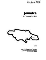
JANAICA . 2 .-Disaster Vulnerability n Hurricane Tracks 1880-1980 D11' Souce- NOAA. 1977, INTETECT9 Dallas# Texas
JAMAICA'' 2. Disaster'.Vulnerability vest%and southwest adl oral:reefs in:.the west and along the north coast provie naturals buffers',to the: sea. 2*2. Hazard Analysis Hurricanes <strong>Jamaica</strong> is situated in one of the most active hurricane regions in the world. The hurricane season runs from June through November, but most storms form in August, September, and October. Since 1880 at least 14 major hurricanes have hit the island, and numerous tropical storms have also caused damage. The damage caused by hurricanes and tropical storms is most severe in the housing and agriculture sectors. High winds of up to 85 mph tear roofs from homes, buildings from their foundations, and agricultural crops from the ground. The accompanying rains cause widespread flooding, washing out roads, bridges, and communication lines, and carrying away survivors' homes and household possessions. The excess water saturates the soil creating landslides and mudslides. On the coastal areas, the high winds generate huge tidal waves which can reach far onto the shore, beating down and carrying away everything in their path. Much of the destruction associated with hurricanes is a result of poor siting and weak construction. Development in areas in the historical path of major hurricanes requires that special measures be taken to protect structures and crops from hurricanes' effects. In the Kingston area, construction of residential and commercial buildings extends to the edge of the sea. Maps delineating the reach of a typical 10 or 25 foot tidal wave clearly show that the areas which will be inimdated and damaged include major new developments in downtown Kingston. A storm surge, or tidal wara of such dgstructive potential could hit the 0amaican coast even if the accompanying hurricane did not. Some natural features help to offset the destructive potential of hurricane-generated storm surges. Coastal barrier reefs shelter parts of the northeast coast and the west coast by providing a buffer to break the force of tidal waves. However, recent and proposed development projects threaten to reduce the'effectiveness of these natural mitigators. Floods Most of the island is prone to flooding, however, this is most severe in the low-lying areas in the east, west, and the capital. The extensive marshlands in the west in Westmoreland and St. Elizabeth, the agricultural plains in Clarendon, and the eastern perimeter of Portland and St. Thomas are all low-lying flood-prone areas. Because they are also the sites of some of the best farm land, much agricultural activity is centered in these regions, including sugar cane, rice, coconut, banana, and pineapple cultivation. 12