NAVIGATIONAL WARNINGS/MSI/GMDSS IN NAVAREA VIII - IHO
NAVIGATIONAL WARNINGS/MSI/GMDSS IN NAVAREA VIII - IHO
NAVIGATIONAL WARNINGS/MSI/GMDSS IN NAVAREA VIII - IHO

You also want an ePaper? Increase the reach of your titles
YUMPU automatically turns print PDFs into web optimized ePapers that Google loves.
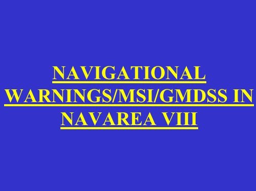
<strong>NAVIGATIONAL</strong><br />
<strong>WARN<strong>IN</strong>GS</strong>/<strong>MSI</strong>/<strong>GMDSS</strong> <strong>IN</strong><br />
<strong>NAVAREA</strong> <strong>VIII</strong>
SCOPE OF PRESENTATION<br />
1. Introduction<br />
2. <strong>NAVAREA</strong> <strong>VIII</strong> Radio Warnings<br />
3. Indian Notices to Mariners<br />
4. Implementation of <strong>GMDSS</strong><br />
5. Marine Safety Information<br />
6. SAR Organisation in India<br />
7. Action by Ships and National Coordinators
1. 10 ° 30'.0S 55 ° 00'.0E<br />
2. 30 ° 00'.0S 55 ° 00'.0E<br />
3. 30 ° 00'.0S 95 ° 00'.0E<br />
4. 06 ° 00'.0N 95 ° 00'.0E<br />
5. 15 ° 00'.0N 98 ° 00'.0E<br />
6. 23 ° 06'.0N 68 ° 03'.0E<br />
7. 12 ° 00'.0N 63 ° 00'.0E<br />
8. 12 ° 00'.0N 51 00'.0E<br />
9. 10° 30'.0S 40° 00'.0E<br />
LIMITS OF<br />
<strong>NAVAREA</strong> <strong>VIII</strong>
ORGANISATION OF<br />
<strong>NAVAREA</strong> <strong>VIII</strong><br />
NHO,DEHRADUN<br />
NAVAERA<br />
<strong>WARN<strong>IN</strong>GS</strong><br />
MUMBAI<br />
NCD<br />
FORTNIGHTLY<br />
NOTICES
<strong>NAVAREA</strong> <strong>VIII</strong> RADIO WARN<strong>IN</strong>G<br />
TRANSMISSION<br />
LES ARVI<br />
TELEX<br />
PUNE<br />
National/<br />
<strong>IN</strong>TERNATIONAL<br />
Organisations<br />
<strong>IN</strong>HO<br />
NCD<br />
MUMBAI<br />
COMCEN<br />
UHF/ HF<br />
NATIONAL<br />
COORD<strong>IN</strong>ATORS<br />
UHF/ HF<br />
MARITIME<br />
BOARDS
TRANSMISSION OF <strong>NAVAREA</strong><br />
WARN<strong>IN</strong>G<br />
1. Issued by NCD(MB)<br />
2. Routine transmission from satellite LES ARVI<br />
3. Daily broadcast at 1000 UTC<br />
4. Urgent message transmitted anytime<br />
5. Navtex transmission through shore stations at Mumbai and Chennai<br />
6. Monitored by National Hydrographic Office
AIM OF RADIO <strong>NAVIGATIONAL</strong><br />
<strong>WARN<strong>IN</strong>GS</strong><br />
Navigational Warnings only give information which cannot be<br />
included in Notices to mariners like failure of important navigational<br />
aids or new dangers. These warnings are aimed to assist the<br />
mariners in coastal navigation upto the entrance of a port. Matters<br />
within a harbour entrance may not be broadcast, therefore<br />
mariners must receive local warnings/ Notice to Mariners before<br />
entering major ports.
TYPES OF <strong>NAVAREA</strong> <strong>WARN<strong>IN</strong>GS</strong><br />
ISSUED<br />
• Casualties to lights, fog signals and buoys affecting main shipping<br />
lanes.<br />
• The presence of dangerous wrecks in or near main shipping lanes<br />
and, if relevant, their marking.<br />
• Establishment of major new aids to navigation or significant changes<br />
to existing ones when such establishment or change might be<br />
misleading to shipping.<br />
• The presence of large unwieldy tows in congested waters.<br />
• Drifting mines<br />
• Areas where search and rescue (SAR) and anti-pollution operations<br />
are being carried out(for avoidance of such areas)<br />
• The presence of newly discovered rocks, shoals, reefs and wrecks<br />
likely to constitute a danger to shipping and, if relevant, their<br />
marking.<br />
• Unexpected alteration or suspension of established routes.
TYPES OF <strong>NAVAREA</strong> <strong>WARN<strong>IN</strong>GS</strong><br />
ISSUED<br />
• Cable or pipe-laying activities, the towing of large submerged objects for<br />
research or exploration purposes, the employment of manned or unmanned<br />
submersibles, or other underwater operations constituting potential dangers in<br />
or near shipping lanes.<br />
• Establishment of offshore structures in or near shipping lanes.<br />
• Significant malfunctioning of radio navigational service and shore-based<br />
maritime safety information radio or satellite services.<br />
• Information concerning special operations which might affect the safety<br />
of shipping, sometimes over wide areas, eg. naval exercises, missile firings,<br />
space missions, nuclear tests, etc. It is important that where the degree of<br />
hazard is known, this information is included in the relevant warning.<br />
Whenever possible, such warnings should be originated not less than five<br />
days in advance of the scheduled event. The warning should remain in force<br />
until the is completed.<br />
• Acts of piracy and armed robbery against ships.
RADIO WARN<strong>IN</strong>G BROADCAST<br />
The radio warnings are transmitted from LES Arvi and COMCEN<br />
Mumbai as per following schedule:-<br />
• Every warning is repeated daily in all schedules for<br />
three days from the date of promulgation.<br />
• The warning is repeated again on 5th and 8 th day from date of<br />
promulgation.<br />
• There after the warning is repeated every fourth day for 42 days<br />
from date of promulgation or date of cancellation of the warning<br />
which ever is early.<br />
• The <strong>NAVAREA</strong> messages pertaining to seismic surveys<br />
are repeated daily for 07 days, and thereafter once a<br />
week for 42 days, or till cancellation of <strong>NAVAREA</strong><br />
message, whichever is earlier.
SUMMARY OF <strong>NAVAREA</strong> WARN<strong>IN</strong>G<br />
Weekly summary of all <strong>NAVAREA</strong> warnings in force is<br />
promulgated every Monday by National Hydrographic Office,<br />
Dehradun, for transmission by COMCEN (MB). The Summary is also<br />
issued to all concerned <strong>NAVAREA</strong> Coordinators.<br />
All national coordinators within <strong>NAVAREA</strong> <strong>VIII</strong> are required to<br />
forward their detailed address including email address to <strong>NAVAREA</strong><br />
coordinator for issuance of the above summary.
ORIG<strong>IN</strong>ATION OF <strong>NAVAREA</strong> <strong>VIII</strong><br />
RADIO WARN<strong>IN</strong>G<br />
Officer-in-Charge NCD(MB) is responsible for originating<br />
<strong>NAVAREA</strong> Warnings on behalf of Chief Hydrographer to Govt<br />
of India.However any Naval/ Coast Guard Authority can<br />
originate a <strong>NAVAREA</strong> warning, depending upon the nature of<br />
event / occurrences that have a bearing on the navigational<br />
safety and route the same through their respective regional<br />
headquarters.
DRAFT<strong>IN</strong>G OF <strong>NAVAREA</strong> <strong>WARN<strong>IN</strong>GS</strong><br />
• While drafting <strong>NAVAREA</strong> <strong>VIII</strong> navigational<br />
warnings, guidelines given in “Joint<br />
IMO/<strong>IHO</strong>/WMO Manual on Maritime Safety<br />
Information (<strong>MSI</strong>)” Special Edition S-53, are<br />
strictly followed. All mariners/National authorities<br />
forwarding information for issuance of these<br />
warnings need to be well aware of the essential<br />
contents of new <strong>NAVAREA</strong> warning format.
FORMAT ON <strong>NAVAREA</strong> <strong>VIII</strong><br />
WARN<strong>IN</strong>G<br />
The text of any <strong>NAVAREA</strong> warning message contains all the relevant<br />
STANDARD ELEMENTS, as indicated below:-<br />
STANDARD ELEMENTS<br />
CONTENT OF ELEMENTS<br />
Message ID<br />
Preamble<br />
Warning<br />
Postscript<br />
<strong>NAVAREA</strong> number and the<br />
Consecutive serial number of the<br />
warning message within the<br />
<strong>NAVAREA</strong> number<br />
1. General Area<br />
2. Locality<br />
3. Chart Number<br />
1. Key Subject<br />
2. Geographical position<br />
3. Amplifying remarks<br />
Cancellation
NOTICES TO MAR<strong>IN</strong>ERS
PORT<br />
AUTHORITIES<br />
NATIONAL/<br />
<strong>IN</strong>TERNAITONAL<br />
ORGANISATIONS<br />
REPORTS<br />
OF <strong>IN</strong> SURVEY<br />
SHIPS<br />
ADJACENT <strong>NAVAREA</strong><br />
COORD<strong>IN</strong>ATORS<br />
NOTICE TO MAR<strong>IN</strong>ERS<br />
NATIONAL<br />
HYDROGRAPHIC<br />
OFFICE,<br />
DEHRADUN<br />
CHART<br />
DEPOTS<br />
ON<br />
DEMAND<br />
ALL<br />
HYDROGRAPHIC<br />
OFFICES<br />
PORT<br />
AUTHORITIES<br />
HYDRO<br />
WEB SITE
NOTICES TO MAR<strong>IN</strong>ERS<br />
• Fortnightly edition to Notices to mariners<br />
• Annual edition to Notices to mariners<br />
• Special edition to Notices to mariners
<strong>IN</strong>FORMATIONS <strong>IN</strong> FORTNIGHTLY<br />
EDITION<br />
1. Permanent Corrections to Indian charts and publications<br />
2. Temporary and Preliminary Corrections to Indian charts and publications<br />
3. General Marine Information for mariners at sea<br />
4. Index of all Radio Navigational Warnings issued during the fortnight<br />
5. Corrections to following publications<br />
a) List of Sailing Direction<br />
b) List of Lights<br />
c) List of Radio Signals<br />
6. Format for reporting of new navigational dangers for issuance of<br />
<strong>NAVAREA</strong> warnings.
<strong>IN</strong>FORMATION <strong>IN</strong>ANNUAL EDITION<br />
1. List of Permanent corrections to Indian navigational charts.<br />
2. Indian Equivalent to British Admiralty Charts.<br />
3. Un-exploded Charges.<br />
4. Text of Temporary and Preliminary Notices.<br />
5. List of Chart Agents.<br />
6. Indian Hydrographic Publications.
<strong>IN</strong>FORMATION <strong>IN</strong> SPECIAL EDITION<br />
The publication is renewed once in four years. All information included in<br />
the publication is of permanent nature and supplement information<br />
published in fortnightly and annual editions. Few examples of information<br />
published in the special edition are as follows:-<br />
1. List of Storm Signal Stations.<br />
2. Firing Practice and Firing Exercise Areas.<br />
3. Information Concerning Submarines.<br />
4. Submarine Cables.<br />
5. Use of Radar in time of emergency or war.<br />
6. National Data Buoy Programme.<br />
7. Development of Offshore Oil and Gas Fields.<br />
8. Traffic Separation Scheme-Ships Routing.
CONTACT AUTHORITIES<br />
Mariners are to contact following authorities in case of any queries regarding<br />
transmission of Navarea <strong>VIII</strong> warnings.<br />
The Chief Hydrographer to the Govt. of India<br />
National Hydrographic Office<br />
Dehradun, India. 248 001<br />
Phone: 91-135-2747365,2747360,2742109<br />
Fax: 91-135-2748373, Telex: 585220 AB: Code HYDR <strong>IN</strong>.<br />
Website: www.hydrobharat.org<br />
The Officer-in-Charge<br />
Naval Chart Depot<br />
SBS Road, Mumbai, India.<br />
Phone: 91-22-22634604<br />
Fax: 91-22-22687049<br />
Telex: 118 3023 NCDM <strong>IN</strong>
IMPLEMENTATION OF <strong>GMDSS</strong> <strong>IN</strong> <strong>IN</strong>DIA
Global Maritime Distress and Safety<br />
system<br />
• The <strong>GMDSS</strong> is fully implemented and vessels built after 1st February<br />
1995 must comply with all applicable <strong>GMDSS</strong> requirements. All<br />
warnings for Navarea <strong>VIII</strong> region are being transmitted on <strong>GMDSS</strong>. The<br />
complete Navarea <strong>VIII</strong> region is designated as area A3. Accordingly all<br />
the messages for the complete region is routed through <strong>IN</strong>MARSAT<br />
LES at Arvi. These messages can be received on any standard<br />
<strong>IN</strong>MARSAT receiver.
MARITIME SAFETY <strong>IN</strong>FORMATION
The Maritime Safety information<br />
<strong>MSI</strong> includes navigational warnings,<br />
meteorological warnings, meteorological forecasts,<br />
and other urgent safety-related messages of vital<br />
importance to all vessels at sea .<strong>NAVAREA</strong> <strong>VIII</strong><br />
<strong>MSI</strong> is broadcasted through MF telex (known as<br />
NAVTEX) by all major ports for local <strong>MSI</strong>, and<br />
through satellite (i.e., <strong>NAVAREA</strong> warnings) by<br />
Naval chart Depot Mumbai for long-range <strong>MSI</strong> as<br />
explained earlier.
The Indian Maritime Safety<br />
Information Service<br />
Navigational Warnings<br />
Meteorological<br />
information<br />
SAR alerts<br />
Shore<br />
organisation<br />
Maritime safety information<br />
(co-ordination/editing function)<br />
NAVTEX service<br />
Navarea <strong>VIII</strong><br />
Broadcast<br />
services<br />
518KHz/local MF<br />
Inmarsat<br />
Arvi Satellite<br />
Shipboard<br />
equipment<br />
Navtex receiver<br />
Ships in Indian Ocean
Porbandar<br />
Limits of ISSR<br />
MRCC<br />
MRSC<br />
Paradip<br />
Kolkata<br />
Haldia<br />
Mumbai<br />
Vishakhapattnam<br />
Goa<br />
ISRR<br />
New Mangalore<br />
Chennai<br />
A&N<br />
Diglipur<br />
ISRR<br />
Kochi<br />
Port Blair<br />
Islands<br />
SRI<br />
LANKA<br />
CG<br />
Campbell Bay<br />
<strong>IN</strong>DIAN SEARCH & RESCUE REGION
<strong>IN</strong>DIAN SRR AND SAR ORGANISATION<br />
1. On accession to the International Convention on Maritime Search and Rescue 1979,<br />
Indian Government has assumed the responsibility of providing SAR cover in Indian<br />
SRR with Director General Indian Coast Guard designated as National Maritime SAR<br />
Coordinating Authority (NMSARCA). There are three geographic areas/regions<br />
established in Indian SRR, for coordinating responses to both maritime and aviation<br />
related distress incidents.<br />
2. The SRR (West) coves the SAR operations on the western seaboard. The SRR (East)<br />
covers Bay of Bengal including portions of Palk Bay and Gulf of Mannar. The SRR<br />
(A&N) covers the area adjacent to Andaman and Nicobar Islands.<br />
3. There are three Maritime Rescue Coordination (MRCCs) defined in <strong>IN</strong>SRR. The<br />
MRCC located at Mumbai covers western seaboard of Indian SRR. The eastern<br />
seaboard is covered by MRCCs located at chennai and Port Blair.
MARITIME RESCUE<br />
COORD<strong>IN</strong>ATION CENTRE <strong>IN</strong> ISRR<br />
1. The Maritime Rescue Coordination Centre (MRCC) is an operational facility,<br />
responsible for promoting efficient organisation of SAR services, and for<br />
coordinating the conduct of SAR operations within the SRR. The MRCC only<br />
coordinates and does not necessarily provide the SAR facilities in the applicable<br />
SRR. Aeronautical SAR coordination is performed from aeronautical RCC.<br />
2. There are three Maritime Rescue Coordination Centres (MRCCs) defined in SRR.<br />
The MRCC located at Mumbai covers the entire western seaboard of Indian SRR.<br />
The Eastern seaboard is covered by MRCCs located at Chennai and Port Blair. The<br />
coordinates of the Indian SRRs associated with the respective MRCCs are as<br />
follows:-
MRCC MUMBAI<br />
The Indian SRR (West) area covered by the MRCC Mumbai, is defined by the line<br />
joining the following coordinates and IBL.<br />
(a) 21 00N 068 15E<br />
(b) 12 00N 063 00E<br />
(c) 12 00N 060 00E<br />
(e) 06 00S 068 00E<br />
(d) 06 00S 060 00E<br />
(f) 00 00S 068 00E<br />
(g) 08 00N 073 00E<br />
(h) 06 10N 077 20E<br />
(i) 08 08N 077 20E
MRCC CHENNAI<br />
The Indian SRR (East) area covered by the MRCC Chennai, is<br />
defined by the line joining the following coordinates and IBL.<br />
(a) 08 08N 077 20E<br />
(c) 06 00N 078 00E<br />
(e) 10 00N 082 00E<br />
(g) 15 20N 088 30E<br />
(b) 06 10N 077 20E<br />
(d) 10 00N 080 00E<br />
(h) Coastal border between India and Bangladesh<br />
(f) 07 15N 088 30E
MRCC Port Blair<br />
The Indian SRR (A&N) area covered by the MRCC Port Blair is defined<br />
by the line joining the following coordinates and IBL.<br />
(a) Coastal border between India and Bangladesh<br />
(b) 15 20N 088 30E<br />
(d) 06 00N 092 00E<br />
(c) 07 15N 088 30E<br />
(e) 06 00N 097 32E<br />
(f) Northwards of position of serial (e) given above and<br />
covering the areas outside limits of the designated areas of other<br />
littoral countries.
RESCUE AGENCIES<br />
(i) Indian Navy<br />
(ii) Indian Air Force<br />
(iii) Port Authorities<br />
(iv) Shipping Corporation of India<br />
(v) Director General civil Aviation<br />
(vi) State/Central Fisheries Authorities<br />
(vii) Merchant Ships operating close to position distress<br />
(viii) Civil Authorities<br />
(ix) Indian Meteorological Department<br />
(x) <strong>IN</strong>MCC Bangalore<br />
(xi) Department of Telecommunications
MANN<strong>IN</strong>G OF DISTRESS FREQUENCIES<br />
• Following authorities along the Indian coast continuously man distress frequencies for<br />
providing assistance to ships/aircraft in distress in Indian waters.<br />
a. Thirteen Coast Radio Stations operated by the Department of communications.<br />
b. Five Port Radio Stations operated by the concerned Port authorities maintain<br />
listening watch on distress frequencies.<br />
c. The Indian Navy for providing maritime reconnaissance aircraft and Indian Naval<br />
Ships.<br />
d. The Indian Air Force for providing suitable aircraft for rescue operations.<br />
e. Air Traffic Control Centers are often the first to receive information about aircraft in<br />
distress. All commercial and may private aircraft are able to communicate with these centers<br />
by radio, therefore all aircraft under the control of the Director General of Civil Aviation will<br />
also be available for SAR operations.
SHIP REPORT<strong>IN</strong>G SYSTEMS<br />
Two ship reporting systems covering Indian SRR are already in<br />
force.<br />
1. <strong>IN</strong>DIAN SHIP POSITION AND <strong>IN</strong>FORMATION<br />
REPORT<strong>IN</strong>G SYSTEM (<strong>IN</strong>SPIRES)<br />
2. SHIP REPORT<strong>IN</strong>G SYSTEM FOR SAR (<strong>IN</strong>DSAR)
<strong>IN</strong>DIAN SHIP POSITION AND<br />
<strong>IN</strong>FORMATION REPORT<strong>IN</strong>G SYSTEM<br />
(<strong>IN</strong>SPIRES)
OBJECTIVES OF <strong>IN</strong>SPIRES<br />
The <strong>IN</strong>SPIRES has been established to achieve following objectives.<br />
(i)<br />
(ii)<br />
(iii)<br />
(iv)<br />
To provide up to date information on shipping for search and<br />
rescue.<br />
For effective vessel traffic management service.<br />
For weather forecasting.<br />
For prevention and containment of marine pollution.
<strong>IN</strong>SPIRES Area of Applicability<br />
The <strong>IN</strong>SPIRES covers all the sea area North of latitude 30 degree<br />
South in the Indian Ocean including Arabian sea and Bay of<br />
Bengal, on the West along the African coast between latitude 10<br />
degree 30 minute South and 12 degree North and in the East upto<br />
longitude 095 degree East.
<strong>IN</strong>SPIRES operating Authority<br />
The Director General Shipping coordinates the functioning of the<br />
system with Maritime Operations Centre, Mumbai. The merchant<br />
ships are required to pass <strong>IN</strong>SPIRES report to the MOC (Mumbai)<br />
and MOC (Vishakhapatnam). The details of information required<br />
for SAR operation can be obtained from MOC (Mumbai) and MOC<br />
(Vishakapatnam) as and when need arise.
SHIP REPORT<strong>IN</strong>G SYSTEM FOR SAR<br />
(<strong>IN</strong>DSAR)
SHIP REPORT<strong>IN</strong>G SYSTEM FOR SAR<br />
(<strong>IN</strong>DSAR)<br />
With effect for 01 Feb 2003, the ship report for search and rescue<br />
services have been brought into operation for participation of<br />
merchant vessels operating/transiting in the Indian Search and<br />
Rescue Region (ISRR). The new reporting system, <strong>IN</strong>DSAR, is an<br />
advanced computerized system designed to contribute to safety of<br />
life at sea and is operated and maintained by the Indian Coast<br />
Guard through Maritime Rescue Co-ordination Centre in Mumbai.
PURPOSE OF THE <strong>IN</strong>DSAR SYSTEM<br />
<strong>IN</strong>DSAR is an integral part of the Maritime Search and<br />
Rescue (MSAR) system in India. The objective of the<br />
<strong>IN</strong>DSAR system is to contribute to safety of life at sea by:<br />
(a)<br />
(b)<br />
(c)<br />
Limiting the time between the loss of a ship and the<br />
initiation of search and rescue action;<br />
Limiting the search area for a rescue action; and<br />
Providing up-to-date information on shipping resources<br />
available in the area, in the event of a search and rescue<br />
incident.
Why MRCC Mumbai needs to know where<br />
you are<br />
If your ship is in distress and you have not been able to send a<br />
Mayday message, the <strong>IN</strong>DSAR positive checking system operated<br />
by MRCC Mumbai, will conduct an air search to locate your ship.<br />
The search aircraft will start searching in the area related to your<br />
ship’s predicted route and speed, the search aircraft may not be able<br />
to find any survivors. It is in the best interest of the ship to keep<br />
MRCC Mumbai advised of all your voyage details.
ACTION BY SHIPS <strong>IN</strong><br />
<strong>NAVAREA</strong> <strong>VIII</strong> REGION<br />
1. <strong>GMDSS</strong> ships shall, while at sea, maintain an automatic DSC watch on the<br />
appropriate distress and safety calling frequencies in the frequency bands<br />
appropriate for the sea area in which they are operating. Ships, where so<br />
equipped, should also maintain watch on the appropriate frequencies for the<br />
automatic reception of transmissions of meteorological and navigational<br />
warnings and other urgent information to ships.<br />
2. Report any information warranting issue of warning in <strong>NAVAREA</strong> <strong>VIII</strong><br />
region.<br />
3. Maintain continuous distress watch on all frequency in accordance with IMO<br />
Special Publication S – 53.<br />
4. Contact concerned authority/ Chief Hydrographer in case of any doubts.<br />
5. Vessels subject to the SOLAS Convention must comply with applicable<br />
equipment carriage for monitoring requirements and Global Maritime Distress<br />
and Safety System (<strong>GMDSS</strong>) equipment.<br />
6. Any vessel carrying <strong>GMDSS</strong> compatible equipment should use it as intended<br />
and must be prepared at all times to receive distress alerts with it.
ACTION BY SHIP RECEIV<strong>IN</strong>G A<br />
DISTRESS MESSAGE<br />
• Acknowledge receipt of message.<br />
• Gather the following information from the craft in distress, if possible<br />
– Position, course and speed of distressed craft.<br />
– Length, breadth and colour of the ship.<br />
– Distressed craft’s identity, port of registration, call sign, M<strong>MSI</strong> number and<br />
name.<br />
– Telephone, fax and telex number of the ship, owner and agent.<br />
– Communication frequency manned by the vessel.<br />
– Number of personnel on board and nationality.<br />
– Nature of the distress or casualty.<br />
– Type of assistance required.<br />
– Number of casualties, if any.<br />
– Facilities for helicopter operation and obstruction for helicopter landing or<br />
winch operation.
ACTION BY SHIP RECEIV<strong>IN</strong>G A<br />
DISTRESS MESSAGE<br />
– Type and quantity of cargo including fuel, chemical, explosives and<br />
hazardous material.<br />
– Any other pertinent information that might facilitate the rescue.<br />
• Proceed to render assistance.<br />
• Relay distress and pass above information to the appropriate<br />
MRCC/MRSC.
ACTION BY NATIONAL<br />
CO-ORD<strong>IN</strong>ATOR.<br />
(i) National Co-ordinators should arrange to receive <strong>NAVAREA</strong> <strong>VIII</strong> warnings<br />
broadcast and include those warnings in force for their region in their National<br />
Notice to Mariners.<br />
(ii) Warnings which warrant further promulgation in an adjacent Area will be<br />
passed to the appropriate Area Co-ordinators by Telex/Cable/Airmail.<br />
(iii) Written copies of <strong>NAVAREA</strong> <strong>VIII</strong> warnings are being sent by the Area Coordinator<br />
to the National Co-ordinators and Authorities in <strong>NAVAREA</strong> <strong>VIII</strong> by<br />
airmail. National Co-ordinators should consider the possibility of making written<br />
versions of <strong>NAVAREA</strong> <strong>VIII</strong> warnings in force available to ships in the region.<br />
(iv) All <strong>NAVAREA</strong> <strong>VIII</strong> warnings included in notices to mariners are also<br />
available on Indian National Hydrographic Office website www.hydrobharat.org.<br />
(v) All <strong>NAVAREA</strong> <strong>VIII</strong> warnings in force and Serial Numbers only of Warnings<br />
pertaining to other <strong>NAVAREA</strong>S are reproduced in Section 5 of the bimonthly<br />
edition of Indian Notices to Mariners and copies sent to National Co-ordinators<br />
and Port Authorities by the Area Co-ordinator (Chief Hydrographer) National coordinator<br />
should make Such Notices available to ship calling at their ports.<br />
(vi) Copies of those <strong>NAVAREA</strong> <strong>VIII</strong> warnings likely to remain in force for more<br />
than six weeks will be made available to other Area Co-ordinators or<br />
National Authorities on request or can be downloaded from <strong>IN</strong>HO website.
ACTION BY NATIONAL<br />
CO-ORD<strong>IN</strong>ATORS<br />
(vii) The National Co-ordinator in <strong>NAVAREA</strong> <strong>VIII</strong> are to make necessary<br />
arrangements to issue coastal warnings where necessary in accordance with<br />
paragraphs 6 and 7 above. If the information is considered appropriate for<br />
promulgation as a <strong>NAVAREA</strong> <strong>VIII</strong> warning, it should be passed to the Area Coordinator<br />
(Chief Hydrographer to the Government of India) prefixed by the<br />
desired degree of priority by the fastest means available (Telex, Cable or Airmail).<br />
(viii) The area Co-ordinator, on receiving the information from the National Coordinator<br />
will issue a <strong>NAVAREA</strong> <strong>VIII</strong> warning, if considered necessary.<br />
(ix) When the National Co-ordinator believes himself to be the first receipt of<br />
information relating to another region he should pass it to the appropriate National<br />
Co-ordinator or Area Co-ordinator by the quickest possible means.<br />
(x) When the Area Co-ordinator believes himself to the first receipt of information<br />
relating to another Area, such information will be passed to the appropriate Area Coordinator<br />
by Telex, Cable or Airmail.<br />
(xi) Implement NAVTEX and SafetyNET service in their respective regions.
CONCLUSION