A Case Study of Banni (Kachchh) Gujarat, India.
A Case Study of Banni (Kachchh) Gujarat, India.
A Case Study of Banni (Kachchh) Gujarat, India.

Create successful ePaper yourself
Turn your PDF publications into a flip-book with our unique Google optimized e-Paper software.
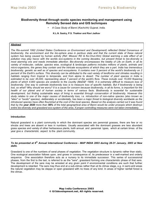
Map <strong>India</strong> 2003<br />
Forestry & Biodiversity<br />
Biodiversity threat through exotic species monitoring and management using<br />
Remotely Sensed data and GIS techniques<br />
- A <strong>Case</strong> <strong>Study</strong> <strong>of</strong> <strong>Banni</strong> (<strong>Kachchh</strong>) <strong>Gujarat</strong>, <strong>India</strong>.<br />
K.L.N. Sastry, P.S. Thakker and Ravi Jadhav<br />
Abstract<br />
The Rio-summit 1992 (United States Conference on Environment and Development) reflected Global Consensus <strong>of</strong><br />
biodiversity, the environment and the bio-sphere area in perilous state and that the current state <strong>of</strong> these natural<br />
system has being caused by human activity (Ref. Weaver RD & Ke.Chun.Kim) Global warming a side effect <strong>of</strong> air<br />
pollution may play havoc with the worlds eco-systems in the coming decades, but present threat to bio-diversity is<br />
most alarming one and needs immediate attention. Bio-diversity encompasses the totality <strong>of</strong> Life on Earth, in all its<br />
variety <strong>of</strong> molecular, cellular, species wise, ecological & landscape patterns includes millions <strong>of</strong> plants, animals and<br />
micro-organisms, the genes they contain and the intricate ecosystems <strong>of</strong> which they are a part. <strong>India</strong> has tremendous<br />
biodiversity, genetic as well as <strong>of</strong> species and ecosystems. It contains over 5 percent <strong>of</strong> the world's biodiversity on 2<br />
percent <strong>of</strong> the Earth's surface. This diversity can be attributed to the vast variety <strong>of</strong> landforms and climates resulting in<br />
habitats ranging from tropical to temperate, and from alpine to desert. The number <strong>of</strong> plant species in <strong>India</strong> is<br />
estimated to be over 45,000, representing about 7 percent <strong>of</strong> the world's flora. These include over 15,000 flowering<br />
plants <strong>of</strong> which 4,900 species are endemic to the countty (MoE&F 1994). It is extremely difficult to measure loss <strong>of</strong><br />
biodiversity. One way to estimate biodiversity loss is to measure loss <strong>of</strong> specific habitats. But if biodiversity is being<br />
lost, so what? Why should we worry? It is a cause for concern because biodiversity, in all its forms, is important for the<br />
health <strong>of</strong> our planet and <strong>of</strong> human society in terms <strong>of</strong> various facts. Biodiversity is essential for sustainable<br />
development, but finding sustainable ways <strong>of</strong> living is essential through conservation <strong>of</strong> biodiversity. However this<br />
study relates to one <strong>of</strong> the major causes <strong>of</strong> biodiversity loss, i.e. introduction <strong>of</strong> non-native species (also known as<br />
"alien" or "exotic" species), deliberately or accidentally, has been a major threat to biological diversity worldwide as the<br />
introduced species have <strong>of</strong>ten flourished at the cost <strong>of</strong> the local species. Based on the analysis carried out it was found<br />
that by the year 2020 more than 56% <strong>of</strong> the total geographical area <strong>of</strong> <strong>Banni</strong> would be under prosopis which destroys<br />
entire bio-diversity and grassland eco-system <strong>of</strong> the area, if proper controlling measures were not taken immediately.<br />
Introduction<br />
Natural grassland is a plant community in which the dominant species are perennial grasses, there are few or no<br />
shrubs and trees are absent or less in numbers. Usually associated with the dominant grasses are less abundant<br />
grass species and variety <strong>of</strong> other herbaceous plants, both annual and perennial types, which at certain times <strong>of</strong> the<br />
year give a characteristic aspect to the plant community.<br />
To be presented at 6 th Annual International Conference - MAP INDIA 2003 during 28-31 January, 2003 at New<br />
delhi.<br />
Grassland is one <strong>of</strong> the numbers <strong>of</strong> seral phases <strong>of</strong> vegetation. The vegetation structure is dynamic rather than static.<br />
One ecological association follows upon, and grows in consequence <strong>of</strong>, its predecessor in a well-marked and orderly<br />
sequence. One association therefore acts as a nursery to its immediate successor. This series <strong>of</strong> successional<br />
phases, from the first to the last, is referred to as the "sere", grassland forming one characteristic phase <strong>of</strong> that sere.<br />
The development <strong>of</strong> the sere may be arrested at any given point if environmental conditions are such that further<br />
development is retarded. The sere may thus end at a sub-climax rather than at its climax stage, e.g. in semi-arid areas<br />
the natural vegetation may be steppe or open grassland with no trees <strong>of</strong> any kind. In areas <strong>of</strong> higher rainfall forest is<br />
the climax.<br />
Map <strong>India</strong> Conference 2003<br />
© GISdevelopment.net, All rights reserved.
Map <strong>India</strong> 2003<br />
Forestry & Biodiversity<br />
In regions <strong>of</strong> high rainfall, the tendency to revert toward forest is particularly marked and confronts the pioneer with<br />
difficult problems <strong>of</strong> stock and pasture management. Continued under-stocking will allow a normal reversion, first to<br />
weeds, and then to shrubs and scrubs, habitual overgrazing will tend to weaken the sward so that the establishment <strong>of</strong><br />
weeds is made easier.<br />
Many <strong>of</strong> the large grassland areas, such as the prairies and plains <strong>of</strong> North America, the pampas <strong>of</strong> South<br />
America, the steppes <strong>of</strong> Asia and the Veld <strong>of</strong> Africa are believed to be <strong>of</strong> great antiquity and are climax<br />
formations determined by soil and climate. Other grasslands are <strong>of</strong> more recent origin and have replaced forests<br />
that have been destroyed mainly by cutting and fire; these have been maintained largely through grazing animals.<br />
True grasslands exist in most part <strong>of</strong> the world where the rainfall is not sufficient to produce thick forest, and yet<br />
sufficiently high to prevent the creation <strong>of</strong> a desert. The great grasslands once covered nearly half <strong>of</strong> the earth's land<br />
surface, from the rolling Prairies <strong>of</strong> North America to the great Savannahs <strong>of</strong> Africa and the vast Steppes <strong>of</strong> Eurasia.<br />
Generally speaking, grassland have few, scattered, small sized trees to break the drying winds. Most <strong>of</strong> these areas<br />
go through periodic drought conditions. As a result, majority <strong>of</strong> plants <strong>of</strong> these regions lives more " in " the soil than<br />
above it. Just under the surface there is a tangled map <strong>of</strong> roots and rhizomes. Some grassroots grow down to the<br />
depths <strong>of</strong> a meter into the soil, while the tap roots <strong>of</strong> other s<strong>of</strong>t stemmed plants may penetrate to five meter in their<br />
search for water and nourishment.<br />
Importance <strong>of</strong> Grassland.<br />
When we talk about grassland, we have to first consider the main component, that goes to form the bulk <strong>of</strong> the<br />
grassland, that is grass. Of all, the grasses are the most important to man. All our food stuff like corn, wheat, oats,<br />
rye, barley, and rice, sugarcane are grasses. Bamboo's are also grasses. Although, the great importance <strong>of</strong><br />
grasslands lies in providing sustenance, grasses also serve humanity in other ways. Grass may be used for<br />
building homes and furniture (walls, thatch, matting, brooms) lawns, sports fields and as components <strong>of</strong> some<br />
cosmetics and medicines.<br />
Grassland provides crucial grazing land and pastures for the domestic and migrated livestock, which forms important<br />
livelihood for majority <strong>of</strong> the population <strong>of</strong> <strong>Banni</strong> and surrounding districts. The milching capacity and overall health<br />
<strong>of</strong> the cattle, is an indicator <strong>of</strong> grassland quality. From these grasslands large quantity <strong>of</strong> forage grass is collected<br />
annually by cutting, and storing it in grass godowns for the droughts. However, free grazing can deteriorate these<br />
grasslands, for which only controlled " rotational grazing " is useful.<br />
Introduced Species :<br />
Introduction <strong>of</strong> non-native species (also known as "alien" or "exotic" species), deliberately or accidentally, has been a<br />
major threat to biological diversity worldwide as the introduced species have <strong>of</strong>ten flourished at the cost <strong>of</strong> the local<br />
species. <strong>India</strong>'s Biodiversity, too, has been affected by introduction <strong>of</strong> alien species. Several exotic animals and plants<br />
introduced in the Andaman and Nicobar Islands are posing a threat to the local species <strong>of</strong> fauna and flora. Animal<br />
husbandry, an occupation <strong>of</strong> majority <strong>of</strong> <strong>India</strong>n farmers, is directly dependent upon grassland for sustenance and it<br />
contributes a significant 5 to 6% towards <strong>India</strong>'s national income (The State <strong>of</strong> <strong>India</strong>'s Environment 1984-85).<br />
<strong>Study</strong> Area<br />
The <strong>Banni</strong> area, as the name signifies, is a ‘<strong>Banni</strong> hui’ (in Hindi) meaning made up land formed by the detritus brought<br />
down and deposited predominantly by the Indus river, which was reported to flow through the Great Rann in the past.<br />
The great and the little ranns <strong>of</strong> <strong>Kachchh</strong> were the old arms <strong>of</strong> the sea in the old geological period. Due to the eruption<br />
and formation <strong>of</strong> the Allah Bund near the Kori Creek, the lands in the Great and Little ranns got blocked up and were<br />
filled up by the deposits brought down by the Indus river (Source: Notes from Animal Husbandry <strong>of</strong> Agriculture,<br />
<strong>Gujarat</strong>). Once upon a time <strong>Banni</strong> was considered the largest grassland <strong>of</strong> its kind in Asia, but has fallen upon sad<br />
times in the last decade. The <strong>Banni</strong> area under the present investigation extends over Bhuj and Nakhtrana Talukas <strong>of</strong><br />
<strong>Kachchh</strong> Districts. It is situated on the northern border <strong>of</strong> <strong>Kachchh</strong> mainland, consisting <strong>of</strong> 45 villages. The actual area<br />
Map <strong>India</strong> Conference 2003<br />
© GISdevelopment.net, All rights reserved.
Map <strong>India</strong> 2003<br />
Forestry & Biodiversity<br />
lies between North latitudes <strong>of</strong> 23 o 19' and 23 o 52' N and East longitudes <strong>of</strong> 68 o 56' to 70 o 32' E. Vegetation comprises <strong>of</strong><br />
grassland, shrubs and legumes found naturally in the <strong>Banni</strong> area. Normally the area is covered with coarse and low<br />
perennial grasses and other non-grass species present in <strong>Banni</strong> area are as follows (Source : <strong>Banni</strong> Development<br />
Office, Bhuj, <strong>Kachchh</strong>).<br />
1. Dichanthium-annulatum, (Forsk) Stapf<br />
2. Sporobolus helvolus (Trin) Thw.<br />
3. Chloris barbate, SW.<br />
4. Cenchrus biflorus, Roxb.<br />
5. Eleusine bianata<br />
6. Elysecarpus rugosus (legume), Wall<br />
7. Heylandis latebrosa (legume), DC<br />
8. Digitarea sanguinalis, Scop. Var Ciliaris Prain<br />
9. Crotolaria medicaginea, Lam.<br />
10. Indig<strong>of</strong>era sps. (Legume), Linn.<br />
11. Sida sps. (Malvaceaa) L.<br />
12. Malanocenchrus jacquemontii, J&S<br />
13. Sporobolus diander (Retz) P. Beauv<br />
14. Cenchrus setigerus, vahl<br />
15. Aristida adscensionis, L<br />
16. Aristida funiculata, Trin & Rupr<br />
17. Setaria rhachitricho, Cook<br />
18. Eragrostis minor and major, Host.<br />
19. Eragrostis trimula, Hochst.<br />
20. Cyprus rotundus, Linn(dupareate form)<br />
21. Desmostachya bipinnata (L.) Stapf<br />
22. Cyperus rotundus, Linn<br />
23. Cressa cretica (Convovulaceae), Linn<br />
24. Eragrostis bulbosa<br />
25. Kochia sps. (Polygonaceae), Roth<br />
26. Suaeda fruticosa<br />
Out <strong>of</strong> the above 26 grass species first 12 species are palatable and rest <strong>of</strong> them are salt-tolerant grasses.<br />
<strong>Banni</strong> area deterioration is linked to the increasing salinity ingress, impoverishment and illiteracy <strong>of</strong> its<br />
inhabitants, a growing human and livestock population, and invasion <strong>of</strong> prosopis juliflora, which <strong>of</strong>fers quick<br />
fuelwood, but its proliferation is dangerous for the grassland, over grazing and improper management <strong>of</strong> the<br />
land.<br />
Data used<br />
The following data was used during the course <strong>of</strong> this study<br />
1. IRS 1C/1D LISS-III data( transparencies ) <strong>of</strong> two seasons at 1:50,000<br />
2. <strong>Banni</strong> area map prepared by <strong>Banni</strong> Development Authority and WRD/CDO joint report.<br />
3. Ground truth data collection.<br />
GIS Database Design and Organisation for <strong>Banni</strong><br />
The data base for the <strong>Banni</strong> development plan has basically two components, Spatial and Non- Spatial. The<br />
Geographic Information system (GIS) package is the core <strong>of</strong> the database for handling the two sets <strong>of</strong> data. In the<br />
present study ARC/INFO GIS package has been employed as the main tool to design, Organization, storage,<br />
retrieval, analysis and generation <strong>of</strong> cartographic outputs. Non-Spatial Data basically consisting <strong>of</strong><br />
numeric/attributes in respect <strong>of</strong> Grassland type-code, Salinity range-code, composition and prosopis density<br />
class-code.<br />
Since it was required that a typical analysis had to be carried out for <strong>Banni</strong> Development Plan, as it was<br />
discussed with other participating agencies like <strong>Gujarat</strong> Institute <strong>of</strong> Desert Ecology (GUIDE), Animal Husbandry,<br />
<strong>Banni</strong> Development <strong>of</strong>fice at Bhuj. The database contents are given in TABLE – 1 .<br />
Map <strong>India</strong> Conference 2003<br />
© GISdevelopment.net, All rights reserved.
Map <strong>India</strong> 2003<br />
Forestry & Biodiversity<br />
Table – 1 : Primary and derived Themes used for <strong>Banni</strong> development plan<br />
Sr. Theme Type Primary/ Source Criteria Remarks<br />
No.<br />
Derived<br />
1 Grassland/ Polygon Primary IRS 1C/1D<br />
- -<br />
Landcover map<br />
1998-99<br />
2 <strong>Banni</strong> Polygon Primary <strong>Banni</strong> Devp.<br />
- -<br />
Boundary<br />
Office<br />
3 Roads Line Primary SOI toposheets - -<br />
and IRS 1C/1D<br />
L3 DATA<br />
4 Elevation Points Primary SOI toposheets - -<br />
& limited GPS<br />
points<br />
5 Drainage Lines Primary SOI toposheets - -<br />
6 Contours Polygons and<br />
lines<br />
Derived Elevation points - Tin and Lattice Model<br />
<strong>of</strong> ARC/INFO<br />
7 Slope Polygons Derived Elevation Points Tin and Lattice Model<br />
<strong>of</strong> ARC/INFO<br />
8 Action Plans For:<br />
8.1 Palatable<br />
Grass<br />
8.2 Mass Weeding<br />
<strong>of</strong> Prosopis<br />
Polygons Derived Landcover Map Multiparametric<br />
criterion based<br />
Analysis<br />
Polygons Derived Landcover Map Multiparametric<br />
criterion based<br />
Analysis<br />
8.3 Pure Prosopis Polygons Derived Landcover Map Multiparametric<br />
criterion based<br />
Analysis<br />
8.4 Salinity range Polygons Derived Landcover Map Criterion based<br />
Analysis<br />
8.5 Water<br />
Harvesting<br />
Polygons Derived Slope Map &<br />
Drainage<br />
Criterion based<br />
Analysis<br />
Identification &<br />
Extraction using GIS<br />
Identification and<br />
Extraction using GIS<br />
Recursive Elimination<br />
Analysis using GIS<br />
Identification <strong>of</strong><br />
fertility island <strong>of</strong><br />
Vegetation types<br />
Possible sites<br />
identified as per the<br />
discussion with<br />
experts<br />
Each <strong>of</strong> the above mentioned action plans was generated using multi – parametric criterion based analysis by<br />
GIS techniques.<br />
Methodology<br />
Looking in to the typical problems <strong>of</strong> <strong>Banni</strong> grasslands and subsequent discussions held with experts,<br />
participating agencies and also with the agencies working in <strong>Banni</strong> development activity at Bhuj, it is felt that the<br />
problems <strong>of</strong> <strong>Banni</strong> can be addressed by four major action plans which are required for implementing for <strong>Banni</strong><br />
development.<br />
They are:<br />
i. Palatable good Grasslands protection and conservation<br />
ii. Arresting Prosopis juliflora invasion into grasslands ( both Palatable and Salt tolerant )<br />
iii. Phase – wise removal <strong>of</strong> Prosopis in non – saline areas and<br />
iv. Rain water harvesting for salinity leaching and increasing grass production<br />
Map <strong>India</strong> Conference 2003<br />
© GISdevelopment.net, All rights reserved.
Map <strong>India</strong> 2003<br />
Forestry & Biodiversity<br />
The methodology flow chart is given below:<br />
Multi-temporal<br />
vegetation map<br />
from RS data<br />
<strong>Banni</strong> (west) boundary<br />
Map from conventional<br />
sources<br />
Elevation and<br />
limited GPS points<br />
Drainage pattern<br />
map from RS<br />
Data<br />
Multi-parametric<br />
criterion based<br />
analysis in GIS<br />
GIS<br />
database<br />
organizatio<br />
Identification <strong>of</strong><br />
fertility island <strong>of</strong><br />
vegetation<br />
Pure Grass<br />
patches<br />
( palateble)<br />
Pure Grass +<br />
Grass saline<br />
+ grass under<br />
tree cover<br />
Thick P.<br />
Juliflora<br />
patches + P.<br />
juliflora with<br />
grass<br />
DEM<br />
generation<br />
Soil Salinity<br />
range map<br />
Slope map<br />
Action plan<br />
for<br />
Trenching,<br />
Furrowing &<br />
Fencing for<br />
better<br />
management<br />
Action plan<br />
for Mass<br />
weeding <strong>of</strong> P.<br />
juliflora<br />
immediately<br />
after post<br />
monsoon<br />
Action plan<br />
for Phasewise<br />
removal <strong>of</strong><br />
P.juliflora in<br />
low saline<br />
plots<br />
Indication <strong>of</strong><br />
possible sites<br />
for rain<br />
water<br />
harvesting<br />
structures<br />
Overlay<br />
Fig - 01: Schematic Representation <strong>of</strong> Methodology for <strong>Banni</strong> Development Plan<br />
Map <strong>India</strong> Conference 2003<br />
© GISdevelopment.net, All rights reserved.
Map <strong>India</strong> 2003<br />
Forestry & Biodiversity<br />
Results, Discussions and Suggestions<br />
Based on the analysis carried out the following results were found.<br />
Prosopis invasion<br />
Invasion <strong>of</strong> Prosopis can be attributed to various allogenic and autogenic factors operating at spatial scales<br />
ranging from the small patch to entire landscape. Allogenic factors include climatic changes, over grazing etc.<br />
Allogenic factors operating to favor Prosopis invasion over good grasslands is an increase in the spatial and<br />
temporal heterogeneity <strong>of</strong> soil salinity, cattle droppings etc.. which promotes the invasion <strong>of</strong> Prosopis.<br />
Prosopis invasion in <strong>Banni</strong> using multi-temporal Satellite data <strong>of</strong> 1980,1985 1988 and 1998 (Normal, Drought,<br />
Normal) have been calculated. The percent <strong>of</strong> area under P.juliflora are as follows:<br />
Year Area (Ha.) %<br />
1980 37893 9.85<br />
1985 35046 9.11<br />
1988 76786 19.96<br />
1998 118675 31.23<br />
Looking at the present scenario and comparing with our own previous studies, it is very interesting to calculate the<br />
future trend <strong>of</strong> invasion in the <strong>Banni</strong> (W) area. To do the trend analysis <strong>of</strong> Prosopis invasion in <strong>Banni</strong>, <strong>Kachchh</strong>,<br />
we have considered an imperial equation, which had been validated by using 1988,1998 & 1999 Satellite data.<br />
Based on that equation we have predicted P-invasion in <strong>Banni</strong> upto 2020.The results are as follows:<br />
Year Area (ha.) %area<br />
1998 118799.40 31.2630<br />
2005 149275.78 39.2831<br />
2010 171017.48 45.0046<br />
2015 192736.38 50.7201<br />
2020 214432.71 56.4297<br />
This shows very alarming situation for <strong>Banni</strong> Grasslands. By the year 2020 more than 56% <strong>of</strong> the total<br />
geographical area <strong>of</strong> <strong>Banni</strong> would be under prosopis and destroys entire bio-diversity, and grassland eco-system<br />
<strong>of</strong> the area, if proper controlling measures were not taken immediately. One <strong>of</strong> the measures suggested was<br />
Mass weeding <strong>of</strong> Prosopis immediately after post – monsoon so as to control its invasion in new areas where<br />
good and palatable grass is growing at present. Fig-02 shows spatial distribution <strong>of</strong> areas for mass weeding <strong>of</strong><br />
P.juliflora immediately after the post-monsoon.<br />
Phase – wise removal <strong>of</strong> prosopis<br />
Looking at the stock <strong>of</strong> Prosopis in <strong>Banni</strong>, it is very essential to remove (uprooting or cut and burn with kerosene)<br />
from non – saline areas. But, removing entire Prosopis at once may cause ecological problems. So, it is<br />
suggested to remove Prosopis phase – wise (may be 1kmX1km plots) starting from matured patches to complete<br />
with in Four or Five years. Fig-03 shows priority areas for phase-wise removal <strong>of</strong> P.juliflora from pure patches <strong>of</strong><br />
prosopis and prosopis invading in good grasslands.<br />
Protecting and Controlling open Grasslands<br />
It is observed from the analysis that, if the rainfall is normal, there is a good grass growth in non–saline patches <strong>of</strong><br />
land in <strong>Banni</strong>. Because <strong>of</strong> over grazing by domestic and migrated cattle from surrounding districts and also from<br />
Rajasthan, the grass is getting exhausted before it fully grows to a particular stage. To overcome this problem it<br />
is essential to protect open (uncontrolled) grasslands to arrest the entry <strong>of</strong> cattle freely from all sides <strong>of</strong> the<br />
Map <strong>India</strong> Conference 2003<br />
© GISdevelopment.net, All rights reserved.
Map <strong>India</strong> 2003<br />
Forestry & Biodiversity<br />
patches. So, it is suggested to fence these patches. Moreover, it is required to do furrowing in these lands for<br />
moisture retaining and thereby better production in the subsequent years.<br />
Salinity ingress<br />
Trenching<br />
This is another major problem in <strong>Banni</strong>. Salinity ingress is approximately about 4% per year in the region. To<br />
control this ingress to some extent it is suggested to dig a trench around good grasslands, which helps in leaching<br />
out salinity and arrest cattle entry to some extent. Fig - 04 depicts the length <strong>of</strong> trenching and fencing required<br />
and the cost may be calculated based on local labor and material charges.<br />
Ghaduli – Santalpur<br />
It is also suggested that the road which is planned to construct between Ghaduli – Santalpur (via. Khavda –<br />
Katwndh – Dolaveera – Amrapur – Bela and Madhutra) must be completed having sluice gate opening only one<br />
side to arrest salinity ingress into <strong>Banni</strong> and other areas.<br />
Rain water harvesting<br />
Leaching out salinity atleast Five to Eight inches from the surface will help grass to grow in low – saline areas <strong>of</strong><br />
<strong>Banni</strong>. This is possible by allowing fresh water (rain water) to flow over saline areas. For this purpose rain water<br />
harvesting is necessary. So, the possible locations were suggested. However, it is very much required to study<br />
“What type <strong>of</strong> structure ?, How much capacity etc.. “ for implementation. Fig - 05 shows the topography <strong>of</strong> the<br />
area and Fig - 06 shows the status <strong>of</strong> drainage pattern in the area and suggested rainwater-harvesting structures.<br />
References<br />
Weaver RD & Ke.chun.kin Economic valuation <strong>of</strong> Bio-diversity. In Bio-diversity & Landscapes PP 255-269,<br />
Cambridge University Press.<br />
Biodiversity, CEE, 1997, Oxford University Press.<br />
Grassland Mapping & Monitoring <strong>of</strong> <strong>Banni</strong> (<strong>Kachchh</strong>) <strong>Gujarat</strong> using Remotely Sensed Data by R. N. Jadhav, M.<br />
M. Kimothi, A. K. Kandya. January 1992.<br />
Map <strong>India</strong> Conference 2003<br />
© GISdevelopment.net, All rights reserved.