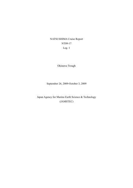
NATSUSHIMA Cruise Report NT09-17 Leg. 1 Okinawa Trough ...
NATSUSHIMA Cruise Report NT09-17 Leg. 1 Okinawa Trough ...
NATSUSHIMA Cruise Report NT09-17 Leg. 1 Okinawa Trough ...

You also want an ePaper? Increase the reach of your titles
YUMPU automatically turns print PDFs into web optimized ePapers that Google loves.
<strong>NATSUSHIMA</strong> <strong>Cruise</strong> <strong>Report</strong><br />
<strong>NT09</strong>-<strong>17</strong><br />
<strong>Leg</strong>. 1<br />
<strong>Okinawa</strong> <strong>Trough</strong><br />
September 26, 2009-October 3, 2009<br />
Japan Agency for Marine-Earth Science & Technology<br />
(JAMSTEC)
Contents<br />
1. <strong>Cruise</strong> Information<br />
1.1 <strong>Cruise</strong> number<br />
1.2 Name of Vessel<br />
1.3 Title of the cruise<br />
1.4 Titles of the proposals<br />
1.5 <strong>Cruise</strong> period<br />
1.6 Ports of call<br />
1.7 Research area<br />
1.8 Research map<br />
2. Researchers<br />
2.1 Chief Scientist<br />
2.2 Representatives of the science party<br />
2.3 Science party<br />
3. Observation<br />
Part 1. Analysis of invertebrates including sponges inhabiting on the sea knoll around<br />
Tokara Archepelago as the cell-biological and biochemical resources (Shigeki<br />
Matsunaga and co-workers)<br />
Purpose, objectives, and background<br />
Observations and activities<br />
Methods<br />
Research results<br />
Future plan<br />
Associated research activities by collaborators<br />
1. Isolation of sponge-associated microorganisms by Yuichi Nogi<br />
2. Metagenomic analysis of Deep-Sea Marine Sponge-associated Bacteria by<br />
Takeshi Terahara<br />
3. Isolation of sponge-associated Actinomycetes by Yousuke Kamiya<br />
4. Taxonomy of deep-sea sponges collected from Tokara Islands by Yuji Ise<br />
Part 2. Ultra-high resolution bathymetric and volcanic-activity mapping on gigantic<br />
seafloor caldera (Hidenori Kumagai and co-workers)<br />
Introduction and background<br />
Survey contents<br />
Sumary of principal survey results<br />
Bathymetry
Hyperd Dolphyn Surveys<br />
Future Works<br />
Summary<br />
References<br />
Part 3. Marine geology and tectonics in the area between the <strong>Okinawa</strong> and Miyako<br />
islands (Kosaku Arai and Hideaki Machiyama)<br />
Introduction and background<br />
Research area<br />
Survey contents<br />
Summary of principal cruise results<br />
Bathymetric surveys<br />
Future Studies
1. <strong>Cruise</strong> Information<br />
1.1 <strong>Cruise</strong> number:<br />
<strong>NT09</strong>-<strong>17</strong>, <strong>Leg</strong> 1<br />
1.2 Name of Vessel<br />
R/V Natsushima<br />
ROV Hyper-Dolphin<br />
1.3 Title of the cruise<br />
<strong>Okinawa</strong> <strong>Trough</strong><br />
1.4 Titles of the proposals<br />
(1) Analysis of invertebrates including sponges inhabiting on the sea knoll<br />
around Tokara Archepelago as the cell-biological and biochemical resources<br />
(2) Ultra-high resolution bathymetric and volcanic-activity mapping on<br />
gigantic seafloor caldera<br />
(3) Marine geology and tectonics in the area between the <strong>Okinawa</strong> and Miyako<br />
Islands<br />
1.5 <strong>Cruise</strong> period<br />
September 26, 2009-October 3, 2009<br />
1.6 Ports of call<br />
Hakata (departure) - Naha (arrival)<br />
1.7 Research area<br />
Central part of Tokara Archipelago: surrounded by the following lines of<br />
longitudes and latitudes: 28°50.0’N, 128°50.0’E, 29°30.0’N, 129°35.0’E.<br />
Miyako Sea-knoll: surrounded by the following lines of longitudes and<br />
latitudes: 25°10.0’N, 125°35.0’E, 25°35.0’N, 126°00.0’E.<br />
1.8 Research map<br />
See Figures 1 and 2 as well as Figures 1.1-1.4 and 2-3 for the research map.<br />
2. Researchers<br />
2.1 Chief Scientist:<br />
Shigeki Matsunaga (The University of Tokyo)<br />
2.2 Representatives of the science party<br />
Hidenori Kumagai (JAMSTEC), who could not attend the cruise.<br />
Kousaku Arai (National Institute of Advanced Industrial Science and<br />
Technology, AIST)
Figure 1. Central part of Tokara Archipelago<br />
Figure 2. Miyako Sea-knoll
2.3 Science party<br />
Name<br />
Shigeki Matsunaga<br />
Tetsuya Miwa<br />
Mitsugu Kitada<br />
Yoshiteru Kume<br />
Yuichi Nogi<br />
Hitoshi Ouki<br />
Takeshi Terahara<br />
Yousuke Kamiya<br />
Yuji Ise<br />
Kanto Suzuki<br />
Tukasa Takeda<br />
Kiminori Shitashima<br />
Tatsuhiro Fukuba<br />
Kousaku Arai<br />
Hideaki Machiyama<br />
Tsuyoshi Kurashima<br />
Affiliation<br />
The University of Tokyo<br />
JAMSTEC<br />
Enoshima Aquarium<br />
JAMSTEC<br />
JAMSTEC<br />
JAMSTEC<br />
Waseda University<br />
OP Bio Factory<br />
The University of Tokyo<br />
The University of Tokyo<br />
The University of Tokyo<br />
CRIEPI<br />
The University of Tokyo<br />
AIST<br />
JAMSTEC<br />
Nagoya University<br />
3. Observation<br />
This section consists of three independent researches, whose results are<br />
presented in three parts in the following sections.
Part 1.<br />
Analysis of invertebrates including sponges inhabiting on the sea knoll around Tokara<br />
Archepelago as the cell-biological and biochemical resources<br />
Shigeki Matsunaga (The University of Tokyo)<br />
Purpose, objectives, and background<br />
Marine invertebrates, especially sponges, tunicates, and corals, frequently<br />
contain secondary metabolites whose architectures are totally different from those from<br />
terrestrial organisms. Some members of such compounds exhibit extraordinary<br />
biological activities, which is the basis of their utilization as medicinal agents and<br />
agrochemicals. More than 15,000 natural products have been discovered from marine<br />
organisms, most of which have been isolated as the major constituents of those<br />
inhabiting in shallow waters. On the other hand, microorganisms isolated in marine<br />
environment attract attention of natural product chemists as sources of novel secondary<br />
metabolites. Many invertebrates are in symbiotic relationship with diverse sets of<br />
microbes, whose constitution differs from species to species. These symbionts are<br />
known to be involved in the production of marine natural products.<br />
Both macroorganisms and microbes in Japanese waters have been intensively<br />
studied for the past 30 years. Therefore, it is hard to discover untouched organism<br />
around Japanese shallow waters. In deep waters, the organisms are thinly populated and<br />
it appears to be difficult to collect materials sufficient for isolating secondary<br />
metabolites.<br />
In our previous experience the top of sea knolls are shown to be densely<br />
populated by sponges as shown by dredging these areas. The populations of sponges are<br />
totally different from those in shallower waters. One of the most prominent sea knolls is<br />
Oshima-shinsone located in the Tokara Archepelago, where huge amounts of sponges<br />
are invariably collected by each dredging operation. We have isolated interesting<br />
compounds from the sponges collected there. It is also expected that such sponges<br />
contain unique symbionts.<br />
The depths of the top of the sea knolls range between 200-400 m which are<br />
too deep for scuba diving. It is impossible to study the organisms inhabiting there in<br />
detail, because it is not possible to recollect the same organisms by dredging. Therefore,<br />
we propose to observe the top of sea knoll and collect rare organisms using ROV. There<br />
are many sea knolls in the Tokara Archipelago which become the collection sites for this
cruise.<br />
Methods<br />
Observations were conducted by high-vision camera and collection by<br />
Hyper-dolphin: Operation dates and sites: 29 Sep. 2009 (#1058 and #1059) at<br />
Oshima-shinsone 1 Oct. and 2 Oct. at Miyakosone (#1060 and #1061, respectively).<br />
Collected sponges were preserved or processed for metagenomic analysis (Terahara),<br />
culturing symbionts (Nogi and Kamiya), taxonomical study (Ise), and isolation of<br />
secondary metabolites (Matsunaga). Invertebrates were continuously observed by high<br />
vision camera throughout the paths of Hyper-dolphin, collected, and kept alive for cell<br />
culture study (Miwa).<br />
Research results<br />
The following biological specimens were collected.<br />
Dive #1058: 32 sponges and one okinaebisu.<br />
Dive#1059: 12 sponges and one okinaebisu.<br />
Dive #1060: <strong>17</strong> sponges.<br />
Dive #1061: 21 sponges.<br />
Future plan<br />
Biologically active compounds especially those with antitumor activity will<br />
be isolated from the sponges by Matsunaga. Metagenomes of sponges will be disclosed<br />
by Terahara and his co-workers. Associated microorganisms will be isolated and<br />
subjected to further study by Nogi and Kamiya and his co-workers. Cell lines of marine<br />
invertebrates will be established by Miwa.<br />
Research area<br />
For the details of research areas in dives #1058-1061, see Figures 1.1-1.4.
Figure 1.1 Dive #1058.
Figure 1.2 Dive #1059.
Figure 1.3 Dive #1060.
Figure 1.4 Dive #1061.
Associated research activities by collaborators are described below.<br />
1. Isolation of sponge-associated microorganisms by Yuichi Nogi<br />
1.1. Purpose of the research.<br />
Isolate the useful microorganism on the deep water, deep-sea organism and<br />
sediment. Isolate the new microorganism such as actinomycete and fungi.<br />
The chitin and cellulose, etc. are natural resources that exist most abundantly on<br />
the earth. However, these resources are not used too much effectively. To use these<br />
unused resources effectively, a good enzyme is needed. We are searching for the new,<br />
useful enzyme production bacterium for that. Moreover, quite new actinomycete and<br />
fungi are isolated, and they are used as a biotechnology resource.<br />
1.2. Execution item<br />
Isolation of useful microorganism that resolves chitin, cellulose, etc. are tried<br />
from deep water, deep-sea organism and sediment. In addition new microorganism such<br />
as actinomycete, fungi, and the difficult culture microorganisms are isolated. In addition,<br />
we try the isolation of the new microorganism such as actinomycete, fungi, and the<br />
difficult culture microorganisms.<br />
1.3. Technique and observation equipment<br />
Sampling by sterilizing mud sampler and collection of sponge by manipulator.<br />
1.4. Observational result and execution result<br />
All gathered samples were described to the meta data sheet. Each sample was<br />
homogenized and spread on the chitin and cellulose, etc. plate, medium for<br />
actinomycete and fungi. These are cultured at each temperature now.<br />
1.5. The future plan<br />
The isolated microorganism is identified. A detailed identification experiment is<br />
conducted to novel strain. The production enzymes of each strains are examined. When<br />
a useful enzyme and a new material are found, a more detailed analysis is done with the<br />
co researcher.<br />
* List of instrument used<br />
Sterilizing mud sampler<br />
When searching for microorganism lives to a specific place in the deep-sea, it is
necessary to prevent the microorganism being mixed other than the field setting. It is<br />
necessary to use the sterilized apparatus for that. It is necessary to prevent the<br />
microorganism from the outside being mixed during the round trip to the point. The<br />
device developed for that is a sterilizing mud sampler. This sampler uses the<br />
centrifuging tube of 50ml on the market. The part where the centrifuging tube was<br />
installed is sealed up, the pressure adjustment with the outside is done through the filter<br />
of 0.22m, it is possible to gather it without mixing of the microorganism of other<br />
points.<br />
2. Metagenomic analysis of Deep-Sea Marine Sponge-associated Bacteria by Takeshi<br />
Terahara<br />
2.1 Objective<br />
Marine invertebrates especially sponges are noteworthy for their unmatched<br />
diversity of secondary metabolites. During this process, many microorganisms are taken<br />
up and digested by phagocytosis or harbored as symbiontic consortia. However,<br />
standard culturing techniques support the growth of less than 1% of the bacterial found<br />
in the environment. Metagenomic analysis is proven to be a powerful tool for mining<br />
the diverse environmental microorganism resources. Thus the present study is an<br />
attempt to analyze metagenomics of deep-sea marine sponge-associated bacteria.<br />
2.2 Material and Methods<br />
Marine sponges were collected at 100-200 m depth from Ohshima Shinsone (28°53′N,<br />
129°32′E) and from Miyakosone (25°26′N, 125°44′E). Sponges were diced into small
pieces and mechanically homogenized into cell suspension by a juicer in a TNE buffer<br />
(10 mM Tris, 3.5% NaCl, 50 mM EDTA-2Na, pH 7.5). The cell suspension was first<br />
filtered by nylon mesh (100 µm pore size) and centrifuged at 700 g for 5 min to get rid<br />
of the sponge debris and dirt. The suspension was then centrifuged at 3,500 g for 5 min<br />
to concentrate the bacteria. The bacterial pellets were stored at 4°C and -20°C.<br />
2.3 Future plan<br />
Much of the interest in metagenomics comes from the discovery that the vast majority<br />
of microorganisms had previously gone unnoticed. We have an attempt to analyze<br />
metagenomics of deep-sea marine sponge-associated bacteria using DNA sequencing<br />
based on 16S rRNA genes.<br />
3. Isolation of sponge-associated Actinomycetes by Yousuke Kamiya<br />
3.1 Introduction<br />
Recently, the actinomycetes living in marine sponges (Porifera) attract our attention as a<br />
new source of various bioactive compounds. We have been investigated the<br />
actinomycetes living in sponges and other marine invertebrates that inhabit shallow sea<br />
area around <strong>Okinawa</strong> (<strong>Okinawa</strong>’s Main Island and Yaeyama Islands). In this survey, we<br />
aimed to isolate actinomycetes from deep-sea sponges and evaluate them as an isolation<br />
source for actinomycetes.<br />
3.2 Purpose of the research<br />
Isolation of actinomycetes from deep-sea sponges, and the evaluation of deep-sea<br />
sponges as an isolation source for actinomycetes<br />
3.3 Materials and methods<br />
Twelve deep-sea sponges collected by a deep submergence search vehicle<br />
"Hyper-Dolphin", Japan Agency for Marine-Earth Science and Technology (JAMSTEC)<br />
were provided by favor of JAMSTEC. Approximately 10 g of the sponge was grinded<br />
by a mixer with 10 ml of sterilized sea water. The suspension was diluted with sterilized<br />
sea water to make 10% diluted solution. The diluted solution was applied onto agar<br />
medium plates with a sterilized cotton swab. The plates were incubated at 27 for 2<br />
weeks. The plates were observed under a microscope, and actinomycetes were isolated<br />
by transferring a small piece of colonies with a sterilized needle.
3.4 Results and discussion<br />
Only an isolate of actinomycetes was isolated from the 12 deep-sea sponges treated in<br />
this study. This suggests that deep-sea sponges might be inadequate for isolating a<br />
number of actinomycetes isolates. However, because the number of actinomycete<br />
isolates from sponge often changes drastically depend on the samples, further studies<br />
are needed before reaching a final conclusion.<br />
3.5 Future plan<br />
We should isolate actinomycetes from more deep-sea sponges.<br />
3.6 Equipment list<br />
Mixer: Tescom Corporation "Mill & Mixer"<br />
Microscope: Olympus BX41N-32-PH<br />
4. Taxonomy of deep-sea sponges collected from Tokara Islands by Yuji Ise<br />
4.1 Purpose, objectives, and background<br />
Sponges (Phylum Porifera) are an ecologically important and highly diverse<br />
component of marine benthic communities, ranging from the intertidal to the deep-sea.<br />
Aside from their importance to reconstruct metazoan phylogenetics, and their enormous<br />
commercial, pharmaceutical and biotechnological potentials increasingly recognized,<br />
yet many aspects of their basic biology remain enigmatic. Taxonomy of sponges offers<br />
an important basement for these applied sciences however Japanese sponge fauna has<br />
not been proceeded for 20 years since Tanita & Hoshino (1989). Moreover, sponge<br />
fauna around Tokara islands are totally unknown. Unveiling biodiversity of sponges in<br />
this area will greatly contribute to related field dealing with sponges (e.g. ecology,<br />
symbiotic bacteria, secondary metabolites).<br />
4.2 Materials and Methods<br />
The sponges were collected during the NT-09-<strong>17</strong>, <strong>Leg</strong>2 cruise of the RV Natsushima of<br />
the Japan Agency for Marine-Earth Science and Technology (JAMSTEC) carried out 26<br />
September –3 October 2009. This cruise was organized as part of the research program<br />
“Analysis of invertebrates including sponges inhabiting on the sea knoll around Tokara<br />
Archepelago as the cell-biological and biochemical resources.” The sponges were<br />
collected by remotely operated vehicle ROV Hyper-Dolphin (Dives#1058–1061). Under<br />
water pictures were taken by high vision camera of ROV. The specimens were
preserved in 90% ethanol soon after landing of ROV on the deck and taking picture of<br />
the specimen. Subsequent morphological description and molecular phylogeny will be<br />
conducted in the laboratory.<br />
4.3 Results<br />
The following sponge specimens were obtained. Dive #1058: 32 samples. Dive#1059:<br />
12 samples. Dive #1060: <strong>17</strong> samples. Dive #1061: 21 samples. Most sponges are<br />
probable undescribed species or new records from Japan because this cruise was the<br />
first survey in this area. Blue color sponges never found from Japanese waters were<br />
collected during Dive #1058. Preliminary study revealed these blue sponges contained<br />
number of unknown species such as Plakina sp. Blue color Plakina species has never<br />
been found from the world, thus is considered as possible undescribed species.<br />
4.4 Future work<br />
Taxonomic study including morphological description and molecular phylogenetics<br />
about sponges collected in this cruise is in progress. In this cruise, we mainly collected<br />
large sponges however more number of small sponges was observed during the Dives.<br />
Next project aiming for collecting these small sponges will be inevitable for<br />
comprehensive understanding of sponge fauna in the area. Combined dataset of sample<br />
image in situ, sample itself, morphological description and molecular data of the sponge<br />
will be very useful for related study dealing with sponges.
Part 2<br />
Ultra-high resolution bathymetric and volcanic-activity mapping on<br />
gigantic seafloor caldera<br />
Hidenori KUMAGAI, Inst. For Research on Earth Evolution (IFREE), JAMSTEC<br />
Hisayoshi YOKOSE, Kumamoto Univ.<br />
Kiminori SHITASHIMA, CRIEPI<br />
Tatsuhiro FUKUBA, IIS, Univ. Tokyo<br />
Introduction and Background<br />
Distribution of gigantic calderas on the Japan Arc is limited in its both ends; from<br />
western Hokkaido toward Kuril Islands and from Aso volcano to Kikai submarine<br />
caldera. Recently, Yokose (2007) pointed it out that distribution of such calderas<br />
possibly extends to the area western off Amami-Oshima centered as 28°30’N, 128°38’E,<br />
using gridded bathymetry compiled by JCG or by Kisimoto (2000). Here after, this<br />
potential caldera western off Amami-Oshima is referred as “Amami Caldera.”<br />
Geochemical composition of magma, observed at such caldera forming volcanoes,<br />
generally shows evolved silicic compositions. Durations of volcanic activity of such<br />
silicic caldera is anticipated to fairly long, up to a few tens of million years both<br />
observations or by modelings (e.g. Kaneko and Koyaguchi, 1996). This infers that the<br />
hydrothermal activity has also long lives in such volcanoes.<br />
In terms of the hunting of hydrothermal activities, to locate the sources of<br />
hydrothermal plumes do so far require huge effort composed by the several tens of<br />
submersible/ROV dives. Recently, acoustic detections of methane bubbling or<br />
hydrothermal plumes are reported (Schneider von Deimling et al. 2007; Gardner, 2009),<br />
which could be applied to such mappings.<br />
Research Area<br />
Takarajima and associating islet are on the quarternaly volcanic front of the Tokara<br />
Islands, northern part of Nansei-Shoto island arc. Study area of Hyper-dolphin dives<br />
consists of the two parts: post caldera cones inside of Takarajima caldera, and a<br />
no-name small cone on the southwestern flank of Takarajima volcano. Bathymetric<br />
survey was also carried out along the estimated quarternaly volcanic front.<br />
Survey contents<br />
Bathymetric surveys were carried out in and around Takarajima caldera, and present<br />
days’ volcanic front from north of Takarajima via Yokoatejima to inferred Amami<br />
caldera (Figure 2-1). Hyper-dolphin observations were carried out to clarify the detailed<br />
volcanology and hydrothermal activity of Takarajima caldera.<br />
Summary of Principal Survey Results<br />
Bathymetry<br />
Using ship-equipped multi narrow beam echo sounder, Seabat8160 of R/V<br />
Natsushima, totally approx. 10 hours bathymetric survey was carried out as four survey<br />
lines (Table x_1). Although limited swath of single or double track of the survey lines,<br />
some of volcanic features were observed. In addition, two box surveys were carried out<br />
as the pre-dive surveys: one includes two post-caldera cones in the Takarajima caldera,<br />
the other does Nigori-Sone (28°56'N, 129°6.5’E). Detailed analysis of the bathymetric<br />
data will be done at Kumamoto Univ. and JAMSTEC on the aspect of the submarine<br />
volcanology and disaster mitigation.
Hyper Dolphin Surveys<br />
Dive <strong>Report</strong> of Hyper Dolphin<br />
Dive Number: HPD#1056<br />
Date: September 28, 2009<br />
Place: Inside of Takarajima-caldera<br />
Landing: 29°12.947'N, 129°13.535E, WD = 400m<br />
Leaving: 29°13.155'N, 129°13.727E, WD = 384m<br />
Samples: 1 core (MBARI-type), HPD#1056-S01<br />
Payloads: Seabat7125, Geochemical Sensors (pH, pCO2, ORP, Gamma Ray).<br />
According to the 500m-grided digital bathymetric data provided from JCC,<br />
Takarajima, Kodakarajima and associated islet are on the rim of the Takarajima caldera<br />
having 80km 3 of volume. In this dive, sea bottom observation of post-caldera cone<br />
within the Takarajima caldera was carried out. During the traverse, acoustic, chemical<br />
and biological plume detection was also tried; assemblages of payloads are shown in<br />
Plates 2-1 and 2-2. For the acoustic mapping, Seabat7125 was used as its side-scan<br />
mode. The dive started from one of the peaks on the post-caldera cone of 1.5-km in the<br />
diameter. Around the landing point, sea floor was covered by the light-colored,<br />
less-sorted gravels (Plate 2-3). They were firmly cemented and hardly sampled. After<br />
the observation, acoustic recording of SeaBat7125 side-scan mode were started. The<br />
course of the acoustic survey was set as firstly northward, then, turned to eastward on<br />
the peak at northwestern corner. Finally, the vehicle approached another peak located on<br />
the northeastern corner of the cone, and landed again. Length of acoustic survey was 76<br />
min. Very weak reflection was recorded in the survey, of which analysis is still on-going<br />
(Figure 2-2). Seafloor of the second landing point was also covered by cemented<br />
gravels (Plate 2-4). Such gravels were sampled using MBARI-type sampler<br />
(HPD#1056-S01). On the post caldera cone, no apparent hydrothermal activity was<br />
found on visual observation. Detailed analysis of geochemical sensors is still on-going.<br />
Dive Number: HPD#1057<br />
Date: September 28, 2009<br />
Place: Small Cone on Southwestern flank of Takarajima-caldera<br />
Acoustic survey commencement: 29°05.357'N, 129°10.637E, Depth = 284m, Alt = 22m<br />
Landing: 29°05.384'N, 129°10.668E, WD = 306m<br />
Leaving: 29°05.390N, 129°10.524E, Depth = 256m, Alt = 46m<br />
Samples: water in Niskin bottle<br />
Payloads: Seabat7125, Geochemical Sensors (pH, pCO2, ORP, Gamma Ray),<br />
Biological Sensor (ISSA-Gene)<br />
In this dive, acoustic plume mapping coupled w/chemical and biological sensors was<br />
carried out on the small no-name cone on the southern flank of Takarajima-caldera. The<br />
dive intended to gridded mapping of hydrothermal plumes, however, the strong bottom<br />
current flowing inverse to the surface current prohibited such systematic survey (Figure<br />
2-3). Only 1-hour survey forming separated two parallel lines of 200m and 300m in<br />
length was allowed with 20-50m of altitude from the sea bottom. During the survey, any<br />
significant anomalies were not recorded either acoustic sonar or chemical sensors<br />
although the equipments worked well (Figure 2-4). Poorly sorted light colored gravels<br />
were also observed at the landing point. Sea water was also sampled near the landing<br />
point.<br />
Future Works<br />
Bathymetric data will be analyzed at Kumamoto Univ. and JAMSTEC on the the
submarine volcanology and disaster mitigation. Feasibility study of advanced plume<br />
mapping will be done at CRIEPI, IIS of Univ. Tokyo and JAMSTEC. Water sample will<br />
be analyzed at IIS, Univ. Tokyo, coupled with the data obtained in <strong>Leg</strong>2.<br />
Summary<br />
No active hydrothermal activities were found in and around Takarajima caldera.<br />
Poorly sorted and fairly cemented gravels indicates inactive features of the volcano at<br />
least near the landing points.<br />
References<br />
Gardner (2009) EOS Trans, 90, 275.<br />
Kaneko and Koyaguchi (2006) Memoires of Geological Society of Japan, 46, 29-41.<br />
Kisimoto (2000) GSJ open files 353.<br />
Schneider von Deimling et al. (2007) Geochem. Geophys. Geosyst., 8, Q06004.<br />
Yokose (2007) Monthly Chikyu (Gekkan Chikyu), 29(9), 561-569.<br />
Plate 2-1: Front view of payloads for HPD#1057 dive.
Plate 2-2: Rn-sensor (CRIEPI) and back view of HyperDolphin where the sensor was<br />
attached<br />
Plate 2-3: Sea floor image at the first landing point of HPD#1056. At this point, the<br />
coring was failed.
Plate 2-4: Sea floor image at the second landing point of HPD#1056.<br />
Fugure 2-1: Bathymetry obtained in the cruise.<br />
Figure 2-2: Acoustic image recorded by the side-scan mode of Seabat7125 equipped on<br />
Hyper-dolphin. The yellow colored saturated reflection is those from seafloor. Within<br />
the water column, weak reflection is occasionally recorded (red circle).
Figure 2-3: Acoustic, geochemical and biological survey track in the HPD#1057 dive.<br />
Figure 2-4: Raw data plot of pH sensor at the dives HPD#1056 and 1057.<br />
Table 2-1. Survey lines for bathymetry<br />
Lat.(deg) Latm (min) Long.(deg) Long.m (min)
Line 1 Start 29 30 129 16<br />
Line 1 End 29 <strong>17</strong>.5 129 12<br />
Line 2 Start 29 6 129 10.5<br />
Line 2 End 28 51 129 1<br />
Line 3 Start 28 51.2 129 2<br />
Line 3 End 29 6 129 11.1<br />
Line 4 Start 28 47 128 59<br />
Line 4 End 28 30 128 38
Part 3<br />
Marine geology and tectonics in the area between the <strong>Okinawa</strong> and Miyako islands<br />
Geological Survey of Japan (GSJ), National Institute of Advanced Industrial Science<br />
and Technology (AIST)<br />
Kohsaku ARAI<br />
Kochi Institute for Core Sample Research, JAMSTEC<br />
Hideaki MACHIYAMA<br />
Introduction and Background<br />
The Ryukyu Island Arc extends from Kyushu to Taiwan, a distance of 1200 km, along<br />
the Ryukyu Trench where the Philippine Sea Plate is subducting beneath the Eurasian<br />
Plate (Fig. 1). The <strong>Okinawa</strong> <strong>Trough</strong>, a back arc basin (Shinjo et al., 1999), formed<br />
behind the Ryukyu Island Arc in the late Pliocene to early Pleistocene (Sibuet et al.,<br />
1998 and Park et al, 1998). The formation of the <strong>Okinawa</strong> <strong>Trough</strong> is strongly related<br />
with tectonics of the Ryukyu Island Arc and assigns to the complicate uplift and/or<br />
subsidence on the Islands. Previous onland surveys of the coral reef terrace such as<br />
Kikai Island led to the detailed sea-level study of inter-glacial ages (Omura, 1988). If<br />
the study of the subsidence offshore areas should recorded the detailed glacial ages sea<br />
level changes. The surveys between <strong>Okinawa</strong> and Miyako islands aim to reveal geology<br />
and tectonic setting of the Miyako-Sone that infer subsidence terrace.<br />
Figure 1: Bathymetric map of the Ryukyu Island Arc. Note the study area of<br />
Miyako-Sone located on the part of the Ryukyu Island Arc.
!($$<br />
!)$$<br />
!#$$<br />
Research area:<br />
Study area of the northwestern Zyuho-Sone located on the part of the Ryukyu Island<br />
Arc (50-60 km northeastern from Miyako Island). The area of shallower than couple<br />
hundred meters in water depth is widely developed between Miyako and <strong>Okinawa</strong><br />
Islands including the Zyuho-Sone. In this report, the “Miyako-Sone” are used widely<br />
means of this shallower area including the Zyuho-Sone. The Miyako-Sone is<br />
approximately 130 km long and 60 km wide in the northeast to southwest direction that<br />
bounded by the steep slope to the Kerama Gap and to the Miyako Saddle.<br />
Survey contents<br />
Bathymetric surveys and Hyper-dolphin submersible observation studies were carried<br />
out on <strong>NT09</strong>-<strong>17</strong> cruise to clarify the detailed geology and tectonics of the Miyako-Sone<br />
area.<br />
Summary of principal cruise results<br />
Bathymetric surveys<br />
Bathymetric surveys are concentrated on the Zyuho-Sone area (Fig. 2). Bathymetric<br />
data were collected using a SeaBat 8160 multi-narrow beam echo-sounder system,<br />
which has frequency of 50 kHz beams and a swath width of 150˚.<br />
!"#$$ !"$$$ !#$$ $<br />
,-./012.30<br />
"#$%&*'4<br />
!"#$%&#'(<br />
!"#$%)*'(<br />
!"#$%)#'(<br />
!"#$%#*'(<br />
"#$%&*'+<br />
!&$$<br />
!#$$<br />
!%$$<br />
!'$$<br />
!($$<br />
!"$$$<br />
!)$$<br />
!*$$<br />
!+$$<br />
!"#$$<br />
!"%$$<br />
!"&$$<br />
!"'$$<br />
!""$$<br />
"#$%"#'4<br />
!"$$$<br />
!($$<br />
!)$$<br />
!*$$<br />
"<br />
!#$$<br />
!%$$<br />
!&$$<br />
#<br />
!&$$<br />
*<br />
"" "&<br />
"#<br />
(<br />
!'$$<br />
!"$$<br />
"#$%"#'+<br />
!+$$<br />
!"&$$<br />
!"'$$<br />
!""$$<br />
!"$$<br />
&<br />
!%$$<br />
!+$$<br />
!&$$<br />
!'$$<br />
!"$$$<br />
"#$%"*'4<br />
!*$$<br />
"#$%"*'+<br />
%<br />
+<br />
) "$ "'"%<br />
!"$$<br />
!""$$<br />
'<br />
"#$%!#'4<br />
!"#$%&#'(<br />
!"#$%)*'(<br />
!"#$%)#'(<br />
51<br />
!"#$%#*'(<br />
"#$%!#'+<br />
$ #<br />
Figure 2: Bathymetric survey lines of the Miyako-Sone area (survey plan).<br />
Hyper-dolphin submersible observation is detailed in below.
Future studies<br />
1. We will make detailed study on rock samples, which were corrected Dive # 1060 and<br />
1061 (GSJ-AIST, JAMSTEC, Nagoya Univ. and Univ. Kumamoto).<br />
2. Bathymetric data will analyze at GSJ-AIST. This result will be use for future seismic<br />
reflection and ROV surveys.<br />
3. This results will use for IODP proposal (COREF project).<br />
Title: Coral-reef Front Migration in the Ryukyu Arc: Responses of high latitude coral<br />
reefs to Quaternary climatic changes in North Western Pacific (H. Matsuda et al.)<br />
Hyper-dolphin Surveys<br />
Dine <strong>Report</strong> of Dive # 1060<br />
Date: October 1, 2009<br />
Place: Miyako-Sone<br />
Landing: 25-26.777N, 125-42.520E, 519 m in water depth<br />
Leaving: 25-27.048N, 125-44.444E, 121 m in water depth<br />
Samples: 3 cores, 10 rocks and sponges (detailed in Table)<br />
Extra 2 cores and 3 rocks are also corrected Dive #1061<br />
The ROV sea bottom observation was carried out using “Hyper Dolphin” dive #1060 to<br />
clarify the geology on cliff of Miyako Saddle (Fig. 3). The dive #1061 was also carried<br />
out part of the same location of #1060. The track starting from cliff of Miyako Saddle<br />
520 m in water depth and up to the flat floor of Miyako-Sone about 121 m in water<br />
depth. The dive traverse based on the detailed bathymetric mapping on this cruise (Fig.<br />
3).
500<br />
400<br />
200<br />
0930miyako_sone30_cl5a3.ps<br />
125 42'E<br />
125 44'E<br />
125 46'E<br />
25 28'N 25 28'N<br />
600<br />
300<br />
25 26'N 25 26'N<br />
400<br />
500<br />
0 1 2<br />
25 24'N 25 24'N<br />
km<br />
125 42'E<br />
125 44'E<br />
GMT 2009 Oct 01 14:44:05 comment 0930miyako_sone30.grd Grid_int 30m Contour_int 5m Mercator Projection<br />
125 46'E<br />
90 190 290 390 490 590 690 790 890 990<br />
Depth<br />
m<br />
Figure 3: Bathymetric map around dive area. Red circles show the location of interested<br />
cliffs.<br />
A sandy flat seafloor (Fig. 4) shows sand ripples and extends around landing area. Core<br />
samples (C-1 and C-2) were corrected at 25-26.777N, 125-42.520E (519 m).
Figure 4 Image of seafloor of sandy area (2009/10/1 08:53 JST)<br />
Figure 5 Image of sea floor of about 410 m in water depth. Many rocks observed on this<br />
area (2009/10/1 09:40 JST). Note the encrusted sponges and other biota is not so much<br />
in this area.
Rock sample (R-1) was corrected at 25-26.644N, 125-42.480E (415 m). Shallower than<br />
this area, many rocks are scatter on the sea floor (Fig. 5). The rocks may come from the<br />
outcrop of about 400 m in water depth (Fig. 6). Rock samples (R-2 R-3 and R-4) are<br />
corrected from the outcrop (R-2: 25-26.624N, 125-42470E 403 m, R-3: 25-26.600N,<br />
125-42.466E 388 m, R-4: 25-26.412N, 125-42.538E 353 m). The cliff of the outcrop<br />
reaches more than 50 m high. After rock sample (R-5) was corrected at 25-26.315N,<br />
125-42.738E (3<strong>17</strong> m) the ROV moves from 11:40 JST (location 25-26.315N and<br />
125-42.738E 3<strong>17</strong> m) to 12:37 JST (location 25-26.670N and 125-43.608E 390 m).<br />
Figure 6 Image of sea floor of about 380 m in water depth. We found outcrops on this<br />
area (2009/10/1 10:10 JST).<br />
Same sandy seafloor extends around second landing area. Core sample (C-3) was<br />
corrected at 25-26.670N, 125-43.608E (390 m). Sand ripple are well observed in this<br />
area and larger scaled sand wave (several ten meters scale) also observed. The<br />
directions of sand wave infer the ENE-WSW that direction cross to the Miyako Saddle.<br />
Rock sample (R-6) was corrected at 25-26.688N, 125-43.648E (393m) at sandy seafloor.<br />
Rocks increase around 350 m in water depth (13:56 JST), subsequently, the outcrops as<br />
Fig. 8 were found. Outcrop is covered by modern sediment. Rock samples (R-7 and<br />
R-8) ware corrected about 200 m in water depth (R-7: 25-26.819N, 125-44.346E 204 m<br />
and 199 m). The steep slope changes slightly flat at 140 m in water depth (Fig. 3). Core<br />
sample (C-4) and Rock sample were corrected at 25-26.928Nm 125-44.371E (131 m).<br />
Outcrop is covered by modern thin sediment same as the area below 140 m in water<br />
depth, however, the encrusted sponges and other biota decrease compare the previous<br />
outcrop.
Figure 7 Image of seafloor of sandy area (2009/10/1 13:09 JST)<br />
Figure 8 Image of outcrops about 200 m in water depth (2009/10/1 14:46 JST)
Figure 9 Image of outcrops about 190 m in water depth (2009/10/2 09:10 JST)<br />
Finally, many Rodolith covered seafloor at area about 120 m in water depth (Fig. 10).<br />
Same modern distribution of Rodolith around <strong>Okinawa</strong> Island was reported by Iryu et al.<br />
(1995). 8 pieces of Rodolith (sample R-10) were corrected at 25-27.048N, 125-44.444E<br />
(121 m).<br />
Summary:<br />
We found the carbonate outcrops that have formed steep cliffs and relatively flat sea<br />
floor was covered by sandy sediment. The mudstone correlated with such as the<br />
Shimajiri Formation (and other oldest Formation) is not found in Dive #1060 (above<br />
500 m in water depth). Top of the Miyako-Sone possibly shallower than140 m in water<br />
depth cropped out at inter-glacial stage and karstified the carbonate rocks should be<br />
occur in this stage. The results of submersible surveys show the possibility of<br />
subsidence on the study area. Detailed sample analyses include dating are let us know<br />
the geological subsidence history on the Miyako-Sone area.
Figure 10 Image of Rodolith distributed area about 121 m in water depth (2009/10/1<br />
16:05 JST)<br />
References<br />
Iryu, Y., Nakamori, T., Matsuda, S and Abe, O. (1995) Distribution of marine<br />
organisms and its geological significance in the modern reef complex of the Ryukyu<br />
Island. Sedimentary Geology, 99, 243-258.<br />
Omura, A. (1988) Geological history of the Kikai Island, central Ryukyus, Japan:<br />
Summary of uranium-series dating of fossil corals from the Riukiu Limestone, Mem.<br />
Geol. Soc. Jap., 29, 253-268 (in Japanese with English abstract).<br />
Park, J.O., Tokuyama, H., Shinohara, M., Suyehiro, K. and Taira, A. (1998) Seismic<br />
record of tectonic evolution and backarc rifting in the southern Ryukyu island arc<br />
system. Tectonophysics, 294, 21-42<br />
Sibuet, J.C., Deffontaines, B., Hsu, S.K., Thareau, N., Le Formal, J.P., Liu, C.S. and<br />
ACT Party (1998)<br />
<strong>Okinawa</strong> <strong>Trough</strong> backarc basin: Early tectonic and magnetic evolution. J. Geophys. Res.<br />
103 (B12) 30245-30267<br />
Shinjo, R (1999) Geochemistry of high Mg andesites and the tectonic evolution of the<br />
<strong>Okinawa</strong> <strong>Trough</strong>-Ryukyu arc system. Chemical Geology 157: 69-88
'5212 6)7%&8 9"*0$%6"1" :"1)1;-% :2+?@? =A> B??CD>?D>&CEFG BHAB@D@GGI >BHAGBDGJ?K G>H&* BGLBBL>?&/*<br />
?@? =AB CEGJ BHAB@D@BGI >BHAGBDGO?K G?F&* BBL>@L>B&/*<br />
?@? =AF >?E?B BHAB@D@??I >BHAGBDG@@K FJJ&* BFL>FL>?&/*<br />
/"$/)3)%-&.%-)*%+1"(,&(2/4&M0%##$%P<br />
*;-.12+%&)+/$;-%-N<br />
34<br />
>?@? =AG >?EHB BHAB@DG>BI >BHAGBDHFJK FHF&* BOLB?L>?&/* #(2Q+).5&
?@? =AJ >GEHJ BHAB@DJ>CI >BHAGGDFG@K B?G&* JLHLF&/*<br />
?@? =AC >HEG> BHAB@DCBJI >BHAGGDFO>K >F>&* BGL>JLC&/*<br />
? >@E>> BHABOD?GJI >BHAGGDGGGK >B>&* J&0)%/%.P&HLHLHP&GLGLGP&%R (2-2$)15&M(%-N<br />
35<br />
>?@? SA?> CEG@ BHAB@D@BGI >BHAGBDGO?K G?F&* CLOLO&/*<br />
,%$$2Q).5& =A> B??CD>?DB&CEBH BHAB@DJFOI >BHAGGDFGHK >JO&* >BL>>LG&/*<br />
,%$$2Q).5& =AB CEGG BHAB@DJG>I >BHAGGDFGCK >JB&* >HL>>L@&/*<br />
#(2Q+).5&?@> SA>> CEFC BHAB@DJG>I >BHAGGDFGCK >JB&* B?LB?L>B&/*<br />
#(2Q+).5&