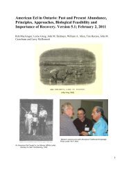
The Grand River - Lake Erie Connection - Great Lakes Fishery ...
The Grand River - Lake Erie Connection - Great Lakes Fishery ...
The Grand River - Lake Erie Connection - Great Lakes Fishery ...

Create successful ePaper yourself
Turn your PDF publications into a flip-book with our unique Google optimized e-Paper software.
<strong>The</strong> <strong>Grand</strong> <strong>River</strong> -<br />
<strong>Lake</strong> <strong>Erie</strong> <strong>Connection</strong><br />
From individual mandates toward<br />
cooperative management<br />
<strong>Great</strong> <strong>Lake</strong>s Urban Habitat<br />
Restoration Symposium,<br />
Chicago, January 2009<br />
Warren Yerex – <strong>Grand</strong> <strong>River</strong> Conservation Authority<br />
Tom MacDougall – Ontario Ministry of Natural Resources
Outline<br />
• Scope<br />
• Past Approaches<br />
• Taking a Step Back<br />
• Renewed Vision<br />
• Moving Forward
<strong>The</strong> <strong>Lake</strong><br />
• <strong>Lake</strong> <strong>Erie</strong>: three basins; gradients west to east: (nutrients,<br />
productivity, max depths /thermal habitat)<br />
• Eastern basin: oligotrophic (ultra) with cool and coldwater<br />
fish communities supporting both commercial and sport<br />
fisheries<br />
• Large urban centres: none on north shore; however<br />
significant urban influences exist<br />
West Central East<br />
“cool” “cool”/(cold) “cool” & “cold”
<strong>The</strong> Watershed<br />
<strong>The</strong> <strong>Grand</strong> <strong>River</strong><br />
Watershed<br />
• Largest tributary on Canadian<br />
side draining to <strong>Lake</strong> <strong>Erie</strong><br />
(approx. 25% of drainage)<br />
• Approx. 7000 sq km<br />
watershed made up of 7<br />
major sub-basins; area larger<br />
that PEI<br />
• One of the fastest growing<br />
regions in Canada<br />
• Major urban centres<br />
(Kitchener, Waterloo,<br />
Cambridge, Guelph,<br />
Brantford) occur > 80 km<br />
upstream from the lake
<strong>The</strong> Watershed<br />
• Largest area in central Canada<br />
dependant on groundwater and<br />
river for water supply<br />
• 350,000 use <strong>Grand</strong> R. as water<br />
supply<br />
• 750,000 put treated effluent into<br />
river<br />
• Population expected to grow<br />
(Green Belt, Places to Grow)<br />
from 950,000 (2008) to 1. 5<br />
million (2028)<br />
• Directed growth (province)<br />
concentrated in urban centres<br />
(20% of watershed)<br />
• 80% of land base is rural (large<br />
proportion intensive agriculture)
<strong>The</strong> <strong>Lake</strong>-Watershed <strong>Connection</strong><br />
• GR water chemistry indicators<br />
(nutrients) can be detected within the<br />
lake nearshore (>10 km)<br />
• Major contributor to loading<br />
basinwide<br />
• <strong>The</strong>rmal, Nutrient, Productivity,<br />
Forage (?) effects
<strong>The</strong> <strong>Lake</strong>-Watershed <strong>Connection</strong><br />
• <strong>Lake</strong> seiche notable upstream in river<br />
• <strong>River</strong> levels can increase ~2m<br />
• Inundated floodplain / wetlands<br />
• Measurable changes in water quality (chemistry / thermal regime)<br />
175.4<br />
175.2<br />
<strong>River</strong> elevation below dam (m)<br />
175.0<br />
174.8<br />
174.6<br />
174.4<br />
174.2<br />
174.0<br />
173.8<br />
173.6<br />
00:00 04:00 08:00 12:00 16:00 20:00<br />
December 1, 2004
<strong>The</strong> <strong>Lake</strong>-Watershed <strong>Connection</strong><br />
• <strong>Grand</strong> <strong>River</strong> has a “drowned” river mouth<br />
• <strong>River</strong> bed elevations < mean lake levels in lower 30+km of river<br />
• <strong>The</strong> lowest river reach IS (essentially) <strong>Lake</strong> <strong>Erie</strong><br />
180<br />
179<br />
178<br />
177<br />
176<br />
Elevation (m)<br />
175<br />
174<br />
173<br />
172<br />
171<br />
Dam Reservoir<br />
<strong>Lake</strong><br />
<strong>Erie</strong><br />
170<br />
169<br />
Elevation of <strong>River</strong> Bed<br />
168<br />
167<br />
166<br />
40<br />
Cayuga<br />
30<br />
20<br />
Dunnville<br />
10<br />
0<br />
Distance upstream from mouth (km)
Biotic <strong>Connection</strong>s<br />
Pic of walleye<br />
MAIN RIVER CHANNEL<br />
WETLANDS<br />
LAKE SHORELINE<br />
<strong>Lake</strong> <strong>Erie</strong><br />
• Main river channel as travel<br />
corridor and source of substrate<br />
for spawning migrations from<br />
lake<br />
• Main river channel and Wetlands<br />
as nursery habitat for juveniles of<br />
some lake-run species (walleye)<br />
• Wetlands produce forage for lakerun<br />
fish<br />
• Nutrients from river influence<br />
nearshore production<br />
• <strong>The</strong>rmal plume in nearshore<br />
influences lake shoal-spawning
Management Approaches<br />
• Environment Canada<br />
• Fisheries and Oceans Canada<br />
• Six Nations of the <strong>Grand</strong> <strong>River</strong><br />
• Ontario Ministry of Natural Resources<br />
• Ontario Ministry of the Environment<br />
• <strong>Grand</strong> <strong>River</strong> Conservation Authority<br />
• Ontario Federation of Anglers and Hunters<br />
• Municipalities<br />
• Local Conservation Clubs
Assessment / Restoration Pre-1998<br />
• Upper <strong>River</strong> Reaches<br />
• Stream habitat rehabilitation (local focus)<br />
• Some assistance to agricultural communities<br />
• Lower <strong>River</strong> Reaches<br />
• Creation of fishway at Dunnville dam<br />
• Introduction of spawning gravel below dam<br />
• Fish hatchery and stocking<br />
• Eastern Basin Fisheries<br />
• Eastern Basin managed as part of lake as a whole (Ontario)<br />
• Eastern Basin Water Quality<br />
• Periodic nearshore and offshore monitoring<br />
Picute of fishway
Watershed<br />
Re-Thinking the Context<br />
• Rural Water Quality Program (1998)<br />
• Broadens its focus<br />
• Surface water / Groundwater Model (1997)<br />
• Links water and processes throughout the watershed<br />
• <strong>Grand</strong> <strong>River</strong> Fisheries Management Plan („95-‟98)<br />
• Acknowledges the watershed/lake connectivity<br />
Provincial<br />
• <strong>Lake</strong> <strong>Erie</strong> Eastern Basin 5-Year Plan (1998)<br />
• Acknowledges the unique ecosystem and fish stocks of the eastern basin<br />
Federal<br />
• <strong>Lake</strong> <strong>Erie</strong> <strong>Lake</strong>wide Management Plan (2000)<br />
• Adopts ecosystem approach (beyond critical pollutants)
Measuring the <strong>Connection</strong><br />
Information Gaps<br />
• <strong>Lake</strong> : contributions from eastern basin nearshore,<br />
embayments, tributaries to yellow perch and walleye fisheries<br />
• <strong>River</strong>: fish community poorly understood<br />
• Condition of lower river and lake nearshore Habitat<br />
• Concrete example for LE LaMP<br />
(watershed/lake connection)<br />
• Funding from Environment Canada and<br />
Canada-Ontario Agreement (COA)<br />
• Multi-Partner approach
• 4 pictures of field crews etc
And the survey says:<br />
• <strong>Grand</strong> <strong>River</strong> / <strong>Lake</strong> <strong>Erie</strong> fishery links<br />
• Signs of walleye production ONLY in <strong>Grand</strong> <strong>River</strong> lower reach<br />
• Eastern basin yellow perch abundant in all north shore bays and tributary mouths<br />
EXCEPT <strong>Grand</strong> river<br />
• Hyper–Eutrophic: lower river each = extremely high nutrient loads<br />
• Urban inputs impact lower river reach and nearshore (seasonal importance<br />
urban /vs agriculture)<br />
• Dam more than just fish barrier:<br />
• Disconnection for sediment, natural hydrology<br />
• Reservoir blocks lake seiche<br />
• Reservoir amplifies eutrophic consequences = ANOXIA and temperature<br />
extremes<br />
• <strong>Grand</strong> <strong>River</strong> walleye stock genetically unique and unable to efficiently use<br />
fishway<br />
• Low habitat diversity (particularly plant communities)
Consequences<br />
• Links between nutrient loads, anoxia events and<br />
nearshore cladophora growth<br />
• Low diversity in the fish community<br />
• Some historic species extirpated (sturgeon,<br />
muskellunge)<br />
• <strong>Grand</strong> <strong>River</strong> Walleye stock significantly under<br />
producing<br />
• Wetlands not functional<br />
• Ecosystem Compromised
Hydrologic issues<br />
Low flows<br />
(climate, water taking/reservoir discharge)<br />
Increased retention times (dams)<br />
-reduced water<br />
column mixing<br />
-thermal structure<br />
with depth<br />
Period<br />
s<br />
of low<br />
oxygen<br />
High nutrients<br />
(point and non-point inputs of<br />
phosphorus/nitrogen)<br />
High sediment<br />
load<br />
(erosion / disturbed<br />
clay landscape)<br />
Total<br />
suspended<br />
solids<br />
Loading and Eroding issues<br />
reduced<br />
PAR at<br />
depth<br />
Planktonic<br />
algae<br />
(abundant)<br />
macrophytes (low)<br />
Deposition<br />
areas<br />
Zooplankton<br />
(large grazers absent)<br />
reduced<br />
habitat<br />
structure<br />
Substrate disturbing, plant<br />
uprooting, generalist fish<br />
species<br />
Benthic invertebrates<br />
(low diversity, pollution tolerant<br />
individuals)<br />
Freshwater<br />
Mussels<br />
(impacted?)<br />
Fish Community<br />
(low diversity, pollution<br />
tolerant individuals)<br />
Habitat<br />
Fragmentation<br />
Issues<br />
-reset of dynamic gradient (RCC)<br />
-Upstream areas separated from water<br />
level variation associated lake levels
Better informed restoration<br />
• Develop restoration priorities and plans within<br />
an ecological context.<br />
• Extent of problems<br />
• Severity of problems<br />
• Causation / sources of problems<br />
• Jurisdictions of problems (not finger pointing;<br />
getting the right people at the table)
Better informed restoration<br />
• Connecting fragments in subwatersheds;<br />
Taquanyah reservoir<br />
and Pike Creek<br />
<strong>Lake</strong> <strong>Erie</strong>
Better informed restoration<br />
• Transfer of adult walleye above<br />
barrier at Dunnville (more effective<br />
than fishway)<br />
• Continued support of upstream water<br />
quality improvements with an eye<br />
toward lower reach improvements
Better informed restoration<br />
• Port Maitland Pier Reconstruction<br />
• Incorporate break to promote<br />
nearshore thermal plume in spring
Southern <strong>Grand</strong> <strong>River</strong> Ecosystem<br />
Restoration Working Group<br />
• Multiple Agencies and Groups around the table<br />
• Vet the gathered information through experts<br />
• Collate and disseminate findings to public and<br />
partners<br />
• Elevate large scale projects to higher levels<br />
• Moving toward creation of Steering committee<br />
and Technical committee to guide future<br />
restoration with a watershed wide perspective
For further information contact<br />
Warren Yerex – wyerex@grandriver.ca<br />
Tom MacDougall – tom.macdougall@ontario.ca