Tat Banga - Gulf Coast Section SEPM
Tat Banga - Gulf Coast Section SEPM
Tat Banga - Gulf Coast Section SEPM

You also want an ePaper? Increase the reach of your titles
YUMPU automatically turns print PDFs into web optimized ePapers that Google loves.
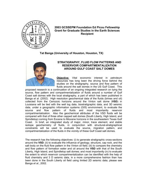
2003 GCS<strong>SEPM</strong> Foundation Ed Picou Fellowship<br />
Grant for Graduate Studies in the Earth Sciences<br />
Recipient<br />
<strong>Tat</strong> <strong>Banga</strong> (University of Houston, Houston, TX)<br />
STRATIGRAPHY, FLUID FLOW PATTERNS AND<br />
RESERVOIR COMPARTMENTALIZATION<br />
AROUND GULF COAST SALT DOMES<br />
Objective: Vital economic interest in petroleum<br />
resources has long been the driving force behind the<br />
studies on the stratigraphy, source and flow pattern of<br />
fluids around the salt domes in the US <strong>Gulf</strong> <strong>Coast</strong>. This<br />
proposed research is a continuation of an ongoing integrated research on tying the<br />
source, flow pattern and compartmentalization of fluids around a number of <strong>Gulf</strong><br />
<strong>Coast</strong> salt domes with the local stratigraphy, a part of which has been published in<br />
<strong>Banga</strong> et al. (2002). High resolution geochemical data of the fluids (brines and oil)<br />
collected from the Cenozoic horizons around the Vinton salt dome (VSD) in<br />
Louisiana will be tied with the well log data, biostratigraphic data, and 3D seismic<br />
data, under a geographic information systems (GIS) environment, to evaluate the<br />
source and flow pattern of fluids and most importantly reservoir<br />
compartmentalization. Also the geochemical attributes of the VSD fluids will be<br />
compared with that of three other capped salt domes (South Liberty, High Island, and<br />
Spindletop) coming from Eocene to Miocene horizons in the southeastern Texas <strong>Gulf</strong><br />
<strong>Coast</strong>. In brief, an integrated study of major, minor, trace element, and stable<br />
isotope geochemistry of fluids, in conjunction with structural-stratigraphical<br />
constraints will be used to evaluate the source, migration pattern, and<br />
compartmentalization of the fluids in the vicinity of these <strong>Gulf</strong> <strong>Coast</strong> salt domes.<br />
The research has the following objectives: (i) to generate stratigraphic cross-sections<br />
around the VSD; (ii) to evaluate the influence of geology, structure, cap rock, and the<br />
salt body on the fluid flow pattern in the Vinton oil field; (iii) to compare the chemistry<br />
and flow pattern of formation water and oil around the VSD with that of the South<br />
Liberty, High Island, and Spindletop salt domes; and most importantly (iv) to evaluate<br />
the extent to which reservoir compartmentalization can be identified with the help of<br />
fluid chemistry and 3 D seismic data, in a more comprehensive fashion than has<br />
been done in the South Liberty oil field using limited 2D seismic data; please see<br />
<strong>Banga</strong> et al., 2002.
Previous Work: Galloway et al. (1983) have discussed in detail the stratigraphy of<br />
the US <strong>Gulf</strong> <strong>Coast</strong>. Hanor and Sassen (1990), in their work on the Louisiana <strong>Gulf</strong><br />
coast, report that aqueous fluid flow directions in most of the deep geopressured<br />
sediments are nearly vertically up and that fluids in the hydropressured zones have<br />
been emplaced by vertical migration from deeper and older geopressured source<br />
rocks. Many workers (including Ranganathan and Hanor, 1989; Capuano, 1994)<br />
have reported dynamic, large-scale fluid-flow system of dissolution and masstransport<br />
and elevated pore water salinity has facilitated by fault systems in the<br />
vicinity of the piercement salt domes from the <strong>Gulf</strong> of Mexico basin. Galloway (1984)<br />
also has discussed the influence of faults and microfractures acting as conduits for<br />
fluid flow in the geopressured sediments of the <strong>Gulf</strong> <strong>Coast</strong>. Dissolution of cap rock<br />
and salt body, and mixing between meteoric water and geopressured fluids (from<br />
deeper source) along the flank of the South Liberty salt dome in Texas have been<br />
described by <strong>Banga</strong> et al. (2002) on the basis of the brine chemistry, structure and<br />
2D seismic data. We [<strong>Banga</strong> et al. (2002)] also have pointed at possible reservoir<br />
compartmentalization around the South Liberty salt dome, Texas, on the basis of<br />
brine chemistry, biostratigraphic data and limited 2D seismic data. A comparison on<br />
the isotopic characters of aqueous fluids collected from the Texas and Louisiana <strong>Gulf</strong><br />
<strong>Coast</strong> is given in <strong>Banga</strong> (2003).<br />
Methodology: The study involves several different steps including: (a) collection of<br />
oil-field fluid samples (oil and water) and fresh water samples from wellheads; (b)<br />
chemical analysis of the brines for major anions and cations; (c) analysis of the<br />
brines for stable isotopes of oxygen (δ 18 O) and hydrogen (δD); (d) geochemical<br />
characterization of these brines with the help of elemental and isotopic tracer<br />
chemistry, geochemical modeling, and chemical cross-plots; (e) high resolution<br />
whole oil gas chromatography, and saturated and aromatic biomarker gas<br />
chromatography of some selected samples; (f) stable isotopes of whole oil, saturates<br />
and aromatic components of some selected samples; (g) spatial analyses of the<br />
geochemical data through GIS software; (h) stratigraphic work and fault identification<br />
in the local horizons on the bases of well-logs, biostratigraphic data, and 3D seismic<br />
data from around the VSD; (i) interpreting geochemical and geophysical data to<br />
formulate comprehensive fluid flow pattern; and (j) comparing the VSD fluid flow<br />
pattern with the South Liberty, High Island and Spindletop fluids. The broad divisions<br />
in the methodology follow.<br />
(a) Chemical Work: Brine samples will be analyzed for: (a) basic field parameters;<br />
(b) analyses of 19 cations and anions using inductively coupled plasma<br />
spectroscopic (ICP) and ion chromatographic (IC) instruments; and (c) stable isotope<br />
of hydrogen (δD) and oxygen (δ 18 O) using mass spectrometers. Oil samples will be<br />
analyzed for high-resolution whole oil gas chromatography, biomarker gas<br />
chromatography mass spectrometry, and stable isotope mass spectrometry.<br />
(b) Stratigraphic Work: The stratigraphic framework of the sediments surrounding<br />
the VSD will be examined, using A2D Smartraster TM images and well logs, and<br />
biostratigraphic data. Geoplus TM Petra interpretation software will be used for
uilding cross-sections around the salt domes. In addition, a number of cores will be<br />
studied to evaluate the depositional set-up around the VSD.<br />
(c) Seismic Work: 3-D seismic data of the VSD oil field available in the University Of<br />
Houston Department Of Geosciences (obtained through Output Exploration LLC., or<br />
OPEX) will be used for better visualization of the VSD flanks and wells and fault<br />
identification. Interpreted seismic data will be used to detect reservoir fault blocks,<br />
and finally, fluid chemistry of samples from individual fault blocks will be used to<br />
determine reservoir compartmentalization or connectivity.<br />
(d) Spatial Analyses: Well production data from these four oil fields (obtained from<br />
PI/Dwights PLUS dataset) and geochemical data will be plotted using ArcView GIS<br />
software, for the purpose of better visualization of spatial variation of production and<br />
chemistry around the fields. The spatial analyses will also be used to make location<br />
maps, base maps for stratigraphic studies and base maps for spatial plots of brine<br />
chemistry. Other culture data (digital orthoquad images or DOQ images, counties,<br />
roads, rail-roads, rivers, cities, etc.) will be downloaded from various sources of the<br />
public domain database.<br />
Key References:<br />
<strong>Banga</strong>, T., 2003, Tracing Salt Dissolution, Fluid Sources and Mixing in The Vicinity of<br />
The South Liberty Salt Dome in the South East Texas <strong>Gulf</strong> <strong>Coast</strong>: University of<br />
Houston, Texas, M.Sc. thesis 319 p (in press).<br />
<strong>Banga</strong>, T., R.M. Capuano, and D. Van Nieuwienhuise, 2002, Fluid flow, stratigraphy and<br />
structure in the vicinity of the South Liberty Salt Dome, Texas: GCAGS<br />
Transactions, v. 52, p. 25-36.<br />
Capuano, R.M., 1994, Evidence of fluid flow in micro-fractures in geopressured shales:<br />
Reply: AAPG Bull., v. 77, p. 1303-1314.<br />
Galloway, W. E., 1984, Hydrogeologic regimes of sandstone diagenesis, in, D.A.<br />
Mcdonald and R.C. Surdam, eds, Clastic Diagenesis: AAPG Memoir 37, p. 3-13.<br />
Galloway, W. E. et al., 1983, Atlas of Major Texas Oil Reservoirs: Univ. of Texas Bureau<br />
of Economic Geology, p. 203.<br />
Hanor, J. S., and R. Sassen, 1990, Evidence for large-scale vertical and lateral migration<br />
of formation waters, dissolved salt, and crude oil in the Louisiana <strong>Gulf</strong> coast:<br />
GCS<strong>SEPM</strong> Foundation Ninth Annual Bob F. Perkins Research Conference<br />
Proceedings, p. 283-296.<br />
Kharaka, Y. K., E. Callender, and W. W. Carothers, 1977, Geochemistry of<br />
geopressured geothermal waters from the Texas <strong>Gulf</strong> <strong>Coast</strong>: Proceedings, Third<br />
Geopressured-Geothermal Energy Conference, p. G1-121- G1-165.<br />
Land, L. S. and D. R. Prezbindowski, 1981, The origin and evolution of saline formation<br />
water, lower Cretaceous carbonates, south-central Texas, USA: Journal of<br />
Hydrology, v. 54, p. 51-74.<br />
Posey, H. H., A. L. Workman, J. S. Hanor, and S.D. Hurst, 1985, Isotopic characteristics<br />
of brines from three oil and gas fields, southern Louisiana: GCAGS Transactions,<br />
v.35, p. 261-267.