B. Taylor Troiani - Gulf Coast Section SEPM
B. Taylor Troiani - Gulf Coast Section SEPM
B. Taylor Troiani - Gulf Coast Section SEPM

You also want an ePaper? Increase the reach of your titles
YUMPU automatically turns print PDFs into web optimized ePapers that Google loves.
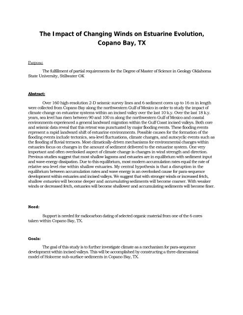
The Impact of Changing Winds on Estuarine Evolution,<br />
Copano Bay, TX<br />
Purpose:<br />
The fulfillment of partial requirements for the Degree of Master of Science in Geology Oklahoma<br />
State University, Stillwater OK<br />
Abstract:<br />
Over 160 high-resolution 2-D seismic survey lines and 6 sediment cores up to 16 m in length<br />
were collected from Copano Bay along the northwestern <strong>Gulf</strong> of Mexico in order to study the impact of<br />
climate change on estuarine systems within an incised valley over the last 10 k.y. Over the last 18 k.y.<br />
years, sea level has risen between 90 and 100 m along the northwestern <strong>Gulf</strong> of Mexico and coastal<br />
environments experienced a general landward migration within the <strong>Gulf</strong> <strong>Coast</strong> incised valleys. Both core<br />
and seismic data reveal that this retreat was punctuated by major flooding events. These flooding events<br />
represent a rapid landward shift of estuarine environments. Possible causes for the formation of the<br />
flooding events include tectonics, sea-level fluctuations, climate changes, and autocyclic events such as<br />
the flooding of fluvial terraces. Most climatically-driven mechanisms for environmental changes within<br />
estuaries focus on changes in the amount of sediment delivered to the estuarine system. One very<br />
important and often overlooked aspect of climate change is changes in wind strength and direction.<br />
Previous studies suggest that most shallow lagoons and estuaries are in equilibrium with sediment input<br />
and wave-energy dissipation. Due to this equilibrium, most modern accumulation rates equal the rate of<br />
relative sea-level rise within shallow estuaries. My central hypothesis is that a disruption in the<br />
equilibrium between accumulation rates and wave energy is an overlooked cause for para-sequence<br />
development within estuaries and incised valleys. We suggest that with stronger winds or increased fetch,<br />
shallow estuaries will become deeper and accumulating sediments will become coarser. With weaker<br />
winds or decreased fetch, estuaries will become shallower and accumulating sediments will become finer.<br />
Need:<br />
Support is needed for radiocarbon dating of selected organic material from one of the 6 cores<br />
taken within Copano Bay, TX.<br />
Goals:<br />
The goal of this study is to further investigate climate as a mechanism for para-sequence<br />
development within incised valleys. This will be accomplished by constructing a three-dimensional<br />
model of Holocene sub-surface sediments in Copano Bay, TX.
Objectives:<br />
In order to accomplish my goals, I will determine -<br />
1) The age of flooding surfaces within the valley<br />
2) The volume of sediment in para-sequences or between flooding surfaces<br />
3) The determination of lithofacies between flooding surfaces<br />
4) Detailed grain-size analysis of sediments across flooding<br />
surfaces. Rational:<br />
The project described in this proposal will address the impact of changing wind strengths on estuarine<br />
evolution. Most studied mechanisms evolved as responses to climate changes mostly pertain to changes in<br />
sediment flux delivered to the estuarine systems. One very important and often overlooked aspect of climate<br />
change is changes in wind strength and direction. Previous studies suggest that wind is the dominant<br />
forcing agent regulating estuarine sedimentary processes.<br />
Study Area:<br />
Copano Bay, is located along the Texas <strong>Gulf</strong> <strong>Coast</strong> about 20 miles north of Corpus Christi,<br />
Texas. It is situated approximately parallel to the present coast line of the <strong>Gulf</strong> of Mexico. The bay covers<br />
an area less than 168 sq. km. Water depths range from 0.6-2.7 m. but nearly 75% of the bay has a depth of<br />
2.1 m. The prevailing winds are onshore from the southeast during the late spring to early fall. During the<br />
late fall to early spring, the winds frequently have strong northerly components directed offshore. Aransas<br />
Bay and St. Joseph Island separate Copano Bay from the <strong>Gulf</strong> of Mexico. The bay lies within a sub humid<br />
to semi-arid climate zone (Thornthwaite 1948) with evaporation exceeding precipitation. Copano Bay has<br />
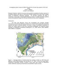
three primary sources of freshwater: the Mission River, the Aransas River, and Copano Creek (figure 1).<br />
Major fluvial sediment is supplied to the bay by the Mission, and Aransas River (Wright 1980). During a sealevel<br />
fall between 18-120 ka the rivers and creeks cut an incised valley 21 m deep (Wright 1980).<br />
N<br />
Copano<br />
Bay<br />
Figure 1 General Map of Copano Bay, Texas
Impact of Winds:<br />
Price (1947) and Nichols (1989) noticed that sedimentation and accumulation rates along with<br />
lagoonal surface area (ie. fetch areas) are in equilibrium with wave energy dissipation. In most lagoons<br />
Nichols (1989) noticed that sediment accumulation rates equal the rate of relative sea-level rise. These<br />
observations suggest that most lagoons are in equilibrium with sediment input and wave energy<br />
dissipation. Wave energy dissipation, i.e., the depth of effective marine planation (scour), is a function of<br />
fetch and average wind speed (Price 1947). Thus, changes in wind strength or in direction will disrupt<br />
this equilibrium and cause a change in the accumulation rate of sediments within a bay. Shideler (1984)<br />
determined that wind is the dominant forcing agent regulating estuarine sedimentary processes. Winddriven<br />
currents, i.e. wave orbital's, have the ability to resuspend bay-floor sediments in the water-column<br />
and there is a direct relationship between mean wind speed and sediment concentration in the watercolumn<br />
Shideler (1984). The resuspended sediments in the water-column consist of poorly sorted claysize<br />
to very fine silt-size detritus (Shideler 1984).<br />
Methods:<br />
I am working closely with Dr.Tim Dellapenna at Texas A&M at Galveston, Tim has been very<br />
generous by allowing me to use over 160 high-resolution 2-D seismic survey lines with spacing intervals<br />
of 150 m in Copano Bay, TX. Using this data set to pick coring sites, we collected four rotary-push cores<br />
up to 16 m in length and two vibarcores up to 3 m in length aboard the R/V Trinity. The cores and<br />
seismic data will be used to study the internal architecture of Copano Bay and determine the mechanisms<br />
responsible for the development of flooding surfaces within the bay. The cores will be described using<br />
coarse fraction analysis according to the procedure of Shepard (1954). Grain size will be analyzed every<br />
20 cm and every 5 cm above and below recognized flooding surfaces within cores with a CILAS 1180L<br />
Laser Particle Size Analyzer. Sedimentary structures, macro fauna, and micro fauna will be included in<br />
the core description and used for interpreting depositional environment. Selected organic material from<br />
the cores such as shells and wood fragments will be sent to Beta Analytical and the University of Tokyo<br />
for radiocarbon dating.<br />
Expected Results:<br />
I will create paleo geographic maps of the bay through time using both the seismic and core data<br />
with the help of Kingdom Suite software. These maps will illustrate the timing and nature of valley fill<br />
within Copano Bay. I will also create isopach maps between the flooding surfaces within the bay. These<br />
isopach maps will be used to calculate the volume of sediment between flooding surfaces. I expect to<br />
see a coarsing of grain size in middle bay deposits where there was an increase in either fetch or paleo wind<br />
strength or both.
References:<br />
NICHOLS, M.M., 1989, SEDIMENT ACCUMULATION RATES AND RELATIVE SEA-LEVEL RISE IN<br />
LAGOONS: Marine Geology, v. 88, p. 201-219.<br />
PRICE, W.A., 1947, Equilibrium of form and forces in tidal basins of coast of Texas and<br />
Louisiana: Bulletin of the American Association of Petroleum Geologists, v. 31, p.<br />
1663-1619.<br />
SHEPARD, F.P., 1954, Sedimentary environments differentiated by coarse-fraction studies:<br />
Bulletin of the American Association of Petroleum Geologists, v. 38, p. 1802-1792.<br />
SHIDELER, G.L., 1984, Suspended sediment responses in a wind-dominated estuary of the<br />
Texas <strong>Gulf</strong> <strong>Coast</strong>, Journal of Sedimentary Petrology: United States, Society of<br />
Economic Paleontologists and Mineralogists : Tulsa, OK, United States, p. 745-731.<br />
THORNTHWAITE, C.W., 1948, An approach toward a rational classification of climate:<br />
Geographical review v. 38, p. 55-94.<br />
WRIGHT, S.S., 1980, Seismic Stratigraphy and Depositional History of Holocene Sediments<br />
on the Central Texas <strong>Gulf</strong> <strong>Coast</strong>: The University of Texas at Austin Austin, TX, 123 p.
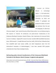
Biography<br />
B. <strong>Taylor</strong> <strong>Troiani</strong><br />
Personal Data:<br />
Born: September 13, 1979 in San Antonio, TX<br />
Parents: Gay and Lendy <strong>Troiani</strong><br />
Education:<br />
Wichita State University, Wichita, KS Dec. 2006<br />
Oklahoma State University, Stillwater, OK expected Dec. 2009<br />
Experience:<br />
Contract Project Geologist 2007: Pogo Producing Company, Tulsa, OK<br />
Associate Geologist 2007: Crow Creek Energy, Tulsa, OK<br />
Geologist Intern 2008: Kirkpatrick Oil Company, Oklahoma City, OK<br />
Professional Membership:<br />
1. Society for Sedimentary Geology (<strong>SEPM</strong>)<br />
2. American Association of Petroleum Geologist (AAPG)<br />
3. Oklahoma City Geological Society