Petroleum Systems of Deep-Water Basins - Gulf Coast Section SEPM
Petroleum Systems of Deep-Water Basins - Gulf Coast Section SEPM
Petroleum Systems of Deep-Water Basins - Gulf Coast Section SEPM

Create successful ePaper yourself
Turn your PDF publications into a flip-book with our unique Google optimized e-Paper software.
Mesozoic Ultra-<strong>Deep</strong> <strong>Water</strong> Potential <strong>of</strong> the U.S. <strong>Gulf</strong> <strong>of</strong><br />
Mexico—Conceptual Play Development and Analysis<br />
Paul J. Post<br />
Peter F. Harrison<br />
Gregory L. Whittle<br />
U.S. Department <strong>of</strong> the Interior<br />
Minerals Management Service<br />
1201 Elmwood Park Blvd.<br />
New Orleans, Louisiana 70123-2394<br />
e-mail: paul.post@mms.gov<br />
Jeff D. Hunt<br />
Bureau <strong>of</strong> Indian Affairs<br />
Division <strong>of</strong> Energy and Mineral Resources<br />
12136 W. Bayaud Ave., Suite 300<br />
Lakewood, Colorado 80228<br />
Abstract<br />
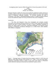
A series <strong>of</strong> conceptual Mesozoic plays was defined in the ultra-deep water U.S. <strong>Gulf</strong> <strong>of</strong> Mexico by interpreting a<br />
2x2 mile grid <strong>of</strong> 2-D seismic data covering an area <strong>of</strong> approximately 39,000 square miles basinward <strong>of</strong> the Sigsbee<br />
salt canopy. Time maps on the seafloor, approximate Cretaceous/Tertiary boundary, Mid-Cretaceous Sequence<br />
Boundary, approximate Jurassic/Cretaceous boundary, top autochthonous salt, and “basement” seismic events were<br />
constructed and converted to depth using regional interval velocities.<br />
Conceptual plays in the western and central planning areas <strong>of</strong> the <strong>Gulf</strong> <strong>of</strong> Mexico include fold belts and buried<br />
hills; the latter have been subdivided into structural, stratigraphic-detrital, and drape plays.<br />
In the eastern planning area, a structural play that is characterized by salt rollers, autochthonous salt swells, pinnacle<br />
salt structures/vertical salt welds, and salt growth and/or salt withdrawal (turtle) features was delineated in the<br />
West Florida Salt Basin.<br />
Reservoir analogs for each play were identified by searching worldwide for fields having similar trap type and<br />
reservoirs <strong>of</strong> comparable depositional environment. Monte Carlo simulations were run to analyze and develop distributions<br />
<strong>of</strong> the analog data. <strong>Petroleum</strong> system analysis was performed to incorporate, describe, and display the<br />
elements (source, reservoir, and seal) and the processes (trap formation, generation–migration–accumulation, and<br />
critical moment) associated with each play. Play risks were evaluated, described, and presented using a “traffic light”<br />
ranking system. The results <strong>of</strong> this study suggest that in the ultra-deep water <strong>Gulf</strong> <strong>of</strong> Mexico, these and other conceptual<br />
Mesozoic plays may <strong>of</strong>fer a variety <strong>of</strong> future high-potential exploration opportunities. This paper is a synopsis <strong>of</strong><br />
over 2 years <strong>of</strong> work, and not all <strong>of</strong> the details can be presented in a paper <strong>of</strong> this length.<br />
3