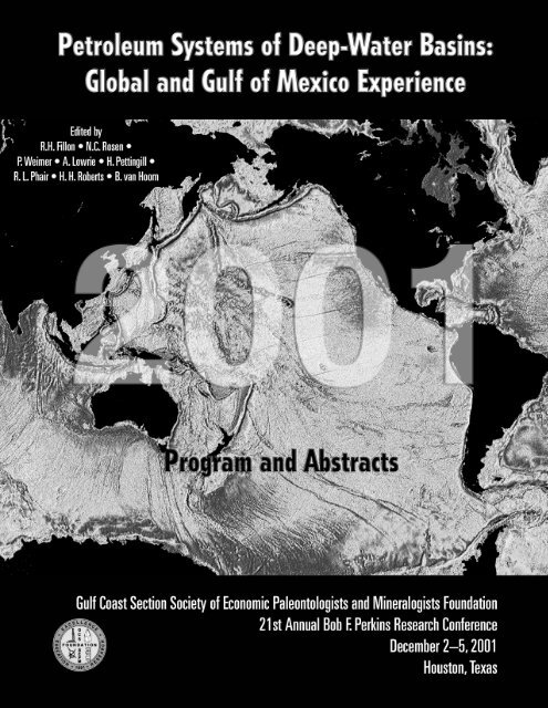
Petroleum Systems of Deep-Water Basins - Gulf Coast Section SEPM
Petroleum Systems of Deep-Water Basins - Gulf Coast Section SEPM
Petroleum Systems of Deep-Water Basins - Gulf Coast Section SEPM

You also want an ePaper? Increase the reach of your titles
YUMPU automatically turns print PDFs into web optimized ePapers that Google loves.
<strong>Petroleum</strong> <strong>Systems</strong> <strong>of</strong> <strong>Deep</strong>-<strong>Water</strong> <strong>Basins</strong>:<br />
Global and <strong>Gulf</strong> <strong>of</strong> Mexico Experience<br />
<strong>Gulf</strong> <strong>Coast</strong> <strong>Section</strong> <strong>SEPM</strong> Foundation<br />
21st Annual Bob F. Perkins Research Conference<br />
2001<br />
Program and Abstracts<br />
Adam’s Mark Hotel<br />
Houston, Texas<br />
December 2–5, 2001<br />
Edited by<br />
R.H. Fillon • N.C. Rosen<br />
P. Weimer • A. Lowrie • H. Pettingill<br />
R.L. Phair • H.H. Roberts • B. van Hoorn
Copyright © 2001 by the<br />
<strong>Gulf</strong> <strong>Coast</strong> <strong>Section</strong><br />
Society <strong>of</strong> Economic Paleontologists and Mineralogists Foundation<br />
www.gcssepm.org<br />
Published November 2001<br />
Publication <strong>of</strong> these Proceedings has been subsidized by generous grants from<br />
Unocal <strong>Deep</strong>water USA<br />
ii
Foreword<br />
The search for petroleum to meet society’s demands for energy in the 20 th century has continually<br />
challenged those in our pr<strong>of</strong>ession to better understand the earth and its systems. On the threshold<br />
<strong>of</strong> the 21 st century, with the significant advances in deep water seismic imaging, drilling, and<br />
production-technology that have been achieved in the last decade, the demand for more detailed<br />
understanding <strong>of</strong> deep water-deep-basin petroleum systems is intensely felt by all <strong>of</strong> us involved<br />
in the earth sciences.<br />
One <strong>of</strong> the key elements <strong>of</strong> deep water-deep-basin petroleum systems, the reservoir, was the focus<br />
<strong>of</strong> last year’s excellent GCS<strong>SEPM</strong> Research Conference “<strong>Deep</strong> <strong>Water</strong> Reservoirs <strong>of</strong> the World.”<br />
That conference amassed, presented, and compiled in its CD-ROM proceedings volume a<br />
tremendous amount <strong>of</strong> reservoir information that is <strong>of</strong> great value to the petroleum industry as it<br />
steps forward to meet the demands <strong>of</strong> the new century.<br />
The goal for this year’s conference is to expand on last year’s theme by including other key<br />
elements <strong>of</strong> the petroleum system. We are pleased that the international earth science and<br />
exploration community stepped forward enthusiastically to summarize the latest deep water<br />
exploration strategies in frontier areas around the world. Topics to be presented in the 2001<br />
conference span the globe, from the ultra-deep <strong>Gulf</strong> <strong>of</strong> Mexico to the deep water basins <strong>of</strong> the<br />
Falklands, and <strong>of</strong>fer new insights into the complex elements <strong>of</strong> deep water basin analysis including<br />
the tectonic framework <strong>of</strong> passive and active margin basins, deep-basin evolution, hydrocarbon<br />
maturation and migration, structuring, salt tectonics, and evolution <strong>of</strong> deep-basin siliciclastic and<br />
carbonate deposystems.<br />
This year’s conference is truly international with 134 authors and co-authors from 10 countries<br />
presenting 49 papers, which examine basinal and deep water portions <strong>of</strong> Nova Scotia, the U. S.<br />
<strong>Gulf</strong> <strong>of</strong> Mexico, Mexico, Guatemala, Belize, the Caribbean, Trinidad, Colombia, Peru, the<br />
Falklands, Spain, Morocco, Equatorial Guinea, Cote d’Ivoire, Angola, Tanzania, New Zealand,<br />
Southeast Asia, and Azerbaijan. The authors represent industry, government and academic<br />
institutions in the United States, Angola, Azerbaijan, Canada, Colombia, England, Italy, Mexico,<br />
Peru, Trinidad, New Zealand, Scotland, and Spain.<br />
All <strong>of</strong> the authors deserve a great deal <strong>of</strong> praise for the huge amount <strong>of</strong> effort they put into preparing<br />
their manuscripts, and for constructing wonderful illustrations that will make the CD-ROM a<br />
valuable reference work in support <strong>of</strong> hydrocarbon exploration for the next decade. The<br />
organizations they represent also deserve our heartfelt gratitude for their foresight in supporting<br />
and encouraging their pr<strong>of</strong>essional staff in sharing a great deal <strong>of</strong> valuable information. With the<br />
mobility <strong>of</strong> the modern workforce it is more than ever in their best interest to encourage such cost<br />
effective transfer and exchange <strong>of</strong> earth science knowledge.<br />
With the large and diverse array <strong>of</strong> papers submitted to the conference this year, the program<br />
advisory committee could not have pulled everything together in less than a year without the<br />
vigorous support <strong>of</strong> reviewers, several <strong>of</strong> whom also had their own papers to get out and all <strong>of</strong><br />
whom were busy with their regular work. Without their help, publication <strong>of</strong> the high-quality,<br />
refereed CD-ROM proceedings volume in such a short time would not have been possible. We<br />
thank the following individuals for providing excellent reviews under very tight time constraints:<br />
iii
Rob Alexander, Dick Buffler, Rion Camerlo, Ed Colling, Ed Denman, Gren Draper, Paul Lawless,<br />
Allen Lowrie, Ernie Mancini, Liz McDade, Henry Pettingill, Ron Phair, David Pyles, Harry<br />
Roberts, Paul Thacker, Berend van Hoorn, Paul Weig, and Paul Weimer.<br />
As chief organizer and link between authors, reviewers and the Foundation, I also thank program<br />
advisory committee co-chairs and members, who represent a true cross section <strong>of</strong> earth science<br />
disciplines, for serving in as many capacities to bring this conference together as possible. They<br />
worked diligently to plan, to entice contributors from around the world, to review manuscripts and,<br />
in several cases, to prepare their own contributions. The committee members: Allen Lowrie, Henry<br />
Pettingill, Paul Weimer, Dick Buffler, Liz McDade, Ernie Mancini, Ron Phair, Harry Roberts, Ed<br />
Denman, Berend van Hoorn, Nancy Engelhardt-Moore, John Armentrout all deserve our gratitude.<br />
Each helped in various capacities, and each in different stages <strong>of</strong> planning and execution.<br />
We thank Gail Bergan for her patience with the continuing tension <strong>of</strong> papers arriving always at the<br />
last possible moment and for turning out a pr<strong>of</strong>essional CD-ROM volume in spite <strong>of</strong> everything.<br />
To Jerri Fillon, scheduler, organizer and mailroom administrator in this endeavor we <strong>of</strong>fer our<br />
sincerest thanks. And last, but absolutely not least, to Norm Rosen, the Executive Director <strong>of</strong> the<br />
GCS<strong>SEPM</strong> Foundation, we <strong>of</strong>fer our deep gratitude and admiration for continuing on in the spirit<br />
<strong>of</strong> our old friend Bob Perkins, making this entire conference series possible.<br />
All connected with this conference and proceedings volume realize that this has been a difficult<br />
time for the United States, its citizens and residents. To all those attending who may have<br />
experienced personal losses we express our sincere sympathy.<br />
The 2001 conference is certainly one <strong>of</strong> the strongest and most significant conferences in a series<br />
that over the years has provided our pr<strong>of</strong>ession and industry with an invaluable and timely source<br />
<strong>of</strong> knowledge. You will, I think, over the next few days find much to excite you in the oral and<br />
poster presentations, and when you open the CD-ROM you will find a reference work that will<br />
occupy an important niche in your <strong>of</strong>fices for years to come.<br />
Dick Fillon<br />
December 2001<br />
Houston, Texas<br />
iv
<strong>Gulf</strong> <strong>Coast</strong> <strong>Section</strong><br />
Society <strong>of</strong> Economic Paleontologists and Mineralogists Foundation<br />
Trustees and Executive Director<br />
Nancy Engelhardt-Moore, Chairman<br />
Consultant<br />
Houston, Texas<br />
Michael J. Nault<br />
Applied Stratigraphix<br />
Houston, Texas<br />
Rashel N. Rosen<br />
Micropaleontological Consultant<br />
Houston, Texas<br />
Norman C. Rosen, Executive Director<br />
NCR & Associates<br />
Houston, Texas<br />
21 st Annual Bob F. Perkins Research Conference Organizing Committee<br />
Ron F. Waszczak<br />
Conoco, Inc.<br />
Houston, Texas<br />
Patricia A. Santogrossi<br />
Chroma Energy<br />
Sugar Land, Texas<br />
Terri Dunn<br />
Consultant<br />
Metarie, Louisiana<br />
Tony D'Agostino<br />
PGS Reservoir Consultants<br />
Houston, Texas<br />
Ilene Rex Corbo<br />
Biostratigraphy Consultant<br />
Houston, Texas<br />
Michael J. Styzen<br />
Shell International E&P, Inc.<br />
New Orleans, Louisiana<br />
Audio-Visual and Poster Committee<br />
Nancy Engelhardt-Moore<br />
Consultant<br />
Houston, Texas<br />
Technical Program Co-Chairmen and Editors<br />
Richard H. Fillon<br />
Earth Studies Associates<br />
New Orleans, Louisiana<br />
Norman C. Rosen<br />
NCR & Associates<br />
Houston, Texas<br />
Paul Weimer<br />
University <strong>of</strong> Colorado<br />
Boulder, Colorado<br />
Allen Lowrie<br />
Consultant<br />
Picayune, Mississippi<br />
Henry Pettingill<br />
Repsol YPF<br />
Madrid, Spain<br />
Ronald L. Phair<br />
Texaco, Inc.<br />
Bellaire, Texas<br />
Harry H. Roberts<br />
University <strong>of</strong> Louisiana<br />
Baton Rouge, Louisiana<br />
Berend van Hoorn<br />
Shell Offshore, Inc.<br />
New Orleans, Louisiana<br />
v
Technical Program Advisory Committee<br />
Richard Buffler<br />
University <strong>of</strong> Texas<br />
Austin, Texas<br />
Elizabeth C. McDade<br />
Consultant<br />
New Orleans, Louisiana<br />
Ernest Mancini<br />
University <strong>of</strong> Alabama<br />
Tuscaloosa, Alabama<br />
H. Edward Denman<br />
Samson Resources<br />
Houston, Texas<br />
Nancy Engelhardt-Moore<br />
Consultant<br />
Houston, Texas<br />
John M. Armentrout<br />
Cascade Stratigraphics<br />
Clackmas, Oregon<br />
vi
Contributors to the <strong>Gulf</strong> <strong>Coast</strong> <strong>Section</strong><br />
Society <strong>of</strong> Economic Paleontologists and Mineralogists Foundation<br />
Corporate Sponsorship<br />
An Invitation from the GCS<strong>SEPM</strong> <strong>Section</strong> and Foundation for your support <strong>of</strong> our conference<br />
series as well as support <strong>of</strong> geological and geophysical staff and graduate student education in<br />
advanced applications <strong>of</strong> geological research to practical problems <strong>of</strong> exploration, production, and<br />
development geology.<br />
Types <strong>of</strong> Sponsorships Currently Available<br />
Platinum Sponsor ($10,000 or More)<br />
Contributions <strong>of</strong> Platinum Sponsors will support the Conference Publication.<br />
Gold Sponsor ($5000 to $9999)<br />
Contributions <strong>of</strong> Gold Sponsors will support the Icebreaker, Lunches<br />
or Poster Session Buffet.<br />
Silver Sponsor ($2500 to $4999)<br />
Contributions <strong>of</strong> Silver Sponsors will support the C<strong>of</strong>fee Bars, Audio-Visual<br />
and Poster Boards.<br />
Bronze Sponsor ($1000 to $2499)<br />
Contributions <strong>of</strong> Bronze Sponsors will support Student Registrations, General<br />
Registration, or Advertising.<br />
Patron ($100 to $999)<br />
Contributions <strong>of</strong> Patrons will support General Expenses <strong>of</strong> the Conferences.<br />
Sponsor Acknowledgment<br />
In any one category, sponsors are listed alphabetically. For 2001, all Platinum are acknowledged<br />
on the lead page <strong>of</strong> the CD. Platinum, Gold, and Silver sponsors will be acknowledged on a special<br />
contributors page inserted in the 2001 conference abstracts volume and CD, and on large placards<br />
strategically placed throughout the meeting areas during the conference. In addition, they will be<br />
acknowledged in the same publication for the 2002 Research Conference.<br />
All Bronze Sponsors and Patrons are acknowledged on a special contributors page inserted in the<br />
2001 conference abstract volume and CD. The GCS<strong>SEPM</strong> Foundation is a 501(c)(3) exempt<br />
organization. Contributions to it are tax deductable as charitable gifts and contributions.<br />
For additional information about making a donation as a sponsor or patron, please contact Dr.<br />
Norman C. Rosen, Executive Director, GCS<strong>SEPM</strong> Foundation, 2719 S. Southern Oaks Drive,<br />
Houston, TX 77068-2610. Telephone (voice or fax) 281-586-0833 or e-mail at<br />
gcssepm@houston.rr.com.<br />
vii
2001 Sponsors and Patrons<br />
Platinum Sponsors<br />
UNOCAL <strong>Deep</strong>water USA<br />
Gold Sponsors<br />
BHPbilliton<br />
bp Exploration<br />
Shell Exploration and Production<br />
Silver Sponsors<br />
ExxonMonil<br />
Ocean Energy<br />
Bronze Sponsors<br />
Agip <strong>Petroleum</strong> Company<br />
Amerada Hess<br />
Conoco GOM <strong>Deep</strong> <strong>Water</strong> Business Unit<br />
Conoco Exploration Production Technology<br />
Dominion Exploration and Production<br />
Kerr-McGee Corporation<br />
Mariner Energy<br />
Phillips <strong>Petroleum</strong><br />
Norman C. and Rashel N. Rosen<br />
Roxar, Inc.<br />
Patrons<br />
Clarence Albers by Ed Picou<br />
Nancy Engelhardt-Moore<br />
Michael J. Nault<br />
Ronald Waszczak<br />
2000 Sponsors<br />
Platinum Sponsors<br />
bp Exploration<br />
Shell Exploration & Production Company<br />
Gold Sponsors<br />
BHPbilliton<br />
The Shell Foundation<br />
Silver Sponsors<br />
Conoco, Inc.<br />
Roxar, Inc.<br />
Ocean Energy<br />
Bronze Sponsors<br />
TGS-NOPEC<br />
viii
Credits<br />
Book Layout, Cover Design, and CD ROM Publishing<br />
Gail R. Bergan and<br />
Leann N. Wagerle<br />
Houston, Texas<br />
www.bergan.com<br />
Cover Photo<br />
The marine gravity map photo on the cover <strong>of</strong> this CD ROM obtained from<br />
http://www.ngdc.noaa.gov/mgg/bathymetry/predicted/explore.HTML<br />
ix
<strong>Petroleum</strong> <strong>Systems</strong> <strong>of</strong> <strong>Deep</strong>-<strong>Water</strong> <strong>Basins</strong>:<br />
Global and <strong>Gulf</strong> <strong>of</strong> Mexico Experience<br />
<strong>Gulf</strong> <strong>Coast</strong> <strong>Section</strong> <strong>SEPM</strong> Foundation<br />
21 st Annual Bob F. Perkins Research Conference<br />
Adam’s Mark Hotel<br />
Houston, Texas<br />
December 2–5, 2001<br />
Program and Abstracts<br />
Sunday, December 2, 2001<br />
4:00–6:00 p.m. Registration—Grand Foyer<br />
6:00–8:00 p.m. Welcoming Reception and Poster Preview—Grand Pavilion<br />
Monday, December 3, 2001<br />
7:00 a.m. Continuous Registration—Grand Foyer<br />
7:45 a.m. Welcome: Nancy Engelhardt-Moore, Chairman <strong>of</strong> the Board <strong>of</strong> Trustees,<br />
GCS<strong>SEPM</strong> Foundation—Grand Pavilion<br />
7:50 a.m. Introduction and Welcome: Dick Fillon, Program Chairman<br />
Session I—Global and <strong>Gulf</strong> <strong>of</strong> Mexico <strong>Deep</strong>-<strong>Water</strong> Exploration<br />
Presiding:<br />
Paul Post, Paul Weimer<br />
8:00 a.m. Pettingill, Henry S. and Paul Weimer: ...............................................................................................1<br />
World-Wide <strong>Deep</strong> <strong>Water</strong> Exploration and Production: Past, Present and Future (Keynote)<br />
8:30 a.m. Hogg, John R., David A. Dolph, David Mackidd and Karin Michel:................................................2<br />
<strong>Petroleum</strong> <strong>Systems</strong> <strong>of</strong> the <strong>Deep</strong> <strong>Water</strong> Scotian Salt Province, Offshore Nova Scotia, Canada<br />
9:00 a.m. Post, Paul J., Peter F. Harrison, Gregory L. Whittle and Jeff D. Hunt: .............................................3<br />
Mesozoic Ultra-<strong>Deep</strong> <strong>Water</strong> Potential <strong>of</strong> the U.S. <strong>Gulf</strong> <strong>of</strong> Mexico–Conceptual Play<br />
Development and Analysis<br />
9:30 a.m. Refreshment Break and Poster Viewing<br />
x
10:00 a.m. Wood, Lesli J.: ...................................................................................................................................4<br />
Intimate Relations: Interaction <strong>of</strong> Tectonics and Sedimentation in the Formation <strong>of</strong> Roller-<br />
Style Fault Families and Traps in the Eastern East Venezuela Basin, Trinidad and<br />
Venezuela<br />
10:30 a.m. Colling, Edwin L., Robert J. Alexander and Ronald L. Phair:...........................................................5<br />
Regional Mapping and Maturity Modeling for the Northern <strong>Deep</strong> <strong>Water</strong> <strong>Gulf</strong> <strong>of</strong> Mexico<br />
11:00 a.m. Richards, Phil: ....................................................................................................................................6<br />
Falkland Islands: Past Exploration Strategies and Remaining Potential in Under-Explored<br />
<strong>Deep</strong>water <strong>Basins</strong><br />
11:30 a.m. Stephens, Bryan P.: ............................................................................................................................7<br />
Basement Controls on Hydrocarbon <strong>Systems</strong>, Depositional Pathways, and Exploration<br />
Plays Beyond the Sigsbee Escarpment in the Central <strong>Gulf</strong> <strong>of</strong> Mexico<br />
12:00–1:30 p.m. Lunch and Open Poster Booths<br />
Session II—Global and <strong>Gulf</strong> <strong>of</strong> Mexico <strong>Deep</strong>-<strong>Water</strong> Basin Evaluation<br />
Presiding:<br />
Allen Lowrie, Jim Pindell<br />
1:30 p.m. Pindell, James and Lorcan Kennan: ...................................................................................................8<br />
Processes and Events in the Terrane Assembly <strong>of</strong> Trinidad and Eastern Venezuela (Keynote)<br />
2:00 p.m. Pindell, James and Lorcan Kennan: ...................................................................................................9<br />
Kinematic Evolution <strong>of</strong> the <strong>Gulf</strong> <strong>of</strong> Mexico and Caribbean<br />
2:30 p.m. Rowan, Mark G., Bruno C. Vendeville and Frank J. Peel: ..............................................................10<br />
The Role <strong>of</strong> Salt in Gravitational Failure <strong>of</strong> Passive Margins<br />
3:00 p.m. Refreshment Break and Poster Viewing<br />
3:30 p.m. Lugo-Fernandez, Alexis, Peter Hamilton and Walter R. Johnson: ..................................................11<br />
New Oceanographic Observations <strong>of</strong> the <strong>Gulf</strong> <strong>of</strong> Mexico <strong>Deep</strong> <strong>Water</strong>s<br />
4:00 p.m. Dailly, Paul, Kenny Goh, Phil Lowry and Gene Monson:...............................................................12<br />
The Rio Muni Basin <strong>of</strong> Equatorial Guinea; A New Hydrocarbon Province<br />
4:30 p.m. Tari, Gabor C., Paul R. Ashton, Katrina L. Coterill, Jim S. Molnar,<br />
Michael C. Sorgenfrei, Philip W.A. Thompson, David W. Valesek and<br />
James F. Fox:...................................................................................................................................13<br />
Examples <strong>of</strong> <strong>Deep</strong>-<strong>Water</strong> Salt Tectonics from West Africa: Are They Analogs to the <strong>Deep</strong>-<br />
<strong>Water</strong>, Salt-Cored Foldbelts <strong>of</strong> the Northern <strong>Gulf</strong> <strong>of</strong> Mexico?<br />
5:00 p.m. Trümpy, Daniel M. and Scott C. Reeve:..........................................................................................14<br />
The Hydrocarbon Habitat <strong>of</strong> the Agadir Basin Offshore Morocco<br />
5:30–8:00 p.m. Hot Buffet and Poster Session<br />
xi
Tuesday, December 4, 2001<br />
Session III—Global and <strong>Gulf</strong> <strong>of</strong> Mexico <strong>Deep</strong>-<strong>Water</strong> Exploration<br />
Presiding:<br />
Dick Fillon, Dan Worrell<br />
8:00 a.m. Worrall, Dan M., Michael W. Bourque and David R. Steele: .........................................................15<br />
Exploration in <strong>Deep</strong> <strong>Water</strong> <strong>Basins</strong>…Where Next? (Keynote)<br />
8:30 a.m. Uruski, Chris and Peter Baillie:........................................................................................................16<br />
<strong>Petroleum</strong> Potential <strong>of</strong> the <strong>Deep</strong>water Taranaki Basin New Zealand<br />
9:00 a.m. Pyles, David R., Paul Weimer, and Renaud Bouroullec:.................................................................17<br />
Stratigraphic and Tectonic Framework <strong>of</strong> the DeSoto Canyon and Lloyd Ridge Protraction<br />
Areas, Northeastern <strong>Deep</strong> <strong>Gulf</strong> <strong>of</strong> Mexico: Implications for the <strong>Petroleum</strong> System and<br />
Potential Play Types<br />
9:30 a.m. Refreshment Break and Poster Viewing<br />
10:00 a.m. Cole, G.A., A. Yu, F. Peel, C.H. Taylor, R. Requejo, J. DeVay, J. Brooks,<br />
B. Bernard, J. Zumberge and S. Brown: ..........................................................................................18<br />
The <strong>Deep</strong> <strong>Water</strong> <strong>Gulf</strong> <strong>of</strong> Mexico <strong>Petroleum</strong> System: Insights from Piston Coring Defining<br />
Seepage, Anomalies, and Background<br />
10:30 a.m. Evans, Douglas G.:...........................................................................................................................20<br />
The Depositional Regime on the Abyssal Plain <strong>of</strong> the Congo Fan in Angola<br />
11:00 a.m. Liro, Louis, Nathan Weber, Steve O’Hara, Mo Etemadi, Susan Lock Williams,<br />
Mary Cubanski, Mary Kadri and Peter Montecchi: .........................................................................21<br />
Subsalt Exploration Trap Styles, Walker Ridge and Keathley Canyon Areas, <strong>Deep</strong> <strong>Water</strong><br />
<strong>Gulf</strong> <strong>of</strong> Mexico<br />
11:30 a.m. Mojonero, Consuelo Garcia and Wenceslao Martinez del Olmo: ...................................................22<br />
One Sea Level Fall and Four Different Gas Plays: The <strong>Gulf</strong> <strong>of</strong> Cadiz Basin, SW Spain<br />
12:00–1:30 p.m. Lunch and Open Poster Booths<br />
Session IV—Global and <strong>Gulf</strong> <strong>of</strong> Mexico <strong>Deep</strong>-<strong>Water</strong> Basin Evaluation<br />
Presiding:<br />
Ernie Mancini, Harry Roberts<br />
1:30 p.m. Moore, Michael G., Gillian M. Apps, and Frank J. Peel: ................................................................23<br />
The <strong>Petroleum</strong> System <strong>of</strong> the Western Atwater Foldbelt in the Ultra <strong>Deep</strong> <strong>Water</strong> <strong>Gulf</strong> <strong>of</strong><br />
Mexico<br />
2:00 p.m. Gibbs, Alan, Paul Griffiths and Serena Jones:.................................................................................24<br />
Hydrocarbon <strong>Systems</strong>—Adding Structural Evolution to the Equation<br />
2:30 p.m. Boavida, Joaquim, Giancarlo Biella, Roberto de Franco, Dario Luzio,<br />
Alfredo Lozej, Zaingo Group and “Terra-Mar Group”: ..................................................................25<br />
The Northern Angolan Margin Imaged by Wide Angle Seismic Data<br />
3:00 p.m. Refreshment Break and Poster Viewing<br />
xii
3:30 p.m. Roberts, Harry H., Roger Sassen and Alexei V. Milkov: ................................................................26<br />
Seafloor Expression <strong>of</strong> Fluid and Gas Expulsion from <strong>Deep</strong> <strong>Petroleum</strong> <strong>Systems</strong>, Continental<br />
Slope <strong>of</strong> the Northern <strong>Gulf</strong> <strong>of</strong> Mexico<br />
4:00 p.m. Mancini, Ernest A., Marcello Badali, T. Markham Puckett, Juan Carlos Llinas<br />
and William C. Parcell: ....................................................................................................................27<br />
Mesozoic Carbonate <strong>Petroleum</strong> <strong>Systems</strong> in the Northeastern <strong>Gulf</strong> <strong>of</strong> Mexico Area<br />
4:30 p.m. Gatenby, Glen: .................................................................................................................................29<br />
Phase Changes: A Major Aspect <strong>of</strong> <strong>Deep</strong> <strong>Water</strong> Hydrocarbon Migration<br />
5:00 p.m. Chen, Jiajie (Jeff), Carlos Acosta Aduna, Fernando Sanchez Lu,<br />
Jaime Patino and Miguel Olivella:...................................................................................................30<br />
Facies Comparison from Bank Margin to <strong>Deep</strong> <strong>Water</strong> Basin: Golden Lane Carbonate<br />
Depositional System, Southern <strong>Gulf</strong> <strong>of</strong> Mexico<br />
6:00–8:30 p.m. Beer, Wine and Snacks, Poster Session<br />
Wednesday, December 5, 2001<br />
Session V—Global and <strong>Gulf</strong> <strong>of</strong> Mexico <strong>Deep</strong>-<strong>Water</strong> Basin Evaluation<br />
Presiding:<br />
Roger Sassen, Berend van Hoorn<br />
8:00 a.m. Meyer, David B. and David B. Rains:..............................................................................................31<br />
The Past and Future Exploration Potential <strong>of</strong> the <strong>Deep</strong> <strong>Water</strong> <strong>Gulf</strong> <strong>of</strong> Mexico<br />
8:30 a.m. Sassen, Roger, Harry H. Roberts, Alexei V. Milkov, and Debra A. De Freitas: .............................32<br />
Sea Floor Vents, Seeps, and Gas Hydrate: Relation to Flux Rate from the <strong>Deep</strong> <strong>Gulf</strong> <strong>of</strong><br />
Mexico <strong>Petroleum</strong> System<br />
9:00 a.m. Hooper, Robert J. and Ian Walker:...................................................................................................33<br />
On the Importance <strong>of</strong> Understanding Why <strong>Deep</strong> <strong>Water</strong> is <strong>Deep</strong>—A West Shetland<br />
Perspective<br />
9:30 a.m. Refreshment Break<br />
10:00 a.m. Waltham, Dave and Ian Davison: ...................................................................................................35<br />
Obstacles and Sinks: Effects on Turbidite Flow on <strong>Deep</strong>water Continental Margins<br />
10:30 a.m. Rolón, Luisa Fernanda, Juan Lorenzo, Allen Lowrie and Dario Barrero:.......................................36<br />
Thrust, Kinematics and Hydrocarbon Migration in the Middle Magdalena Basin, Colombia,<br />
South America<br />
11:00 a.m. Bird, Scott, Kirk Geno and Gonz Enciso .........................................................................................37<br />
Potential <strong>Deep</strong> <strong>Water</strong> <strong>Petroleum</strong> System, Ivory <strong>Coast</strong>, West Africa<br />
11:30 a.m. Fillon, Richard H.:............................................................................................................................38<br />
Late Mesozoic and Cenozoic Deposystem Evolution in the Eastern <strong>Gulf</strong> <strong>of</strong> Mexico:<br />
Implications for Hydrocarbon Migration<br />
xiii
Posters Only: Exploration and <strong>Deep</strong>-<strong>Water</strong> Basin Evaluation<br />
Cathles, Lawrence M.: ..................................................................................................................................................39<br />
Capillary Seals as a Cause <strong>of</strong> Pressure Compartmentation in Sedimentary <strong>Basins</strong><br />
Cope, Michael and Sirilli Massay:................................................................................................................................40<br />
Source Rock Characterization and Maturity Modeling <strong>of</strong> the <strong>Coast</strong>al and <strong>Deep</strong> Offshore <strong>Basins</strong> <strong>of</strong><br />
Tanzania<br />
Cross, Edgar K., Jr.: ......................................................................................................................................................41<br />
Determination <strong>of</strong> Paleogeography and Depositional Environment Within the Phosphorite Bearing<br />
Remnants <strong>of</strong> the San Pedro Del Gallo Terrane in Northeastern Mexico<br />
Dickson, William G., Janice M. Christ, James W. Granath and Mark E. Odegard:.....................................................42<br />
SEAMAGIC or How to SAMBA in South East Asia: Reservoir and <strong>Petroleum</strong> System Controls, A Tectonic<br />
Recompilation and Prospectivity Analysis<br />
Erendi, Alex and Lawrence M. Cathles ........................................................................................................................43<br />
Gas Capillary Inhibition to Oil Production<br />
Hart, William and Martin Albertin: ..............................................................................................................................44<br />
Subsalt Trap Archetype Classification: A Diagnostic Tool for Predicting and Prioritizing <strong>Gulf</strong> <strong>of</strong> Mexico<br />
Subsalt Traps<br />
Lowrie, Allen, Linda Jenkins, Susan M<strong>of</strong>fett, Thomas Klekamp, and Ian Lerche: .....................................................45<br />
Processes Impacting <strong>Deep</strong> <strong>Water</strong>, Sub-Salt, Fold Belt Hydrocarbons<br />
Mitchell, Bruce T. and Michael C. Dean: .....................................................................................................................46<br />
A “Healed Slope” Model for the Deposition <strong>of</strong> Turbidite Reservoirs Applied to Shell’s Zia and Oregano<br />
Discoveries in the <strong>Deep</strong> <strong>Water</strong> <strong>Gulf</strong> <strong>of</strong> Mexico<br />
Murtuzayev, Ibrahim:....................................................................................................................................................47<br />
Transtension Along an Ancient Lineament: Example from the South Caspian Basin<br />
Revil, Andre and Lawrence M. Cathles........................................................................................................................48<br />
The Porosity-Depth Pattern Defined by 40 Wells in Eugene Island South Addition,<br />
Block 330 Area, and its Relation to Pore Pressure, Fluid Leakage, and Seal Migration<br />
Rosenfeld, Joshua H.:....................................................................................................................................................49<br />
Economic Potential <strong>of</strong> the Yucatan Block <strong>of</strong> Mexico, Guatemala and Belize<br />
Shosa, J.D. and L.M. Cathles........................................................................................................................................50<br />
Experimental Investigation <strong>of</strong> Capillary Blockage <strong>of</strong> Two Phase Flow in Layered Porous Media<br />
Somoza, Luis, Bradley M. Battista, Joan Gardner, and Allen Lowrie: ........................................................................51<br />
<strong>Gulf</strong> <strong>of</strong> Cadiz (Western Spain): Characterized by a Complex <strong>Petroleum</strong> System<br />
Zuñiga-Rivero, Fernando, Hugh Hay-Roe, Linda Jenkins and Allen Lowrie: .............................................................53<br />
Complex <strong>Petroleum</strong> <strong>Systems</strong> Developed by Subduction Process Offshore Talara Basin, Northwest Peru<br />
xiv
World-Wide <strong>Deep</strong> <strong>Water</strong> Exploration and Production:<br />
Past, Present and Future<br />
Henry S. Pettingill<br />
Repsol YPF<br />
Paseo de la Castellana 280, 4<br />
28046 Madrid, Spain<br />
e-mail: hpettingill@repsol-ypf.com<br />
Paul Weimer<br />
Energy and Minerals Applied Research Center<br />
Department <strong>of</strong> Geological Sciences, CB 399<br />
University <strong>of</strong> Colorado, Boulder<br />
Boulder, CO 80309-0399<br />
e-mail: paul@emarc.colorado.edu<br />
Abstract<br />
Exploration and production in deep water (>500m) has expanded greatly during the past decade, and approximately<br />
57 BBOE has beeen discovered, more than half since 1995. Despite this rapid emergence, deep water remains<br />
an immature frontier, accounting for less than 5% <strong>of</strong> the current world-wide total oil-equivalent resources. Only about<br />
20% <strong>of</strong> the discovered deep water resources are developed and less than 5% have been produced.<br />
The global deep water exploration success rate was about 10% until 1985, but has since averaged approximately<br />
30%, driven by remarkable success in the <strong>Gulf</strong> <strong>of</strong> Mexico and West Africa. Whereas the world-wide discovery <strong>of</strong><br />
giants has fallen <strong>of</strong>f in recent decades, the discovery rate <strong>of</strong> deep water giants is rapidly increasing.<br />
Most <strong>of</strong> the exploration activity has been concentrated within only three areas <strong>of</strong> the globe, as a majority <strong>of</strong> the<br />
discovered resources in the <strong>Gulf</strong> <strong>of</strong> Mexico, Brazil, and West Africa. Consequently, large portions <strong>of</strong> the world’s deep<br />
water margins remain lightly explored. <strong>Deep</strong> water gas exploration is extremely immature, reflecting current infrastructure<br />
and economic limitations but destined to become a major future focus.<br />
Most <strong>of</strong> the currently most active deep water exploration frontiers and associated resources are located along passive<br />
margins, downdip from productive Tertiary delta systems, in depocenters confined by mobile substrate. In<br />
simplest terms, petroleum systems responsible for the majority <strong>of</strong> the discovered resources can be classified as either<br />
early rift (lacustrine) or later passive margin (marine). Ninety percent <strong>of</strong> the resources are reservoired in turbidites,<br />
primarily <strong>of</strong> Cenozoic age. A key success factor is targeting “high kH” reservoirs, which have high flow rates and<br />
well ultimates. These commonly occur within ponded minibasins associated with mobile substrate, where stacked<br />
turbidites result in high net pay per area. Other key exploration success factors have been seismic DHI’s, identification<br />
<strong>of</strong> stratigraphic traps, and improved reservoir architecture prediction. Leading companies are moving into non-<br />
DHI plays and other geologic settings, including pre-Tertiary objectives and areas lacking major updip reserves.<br />
Recent trends suggest several themes for future deep water exploration: (1) a continuation <strong>of</strong> established plays,<br />
which are still at an immature stage <strong>of</strong> drilling, (2) going beyond the established formula to basins lacking updip production,<br />
unconfined basins, compressive margins, and targeting pre-Cenozoic, non-turbidite, and non-DHI objectives,<br />
(3) increased gas exploration, as pipeline networks and liquefaction technology advance in conjunction with<br />
increased consumption, (4) going deeper, both ultra-deep water and deeper drilling depth, including subsalt, subdetachment,<br />
and sub-volcanic targets, and (5) new business opportunities which may arise in areas currently not open<br />
due to government monopolies, moratoriums, and international boundary disputes. New frontiers having these characteristics<br />
are being actively leased, but many have yet to experience significant drilling, so it remains to be seen<br />
whether the deep water play will continue to add reserves at the rate <strong>of</strong> recent years.<br />
1
<strong>Petroleum</strong> <strong>Systems</strong> <strong>of</strong> the <strong>Deep</strong> <strong>Water</strong> Scotian Salt<br />
Province, Offshore Nova Scotia, Canada<br />
John R. Hogg<br />
john_hogg@pancanadian.ca<br />
David A. Dolph<br />
David Mackidd<br />
Karin Michel<br />
Pan Canadian Energy Corporation<br />
150 9 th Avenue, S.W.<br />
Calgary, Alberta T2P 2S5<br />
Abstract<br />
The Scotian Basin, under Atlantic Canada’s continental shelf and slope, encompasses a corridor 100 to 150 km<br />
wide by 900 km long on the southeastern continental slope <strong>of</strong> the province <strong>of</strong> Nova Scotia, Canada. Since 1967, a<br />
total <strong>of</strong> 103 exploration wells have been drilled in the shelf portion <strong>of</strong> the basin within the setting <strong>of</strong> the Sable<br />
subbasin.<br />
The Scotian Basin is divided into a series <strong>of</strong> geologically distinct subbasins. Opening occurred during the Middle<br />
to Late Triassic, in response to separation <strong>of</strong> North America from Africa. During this time, synrift red beds, restricted<br />
marine dolomites and halites <strong>of</strong> the Eurydice, Iroquois and Argo formations, respectively, have been deposited. From<br />
the Early Jurassic to the end <strong>of</strong> the Cretaceous, the basin continues to subside, infilling with significant quantities <strong>of</strong><br />
fluvio-deltaic and shelf sandstones. During lowstands, incision <strong>of</strong> the shelf carries sands down the paleoslope into<br />
deep marine environments, where they are deposited within a variety <strong>of</strong> subaqueous facies. The Tertiary-aged Banquereau<br />
Formation consists <strong>of</strong> fluvial, deltaic, and deep water sandstone environments.<br />
Although tectonically passive, deep water portions <strong>of</strong> the Scotian Basin contain the Scotian salt province. This<br />
subbasin is extensively deformed by halokinetic movement <strong>of</strong> Late Triassic Argo Formation halite, which mobilized<br />
to form swells, walls, ridges, and domes. Sedimentation and play-types vary considerably along the 900 km <strong>of</strong> the salt<br />
province within water depths <strong>of</strong> 1,000 to 3,000 metres with the potential for a number <strong>of</strong> distinct petroleum systems<br />
throughout the subbasins and include potential subsalt exploration targets.<br />
2
Mesozoic Ultra-<strong>Deep</strong> <strong>Water</strong> Potential <strong>of</strong> the U.S. <strong>Gulf</strong> <strong>of</strong><br />
Mexico—Conceptual Play Development and Analysis<br />
Paul J. Post<br />
Peter F. Harrison<br />
Gregory L. Whittle<br />
U.S. Department <strong>of</strong> the Interior<br />
Minerals Management Service<br />
1201 Elmwood Park Blvd.<br />
New Orleans, Louisiana 70123-2394<br />
e-mail: paul.post@mms.gov<br />
Jeff D. Hunt<br />
Bureau <strong>of</strong> Indian Affairs<br />
Division <strong>of</strong> Energy and Mineral Resources<br />
12136 W. Bayaud Ave., Suite 300<br />
Lakewood, Colorado 80228<br />
Abstract<br />
A series <strong>of</strong> conceptual Mesozoic plays was defined in the ultra-deep water U.S. <strong>Gulf</strong> <strong>of</strong> Mexico by interpreting a<br />
2x2 mile grid <strong>of</strong> 2-D seismic data covering an area <strong>of</strong> approximately 39,000 square miles basinward <strong>of</strong> the Sigsbee<br />
salt canopy. Time maps on the seafloor, approximate Cretaceous/Tertiary boundary, Mid-Cretaceous Sequence<br />
Boundary, approximate Jurassic/Cretaceous boundary, top autochthonous salt, and “basement” seismic events were<br />
constructed and converted to depth using regional interval velocities.<br />
Conceptual plays in the western and central planning areas <strong>of</strong> the <strong>Gulf</strong> <strong>of</strong> Mexico include fold belts and buried<br />
hills; the latter have been subdivided into structural, stratigraphic-detrital, and drape plays.<br />
In the eastern planning area, a structural play that is characterized by salt rollers, autochthonous salt swells, pinnacle<br />
salt structures/vertical salt welds, and salt growth and/or salt withdrawal (turtle) features was delineated in the<br />
West Florida Salt Basin.<br />
Reservoir analogs for each play were identified by searching worldwide for fields having similar trap type and<br />
reservoirs <strong>of</strong> comparable depositional environment. Monte Carlo simulations were run to analyze and develop distributions<br />
<strong>of</strong> the analog data. <strong>Petroleum</strong> system analysis was performed to incorporate, describe, and display the<br />
elements (source, reservoir, and seal) and the processes (trap formation, generation–migration–accumulation, and<br />
critical moment) associated with each play. Play risks were evaluated, described, and presented using a “traffic light”<br />
ranking system. The results <strong>of</strong> this study suggest that in the ultra-deep water <strong>Gulf</strong> <strong>of</strong> Mexico, these and other conceptual<br />
Mesozoic plays may <strong>of</strong>fer a variety <strong>of</strong> future high-potential exploration opportunities. This paper is a synopsis <strong>of</strong><br />
over 2 years <strong>of</strong> work, and not all <strong>of</strong> the details can be presented in a paper <strong>of</strong> this length.<br />
3
Intimate Relations: Interaction <strong>of</strong> Tectonics and<br />
Sedimentation in the Formation <strong>of</strong> Roller-Style Fault<br />
Families and Traps in the Eastern East Venezuela<br />
Basin, Trinidad and Venezuela<br />
Lesli J. Wood<br />
Bureau <strong>of</strong> Economic Geology<br />
The University <strong>of</strong> Texas at Austin<br />
Austin, Texas 78713-8924<br />
e-mail: lesli.wood@beg.utexas.edu<br />
Abstract<br />
The hydrocarbon-prolific eastern East Maturin Basin <strong>of</strong> Trinidad and Venezuela is filled with more than 40,000 ft<br />
<strong>of</strong> deltaic, fluvial/estuarine and deep marine sands and shales deposited in a rapidly subsiding basin along the triple<br />
junction <strong>of</strong> the westward-subducting Atlantic plate and the obliquely colliding Caribbean and South American plates.<br />
The basin is characterized by several northwest-southeast-striking roller faults across which the Plio-Pleistocene<br />
expands to the northeast. Several thrust-cored anticlinal ridges trend northeast to southwest, and major hydrocarbon<br />
fields are aligned along them.<br />
The last Cretaceous shelf-break trends east to west and has an important influence on the underlying Miocene<br />
interval, which appears to thicken to the north across this paleogeomorphic feature. Increased thickness <strong>of</strong> Miocene<br />
shales along the northern margin <strong>of</strong> the basin results in increased shale diapirism in this same region. Bidirectionally<br />
thickened bow-tie anticlines form, whose crests migrate to the east as they become younger, and associated secondary<br />
roll-over faults emerge. These roll-over faults partition hydrocarbon accumulation within the bow-tie structures. Thinning<br />
<strong>of</strong> Miocene shales along the southern margin <strong>of</strong> the eastern East Maturin Basin decreases the influence <strong>of</strong><br />
diapirism, resulting in formation <strong>of</strong> monodirectional thickening <strong>of</strong> section to the west and thinning to the east. Thus<br />
monoclinal structures contain the majority <strong>of</strong> structural traps in the footwall <strong>of</strong> younger roller faults. Shale rollers or<br />
secondary roll-over faults are rare.<br />
Understanding the nature and influence that previous paleogeography can exert on a basin’s structure, migration<br />
pathways, and accommodation distribution can lead to improved predrill and postdrill assessment <strong>of</strong> hydrocarbon systems<br />
risk.<br />
4
Regional Mapping and Maturity Modeling for the<br />
Northern <strong>Deep</strong> <strong>Water</strong> <strong>Gulf</strong> <strong>of</strong> Mexico<br />
Edwin L. Colling, Jr.<br />
Texaco Inc.<br />
4800 Fournace Place<br />
Bellaire, Texas 77401-2324<br />
Robert J. Alexander<br />
Texaco Inc.<br />
4800 Fournace Place<br />
Bellaire, Texas 77401-2324<br />
Ronald L. Phair<br />
Texaco Inc.<br />
4800 Fournace Place<br />
Bellaire, Texas 77401-2324<br />
Abstract<br />
Regional mapping and maturity modeling show distinct patterns that are characteristic <strong>of</strong> the complex petroleum<br />
system in the deep water portion <strong>of</strong> the northern <strong>Gulf</strong> <strong>of</strong> Mexico (GOM). Maturity for source rocks within the Cretaceous<br />
and Jurassic sections tends to increase from the abyssal plain to the salt canopy province as the overlying<br />
section thickens. One striking exception to this trend is the Cuba fracture zone, which extends southeast from South<br />
Pass to the southern GOM. Observed as a strong magnetic anomaly in basement maps, the Cuba fracture zone shows<br />
other impressive anomalies. Heat flows tend to increase approximately 25% along the zone relative to calibration<br />
points on either side, which suggests that it is an important crustal feature. Empirically, the Cuba fracture zone<br />
appears to be a major dividing point in the north central GOM, where on its northeast side gas appears to be much<br />
more prominent than on the southwest side.<br />
Mapping the GOM on a regional scale required the integration <strong>of</strong> 2D and 3D seismic data, gravity and magnetic<br />
data, and large-scale velocity models that include salt for proper depth conversion. Basement maps were generated<br />
from the integration <strong>of</strong> gravity and magnetic data with acoustic basement mapping from seismic in the abyssal plain.<br />
A variety <strong>of</strong> key chronostratigraphic horizon depth maps were generated from a regional velocity model that included<br />
salt and was applied to multiple time horizons. Probably the most difficult mapping task was to make accurate correlations<br />
between areas with enormous amounts <strong>of</strong> data (e.g., 3D seismic) and those with a paucity <strong>of</strong> data (e.g., 2D<br />
seismic in subsalt sections). Developing maturity models required an accurate set <strong>of</strong> stratigraphic depth maps, calibration<br />
and mapping <strong>of</strong> heat flow on a large scale, and the appropriate choice <strong>of</strong> source rock horizons and associated<br />
properties to evaluate.<br />
Results from this regional evaluation indicate that there is a definite relationship between source rock maturity<br />
and major oil and gas discoveries. The timing <strong>of</strong> hydrocarbon generation and migration relative to the timing <strong>of</strong> structuring<br />
is critical to each successful discovery. This can be evaluated on a regional scale when maturity results are<br />
placed in context with general structural trends.<br />
5
Falkland Islands: Past Exploration Strategies<br />
and Remaining Potential in<br />
Under-Explored <strong>Deep</strong>water <strong>Basins</strong><br />
Phil Richards<br />
British Geological Survey<br />
West Mains Road<br />
EH9 3LA Edinburgh<br />
Scotland<br />
United Kingdom<br />
e-mail: pcr@bgs.ac.uk<br />
Abstract<br />
The Falkland Islands are surrounded by four major sedimentary basins (the Falkland Plateau basin to the east, the<br />
South Falkland basin to the south, the Malvinas basin to the west, and the North Falkland basin to the north). The<br />
basins underwent complex rifting from the ?Triassic through Valanginian, during fragmentation <strong>of</strong> Gondwanaland,<br />
before being subjected to Cretaceous thermal sag and Cenozoic uplift coincident with Andean compression and the<br />
development <strong>of</strong> overthrusting along the plate boundary to the south.<br />
Only the North Falkland basin was drilled; six wells were spudded back to back by four operators who formed a<br />
unique alliance in 1998 to undertake all <strong>of</strong> the logistics and support work to facilitate a multi-well drilling campaign.<br />
Drilling took place in water depths between 250 and 460 metres. Five <strong>of</strong> the six wells had oil shows, mostly in postrift<br />
sandstones located immediately above the main source rock interval. Live oil was recovered at the surface from<br />
one <strong>of</strong> the Shell wells; significant levels <strong>of</strong> gas were also recorded in some wells. Although none <strong>of</strong> the wells encountered<br />
commercially viable accumulations, it is possible that up to 60 billion barrels <strong>of</strong> hydrocarbons could have been<br />
expelled in the basin. Post-mortem analyses <strong>of</strong> the petroleum system revealed why the wells were non-commercial<br />
and pointed the way to future commercial success.<br />
As well as the remaining potential <strong>of</strong> the North Falkland basin, the other large, deep water to ultra-deep water<br />
basins around the Islands are under explored and are covered only by reconnaissance seismic data. Oxfordian to<br />
Aptian claystones present in DSDP boreholes indicate a potentially prolific hydrocarbon yield from Type II kerogens.<br />
Modelling suggests that the source rocks are possibly mature for oil generation at about 3,000 metres below seabed,<br />
and numerous play types can be predicted on the basis <strong>of</strong> the existing seismic data and by correlation with analogous<br />
basins.<br />
The paper will highlight the entire basin potential <strong>of</strong> the <strong>of</strong>fshore Falklands region (petroleum systems, sequence<br />
stratigraphy, tectonic evolution, etc.), evaluate the pros and cons <strong>of</strong> the unique exploration sharing strategies adopted<br />
so far, and outline the exploration and production challenges posed by the particularly sensitive environmental concerns<br />
in the region.<br />
6
Basement Controls on Hydrocarbon <strong>Systems</strong>,<br />
Depositional Pathways, and Exploration Plays Beyond<br />
the Sigsbee Escarpment in the Central <strong>Gulf</strong> <strong>of</strong> Mexico<br />
Bryan P. Stephens<br />
U.S. Department <strong>of</strong> the Interior<br />
Minerals Management Service<br />
1201 Elmwood Park Blvd.<br />
New Orleans, Louisiana 70123-2394<br />
email-Bryan.stephens@mms.gov<br />
Abstract<br />
Improved understanding <strong>of</strong> the interaction between basement structure, salt tectonics, and depositional systems<br />
can be <strong>of</strong> great value in tract evaluation and resource assessment, particularly in subsalt areas or under-explored,<br />
emerging plays. One such area is the Abyssal Fan Play <strong>of</strong> the ultra-deep water <strong>Gulf</strong> <strong>of</strong> Mexico. Here, an ordered basement<br />
fabric appears to have influenced the vertical juxtaposition <strong>of</strong> potential Mesozoic source rocks, Tertiary<br />
reservoirs, and vertical migration pathways.<br />
Examination <strong>of</strong> central <strong>Gulf</strong> <strong>of</strong> Mexico tectonic elements, structural features, salt systems, and field distributions<br />
reveals patterns <strong>of</strong> systematic right-lateral <strong>of</strong>fsets along trends that approximate North Atlantic fracture zones.<br />
Regional maps <strong>of</strong> Mesozoic and Tertiary horizons generated from a modern 2x2-mile 2-D seismic grid were used to<br />
interpret transfer fault trends and delineate Mesozoic rift basins beneath the abyssal plain. These basins are seen to be<br />
right-stepping across a series <strong>of</strong> northwest-southeast trending transfer faults in southern Atwater Valley, Walker<br />
Ridge, and Lund. These basins may contain source rocks <strong>of</strong> Jurassic or Cretaceous age. Dramatically high-standing<br />
basement blocks beneath the abyssal plain may be Cretaceous volcanic edifices that exploited the transfer fault zones<br />
during a period <strong>of</strong> post-rift tectonism.<br />
Transfer fault zones may have served as sediment fairways through the salt canopy and fold belt throughout the<br />
Tertiary. Point sources for Miocene deep water fans emanate from the Mississippi Fan Fold Belt where fold axes are<br />
<strong>of</strong>fset along transfer fault zones. The middle Miocene section contains an apron <strong>of</strong> fans just outboard <strong>of</strong> the Sigsbee<br />
Escarpment, but is condensed over most <strong>of</strong> southern Walker Ridge, Atwater Valley, and Lund. However, seismic<br />
facies suggest that some sand-prone middle Miocene fans were directed by basement-controlled fairways beyond the<br />
southern margin <strong>of</strong> Lund and Lund South. Across the northeastern half <strong>of</strong> the abyssal plain, within the corridor<br />
between the Cuban and Campeche fracture zones, regional dip is to the southwest. Across southwestern Lund and<br />
western Walker Ridge, to the west <strong>of</strong> the Campeche fracture zone, regional dip is to the northwest, as the section<br />
climbs toward the Yucatan block. This basin configuration has focused deposition toward southeastern Lund, where<br />
middle Miocene fans onlap the outer reaches <strong>of</strong> the Campeche rise.<br />
Combination structural-stratigraphic traps in middle Miocene fans overlying uplifted basement or Cretaceous volcanic<br />
edifices can be sourced from adjacent rift basins by a series <strong>of</strong> regional joints and fractures. These elements<br />
comprise a new play that extends the Miocene frontier 150 miles south, to the limits <strong>of</strong> U.S. waters.<br />
7
Processes and Events in the Terrane Assembly <strong>of</strong><br />
Trinidad and Eastern Venezuela<br />
James Pindell<br />
Tectonic Analysis, Ltd.,<br />
Cokes, Barn, West Burton<br />
West Sussex RH20 1HD<br />
England<br />
Also: Dept. Earth Science, Rice University, Houston, Texas, USA<br />
e-mail: jim@tectonicanalysis.com<br />
Lorcan Kennan<br />
Tectonic Analysis, Ltd.<br />
Cokes, Barn, West Burton<br />
West Sussex RH20 1HD<br />
England<br />
Abstract<br />
Neogene-Recent arrival <strong>of</strong> the Caribbean plate and subsequent development <strong>of</strong> the southern Caribbean plate<br />
boundary zone as well as coeval deposition <strong>of</strong> Orinoco deltaic sediments in Eastern Venezuela-Trinidad have pr<strong>of</strong>oundly<br />
changed the region’s earlier basin setting, including some very large vertical and horizontal displacements <strong>of</strong><br />
original tectonic elements and depositional systems. Plate kinematic analysis provides the geometric and temporal<br />
framework in which to see past these late developments and to deduce the region’s earlier paleogeographic evolution<br />
and constrains the primary setting, style, and timing <strong>of</strong> basement structure in the region’s shallow-water, and deepwater<br />
continental margins through time. Palinspastic restoration <strong>of</strong> deformations, terrane accretions, and sedimentary<br />
additions to the region’s continental areas back through time to the breakup <strong>of</strong> Pangea allows fine-tuning <strong>of</strong> the kinematics<br />
and prediction <strong>of</strong> parameters such as paleo-heatflow, paleo-sedimentary provenance, and aspects <strong>of</strong> source and<br />
reservoir potential.<br />
In Eastern Venezuela-Trinidad, Jurassic rifting has produced a serrated crustal margin, along which rift segments<br />
are oriented ~070° and separated by sinistral transfer zones at ~140°. A Late Jurassic-Cretaceous “passive” margin<br />
along the proto-Caribbean seaway developed above this basement, but sinistral shear between South American and<br />
Bahamian crusts along the Guyana Escarpment may have caused continued tectonism into Early Cretaceous, prior to<br />
truly passive margin Late Cretaceous source rock deposition. Paleogene convergence between North and South America<br />
caused uplift and erosion in Venezuela’s northern Serranía del Interior, the flyschoid depositional results <strong>of</strong> which<br />
are found in northern Trinidad. This is because the northern Trinidad depocenter, here called the Northern superterrane,<br />
was situated much closer to the Serranía at that time, as opposed to southern Trinidad. During Oligocene-middle<br />
Miocene arrival from the west and dextral-oblique arc-continent collision <strong>of</strong> Caribbean plate with the margin, the<br />
Northern superterrane strata have been translated east-southeast and imbricated with strata <strong>of</strong> the Southern superterrane,<br />
producing strong foredeep subsidence in the Maturín-early Southern basin.<br />
Coeval strike slip faults such as Coche-North <strong>Coast</strong> may have taken up some <strong>of</strong> the strike-slip component <strong>of</strong> the<br />
oblique relative motion. Since the end <strong>of</strong> middle Miocene, the southeast Caribbean plate boundary zone has been<br />
dominated by east-west simple shear and relatively minor north-south shortening and extension adjacent to faults. A<br />
3-stage model involving variable strain partitioning describes the tectonic and basin history <strong>of</strong> Eastern Venezuela and<br />
Trinidad for the last 12Ma. The various stages <strong>of</strong> development have produced exploration settings <strong>of</strong> different aspect<br />
across the greater Trinidad region.<br />
8
Kinematic Evolution <strong>of</strong> the <strong>Gulf</strong> <strong>of</strong> Mexico<br />
and Caribbean<br />
James Pindell<br />
Tectonic Analysis, Ltd.<br />
Cokes, Barn, West Burton<br />
West Sussex RH20 1HD<br />
England<br />
Also, Dept. Earth Science, Rice University, Houston, Texas, USA<br />
e-mail: jim@tectonicanalysis.com<br />
Lorcan Kennan<br />
Tectonic Analysis, Ltd.<br />
Cokes, Barn, West Burton<br />
West Sussex RH20 1HD<br />
England<br />
Abstract<br />
We present a series <strong>of</strong> 14 updated tectonic reconstructions for the <strong>Gulf</strong> <strong>of</strong> Mexico and Caribbean region since the<br />
Jurassic, giving due attention to plate kinematic and palinspastic accuracy. Primary elements <strong>of</strong> the model are<br />
1. A re-evaluation <strong>of</strong> the Mesozoic break-up <strong>of</strong> Pangea, to better define the Proto-Caribbean passive margin elements,<br />
the geology and kinematics <strong>of</strong> the Mexican and Colombian intra-arc basins, and the nature <strong>of</strong> the early<br />
Great Caribbean Arc;<br />
2. Pre-Albian circum-Caribbean rock assemblages are reconstructed into a primitive, west-facing, Mexico-Antilles-<br />
Ecuador arc (initial roots <strong>of</strong> Great Caribbean arc) during the early separation <strong>of</strong> North and South America;<br />
3. The subduction zone responsible for Caribbean Cretaceous HP/LT metamorphic assemblages was initiated during an<br />
Aptian subduction polarity reversal <strong>of</strong> the early Great arc; the reversal was triggered by a strong westward acceleration<br />
<strong>of</strong> the Americas relative to the mantle which threw the original arc into compression (Pindell et al., in press);<br />
4. The same acceleration led to the Aptian-Albian onset <strong>of</strong> back-arc closure and “Sevier” orogenesis in Mexico, the<br />
western USA, and the northern Andes, making this a nearly hemispheric event which must have had an equally<br />
regional driver;<br />
5. Once the Great Caribbean arc became east-facing after the polarity reversal, continued westward drift <strong>of</strong> the<br />
Americas, relative to the mantle, caused subduction <strong>of</strong> proto-Caribbean lithosphere (which belonged to the American<br />
plates) beneath the Pacific-derived Caribbean lithosphere, and further developed the Great arc;<br />
6. Jurassic-Lower Cretaceous, “Pacific-derived,” Caribbean ophiolite bodies were probably dragged and stretched<br />
(arc-parallel) southeastward during the Late Jurassic to Early Cretaceous along an (Aleutian-type) arc spanning<br />
the widening gap between Mexico and Ecuador, having originated from subduction accretion complexes in western<br />
Mexico;<br />
7. A Kula-Farallon ridge segment is proposed to have generated at least part <strong>of</strong> the western Caribbean Plate in<br />
Aptian-Albian time, as part <strong>of</strong> the plate reorganisation associated with the polarity reversal;<br />
8. B” plateau basalts may relate to excessive Kula-Farallon ridge eruptions or to now unknown hotspots east <strong>of</strong> that<br />
ridge, but not to the Galapagos hotspot;<br />
9. A two-stage model for Maastrichtian-early Eocene intra-arc spreading is developed for Yucatán Basin;<br />
10. The opening mechanism <strong>of</strong> the Grenada intra-arc basin remains elusive, but a north-south component <strong>of</strong> extension<br />
is required to understand arc accretion history in western Venezuela;<br />
11. Paleocene and younger underthrusting <strong>of</strong> Proto-Caribbean crust beneath the northern South American margin predates<br />
the arrival from the west <strong>of</strong> the Caribbean Plate along the margin; and<br />
12. Recognition <strong>of</strong> a late middle Miocene change in the Caribbean-North American azimuth from east to east-northeast,<br />
and the Caribbean-South American azimuth from east-southeast to east, resulted in wholesale changes in tectonic<br />
development in both the northeastern and southeastern Caribbean Plate boundary zones.<br />
9
The Role <strong>of</strong> Salt in Gravitational Failure<br />
<strong>of</strong> Passive Margins<br />
Mark G. Rowan<br />
Rowan Consulting, Inc.<br />
1633 D 4 th St.<br />
Boulder, CO 80302<br />
(e-mail: mgrowan@qwest.net)<br />
Bruno C. Vendeville<br />
Bureau <strong>of</strong> Economic Geology<br />
University <strong>of</strong> Texas at Austin<br />
University Station, Box X<br />
Austin, TX 78713<br />
Frank J. Peel<br />
BHP <strong>Petroleum</strong> (Americas) Inc.<br />
1360 Post Oak Blvd., Suite 500<br />
Houston, TX 77056<br />
Abstract<br />
Salt along a passive margin facilitates and accommodates gravitational failure <strong>of</strong> the margin in several key ways.<br />
First, it serves as the basal detachment for a linked system <strong>of</strong> updip extension and downdip contraction that develops<br />
due to a combination <strong>of</strong> gravity gliding and gravity spreading <strong>of</strong> the sediment carapace. Second, proximal subsidence<br />
into salt and distal inflation <strong>of</strong> salt reduces the bathymetric slope and the associated gravity potential. Third, preexisting<br />
salt diapirs and massifs accommodate basinward translation <strong>of</strong> the overburden by lateral squeezing and the<br />
consequent extrusion <strong>of</strong> allochthonous salt. Fourth, allochthonous canopies can serve as additional detachment levels<br />
for gravitational failure. <strong>Deep</strong> water environments are where most <strong>of</strong> the shortening occurs, which is manifested as<br />
salt-cored folds, reverse faults, squeezed diapirs, inflated massifs, and extrusion <strong>of</strong> allochthonous salt. Extensional<br />
and strike-slip faults and associated salt deformation are also present, as are loading-induced features such as turtle<br />
structures and passive diapirs.<br />
10
New Oceanographic Observations <strong>of</strong> the<br />
<strong>Gulf</strong> <strong>of</strong> Mexico <strong>Deep</strong> <strong>Water</strong>s<br />
Alexis Lugo-Fernandez<br />
Minerals Management Service<br />
Physical Sciences Unit (MS 5433)<br />
1201 Elmwood Park Blvd.<br />
New Orleans, Louisiana 70123-2394<br />
e-mail: alexis.lugo.fernandez@mms.gov<br />
Peter Hamilton<br />
Science Applications International Corporation<br />
615 Oberlin Road<br />
Suite 100<br />
Raleigh, North Carolina 27605<br />
Walter R. Johnson<br />
Minerals Management Service,<br />
Environmental Studies Branch (MS 4041)<br />
381 Elden Street<br />
Herndon, Virginia 20170-4817<br />
Abstract<br />
Recent deepwater current observations in the <strong>Gulf</strong> <strong>of</strong> Mexico suggest this environment is more energetic than previously<br />
observed. Data and modeling results suggest that the <strong>Gulf</strong> <strong>of</strong> Mexico behaves as a two-layer system. Coupling<br />
<strong>of</strong> waters above 1,000 m to waters below is still unresolved and remains a topic <strong>of</strong> further research. The upper layer<br />
circulation is dominated by the Loop Current (LC), Loop Current rings (LCR), and smaller scale eddies. Recent data<br />
reveal a rich field <strong>of</strong> eddies <strong>of</strong> 30–150 km diameters that influence the LCR and shelf-edge currents. The lower layer<br />
circulation is less understood. Currents <strong>of</strong> ~30 cm/s vertically unchanged below 1,000 m, but showing near-bottom<br />
intensification interpreted as topographic Rossby waves (TRW) are reported. These waves have 20–30 day periods,<br />
wavelengths <strong>of</strong> 150–250 km, and propagate westward at about 9 km/day. Recent current measurements at 2,000 m<br />
reveal even stronger speeds (~90 cm/s) 11 m above the bottom and a small vertical shear below 1,000 m typical <strong>of</strong><br />
TRW with periods <strong>of</strong> ~10 days and wavelengths <strong>of</strong> 70 km. In this lower layer, models show the presence <strong>of</strong> deep<br />
cyclone-anticyclone pairs that move westward and interact with the bottom topography, creating intense bottom currents.<br />
Direct observations <strong>of</strong> large furrows, active at present, suggest strong (~100 cm/s) near-bottom currents. The<br />
role <strong>of</strong> steep slopes in the generation <strong>of</strong> large amplitude TRW’s is at present unknown. It is also unknown if the<br />
observed strong ocean currents are responsible for the large furrows at the sea floor.<br />
11
The Rio Muni Basin <strong>of</strong> Equatorial Guinea:<br />
A New Hydrocarbon Province<br />
Paul Dailly<br />
Kenny Goh<br />
Phil Lowry<br />
Gene Monson<br />
Triton Energy<br />
6688 North Central Expressway<br />
Dallas, Texas 75206<br />
e-mail: daillyp@tritonenergy.com<br />
Abstract<br />
The Rio Muni basin underlies the continental shelf <strong>of</strong> the west African republic <strong>of</strong> Equatorial Guinea, located<br />
between Gabon and Cameroon. The basin is situated above a section dominated by a northeast-southwest trending<br />
oceanic fracture zone and its continental extension. This fracture zone constitutes the boundary between the Equatorial<br />
Atlantic margin and the West African salt basin.<br />
Despite its location between the prolific hydrocarbon provinces <strong>of</strong> the Niger delta to the north and the Gabon<br />
coastal basin to the south, the Rio Muni basin has been overlooked by the industry for much <strong>of</strong> the last decade. Previous<br />
wells have proved a viable source rock, but no accumulations. Triton Energy licensed Blocks F & G in 1997 and<br />
drilled the Ceiba 1 discovery well in 1999, proving a new hydrocarbon system in the deep water, Late Cretaceous post<br />
rift sequence. Deformation by Santonian-Coniacian transpression caused uplift <strong>of</strong> the shelfal area and deposition <strong>of</strong> a<br />
thick, slope fan sequence. Contemporaneous salt deformation <strong>of</strong> rafted deposits and the development <strong>of</strong> a base <strong>of</strong><br />
slope compressional belt are also evident. The resultant turbidite sequences form the reservoirs in the Ceiba discovery,<br />
which has been tested at 12,400 BOPD. Both Late Cretaceous and Tertiary turbidite reservoirs form exploration targets<br />
in the basin; these may be charged by a deep water source kitchen from which earlier, shelfal wells were<br />
shadowed.<br />
12
Examples <strong>of</strong> <strong>Deep</strong>-<strong>Water</strong> Salt Tectonics from West<br />
Africa: Are They Analogs to the <strong>Deep</strong>-<strong>Water</strong> Salt-Cored<br />
Fold Belts <strong>of</strong> the <strong>Gulf</strong> <strong>of</strong> Mexico?<br />
Gabor C. Tari<br />
Paul R. Ashton<br />
Katrina L. Coterill<br />
Jim S. Molnar<br />
Michael C. Sorgenfrei<br />
Philip W.A. Thompson<br />
David W. Valasek<br />
Vanco Energy Company<br />
One Greenway Plaza<br />
Houston, Texas 77046<br />
James F. Fox<br />
Argonauta Energy, L.L.C.<br />
901 Threadneedle, Suite 201<br />
Houston, Texas 77079<br />
Abstract<br />
<strong>Deep</strong> water structures at the basinward edge <strong>of</strong> African salt basins display very different geometries, some <strong>of</strong><br />
which are directly comparable to the deep water Mississippi Fan and Perdido fold belts <strong>of</strong> the northern <strong>Gulf</strong> <strong>of</strong> Mexico.<br />
To conduct a comparative structural analysis, regional reflection seismic transects were constructed across the<br />
continental margins <strong>of</strong> Morocco, Equatorial Guinea, Gabon and Angola.<br />
All the salt-cored deep-water fold belts are driven by gravity, where updip extension is accommodated by downdip<br />
compression along a basin-wide salt detachment. Differences in the end result are attributed to several factors: (1)<br />
basins containing syn-rift salt compared to post-rift age salt basin settings generally provide a less efficient basinwide<br />
detachment; (2) narrow and steep continental margins tend to enhance the compressional structures at the toe <strong>of</strong><br />
the slope; (3) sharp, fault-bounded termination <strong>of</strong> the original basinward depositional limit <strong>of</strong> the salt may result in<br />
the lack <strong>of</strong> a foldbelt, regardless <strong>of</strong> the tectonic position <strong>of</strong> the salt.<br />
Whereas the Mississippi Fan fold belt is a fairly close structural analog to the Tafelney foldbelt <strong>of</strong>fshore Morocco,<br />
the Perdido fold belt appears to be fairly unique and is not analogous to any fold belts in African salt basins. Conversely,<br />
from a northern <strong>Gulf</strong> <strong>of</strong> Mexico perspective, some deep water toe-thrust zones in West African salt basins<br />
may be regarded as quite unusual. Therefore salt-related exploration experience gained in the <strong>Gulf</strong> <strong>of</strong> Mexico region<br />
should be applied to West African salt basins with some caution.<br />
13
The Hydrocarbon Habitat <strong>of</strong> the Agadir Basin<br />
Offshore Morocco<br />
Daniel M. Trümpy<br />
Scott C. Reeve<br />
Shell International Exploration and Production, Inc<br />
<strong>Deep</strong>water Services<br />
P.O. Box 576<br />
Houston, Texas 77001<br />
e-mail: dmtruempy@shellus.com<br />
Abstract<br />
The Agadir basin is situated <strong>of</strong>f the Moroccan Atlantic coast and the Canary Islands. It comprises some 80,000 sq<br />
km <strong>of</strong> shelf and deep water acreage, and has been explored by 16 wells, all drilled on the shelf margin. The deep water<br />
basin remains undrilled at present.<br />
In 1998, Shell acquired 2,000 km <strong>of</strong> 2D seismic in the Agadir deep water basin, where previous exploration had<br />
revealed the presence <strong>of</strong> a mobile salt substratum in an area characterised by the presence <strong>of</strong> a world-class source rock<br />
(the Albian -Turonian Tarfaya Shale). On the Jurassic carbonate and Cretaceous clastic shelf, significant oil shows<br />
had been discovered during the seventies.<br />
Key results <strong>of</strong> the 1998 to 2000 Agadir Basin exploration are:<br />
1. The basin is highly structured, due to interaction <strong>of</strong> the Atlas compression with passive margin extension and<br />
halokinesis. This structuring creates a large number <strong>of</strong> potential traps.<br />
2. An Atlas-sourced fluvial system delivers Tertiary turbidites to the basin. Late Cretaceous and Palaeocene sandstones<br />
appear to be derived from the Moroccan Meseta. A Jurassic to Cretaceous delivery system from a more<br />
southerly source is expected to shed older turbidites into the Agadir basin. Erosional scours originating on the<br />
platform confirm that the Cretaceous shelf sands have been transported into the basin.<br />
3. Reservoir quality is a possible concern in an area where carbonate rocks abound in the source area. The main<br />
objective in the northern part <strong>of</strong> the Agadir basin is a Late Cretaceous to Paleogene reservoir play, which ties back<br />
to shelf and fluvial sandstones outcropping onshore in the Souss valley and predates the formation <strong>of</strong> the High<br />
Atlas range. Secondary objectives occur in the Neogene and in the Lower Cretaceous to Jurassic intervals.<br />
4. Geochemical modelling supported by the shows in platform wells and the abundance <strong>of</strong> oil slicks suggests that an<br />
active oil charge system is working in the basin. The world-class Tarfaya Shale is likely to be mature over large<br />
areas. Older source rocks are likely to further contribute to oil (and gas) charge. They comprise Oxfordian and<br />
Liassic shales, but also more speculative Westphalian coals and Silurian shales.<br />
5. Halokinesis is active over the entire area, but increasing in intensity and becoming progressively younger towards<br />
the northern part <strong>of</strong> the Agadir permit, where compressional activity has focused. Locally therefore trap integrity<br />
and/or charge timing may form an issue for truncation plays against piercing salt domes. Other play types in the<br />
Agadir basin consist <strong>of</strong> anticlinal closures over deep-seated salt swells, fault-related structures and stratigraphic<br />
traps.<br />
14
Exploration in <strong>Deep</strong> <strong>Water</strong> <strong>Basins</strong>…Where Next?<br />
Dan M. Worrall<br />
Shell International Exploration and Production, Inc.<br />
200 North Dairy Ashford<br />
Houston Texas 77079 USA<br />
e-mail: dmworrall@shell.com<br />
Michael W. Bourque<br />
David R. Steele<br />
Shell <strong>Deep</strong> <strong>Water</strong> Services, Houston, Texas USA<br />
Abstract<br />
Exploration success in the first two decades <strong>of</strong> deep water exploration has been highly focused on a particular<br />
basin type: Atlantic rift margin basins draped by thick deep water clastic strata, deposited downdip <strong>of</strong> large Tertiary<br />
drainage systems and above a mobile substrate <strong>of</strong> shale or salt. Most are downdip extensions <strong>of</strong> working petroleum<br />
systems on the adjacent shelf and onshore. Reasons for the preponderance <strong>of</strong> discovery volume to date in this basin<br />
type include: 1) a very high density <strong>of</strong> structural and stratigraphic/structural leads and prospects; 2) the ready availability<br />
<strong>of</strong> high quality reservoir in deep water channels and fans; and, 3) focused maturation <strong>of</strong> oil-prone source rocks<br />
caused by the Tertiary depocenters. The source rocks are varied and have been found in synrift, post-rift and deltaic<br />
settings. Trap types have included channels over deep-seated salt-or-shale structural highs, flanks and faulted flanks<br />
<strong>of</strong> salt or shale minibasins, and submarine fans draped over underlying structural highs. Exploration in plays in the<br />
upper slope portions <strong>of</strong> some <strong>of</strong> these basins is beginning to show signs <strong>of</strong> maturing, as new play development continues<br />
to move outboard and deeper. In the latter part <strong>of</strong> the last decade exploration plays have been made in the distalmost<br />
structured portions <strong>of</strong> some <strong>of</strong> these basins.<br />
Where then might the next prolific frontier basins and/or plays in the deep water theatre be found? Many ideas<br />
that are being pursued in our industry, or are still on the drawing boards, include:<br />
1. Moving still farther downdip <strong>of</strong> these focus basins into the largely unstructured basin floor fans that lie on the toe<br />
<strong>of</strong> slope and abyssal plain. Although analogs exist for successful traps in this setting given at least low angle structural<br />
inclination, clear difficulties include the occurrence <strong>of</strong> thermal maturity and the inferred low density <strong>of</strong> traps.<br />
2. Moving deeper within these focus basins, especially to non-amplitude supported and/or subsalt objectives.<br />
3. Moving laterally from the mobile substrate basins into less structured provinces nearby, that still have sufficient<br />
sedimentary section to provide reservoir and mature source rocks.<br />
4. Exploring other, similar mobile substrate basins.<br />
5. Exploring basins with other structural origins, for example transform margins, or fold and thrust belts in active<br />
margin settings.<br />
6. Exploring non-turbidite (e.g., carbonate) reservoirs in deep water settings.<br />
These and other more novel play concepts will be required to continue the rapid growth seen in the past two<br />
decades <strong>of</strong> the deep water play.<br />
15
<strong>Petroleum</strong> Potential <strong>of</strong> the <strong>Deep</strong>water<br />
Taranaki Basin, New Zealand<br />
Chris Uruski<br />
Institute <strong>of</strong> Geological & Nuclear Sciences<br />
PO Box 30 368<br />
Lower Hutt, New Zealand<br />
e-mail: C.Uruski@gns.cri.nz<br />
Peter Baillie<br />
TGS-Nopec Geophysical Company<br />
Perth, Australia<br />
Abstract<br />
The New Zealand Exclusive Economic Zone (EEZ) contains at least six large deep water basins: the deep water<br />
Taranaki basin, the Raukumara basin, the Pegasus basin, the Head <strong>of</strong> the Bounty trough, the Great South basin and the<br />
Solander trough. Structural styles vary from rift basins through strike-slip dominated basins to major accretionary<br />
prisms. Source rocks encountered include coal measures, black marine shales, and lacustrine facies. Sedimentary<br />
thicknesses, heat flow studies, and basin modeling supported by production and numerous seeps in the shelf and<br />
onshore, suggest that these basins may be prolific hydrocarbon producers in the future. Recent developments suggest<br />
that the most promising <strong>of</strong> these basins is the deep water Taranaki basin, outboard <strong>of</strong> New Zealand’s only producing<br />
basin to date.<br />
The petroleum histories <strong>of</strong> most <strong>of</strong> these basins began with the Late Cretaceous break-up <strong>of</strong> Gondwana and the<br />
formation <strong>of</strong> rift basins. In onshore New Zealand and on the continental shelf, many <strong>of</strong> the source rocks for the productive<br />
Taranaki basin were deposited at this time. The earliest sediments to be deposited were commonly fluvial,<br />
lacustrine, deltaic and nearshore facies followed by an increasing marine influence as the region foundered through<br />
the Paleogene.<br />
The Neogene saw the formation <strong>of</strong> the present plate boundary and the emergence <strong>of</strong> New Zealand in response to<br />
plate collision. Many <strong>of</strong> the more spectacular structures in the New Zealand sedimentary basins were formed during<br />
the Neogene. Meanwhile, the deep water basins away from the plate margin continued a quieter development. Some<br />
inversion occurred, but not to the extent <strong>of</strong> the nearshore and onshore regions. This relatively gentle structural evolution<br />
increased the likelihood <strong>of</strong> discovering large hydrocarbon fields in unbreached structural traps.<br />
16
Stratigraphic and Tectonic Framework <strong>of</strong> the DeSoto<br />
Canyon and Lloyd Ridge Protraction Areas,<br />
Northeastern <strong>Deep</strong> <strong>Gulf</strong> <strong>of</strong> Mexico: Implications for the<br />
<strong>Petroleum</strong> System and Potential Play Types<br />
David R. Pyles<br />
dpyles@emarc.colorado.edu<br />
Paul Weimer<br />
Renaud Bouroullec<br />
Energy and Minerals Applied Research Center<br />
Department <strong>of</strong> Geological Sciences<br />
University <strong>of</strong> Colorado at Boulder<br />
Boulder, Colorado 80309-0399<br />
Abstract<br />
The deep water northeastern <strong>Gulf</strong> <strong>of</strong> Mexico reflects one <strong>of</strong> the last frontier exploration areas in the U.S. <strong>Gulf</strong>.<br />
Analysis <strong>of</strong> 5860 km <strong>of</strong> 2-D seismic data over the deepwater DeSoto Canyon and Lloyd Ridge protraction areas<br />
allows us to evaluate the stratigraphic and tectonic framework <strong>of</strong> the area and relate that history to the petroleum system<br />
and potential play types.<br />
The stratigraphic framework <strong>of</strong> the study area is divided into five informal stratigraphic units. Each <strong>of</strong> them contains<br />
unique lithologies, stacking patterns and depocenter locations. The stratigraphic units are: (1) Middle Jurassic<br />
salt; (2) Upper Jurassic through lower Oligocene carbonates, including the Early Cretaceous carbonate platform; (3)<br />
upper Oligocene through middle Miocene clastic submarine fans within a base-<strong>of</strong>-slope depocenter; (4) upper<br />
Miocene progradation <strong>of</strong> the Mississippi fan within a slope depocenter; (5) Pliocene to present high sediment accumulation<br />
rate section within a base-<strong>of</strong>-slope and basinal depocenter.<br />
The tectonic history <strong>of</strong> the area is divided into six different time units, based on the type, amount and rate <strong>of</strong> tectonic<br />
activity: (1) Late Triassic through Late Jurassic: rifting, (2) Early Cretaceous: basin subsidence, (3) Late<br />
Cretaceous through early Miocene: gravity-driven, extensional-contractional system related to the Early Cretaceous<br />
carbonate platform, (4) middle Miocene: tectonic quiescence, (5) late Miocene: contractional system linked to up-dip<br />
extension and allochthonous salt deformation to the northwest, (6) Pliocene to present: minor salt diapirism.<br />
The petroleum system in the area involves the complex relationship between reservoir rocks, seal rocks, trap formation<br />
and evolution, salt history, source rocks, overburden rocks and petroleum generation, migration and<br />
accumulation history. The source rocks in the area are interpreted to be Oxfordian, Tithonian, Cenomanian, Turonian,<br />
and lower Eocene. The exact nature <strong>of</strong> the potential source rocks is unknown as no wells penetrate them in the study<br />
area. However, several petroleum seeps are located in the study area, signifying the presence <strong>of</strong> mature source rocks.<br />
Six play types are defined in the study area. They are: (1) Mesozoic structural play, (2) carbonate slope apron play,<br />
(3) middle Oligocene structural play, (4) post-middle Oligocene onlap play, (5) post-middle Oligocene structuralstratigraphic<br />
play, (6) shallow salt play. Each <strong>of</strong> these play types reflects discrete phases <strong>of</strong> the structural and stratigraphic<br />
evolution <strong>of</strong> the area.<br />
Economic issues related to production from this frontier province are heavily affected by ultra-deep water depths,<br />
lack <strong>of</strong> production infrastructure, oil quality issues, reservoir quality and potential field size.<br />
17
The <strong>Deep</strong> <strong>Water</strong> <strong>Gulf</strong> <strong>of</strong> Mexico <strong>Petroleum</strong> System:<br />
Insights from Piston Coring, Defining Seepage,<br />
Anomalies, and Background*<br />
G. A. Cole<br />
A. Yu<br />
F. Peel<br />
C.H. Taylor<br />
BHP <strong>Petroleum</strong><br />
1360 Post Oak Blvd., Suite 500<br />
Houston, Texas 77056<br />
R. Requejo<br />
Geochemical Solutions International, Inc.<br />
2203 Timberloch Place Suite 235<br />
The Woodlands, Texas 77380<br />
J. DeVay<br />
Phillips <strong>Petroleum</strong> Company<br />
6330 West Loop South<br />
Houston, Texas 77401<br />
J. Brooks<br />
B. Bernard<br />
TDI-Brooks International Inc.<br />
1902 Pinon Dr.<br />
College Station, Texas 77845<br />
J. Zumberge<br />
S. Brown<br />
GeoMark Research Inc.<br />
9748 Whithorn Dr.<br />
Houston, Texas 77095<br />
*Published in this volume with permission<br />
Abstract<br />
In the early days <strong>of</strong> <strong>Gulf</strong> <strong>of</strong> Mexico piston coring, locations were chosen on a grid basis or selected from loose 2D<br />
seismic surveys. Such locations resulted in some seepage “hits,” but the majority had either a background signature or<br />
an “anomalous” value that was between a true visible seep and background (using fluorescence intensity and unresolved<br />
complex mixture content). A scale based on these early data identified anything 10,000 were classified as anomalies to seepage depending on individual company<br />
interpretations.<br />
With the advent <strong>of</strong> 3D surveys, it is easier to locate seepage-related seabed features using seafloor amplitude<br />
extractions related to migration conduits, such as faults associated with shallow salt features or deep-seated faults. As<br />
seepage sites are now better defined and as we have an extensive geochemical database, the old scale for background<br />
versus anomaly versus seepage has changed. By correlating true seepage to reservoired oil, most “anomalies” are not<br />
related to seepage or to the reservoired oils, and therefore, are not related to the subsurface petroleum system. The<br />
biomarker signatures can be used to define source origins, and when merged with regional understanding <strong>of</strong> source<br />
rocks in the greater <strong>Gulf</strong> <strong>of</strong> Mexico basin, a deep water source model can be derived. A 2D TemisPack model confirms<br />
the seepage results based on a deep water source rock model placing the primary source centered on the<br />
Tithonian and possible secondary source rocks at the Mid-Cretaceous Unconformity (MCU) and Oxfordian levels.<br />
18
Based on oil-to-seep correlations, we can demonstrate:<br />
1. That most piston cores 100,000 are truthable seepage.<br />
2. Biomarker signatures <strong>of</strong> most piston core extracts having
The Depositional Regime on the Abyssal Plain <strong>of</strong> the<br />
Congo Fan in Angola<br />
D.G. Evans<br />
WesternGeco<br />
London<br />
doug.evans@westerngeco.com<br />
Abstract<br />
The Miocene channel play <strong>of</strong> <strong>of</strong>fshore Angola contains the recent giant discoveries <strong>of</strong> Girassol, Dahlia, etc. From<br />
recent 3D surveys that extend across the salt front onto the abyssal plain in the Outer Congo Fan, it can be seen that<br />
this play can now be continued out into theultra-deep water into a new highly prospective frontier area. This presentation<br />
covers this area’s prospectivity and the use <strong>of</strong> the models generated here in the salt province.<br />
The Congo Fan <strong>of</strong> Angola shows evidence <strong>of</strong> extensive sand deposition from the Oligocene onwards. This sand<br />
deposition extends beyond the current exploration targets in the salt diapir province onto the abyssal plain, an area<br />
that has been covered by recent 3D seismic data sets.<br />
By using these data, the morphology <strong>of</strong> differing styles <strong>of</strong> sand deposition can be shown in a variety <strong>of</strong> ways<br />
including amplitude extraction, timeslices, opacity, and 3D visualisation. All these methods work well in this area<br />
because the strong amplitude/acoustic impedance contrast between sand and shale is combined with the approximately<br />
flat-lying nature <strong>of</strong> the abyssal plain. These factors allow the depositional morphologies to be shown without<br />
the influence or bias <strong>of</strong> interpretation.<br />
In this province <strong>of</strong> <strong>of</strong>fshore Angola, it can be also demonstrated that the Cretaceous and early Tertiary on the abyssal<br />
plain shows little or no seismic evidence <strong>of</strong> sand deposition. However, this section is a prime candidate to contain<br />
mature source rocks, the evidence for which can be demonstrated by the clear ‘DHIs’ seen in the overlying sands.<br />
Micro-faults that act as hydrocarbon migration conduits can be seen on the data.<br />
The abyssal plain is at first sight the ultimate location for the ‘subtle’ (i.e., stratigraphic) trap; however, closures<br />
can also be shown to exist as drapes over basement features and allochthonous salt bodies.<br />
The models generated on the abyssal plain can be applied in the far more heavily structured salt diapir province, to<br />
provide an understanding <strong>of</strong> the channel and fan systems in this area. The multiple DHIs here, combined with numerous<br />
sands and four-way dip closures suggest that this is a highly prospective area.<br />
20
Subsalt Exploration Trap Styles, Walker Ridge and<br />
Keathley Canyon Areas, <strong>Deep</strong> <strong>Water</strong> <strong>Gulf</strong> <strong>of</strong> Mexico<br />
Louis Liro<br />
e-mail: louis_liro@veritasdgc.com<br />
Nathan Weber<br />
Steve O’Hara<br />
Mo Etemadi<br />
Susan Lock Williams<br />
Mary Cubanski<br />
Veritas Exploration Services<br />
Veritas DGC<br />
10300 Town Park<br />
Houston, Texas USA 77072<br />
Mary Kadri<br />
Veritas Exploration Services<br />
2200, 715–5 th Avenue S.W.<br />
Calgary, Alberta Canada T2P5A2<br />
Peter Montecchi<br />
retired<br />
Abstract<br />
We describe the exploration plays associated with the salt nappe, canopy, and massif systems <strong>of</strong> Walker Ridge and<br />
Keathley Canyon areas in the deep water <strong>Gulf</strong> <strong>of</strong> Mexico. Depth imaging <strong>of</strong> 3D seismic allows definition <strong>of</strong> the salt<br />
emplacement and deformation history, and the associated subsalt trap styles.<br />
Salt emplacement in the region follows a simple history: relatively evenly spaced inferred paleo salt stocks have<br />
fed salt canopy, nappe, and massif systems. In this region, salt is emanating directly from the Jurassic Louan layer.<br />
Mapping <strong>of</strong> the salt allows division <strong>of</strong> the present–day salt masses into discrete salt “cells.” Emplacement and extrusion<br />
occurred in a series <strong>of</strong> low-angle and high-angle surfaces, dominantly lateral in the canopy and nappe systems,<br />
and dominantly vertical in the massif system.<br />
Subsalt structural traps are divided into three major types, from deepest to shallowest: (1) Anticlinal salt–cored<br />
folds <strong>of</strong> Mesozoic and Paleogene strata; (2) Structural inversions (“turtles”) <strong>of</strong> Paleogene and Neogene strata; and (3)<br />
Counterregional dip and truncation <strong>of</strong> Neogene strata against the vertical salt emplacement to lateral salt emplacement<br />
transition. Mesozoic anticlines are located basinward <strong>of</strong> a regional low in the Middle Cretaceous sequence<br />
boundary. These structures are fully detached from the superjacent lateral salt masses. These structures are on–trend<br />
with recent significant discoveries in more shallow waters. Structural inversions are associated with paleo salt stocks.<br />
Salt truncation traps are more shallow and <strong>of</strong>fset from the crest <strong>of</strong> the inversion structures. Definition <strong>of</strong> salt “cells”<br />
allows an understanding <strong>of</strong> the development <strong>of</strong> each structure in the trend, which may imply subtle differences in<br />
structural timing and trap competency prior to hydrocarbon emplacement.<br />
21
One Sea Level Fall and Four Different Gas Plays:<br />
The <strong>Gulf</strong> <strong>of</strong> Cadiz Basin, SW Spain<br />
Consuelo García Mojonero<br />
Repsol-YPF E&P<br />
Paseo de la Castellana 280, 4th floor<br />
Madrid 28046<br />
Spain<br />
e-mail: cgarciam@repsol-ypf.com<br />
Wenceslao Martinez del Olmo<br />
Repsol-YPF E&P<br />
Paseo de la Castellana 280, 4th floor<br />
Madrid 28046<br />
Spain<br />
e-mail: wmartinezo@repsol-ypf.com<br />
Abstract<br />
The small (2500 km 2 ) <strong>Gulf</strong> <strong>of</strong> Cadiz basin is located <strong>of</strong>fshore in southwestern Spain, in the most western segment<br />
<strong>of</strong> a marine foreland basin, which has a passive margin to the north (Iberian craton) and a fold and thrust belt to the<br />
south (Betic ridge). The Messinian sea level fall has generated three distinct but synchronous turbidite systems in the<br />
basin. The creation <strong>of</strong> three distinct systems is a result <strong>of</strong> intra- and extra-basinal controls on deep-water reservoir<br />
development. The greatest distance along the basin floor between the most separated systems is no greater than 80<br />
km. Nine biogenic gas fields have been discovered in these turbidite systems, with recoverable reserves <strong>of</strong> 140 BCF.<br />
In addition to the turbidites, there is another type <strong>of</strong> deep-water deposit in the <strong>Gulf</strong> <strong>of</strong> Cadiz area, contourites. The<br />
contourites have been created by the bottom current that spills from the Mediterranean Sea into the Atlantic Ocean.<br />
Exploration possibilities in the contourite section have yet to be established.<br />
22
The <strong>Petroleum</strong> System <strong>of</strong> the Western Atwater Foldbelt<br />
in the Ultra <strong>Deep</strong> <strong>Water</strong> <strong>Gulf</strong> <strong>of</strong> Mexico<br />
Michael G. Moore<br />
Gillian M. Apps<br />
Frank J. Peel<br />
BHP Billiton <strong>Petroleum</strong> (Americas) Inc.<br />
1360 Post Oak Blvd., Suite 150<br />
Houston, Texas 77056 USA<br />
e-mail: mike.g.moore@bhpbilliton.com<br />
e-mail: gillian.apps@bhpbilliton.com:<br />
e-mail: frank.j.peel@bhpbilliton.com<br />
Abstract<br />
Recent major discoveries at Mad Dog, Atlantis, and Neptune have demonstrated a working petroleum system in<br />
the western Atwater fold belt (WAFB). Understanding the nature and scale <strong>of</strong> the petroleum system is important in<br />
determining an appraisal strategy for the discoveries and for pursuing other exploration opportunities.<br />
The source interval in the western Atwater fold belt is interpreted to be Upper Jurassic to Lower Cretaceous carbonates<br />
and marls. Hydrocarbon generation and migration began in the Upper Miocene and continues to present day.<br />
Hydrocarbon reaches the structural traps by a combination <strong>of</strong> vertical and carrier bed migration.<br />
The traps in the western Atwater fold belt are very large, salt-cored, compressional anticlines cut by both normal<br />
and reverse faults. These structures began to form in the upper Miocene and growth continued through the Pliocene.<br />
Erosion <strong>of</strong> the growing structures removed varying amounts <strong>of</strong> the Miocene section. There is generally less erosion to<br />
the southwest and increasing depth <strong>of</strong> erosion to the northeast.<br />
The reservoir rocks in the western Atwater fold belt are lower and middle Miocene submarine fan lobes deposited<br />
at or near the base <strong>of</strong> slope. Pre-existing structural and depositional topography controlled sand deposition. The fan<br />
lobes display a compensational stacking pattern and the reservoir sands are interpreted to be amalgamated and layered<br />
sheet sands. Interbedded Miocene shales seal the reservoirs.<br />
23
Hydrocarbon <strong>Systems</strong>—Adding Structural Evolution<br />
to the Equation<br />
Alan Gibbs<br />
Paul Griffiths<br />
Serena Jones<br />
Midland Valley Exploration<br />
14 Park Circus<br />
Glasgow<br />
KA3 6AR Scotland UK<br />
alan@mve.com<br />
Abstract<br />
This paper outlines new techniques developed to enable the hydrocarbon system to be fully integrated with the<br />
structure model and its evolution through time. The approach was developed to tackle hydrocarbon system problems<br />
in complex structural areas where inversion, salt tectonics, or thrust faulting has lead to complex changes in the 3D<br />
fairways through time. The technique provides the ability to identify and assess risk in hydrocarbon system models<br />
and to generate multiple scenarios. This provides improved input into 2D and 3D basin modeling and allows the key<br />
system components to be integrated through depositional stages, faulting and folding and migration.<br />
Using 3D interpretations, a validated back-stripped model provides the basis for modeling sediment pathway and<br />
fluid migration fairways at each time step. As the model is run forwards in time, sediment accommodation space and<br />
sediment transfer analysis is carried out. This analysis is then integrated with the depositional model. Sub basin spillways,<br />
stacking and migration <strong>of</strong> depocenters can be identified. Using input from basin modeling to identify kitchen<br />
areas and timing the migration pathways, fluid focusing and drainage cell analysis can be carried out. Models for fault<br />
seal / non-seal, fairways through channels, and compartmentalization can be investigated.<br />
This analysis can then be used to develop and condition appropriate detailed 2 or 3D basin models or applied<br />
directly to technical and commercial decision making in exploration. This approach has been successfully applied to<br />
projects in the North Sea, deep water <strong>Gulf</strong> <strong>of</strong> Mexico, Central and South America, North Africa, and the Atlantic margin.<br />
In these areas it has demonstrated clear benefit in significantly reducing work cycle times and in providing<br />
technical results that are significantly different from the conventional approaches which have not included the effect<br />
<strong>of</strong> lateral displacements through time during structural evolution.<br />
24
The Northern Angolan Margin Imaged by<br />
Wide Angle Seismic Data<br />
Joaquim Boavida<br />
Geophysical Department<br />
University <strong>of</strong> Luanda A. Neto<br />
Luanda, Angola<br />
e-mail: calema@netangola.com<br />
Giancarlo Biella<br />
C.S.G.A.Q., National Research Council<br />
Via Bassini<br />
15 20133 Milano, Italy<br />
e-mail: biella@irrs.mi.cnr.it<br />
Roberto de Franco<br />
C.S.G.A.Q., National Research Council<br />
Milano, Italy<br />
Dario Luzio<br />
Geophysical Department<br />
University <strong>of</strong> Palermo<br />
Palermo, Italy<br />
Alfredo Lozej<br />
Earth Science Department<br />
University <strong>of</strong> Milano<br />
Milano, Italy<br />
Zaiango Group<br />
Ifremer, France<br />
“Terra-Mar” Group<br />
University <strong>of</strong> Luanda and Endiama, Angola<br />
CGUL, Portugal<br />
CNR, Milano, Italy<br />
DISTER, Genova, Italy<br />
INGV, Roma, Italy<br />
Abstract<br />
Wide angle seismic data collected on land in Northern Angola during the March-April 2000 Zaiango seismic<br />
experiment provide the first detailed image to date <strong>of</strong> the whole crust down to the upper mantle on the Northern<br />
Angolan margin.<br />
Travel times <strong>of</strong> P-wave refracted arrivals and prominent crustal and mantle reflectors observed to <strong>of</strong>fsets <strong>of</strong> over<br />
200 km were used to model a crust/mantle boundary, which beneath the continent rises in an oceanward direction,<br />
from 40 km to 25 km. In the center <strong>of</strong> the line, where the crust thins most rapidly, a high velocity body has been interpreted<br />
at the base <strong>of</strong> the crust, reaching some 8 km in thickness. This higher velocity body is thought to represent an<br />
area <strong>of</strong> localized magmatic underplating related to the opening <strong>of</strong> the South Atlantic and to the Cenomanian volcanism<br />
in Angola, as well as the late uplift <strong>of</strong> the mainland, which may have deep rooted causes.<br />
25
Seafloor Expression <strong>of</strong> Fluid and Gas Expulsion from<br />
<strong>Deep</strong> <strong>Petroleum</strong> <strong>Systems</strong>, Continental Slope <strong>of</strong> the<br />
Northern <strong>Gulf</strong> <strong>of</strong> Mexico<br />
Harry H. Roberts<br />
<strong>Coast</strong>al Studies Institute<br />
Dept <strong>of</strong> Oceanography & <strong>Coast</strong>al Sciences<br />
Louisiana State University<br />
Baton Rouge, Louisiana 70803<br />
hrober3@lsu.edu<br />
Roger Sassen<br />
Alexei V. Milkov<br />
Geochemical & Environmental Research Group<br />
Texas A&M University<br />
College Station, Texas 77845<br />
Abstract<br />
Intense faulting in the northern <strong>Gulf</strong> <strong>of</strong> Mexico slope province results from complex interactions between subsurface<br />
salt and the deposition <strong>of</strong> large volumes <strong>of</strong> sediment. Many <strong>of</strong> these faults provide pathways for subsurface fluids<br />
and gases to migrate from deep petroleum-generating zones to the modern seafloor. These migration pathways are<br />
concentrated along the margins <strong>of</strong> intraslope basins where they are directed by a spectrum <strong>of</strong> salt geometries. Both<br />
geological and biological responses are highly variable and dependent on rate <strong>of</strong> delivery as well as on fluid and gas<br />
composition. Qualitatively, rapid expulsions <strong>of</strong> gas-charged fluids (including fluidized sediment) result in the deposition<br />
<strong>of</strong> sediment sheets or, mud volcanoes. Both products <strong>of</strong> rapid expulsion vary greatly in scale. The sheet-like flows<br />
may be localized or extend over many square kilometers <strong>of</strong> the slope while mud volcanoes vary from < 1 m to several<br />
km in diameter. Hydrocarbons associated with rapid flux systems reflect little biodegradation during migration. Sediment<br />
samples from these seafloor expulsion areas frequently contain hydrocarbons that are remarkably similar to<br />
those that are produced from the parent deep subsurface reservoirs that are directly connected to the surface by faults.<br />
High accumulation rates, thin depositional units, and limited hydrocarbon storage capacity characterize sediments <strong>of</strong><br />
rapid flux systems. Lucinid-vesycomyid clams and bacterial mats are the chemosynthetic communities that dominate<br />
in these settings.<br />
At the other end <strong>of</strong> the flux rate spectrum, slow hydrocarbon seepage results in lithification and mineralization <strong>of</strong><br />
the seafloor. Microbial utilization <strong>of</strong> hydrocarbons promotes the precipitation <strong>of</strong> 13 C-depleted Ca-Mg carbonates as<br />
by-products. These products occur over the full depth range <strong>of</strong> the slope. Mounded carbonates can have relief <strong>of</strong> up to<br />
30m, but mounds <strong>of</strong> 5-10m relief are most common. Mound-building carbonates represent mixed mineral phases <strong>of</strong><br />
aragonite, Mg-calcite, and dolomite with Mg-calcite being the most common. Barite is another product that is precipitated<br />
from mineral-rich fluids that arrive at the seafloor in low-to-moderate seep rate settings. Hydrocarbons<br />
analyzed from these slow-flux settings are highly biodegraded and chemosynthetic organisms are generally limited to<br />
bacterial mats.<br />
Below water depth <strong>of</strong> approximately 500 m, intermediate flux settings seem best exemplified by areas where gas<br />
hydrates occur at or very near the seafloor. These environments display considerable variability with regard to surficial<br />
geology and on a local scale have elements <strong>of</strong> both rapid and slow flux. However, this dynamic setting apparently<br />
has a constant supply <strong>of</strong> hydrocarbons to promote gas hydrate formation at the seafloor even though oceanic temperature<br />
variation (primarily on the upper slope) cause periodic shallow gas hydrate decomposition. In the northern <strong>Gulf</strong>,<br />
gas hydrates contain both thermogenic and biogenic gas. The presence <strong>of</strong> these deposits provides the unique set <strong>of</strong><br />
conditions necessary to sustain dense and diverse chemosynthetic communities.<br />
The cross-slope variability <strong>of</strong> seafloor response to fluid and gas expulsion is not well known. However, present<br />
data indicate that the expulsion process is highly influenced by migration pathways dictated by salt geometries that<br />
change downslope from isolated salt masses to canopy structures to nappes.<br />
26
Mesozoic Carbonate <strong>Petroleum</strong> <strong>Systems</strong> in the<br />
Northeastern <strong>Gulf</strong> <strong>of</strong> Mexico Area<br />
Ernest A. Mancini<br />
Center for Sedimentary Basin Studies<br />
Department <strong>of</strong> Geological Sciences<br />
Box 870338<br />
The University <strong>of</strong> Alabama<br />
Tuscaloosa, Alabama 35487–0338<br />
e-mail: emancini@wgs.geo.ua.edu<br />
Marcello Badali<br />
T. Markham Puckett<br />
Juan Carlos Llinas<br />
Center for Sedimentary Basin Studies<br />
Department <strong>of</strong> Geological Sciences<br />
Box 870338<br />
The University <strong>of</strong> Alabama<br />
Tuscaloosa, Alabama 35487-0338<br />
William C. Parcell<br />
Department <strong>of</strong> Geology<br />
Wichita State University<br />
Box 27<br />
1845 Fairmount<br />
Wichita, Kansas 67260-0027<br />
Abstract<br />
Jurassic, Cretaceous, and Miocene deposits are productive <strong>of</strong> hydrocarbons in the Outer Continental Shelf (OCS)<br />
area <strong>of</strong> the northeastern <strong>Gulf</strong> <strong>of</strong> Mexico. Based on regional studies <strong>of</strong> the onshore and <strong>of</strong>fshore shelfal areas, Upper<br />
Jurassic and Lower Cretaceous carbonates are projected as viable petroleum reservoirs in the continental slope areas<br />
<strong>of</strong> the northeastern <strong>Gulf</strong> <strong>of</strong> Mexico.<br />
The primary petroleum source rocks for these Mesozoic petroleum reservoirs are believed to be Oxfordian to<br />
Kimmeridgian carbonates and Aptian to Albian carbonates and shales. Tithonian shales and carbonates are effective<br />
source rocks in Mexico and therefore may also have source potential in the OCS area. The Upper Jurassic source beds<br />
are postulated to be natural gas and condensate prone in the OCS area <strong>of</strong> the northeastern <strong>Gulf</strong> <strong>of</strong> Mexico, while the<br />
Lower Cretaceous source beds are believed to be oil prone. The natural gas and condensate produced from the Lower<br />
Cretaceous (Aptian) James Limestone in the OCS shelfal area is speculated to be sourced from Upper Jurassic<br />
(Smackover) carbonates, and the oil produced from Cretaceous (Albian and Cenomanian) Washita carbonates in the<br />
OCS shelfal area is believed to be sourced from Lower Cretaceous (post-James) carbonates and shales.<br />
The principal carbonate petroleum reservoirs in the continental slope areas <strong>of</strong> the northeastern <strong>Gulf</strong> <strong>of</strong> Mexico are<br />
postulated to be Upper Jurassic deep-water microbial buildups (boundstones) developed on the outer portion <strong>of</strong> a carbonate<br />
ramp. Lower Cretaceous rudist reef rudstones and boundstones and slope carbonate deposits comprised <strong>of</strong><br />
forereef debris rudstones and shelf-derived grainstones are believed also to have high reservoir potential in this area.<br />
Such deeper water deposits have been observed from seismic reflection pr<strong>of</strong>iles located seaward <strong>of</strong> the Lower Cretaceous<br />
rimmed shelf margin. Diagenetic studies <strong>of</strong> the Washita carbonate reservoirs in the OCS Main Pass Block 253<br />
Field indicate that these reservoirs have been subjected to favorable diagenetic processes <strong>of</strong> dolomitization, dissolution<br />
and karstification associated with repeated exposure <strong>of</strong> the Cretaceous shelf margin.<br />
Seismic reflection pr<strong>of</strong>iles indicate the presence <strong>of</strong> salt-related structures and paleotopographic basement features<br />
in the northeastern <strong>Gulf</strong> <strong>of</strong> Mexico. <strong>Petroleum</strong> traps in this region, therefore, are postulated to be combination traps<br />
27
involving favorable stratigraphic relationships and salt tectonics. The timing <strong>of</strong> hydrocarbon generation, expulsion,<br />
migration and entrapment appears favorable for petroleum accumulation.<br />
Therefore, the continental slope areas <strong>of</strong> the northeastern <strong>Gulf</strong> <strong>of</strong> Mexico appear to have high potential for successful<br />
hydrocarbon exploration and development.<br />
28
Phase Changes: A Major Aspect <strong>of</strong> <strong>Deep</strong> <strong>Water</strong><br />
Hydrocarbon Migration<br />
Glen Gatenby<br />
Maxus (U.S.) Exploration Company<br />
1330 Lake Robbins Drive, Suite 300<br />
The Woodlands, Texas 77380<br />
e-mail: ggatenbym@repsol-ypf.com<br />
Abstract<br />
Hydrocarbon phase separation is a pervasive aspect <strong>of</strong> deep-water petroleum migration. Major oil fields in the<br />
deep water <strong>Gulf</strong> <strong>of</strong> Mexico are found at subsurface depths coinciding with significant changes in the solubility <strong>of</strong> oil<br />
in gas—suggesting that oil and gas phase separation is a pervasive step in petroleum migration. Additionally, changes<br />
in the solubility <strong>of</strong> methane in water coincide with the depth <strong>of</strong> gas reservoirs—suggesting that gas exsolving from<br />
water is also a process to consider in hydrocarbon migration.<br />
The solubility <strong>of</strong> oil in gas is calculated from Price’s experimental data and plotted versus depth. Increasing temperature<br />
and pressure with depth increases the solubility <strong>of</strong> oil in gas and it eventually becomes asymptotic, leading to<br />
the two becoming cosoluble. Vertically migrating hydrocarbons are most likely to phase separate at this depth. The<br />
importance <strong>of</strong> this depth <strong>of</strong> phase separation cannot be overstated as the largest fields are found proximally above this<br />
depth. Generally, as the magnitude <strong>of</strong> the change in solubility increases, the accumulation size also increases. Conversely,<br />
no commercial pays are found beneath the depth where oil and gas are cosoluble (an economic basement).<br />
The solubility <strong>of</strong> methane in water is calculated using Haas’ program and when plotted versus depth also reveals<br />
that major gas reservoirs are commonly found at the same depth where vertically migrating water would experience<br />
an abrupt decrease in methane solubility. Results from onshore <strong>Gulf</strong> <strong>of</strong> Mexico wells confirm methane saturation at<br />
high temperature and pressure and these waters would exsolve gas if the water migrated vertically.<br />
The solubility versus pay relationship is an improvement over the existing pressure versus pay relationship, and,<br />
this important new step in the hydrocarbon migration process, fortunately, can be modeled ahead <strong>of</strong> the bit, thus leading<br />
to the development <strong>of</strong> a new exploration strategy.<br />
29
Facies Comparison from Bank Margin to <strong>Deep</strong> <strong>Water</strong><br />
Basin: Golden Lane Carbonate Depositional System,<br />
Southern <strong>Gulf</strong> <strong>of</strong> Mexico<br />
Jiajie (Jeff) Chen<br />
Scott Pickford (A Core Laboratories Company)<br />
6316 Windfern<br />
Houston, Texas 77040, USA<br />
e-mail: jchen@corelab.com<br />
Carlos Acosta Aduna<br />
Fernando Sanchez Lu<br />
Jaime Patino<br />
Miguel Olivella<br />
Residencia de Exploracion<br />
Poza Rica<br />
PEMEX<br />
Mexico<br />
Abstract<br />
Located in the southern <strong>Gulf</strong> <strong>of</strong> Mexico, the Golden Lane area comprises a complete carbonate facies assemblage,<br />
from lagoon interior and bank margins to slope and basin talus deposits. Using an integrated approach, we have analyzed<br />
the depositional processes that directly have influenced the accumulation <strong>of</strong> reservoir rocks in the Golden Lane<br />
area. Comparison <strong>of</strong> two deep wells that have penetrated into the basement, Atun-502 and Triton-1, has revealed<br />
important information regarding the variations <strong>of</strong> depositional environment in the study area. Cores from the Atun-<br />
502 are composed mainly <strong>of</strong> grainstone and some wackestone and packstone, indicating a back-reef, post-reef, or<br />
lagoon environment. The Triton-1 well has been drilled on the lower slope <strong>of</strong> the Golden Lane carbonate system, to<br />
the Tamabra Formation, in a setting similar to slope-rise deposits in a siliciclastic environment. Large intraclasts, rock<br />
fragments, pellets, pelloids, and bioclasts characterize the Tamabra in Triton-1; the rocks contain a significant amount<br />
<strong>of</strong> matrix, evidence <strong>of</strong> talus facies. Understanding the reef to slope facies difference is important in order to define reservoir<br />
models for the oil fields in the Golden Lane area.<br />
Another important observation is that cyclic features are more remarkable in the Triton-1 well than the Atun-502<br />
well. One explanation is that the deposition <strong>of</strong> deep basin carbonate talus was significantly influenced by different<br />
modes <strong>of</strong> sediment input due to the variation <strong>of</strong> sea-level cycles on the bank margins. This study may provide additional<br />
information on the response <strong>of</strong> carbonate system to sea level variations.<br />
30
The Past and Future Exploration Potential <strong>of</strong> the<br />
<strong>Deep</strong> <strong>Water</strong> <strong>Gulf</strong> <strong>of</strong> Mexico<br />
David B. Meyer<br />
Chevron North America Exploration and Production<br />
935 Gravier Street<br />
New Orleans, Louisiana 70112<br />
David B. Rains<br />
Geology and Geophysics<br />
Texas A&M University<br />
College Station, Texas 77843<br />
Abstract<br />
On October 16, 1975, Placid spudded the first deep water wildcat well in Mississippi Canyon block 113 initiating<br />
the exploration <strong>of</strong> the deep water <strong>Gulf</strong> <strong>of</strong> Mexico. Twenty-five years and 392 wildcats later, 121 discoveries have been<br />
made yielding an estimated ultimate recovery (EUR) <strong>of</strong> 10.6 billion barrels <strong>of</strong> oil equivalent (BOE) reserves. Fields<br />
such as Auger, Mars/Ursa, Crazy Horse, and Mad Dog demonstrate that field reserves <strong>of</strong> 300 million to 1 BBOE are<br />
possible and that significant potential (10–20 BBOE) remains for the next generation <strong>of</strong> drilling in 2001 and beyond.<br />
An accurate assessment <strong>of</strong> risk and reserves is critical for the prudent investment <strong>of</strong> future plays in the <strong>Deep</strong>water<br />
<strong>Gulf</strong> <strong>of</strong> Mexico. To achieve this, an understanding <strong>of</strong> drilled wells and trends is necessary. For this project, all wildcats<br />
in water depths greater than 400 meters (1,300 feet) were grouped into a specific tectonic setting, stratigraphic<br />
age, and trap style, which ensured meaningful statistical analyses. Tectonic settings included basins (extensional),<br />
fold belts (compressional), Sigsbee plain, and subsalt. The major stratigraphic ages are Pleistocene, Pliocene, and<br />
Miocene, and the four possible trap styles are 4-way anticline, 3-way faulted structure, salt/shale truncation, and<br />
stratigraphic.<br />
At present, 88% <strong>of</strong> the wells have tested structures in basins, resulting in a 32% success rate, an average <strong>of</strong> 68<br />
MMBOE/discovery totaling 7.5 BBOE reserves. The remaining 12% are in the subsalt (26 wells) and foldbelt (19<br />
wells) tectonic settings. These have success rates <strong>of</strong> 27% and 26%, respectively. The subsalt has yielded 2 BBOE,<br />
averaging 285 MMBOE per discovery. The foldbelt has contributed 1.1 BBOE with an average <strong>of</strong> 230 MMBOE per<br />
discovery.<br />
The first half <strong>of</strong> 2001 has already added 500 MMBOE reserves and should total 1 BBOE by year-end. This will be<br />
the fourth year in a row that the one billion barrel mark <strong>of</strong> added reserves has been achieved. Two world records have<br />
also been set. Unocal set a world record for water depth by drilling the Trident prospect in Alaminos Canyon block<br />
903 in 9,687 feet <strong>of</strong> water. Chevron set a world record for total depth drilled with the Poseidon prospect in Mississippi<br />
Canyon block 727, which drilled to 29,750 feet. Continued advances in deepwater drilling, development, and production<br />
technology and seismic imaging will allow industry to tap the vast potential <strong>of</strong> the fold belt and subsalt areas <strong>of</strong><br />
the deepwater <strong>Gulf</strong> <strong>of</strong> Mexico.<br />
31
Sea Floor Vents, Seeps, and Gas Hydrate:<br />
Relation to Flux Rate from the<br />
<strong>Deep</strong> <strong>Gulf</strong> <strong>of</strong> Mexico <strong>Petroleum</strong> System<br />
Roger Sassen<br />
Geochemical and Environmental Research Group<br />
Texas A&M University<br />
College Station, Texas 77845<br />
Harry H. Roberts<br />
Department <strong>of</strong> Oceanography and <strong>Coast</strong>al Sciences<br />
Louisiana State University<br />
Baton Rouge, Louisiana 70803<br />
Alexei V. Milkov<br />
Debra A. DeFreitas<br />
Geochemical and Environmental Research Group<br />
Texas A&M University<br />
College Station, Texas 77845<br />
Abstract<br />
A deep, hot subsurface petroleum system in the Green Canyon area <strong>of</strong> the <strong>Gulf</strong> slope has generated oil and gas<br />
synchronously with salt deformation and fault activation, producing vertical migration conduits that charge traps in<br />
the subsurface. Trapping efficiency is poor. Much oil and gas is lost to venting and seepage at the sea floor. Sea floor<br />
vent and seep environments show hydrocarbon flux that ranges from rapid venting to slow seepage, affecting hydrocarbon<br />
geochemistry and gas hydrate abundance. Active mud volcanoes that vent oil and gas are the high flux endmember.<br />
Oil and gas rapidly bypass the sediment and enter the water column. The oil from the active vent sites shows<br />
only limited bacterial oxidation. Venting is episodic and may cease altogether, and warm brines may be present,<br />
potentially destabilizing gas hydrate. It appears that gas hydrate is only indirectly associated with high flux mud volcanoes.<br />
Massive gas hydrate is most <strong>of</strong>ten found at sites <strong>of</strong> moderate flux. Gas hydrate is associated with smaller but<br />
steady vents <strong>of</strong> relatively unaltered thermogenic gas, chemosynthetic communities, and authigenic carbonate rock.<br />
Oil-related structure II gas hydrate is most abundant. Oil and free gas in sediment are bacterially oxidized in moderate<br />
flux environments, leading to accumulation <strong>of</strong> abundant authigenic carbonate rock and to H 2 S, favoring complex<br />
chemosynthetic communities. Exposed gas hydrate is transiently unstable because <strong>of</strong> changes in seawater temperature,<br />
but this is a thin-skin process and more deeply buried gas hydrate appears to be stable and accumulating.<br />
Mineralized seep sites with low hydrocarbon flux do not appear to be important with respect to gas hydrate<br />
accumulation.<br />
32
On the Importance <strong>of</strong> Understanding Why<br />
<strong>Deep</strong> <strong>Water</strong> is <strong>Deep</strong>—a West Shetland Perspective<br />
Robert J. Hooper<br />
Conoco (U.K.) Limited<br />
Rubislaw House, Anderson Drive<br />
Aberdeen AB15 6FZ<br />
United Kingdom<br />
e-mail: Robert.Hooper@conoco.com<br />
Ian Walker<br />
Conoco (U.K.) Limited<br />
Rubislaw House, Anderson Drive<br />
Aberdeen AB15 6FZ<br />
United Kingdom<br />
Abstract<br />
Considerable crustal stretching is required to create a basin that has water depths in excess <strong>of</strong> 500m. The character,<br />
magnitude, and timing <strong>of</strong> crustal stretching has important implications for the petroleum system particularly with<br />
respect to basin structuring, heat flow and source-rock distribution, quality, and maturity. Nowhere does understanding<br />
the crustal-stretching history have more importance than in deep water basins, such as the West Shetland basinsystem,<br />
where the source rocks were deposited before the main rift-events.<br />
One <strong>of</strong> our challenges in the West Shetland basin-system has been to produce a viable tectonic model that can<br />
explain the apparent incompatibility between the present-day bathymetry and the observed basin architecture. The<br />
Faeroe-Shetland Channel is a prominent northeast-southwest trending bathymetric trough situated between the Shetland<br />
and Faeroe islands. <strong>Water</strong> depths in the axis <strong>of</strong> the channel are in excess <strong>of</strong> 1700 m. The form <strong>of</strong> the channel and<br />
the underlying geology <strong>of</strong> the Faeroe-Shetland basin system are shown in. The crust under the channel is significantly<br />
thinned the computed depth to Moho being as high as -15 km. The bathymetric low and its corresponding Moho high<br />
are, however, significantly <strong>of</strong>fset with respect to the main depositional axis <strong>of</strong> the Faeroe-Shetland basin system. The<br />
depth to top basement in the axis <strong>of</strong> the basin system is as low as -13 km. The combined Cretaceous and Paleocene<br />
section in the axis <strong>of</strong> the basin is over 10 km. This section thins dramatically towards the high ridges that frame the<br />
basin where total thickness <strong>of</strong> Cretaceous and Paleocene rocks can approach 0 km.<br />
The Faeroe-Shetland basin system was at or very close to sea level at the end <strong>of</strong> the Paleocene as evidenced by<br />
subaerial lavas in the Upper Series <strong>of</strong> the Faeroe Plateau basalts and marginal marine rocks <strong>of</strong> the earliest Eocene<br />
Balder Formation. The prominent bathymetric trough—Faeroe-Shetland channel—is a post-Paleocene feature. It is<br />
somewhat <strong>of</strong> a paradox, therefore, that there are no recognisable post-Paleocene faults <strong>of</strong> a magnitude to create a<br />
trough that has water depths in excess <strong>of</strong> 1700 m or to generate crustal thinning to a point at which the Moho is now<br />
at only -15 km. Stretching <strong>of</strong> the lithosphere under the trough is markedly heterogeneous—extension in the upper<br />
crust is significantly lower than the observed extension in the lower crust and mantle lithosphere.<br />
Anomalous subsidence patterns and heterogeneous lithospheric extension are common observations at continental<br />
margins. Depth-dependent stretching and the associated process <strong>of</strong> mantle-exhumation are known to occur at continental<br />
margins in association with sea floor spreading. The Faeroe-Shetland channel has developed after the opening<br />
<strong>of</strong> the North Atlantic. It would be tempting to speculate that depth-dependent stretching, in association with the opening<br />
<strong>of</strong> the North Atlantic, created the Faeroe-Shetland Channel. The trough is, however, linear and at a high angle to<br />
the continent-ocean transition zone to the east <strong>of</strong> the Faeroe Islands. For depth dependent stretching to have caused<br />
the observed anomalous subsidence, there must have been selective migration <strong>of</strong> mantle lithosphere and lower crust<br />
from beneath the channel during breakup northward toward the developing North Atlantic Ocean.<br />
Depth-dependent stretching is a process associated with sea-floor spreading and thus cannot explain the apparent<br />
Mesozoic heterogeneous stretching in the Faeroe-Shetland basin system. “Traditional” methods <strong>of</strong> basin reconstruction<br />
(flexural unloading and decompaction; removal <strong>of</strong> fault-heaves) using “traditional” interpretations <strong>of</strong> the basin<br />
33
geology are unable to satisfactorily backstrip and/or forward-model the interpreted geology. Stretching-factors<br />
derived from summing the fault-heaves across the Faeroe-Shetland basin system simply do not match the stretchingfactors<br />
derived from subsidence calculations or the stretching-factors derived from measurements <strong>of</strong> crustal-thinning.<br />
This prompts one to believe that either something is amiss with the reconstruction approach, or that the input interpretation<br />
and/or our assumptions about the basin history are flawed.<br />
Triassic/Early Jurassic deformation in Western Europe was partitioned into a broad rift-system that linked from<br />
continental Europe, through the North Sea, and northwards into the East Greenland/Norway system. This rift-system<br />
also extended along the western margin <strong>of</strong> Ireland and the UK where it reactivated many older post-Caledonian basinal<br />
elements. It is important to note, however, that the subsequent Middle to Late Jurassic rift-system, so prominent in<br />
mid-Norway and the North Sea, did not extend in any substantial way through the Faeroe Shetland basin-system.<br />
Plate reconstructions, made using the program PLATES, suggest that Jurassic rifting was partitioned principally into a<br />
system that extended from the Arctic Ocean, through the Norwegian Sea, the North Sea and across Continental<br />
Europe. According to the plate reconstructions, the main phase <strong>of</strong> rifting between Greenland and the Faeroes/UK did<br />
not begin until the mid-Cretaceous, ca. 120Ma.<br />
The initial motion between Greenland and the Faeroes/UK (ca. 120Ma–95Ma) was oblique to the trends <strong>of</strong> earlier<br />
basins in the Faeroe-Shetland basin-system that were more northeast-southwest. Reconstruction strategies must accurately<br />
account for the oblique character <strong>of</strong> the rifting, otherwise anomalously low estimates for fault heave may occur.<br />
It is also important to recognise that in oblique-rift settings, very high crustal stretches can occur. In fact, high-stretch<br />
numerical forward models can replicate many features (e.g., the form <strong>of</strong> the ridges that frame the basin, the intra-rift<br />
ridges, and the syn- and post-rift stratal stacking patterns) <strong>of</strong> the observed basin.<br />
A tectonic model is thus emerging for the West Shetland region in which the main rift event responsible for establishing<br />
the Faeroe-Shetland basin system as a major sediment depocenter began in the mid-Cretaceous. The stretching<br />
direction is initially oblique to earlier basin trends and eventually had a very-high stretch. These observations are <strong>of</strong><br />
fundamental significance because the magnitude, direction, and timing <strong>of</strong> rifting ultimately controlled key parameters<br />
<strong>of</strong> the petroleum system. The distribution <strong>of</strong> source, reservoir and seal rocks and the timing and generation <strong>of</strong> hydrocarbons<br />
with respect to structural development are all a function <strong>of</strong> the rift history.<br />
The opening between Greenland and the UK changed significantly late in the Cretaceous (~85Ma), as the direction<br />
<strong>of</strong> rifting became more orthogonal to the present plate boundary. This important period <strong>of</strong> extension in the<br />
Faeroe-Shetland basin system continued into the late Paleocene. Many <strong>of</strong> the main basin elements (viz., Corona ridge,<br />
Westray ridge, Flett ridge, and Rona ridge) owed their current “form” to this Paleocene extension that was the precursor<br />
to the early Eocene breakup. Following break-up <strong>of</strong> the North Atlantic in the early Eocene, rapid post-rift basin<br />
subsidence, possibly caused by depth-dependent stretching, created a deepwater trough—the Faeroe-Shetland channel—in<br />
which water depths are in excess <strong>of</strong> 1700 m.<br />
34
Obstacle and Sinks: Effects on Turbidite Flow on<br />
<strong>Deep</strong>water Continental Margins<br />
Dave Waltham<br />
Department <strong>of</strong> Geology<br />
Royal Holloway<br />
University <strong>of</strong> London<br />
Egham, Surrey TW20 OEX<br />
United Kingdom<br />
e-mail: d.waltham@gl.rhul.ac.uk<br />
Ian Davison<br />
Earthmoves Ltd.<br />
8 Cabrera Avenue<br />
Virginia <strong>Water</strong>, Surrey GU25 4EZ<br />
United Kingdom<br />
e-mail: i.davison@earthmoves.co.uk<br />
Abstract<br />
Numerical models are used to investigate the effects <strong>of</strong> bathymetric obstacles and sinks on turbidite flow and sediment<br />
deposition. Modeling results suggest that bathymetric obstructions such as salt domes produce a thick<br />
sedimentary apron on the landward side <strong>of</strong> the dome and a heart-shaped thin area over the dome crest. The maximum<br />
thickness <strong>of</strong> sediment is located where the flow impinges on the dome. Seaward-dipping fault scarps accelerate flow<br />
and produce local elongate depocenters both landward and seaward <strong>of</strong> the fault scarp. The depocenter is located seaward<br />
<strong>of</strong> the scarp as flow accelerates over the scarp, and there is no deposition immediately in the hanging wall.<br />
Counter-regional faults are very effective barriers to sedimentation and produce an elongate depocenter in the hanging<br />
wall <strong>of</strong> the fault. Oblique counter-regional faults produce an asymmetric depocenter, in which the thickest<br />
sediment is located in the opposite direction to the flow deflection. Depressions caused by salt withdrawal are the<br />
most effective sediment traps and produce depocenters twice the thickness <strong>of</strong> those produced by fault scarps or salt<br />
domes.<br />
35
Thrust, Kinematics and Hydrocarbon Migration in the<br />
Middle Magdalena Basin, Colombia, South America<br />
Luisa Fernanda Rolón<br />
Department <strong>of</strong> Geology and Geography<br />
West Virginia University<br />
Morgantown, West Virginia<br />
e-mail: lrolon@geo.wvu.edu<br />
Juan Lorenzo<br />
Department <strong>of</strong> Geology and Geophysics<br />
Louisiana State University<br />
Baton Rouge, Louisiana<br />
e-mail: juan@geol.lsu.edu<br />
Allan Lowrie<br />
Consultant Geologist<br />
238 F.Z. Goss Road<br />
Picayune, Mississippi 39466<br />
e-mail: alowrie@webtv.net<br />
Darío Barrero<br />
La Luna Oil Company<br />
Calle 100 No. 8ª-55 Torre “C” Of. 504<br />
Bogotá,Colombia<br />
e-mail: dbarrero@uole.com<br />
Abstract<br />
<strong>Petroleum</strong> systems commonly develop in large sedimentary wedges. In Colombia, large sedimentary wedges exist<br />
along the Pacific active margin, along the Caribbean right-lateral transcurrent margin, and in the Middle Magdalena<br />
Valley basin. The Middle Magdalena basin Neogene sedimentary wedge gently laps onto the Precambrian/Lower<br />
Paleozoic metamorphic rocks <strong>of</strong> the west wall <strong>of</strong> the Middle Magdalena Valley basin, which is the Central Cordillera.<br />
The Central Cordillera is the northern extension <strong>of</strong> the Andean magmatic arc created by subduction <strong>of</strong> the Farallon/<br />
Cocos plates. This volcanic arc has been active, certainly during historic and present times.<br />
The end <strong>of</strong> Mesozoic-initiated subduction parallel to the Upper and Middle Magdalena Valley basins triggers the<br />
uplift <strong>of</strong> the Central and Eastern Cordilleras. The Eastern Cordillera, east <strong>of</strong> the Middle Magdalena Valley, displays<br />
abundant reflection seismic evidence <strong>of</strong> east to west thrusting involving Tertiary and Cretaceous valley sediments during<br />
Late Paleocene-Early Eocene, related to Central Cordillera uplift. Thrusting continues today to the west <strong>of</strong> the<br />
Eastern Cordillera, at a rate <strong>of</strong> several cm/year. Low-grade deformation associated with thrusting can nucleate folds<br />
and lead to fracturing having no lateral movement. Such deformation can create non-steady state complex fluid flow<br />
at various scales, by opening and closing migration routes through fracture networks. Higher-grade compressional<br />
deformation, such as shortening across the Middle Magdalena Valley associated with the Eastern Cordillera uplift,<br />
inverts former extensional features during the Paleocene and middle to late Miocene. This structural inversion is documented<br />
in oil fields within the basin such as La Cira-Infantas giant oil field.<br />
Uneven advance <strong>of</strong> the thrust and deformation front in a vertical and lateral sense adds greater complexity to<br />
regional shortening <strong>of</strong> the Middle Magdalena Valley basin. The advance <strong>of</strong> the eastern wall (Eastern Cordillera) <strong>of</strong> the<br />
Middle Magdalena Valley basin is not continuous. Portions <strong>of</strong> the eastern wall advance more rapidly than others as<br />
evidenced by the uneven and irregular spacing <strong>of</strong> Holocene faults. Irregular deformation rates seen on the surface may<br />
also apply to the subsurface. From a petroleum system perspective, a sedimentary body less deformed than its neighbors<br />
may retain its fluid longer. When local deformation finally occurs, it may be relatively rapid. Fluid expulsion<br />
then can be more energetic than in adjacent areas, and a second phase <strong>of</strong> hydrocarbon migration takes place.<br />
36
Potential <strong>Deep</strong> <strong>Water</strong> <strong>Petroleum</strong> System,<br />
Ivory <strong>Coast</strong>, West Africa<br />
Scott Bird<br />
Kirk Geno<br />
Gonz Enciso<br />
Ocean Energy, Inc.<br />
1001 Fannin, Suite 1600<br />
Houston, Texas 77002<br />
Abstract<br />
All <strong>of</strong> the petroleum accumulations discovered to date in Côte d’Ivoire are along west-northwest to east-southeast<br />
trending anticlines bounded by normal faults known as the Lion, Foxtrot, Espoir, and Quebec highs. An analogous<br />
positive structural feature, the Grand Lahou high, exists in 1500m+ water depths. Basinward <strong>of</strong> the Grand Lahou high<br />
is the Grand Bassam sub-basin, which may contain rich deep water source rocks and reservoirs.<br />
The oldest known reservoirs are Aptian/Albian clastics, which grade up-section from lacustrine to marginal<br />
marine. Later Albian and Cenomanian fluvial and shallow marine sediments form additional reservoirs overlying an<br />
unconformity dated at 98 Ma. Slope canyon systems did developed during Coniacian time. Additional deep water<br />
clastic reservoirs are deposited in Coniacian, Santonian, Campanian, and Maastrichtian times. Less well-developed<br />
slope canyon systems have formed reservoirs during the Miocene.<br />
Gas prone source rocks have been encountered in middle Albian shales. Oil prone source rocks have been encountered<br />
in upper Albian marginal marine shales, upper Albian shallow water limestone, and Cenomanian/Turonian<br />
shallow marine shales. Oil geochemistry suggests the presence <strong>of</strong> a fifth source rock, most likely Albian-Aptian<br />
lacustrine shale. Oils reservoired in the western part <strong>of</strong> the basin appear to originate from lacustrine and marine<br />
sources, while oils reservoired in the eastern part <strong>of</strong> the basin are from exclusively marine source rocks.<br />
Future deep water discoveries may be found along the Grand Lahou High or in deeper basinal areas <strong>of</strong> the Grand<br />
Bassam sub-basin. Trap types and reservoirs along the Grand Lahou high would be similar to those found in shallower<br />
water along the Lion-Quebec high, consisting <strong>of</strong> Albian and Cenomanian fluvial and shallow marine<br />
sandstones in fault and stratigraphic traps on Albian highs. Other potential accumulations may be found in stratigraphic<br />
traps associated with Campanian through Maastrichtian slope canyon systems, which have been identified in<br />
shallower water. These same canyon systems feed into the Grand Bassam sub-basin, and may compose slope canyon<br />
and basin floor fan sand reservoirs.<br />
37
Late Mesozoic and Cenozoic Deposystem Evolution<br />
in the Eastern <strong>Gulf</strong> <strong>of</strong> Mexico:<br />
Implications for Hydrocarbon Migration<br />
Richard H. Fillon<br />
Earth Studies Associates<br />
3730 Rue Nichole<br />
New Orleans, Louisiana 70131<br />
e-mail: fillorh@bellsouth.net<br />
Abstract<br />
A preliminary analysis <strong>of</strong> Mesozoic and Cenozoic deposystems in the eastern <strong>Gulf</strong> <strong>of</strong> Mexico, using published<br />
regional stratigraphic and depth to basement studies, reveals striking elements <strong>of</strong> deposystem history and petroleum<br />
system architecture. Integration <strong>of</strong> thirteen regional studies into a single chronostratigraphic framework provides a<br />
basis for assessing accumulation rates within eight provisional Late Mesozoic second-order depositional sequences<br />
and eight Cenozoic second-order depositional sequences spanning the interval 165 Ma to the present.<br />
Interval accumulation rate mapping reveals that major deposystems shifted in response to the changing tectonic<br />
setting <strong>of</strong> the <strong>Gulf</strong> basin. The evolving deposystems reflect changes in sequence architecture corresponding to evolution<br />
from a dynamic environment <strong>of</strong> salt tectonics and hot mobile crust in the youthful <strong>Gulf</strong> basin to cool thermally<br />
stable modern crust where gravity driven depositional patterns dominate. Shifting depocenters throughout this period<br />
differentially loaded and compacted underlying sediments, thus modifying pressure gradients that influence the lateral<br />
migration pathways <strong>of</strong> hydrocarbons. Analysis <strong>of</strong> differential deposystem loading predicts that hydrocarbon migration<br />
paths locally converge within the original Federal lease sale 181 area, principally because Late Cretaceous strata<br />
in the area are relatively thin compared to adjacent areas. While perceived hydrocarbon risk is therefore diminished,<br />
low accumulation rates for most sequences suggest that reservoir risk in a given vertical section is high. The search for<br />
productive reservoir in the area should therefore focus on specific parts <strong>of</strong> the section immediately above or below a<br />
condensed Middle Cretaceous Sequence Boundary (MCSB) interval that exhibit accumulation rates higher than the<br />
regional average. Accordingly, the late Albian-early Cenomanian (Paluxy sequence) and the middle to late Miocene<br />
(upper Miocene sequence) are preferred candidates for exploration.<br />
38
Capillary Seals as a Cause <strong>of</strong> Pressure<br />
Compartmentation in Sedimentary <strong>Basins</strong><br />
L. M. Cathles<br />
Department <strong>of</strong> Earth and Atmospheric Sciences<br />
Cornell University<br />
Ithaca, New York 14853<br />
e-mail: cathles@geology.cornell.edu<br />
Abstract<br />
A new hypothesis that pressure compartmentation in basins can be caused by capillary seals is presented and discussed.<br />
Capillary seals form when a non-wetting fluid phase is generated within or introduced into grain-size layered<br />
sediments that are fine-grained enough that gravitational separation <strong>of</strong> the phases does not occur. Experiments show<br />
that such seals can be formed in the laboratory. These seals have many important implications: The changes in basin<br />
permeability that allow fluid overpressuring may occur when non-wetting phases are generated in the basin (CO 2 or<br />
hydrocarbon). Basin seals can be dynamic; they can move through the sediment column. Porosity pr<strong>of</strong>iles reflect such<br />
movement. Hydrocarbons and water may follow the trajectory <strong>of</strong> seal rupture and move along the same migration<br />
routes. The flow <strong>of</strong> both water and hydrocarbons may be directed to areas where the top <strong>of</strong> overpressure is covered by<br />
the least sediments. We have not proven the capillary seal hypothesis, but diverse evidence supports it and it has<br />
important implications.<br />
39
Source Rock Characterization and Maturity Modelling<br />
<strong>of</strong> the <strong>Coast</strong>al and <strong>Deep</strong> Offshore <strong>Basins</strong> <strong>of</strong> Tanzania<br />
Michael Cope<br />
Seismic Reservoir Services<br />
WesternGeco<br />
455 London Road<br />
TW7 5AA<br />
United Kingdom<br />
Sirilli Massay<br />
Tanzania <strong>Petroleum</strong> Development Corporation<br />
PO Box 2774<br />
Dar Es Salaam,<br />
Tanzania<br />
Abstract<br />
The <strong>Coast</strong>al basin <strong>of</strong> Tanzania is a known petroliferous area. Hydrocarbons occur at the surface on Pemba Island<br />
and the Tanzania mainland and shows <strong>of</strong> oil and accumulations <strong>of</strong> gas have been proved in several <strong>of</strong>fshore and<br />
coastal island wells. These occurrences display varying geochemical characteristics pointing to the existence <strong>of</strong> several<br />
active petroleum systems. The Mafia deep <strong>of</strong>fshore basin (MDOB) <strong>of</strong> southern Tanzania occupies an area <strong>of</strong><br />
some 75,000 km 2 developed between the <strong>Coast</strong>al basin and the Davie fracture zone some 200 km to the east. This<br />
undrilled frontier basin is interpreted to be the generative area for the hydrocarbon occurrences recorded in the<br />
<strong>Coast</strong>al Basin.<br />
To assess further the prospective framework <strong>of</strong> the MDOB, a study <strong>of</strong> some 1700 source characterization analyses<br />
from wells in the <strong>Coast</strong>al basin <strong>of</strong> Tanzania was undertaken together with a critical review <strong>of</strong> the geochemical characteristics<br />
<strong>of</strong> hydrocarbon shows and reservoir fluids. The study recognized the occurrence <strong>of</strong> four oil-prone source formations:<br />
1. Middle Eocene (mixed Type II/III kerogen)<br />
2. Upper Cretaceous (mixed Type II/III kerogen)<br />
3. Middle Jurassic (mixed Type II/III kerogen)<br />
4. Lower Jurassic (Younger Karroo, predominantly Type I/II kerogen).<br />
Seismic data indicate that Upper Cretaceous shales are regionally developed throughout the deep-water area and<br />
that Younger Karroo likely source bearing half-grabens are present in the subcrop over much <strong>of</strong> the MDOB. In addition<br />
to these oil-prone sources, Lower Cretaceous and Triassic (Older Karroo) gas-prone source formations are also<br />
identified. Data are presented to indicate the source richness and petroleum potential <strong>of</strong> the various formations.<br />
Maturity modelling and calibration has been undertaken for the following key source-indicative surfaces over the<br />
deep <strong>of</strong>fshore area:<br />
1. Base Middle Eocene (for Middle Eocene sources)<br />
2. Mid Cretaceous Unconformity (for Upper Cretaceous sources)<br />
3. Top Karroo (for Middle and Lower Jurassic sources).<br />
The results <strong>of</strong> the modelling study demonstrate that the middle Eocene and mid-Cretaceous surfaces are presently<br />
at oil window levels <strong>of</strong> maturity, the mid-Cretaceous surface having entered the oil window in the early Miocene. The<br />
Top Karroo surface is currently at gas generative or spent levels <strong>of</strong> maturity. The interpreted maturation history <strong>of</strong> the<br />
principal source formations in the MDOB appears consistent with the pattern <strong>of</strong> biomarker and isotopic data for the<br />
various hydrocarbon occurrences in the <strong>Coast</strong>al Basin.<br />
40
Determination <strong>of</strong> Paleogeography and<br />
Depositional Environment Within<br />
Phosphate Bearing Remnants <strong>of</strong> the<br />
San Pedro del Gallo Terrane in Northeastern Mexico<br />
Edgar K. Cross, Jr.,<br />
Shell Exploration and Production Company<br />
One Shell Square, Poydras St.<br />
New Orleans, Louisiana<br />
Abstract<br />
Geochemical and sedimentological data obtained from outcrop localities examined during the present study are<br />
presented to explain the origin <strong>of</strong> bedded phosphatic limestones for selected San Pedro del Gallo terrane remnants<br />
(SPGTR) occurring southwest <strong>of</strong> the Walper Megashear in northeastern Mexico. Three “remnants” <strong>of</strong> the San Pedro<br />
del Gallo terrane (SPGT) (lower Oxfordian to upper Hauterivian) are examined, concentrating on the outer bathyal to<br />
upper abyssal La Caja Formation (lower Kimmeridgian to upper Tithonian). During the late Tithonian, a worldwide<br />
phosphorogenic episode is recorded from deposits occurring along the western margin <strong>of</strong> continental masses. In Mexico,<br />
a study <strong>of</strong> the upper Tithonian phosphorite interval (Unit D; Mazapil and Iturbide remnants) has revealed the<br />
presence <strong>of</strong> five phosphatic zones (MPL-1 to MPL-5) from the Mazapil remnant, and three phosphatic zones from the<br />
Iturbide remnant (IPL-3 to IPL-5). In addition, three “phosphatic realms” (PR-1, PR-2, and PR-3) occurring in the<br />
upper portion <strong>of</strong> the La Caja Formation within the Mazapil and Iturbide remnants <strong>of</strong> the SPGT have been assigned. In<br />
addition to the PR-zones, the sequence <strong>of</strong> phosphatic limestone deposition within Unit D from the Mazapil and Iturbide<br />
remnants displays geochemical signatures resulting in the identification <strong>of</strong> three phases or pulses <strong>of</strong> phosphatic<br />
limestone turbidite activity. The paleogeographic configuration <strong>of</strong> continental masses in the Northern Hemisphere<br />
and corresponding paleocurrent configurations, and the depth at which these currents encounter the zone <strong>of</strong> photosynthesis,<br />
along with the effects <strong>of</strong> nutrient-rich upwelling waters, are proposed as primary limiting factors to the<br />
initiation and subsequent termination <strong>of</strong> bedded phosphorite formation within the San Pedro del Gallo basin.<br />
41
SEAMAGIC or How to SAMBA in South East Asia:<br />
Reservoir and <strong>Petroleum</strong> System Controls,<br />
a Tectonic Recompilation and Prospectivity Analysis<br />
William G. Dickson<br />
DIGs<br />
12503 Exchange Drive, Suite 510A<br />
Stafford, Texas 77477<br />
e-mail: info@digsgeo.com<br />
Janice M. Christ<br />
J-SEA Geoscience<br />
3 Biscay Court<br />
The Woodlands, Texas 77381<br />
e-mail: janchrist@usa.net<br />
James W. Granath<br />
Granath & Associates<br />
14102 Langbourne Drive<br />
Houston, Texas 77077<br />
e-mail: granath@attglobal.net<br />
Mark E. Odegard<br />
Getech (Geophysical Exploration Technology, Inc.)<br />
12946 Dairy Ashford, Suite 250<br />
Sugarland, Texas 77478<br />
e-mail: meo@getech.com<br />
Abstract<br />
Remarkable correlations between gravity imagery and reservoir distribution have been documented in basins <strong>of</strong>fshore<br />
Brasil and West Africa in a simple passive margin setting. The present group has tackled Southeast Asia, and its<br />
much more complicated plate history, placing the petroliferous basins in a clearer tectonic framework. We used a GIS<br />
environment to enable faster and more precise interpretation methods and digital presentation <strong>of</strong> results. First we correlated<br />
published geological features to gravity and magnetic anomalies displayed as geotiffs (geo-referenced<br />
images). We reinterpreted, realigned and extrapolated even long-recognized features not previously imaged in their<br />
entirety, due to inadequate data coverages. We refined the location and extents <strong>of</strong> many first-order tectonic features<br />
through their gravity/magnetic signatures, including the Red River, Three Pagodas and other faults, the outlines <strong>of</strong><br />
most <strong>of</strong> the Tertiary basins, and various discovery trends.<br />
Our results contrast examples from the Campos and Lower Congo basins (showing sediment distribution controls<br />
by basement faulting and salt-involved compression respectively) with both extensional and compressional regimes in<br />
Southeast Asia. In each region, potential field signatures suggested relationships that explained reservoir distribution<br />
or controls on petroleum systems. While mapping terrane boundaries, we also reinterpreted extents <strong>of</strong> continental,<br />
oceanic and proto-oceanic crust and their depths, with natural consequences for hydrocarbon maturation modeling.<br />
Side benefits <strong>of</strong> a GIS approach are: (1) the ease with which multiple data sets from participants can be integrated and<br />
updated; and, (2) improved corporate memory as the project evolves.<br />
42
Gas Capillary Inhibition to Oil Production<br />
Alex Erendi<br />
Chevron Research and Technology Company<br />
6001 Bollinger Canyon Road<br />
San Ramon, California 94583<br />
e-mail: EREA@Chevron.com<br />
Lawrence M. Cathles<br />
Department <strong>of</strong> Geological Sciences<br />
Cornell University<br />
Ithaca, New York 14583<br />
cathles@geology.cornell.edu<br />
Abstract<br />
In a sand reservoir, grain-size variations and the presence <strong>of</strong> two separate phases can result in capillary barriers<br />
that impair oil production. We calculate the effect capillary barriers could have on the cumulative oil production and<br />
derive a formula for the time at which the capillary loss <strong>of</strong> production will reach 20%. Our calculations replace the<br />
traditional Darcy’s law with a plastic flow law that prohibits flow unless the driving pressure gradient is larger than a<br />
specified minimum. The minimum pressure gradient depends on reservoir conditions that can be controlled to some<br />
degree.<br />
43
Subsalt Trap Archetype Classification:<br />
A Diagnostic Tool for Predicting and Prioritizing<br />
<strong>Gulf</strong> <strong>of</strong> Mexico Subsalt Traps<br />
William Hart<br />
BP<br />
501 WestLake Park Boulevard<br />
Houston, Texas 77079<br />
e-mail: hartwh@bp.com<br />
Martin Albertin<br />
BP<br />
501 WestLake Park Boulevard<br />
Houston, Texas 77079<br />
e-mail: albertml@bp.com<br />
Abstract<br />
The accurate assessment <strong>of</strong> trap attributes remains a primary determinant <strong>of</strong> subsalt exploration success. <strong>Gulf</strong> <strong>of</strong><br />
Mexico 3D seismic datasets, subsalt well results, and kinematic models have been integrated into a calibrated methodology<br />
for assessing subsalt trap geometry and prospectivity. Subsalt traps can be grouped into genetically distinct<br />
archetype families, a classification that reveals the predictable influence <strong>of</strong> common salt styles on specific trap<br />
attributes. The archetype families are qualitatively ranked for exploration value according to their inherent trap risks,<br />
forming a basis for evaluating the prospectivity <strong>of</strong> even poorly imaged subsalt objectives.<br />
Within the complex salt systems <strong>of</strong> the northern <strong>Gulf</strong> <strong>of</strong> Mexico, subsalt stratal geometries are highly variable.<br />
Narrow, three-way ribbon truncation closures and steep stratal dips pose generic exploration risks, while trap prospectivity<br />
may be greatly improved where subsalt strata have been counter-rotated, inverted, and/or downwardly<br />
flexed. Structural elements that enhance or destroy subsalt trap viability evolve with the deformation <strong>of</strong> ubiquitous,<br />
deeper allochthonous and autochthonous salt. The concept <strong>of</strong> vertical linkage describes this systematic relationship<br />
between deep salt movement and the magnitude and mode <strong>of</strong> subsalt trap deformation. Empirical observations and<br />
kinematic models demonstrate that vertical linkage is, in turn, dictated by local salt root geometry. Three kinematically<br />
distinct subsalt root types are recognized: autochthonous salt roots, fore-ramping allochthonous salt roots, and<br />
back-ramping allochthonous salt roots. Each root style exerts a predictable influence on subsalt stratal geometry,<br />
thereby providing explorationists a means <strong>of</strong> inferring trap attributes that may be obscured by overlying salt.<br />
End-member trap archetypes illustrate frequently occurring subsalt trap styles, and are grouped into four play<br />
families: (1) sub-suture traps, (2) autochthon rooted traps, (3) fore-ramping allochthon rooted traps, and (4) backramping<br />
allochthon rooted traps. Sub-suture traps occur as bilateral stratal truncations against salt base antiforms, and<br />
present high-risk objectives having the lowest overall value. In contrast, the top ranked family <strong>of</strong> autochthon rooted<br />
traps includes highly prospective salt cored and inverted subsalt anticlines. The allochthonous fore-ramping and backramping<br />
trap families fall in between these extremes and are ranked by their generic subsalt fold styles. Fore-ramping<br />
roots promote risk-inducing upward stratal flexures, while back-ramping roots yield favorable downward flexures,<br />
warranting third and second priority rankings for the respective play families.<br />
44
Processes Impacting <strong>Deep</strong> <strong>Water</strong>, Subsalt,<br />
Fold Belt Hydrocarbons<br />
Allen Lowrie<br />
238 F. Z. Goss Road<br />
Picayune, Mississippi 39466<br />
e-mail: alowrie@webtv.com<br />
Linda Jenkins<br />
10 McCarty Island Road<br />
Picayune, Mississippi 39466<br />
e-mail: therock@datasync.com<br />
Susan M<strong>of</strong>fett<br />
2144 Crestwood Drive<br />
Picayune, Mississippi 39466<br />
e-mail: sjm61@hotmail.com<br />
Thomas Klekamp<br />
El-Can Exploration, Inc.<br />
1011 North Causeway Boulevard, Suite 38<br />
Mandeville, Louisiana 70471<br />
Ian Lerche<br />
Department <strong>of</strong> Geological Sciences<br />
University <strong>of</strong> South Carolina<br />
Columbia, South Carolina 29208<br />
e-mail: black@geol.sc.edu<br />
Abstract<br />
A brief compilation is presented <strong>of</strong> geologic processes, both subsalt and deep water. The processes include<br />
hydrate formation and destruction associated with hydrate stability zones, the evolution <strong>of</strong> salt-floored basins, the<br />
generation <strong>of</strong> earthquakes and pale<strong>of</strong>racture zones with associated thermal anomalies, the migration <strong>of</strong> Louann Salt<br />
with associated fracture development and gas expansion/contraction, compressional foldbelt development, subsalt<br />
pressure compartment evolution, and major changes in deposition rates from highstand to lowstand during the Quaternary,<br />
and probably the entire Neogene. Earthquakes and paleo-fracture zones associated with thermal anomalies,<br />
along with hydrates and hydrate stability zones, are suggested as permanent geologic inputs. Deposition rate variability,<br />
especially during lowstands, fills in the basin. This infilling creates the various physiographic and depositional<br />
provinces from coastal plain to abyssal plain.<br />
45
A “Healed Slope” Model for the Deposition <strong>of</strong> Turbidite<br />
Reservoirs Applied to Shell’s Zia and Oregano<br />
Discoveries in the <strong>Deep</strong> <strong>Water</strong> <strong>Gulf</strong> <strong>of</strong> Mexico<br />
Bruce T. Mitchell<br />
Michael C. Dean<br />
Shell Exploration and Production Company<br />
P.O.Box 61933<br />
New Orleans, Louisiana 70161<br />
Abstract<br />
Shell Exploration & Production Company has recently made two smaller-volume discoveries in the deepwater<br />
<strong>Gulf</strong> <strong>of</strong> Mexico: Zia (Mississippi Canyon 496) in 1998 and Oregano (Garden Banks 559) in 1999. Neither <strong>of</strong> these<br />
discoveries is large enough for Shell to develop using a fixed production facility, but they become pr<strong>of</strong>itable if tied<br />
back to an existing host platform as a subsea development. An understanding <strong>of</strong> the depositional environment and reservoir<br />
architecture <strong>of</strong> the main pay sands at Zia and Oregano has been an important component <strong>of</strong> the detailed<br />
development planning that is necessary in order to optimally locate the development wells.<br />
The primary oil-bearing reservoirs at both Oregano and Zia are examples <strong>of</strong> sands that have been deposited in<br />
what has been referred to as a “healing phase” <strong>of</strong> turbidite deposition (Booth et al., 2000). Elsewhere in the region<br />
around the discoveries, the stratigraphic interval in which the pay sands occur is normally a bypass facies assemblage<br />
(e.g., Prather et al., 1998), as most <strong>of</strong> the sand in the vicinity is diverted out into the basins in deeper water. At Oregano<br />
and Zia, however, locally unique conditions have resulted in “healing phase” deposition instead. A local<br />
topographic indentation or change in slope has formed along the seafloor, possibly in response to salt movement<br />
nearby. Turbidite sands transported down from the shelf encounter the break in slope at the edge <strong>of</strong> the indentation<br />
and are deposited as a local area <strong>of</strong> amalgamated turbidite sheet sands. The area <strong>of</strong> topographic relief is quickly filled<br />
or “healed over” by the deposition <strong>of</strong> the initial sands and the system transitions back into the bypass mode. Subsequent<br />
turbidite sands may be deposited on top <strong>of</strong> the “healing phase” sheets as amalgamated channel complexes. In<br />
the case <strong>of</strong> both Oregano and Zia, the channel sands cut into the underlying sheet sands and may improve reservoir<br />
connectivity. Finally, as the last slight topographic variations are smoothed out, the true bypass system is restored.<br />
Younger shale-filled channels that <strong>of</strong>ten partially cut into the underlying reservoir and help to trap the accumulation<br />
are observed in the 3D seismic data volume.<br />
In turbidite reservoirs formed by this type <strong>of</strong> process, the proximal end <strong>of</strong> the amalgamated sheet sand complex is<br />
a higher energy depositional setting, in which there is <strong>of</strong>ten a predominance <strong>of</strong> sand-on-sand contacts. This is also the<br />
place where the overlying amalgamated channel complexes may cut into the sheet sands beneath, providing many different<br />
mechanisms for interconnected sand bodies. The distal end, by contrast, will have a lower overall net-to-gross<br />
and interbedded shales that can isolate portions <strong>of</strong> the reservoir. Understanding these components <strong>of</strong> the depositional<br />
model and their areal relationship to the depth structure <strong>of</strong> the accumulation is important in planning a successful<br />
development.<br />
46
Transtension Along an Ancient Lineament:<br />
Example from the South Caspian Basin<br />
Ibrahim Murtuzayev<br />
Independent Consultant<br />
1 “A” Inshaatchilar Ave., Apt.3<br />
Baku, Azerbaijan<br />
e-mail: i_murtuzayev@hotmail.com<br />
Abstract<br />
Data from field mapping, seismology, gravimetry, and rock chemistry show the south Caspian oceanic crust to be<br />
underthrusting the continental crust <strong>of</strong> the Eurasian plate to the north and, at the same time, that <strong>of</strong> the south Caucasian<br />
plate to the southwest. Explanation is supposed to come from transtension along a 40 km-wide, ancestral lateral<br />
displacement zone whose southern master fault coincides with latitude 40° north. In the Azerbaijan mainland, the 40 th<br />
parallel shear zone embraces, from east to west, the Pliocene-Quaternary Navaghy pull-apart basin near shore; the S-<br />
shaped Sarysou Lake in the Kura River valley; a series <strong>of</strong> Jurassic calderas in the Lesser Caucasus; and the superimposed<br />
Kelbadjar caldera west <strong>of</strong> the ophiolitic belt. An <strong>of</strong>fshore seismic pr<strong>of</strong>ile across the 40 th parallel reveals a<br />
flower structure.<br />
Satellite images <strong>of</strong> the region between the Black and Caspian seas show the high heat flow-related zone <strong>of</strong> surficial<br />
evaporation striking along 40° N. The associated thermal anomaly results in high fluidity <strong>of</strong> flows being<br />
produced by mud volcanoes in the 40 th parallel shear zone. Evidence for the extensional nature <strong>of</strong> the 40 th parallel<br />
shear is provided by the 180°-reversal in the direction <strong>of</strong> tilt <strong>of</strong> mud volcano feeders and <strong>of</strong> fold vergence.<br />
The 40 th parallel shear appears to be inherited from a pre-existing Precambrian basement structural fabric. Volcanologic<br />
studies in the Lesser Caucasus have shown that the shear zone was active in the Paleozoic. Comprehensive<br />
analysis <strong>of</strong> the south Caspian basin is impossible without understanding the role <strong>of</strong> pre-existing crustal weaknesses in<br />
its evolution, architecture and petroleum system.<br />
47
The Porosity-Depth Pattern Defined by 40 Wells in<br />
Eugene Island South Addition, Block 330 Area,<br />
and its Relation to Pore Pressure, Fluid Leakage,<br />
and Seal Migration<br />
Andre Revil<br />
Centre National de la Recherche Scientifique<br />
Centre European de Recherche et d’Education en Geosciences de l’Environment<br />
Department <strong>of</strong> Geophysics<br />
University <strong>of</strong> Aix-Marseille III<br />
Aix-en-provence, France<br />
e-mail: revil@cerege.fr<br />
L. M. Cathles<br />
Department <strong>of</strong> Earth and Atmospheric Sciences<br />
Cornell University, Ithaca, N.Y. 14853<br />
email: cathles@geology.cornell.edu<br />
Abstract<br />
Porosity-depth pr<strong>of</strong>iles determined from density logs in numerous wells in the Eugene Island South Addition<br />
Block 330 area <strong>of</strong> the <strong>of</strong>fshore Louisiana <strong>Gulf</strong> <strong>of</strong> Mexico show departures from the expected hydrostatic compaction<br />
trends at depths ranging from 900 m to 1950 m. At greater depths, porosities may remain constant, increase, or<br />
decrease. Although it changes over distances <strong>of</strong> a few kilometers, the porosity pattern is locally coherent. The cause <strong>of</strong><br />
porosity departure from the expected compaction related trend (hydrostatic trend) is in all observed cases pore pressures<br />
in excess <strong>of</strong> hydrostatic pressures.<br />
Porosity pr<strong>of</strong>iles are plotted and analyzed in detail in 40 area wells. Fluid pressure in these wells can be predicted<br />
from porosity because porosity is linearly related to effective stress. The depth at which porosity departs from the<br />
hydrostatic trend (the porosity-defined top <strong>of</strong> overpressure) coincides mostly with the 1.27 Ma transgressive Helicosphaera<br />
sellii shale that immediately overlies the gas-charged “JD” sand. However, in Block 314, the porositydefined<br />
top <strong>of</strong> overpressure lies 500 m above the H. sellii surface, passing above two sand units and two transgressive<br />
shales.<br />
In this paper we derive analytical expressions that were used to interpret porosity pr<strong>of</strong>iles and overpressure relationships.<br />
One well in Block 314 was analyzed in detail as an example. In this well a seal was developed in the H.<br />
sellii shale when the shale lay at ~550m depth. When this lithologically fixed seal was gradually buried to 1430m<br />
depth, fluid pressures in underlying strata reached 0.8 <strong>of</strong> lithostatic and the seal began to deform and leak. Continued<br />
leakage while the seal was buried to its present depth <strong>of</strong> 2020m produced an interval <strong>of</strong> constant porosity (migrating<br />
seal compartment) from 1040 to 2020m.<br />
Although other interpretations are admittedly possible, we suggest that the migrating seal compartment formed<br />
when hydrocarbon fluids were introduced and capillary barriers developed. Applying the same methods, we identify<br />
areas in the Eugene Island South Addition Block 330 area where venting has diminished and areas where it has accelerated.<br />
The methods further developed and illustrated could facilitate exploration for higher porosity, more permeable<br />
sand reservoirs, address hazards associated with fluid overpressuring, and extract information on the timing and<br />
nature <strong>of</strong> hydrocarbon venting from a new information base: shale porosity pr<strong>of</strong>iles.<br />
48
Economic Potential <strong>of</strong> the Yucatan Block <strong>of</strong> Mexico,<br />
Guatemala and Belize<br />
Joshua H. Rosenfeld<br />
Veritas Exploration Services<br />
10300 Town Park<br />
Houston, Texas 77072<br />
Abstract<br />
The Yucatan block is a rifted continental microplate covering 450,000 sq km in southern Mexico, northern Guatemala,<br />
and Belize. The crystalline basement is mantled by a Late Jurassic through Recent carbonate/evaporite platform<br />
up to six km thick. The southern margin <strong>of</strong> the block was affected by Late Cretaceous suturing to the Chortis microplate<br />
followed by Miocene to Recent strike slip faulting. Its eastern margin was modified by Paleogene strike-slip<br />
against the Cuban Arc Terrane. The Yucatan Block has received very little terrigenous sedimentation since it was isolated<br />
from nearby landmasses by the Jurassic separation <strong>of</strong> North and South America.<br />
There is major hydrocarbon production in Mexico from the area immediately west <strong>of</strong> theYucatan block in the<br />
Reforma trend, Campeche Sound, and the Macuspana basin. Oil has also been found in the Sierra de Chiapas west<br />
and south <strong>of</strong> the block in Guatemala and Mexico. Only one commercial oil accumulation has been found to date on<br />
the stable block itself, i.e., Xan Field in Guatemala, while unsuccessful mineral exploration has been limited to the<br />
small area <strong>of</strong> exposed crystalline basement in the Maya Mountains <strong>of</strong> Belize.<br />
Based on current knowledge, it is the author’s opinion that the economic potential <strong>of</strong> the Yucatan block should not<br />
be discounted. Hydrocarbon exploration has been sporadic and generally low-tech, and there is a clear need for high<br />
quality regional seismic data to reveal the structural configuration and sedimentary architecture. Among the many<br />
geological factors to be understood are:<br />
1. The geometry <strong>of</strong> Triassic-Jurassic rift structures (horsts and grabens)<br />
2. The location and geometries <strong>of</strong> possible Jurassic and Cretaceous intraplatform hydrocarbon source basins, potential<br />
carbonate buildups, and structural traps within the evaporite/carbonate section<br />
3. Paleo-heatflow as it affected organic maturation<br />
4. The effects within the block <strong>of</strong> tectonics along its margins (tilting, mass wasting and foreland bulging.)<br />
5. The effects <strong>of</strong> the Chicxulub K/T astrobleme.<br />
49
Experimental Investigation <strong>of</strong> Capillary Blockage <strong>of</strong><br />
Two Phase Flow in Layered Porous Media<br />
J. D. Shosa<br />
Geology Department<br />
Colby College<br />
<strong>Water</strong>ville, Maine 04901<br />
email: jdshosa@colby.edu<br />
L. M. Cathles<br />
Department <strong>of</strong> Earth and Atmospheric Sciences<br />
Cornell University<br />
Ithaca, New York 14853<br />
email: cathles@geology.cornell.edu<br />
Abstract<br />
The flow <strong>of</strong> two fluid phases through a tube filled with layers <strong>of</strong> sediments <strong>of</strong> contrasting grain size has been<br />
investigated in the laboratory. The gas phase is introduced uniformly into the sediment pore spaces by decompressing<br />
CO 2 -charged water flowing through the tube. After a brief transition, the flow <strong>of</strong> both phases is blocked until the pressure<br />
across the tube exceeds a threshold equal to the sum <strong>of</strong> smaller thresholds at each fine layer. The permeability <strong>of</strong><br />
the fine layers to the flow <strong>of</strong> both fluid phases is effectively reduced by at least seven orders <strong>of</strong> magnitude. Capillary<br />
forces are responsible for this blockage. The threshold pressure is predicted by Laplace’s capillary formula and the<br />
temperature dependence <strong>of</strong> the threshold pressure is that <strong>of</strong> interfacial tension. The capillary barriers are highly resistive<br />
to permanent rupture by faulting or fracturing.<br />
50
<strong>Gulf</strong> <strong>of</strong> Cadiz (Western Spain):<br />
Characterized by a Complex <strong>Petroleum</strong> System<br />
Luis Somoza<br />
ITGE: Geological Survey <strong>of</strong> Spain<br />
Rio Rosas 23 E-28003<br />
Madrid, Spain<br />
e-mail: Luis.Somoza@itge.es<br />
Bradley M. Battista<br />
Consultant<br />
1507 Dunbar Avenue<br />
Bay Saint Louis, Mississippi 39520<br />
U.S.A.<br />
Joan Gardner<br />
Code 7420<br />
Naval Research Labs<br />
4555 Overlook Drive<br />
Washington, D.C. 20375-5320<br />
U.S.A.<br />
e-mail: gardner@qur.nrl.navy.mil<br />
Allen Lowrie<br />
Consultant<br />
238 F. Z. Goss Road<br />
Picayune, Mississippi 39466-9458<br />
U.S.A.<br />
e-mail: alowrie@webtv.net<br />
Abstract<br />
The petroleum system is that series <strong>of</strong> interrelated processes by which hydrocarbons are generated and migrate to<br />
reservoirs from which they can be extracted commercially. The complex geology <strong>of</strong> the <strong>Gulf</strong> <strong>of</strong> Cadiz provides three<br />
separate heat sources for thermal maturation, while energetic downslope movement <strong>of</strong> crustal blocks has created reservoirs<br />
and traps that result from both structure and stratigraphic complexity.<br />
Westward extension by continental margin collapse <strong>of</strong> the Alboran Sea microplate in the Early Neogene has initiated<br />
large slump-block movements along the Iberic and Moroccan continental margins. Extensive allochthonous Late<br />
Cretaceous-Paleogene salt, deposited in a paleobasin having a western limit <strong>of</strong> 10°W to 12°W may underlie the<br />
slump-blocks at depths from 20 to 25 km and temperatures from 450° to 600°C, assuming 25°C/km gradient, and<br />
could serve as a lubricant for gravity-driven translation. Overall movement may exceed 400 km. The migrating<br />
blocks, operating as thin-skinned tectonics, and associated down-dip debris flows may be trapping mechanisms for<br />
hydrocarbons. Migrating debris covers an area as great as 90,000 km2, an area approximately equivalent to that covered<br />
by salt in the <strong>Gulf</strong> <strong>of</strong> Mexico.<br />
The eastern terminus <strong>of</strong> the Azores triple junction is well marked by shallow earthquakes (
along the salt wedges/layers and diapirs; salt is from two to three times as heat conductive as sandy clay sediment. In<br />
their <strong>of</strong>ten-interrupted upward migration, hydrocarbons may be stored beneath the thrusted crustal blocks.<br />
The specifics <strong>of</strong> this crustal tectonics have not been deciphered; deeper seismic penetration is needed. The possibility<br />
that the <strong>Gulf</strong> <strong>of</strong> Cadiz could contain abundant hydrocarbons is discussed. The potential oil and gas reserves may<br />
rival the size <strong>of</strong> those in the subsalt play if source rocks, maturation processes, migration routes, and reservoir systems<br />
are found to occur. At present, some 180,000 to 360,000 km3 <strong>of</strong> sediments 2 to 4 km thick in the <strong>Gulf</strong> <strong>of</strong> Cadiz have<br />
never been explored by drilling.<br />
52
Complex <strong>Petroleum</strong> <strong>Systems</strong> Developed<br />
by Subduction Process, Offshore Talara Basin,<br />
Northwest Peru<br />
Fernando Zúñiga-Rivero<br />
Hugh Hay-Roe<br />
BPZ & Associates, Inc.<br />
11999 Katy Freeway, Suite 560<br />
Houston, Texas 77079<br />
(e-mail: bpz@bpzenergy.com)<br />
Linda Jenkins<br />
10 McCarty Island Road<br />
Picayune, Mississippi 39466<br />
(e-mail: libertybelle55@hotmail.com)<br />
Allen Lowrie<br />
238 FZ Goss Road<br />
Picayune, Mississippi 39466-9458<br />
(e-mail: alowrie@webtv.com)<br />
Abstract<br />
Study <strong>of</strong> 2-D marine seismic data <strong>of</strong> 1993 vintage along the Peruvian coast has led to the idea that subduction <strong>of</strong><br />
marine sediments beneath a continental plate may be a potentially important mechanism for petroleum generation.<br />
The concept can be embodied in a new geologic model involving five essential factors:<br />
1. Subduction <strong>of</strong> both continental and oceanic sediments along the Peru Trench.<br />
2. Incorporation into the subducted material <strong>of</strong> rich organic material from two different sources:<br />
3. From the west: subducted deep-ocean sediments.<br />
4. From above: organic matter precipitated from the surficial Humboldt Current.<br />
5. Probable duration <strong>of</strong> this previously unexamined mechanism during the past 100 million years.<br />
6. Upward migration <strong>of</strong> the thermally mature, buoyant hydrocarbon fluids (first as liquid petroleum, later as natural<br />
gas) through the shattered sediments and along normal faults cutting the slope margin.<br />
7. Entrapment <strong>of</strong> rising hydrocarbons in anticlinal closures, normal fault-blocks and fluviodeltaic stratigraphic traps.<br />
Hydrocarbon formation must have benefited from unique oceanographic-geologic conditions associated with the<br />
“El Niño” phenomenon, and probably effective for the past 20-25 Ma. El Niño periodically generates a massive erosion<br />
<strong>of</strong> the coastal plain, which provides reservoir-grade sediments to the continental slope. Normal organic output<br />
from the nutrient-rich Humboldt Current is a primary factor in the creation <strong>of</strong> source rocks; the other source is subducted<br />
deep-sea sediments. Shallow cores taken during Leg 112 <strong>of</strong> DSDP (Yeats et al, 1976) indicate total organic<br />
carbon (TOC) ranging from 0.5% to 2.0%. Hydrocarbon generation could take place after incorporation into the subduction<br />
zone. Subsidence and burial <strong>of</strong> Tertiary, Mesozoic, and Paleozoic sediments would also provide hydrocarbon<br />
sources, whether derived from the paleo-shelf or the paleo-slope. The presence <strong>of</strong> two separate hydrocarbon-generating<br />
systems would enhance the prospectiveness <strong>of</strong> the Peruvian continental margin. The logical place to commence<br />
exploration is westward from the prolific and long-developed onshore and shallow <strong>of</strong>fshore sectors <strong>of</strong> the Talara<br />
Basin.<br />
53