
You also want an ePaper? Increase the reach of your titles
YUMPU automatically turns print PDFs into web optimized ePapers that Google loves.
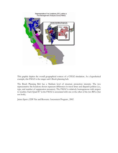
This graphic depicts the overall geographical context <strong>of</strong> a CFES2 simulation. As a hypothetical<br />
example, this FMAZ is the ranger unit’s Brush planning belt.<br />
The Brush Planning Belt has a Medium level <strong>of</strong> structure protection intensity. The two<br />
representative fire locations shown represent differences in travel times and dispatch policies (i.e.,<br />
type, and number <strong>of</strong> suppression resources). The FMAZ is relatively homogeneous with respect<br />
to weather. Each Quad 81 st in the FMAZ is associated with one or the other <strong>of</strong> the two RFLs (but<br />
not both).<br />
James Spero ,CDF Fire and Resource Assessment Program , 2002