Point Cook West Precinct Structure Plan - Growth Areas Authority
Point Cook West Precinct Structure Plan - Growth Areas Authority
Point Cook West Precinct Structure Plan - Growth Areas Authority
Create successful ePaper yourself
Turn your PDF publications into a flip-book with our unique Google optimized e-Paper software.
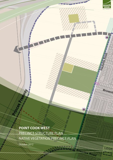
Princes Princes Freeway Freeway<br />
POINT COOK WEST<br />
PRECINCT STRUCTURE PLAN<br />
NATIVE VEGETATION PRECINCT PLAN<br />
October 2012<br />
Sneydes Road<br />
Hacketts Road<br />
Brownlo Brownlo<br />
LEGEN
POINT COOK WEST PRECINCT STRUCTURE PLAN<br />
ii INTRODUCTION<br />
SM | 20121029 05:04
CONTENTS<br />
1.0 INTRODUCTION 3<br />
1.1 How to use this document 3<br />
1.2 Application 3<br />
1.3 Development Contributions <strong>Plan</strong> 4<br />
1.4 Native Vegetation <strong>Precinct</strong> <strong>Plan</strong> 4<br />
1.5 Background information 4<br />
2.0 OUTCOMES 7<br />
2.1 Vision 7<br />
2.2 Objectives 7<br />
2.3 Summary land budget 8<br />
2.4 Demographic projections 9<br />
3.0 IMPLEMENTATION 10<br />
3.1 <strong>Precinct</strong> character and housing 10<br />
3.2 Employment and activity areas 11<br />
3.3 Open space and natural systems 13<br />
3.4 Transport, water and utilities 15<br />
3.5 Subdivision infrastructure 18<br />
3.6 <strong>Precinct</strong> infrastructure plan 18<br />
PLANS<br />
<strong>Plan</strong> 1: <strong>Precinct</strong> location & features 2<br />
<strong>Plan</strong> 2: Future urban structure 6<br />
<strong>Plan</strong> 3: Threatened species action & biodiversity 12<br />
<strong>Plan</strong> 4: Public transport & walking trails 14<br />
TABLES<br />
Table 1: Summary land budget and lot yield 8<br />
Table 2: Open space inventory 13<br />
Table 3: Road cross sections 17<br />
Table 4: Retarding basins 17<br />
Table 5: Infrastructure 19<br />
PART 2 23<br />
Native Vegetation <strong>Precinct</strong> <strong>Plan</strong><br />
APPENDICES 28<br />
Road cross sections<br />
POINT COOK WEST PRECINCT STRUCTURE PLAN<br />
1
East Werribee<br />
Employment<br />
<strong>Precinct</strong><br />
Master <strong>Plan</strong><br />
Sneydes Road<br />
Heaths Road<br />
Hoppers Crossing<br />
Rail Station<br />
Werribee<br />
Mercy<br />
Hospital<br />
Victoria University<br />
Werribee Campus<br />
0 150 450m<br />
Suzanne<br />
Cory<br />
High School<br />
Hoppers<br />
Crossing<br />
Shopping<br />
Centre<br />
Medical Centre<br />
(Under construction)<br />
Werribee Golf<br />
Driving Range<br />
& Mini Golf<br />
Melbourne<br />
Water<br />
Victoria University<br />
plan 1<br />
precinct location and features<br />
point cook west precinct structure plan<br />
scale: 1:20,000 @ A4<br />
2<br />
POINT COOK WEST PRECINCT STRUCTURE PLAN<br />
Hoppers Lane<br />
Hoppers Lane<br />
Old Geelong Road<br />
Princes Freeway<br />
Sneydes Road<br />
East Werribee<br />
Employment<br />
<strong>Precinct</strong><br />
Master <strong>Plan</strong><br />
Hoppers Crossing<br />
Commercial Area<br />
Hacketts Road<br />
Dunnings Road<br />
Brownlow Drive<br />
Tom Roberts Parade<br />
Sneydes Road<br />
Hoppers Crossing<br />
Commercial Area<br />
Princes Freeway<br />
<strong>Point</strong> <strong>Cook</strong><br />
College<br />
Stella Maris<br />
Catholic<br />
Primary School<br />
Boardwalk<br />
Central<br />
Shopping<br />
Centre<br />
Proposed<br />
Featherbrook<br />
Shopping Centre<br />
Proposed<br />
child care<br />
centre<br />
<strong>Point</strong> <strong>Cook</strong><br />
South P-9<br />
School<br />
LEGEND<br />
<strong>Precinct</strong> boundary<br />
Watercourse<br />
Rail line (with station)<br />
Tenix gas 1m easement<br />
Shell oil pipes<br />
Melbourne Water western trunk<br />
sewer<br />
Shell oil pipes easement<br />
Significant open space<br />
Urban growth boundary<br />
Existing bridge<br />
Skeleton Creek<br />
Boardwalk Blvd<br />
<strong>Point</strong> <strong>Cook</strong><br />
Town Centre<br />
<strong>Point</strong> <strong>Cook</strong><br />
Senior<br />
Secondary<br />
College<br />
SM | 20121029 05:04<br />
Wetlands
1.0 INTRODUCTION<br />
The <strong>Point</strong> <strong>Cook</strong> <strong>West</strong> <strong>Precinct</strong> <strong>Structure</strong> <strong>Plan</strong> (the PSP) has been prepared by the <strong>Growth</strong> <strong>Areas</strong> <strong>Authority</strong><br />
(GAA) with the assistance of the Wyndham City Council, Government agencies, service authorities and<br />
stakeholders.<br />
The <strong>Precinct</strong> <strong>Structure</strong> <strong>Plan</strong> is a set of decisions about how the land is to be developed. The PSP:<br />
• Sets out plans to guide the delivery of quality urban environments in accordance with the Victorian<br />
Government guidelines.<br />
• Enables the transition of non-urban land to urban land.<br />
• Sets the vision for how land should be developed and the outcomes to be achieved.<br />
• Outlines the projects required to ensure that future residents, visitors and workers within the area can<br />
be provided with timely access to services and transport necessary to support a quality, affordable<br />
lifestyle.<br />
• Sets out guidelines and requirements for land use and development.<br />
• Addresses the requirements of the Environment Protection and Biodiversity Conservation Act 1999 in<br />
accordance with an approved program under Part 10 of the Act.<br />
• Provides Government agencies, the Council, developers, investors and local communities with certainty<br />
about future development.<br />
1.1 How to use this document<br />
This precinct structure plan guides land use and development where a planning permit is required under<br />
the Urban <strong>Growth</strong> Zone or another zone where that zone references this precinct structure plan.<br />
A planning application and a planning permit must implement the outcomes of the precinct structure plan.<br />
The outcomes are expressed as the vision and objectives.<br />
Each element of the precinct structure plan contains requirements, guidelines and conditions as relevant.<br />
Requirements must be adhered to in developing the land. Where they are not demonstrated in a permit<br />
application, requirements will usually be included as a condition on a planning permit whether or not they<br />
take the same wording as in this structure plan. A requirement may include or reference a plan, table or<br />
figure in the precinct structure plan.<br />
Guidelines express how discretion will be exercised by the responsible authority in certain matters that<br />
require a planning permit. If the responsible authority is satisfied that an application for an alternative to<br />
a guideline implements the outcomes the responsible authority may consider the alternative. A guideline<br />
may include or reference a plan, table or figure in the precinct structure plan.<br />
Conditions must be included in a planning permit.<br />
Meeting these requirements, guidelines and conditions will implement the outcomes of the precinct<br />
structure plan.<br />
Development must also comply with other Acts and approvals where relevant e.g. the Environment<br />
Protection and Biodiversity Act 1999 in the case of biodiversity or the Aboriginal Heritage Act 2006 in the<br />
case of cultural heritage amongst others.<br />
Not every aspect of the land’s use and development is addressed in this structure plan and a Responsible<br />
<strong>Authority</strong> may manage development and issue permits as relevant under its general discretion.<br />
1.2 Application<br />
POINT COOK WEST PRECINCT STRUCTURE PLAN<br />
The PSP applies to approximately 141 hectares of land as shown on <strong>Plan</strong> 1. The PSP area is generally bound<br />
by the Princes Freeway to the north and west, Hacketts Road to the east and Sneydes Road to the south.<br />
<strong>Plan</strong> 1 also identifies the key features of the land including utility easements.<br />
INTRODUCTION<br />
3
POINT COOK WEST PRECINCT STRUCTURE PLAN<br />
4 INTRODUCTION<br />
This page has been left blank intentionally<br />
SM | 20121029 05:04
1.3 Development Contributions <strong>Plan</strong><br />
Development proponents within the <strong>Point</strong> <strong>Cook</strong> <strong>West</strong> <strong>Precinct</strong> will be bound by the <strong>Point</strong> <strong>Cook</strong> <strong>West</strong><br />
Development Contributions <strong>Plan</strong> (the DCP). The DCP has been prepared concurrently with the PSP. It sets<br />
out requirements for development proponents to make a contribution toward infrastructure required to<br />
support the development of the precinct.<br />
The DCP is contained in a separate document and is incorporated in the Wyndham <strong>Plan</strong>ning Scheme.<br />
1.4 Native Vegetation <strong>Precinct</strong> <strong>Plan</strong><br />
The <strong>Point</strong> <strong>Cook</strong> <strong>West</strong> Native Vegetation <strong>Precinct</strong> <strong>Plan</strong> (the NVPP) has also been prepared concurrently with<br />
the PSP. The NVPP identifies:<br />
• Native vegetation which may be removed without a planning permit; and<br />
• The offsets that must be provided to remove the native vegetation which can be removed.<br />
The NVPP is contained in Part 2 of this document.<br />
1.5 Background information<br />
POINT COOK WEST PRECINCT STRUCTURE PLAN<br />
Background information on the PSP area including its local and metropolitan context, history, landform<br />
and topography, drainage, open space, biodiversity and community facilities are contained in background<br />
reports. This information has informed the preparation of the PSP.<br />
INTRODUCTION<br />
5
Werribee<br />
Mercy<br />
Hospital<br />
Victoria University<br />
Werribee Campus<br />
Suzanne Cory<br />
High School<br />
East<br />
Werribee<br />
Employment<br />
<strong>Precinct</strong><br />
Master <strong>Plan</strong><br />
Sneydes Sneydes Road Road<br />
POINT COOK WEST PRECINCT STRUCTURE PLAN<br />
Hoppers<br />
Crossing<br />
Shopping<br />
Centre<br />
Hoppers Crossing<br />
Rail Station<br />
Hoppers Hoppers Lane Lane<br />
Heaths Heaths Road Road<br />
Medical Centre<br />
(Under construction)<br />
Werribee Golf<br />
Driving Range<br />
& Mini Golf<br />
Melbourne<br />
Water<br />
Victoria University<br />
plan 2<br />
future urban structure<br />
point cook west precinct structure plan<br />
scale: 1:12,500 @ A4<br />
0 100 300m<br />
6 OUTCOMES<br />
Sneydes Sneydes Road Road<br />
Old Old Geelong Geelong Road Road<br />
Princes Princes Freeway Freeway<br />
Hoppers Crossing<br />
Commercial Area<br />
East<br />
Werribee<br />
Employment<br />
<strong>Precinct</strong><br />
Master <strong>Plan</strong><br />
Hoppers Crossing<br />
Commercial Area<br />
Hacketts Road<br />
Sneydes Road<br />
Dunnings Road<br />
Brownlow Brownlow Drive Drive<br />
LEGEND<br />
Tom Tom Roberts Roberts Parade Parade<br />
<strong>Precinct</strong> boundary<br />
Watercourse<br />
Rail line (with station)<br />
Medium density residential (indicative)<br />
Conventional residential<br />
Significant open space<br />
East Werribee Employment <strong>Precinct</strong><br />
Education facilities<br />
Commercial area<br />
Potential local convenience centre location<br />
Unencumbered passive open space<br />
Unencumbered active open space<br />
Shell oil pipes easement<br />
Tenix gas 1m easement<br />
Primary arterial road (Future)<br />
Local arterial road<br />
Connector street<br />
Key local access street (indicative only)<br />
Land required for interchange/overpass<br />
Existing bridge<br />
Princes Princes Freeway Freeway<br />
Skeleton Skeleton Creek Creek<br />
Pedestrian crossing - signalised<br />
Retarding basin<br />
SM | 20121029 05:04<br />
<strong>Point</strong> <strong>Cook</strong><br />
College<br />
Stella<br />
Maris<br />
Catholic<br />
Primary<br />
School
2.0 OUTCOMES<br />
2.1 Vision<br />
<strong>Point</strong> <strong>Cook</strong> <strong>West</strong> is a new residential community at the gateway to the East Werribee Employment <strong>Precinct</strong>.<br />
It will be an extension to the existing <strong>Point</strong> <strong>Cook</strong> community and well connected to <strong>Point</strong> <strong>Cook</strong> to the<br />
east, and to existing and future employment opportunities, services and facilities in the East Werribee<br />
Employment <strong>Precinct</strong> to the south and west.<br />
The new community will have good opportunities to get around locally via streets and trails that encourage<br />
walking and cycling as well as connecting with the wider metropolitan trail network.<br />
A district park will be home to sports facilities and clubs that will serve the local community and <strong>Point</strong> <strong>Cook</strong><br />
more broadly.<br />
There will be a greater diversity of housing types in <strong>Point</strong> <strong>Cook</strong> <strong>West</strong>, including small lot houses, than has<br />
been typical of many new suburbs in the west.<br />
Over time, the Principal Public Transport Network (Sneydes Road and Dunnings Road) will be developed<br />
to provide higher frequency services by road and rail to destinations across Melbourne including the East<br />
Werribee Employment <strong>Precinct</strong>, Werribee City Centre and nearby town centres.<br />
The interchange with the Princes Freeway at Sneydes Road will have traffic benefits for the wider region.<br />
2.2 Objectives<br />
The following points describe the desired outcomes of development of the precinct and guide the<br />
implementation of the vision.<br />
O1 Housing diversity and choice for a range of household types and sizes.<br />
O2 A discernable and consistent residential character.<br />
O3<br />
Small lot housing concentrated around parks with some small lot housing scattered through the<br />
precinct and within convenient walking distance of the Principle Public Transport Network.<br />
O4 A district open space reserve and related facilities form the hub of the community.<br />
O5 The trail and path network will connect to Skeleton Creek, Federation Trail and Featherbrook Trail.<br />
O6 Access to the Princes Freeway is improved and traffic congestion in <strong>Point</strong> <strong>Cook</strong> is relieved.<br />
O7<br />
O8<br />
POINT COOK WEST PRECINCT STRUCTURE PLAN<br />
Improve access for car, bicycle, pedestrian and public transport opportunities for <strong>Point</strong> <strong>Cook</strong> <strong>West</strong>,<br />
<strong>Point</strong> <strong>Cook</strong> and the East Werribee Employment <strong>Precinct</strong>.<br />
Early provision of the path network to connect key features of the precinct with the regional<br />
network outside the precinct.<br />
The structure of <strong>Point</strong> <strong>Cook</strong> <strong>West</strong> has been designed to achieve the general objectives and standards set<br />
out in the <strong>Precinct</strong> <strong>Structure</strong> <strong>Plan</strong>ning Guidelines as well as requirements of State and Local planning<br />
frameworks.<br />
OUTCOMES<br />
7
POINT COOK WEST PRECINCT STRUCTURE PLAN<br />
2.3 Summary land budget<br />
8 OUTCOMES<br />
The Net Developable Area (NDA) is established by deducting the land requirements for transport<br />
infrastructure, easements, retarding basins, and active and passive open space from the total precinct area.<br />
The NDA for the <strong>Precinct</strong> is 105.66 hectares which equates to approximately 75% of the PSP area. This is<br />
the land that is available for residential development..<br />
Of the 105.66 hectares available for residential development, 84.89 hectares is identified for conventional<br />
density housing and 20.77 hectares is identified for medium density housing. Conventional density housing<br />
development is expected to yield 15 dwellings per hectare. Medium density housing may yield up to 35<br />
dwellings per hectare. Overall the precinct is expected to yield 2000 dwellings at an average of 18.93<br />
dwellings per hectare.<br />
The land budget and lot yield is summarised in Table 1 – Summary Land Budget and Lot Yield<br />
Table 1: Summary Land Budget and Lot Yield<br />
DESCRIPTION Hectares<br />
% of Total<br />
Area<br />
TOTAL PRECINCT AREA (ha) 141.03 100.0%<br />
% of NDA<br />
TRANSPORT<br />
Arterial road (41m reservation - Sneydes Road) 1.34 0.95% 1.26%<br />
Local arterial road (34m reservation - Dunnings Road) 3.37 2.39% 3.19%<br />
Sneydes Road interchange 13.66 9.69% 12.93%<br />
Sub-total<br />
OPEN SPACE<br />
Encumbered land available for recreation<br />
18.37 13.02% 17.38%<br />
Tenix easements 0.07 0.05% 0.07%<br />
Shell easements 1.71 1.21% 1.62%<br />
Sub-total 1.78 1.26% 1.68%<br />
Retarding Basin<br />
Unencumbered land available for recreation<br />
3.50 2.48% 3.31%<br />
Active open space 8.73 6.2% 8.26%<br />
Passive open space 3.00 2.1% 2.84%<br />
Sub-total 11.73 8.3% 11.10%<br />
TOTAL OPEN SPACE 17.01 12.1% 16.10%<br />
NET DEVELOPABLE AREA (NDA) ha 105.66 74.92% 100.0%<br />
HOUSING Hectares Dw/Ha Dwellings<br />
Conventional residential 84.89 15 1273<br />
Medium density residential 20.77 35 727<br />
SUBTOTAL AGAINST NET RESIDENTIAL AREA (NRA) 105.66 18.93 2000<br />
COMBINED RES/ RETAIL / EMP / OTHER NDA (Ha) Dwell / NDHA Dwellings<br />
TOTALS RESIDENTIAL YIELD AGAINST NDA 105.66 18.93 2000<br />
SM | 20121029 05:04
2.4 Demographics projections<br />
POINT COOK WEST PRECINCT STRUCTURE PLAN<br />
The future population of the the precinct is estimated by multiplying the expected number of houses by the<br />
expected average number of persons per house.<br />
An average of 2.8 persons for conventional density housing and medium density housing is used to estimate<br />
the future population of the PSP area. Using these figures, population of the PSP area is estimated at 5600.<br />
In the longer term, this household size is forecast to gradually decline toward the current metropolitan<br />
average of about 2.5 persons.<br />
Based on the demographic profile for the existing <strong>Point</strong> <strong>Cook</strong> community the PSP plans for the following<br />
characteristics compared to the Melbourne Statistical Division<br />
• A higher percentage of children aged 0-17 years.<br />
• A much lower percentage of mature adults aged 65 to 84 years and senior citizens (85+ years).<br />
• A slightly higher percentage of people employed full time, and slightly lower percentage of people<br />
unemployed.<br />
• A higher percentage of couples with children.<br />
These characteristics are generally typical of a growth area community in its establishment phase and<br />
reflect the characteristics of the existing <strong>Point</strong> <strong>Cook</strong> community.<br />
The proportion of residents at or reaching retirement age by 2031 is projected to increase significantly, in<br />
line with the projected metropolitan average.<br />
IMPLEMENTATION<br />
9
POINT COOK WEST PRECINCT STRUCTURE PLAN<br />
3.0 IMPLEMENTATION<br />
3.1 <strong>Precinct</strong> character and housing<br />
PRECINCT CHARACTER<br />
R1<br />
R2<br />
R3<br />
REQUIREMENTS<br />
Street trees must be provided on both sides of connector and local access streets at intervals of no more<br />
than 15 metres, where practicable.<br />
The design of noise attenuation structures including materials, finishes and landscaping must be high<br />
quality to the satisfaction of VicRoads and the Council.<br />
Retarding basins at gateways to the precinct must be designed and landscaped to enhance visual<br />
amenity of the gateway location.<br />
G1 Use street tree species to develop a consistent character across the precinct.<br />
G2<br />
Use variations in street tree species to create visual cues in appropriate locations such as at the<br />
termination of view lines, key intersections, and in parks.<br />
GUIDELINES<br />
G3 Noise attenuation structures should be landscaped to enhance amenity and designed for public safety.<br />
G4 Subdivisions should be designed to enhance the safety and amenity of noise attenuation structures.<br />
G5<br />
G6<br />
HOUSING<br />
R4<br />
R5<br />
G7<br />
G8<br />
G9<br />
G10<br />
10 IMPLEMENTATION<br />
Where practicable, consider amalgamating some passive open space with retarding basins in gateway<br />
locations.<br />
Road alignments north of Dunnings Road should ensure housing fronts streets and new development<br />
integrates with existing housing in Campaspe Way and Hacketts Road.<br />
REQUIREMENTS<br />
Achieve a minimum density of 15 dwellings per Net Developable Hectare (NDHa) across the entire<br />
precinct.<br />
Eliminate the need for a planning permit for small lot housing in appropriate locations where the<br />
requirements of the Small Lot Housing Code are met.<br />
Individual developments should achieve an average density of at least 15 dwellings per Net<br />
Developable Hectare (NDHa).<br />
Deliver a broad range of dwelling types, which may include:<br />
• multi-storey apartments<br />
• terrace housing<br />
• attached housing<br />
• semi-detached housing<br />
• integrated housing<br />
• detached housing<br />
• retirement housing<br />
• housing in mixed use development<br />
• villa units<br />
GUIDELINES<br />
Higher density housing should be concentrated around areas of highest amenity and activity including<br />
within convenient walking distance to existing and proposed Principle Public Transport Network routes<br />
and potential local bus routes.<br />
Medium density housing should be concentrated around areas of high amenity including within<br />
convenient walking distance to public transport.<br />
G11 Some medium and higher density housing may be scattered across the precinct.<br />
SM | 20121029 05:04
3.2 Employment and activity areas<br />
BUILDING DESIGN<br />
R6<br />
REQUIREMENTS<br />
Non-residential building facades on side streets (excluding shopfronts) that exceed 10m in length must<br />
be articulated to the satisfaction of the responsible authority.<br />
NON RESIDENTIAL USES<br />
G12<br />
G13<br />
G14<br />
G15<br />
Commercial uses usually found in residential areas should locate adjacent to a neighbourhood<br />
convenience centre and/or Dunnings, Hacketts or Sneydes Roads<br />
GUIDELINES<br />
A neighbourhood convenience centre (or centres) of up to approximately 1,000m2 retail floor space is<br />
encouraged.<br />
Retail and commercial buildings in a local convenience centre should generally be built to the property<br />
line.<br />
Footpaths associated with neighbourhood convenience shopping should extend from kerb-line to<br />
property line to cater for increased pedestrian activity and allow for street dining.<br />
G16 Housing above retail and professional services buildings is encouraged.<br />
POINT COOK WEST PRECINCT STRUCTURE PLAN<br />
IMPLEMENTATION<br />
11
Werribee<br />
Mercy<br />
Hospital<br />
Victoria University<br />
Werribee Campus<br />
Suzanne Cory<br />
High School<br />
East<br />
Werribee<br />
Employment<br />
<strong>Precinct</strong><br />
Master <strong>Plan</strong><br />
Sneydes Road<br />
POINT COOK WEST PRECINCT STRUCTURE PLAN<br />
Hoppers<br />
Crossing<br />
Shopping<br />
Centre<br />
Hoppers Crossing<br />
Rail Station<br />
Hoppers Lane<br />
Heaths Road<br />
Medical Centre<br />
(Under construction)<br />
Werribee Golf<br />
Driving Range<br />
& Mini Golf<br />
Melbourne<br />
Water<br />
Victoria University<br />
Sneydes Road<br />
Old Geelong Road<br />
Princes Freeway<br />
plan 3<br />
threatened species action and biodiversity plan<br />
point cook west precinct structure plan<br />
scale: 1:12,500 @ A4<br />
0 100 300m<br />
12 IMPLEMENTATION<br />
3<br />
Hoppers Crossing<br />
Commercial Area<br />
East<br />
Werribee<br />
Employment<br />
<strong>Precinct</strong><br />
Master <strong>Plan</strong><br />
2<br />
1<br />
Sneydes Road<br />
LEGEND<br />
1<br />
Hoppers Crossing<br />
Commercial Area<br />
Hacketts Road<br />
Brownlow Drive<br />
<strong>Precinct</strong> boundary<br />
Parcel boundary<br />
Property reference number<br />
Native vegetation<br />
Dunnings Road<br />
Princes Freeway<br />
Skeleton Creek<br />
Tom Roberts Parade<br />
<strong>Point</strong> <strong>Cook</strong><br />
College<br />
Stella<br />
Maris<br />
Catholic<br />
Primary<br />
School<br />
NOTES:<br />
- The entire precinct is Striped legless Lizard habitat<br />
- The area of Plains Grassy Wetland is potential Growling Grass Frog habitat<br />
SM | 20121029 05:04
3.3 Open space and natural systems<br />
OPEN SPACE<br />
R7<br />
R8<br />
R9<br />
R10<br />
G17<br />
G18<br />
REQUIREMENTS<br />
The final location design and configuration of active and passive open space reserves must be to the<br />
satisfaction of the responsible authority.<br />
All public landscaped areas must be designed for low maintenance and amenity to the satisfaction of<br />
the responsible authority.<br />
Public open space and drainage and waterway infrastructure must be adjoined at each edge by a street<br />
or lots aligned to front the open space unless otherwise agreed in writing by the responsible authority.<br />
All land owners must provide a public open space contribution equal to2.84% of Net Developable Area<br />
(NDA) upon subdivision of land in accordance with the following:<br />
• Where land is required for unencumbered open space purposes as shown in <strong>Plan</strong> 2 and<br />
specified in Table 2 and is less or equal to 2.84% of NDA that land is to be transferred to Council<br />
at no cost.<br />
• Where no land or less than 2.84% of NDA is shown in <strong>Plan</strong> 2 and specified in Table 2, a cash<br />
contribution is to be made to Council to bring total open space contribution to a value equal to<br />
2.84% of NDA.<br />
• Where land required for unencumbered open space purposes as shown in <strong>Plan</strong> 2 and specified<br />
in Table 2 is more than 2.84% of NDA, Council will pay an amount equivalent to the value of the<br />
additional land being provided by that property.<br />
The value of land for equalisation purposes is to be assessed as an equivalent proportion of the value of<br />
the whole of the land, in accordance with Section 18 of the Subdivision Act 1988<br />
GUIDELINES<br />
Any residential landscape buffers associated with noise attenuation structures should be designed to<br />
integrate with the open space network.<br />
Where practicable, consider amalgamating some passive open space with retarding basins in gateway<br />
locations.<br />
Table 2: Open space inventory<br />
Description Area Location Responsibility<br />
Active and passive open space suitable for:<br />
• two AFL ovals and associated pavilion<br />
• 6 – 12 tennis courts and associated pavilion<br />
• car parking<br />
• landscaping<br />
• neighbourhood park facilities such as BBQ,<br />
public shelter<br />
Passive open space including:<br />
• playground<br />
• landscaping<br />
• park furniture<br />
• dispersal area suitable for ball games<br />
Passive open space including:<br />
• playground<br />
• landscaping<br />
• park furniture<br />
• dispersal area suitable for ball games<br />
1.0 hectare passive<br />
8.73 hectares active<br />
1.0 hectare North<br />
1.0 hectare South<br />
Hacketts Road,<br />
Central<br />
Wyndham City<br />
Council<br />
Wyndham City<br />
Council<br />
Wyndham City<br />
Council<br />
THREATENED SPECIES ACTION AND BIODIVERSITY PLAN<br />
REQUIREMENTS<br />
R11<br />
POINT COOK WEST PRECINCT STRUCTURE PLAN<br />
All development must provide offsets and provide salvage and translocation in accordance with<br />
Prescriptions for listed species and communities.<br />
IMPLEMENTATION<br />
13
Werribee<br />
Mercy<br />
Hospital<br />
Victoria University<br />
Werribee Campus<br />
Suzanne Cory<br />
High School<br />
East Werribee<br />
Employment<br />
<strong>Precinct</strong><br />
Master <strong>Plan</strong><br />
Sneydes Road<br />
POINT COOK WEST PRECINCT STRUCTURE PLAN<br />
Hoppers<br />
Crossing<br />
Shopping<br />
Centre<br />
Hoppers Crossing<br />
Rail Station<br />
Medical Centre<br />
(Under construction)<br />
Hoppers Lane<br />
Federation Trail<br />
Heaths Road<br />
Werribee Golf<br />
Driving Range<br />
& Mini Golf<br />
Melbourne<br />
Water<br />
Victoria University<br />
plan 4<br />
public transport and trails<br />
point cook west precinct structure plan<br />
scale: 1:12,500 @ A4<br />
0 100 300m<br />
14 IMPLEMENTATION<br />
Old Geelong Road<br />
Princes Freeway<br />
Hoppers Crossing<br />
Commercial Area<br />
East Werribee<br />
Employment<br />
<strong>Precinct</strong><br />
Master <strong>Plan</strong><br />
Federation Trail<br />
Hoppers Crossing<br />
Commercial Area<br />
Hacketts Road<br />
Brownlow Drive<br />
Sneydes Road<br />
LEGEND<br />
Dunnings Road<br />
<strong>Precinct</strong> boundary<br />
Unencumbered passive open space<br />
Unencumbered active open space<br />
Shell oil pipes easement<br />
PPTN<br />
Potential local bus route<br />
Shared trail - off road and bike lane - on road<br />
Shared trail - off road<br />
Options for shared trail / bike lanes<br />
Bike lane - on road<br />
Potential future shared trail - off road<br />
Existing trail<br />
Pedestrian crossing - signalised<br />
Future pedestrain overpass (indicative location)<br />
Trail connection<br />
Land required for interchange/overpass<br />
Retarding basin<br />
Princes Freeway<br />
Skeleton Creek<br />
Tom Roberts Parade<br />
SM | 20121029 05:04<br />
<strong>Point</strong> <strong>Cook</strong><br />
College<br />
Stella<br />
Maris<br />
Catholic<br />
Primary<br />
School
3.4 Transport, water and utilities<br />
TRANSPORT: PUBLIC TRANSPORT<br />
R12<br />
REQUIREMENTS<br />
Bus stop facilities must be constructed by development proponents as part of the subdivision<br />
works (prior to the issue of a statement of compliance for the relevant stage) in accordance with the<br />
requirements of the Public Transport Guidelines for Land Use and Development and to the satisfaction<br />
of the Director of Public Transport.<br />
TRANSPORT: ROAD NETWORK<br />
R13<br />
R14<br />
R15<br />
R16<br />
Arterial roads and connector streets must be constructed in accordance with the cross sections<br />
identified in Table 3 and as shown on Appendix A.<br />
REQUIREMENTS<br />
Staging of subdivisions is to provide for the timely connection of road links between properties and<br />
to the connector and arterial road network and the off-road pedestrian and bicycle network to the<br />
satisfaction of the responsible authority.<br />
Driveway access to lots fronting arterial, sub-arterial road or connector road must be provided from<br />
internal loop roads, local roads or rear lanes to the satisfation of the responsible authority.<br />
Where vehicle access to lots is from the front of the lot, street blocks must not exceed 200 metres in<br />
length. Intervals between blocks may take the form of either a trafficable street or pedestrian passage<br />
of no less than 4 metres in width.<br />
R17 Land required for the Sneydes Road interchange must be set aside for this purpose.<br />
G19<br />
G20<br />
G21<br />
G22<br />
G23<br />
G24<br />
POINT COOK WEST PRECINCT STRUCTURE PLAN<br />
GUIDELINES<br />
Roads north of Dunnings Roads should be configured to allow new housing to back onto existing<br />
development and allow new dwellings to face streets.<br />
Street layouts should provide multiple convenient routes to major destinations to disperse traffic across<br />
the precinct, as appropriate.<br />
Street layouts should provide all lots with efficient passage to local facilities and regional travel routes.<br />
Culs-de-sac should not detract from convenient pedestrian, bicycle, public transport and vehicular<br />
connections.<br />
Local access streets (excluding lanes) should be configured in accordance with <strong>Growth</strong> <strong>Areas</strong> <strong>Authority</strong><br />
Demonstration Example – Access Place / Access Street Level 1 and Demonstration Example Access<br />
Street level 2 contained within the PSP Note Our Roads: Connecting People. - (Note; Demonstration<br />
examples may be updated and revised and additional Demonstration examples added.)<br />
Fianl design of the Sneydes Road interchange should consider the practicability of retaining the existing<br />
Sneydes Road bridge as a dedicated bicycle and pedestrian bridge.<br />
IMPLEMENTATION<br />
15
POINT COOK WEST PRECINCT STRUCTURE PLAN<br />
TRANSPORT: WALKING & CYCLING<br />
R18<br />
REQUIREMENTS<br />
Shared trails not included in the DCP must be constructed by development proponents as part of subdivision<br />
works prior to the issue of a statement of compliance for the relevant stage of development.<br />
R19 Pedestrian paths must be provided on both sides of connector and access streets.<br />
R20<br />
All shared trails within retarding basins must be designed to meet the safety and access requirements of the<br />
responsible authority and Melbourne Water.<br />
R21 Pedestrian and cycle crossing points must be provided at all intersections and on key desire lines.<br />
R22<br />
Cycle parking facilities must be provided by development proponents in convenient locations at key<br />
destinations such as parks.<br />
G25 Appropriately scaled lighting should be installed along all major pedestrian and cycle paths.<br />
GUIDELINES<br />
G26 Location of shared trails should make the best use of opportunities for passive surveillance, where practicable.<br />
G27<br />
WATER<br />
R23<br />
R24<br />
Pedestrian, cycle path and shared trail connections with roads should be designed to allow for the safe and<br />
convenient transition between on-road and off-road networks.<br />
REQUIREMENTS<br />
Development must conform to relevant policies and strategies being implemented by the responsible authority<br />
and relevant referral authorities including any approved plan for integrated water cycle management.<br />
Final design of drainage and waterway infrastructure including retarding basins (refer to Table 4) is to be to the<br />
satisfaction of the responsible authority and Melbourne Water.<br />
R25 Integrated water management design must be to the satisfaction of the responsible authority.<br />
R26<br />
G28<br />
UTILITIES<br />
R27<br />
R28<br />
Drainage outfall structures to control stormwater flows to pre-development rates must be designed and<br />
constructed to the satisfaction of the responsible authority and Melbourne Water.<br />
GUIDELINES<br />
Development proponents should consider opportunities for water harvesting and reuse in conjunction with<br />
Melbourne Water, the water retailer and the Council.<br />
REQUIREMENTS<br />
All new electricity supply infrastructure must be provided underground excluding substation and cables with a<br />
voltage greater than 66kv.<br />
New substations must be identified at subdivision design response stage and must be sited to minimise<br />
amenity impacts.<br />
G29 Electricity substations should be screened and located outside of key view lines.<br />
16 IMPLEMENTATION<br />
GUIDELINES<br />
SM | 20121029 05:04
Table 3: Road cross sections<br />
Description Location Configuration Responsibility<br />
Dunnings Road Between Hacketts Road and<br />
north-south connector<br />
North-south<br />
connector<br />
Tom Roberts<br />
Parade<br />
Between Dunnings Road<br />
extension and Tom Roberts<br />
Parade extension<br />
34m secondary arterial reservation. Interim<br />
construction as per Figure 1 in Appendix A.<br />
Ultimate configuration to be determined by<br />
Wyndham Council.<br />
25m residential connector streets as per<br />
Figure 2 in Appendix A.<br />
Extension west of Hacketts Road 31m connector street (residential with<br />
lanscaped shared trail) as per Figure 3 in<br />
Appendix A or as otherwise agreed in writing<br />
by the responsible authority.<br />
Sneydes Road Between the intersection with<br />
Hacketts and the interchange<br />
Table 4: Retarding basins<br />
41m arterial road reservation for potential 6<br />
lane configuration. Ultimate configuration to<br />
be determined by VicRoads.<br />
Wyndham City<br />
Council<br />
Wyndham City<br />
Council<br />
Wyndham City<br />
Council<br />
VicRoads<br />
ID * Area Ha Location Responsibility<br />
RB10 0.45 Hacketts Road, far north of Dunnings Road Wyndham City Council<br />
RB9 1.38 Hacketts Road, north of Dunnings Road Melbourne Water<br />
RB8a 1.69 Hacketts Road, north of Sneydes Road intersection Wyndham City Council<br />
RB8c 2.45 Hacketts Road, south of Sneydes Road intersection<br />
(Outside PSP boundary)<br />
Wyndham City Council<br />
RB8b 6.39 Hacketts Road, south of Sneydes Road<br />
Wyndham City Council or<br />
(Outside PSP boundary)<br />
Melbourne Water<br />
* Refer to <strong>Plan</strong> 4 in the <strong>Point</strong> <strong>Cook</strong> <strong>West</strong> Background Report, June 2012.<br />
POINT COOK WEST PRECINCT STRUCTURE PLAN<br />
IMPLEMENTATION<br />
17
POINT COOK WEST PRECINCT STRUCTURE PLAN<br />
3.5 Subdivision infrastructure<br />
SUBDIVISION WORKS<br />
R29<br />
REQUIREMENTS<br />
As part of subdivision construction works, new development must meet the total cost of delivering the<br />
following infrastructure:<br />
• Connector roads and local streets.<br />
• Local bus stop infrastructure.<br />
• Landscaping of all existing and future roads and local streets.<br />
• Intersection works and traffic management measures along arterial roads, connector streets,<br />
and local streets.<br />
• Council approved fencing and landscaping (where required) along arterial roads.<br />
• Local pedestrian and shared trails along local arterial roads, connector roads and local streets,<br />
within local parks and easements (except those included in the Development Contributions<br />
<strong>Plan</strong>).<br />
• Basic improvements to local parks / open space including leveling, grassing, tree planting and<br />
local paths consistent with the Council’s required construction standards.<br />
• Local drainage systems.<br />
• Infrastructure as required by utility services providers including water, sewerage, drainage<br />
(except where the item is funded through a drainage scheme) , electricity, gas, and<br />
telecommunications<br />
3.6 <strong>Precinct</strong> infrastructure plan<br />
The items listed in Table 5 are key infrastructure projects needed for the development of the precinct and<br />
adjoining areas. The infrastructure items and services are to be provided through mechanisms including:<br />
• Subdivision construction works by developers<br />
• Utility service provider requirements<br />
• Capital works projects by Wyndham City Council, State government agencies and non-government<br />
organizations.<br />
• The <strong>Point</strong> <strong>Cook</strong> <strong>West</strong> Development Contributions <strong>Plan</strong><br />
• Development contributions by adjacent precincts<br />
18 IMPLEMENTATION<br />
0 50 100 200 300m<br />
SM | 20121029 05:04
Table 5: Infrastructure table<br />
Description Lead Agency Timing*<br />
Construction of the Sneydes Road interchange. May be<br />
constructed initially as a Melbourne bound half diamond<br />
arrangement with the Geelong bound access ramps to be<br />
added at a later date. [Note: a realignment of the Hoppers Lane<br />
connection to Sneydes Road, south east of the interchange<br />
may be required in the Werribee East Employment <strong>Precinct</strong>.<br />
Widen Sneydes Road to 41m to allow for potential construction<br />
as a 6 lane arterial. The widening is provided north of the<br />
existing reservation of Sneydes Road.<br />
Extend Dunnings Road over the Princes Freeway.<br />
Community centre incorporating community rooms, 2<br />
maternal and child health care rooms and 2 kindergarten<br />
rooms, located south of Sneydes Road.<br />
Pedestrian bridge over the Princes Freeway.<br />
Signalised mid-block pedestrian crossing across Hacketts Road<br />
adjacent to Brownlow Drive.<br />
Sports ground including pavilions, car parking, landscaping<br />
and associated facilities.<br />
Local parks.<br />
Signalised intersection at Hacketts and Dunnings Road.<br />
Signalised intersection at Tom Roberts Parade and Hacketts<br />
Road.<br />
Provision of bus services.<br />
Additional fire suppression infrastructure including upgraded<br />
appliance increased demands on members.<br />
*Short-medium term = 0-15 years, short-term = 0-5 years<br />
POINT COOK WEST PRECINCT STRUCTURE PLAN<br />
VicRoads As soon as practicable<br />
Indicative<br />
Cost<br />
$27.5 million<br />
for Melbourne<br />
bound half<br />
diamond<br />
VicRoads Short-medium term $1.3m<br />
Wyndham City<br />
Council<br />
Wyndham City<br />
Council<br />
Wyndham City<br />
Council<br />
Wyndham City<br />
Council<br />
Wyndham City<br />
Council<br />
Wyndham<br />
City Council/<br />
Development<br />
Proponent<br />
Wyndham City<br />
Council<br />
Wyndham City<br />
Council<br />
Department of<br />
Transport<br />
Short-medium term $22 million<br />
Short-medium term $6.4 million<br />
Short-medium term $0.8 million<br />
Short term $0.3 million<br />
Short term $16.6 million<br />
Short term $2.85 million<br />
Short term $4.5 million<br />
Short term $3.1 million<br />
Short-medium term<br />
CFA Short-medium term<br />
IMPLEMENTATION<br />
19
Werribee<br />
Mercy<br />
Hospital<br />
Victorian University<br />
Werribee Campus<br />
Suzanne Cory<br />
High School<br />
Werribee<br />
Employment<br />
<strong>Precinct</strong><br />
Master <strong>Plan</strong><br />
Sneydes Road<br />
POINT COOK WEST PRECINCT STRUCTURE PLAN<br />
Hoppers Crossing<br />
Rail Station<br />
Wyndham<br />
Private<br />
Hospital<br />
(proposed)<br />
Hoppers La<br />
Heaths Road<br />
Werribee Golf<br />
Driving Range<br />
& Mini Golf<br />
Hoppers<br />
Crossing<br />
Shopping<br />
Centre<br />
Melbourne<br />
Water<br />
Victorian University<br />
map 1<br />
area where NVPP applies<br />
point cook west native vegetation precinct plan<br />
scale: 1:12,500 @ A4<br />
0 100 300m<br />
20 IMPLEMENTATION<br />
Geelong Road<br />
Princes Freeway<br />
Hoppers Crossing<br />
Commercial Area<br />
Werribee<br />
Employment<br />
<strong>Precinct</strong><br />
Master <strong>Plan</strong><br />
Hoppers Crossing<br />
Commercial Area<br />
Hacketts Road<br />
Dunnings Road<br />
Brownlow Drive<br />
Sneydes Road<br />
LEGEND<br />
Tom Roberts Parade<br />
Native vegetation precinct plan area<br />
SM | 20121029 05:04<br />
Princes Freeway<br />
Skeleton Creek<br />
<strong>Point</strong> <strong>Cook</strong><br />
College<br />
Stella<br />
Maris<br />
Catholic<br />
Primary<br />
School
PART 2<br />
POINT COOK WEST PRECINCT STRUCTURE PLAN<br />
POINT COOK WEST NATIVE VEGETATION PRECINCT PLAN<br />
This is the <strong>Point</strong> <strong>Cook</strong> <strong>West</strong> Native Vegetation <strong>Precinct</strong> <strong>Plan</strong> (NVPP) listed under the Schedule to Clause<br />
52.16 of the Wyndham <strong>Plan</strong>ning Scheme. The removal, destruction or lopping of native vegetation in<br />
accordance with this Native Vegetation <strong>Precinct</strong> <strong>Plan</strong> does not require a permit provided conditions and<br />
requirements specified in this NVPP are met.<br />
The <strong>Point</strong> <strong>Cook</strong> <strong>West</strong> NVPP applies to all land within the ‘Native Vegetation <strong>Precinct</strong> <strong>Plan</strong> Area’ shown in<br />
NVPP Map 1<br />
1.0 PURPOSE<br />
The purpose of the <strong>Point</strong> <strong>Cook</strong> <strong>West</strong> NVPP is to:<br />
• Apply a holistic, landscape wide approach to retention and removal of native vegetation within the<br />
<strong>Point</strong> <strong>Cook</strong> <strong>West</strong> NVPP area.<br />
• Specify the native vegetation to be protected and the native vegetation that can be removed, destroyed<br />
or lopped.<br />
• Ensure that the removal, destruction or lopping of native vegetation is in accordance with the Melbourne<br />
Strategic Assessment (under Part 10 of the Environment Protection and Biodiversity Conservation Act<br />
1999) and Victoria’s Native Vegetation Management – a Framework for Action, DSE 2002.<br />
• Set out the works or other necessary actions required to offset the removal, destruction or lopping of<br />
native vegetation.<br />
• Streamline the planning approvals process through a landscape wide approach to native vegetation<br />
protection and management.<br />
2.0 VEGETATION PROTECTION OBJECTIVES TO BE ACHIEVED<br />
The objectives of the <strong>Point</strong> <strong>Cook</strong> <strong>West</strong> NVPP are to:<br />
• Provide for the protection of revegetated and regenerated native vegetation in offset sites.<br />
• Protect and manage threatened species, communities and habitats in accordance with the Melbourne<br />
Strategic Assessment.<br />
3.0 NATIVE VEGETATION TO BE PROTECTED<br />
There is no native vegetation in the precinct that is required to be protected.<br />
4.0 NATIVE VEGETATION WHICH CAN BE REMOVED, DESTROYED OR LOPPED<br />
The native vegetation shown on Map 2 and described in NVPP Table 1 can be removed, destroyed or lopped<br />
subject to the requirements and conditions set out below as allowed.<br />
4.1 Conditions for removal of native vegetation<br />
IMPLEMENTATION<br />
21
Werribee<br />
Mercy<br />
Hospital<br />
Victorian University<br />
Werribee Campus<br />
Suzanne Cory<br />
High School<br />
Werribee<br />
Employment<br />
<strong>Precinct</strong><br />
Master <strong>Plan</strong><br />
Sneydes Road<br />
POINT COOK WEST PRECINCT STRUCTURE PLAN<br />
Morris Road<br />
Hoppers<br />
Crossing<br />
Shopping<br />
Centre<br />
Hoppers Crossing<br />
Rail Station<br />
Wyndham<br />
Private<br />
Hospital<br />
(proposed)<br />
Hoppers La<br />
0 100 300m<br />
Heaths Road<br />
Werribee Golf<br />
Driving Range<br />
& Mini Golf<br />
Melbourne<br />
Water<br />
Victorian University<br />
Geelong Road<br />
Princes Freeway<br />
HZ1<br />
HZ2<br />
Hoppers Crossing<br />
Commercial Area<br />
HZ6<br />
Werribee<br />
Employment<br />
<strong>Precinct</strong><br />
Master <strong>Plan</strong><br />
map 2<br />
native vegetation to be protected & which can be removed<br />
point cook west native vegetation precinct plan<br />
scale: 1:12,500 @ A4<br />
22 APPENDICES<br />
HZ3<br />
HZ5<br />
HZ4<br />
LEGEND<br />
Hoppers Crossing<br />
Commercial Area<br />
Hacketts Road<br />
Dunnings Road<br />
Brownlow Drive<br />
Sneydes Road<br />
Native vegetation precinct plan<br />
Tom Roberts Parade<br />
Remnant patches to be removed<br />
(Plains grassy wetland)<br />
Degraded treeless vegetation to be removed<br />
(Natural temperate grassland)<br />
Princes Freeway<br />
Skeleton Creek<br />
<strong>Point</strong> <strong>Cook</strong><br />
College<br />
Notes:<br />
The entire precinct is Striped Legless Lizard habitat.<br />
The area of Plains Grassy Wetland is potential Growling Grass frog habitat.<br />
SM | 20121029 05:04<br />
Stella<br />
Maris<br />
Catholic<br />
Primary<br />
School
NVPP Table: 1: Habitat Zones of native vegetation which can be removed<br />
PROPERTY<br />
NUMBER<br />
2<br />
2<br />
2<br />
2<br />
2<br />
3<br />
PROPERTY ADDRESS<br />
CA11D, Section B, Parish of<br />
Tarneit<br />
CA11D, Section B, Parish of<br />
Tarneit<br />
CA11D, Section B, Parish of<br />
Tarneit<br />
CA11D, Section B, Parish of<br />
Tarneit<br />
CA11D, Section B, Parish of<br />
Tarneit<br />
CA2A, Section C, Parish of<br />
Deutgam<br />
HABITAT<br />
ZONE<br />
ID<br />
POINT COOK WEST PRECINCT STRUCTURE PLAN<br />
The native vegetation described in Table 1 and shown in Map 2 as native vegetation that ‘can be removed’<br />
can be removed, destroyed or lopped under Clause 52.16-3 of the Wyndham <strong>Plan</strong>ning Scheme.<br />
Only the native vegetation which is identified for removal in the <strong>Point</strong> <strong>Cook</strong> <strong>West</strong> NVPP applying to the land<br />
may be removed, lopped or destroyed without a permit, under this NVPP.<br />
Before the removal, destruction or lopping of any native vegetation within the property the owner of the<br />
land from which the native vegetation is being removed must provide offsets consistent with this Native<br />
Vegetation <strong>Precinct</strong> <strong>Plan</strong> by either:<br />
• Providing an allocated credit extract issued by the Department of Sustainability and Environment; or<br />
• Preparing and submitting an Offset <strong>Plan</strong> to the satisfaction of the Department of Sustainability and<br />
Environment for the approval of the responsible authority. The Offset <strong>Plan</strong> must be approved prior to<br />
removal, destruction or lopping of any native vegetation.<br />
4.1.1 Where an Offset <strong>Plan</strong> is required:<br />
• Before the removal, destruction or lopping of any native vegetation the owner of the land from<br />
which the native vegetation is being removed must provide on-title security for the offset site to the<br />
satisfaction of the Department of Sustainability and Environment that provides for the implementation<br />
of the Offset <strong>Plan</strong> and pay the reasonable costs of the preparation, execution and registration of any<br />
on-title agreement.<br />
• Offsets must be initiated within 12 months of the approval of the Offset <strong>Plan</strong> or before the removal<br />
of Very High Conservation Significance vegetation and be implemented according to the schedule of<br />
works in the offset plan to the satisfaction of the responsible authority. Before the removal, destruction<br />
or lopping of any native vegetation any native vegetation to be removed (in accordance with this<br />
NVPP) must be clearly marked on the site to the satisfaction of the responsible authority whilst works<br />
are being undertaken in the vicinity.<br />
4.1.2 Where native vegetation removal will impact on an area of land identified as potential habitat for Striped<br />
Legless Lizard on the Threatened Species Action and Biodiversity <strong>Plan</strong> in the <strong>Point</strong> <strong>Cook</strong> <strong>West</strong> <strong>Precinct</strong> <strong>Structure</strong><br />
<strong>Plan</strong> the following condition applies:<br />
• The Salvage and Translocation of Striped Legless Lizard in the Urban <strong>Growth</strong> <strong>Areas</strong> of Melbourne:<br />
Strategic Approach (DSE2011) and Salvage and Translocation of Striped Legless Lizard in the Urban<br />
<strong>Growth</strong> <strong>Areas</strong> of Melbourne: Operational <strong>Plan</strong> (DSE2011) must be implemented to the satisfaction<br />
of the Department of Sustainability and Environment before during and after the carrying out of<br />
any buildings or works or native vegetation removal and all specifications and requirements of the<br />
approved plan must be complied with.<br />
EVC<br />
Name and No.<br />
HZ1 Plains Grassland PG132_61<br />
HZ2 Plains Grassland PG132_61<br />
HZ3 Plains Grassland PG132_61<br />
HZ4 Plains Grassland PG132_61<br />
HZ5<br />
HZ6<br />
Plains Grassy Wetland<br />
PGW125<br />
Plains Grassy Wetland<br />
PGW125<br />
EPBC ACT LISTED ECOLOGICAL<br />
COMMUNITY<br />
Initials<br />
Natural Temperate Grassland of<br />
the Victorian Volcanic <strong>Plan</strong><br />
Natural Temperate Grassland of<br />
the Victorian Volcanic <strong>Plan</strong><br />
Natural Temperate Grassland of<br />
the Victorian Volcanic <strong>Plan</strong><br />
Natural Temperate Grassland of<br />
the Victorian Volcanic <strong>Plan</strong><br />
SIZE<br />
Hectares<br />
0.030<br />
1.03<br />
0.19<br />
0.086<br />
- 0.22<br />
- 1.67<br />
APPENDICES<br />
23
POINT COOK WEST PRECINCT STRUCTURE PLAN<br />
4.1.3 Where native vegetation removal will impact on an area of land identified as potential habitat for Growling<br />
Grass Frog on the Threatened Species Action and Biodiversity <strong>Plan</strong> in the <strong>Point</strong> <strong>Cook</strong> <strong>West</strong> <strong>Precinct</strong> <strong>Structure</strong> <strong>Plan</strong><br />
the following condition applies:<br />
• Prior to the commencement of any building and works, a fully costed Growling Grass Frog Conservation<br />
Management <strong>Plan</strong> that directs salvage and translocation must be prepared to the satisfaction of the<br />
Department of Sustainability and Environment and be submitted to and approved by the responsible<br />
authority. The approved Growling Grass Frog Conservation Management <strong>Plan</strong> must be implemented<br />
to the satisfaction of the Department of Sustainability and Environment the responsible authority.<br />
4.2 Requirements for removal of native vegetation<br />
4.2.1 Offsets for native vegetation required under this NVPP must be provided in accordance with Victoria’s Native<br />
Vegetation Management: A Framework for Action.<br />
4.2.2 An Offset <strong>Plan</strong> must show offsets in relation to all native vegetation under this NVPP within the property to<br />
which this NVPP allows to be removed, to the satisfaction of the Department of Sustainability and Environment.<br />
The offsets are to be as set out in this NVPP. An Offset <strong>Plan</strong> must be prepared in accordance with the DSE Offset<br />
<strong>Plan</strong> Template available from the Department of Sustainability and Environment.<br />
4.2.3 An offset site must be secured through an appropriate mechanism to the satisfaction of the Department of<br />
Sustainability of Environment. Where an offset is secured via an agreement , the agreement must be registered<br />
of the title to the land and provide for a native vegetation offset in accordance with the endorsed Offset <strong>Plan</strong>.<br />
4.2.4 The offset requirements for native vegetation which can be removed, destroyed or lopped as described in Table<br />
1 are set out in Table 2.<br />
4.3 Offset calculations<br />
NVPP Table: 2: Offset requirements for Habitat Zones for native vegetation<br />
PROPERTY<br />
NUMBER<br />
PROPERTY<br />
ADDRESS<br />
24 APPENDICES<br />
2<br />
2<br />
2<br />
2<br />
2<br />
3<br />
CA11D,<br />
Section B,<br />
Parish of<br />
Tarneit<br />
CA11D,<br />
Section B,<br />
Parish of<br />
Tarneit<br />
CA11D,<br />
Section B,<br />
Parish of<br />
Tarneit<br />
CA11D,<br />
Section B,<br />
Parish of<br />
Tarneit<br />
CA11D,<br />
Section B,<br />
Parish of<br />
Tarneit<br />
CA2A,<br />
Section C,<br />
Parish of<br />
Deutgam<br />
HABITAT<br />
ZONE<br />
ID<br />
HZ1<br />
HZ2<br />
HZ3<br />
HZ4<br />
HZ5<br />
HZ6<br />
EVC<br />
Name and<br />
No.<br />
Plains<br />
Grassland<br />
PG132_61<br />
Plains<br />
Grassland<br />
PG132_61<br />
Plains<br />
Grassland<br />
PG132_61<br />
Plains<br />
Grassland<br />
PG132_61<br />
Plains<br />
Grassy<br />
Wetland<br />
PGW125<br />
Plains<br />
Grassy<br />
Wetland<br />
PGW125<br />
CONSERVATION<br />
STATUS<br />
CONSERVATION<br />
SIGNIFICANCE<br />
AREA OF<br />
HABITAT<br />
ZONE<br />
HABITAT<br />
SCORE<br />
HABITAT<br />
HECTARES<br />
NET GAIN<br />
MULTIPLIER<br />
NET<br />
GAIN<br />
TARGET<br />
Endangered High 0.030 0.22 0.0066 1.5 0.0099<br />
Endangered High 1.03 0.22 0.2266 1.5 0.34<br />
Endangered High 0.19 0.22 0.0418 1.5 0.063<br />
Endangered High 0.086 0.22 0.0189 1.5 0.0284<br />
Endangered High 0.186 0.30 0.0558 1.5 0.084<br />
Endangered High 1.455 0.30 0.4365 1.5 0.655<br />
SM | 20121029 05:04
5.0 REFERENCE DOCUMENTS<br />
POINT COOK WEST PRECINCT STRUCTURE PLAN<br />
Victoria’s Native Vegetation Management: A Framework for Action, Department of Resources and Natural<br />
Environment, 2002<br />
Werribee Employment <strong>Precinct</strong>: Targeted Flora and Fauna Surveys, Werribee, Victoria, Ecology Partners Pty<br />
Ltd, April 2010<br />
Additional vegetation assessment within the Werribee Employment <strong>Precinct</strong>, Werribee, Victoria, Ecology<br />
Partners Pty Ltd, 10 December 2010<br />
Developing Melbourne’s Newest Sustainable Communities: Program Report, Department of <strong>Plan</strong>ning and<br />
Community Development<br />
Salvage and Translocation of Striped Legless Lizard in the Urban <strong>Growth</strong> <strong>Areas</strong> of Melbourne: Strategic<br />
Approach, Department of Sustainability and Environment, 2002<br />
Salvage and Translocation of Striped Legless Lizard in the Urban <strong>Growth</strong> <strong>Areas</strong> of Melbourne: Operational<br />
<strong>Plan</strong>, Department of Sustainability and Environment, 2002<br />
Biodiversity <strong>Precinct</strong> <strong>Plan</strong>ning Kit, Department of Sustainability and Environment.<br />
5.1 Acronyms<br />
EPBC Act – Environment Protection and Biodiversity Act 1999 (Commonwealth)<br />
EVC – Ecological Vegetation Class<br />
Ha – Hectares<br />
HHa – Habitat Hectares<br />
HZ – Habitat Zone<br />
NTGVVP – Natural Temperate Grasslands of the Victorian Volcanic Plain<br />
NVPP – Native Vegetation <strong>Precinct</strong> <strong>Plan</strong><br />
APPENDICES<br />
25
POINT COOK WEST PRECINCT STRUCTURE PLAN<br />
APPENDIX A<br />
ROAD CROSS SECTIONS<br />
Lot boundary<br />
1.0<br />
Pedestrian<br />
Path<br />
26 APPENDICES<br />
4.0 34.0 m<br />
12.0<br />
3.0<br />
Shared path<br />
1.0<br />
Figure 1: 34m Secondary Arterial<br />
1.5 3.5 2.3 1.7 3.5 3.5 1.7<br />
2.3<br />
3.5<br />
Bike Lane<br />
25.0<br />
5.0 15.0<br />
5.0<br />
Nature Strip Parking - with<br />
outstand at<br />
Carriageway Parking - with<br />
outstand at<br />
Nature Strip<br />
intersections<br />
intersections<br />
Figure 2: 25m Residential Connector Street<br />
Profiled bicycle lane line<br />
marking<br />
3.5 3.5<br />
Secondary Arterial Road - Interim Construction 34m 12,000-40,000VPD<br />
Copyright, <strong>Growth</strong> <strong>Areas</strong> <strong>Authority</strong>, 2011 The state of Victoria does not warrant the accuracy or completeness of information in this publication and any person using or relying upon such information does so on the basis that the State of Victoria shall bear no responsibility or liability whatsoever for any errors, faults, defects or omission in the information.<br />
Demonstration Example<br />
Connector Street - Residential 25m Typically 3000-7,000VPD Current at 19-07-2010<br />
Copyright, <strong>Growth</strong> <strong>Areas</strong> <strong>Authority</strong>, 2011 The state of Victoria does not warrant the accuracy or completeness of information in this publication and any person using or relying upon such information does so on the basis that the State of Victoria shall bear no responsibility or liability whatsoever for any errors, faults, defects or omission in the information.<br />
1.5<br />
Bike lane<br />
6.5 clearzone*<br />
1.5 5.0 1.8 5.5 3.2 1.5<br />
1.0<br />
3.0<br />
Carriageway Large canopy tree<br />
beyond clearzone may include<br />
ground level planting also<br />
This zone to accommodate bus<br />
stops connected via sealed<br />
paths to pedestrian path<br />
network<br />
Local frontage road<br />
Bike lane<br />
Bike Lane<br />
Naturestrip with<br />
medium / large<br />
canopy trees<br />
1.5<br />
Pedestrian<br />
Path<br />
Ped. path<br />
SM | 20121029 05:04
4.0<br />
<strong>Plan</strong>ted zone between Shared Path<br />
property and path -<br />
suggested minimum 4m<br />
POINT COOK WEST PRECINCT STRUCTURE PLAN<br />
31.0<br />
11.0 15.0 5.0<br />
3.0 3.5 - 4.0<br />
2.3 1.7 3.5 3.5 1.7 2.3<br />
Nature Strip<br />
Parking Bay<br />
with outstands<br />
at intersections<br />
Bike Lane<br />
Carriageway<br />
Note<br />
Shared landscaped trails to be used along targetted strategic streets, connecting key destinations and activities.<br />
Where they are used, a minimum appropriate offset from property boundaries, to allow for sufficient sight-lines, is required.<br />
Measures to reduce the frequency and number of vehicle crossings, and the frequency of street intersection should also<br />
occur along these trails.<br />
Figure 3: 31m Connector Street with Shared Landscape Trail<br />
Connector Street - Residential<br />
with Shared Landscape Trail 31m Typically 3000-7,000VPD Current at 09-10-2010<br />
Copyright, <strong>Growth</strong> <strong>Areas</strong> <strong>Authority</strong>, 2011 The state of Victoria does not warrant the accuracy or completeness of information in this publication and any person using or relying upon such information does so on the basis that the State of Victoria shall bear no responsibility or liability whatsoever for any errors, faults, defects or omission in the information.<br />
Bike Lane<br />
Parking Bay<br />
with outstands<br />
at intersections<br />
3.5 1.5<br />
Nature Strip<br />
Pedestrian<br />
Path<br />
APPENDICES<br />
27
<strong>Growth</strong> <strong>Areas</strong> <strong>Authority</strong> Level 29, 35 Collins Street MELBOURNE VIC 3000<br />
www.gaa.vic.gov.au<br />
partners in creating new communities


