Part 1 - Metro Gold Line
Part 1 - Metro Gold Line
Part 1 - Metro Gold Line

You also want an ePaper? Increase the reach of your titles
YUMPU automatically turns print PDFs into web optimized ePapers that Google loves.
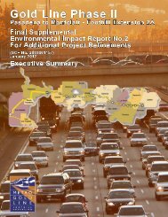
Project Definition Report<br />
<strong>Gold</strong> <strong>Line</strong> Phase II—Foothill Extension<br />
Prepared for:<br />
<strong>Metro</strong> <strong>Gold</strong> <strong>Line</strong> Foothill Extension<br />
Construction Authority<br />
Prepared by:<br />
Parsons Brinckerhoff Quade & Douglas<br />
In conjunction with:<br />
Myra L. Frank / Jones & Stokes, Inc.<br />
Korve Engineering<br />
March 2005
Foothill Extension Project Definition Report Table of Contents<br />
Table of Contents<br />
1.0 Introduction ......................................................................................................... 1-1<br />
1.1 Purpose of the Project Definition Report .................................................... 1-1<br />
1.2 Project Background.................................................................................... 1-1<br />
1.3 Locally Preferred Alternative ...................................................................... 1-1<br />
1.4 DEIS/R Review and Public Process........................................................... 1-3<br />
1.5 Approval of Project Definition Report by Cities .......................................... 1-7<br />
1.6 Modifications to DEIS/R System Definition ................................................ 1-8<br />
1.7 Mitigations Measures from DEIS/R .......................................................... 1-20<br />
2.0 Phase I and the Eastside Extension Relationship............................................... 2-1<br />
3.0 Foothill Extension Alignment Overview............................................................... 3-1<br />
3.1 LRT and Freight Rail Tracks ...................................................................... 3-1<br />
3.2 Foothill Extension Stations......................................................................... 3-1<br />
3.3 Grade Crossings ........................................................................................ 3-2<br />
3.4 Traction Power Substations ....................................................................... 3-3<br />
3.5 Construction Scenarios .............................................................................. 3-3<br />
4.0 Specific Information by City................................................................................. 4-1<br />
Pasadena................................................................................................... 4-2<br />
Unincorporated Los Angeles County.......................................................... 4-3<br />
Arcadia....................................................................................................... 4-4<br />
Monrovia .................................................................................................... 4-9<br />
Duarte ...................................................................................................... 4-13<br />
Irwindale................................................................................................... 4-17<br />
Azusa ....................................................................................................... 4-20<br />
Glendora .................................................................................................. 4-25<br />
San Dimas ............................................................................................... 4-29<br />
La Verne .................................................................................................. 4-34<br />
Pomona.................................................................................................... 4-38<br />
Claremont ................................................................................................ 4-42<br />
Montclair .................................................................................................. 4-46<br />
5.0 Maintenance and Operations Facility.................................................................. 5-1<br />
5.1 Storage Yard.............................................................................................. 5-1<br />
5.2 Maintenance and Shop Facility .................................................................. 5-2<br />
6.0 Next Steps .......................................................................................................... 6-1<br />
6.1 Project Definition Approval......................................................................... 6-1<br />
6.2 Issues to be Addressed.............................................................................. 6-1<br />
March 10, 2005 i FINAL
Foothill Extension Project Definition Report Table of Contents<br />
List of Figures<br />
1-1 <strong>Gold</strong> <strong>Line</strong> Network<br />
3-1 Foothill Extension LPA with stations<br />
3-2 Foothill Extension LPA Segment 1 with stations and TPSS<br />
3-3 Foothill Extension LPA Segment 2 with stations and TPSS<br />
3-4 Typical Station Design – Center Platform<br />
3-5 Typical Station Design – Side Platform<br />
4-1 Key Station Locations<br />
4-2 Pasadena / Sierra Madre Villa Station<br />
4-2A Pasadena Grade Crossing Locations<br />
4-3 Arcadia Station Alternative Locations<br />
4-3A Arcadia Station Option 1 Conceptual Plan<br />
4-3B Arcadia Station Option 2 Conceptual Plan<br />
4-3C Arcadia Grade Crossing Locations<br />
4-3D Arcadia Grade Crossing Locations<br />
4-3E Arcadia TPSS Location (TPSS-01)<br />
4-3F Arcadia TPSS Location (TPSS-02)<br />
4-4 Monrovia Station Location<br />
4-4A Monrovia Station Conceptual Plan<br />
4-4B Monrovia Grade Crossing Locations<br />
4-4C Monrovia Grade Crossing Locations<br />
4-4D Monrovia TPSS Location (TPSS-03)<br />
4-4E Monrovia TPSS Location (TPSS-04)<br />
4-5 Duarte Station Location<br />
4-5A Duarte Station Conceptual Plan<br />
4-5B Duarte Grade Crossing Locations<br />
4-5C Duarte Grade Crossing Locations<br />
4-5D Duarte TPSS Location (TPSS-05, Option 1)<br />
4-5E Duarte TPSS Location (TPSS-05, Option 2)<br />
4-6 Irwindale Station Location<br />
4-6A Irwindale Station Conceptual Plan<br />
4-6B Irwindale Grade Crossing Locations<br />
4-6C Irwindale Grade Crossing Locations<br />
4-6D Irwindale TPSS Location (TPSS-06)<br />
4-7 Azusa Station Locations<br />
4-7A Azusa Alameda Avenue Station Conceptual Plan<br />
4-7B Azusa Citrus Avenue Station Conceptual Plan<br />
4-7C Azusa Grade Crossing Locations<br />
4-7D Azusa Grade Crossing Locations<br />
4-7E Azusa TPSS Location (TPSS-07)<br />
4-7F Azusa TPSS Location (TPSS-08)<br />
4-8 Glendora Station Location<br />
4-8A Glendora Station Conceptual Plan<br />
March 10, 2005 ii FINAL
Foothill Extension Project Definition Report Table of Contents<br />
4-8B Glendora Grade Crossing Locations<br />
4-8C Glendora Grade Crossing Locations<br />
4-8D Glendora Grade Crossing Locations<br />
4-8E Glendora TPSS Location (TPSS-09)<br />
4-8F Glendora TPSS Location (TPSS-10, Options 1-3)<br />
4-9 San Dimas Station Location<br />
4-9A San Dimas Station Conceptual Plan<br />
4-9B San Dimas Grade Crossing Locations<br />
4-9C San Dimas Grade Crossing Locations<br />
4-9D San Dimas TPSS Location (TPSS-11)<br />
4-10 La Verne Station Location<br />
4-10A La Verne Station Conceptual Plan<br />
4-10B La Verne Grade Crossing Locations<br />
4-10C La Verne Grade Crossing Locations<br />
4-10D La Verne TPSS Location (TPSS-12)<br />
4-11 Pomona Station Location<br />
4-11A Pomona Station Conceptual Plan<br />
4-11B Pomona Grade Crossing Locations<br />
4-11C Pomona TPSS Location (TPSS-13)<br />
4-12 Claremont Station Location<br />
4-12A Claremont Station Conceptual Plan<br />
4-12B Claremont Grade Crossing Locations<br />
4-12C Claremont TPSS Location (TPSS-14)<br />
4-13 Montclair Station<br />
4-13A Montclair Station Conceptual Plan<br />
4-13B Montclair Grade Crossing Locations<br />
4-13C Montclair TPSS Location (TPSS-15)<br />
5-1 Irwindale Maintenance / Operations Facility Location (includes TPSS-16)<br />
Appendices<br />
City Council Agendas and Staff Reports, Meeting Notes, Correspondence, and Grade<br />
Crossing Preliminary Hazard Analysis Crossing Layouts for:<br />
A City of Arcadia<br />
B City of Monrovia<br />
C City of Duarte<br />
D City of Irwindale<br />
E City of Azusa<br />
F City of Glendora<br />
G City of San Dimas<br />
H City of La Verne<br />
I City of Pomona<br />
J City of Claremont<br />
K City of Montclair<br />
L Glossary<br />
M References<br />
March 10, 2005 iii FINAL
Foothill Extension Project Definition Report Introduction<br />
1.0 Introduction<br />
In May 2004, a Draft Environmental Impact Statement / Report (DEIS/R) was released<br />
for review and comment for the <strong>Metro</strong> <strong>Gold</strong> <strong>Line</strong> Phase II Pasadena to Montclair –<br />
Foothill Extension Project. The DEIS/R evaluated a No-Build Alternative, a<br />
Transportation System Management (TSM) Alternative, and two Light-Rail Transit (LRT)<br />
Alternatives. The Locally Preferred Alternative (LPA) was identified by the <strong>Gold</strong> <strong>Line</strong><br />
Authority Board and the cities along the alignment as the 24-mile LRT project studied in<br />
the DEIS/R.<br />
1.1 Purpose of the Project Definition Report<br />
This report summarizes the refinement of the LPA as a result of further analysis and<br />
comments received during the public review period pertaining to station locations,<br />
parking facility locations, the LRT/freight tracks alignment, grade crossings, traction<br />
power substation locations, and typical mitigation measures. This refined project<br />
definition will be the basis for the environmental analysis in the Final EIS/R (FEIS/R)<br />
and for the Advanced Conceptual Engineering work efforts to support the FEIS/R.<br />
1.2 Project Background<br />
The Pasadena to Montclair Light Rail Project, referred to as the Foothill Extension, is an<br />
approximately 24-mile east-west light rail extension of the <strong>Metro</strong> <strong>Gold</strong> <strong>Line</strong> Phase I.<br />
The alignment generally follows the foothills of the San Gabriel Mountains from east<br />
Pasadena to Montclair. The project begins just east of the existing Phase I terminus<br />
Sierra Madre Villa station in Pasadena and runs along the former Burlington Northern<br />
Santa Fe (BNSF) railroad right-of-way (ROW), generally paralleling the Interstate 210<br />
(I-210) Freeway. The Foothill Extension will connect the communities of Arcadia,<br />
Monrovia, Duarte, Irwindale, Azusa, Glendora, San Dimas, La Verne, Pomona,<br />
Claremont, and Montclair. Refer to Figure 1-1.<br />
In April 2002, the Study Steering Committee, comprised of representatives from each<br />
corridor city, accepted the Alternatives Analysis Final Report Draft and recommended<br />
Alternative 4: Light Rail Transit as the Locally Preferred Alternative (LPA-AA). The<br />
corridor City Councils, the Governing Board of the San Gabriel Valley Council of<br />
Governments (COG), and the <strong>Gold</strong> <strong>Line</strong> Authority’s Board of Directors then adopted this<br />
alternative as the LPA-AA. The alternative provided two dedicated light rail tracks and a<br />
third track dedicated to freight operations.<br />
1.3 Locally Preferred Alternative (LPA)<br />
The DEIS/R was released in May 2004 for review and comment. In consideration of the<br />
public and agency comments received during the public hearings and 45-day review<br />
period, a Revised LPA was adopted by the <strong>Gold</strong> <strong>Line</strong> Authority’s Board of Directors on<br />
August 25, 2004.<br />
March 10, 2005 1-1 FINAL
Foothill Extension Project Definition Report Introduction<br />
The Revised LPA is defined as a 24-mile Light Rail Transit (LRT) System extending<br />
from the City of Pasadena to the City of Montclair with the following characteristics:<br />
• 12 stations and their associated parking facilities,<br />
• a Maintenance and Operations Facility,<br />
• double tracks for the LRT System, with the possible exception of a short section<br />
in the City of Claremont,<br />
• dedicated track for freight operations east of the Miller Brewing Company facility<br />
within the City of Irwindale to connect to the <strong>Metro</strong>link track in Claremont,<br />
• widening as necessary existing bridge structures to accommodate two tracks and<br />
the dedicated third track for freight operations,<br />
• 43 at-grade crossings with gate protection,<br />
• an extension of the existing Phase I power, signaling and communications<br />
systems.<br />
LRT System Segments<br />
The LRT System would be constructed in two segments and may include additional<br />
refinements during the FEIS/R and Advanced Conceptual Engineering process.<br />
Segment 1 is defined as an 11.4-mile, 6 station extension from the City of Pasadena to<br />
the City of Azusa, representing a 2.7 mile increase from that which was identified in the<br />
DEIS/R for this first segment. Segment 1 will also include a Maintenance and<br />
Operations Facility in Irwindale, for approximately 80 light rail vehicles based upon the<br />
requirements of the full <strong>Gold</strong> <strong>Line</strong> system including the Eastside Extension. The 12.6mile<br />
Segment 2 is defined as the completion of the LRT System to the City of Montclair<br />
in San Bernardino County with 6 stations in the segment.<br />
Changes to the DEIS/R Alternative in the LPA<br />
The LPA is similar to the project defined in the DEIS/R, but includes the following<br />
modifications in response to the comments received on the DEIS/R:<br />
• Segment 1 is extended 2.7 miles east of Irwindale to Azusa’s second proposed<br />
station at Citrus Avenue. This extension connects the following sites:<br />
- Downtown Azusa<br />
- Azusa’s old Santa Fe rail passenger depot<br />
- Future Development at the Monrovia Nursery site<br />
- Citrus College<br />
- Azusa Pacific University<br />
• The size of the Maintenance and Operations Facility at the Miller Brewing<br />
Company site just south and west of the Irwindale station is reduced from 121 to<br />
80 light rail vehicles based upon the system requirements of the <strong>Gold</strong> <strong>Line</strong><br />
March 10, 2005 1-2 FINAL
Foothill Extension Project Definition Report Introduction<br />
including the Eastside Extension. Miller Brewing Company has plans to expand<br />
their plant’s production capability, and has indicated that it cannot accommodate<br />
the size of the parcel described in the DEIS/R. This proposal will allow the <strong>Gold</strong><br />
<strong>Line</strong> to enter / exit the railroad right-of-way (ROW) at the most western point of<br />
the plant site and would result in a reduction in cost for the grade separations<br />
identified in the DEIS/R.<br />
• Elimination of the third track for freight between Pasadena and Irwindale due to<br />
the proposed Monrovia Granary relocation plan.<br />
• There are two options for the LRT and <strong>Metro</strong>link track configurations in<br />
Claremont. Due to right-of-way constraints between Indian Hill Boulevard and<br />
College Avenue, only three tracks can be accommodated. The LRT System may<br />
operate on two tracks, with <strong>Metro</strong>link / freight on one track to the south through<br />
this area. Alternatively, the LRT system may operate on a single track section<br />
through the station area, with two <strong>Metro</strong>link / freight tracks on the south. The<br />
length of this single track section will have to be confirmed by further engineering<br />
analysis and discussions with all parties. This constraint was imposed due to<br />
strong objections from the City of Claremont and businesses immediately<br />
adjacent to the current <strong>Metro</strong>link Station located between Indian Hill Boulevard<br />
and College Avenue.<br />
Following the adoption of the Revised LPA by the <strong>Gold</strong> <strong>Line</strong> Authority’s Board of<br />
Directors on August 25, 2004, additional analysis and design was performed on the<br />
project definition. The results of this analysis, communication with the Cities, and<br />
actions by the Cities have led to the project definition outlined in Sections 3, 4, and 5.<br />
1.4 DEIS/R Review and Public Process<br />
DEIS/R Formal Comment Period<br />
The DEIS/R Notice of Availability was posted with the Los Angeles and San Bernardino<br />
County Clerks on April 27, 2004, and published in the Federal Register on May 7, 2004.<br />
The Notice of Completion was filed with the State Clearinghouse on April 27, 2004. The<br />
publication in the Federal Register began the NEPA review period. The filing with the<br />
Los Angeles County Clerk, San Bernardino County Clerk, and the State Clearinghouse<br />
began the CEQA public review period.<br />
Several newspapers also carried notices regarding the release of the DEIS/R, including<br />
the Los Angeles Times, the Pasadena Star News, the San Gabriel Valley Tribune, La<br />
Opinion, and Wave Publications. The Notice of Availability was published on April 30,<br />
2004 in the Los Angeles Times.<br />
The document was available for download from the Authority’s website in addition to<br />
being available for public review in the following public libraries: Pasadena, Arcadia,<br />
Monrovia, Duarte, Irwindale, Azusa, Glendora, San Dimas, La Verne, Pomona,<br />
March 10, 2005 1-3 FINAL
Foothill Extension Project Definition Report Introduction<br />
Claremont, Montclair, South Pasadena, Upland, Los Angeles Riordan Public Library,<br />
Los Angeles Chinatown Branch Library and Arroyo Seco Regional Library.<br />
Public hearings began on May 19, 2004 in each of the cities along the Phase I and<br />
Foothill Extension alignments. The formal public comment period ended on June 21,<br />
2004.<br />
Date Time City / Location Format<br />
Wednesday, May 19, 2004 5:00 PM Claremont Open House, Presentation, Verbal<br />
Comments<br />
Thursday, May 20, 2004 5:30 PM Glendora Open House, Presentation, Verbal<br />
Comments<br />
Wednesday, May 26, 2004 6:00 PM Duarte Open House, Written Comments<br />
Tuesday, June 1, 2004 5:30 PM Los Angeles Open House, Written Comments<br />
Thursday, June 3, 2004 6:00 PM Monrovia Open House, Written Comments<br />
Monday, June 7, 2004 5:00 PM Montclair Open House, Presentation, Verbal<br />
Comments<br />
Tuesday, June 8, 2004 5:30 PM San Dimas Open House, Presentation, Verbal<br />
Comments<br />
Wednesday, June 9, 2004 5:30 PM La Verne Open House, Presentation, Verbal<br />
Comments<br />
Wednesday, June 9, 2004 5:15 PM Pasadena Open House, Presentation, Verbal<br />
Comments<br />
Thursday, June 10, 2004 6:30 PM South Pasadena Open House, Presentation, Verbal<br />
Comments<br />
Monday, June 14, 2004 6:00 PM Pomona Open House, Written Comments<br />
Monday, June 14, 2004 7:00 PM Arcadia Presentation, Verbal Comments<br />
Tuesday, June 15, 2004 5:00 PM Irwindale Open House, Presentation, Verbal<br />
Comments<br />
Wednesday, June 16, 2004 6:30 PM Azusa Open House, Presentation, Verbal<br />
Thursday, June 17, 2004 4:30 PM San Gabriel Valley<br />
Council of<br />
Governments Joint<br />
Powers Authority /<br />
Duarte<br />
Comments<br />
Presentation, Verbal Comments<br />
At the close of the Public Comment period, the comments received were reviewed and<br />
categorized by topic and commenter. While the comments were considered in defining<br />
the project, the formal responses to comments will be published as part of the FEIS/R<br />
document.<br />
Post-DEIS/R Project Refinement<br />
Over the past year (2004-2005), numerous meetings were held with each City and other<br />
interested parties in a joint effort to reach consensus on station locations, parking,<br />
alignment options, and community concerns. The meeting dates are identified in the<br />
table below.<br />
March 10, 2005 1-4 FINAL
Foothill Extension Project Definition Report Introduction<br />
Date City / Organization<br />
July 14, 2004 <strong>Gold</strong> <strong>Line</strong> Authority Board of Directors<br />
July 15, 2004 San Gabriel Valley Council of Governments Joint<br />
Powers Authority Technical Advisory Committee<br />
July 20, 2004 City of Claremont Staff<br />
July 26, 2004 City of San Dimas Staff<br />
July 27, 2004 City of La Verne Staff<br />
July 28, 2004 City of Montclair Staff<br />
July 29, 2004 City of Azusa Staff<br />
July 29, 2004 City of Arcadia Staff<br />
August 2, 2004 City of Monrovia Staff<br />
August 3, 2004 City of Pomona Staff<br />
August 4, 2004 City of Glendora Staff<br />
August 12, 2004 City of Duarte Staff<br />
August 16, 2004 City of Irwindale Staff<br />
August 19, 2004 San Gabriel Valley Council of Governments Joint<br />
Powers Authority Technical Advisory Committee<br />
(JPA TAC)<br />
August 25, 2004 <strong>Gold</strong> <strong>Line</strong> Authority Board of Directors<br />
September 20, 2004 Federal Transit Administration (FTA)<br />
September 22, 2004 <strong>Gold</strong> <strong>Line</strong> Authority Board of Directors<br />
September 23, 2004 Azusa Land <strong>Part</strong>ners (ALP) Developers (Monrovia<br />
Nursery Land)<br />
September 23, 2004 City of Montclair Staff<br />
September 24, 2004 City of Glendora Staff<br />
September 27, 2004 City of Claremont Staff<br />
September 28, 2004 City of Pomona Staff<br />
September 28, 2004 City of Monrovia Staff<br />
September 29, 2004 City of Duarte Staff<br />
September 29, 2004 City of Arcadia Staff<br />
September 29, 2004 City of Hope<br />
September 30, 2004 City of Azusa Staff<br />
September 30, 2004 City of La Verne Staff<br />
October 4, 2004 City of Irwindale Staff<br />
October 4, 2004 City of San Dimas Staff<br />
October 7, 2004 Miller Brewing Company, City of Irwindale Staff<br />
October 7, 2004 Guided Tour of Phase I for City of Arcadia<br />
October 12, 2004 Burlington Northern Santa Fe (BNSF)<br />
October 21, 2004 JPA TAC<br />
October 27, 2004 <strong>Gold</strong> <strong>Line</strong> Authority Board of Directors<br />
October 28, 2004 FTA<br />
October 28, 2004 Artist Request For Qualifications Public Meeting<br />
November 4, 2004 Guided Tour of Phase I for City of San Dimas City<br />
Council Member<br />
November 9, 2004 FTA<br />
November 9, 2004 Guided Tour of Phase I for City of Irwindale Staff<br />
November 9, 2004 City of San Dimas Station Design And Review<br />
(SDAR) Committee<br />
November 10, 2004 Guided Tour of Phase I for City of La Verne City<br />
Council Member<br />
November 15, 2004 City of San Dimas Staff<br />
November 15, 2004 City of Pomona City Council Meeting<br />
November 16, 2004 City of Montclair SDAR Committee<br />
November 18, 2004 JPA TAC<br />
March 10, 2005 1-5 FINAL
Foothill Extension Project Definition Report Introduction<br />
Date City / Organization<br />
November 18, 2004 Guided Tour of Phase I for City of Claremont<br />
November 18, 2004 City of La Verne Staff<br />
November 23, 2004 City of Arcadia Alignment Walk<br />
November 30, 2004 Guided Tour of Phase I for City of Arcadia<br />
December 6, 2004 City of Duarte SDAR Committee<br />
December 6, 2004 City of La Verne Council and Planning Commission<br />
December 8, 2004 Guided Tour of Phase I for City of Arcadia SDAR<br />
Committee<br />
December 8, 2004 <strong>Gold</strong> <strong>Line</strong> Authority Board of Directors<br />
December 9, 2004 JPA TAC<br />
December 14, 2004 Guided Tour of Phase I for City of Montclair SDAR<br />
Committee<br />
December 20, 2004 City of Azusa Staff, ALP Developers<br />
December 28, 2004 FTA<br />
January 13, 2005 JPA TAC<br />
January 20, 2005 JPA<br />
January 26, 2005 <strong>Gold</strong> <strong>Line</strong> Authority Board of Directors<br />
January 27, 2005 JPA TAC Special Meeting<br />
January 25, 2005 City of Duarte Staff<br />
January 27, 2005 City of Irwindale Staff<br />
January 31, 2005 Tour of proposed O&M Facility for LACMTA<br />
Operations<br />
February 7, 2005 City of Pomona Staff<br />
February 7, 2005 City of Montclair City Council Meeting<br />
February 9, 2005 City of Pomona Staff<br />
February 9, 2005 JPA TAC Grade Crossing Sub-committee<br />
February 10, 2005 JPA TAC<br />
February 10, 2005 City of Glendora Staff<br />
February 11, 2005 LACMTA Modeling Group<br />
February 15, 2005 City of Arcadia City Council Meeting<br />
February 15, 2005 City of Monrovia City Council Meeting<br />
February 16, 2005 City of San Dimas Staff<br />
February 17, 2005 JPA Meeting<br />
February 22, 2005 City of La Verne City Council Meeting<br />
February 22, 2005 City of Duarte City Council Meeting<br />
February 22, 2005 City of Azusa City Council Meeting<br />
February 22, 2005 City of San Dimas City Council Meeting<br />
February 22, 2005 City of Claremont City Council Meeting<br />
February 22, 2005 City of Glendora City Council Meeting<br />
February 28, 2005 City of Pomona City Council Meeting<br />
March 1, 2005 City of Irwindale City Council Meeting<br />
During the meetings with the Cities, the station and parking locations from the DEIS/R<br />
were discussed. The plans were revised based on City comments, and distributed via<br />
follow-up mailings and meetings. In some cases, several alternatives were analyzed in<br />
this iterative process.<br />
Analysis continued on the grade crossings during this period. Further analysis was<br />
completed on the forty-three grade crossings using the <strong>Metro</strong> Grade Crossing Analysis<br />
Policy. The Milestone 2 Detailed Analysis was completed on the thirteen grade<br />
crossings identified as “At Grade Operation Possible.” The Grade Crossing Preliminary<br />
March 10, 2005 1-6 FINAL
Foothill Extension Project Definition Report Introduction<br />
Hazard Analysis (PHA) was completed for all grade crossings along the alignment and<br />
resulted in suggested intersection and crossing improvements to improve safety and<br />
allow optimal operation of the crossings and streets.<br />
Alignment drawings in the DEIS/R were revised by both the Authority and the FEIS/R<br />
consultant. Locations of some of the TPSS were revised based on a new operating<br />
plan, changes to headways, comments from cities, and professional experience.<br />
Architects revised the station and parking design in consultation with City staff. Cost<br />
effectiveness, safety, and good design were key themes during the design process.<br />
The Authority assisted each City in developing a Station Design and Review (SDAR)<br />
Committee. The purpose of these committees is to work with the Authority on various<br />
planning decisions for each City’s station design features and artwork. The full SDAR<br />
Committee Plan was distributed to each City at the October / November TAC meetings,<br />
and also at the first SDAR meetings. Initial meetings were held with the SDAR<br />
committees to explain goals, objectives and the process, review the project and station<br />
location, discuss public comments received on the DEIS/R, and look at examples of<br />
standard station components and betterments. The artist selection process was<br />
discussed as well. Continuing throughout the Advanced Conceptual Engineering<br />
phase, future meetings will focus on specific design issues, artist selection, community<br />
themes, and City process.<br />
Meetings with the other interested parties concerned the location of the alignment, the<br />
Maintenance and Operations Facility layout, bridge structures, and other technical<br />
decisions. Stakeholder meetings were also held in order to gain an understanding of<br />
other stakeholders concerns. Again, the meetings and subsequent communications<br />
were an attempt to reach consensus on aspects of the project definition.<br />
1.5 Approval of Project Definition Report by Corridor Cities<br />
The Draft Project Definition Report was released in early January 2005. The report was<br />
presented to the Technical Advisory Committee (TAC), the Joint Powers Authority<br />
(JPA), and the <strong>Gold</strong> <strong>Line</strong> Construction Authority Board (Board) respectively.<br />
Each City Council was asked to approve the four elements outlined for their City<br />
(Section 4.0) by March 1, 2005. The City Council agendas, staff reports, and other<br />
information are included in the Appendices. The dates of the City Council meetings<br />
where formal action was taken are identified in the table below.<br />
March 10, 2005 1-7 FINAL
Foothill Extension Project Definition Report Introduction<br />
Date City<br />
February 7, 2005 City of Montclair City Council Meeting<br />
February 15, 2005 City of Arcadia City Council Meeting<br />
February 15, 2005 City of Monrovia City Council Meeting<br />
February 22, 2005 City of La Verne City Council Meeting<br />
February 22, 2005 City of Duarte City Council Meeting<br />
February 22, 2005 City of Azusa City Council Meeting<br />
February 22, 2005 City of San Dimas City Council Meeting<br />
February 22, 2005 City of Claremont City Council Meeting<br />
February 22, 2005 City of Glendora City Council Meeting<br />
February 28, 2005 City of Pomona City Council Meeting<br />
March 1, 2005 City of Irwindale City Council Meeting<br />
Each City Council approved the Draft Project Definition Report contents, with some<br />
caveats and/or reservations. This report incorporates those approvals and comments.<br />
The issues identified by each City will be the subject of discussion and analysis as the<br />
FEIS/R and Advanced Conceptual Engineering are completed.<br />
1.6 Modifications to DEIS/R System Definition<br />
The changes to the project definition since it was published in the DEIS/R are identified<br />
below. These modifications are based on comments received during the public<br />
process, on-going discussions with City and other officials, and design considerations.<br />
Project-wide changes include switching the freight track to the north side of the<br />
alignment from Azusa to Pomona, relocating some of the TPSS sites, eliminating the<br />
freight track in Monrovia and Duarte, and selecting Option G identified in the DEIS/R,<br />
(the southern alignment option) in Montclair. Additionally, Segment 1 was extended to<br />
the eastern border of the City of Azusa, terminating at the Azusa-Citrus station.<br />
Segment 2 continues from this station to the Montclair TransCenter.<br />
Changes specific to each City are identified below. The project definition station and<br />
parking locations were arrived at through an iterative process involving the Cities, the<br />
Authority, the FEIS/R consultant, and other pertinent parties.<br />
Arcadia<br />
The Authority met with staff from the City of Arcadia twice during the summer / fall of<br />
2004. Topics covered at these meetings included the City’s request for the grade<br />
separation of Santa Anita Avenue, the potential benefits and impacts of a grade<br />
separation, additional traffic counts, the station and parking location, grade crossings,<br />
and TPSS sites. A memo on the grade separation benefits and impacts was furnished<br />
to the City to facilitate a decision. During a Study Session in November, and again in<br />
the approval of the Draft Project Definition Report, the City Council agreed to pursue a<br />
grade separation at Santa Anita Avenue. They indicated the City would pay the cost<br />
differential for this structure if the funds are available. The City of Arcadia has agreed to<br />
fund the Advanced Conceptual Engineering effort to advance the grade separation<br />
March 10, 2005 1-8 FINAL
Foothill Extension Project Definition Report Introduction<br />
design for the FEIS/R. The structure reaches grade level northwest of First Avenue /<br />
Santa Clara Avenue, thus setting the station location southeast of the intersection. One<br />
of the station options can be eliminated once the City Council provides a letter formally<br />
requesting the grade separation and outlining the City’s financial responsibilities. The<br />
general parking location was agreed upon by all parties but requires further refinement<br />
for the FEIS/R.<br />
ARCADIA<br />
DEIS/R Project Definition<br />
Multiple options:<br />
(1) Base Condition: At-grade center platform<br />
station located NW of N. First Ave. / E. Santa<br />
Clara Ave. Entry from southern end of<br />
platform.<br />
(2) Option A: At-grade side platform station<br />
located SE of N. First Ave. / E. Santa Clara<br />
Ave. Entry from northern end of platform.<br />
This option works with a grade separation at<br />
Santa Anita Ave.<br />
(3) Option B: Aerial center platform station<br />
located NW of N. First Ave. / E. Santa Clara<br />
Ave. (similar to base condition). Station<br />
would be elevated approximately 30 feet<br />
above grade. This option works with a grade<br />
separation at Santa Anita Ave. and at N. First<br />
Ave. / E. Santa Clara Ave. intersection.<br />
All options assume double track LRT, no freight.<br />
Utilize both locations:<br />
(1) Structure at southwest corner of N. First St. &<br />
Wheeler Ave. Current use of property is<br />
municipal parking lot for local merchants.<br />
New structure must replace existing parking<br />
for merchants. Structure will be ground plus<br />
3 levels. Total structure contains 990 spaces<br />
(743 for <strong>Gold</strong> <strong>Line</strong> patrons + 247 for<br />
merchants / customers).<br />
(2) Surface lot at northwest corner of Front St. &<br />
E. Santa Clara St. Total lot contains 57<br />
spaces, all for <strong>Gold</strong> <strong>Line</strong> patrons. Current<br />
use of property is commercial/light industrial.<br />
Station Location<br />
Parking Location & Description<br />
Two options:<br />
(1) At-grade center platform station located NW<br />
of N. First Ave. / E. Santa Clara Ave. Entry<br />
from southern end of platform. (Base<br />
Condition in DEIS/R)<br />
(2) At-grade side platform station located SE of<br />
N. First Ave. / E. Santa Clara Ave. Entry<br />
from northern end of platform. (Option A in<br />
DEIS/R) This option works with a grade<br />
separation at Santa Anita Ave., as preferred<br />
by the City.<br />
Double track LRT, no freight.<br />
DEIS/R parking locations have been eliminated.<br />
Structure at northwest corner of Front St. & E.<br />
Santa Clara St. Structure will be ground plus 1<br />
level. Total structure contains approximately 305<br />
spaces.<br />
City requests alternative station parking located<br />
within Authority right-of-way, approximately<br />
northwest of First Avenue and Santa Clara Street<br />
intersection. Amount of parking available in this<br />
area to be determined.<br />
March 10, 2005 1-9 FINAL
Foothill Extension Project Definition Report Introduction<br />
Monrovia<br />
Two meetings were held with staff from the City of Monrovia during August and<br />
September of 2004. Topics discussed included grade crossings, potential future<br />
development around the station area by the City, parking locations, intersection<br />
impacts, and the potential relocation of the Granary resulting in elimination of the freight<br />
track in Monrovia and Duarte. There was no change in the station location from the<br />
DEIS/R, but the parking has changed. The City will provide the required parking near<br />
the station. In addition, the City is working with the Granary to facilitate relocation.<br />
MONROVIA<br />
DEIS/R Project Definition<br />
Multiple options:<br />
(1) Double Track Option: At-grade side platform<br />
station is located at the historic Santa Fe rail<br />
passenger depot at W. Duarte Rd. & S.<br />
Myrtle Ave. Entry from eastern end of<br />
platform.<br />
(2) Triple Track Option: At-grade center platform<br />
station is located at the historic Santa Fe rail<br />
passenger depot at W. Duarte Rd. & S.<br />
Myrtle Ave. Entry from eastern end of<br />
platform. Freight track travels north of<br />
historic depot and terminates just west of<br />
station area.<br />
Utilize both locations:<br />
(1) City is in process of constructing 205 surface<br />
parking spaces at west side of E. Pomona<br />
Ave., S. Myrtle Ave. & Rail ROW. Current<br />
use of property is park-and-ride, commercial<br />
and residential uses. City has obtained most<br />
of the land. <strong>Gold</strong> <strong>Line</strong> patrons will utilize 100<br />
spaces. Foothill Transit & Park-and-Ride<br />
patrons will utilize the remainder.<br />
(2) Structure located at triangle of land south of<br />
Rail ROW, north of W. Duarte Rd., and east<br />
of Peck Rd. Structure will be ground plus 1<br />
level. Current use of property is light<br />
industrial / commercial. Property would need<br />
to be acquired. Structure will be ground plus<br />
3 levels. Structure contains 500 spaces.<br />
Station Location<br />
Parking Location & Description<br />
At-grade side platform station is located at the<br />
historic Santa Fe rail passenger depot at W.<br />
Duarte Rd. & S. Myrtle Ave. Entry from the east<br />
end of platform. (Similar to Double Track Option<br />
from DEIS/R)<br />
No freight track in this location if Monrovia is<br />
successful in relocating the Granary. Alignment<br />
contains 2 LRT tracks and no freight.<br />
Triple Track Option has been eliminated.<br />
DEIS/R parking location (2) has been eliminated.<br />
City is in process of constructing a surface<br />
parking lot south of E. Pomona Ave., and west of<br />
S. Myrtle Ave. & north of Authority ROW. Current<br />
use of property is park-and-ride, commercial, and<br />
residential uses. City has obtained most of the<br />
land. Option (1) from DEIS/R. City has plans for<br />
redevelopment of entire block. City assures<br />
Authority they will meet opening day parking<br />
requirements.<br />
March 10, 2005 1-10 FINAL
Foothill Extension Project Definition Report Introduction<br />
Duarte<br />
Three meetings were held with City of Duarte staff to reach consensus on the project<br />
definition. Topics discussed in the meetings included parking location options, grade<br />
crossings, noise, and safety. The station remained in the same general area, but<br />
several parking options were studied in response to comments from the City of Hope<br />
Medical Center. The station option to be studied in the FEIS/R is located just east of<br />
the original location.<br />
DUARTE<br />
DEIS/R Project Definition<br />
Multiple options:<br />
(1) Double Track Option: At-grade center<br />
platform station is located on Duarte Rd. near<br />
the City of Hope Medical Center. Entry from<br />
western end of platform.<br />
(2) Triple Track Option: At-grade center platform<br />
station is located on Duarte Rd. near the City<br />
of Hope Medical Center. Entry from western<br />
end of platform. Expansion of ROW into<br />
westbound side of Duarte Rd. would be<br />
necessary. This area used to be a parking<br />
lane but parking was removed due to safety<br />
concerns.<br />
Parking would be located in a structure to be<br />
constructed over the existing City of Hope staff &<br />
visitor parking lot directly south of the proposed<br />
station. Structure must replace existing City of<br />
Hope parking. Structure will be ground plus 1<br />
level. Structure contains 500 spaces split evenly<br />
between City of Hope and <strong>Gold</strong> <strong>Line</strong> patrons.<br />
Station Location<br />
Parking Location & Description<br />
At-grade center platform station located on<br />
Duarte Rd. across from City of Hope Medical<br />
Center and Corps of Engineers property. Entry<br />
from west end of platform.<br />
No freight in this location if Monrovia is successful<br />
in relocating the Granary. Alignment contains 2<br />
LRT tracks and no freight.<br />
Triple Track Option has been eliminated.<br />
DEIS/R parking location has been eliminated.<br />
Surface parking on existing commercial lot<br />
located approximately 250 feet north of platform.<br />
Lot contains approximately 200 spaces.<br />
Easement through commercial property required<br />
to access platform.<br />
March 10, 2005 1-11 FINAL
Foothill Extension Project Definition Report Introduction<br />
Irwindale<br />
Four meetings were held with the City of Irwindale staff to discuss the <strong>Gold</strong> <strong>Line</strong> project.<br />
Key topics at these meetings included relocating the parking, the size and location of<br />
the Maintenance & Operation Facility, and cooperation with Miller Brewing Company.<br />
The station was relocated to east of Irwindale Boulevard to allow room for siding tracks<br />
near the Miller Brewing facility. Several parking options were analyzed but a decision<br />
has not yet been reached. Discussions on parking will continue with the City. The<br />
Maintenance and Operations Facility, located west of the Miller Brewing Facility, was<br />
revised in both size and shape following meetings with the Miller Brewery staff and the<br />
City of Irwindale.<br />
IRWINDALE<br />
DEIS/R Project Definition<br />
At-grade center platform station located SW of I-<br />
210 Freeway and Irwindale Blvd. adjacent to<br />
Miller Brewing Company property. Entry from<br />
eastern end of platform. Vehicular access from<br />
Irwindale Blvd. via Montoya Rd. Double or Triple<br />
Track. Freight track on south side of alignment.<br />
Terminus for Segment 1.<br />
Parking structure located on Miller Property south<br />
of the station site. Structure will be ground plus 1<br />
level. Structure contains 700 spaces for <strong>Gold</strong><br />
<strong>Line</strong> patrons.<br />
Station Location<br />
Parking Location & Description<br />
DEIS/R station location has been eliminated.<br />
At-grade side platform station located south of I-<br />
210 Freeway and east of Irwindale Avenue<br />
overpass. Entry from both ends of platform.<br />
Vehicular access from Irwindale Blvd. via a tunnel<br />
accessed from Adelante Street. Freight track on<br />
south side of alignment, terminates just west of<br />
station at Miller Brewing Company.<br />
Property identified in DEIS/R is slated for Miller<br />
Brewing Company expansion. DEIS/R parking<br />
location has been eliminated.<br />
Several parking options:<br />
(1) Surface lot located in Kincaid Pit (South)<br />
south of I-210 Freeway, east of Irwindale<br />
Avenue, north of Montoya St. Tunnel under<br />
alignment necessary to access parking.<br />
Tunnel accessed via Adelante St. 6% slope<br />
required to go under alignment. Pit could<br />
require some fill. Lot contains approximately<br />
350 spaces.<br />
(2) City has requested the Authority consider<br />
alternate locations: Miller Brewing property,<br />
City property west of Irwindale Avenue, and<br />
various sites east of Irwindale Avenue.<br />
Parking capacity to be determined following<br />
continued discussions with the City.<br />
March 10, 2005 1-12 FINAL
Foothill Extension Project Definition Report Introduction<br />
Azusa<br />
The Authority met with staff from the City of Azusa three times during the summer / fall<br />
of 2004. Topics covered during these meetings included grade crossings, noise, station<br />
and parking locations, the LRT flyover in western Azusa, and the Monrovia Nursery<br />
Development. Additional meetings were held with Azusa Land <strong>Part</strong>ners, LLC (ALP), the<br />
developers of Monrovia Nursery, to discuss the relationship between their grade<br />
separation structures and the future Foothill Extension bridges. Station locations at<br />
both the downtown (Alameda Avenue) and Monrovia Nursery (Citrus Avenue) stations<br />
remained fairly consistent, while parking shifted slightly at both locations.<br />
AZUSA – Alameda Station<br />
DEIS/R Project Definition<br />
Station Location<br />
At-grade center platform station located at N.<br />
Alameda Ave., which would be closed. Adjacent<br />
to old Santa Fe rail passenger depot. Entry from<br />
western end of platform. Double or Triple Track.<br />
Freight track on south side of alignment.<br />
Structure on block bounded by N. Alameda Ave.,<br />
9 th St., N. Dalton Ave., and the rail ROW. Current<br />
use of the property is commercial and residential.<br />
Structure is ground plus 1 level. Total structure<br />
contains 400 spaces.<br />
Parking Location & Description<br />
Station location same as DEIS/R, with a side<br />
platform.<br />
At-grade side platform station located at N.<br />
Alameda Ave., which would be closed. Adjacent<br />
to old Santa Fe rail passenger depot. Entry from<br />
western end of platform. Double or Triple Track.<br />
Freight track on north side of alignment.<br />
Parking located on block bounded by N. Azusa<br />
Ave., E. 9 th St., N. Alameda Ave., and the<br />
Authority ROW. Current use of the property is<br />
commercial. Potential future mixed-use<br />
development on this property as per City.<br />
AZUSA – Citrus Station<br />
DEIS/R Project Definition<br />
Station Location<br />
At-grade side platform station located W of the<br />
future extension of Citrus Ave. Located at the<br />
Monrovia Nursery Development project. Entry<br />
from western end of platform. Double or Triple<br />
Track.<br />
Freight track on south side of alignment.<br />
At-grade center platform station located between<br />
Palm Ave. and the future Citrus Ave. Located at<br />
the Monrovia Nursery Development project.<br />
Entry from eastern end of platform. Allow enough<br />
tail track space on the eastern end prior to Citrus<br />
Ave. grade crossing. (Similar to DEIS/R)<br />
Freight track on north side of alignment.<br />
Terminus for Segment 1.<br />
March 10, 2005 1-13 FINAL
Foothill Extension Project Definition Report Introduction<br />
Parking to be provided by developer (350<br />
spaces).<br />
AZUSA – Citrus Station<br />
DEIS/R Project Definition<br />
Parking Location & Description<br />
Developer to make available for purchase 1 acre<br />
of land for parking.<br />
Located north of Authority ROW & west of future<br />
extension of Citrus Ave. Current use of property<br />
is agricultural, with future development imminent.<br />
Area to be Transit Oriented Development Specific<br />
Plan with Provisions for 200 Opening Day Parking<br />
Spaces for the LRT Project, expandable to 350-<br />
400 spaces including bus loading /unloading area<br />
and pedestrian access to the east end of the LRT<br />
station platform.<br />
March 10, 2005 1-14 FINAL
Foothill Extension Project Definition Report Introduction<br />
Glendora<br />
Three meetings were held with City staff regarding the project definition. Issues<br />
discussed at these meetings and in subsequent communications included grade<br />
crossings, future development, parking facility locations, and noise. The City expressed<br />
concern over future development on the eastern edge of the City and its potential<br />
impact on the Foothill Extension. Additional communication via phone, fax, and e-mail<br />
allowed further clarification. There were no major changes to the station and parking<br />
facility locations in Glendora, as both are located within the Authority right-of-way.<br />
GLENDORA<br />
DEIS/R Project Definition<br />
Multiple options:<br />
(1) Double Track Option: At-grade center<br />
platform station located on empty parcel<br />
between Glendora Ave., E. Ada Ave., and<br />
Vermont Ave. Entry from western end of<br />
platform.<br />
(2) Triple Track Option: At-grade side platform<br />
station is located on empty parcel between<br />
Glendora Ave., E. Ada Ave., and Vermont<br />
Ave. Entry from western end of platform.<br />
Freight track on south side of alignment.<br />
Utilize both locations:<br />
(1) Structure at NW corner of Vermont Ave. and<br />
Rail ROW. Current use of property is<br />
commercial. Parking spaces were not<br />
specified for this lot.<br />
(2) Surface lot at empty parcel between<br />
Glendora Ave., E. Ada Ave., and Vermont<br />
Ave. at station site. Parking spaces were not<br />
specified for this lot.<br />
Station Location<br />
Parking Location & Description<br />
DEIS/DEIR options have been revised /<br />
eliminated.<br />
At-grade center platform station is located on<br />
empty parcel between Glendora Ave., E. Ada<br />
Ave., and Vermont Ave. Entry from both ends of<br />
platform.<br />
The City has indicated that they plan to work with<br />
the Authority to add enhancements adjacent to<br />
the Station platform on Authority right-of-way.<br />
Freight track on north side of alignment.<br />
DEIS/R parking location (1) has been eliminated.<br />
DEIS/R parking location option (2) remains. This<br />
surface lot contains approximately 240 spaces<br />
plus transit drop-off area.<br />
Area immediately south of Authority ROW could<br />
also be utilized for future surface parking,<br />
providing approximately 160 spaces.<br />
March 10, 2005 1-15 FINAL
Foothill Extension Project Definition Report Introduction<br />
San Dimas<br />
The Authority met with the City of San Dimas three times over the course of summer /<br />
autumn 2004, and again in February of 2005. Additional communication via phone, fax,<br />
and e-mail allowed further clarification. Numerous options were considered for both<br />
station and parking facility locations following the release of the DEIS/R. The City<br />
narrowed these alternatives down to one location for study in the FEIS/R. Also of<br />
importance to the City was the treatment of the Bonita Avenue / Cataract Avenue grade<br />
crossing. While it does not warrant a grade separation, special treatment is necessary<br />
to ensure a safe and functioning intersection due to constraints.<br />
SAN DIMAS<br />
DEIS/R Project Definition<br />
Multiple options:<br />
(1) Double Track Option: At-grade offset side<br />
platform station located at historic Santa Fe<br />
rail passenger depot (now a railroad<br />
museum) between Cataract Ave. & Monte<br />
Vista Ave. Entry from both ends of platforms.<br />
(2) Triple Track Option: At-grade center platform<br />
station located north of Bonita Ave. between<br />
Cataract Ave. & Acacia Ave. Entry from<br />
eastern end of platform. Freight track on<br />
south side of alignment.<br />
Multiple options - utilize some or all locations:<br />
(1) Use any extra parking at the existing parkand-ride<br />
lot located between San Dimas Ave.<br />
and Monte Vista Ave., just south of the Rail<br />
ROW.<br />
(2) Surface lot located NW of Cataract Ave. &<br />
Bonita Ave. Current use of property is<br />
commercial/industrial. Lot size and number<br />
of parking spaces not specified in DEIS/R.<br />
(3) Structure located NW of Acacia Ave. & Rail<br />
ROW. Current use of property is<br />
commercial/industrial. Structure size and<br />
number of parking spaces not specified in<br />
DEIS/R.<br />
(4) Structure located NW of Eucla Ave. & Rail<br />
ROW. Current use of property is<br />
commercial/industrial. Structure size and<br />
number of parking spaces not specified in<br />
DEIS/R.<br />
Station Location<br />
Parking Location & Description<br />
DEIS/R station locations have been eliminated /<br />
revised.<br />
At-grade center platform station located west of<br />
Eucla Ave. Entry from eastern end of platform.<br />
City has requested Authority to consider a side<br />
platform at this location.<br />
Freight track on north side of alignment.<br />
All parking options from the DEIS/R have been<br />
eliminated / revised.<br />
Parking located on “Henkel & McCoy Property”<br />
west of Eucla and north of the alignment (same<br />
as DEIS/R Option #4). Structure is ground plus 2<br />
levels and contains 420 spaces. 50 additional<br />
spaces are located in a surface lot to the east of<br />
the structure. Property will contain bus and<br />
passenger drop off area.<br />
March 10, 2005 1-16 FINAL
Foothill Extension Project Definition Report Introduction<br />
La Verne<br />
Three meetings were held with City of La Verne staff to discuss their concerns<br />
regarding station location, parking, noise, grade crossings, and landscaping. Following<br />
the release of the DEIS/R, an additional station option was identified in La Verne. The<br />
City, in partnership with the Los Angeles County Fairplex and the University of La<br />
Verne, hired a consultant to analyze station options. Four options were narrowed down<br />
to one after extensive analysis.<br />
LA VERNE<br />
DEIS/R Project Definition<br />
Multiple options:<br />
(1) Base Condition: At-grade center platform<br />
station located east of E St. Entry from<br />
western end of platform.<br />
(2) Option C – Double Track: At-grade center<br />
platform station located west of D St.<br />
adjacent to the University of La Verne<br />
campus. Entry from eastern end of platform.<br />
(3) Option D – Double Track: At-grade center<br />
platform located within a multi-modal transfer<br />
facility. Facility located on parcel S of rail<br />
ROW between E St., White St., Arrow Hwy.,<br />
and <strong>Metro</strong>link ROW. Facility would serve<br />
Foothill Transit, OmniTrans, <strong>Metro</strong>link, and<br />
the LRT. Option would require <strong>Metro</strong>link<br />
track relocation to LRT ROW.<br />
(4) Option E – Triple Track: Same as Option C.<br />
Freight track on south side of alignment.<br />
(5) Option F – Triple Track: Same as Option D.<br />
Freight operates on relocated <strong>Metro</strong>link track,<br />
south of LRT, between approximately San<br />
Dimas Canyon Rd. and White Ave.<br />
Surface lot on Fairplex property. Current use of<br />
property is parking for the Fairplex. Total lot<br />
contains 600 spaces at-grade. Property to be<br />
donated by Fairplex.<br />
Station Location<br />
Parking Location & Description<br />
DEIS/R station location options C, D, and E have<br />
been eliminated.<br />
At-grade center platform station located east of E<br />
St. Entry from western end of platform. (Same<br />
as DEIS/R)<br />
Same as DEIS/R.<br />
The City has indicated that they would like to see<br />
a handicap parking area and a kiss-n-ride<br />
adjacent to the station area.<br />
March 10, 2005 1-17 FINAL
Foothill Extension Project Definition Report Introduction<br />
Pomona<br />
Five meetings were held with the City of Pomona staff, followed by additional<br />
communications via email, fax, and phone. Topics discussed included station and<br />
parking locations, future development, the LRT flyover (elevated structure), noise, the<br />
relationship to <strong>Metro</strong>link, and grade crossings. Following internal discussions, the City<br />
Council identified a station site. The major change from the DEIS/R involves the LRT<br />
and freight alignments. The freight alignment is located on the north side of the right-ofway<br />
in the western part of the City. In order to connect with the <strong>Metro</strong>link tracks, which<br />
are located on the south side of the LRT tracks, the freight must cross the LRT tracks.<br />
The LRT tracks are located on a flyover (elevated structure) that spans Towne Avenue<br />
and allows the freight tracks to cross under the LRT. This creates a grade separation at<br />
Towne Avenue for the LRT tracks.<br />
POMONA<br />
DEIS/R Project Definition<br />
Multiple options:<br />
(1) Base Condition: At-grade center platform<br />
station located adjacent to existing <strong>Metro</strong>link<br />
station W of Garey Ave. Entry from eastern<br />
end of platform.<br />
(2) Option D / F: At-grade center platform station<br />
located E of Towne Ave. Entry from western<br />
end of platform. This station relates to the La<br />
Verne multi-modal station option.<br />
Two <strong>Metro</strong>link tracks on south side of alignment<br />
(Freight operates on <strong>Metro</strong>link tracks).<br />
Relates to options above:<br />
(1) Base Condition: Structure at vacant lot N of<br />
rail ROW & S of Bonita Ave. Property is<br />
currently vacant. Structure is ground plus 2<br />
levels. Total structure contains 800 spaces.<br />
(2) Option D / F: Surface lot at NE corner of<br />
Towne Ave. & rail ROW. Total lot contains<br />
800 spaces.<br />
Station Location<br />
Parking Location & Description<br />
DEIS/R station location (2) has been eliminated.<br />
At-grade center platform station located adjacent<br />
to existing <strong>Metro</strong>link station west of Garey Ave.<br />
Entry from western end of platform. (Similar to<br />
DEIS/R Base Condition)<br />
This results in 5 tracks through Pomona: Two<br />
<strong>Metro</strong>link tracks on south side of LRT alignment<br />
and a freight track on the north side of LRT<br />
alignment between Fulton and west of Towne; the<br />
Towne Ave. flyover (elevated structure) relocates<br />
the LRT to north of the freight / <strong>Metro</strong>link track.<br />
Flyover (elevated structure) located over Towne<br />
Ave.<br />
DEIS/R parking location (2) has been eliminated.<br />
DEIS/R parking location (1) has been revised.<br />
Structure at vacant lot north of Authority ROW &<br />
south of Bonita Ave. Property is currently vacant.<br />
Structure is ground plus 1 level. Total structure<br />
contains 530 spaces.<br />
The City has requested a full build parking facility<br />
of 800 <strong>Gold</strong> <strong>Line</strong> spaces on opening day.<br />
Discussions regarding the financial aspects will<br />
continue.<br />
March 10, 2005 1-18 FINAL
Foothill Extension Project Definition Report Introduction<br />
Claremont<br />
The Authority met with staff from the City of Claremont twice during the summer / fall of<br />
2004. Topics covered during these meetings included station placement, parking facility<br />
locations, acquisitions, <strong>Metro</strong>link, noise, and grade crossings. Due to concerns from<br />
residents, the City requested that the proposed land acquisitions on the south side of<br />
the right-of-way be eliminated. Four tracks (2 LRT, 2 <strong>Metro</strong>link) and 2 stations, with the<br />
requisite spacing, could not fit in the resulting limited area. Discussions with <strong>Metro</strong>link,<br />
MTA, and BNSF are continuing regarding the single and double track options identified<br />
in the Draft Project Definition Report. The City has approved an option with two LRT<br />
tracks and a single <strong>Metro</strong>link / freight track between approximately Indian Hill Boulevard<br />
and College Avenue. The parking location has also changed.<br />
CLAREMONT<br />
DEIS/R Project Definition<br />
At-grade side platform station located W of Indian<br />
Hill Blvd. at historic Santa Fe rail passenger<br />
depot and existing <strong>Metro</strong>link station. Entry from<br />
both ends of platform.<br />
Two <strong>Metro</strong>link tracks on south side of alignment<br />
(Freight operates on <strong>Metro</strong>link tracks).<br />
Utilize both locations:<br />
(1) Current <strong>Metro</strong>link parking lot located W of<br />
College Ave. is underutilized and could<br />
handle <strong>Gold</strong> <strong>Line</strong> parking. Total lot contains<br />
100 <strong>Gold</strong> <strong>Line</strong> spaces.<br />
(2) Structure SW of Indian Hill Blvd. & W. 1 st St.<br />
Structure is ground plus 2 levels. Total lot<br />
contains 600 spaces.<br />
Station Location<br />
Parking Location & Description<br />
At-grade center platform station located east of<br />
Indian Hill Blvd. south of historic Santa Fe rail<br />
passenger depot and north of existing <strong>Metro</strong>link<br />
station. Entry from eastern end of platform. LRT<br />
double tracks, <strong>Metro</strong>link single track with side<br />
platform north of <strong>Metro</strong>link track. (Similar to<br />
DEIS/R)<br />
Freight operates on <strong>Metro</strong>link track.<br />
Current <strong>Metro</strong>link parking lot located east of<br />
College Ave. is underutilized and could handle<br />
Foothill Extension parking. Existing lot holds 403<br />
spaces, with approximately 260 in daily use.<br />
Build structure on ½ of the parcel holding 400<br />
spaces, surface parking on ½ of the parcel<br />
holding 200 spaces. Total is 600 spaces, with<br />
300 for <strong>Gold</strong> <strong>Line</strong> patrons and 300 for <strong>Metro</strong>link<br />
patrons.<br />
March 10, 2005 1-19 FINAL
Foothill Extension Project Definition Report Introduction<br />
Montclair<br />
Two meetings were held with the City of Montclair staff to present station alternatives<br />
and to discuss issues such as their Specific Plan currently in progress, the relationship<br />
with the <strong>Metro</strong>link station and tracks, and the <strong>Metro</strong>link pedestrian tunnel. A station<br />
location was identified and the spatial relationship between the LRT and <strong>Metro</strong>link<br />
stations was clarified.<br />
MONTCLAIR<br />
DEIS/R Project Definition<br />
Multiple options:<br />
(1) Base Condition: At-grade center platform<br />
station located north of the Montclair<br />
TransCenter. Entry from western end of<br />
platform. Utilizes UP/PE ROW.<br />
(2) Option G: At-grade side platform station<br />
located south of the Montclair TransCenter<br />
adjacent to the existing <strong>Metro</strong>link station.<br />
Entry from western end of platform.<br />
Two <strong>Metro</strong>link tracks on south side of alignment<br />
(Freight operates on <strong>Metro</strong>link tracks).<br />
Montclair TransCenter has approximately 1,600<br />
existing parking spaces, with less than 50%<br />
utilization. Use existing TransCenter parking to<br />
provide 800 spaces for <strong>Gold</strong> <strong>Line</strong> patrons.<br />
1.7 Mitigation Measures<br />
Station Location<br />
Parking Location & Description<br />
Base Condition is eliminated.<br />
Option G is revised as follows:<br />
At-grade center platform station located on south<br />
side of Montclair TransCenter, north of <strong>Metro</strong>link<br />
tracks and station. Entry via at-grade entrances<br />
from both ends of the platform.<br />
Two <strong>Metro</strong>link tracks on south side of alignment<br />
(Freight operates on <strong>Metro</strong>link tracks).<br />
No change from DEIS/R.<br />
Bus drop-off area will most likely need to be<br />
reconstructed due to location of LRT tracks.<br />
There are no substantive changes in mitigation measures from those identified in the<br />
DEIS/R and excerpted below:<br />
Acquisitions and Displacements<br />
Construction of the Foothill Extension would result in some property acquisitions. The<br />
potential effect of property acquisitions would be mitigated to a less than significant level<br />
through compliance with applicable federal and state laws governing property<br />
acquisition procedures. The applicable federal and state laws include:<br />
• The Uniform Relocation Assistance and Real Properties Acquisition Policies Act<br />
of 1970, as amended,<br />
March 10, 2005 1-20 FINAL
Foothill Extension Project Definition Report Introduction<br />
• Section 6018 of the Relocation Assistance and Real Property Acquisitions<br />
Guidelines (California Code of Regulations),<br />
• The California Relocation Act (Government Code sections 7260-7277)<br />
Air Quality<br />
Operation of the Foothill Extension would not exacerbate or cause a violation of state or<br />
national ambient air quality standards. Measures to minimize air quality impacts during<br />
construction have been recommended. These include:<br />
• Implement measures to control fugitive dust; and maintain fugitive dust control<br />
program consistent with SCAQMD Rules.<br />
• Minimize use of on-site diesel construction equipment; and where feasible,<br />
replace diesel equipment with electrically powered ones.<br />
• Reduce idling of vehicles and equipment.<br />
• Locate long-haul truck staging in non-residential areas away from school<br />
buildings and playgrounds.<br />
• Require all trucks carrying loose substances and building materials to be<br />
covered.<br />
• Utilize street sweeping equipment to clean the streets adjacent to construction<br />
sites, at access points for trucks and other vehicles. Also implement a sidewalk<br />
and window cleaning program if needed.<br />
• To the extent feasible phase construction activities to minimize concurrent dust<br />
generating activities within a 2,500-foot radius of shaft site locations.<br />
• Suspend grading operations during first and second stage smog alerts, and<br />
during high winds.<br />
While implementation of these measures is anticipated to result in a significant<br />
reduction in airborne particulate emissions, reductions in vehicular emissions would be<br />
negligible.<br />
Biological Resources<br />
For the Foothill Extension, biological impacts are limited to the proposed site of the<br />
Maintenance and Operations Facility in Irwindale, the crossing of the San Gabriel River<br />
and adjoining parkland areas, and stations and parking sites in Glendora and Pomona.<br />
Focused surveys would be conducted during the development phase of the above<br />
referenced activities to identify measures, if necessary, that would mitigate impacts on<br />
biological resources to less than adverse / significant levels.<br />
Community Facilities and Services<br />
The Foothill Extension would not have adverse / significant impacts on police, fire,<br />
government centers, or hospitals. After noise and construction fugitive dust mitigation<br />
measures, the system would not have adverse / significant impacts on schools or parks.<br />
March 10, 2005 1-21 FINAL
Foothill Extension Project Definition Report Introduction<br />
Cultural Resources<br />
The Foothill Extension would not have adverse / significant impacts on cultural<br />
resources. The historic depots along the alignment would be retained, and new station<br />
parking facilities in their vicinity could be designed to avoid adverse impacts to the<br />
depots’ settings. Modifications to two bridges and one pedestrian tunnel that appear to<br />
have historical or architectural significance can be made in accordance with the<br />
Secretary of the Interior’s Standards, so that impacts if any, would not be adverse /<br />
significant.<br />
Construction period impacts to cultural and paleontological resources would be<br />
eliminated or reduced by complying with the local, state and/or federal regulatory<br />
requirements and/or permits. No additional mitigation measures are required.<br />
Energy<br />
Since energy impacts due to construction and operation of the Foothill Extension would<br />
be not adverse / less than significant, no mitigation measures are required.<br />
Executive Orders<br />
The planning, engineering, construction and operation of the Foothill Extension would<br />
not result in the violation of Executive Orders pertaining to Floodplain Management,<br />
Protection of Wetlands, Environmental Justice, Environmental Health and Safety Risks<br />
to Children, Invasive Species, and Improving Access to Services for Persons with<br />
Limited English Proficiency.<br />
Geologic – Seismic<br />
The Foothill Extension would cross areas of seismic activities and potentially unstable<br />
geomorphology that underlie the entire study area. During the Advanced Conceptual<br />
Engineering that would be done to support the FEIS/R, specific design studies would be<br />
undertaken to determine the appropriate design solutions, and compliance with<br />
applicable design standards should result in not adverse / less than significant impacts.<br />
Hazardous Materials<br />
Detailed evaluation and development of mitigations for potentially hazardous materials<br />
identified for the alignment and station areas will be undertaken in the FEIS/R when a<br />
more precise location of facilities is determined. It is expected that complying with<br />
federal and state regulatory requirements and/or permits would eliminate or reduce<br />
impacts if any, to not adverse / less than significant levels.<br />
March 10, 2005 1-22 FINAL
Foothill Extension Project Definition Report Introduction<br />
Land Use and Planning<br />
With dedicated freight track in the Revised LPA, which will have 3 tracks over the entire<br />
length of the alignment, there would be no long-term land use impacts to Phase I or<br />
Foothill Extension cities. Parking facility alternatives considered in Arcadia, Monrovia,<br />
Azusa, Glendora, and San Dimas would require building demolition and the<br />
replacement of existing land uses. However, these impacts would be less than<br />
significant because the proposed parking uses would be consistent with local plans for<br />
these cities.<br />
Noise and Vibration<br />
For the project, several residences would be exposed to noise impacts, as identified in<br />
the DEIS/R. Mitigation measures, including sound-walls and sound insulation of some<br />
residences, are expected to reduce noise impacts to below impact thresholds, with the<br />
exception of properties in close proximity to grade crossings. During the Advanced<br />
Conceptual Engineering that would be done to support the FEIS/R, more detailed<br />
studies would be conducted to assess the ability of existing walls to mitigate noise, and<br />
locations where existing walls would require replacement. Final mitigation would be<br />
described in the FEIS/R. Final mitigation will be described in the FEIS/R and will follow<br />
the FTA guidelines established for noise mitigations.<br />
During project construction, compliance with applicable noise regulations, permits, or<br />
similar requirements would eliminate or reduce such impacts. In addition to typical<br />
noise limiting measures, the following measures can also be considered:<br />
• Inclusion of specific residential property noise limits in the project’s construction<br />
specifications<br />
• Performing noise monitoring during construction to verify compliance with the<br />
limits<br />
At a minimum, vibration mitigation would require installation of ballast mats. However,<br />
more extensive mitigation may be required to adequately reduce vibration levels to<br />
below the FTA vibration impact criterion. Specific recommendations on vibration<br />
mitigation will be addressed in greater detail during the Advanced Conceptual<br />
Engineering that would be done to support the FEIS/R.<br />
Railroad Operations<br />
To enable the freight operations to continue much as it does now with some short term<br />
scheduling constraints, the following measures would be necessary:<br />
• Flyovers (elevated structures) will enable freight operations to continue to serve<br />
customers with no conflict to the Foothill Extension.<br />
March 10, 2005 1-23 FINAL
Foothill Extension Project Definition Report Introduction<br />
• The 6,000-foot long siding lost in Irwindale would have to be replaced at another<br />
location in the BNSF network.<br />
Safety and Security<br />
Construction and operation of the Foothill Extension would be performed in accordance<br />
with policies and practices of regulatory agencies such as OHSA, CALOSHA, CPUC,<br />
and MTA.<br />
Socio Economics<br />
Construction period socioeconomic impacts would be mitigated or reduced to less than<br />
adverse / significance levels by:<br />
• Ensuring that adequate access is provided to residential and business properties.<br />
• Schedules for street closures would be developed in consultation with each<br />
corridor city, and notices and signs will be posted regarding restricted access or<br />
closed streets.<br />
• Changes and restrictions would be publicized through newspapers and the<br />
Authority / City websites.<br />
Traffic and Transportation<br />
Transit service and automobile traffic could be disrupted during construction of the<br />
Foothill Extension. Transit lines may have to be rerouted or may experience<br />
congestion. Before any significant rerouting / routing changes are made, passengers<br />
would be informed at least two weeks in advance through fliers and information hoods<br />
over bus stop signs. The community at large will be kept informed during construction<br />
of the system through surveys, meetings, telephone hot lines, field offices, etc.<br />
During final engineering, site and street specific Worksite Traffic Control Plans would be<br />
developed in cooperation with appropriate City / County / Agency departments. To the<br />
extent practical, traffic lanes will be maintained in both directions, particularly during<br />
peak traffic periods. Access to homes and businesses will be maintained throughout<br />
the construction period. Designated haul routes for trucks will be identified during final<br />
engineering.<br />
Several street and intersection improvements / modifications are recommended to<br />
mitigate traffic impacts during the operation of the Foothill Extension.<br />
Utility Disruptions and Relocation<br />
Construction of the Foothill Extension would result in utility disruptions and relocations.<br />
Mitigation measures would include coordination with utility providers to ensure<br />
compliance with regulatory requirements. During the Advanced Conceptual<br />
Engineering and the FEIS/R, utility locations and measures to maintain operations<br />
March 10, 2005 1-24 FINAL
Foothill Extension Project Definition Report Introduction<br />
during construction will be identified. The Construction Authority, LA <strong>Metro</strong>, and<br />
SANBAG or their agents will work with the utility providers to minimize potential service<br />
interruptions and conserve resources.<br />
Visual Quality<br />
The protection of visual resources in the Foothill Extension project is promulgated<br />
through voluntary conformance with FHWA guidelines for assessing visual impacts<br />
associated with transportation projects. These provide a methodology for determining<br />
whether visual resources exist and whether impacts to those resources are likely to<br />
occur as a result of the proposed project. With mitigation, the proposed project as<br />
currently conceived is not expected to result in adverse effects (under NEPA)/significant<br />
impacts (under CEQA) to visual resources. Mitigation Measures would be replacement<br />
screening landscaping commensurate with Phase I landscape improvements.<br />
Water Quality<br />
Construction of the Foothill Extension would result in some adverse effects to surface<br />
water-water quality impacts to all Foothill Extension cities. To reduce water quality<br />
impacts, it is assumed that approvals and permits, identifying mitigations, will be<br />
obtained from agencies having jurisdiction during the project design and construction<br />
phases. With the implementation of construction-period permits and Best Management<br />
Practices, surface water-water quality impacts in the maintenance facility area would be<br />
less than significant. Permits would be obtained for affected resources in all parts of the<br />
alignment as appropriate.<br />
March 10, 2005 1-25 FINAL
Foothill Extension Project Definition Report Relationship to Phase I<br />
2.0 Phase I and the Eastside Extension<br />
The Foothill Extension is a 24-mile eastward continuation of the <strong>Metro</strong> <strong>Gold</strong> <strong>Line</strong> Phase<br />
I Light Rail Transit (LRT) system, which opened for revenue service in July 2003.<br />
Serving the communities of Los Angeles, South Pasadena, and Pasadena, the Phase I<br />
double track system is 13.7 miles in length and includes thirteen stations.<br />
The <strong>Metro</strong> <strong>Gold</strong> <strong>Line</strong> Eastside Extension is a 6-mile, 8 station continuation of the <strong>Metro</strong><br />
<strong>Gold</strong> <strong>Line</strong> Phase I LRT system to the southeast. From Union Station, the double track<br />
system extends through Boyle Heights and East Los Angeles to terminate at the<br />
intersection of Beverly / Atlantic Boulevards.<br />
The future operating plan for the <strong>Metro</strong> <strong>Gold</strong> <strong>Line</strong> Phase I and Eastside Extension (from<br />
the Sierra Madre Villa Station to the Beverly / Atlantic Station) is planned to have 5minute<br />
peak service and 10-minute off-peak service in 2025. Every other train will<br />
continue through Sierra Madre Villa Station on to the Foothill Extension. This will result<br />
in an operating plan of 10-minute peak service and 20-minute off-peak service between<br />
Sierra Madre Villa Station and the line terminus in Montclair.<br />
The <strong>Metro</strong> <strong>Gold</strong> <strong>Line</strong> system currently carries 14,000 passengers on an average<br />
weekday, and operates on a 10-minute headway during the peak period and a 12-<br />
minute headway during off-peak periods.<br />
Figure 1-1, previously, illustrates the 43.7-mile Beverly / Atlantic to Montclair <strong>Metro</strong> <strong>Gold</strong><br />
<strong>Line</strong> LRT System. The 11.4-mile Segment 1 of the Foothill Extension between<br />
Pasadena and Azusa-Citrus is expected to be operational in 2009. The 12.6-mile<br />
Segment 2 of the Foothill Extension from Glendora to Montclair is expected to be<br />
completed by 2014. The 6-mile Eastside Extension is expected to be completed in<br />
2009.<br />
March 10, 2005 2-1 FINAL
Foothill Extension Project Definition Report Alignment Overview<br />
3.0 Foothill Extension Alignment Overview<br />
The 24-mile Foothill Extension Project, encompassing Segments 1 and 2, would extend<br />
the current <strong>Metro</strong> <strong>Gold</strong> <strong>Line</strong> system from the Phase I terminus Sierra Madre Villa station<br />
in Pasadena to Montclair. Two light rail tracks would continue from the existing Sierra<br />
Madre Villa Station to the terminus at Montclair. A single freight rail track would extend<br />
from Irwindale, where the Miller Brewing facility would be the westernmost freight<br />
customer, to the City of Claremont, where it would connect with the existing <strong>Metro</strong>link<br />
track. In some areas, the existing <strong>Metro</strong>link track would have to be relocated within the<br />
right-of-way to provide room for the two light rail tracks. Figures 3-1, 3-2, and 3-3<br />
illustrate the alignments with stations and traction power substations for Segments 1<br />
and 2, respectively.<br />
3.1 LRT and Freight Rail Tracks<br />
The Foothill Extension utilizes the 24-mile Authority/BNSF rail right-of-way from<br />
Pasadena to Montclair. The project is divided into two segments, which have changed<br />
slightly from the DEIS/R. Segment 1 extends the current <strong>Metro</strong> <strong>Gold</strong> <strong>Line</strong> system from<br />
the Phase I terminus Sierra Madre Villa station to the proposed Azusa-Citrus station.<br />
Segment 2 lies between the Azusa-Citrus station and the Montclair TransCenter. The<br />
Maintenance and Operations facility site has been re-designed and slightly downsized,<br />
but is still in the same general location in Irwindale. Section 5.0 describes the<br />
Maintenance and Operations facility in more detail. The project will use the same light<br />
rail transit (LRT) technology and the same types of system components as are in the<br />
existing Phase I and the under-construction Eastside Extension.<br />
The Foothill Extension consists of two LRT tracks extending from Sierra Madre Villa<br />
station in Pasadena along the Authority/BNSF alignment through the San Gabriel Valley<br />
to the Montclair TransCenter. A freight track will begin on the south side of the<br />
alignment in Irwindale at the Miller Brewing facility. Just east of the I-210 freeway in<br />
Azusa at Virginia Avenue, the LRT tracks will flyover the freight track via an elevated<br />
structure, placing the LRT tracks on the south and the freight track on the north. In<br />
Pomona, the LRT tracks will again flyover the freight track via an elevated structure at<br />
Towne Avenue, placing the LRT tracks on the north and the freight track on the south,<br />
where it will eventually merge with the <strong>Metro</strong>link tracks.<br />
3.2 Foothill Extension Stations<br />
The Foothill Extension system will include 12 new stations. All stations would have one<br />
or two platforms, and be approximately 279-feet long, to accommodate LRT trains with<br />
up to three cars. Platforms would generally be 12-feet wide for each side-platform, and<br />
16-feet wide for the center-platform. Platform widths at specific locations would be<br />
based on available right-of-way widths and subject to minimum acceptable dimensions.<br />
Station platforms would be designed to accommodate high-floor LRT vehicles, with the<br />
March 10, 2005 3-1 FINAL
Foothill Extension Project Definition Report Alignment Overview<br />
platform level approximately 3 feet above the top of rail. Grade changes between the<br />
platform and the surrounding land would be addressed with ramps, sloped walks, and<br />
stairs that meet ADA requirements. Unless location specific waivers are granted, <strong>Metro</strong><br />
design guidelines require that stations are to be at least 180 feet from the nearest street<br />
in order to allow for safe emergency stopping of the LRT vehicles short of the roadway.<br />
Parking at each station will be provided to accommodate LRT patrons. The parking<br />
facilities will be designed based on the results of the travel demand modeling ridership<br />
forecasts, which currently estimate a requirement of more than 7,150 total parking<br />
spaces for the 12 stations in 2025. The demand for parking has been established from<br />
the transportation modeling process for opening day and 2025, and initial parking<br />
facilities will be designed to meet opening day ridership forecasts. Segment 1 estimate<br />
for opening day requirements are 1,525 parking spaces, and Segment 2 estimate is<br />
2,590 parking spaces. Additional parking facilities may be required by 2025. Parking at<br />
stations may also be provided as part of transit-oriented development that may be<br />
implemented by the individual cities.<br />
Figures 3-4 and 3-5 illustrate prototypical platform concepts for center and side<br />
platforms, respectively. Conceptual plans for stations in each city are included in<br />
Section 4.0.<br />
3.3 Grade Crossings<br />
The impacts to roadway crossings due to the operation of the Foothill Extension were<br />
analyzed according to the <strong>Metro</strong> Grade Crossing Policy for Light Rail Transit as well as<br />
in a Grade Crossing Preliminary Hazard Analysis.<br />
The purpose of the <strong>Metro</strong> policy is to provide a process that addresses all of the<br />
principal concerns and clarifies the trade-offs involved in grade separation decisions.<br />
The policy includes up to three sequential phases of review and three corresponding<br />
Milestones that would take place before arriving at the “Final Decision” on a crossing.<br />
The information related to Grade Crossings in the Project Definition Report is based<br />
upon the results of the Milestone 1 and Milestone 2 Analyses. Milestone 2 builds upon<br />
the initial screening process at the completion of Milestone 1. The Milestone 1 analysis<br />
found that 43 crossings could be operated at-grade for the Foothill Extension, from<br />
Arcadia in the west to Montclair in the east. Additionally, the Milestone 1 study<br />
identified 13 crossings that had potential for grade separation or required mitigation in<br />
order to operate at-grade.<br />
The Milestone 2 analysis provided a detailed operational evaluation of each of these 13<br />
grade crossings, and took into account the peak hour and movement-by-movement<br />
analysis of roadway traffic in conjunction with assessment of potential impacts to rail<br />
operations due to priority control. It provided a more refined assessment of the<br />
feasibility of each at-grade operation and also identified operational trade-offs between<br />
March 10, 2005 3-2 FINAL
Foothill Extension Project Definition Report Alignment Overview<br />
roadway traffic conditions and rail operations. The suggested mitigations identified for<br />
selected grade crossings within each City’s section result from this process.<br />
Concurrent to the Milestone Grade Crossing analysis, a Grade Crossing Preliminary<br />
Hazard Analysis was conducted. This study also identified mitigations for grade<br />
crossings, looking at the crossing from a safety standpoint. Figures for each grade<br />
crossing from this analysis are included in the Appendices A thru K.<br />
3.4 Traction Power Substations<br />
Traction Power Substations (TPSS) will be required along the alignment to provide<br />
electrical power to the light rail vehicles. These pre-fabricated buildings are typically 14<br />
feet wide by 43 feet long by 16 feet high, and require an area of 40 feet by 70 feet to<br />
allow room for a perimeter ground mat, equipment access, and parking. As noted in the<br />
City descriptions, the TPSS are located along the alignment, in the Authority right-ofway<br />
where possible. Some may be located on vacant or landscaped land adjacent to<br />
the right-of-way. Architectural treatments and landscaping can make the TPSS more<br />
compatible with the surrounding land uses and will be explored further with the Cities<br />
during the FEIS/R and Advanced Conceptual Engineering phase.<br />
Locations of TPSS are independent of station locations. Sixteen TPSS sites will be<br />
required along the 24-mile Foothill Extension alignment, including one in the proposed<br />
Maintenance and Operations facility in Irwindale. The number of TPSS sites is based<br />
on the ultimate light rail operations of 3-car trains at 10-minute headways.<br />
3.5 Construction Scenarios<br />
Construction of the Foothill Extension would be accomplished over an approximate 4 to<br />
9 year period for both line Segments. Segment 1 would be completed in 2009, and<br />
Segment 2 would be completed in 2014. The schedule would depend on such variables<br />
as final designs, contractor’s means and methods, project funding, and restrictions on<br />
working hours. Construction would occur simultaneously at several locations along the<br />
alignment and would follow all applicable local, state and general laws for building and<br />
safety. Standard construction methods will be used for traffic control and noise,<br />
vibration, and dust control.<br />
March 10, 2005 3-3 FINAL
Figure 3-3<br />
GOLD LINE SEGMENT II: CITY OF GLENDORA TO MONTCLAIR<br />
Citrus Ave.<br />
SAN BERNARDINO CO.<br />
LOS ANGELES CO.<br />
Glendora<br />
Glendora<br />
#*<br />
#*<br />
!.<br />
A§³0<br />
Claremont<br />
La Verne<br />
Upland<br />
San Dimas<br />
#* !.<br />
La Verne<br />
Montclair<br />
Claremont<br />
Pomona<br />
#*<br />
#* !. #* #*<br />
!.<br />
!.<br />
Montclair<br />
San<br />
Dimas<br />
Covina<br />
Pomona<br />
<strong>Gold</strong> <strong>Line</strong> Segment II: City of Glendora to Montclair<br />
?l<br />
Freeway<br />
Road<br />
Proposed Station<br />
!. #*<br />
City<br />
TPSS Locations<br />
!"`$<br />
!"`$<br />
Source: Geographic Data Technology, Inc. 2000;<br />
Caltrans 2001; USGS 2001<br />
0 Miles<br />
I
Foothill Extension Project Definition Report<br />
Figure 3-4 Center Platform Typical Plan<br />
January 6, 2005 DRAFT
Foothill Extension Project Definition Report<br />
Figure 3-5 Side Platform Typical Plan<br />
January 6, 2005 DRAFT
Foothill Extension Project Definition Report Segment 1<br />
4.0 Specific Information by City<br />
This section identifies specific station, parking facilities, alignment, TPSS and grade<br />
crossing information for each City along the 24-mile LRT alignment. Figures 4-1<br />
through 4-13 illustrate this information. Figure 4-1 provides an overview of the corridor,<br />
while Figures 4-2 through 4-13 show City and station-level detail.<br />
March 10, 2005 4-1 FINAL
Figure 4-1<br />
Pasadena Arcadia Monrovia Duarte<br />
%&'( 210<br />
Central Ave.<br />
Evergreen St.<br />
Myrtle Ave.<br />
Central Ave.<br />
%&'( 210<br />
%&'( 210<br />
Newman Ave.<br />
Foothill Blvd.<br />
Colorado Blvd.<br />
Business Center Dr.<br />
Pomona Ave.<br />
Monrovia<br />
2nd Ave<br />
La Porte St.<br />
!.<br />
Saint Joseph St.<br />
!.<br />
!.<br />
Duarte Rd.<br />
Duarte Rd.<br />
!.<br />
Santa Clara St.<br />
Santa Anita Ave.<br />
%&'( 210<br />
Sierra Madre Villa<br />
Duarte<br />
Option 1<br />
Circle Rd.<br />
!.<br />
Duarte<br />
Peck Rd.<br />
1 St. Ave.<br />
Wheeler Ave.<br />
Halstead St.<br />
Frontage Rd.<br />
Option 2<br />
Sierra Madre<br />
Colorado Blvd.<br />
Green St.<br />
Irwindale Azusa Glendora San Dimas<br />
Cataract Ave.<br />
Oakway Ave.<br />
Carroll Ave.<br />
3rd St<br />
Glendora<br />
2nd St<br />
Ada Ave<br />
!.<br />
Rockvale Ave.<br />
9th St.<br />
San Dimas<br />
Azusa Alameda Ave Sta.<br />
!. !. !.<br />
Irwindale<br />
1st St.<br />
!.<br />
%&'( 210<br />
Montoya St.<br />
Acacia St.<br />
Eucla Ave.<br />
Alosta Ave<br />
Vermont Ave<br />
Azusa Citrus Ave. Sta.<br />
Foothill Blvd.<br />
Citrus Ave.<br />
Bonita Ave.<br />
Alosta Ave.<br />
Azusa Ave.<br />
Adelante St.<br />
Irwindale Ave<br />
La Verne Pomona Claremont Montclair<br />
Huntington Dr.<br />
Upland<br />
Montclair<br />
College Ave.<br />
Bonita Ave.<br />
F St<br />
3 rd St<br />
2nd St.<br />
D St<br />
2 nd St<br />
!. !.<br />
Monte Vista Ave.<br />
Claremont<br />
Bonita Ave.<br />
Fulton Rd.<br />
1st St.<br />
Richton St.<br />
Garey Ave<br />
Pomona<br />
La Verne<br />
Santa Fe St.<br />
!. !.<br />
1 St<br />
Montclair<br />
Green St.<br />
Arrow Hwy<br />
Indian Hill Blvd.<br />
Santa Fe St.<br />
E St<br />
Olive St.<br />
Arrow Hwy<br />
Cameron Ave.
Foothill Extension Project Definition Report Segment 1<br />
Pasadena<br />
Sierra Madre Villa Station to Unincorporated Los Angeles County Boundary (Rosemead Boulevard)<br />
Station 827+23 to 849+55<br />
Length of alignment within the City: 0.42 miles<br />
The terminus of the Phase I is located in eastern Pasadena at Madre Street. The<br />
Foothill Extension begins at this location in the median of the I-210 Foothill Freeway.<br />
There are no new stations, parking facilities, grade crossings, or TPSS sites in<br />
Pasadena along the Foothill Extension.<br />
Alignment<br />
• At-grade<br />
• Utilizes Authority-owned railroad right-of-way<br />
• Freeway running<br />
• Double LRT tracks<br />
Two at-grade LRT tracks would follow the Authority-owned railroad right-of-way in the<br />
median of the I-210 freeway, continuing as per the Phase I alignment. This section of<br />
the right-of-way has not been used by freight or passenger trains for over 15 years.<br />
Beginning at the Sierra Madre Villa Station, the alignment remains in the middle of the I-<br />
210 for under half a mile before entering an unincorporated part of Los Angeles County.<br />
Refer to Figure 4-2.<br />
Grade Crossings<br />
• No at-grade crossings within this City<br />
• Existing grade separations within this City<br />
- Rosemead Boulevard<br />
There are no at-grade crossings of the Foothill Extension project in the City of<br />
Pasadena. The double LRT tracks, located at a similar grade as the I-210 freeway, will<br />
cross over Rosemead Boulevard. Figure 4-2A illustrates the location of this existing<br />
grade separation as well as two located within the unincorporated County of Los<br />
Angeles.<br />
Changes from DEIS/R<br />
The precise location of the tracks has shifted since the publication of the DEIS/R, and<br />
will continue to shift as engineering design continues. No other changes have occurred<br />
in this area.<br />
March 10, 2005 4-2 FINAL
FOOTHILL EXTENSION GRADE CROSSINGS AND GRADE SEPARATIONS<br />
(EXISTING AND FUTURE)<br />
PASADENA<br />
Sierra Madre Villa Ave<br />
§¨¦ 210<br />
Foothill Blvd<br />
!<br />
!<br />
!.<br />
!<br />
Lotus Ave<br />
Halstead St<br />
Colorado Blvd<br />
Michillinda Ave<br />
Madre St<br />
E<br />
San Gabriel Blvd<br />
Rosemead Blvd · |}þ19<br />
Feet #* At Grade Crossing<br />
0 500 1,000 2,000 3,000 4,000 ! Existing Grade Separation<br />
Data Source: 2000 Census Tiger and Parsons Brinckerhoff Figure 4-2 A<br />
[` Future Grade Separation<br />
File Name: <strong>Gold</strong>_<strong>Line</strong>_Grade_Separations.mxd<br />
Date Printed: 2/15/05 !. <strong>Gold</strong> <strong>Line</strong> Stations
Foothill Extension Project Definition Report Segment 1<br />
Unincorporated Los Angeles County<br />
Pasadena City Boundary (Rosemead Boulevard) to Arcadia City Boundary (Michillinda Avenue)<br />
Station 849+55 to 866+65<br />
Length of alignment: 0.32 miles<br />
The LRT alignment passes through a very small portion of unincorporated Los Angeles<br />
County. There are no new stations, parking facilities, grade crossings, or TPSS sites in<br />
this area along the Foothill Extension.<br />
Alignment<br />
• At-grade<br />
• Utilizes Authority-owned railroad right-of-way<br />
• Freeway running<br />
• Double LRT tracks<br />
Two at-grade LRT tracks would follow the Authority-owned railroad right-of-way in the<br />
median of the I-210 freeway, a part of the right-of-way that has not been used by freight<br />
or passenger trains for over 15 years. The alignment remains in the middle of the I-210<br />
for approximately a third of a mile before entering the City of Arcadia.<br />
Grade Crossings<br />
• No at-grade crossings within this area<br />
• Existing grade separations within this area<br />
- Rosemead Boulevard<br />
- Michillinda Avenue<br />
There are no at-grade crossings of the Foothill Extension project in this area of<br />
unincorporated Los Angeles County. The double LRT tracks, located at a similar grade<br />
as the I-210 freeway, will cross over Rosemead Boulevard and Michillinda Avenue.<br />
Figure 4-2A, previously, illustrates the location of these two existing grade separations.<br />
Changes from DEIS/R<br />
The precise location of the tracks has shifted since the publication of the DEIS/R, and<br />
will continue to shift as engineering design continues. No other changes have occurred<br />
in this area.<br />
March 10, 2005 4-3 FINAL
Foothill Extension Project Definition Report Segment 1<br />
Arcadia<br />
Arcadia City Western Boundary (Michillinda Avenue) to Monrovia City Boundary<br />
Station 866+65 to 1022+50<br />
Length of alignment within the City: 2.95 miles<br />
Arcadia is home to the Los Angeles County Arboretum, the world-famous Santa Anita<br />
Race Track, and the newly expanded Westfield ShoppingTown Santa Anita. Arcadia is<br />
the first stop heading east on the Foothill Extension from the Phase I terminus in<br />
Pasadena. There are two potential station options depending on the treatment of the<br />
Santa Anita Avenue grade crossing. Refer to Figure 4-3.<br />
Station (Option 1)<br />
• Center Platform<br />
• Northwest corner of the North First Avenue and East Santa Clara Street<br />
Intersection<br />
• Entry from southeast end of platform<br />
• Santa Anita Avenue – at-grade crossing<br />
The LRT station will be located northwest of the intersection of North First Avenue and<br />
East Santa Clara Street. The station will have a center platform, with access from the<br />
southeast end of the platform via the corner of North First Street and East Santa Clara<br />
Avenue. This option assumes that Santa Anita Avenue is an at-grade crossing. Refer<br />
to Figure 4-3A.<br />
Station (Option 2)<br />
• Side Platforms<br />
• Southeast corner of the North First Avenue and East Santa Clara Street<br />
Intersection<br />
• Entry from northwest end of platforms<br />
• Santa Anita Avenue – grade separated<br />
• Location determined by grade separation at Santa Anita Avenue<br />
The second station location option, southeast of the intersection of North First Avenue<br />
and East Santa Clara Street, is due to the City’s request for grade separation of Santa<br />
Anita Avenue. Grade separation of the crossing at Santa Anita Avenue would require<br />
the station to be located after the tracks reached grade level, just west of North First<br />
Avenue. The LRT station would be located a short block away from the City’s main<br />
commercial area on Huntington Drive. The station will have side platforms, with access<br />
from the northwest end of the platforms via the corner of North First Street and East<br />
Santa Clara Avenue. Refer to Figure 4-3B.<br />
March 10, 2005 4-4 FINAL
Foothill Extension Project Definition Report Segment 1<br />
The DEIS/R identified three possible station locations depending on whether the<br />
crossing at Santa Anita Avenue would be at-grade or grade-separated. At the February<br />
15, 2005, the Arcadia City Council approved the grade separated crossing at Santa<br />
Anita Avenue with the incremental cost to be borne by the City. Refer to Appendix A.<br />
Because this grade separation is not required as per the <strong>Metro</strong> Grade Crossing Policy,<br />
by selecting this option, the City agrees to pay the differential cost for the design and<br />
construction of the grade separation. Refer to Appendix A. The City Council’s decision<br />
in February also determined the station location on the southeast corner of the North<br />
First Avenue and East Santa Clara Street intersection.<br />
Parking<br />
• 300 parking spaces required on opening day<br />
• 800 parking spaces required in 2025<br />
• Structure at northwest corner of North First Street & East Santa Clara Street.<br />
Structure will be ground level plus 1 level. Total structure contains approximately<br />
305 spaces.<br />
• Alternate parking option, recommended by the City, is on Authority right-of-way<br />
at the same intersection. This will not meeting opening day parking<br />
requirements.<br />
The Arcadia station requires 300 parking spaces on opening day and 800 parking<br />
spaces by 2025. On opening day, parking will be provided in a 2-level structure located<br />
on the northwest corner of North First Street and East Santa Clara Street, just east of<br />
the REI retail store property. This structure will accommodate approximately 305<br />
spaces and will be located adjacent to station option 1 and approximately 400 feet from<br />
station option 2. The location of this structure would be partially on Authority right-ofway<br />
and partially on a property currently used for commercial purposes. It would also<br />
require Front Street to be partially vacated. Figures 4-3A and 4-3B illustrate the<br />
potential parking location.<br />
In approving the Draft Project Definition Report document, the City Council<br />
recommended that parking be provided on the Authority right-of-way, northwest of the<br />
Front Street and East Santa Clara Street intersection, in order to avoid impacting the<br />
existing commercial businesses. However, the size of this parcel does not meet the<br />
parking requirements determined for opening day. Both options will be analyzed during<br />
the Advanced Conceptual Engineering and FEIS/R development and the Authority will<br />
continue to work with the City to reach agreement.<br />
Alignment<br />
• At-grade<br />
• Utilizes Authority-owned railroad right-of-way<br />
• Double LRT tracks<br />
March 10, 2005 4-5 FINAL
Foothill Extension Project Definition Report Segment 1<br />
Two at-grade LRT tracks would follow the Authority-owned railroad right-of-way. This<br />
section of the right-of-way has not been used by revenue freight or passenger trains in<br />
over 15 years.<br />
The alignment through the City of Arcadia begins in the median of the I-210 Freeway in<br />
the western portion of the City. The two light rail tracks cross over the I-210 eastbound<br />
lanes between Baldwin Avenue and Santa Anita Avenue, and travel in a southeasterly<br />
direction through Arcadia.<br />
Grade Crossings<br />
• At-grade crossings within Arcadia<br />
- Santa Anita Avenue<br />
- First Avenue / Santa Clara Street<br />
• Existing grade separations within Arcadia<br />
- Baldwin Avenue<br />
- Colorado Boulevard<br />
- Huntington Drive / Second Avenue<br />
• Future grade separation<br />
- I-210 Eastbound lanes<br />
• Milestone 2 Grade Crossing Analysis completed on<br />
- Santa Anita Avenue<br />
- First Avenue / Santa Clara Street<br />
• No grade separations of City streets warranted<br />
• City desires grade separation at Santa Anita Avenue and has indicated<br />
willingness to pay the cost differential.<br />
There are three existing grade separated crossings within the City of Arcadia; and they<br />
are at Baldwin Avenue, Colorado Boulevard, and Huntington Drive / Second Avenue.<br />
Refer to Figures 4-3C and 4-3D. Two existing at-grade crossings are at Santa Anita<br />
Avenue and North First Avenue / Santa Clara Street. A future grade separation will<br />
span the eastbound lanes of the I-210 Freeway. The grade crossings were analyzed<br />
using the <strong>Metro</strong> Grade Crossing Policy. During this initial analysis, both intersections<br />
fell into the category of “Possible At-Grade Operation.” A Milestone 2 (M2) Analysis<br />
(from the <strong>Metro</strong> Grade Crossing Policy) was conducted for these grade crossings. It<br />
was found that appropriate mitigations for the Santa Anita Avenue crossing would<br />
include:<br />
• four quadrant gates to supplement the existing median and pedestrian<br />
gates,<br />
• design provisions to address the queuing at the adjacent In-and-Out fast<br />
food restaurant, such as parking removal to provide a lead-in lane and/or<br />
advance warning signs with queue detection.<br />
Mitigations for the North First Avenue / Santa Clara Street grade crossing would<br />
include:<br />
March 10, 2005 4-6 FINAL
Foothill Extension Project Definition Report Segment 1<br />
• signalizing the intersection,<br />
• prohibiting right turns on red,<br />
• four quadrant gates and pedestrian gates installed in coordination with the<br />
traffic signal.<br />
With these provisions, both of these crossings should be operable at-grade. However,<br />
based on the Arcadia City Council action in November 2004, and the subsequent action<br />
in February 2005, the crossing at Santa Anita Avenue may be grade separated at the<br />
City’s cost.<br />
A Grade Crossing Preliminary Hazard Analysis (PHA) was conducted for both<br />
intersections. The analysis concurred with adding pedestrian gates at both<br />
intersections, and four quadrant gates, signalization, and left-turn treatments as<br />
recommended in the M2 Analysis for the North First Avenue / Santa Clara Street<br />
Intersection. The PHA mitigation at Santa Anita Avenue recommended modifying the<br />
median barriers rather than four quadrant gates. This difference will be analyzed during<br />
the FEIS/R and Advanced Conceptual Engineering for the most appropriate solution to<br />
the crossing. Refer to the end of Appendix A for the proposed grade crossing<br />
treatments identified in the PHA.<br />
Traction Power Substations (TPSS)<br />
• 2 TPSS sites within the City<br />
- TPSS-01: North of the I-210 Freeway East of Baldwin Avenue on-ramp<br />
(sta. 921+00)<br />
- TPSS-02: West of Second Avenue, North of Alignment (sta. 999+50)<br />
Traction Power Substations (TPSS) provide electrical power to the light rail vehicles.<br />
There are two TPSS proposed to be located in the City of Arcadia. The first would be<br />
located along the freeway portion of the alignment and the second would be located in<br />
the commercial district. TPSS-01 is located north of the I-210 Freeway, North of<br />
Colorado Boulevard, at Station 921+00. TPSS-02 is located west of Second Avenue,<br />
behind the building at 136 East Santa Clara Street at Station 999+50. Refer to Figures<br />
4-3E and 4-3F for the TPSS locations.<br />
Changes from DEIS/R<br />
• One DEIS/R station option has been eliminated:<br />
o Option B: Aerial station located northwest of North First Avenue / East Santa<br />
Clara Avenue<br />
• One DEIS/R parking option has been eliminated:<br />
o Structure on the City Municipal lot located on North Santa Anita Avenue<br />
between Wheeler Avenue and Huntington Drive.<br />
March 10, 2005 4-7 FINAL
Foothill Extension Project Definition Report Segment 1<br />
• One DEIS/R parking option has been revised:<br />
o DEIS/R had a surface lot located at the northwest corner of North First<br />
Avenue / East Santa Clara Avenue.<br />
o Draft Project Definition Report has a 2 level parking structure (305 spaces) at<br />
this location.<br />
o Project Definition Report considers a surface lot on Authority right-of-way at<br />
this location.<br />
• Grade separation at Santa Anita Avenue<br />
o M2 and PHA did not support inclusion of a grade separation.<br />
o City has recommended grade separation and is prepared to finance the cost<br />
differential of the design and construction. However, two station and grade<br />
crossing treatments options remain until the City has finalized their financial<br />
source.<br />
• TPSS locations<br />
o Two TPSS locations have changed from the DEIS/R.<br />
o One TPSS location in the DEIS/R was eliminated from the proposed three<br />
locations in the DEIS/R.<br />
The City of Arcadia had a number of options in the DEIS/R that have been narrowed<br />
down for more detailed study in the Advanced Conceptual Engineering and FEIS/R.<br />
The parking location has shifted at the request of the City, and the City has made<br />
preliminary decisions regarding the grade separation of Santa Anita. The number of<br />
TPSS locations has been reduced.<br />
City Approval<br />
The Arcadia City Council approved the recommendations of the Draft Project Definition<br />
Report on February 15, 2005, with additional recommendations regarding the Santa<br />
Anita Avenue grade separation, the station location, alternate station parking<br />
configuration, and aesthetic and noise treatments for the TPSS sites. The Staff Report<br />
and City Council agenda are included in Appendix A. The Authority will include in the<br />
FEIS/R and Advanced Conceptual Engineering the Santa Anita Avenue grade<br />
separation as an option, with the acknowledgement that the City will pay the additional<br />
cost. The Authority will work with the City during the development of the FEIS/R to<br />
reach a mutually agreeable solution to the station parking location, balancing the City’s<br />
desires to not impact existing commercial properties with the need to provide adequate<br />
parking for LRT patrons.<br />
March 10, 2005 4-8 FINAL
FOOTHILL EXTENSION GRADE CROSSINGS AND GRADE SEPARATIONS<br />
(EXISTING AND FUTURE)<br />
ARCADIA<br />
Baldwin Ave<br />
Foothill Blvd<br />
!<br />
[`<br />
§¨¦ 210<br />
Santa Maria<br />
Rd<br />
Colorado St<br />
!<br />
Colorado Blvd<br />
Colorado Pl<br />
Baldwin Ave<br />
E<br />
Feet #* At Grade Crossing<br />
0 500 1,000 2,000 3,000 4,000 ! Existing Grade Separation<br />
Data Source: 2000 Census Tiger and Parsons Brinckerhoff Figure 4-3 C<br />
[` Future Grade Separation<br />
File Name: <strong>Gold</strong>_<strong>Line</strong>_Grade_Separations.mxd<br />
Date Printed: 2/15/05 !. <strong>Gold</strong> <strong>Line</strong> Stations
FOOTHILL EXTENSION GRADE CROSSINGS AND GRADE SEPARATIONS<br />
(EXISTING AND FUTURE)<br />
C<br />
Colorado Blvd<br />
(Potential)<br />
!<br />
[`<br />
MONROVIA<br />
§¨¦ 210<br />
!.<br />
Santa Clara St<br />
#* #*<br />
5th Ave<br />
Huntington Dr<br />
! !<br />
1st Ave<br />
Mayflower Ave<br />
2nd Ave<br />
Magnolia Ave<br />
#* #*<br />
Santa Anita Ave<br />
E!.<br />
#* #*<br />
Encino Ave<br />
ARCADIA<br />
Duarte Rd<br />
P<br />
Feet #* At Grade Crossing<br />
0 500 1,000 2,000 3,000 4,000 ! Existing Grade Separation<br />
Data Source: 2000 Census Tiger and Parsons Brinckerhoff Figure 4-3 D<br />
[` Future Grade Separation<br />
File Name: <strong>Gold</strong>_<strong>Line</strong>_Grade_Separations.mxd<br />
Date Printed: 2/15/05 !. <strong>Gold</strong> <strong>Line</strong> Stations
Foothill Extension Project Definition Report Segment 1<br />
Monrovia<br />
Arcadia City Boundary to Duarte City Boundary<br />
Station 1022+50 to 1128+85<br />
Length of alignment within the City: 2.01 miles<br />
The City of Monrovia has a historic Santa Fe depot located west of Myrtle Avenue,<br />
south of West Pomona Avenue and just north of West Duarte Road. The City is in the<br />
process of revitalizing the depot area with the creation of a new transit center that will<br />
jointly serve the Foothill Extension and Foothill Transit. The groundbreaking ceremony<br />
for this center was held on February 9, 2005. The City is working with a developer to<br />
facilitate transit-oriented development in the vicinity. To be consistent with the future<br />
land use policies in Monrovia, the existing Granary is being planned for relocation east<br />
of the City of Irwindale and will eliminate the need to extend freight service from<br />
Monrovia to Irwindale.<br />
Station<br />
• Located west of historic Santa Fe passenger rail depot<br />
• Side Platforms<br />
• Northwest corner of the West Duarte Road / South Myrtle Avenue intersection<br />
• Entry from east end of platforms<br />
The Foothill Extension station will be located northwest of the intersection of West<br />
Duarte Road and South Myrtle Avenue, just west of the historic Santa Fe passenger rail<br />
depot. Side platforms with access from the east end of the platforms will provide<br />
flexibility to the City for future planned development of the surrounding area. Refer to<br />
Figures 4-4 and 4-4A.<br />
Parking<br />
• 350 parking spaces required on opening day<br />
• 600 parking spaces required in 2025<br />
• City is in process of constructing a surface parking lot south of W. Pomona Ave.,<br />
west of S. Myrtle Ave. & north of the Authority right-of-way. Current use of<br />
property is park-and-ride, commercial, and residential uses. City has obtained<br />
most of the land. Option (1) from DEIS/R. Current proposed square fottage of<br />
the surface parking lot will not meet opening day parking requirements. City has<br />
plans for redevelopment of entire block.<br />
• City assures the Authority they will meet parking requirements<br />
This station requires 350 parking spaces on opening day, and 600 parking spaces by<br />
2025. Some parking for the Foothill Extension station will be provided in a joint use<br />
facility with Foothill Transit. The City of Monrovia has acquired the land for this facility,<br />
located on the west side of South Myrtle Avenue, between East Pomona Avenue and<br />
March 10, 2005 4-9 FINAL
Foothill Extension Project Definition Report Segment 1<br />
the LRT Alignment. The City has committed to meeting the parking requirements for<br />
this station through the adjacent development proposed for the station area. The City is<br />
in the process of selecting a developer for the proposed transit-oriented development.<br />
Alignment<br />
• At-grade<br />
• Utilizes Authority-owned railroad right-of-way<br />
• Double LRT tracks<br />
• Working with City to relocate Granary to allow freight to terminate at Irwindale<br />
The alignment through the City of Monrovia is primarily tangent, heading in a northwest<br />
/ southeast direction, and turning to an east / west orientation west of Myrtle Avenue,<br />
adjacent to the station. The at-grade, double LRT tracks utilize the Authority-owned<br />
right-of-way. The City is working on relocating the western-most BNSF freight<br />
customer, the Granary, which is adjacent to the station site. If the Granary is relocated,<br />
the existing BNSF freight line would be eliminated within the City.<br />
The City’s October 2004 and February 2005 request that the LRT tracks be located on<br />
the northern side of the LRT right-of-way in order to facilitate widening of Duarte Road<br />
will be considered during the analysis for the FEIS/R and the Advanced Conceptual<br />
Engineering. Refer to Appendix B. However, a number of factors must be considered,<br />
including that the portion of the LRT alignment that parallels Duarte Road approximately<br />
between Myrtle Avenue and Highland Avenue (in Duarte) is approximately 50 feet or<br />
less in width.<br />
Grade Crossings<br />
• At-grade crossings within Monrovia<br />
- Mayflower Avenue<br />
- Magnolia Avenue<br />
- Myrtle Avenue<br />
- California Avenue<br />
- Mountain Avenue<br />
• Milestone 2 Grade Crossing Analysis completed on:<br />
- Myrtle Avenue<br />
• No grade separations warranted<br />
There are five grade crossings within the City: Mayflower Avenue; Magnolia Avenue;<br />
Myrtle Avenue; California Avenue; and Mountain Avenue. Refer to Figures 4-4B and 4-<br />
4C. The City boundary between Monrovia and Duarte runs down the center of<br />
Mountain Avenue. These five crossings were analyzed using the <strong>Metro</strong> Grade Crossing<br />
Policy. During this initial analysis, four crossings fell into the category of “At Grade<br />
Operation Should be Feasible,” while one crossing fell into “Possible At Grade<br />
Operation.” This latter crossing was at Myrtle Avenue. A Milestone 2 (M2) Analysis<br />
(from the <strong>Metro</strong> Grade Crossing Policy) was conducted on the Myrtle Avenue grade<br />
March 10, 2005 4-10 FINAL
Foothill Extension Project Definition Report Segment 1<br />
crossing, and it was found that appropriate mitigations would include four quadrant<br />
gates, pedestrian gates, pre-emption of the traffic signal, a pre-signal for the train, traffic<br />
signal provisions to address spillback queues, and possible queue length detection and<br />
traffic signal interconnect between Duarte Road and Evergreen Avenue traffic signals.<br />
With these provisions, this crossing should be operable at-grade.<br />
A Grade Crossing Preliminary Hazard Analysis (PHA) was conducted for all five<br />
intersections. The analysis supported four quadrant gates and pedestrian gates for all<br />
of the grade crossings within the City. Pre-emption to clear the southbound lanes was<br />
suggested at three crossings: Myrtle Avenue, California Avenue, and Mountain Avenue.<br />
The results of the PHA concur with the M2 Analysis of Myrtle Avenue. Refer to the end<br />
of Appendix B for the proposed grade crossing treatments identified in the PHA.<br />
The City indicated in an October 12, 2004 letter, that they had a number of concerns<br />
with the grade crossings, including the elimination of super-elevation at the crossings, a<br />
request for signal pre-emption on Myrtle Avenue, the proposed re-alignment of the<br />
Mountain Avenue / Duarte Road intersection, and interconnectivity with proposed new<br />
traffic signals in areas near the crossings. The Authority will work with the City during<br />
the FEIS/R and Advanced Conceptual Engineering to address these concerns.<br />
Traction Power Substations (TPSS)<br />
• 2 TPSS sites within Monrovia<br />
- TPSS-03: West of Magnolia Avenue (sta. 1061+53)<br />
- TPSS-04: West of Sawpit Wash, North of the alignment (sta. 1119+53)<br />
Traction Power Substations (TPSS) provide electrical power to the light rail vehicles.<br />
Two TPSS are located in the City of Monrovia, TPSS-03 just west of Magnolia Avenue<br />
at Station 1061+53 and TPSS-04 is located west of Sawpit Wash, north of Duarte Road<br />
at Station 1119+53. TPSS-04 was incorrectly labeled as being located in the City of<br />
Duarte in the Draft Project Definition Report, and was not included in the City Council’s<br />
approval of the document. The Authority has met with City staff regarding this issue<br />
and will continue to work with the City to obtain approval of this location. Refer to<br />
Figures 4-4D and 4-4E.<br />
Changes from DEIS/R<br />
• One DEIS/R station option has been eliminated:<br />
o Triple Track option.<br />
• One DEIS/R parking option has been eliminated:<br />
o Structure located south of Authority right-of-way, north of Duarte Road, and<br />
east of Peck Road.<br />
• Triple Track Option has been eliminated<br />
o The relocation of the Granary has eliminated the need for a BNSF freight<br />
track west of Irwindale.<br />
March 10, 2005 4-11 FINAL
Foothill Extension Project Definition Report Segment 1<br />
• TPSS<br />
o The TPSS has moved slightly from the DEIS/R location.<br />
o One TPSS location was corrected to within the City of Monrovia.<br />
For the most part, the alignment, station, and parking in Monrovia have not changed<br />
from the DEIS/R. The station has remained in the same location, adjacent to the<br />
historic Santa Fe passenger rail depot. With the decision to relocate the Granary, the<br />
triple track option for the station and alignment has been eliminated. Because the City<br />
is planning to redevelop the area surrounding the station, one of the parking options has<br />
been eliminated.<br />
City Approval<br />
The Monrovia City Council approved the recommendations of the Draft Project<br />
Definition Report on February 15, 2005. The approval letter from the City is included in<br />
Appendix B. The City noted concerns regarding the Myrtle Avenue grade crossing,<br />
intersection connectivity, and their future plans to widen Duarte Road. The Authority will<br />
work with the City to ensure that their concerns are addressed. Additionally, the<br />
Authority will work with the City during the analysis period for the FEIS/R and Advanced<br />
Conceptual Engineering in order to finalize parking plans and locations. The location of<br />
TPSS-04, which was incorrectly identified in the Draft Project Definition Report, will also<br />
be an important topic of discussion with the City in the upcoming months.<br />
March 10, 2005 4-12 FINAL
FOOTHILL EXTENSION GRADE CROSSINGS AND GRADE SEPARATIONS<br />
(EXISTING AND FUTURE)<br />
C<br />
Colorado Blvd<br />
(Potential)<br />
!<br />
[`<br />
MONROVIA<br />
§¨¦ 210<br />
!.<br />
Santa Clara St<br />
#*<br />
5th Ave<br />
Huntington Dr<br />
!<br />
1st Ave<br />
Mayflower Ave<br />
2nd Ave<br />
Magnolia Ave<br />
#*<br />
Santa Anita Ave<br />
E!.<br />
#*<br />
Encino Ave<br />
ARCADIA<br />
Duarte Rd<br />
P<br />
Feet #* At Grade Crossing<br />
0 500 1,000 2,000 3,000 4,000 ! Existing Grade Separation<br />
Data Source: 2000 Census Tiger and Parsons Brinckerhoff Figure 4-4 B<br />
[` Future Grade Separation<br />
File Name: <strong>Gold</strong>_<strong>Line</strong>_Grade_Separations.mxd<br />
Date Printed: 2/15/05 !. <strong>Gold</strong> <strong>Line</strong> Stations
FOOTHILL EXTENSION GRADE CROSSINGS AND GRADE SEPARATIONS<br />
(EXISTING AND FUTURE)<br />
Huntington Dr.<br />
Mountain Ave<br />
MONROVIA<br />
§¨¦ 210<br />
DUARTE<br />
Shamrock Ave<br />
California Ave<br />
Magnolia Ave<br />
#*<br />
!.<br />
#* #* #* #*<br />
Duarte Rd<br />
Buena Vista St<br />
Peck Rd<br />
Myrtle Ave<br />
E<br />
Feet #* At Grade Crossing<br />
0 500 1,000 2,000 3,000 4,000 ! Existing Grade Separation<br />
Data Source: 2000 Census Tiger and Parsons Brinckerhoff Figure 4-4 C<br />
[` Future Grade Separation<br />
File Name: <strong>Gold</strong>_<strong>Line</strong>_Grade_Separations.mxd<br />
Date Printed: 2/15/05 !. <strong>Gold</strong> <strong>Line</strong> Stations
Foothill Extension Project Definition Report Segment 1<br />
Duarte<br />
Monrovia City Boundary to Irwindale City Boundary<br />
Station 1128+85 to 1208+45<br />
Length of alignment within the City: 1.51 miles<br />
The City of Duarte, located at the terminus of the San Gabriel River Freeway (I-605)<br />
and just west of the San Gabriel River, is the location for the third station on the Foothill<br />
Extension. Refer to Figure 4-5.<br />
Station<br />
• Center Platform<br />
• North of Duarte Road, West of Highland Avenue<br />
• Entry from the west end of platform<br />
The Foothill Extension station will be located along Duarte Road, approximately 500<br />
feet west of Highland Avenue. It will be a center platform station, and entry will be via<br />
the western end of the platform. The City has requested access from both sides of the<br />
platform, which will be reviewed in the FEIS/R and Advanced Conceptual Engineering<br />
for feasibility. Surrounding uses include commercial, industrial, and residential buildings<br />
to the north and west, and the City of Hope Medical campus and the San Gabriel River<br />
Flood Control area to the south. Note that the location has shifted slightly from previous<br />
studies. Refer to Figure 4-5A.<br />
Parking<br />
• 125 parking spaces required on opening day<br />
• 250 parking spaces required in 2025<br />
• Surface parking on existing commercial lot located approximately 250 feet north<br />
of platform. Lot will contain approximately 200 spaces. Easement through<br />
commercial property required to access platform.<br />
The Duarte station requires 125 parking spaces on opening day and 250 parking<br />
spaces by 2025. Surface parking would be provided north of the platform on an<br />
existing commercial lot. Vehicular access to this lot would be from the north via<br />
Business Center Drive, which connects with Highland Avenue. The walk between the<br />
parking facility and the station would be approximately 500 feet via an easement<br />
through an adjacent commercial property. The proposed surface lot would<br />
accommodate approximately 200 spaces. The City has requested a traffic analysis on<br />
the potential impacts to abutting residences as well as traffic and circulation impacts<br />
resulting from the parking facility in addition to other requests including signalization.<br />
Additional analyses have been discussed with the City and will be conducted as a part<br />
of the FEIS/R.<br />
March 10, 2005 4-13 FINAL
Foothill Extension Project Definition Report Segment 1<br />
Alignment<br />
• At-grade<br />
• Utilizes Authority-owned railroad right-of-way<br />
• Double LRT tracks<br />
The alignment through the City of Duarte is primarily tangent, heading in an east / west<br />
direction parallel to Duarte Road. The at-grade, double LRT tracks utilize the Authorityowned<br />
right-of-way. If relocating the existing Monrovia freight customer is successful,<br />
there will be no freight track along the alignment through the City of Duarte.<br />
Grade Crossings<br />
• At-grade crossings within Duarte<br />
- Mountain Avenue<br />
- Buena Vista Street<br />
- Highland Avenue<br />
• Milestone 2 Grade Crossing Analysis completed on<br />
- Buena Vista Street<br />
• No grade separations warranted<br />
There are three existing grade crossings within the City of Duarte: Mountain Avenue,<br />
Buena Vista Street, and Highland Avenue. Note that the City boundary between<br />
Monrovia and Duarte runs down the center of Mountain Avenue. Refer to Figures 4-5B<br />
and 4-5C. The three grade crossings were analyzed using the <strong>Metro</strong> Grade Crossing<br />
Policy. During this initial analysis, two crossings fell into the category of “At Grade<br />
Operation Should be Feasible,” while one crossing fell into “Possible At Grade<br />
Operation.” This latter crossing was at Buena Vista Street. A Milestone 2 (M2) Analysis<br />
(from the <strong>Metro</strong> Grade Crossing Policy) was conducted on the Buena Vista Street grade<br />
crossing, and it was found that appropriate mitigations would include:<br />
• four quadrant gates and pedestrian gates,<br />
• pre-emption of the traffic signal,<br />
• a pre-signal for the train,<br />
• traffic signal provisions to address the impact of pre-emption on Duarte<br />
Road intersection capacity.<br />
With these provisions, this crossing should be operable at-grade.<br />
A Grade Crossing Preliminary Hazard Analysis (PHA) was conducted for all three<br />
intersections. The analysis concurred with adding four quadrant gates and pedestrian<br />
gates for all of the at-grade crossings within the City (for Highland Avenue, quad gate<br />
was recommended for the northeast quadrant only). Pre-emption to clear the<br />
southbound lanes, relocation of the traffic signals, and flashing red during crossing<br />
activation were suggested at two crossings: Mountain Avenue and Buena Vista Street.<br />
March 10, 2005 4-14 FINAL
Foothill Extension Project Definition Report Segment 1<br />
This concurs with the M2 analysis of Buena Vista Street. Refer to the end of Appendix<br />
C for the proposed grade crossing treatments identified in the PHA.<br />
Traction Power Substations (TPSS)<br />
• 1 TPSS site within Duarte<br />
- TPSS-05, Option 1: In the proposed parking lot near Duarte Station (sta.<br />
1177+10)<br />
- TPSS-05, Option 2: In an existing commercial parking lot, east of Highland<br />
Avenue and north of the alignment (sta. 1192+42)<br />
Traction Power Substations (TPSS) provide electrical power to the light rail vehicles.<br />
There is one TPSS proposed to be located in the City of Duarte. The location has<br />
changed from that identified in the DEIS/R, described in the Draft Project Definition<br />
Report as south of the alignment and directly across from the Highland Avenue<br />
terminus, and subsequently approved by the City Council. However, the location is<br />
within the City of Irwindale, whose City Council approved only 2 TPSS locations within<br />
their City; this particular TPSS location is not one of them. Therefore, several alternate<br />
options were analyzed for the location of TPSS-05, in the general vicinity of the Duarte<br />
Station at the eastern end of the City. TPSS-05, option 1, is located in the proposed<br />
surface parking facility, north of the station, at Station 1177+10. This option was<br />
discussed with the City Council but due to insufficient data and review time, was not<br />
acted upon at the Council meeting on February 22, 2005. TPSS-05, option 2, is located<br />
in an existing commercial parking lot, east of Highland Avenue and north of the<br />
alignment at Station 1192+42. This option will be reviewed with the City during the<br />
FEIS/R and Advanced Conceptual Engineering period. Refer to Figures 4-5D and 4-5E.<br />
Changes from DEIS/R<br />
- Both DEIS/R station options have been eliminated:<br />
o Double Track option.<br />
o Triple Track option.<br />
- One station option has been added at the City’s request:<br />
o Center platform located approximately 500’ west of Highland Avenue on<br />
Duarte Road.<br />
- DEIS/R parking option has been eliminated:<br />
o Structure located on City of Hope property.<br />
- New parking location in Project Definition Report:<br />
o Surface lot (200 spaces) located approximately 250’ north of station<br />
location via an easement. Vehicle access via Business Center Drive.<br />
- Triple Track Option has been eliminated<br />
o The relocation of the Granary has eliminated the need for a freight track<br />
west of Irwindale.<br />
- TPSS<br />
o One TPSS location has been eliminated.<br />
o One TPSS location has changed slightly from the DEIS/R, and now<br />
requires future City Council action.<br />
March 10, 2005 4-15 FINAL
Foothill Extension Project Definition Report Segment 1<br />
The alignment in Duarte has not changed from that identified in the DEIS/R. The station<br />
has remained in the same general location on Duarte Road, but is now located<br />
approximately 500’ west of Highland Avenue. The triple track option has been<br />
eliminated, thus avoiding the partial acquisition of Duarte Road. Based on comments<br />
received and following meetings with the City, a new parking facility as described herein<br />
and the TPSS site located in the eastern portion of the City will be studied as a part of<br />
the FEIS/R and Advanced Conceptual Engineering.<br />
City Approval<br />
The Duarte City Council approved the Draft Project Definition Report on February 22,<br />
2005 with comments and City Staff recommendations. The approval letter from the City<br />
is included in Appendix C. The City included several requests in their letter to the<br />
Authority, including further analysis of the station parking facility impact to the<br />
surrounding neighborhoods be conducted, possibly signalization along Highland<br />
Avenue, further design of the parking facility, and access from both sides of the station<br />
platform. The traffic analysis and other studies to be completed during the FEIS/R and<br />
Advanced Conceptual Engineering will address these concerns. Additionally, the TPSS<br />
site in Duarte has not been finalized in this report but on-going discussions with the City<br />
will endeavor to resolve this issue.<br />
March 10, 2005 4-16 FINAL
Figure 4-5<br />
Duarte Station<br />
Central Ave.<br />
%&'( 210<br />
Evergreen St.<br />
Business Center Dr.<br />
Highland Ave.<br />
Three Ranch Rd.<br />
Duarte<br />
!.<br />
Duarte Rd.<br />
F<br />
0 120 240 480 720 960<br />
Feet
FOOTHILL EXTENSION GRADE CROSSINGS AND GRADE SEPARATIONS<br />
(EXISTING AND FUTURE)<br />
Huntington Dr.<br />
Mountain Ave<br />
MONROVIA<br />
§¨¦ 210<br />
DUARTE<br />
Shamrock Ave<br />
California Ave<br />
Magnolia Ave<br />
#*<br />
!.<br />
#* #* #* #*<br />
Duarte Rd<br />
Buena Vista St<br />
Peck Rd<br />
Myrtle Ave<br />
E<br />
Feet #* At Grade Crossing<br />
0 500 1,000 2,000 3,000 4,000 ! Existing Grade Separation<br />
Data Source: 2000 Census Tiger and Parsons Brinckerhoff Figure 4-5 B<br />
[` Future Grade Separation<br />
File Name: <strong>Gold</strong>_<strong>Line</strong>_Grade_Separations.mxd<br />
Date Printed: 2/15/05 !. <strong>Gold</strong> <strong>Line</strong> Stations
FOOTHILL EXTENSION GRADE CROSSINGS AND GRADE SEPARATIONS<br />
(EXISTING AND FUTURE)<br />
DUARTE<br />
Central Ave<br />
§¨¦ 210<br />
Highland Ave<br />
!. #* ! ! !<br />
Duarte Rd<br />
IRWINDALE<br />
§¨¦ 605<br />
E<br />
Feet #* At Grade Crossing<br />
0 500 1,000 2,000 3,000 4,000 ! Existing Grade Separation<br />
Data Source: 2000 Census Tiger and Parsons Brinckerhoff Figure 4-5 C<br />
[` Future Grade Separation<br />
File Name: <strong>Gold</strong>_<strong>Line</strong>_Grade_Separations.mxd<br />
Date Printed: 2/15/05 !. <strong>Gold</strong> <strong>Line</strong> Stations
Foothill Extension Project Definition Report Segment 1<br />
Irwindale<br />
Duarte City Boundary to Azusa City Boundary<br />
Station 1208+45 to 1301+20<br />
Length of alignment within the City: 1.76 miles<br />
The City of Irwindale is located just east of the San Gabriel River Flood Control area.<br />
Known as the Jardin de Roca, or Garden of Rocks, Irwindale is actively revitalizing their<br />
vacant land through a sixty-year pit reclamation program. The Maintenance and<br />
Operations Facility will be located in Irwindale, east of the Miller Brewing Facility on<br />
currently vacant land. Refer to Section 5 of this Report for information pertaining to the<br />
Maintenance and Operations Facility.<br />
Station<br />
• Side Platforms<br />
• East of Irwindale Avenue overpass<br />
• Entry from both ends of platforms<br />
The Foothill Extension station within the City of Irwindale is located east of Irwindale<br />
Avenue overpass and is accessed via Montoya Street. The side platform station will be<br />
entered via both ends of the platforms. Surrounding land uses are vacant land and<br />
abandoned pits, and commercial / industrial uses, with Miller Brewing Company located<br />
to the west and south of the station. Refer to Figures 4-6 and 4-6A.<br />
Parking<br />
• 350 parking spaces required on opening day<br />
• 700 parking spaces required in 2025<br />
• Surface lot located north of LRT alignment, east of Irwindale Avenue overpass,<br />
south of I-210 freeway, in south Kincaid pit.<br />
• Access to lot via underpass from Adelante Street.<br />
• Alternate parking locations, as suggested by the City, are on the Miller Brewing<br />
Company property, City right-of-way located west of Irwindale Avenue adjacent<br />
to the western Access Road, and various sites east of Irwindale Avenue.<br />
This station requires 350 parking spaces on opening day, and 700 parking spaces by<br />
2025. The Draft Project Definition Report states that the station surface parking will be<br />
provided on a currently vacant parcel of land located north of the alignment, east of<br />
Irwindale Avenue, and south of the I-210 freeway. This land is known locally as the<br />
south Kincaid pit. The approximately 350-space parking lot would be accessed via a<br />
tunnel/driveway from Adelante Street, under the alignment. The City Council has<br />
requested that the Authority look at additional parking options: on the Miller Brewing<br />
Company property, City right-of-way located west of Irwindale Avenue adjacent to the<br />
western Access Road, and various sites east of Irwindale Avenue. The Authority will<br />
March 10, 2005 4-17 FINAL
Foothill Extension Project Definition Report Segment 1<br />
analyze these alternative parking sites, taking into account size, cost, and feasibility,<br />
and will work with the City during the FEIS/R and Advanced Conceptual Engineering<br />
analysis to reach agreement on a site.<br />
Alignment<br />
• At-grade<br />
• Utilizes Authority-owned railroad right-of-way<br />
• Double LRT tracks on northern side of alignment<br />
• Western terminus of freight track<br />
• Freight track(s) on southern side of alignment<br />
The alignment through the City of Irwindale follows the gentle curve of the I-210 freeway<br />
across the San Gabriel River Flood Control area, past the Miller Brewing Company<br />
facility, and then east into Azusa. Miller Brewing Company is the western-most<br />
customer of the BNSF freight line, if the existing Monrovia freight customer is relocated.<br />
From Miller Brewing Company to the east, the alignment will consist of one freight track<br />
and two LRT tracks on the Authority-owned, at-grade, right-of-way. Within the City of<br />
Irwindale, the freight track will be located on the south side of the alignment and the<br />
LRT tracks will be located on the north side. Adjacent to the Miller Brewing facility,<br />
there will also be freight sidings for use by BNSF.<br />
Grade Crossings<br />
• There are no at-grade crossings within Irwindale<br />
• Existing grade separations within Irwindale<br />
- Irwindale Avenue<br />
- I-605 Mainline and Connector Ramps to I-210<br />
There are no at-grade crossings within the City of Irwindale; Irwindale Avenue is the<br />
sole grade separation. The light rail tracks will pass underneath the I-605 mainline and<br />
connector ramps to the I-210. Refer to Figures 4-6B and 4-6C. The <strong>Metro</strong> Grade<br />
Crossing Policy and the Grade Crossing Preliminary Hazard Analysis do not apply in<br />
this City.<br />
Traction Power Substations (TPSS)<br />
• 2 TPSS sites within Irwindale<br />
TPSS-06: South of I-210, West of Miller Brewing (sta. 1252+85)<br />
TPSS-16: Maintenance & Operations Facility<br />
Traction Power Substations (TPSS) provide electrical power to the light rail vehicles.<br />
There are two TPSS proposed to be located in the City of Irwindale. The location on the<br />
alignment has changed from that identified in the DEIS/R. TPSS-06 is located south of<br />
the I-210 Freeway and west of the Miller Brewing Facility at Station 1252+85. Refer to<br />
March 10, 2005 4-18 FINAL
Foothill Extension Project Definition Report Segment 1<br />
Figure 4-6D. TPSS-16 is located within the Maintenance and Operations Facility, west<br />
of the Miller Brewing Facility, and is discussed in Section 5.0.<br />
The Draft Project Definition Report specified a third TPSS location for the City of<br />
Irwindale, which was incorrectly labeled as located within the City of Duarte. The<br />
Irwindale City Council took action on March 1, 2005 to not allow a third TPSS site within<br />
their City. The Authority will work with the City of Duarte to relocate this TPSS site to<br />
ensure that it will be outside of the City of Irwindale.<br />
Changes from DEIS/R<br />
- Both DEIS/R station options have been eliminated:<br />
o Double Track<br />
o Triple Track<br />
- New station option in Project Definition Report:<br />
o Side platform located east of Irwindale Boulevard.<br />
- New parking locations in Project Definition Report:<br />
o Per the Draft Project Definition Report, surface lot (350 spaces) located in<br />
south Kincaid pit, northeast of the proposed station.<br />
o Alternate parking locations suggested by City to be considered during<br />
analysis for FEIS/R.<br />
- TPSS<br />
o Two TPSS locations have changed slightly from the DEIS/R.<br />
- Refer to Section 5.0 for changes to the Maintenance and Operations Facility<br />
- Irwindale is no longer the terminus for Segment 1.<br />
There have been several changes to the Irwindale station and parking facility locations<br />
since the publication of the DEIS/R. The double track station and alignment options<br />
have been eliminated. The station platform has been shifted to the east side of<br />
Irwindale Avenue overpass, and parking has not been finalized with additional parking<br />
sites suggested by the City also being considered. The TPSS locations have shifted<br />
slightly as well. Changes to the Maintenance and Operations Facility are addressed in<br />
Section 5.0. The terminus of Segment 1 has shifted to Azusa and is no longer<br />
Irwindale.<br />
City Approval<br />
The Irwindale City Council approved the recommendations of the Draft Project<br />
Definition Report on March 1, 2005, with additional recommendations on the station<br />
parking facility location and the TPSS locations, quantity, and aesthetics. Refer to<br />
Appendix D for the City Council Agenda, Staff Report, and approval letter. The City<br />
Council requested that the Authority consider alternative locations for the station parking<br />
facility and the TPSS locations, and indicated that the City shall approve the final<br />
parking location and the TPSS locations. The Authority will work with City staff to reach<br />
agreement on the parking location, keeping several factors in mind, including location,<br />
size, and cost. In addition, the Authority will work with City staff on the final TPSS<br />
locations, quantity, and the aesthetics, keeping several factors in mind including cost.<br />
March 10, 2005 4-19 FINAL
FOOTHILL EXTENSION GRADE CROSSINGS AND GRADE SEPARATIONS<br />
(EXISTING AND FUTURE)<br />
DUARTE<br />
Central Ave<br />
§¨¦ 210<br />
Highland Ave<br />
!. #* ! ! !<br />
Duarte Rd<br />
IRWINDALE<br />
§¨¦ 605<br />
E<br />
Feet #* At Grade Crossing<br />
0 500 1,000 2,000 3,000 4,000 ! Existing Grade Separation<br />
Data Source: 2000 Census Tiger and Parsons Brinckerhoff Figure 4-6 B<br />
[` Future Grade Separation<br />
File Name: <strong>Gold</strong>_<strong>Line</strong>_Grade_Separations.mxd<br />
Date Printed: 2/15/05 !. <strong>Gold</strong> <strong>Line</strong> Stations
FOOTHILL EXTENSION GRADE CROSSINGS AND GRADE SEPARATIONS<br />
(EXISTING AND FUTURE)<br />
AZUSA<br />
Todd Ave<br />
Mc Keever Ave<br />
Foothill Blvd<br />
!<br />
[`<br />
IRWINDALE<br />
5th St<br />
Virginia Ave<br />
!<br />
§¨¦ 210<br />
!.<br />
!<br />
E<br />
Irwindale Ave<br />
Feet #* At Grade Crossing<br />
0 500 1,000 2,000 3,000 4,000 ! Existing Grade Separation<br />
Data Source: 2000 Census Tiger and Parsons Brinckerhoff Figure 4-6 C<br />
[` Future Grade Separation<br />
File Name: <strong>Gold</strong>_<strong>Line</strong>_Grade_Separations.mxd<br />
Date Printed: 2/15/05 !. <strong>Gold</strong> <strong>Line</strong> Stations
Foothill Extension Project Definition Report Segment 1<br />
Azusa<br />
Irwindale City Boundary to Glendora City Boundary<br />
Station 1301+20 to 1428+10<br />
Length of alignment within the City: 2.40 miles<br />
The City of Azusa will have two stations – one in the downtown area near City Hall, and<br />
one at the proposed Monrovia Nursery development on the eastern border of the City.<br />
This latter station will also serve as the terminus of Segment 1. Refer to Figure 4-7.<br />
Station (1) – Alameda Avenue<br />
• Side Platforms<br />
• At North Alameda Avenue, 180 feet east of North Azusa Avenue<br />
• Entry from western end of platforms<br />
• Requires the closure of North Alameda Avenue<br />
• Adjacent to old Santa Fe depot<br />
Located in the heart of downtown Azusa, the Alameda Avenue station will have side<br />
platforms. The station will be located 180 feet east of North Azusa Avenue, and will be<br />
accessed via the western end of the platforms. The old Santa Fe depot, while needing<br />
rehabilitation, is also located near the proposed LRT station. Due to the short distance<br />
between streets, North Alameda Avenue will be closed at the alignment to allow for<br />
station placement. Refer to Figure 4-7A.<br />
Parking (1) – Alameda Avenue<br />
• 200 parking spaces required on opening day<br />
• 400 parking spaces required in 2025<br />
• City has expressed interest in mixed-use development / parking on block north of<br />
the alignment bounded by North Azusa Avenue, North Alameda Avenue, and<br />
East 9 th Street. Authority would build surface parking on this block for opening<br />
day parking requirements. Future development would require agreements<br />
between the Authority and the City.<br />
The downtown Alameda station will require 200 parking spaces on opening day, and an<br />
ultimate of 400 parking spaces in 2025. The City of Azusa has expressed interest in<br />
mixed-use development and parking on the block north of the alignment bounded by<br />
North Azusa Avenue, North Alameda Avenue, and East 9 th Street. To meet opening<br />
day parking requirements, the Authority would build parking within this block. Future<br />
development would require agreements between the Authority and the City. The City<br />
plans to complete a parking study in July 2005.<br />
March 10, 2005 4-20 FINAL
Foothill Extension Project Definition Report Segment 1<br />
Station (2) – Citrus Avenue<br />
• Center Platform<br />
• Between Palm and Citrus Avenues<br />
• Entry from east end of platform<br />
The development of the Monrovia Nursery property has provided a unique opportunity<br />
to add a LRT station to a master-planned green-field development. The Authorityowned<br />
right-of-way is located on the southern edge of this development. A center<br />
platform station will be located between Palm Avenue and Citrus Avenue, with access<br />
via the east end of the platform. This will be the terminus of Segment 1. Currently,<br />
land uses south of the proposed station are primarily residential, commercial, and<br />
educational. Refer to Figure 4-7B.<br />
Parking (2) – Citrus Avenue<br />
• 200 parking spaces required on opening day<br />
• 350 parking spaces required in 2025<br />
• Structure parking would be located just west of the proposed Citrus Avenue<br />
extension. Ground level plus one level to hold approximately 230 vehicles.<br />
Approximately 200 parking spaces are required on opening day at the Citrus station,<br />
and 350 parking spaces will be required by 2025. The developer of the Monrovia<br />
Nursery will provide the Authority the opportunity to purchase a one-acre parcel for<br />
parking near the proposed station location. This is enough land for a two-level parking<br />
structure containing approximately 230 parking spaces. A transit plaza is also proposed<br />
adjacent to the station and parking.<br />
Alignment<br />
• At-grade<br />
• Utilizes Authority-owned railroad right-of-way<br />
• Double LRT tracks on south side of alignment<br />
• Freight rail on south side of alignment until Virginia Avenue (just east of the I-210<br />
freeway), at which time it moves to the north side of alignment<br />
• LRT flyover (elevated structure) located at Virginia Avenue in order for LRT to<br />
cross freight from the north side of the alignment to the south side.<br />
Two at-grade LRT tracks and one freight track would follow the Authority-owned railroad<br />
right-of-way through the City of Azusa.<br />
The at-grade alignment through Azusa generally follows a northeast / southwest<br />
direction along the Authority-owned right-of-way. At the western end of the city, the<br />
freight track is located on the south side of the alignment, and the LRT is located on the<br />
north side. At Virginia Avenue, a LRT flyover (elevated structure) will transfer the light<br />
rail from the north side to the south side of the right-of-way, while the freight track will<br />
March 10, 2005 4-21 FINAL
Foothill Extension Project Definition Report Segment 1<br />
move at-grade to the north side of the right-of-way. The LRT tracks will be grade<br />
separated over Virginia Avenue while the freight track will remain at-grade. This<br />
arrangement will allow the light rail to operate without affecting the freight track.<br />
Grade Crossings<br />
• At-grade crossings within Azusa<br />
- Virginia Avenue (freight only)<br />
- San Gabriel Avenue, Rte. 39 (one-way street)<br />
- Azusa Avenue, Rte. 39 (one-way street)<br />
- Alameda Avenue (will become a pedestrian crossing only)<br />
- Dalton Avenue<br />
- Pasadena Avenue<br />
• Existing grade separations within Azusa<br />
- I-210 Freeway mainline<br />
- Foothill Boulevard<br />
• Future grade separations<br />
- Virginia Avenue (LRT only)<br />
- Palm Drive (Grade Separation by Monrovia Nursery Developer)<br />
- Citrus Avenue (New Road, New Grade Separation by Monrovia Nursery<br />
Developer)<br />
• Closed grade crossings<br />
- Alameda Avenue (will become a pedestrian crossing only)<br />
• No Milestone 2 Grade Crossing Analysis required<br />
• No grade separations warranted<br />
There are seven existing at-grade crossings within the City: Virginia Avenue, San<br />
Gabriel Avenue (Rte. 39 South), Azusa Avenue (Rte. 39 North), Alameda Avenue,<br />
Dalton Avenue, Pasadena Avenue, and Palm Drive. The grade crossings were<br />
analyzed using the <strong>Metro</strong> Grade Crossing Policy. During this initial analysis, all seven<br />
crossings fell into the category of “At Grade Operation Should be Feasible.” As a result,<br />
no Milestone 2 (M2) Analyses were conducted within the City of Azusa. Alameda<br />
Avenue will be closed at the alignment to allow for the downtown Alameda station.<br />
Refer to Figures 4-7C and 4-7D.<br />
There is one existing grade separation in Azusa, Foothill Boulevard (Rte. 66). Virginia<br />
Avenue will be grade separated (LRT only) as a part of the flyover (elevated structure)<br />
described previously. Two additional grade separations will be constructed as a part of<br />
the Monrovia Nursery development. Citrus Avenue will be extended northward, and<br />
both Citrus Avenue and Palm Avenue will be grade separated under the alignment.<br />
Note that the City boundary of Azusa and Glendora runs through the center of the<br />
proposed Citrus Avenue.<br />
A Grade Crossing Preliminary Hazard Analysis (PHA) was conducted for all seven<br />
crossings. The analysis concurred with adding four quadrant gates and pedestrian<br />
gates for all of the bi-directional at-grade crossings within the City. San Gabriel Avenue<br />
March 10, 2005 4-22 FINAL
Foothill Extension Project Definition Report Segment 1<br />
and Azusa Avenue are currently one-way streets, so full closure of the crossing can be<br />
achieved with standard gates and pedestrian gates. Refer to the end of Appendix E for<br />
the proposed grade crossing treatments identified in the PHA.<br />
Traction Power Substations (TPSS)<br />
• 2 TPSS sites within Azusa<br />
TPSS-07: East of Virginia Avenue (sta. 1342+44)<br />
TPSS-08: East of Pasadena Avenue (sta. 1394+44)<br />
Traction Power Substations (TPSS) provide electrical power to the light rail vehicles.<br />
There are two TPSS proposed to be located in the City of Azusa. The locations have<br />
changed from those identified in the DEIS/R. TPSS-07 is located east of Virginia<br />
Avenue at Station 1342+44 adjacent to the proposed flyover (elevated structure).<br />
TPSS-08 is located east of Pasadena Avenue at Station 1394+44. Refer to Figures 4-<br />
7E and 4-7F.<br />
Changes from DEIS/R<br />
- Two DEIS/R station options have been eliminated:<br />
o Azusa-Alameda: Double Track option has been eliminated.<br />
o Azusa-Citrus: Double Track option has been eliminated.<br />
- Two DEIS/R station options have been revised:<br />
o Azusa-Alameda: Triple Track option is now a side platform station.<br />
o Azusa-Citrus: Triple Track option is now a center platform station located<br />
halfway between Palm Avenue and Citrus Avenue.<br />
- DEIS/R parking option has been eliminated:<br />
o Azusa-Alameda: Structure (400 spaces) located north of the Authority<br />
right-of-way and between North Alameda Avenue and North Dalton<br />
Avenue.<br />
- New parking location in Project Definition Report:<br />
o Azusa-Alameda: Station surface parking lot (200 spaces) located north of<br />
the Authority right-of-way and between North Azusa Avenue, North<br />
Alameda Avenue, and East 9 th Avenue.<br />
o Azusa-Citrus: Structure (230 spaces) located north of the Authority rightof-way<br />
and west of the future extension of Citrus Avenue.<br />
- One DEIS/R at-grade crossing is grade separated due to LRT flyover<br />
(elevated structure):<br />
o Virginia Avenue<br />
- LRT tracks flyover freight track located in western end of the City of Azusa at<br />
Virginia Avenue.<br />
o Freight track on north side of LRT until Virginia Avenue.<br />
- TPSS<br />
o Two TPSS locations have changed slightly from the DEIS/R.<br />
- Segment 1 terminates at Citrus Avenue (Azusa / Glendora City Boundary).<br />
March 10, 2005 4-23 FINAL
Foothill Extension Project Definition Report Segment 1<br />
Azusa is now the terminus of Segment 1, which is a departure from the DEIS/R. The<br />
double track station and alignment options have been eliminated, and the triple track<br />
options have been revised. The station layouts have changed slightly, as have the<br />
parking locations. One at-grade crossing has been grade separated as a part of the<br />
flyover (elevated structure). The freight track is now on the north side of the alignment<br />
instead of the south, as in the DEIS/R, through the majority of the City from Virginia<br />
Avenue to the east. A flyover, instead of a switch, will allow uninterrupted freight and<br />
LRT service. The two TPSS locations have changed slightly from the DEIS/R.<br />
City Approval<br />
The Azusa City Council approved the recommendations of the Draft Project Definition<br />
Report on February 22, 2005. Appendix E contains the City Council Letter and Staff<br />
Report.<br />
March 10, 2005 4-24 FINAL
FOOTHILL EXTENSION GRADE CROSSINGS AND GRADE SEPARATIONS<br />
(EXISTING AND FUTURE)<br />
AZUSA<br />
Todd Ave<br />
Mc Keever Ave<br />
Foothill Blvd<br />
!<br />
[`<br />
IRWINDALE<br />
5th St<br />
Virginia Ave<br />
!<br />
§¨¦ 210<br />
!.<br />
!<br />
E<br />
Irwindale Ave<br />
#* At Grade Crossing<br />
! Existing Grade Separation<br />
[` Future Grade Separation<br />
!. <strong>Gold</strong> <strong>Line</strong> Stations<br />
Feet<br />
0 500 1,000 2,000 3,000 4,000<br />
Figure 4-7 C<br />
Data Source: 2000 Census Tiger and Parsons Brinckerhoff<br />
Date Printed: 3/07/05
FOOTHILL EXTENSION GRADE CROSSINGS AND GRADE SEPARATIONS<br />
(EXISTING AND FUTURE)<br />
·|}þ39<br />
Barranca Ave<br />
AZUSA<br />
#*<br />
Azusa Ave<br />
San Gabriel Ave<br />
[`<br />
!.<br />
#* [`<br />
Foothill Blvd<br />
#*<br />
!.<br />
#*<br />
GLENDORA<br />
Palm Dr<br />
Rockvale Ave<br />
#*<br />
Foothill Blvd<br />
Pasadena Ave<br />
Citrus Ave<br />
Alosta Ave<br />
Cerritos Ave<br />
5th St<br />
Soldano Ave<br />
Dalton Ave<br />
Alameda Ave<br />
E<br />
·|}þ 39<br />
#* At Grade Crossing<br />
! Existing Grade Separation<br />
[` Future Grade Separation<br />
!. <strong>Gold</strong> <strong>Line</strong> Stations<br />
Feet<br />
0 500 1,000 2,000 3,000 4,000<br />
Figure 4-7 D<br />
Data Source: 2000 Census Tiger and Parsons Brinckerhoff<br />
Date Printed: 03/07/05