Information about National Tourist Route Gaularfjellet, download pdf.
Information about National Tourist Route Gaularfjellet, download pdf.
Information about National Tourist Route Gaularfjellet, download pdf.

You also want an ePaper? Increase the reach of your titles
YUMPU automatically turns print PDFs into web optimized ePapers that Google loves.
GAULARFJELLET<br />
Aserene journey passing protected rivers,<br />
waterfalls and a tranquil fjord. Here, children<br />
and adults can enjoy trout fishing at its best,<br />
and wander along well-maintained trails by water-<br />
falls and rapids. There are boats for hire, but those<br />
who prefer to hike through the mountains also have<br />
plenty of opportunities. The road runs along an arm<br />
of the world’s longest fjord, the Sognefjord, before<br />
curving up the steep slopes to the mountain. Further<br />
on, the road follows the protected Gaula river system,<br />
which is famous for its many waterfalls, but also has<br />
white-water rapids and tranquil mountain lakes. Trails<br />
have been laid along selected stretches of the river<br />
to provide better access to the waterfalls, which are<br />
well worth seeing. The tourist centre in Balestrand is<br />
a good point of departure for day trips, and the boat<br />
ride to Fjærland with its Glacier Museum is a splendid<br />
way to explore nature in this locality.<br />
nasjonaleturistveger.no<br />
© Norwegian Public Roads Administration<br />
Florø<br />
57<br />
E39<br />
Nordfjordeid<br />
Sande<br />
Førde<br />
Moskog<br />
13<br />
Høyanger<br />
Balestrand<br />
Voss<br />
E39<br />
55<br />
13<br />
15<br />
Stryn<br />
60<br />
5<br />
Kaupanger<br />
<strong>National</strong> <strong>Tourist</strong> <strong>Route</strong> <strong>Gaularfjellet</strong> from Balestrand to<br />
Eldalsosen and Moskog and from Eldalsosen to Sande has<br />
a total length of 130 kilometres (County Roads No. 55 /<br />
13 / 610). The stretch between Mel and Mjell on the<br />
<strong>Gaularfjellet</strong> plateau is closed during the winter season.<br />
Photo: Bjørn Andresen / Statens vegvesen
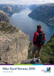
18 NATIONAL TOURIST ROUTES. Each of these<br />
selected routes represents a unique motoring<br />
experience, and each offers its own special<br />
combination of road, scenery and history.<br />
Our job is to ensure that you have an<br />
enjoyable journey. We do this by<br />
constructing spectacular viewing<br />
platforms and by providing<br />
service facilities, car parks,<br />
picnic areas, walking trails<br />
and artworks.<br />
1 UTSIKTEN. From the Vetlefjord, the road curves up the<br />
mountain slope before reaching its highest point at Nystøls-<br />
vatnet lake. The lay-by at Utsikten offers a panoramic view of<br />
the valley and the magnificent mountain landscape.<br />
2 LIKHOLEFOSSEN. The Gaula river is powerful and<br />
untamed, and walking out onto the elegant steel bridge over the<br />
Likholefossen waterfall brings you into close contact with the<br />
mighty force of the water, especially when the river runs high.<br />
Proceeding from the bridge, you can stroll along the «waterfall<br />
trail» along the protected river. Architect: Nordplan – Arild Waage.<br />
3 VALLESTADFOSSEN. This exuberant, cascading waterfall<br />
at the mouth of Haukedalsvatnet lake is a breathtaking sight.<br />
4 HESTAD CHAPEL. The old chapel is beautifully situated<br />
on the small tongue of land between Viksdalsvatnet lake<br />
and Hestadfjorden.<br />
5 RØRVIKFJELLET. From the viewpoint on the Rørvikfjellet<br />
mountain there is a panoramic view over the beautiful<br />
Haukedalsvatnet lake, where you can also see the Jostedals-<br />
breen glacier in the horizon.<br />
Photos: Statens vegvesen<br />
Statens vegvesen<br />
Turistvegseksjonen<br />
Address:<br />
Industrigata 17<br />
N-2605 Lillehammer<br />
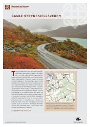
Gamle Strynefjellsvegen<br />
<strong>Gaularfjellet</strong><br />
Hardanger<br />
Jæren<br />
Atlanterhavsvegen<br />
Rondane<br />
Sognefjellet<br />
Valdresflye<br />
Aurlandsfjellet<br />
Ryfylke<br />
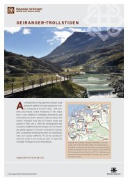
Geiranger-Trollstigen<br />
Hardangervidda<br />
Postal address:<br />
PO Box 1010<br />
N-2605 Lillehammer<br />
Lofoten<br />
Senja<br />
Andøya<br />
Helgelandskysten<br />
Phone:<br />
+47 815 22 000<br />
Havøysund<br />
1<br />
2<br />
3<br />
4<br />
5<br />
Varanger<br />
E-mail:<br />
turistvegkontoret@vegvesen.no<br />
Internet:<br />
nasjonaleturistveger.no<br />
vegvesen.no/nasjonaleturistveger<br />
0541-12 grafisk.senter@vegvesen.no