Final FO 3rd 5YR Report.pdf - Former Fort Ord - Environmental ...
Final FO 3rd 5YR Report.pdf - Former Fort Ord - Environmental ...
Final FO 3rd 5YR Report.pdf - Former Fort Ord - Environmental ...

You also want an ePaper? Increase the reach of your titles
YUMPU automatically turns print PDFs into web optimized ePapers that Google loves.
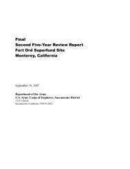
<strong>Final</strong><br />
3 rd Five-Year Review <strong>Report</strong> for<br />
<strong>Fort</strong> <strong>Ord</strong> Superfund Site<br />
Monterey County, California<br />
September 2012<br />
<strong>Fort</strong> <strong>Ord</strong> Base Realignment and Closure Office<br />
U.S. Department of the Army<br />
4463 Gigling Road<br />
Seaside, California 93955
TABLE OF CONTENTS<br />
<strong>Fort</strong> <strong>Ord</strong> Superfund Site<br />
<strong>3rd</strong> Five-Year Review<br />
Acronyms and Abbreviations ............................................................................... vii<br />
Executive Summary ........................................................................................... ES-1<br />
1.0 Introduction ............................................................................................... 1-1<br />
1.1 Five-Year Review <strong>Report</strong> Organization .............................................................................. 1-2<br />
2.0 Site Chronology Table ............................................................................... 2-1<br />
3.0 <strong>Fort</strong> <strong>Ord</strong> Background ............................................................................... 3-1<br />
3.1 Physical Characteristics ......................................................................................................... 3-1<br />
3.2 Land Use ....................................................................................................................... 3-1<br />
3.3 History of Contamination ...................................................................................................... 3-4<br />
3.4 Initial Responses ........................................................................................................... 3-4<br />
3.5 Munitions Response under ESCA ........................................................................................ 3-5<br />
3.6 Basis for Action ............................................................................................................ 3-6<br />
4.0 Five-Year Review Process ......................................................................... 4-1<br />
4.1 Administrative Component ................................................................................................... 4-1<br />
4.2 Community Involvement .............................................................................................. 4-1<br />
4.3 Document Review ......................................................................................................... 4-2<br />
4.4 Data Review .................................................................................................................. 4-2<br />
4.5 Site Inspections ............................................................................................................. 4-3<br />
4.6 Land Use Controls ........................................................................................................ 4-3<br />
4.7 Incidental Military Munitions ............................................................................................... 4-4<br />
4.8 Interviews ...................................................................................................................... 4-5<br />
5.0 OU 1 ROD – Fire Drill Area ..................................................................... 5-1<br />
5.1 OU 1 Background ......................................................................................................... 5-1<br />
5.2 Remedial Actions .......................................................................................................... 5-4<br />
5.3 Progress Since the Last Five-Year Review ......................................................................... 5-8<br />
5.4 OU 1 Five-Year Review Process ........................................................................................ 5-10<br />
5.5 Technical Assessment ................................................................................................. 5-16<br />
5.6 Issues ........................................................................................................................... 5-18<br />
5.7 Recommendations and Follow-up Actions ....................................................................... 5-18<br />
5.8 Protectiveness Statement ..................................................................................................... 5-19<br />
6.0 OU 2 ROD – <strong>Fort</strong> <strong>Ord</strong> Landfills .............................................................. 6-1<br />
6.1 OU 2 Background ......................................................................................................... 6-1<br />
August 29, 2012 i<br />
Cover Pages.docx United States Department of the Army
TABLE OF CONTENTS (Continued)<br />
<strong>Fort</strong> <strong>Ord</strong> Superfund Site<br />
<strong>3rd</strong> Five-Year Review<br />
6.2 Remedial Actions .......................................................................................................... 6-2<br />
6.3 Progress Since the Last Five-Year Review ......................................................................... 6-7<br />
6.4 OU 2 Five-Year Review Process .......................................................................................... 6-9<br />
6.5 Technical Assessment ................................................................................................. 6-11<br />
6.6 Issues ........................................................................................................................... 6-16<br />
6.7 Recommendations and Follow-Up Actions ...................................................................... 6-16<br />
6.8 Protectiveness Statement ..................................................................................................... 6-16<br />
7.0 Basewide Remedial Investigation Sites ROD .......................................... 7-1<br />
7.1 Sites 2 - Main Garrison Sewage Treatment Plant and 12 – Four Sub-Areas ................ 7-1<br />
7.2 Site 16 – DOL Maintentance Yard, Pete’s Pond, and Pete’s Pond Extension and<br />
Site 17 – Disposal Area ....................................................................................................... 7-12<br />
7.3 Site 31 - East Garrison Dump Site .............................................................................. 7-13<br />
7.4 Site 39 – Inland Ranges .............................................................................................. 7-17<br />
7.5 Surface Water Outfalls ................................................................................................ 7-28<br />
7.6 Site 25 - <strong>Former</strong> Defense Reutilization and Marketing Office ................................... 7-29<br />
7.7 Site 33 - Golf Course Maintenance Area .................................................................... 7-29<br />
8.0 Site 3 ROD - Beach Trainfire Ranges ...................................................... 8-1<br />
8.1 Site 3 Background ......................................................................................................... 8-1<br />
8.2 Remedial Actions .......................................................................................................... 8-1<br />
8.3 Progress Since the last Five-Year Review .......................................................................... 8-3<br />
8.4 Five-Year Review Process .................................................................................................... 8-3<br />
8.5 Technical Assessment ................................................................................................... 8-5<br />
8.6 Issues ............................................................................................................................. 8-6<br />
8.7 Recommendations and Follow-Up Actions ........................................................................ 8-6<br />
8.8 Protectiveness Statement ............................................................................................... 8-6<br />
9.0 No Action Sites ROD ................................................................................. 9-1<br />
9.1 No Action Sites Summary ..................................................................................................... 9-1<br />
10.0 Interim Action Sites ROD ....................................................................... 10-1<br />
10.1 Background ................................................................................................................. 10-1<br />
10.2 Remedial Actions ........................................................................................................ 10-1<br />
10.3 Progress Since the last Five-Year Review ........................................................................ 10-5<br />
10.4 IA Sites Five-Year Review Process ................................................................................... 10-5<br />
August 29, 2012 ii<br />
Cover Pages.docx United States Department of the Army
TABLE OF CONTENTS (Continued)<br />
<strong>Fort</strong> <strong>Ord</strong> Superfund Site<br />
<strong>3rd</strong> Five-Year Review<br />
10.5 Technical Assessment ................................................................................................. 10-6<br />
10.6 Issues ........................................................................................................................... 10-7<br />
10.7 Recommendations and Follow-Up Actions ...................................................................... 10-7<br />
10.8 Protectiveness Statement ............................................................................................. 10-7<br />
11.0 Operable Unit Carbon Tetrachloride Plume ROD .............................. 11-1<br />
11.1 OUCTP Background ................................................................................................... 11-1<br />
11.2 Remedial Actions ........................................................................................................ 11-2<br />
11.3 Progress Since the Last Five-Year Review ....................................................................... 11-3<br />
11.4 OUCTP Five-Year Review Process ................................................................................... 11-5<br />
11.5 Technical Assessment ................................................................................................. 11-8<br />
11.6 Issues ......................................................................................................................... 11-12<br />
11.7 Recommendations and Follow-up Actions ..................................................................... 11-12<br />
11.8 Protectiveness Statement ........................................................................................... 11-12<br />
12.0 Track 0 ROD - No Action Regarding <strong>Ord</strong>nance-Related<br />
Investigation ............................................................................................. 12-1<br />
12.1 Track 0 Background .................................................................................................... 12-1<br />
12.2 Remedial Actions ........................................................................................................ 12-1<br />
12.3 Progress Since the Last Five-Year Review ....................................................................... 12-2<br />
12.4 Five-Year Review Process .................................................................................................. 12-3<br />
12.5 Technical Assessment ................................................................................................. 12-3<br />
12.6 Issues ........................................................................................................................... 12-3<br />
12.7 Recommendations and Follow-Up Actions ...................................................................... 12-3<br />
12.8 Protectiveness Statement ............................................................................................. 12-4<br />
13.0 Track 1 ROD - No Further Action Related to Munitions and Explosives<br />
of Concern ................................................................................................ 13-1<br />
13.1 Background ................................................................................................................. 13-1<br />
13.2 Remedial Actions ........................................................................................................ 13-1<br />
13.3 Progress Since the Last Five-Year Review ....................................................................... 13-5<br />
13.4 Five-Year Review Process .................................................................................................. 13-5<br />
13.5 Technical Assessment ................................................................................................. 13-6<br />
13.6 Issues ........................................................................................................................... 13-6<br />
13.7 Recommendations and Follow-Up Actions ...................................................................... 13-6<br />
August 29, 2012 iii<br />
Cover Pages.docx United States Department of the Army
TABLE OF CONTENTS (Continued)<br />
<strong>Fort</strong> <strong>Ord</strong> Superfund Site<br />
<strong>3rd</strong> Five-Year Review<br />
13.8 Protectiveness Statement ............................................................................................. 13-6<br />
14.0 Track 2 ROD - Parker Flats Munitions Response Area ...................... 14-1<br />
14.1 Background ................................................................................................................. 14-1<br />
14.2 Remedial Actions ........................................................................................................ 14-2<br />
14.3 Progress Since the Last Five-Year Review ....................................................................... 14-8<br />
14.4 Five-Year Review Process .................................................................................................. 14-8<br />
14.5 Technical Assessment .......................................................................................................... 14-9<br />
14.6 Issues ......................................................................................................................... 14-10<br />
14.7 Recommendations and Follow-Up Actions .................................................................... 14-10<br />
14.8 Protectiveness Statement ........................................................................................... 14-10<br />
15.0 Interim Action Sites Munitions Response ROD - Ranges 43-48,<br />
Range 30A, and MRS-16 ......................................................................... 15-1<br />
15.1 Background ................................................................................................................. 15-1<br />
15.2 Remedial Actions ........................................................................................................ 15-2<br />
15.3 Progress Since the Last Five-Year Review ....................................................................... 15-7<br />
15.4 Five-Year Review Process .................................................................................................. 15-7<br />
15.5 Technical Assessment ................................................................................................. 15-8<br />
15.6 Issues ........................................................................................................................... 15-9<br />
15.7 Recommendations and Follow-Up Actions ...................................................................... 15-9<br />
15.8 Protectiveness Statement ............................................................................................. 15-9<br />
16.0 Track 3 ROD - Impact Area Munitions Response Area ..................... 16-1<br />
16.1 Background ................................................................................................................. 16-1<br />
16.2 Remedial Actions ........................................................................................................ 16-2<br />
16.3 Progress Since the Last Five-Year Review ....................................................................... 16-8<br />
16.4 Five-Year Review Process ...................................................................................................... 16-8<br />
16.5 Technical Assessment .......................................................................................................... 16-9<br />
16.6 Issues ......................................................................................................................... 16-11<br />
16.7 Recommendations and Follow-Up Actions .................................................................... 16-11<br />
16.8 Protectiveness Statement ........................................................................................... 16-11<br />
17.0 Track 2 ROD - Del Rey Oaks Munitions Response Area .................... 17-1<br />
17.1 Background ................................................................................................................. 17-1<br />
August 29, 2012 iv<br />
Cover Pages.docx United States Department of the Army
TABLE OF CONTENTS (Continued)<br />
<strong>Fort</strong> <strong>Ord</strong> Superfund Site<br />
<strong>3rd</strong> Five-Year Review<br />
17.2 Remedial Actions ........................................................................................................ 17-2<br />
17.3 Progress Since the Last Five-Year Review ....................................................................... 17-6<br />
17.4 Five-Year Review Process .................................................................................................. 17-6<br />
17.5 Technical Assessment ................................................................................................. 17-6<br />
17.6 Issues ........................................................................................................................... 17-7<br />
17.7 Recommendations and Follow-Up Actions ...................................................................... 17-7<br />
17.8 Protectiveness Statement ..................................................................................................... 17-7<br />
18.0 <strong>Environmental</strong> Services Cooperative Agreement Group 1 Areas ...... 18-1<br />
18.1 Background ................................................................................................................. 18-1<br />
18.2 Status of Remedial Investigation/Feasibility Study/ROD ............................................... 18-3<br />
18.3 Recommendations and Follow-Up Actions ...................................................................... 18-4<br />
18.4 Protectiveness Statement ......................................................................................................... 18-4<br />
19.0 <strong>Environmental</strong> Services Cooperative Agreement Group 2 Areas ...... 19-1<br />
19.1 Background ................................................................................................................. 19-1<br />
19.2 Status of Remedial Investigation/Feasibility Study/ROD ............................................... 19-2<br />
19.3 Recommendations and Follow-Up Actions ...................................................................... 19-3<br />
19.4 Protectiveness Statement ......................................................................................................... 19-3<br />
20.0 <strong>Environmental</strong> Services Cooperative Agreement Group 3 Areas ...... 20-1<br />
20.1 Background ................................................................................................................. 20-1<br />
20.2 Status of Remedial Investigation/Feasibility Study/ROD ............................................... 20-3<br />
20.3 Recommendations and Follow-up Actions ....................................................................... 20-4<br />
20.4 Protectiveness Statement ......................................................................................................... 20-4<br />
21.0 <strong>Environmental</strong> Services Cooperative Agreement Group 4 Areas ...... 21-1<br />
21.1 Background ................................................................................................................. 21-1<br />
21.2 Status of Remedial Investigation/Feasibility Study/ROD ............................................... 21-2<br />
21.3 Recommendations and Follow-Up Actions ............................................................................ 21-2<br />
21.4 Protectiveness Statement ......................................................................................................... 21-2<br />
22.0 Status of Other Investigations ................................................................ 22-1<br />
22.1 Resource Conservation and Recovery Act Closures ....................................................... 22-1<br />
22.2 Comprehensive Basewide Range Assessment .................................................................. 22-3<br />
22.3 Remaining RI/FS Areas Program for MR ............................................................................... 22-4<br />
23.0 Next Five-Year Review ............................................................................ 23-1<br />
August 29, 2012 v<br />
Cover Pages.docx United States Department of the Army
TABLE OF CONTENTS (Continued)<br />
<strong>Fort</strong> <strong>Ord</strong> Superfund Site<br />
<strong>3rd</strong> Five-Year Review<br />
24.0 References ................................................................................................. 24-1<br />
TABLES<br />
Table 1 Parcels Transferred by Deed as of September 30, 2011<br />
Table 2 HTW Site Summary<br />
Table 3 Groundwater Protection Zone Status and Deed Restrictions by Site<br />
Table 4 Incidental Military Munitions Items Found through December 31, 2010<br />
Table 5 Aquifer Cleanup Levels<br />
Table 6 Historical Areas and Site Status as of September 30, 2011<br />
PLATES<br />
Plate 1 Location Map<br />
Plate 2 Installation Restoration Program Sites and Active Army<br />
Solid Waste Management Units<br />
Plate 3 Groundwater Plumes July 2006<br />
Plate 4 Groundwater Plumes December 2010<br />
Plate 5a Operable Unit 1 Remediation System<br />
Plate 5b Operable Unit 1 <strong>FO</strong>NR Remediation System Capture Zone<br />
Plate 6 Operable Unit 2 Remediation Systems and <strong>Former</strong> Landfills<br />
Plate 7 Sites 2/12 Remediation System<br />
Plate 8 OUCTP Remediation System<br />
Plate 9 Munitions Response Sites<br />
Plate 10 Property Transfer Status Map, July 2011<br />
Plate 11 Remaining RI/FS Areas for Munitions Response<br />
APPENDICES<br />
A Field Documentation of Site Inspections and Interviews<br />
B Community Survey Responses<br />
C Figures for the ESCA Areas<br />
August 29, 2012 vi<br />
Cover Pages.docx United States Department of the Army
ACRONYMS AND ABBREVIATIONS<br />
<strong>Fort</strong> <strong>Ord</strong> Superfund Site<br />
<strong>3rd</strong> Five-Year Review<br />
AAFES Army and Air Force Exchange Service<br />
AAR after action report<br />
ACL aquifer cleanup level<br />
AOC Administrative <strong>Ord</strong>er on Consent<br />
AR Administrative Record<br />
ARAR applicable or relevant and appropriate requirement<br />
Army U.S. Department of the Army<br />
AST above-ground storage tank<br />
BCT BRAC Cleanup Team<br />
bgs below ground surface<br />
BLM Bureau of Land Management<br />
BRA Basewide Range Assessment<br />
BRAC Base Realignment and Closure<br />
Cal/EPA California <strong>Environmental</strong> Protection Agency<br />
CAMU Corrective Action Management Unit<br />
CAO Cleanup and Abatement <strong>Ord</strong>er<br />
CCAA California Clean Air Act<br />
CCR California Code of Regulations<br />
CD cultural debris<br />
CDFG California Department of Fish and Game<br />
CERCLA Comprehensive <strong>Environmental</strong> Response, Compensation, and<br />
Liability Act<br />
CES Civil Engineer Squadron<br />
CFR Code of Federal Regulations<br />
CIW Community Involvement Workshop<br />
CMC Central Maritime Chaparral<br />
COC chemical of concern<br />
COPC contaminant of potential concern<br />
CRUP Covenant to Restrict Use of Property<br />
CSUMB California State University Monterey Bay<br />
CT carbon tetrachloride<br />
CTS California Tiger Salamander<br />
cy cubic yard<br />
DCA dichloroethane<br />
DCE dichloroethene<br />
DCP dichloropropane<br />
DEH Directorate of Engineering and Housing<br />
DGM digital geophysical mapping<br />
DMM discarded military munitions<br />
DoD Department of Defense<br />
DOL Directorate of Logistics<br />
DPR California Department of Parks and Recreation<br />
DPW Department of Public Works<br />
DRMO Defense Reutilization and Marketing Office<br />
August 29, 2012 vii<br />
Cover Pages.docx United States Department of the Army
ACRONYMS AND ABBREVIATIONS (Continued)<br />
DRO Del Rey Oaks<br />
DTSC Department of Toxic Substances Control<br />
EIS <strong>Environmental</strong> Impact Statement<br />
EOD Explosive <strong>Ord</strong>nance Disposal<br />
EPA U.S. <strong>Environmental</strong> Protection Agency<br />
ERA ecological risk assessment<br />
ESA Endangered Species Act<br />
ESCA <strong>Environmental</strong> Services Cooperative Agreement<br />
ESD Explanation of Significant Differences<br />
EW extraction well<br />
FAAF Fritzsche Army Airfield<br />
FD Fire Department<br />
FDA Fire Drill Area<br />
FFA Federal Facility Agreement<br />
<strong>FO</strong>NR <strong>Fort</strong> <strong>Ord</strong> Natural Reserve<br />
<strong>FO</strong>RA <strong>Fort</strong> <strong>Ord</strong> Reuse Authority<br />
<strong>FO</strong>SET Finding of Suitability for Early Transfer<br />
<strong>FO</strong>ST Finding of Suitability to Transfer<br />
FS Feasibility Study<br />
GAC granular activated carbon<br />
gpm gallons per minute<br />
GWETS groundwater extraction and treatment system<br />
GWTP groundwater treatment plant<br />
HA historical area<br />
HCPP hydraulic control pilot project<br />
HE high explosive<br />
HGL HydroGeoLogic, Inc.<br />
HGV health guidance value<br />
HHRA human health risk assessment<br />
HI hazard index<br />
HLA Harding Lawson Associates<br />
HMP Habitat Management Plan<br />
HMTA Hazardous Materials Transportation Act<br />
HMX cyclotetramethylene tetranitramine<br />
HRP habitat restoration plan<br />
HTW hazardous and toxic waste<br />
IA Interim Action<br />
IAROD Interim Action Sites ROD<br />
IRP Installation Restoration Program<br />
ISD insufficient data<br />
IT International Technology Corporation<br />
IW injection well<br />
JMM James M. Montgomery Consulting Engineering<br />
LTM long-term monitoring<br />
<strong>Fort</strong> <strong>Ord</strong> Superfund Site<br />
<strong>3rd</strong> Five-Year Review<br />
August 29, 2012 viii<br />
Cover Pages.docx United States Department of the Army
ACRONYMS AND ABBREVIATIONS (Continued)<br />
<strong>Fort</strong> <strong>Ord</strong> Superfund Site<br />
<strong>3rd</strong> Five-Year Review<br />
LUC land use control<br />
MBTA Migratory Bird Treaty Act<br />
MCC Monterey County Code<br />
MCL maximum contaminant level<br />
MCLG maximum contaminant level goal<br />
MD munitions debris<br />
MEC munitions and explosives of concern<br />
MEK methyl ethyl ketone<br />
mg/kg milligrams per kilogram<br />
MGSTP Main Garrison Sewage Treatment Plant<br />
Military Munitions Rule Federal RCRA Subpart M<br />
mm millimeter<br />
MOA Memorandum of Agreement<br />
MOUT Military Operations in Urban Terrain<br />
MPC Monterey Peninsula College<br />
MR Munitions Response<br />
MRA Munitions Response Area<br />
MRS Munitions Response Site<br />
MRS-BLM Munitions Response Site–Bureau of Land Management<br />
MW monitoring well<br />
NCA non-completed areas<br />
NCP National Oil and Hazardous SubstancesPollution Contingency Plan<br />
NFA no further action<br />
NoA no action<br />
NPDES National Pollutant Discharge Elimination System<br />
NPL National Priorities List<br />
NRMA natural resource management area<br />
NTCRA non time-critical removal action<br />
NWTS Northwest Treatment System<br />
OE ordnance and explosives<br />
OEHHA California Office of <strong>Environmental</strong> Health Hazard Assessment<br />
OF outfall<br />
off-site GWETS Off-Site Groundwater Extraction Pilot Study GWETS<br />
O&M operations and maintenance<br />
OU 1 Operable Unit 1<br />
OU 2 Operable Unit 2<br />
OUCTP Operable Unit Carbon Tetrachloride Plume<br />
PA/SI Preliminary Assessment/Site Investigation<br />
PCB polychlorinated biphenyl<br />
PCE tetrachloroethene<br />
POM Presidio of Monterey<br />
POMFD Presidio of Monterey Fire Department<br />
ppbv parts per billion by volume<br />
PRG Preliminary Remediation Goal<br />
August 29, 2012 ix<br />
Cover Pages.docx United States Department of the Army
ACRONYMS AND ABBREVIATIONS (Continued)<br />
<strong>Fort</strong> <strong>Ord</strong> Superfund Site<br />
<strong>3rd</strong> Five-Year Review<br />
PRHRA Post-Remediation Health Risk Assessment<br />
RA Remedial Action<br />
RACR Remedial Action Completion <strong>Report</strong><br />
RAO remedial action objective<br />
RAWP Remedial Action Work Plan<br />
RCRA Resource Conservation and Recovery Act<br />
RD Remedial Design<br />
RD/RA Remedial Design / Remedial Action<br />
RDX cyclotrimethylene trinitramine<br />
RI Remedial Investigation<br />
RfD oral reference dose<br />
RI/FS Remedial Investigation/Feasibility Study<br />
ROD Record of Decision<br />
RP Remediation Program<br />
RQA Residential Quality Assurance<br />
RSL regional screening level<br />
RWQCB California Central Coast Regional Water Quality Control Board<br />
SCA Special Case Areas<br />
SEDR Summary of Existing Data <strong>Report</strong><br />
SGPZ Special Groundwater Protection Zone<br />
SPRR Southern Pacific Railroad<br />
SRU soil remedial unit<br />
SSWP site-specific work plan<br />
SVE soil vapor extraction<br />
SWMU Solid Waste Management Unit<br />
SWOI Surface Water Outfall Investigation<br />
TCDD 2,3,7,8-tetrachlorodibenzo-p-dioxin<br />
TCDD-TE 2.3.7.8-TCDD toxic equivalents<br />
TCA trichloroethane<br />
TCE trichloroethene<br />
TCRA time-critical removal action<br />
TNT trinitrotoluene<br />
TPH total petroleum hydrocarbons<br />
TPH-d TPH as diesel<br />
TPH-unknown TPH of unknown origin<br />
TRC Technical Review Committee<br />
TTU thermal treatment unit<br />
UCSC University of California Santa Cruz<br />
ug/dl micrograms per deciliter<br />
ug/L micrograms per liter<br />
USACE United States Army Corps of Engineers<br />
USFWS United States Fish and Wildlife Service<br />
UST underground storage tank<br />
UV-Ox ultraviolet chemical oxidation<br />
August 29, 2012 x<br />
Cover Pages.docx United States Department of the Army
ACRONYMS AND ABBREVIATIONS (Continued)<br />
UXO unexploded ordnance<br />
VOC volatile organic compound<br />
WWII World War II<br />
<strong>Fort</strong> <strong>Ord</strong> Superfund Site<br />
<strong>3rd</strong> Five-Year Review<br />
August 29, 2012 xi<br />
Cover Pages.docx United States Department of the Army
EXECUTIVE SUMMARY<br />
<strong>Fort</strong> <strong>Ord</strong> Superfund Site<br />
<strong>3rd</strong> Five-Year Review<br />
The United States Department of the Army (Army) has completed this <strong>3rd</strong> Five-Year Review of<br />
all in-place cleanup remedies for the <strong>Fort</strong> <strong>Ord</strong> Superfund Site in Monterey County, California.<br />
The 2nd Five-Year Review for <strong>Fort</strong> <strong>Ord</strong> was completed in September 10, 2007 and was the<br />
triggering action for this five-year review.<br />
<strong>Fort</strong> <strong>Ord</strong> served primarily as a training and staging facility for infantry troops beginning in 1917<br />
until its deactivation in 1994. Activities conducted throughout the base, including industrial<br />
activities and military munitions training, have resulted in the identification of numerous sites<br />
where chemicals have been detected in soil and groundwater and munitions and explosives of<br />
concern (MEC) have been detected in former munitions training areas.<br />
Since 1986, the Army has been conducting investigation and cleanup actions at the former <strong>Fort</strong><br />
<strong>Ord</strong>. Initially, the studies concentrated on identifying chemical contaminants in soil and<br />
groundwater, generally as a result of industrial and waste disposal activities. These sites<br />
constitute the Hazardous and Toxic Waste (HTW) sites at the former <strong>Fort</strong> <strong>Ord</strong>. In 1993, the<br />
Army also began investigating sites where MEC were suspected to be present. These Munitions<br />
Response Sites (MRSs) and Munitions Response Areas (MRAs) include approximately 12,000<br />
acres of the former <strong>Fort</strong> <strong>Ord</strong>. These sites have been identified through archive searches,<br />
interviews, and visual inspections. The types of MEC found include artillery projectiles, rockets,<br />
hand grenades, land mines, pyrotechnics, bombs, demolition materials, and other items. The MR<br />
Program sites at <strong>Fort</strong> <strong>Ord</strong> are categorized according to MEC-related characteristics to expedite<br />
cleanup, reuse, and/or transfer of former <strong>Fort</strong> <strong>Ord</strong> property. According to this process, areas are<br />
assigned to Tracks 0 through 3.<br />
The soil and groundwater cleanup sites and the MRS have been grouped into the remedial<br />
categories described below; Records of Decision (RODs) have been or are being developed for<br />
each group to specifically address the hazards. For each of the sites included in this five-year<br />
review, the effectiveness of their respective cleanup remedies has been evaluated or an update on<br />
the status of the cleanup process has been provided. A brief summary of the general categories of<br />
sites and groups of sites, and definitions of the terms used in this Five-Year Review <strong>Report</strong> to<br />
describe these groupings follows.<br />
• No Action Sites are those that require no further action, either because no release of<br />
contaminants was identified at the site or because the site activities are excluded under<br />
Superfund (e.g. underground storage tank remediation).<br />
• Interim Action Sites are those that have contaminated soil with a limited volume and<br />
extent and, as a result, the soils were excavated as an interim action.<br />
• Remedial Investigation (RI) Sites are those with complex problems that require longterm<br />
remediation, development of a risk assessment, and an assessment of the applicable<br />
or relevant and appropriate requirements for cleanup.<br />
• Operable Units (OUs) are sites with complex cleanup remedial actions that are ongoing.<br />
These sites include: OU 1, the Fritzsche Army Airfield Fire Drill Area; OU 2, the <strong>Fort</strong><br />
<strong>Ord</strong> Landfills; and OUCTP, the former vadose zone source area of carbon tetrachloride<br />
and associated groundwater plume. These OUs are supported by their own individual<br />
RODs.<br />
• Munitions Response Program Sites and Groups of Sites have been undergoing<br />
munitions response actions designed to minimize the explosive safety risk to the public<br />
August 20, 2012 ES-1<br />
<strong>5YR</strong> ExecSumm.docx United States Department of the Army
<strong>Fort</strong> <strong>Ord</strong> Superfund Site<br />
<strong>3rd</strong> Five-Year Review<br />
under designated future uses. In the interim, some restricted MRSs are fenced and<br />
warning signs are posted, while other areas have undergone sufficient evaluations to be<br />
released for unrestricted use.<br />
• <strong>Environmental</strong> Services Cooperative Agreement (ESCA) Areas - In connection with<br />
the early transfer of a portion of the former <strong>Fort</strong> <strong>Ord</strong>, the <strong>Fort</strong> <strong>Ord</strong> Reuse Authority<br />
(<strong>FO</strong>RA) assumed some of the Army’s cleanup obligations under an ESCA grant.<br />
Pursuant to the ESCA process, <strong>FO</strong>RA agreed to conduct the evaluation of MEC hazards<br />
and conduct remedial actions deemed necessary to protect human health and the<br />
environment under future uses. The land transferred under the Finding of Suitability for<br />
Early Transfer (<strong>FO</strong>SET) 5 included approximately 3,336 acres; and the land subject to<br />
the ESCA Remediation Program included approximately 3,279 acres. .<br />
A list of the sites and OUs evaluated in the 3 rd Five-Year Review (with the associated report<br />
Section numbers) and a summary of the results of the evaluation are provided below.<br />
OU 1 - Fritzsche Army Airfield Fire Drill Area (Section 5.0): The technical assessment<br />
identified no issues for OU 1, and the remedies were deemed protective of human health and the<br />
environment.<br />
OU 2 - <strong>Fort</strong> <strong>Ord</strong> Landfills (Section 6.0): The technical assessment identified no issues for OU<br />
2 and the remedies were deemed protective of human health and the environment.<br />
Site 2 – Main Garrison Sewage Treatment Plant and Site 12 - Lower Meadow Disposal<br />
Area, Directorate of Logistics (DOL) Automotive Yard, Cannibalization Yard, and<br />
Southern Pacific Railroad Spur (Section 7.1): The technical assessment identified the<br />
following issue for Sites 2 and 12: There has been a change in potential soil vapor exposure and<br />
associated potential risk due to recent increases of contaminant of concern (COC) concentrations<br />
in groundwater. An evaluation is recommended to determine if the recent increase in COC<br />
concentrations in groundwater results in an actual increase in risk. A protectiveness<br />
determination for Sites 2 and 12 soil vapor should be deferred until evaluation of the recent<br />
increase in COC concentration is completed.<br />
For groundwater, the Sites 2 and12 remedy was deemed protective of human health and the<br />
environment.<br />
Site 16 - DOL Maintenance Yard, Pete’s Pond, and Pete’s Pond Extension and Site 17 -<br />
Disposal Area (Section 7.2): The technical assessment identified no issues for Sites 16 and 17.<br />
The soil remedy allows for unrestricted use and is protective of human health and the<br />
environment.<br />
Site 31 - <strong>Former</strong> East Garrison Dump Site (Section 7.3): The technical assessment identified<br />
the following issue for Site 31: The OEHHA health guidance value for lead in blood and the<br />
methodology used to calculate the human health-based cleanup levels for Site 31 have been<br />
revised which may affect protectiveness of human health. An evaluation is recommended to<br />
determine the effect of the changes on the protectiveness of the human health-based cleanup<br />
levels for Site 31. Therefore, a protectiveness determination for human health should be deferred<br />
until further information is obtained. The Site 31 remedy was deemed protective of the<br />
environment.<br />
August 20, 2012 ES-2<br />
<strong>5YR</strong> ExecSumm.docx United States Department of the Army
<strong>Fort</strong> <strong>Ord</strong> Superfund Site<br />
<strong>3rd</strong> Five-Year Review<br />
Site 39 - Inland Ranges (Section 7.4): The technical assessment identified the following issue<br />
for Site 39: The OEHHA health guidance value for lead in blood and the methodology used to<br />
calculate the human health-based cleanup levels for Site 39 have been revised which may affect<br />
protectiveness of human health. An evaluation is recommended to determine the effect of the<br />
changes on the protectiveness of the human health-based cleanup levels for Site 39. Therefore, a<br />
protectiveness determination for human health should be deferred until further information is<br />
obtained. The Site 39 remedy was deemed protective of the environment.<br />
Surface Water Outfalls (Section 7.5): The technical assessment identified no issues for the<br />
surface water outfalls. The remedies allow for unrestricted use and were deemed protective of<br />
human health and the environment.<br />
Site 25 - <strong>Former</strong> Defense Reutilization and Marketing Office (Section 7.6): The technical<br />
assessment identified no issues for Site 25. The soil remedy allows for unrestricted use and was<br />
deemed protective of human health and the environment.<br />
Site 33 - Golf Course Maintenance Facility (Section 7.7): The technical assessment identified<br />
no issues for Site 33. The Site 33 remedy was deemed protective of human health and the<br />
environment.<br />
Site 3 – Beach Trainfire Ranges, also known as MRS-22 under the military munitions<br />
response program (Section 8.0): The technical assessment identified the following issue for<br />
Site 3: the OEHHA health guidance value for lead in blood and the methodology used to<br />
calculate the human health-based cleanup levels for Site 3 have been revised, which may affect<br />
protectiveness of human health. An evaluation is recommended to determine the effect of the<br />
changes on the protectiveness of the human health-based cleanup levels for Site 3. Therefore, a<br />
protectiveness determination for human health should be deferred until further information is<br />
obtained. The Site 3 remedy is deemed protective of the environment.<br />
No Action (NoA) Sites - 12 sites that were investigated and recommended for no further<br />
action (Section 9.0): The technical assessment identified no issues for the NoA sites. The no<br />
action remedies are protective of human health and the environment, and the sites are available<br />
for unrestricted use.<br />
Interim Action (IA) Sites - 23 soil excavation sites (Section 10.0): The technical assessment<br />
identified the following issue for the IA sites: although the IA Sites were closed with no further<br />
action required, the California OEHHA health guidance value for lead in blood and the<br />
methodology used to calculate the human health-based cleanup levels for the IA Sites with lead<br />
contamination in soil have been revised, which may affect protectiveness of human health. The<br />
remedies at the IA sites were deemed protective of the environment. An evaluation is<br />
recommended to determine the effect of the changes on the protectiveness of the human healthbased<br />
cleanup levels for applicable IA Sites. Therefore, a protectiveness determination for<br />
human health should be deferred for these sites until further information is obtained. For the IA<br />
Sites that were not excavated to remove lead-impacted soil, there have been no changes in<br />
toxicity, therefore, the remedy for these sites remains protective.<br />
August 20, 2012 ES-3<br />
<strong>5YR</strong> ExecSumm.docx United States Department of the Army
<strong>Fort</strong> <strong>Ord</strong> Superfund Site<br />
<strong>3rd</strong> Five-Year Review<br />
OUCTP - The Operable Unit Carbon Tetrachloride Plume (Section 11.0): The technical<br />
assessment identified no issues for OUCTP. The OUCTP remedy is expected to be protective of<br />
human health and the environment upon completion. In the interim, potential exposure pathways<br />
that could result in unacceptable risks are being controlled.<br />
Track 0 – No Action MR Areas (Section 12.0): The technical assessment identified no issues<br />
for Track 0 areas. The Track 0 ROD’s No Action response action was deemed protective of<br />
human health and the environment.<br />
Track 1 - No Further Action MR Areas (Section 13.0): The technical assessment identified<br />
no issues for Track 1 sites. The Track 1 remedy was deemed protective of human health and the<br />
environment.<br />
Track 2 - Parker Flats Munitions Response Area (Section 14.0): The technical assessment<br />
identified no issues for the Parker Flats MRA. The remedies were deemed protective of human<br />
health and the environment, and exposure pathways that could result in unacceptable risks are<br />
being controlled.<br />
Interim Action Sites Munitions Response - Ranges 43-48, Range 30A, and MRS-16 (Section<br />
15.0): The technical assessment identified no issues for the IA MR sites. The IA MR Sites<br />
remedy is expected to be protective of human health and the environment upon completion and,<br />
in the interim, potential exposure pathways that could result in unacceptable risks are being<br />
controlled.<br />
Track 3 - Impact Area Munitions Response Area (Section 16.0): The technical assessment<br />
identified the following issue for the Impact Area: Although decreasing in frequency, there have<br />
been incidents of trespassing and evidence of fence damage during the review period. Continued<br />
implementation of the MRS Security Program is recommended. The Impact Area MRA remedy<br />
is expected to be protective of human health and the environment upon completion and, in the<br />
interim, exposure pathways that could result in unacceptable risks are being controlled.<br />
Track 2 - Del Rey Oaks Munitions Response Area (Section 17.0): The technical assessment<br />
identified no issues for Del Rey Oaks MRA. The remedies were deemed protective of human<br />
health and the environment, and exposure pathways that could result in unacceptable risks are<br />
being controlled.<br />
ESCA Areas – four groups, defined as Group 1, Group 2, Group 3, and Group 4 (Sections<br />
18.0 to 21.0): The technical assessment identified no issues for the ESCA areas, although the<br />
RODs for these areas are not yet completed. The remedy for the ESCA Areas currently protects<br />
human health and environment because land use restrictions are placed on the properties.<br />
However, in order for the remedy to be protective in the long term, an RI/FS and subsequent<br />
Group 1 ROD must be completed.<br />
August 20, 2012 ES-4<br />
<strong>5YR</strong> ExecSumm.docx United States Department of the Army
Site Name: <strong>Fort</strong> <strong>Ord</strong><br />
EPA ID: CA7210020676<br />
Five-Year Review Summary Form<br />
SITE IDENTIFICATION<br />
Region: 9 State: CA City/County: Marina / Monterey<br />
NPL Status: <strong>Final</strong><br />
Multiple OUs?<br />
Yes<br />
SITE STATUS<br />
Has the site achieved construction completion?<br />
No<br />
REVIEW STATUS<br />
Lead agency: Other Federal Agency<br />
If “Other Federal Agency” was selected above, enter Agency name:<br />
U.S. Department of the Army<br />
Author name (Federal or State Project Manager): Gail Youngblood<br />
Author affiliation: U.S. Department of the Army<br />
Review period: 07/06/07 – 09/30/11<br />
Date of site inspection: 10 / 25 / 11 through 12 / 16 / 11<br />
Type of review: Statutory<br />
Review number: 3<br />
Triggering action date: 25 September 2007<br />
Due date (five years after triggering action date): 25 September 2012<br />
Page 1 of 6<br />
<strong>Final</strong> August 20, 2012<br />
<strong>Former</strong> <strong>Fort</strong> <strong>Ord</strong> Five-Year Review 2012
Five-Year Review Summary Form (Continued)<br />
Issues/Recommendations Protectiveness Statements<br />
Issues and Recommendations Identified in the Five-Year Review<br />
and Sites/Operable Units (OUs) without Issues/Recommendations Identified in the Five-Year Review<br />
OU(s): Section 5: OU 1<br />
― Fritzsche Army Airfield<br />
Fire Drill Area<br />
OU(s): Section 6: OU 2 –<br />
<strong>Fort</strong> <strong>Ord</strong> Landfills<br />
OU(s): Section 7.1:<br />
Basewide Remedial<br />
Investigation (RI) Sites –<br />
Site 2 – Main Garrison<br />
Sewage Treatment Plant<br />
and Site 12 - Lower<br />
Meadow Disposal Area,<br />
Directorate of Logistics<br />
(DOL) Automotive Yard,<br />
Cannibalization Yard, and<br />
Southern Pacific Railroad<br />
Spur<br />
Affect Current<br />
Protectiveness<br />
There are no issues affecting the protectiveness of the remedy at OU 1. Protectiveness Statement:<br />
The remedy at OU 1 is protective of human health and the environment and, in the<br />
interim, potential exposure pathways that could result in unacceptable risks are being<br />
controlled.<br />
There are no issues affecting the protectiveness of the remedy at OU 2. Protectiveness Statement:<br />
The OU 2 remedies are protective of human health and the environment and, in the<br />
interim, potential exposure pathways that could result in unacceptable risks are being<br />
controlled.<br />
Issue Category: Changed Site Conditions Operable Unit:<br />
Sites 2 and12<br />
Issue: There has been a change in potential soil vapor exposure and associated potential risk due<br />
to recent increases of contaminant of concern (COC) concentrations in groundwater.<br />
Recommendation: An evaluation is recommended to determine if the recent increase in COC<br />
concentrations in groundwater results in an actual increase in risk.<br />
Affect Future<br />
Protectiveness<br />
Implementing Party Oversight Party Milestone Date<br />
Yes Yes Federal Facility EPA/State December 31, 2013<br />
OU(s): Section 7.2:<br />
Basewide RI Sites – Site<br />
16 - DOL Maintenance<br />
Yard, Pete’s Pond, and<br />
Pete’s Pond Extension<br />
and Site 17 - Disposal<br />
Area<br />
Protectiveness<br />
Determination:<br />
Protectiveness Deferred<br />
Addendum Due Date<br />
(if applicable):<br />
NA<br />
Protectiveness Statement:<br />
A protectiveness determination for Sites 2 and 12 soil vapor should be deferred until<br />
evaluation of the recent increase in COC concentration is completed, which is<br />
expected by the end of December 2013. The Sites 2 and12 groundwater remedy is<br />
protective of human health and the environment and, in the interim, potential<br />
exposure pathways that could result in unacceptable risks are being controlled.<br />
There are no issues affecting the protectiveness of the remedy at Sites 16 and 17. Protectiveness Statement:<br />
The Sites 16 and 17 soil remedy allows for unrestricted use and is protective of<br />
human health and the environment.<br />
Page 2 of 6<br />
<strong>Final</strong> August 20, 2012<br />
<strong>Former</strong> <strong>Fort</strong> <strong>Ord</strong> Five-Year Review 2012
Issues/Recommendations Protectiveness Statements<br />
Issues and Recommendations Identified in the Five-Year Review<br />
and Sites/Operable Units (OUs) without Issues/Recommendations Identified in the Five-Year Review<br />
OU(s): Section 7.3:<br />
Basewide RI Sites –<br />
Site 31 – <strong>Former</strong> East<br />
Garrison Dump Site<br />
Affect Current<br />
Protectiveness<br />
Issue Category: Remedy Performance Operable Unit:<br />
Site 31<br />
Issue: The California Office of <strong>Environmental</strong> Health Hazard Assessment (OEHHA) health guidance<br />
value for lead in blood and the methodology used to calculate the human health-based cleanup<br />
levels for Site 31 have been revised which may affect protectiveness of human health.<br />
Recommendation: The current remedy is functioning as intended; however, the effect of the<br />
changes in the OEHHA health guidance value for lead in blood and the California Department of<br />
Toxic Substance Control (DTSC) methodology for calculating heath risk on the protectiveness of the<br />
human health-based cleanup levels for Site 31 will need to be evaluated.<br />
Affect Future<br />
Protectiveness<br />
Implementing Party Oversight Party Milestone Date<br />
Yes Yes Federal Facility EPA/State December 31, 2013<br />
OU(s): Section 7.4:<br />
Basewide RI Sites – Site<br />
39 – Impact Area<br />
Affect Current<br />
Protectiveness<br />
Issue Category: Remedy Performance Operable Unit:<br />
Site 39<br />
Issue: The OEHHA health guidance value for lead in blood and the methodology used to calculate<br />
the human health-based cleanup levels for Site 39 have been revised which may affect<br />
protectiveness of human health.<br />
Recommendation: The current remedy is functioning as intended; however, the effect of the<br />
changes in the OEHHA health guidance value for lead in blood and the DTSC methodology for<br />
calculating heath risk on the protectiveness of the human health-based cleanup levels for Site 39 will<br />
need to be evaluated. As additional areas of Site 39 are cleared of munitions and explosives of<br />
concern (MEC) and become accessible, evaluation of potential soil contamination will be performed.<br />
Affect Future<br />
Protectiveness<br />
Implementing Party Oversight Party Milestone Date<br />
Yes Yes Federal Facility EPA/State December 31, 2013<br />
OU(s): Section 7.5:<br />
Basewide RI Sites -<br />
Surface Water Outfalls<br />
(OF)<br />
OU(s): Section 7.6:<br />
Basewide RI Sites – Site<br />
25 - <strong>Former</strong> Defense<br />
Reutilization and<br />
Marketing Office<br />
There are no issues affecting the protectiveness of the remedy at the Surface Water OFs.<br />
Protectiveness<br />
Determination:<br />
Protectiveness Deferred<br />
Addendum Due Date<br />
(if applicable):<br />
NA<br />
Protectiveness Statement:<br />
The Site 31 remedy is protective of the environment. However, a protectiveness<br />
determination for human health should be deferred until further information is<br />
obtained. Further information will be obtained by evaluating the effect of the<br />
changes in the OEHHA health guidance value for lead in blood and the DTSC<br />
methodology for calculating heath risk on the protectiveness of the human healthbased<br />
cleanup levels for Site 31. It is expected that this evaluation will be completed<br />
by the end of December 2013 and, at that time, a protectiveness determination for<br />
human health will be made.<br />
Protectiveness<br />
Determination:<br />
Protectiveness Deferred<br />
Addendum Due Date<br />
(if applicable):<br />
NA<br />
Protectiveness Statement:<br />
The Site 39 remedy is protective of the environment. However, a protectiveness<br />
determination for human health should be deferred until further information is<br />
obtained. Further information will be obtained by evaluating the effect of the<br />
changes in the OEHHA health guidance value for lead in blood and the DTSC<br />
methodology for calculating heath risk on the protectiveness of the human healthbased<br />
cleanup levels for Site 39. It is expected that this evaluation will be completed<br />
by the end of December 2013 and, at that time, a protectiveness determination for<br />
human health will be made.<br />
Protectiveness Statement:<br />
The remedies at the OFs allow for unrestricted use and are protective of human<br />
health and the environment.<br />
There are no issues affecting the protectiveness of the remedy at Site 25. Protectiveness Statement:<br />
Site 25 is available for unrestricted use. The no further action (NFA) remedy is<br />
protective of human health and the environment.<br />
Page 3 of 6<br />
<strong>Final</strong> August 20, 2012<br />
<strong>Former</strong> <strong>Fort</strong> <strong>Ord</strong> Five-Year Review 2012
Issues/Recommendations Protectiveness Statements<br />
Issues and Recommendations Identified in the Five-Year Review<br />
and Sites/Operable Units (OUs) without Issues/Recommendations Identified in the Five-Year Review<br />
OU(s): Section 7.7:<br />
Basewide RI Sites – Site<br />
33 - Golf Course<br />
Maintenance Area<br />
OU(s): Section 8: Site 3<br />
– Beach Trainfire<br />
Ranges<br />
Affect Current<br />
Protectiveness<br />
There are no issues affecting the protectiveness of the remedy at Site 33.<br />
Issue Category: Remedy Performance: Operable Unit:<br />
Site 3<br />
Issue: The OEHHA health guidance value for lead in blood and the methodology used to calculate<br />
the human health-based cleanup levels for Site 3 have been revised which may affect protectiveness<br />
of human health.<br />
Recommendation: The current remedy is functioning as intended; however, the effect of the<br />
changes in the OEHHA health guidance value for lead in blood and the DTSC methodology for<br />
calculating heath risk on the protectiveness of the human health-based cleanup levels for Site 3 will<br />
need to be evaluated.<br />
Affect Future<br />
Protectiveness<br />
Implementing Party Oversight Party Milestone Date<br />
Yes Yes Federal Facility EPA/State December 31, 2013<br />
OU(s): Section 9: No<br />
Action (NoA) sites<br />
OU(s): Section 10.0:<br />
Interim Action (IA) Sites –<br />
Contaminated Surface<br />
Soil Remediation<br />
Affect Current<br />
Protectiveness<br />
Protectiveness Statement:<br />
The Site 33 remedy is protective of human health and the environment and, in the<br />
interim, potential exposure pathways that could result in unacceptable risks are being<br />
controlled.<br />
Protectiveness<br />
Determination:<br />
Protectiveness Deferred<br />
Addendum Due Date<br />
(if applicable):<br />
NA<br />
Protectiveness Statement:<br />
The Site 3 remedy is protective of the environment. However, a protectiveness<br />
determination for human health should be deferred until further information is<br />
obtained. Further information will be obtained by evaluating the effect of the<br />
changes in the OEHHA health guidance value for lead in blood and the DTSC<br />
methodology for calculating heath risk on the protectiveness of the human healthbased<br />
cleanup levels for Site 3. It is expected that this evaluation will be completed<br />
by the end of December 2013 and, at that time, a protectiveness determination for<br />
human health will be made.<br />
There are no issues affecting the protectiveness of the remedy at the NoA Sites. Protectiveness Statement:<br />
The NoA remedies are protective of human health and the environment; the sites are<br />
available for unrestricted use.<br />
Issue Category: Remedy Performance Operable Unit:<br />
IA Sites<br />
Issue: The California OEHHA health guidance value for lead in blood and the methodology used to<br />
calculate the human health-based cleanup levels for the IA Sites with lead contamination in soil have<br />
been revised which may affect protectiveness of human health.<br />
Recommendation: The IA Sites’ remedy is functioning as intended; however, the effect of the<br />
changes in the OEHHA health guidance value for lead in blood and the DTSC methodology for<br />
calculating heath risk on the protectiveness of the human health-based cleanup levels for the IA<br />
Sites with lead contamination in soil will need to be evaluated.<br />
Affect Future<br />
Protectiveness<br />
Implementing Party Oversight Party Milestone Date<br />
Yes Yes Federal Facility EPA/State December 31, 2013<br />
Protectiveness<br />
Determination:<br />
Protectiveness Deferred<br />
Addendum Due Date<br />
(if applicable):<br />
NA<br />
Protectiveness Statement:<br />
The IA Sites’ remedy is protective of the environment. However, a protectiveness<br />
determination for human health should be deferred until further information is<br />
obtained. Further information will be obtained by evaluating the effect of the<br />
changes in the OEHHA health guidance value for lead in blood and the DTSC<br />
methodology for calculating heath risk on the protectiveness of the human healthbased<br />
cleanup levels for the IA Sites with lead contamination in soil. It is expected<br />
that this evaluation will be completed by the end of December 2013 and, at that time,<br />
a protectiveness determination for human health will be made.<br />
Page 4 of 6<br />
<strong>Final</strong> August 20, 2012<br />
<strong>Former</strong> <strong>Fort</strong> <strong>Ord</strong> Five-Year Review 2012
Issues/Recommendations Protectiveness Statements<br />
Issues and Recommendations Identified in the Five-Year Review<br />
and Sites/Operable Units (OUs) without Issues/Recommendations Identified in the Five-Year Review<br />
OU(s): Section 11:<br />
Operable Unit Carbon<br />
Tetrachloride Plume<br />
(OUCTP)<br />
OU(s): Section 12: Track<br />
0 Areas<br />
OU(s): Section 13: Track<br />
1 Areas<br />
OU(s): Section 14: Track<br />
2 Parker Flats Munitions<br />
Response Area (MRA)<br />
OU(s): Section 15: IA<br />
Munitions Response Sites<br />
(MRSs) - Ranges 43-48,<br />
MRS-16, and Range 30A<br />
OU(s): Section 16: Track<br />
3 Impact Area MRA<br />
Affect Current<br />
Protectiveness<br />
There are no issues affecting the protectiveness of the remedy at OUCTP. Protectiveness Statement:<br />
The OUCTP remedy is expected to be protective of human health and the<br />
environment upon completion. In the interim, potential exposure pathways that could<br />
result in unacceptable risks are being controlled.<br />
There are no issues affecting the protectiveness of the remedy at the Track 0 Areas. Protectiveness Statement:<br />
The Track 0 Record of Decision (ROD)’s No Action response action is protective of<br />
human health and the environment.<br />
There are no issues affecting the protectiveness of the remedy at the Track 1 Areas. Protectiveness Statement:<br />
The Track 1 remedy is protective of human health and the environment.<br />
There are no issues affecting the protectiveness of the remedy at the Track 2 Parker Flats MRA. Protectiveness Statement:<br />
The remedy for the Parker Flats MRA is protective of human health and the<br />
environment. All exposure pathways that could result in unacceptable risks are<br />
being controlled.<br />
There are no issues affecting the protectiveness of the remedy at the IA Site MRSs. Protectiveness Statement:<br />
The IA MRSs’ remedy is expected to be protective of human health and the<br />
environment and, in the interim, potential exposure pathways that could result in<br />
unacceptable risks are being controlled.<br />
Issue Category: Site Access/Security Operable Unit:<br />
Track 3<br />
Issue: Although decreasing in frequency, there have been incidents of trespassing and evidence of<br />
fence damage during the review period.<br />
Recommendation: Continue implementation of the MRS Security Program.<br />
Affect Future<br />
Protectiveness<br />
Implementing Party Oversight Party Milestone Date<br />
No No Federal Facility EPA/State September 25, 2017<br />
OU(s): Section 17: Track<br />
2 Del Rey Oaks MRA<br />
Acronyms:<br />
RI Remedial Investigation<br />
COC contaminant of concern<br />
DOL Directorate of Logistics<br />
Protectiveness<br />
Determination:<br />
Will be Protective<br />
Addendum Due Date<br />
(if applicable):<br />
NA<br />
Protectiveness Statement:<br />
The remedial action within the Impact Area MRA is expected to be protective of<br />
human health and the environment upon completion and, in the interim, exposure<br />
pathways that could result in unacceptable risks are being controlled.<br />
There are no issues affecting the protectiveness of the remedy at the Track 2 Del Rey Oaks MRA. Protectiveness Statement:<br />
The remedy for the Del Rey Oaks MRA is protective of human health and the<br />
environment, and exposure pathways that could result in unacceptable risks are<br />
being controlled.<br />
Page 5 of 6<br />
<strong>Final</strong> August 20, 2012<br />
<strong>Former</strong> <strong>Fort</strong> <strong>Ord</strong> Five-Year Review 2012
DTSC California Department of Toxic Substance Control<br />
EPA U.S. <strong>Environmental</strong> Protection Agency<br />
IA Interim Action<br />
MEC munitions and explosives of concern<br />
MRS Munitions Response Site<br />
MRA Munitions Response Area<br />
NFA no further action<br />
NoA No Action<br />
OF Outfalls (for surface water)<br />
OU Operable Unit<br />
OUCTP Operable Unit Carbon Tetrachloride Plume<br />
OEHHA California Office of <strong>Environmental</strong> Health Hazard Assessment<br />
ROD Record of Decision<br />
Page 6 of 6<br />
<strong>Final</strong> August 20, 2012<br />
<strong>Former</strong> <strong>Fort</strong> <strong>Ord</strong> Five-Year Review 2012
1.0 INTRODUCTION<br />
<strong>Fort</strong> <strong>Ord</strong> Superfund Site<br />
<strong>3rd</strong> Five-Year Review<br />
The purpose of the five-year review is to determine whether the remedy at a site continues to be<br />
protective of human health and the environment after a period of five years from the time the<br />
remedy was implemented (or from the time of the previous five-year review). The methods,<br />
findings, and conclusions of the five-year review are documented in a Five-Year Review <strong>Report</strong>.<br />
In addition, the report documents any issues identified during the review based on site conditions<br />
and data, and proposes recommendations to address them, as appropriate.<br />
The U.S. Department of Army (Army) has prepared this Five-Year Review <strong>Report</strong> for the <strong>Former</strong><br />
<strong>Fort</strong> <strong>Ord</strong> pursuant to the Comprehensive <strong>Environmental</strong> Response, Compensation, and Liability<br />
Act (CERCLA) §121 and the National Oil and Hazardous Substances Pollution Contingency<br />
Plan (NCP). CERCLA §121 states:<br />
If the President selects a remedial action that results in any hazardous<br />
substances, pollutants, or contaminants remaining at the site, the President shall<br />
review such remedial action no less often than each five years after the initiation<br />
of such remedial action to assure that human health and the environment are<br />
being protected by the remedial action being implemented. In addition, if upon<br />
such review it is the judgment of the President that action is appropriate at such<br />
site in accordance with section [104] or [106], the President shall take or<br />
require such action. The President shall report to the Congress a list of facilities<br />
for which such review is required, the results of all such reviews, and any actions<br />
taken as a result of such reviews.<br />
The U.S. <strong>Environmental</strong> Protection Agency (EPA) interpreted this requirement further in the<br />
NCP; 40 Code of Federal Regulations (CFR) §300.430(f)(4)(ii), which states:<br />
If a remedial action is selected that results in hazardous substances, pollutants,<br />
or contaminants remaining at the site above levels that allow for unlimited use<br />
and unrestricted exposure, the lead agency shall review such action no less often<br />
than every five years after the initiation of the selected remedial action.<br />
During the period from September 2011 through March 2012, the Army conducted and<br />
documented the five-year review of all remedies implemented at the <strong>Fort</strong> <strong>Ord</strong> Superfund Site in<br />
Monterey County, California (Plate 1). This report documents the results of the review of<br />
remedies implemented at <strong>Fort</strong> <strong>Ord</strong> sites, as specified in their respective Records of Decision<br />
(RODs), and at other <strong>Fort</strong> <strong>Ord</strong> areas (which may not have RODs in place). The sites discussed in<br />
this report are shown on Plate 2 (Installation Restoration Program [IRP] Sites) and Plate 9<br />
(Munitions Response [MR] Sites). Plates 3 through 8 present information on IRP Sites with<br />
groundwater plumes. <strong>Fort</strong> <strong>Ord</strong> sites discussed in this report are listed below:<br />
• Operable Unit 1 (OU 1) ROD ― Fritzsche Army Airfield (FAAF) Fire Drill Area (FDA)<br />
• Operable Unit 2 (OU 2) ROD ― <strong>Fort</strong> <strong>Ord</strong> Landfills<br />
• Basewide Remedial Investigation (RI) Sites ROD<br />
- Sites 2 and 12 (Site 2: Main Garrison Sewage Treatment Plant [MGSTP]; Site 12:<br />
Lower Meadow Disposal Area, Directorate of Logistics [DOL] Automotive Yard,<br />
Cannibalization Yard and Industrial Area, Southern Pacific Railroad [SPRR] Spur,<br />
and Outfall [OF]-31 Area)<br />
August 20, 2012 1-1<br />
<strong>5YR</strong> Sect 1thru4.docx United States Department of the Army
<strong>Fort</strong> <strong>Ord</strong> Superfund Site<br />
<strong>3rd</strong> Five-Year Review<br />
- Sites 16 and 17 (Site 16: DOL Maintenance Yard, Pete's Pond, Pete's Pond<br />
Extension; Site 17: Disposal Area and Other Areas)<br />
- Site 31 (<strong>Former</strong> Dump Site)<br />
- Site 39 (Inland Ranges; includes Sites 5 and 9)<br />
- Surface Water OFs (OF-1 through OF-14; OF-16 through OF-30; OF-32; OF-33)<br />
- Site 25 (Equipment Storage Area)<br />
- Site 33 (Golf Course Maintenance Area)<br />
• Site 3 Interim ROD ― Beach Trainfire Ranges<br />
• No Action (NoA) Sites ROD<br />
• Interim Action (IA) Sites ROD<br />
• Operable Unit Carbon Tetrachloride Plume (OUCTP) ROD<br />
• Track 0 ROD<br />
• Track 1 ROD<br />
• Track 2 ROD - Parker Flats Munitions Response Area (MRA),<br />
• Interim Action Sites MR ROD - Ranges 43-48, Range 30A, and Munitions Response Site<br />
(MRS)-16<br />
• Track 3 ROD - Impact Area MRA<br />
• Track 2 ROD - Del Rey Oaks MRA,<br />
• <strong>Environmental</strong> Services Cooperative Agreement (ESCA) Group 1 Areas<br />
• ESCA Group 2 Areas<br />
• ESCA Group 3 Areas<br />
• ESCA Group 4 Areas<br />
• Status of Other Investigations (not addressed under one of the RODs above)<br />
- Resource Conservation and Recovery Act (RCRA) Closures<br />
- Comprehensive Basewide Range Assessment (BRA)<br />
- Remaining Remedial Investigation/Feasibility Study (RI/FS) Areas Program for MR<br />
The remedial action at the OU 2 Landfills on May 17, 1997 triggered the 1 st five-year review,<br />
which was submitted in 2002. The 2 nd five-year review was finalized in September 2007 and<br />
included the OUs, plus areas with munitions and explosives of concern (MEC) (Army, 2007c).<br />
This 3 rd Five-Year Review <strong>Report</strong> includes the sites reviewed in the previous reports and also<br />
includes additional sites that have RODs pending, such as the ESCA group areas. In accordance<br />
with CERCLA and the NCP, a five-year review is required since there are sites at <strong>Fort</strong> <strong>Ord</strong> where<br />
hazardous substances, pollutants, or contaminants remain above levels that allow for unlimited<br />
use and unrestricted exposure.<br />
1.1 Five-Year Review <strong>Report</strong> Organization<br />
This Five-Year Review <strong>Report</strong> is organized as follows:<br />
August 20, 2012 1-2<br />
<strong>5YR</strong> Sect 1thru4.docx United States Department of the Army
<strong>Fort</strong> <strong>Ord</strong> Superfund Site<br />
<strong>3rd</strong> Five-Year Review<br />
Section 1 – Introduction. Describes the purpose and scope of the Five-Year Review <strong>Report</strong> and<br />
summarizes its organization.<br />
Section 2 – Site Chronology Table. Summarizes the chronology of cleanup-related events at<br />
<strong>Fort</strong> <strong>Ord</strong> that are reviewed in this report.<br />
Section 3 – <strong>Fort</strong> <strong>Ord</strong> Background. Describes the general physical characteristics and land uses,<br />
including land transfers, at <strong>Fort</strong> <strong>Ord</strong>; presents the history of contamination; summarizes the initial<br />
responses to the presence of contamination; and provides the basis for actions taken to address the<br />
contamination.<br />
Section 4 – Five-Year Review Process. Summarizes the components of the 3 rd five-year review<br />
process, including administrative and community involvement components; and describes the<br />
data review, site inspection, and interview procedures.<br />
Section 5 – OU 1 ROD - Fritzsche Army Airfield Fire Drill Area. Presents background<br />
information on OU 1 ― FAAF FDA; provides a summary of remedial actions, a technical<br />
assessment of the actions taken at the site, and progress since the last five-year review; identifies<br />
any issues related to the protectiveness of the remedies based on the review; presents<br />
recommendations and follow-up actions, if needed, to address any issues identified during the<br />
review; and provides a statement regarding the protectiveness of the site remedies.<br />
Section 6 – OU 2 ROD - <strong>Fort</strong> <strong>Ord</strong> Landfills. Presents background information on OU 2 - <strong>Fort</strong><br />
<strong>Ord</strong> Landfills; provides a summary of remedial actions, a technical assessment of the actions<br />
taken at the site, and progress since the last five-year review; identifies any issues related to the<br />
protectiveness of the remedies based on the review; presents recommendations and follow-up<br />
actions, if needed, to address any issues identified during the review; and provides a statement<br />
regarding the protectiveness of the site remedies.<br />
Section 7 – Basewide Remedial Investigation Sites ROD. Presents background information on<br />
the Basewide RI sites; provides a summary of remedial actions, a technical assessment of the<br />
actions taken at these sites, and progress since the last five-year review; identifies any issues<br />
related to the protectiveness of the remedies based on the review; presents recommendations and<br />
follow-up actions, if needed, to address any issues identified during the review; and provides<br />
statements regarding the protectiveness of the site remedies.<br />
Section 8 – Site 3 Beach Trainfire Ranges ROD. Presents background information on the<br />
Site 3 Interim ROD; provides a summary of remedial actions, a technical assessment of the<br />
actions taken at this site, and progress since the last five-year review; identifies any issues related<br />
to the protectiveness of the remedy based on the review; presents recommendations and followup<br />
actions, if needed, to address any issues identified during the review; and provides a statement<br />
regarding the protectiveness of the site remedy.<br />
Section 9 – No Action Sites ROD. Presents background information on the NoA Sites ROD and<br />
provides a list of these sites that have completed the approval process for NoA.<br />
Section 10 – Interim Action Sites ROD. Presents background information on the IA Sites<br />
ROD; a list of the sites that have completed remediation, and the status of the documentation<br />
process. For those IA sites that remain active, this section provides a summary of remedial<br />
actions, a technical assessment of the actions taken at these sites, and progress since the last fiveyear<br />
review; identifies any issues related to the protectiveness of the remedies based on the<br />
review; presents recommendations and follow-up actions, if needed, to address any issues<br />
August 20, 2012 1-3<br />
<strong>5YR</strong> Sect 1thru4.docx United States Department of the Army
<strong>Fort</strong> <strong>Ord</strong> Superfund Site<br />
<strong>3rd</strong> Five-Year Review<br />
identified during the review; and provides a statement regarding the protectiveness of the site<br />
remedies.<br />
Section 11 – Operable Unit Carbon Tetrachloride Plume ROD. Presents background<br />
information on the OUCTP; provides a summary of remedial actions, and a technical assessment<br />
of the actions taken at this site; identifies any issues related to the protectiveness of the remedies<br />
based on the review; presents recommendations and follow-up actions, if needed, to address any<br />
issues identified during the review; and provides a statement regarding the protectiveness of the<br />
site remedies.<br />
Section 12 – Track 0 ROD. Presents background information on the Track 0 (No Action) ROD<br />
regarding MR; provides a technical assessment of the actions taken at these sites; identifies any<br />
issues related to the protectiveness of the no action remedy based on the review; presents<br />
recommendations and follow-up actions, if needed, to address any issues identified during the<br />
review; and provides a statement regarding the protectiveness of the site remedy.<br />
Section 13 – Track 1 ROD. Presents background information on the Track 1 ROD regarding<br />
MR; provides a summary of remedial actions, and a technical assessment of the actions taken at<br />
these sites; identifies any issues related to the protectiveness of the remedies based on the review;<br />
presents recommendations and follow-up actions, if needed, to address any issues identified<br />
during the review; and provides a statement regarding the protectiveness of the site remedies.<br />
Section 14 – Track 2 ROD - Parker Flats Munitions Response Area. Presents background<br />
information on the Parker Flats MRA, Track 2 MR ROD (Parker Flats ROD; Army, 2008);<br />
provides a summary of remedial actions and a technical assessment of the actions taken at these<br />
sites; identifies any issues related to the protectiveness of the remedies based on the review;<br />
presents recommendations and follow-up actions, if needed, to address any issues identified<br />
during the review; and provides a statement regarding the protectiveness of the site remedies.<br />
Section 15 – Interim Action Sites Munitions Response ROD – Ranges 43-48, Range 30A,<br />
and MRS-16. Presents background information on the IA Sites MR ROD; provides a summary<br />
of remedial actions, and a technical assessment of the actions taken at these sites; identifies any<br />
issues related to the protectiveness of the remedies based on the review; presents<br />
recommendations and follow-up actions, if needed, to address any issues identified during the<br />
review; and provides a statement regarding the protectiveness of the site remedies.<br />
Section 16 – Track 3 ROD - Impact Area Munitions Response Area. Presents background<br />
information on the Impact Area MRA, Track 3 MRA ROD; provides a summary of remedial<br />
actions; identifies any issues related to the protectiveness of the remedies based on the review;<br />
presents recommendations and follow-up actions, if needed, to address any issues identified<br />
during the review; and provides a statement regarding the protectiveness of the site remedies.<br />
Section 17 – Track 2 ROD - Del Rey Oaks Munitions Response Area. Presents background<br />
information on the Del Rey Oaks MRA, Track 2 ROD (DRO ROD); provides a summary of<br />
remedial actions; identifies any issues related to the protectiveness of the remedies based on the<br />
review; presents recommendations and follow-up actions, if needed, to address any issues<br />
identified during the review; and provides a statement regarding the protectiveness of the site<br />
remedies.<br />
Section 18 – <strong>Environmental</strong> Services Cooperative Agreement Group 1 Areas (ROD in<br />
progress). Presents background information on and a status update of the ESCA Group 1 Areas<br />
August 20, 2012 1-4<br />
<strong>5YR</strong> Sect 1thru4.docx United States Department of the Army
<strong>Fort</strong> <strong>Ord</strong> Superfund Site<br />
<strong>3rd</strong> Five-Year Review<br />
RI/FS and ROD preparation, and presents recommendations and follow-up actions, if needed, to<br />
address any issues identified during the review.<br />
Section 19 – <strong>Environmental</strong> Services Cooperative Agreement Group 2 Areas (ROD in<br />
progress). Presents background information on and a status update of the ESCA Group 2 Areas<br />
RI/FS and ROD preparation, and presents recommendations and follow-up actions, if needed, to<br />
address any issues identified during the review.<br />
Section 20 – <strong>Environmental</strong> Services Cooperative Agreement Group 3 Areas (ROD in<br />
progress). Presents background information on and a status update of the ESCA Group 3 Areas<br />
RI/FS and ROD preparation, and presents recommendations and follow-up actions, if needed, to<br />
address any issues identified during the review.<br />
Section 21 – <strong>Environmental</strong> Services Cooperative Agreement Group 4 Areas (ROD in<br />
progress). Presents background information on and a status update of the ESCA Group 4 Areas<br />
RI/FS and ROD preparation, and presents recommendations and follow-up actions, if needed, to<br />
address any issues identified during the review.<br />
Section 22 – Status of Other Investigations. Provides background information and status<br />
reports on other investigations at <strong>Fort</strong> <strong>Ord</strong> not addressed under one of the RODs or ESCA groups<br />
described above.<br />
Section 23 – Next Five-Year Review. Describes the schedule for the next five-year review to be<br />
conducted at <strong>Fort</strong> <strong>Ord</strong>.<br />
Section 24 – References. Provides a list of references to pertinent documents cited in the report.<br />
August 20, 2012 1-5<br />
<strong>5YR</strong> Sect 1thru4.docx United States Department of the Army
2.0 SITE CHRONOLOGY TABLE<br />
<strong>Fort</strong> <strong>Ord</strong> Superfund Site<br />
<strong>3rd</strong> Five-Year Review<br />
The table below presents a summary of the chronology of cleanup-related events at <strong>Fort</strong> <strong>Ord</strong>.<br />
Event Date<br />
Pre-National Priorities List (NPL) Responses<br />
FAAF FDA Investigation (later referred to as OU 1) 1984<br />
<strong>Fort</strong> <strong>Ord</strong> Landfills Investigation (later referred to as OU 2) 1986<br />
NPL Listing 2/1990<br />
Federal Facility Agreement (FFA) 7/1990<br />
Base Realignment and Closure (BRAC) Listing 7/1991<br />
IA Sites ROD (IAROD) 3/1994<br />
OU 2, <strong>Fort</strong> <strong>Ord</strong> Landfills, ROD 8/1994<br />
NoA Sites Proposed Plan and ROD 4/1995<br />
OU 1 FAAF FDA ROD 9/1995<br />
OU 2 Explanation of Significant Differences (ESD) #1 8/1995<br />
Basewide RI/FS 10/1995<br />
OU 2 ESD #2 8/1996<br />
OU 2 ESD #3 1/1997<br />
Interim ROD, Site 3 Beach Trainfire Ranges 1/1997<br />
Basewide RI Sites ROD 1/1997<br />
NoA MR Proposed Plan, Track 0 2/2000<br />
IA MR RI/FS for Ranges 43-48, Range 30A, and MRS-16 3/2002<br />
IA MR Proposed Plan for Ranges 43-48, Range 30A, and MRS-16 3/2002<br />
NoA MR ROD, Track 0 6/2002<br />
IA MR ROD for Ranges 43-48, Range 30A, and MRS-16 9/2002<br />
Site 39 ESD 12/2003<br />
Track 1 MR RI/FS 6/2004<br />
No Further Action Proposed Plan, Track 1 Sites 9/2004<br />
No Further Action ROD for Track 1 Sites and for Site 3 (MRS-22) with monitoring 4/2005<br />
Track 0 ESD 4/2005<br />
Post-Decision Proposed Plan, IA MR ROD for MRS-16 1/2006<br />
OU 2 ESD #4 8/2006<br />
OUCTP Proposed Plan 5/2006<br />
Track 2 Parker Flats MRA MR RI/FS 8/2006<br />
Comprehensive BRA <strong>Report</strong> 11/2006<br />
Track 2 Parker Flats MRA Proposed Plan 2/2007<br />
Track 3 Impact Area MRA RI/FS 6/2007<br />
Track 3 Impact Area MRA MR Proposed Plan 6/2007<br />
Amendment 01 to the 1990 FFA 7/2007<br />
August 20, 2012 2-1<br />
<strong>5YR</strong> Sect 1thru4.docx United States Department of the Army
<strong>Fort</strong> <strong>Ord</strong> Superfund Site<br />
<strong>3rd</strong> Five-Year Review<br />
Event Date<br />
Track 2 MR RI/FS Del Rey Oaks MRA 8/2007<br />
Track 2 MR Proposed Plan, Del Rey Oaks MRA 8/2007<br />
OUCTP ROD 2/2008<br />
Feasibility Study (FS) Addendum, Site 39 Ranges 3/2008<br />
Site 39 Proposed Plan 4/2008<br />
Track 3 Impact Area MRA ROD 5/2008<br />
Track 2 Parker Flats MRA ROD 8/2008<br />
Track 2 Del Rey Oaks MRA ROD 11/2008<br />
Comprehensive BRA <strong>Report</strong>, Revision 1 6/2009<br />
Site 39 ROD Amendment 9/2009<br />
OU 1 ESD #1 8/2010<br />
August 20, 2012 2-2<br />
<strong>5YR</strong> Sect 1thru4.docx United States Department of the Army
3.0 <strong>FO</strong>RT ORD BACKGROUND<br />
<strong>Fort</strong> <strong>Ord</strong> Superfund Site<br />
<strong>3rd</strong> Five-Year Review<br />
This section describes the general physical characteristics and land uses at <strong>Fort</strong> <strong>Ord</strong>, the history of<br />
contamination, initial responses to the presence of contamination, and the basis for actions taken<br />
to address the contamination.<br />
3.1 Physical Characteristics<br />
<strong>Fort</strong> <strong>Ord</strong> is adjacent to Monterey Bay in northwestern Monterey County, California,<br />
approximately 80 miles south of San Francisco (Plate 1). The base consists of approximately<br />
28,000 acres adjacent to the cities of Seaside, Sand City, Monterey, and Del Rey Oaks to the<br />
south and Marina to the north. Highway 1 passes through the western part of <strong>Fort</strong> <strong>Ord</strong>, separating<br />
the beachfront portions from the rest of the base. Laguna Seca Recreation Area and Toro<br />
Regional Park also border <strong>Fort</strong> <strong>Ord</strong> to the south and southeast, respectively, as well as several<br />
small communities along Highway 68.<br />
3.1.1 History<br />
Beginning with its founding in 1917, <strong>Fort</strong> <strong>Ord</strong> served primarily as a training and staging facility<br />
for infantry troops. From 1947 to 1975, <strong>Fort</strong> <strong>Ord</strong> was a basic training center. After 1975, the 7th<br />
Infantry Division occupied <strong>Fort</strong> <strong>Ord</strong>. The 7th Infantry Division was converted to a light division<br />
in 1983. Light infantry troops operate without heavy tanks, armor, or artillery. In 1991 <strong>Fort</strong> <strong>Ord</strong><br />
was selected for closure and the post was officially closed in 1994. RIs and cleanup actions at the<br />
former <strong>Fort</strong> <strong>Ord</strong> have been performed and documented since 1986.<br />
Before the Army's use of the property, the area was agricultural, as is much of the surrounding<br />
land today. The Army originally bought the present day East Garrison and nearby lands on the<br />
east side of <strong>Fort</strong> <strong>Ord</strong> in 1917 to use as a maneuver and training ground for field artillery and<br />
cavalry troops stationed at the Presidio of Monterey. No permanent improvements were made<br />
until the late 1930s, when administrative buildings, barracks, mess halls, tent pads, and a sewage<br />
treatment plant were constructed.<br />
In 1938, additional agricultural property was purchased for the development of the Main<br />
Garrison. At the same time, the beachfront property was donated to the Army. The Main<br />
Garrison was constructed between 1940 and the 1960s, starting in the northwestern corner of the<br />
base and expanding southward and eastward. During the 1940s and 1950s, an area within the<br />
Main Garrison was utilized as a small airfield. In the early 1960s, construction of the FAAF was<br />
completed. The smaller Main Garrison airfield was then decommissioned, and its facilities were<br />
redeveloped as motor pools and other facilities.<br />
3.2 Land Use<br />
<strong>Fort</strong> <strong>Ord</strong> consists of both developed and undeveloped land. The three principal developed areas<br />
at the time of base closure in 1994 were the East Garrison, the FAAF, and the Main Garrison;<br />
these areas collectively comprised approximately 8,000 acres. The remaining 20,000 acres are<br />
largely undeveloped areas. Land uses in both the developed and undeveloped areas are described<br />
below.<br />
August 20, 2012 3-1<br />
<strong>5YR</strong> Sect 1thru4.docx United States Department of the Army
3.2.1 Developed Land<br />
<strong>Fort</strong> <strong>Ord</strong> Superfund Site<br />
<strong>3rd</strong> Five-Year Review<br />
Developed areas at <strong>Fort</strong> <strong>Ord</strong> resembled a medium-sized city during its active history, with family<br />
housing, medical facilities, warehouses, office buildings, industrial complexes, and gas stations.<br />
In 1991, there were 14,372 active duty military personnel and 3,855 civilian employees (based on<br />
the <strong>Final</strong> <strong>Fort</strong> <strong>Ord</strong> Disposal and Reuse <strong>Environmental</strong> Impact Statement [EIS; Army, 1993]).<br />
Individual land use categories within developed areas were as follows:<br />
• Residential areas included military housing, such as training and temporary personnel<br />
barracks, enlisted housing, and officer housing.<br />
• Local services/commercial areas provided retail or other commercial services, such as gas<br />
stations, mini-markets, and fast food facilities.<br />
• Military support/industrial areas included industrial operations, such as motor pools,<br />
machine shops, a cannibalization yard (area where serviceable parts are removed from<br />
damaged vehicles), and the FAAF.<br />
• Mixed land use areas combined residential, local services/commercial, and military<br />
support operations.<br />
• Schools included the Thomas Hayes Elementary, Roger S. Fitch Junior High, General<br />
George S. Patton Elementary, and Gladys Stone schools. High school students attended<br />
Seaside High, just outside <strong>Fort</strong> <strong>Ord</strong>'s southwestern boundary.<br />
• Hospital facilities included the Silas B. Hayes Army Hospital, medical and dental<br />
facilities, and a helipad.<br />
• Training areas included a central running track and athletic field, firing ranges, and<br />
obstacle courses.<br />
• Recreational areas included a golf course and club house, baseball diamonds, tennis<br />
courts, gymnasiums, and playgrounds.<br />
The three principal developed areas are described below.<br />
East Garrison: The East Garrison is in the northeastern side of the base, adjacent to undeveloped<br />
training areas. Military/industrial support areas at the East Garrison included tactical vehicle<br />
storage facilities, defense recycling and disposal areas, a sewage treatment plant, and a small<br />
arms range. The East Garrison also contained recreational open space, including primitive<br />
camping facilities, baseball diamonds, a skeet range, and tennis courts. Recreational open space<br />
comprised 25 of the approximately 350 acres of the East Garrison.<br />
Fritzsche Army Airfield: The former FAAF is in the northern portion of <strong>Fort</strong> <strong>Ord</strong>, on the north<br />
side of Reservation Road and adjacent to the city limits of Marina (see Plate 1). The primary land<br />
use was for military/industrial support operations. Facilities included runways, a motor park,<br />
aircraft fuel facilities, a sewage treatment plant, aircraft maintenance facilities, an air traffic<br />
control tower, a fire and rescue station, and aircraft hangars.<br />
Main Garrison: Highway 1 separates <strong>Fort</strong> <strong>Ord</strong>'s Main Garrison from the coastal zone. The Main<br />
Garrison consisted of a combination of the various land use categories. Facilities included<br />
schools; a hospital; housing; commercial facilities, including a dry cleaner and a gasoline service<br />
station; and industrial operations, including motor pools and machine shops; military services,<br />
military units, offices, and barracks.<br />
August 20, 2012 3-2<br />
<strong>5YR</strong> Sect 1thru4.docx United States Department of the Army
3.2.2 Undeveloped Land<br />
<strong>Fort</strong> <strong>Ord</strong> Superfund Site<br />
<strong>3rd</strong> Five-Year Review<br />
Coastal Zone: A system of sand dunes lies between Highway 1 and the shoreline. There is an<br />
abrupt drop in elevation of 40 to 70 feet at the western edge of the dunes. On the gentler, eastern<br />
slopes, the dunes reach an elevation of 140 feet above mean sea level. The dunes provide a buffer<br />
zone that isolated the Beach Trainfire Ranges (RI Site 3) from the shoreline to the west. In some<br />
areas, spent ammunition accumulated on the dune slopes as the result of years of range operation.<br />
Based on the presence of rare, threatened, and/or endangered species and because of its visual<br />
attributes, Monterey County has designated <strong>Fort</strong> <strong>Ord</strong>'s coastal zone an environmentally sensitive<br />
area. In accordance with its planned reuse, the area of the former Beach Trainfire Ranges is now<br />
a State park called Ford <strong>Ord</strong> Dunes State Park. The park consists of hiking trails, campgrounds,<br />
and ancillary facilities.<br />
Inland Areas: Undeveloped land in the inland portions of <strong>Fort</strong> <strong>Ord</strong> included infantry training<br />
areas and open areas used for livestock grazing and recreational activities, such as hunting,<br />
fishing, and camping. A large portion of this undeveloped land is occupied by the former Inland<br />
Trainfire Ranges (part of Site 39); this area was used for advanced military training operations.<br />
The proposed future use of most of the Inland Ranges will be as a natural resource management<br />
area (NRMA) and as habitat reserve areas. Public access will be restricted in this area, which will<br />
be managed by the U.S. Department of the Interior, Bureau of Land Management (BLM).<br />
These undeveloped areas occur primarily in their natural state and typically do not contain<br />
developed facilities.<br />
3.2.3 Transferred Land<br />
Over 19,000 acres of former <strong>Fort</strong> <strong>Ord</strong> property have been transferred. Parcel sizes ranged from<br />
0.1 acre to over 4,900 acres. The major property recipients have been the BLM, California<br />
Department of Parks and Recreation, California State University Monterey Bay (CSUMB), the<br />
<strong>Fort</strong> <strong>Ord</strong> Reuse Authority (<strong>FO</strong>RA), the University of California, the City of Marina, and the City<br />
of Seaside. Table 1 lists parcels transferred as of September 30, 2011.<br />
3.2.3.1 Early Transfer of ESCA Land<br />
The early transfer of a portion of the former <strong>Fort</strong> <strong>Ord</strong>, pursuant to CERCLA Section<br />
120(h)(3)(C), was requested by the <strong>FO</strong>RA in a letter dated May 18, 2005. Under CERCLA<br />
Section 120(h)(3), the United States is required to provide a covenant in the deed conveying the<br />
property warranting that all remedial action necessary to protect human health and the<br />
environment has been taken before the date of transfer. CERCLA Section 120(h)(3)(C)<br />
authorizes the EPA Administrator, with the concurrence of the Governor of the State in which the<br />
Federal facility is located, to defer the CERCLA Covenant that requires all necessary remedial<br />
action to be completed before Federal property at facilities listed on the NPL is transferred. The<br />
United States will provide the warranty after transfer of the property when all of the response<br />
actions necessary to protect human health and the environment have been completed.<br />
A Finding of Suitability for Early Transfer (<strong>FO</strong>SET), ESCA Parcels and Non-ESCA Parcels<br />
(OUCTP) dated September 2007 (<strong>FO</strong>SET 5; Army, 2007d) was issued in accordance with the<br />
United States Department of Defense (DoD) and Army policy requirements. The EPA<br />
Administrator, with the concurrence of the Governor of the State of California, deferred the<br />
CERCLA covenant upon determination that the property is suitable for transfer for the intended<br />
reuse. Approximately 3,336 acres of property at the former <strong>Fort</strong> <strong>Ord</strong> were transferred to <strong>FO</strong>RA<br />
August 20, 2012 3-3<br />
<strong>5YR</strong> Sect 1thru4.docx United States Department of the Army
<strong>Fort</strong> <strong>Ord</strong> Superfund Site<br />
<strong>3rd</strong> Five-Year Review<br />
by quitclaim deed under the authority provided by CERCLA Section 120(h)(3)(C). In accordance<br />
with the ESCA, <strong>FO</strong>RA is responsible for all response actions on the Early Transfer Property<br />
(defined in the FFA Amendment [Army, 2007b]) except for "Army Obligations" as defined in the<br />
FFA Amendment (Army, 2007b).<br />
The property included in <strong>FO</strong>SET 5 consists of 47 parcels of developed and undeveloped land on<br />
the former <strong>Fort</strong> <strong>Ord</strong> (Army, 2007d). The property previously was used for training of Army<br />
troops. Nine MRAs, including 42 parcels of property (approximately 3,279 acres; see Figures 1<br />
through 10 in Appendix C), were transferred for <strong>FO</strong>RA’s completion of remedial and corrective<br />
actions in accordance with the ESCA, the Administrative <strong>Ord</strong>er on Consent (AOC), and the FFA<br />
Amendment Number 1. The ESCA, AOC, and FFA are described in Sections 3.5.1, 3.5.2, and<br />
3.5.3 of this report, respectively. Upon regulatory closure of the parcels associated with the<br />
property, the Army will execute and deliver the CERCLA Covenant to <strong>FO</strong>RA, at which time the<br />
property is intended for a variety of uses, including park facilities, roads and road improvements,<br />
education, habitat management, residential use, mixed use, and development. Five parcels of the<br />
property (approximately 57 acres) associated with the OUCTP, but not associated with the<br />
MRAs, are included in <strong>FO</strong>SET 5; however, this portion of the property is not included in the<br />
ESCA.<br />
3.3 History of Contamination<br />
The Army began conducting remedial investigation and cleanup actions at the former <strong>Fort</strong> <strong>Ord</strong> in<br />
1986. Initially, the studies concentrated on identifying chemical contaminants in soil and<br />
groundwater which resulted from industrial and waste disposal activities. In 1993, the Army also<br />
began investigating sites where MEC were suspected to be present by performing archive<br />
searches, interviews, and visual inspections.<br />
The history of contamination is discussed on a site-by-site basis in Sections 5.0 through 22.0.<br />
3.4 Initial Responses<br />
After completion of the first phase of RI/FS field work, it was evident that the IRP sites could be<br />
categorized based on: (1) whether a release was identified at a site, and (2) if a release had<br />
occurred, the nature and extent of the release. Therefore, using the initial site characterization<br />
information and existing pre-RI/FS data, the 43 IRP sites at <strong>Fort</strong> <strong>Ord</strong> were categorized as:<br />
(1) Basewide RI sites, (2) IA sites, or (3) NoA sites. These individual RI, NoA, and IA sites are<br />
listed in Sections 7.0, 9.0, and 10.0, respectively:<br />
• RI Sites: Sites that have sufficient contamination to warrant a full RI, Baseline Risk<br />
Assessment, Ecological Risk Assessment (ERA), and FS<br />
• NoA Sites: Sites that do not warrant remedial action under CERCLA<br />
• IA Sites: Sites that have limited volume and extent of contaminated soil and, as a result,<br />
are easily excavated as an IA<br />
To accelerate the cleanup process, IA and NoA sites were addressed in separate remedial<br />
categories from the RI sites and were supported by their own RODs. These RODs provided a<br />
process for accelerated transfer of NoA sites and cleanup of IA sites under BRAC, rather than<br />
delaying cleanup or transfer actions until a final ROD for all of <strong>Fort</strong> <strong>Ord</strong> could be signed. The<br />
NoA ROD was signed in April 1995, and the IAROD was signed in March 1994. The RI Sites<br />
ROD was signed in January 1997 and addressed cleanup of a range of sites for which full RI/FSs<br />
were deemed necessary.<br />
August 20, 2012 3-4<br />
<strong>5YR</strong> Sect 1thru4.docx United States Department of the Army
<strong>Fort</strong> <strong>Ord</strong> Superfund Site<br />
<strong>3rd</strong> Five-Year Review<br />
In addition to the Basewide RI Sites ROD, the NoA ROD, and the IA Sites ROD, two OUs at<br />
<strong>Fort</strong> <strong>Ord</strong> were also supported by their own RODs (OU 1, the FAAF FDA, and OU 2, the <strong>Fort</strong> <strong>Ord</strong><br />
Landfills; locations are shown on Plate 2). These OUs have followed individual paths to their<br />
final RODs. The OU 1 ROD was signed in September 1995, and the OU 2 ROD was signed in<br />
August 1994. Individual RODs were also generated for OUCTP (signed in February 2008) and<br />
Site 3 (Interim ROD signed in January 1997 and <strong>Final</strong> ROD signed in April 2005), and a ROD<br />
for Site 39 was published in 2010.<br />
Six separate RODs were prepared between 2002 and 2008 to address MR sites. The Army has<br />
been investigating and cleaning up MEC at the former <strong>Fort</strong> <strong>Ord</strong> since 1993. Information gained<br />
from these actions formed the basis for developing RI/FSs that supported these RODs. Identified<br />
MRSs were categorized based on similar MEC-related characteristics to expedite cleanup, reuse,<br />
and/or transfer of the property. A NoA MR ROD was signed in September 2002 for the Track 0<br />
areas. Also in 2002, an IA MR ROD was signed in for Ranges 43-48, Range 30A, and Site<br />
<strong>Ord</strong>nance and Explosives (OE)-16 (also known as MRS-16). A No Further Action ROD for<br />
Track 1 sites and ecological monitoring at Site 3 (MRS-22) was signed in April 2005. Two<br />
RODs were prepared for Track 2 Areas: the Track 2 Parker Flats MRA ROD was signed in<br />
August 2008 and the Track 2 Del Rey Oaks MRA ROD was signed in November 2008. The<br />
Track 3 Impact Area MRA ROD was signed in May 2008.<br />
3.5 Munitions Response under ESCA<br />
The ESCA Remediation Program (RP) encompasses the remediation of MEC at the ESCA<br />
MRAs. The purpose of the ESCA RP is to conduct the characterization, assessment of risk of<br />
explosive hazards, feasibility study, remediation alternatives analysis, and performance of<br />
remediation, in accordance with the ESCA and the AOC. The ESCA RP includes the completion<br />
of munitions response efforts initiated by the Army on properties transferred in connection with<br />
the ESCA, as described in Section 3.5.1. The primary objective of the ESCA RP is to complete a<br />
timely cleanup of the property in accordance with the ESCA and the AOC, while promoting and<br />
enhancing the public health and safety of current and future users of the property.<br />
3.5.1 <strong>Environmental</strong> Services Cooperative Agreement<br />
The Army and <strong>FO</strong>RA entered into an ESCA (Army, 2007a), under which the Army provided<br />
funds for <strong>FO</strong>RA to conduct all response actions for the ESCA properties and obtain regulatory<br />
closure, except for those responsibilities the Army has retained.<br />
3.5.2 Administrative <strong>Ord</strong>er on Consent (AOC) for Cleanup of Portions of<br />
the <strong>Former</strong> <strong>Fort</strong> <strong>Ord</strong><br />
An AOC was entered into by <strong>FO</strong>RA, the EPA, and the California Department of Toxic<br />
Substances Control (DTSC) for the ESCA parcels. The effective date for the AOC was July 25,<br />
2008 (EPA, 2008). The AOC concerns the preparation and performance by <strong>FO</strong>RA of potential<br />
removal actions, remedial investigations and feasibility studies, and remedial designs and<br />
remedial actions for MEC present on portions of the former <strong>Fort</strong> <strong>Ord</strong>, and the reimbursement for<br />
future response costs incurred by the EPA and the DTSC in connection with such CERCLA<br />
response actions. Under the AOC, <strong>FO</strong>RA is also responsible for providing information to the<br />
public explaining activities at the former <strong>Fort</strong> <strong>Ord</strong> being performed under the AOC.<br />
August 29, 2012 3-5<br />
<strong>5YR</strong> Sect 1thru4r.docx United States Department of the Army
3.5.3 <strong>Fort</strong> <strong>Ord</strong> Federal Facility Agreement (FFA) Amendment<br />
<strong>Fort</strong> <strong>Ord</strong> Superfund Site<br />
<strong>3rd</strong> Five-Year Review<br />
As required under CERCLA Section 120, the Army, the EPA, the DTSC, and the California<br />
Central Coast Regional Water Quality Control Board (RWQCB) entered into an FFA, which<br />
became effective on November 19, 1990. Under the FFA, the Army was designated as the lead<br />
agency, and the EPA, the DTSC, and the RWQCB were established as regulatory agencies for the<br />
Superfund process at <strong>Fort</strong> <strong>Ord</strong>. Amendment 01 to the FFA effective July 26, 2007 (Army,<br />
2007b) reflects <strong>FO</strong>RA’s assumption of the Army’s cleanup responsibilities for the ESCA parcels,<br />
except for those responsibilities which the Army has retained. The FFA Amendment also<br />
provides that the Army and/or EPA will continue to be responsible for the selection of response<br />
actions for the Early Transfer Property in accordance with CERCLA Section 120(e)(4)(A). In the<br />
event the EPA, in consultation with the DTSC, determines <strong>FO</strong>RA is in default, the Army will<br />
complete the response actions in accordance with the terms and conditions of the FFA and the<br />
FFA Amendment. The EPA is the lead regulatory agency (Army, 2007b).<br />
3.6 Basis for Action<br />
The basis for the action is discussed on a site-by-site basis in Sections 5.0 through 21.0.<br />
August 20, 2012 3-6<br />
<strong>5YR</strong> Sect 1thru4.docx United States Department of the Army
4.0 FIVE-YEAR REVIEW PROCESS<br />
<strong>Fort</strong> <strong>Ord</strong> Superfund Site<br />
<strong>3rd</strong> Five-Year Review<br />
This section summarizes the components of the five-year review process, including<br />
administrative and community involvement components, and data review, site inspection, land<br />
transfer, incidental military munitions discoveries, and interview procedures.<br />
4.1 Administrative Component<br />
Members of the BRAC Cleanup Team (BCT) were notified of the initiation of the five-year<br />
review at the end of August 2011. A kick-off meeting with the Army and its subcontractors was<br />
held on August 30, 2011 to discuss the five-year review process, the upcoming tasks, and the<br />
schedule for completing those tasks. The multidisciplinary <strong>Fort</strong> <strong>Ord</strong> five-year review team was<br />
led by Gail Youngblood, the BRAC <strong>Environmental</strong> Coordinator, and included the United States<br />
Army Corps of Engineers (USACE) staff and its contractors, and agency representatives. The<br />
review team includes members with expertise in engineering, hydrogeology, geology, treatment<br />
system operations, risk assessment, and remediation of munitions sites. Portions of this five-year<br />
review pertaining to areas and topics that are subject to the ESCA were generated by <strong>FO</strong>RA in<br />
cooperation with the Army.<br />
Personnel responsible for operations and maintenance (O&M) at remediation sites with active<br />
treatment systems were notified on October 21, 2011 that site inspections would be performed<br />
and were provided with a general questionnaire for discussion during the inspections. Site<br />
inspections and interviews of site personnel directly responsible for O&M were performed on<br />
October 25 and 26, 2011 at OU 1, OU 2, OUCTP, and Sites 2 and 12. Regulatory agency<br />
personnel participated in a site visit of those sites on October 25, 2011. In addition, Sites 3, 31,<br />
33, Ranges 43-48, MRS-16, and the Impact Area MRA (sites and/or areas with deed or access<br />
restrictions) were visually inspected to confirm compliance with their respective deed or access<br />
restrictions in early December 2011. These inspections are described in the site-specific section<br />
of this report for each applicable site. Documentation of these inspections is included in<br />
Appendix A.<br />
Additional site visit to inspect active groundwater treatment facilities was performed in<br />
November 2011 (for most groundwater sites) and completed in January 2012 (for OU 1). The<br />
Army as well as regulatory agency representatives attended these visits.<br />
4.2 Community Involvement<br />
Activities to involve the community in the five-year review were initiated with an announcement<br />
that was placed on the public <strong>Fort</strong> <strong>Ord</strong> web site (www.fortordcleanup.com) in October 2011.<br />
Subsequently, a fact sheet announcing the initiation of the 3 rd five-year review, explaining the<br />
review process, and suggesting how the community could provide input was sent in November<br />
2011 to a 750-household community mailing list and an e-mail sent to over 2,200 individuals<br />
expressing an interest in receiving <strong>Fort</strong> <strong>Ord</strong> cleanup information. These lists are maintained by<br />
the Army.<br />
Additional information regarding the five-year review process was also provided at the<br />
Community Involvement Workshop (CIW) and Technical Review Committee (TRC) meetings in<br />
January 2012. Although not commissioned by the Army and not required, the USEPA Technical<br />
Assistance Grant recipient, Marina in Motion, as part of its role in performing community<br />
outreach, published a five-year review notice in their Fall 2011 newsletter. Similarly, the<br />
Monterey County Weekly published a Five Year Review notice in their November 2011 issue.<br />
August 20, 2012 4-1<br />
<strong>5YR</strong> Sect 1thru4.docx United States Department of the Army
<strong>Fort</strong> <strong>Ord</strong> Superfund Site<br />
<strong>3rd</strong> Five-Year Review<br />
On December 9, 2011 the Army provided a five-year review update and distributed survey<br />
questionnaires at the <strong>Fort</strong> <strong>Ord</strong> Reuse Authority Board meeting for local elected officials and<br />
agency representatives.<br />
Survey questionnaires regarding the site cleanup activities were mailed to Community members<br />
and local officials on October 31, 2011, and interviews were conducted upon request between<br />
November 2011 and March 2012, as described in Section 4.8.<br />
The Army maintains contact with the Monterey Bay and Salinas Valley communities through<br />
ongoing outreach efforts which include quarterly CIWs and TRCs, frequent guided public tours<br />
of <strong>Fort</strong> <strong>Ord</strong>, and the participation of <strong>Fort</strong> <strong>Ord</strong> personnel in local fairs and events. The Army also<br />
informs and involves the community during before, during, and after prescribed burning activities<br />
conducted to facilitate MEC cleanup.<br />
4.3 Document Review<br />
Relevant documents contained in the <strong>Fort</strong> <strong>Ord</strong> Administrative Record (AR) were reviewed for<br />
basewide considerations and on a site-specific basis for each individual site. Document review<br />
discussions are provided within each site subsection. Section 24.0 provides a comprehensive list<br />
of reference documents organized into basewide and site-specific lists.<br />
The public may review the documents contained in the AR on-site or on-line. The AR documents<br />
are physically located in the BRAC Office, Building 4463 Gigling Road, <strong>Ord</strong> Military<br />
Community (former <strong>Fort</strong> <strong>Ord</strong>). In addition, the <strong>Fort</strong> <strong>Ord</strong> BRAC Office administers the <strong>Fort</strong> <strong>Ord</strong><br />
environmental cleanup web site (www.fortordcleanup.com). This public web site provides<br />
background information, a description of current activities, documents available for public<br />
comment, maps, notices, CIW agendas and summaries, the AR index, and documents and<br />
references for further cleanup and environmental information through EPA, DTSC, Army,<br />
RWQCB, <strong>FO</strong>RA, and related agency web sites.<br />
4.4 Data Review<br />
This 3 rd five-year review consisted of a review of relevant data presented in a variety of<br />
documents, including O&M records; quarterly and annual monitoring reports; RODs; ESDs to the<br />
RODs, where appropriate; confirmation reports; closure reports; applicable groundwater cleanup<br />
standards; Preliminary Remediation Goals (PRGs); and other reports listed in Section 24.0<br />
(References) and referenced herein. Table 2 presents a summary of the current status of the <strong>Fort</strong><br />
<strong>Ord</strong> sites relative to their inclusion in the five-year review.<br />
The purpose of the Five-Year Review is to ascertain: (1) whether the remedies established for<br />
individual sites are making progress toward meeting the remedial objectives, and (2) whether the<br />
remedial objectives remain protective of human health and the environment since the ROD was<br />
implemented, or since the previous five-year review.<br />
Site RI/FS and ROD documents describe how human health and environmental risk were<br />
assessed and what criteria were developed for evaluating cleanup actions implemented to reduce<br />
those risks. In the Five-Year Review <strong>Report</strong>, a comparison of current site conditions and trends<br />
with previous site conditions, particularly over the last five years, were the basis for evaluating<br />
remedial progress at reducing human health and environmental risk.<br />
In addition, a comparison of the criteria established in the RODs, work plans, and other pertinent<br />
decision documents, with current regulatory criteria is performed to help determine the continued<br />
August 20, 2012 4-2<br />
<strong>5YR</strong> Sect 1thru4.docx United States Department of the Army
<strong>Fort</strong> <strong>Ord</strong> Superfund Site<br />
<strong>3rd</strong> Five-Year Review<br />
protectiveness of the site remedies. Based on the assumption that the remedial objectives were<br />
considered protective of human health and the environment at the time the decision documents<br />
became effective, the remedy is considered currently protective when the regulatory criteria<br />
continue to be met, unless the criteria or other Applicable or Relevant and Appropriate<br />
Requirements (ARARs) have changed, making the site remedial objectives potentially no longer<br />
compliant.<br />
4.5 Site Inspections<br />
Inspections at the sites were conducted between October 25 and December 16, 2011 for the<br />
purpose of assessing the protectiveness of the remedies. The Army and its contractors conducted<br />
the site inspections. Site inspections were performed at sites undergoing active groundwater<br />
treatment (OU 1, OU 2, OUCTP, and Sites 2 and 12) in October 2011. Sites and/or areas with<br />
deed or access restrictions (Sites 3, 31, 33, 39, Ranges 43-48, and MRS-16) were visually<br />
inspected in December 2011 to confirm compliance with their respective deed or access<br />
restrictions. Documentation of the inspections is included as Appendix A and a summary of the<br />
observations noted during each inspection is included within the relevant site subsections. No<br />
site inspections were necessary or performed for closed NoA and IA sites.<br />
4.6 Land Use Controls<br />
Land Use Controls (LUCs), including Federal deed restrictions and State Covenants to Restrict<br />
Use of Property (CRUPs), are required on some former <strong>Fort</strong> <strong>Ord</strong> property to ensure protection of<br />
human health and the environment. These restrictions are based on environmental evaluations of<br />
the property. CRUPs are executed by the Army and DTSC and are recorded with the quitclaim<br />
deed, which is provided to the property recipient at the time of property transfer. Implementation<br />
and enforcement of <strong>Fort</strong> <strong>Ord</strong> CRUPs is in accordance with the Memorandum of Agreement<br />
(MOA) Among the <strong>FO</strong>RA, Monterey County, and Cities of Seaside, Monterey, Del Rey Oaks, and<br />
Marina, CSUMB, University of California Santa Cruz (UCSC), Monterey Peninsula College<br />
(MPC), and the DTSC Concerning Monitoring and <strong>Report</strong>ing on <strong>Environmental</strong> Restrictions on<br />
the <strong>Former</strong> <strong>Fort</strong> <strong>Ord</strong> (DTSC, 2007).<br />
As part of the five-year review, deeds associated with transferred property were reviewed, and<br />
any deed restrictions were identified. The Army verified that the restrictions required by the<br />
remedies are still in place. Table 1 includes a list of all <strong>Fort</strong> <strong>Ord</strong> property that has been<br />
transferred to date, listed by USACE parcel number, USACE deed tracking number, a reference<br />
to the Finding of Suitability to Transfer (<strong>FO</strong>ST) document or the <strong>FO</strong>SET document that included<br />
the particular parcel (if applicable), and any applicable State or Federal deed notices/restrictions<br />
that were determined to be necessary. Table 3 lists which HTW sites have deed restrictions.<br />
Land use restrictions that may be applicable to transferred former <strong>Fort</strong> <strong>Ord</strong> property include<br />
prohibitions on the installation of groundwater wells, restrictions on residential use, restrictions<br />
on soil excavation and disturbance, and other parcel-specific reuse restrictions.<br />
<strong>Fort</strong>y-two parcels (approximately 3,279 acres of developed and undeveloped land on the former<br />
<strong>Fort</strong> <strong>Ord</strong>) were transferred to <strong>FO</strong>RA for completion of remedial and corrective actions at MRAs<br />
in accordance with the ESCA, the AOC, and the FFA. To ensure protection of human health and<br />
the environment, land use restrictions were placed on the Early Transfer Parcels. A CRUP has<br />
been developed at DTSC’s request. Deeds associated with the <strong>FO</strong>RA parcels were reviewed by<br />
the <strong>FO</strong>RA ESCA RP and any applicable deed restrictions have been implemented and identified<br />
where applicable. Table 1 identifies those parcels which are subject to the ESCA process.<br />
August 20, 2012 4-3<br />
<strong>5YR</strong> Sect 1thru4.docx United States Department of the Army
4.7 Incidental Military Munitions<br />
<strong>Fort</strong> <strong>Ord</strong> Superfund Site<br />
<strong>3rd</strong> Five-Year Review<br />
Records documenting the discovery of incidental military munitions were reviewed to determine<br />
if any of the discoveries had occurred on transferred property. The incident reports are compiled<br />
by the <strong>Fort</strong> <strong>Ord</strong> BRAC Office as part of the MRS Security Program in response to discoveries by<br />
private citizens, contractors, BLM employees, and Army personnel. The reports contain a<br />
description and location of each item found, as well as the date of the discovery, who made the<br />
discovery, the date and time of the response, status of the item (e.g., MEC, munitions debris<br />
[MD], etc.), results of any inspection of the surrounding area, and the final disposition of the<br />
item. Historical incidental military munitions incident data is analyzed annually in accordance<br />
with the <strong>Fort</strong> <strong>Ord</strong> MRS Security Program to determine if the locations, frequencies, or types of<br />
incidents indicate a need for changes in security procedures. If a change is deemed appropriate, a<br />
notice is provided to regulatory agencies to include the recommended change.<br />
A total of 36 discoveries of incidental military munitions items were reported on transferred or<br />
non-transferred property over the four-year period from 2007 through 2010, as documented in the<br />
<strong>Fort</strong> <strong>Ord</strong> Military Munitions Response Site (MRS) Security Program Annual <strong>Report</strong> for each<br />
year. These items are discussed in the following paragraphs and listed in Table 4.<br />
Eleven incidents of discovery of MEC or related items at <strong>Fort</strong> <strong>Ord</strong> were reported in 2007 (MRS<br />
Security Program Annual <strong>Report</strong> 2007; <strong>Fort</strong> <strong>Ord</strong> BRAC, 2008). Seven reports were submitted by<br />
the BLM. Five of those reports were determined to be MD at locations outside restricted MRSs.<br />
Two incidents were determined to be MD at locations within the Impact Area (restricted MRS).<br />
One incident report was determined to involve a 60 millimeter (mm) high explosive (HE) mortar<br />
discarded military munition (DMM) discovered within the Impact Area (restricted MRS) by a<br />
<strong>FO</strong>RA contractor during vegetation removal actions. Three incidents occurred on redevelopment<br />
construction sites on former <strong>Fort</strong> <strong>Ord</strong> property transferred to the <strong>FO</strong>RA or the City of Marina.<br />
These items were destroyed by teams from the 60th Civil Engineer Squadron (CES) Explosives<br />
<strong>Ord</strong>nance Disposal (EOD) unit. A determination of the types of these items (Unexploded<br />
<strong>Ord</strong>nance [UXO], MD, or DMM) was not made prior to their destruction. These items are<br />
recorded in the database as “Insufficient Data” (ISD).<br />
Fourteen incidents of discovery of MEC or related items were reported in 2008 (MRS Security<br />
Program Annual <strong>Report</strong> 2008; <strong>Fort</strong> <strong>Ord</strong> BRAC, 2009). Nine reports involved UXO or DMM and<br />
were submitted by contractors or subcontractors to the <strong>FO</strong>RA during ordnance tech supported<br />
construction preparations and subsurface grading of parcels within and adjacent to the MRS-BLM<br />
(restricted MRS). Of those reports, three were items located adjacent to the MRS-BLM<br />
(restricted MRS) and six were unearthed within that MRS. Four reports were made by BLM staff<br />
in areas posted, but not restricted. All these reported items were determined to be MD. One<br />
incident report involved an expended (MD) smoke grenade discovered within the beach range<br />
parcel (California Department of Parks and Recreation property) and reported to the 60th CES<br />
EOD. One report from BLM property resulted in the recovery of a military training aid that was<br />
classified as cultural debris (CD).<br />
Four incidents of discovery of MEC or related items were reported in 2009 (MRS Security<br />
Program Annual <strong>Report</strong> 2009; <strong>Fort</strong> <strong>Ord</strong> BRAC, 2010). One report involved DMM and was<br />
submitted by a contractor responding to a request for assistance from the Presidio of Monterey<br />
(POM) Fire Department (FD). The remaining three reports were made by BLM staff in areas<br />
open to the public, posted with MEC safety alert information, but not restricted. All of these<br />
reported items were determined to be MD.<br />
August 20, 2012 4-4<br />
<strong>5YR</strong> Sect 1thru4.docx United States Department of the Army
<strong>Fort</strong> <strong>Ord</strong> Superfund Site<br />
<strong>3rd</strong> Five-Year Review<br />
Seven incidents of discovery of MEC or related items were reported in 2010 (MRS Security<br />
Program Annual <strong>Report</strong> 2010; <strong>Fort</strong> <strong>Ord</strong> BRAC, 2011). All reports involved MD. Six reports<br />
were made by BLM personnel and one by Monterey County maintenance personnel. Three of the<br />
reports resulted from observations inside the restricted Impact Area MRS in locations where an<br />
MEC remediation had occurred. Another was observed in the area of MRS-16 where an MEC<br />
remediation had also been completed. The remaining three reports were made by BLM or<br />
Monterey County staff for items in MRSs open to the public, posted with MEC safety alert<br />
information.<br />
All incidents were reported using appropriate reporting systems, and the items were disposed of<br />
in accordance with explosives safety standards and MRS Security Program guidance.<br />
4.8 Interviews<br />
On October 31, 2011, a survey questionnaire and invitation to interview was mailed to local<br />
officials, community leaders, and other community members using a mailing list developed in<br />
cooperation with the EPA. Individuals participating in the survey were given three options for<br />
responding: (1) returning the questionnaire by mail in an addressed, pre-paid envelope,<br />
(2) participating in an interview by phone, or (3) participating in an interview in person.<br />
The 2011 interviews were structured using EPA guidance, allowing participants to discuss their<br />
interests and concerns fully and openly. Interview participants were encouraged to express their<br />
perspective and knowledge of community interests and concerns, environmental issues, and the<br />
needs of the community in relation to the cleanup. As a result of this outreach effort, three inperson<br />
and eight phone interviews were conducted, and 10 survey questionnaires were returned<br />
by mail. The breakdown of interviews is as follows: four city officials, three county officials,<br />
four local regulatory agency representatives, and eight community group representatives/<br />
individuals.<br />
Information gathered during interviews indicates that the majority of community members are<br />
comfortable with their level of participation in the cleanup decision process and that they were<br />
confident that the cleanup was being conducted thoroughly. Of the 17 interviewees expressing<br />
interest or concern about community relations issues during the interview process, two of 17<br />
describe the cleanup information available to the community as not complete, distorted, or too<br />
technical. Conversely, 15 comments on community relations issues endorsed or complimented<br />
existing outreach programs. Two comments associated with cleanup activities that were<br />
commonly expressed were related to the prescribed burn events and their impact on the<br />
surrounding communities, as well as a desire to see the Army accelerate the cleanup process in<br />
order to expedite reuse and/or redevelopment of the area. Copies of the survey responses are<br />
included as Appendix B. Ongoing outreach efforts have noted similar community concerns and<br />
have addressed and continue to address these concerns.<br />
August 20, 2012 4-5<br />
<strong>5YR</strong> Sect 1thru4.docx United States Department of the Army
5.0 OU 1 ROD – FIRE DRILL AREA<br />
<strong>Fort</strong> <strong>Ord</strong> Superfund Site<br />
<strong>3rd</strong> Five-Year Review<br />
This section presents background information on the OU 1 ROD; provides a summary of<br />
remedial actions, and a technical assessment of the actions taken; identifies any issues related to<br />
the protectiveness of the remedies based on the review; presents recommendations and follow-up<br />
actions, if needed, to address issues identified during the review; and provides a statement<br />
regarding the protectiveness of the site remedies.<br />
5.1 OU 1 Background<br />
The Fritzsche Army Airfield FDA was established in 1962 as a training area for the <strong>Fort</strong> <strong>Ord</strong> Fire<br />
Department (Plate 2). As part of training activities, waste fuel (primarily composed of outdated<br />
or water-contaminated JP-4) was discharged from an on-site storage tank into a pit, ignited, and<br />
then extinguished. Other fuels included hydraulic and lubrication oils, gasoline, diesel, and<br />
solvents. Training activities at the FDA were discontinued in 1985 and the associated structures<br />
(pipeline and storage tank) were removed. The first site investigation was conducted at the FDA<br />
in 1984, which led to the conclusion that soil and groundwater cleanup were required in this area.<br />
Groundwater monitoring within OU 1 began in January 1986 and is currently ongoing.<br />
In 1987, approximately 4,000 cubic yards of contaminated soil were removed from the FDA, and<br />
the area was then backfilled with clean fill (soil). The OU 1 ROD was finalized in 1995 and<br />
indicated that the contaminated soils at the FDA had been remediated (Army, 1995). The OU 1<br />
ROD defined groundwater extraction and treatment as the selected remedial action for OU 1<br />
groundwater. The remedial action objectives specified in the OU 1 ROD are (1) hydraulic control<br />
and containment of contaminated groundwater and (2) extraction and treatment of groundwater<br />
exceeding aquifer cleanup levels (ACLs). The second objective is expressed in terms of aquifer<br />
concentrations for 10 specific chemicals of concern (COCs), all of which are volatile organic<br />
compounds (VOCs). These 10 COCs and the ACLs specified in the ROD are as follows:<br />
• 1,1-Dichloroethane (DCA) (5 micrograms per liter [ug/L])<br />
• 1,2-DCA (0.5 ug/L)<br />
• 1,1-Dichloroethene (DCE) (6 ug/L)<br />
• Total 1,2-DCE (6 ug/L)<br />
• 1,1,1-Trichloroethane (TCA) (200 ug/L)<br />
• Benzene (1 ug/L)<br />
• Chloroform (2 ug/L)<br />
• Methyl ethyl ketone (1,900 ug/L)<br />
• Tetrachloroethene (PCE) (5 ug/L)<br />
• Trichloroethene (TCE) (5 ug/L)<br />
TCE has historically exhibited the highest concentrations and greatest geographic extent of the 10<br />
COCs at OU 1. Because the TCE plume footprint encompasses that of the other nine COCs, TCE<br />
concentrations are used to define the boundaries of groundwater contamination from all COCs<br />
identified within the OU 1 area. Since January 1998, only benzene, total 1,2-DCE, and TCE have<br />
exceeded their respective ACLs. For total 1,2-DCE, the last detection at a concentration greater<br />
than its ACL of 6 ug/L was in 2002. Except for a single sample in 2008 where benzene exceeded<br />
August 20, 2012 5-1<br />
<strong>5YR</strong>_Sect_5_OU1.docx United States Department of the Army
<strong>Fort</strong> <strong>Ord</strong> Superfund Site<br />
<strong>3rd</strong> Five-Year Review<br />
the ACL, TCE was the only COC during the 2007 through 2011 groundwater monitoring period<br />
to exceed the cleanup targets established in the ROD (Army, 1995). Consequently, groundwater<br />
quality evaluations in this report are based on the concentration and extent of TCE within OU 1<br />
groundwater.<br />
Long term groundwater monitoring has been performed at least semiannually within OU 1 during<br />
this five year review period. Plate 3 shows the most recent extent of contaminated groundwater<br />
within OU 1 as of October 2011.<br />
Groundwater remediation efforts began in 1988 by initiating the groundwater extraction and<br />
treatment system (GWETS). The GWETS included two extraction wells placed downgradient<br />
from the FDA connected to a granular activated carbon (GAC) treatment system located within<br />
the former FDA footprint. This remediation system is identified as the “original GWETS” to<br />
distinguish it from subsequent construction of additional extraction wells and treatment (see<br />
Section 5.2). Treated water from the GWETS was recharged to the groundwater through a spray<br />
irrigation system at the FDA.<br />
Groundwater monitoring results obtained after the original GWETS began operating in 1988<br />
indicated that the VOC plume was present beyond the designed capture zone of the original<br />
GWETS. In July 2003, the contaminant plume was believed to cover an elongated area extending<br />
approximately 2,700 feet from the FDA in the direction of groundwater flow to the northwest<br />
with a width of approximately 600 feet. Late in 2003, the Army contracted with HydroGeoLogic,<br />
Inc. (HGL) to evaluate and implement additional remediation measures to capture and treat the<br />
entire contaminant plume. In 2005, TCE was detected at the northwestern boundary of the<br />
<strong>Former</strong> <strong>Fort</strong> <strong>Ord</strong> at a concentration exceeding the ACL. In 2006, sampling results from<br />
downgradient monitoring wells constructed on private property confirmed that the OU 1<br />
contaminant plume had traveled beyond the <strong>Former</strong> <strong>Fort</strong> <strong>Ord</strong> boundary. The Army expanded the<br />
scope of the remediation efforts to address the off-site portion of the OU 1 contaminant plume.<br />
The Army prepared an ESD to address the expanded remediation efforts at OU 1 (Army, 2010).<br />
The impetus to prepare the Explanation of Significant Differences came from three factors:<br />
• Groundwater contaminated with TCE migrated outside the capture zone of the original<br />
GWETS. Because the TCE plume extended downgradient of the former <strong>Fort</strong> <strong>Ord</strong><br />
property boundary and under the adjacent property (Armstrong Ranch), the size and<br />
configuration of the remedial action were altered.<br />
• Because the size of the remedial action changed, there were significant increases in the<br />
costs from those estimated in the OU 1 ROD.<br />
• Institutional controls regarding contaminated groundwater at the former <strong>Fort</strong> were signed<br />
after the OU 1 ROD was signed. These controls prohibit the use of groundwater from<br />
OU 1 without permission from state and county regulators, thereby eliminating potential<br />
exposure pathways.<br />
When the ROD was signed in 1995, the VOC plume length was estimated to extend to<br />
approximately 1,160 feet from the FDA. Groundwater samples collected in 2006 showed that the<br />
TCE plume extended approximately 3,650 feet. To address this difference, the remediation<br />
efforts were expanded but remained consistent with the remedy selected in the ROD—<br />
groundwater extraction followed by aqueous GAC treatment—and were implemented in four<br />
stages:<br />
August 20, 2012 5-2<br />
<strong>5YR</strong>_Sect_5_OU1.docx United States Department of the Army
<strong>Fort</strong> <strong>Ord</strong> Superfund Site<br />
<strong>3rd</strong> Five-Year Review<br />
• Four extraction wells and a treatment system were constructed along the northwest border<br />
of former <strong>Fort</strong> <strong>Ord</strong> in 2006 to prevent continued off-site migration of contaminated OU 1<br />
groundwater. This effort began as the hydraulic control pilot project (HCPP). It was<br />
successful and was incorporated into the full-scale remediation effort and renamed the<br />
Northwest Treatment System (NWTS). Under this system, treated water is discharged to<br />
the groundwater through infiltration trenches along the northwest former <strong>Fort</strong> <strong>Ord</strong><br />
boundary. The NWTS is still operating successfully and continues to meet remedial<br />
objective 1—hydraulic control and containment of contaminated groundwater.<br />
• In 2007, four additional extraction wells were constructed within the central portion of<br />
the contaminated groundwater zone in OU 1. These wells were connected to the NWTS<br />
and, for ease of reference, are identified as the <strong>Fort</strong> <strong>Ord</strong> Natural Reserve (<strong>FO</strong>NR)<br />
component of the remedy. The purpose of these wells was to accelerate the overall OU 1<br />
groundwater cleanup. The <strong>FO</strong>NR system also operated successfully throughout this five<br />
year review period.<br />
• Some groundwater with TCE concentrations exceeding the ACL had migrated off site<br />
before the HCPP began operating. In 2008 the Off-Site Groundwater Extraction Pilot<br />
Study GWETS (off-site GWETS) began to capture and treat this off-site groundwater.<br />
The remedy constructed for the off-site GWETS consisted of two extraction wells and a<br />
treatment system. Treated groundwater was recharged to the A-Aquifer through an<br />
infiltration pond. Sampling results from off-site monitoring wells showed that the VOCs<br />
met the ACL cleanup targets in 2009. Subsequent sampling results confirmed that the<br />
cleanup was complete, and the off-site pilot study was decommissioned in 2010.<br />
• In 2010, monitoring well IW-OU1-10-A was converted to an extraction well and<br />
connected to the NWTS. This well is located in the southern portion of the remaining<br />
zone of contaminated OU 1 groundwater within the <strong>FO</strong>NR. Converting IW-OU1-10-A<br />
from a monitoring well to an extraction was accomplished to reduce the time required to<br />
achieve the groundwater cleanup throughout OU 1.<br />
The cumulative effects of the expanded remedial effort meet the second remedial action objective<br />
specified in the 1995 OU 1 ROD—extraction and treatment of groundwater exceeding ACLs.<br />
TCE, the only COC remaining above the ACL, was reduced from the maximum concentration<br />
650 ug/L reported in the 1995 OU 1 ROD to a maximum concentration of 17ug/L in September<br />
2011.<br />
Plate 5a illustrates the locations of the various components of the OU 1 groundwater remedy.<br />
Note that typical well identification formats—“MW-” prefix for monitoring wells, “EW-” prefix<br />
for extraction wells, and “IW-” prefix for injection wells—do not correspond to well function in<br />
all cases. The boundaries of the contaminated groundwater zone in OU 1 were refined as the<br />
remedial design progressed.<br />
The initial implementation of the HCPP component provided additional plume definition and<br />
system performance data and field tests provided data describing potential pumping rates for<br />
several wells. These data were used during design of the <strong>FO</strong>NR component. The formulation<br />
and evaluation of design alternatives showed that the most effective OU 1 remedy required that<br />
some wells be used for different purposes than originally intended. Consequently, some wells<br />
that were intended and named as monitoring wells (MW-OU1-46-AD, MW-OU1-85-A, and<br />
MW-OU1-87-A) became extraction wells. Conversely, well EW-OU1-72-A has been used only<br />
for monitoring VOC concentrations. Several wells were named as potential injection well sites<br />
but only two (IW-OU1-73-A and IW-OU1-74-A) were connected to the NWTS for this purpose.<br />
August 20, 2012 5-3<br />
<strong>5YR</strong>_Sect_5_OU1.docx United States Department of the Army
<strong>Fort</strong> <strong>Ord</strong> Superfund Site<br />
<strong>3rd</strong> Five-Year Review<br />
The rest of the “IW-” prefix wells have been used only for monitoring VOC concentrations, with<br />
one exception: well IW-OU1-10-A was converted to an extraction well in October 2010.<br />
5.2 Remedial Actions<br />
5.2.1 Remedy Selection<br />
Several response actions to address contaminated groundwater were evaluated and considered in<br />
the selection process. According to the RI/FS (Harding Lawson Associates [HLA], 1987), these<br />
responses were as follows:<br />
• No action<br />
• Remove and contain contaminated groundwater using barrier walls<br />
• Remove and contain contaminated groundwater using interceptor trench(es)<br />
• Remove and contain contaminated groundwater using extraction wells<br />
• Treat contaminated groundwater off site<br />
• Treat contaminated groundwater on site<br />
To determine a selected remedy, the following three treatment alternatives were considered:<br />
• Air stripping with vapor phase carbon treatment of effluent<br />
• Air stripping with vapor phase carbon off-gas treatment and effluent polishing with<br />
aqueous carbon<br />
• Effluent treatment using aqueous carbon<br />
Groundwater extraction and treatment using aqueous GAC was the remedy selected based on<br />
comparison of the alternatives in the RI/FS. This approach was approved of and implemented in<br />
June 1987 and was approved in the OU 1 ROD. The network of extraction wells was expanded<br />
incrementally in 2006, 2007, and 2008 to address the full extent of the OU 1 contaminant plume<br />
and, again, in 2010 to accelerate the rate of groundwater cleanup. A separate groundwater<br />
treatment and treated water recharge system was constructed near the northwestern border of<br />
<strong>Former</strong> <strong>Fort</strong> <strong>Ord</strong> as part of the expansion effort in 2006. Plate 5a shows the locations where the<br />
overall OU 1 selected remedy and its components were applied. A description of each expansion<br />
is provided in Section 5.2.2.<br />
5.2.2 Remedy Implementation<br />
As noted earlier, the original GWETS began operating in 1987. Except for brief periods when it<br />
was taken off-line to conduct maintenance or repairs, it operated continuously through January<br />
2006. The original GWETS was shut down in February 2006 because VOC concentrations<br />
within the capture zone of the two extraction wells met the ACLs specified in the ROD. A<br />
rebound evaluation study was conducted from February 2006 through May 2007 to monitor VOC<br />
concentrations within the GWETS capture zone. The rebound evaluation study showed that VOC<br />
concentrations continued to meet the ACLs (HGL, 2011c). Results from subsequent periodic<br />
groundwater sampling at monitoring wells in this region through October 2011 confirmed the<br />
rebound evaluation results (HGL, 2009a, 2010a, 2011a, and 2011b). The GWETS was<br />
deactivated in December 2010 and the monitoring and extraction wells within the GWETS<br />
capture zone were destroyed in October 2011.<br />
August 20, 2012 5-4<br />
<strong>5YR</strong>_Sect_5_OU1.docx United States Department of the Army
<strong>Fort</strong> <strong>Ord</strong> Superfund Site<br />
<strong>3rd</strong> Five-Year Review<br />
Subsequent expansions of the pump and treat system in 2006 and 2007 were constructed<br />
separately in accordance with the ROD and operated independently from the original GWETS.<br />
5.2.2.1 HCPP/NWTS<br />
Data resulting from groundwater samples collected in 2004 showed that the TCE plume had<br />
migrated off site. To prevent the contaminant plume from migrating farther off site, the HCPP<br />
was constructed and began operating in 2006. It included four extraction wells along the<br />
northwestern boundary of <strong>Former</strong> <strong>Fort</strong> <strong>Ord</strong> and a GAC treatment system. Treated groundwater<br />
was recharged to the A-Aquifer through infiltration trenches that were constructed adjacent to the<br />
treatment plant (see Plate 5a).<br />
Three-dimensional groundwater mass transport modeling was used to define the capture zone of<br />
the HCPP system. Plate 5b shows the extent of the capture zone based on the model results.<br />
Groundwater sampling results and groundwater elevation measurements showed that the HCPP<br />
prevented contaminated groundwater from migrating farther. Subsequent groundwater samples<br />
and elevation measurements confirmed that the OU 1 plume is being captured. Based on the<br />
success of the pilot effort, the components of the HCPP were incorporated into the overall remedy<br />
and designated as the NWTS. Except for brief periods to conduct maintenance or repairs, the<br />
NWTS operated continuously through September 2011.<br />
To accelerate groundwater cleanup upgradient from the NWTS, the OU 1 <strong>FO</strong>NR system was<br />
completed in 2007. Four extraction wells and two injection wells for treated water that were<br />
constructed during the summer of 2006 were connected to the NWTS during the summer of 2007.<br />
As shown on Plate 5a, the work involved installing the following:<br />
• Pipelines to connect these wells to the NWTS<br />
• Pumps and controls<br />
• Two infiltration trenches<br />
• Additional GAC units at the NWTS facility<br />
• Additional electrical controls<br />
The <strong>FO</strong>NR remediation system began operating in October 2007 and continued with occasional<br />
short interruptions for maintenance or repairs through September 2011.<br />
In October 2010, existing monitoring well IW-OU1-10-A was converted to an extraction well to<br />
provide additional pumping capacity in the southern portion of the remaining OU 1 contaminant<br />
plume. This system expansion included installing a pump in well IW-OU1-10-A, installing<br />
connection piping (see Plate 5a), and modifying the NWTS process controls to include operating<br />
IW-OU1-10-A.<br />
5.2.2.2 Off-Site Groundwater Extraction Pilot Study<br />
The remedy for TCE-contaminated groundwater that had migrated downgradient of the former<br />
<strong>Fort</strong> <strong>Ord</strong> property boundary and under the adjacent property (Armstrong Ranch) was initially<br />
implemented as a pilot study. The Off-Site Groundwater Extraction Pilot Study began in August<br />
2008 and included two extraction wells, two GAC treatment vessels, and piping and controls to<br />
convey the extracted groundwater to the GAC treatment vessels (see Plate 5a). A pipeline<br />
conveyed treated groundwater to an unlined discharge basin located within the Marina Coast<br />
August 20, 2012 5-5<br />
<strong>5YR</strong>_Sect_5_OU1.docx United States Department of the Army
<strong>Fort</strong> <strong>Ord</strong> Superfund Site<br />
<strong>3rd</strong> Five-Year Review<br />
Water District property where it percolated into the A-Aquifer. Groundwater monitoring results<br />
showed that the concentrations of all chemicals of concern met the ACLs early in 2009. Several<br />
short term rebound evaluations were conducted during 2009 and demonstrated that contaminant<br />
concentrations remained below the ACLs. With regulatory concurrence, the off-site remediation<br />
system was decommissioned in June 2010 and remains inactive.<br />
5.2.3 System O&M<br />
The remote monitoring systems for the off-site GWETS and the NWTS operate independently.<br />
Both treatment systems operate automatically and operational status is tracked using remote<br />
monitoring systems. The appropriate project team members are notified of unusual or failed<br />
operation through automated phone alerts and respond as needed to restore normal operation.<br />
Performance data are collected and routine maintenance is performed during regularly scheduled<br />
site visits. Both systems are connected to the local electric power utility. O&M costs include the<br />
following:<br />
• Supplying electrical power<br />
• Performing remote monitoring<br />
• Conducting regular site visits to monitor conditions<br />
• Providing routine maintenance and making any necessary repairs<br />
• Collecting performance samples<br />
• Facilitating laboratory analyses<br />
• Replacing and disposing of spent carbon<br />
The remote monitoring systems are capable of collecting data, recognizing preprogrammed<br />
abnormal conditions, automatically notifying the remote operator, and shutting down the pump<br />
and treat system, if necessary. O&M costs during this five year review period totaled $314,000<br />
(rounded to the nearest thousand). The on-post remediation system operated throughout the 60month<br />
period while the off-site system ran for approximately 23 months. The average monthly<br />
costs for each system during their respective periods of operation differed by less than 5 percent.<br />
O&M for these systems is described in following sections.<br />
5.2.3.1 NWTS O&M<br />
Groundwater from the NWTS extraction wells and the <strong>FO</strong>NR extraction wells is treated at the<br />
NWTS. Details regarding system operation and performance are presented in the annual<br />
groundwater monitoring reports for 2007 through 2011 (HGL, 2009a, 2010a, 2011a, 2011b, and<br />
2012). The results also are summarized in the following paragraphs.<br />
Since the <strong>FO</strong>NR wells were brought online, there have been temporary system shutdowns<br />
because biological or fine-grained sediments clogged the NWTS bag filters, power outages<br />
occurred, and leaking pipes required repair. With the exception of 2008, the NWTS/<strong>FO</strong>NR<br />
system operated between 95 percent and 99 percent of the time on an annual basis from 2007<br />
through September 2011. In 2008, the NWTS/<strong>FO</strong>NR system operated 90 percent of the time.<br />
The NWTS was out of service for numerous short periods during the first quarter of 2008 because<br />
fine sediments from the recently constructed <strong>FO</strong>NR extraction wells clogged the bag filters at the<br />
NWTS. The blockage caused high pressures in the pipeline to the treatment vessels that, in turn,<br />
triggered an automatic shutdown. This problem was resolved by changing the type of filter bags<br />
August 20, 2012 5-6<br />
<strong>5YR</strong>_Sect_5_OU1.docx United States Department of the Army
<strong>Fort</strong> <strong>Ord</strong> Superfund Site<br />
<strong>3rd</strong> Five-Year Review<br />
and by the continual decrease in the quantity of fine sediments as pumping continued. The new<br />
filter bags were less likely to clog during periods when increased amounts of greater fine-grained<br />
sediments were present. The normal decrease in the quantity of fine sediments in the pumped<br />
groundwater also reduced the potential for clogging to occur. Although the system was<br />
operational between 96 percent and 98 percent of the time during the last half of 2008, the<br />
shutdowns during the first quarter reduced the overall 2008 operational performance to 90<br />
percent.<br />
Individual extraction wells were taken off-line or operated at less than capacity in areas where<br />
groundwater monitoring has shown that COC concentrations are less than the cleanup targets.<br />
For example, extraction wells EW-OU1-62-A and EW-OU1-63-A (see Plate 5a) have been offline<br />
since January 2010 because COCs have not been detected above the reporting limits near<br />
those wells since 2007. Pumping from extraction wells MW-OU1-46-AD and MW-OU1-85-A<br />
also was reduced or intermittently shut down because monitoring results showed that COC<br />
concentrations in groundwater in those regions are significantly below the ACLs. Annual<br />
average pumping rates for the combined NWTS/<strong>FO</strong>NR extraction wells over the this five year<br />
review period ranged from 47 gallons per minute (gpm) to 83 gpm and have generally trended<br />
lower with the passage of time. The average total pumping rate during September 2011 was 64<br />
gpm, excluding downtime to replace malfunctioning hardware.<br />
During the review period, individual extraction wells have periodically malfunctioned and<br />
stopped pumping while the remainder of the OU 1 remediation systems operated normally.<br />
Except for extraction well EW-OU1-60-A on the northwest <strong>FO</strong>NR boundary, such stoppages<br />
have been rare and limited to a few days over the last 5 years.<br />
The initial yield from EW-OU1-60-A was significantly less than all other extraction wells in the<br />
OU 1 remediation network and has declined over time to approximately 1gpm. EW-OU1-60-A<br />
has intermittently been unable to sustain even this limited pumping rate. Consequently, EW-<br />
OU1-60-A is operated whenever possible. Except for 2008, EW-OU1-60-A operated<br />
approximately 72 percent to 77 percent of the time on an annual basis. In 2008, EW-OU1-60-A<br />
operated 100 percent of the time. This well stopped pumping and has been off-line since the end<br />
of August 2011. It will be operated whenever possible until the cleanup targets are attained in<br />
this area.<br />
Adjacent extraction well EW-OU1-66-A also is on the northwestern <strong>FO</strong>NR boundary (see Plate<br />
5a) and this well reliably pumps 13 gpm to 15 gpm. Groundwater elevation and groundwater<br />
sampling data indicate that operation of EW-OU1-66-A provides hydraulic control at the<br />
northwest <strong>FO</strong>NR boundary with or without continuous pumping from EW-OU1-60-A.<br />
The effluent discharge at the NWTS was monitored every other month through March 2009 and<br />
quarterly thereafter. Only chloroform and total 1,2-DCE were detected in the effluent samples<br />
during this review period; chloroform was detected once and total 1,2-DCE was detected on six<br />
occasions. In each case, the reported concentration was an estimated value below the analytical<br />
method reporting limit. Chloroform was reported at 0.074 J ug/L (versus the ACL of 2.0 ug/L)<br />
and the maximum effluent concentration for total 1,2-DCE was 0.3 J ug/L (versus the ACL of<br />
6.0 ug/L). The NWTS operated in compliance with the discharge criteria since startup, which<br />
includes the current five year review period.<br />
August 20, 2012 5-7<br />
<strong>5YR</strong>_Sect_5_OU1.docx United States Department of the Army
5.2.3.2 Off-Site Treatment System<br />
<strong>Fort</strong> <strong>Ord</strong> Superfund Site<br />
<strong>3rd</strong> Five-Year Review<br />
On August 5, 2008, the long-term operation of the off-site extraction and treatment system was<br />
initiated. The extraction flow rates in the two extraction wells (EW-OU1-93-A and EW-OU1-92-<br />
A) were initially set at 20 gpm. Extraction well EW-OU1-92-A was shut down in December<br />
2008 because VOC concentrations in groundwater were reduced and to minimize the potential for<br />
overlapping capture zones to adversely impact the hydraulic control created by the nearby NWTS<br />
at the boundary of former <strong>Fort</strong> <strong>Ord</strong>. Extraction well EW-OU1-93-A remained in operation until it<br />
was shut off in February 2009 to initiate the rebound study. Pumping resumed for one month in<br />
April, August, and November of 2009 as part of the rebound evaluation study. Unplanned system<br />
shutdowns were rare and the system ran nearly 100 percent of the time during the planned periods<br />
of operation.<br />
The effluent from the GAC vessels at the OU 1 Off-Site GWETS was monitored weekly<br />
whenever the system was operating. No VOCs were detected in any of the effluent samples. The<br />
OU 1 Off-Site GWETS operated in compliance with the discharge criteria for the duration of the<br />
Off-Site Groundwater Extraction Pilot Study, which was conducted within the current five year<br />
review period.<br />
5.3 Progress Since the Last Five-Year Review<br />
VOC concentrations within the original GWETS capture zone met the cleanup targets in 2006.<br />
The rebound evaluation study and subsequent long term monitoring confirmed that groundwater<br />
cleanup was complete within this part of OU 1. The original GWETS system was<br />
decommissioned in December 2009 and did not operate during the 2007 through 2011 five year<br />
review period. The off-site GWETS operated only from August 2008 to March 2010 before<br />
achieving the groundwater cleanup objectives for this area.<br />
The NWTS began operating in July 2006 and the <strong>FO</strong>NR system was started in October 2007.<br />
The NWTS has maintained hydraulic control throughout the five year review period along the<br />
OU 1 segment of the northwest property boundary of the former <strong>Fort</strong> <strong>Ord</strong>. Ambient groundwater<br />
flow paths within the footprint of the TCE plume have been generally to the northwest throughout<br />
each five year review period. Localized groundwater flow paths are altered to move toward<br />
active extraction wells and away from treated water recharge areas.<br />
The size of the groundwater zone in which the TCE concentration exceeds the ACL within the<br />
on-post portion of OU 1 has steadily diminished from 2006 through 2011. The footprint of this<br />
zone decreased from approximately 22.5 acres in 2006 to 9.5 acres in 2011. In 2006, the<br />
groundwater plume containing TCE with concentrations of at least 5 ug/L extended continuously<br />
from near the original FDA source to the Armstrong Ranch property, a distance of approximately<br />
3,650 feet. As of September 2011, the TCE plume was reduced to a discrete, 200-foot-long<br />
segment at the former <strong>Fort</strong> <strong>Ord</strong> northwest boundary and a second approximately 1,200-foot-long<br />
segment in the central portion of the OU 1 area. The two segments are separated by<br />
approximately 1,500 feet wherein the intervening groundwater has met the cleanup targets since<br />
2008.<br />
The maximum TCE concentration within OU 1 during the same period decreased from 25 ug/L<br />
(with TCE concentrations exceeding 10 ug/L at four locations) to 17 ug/L (with TCE<br />
concentrations exceeding 10 ug/L at only two locations). In the off-site OU 1 area, none of the<br />
OU 1 COCs exceeded its associated ACL at any well in the monitoring network in 2010 or 2011.<br />
August 20, 2012 5-8<br />
<strong>5YR</strong>_Sect_5_OU1.docx United States Department of the Army
<strong>Fort</strong> <strong>Ord</strong> Superfund Site<br />
<strong>3rd</strong> Five-Year Review<br />
The NWTS influent TCE concentration has been less than 5 ug/L since March 2008 and has been<br />
less than 2.7 ug/L since December 2008. Since pumping at IW-OU1-10-A began in October<br />
2010, the influent TCE concentration has been stable at approximately 2.6 ug/L. Approximately<br />
159 million gallons of groundwater containing approximately 0.4 gallon (5.2 pounds) of VOCs<br />
were pumped from the <strong>FO</strong>NR portion of OU 1 during this five year review. The off-site<br />
treatment system removed 8.8 million gallons of groundwater containing approximately 0.01<br />
gallon (0.2 pound) of TCE during the time it was operating. In summary, the remediation<br />
systems addressing OU 1 groundwater operated successfully and removed more than 0.4 gallon<br />
of VOCs (nearly all of which was TCE) from OU 1 groundwater.<br />
5.3.1 2007 Five-Year Review Protectiveness Statement<br />
The second Five-Year Review concluded that:<br />
“The remedy is protective of human health and the environment within the<br />
designated capture area by maintaining hydraulic control of the contaminant<br />
plume and by actively reducing contaminant mass and concentration. The<br />
remedy is compliant with applicable or relevant and appropriate regulations<br />
(ARARs) in the area for which it was designed but does not address the presence<br />
of OU 1 contaminants which have migrated beyond the <strong>Former</strong> <strong>Fort</strong> <strong>Ord</strong>/<strong>FO</strong>NR<br />
boundary. As of early 2007, the area in which TCE exceeds the aquifer cleanup<br />
level beyond the property boundary does not extend to residential areas. It is<br />
expected that the Army will implement measures to prevent exposures to<br />
residents above acceptable risk levels.”<br />
Implementing the off-site extraction and treatment system addressed the concerns stated above<br />
concerning groundwater with TCE concentrations greater than 5 ug/L migrating beyond the<br />
<strong>Former</strong> <strong>Fort</strong> <strong>Ord</strong> property boundary. As noted in Section 5.3, monitoring data from 2009 through<br />
2011 showed that COC concentrations in OU 1 groundwater beyond the <strong>Former</strong> <strong>Fort</strong> <strong>Ord</strong><br />
property boundary were below the cleanup targets. The continuing operation of the NWTS<br />
extraction wells prevents off-site migration of groundwater with high concentrations of COCs.<br />
Together, these factors prevent residents from being exposed to unacceptable risk levels.<br />
5.3.2 Status of 2007 Five-Year Review Issues and Recommendations<br />
The 2007 Five Year Review identified issues concerning the OU 1 remedial action. These issues<br />
were resolved during the current Five Year Review period. The individual issues identified in the<br />
2007 Five Year Review, corresponding recommendations, and Army responses are described<br />
below.<br />
Item<br />
#<br />
Issue Noted in 2007 Five-Year Review Army Response<br />
1 The original GWETS is currently in a not operating The rebound evaluation was completed in May<br />
[mode] while a rebound evaluation study is being 2007. The regulatory agencies concurred that the<br />
conducted to determine if the cleanup standards have original GWETS be deactivated (HGL, 2007d and<br />
been achieved in the area of the former FDA. The 2011c). Subsequent groundwater sampling results<br />
results of this study will be presented to the BCT and confirmed the rebound evaluation results. The<br />
the appropriate follow-up actions will be identified and GAC treatment medium was removed in December<br />
implemented.<br />
2009. The monitoring and extraction wells within<br />
the GWETS capture zone were destroyed in<br />
September 2011.<br />
August 20, 2012 5-9<br />
<strong>5YR</strong>_Sect_5_OU1.docx United States Department of the Army
<strong>Fort</strong> <strong>Ord</strong> Superfund Site<br />
<strong>3rd</strong> Five-Year Review<br />
Item<br />
#<br />
Issue Noted in 2007 Five-Year Review Army Response<br />
2 The HCPP component of the GWETS Expansion is Draft and final interim evaluation reports for the<br />
operating within its initial six-month evaluation period. HCPP were prepared and submitted. The<br />
Groundwater quality and elevation data collected regulatory agencies concurred that the HCPP<br />
during the first six months of system operation will be effectively controlled plume migration and should<br />
evaluated to assess the effectiveness of the HCPP with continue operating as part of the overall GWETS<br />
respect to control of plume migration and groundwater expansion (HGL, 2008a). The HCPP was renamed<br />
cleanup. An effectiveness evaluation report for the first to the NWTS to represent its inclusion into the<br />
six months of HCPP operation will be prepared and long-term remedy. Groundwater elevation and<br />
submitted during the first quarter of 2007. Appropriate quality data from the performance monitoring<br />
follow-up actions, if necessary, will be identified in this network through September 2011 showed that the<br />
report.<br />
NWTS continues to control plume migration.<br />
3 The existing groundwater remedy is protective over the The off-site GWETS was implemented in 2008 to<br />
area for which it was designed but cannot remediate remediate groundwater contamination<br />
contamination downgradient of the property boundary downgradient of the property boundary. Operating<br />
without modification. If remediation of this<br />
the NWTS extraction well(s) prevents groundwater<br />
downgradient contamination is necessary, then with high concentrations of COCs from migrating<br />
expansion of the existing system or alternative<br />
farther off site. The cleanup standards specified in<br />
remediation methods will need to be implemented to the OU 1 ROD were achieved in the off-site OU 1<br />
apply the cleanup standards specified in the OU 1 ROD area in 2009 and the off-site remediation effort was<br />
to the entire area of the plume.<br />
deactivated in 2010.<br />
The 2007 Five-Year Review also made three recommendations concerning the OU 1 remedial<br />
action. These recommendations and the follow-up actions are described below.<br />
Item<br />
#<br />
Recommendations From 2007 Five-Year Review Army Response<br />
1 The rebound evaluation for the original GWETS should This recommendation was implemented and<br />
be completed by the summer of 2007 and appropriate<br />
follow-up actions will be recommended at the end of the<br />
rebound evaluation period.<br />
completed as described in Section 5.2.3.<br />
2 Operation of the HCPP system should continue until The remediation components of the HCPP<br />
aquifer cleanup levels have been achieved and maintained operation were incorporated into the remediation<br />
within the <strong>FO</strong>NR.<br />
system and renamed to the NWTS. The NWTS<br />
operated throughout the 2007 to 2011 review<br />
period.<br />
3 Construction of the remaining facilities in the GWETS The <strong>FO</strong>NR system was completed and began<br />
Expansion (the <strong>FO</strong>NR System) is planned for completion<br />
and operation should begin during the late summer/fall of<br />
2007.<br />
operating in October 2007.<br />
5.4 OU 1 Five-Year Review Process<br />
5.4.1 Document Review<br />
This five year review consisted of evaluating relevant documents including O&M records,<br />
groundwater elevation records, groundwater VOC concentration monitoring data, and<br />
remediation system performance data. Applicable groundwater cleanup standards, as listed in the<br />
1995 ROD were reviewed. Key documents included the following:<br />
• <strong>Final</strong> Interim Hydraulic Control Pilot Project Evaluation <strong>Report</strong> (HGL, 2008a)<br />
• <strong>Final</strong> Rebound Evaluation <strong>Report</strong> (HGL, 2011c)<br />
August 20, 2012 5-10<br />
<strong>5YR</strong>_Sect_5_OU1.docx United States Department of the Army
<strong>Fort</strong> <strong>Ord</strong> Superfund Site<br />
<strong>3rd</strong> Five-Year Review<br />
• <strong>Report</strong> of Off-Site Groundwater Extraction Pilot Study Completion and Quarterly<br />
Monitoring (Shaw <strong>Environmental</strong>, 2010)<br />
• Remedial Design Modifications for the <strong>FO</strong>NR Portion of the Groundwater Extraction<br />
and Treatment System (HGL, 2007a)<br />
• <strong>Final</strong> <strong>FO</strong>NR Remediation System Expansion Design, Technical Memorandum (HGL,<br />
2010b)<br />
• Recommended Well Destruction Technical Memorandum (HGL, 2011d)<br />
• OU 1 Groundwater Monitoring <strong>Report</strong>s (quarterly, semiannually, and annually) for 2007<br />
through 2011 (HGL 2007b, 2007c, 2008b, 2008c, 2008d. 2009a, 2009b, 2009c, 2010a,<br />
2010c, 2011a, 2011b, 2011e, and 2012)<br />
5.4.2 Data Review<br />
5.4.2.1 Soil and Soil Vapor<br />
Contaminated soil was removed from the FDA in 1987 and replaced with clean fill (soil). The<br />
OU 1 ROD indicated that remediation of the contaminated soils at the FDA was complete (Army,<br />
1995). Consequently, VOCs are present only within the groundwater at OU 1. The current<br />
extent of the groundwater plume is shown in Plate 3.<br />
Guidance documents from the EPA and DTSC state that soil vapor intrusion is possible if<br />
buildings are located within 100 feet of a source of chlorinated solvents. The September 2011<br />
depth to groundwater measurements ranged from 63 to 110 feet and averaged approximately 82<br />
feet. The property above the OU 1 groundwater plume resides completely within the <strong>FO</strong>NR<br />
where no buildings are present and construction is prohibited by the property owner (University<br />
of California at Santa Cruz). The <strong>FO</strong>NR is part of the California Natural Reserve System founded<br />
in 1965 to provide undisturbed environments for research, education, and public service. This<br />
land will remain part of the <strong>FO</strong>NR in perpetuity and no buildings will be constructed (Army,<br />
2011). Because no buildings are present over the groundwater plume or within 100 feet of the<br />
plume boundary, the possibility of soil vapor intrusion does not exist within the on-site portion of<br />
OU 1.<br />
The groundwater monitoring network shows that COC concentrations in groundwater in the offsite<br />
region of OU 1 are less than the corresponding cleanup targets. This situation indicates that<br />
soil vapor intrusion is not a concern.<br />
5.4.2.2 Groundwater Monitoring Overview<br />
The groundwater cleanup targets were specified in the OU 1 ROD (Army, 1995) as ACLs for<br />
each COC. The table below is excerpted from the ROD with one column added showing the<br />
maximum concentrations in 2011 for each COC. The individual COCs were based on an<br />
evaluation of federal and state ARARs. In most cases, the more restrictive federal or state<br />
maximum contaminant level (MCL) for drinking water was selected as the ACL. The specific<br />
values and corresponding rationale are shown in the table below.<br />
August 20, 2012 5-11<br />
<strong>5YR</strong>_Sect_5_OU1.docx United States Department of the Army
Chemicals of Concern<br />
Federal<br />
MCL<br />
(ppb)<br />
State<br />
MCL<br />
(ppb)<br />
Maximum Concentration<br />
in 1995 ROD<br />
(ppb)<br />
Maximum Concentration Detected in<br />
2011 (and Location)<br />
<strong>Fort</strong> <strong>Ord</strong> Superfund Site<br />
<strong>3rd</strong> Five-Year Review<br />
Aquifer<br />
Cleanup Goals<br />
(ppb) (1)<br />
Benzene 5 1 76 0.16 J (EW-OU1-60-A) 1<br />
Chloroform 100 -- 3.2 0.31 (MW-OU1-23-A) 2.0 (2)<br />
1,1-Dichloroethane -- 5 40<br />
ND 5<br />
1,2-Dichloroethane 5 0.5 1.2<br />
ND 0.5<br />
1,1-Dichloroethene<br />
Total 1,2-<br />
7 6 19<br />
ND 6<br />
dichloroethene<br />
-- --<br />
170<br />
1.1 (MW-OU1-88-A, PZ-OU1-10-A1) 6 (3)<br />
Methyl Ethyl Ketone -- -- 1,700<br />
0.56 J (PZ-OU1-49-A1) 1,900<br />
8<br />
(4)<br />
Tetrachloroethene 5 5 ND 5<br />
1,1,1-Trichloroethane 200 200 110<br />
ND 200<br />
Trichloroethene 5 5 650<br />
17 (PZ-OU1-10-A1) 5<br />
(1) The combined, or additive, effect of exposure to all chemicals at the levels listed was found to range from 2 x 10 -6 to 3 x 10 -5 .<br />
This cumulative risk is within the acceptable risk range, and is protective of health.<br />
(2) Aquifer cleanup goal lower than federal or state MCL selected based on risk calculation.<br />
(3) Cleanup goal based on the lowest MCL for isomers.<br />
(4) Based on Preliminary Remediation Goal (EPA, 1995) from Region IX Preliminary Remediation Goals First Half 1995.<br />
February 1, 1995.<br />
ND Chemical not detected during 1994 sampling events<br />
ppb parts per billion<br />
MCL<br />
ROD<br />
maximum contaminant level<br />
Record of Decision<br />
* Detected in March 2008 sample. Benzene was not detected in any other sample at this well from 2006 through 2011<br />
(19 total).<br />
The MCLs shown in the table above have not changed since the ACLs were established with the<br />
exception of chloroform. The current federal and state MCL for chloroform (80 parts per billion<br />
[EPA, 2007]) is lower than the 1995 value listed in the ROD. The chloroform ACL, however,<br />
was based on the human health risk assessment conducted for groundwater (Army, 1995) and the<br />
ACL of 2 ug/L is still well below the current MCL of 80 ug/L. For methyl ethyl ketone (MEK),<br />
the ACL was based on EPA’s PRGs in effect in 1995. The PRGs were subsequently replaced<br />
with regional screening levels (RSL) (EPA, 2012). The current RSL for MEK varies between<br />
4,900 parts per billion and 10,000 parts per billion depending on the exposure pathway(s) being<br />
considered (EPA, 2012). The ACL for MEK in OU 1 groundwater is more restrictive at 1,900<br />
parts per billion.<br />
VOC concentrations in OU 1 groundwater have trended lower since remediation began.<br />
Maximum COC concentrations detected in the OU 1 groundwater monitoring network in 2011<br />
are less than the maximums identified in Table 1 of the OU 1 ROD (Army, 1995) as shown<br />
below.<br />
The number of wells included in each sampling event varies according to the sampling schedule<br />
established annually in consultation with the regulatory agencies. The 2007 groundwater longterm<br />
monitoring (LTM) and system performance sampling included 67 wells; 29 monitoring<br />
wells were sampled quarterly, 27 monitoring wells were sampled biannually, and 7 monitoring<br />
wells were sampled annually. The four extraction wells operating at the start of 2007 were<br />
sampled bimonthly. The four additional extraction wells that began operating in October 2007<br />
also were sampled bimonthly and brought the total number of wells sampled during 2007 to 71.<br />
Between 2007 and 2011, the number of wells sampled decreased to reflect the increase in the<br />
number of wells where VOC concentrations were consistently less than the ACL. Individual<br />
wells were sampled less frequently if the TCE concentration remained below the cleanup target in<br />
successive years. Sampling was discontinued if TCE was not detected in 2 successive years. The<br />
August 20, 2012 5-12<br />
<strong>5YR</strong>_Sect_5_OU1.docx United States Department of the Army
<strong>Fort</strong> <strong>Ord</strong> Superfund Site<br />
<strong>3rd</strong> Five-Year Review<br />
2011 LTM and performance sampling included 35 wells; 11 monitoring wells were sampled<br />
annually and 17 monitoring wells were sampled biannually. Five of the operating extraction<br />
wells were sampled quarterly and two were sampled biannually.<br />
5.4.2.3 OU 1 Groundwater Sampling Results<br />
Analytical results from the groundwater monitoring program show that the VOC concentrations<br />
within the OU 1 area have been significantly reduced since the end of the previous five year<br />
review period in September 2006. The 5 ug/L or greater TCE footprint included 23 wells at that<br />
time. In September 2011, the TCE footprint for the 5 ug/L or greater contour included 10 wells<br />
(Plate 3). The zone of contaminated groundwater where TCE exceeds 5 ug/L has been reduced<br />
by 70 percent in size and over 60 percent in length during the current five year review period.<br />
The maximum TCE concentration observed in the OU 1 monitoring well network also decreased<br />
significantly since September 2006. In October 2006 and during 2007, the maximum annual TCE<br />
concentrations in OU 1 were detected at well MW-OU1-85A (see Plate 3 for well location).<br />
These values were 52 ug/L and 43 ug/L, respectively. From 2008 through October 2011, the<br />
annual maximum TCE concentration has ranged from 10 ug/L to 18 ug/L and has occurred at four<br />
different wells.<br />
The September/October 2011 TCE concentration in groundwater exceeded 5 ug/L at five wells in<br />
the monitoring well network (see Plate 3) and at one of the seven extraction wells, specifically,<br />
extraction well MW-OU1-85-A showed TCE at 6.2 ug/L. Well MW-OU1-85-A was converted<br />
from a monitoring well to an extraction well in October 2007. Well PZ-OU1-10-A1 is one of<br />
only two wells where TCE exceeded 10 ug/L in the September/October 2011 sampling effort.<br />
The other occurrence was at well MW-OU1-61-A with TCE detected at12 ug/L. Sampling<br />
results from these wells are discussed in more detail in the following sections.<br />
5.4.2.4 VOC Concentrations at Well MW-OU1-61-A<br />
Well MW-OU1-61-A is located near the northwest border of former <strong>Fort</strong> <strong>Ord</strong> (see Plate 3). TCE<br />
concentrations at this well have oscillated over time as illustrated below. This well is screened<br />
only in the deepest 6 feet of the A-Aquifer in relatively less permeable material than the overlying<br />
portion of the aquifer. The aquifer characteristics at this location contribute to the variability seen<br />
in the sampling results and inhibit rapid removal of TCE at this location.<br />
Continued pumping is expected to reduce the TCE concentration at this location and meet the<br />
cleanup target in the future. Well MW-OU1-67-A is approximately 120 feet to the east and<br />
screened in the same aquifer interval and type of material. TCE at this well decreased from 3.4<br />
ug/L in September 2006 to 0.6 ug/L in September 2011. Well MW-OU1-50-A is approximately<br />
150 feet upgradient from MW-OU1-61-A and is screened throughout the full saturated thickness.<br />
Samples were collected from MW-OU1-50-A in the deepest part of the aquifer where TCE<br />
concentrations have been greatest. As shown below, TCE concentrations at this well varied<br />
significantly from 2004 through 2009 but have been nearly 10 times less than the ACL since<br />
March 2010.<br />
August 20, 2012 5-13<br />
<strong>5YR</strong>_Sect_5_OU1.docx United States Department of the Army
TCE Concentration at Monitoring Well MW-OU1-61-A<br />
TCE Concentration at Monitoring Well MW-OU1-50-A<br />
5.4.2.5 VOC Concentrations at Well PZ-OU1-10-A<br />
<strong>Fort</strong> <strong>Ord</strong> Superfund Site<br />
<strong>3rd</strong> Five-Year Review<br />
Well PZ-10-OU1-A was installed approximately 35 feet from well IW-OU1-10-A to obtain water<br />
level data during pumping tests conducted at IW-OU1-10-A in 2006. Because the two wells are<br />
near each other, only IW-OU1-10-A was included in the OU 1 groundwater LTM network. IW-<br />
OU1-10-A was sampled routinely since it was constructed in 2005. After IW-OU1-10-A was<br />
converted to an extraction well in October 2010, well PZ-OU1-10-A was added to the OU 1 LTM<br />
network.<br />
TCE concentrations at IW-OU1-10-A varied between 5 ug/L and 10 ug/L from 2005 through<br />
2010 but have trended lower since it was converted to an extraction well; for example, TCE was<br />
at 4.5 ug/L in September 2011. TCE concentrations measured in pumping wells represent a blend<br />
of the groundwater present throughout the capture zone of the pumping well. At well PZ-OU1-<br />
10-A, TCE concentrations have trended higher over its limited sampling history (September 2010<br />
through 2011). This trend is occurring because pumping at IW-OU1-10-A is drawing<br />
groundwater from areas of higher TCE concentration toward itself and PZ-OU1-10-A. The 17<br />
ug/L TCE concentration at PZ-OU1-10-A in October 2011 is comparable to the annual maximum<br />
values seen at other wells in the central part of OU 1. The maximum TCE concentration in 2009<br />
August 20, 2012 5-14<br />
<strong>5YR</strong>_Sect_5_OU1.docx United States Department of the Army
<strong>Fort</strong> <strong>Ord</strong> Superfund Site<br />
<strong>3rd</strong> Five-Year Review<br />
was 10 ug/L at EW-OU1-53-A in 2009 and was 18 ug/L at pumping well EW-OU1-71-A in May<br />
2008.<br />
Overall, the data showed that the OU 1 expanded remediation system is effectively meeting the<br />
project objectives, and VOC concentrations within the OU 1 <strong>FO</strong>NR region have been<br />
significantly reduced. Full compliance with the cleanup criteria is expected with continued<br />
operation of the current system.<br />
5.4.2.6 Rebound Evaluation of VOC Concentrations within Original<br />
GWETS Capture Zone<br />
Extraction wells EW-OU1-17-A and EW-OU1-18-A of the original GWETS operated nearly<br />
continuously from 1988 through 2000. Although pumping from EW-OU1-17-A continued<br />
uninterrupted, pumping from EW-OU1-18-A was discontinued between June 2001 and February<br />
2005 because groundwater samples collected from monitoring wells in the area exhibited VOC<br />
concentrations that were below the ACLs specified in the ROD. Pumping from EW-OU1-18-A<br />
resumed in February 2005 because the hydraulic effect of both wells simultaneously pumping<br />
improved plume capture at EW-OU1-17-A.<br />
During the September 2005 sampling event, the ACL targets specified in the ROD were met for<br />
all wells within the original GWETS capture zone. Consequently, the regulatory agencies<br />
approved the request to conduct a rebound evaluation study in that area. The rebound evaluation<br />
was performed by terminating pumping at both extraction wells (on February 23, 2006) and then<br />
collecting quarterly groundwater samples from 10 monitoring wells within the capture zone<br />
(HGL, 2006). Monitoring wells located beyond the original GWETS capture zone were sampled<br />
in accordance with the frequencies specified in the annual 2006 groundwater monitoring report<br />
(HGL, 2007c).<br />
The rebound evaluation was originally intended as a quarterly groundwater monitoring effort for<br />
four quarters extending from the first quarter through the fourth quarter of 2006. In 2006, HGL<br />
discovered some continuing calibration issues in some of the previous laboratory analyses.<br />
Because of these laboratory issues, the regulatory stakeholders approved collecting rebound data<br />
for two additional quarters and the rebound study was completed in the second quarter of 2007.<br />
The rebound study concluded and the regulatory agencies concurred that the original GWETS<br />
should remain off-line (HGL, 2011c). This conclusion was based on the following:<br />
• The absence of any significant rebound in COC concentrations during the period that the<br />
original GWETS was off-line<br />
• The minimal change in COC concentrations within the former capture zone during the<br />
rebound evaluation period<br />
• The minimal TCE mass remaining within the 5.0 ug/L contour boundary<br />
Also, the TCE concentrations observed in groundwater will be further reduced even without<br />
GWETS operations as a result of natural attenuation as the plume migrates downgradient.<br />
5.4.3 Site Inspection and Interviews<br />
A site inspection and interview of the treatment system operators were performed on October 25,<br />
2011, to assess the overall condition of the remedy as it relates to effectiveness, including the<br />
August 20, 2012 5-15<br />
<strong>5YR</strong>_Sect_5_OU1.docx United States Department of the Army
<strong>Fort</strong> <strong>Ord</strong> Superfund Site<br />
<strong>3rd</strong> Five-Year Review<br />
physical condition of the system, system integrity, system operations, site security, and access<br />
controls. Detailed inspection forms and site photographs are included in Appendix A.<br />
The active groundwater treatment system is an outdoor facility enclosed by a chain-link fence to<br />
limit access. The extraction wells are connected to the treatment system by a network of<br />
underground pipes. Critical control panels and sensitive monitoring systems are housed in<br />
weather resistance steel enclosures. The system operates continuously and is computer<br />
monitored. Automated shutdown and operator notification systems are in place in the event of a<br />
malfunction if the operator is not on site. System maintenance personnel typically visit the site<br />
weekly. System components generally are in good condition. Access to the system is limited<br />
because of the location within the <strong>FO</strong>NR, to which public access is not permitted. <strong>FO</strong>NR<br />
stewards frequent the area, although site security is not continuously present. Occasional trespass<br />
incidents have been reported in the <strong>FO</strong>NR, but no vandalism has occurred to the GWETS. In<br />
general, system integrity appeared to be good, the system appears to be well maintained, in good<br />
condition, and functioning as designed.<br />
5.5 Technical Assessment<br />
5.5.1 Question A:<br />
Is the Remedy Functioning as Intended by the Decision Documents?<br />
The groundwater monitoring data and system performance data demonstrate that the original<br />
GWETS remedy and the system expansions (see Plate 5a for locations) is functioning as<br />
intended. In those areas addressed by the original GWETS and the off-site GWETS, groundwater<br />
met the aquifer cleanup targets during the current review period. Rebound evaluations in both<br />
cases showed that COC concentrations remained below the ACLs. Consequently, remedial action<br />
is complete in those regions and pumping has ceased. The wells that comprise the extraction and<br />
monitoring network within the capture zone of the original GWETS were abandoned in<br />
September 2011.<br />
TCE is the only COC within OU 1 that has exceeded the ACL since 2006. At the end of the<br />
previous five year review period in 2006, TCE exceeded the cleanup level along a continuous<br />
path approximately 3,000 feet long. By September 2011, TCE concentrations in OU 1<br />
groundwater exceeded the cleanup level in only two areas (see Plate 3):<br />
• TCE concentrations, on the northwest boundary, exceeded the ACL at only one well—<br />
MW-OU1-61-A. TCE exceeded the ACL within a zone approximately 200 feet long and<br />
150 feet wide. The extent of this zone is estimated based on interpolating the location of<br />
the 5 ug/L TCE concentration between well MW-OU1-61-A and each of the surrounding<br />
northwest boundary wells (additional detail is provided in the following paragraph).<br />
Based on interpolating between the TCE concentration at MW-OU1-61-A and the two<br />
nearest off post wells (MW-OU1-69-A2 and MW-OU1-70A), the estimated 5 ug/L TCE<br />
concentration zone may extend approximately 25 feet beyond the former <strong>Fort</strong> <strong>Ord</strong><br />
boundary. However, TCE was not detected at MW-OU1-69-A2 and MW-OU1-70A and<br />
based on groundwater transport modeling, TCE concentrations greater than the ACL will<br />
not extend beyond the former <strong>Fort</strong> <strong>Ord</strong> boundary. Consequently, the interpolated 5 ug/L<br />
TCE concentration boundary may overestimate the actual extent of this zone.<br />
• Within a 1,400-foot-long continuous path in the south-central portion of OU 1.<br />
August 20, 2012 5-16<br />
<strong>5YR</strong>_Sect_5_OU1.docx United States Department of the Army
<strong>Fort</strong> <strong>Ord</strong> Superfund Site<br />
<strong>3rd</strong> Five-Year Review<br />
The areas referenced above are defined by analytical results from surrounding wells. The<br />
following wells were used to estimate the size of the area around MW-OU1-61-A in which the<br />
TCE concentration exceeds the ACL:<br />
• MW-OU1-50-A is located to the south. Since March 2010, the maximum TCE<br />
concentration in this well is 0.43 J ug/L.<br />
• MW-OU1-58-A and MW-OU1-67-A are located to the east. The TCE concentration in<br />
samples from MW-OU1-58-A has been no more than 0.43 J ug/L since June 2008. TCE<br />
concentrations in MW-OU1-67-A have steadily decreased from a maximum of 3.7 ug/L<br />
in March 2007 to 0.63 ug/L in September 2011.<br />
• MW-OU1-69-A2 and MW-OU1-70A are located to the north, approximately 75 feet<br />
beyond the boundary of the former <strong>Fort</strong> <strong>Ord</strong>. TCE has not been detected at the latter well<br />
since September 2007. TCE concentrations at the former well have steadily decreased<br />
from 3.4 ug/L observed in March 2007. The analytical results since March 2008 have<br />
shown lower trending TCE concentrations only as estimated values below the 0.5 ug/L<br />
reporting limit. In September 2011 the TCE concentration at MW-OU1-69-A2 was<br />
0.15 J ug/L (J indicates the concentration value is estimated).<br />
• MW-OU1-57-A, MW-OU1-64-A1, and MW-OU1-64-A2 are located to the west. TCE<br />
has not been detected at any of these wells since November 2006.<br />
Analytical results from the following wells were used to define the extent of the central plume.<br />
All wells listed below have been used only as monitoring wells, even though the well identifier<br />
does not begin with the “MW-” prefix in all cases:<br />
• MW-OU1-23-A is located to the south. TCE was detected at 4.3 ug/L in September 2011.<br />
• MW-OU1-25-A is located to the southwest. The TCE concentration has been stable at<br />
approximately 1.4 ug/L since March 2007.<br />
• EW-OU1-53-A and MW-OU1-22-A are located to the southeast. TCE was detected at<br />
4.9 ug/L at the former well and at 2.7 ug/L at the latter well in September 2011.<br />
• IW-OU1-02-A is positioned to the east of the central plume. The TCE concentration was<br />
3.7 ug/L in September 2011.<br />
• PZ-OU1-49-A1 is located to the northeast. In September 2011 the TCE concentration<br />
was 0.29 J ug/L.<br />
• MW-OU1-86-A and EW-OU1-72-A are located to the northwest. TCE concentrations<br />
have been stable at approximately 0.25 J ug/L at the latter well since March 2009. At<br />
MW-OU1-86-A, TCE concentrations have decreased steadily from 2.6 ug/L in<br />
September 2009 to 0.72 ug/L in September 2011.<br />
These regions are within the capture zones of the NWTS and <strong>FO</strong>NR remediation systems,<br />
respectively (see Plate 5a). The remedy is functioning as intended and has achieved the cleanup<br />
targets in the off-site area and in the region of the original GWETS.<br />
5.5.2 Question B:<br />
Are the Exposure Assumptions, Toxicity Data, Cleanup Levels, and Remedial Action Objectives<br />
Used at the Time of Remedy Selection Still Valid?<br />
Although the chemical-specific ARARs have not changed since the ROD was prepared, the<br />
toxicity values for TCE were updated by EPA in Fall 2011. Previously, the available TCE<br />
August 20, 2012 5-17<br />
<strong>5YR</strong>_Sect_5_OU1.docx United States Department of the Army
<strong>Fort</strong> <strong>Ord</strong> Superfund Site<br />
<strong>3rd</strong> Five-Year Review<br />
toxicity values were those developed by the California <strong>Environmental</strong> Protection Agency<br />
(Cal/EPA). The 2011 toxicity values for TCE are more conservative than the CalEPA values.<br />
However, the new toxicity values for TCE do not change the ACL or the MCL for TCE in<br />
drinking water specified in either federal or state regulations. Also, there is no exposure pathway<br />
corresponding to TCE at the OU 1 site.<br />
The standards for site ACLs with respect to TCE were based on state and federal maximum<br />
MCLs. The MCLs for the OU 1 COCs have not changed since the OU 1 ROD was signed; thus,<br />
the ACLs are still in compliance with, or more conservative than, federal standards.<br />
There have also been changes to the reference dose and/or cancer slope factor used in calculating<br />
the potential risk for benzene, 1,1-DCA, 1,1-DCE, 1,2-DCE, 1,1,1-TCA and PCE. Except for<br />
1,1-DCA, these changes would result in slightly lower cancer risks. For 1,1-DCA, the cancer risk<br />
could increase. For 1,1-DCE and 1,1,1-TCA, these changes would result in a lower non-cancer<br />
hazard index (HI), while the others could result in a slightly higher HI. However, the ACL for<br />
these six COCs is also based on the MCL for drinking water and that value has not changed since<br />
the ACL was established.<br />
Also, the potential increased health risk associated with the revised toxicity values pertains to<br />
potential exposure pathways that do not exist; for example, using OU 1 groundwater as source for<br />
drinking water. The groundwater in this region is part of a Special Groundwater Protection Zone<br />
(SGPZ) established jointly by the California Regional Water Quality Control Board, the<br />
California Department of Toxic Substances Control, the Monterey County Water Resources<br />
Agency, the Monterey County <strong>Environmental</strong> Health Department, and the Marina Coast Water<br />
District. The ordinance establishing the SGPZ prohibits or regulates drilling new wells within<br />
OU 1. Consequently, the revised toxicity values do not affect the cleanup targets guiding the<br />
ongoing remediation effort.<br />
5.5.3 Question C:<br />
Has Any Other Information Come to Light that Could Call Into Question the Protectiveness of the<br />
Remedy?<br />
Land use and potential exposure pathways within the limits of the OU 1 groundwater plume have<br />
not changed since development of the ACLs specified in the OU 1 ROD. No new information<br />
has been found that calls into question the protectiveness of the remedy.<br />
5.6 Issues<br />
There are no issues affecting the protectiveness of the remedy at OU 1.<br />
5.7 Recommendations and Follow-up Actions<br />
No issues were identified that would require follow-up action to ensure that the current remedy<br />
will achieve the groundwater cleanup objectives. Significant progress was achieved during the<br />
last 5 years in terms of reducing the footprint of the TCE plume by over 60 percent and reducing<br />
the maximum detected TCE concentration by 67 percent (to 17 ug/L). Since 2007, the remaining<br />
TCE plume is composed of two discrete segments covering approximately 8 acres in total. The<br />
smaller segment is located along the northwest OU 1 boundary, in the immediate vicinity of MW-<br />
OU1-61-A, with a footprint of approximately 0.5 acre.The 7.5 acres remaining in the second<br />
segment is at least 1,700 feet from the northwest boundary. The Army recommends that the<br />
ongoing remedy continue operating.<br />
August 20, 2012 5-18<br />
<strong>5YR</strong>_Sect_5_OU1.docx United States Department of the Army
<strong>Fort</strong> <strong>Ord</strong> Superfund Site<br />
<strong>3rd</strong> Five-Year Review<br />
Current data shows that the maximum observed TCE concentrations are relatively low and the<br />
distance from the leading edge of the larger plume segment to the OU 1 boundary is over 1,700<br />
feet. Under these conditions, it is anticipated that natural attenuation alone would reduce TCE<br />
concentrations in the main body of the TCE plume to less than the ACL before the plume<br />
migrated to the OU 1 boundary. Consequently, the Army also recommends that the ongoing<br />
operations be evaluated to optimize the overall effectiveness of natural attenuation with respect to<br />
the following:<br />
• Time required to achieve the ACLs<br />
• Impact on greenhouse gas emissions resulting from the current pump and treat system<br />
• <strong>FO</strong>NR habitat impact<br />
• Groundwater mass balance<br />
• Total cost to meet the ACLs<br />
Pumping should continue along the northwest boundary to maintain hydraulic control in that<br />
region and to address the smaller segment of the TCE plume around MW-OU1-61-A. Likewise,<br />
pumping should continue in the central portion of the plume pending an assessment of the<br />
evaluations recommended above. Groundwater monitoring will be continued to assess overall<br />
performance and to evaluate the effectiveness of natural attenuation in the central portion of the<br />
OU 1area.<br />
5.8 Protectiveness Statement<br />
The remedy at OU 1 is protective of human health and the environment and, in the interim,<br />
potential exposure pathways that could result in unacceptable risks are being controlled.<br />
The remedy was designated by the EPA as “Operating Properly and Successfully” (EPA, 2011).<br />
The groundwater monitoring network shows that COC concentrations in groundwater in the offsite<br />
region of OU 1 are less than the corresponding cleanup targets. In those parts of OU 1 within<br />
the <strong>Former</strong> <strong>Fort</strong> <strong>Ord</strong> boundary where COC concentrations in groundwater still exceed the cleanup<br />
targets, exposure pathways that could result in unacceptable risks are being controlled. Access to<br />
the OU 1 area is restricted by fences, gates, and posted signs prohibiting entry. The on-post OU 1<br />
area is part of the California Natural Reserve System and access would be restricted regardless of<br />
the OU 1 remedial action. Drilling new wells for public or private use is prohibited or regulated<br />
by state agencies and the local water district.<br />
Protectiveness was assessed in the Baseline Risk Assessment (BRA) discussed in the 1995 ROD<br />
(Army, 1995). The BRA identified the chemicals of concern for human health and the<br />
environment as those that have been consistently detected in groundwater. The objective of the<br />
BRA was to qualitatively evaluate and characterize the potential human health impacts associated<br />
with conditions at the site as it existed prior to any remedial efforts associated with the remedial<br />
treatment. The BRA presents a qualitative evaluation by comparing the maximum detected<br />
concentrations of the 10 chemicals of concern with preliminary remediation goals developed by<br />
EPA Region IX.<br />
A post cleanup human health risk assessment (HHRA) was performed for the groundwater at the<br />
FDA. The purpose of the HHRA was to evaluate potential health risks associated with ingestion<br />
of tap water at the proposed Aquifer Cleanup Goals. The methods used to conduct the HHRA<br />
were consistent with EPA recommended guidance. Although it is unlikely that onsite<br />
August 20, 2012 5-19<br />
<strong>5YR</strong>_Sect_5_OU1.docx United States Department of the Army
<strong>Fort</strong> <strong>Ord</strong> Superfund Site<br />
<strong>3rd</strong> Five-Year Review<br />
groundwater will be used as a drinking water source, the exposure pathways for a child and adult<br />
receptor that might be exposed to the COCs through ingestion of tap water were evaluated.<br />
The results of the HHRA indicated that human health risks associated with COC concentrations<br />
in groundwater equal to the ACLs will not result in adverse human health effects. The resulting<br />
excess cancer risk estimated for site conditions at the time that ACLs are achieved is 2 x 10 -6 to<br />
3 x 10 -5 . In other words, if the human receptors identified above were exposed to groundwater at<br />
the FDA less than three out of one hundred thousand people would be at risk of developing<br />
cancer. These excess cancer risks are within the 10 -4 to 10 -6 identified as acceptable residual risks<br />
for Federal Superfund sites (Army, 1995).<br />
August 20, 2012 5-20<br />
<strong>5YR</strong>_Sect_5_OU1.docx United States Department of the Army
6.0 OU 2 ROD – <strong>FO</strong>RT ORD LANDFILLS<br />
<strong>Fort</strong> <strong>Ord</strong> Superfund Site<br />
<strong>3rd</strong> Five-Year Review<br />
This section presents background information on OU 2, the <strong>Fort</strong> <strong>Ord</strong> Landfills and associated<br />
groundwater plume; provides a summary of remedial activities and a technical assessment of<br />
remedial actions taken at the site; identifies any issues related to the protectiveness of the<br />
remedies based on the review; presents recommendations and follow-up actions, if needed, to<br />
address any issues identified during the review; and provides a statement regarding the<br />
protectiveness of the site remedies.<br />
6.1 OU 2 Background<br />
OU 2, the <strong>Fort</strong> <strong>Ord</strong> Landfills site, consists of landfill cells historically covering approximately<br />
150 acres (Plate 2), the immediate surrounding area, and the underlying contaminated<br />
groundwater.<br />
The landfills were used from 1950 to 1987 for disposal of residential and commercial waste<br />
generated at <strong>Fort</strong> <strong>Ord</strong>. There were six landfill cells, Cells A through F. One cell (Cell A) was<br />
located north of Imjin Parkway and the remaining cells (B through F) are located south of Imjin<br />
Parkway (Plate 6). Cell A operated from 1956 to 1966. Cells B through F operated from 1960<br />
until interim closure of the facility in May 1987. In addition to household and commercial refuse,<br />
Cells B through F also may have received a small amount of chemical waste (Army, 1994).<br />
As a result of detections of VOCs in <strong>Fort</strong> <strong>Ord</strong> and Marina Coast Water District water supply<br />
wells, the RWQCB issued Cleanup and Abatement <strong>Ord</strong>er (CAO) 86-87 that required the initiation<br />
of soil and groundwater studies to assess the potential impact of the <strong>Fort</strong> <strong>Ord</strong> Landfills on<br />
underground water resources. The RWQCB also issued CAO 86-317 and CAO 88-139 requiring<br />
the investigation and cleanup of groundwater contamination caused by the landfill and Waste<br />
Discharge Requirements No. 87-153 requiring landfill closure by 1989. The Army initiated<br />
studies, as documented in the <strong>Fort</strong> <strong>Ord</strong> Landfills: Preliminary Hydrogeologic Investigation, <strong>Fort</strong><br />
<strong>Ord</strong>, California. (HLA, 1988) to evaluate whether chemicals from the landfill had affected either<br />
soil beneath the landfill cells or the quality of groundwater beneath the sites, or both.<br />
The <strong>Final</strong> Remedial Investigation <strong>Report</strong> (Dames and Moore, 1993a) indicated the presence of<br />
VOCs in groundwater samples collected from both the A-Aquifer and the Upper 180-Foot<br />
Aquifer (described below). TCE was the most frequently detected chemical in groundwater with<br />
a maximum concentration of 80 ug/L. Other VOCs detected in groundwater samples included:<br />
PCE, benzene, cis-1,2-DCE, and dichloromethane.<br />
Groundwater contamination at OU 2 affected the upper three groundwater aquifers as described<br />
in the <strong>Final</strong> Remedial Investigation/Feasibility Study, <strong>Fort</strong> <strong>Ord</strong>, California, Volume II - Remedial<br />
Investigation Introduction and Basewide Hydrogeologic Characterization (HLA, 1995). These<br />
three aquifers include the A-Aquifer, the Upper 180-Foot Aquifer, and the Lower 180-Foot<br />
Aquifer. In the vicinity of OU 2, the tops of each of these aquifers typically are first encountered<br />
at depths of about 60 feet bgs, 150 feet bgs, and 250 feet bgs, respectively. None of these three<br />
aquifers within OU 2 is used as a direct source for drinking water, although the Lower 180-Foot<br />
Aquifer outside of OU 2 is a significant source of potable water for the former <strong>Fort</strong> <strong>Ord</strong> and the<br />
City of Marina (Army, 2008). The COCs and ACLs for OU 2 are listed in Table 5. The primary<br />
indicator chemical for the distribution of COCs has been TCE. The footprint of the OU 2 TCE<br />
plume in 2006 and 2010 is shown on Plates 3 and 4, respectively, and the distribution of COCs<br />
within the aquifers is summarized below.<br />
August 17, 2012 6-1<br />
<strong>5YR</strong> Sect 6 OU2.docx United States Department of the Army
<strong>Fort</strong> <strong>Ord</strong> Superfund Site<br />
<strong>3rd</strong> Five-Year Review<br />
A-Aquifer Groundwater<br />
In the A-Aquifer, concentrations of TCE greater than 5 ug/L currently extend discontinuously<br />
approximately 1.5 miles downgradient from the former <strong>Fort</strong> <strong>Ord</strong> Landfills over a width of<br />
approximately 500 to 800 feet (Plate 4). The State MCL for TCE in groundwater is 5.0 ug/L,<br />
which has been identified as the aquifer cleanup level. Hydraulic communication between this A-<br />
Aquifer and underlying aquifers is currently limited to areas west of OU 2 where the intervening<br />
<strong>Fort</strong> <strong>Ord</strong>-Salinas Valley Aquitard (<strong>FO</strong>-SVA) clay unit is absent and groundwater flowing<br />
westerly and northwesterly from the A-Aquifer directly recharges the underlying Upper 180-Foot<br />
Aquifer (HLA, 1995).<br />
Upper 180-Foot Aquifer<br />
Groundwater in the Upper 180-Foot Aquifer generally flows to the east and northeast due to<br />
agricultural pumping in the Salinas Valley. There are two lobes of TCE at concentrations above<br />
ACLs (Ahtna, 2011c) within the Upper 180-Foot Aquifer that converge in the vicinity of the<br />
landfill (see Plate 4). The northern lobe is approximately 0.7 miles long, and the southern lobe is<br />
approximately one mile long.<br />
Lower 180-Foot Aquifer<br />
The Lower 180-Foot Aquifer is separated from the Upper 180-Foot Aquifer by the Intermediate<br />
180-Foot Aquitard. Groundwater in the Lower 180-Foot Aquifer generally flows to the east and<br />
fluctuates seasonally in response to agricultural pumping in the Salinas Valley (Ahtna, 2011c).<br />
The presence of COCs in the Lower 180-Foot Aquifer is believed to have resulted from the<br />
presence of a natural conduit in the overlying aquitard and possibly other vertical pathways that<br />
allowed downward migration of contaminants from the Upper 180-Foot Aquifer (Ahtna, 2011c).<br />
Recent groundwater monitoring in the Lower 180-Foot Aquifer indicates that TCE is currently<br />
not present at concentrations exceeding ACLs.<br />
6.2 Remedial Actions<br />
The RAOs and the remedy for OU 2 are described in the ROD for the OU 2 Landfill (Army,<br />
1994). The RAOs for the shallow soils and waste materials are to restrict rainfall infiltration and<br />
prevent leaching to underlying groundwater of VOCs remaining in waste materials and soil and to<br />
prevent potential exposure to VOCs of the environment or people who use the site in the future.<br />
Also, to protect human health and comply with federal and state law, groundwater must be<br />
returned to a condition that will allow beneficial uses to occur, including potential future use as a<br />
drinking water source, without unacceptable risks to the users. Thus the RAOs for groundwater<br />
include cleaning the upper aquifer to MCLs or lower. The provisional goals for the interim in the<br />
180-foot aquifer also include cleaning groundwater to these same levels.<br />
The following five remedial alternatives for OU 2 were evaluated in the FS (Dames and Moore,<br />
1993a):<br />
• Alternative 1: No Action<br />
• Alternative 2: Containment<br />
• Alternative 3: A-Aquifer Cleanup and Landfill Capping.<br />
• Alternative 4: A-Aquifer Cleanup and Landfill Capping – Interim Action on the 180-<br />
Foot Aquifer<br />
• Alternative 5: A-Aquifer Cleanup and Removal, Treatment, and Disposal of Landfill<br />
Waste – Interim Action on 180-Foot Aquifer<br />
August 17, 2012 6-2<br />
<strong>5YR</strong> Sect 6 OU2.docx United States Department of the Army
6.2.1 Remedy Selection<br />
<strong>Fort</strong> <strong>Ord</strong> Superfund Site<br />
<strong>3rd</strong> Five-Year Review<br />
Alternative 4, A-Aquifer Cleanup and Landfill Capping – Interim Action on the 180-Foot<br />
Aquifer, was selected as the appropriate site remedy and the ROD was issued for OU 2 (Army,<br />
1994). This selected alternative includes use of groundwater extraction wells screened in the A-<br />
Aquifer; a treatment system designed to meet the remedial action objective of achieving<br />
groundwater and chemical removal as well as contaminant plume containment in the A-Aquifer;<br />
and reuse or recharge of treated groundwater to the subsurface. This alternative also includes a<br />
landfill cap to minimize rainwater infiltration and migration of contaminants to the underlying<br />
groundwater aquifers and to protect the surrounding environment from exposure to landfill waste.<br />
In addition, this alternative includes removal and treatment of groundwater and COCs from the<br />
180-Foot Aquifer. The ACLs are listed in Table 5.<br />
Groundwater extraction from the 180-Foot Aquifer was considered an interim measure in the<br />
OU 2 ROD with the final remedy for the 180-Foot Aquifer to be addressed in the basewide ROD,<br />
(Army, 1997b), which addressed the 180-Foot Aquifer as part of the Sites 2 and 12 remedy.<br />
The following four ESD documents identified additional remediation criteria that were not<br />
specified in the original OU 2 ROD:<br />
ESD 1<br />
Cleanup goals for the 180-Foot Aquifer that were consistent with those established for the A-<br />
Aquifer in the OU 2 ROD were formalized in August 1995 in the Explanation of Significant<br />
Differences, Operable Unit 2, <strong>Fort</strong> <strong>Ord</strong> Landfills (Army, 1995).<br />
ESD 2<br />
In August 1996, the Explanation of Significant Differences, Area A, Operable Unit 2, <strong>Fort</strong> <strong>Ord</strong><br />
Landfills (Army, 1996) was signed. This ESD specified soil cleanup criteria for landfill areas at<br />
which excavation was to be used to achieve closure. Planned excavation areas included Area A,<br />
and some areas on the perimeter of the main landfill. Excavated materials were consolidated<br />
within the main landfill.<br />
ESD 3<br />
In January 1997, the Explanation of Significant Differences, Consolidation of Remediation Waste<br />
in a Corrective Action Management Unit (CAMU), Operable Unit 2 Landfill (Army, 1997a) was<br />
signed. This ESD addressed the reuse of remediation waste (soil and debris with residual lead<br />
excavated from remediation areas at <strong>Fort</strong> <strong>Ord</strong>), and consolidation of the waste within the main<br />
landfill as a foundation layer rather than using clean soil for the same purpose. This ESD also<br />
designates OU 2 Landfill as a CAMU.<br />
ESD 4<br />
In August 2006, the Explanation of Significant Differences, No Further Action for Munitions and<br />
Explosives of Concern, Landfill Gas Control, Reuse of Treated Groundwater, Designation of<br />
CAMU Requirements as Applicable or Relevant and Appropriate Requirements (ARARs),<br />
Operable Unit 2, <strong>Fort</strong> <strong>Ord</strong> Landfills, <strong>Former</strong> <strong>Fort</strong> <strong>Ord</strong>, California (Army, 2006) was signed.<br />
This ESD concludes that no further action regarding MEC within the landfill is required, clarifies<br />
landfill gas control measures; documents the decision to reuse treated groundwater for nonpotable<br />
construction purposes, including dust control and soil compaction; clarifies that the intent<br />
and purpose of ESD 3 (Army, 1997a) was not to formally designate the landfill as a CAMU, as<br />
August 17, 2012 6-3<br />
<strong>5YR</strong> Sect 6 OU2.docx United States Department of the Army
<strong>Fort</strong> <strong>Ord</strong> Superfund Site<br />
<strong>3rd</strong> Five-Year Review<br />
suggested by ESD 3, but to state that the substantive CAMU requirements of California Code of<br />
Regulations (CCR) Title 22 and RCRA are applicable to the <strong>Fort</strong> <strong>Ord</strong> Landfills.<br />
6.2.2 Remedy Implementation<br />
Landfill Cap<br />
Debris from Cell A (Plate 6), an approximately 25-acre area of the landfill located north of Imjin<br />
Parkway, was excavated and transferred to the main portion of the landfill to consolidate the<br />
debris into one area. This soil consolidation action allowed for clean closure of Cell A, which<br />
now is available for unrestricted use (Ahtna, 2009a). The remaining areas of the landfills (Cells<br />
B, C, D, E, and F) have been covered by a landfill cap constructed after consolidation activities<br />
were completed. A seven-acre portion of Cell E (Interim Cell E) was kept open to allow the<br />
placement of additional waste from other <strong>Fort</strong> <strong>Ord</strong> remediation sites (Army, 1997a). The landfill<br />
cap was completed over the Interim Cell E in December 2002.<br />
The Army completed construction of the engineered cover over Cells B through F from 1997 to<br />
2002 (Shaw, 2005). However, due to the need for disposal of contaminated soils from the Site 39<br />
Inland Ranges, and the availability of additional capacity at Cell E, the Army placed<br />
contaminated soil within the existing footprint of Area E as a vertical expansion. This additional<br />
soil is being placed over the existing engineered cover and does not affect the integrity of the<br />
existing cover (Army, 1997a). An additional cover will be placed over the vertical expansion<br />
when completed.<br />
Groundwater Treatment<br />
A groundwater treatment facility was constructed in 1995 to remediate groundwater contaminated<br />
by discharges from the landfill. The treatment facility is connected to a network of extraction and<br />
injection wells as described in Section 6.3. Remediation is expected to require approximately 30<br />
years for completion. During operation of the treatment system, groundwater is sampled<br />
periodically to confirm the effectiveness of treatment system operation. Since 1995, water<br />
samples and water levels from groundwater MWs have been collected every three months. This<br />
information has been compiled into quarterly and annual reports to show the long-term trends of<br />
system operation. The general subsurface extent of the groundwater contaminant plume as of<br />
December 2010 is shown on Plate 4.<br />
The OU 2 groundwater treatment system originally consisted of carbon adsorption followed by<br />
polishing via catalyzed ultraviolet chemical oxidation (UV-Ox). Carbon adsorption originally<br />
was accomplished using two 20,000-pound carbon vessels connected in series. The original<br />
system extracted water from two Upper 180-Foot Aquifer extraction wells and 13 A-Aquifer<br />
extraction wells to produce a total flow of approximately 765 gpm. Following treatment, the<br />
extracted water was injected back into its source aquifer (either the A-Aquifer or Upper 180-Foot<br />
Aquifer). The OU 2 groundwater remedy was formally recognized as Operating Properly and<br />
Successfully by the EPA in January 1996 (USEPA, 1996).<br />
Expansion of the OU 2 treatment system was initiated following discovery that capture of the<br />
contaminant plume was incomplete and that the plume area exceeding ACLs extended farther<br />
than previously identified during design of the remediation system. In response, a system<br />
expansion was designed and implemented to enable complete hydraulic capture of the plume in<br />
accordance with the OU 2 ROD remediation objectives.<br />
The system modifications were completed in April 2001, as described in the Construction<br />
Completion <strong>Report</strong> Operable Unit 2 Groundwater Remedy Expansion (IT, 2001). Modifications<br />
August 17, 2012 6-4<br />
<strong>5YR</strong> Sect 6 OU2.docx United States Department of the Army
<strong>Fort</strong> <strong>Ord</strong> Superfund Site<br />
<strong>3rd</strong> Five-Year Review<br />
included removal of the UV-Ox system and installation of two additional 20,000 pound carbon<br />
vessels and seven additional extraction wells. The two additional carbon vessels were connected<br />
in series and operated in parallel with the original carbon vessels. In addition to the expanded<br />
treatment capacity, a pipeline was constructed to transport some of the OU 2 effluent to the Sites<br />
2 and 12 area for injection to enhance control of groundwater flow.<br />
The 2001 system modification effectively doubled the potential throughput capacity of the GWTP<br />
to more than 1,200 gpm. However, water flow into the GWTP was limited by the pipeline flow<br />
capacity until installation of a 1,200 gpm in-line pump in 2006.<br />
The OU 2 treatment system was expanded again in 2006/2007 with the addition of two new<br />
extraction wells (EW-OU2-07-180 and MW-OU2-08-180) in the Upper 180-Foot Aquifer that<br />
were connected to the treatment system by a new pipeline. One of these wells (MW-OU2-08-<br />
180) became operational in July 2007; the second well (MW-OU2-07-180) has not been brought<br />
on line for extraction to date because of limited effectiveness in the currently targeted extraction<br />
areas, as demonstrated by pumping tests.<br />
Landfill Gas Treatment<br />
A landfill gas extraction and treatment system was installed in 2001 to prevent migration of<br />
landfill gas toward residential housing east of Landfill Cell F. The system consisted of eleven<br />
extraction wells, associated piping, and the gas treatment system, which included GAC (to<br />
remove VOCs) and potassium permanganate (to remove vinyl chloride). This system maintained<br />
methane concentrations along the fence line adjacent to the eastern side of Cell F to less than five<br />
percent by volume, which is compliant with regulatory criteria.<br />
The landfill gas extraction and treatment system was expanded in 2006 to improve vapor<br />
recovery and reduce migration of VOCs to underlying groundwater in addition to reducing<br />
atmospheric emissions of VOCs and methane. The expansion included addition of vertical<br />
extraction wells along the perimeter and interior of Cell F and replacing the existing<br />
GAC/potassium permanganate treatment system with a thermal treatment unit (TTU). After the<br />
LFG extraction and treatment system expansion was completed, intermittent operation of the<br />
TTU was initiated as part of the startup testing in April 2006, and full-time operation began on<br />
August 2, 2006.<br />
The TTU comprises two process flow trains; one for extraction of interior LFG and one for<br />
perimeter extraction. The system filters out moisture condensed from the extracted LFG and the<br />
gas is routed into a high-temperature combustion chamber (enclosed ground flare) where the gas<br />
is destroyed by burning. The systems include flow and pressure monitoring devices, fail-safe<br />
shut down systems to stop gas flow in the event of system malfunctions, flame arrestors to<br />
prevent backward propagation of flame from the combustion chamber, and computerized control<br />
systems to measure and record system processes and optimize the gas destruction. The system is<br />
described in detail in the Operation and Maintenance Plan, Operable Unit 2 Landfills, <strong>Former</strong><br />
<strong>Fort</strong> <strong>Ord</strong>, California (Shaw, 2008a).<br />
6.2.3 System Operations and Maintenance<br />
Landfill Cap<br />
Landfill O&M includes inspection and maintenance of the landfill cover (vegetative cover and<br />
geomembrane), slope stability, survey monuments, settlement plates, erosion and drainage<br />
control, and security fence.<br />
August 17, 2012 6-5<br />
<strong>5YR</strong> Sect 6 OU2.docx United States Department of the Army
<strong>Fort</strong> <strong>Ord</strong> Superfund Site<br />
<strong>3rd</strong> Five-Year Review<br />
Groundwater Treatment<br />
The effectiveness of the remedy is evaluated based on data from groundwater monitoring<br />
conducted throughout the OU 2 treatment area and within the affected aquifers. Continuing<br />
O&M activities performed since the start of groundwater treatment operations in 1995 have<br />
provided assurance that the OU 2 groundwater treatment plant (GWTP) has functioned in<br />
accordance with the objectives of the ROD and system design parameters. The system is<br />
operated in accordance with the <strong>Final</strong> Operations and Maintenance Manual, Operable Unit 2 and<br />
Sites 2 and 12 Groundwater Treatment Systems, <strong>Former</strong> <strong>Fort</strong> <strong>Ord</strong>, California, Volumes I and II<br />
(Ahtna, 2009b) and the <strong>Final</strong> Quality Assurance Project Plan, <strong>Former</strong> <strong>Fort</strong> <strong>Ord</strong>, California,<br />
Volume I, Appendix A, Groundwater Monitoring Program at Sites 2 and 12, Operable Unit 1,<br />
Operable Unit 2, and Operable Unit Carbon Tetrachloride Plume (Ahtna, 2011b). Summaries of<br />
O&M activities are presented in annual treatment system data summary reports. The most recent<br />
annual report describing OU 2 O&M is the Annual Groundwater Treatment Systems Operation<br />
Data Summary <strong>Report</strong>, January through December 2010, Operable Unit 2 and Sites 2 and 12<br />
Groundwater Remedy, <strong>Former</strong> <strong>Fort</strong> <strong>Ord</strong>, California, Volume I and II (Ahtna, 2011e). Through<br />
September 2011, the system has processed over 5.4 billion gallons of water and removed over<br />
692 pounds of COCs, of which approximately 98 percent are TCE, cis-1,2-DCE, 1,1-DCA, PCE,<br />
and chloroform. The system operates continuously, except for periods of routine maintenance,<br />
replacement of worn equipment, and carbon servicing which occurs approximately every 4 to 6<br />
months. To date, the system has routinely exceeded the operational continuity goal of 95 percent<br />
(D. Lieberman, 2011, pers. com.), as specified in the decision documents.<br />
OU 2 Effluent Monitoring. For 2006 and early 2007, analytical data for the reporting period<br />
indicate that levels of TCE in effluent injection monitoring samples exceeded discharge limits in<br />
samples collected from May 17, 2006 to January 19, 2007 (Ahtna, 2008a and 2008b). A GAC<br />
change-out of the lead carbon vessel was performed on May 23, 2006; however, while the<br />
sequence of GAC vessels is normally reversed after a GAC change-out, the vessels were not<br />
reversed this time. Subsequently, TCE desorbed from the partly-used lag vessel, with<br />
concentrations in the effluent ranging from 2.1 to 4.3 ug/L for the period of June 21, 2006 to<br />
January 19, 2007. These values are above the discharge limit of 0.5 ug/L for TCE, but it was<br />
mistakenly believed that the relevant discharge limit was the ACL of 5.0 ug/L for TCE; as a<br />
result, no further action was taken until January 2007, when the error was discovered and a GAC<br />
changeout was performed. There were no exceedances of the discharge limit for TCE or other<br />
compounds in the remainder of 2006 and 2007 (Ahtna, 2008a and 2008b).<br />
For 2008, analytical data for the reporting period indicate that levels of TCE in effluent injection<br />
monitoring samples exceeded discharge limits in samples collected on September 25 and October<br />
2, 2008 (all other samples collected in 2008 were below discharge limits; Ahtna, 2009b).<br />
Corrective actions taken pursuant to these exceedances included re-analysis of the samples;<br />
shutting off of the three extraction wells with the highest concentration; shutting off of the GTP<br />
after the second discharge-limit exceedance; and replacement of one of the GAC units.<br />
Confirmation sampling at the injection location on October 11, 2008, after re-starting of the<br />
system, showed non-detect results for all COCs. No other exceedances of discharge limits<br />
occurred in 2008 (Ahtna, 2009b).<br />
For 2009 and 2010, analytical data for the reporting periods indicate that there were no<br />
exceedances of the discharge limit for TCE or other compounds (Ahtna, 2010 and 2011e).<br />
Landfill Gas Treatment<br />
Landfill gas monitoring is performed quarterly to evaluate subsurface landfill gas concentrations<br />
and potential migration. Evaluation of monitoring data is summarized in Annual Operation and<br />
August 17, 2012 6-6<br />
<strong>5YR</strong> Sect 6 OU2.docx United States Department of the Army
<strong>Fort</strong> <strong>Ord</strong> Superfund Site<br />
<strong>3rd</strong> Five-Year Review<br />
Maintenance <strong>Report</strong>s (Shaw, 2010, 2011). A landfill gas reduction program initiated in 2001 was<br />
modified in 2006 to include use of a TTU as described in Section 6.2.2. Operation and<br />
monitoring of the TTU and landfill gas monitoring is performed in accordance with the Operation<br />
and Maintenance Plan, Operable Unit 2 Landfills, <strong>Former</strong> <strong>Fort</strong> <strong>Ord</strong>, California (Shaw, 2008a).<br />
Currently, the TTU operates on an intermittent basis to optimize fuel/pressure ratios and provide<br />
the most complete COC consumption rate. Typical burn time is equivalent to about 54 hours per<br />
week (Shaw, 2011). Although TTU emissions are subject to CERCLA requirements and are not<br />
subject to local air district permitting, system operations are within local emission limits (Shaw,<br />
2011).<br />
Operation and Maintenance Costs<br />
Costs for operations and maintenance over the last five years are summarized in the tables below.<br />
Major repairs to the treatment system in 2009 contributed to notable increases in O&M costs.<br />
Incurred costs of approximately $500,000 and $1,200,000 for installation of new extraction and<br />
monitoring wells in 2010 and 2011, respectively, are not included in the tables.<br />
Annual Landfill O&M Costs<br />
Dates Total Cost<br />
(Rounded to the nearest $1.000)<br />
From To<br />
2007 2008 $298,000<br />
2008 2009 $325,000<br />
2009 2010 $328,000<br />
2010 2011 $242,000<br />
2011 September 2011 $250,000<br />
Annual Groundwater Treatment System O&M Costs<br />
Dates Total Cost<br />
From To<br />
(Rounded to the nearest $1.000)<br />
2007 2008 $1,056,000<br />
2008 2009 $1,073,000<br />
2009 2010 $3,373,000<br />
2010 2011 $1,123,000<br />
2011 September 2011 $1,162,000<br />
Based on costs listed in the ROD (Army, 1994), the predicted annual O&M costs for both the<br />
landfill and the groundwater treatment system were estimated to be $480,000. The O&M costs<br />
listed above are significantly higher than this amount, with much of the difference being due to<br />
higher costs for the groundwater treatment system, which is mostly due to the increased number<br />
of extraction wells required for complete plume capture as compared to the initial design. The<br />
anomalously high O&M costs for the groundwater treatment system in 2009 are due to major<br />
system repairs that were performed in that year.<br />
6.3 Progress Since the Last Five-Year Review<br />
Groundwater Treatment<br />
The mass and spatial distribution of the OU 2 plume has decreased since implementation of the<br />
remedy in 1995. Comparison of monitoring data from 1996 to 2010 (HLA, 1997; Ahtna, 2011c)<br />
August 17, 2012 6-7<br />
<strong>5YR</strong> Sect 6 OU2.docx United States Department of the Army
<strong>Fort</strong> <strong>Ord</strong> Superfund Site<br />
<strong>3rd</strong> Five-Year Review<br />
indicates a reduction of maximum influent concentrations by approximately 50 percent, and a<br />
reduction of 5 to 10 percent in the last five years. Similarly, comparison of plume distribution<br />
maps from 2001 and 2010 (Figures 3 and 4) shows a significant reduction (roughly 50 percent) in<br />
the spatial distribution of OU 2 plume areas containing concentrations greater than ACLs in both<br />
the A-Aquifer and Upper 180-foot Aquifer. Additional monitoring wells have been installed<br />
recently to provide better spatial coverage and data evaluation capability as the plume size<br />
continues to decrease. Five OU 2 A-Aquifer wells, one OU 2 Upper-180-Foot Aquifer well, and<br />
one OU 2 Lower 180-Foot Aquifer well were installed in accordance with the Draft <strong>Final</strong><br />
Operable Unit 2 Well Installation Work Plan (OU 2 Work Plan; Ahtna, 2011a). Currently the<br />
OU 2 groundwater remedy consists of twenty-four EWs, the OU 2 GWTP, two infiltration<br />
galleries, three injection wells that are not currently being used, and a pipeline to the Sites 2 and<br />
12 GWTP (Ahtna, 2011e). An additional extraction well (EW-OU2-09-180) that was installed as<br />
part of the remedy for the OUCTP (see Section 11.0) is integrated into the OU 2 treatment<br />
network, but is not a component of the OU 2 extraction system (Ahtna, 2011d). Evaluation of the<br />
hydraulic capture maintained by the OU 2 remedy is summarized in the Annual Groundwater<br />
Treatment System Operations Data Summary <strong>Report</strong>s. The 2010 report indicates that the remedy<br />
is effectively capturing COCs in the affected aquifers, although occasional modifications such as<br />
the addition of monitoring wells or changes in pumping regimes are introduced as part of ongoing<br />
system optimization (Ahtna, 2011e).<br />
Landfill Cap/Landfill Gas Treatment<br />
Vegetation is well established in closed cell areas, and placement of soil from Site 39 into Cell E<br />
over the existing engineered cover is in progress. A minor enhancement for Area D included the<br />
installation of vapor extraction well EW-35 which was completed in early 2008 (Shaw, 2008b).<br />
In addition to EW-35, the landfill gas treatment system currently comprises 23 vertical vapor<br />
extraction wells along the northern, western, and southern perimeters, and the interior of Area F,<br />
and conveyance piping into the undisturbed soil berms between the original excavated waste<br />
trenches. Since the onset of TTU operations, the methane concentrations in perimeter monitoring<br />
probes have remained below remediation criteria (Shaw, 2011).<br />
6.3.1 2007 Five-Year Review Protectiveness Statement<br />
Regarding the protectiveness of the OU 2 remedy, the 2007 Five-Year Review stated that:<br />
“The remedy will be protective of human health and the environment upon<br />
completion, and in the interim, exposure pathways that could result in<br />
unacceptable risks are being controlled because of the restrictions provided by<br />
Monterey County <strong>Ord</strong>inance 4011 and the CRUP.”<br />
6.3.2 Status of 2007 Five Year Review Issues and Recommendations<br />
This section summarizes the issues and recommendations identified in the previous five-year<br />
review and the steps that have been taken to address any concerns pertaining to the effectiveness<br />
of the remedy.<br />
August 17, 2012 6-8<br />
<strong>5YR</strong> Sect 6 OU2.docx United States Department of the Army
The following summary table lists the actions taken since the last five-year review.<br />
Issues from<br />
Previous<br />
Review<br />
Landfill is not<br />
yet closed<br />
Recommendations/<br />
Follow-up Actions<br />
Continue operation<br />
of the landfill gas<br />
treatment system<br />
and GWTS<br />
Implementing<br />
Party<br />
Milestone<br />
Date<br />
Army/DTSC Not<br />
provided<br />
<strong>Fort</strong> <strong>Ord</strong> Superfund Site<br />
<strong>3rd</strong> Five-Year Review<br />
Action Taken<br />
and Outcome<br />
Systems<br />
operated in<br />
accordance<br />
with design<br />
Date of<br />
Action<br />
Ongoing<br />
6.4 OU 2 Five-Year Review Process<br />
This five-year review was performed in accordance with EPA Guidance (EPA, 2001) and with<br />
the process described in Section 4.0 of this document. Administrative and community<br />
involvement activities have been performed for <strong>Fort</strong> <strong>Ord</strong> using a basewide approach and are<br />
detailed in Sections 4.1 and 4.2. Document reviews, data reviews, site inspections, and<br />
interviews, if applicable, have been conducted on a site-by-site basis and are described in the<br />
following subsections.<br />
6.4.1 Document Review<br />
As part of the five-year-review for OU 2, pertinent site-specific documents were reviewed to<br />
evaluate current site conditions in the context of remedy implementation and progress toward<br />
remedial objectives. Among the documents reviewed were the RI/FS, ROD, remedial action<br />
work plan and remedial design, remedy implementation work plans and completion reports,<br />
system modification reports, and quarterly and annual operations and monitoring reports. A<br />
complete list of the references reviewed is presented in Section 24.<br />
6.4.2 Data Review<br />
Groundwater<br />
Evaluation of the data obtained from OU 2 treatment system influent samples and monitoring<br />
wells indicates that COC concentrations generally are decreasing over time, and the spatial<br />
distribution of the OU 2 plume has decreased since implementation of the remedy in 1995<br />
(Ahtna,2011c; HLA, 1997). Maximum treatment system influent concentrations of COCs have<br />
decreased by approximately 5 to 10 percent since the last five-year review (Ahtna, 2011e; Army,<br />
2007; MACTEC, 2007). During the same period, the area of the contaminant plume that exceeds<br />
ACLs has decreased in both the A-Aquifer and Upper 180-Foot Aquifer by more than 40 percent.<br />
In the Lower 180-Foot Aquifer, all COCs have been below ACLs in recent samples (Ahtna<br />
2011c). Trend evaluations indicate that hydraulic capture of the plume is effectively reducing<br />
COCs and that the highest concentrations of COCs typically are associated with extraction wells<br />
or flow toward extraction wells (Ahtna, 2011e, Appendix F). The remaining groundwater<br />
contaminant mass within the hydraulic capture area is expected to be addressed adequately by the<br />
existing remedy (including planned system modifications). Analysis of the OU 2 groundwater<br />
remedy hydraulic capture is part of the annual evaluation summarized in the Annual Groundwater<br />
Treatment System Operations Data Summary <strong>Report</strong>s. The analysis uses groundwater elevation<br />
data and the updated groundwater flow model for <strong>Former</strong> <strong>Fort</strong> <strong>Ord</strong> to simulate groundwater flow<br />
and estimate effective capture relative to GWTS operations (Ahtna, 2011e, Appendix F). The<br />
report for 2010 (Ahtna, 2011e) indicates that the remedy is effectively capturing COCs in the<br />
affected aquifers, although some optimization processes are also recommended that have since<br />
August 17, 2012 6-9<br />
<strong>5YR</strong> Sect 6 OU2.docx United States Department of the Army
<strong>Fort</strong> <strong>Ord</strong> Superfund Site<br />
<strong>3rd</strong> Five-Year Review<br />
been implemented or are underway. Some of these modifications include addition of extraction<br />
wells or changes in pumping regimes to enhance extraction and hydraulic control.<br />
Landfill<br />
The integrity of the landfill cover is being maintained and cover vegetation is well established.<br />
Since the onset of TTU operations, the methane concentrations in perimeter monitoring probes<br />
have remained below regulatory criteria (CCR Title 27). It is anticipated that methane<br />
concentrations will be reduced further with continued operation of the TTU and as the rate of<br />
methane production from the landfill decreases (Shaw, 2011).<br />
Soil Gas<br />
The potential for intrusion of contaminated soil gas to indoor air from contamination at OU 2 is a<br />
consideration relative to potential off-site migration of landfill gases (primarily methane) and<br />
volatilization of contaminants into soil pore space from the groundwater contaminant plume. Soil<br />
gas monitoring at the perimeter of the OU 2 landfill indicate that concentrations of landfill gases<br />
are below regulatory criteria (Shaw, 2011), and the TTU is containing elevated concentrations of<br />
landfill gases within the footprint of the landfill and further reducing subsurface concentrations<br />
such that migration of landfill gases is not a significant concern.<br />
Occupied structures are present over the OU 2 groundwater contaminant plume, but the potential<br />
for human exposure to contaminated soil vapor originating from the groundwater contaminant<br />
plume at OU 2 is also unlikely given that groundwater is at depths greater than 100 feet bgs (the<br />
maximum depth considered viable by EPA for potential soil vapor intrusion to indoor air) for the<br />
majority of the plume.<br />
Where groundwater is present within 100 of the ground surface, the corresponding monitoring<br />
well sample analyses have indicated that concentrations of COCs greater than ACLs were only<br />
detected in two monitoring wells (monitoring wells MW-OU2-04-A and MW-OU2-73-A; Ahtna,<br />
2011c). There is no current or planned development in these areas. MW-OU2-04-A is in an<br />
undeveloped area and MW-OU2-73-A is adjacent to the landfill.<br />
6.4.3 Site Inspection and Interviews<br />
A site inspection was performed on October 26, 2011 to assess the overall condition of the<br />
remedy as it relates to effectiveness, including the physical condition of the system, system<br />
integrity, system operations, site security, and access controls. Detailed inspection forms and site<br />
photographs are included in Appendix A.<br />
Groundwater<br />
The groundwater treatment system contains both indoor and outdoor components, and the<br />
extraction wells are connected to the treatment system by a network of underground pipes. The<br />
indoor components are housed in a warehouse structure that provides protection from the<br />
elements, and both indoor and outdoor components are enclosed within a chain-link fence to limit<br />
access. The system operates continuously and is computer-monitored. Automated shutdown and<br />
operator-notification systems are in place in the event of a malfunction, if the operator is not on<br />
site. System components are in reasonable condition, although components exposed to the<br />
elements show more extensive wear, weathering, and signs of aging. In general, the system<br />
appears to be well maintained, in good condition, and functioning as designed. System integrity<br />
appeared good, and security systems generally appeared to be adequate.<br />
August 17, 2012 6-10<br />
<strong>5YR</strong> Sect 6 OU2.docx United States Department of the Army
<strong>Fort</strong> <strong>Ord</strong> Superfund Site<br />
<strong>3rd</strong> Five-Year Review<br />
Landfill<br />
The OU 2 landfill is surrounded by a chain-link fence to restrict access, and the TTU is within the<br />
landfill and enclosed by another chain-link fence. Components of the TTU appear to be in<br />
generally good condition, but show some indications of exposure to the elements. The TTU is<br />
automated and computer-monitored, and typically operates an average of about 3 days per week<br />
(Shaw, 2011). The system operator visits the site at least weekly to evaluate maintenance needs<br />
and to implement minor system adjustments. In general, the system appears to be well<br />
maintained, in good condition, and functioning as designed. System integrity appeared good, and<br />
security systems generally appeared to be adequate.<br />
The landfill cap appears to be in generally good condition, with minor erosion and animal<br />
burrowing that are regularly addressed. Vegetation is reasonably well developed within<br />
allowances for protection of the cap and provides suitable habitat for native fauna. Natural<br />
control of burrowing rodents is encouraged by the presence of raptor perches constructed within<br />
the landfill. Hunting activity by hawks and coyotes was observed during the site inspection. In<br />
general, the landfill cap and TTU systems appeared to be in good condition and functioning as<br />
designed.<br />
6.5 Technical Assessment<br />
6.5.1 Question A<br />
Is the Remedy functioning as intended by the Decision Documents?<br />
Landfill Cap<br />
The landfill cap is functioning as intended in accordance with decision documents and<br />
amendments. The cap is providing control against environmental exposure of landfill materials.<br />
Construction and modification of the landfill gas treatment system have also addressed the<br />
generation and emission of landfill gases identified subsequent to the decision document. Soil<br />
gas monitoring at the perimeter of the OU 2 landfills indicate that concentrations of landfill gases<br />
are below regulatory criteria, and the TTU is containing elevated concentrations of landfill gases<br />
within the footprint of the landfill and further reducing subsurface concentrations such that<br />
migration of landfill gases is not a significant concern (Shaw, 2011). Results of quarterly<br />
monitoring for methane and annual monitoring for VOCs conducted at designated compliance<br />
monitoring probes around the landfill boundary in 2010 indicated that VOCs were mostly nondetectable<br />
and methane concentrations along the eastern perimeter of Area F, where housing is<br />
located closest to the landfills, were less than 0.1 percent methane (non-detectable at the reporting<br />
limit)(Shaw, 2011). The regulatory standard for methane in perimeter probes is less than five<br />
percent.<br />
Since monitoring began in 2000, methane concentrations have generally declined, and<br />
concentrations of VOCs have also decreased significantly since implementation of the TTU<br />
(Shaw, 2011). Operation of the TTU will continue to mitigate vapor emissions as generation of<br />
landfill gases decreases with time. The landfill has not been formally closed, but an engineered<br />
cover including an impermeable membrane, soil, and vegetative cover has been placed on each of<br />
the cells where wastes were placed. The landfill is scheduled for final closure after placement of<br />
excavated soil from Site 39 is completed on a portion of Cell E which will receive an additional<br />
engineered cover. The current addition of soil from Site 39 does not affect the function or<br />
integrity of the underlying original cover. As outlined in ESD 3 (Army, 1997a), Site 39 wastes<br />
will not react with the cap material or other wastes in the landfill, and compounds present in these<br />
wastes are not anticipated to leach to groundwater when placed in the landfill. The physical<br />
August 17, 2012 6-11<br />
<strong>5YR</strong> Sect 6 OU2.docx United States Department of the Army
<strong>Fort</strong> <strong>Ord</strong> Superfund Site<br />
<strong>3rd</strong> Five-Year Review<br />
integrity of the original cover is not expected to be affected, based on the limited volume of<br />
additional wastes (3% of total landfill waste), and the application of an engineered cover that will<br />
be maintained and monitored to minimize any future contaminant releases.<br />
Groundwater Treatment<br />
The OU 2 groundwater remedy is functioning as intended. Although the original system<br />
achieved design parameters based on existing understanding of aquifer conditions, it did not fully<br />
achieve the objectives of the ROD - that is, complete plume capture. After the system was<br />
expanded in 2001, both the design parameters and ROD parameters were achieved. System<br />
operation overall has been relatively constant since the original system startup in 1995. Although<br />
some treatment system discharge criteria were temporarily exceeded as described in Section<br />
6.2.3, the causes have been corrected and the remedy is functioning as intended in compliance<br />
with design objectives. Details regarding operation and system performance are summarized in<br />
annual reports. The most recent annual report published is the Annual Groundwater Treatment<br />
Systems Operation Data Summary <strong>Report</strong>, January through December 2010, Operable Unit 2<br />
and Sites 2 and 12 Groundwater Remedy, <strong>Former</strong> <strong>Fort</strong> <strong>Ord</strong>, California (Ahtna, 2011e). In the<br />
last five years, the system has been operating over 95 percent of the time and has achieved<br />
operational continuity goals.<br />
Evaluation of the data obtained from OU 2 treatment system influent samples indicates that<br />
concentrations generally are decreasing over time (Ahtna, 2008a; Ahtna, 2011e). Furthermore,<br />
evaluation of monitoring well sample data indicates that the lateral extent of the groundwater<br />
plume has decreased significantly since system operations began and since the previous five-year<br />
review (HLA, 1997; MACTEC, 2007; Ahtna, 2011c). Comparison of these data indicates that the<br />
OU 2 groundwater remedy is effectively reducing the total mass of COCs in groundwater and is<br />
functioning in accordance with the objectives stated in the OU 2 ROD (Army, 1994).<br />
The expanded OU 2 groundwater remedy is operating at the designed flow parameters. Based on<br />
monitoring performed since system modification, it appears to have achieved hydraulic capture of<br />
the groundwater containing COCs at concentrations above ACLs. Hydraulic capture evaluation<br />
is described in the Annual Groundwater Treatment System Operations Summary <strong>Report</strong>s. The<br />
remaining groundwater contaminant mass within the hydraulic capture area is expected to be<br />
addressed adequately by the existing remedy and system modifications in progress. Based on the<br />
current remedy operations and rate of contaminant removal, achievement of remedial objectives<br />
will require another 15 years for the A-Aquifer and 27 years for the Upper 180-foot Aquifer<br />
(Shaw, 2011).<br />
Opportunities for future system optimization include reduced or discontinued pumping from<br />
individual wells where cleanup goals (ACLs) have been attained. This also may provide<br />
opportunities for increased pumping elsewhere to modify hydraulic flow as needed for enhanced<br />
capture and will potentially reduce O&M costs associated with individual well operation.<br />
In addition to the remedy as described in the ROD, Monterey County enacted <strong>Ord</strong>inance 04011,<br />
which amends Monterey County Code Chapter 15.08 of Title 15 to regulate water supply well<br />
installation within specified zones overlying and adjacent to the known groundwater plumes at<br />
the former <strong>Fort</strong> <strong>Ord</strong>. The regulations established a “Groundwater Prohibition Zone” overlying<br />
and adjacent to the contaminant plumes (see Plate 4), within which no water supply wells may be<br />
installed, and a “Groundwater Consultation Zone” around the “Prohibition Zone” wherein<br />
proposed installation of wells is subject to special review and possible prohibition due to potential<br />
impacts to remediation operations. A Special Groundwater Protection Zone map is prepared and<br />
maintained by the Army to identify the extent of the Prohibition Zone and Consultation Zone<br />
August 17, 2012 6-12<br />
<strong>5YR</strong> Sect 6 OU2.docx United States Department of the Army
<strong>Fort</strong> <strong>Ord</strong> Superfund Site<br />
<strong>3rd</strong> Five-Year Review<br />
based on the progress of the groundwater remedies. In addition, the Army has included<br />
groundwater use restrictions in the Federal deed and has executed a CRUP (recorded with the<br />
deed) for all transferring parcels that are located over the groundwater plume. The deed<br />
restrictions and the CRUP will prohibit construction of wells for injection or extraction of any<br />
groundwater until the ACLs are attained.<br />
6.5.2 Question B<br />
Are the Exposure Assumptions, Toxicity Data, Cleanup Levels, and Remedial Action Objectives<br />
used at the time of remedy selection still valid?<br />
Landfill Cap<br />
The exposure and toxicity criteria used to evaluate human health risks are still valid. The<br />
exposure criteria used for the original evaluation tended to overestimate potential risks, thereby<br />
providing conservative remedial criteria. For instance, it was conservatively assumed that adults<br />
and children would reside directly over the landfill, there would be no dilution in groundwater<br />
contamination in the future, and that exposure pathways included ingestion, inhalation, and<br />
dermal contact with contaminated surface soil, in addition to ingestion and dermal contact with<br />
contaminated groundwater as well as inhalation of contaminant vapors from groundwater. In<br />
contrast, most of the assumed exposure pathways are incomplete or the exposure potential is<br />
significantly reduced because there are no residences over the landfills, groundwater treatment is<br />
reducing the area and concentrations of COCs in the subsurface, and groundwater use restrictions<br />
control use of groundwater from within the contaminant plume. Furthermore, monitoring of<br />
landfill gases including VOCs and methane have indicated that concentrations of landfill gases at<br />
the perimeter of the landfill are below regulatory criteria, that elevated concentrations of landfill<br />
gases are being contained within the footprint of the landfill, and subsurface concentrations are<br />
being further reduced such that migration of landfill gases is not a significant concern (Shaw,<br />
2011).<br />
Groundwater Treatment<br />
Portions of the property in and around the OU 2 plume area have been transferred. Development<br />
in the vicinity has increased significantly, but the type of land use has not changed sufficiently to<br />
alter the exposure assumptions that were used during the original risk assessment and<br />
development of ACLs. The ACLs identified in the OU 2 ROD and presented in Table 5 were<br />
either: (a) the lower value between State or Federal MCLs or (b) risk-based levels. COCs with<br />
ACLs that are based on MCLs include benzene, carbon tetrachloride, 1,1-DCA, 1,2-DCA, cis-<br />
1,2-DCE, methylene chloride (dichloromethane), and TCE. MCLs for these COCs have not<br />
changed, therefore, the ACLs remain valid despite changes in toxicity criteria for all these COCs<br />
except for benzene and methylene chloride.<br />
The risk-based ACLs identified in the OU 2 ROD were chloroform, 1,2-dichloropropane (DCP),<br />
PCE, and vinyl chloride. Although the ROD had identified a Federal MCL of 100 ug/L for<br />
chloroform, there is no current MCL for chloroform. However, chloroform does have a<br />
Maximum Contaminant Level Goal (MCLG) of 70 ug/L. MCLGs are non-enforceable health<br />
goals that are levels of chemicals in groundwater below which there are no health effects. Since<br />
the ACLs for chloroform is risk-based, a change in its MCL does not affect the evaluation of its<br />
continuing health-protectiveness.<br />
The changes in toxicity criteria and how those changes could influence the continuing healthprotectiveness<br />
of COCs with risk-based ACLs was assessed and is presented below:<br />
August 17, 2012 6-13<br />
<strong>5YR</strong> Sect 6 OU2.docx United States Department of the Army
OU 2<br />
Analyte<br />
Oral Slope Factor<br />
(mg/kg-day) -1<br />
Chloroform None (EPA)<br />
3.1E-02 (Cal/EPA)<br />
Oral Reference Dose<br />
(mg/kg-day)<br />
2004 2011 2004 2011<br />
<strong>Fort</strong> <strong>Ord</strong> Superfund Site<br />
<strong>3rd</strong> Five-Year Review<br />
Are the ACLs still<br />
health protective?<br />
3.1E-02 1E-02 1E-02 Yes<br />
1,2-Dichloropropane 6.8E-02 3.6E-02 1.1E-03 9E-02 Yes<br />
Tetrachloroethene 5.4E-01 1E-02 5.4E-01 1E-02 Yes<br />
Vinyl Chloride 7.5E-01 7.2E-01 3E-03 3E-03 Yes<br />
Source: Toxicity factors in Table of Regional Screening Levels (EPA, Nov 2011)<br />
Previously, EPA did not publish an oral slope factor for chloroform. Cal/EPA, however, had<br />
developed an oral slope factor, and EPA’s recently published oral slope factor for chloroform is<br />
similar to that developed by Cal/EPA. The toxicity criteria for noncancer effects or oral reference<br />
dose (RfD) did not change. Data from several studies indicate that, in the case of chloroform,<br />
cancer effects are secondary to noncancer effects. Therefore, the RfD is considered protective of<br />
cancer risk. Based on these results, the risk-based ACLs for chloroform remain valid. Changes<br />
in the oral toxicity criteria for 1,2-DCP indicate that the risk-based ACLs specified in the ROD<br />
are lower than the most stringent acceptable level.<br />
There are no changes in toxicity criteria for PCE, and the change in the oral slope factor for vinyl<br />
chloride are insignificant. Therefore, the risk-based ACLs for 1,2-DCP, PCE and vinyl chloride<br />
remain valid and health-protective.<br />
A flux model (Jury Model) was used in the baseline human health risk assessment to evaluate<br />
potential exposures of human receptors, including residents, to vapors being emitted from soil<br />
due to VOCs in groundwater. Studies have shown that predicting indoor air levels based on soil<br />
concentrations are extremely uncertain. The recommended hierarchy in evaluating vapor<br />
intrusion is soil gas data, followed by groundwater data. EPA recommends the Johnson and<br />
Ettinger Model for subsurface vapor intrusion to predict indoor air concentrations based on VOC<br />
concentrations in groundwater. The following OU 2 cancer risk and hazard quotient estimates<br />
associated with indoor air concentrations (due to ACLs of groundwater COCs) were generated<br />
using the screening Johnson and Ettinger model:<br />
August 17, 2012 6-14<br />
<strong>5YR</strong> Sect 6 OU2.docx United States Department of the Army
OU 2<br />
Analyte<br />
ACL<br />
Cancer Risk<br />
<strong>Fort</strong> <strong>Ord</strong> Superfund Site<br />
<strong>3rd</strong> Five-Year Review<br />
Hazard Quotient<br />
Benzene 1 2.1E-07 0.0021<br />
Carbon Tetrachloride 0.5 4.1E-07 0.0016<br />
Chloroform 2 9.7E-07 0.001<br />
1,1-Dichloroethane 5 2E-07 0.0014<br />
1,2-Dichloroethane 0.5 7.3E-08 0.0009<br />
c-1,2-Dichloroethene 6 ------ 0.0069<br />
1,2-Dichloropropane 1 1.2E-07 0.007<br />
Dichloromethane 5 3E-08 0.00014<br />
Tetrachloroethene 3 1.3E-06 0.002<br />
Trichloroethene 5 1.1E-06 0.27<br />
Vinyl chloride 0.1 7.0E-08 0.00037<br />
Cumulative Cancer Risk ----- 4 E-06 -------<br />
Cumulative Hazard Index ------ ----- 0.3<br />
The results show that, except for PCE and TCE, the predicted indoor air concentrations have<br />
cancer risks and hazard quotients that do not exceed 1 x 10 -6 and the threshold level of 1,<br />
respectively. The estimated cancer risks based on the ACLs for PCE and TCE are 1.3 x 10 -6 and<br />
1.1 x 10 -6 , respectively. The cumulative cancer risk is 4 x10 -6 and is within EPA’s risk<br />
management range of 1 x 10 -6 to 1 x 10 -4 . The cumulative hazard index is 0.3, which is less than<br />
the threshold level of 1. Therefore, the ACLs for groundwater COCs are health-protective of<br />
indoor air exposures and remain valid.<br />
It should be noted that the evaluation of indoor air exposures incorporate EPA’s recent guidelines<br />
in evaluating the inhalation pathway and applies the most recent inhalation toxicity criteria. The<br />
current methodology is a concentration-based approach and does not incorporate inhalation rate<br />
and body weight of the exposed individual.<br />
Actual exposure potential is limited for most of the groundwater plume area. Although occupied<br />
structures are present over the OU 2 groundwater contaminant plume, groundwater for the<br />
majority of the plume is at depths greater than 100 feet bgs (the maximum depth considered<br />
viable by EPA for potential soil vapor intrusion to indoor air). Where groundwater is present<br />
within 100 feet of the ground surface the corresponding monitoring well sample analyses have<br />
indicated that concentrations of COCs greater than ACLs were only detected in two monitoring<br />
wells (monitoring wells MW-OU2-04-A and MW-OU2-73-A; Ahtna, 2011c).<br />
6.5.3 Question C<br />
Has any other information come to light that could call into question the Protectiveness of the<br />
Remedy?<br />
Landfill Cap<br />
Continued operation and optimization of the TTU system and maintenance of the landfill in<br />
accordance with design parameters and approved maintenance protocols will support the<br />
August 17, 2012 6-15<br />
<strong>5YR</strong> Sect 6 OU2.docx United States Department of the Army
<strong>Fort</strong> <strong>Ord</strong> Superfund Site<br />
<strong>3rd</strong> Five-Year Review<br />
continued protectiveness of the remedy. There are no indications at the present time that the<br />
overall protectiveness of the implemented remedy is questionable.<br />
Groundwater Treatment<br />
The OU 2 groundwater remedy has operated consistently in accordance with either the original<br />
design or the more recent system expansion and modification designs. Current system operation<br />
is compliant with the objectives of the OU 2 ROD and continues to be protective of human health<br />
and the environment. Monitoring wells and extraction wells have been added to the system over<br />
time, and individual well extraction rates have been modified to enhance hydraulic control of<br />
COC plumes and improve the quality of monitoring data. As of September 2011, the system has<br />
processed over 5.4 billion gallons of water and removed over 692 pounds of COCs<br />
(D. Lieberman, pers. comm.) Continued evaluation of monitoring data should identify<br />
opportunities for additional modifications that may be implemented to optimize hydraulic capture<br />
and treatment as needed.<br />
6.6 Issues<br />
There are no issues affecting the protectiveness of the remedy at OU 2. Additionally, this<br />
assessment did not identify any unresolved issues previously raised by regulatory agencies, the<br />
community, or other interested parties.<br />
6.7 Recommendations and Follow-Up Actions<br />
The OU 2 groundwater remedy and landfill O&M activities including landfill gas monitoring are<br />
operating as intended, and no follow-up actions are recommended.<br />
Operation of the landfill gas treatment system should continue to ensure that landfill gas levels<br />
remain below regulatory standards, and TTU operations should be evaluated for optimization<br />
considerations. Operation of the OU 2 Groundwater Remedy should continue as designed with<br />
implementation of appropriate optimization measures until ACLs are reached and maintained.<br />
Relocation of the GWTS to the OU 2 Landfills as recommended in the <strong>Final</strong> Annual<br />
Groundwater Treatment Systems Operation Data Summary <strong>Report</strong>, January through December<br />
2010 (Ahtna, 2011e), which is anticipated to begin in late 2012, will provide upgrades to system<br />
components that will reduce long-term O&M costs and offset the cost of relocation.<br />
6.8 Protectiveness Statement<br />
The OU 2 remedies are protective of human health and the environment, and, in the interim,<br />
potential exposure pathways that could result in unacceptable risks are being controlled.<br />
During the course of the remediation process, potential environmental and health concerns are<br />
being addressed by mitigation measures, such as control and treatment of landfill gases, and<br />
potential exposure pathways that could result in unacceptable risks are being controlled by<br />
restrictions of Chapter 15.08 of Title 15, Monterey County Code, and the CRUP.<br />
August 17, 2012 6-16<br />
<strong>5YR</strong> Sect 6 OU2.docx United States Department of the Army
7.0 BASEWIDE REMEDIAL INVESTIGATION SITES ROD<br />
<strong>Fort</strong> <strong>Ord</strong> Superfund Site<br />
<strong>3rd</strong> Five-Year Review<br />
This section presents background information on the Basewide RI sites; provides a summary of<br />
remedial actions, a technical assessment of the actions taken at these sites, and progress since the<br />
last five-year review; identifies any issues related to the protectiveness of the remedies based on<br />
the review; presents recommendations and follow-up actions, if needed, to address any issues<br />
identified during the review; and provides statements regarding the protectiveness of the site<br />
remedies.<br />
7.1 Sites 2 – Main Garrison Sewage Treatment Plant and 12 – Four<br />
Sub-Areas<br />
Sites 2 and 12 comprise an area that is inclusive of five separate sub-areas of various types of<br />
operations within two separate investigation sites. The locations of the two sites are shown on<br />
Plate 2.<br />
7.1.1 Sites 2 and 12 Background<br />
Site 2 and Site 12 were combined into one site after the first phase of the RI activities (HLA,<br />
1995b) because similar groundwater contamination was identified at both sites and in the area<br />
between the two sites (see Plate 2). A description of the five individual areas of concern within<br />
the Sites 2 and 12 complex and a description of groundwater contamination associated with the<br />
complex are presented below.<br />
7.1.1.1 Site 2 - Main Garrison Sewage Treatment Plant<br />
Site 2 comprises an area of approximately 28 acres that included the infrastructure associated<br />
with the MGSTP, which was the primary sewage treatment facility for <strong>Fort</strong> <strong>Ord</strong>. This facility<br />
served the majority of the housing areas and the main industrial areas from the late 1930s until it<br />
was decommissioned in May 1990. The former treatment facility was fenced and contained<br />
several buildings and two large trickling filters. Three unlined sewage ponding areas and 10<br />
asphalt-lined sludge-drying beds were located outside of the fenced area. During operation,<br />
effluent from the MGSTP was discharged in accordance with a National Pollutant Discharge<br />
Elimination System (NPDES) permit to a storm drain that emptied to the west onto Indianhead<br />
Beach during low tide and discharged to Monterey Bay during high tide. Sewage from the<br />
former <strong>Fort</strong> <strong>Ord</strong> area now flows via gravity to a pumping station in Marina, and is then pumped<br />
to the Monterey Regional Treatment Plant in Marina. Potential contaminants associated with the<br />
former MGSTP include metals, pesticides, and hydrocarbons.<br />
7.1.1.2 Site 12<br />
Site 12 includes four former operations areas south and east of Imjin Road and Highway 1 in an<br />
area now mostly occupied by commercial retail complexes. The four major areas include the<br />
Lower Meadow Disposal Area, the DOL Automotive Yard, the Cannibalization Yard, and the<br />
Union Pacific Railroad Spur, as described below.<br />
Lower Meadow Disposal Area<br />
The Lower Meadow was an approximately 2-acre grassy field east of Highway 1, near the former<br />
Twelfth Street gate. The Lower Meadow was approximately 5 feet lower than the adjacent DOL<br />
Automotive Yard and received runoff from it. Several drainpipes and outfalls were present in the<br />
August 20, 2012 7-1<br />
<strong>5YR</strong> Sect 7 RI Sites.docx United States Department of the Army
<strong>Fort</strong> <strong>Ord</strong> Superfund Site<br />
<strong>3rd</strong> Five-Year Review<br />
eastern and southeastern portions of the site, but it is unknown whether these were designed as<br />
drainage lines. No buildings were present in the Lower Meadow. The Lower Meadow<br />
previously was used to dispose of waste material generated by the DOL such as scrap metal, oil,<br />
and batteries, and also was reported to contain road construction waste. Contaminated soil and<br />
associated debris were excavated during cleanup activities at the site, and the area was backfilled<br />
with clean soil (HLA, 1995b).<br />
DOL Automotive Yard<br />
The DOL Automotive Yard is east of Highway 1 and northeast of the SPRR spur that runs east<br />
from First Avenue. The 8.5-acre fenced site was adjacent to Twelfth Street to the north and the<br />
Lower Meadow to the west. The site included a paint shop, two wash racks, one temporary<br />
hazardous waste container storage area, an oil/water separator, an above-ground storage tank<br />
(AST), and several buildings that housed automotive repair operations. The site was paved and<br />
sloped gently to the west. Documented site activities included transmission repair, degreasing,<br />
testing, vehicle steam-cleaning and washing of engines, and petroleum/oil/lubricant storage. A<br />
buried container, which originally was used as a muffler for exhaust from engine testing, also<br />
may have been used for liquid waste storage. Tanks and contaminated soils were excavated<br />
during cleanup activities at the site, and the area was backfilled with clean soil.<br />
Cannibalization Yard and Industrial Area<br />
The Cannibalization Yard was a small (0.5-acre) paved and fenced area located within the larger<br />
(18.5 acre) paved and fenced Industrial Area. The entire 18.5-acre area was bounded by Highway<br />
1 to the west, a baseball field to the east, and Tenth Street to the south. The Union Pacific<br />
Railroad spur separated the Industrial Area from the DOL Automotive Yard to the north. The<br />
area included a machine shop, a furniture repair shop, a laundry facility, a temporary hazardous<br />
waste container storage area, an oil/water separator, and an AST used for storing waste oil.<br />
Beginning in 1964, the Cannibalization Yard was used for disassembly of old equipment,<br />
primarily decommissioned military vehicles. Used motor oil was collected and stored on site in<br />
55-gallon drums, and also in the 450-gallon AST for a brief period (between January 1988 and<br />
August 1988). Other vehicle maintenance activities included removal and storage of the<br />
following types of fluids and parts: gasoline (leaded and unleaded), diesel fuel, brake fluid,<br />
asbestos-containing brake shoes and linings, antifreeze/coolants, lead and acid from batteries,<br />
lubricating greases, and transmission fluids. Prior to the installation of the oil/water separator at<br />
the northeastern corner of the yard, runoff from the site flowed down the sloped area northeast of<br />
the Cannibalization Yard toward the baseball field. Contaminated soils were excavated during<br />
cleanup activities at the site, and the area was backfilled with clean soil.<br />
Union Pacific Railroad Spur<br />
The Union Pacific (formerly Southern Pacific)Railroad Spur (which is part of Site 13), included<br />
an area of approximately 0.8 acres of right-of-way along a portion of the railroad spur that<br />
extended northward from the Union Pacific Railroad track west of Highway 1 and curved east<br />
through an industrial complex. The portion of the railroad track within Site 12, and discussed<br />
here, extended from the main track east of Highway 1, across First Avenue, and between the<br />
DOL Automotive Yard and the Cannibalization Yard and surrounding Industrial Area. The rest<br />
of the railroad spur was investigated during the characterization of Site 13. The relatively flat<br />
right-of-way was mostly unpaved except in the areas adjacent to loading docks and where the<br />
spur crossed First Avenue. The railroad spur was used to transport troop materials and equipment<br />
from the main rail line to storage facilities between the DOL Automotive Yard and the Industrial<br />
Area. The railroad spur is of concern because waste oil and/or fuels may have been sprayed in<br />
August 20, 2012 7-2<br />
<strong>5YR</strong> Sect 7 RI Sites.docx United States Department of the Army
<strong>Fort</strong> <strong>Ord</strong> Superfund Site<br />
<strong>3rd</strong> Five-Year Review<br />
this area for dust control. Contaminated soils were excavated during cleanup activities at the site,<br />
and the area was backfilled with clean soil.<br />
7.1.1.3 Sites 2 and 12 Groundwater Description<br />
Groundwater contamination issues at Sites 2 and 12 concern the upper two groundwater aquifers<br />
as described in the <strong>Final</strong> Remedial Investigation/Feasibility Study, <strong>Fort</strong> <strong>Ord</strong>, California, Volume<br />
II - Remedial Investigation Introduction and Basewide Hydrogeologic Characterization (HLA,<br />
1995a). In the Sites 2 and 12 area, these two aquifers include the Upper 180-Foot Aquifer, and<br />
the Lower 180-Foot Aquifer. The A-Aquifer, which is present elsewhere at the former <strong>Fort</strong> <strong>Ord</strong>,<br />
terminates a short distance east of the site.<br />
Depth to groundwater in the Upper 180-Foot Aquifer is approximately 40 to 80 feet bgs. The<br />
base of the confining aquitard beneath the Upper 180-Foot Aquifer and overlying the Lower 180-<br />
Foot Aquifer is encountered at approximately 110 feet bgs in the vicinity of the site.<br />
Groundwater in monitoring wells rises above this depth as a result of hydraulic pressure. The<br />
Lower 180-Foot Aquifer in the vicinity of Sites 2 and 12 is not used as a water supply source, but<br />
elsewhere is a significant source of potable water for the former <strong>Fort</strong> <strong>Ord</strong> and the City of Marina<br />
(Army, 2008). Existing water supply wells are located at least 3 miles away from the site. The<br />
natural flow of groundwater in the Upper 180-Foot Aquifer in the vicinity is westward toward the<br />
Pacific Ocean, but reinjection of treated groundwater at Site 2 reverses the gradient eastward to<br />
facilitate groundwater flow to the extraction wells at Site 12.<br />
The Intermediate 180-Foot Aquitard, a sandy clay unit, appears to have limited the downward<br />
migration of contaminants between the Upper and Lower 180-Foot Aquifers so that remediation<br />
was only necessary in the Upper 180-Foot Aquifer. The COCs and aquifer cleanup levels for<br />
Sites 2 and 12 are listed in Table 5. The primary indicator chemical for the distribution of COCs<br />
at Sites 2 and 12 has been TCE. The footprint of the Sites 2 and 12 TCE plume in 2006 and 2010<br />
is shown on Plates 3 and 4.<br />
7.1.2 Remedial Actions<br />
Remedial actions were implemented at Sites 2 and 12 in accordance with the Basewide RI Sites<br />
ROD (Army, 1997). For soil, the RAO for Sites 2 and 12 was to protect groundwater by<br />
remediating TPH in soil to a concentration of 500 mg/kg or less. For groundwater, the RAO was<br />
to remediate the Upper 180-foot aquifer to MCLs, and for some constituents more stringent<br />
levels, for the detected VOCs. <strong>Final</strong>ly, there was an RAO of removal of debris because<br />
contaminated soil was potentially mixed with the debris. Remedy implementation included<br />
removal of contaminated soil and construction of a groundwater treatment system. One<br />
groundwater remedial unit and three soil remedial units (SRUs) were defined at Sites 2 and 12, as<br />
described below.<br />
Groundwater Remedial Unit (VOC Plume at Sites 2 and 12)<br />
The groundwater remedial unit is defined as the portion of groundwater at Sites 2 and 12 where<br />
the eight identified COCs exceed aquifer cleanup levels (see Table 5).<br />
The vertical extent of the affected groundwater ranges from the top of the water table to the top of<br />
the sandy silt layer that divides the 180-Foot Aquifer into upper and lower zones. The affected<br />
water-bearing zone beneath Sites 2 and 12 is the Upper 180-Foot Aquifer, which is the uppermost<br />
water-bearing zone in the vicinity and has approximately 75 to 80 feet of saturated thickness.<br />
Depth to water is approximately 70 to 80 feet bgs at the eastern edge of the plume (Site 12) and<br />
August 20, 2012 7-3<br />
<strong>5YR</strong> Sect 7 RI Sites.docx United States Department of the Army
<strong>Fort</strong> <strong>Ord</strong> Superfund Site<br />
<strong>3rd</strong> Five-Year Review<br />
approximately 40 feet bgs at the western edge (Site 2). The sandy silt layer dividing the Upper<br />
180-Foot Aquifer from the Lower 180-Foot Aquifer appears to have limited vertical migration of<br />
dissolved VOCs. The groundwater plume as of September 2010 is shown on Plate 4.<br />
Soil Remedial Unit 1 (Lower Meadow Disposal Area)<br />
The Lower Meadow Disposal Area, which is an approximately 0.5-acre portion of the Lower<br />
Meadow on Site 12, consists of a grassy field east of Highway 1 near the Twelfth Street Gate.<br />
This area, defined as SRU 1, contained concrete rubble and other construction debris intermixed<br />
with total petroleum hydrocarbon (TPH)-contaminated soil.<br />
Soil Remedial Unit 2 (Outfall-31 Area)<br />
SRU 2 was defined as the OF-31 Area east of SRU 1. It consists of a grass-covered depression<br />
that received surface runoff and storm drainage flow from OF-31 and several other pipes. It had a<br />
catch basin area that collected precipitation and rainfall runoff. The catch basin was connected to<br />
subsurface piping, which ran to the west from the OF-31 Area to OF-15. The primary<br />
contaminants in soil associated with OF-31 included total TPH of unknown origin (TPHunknown)<br />
and TPH as diesel (TPH-d).<br />
Soil Remedial Unit 3 (Cannibalization Yard Area)<br />
SRU 3 was the Cannibalization Yard Area. This area was a shallow surface drainage subject to<br />
runoff from the DOL Automotive Yard to the west and the Industrial Area to the south. Samples<br />
from surface and shallow borings near an oil/water separator and along the eastern margin of the<br />
Cannibalization Yard indicated that elevated concentrations (greater than 500 mg/kg) of TPH<br />
were present in shallow soil. No TPH concentrations greater than 500 mg/kg were detected in<br />
soil samples collected below 0.5 feet bgs. The vertical and horizontal limits were defined by<br />
analytical data from soil borings and surface samples.<br />
7.1.2.1 Remedy Selection<br />
The following four remedial alternatives were evaluated in the Sites 2 and 12 FS (HLA, 1995b).<br />
• Alternative 1: No Action<br />
• Alternative 2: Groundwater Extraction and Treatment by Publicly Owned Treatment<br />
Works<br />
• Alternative 3: Groundwater extraction and treatment by GAC<br />
• Alternative 4: Groundwater extraction, treatment, and disposal<br />
Selected Remedy<br />
Alternative 4 was selected as the remedy and includes the following components:<br />
• Groundwater extraction and treatment by GAC<br />
• Disposal of treated groundwater by: (1) reuse above ground or (2) injection or infiltration<br />
of treated water back into the aquifer<br />
• Deed restriction on groundwater use<br />
• Excavation of approximately 16,000 cubic yards (cy) of soil and debris containing TPH<br />
concentrations above the cleanup goal of 500 mg/kg from the Lower Meadow Disposal<br />
Area, and placement at the OU 2 landfills<br />
August 20, 2012 7-4<br />
<strong>5YR</strong> Sect 7 RI Sites.docx United States Department of the Army
<strong>Fort</strong> <strong>Ord</strong> Superfund Site<br />
<strong>3rd</strong> Five-Year Review<br />
• Excavation of approximately 3,800 cy of soil containing TPH concentrations above the<br />
cleanup goal of 500 mg/kg from the OF Area and Cannibalization Yard, and placement at<br />
the OU 2 landfills<br />
7.1.2.2 Remedy Implementation<br />
Soil Remedy<br />
The soil remedy was implemented in accordance with the approved plan (HLA, 1995b) including<br />
a series of soil removal actions, as documented in the Remedial Action Confirmation <strong>Report</strong> and<br />
Post-Remediation Health Risk Assessment, Site 12 Remedial Action, Basewide Remediation Sites,<br />
<strong>Fort</strong> <strong>Ord</strong>, California (IT, 1999). Based on completion of the soil remediation activities, the site is<br />
available for unrestricted reuse.<br />
Groundwater Remedy<br />
The GWETS comprises a network of extraction wells in the Upper 180-Foot Aquifer, primary<br />
treatment by GAC, and injection and infiltration as described in the <strong>Final</strong> Annual Groundwater<br />
Treatment Systems Operation Data Summary <strong>Report</strong>, January through December 2010, Operable<br />
Unit 2 and Sites 2 and 12 (Ahtna, 2011c). Operation of the groundwater pump-and-treat system<br />
to remediate the plume of COCs in groundwater began in 1999 and was confirmed as “Operating<br />
Properly and Successfully” in 2002 (Shaw, 2002). Sampling and analysis are routinely conducted<br />
to verify that the treatment system is operating effectively. Groundwater samples and water<br />
levels from monitoring wells are collected quarterly to evaluate the effects of pumping and<br />
treatment on hydraulic capture and contaminant reduction. This information is compiled into<br />
quarterly and annual reports that summarize long-term trends resulting from system operation.<br />
The groundwater treatment system consists of carbon adsorption, accomplished using two carbon<br />
vessels connected in series. The carbon vessels have a 13,000 pound capacity, but the system is<br />
designed to use 10,000 pounds of carbon in each of the vessels. The original system extracted<br />
water from eight wells located at Site 12 and discharged into five Upper 180-Foot Aquifer<br />
recharge structures (2 injection wells and 3 infiltration galleries) at Site 2. However, system<br />
modifications were implemented shortly after startup due to the presence of vinyl chloride at<br />
concentrations greater than anticipated. System modifications included construction of a pipeline<br />
to transport and combine treated water from OU 2 with treated water from the Sites 2 and 12<br />
GWTP at the effluent tank where the pH is adjusted as needed using sulfuric acid prior to<br />
conveyance to the aquifer recharge structures at Site 2. In response to the presence of elevated<br />
vinyl chloride concentrations, the effectiveness of various remediation alternatives was evaluated<br />
to address vinyl chloride and optimize remediation efficiency (Ahtna, 2003; Shaw, 2006). Based<br />
on the study results, treatment system augmentation was completed in 2006, in accordance with<br />
the Treatment Augmentation Work Plan, Sites 2 and 12 Groundwater Remedy Expansion (Shaw,<br />
2006b). Treatment augmentation consists of a modified low-profile air stripper, with vapor<br />
treatment by a substrate impregnated with potassium permanganate. Since the augmentation acts<br />
as a polishing step, the GAC groundwater remedy specified in the Basewide RI Sites ROD<br />
(Army, 1997) remains unchanged.<br />
To accommodate redevelopment activities at the former <strong>Fort</strong> <strong>Ord</strong>, four extraction wells (EW-12-<br />
01-180U, EW-12-01-180L, EW-12-02-180U, EW-12-02-180L) and associated pipelines were<br />
abandoned and three replacement wells (EW-12-05-180U, EW-12-06-180U, and EW-12-07-<br />
180U and associated pipelines were installed in 2006.<br />
August 20, 2012 7-5<br />
<strong>5YR</strong> Sect 7 RI Sites.docx United States Department of the Army
7.1.2.3 System Operations and Maintenance<br />
<strong>Fort</strong> <strong>Ord</strong> Superfund Site<br />
<strong>3rd</strong> Five-Year Review<br />
The Sites 2 and 12 groundwater treatment system has been in operation since April 1999. The<br />
Sites 2 and 12 groundwater remedy is operated in accordance with the <strong>Final</strong> Operations and<br />
Maintenance Manual, Operable Unit 2 and Sites 2 and 12 Groundwater Treatment Systems,<br />
<strong>Former</strong> <strong>Fort</strong> <strong>Ord</strong>, California, Volumes I and II (Ahtna, 2009) and the <strong>Final</strong> Quality Assurance<br />
Project Plan, <strong>Former</strong> <strong>Fort</strong> <strong>Ord</strong>, California, Volume I, Appendix A, Groundwater Extraction and<br />
Treatment Systems at Operable Unit 2 and Sites 2 and 12, Groundwater Monitoring Program at<br />
Sites 2 and 12, Operable Unit 1, Operable Unit 2, and Operable Unit Carbon Tetrachloride<br />
Plume (Ahtna, 2011a). O&M activities are summarized annually in treatment system data<br />
summary reports. The most recent annual report describing O&M activities at Sites 2 and 12 is<br />
the Annual Groundwater Treatment Systems Operation Data Summary <strong>Report</strong>, January through<br />
December 2010, Operable Unit 2 and Sites 2 and 12, <strong>Former</strong> <strong>Fort</strong> <strong>Ord</strong>, California (Ahtna,<br />
2011b). Through September 2011, the system had processed over 1.48 billion gallons of water<br />
and removed over 441 pounds of contaminants, of which approximately 75.8 percent is TCE, cis-<br />
1,2-DCE, 1,1-DCA, PCE, and chloroform (D. Lieberman, pers. comm.). The system operates<br />
continuously except during routine maintenance, carbon servicing, and replacement of worn<br />
equipment, and has been operational approximately 95.5 percent of the time (D. Lieberman, pers.<br />
comm.) Before treatment system augmentation with the air stripper (1999-2006), carbon<br />
replacement occurred approximately every 12 weeks. After treatment system augmentation with<br />
the air stripper (2007 – present), carbon replacement occurs approximately every 19 months.<br />
Costs for operations and maintenance over the last five years are summarized in the table below.<br />
Annual System Operations/O&M Costs<br />
Based on costs listed in the ROD (Army, 1997), predicted annual O&M costs for the groundwater<br />
treatment system were estimated to range from $326,000 to $375,000. The O&M costs listed<br />
above are significantly higher than this amount, with much of the difference being due to higher<br />
costs for the groundwater treatment system, likely owing to the increased number of extraction<br />
wells and system components as compared to the initial design. The anomalously high O&M<br />
costs for the groundwater treatment system in 2009 are due to major system repairs that were<br />
performed in that year.<br />
7.1.3 Progress Since the Last Five-Year Review<br />
The area of the Site 2 and 12 plume where the COCs exceed ACLs has been reduced, as indicated<br />
by comparison of recent concentration contour maps showing the extent of the plume (see Plate<br />
4) with maps corresponding to the time of treatment inception (provided in the RI/FS [HLA,<br />
1995b]) and from the time of the previous 5-Year Review (see Plate 3). Currently, detections of<br />
TCE above the ACL of 5 ug/L are found only within or in close proximity to the extraction wells<br />
(Ahtna, 2011c), and the continuing decrease in concentrations of most COCs indicates<br />
progressive mass removal by the ongoing remediation activities. Furthermore, concentrations of<br />
COCs have been reduced below ACLs in three of the site extraction wells since the previous five<br />
year evaluation (Ahtna, 2008; Ahtna, 2011c). Consequently, pumping at these wells has been<br />
discontinued and the wells are now used as monitoring wells, in accordance with decision rules<br />
specified in the Quality Assurance Project Plan (Ahtna, 2011a). Concentrations of COCs in<br />
samples from extraction wells EW-12-04-180U, EW-12-03-180U and EW-12-04-180M have<br />
been below ACLs since 2004, 2005 and 2007, respectively (Ahtna, 2005; Ahtna, 2007; Ahtna,<br />
2008).<br />
Vinyl chloride concentrations in GWTP influent samples have been reduced and are consistently<br />
below the reporting limit (Ahtna, 2010; Ahtna, 2011c). Although the air stripper was added as a<br />
August 20, 2012 7-6<br />
<strong>5YR</strong> Sect 7 RI Sites.docx United States Department of the Army
<strong>Fort</strong> <strong>Ord</strong> Superfund Site<br />
<strong>3rd</strong> Five-Year Review<br />
treatment augmentation specifically to address the presence of vinyl chloride, this treatment step<br />
also has contributed to a significant reduction in the frequency of carbon replacement along with<br />
significant cost savings (Ahtna, 2011c). As a result, the air stripper component of the remedy<br />
continues to be operated. Additionally, pH values of GWTP influent have been sufficiently near<br />
neutral for some time, such that the addition of sulfuric acid to balance pH is rarely needed.<br />
However, the pH balancing system capability is fully retained for use as appropriate.<br />
7.1.3.1 2007 Five-Year Review Protectiveness Statement<br />
Regarding the protectiveness of the Sites 2 and 12 remedy, the 2007 Five-Year Review stated<br />
that:<br />
• The remedial action for soil at Sites 2 and 12 is protective of human health and the<br />
environment, and<br />
• The groundwater remedy will be protective of human health and the environment upon<br />
completion, and in the interim, exposure pathways that could result in unacceptable risks<br />
are being controlled because of the restrictions provided by Chapter 15.08 of Title 15,<br />
Monterey County Code and the CRUP.<br />
7.1.3.2 Status of 2007 Five Year Review Issues and Recommendations<br />
This section summarizes the issues and recommendations identified in the previous five-year<br />
review and the steps that have been taken to address any concerns pertaining to the effectiveness<br />
of the remedy.<br />
Issues Identified in 2007 Five-Year Review<br />
No issues regarding the Sites 2 and 12 remedy were identified in the 2007 five-year review.<br />
Recommendations from 2007 Five-Year Review<br />
Recommendations from the previous Five-Year Review <strong>Report</strong> (Army, 2007) pertained to<br />
continuing system operations with implementation of optimization processes as they are<br />
identified. Recommended considerations included the discontinuation of pumping from<br />
extraction wells where remedial criteria are achieved, with commensurate increased pumping in<br />
selected remaining wells to enhance hydraulic capture and/or increase the rate of remediation and<br />
potentially reduce long-term O&M costs. As described in Section 7.1.3, three extraction wells<br />
have been turned off and are used only as monitoring wells in response to achievement of ACLs<br />
in those wells. Pumping rates in other extraction wells continue to be modified to optimize<br />
treatment. Other processes, such as continuing air stripping to reduce the frequency of carbon<br />
replacement, as described in Section 7.1.3, have been used for optimization and have provided<br />
effective enhancements to system operation.<br />
The following summary table lists the actions taken since the last five-year review.<br />
August 20, 2012 7-7<br />
<strong>5YR</strong> Sect 7 RI Sites.docx United States Department of the Army
Issues from<br />
Previous<br />
Review<br />
None<br />
identified<br />
Recommendations<br />
/ Follow-up<br />
Actions<br />
Continue to operate<br />
remedy as<br />
designed<br />
Implementing<br />
Party<br />
Milestone<br />
Date<br />
<strong>Fort</strong> <strong>Ord</strong> Superfund Site<br />
<strong>3rd</strong> Five-Year Review<br />
Action Taken<br />
and Outcome<br />
Army Not identified Continued<br />
system<br />
operation and<br />
optimization<br />
7.1.4 Sites 2 and 12 Five-Year Review Process<br />
Date of Action<br />
Ongoing<br />
This five-year review was performed in accordance with EPA Guidance (EPA, 2001) and with<br />
the process described in Section 4.0 of this document. The administrative and community<br />
involvement activities have been performed for <strong>Fort</strong> <strong>Ord</strong> using a basewide approach and are<br />
detailed in Sections 4.1 and 4.2. Document reviews, data reviews, site inspections, and<br />
interviews, if applicable, have been conducted on a site-by-site basis and are described in the<br />
following subsections.<br />
7.1.4.1 Document Review<br />
As part of the five-year-review for Sites 2 and 12, pertinent site-specific documents were<br />
reviewed to evaluate current site conditions in the context of remedy implementation and<br />
progress toward remedial objectives. Among the documents reviewed were the RI/FS, ROD,<br />
remedial action work plan and remedial design, remedy implementation work plans and<br />
completion reports, and quarterly and annual operations and monitoring reports. A complete list<br />
of the references reviewed is presented in Section 24.<br />
7.1.4.2 Data Review<br />
Evaluation of treatment system and well monitoring data indicates continuing reduction of the<br />
distribution area and concentrations of COCs in groundwater at the site. Recent detections of<br />
TCE above the ACL are only found in close proximity to extraction wells (Ahtna, 2011c). Three<br />
of the system extraction wells have been turned off and are used only for monitoring because<br />
ACLs have been achieved and maintained (Ahtna, 2007; Ahtna, 2011b). Continuing trends in the<br />
reduction of COC concentrations are expected to allow removal of additional wells from the<br />
extraction network in accordance with established decision rules in the Quality Assurance Project<br />
Plan (Ahtna, 2011a).<br />
Vinyl chloride concentrations in GWTP influent samples have been reduced and are consistently<br />
below the laboratory reporting limit, which is below the ACL of 0.1 ug/L and the discharge limit<br />
of 0.5 ug/L (Ahtna, 2010; Ahtna, 2011b). Operation of the air stripper component of the<br />
treatment system, which was introduced to address vinyl chloride, is continuing because this<br />
component also has contributed to reductions in the concentrations of other COCs and has<br />
provided a significant reduction in the frequency of carbon replacement, with a commensurate<br />
reduction in operating costs (Ahtna, 2011b).<br />
Recently there have been increases in detected PCE concentrations at some monitoring locations<br />
within Sites 2 and 12. Although the increases are relatively small, the occupation of recently<br />
developed commercial buildings in the vicinity along with the observed concentration changes<br />
indicates a potential for intrusion of contaminated soil vapors to indoor air. As there is currently<br />
insufficient data pertaining to potential vapor intrusion at the site to ascertain whether the changes<br />
August 20, 2012 7-8<br />
<strong>5YR</strong> Sect 7 RI Sites.docx United States Department of the Army
<strong>Fort</strong> <strong>Ord</strong> Superfund Site<br />
<strong>3rd</strong> Five-Year Review<br />
in PCE concentration are sufficient to adversely affect indoor air, the Army is initiating additional<br />
studies to acquire the necessary data for evaluation.<br />
7.1.4.3 Site Inspection and Interviews<br />
A site inspection was performed on October 26, 2011, to assess the overall condition of the<br />
remedy as it relates to effectiveness, including the physical condition of the system, system<br />
integrity, system operations, site security, and access controls. Detailed inspection forms and site<br />
photographs are included in Appendix A. The treatment system is housed in a metal-framed<br />
warehouse structure that limits access and provides protection from the elements. The extraction<br />
wells are connected to the treatment system by a network of underground pipes. The system<br />
operates continuously and is computer monitored. Automated shutdown and operator notification<br />
systems are in place in the event of a malfunction if the operator is not on site. System<br />
components generally are in good condition and show no unusual or unexpected wear or aging.<br />
In general, the system appears to be well maintained, in good condition, and functioning as<br />
designed. System integrity appeared good, and security systems generally appeared to be<br />
adequate.<br />
7.1.5 Technical Assessment<br />
7.1.5.1 Question A<br />
Is the Remedy functioning as intended by the Decision Documents?<br />
The Sites 2 and 12 groundwater remedy is functioning as intended, and is achieving the<br />
performance goals of the original conceptual design and decision documents. Operation data<br />
indicate that the system has been pumping, treating, and discharging water in accordance with the<br />
approved plans. Through September 2011, the system had processed over 1.48 billion gallons of<br />
water and removed 441 pounds of COCs. The system typically extracts water at an average<br />
reported rate between 210 gpm and 225 gpm, and recharges water at an average reported rate<br />
between 550 gpm and 600 gpm, including approximately 375 gpm of treated effluent from the<br />
OU 2 system.<br />
Evaluation of groundwater monitoring and modeling data indicates that groundwater<br />
contamination is being captured and that the mass and spatial distribution of the contaminant<br />
plume is being reduced (Ahtna, 2011b, Appendix F). Comparison of recent plume distribution<br />
maps with maps corresponding to the time of the previous five-year review and the start of<br />
remediation indicates significant reduction of plume size as a result of remedy implementation<br />
(see Plates 3 and 4). Recent modifications and refinements to remedy operations also appear to<br />
be enhancing hydraulic control and optimizing reduction of COCs. Long-term operation of the<br />
system appears to have reversed the hydraulic gradient between Sites 2 and 12 and enhanced<br />
hydraulic capture of COCs, as well as locally neutralizing inland encroachment of seawater into<br />
the aquifer (Ahtna, 2011b, Appendix F).<br />
In addition to the active remediation measures described above, Chapter 15.08 of Title 15,<br />
Monterey County Code also regulates installation of water wells that may affect the groundwater<br />
remedy. The ordinance established a “Groundwater Prohibition Zone” and a “Groundwater<br />
Consultation Zone,” (see Plate 4) which include the known groundwater plumes at the former<br />
<strong>Fort</strong> <strong>Ord</strong> and a buffer zone, and provide a means of minimizing unplanned effects on aquifer<br />
hydraulic conditions. In addition, the Army has included groundwater use restriction in the<br />
federal deed and has executed a CRUP (recorded with the deed) for all transferring parcels that<br />
August 20, 2012 7-9<br />
<strong>5YR</strong> Sect 7 RI Sites.docx United States Department of the Army
<strong>Fort</strong> <strong>Ord</strong> Superfund Site<br />
<strong>3rd</strong> Five-Year Review<br />
are located over the groundwater plume. The deed restrictions and the CRUP will prohibit<br />
construction of wells for injection or extraction of any groundwater until the aquifer cleanup<br />
levels are attained.<br />
7.1.5.2 Question B<br />
Are the Exposure Assumptions, Toxicity Data, Cleanup Levels, and Remedial Action Objectives<br />
used at the time of remedy selection still valid?<br />
Land use has not changed sufficiently to alter the exposure assumptions that were used during the<br />
original risk assessment and development of ACLs, although more extensive commercial<br />
development is present.<br />
The ACLs for Sites 2 and 12 were either: (a) the lower value between State or Federal MCLs, or<br />
(b) risk-based levels. Table 5 shows COCs with ACLs based on State MCLs, which include 1,3dichloropropene,<br />
1,2-DCA, cis-1,2-DCE, 1,1-DCE, and TCE. MCLs for these COCs have not<br />
changed, therefore, the ACLs remain valid despite changes in toxicity criteria for 1,2-DCA, cis-<br />
1,2-DCE, and TCE.<br />
The following table below shows the COCs with risk-based ACLs, namely, chloroform, PCE, and<br />
vinyl chloride.<br />
Although the ROD had identified a Federal MCL of 100 ug/L for chloroform, there is no current<br />
MCL for chloroform. However, chloroform does have a MCLG of 70 ug/L. MCLGs are nonenforceable<br />
health goals that are levels of chemicals in groundwater below which there are no<br />
health effects. As shown below, the ACL for chloroform is risk-based, thus, a change in its MCL<br />
does not affect the evaluation of its continuing health-protectiveness.<br />
The table below shows how changes in toxicity criteria could influence the continuing healthprotectiveness<br />
of COCs with risk-based ACLs.<br />
Sites 2 and 12<br />
Analytes<br />
Chloroform None (EPA)<br />
3.1E-02<br />
(CalEPA)<br />
Oral Slope Factor<br />
(mg/kg-day)-1<br />
Oral Reference Dose<br />
(mg/kg-day)<br />
2004 2011 2004 2011<br />
Are the ACLs still health<br />
protective?<br />
3.1E-02 1E-02 1E-02 Yes<br />
Tetrachloroethene 5.4E-01 1E-02 5.4E-01 1E-02 Yes<br />
Vinyl Chloride 7.5E-01 7.2E-01 3E-03 3E-03 Yes<br />
Source: Toxicity factors in Table of Regional Screening Levels (EPA, Nov 2011)<br />
Previously, EPA did not publish an oral slope factor for chloroform. Cal/EPA, however, had<br />
developed an oral slope factor, and EPA’s recently published oral slope factor for chloroform is<br />
similar to that developed by Cal/EPA. The toxicity criteria for noncancer effects or oral RfD did<br />
not change. Data from several studies indicate that, in the case of chloroform, cancer effects are<br />
secondary to noncancer effects. Therefore, the RfD is considered protective of cancer risk.<br />
Based on these results, the risk-based ACL for chloroform remains valid.<br />
The MCL for PCE has not changed because, unlike the tap water RSLs, MCLs are not necessarily<br />
risk-based. The change in the oral slope factor for vinyl chloride is insignificant. Therefore, the<br />
risk-based ACLs for PCE and vinyl chloride remain valid and health-protective.<br />
August 20, 2012 7-10<br />
<strong>5YR</strong> Sect 7 RI Sites.docx United States Department of the Army
<strong>Fort</strong> <strong>Ord</strong> Superfund Site<br />
<strong>3rd</strong> Five-Year Review<br />
A flux model (Jury Model) was used in the baseline human health risk assessment to evaluate<br />
potential exposures of human receptors, including residents, to vapors being emitted from soil<br />
due to VOCs in groundwater. Studies have shown that predicting indoor air levels based on soil<br />
concentrations are extremely uncertain. The recommended hierarchy in evaluating vapor<br />
intrusion is soil gas data, followed by groundwater data. EPA recommends the Johnson and<br />
Ettinger Model for subsurface vapor intrusion to predict indoor air concentrations based on VOC<br />
concentrations in groundwater. Using the screening Johnson and Ettinger model, the following<br />
table shows the comparison between predicted indoor air concentrations associated with ACLs of<br />
groundwater COCs at Sites 2 and 12 and the acceptable indoor air concentrations or indoor air<br />
RSLs in residential and industrial buildings based on a target cancer risk of 1 x 10 -6 .<br />
Sites 2 and 12 Analytes ACL Indoor Air<br />
Concentrations<br />
(ug/m 3 )<br />
Residential Indoor<br />
Air RSL<br />
(ug/m 3 )<br />
Industrial Indoor<br />
Air RSL<br />
(ug/m 3 )<br />
1,2-Dichloroethane 0.5 0.0068 0.094 0.47<br />
1,3-Dichloropropene (total) 0.5 0.078 0.61 3.1<br />
c-1,2-Dichloroethene 6 0.253 NA NA<br />
Chloroform 2 0.103 0.11 0.53<br />
Tetrachloroethene 3 0.55 9 47<br />
Trichloroethene 5 0.563 0.43 3<br />
1,1-Dichloroethene 1 1.34 210 880<br />
Vinyl chloride 0.1 0.039 0.16 2.8<br />
NA – not available<br />
Based on EPA’s acceptable cancer risk range of 1 x 10 -6 to 1 x 10 -4 , indoor air RSLs for TCE<br />
range from 3 to 300 micrograms per cubic meter (ug/m 3 ) for industrial buildings. For residential<br />
buildings, indoor air RSLs range from 0.43 to 43 ug/m 3 . It is noted that for industrial settings, 8<br />
ug/m 3 of TCE in indoor air would protect against developmental effects due to sub-chronic<br />
exposures (two weeks to seven years) to TCE and 2 ug/m 3 would be protective in a residential<br />
setting.<br />
As shown in the preceding table, the predicted indoor air concentrations are all below the<br />
industrial indoor air RSLs. The predicted indoor air concentration for TCE is slightly higher than<br />
its residential indoor air RSL, but all other groundwater COCs show indoor air concentrations<br />
lower than residential indoor air RSLs. Therefore, the ACLs for groundwater COCs are healthprotective<br />
of indoor air exposures and remain valid.<br />
It should be noted that the evaluation of indoor air exposures incorporate EPA’s recent guidelines<br />
in evaluating the inhalation pathway and applies the most recent inhalation toxicity criteria. The<br />
current methodology is a concentration-based approach and does not incorporate inhalation rate<br />
and body weight of the exposed individual.<br />
7.1.5.3 Question C<br />
Has any other information come to light that could call into question the Protectiveness of the<br />
Remedy?<br />
The Sites 2 and 12 groundwater remedy is achieving the performance goals of the original design<br />
by reducing the concentrations and distribution area of COCs. Current system operation is<br />
compliant with the objectives of the ROD. All of the data reviewed indicate that the groundwater<br />
August 20, 2012 7-11<br />
<strong>5YR</strong> Sect 7 RI Sites.docx United States Department of the Army
<strong>Fort</strong> <strong>Ord</strong> Superfund Site<br />
<strong>3rd</strong> Five-Year Review<br />
remedy is protective. However, recent increases in concentrations of some COCs in groundwater<br />
have introduced uncertainty regarding potential risk from soil vapor exposure (Section 7.1.4.2).<br />
An evaluation is needed to ascertain whether these concentration increases in groundwater result<br />
in an actual increased vapor exposure risk.<br />
7.1.6 Issues<br />
Issues<br />
There has been a change in potential soil vapor exposure and<br />
associated potential risk due to recent increases of COC<br />
concentrations in groundwater.<br />
7.1.7 Recommendations and Follow-Up Actions<br />
Recommendation/<br />
Follow-up Actions<br />
Evaluate whether the recent<br />
increase in concentrations of COCs<br />
in groundwater results in an actual<br />
increase in risk associated with<br />
potential exposure from soil vapor<br />
intrusion.<br />
7.1.8 Protectiveness Statement<br />
Implementing<br />
Party<br />
Oversight<br />
Agency<br />
Affects Current<br />
Protectiveness<br />
(Y/N)<br />
Affects Future<br />
Protectiveness<br />
(Y/N)<br />
Y Y<br />
Milestone<br />
Date<br />
Army EPA/State December<br />
31, 2013<br />
Affects<br />
Protectiveness?<br />
(Y/N)<br />
Current Future<br />
Y Y<br />
A protectiveness determination for Sites 2 and 12 soil vapor should be deferred until evaluation<br />
of the recent increase in COC concentrations in groundwater is completed (this evaluation is<br />
expected by December 31, 2013). The Sites 2 and 12 groundwater remedy is protective of human<br />
health and the environment and, in the interim, potential exposure pathways that could result in<br />
unacceptable risks are being controlled.<br />
Remedial actions regarding contaminated soil at Sites 2 and 12 already have been completed and<br />
are compliant with protectiveness criteria for human health and the environment.<br />
7.2 Site 16 – DOL Maintentance Yard, Pete’s Pond, and Pete’s Pond<br />
Extension and Site 17 – Disposal Area<br />
The selected remedies for the basewide RI sites, including Sites 16 and 17, are described in the<br />
Record of Decision, Basewide Remedial Investigation Sites, <strong>Fort</strong> <strong>Ord</strong>, California (Army, 1997).<br />
Site 16 consists of the DOL Maintenance Yard, Pete's Pond (a surface water drainage area), and<br />
Pete's Pond Extension. Site 17 consists of a Disposal Area and other areas (Plate 2). Sites 16 and<br />
17 were combined into one site after the first phase of the RI activities because of the similar<br />
contamination identified at both sites.<br />
August 20, 2012 7-12<br />
<strong>5YR</strong> Sect 7 RI Sites.docx United States Department of the Army
7.2.1 Site Summary<br />
<strong>Fort</strong> <strong>Ord</strong> Superfund Site<br />
<strong>3rd</strong> Five-Year Review<br />
As described in the Basewide RI Sites ROD (Army, 1997), the RAO for soil at Site 16 was to<br />
protect groundwater by remediating TPH in soil to a concentration of 500 mg/kg or less. The<br />
selected remedy (a large-scale soil removal) was completed in 1997 for the Sites 16 and 17 soil<br />
remedial units, resulting in unrestricted reuse, as documented in the Construction Close-out<br />
<strong>Report</strong>, Sites 16 and 17, Basewide Remedial Investigation Sites (IT, 1999). In concurrence letters<br />
from EPA (dated September 20, 1999) and DTSC (dated June 3, 1999), the agencies agreed that<br />
the cleanup at Sites 16 and 17 is complete and a five-year review of the soil remedy is not<br />
required. However, a groundwater plume exists in the vicinity of Sites 16 and 17 (see Plate 4).<br />
This plume is associated with OU 2 and is not considered a separate remedial unit for Sites 16<br />
and 17. Groundwater in this area is being captured and treated by the OU 2 treatment system<br />
(described in Section 6.0). Transfer of parcels located over the groundwater plume includes a<br />
CRUP recorded with the deed and a federal deed restriction. The CRUP prohibits or regulates<br />
construction of wells for injection or extraction of any groundwater until the aquifer cleanup<br />
levels are attained. (These restrictions do not apply to monitoring wells and extraction wells<br />
constructed for the purpose of remediation of the contaminant plumes.) In addition, Chapter<br />
15.08 of Title 15, Monterey County Code (MCC) established a “Groundwater Prohibition Zone”<br />
and a “Groundwater Consultation Zone” (see Plate 4). These zones include areas overlying the<br />
known groundwater plumes at the former <strong>Fort</strong> <strong>Ord</strong> and areas where groundwater extraction may<br />
impact or be impacted by the contaminant plumes, respectively. These restrictions continue to be<br />
maintained for the groundwater beneath Sites 16 and 17.<br />
7.2.2 Recommendations<br />
The soil cleanup remedy is complete at Sites 16 and 17. Since no further action is required, and<br />
the sites are available for unrestricted use, it is recommended that future 5-year reviews be<br />
discontinued for the soil remedial units at these sites.<br />
7.3 Site 31 - East Garrison Dump Site<br />
7.3.1 Site 31 Background<br />
The selected remedies for the basewide RI sites, including Site 31, are described in the Record of<br />
Decision, Basewide Remedial Investigation Sites, <strong>Fort</strong> <strong>Ord</strong>, California (Army, 1997). Site 31 is a<br />
former dump site in the southern part of the East Garrison, and is adjacent to a ravine<br />
approximately 0.2 mile southeast of the intersection of Watkins Gate Road and Barloy Canyon<br />
Road. This dump site was at the boundary of the Leadership Reaction Training Compound on the<br />
northern side of the ravine. The visible extent of disposal encompassed an approximately 500foot-long<br />
section of the northern slope of the ravine. The dump site was reportedly used in the<br />
1940s and 1950s. Apparently, during this time, refuse was wholly or partially incinerated in a<br />
500-ton incinerator, which was adjacent to the ravine, and the incineration waste was dumped<br />
over the side of the north side of the ravine.<br />
The site is underlain by fine- to medium-grained sand to silty or clayey sand. Undisturbed and<br />
slightly cemented sand outcrops in several areas adjacent to and north of the ravine, as well as at<br />
the base of the western portion of the ravine.<br />
August 20, 2012 7-13<br />
<strong>5YR</strong> Sect 7 RI Sites.docx United States Department of the Army
7.3.2 Remedial Actions<br />
<strong>Fort</strong> <strong>Ord</strong> Superfund Site<br />
<strong>3rd</strong> Five-Year Review<br />
As described in the Basewide RI Sites ROD (Army, 1997), the RAO for soil at Site 31 was to<br />
remove soil containing lead intermixed with debris above the health-based level of concern of<br />
1,860 mg/kg lead in surface soil as developed in the Baseline Human Health Risk Assessment<br />
(HLA, 1995).<br />
Groundwater Remedial Unit<br />
No chemicals were identified in soils posing a threat to groundwater; therefore, no groundwater<br />
remedial units were defined for Site 31.<br />
Soil Remedial Unit<br />
Base on the lead contamination detected in soil at concentrations above the human health-based<br />
level of concern for lead defined in the ROD, a single SRU was defined on the north slope of Site<br />
31. The SRU consisted of shallow soil (up to 3 feet bgs) at five sample locations where lead in<br />
soil was above the ROD-specified soil cleanup level. The area is steep (1 foot horizontal per 1<br />
foot vertical) and heavily vegetated. Despite the heavy vegetation, the steep slope and sandy,<br />
non-cohesive soil make it unstable.<br />
The remainder of the debris and soil at the site that has not been shown to pose a human health<br />
risk does not require remediation. In addition, debris removal or treatment will not be performed<br />
in these other areas of Site 31 because of (1) the steep topography and inaccessibility of the<br />
ravine and associated biological hazards (e.g., poison oak); (2) sensitive habitat that could be<br />
disturbed; (3) overhead power lines traversing the site, which would make maneuvering<br />
equipment difficult; and (4) unstable soil conditions.<br />
7.3.2.1 Remedy Selection<br />
The following four remedial alternatives were evaluated for Site 31 in the Basewide RI/FS,<br />
Volume V – FS, Section 5.0 - Site 31 (HLA, 1995):<br />
• Alternative 1: NoA<br />
• Alternative 2: Excavation, Soil Screening, and On-site Disposal<br />
• Alternative 3: Excavation and On-site Disposal<br />
• Alternative 4: Excavation, Soil Screening and Off-site Disposal<br />
Selected Remedy<br />
Alternative 2 is the selected remedy and includes the following components:<br />
• Excavation and segregation of approximately 350 cubic yards of soil and debris<br />
containing lead above the human health based level of concern of 1,860 mg/kg.<br />
• Placement of soil and debris at the OU 2 landfill as part of the foundation layer.<br />
• Deed restrictions.<br />
7.3.2.2 Remedy Implementation<br />
The selected remedy for Site 31 (removal of approximately 1,500 cubic yards of soil) was<br />
completed in June 1998, as described in the Remedial Action Confirmation <strong>Report</strong>, Site 31<br />
August 20, 2012 7-14<br />
<strong>5YR</strong> Sect 7 RI Sites.docx United States Department of the Army
<strong>Fort</strong> <strong>Ord</strong> Superfund Site<br />
<strong>3rd</strong> Five-Year Review<br />
Remedial Action (IT/HLA, 1999). A Post-Remediation Health Risk Assessment (PRHRA) and a<br />
Post-Remediation Ecological Risk Assessment (ERA) were included as Appendix A to the<br />
Confirmation <strong>Report</strong>. The PRHRA concluded that human health risks and hazards are unlikely to<br />
be associated with future development of Site 31, and the Post-Remediation ERA concluded that<br />
significant risks are not expected to ecological receptors that are exposed to chemicals remaining<br />
at Site 31.<br />
7.3.2.3 System Operations and Maintenance<br />
There are no ongoing activities related to the remedy that require O&M.<br />
7.3.3 Progress Since the Last Five-Year Review<br />
EPA and DTSC concurred with the Army that no further remedial action is necessary for Site 31<br />
in letters dated September 20, 1999, and June 28, 2006, respectively. In its 2006 letter, the DTSC<br />
stated that, although the overall site risk is very low, the presence of lead remaining in soil at an<br />
average concentration of 550 mg/kg requires long-term management in the form of a land use<br />
covenant prohibiting excavation, exposure of the soil, or use of the area as part of any residential<br />
development. DTSC’s acknowledgement that no further action was necessary for Site 31 was<br />
conditioned upon signature and recordation of such a covenant for the section of the site on the<br />
north face of the ravine and under the power transmission lines. A land use restriction prohibiting<br />
excavation, exposure of the soil, or residential development of the area was recorded in June 2009<br />
as part of the Quitclaim deed.<br />
7.3.3.1 2007 Five-Year Review Protectiveness Statement<br />
In 2007, the second five-year review stated that:<br />
“The remedial actions at Site 31 are protective of human health and the<br />
environment.”<br />
7.3.3.2 Status of 2007 Five-Year Review Issues and<br />
Recommendations<br />
The 2007 five-year review listed the need for land use restrictions as an issue for Site 31 and<br />
recommended that a CRUP and federal deed restriction be implemented as part of the property<br />
transfer deed prohibiting certain future land uses. This covenant has since been implemented.<br />
The following summary table lists the actions taken since the last five-year review.<br />
Issues from<br />
Previous<br />
Review<br />
Land use<br />
restrictions<br />
requested by<br />
DTSC<br />
Recommendations/<br />
Follow-up Actions<br />
Land use restrictions<br />
recorded<br />
Implementing<br />
Party<br />
Milestone<br />
Date<br />
Army / DTSC Upon<br />
Property<br />
Transfer<br />
Action Taken<br />
and Outcome<br />
Land use<br />
restrictions<br />
recorded<br />
prohibiting certain<br />
land uses<br />
Date of<br />
Action<br />
06/08/2009<br />
August 20, 2012 7-15<br />
<strong>5YR</strong> Sect 7 RI Sites.docx United States Department of the Army
7.3.4 Site 31 Five-Year Review Process<br />
<strong>Fort</strong> <strong>Ord</strong> Superfund Site<br />
<strong>3rd</strong> Five-Year Review<br />
This five-year review was performed in accordance with EPA Guidance (EPA, 2001) and with<br />
the process described in Section 4.0 of this document. The administrative and community<br />
involvement activities that have been performed for <strong>Fort</strong> <strong>Ord</strong> using a basewide approach are<br />
detailed in Sections 4.1 and 4.2. Document review, data review, site inspection, and interviews, if<br />
applicable, have been conducted on a site-by-site basis and are described in the following<br />
subsections.<br />
7.3.4.1 Document Review<br />
Documents reviewed in this evaluation included the Basewide RI Sites ROD, Site 31 PRHRA,<br />
and the property transfer deed. The references are listed in the Site 31 section of the reference<br />
list.<br />
7.3.4.2 Data Review<br />
No new sampling data have been generated since the previous five-year review was conducted.<br />
7.3.4.3 Site Inspection and Interviews<br />
An inspection of Site 31 was performed for this No Further Action site with land use restrictions<br />
on December 7, 2011. The observations confirmed that:<br />
• The vegetation is intact and growth is good on the excavated slope;<br />
• There are no signs of erosion or drainage problems;<br />
• There are no signs of inappropriate activities;<br />
• There are no changes in land use.<br />
Photographs and notes, including the Five-Year Review Site Inspection Checklist from the<br />
inspection, are included in Appendix A.<br />
7.3.5 Technical Assessment<br />
7.3.5.1 Question A<br />
Is the remedy functioning as intended by the decision document?<br />
The Army completed the remedial action at Site 31 in 1998 in accordance with CERCLA and the<br />
RI Sites ROD, and met the objectives defined in the ROD. Therefore, the remedy is functioning<br />
as intended by the decision document.<br />
7.3.5.2 Question B<br />
Are the exposure assumptions, toxicity data, cleanup levels, and RAOs used at the time of the<br />
remedy selection still valid?<br />
In April 2007, the California Office of <strong>Environmental</strong> Health Hazard Assessment (OEHHA)<br />
established a child-specific health guidance value (HGV) for lead in blood. This health guidance<br />
value establishes a benchmark of 1 microgram per deciliter (ug/dL) increase in lead content of<br />
August 20, 2012 7-16<br />
<strong>5YR</strong> Sect 7 RI Sites.docx United States Department of the Army
<strong>Fort</strong> <strong>Ord</strong> Superfund Site<br />
<strong>3rd</strong> Five-Year Review<br />
blood. Based on this health guidance value, an increase in a child’s blood lead level by more than<br />
1 ug/dL is considered significant for risk assessment purposes. In September 2009, OEHHA<br />
published a revised set of soil screening levels based on this new HGV, including updated values<br />
for commercial/industrial based on a pregnant adult worker. This new health guidance value is<br />
significantly lower than the previous blood-lead level of 10 ug/dL used in the development of<br />
cleanup levels at the site. In 2011, DTSC updated the LeadSpread model (LeadSpread 8) that had<br />
been used in the HHRA contained in Volume III of the Basewide RI/FS (HLA, 1994). The<br />
updated version incorporates the new health guidance value, and is designed to assess residential<br />
land use scenarios, but currently considers only lead in soil and dust. The revised OEHHA health<br />
guidance value for lead in blood and the methodology used to calculate the human health-based<br />
cleanup levels for Site 31 may affect protectiveness of human health.<br />
7.3.5.3 Question C<br />
Has any information come to light that could call into question the protectiveness of the remedy?<br />
As discussed in Section 7.3.5.2, the OEHHA health guidance value for lead in blood and the<br />
methodology used to calculate the human health-based cleanup levels for Site 31 have been<br />
revised which may affect protectiveness of human health.<br />
7.3.6 Issues<br />
The OEHHA health guidance value for lead in blood and the methodology used to calculate the<br />
human health-based cleanup levels for Site 31 have been revised which may affect protectiveness<br />
of human health.<br />
7.3.7 Recommendations and Follow-Up Actions<br />
The current remedy is functioning as intended however, the effect of the changes in the OEHHA<br />
health guidance value for lead in blood and the DTSC methodology for calculating heath risk on<br />
the protectiveness of the human health-based cleanup levels for Site 31 will need to be evaluated.<br />
7.3.8 Protectiveness Statement<br />
The Site 31 remedy is protective of the environment. However, a protectiveness determination<br />
for human health should be deferred until further information is obtained. Further information<br />
will be obtained by evaluating the effect of the changes in the OEHHA health guidance value for<br />
lead in blood and the DTSC methodology for calculating heath risk on the protectiveness of the<br />
human health-based cleanup levels for Site 31. It is expected that this evaluation will be<br />
completed by December 31, 2013 and, at that time, a protectiveness determination for human<br />
health will be made.<br />
7.4 Site 39 – Inland Ranges<br />
7.4.1 Site 39 Background<br />
Site 39 is in the southwestern portion of the former <strong>Fort</strong> <strong>Ord</strong> and includes the Inland Ranges<br />
(approximately 8,000 acres) and the 2.36-inch Rocket Range (approximately 50 acres). The<br />
Inland Ranges are bounded by Eucalyptus Road to the north, Barloy Canyon Road to the east,<br />
South Boundary Road to the south, and General Jim Moore Blvd. to the west. The 2.36-inch<br />
Rocket Range is immediately north of Eucalyptus Road, near the north-central portion of the<br />
August 20, 2012 7-17<br />
<strong>5YR</strong> Sect 7 RI Sites.docx United States Department of the Army
<strong>Fort</strong> <strong>Ord</strong> Superfund Site<br />
<strong>3rd</strong> Five-Year Review<br />
Inland Ranges. A majority of Site 39 is encompassed within the footprint of the Impact Area<br />
MRA (discussed in Section 16.0).<br />
The Inland Ranges were reportedly used beginning in the early 1900s for ordnance training<br />
exercises. Over the years, various types of ordnance have been used or found in the Inland<br />
Ranges, including hand grenades, mortars, rockets, mines, artillery projectiles, and small arms<br />
ammunition. Some training activities using petroleum hydrocarbons also were conducted. The<br />
2.36-inch Rocket Range reportedly was used for anti-armor (bazooka) training during and shortly<br />
after World War II.<br />
The proposed future use of most of the Inland Ranges will be as a NRMA and as habitat reserve<br />
areas. These areas will be managed by the U.S. Department of the Interior, BLM, and public<br />
access will be restricted. Several areas within, but along the periphery of, the Inland Ranges have<br />
a proposed future land use other than as an NRMA. The Military Operations on Urban Terrain<br />
Area, near the northeastern edge of the Inland Ranges, is proposed for use as a peace officer<br />
training area. The areas along the southern and western boundaries of the Inland Ranges are<br />
designated for future development under the Reuse Plan and HMP.<br />
The remedial action for the Site 39 Inland Ranges at the former <strong>Fort</strong> <strong>Ord</strong> was originally identified<br />
in the Record of Decision, Basewide Remedial Investigation Sites, <strong>Fort</strong> <strong>Ord</strong>, California<br />
(Basewide ROD) dated January 13, 1997 (Army, 1997a). The selected remedy identified in the<br />
Basewide ROD addressed the risks to human health from lead contamination in soils co-located<br />
with bullets and constituents of explosives in soils from MEC usage at the Site 39 Inland Ranges.<br />
The Basewide ROD identified the selected remedy for the Site 39 Inland Ranges as “Excavation<br />
and Onsite Placement at the Operable Unit 2 Landfill Beneath a Cap” at the former <strong>Fort</strong> <strong>Ord</strong><br />
based on the protection of human health for reuse of the site as habitat reserve. As discussed in<br />
Section 7.4.2, parts or all of six ranges or historical areas (HAs) were remediated in accordance<br />
with the Basewide ROD before the last five-year review in 2007.<br />
Explanation of Significant Differences: Excavation and Segregation of<br />
Spent Ammunition From Soil<br />
An ESD issued in December 2003 describes a change in the final remedy selected for leadcontaminated<br />
soil at the Small Arms Ranges at Site 39. The portion of the remedy for Site 39 that<br />
addressed the Small Arms Ranges included segregation and recycling of spent ammunition from<br />
soil containing lead prior to placement of the soil at the OU 2 Landfill. The remedy to dispose of<br />
lead-contaminated soils in the OU 2 Landfill was selected in the OU 2 ROD, dated August 1994,<br />
and three ESDs for OU 2 dated August 1995, August 1996, and January 1997. The same remedy<br />
was selected to address lead-contaminated soils excavated from the Small Arms Ranges at Site 3<br />
(the Beach Trainfire Ranges), where conditions are similar to those at Site 39. The Site 3 remedy<br />
was selected in the Interim ROD, Site 3, Beach Trainfire Ranges (Army, 1997b).<br />
Based on comments from the public, site conditions, and engineering constraints for the Site 3<br />
remedial activities, segregation and recycling of spent ammunition prior to placement at the OU 2<br />
Landfill was found to be of significant public concern, and technically and economically<br />
impractical. Therefore, the Army eliminated these procedures from the remedy for the Small<br />
Arms Ranges at Site 39.<br />
Comprehensive Basewide Range Assessment<br />
The Comprehensive BRA <strong>Report</strong> summarized the status of investigation for the presence of<br />
potential COCs at known or suspected small arms ranges, multi-use ranges, and military<br />
August 20, 2012 7-18<br />
<strong>5YR</strong> Sect 7 RI Sites.docx United States Department of the Army
<strong>Fort</strong> <strong>Ord</strong> Superfund Site<br />
<strong>3rd</strong> Five-Year Review<br />
munitions training areas within the former <strong>Fort</strong> <strong>Ord</strong>, including those within Site 39 (MACTEC,<br />
2006).<br />
The objective of the Comprehensive BRA investigation activities described in the report was to<br />
(1) ascertain whether the potential COCs could be present in sufficient amounts to warrant<br />
remediation, and if remediation was warranted based on available information, to determine the<br />
area(s) within a site where remediation should be recommended; (2) identify which HAs can be<br />
eliminated from consideration for potential remediation; and (3) identify sites that require<br />
additional investigation, or should be considered for remediation.<br />
The Comprehensive BRA process involved five steps: (1) review of historical documents<br />
including historical training maps, historical aerial photographs, range control records, and<br />
military munitions after action removal reports; (2) site reconnaissance and mapping; (3) limited<br />
soil sampling for screening purposes; (4) site characterization; and (5) remediation/ habitat<br />
mapping. This investigation identified areas of additional soil contamination associated with<br />
ranges within Site 39 and resulted in a significant increase in the volume of soil to be excavated at<br />
the site.<br />
Ecological Risk Assessment<br />
The ERA for Site 39 Ranges, Habitat Areas, Impact Area, <strong>Former</strong> <strong>Fort</strong> <strong>Ord</strong>, California<br />
(MACTEC, 2007) described the methods, approach, and results of an assessment conducted to<br />
evaluate potential ecological risks for the ranges within habitat areas of the Impact Area. The<br />
ERA was used to guide risk management decision-making. The overall approach for conducting<br />
the ERA was to evaluate potential ecological risk under a baseline scenario (i.e., current<br />
conditions with no remediation) and evaluate risk reduction based on various potential<br />
remediation scenarios developed based on an assessment of habitat quality and distribution and<br />
concentrations of contaminants.<br />
The ERA focused on chemical contamination in soil associated with 22 Range Areas at Site 39;<br />
lead, copper, antimony, and explosive compounds were identified as chemicals of potential<br />
ecological concern. Ecological receptors at the Impact Area evaluated in the ERA included<br />
plants, reptiles, herbivorous/insectivorous mammals, omnivorous/carnivorous mammals,<br />
herbivorous birds, omnivorous/carnivorous birds, and insectivorous birds. Aquatic receptors<br />
were also evaluated for pond areas.<br />
Because previous ecological risk evaluations for the Impact Area were conducted using limited<br />
soil and biota data, an ERA sampling program was conducted to fill data gaps for the evaluation<br />
of ecological risks. A total of 40 locations within the ranges were sampled, and lead<br />
bioavailability tests also were conducted on soil and plant samples. Baseline (NoA) risks were<br />
estimated for the receptors and exposure areas, and risk estimates were then calculated for a range<br />
of remedial exposure scenarios to evaluate both the level of risk reduction and the amount of<br />
habitat destroyed under various potential remediation scenarios. The primary goal of developing<br />
the remedial risk scenarios was to devise a remediation approach that would maximize risk<br />
reduction within known and potential breeding habitat for the California Tiger Salamander (CTS)<br />
along with preservation of high-quality habitat to be used in remedial decision-making.<br />
Feasibility Study Addendum<br />
The FS Addendum (MACTEC, 2008) for the Site 39 Ranges presents the revisions to the<br />
remedial units (originally identified in the Basewide RI Sites ROD for Site 39) based on<br />
additional investigations for contaminated soils and the ERA completed at Site 39 since the time<br />
the ROD was prepared. The purpose of this FS Addendum was to summarize the results of the<br />
August 20, 2012 7-19<br />
<strong>5YR</strong> Sect 7 RI Sites.docx United States Department of the Army
<strong>Fort</strong> <strong>Ord</strong> Superfund Site<br />
<strong>3rd</strong> Five-Year Review<br />
comprehensive Basewide Range Assessment and ERA for contaminated soils present at Site 39,<br />
and identify the revised remedial units based on those results for which the original preferred<br />
remedial alternative of “On-site Placement at the OU 2 Landfill Beneath a Cap” was to be<br />
implemented, as identified in the Basewide RI Sites ROD. The results of the Basewide Range<br />
Assessment, ERA, and FS Addendum were used to guide risk management and remedial<br />
decision-making for these ranges during the preparation of a ROD amendment to address<br />
ecological risks and the additional volume of contaminated soil that required remediation.<br />
7.4.2 Remedial Actions<br />
The RAOs and the soil remedy for Site 39 were described in the Basewide RI Sites ROD (Army,<br />
1997). One RAO for soil was for protection of groundwater, to remediate TPH in soil to a<br />
concentration of 500 mg/kg or less. A second RAO addressed lead, RDX, and beryllium, and<br />
specified removal of soil containing these chemicals above health-based levels of concern and<br />
risk-based target cleanup levels of 1,860 mg/kg for lead, 0.5 mg/kg for RDX, and 2.8 mg/kg for<br />
beryllium in surface soil. A third RAO was the removal of spent ammunition, because it is a<br />
source of lead in soil. A ROD Amendment for Site 39 was published in 2009, but that document<br />
did not specify any changes in RAOs; only the remedial approaches for achieving RAOs were<br />
modified (Army, 2009).<br />
Groundwater<br />
No groundwater remedial unit was defined for Site 39 because (1) the vertical extent of<br />
contamination is limited to shallow soil, (2) the depth to groundwater beneath Site 39 is estimated<br />
to range from 60 to 180 feet bgs, (3) the presence of potential contaminants (antimony and<br />
nitrates) in groundwater has not been confirmed, and (4) groundwater data from monitoring wells<br />
in the area indicated that there is little potential for contamination of groundwater as a result of<br />
site activities.<br />
Initial Soil Remedial Units<br />
Before 2007, soils were removed from several ranges/HAs (ranges 21, 24, 25, and 46; the Seaside<br />
parcels of ranges 18 and 19) that had soil containing lead exceeding the human health-based level<br />
of 1,860 mg/kg, as defined in the ROD (Army, 1997a). For the explosive ordnance target areas,<br />
the distribution of lead with concentrations at or above the ROD’s cleanup level defined the<br />
remedial units, based on the original FS (HLA, 1994). For the small arms ranges, chemical data<br />
for lead in soil and the distribution of lead above the cleanup level was believed to correspond to<br />
the distribution of spent ammunition based on the Site 3 investigation. Because the conditions at<br />
the small arms ranges were similar to Site 3, the same model for site characterization was applied<br />
to these ranges.<br />
Soils Remediation Completed under Site 39 ROD Amendment<br />
Soils from 18 ranges/HAs in Site 39 were addressed in the ROD Amendment of 2009 (Army,<br />
2009). Since the Basewide ROD was signed in 1997, additional range areas and soil volumes<br />
within the habitat reserve area have been identified as requiring cleanup to address ecological<br />
risks to animal and plant species at these ranges. The selected remedy identified in the Basewide<br />
ROD for the Site 39 Inland Ranges required re-evaluation because additional studies conducted<br />
after the Basewide RI/FS and Basewide ROD identified: (1) ecological cleanup levels, and<br />
(2) associated volumes of soil requiring cleanup to protect ecological receptors based on the<br />
results of these studies and the subsequent FS Addendum (MACTEC, 2008). The Amendment to<br />
the Basewide RI Sites ROD (Army, 2009): (1) established revised cleanup levels, (2) identified a<br />
larger volume of soil proposed for remediation, (3) confirmed that the landfill was still the best<br />
August 20, 2012 7-20<br />
<strong>5YR</strong> Sect 7 RI Sites.docx United States Department of the Army
<strong>Fort</strong> <strong>Ord</strong> Superfund Site<br />
<strong>3rd</strong> Five-Year Review<br />
location to place the contaminated soil, (4) eliminated the need to conduct a post-remediation risk<br />
assessment, and (5) eliminated the need for institutional controls related to the chemical<br />
contamination.<br />
7.4.2.1 Remedy Selection<br />
The following four remedial alternatives were evaluated in the original FS (HLA, 1994).<br />
• Alternative 1: No action<br />
• Alternative 2: Institutional controls<br />
• Alternative 3: Excavation and onsite disposal<br />
• Alternative 4: Excavation and offsite disposal<br />
Selected Remedy – Ranges Remediated under the Basewide ROD<br />
Alternative 3 of the initial FS (HLA, 1994) was the originally selected remedy and guided<br />
remediation of sites remediated under the Basewide ROD (Army, 1997a) (ranges 21, 24, 25, and<br />
46; the Seaside parcels of ranges 18 and 19 were remediated on this basis).<br />
Selected Remedy – Ranges Remediated under the ROD Amendment<br />
As noted in Section 7.4.2 above, a larger volume of soil requiring remediation in Site 39 was<br />
identified in the ROD Amendment (Army, 2009). While the remedial technology (Excavation<br />
and Onsite Placement at the OU 2 Landfill Beneath a Cap) remained the same, the selected<br />
remedy identified in the ROD was revised in the ROD Amendment to include the soil volumes<br />
identified based on the results of the Comprehensive BRA, ERA, and FS Addendum for the Site<br />
39 Inland Ranges that were to be placed at the OU 2 Landfill. The selected remedy in the ROD<br />
Amendment is:<br />
Remedial Alternative 3 – Remediation to Range-Wide Weighted Average for Lead and<br />
Constituents of Explosives, With Special Considerations for Ecological Receptors. This<br />
alternative includes:<br />
• Excavation of soil containing concentrations above the following ERA cleanup levels: a<br />
range-wide weighted average of 225 mg/kg for lead, and for constituents of explosives of<br />
5.9 mg/kg for trinitrotoluene (TNT), 3.1 mg/kg for cyclotrimethylene trinitramine (RDX),<br />
and 2.7 mg/kg for cyclotetramethylene tetranitramine (HMX). These cleanup levels are<br />
designed to be protective of ecological receptors, and take into account the HMP and<br />
related requirements by incorporating special considerations to minimize destruction of<br />
potential California tiger salamander reproductive habitat and high quality habitat. These<br />
cleanup levels also are protective of human health, because they are lower than human<br />
health-based levels of concern identified in the Basewide ROD for reuse of the areas as a<br />
habitat reserve (based upon risks to a habitat management worker and site visitor), and<br />
are lower than the current EPA Residential Soil Regional Screening Levels.<br />
o Special considerations for ranges near ponds which may provide reproductive habitat<br />
for the CTS (Ranges 28, 37 and 39/40), where all sample locations with lead<br />
concentrations above 225 mg/kg will be removed, and the range-wide weighted<br />
averages for constituents of explosives will be 0.59 mg/kg for TNT, 2.4 mg/kg for<br />
RDX, and 2.7 mg/kg for HMX.<br />
August 20, 2012 7-21<br />
<strong>5YR</strong> Sect 7 RI Sites.docx United States Department of the Army
<strong>Fort</strong> <strong>Ord</strong> Superfund Site<br />
<strong>3rd</strong> Five-Year Review<br />
o Special considerations for ranges with large areas of very high quality chaparral<br />
habitat (Range 19) that include remediation of the target and firing lanes and all areas<br />
with greater than 10 percent spent small arms bullets distribution.<br />
o The approximate range-wide weighted average concentrations of lead that will<br />
remain on site under the selected remedy vary from 50 to 190 mg/kg, except for<br />
Range 19, which would result in a range wide weighted average of 355 mg/kg.<br />
• Excavation of approximately 125,000 cubic yards of soil and spent bullets based on<br />
current data to depths ranging from approximately 1 to 2 feet bgs over a total estimated<br />
remediation area of approximately 53 acres, resulting in a moderate amount of<br />
disturbance to the sensitive habitat including rare, threatened, and endangered species.<br />
• The Army will continue to conduct characterization of metals and constituents of<br />
explosives in soil within the Site 39 Inland Ranges that are associated with former<br />
military munitions range uses, as munitions responses are completed within the Impact<br />
Area MRA. If there is evidence that military munitions recovered from the subsurface<br />
have degraded and released constituents of explosives or metals into soils, these specific<br />
locations will be evaluated to determine if additional sampling or remediation for<br />
constituents of explosives or metals is necessary.<br />
• Placement of the excavated soil and spent bullets on top of the OU 2 Landfill (Area E<br />
cell) above the existing geomembrane cover as described in Appendix B of the FS<br />
Addendum (MACTEC, 2008). The estimated soil volume of approximately 125,000<br />
cubic yards will be placed over approximately 15 acres of the Area E cell as a foundation<br />
layer, and a new cover consisting of a low permeability geomembrane and vegetative<br />
layer will be placed over the foundation layer.<br />
After remediation is completed under this alternative, no institutional controls (e.g., access<br />
management measures or land use restrictions) will be required related to residual chemical<br />
contamination in soil, which was determined not to pose a risk to human health or the<br />
environment based on the results of the Comprehensive BRA, ERA, and FS Addendum that were<br />
conducted after the Basewide ROD was signed in 1997. Details associated with implementation<br />
of the range-specific remedial approaches identified in the selected remedy were provided in the<br />
RAWP that was prepared for the Site 39 Inland Ranges (Shaw, 2009).<br />
Details associated with implementation of the range-specific remedial approaches identified in<br />
the selected remedy were provided in the Remedial Action Work Plan (RAWP) prepared for the<br />
Site 39 Inland Ranges (Shaw, 2009). A description of re-vegetation and restoration efforts<br />
associated with the post-remediation cleanup for the ranges are included in the <strong>Final</strong> Habitat<br />
Restoration Plan, Site 39 Inland Ranges, <strong>Former</strong> <strong>Fort</strong> <strong>Ord</strong>, California (HRP) (Duffy/Shaw,<br />
2009) [BW-2450G]. Habitat and wetland monitoring procedures will be conducted in accordance<br />
with the Vegetation Monitoring Plan and Wetlands Restoration Plan (Burleson, 2007, 2006).<br />
Results of monitoring will be documented in annual reports submitted to the U.S. Fish and<br />
Wildlife Service (USFWS) and California Department of Fish and Game (CDFG). Rangespecific<br />
details regarding vegetation regrowth monitoring and restoration activities are described<br />
in detail in the HRP, including an assessment of the restoration potential for each range, and<br />
identify the specific HMP species that occur.<br />
7.4.2.2 Remedy Implementation<br />
The remedy for Site 39 has not been implemented fully, but approximately 140,000 cy have been<br />
excavated at HAs identified in the FS Addendum (MACTEC, 2008). Lead-contaminated soils<br />
August 20, 2012 7-22<br />
<strong>5YR</strong> Sect 7 RI Sites.docx United States Department of the Army
<strong>Fort</strong> <strong>Ord</strong> Superfund Site<br />
<strong>3rd</strong> Five-Year Review<br />
were excavated from portions of HA-24 and HA-25 in 1999 after the MEC hazard was removed<br />
(IT, 2000), and remediation at HA-21 and 46 occurred in 1999 and 2000 (Shaw, 2003). Portions<br />
of HA-18 and HA-19 (the Seaside parcels) were remediated in 2002 to cleanup goals that would<br />
allow unrestricted use in parcels with a proposed residential reuse (Shaw, 2005). Postremediation<br />
confirmation samples were used to estimate a range-wide average lead concentration<br />
for the remaining soils at the HAs excavated in 1999 through 2002. With the exception of HA-<br />
18, the averages ranged from 26 mg/kg for HA-46 to 41 mg/kg for HA-19. The range-wide<br />
average for HA-18 was 109 mg/kg. Since these results were below the revised (2008) cleanup<br />
levels for lead in soil of 225 mg/kg, no additional excavation was conducted for these HAs after<br />
2002. Remediation at other Site 39 ranges is discussed in Sections 7.4.3 and 7.4.4. Remedy<br />
implementation is currently ongoing at HA-37 and HA-38 (the last two ranges that remain to be<br />
remediated within Site 39). Within Track 3, soil sampling after MEC remediation (Section 16.0)<br />
will be used to determine whether additional remediation is needed in these units, as required by<br />
the ROD Amendment.<br />
7.4.2.3 System Operations and Maintenance<br />
There are currently no O&M activities required for Site 39 based on the chemical contamination.<br />
7.4.3 Progress Since the last Five-Year Review<br />
7.4.3.1 2007 Five-Year Review Protectiveness Statement<br />
The 2007 Five-Year Review for Site 39 stated that:<br />
“The remedy will be protective of human health upon completion, and in the<br />
interim, exposure pathways that could result in unacceptable risks are being<br />
controlled by an existing fence. The ecological protectiveness determination of<br />
the remedy cannot be made at this time until the ROD Amendment is finalized. It<br />
is expected that these actions will be completed in 2008, at which time a<br />
protectiveness determination can be made.”<br />
7.4.3.2 Status of 2007 Five-Year Review Issues and<br />
Recommendations<br />
Based on the results of the Comprehensive BRA and the ERA, additional areas were proposed for<br />
remediation since the last five-year review. The volume of soil slated for excavation increased<br />
substantially and required a ROD Amendment for the Site 39 section of the Basewide RI Sites<br />
ROD (Army, 2009).<br />
The soil excavation remedial actions were completed for all but two of the currently identified<br />
HAs between 2009 and 2011; soil remediation is still underway for HA-37 and HA-38.<br />
Issues and recommendations from the 2007 review included completion of the ROD Amendment<br />
for the Site 39 section of the Basewide RI Sites ROD, and preparation and implementation of a<br />
RAWP. It also was recommended that any additional areas identified during completion of the<br />
MEC response actions should be remediated in accordance with the ecological screening values<br />
identified in the Site 39 ROD Amendment. Seven ranges were identified for evaluation following<br />
MEC removal in the 2007 review and are included in the table below.<br />
August 20, 2012 7-23<br />
<strong>5YR</strong> Sect 7 RI Sites.docx United States Department of the Army
<strong>Fort</strong> <strong>Ord</strong> Superfund Site<br />
<strong>3rd</strong> Five-Year Review<br />
The <strong>Final</strong> ROD Amendment was completed and issued by the Army on August 25, 2009 (Army,<br />
2009). The <strong>Final</strong> Remedial Design/Remedial Action Work Plan for Site 39 Inland Ranges<br />
Remediation and OU 2 Landfills was completed in December 2009 (Shaw, 2009).<br />
Remedial actions were conducted in accordance with the RAWP (Shaw, 2009) through July 2011<br />
at 17 of the HAs at the Site 39 Inland Ranges. The activities were summarized in <strong>Final</strong> Technical<br />
Memorandum, Summary of Remedial Action Completion at Historical Areas 18, 19, 22, 23, 26,<br />
27, 27A, 28, 29, 33, 36, 39/40/40A, 43, 44, and 48 (MRS-BLM), <strong>Former</strong> <strong>Fort</strong> <strong>Ord</strong>, California<br />
(Shaw, 2011). The technical memoranda concluded that the remedial action objectives presented<br />
in the 2009 RAWP were achieved for each HA. However, these technical memoranda do not<br />
document the final decision for “No Further Action.” Each TM was issued to allow for the<br />
release of the excavated area for re-contouring and habitat restoration in advance of final approval<br />
of the Remedial Action Completion <strong>Report</strong> (RACR). The RACR, which is projected to be<br />
completed in 2012, will document the recommendation for a “No Further Action” decision for<br />
each HA.<br />
The following summary table lists the actions taken since the last five-year review.<br />
Issues from<br />
Previous<br />
Review<br />
ROD<br />
Amendment<br />
required to<br />
address<br />
additional<br />
remediation<br />
areas<br />
Some sites<br />
require MEC<br />
removal to<br />
conduct an<br />
HTW<br />
investigation<br />
within those<br />
sites<br />
Recommendations<br />
/ Follow-up Actions<br />
Complete the ROD<br />
Amendment;<br />
Prepare and<br />
implement RAWP<br />
Complete the HTW<br />
investigation after<br />
MEC removal from<br />
ranges HA-30,<br />
HA-31A, HA-32,<br />
HA-41, HA-42,<br />
HA-70, HA-73,<br />
HA-37, and HA-38<br />
Implementing<br />
Party<br />
Milestone<br />
Date<br />
Action Taken<br />
and Outcome<br />
Army 2008 ROD/RAWP<br />
Amendment<br />
issued; tech<br />
memos issued<br />
Army 2012 MEC removal and<br />
HTW investigation<br />
has been<br />
completed at HA-<br />
41, HA-42, HA-37<br />
and HA-38.<br />
MEC removal and<br />
site investigation<br />
is pending for HA-<br />
30, HA-31A, HA-<br />
32, HA-70, and<br />
HA-73.<br />
Date of<br />
Action<br />
8/25/2009<br />
2008 -<br />
HA-41 and<br />
HA-42<br />
2011 -<br />
HA-37 and<br />
HA-38.<br />
Pending for<br />
the<br />
remaining<br />
HAs.<br />
Remediation has been completed and documented in technical memoranda for most Site 39<br />
ranges, but RACRs remain to be completed for the ranges covered by the ROD Amendment to<br />
document the remedial action relative to a “No Further Action” decision for each range. Soil<br />
remediation is currently underway at two HAs within Site 39 (HA-37 and HA-38). As stated<br />
above, soil sampling will occur as necessary following the remaining MEC remediation actions<br />
and site investigation. Additional areas may be identified following MEC remediation being<br />
conducted in accordance with the Site 39 Inland Ranges Habitat Restoration Plan, in accordance<br />
with the ROD Amendment. Site access is currently restricted through the use of Track 3 fencing,<br />
access restrictions, and land use restrictions.<br />
August 20, 2012 7-24<br />
<strong>5YR</strong> Sect 7 RI Sites.docx United States Department of the Army
7.4.4 Site 39 Five-Year Review Process<br />
7.4.4.1 Document Review<br />
<strong>Fort</strong> <strong>Ord</strong> Superfund Site<br />
<strong>3rd</strong> Five-Year Review<br />
Documents reviewed in this evaluation are included in the Site 39 section of the reference list.<br />
7.4.4.2 Data Review<br />
A large number of samples have been collected from Site 39 since the last Five-Year Review was<br />
conducted, primarily for analysis of lead in soil; other analytes that locally exceeded screening<br />
levels were the explosives HMX, RDX, and TNT. The following table summarizes information<br />
on soil samples analyzed for either lead or explosives (whichever had the greater number of<br />
analyses at each range), before and after excavation; the overall range-weighted average<br />
concentrations in soil before and after excavation; and the volume of soil removed from each<br />
historical area in Site 39.<br />
Historical<br />
Area<br />
(Range)<br />
Summary of Soil Sampling Results<br />
and Volumes Removed from Site 39 Ranges Remediated 2009-2011<br />
Number of Soil Samples<br />
Pre-<br />
Excavation<br />
Post-<br />
Excavation<br />
Range-weighted Average<br />
Concentration in Soil, mg/kg<br />
(concentrations are for lead<br />
except where noted)<br />
Post-<br />
Pre-Excavation<br />
Excavation<br />
Volume of<br />
Soil<br />
Removed,<br />
cubic yards<br />
18 89 45 421 187 2,750<br />
19 398 291 1,576 306 26,550<br />
22 34 5 85 47.7 80<br />
23 39 12 211 171 440<br />
26 214 366 215<br />
127 24,830<br />
27 30 6 120 112 120<br />
27A 28 22 1,380 90.5 1,740<br />
28 140 103 431 60.8 10,020<br />
29 54 50 1,561 189 3,190<br />
33 34 2 (0.78) 1 (0.37) 1 20<br />
36 69 45 (7.62) 1 (0.95) 1 2,620<br />
39, 40, 40A 163 99 396 90.6 7,440<br />
43 30 8 153 152 2<br />
44 112 68 4.3 3 0.40 3 4,070<br />
48 91 1 NC 4 55.4 150<br />
1<br />
Concentrations listed are for the explosive compound RDX, which is the explosive compound with the highest concentrations in<br />
this HA.<br />
2<br />
While the range-weighted average changed very slightly, the average for lead in the excavated area declined from 640 to 373<br />
mg/kg.<br />
3<br />
Concentrations listed are for the explosive compound HMX, the explosive compound with the highest concentrations in this HA.<br />
4<br />
Not calculated (acreage not available).<br />
While lead was of major concern at the historical areas listed above, several ranges, including<br />
HA-26, HA-33, HA-36, HA-44, and HA-48, had soil samples collected for analysis of explosives,<br />
August 20, 2012 7-25<br />
<strong>5YR</strong> Sect 7 RI Sites.docx United States Department of the Army<br />
150
<strong>Fort</strong> <strong>Ord</strong> Superfund Site<br />
<strong>3rd</strong> Five-Year Review<br />
and discrete areas were excavated on that basis. Overall, the areas requiring removal due to<br />
exceedance of cleanup goals by explosives were small relative to those areas exceeding cleanup<br />
goals for lead.<br />
In addition to the ranges listed in the foregoing table, soil remediation has not been completed at<br />
HA-37 or HA-38 and has been completed, but not yet documented in a report at HA-34. At HA-<br />
37, the work plan specified removal of approximately 19,430 cubic yards of soil, while at HA-34,<br />
the work plan proposed removal of approximately 26,270 cubic yards of soil ; in both cases the<br />
primary concern is lead-contaminated soil. Although HA-38 was not specifically identified in the<br />
FS Addendum and ROD Amendment, the ROD Amendment does cover this HA and any other<br />
area within Site 39 where evidence of soil contamination is encountered following MEC remedial<br />
actions. See the remedy description provided above.<br />
The lower cleanup levels in the ROD Amendment (Army, 2009) do not affect the remedial<br />
actions already taken in ranges 21, 24, 25, and 46, as well as portions of HA-18 and HA-19. As<br />
documented in the remedial action confirmation reports for these sites (IT, 2000; Shaw, 2003;<br />
Shaw 2005), range-wide averages for lead in soil at these ranges were well below the 225 mg/kg<br />
that is the amended cleanup level specified in the ROD Amendment.<br />
7.4.4.3 Site Inspection and Interviews<br />
A visual site inspection was performed on December 7, 2011 for the Impact Area MRA (Track 3)<br />
which lies within Site 39. Although there is a perimeter fence at the site, the fence is not intended<br />
as part of the remedy for Site 39. The fencing fulfills the requirements of the Impact Area MRA<br />
(Track 3) remedy. A description of the inspection of the fencing and the access and security<br />
measures for the Impact Area MRA is included in Section 16.0.<br />
7.4.5 Technical Assessment<br />
7.4.5.1 Question A<br />
Is the remedy functioning as intended by the decision document?<br />
The remedy is functioning as intended in the decision document.<br />
Items to be completed for Site 39, in accordance with existing plans, include: RACRs for the Site<br />
39 ranges remediated to date under the ROD Amendment, and remediation activities at ranges<br />
HA-37 and HA-38. Any additional areas identified following completion of the MEC response<br />
actions will be remediated using the ecological screening values identified in the Site 39 ROD<br />
Amendment (Army, 2009).<br />
7.4.5.2 Question B<br />
Are the exposure assumptions, toxicity data, cleanup levels and RAOs used at the time of the<br />
remedy selection still valid?<br />
Proposed reuse of the Site 39 Inland Ranges consists primarily of habitat reserve (6,830 acres<br />
from within the historical impact area) and to a lesser extent development (the approximately<br />
1,170 acres remaining from the historical impact area and the 2.36-inch rocket range north of the<br />
impact range).<br />
August 20, 2012 7-26<br />
<strong>5YR</strong> Sect 7 RI Sites.docx United States Department of the Army
<strong>Fort</strong> <strong>Ord</strong> Superfund Site<br />
<strong>3rd</strong> Five-Year Review<br />
Amended cleanup goals were presented in the ROD Amendment of August 25, 2009 (Army,<br />
2009) based on addressing ecological risks to animal and plant species rather than human health<br />
(the institutional control prohibiting residential use in the habitat reserve was removed as part of<br />
this ROD amendment). An ecological risk assessment cleanup level of 225 mg/kg was<br />
established (Army, 1997a). Large volumes of contaminated soils have been removed from<br />
portions of Site 39, and sensitive habitat restored in these areas. Preservation of sensitive habitat<br />
may be the governing concern for the portion of Site 39 designated as habitat reserve.<br />
In April 2007, the OEHHA established a child-specific HGV for lead in blood (Cal/EPA, 2007).<br />
This health guidance value establishes a benchmark of 1 ug/dL increase in lead content of blood.<br />
Based on this health guidance value, an increase in a child’s blood lead level by more than<br />
1 ug/dL is considered significant for risk assessment purposes. In September 2009, OEHHA<br />
published a revised set of soil screening levels based on this new HGV (Cal/EPA, 2009),<br />
including updated values for commercial/industrial based on a pregnant adult worker. This new<br />
health guidance value is significantly lower than the previous blood-lead level of 10 ug/dL used<br />
in the development of cleanup levels at the site. In 2011, DTSC updated the LeadSpread model<br />
(LeadSpread 8) (DTSC, 2011) that had been used in the Human Health Risk Assessment (HHRA)<br />
contained in Volume III of the Basewide RI/FS (HLA, 1994). The updated version incorporates<br />
the new health guidance value, and is designed to assess residential land use scenarios, but<br />
currently considers only lead in soil and dust. The revised OEHHA health guidance value for<br />
lead in blood and the methodology used to calculate the human health-based cleanup levels for<br />
Site 39 may affect protectiveness of human health.<br />
7.4.5.3 Question C<br />
Has any information come to light that could call into question the protectiveness of the remedy?<br />
As discussed in Section 7.4.5.2, the OEHHA health guidance value for lead in blood and the<br />
methodology used to calculate the human health-based cleanup levels for Site 39 have been<br />
revised which may affect protectiveness of human health. Separately, information contained in<br />
the ERA resulted in amended cleanup goals based on ecological receptors (in the ROD<br />
Amendment of 2009). Uncertainties in toxicity data for the CTS, a threatened species, require<br />
special considerations near potential breeding ponds. The RAOs and volumes of soil proposed<br />
for remediation were modified based on the new data and were presented in the Site 39 RAWP<br />
(Shaw, 2009). The remedy is protective of ecological receptors for the planned site use as a<br />
habitat reserve.<br />
7.4.6 Issues<br />
The OEHHA health guidance value for lead in blood and the methodology used to calculate the<br />
human health-based cleanup levels for Site 39 have been revised which may affect protectiveness<br />
of human health.<br />
7.4.7 Recommendations and Follow-Up Actions<br />
The current remedy is functioning as intended, however, the effect of the changes in the OEHHA<br />
health guidance value for lead in blood and the DTSC methodology for calculating heath risk on<br />
the protectiveness of the human health-based cleanup levels for Site 39 will need to be evaluated.<br />
As additional areas of Site 39 are cleared of munitions and explosives of concern (MEC) and<br />
become accessible, evaluation of potential soil contamination will be performed.<br />
August 20, 2012 7-27<br />
<strong>5YR</strong> Sect 7 RI Sites.docx United States Department of the Army
7.4.8 Protectiveness Statement<br />
<strong>Fort</strong> <strong>Ord</strong> Superfund Site<br />
<strong>3rd</strong> Five-Year Review<br />
The Site 39 remedy is protective of the environment. However, a protectiveness determination<br />
for human health should be deferred until further information is obtained. Further information<br />
will be obtained by evaluating the effect of the changes in the OEHHA health guidance value for<br />
lead in blood and the DTSC methodology for calculating heath risk on the protectiveness of the<br />
human health-based cleanup levels for Site 39. It is expected that this evaluation will be<br />
completed by December 31, 2013 and, at that time, a protectiveness determination for human<br />
health will be made.<br />
When soil remediation of the two remaining HAs is completed, the implemented mitigation<br />
measures to prevent site access (i.e. fencing and deed restrictions) could be removed. However,<br />
due to explosive hazards posed by MEC within the Site 39 Inland Ranges, the Army will<br />
implement land use restrictions to address MEC, as identified as part of the selected remedy in<br />
the Impact Area MRA ROD (as part of the Track 3 sites).<br />
7.5 Surface Water Outfalls<br />
The selected remedies for the basewide RI sites, including the Surface Water OFs, are described<br />
in the Record of Decision, Basewide Remedial Investigation Sites, <strong>Fort</strong> <strong>Ord</strong>, California (Army,<br />
1997). The Basewide Surface Water OF Investigation (SWOI) evaluated contamination within,<br />
and adjacent to, thirty-five OFs and manholes. The OFs at <strong>Fort</strong> <strong>Ord</strong> are part of a surface water<br />
drainage system made up of above-ground natural and engineered drainages that discharge to, or<br />
receive discharge from, the subsurface storm drain system. These outfalls have been investigated<br />
because water in the drainage system may have come in contact with areas of known historical<br />
chemical usage. The surface water OFs OF-1 through OF-14, OF-16 through OF-30, OF-32, and<br />
OF-33 were investigated as part of the Basewide RI/FS (HLA, 1995).<br />
Results of the SWOI indicated the presence of the following contaminants in soil and sediment<br />
near or in the surface water OFs: TPH, organic chemicals, pesticides, lead, cadmium, and<br />
polychlorinated biphenyls (PCBs). A Human Health Screening Risk Evaluation indicated that<br />
soil and sediment from OF-15, OF-34, and OF-35 should be removed for the protection of human<br />
health. No further action was required for the other OFs that were investigated.<br />
7.5.1 Site Summary<br />
OF-15, OF-34, and OF-35 required soil removal actions. The soil removals were conducted<br />
under the IA Sites program at <strong>Fort</strong> <strong>Ord</strong>, as described in Section 10.0. The RAO for the IA Sites<br />
was the achievement of an acceptable aggregate human health risk estimate of: (1) 10-6 excess<br />
cancer risk (one-in-one-million probability of an exposed individual developing cancer) or lower<br />
in accordance with USEPA methods, and (2) a hazard index of 1 or less, to address possible<br />
noncancer health risks (Army, 1994a). Contaminated soil and sediment were excavated and<br />
removed from OF-15, OF-34, and OF-35; the cleanups related to these three sites are complete.<br />
No further action is required for these sites and the areas are available for unrestricted use. In<br />
addition, the selected remedy for the remaining OFs was no further action, which also allows for<br />
unrestricted reuse. As a result, it is recommended that future 5-year reviews be discontinued for<br />
these OFs.<br />
As part of the redevelopment of the former <strong>Fort</strong> <strong>Ord</strong>, the original storm drainage system has been<br />
modified and upgraded significantly since 2002. Four of the five stormwater OF pipes that<br />
extended into Monterey Bay were removed and several percolation basins were constructed. A<br />
August 20, 2012 7-28<br />
<strong>5YR</strong> Sect 7 RI Sites.docx United States Department of the Army
<strong>Fort</strong> <strong>Ord</strong> Superfund Site<br />
<strong>3rd</strong> Five-Year Review<br />
Storm Water Master Plan was prepared for <strong>FO</strong>RA to provide guidelines for implementing future<br />
storm water management.<br />
7.6 Site 25 - <strong>Former</strong> Defense Reutilization and Marketing Office<br />
The selected remedies for the basewide RI sites, including Site 25, are described in the Record of<br />
Decision, Basewide Remedial Investigation Sites, <strong>Fort</strong> <strong>Ord</strong>, California (Army, 1997). Site 25 is<br />
an 11-acre, unpaved field in the Main Garrison used from 1950 to 1972 to store decommissioned<br />
equipment, including transformers containing PCBs. Based on the information presented for Site<br />
25 in the Basewide RI, the selected remedy in the ROD was no further action, which allows for<br />
unrestricted reuse of the site. It is, therefore, recommended that future 5-year reviews be<br />
discontinued for Site 25.<br />
7.7 Site 33 - Golf Course Maintenance Area<br />
7.7.1 Site 33 Background<br />
The selected remedies for the basewide RI sites, including Site 33, are described in the Record of<br />
Decision, Basewide Remedial Investigation Sites, <strong>Fort</strong> <strong>Ord</strong>, California (Army, 1997). Site 33<br />
includes the golf course maintenance area, which consists of a pesticide mixing area, an unpaved<br />
surface drainage area, and a former pesticide storage area. The golf course was established in the<br />
early 1950s, and pesticides and herbicides have been used regularly since operations began.<br />
Pesticides, herbicides, and metals were detected in soil at concentrations below the PRGs set for<br />
reuse of this site.<br />
The Human Health Risk Assessment for soil at Site 33 evaluated risk to a golf course<br />
maintenance worker from exposure to contaminants of potential concern (COPCs) detected at the<br />
site. Based on the assessment, adverse human health effects are not expected for the proposed<br />
reuse. A quantitative ERA also was performed (HLA, 1995). Ecological impacts were evaluated<br />
by collecting plants and animals and measuring chemical concentrations of COPCs in their<br />
tissues. Results of the ecological evaluation indicated that tissue concentrations in prey were not<br />
likely to produce adverse effects in animal populations, nor would tissue concentrations in plants<br />
within the surrounding habitat be adversely effected.<br />
The Site 33 property was transferred to the City of Seaside in September 2004 under <strong>FO</strong>ST 6<br />
(Parcel No. F2.7.2; see Table 1). A deed restriction was implemented at the time of the land<br />
transfer to restrict the land use to non-residential.<br />
7.7.2 Remedial Actions<br />
The RAO for Site 33 is to maintain a deed restriction allowing only uses other than residential<br />
(Army, 1997).<br />
7.7.2.1 Remedy Selection<br />
A deed restriction on the property prohibiting residential use is the selected remedy for Site 33.<br />
7.7.2.2 Remedy Implementation<br />
The remedial action was to maintain restrictions on the deed to the property to ensure nonresidential<br />
uses.<br />
August 20, 2012 7-29<br />
<strong>5YR</strong> Sect 7 RI Sites.docx United States Department of the Army
7.7.2.3 System Operations and Maintenance<br />
<strong>Fort</strong> <strong>Ord</strong> Superfund Site<br />
<strong>3rd</strong> Five-Year Review<br />
Periodic review of deed restrictions may be required, and continuing five-year reviews will be<br />
required at this site.<br />
7.7.3 Progress Since the last Five-Year Review<br />
The LUCs for Site 33 are still in place. There has been no change in the non-residential use status<br />
of the site during the last five years. The site remains a golf course maintenance area.<br />
7.7.3.1 2007 Five-Year Review Protectiveness Statement<br />
In the 2007 five-year review evaluation, the following statement summarized the protectiveness<br />
of Site 33:<br />
“The remedial actions at Site 33 are protective of human health and the<br />
environment.”<br />
7.7.3.2 Status of 2007 Five Year Review Issues and<br />
Recommendations<br />
There were no unresolved issues for Site 33 in the 2007 five-year review. Recommendations for<br />
the site were to maintain deed restrictions preventing residential use of the property. Previous<br />
uses of the golf course maintenance area are continuing; no residential use of the area has<br />
occurred or is planned.<br />
7.7.4 Site 33 Five-Year Review Process<br />
This five-year review was performed in accordance with EPA Guidance (EPA, 2001) and with<br />
the process described in Section 4.0 of this document. The administrative and community<br />
involvement activities have been performed for <strong>Fort</strong> <strong>Ord</strong>, using a basewide approach and are<br />
detailed in Sections 4.1 and 4.2. Document review, data review, site inspection, and interviews, if<br />
applicable, have been conducted on a site-by-site basis, described in the following subsections.<br />
7.7.4.1 Document Review<br />
A list of relevant documents reviewed as part of this evaluation is included in the Site 33 section<br />
of the reference list (see Section 24).<br />
7.7.4.2 Data Review<br />
No new sampling data have been generated since the previous Five-Year Review was conducted.<br />
Appendix A of the Basewide RI/FS stated that no ARARs were presented for Site 33 because it is<br />
a no action site; therefore, no review of the ARARs was needed for this five-year review.<br />
7.7.4.3 Site Inspection and Interviews<br />
A site inspection was performed at Site 33 on December 12, 2011 to verify the current uses of the<br />
site. The observations verified that the site continues to be used as a golf course maintenance<br />
area. There is a fence around the area; access is limited to the gate, which was open on the date<br />
of inspection. There are no signs to prohibit entry. The Bayonet/Blackhorse Golf Course<br />
August 20, 2012 7-30<br />
<strong>5YR</strong> Sect 7 RI Sites.docx United States Department of the Army
<strong>Fort</strong> <strong>Ord</strong> Superfund Site<br />
<strong>3rd</strong> Five-Year Review<br />
groundskeepers are currently using the site as an equipment washout work area. It was visually<br />
confirmed on the date of inspection that only industrial and maintenance uses were occurring, and<br />
it was verified that there were no residential uses at the site.<br />
7.7.5 Technical Assessment<br />
7.7.5.1 Question A<br />
Is the remedy functioning as intended by the decision document?<br />
The remedy is functioning as intended by maintaining deed restrictions to protect human health<br />
and the environment.<br />
7.7.5.2 Question B<br />
Are the exposure assumptions, toxicity data, cleanup levels, and RAOs used at the time of the<br />
remedy selection still valid?<br />
The exposure and toxicity criteria that were used for the risk evaluation remain valid.<br />
7.7.5.3 Question C<br />
Has any information come to light that could call into question the protectiveness of the remedy?<br />
No additional information has been identified that could call the protectiveness of the remedy into<br />
question.<br />
7.7.6 Issues<br />
There are no issues affecting the protectiveness of the remedy for Site 33.<br />
7.7.7 Recommendations and Follow-Up Actions<br />
There are no recommendations or follow-up actions identified for this site.<br />
7.7.8 Protectiveness Statement<br />
The Site 33 remedy is protective of human health and the environment and, in the interim,<br />
potential exposure pathways that could result in unacceptable risks are being controlled.<br />
August 20, 2012 7-31<br />
<strong>5YR</strong> Sect 7 RI Sites.docx United States Department of the Army
8.0 SITE 3 ROD - BEACH TRAINFIRE RANGES<br />
<strong>Fort</strong> <strong>Ord</strong> Superfund Site<br />
<strong>3rd</strong> Five-Year Review<br />
This section presents background information on the Site 3 Interim ROD (Army, 1997); provides<br />
a summary of remedial actions and progress made at this site since the last five-year review;<br />
summarizes data obtained since the last five-year review; identifies any issues related to the<br />
protectiveness of the remedy based on the review; presents recommendations and follow-up<br />
actions, if needed, to address any issues identified during the review; and provides a statement<br />
regarding the protectiveness of the site remedy.<br />
8.1 Site 3 Background<br />
Site 3, the Beach Trainfire Ranges, extends approximately 3.2 miles along the coastline of<br />
Monterey Bay at the western boundary of <strong>Fort</strong> <strong>Ord</strong> (Plate 2) and was used for small-arms training<br />
beginning in the 1940s. In general, trainees fired small-arms weapons from firing lines in the<br />
eastern portion of the site toward targets spaced at various intervals to the west. Spent<br />
ammunition accumulated on the east-facing (leeward) sides of the sand dunes that formed the<br />
"backstops" for the targets. Site 3 has been planned for reuse as a state park consisting of hiking<br />
trails, campgrounds, and ancillary facilities. The excavation of contaminated soil on this site is<br />
complete. The post-remediation ERA and HHRA were also completed (HLA, 1998, IT, 2000).<br />
Additionally, the Army has completed a Proposed Plan, public comment period, and ROD<br />
addressing ecological risks at this site, as described in Sections 8.2.2 and 8.3.2. Site 3 is also<br />
known as MRS-22 (discussed in Section 13.0 of this report, which addresses MEC-related<br />
issues).<br />
8.2 Remedial Actions<br />
The RAOs for the protection of human health at Site 3 are to reduce potential adverse health<br />
effects associated with noncarcinogenic, site-related chemicals by remediation to health-based<br />
levels of concern (Army, 1997).<br />
8.2.1 Remedy Selection<br />
A human health-based level of concern of 1,860 mg/kg was developed for lead in soil for Site 3.<br />
Concentrations of lead above 1,860 mg/kg occurred mainly in areas where greater than 10 percent<br />
of the surface was covered by spent ammunition. Although some areas with moderate bullet<br />
distribution contain lead above the human health-based level of concern, the ERA recommended<br />
remediation only in areas of heavy bullet distribution to minimize impacts to the sensitive<br />
ecological habitat in other areas. Therefore, the SRU for Site 3 is defined by those areas of heavy<br />
bullet distribution (greater than 10 percent surface coverage by bullets).<br />
The following alternative remedies were evaluated, as summarized in the Interim ROD (Army,<br />
1997):<br />
• Alternative 1: No Further Action<br />
• Alternative 2: Excavation, screening and soil treatment<br />
• Alternative 3: Excavation, screening and on-site disposal<br />
Alternative 3 was the selected remedy and consisted of mechanical and hand excavation of soil in<br />
areas with greater than 10 percent coverage of spent ammunition, followed by mechanical<br />
separation using screens and gravity-feed separation techniques.<br />
August 20, 2012 8-1<br />
<strong>5YR</strong> Sect 8 Site 3.docx United States Department of the Army
8.2.2 Remedy Implementation<br />
<strong>Fort</strong> <strong>Ord</strong> Superfund Site<br />
<strong>3rd</strong> Five-Year Review<br />
The Army has completed the remedial action at Site 3 in accordance with CERCLA and the Site<br />
3 Interim ROD (Army, 1997). The remedial action included excavation of soil contaminated with<br />
lead and associated spent ammunition. Approximately 162,800 cy of impacted soil were<br />
removed from Site 3, of which approximately 129,200 cy were transported to the screening plant<br />
for separation of spent ammunition from soil. The remaining 33,600 cy, composed of<br />
approximately 26,700 cy of vegetation and 6,900 cy of soil from over-excavated areas<br />
(containing little spent ammunition), were not screened and were used as general fill at the OU 2<br />
Landfill, Cell E. Of the screened material, approximately 42,000 cy were used for the foundation<br />
layer at Cell E; 49,200 cy were used for the foundation layer at Cell F; and 38,000 cy were used<br />
as general fill at Cell E. Approximately 719,000 pounds of spent ammunition recovered from the<br />
screening operations were recycled and reclaimed at an off-site facility.<br />
Post-excavation soil samples were collected, and subsequently the dunes were regraded/<br />
recontoured to provide a more natural appearance. All final confirmation samples had reported<br />
lead concentrations of less than 1,860 mg/kg and, therefore, met the human health-based cleanup<br />
level of 1,860 mg/kg for lead, as defined in the ROD. The post-remediation HHRA stated that<br />
unacceptable human health risks and hazards are considered unlikely to be associated with future<br />
recreational, commercial, or residential development of Site 3 under the exposure conditions<br />
evaluated (IT, 2000). The post-remediation ERA concluded that significant risks to herbivorous<br />
birds and carnivorous/omnivorous mammals from exposure to residual chemicals remaining in<br />
the soil at Site 3 are not expected (HLA, 1998). Potentially significant risks were identified for<br />
two “hot spot” areas where chemical concentrations in soil were elevated. However, significant<br />
risks to populations of small mammals and plants from exposure to residual chemicals in soil are<br />
not expected. The soil remediation resulted in the site being available for unrestricted reuse.<br />
The Site 3 Interim ROD (Army, 1997) was subsequently finalized as part of the Record of<br />
Decision, No Further Action Related to Munitions and Explosives of Concern-Track 1 Sites; No<br />
Further Remedial Action with Monitoring for Ecological Risks from Chemical Contamination at<br />
Site 3 (MRS-22) (Army, 2005). This ROD specifies that Site 3 is protective of ecological<br />
receptors and that no further action is necessary. Ecological monitoring is being conducted at<br />
Site 3 to confirm the results of the risk assessments and evaluations conducted to date (HLA,<br />
1995, 1998; IT, 2000). In November 2006, the Army issued the Post-Remediation Ecological<br />
Habitat Sampling and Analysis Plan (Shaw, 2006). This plan specified soil sampling at twelve<br />
sampling locations within Site 3, in areas that were un-remediated due to surface coverage of<br />
bullets being less than 10.<br />
The area of former Site 3 is now a state park called Ford <strong>Ord</strong> Dunes State Park. The Army has<br />
agreed that, provided the California State Parks and Recreation staff collect spent bullets and<br />
notify the Army, the Army will either recycle the material or properly dispose of it through the<br />
Army’s hazardous waste disposal process.<br />
8.2.3 System Operations and Maintenance<br />
There are presently no O&M requirements identified for Site 3.<br />
August 20, 2012 8-2<br />
<strong>5YR</strong> Sect 8 Site 3.docx United States Department of the Army
8.3 Progress Since the last Five-Year Review<br />
8.3.1 2007 Five-Year Review Protectiveness Statement<br />
The protectiveness statement from the 2007 five-year review stated that:<br />
<strong>Fort</strong> <strong>Ord</strong> Superfund Site<br />
<strong>3rd</strong> Five-Year Review<br />
“The remedial actions at Site 3 are protective of human health and the<br />
environment. Additional monitoring is being conducted to confirm that the<br />
remedy is protective of ecological receptors, and will be evaluated in the next<br />
five-year review.”<br />
8.3.2 Status of 2007 Five-Year Review Issues and Recommendations<br />
Since the last five-year review (2007), ecological monitoring has taken place pursuant to, and<br />
consistent with, the Post-Remediation Ecological Habitat Sampling and Analysis Plan (Shaw,<br />
2006) (single monitoring event), and the annual monitoring specified under the <strong>Final</strong> Habitat<br />
Restoration And Monitoring Plan Non-Remediated Areas <strong>Fort</strong> <strong>Ord</strong> Dunes State Park (<strong>Former</strong>ly<br />
Site 3) (Shaw, 2008). Data collected under these plans were intended to be used to evaluate the<br />
need for continued future monitoring, and to be reported upon during five-year reviews. The<br />
monitoring results are discussed in Section 8.4.2.<br />
8.4 Five-Year Review Process<br />
8.4.1 Document Review<br />
In addition to the several key existing decision documents (RI/FS, ROD, and risk-assessment<br />
documents) referenced in the background section (Section 8.1), the following documents were<br />
released since issuance of the last five-year review and were examined for the current five-year<br />
review:<br />
• Arcadis, 2007. Results of January 2007 Post-Remediation Sampling at Site 3 Beach<br />
Trainfire Ranges. August 30.<br />
• California Department of Parks and Recreation (DPR), 2009. Draft <strong>Final</strong> 2009 Habitat<br />
Restoration and Monitoring <strong>Report</strong>, Non-Remediated Areas, <strong>Fort</strong> <strong>Ord</strong> Dunes State Park<br />
(formerly Site 3). Monterey District of California State Parks. December.<br />
• DPR, 2010. Draft <strong>Final</strong> 2010 Habitat Restoration and Monitoring <strong>Report</strong>, Non-<br />
Remediated Areas, <strong>Fort</strong> <strong>Ord</strong> Dunes State Park (formerly Site 3). Monterey District of<br />
California State Parks. November.<br />
• Shaw <strong>Environmental</strong> Inc., 2008. <strong>Final</strong> Habitat Restoration And Monitoring Plan Non-<br />
Remediated Areas <strong>Fort</strong> <strong>Ord</strong> Dunes State Park (<strong>Former</strong>ly Site 3) <strong>Former</strong> <strong>Fort</strong> <strong>Ord</strong>,<br />
California. June.<br />
8.4.2 Data Review<br />
Post-remediation sampling at Site 3 (Arcadis, 2007) was conducted in January 2007 to gather<br />
data to evaluate post-remediation conditions and potential impacts to ecological receptors from<br />
exposure to residual concentrations of antimony, copper, and lead in soil at Site 3. The sampling<br />
was intended to fulfill the 2005 ROD (Army, 2005) requirement for ecological monitoring to<br />
confirm the results of the previous evaluations. The sampling was conducted in accordance with<br />
the Post-Remediation Ecological Habitat Sampling and Analysis Plan (Shaw/MACTEC, 2006).<br />
August 20, 2012 8-3<br />
<strong>5YR</strong> Sect 8 Site 3.docx United States Department of the Army
<strong>Fort</strong> <strong>Ord</strong> Superfund Site<br />
<strong>3rd</strong> Five-Year Review<br />
Soil samples were collected from non-remediated portions of eight ranges within Site 3. Lead<br />
concentrations were compared to 500 mg/kg, because this value was used initially to identify the<br />
locations where lead was present at elevated levels in non-remediated areas, and investigation<br />
was warranted (sampling plan process). The 500 mg/kg value for lead in soil is simply a<br />
comparative value used in the post-remediation sampling report (Arcadis, 2007), and roughly<br />
corresponds to the back-calculated threshold concentration for impacts to small mammals, and<br />
half the threshold concentration for plants (which ranged from 931 to 10,306 mg/kg lead) (HLA,<br />
1998). While elevated lead (relative to the comparison value of 500 mg/kg) was detected at two<br />
locations, composite samples from 11 of the 12 locations sampled contained COCs at lower<br />
concentrations than had been detected in historical samples and at concentrations less than the<br />
thresholds developed for plant species. Therefore, it appears that elevated concentrations of lead<br />
may occur sporadically in the sampled unremediated zones (blue zones, at 1 to 10 percent<br />
bullets). Large variability was noted based on significant differences between the composite<br />
samples and the discrete samples comprising the composite samples.<br />
In June 2008, the Army issued the <strong>Final</strong> Habitat Restoration and Monitoring Plan, Non-<br />
Remediated Areas, <strong>Fort</strong> <strong>Ord</strong> Dunes State Park (<strong>Former</strong>ly Site 3), <strong>Former</strong> <strong>Fort</strong> <strong>Ord</strong>, California<br />
(Shaw, 2008). This plan outlines the strategy and methods to be used by the DPR during<br />
restoration and monitoring of approximately two acres of non-remediated areas at Site 3.<br />
Restoration and monitoring are being conducted in two one-acre areas to further evaluate<br />
potential impacts to ecological receptors from exposure to residual metals within non-remediated<br />
areas (blue zone with 1 to 10 percent ammunition cover). The approach specified in this plan is<br />
based on the restoration methods described in the Habitat Restoration and Monitoring Plan for<br />
Lead Remediation Area on the Future <strong>Fort</strong> <strong>Ord</strong> Dunes State Park (DPR, 2000). This plan<br />
specifies annual ecological monitoring and reporting.<br />
Post-remediation ecological restoration at the two one-acre areas was conducted in the winter of<br />
2008–2009 and included the planting of 2,688 plants of 10 native varieties and the removal of<br />
non-native plants, such as ice plant. The first two years of monitoring, in 2009 and 2010, have<br />
been completed and documented (2011 monitoring has been completed but was not yet<br />
documented at the time of this writing).<br />
Ecological monitoring has focused on the percent ground coverage of native plants, along with<br />
measurement of a variety of plant health parameters, such as plant height and the number of<br />
stems, leaves, and flowers. Based on the results of the first two years of monitoring in 2009 and<br />
2010, indications of the survivorship of newly planted native varieties have been quite positive.<br />
By 2010, percent coverage by native plants in the two restoration areas (A and B) has increased to<br />
parity with the two reference areas (Ax and Bx), with all falling between 64 and 70%, after being<br />
less than half those proportions in 2009 (DPR, 2009, 2010). Similarly, as of 2010, the numbers<br />
of stems, leaves, and flowers in the restoration areas A and B have all increased to be greater than<br />
in reference sites Ax and Bx.<br />
As stated in the 2009 and 2010 ecological monitoring reports, further planting does not appear<br />
necessary because of the high planting survivorship and seedling recruitment that has been<br />
observed in the restoration sites. Invasive weed control is needed and is slated to continue.<br />
While additional years of monitoring are necessary, monitoring results from these first two years<br />
suggest that conditions at the restoration site are on a trajectory to meet the objectives of<br />
restoration at former Site 3. There is no evidence that residual metals in the soil are inhibiting<br />
restoration.<br />
August 20, 2012 8-4<br />
<strong>5YR</strong> Sect 8 Site 3.docx United States Department of the Army
8.4.3 Site Inspections and Interviews<br />
<strong>Fort</strong> <strong>Ord</strong> Superfund Site<br />
<strong>3rd</strong> Five-Year Review<br />
A visual site inspection was performed at Site 3 on December 12, 2011 to verify site status.<br />
There was no evidence of vandalism, and the site vegetation appeared to be in good condition. It<br />
was noted that gates restrict vehicle access at the site and barrier wire indicates where public<br />
entry is allowed. Markers are in place indicating areas closed to the public, protecting revegetation<br />
efforts from damage.<br />
8.5 Technical Assessment<br />
8.5.1 Question A<br />
Is the remedy functioning as intended by the decision document?<br />
The remedy is functioning as intended.<br />
8.5.2 Question B<br />
Are the exposure assumptions, toxicity data, cleanup levels, and RAOs used at the time of the<br />
remedy selection still valid?<br />
Proposed reuse of Site 3 consists of a public park consisting of mostly open space, and is intended<br />
for public hiking, camping and recreational use. Large volumes of contaminated soils have been<br />
removed from Site 3, and critical habitat restored in these areas. Preservation of critical habitat<br />
may be the governing concern for Site 3.<br />
In April 2007, OEHHA established a child-specific HGV for lead in blood (Cal EPA, 2007).<br />
This health guidance value establishes a benchmark of 1 ug/dL increase in lead content of blood.<br />
Based on this health guidance value, an increase in a child’s blood lead level by more than 1 ug/dl<br />
is considered significant for risk assessment purposes. In September 2009, OEHHA published a<br />
revised set of soil screening levels based on this new HGV (Cal EPA, 2009), including updated<br />
values for commercial/industrial based on a pregnant adult worker. This new health guidance<br />
value is significantly lower than the previous blood-lead level of 10 ug/dl used in the<br />
development of cleanup levels at the site. In 2011, DTSC updated the LeadSpread model<br />
(LeadSpread 8) (DTSC, 2011) that had been used in the HHRA contained in Volume III of the<br />
Basewide RI/FS (HLA, 1994). The updated version incorporates the new health guidance value,<br />
and is designed to assess residential land use scenarios, but currently considers only lead in soil<br />
and dust. The revised OEHHA health guidance value for lead in blood and the methodology used<br />
to calculate the human health-based cleanup levels for Site 3 may affect protectiveness of human<br />
health.<br />
8.5.3 Question C<br />
Has any information come to light that could call into question the protectiveness of the remedy?<br />
As discussed in Section 8.5.2, the OEHHA health guidance value for lead in blood and the<br />
methodology used to calculate the human health-based cleanup levels for Site 3 have been revised<br />
which may affect protectiveness of human health.<br />
August 20, 2012 8-5<br />
<strong>5YR</strong> Sect 8 Site 3.docx United States Department of the Army
8.6 Issues<br />
<strong>Fort</strong> <strong>Ord</strong> Superfund Site<br />
<strong>3rd</strong> Five-Year Review<br />
The OEHHA health guidance value for lead in blood and the methodology used to calculate the<br />
human health-based cleanup levels for Site 3 have been revised which may affect protectiveness<br />
of human health.<br />
8.7 Recommendations and Follow-Up Actions<br />
The current remedy is functioning as intended however, the effect of the changes in the OEHHA<br />
health guidance value for lead in blood and the DTSC methodology for calculating heath risk on<br />
the protectiveness of the human health-based cleanup levels for Site 3 will need to be evaluated.<br />
The <strong>Final</strong> Habitat Restoration and Monitoring Plan (Shaw, 2008) specifies annual ecological<br />
monitoring and reporting to ensure that ecological restoration succeeds in establishing native<br />
plants. Future ecological monitoring data will be evaluated during the next five-year review to<br />
determine whether future monitoring is required.<br />
8.8 Protectiveness Statement<br />
The Site 3 remedy is protective of the environment. However, a protectiveness determination for<br />
human health should be deferred until further information is obtained. Further information will<br />
be obtained by evaluating the effect of the changes in the OEHHA health guidance value for lead<br />
in blood and the DTSC methodology for calculating heath risk on the protectiveness of the human<br />
health-based cleanup levels for Site 3. It is expected that this evaluation will be completed by<br />
December 31, 2013 and, at that time, a protectiveness determination for human health will be<br />
made.<br />
Additional monitoring is being conducted to confirm that the remedy continues to be protective of<br />
ecological receptors, and will be evaluated in the next five-year review.<br />
August 20, 2012 8-6<br />
<strong>5YR</strong> Sect 8 Site 3.docx United States Department of the Army
9.0 NO ACTION SITES ROD<br />
<strong>Fort</strong> <strong>Ord</strong> Superfund Site<br />
<strong>3rd</strong> Five-Year Review<br />
This section presents background information on the NoA Sites ROD, a summary of the no action<br />
criteria and approval process, and a list of the sites that have completed the process.<br />
9.1 No Action Sites Summary<br />
The No Action sites discussed below required no further action either because no release of<br />
contaminants was identified at the site, or because the site activities are excluded under<br />
Superfund (e.g. underground storage tank [UST] remediation). The No Action Plug-In Record of<br />
Decision <strong>Fort</strong> <strong>Ord</strong>, California (Army, 1995) was signed in April 1995 and is based on the Army's<br />
No Action Proposed Plan for Selected Areas at <strong>Fort</strong> <strong>Ord</strong>, California (Army, 1994b). The NoA<br />
ROD defines the criteria that a site must meet to qualify as a NoA site and describes the approval<br />
process. NoA sites at <strong>Fort</strong> <strong>Ord</strong> are either:<br />
• Category 1: Sites that are already in a protective state and pose no current or potential<br />
threat to human health or the environment.<br />
• Category 2: Sites where CERCLA does not provide authority to take any remedial<br />
action. These sites may be regulated by state or local agencies and must follow the<br />
applicable requirements.<br />
The criteria and approach for these sites are conservative and consistent with those presented for<br />
the other <strong>Fort</strong> <strong>Ord</strong> OU and RI sites.<br />
The sites that met the criteria of one of the above categories were proposed as NoA sites. For<br />
these sites, the evaluation process began with a site characterization investigation and report. The<br />
regulatory agencies reviewed the report and, after their comments were addressed, approved it. If<br />
the site met the criteria, a NoA approval memorandum was submitted for public comment and<br />
regulatory agency approval. If the approval memorandum was accepted, the site was included in<br />
the NoA ROD process. If approval was not granted, the site was transferred to the IA category<br />
(see Section 10.0).<br />
The selected remedy for the NoA sites consisted of no further action. The following sites<br />
(locations are shown on Plate 2) were included in the NoA process and have completed the<br />
approval process. (The Category for each site is included in parenthesis).<br />
• Site 11 – Army and Air Force Exchange Service (AAFES) Fueling Station (2)<br />
• Site 13 – Railroad Right-of-Way (1)<br />
• Site 18 – 1600 Block Facility (1)<br />
• Site 19 – 2200 Block Facility (1)<br />
• Site 23 – 3700 Block Motor Pool Complex (2)<br />
• Site 26 – Sewage Pump Stations, Buildings 5871 and 6143 (1)<br />
• Site 27 – Army Reserve Motor Pool (2)<br />
• Site 28 – Barracks and Main Garrison Area (1)<br />
• Site 29 – Defense Reutilization Marketing Office (1)<br />
• Site 35 – FAAF Aircraft Cannibalization Yard (1)<br />
August 20, 2012 9-1<br />
<strong>5YR</strong> Sect 9_NOA_10_IA.docx United States Department of the Army
• Site 37 – Trailer Park Maintenance Shop (1)<br />
• Site 38 – AAFES Dry Cleaners (1)<br />
<strong>Fort</strong> <strong>Ord</strong> Superfund Site<br />
<strong>3rd</strong> Five-Year Review<br />
As shown on Table 2, all of these sites were considered complete after the 1 st five-year review in<br />
2001. Therefore, these sites will be discontinued from future five-year reviews. The Category 1<br />
sites are protective, require no action, and are available for unrestricted use. The Category 2 sites<br />
have been clean closed in accordance with state or county regulations for USTs or petroleum sites<br />
(with the exception that active USTs remain at the AAFES fueling station). Information on the<br />
non-CERCLA sites can be found in the administrative record under the record number:<br />
BW-2577, which consists of a series of closure and completion letters.<br />
August 20, 2012 9-2<br />
<strong>5YR</strong> Sect 9_NOA_10_IA.docx United States Department of the Army
10.0 INTERIM ACTION SITES ROD<br />
<strong>Fort</strong> <strong>Ord</strong> Superfund Site<br />
<strong>3rd</strong> Five-Year Review<br />
This section presents background information on the IA Sites ROD, a list of the sites that have<br />
completed remediation, and the status of the documentation process. For those IA sites that<br />
remained active after the previous five-year review, this section provides a summary of remedial<br />
actions, and a technical assessment of the actions taken at these sites; identifies any issues related<br />
to the protectiveness of the remedies based on the review; presents recommendations and followup<br />
actions, if needed, to address issues identified during the review; and provides a statement<br />
regarding the protectiveness of the site remedies.<br />
10.1 Background<br />
The IA sites include those sites with a limited volume and extent of contaminated soil and, as a<br />
result, the soils were excavated as an interim action. A ROD for the IA sites (Interim Action<br />
Record of Decision, Contaminated Surface Soil Remediation, <strong>Fort</strong> <strong>Ord</strong>, California; known as the<br />
IAROD) was signed in March 1994 (Army, 1994a). The IAROD was based on the IA FS (HLA,<br />
1993) and proposed plan (Army, 1993). The IAROD defined criteria that a site must meet to<br />
qualify as an IA site and described the approval process for implementing IAs. Typically, the<br />
maximum depth of affected soil that could be addressed as an IA was 25 feet bgs, and the volume<br />
of affected soil that could be addressed as an IA was limited to between 500 and 5,500 cy. The<br />
cleanup goals and approach for these sites were consistent with those presented for the OUs and<br />
RI sites at <strong>Fort</strong> <strong>Ord</strong>. The Army plans to issue a ROD to finalize the IAROD which, as indicated<br />
in the IAROD, will address final cleanup levels and the necessity for any additional actions. As<br />
remedial actions are planned to continue through 2020, the Army has not developed a schedule<br />
for this ROD, but will prepare the document after all remedial work is completed.<br />
For each proposed IA site, the process began with a site characterization investigation and report.<br />
The regulatory agencies reviewed the report and approved it after their comments were addressed.<br />
If the site met the criteria, an IA approval memorandum was submitted for regulatory agency<br />
approval. The public was notified that an approval memorandum was submitted. Once the<br />
approval memorandum was approved, public notice of the proposed action was provided two<br />
weeks before work began. The IA was then implemented, and a Confirmation <strong>Report</strong> was<br />
prepared upon its completion. If the report was approved, the site was included in the IAROD<br />
process. If the confirmation report was not approved, it was resubmitted after additional action<br />
was taken to address agency concerns. If it was determined that the contamination was too<br />
extensive to be remediated under the IAROD, then the site was transferred to the RI sites<br />
category. An RI/FS report would then be prepared for the site, and it would be included in the<br />
Basewide RI Sites ROD.<br />
10.2 Remedial Actions<br />
The Interim RAOs, as stated in the IAROD (Army 1994a) include (1) the reduction of risks to<br />
human health from long-term exposure to contaminated soil and (2) the protection of<br />
groundwater at each IA area.<br />
10.2.1 Remedy Selection<br />
• Alternative 1: NoA<br />
• Alternative 2: Excavation, soil treatment, recycling and/or disposal<br />
August 20, 2012 10-1<br />
<strong>5YR</strong> Sect 9_NOA_10_IA.docx United States Department of the Army
<strong>Fort</strong> <strong>Ord</strong> Superfund Site<br />
<strong>3rd</strong> Five-Year Review<br />
Selected Remedy<br />
Alternative 2 was the selected remedy for the IA Sites. This remedy includes excavating,<br />
treating, recycling, and/or disposing of contaminated soil from IA areas, and backfilling the areas<br />
with clean soil. Locations of the sites are shown on Plate 2.<br />
10.2.2 Remedy Implementation<br />
Remedies at the following sites were completed and the associated confirmation reports received<br />
agency concurrence for No Further Action (NFA) prior to August 2002, as described in the 1st<br />
five-year review. These sites are listed below, along with the dates of final disposition for each.<br />
IA Site<br />
• Site 14 – 707th Maintenance Facility<br />
• Site 15 – Directorate of Engineering and Housing<br />
(DEH) Yard<br />
• Site 20 – South Parade Ground and 3800 and 519th<br />
Motor Pools<br />
• Site 22 – 4400/4500 Block Motor Pool West<br />
• Site 24 – Old DEH Yard<br />
• Site 36 – FAAF Sewage Treatment Plant<br />
• Site 40 – FAAF Helicopter Defueling Area<br />
• OF-34 and OF-35<br />
Date of Confirmation <strong>Report</strong> /<br />
Concurrence (Agency)<br />
2-12-96 /<br />
3-7-96 (EPA)<br />
2-11-98 and 7‐17‐03 (DTSC)<br />
8-13-96 /<br />
4-7-97 (EPA)<br />
9-25-96 (RWQCB)<br />
7-1-96 /<br />
7-28-97 (EPA)<br />
3-12-98 (DTSC)<br />
5-22-96 /<br />
9-19-96 (EPA)<br />
6-8-98 (DTSC)<br />
1-23-97 /<br />
4-14-97 (EPA)<br />
3-12-98 (DTSC)<br />
6-20-97 /<br />
7-22-97 (EPA)<br />
7-23-98 (DTSC)<br />
1-2-97 /<br />
1-31-97 (EPA)<br />
7-23-98 (DTSC)<br />
5-10-01 (RWQCB re: Freon 113<br />
<strong>Report</strong> 12-15-00)<br />
6-20-97 /<br />
7-23-97 (EPA)<br />
7-23-98 (DTSC)<br />
Remedies at the following IA sites were completed, and their associated confirmation reports<br />
received agency concurrence for NFA, between August 2002 and September 2007, as described<br />
in the 2nd five-year review. These sites are listed below along with the dates of final disposition<br />
for each.<br />
August 20, 2012 10-2<br />
<strong>5YR</strong> Sect 9_NOA_10_IA.docx United States Department of the Army
IA Site<br />
• Site 1 – The <strong>Ord</strong> Village Sewage Treatment Plant<br />
• Site 8 – Range 49, Molotov Cocktail Range<br />
• Site 10 – Burn Pit<br />
• Site 21 – 4400/4500 Block Motor Pool East<br />
• Site 30 – Driver Training Area<br />
• Site 32 – East Garrison Sewage Treatment Plant<br />
• Site 34 – FAAF Fueling Facility<br />
• Site 39A – East Garrison Ranges<br />
• Site 41 – Crescent Bluff Fire Drill Area<br />
• Outfall OF-15<br />
<strong>Fort</strong> <strong>Ord</strong> Superfund Site<br />
<strong>3rd</strong> Five-Year Review<br />
Date of Confirmation <strong>Report</strong> /<br />
Concurrence (Agency)<br />
12-10-97 /<br />
4-6-98 (EPA)<br />
4-11-05 (DTSC)<br />
8-26-96 /<br />
4-14-97 (EPA)<br />
10-20-06 (DTSC)<br />
10-3-96 (RWQCB)<br />
8-30-96 /<br />
5-4-95 (EPA)<br />
6-27-07 (DTSC)<br />
10-3-96 (RWQCB)<br />
7-10-96 /<br />
4-14-97 (EPA)<br />
10-20-06 (DTSC)<br />
2-20-96 /<br />
4-14-97 (EPA)<br />
10-23-02 (DTSC)<br />
3-5-98 /<br />
3-19-98 (EPA)<br />
10-23-02 (DTSC)<br />
9-8-98 /<br />
2-5-02 (EPA)<br />
10-23-02 (DTSC)<br />
3-9-06 /<br />
5-25-06 (EPA)<br />
4-17-06 (DTSC)<br />
2-4-97 /<br />
4-14-97 (EPA)<br />
3-10-06 (DTSC)<br />
9-3-98 /<br />
3-16-05 (EPA)<br />
4-11-05 (DTSC)<br />
Although not listed individually here, the List of References for Section 10 provides the titles,<br />
authors, dates, and administrative record numbers of the confirmation reports and closure letters<br />
for the above sites.<br />
The following IA sites remained active after the 2nd five-year review:<br />
• Site 6 – Range 39, Abandoned Car Dump<br />
• Site 34B – <strong>Former</strong> Burn Pit, FAAF Defueling Area<br />
August 20, 2012 10-3<br />
<strong>5YR</strong> Sect 9_NOA_10_IA.docx United States Department of the Army
• Site 39B – Inter-Garrison Training Area, Historical Area-161 (HA-161)<br />
<strong>Fort</strong> <strong>Ord</strong> Superfund Site<br />
<strong>3rd</strong> Five-Year Review<br />
Table 2 lists the above sites, along with the other hazardous and toxic waste (HTW) sites, and<br />
specifies which sites have ongoing actions, which are complete, and for completed sites, under<br />
which five-year reviews each site was completed. An update on the status of remedy<br />
implementation for the three sites that remained active during this review period is provided<br />
below.<br />
Site 6 – Range 39, Abandoned Car Dump<br />
Site 6 is an approximate 400-foot by 1,000-foot undeveloped parcel located 1.5 miles southeast of<br />
the intersection of Eucalyptus and Parker Flats roads, within the multi-range area, where vehicles,<br />
scrap metal, and other items were disposed. All contaminated soil in this area has been removed.<br />
The Interim Action Confirmation <strong>Report</strong>, Site 6 – Range 39 (Abandoned Car Dump), <strong>Fort</strong> <strong>Ord</strong>,<br />
California (HLA, 1997a) was submitted in 1997. The 2nd five-year review documented that the<br />
confirmation report had received no further action concurrence from EPA. DTSC concurrence<br />
for no further action was received in June 2007; therefore, reference to this concurrence was not<br />
included in the 2nd five-year review. The remedial action for this site is considered complete,<br />
and no further action is required.<br />
Site 34B – <strong>Former</strong> Burn Pit, Fritzsche Army Airfield Defueling Area<br />
Fritzsche Army Airfield is located in the northern part of the former <strong>Fort</strong> <strong>Ord</strong>, at the northern end<br />
of Imjin Road, and is bounded by Reservation Road to the south and Imjin Road to the east.<br />
Three sites of potential concern and an additional magnetic anomaly location were identified and<br />
investigated at FAAF, but only the <strong>Former</strong> Burn Pit (Site 34B) was identified as a potential IA<br />
area.<br />
Site characterization activities at Site 34B identified soil contaminated with TPH as motor oil,<br />
dioxins and furans, and lead resulting from previous burn pit activities. All contaminated soil<br />
was removed in October and November 2002. The Interim Action Confirmation <strong>Report</strong>, Interim<br />
Action Area 34B, <strong>Former</strong> Burn Pit, Site 34—Fritzsche Army Airfield Defueling Area, <strong>Former</strong><br />
<strong>Fort</strong> <strong>Ord</strong>, California (Shaw, 2003) documents the removal activities and the attainment of the<br />
remedial action objectives. The confirmation report received no further action concurrence from<br />
DTSC in 2007 and EPA in 2012. The remedial action for this site is considered complete, and no<br />
further action is required.<br />
Site 39B – Inter-Garrison Training Area<br />
Site 39B is located east of the Main Garrison, south of Inter-Garrison Road, between Eighth<br />
Avenue and Abrams Drive. As reported in the 2nd five-year review, completion of a 1994 Time-<br />
Critical Removal Action of ammunition canisters and soil contaminated with lead, oil and grease,<br />
and diesel fuel was documented in the Interim Action Confirmation <strong>Report</strong>, Site 39B - Inter-<br />
Garrison Site, <strong>Fort</strong> <strong>Ord</strong>, California (HLA, 1997b) and received concurrence from the regulatory<br />
agencies in 2006. However, results of a 2004 site inspection conducted at HA-161, within IA<br />
Area 39B, initiated additional investigation in October 2006 to further characterize lead<br />
contamination, as documented in the Comprehensive BRA (MACTEC/Shaw, 2009). The results<br />
of the characterization sampling indicated that lead contamination was present above the IAROD<br />
cleanup goals. The area delineated by the step-out sampling was recommended for further<br />
remediation. IA excavation activities took place in 2010. The remedial action for this site is<br />
considered complete, and no further action is required.<br />
August 20, 2012 10-4<br />
<strong>5YR</strong> Sect 9_NOA_10_IA.docx United States Department of the Army
10.2.3 System Operations and Maintenance<br />
There are no O&M requirements under the IAROD.<br />
<strong>Fort</strong> <strong>Ord</strong> Superfund Site<br />
<strong>3rd</strong> Five-Year Review<br />
10.3 Progress Since the last Five-Year Review<br />
The Site 6 confirmation report submitted in 2006 received EPA concurrence during the prior fiveyear<br />
review period. DTSC concurrence for no further action was received in June 2007.<br />
The Site 34B confirmation report submitted in 2003 received DTSC concurrence for no further<br />
action in 2007 and EPA concurrence on January 10, 2012.<br />
A proposed IA excavation for Site 39B was described in the Approval Memorandum, Proposed<br />
Interim Action Excavation, IA Area 39B HA-161, Site 39B – Inter-Garrison Training Area<br />
(Army, 2009), which received agency concurrence. Excavation activities were conducted<br />
between February 2010 and June 2010 in accordance with the Draft <strong>Final</strong> Work Plan, Historical<br />
Area 161 Excavation, Inter-Garrison Training Area, <strong>Former</strong> <strong>Fort</strong> <strong>Ord</strong>, California (Work Plan;<br />
Shaw, 2009). Approximately 20 cubic yards of lead-contaminated soil were excavated and<br />
transported to the OU 2 Landfill for disposal. Lead concentrations in confirmation soil samples<br />
were below the target cleanup concentrations established in the Work Plan. The excavation<br />
achieved the remedial action objectives, and the site requires no further action, as documented in<br />
the Draft <strong>Final</strong> Interim Action Confirmation <strong>Report</strong>, Area 39B, Historical Area 161 Excavation,<br />
Inter-Garrison Training Area, <strong>Former</strong> <strong>Fort</strong> <strong>Ord</strong>, California (Shaw, 2011). DTSC concurred with<br />
the confirmation report in a letter dated December 31, 2010 and EPA concurred in a letter dated<br />
January 6, 2011. (Both agencies concurred with no comments on the Draft version of the report<br />
dated October 28, 2010).<br />
10.3.1 2007 Five-Year Review Protectiveness Statement<br />
In 2007, remedial actions for the IA sites were deemed protective of human health and the<br />
environment, or were expected to be protective upon completion.<br />
10.3.2 Status of 2007 Five Year Review Issues and Recommendations<br />
The 2007 five-year review reported no unresolved issues for the IA Sites in regard to the<br />
protectiveness of human health and the environment and no recommendations for follow-up<br />
actions.<br />
10.4 IA Sites Five-Year Review Process<br />
This five-year review was performed in accordance with EPA Guidance (EPA, 2001) and with<br />
the process described in Section 4.0 of this document. The administrative and community<br />
involvement activities performed for <strong>Fort</strong> <strong>Ord</strong>, using a basewide approach, are detailed in<br />
Sections 4.1 and 4.2. Document and data review have been conducted on a site-by-site basis and<br />
are described in the following subsections.<br />
10.4.1 Document Review<br />
Documents reviewed in this evaluation are included in the IAROD section of the reference list<br />
(Section 24).<br />
August 20, 2012 10-5<br />
<strong>5YR</strong> Sect 9_NOA_10_IA.docx United States Department of the Army
10.4.2 Data Review<br />
<strong>Fort</strong> <strong>Ord</strong> Superfund Site<br />
<strong>3rd</strong> Five-Year Review<br />
No new sampling data have been generated since the previous five-year review for Sites 6 or<br />
39B. Pertinent site characterization data from the HA-161 chapter of Appendix A of the<br />
Comprehensive BRA (MACTEC/Shaw, 2009) and the Approval Memorandum (Army, 2009)<br />
were reviewed, and the recommendation for an IA excavation was confirmed. Since these sites<br />
are complete and available for unrestricted use, and agency concurrence has been received, the IA<br />
Sites listed in this section will be dropped from future five-year reviews, with the possible<br />
exception of any sites excavated for lead contamination that, upon further evaluation, might<br />
represent a human health risk as a result of recent changes in the child-specific health guidance<br />
value for lead in blood.<br />
10.4.3 Site Inspection and Interviews<br />
Site inspections or interviews were not necessary for the IA Sites that meet the criteria for<br />
unrestricted use or will meet the criteria once the IA confirmation reports receive agency<br />
approval.<br />
10.5 Technical Assessment<br />
10.5.1 Question A<br />
Is the remedy functioning as intended by the decision document?<br />
The Army has completed the remedial actions at the IA sites in accordance with CERCLA and<br />
the IAROD, and met the objectives defined in the ROD. Therefore, the remedy is functioning as<br />
intended by the decision document.<br />
10.5.2 Question B<br />
Are the exposure assumptions, toxicity data, cleanup levels and RAOs used at the time of the<br />
remedy selection still valid?<br />
In April 2007, the California OEHHA established a child-specific health guidance value for lead<br />
in blood. This value establishes a benchmark of 1 ug/dL increase in lead content of blood. Based<br />
on this revised value, an increase in a child’s blood lead level by more than 1 ug/dL is considered<br />
significant for risk assessment purposes. In September 2009, OEHHA published a revised set of<br />
soil screening levels based on this new health guidance value, including updated values for<br />
commercial/industrial workers based on a pregnant adult worker. This new health guidance value<br />
is significantly lower than the previous blood-lead level of 10 ug/dL used previously in the<br />
development of cleanup levels at the IA sites. Fourteen of the IA sites were excavated to<br />
remediate lead contamination in soil and may need to be re-evaluated.<br />
10.5.3 Question C<br />
Has any information come to light that could call into question the protectiveness of the remedy?<br />
As discussed in Section 10.5.2, the OEHHA health guidance value for lead in blood and the<br />
methodology used to calculate the human health-based cleanup levels for IA sites with lead<br />
contamination in soil have been revised, which may affect protectiveness of human health.<br />
August 20, 2012 10-6<br />
<strong>5YR</strong> Sect 9_NOA_10_IA.docx United States Department of the Army
10.6 Issues<br />
<strong>Fort</strong> <strong>Ord</strong> Superfund Site<br />
<strong>3rd</strong> Five-Year Review<br />
As a result of the revised OEHHA health guidance value for lead in blood and the changes in the<br />
methodology used to calculate the human health-based cleanup levels, the protectiveness of<br />
human health may need to be re-evaluated for the following IA sites with lead contamination in<br />
soil:<br />
• Site 20<br />
• Site 22<br />
• Site 36<br />
• Site 40<br />
• OF-34 and OF-35<br />
• Site 8/Range 49<br />
• Site 10<br />
• Site 21<br />
• Site 34<br />
• Site 39A<br />
• Site 41<br />
• Outfall OF-15<br />
• Site 34B<br />
• Site 39B<br />
10.7 Recommendations and Follow-Up Actions<br />
The IA sites’ remedy is functioning as intended; however, the effect of the changes in the<br />
OEHHA health guidance value for lead in blood and the DTSC methodology for calculating<br />
heath risk on the protectiveness of the human health-based cleanup levels for the IA sites will<br />
need to be evaluated.<br />
10.8 Protectiveness Statement<br />
The IA sites’ remedy is protective of human health and the environment. However, a<br />
protectiveness determination for human health should be deferred for those IA sites with leadimpacted<br />
soil until further information is obtained. Further information will be obtained by<br />
evaluating the effect of the changes in the OEHHA health guidance value for lead in blood and<br />
the DTSC methodology for calculating heath risk on the protectiveness of the human healthbased<br />
cleanup levels for the IA sites with lead contamination in soil. It is expected that this<br />
evaluation will be completed by December 31, 2013 and, at that time, a protectiveness<br />
determination for human health will be made.<br />
August 20, 2012 10-7<br />
<strong>5YR</strong> Sect 9_NOA_10_IA.docx United States Department of the Army
11.0 OPERABLE UNIT CARBON TETRACHLORIDE PLUME ROD<br />
<strong>Fort</strong> <strong>Ord</strong> Superfund Site<br />
<strong>3rd</strong> Five-Year Review<br />
This section presents background information on the OUCTP and corresponding ROD (Army,<br />
2008); summarizes remedial actions; provides a technical assessment of the remedial activities<br />
performed at this site to date; identifies any issues related to the protectiveness of the remedies<br />
based on the review; presents recommendations and follow-up actions, if needed, to address any<br />
issues identified during the review; and provides a statement regarding the protectiveness of the<br />
site remedies.<br />
11.1 OUCTP Background<br />
Carbon tetrachloride (CT) was originally identified in groundwater in 1992 as part of the<br />
basewide groundwater monitoring activities. The results from the initial investigation of CT were<br />
presented in the Draft <strong>Final</strong> Carbon Tetrachloride Investigation <strong>Report</strong> (HLA, 1999).<br />
Subsequent investigation activities and studies of OUCTP were conducted as part of the <strong>Final</strong><br />
Operable Unit Carbon Tetrachloride Plume Groundwater Remedial Investigation/Feasibility<br />
Study, <strong>Former</strong> <strong>Fort</strong> <strong>Ord</strong>, California (OUCTP RI; MACTEC, 2006).<br />
Groundwater contamination issues at OUCTP concern the upper three groundwater aquifers that<br />
are described in the <strong>Final</strong> Remedial Investigation/Feasibility Study, <strong>Fort</strong> <strong>Ord</strong>, California, Volume<br />
II - Remedial Investigation Introduction and Basewide Hydrogeologic Characterization (HLA,<br />
1995). Concentrations of CT and other VOCs were discovered in these three aquifers during<br />
groundwater monitoring associated with OU 2. None of these three aquifers within the OUCTP<br />
is used as a direct source for drinking water, although the Lower 180-Foot Aquifer outside of the<br />
OUCTP is a significant source of potable water for the former <strong>Fort</strong> <strong>Ord</strong> and the City of Marina<br />
(Army, 2008). The COCs and aquifer cleanup levels for the OUCTP are listed in Table 5. The<br />
footprint of the CT plume in 2006 and 2010 is shown on Plates 3 and 4, and the distribution of<br />
CT within the aquifers is described in Section 11.4.2.<br />
The apparent former source of the OUCTP was located in the vicinity of what is now Lexington<br />
Court, a residential area in the northern portion of the former <strong>Fort</strong> <strong>Ord</strong> (Ahtna, 2011a). A<br />
groundwater contaminant plume extends from the apparent source area approximately one mile to<br />
the northwest (Plate 4). Site investigations indicated that CT was present in groundwater within<br />
the A-Aquifer, Upper 180-Foot Aquifer, and Lower 180-Foot Aquifer. Elevated concentrations<br />
of CT in soil vapor also were identified in the vicinity of the apparent source area, but have been<br />
remediated as part of a soil vapor extraction pilot study, as described in Sections 11.2.2 and<br />
11.4.2.2 (Shaw, 2006). Subsequent to the soil vapor extraction pilot study, the concentrations and<br />
apparent mass of CT remaining in vadose zone soil appear insufficient to contribute further to<br />
significant A-Aquifer contamination (MACTEC, 2006).<br />
Based on the results of the investigations performed at the site, the <strong>Final</strong> ROD (Army, 2008)<br />
established the remedial criteria to be implemented for site restoration. Between 2006 and 2008,<br />
a pilot study was performed to evaluate potential delivery methods and the effectiveness of<br />
microbial enhancement for reduction of COCs in the A-Aquifer, as described further in Section<br />
11.2.2. The data obtained from the pilot study were subsequently used for full implementation of<br />
the A-Aquifer remedy, which was initiated in 2008 and is still in progress, as described further in<br />
Sections 11.2 and 11.3.<br />
August 20, 2012 11-1<br />
<strong>5YR</strong> Sect 11 OUCTP.docx United States Department of the Army
11.2 Remedial Actions<br />
<strong>Fort</strong> <strong>Ord</strong> Superfund Site<br />
<strong>3rd</strong> Five-Year Review<br />
The RAOs and the remedy for OUCTP are described in the ROD for this site (Army, 2007). The<br />
primary RAO for OUCTP groundwater impacted by VOCs is to comply with ARARs such as<br />
federal and state laws and regulations. There is no unacceptable human health risk that has been<br />
demonstrated since the exposure pathway for contaminated groundwater is not complete.<br />
Restricting access to contaminated groundwater and remediating the contaminated groundwater<br />
are both needed to assure that the pathway does not become complete. Groundwater at OUCTP<br />
is designated as drinking water, industrial water, and agricultural water source under the Basin<br />
Plan (RWQCB, 1994), but is not currently used for these purposes. Achievement of the RAOs<br />
will restore the uses of groundwater within and adjacent to OUCTP. Proposed aquifer cleanup<br />
levels for carbon tetrachloride and several other VOCs were developed based on (1) an<br />
assessment of ARARs including federal and state MCLs for groundwater; and (2) the results of<br />
the HHRA (OUCTP RI/FS Volume II; MACTEC, 2006).<br />
11.2.1 Remedy Selection<br />
The following four alternatives were evaluated in the FS (MACTEC, 2006).<br />
• Alternative 1: No Action with Monitoring.<br />
• Alternative 2: In Situ Enhanced Biodegradation (A-Aquifer); Groundwater Extraction<br />
and Treatment within the OU 2 Groundwater Treatment and Extraction System (Upper<br />
180-Foot Aquifer); Monitored Natural Attenuation with Wellhead Treatment<br />
Contingency (Lower 180-Foot Aquifer).<br />
• Alternative 3: In Situ Permeable Reactive Barrier (A-Aquifer); Groundwater Extraction<br />
and Treatment within the OU 2 Groundwater Treatment and Extraction System (Upper<br />
180-Foot Aquifer); Monitored Natural Attenuation with Wellhead Treatment<br />
Contingency (Lower 180-Foot Aquifer).<br />
• Alternative 4: Groundwater Extraction and Treatment (A-Aquifer); Groundwater<br />
Extraction and Treatment within the OU 2 Groundwater Treatment and Extraction<br />
System (Upper 180-Foot Aquifer); Monitored Natural Attenuation with Wellhead<br />
Treatment Contingency (Lower 180-Foot Aquifer).<br />
Alternative 2 was the selected remedy, and the ROD includes the following components in<br />
addition to those specified above:<br />
• Monitoring of up to 30 additional wells for 30 years.<br />
• All aquifers—Institutional controls (e.g., deed restrictions, land use controls, etc.) to<br />
prevent access to or use of the groundwater within the OUCTP area for any purpose until<br />
cleanup levels are met, and to maintain the integrity of any current or future remedial or<br />
monitoring system including monitoring, extraction, and injection wells.<br />
The ROD also specifies the COCs for each of the affected aquifers, as follows:<br />
• A-Aquifer: CT, TCE, and PCE<br />
• Upper 180 Foot-Aquifer: CT<br />
• Lower 180 Foot-Aquifer: CT and 1,2-DCA).<br />
August 20, 2012 11-2<br />
<strong>5YR</strong> Sect 11 OUCTP.docx United States Department of the Army
11.2.2 Remedy Implementation<br />
<strong>Fort</strong> <strong>Ord</strong> Superfund Site<br />
<strong>3rd</strong> Five-Year Review<br />
Implementation of the selected remedy to meet the RAOs… began in 2006 with an A-Aquifer<br />
pilot study with the following objectives:<br />
• Evaluate the effectiveness of subsurface injection methods used to distribute a microbial<br />
enhancement substrate;<br />
• Monitor and evaluate the effects of the substrate on subsurface conditions and COCs; and<br />
• Address the migration of CT in the A-Aquifer beyond the former <strong>Fort</strong> <strong>Ord</strong> property<br />
boundary under the City of Marina, California.<br />
The pilot study was performed between June 2006 and July 2008 in accordance with the<br />
Operable Unit Carbon Tetrachloride Plume Enhanced In Situ Bioremediation Remedial Design<br />
Pilot Study Work Plan, <strong>Former</strong> <strong>Fort</strong> <strong>Ord</strong>, California (Shaw, 2007). The results of the pilot study,<br />
reported in the <strong>Final</strong> Operable Unit Carbon Tetrachloride Plume Enhanced In Situ<br />
Bioremediation Pilot Study Completion <strong>Report</strong>, <strong>Former</strong> <strong>Fort</strong> <strong>Ord</strong>, California (Shaw, 2009a),were<br />
used to support full-scale implementation of the remedy.<br />
The pilot study treatment method involved mixing sodium lactate into extracted groundwater to<br />
enhance growth of beneficial bacteria and support CT biodegradation processes. A portable<br />
processing system was constructed to facilitate subsequent reuse at various locations within the<br />
OUCTP. The system consists of a transportable container with a substrate storage tank, metering<br />
pumps, a duplex strainer, piping, instrumentation, and controls. This system was connected to a<br />
network of extraction and injection wells to recirculate the treated water, and to provide<br />
additional chemical monitoring points to complement existing groundwater monitoring wells in<br />
the area.<br />
During the pilot study, approximately 7,000 gallons of sodium lactate were injected into the<br />
A-Aquifer using the groundwater recirculation system. Groundwater monitoring was conducted<br />
to monitor substrate distribution, changes in bioactivity, and biodegradation of CT. Evaluation of<br />
monitoring data indicated significant decreases in CT to concentrations below ACLs in most<br />
wells. Subsequent monitoring indicated that, although wells at the upgradient extent of injection<br />
influence returned to baseline conditions shortly after cessation of injection and recirculation, CT<br />
concentrations continued to be reduced in groundwater passing through the central substrate<br />
injection area for a considerable length of time afterward (Shaw, 2009). Continued long term<br />
monitoring data is being used to evaluate changes in site conditions and longevity of the<br />
substrate.<br />
11.2.3 System Operations and Maintenance<br />
Significant operations and maintenance costs have not been compiled because the construction/<br />
implementation phase of the remedy is just underway.<br />
11.3 Progress Since the Last Five-Year Review<br />
The ROD for OUCTP was not finalized at the time of the 2007 Five-Year Review. However, the<br />
review included evaluation of the OUCTP remedy status. The ROD was finalized in 2008<br />
(Army, 2008), and full implementation of the remedy began based on the effectiveness of the<br />
remedy results demonstrated in the pilot study described in Section 11.2.2. Comparison of Plates<br />
3 and 4 indicates the changes in CT extent that have occurred between the 2007 Five-Year<br />
August 20, 2012 11-3<br />
<strong>5YR</strong> Sect 11 OUCTP.docx United States Department of the Army
<strong>Fort</strong> <strong>Ord</strong> Superfund Site<br />
<strong>3rd</strong> Five-Year Review<br />
Review and 2010. A reduction in the distribution area within the Upper 180-Foot Aquifer<br />
through 2010 is apparent. However, as full implementation of the remedy in the A-Aquifer had<br />
only begun in 2010, significant change in the spatial distribution area of COCs was not yet<br />
apparent for the A-Aquifer, although maximum concentrations decreased by approximately half<br />
between 1992 and 2010. A description of remediation progress for each of the aquifers follows.<br />
A-Aquifer<br />
Remedy implementation in the A-Aquifer is being performed in phases at five separate<br />
deployment areas within two treatment areas. Substrate injection was performed in Area 1<br />
(Deployment Areas 1A, 1B, and 1C) between March and September of 2010. Groundwater<br />
recirculation continued at each Deployment Area for approximately 5 to 6 weeks after injection<br />
was completed. Substrate injection at Deployment Area 2A was completed in April 2011 and<br />
groundwater recirculation was completed in June 2011. Treatment at Deployment Area 2B began<br />
in October 2011. Groundwater monitoring in all deployment areas to monitor the effects of<br />
treatment is continuing.<br />
Evaluation of data collected to date indicates that the substrate has been distributed effectively,<br />
resulting in a significant reduction of CT concentrations within and downgradient of injection<br />
areas (Shaw, 2011). Continued long-term monitoring will be used to evaluate whether treatment<br />
has been sufficient to maintain concentrations of COCs below ACLs, and whether additional<br />
treatment is needed.<br />
Upper 180-Foot Aquifer<br />
A new extraction well was installed in in the Upper 180-Foot Aquifer (EW-OU2-09-180) in 2010<br />
(Ahtna, 2011a) to supplement the OU 2 extraction network and enhance capture of the CT plume<br />
that was partially accomplished by the existing OU 2 network. In September 2011, construction<br />
of piping to tie the new extraction well into the OU 2 treatment system was complete, aquifer<br />
testing associated with system startup was complete, and the well became fully operational.<br />
Further evaluation of the well startup data and continued groundwater monitoring will be used to<br />
evaluate the effectiveness of the new extraction well and determine whether additional extraction<br />
wells are needed to complete the remedy in the Upper 180-Foot Aquifer.<br />
Lower 180-Foot Aquifer<br />
The remedy for the Lower 180-Foot Aquifer is monitored natural attenuation with a contingency<br />
for treatment at the wellheads if CT is detected at concentrations above its aquifer cleanup level at<br />
any active water supply wells. The contingency procedure is described in the <strong>Final</strong> Operable<br />
Unit Carbon Tetrachloride Plume Lower 180-Foot Aquifer Remedial Design (Shaw, 2010). To<br />
enhance monitoring capabilities in the Lower 180-Foot Aquifer, four multi-port (Westbay)<br />
monitoring wells were installed in accordance with the OUCTP Work Plan (AES, 2010) between<br />
December 2010 and February 2011 (AES, 2011). Monitoring in the Lower 180-Foot Aquifer at<br />
OUCTP is in progress, and will evaluate changes in the concentrations and distribution of CT.<br />
Monitoring at OUCTP is performed in conjunction with the Basewide Monitoring and <strong>Report</strong>ing<br />
program.<br />
11.3.1 2007 Five-Year Review Protectiveness Statement<br />
Regarding the protectiveness of the OUCTP remedy, the 2007 Five-Year Review stated that:<br />
“The remedy for OUCTP will be protective of human health and the environment<br />
upon completion, and in the interim, exposure pathways that could result in<br />
August 20, 2012 11-4<br />
<strong>5YR</strong> Sect 11 OUCTP.docx United States Department of the Army
unacceptable risks are being controlled because of the restrictions provided by<br />
Monterey County <strong>Ord</strong>inance 4011 and the CRUP.”<br />
<strong>Fort</strong> <strong>Ord</strong> Superfund Site<br />
<strong>3rd</strong> Five-Year Review<br />
11.3.2 Status of 2007 Five Year Review Issues and Recommendations<br />
The issues and recommendations for OUCTP discussed in the 2007 Five-Year Review included<br />
the need to develop full-scale remedy design specifications in order to finalize the OUCTP ROD<br />
and the need to implement the remedy.<br />
The pilot study effectively demonstrated the efficacy of the substrate injection and circulation<br />
process for remediation of the A-Aquifer within the OUCTP. Data acquired during the pilot<br />
study were used to refine the site flow model and optimize remediation processes for full-scale<br />
implementation. As described in Section 11.3, substrate injection and groundwater recirculation<br />
had been completed in four of the five proposed deployment areas as of September 30, 2011.<br />
Treatment of the additional area (2B) was scheduled to begin in late 2011. Continued<br />
groundwater monitoring will be used to identify subsequent changes in the concentration and<br />
distribution of COCs, and verify whether ACLs are maintained.<br />
The OUCTP ROD was finalized in February 2008 (Army, 2008) after results of the EISB Pilot<br />
study demonstrated the effectiveness of the selected remedy for the A-aquifer.<br />
The following summary table lists the actions taken since the last five-year review.<br />
Issues from<br />
Previous<br />
Review<br />
Recommendations/<br />
Follow-up Actions<br />
Implementing<br />
Party<br />
No issues <strong>Final</strong>ize the ROD Army<br />
No issues<br />
Implement the<br />
remedy<br />
Army<br />
Milestone<br />
Date<br />
Not<br />
indicated<br />
Not<br />
indicated<br />
Action Taken<br />
and Outcome<br />
Date of<br />
Action<br />
ROD finalized; 2/6/2008<br />
Remedy<br />
underway<br />
Ongoing<br />
11.4 OUCTP Five-Year Review Process<br />
This five-year review was performed in accordance with EPA Guidance (EPA, 2001) and with<br />
the process described in Section 4.0 of this document. The administrative and community<br />
involvement activities have been performed for <strong>Fort</strong> <strong>Ord</strong> using a basewide approach and are<br />
detailed in Sections 4.1 and 4.2. Document review, data review, site inspection, and interviews, if<br />
applicable, have been conducted on a site-by-site basis and are described in the following<br />
subsections.<br />
11.4.1 Document Review<br />
Documents reviewed in this evaluation included the ROD, the previous 5-Year Review, quarterly<br />
and annual monitoring reports, RI/FS, pilot study reports, and construction/implementation<br />
reports as listed in the Section 24.0 references.<br />
11.4.2 Data Review<br />
A discussion of current site conditions is provided in the following sections.<br />
August 20, 2012 11-5<br />
<strong>5YR</strong> Sect 11 OUCTP.docx United States Department of the Army
11.4.2.1 Groundwater<br />
<strong>Fort</strong> <strong>Ord</strong> Superfund Site<br />
<strong>3rd</strong> Five-Year Review<br />
A-Aquifer Groundwater<br />
Concentrations of CT greater than 0.5 ug/L in the A-Aquifer extend approximately 2 miles<br />
downgradient from the former source area over a width of approximately 500 to 800 feet<br />
(Plate 4). The State MCL for CT in groundwater is 0.5 ug/L, which has been identified as the<br />
ACL. The maximum historical concentration measured in samples from the A-Aquifer since<br />
groundwater monitoring was initiated in 1992 is 19 ug/L. The maximum CT concentration<br />
reported in A-Aquifer samples collected in September 2010 was 9.1 ug/L (Ahtna, 2011b). Low<br />
concentrations of PCE and TCE also are present in the A-Aquifer within the OUCTP.<br />
Results from pilot studies and initial implementation of the A-Aquifer remedy indicate that the<br />
selected remedy is performing as designed and is expected to reduce concentrations of COCs<br />
significantly as the remedy is fully implemented. Evaluation of data collected to date indicates<br />
subsurface chemistry following substrate injection remains favorable for further enhancement of<br />
bioremedial processes (Shaw, 2010a; Shaw, 2010b).<br />
Upper 180-Foot Aquifer<br />
The CT plume in the Upper 180-Foot Aquifer is approximately 0.7 mile long and 1000 feet wide<br />
(see Plate 4). The maximum historical concentration measured in samples from the Upper 180-<br />
Foot Aquifer since groundwater monitoring was initiated was 9.8 ug/L. In the September 2010<br />
sampling, the maximum concentration of CT in the Upper 180-Foot Aquifer was 4.3 ug/L (Ahtna,<br />
2011b).<br />
In the Upper 180-Foot Aquifer, a reduction in the concentration and areal distribution of COCs<br />
between 2006 (MACTEC, 2007) and 2010 (Ahtna, 2011b)can be observed in monitoring well<br />
data trends. Pumping from recently installed and potential additional extraction wells designed<br />
specifically to enhance CT plume capture is expected to further improve the rate of COC<br />
removal.<br />
Lower 180-Foot Aquifer<br />
There are two separate plumes in this aquifer, the northern plume appears to emanate from the<br />
vicinity of a former well that likely was a vertical conduit for contaminant migration (Army,<br />
2008). The southern plume originates through an apparent discontinuity in the aquitard between<br />
the Upper 180-Foot Aquifer and the Lower 180-Foot Aquifer (Ahtna, 2011b). The northern CT<br />
plume in the Lower 180-Foot Aquifer is approximately 0.75 mile long and 1,000 feet wide (Plate<br />
4), and the southern plume is approximately 4000 feet long. The maximum historical<br />
concentration measured in samples from the Lower 180-Foot Aquifer since groundwater<br />
monitoring was initiated is 6.95 ug/L. The maximum concentration of CT reported in samples<br />
from the Lower 180-Foot Aquifer for September 2010 was 1.6 ug/L (Ahtna, 2011b), and none of<br />
the samples from monitoring wells within the southern plume exceeded the ACL.<br />
In the Lower 180-Foot Aquifer, the distribution areas and plume configurations appear similar to<br />
those observed in 2006 (MACTEC, 2007), although the maximum detected concentrations of CT<br />
appear to be reduced slightly. In September 2010, only one monitoring location within the<br />
northern plume contained CT concentrations greater than 1 ug/L (Ahtna, 2011b), compared to<br />
three locations in September 2006 (MACTEC, 2007).<br />
August 20, 2012 11-6<br />
<strong>5YR</strong> Sect 11 OUCTP.docx United States Department of the Army
11.4.2.2 Soil Vapor<br />
<strong>Fort</strong> <strong>Ord</strong> Superfund Site<br />
<strong>3rd</strong> Five-Year Review<br />
A pilot study was performed to evaluate soil vapor contamination in the apparent source area and<br />
the efficacy of vapor extraction and treatment (Shaw, 2006). The pilot study included installation<br />
of a soil vapor extraction (SVE) and treatment system in the source area that removed and treated<br />
0.78 pounds of CT from soil in the vadose zone. Soil vapor samples were collected and analyzed<br />
6 months after the SVE and treatment system were shut down to evaluate the effects of treatment.<br />
Evaluation of data showed that only low concentrations of CT (an average of 0.06 parts per<br />
billion by volume [ppbv]) remained in vadose zone soil, which indicated that residual CT in soil<br />
was no longer a significant contributor to groundwater contamination. Consequently, no<br />
additional soil vapor treatment for the source area has been recommended.<br />
The Johnson & Ettinger Model was used to estimate potential indoor air concentrations of VOCs<br />
relative to downgradient portions of the CT plume using data from monitoring well MW-BW-<br />
49A, in which concentrations of CT and chloroform in groundwater were 4 ug/L and 0.27 ug/L,<br />
respectively. The Johnson &Ettinger Model indicated a potential risk of 2 x 10 -5 for off-gassing<br />
of VOCs into indoor air. This risk number falls within the EPA and Cal/EPA-DTSC risk<br />
management range (MACTEC, 2006).<br />
In September 2004, off-gassing of VOCs from groundwater was further evaluated by comparing<br />
actual soil vapor concentrations with groundwater concentrations in the central portion of the<br />
plume. One soil vapor sample (CTP-SGP-66) collected from a depth of 85 feet bgs<br />
(approximately 10 feet above the water table) was analyzed for VOCs and compared to the<br />
highest concentration of CT in groundwater. Samples of groundwater from nearby monitoring<br />
well MW-BW-53A contained CT, TCE, and chloroform at concentrations of 13 ug/L, 4.9 ug/L,<br />
and 1.6 ug/L, respectively. In contrast to the theoretical vapor concentrations predicted by the<br />
model, analysis of the soil vapor sample detected no VOCs. This result suggested that the model<br />
overestimates risk from off-gassing at the site, and that actual measured concentrations of VOCs<br />
in soil vapor directly above the center of the CT plume in groundwater are not significant<br />
(MACTEC, 2006).<br />
Analysis of indoor air and soil vapor data from samples collected in the suspected source area<br />
also indicated that subsurface vapors from the OUCTP are not contributing significantly to VOCs<br />
in residential indoor air (Shaw, 2004). The measured indoor air concentrations of CT in the<br />
source area (0.092 ppbv and 0.099 ppbv) were comparable to concentrations measured in outdoor<br />
air samples from the same area (0.09 ppbv and 0.098 ppbv). Both the indoor and outdoor air<br />
samples collected at Lexington Court were within the range of background concentrations (0.067<br />
ppbv and 0.13 ppbv) measured in outdoor air elsewhere during the <strong>Fort</strong> <strong>Ord</strong> outdoor air<br />
monitoring activity. These results support the conclusion that contamination in groundwater does<br />
not appear to contribute significantly to contamination of indoor air by VOCs in the CT source<br />
area (MACTEC, 2006).<br />
11.4.3 Site Inspection and Interviews<br />
A site inspection was performed on October 25, 2011 to assess the overall condition of the<br />
remedy as it relates to effectiveness including physical condition of the system, system integrity,<br />
system operations, site security and access controls. Detailed inspection forms and site<br />
photographs are included in Appendix A. For the OUCTP remedy, the inspection focused on the<br />
A-Aquifer remedy because the remedy for the Upper 180-Foot Aquifers is integrated into the<br />
OU 2 remedy, and the remedy for the Lower 180-Foot Aquifer (monitored natural attenuation)<br />
has no active remediation component.<br />
August 20, 2012 11-7<br />
<strong>5YR</strong> Sect 11 OUCTP.docx United States Department of the Army
<strong>Fort</strong> <strong>Ord</strong> Superfund Site<br />
<strong>3rd</strong> Five-Year Review<br />
The current location of the portable injection/recirculation system is within the southern portion<br />
of the <strong>FO</strong>NR, to which access is limited by locked gates in continuous chain-link fencing, and<br />
posted signs indicating that public access is restricted. A network of extraction and injection<br />
wells is linked to the treatment facility by temporary above-ground piping. This piping is<br />
exposed to potential vandalism, although none has occurred and the limited accessibility to the<br />
area serves as a deterrent. Given the relatively short duration of active operations for any given<br />
OUCTP treatment location, alternative methods of pipe placement (e.g., underground) are not<br />
considered sufficiently portable or economically practical, and the amount of ground disturbance<br />
that would be needed is not acceptable for short-term use within the natural reserve, as natural<br />
habitat preservation is an Army priority.<br />
The injection system is housed within a locked steel storage trailer with internal and external<br />
video monitors. The trailer and treatment components are in good condition and are relatively<br />
new, and show no significant signs of wear, weathering, or aging. Water flow and substrate<br />
mixing are computer monitored, and automated shutdown and operator-notification systems are<br />
in place in the event of malfunction if the operator is not on site. No active injection/recirculation<br />
was underway at the time of the inspection.<br />
The OUCTP A-Aquifer remedy generally appeared to be in good condition and appears to be<br />
functioning as designed. System integrity appeared good, and security systems generally<br />
appeared to be adequate.<br />
11.5 Technical Assessment<br />
11.5.1 Question A<br />
Is the Remedy functioning as intended by the Decision Documents?<br />
The remedy appears to be functioning as intended by the Decision Documents, although it has not<br />
yet been implemented fully in all three target aquifers. The land use controls required by the<br />
ROD are in place and prohibit use of groundwater within OUCTP for any purpose other than<br />
remediation and maintaining the integrity of remedial and monitoring systems. The status of<br />
remedy implementation for each of the affected aquifers is described below.<br />
A-Aquifer<br />
As described in Sections 11.2.2 and 11.3, the initial A-Aquifer remedial design calls for injection<br />
and recirculation of substrate in five deployment areas. The initial treatment in four of the five<br />
areas has been completed, and treatment in the remaining area is scheduled for completion by<br />
early 2012. Monitoring in each of the treated areas is continuing in order to evaluate the impact<br />
of treatment on COCs, the effective residence time of the substrate, and maintenance of ACLs.<br />
To date, analysis of samples from treated areas has shown reductions of COCs in most wells to<br />
concentrations below ACLs, and the enhancement of microbial activity from the presence of the<br />
injected substrate continues to provide effective treatment of groundwater flowing into and<br />
through the treated areas after cessation of recirculation (Shaw, 2011). Further, monitoring will<br />
provide data to evaluate the overall effectiveness of the remedy and indicate whether<br />
opportunities for optimization exist, such as whether injection of additional substrate would<br />
significantly reduce the cost of the remedy by shortening the duration of treatment or subsequent<br />
monitoring.<br />
Upper 180-Foot Aquifer<br />
August 20, 2012 11-8<br />
<strong>5YR</strong> Sect 11 OUCTP.docx United States Department of the Army
<strong>Fort</strong> <strong>Ord</strong> Superfund Site<br />
<strong>3rd</strong> Five-Year Review<br />
The Decision Documents specify that the remedy for the Upper 180-Foot Aquifer will be<br />
achieved using the OU 2 groundwater treatment system. Based on evaluation of monitoring<br />
results and modeling, the need for an additional well to complete full capture of the CT plume<br />
was identified. As described in Section 11.3, Extraction Well EW-OU2-09-180 was installed to<br />
supplement the OU 2 capture area to achieve the OUCTP remedial objectives. This extraction<br />
well has been installed and connected to the OU 2 treatment plant (Ahtna, 2011a). The well<br />
became fully operational in September 2011 and performance and aquifer response to pumping<br />
are being evaluated. Performance monitoring and groundwater modeling will be used to evaluate<br />
the effects of well pumping on plume capture and remediation, and to ascertain whether the<br />
OUCTP remedy in the Upper 180-Foot Aquifer is fully addressed.<br />
Lower 180-Foot Aquifer<br />
The remedy (monitored natural attenuation) appears to be functioning as intended by the design<br />
documents. In October 2011 the EPA concurred with the Army request to designate the Lower<br />
180-Foot Aquifer remedy for OUCTP as Operating Properly and Successfully (EPA, 2011;<br />
Army, 2011). Four additional monitoring wells have been installed, as described in Section 11.3,<br />
to enhance monitoring capabilities in the Lower 180-Foot Aquifer. These new wells include<br />
discrete sampling ports at multiple depths to provide more comprehensive data regarding<br />
characteristics of the aquifer and distribution of the CT plume. Continued monitoring and<br />
groundwater modeling will be used to evaluate the progress of natural attenuation in the Lower<br />
180-Foot Aquifer and the overall effectiveness of the selected remedy.<br />
All Aquifers<br />
The land use controls in place for the OUCTP are providing restrictions to prevent use of<br />
groundwater for agricultural or domestic purposes and are maintaining the integrity of the<br />
remedy.<br />
11.5.2 Question B:<br />
Are the Exposure Assumptions, Toxicity Data, Cleanup Levels, and Remedial Action Objectives<br />
used at the time of remedy selection still valid?<br />
A Aquifer<br />
The ACLs for the A-aquifer were either: (a) the lower value between State or Federal MCLs or<br />
(b) risk-based levels. COCs with ACLs based on State MCLs include CT, PCE, TCE, 1,1-DCE,<br />
1,2-DCE, and methylene chloride. MCLs for these COCs have not changed, therefore, the ACLs<br />
remain valid despite changes in toxicity criteria for CT, 1,2-DCE, and TCE.<br />
The OUCTP COCs with risk-based ACLs are shown on Table 5, namely, chloroform and vinyl<br />
chloride. Although the ROD had identified a Federal MCL of 100 ug/L for chloroform, there is<br />
no current MCL for chloroform. However, chloroform does have a MCLG of 70 ug/L. MCLGs<br />
are non-enforceable health goals that are levels of chemicals in groundwater below which there<br />
are no health effects. As shown in Table 5, the ACL for chloroform is risk-based, thus, a change<br />
in its MCL does not affect the evaluation of its continuing health-protectiveness.<br />
The table below shows how changes in toxicity criteria could influence the continuing healthprotectiveness<br />
of COCs with risk-based ACLs.<br />
August 20, 2012 11-9<br />
<strong>5YR</strong> Sect 11 OUCTP.docx United States Department of the Army
A Aquifer<br />
Analytes<br />
Chloroform<br />
Oral Slope Factor<br />
(mg/kg-day) -1<br />
Oral Reference<br />
Dose (mg/kg-day)<br />
2004 2011 2004 2011<br />
None (EPA)<br />
3.1E-02<br />
(CalEPA)<br />
<strong>Fort</strong> <strong>Ord</strong> Superfund Site<br />
<strong>3rd</strong> Five-Year Review<br />
Are the ACLs still<br />
health protective?<br />
3.1E-02 1E-02 1E-02 Yes<br />
Vinyl Chloride 7.5E-01 7.2E-01 3E-03 3E-03 Yes<br />
Source: Toxicity factors in Table of Regional Screening Levels (EPA, Nov 2011)<br />
Previously, EPA did not publish an oral slope factor for chloroform. Cal/EPA, however, had<br />
developed an oral slope factor, and EPA’s recently published oral slope factor for chloroform is<br />
similar to that developed by Cal/EPA. The toxicity criteria for noncancer effects or oral RfD did<br />
not change. Data from several studies indicate that, in the case of chloroform, cancer effects are<br />
secondary to noncancer effects. Therefore, the RfD is considered protective of cancer risk.<br />
Based on these results, the risk-based ACL for chloroform remains valid.<br />
The change in the oral toxicity criteria for vinyl chloride is insignificant, thus, the ACL for vinyl<br />
chloride remains health-protective and valid.<br />
A flux model (Jury Model) was used in the baseline human health risk assessment to evaluate<br />
potential exposures of human receptors, including residents, to vapors being emitted from soil<br />
due to VOCs in A-aquifer groundwater. Studies have shown that predicting indoor air levels<br />
based on soil concentrations are extremely uncertain. The recommended hierarchy in evaluating<br />
vapor intrusion is soil gas data, followed by groundwater data. EPA recommends the Johnson<br />
and Ettinger Model for subsurface vapor intrusion to predict indoor air concentrations based on<br />
VOC concentrations in groundwater. Using the screening Johnson and Ettinger model, the<br />
following table shows the cancer risk and hazard quotient estimates associated with indoor air<br />
concentrations due to ACLs of groundwater COCs in OUCTP.<br />
A Aquifer Analytes ACL Cancer Risk Hazard Quotient<br />
Carbon Tetrachloride 0.5 4.1E-07 0.0016<br />
Tetrachloroethene 3 1.3E-06 0.002<br />
Trichloroethene 5 1.1E-06 0.27<br />
1,1-Dichloroethene 1 -- 0.027<br />
Chloroform 2 9.7E-07 0.001<br />
c-1,2-Dichloroethene 6 0.0069<br />
Dichloromethane 5 3E-08 0.00014<br />
Vinyl chloride 0.1 7.0E-08 0.00037<br />
Cumulative Cancer Risk 4 E-06<br />
Cumulative Hazard Index 0.3<br />
The results show that, except for PCE and TCE, the predicted indoor air concentrations have<br />
cancer risks and hazard quotients that do not exceed 1 x 10 -6 and the threshold level of 1,<br />
respectively. The estimated cancer risks based on the ACLs for PCE and TCE are 1.3 x 10 -6 and<br />
August 20, 2012 11-10<br />
<strong>5YR</strong> Sect 11 OUCTP.docx United States Department of the Army
<strong>Fort</strong> <strong>Ord</strong> Superfund Site<br />
<strong>3rd</strong> Five-Year Review<br />
1.1 x 10 -6 , respectively. The cumulative cancer risk is 4 x 10 -6 , which is within EPA’s risk<br />
management range of 1 x 10 -6 to 1 x 10 -4 . The cumulative hazard index is 0.3, which is less than<br />
the threshold level of 1. Therefore, the ACLs for groundwater COCs are health-protective of<br />
indoor air exposures and remain valid.<br />
It should be noted that the evaluation of indoor air exposures incorporate EPA’s recent guidelines<br />
in evaluating the inhalation pathway and applies the most recent inhalation toxicity criteria. The<br />
current methodology is a concentration-based approach and does not incorporate inhalation rate<br />
and body weight of the exposed individual.<br />
Upper 180-Foot Aquifer<br />
The ACL for CT in the upper 180-Foot Aquifer is based on the State MCL of 0.5 ug/L, which is<br />
lower than the Federal MCL. There is no change in the State MCL for CT, therefore, the ACL<br />
for the upper 180-Foot Aquifer remains health-protective and valid.<br />
The baseline human health risk assessment evaluated potential exposures of human receptors,<br />
including residents, to vapors from VOCs in groundwater through a flux model (Jury Model).<br />
The assumption was that groundwater was the source of vapors being emitted from the soil.<br />
Contrary to the Jury Model that is based on flux emissions from soil, EPA recommends the<br />
Johnson and Ettinger Model for subsurface vapor intrusion to predict indoor air concentrations<br />
based on VOC concentrations in groundwater. Using the screening Johnson and Ettinger model,<br />
the predicted indoor air concentrations based on the ACL for CT has an estimated cancer risk of<br />
4.1 x 10 -7 , which is lower than the most stringent acceptable level of 1x 10 -6 . The hazard quotient<br />
is 0.002, which is well below the threshold level of 1. Therefore, the ACL for CT does not pose a<br />
potential health risk through vapor intrusion, and remains valid.<br />
It should be noted that the evaluation of indoor air exposures incorporate EPA’s recent guidelines<br />
in evaluating the inhalation pathway. The current methodology is a concentration-based<br />
approach and does not incorporate inhalation rate and body weight of the exposed individual.<br />
Lower 180-Foot Aquifer<br />
The ACL for 1,2-DCA and CT in the lower 180-Foot Aquifer are based on their State MCLs of<br />
0.5 ug/L, which are lower than the Federal MCL. There are no changes in the State MCLs for<br />
1,2-DCA and CT, therefore, the ACLs for the lower 180-Foot Aquifer remain health-protective<br />
and valid.<br />
The baseline human health risk assessment evaluated potential exposures of human receptors,<br />
including residents, to vapors from VOCs in groundwater through a flux model (Jury Model).<br />
The assumption was that groundwater was the source of vapors being emitted from the soil.<br />
Contrary to the Jury Model that is based on flux emissions from soil, EPA recommends the<br />
Johnson and Ettinger Model for subsurface vapor intrusion to predict indoor air concentrations<br />
based on VOC concentrations in groundwater. Using the screening Johnson and Ettinger model,<br />
the predicted indoor air concentrations based on the ACLs for 1,2-DCA and CT have a<br />
cumulative cancer risk of 9 x 10 -7 , which is lower than the most stringent acceptable level of 1 x<br />
10 -6 . The cumulative hazard index is 0.005, which is well below the threshold level of 1.<br />
Therefore, the ACLs for 1,2-DCA and CT remain health-protective and valid.<br />
It should be noted that the evaluation of indoor air exposures incorporate EPA’s recent guidelines<br />
in evaluating the inhalation pathway. The current methodology is a concentration-based<br />
approach and does not incorporate inhalation rate and body weight of the exposed individual.<br />
August 20, 2012 11-11<br />
<strong>5YR</strong> Sect 11 OUCTP.docx United States Department of the Army
11.5.3 Question C<br />
<strong>Fort</strong> <strong>Ord</strong> Superfund Site<br />
<strong>3rd</strong> Five-Year Review<br />
Has any other information come to light that could call into question the Protectiveness of the<br />
Remedy?<br />
No new information has been identified that could call the protectiveness of the remedy into<br />
question.<br />
11.6 Issues<br />
There are no issues that affect the protectiveness of the OUCTP remedy.<br />
11.7 Recommendations and Follow-up Actions<br />
Implementation of the site remedy is still in progress, and no specific follow-up actions are<br />
recommended other than those taking place as part of the implementation and optimization<br />
process.<br />
11.8 Protectiveness Statement<br />
The OUCTP remedy is expected to be protective of human health and the environment upon<br />
completion and, in the interim, potential exposure pathways that could result in unacceptable<br />
risks are being controlled. Specific controls include groundwater prohibitions provided by<br />
Chapter 15.08 of Title 15, Monterey County Code, deed restrictions, and the CRUP.<br />
August 20, 2012 11-12<br />
<strong>5YR</strong> Sect 11 OUCTP.docx United States Department of the Army
<strong>Fort</strong> <strong>Ord</strong> Superfund Site<br />
<strong>3rd</strong> Five-Year Review<br />
12.0 TRACK 0 ROD - NO ACTION REGARDING ORDNANCE-RELATED<br />
INVESTIGATION<br />
This section presents background information on the Track 0 (No Action) ROD regarding MR;<br />
provides a technical assessment of the actions taken at these sites; identifies any issues related to<br />
the protectiveness of the no action remedy based on the review; presents recommendations and<br />
follow-up actions, if needed, to address any issues identified during the review; and provides a<br />
statement regarding the protectiveness of the site remedies.<br />
12.1 Track 0 Background<br />
In 2002, the Army published the <strong>Final</strong> Record of Decision, No Action Regarding <strong>Ord</strong>nance-<br />
Related Investigation (Track 0 ROD; Army, 2002). The Track 0 ROD addresses areas at the<br />
former <strong>Fort</strong> <strong>Ord</strong> that contain no evidence of MEC and have never been suspected as having been<br />
used for military munitions-related activities of any kind based on then-current knowledge, as<br />
outlined in the Literature Review (HLA, 2000) and investigated under the basewide MR RI/FS<br />
Program at former <strong>Fort</strong> <strong>Ord</strong>. The 129 Track 0 areas listed in the Track 0 ROD consist largely of<br />
land that has been developed for military support or residential use throughout <strong>Fort</strong> <strong>Ord</strong>’s history<br />
and areas that have no physical or documented evidence of military munitions-related training.<br />
The Track 0 process addresses single or grouped areas of land at the former <strong>Fort</strong> <strong>Ord</strong> that have no<br />
history of ordnance-related use and for which No Action is needed to protect human health and<br />
the environment. The Track 0 ROD addresses designated land parcels, and also provides a Plug-<br />
In process to address subsequently identified land parcels (areas that are similar to those already<br />
approved in the Track 0 ROD) that are considered eligible for inclusion in the Track 0 process.<br />
The Track 0 “Plug-in” Process requires that No Action decisions for these future Track 0 areas be<br />
documented in Approval Memoranda.<br />
12.2 Remedial Actions<br />
Because there are no current or potential future risks to human health and the environment posed<br />
by MEC at Track 0 areas, no remedial action is necessary in these areas.<br />
12.2.1 Remedy Selection<br />
No remedial action is necessary in Track 0 areas to meet the objectives of unrestricted use. In the<br />
future, should any ordnance-related item be found within any of the areas addressed in the Track<br />
0 ROD, the Army will take appropriate action immediately and, within 90 days of the discovery,<br />
will submit a plan for appropriate follow-on action to EPA and DTSC for consultation.<br />
In addition, a “Plug-In” process can be used for documenting No Action determinations for other<br />
areas that meet the Track 0 criteria based on requirements described in the Track 0 ROD.<br />
An ESD was prepared (Army, 2005a) to clarify the scope of the Track 0 Plug-In process and the<br />
types of areas that the Track 0 ROD intended to make eligible for consideration for No Action<br />
under the Track 0 “Plug-In” process. The specific circumstances discussed in the ESD are areas<br />
where incidental military munitions are found, special case areas where military munitions are<br />
found in a disposal area and are fully excavated, and areas where no live firing occurred.<br />
August 20, 2012 12-1<br />
<strong>5YR</strong> Sect 12 Track 0.docx United States Department of the Army
12.2.2 Remedy Implementation<br />
The selected remedy was No Action, which allows for unrestricted reuse.<br />
<strong>Fort</strong> <strong>Ord</strong> Superfund Site<br />
<strong>3rd</strong> Five-Year Review<br />
Additional areas identified as Track 0 were documented as such through the Track 0 Plug-In<br />
process. Four separate Approval Memoranda, which are listed below, were prepared to include<br />
45 new areas as Track 0 areas.<br />
• Track 0 Approval Memorandum, East Garrison Area 1, <strong>Former</strong> <strong>Fort</strong> <strong>Ord</strong>, Monterey,<br />
California (Army, 2003).<br />
• Track 0 Plug-In Approval Memorandum, Selected Parcels – Group B, <strong>Former</strong> <strong>Fort</strong> <strong>Ord</strong><br />
(Army, 2005d).<br />
• Track 0 Plug-In Approval Memorandum, Selected Parcels – Group C, <strong>Former</strong> <strong>Fort</strong> <strong>Ord</strong><br />
(Army, 2005b).<br />
• Track 0 Plug-In Approval Memorandum, Selected Parcels – Group D, <strong>Former</strong> <strong>Fort</strong> <strong>Ord</strong><br />
(Army, 2006c).<br />
12.2.3 System Operations and Maintenance<br />
No operations or maintenance are necessary for the selected remedy.<br />
12.2.4 Property Transfer<br />
As of September 30, 2011, a total of 3,020.56 acres within 187 parcels have been transferred that<br />
include all or part of areas included in the Track 0 ROD and subsequent approval memoranda.<br />
12.3 Progress Since the Last Five-Year Review<br />
12.3.1 2007 Five-Year Review Protectiveness Statement<br />
The 2007 protectiveness statement for Track 0 ROD sites stated:<br />
“Because the Track 0 areas contained no evidence of MEC and never have been<br />
suspected as having been used for military munitions-related activities, No<br />
Action was required at the areas. The site remedy is protective because there is<br />
no known current or potential risk to human health or the environment from<br />
previous military munitions-related activities.”<br />
12.3.2 Status of the 2007 Five-Year Review Issues and<br />
Recommendations<br />
The previous five-year review stated that the Army would take appropriate immediate action (i.e.,<br />
removing the found item, recording the incident) if any ordnance-related items were found within<br />
any of the areas addressed in the Track 0 ROD and, within 90 days of the discovery, would<br />
submit a plan for appropriate follow-on action to EPA and DTSC for consultation. No military<br />
munitions incidents have occurred within the Track 0 area since the last five-year review.<br />
The areas addressed under the Track 0 ROD at the former <strong>Fort</strong> <strong>Ord</strong> contain no evidence of MEC<br />
and have never been suspected as having been used for military munitions-related activities of<br />
any kind. The Track 0 areas meet the unlimited use/unrestricted exposure criteria and are<br />
August 20, 2012 12-2<br />
<strong>5YR</strong> Sect 12 Track 0.docx United States Department of the Army
<strong>Fort</strong> <strong>Ord</strong> Superfund Site<br />
<strong>3rd</strong> Five-Year Review<br />
considered stable, since there are no issues that would result in a change in the effectiveness or<br />
protectiveness of the no action response action. Therefore, further five-year review assessment of<br />
the Track 0 ROD areas is no longer necessary. Termination of further Five Year Reviews for the<br />
Track 0 ROD areas is recommended, with regulatory agency concurrence.<br />
12.4 Five-Year Review Process<br />
12.4.1 Document Review<br />
Documents reviewed in this evaluation included the Track 0 ROD, the Track 0 Plug-in Approval<br />
Memoranda, and the property transfer deeds. The references are listed in the Track 0 ROD<br />
section of the reference list.<br />
12.4.2 Data Review<br />
Since the last five-year review, there have been no changes in the statuses of the sites.<br />
12.4.3 Site Inspection and Interviews<br />
Site inspections and interviews were not conducted for the Track 0 ROD areas because these<br />
areas meet the criteria for no further action and unrestricted reuse.<br />
12.5 Technical Assessment<br />
12.5.1 Question A<br />
Is the remedy functioning as intended by the decision document?<br />
The selected remedy for the Track 0 sites was No Action.<br />
12.5.2 Question B<br />
Are the exposure assumptions, toxicity data, cleanup levels and RAOs used at the time of the<br />
remedy selection still valid?<br />
No new information has become available during the review period about historical site use.<br />
Therefore, the selected “No Action” remedy is still protective of human health and the<br />
environment.<br />
12.5.3 Question C<br />
Has any information come to light that could call into question the protectiveness of the remedy?<br />
No new information has been identified that could call the protectiveness of the remedy into<br />
question.<br />
12.6 Issues<br />
There are no issues affecting the protectiveness of this remedy.<br />
12.7 Recommendations and Follow-Up Actions<br />
Because there are no issues affecting the protectiveness of the site and the remedy is functioning<br />
as intended, there are no recommendations and follow-up actions.<br />
August 20, 2012 12-3<br />
<strong>5YR</strong> Sect 12 Track 0.docx United States Department of the Army
12.8 Protectiveness Statement<br />
<strong>Fort</strong> <strong>Ord</strong> Superfund Site<br />
<strong>3rd</strong> Five-Year Review<br />
The Track 0 ROD’s No Action response action is protective of human health and the<br />
environment.<br />
August 20, 2012 12-4<br />
<strong>5YR</strong> Sect 12 Track 0.docx United States Department of the Army
<strong>Fort</strong> <strong>Ord</strong> Superfund Site<br />
<strong>3rd</strong> Five-Year Review<br />
13.0 TRACK 1 ROD - NO FURTHER ACTION RELATED TO MUNITIONS<br />
AND EXPLOSIVES OF CONCERN<br />
This section presents background information on the Track 1 ROD regarding MR; provides a<br />
summary of remedial actions, and a technical assessment of the actions taken at these sites;<br />
identifies any issues related to the protectiveness of the remedies based on the review; presents<br />
recommendations and follow-up actions, if needed, to address any issues identified during the<br />
review; and provides a statement regarding the protectiveness of the site remedies.<br />
13.1 Background<br />
The Record of Decision, No Further Action Related to Munitions and Explosives of Concern –<br />
Track 1 Sites, No Further Action with Monitoring for Ecological Risks from Chemical<br />
Contamination at Site 3 (MRS-22), <strong>Former</strong> <strong>Fort</strong> <strong>Ord</strong>, California (Track 1 ROD) was signed in<br />
April 2005 (Army, 2005a). The Track 1 ROD is based on the Track 1 OE RI/FS (MACTEC,<br />
2004). The ROD addresses 21 Track 1 MR sites that were suspected to have been used for<br />
training with military munitions, but no further response action is required based on remedial<br />
investigation. The ROD defines the criteria that additional sites must meet to qualify as No<br />
Further Action sites and describes the approval process. Track 1 No Further Action sites at <strong>Fort</strong><br />
<strong>Ord</strong> are categorized into one of the following three categories:<br />
Category 1 Sites: There is no evidence to indicate military munitions were used at the site,<br />
i.e., suspected training did not occur; or<br />
Category 2 Sites: The site was used for training, but the military munitions items used do not<br />
pose an explosive hazard, i.e., training did not involve explosive items; or<br />
Category 3 Sites: The site was used for training with military munitions, but military<br />
munitions items that potentially remain as a result of that training do not pose an<br />
unacceptable risk based on site-specific evaluations conducted in the Track 1 OE RI/FS. For<br />
this category of sites, field investigations identified evidence of past training involving<br />
military munitions, but the training at these sites involved only the use of practice and/or<br />
pyrotechnic items that are not designed to cause injury. In the unlikely event that a live item<br />
of the type previously observed at the site is found, it is not expected that the item would<br />
function by casual contact (i.e., inadvertent and unintentional contact).<br />
For the purposes of the ROD, MEC does not include small arms ammunition (.50 caliber and<br />
below).<br />
13.2 Remedial Actions<br />
The selected remedy for the Track 1 MRSs is no further action.<br />
Even though no actionable risk was identified through the RI process, in the interest of safety,<br />
reasonable and prudent precautions should be taken when conducting intrusive operations at the<br />
21 Track 1 MRSs and the 19 Track 1 Plug-In MRSs/parcels (listed in Section 13.2.2).<br />
The Army recommended that construction personnel involved in intrusive operations at specific<br />
MRSs/areas attend the Army’s MEC recognition and safety training. MRSs are shown on<br />
Plate 9.<br />
August 20, 2012 13-1<br />
<strong>5YR</strong> Sect 13 Track 1.docx United States Department of the Army
<strong>Fort</strong> <strong>Ord</strong> Superfund Site<br />
<strong>3rd</strong> Five-Year Review<br />
The Track 1 ROD also presented a “No Further Action with Monitoring for Ecological Risks<br />
from Chemical Contamination” for Site 3 (MRS-22), the former Beach Trainfire Ranges. An<br />
Interim ROD for Site 3 (Army, 1997) identified excavation of metals-contaminated soil and spent<br />
ammunition present at the site as the selected remedy for Site 3. The 2005 Track 1 ROD is the<br />
final ROD for Site 3. The remedial action at Site 3 is described in Section 8.0.<br />
13.2.1 Remedy Selection<br />
The Track 1 ROD addresses identified potential munitions sites that contain no actionable risks.<br />
No remedial action is needed for the Track 1 sites. Therefore, the selected remedy for the Track 1<br />
sites is no further action and allows for unrestricted reuse. An MEC safety education program<br />
was recommended and is implemented through the MRS security program. The MEC safety<br />
education program is provided by request. In the future, should any ordnance-related item be<br />
reported within any of the areas addressed in the Track 1 ROD, the Army will take appropriate<br />
action and submit a plan for appropriate follow-on action to EPA and DTSC within 90 days of the<br />
discovery.<br />
In addition, a “Plug-In” process can be used for documenting No Further Action determinations<br />
for areas not included in the original Track 1 ROD that meet the Track 1 criteria based on the<br />
ongoing MR RI/FS program.<br />
13.2.2 Remedy Implementation<br />
The selected remedy for the Track 1 sites is no further action and allows for unrestricted reuse.<br />
The 21 Track 1 MRSs are:<br />
• MRS-1 - Flame Thrower Range<br />
• MRS-5 - South of East Garrison<br />
• MRS-6 - Mine and Booby Trap Training Area<br />
• MRS-13A - Practice Mortar Range<br />
• MRS-20 - Recoilless Rifle Training Range<br />
• MRS-22 (Site 3) - Beach Trainfire Ranges<br />
• MRS-24B - Practice Hand Grenade Range<br />
• MRS-24D - Booby Traps<br />
• MRS-24E - Practice Rifle Grenade Range<br />
• MRS-27X - Training Site 24<br />
• MRS-27Y - Training Site 25<br />
• MRS-32A - Oil Well Road Training Area<br />
• MRS-32B - Oil Well Road Training Area II<br />
• MRS-39 - Mine and Booby Trap Area<br />
• MRS-49 - <strong>Former</strong> Rifle Grenade Range<br />
• MRS-59A - Unnamed<br />
August 20, 2012 13-2<br />
<strong>5YR</strong> Sect 13 Track 1.docx United States Department of the Army
• MRS-62 - Laguna Seca Open Space<br />
• MRS-63 - Canyon Training Area<br />
• MRS-66 - Signal Corps Small Arms<br />
• MRS-69 - Unnamed<br />
• MRS-70 - Unnamed<br />
<strong>Fort</strong> <strong>Ord</strong> Superfund Site<br />
<strong>3rd</strong> Five-Year Review<br />
Additional areas have been identified as Track 1 sites and were documented as such through the<br />
Track 1 Plug-In process. Four separate Approval Memoranda, which are listed below, were<br />
prepared to include the new areas as Track 1 sites. With the receipt of written concurrence from<br />
USEPA, and acknowledgement from the DTSC, these memoranda serve as the decision<br />
documents stating that no further action regarding munitions response is required.<br />
The following three Track 1 Plug-In Approval Memoranda were submitted prior to, and reported<br />
in, the second Five-Year Review <strong>Report</strong> which was submitted on September 10, 2007:<br />
• Track 1 Plug-In Approval Memorandum, MRS-6 Expansion Area, <strong>Former</strong> <strong>Fort</strong> <strong>Ord</strong>,<br />
California (Army, 2005b).<br />
• Track 1 Plug-In Approval Memorandum, East Garrison Areas 2 and 4 NE, <strong>Former</strong> <strong>Fort</strong><br />
<strong>Ord</strong>, California (Army, 2006a).<br />
• Track 1 Plug-In Approval Memorandum, Multiple Sites, Groups 1 – 5, <strong>Former</strong> <strong>Fort</strong> <strong>Ord</strong><br />
(Army, 2006b).<br />
Since the second Five-Year Review <strong>Report</strong>, the following Track 1 Plug-In Approval<br />
Memorandum was finalized:<br />
• Track 1 Plug-In Approval Memorandum, County North Munitions Response Area,<br />
<strong>Former</strong> <strong>Fort</strong> <strong>Ord</strong> (ESCA RP Team, 2010). (see Section 13.2.2.1)<br />
The MRS Security Program for the former <strong>Fort</strong> <strong>Ord</strong> munitions sites includes the Army’s<br />
recommendation for the MEC recognition training program noted in Section 13.2.1. Notices<br />
regarding the Army’s recommendation for MEC recognition training were included in transfer<br />
documents for parcels containing Track 1 MRSs. For properties that had been transferred at the<br />
time the Track 1 ROD was signed, owners of those properties were notified about the training<br />
program in August 2005. Information about MEC recognition training sessions that have been<br />
provided to the public is reported in the annual MRS Security Program reports (<strong>Fort</strong> <strong>Ord</strong> BRAC,<br />
2008, 2009, 2010, 2011)..<br />
Because ordnance recognition and safety training is recommended for the Track 1 MRSs and the<br />
Track 1 Plug-in sites, the Army, in accordance with the Track 1 ROD (Army, 2005a), will assess<br />
whether or not the education program should continue. If information indicates that no MEC<br />
items have been found in the course of development or redevelopment of the site, it is expected<br />
that the education program may, with the concurrence of the regulatory agencies, be discontinued,<br />
subject to reinstatement if an MEC item is encountered in the future.<br />
For Track 1 MRSs during the calendar years 2007, 2008, 2009, and 2010:<br />
• No training was requested from individuals or entities specifically identified as Track 1<br />
parcel owners or their representatives.<br />
August 20, 2012 13-3<br />
<strong>5YR</strong> Sect 13 Track 1.docx United States Department of the Army
• No notice of intrusive actions on Track 1 parcels was received.<br />
• No MEC incidents were reported on Track 1 parcels.<br />
<strong>Fort</strong> <strong>Ord</strong> Superfund Site<br />
<strong>3rd</strong> Five-Year Review<br />
In the future, should any military munitions-related item be found within the Track 1 sites, the<br />
Army will take an appropriate immediate action (i.e., removing the found item, recording the<br />
incident). Within 90 days of the discovery, the Army will submit a plan for appropriate follow-on<br />
action to EPA and DTSC for consultation, pursuant to Section 7.7(b) of the <strong>Fort</strong> <strong>Ord</strong> FFA.<br />
13.2.2.1 ESCA County North MRA Track 1 Plug-In<br />
The ESCA County North MRA has been approved for the Track 1 Plug-In based on the Army’s<br />
Track 1 ROD Plug-In Approval Memorandum (Army, 2009), concluding that no further action<br />
related to MEC is recommended under the ESCA RP. The ESCA County North MRA meets the<br />
Track 1 criteria. MRS-27E, MRS-45, MRS-57, and the portion of MRS-59 within the County<br />
North MRA meet the Track 1, Category 3 criteria because historical research and field<br />
investigations indicated past training involving military munitions at these sites involved only the<br />
use of practice and pyrotechnic items that are not designed to cause injury.<br />
<strong>FO</strong>RA (or its approved successor) will provide ordnance recognition and safety training as<br />
described in the Track 1 ROD to those wishing to conduct intrusive activities on the County<br />
North MRA. If MEC is discovered during future development activities in the MRA, trained<br />
construction personnel will immediately stop any intrusive or ground-disturbing work in the area<br />
or in any adjacent areas and will not attempt to disturb, remove, or destroy the MEC item, but<br />
will immediately notify the local law enforcement agency having jurisdiction on the parcel. The<br />
local law enforcement agency will arrange for an appropriate agency to respond. <strong>FO</strong>RA will<br />
request notice from future landowners of planned intrusive activities, and in turn will provide<br />
ordnance recognition and safety training to construction personnel prior to the start of intrusive<br />
work. <strong>FO</strong>RA will provide ordnance recognition and safety refresher training as appropriate.<br />
13.2.3 System Operations and Maintenance<br />
No operations or maintenance are necessary for the selected remedy.<br />
13.2.4 Property Transfer<br />
As of September 30, 2011, a total of 2,266.56 acres within 36 parcels have been transferred that<br />
contain all or part of MRSs/areas that are addressed in the Track 1 ROD and subsequent Approval<br />
Memoranda.<br />
13.2.4.1 ESCA County North MRA<br />
The County North MRA, totaling 506 acres within two entire parcels and portions of two other<br />
parcels, was determined suitable for early transfer to <strong>FO</strong>RA by <strong>FO</strong>SET 5 (Army 2007), as<br />
discussed in Section 3.2.3.1. The Track 1 ROD Plug-In Approval Memorandum documented the<br />
Army’s NFA decision, as described in Section 13.2.2.1, and was concurred with by the EPA and<br />
DTSC under the FFA. The EPA accepted (with concurrence from the DTSC) the Request for<br />
Certification of Completion of the Remedial Action County North MRA, <strong>Former</strong> <strong>Fort</strong> <strong>Ord</strong>,<br />
Monterey County, California (“Track 1 Plug-in Approval Memorandum, County North MRA”;<br />
ESCA RP Team, 2010), dated February 16, 2010, in a letter to <strong>FO</strong>RA from the EPA dated July<br />
18, 2011 (EPA, 2011). Based on the review of the County North Track 1 Approval<br />
August 20, 2012 13-4<br />
<strong>5YR</strong> Sect 13 Track 1.docx United States Department of the Army
<strong>Fort</strong> <strong>Ord</strong> Superfund Site<br />
<strong>3rd</strong> Five-Year Review<br />
Memorandum, the EPA concurred with <strong>FO</strong>RA’s recommendation of no further action required<br />
for MEC at the County North MRA. The DTSC also concurred that no further action is necessary<br />
at the County North MRA.<br />
13.3 Progress Since the Last Five-Year Review<br />
13.3.1 2007 Five-Year Review Protectiveness Statement<br />
The 2007 protectiveness statement for Track 1 ROD sites stated:<br />
“Because MEC associated with past training conducted at former <strong>Fort</strong> <strong>Ord</strong><br />
Track 1 sites was not found during field investigations and/or is not expected to<br />
be found in the future, No Action was required at the areas. The site remedy is<br />
protective because there is no known current risk to human health or the<br />
environment from previous MEC-related activities.”<br />
13.3.2 Status of the 2007 Five-Year Review Issues and<br />
Recommendations<br />
The Track 1 ROD recommended that at the time of the next 2012 five-year review, the Army<br />
assess whether the MEC safety education program should continue.<br />
No training was requested from individuals or entities specifically identified as Track 1 parcel<br />
recipients or their representatives. No notice of intrusive actions on Track 1 parcels was received.<br />
No MEC incidents were reported on Track 1 parcels. The primary reason is that there has been<br />
no development or redevelopment activity in the Track 1 areas. Therefore, the Army will<br />
continue the education program and the need for the program will be assessed at the time of<br />
future five-year reviews or as appropriate. If information indicates that no MEC items have been<br />
found in the course of development or redevelopment of the site, it is expected that the education<br />
program may, in consultation with and concurrence of the regulatory agencies, be discontinued,<br />
subject to reinstatement if an MEC item is encountered in the future.<br />
13.4 Five-Year Review Process<br />
13.4.1 Document Review<br />
Documents reviewed in this evaluation included the Track 1 RI/FS and ROD, the Track 1 Plug-in<br />
Approval Memoranda, and the property transfer deeds. The references are listed in the Track 1<br />
ROD section of the reference list.<br />
13.4.2 Data Review<br />
Since the last five-year review, one additional Plug-in Technical Memorandum was generated<br />
which added the County North MRA (Army, 2009).<br />
13.4.3 Site Inspection and Interviews<br />
Site inspections and interviews were not conducted for the Track 1 ROD sites because these sites<br />
meet the criteria for no further action.<br />
August 20, 2012 13-5<br />
<strong>5YR</strong> Sect 13 Track 1.docx United States Department of the Army
13.5 Technical Assessment<br />
13.5.1 Question A<br />
Is the remedy functioning as intended by the decision document?<br />
The selected remedy for the Track 1 sites was no further action.<br />
<strong>Fort</strong> <strong>Ord</strong> Superfund Site<br />
<strong>3rd</strong> Five-Year Review<br />
The Army offers “ordnance recognition and safety training,” provided outreach to the<br />
community, and monitored for MEC incidents. No training was requested from individuals or<br />
entities specifically identified as Track 1 parcel recipients or their representatives. No notice of<br />
intrusive actions on Track 1 parcels was received. No MEC incidents were report on Track 1<br />
parcels. Therefore, the selected remedy is functioning as intended by the ROD and remains<br />
protective.<br />
13.5.2 Question B<br />
Are the exposure assumptions, toxicity data, cleanup levels, and RAOs used at the time of the<br />
remedy selection still valid?<br />
Track 1 sites do not pose an unacceptable risk to human health or the environment from previous<br />
military munitions-related activities. Therefore, no further action related to MEC is necessary at<br />
these sites. The assumptions made during the remedy selection are consistent with current site<br />
conditions and remain unchanged. No changes to site conditions have occurred that would affect<br />
the remedy performance. Therefore, the selected “No Further Action” remedy is still valid.<br />
13.5.3 Question C<br />
Has any information come to light that could call into question the protectiveness of the remedy?<br />
No new information has been identified that could call the protectiveness of the remedy into<br />
question.<br />
13.6 Issues<br />
There are no issues affecting the protectiveness of this remedy.<br />
13.7 Recommendations and Follow-Up Actions<br />
Because there are no issues affecting the protectiveness of the remedy and the remedy is<br />
functioning as intended, there are no recommendations and follow-up actions.<br />
13.8 Protectiveness Statement<br />
The Track 1 remedy is protective of human health and the environment.<br />
August 20, 2012 13-6<br />
<strong>5YR</strong> Sect 13 Track 1.docx United States Department of the Army
<strong>Fort</strong> <strong>Ord</strong> Superfund Site<br />
<strong>3rd</strong> Five-Year Review<br />
14.0 TRACK 2 ROD - PARKER FLATS MUNITIONS RESPONSE AREA<br />
This section presents background information on the Parker Flats MRA, Track 2 MR ROD<br />
(Parker Flats ROD; Army, 2008); provides a summary of remedial actions and a technical<br />
assessment of the actions taken at these sites; identifies any issues related to the protectiveness of<br />
the remedies based on the review; presents recommendations and follow-up actions, if needed, to<br />
address any issues identified during the review; and provides a statement regarding the<br />
protectiveness of the site remedies.<br />
14.1 Background<br />
Track 2 sites are those sites where MEC was found and an MEC removal was conducted. The<br />
Track 2 site known as the Parker Flats MRA contains all or portions of several MRSs that were<br />
believed to have been used for military training with military munitions.<br />
The Record of Decision, Parker Flats Munitions Response Area Track 2 Munitions Response<br />
Site, <strong>Former</strong> <strong>Fort</strong> <strong>Ord</strong>, California, was signed on August 26, 2008 (Army, 2008). The Parker<br />
Flats MRA is approximately 758 acres in size and is located in the central part of the former <strong>Fort</strong><br />
<strong>Ord</strong> between the former <strong>Fort</strong> <strong>Ord</strong> Main Garrison and the historical Impact Area. The portion of<br />
the Parker Flats MRA that lies south of Gigling Road was purchased by the government in 1917,<br />
while the portion to the north of Gigling Road was privately held agricultural land until the 1940s<br />
when it was purchased by the government. The site is primarily undeveloped.<br />
The Parker Flats MRA includes all or portions of 13 MRSs as shown on Plate 9 (MRS-3, MRS-<br />
04B, MRS-13B, MRS-27A, MRS-27B, MRS-27G, MRS-37, MRS-40, MRS-50/50EXP, MRS-<br />
52, MRS-53/53EXP, MRS-54EDC, and MRS-55 [including portions of MRS 27A and MRS-<br />
27B]), many of which were used for live-fire training (e.g., artillery, mortar) and other training<br />
that may have included the use of military munitions. The northern portion of the Parker Flats<br />
MRA consists entirely of MRS-13B (Practice Mortar Range), and is separated from the southern<br />
portion of the Parker Flats MRA by an area for which an investigation for the presence of MEC<br />
has not been completed. The southern portion of the Parker Flats MRA includes the remaining<br />
MRSs. The 13 MRSs were investigated and MEC removals were completed by the Army’s<br />
munitions response contractors.<br />
The Army’s Track 2 Parker Flats MRA was investigated, and all MEC items detected were<br />
removed. These removal actions included Quality Control and Quality Assurance requirements<br />
that evaluated the adequacy of the removal action. The munitions response to MEC was designed<br />
to address MEC to a depth of four feet bgs; however, all anomalies (i.e., ferromagnetic material),<br />
even those deeper than four feet, were investigated and all MEC items encountered were<br />
removed. Although additional MEC are not expected to be encountered within these MRSs, it is<br />
possible that some MEC may not have been detected and remain present. Because a future land<br />
user (e.g., worker, resident, or visitor) may encounter MEC at the Parker Flats MRA, the Army<br />
conducted the Parker Flats MRA RI/FS to evaluate remedial alternatives to address this potential<br />
risk.<br />
Munitions constituents were addressed as part of the HTW RI/FS program. No restrictions<br />
related to munitions constituents in soil were recommended following completion of a literature<br />
review, site reconnaissance, and soil sampling (Shaw/MACTEC, 2012).<br />
Under the ESCA RP, Phase I of the Parker Flats MRA (Plate 9) is the original 13 MRSs under the<br />
Track 2 ROD. The ESCA RP is evaluating the Parker Flats MRA Phase II under the Group 1<br />
August 20, 2012 14-1<br />
<strong>5YR</strong> Sect 14 Track 2 PF.docx United States Department of the Army
<strong>Fort</strong> <strong>Ord</strong> Superfund Site<br />
<strong>3rd</strong> Five-Year Review<br />
RI/FS, and is not the subject of the Army’s Track 2 Parker Flats ROD. The activities associated<br />
with the Parker Flats MRA Phase II are further discussed in Section 18.0 under ESCA Group 1.<br />
14.2 Remedial Actions<br />
The primary remedial action objectives (RAOs) for the Track 2 Parker Flats MRA reuse areas,<br />
based on EPA RI/FS Guidance, are to achieve the EPA’s threshold criteria of “Overall Protection<br />
of Human Health and the Environment” and “Compliance with ARARs.”<br />
14.2.1 Remedy Selection<br />
The principal threats at the Parker Flats MRA reuse areas have already been treated (i.e., MEC<br />
removal actions have been completed), significantly reducing the risks to human health and the<br />
environment. However, there are uncertainties inherent to the instrumentation used in MEC<br />
detection, particularly where the ground surface is obstructed by pavement or other structures, or<br />
where the depth of buried MEC items exceeds the sensitivity of the instruments. In August 2006,<br />
the Army conducted a Track 2 Munitions Response RI/FS for the Parker Flats MRA (MACTEC,<br />
2006). The RI/FS evaluated the risks related to remaining MEC within the Parker Flats MRA<br />
based on the intended future uses.<br />
The Parker Flats MRA Risk Assessment (Volume II; Malcolm-Pirnie, 2006) identified certain<br />
receptors (i.e., workers conducting ground-disturbing or intrusive activities) as requiring<br />
additional risk management. Exposure assumptions used in the development of Overall MEC<br />
Risk Scores in the Parker Flats MRA Risk Assessment included the following:<br />
• During Development: Workers (e.g., construction, outdoor maintenance, habitat,<br />
cemetery) performing ground-disturbing or intrusive activities were the only likely<br />
receptors identified during development of these areas.<br />
• During Reuse: The likely receptors for future use of the areas include:<br />
Non-Residents—Indoor workers, facility visitors, trespassers, recreational users,<br />
habitat monitors, students, and faculty.<br />
Adult/Child Residents.<br />
Workers Conducting Ground Disturbing or Intrusive Activities—Construction<br />
workers, outdoor maintenance workers, habitat workers, and cemetery workers.<br />
In general, the results of the risk assessment for the Parker Flats MRA indicated that the<br />
completed MEC investigation and removal actions decreased the overall risks for the majority of<br />
the use-specific receptors evaluated. For the majority of the potential receptors evaluated (e.g.,<br />
trespassers, recreational users, indoor workers, public facility visitors), the overall MEC risk was<br />
estimated as low. For these potential receptors, additional risk management was determined not<br />
to be necessary. For the remaining receptors (e.g., construction workers, outdoor maintenance<br />
workers, habitat workers) who conduct ground-disturbing or intrusive activities, overall MEC risk<br />
was estimated as high. For these potential receptors, additional risk management was determined<br />
to be necessary.<br />
To manage the risk to future land users from MEC that potentially remain in the property, the<br />
Army evaluated the following three remedial alternatives for the Parker Flats MRA reuse areas in<br />
the Parker Flats MRA FS (Volume III; MACTEC, 2006):<br />
August 20, 2012 14-2<br />
<strong>5YR</strong> Sect 14 Track 2 PF.docx United States Department of the Army
• Alternative 1: No Further Action<br />
• Alternative 2: Land Use Controls<br />
• Alternative 3: Additional MEC Remediation<br />
<strong>Fort</strong> <strong>Ord</strong> Superfund Site<br />
<strong>3rd</strong> Five-Year Review<br />
Selected Remedy<br />
On August 26, 2008, the Army and the EPA, in consultation with the DTSC, recorded the final<br />
decision in the Track 2 Parker Flats MRA ROD documenting the selected remedial alternative of<br />
LUCs for managing the risk to future land users from MEC that potentially remain in the Parker<br />
Flats MRA, where the Army has completed a munitions response, as described in the Parker Flats<br />
MRA RI/FS (MACTEC, 2006).<br />
The selected remedy includes LUCs to address the fact that detection technologies may not detect<br />
all MEC present, particularly where the depth of MEC items exceeds the sensitivity of the<br />
instruments. Some areas contain barriers (e.g., pavement, buildings) that, while providing<br />
protection against any MEC potentially present, preclude the use of detection technologies. The<br />
source material constituting the principal threats at the Parker Flats MRA are MEC that<br />
potentially remain below the ground surface (in the subsurface). The remedial alternative will<br />
address the threat through the implementation of:<br />
1) MEC recognition and safety training for workers that will conduct ground disturbing or<br />
intrusive activities,<br />
2) Construction monitoring during ground disturbing or intrusive activities; and<br />
3) Restrictions against residential use.<br />
The Track 2 Parker Flats MRA RI/FS identified two areas (i.e., “CSU Expansion Area” and<br />
“MRS-13B Habitat Reserve Area”) (approximately 2 acres) that are not included in the Track 2<br />
Parker Flats MRA ROD. These areas will be addressed in a future separate decision document<br />
that addresses adjacent parcels (ESCA Group 1 and ESCA Group 2, respectively). Therefore, of<br />
the 758 acres comprising the Parker Flats MRA that was evaluated in the RI/FS, the reuse areas<br />
included in the ROD total approximately 756 acres. All of the proposed reuse scenarios could<br />
result in ground disturbing or intrusive activities (e.g., during construction/excavation).<br />
Based on the RI/FS, it is the Army’s position that the additional layer of protection in the form of<br />
a residential use restriction is not necessary for the Parker Flats MRA; however, CERCLA<br />
dictates that the views of the regulatory agencies must be included in any decision-making.<br />
Therefore, in response to EPA and DTSC, the selected remedy includes restrictions against<br />
residential use. While the Army does not consider California laws and regulations concerning<br />
LUCs to be potential ARARs, the Army entered into a state CRUP at the time the property was<br />
transferred. The existing covenant will be modified as appropriate to document the land use<br />
restrictions that are selected as part of the remedy. In addition, long-term management measures<br />
comprising a federal deed restriction, CRUPs, annual monitoring and reporting, and five-year<br />
review reporting will be implemented for all reuse areas within the Parker Flats MRA Phase I.<br />
Any proposal for residential development in the Parker Flats MRA Phase I will be subject to<br />
regulatory review. It should be noted that, as established in the <strong>Fort</strong> <strong>Ord</strong> Base Reuse Plan<br />
(<strong>FO</strong>RA, 1997), only the “development reserve” within the northern portion of MRS-50EXP and<br />
the southeastern portion of MRS-13B (approximately 36 acres total) could include residential<br />
development as a potential future use.<br />
August 20, 2012 14-3<br />
<strong>5YR</strong> Sect 14 Track 2 PF.docx United States Department of the Army
14.2.2 Remedy Implementation<br />
<strong>Fort</strong> <strong>Ord</strong> Superfund Site<br />
<strong>3rd</strong> Five-Year Review<br />
The USACE property transfer parcels E19a.5 and L32.1 and portions of USACE property transfer<br />
parcels E18.1.1, E18.1.2, E19a.1, E19a.3, and E19a.4 were transferred by the Army to <strong>FO</strong>RA in<br />
May 2009, along with the responsibilities described in the ROD. The <strong>FO</strong>RA classifies this area<br />
of the Parker Flats MRA as ‘Phase I.’ (discussed in Section 14.2.2.1)<br />
Implementation of the selected remedy for Parcels F2.6, L2.4.1, and L2.3 will be the Army’s<br />
responsibility. The Army has prepared a separate RD/RA Work Plan for the implementation of<br />
the LUCs for these parcels (<strong>Final</strong> Remedial Design/Remedial Action Work Plan, Parker Flats<br />
Munitions Response Area, <strong>Former</strong> <strong>Fort</strong> <strong>Ord</strong>, California, Revision 1 [MACTEC/Shaw, 2009]).<br />
Parcels L2.4.1 and L2.3 are in the planning stages for being transferred to <strong>FO</strong>RA. The Draft<br />
<strong>Final</strong> <strong>FO</strong>ST addressing Parcels L2.4.1 and L2.3 (<strong>FO</strong>ST 11) was developed and issued for public<br />
review in July 2010. Until the transfer is completed, the Army will be responsible for<br />
implementing the LUCs. Parcel F2.6 is to be retained by the Army, and will continue to be used<br />
for maintenance and support for the Presidio of Monterey and <strong>Ord</strong> Military Community.<br />
Annual physical inspections of remaining Parcels F2.6, L2.4.1, and L2.3 were conducted by the<br />
Army on February 23, 2010, and February 10, 2011, for the 2009 and 2010 reporting periods.<br />
Parcels L2.4.1 and L2.3 remain unused. Parcel F2.6 remains used by U.S. Army Garrison,<br />
Presidio of Monterey for light industrial and municipal uses. No evidence of ground-disturbing<br />
activity (e.g. new construction or redevelopment) or residential use was detected. Refer to <strong>Report</strong><br />
of Annual Monitoring of Land Use Controls (U.S. Army, BRAC <strong>Fort</strong> <strong>Ord</strong> Field Office 25 March<br />
2010, and 11 February 2011).<br />
Monterey County adopted the 2010 General Plan on October 26, 2010. Identified land use<br />
categories related to the Parker Flats MRA are "Public Facility/Institutional" for Parcel L2.4.1;<br />
"Business Park/Light Industrial Office/Research & Development" for Parcel L2.3; and "Military<br />
Enclave" for Parcel F2.6, consistent with the 1997 <strong>FO</strong>RA Reuse Plan.<br />
Based on a review of the MRS Security Program records, no MEC incident was reported for the<br />
subject parcels during 2010.<br />
Based on a review of the MRS Security Program records, MEC recognition and safety training<br />
was available during 2010. The BRAC <strong>Fort</strong> <strong>Ord</strong> Field Office received no request for MEC<br />
recognition and safety training. No ground-disturbing or intrusive activities were conducted<br />
within the subject parcels during 2010, and there were no requests from the Army to provide<br />
construction monitoring.<br />
The results of monitoring described above indicate that the land uses in the subject parcels are<br />
consistent with the land use controls that were selected in the Parker Flats ROD.<br />
Federal deeds for transferring property will contain a notice that includes: a statement notifying<br />
future property owners that MEC were found and removed from the property; information for the<br />
future property owners describing the selected remedy; and an outline of the appropriate<br />
procedures to be followed in the event that MEC are encountered. The restrictions will be<br />
documented in the federal deeds, will be recorded with the county recorder’s office, and will run<br />
with the land in perpetuity unless modified in the future.<br />
August 20, 2012 14-4<br />
<strong>5YR</strong> Sect 14 Track 2 PF.docx United States Department of the Army
14.2.2.1 ESCA Parker Flats MRA Phase I<br />
<strong>Fort</strong> <strong>Ord</strong> Superfund Site<br />
<strong>3rd</strong> Five-Year Review<br />
The Army’s Parker Flats MRA Track 2 Munitions Response Site ROD stipulates the<br />
implementation of certain LUCs is required to prevent future residential development at the<br />
Parker Flats MRA without further evaluation by the regulatory agencies and to require MEC<br />
recognition and safety training and construction support prior to the initiation of grounddisturbing<br />
or intrusive activities (Army, 2008). These LUCs are intended to limit the risk<br />
associated with MEC that may remain at the Parker Flats MRA. The Remedial Design/Remedial<br />
Action, Land Use Controls Implementation, and Operation and Maintenance Plan (RD/RA<br />
LUCI O&M Plan; ESCA RP Team, 2009b) was prepared by <strong>FO</strong>RA for the Parker Flats MRA<br />
Phase I area addressed in the Army’s Parker Flats MRA Track 2 Munitions Response Site ROD<br />
and subject to the ESCA. The RD/RA LUCI O&M Plan provides information on how the<br />
remedy selected in the ROD for the Parker Flats MRA Track 2 MRS will be implemented and<br />
maintained.<br />
The performance objectives for the LUC remedy described in the Army’s Parker Flats MRA<br />
Track 2 MRS ROD include MEC recognition and safety training for land users involved in<br />
ground-disturbing or intrusive activities, construction support performed by UXO-qualified<br />
personnel, and restrictions against residential use without approval by EPA in coordination with<br />
DTSC.<br />
To achieve the LUC performance objectives and to assure that proper O&M of the remedy is<br />
achieved, the following implementation actions were presented in the RD/RA LUCI O&M Plan:<br />
• Within 30 days of finalizing the RD/RA LUCI O&M Plan, <strong>FO</strong>RA shall provide a copy<br />
of the survey plat, the RD/RA LUCI O&M Plan, and written notification to the County<br />
and the City advising that no permits be issued for ground-disturbing or intrusive<br />
activities unless the land users involved in ground-disturbing or intrusive activities<br />
provide MEC recognition and safety training and construction support with UXOqualified<br />
personnel to the personnel that would be involved in these ground-disturbing<br />
and/or intrusive activities.<br />
• Within 30 days of finalizing the RD/RA LUCI O&M Plan, <strong>FO</strong>RA shall provide a copy<br />
of the survey plat, the RD/RA LUCI O&M Plan, and written notification to the County<br />
and the City that the area should not be zoned for residential use without further<br />
evaluation and approval from EPA in coordination with DTSC.<br />
• Within 45 days of the RD/RA LUCI O&M Plan being finalized, <strong>FO</strong>RA shall place a<br />
copy of the Parker Flats MRA Phase I survey plat, the RD/RA LUCI O&M Plan, and<br />
the estimated duration of such LUC restrictions into the Army-maintained Information<br />
Repositories and Administrative Record. In addition, <strong>FO</strong>RA shall provide a copy of the<br />
RD/RA LUCI O&M Plan to the MPC, Monterey Horse Park Group, the Veterans<br />
Cemetery Group, and the BLM.<br />
• LUC inspections and reporting will be conducted in accordance with procedures<br />
identified in Sections 4.1, 4.2, and 4.3 of the RD/RA LUCI O&M Plan, the MOA, and<br />
the LUC Evaluation Form.<br />
• The City of Seaside and Monterey County have adopted ordinances related to soildisturbing<br />
activities that may occur on the portions of the former <strong>Fort</strong> <strong>Ord</strong> that fall within<br />
their respective jurisdictions. The City of Seaside has adopted <strong>Ord</strong>inance 924, amending<br />
the Municipal Code to add Chapter 15.34. Monterey County has adopted <strong>Ord</strong>inance No.<br />
August 20, 2012 14-5<br />
<strong>5YR</strong> Sect 14 Track 2 PF.docx United States Department of the Army
<strong>Fort</strong> <strong>Ord</strong> Superfund Site<br />
<strong>3rd</strong> Five-Year Review<br />
5012, amending the County Code to include Chapter 16.10, titled “Digging and<br />
Excavation on the <strong>Former</strong> <strong>Fort</strong> <strong>Ord</strong>.” Prior to any ground-disturbing or intrusive<br />
activities, an owner or user of the property within the former <strong>Fort</strong> <strong>Ord</strong> wishing to conduct<br />
intrusive activities must first go through a notification and permitting process as specified<br />
in the county and city ordinances. Once an application for a permit is received by the city<br />
or the county, the city or county shall review the permit to verify the location of the<br />
proposed excavation and to determine if any sites with known LUCs will be affected. If<br />
the work involved is located within the Parker Flats MRA Phase I, the city or county<br />
shall contact the Army, EPA, <strong>FO</strong>RA, and DTSC by e-mail or written correspondence<br />
prior to granting the permit application. As described in the excavation ordinances, the<br />
permit applicant may not move or disturb any soil unless the applicant is in compliance<br />
with the requirements placed on the property by an agreement executed between the city<br />
or county, the city or county redevelopment agency, <strong>FO</strong>RA, and DTSC. The agreement<br />
shall, at a minimum, include construction support and shall be attached to and become a<br />
part of any permit issued. This process will be reviewed during the five-year review for<br />
the former <strong>Fort</strong> <strong>Ord</strong> under CERCLA, prepared by the Army, to determine if any changes<br />
need to be implemented. However, under the ESCA, <strong>FO</strong>RA (or its approved successor)<br />
should provide an evaluation of the above-mentioned notification and permitting process<br />
for inclusion in the Army’s five-year review reports. In order for such evaluation, and<br />
any recommendation for changes, to be incorporated into a five-year review, it must be<br />
submitted by <strong>FO</strong>RA to the Army by February of the year of the review.<br />
• LUCs shall be maintained through periodic inspections and enforcement as described in<br />
Section 4.0 of the RD/RA LUCI O&M Plan.<br />
• When it is determined, with the Army, EPA, and DTSC concurrence, that one or more of<br />
the LUCs at Parker Flats MRA Phase I is no longer needed, <strong>FO</strong>RA (and subsequently the<br />
county or city when <strong>FO</strong>RA ceases to exist) shall obtain from the Army and DTSC an<br />
appropriate release for recordation with the deed and the state Land Use Covenant<br />
pertaining to the site, and will also timely advise the local jurisdictions.<br />
• New property owners will be notified of, and shall comply with, any deed restrictions as<br />
described in Section 4.6 of the RD/RA LUCI O&M Plan.<br />
The remedy inspections and reporting described in the RD/RA LUCI O&M Plan became<br />
effective immediately upon approval by the Army, EPA, and DTSC. The RD/RA LUCI O&M<br />
Plan is applicable to Parker Flats MRA Phase I during <strong>FO</strong>RA’s ownership of the site, as well as<br />
subsequent to <strong>FO</strong>RA transferring the site.<br />
Within 30 days of issuance, the <strong>Final</strong> RD/RA LUCI O&M Plan was provided to the County of<br />
Monterey and the City of Seaside, to include a copy of the survey plat (Appendix A, Survey Plat<br />
Area, <strong>Final</strong> RD/RA LUCI O&M Plan) and written notification (Section 5.0, Remedial Action<br />
Sequence, <strong>Final</strong> RD/RA LUCI O&M Plan) advising that no permits be issued for grounddisturbing<br />
or intrusive activities unless the land users involved in the activity provide MEC<br />
recognition and safety training and construction support with UXO-qualified personnel to the<br />
personnel that would be involved in these ground-disturbing and/or intrusive activities. Written<br />
notification (Section 5.0, Remedial Action Sequence, <strong>Final</strong> RD/RA LUCI O&M Plan) was<br />
provided to the county and the city stating that the area shall not be zoned for residential use<br />
without further evaluation and approval from EPA in coordination with DTSC. Copies of the<br />
Parker Flats MRA Phase I survey plat (Appendix A, Survey Plat Area, <strong>Final</strong> RD/RA LUCI<br />
O&M Plan), the <strong>Final</strong> RD/RA LUCI O&M Plan, and the estimated duration of such LUC<br />
August 20, 2012 14-6<br />
<strong>5YR</strong> Sect 14 Track 2 PF.docx United States Department of the Army
<strong>Fort</strong> <strong>Ord</strong> Superfund Site<br />
<strong>3rd</strong> Five-Year Review<br />
restriction (Section 5.0, Remedial Action Sequence, <strong>Final</strong> RD/RA LUCI O&M Plan) have been<br />
submitted into the Army-maintained Information Repositories and Administrative Record. A<br />
copy of the RD/RA LUCI O&M Plan was provided to the Monterey Horse Park Group and the<br />
Veterans Cemetery Group via the documents provided to the County of Monterey. <strong>FO</strong>RA has<br />
conducted the LUC inspections identified in Sections 4.1, 4.2, and 4.3 of the RD/RA LUCI<br />
O&M Plan, the MOA, and the LUC Evaluation Form (<strong>FO</strong>RA 2009a, 2010, and 2011).<br />
14.2.3 System Operations and Maintenance<br />
O&M associated with implementation, inspections, and reporting of the LUCs are the<br />
responsibilities of the Army and <strong>FO</strong>RA.<br />
Annual monitoring and reporting was performed by the Army for the Parker Flats MRA Parcels<br />
F2.6, L2.4.1, and L2.3 regarding MEC finds and changes in site conditions that could increase the<br />
possibility of finding MEC at the site. The results of the 2009 and 2010 monitoring activities<br />
were reported to the regulatory agencies by the Army. The Army will retain Parcel F2.6 and will<br />
be responsible for implementing LUCs for this parcel. Once Parcels L2.4.1 and L2.3 are<br />
transferred, <strong>FO</strong>RA and Monterey County will assume responsibility for implementing and<br />
reporting on LUCs.<br />
During the July 2007 through June 2010 reporting period, no ground-disturbing or intrusive<br />
activities requiring MEC recognition and safety training for workers were conducted within<br />
parcels F2.6, L2.4.1, and L2.3. No construction monitoring for ground-disturbing or intrusive<br />
activities was required. Therefore, no costs associated with these activities have been incurred.<br />
Actual costs associated with LUC inspections and reporting conducted by the above jurisdictions<br />
are not available for comparison.<br />
14.2.3.1 ESCA Parker Flats MRA Phase I<br />
The actions stated in the RD/RA LUCI O&M Plan will remain applicable to the Parker Flats<br />
MRA Phase I Area during <strong>FO</strong>RA’s ownership of the site, as well as subsequent to <strong>FO</strong>RA<br />
transferring the site, or until determined by the Army, DTSC, and EPA that one or more of the<br />
LUCs is no longer needed. <strong>FO</strong>RA (or its approved successor) will continue to implement<br />
inspections and will comply with reporting requirements as stated in the RD/RA LUCI O&M<br />
Plan and as outlined in Section 14.2.2.1.<br />
In addition to five-year review requirements, annual monitoring will be completed by <strong>FO</strong>RA and<br />
reported to the Army for the Parker Flats MRA Phase I area regarding MEC finds and changes in<br />
site conditions that could increase the possibility of finding MEC at the site. The results of the<br />
monitoring activities will be reported to the regulatory agencies annually.<br />
The estimated cost of the selected remedy including MEC recognition and safety training for<br />
those people that use the property and conduct ground-disturbing or intrusive activities,<br />
construction support for ground-disturbing or intrusive activities, and restrictions against<br />
residential use, was $1.25 million including capital and long-term O&M ($995,000) and longterm<br />
management ($258,000) costs as stated in the Parker Flats ROD (Army 2008).<br />
August 20, 2012 14-7<br />
<strong>5YR</strong> Sect 14 Track 2 PF.docx United States Department of the Army
ESCA Parker Flats MRA Phase I Annual System Operations/O&M Costs:<br />
Dates*<br />
From To<br />
<strong>Fort</strong> <strong>Ord</strong> Superfund Site<br />
<strong>3rd</strong> Five-Year Review<br />
Total Cost Rounded to nearest $1,000<br />
6/2008 6/2009 $ 5,000<br />
6/2009 6/2010 $ 5,000<br />
6/2010 6/2011 $ 11,000<br />
* <strong>Report</strong>ing periods are based on the date of the finalized ROD.<br />
14.2.4 Property Transfer<br />
As of September, 30, 2011, a total of 697.76 acres have been transferred. These acreages<br />
partially or wholly occupy seven parcels that are part of the Parker Flats MRA Track 2 ROD.<br />
14.3 Progress Since the Last Five-Year Review<br />
14.3.1 2007 Five-Year Review Protectiveness Statement<br />
The 2007 protectiveness statement for Track 1 ROD sites stated:<br />
“The remedy will be protective of human health and the environment upon<br />
completion, and in the interim, exposure pathways that could result in<br />
unacceptable risks are being controlled by provisions within the MRS Security<br />
Program.”<br />
14.3.2 Status of the 2007 Five-Year Review Issues and<br />
Recommendations<br />
The 2007 Five-Year Review <strong>Report</strong> presented no issues with the Track 2 Parker Flats MRA<br />
remedy and recommended that the ROD be finalized. The Parker Flats MRA, Track 2 MR ROD<br />
was finalized on August 26, 2008.<br />
Actions taken since the last five-year review are summarized below:<br />
Issues from<br />
Previous<br />
Review<br />
None<br />
Identified<br />
Recommendations<br />
/ Follow-up<br />
Actions<br />
Implementing<br />
Party<br />
Milestone<br />
Date<br />
Action Taken<br />
and Outcome<br />
Date of Action<br />
<strong>Final</strong>ize the ROD Army Not identified ROD <strong>Final</strong>ized August 2008<br />
14.4 Five-Year Review Process<br />
14.4.1 Document Review<br />
Documents reviewed in this evaluation included the Parker Flats MRA Track 2 RI/FS and ROD,<br />
the Army’s RD/RA Work Plan, the <strong>FO</strong>RA RD/RA LUCI O&M Plan, the property transfer<br />
deeds, and the annual monitoring and reporting. The cited references are listed in the Track 2<br />
Parker Flats MRA ROD portion of the reference list (Section 24).<br />
August 20, 2012 14-8<br />
<strong>5YR</strong> Sect 14 Track 2 PF.docx United States Department of the Army
14.4.2 Data Review<br />
<strong>Fort</strong> <strong>Ord</strong> Superfund Site<br />
<strong>3rd</strong> Five-Year Review<br />
Since the last five-year review, the RD/RA Work Plan and the RD/RA LUCI O&M Plan were<br />
developed and the annual monitoring reports.<br />
14.4.3 Site Inspection and Interviews<br />
Site inspections and interviews were not conducted for the Track 2 Parker Flats MRA because the<br />
MRA is inspected annually and property users provide annual reports.<br />
14.5 Technical Assessment<br />
14.5.1 Question A<br />
Is the remedy functioning as intended by the decision document?<br />
Based on the gathered updated information, review of the annual reports and site inspections, and<br />
evaluation of the site conditions, the Parker Flats MRA Track 2 area is determined to remain safe<br />
from any MEC contamination that might be left at the site. The selected remedy provides<br />
protection for both human health and the environment through implementation of LUCs to<br />
mitigate the risk from MEC that potentially remain present, and is functioning as intended in the<br />
Track 2 Parker Flats MRA ROD document.<br />
The principal threats at the Parker Flats MRA have already been treated (i.e., MEC removal<br />
actions have been completed) utilizing permanent solutions and alternative treatment (or resource<br />
recovery) technologies to the maximum extent practicable.<br />
The expected outcomes of implementation of LUCs would be protection of human health and the<br />
environment. LUCs will be maintained by the developer/property owner to protect subsequent<br />
landowners and reusers conducting ground-disturbing or intrusive activities on the property. If<br />
residential development is planned for any part of the Parker Flats MRA included in the ROD, the<br />
plans will be subjected to regulatory review.<br />
For the parcels subject to the ESCA, the current remedy meets the RAOs specified in the ROD.<br />
Dated copies of submission of the survey plat, the RD/RA, and written notification to the City of<br />
Seaside and County of Monterey of the LUCs (including construction support, MEC recognition<br />
and safety training, and restriction against residential reuse) were posted to the <strong>Fort</strong> <strong>Ord</strong><br />
Administrative Record on August 5, 2009.<br />
14.5.2 Question B<br />
Are the exposure assumptions, toxicity data, cleanup levels and RAOs used at the time of the<br />
remedy selection still valid?<br />
There have been no changes in the assumptions, toxicity data, cleanup levels or RAOs used at the<br />
time of the remedy selection for the Parker Flats MRAs. The primary RAOs for the Track 2<br />
Parker Flats MRA reuse areas are to achieve the EPA’s threshold criteria of “Overall Protection<br />
of Human Health and the Environment” and “Compliance with ARARs.”<br />
The principal threats at the Parker Flats MRA have already been treated (i.e., MEC removal<br />
actions have been completed), satisfying the statutory preference for treatment as a principal<br />
element (i.e., reducing the toxicity, mobility, or volume of hazardous substances, pollutants, or<br />
August 20, 2012 14-9<br />
<strong>5YR</strong> Sect 14 Track 2 PF.docx United States Department of the Army
<strong>Fort</strong> <strong>Ord</strong> Superfund Site<br />
<strong>3rd</strong> Five-Year Review<br />
contaminants as a principal element through treatment). LUCs have been in place and<br />
implemented in order to manage the risk to future land users from MEC that could potentially<br />
remain at the property.<br />
For the parcels subject to the ESCA, the exposure and toxicity criteria used to evaluate human<br />
health risks are still valid. Land use assumptions made at the time of the remedy selection<br />
continue to be appropriate for the Parker Flats MRA Phase I area; therefore, LUCs included in the<br />
remedy selection continue to be effective.<br />
14.5.3 Question C<br />
Has any information come to light that could call into question the protectiveness of the remedy?<br />
No new information has been identified that could call the protectiveness of the remedy into<br />
question.<br />
14.6 Issues<br />
For the July 2007 to June 2008 reporting period, some property owners (e g. Monterey County,<br />
Monterey City, MPC) did not report completion of visual site inspections to <strong>FO</strong>RA. DTSC<br />
requested that property owners complete visual site inspections as part of their annual reporting.<br />
Otherwise, there are no unresolved issues that have been identified in regard to the protectiveness<br />
of human health and the environment.<br />
14.7 Recommendations and Follow-Up Actions<br />
No modifications to the LUCs are required based on the results of the inspections and monitoring<br />
conducted during this review period.<br />
There have been no reports of soil disturbance or intrusive activities due to property development<br />
since the last review period. Therefore, there have been no MEC encounters for evaluation to<br />
determine whether construction monitoring should be discontinued. Therefore, the MEC<br />
recognition training and construction monitoring program will continue to be implemented,<br />
subject to evaluation during future five-year reviews, or as appropriate. During the next review<br />
period, the Army, in consultation with EPA and DTSC, should review MEC-related data<br />
collected during the property’s development to determine whether construction monitoring should<br />
continue. If experience indicates that MEC have not been encountered during development or<br />
use of an area, construction monitoring may, with regulatory approval, be discontinued, subject to<br />
reinstatement if MEC are encountered in the future.<br />
14.8 Protectiveness Statement<br />
The remedy for the Parker Flats MRA is protective of human health and the environment. All<br />
exposure pathways that could result in unacceptable risks are being controlled.<br />
August 20, 2012 14-10<br />
<strong>5YR</strong> Sect 14 Track 2 PF.docx United States Department of the Army
<strong>Fort</strong> <strong>Ord</strong> Superfund Site<br />
<strong>3rd</strong> Five-Year Review<br />
15.0 INTERIM ACTION SITES MUNITIONS RESPONSE ROD - RANGES<br />
43-48, RANGE 30A, AND MRS-16<br />
This section presents background information on the IA Sites MR ROD; provides a summary of<br />
the remedial actions, and a technical assessment of the actions taken; identifies any issues related<br />
to the protectiveness of the remedies based on the review; presents recommendations and followup<br />
actions, if needed, to address any issues identified during the review; and provides a statement<br />
regarding the protectiveness of the site remedies.<br />
15.1 Background<br />
The Record of Decision, Interim Action for <strong>Ord</strong>nance and Explosives at Ranges 43-48, Range<br />
30A, and Site OE-16, <strong>Former</strong> <strong>Fort</strong> <strong>Ord</strong>, California (IA MR ROD; Army, 2002) addresses sites<br />
where MEC with sensitive fuzes are present on the ground surface in close proximity to<br />
residential neighborhoods and schools with a history of trespassing incidents. As the lead agency<br />
at the former <strong>Fort</strong> <strong>Ord</strong>, the Army concluded in early 2002 that an interim action was appropriate<br />
to protect the public from three high-risk MRSs at the former <strong>Fort</strong> <strong>Ord</strong>: Ranges 43–48, Range<br />
30A, and MRS-16 (previously referred to as OE-16).<br />
Ranges 43–48 cover approximately 499 acres to the south of Eucalyptus Road in the southcentral<br />
portion of the former <strong>Fort</strong> <strong>Ord</strong> (Plate 9). The majority of the site (approximately 473<br />
acres) is designated as habitat reserve and will remain undeveloped. A limited portion of the site<br />
(approximately 25 acres) is designated for development. Vegetation at Ranges 43-48 consists<br />
mainly of Central Maritime Chaparral (CMC) with some grassland areas.<br />
To address an imminent threat to the public posed by the presence of MEC on the ground surface,<br />
a Time-Critical Removal Action (TCRA) was conducted over ranges 43 through 48 from August<br />
to December 2001 to remove surface MEC and MD from open and accessible areas (Parsons,<br />
2002) prior to the implementation of the IA remedial action in 2003 to 2005.<br />
MRS–16 includes approximately 80 acres of undeveloped land located immediately north of the<br />
former <strong>Fort</strong> <strong>Ord</strong> Impact Area, between Eucalyptus Road and Parker Flats Road and bounded by<br />
Watkins Gate Road to the east. MRS-16 is approximately one mile from a residential<br />
neighborhood (Fitch Park) on the former <strong>Fort</strong> <strong>Ord</strong>, adjacent to the Impact Area MRA and land<br />
that has been transferred to BLM. The immediately adjacent BLM land is open to the public for<br />
activities such as hiking, biking, jogging, and horseback riding. MRS-16 is a World War II<br />
(WWII)-era rocket range, and is identified as a “bazooka practice” area on <strong>Fort</strong> <strong>Ord</strong> Training<br />
Facilities maps dating from 1945 and 1946. MRS-16 is primarily left in its natural state, and<br />
support facilities associated with training that occurred at the site (e.g. access roads, observation<br />
towers, targets, trenches, bunkers, etc.) have been removed. Prior to the IA, MRS-16 was<br />
enclosed by a 6-foot-high chain link fence and was posted with signs warning of the dangers<br />
associated with unexploded ordnance, and access was restricted to authorized personnel only. As<br />
a result of completion of the IA in 2006 to 2009, the boundary fence around MRS-16 has been<br />
removed. For administrative purposes, the boundaries for MRS-16 were established in the IA<br />
MR ROD (Army, 2002) at existing paved roads, when present.<br />
Range 30A includes approximately 388 acres located in the southeastern portion of the Impact<br />
Area MRA, approximately 1,500 feet north of South Boundary Road and to the west of Barloy<br />
Canyon Road. Range 30A was identified as an IA site based on the presence of HE projectiles.<br />
Its future reuse is designated as habitat reserve. Range 30A is part of the former <strong>Fort</strong> <strong>Ord</strong> Impact<br />
Area MRA and is categorized as a firing range where personnel were trained in the use of live<br />
September 2012 15-1<br />
<strong>5YR</strong> Sect 15 IA Sites.docx United States Department of the Army
<strong>Fort</strong> <strong>Ord</strong> Superfund Site<br />
<strong>3rd</strong> Five-Year Review<br />
ammunition. The MRA is fenced and posted with signs warning of the dangers associated with<br />
MEC.<br />
A TCRA was conducted at Range 30A in November and December 2001 to address an imminent<br />
threat to the public posed by the presence of MEC on the ground surface. A surface removal was<br />
performed without vegetation removal or the use of geophysical equipment. The TCRA’s scope<br />
only included areas wide enough for bicycle travel, with field crews walking open areas and trails<br />
visually searching for MEC and MD. Surface removal operations covered approximately 1<br />
percent of the 388-acre site.<br />
15.2 Remedial Actions<br />
The interim RAOs for Ranges 43-48, MRS-16, and Range 30A are to reduce risks to human<br />
health and the environment associated with ordnance and explosives and to comply with federal<br />
and state ARARs including the Endangered Species Act (ESA) as well as air emissions<br />
regulations.<br />
15.2.1 Remedy Selection<br />
Remedial alternatives were evaluated in the <strong>Final</strong> Interim Action OE RI/FS for Ranges 43-48,<br />
Range 30A, Site OE-16 (Harding ESE, 2002). The rationale for the selected remedies are<br />
documented in the Record of Decision, Interim Action for <strong>Ord</strong>nance and Explosives at Ranges<br />
43-48, Range 30A, and Site OE-16, <strong>Former</strong> <strong>Fort</strong> <strong>Ord</strong>, California (Army, 2002). The selected<br />
remedies for the IA sites are: (1) vegetation clearance via prescribed burning, (2) MEC remedial<br />
action via surface and subsurface MEC removal, and (3) detonation of MEC with engineering<br />
controls. In the post-decision proposed plan (Army, 2006), the Army proposed a change to the<br />
voluntary relocation program associated with the prescribed burn at MRS-16, but didn’t modify<br />
the remedy. A three-tiered approach was used to evaluate the following alternatives for each<br />
remedial action:<br />
Vegetation Clearance Alternatives<br />
- No Action (as required by CERCLA as a baseline for comparison).<br />
- Prescribed burning.<br />
- Mechanical cutting methods.<br />
- Manual cutting methods.<br />
MEC Remedial Action Alternatives<br />
- No Action with existing site security measures (as required by CERCLA as a baseline for<br />
comparison).<br />
- Enhanced site security measures.<br />
- Surface and subsurface MEC removal.<br />
MEC Detonation Alternatives<br />
- No Action (as required by CERCLA as a baseline for comparison).<br />
- Detonation with engineering controls.<br />
- Detonation chamber and detonation with engineering controls.<br />
Selected Remedies<br />
The IA MR ROD selected prescribed burning, surface and subsurface MEC removal, and<br />
detonation with engineering controls as the interim remedy for each of the IA sites. The<br />
selected remedy is described below.<br />
September 2012 15-2<br />
<strong>5YR</strong> Sect 15 IA Sites.docx United States Department of the Army
Prescribed burning will include:<br />
<strong>Fort</strong> <strong>Ord</strong> Superfund Site<br />
<strong>3rd</strong> Five-Year Review<br />
• Preparation of a prescribed burn plan outlining the objectives of the prescribed burn; the<br />
prescribed burn area; the range of environmental conditions under which the prescribed<br />
burn will be conducted; the manpower and equipment resources required to ignite,<br />
manage, and contain the fire; a smoke management plan; and establishment of<br />
communication procedures for the fire crew and to the public and other affected agencies.<br />
• Site preparation, including removal of debris; establishment and maintenance of primary,<br />
secondary, and tertiary containment lines, staging areas, and escape routes; and protection<br />
of existing structures by removing nearby vegetation and applying fire suppressant foam<br />
or demolishing and removing the structures.<br />
• Conducting the prescribed burn within the window of environmental conditions<br />
established in the prescribed burn plan.<br />
• Conducting the prescribed burn in a manner to ensure the fire is fully contained and does<br />
not escape the perimeter of the prescribed burn area.<br />
• Offering voluntary temporary relocation for any Monterey County resident who wishes to<br />
relocate during a prescribed burn.<br />
• Conducting air monitoring during the prescribed burns; data will be used to further<br />
evaluate the effectiveness of prescribed burning as a vegetation clearance alternative.<br />
Surface and subsurface MEC removal will consist of identification of MEC (by conducting a<br />
visual search and operating detection equipment), and remediation of any MEC found/detected on<br />
the ground surface of the site and in the subsurface to depths determined in the site-specific work<br />
plan. Subsurface MEC removal depths will be determined based on: (1) the type of MEC, (2) the<br />
typical depth at which the MEC type is found, (3) planned reuse of specific areas within the IA<br />
site, and (4) the capabilities of the geophysical detection equipment selected as best suited for site<br />
conditions by the MEC site geophysicist.<br />
MEC detonation with engineering controls will consist of applying additional detonating charges<br />
to single or consolidated MEC items, and applying engineering controls (covering the MEC with<br />
tamped dirt, sandbags, contained water, or other materials) prior to detonation to reduce the blast<br />
and any associated fragmentation, emissions, or noise.<br />
15.2.2 Remedy Implementation<br />
Ranges 43-48<br />
A prescribed burn at MRS-Ranges 43–48 was scheduled for November 2002, but was postponed<br />
due to unfavorable weather conditions. In October 2003, the required meteorological and fire<br />
conditions materialized and the prescribed burn was conducted. The prescribed burn cleared<br />
most of the maritime chaparral vegetation covering the site, revealing thousands of MEC items<br />
previously hidden by the thick brush. The prescribed burn also jumped the primary containment<br />
line and burned nearly 1,100 additional acres south and southwest of Ranges 43-48, referred to as<br />
the Watkins Gate Burn Area.<br />
In accordance with the IA MR ROD, surface and subsurface removal were conducted on the<br />
499.5-acre Ranges 43–48 site from November 2003 to December 2005. Surface removal was<br />
completed over the entire site. Subsurface removal was conducted to the maximum capability of<br />
the technologies and instruments used over those portions of the site that could be completed<br />
within the environmental, funding, and time constraints of the contract.<br />
September 2012 15-3<br />
<strong>5YR</strong> Sect 15 IA Sites.docx United States Department of the Army
<strong>Fort</strong> <strong>Ord</strong> Superfund Site<br />
<strong>3rd</strong> Five-Year Review<br />
The subsurface MEC remediation was not completed in approximately 227.7 acres of MRS<br />
Ranges 43-48. Ranges 44, 47, and 48 include the majority of the Special Case Areas (SCAs).<br />
These ranges were designated as SCAs because heavy metallic debris left over from training<br />
activities prevented the Schonstedt magnetometers from detecting individual anomalies, which<br />
potentially represent MEC in the subsurface. Removing the metallic clutter to complete the<br />
subsurface MEC removal would require an intensive effort such as scraping and sifting, and<br />
exceeded the time and funding available to the contract at that time. Working with the<br />
constraints, completion of subsurface remediation was prioritized in portions of the site in a<br />
manner that best enhanced public and personnel safety and land reuse. Lower priority areas<br />
where subsurface remediation was not completed were designated as non-completed areas<br />
(NCAs). Designated SCAs and NCAs within Ranges 43-48 are described in detail in <strong>Final</strong> MRS-<br />
Ranges 43-48 Interim Action Technical Information Paper, <strong>Former</strong> <strong>Fort</strong> <strong>Ord</strong>, California<br />
(Parsons, 2007).<br />
The southern portion of MRS-Ranges 43-48, including some of the SCAs and NCAs, was<br />
included within the boundaries of the Impact Area MRA. The evaluation of remedial alternatives<br />
in the Track 3 Impact Area MRA RI/FS doubles as the follow-on evaluation of this portion of the<br />
Ranges 43-48 Interim Action site. The final remedy selected in the Track 3 ROD is consistent<br />
with objectives of the interim actions taken at the Ranges 43-48 site. Therefore, the remedy<br />
selected in the Track 3 ROD (Army, 2008) also serves as the final remedy for the southern<br />
portion of Ranges 43-48. The selected remedy is addressed under the Track 3 ROD for<br />
implementation (see Section 16).<br />
The northern portion of MRS-Ranges-43-48 interim action site was transferred to <strong>FO</strong>RA as part<br />
of the ESCA. See Section 15.2.2.1 and Plate 9.<br />
Range 30A<br />
An interim remedial action to address MEC at Range 30A was addressed in the IA MR ROD.<br />
However, the interim remedial action was not conducted at this site. The site contains and is<br />
surrounded by areas of healthy CMC vegetation that is highly flammable and has not been<br />
burned. The implementation of the IA in Range 30A was suspended due to the high wildfire risk<br />
associated with prescribed burning in this part of the Impact Area MRA. Under the IA program,<br />
the site would be surrounded by a 45-foot primary fuel break and burned in one large prescribed<br />
burn. Drawing from the lessons learned from the prescribed burn conducted for Ranges 43-48,<br />
the Army determined that remedial actions in the vicinity of the Impact Area MRA should be<br />
sequenced so that the area between Range 30A and the Base boundary is burned and cleaned up<br />
first, thus creating a larger fuel break in the process, before action is initiated in Range 30A. The<br />
final remedy for Range 30A was evaluated as part of the Track 3 MR RI/FS. The remedy<br />
selected in the Track 3 ROD (Army, 2008), as described in Section 16, provides for MEC<br />
removal to depth in selected areas, including areas of high-density metallic clutter associated with<br />
military munitions with sensitive fuzes–a type of area specifically suspected to exist in Range<br />
30A. Therefore, the selected final remedy is consistent with the objectives of the interim action<br />
ROD.<br />
MRS-16<br />
In October 2006, a prescribed burn was conducted at MRS-16 as part of the IA MR ROD selected<br />
remedy to protect the public from the threat posed by the MEC known to exist on the site. The<br />
prescribed burn was performed to remove vegetation to provide a safer environment for<br />
conducting MEC removal, for habitat management, and for fire fuel reduction (Draft <strong>Final</strong><br />
Prescribed Burn 2006 MRS-16 After Action <strong>Report</strong> <strong>Former</strong> <strong>Fort</strong> <strong>Ord</strong>, Monterey County,<br />
California [Presidio of Monterey Fire Department, 2007]).<br />
September 2012 15-4<br />
<strong>5YR</strong> Sect 15 IA Sites.docx United States Department of the Army
<strong>Fort</strong> <strong>Ord</strong> Superfund Site<br />
<strong>3rd</strong> Five-Year Review<br />
Following the prescribed burn, MEC remedial action was completed on approximately 80 acres<br />
of MRS-16. The work was performed in accordance with the <strong>Final</strong> Work Plan, MRS-16<br />
Munitions and Explosives of Concern Removal, <strong>Former</strong> <strong>Fort</strong> <strong>Ord</strong> (<strong>Final</strong> Work Plan; Shaw,<br />
2006), and with the IA MR ROD (Army, 2002).<br />
During the course of MEC removal operations at MRS-16, an area exhibiting very high density of<br />
subsurface anomalies was delineated from DGM results. This MRS-16 area consists of 24 grids<br />
equating to approximately 5.4 acres. Subsurface removal was not completed in 24 grids<br />
identified from DGM as high density or “saturated” areas. For this area, MEC may remain below<br />
the surface and it is possible that a receptor could encounter an MEC item. Following the<br />
completion of the IA at MRS-16, post-removal exposure risk to receptors was evaluated. Based<br />
on the evaluation, it is considered that MEC are likely to be present in the subsurface of the<br />
“saturated area.” Some of the MEC likely to be recovered in the “saturated area” are considered<br />
to be sensitive. A two-strand barbed wire fence has been constructed around the “saturated area”<br />
along existing roads for convenience and government property signs have been placed. The<br />
purpose of this fence is to delineate the area in which subsurface removal was not completed.<br />
Any intrusive activities within the “saturated area” should be accompanied by UXO support. The<br />
requirement for UXO support during intrusive activities has been coordinated with BLM and the<br />
regulatory agencies (Shaw, 2009).<br />
In the remaining areas of MRS-16 (the majority of the site), surface and subsurface MEC<br />
remediation is complete, and the perimeter 6-foot chain-link fence has been removed, as<br />
described in <strong>Final</strong> MRS-16 Munitions and Explosives of Concern Remedial Action <strong>Report</strong>,<br />
<strong>Former</strong> <strong>Fort</strong> <strong>Ord</strong>, California (Shaw, 2009).<br />
A final ROD is still needed for MRS-16 to complete the CERCLA process.<br />
15.2.2.1 ESCA Interim Action Ranges MRA<br />
The ESCA Interim Action Ranges MRA is located within the MRS Ranges 43-48. In 2009, a 40-<br />
mm HE projectile was found on the ground surface in the Range 47 SCA by <strong>FO</strong>RA during site<br />
reconnaissance. In addition, the Army found a 40mm HE projectile in the Range 44 SCA in 2010<br />
during a soil remediation project. The discovery of these 40mm projectiles indicates that<br />
sensitively fuzed munitions remain within the Range 44 and Range 47 SCAs on MRS Ranges 43-<br />
48. Therefore, the Interim Action Ranges MRA is being evaluated for additional interim actions<br />
necessary to meet the objectives of the Interim Action ROD and support a final remedial action<br />
decision for the area.<br />
A Design Study, as described in the <strong>Final</strong> Phase II Interim Action Work Plan and associated field<br />
variance forms (ESCA RP Team, 2011), was completed in September 2011 for the Range 47<br />
SCA and it was determined that an interim remedial action was necessary. The interim remedial<br />
action for the Range 47 SCA included excavation and screening of soil followed by digital<br />
geophysical mapping (DGM) survey and target investigation in an approximately 11.9-acre<br />
portion of the Range 47 SCA; and DGM survey and target investigation in an approximately 3.5acre<br />
portion of the Range 47 SCA. The decision regarding the extent and approach for<br />
conducting an interim remedial action was made in consultation with the EPA, DTSC, and the<br />
Army. The interim remedial action, which began in October 2011, will be conducted in<br />
accordance with the procedures described in the <strong>Final</strong> Phase II Interim Action Work Plan and<br />
associated field variance forms (ESCA RP Team, 2011).<br />
September 2012 15-5<br />
<strong>5YR</strong> Sect 15 IA Sites.docx United States Department of the Army
<strong>Fort</strong> <strong>Ord</strong> Superfund Site<br />
<strong>3rd</strong> Five-Year Review<br />
A Design Study, as described in the <strong>Final</strong> Phase II Interim Action Work Plan and associated field<br />
variance forms (ESCA RP Team, 2011), is ongoing in the northern portion of the Range 44 SCA.<br />
The Design Study consists of DGM survey and target investigation in an approximately 8.3-acre<br />
portion of the Range 44 SCA. The decision regarding the extent and approach for conducting the<br />
Design Study was made in consultation with the EPA, DTSC, and the Army. The Design Study,<br />
which began in June 2011, is being conducted in accordance with the procedures described in the<br />
<strong>Final</strong> Phase II Interim Action Work Plan and associated field variance forms (ESCA RP Team,<br />
2011).<br />
A Design Study, as described in the <strong>Final</strong> Phase II Interim Action Work Plan (ESCA RP Team<br />
2011), has been completed in the southern portion of the Range 44 Special Case Areas (SCA) and<br />
the Central Area NCAs. The Design Study consisted of DGM survey and target investigation<br />
along designated transects in an approximately 18-acre portion of the southern portion of the<br />
Range 44 SCA and the Central Area NCAs. The Design Study, which began in June 2011, was<br />
conducted in accordance with the procedures described in the <strong>Final</strong> Phase II Interim Action Work<br />
Plan (ESCA RP Team, 2011).<br />
The Design Study and resulting remedial actions at the Interim Action Ranges MRA are being<br />
conducted on an interim basis in support of the Interim Action Ranges MRA RI/FS, which will be<br />
completed in 2012. Therefore, the cleanup goals for this MRA are to take quick action to protect<br />
human health from imminent threat, and to institute temporary measures to secure the area while<br />
the remedial alternatives are being evaluated under an RI/FS. The results of the Design Study<br />
and the interim remedial action, where necessary, will be presented in a technical information<br />
paper and will be incorporated into the RI/FS for the Interim Action Ranges MRA to support a<br />
final remedial decision for the MRA.<br />
15.2.3 System Operations and Maintenance<br />
The southern portions of Ranges 43-48 and Range 30A are now part of the Track 3 Impact Area<br />
MRA where remedial action is underway as discussed in Section 16.<br />
The MRS-16 remedy does not include any operating systems that require a formal O&M plan.<br />
Remedial actions are on-going in the ESCA Interim Action Ranges MRA; therefore, no annual<br />
O&M costs have been incurred.<br />
15.2.3.1 ESCA Interim Action Ranges MRA<br />
Because the Interim Action Ranges MRA is currently under an Interim Action ROD, the Interim<br />
Action Ranges MRA will be evaluated further under a final ROD following the RI/FS. Due to<br />
the presence of SCAs and NCAs, site security measures (fences, signs, perimeter controls, etc.) in<br />
place at MRS Ranges 43-48 provide continuing protection until such time that the final Interim<br />
Action Range MRA ROD modifies site security requirements.<br />
The total cost for the interim action remedy for MRA Ranges 43-48 was estimated to be $13.6 to<br />
$14.2 million (Army, 2002). The estimated cost included vegetation removal, MEC remedial<br />
action, and MEC detonation.<br />
September 2012 15-6<br />
<strong>5YR</strong> Sect 15 IA Sites.docx United States Department of the Army
15.3 Progress Since the Last Five-Year Review<br />
15.3.1 2007 Five-Year Review Protectiveness Statement<br />
The 2007 protectiveness statement for IA MR ROD sites stated:<br />
<strong>Fort</strong> <strong>Ord</strong> Superfund Site<br />
<strong>3rd</strong> Five-Year Review<br />
“The interim remedy will be protective of human health and the environment in<br />
the short-term because exposure pathways that could result in unacceptable risks<br />
are being controlled by an existing fence. A long-term protectiveness<br />
determination is deferred and cannot be made until further information is<br />
obtained. Further information will be obtained by completing the interim remedy<br />
and comparing them with the requirements stated in the Interim ROD.”<br />
15.3.2 Status of the 2007 Five-Year Review Issues and<br />
Recommendations<br />
The 2007 Five-Year Review <strong>Report</strong> identified one issue with the IA MR ROD because MEC<br />
remediation has not been implemented and/or completed.<br />
Actions taken since the last five-year review are summarized below:<br />
Issues from<br />
Previous<br />
Review<br />
MEC<br />
remediation<br />
has not<br />
been<br />
implemented<br />
and/or<br />
completed at<br />
this time.<br />
Recommendations/<br />
Follow-up Actions<br />
The remaining<br />
explosive risks at<br />
SCAs at MRS-<br />
Ranges 43-48<br />
should be evaluated<br />
under the MR RI/FS<br />
program. MEC<br />
remediation at<br />
Range 30A should<br />
be evaluated as a<br />
component of the<br />
Track 3 MR RI/FS.<br />
Implementing<br />
Party<br />
15.4 Five-Year Review Process<br />
15.4.1 Document Review<br />
Mileston<br />
e Date<br />
Army Not<br />
identified<br />
Action Taken and<br />
Outcome<br />
The southern<br />
portions of Ranges<br />
43-48 and Range<br />
30A were<br />
evaluated as part of<br />
the Track 3 MR<br />
RI/FS and will be<br />
addressed by the<br />
Track 3 Impact<br />
Area MRA ROD.<br />
The northern<br />
portion of Ranges<br />
43-48 was<br />
transferred to<br />
<strong>FO</strong>RA as part of<br />
ESCA.<br />
Date of Action<br />
Track 3 MR<br />
RI/FS<br />
completed<br />
2007.<br />
Track 3 Impact<br />
Area MRA<br />
ROD signed in<br />
April 2008.<br />
ESCA signed<br />
in 2007.<br />
Documents reviewed for this IA MR ROD evaluation are included in the references listed in<br />
Section 24.<br />
15.4.2 Data Review<br />
Since the last five-year review, the After-Action <strong>Report</strong> for MRS-16 and the ESCA Interim<br />
Action Ranges Design Studies were developed.<br />
September 2012 15-7<br />
<strong>5YR</strong> Sect 15 IA Sites.docx United States Department of the Army
15.4.3 Site Inspection and Interviews<br />
<strong>Fort</strong> <strong>Ord</strong> Superfund Site<br />
<strong>3rd</strong> Five-Year Review<br />
A site inspection was conducted at MRS-16 on December 12, 2011 to assess the protectiveness of<br />
the remedy. The site was observed to be in good condition. There is a fence within MRS-16<br />
consisting of two strands of barbed wire to demarcate the “saturated” area (identified as an area<br />
with a high density of MEC items) where subsurface removal of munitions has not been<br />
completed.<br />
15.5 Technical Assessment<br />
15.5.1 Question A<br />
Is the remedy functioning as intended by the decision document?<br />
The implementation of the IA remedy for MRS-16 was completed. Within the “saturated areas”<br />
(24 grids) subsurface removal was not completed. The area is considered safe for its intended<br />
reuse because a surface removal has been conducted and recommended institutional controls at<br />
the site include UXO support for intrusive activities. The area has also been delineated with<br />
fencing.<br />
The nature and extent and the risk posed by MEC for the southern portion of Ranges 43-48 and<br />
for Range 30A, and potential remedial actions, were evaluated in the Track 3 MR RI/FS. The<br />
selected remedy for MEC at the southern portion of Ranges 43-48 and at Range 30A is described<br />
in the Track 3 ROD. The Track 3 ROD amends the 2002 IA MR ROD regarding the southern<br />
portion of Ranges 43-48 and Range 30A.<br />
Remedy implementation is in progress in the northern portion of the Ranges 43-48 site, which<br />
was designated by <strong>FO</strong>RA as the Interim Action Ranges MRA, under the ESCA.<br />
15.5.2 Question B<br />
Are the exposure assumptions, toxicity data, cleanup levels and RAOs used at the time of the<br />
remedy selection still valid?<br />
The primary purpose for developing Interim RAOs is to reduce risks to human health and the<br />
environment associated with MEC. The RAOs presented in the IA MR ROD are still applicable<br />
and appropriate.<br />
The ARARs identified in the Interim Action Munitions Response ROD were reviewed to evaluate<br />
if there are any changes in these standards that may affect the protectiveness of the remedies.<br />
Based on this evaluation, it was concluded that there were no significant changes to the<br />
standards/requirements identified as ARARs in the IA Munitions Response ROD that could affect<br />
the protectiveness of the remedies at the sites. Additionally, no newly promulgated standards<br />
were identified that could affect the protectiveness of the remedy implemented at Ranges 43-48<br />
and MRS 16.<br />
15.5.3 Question C<br />
Has any information come to light that could call into question the protectiveness of the remedy?<br />
No new information has been identified that could call the protectiveness of the remedy into<br />
question in the areas where the remedy has been implemented at Ranges 43-48 and MRS-16.<br />
September 2012 15-8<br />
<strong>5YR</strong> Sect 15 IA Sites.docx United States Department of the Army
<strong>Fort</strong> <strong>Ord</strong> Superfund Site<br />
<strong>3rd</strong> Five-Year Review<br />
The remedy for protection of public health and the environment from risk of exposure to MEC at<br />
the southern portion of Ranges 43-48 and Range 30A will be addressed as part of the Track 3<br />
ROD for the Impact Area MRA.<br />
The remedy implementation is still in progress in the northern portion of the Ranges 43-48 site,<br />
which was designated by <strong>FO</strong>RA as the Interim Action Ranges MRA, under the ESCA.<br />
15.6 Issues<br />
No issues have been identified for the Interim Action ROD that would prevent the respective<br />
remedies at these sites from being protective of human health.<br />
For the northern portion of Ranges 43-48, MEC remediation has not been completed at this time.<br />
No new issues have been identified in regard to the protectiveness of human health and the<br />
environment.<br />
15.7 Recommendations and Follow-Up Actions<br />
Recommendations and Follow-Up Actions are summarized below:<br />
Recommendations/<br />
Follow-up Actions<br />
Complete and sign a<br />
final ROD for MRS-<br />
16 following the<br />
CERCLA process.<br />
Complete and sign a<br />
final ROD for the<br />
ESCA Interim Action<br />
Ranges MRA<br />
following the<br />
CERCLA process.<br />
Implementing<br />
Party<br />
Oversight<br />
Agency<br />
Milestone<br />
Date<br />
The Army EPA/State December 31,<br />
2015<br />
The Army and<br />
<strong>FO</strong>RA in<br />
accordance with<br />
the ESCA, AOC,<br />
and FFA<br />
Amendment No. 1.<br />
15.8 Protectiveness Statement<br />
EPA/State in<br />
accordance with<br />
AOC and FFA<br />
Amendment No. 1<br />
December 31,<br />
2014<br />
Affects<br />
Protectiveness?<br />
(Y/N)<br />
Current Future<br />
N N<br />
Y Y<br />
The IA MR Sites remedy is expected to be protective of human health and the environment upon<br />
completion. In the interim, potential exposure pathways that could result in unacceptable risks<br />
are being controlled.<br />
September 2012 15-9<br />
<strong>5YR</strong> Sect 15 IA Sites.docx United States Department of the Army
<strong>Fort</strong> <strong>Ord</strong> Superfund Site<br />
<strong>3rd</strong> Five-Year Review<br />
16.0 TRACK 3 ROD - IMPACT AREA MUNITIONS RESPONSE AREA<br />
This section presents background information on the Impact Area MRA, Track 3 MRA ROD;<br />
provides a summary of remedial actions, and a technical assessment of the actions taken at these<br />
sites; identifies any issues related to the protectiveness of the remedies based on the review;<br />
presents recommendations and follow-up actions, if needed, to address any issues identified<br />
during the review; and provides a statement regarding the protectiveness of the site remedies.<br />
16.1 Background<br />
Track 3 includes areas at the former <strong>Fort</strong> <strong>Ord</strong> where MEC is known or suspected to be present,<br />
but MEC investigations have not yet been completed at the time the MR RI/FS program was<br />
initiated. The Impact Area MRA contains all of MRS-BLM and the southern portion of MRS<br />
Ranges 43-48 (Range 30A is part of MRS-BLM). The Impact Area MRA consists of the 6,560acre<br />
portion of the 8,000-acre historical Impact Area that is entirely within the natural resources<br />
management area described in the Installation-Wide Multispecies Habitat Management Plan for<br />
<strong>Former</strong> <strong>Fort</strong> <strong>Ord</strong>, California (HMP; USACE, 1997) and is designated as a habitat reserve in the<br />
<strong>FO</strong>RA Base Reuse Plan. The historical Impact Area encompassed an area bounded by<br />
Eucalyptus Road to the north, General Jim Moore Boulevard to the west, South Boundary Road<br />
to the south, and Barloy Canyon Road to the east. Residential and commercial properties are<br />
located within one mile of the Impact Area MRA (Plate 9).<br />
<strong>Former</strong> land use included live-fire training with military munitions. Multiple firing ranges<br />
operated within the historical Impact Area, and weapon firing generally was directed toward the<br />
center of the historical Impact Area. Training activities at the Impact Area MRA ceased after the<br />
closure of <strong>Fort</strong> <strong>Ord</strong> in 1994. Over the years, munitions used during training activities within the<br />
Impact Area MRA included hand grenades, mortars, rockets, mines, artillery projectiles, and<br />
small arms.<br />
The Impact Area MRA is currently identified for transfer to the BLM and is to be managed as a<br />
“habitat reserve” by BLM in the future. The Impact Area MRA is covered by dense vegetation,<br />
and the dominant plant community is CMC. This plant community is host to several threatened<br />
or endangered species and many other rare species known to the State of California and federal<br />
government.<br />
The Impact Area MRA is fenced, warning signs are posted, and access is controlled by the Army.<br />
The perimeter of the historical Impact Area is patrolled to detect and prevent trespassing.<br />
The Impact Area MRA is currently undeveloped. While the environmental investigation and<br />
cleanup is ongoing, habitat management activities such as invasive weed and erosion control are<br />
implemented on a routine basis. Other activities include ecological monitoring, such as plant and<br />
animal studies. These activities are conducted under the supervision of the Army and require<br />
specific training and generally require UXO escort. No accidents involving MEC have occurred<br />
during these ongoing activities.<br />
Based on the data collected during previous investigations, MEC is known or suspected to be<br />
present. Therefore, there is a potential for a future land user (e.g., habitat monitor, habitat<br />
worker, or visitor) to encounter MEC at the Impact Area MRA. Accordingly, the Army<br />
conducted the Impact Area MRA Remedial Investigation/Feasibility Study, which evaluated<br />
remedial alternatives to address the potential risk from MEC at the Impact Area MRA to future<br />
land users. The Track 3 ROD was signed in 2008 and remedy implementation is underway.<br />
August 20, 2012 16-1<br />
<strong>5YR</strong> Sect 16 Track3.docx United States Department of the Army
<strong>Fort</strong> <strong>Ord</strong> Superfund Site<br />
<strong>3rd</strong> Five-Year Review<br />
The Impact Area MRA evaluated in the Track 3 MR RI/FS includes two areas previously<br />
evaluated in the Interim Action program: the southern portion of Ranges 43-48 and Range 30A.<br />
The 2002 Interim Action ROD is described in Section 15. The Track 3 Impact Area MRA ROD,<br />
described herein, will be the final ROD for both the southern portion of Ranges 43-48 and Range<br />
30A.<br />
16.2 Remedial Actions<br />
The Track 3 Impact Area MRA ROD was signed in April 2008. The primary RAOs for the<br />
Impact Area MRA, based on EPA RI/FS Guidance (EPA, 1989), are to achieve the EPA’s<br />
threshold criteria of “Overall Protection of Human Health and the Environment” and<br />
“Compliance with ARARs.” Significant ARARs identified in the Track 3 Impact Area MRA<br />
ROD include the ESA, the Migratory Bird Treaty Act (MBTA), the Hazardous Materials<br />
Transportation Act (HMTA), the Federal RCRA Subpart M (Military Munitions Rule), and the<br />
California Clean Air Act (CCAA).<br />
16.2.1 Remedy Selection<br />
The principal threats are posed by the presence of MEC at the Impact Area MRA. Based on<br />
many years of site experience, the presence of MEC in the Impact Area MRA does not appear to<br />
be a concern in terms of explosive safety risks to ecological receptors. Potential human health<br />
and ecological risks related to any soil contamination from small arms and military munitions<br />
ranges are being addressed under the Comprehensive Basewide Range Assessment<br />
(Shaw/MACTEC, 2009) program and the Site 39 Feasibility Study Addendum (MACTEC, 2008),<br />
which were used to guide risk management and remedial decision-making for these ranges during<br />
the preparation of a ROD amendment, as further described in Section 7.4.<br />
The Army evaluated four remedial alternatives described below that could potentially mitigate<br />
and manage risks from any MEC that could still be present in the Impact Area MRA. The<br />
following four remedial action alternatives were developed in the FS (Volume II; MACTEC,<br />
2007) to address the risk from MEC for future land users identified in the Impact Area MRA Risk<br />
Assessment (Volume I; MACTEC, 2007):<br />
Alternative 1: No Further Action<br />
Alternative 2: Technology-aided Surface MEC Remediation and Land Use Controls<br />
Alternative 3: Subsurface MEC Remediation and Land Use Controls<br />
Alternative 4: Technology-Aided Surface MEC Remediation, with Subsurface MEC<br />
Remediation in Selected Areas and Land Use Controls.<br />
The Track 3 Impact Area MRA ROD selected Alternative 4 as the final remedy to address MEC<br />
risks at the portion of the historical Impact Area that is currently designated for transfer to BLM<br />
as Habitat Reserve in the <strong>Fort</strong> <strong>Ord</strong> Base Reuse Plan (<strong>FO</strong>RA, 1997), as well as the HMP (USACE,<br />
1997). The planned response action for this MRA will be the final remedy for protection of<br />
human health and the environment regarding explosive safety risks posed by MEC. The remedy<br />
that is selected in the Track 3 Impact Area ROD also serves as the final remedy for the two<br />
Interim Action areas (Section 15), which includes the southern portion of Ranges 43-48 and<br />
Range 30A. In effect, the Impact Area MRA Track 3 ROD amends the 2002 Interim Action<br />
ROD regarding these areas.<br />
August 20, 2012 16-2<br />
<strong>5YR</strong> Sect 16 Track3.docx United States Department of the Army
<strong>Fort</strong> <strong>Ord</strong> Superfund Site<br />
<strong>3rd</strong> Five-Year Review<br />
The selected remedy – Technology-Aided Surface MEC Remediation, Subsurface MEC<br />
Remediation in Selected Areas, and LUCs - includes the components listed below.<br />
Planned prescribed burning in a series of small burns to clear vegetation and provide<br />
access to conduct MEC removals, up to 800 acres per year.<br />
Technology-aided surface MEC removal throughout the entire Impact Area MRA;<br />
Subsurface MEC remediation (intrusive investigation of all anomalies) in selected areas.<br />
These areas include: (1) regularly maintained fuel breaks and access roads essential to<br />
habitat management activities; (2) a 100-foot-wide (minimum) safety buffer area along<br />
the habitat side of the development border of the Impact Area MRA that will act as an<br />
additional safety zone for subsurface activity and enhance firefighters’ ability to fight<br />
wildfires from the border-buffer area; and (3) in other limited areas that may require<br />
MEC clearance to depth for specific purposes to support the reuse (e.g., proposed future<br />
landowner habitat restoration areas).<br />
Digital mapping to provide a record of remaining anomalies and to assist future property<br />
users in identifying areas with specific MEC safety support requirements (e.g., on-site<br />
construction support) for ground-disturbing or intrusive activities.<br />
Implementation of LUCs: MEC recognition and safety training; construction support for<br />
ground-disturbing or intrusive activities and UXO-qualified personnel support; access<br />
management measures including regular security patrols and maintaining a perimeter<br />
fence (a four-strand barbed wire fence with concertina wire in some portions) and signs;<br />
fire-suppression helicopter support for select future habitat management prescribed<br />
burns; land use restrictions, including the prohibition of unrestricted land use; weed<br />
abatement support; and property transfer documentation that outlines land use<br />
restrictions, including prohibition of unrestricted land use. In addition to providing MEC<br />
recognition training and construction support, the full-time on-site UXO-qualified<br />
personnel will be available to provide assistance as needed to support reuse activities<br />
based on area-specific conditions and activities, such as surface reconnaissance of future<br />
prescribed-burned areas and activity planning.<br />
Post-remediation habitat monitoring within the areas of subsurface MEC removal or<br />
other disturbances (e.g., mechanical clearance of vegetation); collecting data on HMP<br />
species and habitats; and performing mapping, data management and evaluation, and<br />
reporting; and habitat restoration in sifting areas.<br />
At the completion of the remedial action, including the initial implementation of land use<br />
controls, the following long-term management measures will be implemented: a land transfer<br />
document that outlines any land use restrictions, such as prohibition of unrestricted land use;<br />
annual monitoring and reporting; and five-year review reporting required under CERCLA.<br />
The HMP allows a maximum of 800 acres to be burned per year within habitat reserve containing<br />
CMC; and contiguous areas must not exceed 400 acres unless approved by the USFWS. In order<br />
to accomplish the remedial action, the Impact Area MRA has been segmented into burn units<br />
based on existing fuel breaks and roads.<br />
Site-specific work plans will be developed for each phase of the work in burn units or groups of<br />
units, and they will outline planned vegetation clearance methods (e.g., prescribed burning),<br />
surface and subsurface MEC detection and removal methodologies, and habitat monitoring<br />
protocols. In accordance with the Memorandum for Record - Minor Change to the Selected<br />
August 20, 2012 16-3<br />
<strong>5YR</strong> Sect 16 Track3.docx United States Department of the Army
<strong>Fort</strong> <strong>Ord</strong> Superfund Site<br />
<strong>3rd</strong> Five-Year Review<br />
Remedy, <strong>Fort</strong> <strong>Ord</strong> Track 3 Impact Area MRA (Army, 2011), in locations where prescribed<br />
burning is too difficult to implement (i.e., where conditions preclude the Army’s ability to<br />
conduct a safe prescribed burn), the vegetation will be cut. The subsurface remediation areas are<br />
identified and confirmed during the development of RAWP and the technical memorandum<br />
describing the DGM results for the units.<br />
The property will not be transferred until all MEC remedial actions have been completed. Prior<br />
to property transfer and during the implementation of the remedial action, the Army will continue<br />
to implement site security measures to include maintenance of the existing perimeter fence and<br />
monitoring for evidence of trespassing. These activities will be reported to the regulatory<br />
agencies as part of the MR Site Security Program annual reports.<br />
The remedial action within the Impact Area MRA is expected to take eight or more years. Prior<br />
to property transfer and during the implementation of the remedial action, the Army will provide<br />
MEC recognition and safety training as needed; UXO-qualified personnel support for intrusive<br />
work or escort as needed; and site security and access management (maintain gates, fences, and<br />
signs).<br />
Land use controls will be maintained until EPA and DTSC concur that, from an explosives safety<br />
perspective, the site is protective of human health and the environment regarding explosives<br />
safety risks posed by MEC without a need for land use controls. This decision will be based on:<br />
1) Post-remediation site evaluation incorporating new information (e.g., geophysical<br />
mapping); and/or<br />
2) Where clearance to depth has adequately addressed potential of MEC remaining in soil.<br />
16.2.2 Remedy Implementation<br />
In August 2009, the Army submitted the <strong>Final</strong> Work Plan, Remedial Design (RD)/Remedial<br />
Action (RA) Track 3 Impact Area MRA MEC Removal at <strong>Former</strong> <strong>Fort</strong> <strong>Ord</strong>. The RD/RA Work<br />
Plan is intended to implement the selected remedial action identified in the ROD for MEC in the<br />
Impact Area MRA by specifying the general requirements to accomplish prescribed burning,<br />
technology-aided surface remediation, and limited subsurface MEC remediation. In order to gain<br />
access to the MEC, the primary method of vegetation clearance is prescribed burning. The HMP<br />
and Biological Opinions limit cutting of CMC in habitat reserve, but allow burning up to 800<br />
acres per year. Acceptable weather conditions in the <strong>Former</strong> <strong>Fort</strong> <strong>Ord</strong> area will generally limit<br />
the number of suitable burn days to very few per year. These constraints require that the remedial<br />
action be accomplished over several years, possibly as long as eight years or more. In addition,<br />
an Army Memorandum for Record clarifies that, where prescribed burning is too difficult to<br />
implement (unsafe), the vegetation will be cut (Army, 2011).<br />
In order to accomplish the remedial action, the Impact Area MRA has been segmented into burn<br />
units utilizing existing fuel breaks and roads. Fuel breaks will be established on existing roads<br />
and trails to achieve a defensible size burn. Additional cutting to establish one-time primary fuel<br />
breaks will be accomplished in accordance with the requirements of the Biological Opinions<br />
issued by the USFWS.<br />
Each remedial action will involve individual burn units within the MRA and will be identified in<br />
a site-specific RD/RA Work Plan approved by the agencies. The RD/RA Work Plan will identify<br />
features that correspond to the specific burn unit, such as historical use, known ranges, most<br />
probable munitions, and weather monitoring data.<br />
August 20, 2012 16-4<br />
<strong>5YR</strong> Sect 16 Track3.docx United States Department of the Army
<strong>Fort</strong> <strong>Ord</strong> Superfund Site<br />
<strong>3rd</strong> Five-Year Review<br />
Remedial actions have been completed in Units 18, 22, 14, 19, 15, 21, 32, and 34; and are ongoing<br />
in Units 4, 11, and 12. These and other activities conducted at the Impact Area MRA are<br />
briefly described below.<br />
MRS-BLM Units 18 and 22<br />
On December 10, 2008, a prescribed burn was conducted on the former <strong>Fort</strong> <strong>Ord</strong> at Munitions<br />
Response Site–Bureau of Land Management (MRS-BLM) Units 18 and 22, located in the<br />
northeastern quadrant of the Impact Area. Units 18 and 22 comprise approximately 209 acres in<br />
the northern portion of the Impact Area MRA and the MRS-BLM, roughly in the center of the<br />
former <strong>Fort</strong> <strong>Ord</strong>.<br />
After surface MEC remediation activities were complete, DGM was completed over the entire<br />
project area, with the exception of areas where DGM activities were precluded due to dense<br />
vegetative cover, difficult terrain, or unsafe slopes. Subsurface MEC remediation to depth of<br />
instrument detection was completed in a total of 12.3 acres for habitat restoration areas and<br />
portions of permanent fuel breaks. The total acreage included approximately 0.1 acre of<br />
subsurface MEC remediation that was completed within permanent fuel breaks prior to deferring<br />
the subsurface MEC removal effort in this area in order to evaluate remediation alternatives due<br />
to the high densities of subsurface anomalies. The area in proximity to the Range 42 pad and<br />
interior roads (approximately 21 acres) that was re-contoured with a bulldozer for subsequent<br />
habitat restoration is not included in the 12.3 acres. A description and discussions of the details<br />
of the work completed as part of the MRS-BLM Units 18 and 22 MEC remedial action are<br />
provided in the <strong>Final</strong> MRS-BLM Units 18 and 22 Munitions and Explosives of Concern Remedial<br />
Action <strong>Report</strong>, <strong>Former</strong> <strong>Fort</strong> <strong>Ord</strong>, California (Shaw, 2011a).<br />
MRS-BLM Units 14 and 19<br />
The prescribed burns for Units 14 and 19 were conducted in October and November 2009,<br />
respectively. An After Action <strong>Report</strong> (AAR) was prepared documenting the details of the<br />
prescribed burn conducted at Units 14 and 19 (Presidio of Monterey Fire Department [POMFD],<br />
2010). Units 14 and 19 comprise approximately 522 acres in the northern portion of the Impact<br />
Area MRA, roughly in the center of the former <strong>Fort</strong> <strong>Ord</strong>.<br />
The remedial action entailed a technology-aided surface MEC remediation within Units 14 and<br />
19. An approximate 27.5-acre area adjacent to Unit 14 was affected by the prescribed burn and<br />
was added to the remediation scope as Unit 14A. After surface MEC remediation activities were<br />
completed, DGM was completed over the entire project area, with the exception of areas where<br />
DGM activities were precluded due to dense vegetative cover, difficult terrain, or unsafe slopes.<br />
Subsurface MEC remediation was completed in a total of approximately 2 acres, including the<br />
planned subsurface MEC remediation area within Unit 19 and the Broadway Road Fuel Break. A<br />
description and discussions of the details of the work completed as part of the MRS-BLM Units<br />
14 and 19 MEC remedial action are provided in the <strong>Final</strong> MRS-BLM Units 14 and 19 Munitions<br />
and Explosives of Concern Remedial Action <strong>Report</strong>, <strong>Former</strong> <strong>Fort</strong> <strong>Ord</strong>, California (Shaw, 2011b).<br />
MRS-BLM Units 15, 21, 32 and 34<br />
On October 7, 2010, a prescribed burn was conducted at Unit 21. On October 8, 2010, a second<br />
prescribed burn was conducted at Unit 15 (POMFD, 2011a). Unit 15 is 238 acres and is located<br />
in the northeastern quadrant of the Impact Area. Unit 21 is 167 acres and also is located in the<br />
northeastern quadrant of the Impact Area. Unit 32 comprises 55 acres, including 33 acres of<br />
CMC. Unit 32 is located directly north of Unit 21 and directly east of Unit 34. Unit 34<br />
comprises 37 acres, all of which is considered CMC. Unit 34 is located directly north of Unit 21,<br />
August 20, 2012 16-5<br />
<strong>5YR</strong> Sect 16 Track3.docx United States Department of the Army
<strong>Fort</strong> <strong>Ord</strong> Superfund Site<br />
<strong>3rd</strong> Five-Year Review<br />
east of the BLM offices and directly west of Unit 32. Units 32 and 34 were masticated as part of<br />
the preparation for the prescribed burn operations. Thirty-three acres of MRS-BLM Unit 32 were<br />
masticated; the remaining areas could not be masticated due to slope and/or habitat accessibility<br />
issues. MRS-BLM Unit 34 was masticated in its entirety. The masticated debris was then burned<br />
through black-lining.<br />
Remedial action (prescribed burning and MEC removal) at MRS-BLM Units 15, 21, 32, and 34 is<br />
completed. Surface MEC removal and DGM have been completed. A technical memorandum<br />
was prepared for Units 32 and 34 (Shaw E&I, 2011c) and another for Units 15 and 21 (Shaw<br />
E&I, 2011d) by the Army which includes the results of the DGM. A Remedial Action <strong>Report</strong><br />
will be prepared upon concurrence of the Units 15 and 21 TM by EPA and DTSC.<br />
MRS-BLM UNITS 4, 5A, 9, 11 and 12<br />
A Site-Specific Work Plan (SSWP) was prepared by the Army for an MEC remedial action at<br />
MRS-BLM Units 4, 5A, 9, 11, and 12 (ITSI, 2011). In addition, the <strong>Final</strong> Prescribed Burn Plan<br />
for Units 11 and 12 was prepared by the Presidio of Monterey Fire Department (POMFD, 2011b)<br />
for implementation. The initial plans were to cut vegetation in Units 4, 5A, and 9 as a part of the<br />
containment for the burn of Units 11 and 12. Two large high-explosive projectiles (MEC items)<br />
were found on the ground surface during site preparations of Units 11 and 12, and the prescribed<br />
burn planned for these units was cancelled. The items encountered require a safety setback<br />
distance that precludes the Army’s ability to conduct a safe prescribed burn. As a result, a<br />
modified Biological Opinion was sought from USFWS to masticate Units 11 and 12 in their<br />
entireties. The Army submitted a request for consultation on June 17, 2011 and a revised BO was<br />
received on August 3, 2011 (USFWS, 2011). As of September 30, 2011, vegetation cutting,<br />
surface removal, and DGM were in progress in Units 4, 11, and 12. Because the Habitat<br />
Management Plan requires the vegetation to be burned, prescribed burning will be conducted in<br />
the future at all of the Units where vegetation was masticated.<br />
Non-Burn Areas<br />
A SSWP was prepared by the Army for an MEC Remedial Action in Non-Burn Areas of the<br />
Impact Area (Shaw, 2010). The overall scope work in “Non-Burn Areas” includes vegetation<br />
clearance, technology-aided surface and/or subsurface MEC removal in selected areas, and DGM<br />
in an approximate area of up to 509 acres located within the Impact Area MRA including<br />
permanent fuel breaks and 100-foot buffer areas. DGM of the permanent fuel breaks was<br />
completed in 2011 and was documented in a Technical Information Paper (Shaw, 2011e).<br />
Subsurface removal in the permanent fuel breaks is on-going as of September 30, 2011.<br />
16.2.3 System Operations and Maintenance<br />
The operations and maintenance activities at the Impact Area MRA involve annual monitoring<br />
and reporting regarding MEC finds and changes in site conditions that could increase the<br />
possibility of finding MEC exposed due to erosion over time. As part of the Track 3 remedy, area<br />
walks and safety and security monitoring have been performed for the purpose of monitoring the<br />
status of MRSs with completed surface remediation since 2009. Data collected during area<br />
walks, worker observations, and incident reports are documented in the monitoring reports (<strong>Fort</strong><br />
<strong>Ord</strong> BRAC, 2011a and 2011c). The reports include summaries of the area walks conducted at a<br />
portion of Ranges 43-48, the Watkins Gate Burn Area, the Eucalyptus Fire Area, MRS-BLM<br />
Units 18 and 22, and MRS-BLM Units 14 and 19 (Plate 9), and provide recommendations for<br />
future actions. These areas remain fenced and under Army control. Area walks resulted in no<br />
MEC items found. Significant numbers of MD items were found and removed, with finds limited<br />
August 20, 2012 16-6<br />
<strong>5YR</strong> Sect 16 Track3.docx United States Department of the Army
<strong>Fort</strong> <strong>Ord</strong> Superfund Site<br />
<strong>3rd</strong> Five-Year Review<br />
to a few areas. Recommendations for the sites included continued MEC recognition and safety<br />
training for authorized personnel, continued collection of MEC or MD when observed, and<br />
continued yearly monitoring for all areas except for the Eucalyptus Fire Area (where recovered<br />
vegetation is sufficiently dense to obscure the surface to the point that continued surface<br />
monitoring would not be effective). Based on the findings of no MEC items and limited areas<br />
with a significant number of MD items during the area walks, no additional surface MEC<br />
remediation was recommended for four of the five areas. At MRS-BLM Units 14 and 19, the<br />
number and type of MD items observed during the site walk suggests that additional remediation<br />
might be needed.<br />
Annual monitoring and reporting were performed as part of the MRS Security Program by the<br />
Army for the period from 2007 to 2011, and the results of the monitoring activities were reported<br />
to the regulatory agencies annually (<strong>Fort</strong> <strong>Ord</strong> BRAC, 2008, 2009, 2010, 2011b). Based on any<br />
discoveries of trespasses and incidents of finding munitions-related items, corrective action<br />
recommendations were made in each of the annual reports for subsequent implementation.<br />
MEC Incidents:<br />
There were three MEC incidents reported in 2007. Two incidents were determined to be<br />
MD and one incident was determined to be MEC (DMM) at locations within the Impact<br />
Area (restricted MRS).<br />
There were six MEC incidents reported in 2008. Six MD items were reported the Impact<br />
Area MRA.<br />
There were no MEC incidents reported in 2009 from within the Impact Area MRA.<br />
There were three MEC incidents reported in 2010 that resulted from observations inside<br />
the Impact Area (restricted MRS) in areas where MEC remediation had been conducted.<br />
All reports involved MD.<br />
All reported MEC incidents were initiated using appropriate reporting systems and disposed of in<br />
accordance with explosives safety standards and MRS Security Program guidance.<br />
Trespass Incidents:<br />
There were two trespasses and five reported evidence of trespass incidents on restricted<br />
MRSs of the former <strong>Fort</strong> <strong>Ord</strong> during 2007. The trespass incidents resulted in a female<br />
being escorted from MRS-16 and a male being apprehended, cited and released. These<br />
incidents generally involved damage to fences, gates, or locks, which were repaired. In<br />
all instances the POM Police were notified.<br />
There was one trespass and one reported evidence of trespass incident on restricted MRSs<br />
of the former <strong>Fort</strong> <strong>Ord</strong> during 2008. The trespass incident resulted in two persons being<br />
apprehended by the Federal Police for the act of trespass in a restricted MRS (posted<br />
federal property).<br />
There was one trespass and one reported evidence of trespass incident on restricted MRSs<br />
(posted federal property) of the former <strong>Fort</strong> <strong>Ord</strong> during 2009. The trespass incident<br />
resulted in apprehension of four persons by the Federal Police. The evidence of trespass<br />
involved observation by BLM personnel of a break in all wires of the perimeter fence to<br />
MRS-BLM at the Bitter Gate. The fence was repaired.<br />
August 20, 2012 16-7<br />
<strong>5YR</strong> Sect 16 Track3.docx United States Department of the Army
<strong>Fort</strong> <strong>Ord</strong> Superfund Site<br />
<strong>3rd</strong> Five-Year Review<br />
There was one trespass incident on a restricted MRS of the former <strong>Fort</strong> <strong>Ord</strong> during 2010,<br />
which resulted in the subsequent apprehension of two military personnel by the Federal<br />
Police for trespass in posted federal property.<br />
The most common trespassing evidence remains foot or equipment (bicycle) tracks and/or the<br />
dislodging of one or more of the wires of the MRS-BLM perimeter fence. The most prevalent<br />
locations for evidence of trespass remains the MRS-BLM fence line near or adjacent to the<br />
MOUT site, local communities, and fuel breaks intersecting with the perimeter fence.<br />
The Site Security Program annual reports provide analysis of the MEC and trespass incidents and<br />
provide recommendations for subsequent implementation. In general, in a continuing effort to<br />
accomplish the MRS security mission, and in response to recommendations from the MRS<br />
Security Program Committee in regards to <strong>Fort</strong> <strong>Ord</strong> MRS security, the Army continues to<br />
implement changes in the MRS Security Program based on annual report recommendations.<br />
16.3 Progress Since the Last Five-Year Review<br />
16.3.1 2007 Five-Year Review Protectiveness Statement<br />
The 2007 protectiveness statement for Track 3 Impact Area ROD stated:<br />
“The remedy for Track 3 Impact Area MRA will be protective of human health<br />
and the environment upon completion, and in the interim, exposure pathways that<br />
could result in unacceptable risks are being controlled by an existing fence.”<br />
16.3.2 Status of the 2007 Five-Year Review Issues and<br />
Recommendations<br />
The 2007 Five-Year Review <strong>Report</strong> recommended finalizing the Track 3 ROD. The ROD was<br />
finalized in May 2008, as summarized in the following table.<br />
Actions taken since the last five-year review<br />
Issues from<br />
Previous<br />
Review<br />
<strong>Final</strong>ize the<br />
ROD and<br />
Implement the<br />
Remedy<br />
Recommendations/<br />
Follow-up Actions<br />
Implementing<br />
Party<br />
Milestone<br />
Date<br />
<strong>Final</strong>ize the ROD Army Not<br />
identified<br />
16.4 Five-Year Review Process<br />
16.4.1 Document Review<br />
Action Taken<br />
and Outcome<br />
Date of<br />
Action<br />
ROD <strong>Final</strong>ized May 2008<br />
Documents reviewed in this evaluation included the Track 3 ROD and RD/RAWP and the MRS<br />
Security Program annual reports for the years since the last five-year review. The references are<br />
listed in the Track 3 ROD portion of the reference list (see Section 24).<br />
August 20, 2012 16-8<br />
<strong>5YR</strong> Sect 16 Track3.docx United States Department of the Army
16.4.2 Data Review<br />
<strong>Fort</strong> <strong>Ord</strong> Superfund Site<br />
<strong>3rd</strong> Five-Year Review<br />
Data from the Site Security Program annual reports was reviewed to assess the effectiveness of<br />
the remedy at Track 3.<br />
16.4.3 Site Inspection and Interviews<br />
A visual site inspection was performed on December 7, 2011 around the perimeter of the Impact<br />
Area. The presence of fences around site boundaries was documented. Some portions of fence<br />
are affected by sediment at the base of the fence or overgrown vegetation that is obscuring the<br />
warning signs, and many signs are faded, making them difficult to read in a few cases.<br />
The deposited sediments at the base of the fence in the area noted do not compromise the<br />
integrity of the fence, limit the effectiveness of the fence to prevent unintentional trespass, or to<br />
deter intentional trespass. Half of the subject sediment is on private property. Excavation of the<br />
sediment from Army property would adversely impact habitat without significantly changing the<br />
situation on the municipal property side of the fence. The area is monitored during security<br />
inspections. There has been no indication noted during security inspections of attempted trespass<br />
in that area.<br />
Areas of overgrown vegetation do not compromise the integrity of the fence. Dense vegetation<br />
combined with the fence is considered (and continues to be demonstrated as) a suitable barrier to<br />
trespass. Warning signs are visible if the vegetation is penetrated to the fence line.<br />
The faded portion of the warning signs does not affect the nature of the warning. Signs that have<br />
faded to the point of being unreadable are replaced as noticed during inspections.<br />
16.5 Technical Assessment<br />
16.5.1 Question A<br />
Is the remedy functioning as intended by the decision document?<br />
The selected remedial action has been conducted at several of the Impact Area MRA Burn Units,<br />
and the remediation of the remainder of the Burn Units is planned to be conducted in the next<br />
several years. In the areas where the remedy has been conducted, it has functioned as intended in<br />
the ROD.<br />
16.5.2 Question B<br />
Are the exposure assumptions, toxicity data, cleanup levels and RAOs used at the time of the<br />
remedy selection still valid?<br />
There have been no changes to exposure assumptions and the RAOs used at the time of the<br />
remedy selection, and they remain valid.<br />
The RAOs will be achieved by implementing the selected remedy of Technology-Aided Surface<br />
MEC Remediation, with Subsurface MEC Remediation in Selected Areas, and LUCs. The<br />
selected remedy is designed to achieve both substantial risk reduction through MEC remediation<br />
and risk management through implementation of LUCs. The selected remedy best balances the<br />
risk reduction and associated environmental impacts in supporting the anticipated future use of<br />
August 20, 2012 16-9<br />
<strong>5YR</strong> Sect 16 Track3.docx United States Department of the Army
<strong>Fort</strong> <strong>Ord</strong> Superfund Site<br />
<strong>3rd</strong> Five-Year Review<br />
the site as a habitat reserve. The presence of MEC in the Impact Area MRA was not identified as<br />
a concern in terms of explosive safety risks to ecological receptors.<br />
The selected remedy is expected to be protective of human health and the environment and is<br />
expected to comply with all ARARs, as identified in the ROD. Significant ARARs identified in<br />
the ROD include the ESA, MBTA, HMTA, Military Munitions Rule, and CCAA. The ARARs<br />
were developed to include all phases of the remedial action: 1) Vegetation clearance, 2) MEC<br />
remediation, and 3) MEC detonation. The ARARs were reviewed as part of this Five-Year<br />
Review and the selected remedy remains in compliance with the ARARs.<br />
The Army has received public comments and input regarding the potential affects from exposure<br />
to smoke from the prescribed burns being conducted as part of the munitions response at the<br />
former <strong>Fort</strong> <strong>Ord</strong>. Potential health impacts to the public, safety, and other aspects of prescribed<br />
burning were evaluated as a component of the remedial alternative in the Track 3 RI/FS for the<br />
Impact Area MRA. The results of the evaluation and public comments were considered prior to<br />
the remedy selection. The implementation of the selected remedy will allow for safe reuse and<br />
proper management of the Impact Area MRA as habitat reserve, in keeping with a general goal of<br />
the HMP to promote preservation, enhancement, and restoration of habitat and populations of<br />
HMP species while allowing development on selected properties on the former <strong>Fort</strong> <strong>Ord</strong>.<br />
The Army conducted an assessment of potential MEC-related air emissions associated with<br />
conducting the prescribed burn at the Ranges 43–48 Interim Action site, part of which occurs<br />
within the Impact Area MRA. The results are presented in the Technical Memorandum, Air<br />
Emissions from Incidental <strong>Ord</strong>nance Detonation During a Prescribed Burn on Ranges 43<br />
through 48, <strong>Former</strong> <strong>Fort</strong> <strong>Ord</strong> (Harding ESE, 2001). The study focused on Ranges 43–48 because<br />
the Ranges 43-48 area is considered to have the highest concentration of MEC on the surface<br />
within the MRA. Results of the study indicated that air pollutant emissions from incidental MEC<br />
detonation during a prescribed burn in Ranges 43–48 would be minor compared to emissions<br />
contributed directly by biomass (vegetation) burning. The Army subsequently conducted<br />
extensive air monitoring during the Ranges 43-48 prescribed burn in October 2003 (MACTEC,<br />
2004). Based on the analysis of the air monitoring results, munitions-related chemicals (i.e.,<br />
explosive residues) were not detected in air samples. In Health Consultation, <strong>Former</strong> <strong>Fort</strong> <strong>Ord</strong><br />
Site (a/k/a <strong>Fort</strong> <strong>Ord</strong>) dated February 3, 2005, Agency for Toxic Substances and Disease Registry<br />
(ATSDR) conducted an independent evaluation of the 2003 air monitoring results, and concluded<br />
that, although “temporary minor respiratory and eye irritation could have occurred in some<br />
sensitive individuals,” the emissions from the burn posed “no apparent public health hazard”<br />
(ATSDR, 2005).<br />
As part of the Track 3 remedial action in the Impact Area, the Army has of conducted air<br />
monitoring for PM10 during the prescribed burns of Units 14, 15, 18, 19, 21, and 22. Prescribed<br />
burns in the Impact Area MRA include smoke management planned and performed in accordance<br />
with the smoke management guidelines outlined in California Code of Regulations, Title 17, and<br />
a post-burn evaluation. Smoke impacts on the community are expected to be temporary, and<br />
through community notification, the public will be advised of reasonable precautions they can<br />
take to minimize exposure to smoke from prescribed burns, such as staying indoors with doors<br />
and windows closed, and limiting outdoor activity when smoke is present.<br />
16.5.3 Question C<br />
Has any information come to light that could call into question the protectiveness of the remedy?<br />
August 20, 2012 16-10<br />
<strong>5YR</strong> Sect 16 Track3.docx United States Department of the Army
<strong>Fort</strong> <strong>Ord</strong> Superfund Site<br />
<strong>3rd</strong> Five-Year Review<br />
There has been no new information identified that could call into question the protectiveness of<br />
the remedy.<br />
16.6 Issues<br />
Although decreasing in frequency, there have been incidents of trespassing and fence damage<br />
during the review period.<br />
16.7 Recommendations and Follow-Up Actions<br />
Because of the extensive size and attractiveness of the site, trespassing incidents are expected; but<br />
the frequency of incidents is being managed through the upkeep of the fencing, signs, and gates,<br />
frequent inspection and reporting of incidents, and the conduct of public education programs.<br />
16.8 Protectiveness Statement<br />
The remedial action within the Track 3 Impact Area MRA is expected to be protective of human<br />
health and the environment upon completion and, in the interim, exposure pathways that could<br />
result in unacceptable risks are being controlled. The protectiveness will be re-evaluated in the<br />
next five-year review to be published September 25, 2017.<br />
August 20, 2012 16-11<br />
<strong>5YR</strong> Sect 16 Track3.docx United States Department of the Army
<strong>Fort</strong> <strong>Ord</strong> Superfund Site<br />
<strong>3rd</strong> Five-Year Review<br />
17.0 TRACK 2 ROD - DEL REY OAKS MUNITIONS RESPONSE AREA<br />
This section presents background information on the Del Rey Oaks MRA, Track 2 ROD (DRO<br />
ROD); provides a summary of remedial actions; identifies any issues related to the protectiveness<br />
of the remedies based on the review; presents recommendations and follow-up actions, if needed,<br />
to address any issues identified during the review; and provides a statement regarding the<br />
protectiveness of the site remedies.<br />
17.1 Background<br />
The DRO MRA is considered a Track 2 site. Track 2 sites are those sites where MEC was found<br />
and an MEC removal was conducted. The Del Rey Oaks MRA ROD (Army, 2008) documents the<br />
selected remedy for the site.<br />
The DRO MRA consists of approximately 324 acres of land in the southwestern corner of the<br />
former <strong>Fort</strong> <strong>Ord</strong> in the City of Del Rey Oaks, Monterey County, California. The DRO MRA<br />
includes all or portions of three MRSs, identified as MRS-15 DRO 01, MRS-15 DRO 02, and a<br />
portion of MRS-43.<br />
The entire area that comprises the DRO MRA was investigated through sampling, and several<br />
removal actions were conducted. These include a road and trail clearance, a fuel-break removal<br />
action, Impact Area grid sampling, a GridStats/SiteStats sampling, remediation activities, nontime<br />
critical removal action, eastern boundary removal, berm removal, and machine gun link<br />
removal (USA, 2000, 2001a, 2001b, 2001c, 2001d, 2001e, 2001f; Parsons, 2003). The individual<br />
investigations and removals may have only covered a portion of the Del Rey Oaks MRA;<br />
however, after all of the above actions had been completed, 100 percent of the Del Rey Oaks<br />
MRA had been surveyed by one or more geophysical instruments and all detected MEC removed.<br />
The MEC sampling and removal actions were designed to address MEC to depths of four feet<br />
bgs; however, all anomalies, even those deeper than four feet bgs, were investigated and all<br />
detected MEC was removed within the Del Rey Oaks MRA.<br />
The City of Del Rey Oaks and the <strong>FO</strong>RA requested early transfer of the DRO MRA. The Army<br />
conducted a munitions response (MEC removal), developed the Finding of Suitability for Early<br />
Transfer (<strong>FO</strong>SET; Army, 2004), and in 2005, transferred the property under early transfer<br />
authority with EPA and the Governor’s concurrence. The <strong>FO</strong>SET found that the DRO MRA had<br />
been cleared of all dangerous and/or explosive material reasonably possible to detect and that no<br />
further munitions response actions were recommended (Army, 2004). The Army’s assessment<br />
indicated that, with the exception of the approximate 2.5-acre Range 26 berm area, consisting of<br />
11 MEC removal grids (hereinafter referred to as the “11-Grid Area”), the property could be<br />
transferred with no restriction on land use. However, the Army agreed to enter into a CRUP with<br />
DTSC, with which the City of Del Rey Oaks agreed. The Covenant excluded the following types<br />
of use for the entire DRO MRA: residential use, day care facilities that do not have measures to<br />
prevent contact with soil, schools for persons under 21 years of age, and hospitals (other than<br />
veterinary hospitals). Pursuant to an agreement with DTSC, the City of Del Rey Oaks has<br />
adopted a City <strong>Ord</strong>inance (City <strong>Ord</strong>inance 259, Chapter 15.48, also known as the “Excavation<br />
<strong>Ord</strong>inance”) that addresses the potential explosive safety risks posed by MEC, particularly UXO,<br />
by requiring permits for certain soil movement or excavation activities. The 11-Grid Area (which<br />
encompasses portions of transfer parcels E29a and E29b.1) has been transferred with restrictions<br />
that require additional construction support to be provided by the Army for intrusive activities<br />
that penetrate to depths greater than 4 feet bgs.<br />
August 20, 2012 17-1<br />
<strong>5YR</strong> Sect 17 Track 2 DRO.docx United States Department of the Army
<strong>Fort</strong> <strong>Ord</strong> Superfund Site<br />
<strong>3rd</strong> Five-Year Review<br />
The DTSC and the entities owning property on the former <strong>Fort</strong> <strong>Ord</strong> entered into a Memorandum<br />
of Agreement (MOA) Concerning Monitoring and <strong>Report</strong>ing on <strong>Environmental</strong> Restrictions on<br />
the <strong>Former</strong> <strong>Fort</strong> <strong>Ord</strong>, Monterey County, which is between <strong>FO</strong>RA, Monterey County, the Cities of<br />
Seaside, Monterey, Del Rey Oaks, and Marina; CSUMB; UCSC; MPC; and the DTSC. The<br />
MOA was finalized on February 27, 2008 and lists the requirements for reporting on the<br />
implementation of the LUCs placed on the various parcels at the former <strong>Fort</strong> <strong>Ord</strong>. Refer to the<br />
Draft <strong>Final</strong> Remedial Design/Remedial Action Work Plan Del Rey Oaks Munitions Response<br />
Area, <strong>Former</strong> <strong>Fort</strong> <strong>Ord</strong> Del Rey Oaks, California (ARCADIS, 2010). The document is<br />
considered final as of September 16, 2010.<br />
Identified reuse includes a visitor serving area, a business park, light industrial, and office park.<br />
The specific reuse of the visitor serving area was not identified; however, intended reuses<br />
reportedly include a golf course, lodging, and retail. Since the time the property was transferred,<br />
residential use also is being considered based on a proposed zoning change by the City of Del<br />
Rey Oaks that would allow residential development in the DRO MRA. The site is currently<br />
undeveloped. The RI/FS was developed after the property was transferred; the ROD was signed<br />
in 2008.<br />
17.2 Remedial Actions<br />
The primary RAOs for the DRO MRA, based on EPA RI/FS guidance, are to achieve the EPA<br />
threshold criteria of “Overall Protection of Human Health and the Environment” and<br />
“Compliance with ARARs.”<br />
17.2.1 Remedy Selection<br />
A munitions response was completed at the DRO MRA, significantly reducing the potential risks<br />
to human health and the environment from the explosive hazards associated with MEC.<br />
Although MEC are not expected to be encountered within the MRSs, it is possible that some<br />
MEC may not have been detected and potentially remains, thus constituting the principal threats<br />
at the DRO MRA. The Army conducted the DRO MRA RI/FS to evaluate remedial alternatives<br />
to address potential risk to a future land user (e.g., worker, resident, or visitor). For the identified<br />
reuse-specific receptors (recreational user, indoor worker, outdoor maintenance worker,<br />
construction worker, and adult/child resident), the overall MEC risk was low (MACTEC, 2007).<br />
The risks associated with chemical hazards were addressed as part of the Basewide Range<br />
Assessment, which is a component of the HTW RI/FS program.<br />
Because munitions response has been completed, LUCs were considered in the development of<br />
response alternatives for managing the risk from MEC that potentially remain at the MRA.<br />
Selected Remedy<br />
The Army evaluated three remedial alternatives to address risks from any MEC that potentially<br />
remains in the DRO MRA during development and in the future following development and reuse<br />
of the area:<br />
• Alternative 1: No Further Action<br />
• Alternative 2: Conditions on Soil Disturbance Activities to Minimize MEC Exposure<br />
August 20, 2012 17-2<br />
<strong>5YR</strong> Sect 17 Track 2 DRO.docx United States Department of the Army
<strong>Fort</strong> <strong>Ord</strong> Superfund Site<br />
<strong>3rd</strong> Five-Year Review<br />
• Alternative 3: Conditions on Soil Disturbance Activities to Minimize MEC Exposure<br />
and Residential Use Restrictions Including Contingency to Address Proposed Change in<br />
Site Reuse<br />
Although the Army determined that there are no potential federal or California ARARs that relate<br />
to LUCs at the DRO MRA, LUCs will be implemented in a manner consistent with applicable<br />
federal and state guidance. While the Army does not consider California laws and regulations<br />
concerning LUCs to be potential ARARs, the Army entered into a state CRUP at the time the<br />
property was transferred. The existing covenant will be modified as appropriate to document the<br />
land use restrictions that are selected as part of the remedy.<br />
Remedial Alternative 3 (Conditions on Soil Disturbance Activities to Minimize MEC Exposure<br />
and Residential Use Restrictions including Contingency to Address Proposed Change in Site<br />
Reuse) was selected as the remedy for ROD, Del Rey Oaks MRA, Track 2 MRS, <strong>Former</strong> <strong>Fort</strong><br />
<strong>Ord</strong>, California (Army, 2008). The specific components of the selected remedy include:<br />
• MEC Recognition and Safety Training: Reasonable and prudent precautions should be<br />
taken when conducting ground-disturbing or intrusive operations. The Army will provide<br />
MEC recognition and safety training, upon request, for any person who will be<br />
conducting such activities in the DRO MRA. MEC recognition and safety training is<br />
required for people conducting ground-disturbing or intrusive soil disturbance activities<br />
within the 11-Grid Area at depths exceeding 4 feet bgs.<br />
• Construction Support in the 11-Grid Area: The Army will provide construction<br />
support within the 11-Grid Area during soil excavation or movement at depths exceeding<br />
4 feet bgs.<br />
• Site-Wide Construction Support: Although the Army does not believe construction<br />
support throughout the entire MRA is necessary based on the results of the DRO MRA<br />
Remedial Investigation and Risk Assessment, pursuant to the Del Rey Oaks – DTSC<br />
Agreement, the City of Del Rey Oaks agreed to implement this requirement, at its<br />
expense, through establishment and maintenance of a city ordinance. The City of Del<br />
Rey Oaks will provide site-wide construction support by UXO-qualified personnel in<br />
compliance with the Excavation <strong>Ord</strong>inance throughout the remainder of the MRA as<br />
defined in the 2004 Agreement between the City of Del Rey Oaks and the Department of<br />
Toxic Substances Control (DTSC; “the Del Rey Oaks – DTSC Agreement”). Under the<br />
Del Rey Oaks – DTSC Agreement, construction support is required for activities that<br />
disturb more than 10 cubic yards of soil.<br />
• Use Restrictions: A residential use restriction was in effect for the DRO MRA when the<br />
property was transferred. The restriction will be modified as follows: the residential use<br />
restriction for the central portion of the DRO MRA is no longer required; and the<br />
residential use restriction for the remainder (northern and southern portions) of the MRA<br />
will be modified to allow for residential use, as appropriate, once DTSC has verified that<br />
Residential Protocol has been successfully implemented. Any proposal for residential<br />
development in the DRO MRA where this restriction applies will be subject to regulatory<br />
review. For the purpose of the ROD and the RD/RAWP, residential use includes, but is<br />
not limited to, residences, day care facilities that do not have measures to prevent contact<br />
with soil, schools for persons under 21 years of age, and hospitals (other than veterinary<br />
hospitals).<br />
These above LUC measures are intended to limit the risk associated with MEC that may remain<br />
at the DRO MRA.<br />
August 20, 2012 17-3<br />
<strong>5YR</strong> Sect 17 Track 2 DRO.docx United States Department of the Army
<strong>Fort</strong> <strong>Ord</strong> Superfund Site<br />
<strong>3rd</strong> Five-Year Review<br />
The performance objectives for the LUCs that are selected as part of the remedy are the<br />
following:<br />
• MEC recognition and safety training: (1) to ensure that current land users conducting<br />
ground-disturbing or intrusive activities are educated about the possibility of<br />
encountering MEC, and (2) to ensure that land users involved in ground-disturbing or<br />
intrusive activities stop the activity if MEC are encountered and report the encounter to<br />
the appropriate authority. It should be noted that, pursuant to the Del Rey Oaks–DTSC<br />
Agreement, no soil disturbance may begin until the Army safety training, or equivalent,<br />
has been provided to all construction workers involved in soil disturbance.<br />
• Construction support: to ensure that projects where ground-disturbing or intrusive<br />
activities will be conducted are coordinated with UXO-qualified personnel so that<br />
discoveries of potential MEC are handled appropriately.<br />
• Restrictions against residential use: to prevent residential development on the Del Rey<br />
Oaks MRA until modifications to residential restrictions are approved by DTSC, with an<br />
opportunity to comment by EPA and the Army.<br />
The Army and the City of Del Rey Oaks will maintain these LUCs until EPA and DTSC concur<br />
that the site is protective of human health and environment without construction support and<br />
MEC recognition and safety training on the basis of: (1) further site evaluation incorporating new<br />
information (e.g. limited geophysical mapping, site development); and/or (2) where, using<br />
construction support, it is determined that the depth of soil disturbance related to development<br />
activities is sufficient to address the uncertainty of MEC remaining in soil, and any MEC found<br />
as part of the development are removed.<br />
As part of the five-year review, the Army or its representatives will evaluate the effectiveness of<br />
each of the conditions on soil disturbance activities. If MEC have not been encountered during<br />
development, redevelopment, or reuse of an area, the conditions may, with regulatory approval,<br />
be modified or terminated.<br />
The regulatory agencies identified the Residential Protocol as a suitable mechanism to terminate<br />
the residential use restriction once DTSC has verified successful implementation of the<br />
Residential Protocol, which will confirm that the subject area is suitable for residential use.<br />
During development activities by the property owner, initial grading of the top layer of soil would<br />
be followed by a geophysical investigation, as described in DTSC’s Residential Protocol, to<br />
confirm that MEC are not present in those areas. Because residential reuse was not part of the<br />
designated use at the time the property was transferred from the Army, any costs associated with<br />
changing the reuse by implementing this or any other activity will be the reuser’s responsibility.<br />
The selected LUCs are explained in the RD/RAWP, which includes plans for implementing,<br />
monitoring, and enforcing the selected LUCs. As part of the implementation plan, the<br />
RD/RAWP also describes the following long-term management measures:<br />
• Federal Deed<br />
• CRUPs<br />
• Annual monitoring and reporting<br />
• Five-year review reporting<br />
August 20, 2012 17-4<br />
<strong>5YR</strong> Sect 17 Track 2 DRO.docx United States Department of the Army
17.2.2 Remedy Implementation<br />
<strong>Fort</strong> <strong>Ord</strong> Superfund Site<br />
<strong>3rd</strong> Five-Year Review<br />
An RD/RAWP has been prepared by the City of Del Rey Oaks (the current property owner) as a<br />
result of the selection of LUCs as a component of the remedy in accordance with the ROD. The<br />
purpose of the RD/RAWP is to provide information on how the remedy selected in the ROD<br />
(Army, 2008) will be implemented and maintained. The City of Del Rey Oaks submitted a Draft<br />
<strong>Final</strong> RD/RAWP version (ARCADIS, 2010) to the agencies for review on July 28, 2010. (As of<br />
September 16, 2010, the Draft <strong>Final</strong> version is considered as final after receiving EPA approval<br />
and responding to community comments.) The RD/RAWP presents the LUC objectives as<br />
described in the ROD and describes remedy implementation actions to be performed in<br />
accordance with the ROD to ensure the LUC objectives are met.<br />
For the Track 2 Del Rey Oaks ROD MRSs that were transferred to the City of Del Rey Oaks (i.e.,<br />
MRS-15 DRO 01, MRS-15 DRO 02, and a portion of MRS-43), <strong>FO</strong>RA received Land Use<br />
Covenant ("Covenant") annual reports completed by City of Del Rey Oaks for the reporting<br />
periods July 1, 2007 to June 30, 2008; July 1, 2008 to June 30, 2009; and July 1, 2009 to June 30,<br />
2010. The reports were submitted by <strong>FO</strong>RA (on behalf of the above property owner) pursuant to<br />
the requirements within the land use covenants and MOA (dated December 8, 2007), to the<br />
DTSC. The annual reports summarize an annual inspection and compliance with general use and<br />
soil restrictions. The reports concluded that the property is being used in a manner consistent<br />
with the provisions of the land use covenants.<br />
The following information for the Del Rey Oaks MRA was available from the MRS Security<br />
Program Annual <strong>Report</strong>s for calendar years 2008, 2009, and 2010 (Army; 2009, 2010, 2011).<br />
• No training was requested from individuals or entities specifically identified as Track 2<br />
Del Rey Oaks parcel recipients or their representatives.<br />
• No notice of intrusive actions on Track 2 Del Rey Oaks parcels was received.<br />
• No MEC incidents were reported on Del Rey Oaks parcels.<br />
The City of Del Rey Oaks has requested to DTSC to initiate the CRUP variance/amendment<br />
process to reflect the change in land use restrictions from when the CRUP was implemented to<br />
the restrictions defined in the ROD.<br />
17.2.3 System Operations and Maintenance<br />
Long-term management measures comprising a deed notice, annual monitoring and reporting,<br />
and five-year review reporting are being implemented for the DRO MRA to (1) warn property<br />
owners of potential MEC risks associated with intrusive activities, (2) monitor and report any<br />
MEC-related data during development or reuse, and (3) assess and manage information regarding<br />
the continued protectiveness of these alternatives over time.<br />
17.2.4 Property Transfer<br />
As of September 30, 2011, a total of 335.63 acres within nine parcels have been transferred to the<br />
City of Del Rey Oaks as part of Track 2.<br />
August 20, 2012 17-5<br />
<strong>5YR</strong> Sect 17 Track 2 DRO.docx United States Department of the Army
17.3 Progress Since the Last Five-Year Review<br />
17.3.1 2007 Five-Year Review Protectiveness Statement<br />
The 2007 protectiveness statement for DRO MRA, Track 2 ROD sites stated:<br />
<strong>Fort</strong> <strong>Ord</strong> Superfund Site<br />
<strong>3rd</strong> Five-Year Review<br />
“The remedy for the DRO MRA, Track 2 will be protective of human health and<br />
the environment upon completion, and in the interim, exposure pathways that<br />
could result in unacceptable risks are being controlled by institutional control,<br />
CRUP.”<br />
17.3.2 Status of the 2007 Five-Year Review Issues and<br />
Recommendations<br />
Recommendations from the 2007 five-year review are summarized below:<br />
Issues from<br />
Previous<br />
Review<br />
None<br />
identified<br />
Recommendations/<br />
Follow-up Actions<br />
<strong>Final</strong>ize the DRO<br />
MRA Track 2 ROD<br />
Implementing<br />
Party<br />
17.4 Five-Year Review Process<br />
17.4.1 Document Review<br />
Milestone<br />
Date<br />
Action Taken<br />
and Outcome<br />
Army Not identified The DRO MRA<br />
Track 2 ROD<br />
was finalized<br />
Date of Action<br />
10/06/2008<br />
Documents reviewed in this evaluation included the DRO MRA Track 2 RI/FS and ROD, DRO<br />
RD/RA Work Plan, and the property transfer deeds. The references are listed in the Track 2 DRO<br />
MRA ROD section of the reference list.<br />
17.4.2 Data Review<br />
Since the last five-year review, the ROD, the RD/RA Work Plan, and the Land Use Covenant<br />
Annual <strong>Report</strong>s (<strong>FO</strong>RA, 2011) were developed.<br />
17.4.3 Site Inspection and Interviews<br />
Site inspections and interviews were not conducted for the DRO MRA site, because there were no<br />
issues identified and the remedy is protective of human health and the environment.<br />
17.5 Technical Assessment<br />
17.5.1 Question A<br />
Is the remedy functioning as intended by the decision document?<br />
Based on the gathered updated information, review of the annual reports and site inspections, and<br />
evaluation of site conditions, the DRO MRA sites are determined to remain safe from any MEC<br />
contamination that might be left at the site. The selected remedy provides protection for human<br />
health and the environment through implementation of LUCs to mitigate the risk from MEC that<br />
August 20, 2012 17-6<br />
<strong>5YR</strong> Sect 17 Track 2 DRO.docx United States Department of the Army
<strong>Fort</strong> <strong>Ord</strong> Superfund Site<br />
<strong>3rd</strong> Five-Year Review<br />
potentially remains present, and is functioning as intended in the Track 2 DRO MRA ROD<br />
document.<br />
The principal threats at the DRO MRA have already been addressed (i.e., MEC removal actions<br />
have been completed), utilizing permanent solutions and alternative treatment (or resource<br />
recovery) technologies to the maximum extent practicable.<br />
The expected outcomes of implementation of LUCs would be protection of human health and the<br />
environment. LUCs will be maintained by the City of Del Rey Oaks (owner) to protect<br />
subsequent landowners and reusers conducting ground-disturbing or intrusive activities on the<br />
property. If residential development is proposed for the area of the DRO MRA where the ROD<br />
residential restriction continues to apply, the plans will be subject to regulatory review.<br />
17.5.2 Question B<br />
Are the exposure assumptions, toxicity data, cleanup levels and RAOs used at the time of the<br />
remedy selection still valid?<br />
There have been no changes in the assumptions, toxicity data, or cleanup levels used at the time<br />
of the remedy selection. The primary RAOs for the Track 2 DRO MRA reuse areas are to<br />
achieve the EPA’s threshold criteria of “Overall Protection of Human Health and the<br />
Environment” and “Compliance with ARARs.” There have been no changes to the RAOs, which<br />
remain valid.<br />
The principal threats at the DRO MRA have already been treated (i.e., MEC removal actions have<br />
been completed), satisfying the statutory preference for treatment as a principal element (i.e.,<br />
reducing the toxicity, mobility, or volume of hazardous substances, pollutants, or contaminants as<br />
a principal element through treatment). LUCs have been in place and implemented by the City of<br />
Del Rey Oaks to manage the risk to future land users from MEC that potentially remain in the<br />
property.<br />
17.5.3 Question C<br />
Has any information come to light that could call into question the protectiveness of the remedy?<br />
No new information has been identified that could call the protectiveness of the remedy into<br />
question.<br />
17.6 Issues<br />
There are no unresolved issues that have been identified in regard to the protectiveness of human<br />
health and the environment.<br />
17.7 Recommendations and Follow-Up Actions<br />
There are no recommendations or follow-up actions for the DRO MRA.<br />
17.8 Protectiveness Statement<br />
The remedy for the DRO MRA is protective of human health and the environment.<br />
August 20, 2012 17-7<br />
<strong>5YR</strong> Sect 17 Track 2 DRO.docx United States Department of the Army
<strong>Fort</strong> <strong>Ord</strong> Superfund Site<br />
<strong>3rd</strong> Five-Year Review<br />
18.0 ENVIRONMENTAL SERVICES COOPERATIVE AGREEMENT<br />
GROUP 1 AREAS<br />
This section provides background information on and status of the ESCA Group 1 Areas and<br />
presents recommendations and follow-up actions, if needed, to address any issues identified<br />
during the review.<br />
The ESCA Group 1 Areas include the Seaside and Parker Flats MRAs. The Parker Flats MRA<br />
has been further divided into two areas: Parker Flats Phase I and Parker Flats Phase II. The<br />
Army has finalized a ROD for the Parker Flats MRA Phase I Area (Army, 2008). Therefore, the<br />
Parker Flats MRA Phase I Area is addressed in Section 14.0, Parker Flats MRA Track 2 ROD, of<br />
this report.<br />
This section presents background information on the ESCA Draft Group 1 RI/FS, Seaside and<br />
Parker Flats (Phase II) MRAs (in progress). The information presented below is based on the<br />
<strong>Final</strong> Group 1 RI/FS Work Plan, Seaside and Parker Flats (Phase II) MRAs (ESCA RP Team,<br />
2008c).<br />
18.1 Background<br />
The <strong>Final</strong> Group 1 RI/FS Work Plan, Seaside and Parker Flats (Phase II) MRAs, was completed<br />
in December 2008 (ESCA RP Team, 2008c). The Draft Group 1 RI/FS is being prepared in<br />
accordance with the work plan. Future land uses for Group 1 include: residential and<br />
nonresidential areas in the Seaside MRA; and residential, nonresidential, and habitat reserve areas<br />
in the Parker Flats MRA.<br />
18.1.1 Residential Quality Assurance<br />
Volume 2 of the <strong>Final</strong> Group 1 RI/FS Work Plan includes a Residential Quality Assurance<br />
(RQA) Pilot Study work plan. The regulatory agencies have expressed concern regarding the<br />
residual risk that may remain after MEC removals have taken place, particularly in areas that are<br />
slated for residential development (i.e., unrestricted land use). In an effort to satisfy regulatory<br />
concerns, the RQA process was developed to allow the regulators to gain comfort with the<br />
acceptability of a parcel, where MEC removal was conducted, for residential use (and other<br />
sensitive uses). As specified in the ESCA, <strong>FO</strong>RA and their response contractor developed an<br />
RQA Pilot Study which includes recommending areas for inclusion in the study and developing<br />
success criteria to be used by EPA and DTSC to determine if and when the RQA process will be<br />
applied to other designated residential parcels covered by the ESCA. The results of the Pilot<br />
Study will be considered in developing and evaluating remedial alternatives for MRAs slated for<br />
residential development (i.e., unrestricted land use) and their respective FS reports. The RQA<br />
process which was applied to the Seaside MRA and Parker Flats MRA is further described below.<br />
18.1.2 Seaside MRA<br />
Physical Characteristics<br />
The Seaside MRA is located in the southwestern portion of the former <strong>Fort</strong> <strong>Ord</strong>, bordered by the<br />
City of Seaside and General Jim Moore Boulevard to the west, the historical Impact Area to the<br />
east, Eucalyptus Road to the north, and additional former <strong>Fort</strong> <strong>Ord</strong> property to the south. The<br />
Seaside MRA is wholly contained within the jurisdictional boundaries of the City of Seaside,<br />
August 20, 2012 18-1<br />
<strong>5YR</strong> Sect 18-21 (ESCA).docx United States Department of the Army
<strong>Fort</strong> <strong>Ord</strong> Superfund Site<br />
<strong>3rd</strong> Five-Year Review<br />
encompasses approximately 419 acres, and contains the following four USACE property transfer<br />
parcels: E23.1, E23.2, E24, and E34.<br />
History of Contamination<br />
The Seaside MRA lies on the westernmost part of the historical Impact Area. The Seaside MRA<br />
contained former firing points and former targets associated with small arms ammunition<br />
training, non-firing target range training, mortar and anti-tank training, and booby trap training.<br />
Initial Response<br />
Investigations and removal actions have been conducted by the Army on the Seaside MRA<br />
(MRS-15SEA.1 through MRS-15SEA.4). A TCRA and a Non-Time-Critical Removal Action<br />
(NTCRA) were conducted on the Seaside MRA with the exception of approximately 35 acres<br />
identified as SCAs.<br />
To complete the Army’s NTCRA on the 35 acres of SCAs, the Phase II Seaside MRA removal<br />
action was completed by <strong>FO</strong>RA. The anomalies that represented potential MEC were intrusively<br />
investigated and removed, except in a few areas where anomalies could not be adequately<br />
investigated due to physical obstructions and/or equipment interference. Field activities and<br />
removal action findings were presented in the <strong>Final</strong> Technical Information Paper, Phase II<br />
Seaside Munitions Response Area Outside Roadway Alignment and Utility Corridor (ESCA RP<br />
Team, 2011b) and the <strong>Final</strong> Technical Information Paper, Phase II Seaside Munitions Response<br />
Area Roadway Alignment and Utility Corridor (ESCA RP Team, 2008a). Both <strong>Final</strong> Technical<br />
Information Papers will be incorporated into the Group 1 RI/FS to support the Army’s Group 1<br />
ROD. Upon completion of the NTCRA in the Seaside MRA, <strong>FO</strong>RA, in consultation with the<br />
EPA and DTSC, determined that further investigation under the RQA process was needed.<br />
As stated in the Group 1 RQA Pilot Study Implementation Phase, Level 1 Initial Evaluation<br />
Memorandum, Seaside Munitions Response Area, dated May 10, 2011 and submitted under Field<br />
Variance Form No. G1WP-005, which was an addendum to the <strong>Final</strong> Group 1 RI/FS Work Plan<br />
(ESCA RP Team, 2008c), <strong>FO</strong>RA, in consultation with the EPA and DTSC, determined that<br />
approximately 246 acres of the future residential reuse areas were recommended as acceptable for<br />
residential reuse with appropriate institutional controls, such as applicability of a city ordnance<br />
ordinance, future construction support related to munitions, and property transfer disclosures.<br />
Approximately 30 acres in five portions of the future residential reuse areas were recommended<br />
for further assessment during the RQA Pilot Study Implementation Phase using a Level 2<br />
Baseline DGM Survey (in progress). The Level 1 Initial Evaluation Memorandum was developed<br />
and submitted in accordance with Field Variance Form No. G1WP-004, which was an addendum<br />
to the <strong>Final</strong> Group 1 RI/FS Work Plan (ESCA RP Team, 2008c). The results and findings from<br />
the RQA Implementation Phase field operations will be used in the Group 1 RI/FS to support the<br />
final remedial action decision-making process, in accordance with CERCLA and a data-driven<br />
evaluation of the residential use restriction for the Seaside MRA.<br />
Basis for Taking Action<br />
Characterization of the nature and extent of MEC remaining in the Seaside MRA is necessary in<br />
order to complete the Group 1 RI/FS in which remediation alternatives will be evaluated for the<br />
Group 1 MRAs pursuant to the CERCLA.<br />
August 20, 2012 18-2<br />
<strong>5YR</strong> Sect 18-21 (ESCA).docx United States Department of the Army
18.1.3 Parker Flats MRA Phase II<br />
<strong>Fort</strong> <strong>Ord</strong> Superfund Site<br />
<strong>3rd</strong> Five-Year Review<br />
Physical Characteristics<br />
The Parker Flats MRA is located in the central portion of the former <strong>Fort</strong> <strong>Ord</strong>, bordered by the<br />
CSUMB Off-Campus MRA (formerly referred to as the CSUMB MRA) and the County North<br />
MRA (formerly referred to as the Development North MRA) to the north, the Interim Action<br />
Ranges MRA to the south, CSUMB campus property to the west, and additional former <strong>Fort</strong> <strong>Ord</strong><br />
property to the east and southeast. The Parker Flats MRA is contained within the jurisdictional<br />
boundaries of the City of Seaside and the County of Monterey. The Parker Flats MRA (Phase I<br />
and Phase II areas) encompasses approximately 1,180 acres and fully contains USACE property<br />
transfer parcels E18.1.1, E18.1.2, E18.1.3, E18.4, E19a.1, E19a.2, E19a.5, E20c.2, E21b.3,<br />
L20.18, L23.2, and L32.1, and portions of USACE property transfer parcels E19a.3 and E19a.4.<br />
The area completed under the Phase I activities was approximately 698 acres; the remaining<br />
approximately 482 acres were included under the Phase II activities.<br />
History of Contamination<br />
The historical use of the Parker Flats MRA Phase II area was for troop training and maneuvers.<br />
Because the northern portion of the Parker Flats MRA (north of Gigling Road) prior to 1940 was<br />
privately-owned agricultural land, it is unlikely that this area was used for military training until<br />
after this time.<br />
Initial Response<br />
The Army has completed investigations over a total of 698 acres in the Parker Flats MRA during<br />
Phase I activities. The anomalies that represented potential MEC were intrusively investigated<br />
and removed, except in areas where anomalies could not be adequately investigated due to<br />
obstructions, equipment interference, and/or dense tree populations. It was determined that<br />
additional data should be collected and that a portion of the residential reuse area should be<br />
included in the RQA Pilot Study, in order to fully characterize the MRA and to support the final<br />
remedial action decision-making process for the Parker Flats MRA Phase II. Field work is<br />
currently on-going in the Parker Flats MRA Phase II.<br />
Basis for Taking Action<br />
Characterization of the nature and extent of MEC remaining in the Parker Flats MRA Phase II is<br />
necessary in order to complete the Group 1 RI/FS in which remediation alternatives will be<br />
evaluated for the Group 1 MRAs pursuant to CERCLA.<br />
18.2 Status of Remedial Investigation/Feasibility Study/ROD<br />
The Group 1 RI/FS is in progress and is anticipated to be completed in early 2013. The results of<br />
the remedial investigation activities, historical remedial actions, and implementation of the RQA<br />
process will be incorporated into the Group 1 RI/FS to support a final remedial decision for the<br />
Seaside MRA and Parker Flats MRA Phase II.<br />
The Group 1 RI/FS will be used in the development of the Proposed Plan and in support of a<br />
remedy selection for the Seaside MRA and Parker Flats MRA Phase II that will be documented in<br />
a Group 1 ROD. Implementation of the selected remedy will be described in the RD/RA Plan or<br />
similar document.<br />
August 20, 2012 18-3<br />
<strong>5YR</strong> Sect 18-21 (ESCA).docx United States Department of the Army
18.3 Recommendations and Follow-Up Actions<br />
<strong>Fort</strong> <strong>Ord</strong> Superfund Site<br />
<strong>3rd</strong> Five-Year Review<br />
Recommendations and Follow-Up Actions for the ESCA Group 1 Areas are listed in the<br />
following table:<br />
Recommendations/<br />
Follow-up Actions<br />
Complete and sign a<br />
final ROD following<br />
the CERCLA<br />
process.<br />
Implementing Party<br />
The Army and<br />
<strong>FO</strong>RA in accordance<br />
with ESCA, AOC,<br />
and FFA<br />
Amendment No. 1<br />
18.4 Protectiveness Statement<br />
Oversight<br />
Agency<br />
EPA/State in<br />
accordance with<br />
AOC and FFA<br />
Amendment No. 1<br />
Milestone<br />
Date<br />
December<br />
31, 2014<br />
Affects<br />
Protectiveness?<br />
(Y/N)<br />
Current Future<br />
Y Y<br />
ESCA Group 1 Areas are undergoing investigation. Meanwhile, land use restrictions are in place,<br />
which are intended to be protective of human health and the environment in the short term. These<br />
restrictions are contained in two places: 1) the State Land Use Covenant entered into by DTSC<br />
and the Army, and 2) the Federal deed transferring the property to <strong>FO</strong>RA. However, in order for<br />
the remedy to be protective in the long term, the following actions need to be taken: completion<br />
of Group 1 RI/FS and subsequent Group 1 ROD.<br />
August 20, 2012 18-4<br />
<strong>5YR</strong> Sect 18-21 (ESCA).docx United States Department of the Army
<strong>Fort</strong> <strong>Ord</strong> Superfund Site<br />
<strong>3rd</strong> Five-Year Review<br />
19.0 ENVIRONMENTAL SERVICES COOPERATIVE AGREEMENT<br />
GROUP 2 AREAS<br />
This section presents background information on and status of the ESCA Group 2 Areas and<br />
presents recommendations and follow-up actions, if needed, to address any issues identified<br />
during the review.<br />
The ESCA Group 2 Areas originally included the CSUMB Off-Campus MRA and the County<br />
North MRA (formerly referred to as the Development North MRA). The Army has determined<br />
that no further munitions response is necessary for the County North MRA. As documented in<br />
the Track 1 Plug-In Approval Memorandum (ESCA RP Team, 2010a), this MRA was identified<br />
as a Track 1 area after the Track 1 ROD was signed. The County North MRA is addressed in<br />
Section 13.2.1.1, ESCA County North MRA Track 1 Plug-In, of this report. Therefore, Group 2<br />
only consists of the CSUMB Off-Campus MRA.<br />
This section presents background information on the ESCA Draft Group 2 RI/FS, CSUMB Off-<br />
Campus MRA (ESCA RP Team, 2009c). The report is based on the evaluation of previous work<br />
conducted for the CSUMB Off-Campus MRA according to the guidance provided in the <strong>Final</strong><br />
Group 2 RI/FS Work Plan, CSUMB Off-Campus and County North MRAs (ESCA RP Team,<br />
2009a).<br />
19.1 Background<br />
The Draft Group 2 RI/FS CSUMB Off-Campus MRA was completed in September 2009 (ESCA<br />
RP Team, 2009c). The Draft <strong>Final</strong> Group 2 RI/FS CSUMB Off-Campus MRA is being prepared<br />
in accordance with the work plan and review comments to the Draft Group 2 RI/FS. Future land<br />
uses for Group 2 include residential and nonresidential areas.<br />
Residential Quality Assurance<br />
The <strong>Final</strong> Group 1 RI/FS Work Plan includes an RQA Pilot Study work plan which is presented<br />
in Volume 2 of the work plan and includes the CSUMB Off-Campus MRA. The regulatory<br />
agencies expressed concern regarding the residual risk that may remain after MEC removals have<br />
taken place, particularly in areas that are slated for residential development (i.e., unrestricted land<br />
use). In an effort to satisfy regulatory concerns, the RQA process was developed to allow the<br />
regulators to gain comfort with the acceptability of a parcel, where MEC removal was conducted,<br />
for residential use (and other sensitive uses). As specified in the ESCA, <strong>FO</strong>RA and their response<br />
contractor developed an RQA Pilot Study which includes recommending areas for inclusion in<br />
the study and developing success criteria to be used by EPA and DTSC to determine if and when<br />
the RQA process will be applied to other designated residential parcels covered by the ESCA.<br />
The results of the Pilot Study will be considered in developing and evaluating remedial<br />
alternatives for MRAs slated for residential development (i.e., unrestricted land use) and their<br />
respective FS reports. The RQA process which was applied to the CSUMB Off-Campus MRA is<br />
further described below.<br />
Physical Characteristics<br />
The CSUMB Off-Campus MRA is approximately 333 acres in size and is located in the northcentral<br />
portion of the former <strong>Fort</strong> <strong>Ord</strong>, bordered by Inter-Garrison Road to the north, the County<br />
North MRA to the east and southeast, the Parker Flats MRA to the south, and 8th Avenue and<br />
CSUMB campus property to the west and southwest. The MRA boundaries generally correspond<br />
August 20, 2012 19-1<br />
<strong>5YR</strong> Sect 18-21 (ESCA).docx United States Department of the Army
<strong>Fort</strong> <strong>Ord</strong> Superfund Site<br />
<strong>3rd</strong> Five-Year Review<br />
to the boundaries of USACE property transfer Parcel S1.3.2. The CSUMB Off-Campus MRA is<br />
wholly contained within the jurisdictional boundaries of Monterey County.<br />
History of Contamination<br />
The majority of the CSUMB Off-Campus MRA is composed of MRS-31 which was a troop<br />
training and maneuver area that encompassed five smaller MRSs: MRS-04C, used for chemical,<br />
biological, and radiological training; MRS-07 and MRS-08, used for mine and booby trap<br />
training; MRS-18, used as a minefield practice area; and a portion of MRS-13B, used as a<br />
practice mortar range. The remainder of the MRA consists of MRS-13C.<br />
Initial Response<br />
Initial sampling was conducted within the CSUMB Off-Campus MRA in 1994 to determine if<br />
further action (removal) was necessary. Based on sampling results, 3- to 4-foot deep removal<br />
actions were conducted by the Army’s contractors within the majority of the MRA from 1994 to<br />
1995 and in 1997. The MEC and MD encountered within the MRA during the previous removal<br />
actions were consistent with the documented historical uses. The majority of these items were<br />
associated with practice and pyrotechnic munitions. Other MEC and MD not related to the<br />
training listed above were also found within the CSUMB Off-Campus MRA, but there was no<br />
evidence of a pattern of use indicating that training with these items occurred in the CSUMB Off-<br />
Campus MRA. The remedial investigation completed for the CSUMB Off-Campus MRA<br />
indicated that the remedial actions conducted in the MRA successfully detected, excavated, and<br />
recovered the MEC items, removing the associated imminent safety hazard. Upon completion of<br />
the investigations and removal actions in the MRA, <strong>FO</strong>RA, in consultation with the EPA and<br />
DTSC, determined that further investigation under the RQA process was needed.<br />
As stated in the Group 2 RQA Pilot Study Implementation Phase, Level 1 Initial Evaluation<br />
Memorandum, CSUMB Off-Campus MRA, dated November 11, 2011 and submitted under Field<br />
Variance Form No. G1WP-006, which was an addendum to the <strong>Final</strong> Group 1 RI/FS Work Plan<br />
(ESCA RP Team, 2008c), <strong>FO</strong>RA, in consultation with the EPA and DTSC determined that the<br />
entire 48.1 acres of the future residential reuse area was recommended to be acceptable for<br />
residential reuse with appropriate institutional controls, such as the county ordnance ordinance,<br />
construction support, and disclosures. The Level 1 Initial Evaluation Memorandum was<br />
developed and submitted in accordance with Field Variance Form No. G1WP-004, which was an<br />
addendum to the <strong>Final</strong> Group 1 RI/FS Work Plan (ESCA RP Team, 2008c). The results and<br />
findings from the RQA Implementation Phase field operations will be used in the Group 2 RI/FS<br />
to support the final remedial action decision-making process, in accordance with CERCLA and a<br />
data-driven evaluation of the residential use restriction for the Seaside MRA.<br />
Basis for Taking Action<br />
Characterization of the nature and extent of MEC remaining in the CSUMB Off-Campus MRA<br />
was necessary in order to complete the Group 2 RI/FS in which remediation alternatives will be<br />
evaluated for the MRA pursuant to the CERCLA.<br />
19.2 Status of Remedial Investigation/Feasibility Study/ROD<br />
Investigations and removal actions have been completed at the CSUMB Off-Campus MRA, and<br />
the Group 2 RI/FS is in progress. The Group 2 RI/FS will be used in the development of the<br />
Proposed Plan (anticipated in late 2012) and in support of a remedy selection for the CSUMB<br />
Off-Campus MRA that will be documented in a Group 2 ROD (anticipated in mid-2013).<br />
Implementation of the selected remedy will be described in further detail in the RD/RA Plan or<br />
similar document.<br />
August 20, 2012 19-2<br />
<strong>5YR</strong> Sect 18-21 (ESCA).docx United States Department of the Army
19.3 Recommendations and Follow-Up Actions<br />
<strong>Fort</strong> <strong>Ord</strong> Superfund Site<br />
<strong>3rd</strong> Five-Year Review<br />
Recommendations and Follow-Up Actions for the ESCA Group 2 Areas are listed in the<br />
following table:<br />
Recommendation/<br />
Follow-up Actions<br />
Complete and sign a<br />
final ROD following<br />
the CERCLA<br />
process.<br />
Implementing Party Oversight Agency<br />
The Army and<br />
<strong>FO</strong>RA in accordance<br />
with ESCA, AOC,<br />
and FFA<br />
Amendment No. 1<br />
19.4 Protectiveness Statement<br />
EPA/State in<br />
accordance with<br />
AOC and FFA<br />
Amendment No. 1<br />
Milestone<br />
Date<br />
December 31,<br />
2014<br />
Affects<br />
Protectiveness?<br />
(Y/N)<br />
Current Future<br />
Y Y<br />
ESCA Group 2 Areas are undergoing investigation. Meanwhile, land use restrictions are in place,<br />
which are intended to be protective of human health and the environment in the short term. These<br />
restrictions are contained in two places: 1) the State Land Use Covenant entered into by DTSC<br />
and the Army, and 2) the Federal deed transferring the property to <strong>FO</strong>RA. However, in order for<br />
the remedy to be protective in the long term, the following actions need to be taken: completion<br />
of Group 2 RI/FS and subsequent Group 2 ROD.<br />
August 20, 2012 19-3<br />
<strong>5YR</strong> Sect 18-21 (ESCA).docx United States Department of the Army
<strong>Fort</strong> <strong>Ord</strong> Superfund Site<br />
<strong>3rd</strong> Five-Year Review<br />
20.0 ENVIRONMENTAL SERVICES COOPERATIVE AGREEMENT<br />
GROUP 3 AREAS<br />
This section presents background information on and the status of the ESCA Group 3 Areas and<br />
presents recommendations and follow-up actions, if needed, to address issues identified during<br />
the review.<br />
The ESCA Group 3 Areas include the DRO/Monterey MRA, the Laguna Seca Parking MRA, and<br />
the Military Operations in Urban Terrain (MOUT) Site MRA. Originally, Group 3 also included<br />
the Interim Action Ranges MRA. The Interim Action Ranges MRA was removed from the<br />
ESCA Group 3 Areas for further evaluation, as agreed upon by <strong>FO</strong>RA, the EPA, DTSC, and the<br />
Army, and is discussed in Section 15.2.2.1 of this report.<br />
This section presents background information on the ESCA Draft <strong>Final</strong> Group 3 RI/FS,<br />
DRO/Monterey, Laguna Seca Parking, and MOUT Site MRAs (ESCA RP Team, 2011a). The<br />
Draft <strong>Final</strong> Group 3 RI/FS was conducted in accordance with the <strong>Final</strong> Group 3 RI/FS Work<br />
Plan, Interim Action Ranges, MOUT Site, Laguna Seca Parking, and DRO/Monterey MRAs<br />
(ESCA RP Team, 2009d).<br />
20.1 Background<br />
The Draft <strong>Final</strong> Group 3 RI/FS was completed in February 2011 (ESCA RP Team, 2011a). The<br />
<strong>Final</strong> Group 3 RI/FS is being prepared in accordance with the work plan and review comments to<br />
the Draft <strong>Final</strong> Group 3 RI/FS. The following sections provide a brief description of each of the<br />
three MRAs.<br />
20.1.1 DRO/Monterey MRA<br />
Physical Characteristics<br />
The DRO/Monterey MRA is located in the southwestern portion of the former <strong>Fort</strong> <strong>Ord</strong> and<br />
encompasses approximately 29 acres of undeveloped land and approximately 5 acres of the<br />
existing South Boundary Road and associated right-of-way. The DRO/Monterey MRA is<br />
comprised of two non-contiguous portions of MRS-43 and a portion of South Boundary Road<br />
which is not located within the boundaries of a MRS. The DRO/Monterey MRA contains the<br />
following USACE property transfer parcels: E29.1, L6.2, L20.13.1.2, and L20.13.3.1. The<br />
DRO/Monterey MRA is contained within the jurisdictional boundaries of the City of Del Rey<br />
Oaks and Monterey County. Future land use for the MRA includes nonresidential development<br />
and habitat management.<br />
History of Contamination<br />
Based on literature review, sampling results, and removal actions, the MRA was impacted during<br />
training with 37 mm projectiles prior to World War II.<br />
Initial Response<br />
The majority of the DRO/Monterey MRA has undergone previous MEC investigations and<br />
removal actions with the exception of a narrow strip of land approximately 50 feet wide and 900<br />
feet long on the northwestern boundary of the MRA (in the Habitat Management Reuse Area) and<br />
a narrow strip of land on the southern side of South Boundary Road, parallel to the road (in the<br />
South Boundary Road and Associated Right-of-Way Reuse Area). The types of MEC and MD<br />
removed from the DRO/Monterey MRA included smoke hand grenades, a smoke pot, smoke rifle<br />
August 20, 2012 20-1<br />
<strong>5YR</strong> Sect 18-21 (ESCA).docx United States Department of the Army
<strong>Fort</strong> <strong>Ord</strong> Superfund Site<br />
<strong>3rd</strong> Five-Year Review<br />
grenades, a flare, projectiles, and a hand grenade fuze. Except for the hand grenade fuze, these<br />
munitions items were consistent with the historical use of the DRO/Monterey MRA.<br />
Review of the available literature, removal results, and equipment performance results indicated<br />
that investigations and removal actions conducted in the DRO/Monterey MRA successfully<br />
detected, excavated, and recovered the MEC items, removing the associated imminent safety<br />
hazard.<br />
Basis for Taking Action<br />
Characterization of the nature and extent of MEC remaining in the DRO/Monterey MRA was<br />
necessary to complete the Group 3 RI/FS in which remediation alternatives will be evaluated for<br />
the Group 3 MRAs pursuant to the CERCLA.<br />
20.1.2 Laguna Seca Parking MRA<br />
Physical Characteristics<br />
The Laguna Seca Parking MRA is located in the south-central portion of the former <strong>Fort</strong> <strong>Ord</strong><br />
adjacent to Laguna Seca Raceway and encompasses approximately 276 acres. The Laguna Seca<br />
Parking MRA is comprised of four MRSs: MRS-14A, MRS-29, MRS-30, and MRS-47. The<br />
MRA contains the following USACE property transfer parcels: L20.3.1, L20.3.2, L20.5.1,<br />
L20.5.2, L20.5.3, and L20.5.4. The Laguna Seca MRA is wholly contained within the<br />
jurisdictional boundaries of Monterey County. Future land use for the MRA includes<br />
nonresidential development with restrictions. The intended and current land uses for the Laguna<br />
Seca Parking MRA are associated with the operation of the Laguna Seca Raceway. These land<br />
uses include parking, staging, and event-related roadway access along Barloy Canyon Road and<br />
South Boundary Road.<br />
History of Contamination<br />
Based on the results of the literature review, sampling results, and removal action (munitions<br />
response), the MRA has been used for various type of training in the vicinity of known firing<br />
ranges.<br />
Initial Response<br />
Removal actions were conducted across the entire MRA to a depth of 4 feet with the exception of<br />
the western and eastern slopes of MRS-14A, which had a 1-foot removal action. Six grids (two<br />
complete grids and portions of four grids) in MRS-14A did not receive a removal action due to<br />
terrain-related inaccessibility. In addition, no subsurface removal actions were performed within<br />
the alignment of the paved ditch along Lookout Ridge Road.<br />
Review of the available literature, removal results, and equipment performance results indicated<br />
that the removal actions conducted in the Laguna Seca Parking MRA successfully detected,<br />
excavated, and recovered the MEC items and that the imminent safety hazard to human health<br />
and the environment had been removed.<br />
Basis for Taking Action<br />
Characterization of the nature and extent of MEC remaining in the Laguna Seca Parking MRA<br />
was necessary to complete the Group 3 RI/FS in which remediation alternatives will be evaluated<br />
for the Group 3 MRAs pursuant to the CERCLA.<br />
August 20, 2012 20-2<br />
<strong>5YR</strong> Sect 18-21 (ESCA).docx United States Department of the Army
20.1.3 MOUT Site MRA<br />
<strong>Fort</strong> <strong>Ord</strong> Superfund Site<br />
<strong>3rd</strong> Five-Year Review<br />
Physical Characteristics<br />
The MOUT Site MRA is located in the central portion of the former <strong>Fort</strong> <strong>Ord</strong> within the<br />
northeastern portion of the historical Impact Area and encompasses approximately 61 acres. The<br />
MRA contains USACE property transfer parcels F1.7.2 and L20.8. The MRA includes the<br />
MOUT training area, consisting of a mock city training area currently used for tactical training of<br />
military, federal, and local law enforcement and emergency service providers, and a portion of<br />
Barloy Canyon Road along the eastern boundary of the historical Impact Area. The MRA<br />
consists of two MRSs: MRS-28, the MOUT training area, and MRS-27O, which is a training site<br />
located across the northern portion of Barloy Canyon Road. The southern portion of Barloy<br />
Canyon Road is bordered by MRS-14D to the east. The MRA also includes a portion of Barloy<br />
Canyon Road located outside of an MRS boundary. Portions of the MRA are currently developed<br />
for use as a MOUT training facility, which has the remnants of the pistol range, and Barloy<br />
Canyon Road. Most of the MRA remains undeveloped. Future land use includes nonresidential<br />
areas for continued MOUT and pistol training and roadway.<br />
History of Contamination<br />
Based on the results of the literature review, sampling results, and removal actions, the MOUT<br />
Site MRA has been used for MOUT training, practice hand grenade training, pistol training, and<br />
contained a firing point and range fan for rocket training.<br />
Initial Response<br />
The majority of the MOUT Site MRA has undergone previous MEC investigations and removal<br />
actions with the exception of approximately 600 feet of the southern portion of Barloy Canyon<br />
Road (along the eastern side of the roadway) which is not located within an MRS.<br />
Review of the available literature, removal results, and equipment performance results indicated<br />
that the sampling and removal actions conducted in the MOUT Site MRA detected, excavated,<br />
and recovered MEC items, removing the associated imminent safety hazard.<br />
Basis for Taking Action<br />
Characterization of the nature and extent of MEC remaining in the MOUT Site MRA was<br />
necessary to complete the Group 3 RI/FS in which remediation alternatives will be evaluated for<br />
the Group 3 MRAs pursuant to the CERCLA.<br />
20.2 Status of Remedial Investigation/Feasibility Study/ROD<br />
The Group 3 RI/FS is anticipated to be finalized in early 2012 and will be the basis for the<br />
development of the Proposed Plan (anticipated in mid-2012), and subsequently the remedy<br />
selection for the DRO/Monterey, the Laguna Seca Parking, and the MOUT Site MRAs that will<br />
be documented in a Group 3 ROD (anticipated in early-2013). Implementation of the selected<br />
remedy will be described in further detail in the RD/RA Plan, or similar document.<br />
The following three remedial alternatives were evaluated in the Draft <strong>Final</strong> Group 3 RI/FS to<br />
mitigate and manage risks from MEC that could still be present in the DRO/Monterey, Laguna<br />
Seca Parking, and MOUT Site MRAs:<br />
• Alternative 1: No Further Action;<br />
• Alternative 2: Land Use Controls;<br />
August 20, 2012 20-3<br />
<strong>5YR</strong> Sect 18-21 (ESCA).docx United States Department of the Army
<strong>Fort</strong> <strong>Ord</strong> Superfund Site<br />
<strong>3rd</strong> Five-Year Review<br />
• Alternative 3: Additional Surface MEC Remediation; and<br />
• Alternative 4: Additional Subsurface MEC Remediation in Selected Areas of the MRA<br />
and Land Use Controls.<br />
Preferred Alternative<br />
Alternative 2, Land Use Controls, was identified as the preferred alternative in the Draft <strong>Final</strong><br />
Group 3 RI/FS for the DRO/Monterey, Laguna Seca Parking, and MOUT Site MRAs. This<br />
alternative assumes that LUCs without additional MEC remediation on any portion of the site<br />
would be implemented to address potential MEC risks for intrusive reuse.<br />
The LUCs alternative includes MEC recognition and safety training, construction support, and<br />
continuation of the existing residential use restriction. The LUCs will be maintained by the<br />
developer/property owner to protect subsequent landowners and reusers conducting intrusive<br />
activities on the property. Receptors performing intrusive activities (i.e., construction and<br />
maintenance workers) during or after development would be protected under this alternative<br />
because the landowner will be required to: (1) provide notice of planned intrusive activities, and<br />
arrange for and provide MEC recognition and safety training to construction personnel prior to<br />
the start of intrusive work, and (2) coordinate and arrange for construction support by UXOqualified<br />
personnel during any construction that involves intrusive activities. This alternative<br />
prohibits use of the MRAs for residential reuse. If chosen as the selected alternative, the<br />
implementation of this alternative would be described in further detail in the RD/RA Plan, or<br />
similar document.<br />
20.3 Recommendations and Follow-up Actions<br />
Recommendations and Follow-Up Actions for the ESCA Group 3 Areas are listed in the<br />
following table:<br />
Recommendations/<br />
Follow-up Actions<br />
Complete and sign a<br />
final ROD following<br />
the CERCLA process.<br />
Implementing Party<br />
The Army and<br />
<strong>FO</strong>RA in accordance<br />
with ESCA, AOC,<br />
and FFA<br />
Amendment No. 1<br />
20.4 Protectiveness Statement<br />
Oversight<br />
Agency<br />
EPA/State in<br />
accordance with<br />
AOC and FFA<br />
Amendment No. 1<br />
Milestone<br />
Date<br />
December<br />
31, 2014<br />
Affects<br />
Protectiveness?<br />
(Y/N)<br />
Current Future<br />
Y Y<br />
ESCA Group 3 Areas are undergoing investigation. Meanwhile, land use restrictions are in place,<br />
which are intended to be protective of human health and the environment in the short term. These<br />
restrictions are contained in two places: 1) the State Land Use Covenant entered into by DTSC<br />
and the Army, and 2) the Federal deed transferring the property to <strong>FO</strong>RA. However, in order for<br />
the remedy to be protective in the long term, the following actions need to be taken: completion<br />
of Group 3 RI/FS and subsequent Group 3 ROD.<br />
August 20, 2012 20-4<br />
<strong>5YR</strong> Sect 18-21 (ESCA).docx United States Department of the Army
<strong>Fort</strong> <strong>Ord</strong> Superfund Site<br />
<strong>3rd</strong> Five-Year Review<br />
21.0 ENVIRONMENTAL SERVICES COOPERATIVE AGREEMENT<br />
GROUP 4 AREAS<br />
This section presents background information on and the status of the ESCA Group 4 Areas and<br />
presents recommendations and follow-up actions, if needed, to address issues identified during<br />
the review.<br />
The ESCA Group 4 Areas includes the Future East Garrison MRA (previously referred to as East<br />
Garrison MRA). This section presents background information on the Group 4 RI/FS.<br />
21.1 Background<br />
The issue dates for the Group 4 RI/FS and ROD for the Future East Garrison MRA have not been<br />
determined. The Group 4 ROD will be based on the <strong>Final</strong> Group 4 RI/FS. The information<br />
presented below is based on the <strong>Final</strong> Group 4 RI/FS Work Plan, Future East Garrison MRA<br />
(ESCA RP Team, 2010b) and the Summary of Existing Data <strong>Report</strong> (SEDR) (ESCA RP Team,<br />
2008b).<br />
Physical Characteristics<br />
The Future East Garrison MRA encompasses approximately 252 acres and fully contains USACE<br />
property transfer parcels E11b.6.1, E11b.7.1.1, E11b.8, and L20.19.1.1. Three MRSs have been<br />
identified within the MRA: MRS-11, MRS-23, and MRS-42 which includes an expanded area<br />
identified as MRS-42 EXP. In addition, safety fans for the former East Garrison Small Arms<br />
Ranges, located to the northwest, extended into the MRA. The Future East Garrison MRA is<br />
wholly contained within the jurisdictional boundaries of Monterey County. The Future East<br />
Garrison MRA is currently undeveloped and unused, with the exception of the former<br />
Ammunitions Supply Point located in the central portion of the MRA. Future land uses for the<br />
Future East Garrison MRA include habitat management, nonresidential development, and<br />
residential development.<br />
History of Contamination<br />
Initial use of the Future East Garrison MRA began in approximately 1917 when the U.S.<br />
government purchased more than 15,000 acres of land and designated it as an artillery range.<br />
Although no training maps from this time period have been found, pre-World War II-era military<br />
munitions have been removed during previous Army response actions within the Future East<br />
Garrison MRA. Known and suspected training areas in the MRA included a demolition training<br />
area and hand grenade area, mechanic training area, rifle grenade range, and an impact area for<br />
Stokes trench mortars.<br />
Initial Response<br />
Several investigation and removal actions have been conducted in the Future East Garrison MRA.<br />
Portions of the Future East Garrison MRA were not previously investigated because the areas<br />
were considered inaccessible due to extreme topography or dense vegetation. Additionally,<br />
selected areas of the MRA require additional characterization based on the results of previous<br />
MEC investigations within and adjacent to the MRA.<br />
Basis for Taking Action<br />
Characterization of the nature and extent of MEC remaining in the Future East Garrison MRA is<br />
necessary to complete the Group 4 RI/FS in which remediation alternatives will be evaluated for<br />
the Group 4 MRA pursuant to the CERCLA.<br />
August 20, 2012 21-1<br />
<strong>5YR</strong> Sect 18-21 (ESCA).docx United States Department of the Army
21.2 Status of Remedial Investigation/Feasibility Study/ROD<br />
<strong>Fort</strong> <strong>Ord</strong> Superfund Site<br />
<strong>3rd</strong> Five-Year Review<br />
Remedial investigation activities of the areas specified in the Group 4 RI/FS Work Plan and<br />
associated field variance forms are in progress (ESCA RP Team, 2010b). Upon completion of<br />
the field work, the data collected will be used to complete the Group 4 RI/FS (release date to be<br />
decided).<br />
The Group 4 RI/FS will be used in development of the Proposed Plan and in support of a remedy<br />
selection for the Future East Garrison MRA that will be documented in a Group 4 ROD.<br />
Implementation of the selected remedy would be described in further detail in the RD/RA Plan, or<br />
similar document.<br />
21.3 Recommendations and Follow-Up Actions<br />
Recommendations and Follow-Up Actions for the ESCA Group 4 Area are listed in the following<br />
table:<br />
Recommendations/<br />
Follow-up Actions<br />
Complete and sign a<br />
final ROD following<br />
the CERCLA<br />
process.<br />
Implementing Party<br />
The Army and<br />
<strong>FO</strong>RA in accordance<br />
with ESCA, AOC,<br />
and FFA<br />
Amendment No. 1<br />
21.4 Protectiveness Statement<br />
Oversight<br />
Agency<br />
EPA/State in<br />
accordance with<br />
AOC and FFA<br />
Amendment No. 1<br />
Milestone<br />
Date<br />
December 31,<br />
2014<br />
Affects<br />
Protectiveness?<br />
(Y/N)<br />
Current Future<br />
Y Y<br />
ESCA Group 4 Areas are undergoing investigation. Meanwhile, land use restrictions are in place,<br />
which are intended to be protective of human health and the environment in the short term. These<br />
restrictions are contained in two places: 1) the State Land Use Covenant entered into by DTSC<br />
and the Army, and 2) the Federal deed transferring the property to <strong>FO</strong>RA. However, in order for<br />
the remedy to be protective in the long term, the following actions need to be taken: completion<br />
of Group 4 RI/FS and subsequent Group 4 ROD.<br />
August 20, 2012 21-2<br />
<strong>5YR</strong> Sect 18-21 (ESCA).docx United States Department of the Army
22.0 STATUS OF OTHER INVESTIGATIONS<br />
<strong>Fort</strong> <strong>Ord</strong> Superfund Site<br />
<strong>3rd</strong> Five-Year Review<br />
This section provides background information and status reports on other investigations at <strong>Fort</strong><br />
<strong>Ord</strong> not addressed under one of the RODs previously described.<br />
22.1 Resource Conservation and Recovery Act Closures<br />
22.1.1 Range 36A<br />
Background<br />
Range 36A was an EOD range and was used for disposal of various types of commercial<br />
explosives and military ordnance and ammunition. Disposal of MEC occurred by open burning<br />
and open detonation. The range was used until October 1992, when <strong>Fort</strong> <strong>Ord</strong>'s EOD unit was<br />
deactivated as part of the closure of <strong>Fort</strong> <strong>Ord</strong>. In January 1994, Range 36A was reactivated for<br />
disposal of MEC identified from <strong>Fort</strong> <strong>Ord</strong>'s Time-Critical Removal Action Program for MEC<br />
found outside the Inland Ranges. Potential contaminants present at the range as a result of past<br />
activities include explosive compounds and metals.<br />
Investigations were conducted at Range 36A by James M. Montgomery Consulting Engineering<br />
(JMM) and by HLA. In 1990, JMM performed a Preliminary Assessment/Site Investigation<br />
(PA/SI) at Range 36A to evaluate the presence of explosive compounds and metals as a result of<br />
past activities at the site. The JMM investigation consisted of drilling two soil borings and<br />
installing three wells. Twenty-four soil samples, plus one split sample and one duplicate sample,<br />
were collected from the two borings and three MW boreholes, and the samples were analyzed for<br />
explosive compounds and metals.<br />
In 1992, HLA performed an RI at Range 36A. This investigation included:<br />
• Drilling 23 borings to depths of 15 to 20 feet bgs on an approximate 50-foot grid<br />
• Collecting 69 surface and subsurface soil samples for lithologic characterization and<br />
chemical and physical analysis<br />
• Analysis of soil samples for explosive compounds and priority pollutant metals. The<br />
findings of the field investigations at Range 36A indicated the following:<br />
o The explosive compounds HMX and RDX were present at low levels (maximum<br />
concentrations of 1.84 and 16.5 mg/kg, respectively), were generally limited to<br />
shallow soil, and were below PRGs. The PRG for HMX is 803 mg/kg, and the PRG<br />
for RDX is 4.4 mg/kg.<br />
With the exception of beryllium which was detected at a maximum concentration 0.89 mg/kg in<br />
shallow soil, metals in soil at the site were below background or PRG concentrations. (The <strong>Fort</strong><br />
<strong>Ord</strong> PRG for beryllium is 0.39 mg/kg. The most recent EPA Region 9 PRG for beryllium is 150<br />
mg/kg.)<br />
Additional sampling was conducted in 2004 to investigate the areas used after the previous<br />
investigations and to verify the presence of RDX above the PRG. At the request of DTSC,<br />
dioxins and perchlorate also were analyzed. The following items summarize the 2004<br />
investigation:<br />
• Ten soil samples were collected.<br />
August 20, 2012 22-1<br />
<strong>5YR</strong> Sect 22 other.docx United States Department of the Army
<strong>Fort</strong> <strong>Ord</strong> Superfund Site<br />
<strong>3rd</strong> Five-Year Review<br />
• RDX was detected in one sample but at a concentration less than the PRG of 4.4 mg/kg.<br />
• Perchlorate was not detected in any of the soil samples.<br />
Dioxins were detected at low levels (less than the 2,3,7,8-Tetrachlorodibenzo-p-dioxin [TCDD]<br />
PRG of 3.9E-06 mg/kg) in each of the surface samples. One dioxin congener was detected in a<br />
soil sample collected at a depth of 5 feet but at a concentration less than the 2,3,7,8-TCDD PRG.<br />
Additionally, all calculated TCDD toxic equivalent (TCDD-TE) concentrations for dioxins<br />
detected in the soil samples were less than the 2,3,7,8-TCDD PRG.<br />
Status <strong>Report</strong><br />
The <strong>Final</strong> RCRA Closure Plan, Range 36A, <strong>Former</strong> <strong>Fort</strong> <strong>Ord</strong>, California (Solid Waste<br />
Management Unit FTO-016) (MACTEC, 2005) was submitted in 2005. This plan was amended<br />
after geophysical investigation revealed widespread metal debris across the whole site. In the<br />
amended plan, the Army proposed to excavate and investigate additional areas to demonstrate<br />
with a reasonable probability that MEC are unlikely to be found at Range 36A. These amended<br />
closure procedures were intended to provide sufficient information to determine whether Range<br />
36A met the closure performance standards or additional MR was warranted.<br />
The amended closure activities were completed in February 2007. No MEC were found. The<br />
final closure certification report was submitted in June 2007 (Shaw, 2007). Approval of the<br />
report was provided by DTSC in a Closure Certification Acknowledgement for Range 36A in<br />
September 2007 (DTSC, 2007). These actions demonstrate that all RCRA/HTW actions and all<br />
MR actions at Range 36A are complete and approval has been received from DTSC. Any access<br />
controls that are deemed necessary in the future will be implemented as part of the Track 3<br />
process.<br />
22.1.2 Solid Waste Management Units<br />
Background<br />
In support of <strong>Fort</strong> <strong>Ord</strong>’s RCRA Part B permit application, the Army <strong>Environmental</strong> Hygiene<br />
Agency identified 58 Solid Waste Management Unit (SWMUs) in 1988. All but two of these 58<br />
SWMUs were in areas investigated during the RI/FS or were previously identified as Operable<br />
Units. In 1996, the Army identified 14 additional SWMUs. The Draft Field Investigation and<br />
Data Review, Solid Waste Management Units, <strong>Fort</strong> <strong>Ord</strong>, California (HLA, 1996) recommended<br />
no additional sampling under the SWMU program.<br />
A limited site visit to the SWMUs in 2001, as well as a review of previous visits and data<br />
reviews, also concluded that no investigative sampling was needed for the SWMU sites. The<br />
recommendation is documented in the Draft <strong>Final</strong> Field Investigation and Data Review, Solid<br />
Waste Management Units, <strong>Fort</strong> <strong>Ord</strong>, California (Harding ESE, 2002).<br />
Status <strong>Report</strong><br />
On November 9, 2011, the Army conducted a review and inspection of the seven SWMUs<br />
identified in the previous five-year review as active at that time (in 2007) and determined that<br />
only one SWMU remained active and under Army control (FTO-055 – the Army Reserve Center<br />
Motor Pool Temporary Container Storage, located at Site 27, as shown on Plate 2).<br />
The following SWMUs were inspected in 2011 and had either been removed or were not being<br />
used to store hazardous waste during the time of inspection:<br />
August 20, 2012 22-2<br />
<strong>5YR</strong> Sect 22 other.docx United States Department of the Army
• FTO-027 – Building 4495 Temporary Container Storage<br />
• FTO-030 – Building 4418W Temporary Container Storage<br />
• FTO-031 – Building 4522 Temporary Container Storage<br />
<strong>Fort</strong> <strong>Ord</strong> Superfund Site<br />
<strong>3rd</strong> Five-Year Review<br />
The following SWMUs listed in the previous five-year review have been transferred and are no<br />
longer controlled by the Army;<br />
• FTO-68 – Auto Craft Shop Temporary Container Storage. (This SWMU has been<br />
transferred to CSU Monterey Bay.)<br />
• FTO-071 – Golf Course Maintenance Area Temporary Container Storage. (This SWMU<br />
has been transferred to the City of Seaside.)<br />
• FTO-010 – AAFES Service Station (This SWMU has been transferred to the Presidio of<br />
Monterey [POM].)<br />
The FTO-010 service station is currently in use and is operated by a contractor with oversight by<br />
the POM. It is no longer controlled by the <strong>Fort</strong> <strong>Ord</strong> BRAC Office. Current operations are<br />
regulated by local regulatory rules and inspections.<br />
The following SMWU was found to be active during the time of inspection:<br />
• FTO-055 - Army Reserve Center Motor Pool Temporary Container Storage<br />
Documentation of the Army’s inspection findings are included in Appendix A.<br />
22.2 Comprehensive Basewide Range Assessment<br />
22.2.1 Background<br />
A Comprehensive BRA was conducted to evaluate the potential presence of metals and/or<br />
explosive compounds in the soil at known or suspected small arms ranges, multi-use ranges, and<br />
military munitions training areas within the former <strong>Fort</strong> <strong>Ord</strong>. The Comprehensive BRA<br />
(MACTEC/Shaw, 2009) summarizes the status of the investigation for 221 known or suspected<br />
small-arms and multi-use training ranges. The areas are recognized as HAs, which were<br />
identified for investigation as part of the Basewide Range Assessment Work Plan (Harding<br />
ESE/IT, 2001) and previous investigations performed as part of the Basewide RI/FS (HLA, 1995).<br />
The objectives of the Comprehensive BRA investigation activities were: (1) to identify which<br />
HAs could be eliminated from consideration for potential remediation related to metals and/or<br />
explosive compounds, and (2) to identify sites that require additional investigation for potential<br />
chemical contamination, or should be considered for remediation related to metals and/or<br />
explosive compounds.<br />
The Comprehensive BRA process involved five steps: (1) A review of historical documents,<br />
including historical training maps, historical aerial photographs, range control records, and<br />
military munitions after-action removal reports, (2) site reconnaissance and mapping, (3) limited<br />
soil sampling for screening purposes, (4) site characterization, and (5) remediation/habitat<br />
mapping. The first three steps are considered part of the preliminary assessment phase and the<br />
final two steps are considered part of the remediation phase.<br />
August 20, 2012 22-3<br />
<strong>5YR</strong> Sect 22 other.docx United States Department of the Army
22.2.2 Status <strong>Report</strong><br />
<strong>Fort</strong> <strong>Ord</strong> Superfund Site<br />
<strong>3rd</strong> Five-Year Review<br />
There were 221 sites included in the Comprehensive BRA (MACTEC/Shaw, 2009). As of 2007,<br />
at the time of the previous five-year review, 33 HAs had been remediated, 19 HAs at Site 39 were<br />
identified for remediation, eight HAs were identified for additional investigation following<br />
military munitions removal actions, 11 HAs were identified for additional investigation, and 150<br />
HAs were identified for no further action for chemical contamination based on the evaluations.<br />
At that time, activities at some of the HAs identified for inclusion in the Comprehensive BRA<br />
had not been completed due to accumulations of munitions and MEC, or because MEC removal<br />
activities are ongoing, limiting access to the site.<br />
Since 2007, remediation has been completed at 19 HAs, as documented in the <strong>Final</strong> Technical<br />
Memorandum, Summary of Remedial Action Completion at Historical Areas 18, 19, 22,<br />
23, 26, 27, 27a, 28, 29, 33, 36, 39/40/40A, 43, 44, and 48 (MRS/BLM), <strong>Former</strong> <strong>Fort</strong> <strong>Ord</strong>,<br />
California (Shaw, 2011). This compilation of technical memoranda states that the remedial<br />
action objectives have been achieved for each of these HAs.<br />
22.3 Remaining RI/FS Areas Program for MR<br />
22.3.1 Background<br />
In 2010, a <strong>Final</strong> Remaining RI/FS Areas Management Plan (MACTEC/Shaw, 2010a) was<br />
developed to address the process for evaluating remaining areas within the former <strong>Fort</strong> <strong>Ord</strong> where<br />
MR activities and associated CERCLA documentation were not complete. The Remaining RI/FS<br />
Areas include both previously identified MRSs and some additional areas between existing<br />
MRSs. These areas are located to the east and north of the Impact Area MRA, and were divided<br />
into nine units (geographic areas) to facilitate the investigation process. The geographic areas are<br />
shown on Plate 11. These areas are being addressed as either Track 1 or Track 2 sites, as<br />
described in the management plan. The nine geographic areas and their associated tracks are<br />
listed below.<br />
• BLM East Pre-1940 (Southern Portion) – Track 1 Plug-in and Track 2<br />
• BLM East Pre-1940 (Northern Portion) – Track 1 Plug-in and Track 2<br />
• BLM East Post -1940 (Southern Portion) – Track 1 Plug-in<br />
• BLM East Post -1940 (Northern Portion) – Track 1 Plug-in<br />
• BLM North (Southern Portion) – Track 2<br />
• BLM North (Northern Portion) – Track 1 Plug-in and Track 2<br />
• BLM Headquarters – Track 1 Plug-in<br />
• Garrison South - Track 1 Plug-in and Track 2<br />
• Rocket Range FAAF – Track 2<br />
As described in Section 13.0, the Track 1 MR sites include those sites that were suspected to have<br />
been used for military training with military munitions, but no further action is required based on<br />
remedial investigation. Areas recommended for Track 1 will be further evaluated in the Track 1<br />
Approval Memorandum. Track 2 sites differ from Track 1 sites in that MEC was found and an<br />
August 20, 2012 22-4<br />
<strong>5YR</strong> Sect 22 other.docx United States Department of the Army
<strong>Fort</strong> <strong>Ord</strong> Superfund Site<br />
<strong>3rd</strong> Five-Year Review<br />
MEC removal was conducted. A MEC risk assessment and an RI/FS would be prepared as part<br />
of the evaluation for Track 2 sites.<br />
Site assessment investigation was recommended for six of the nine geographical areas as part of<br />
the RI. The status of the investigation and documentation process under the Remaining RI/FS<br />
Areas Program for MR is described in the following section.<br />
22.3.2 Status <strong>Report</strong><br />
The following four technical memoranda have been prepared under the Remaining Areas RI/FS<br />
Program (covering six of the nine geographic areas) to describe the site assessment approach:<br />
<strong>Final</strong> Technical Memorandum, Site Assessment Approach, BLM East/Post-1940<br />
(Southern Portion), Remaining RI/FS Areas (MACTEC/Shaw, 2010b)<br />
<strong>Final</strong> Technical Memorandum, Site Assessment Approach, BLM East/Post-1940<br />
(Northern Portion), Remaining RI/FS Areas (MACTEC/Shaw, 2010c)<br />
<strong>Final</strong> Technical Memorandum, Site Assessment Approach, BLM East/Pre-1940<br />
(Northern and Southern Portions), Remaining RI/FS Areas (MACTEC/Shaw, 2011a)<br />
<strong>Final</strong> Technical Memorandum, Site Assessment Approach, BLM North, Northern and<br />
Southern Portions, Remaining RI/FS Areas (MACTEC/Shaw, 2011b)<br />
Subsequent field investigation activities were performed and, as of September 2011, draft<br />
summary reports had been issued as follows (updated status as of the end of March 2012 is<br />
included in parenthesis, for clarity):<br />
Draft <strong>Final</strong> Site Assessment Data <strong>Report</strong>, BLM East/Post-1940 (Southern Portion)<br />
(MACTEC/Shaw, 2011c) issued September 13, 2011. (<strong>Final</strong> version submitted January<br />
26, 2012 [MACTEC/Shaw, 2012a]).<br />
Draft Site Assessment Data <strong>Report</strong>, BLM East/Post-1940 (Northern Portion)<br />
(MACTEC/Shaw, 2011d) issued September 21, 2011. (Draft <strong>Final</strong> version submitted<br />
December 19, 2011; finalized during BCT meeting on February 24, 2012<br />
[MACTEC/Shaw, 2012d]).<br />
Draft Site Assessment Data <strong>Report</strong>, BLM East/Pre-1940 (Northern/Southern Portions)<br />
(MACTEC/Shaw, 2011e) issued September 30, 2011 (Draft <strong>Final</strong> version submitted<br />
February 7, 2012 [MACTEC/Shaw, 2012b]).<br />
Work on the draft summary report for the BLM North, Northern and Southern Portions was in<br />
progress (Draft Site Assessment Data <strong>Report</strong>, BLM North (Northern and Southern Portions)<br />
submitted February 22, 2012 [MACTEC/Shaw, 2012c]) as of the cut-off date for this five-year<br />
review.<br />
For the other three of the nine geographic areas (not included above), the ongoing actions are<br />
described below.<br />
For the BLM headquarters area, a Track 1 Plug-In Approval Memorandum, BLM-Headquarters<br />
and MRS-35 (Army, 2011a) was prepared in March 2011, approved by EPA in September 2011.<br />
Approval by DTSC was still in progress as of the cut-off date for the five-year review. (DTSC<br />
acknowledgement was received on January 9, 2012; the Track 1 process has been completed for<br />
this area.)<br />
August 20, 2012 22-5<br />
<strong>5YR</strong> Sect 22 other.docx United States Department of the Army
<strong>Fort</strong> <strong>Ord</strong> Superfund Site<br />
<strong>3rd</strong> Five-Year Review<br />
For the Garrison South area, sites MRS-24A, MRS-24C, and parcel E20C.1 comprise the area<br />
and were included in the <strong>Final</strong> Track 1 Plug-In Approval Memorandum, MRS-24A, MRS-24C,<br />
and Parcel E20c.1a that was released in September 2011 (Army, 2011b). Approvals by EPA and<br />
DTSC were in progress as of the end of the cut-off date for the five-year review. (EPA and<br />
DTSC acknowledgement was received on October 20 and 31, 2012, respectively; the Track 1<br />
process has been completed for this area.)<br />
For the Rocket Range FAAF (MRS-34), as of September 30, 2011, a Track 2 RI was being<br />
prepared for submittal in March 2012.<br />
August 20, 2012 22-6<br />
<strong>5YR</strong> Sect 22 other.docx United States Department of the Army
23.0 NEXT FIVE-YEAR REVIEW<br />
<strong>Fort</strong> <strong>Ord</strong> Superfund Site<br />
<strong>3rd</strong> Five-Year Review<br />
The next five-year review will be submitted by September 25, 2017. The next review will<br />
include only those sites with ongoing remediation, sites that have not received final agency<br />
approval for closure prior to this report, and sites where institutional controls are in place to<br />
preclude unrestricted/residential use.<br />
August 20, 2012 23-1<br />
<strong>5YR</strong> Sect 23.docx United States Department of the Army
24.0 REFERENCES<br />
<strong>Fort</strong> <strong>Ord</strong> Superfund Site<br />
<strong>3rd</strong> Five-Year Review<br />
<strong>Report</strong><br />
Document Author, Year Date of<br />
Admin Record<br />
Site Identification Document Title<br />
Section<br />
(In text Reference) Document<br />
Number<br />
References listed below were used to prepare this Five Year Review and were the current versions available at the time of the September 30, 2011 review period<br />
end date. Therefore, documents provided in this reference list that were not in a final version by September 30, 2011, may be subsequently replaced by a newer<br />
version in the <strong>Fort</strong> <strong>Ord</strong> Administrative Record.<br />
Sections 1 through 4<br />
1.0 General<br />
U. S. Department of the<br />
Army (Army), 2007c<br />
9/10/2007<br />
1.0 General Army, 2008 8/26/2008<br />
3.0 General<br />
Army, U.S.<br />
<strong>Environmental</strong> Protection<br />
Agency (EPA) Region 9,<br />
and State of California,<br />
1990<br />
11/19/1990<br />
3.0 General Army, 1993 June 1993<br />
3.0 General Army, 2007a 3/30/2007<br />
3.0 General Army, 2007b 7/26/2007<br />
3.0 General Army, 2007d<br />
8/17/2012<br />
Fnl <strong>5YR</strong> Sect 24 RefList.xlsx<br />
September<br />
2007<br />
<strong>Final</strong> Second Five-Year Review <strong>Report</strong>, <strong>Fort</strong> <strong>Ord</strong> Superfund Site,<br />
Monterey, California.<br />
<strong>Final</strong> Record of Decision Parker Flats Munitions Response Area<br />
Track 2 Munitions Response Site, <strong>Former</strong> <strong>Fort</strong> <strong>Ord</strong>, California.<br />
Document dated June 24, 2008. USEPA signature date is August 26,<br />
2008.<br />
Federal Facility Agreement under CERCLA Section 120<br />
Administrative Docket Number: 90-14. (Effective November 19,<br />
1990)<br />
<strong>Fort</strong> <strong>Ord</strong> Disposal and Reuse <strong>Environmental</strong> Impact Statement<br />
(EIS). <strong>Final</strong>. Technical Assistance from Jones & Stokes Associates,<br />
Inc. (JSA 90-214S). U.S. Army Corp of Engineers. Sacramento<br />
District, Sacramento, CA.<br />
<strong>Environmental</strong> Services Cooperative Agreement (ESCA) under the<br />
authority of Title 10 United States Code, Section 2701(d) -<br />
<strong>Environmental</strong> Restoration Program (10 U.S.C. 2701).<br />
Federal Facility Agreement, CERCLA Section 120, Amendment No.<br />
1 Related to Early Transfer Property Referenced in <strong>FO</strong>SET 5.<br />
Finding of Suitability for Early Transfer (<strong>FO</strong>SET), ESCA Parcels<br />
and Non-ESCA Parcels (OUCTP), <strong>Former</strong> <strong>Fort</strong> <strong>Ord</strong>, California<br />
(<strong>FO</strong>SET 5).<br />
BW-2437<br />
OE-0661<br />
BW-0119<br />
BW-1348<br />
ESCA-0031<br />
BW-0119B<br />
<strong>FO</strong>SET-004J<br />
24-1<br />
United States Department of the Army
24.0 REFERENCES<br />
<strong>Report</strong><br />
Section<br />
Site Identification<br />
Document Author, Year<br />
(In text Reference)<br />
Date of<br />
Document<br />
3.0 General EPA, 2008 7/25/2008<br />
3.0 General<br />
4.0<br />
4.0<br />
4.0<br />
4.0<br />
General/MRS<br />
Security Program<br />
General/MRS<br />
Security Program<br />
General/MRS<br />
Security Program<br />
General/MRS<br />
Security Program<br />
4.0 General<br />
8/17/2012<br />
Fnl <strong>5YR</strong> Sect 24 RefList.xlsx<br />
ESCA Remediation<br />
Program (RP) Team, 2008<br />
<strong>Fort</strong> <strong>Ord</strong> Base<br />
Realignment and Closure<br />
(<strong>Fort</strong> <strong>Ord</strong> BRAC), 2008<br />
<strong>Fort</strong> <strong>Ord</strong> Superfund Site<br />
<strong>3rd</strong> Five-Year Review<br />
Admin Record<br />
Document Title<br />
Number<br />
Letter: Effective Date of Administrative <strong>Ord</strong>er on Consent (AOC).<br />
For Cleanup Of Portions Of The <strong>Former</strong> <strong>Fort</strong> <strong>Ord</strong>, U.S. EPA Region ESCA-0098<br />
9, CERCLA Docket No. R9-2007-03.<br />
11/26/2008 <strong>Final</strong> Summary of Existing Data <strong>Report</strong> (SEDR), <strong>Former</strong> <strong>Fort</strong> <strong>Ord</strong>,<br />
Monterey County, California.<br />
5/1/2008<br />
<strong>Fort</strong> <strong>Ord</strong> BRAC, 2009 5/1/2009<br />
<strong>Fort</strong> <strong>Ord</strong> BRAC, 2010 5/26/2010<br />
<strong>Fort</strong> <strong>Ord</strong> BRAC, 2011 6/23/2011<br />
California Department of<br />
Toxic Substances Control<br />
(DTSC), 2007<br />
11/15/2007<br />
<strong>Fort</strong> <strong>Ord</strong> Military MRS Security Program Annual <strong>Report</strong> 2007.<br />
(Also inserted as Appendix B to the Munitions Response Site Security<br />
Program; <strong>Former</strong>ly <strong>Ord</strong>nance and Explosives Site Security 2002<br />
Program Summary).<br />
<strong>Fort</strong> <strong>Ord</strong> Military MRS Security Program Annual <strong>Report</strong> 2008.<br />
(Also inserted as Appendix B to the Munitions Response Site Security<br />
Program; <strong>Former</strong>ly <strong>Ord</strong>nance and Explosives Site Security 2002<br />
Program Summary).<br />
<strong>Fort</strong> <strong>Ord</strong> Military MRS Security Program Annual <strong>Report</strong> 2009.<br />
(Also inserted as Appendix B to the MRS Security Program;<br />
<strong>Former</strong>ly <strong>Ord</strong>nance and Explosives Site Security 2002 Program<br />
Summary).<br />
<strong>Fort</strong> <strong>Ord</strong> Military MRS Security Program Annual <strong>Report</strong> 2010.<br />
(Also inserted as Appendix B to the MRS Security Program;<br />
<strong>Former</strong>ly <strong>Ord</strong>nance and Explosives Site Security 2002 Program<br />
Summary).<br />
Transmittal letter forwarding the Memorandum of Agreement (MOA)<br />
Among the <strong>Fort</strong> <strong>Ord</strong> Reuse Authority (<strong>FO</strong>RA), Monterey County, and<br />
Cities of Seaside, Monterey, Del Rey Oaks and Marina, CSUMB,<br />
UCSC, MPC and DTSC Concerning Monitoring and <strong>Report</strong>ing on<br />
<strong>Environmental</strong> Restrictions on <strong>Fort</strong> <strong>Ord</strong>.<br />
ESCA-0130<br />
OE-0422D.7<br />
OE-0422D.8<br />
OE-0422D.9<br />
OE-0422D.10<br />
Not Applicable<br />
24-2<br />
United States Department of the Army
24.0 REFERENCES<br />
<strong>Report</strong><br />
Section<br />
Section 5<br />
Site Identification<br />
5.0 OU 1 Army, 1995<br />
Document Author, Year<br />
(In text Reference)<br />
Date of<br />
Document<br />
February<br />
1995<br />
5.0 OU 1 Army, 2010 August 2010<br />
Document Title<br />
Record of Decision, Operable Unit I, Fritzsche Army Airfield Fire<br />
Drill Area. <strong>Fort</strong> <strong>Ord</strong>, California.<br />
Explanation of Significant Differences No. 1 Operable Unit I,<br />
Fritzsche Army Airfield Fire Drill Area. <strong>Fort</strong> <strong>Ord</strong>, California.<br />
<strong>Fort</strong> <strong>Ord</strong> Superfund Site<br />
<strong>3rd</strong> Five-Year Review<br />
Admin Record<br />
Number<br />
OU1-308<br />
OU1-581<br />
5.0 OU 1 Army, 2011<br />
October<br />
2011<br />
Understanding Soil Gas at the <strong>Former</strong> <strong>Fort</strong> <strong>Ord</strong>. BW-2588<br />
5.0 OU 1 EPA, Region IX, 1995 2/1/1995 Preliminary Remediation Goals First Half 1995. Not Applicable<br />
5.0 OU 1 EPA, 2007 June 2007 Drinking Water Standards and Health Advisories Table.<br />
Personal correspondence, Assistant Director, Federal Facility and<br />
Site Clean Up Branch, Superfund Division, U.S. EPA, Letter and<br />
Not Applicable<br />
5.0 OU 1 EPA, 2011 9/8/2011<br />
Correspondence to Gail Youngblood, <strong>Fort</strong> <strong>Ord</strong> BRAC<br />
<strong>Environmental</strong> Coordinator, Department of the Army,<br />
<strong>Environmental</strong> and Natural Resources, Presidio of Monterey,<br />
California.<br />
OU1-590A<br />
5.0 OU 1 EPA, 2012 2012 http://www.epa.gov/region9/superfund/prg/ Not Applicable<br />
5.0 OU 1<br />
Harding Lawson<br />
Associates (HLA), 1987<br />
June 1987<br />
Remedial Investigation/Feasibility Study of Groundwater<br />
Contamination Fritzsche Army Airfield Fire Drill Area <strong>Fort</strong> <strong>Ord</strong>,<br />
California.<br />
Technical Memorandum, <strong>Former</strong> <strong>Fort</strong> <strong>Ord</strong> OU 1 Source Area<br />
OU1-060<br />
5.0 OU 1<br />
HydroGeoLogic, Inc.<br />
(HGL), 2006<br />
Groundwater Remediation Status/Rebound Evaluation Plan,<br />
January 2006<br />
Fritzsche Army Airfield Fire Drill Area, <strong>Former</strong> <strong>Fort</strong> <strong>Ord</strong>,<br />
California.<br />
OU1-529<br />
5.0 OU 1 HGL, 2007a.<br />
February<br />
2007<br />
Remedial Design Modifications for the <strong>FO</strong>NR Portion of the<br />
Groundwater Extraction and Treatment System, Operable Unit 1,<br />
<strong>Former</strong> <strong>Fort</strong> <strong>Ord</strong>, California.<br />
OU1-546<br />
5.0 OU 1 HGL, 2007b<br />
September<br />
2007<br />
First Quarter 2007 Groundwater Monitoring <strong>Report</strong>, Operable Unit<br />
1, <strong>Former</strong> <strong>Fort</strong> <strong>Ord</strong>, California.<br />
OU1-555<br />
5.0 OU 1 HGL, 2007c<br />
October<br />
2007<br />
Second Quarter 2007 Groundwater Monitoring <strong>Report</strong>, Operable<br />
Unit 1, <strong>Former</strong> <strong>Fort</strong> <strong>Ord</strong>, California.<br />
OU1-556<br />
8/17/2012<br />
Fnl <strong>5YR</strong> Sect 24 RefList.xlsx<br />
24-3<br />
United States Department of the Army
24.0 REFERENCES<br />
<strong>Report</strong><br />
Section<br />
Site Identification<br />
5.0 OU 1 HGL, 2007d<br />
Document Author, Year<br />
(In text Reference)<br />
Date of<br />
Document<br />
November<br />
2007<br />
5.0 OU 1 HGL, 2008a January 2008<br />
5.0 OU 1 HGL, 2008b January 2008<br />
5.0 OU 1 HGL, 2008c August 2008<br />
5.0 OU 1 HGL, 2008d<br />
5.0 OU 1 HGL, 2009a<br />
November<br />
2008<br />
December<br />
2009<br />
5.0 OU 1 HGL, 2009b March 2009<br />
5.0 OU 1 HGL, 2009c June 2009<br />
5.0 OU 1 HGL, 2010a August 2010<br />
5.0 OU 1 HGL, 2010b.<br />
October<br />
2010<br />
5.0 OU 1 HGL, 2010c July 2010<br />
5.0 OU 1 HGL, 2011a<br />
8/17/2012<br />
Fnl <strong>5YR</strong> Sect 24 RefList.xlsx<br />
November<br />
2011<br />
Document Title<br />
Draft Rebound Evaluation <strong>Report</strong>, Operable Unit 1, Fritzsche Army<br />
Airfield Fire Drill Area, <strong>Former</strong> <strong>Fort</strong> <strong>Ord</strong>, California.<br />
<strong>Final</strong> Interim Hydraulic Control Pilot Project Evaluation <strong>Report</strong>,<br />
Operable Unit 1, Fritzsche Army Airfield Fire Drill Area, <strong>Former</strong><br />
<strong>Fort</strong> <strong>Ord</strong>, California.<br />
Third Quarter 2007 Groundwater Monitoring <strong>Report</strong>, Operable Unit<br />
1, <strong>Former</strong> <strong>Fort</strong> <strong>Ord</strong>, California.<br />
First Quarter 2008 Groundwater Monitoring <strong>Report</strong>, Operable Unit<br />
1, <strong>Former</strong> <strong>Fort</strong> <strong>Ord</strong>, California.<br />
Second Quarter 2008 Groundwater Monitoring <strong>Report</strong>, Operable<br />
Unit 1, <strong>Former</strong> <strong>Fort</strong> <strong>Ord</strong>, California.<br />
<strong>Final</strong> 2008 Annual and Fourth Quarter Groundwater Monitoring<br />
<strong>Report</strong>, Operable Unit 1, Fritzsche Army Airfield Fire Drill Area,<br />
<strong>Former</strong> <strong>Fort</strong> <strong>Ord</strong>, California.<br />
Third Quarter 2008 Groundwater Monitoring <strong>Report</strong>, Operable Unit<br />
1, <strong>Former</strong> <strong>Fort</strong> <strong>Ord</strong>, California.<br />
First Quarter 2009 Groundwater Monitoring <strong>Report</strong>, Operable Unit<br />
1, <strong>Former</strong> <strong>Fort</strong> <strong>Ord</strong>, California.<br />
<strong>Final</strong> 2009 Annual and Fourth Quarter Groundwater Monitoring<br />
<strong>Report</strong>, Operable Unit 1, Fritzsche Army Airfield Fire Drill Area,<br />
<strong>Former</strong> <strong>Fort</strong> <strong>Ord</strong>, California.<br />
<strong>Final</strong> <strong>FO</strong>NR Remediation System Expansion Design Technical<br />
Memorandum, Operable Unit 1, Fritzsche Army Airfield Fire Drill<br />
Area, <strong>Former</strong> <strong>Fort</strong> <strong>Ord</strong>, California.<br />
First Quarter 2010 Groundwater Monitoring <strong>Report</strong>, Operable Unit<br />
1, <strong>Former</strong> <strong>Fort</strong> <strong>Ord</strong>, California.<br />
<strong>Final</strong> 2010 Annual and Third Quarter Groundwater Monitoring<br />
<strong>Report</strong>, Operable Unit 1, Fritzsche Army Airfield Fire Drill Area,<br />
<strong>Former</strong> <strong>Fort</strong> <strong>Ord</strong>, California.<br />
<strong>Fort</strong> <strong>Ord</strong> Superfund Site<br />
<strong>3rd</strong> Five-Year Review<br />
Admin Record<br />
Number<br />
OU1-559<br />
OU1-549J<br />
OU1-560<br />
OU1-572<br />
OU1-563<br />
OU1-567C<br />
OU1-566<br />
OU1-570<br />
OU1-575A<br />
OU1-583A<br />
OU1-580<br />
OU1-588A<br />
24-4<br />
United States Department of the Army
24.0 REFERENCES<br />
<strong>Report</strong><br />
Section<br />
Site Identification<br />
Document Author, Year<br />
(In text Reference)<br />
Date of<br />
Document<br />
5.0 OU 1 HGL, 2011b In progress.<br />
5.0 OU 1 HGL, 2011c<br />
September<br />
2011<br />
5.0 OU 1 HGL, 2011d August 2011<br />
5.0 OU 1 HGL, 2011e<br />
5.0 OU 1 Shaw, 2010<br />
Section 6<br />
September<br />
2011<br />
February<br />
2010<br />
6.0 OU 2 Ahtna, 2008a 1/25/2008<br />
6.0 OU 2 Ahtna, 2008b 9/5/2008<br />
6.0 OU 2 Ahtna, 2009a 8/31/2009<br />
6.0 OU 2 Ahtna, 2009b 8/31/2009<br />
8/17/2012<br />
Fnl <strong>5YR</strong> Sect 24 RefList.xlsx<br />
Document Title<br />
Draft 2010 Annual and Fourth Quarter Groundwater Monitoring<br />
<strong>Report</strong>, Operable Unit 1, Fritzsche Army Airfield Fire Drill Area,<br />
<strong>Former</strong> <strong>Fort</strong> <strong>Ord</strong>, California.<br />
<strong>Final</strong> Rebound Evaluation <strong>Report</strong>, Operable Unit 1, Fritzsche Army<br />
Airfield Fire Drill Area, <strong>Former</strong> <strong>Fort</strong> <strong>Ord</strong>, California.<br />
Recommended Well Destruction <strong>Final</strong> Technical Memorandum,<br />
Operable Unit 1, Fritzsche Army Airfield Fire Drill Area, <strong>Former</strong><br />
<strong>Fort</strong> <strong>Ord</strong>, California.<br />
First Quarter 2011 Groundwater Monitoring <strong>Report</strong>, Operable Unit<br />
1, <strong>Former</strong> <strong>Fort</strong> <strong>Ord</strong>, California.<br />
<strong>Report</strong> of Off-Site Groundwater Extraction Pilot Study and<br />
Quarterly Monitoring, Operable Unit 1, July to September 2009,<br />
<strong>Former</strong> <strong>Fort</strong> <strong>Ord</strong>, California, Revision 0.<br />
<strong>Final</strong> Annual Groundwater Treatment Systems Operation Data<br />
Summary <strong>Report</strong>, January through December 2006, Operable Unit 2<br />
Groundwater Remedy, <strong>Former</strong> <strong>Fort</strong> <strong>Ord</strong>, California, Volume 1.<br />
Draft <strong>Final</strong> Annual Groundwater Treatment Systems Operation Data<br />
Summary <strong>Report</strong>, January through December 2007, Operable Unit 2<br />
Groundwater Remedy, <strong>Former</strong> <strong>Fort</strong> <strong>Ord</strong>, California, Volume 1.<br />
<strong>Final</strong> Operations and Maintenance Manual, Operable Unit 2 and<br />
Sites 2 and 12 Groundwater Treatment Systems, <strong>Former</strong> <strong>Fort</strong> <strong>Ord</strong>,<br />
California, Volumes I and II.<br />
<strong>Final</strong> Annual Groundwater Treatment System Operation Data<br />
Summary <strong>Report</strong>, January through December 2008, Operable Unit 2<br />
Groundwater Remedy, <strong>Former</strong> <strong>Fort</strong> <strong>Ord</strong>, California. Volume I.<br />
<strong>Fort</strong> <strong>Ord</strong> Superfund Site<br />
<strong>3rd</strong> Five-Year Review<br />
Admin Record<br />
Number<br />
Not Applicable<br />
OU1-559D<br />
OU1-586B<br />
OU1-591<br />
OU1-576<br />
BW-2425G<br />
BW-2462C<br />
BW-2479G<br />
BW-2484G<br />
24-5<br />
United States Department of the Army
24.0 REFERENCES<br />
<strong>Report</strong><br />
Section<br />
Site Identification<br />
Document Author, Year<br />
(In text Reference)<br />
Date of<br />
Document<br />
6.0 OU 2 Ahtna, 2010 7/30/2010<br />
6.0 OU 2 Ahtna, 2011a 1/3/2011<br />
6.0 OU 2 Ahtna, 2011b 4/1/2011<br />
6.0 OU 2 Ahtna, 2011c 6/21/2011<br />
6.0 OU 2 Ahtna, 2011d 8/12/2011<br />
6.0 OU 2 Ahtna, 2011e 8/26/2010<br />
6.0 OU 2 Army, 1994 7/15/1994<br />
6.0 OU 2 Army, 1995 8/3/1995<br />
6.0 OU 2 Army, 1996 8/13/1996<br />
6.0 OU 2 Army, 1997a 1/13/1997<br />
6.0 OU 2 Army, 1997b 1/13/1997<br />
8/17/2012<br />
Fnl <strong>5YR</strong> Sect 24 RefList.xlsx<br />
Document Title<br />
<strong>Final</strong> 2009 Annual Groundwater Treatment Systems, Operation<br />
Data Summary <strong>Report</strong>, January through December 2009, Operable<br />
Unit 2 and Sites 2 and 12 Groundwater Remedies, <strong>Former</strong> <strong>Fort</strong> <strong>Ord</strong>,<br />
California (Volumes 1 and 2).<br />
Draft <strong>Final</strong> Operable Unit 2 Well Installation Work Plan, <strong>Former</strong><br />
<strong>Fort</strong> <strong>Ord</strong>, California.<br />
<strong>Final</strong> Quality Assurance Project Plan, <strong>Former</strong> <strong>Fort</strong> <strong>Ord</strong>, California,<br />
Volume I, Appendix A, Groundwater Monitoring Program at Sites 2<br />
and 12, Operable Unit 1, Operable Unit 2, and Operable Unit<br />
Carbon Tetrachloride Plume.<br />
Draft Annual <strong>Report</strong> of Quarterly Monitoring, October 2009 through<br />
September 2010, Groundwater Monitoring Program Sites 2 and 12,<br />
OU2, OUCTP, and OU1 Off-Site, <strong>Former</strong> <strong>Fort</strong> <strong>Ord</strong>, California.<br />
<strong>Final</strong> Well Installation Completion <strong>Report</strong>, Operable Unit Carbon<br />
Tetrachloride Plume, Lower-180 Foot Aquifer and Operable Unit 2,<br />
<strong>Former</strong> <strong>Fort</strong> <strong>Ord</strong>, California.<br />
<strong>Final</strong> Annual Groundwater Treatment Systems Operation Data<br />
Summary <strong>Report</strong>, January through December 2010, Operable Unit 2<br />
and Sites 2 and 12 Groundwater Remedy, <strong>Former</strong> <strong>Fort</strong> <strong>Ord</strong>,<br />
California, Volume I and II.<br />
<strong>Final</strong> Record of Decision, Operable Unit 2, <strong>Fort</strong> <strong>Ord</strong> Landfills, <strong>Fort</strong><br />
<strong>Ord</strong>, California.<br />
Explanation of Significant Differences, Operable Unit 2, <strong>Fort</strong> <strong>Ord</strong><br />
Landfills, <strong>Fort</strong> <strong>Ord</strong>, California.<br />
Explanation of Significant Differences, Area A, Operable Unit 2<br />
Landfill, <strong>Fort</strong> <strong>Ord</strong>, California.<br />
Explanation of Significant Differences, Consolidation of<br />
Remediation Waste in a Corrective Action Management Unit<br />
(CAMU) Operable Unit 2 Landfill, <strong>Fort</strong> <strong>Ord</strong>, California.<br />
Record of Decision, Basewide Remedial Investigation Sites, <strong>Fort</strong><br />
<strong>Ord</strong>, California.<br />
<strong>Fort</strong> <strong>Ord</strong> Superfund Site<br />
<strong>3rd</strong> Five-Year Review<br />
Admin Record<br />
Number<br />
OU2-676B<br />
OU2-678A<br />
BW-2566A<br />
BW-2573<br />
BW-2572A<br />
BW-2565B<br />
OU2-480<br />
OU2-406<br />
OU2-458<br />
OU2-523<br />
RI-025<br />
24-6<br />
United States Department of the Army
24.0 REFERENCES<br />
<strong>Report</strong><br />
Section<br />
Site Identification<br />
Document Author, Year<br />
(In text Reference)<br />
Date of<br />
Document<br />
6.0 OU 2 Army, 2006 10/4/2006<br />
6.0 OU 2 Army, 2007 9/10/2007<br />
6.0 OU 2 Army, 2008 2/6/2008<br />
6.0 OU 2 Dames and Moore, 1993a 6/8/1993<br />
6.0 OU 2 HLA, 1988 6/1/1988<br />
6.0 OU 2 HLA, 1995 10/1/1995<br />
6.0 OU 2 HLA, 1997 12/22/1997<br />
6.0 OU 2 EPA, 1996 1/4/1996<br />
6.0 OU 2 EPA, 2001 6/1/2001<br />
6.0 OU 2 IT, 2001 9/13/2001<br />
6.0 OU 2 MACTEC, 2007 12/17/2007<br />
8/17/2012<br />
Fnl <strong>5YR</strong> Sect 24 RefList.xlsx<br />
Document Title<br />
Explanation of Significant Differences, No Further Action Related to<br />
Munitions and Explosives of Concern, Landfill Gas Control, Reuse<br />
of Treated Groundwater, Designation of CAMU Requirements as<br />
ARARs, Operable Unit 2 Landfills, <strong>Former</strong> <strong>Fort</strong> <strong>Ord</strong>, California.<br />
<strong>Final</strong> Second Five-Year Review <strong>Report</strong>, <strong>Fort</strong> <strong>Ord</strong> Superfund Site,<br />
Monterey, California.<br />
Record of Decision, Carbon Tetrachloride Groundwater<br />
Contamination Study, <strong>Fort</strong> <strong>Ord</strong>, California.<br />
<strong>Final</strong> Remedial Investigation <strong>Report</strong>, Remedial<br />
Investigation/Feasibility Study <strong>Fort</strong> <strong>Ord</strong> Landfills, <strong>Fort</strong> <strong>Ord</strong><br />
California, Dated June 8, 1993.<br />
<strong>Fort</strong> <strong>Ord</strong> Landfills: Preliminary Hydrogeologic Investigation, <strong>Fort</strong><br />
<strong>Ord</strong>, California. Volumes I, II, III.<br />
<strong>Final</strong> Remedial Investigation/Feasibility Study, <strong>Fort</strong> <strong>Ord</strong>, California,<br />
Volume II - Remedial Investigation Introduction and Basewide<br />
Hydrogeologic Characterization.<br />
Annual <strong>Report</strong> of Quarterly Monitoring, December 1995 through<br />
September 1996, <strong>Fort</strong> <strong>Ord</strong>, California, Volume I - Basewide and<br />
Operable Unit 2, Volume II - Operable Unit 1, Volume III - Quality<br />
Control Summary <strong>Report</strong>.<br />
<strong>Fort</strong> <strong>Ord</strong> – CERCLA Section 120 (h) (3), Transfer of Property<br />
Overlying OU-2 (Landfills) Groundwater Plume.<br />
Comprehensive Five-Year Review Guidance, OSWER Directive<br />
9355.7-03B-P<br />
Construction Completion <strong>Report</strong> Operable Unit 2 Groundwater<br />
Remedy Expansion Revision 0.<br />
<strong>Final</strong> Annual <strong>Report</strong> of Quarterly Monitoring, October 2005 through<br />
September 2006, Basewide Groundwater Monitoring, <strong>Former</strong> <strong>Fort</strong><br />
<strong>Ord</strong>, California.<br />
<strong>Fort</strong> <strong>Ord</strong> Superfund Site<br />
<strong>3rd</strong> Five-Year Review<br />
Admin Record<br />
Number<br />
OU2-656<br />
BW-2437<br />
OUCTP-0021D<br />
OU2-222<br />
OU2-037<br />
BW-1283B<br />
BW-1390<br />
OU2-495<br />
Not Applicable<br />
OU2-613<br />
BW-2432F<br />
24-7<br />
United States Department of the Army
24.0 REFERENCES<br />
<strong>Report</strong><br />
Section<br />
Site Identification<br />
Document Author, Year<br />
(In text Reference)<br />
Date of<br />
Document<br />
6.0 OU 2 Shaw E&I, 2005 1/31/2005<br />
6.0 OU 2 Shaw E&I, 2008a 8/4/2008<br />
6.0 OU 2 Shaw E&I, 2008b 9/26/2008<br />
6.0 OU 2 Shaw E&I, 2010 2/4/2010<br />
6.0 OU 2 Shaw E&I, 2011 6/3/2010<br />
Section 7<br />
7.1 Site 2 and 12 Ahtna, 2003 6/3/2003<br />
7.1 Site 2 and 12 Ahtna, 2005 3/23/2005<br />
7.1 Site 2 and 12 Ahtna, 2007 5/18/2007<br />
7.1 Site 2 and 12 Ahtna, 2008 9/5/2008<br />
7.1 Site 2 and 12 Ahtna, 2009 8/31/2009<br />
8/17/2012<br />
Fnl <strong>5YR</strong> Sect 24 RefList.xlsx<br />
Document Title<br />
Draft <strong>Final</strong> Remedial Action Construction Completion <strong>Report</strong><br />
Operable Unit 2 Landfills Areas A through F, <strong>Former</strong> <strong>Fort</strong> <strong>Ord</strong>,<br />
California, Revision 0<br />
Operation and Maintenance Plan, Operable Unit 2 Landfills,<br />
<strong>Former</strong> <strong>Fort</strong> <strong>Ord</strong>, California, Revision 2.<br />
<strong>Final</strong> Construction Completion <strong>Report</strong>, Operable Unit 2<br />
Groundwater Remedy, System Expansion Phase II, <strong>Former</strong> <strong>Fort</strong><br />
<strong>Ord</strong>, California.<br />
Annual <strong>Report</strong>, 2008 Operations and Maintenance, Operable Unit 2<br />
Landfills, <strong>Former</strong> <strong>Fort</strong> <strong>Ord</strong>, California, Revision 1.<br />
Annual <strong>Report</strong>, 2010, Operations and Maintenance, Operable Unit 2<br />
Landfills, <strong>Former</strong> <strong>Fort</strong> <strong>Ord</strong>, California, Revision 0.<br />
Draft <strong>Final</strong> Sites 2 and 12 In-Situ Chemical Oxidation Pilot Study<br />
<strong>Report</strong>, <strong>Former</strong> <strong>Fort</strong> <strong>Ord</strong>, California.<br />
Draft Semiannual Groundwater Treatment Systems Operation Data<br />
Summary <strong>Report</strong> July through December 2004 Operable Unit 2 and<br />
Sites 2 and 12, <strong>Former</strong> <strong>Fort</strong> <strong>Ord</strong>, California.<br />
<strong>Final</strong> Annual Groundwater Treatment Systems Operation Data<br />
Summary <strong>Report</strong> January through December 2005 Operable Unit 2<br />
and Sites 2/12 Groundwater Remedy, <strong>Former</strong> <strong>Fort</strong> <strong>Ord</strong>, California,<br />
Volumes I and II.<br />
Draft <strong>Final</strong> Annual Groundwater Treatment Systems Operation Data<br />
Summary <strong>Report</strong>, January through December 2007, Operable Unit 2<br />
Groundwater Remedy, <strong>Former</strong> <strong>Fort</strong> <strong>Ord</strong>, California, Volume 1.<br />
<strong>Final</strong> Operations and Maintenance Manual, Operable Unit 2 and<br />
Sites 2 and 12 Groundwater Treatment Systems, <strong>Former</strong> <strong>Fort</strong> <strong>Ord</strong>,<br />
California, Volumes I and II.<br />
<strong>Fort</strong> <strong>Ord</strong> Superfund Site<br />
<strong>3rd</strong> Five-Year Review<br />
Admin Record<br />
Number<br />
OU2-630B<br />
OU2-593F<br />
OU2-668C<br />
OU2-675B<br />
OU2-682<br />
BW-2209G<br />
BW-2335<br />
BW-2385L<br />
BW-2462C<br />
BW-2479G<br />
24-8<br />
United States Department of the Army
24.0 REFERENCES<br />
<strong>Report</strong><br />
Section<br />
Site Identification<br />
Document Author, Year<br />
(In text Reference)<br />
Date of<br />
Document<br />
7.1 Site 2 and 12 Ahtna, 2010 7/30/2010<br />
7.1 Site 2 and 12 Ahtna, 2011a 4/1/2011<br />
7.1 Site 2 and 12 Ahtna, 2011b 8/26/2011<br />
7.1 Site 2 and 12 Ahtna, 2011c 10/31/2011<br />
7.1 Site 2 and 12 Army, 1997 1/13/1997<br />
7.1 Site 2 and 12 Army, 2007 9/10/2007<br />
7.1 Site 2 and 12 Army, 2008 2/6/2008<br />
7.1 Site 2 and 12 EPA, 2001 6/1/2001<br />
7.1 Site 2 and 12 HLA, 1995a 10/1/1995<br />
7.1 Site 2 and 12 HLA, 1995b 10/1/1995<br />
7.1 Site 2 and 12 IT, 1999 6/1/1999<br />
8/17/2012<br />
Fnl <strong>5YR</strong> Sect 24 RefList.xlsx<br />
<strong>Fort</strong> <strong>Ord</strong> Superfund Site<br />
<strong>3rd</strong> Five-Year Review<br />
Admin Record<br />
Document Title<br />
Number<br />
<strong>Final</strong> 2009 Annual Groundwater Treatment Systems, Operation<br />
Data Summary <strong>Report</strong>, January through December 2009, Operable<br />
OU2-676B<br />
Unit 2 and Sites 2 and 12 Groundwater Remedies, <strong>Former</strong> <strong>Fort</strong> <strong>Ord</strong>,<br />
California (Volumes 1 and 2).<br />
<strong>Final</strong> Quality Assurance Project Plan, <strong>Former</strong> <strong>Fort</strong> <strong>Ord</strong>, California,<br />
Volume I, Appendix A, Groundwater Monitoring Program at Sites 2<br />
BW-2566A<br />
and 12, Operable Unit 1, Operable Unit 2, and Operable Unit<br />
Carbon Tetrachloride Plume.<br />
<strong>Final</strong> Annual Groundwater Treatment Systems Operation Data<br />
Summary <strong>Report</strong>, January through December 2010, Operable Unit 2<br />
BW-2565B<br />
and Sites 2 and 12 Groundwater Remedy, <strong>Former</strong> <strong>Fort</strong> <strong>Ord</strong>,<br />
California, Volume I and II.<br />
<strong>Report</strong> of Quarterly Monitoring, October through December 2010,<br />
Groundwater Monitoring Program, Sites 2 and 12, OU 2, OUCTP BW-2593<br />
and OU 1 Off-Site, <strong>Former</strong> <strong>Fort</strong> <strong>Ord</strong>, California.<br />
Record of Decision, Basewide Remedial Investigation Sites, <strong>Fort</strong><br />
RI-025<br />
<strong>Ord</strong>, California.<br />
<strong>Final</strong> Second Five-Year Review <strong>Report</strong>, <strong>Fort</strong> <strong>Ord</strong> Superfund Site,<br />
BW-2437<br />
Monterey, California.<br />
Record of Decision, Carbon Tetrachloride Groundwater<br />
OUCTP-0021D<br />
Contamination Study, <strong>Fort</strong> <strong>Ord</strong>, California.<br />
Comprehensive Five-Year Review Guidance, OSWER Directive<br />
Not Applicable<br />
9355.7-03B-P<br />
<strong>Final</strong> Remedial Investigation/Feasibility Study, <strong>Fort</strong> <strong>Ord</strong>, California,<br />
Volume II - Remedial Investigation Introduction and Basewide BW-1283B<br />
Hydrogeologic Characterization.<br />
<strong>Final</strong> Remedial Investigation/Feasibility Study, <strong>Fort</strong> <strong>Ord</strong>, California,<br />
Volume V - Feasibility Study Sites 2 and 12, Sites 16 and 17, Site 3. BW-1283Q<br />
Draft <strong>Final</strong> Remedial Action Confirmation <strong>Report</strong> and Post-<br />
Remediation Health Risk Assessment Site 12 Remedial Action, BW-2031D<br />
Basewide Remediation Sites, <strong>Fort</strong> <strong>Ord</strong>, California, Revision 0.<br />
24-9<br />
United States Department of the Army
24.0 REFERENCES<br />
<strong>Report</strong><br />
Section<br />
Site Identification<br />
Document Author, Year<br />
(In text Reference)<br />
Date of<br />
Document<br />
7.1 Site 2 and 12 Shaw, 2002 6/1/2002<br />
7.1 Site 2 and 12 Shaw, 2006 2/6/2006<br />
Document Title<br />
Sites 2 and 12 Groundwater Remedy Operating Properly and<br />
Successfully Evaluation <strong>Report</strong>, <strong>Former</strong> <strong>Fort</strong> <strong>Ord</strong>, California,<br />
Revision 0.<br />
Treatment Augmentation Work Plan, Sites 2 and 12 Groundwater<br />
Remedy Expansion, <strong>Former</strong> <strong>Fort</strong> <strong>Ord</strong>, California, February 2006,<br />
Revision 0.<br />
7.2 Sites 16 and 17 Army, 1997 1/13/1997<br />
Record of Decision, Basewide Remedial Investigation Sites, <strong>Fort</strong><br />
<strong>Ord</strong>, California.<br />
7.2 Sites 16 and 17 IT, 1999 10/11/1999<br />
Construction Close-out <strong>Report</strong>, Sites 16 and 17, Basewide Remedial<br />
Investigation Sites, <strong>Former</strong> <strong>Fort</strong> <strong>Ord</strong>, California.<br />
<strong>Fort</strong> <strong>Ord</strong> Superfund Site<br />
<strong>3rd</strong> Five-Year Review<br />
Admin Record<br />
Number<br />
BW-2190<br />
BW-2375<br />
RI-025<br />
BW-2022B<br />
7.3 Site 31 Army, 1997 1/13/1997<br />
Record of Decision, Basewide Remedial Investigation Sites, <strong>Fort</strong><br />
<strong>Ord</strong>, California.<br />
RI-025<br />
7.3 Site 31 EPA, 2001 6/1/2001<br />
Comprehensive Five-Year Review Guidance, OSWER Directive<br />
9355.7-03B-P<br />
Not Applicable<br />
7.3 Site 31 HLA, 1995 10/25/1995<br />
<strong>Final</strong> Remedial Investigation/Feasibility Study, <strong>Fort</strong> <strong>Ord</strong>, California,<br />
BW-1283R<br />
Volume V - Feasibility Study, Section 5.0 - Site 31.<br />
7.3 Site 31 IT/HLA, 1999 April 1999<br />
Remedial Action Confirmation <strong>Report</strong>, Site 31 Remedial Action,<br />
Basewide Remediation Sites, <strong>Former</strong> <strong>Fort</strong> <strong>Ord</strong>, California.<br />
BW-2035<br />
7.4 Site 39 Army, 1997a 1/13/1997<br />
7.4 Site 39 Army, 1997b 1/13/1997<br />
7.4 Site 39 Army, 2009 8/25/2009<br />
7.4 Site 39<br />
8/17/2012<br />
Fnl <strong>5YR</strong> Sect 24 RefList.xlsx<br />
Burleson Consulting, Inc.<br />
(Burleson), 2006<br />
9/27/2006<br />
Record of Decision, Basewide Remedial Investigation Sites, <strong>Fort</strong><br />
<strong>Ord</strong>, California.<br />
Interim Record of Decision Site 3 Beach Train fire Ranges <strong>Fort</strong> <strong>Ord</strong>,<br />
California.<br />
<strong>Final</strong> Record of Decision Amendment Site 39 Inland Ranges, <strong>Former</strong><br />
<strong>Fort</strong> <strong>Ord</strong>, California. United States Department of the Army Base<br />
Realignment and Closure (BRAC).<br />
Draft Wetland Monitoring and Restoration Plan, <strong>Former</strong> <strong>Fort</strong> <strong>Ord</strong>,<br />
California.<br />
RI-025<br />
BW-0070<br />
RI-041E<br />
BW-2453<br />
24-10<br />
United States Department of the Army
24.0 REFERENCES<br />
<strong>Report</strong><br />
Section<br />
Site Identification<br />
Document Author, Year<br />
(In text Reference)<br />
Date of<br />
Document<br />
7.4 Site 39 Burleson, 2007 January 2007<br />
7.4 Site 39<br />
California <strong>Environmental</strong><br />
Protection Agency<br />
(Cal/EPA), 2007<br />
7.4 Site 39 Cal/EPA, 2009<br />
7.4 Site 39 DTSC, 2011<br />
7.4 Site 39<br />
7.4 Site 39 HLA, 1994<br />
7.4 Site 39 IT, 2000<br />
Denise Duffy and<br />
Associates & Shaw E&I,<br />
Inc.(Duffy/Shaw), 2009<br />
April 2007<br />
September<br />
2009<br />
September<br />
2011<br />
September<br />
2009<br />
December<br />
1994<br />
October<br />
2000<br />
7.4 Site 39 MACTEC/Shaw, 2009 11/24/2009<br />
7.4 Site 39 MACTEC, 2008 3/28/2008<br />
8/17/2012<br />
Fnl <strong>5YR</strong> Sect 24 RefList.xlsx<br />
Document Title<br />
Protocol for Conducting Vegetation Monitoring in Compliance with<br />
the Installation-Wide Multispecies Habitat Management Plan at<br />
<strong>Former</strong> <strong>Fort</strong> <strong>Ord</strong>, California.<br />
Development of Health Criteria for School Site Risk Assessment<br />
Pursuant to Health and Safety Code Section 901(G): Child-Specific<br />
Benchmark Change in Blood Lead Concentration for School Site<br />
Risk Assessment, <strong>Final</strong> <strong>Report</strong>, Integrated Risk Assessment Branch,<br />
Office of <strong>Environmental</strong> Health Hazard Assessment (OEHHA),<br />
California <strong>Environmental</strong> Protection Agency (Cal EPA).<br />
Revised California Human Health Screening Levels for Lead,<br />
Integrated Risk Assessment Branch, OEHHA, Cal EPA.<br />
User’s Guide To Leadspread 8 and Recommendations For<br />
Evaluation Of Lead Exposures In Adults, California Department of<br />
Toxic Substances Control (DTSC), Human and Ecological Risk<br />
Office (HERO). Model is available at:<br />
http://www.dtsc.ca.gov/AssessingRisk/leadspread8.cfm<br />
<strong>Final</strong> Habitat Restoration Plan, Site 39 Inland Ranges, <strong>Former</strong> <strong>Fort</strong><br />
<strong>Ord</strong>, California.<br />
Draft <strong>Final</strong> Basewide Remedial Investigation <strong>Report</strong>, Remedial<br />
Investigation/Feasibility Study, <strong>Fort</strong> <strong>Ord</strong>, California. Prepared for<br />
USACE.<br />
Remedial Action Confirmation <strong>Report</strong>, Site 39 Ranges 24 and 25,<br />
and Post-remediation Risk Assessment, Ranges 24, 25, and 26,<br />
Basewide Remediation Sites, <strong>Former</strong> <strong>Fort</strong> <strong>Ord</strong>, California. Draft<br />
<strong>Final</strong>.<br />
Comprehensive Basewide Range Assessment <strong>Report</strong>, <strong>Former</strong> <strong>Fort</strong><br />
<strong>Ord</strong>, California, Revision 1.<br />
<strong>Final</strong> Feasibility Study Addendum Site 39 Ranges <strong>Former</strong> <strong>Fort</strong> <strong>Ord</strong>,<br />
California Revision 0. Prepared for Shaw on behalf of USACE.<br />
<strong>Fort</strong> <strong>Ord</strong> Superfund Site<br />
<strong>3rd</strong> Five-Year Review<br />
Admin Record<br />
Number<br />
Not Applicable<br />
Not Applicable<br />
Not Applicable<br />
Not Applicable<br />
BW-2450G<br />
BW-1568<br />
BW-2068A<br />
BW-2300J<br />
BW-2423F<br />
24-11<br />
United States Department of the Army
24.0 REFERENCES<br />
<strong>Report</strong><br />
Section<br />
Site Identification<br />
Document Author, Year<br />
(In text Reference)<br />
Date of<br />
Document<br />
Document Title<br />
7.4 Site 39 Shaw, 2003<br />
Draft <strong>Final</strong> Remedial Action Confirmation <strong>Report</strong>, Site 39, Ranges<br />
January 2003 21 and 46, Basewide Remediation Sites, <strong>Former</strong> <strong>Fort</strong> <strong>Ord</strong>,<br />
California.<br />
7.4 Site 39 Shaw, 2005<br />
February<br />
2005<br />
Draft <strong>Final</strong> Remedial Action Confirmation <strong>Report</strong>, Site 39, Ranges<br />
18 and 19, Basewide Remediation Sites, <strong>Former</strong> <strong>Fort</strong> <strong>Ord</strong>,<br />
California.<br />
7.4 Site 39 Shaw, 2009<br />
December<br />
2009<br />
<strong>Final</strong> Remedial Design/Remedial Action Work Plan Site 39 Inland<br />
Ranges Remediation and OU 2 Landfills, Area E Construction<br />
<strong>Former</strong> <strong>Fort</strong> <strong>Ord</strong>, California.<br />
<strong>Final</strong>, Technical Memorandum Summary of Remedial Action<br />
7.4 Site 39 Shaw, 2011. July 2011<br />
Completion at Historical Areas 18, 19, 22, 23, 26, 27, 27a, 28, 29,<br />
33, 36, 39/40/40A, 43, 44, and 48 (MRS-BLM), <strong>Former</strong> <strong>Fort</strong> <strong>Ord</strong>,<br />
California.<br />
7.4 Site 39<br />
Shaw and MACTEC,<br />
2007.<br />
10/31/2007<br />
<strong>Final</strong> <strong>Report</strong>, Ecological Risk Assessment for Small Arms Ranges,<br />
Habitat Areas, Impact Area, <strong>Former</strong> <strong>Fort</strong> <strong>Ord</strong>, California. Revision<br />
0.<br />
7.5 SWOF Army, 1997 1/13/1997<br />
7.5 SWOF HLA, 1995 10/25/1995<br />
7.6 Site 25 Army, 1997 1/13/1997<br />
7.7 Site 33 Army, 1997 1/13/1997<br />
7.7 Site 33 EPA, 2001 6/1/2001<br />
7.7 Site 33 HLA, 1995 10/1/1995<br />
8/17/2012<br />
Fnl <strong>5YR</strong> Sect 24 RefList.xlsx<br />
Record of Decision, Basewide Remedial Investigation Sites, <strong>Fort</strong><br />
<strong>Ord</strong>, California.<br />
<strong>Final</strong> Remedial Investigation/Feasibility Study, <strong>Fort</strong> <strong>Ord</strong>, California,<br />
Volume V - Feasibility Study, Section 5.0 - Site 31.<br />
Record of Decision, Basewide Remedial Investigation Sites, <strong>Fort</strong><br />
<strong>Ord</strong>, California.<br />
Record of Decision, Basewide Remedial Investigation Sites, <strong>Fort</strong><br />
<strong>Ord</strong>, California.<br />
Comprehensive Five-Year Review Guidance, OSWER Directive<br />
9355.7-03B-P<br />
<strong>Final</strong> Remedial Investigation/Feasibility Study, <strong>Fort</strong> <strong>Ord</strong>, California,<br />
Volume IV - Baseline Ecological Risk Assessment, Appendix K.<br />
<strong>Fort</strong> <strong>Ord</strong> Superfund Site<br />
<strong>3rd</strong> Five-Year Review<br />
Admin Record<br />
Number<br />
RI-038A<br />
BW-2222F<br />
RI-044D<br />
RI-045A<br />
BW-2226U<br />
RI-025<br />
BW-1283R<br />
RI-025<br />
RI-025<br />
Not Applicable<br />
BW-1283P<br />
24-12<br />
United States Department of the Army
24.0 REFERENCES<br />
<strong>Report</strong><br />
Section<br />
Section 8<br />
Site Identification<br />
Document Author, Year<br />
(In text Reference)<br />
Date of<br />
Document<br />
8.0 SITE 3 Army, 1997 1/13/1997<br />
8.0 SITE 3 Army, 2003 12/1/2003<br />
8.0 SITE 3 and Track 1 Army, 2005 3/10/2005<br />
8.0 SITE 3 Army, 2008 6/1/2008<br />
8.0 SITE 3<br />
Arcadis U.S., Inc.<br />
(Arcadis), 2007<br />
8/30/2007<br />
8.0 SITE 3 Cal/EPA, 2007 April 2007<br />
8.0 SITE 3 Cal/EPA, 2009<br />
8.0 SITE 3<br />
California Department of<br />
Parks and Recreation<br />
(DPR), 2000<br />
September<br />
2009<br />
5/16/2000<br />
8.0 SITE 3 DPR, 2009 12/1/2009<br />
8/17/2012<br />
Fnl <strong>5YR</strong> Sect 24 RefList.xlsx<br />
Document Title<br />
Interim Record of Decision Site 3 Beach Trainfire Ranges <strong>Fort</strong> <strong>Ord</strong>,<br />
California.<br />
Habitat Restoration and Monitoring at <strong>Former</strong> <strong>Fort</strong> <strong>Ord</strong>, Site 3<br />
California State Parks, Monterey District Annual <strong>Report</strong> .<br />
<strong>Final</strong> Record of Decision No Further Action Related to Munitions<br />
and Explosives of Concern - Track 1 Sites. No Further Remedial<br />
Action with Monitoring for Ecological Risks from Chemical<br />
Contamination at Site 3 (MRS-22), (signed by USEPA April 26,<br />
2005)<br />
<strong>Final</strong> Habitat Restoration and Monitoring Plan Non- Remediated<br />
Areas <strong>Fort</strong> <strong>Ord</strong> Dunes State Park (<strong>Former</strong>ly Site 3) <strong>Former</strong> <strong>Fort</strong><br />
<strong>Ord</strong>, California.<br />
Results of January 2007 Post-Remediation Sampling at Site 3 Beach<br />
Trainfire Ranges.<br />
Development of Health Criteria for School Site Risk Assessment<br />
Pursuant to Health and Safety Code Section 901(G): Child-Specific<br />
Benchmark Change in Blood Lead Concentration for School Site<br />
Risk Assessment, <strong>Final</strong> <strong>Report</strong>, Integrated Risk Assessment Branch,<br />
OEHHA, Cal EPA.<br />
Revised California Human Health Screening Levels for Lead,<br />
Integrated Risk Assessment Branch, OEHHA, Cal EPA.<br />
Habitat Restoration and Monitoring Plan for Lead Remediation<br />
Areas on the Future <strong>Fort</strong> <strong>Ord</strong> Dunes State Park. Prepared by<br />
California State Parks for Presidio of Monterey Annex, Monterey,<br />
California.<br />
Draft <strong>Final</strong> 2009 Habitat Restoration and Monitoring <strong>Report</strong> Non-<br />
Remediated Areas, <strong>Fort</strong> <strong>Ord</strong> Dunes State Park.<br />
<strong>Fort</strong> <strong>Ord</strong> Superfund Site<br />
<strong>3rd</strong> Five-Year Review<br />
Admin Record<br />
Number<br />
SITE3-070<br />
BW-2279<br />
OE-0526<br />
BW-2279J<br />
SITE3-114C<br />
Not Applicable<br />
Not Applicable<br />
BW-2279A<br />
BW-2526A<br />
24-13<br />
United States Department of the Army
24.0 REFERENCES<br />
<strong>Report</strong><br />
Section<br />
Site Identification<br />
Document Author, Year<br />
(In text Reference)<br />
Date of<br />
Document<br />
Document Title<br />
8.0 SITE 3 DPR, 2010 11/1/2010<br />
Draft <strong>Final</strong> 2010 Habitat Restoration and Monitoring <strong>Report</strong> Non-<br />
Remediated Areas, <strong>Fort</strong> <strong>Ord</strong> Dunes State Park.<br />
User’s Guide To Leadspread 8 and Recommendations For<br />
8.0 SITE 3 DTSC, 2011<br />
September<br />
2011<br />
Evaluation Of Lead Exposures In Adults, California Department of<br />
Toxic Substances Control (DTSC), Human and Ecological Risk<br />
Office (HERO). Model is available at:<br />
http://www.dtsc.ca.gov/AssessingRisk/leadspread8.cfm<br />
8.0 SITE 3 HLA, 1995 10/19/1995<br />
Basewide Remedial Investigation/Feasibility Study, <strong>Former</strong> <strong>Fort</strong><br />
<strong>Ord</strong>, California, Volume II - Remedial Investigation, Site 3.<br />
Draft <strong>Final</strong> Additional Ecological Risk Evaluations, Site 3 - Beach<br />
8.0 SITE 3 HLA, 1998 9/30/1998 Trainfire Ranges, <strong>Former</strong> <strong>Fort</strong> <strong>Ord</strong>, California. Prepared for<br />
USACE.<br />
8.0 SITE 3<br />
IT Corporation (IT<br />
Corp.), 2000<br />
8/8/2000<br />
<strong>Final</strong> Remedial Action Confirmation <strong>Report</strong> and Post-Remediation<br />
Health Risk Assessment, Revision 0, Site 3 Remedial Action,<br />
<strong>Fort</strong> <strong>Ord</strong>, California. Prepared for USACE.<br />
<strong>Final</strong> Habitat Restoration And Monitoring Plan Non-Remediated<br />
8.0 SITE 3 Shaw, 2008 June 2008 Areas <strong>Fort</strong> <strong>Ord</strong> Dunes State Park (<strong>Former</strong>ly Site 3) <strong>Former</strong> <strong>Fort</strong><br />
<strong>Ord</strong>, California.<br />
Draft <strong>Final</strong> Post-Remediation Ecological Habitat Sampling and<br />
8.0 SITE 3 Shaw/MACTEC, 2006 11/30/2006 Analysis Plan Site 3, Beach Trainfire Ranges <strong>Former</strong> <strong>Fort</strong> <strong>Ord</strong>,<br />
California, Revision 0.<br />
Sections 9 and 10<br />
<strong>Fort</strong> <strong>Ord</strong> Superfund Site<br />
<strong>3rd</strong> Five-Year Review<br />
Admin Record<br />
Number<br />
BW-2549A<br />
Not Applicable<br />
BW-1283I<br />
SITE3-093<br />
SITE3-106A<br />
BW-2279J<br />
SITE3-113C<br />
9.0 No Action Sites Army, 1994b 8/30/1994<br />
Superfund Proposed Plan and Record of Decision, No Action is<br />
Proposed for Selected Areas, <strong>Fort</strong> <strong>Ord</strong>, California.<br />
BW-0701<br />
9.0 No Action Sites Army, 1995 3/21/1995 No Action Plug-In Record of Decision <strong>Fort</strong> <strong>Ord</strong>, California. IAFS-110<br />
10.0 IA Sites Army, 1993 11/4/1993<br />
8/17/2012<br />
Fnl <strong>5YR</strong> Sect 24 RefList.xlsx<br />
Superfund Proposed Plan - Interim Action Remedial Excavations<br />
Are Proposed for Cleanup of Selected Areas.<br />
IAFS-051<br />
24-14<br />
United States Department of the Army
24.0 REFERENCES<br />
<strong>Report</strong><br />
Section<br />
Site Identification<br />
Document Author, Year<br />
(In text Reference)<br />
Date of<br />
Document<br />
10.0 IA Sites Army, 1994a 2/23/1994<br />
10.0 IA Sites Army, 2009 3/18/2009<br />
10.0 IA Sites EPA, 2001 6/1/2001<br />
10.0 IA Sites HLA, 1993 11/4/1993<br />
10.0 IA Sites HLA, 1997e 4/2/1997<br />
10.0 IA Sites MACTEC/Shaw, 2009 6/3/2009<br />
10.0 IA Sites Shaw, 2009 12/9/2009<br />
10.0 IA Site 1 HLA, 1997g 12/10/1997<br />
10.0 IA Site 1 EPA, 1998b 4/6/1998<br />
10.0 IA Site 1 DTSC, 2005a1 4/11/2005<br />
10.0 IA Site 6 HLA, 1997b 1/10/1997<br />
10.0 IA Site 6 EPA, 1997a1 1/31/1997<br />
10.0 IA Site 6 DTSC, 2007a1 6/27/2007<br />
8/17/2012<br />
Fnl <strong>5YR</strong> Sect 24 RefList.xlsx<br />
<strong>Fort</strong> <strong>Ord</strong> Superfund Site<br />
<strong>3rd</strong> Five-Year Review<br />
Admin Record<br />
Document Title<br />
Number<br />
Interim Action Record of Decision, Contaminated Surface Soil<br />
IAFS-089<br />
Remediation, <strong>Fort</strong> <strong>Ord</strong>, California. Signed February 23, 1994.<br />
Approval Memorandum Proposed Interim Action Excavation, IA<br />
Areas 39B HA-161, Site 39B - Inter-Garrison Training Area, <strong>Former</strong> IAFS-233<br />
<strong>Fort</strong> <strong>Ord</strong>, California.<br />
Comprehensive Five-Year Review Guidance, OSWER Directive<br />
Not Applicable<br />
9355.7-03B-P<br />
<strong>Final</strong> Interim Action Feasibility Study, Impacted Surface Soil<br />
IAFS-050<br />
Remediation.<br />
Interim Action Confirmation <strong>Report</strong>, Site 39B - Inter-Garrison Site,<br />
<strong>Fort</strong> <strong>Ord</strong>, California. Interim Action Confirmation <strong>Report</strong>, Site 39B - IAFS-170<br />
Inter-Garrison Site, <strong>Fort</strong> <strong>Ord</strong>, California.<br />
Comprehensive Basewide Range Assessment <strong>Report</strong>, <strong>Former</strong> <strong>Fort</strong><br />
BW-2300J<br />
<strong>Ord</strong>, California, Revision 1.<br />
Draft <strong>Final</strong> Work Plan, Historical Area 161 Excavation, Inter-<br />
IAFS-235E<br />
Garrison Training Area, <strong>Former</strong> <strong>Fort</strong> <strong>Ord</strong>, California.<br />
Interim Action Confirmation <strong>Report</strong> Site 1 <strong>Ord</strong> Village Sewage<br />
Treatment Plant.<br />
USEPA Approves Interim Action Confirmation <strong>Report</strong> for Site 1.<br />
Subject: Remedial Action Completion, Operable Unit #4, Site 1 <strong>Ord</strong><br />
Village, <strong>Fort</strong> <strong>Ord</strong>, California.<br />
Letter: Completion of Interim Action Confirmation <strong>Report</strong> Site 1 <strong>Ord</strong><br />
Village Sewage Treatment Plant, <strong>Former</strong> <strong>Fort</strong> <strong>Ord</strong>, California.<br />
Interim Action Confirmation <strong>Report</strong>, Site 6 – Range 39 (Abandoned<br />
Car Dump), <strong>Fort</strong> <strong>Ord</strong>, California.<br />
Letter: Remedial Action Completion, Operable Unit 3, Site 6-Range<br />
39 ( Abandoned Car Dump), <strong>Fort</strong> <strong>Ord</strong>, California.<br />
Letter: No Further Action (NFA), Interim Action (IA) Confirmation<br />
<strong>Report</strong>, Interim Action Site 6, Range 39 (Abandoned Car Dump).<br />
IAFS-199<br />
BW-1972<br />
IAFS-199F<br />
IAFS-133<br />
BW-1645<br />
IAFS-133B<br />
24-15<br />
United States Department of the Army
24.0 REFERENCES<br />
<strong>Report</strong><br />
Section<br />
Site Identification<br />
Document Author, Year<br />
(In text Reference)<br />
Date of<br />
Document<br />
Document Title<br />
<strong>Fort</strong> <strong>Ord</strong> Superfund Site<br />
<strong>3rd</strong> Five-Year Review<br />
Admin Record<br />
Number<br />
10.0 IA Site 8 HLA, 1996g 8/26/1996<br />
Interim Action Confirmation <strong>Report</strong>, Site 8 – Range 49 (Molotov<br />
Cocktail Range), <strong>Fort</strong> <strong>Ord</strong>, California.<br />
BW-1501<br />
10.0 IA Site 8 RWQCB, 1996b1 10/3/1996<br />
Memorandum: Interim Action Confirmation <strong>Report</strong>, Site 8-Range 49<br />
(Molotov Cocktail Range), <strong>Fort</strong> <strong>Ord</strong>, California.<br />
BW-1528<br />
10.0 IA Site 8 EPA, 1997c1 4/14/1997<br />
Letter: Remedial Action Completion, Operable Unit #4, Site 8-Range<br />
49, <strong>Former</strong> <strong>Fort</strong> <strong>Ord</strong>, California.<br />
IAFS-162<br />
10.0 IA Site 8 DTSC, 2006c1 10/20/2006<br />
Letter: Interim Action Confirmation <strong>Report</strong>, Site 8-Range 49, <strong>Former</strong><br />
BW-1502A<br />
<strong>Fort</strong> <strong>Ord</strong>, California.<br />
10.0 IA Site 10 EPA, 1995 5/4/1995<br />
10.0 IA Site 10 HLA, 1996h 8/30/1996<br />
10.0 IA Site 10 RWQCB, 1996b2 10/3/1996<br />
10.0 IA Site 10 DTSC, 2007a2 6/27/2007<br />
10.0 IA Site 14 HLA, 1996a 2/12/1996<br />
10.0 IA Site 14 EPA, 1996a 3/7/1996<br />
10.0 IA Site 14 DTSC, 1998a 2/11/1998<br />
10.0 IA Site 14 DTSC, 2003 7/17/2003<br />
8/17/2012<br />
Fnl <strong>5YR</strong> Sect 24 RefList.xlsx<br />
Letter: Remedial Action Completion, Operable Unit #3, Site 10-Burn<br />
Pit, <strong>Fort</strong> <strong>Ord</strong>, California.<br />
Interim Action Confirmation <strong>Report</strong>, SITE 10 - Burn Pit, <strong>Fort</strong> <strong>Ord</strong>,<br />
California.<br />
Memorandum: Interim Action <strong>Report</strong>, Site 10 - Burn Pit, <strong>Former</strong><br />
<strong>Fort</strong> <strong>Ord</strong>, California.<br />
Letter: No Further Action, Interim Action Confirmation <strong>Report</strong>,<br />
Interim Action Site 10, Burn Pit, <strong>Former</strong> <strong>Fort</strong> <strong>Ord</strong>, California.<br />
Confirmation <strong>Report</strong>, Site 14 - 707th Maintenance Facility, <strong>Fort</strong><br />
<strong>Ord</strong>, California.<br />
USEPA Comments and Concurrence Letter on Confirmation <strong>Report</strong>,<br />
Site 14 - 707th Maintenance Facility, <strong>Fort</strong> <strong>Ord</strong>, California.<br />
Completion of Interim Actions for Installation Restoration Sites 14<br />
and 15, Building 4885 Disposal Parcel and Building 2881/2901<br />
Disposal Parcel.<br />
DTSC Review of the Draft <strong>Final</strong> Field Investigation and Data<br />
Review, Solid Waste Management Units, <strong>Fort</strong> <strong>Ord</strong> California, dated<br />
July 30, 2002. Solid Waste Management Units FTO-004 and FTO-<br />
061- 707th Maintenance Battalion A, B and C Motor Pools. (NFA<br />
Concurrence on SWMUs Within Site 14)<br />
BW-1384<br />
BW-1382<br />
BW-1531<br />
BW-1382A<br />
BW-1517<br />
BW-1615<br />
IAFS-202<br />
BW-1946D<br />
24-16<br />
United States Department of the Army
24.0 REFERENCES<br />
<strong>Report</strong><br />
Section<br />
Site Identification<br />
Document Author, Year<br />
(In text Reference)<br />
Date of<br />
Document<br />
10.0 IA Site 15 HLA, 1996f 8/13/1996<br />
10.0 IA Site 15 RWQCB, 1996a 9/25/1996<br />
10.0 IA Site 15 EPA, 1997b 4/7/1997<br />
10.0 IA Site 20 HLA, 1996d 7/1/1996<br />
10.0 IA Site 20 EPA, 1997f 7/28/1997<br />
10.0 IA Site 20 DTSC, 1998b2 3/12/1998<br />
10.0 IA Site 21 HLA, 1996e 7/10/1996<br />
10.0 IA Site 21 EPA, 1997c2 4/14/1997<br />
10.0 IA Site 21 DTSC, 2006c2 10/20/2006<br />
10.0 IA Site 22 HLA, 1996c 5/22/1996<br />
10.0 IA Site 22 EPA, 1996b 9/19/1996<br />
8/17/2012<br />
Fnl <strong>5YR</strong> Sect 24 RefList.xlsx<br />
Document Title<br />
Remedial Action Completion, Operable Unit #4, Site 15-Directorate<br />
of Engineering and Housing Yard, <strong>Former</strong> <strong>Fort</strong> <strong>Ord</strong>, California.<br />
Memorandum Subject: Confirmation <strong>Report</strong>, Site 15-Directorate of<br />
Engineering and Housing Yard, <strong>Fort</strong> <strong>Ord</strong>, California.<br />
Letter: Remedial Action Completion, Operable Unit #4, Site 15-<br />
Directorate of Engineering and Housing Yard, <strong>Former</strong> <strong>Fort</strong> <strong>Ord</strong>,<br />
California.<br />
Interim Action Confirmation <strong>Report</strong>, Site 20 - South Parade Ground<br />
3800 and 519th Motor Pools, <strong>Fort</strong> <strong>Ord</strong>, California.<br />
Letter: Remedial Action Completion, Operable Unit #4, Site 20-<br />
South Parade Ground, 3800 and 519th Motor Pool. <strong>Former</strong> <strong>Fort</strong><br />
<strong>Ord</strong>, California.<br />
Letter: Completion of Interim Actions for Installation Restoration<br />
Sites 20 and 24. (Main Garrison Parcel numbers E15.1, S.14 and<br />
CSUMB Phase II Parcel S1.6)<br />
Interim Action Confirmation <strong>Report</strong>, SITE 21 - 4400/4500 Motor<br />
Pool, East Block, <strong>Fort</strong> <strong>Ord</strong>, California.<br />
Letter: Remedial Action Completion, Operable Unit #4, Site 21-<br />
440/45//Motor Pool, East Block, <strong>Former</strong> <strong>Fort</strong> <strong>Ord</strong>, California.<br />
Letter: Interim Action Confirmation <strong>Report</strong>, Site 21-440/4500 Motor<br />
Pool, East Block, <strong>Former</strong> <strong>Fort</strong> <strong>Ord</strong>, California.<br />
Interim Action Confirmation <strong>Report</strong>, Site 22 - 4400/4500 Motor<br />
Pool, West Block, <strong>Fort</strong> <strong>Ord</strong>, California.<br />
Letter: Remedial Action Completion Operable Unit #3, Site 22 -<br />
4400/4500 Motor Pool, West Block, <strong>Fort</strong> <strong>Ord</strong>, California.<br />
<strong>Fort</strong> <strong>Ord</strong> Superfund Site<br />
<strong>3rd</strong> Five-Year Review<br />
Admin Record<br />
Number<br />
BW-1515<br />
BW-1551<br />
BW-1688<br />
BW-1351<br />
BW-1351B<br />
IAFS-204<br />
BW-1499<br />
IAFS-161<br />
BW-1500A<br />
IAFS-131<br />
IAFS-217<br />
24-17<br />
United States Department of the Army
24.0 REFERENCES<br />
<strong>Report</strong><br />
Section<br />
Site Identification<br />
Document Author, Year<br />
(In text Reference)<br />
Date of<br />
Document<br />
10.0 IA Site 22 DTSC, 1998c 6/8/1998<br />
10.0 IA Site 22 HLA, 1999 1/13/1999<br />
10.0 IA Site 24 HLA, 1997c 1/23/1997<br />
10.0 IA Site 24 EPA, 1997c3 4/14/1997<br />
10.0 IA Site 24 DTSC, 1998b1 3/12/1998<br />
<strong>Fort</strong> <strong>Ord</strong> Superfund Site<br />
<strong>3rd</strong> Five-Year Review<br />
Admin Record<br />
Document Title<br />
Number<br />
Letter: Completion of Interim Actions for Installation Restoration<br />
Site 22, <strong>Former</strong> <strong>Fort</strong> <strong>Ord</strong>, California. (Army Parcel Number S.1.3.1, IAFS-131E<br />
California State University Parcel Number 3A)<br />
Site Investigation <strong>Former</strong> Building 4493 (Site 22), <strong>Former</strong> <strong>Fort</strong> <strong>Ord</strong>,<br />
BW-2033<br />
California.<br />
Interim Action Confirmation <strong>Report</strong>, Site 24 - Old DEH Yard, <strong>Fort</strong><br />
<strong>Ord</strong>, California.<br />
Letter: Remedial Action Completion Operable Unit #4, Site 24 – Old<br />
DEH Yard, <strong>Former</strong> <strong>Fort</strong> <strong>Ord</strong>, California.<br />
Letter: Confirmation <strong>Report</strong>s for Site 20 and Site 24. Completion of<br />
Interim Actions for Installation Restoration Sites 20 and 24. (Main<br />
Garrison Parcel numbers E15.1, S.14 and CSUMB Phase II Parcel<br />
S1.6)<br />
10.0 IA Site 30 HLA, 1996b 2/20/1996<br />
Confirmation <strong>Report</strong>, Site 30 - Driver Training Area, <strong>Fort</strong> <strong>Ord</strong>,<br />
California.<br />
10.0 IA Site 30 EPA, 1997c4 4/14/1997<br />
Letter: Remedial Action Completion, Operable Unit #4, Site 30 –<br />
Driver Training Area, <strong>Former</strong> <strong>Fort</strong> <strong>Ord</strong>, California.<br />
10.0 IA Site 30 DTSC, 2002a1 10/23/2002<br />
Letter: Confirmation <strong>Report</strong>, Site 30 - Driver Training Area, <strong>Fort</strong><br />
<strong>Ord</strong>, California.<br />
IAFS-135<br />
IAFS-160<br />
IAFS-204<br />
BW-1514<br />
IAFS-164<br />
BW-1514A<br />
10.0 IA Site 32 HLA, 1998a 3/5/1998<br />
Interim Action Confirmation <strong>Report</strong> Site 32 East Garrison Sewage<br />
Treatment Plant.<br />
IAFS-203<br />
10.0 IA Site 32 EPA, 1998a 3/19/1998<br />
Letter: Remedial Action Completion, Operable Unit #4, Site 32- East<br />
Garrison Sewage Treatment Plant, <strong>Former</strong> <strong>Fort</strong> <strong>Ord</strong>, California.<br />
IAFS-208<br />
10.0 IA Site 32 DTSC, 2002a2 10/23/2002<br />
Letter: Interim Action Confirmation <strong>Report</strong> – Site 32, East Garrison<br />
Sewage Treatment Plant, <strong>Former</strong> <strong>Fort</strong> <strong>Ord</strong>, California.<br />
IAFS-203C<br />
10.0 IA Site 34 Uribe & Associates, 1998 9/8/1998<br />
8/17/2012<br />
Fnl <strong>5YR</strong> Sect 24 RefList.xlsx<br />
<strong>Final</strong> Interim Action Confirmation <strong>Report</strong>, Site 34, Fritzsche Army<br />
Airfield Fueling Facility, <strong>Fort</strong> <strong>Ord</strong>, California.<br />
IAFS-215<br />
24-18<br />
United States Department of the Army
24.0 REFERENCES<br />
<strong>Report</strong><br />
Section<br />
Site Identification<br />
Document Author, Year<br />
(In text Reference)<br />
Date of<br />
Document<br />
10.0 IA Site 34 EPA, 2002 2/5/2002<br />
10.0 IA Site 34 DTSC, 2002a3 10/23/2002<br />
10.0 IA Site 34B MACTEC/Shaw, 2003 9/22/2003<br />
10.0 IA Site 34B DTSC, 2007a3 6/27/2007<br />
10.0 IA Site 34B EPA, 2012 1/10/2012<br />
10.0 IA Site 36 HLA, 1997f1 6/20/1997<br />
10.0 IA Site 36 EPA, 1997d 7/22/1997<br />
10.0 IA Site 36 DTSC, 1998d1 7/23/1998<br />
10.0 IA Site 39A Mactec, 2006 3/9/2006<br />
10.0 IA Site 39A DTSC, 2006b 4/17/2006<br />
10.0 IA Site 39A EPA, 2006 5/25/2006<br />
8/17/2012<br />
Fnl <strong>5YR</strong> Sect 24 RefList.xlsx<br />
Document Title<br />
Letter: Remedial Action Completion, Operable Unit #4, Site 34,<br />
Fritzsche Army Airfield Fueling Facility, <strong>Fort</strong> <strong>Ord</strong>, California.<br />
Letter: Interim Action Confirmation <strong>Report</strong>, Site 34, Fritzsche Army<br />
Airfield Fueling Facility, <strong>Fort</strong> <strong>Ord</strong>, California.<br />
Interim Action Confirmation <strong>Report</strong>, Interim Action Area 34B,<br />
<strong>Former</strong> Burn Pit, Site 34 - Fritzsche Army Airfield Defueling Area,<br />
<strong>Former</strong> <strong>Fort</strong> <strong>Ord</strong>, California.<br />
Letter: No Further Action, Interim Action Area 34B, <strong>Former</strong> Burn<br />
Pit, Site 34 - Fritzsche Army Airfield Defueling Area, <strong>Former</strong> <strong>Fort</strong><br />
<strong>Ord</strong>, California.<br />
No Comments Letter: Interim Action Confirmation <strong>Report</strong>, Interim<br />
Action Area 34B, <strong>Former</strong> Burn Pit, Site 34 - Fritzsche Army Airfield<br />
Defueling Area, <strong>Former</strong> <strong>Fort</strong> <strong>Ord</strong>, California.<br />
Interim Action Confirmation <strong>Report</strong>, Site 36 - Fritzsche Army<br />
Airfield Sewage Treatment Plant, <strong>Fort</strong> <strong>Ord</strong>, California.<br />
Letter: Remedial Action Completion Operable Unit #4, Site 36,<br />
Fritzsche Army Airfield, <strong>Former</strong> <strong>Fort</strong> <strong>Ord</strong>, California.<br />
Letter: Completion of Interim Actions for Installation Restoration<br />
Sites 36, 40 and Outfalls 34 and 35. Parcels L5.1.1, L5.1.8, L5.2,<br />
L5.3.<br />
Interim Action Confirmation <strong>Report</strong> IA Areas 39A HA-80 and 39A<br />
HA-85, Site 39A, East Garrison Ranges, <strong>Former</strong> <strong>Fort</strong> <strong>Ord</strong>,<br />
California.<br />
Letter: Draft Interim Action Confirmation <strong>Report</strong>, Site 39A HA-80,<br />
and HA-85, East Garrison Ranges, <strong>Former</strong> <strong>Fort</strong> <strong>Ord</strong>, California.<br />
No Comments Letter: Interim Action Confirmation <strong>Report</strong> IA Areas<br />
39A HA-80 and 39A HA-85, Site 39A, East Garrison Ranges,<br />
<strong>Former</strong> <strong>Fort</strong> <strong>Ord</strong>, California.<br />
<strong>Fort</strong> <strong>Ord</strong> Superfund Site<br />
<strong>3rd</strong> Five-Year Review<br />
Admin Record<br />
Number<br />
IAFS-215C<br />
IAFS-221A<br />
IAFS-224<br />
IAFS-224E<br />
IAFS-224F<br />
IAFS-177<br />
BW-1805<br />
IAFS-209<br />
IAFS-232B<br />
IAFS-232C<br />
IAFS-232D<br />
24-19<br />
United States Department of the Army
24.0 REFERENCES<br />
<strong>Report</strong><br />
Section<br />
Site Identification<br />
Document Author, Year<br />
(In text Reference)<br />
Date of<br />
Document<br />
10.0 IA Site 39B DTSC, 2010 12/31/2010<br />
10.0 IA Site 39B EPA, 2011 1/6/2011<br />
10.0 IA Site 39B Shaw, 2011 3/24/2011<br />
10.0 IA Site 40 HLA, 1997a 1/2/1997<br />
10.0 IA Site 40 EPA, 1997a2 1/31/1997<br />
10.0 IA Site 40 DTSC, 1998d2 7/23/1998<br />
10.0 IA Site 41 HLA, 1997d 2/4/1997<br />
10.0 IA Site 41 EPA, 1997c5 4/14/1997<br />
10.0 IA Site 41 DTSC, 2006a 3/10/2006<br />
10.0 OF-15 HLA, 1998b 9/3/1998<br />
10.0 OF-15 EPA, 2005 3/16/2005<br />
10.0 OF-15 DTSC, 2005a2 4/11/2005<br />
8/17/2012<br />
Fnl <strong>5YR</strong> Sect 24 RefList.xlsx<br />
Document Title<br />
No Comments Letter: Draft Interim Action Confirmation <strong>Report</strong><br />
Area 39B, Historical Area 161 Excavation, Inter Garrison Training<br />
Area, <strong>Former</strong> <strong>Fort</strong> <strong>Ord</strong>, California.<br />
No Comments Letter: Draft Interim Action Confirmation <strong>Report</strong><br />
Area 39B, Historical Area 161 Excavation, Inter Garrison Training<br />
Area, <strong>Former</strong> <strong>Fort</strong> <strong>Ord</strong>, California.<br />
Draft <strong>Final</strong> Interim Action Confirmation <strong>Report</strong> Area 39B,<br />
Historical Area 161 Excavation, Inter Garrison Training Area,<br />
<strong>Former</strong> <strong>Fort</strong> <strong>Ord</strong>, California.<br />
Interim Action Confirmation <strong>Report</strong>, Site 40 - Fritzsche Army<br />
Airfield Defueling Area, <strong>Fort</strong> <strong>Ord</strong>, California.<br />
Letter: Remedial Action Completion, Operable Unit #3, Site 40,<br />
Fritzsche Army Airfield, <strong>Fort</strong> <strong>Ord</strong>, California.<br />
Letter: Completion of Interim Actions for Installation Restoration<br />
Sites 36, 40 and Outfalls 34 and 35. Parcels L5.1.1, L5.1.8, L5.2,<br />
L5.3.<br />
Interim Action Confirmation <strong>Report</strong>, Site 41 - Crescent Bluff Fire<br />
Drill Area, <strong>Fort</strong> <strong>Ord</strong>, California.<br />
Letter: Remedial Action Completion Operable Unit #4 Site 41 -<br />
Crescent Bluff Fire Drill Area, <strong>Former</strong> <strong>Fort</strong> <strong>Ord</strong>, California.<br />
Letter: Interim Action Confirmation <strong>Report</strong>, Site 41 - Crescent Bluff<br />
Fire Drill Area, <strong>Fort</strong> <strong>Ord</strong>, California.<br />
Interim Action Confirmation <strong>Report</strong>, Outfall 15, <strong>Former</strong> <strong>Fort</strong> <strong>Ord</strong>,<br />
California.<br />
Letter: Completion of Interim Action Confirmation <strong>Report</strong>, Outfall<br />
15, <strong>Former</strong> <strong>Fort</strong> <strong>Ord</strong>, California.<br />
Letter: Interim Action Confirmation <strong>Report</strong>, Outfall 15, <strong>Former</strong> <strong>Fort</strong><br />
<strong>Ord</strong>, California.<br />
<strong>Fort</strong> <strong>Ord</strong> Superfund Site<br />
<strong>3rd</strong> Five-Year Review<br />
Admin Record<br />
Number<br />
IAFS-236.2<br />
IAFS-236.3<br />
IAFS-236A<br />
IAFS-132<br />
BW-1646<br />
IAFS-209<br />
IAFS-149<br />
IAFS-163<br />
IAFS-149B<br />
IAFS-213<br />
IAFS-213E.1<br />
IAFS-213G<br />
24-20<br />
United States Department of the Army
24.0 REFERENCES<br />
<strong>Report</strong><br />
Section<br />
Site Identification<br />
Document Author, Year<br />
(In text Reference)<br />
Date of<br />
Document<br />
10.0 OF-34 and OF-35 HLA, 1997f2 6/20/1997<br />
10.0 OF-34 and OF-35 EPA, 1997e 7/23/1997<br />
10.0 OF-34 and OF-35 DTSC, 1998d3 7/23/1998<br />
Section 11<br />
11.0 OUCTP Ahtna, 2010 12/3/2010<br />
11.0 OUCTP Ahtna, 2011a 8/12/2011<br />
11.0 OUCTP Ahtna, 2011b 10/31/2011<br />
11.0 OUCTP Army, 2008 2/6/2008<br />
11.0 OUCTP Army, 2011 8/26/2011<br />
11.0 OUCTP EPA, 2001 6/1/2001<br />
11.0 OUCTP EPA, 2011 10/20/2011<br />
8/17/2012<br />
Fnl <strong>5YR</strong> Sect 24 RefList.xlsx<br />
Document Title<br />
Interim Action Confirmation <strong>Report</strong>, Outfalls 34 and 35 - Fritzsche<br />
Army Airfield, <strong>Fort</strong> <strong>Ord</strong>, California.<br />
Letter: Remedial Action Completion, Operable Unit #3, Outfalls 34<br />
and 35 - Fritzsche Army Airfield, <strong>Fort</strong> <strong>Ord</strong>, California.<br />
Letter: Completion of Interim Actions for Installation Restoration<br />
Sites 36, 40 and Outfalls 34 and 35. Parcels L5.1.1, L5.1.8, L5.2,<br />
L5.3.<br />
Draft <strong>Final</strong> Operable Unit Carbon Tetrachloride Plume, Lower 180-<br />
Foot Aquifer Well Installation Work Plan, <strong>Former</strong> <strong>Fort</strong> <strong>Ord</strong>,<br />
California.<br />
<strong>Final</strong> Well Installation Completion <strong>Report</strong>, Operable Unit Carbon<br />
Tetrachloride Plume, Lower 180-Foot Aquifer and Operable Unit 2,<br />
<strong>Former</strong> <strong>Fort</strong> <strong>Ord</strong>, California.<br />
<strong>Report</strong> of Quarterly Monitoring, October through December 2010,<br />
Groundwater Monitoring Program, Sites 2 and 12, OU 2, OUCTP<br />
and OU 1 Off-Site, <strong>Former</strong> <strong>Fort</strong> <strong>Ord</strong>, California.<br />
Record of Decision, Carbon Tetrachloride Groundwater<br />
Contamination Study, <strong>Former</strong> <strong>Fort</strong> <strong>Ord</strong>, California.<br />
Letter to EPA Demonstrating that Monitored Natural Attenuation<br />
(MNA) is Working Properly and Successfully in the Lower 180-Foot<br />
Aquifer Portion of the OUCTP Groundwater Plume.<br />
Comprehensive Five-Year Review Guidance , OSWER Directive<br />
9355.7-03B-P<br />
Letter concurring with Army assertion that Monitored Natural<br />
Attenuation (MNA) is working Properly and Successfully in the<br />
Lower 180-Foot Aquifer Portion of the OUCTP Groundwater Plume.<br />
<strong>Fort</strong> <strong>Ord</strong> Superfund Site<br />
<strong>3rd</strong> Five-Year Review<br />
Admin Record<br />
Number<br />
IAFS-176<br />
BW-1804<br />
IAFS-209<br />
OUCTP-0036T<br />
BW-2572A<br />
BW-2593<br />
OUCTP-0021D<br />
OUCTP-0050<br />
Not Applicable<br />
OUCTP-0050A<br />
24-21<br />
United States Department of the Army
24.0 REFERENCES<br />
<strong>Report</strong><br />
Section<br />
Site Identification<br />
Document Author, Year<br />
(In text Reference)<br />
Date of<br />
Document<br />
11.0 OUCTP HLA, 1995 10/1/1995<br />
11.0 OUCTP HLA, 1999 11/10/1999<br />
11.0 OUCTP MACTEC, 2006 4/19/2006<br />
11.0 OUCTP MACTEC, 2007 12/17/2007<br />
11.0 OUCTP Shaw, 2004 9/30/2004<br />
11.0 OUCTP Shaw, 2006 5/9/2006<br />
11.0 OUCTP Shaw, 2007 7/30/2007<br />
11.0 OUCTP Shaw, 2009 8/20/2009<br />
11.0 OUCTP Shaw, 2010a 6/3/2010<br />
11.0 OUCTP Shaw, 2010b 12/8/2010<br />
11.0 OUCTP Shaw, 2011 5/31/2011<br />
8/17/2012<br />
Fnl <strong>5YR</strong> Sect 24 RefList.xlsx<br />
Document Title<br />
<strong>Final</strong> Remedial Investigation/Feasibility Study, <strong>Fort</strong> <strong>Ord</strong>, California,<br />
Volume II - Remedial Investigation Introduction and Basewide<br />
Hydrogeologic Characterization.<br />
Draft <strong>Final</strong> Carbon Tetrachloride Investigation <strong>Report</strong>, <strong>Fort</strong> <strong>Ord</strong>,<br />
California.<br />
<strong>Final</strong> Operable Unit Carbon Tetrachloride Plume Groundwater<br />
Remedial Investigation/Feasibility Study, <strong>Former</strong> <strong>Fort</strong> <strong>Ord</strong>,<br />
California, Volumes I through V.<br />
<strong>Final</strong> Annual <strong>Report</strong> of Quarterly Monitoring, October 2005 through<br />
September 2006, Basewide Groundwater Monitoring, <strong>Former</strong> <strong>Fort</strong><br />
<strong>Ord</strong>, California.<br />
Draft <strong>Final</strong> Evaluation <strong>Report</strong>, Pilot Soil Vapor Extraction and<br />
Treatment, Operable Unit Carbon Tetrachloride Plume, <strong>Former</strong><br />
<strong>Fort</strong> <strong>Ord</strong>, California, Revision 0.<br />
Draft <strong>Final</strong> <strong>Report</strong>, March 2004 Indoor Air Sampling, Lexington<br />
Court, <strong>Former</strong> <strong>Fort</strong> <strong>Ord</strong>, California, Revision 0.<br />
Draft <strong>Final</strong> Work Plan, Operable Unit Carbon Tetrachloride Plume<br />
Enhanced In Situ Bioremediation Remedial Design Pilot Study,<br />
<strong>Former</strong> <strong>Fort</strong> <strong>Ord</strong>, California, Revision 0.<br />
<strong>Final</strong> Operable Unit Carbon Tetrachloride Plume Enhanced In Situ<br />
Bioremediation Pilot Study Completion <strong>Report</strong>, <strong>Former</strong> <strong>Fort</strong> <strong>Ord</strong>,<br />
California, Revision 0.<br />
Deployment Area 1A Post-Treatment and Long-Term Monitoring,<br />
Operable Unit Carbon Tetrachloride Plume, A-Aquifer Remedial<br />
Action, <strong>Former</strong> <strong>Fort</strong> <strong>Ord</strong>, California.<br />
Technical Memorandum, Deployment Area 1B Post-Treatment and<br />
Long-Term Monitoring, Operable Unit Carbon Tetrachloride Plume,<br />
A-Aquifer Remedial Action, <strong>Former</strong> <strong>Fort</strong> <strong>Ord</strong>, California.<br />
Technical Memorandum, Deployment Area 1C Post-Treatment and<br />
Long-Term Monitoring, Operable Unit Carbon Tetrachloride Plume,<br />
A-Aquifer Remedial Action, <strong>Former</strong> <strong>Fort</strong> <strong>Ord</strong>, California.<br />
<strong>Fort</strong> <strong>Ord</strong> Superfund Site<br />
<strong>3rd</strong> Five-Year Review<br />
Admin Record<br />
Number<br />
BW-1283B<br />
BW-1997U<br />
OUCTP-0011P<br />
BW-2432F<br />
OUCTP-0013C<br />
OUCTP-0008K<br />
OUCTP-0025E<br />
OUCTP-0041G<br />
OUCTP-0045<br />
OUCTP-0046<br />
OUCTP-0047<br />
24-22<br />
United States Department of the Army
24.0 REFERENCES<br />
<strong>Report</strong><br />
Section<br />
Section 12<br />
Site Identification<br />
Document Author, Year<br />
(In text Reference)<br />
Date of<br />
Document<br />
12.0 Track 0 Army, 2002 6/19/2002<br />
12.0 Track 0 Army, 2003 12/1/2003<br />
12.0 Track 0 Army, 2005a 4/5/2005<br />
12.0 Track 0 Army, 2005b 5/2/2005<br />
12.0 Track 0 Army, 2005c 5/5/2006<br />
12.0 Track 0 Army, 2005d 5/27/2005<br />
12.0 Track 0 HLA, 2000 1/4/2000<br />
Section 13<br />
13.0 Track 1 Army, 1997 1/13/1997<br />
13.0 Track 1 Army, 2005a 3/10/2005<br />
13.0 Track 1 Army, 2005b 5/6/2005<br />
13.0 Track 1 Army, 2006a 3/23/2006<br />
8/17/2012<br />
Fnl <strong>5YR</strong> Sect 24 RefList.xlsx<br />
Document Title<br />
<strong>Final</strong> Record of Decision No Action Regarding <strong>Ord</strong>nance-Related<br />
Investigation, <strong>Former</strong> <strong>Fort</strong> <strong>Ord</strong>, California (Track 0).<br />
Track 0 Approval Memorandum East Garrison Area 1, <strong>Former</strong> <strong>Fort</strong><br />
<strong>Ord</strong>, Monterey, California.<br />
Explanation of Significant Differences <strong>Final</strong> Record of Decision No<br />
Action Regarding <strong>Ord</strong>nance-Related Investigation (Track 0 ROD),<br />
<strong>Former</strong> <strong>Fort</strong> <strong>Ord</strong>, California. Signed April 26, 2005.<br />
Track 0 Plug-In Approval Memorandum Selected Parcels - Group C,<br />
<strong>Former</strong> <strong>Fort</strong> <strong>Ord</strong>, California<br />
Track 0 Plug-in Approval Memorandum Selected Parcels - Group D,<br />
<strong>Former</strong> <strong>Fort</strong> <strong>Ord</strong>, California<br />
Track 0 Plug-in Approval Memorandum, Selected Parcels - Group<br />
B, <strong>Former</strong> <strong>Fort</strong> <strong>Ord</strong>, California<br />
Literature Review <strong>Report</strong>, <strong>Ord</strong>nance and Explosives Remedial<br />
Investigation/Feasibility Study (OE RI/FS).<br />
Interim Record of Decision Site 3 Beach Trainfire Ranges <strong>Fort</strong> <strong>Ord</strong>,<br />
California.<br />
Record of Decision: No further Action Related to Munitions and<br />
Explosives of Concern - Track 1 Sites/ No Remedial Action with<br />
Monitoring for Ecological Risks from Chemical Contamination at<br />
Site 3 (MRS-22), <strong>Former</strong> <strong>Fort</strong> <strong>Ord</strong>, California.<br />
Track 1 Plug-in Approval Memorandum MRS-6 Expansion Area,<br />
<strong>Former</strong> <strong>Fort</strong> <strong>Ord</strong>, Monterey, California.<br />
Track 1 Plug-in Approval Memorandum East Garrison Areas 2 and<br />
4 NE, <strong>Former</strong> <strong>Fort</strong> <strong>Ord</strong>, Monterey, California.<br />
<strong>Fort</strong> <strong>Ord</strong> Superfund Site<br />
<strong>3rd</strong> Five-Year Review<br />
Admin Record<br />
Number<br />
OE-0406<br />
OE-0472<br />
OE-0406D<br />
OE-0527<br />
OE-0587<br />
OE-0525F<br />
OE-0245H<br />
BW-0070<br />
OE-0526<br />
OE-0529<br />
OE-0559A<br />
24-23<br />
United States Department of the Army
24.0 REFERENCES<br />
<strong>Report</strong><br />
Section<br />
Site Identification<br />
Document Author, Year<br />
(In text Reference)<br />
Date of<br />
Document<br />
13.0 Track 1 Army, 2006b 5/31/2006<br />
13.0 Track 1 Army, 2007<br />
September<br />
2007<br />
13.0 Track 1 EPA, 2011 7/18/2011<br />
13.0 Track 1 ESCA RP Team, 2010 2/16/2010<br />
13.0 Track 1 <strong>Fort</strong> <strong>Ord</strong> BRAC, 2008 5/1/2008<br />
13.0 Track 1 <strong>Fort</strong> <strong>Ord</strong> BRAC, 2009 5/1/2009<br />
13.0 Track 1 <strong>Fort</strong> <strong>Ord</strong> BRAC, 2010 5/26/2010<br />
13.0 Track 1 <strong>Fort</strong> <strong>Ord</strong> BRAC, 2011 6/23/2011<br />
13.0 Track 1 MACTEC, 2004 6/21/2004<br />
8/17/2012<br />
Fnl <strong>5YR</strong> Sect 24 RefList.xlsx<br />
Document Title<br />
Track 1 Plug-in Approval Memorandum Multiple Sites, Groups 1 - 5,<br />
<strong>Former</strong> <strong>Fort</strong> <strong>Ord</strong>, California.<br />
Finding of Suitability for Early Transfer (<strong>FO</strong>SET), ESCA Parcels<br />
and Non-ESCA Parcels (OUCTP), <strong>Former</strong> <strong>Fort</strong> <strong>Ord</strong>, California<br />
(<strong>FO</strong>SET 5).<br />
EPA has reviewed the Request for Certification of Completion of the<br />
Remedial Action County North Munitions Response Area, (Letter<br />
Dated 7/7/2011, AR# ESCA-0254) and Concurs that all Remedial<br />
Action has been Completed as Specified by the AOC.<br />
<strong>Final</strong> Track 1 Plug-in Approval Memorandum, County North<br />
Munitions Response Area, <strong>Former</strong> <strong>Fort</strong> <strong>Ord</strong>, California.<br />
<strong>Fort</strong> <strong>Ord</strong> Military MRS Security Program Annual <strong>Report</strong> 2007.<br />
(Also inserted as Appendix B to the Munitions Response Site Security<br />
Program; <strong>Former</strong>ly <strong>Ord</strong>nance and Explosives Site Security 2002<br />
Program Summary).<br />
<strong>Fort</strong> <strong>Ord</strong> Military MRS Security Program Annual <strong>Report</strong> 2008.<br />
(Also inserted as Appendix B to the Munitions Response Site Security<br />
Program; <strong>Former</strong>ly <strong>Ord</strong>nance and Explosives Site Security 2002<br />
Program Summary).<br />
<strong>Fort</strong> <strong>Ord</strong> Military MRS Security Program Annual <strong>Report</strong> 2009.<br />
(Also inserted as Appendix B to the MRS Security Program;<br />
<strong>Former</strong>ly <strong>Ord</strong>nance and Explosives Site Security 2002 Program<br />
Summary).<br />
<strong>Fort</strong> <strong>Ord</strong> Military MRS Security Program Annual <strong>Report</strong> 2010.<br />
(Also inserted as Appendix B to the MRS Security Program;<br />
<strong>Former</strong>ly <strong>Ord</strong>nance and Explosives Site Security 2002 Program<br />
Summary).<br />
<strong>Final</strong> Track 1 <strong>Ord</strong>nance and Explosives Remedial<br />
Investigation/Feasibility Study, <strong>Former</strong> <strong>Fort</strong> <strong>Ord</strong>, California.<br />
<strong>Fort</strong> <strong>Ord</strong> Superfund Site<br />
<strong>3rd</strong> Five-Year Review<br />
Admin Record<br />
Number<br />
OE-0591<br />
<strong>FO</strong>SET-004J<br />
ESCA-0255<br />
ESCA-0169A<br />
OE-0422D.7<br />
OE-0422D.8<br />
OE-0422D.9<br />
OE-0422D.10<br />
OE-0421M<br />
24-24<br />
United States Department of the Army
24.0 REFERENCES<br />
<strong>Report</strong><br />
Section<br />
Section 14<br />
Site Identification<br />
Document Author, Year<br />
(In text Reference)<br />
Date of<br />
Document<br />
Document Title<br />
<strong>Fort</strong> <strong>Ord</strong> Superfund Site<br />
<strong>3rd</strong> Five-Year Review<br />
Admin Record<br />
Number<br />
14.0 Track 2 Army, 2008 8/26/2008<br />
Record of Decision Parker Flats Munitions Response Area, Track 2<br />
Munitions Response Site, <strong>Former</strong> <strong>Fort</strong> <strong>Ord</strong>, California. Dated June<br />
24, 2008. USEPA signature date is August 26, 2008.<br />
<strong>Report</strong> of Annual Monitoring of Land Use Controls; Parcels F2.6,<br />
OE-0661<br />
14.0 Track 2 Army, 2010 3/29/2010 L2.4.1 and L2.3. (<strong>Final</strong> Record of Decision, Parker Flats MRA,<br />
Track 2 MRS, <strong>Former</strong> <strong>Fort</strong> <strong>Ord</strong>, California).<br />
OE-0713<br />
14.0 Track 2 Army, 2011 2/11/2011<br />
<strong>Report</strong> of Annual Monitoring of Land Use Controls; Parcels F2.6,<br />
L2.4.1 and L2.3.<br />
Letter to California Department of Toxic Substances Control from<br />
BW-2560<br />
14.0 Track 2 ESCA RP Team, 2009a 4/29/2009<br />
<strong>Fort</strong> <strong>Ord</strong> Reuse Authority Conveying the Annual <strong>Report</strong> for Land<br />
Use Covenants for <strong>Former</strong> <strong>Fort</strong> <strong>Ord</strong> Properties for reporting period<br />
July 1, 2007 to June 30, 2008.<br />
<strong>Final</strong> Remedial Design/Remedial Action, Land Use Controls<br />
OTH-255<br />
14.0 Track 2 ESCA RP Team, 2009b 8/4/2009<br />
Implementation, and Operation and Maintenance Plan, Parker Flats<br />
Munitions Response Area Phase I, <strong>Former</strong> <strong>Fort</strong> <strong>Ord</strong>, Monterey<br />
County, California.<br />
Letter to California Department of Toxic Substances Control from<br />
ESCA-0166<br />
14.0 Track 2 ESCA RP Team, 2010 8/4/2010<br />
<strong>Fort</strong> <strong>Ord</strong> Reuse Authority Conveying the Annual <strong>Report</strong> for Land<br />
Use Covenants for <strong>Former</strong> <strong>Fort</strong> <strong>Ord</strong> Properties for reporting period<br />
July 1, 2008 to June 30, 2009.<br />
Letter to California Department of Toxic Substances Control from<br />
OTH-255<br />
14.0 Track 2 ESCA RP Team, 2011 10/17/2011<br />
<strong>Fort</strong> <strong>Ord</strong> Reuse Authority Conveying the Annual <strong>Report</strong> for Land<br />
Use Covenants for <strong>Former</strong> <strong>Fort</strong> <strong>Ord</strong> Properties for reporting period<br />
July 1, 2009 to June 30, 2010.<br />
OTH-255<br />
14.0 Track 2 <strong>FO</strong>RA, 1997 6/13/1997 <strong>Fort</strong> <strong>Ord</strong> Base Reuse Plan.<br />
<strong>Final</strong> Track 2 Munitions Response Remedial Investigation/<br />
Not Applicable<br />
14.0 Track 2 MACTEC, 2006 8/31/2006 Feasibility Study Parker Flats Munitions Response Area, <strong>Former</strong><br />
<strong>Fort</strong> <strong>Ord</strong>, California, Volume 1 Remedial Investigation.<br />
OE-0523N<br />
8/17/2012<br />
Fnl <strong>5YR</strong> Sect 24 RefList.xlsx<br />
24-25<br />
United States Department of the Army
24.0 REFERENCES<br />
<strong>Report</strong><br />
Section<br />
Site Identification<br />
Document Author, Year<br />
(In text Reference)<br />
Date of<br />
Document<br />
14.0 Track 2 Malcolm-Pirnie, 2006 8/31/2006<br />
14.0 Track 2 MACTEC/Shaw, 2009 6/30/2009<br />
Section 15<br />
15.0<br />
15.0<br />
Ranges 43-48, Range<br />
30A, and MRS-16<br />
Ranges 43-48, Range<br />
30A, and MRS-16<br />
Army, 2002 3/8/2002<br />
Army, 2002 9/20/2002<br />
15.0 MRS-16 Army, 2006 1/27/2006<br />
15.0<br />
15.0<br />
15.0<br />
Ranges 43-48 (and<br />
Track 3)<br />
Ranges 43-48, Range<br />
30A, and MRS-16<br />
Ranges 43-48, Range<br />
30A, and MRS-16<br />
15.0 Ranges 43-48<br />
Army, 2008 5/15/2008<br />
ESCA RP Team, 2011 5/24/2011<br />
Harding ESE, 2002 3/7/2002<br />
Parsons, 2002 2/1/2002<br />
15.0 Ranges 43-48 Parsons, 2007 1/26/2007<br />
8/17/2012<br />
Fnl <strong>5YR</strong> Sect 24 RefList.xlsx<br />
<strong>Fort</strong> <strong>Ord</strong> Superfund Site<br />
<strong>3rd</strong> Five-Year Review<br />
Admin Record<br />
Document Title<br />
Number<br />
<strong>Final</strong> Track 2 Munitions Response Remedial Investigation/<br />
Feasibility Study Parker Flats Munitions Response Area, <strong>Former</strong> OE-0523N<br />
<strong>Fort</strong> <strong>Ord</strong>, Volume II Risk Assessment.<br />
<strong>Final</strong> Remedial Design/Remedial Action Work Plan, Parker Flats<br />
Munitions Response Area, <strong>Former</strong> <strong>Fort</strong> <strong>Ord</strong>, California, Revision 1. OE-0667J<br />
Superfund Proposed Plan: Interim Action is Proposed for Vegetation<br />
Clearance, <strong>Ord</strong>nance and Explosives Remedial Action, and<br />
<strong>Ord</strong>nance and Explosives Detonation, Ranges 43-48, Range 30A,<br />
and Site OE-16, <strong>Former</strong> <strong>Fort</strong> <strong>Ord</strong>, California.<br />
Record of Decision, Interim Action for <strong>Ord</strong>nance and Explosives at<br />
Ranges 43-48, Range 30A, and Site OE-16, <strong>Former</strong> <strong>Fort</strong> <strong>Ord</strong>,<br />
California.<br />
Post-Decision Proposed Plan, Interim Action Record of Decision for<br />
MRS-16<br />
Record of Decision, Impact Area Munitions Response Area Track 3<br />
Munitions Response Site, <strong>Former</strong> <strong>Fort</strong> <strong>Ord</strong>, California, Dated April<br />
18, 2008 (signed by USEPA on May 15, 2008)<br />
<strong>Final</strong> Phase II Interim Action Work Plan, Interim Action Ranges<br />
Munitions Response Area, <strong>Former</strong> <strong>Fort</strong> <strong>Ord</strong>, Monterey County,<br />
California.<br />
<strong>Final</strong> Interim Action <strong>Ord</strong>nance and Explosives Remedial<br />
Investigation/Feasibility Study For Ranges 43-48, Range 30A, Site<br />
OE-16, <strong>Former</strong> <strong>Fort</strong> <strong>Ord</strong>, California.<br />
<strong>Final</strong> Technical Information Paper Surface Removal <strong>Ord</strong>nance and<br />
Explosives (OE) Site Ranges 43-48.<br />
<strong>Final</strong> MRS-Ranges 43-48 Interim Action Technical Information<br />
Paper, <strong>Former</strong> <strong>Fort</strong> <strong>Ord</strong>, Monterey, California, Military Munitions<br />
Response Program.<br />
OE-0383<br />
OE-0414<br />
OE-0572<br />
OE-0647<br />
ESCA-0252B<br />
OE-0332JJ<br />
OE-0537<br />
OE-0590L<br />
24-26<br />
United States Department of the Army
24.0 REFERENCES<br />
<strong>Report</strong><br />
Section<br />
15.0 MRS-16<br />
Site Identification<br />
Document Author, Year<br />
(In text Reference)<br />
Presidio of Monterey Fire<br />
Dept, 2007<br />
Date of<br />
Document<br />
4/30/2007<br />
15.0 MRS-16 Shaw, 2006 8/9/2006<br />
15.0 MRS-16 Shaw, 2009 7/14/2009<br />
Section 16<br />
16.0 Track 3 Army 2007 6/25/2007<br />
16.0 Track 3 Army, 2008 4/18/2008<br />
16.0 Track 3 Army, 2011 11/7/2011<br />
16.0 Track 3<br />
Agency for Toxic<br />
Substances and Disease<br />
Registry, 2005<br />
2/3/2005<br />
Document Title<br />
Prescribed Burn 2006 MRS-16 After-Action <strong>Report</strong> , <strong>Former</strong> <strong>Fort</strong><br />
<strong>Ord</strong>, California, Revision 0.<br />
<strong>Final</strong> Work Plan MRS-16 Munitions and Explosives of Concern<br />
Removal, <strong>Former</strong> <strong>Fort</strong> <strong>Ord</strong>, California, Revision 1.<br />
<strong>Final</strong> MRS-16 Munitions and Explosives of Concern, Remedial<br />
Action <strong>Report</strong>, <strong>Former</strong> <strong>Fort</strong> <strong>Ord</strong>, California, Revision 1.<br />
Superfund Proposed Plan: Remedial Action is Proposed for Impact<br />
Area Munitions Response Area, Track 3 Munitions Response<br />
Remedial Investigation/Feasibility Study, <strong>Former</strong> <strong>Fort</strong> <strong>Ord</strong>,<br />
California.<br />
Record of Decision Impact Area Munitions Response Area Track 3<br />
Munitions Response Site, <strong>Former</strong> <strong>Fort</strong> <strong>Ord</strong>, California<br />
Army Memorandum for Record - Minor Change to the Selected<br />
Remedy, <strong>Fort</strong> <strong>Ord</strong> Track 3 Impact Area Munitions Response Area<br />
(MRA).<br />
Health Consultation <strong>Former</strong> <strong>Fort</strong> <strong>Ord</strong> Site, Marina, Monterey<br />
County, California, EPA Facility ID: CA7210020676.<br />
<strong>Fort</strong> <strong>Ord</strong> Superfund Site<br />
<strong>3rd</strong> Five-Year Review<br />
Admin Record<br />
Number<br />
OE-0613E<br />
OE-0583<br />
OE-0682F<br />
OE-0623<br />
OE-0647<br />
OE-0757<br />
OE-0522<br />
16.0 Track 3 <strong>FO</strong>RA, 1997 6/13/1997 <strong>Fort</strong> <strong>Ord</strong> Base Reuse Plan. Not Applicable<br />
16.0 Track 3 <strong>Fort</strong> <strong>Ord</strong> BRAC, 2008 5/1/2008<br />
<strong>Fort</strong> <strong>Ord</strong> Military Munitions Response Site Security Program Annual<br />
OE-0422D.7<br />
<strong>Report</strong> 2007.<br />
16.0 Track 3 <strong>Fort</strong> <strong>Ord</strong> BRAC, 2009 5/1/2009<br />
<strong>Fort</strong> <strong>Ord</strong> Military Munitions Response Site Security Program Annual<br />
OE-0422D.8<br />
<strong>Report</strong> 2008.<br />
16.0 Track 3 <strong>Fort</strong> <strong>Ord</strong> BRAC, 2010a 5/26/2010<br />
<strong>Fort</strong> <strong>Ord</strong> Military Munitions Response Site Security Program Annual<br />
OE-0422D.9<br />
<strong>Report</strong> 2009.<br />
16.0 Track 3 <strong>Fort</strong> <strong>Ord</strong> BRAC, 2011a 6/1/2011<br />
Track 3 Surface Removal Area Munitions and Explosives of Concern<br />
Monitoring <strong>Report</strong>s, <strong>Former</strong> <strong>Fort</strong> <strong>Ord</strong>, California 2011.<br />
OE-0750<br />
8/17/2012<br />
Fnl <strong>5YR</strong> Sect 24 RefList.xlsx<br />
24-27<br />
United States Department of the Army
24.0 REFERENCES<br />
<strong>Report</strong><br />
Section<br />
Site Identification<br />
Document Author, Year<br />
(In text Reference)<br />
Date of<br />
Document<br />
16.0 Track 3 <strong>Fort</strong> <strong>Ord</strong> BRAC, 2011b 6/23/2011<br />
16.0 Track 3 <strong>Fort</strong> <strong>Ord</strong> BRAC, 2011c 9/1/2011<br />
16.0 Track 3 Harding ESE, 2001 11/9/2001<br />
16.0 Track 3 ITSI 9/15/2011<br />
16.0 Track 3 MACTEC, 2004 6/16/2004<br />
16.0 Track 3 MACTEC, 2007 6/25/2007<br />
16.0 Track 3 MACTEC, 2008 3/28/2008<br />
16.0 Track 3<br />
Presidio of Monterey Fire<br />
Department (POMFD),<br />
2010<br />
5/1/2010<br />
16.0 Track 3 POMFD, 2011a 5/1/2011<br />
16.0 Track 3 POMFD, 2011b 8/29/2011<br />
16.0 Track 3 Shaw/MACTEC, 2009 6/3/2009<br />
16.0 Track 3 Shaw E&I, 2010 2/11/2010<br />
16.0 Track 3 Shaw E&I, 2011a 3/29/2011<br />
8/17/2012<br />
Fnl <strong>5YR</strong> Sect 24 RefList.xlsx<br />
Document Title<br />
<strong>Fort</strong> <strong>Ord</strong> Military Munitions Response Site Security Program Annual<br />
<strong>Report</strong> 2010.<br />
Munitions and Explosives of Concern, Track 3 Area Monitoring<br />
<strong>Report</strong>s, <strong>Former</strong> <strong>Fort</strong> <strong>Ord</strong>, California, 2010.<br />
Technical Memorandum, Air Emissions from Incidental <strong>Ord</strong>nance<br />
Detonation During a Prescribed Burn on Ranges 43 through 48,<br />
<strong>Former</strong> <strong>Fort</strong> <strong>Ord</strong>, California.<br />
<strong>Final</strong> Site-Specific Work Plan, Munitions and Explosives of Concern<br />
Remedial Action, MRS-BLM Units 4, 5A, 9, 11 and 12, <strong>Former</strong> <strong>Fort</strong><br />
<strong>Ord</strong>, California.<br />
Draft <strong>Final</strong> Ranges 43-48 Prescribed Burn Air Monitoring <strong>Report</strong>,<br />
<strong>Former</strong> <strong>Fort</strong> <strong>Ord</strong>.<br />
<strong>Final</strong> Track 3 Impact Area Munitions Response Area, Munitions<br />
Response Remedial Investigation/Feasibility Study, <strong>Former</strong> <strong>Fort</strong><br />
<strong>Ord</strong>, California, Volumes 1 and 2.<br />
<strong>Final</strong> Feasibility Study Addendum Site 39 Ranges <strong>Former</strong> <strong>Fort</strong> <strong>Ord</strong>,<br />
California Revision 0. Prepared for Shaw on behalf of USACE.<br />
Prescribed Burn 2009 MRS-BLM Units 14 and 19 After Action<br />
<strong>Report</strong>, <strong>Former</strong> <strong>Fort</strong> <strong>Ord</strong>, Monterey County, California.<br />
Draft <strong>Final</strong> - Prescribed Burn 2010 MRS-BLM Units 15, 21, 32 and<br />
34 After-Action <strong>Report</strong>, <strong>Former</strong> <strong>Fort</strong> <strong>Ord</strong>, Monterey County,<br />
California.<br />
<strong>Final</strong> MRS-BLM Units 11 and 12 (2011 Units) Prescribed Burn<br />
Plan, <strong>Former</strong> <strong>Fort</strong> <strong>Ord</strong>, California.<br />
<strong>Final</strong> Comprehensive Basewide Range Assessment <strong>Report</strong>, <strong>Former</strong><br />
<strong>Fort</strong> <strong>Ord</strong>, California, Revision 1. Prepared for USACE.<br />
<strong>Final</strong> Site-Specific Work Plan, Munitions and Explosives of Concern<br />
Remedial Action, Non-Burn Areas, <strong>Former</strong> <strong>Fort</strong> <strong>Ord</strong>, California.<br />
<strong>Final</strong> MRS-BLM Units 18 and 22, Munitions and Explosives of<br />
Concern, Remedial Action <strong>Report</strong>, (Track 3) <strong>Former</strong> <strong>Fort</strong> <strong>Ord</strong><br />
California.<br />
<strong>Fort</strong> <strong>Ord</strong> Superfund Site<br />
<strong>3rd</strong> Five-Year Review<br />
Admin Record<br />
Number<br />
OE-0422D.10<br />
OE-0759<br />
OE-0355<br />
OE-0736B<br />
OE-0481J<br />
OE-0596R<br />
BW-2423F<br />
OE-0712B<br />
OE-0732A<br />
OE-0735G<br />
BW-2300J<br />
OE-0685D<br />
OE-0721B<br />
24-28<br />
United States Department of the Army
24.0 REFERENCES<br />
<strong>Fort</strong> <strong>Ord</strong> Superfund Site<br />
<strong>3rd</strong> Five-Year Review<br />
<strong>Report</strong><br />
Section<br />
Site Identification<br />
Document Author, Year<br />
(In text Reference)<br />
Date of<br />
Document<br />
Document Title<br />
Admin Record<br />
Number<br />
16.0 Track 3 Shaw E&I, 2011b<br />
<strong>Final</strong> MRS-BLM Units 14 and 19, Munitions and Explosives of<br />
12/30/2011<br />
Concern, Remedial Action <strong>Report</strong>, <strong>Former</strong> <strong>Fort</strong> <strong>Ord</strong>, California.<br />
OE-0753B<br />
16.0 Track 3 Shaw E&I, 2011c 5/9/2011<br />
MRS‐BLM Units 32 and 34 MEC Remedial Action, Technical<br />
Memorandum, <strong>Former</strong> <strong>Fort</strong> <strong>Ord</strong>, California.<br />
OE-0745<br />
16.0 Track 3 Shaw E&I, 2011d<br />
MRS‐BLM Units 15 and 21 MEC Remedial Action, Technical<br />
12/21/2011<br />
Memorandum, <strong>Former</strong> <strong>Fort</strong> <strong>Ord</strong>, California.<br />
OE-0760<br />
16.0 Track 3 Shaw E&I, 2011e 9/16/2011<br />
<strong>Final</strong> Technical Information Paper, Digital Geophysical Mapping<br />
(DGM) of the Permanent Fuel Breaks, <strong>Former</strong> <strong>Fort</strong> <strong>Ord</strong>, California. OE-0747A<br />
16.0 Track 3 USACE, 1997 4/1/1997<br />
Installation-Wide Multispecies Habitat Management Plan for<br />
<strong>Former</strong> <strong>Fort</strong> <strong>Ord</strong>, California.<br />
<strong>Final</strong> Work Plan Remedial Design (RD)/Remedial Action (RA) Track<br />
BW-1787<br />
16.0 Track 3 USACE, 2009 8/4/2009<br />
3 Impact Area Munitions Response Area (MRA) Munitions and<br />
Explosives of Concern (MEC) Removal, <strong>Former</strong> <strong>Fort</strong> <strong>Ord</strong>,<br />
California.<br />
OE-0660K<br />
16.0 Track 3<br />
U.S. Fish and Wildlife<br />
Service, 2011<br />
8/8/2011<br />
Biological Opinion for the <strong>Former</strong> <strong>Fort</strong> <strong>Ord</strong> Vegetation Clearance<br />
Activities and Transfer of Parcel E29b.3.1 (8-8-11-F-39).<br />
BW-2579<br />
Section 17<br />
17.0<br />
17.0<br />
17.0<br />
17.0<br />
8/17/2012<br />
Fnl <strong>5YR</strong> Sect 24 RefList.xlsx<br />
Track 2, Del Rey<br />
Oaks<br />
Track 2, Del Rey<br />
Oaks<br />
Track 2, Del Rey<br />
Oaks<br />
Track 2, Del Rey<br />
Oaks<br />
ARCADIS, 2010 7/30/2010<br />
Army, 2004 7/28/2004<br />
Army, 2008 11/21/2008<br />
<strong>FO</strong>RA, 2011 11/1/2011<br />
Draft <strong>Final</strong> Remedial Design/Remedial Action Work Plan, Del Rey<br />
Oaks Munitions Response Area, <strong>Former</strong> <strong>Fort</strong> <strong>Ord</strong>, Del Rey Oaks,<br />
California. (Includes MOA with <strong>FO</strong>RA, et al. and DTSC Concerning<br />
Monitoring and <strong>Report</strong>ing on <strong>Environmental</strong> Restrictions.)<br />
Finding of Suitability for Early Transfer (<strong>FO</strong>SET) with CERCLA<br />
120(h)(3) Covenant Deferral Del Rey Oaks Parcels. (Signed<br />
Version).<br />
<strong>Final</strong> Record of Decision Del Rey Oaks Munitions Response Area<br />
Track 2 Munitions Response Site, <strong>Former</strong> <strong>Fort</strong> <strong>Ord</strong>, California,<br />
Dated October 6, 2008. Signed by USEPA November 21, 2008.<br />
Binder of various <strong>FO</strong>RA Annual Land Use Covenant Monitoring<br />
<strong>Report</strong>s.<br />
OE-0714A<br />
<strong>FO</strong>SET-003K<br />
OE-0670<br />
OTH-255<br />
24-29<br />
United States Department of the Army
24.0 REFERENCES<br />
<strong>Report</strong><br />
Section<br />
Site Identification<br />
17.0<br />
Track 2, Del Rey<br />
Oaks<br />
17.0<br />
Track 2, Del Rey<br />
Oaks<br />
17.0<br />
Track 2, Del Rey<br />
Oaks<br />
17.0<br />
17.0<br />
17.0<br />
17.0<br />
17.0<br />
17.0<br />
17.0<br />
17.0<br />
17.0<br />
8/17/2012<br />
Fnl <strong>5YR</strong> Sect 24 RefList.xlsx<br />
Track 2, Del Rey<br />
Oaks<br />
Track 2, Del Rey<br />
Oaks<br />
Track 2, Del Rey<br />
Oaks<br />
Track 2, Del Rey<br />
Oaks<br />
Track 2, Del Rey<br />
Oaks<br />
Track 2, Del Rey<br />
Oaks<br />
Track 2, Del Rey<br />
Oaks<br />
Track 2, Del Rey<br />
Oaks<br />
Track 2, Del Rey<br />
Oaks<br />
<strong>Fort</strong> <strong>Ord</strong> Superfund Site<br />
<strong>3rd</strong> Five-Year Review<br />
Document Author, Year<br />
(In text Reference)<br />
Date of<br />
Document<br />
Document Title<br />
Admin Record<br />
Number<br />
<strong>Fort</strong> <strong>Ord</strong> BRAC, 2009 5/1/2009<br />
<strong>Fort</strong> <strong>Ord</strong> Military Munitions Response Site Security Program Annual<br />
OE-0422D.8<br />
<strong>Report</strong> 2008.<br />
<strong>Fort</strong> <strong>Ord</strong> BRAC, 2010 5/26/2010<br />
<strong>Fort</strong> <strong>Ord</strong> Military Munitions Response Site Security Program Annual<br />
OE-0422D.9<br />
<strong>Report</strong> 2009.<br />
<strong>Fort</strong> <strong>Ord</strong> BRAC, 2011 6/23/2011<br />
<strong>Fort</strong> <strong>Ord</strong> Military Munitions Response Site Security Program Annual<br />
OE-0422D.10<br />
<strong>Report</strong> 2010.<br />
<strong>Final</strong> Track 2 Munitions Response Remedial<br />
MACTEC, 2007 8/22/2007 Investigation/Feasibility Study Del Rey Oaks Munitions Response<br />
Area, <strong>Former</strong> <strong>Fort</strong> <strong>Ord</strong>, California, Revision 1.<br />
OE-0615Q<br />
Parsons <strong>Environmental</strong>,<br />
Inc. (Parsons), 2003<br />
<strong>Final</strong> OE-15 DRO 01-2 After-Action <strong>Report</strong> Geophysical<br />
August 2003 Investigation of Eastern Boundary, Excavation of Range 26 Berm,<br />
and Clearance of Machine Gun Links from 12-Grid Area.<br />
OE-0293J<br />
USA <strong>Environmental</strong>, Inc.,<br />
(USA), 2000a.<br />
December<br />
2000<br />
<strong>Final</strong> After Action <strong>Report</strong>, 100% Grid Sampling, Inland Range<br />
Contract, <strong>Former</strong> <strong>Fort</strong> <strong>Ord</strong>, California, Site OE-15B .<br />
<strong>Final</strong> After Action <strong>Report</strong>, Geophysical Sampling, Investigation &<br />
OE-0287A<br />
USA, 2001a 4/24/2001 Removal, Inland Range Contract, <strong>Former</strong> <strong>Fort</strong> <strong>Ord</strong>, California, Site<br />
Del Rey Oaks Group .<br />
OE-0293A<br />
USA, 2001b 9/23/2001<br />
<strong>Final</strong> 4’ OE Removal After Action <strong>Report</strong>, Inland Range Contract,<br />
<strong>Former</strong> <strong>Fort</strong> <strong>Ord</strong>, OE-15 (Roads and Trails).<br />
<strong>Final</strong> 100% Grid Sampling 4’ OE Removal <strong>Former</strong> <strong>Fort</strong> <strong>Ord</strong>,<br />
OE-0316<br />
USA, 2001c 10/13/2001 California. Site OE-15 Seaside 1-4, DRO.02, and MoCo 1 & 2 , After OE-0338<br />
Action <strong>Report</strong>.<br />
Gridstats/Sitestats Sampling After Action <strong>Report</strong>, Inland Range<br />
USA, 2001d 9/30/2001 Contract, <strong>Former</strong> <strong>Fort</strong> <strong>Ord</strong>, California, Site MRS-43 and OE-15<br />
DRO.1.<br />
<strong>Final</strong> 4-Foot OE Removal & Investigation After Action <strong>Report</strong>,<br />
OE-0336<br />
USA, 2001e 9/30/2001 Inland Range Contract, <strong>Former</strong> <strong>Fort</strong> <strong>Ord</strong>, California, IT<br />
Corporation Support (HTW) .<br />
OE-0340<br />
USA, 2001f 11/15/2001<br />
<strong>Final</strong> 4' OE Removal After Action <strong>Report</strong>, Inland Range Contract,<br />
<strong>Former</strong> <strong>Fort</strong> <strong>Ord</strong>, California, <strong>Former</strong> <strong>Fort</strong> <strong>Ord</strong> Fuel Breaks.<br />
OE-0362<br />
24-30<br />
United States Department of the Army
24.0 REFERENCES<br />
<strong>Report</strong><br />
Section<br />
Site Identification<br />
Sections 18 through 21<br />
Document Author, Year<br />
(In text Reference)<br />
Date of<br />
Document<br />
18.0 ESCA Group 1 Army, 2008 8/26/2008<br />
18.0 ESCA Group 1 ESCA RP Team, 2008a 9/26/2008<br />
18.0 ESCA Group 1 ESCA RP Team, 2008c. 12/17/2008<br />
18.0 ESCA Group 1 ESCA RP Team, 2011b 3/25/2011<br />
19.0 ESCA Group 1 ESCA RP Team, 2008c. 12/17/2008<br />
19.0 ESCA Group 2 ESCA RP Team, 2009a 7/8/2009<br />
19.0 ESCA Group 2 ESCA RP Team, 2009c 9/17/2009<br />
19.0 ESCA Group 2 ESCA RP Team, 2010a 2/16/2010<br />
8/17/2012<br />
Fnl <strong>5YR</strong> Sect 24 RefList.xlsx<br />
Document Title<br />
<strong>Final</strong> Record of Decision Parker Flats Munitions Response Area<br />
Track 2 Munitions Response Site, <strong>Former</strong> <strong>Fort</strong> <strong>Ord</strong>, California.<br />
Document dated June 24, 2008. USEPA signature date is August 26,<br />
2008.<br />
<strong>Final</strong> Technical Information Paper Phase II Seaside Munitions<br />
Response Area Roadway Alignment and Utility Corridor, <strong>Former</strong><br />
<strong>Fort</strong> <strong>Ord</strong>, California. (Supercedes Administrative Record ESCA-<br />
0091.)<br />
<strong>Final</strong> Group 1 Remedial Investigation/Feasibility Study Work Plan,<br />
Seaside Munitions Response Area and Parker Flats Munitions<br />
Response Area Phase II, <strong>Former</strong> <strong>Fort</strong> <strong>Ord</strong>, Monterey County,<br />
California.<br />
<strong>Final</strong> Technical Information Paper, Phase II Seaside Munitions<br />
Response Area Outside Roadway Alignment and Utility Corridor.<br />
<strong>Former</strong> <strong>Fort</strong> <strong>Ord</strong>, Monterey County, California.<br />
<strong>Final</strong> Group 1 Remedial Investigation/Feasibility Study Work Plan,<br />
Seaside Munitions Response Area and Parker Flats Munitions<br />
Response Area Phase II, <strong>Former</strong> <strong>Fort</strong> <strong>Ord</strong>, Monterey County,<br />
California.<br />
<strong>Final</strong> Group 2 Remedial Investigation/Feasibility Study Work Plan,<br />
California State University at Monterey Bay (CSUMB) Off-Campus<br />
and County North Munitions Response Areas, <strong>Former</strong> <strong>Fort</strong> <strong>Ord</strong>,<br />
Monterey, California.<br />
Draft Group 2, Remedial Investigation/Feasibility Study, CSUMB<br />
Off-Campus Munitions Response Area, <strong>Former</strong> <strong>Fort</strong> <strong>Ord</strong>, Monterey<br />
County, California.<br />
<strong>Final</strong> Track 1 Plug-In Approval Memorandum, County North<br />
Munitions Response Area, <strong>Former</strong> <strong>Fort</strong> <strong>Ord</strong>, California.<br />
<strong>Fort</strong> <strong>Ord</strong> Superfund Site<br />
<strong>3rd</strong> Five-Year Review<br />
Admin Record<br />
Number<br />
OE-0661<br />
ESCA-0117<br />
ESCA-0124<br />
ESCA-0251B<br />
ESCA-0124<br />
ESCA-0161<br />
ESCA-0177<br />
ESCA-0169A<br />
24-31<br />
United States Department of the Army
24.0 REFERENCES<br />
<strong>Report</strong><br />
Section<br />
Site Identification<br />
Document Author, Year<br />
(In text Reference)<br />
Date of<br />
Document<br />
20.0 ESCA Group 3 ESCA RP Team, 2009d 11/13/2009<br />
20.0 ESCA Group 3 ESCA RP Team, 2011a 2/8/2011<br />
21.0 ESCA Group 4 ESCA RP Team, 2010b 10/8/2010<br />
21.0 ESCA Group 4 ESCA RP Team, 2008b 11/26/2008<br />
Section 22<br />
Document Title<br />
<strong>Final</strong> Group 3, Remedial Investigation/Feasibility Study Work Plan,<br />
Interim Action Ranges, Military Operations in Urban Terrain,<br />
Laguna Seca Parking, and Del Rey Oaks/Monterey Munitions<br />
Response Areas, <strong>Former</strong> <strong>Fort</strong> <strong>Ord</strong>, Monterey County, California.<br />
Draft <strong>Final</strong> Group 3 Remedial Investigation/Feasibility Study, Del<br />
Rey Oaks/Monterey, Laguna Seca Parking, and Military Operations<br />
in Urban Terrain Site Munitions Response Areas, <strong>Former</strong> <strong>Fort</strong> <strong>Ord</strong>,<br />
California.<br />
<strong>Final</strong> Group 4 Remedial Investigation/Feasibility Study Work Plan,<br />
Future East Garrison Munitions Response Area, <strong>Former</strong> <strong>Fort</strong> <strong>Ord</strong>,<br />
Monterey County, California.<br />
<strong>Final</strong> Summary of Existing Data <strong>Report</strong>, <strong>Fort</strong> <strong>Ord</strong> Reuse Authority<br />
(<strong>FO</strong>RA) <strong>Environmental</strong> Services Cooperative Agreement (ESCA)<br />
Remediation Program, <strong>Former</strong> <strong>Fort</strong> <strong>Ord</strong>, Monterey County,<br />
California.<br />
<strong>Fort</strong> <strong>Ord</strong> Superfund Site<br />
<strong>3rd</strong> Five-Year Review<br />
Admin Record<br />
Number<br />
ESCA-0241<br />
ESCA-0249A<br />
ESCA-0233C<br />
ESCA-0130<br />
22.0 Other Investigations Army, 2011a 3/24/2011<br />
Track 1 Plug-In Approval Memorandum, BLM-Headquarters and<br />
MRS-35, <strong>Former</strong> <strong>Fort</strong> <strong>Ord</strong>, California.<br />
OE-0740<br />
22.0 Other Investigations Army, 2011b 9/30/2011<br />
<strong>Final</strong> Track 1 Plug-In Approval Memorandum, MRS-24A, MRS-24C,<br />
and Parcel E20c.1, <strong>Former</strong> <strong>Fort</strong> <strong>Ord</strong>, California.<br />
Closure Certification Acknowledgement for Range 36A Open<br />
OE-0741A<br />
22.0 Other Investigations DTSC, 2007 9/21/2007 Burn/Open Detonation Unit, U.S. Department of the Army, <strong>Former</strong><br />
<strong>Fort</strong> <strong>Ord</strong>, EPA ID Number CA7210020676.<br />
BW-2276V.1<br />
22.0 Other Investigations HLA, 1995 6/1/1995 <strong>Final</strong> Basewide RI/FS, <strong>Fort</strong> <strong>Ord</strong>, California. BW-1263<br />
22.0 Other Investigations HLA, 1996 8/8/1996<br />
Draft Field Investigation and Data Review, Solid Waste<br />
Management Units, <strong>Fort</strong> <strong>Ord</strong>, California.<br />
BW-1497A<br />
22.0 Other Investigations Harding ESE/IT, 2001 7/26/2001 Basewide Range Assessment Work Plan. BW-2085A<br />
8/17/2012<br />
Fnl <strong>5YR</strong> Sect 24 RefList.xlsx<br />
24-32<br />
United States Department of the Army
24.0 REFERENCES<br />
<strong>Report</strong><br />
Section<br />
Site Identification<br />
Document Author, Year<br />
(In text Reference)<br />
Date of<br />
Document<br />
22.0 Other Investigations Harding ESE, 2002 7/30/2002<br />
22.0 Other Investigations MACTEC, 2005 5/20/2005<br />
22.0 Other Investigations MACTEC/Shaw, 2009 6/3/2009<br />
22.0 Other Investigations MACTEC/Shaw, 2010a 2/5/2010<br />
22.0 Other Investigations MACTEC/Shaw, 2010b 6/10/2010<br />
22.0 Other Investigations MACTEC/Shaw, 2010c 8/25/2010<br />
22.0 Other Investigations MACTEC/Shaw, 2011a 5/4/2011<br />
22.0 Other Investigations MACTEC/Shaw, 2011b 6/20/2011<br />
22.0 Other Investigations MACTEC/Shaw, 2011c 9/13/2011<br />
22.0 Other Investigations MACTEC/Shaw, 2011d 9/21/2011<br />
22.0 Other Investigations MACTEC/Shaw, 2011e 9/30/2011<br />
22.0 Other Investigations MACTEC/Shaw, 2012a 1/26/2012<br />
22.0 Other Investigations MACTEC/Shaw, 2012b 2/7/2012<br />
8/17/2012<br />
Fnl <strong>5YR</strong> Sect 24 RefList.xlsx<br />
<strong>Fort</strong> <strong>Ord</strong> Superfund Site<br />
<strong>3rd</strong> Five-Year Review<br />
Admin Record<br />
Document Title<br />
Number<br />
Draft <strong>Final</strong> Field Investigation and Data Review, Solid Waste<br />
BW-1496A<br />
Management Units, <strong>Fort</strong> <strong>Ord</strong>, California.<br />
<strong>Final</strong> RCRA Closure Plan, Range 36A, <strong>Former</strong> <strong>Fort</strong> <strong>Ord</strong>, California<br />
BW-2276<br />
(Solid Waste Management Unit FTO-016).<br />
Comprehensive Basewide Range Assessment <strong>Report</strong>, <strong>Former</strong> <strong>Fort</strong><br />
BW-2300J<br />
<strong>Ord</strong>, California, Revision 1.<br />
<strong>Final</strong> Remaining Areas Remedial Investigation/Feasibility Study<br />
Areas Management Plan, <strong>Former</strong> <strong>Fort</strong> <strong>Ord</strong>, California. Revision 0. OE-0687E<br />
<strong>Final</strong> Technical Memorandum, Site Assessment Approach, BLM<br />
East/Post-1940 (Southern Portion), Remaining RI/FS Areas, <strong>Former</strong> OE-0709A<br />
<strong>Fort</strong> <strong>Ord</strong>, California, Revision 0.<br />
<strong>Final</strong> Technical Memorandum, Site Assessment Approach, BLM<br />
East/Post-1940 (Northern Portion), Remaining RI/FS Areas, <strong>Former</strong> OE-0717A<br />
<strong>Fort</strong> <strong>Ord</strong>, California.<br />
<strong>Final</strong> Technical Memorandum, Site Assessment Approach, BLM<br />
East/Pre-1940 (Northern and Southern Portions), Remaining RI/FS OE-0725A<br />
Areas, <strong>Former</strong> <strong>Fort</strong> <strong>Ord</strong>, California.<br />
<strong>Final</strong> Technical Memorandum, Site Assessment Approach, BLM<br />
North, Northern and Southern Portions, Remaining RI/FS Areas, OE-0733A<br />
<strong>Former</strong> <strong>Fort</strong> <strong>Ord</strong>, California, Revision 0.<br />
Draft <strong>Final</strong> Site Assessment Data <strong>Report</strong>, BLM EAST/Post-1940<br />
OE-0748A<br />
(Southern Portion), <strong>Former</strong> <strong>Fort</strong> <strong>Ord</strong>, California.<br />
Draft Site Assessment Data <strong>Report</strong>, BLM East/Post-1940 (Northern<br />
OE-0754A<br />
Portion), <strong>Former</strong> <strong>Fort</strong> <strong>Ord</strong>, California.<br />
Draft Site Assessment Data <strong>Report</strong>, BLM East/Pre-1940<br />
OE-0755A<br />
(Northern/Southern Portions), <strong>Former</strong> <strong>Fort</strong> <strong>Ord</strong>, California.<br />
<strong>Final</strong> Site Assessment Data <strong>Report</strong>, BLM East/Post-1940 (Southern<br />
OE-0748B<br />
Portion), <strong>Former</strong> <strong>Fort</strong> <strong>Ord</strong>, California.<br />
Draft <strong>Final</strong> Site Assessment Data <strong>Report</strong>, BLM East/Pre-1940<br />
(Northern and Southern Portions), <strong>Former</strong> <strong>Fort</strong> <strong>Ord</strong>, California, OE-0755A<br />
Revision 0.<br />
24-33<br />
United States Department of the Army
24.0 REFERENCES<br />
<strong>Report</strong><br />
Section<br />
Site Identification<br />
Document Author, Year<br />
(In text Reference)<br />
Date of<br />
Document<br />
22.0 Other Investigations MACTEC/Shaw, 2012c 2/22/2012<br />
22.0 Other Investigations MACTEC/Shaw, 2012d 2/24/2012<br />
22.0 Other Investigations Shaw, 2007 7/6/2007<br />
22.0 Other Investigations Shaw, 2011 7/28/2011<br />
8/17/2012<br />
Fnl <strong>5YR</strong> Sect 24 RefList.xlsx<br />
Document Title<br />
Draft Site Assessment Data <strong>Report</strong>, BLM North (Northern and<br />
Southern Portions), <strong>Former</strong> <strong>Fort</strong> <strong>Ord</strong>, California.<br />
<strong>Final</strong> Site Assessment Data <strong>Report</strong>, BLM East/Post-1940 (Northern<br />
Portion), <strong>Former</strong> <strong>Fort</strong> <strong>Ord</strong>, California. (Draft <strong>Final</strong> issued<br />
12/19/2011; document considered <strong>Final</strong> as of February MR BCT<br />
meeting held on 2/24/2012).<br />
<strong>Final</strong> RCRA Closure Certification <strong>Report</strong>, Range 36A (Solid Waste<br />
Management Unit FTO-016), <strong>Former</strong> <strong>Fort</strong> <strong>Ord</strong>, California, Revision<br />
1. Includes signed certification pages.<br />
<strong>Final</strong> Technical Memorandum, Summary of Remedial Action<br />
Completion at Historical Areas 18, 19, 22, 23, 26, 27, 27a, 28, 29,<br />
33, 36, 39/40/40A, 43, 44, and 48 (MRS/BLM), <strong>Former</strong> <strong>Fort</strong> <strong>Ord</strong>,<br />
California.<br />
<strong>Fort</strong> <strong>Ord</strong> Superfund Site<br />
<strong>3rd</strong> Five-Year Review<br />
Admin Record<br />
Number<br />
OE-0766<br />
OE-0754A<br />
BW-2276V<br />
RI-045A<br />
24-34<br />
United States Department of the Army
TABLES<br />
<strong>Fort</strong> <strong>Ord</strong> Superfund Site<br />
<strong>3rd</strong> Five-Year Review<br />
United States Department of the Army
USACE Parcel Number Parcel Name<br />
<strong>Final</strong><br />
<strong>FO</strong>_<strong>5YR</strong>_2012_Tbl1_090612r4.xlsx<br />
USACE Deed Tracking<br />
Number<br />
Table 1<br />
Parcels Transferred by Deed as of September 30, 2011<br />
<strong>Former</strong> <strong>Fort</strong> <strong>Ord</strong>, California<br />
Applicable <strong>FO</strong>SET <strong>FO</strong>SET Date Applicable <strong>FO</strong>ST <strong>FO</strong>ST Date Transfer Date Deed Restriction 1<br />
E11a Habitat Management DACA05-9-05-575 <strong>FO</strong>ST 9 (Track 0 Plug-in "C" and Track 1 Parcels) 8/15/05 7/6/06 Yes: Groundwater Restriction<br />
E11a.1 Development / Road ROW DACA05-9-05-529 <strong>FO</strong>ST 8 (Track 0 and Track 0 Plug-in "B" Parcels) 6/7/05 10/18/06 Yes: Groundwater Restriction<br />
E11b.1 Development / mixed use-ac limit DACA05-9-02-593 <strong>FO</strong>ST 6 (Track 0) 5/27/03 9/1/04 Yes: Groundwater Restriction<br />
E11b.2 Development / mixed use-ac limit DACA05-9-02-593 <strong>FO</strong>ST 6 (Track 0) 5/27/03 9/1/04 Yes: Groundwater Restriction<br />
E11b.3 sewer treatment facility / development mix DACA05-9-02-593 <strong>FO</strong>ST 6 (Track 0) 5/27/03 9/1/04 Yes: Groundwater Restriction<br />
E11b.4 Water Tank 147 DACA05-9-02-593 <strong>FO</strong>ST 6 (Track 0) 5/27/03 9/1/04 Yes: Groundwater Restriction<br />
E11b.6.1 (ESCA Parcel) Habitat Reserve DACA05-9-07-505 <strong>FO</strong>SET 5 (ESCA and Non-ESCA OUCTP) 11/15/2007 5/8/09<br />
Yes: Excavation Restriction<br />
Residential Use Restriction<br />
E11b.6.2 Habitat Reserve DACA05-9-05-575 <strong>FO</strong>ST 9 (Track 0 Plug-in "C" and Track 1 Parcels) 8/15/05 7/6/06 Yes: Groundwater Restriction<br />
E11b.6.3 Habitat Reserve DACA05-9-06-549 <strong>FO</strong>ST 10 (Track 0 Grp D, Track 1 EG 2/4, Track 1 Grps 1-5) 8/20/07 7/10/09 Yes: Residential Use Restriction<br />
E11b.7.1.1 (ESCA<br />
Parcel)<br />
Habitat Reserve DACA05-9-07-505 <strong>FO</strong>SET 5 (ESCA and Non-ESCA OUCTP) 11/15/2007 5/8/09<br />
Yes: Excavation Restriction<br />
Residential Use Restriction<br />
E11b.7.1.2 Habitat Reserve DACA05-9-06-549 <strong>FO</strong>ST 10 (Track 0 Grp D, Track 1 EG 2/4, Track 1 Grps 1-5) 8/20/07 7/10/09 Yes: Residential Use Restriction<br />
E11b.7.2 Habitat Reserve DACA05-9-06-549 <strong>FO</strong>ST 10 (Track 0 Grp D, Track 1 EG 2/4, Track 1 Grps 1-5) 8/20/07 7/10/09 Yes: Residential Use Restriction<br />
E11b.8 (ESCA Parcel) Development / mixed use ASP DACA05-9-07-505 <strong>FO</strong>SET 5 (ESCA and Non-ESCA OUCTP) 11/15/2007 5/8/09<br />
Yes: Excavation Restriction<br />
Residential Use Restriction<br />
E15.1 ROW / retail DACA05-9-02-587a <strong>FO</strong>ST 6 (Track 0) 5/27/03 4/21/04 Yes: Groundwater Restriction<br />
E15.2 Open space DACA05-9-05-576 <strong>FO</strong>ST 9 (Track 0 Plug-in "C" and Track 1 Parcels) 8/15/05 7/25/06 Yes: Groundwater Restriction<br />
E17 Lightfighter Lodge DACA05-9-01-604 <strong>FO</strong>SET 2 (Housing Areas and <strong>Former</strong> Garrison) 12/3/2001 NA 10/17/02 Yes: Groundwater Restriction<br />
E18.1.1 (ESCA Parcel) Veterans Cemetary DACA05-9-07-506 <strong>FO</strong>SET 5 (ESCA and Non-ESCA OUCTP) 11/15/2007 5/8/09<br />
Yes: Excavation Restriction<br />
Residential Use Restriction<br />
E18.1.2 (ESCA Parcel) Veterans Cemetary DACA05-9-07-505 <strong>FO</strong>SET 5 (ESCA and Non-ESCA OUCTP) 11/15/2007 5/8/09<br />
Yes: Excavation Restriction<br />
Residential Use Restriction<br />
E18.1.3 (ESCA Parcel) Housing future DACA05-9-07-506 <strong>FO</strong>SET 5 (ESCA and Non-ESCA OUCTP) 11/15/2007 5/8/09<br />
Yes: Excavation Restriction<br />
Residential Use Restriction<br />
E18.2.1 ROW / Gigling Road DACA05-9-05-530 <strong>FO</strong>ST 8 (Track 0 and Track 0 Plug-in "B" Parcels) 6/7/05 7/25/06 Yes: Groundwater Restriction<br />
E18.2.2 ROW / Gigling Road DACA05-9-05-529 <strong>FO</strong>ST 8 (Track 0 and Track 0 Plug-in "B" Parcels) 6/7/05 10/18/06 Yes: Groundwater Restriction<br />
E18.3 ROW / Normandy - Parker Flats DACA05-9-05-530 <strong>FO</strong>ST 8 (Track 0 and Track 0 Plug-in "B" Parcels) 6/7/05 7/25/06 Yes: Groundwater Restriction<br />
E18.4 (ESCA Parcel) Water Tank DACA05-9-07-506 <strong>FO</strong>SET 5 (ESCA and Non-ESCA OUCTP) 11/15/2007 5/8/09<br />
Yes: Excavation Restriction<br />
Residential Use Restriction<br />
E19a.1 (ESCA Parcel) County Development DACA05-9-07-505 <strong>FO</strong>SET 5 (ESCA and Non-ESCA OUCTP) 11/15/2007 5/8/09<br />
Yes: Excavation Restriction<br />
Residential Use Restriction<br />
E19a.2 (ESCA Parcel) Habitat Reserve DACA05-9-07-505 <strong>FO</strong>SET 5 (ESCA and Non-ESCA OUCTP) 11/15/2007 5/8/09<br />
Yes: Excavation Restriction<br />
Residential Use Restriction<br />
E19a.3 (ESCA Parcel) Horse Park DACA05-9-07-505 <strong>FO</strong>SET 5 (ESCA and Non-ESCA OUCTP) 11/15/2007 5/8/09<br />
Yes: Excavation Restriction<br />
Residential Use Restriction<br />
E19a.4 (ESCA Parcel) Habitat Reserve / County DACA05-9-07-505 <strong>FO</strong>SET 5 (ESCA and Non-ESCA OUCTP) 11/15/2007 5/8/09<br />
Yes: Excavation Restriction<br />
Residential Use Restriction<br />
E19a.5 (ESCA Parcel) MPC EVOC DACA05-9-07-508 <strong>FO</strong>SET 5 (ESCA and Non-ESCA OUCTP) 11/15/2007 5/8/09<br />
Yes: Excavation Restriction<br />
Residential Use Restriction<br />
E20b Stilwell Housing - DoD reacquired DACA05-9-00-599 Preston and Stilwell Park 3/2/98 8/8/00 No<br />
E20c.1.1.1 Housing future DACA05-9-06-551 <strong>FO</strong>ST 10 (Track 0 Grp D, Track 1 EG 2/4, Track 1 Grps 1-5) 8/20/07 7/10/09 No<br />
E20c.1.2 Cable TV area DACA05-9-05-530 <strong>FO</strong>ST 8 (Track 0 and Track 0 Plug-in "B" Parcels) 6/7/05 7/25/06 No<br />
E20c.1.3 ROW / Gen. Jim Moore Blvd. DACA05-9-06-551 <strong>FO</strong>ST 10 (Track 0 Grp D, Track 1 EG 2/4, Track 1 Grps 1-5) 8/20/07 7/10/09 Yes: Residential Use Restriction<br />
E20c.2 (ESCA Parcel) Housing Future DACA05-9-07-506 <strong>FO</strong>SET 5 (ESCA and Non-ESCA OUCTP) 11/15/2007 5/8/09<br />
Yes: Excavation Restriction<br />
Residential Use Restriction<br />
E20c.2.1 Housing future DACA05-9-05-576 <strong>FO</strong>ST 9 (Track 0 Plug-in "C" and Track 1 Parcels) 8/15/05 7/25/06 Yes: Groundwater Restriction<br />
E20c.2.2 Water Tanks / pumps DACA05-9-05-530 <strong>FO</strong>ST 8 (Track 0 and Track 0 Plug-in "B" Parcels) 6/7/05 7/25/06 No<br />
Yes: Excavation Restriction<br />
E21b.3 (ESCA Parcel) Housing Single Family Dwelling low density DACA05-9-07-508 <strong>FO</strong>SET 5 (ESCA and Non-ESCA OUCTP) 11/15/2007 5/8/09<br />
Residential Use Restriction<br />
E23.1 (ESCA Parcel) ROW / retail DACA05-9-07-506 <strong>FO</strong>SET 5 (ESCA and Non-ESCA OUCTP) 11/15/2007 5/8/09<br />
E23.2 (ESCA Parcel) ROW / Housing future Singe Family Dwelling medium DACA05-9-07-506 <strong>FO</strong>SET 5 (ESCA and Non-ESCA OUCTP) 11/15/2007 5/8/09<br />
E24 (ESCA Parcel) ROW / Housing future Singe Family Dwelling medium DACA05-9-07-506 <strong>FO</strong>SET 5 (ESCA and Non-ESCA OUCTP) 11/15/2007 5/8/09<br />
Access Restriction<br />
Yes: Excavation Restriction<br />
Residential Use Restriction<br />
Access Restriction<br />
Yes: Excavation Restriction<br />
Residential Use Restriction<br />
Access Restriction<br />
Yes: Excavation Restriction<br />
Residential Use Restriction<br />
Access Restriction<br />
1 of 8<br />
United States Department of the Army
USACE Parcel Number Parcel Name<br />
<strong>Final</strong><br />
<strong>FO</strong>_<strong>5YR</strong>_2012_Tbl1_090612r4.xlsx<br />
USACE Deed Tracking<br />
Number<br />
Table 1<br />
Parcels Transferred by Deed as of September 30, 2011<br />
<strong>Former</strong> <strong>Fort</strong> <strong>Ord</strong>, California<br />
Applicable <strong>FO</strong>SET <strong>FO</strong>SET Date Applicable <strong>FO</strong>ST <strong>FO</strong>ST Date Transfer Date Deed Restriction 1<br />
E29.1 (ESCA Parcel) Business Park / Light Industrial / Office Park DACA05-9-07-501 <strong>FO</strong>SET 5 (ESCA and Non-ESCA OUCTP) 11/15/2007 5/8/09<br />
Yes: Excavation Restriction<br />
Residential Use Restriction<br />
E29.2 Business Park / Light Industrial / Office Park DACA05-9-06-553 <strong>FO</strong>ST 10 (Track 0 Grp D, Track 1 EG 2/4, Track 1 Grps 1-5) 8/20/07 7/10/09 Yes: Residential Use Restriction<br />
Yes: Excavation Restriction<br />
E29a Visitor Center / business park DACA05-9-02-538 <strong>FO</strong>SET 4 (Del Rey Oaks Group) 7/28/2004 NA 12/28/05 Soil Disturbance Restriction<br />
Residential Use Restriction<br />
E29a.1 Habitat Reserve Area DACA05-9-06-552 <strong>FO</strong>ST 10 (Track 0 Grp D, Track 1 EG 2/4, Track 1 Grps 1-5) 8/20/07 7/10/09 Yes: Residential Use Restriction<br />
Yes: Excavation Restriction<br />
E29b.1 ROW / future Hwy 68 / habitat DACA05-9-02-538 <strong>FO</strong>SET 4 (Del Rey Oaks Group) 7/28/2004 NA 12/28/05 Soil Disturbance Restriction<br />
Residential Use Restriction<br />
E29b.2 ROW / Business Park / Light Industrial / Office Pa DACA05-9-06-553 <strong>FO</strong>ST 10 (Track 0 Grp D, Track 1 EG 2/4, Track 1 Grps 1-5) 8/20/07 7/10/09 Yes: Residential Use Restriction<br />
E29b.3 Business Park / Light Industrial / Office Park / R DACA05-9-05-534 <strong>FO</strong>ST 8 (Track 0 and Track 0 Plug-in "B" Parcels) 6/7/05 10/6/06 No<br />
E29e ROW / future Hwy 68 / Office Park / Research & Dev DACA05-9-05-534 <strong>FO</strong>ST 8 (Track 0 and Track 0 Plug-in "B" Parcels) 6/7/05 10/6/06 No<br />
E2a Development / mixed use DACA05-9-05-577 <strong>FO</strong>ST 9 (Track 0 Plug-in "C" and Track 1 Parcels) 8/15/05 3/13/06 Yes: Groundwater Restriction<br />
E2b.1.1.1 Development / mixed use DACA05-9-02-586 <strong>FO</strong>ST 6 (Track 0) 5/27/03 3/15/04 Yes: Groundwater Restriction<br />
E2b.1.1.2 Development / mixed use DACA05-9-02-586 <strong>FO</strong>ST 6 (Track 0) 5/27/03 3/15/04 Yes: Groundwater Restriction<br />
E2b.1.2 ROW / road DACA05-9-02-586 <strong>FO</strong>ST 6 (Track 0) 5/27/03 3/15/04 Yes: Groundwater Restriction<br />
E2b.1.3 Development / mixed use DACA05-9-02-586 <strong>FO</strong>ST 6 (Track 0) 5/27/03 3/15/04 Yes: Groundwater Restriction<br />
E2b.1.4 ROW / road DACA05-9-02-586 <strong>FO</strong>ST 6 (Track 0) 5/27/03 3/15/04 Yes: Groundwater Restriction<br />
E2b.1.5 Development / mixed use DACA05-9-02-586 <strong>FO</strong>ST 6 (Track 0) 5/27/03 3/15/04 Yes: Groundwater Restriction<br />
E2b.2.1 Development / mixed use DACA05-9-02-586 <strong>FO</strong>ST 6 (Track 0) 5/27/03 3/15/04 Yes: Groundwater Restriction<br />
E2b.2.2 ROW / road DACA05-9-02-586 <strong>FO</strong>ST 6 (Track 0) 5/27/03 3/15/04 Yes: Groundwater Restriction<br />
E2b.2.3 ROW / road DACA05-9-02-586 <strong>FO</strong>ST 6 (Track 0) 5/27/03 3/15/04 Yes: Groundwater Restriction<br />
E2b.2.4 Development / mixed use DACA05-9-02-586 <strong>FO</strong>ST 6 (Track 0) 5/27/03 3/15/04 Yes: Groundwater Restriction<br />
E2b.2.5 2/12 Pump and Treat Facility DACA05-9-02-586 <strong>FO</strong>ST 6 (Track 0) 5/27/03 3/15/04 Yes: Groundwater Restriction<br />
E2b.3.1.1 Development / mixed use DACA05-9-02-586 <strong>FO</strong>ST 6 (Track 0) 5/27/03 3/15/04 Yes: Groundwater Restriction<br />
E2b.3.1.2 CID Building DACA05-9-00-598 Building 1021 6/12/97 8/8/00 No<br />
E2b.3.2 ROW / 8th Street DACA05-9-02-586 <strong>FO</strong>ST 6 (Track 0) 5/27/03 3/15/04 Yes: Groundwater Restriction<br />
E2c.1 Development / mixed use DACA05-9-02-586 <strong>FO</strong>ST 6 (Track 0) 5/27/03 3/15/04 Yes: Groundwater Restriction<br />
E2c.2 OU 2 Pump and Treat Facility DACA05-9-02-586 <strong>FO</strong>ST 6 (Track 0) 5/27/03 3/15/04 Yes: Groundwater Restriction<br />
E2c.3.1 Development / mixed use DACA05-9-02-586 <strong>FO</strong>ST 6 (Track 0) 5/27/03 3/15/04 Yes: Groundwater Restriction<br />
E2c.3.2 ROW / road DACA05-9-02-586 <strong>FO</strong>ST 6 (Track 0) 5/27/03 3/15/04 Yes: Groundwater Restriction<br />
E2c.3.3 Development / mixed use DACA05-9-02-586 <strong>FO</strong>ST 6 (Track 0) 5/27/03 3/15/04 Yes: Groundwater Restriction<br />
E2c.4.1.1 ROW / road DACA05-9-02-586 <strong>FO</strong>ST 6 (Track 0) 5/27/03 3/15/04 Yes: Groundwater Restriction<br />
E2c.4.1.2 ROW / road DACA05-9-06-550 <strong>FO</strong>ST 10 (Track 0 Grp D, Track 1 EG 2/4, Track 1 Grps 1-5) 8/20/07 7/10/09<br />
Yes: Groundwater Restriction<br />
Residential Use Restriction<br />
E2c.4.2.1 Development / mixed use DACA05-9-02-586 <strong>FO</strong>ST 6 (Track 0) 5/27/03 3/15/04 Yes: Groundwater Restriction<br />
E2c.4.2.2 Development / mixed use DACA05-9-06-550 <strong>FO</strong>ST 10 (Track 0 Grp D, Track 1 EG 2/4, Track 1 Grps 1-5) 8/20/07 7/10/09<br />
Yes: Groundwater Restriction<br />
Residential Use Restriction<br />
E2c.4.3 ROW / road DACA05-9-06-550 <strong>FO</strong>ST 10 (Track 0 Grp D, Track 1 EG 2/4, Track 1 Grps 1-5) 8/20/07 7/10/09<br />
Yes: Groundwater Restriction<br />
Residential Use Restriction<br />
E2c.4.4 ROW / road DACA05-9-06-550 <strong>FO</strong>ST 10 (Track 0 Grp D, Track 1 EG 2/4, Track 1 Grps 1-5) 8/20/07 7/10/09<br />
Yes: Groundwater Restriction<br />
Residential Use Restriction<br />
E2d.1 Development / mixed use DACA05-9-02-586 <strong>FO</strong>ST 6 (Track 0) 5/27/03 3/15/04 Yes: Groundwater Restriction<br />
E2d.2 ROW DACA05-9-02-586 <strong>FO</strong>ST 6 (Track 0) 5/27/03 3/15/04 Yes: Groundwater Restriction<br />
E2d.3.1 Development / Mixed Use DACA05-9-05-532 <strong>FO</strong>ST 8 (Track 0 and Track 0 Plug-in "B" Parcels) 6/7/05 3/21/06 Yes: Groundwater Restriction<br />
E2d.3.2 Development / Mixed Use DACA05-9-06-550 <strong>FO</strong>ST 10 (Track 0 Grp D, Track 1 EG 2/4, Track 1 Grps 1-5) 8/20/07 7/10/09<br />
Yes: Groundwater Restriction<br />
Residential Use Restriction<br />
E2e.1 ROW / 6th Avenue / 8th Street Road DACA05-9-02-586 <strong>FO</strong>ST 6 (Track 0) 5/27/03 3/15/04 Yes: Groundwater Restriction<br />
E2e.2 ROW / Intergarrison Road DACA05-9-02-593 <strong>FO</strong>ST 6 (Track 0) 5/27/03 9/1/04 Yes: Groundwater Restriction<br />
Yes: Excavation Restriction<br />
E31a Business Park / Light Industrial / Office Park / R DACA05-9-02-538 <strong>FO</strong>SET 4 (Del Rey Oaks Group) 7/28/2004 NA 12/28/05 Soil Disturbance Restriction<br />
E31b Businsess Park / Light Industrial / Office Park / DACA05-9-02-538 <strong>FO</strong>SET 4 (Del Rey Oaks Group) 7/28/2004 NA 12/28/05<br />
E31c Buiness Park / Light Industrial / Office Park / Re DACA05-9-02-538 <strong>FO</strong>SET 4 (Del Rey Oaks Group) 7/28/2004 NA 12/28/05<br />
Residential Use Restriction<br />
Yes: Excavation Restriction<br />
Soil Disturbance Restriction<br />
Residential Use Restriction<br />
Yes: Excavation Restriction<br />
Soil Disturbance Restriction<br />
Residential Use Restriction<br />
2 of 8<br />
United States Department of the Army
USACE Parcel Number Parcel Name<br />
<strong>Final</strong><br />
<strong>FO</strong>_<strong>5YR</strong>_2012_Tbl1_090612r4.xlsx<br />
USACE Deed Tracking<br />
Number<br />
Table 1<br />
Parcels Transferred by Deed as of September 30, 2011<br />
<strong>Former</strong> <strong>Fort</strong> <strong>Ord</strong>, California<br />
Applicable <strong>FO</strong>SET <strong>FO</strong>SET Date Applicable <strong>FO</strong>ST <strong>FO</strong>ST Date Transfer Date Deed Restriction 1<br />
E34 (ESCA Parcel) ROW / Housing future Singe Family Dwelling medium DACA05-9-07-506 <strong>FO</strong>SET 5 (ESCA and Non-ESCA OUCTP) 11/15/2007 5/8/09<br />
Yes: Excavation Restriction<br />
Residential Use Restriction<br />
Access Restriction<br />
E36 Business Park / Light Industrial / Office Park / R DACA05-9-02-538 <strong>FO</strong>SET 4 (Del Rey Oaks Group) 7/28/2004 NA 12/28/05<br />
Yes: Excavation Restriction<br />
Soil Disturbance Restriction<br />
Residential Use Restriction<br />
E37 ROW / Fremont DACA05-9-02-554 Surplus II Area A 3/19/99 7/25/02 No<br />
Yes: Excavation Restriction<br />
E38 (ESCA Parcel) MPC Reserve DACA05-9-07-508 <strong>FO</strong>SET 5 (ESCA and Non-ESCA OUCTP) 11/15/2008 5/8/09<br />
Residential Use Restriction<br />
Access Restriction<br />
E39 (ESCA Parcel) MPC Reserve DACA05-9-07-508 <strong>FO</strong>SET 5 (ESCA and Non-ESCA OUCTP) 11/15/2007 5/8/09<br />
Yes: Excavation Restriction<br />
Residential Use Restriction<br />
Access Restriction<br />
E4.1.1 Patton Housing - lower DACA05-9-01-604 <strong>FO</strong>SET 2 (Housing Areas and <strong>Former</strong> Garrison) 12/3/2001 NA 10/17/02 Yes: Groundwater Restriction<br />
E4.1.2.1 Patton Housing - lower DACA05-9-05-577 <strong>FO</strong>ST 9 (Track 0 Plug-in "C" and Track 1 Parcels) 8/15/05 3/13/06 Yes: Groundwater Restriction<br />
E4.1.2.2 Patton Housing - lower DACA05-9-05-577 <strong>FO</strong>ST 9 (Track 0 Plug-in "C" and Track 1 Parcels) 8/15/05 3/13/06 Yes: Groundwater Restriction<br />
E4.1.2.3 ROW / Booker Street / Patton - lower DACA05-9-05-577 <strong>FO</strong>ST 9 (Track 0 Plug-in "C" and Track 1 Parcels) 38579 3/13/06 Yes: Groundwater Restriction<br />
E4.2 Patton Housing - upper DACA05-9-01-604 <strong>FO</strong>SET 2 (Housing Areas and <strong>Former</strong> Garrison) 12/3/2001 NA 10/17/02 Yes: Groundwater Restriction<br />
E4.3.1.1 Abrams Housing DACA05-9-01-604 <strong>FO</strong>SET 2 (Housing Areas and <strong>Former</strong> Garrison) 12/3/2001 NA 10/17/02 Yes: Groundwater Restriction<br />
E4.3.1.2 Abrams Housing DACA05-9-05-577 <strong>FO</strong>ST 9 (Track 0 Plug-in "C" and Track 1 Parcels) 38579 3/13/06 Yes: Groundwater Restriction<br />
E4.3.2.1 Abrams Housing DACA05-9-05-577 <strong>FO</strong>ST 9 (Track 0 Plug-in "C" and Track 1 Parcels) 38579 3/13/06 Yes: Groundwater Restriction<br />
E4.3.2.2 Lexington Court Housing DACA05-9-07-503 <strong>FO</strong>SET 5 (ESCA and Non-ESCA OUCTP) 11/15/2007 5/8/09 Yes: Groundwater Restriction<br />
E4.4 Preston Housing DACA05-9-00-560 Preston and Stilwell Park 3/2/98 8/8/00 Yes: Groundwater Restriction<br />
E4.5 Water treatment facility DACA05-9-02-586 <strong>FO</strong>ST 6 (Track 0) 5/27/03 3/15/04 Yes: Groundwater Restriction<br />
E4.6.1 ROW / middle Imjin Road DACA05-9-05-577 <strong>FO</strong>ST 9 (Track 0 Plug-in "C" and Track 1 Parcels) 8/15/05 3/13/06 Yes: Groundwater Restriction<br />
E4.6.2 ROW / Imjin Road DACA05-9-05-575 <strong>FO</strong>ST 9 (Track 0 Plug-in "C" and Track 1 Parcels) 8/15/05 7/6/06 Yes: Groundwater Restriction<br />
E4.7.1 ROW / Imjin Road - northeast DACA05-9-07-503 <strong>FO</strong>SET 5 (ESCA and Non-ESCA OUCTP) 11/15/2007 5/8/09 Yes: Groundwater Restriction<br />
E4.7.2 ROW / Imjin Road DACA05-9-09-505 <strong>FO</strong>SET 5 (ESCA and Non-ESCA OUCTP) 11/15/2007 5/8/09 Yes: Groundwater Restriction<br />
Yes: Excavation Restriction<br />
E40 (ESCA Parcel) Range Extension DACA05-9-07-508 <strong>FO</strong>SET 5 (ESCA and Non-ESCA OUCTP) 11/15/2007 5/8/09<br />
Residential Use Restriction<br />
E41 (ESCA Parcel) MPC Habitat Reserve Wing DACA05-9-07-508 <strong>FO</strong>SET 5 (ESCA and Non-ESCA OUCTP) 11/15/2007 5/8/09<br />
Access Restriction<br />
Yes: Excavation Restriction<br />
Residential Use Restriction<br />
Access Restriction<br />
E42 (ESCA Parcel) MPC Habitat Reserve Wing DACA05-9-07-508 <strong>FO</strong>SET 5 (ESCA and Non-ESCA OUCTP) 11/15/2007 5/8/09<br />
Yes: Excavation Restriction<br />
Residential Use Restriction<br />
Access Restriction<br />
E5a.1 Development / Mixed Use DACA05-9-07-503 <strong>FO</strong>SET 5 (ESCA and Non-ESCA OUCTP) 11/15/2007 5/8/09 Yes: Groundwater Restriction<br />
E5a.2 Development / Mixed Use DACA05-9-05-532 <strong>FO</strong>ST 8 (Track 0 and Track 0 Plug-in "B" Parcels) 6/7/05 3/21/06 Yes: Groundwater Restriction<br />
E5b Development / mixed use DACA05-9-00-560 Preston and Stilwell Park 3/2/98 8/8/00 Yes: Groundwater Restriction<br />
E8a.1.1.2 Landfill Shoe DACA05-9-05-575 <strong>FO</strong>ST 9 (Track 0 Plug-in "C" and Track 1 Parcels) 8/15/05 7/6/06 Yes: Groundwater Restriction<br />
E8a.1.2 Landfill DACA05-9-02-593 <strong>FO</strong>ST 6 (Track 0) 5/27/03 9/1/04 Yes: Groundwater Restriction<br />
E8a.1.3 Landfill DACA05-9-02-593 <strong>FO</strong>ST 6 (Track 0) 5/27/03 9/1/04 Yes: Groundwater Restriction<br />
E8a.1.4 Landfill DACA05-9-02-593 <strong>FO</strong>ST 6 (Track 0) 5/27/03 9/1/04 Yes: Groundwater Restriction<br />
E8a.1.5 Landfill DACA05-9-02-593 <strong>FO</strong>ST 6 (Track 0) 5/27/03 9/1/04 Yes: Groundwater Restriction<br />
F1.1.1 BLM Parcel A DACA05-9-95-618 NA NA 10/18/96 No<br />
F1.1.2 ROW / BLM Parcel A DACA05-9-95-618 NA NA 10/18/96 No<br />
F1.1.3 BLM Parcel A DACA05-9-95-618 NA NA 10/18/96 No<br />
F1.12 BLM Headquarters Parcel E DACA05-9-95-618 NA NA 10/18/96 No<br />
F1.2 BLM Parcel B DACA05-9-95-618 NA NA 10/18/96 No<br />
Yes: Excavation Restriction<br />
F1.7.2 (ESCA Parcel) BLM Parcel H / MOUT DACA05-9-07-508 <strong>FO</strong>SET 5 (ESCA and Non-ESCA OUCTP) 11/15/2007 5/8/09<br />
Residential Use Restriction<br />
Access Restriction<br />
F2.7.1 Golf courses DACA05-9-97-613 Golf Course Phase 1 11/26/96 1/15/97 No<br />
F2.7.2 Site 33 DACA05-9-04-534 <strong>FO</strong>ST 6 (Track 0) 5/27/03 9/2/04 Yes: Residential Use Restriction<br />
F2.7.3 North South Road path (Gen. Jim Moore Blvd.) DACA05-9-97-613 Golf Course Phase 1 11/26/96 1/15/97 No<br />
F6 Veterans Clinic DACA05-9-94-607 NA NA 6/23/98 No<br />
F7.1 Well 30 B DACA05-9-06-535 UCSC Phase 1 6/15/94 3/2/11 Yes: Groundwater Restriction<br />
F7.2 Well 31 C DACA05-9-06-535 <strong>FO</strong>ST 6 (Track 0) 5/27/03 3/2/11 Yes: Groundwater Restriction<br />
3 of 8<br />
United States Department of the Army
USACE Parcel Number Parcel Name<br />
<strong>Final</strong><br />
<strong>FO</strong>_<strong>5YR</strong>_2012_Tbl1_090612r4.xlsx<br />
USACE Deed Tracking<br />
Number<br />
Table 1<br />
Parcels Transferred by Deed as of September 30, 2011<br />
<strong>Former</strong> <strong>Fort</strong> <strong>Ord</strong>, California<br />
Applicable <strong>FO</strong>SET <strong>FO</strong>SET Date Applicable <strong>FO</strong>ST <strong>FO</strong>ST Date Transfer Date Deed Restriction 1<br />
L1.1 Law School / Surplus II DACA05-9-02-589 <strong>FO</strong>ST 6 (Track 0) 5/27/03 12/3/03 Yes: Groundwater Restriction<br />
L1.2 Housing Single Family Dwelling DACA05-9-97-611 Monterey College of Law 6/26/96 6/26/97 Yes: Groundwater Restriction<br />
L11 Abrams Housing / Interim DACA05-9-96-616 Interim , Inc 5/31/96 7/2/96 Yes: Groundwater Restriction<br />
L12.1 Abrams Housing / Peninsula Outreach DACA05-9-98-618 Peninsula Outreach Buildings 6279, 6280 11/8/95 3/2/96 Yes: Groundwater Restriction<br />
L12.2.1 Housing VOQ (visiting officers quarters) DACA05-9-99-617 Peninsula Outreach Buildings T-2814 to T-2817, T2836 4/29/96 1/22/99 Yes: Groundwater Restriction<br />
L12.2.2 Housing VOQ (visiting officers quarters) DACA05-9-02-586 <strong>FO</strong>ST 6 (Track 0) 5/27/03 3/15/04 Yes: Groundwater Restriction<br />
L12.2.3 Housing VOQ (visiting officers quarters) DACA05-9-02-586 <strong>FO</strong>ST 6 (Track 0) 5/27/03 3/15/04 Yes: Groundwater Restriction<br />
L12.3 Warehouse Building 2434 DACA05-9-02-586 <strong>FO</strong>ST 6 (Track 0) 5/27/03 3/15/04 Yes: Groundwater Restriction<br />
L13.1 ROW / Coe Avenue - south DACA05-9-97-613 Golf Course Phase 1 11/26/96 1/15/97 No<br />
L13.2 ROW / Monterey Road - south DACA05-9-97-613 Golf Course Phase 1 11/26/96 1/15/97 No<br />
L14 Childcare Center DACA05-9-97-620 Children's Services International 10/24/96 8/13/97 Yes: Groundwater Restriction<br />
L15.1 Building 4481 / Surplus II DACA05-9-02-591 <strong>FO</strong>ST 6 (Track 0) 5/27/03 9/30/04 Yes: Groundwater Restriction<br />
L15.2 Abrams Housing / Housing Authority DACA05-9-96-617 Housing Authority of Monterey County 5/31/96 7/3/96 Yes: Groundwater Restriction<br />
L15.3 Abrams Housing / Housing Authority DACA05-9-96-617 Housing Authority of Monterey County 5/31/96 7/3/96 Yes: Groundwater Restriction<br />
L16 Red Cross buildings DACA05-9-97-619 Goodwill Industries 3/7/97 11/26/97 Yes: Groundwater Restriction<br />
L17.2 Preston Housing / Shelter Plus DACA05-9-96-618 Shelter Plus 11/8/95 5/7/96 Yes: Groundwater Restriction<br />
L19.1 Golf C tank DACA05-9-97-613 Golf Course Phase 1 11/26/96 1/15/97 No<br />
L19.2 Gym Shea / field / Surplus II DACA05-9-02-587a <strong>FO</strong>ST 6 (Track 0) 5/27/03 4/21/04 Yes: Groundwater Restriction<br />
L19.3 Multisport fields / Surplus II DACA05-9-02-587a <strong>FO</strong>ST 6 (Track 0) 5/27/03 4/21/04 Yes: Groundwater Restriction<br />
L19.4 Building 4418, 4450 / field / Surplus II DACA05-9-02-587a <strong>FO</strong>ST 6 (Track 0) 5/27/03 4/21/04 Yes: Groundwater Restriction<br />
L2.1 Transit Center Building 2058 DACA05-9-01-603 <strong>FO</strong>SET 2 (Housing Areas and <strong>Former</strong> Garrison) 12/3/2001 NA 3/25/03 No<br />
L2.2.1 Park and Ride I DACA05-9-02-592 <strong>FO</strong>ST 6 (Track 0) 5/27/03 5/20/04 Yes: Groundwater Restriction<br />
L2.2.2 Park and Ride I DACA05-9-06-556 <strong>FO</strong>ST 10 (Track 0 Grp D, Track 1 EG 2/4, Track 1 Grps 1-5) 8/20/07 7/10/09<br />
Yes: Groundwater Restriction<br />
Residential Use Restriction<br />
L2.4.2 Maintenance Center / Surplus II DACA05-9-01-603 <strong>FO</strong>SET 2 (Housing Areas and <strong>Former</strong> Garrison) 12/3/2002 NA 3/25/03 No<br />
L2.4.3.1 Building 4448 / Surplus II DACA05-9-01-603 <strong>FO</strong>SET 2 (Housing Areas and <strong>Former</strong> Garrison) 12/3/2002 NA 3/25/03 No<br />
L2.4.3.2 Building 4448 / Surplus II DACA05-9-01-603 <strong>FO</strong>SET 2 (Housing Areas and <strong>Former</strong> Garrison) 12/3/2002 NA 3/25/03 No<br />
L20.10.1.1 ROW / Reservation Road DACA05-9-02-593 <strong>FO</strong>ST 6 (Track 0) 5/27/03 9/1/04 Yes: Groundwater Restriction<br />
L20.10.1.2 ROW / Reservation Road DACA05-9-02-593 <strong>FO</strong>ST 6 (Track 0) 5/27/03 9/1/04 Yes: Groundwater Restriction<br />
L20.10.2 ROW / Reservation Road - north DACA05-9-02-593 <strong>FO</strong>ST 6 (Track 0) 5/27/03 9/1/04 Yes: Groundwater Restriction<br />
L20.10.3 ROW / Reservation Road - north DACA05-9-02-593 <strong>FO</strong>ST 6 (Track 0) 5/27/03 9/1/04 No<br />
L20.11.1 ROW / Blanco Road DACA05-9-00-598 Blanco Road 6/12/97 8/8/00 Yes: Groundwater Restriction<br />
L20.11.2 ROW / Blanco Road DACA05-9-00-598 Blanco Road 6/12/97 8/8/00 Yes: Groundwater Restriction<br />
L20.12 ROW / York Road DACA05-9-97-621 York Road 9/18/95 1/29/97 No<br />
L20.13.1.1 ROW / Gen. Jim Moore Blvd DACA-05-9-05-533 <strong>FO</strong>ST 8 (Track 0 and Track 0 Plug-in "B" Parcels) 6/7/05 3/15/06 No<br />
L20.13.1.2 (ESCA Parcel) ROW / Gen. Jim Moore Blvd DACA05-9-07-502 <strong>FO</strong>SET 5 (ESCA and Non-ESCA OUCTP) 11/15/2007 5/8/09<br />
Yes: Excavation Restriction<br />
Residential Use Restriction<br />
L20.13.2 ROW / South Boundary Road DACA-05-9-05-533 <strong>FO</strong>ST 8 (Track 0 and Track 0 Plug-in "B" Parcels) 6/7/05 3/15/06 No<br />
L20.13.3.1 (ESCA Parcel) ROW / South Boundary Road / Gen. Jim Moore Blvd. DACA05-9-07-502 <strong>FO</strong>SET 5 (ESCA and Non-ESCA OUCTP) 11/15/2007 5/8/09<br />
Yes: Excavation Restriction<br />
Residential Use Restriction<br />
L20.13.3.2 ROW / South Boundary Road / Gen. Jim Moore Blvd. DACA-05-9-05-533 <strong>FO</strong>ST 8 (Track 0 and Track 0 Plug-in "B" Parcels) 6/7/05 3/15/06 No<br />
L20.13.4 ROW / South Boundary Road / future Hwy 68 DACA-05-9-05-533 <strong>FO</strong>ST 8 (Track 0 and Track 0 Plug-in "B" Parcels) 6/7/05 3/15/06 No<br />
L20.13.5 ROW / South Boundary Road / York Road DACA05-9-05-584 <strong>FO</strong>ST 9 (Track 0 Plug-in "C" and Track 1 Parcels) 8/15/05 10/23/06 No<br />
L20.14.1.1 ROW / Intergarrison Road DACA05-9-05-575 <strong>FO</strong>ST 9 (Track 0 Plug-in "C" and Track 1 Parcels) 8/15/05 7/6/06 Yes: Groundwater Restriction<br />
L20.14.1.2 ROW / Intergarrison Road DACA05-9-02-593 <strong>FO</strong>ST 6 (Track 0) 5/27/03 9/1/04 Yes: Groundwater Restriction<br />
L20.14.2 ROW / mid Intergarrison Road DACA05-9-05-575 <strong>FO</strong>ST 9 (Track 0 Plug-in "C" and Track 1 Parcels) 8/15/05 7/6/06 Yes: Groundwater Restriction<br />
L20.15 Balloon Spur Track DACA05-9-05-575 <strong>FO</strong>ST 9 (Track 0 Plug-in "C" and Track 1 Parcels) 8/15/05 7/6/06 Yes: Groundwater Restriction<br />
L20.16.1 Railroad Spur Intermodal warehouses DACA05-9-02-586 <strong>FO</strong>ST 6 (Track 0) 5/27/03 3/15/04 Yes: Groundwater Restriction<br />
L20.16.2 Railroad Spur Intermodal Transportation DACA05-9-02-586 <strong>FO</strong>ST 6 (Track 0) 5/27/03 3/15/04 Yes: Groundwater Restriction<br />
L20.16.3 Railroad Spur Intermodal Transportation 8th Street DACA05-9-02-586 <strong>FO</strong>ST 6 (Track 0) 5/27/03 3/15/04 Yes: Groundwater Restriction<br />
L20.17.1 Maintenance Center Building 4900 DACA05-9-02-586 <strong>FO</strong>ST 6 (Track 0) 5/27/03 3/15/04 Yes: Groundwater Restriction<br />
L20.17.2 Maintenance Center Park DACA05-9-06-550 <strong>FO</strong>ST 10 (Track 0 Grp D, Track 1 EG 2/4, Track 1 Grps 1-5) 8/20/07 7/10/09<br />
Yes: Groundwater Restriction<br />
Residential Use Restriction<br />
L20.18 (ESCA Parcel) ROW / Eucalyptus Road DACA05-9-07-505 <strong>FO</strong>SET 5 (ESCA and Non-ESCA OUCTP) 11/15/2007 5/8/09<br />
Yes: Excavation Restriction<br />
Residential Use Restriction<br />
L20.19.1.1 (ESCA Parcel) ROW / Barloy Canyon Road DACA05-9-07-505 <strong>FO</strong>SET 5 (ESCA and Non-ESCA OUCTP) 11/15/2007 5/8/09<br />
Yes: Excavation Restriction<br />
Residential Use Restriction<br />
L20.19.1.2 ROW / Barloy Canyon Road DACA05-9-06-549 <strong>FO</strong>ST 10 (Track 0 Grp D, Track 1 EG 2/4, Track 1 Grps 1-5) 8/20/07 7/10/09 Yes: Residential Use Restriction<br />
4 of 8<br />
United States Department of the Army
USACE Parcel Number Parcel Name<br />
<strong>Final</strong><br />
<strong>FO</strong>_<strong>5YR</strong>_2012_Tbl1_090612r4.xlsx<br />
USACE Deed Tracking<br />
Number<br />
Table 1<br />
Parcels Transferred by Deed as of September 30, 2011<br />
<strong>Former</strong> <strong>Fort</strong> <strong>Ord</strong>, California<br />
Applicable <strong>FO</strong>SET <strong>FO</strong>SET Date Applicable <strong>FO</strong>ST <strong>FO</strong>ST Date Transfer Date Deed Restriction 1<br />
L20.19.2 ROW / Barloy Canyon Road DACA05-9-02-593 <strong>FO</strong>ST 6 (Track 0) 5/27/03 9/1/04 Yes: Groundwater Restriction<br />
Yes: Excavation Restriction<br />
L20.2.1 (ESCA Parcel) Travel Camp DACA05-9-07-505 <strong>FO</strong>SET 5 (ESCA and Non-ESCA OUCTP) 11/15/2007 5/8/09<br />
Residential Use Restriction<br />
Groundwater Restriction<br />
L20.2.2 Travel Camp DACA05-9-06-549 <strong>FO</strong>ST 10 (Track 0 Grp D, Track 1 EG 2/4, Track 1 Grps 1-5) 8/20/07 7/10/09 Yes: Groundwater Restriction<br />
L20.2.3.1 Travel Camp DACA05-9-06-549 <strong>FO</strong>ST 10 (Track 0 Grp D, Track 1 EG 2/4, Track 1 Grps 1-5) 8/20/07 7/10/09 Yes: Groundwater Restriction<br />
L20.20 ROW / West Camp Road DACA05-9-02-593 <strong>FO</strong>ST 6 (Track 0) 5/27/03 9/1/04 Yes: Groundwater Restriction<br />
L20.21.1 ROW / Watkins Gate Road DACA05-9-02-593 <strong>FO</strong>ST 6 (Track 0) 5/27/03 9/1/04 Yes: Groundwater Restriction<br />
L20.21.2 ROW / Watkins Gate Road DACA05-9-02-593 <strong>FO</strong>ST 6 (Track 0) 5/27/03 9/1/04 Yes: Groundwater Restriction<br />
L20.22 ROW / Chapel Hill Road DACA05-9-02-593 <strong>FO</strong>ST 6 (Track 0) 5/27/03 9/1/04 Yes: Groundwater Restriction<br />
L20.3.1 (ESCA Parcel) Wolf Hill DACA05-9-07-505 <strong>FO</strong>SET 5 (ESCA and Non-ESCA OUCTP) 11/15/2007 5/8/09<br />
Yes: Excavation Restriction<br />
Residential Use Restriction<br />
L20.3.2 (ESCA Parcel) ROW / Wolf Hill DACA05-9-07-505 <strong>FO</strong>SET 5 (ESCA and Non-ESCA OUCTP) 11/15/2007 5/8/09<br />
Yes: Excavation Restriction<br />
Residential Use Restriction<br />
L20.5.1 (ESCA Parcel) Lookout Ridge DACA05-9-07-505 <strong>FO</strong>SET 5 (ESCA and Non-ESCA OUCTP) 11/15/2007 5/8/09<br />
Yes: Excavation Restriction<br />
Residential Use Restriction<br />
L20.5.2 (ESCA Parcel) ROW / Lookout Ridge DACA05-9-07-505 <strong>FO</strong>SET 5 (ESCA and Non-ESCA OUCTP) 11/15/2007 5/8/09<br />
Yes: Excavation Restriction<br />
Residential Use Restriction<br />
L20.5.3 (ESCA Parcel) Lookout Ridge DACA05-9-07-505 <strong>FO</strong>SET 5 (ESCA and Non-ESCA OUCTP) 11/15/2007 5/8/09<br />
Yes: Excavation Restriction<br />
Residential Use Restriction<br />
L20.5.4 (ESCA Parcel) South Boundary Park - part / part Turn 11 DACA05-9-07-505 <strong>FO</strong>SET 5 (ESCA and Non-ESCA OUCTP) 11/15/2007 5/8/09 Yes: Residential Use Restriction<br />
L20.6 Laguna Seca Park DACA05-9-05-575 <strong>FO</strong>ST 9 (Track 0 Plug-in "C" and Track 1 Parcels) 8/15/05 7/6/06 No<br />
L20.7.1 South Boundary Road - east DACA05-9-05-529 <strong>FO</strong>ST 8 (Track 0 and Track 0 Plug-in "B" Parcels) 6/7/05 10/18/06 No<br />
L20.7.2 South Boundary Road - east DACA05-9-05-529 <strong>FO</strong>ST 8 (Track 0 and Track 0 Plug-in "B" Parcels) 6/7/05 10/18/06 No<br />
L20.7.3 South Boundary Road - east DACA05-9-05-529 <strong>FO</strong>ST 8 (Track 0 and Track 0 Plug-in "B" Parcels) 6/7/05 10/18/06 No<br />
L20.7.4 South Boundary Road - east DACA05-9-05-529 <strong>FO</strong>ST 8 (Track 0 and Track 0 Plug-in "B" Parcels) 6/7/05 10/18/06 No<br />
L20.7.5 South Boundary Road - east DACA05-9-05-529 <strong>FO</strong>ST 8 (Track 0 and Track 0 Plug-in "B" Parcels) 6/7/05 10/18/06 No<br />
L20.8 (ESCA Parcel) Barloy Canyon Road - south DACA05-9-07-505 <strong>FO</strong>SET 5 (ESCA and Non-ESCA OUCTP) 11/15/2007 5/8/09<br />
Yes: Excavation Restriction<br />
Residential Use Restriction<br />
L20.9 ROW / Reservation Road - south DACA05-9-02-593 <strong>FO</strong>ST 6 (Track 0) 5/27/03 9/1/04 No<br />
L21 Astronomy Center DACA05-9-95-598 Monterey Institute for Research in Astronomy 3/13/96 3/22/96 Yes: Groundwater Restriction<br />
L22 Electrical Substation DACA05-9-97-622 Pacific Gas & Electric Substation 10/28/95 3/27/97 No<br />
L23.1.1 Satellite Campus DACA05-9-02-594 <strong>FO</strong>ST 6 (Track 0) 5/27/03 9/1/04 Yes: Groundwater Restriction<br />
L23.1.2 Satellite Campus DACA05-9-02-594 <strong>FO</strong>ST 6 (Track 0) 5/27/03 9/1/04 Yes: Groundwater Restriction<br />
L23.1.3 Satellite Campus DACA05-9-02-594 <strong>FO</strong>ST 6 (Track 0) 5/27/03 9/1/04 Yes: Groundwater Restriction<br />
L23.1.4 Satellite Campus DACA05-9-02-594 <strong>FO</strong>ST 6 (Track 0) 5/27/03 9/1/04 Yes: Groundwater Restriction<br />
L23.1.5 Satellite Campus DACA05-9-02-594 <strong>FO</strong>ST 6 (Track 0) 5/27/03 9/1/04 Yes: Groundwater Restriction<br />
L23.2 (ESCA Parcel) Habitat / field study area DACA05-9-07-508 <strong>FO</strong>SET 5 (ESCA and Non-ESCA OUCTP) 11/15/2007 5/8/09<br />
Yes: Excavation Restriction<br />
Residential Use Restriction<br />
L23.3.1 Development / mixed use-ac limit DACA05-9-02-593 <strong>FO</strong>ST 6 (Track 0) 5/27/03 9/1/04 Yes: Groundwater Restriction<br />
L23.3.2.1 Development / mixed use-ac limit / historic distr DACA05-9-02-593 <strong>FO</strong>ST 6 (Track 0) 5/27/03 9/1/04 Yes: Groundwater Restriction<br />
L23.3.2.2 Development / mixed use-ac limit DACA05-9-06-549 <strong>FO</strong>ST 10 (Track 0 Grp D, Track 1 EG 2/4, Track 1 Grps 1-5) 8/20/07 7/10/09 Yes: Residential Use Restriction<br />
L23.3.3.1 Development / Mixed Use ac-limit DACA05-9-06-549 <strong>FO</strong>ST 10 (Track 0 Grp D, Track 1 EG 2/4, Track 1 Grps 1-5) 8/20/07 7/10/09<br />
Yes: Groundwater Restriction<br />
Residential Use Restriction<br />
L23.3.3.2 Development / Mixed Use ac-limit DACA05-9-06-549 <strong>FO</strong>ST 10 (Track 0 Grp D, Track 1 EG 2/4, Track 1 Grps 1-5) 8/20/07 7/10/09 Yes: Residential Use Restriction<br />
L23.4 Building 4885 - part DACA05-9-02-594 <strong>FO</strong>ST 6 (Track 0) 5/27/03 9/1/04 Yes: Groundwater Restriction<br />
L23.5.1 BOQ (bachelor officers quarters west) DACA05-9-05-573 <strong>FO</strong>ST 9 (Track 0 Plug-in "C" and Track 1 Parcels) 8/15/05 3/16/07 No<br />
L23.5.2 BOQ (bachelor officers quarters east) DACA05-9-06-557 <strong>FO</strong>ST 10 (Track 0 Grp D, Track 1 EG 2/4, Track 1 Grps 1-5) 8/20/07 3/2/11 Yes: Residential Use Restriction<br />
L23.6 Legal Assistant School / Surplus II DACA05-9-02-594 <strong>FO</strong>ST 6 (Track 0) 5/27/03 9/1/04 Yes: Groundwater Restriction<br />
L24 University Campus DACA05-9-94-597 Golden Gate University 8/28/95 8/31/96 Yes: Groundwater Restriction<br />
L25 Coe Avenue Triangle DACA05-9-97-613 Golf Course Phase 1 11/26/96 1/15/97 No<br />
L27 Brostrom Housing DACA05-9-98-577 <strong>FO</strong>ST 7 (Brostrom Park 2002), <strong>FO</strong>ST 6 (Track 0) 1/9/03 2/3/03 No<br />
L28 Thorsen Village Housing DACA05-9-98-530 Thorsen Village 9/26/96 7/17/99 No<br />
L29 Hayes Housing DACA05-9-02-554 Hayes Park 9/28/96 7/25/02 No<br />
L3.1 York School South of South Boundary DACA05-9-05-536 <strong>FO</strong>ST 8 (Track 0 and Track 0 Plug-in "B" Parcels) 6/7/05 3/16/07 No<br />
L3.2 York School cross country track and soccer field DACA05-9-06-558 <strong>FO</strong>ST 10 (Track 0 Grp D, Track 1 EG 2/4, Track 1 Grps 1-5) 8/20/07 3/2/11 Yes: Residential Use Restriction<br />
L30 AAFES gas station DACA05-9-02-554 Surplus II Area A 3/19/99 7/25/02 No<br />
L31 Development / mixed use / Surplus II DACA05-9-05-576 <strong>FO</strong>ST 9 (Track 0 Plug-in "C" and Track 1 Parcels) 8/15/05 7/25/06 No<br />
5 of 8<br />
United States Department of the Army
USACE Parcel Number Parcel Name<br />
<strong>Final</strong><br />
<strong>FO</strong>_<strong>5YR</strong>_2012_Tbl1_090612r4.xlsx<br />
USACE Deed Tracking<br />
Number<br />
Table 1<br />
Parcels Transferred by Deed as of September 30, 2011<br />
<strong>Former</strong> <strong>Fort</strong> <strong>Ord</strong>, California<br />
Applicable <strong>FO</strong>SET <strong>FO</strong>SET Date Applicable <strong>FO</strong>ST <strong>FO</strong>ST Date Transfer Date Deed Restriction 1<br />
L32.1 (ESCA Parcel) Public facilities / institute / Surplus II DACA05-9-07-505 <strong>FO</strong>SET 5 (ESCA and Non-ESCA OUCTP) 11/15/2007 5/8/09<br />
Yes: Groundwater Restriction<br />
Excavation Restriction<br />
Residential Restriction<br />
L32.2.1 Campus addition / Surplus II DACA05-9-02-587 <strong>FO</strong>ST 6 (Track 0) 5/27/03 1/26/04 Yes: Groundwater Restriction<br />
L32.2.2 Campus addition / Surplus II DACA05-9-02-587 <strong>FO</strong>ST 6 (Track 0) 5/27/03 1/26/04 Yes: Groundwater Restriction<br />
L32.3 Campus addition / Surplus II DACA05-9-02-587 <strong>FO</strong>ST 6 (Track 0) 5/27/03 1/26/04 Yes: Groundwater Restriction<br />
L32.4.1.1 Development mixed use / retail / Surplus II DACA05-9-02-597 <strong>FO</strong>ST 6 (Track 0) 5/27/03 12/15/04 Yes: Groundwater Restriction<br />
L32.4.1.2 Development mixed use / retail / Surplus II DACA05-9-01-605 <strong>FO</strong>SET 2 (Housing Areas and <strong>Former</strong> Garrison) 12/3/2001 NA 10/17/02 No<br />
L32.4.2 ROW / development / mixed use / Surplus II DACA05-9-02-593 <strong>FO</strong>ST 6 (Track 0) 5/27/03 9/1/04 Yes: Groundwater Restriction<br />
L33.1 Campus addition / Surplus II DACA05-9-02-587 <strong>FO</strong>ST 6 (Track 0) 5/27/03 1/26/03 Yes: Groundwater Restriction<br />
L33.2 Campus addition / Surplus II DACA05-9-02-587 <strong>FO</strong>ST 6 (Track 0) 5/27/03 1/26/03 Yes: Groundwater Restriction<br />
L34 Golf course well DACA05-9-97-613 Golf Course Phase 1 11/26/96 1/15/97 No<br />
L35.1 Corporation yard DACA05-9-02-596 <strong>FO</strong>ST 6 (Track 0) 5/27/03 3/15/04 Yes: Groundwater Restriction<br />
L35.2 Water Tank - future DACA05-9-02-596 <strong>FO</strong>ST 6 (Track 0) 5/27/03 3/15/04 Yes: Groundwater Restriction<br />
L35.3 Travel Camp Pump DACA05-9-02-596 <strong>FO</strong>ST 6 (Track 0) 5/27/03 3/15/04 Yes: Groundwater Restriction<br />
L35.4 Travel Camp Tank DACA05-9-06-554 <strong>FO</strong>ST 10 (Track 0 Grp D, Track 1 EG 2/4, Track 1 Grps 1-5) 8/20/07 7/10/09<br />
Yes: Groundwater Restriction<br />
Residential Use Restriction<br />
L35.5 Water Tank F DACA05-9-05-531 <strong>FO</strong>ST 8 (Track 0 and Track 0 Plug-in "B" Parcels) 6/7/05 12/8/05 Yes: Groundwater Restriction<br />
L35.6 Skeet Field Tank DACA05-9-02-596 <strong>FO</strong>ST 6 (Track 0) 5/27/03 3/15/04 Yes: Groundwater Restriction<br />
L35.7 Lift Station # 96 DACA05-9-02-596 <strong>FO</strong>ST 6 (Track 0) 5/27/03 3/15/04 Yes: Groundwater Restriction<br />
L35.8 Lift Station # 31 DACA05-9-02-596 <strong>FO</strong>ST 6 (Track 0) 5/27/03 3/15/04 Yes: Groundwater Restriction<br />
L36 Building 4458 / Surplus II DACA05-9-02-597 <strong>FO</strong>ST 6 (Track 0) 5/27/03 9/1/04 Yes: Groundwater Restriction<br />
L37 Building 4419, 4420, 4421, 4423 / Surplus II DACA05-9-00-569 <strong>FO</strong>SET 2 (Housing Areas and <strong>Former</strong> Garrison) 12/3/2001 NA 5/16/02 No<br />
L4.1 Park - future DACA05-9-06-553 <strong>FO</strong>ST 10 (Track 0 Grp D, Track 1 EG 2/4, Track 1 Grps 1-5) 8/20/07 7/10/09 Yes: Residential Use Restriction<br />
L4.2 Park - future DACA05-9-06-553 <strong>FO</strong>ST 10 (Track 0 Grp D, Track 1 EG 2/4, Track 1 Grps 1-5) 8/20/07 7/10/09 Yes: Residential Use Restriction<br />
L5.1 Municipal Airport DACA05-9-95-617 FAAF Phase 1 8/11/95 8/11/95 No<br />
L5.1.1 Municipal Airport DACA05-9-98-574 <strong>FO</strong>SET 1 (Fritzsche Army Airfield Phase II) 8/1/2000 NA 10/5/01<br />
Yes: Excavation Restriction<br />
Soil Disturbance Restriction<br />
L5.1.10 Municipal Airport DACA05-9-00-586 <strong>FO</strong>SET 1 (Fritzsche Army Airfield Phase II) 8/1/2000 NA 10/5/01 No<br />
L5.1.11 Municipal Airport DACA05-9-95-617 FAAF Phase 1 8/11/95 8/11/95 No<br />
L5.1.12 Municipal Airport DACA05-9-95-617 FAAF Phase 1 8/11/95 8/11/95 No<br />
L5.1.2 Municipal Airport DACA05-9-00-586 <strong>FO</strong>SET 1 (Fritzsche Army Airfield Phase II) 8/1/2000 NA 10/5/01 No<br />
L5.1.3 Municipal Airport DACA05-9-00-586 <strong>FO</strong>SET 1 (Fritzsche Army Airfield Phase II) 8/1/2000 NA 10/5/01 No<br />
L5.1.4 Municipal Airport DACA05-9-00-586 <strong>FO</strong>SET 1 (Fritzsche Army Airfield Phase II) 8/1/2000 NA 10/5/01 No<br />
L5.1.5 Municipal Airport DACA05-9-00-586 <strong>FO</strong>SET 1 (Fritzsche Army Airfield Phase II) 8/1/2000 NA 10/5/01 No<br />
L5.1.6 Municipal Airport DACA05-9-00-586 <strong>FO</strong>SET 1 (Fritzsche Army Airfield Phase II) 8/1/2000 NA 10/5/01 No<br />
L5.1.7 Municipal Airport DACA05-9-00-586 <strong>FO</strong>SET 1 (Fritzsche Army Airfield Phase II) 8/1/2000 NA 10/5/01 No<br />
L5.1.8 Municipal Airport DACA05-9-00-586 <strong>FO</strong>SET 1 (Fritzsche Army Airfield Phase II) 8/1/2000 NA 10/5/01 No<br />
L5.1.9 Municipal Airport DACA05-9-00-586 <strong>FO</strong>SET 1 (Fritzsche Army Airfield Phase II) 8/1/2000 NA 10/5/01 No<br />
L5.10.1 Reservation Road NW DACA05-9-07-503 <strong>FO</strong>SET 5 (ESCA and Non-ESCA OUCTP) 11/15/2007 5/8/09 Yes: Groundwater Restriction<br />
L5.10.2 Reservation Road N DACA05-9-05-532 <strong>FO</strong>ST 8 (Track 0 and Track 0 Plug-in "B" Parcels) 6/7/05 3/21/06 Yes: Groundwater Restriction<br />
L5.2 Municipal Airport / middle marker DACA05-9-00-586 <strong>FO</strong>SET 1 (Fritzsche Army Airfield Phase II) 8/1/2000 NA 10/5/01 No<br />
L5.3 Municipal Airport / outer marker DACA05-9-00-586 <strong>FO</strong>SET 1 (Fritzsche Army Airfield Phase II) 8/1/2000 NA 10/5/01 No<br />
L5.4.1 Sports Center DACA05-9-98-518 Marina Sports Center 6/16/97 5/8/98 Yes: Groundwater Restriction<br />
L5.4.2 Sports Center Expansion DACA05-9-98-518 Marina Sports Center 6/16/97 5/8/98 Yes: Groundwater Restriction<br />
L5.4.3 Sports Center Expansion DACA05-9-98-518 Marina Sports Center 6/16/97 5/8/98 Yes: Groundwater Restriction<br />
L5.5.1 Sports Tennis Center DACA05-9-98-518 Marina Sports Center 6/16/97 5/8/98 Yes: Groundwater Restriction<br />
L5.5.2 Sports Tennis Center DACA05-9-98-518 Marina Sports Center 6/16/97 5/8/98 Yes: Groundwater Restriction<br />
L5.6.1 Abrams Park DACA05-9-05-577 <strong>FO</strong>ST 9 (Track 0 Plug-in "C" and Track 1 Parcels) 8/15/05 3/13/06 Yes: Groundwater Restriction<br />
L5.6.2 Marina Park offices DACA05-9-05-577 <strong>FO</strong>ST 9 (Track 0 Plug-in "C" and Track 1 Parcels) 8/15/05 3/13/06 Yes: Groundwater Restriction<br />
Yes: Excavation Restriction<br />
L5.7 Park - future DACA05-9-07-505 <strong>FO</strong>SET 5 (ESCA and Non-ESCA OUCTP) 11/15/2007 5/8/09<br />
Residential Use Restriction<br />
Groundwater Restriction<br />
L5.8.1 Maintenance Center Building 4885 Phase I DACA05-9-02-586 <strong>FO</strong>ST 6 (Track 0) 5/27/03 3/15/04 Yes: Groundwater Restriction<br />
L5.8.2 Maintenance Center Building 4885 Phase II DACA05-9-02-586 <strong>FO</strong>ST 6 (Track 0) 5/27/03 3/15/04 Yes: Groundwater Restriction<br />
L5.9.1.1 Equestrian Center DACA05-9-97-610 Marina Equestrian 7/15/97 4/30/98 Yes: Groundwater Restriction<br />
L5.9.1.2 Equestrian Center DACA05-9-97-610 Marina Equestrian 7/15/97 4/30/98 Yes: Groundwater Restriction<br />
6 of 8<br />
United States Department of the Army
USACE Parcel Number Parcel Name<br />
<strong>Final</strong><br />
<strong>FO</strong>_<strong>5YR</strong>_2012_Tbl1_090612r4.xlsx<br />
USACE Deed Tracking<br />
Number<br />
Table 1<br />
Parcels Transferred by Deed as of September 30, 2011<br />
<strong>Former</strong> <strong>Fort</strong> <strong>Ord</strong>, California<br />
Applicable <strong>FO</strong>SET <strong>FO</strong>SET Date Applicable <strong>FO</strong>ST <strong>FO</strong>ST Date Transfer Date Deed Restriction 1<br />
L5.9.2 Equestrian Center tail DACA05-9-06-550 <strong>FO</strong>ST 10 (Track 0 Grp D, Track 1 EG 2/4, Track 1 Grps 1-5) 8/20/07 7/10/09<br />
Yes: Groundwater Restriction<br />
Residential Use Restriction<br />
L6.1 Frog Pond DACA05-9-06-555 <strong>FO</strong>ST 10 (Track 0 Grp D, Track 1 EG 2/4, Track 1 Grps 1-5) 8/20/07 7/10/09 Yes: Residential Use Restriction<br />
L6.2 (ESCA Parcel) Frog Pond DACA05-9-07-504 <strong>FO</strong>SET 5 (ESCA and Non-ESCA OUCTP) 11/15/2007 5/8/09<br />
Yes: Excavation Restriction<br />
Residential Use Restriction<br />
L7.1 School Patton DACA05-9-94-557 MPUSD Phase I 8/28/94 7/15/95 Yes: Groundwater Restriction<br />
L7.2 School site - future DACA05-9-95-575 MPUSD Phase II 4/29/96 2/2/96 Yes: Groundwater Restriction<br />
L7.3 School Stilwell DACA05-9-94-558 MPUSD Phase I 8/28/94 7/15/95 No<br />
L7.4 School Marshall DACA05-9-94-556 MPUSD Phase I 8/28/94 7/15/95 No<br />
L7.5 School Fitch Middle DACA05-9-94-554 MPUSD Phase I 8/28/94 7/15/95 No<br />
L7.6 School Hayes DACA05-9-94-555 MPUSD Phase I 8/28/94 7/15/95 No<br />
L7.7 Officers' Club DACA05-9-96-620 MPUSD Phase I 4/29/96 2/2/96 No<br />
L7.8 Building 4550 / Surplus II DACA05-9-02-599 <strong>FO</strong>ST 6 (Track 0) 5/27/03 12/15/04 Yes: Groundwater Restriction<br />
L7.9 Building 4560 / Surplus II DACA05-9-02-599 <strong>FO</strong>ST 6 (Track 0) 5/27/03 12/15/04 Yes: Groundwater Restriction<br />
L9.1.1.1 Patton Housing DACA05-9-98-616 Vietnam Veterans 6/12/97 10/19/98 Yes: Groundwater Restriction<br />
L9.1.1.2 Patton Housing DACA05-9-05-570 <strong>FO</strong>ST 9 (Track 0 Plug-in "C" and Track 1 Parcels) 8/15/05 9/5/07 Yes: Groundwater Restriction<br />
L9.1.2.1 Patton Housing DACA05-9-98-616 Vietnam Veterans 6/12/97 10/19/98 Yes: Groundwater Restriction<br />
L9.1.2.2 Patton Housing DACA05-9-05-570 <strong>FO</strong>ST 9 (Track 0 Plug-in "C" and Track 1 Parcels) 8/15/05 9/5/07 Yes: Groundwater Restriction<br />
L9.2.1 Martinez Hall DACA05-9-98-616 Vietnam Veterans 6/12/97 10/19/98 Yes: Groundwater Restriction<br />
L9.2.2 ROW / Martinez Hall DACA05-9-98-616 Vietnam Veterans 6/12/97 10/19/98 Yes: Groundwater Restriction<br />
L9.3 Warehouse Building 2988 and Building 2990 DACA05-9-98-616 Vietnam Veterans 6/12/97 10/19/98 Yes: Groundwater Restriction<br />
S1.1.1 Central Campus DACA05-9-94-602 CSUMB Phase I 7/14/94 8/19/94 Yes: Groundwater Restriction<br />
S1.1.2 Central Campus DACA05-9-94-602 CSUMB Phase I 7/14/94 8/19/94 Yes: Groundwater Restriction<br />
S1.1.3 Central Campus DACA05-9-94-602 CSUMB Phase I 7/14/94 8/19/94 Yes: Groundwater Restriction<br />
S1.2.1 Campus Housing / Schoonover DACA05-9-94-602 CSUMB Phase I 7/14/94 8/19/94 Yes: Groundwater Restriction<br />
S1.2.2 Fredericks Housing - peanut DACA05-9-97-578 CSUMB Fredricks & Parcel B 2/7/97 9/15/97 Yes: Groundwater Restriction<br />
S1.3.1 Maintenance Area 3A DACA05-9-00-548 <strong>FO</strong>SET 2 (Housing Areas and <strong>Former</strong> Garrison) 12/3/2001 NA 8/22/02 Yes: Groundwater Restriction<br />
Yes: Excavation Restriction<br />
S1.3.2 (ESCA Parcel) Expansion Area 3B DACA05-9-07-507 <strong>FO</strong>SET 5 (ESCA and Non-ESCA OUCTP) 11/15/2007 5/8/09<br />
Residential Use Restriction<br />
Groundwater Restriction<br />
S1.3.3 ROW / Intergarrison Road - part DACA05-9-02-595 <strong>FO</strong>ST 6 (Track 0) 37768 10/16/03 Yes: Groundwater Restriction<br />
S1.4 South Campus DACA05-9-00-548 <strong>FO</strong>SET 2 (Housing Areas and <strong>Former</strong> Garrison) 12/3/2001 NA 8/22/02 Yes: Groundwater Restriction<br />
S1.5.1.1 Maintenance Area DACA05-9-00-548 <strong>FO</strong>SET 2 (Housing Areas and <strong>Former</strong> Garrison) 12/3/2001 NA 8/22/02 Yes: Groundwater Restriction<br />
S1.5.1.2 Maintenance Area / Site 17 DACA05-9-02-595 <strong>FO</strong>ST 6 (Track 0) 37768 10/16/03 Yes: Groundwater Restriction<br />
S1.5.2 Facilities Engineer Area DACA05-9-00-548 <strong>FO</strong>SET 2 (Housing Areas and <strong>Former</strong> Garrison) 12/3/2001 NA 8/22/02 Yes: Groundwater Restriction<br />
S1.6 East of 2nd Avene DACA05-9-97-578 CSUMB Fredricks & Parcel B 2/7/98 9/15/97 No<br />
S1.7 Maintenance Buildings DACA05-9-98-501 CSUMB Parcel 9 10/24/96 2/9/98 Yes: Groundwater Restriction<br />
S2.1.1 West Parcel DACA05-9-94-603 UCSC Phase I 6/15/94 8/31/94 Yes: Groundwater Restriction<br />
S2.1.1.1 West Parcel - Habitat Reserve DACA05-9-94-603 UCSC Phase I 34500 8/31/94 Yes: Groundwater Restriction<br />
S2.1.1.2 West Parcel - Habitat Reserve DACA05-9-94-603 UCSC Phase I 34500 8/31/94 Yes: Groundwater Restriction<br />
S2.1.3 Site 35 DACA05-9-97-599 <strong>FO</strong>SET 2 (Housing Areas and <strong>Former</strong> Garrison) 12/3/2001 NA 6/28/04 Yes: Groundwater Restriction<br />
S2.1.4.1 Site 35A DACA05-9-97-599 <strong>FO</strong>SET 2 (Housing Areas and <strong>Former</strong> Garrison) 12/3/2001 NA 6/28/04 Yes: Groundwater Restriction<br />
S2.1.4.2 Site 35B DACA05-9-06-535 <strong>FO</strong>ST 6 (Track 0) 37768 3/3/11 Yes: Groundwater Restriction<br />
S2.1.5 Habitat without contaminant DACA05-9-94-603 UCSC Phase I 6/15/94 8/31/94 Yes: Groundwater Restriction<br />
S2.1.5.1 Development DACA05-9-94-603 UCSC Phase I 6/15/94 8/31/94 Yes: Groundwater Restriction<br />
S2.1.6 Development DACA05-9-94-603 UCSC Phase I 6/15/94 8/31/94 Yes: Groundwater Restriction<br />
S2.1.7 West Parcel DACA05-9-94-603 UCSC Phase I 6/15/94 8/31/94 Yes: Groundwater Restriction<br />
S2.2.1 Development area - northeast area DACA05-9-94-603 UCSC Phase I 6/15/94 8/31/94 Yes: Groundwater Restriction<br />
S2.3.1.1 Development area - south DACA05-9-94-603 UCSC Phase I 6/15/94 8/31/94 Yes: Groundwater Restriction<br />
S2.3.1.2 ROW / south development area DACA05-9-94-603 UCSC Phase I 6/15/94 8/31/94 Yes: Groundwater Restriction<br />
S2.3.1.3 Development area - south DACA05-9-94-603 UCSC Phase I 6/15/94 8/31/94 Yes: Groundwater Restriction<br />
S2.3.1.4 UCMBEST Nature Reserve DACA05-9-94-603 UCSC Phase I 6/15/94 8/31/94 Yes: Groundwater Restriction<br />
S2.3.2.1 Habitat Reserve - south DACA05-9-94-603 UCSC Phase I 6/15/94 8/31/94 Yes: Groundwater Restriction<br />
S2.3.2.2 ROW / South reserve DACA05-9-94-603 UCSC Phase I 6/15/94 8/31/94 Yes: Groundwater Restriction<br />
S2.3.2.3 ROW / South reserve DACA05-9-94-603 UCSC Phase I 6/15/94 8/31/94 Yes: Groundwater Restriction<br />
S2.3.2.4 Habitat Reserve - south DACA05-9-94-603 UCSC Phase I 6/15/94 8/31/94 Yes: Groundwater Restriction<br />
S2.4 Habitat Reserve - west DACA05-9-94-603 UCSC Phase I 6/15/94 8/31/94 Yes: Groundwater Restriction<br />
S2.5.1.1 Office Park / Transit Center DACA05-9-97-599 <strong>FO</strong>SET 2 (Housing Areas and <strong>Former</strong> Garrison) 12/3/2001 NA 6/28/04 Yes: Groundwater Restriction<br />
7 of 8<br />
United States Department of the Army
USACE Parcel Number Parcel Name<br />
<strong>Final</strong><br />
<strong>FO</strong>_<strong>5YR</strong>_2012_Tbl1_090612r4.xlsx<br />
USACE Deed Tracking<br />
Number<br />
Table 1<br />
Parcels Transferred by Deed as of September 30, 2011<br />
<strong>Former</strong> <strong>Fort</strong> <strong>Ord</strong>, California<br />
Applicable <strong>FO</strong>SET <strong>FO</strong>SET Date Applicable <strong>FO</strong>ST <strong>FO</strong>ST Date Transfer Date Deed Restriction 1<br />
S2.5.1.2 Office Park / Transit Center DACA05-9-97-599 <strong>FO</strong>SET 2 (Housing Areas and <strong>Former</strong> Garrison) 12/3/2001 NA 6/28/04 Yes: Groundwater Restriction<br />
S2.5.2.1 Office Park DACA05-9-97-599 <strong>FO</strong>SET 2 (Housing Areas and <strong>Former</strong> Garrison) 12/3/2001 NA 6/28/04 Yes: Groundwater Restriction<br />
S2.5.2.2 Office Park DACA05-9-97-599 <strong>FO</strong>SET 2 (Housing Areas and <strong>Former</strong> Garrison) 12/3/2001 NA 6/28/04 Yes: Groundwater Restriction<br />
S3.1.1 State Park - east side DACA05-9-05-574 <strong>FO</strong>ST 9 (Track 0 Plug-in "C" and Track 1 Parcels) 8/15/05 9/29/06<br />
Yes: Residential Use Restriction<br />
Groundwater Restriction<br />
S3.1.2 State Park - west side DACA05-9-05-574 <strong>FO</strong>ST 9 (Track 0 Plug-in "C" and Track 1 Parcels) 8/15/05 9/29/06 Yes: Groundwater Restriction<br />
S3.1.3 Balloon Spur Interior DACA05-9-05-574 <strong>FO</strong>ST 9 (Track 0 Plug-in "C" and Track 1 Parcels) 8/15/05 9/29/06<br />
Yes: Groundwater Restriction<br />
Residential Use Restriction<br />
S3.1.4 Development Park area DACA05-9-05-574 <strong>FO</strong>ST 9 (Track 0 Plug-in "C" and Track 1 Parcels) 8/15/05 9/29/06<br />
Yes: Groundwater Restriction<br />
Residential Use Restriction<br />
S3.2.1 Seaside Drumstick DACA05-9-08-527 <strong>FO</strong>ST 8 (Track 0 and Track 0 Plug-in "B" Parcels) 6/7/05 8/28/08 Yes: Groundwater Restriction<br />
S3.2.2 Seaside Drumstick DACA05-9-08-527 <strong>FO</strong>ST 8 (Track 0 and Track 0 Plug-in "B" Parcels) 6/7/05 8/28/08 Yes: Groundwater Restriction<br />
S4.1.1 ROW / Hwy 1 DACA05-9-05-572 <strong>FO</strong>ST 9 (Track 0 Plug-in "C" and Track 1 Parcels) 8/15/05 8/8/07 Yes: Groundwater Restriction<br />
S4.1.2.1 ROW / Hwy 1 DACA05-9-02-600 <strong>FO</strong>ST 6 (Track 0) 5/27/03 9/1/04 Yes: Groundwater Restriction<br />
S4.1.2.2 ROW / Hwy 1 DACA05-9-02-600 <strong>FO</strong>ST 6 (Track 0) 5/27/03 9/1/04 Yes: Groundwater Restriction<br />
S4.1.3 ROW / Hwy 1 Railroad crossing DACA05-9-02-600 <strong>FO</strong>ST 6 (Track 0) 5/27/03 9/1/04 Yes: Groundwater Restriction<br />
S4.1.4 Railroad Union Pacific / Hwy 1 DACA05-9-02-600 <strong>FO</strong>ST 6 (Track 0) 5/27/03 9/1/04 Yes: Groundwater Restriction<br />
S4.1.5 ROW / Hwy 1 DACA05-9-02-600 <strong>FO</strong>ST 6 (Track 0) 5/27/03 9/1/04 Yes: Groundwater Restriction<br />
S4.2.1 ROW / future Hwy 68 DACA05-9-05-528 <strong>FO</strong>ST 8 (Track 0 and Track 0 Plug-in "B" Parcels) 6/7/05 3/15/06 No<br />
S4.2.2 ROW / North of Hwy 68 DACA05-9-05-528 <strong>FO</strong>ST 8 (Track 0 and Track 0 Plug-in "B" Parcels) 6/7/05 3/15/06 No<br />
S4.2.3 ROW / South of Hwy 68 DACA05-9-05-528 <strong>FO</strong>ST 8 (Track 0 and Track 0 Plug-in "B" Parcels) 6/7/05 3/15/06 No<br />
S4.2.4 ROW / South of Hwy 68 DACA05-9-05-528 <strong>FO</strong>ST 8 (Track 0 and Track 0 Plug-in "B" Parcels) 6/7/05 3/15/06 No<br />
S4.3 ROW / Hwy 68 at Corral de Tierra DACA05-9-05-528 <strong>FO</strong>ST 8 (Track 0 and Track 0 Plug-in "B" Parcels) 6/7/05 3/15/06 No<br />
Footnotes:<br />
1 - Groundwater Restriction: Denotes properties with deed containing a restriction or notice of presence of contaminated groundwater that (a) prohibits access to or use of ground water or (b) prohibits access to groundwater without first consulting with<br />
BCT and the County of Monterey.<br />
Notes:<br />
AAFES = Army and Air Force Exchange Service UCMBEST = University of California Monterey Bay Education, Science, and Technology<br />
ASP = Ammunition Supply Point UCSC = University of California, Santa Cruz<br />
BOQ = bachelor officers quarters USACE = U.S. Army Corps Of Engineers<br />
BLM = Bureau of Land Management VOQ = visiting officers quarters<br />
CSUMB = California State University Monterey Bay<br />
DBRAC = Department of Base Realignment and Closure<br />
Dev = Development<br />
distr = district<br />
DoD = Department of Defense<br />
DPW = Department of Public Works<br />
ESCA = <strong>Environmental</strong> Services Cooperative Agreement<br />
EVOC = Emergency Vehicle Operations Center<br />
FAAF = Fritzsche Arm Airfield<br />
<strong>FO</strong>RA = <strong>Fort</strong> <strong>Ord</strong> Reuse Authority<br />
<strong>FO</strong>SET = Finding of Suitability to Early Transfer<br />
<strong>FO</strong>SL = Finding of Suitability to Lease<br />
<strong>FO</strong>ST = Finding of Suitability to Transfer<br />
Gen. = General<br />
Grp(s) = Group(s)<br />
MOUT = Military Operations in Urban Terrain<br />
MPC = Monterey Peninsula College<br />
MPUSD = Monterey Peninsula Unified School District<br />
N = North<br />
NA = Not applicable<br />
NW = Northwest<br />
OU 1 = Operable Unit 1<br />
OU 2 = Operable Unit 2<br />
OUCTP = Operable Unit Carbon Tetrachloride Plume<br />
ROW = Right of way<br />
8 of 8<br />
United States Department of the Army
Site<br />
Number<br />
Site Name<br />
Table 2<br />
HTW Site Summary<br />
<strong>Former</strong> <strong>Fort</strong> <strong>Ord</strong>, California<br />
Record of Decision<br />
(ROD)<br />
Completed<br />
in 1 st 5-Year<br />
Review<br />
(2001)<br />
Completed<br />
in 2 nd 5-Year<br />
Review<br />
(2007)<br />
Completed<br />
in 3 rd 5-Year<br />
Review<br />
(2012)<br />
1<br />
<strong>Ord</strong> Village Sewage Treatment<br />
Plant<br />
Interim Action Sites ROD X<br />
2<br />
Main Garrison Sewage Treatment<br />
Plant<br />
Basewide Remedial<br />
Investigation Sites ROD<br />
X<br />
3 Beach Trainfire Ranges Site 3/Track 1 X<br />
4 Beach Stormwater Outfalls<br />
Basewide Remedial<br />
Investigation Sites ROD<br />
X<br />
5 Range 36A (within Site 39)<br />
Basewide Remedial<br />
Investigation Sites ROD<br />
X<br />
6 Range 39, Abandoned Car Dump Interim Action Sites ROD X<br />
7 Ranges 40 and 41 (within Site 39)<br />
Basewide Remedial<br />
Investigation Sites ROD<br />
X<br />
8 Range 49, Molotov Cocktail Range Interim Action Sites ROD X<br />
9 Range 40A (within Site 39)<br />
Basewide Remedial<br />
Investigation Sites ROD<br />
10 Burn Pit Interim Action Sites ROD X<br />
11<br />
Army and Air Force Exchange<br />
Service Fueling Station<br />
No Action Sites ROD X<br />
12 Lower Meadow Disposal Area<br />
Basewide Remedial<br />
Investigation Sites ROD<br />
13 Railroad Right-of-Way No Action Sites ROD X<br />
14 707th Maintenance Facility Interim Action Sites ROD X<br />
15<br />
Directorate of Engineering and<br />
Housing (DEH) Yard<br />
Interim Action Sites ROD X<br />
16 DOL Maintenance Yard<br />
Basewide Remedial<br />
Investigation Sites ROD<br />
X<br />
17<br />
Disposal Area, 1400 Block Motor<br />
Pool<br />
Basewide Remedial<br />
Investigation Sites ROD<br />
X<br />
18 1600 Block Facility No Action Sites ROD X<br />
19 2200 Block Facility No Action Sites ROD X<br />
20<br />
South Parade Ground and 3800<br />
and 519th Motor Pools<br />
Interim Action Sites ROD X<br />
21 4400/4500 Block Motor Pool East Interim Action Sites ROD X<br />
22 4400/4500 Block Motor Pool West Interim Action Sites ROD X<br />
23 3700 Block Motor Pool Complex No Action Sites ROD X<br />
24<br />
Old Directorate of Engineering<br />
and Housing (DEH) Yard<br />
Interim Action Sites ROD X<br />
25<br />
26<br />
<strong>Former</strong> Defense Reutilization<br />
Marketing Office<br />
Sewage Pump Stations, Buildings<br />
5871 and 6143<br />
<strong>Final</strong><br />
<strong>FO</strong>_<strong>5YR</strong>_2012_Tbl2_081612.xlsx<br />
Basewide Remedial<br />
Investigation Sites ROD<br />
X<br />
No Action Sites ROD X<br />
Ongoing<br />
Page 1 of 2<br />
United States Department of the Army<br />
X<br />
X
Site<br />
Number<br />
Site Name<br />
Table 2<br />
HTW Site Summary<br />
<strong>Former</strong> <strong>Fort</strong> <strong>Ord</strong>, California<br />
Record of Decision<br />
(ROD)<br />
Completed<br />
in 1 st 5-Year<br />
Review<br />
(2001)<br />
27 Army Reserve Motor Pool No Action Sites ROD X<br />
28 Barracks and Main Garrison Area No Action Sites ROD X<br />
Completed<br />
in 2 nd 5-Year<br />
Review<br />
(2007)<br />
Completed<br />
in 3 rd 5-Year<br />
Review<br />
(2012)<br />
29<br />
Defense Reutilization Marketing<br />
Office<br />
No Action Sites ROD X<br />
30 Driver Training Area Interim Action Sites ROD X<br />
31 <strong>Former</strong> Dump Site<br />
Basewide Remedial<br />
Investigation Sites ROD<br />
32<br />
East Garrison Sewage Treatment<br />
Plant<br />
Interim Action Sites ROD X<br />
33 Golf Course Maintenance Area<br />
Basewide Remedial<br />
Investigation Sites ROD<br />
34<br />
Fritzsche Army Airfield (FAAF)<br />
Fueling Facility<br />
Interim Action Sites ROD X<br />
34B <strong>Former</strong> Burn Pit Interim Action Sites ROD X<br />
35<br />
FAAF Aircraft Cannibalization<br />
Yard<br />
No Action Sites ROD X<br />
36 FAAF Sewage Treatment Plant Interim Action Sites ROD X<br />
37 Trailer Park Maintenance Shop No Action Sites ROD X<br />
38<br />
Army and Air Force Exchange<br />
Service Dry Cleaners<br />
No Action Sites ROD X<br />
39 Inland Ranges<br />
Basewide Remedial<br />
Investigation Sites ROD<br />
39A East Garrison Ranges Interim Action Sites ROD X<br />
39B Inter-Garrison Training Area Interim Action Sites ROD X<br />
40 FAAF Helicopter Defueling Area Interim Action Sites ROD X<br />
41 Crescent Bluff Fire Drill Area Interim Action Sites ROD X<br />
OF-15 Outfall 15 Interim Action Sites ROD X<br />
OF34/35 Outfalls 34 and 35 Interim Action Sites ROD X<br />
Notes:<br />
DEH = Directorate of Engineering and Housing<br />
FAAF = Fritzsche Army Airfield<br />
HTW = Hazardous and Toxic Waste<br />
OF = Outfall<br />
ROD = Record of Decision<br />
<strong>Final</strong><br />
<strong>FO</strong>_<strong>5YR</strong>_2012_Tbl2_081612.xlsx<br />
Ongoing<br />
Page 2 of 2<br />
United States Department of the Army<br />
X<br />
X<br />
X
Site<br />
Number<br />
Table 3<br />
Groundwater Protection Zone Status and Deed Restrictions by Site<br />
<strong>Former</strong> <strong>Fort</strong> <strong>Ord</strong>, California<br />
Site Name Record of Decision (ROD)<br />
Within Special<br />
Groundwater<br />
Protection Zone?<br />
Deed<br />
Restriction?<br />
(See Note 1)<br />
1<br />
<strong>Ord</strong> Village Sewage Treatment<br />
Plant<br />
Interim Action Sites ROD Yes Yes<br />
2<br />
Main Garrison Sewage Treatment<br />
Plant<br />
Basewide Remedial Investigation<br />
Sites ROD<br />
Yes Yes<br />
3 Beach Trainfire Ranges Site 3 ROD/Track 1 Yes Yes<br />
4 Beach Stormwater Outfalls (OFs)<br />
Basewide Remedial Investigation<br />
Sites ROD<br />
Yes Yes<br />
5 Range 36A (within Site 39)<br />
Basewide Remedial Investigation<br />
Sites ROD<br />
No Yes<br />
6 Range 39, Abandoned Car Dump Interim Action Sites ROD No Yes<br />
7 Ranges 40 and 41 (within Site 39)<br />
Basewide Remedial Investigation<br />
Sites ROD<br />
No Yes<br />
8 Range 49, Molotov Cocktail Range Interim Action Sites ROD No Yes<br />
9 Range 40A (within Site 39)<br />
Basewide Remedial Investigation<br />
Sites ROD<br />
No Yes<br />
10 Burn Pit Interim Action Sites ROD No No<br />
11<br />
Army and Air Force Exchange<br />
Service Fueling Station<br />
No Action Sites ROD No No<br />
12 Lower Meadow Disposal Area<br />
Basewide Remedial Investigation<br />
Sites ROD<br />
Yes Yes<br />
13 Railroad Right-of-Way No Action Sites ROD Yes Yes<br />
14 707th Maintenance Facility Interim Action Sites ROD Yes Yes<br />
15<br />
Directorate of Engineering and<br />
Housing (DEH) Yard<br />
Interim Action Sites ROD Yes Yes<br />
16 DOL Maintenance Yard<br />
Basewide Remedial Investigation<br />
Sites ROD<br />
Yes Yes<br />
17<br />
Disposal Area, 1400 Block Motor<br />
Pool<br />
Basewide Remedial Investigation<br />
Sites ROD<br />
Yes Yes<br />
18 1600 Block Facility No Action Sites ROD Yes Yes<br />
19 2200 Block Facility No Action Sites ROD Yes Yes<br />
20<br />
South Parade Ground and 3800 and<br />
Interim Action Sites ROD<br />
519th Motor Pools<br />
Yes Yes<br />
21 4400/4500 Block Motor Pool East Interim Action Sites ROD Yes Yes<br />
22 4400/4500 Block Motor Pool West Interim Action Sites ROD Yes Yes<br />
23 3700 Block Motor Pool Complex No Action Sites ROD Yes Yes<br />
24<br />
Old Directorate of Engineering and<br />
Interim Action Sites ROD<br />
Housing (DEH) Yard<br />
Yes Yes<br />
25<br />
<strong>Former</strong> Defense Reutilization<br />
Marketing Office<br />
Basewide Remedial Investigation<br />
Sites ROD<br />
Yes Yes<br />
<strong>Final</strong><br />
<strong>FO</strong>_<strong>5YR</strong>_2012_Tbl3_081612.xlsx<br />
Page 1 of 2<br />
United States Department of the Army
Site<br />
Number<br />
Table 3<br />
Groundwater Protection Zone Status and Deed Restrictions by Site<br />
<strong>Former</strong> <strong>Fort</strong> <strong>Ord</strong>, California<br />
Site Name Record of Decision (ROD)<br />
Within Special<br />
Groundwater<br />
Protection Zone?<br />
Deed<br />
Restriction?<br />
(See Note 1)<br />
26<br />
Sewage Pump Stations, Buildings<br />
5871 and 6143<br />
No Action Sites ROD Yes Yes<br />
27 Army Reserve Motor Pool No Action Sites ROD Yes Yes<br />
28 Barracks and Main Garrison Area No Action Sites ROD Yes Yes<br />
29<br />
Defense Reutilization Marketing<br />
Office<br />
No Action Sites ROD Yes Yes<br />
30 Driver Training Area Interim Action Sites ROD Yes Yes<br />
31 <strong>Former</strong> Dump Site<br />
Basewide Remedial Investigation<br />
Sites ROD<br />
No Yes<br />
32<br />
East Garrison Sewage Treatment<br />
Plant<br />
Interim Action Sites ROD Yes Yes<br />
33 Golf Course Maintenance Area<br />
Basewide Remedial Investigation<br />
Sites ROD<br />
No Yes<br />
34<br />
Fritzsche Army Airfield (FAAF)<br />
Fueling Facility<br />
Interim Action Sites ROD Yes Yes<br />
34B <strong>Former</strong> Burn Pit Interim Action Sites ROD Yes Yes<br />
35<br />
FAAF Aircraft Cannibalization<br />
Yard<br />
No Action Sites ROD Yes Yes<br />
36 FAAF Sewage Treatment Plant Interim Action Sites ROD Yes Yes<br />
37 Trailer Park Maintenance Shop No Action Sites ROD No No<br />
38<br />
Army and Air Force Exchange<br />
Service Dry Cleaners<br />
No Action Sites ROD Yes Yes<br />
39 Inland Ranges<br />
Basewide Remedial Investigation<br />
Sites ROD<br />
No Yes<br />
39A East Garrison Ranges Interim Action Sites ROD Yes Yes<br />
39B Inter-Garrison Training Area Interim Action Sites ROD Yes Yes<br />
40 FAAF Helicopter Defueling Area Interim Action Sites ROD Yes Yes<br />
41 Crescent Bluff Fire Drill Area Interim Action Sites ROD No No<br />
OF-15 Outfall 15 Interim Action Sites ROD Yes Yes<br />
OF34/35 Outfall 34 and Outfall 35 Interim Action Sites ROD Yes Yes<br />
Notes:<br />
1. If "Yes" then see Table 1 for details on the deed restrictions.<br />
DEH = Directorate of Engineering and Housing<br />
FAAF = Fritzsche Army Airfield<br />
OF = Outfall<br />
ROD = Record of Decision<br />
<strong>Final</strong><br />
<strong>FO</strong>_<strong>5YR</strong>_2012_Tbl3_081612.xlsx<br />
Page 2 of 2<br />
United States Department of the Army
USACE<br />
Parcel<br />
Number<br />
Table 4<br />
Incidental Military Munitions Items Found through December 31, 2010*<br />
<strong>Former</strong> <strong>Fort</strong> <strong>Ord</strong>, California<br />
Parcel Name Incidental Military Munitions Found Type<br />
E2b.2.1 Developed/mixed use<br />
E4.2 Patton Housing - upper<br />
F1.13 BLM Parcel L<br />
E4.3.1.1 Abrams Housing<br />
F1.1.1 BLM Parcel A<br />
F1.1.1 BLM Parcel A<br />
F1.13 BLM Parcel L<br />
F1.1.1 BLM Parcel A<br />
F1.3 BLM Parcel C<br />
F1.2 BLM Parcel B<br />
E23.2<br />
ROW / Housing future Singe<br />
Family Dwelling medium<br />
E20c.2 Housing Future<br />
F1.2 BLM Parcel B<br />
E24<br />
ROW / Housing future Singe<br />
Family Dwelling medium<br />
E20c.1 Housing Future<br />
E20c.1.1.1 Housing Future<br />
<strong>Final</strong><br />
Ft <strong>Ord</strong> <strong>5YR</strong> 2012 Tbl4_081412rc.xlsx<br />
Date<br />
Found<br />
Quantity<br />
USACE Deed<br />
Tracking Number<br />
Antitank Rocket, 66 mm, HE M72 series<br />
ISD<br />
reported by const. workers<br />
3/9/2007 1 DACA05-9-02-586<br />
Antitank Rocket, 3.5 inch HE M28 series<br />
ISD<br />
reported by const. workers<br />
5/3/2007 1 DACA05-9-01-604<br />
Mortar Projectile, 60 mm, HE M49 series<br />
DMM<br />
reported by MEC Safety Specialist<br />
7/16/2007 1 Not Transferred<br />
Mortar Projectile, 81 mm, model unk<br />
reported by const. workers<br />
Practice Projectile, 40 mm, Grenade<br />
ISD 8/21/2007 1 DACA05-9-01-604<br />
M918 series reported by BLM habitat<br />
crew<br />
Mortar Projectile, 81 mm, illumination,<br />
MD 9/11/2007 1 DACA05-9-95-618<br />
M301 series reported by BLM habitat<br />
crew<br />
MD 9/20/2007 1 DACA05-9-95-618<br />
Mortar Projectile, 60 mm, illumination,<br />
MD<br />
M83 series reported by BLM habitat crew<br />
9/24/2007 2 Not Transferred<br />
Rifle Grenade, smoke, M22 series<br />
reported by BLM habitat crew<br />
MD 10/2/2007 2 DACA05-9-95-618<br />
Hand Grenade, smoke, M18 series<br />
reported by BLM habitat crew<br />
MD 10/23/2007 1 Not Transferred<br />
Practice Cartridge, 40 mm, M781 series<br />
reported by BLM habitat crew<br />
MD 11/28/2007 1 DACA05-9-95-618<br />
Mortar Projectile, 60 mm, HE M49 series<br />
ISD<br />
reported by const. crew<br />
12/18/2007 1 DACA05-9-07-506<br />
Shrapnel Projectile, 75 mm, MK1 series<br />
reported by const. workers<br />
UXO 1/16/2008 1 DACA05-9-07-506<br />
Rifle Grenade, smoke, model unk<br />
reported by habitat workers<br />
MD 1/17/2008 1 DACA05-9-95-618<br />
Fuze, Hand Grenade, practice, M205<br />
series reported by const. workers<br />
UXO 1/25/2008 1 DACA05-9-07-506<br />
Target Projectile, practice, 57 mm, M306<br />
UXO<br />
series reported by const. workers<br />
1/29/2008 1 Not Transferred<br />
Hand Grenade, Smoke, M18 series<br />
reported by const. workers<br />
DMM 1/30/2008 1 DACA05-9-06-551<br />
Page 1 of 3<br />
United States Department of the Army
USACE<br />
Parcel<br />
Number<br />
Table 4<br />
Incidental Military Munitions Items Found through December 31, 2010*<br />
<strong>Former</strong> <strong>Fort</strong> <strong>Ord</strong>, California<br />
Parcel Name Incidental Military Munitions Found Type<br />
Date<br />
Found<br />
Quantity<br />
USACE Deed<br />
Tracking Number<br />
E20c.1.1.1 Housing Future<br />
Practice Hand Grenade, M69 series<br />
reported by const. workers<br />
DMM 1/30/2008 1 DACA05-9-06-551<br />
E20c.1.1.1 Housing Future<br />
Hand Grenade, smoke, M18 series<br />
reported by const. workers<br />
DMM 2/6/2008 1 DACA05-9-06-551<br />
E23.2<br />
ROW / Housing future Singe Rocket Motor, 2.36 inch reported by<br />
Family Dwelling medium UXO tech spt.<br />
UXO 3/5/2008 1 DACA05-9-07-506<br />
E24<br />
ROW / Housing future Singe Civilian Projectile, Candle Smoke model<br />
Family Dwelling medium unk reported by UXO tech spt<br />
UXO 4/18/2008 5 DACA05-9-07-506<br />
F1.13 BLM Parcel L<br />
Practice Projectile, 40 mm, M382 series<br />
reported by USACE Safety<br />
UXO 8/11/2008 1 Not Transferred<br />
F1.3<br />
BLM Parcel C<br />
Practice Rocket, 4.5 inch, M17 series<br />
reported by BLM staff<br />
MD 9/30/2008 1 Not Transferred<br />
F1.3<br />
BLM Parcel C<br />
Rocket Motor, 2.36 inch reported by BLM<br />
MD<br />
staff<br />
11/4/2008 1 Not Transferred<br />
S3.1.1 State Park - east side Hand Grenade, smoke, M18 series MD 12/8/2008 1 DACA05-9-05-574<br />
F1.1.1 BLM Parcel A<br />
Round blue plastic item with “practice”<br />
printed on it.<br />
Ground Signal, Illumnination (suspected<br />
Inert training<br />
12/17/2008 1<br />
aide<br />
DACA05-9-95-618<br />
F1.13 BLM Parcel A<br />
“Slap Flare”), M126 series reported by<br />
BLM habitat workers<br />
Hand Grenade, smoke, white<br />
MD 7/9/2009 1 DACA05-9-95-618<br />
F1.13 BLM Parcel L<br />
phosphorus M15 series reported by<br />
POM FD<br />
DMM 8/29/2009 1 Not Transferred<br />
F1.1.1 BLM Parcel A<br />
Practice Antipersonnel Mine, M8 series<br />
reported by BLM habitat workers<br />
MD 10/14/2009 1 DACA05-9-95-618<br />
F1.1.1 BLM Parcel A<br />
Training Mortar Projectile, 81 mm, M68<br />
series reported by BLM habitat workers<br />
MD 10/21/2009 1 DACA05-9-95-618<br />
F1.3 BLM Parcel C<br />
Rocket Motor, 2.36 inch reported by<br />
habitat workers<br />
MD 1/4/2010 1 Not Transferred<br />
F1.13 BLM Parcel L<br />
Practice Hand Grenade, MK II series<br />
reported by maintenance workers<br />
MD 2/16/2010 1 Not Transferred<br />
F1.1.1 BLM Parcel A<br />
Practice Antipersonnel Mine, M8 series<br />
reported by BLM habitat workers<br />
MD 4/19/2010 1 DACA05-9-95-618<br />
<strong>Final</strong><br />
Ft <strong>Ord</strong> <strong>5YR</strong> 2012 Tbl4_081412rc.xlsx<br />
Page 2 of 3<br />
United States Department of the Army
USACE<br />
Parcel<br />
Number<br />
Table 4<br />
Incidental Military Munitions Items Found through December 31, 2010*<br />
<strong>Former</strong> <strong>Fort</strong> <strong>Ord</strong>, California<br />
Parcel Name Incidental Military Munitions Found Type<br />
F1.1.1 BLM Parcel A<br />
F1.13 BLM Parcel L<br />
F1.13 BLM Parcel L<br />
F1.13 BLM Parcel L<br />
Date<br />
Found<br />
Quantity<br />
USACE Deed<br />
Tracking Number<br />
Ground Signal, Illumination, M126 series<br />
MD<br />
reported by habitat workers<br />
5/13/2010 1 DACA05-9-95-618<br />
Ground Signal, Illumination, M126 series<br />
MD<br />
reported by habitat workers<br />
8/31/2010 1 Not Transferred<br />
Practice Rocket, 2.36 inch, M7 series<br />
reported by habitat workers<br />
MD 9/20/2010 1 Not Transferred<br />
Mortar Projectile, 81 mm, Illumination,<br />
M301 series reported by habitat workers<br />
MD 11/9/2010 1 Not Transferred<br />
* Munitions reported in this table are based on published Annual <strong>Report</strong>s submitted by September 30. 2011 (the Five-Year Review cut-off date).<br />
The Annual <strong>Report</strong> for 2011 was issued on June 1, 2012, after the Five-Year Review cut-off date.<br />
Acronyms:<br />
BLM = Bureau of Land Management<br />
const = construction<br />
DMM = Discarded Military Munitions<br />
HE = High Explosive<br />
ISD = Insufficient Data<br />
MD = Munitions Debris<br />
mm = millimeter<br />
OE = <strong>Ord</strong>nance and Explosives<br />
POM FD = Presidio of Monterey Fire Department<br />
ROW = Right-of-way<br />
unk = unknown<br />
USACE = United States Army Corps of Engineers<br />
UXO = unexploded ordnance<br />
<strong>Final</strong><br />
Ft <strong>Ord</strong> <strong>5YR</strong> 2012 Tbl4_081412rc.xlsx<br />
Page 3 of 3<br />
United States Department of the Army
Chemicals of Concern<br />
Operable Unit 1<br />
Table 5<br />
Aquifer Cleanup Levels<br />
<strong>Former</strong> <strong>Fort</strong> <strong>Ord</strong>, California<br />
Maximum<br />
Contaminant Levels<br />
(MCLs)<br />
State Federal<br />
Aquifer<br />
Cleanup<br />
Levels<br />
(ACLs)<br />
ug/L ug/L ug/L<br />
Basis for Selection<br />
Benzene 1.0 5.0 1.0 State MCL<br />
Chloroform -- 100 1 2.0 Risk-Based Calculations<br />
1,1-Dichloroethane 5.0 -- 5.0 State MCL<br />
1,2-Dichloroethane 0.5 5.0 0.5 State MCL<br />
1,1-Dichloroethene 6.0 7.0 6.0 State MCL<br />
Total 1,2-Dichloroethene -- -- 6.0 Lowest MCL for isomers<br />
Methyl Ethyl Ketone -- -- 1,900 EPA IX PRG 1995<br />
Tetrachloroethene 5.0 5.0 5.0 State MCL<br />
1,1,1-Trichloroethane 200 200 200 State MCL<br />
Trichloroethene 5.0 5.0 5.0 State MCL<br />
Operable Unit 2<br />
Benzene 1.0 5.0 1.0 State MCL<br />
Carbon Tetrachloride 0.5 5.0 0.5 State MCL<br />
Chloroform -- 100 1 2.0 Risk-Based Calculations<br />
1,1-Dichloroethane 5.0 -- 5.0 State MCL<br />
1,2-Dichloroethane 0.5 5.0 0.5 State MCL<br />
cis-,2-Dichloroethene 6.0 70.0 6.0 Lowest MCL for isomers<br />
1,2-Dichloropropane -- 5.0 1.0 Risk-Based Calculations<br />
Dichloromethane -- 5.0 5.0 Federal MCL<br />
Tetrachloroethene 5.0 5.0 3.0 Risk-Based Calculations<br />
Trichloroethene 5.0 5.0 5.0 State MCL<br />
Vinyl Chloride 0.5 2.0 0.1 Risk-Based Calculations<br />
Sites 2 and 12<br />
1,2-Dichloroethane 0.5 5.0 0.5 State MCL<br />
1,3-Dichloropropene (total) 0.5 -- 0.5 State MCL<br />
cis-1,2-Dichloroethene 6.0 70.0 6.0 Lowest MCL for isomers<br />
Chloroform -- 100 1 2.0 Risk-Based Calculations<br />
Tetrachloroethene 5.0 5.0 3.0 Risk-Based Calculations<br />
Trichloroethene 5.0 5.0 5.0 State MCL<br />
1,1-Dichloroethene 6.0 7.0 6.0 State MCL<br />
Vinyl Chloride 0.5 2.0 0.1 Risk-Based Calculations<br />
<strong>Final</strong><br />
Page 1 of 2<br />
<strong>FO</strong>_<strong>5YR</strong>_2012_Tbl5_081612.doc United States Department of the Army
Chemicals of Concern<br />
Table 5 (Continued)<br />
Aquifer Cleanup Levels<br />
<strong>Former</strong> <strong>Fort</strong> <strong>Ord</strong>, California<br />
Maximum<br />
Contaminant Levels<br />
(MCLs)<br />
State Federal<br />
Aquifer<br />
Cleanup<br />
Levels<br />
(ACLs)<br />
ug/L ug/L ug/L<br />
Basis for Selection<br />
Operable Unit Carbon<br />
Tetrachloride Plume<br />
A-Aquifer<br />
Carbon Tetrachloride 0.5 5.0 0.5 State MCL<br />
Tetrachloroethene 5.0 5.0 5.0 State MCL<br />
Trichloroethene 5.0 5.0 5.0 State MCL<br />
1,1-Dchloroethene 6.0 7.0 6.0 State MCL<br />
Chloroform -- -- 2.0 Risk-Based Calculations<br />
1,2-Dichloroethene 6.0 70 6.0 State MCL<br />
Dichloromethane 5.0 5.0 5.0 State MCL<br />
Vinyl Chloride 0.5 2.0 0.1 Risk-Based Calculations<br />
Upper 180-Foot Aquifer<br />
Carbon Tetrachloride 0.5 5.0 0.5 State MCL<br />
Lower 180-Foot Aquifer<br />
1,2-Dichloroethane 0.5 5.0 0.5 State MCL<br />
Carbon Tetrachloride 0.5 5.0 0.5 State MCL<br />
Notes:<br />
Since the Record of Decision (ROD) was signed, the Federal MCL has been lowered to 80 ug/L<br />
EPA = U.S. <strong>Environmental</strong> Protection Agency<br />
PRG = Preliminary Remediation Goal<br />
ug/L = micrograms per liter<br />
<strong>Final</strong><br />
Page 2 of 2<br />
<strong>FO</strong>_<strong>5YR</strong>_2012_Tbl5_081612.doc United States Department of the Army
Historical<br />
Training<br />
Area<br />
Reference<br />
Number<br />
Range/<br />
Site<br />
Number<br />
HA-18H 18 Record Firing<br />
Range<br />
HA-19H 19 Record Firing<br />
Range<br />
HA-21H 21 10m Machine<br />
Gun/25m Rifle<br />
Range<br />
HA-22H 22 0.50 cal Machine<br />
Gun Range<br />
HA-23H 23 Squad Attack<br />
Range, Rifle<br />
Squad Tactical<br />
Range, Trainfire<br />
II Range<br />
Complex<br />
HA-24H 24 Sniper Range,<br />
Table VII Range,<br />
Table VIII Range<br />
Range/Site<br />
Name(s) Range Type<br />
Proposed<br />
Reuse<br />
Small Arms Habitat<br />
Management<br />
Small Arms Habitat<br />
Management<br />
Small Arms Habitat<br />
Management<br />
Small Arms Habitat<br />
Management<br />
Mixed Use Habitat<br />
Management<br />
Mixed Use Habitat<br />
Management<br />
Table 6<br />
Historical Areas and Site Status as of September 30, 2011<br />
<strong>Former</strong> <strong>Fort</strong> <strong>Ord</strong>, California<br />
Comments<br />
Range 18 is shown on maps dating back to 1961 and is present on the 1960 photo mosaic.<br />
The range fans do not appear to have changed since 1960 and the range is labeled as<br />
Range 18 from 1960. Use of the range is documented as Record Range from 1973 to<br />
present. Maps from 1945 do show a practice 30 cal AA, Dummy Grenade and 30 cal<br />
Machine Gun range in southern (Inland from current position) portion of the range.<br />
Evidence of these ranges is present on the 1947, 1949, and 1951 aerial photograph, and<br />
the 1960 and 1965 aerial photo mosaics.<br />
Range 19 is shown on maps dating back to 1956. It is labeled as Range 19 since 1961.<br />
The range fan has changed shape slightly in some years, but location has remained<br />
consistent. Use of the range is documented as a Record Firing Range from 1973 to<br />
present. Review of 1960 and 1965 Air Photo Mosaics shows similar vegetation pattern as<br />
is seen today. Appears some type of training, possibly small arms took place in the area of<br />
Range 19 in the 1940s and possibly early 1950s based on review of aerial photographs.<br />
The type of activities performed in the area during the 1940s and 1950s are not known.<br />
The range is not present on maps or air photos dated before 1968. Evidence of previous<br />
ranges is not seen on 1965 air photo mosaic. The use of the range appears to have been<br />
consistent. The 1973 SOP indicates it was a 10M Machine Gun Range, later a 25m Zero<br />
range was added (1980 through 1993).<br />
The range is not present on maps or air photos dated before 1984. Evidence of previous<br />
ranges is not seen on 1965 air photo mosaic. The use of the range appears to have been<br />
consistent.<br />
Area of Range 23 appears to have been used for training since at least 1945 and as a range<br />
from at least the mid 1950s. Use of the range appears to have changed some over time,<br />
starting as a Trainfire Range Complex, becoming a Rifle Squad Tactical Range in 1965.<br />
Because the range was used as a squad attack range, no fixed firing points are present.<br />
Movement downrange was limited to 700 meters due to Range 19 and 25 safety fans.<br />
Information from Range Control files indicates that Range 24 was constructed in 1966 and<br />
was modified in 1975 and 1991. Prior to 1966 a Range is present in about the same<br />
location as the present Range 24. The range was labeled as Range 21 on the 1965 photo<br />
mosaic and as AR Table VII and AR Table VIII in 1950s maps. The area further inland<br />
from the current range fan appears to have been used as squad problems ranges in the<br />
1940s based on the 1945 training map and 1940s aerial photographs.<br />
<strong>Final</strong> Page 1 of 6<br />
<strong>FO</strong>_<strong>5YR</strong>_2012_Tbl6_081612.doc United States Department of the Army<br />
Site Status<br />
Small Arms Explosives Other Recommend<br />
Site characterization and<br />
remediation/ habitat<br />
mapping complete.<br />
Site characterization and<br />
remediation/ habitat<br />
mapping complete.<br />
Site characterization and<br />
remediation/habitat<br />
mapping complete.<br />
Remediation Complete,<br />
2010<br />
Remediation Complete,<br />
2010<br />
Site characterization<br />
complete.<br />
Not Applicable Not Applicable Remediation<br />
Complete, 2010<br />
Not Applicable Not Applicable Remediation<br />
Complete, 2010<br />
Not Applicable Not Applicable No further action<br />
Not Applicable Not Applicable No further action<br />
Reconnaissance<br />
Complete<br />
Reconnaissance<br />
Complete<br />
Not Applicable No further action<br />
Not Applicable No further action.
Historical<br />
Training<br />
Area<br />
Reference<br />
Number<br />
Range/<br />
Site<br />
Number<br />
HA-26H 26 Machine Gun<br />
Transition,<br />
Machine Gun<br />
Field Fire,<br />
Machine gun,<br />
Table II, Austin<br />
Antitank Range<br />
HA-27 27 Fire Movement<br />
Course, SAW<br />
Table I-IV, Close<br />
Combat Course<br />
HA-27A 27A 10m Machine<br />
Gun/25m Rifle<br />
Range<br />
HA-28 28 Technique of<br />
Fire Range, Rifle<br />
Squad Tactical<br />
Range,<br />
Automatic Rifle<br />
and ARTEP<br />
Range<br />
HA-29 29 Machine Gun<br />
Assault Range,<br />
Squad Battle<br />
Drill and Assault<br />
Range, 10m<br />
Machine Gun,<br />
25m Zero, M-3<br />
Machine Gun<br />
HA-30 30/30A Rifle Squad<br />
Tactical Ranges,<br />
Technique of<br />
Fire Ranges,<br />
Squad Defense,<br />
ARTEP<br />
Range/Site<br />
Name(s) Range Type<br />
Proposed<br />
Reuse<br />
Mixed Use Habitat<br />
Management<br />
Small Arms Habitat<br />
Management<br />
Small Arms Habitat<br />
Management<br />
Mixed Use Habitat<br />
Management<br />
Mixed Use Habitat<br />
Management<br />
Mixed Use Habitat<br />
Management<br />
Table 6 (Continued)<br />
Historical Areas and Site Status as of September 30, 2011<br />
<strong>Former</strong> <strong>Fort</strong> <strong>Ord</strong>, California<br />
Comments<br />
This range is present as a range since at least 1945. The range appears to have been used<br />
primarily for machine gun fire since the mid 1950s. Information from the range control<br />
files indicates that the range was wired for M-30 Target Devices in 1966 and that in<br />
November 1973 the range was modified from a Machine Gun Range to a Dry Fire and<br />
Movement Course used in conjunction with Range 27. In February 1975 it was<br />
reactivated as a Machine Gun Range. In 1991 the range was modified for SAW firing.<br />
This range was constructed in 1967. It was placed on inactive status in 1975, reopened in<br />
1984, operated until 1989, and was converted to SAW in 1990. In April 1973 the range<br />
operated as a Close Combat Course with targets about 50 to 250m. In 1992 targets were<br />
located at 100, 200, and 300m. A night firing course may have operated in this area in the<br />
1950s. This area was labeled as such on the 1956 training map.<br />
This range was used from at least 1973 through 1991 as a 10m Machine Gun, 25m Zero<br />
range. Up to 70 firing points were used at this range. The range use appears to have been<br />
consistent over time.<br />
This range was used from at least 1964 through early 1990s. The range was labeled as a<br />
Rifle Squad Tactical Range in 1964 and was labeled as Automatic Rifle and ARTEP<br />
Range (Def) in SOPs from 1973 through 1991. The area may have been used in the mid<br />
1950s as indicated by presence of a Carbine Range shown on the 1956 training map.<br />
According to range control records the range was used for day and night time activities.<br />
This range was used from at least 1961 through 1975 as a Machine Gun Assault Range. It<br />
was reactivated in 1984 and a portion of the range was set up for mortar firing. In 1991<br />
the machine gun assault course was converted to a 10m/25m range. SOP for the mortar<br />
range indicated 60mm, 81mm, and 4.2 inch mortars were authorized for firing. The 1956<br />
Training Map showed a range in the same area as Range 29 labeled as a 57mm RR range,<br />
so the range may have been used as early as the mid 50s.<br />
This range was constructed in 1964 and used for BCT training until 1975. The range was<br />
reactivated in 1983 and deactivated in 1989. The range was listed as a Technique of Fire<br />
Range on the 1973 SOP, as a MOBA range in 1982 with blank ammo only, and as a<br />
Squad Defense ARTEP range in 1984. The range was not listed in the 1991 and 1992<br />
SOPs. The area may have been used as a range in the 1950s based on the 1956 training<br />
map that shows a Submachine gun range in the area.<br />
<strong>Final</strong> Page 2 of 6<br />
<strong>FO</strong>_<strong>5YR</strong>_2012_Tbl6_081612.doc United States Department of the Army<br />
Site Status<br />
Small Arms Explosives Other Recommend<br />
Remediation complete,<br />
2010<br />
Remediation complete,<br />
2010<br />
Remediation complete,<br />
2009-2010<br />
Remediation complete,<br />
2010-2011<br />
Remediation complete,<br />
2009-2010<br />
Literature review<br />
complete, some lead<br />
identified. 40mm<br />
practice rounds also<br />
found.<br />
Reconnaissance<br />
Complete<br />
Not Applicable No further action.<br />
Not Applicable Not Applicable No further action.<br />
Not Applicable Not Applicable No further action.<br />
Reconnaissance<br />
Complete<br />
Reconnaissance<br />
Complete<br />
Literature review<br />
complete, some<br />
lead identified.<br />
40mm practice<br />
rounds also<br />
found.<br />
Not Applicable No further action.<br />
Not Applicable No further action.<br />
Not Applicable SI sampling after<br />
additional military<br />
munitions removal.
Historical<br />
Training<br />
Area<br />
Reference<br />
Number<br />
Range/<br />
Site<br />
Number<br />
Range/Site<br />
Name(s) Range Type<br />
Proposed<br />
Reuse<br />
HA-31A NA STT Range 23 Mixed Use Habitat<br />
Management<br />
HA-32 32 Wild Cat Ridge<br />
Day/Night<br />
Combat Course,<br />
Attack<br />
Helicopter and<br />
UH-1 Door<br />
Gunnery, Live<br />
Fire Exercise,<br />
Day/Night<br />
Combat<br />
HA-33 33 Demolitions<br />
Range<br />
HA-34 34 Machine Gun<br />
Assault Range,<br />
Close Combat<br />
Course, Mortar<br />
Range<br />
HA-36 36 Fragmentation<br />
Hand Grenade<br />
Mixed Use Habitat<br />
Management<br />
Explosives Habitat<br />
Management<br />
Mixed Use Habitat<br />
Management<br />
Explosives Habitat<br />
Management<br />
HA-36A 36A EOD Explosives Habitat<br />
Management<br />
HA-37 37 25m Night<br />
Record Fire,<br />
Quick Kill and<br />
Night Fire, Rifle<br />
Grenade Range,<br />
Old Bazooka<br />
Range<br />
Mixed Use Habitat<br />
Management<br />
Table 6 (Continued)<br />
Historical Areas and Site Status as of September 30, 2011<br />
<strong>Former</strong> <strong>Fort</strong> <strong>Ord</strong>, California<br />
Comments<br />
This range is present on the 1964 Training map. Literature review<br />
complete. Limited data<br />
available for review.<br />
Area around Range 32 appears to have been used for training exercises from as early as<br />
the 1940s to the late 1980s. Use ranged from a submachine gun training area in the 1940s,<br />
to unspecified training area in the 1950s, as inactive through most of the 1970s, and as a<br />
helicopter attack range in the 1980s. Site visit indicated several areas around Wildcat<br />
ridge and Wildcat Canyon that may have been used for small arms training; however,<br />
concentrations of spent ammunition were not evident.<br />
This range was investigated as part of the Basewide Remedial Investigation/Feasibility<br />
Study.<br />
Range has been in use since 1950s. Records indicate it was used as a Close Combat<br />
Course from the late 1950s through late 1960s. SOP from 1973 indicates it was a<br />
Machine Gun Assault Course. By 1980 the range was used as a mortar range to support<br />
Range 31. SOP from 6/91 indicates that the range was inactive. An initial visit to the site<br />
indicates that there are areas with greater than 10 percent spent ammunition.<br />
Range was used as a hand grenade range from at least 1966 to 1993. SOPs from 1973<br />
through 1992 indicate that the range was a hand grenade range.<br />
<strong>Final</strong> Page 3 of 6<br />
<strong>FO</strong>_<strong>5YR</strong>_2012_Tbl6_081612.doc United States Department of the Army<br />
Site Status<br />
Small Arms Explosives Other Recommend<br />
Reconnaissance and<br />
limited mapping<br />
complete. Some lead<br />
identified. Practice<br />
landmines and possible<br />
non-practice landmine<br />
identified.<br />
Literature review<br />
complete.<br />
Limited data<br />
available for<br />
review.<br />
Reconnaissance<br />
and limited<br />
mapping<br />
complete. Some<br />
lead identified.<br />
Practice<br />
landmines and<br />
possible nonpractice<br />
landmine<br />
identified.<br />
Not Applicable Remediation<br />
complete, 2010<br />
Remediation complete,<br />
2011<br />
Site<br />
Characterization<br />
Complete.<br />
Analytical<br />
results indicate<br />
that explosives<br />
will not require<br />
remediation.<br />
Not Applicable Remediation<br />
complete, 2010<br />
This area was investigated as part of the Basewide RI/FS. Not Applicable Remediation<br />
complete, 2007<br />
According to range control records and historical training maps this range was used as a<br />
bazooka range and may also have been used as a rifle grenade range in the late 1950s.<br />
The range was labeled as a night firing range on 1961 maps. SOPs from 1973 to 1992<br />
indicate the range was a 25 and 50 m range for night firing. The firing line was 185<br />
meters with up to 60 firing points.<br />
Remediation in progress Remediation in<br />
progress<br />
Not Applicable Further data review<br />
after additional<br />
military munitions<br />
removal.<br />
Not Applicable Additional<br />
reconnaissance after<br />
military munitions<br />
clearance.<br />
Site<br />
characterization<br />
and remediation/<br />
habitat mapping<br />
complete.<br />
Site<br />
Characterization<br />
Complete.<br />
Analytical results<br />
indicate that TPH<br />
will not require<br />
remediation.<br />
No further action.<br />
No further action.<br />
Not Applicable No further action.<br />
Not Applicable No further action.<br />
Not Applicable Complete remedial<br />
action
Historical<br />
Training<br />
Area<br />
Reference<br />
Number<br />
Range/<br />
Site<br />
Number<br />
HA-38 38 Zero Range, 25<br />
M-2 Submachine<br />
Gun Shotgun<br />
HA-39 39 Bench Rest Rifle<br />
Range<br />
HA-40/40A 40/40A Infiltration<br />
Course, 10-m<br />
and 25m<br />
Machine gun and<br />
rifle range<br />
HA-41 41 Sub-Caliber<br />
Moving<br />
Target/Mortar<br />
HA-42 42 Mortar Range<br />
(Long Range),<br />
HA-43 43 Platoon Size<br />
Live Fire Course,<br />
Mortar Range<br />
HA-44 44 Antitank<br />
Weapons Range<br />
Range/Site<br />
Name(s) Range Type<br />
Proposed<br />
Reuse<br />
Mixed Use Habitat<br />
Management<br />
Small Arms Habitat<br />
Management<br />
Mixed Use Habitat<br />
Management<br />
Mixed Use Habitat<br />
Management<br />
Explosives Habitat<br />
Management<br />
Mixed Use Habitat<br />
Management<br />
Explosives Non Habitat<br />
and Habitat<br />
Table 6 (Continued)<br />
Historical Areas and Site Status as of September 30, 2011<br />
<strong>Former</strong> <strong>Fort</strong> <strong>Ord</strong>, California<br />
Comments<br />
Range labeled as a rifle grenade range on training maps dated 1968 through 1984. May<br />
also have been present in the 1950s and 1960s but location is difficult to evaluate from the<br />
existing training maps. SOPs from 1973 through 1992 indicate the range was used for<br />
machine gun, rifle, and pistol firing.<br />
This range was used for small arms from at least 1973 through 1993. The range is also<br />
shown on the 1968 training map and is in the area of Range 30 shown on the 1964 training<br />
map. The 1973 SOP states that the range was operated by the Rod and Gun Club. The<br />
range was still operated by the Rod and Gun Club in 1980. The range had 10 firing<br />
points. Review of historical maps indicates that ranges were not present in this location in<br />
the mid 1940s and late 1950s.<br />
This range appears to have been used as an infiltration course from as early as the mid<br />
1940s through some of the 1960s. Range control records indicate that the Infiltration<br />
course was used from 1951 through 1973. Training Maps from 1977 indicate that the<br />
range was a CID Pistol Range. The SOPs indicate that the range was inactive in 1980 and<br />
that it was a 10M 50 cal M2 Combat Pistol range in 1982 and 1984. 38, 45 and 50 cal<br />
ammunition was authorized at that time. The 1991 SOP indicates that the range was an<br />
infiltration course. In 1992 the range was listed as a 10m MG, 25m Zero range with 5.56<br />
and 7.62mm ammunition authorized. Range 40A was used for flame field expediency<br />
training.<br />
Appears this area of the inland ranges has been used since at least the 1940s. Use has<br />
changed from a close combat course in the 1940s and early 1950s to a mortar range in the<br />
late 1950s through present. Some spent small arms ammunition may be present at this<br />
range; however it does not appear that the range was used for small arms training in the<br />
more recent (1960s through 1990s) past. Two soil borings were sampled for explosives as<br />
part of the BW RI/FS. No explosives were detected.<br />
Appears this area has been used since at least the mid 1940s. The area was used as a<br />
mortar firing range from at least 1973 to 1993. Use prior to 1973 is not documented, but it<br />
appears based on review of maps that it may have been used for mortar fire as early as the<br />
1950s. It is not known if small arms were used in the 1940s as part of the Grant training<br />
area. Six soil borings were sampled for explosives in this area as part of the Basewide<br />
RI/FS in 1994. No explosives were detected.<br />
Appears this area of the inland ranges has been used since at least the mid 1940s. The<br />
area was used as a mortar firing range through the 1980s and possibly as early as the<br />
1950s. The Platoon-Size Live Fire Course was constructed in 1991 and was used until<br />
1993. Review of the SOPs from 1991 and 1992 indicate that small arms were used on this<br />
range at that time. RDX was detected above the Basewide ROD cleanup level of 0.5<br />
mg/kg in one sample collected during the Basewide RI/FS.<br />
Range was used as an Antitank Range from at least 1973 through 1993. It is not known if<br />
small arms were used at this range in the past.<br />
<strong>Final</strong> Page 4 of 6<br />
<strong>FO</strong>_<strong>5YR</strong>_2012_Tbl6_081612.doc United States Department of the Army<br />
Site Status<br />
Small Arms Explosives Other Recommend<br />
SI Sampling complete.<br />
Additional sampling<br />
conducted following<br />
MEC removal.<br />
Remediation complete,<br />
2010<br />
Remediation complete,<br />
2010<br />
Literature review<br />
complete.<br />
Literature review<br />
complete.<br />
Remediation complete,<br />
2010<br />
Reconnaissance<br />
Complete<br />
Not Applicable Remedial action.<br />
Not Applicable Not Applicable No further action.<br />
Site<br />
Characterization<br />
Complete<br />
Literature review<br />
complete.<br />
Literature review<br />
complete.<br />
Remediation<br />
complete, 2010<br />
Not Applicable Remediation<br />
complete, 2010<br />
Site<br />
characterization<br />
complete.<br />
No further action.<br />
Not Applicable No Further Action<br />
following site<br />
reconnaissance after<br />
2008 and 2009<br />
prescribed burns.<br />
Not Applicable No Further Action<br />
following site<br />
reconnaissance after<br />
2008 and 2009<br />
prescribed burns.<br />
Not Applicable No further action.<br />
Not Applicable No further action.
Historical<br />
Training<br />
Area<br />
Reference<br />
Number<br />
Range/<br />
Site<br />
Number<br />
HA-45 45 Grenade<br />
Launcher Range<br />
HA-48H 48 14.5mm Artillery<br />
and Mortar<br />
Subcaliber<br />
Range, Light<br />
Antitank<br />
Weapons Range,<br />
Sniper Training<br />
HA-70 NA Small Arms<br />
Firing Course<br />
HA-73 NA Grant Close<br />
Combat Course<br />
Range/Site<br />
Name(s) Range Type<br />
HA-161 MRS-31 CSU Footprint Training Area<br />
Other<br />
(Practice)<br />
HA-161A MRS-7 Part of CSU<br />
Footprint<br />
Proposed<br />
Reuse<br />
Explosives Non Habitat<br />
and Habitat<br />
Mixed Use Habitat<br />
Management<br />
Small Arms Habitat<br />
Management<br />
Small Arms Habitat<br />
Management<br />
Training Area<br />
Other<br />
(Practice)<br />
Table 6 (Continued)<br />
Historical Areas and Site Status as of September 30, 2011<br />
<strong>Former</strong> <strong>Fort</strong> <strong>Ord</strong>, California<br />
Comments<br />
Range was used as a grenade launcher range from at least the early 1970s until 1993. It is<br />
not known if small arms were used at this range in the past.<br />
Range used as mortar range from at least the mid 1940s. Small arms have also been used<br />
at this range. The range has been used for Sniper training. Review of range control files,<br />
historical training maps, and SOP information indicates that small arms use was probably<br />
limited at this range.<br />
Range only shown on the After 1953 and 1958 Training Maps. Course is not shown on<br />
any other reviewed training maps. Initial visit by HLA in March 1999 indicated small<br />
arms use in the area.<br />
Range was labeled for Close Combat in the 1940s. It is not known whether small arms<br />
were used at this range in the 1940s. Range location is shown in the 1945 training map.<br />
The 1953 training map shows the range area named Grant training area. After the 1940s,<br />
the range area was used as a mortar range. The 1958 training areas and facilities map<br />
labeled the area as Grant.<br />
Development For many years, U.S. Army units used Site CSU for troop training, according to the USA<br />
report. Mostly pyrotechnics were used; however, some other military munitions were also<br />
used. Previous military munitions sampling activities were conducted in sites within the<br />
Site CSU Footprint (Sites 4C, 7, 8, 18, CSU, HFA/CSU). Most of the site was subjected<br />
to three separate removal actions, one conducted by HFA and the other two by UXB.<br />
HFA's activities included a 3-foot removal action covering most of the western portion of<br />
the site. UXB conducted a 4-foot removal action in the eastern portion of the site and<br />
HFA/CSU. Several burial pit caches of ordnance were found and removed. In 1994, HFA<br />
performed a 100 percent military munitions clearance in a portion of the site. Many trash<br />
pits and some ammo and burn pits were found throughout the site. Several dump sites<br />
were found, one used to dump petroleum products (grid 61-D). Several cleared areas are<br />
present within this area on the 1956, 1966, 1978, and 1999 aerial photographs.<br />
Development As stated in the ASR, Site MRS-7 appears on the 1957-58 <strong>Fort</strong> <strong>Ord</strong> Training Areas &<br />
Facilities maps as the Mine and Booby-Trap Training Areas. This site is within the CSU<br />
Footprint. Seven grids were sampled by HFA. Live small arms, 46 live Mine Activators,<br />
and 3 inert AT Training Mines were found. A removal action was completed at 100<br />
percent of the site.<br />
<strong>Final</strong> Page 5 of 6<br />
<strong>FO</strong>_<strong>5YR</strong>_2012_Tbl6_081612.doc United States Department of the Army<br />
Site Status<br />
Small Arms Explosives Other Recommend<br />
Not Applicable SI sampling<br />
complete.<br />
Remediation complete,<br />
2010<br />
Reconnaissance<br />
complete.<br />
Literature review<br />
complete, Combined<br />
with HA-42.<br />
Remediation<br />
complete, 2010<br />
Not Applicable No further action<br />
based on analytical<br />
results.<br />
Not Applicable No further action<br />
Not Applicable Not Applicable Further data review<br />
after additional<br />
MEC clearance.<br />
Literature review<br />
complete,<br />
Combined with<br />
HA-42.<br />
Not Applicable Not Applicable Remediation<br />
complete, 2010<br />
Not Applicable Not Applicable Remediation<br />
complete, 2010<br />
Not Applicable No Further Action<br />
following site<br />
reconnaissance after<br />
2008 and 2009<br />
prescribed burns.<br />
No further action<br />
No further action
Historical<br />
Training<br />
Area<br />
Reference<br />
Number<br />
Range/<br />
Site<br />
Number<br />
HA-161B MRS-18 Part of CSU<br />
Footprint (100<br />
LB Bomb)<br />
HA-161C MRS-8 Part of CSU<br />
Footprint<br />
HA-161D MRS-4C Part of CSU<br />
Footprint<br />
HA-203 NA Eucalyptus Fire<br />
Area<br />
Range/Site<br />
Name(s) Range Type<br />
Training Area<br />
Other<br />
(Practice)<br />
Training Area<br />
Other<br />
(Practice)<br />
Training Area<br />
Other<br />
(Practice)<br />
Proposed<br />
Reuse<br />
Mixed Use Habitat<br />
Management<br />
Area<br />
Table 6 (Continued)<br />
Historical Areas and Site Status as of September 30, 2011<br />
<strong>Former</strong> <strong>Fort</strong> <strong>Ord</strong>, California<br />
Comments<br />
Development As noted in the ASR, in the 1970s, this area was a minefield practice area used for<br />
teaching trainees methods for locating landmines (mine and booby trap area # 1). An<br />
obstacle course is located in the area. A 100-lb bomb found at the site was identified in a<br />
1993 EOD incident report as an unfuzed concrete-filled training device. Three practice<br />
mines and parachute flares were also found. This Site was subsumed into Site MRS-31<br />
CSU Footprint. HFA conducted sampling in 1993-94. Removal action was conducted<br />
with the larger CSU footprint.<br />
Development Site MRS-8 appears on the 1957-58 <strong>Fort</strong> <strong>Ord</strong> Training Areas & Facilities maps as a Mine<br />
and Booby-Trap Training Area. This site was sampled 100% by HFA. As noted in the<br />
ASR, 6,363 live small arms and 502 MEC items were removed. This site is part of HA-<br />
161. See HA-161 for more information.<br />
Development This site is identified as a CBR Training Area on the <strong>Fort</strong> <strong>Ord</strong> Training Areas & Facilities<br />
maps for 1957 and 1958. HFA sampled 5 of 6 grids in the early 1990s. A removal action<br />
was completed over 100 percent of this site when the CSU Footprint removal action was<br />
done. Four rifle grenades (smoke) and 250 device pyrotechnic simulators were found.<br />
This site is located in the northeastern part of the Impacted Area. The vegetation burned<br />
as part of a fire in 2003 allowing better access. Portions of HA-34, HA-35, HA-69, and<br />
HA-158 fall within HA-203.<br />
<strong>Final</strong> Page 6 of 6<br />
<strong>FO</strong>_<strong>5YR</strong>_2012_Tbl6_081612.doc United States Department of the Army<br />
Site Status<br />
Small Arms Explosives Other Recommend<br />
Not Applicable Not Applicable Remediation<br />
complete, 2010<br />
Not Applicable Not Applicable Remediation<br />
complete, 2010<br />
Not Applicable Not Applicable Remediation<br />
complete, 2010<br />
SI Sampling complete. SI Sampling<br />
complete.<br />
Notes:<br />
1. This table includes only historical training areas that were in progress after publication of the 2007 Five-Year Review.<br />
2. Small Arms - Range was authorized for small arms ammunition, and historical and reconnaissance data indicate that primary use was for small arms training.<br />
3. Mixed Use – Either the range was authorized for small arms ammunition and other military munitions, or historical and reconnaissance data indicate that both small arms and larger military munitions were used at the range.<br />
4. Explosives – Either the range was authorized for explosive military munitions such as high explosive hand grenades, mortars, rockets, or artillery, or the range was used as an open burn/open detonation disposal area.<br />
5. Training Area Other - Site was used as a training area and the use of military munitions is known or suspected. These areas are located outside the Impact Area. If the primary use of the area is known it is provided in the table.<br />
ARTEP - Army Training and Evaluation Program HFA – Human Factors Applications, Incorporated<br />
BCT – Base Realignment and Closure Team RI/FS – remedial investigation/feasibility study<br />
BW – basewide ROD – Record of Decision<br />
cal – caliber SOP – standard operating procedure<br />
CSU – California State University TPH – total petroleum hydrocarbons<br />
m – meter UXB – UXB International Incorporated<br />
mm - millimeter<br />
MEC - munitions and explosives of concern<br />
MRS - Munitions Response Site<br />
HA – historical area<br />
No further action<br />
No further action<br />
No further action<br />
Not Applicable Additional sampling<br />
in the area south of<br />
the MOUT site,<br />
where previous<br />
surface soil sample<br />
result exceeded the<br />
225 mg/kg screening<br />
level for lead.
PLATES<br />
<strong>Fort</strong> <strong>Ord</strong> Superfund Site<br />
<strong>3rd</strong> Five-Year Review<br />
United States Department of the Army
SANTA CRUZ<br />
MONTEREY BAY<br />
Seaside<br />
Del Rey<br />
Oaks<br />
MONTEREY<br />
PT. SUR<br />
MONTEREY BAY<br />
HIGHWAY 1<br />
GEN. JIM MOORE BLVD<br />
HWY 68<br />
0 3,500 7,000 FEET<br />
MARINA<br />
1<br />
1<br />
WATSONVILLE<br />
SALINAS<br />
101<br />
Marina<br />
Main Garrison<br />
S BOUNDARY ROAD<br />
IMJIN PKWY<br />
EUCALYPTUS RD<br />
I M P A C T A R E A<br />
<strong>FO</strong>RMER<br />
<strong>FO</strong>RT ORD<br />
RESERVATION ROAD<br />
INTER GARRISON ROAD<br />
Laguna<br />
Seca<br />
PLATE<br />
1<br />
Fritzsche Army Airfield<br />
BARLOY CANYON RD<br />
DATE<br />
01/06/12<br />
East Garrison<br />
US DEPARTMENT OF THE ARMY<br />
<strong>FO</strong>RMER <strong>FO</strong>RT ORD<br />
LOCATION MAP<br />
RD<br />
3 5-YEAR REVIEW REPORT<br />
PROJECT NUMBER<br />
141234<br />
FILE NAME<br />
5-yr_location.mxd
MONTEREY BAY<br />
Site 1<br />
Sand<br />
City<br />
Seaside<br />
Del Rey<br />
Oaks<br />
Site 2<br />
Site 13<br />
Site 37<br />
OF-15<br />
Site 3<br />
Site 33<br />
Site 28<br />
Site 20<br />
Site 11<br />
Site 18<br />
Site 17<br />
Marina<br />
Site 12<br />
OU2 Area A<br />
Site 19<br />
Site 25<br />
Site 10<br />
OU1<br />
Fritzsche Army Airfield<br />
Fire Drill Area<br />
Site 23<br />
Site 24<br />
Site 16<br />
Site 15<br />
Site 14<br />
Site 39<br />
Site 35<br />
OU2<br />
Site 22<br />
Site 21<br />
Site 26<br />
OF-34<br />
Site 8<br />
Site 34B<br />
Site 26<br />
Site 40<br />
OF-35<br />
Site 27<br />
Site 39B<br />
Site 39<br />
Site 9<br />
Site 6<br />
Site 34<br />
FTO-055<br />
Laguna<br />
Seca<br />
Site 36<br />
Site 5 (Range 36A)<br />
Site 32<br />
Site 30<br />
Site 39A<br />
Site 31<br />
Site 41<br />
Site 29<br />
Bldg T-111<br />
Legend<br />
FTO-055<br />
IRP Site<br />
Active Army SWMU<br />
Roads<br />
<strong>Former</strong> <strong>Fort</strong> <strong>Ord</strong> Base Boundary<br />
Note: Note: MRS are shown on on Plate Plate 5. 9.<br />
0 4,000 8,000<br />
PLATE<br />
2<br />
DATE<br />
PROJECT NUMBER<br />
Feet<br />
US DEPARTMENT OF THE ARMY<br />
INSTALLATION RESTORATION PROGRAM SITES<br />
AND ACTIVE ARMY SOLID WASTE MANAGEMENT UNTS<br />
3 RD<br />
5-YEAR REVIEW REPORT<br />
01/06/12<br />
<strong>FO</strong>RMER <strong>FO</strong>RT ORD<br />
141234<br />
FILE NAME<br />
5-yr_review_sites.mxd
MONTEREY BAY<br />
2/12 TCE<br />
Upper 180-foot Aquifer<br />
(5 μg/L)<br />
OUCTP A-Aquifer<br />
(0.5 μg/L)<br />
OU2 TCE<br />
Upper 180-foot Aquifer<br />
(5 μg/L)<br />
OU1 TCE A-Aquifer<br />
(5 μg/L)<br />
OUCTP<br />
Upper 180-foot Aquifer<br />
(0.5 μg/L)<br />
OU2 TCE A-Aquifer<br />
(5 μg/L)<br />
Legend<br />
Groundwater Plume;<br />
dashed where inferred<br />
Roads<br />
<strong>Former</strong> <strong>Fort</strong> <strong>Ord</strong> Base Boundary<br />
US DEPARTMENT OF THE ARMY<br />
PLATE<br />
<strong>FO</strong>RMER <strong>FO</strong>RT ORD<br />
GROUNDWATER PLUMES<br />
0 1,500 3,000<br />
3<br />
JULY 2006<br />
RD<br />
3 5-YEAR REVIEW REPORT<br />
Feet DATE<br />
PROJECT NUMBER FILE NAME<br />
01/06/12<br />
141234<br />
5-yr_plumes2006.mxd
MONTEREY BAY<br />
2/12 TCE<br />
Upper 180-foot Aquifer<br />
(5 μg/L)<br />
OU2 TCE<br />
Upper 180-foot Aquifer<br />
(5 μg/L)<br />
OUCTP A-Aquifer<br />
(0.5 μg/L)<br />
OU1 TCE A-Aquifer<br />
(5 μg/L)<br />
OU2 TCE A-Aquifer<br />
(5 μg/L)<br />
OUCTP<br />
Lower 180-foot Aquifer<br />
(0.5 μg/L)<br />
Legend<br />
OUCTP<br />
Upper 180-foot Aquifer<br />
(0.5 μg/L)<br />
0 1,500 3,000<br />
PLATE<br />
4<br />
Groundwater Plume<br />
Monterey County<br />
Special Groundwater Protection Zone<br />
Consultation Zone<br />
Prohibition Zone<br />
Roads<br />
<strong>Former</strong> <strong>Fort</strong> <strong>Ord</strong> Base Boundary<br />
US DEPARTMENT OF THE ARMY<br />
<strong>FO</strong>RMER <strong>FO</strong>RT ORD<br />
GROUNDWATER PLUMES<br />
DECEMBER 2010<br />
RD<br />
3 5-YEAR REVIEW REPORT<br />
Feet DATE<br />
PROJECT NUMBER FILE NAME<br />
01/06/12<br />
141234<br />
5-yr_plumes.mxd
D<br />
D<br />
D<br />
D<br />
N<br />
D<br />
D<br />
D<br />
D<br />
D<br />
D<br />
D<br />
D<br />
D D D D<br />
D<br />
D<br />
D<br />
D<br />
D<br />
D<br />
Treated Water Discharged to<br />
Existing Infiltration Area<br />
D<br />
D<br />
D<br />
D<br />
D<br />
D<br />
D<br />
Municipal Water<br />
Storage Tank<br />
OU1 Groundwater<br />
Treatment System<br />
ð<br />
D<br />
D D D D D<br />
D<br />
MW-OU1-81-A<br />
D<br />
D<br />
D<br />
D<br />
D<br />
D<br />
D<br />
D<br />
Off-Post System<br />
ð<br />
ð<br />
ð<br />
ð<br />
ð<br />
ð<br />
ð<br />
ð<br />
ð<br />
ððð<br />
ð<br />
ð<br />
ð<br />
ð<br />
ð<br />
ð<br />
ð<br />
ð<br />
ð<br />
ð<br />
ð<br />
ð<br />
ð ðð<br />
ð<br />
ð<br />
ð<br />
ð<br />
ð<br />
ð<br />
ð<br />
ð<br />
ð<br />
ð<br />
ð<br />
ð<br />
ð<br />
ð<br />
ð<br />
ð<br />
ð<br />
ð<br />
ð<br />
ð<br />
ð<br />
ð<br />
ð<br />
ð<br />
ð<br />
ð<br />
ð<br />
ð<br />
MW-OU1-91-A<br />
ð<br />
MW-OU1-94-A<br />
ð<br />
MW-OU1-80-A<br />
NWTS System<br />
ð EW-OU1-93-A<br />
MW-OU1-89-A<br />
ðð<br />
ð ð<br />
MW-OU1-79-A<br />
ð MW-OU1-78-A<br />
MW-OU1-76-A<br />
ð<br />
NWTS<br />
Treatment Plant<br />
MW-OU1-58-A<br />
MW-OU1-41-A<br />
MW-OU1-42-A<br />
Treated Water<br />
Infiltration Trenches<br />
MW-OU1-90-A<br />
MW-OU1-75-A<br />
MW-OU1-67-A<br />
ð<br />
EW-OU1-62-A<br />
ð EW-OU1-92-A ð<br />
EW-OU1-47-A<br />
MW-OU1-77-A<br />
MW-OU1-69-A2<br />
IW-OU1-13-A<br />
MW-OU1-70-A<br />
MW-OU1-45-A<br />
MW-OU1-ERD-04-A<br />
MW-OU1-43-A<br />
EW-OU1-66-A<br />
MW-OU1-68-A<br />
0<br />
MW-OU1-34-A<br />
MW-B-10-A<br />
EW-OU1-48-A<br />
ð<br />
MW-OU1-ERD-03-A<br />
MW-OU1-ERD-08-A<br />
MW-OU1-56-A<br />
MW-OU1-50-A<br />
MW-OU1-83-A ð<br />
Treated Water<br />
Infiltration Trenches<br />
MW-OU1-65-A<br />
MW-OU1-59-A<br />
MW-OU1-64-A2<br />
MW-OU1-61-A<br />
MW-OU1-64-A1<br />
EW-OU1-60-A<br />
EW-OU1-63-A<br />
MW-OU1-57-A<br />
MW-OU1-82-A<br />
GWETS<br />
Expansion<br />
MW-OU1-46-AD<br />
MW-OU1-ERD-07-A<br />
MW-OU1-46-A ð<br />
ð<br />
MW-OU1-ERD-05-A<br />
MW-OU1-84-A ð MW-OU1-85-A<br />
IW-OU1-74-A<br />
ð<br />
PZ-OU1-46-AD2<br />
EW-OU1-72-A<br />
MW-OU1-ERD-06-A<br />
IW-OU1-73-A<br />
MW-OU1-51-A<br />
IW-OU1-ERD-01-A<br />
IW-OU1-ERD-02-A<br />
MW-OU1-ERD-02-A<br />
MW-OU1-28-A<br />
ð<br />
ð<br />
#*<br />
ð<br />
MW-OU1-29-A<br />
PZ-OU1-35-A<br />
MW-OU1-ERD-01-A<br />
IW-OU1-ERD-04-A<br />
EW-OU1-49-A<br />
ð<br />
MW-OU1-87-A<br />
MW-OU1-27-A ð<br />
ð<br />
MW-OU1-88-A<br />
ð<br />
MW-OU1-30-A<br />
IW-OU1-ERD-03-A<br />
EW-OU1-71-A<br />
MW-OU1-86-A<br />
PZ-OU1-49-A1 *<br />
MW-OU1-26-A<br />
IW-OU1-02-A<br />
#*<br />
PZ-OU1-02-A<br />
MW-OU1-24-AR<br />
PZ-OU1-10-A1 ð MW-OU1-22-A<br />
IW-OU1-10-A<br />
EW-OU1-52-A<br />
D<br />
D<br />
D<br />
D<br />
D<br />
D<br />
D<br />
D<br />
D<br />
D<br />
D<br />
D<br />
D<br />
D<br />
D<br />
D<br />
D D<br />
D<br />
D<br />
D<br />
D<br />
D<br />
Private Ownership<br />
D<br />
D<br />
D<br />
D<br />
D<br />
D<br />
D D<br />
D<br />
D<br />
D<br />
D<br />
D<br />
D<br />
D<br />
D<br />
D<br />
D<br />
D<br />
D D<br />
D<br />
D<br />
D<br />
D<br />
D<br />
D<br />
GWETS<br />
Expansion<br />
D<br />
D<br />
D<br />
D<br />
D<br />
D D<br />
Private Ownership<br />
MW-OU1-06-A<br />
MW-OU1-36-A<br />
ð<br />
ð<br />
MW-OU1-01-180<br />
MW-OU1-01-A<br />
D<br />
D<br />
D<br />
ð<br />
D<br />
D<br />
ð<br />
D<br />
D<br />
D<br />
ð<br />
D<br />
ð<br />
ð<br />
D<br />
D<br />
D<br />
D<br />
D<br />
D<br />
D D D<br />
D<br />
D<br />
D<br />
D<br />
D<br />
D<br />
D<br />
D<br />
D<br />
D<br />
D<br />
D D<br />
D<br />
MW-OU1-21-A<br />
ð<br />
ð<br />
ð<br />
ð<br />
ð<br />
ð<br />
ð #*<br />
#* ð<br />
ð<br />
ð<br />
ð<br />
ð<br />
ð<br />
ð<br />
ð<br />
ð<br />
ð<br />
ð<br />
ð<br />
ð<br />
ð ð<br />
#*<br />
ð<br />
ð<br />
ð<br />
ð<br />
ð<br />
#*<br />
MW-OU1-25-A<br />
MW-OU1-23-A<br />
MW-OU1-40-A<br />
MW-OU1-33-A<br />
MW-OU1-32-A<br />
MW-OU1-09-A<br />
MW-OU1-10-A<br />
MW-OU1-20-A<br />
PZ-OU1-13-A<br />
IW-OU1-01-A<br />
IW-OU1-24-A<br />
EW-OU1-54-A<br />
EW-OU1-17-A<br />
IW-OU1-25-A<br />
MW-OU1-08-A<br />
MW-OU1-04-A<br />
PZ-OU1-14-A<br />
MW-OU1-39-A<br />
MW-OU1-19-A<br />
MW-OU1-44-A<br />
EW-OU1-55-A<br />
MW-OU1-11-SVA<br />
MW-OU1-03-180<br />
MW-OU1-03-A<br />
MW-OU1-38-A<br />
PZ-OU1-16-A<br />
EW-OU1-18-A<br />
MW-OU1-05-A<br />
IW-OU1-05-A<br />
Offline GWETS<br />
Treatment Plant<br />
EW-OU1-53-A<br />
<strong>FO</strong>NR System<br />
MW-OU1-07-A<br />
MW-OU1-02-180<br />
<strong>Fort</strong> <strong>Ord</strong> Natural Reserve<br />
MW-BW-10-A<br />
Original GWETS<br />
D<br />
D<br />
D<br />
D<br />
D<br />
D<br />
D<br />
ð<br />
D<br />
ð<br />
PZ-OU1-15-A<br />
MW-OU1-37-A<br />
MW-OU1-31-A<br />
D<br />
D<br />
ð<br />
D<br />
D<br />
D<br />
D<br />
D<br />
MW-OU1-02-A<br />
Inactive Spray<br />
Irrigation Area<br />
D<br />
D<br />
D D<br />
D<br />
D<br />
D<br />
D<br />
D<br />
D<br />
D<br />
D<br />
D<br />
D D<br />
Marina Airport<br />
D<br />
D<br />
D<br />
D<br />
D<br />
D<br />
D<br />
D<br />
D<br />
D<br />
D<br />
D<br />
D<br />
D<br />
D<br />
D<br />
D<br />
D<br />
D<br />
D<br />
D<br />
D<br />
D<br />
D<br />
D<br />
D<br />
D<br />
D<br />
D<br />
D<br />
D<br />
D<br />
D<br />
D<br />
D<br />
D<br />
D<br />
D<br />
D<br />
D<br />
D<br />
D<br />
Private<br />
Ownership<br />
Legend<br />
D<br />
D<br />
D D D<br />
D<br />
D<br />
ð Monitoring Well<br />
EW-OU1-18-A<br />
IW-OU1-73-A<br />
MW-OU1-46-AD<br />
EW-OU1-63-A<br />
#*<br />
D D D Fence<br />
D<br />
D<br />
D<br />
D<br />
D<br />
Plate<br />
5a<br />
D<br />
D<br />
D<br />
D<br />
D<br />
D<br />
D<br />
D<br />
D<br />
Original GWETS Extraction Well<br />
<strong>FO</strong>NR Injection Well<br />
<strong>FO</strong>NR Extraction Well<br />
NWTS Extraction Well<br />
Piezometer<br />
Trail/Unimproved Road<br />
Discharge Pipe<br />
Extraction Pipeline<br />
Treated Water Pipeline<br />
Treated Water Infiltration Trench<br />
Treatment Plant<br />
D<br />
D<br />
D<br />
D<br />
D<br />
D<br />
Notes:<br />
NWTS = Northwest Treatment System<br />
<strong>FO</strong>NR = <strong>Fort</strong> <strong>Ord</strong> Natural Reserve<br />
GWETS = Groundwater Extraction and Treatment System<br />
The treated water and extraction water pipelines are<br />
located in separate trenches within or near the existing<br />
roadway. The separation shown in this figure is<br />
exaggerated for clarity.<br />
D D<br />
D<br />
D<br />
D<br />
D<br />
D<br />
0 200 400 800<br />
D<br />
D<br />
SCALE IN FEET<br />
US Department of the Army<br />
<strong>Former</strong> <strong>Fort</strong> <strong>Ord</strong><br />
D<br />
D<br />
Operable Unit 1<br />
Remediation System<br />
Date Project Number File Name<br />
02/14/2012 141234 (5-02a)Rem_Sys.mxd<br />
D<br />
D<br />
D<br />
D<br />
D<br />
D<br />
D<br />
D<br />
D<br />
D<br />
D<br />
D<br />
D<br />
D<br />
D<br />
D<br />
D<br />
D<br />
D<br />
D<br />
D<br />
D<br />
D<br />
D D<br />
D<br />
D<br />
D
DD<br />
DD<br />
DD<br />
DD<br />
N<br />
DD<br />
DD<br />
1<br />
2<br />
DD<br />
DD<br />
DD<br />
DD<br />
DD<br />
DD<br />
DD<br />
DD DD<br />
DD<br />
DD<br />
DD<br />
DD DD DD DD<br />
3<br />
4<br />
5<br />
6<br />
DD<br />
A<br />
EW-OU1-66-A* (NA - 0.36 J)<br />
DD<br />
DD<br />
DD<br />
DD<br />
DD<br />
DD<br />
DD<br />
MW-B-10-A<br />
MW-OU1-61-A (14 ft. - 9.1)<br />
(14 ft. - 12)<br />
EW-OU1-60-A* (NA - 0.57)<br />
MW-OU1-69-A2 (8 ft. - ND)<br />
MW-OU1-70-A (10 ft. - ND)<br />
DD<br />
DD<br />
DD<br />
DD<br />
MW-OU1-56-A<br />
MW-OU1-65-A<br />
MW-OU1-64-A2<br />
DD<br />
DD<br />
MW-OU1-64-A1<br />
EW-OU1-63-A<br />
DD<br />
DD<br />
MW-OU1-57-A (13 ft. - ND)<br />
A<br />
MW-OU1-50-A (6 ft. - 0.21 J)<br />
DD<br />
DD<br />
DD DD<br />
DD<br />
DD<br />
DD<br />
DD<br />
DD<br />
DD<br />
DD<br />
DD<br />
DD<br />
DD<br />
DD<br />
DD DD<br />
DD<br />
DD<br />
ð<br />
ð<br />
ð<br />
ð<br />
ð<br />
ð ðð<br />
ð ðð<br />
ð<br />
ð ð ð ð<br />
ð 10<br />
ð ð 5<br />
ð<br />
ð 5<br />
ð<br />
ð<br />
ð<br />
MW-OU1-59-A<br />
B<br />
MW-OU1-58-A (11 ft. - 0.31 J)<br />
DD<br />
DD<br />
DD<br />
DD<br />
DD<br />
DD<br />
ð<br />
DD<br />
DD<br />
DD<br />
DD<br />
DD DD<br />
MW-OU1-41-A<br />
ð<br />
MW-OU1-67-A (6 ft. - 0.63)<br />
EW-OU1-62-A<br />
MW-OU1-68-A<br />
MW-OU1-45-A<br />
ð<br />
MW-OU1-83-A (5 ft. - 0.15 J)<br />
MW-OU1-46-AD* (NA - 0.38 J)<br />
MW-OU1-46-A<br />
IW-OU1-74-A<br />
MW-OU1-51-A<br />
MW-OU1-82-A (4 ft. - 0.61) PZ-OU1-46-AD2<br />
B<br />
C<br />
ð<br />
MW-OU1-84-A (6 ft. - ND)<br />
ð<br />
IW-OU1-73-A<br />
DD<br />
DD<br />
DD<br />
ð<br />
ð<br />
ð #*<br />
ð<br />
DD<br />
DD<br />
EW-OU1-47-A<br />
MW-OU1-85-A* (NA - 1.1)<br />
EW-OU1-72-A (15 ft. - 0.24J)<br />
C<br />
NWTS Facility<br />
DD<br />
DD<br />
D<br />
ð<br />
DD<br />
DD<br />
DD<br />
DD DD<br />
NWTS Infiltration Trenches<br />
IW-OU1-13-A<br />
ð<br />
MW-OU1-42-A<br />
ð<br />
ð<br />
MW-OU1-43-A<br />
MW-OU1-ERD-04-A<br />
MW-OU1-ERD-05-A<br />
MW-OU1-ERD-06-A<br />
MW-OU1-ERD-02-A<br />
<strong>FO</strong>NR System<br />
Infiltration Trenches<br />
ððð<br />
ð<br />
ð<br />
ð<br />
ð<br />
ð<br />
ð<br />
ð<br />
ð<br />
ð<br />
ð<br />
ðððð<br />
ð<br />
ð<br />
ð<br />
ð<br />
ð<br />
ð<br />
ð<br />
ð<br />
ð<br />
ð<br />
ð<br />
IW-OU1-ERD-01-A<br />
IW-OU1-ERD-02-A<br />
EW-OU1-71-A (NA - 4.2)<br />
MW-OU1-86-A (20 ft. - 0.72)<br />
ð<br />
MW-OU1-24-AR<br />
MW-OU1-ERD-08-A<br />
ð<br />
ð<br />
MW-OU1-26-A (27 ft. - 7.1, 37 ft. - 7.1)<br />
D<br />
E<br />
MW-OU1-ERD-07-A<br />
MW-OU1-34-A<br />
MW-OU1-ERD-03-A<br />
#* ð<br />
IW-OU1-ERD-04-A<br />
IW-OU1-ERD-03-A<br />
ð ð<br />
ð<br />
ð<br />
MW-OU1-44-A<br />
MW-OU1-ERD-01-A<br />
MW-OU1-27-A<br />
10<br />
55<br />
ð<br />
ð<br />
PZ-OU1-35-A<br />
ð<br />
#*<br />
ð<br />
ð<br />
15<br />
PZ-OU1-10-A1 (8 ft. - 2.3, 25 ft. - 12)<br />
(8 ft. - 2.2, 14 ft. - 17)<br />
IW-OU1-10-A*(25 ft. - 4.5)<br />
MW-OU1-25-A<br />
MW-OU1-09-A<br />
E<br />
MW-OU1-29-A<br />
ð<br />
MW-OU1-10-A<br />
ð #*<br />
ð<br />
ð<br />
ð<br />
MW-OU1-19-A<br />
MW-OU1-04-A<br />
MW-OU1-05-A<br />
MW-OU1-28-A<br />
PZ-OU1-49-A1 (32 ft. - 0.29 J)<br />
IW-OU1-01-A<br />
PZ-OU1-14-A<br />
EW-OU1-49-A<br />
10 10<br />
IW-OU1-05-A<br />
F<br />
ð<br />
ð<br />
MW-OU1-06-A<br />
MW-OU1-87-A (NA - 6.2)<br />
ð<br />
ð<br />
#*<br />
#* ð<br />
ð<br />
ð<br />
ð<br />
ð<br />
ð<br />
ð<br />
ð<br />
MW-OU1-20-A<br />
DD<br />
DD<br />
ð<br />
ð<br />
DD<br />
DD<br />
ð<br />
DD<br />
DD<br />
MW-OU1-01-A<br />
ð<br />
MW-OU1-23-A (41 ft. - 4.3)<br />
MW-OU1-07-A<br />
MW-OU1-36-A<br />
ð<br />
ð<br />
PZ-OU1-13-A<br />
EW-OU1-17-A<br />
ð<br />
DD<br />
DD<br />
ð<br />
DD<br />
DD<br />
ð<br />
ð<br />
DD<br />
DD<br />
DD<br />
MW-OU1-30-A<br />
MW-OU1-88-A (4 ft. - 9.1, 12 ft. - 9.2, 23 ft. - 9.0)<br />
IW-OU1-02-A (12 ft. - 3.8, 24 ft. - 3.7)<br />
PZ-OU1-02-A1<br />
EW-OU1-54-A<br />
EW-OU1-55-A<br />
MW-OU1-02-180<br />
F<br />
DD<br />
DD<br />
DD<br />
DD<br />
DD DD DD<br />
IW-OU1-25-A<br />
MW-OU1-22-A (37 ft. - 2.7)<br />
EW-OU1-52-A (28 ft. - 6.4)<br />
EW-OU1-53-A (25 ft. - 4.9)<br />
DD<br />
DD<br />
DD<br />
ð<br />
ð<br />
ð ð<br />
#* #*<br />
ð<br />
ð ð<br />
#* #*<br />
ð<br />
MW-OU1-01-180<br />
DD<br />
DD<br />
DD DD<br />
DD<br />
DD<br />
ð<br />
DD<br />
ð<br />
DD<br />
DD<br />
G<br />
DD<br />
DD<br />
DD<br />
ð<br />
ð<br />
DD<br />
DD<br />
DD<br />
DD<br />
ð<br />
DD<br />
DD<br />
ð<br />
MW-OU1-40-A<br />
DD<br />
ð<br />
DD<br />
DD<br />
MW-OU1-32-A<br />
MW-OU1-08-A<br />
MW-OU1-39-A<br />
MW-OU1-03-A<br />
MW-OU1-33-A<br />
IW-OU1-24-A<br />
MW-OU1-11-SVA<br />
MW-BW-10-A<br />
MW-OU1-38-A<br />
PZ-OU1-16-A<br />
EW-OU1-18-A<br />
PZ-OU1-15-A<br />
MW-OU1-37-A<br />
G<br />
DD<br />
DD<br />
MW-OU1-31-A<br />
DD<br />
DD<br />
DD<br />
MW-OU1-21-A<br />
MW-OU1-02-A<br />
DD<br />
DD<br />
DD<br />
ð<br />
DD<br />
H<br />
DD<br />
DD<br />
DD<br />
DD<br />
DD<br />
DD<br />
DD<br />
DD DD<br />
DD<br />
DD<br />
DD DD<br />
DD<br />
DD<br />
MW-OU1-03-180<br />
H<br />
DD<br />
DD<br />
DD<br />
DD<br />
DD<br />
DD<br />
DD<br />
DD<br />
DD<br />
1<br />
2<br />
DD<br />
DD<br />
DD<br />
3<br />
4<br />
5<br />
DD<br />
6<br />
DD<br />
DD<br />
DD<br />
DD<br />
DD<br />
DD<br />
DD<br />
DD<br />
DD<br />
DD<br />
DD<br />
Legend<br />
ð Legend Monitoring Well<br />
Extraction Well<br />
ð<br />
Bold green font indicates active well<br />
Injection Well<br />
ð<br />
Bold green font indicates active well<br />
# Piezometer<br />
Locations with TCE Concentrations at<br />
MW-OU1-88-A<br />
or Above ACL (5 µg/L)<br />
MW-OU1-31-A Well Abandoned September 2011<br />
MW-OU1-88-A Well ID<br />
(4 ft. - 7.0) September 2011 TCE Result (µg/L)<br />
(14 ft. - 12) Confirmation Sample TCE Result (µg/L)<br />
Sample Elevation<br />
(feet above mean sea level)<br />
DD<br />
DD<br />
DD<br />
DD<br />
DD DD<br />
DD<br />
5<br />
DD<br />
DD<br />
DD<br />
DD<br />
DD<br />
DD<br />
DD<br />
DD<br />
DD DD DD<br />
DD<br />
DD<br />
DD<br />
D D D Fence<br />
TCE Contour (µg/L) Based on<br />
September 2011 Data<br />
(dashed where inferred)<br />
Trail/Unimproved Road<br />
DD<br />
DD<br />
DD<br />
DD<br />
DD<br />
DD<br />
DD<br />
DD<br />
DD<br />
DD<br />
DD<br />
DD<br />
DD<br />
DD<br />
DD<br />
DD<br />
DD<br />
DD<br />
DD DD<br />
Notes:<br />
Units of TCE concentrations are in micrograms per liter.<br />
Wells shown with an asterisk were not used to develop contour boundaries.<br />
Active extraction wells are typically not included because the data are not<br />
location-specific. Data from extraction wells EW-OU1-71-A and<br />
MW-OU1-87-A were used to infer the 5 µg/L TCE contour because the<br />
results at those wells suggest higher TCE concentrations nearby.<br />
Well names appearing in gray were not included in the OU1-<br />
Groundwater Monitoring Program.<br />
Wells for which no data are posted were not sampled.<br />
ND = Nondetect<br />
NA = Depth is not applicable - sample is from pumping well<br />
J = Estimated Value<br />
µg/L = Micrograms per liter<br />
Plate<br />
5b<br />
Treated Water Infiltration Trench<br />
Estimated Northwest Treatment<br />
System Capture Zone<br />
General Direction of<br />
Groundwater Flow<br />
<strong>Former</strong> Fire Drill Area<br />
0 200 400 800<br />
SCALE IN FEET<br />
US Department of the Army<br />
<strong>Former</strong> <strong>Fort</strong> <strong>Ord</strong><br />
Operable Unit 1<br />
<strong>FO</strong>NR Remediation<br />
System Capture Zone<br />
Date Project Number File Name<br />
02/14/2012 141234 (5-02b)Sys_Capt_Zone.mxd<br />
DD<br />
DD<br />
DD<br />
DD<br />
DD<br />
DD<br />
DD<br />
DD<br />
DD<br />
DD<br />
DD<br />
DD<br />
DD<br />
DD<br />
DD<br />
DD<br />
DD<br />
DD<br />
DD<br />
DD<br />
DD
OPERABLE UNIT 2<br />
INJECTION<br />
IW-OU2-01-180<br />
INF-OU2-01-180<br />
OU2 GROUNDWATER<br />
TREATMENT PLANT<br />
2/12 GWTP<br />
IW-OU2-02-180<br />
INF-OU2-02-180<br />
OPERABLE UNIT 2<br />
INJECTION<br />
12TH ST<br />
0 800 1,600 FEET<br />
4TH AVE<br />
WESTERN<br />
NETWORK<br />
EW-OU2-03-A<br />
EW-OU2-01-A<br />
EW-OU2-01-180<br />
EW-OU2-02-A<br />
EW-OU2-04-A<br />
EW-OU2-05-A<br />
EW-OU2-06-A<br />
Legend<br />
9TH ST<br />
Extraction Well<br />
Injection Well<br />
Infiltration Well<br />
Groundwater Collection Pipeline<br />
Treated Water Injection Pipeline<br />
IMJIN PKWY<br />
IMJIN ST<br />
OU2 Groundwater Treatment Plant<br />
Landfill Cell<br />
CALI<strong>FO</strong>RNIA AVE<br />
EW-OU2-02-180<br />
EW-OU2-10-A<br />
EW-OU2-07-A<br />
EASTERN<br />
NETWORK<br />
EW-OU2-11-A<br />
EW-OU2-09-A<br />
EW-OU2-08-A<br />
8TH ST<br />
EW-OU2-12-A<br />
LANDFILL<br />
WELLS<br />
A<br />
EW-OU2-03-180<br />
EW-OU2-04-180<br />
ENGINEERING EQUIPMENT RD<br />
B<br />
INTER-GARRISON RD<br />
EW-OU2-13-A<br />
C<br />
D<br />
E<br />
ABRAMS/IMJIN<br />
WELLS<br />
EW-OU2-05-180<br />
EW-OU2-06-180<br />
F<br />
EW-OU2-16-A<br />
PLATE<br />
6<br />
Monterey Bay<br />
ABRAMS DR<br />
DATE<br />
03/07/12<br />
Area of Map<br />
EW-OU2-09-180<br />
RESERVATION RD<br />
<strong>Former</strong><br />
<strong>Fort</strong> <strong>Ord</strong><br />
BUNKER HILL<br />
WELLS<br />
EW-OU2-08-180<br />
EW-OU2-07-180<br />
EW-OU2-15-A<br />
EW-OU2-14-A<br />
US DEPARTMENT OF THE ARMY<br />
<strong>FO</strong>RMER <strong>FO</strong>RT ORD<br />
141234<br />
CSUMB<br />
WELLS<br />
OPERABLE UNIT 2 REMEDIATION<br />
SYSTEMS AND <strong>FO</strong>RMER LANDFILLS<br />
3 RD<br />
5-YEAR REIVEW REPORT<br />
PROJECT NUMBER<br />
FILE NAME<br />
5-yr_OU2.mxd
Monterey Bay<br />
Area of Map<br />
<strong>Former</strong><br />
<strong>Fort</strong> <strong>Ord</strong><br />
INF-02-01-180<br />
INF-02-03-180<br />
INF-02-02-180<br />
IW-02-02-180<br />
IW-02-01-180<br />
SITES 2/12 GROUNDWATER<br />
TREATMENT PLANT<br />
EW-12-04-180U<br />
EW-12-04-180M<br />
HIGHWAY 1<br />
EW-12-06-180M<br />
EW-12-07-180M<br />
EW-12-05-180M<br />
EW-12-03-180M<br />
EW-12-03-180U<br />
0 300 600 FEET<br />
IMJIN PARKWAY<br />
2ND AVE Legend<br />
PLATE<br />
7<br />
DATE<br />
03/07/12<br />
Extraction Well<br />
Injection Well<br />
Infiltration Well<br />
Groundwater Collection Pipeline<br />
Treated Water Injection Pipeline<br />
US DEPARTMENT OF THE ARMY<br />
<strong>FO</strong>RMER <strong>FO</strong>RT ORD<br />
141234<br />
OU2 GWTP<br />
SITES 2/12 REMEDIATION SYSTEM<br />
3 RD<br />
5-YEAR REIVEW REPORT<br />
PROJECT NUMBER<br />
FILE NAME<br />
5-yr_Sites2-12.mxd
Monterey Bay<br />
Area of Map<br />
<strong>Former</strong><br />
<strong>Fort</strong> <strong>Ord</strong><br />
SALINAS AVE<br />
ABRAMS DR<br />
EW-BW-140-A<br />
IW-BW-141-A<br />
IW-BW-137-A<br />
DEPLOYMENT 2A<br />
WELLS<br />
IW-BW-153-A<br />
EW-BW-156-A EW-BW-154-A<br />
EW-BW-148-A<br />
EW-BW-150-A<br />
EW-BW-133-A<br />
IW-BW-134-A<br />
IW-BW-152-A<br />
EW-BW-129-A<br />
EW-BW-142-A<br />
EW-BW-144-A<br />
DEPLOYMENT 1B<br />
WELLS<br />
DEPLOYMENT 1A<br />
WELLS<br />
EW-BW-126-A<br />
EW-BW-155-A<br />
IW-BW-130-A<br />
IW-BW-128-A<br />
EW-BW-131-A<br />
EW-BW-123-A<br />
IW-BW-125-A<br />
DEPLOYMENT 1C<br />
WELLS<br />
EW-BW-97-A<br />
EW-BW-93-A EW-BW-92-A<br />
EW-BW-87-A<br />
EW-BW-138-A<br />
EW-BW-121-A<br />
WAHL CT<br />
HORN CT<br />
EW-BW-119-A<br />
BAILEY CT<br />
IW-BW-90-A<br />
EW-BW-100-A<br />
IW-BW-99-A<br />
IW-BW-89-A<br />
IW-BW-151-A<br />
EW-BW-86-A<br />
EW-BW-149-A<br />
IW-BW-147-A<br />
IW-BW-145-A<br />
EW-BW-135-A<br />
EW-BW-115-A<br />
IW-BW-114-A<br />
EW-BW-112-A<br />
EW-BW-108-A<br />
IW-BW-105-A<br />
EW-BW-104-A<br />
IW-BW-103-A<br />
IW-BW-96-A<br />
EW-BW-146-A<br />
EW-BW-143-A<br />
IW-BW-139-A<br />
EW-BW-127-A<br />
EW-BW-124-A<br />
IW-BW-122-A<br />
DEPLOYMENT 2B<br />
WELLS<br />
IW-BW-136-A<br />
EW-BW-132-A<br />
IW-BW-118-A<br />
EW-BW-120-A<br />
EW-BW-102-A<br />
EW-BW-95-A<br />
IW-BW-88-A<br />
EW-BW-85-A<br />
IW-BW-117-A<br />
EW-BW-101-A<br />
EW-BW-91-A<br />
EW-BW-116-A<br />
IW-BW-107-A<br />
EW-BW-106-A<br />
IW-BW-94-A<br />
EW-BW-159-A<br />
EW-BW-109-A<br />
IW-BW-158-A<br />
STEWART CT<br />
RESERVATION RD<br />
EW-BW-113-A<br />
EW-BW-98-A<br />
IW-BW-111-A<br />
IW-BW-110-A<br />
PRESTON DR<br />
IMJIN PKWY<br />
Legend<br />
Extraction Well<br />
Injection Well<br />
Groundwater Collection Pipeline<br />
Treated Water Injection Pipeline<br />
0 400 800 FEET<br />
PLATE<br />
8<br />
DATE<br />
03/07/12<br />
US DEPARTMENT OF THE ARMY<br />
<strong>FO</strong>RMER <strong>FO</strong>RT ORD<br />
OUCTP REMEDIATION SYSTEM<br />
RD<br />
3 5-YEAR REIVEW REPORT<br />
PROJECT NUMBER<br />
141234<br />
FILE NAME<br />
5-yr_OUCTP.mxd
q<br />
MONTEREY MONTEREY BAY BAY<br />
Sand<br />
City<br />
Seaside MRA<br />
Del Rey Oaks MRA<br />
Seaside<br />
15 DRO 01A<br />
Del Rey<br />
Oaks<br />
DRO/Monterey MRA<br />
15 SEA 01<br />
15 SEA 02<br />
43<br />
22<br />
Parker Flats MRA<br />
15 SEA 03<br />
43A<br />
20<br />
15 SEA 04<br />
15 MOCO 01<br />
Interim Action<br />
Ranges MRA<br />
CSUMB Off-Campus MRA<br />
3<br />
10<br />
MRS-BLM<br />
12<br />
11<br />
"11-Grid Area"<br />
46<br />
6<br />
06 EXP<br />
1<br />
39<br />
2<br />
50 EXP<br />
24E<br />
49<br />
40<br />
50<br />
24D<br />
24B<br />
44 EDC<br />
24C<br />
15 DRO 01<br />
2<br />
24A<br />
Watkins Gate<br />
Burn Area<br />
15 DRO 02<br />
15 DRO 02A<br />
1<br />
44 PBC<br />
7<br />
33<br />
6<br />
Marina<br />
04A<br />
27G<br />
Ranges 43-48<br />
53 EXP<br />
53<br />
7<br />
04B<br />
15 MOCO 02<br />
14<br />
13A<br />
18<br />
13B<br />
52<br />
[ [<br />
[ [<br />
[ [<br />
[ [<br />
[ [<br />
27H<br />
18<br />
23<br />
Range 30A<br />
4<br />
5<br />
19<br />
8<br />
27A<br />
[ [<br />
[ [<br />
37<br />
55<br />
3<br />
54<br />
53 BLM<br />
16<br />
35<br />
22<br />
04C<br />
31<br />
13C<br />
27B<br />
56<br />
41<br />
58<br />
MOUT MRA<br />
5a<br />
15<br />
31<br />
9<br />
34<br />
27C<br />
21<br />
54 EDC<br />
25<br />
9<br />
28<br />
20<br />
47<br />
34<br />
45<br />
32<br />
Laguna<br />
Seca<br />
62<br />
66<br />
27Y<br />
57<br />
27D<br />
10A<br />
28<br />
13<br />
30<br />
27I<br />
17<br />
County North MRA<br />
27E<br />
14A<br />
29<br />
27J<br />
45A<br />
27F<br />
10B<br />
14D<br />
59B<br />
59<br />
19<br />
27O<br />
Eucalyptus<br />
Fire Area<br />
14E<br />
14B<br />
5<br />
59A<br />
48<br />
25<br />
26<br />
14C<br />
42<br />
11<br />
65<br />
27K<br />
12<br />
27V<br />
Parcel L2.4.1<br />
(<strong>FO</strong>ST 11)<br />
MRS-04A<br />
27T<br />
21<br />
27P<br />
Laguna Seca<br />
Parking MRA<br />
63<br />
27L<br />
27Q<br />
27R<br />
27U<br />
27M<br />
32C<br />
32A<br />
32B<br />
NON-ESCA<br />
Parcel F2.6<br />
(Retained by Army)<br />
Parcel L2.3<br />
(<strong>FO</strong>ST 11)<br />
Future East Garrison MRA<br />
33<br />
23<br />
60<br />
27W<br />
67<br />
27X<br />
64<br />
61<br />
MRS-13B<br />
27N<br />
17<br />
27S<br />
70<br />
MRS-31<br />
ESCA<br />
Parcels in MRS-13B Enlargement<br />
68<br />
MRS-13C<br />
69<br />
MRS-45<br />
MRS-27A<br />
0 4,000 8,000<br />
Legend<br />
Feet<br />
<strong>Former</strong> <strong>Fort</strong> <strong>Ord</strong> Base Boundary<br />
Track 3 Impact Area MRA<br />
Munitions Response Site with Site Number<br />
(MRS- prefix not shown for clarity)<br />
Burn Unit Boundary<br />
Track 2 Parker Flats MRA (Phase I)<br />
ESCA Group 1<br />
Parker Flats and Seaside MRAs<br />
ESCA Group 2<br />
County North and CSUMB Off-Campus MRAs<br />
ESCA Group 3<br />
DRO/Monterey, Laguna Seca Parking, Interim Action<br />
Ranges, and MOUT (including Barloy Canyon) MRAs<br />
ESCA Group 4<br />
MRS-27H<br />
Future East Garrison MRA<br />
CSUMB - California State University Monterey Bay<br />
DRO - Del Rey Oaks<br />
ESCA - <strong>Environmental</strong> Services Cooperative Agreement<br />
<strong>FO</strong>RA - <strong>Fort</strong> <strong>Ord</strong> Reuse Authority<br />
<strong>FO</strong>ST - Finding of Suitability to Transfer<br />
MOUT - Military Operations in Urban Terrain<br />
MRA - Munitions Response Area<br />
MRS - Munitions Response Site<br />
[ [ [<br />
[ [ [ [ [<br />
[ [ [ [ [ [ [ [<br />
[ [<br />
[<br />
[ [ [<br />
MRS-BLM<br />
PLATE<br />
9<br />
Saturated Area with Fence<br />
MRS-16<br />
MRS-16 Enlargement<br />
DATE<br />
01/06/12<br />
MRS-35<br />
US DEPARTMENT OF THE ARMY<br />
<strong>FO</strong>RMER <strong>FO</strong>RT ORD<br />
141234<br />
MRS-58<br />
MUNITIONS RESPONSE SITES<br />
RD<br />
3 5-YEAR REVIEW REPORT<br />
PROJECT NUMBER<br />
FILE NAME<br />
5-yr_MRS.mxd
MONTEREY BAY<br />
Sand<br />
City<br />
E37<br />
S3.1.2<br />
S3.1.4<br />
L30<br />
L7.6<br />
Seaside<br />
Del Rey<br />
Oaks<br />
L20.13.3.2<br />
L20.13.1.1<br />
L34<br />
L27<br />
L6.1<br />
L6.2<br />
E31b<br />
E36<br />
L12.2.1<br />
E2b.1.1.1<br />
S4.1.1<br />
E2b.1.1.2<br />
L9.3<br />
L16<br />
L12.3<br />
L20.16.2<br />
L20.16.1<br />
F2.1<br />
L29<br />
E2b.1.2<br />
S3.1.1<br />
L12.2.2<br />
E2b.2.2<br />
E2b.2.5<br />
E2b.1.4<br />
E2b.2.3<br />
E2b.3.2<br />
L20.16.3<br />
L25<br />
E29a.1<br />
L28<br />
E24<br />
F2.2<br />
L20.13.1.2<br />
E31a<br />
E31c<br />
E29a<br />
E29.1<br />
S4.1.2.1<br />
L13.2<br />
E29.2<br />
L9.1.1.2<br />
L9.1.2.2<br />
L23.1.3<br />
L23.1.5<br />
L20.15<br />
L13.1<br />
E20c.1.3<br />
L4.1<br />
E29b.3.1<br />
S4.1.4<br />
S4.1.5<br />
E2b.3.1.2<br />
S4.1.2.2<br />
F2.7.1<br />
E34<br />
L20.13.3.1<br />
L4.2<br />
S3.1.3<br />
F2.7.2<br />
L7.5<br />
E29e<br />
E29b.3<br />
S3.2.1<br />
F2.7.3<br />
L20.13.2<br />
L20.13.5<br />
E15.2<br />
E20b<br />
S1.1.1<br />
L5.5.1<br />
L23.4<br />
E2e.2<br />
S1.1.2<br />
S3.2.2<br />
S1.1.3<br />
L33.1 F6 S1.4 F5.1<br />
E15.1 S1.6<br />
L19.4 L32.2.2<br />
L32.3<br />
L15.1<br />
F5.2<br />
L7.8<br />
L33.2<br />
L23.6<br />
L7.9<br />
L36<br />
F2.3.2<br />
L19.2<br />
F2.3<br />
L3.2<br />
F1.13.1<br />
E39<br />
E19a.5<br />
F1.13<br />
F1.3<br />
S2.1.5<br />
E4.1.2.1<br />
E2a L7.1<br />
L9.1.2.1<br />
E4.1.2.3<br />
L9.1.1.1<br />
L5.10.1<br />
L15.3<br />
S2.1.3<br />
L5.1.6 S2.1.1.2<br />
S2.1.1<br />
S2.1.1.1 L5.1.7<br />
L5.1.9<br />
L5.1<br />
S2.1.7<br />
L5.1.10<br />
L20.11.2<br />
L5.2<br />
E4.1.2.2<br />
L12.2.3<br />
E2c.1<br />
L9.2.1<br />
L23.1.1<br />
E5a.2<br />
E5a.1<br />
L17.2<br />
S2.4<br />
S2.1.4.2<br />
L20.11.1<br />
E2b.2.1<br />
L9.2.2<br />
E2b.1.3<br />
E2c.2<br />
L23.1.4<br />
E2c.3.1 E4.1.1<br />
E2c.3.2<br />
E4.5<br />
E2c.3.3<br />
E17<br />
L35.2<br />
E2d.1 L5.9.1.1<br />
L35.1<br />
L14<br />
L15.2<br />
L23.1.2<br />
E4.3.1.2<br />
E2c.4.1.1<br />
L11<br />
E4.2<br />
L1.2<br />
E4.3.1.1<br />
E2c.4.2.2<br />
L5.6.2<br />
L2.2.1<br />
E4.3.2.1<br />
E2c.4.1.2<br />
E4.6.1<br />
E2c.4.3<br />
L5.6.1<br />
E4.7.2 E5b S2.1.4.1<br />
E4.4<br />
S2.1.6<br />
F4<br />
E4.3.2.2<br />
L5.10.2<br />
S2.3.1.1<br />
E4.7.1<br />
S2.3.1.4<br />
S2.3.2.1<br />
S2.3.1.2<br />
S2.3.2.2<br />
L7.2<br />
L12.1<br />
S2.3.2.3<br />
S2.2.1<br />
L20.10.1.1<br />
F7.2<br />
F7.1<br />
E2c.4.2.1<br />
E2b.2.4 E2b.1.5 E2d.3.1<br />
L2.2.2<br />
L5.4.1 L5.4.2<br />
L5.9.1.2 L5.9.2<br />
E2d.2<br />
E2d.3.2 S2.5.1.1<br />
L2.1<br />
L21<br />
S1.5.1.2<br />
S1.5.1.1<br />
L5.4.3<br />
L20.17.1 E2e.1<br />
E2b.3.1.1<br />
L5.5.2<br />
S2.5.2.1<br />
L5.8.2 S1.5.2<br />
L20.17.2<br />
E2c.4.4<br />
S2.5.1.2<br />
E8a.1.4<br />
E8a.1.2<br />
E4.6.2 E8a.2<br />
E8a.1.1.1<br />
E8a.1.3<br />
E8a.1.5 S1.2.2<br />
S1.2.1<br />
L20.14.2<br />
S2.3.2.4<br />
S2.3.1.3<br />
E11a<br />
L20.14.1.1 E11a.1<br />
L5.8.1<br />
S1.7 L24<br />
S2.5.2.2<br />
E8a.1.1.2<br />
E11b.2<br />
E23.1<br />
L20.13.4<br />
E29b.1<br />
E29b.2<br />
L20.12<br />
L7.3<br />
E20c.1.1.1<br />
L19.1<br />
E23.2<br />
L19.3<br />
F2.4<br />
L32.4.1.1<br />
E20c.1<br />
L3.1<br />
S4.1.3<br />
F2.3.4<br />
F2.3.3 L32.4.1.2<br />
Marina<br />
Railroad Right of Way<br />
(not part of <strong>Former</strong> <strong>Fort</strong> <strong>Ord</strong>)<br />
F2.9<br />
F2.5<br />
E38<br />
L1.1<br />
F3<br />
L22<br />
E18.1.3<br />
E18.3<br />
L23.5.2<br />
F2.3.1<br />
L7.4<br />
L7.7<br />
L31<br />
E18.1.1<br />
L23.5.1<br />
F2.8<br />
E20c.2.1<br />
E20c.2.2 E18.1.2<br />
E20c.1.2<br />
L23.2<br />
E20c.2<br />
L20.7.1<br />
E41<br />
E21b.3<br />
E40<br />
S1.3.1<br />
L2.4.2<br />
L37<br />
E18.2.1 E18.4<br />
E19a.1<br />
E42<br />
E18.2.2<br />
S4.2.3<br />
L20.18<br />
L2.4.3.1<br />
L32.2.1<br />
L2.4.3.2<br />
L32.4.2<br />
F2.6<br />
L32.1<br />
L2.3<br />
L2.4.1<br />
S1.3.3<br />
L20.7.3<br />
S4.2.2<br />
L20.7.2<br />
L5.1.2<br />
L5.1.3<br />
S1.3.2<br />
E19a.3<br />
E19a.2<br />
S2.1.2<br />
F1.12<br />
L20.7.4<br />
S4.2.1<br />
L5.1.11<br />
E19a.4<br />
S4.2.4<br />
F1.7.4<br />
L5.1.1<br />
L5.1.4<br />
L5.1.5<br />
S2.1.5.1<br />
L5.7<br />
L20.3.1<br />
L20.3.2<br />
L20.7.5<br />
F1.13.1<br />
Laguna<br />
Seca<br />
L20.6<br />
F1.2<br />
F1.7.2<br />
L20.5.4<br />
L35.4<br />
L20.2.1<br />
L20.5.2<br />
L20.5.3<br />
L5.1.8<br />
L35.5<br />
L20.5.1<br />
L5.1.12<br />
L35.3<br />
L20.20<br />
L20.2.2<br />
F1.1.3<br />
E11b.1<br />
L20.21.2<br />
L20.2.3.1<br />
E11b.6.3<br />
L20.19.1.1<br />
L20.8<br />
L23.3.1<br />
L23.3.3.1<br />
E11b.8<br />
E11b.7.1.1<br />
F1.1.2<br />
L23.3.2.1<br />
E11b.6.2 L20.19.1.2 L23.3.2.2<br />
E11b.6.1<br />
L23.3.3.2<br />
L20.10.1.2<br />
E11b.4<br />
E11b.3<br />
S4.3<br />
L20.14.1.2<br />
L35.6<br />
L20.22<br />
L20.21.1<br />
L35.7<br />
L20.10.2<br />
L20.4<br />
L35.8<br />
E11b.7.1.2<br />
L20.19.2<br />
F1.1.1<br />
E11b.7.2<br />
L20.10.3<br />
L5.3<br />
L20.9<br />
Legend<br />
TransferStatus<br />
Not Started<br />
Retained<br />
Transferred<br />
Finding of Suitability to Transfer (<strong>FO</strong>ST)<br />
F7.1<br />
<strong>FO</strong>ST 11 (In Progress)<br />
<strong>FO</strong>ST 12 (Not Started)<br />
<strong>FO</strong>ST 13 (Not Started)<br />
<strong>Fort</strong> <strong>Ord</strong> Parcel Number<br />
0 4,000 8,000<br />
Feet<br />
US DEPARTMENT OF THE ARMY<br />
PLATE<br />
<strong>FO</strong>RMER <strong>FO</strong>RT ORD<br />
PROPERTY TRANSFER STATUS MAP<br />
10<br />
JULY 2011<br />
RD<br />
3 5-YEAR REVIEW REPORT<br />
DATE<br />
PROJECT NUMBER FILE NAME<br />
01/06/12<br />
141234<br />
5-yr_property_transfer.mxd
MONTEREY BAY<br />
Sand<br />
City<br />
Seaside<br />
Del Rey<br />
Oaks<br />
Marina<br />
Laguna<br />
Seca<br />
Legend<br />
BLM East Post-1940 (Northern Portion)<br />
BLM East Post-1940 (Southern Portion)<br />
BLM East/Pre-1940 (Northern Portion)<br />
BLM East/Pre-1940 (Southern Portion)<br />
BLM North (Northern Portion)<br />
BLM North (Southern Portion)<br />
Note: MRS are shown on Plate 5.<br />
BLM Headquarters<br />
Garrison South<br />
Rocket Range FAAF<br />
Facilities<br />
Roads<br />
<strong>Former</strong> <strong>Fort</strong> <strong>Ord</strong> Base Boundary<br />
0 4,000 8,000<br />
PLATE<br />
11<br />
DATE<br />
03/07/12<br />
PROJECT NUMBER<br />
Feet<br />
US DEPARTMENT OF THE ARMY<br />
<strong>FO</strong>RMER <strong>FO</strong>RT ORD<br />
REMAINING RI/FS AREAS<br />
<strong>FO</strong>R MUNITIONS REPONSE<br />
3 RD<br />
5-YEAR REVIEW REPORT<br />
141234<br />
FILE NAME<br />
5-yr_remaining.mxd
APPENDIX A<br />
Field Documentation of Site Inspections and Interviews<br />
List of Sites Inspected and Included in Appendix A:<br />
Operable Unit 1 Groundwater Remedy<br />
Operable Unit 2<br />
Sites 2 & 12 Groundwater Remedy<br />
Site 31<br />
Site 33<br />
Site 3<br />
Operable Unit Carbon Tetrachloride Plume<br />
Ranges 43 through 48<br />
Site MRS 16<br />
Impact Area MRA (Track 3)<br />
Solid Waste Management Units<br />
<strong>Fort</strong> <strong>Ord</strong> Superfund Site<br />
<strong>3rd</strong> Five-Year Review<br />
United States Department of the Army
Appendix A<br />
Operable Unit 1 Groundwater Remedy<br />
<strong>Fort</strong> <strong>Ord</strong> Superfund Site<br />
<strong>3rd</strong> Five-Year Review<br />
United States Department of the Army
OSWER No. 9355.7-03B-P (Modified with Limited USACE RSE Checklist Info)<br />
Five-Year Review Site Inspection Checklist<br />
<strong>Fort</strong> <strong>Ord</strong>: Operable Unit 1 Groundwater Remedy<br />
I. SITE IN<strong>FO</strong>RMATION<br />
Site name: Operable Unit 1 Date of inspection: 10/25/11<br />
Location: <strong>Former</strong> <strong>Fort</strong> <strong>Ord</strong>, CA EPA ID: CA7210020676<br />
Agency, office, or company leading the five-year<br />
review: US Department of the Army<br />
Weather/temperature: Clear/70 F<br />
Remedy Includes: (Check all that apply)<br />
□ Landfill cover/containment □ Monitored natural attenuation<br />
x Access controls x Groundwater containment<br />
x Institutional controls □ Vertical barrier walls<br />
x Groundwater pump and treatment<br />
□ Surface water collection and treatment<br />
x Other Liquid Phase Carbon<br />
Attachments: □ Inspection team roster attached x Site inspection photos attached<br />
II. INTERVIEWS<br />
1. O&M site manager Roy Evans Groundwater Project Manager 10/25/11<br />
Name Title Date<br />
Interviewed x at site □ at office □ by phone Phone no. 303-984-1167<br />
Problems, suggestions; □ <strong>Report</strong> attached ________________________________________________<br />
III. ON-SITE DOCUMENTS & RECORDS VERIFIED (Check all that apply)<br />
1. O&M Documents<br />
x O&M manual x Readily available x Up to date □ N/A<br />
x As-built drawings x Readily available x Up to date □ N/A<br />
x Maintenance logs x Readily available x Up to date □ N/A<br />
Remarks: Documents maintained in the US Department of the Army contractor’s offices._<br />
2. Site-Specific Health and Safety Plan x Readily available x Up to date □ N/A<br />
Contingency plan/emergency response plan x Readily available x Up to date □ N/A<br />
Remarks: Documents maintained in the US Department of the Army BRAC and contractors’<br />
offices.<br />
3. O&M and OSHA Training Records x Readily available x Up to date □ N/A<br />
Remarks: Documents maintained in the US Department of the Army contractor’s offices.<br />
4. Permits and Service Agreements<br />
□ Air discharge permit □ Readily available □ Up to date x N/A<br />
□ Effluent discharge □ Readily available □ Up to date x N/A<br />
□ Waste disposal, POTW □ Readily available □ Up to date x N/A<br />
□ Other permits__________ □ Readily available □ Up to date x N/A<br />
Remarks: _________________________________________________________________________<br />
5. Gas Generation Records □ Readily available □ Up to date x N/A<br />
Remarks: _________________________________________________________________________<br />
<strong>Fort</strong> <strong>Ord</strong> OU 1 Page 1 of 9
OSWER No. 9355.7-03B-P (Modified with Limited USACE RSE Checklist Info)<br />
6. Settlement Monument Records □ Readily available □ Up to date x N/A<br />
Remarks: _________________________________________________________________________<br />
III. ON-SITE DOCUMENTS & RECORDS VERIFIED (continued)<br />
7. Groundwater Monitoring Records x Readily available x Up to date □ N/A<br />
Remarks: _________________________________________________________________________<br />
8. Leachate Extraction Records □ Readily available □ Up to date x N/A<br />
Remarks: _________________________________________________________________________<br />
9. Discharge Compliance Records<br />
□ Air □ Readily available □ Up to date x N/A<br />
x Water (effluent) x Readily available x Up to date □ N/A<br />
Remarks: _________________________________________________________________________<br />
10. Daily Access/Security Logs x Readily available x Up to date □ N/A<br />
Remarks: Documents maintained in the US Department of the Army contractor’s offices.<br />
IV. O&M COSTS<br />
1. O&M Organization<br />
□ State in-house □ Contractor for State<br />
□ PRP in-house □ Contractor for PRP<br />
□ Federal Facility in-house x Contractor for Federal Facility<br />
□ Other __________________________________________________________________________<br />
2. O&M Cost Records<br />
□ Readily available x Up to date<br />
x Funding mechanism/agreement in place<br />
Original O&M cost estimate __ □ Breakdown attached<br />
Total annual cost by year for review period if available<br />
From_2006____ To_2010_ __$314,000 _____ □ Breakdown attached<br />
Date Date Total cost<br />
3. Unanticipated or Unusually High O&M Costs During Review Period<br />
Describe costs and reasons: ___________________________________________________________<br />
A. Fencing<br />
V. ACCESS AND INSTITUTIONAL CONTROLS x Applicable____________ □ N/A<br />
1. Fencing □ Location shown on site map x Gates secured □ N/A<br />
Remarks: Fencing is intact and access to the site is controlled.<br />
B. Other Access Restrictions<br />
1. Signs and other security measures □ Location shown on site map □ N/A<br />
Remarks: Posted signs on perimeter indicate US Gov’t property, natural reserve area, restricted<br />
access.<br />
<strong>Fort</strong> <strong>Ord</strong> OU 1 Page 2 of 9
C. Institutional Controls (ICs)<br />
OSWER No. 9355.7-03B-P (Modified with Limited USACE RSE Checklist Info)<br />
1. Implementation and enforcement<br />
Site conditions imply ICs not properly implemented □ Yes x No □ N/A<br />
Site conditions imply ICs not being fully enforced □ Yes x No □ N/A<br />
Type of monitoring (e.g., self-reporting, drive by): Site inspections, self-reporting<br />
Frequency: quarterly<br />
Responsible party/agency: US Department of the Army<br />
Contact _________________________ _________________ __________________________<br />
Name Title Date Phone no.<br />
<strong>Report</strong>ing is up-to-date x Yes □ No □ N/A<br />
<strong>Report</strong>s are verified by the lead agency x Yes □ No □ N/A<br />
Specific requirements in deed or decision documents have been met x Yes □ No □ N/A<br />
Violations have been reported □ Yes x No □ N/A<br />
Other problems or suggestions: □ <strong>Report</strong> attached<br />
_________________________________________________________________________________<br />
2. Adequacy x ICs are adequate □ ICs are inadequate □ N/A<br />
Remarks__________________________________________________________________________<br />
D. General<br />
1. Vandalism/trespassing □ Location shown on site map x No vandalism evident<br />
Remarks: Occasional trespassers reported.<br />
2. Land use changes on site x N/A<br />
Remarks: None<br />
3. Land use changes off site x N/A<br />
Remarks: None<br />
A. Roads x Applicable □ N/A<br />
VI. GENERAL SITE CONDITIONS<br />
1. Roads □ Location shown on site map x Roads adequate □ N/A<br />
Remarks: __________________________________________________________________________<br />
B. Other Site Conditions<br />
Remarks: The site is located within an access-controlled natural reserve.<br />
VII. LANDFILL COVERS □ Applicable x N/A<br />
VIII. VERTICAL BARRIER WALLS □ Applicable x N/A<br />
<strong>Fort</strong> <strong>Ord</strong> OU 1 Page 3 of 9
OSWER No. 9355.7-03B-P (Modified with Limited USACE RSE Checklist Info)<br />
IX. GROUNDWATER/SURFACE WATER REMEDIES x Applicable □ N/A<br />
A. Groundwater Extraction Wells, Pumps, and Pipelines x Applicable □ N/A<br />
1. Pumps, Wellhead Plumbing, and Electrical<br />
x Good condition x All required wells properly operating □ Needs Maintenance □ N/A<br />
Remarks: __________________________________________________________________________<br />
2. Extraction System Pipelines, Valves, Valve Boxes, and Other Appurtenances<br />
x Good condition □ Needs Maintenance<br />
Remarks: __________________________________________________________________________<br />
3. Spare Parts and Equipment<br />
x Readily available □ Good condition □ Requires upgrade □ Needs to be provided<br />
Remarks: _________________________________________________________________________<br />
B. Surface Water Collection Structures, Pumps, and Pipelines □ Applicable x N/A<br />
C. Treatment System x Applicable □ N/A<br />
1. Treatment Train (Check components that apply)<br />
□ Metals removal □ Oil/water separation □ Bioremediation<br />
□ Air stripping x Carbon adsorbers<br />
□ Filters_________________________________________________________________________<br />
□ Additive (e.g., chelation agent, flocculent)______________<br />
□ Others_________________________________________________________________________<br />
x Good condition □ Needs Maintenance<br />
x Sampling ports properly marked and functional<br />
x Sampling/maintenance log displayed and up to date<br />
x Equipment properly identified<br />
x Quantity of groundwater treated annually: 31,800,000 gallons<br />
□ Quantity of surface water treated annually: ________________________<br />
Remarks: ________________________________<br />
2. Electrical Enclosures and Panels (properly rated and functional)<br />
□ N/A x Good condition □ Needs Maintenance<br />
Remarks: __________________________________________________________________________<br />
3. Tanks, Vaults, Storage Vessels<br />
□ N/A x Good condition x Proper secondary containment □ Needs Maintenance<br />
Remarks:__________________________________________________________________________<br />
4. Discharge Structure and Appurtenances<br />
□ N/A x Good condition □ Needs Maintenance<br />
Remarks: __________________________________________________________________________<br />
5. Treatment Building(s)<br />
x N/A □ Good condition (esp. roof and doorways) □ Needs repair<br />
□ Chemicals and equipment properly stored<br />
Remarks: __________________________________________________________________________<br />
<strong>Fort</strong> <strong>Ord</strong> OU 1 Page 4 of 9
OSWER No. 9355.7-03B-P (Modified with Limited USACE RSE Checklist Info)<br />
6. Monitoring Wells (pump and treatment remedy)<br />
x Properly secured/locked x Functioning x Routinely sampled x Good condition<br />
x All required wells located □ Needs Maintenance □ N/A<br />
Remarks:<br />
__________________________________________________________________________<br />
D. Monitoring Data<br />
1. Monitoring Data<br />
x Is routinely submitted on time x Is of acceptable quality<br />
2. Monitoring data suggests:<br />
x Groundwater plume is effectively contained x Contaminant concentrations are declining<br />
E. Monitored Natural Attenuation<br />
1. Monitoring Wells (natural attenuation remedy)<br />
□ Properly secured/locked □ Functioning □ Routinely sampled □ Good condition<br />
□ All required wells located □ Needs Maintenance x N/A<br />
Remarks: ________________________________________________________________________<br />
X. OTHER REMEDIES<br />
If there are remedies applied at the site which are not covered above, attach an inspection sheet<br />
describing the physical nature and condition of any facility associated with the remedy. An example<br />
would be soil vapor extraction.<br />
A. Implementation of the Remedy<br />
XI. OVERALL OBSERVATIONS<br />
Describe issues and observations relating to whether the remedy is effective and functioning as<br />
designed. Begin with a brief statement of what the remedy is to accomplish (i.e., to contain<br />
contaminant plume, minimize infiltration and gas emission, etc.).<br />
The OU 1 remedy is intended to contain and reduce contaminants in groundwater. The<br />
GWETS appears to be functioning in accordance with system design and modification<br />
criteria. Based on monitoring and evaluation reports the system appears to be effectively<br />
capturing and reducing groundwater contamination at the site and remediation objectives are<br />
likely to be completed within several years.<br />
B. Adequacy of O&M<br />
Describe issues and observations related to the implementation and scope of O&M procedures. In<br />
particular, discuss their relationship to the current and long-term protectiveness of the remedy.<br />
Current O&M procedures are consistent with approved implementation and operation plans<br />
and appear to be effective in maintaining the effectiveness of long-term operations.<br />
C. Early Indicators of Potential Remedy Problems<br />
Describe issues and observations such as unexpected changes in the cost or scope of O&M or a high<br />
frequency of unscheduled repairs that suggest that the protectiveness of the remedy may be<br />
compromised in the future.<br />
None identified<br />
D. Opportunities for Optimization<br />
Describe possible opportunities for optimization in monitoring tasks or the operation of the remedy.<br />
Evaluation of optimization opportunities should be continued.<br />
<strong>Fort</strong> <strong>Ord</strong> OU 1 Page 5 of 9
OSWER No. 9355.7-03B-P (Modified with Limited USACE RSE Checklist Info)<br />
E. Additional Questions/Comments<br />
1. What is your current role as it relates to the site?<br />
Roy Evans – Project Manager<br />
2-A. Explain the purpose of the system and list what contaminants it is treating for<br />
Extraction, treatment and recharge of groundwater, containment of plume COCs, primarily<br />
TCE.<br />
2-A. What is your overall impression of the system with regards to safety, efficiency and<br />
effectiveness?<br />
System is safely, efficiently and effectively operated and maintained, facilitated by regular site<br />
inspections by senior operator and communication connectivity via SCADA.<br />
2-B. Have any system enhancements been made since the 2007 FYR? If so, explain.<br />
See quarterly and annual O&M reports<br />
2-C. Are there any improvements you recommend to system operation to improve these areas?<br />
See 2010 Annual Operation Data Summary <strong>Report</strong><br />
3-A. Is there a continuous on-site O&M presence or is there the ability to monitor the system<br />
remotely (If so describe)?<br />
Remote monitoring through SCADA<br />
3-B. If there is not continuous onsite presence, how often are personnel on-site during routine<br />
operations?<br />
Site visits 2-3 times weekly<br />
3-C. Describe routine O&M activities.<br />
As described in O&M Manual<br />
3-D. Have there been any significant changes in O&M requirements, maintenance schedule and<br />
activities, or sampling routines since the last five year review (September 2006)? If so please<br />
explain changes and reasons for change.<br />
Monitoring frequencies for individual wells are periodically reduced after remediation criteria<br />
have been achieved and maintained in accordance with approved protocol.<br />
<strong>Fort</strong> <strong>Ord</strong> OU 1 Page 6 of 9
OSWER No. 9355.7-03B-P (Modified with Limited USACE RSE Checklist Info)<br />
E. Additional Questions/Comments – Continued<br />
3-E. Have there been unexpected O&M difficulties or costs changes at the site since the last five<br />
year review?<br />
No<br />
4-A. Please describe what controls in place to prevent or reduce the impact of an unintended release<br />
of untreated water in the event of system upset.<br />
Secondary containment of GWETS equipment and conveyance piping, leak detections<br />
systems, and automatic shutdown via SCADA protocols.<br />
4-B. When was the last time these controls were inspected/tested and documented?<br />
2011<br />
4-C. Has there been any unintended release of untreated water since the last 5 year review? If so<br />
describe nature of release, lessons learned and changes to system and/or SOPs as a result.<br />
No<br />
5. Are you aware of any community concerns or complaints regarding the site or operation of the<br />
remediation treatment systems at the site?<br />
No<br />
<strong>Fort</strong> <strong>Ord</strong> OU 1 Page 7 of 9
F. System Condition<br />
OSWER No. 9355.7-03B-P (Modified with Limited USACE RSE Checklist Info)<br />
1. Extraction, Injection & Monitor Wells<br />
a) Is there a regular well maintenance program? If so, What is the well maintenance protocol:<br />
Yes, see O&M Manual<br />
b) Can the prescribed well maintenance be carried out given the layout of the well and the available<br />
Personnel and equipment?<br />
Yes<br />
c) When were the well(s) last developed and when will it (they) be redeveloped?<br />
Last developed after installation. No plans for redevelopment.<br />
d) Is there a maintenance schedule for the pump and how is it documented? Has there been<br />
excessive pump wear noticed due to sediments?<br />
The maintenance schedule is prescribed in the O&M Manual. Maintenance is documented in<br />
the operator’s log. No unusual wear noted.<br />
e) Are all of the flow meters/totalizers in good working order?<br />
Yes<br />
f) Is there an inventory of appropriate spare parts for the pumps and related equipment?<br />
Yes<br />
g) Is there an up-to-date logbook for recording performance & maintenance for each extraction<br />
well?<br />
Yes<br />
2. General Treatment System Inspection<br />
a) What is the design basis for the above-ground portion of the water treatment system? (e.g.,<br />
minimum and maximum influent flow, influent concentrations, operating hours per day,<br />
expected downtime)<br />
Minimum influent flow = 47 GPM. Maximum influent flow = 83 GPM. Influent COC<br />
concentration
F. System Condition – Continued<br />
OSWER No. 9355.7-03B-P (Modified with Limited USACE RSE Checklist Info)<br />
c) What are the average total hours of down time annually?<br />
Typically less than 450 hours annually<br />
d) List the amounts of consumable materials used in the treatment processes (e.g., acid, caustic,<br />
sequestering agents, coagulants, activated carbon).<br />
Not available<br />
e) What are the quantities of secondary waste products generated (e.g., sludge, spent activated<br />
carbon).<br />
Not available<br />
f) Are all ancillary equipment (pumps, blowers, valves, etc) are maintained per manufacturers<br />
recommendations?<br />
Yes<br />
h) Do any pumps, blowers or ancillary equipment produce excessive noise?<br />
No<br />
i) Are there any signs of wear or corrosion present on system components (i.e. ion exchange vessels,<br />
air stripper towers, vapor phase carbon vessels, pipes and/or ductwork)?<br />
Normal wear is evident, none excessive<br />
<strong>Fort</strong> <strong>Ord</strong> OU 1 Page 9 of 9
Photographic Documentation<br />
Client: USACE Prepared by: ITSI<br />
Location: <strong>Former</strong> <strong>Fort</strong> <strong>Ord</strong> OU 1 Photographer: L. Friend<br />
Photograph Dates: 25-Oct-11 Project Number: 07202.2001 100120<br />
Photograph No. 1<br />
Date: 25-Oct-11<br />
Site: OU 1<br />
Description:<br />
Photo of Neeson Road<br />
entrance gate to <strong>Fort</strong> <strong>Ord</strong><br />
Natural Reserve.<br />
Photograph No. 2<br />
Date: 25-Oct-11<br />
Site: OU 1<br />
Description:<br />
Photo of UC<strong>FO</strong>NR sign<br />
on Neeson Road entrance<br />
gate.<br />
Page 1 of 11
Photographic Documentation<br />
Client: USACE Prepared by: ITSI<br />
Location: <strong>Former</strong> <strong>Fort</strong> <strong>Ord</strong> OU 1 Photographer: L. Friend<br />
Photograph Dates: 25-Oct-11 Project Number: 07202.2001 100120<br />
Photograph No. 3<br />
Date: 25-Oct-11<br />
Site: OU 1<br />
Description:<br />
Photo of habitat warning<br />
and no trespassing signs.<br />
Photograph No. 4<br />
Date: 25-Oct-11<br />
Site: OU 1<br />
Description:<br />
Looking north at<br />
inoperative remnants of<br />
Burn Pit GWTS.<br />
Page 2 of 11
Photographic Documentation<br />
Client: USACE Prepared by: ITSI<br />
Location: <strong>Former</strong> <strong>Fort</strong> <strong>Ord</strong> OU 1 Photographer: L. Friend<br />
Photograph Dates: 25-Oct-11 Project Number: 07202.2001 100120<br />
Photograph No. 5<br />
Date: 25-Oct-11<br />
Site: OU 1<br />
Description:<br />
Looking northwest at<br />
electrical panels and<br />
empty carbon vessels at<br />
the former Burn Pit<br />
GWTS.<br />
Page 3 of 11
Photographic Documentation<br />
Client: USACE Prepared by: ITSI<br />
Location: <strong>Former</strong> <strong>Fort</strong> <strong>Ord</strong> OU 1 Photographer: L. Friend<br />
Photograph Dates: 25-Oct-11 Project Number: 07202.2001 100120<br />
Photograph No. 6<br />
Date: 25-Oct-11<br />
Site: OU 1<br />
Description:<br />
Looking north at<br />
monitoring well (partially<br />
hidden by shrub in lower<br />
left) and extraction well<br />
vaults along the northwest<br />
<strong>FO</strong>NR perimeter road.<br />
Page 4 of 11
Photographic Documentation<br />
Client: USACE Prepared by: ITSI<br />
Location: <strong>Former</strong> <strong>Fort</strong> <strong>Ord</strong> OU 1 Photographer: L. Friend<br />
Photograph Dates: 25-Oct-11 Project Number: 07202.2001 100120<br />
Photograph No. 7<br />
Date: 25-Oct-11<br />
Site: OU 1<br />
Description:<br />
Looking west at OU 1<br />
NW GWTS.<br />
Photograph No. 8<br />
Date: 25-Oct-11<br />
Site: OU 1<br />
Description:<br />
Looking west-northwest at<br />
OU 1 NW GWTS.<br />
Page 5 of 11
Photographic Documentation<br />
Client: USACE Prepared by: ITSI<br />
Location: <strong>Former</strong> <strong>Fort</strong> <strong>Ord</strong> OU 1 Photographer: L. Friend<br />
Photograph Dates: 25-Oct-11 Project Number: 07202.2001 100120<br />
Photograph No. 9<br />
Date: 25-Oct-11<br />
Site: OU 1<br />
Description:<br />
Looking northwest at OU<br />
1 NW GWTS.<br />
Photograph No. 10<br />
Date: 25-Oct-11<br />
Site: OU 1<br />
Description:<br />
Looking north at OU 1<br />
NW GWTS electrical<br />
panels.<br />
Page 6 of 11
Photographic Documentation<br />
Client: USACE Prepared by: ITSI<br />
Location: <strong>Former</strong> <strong>Fort</strong> <strong>Ord</strong> OU 1 Photographer: L. Friend<br />
Photograph Dates: 25-Oct-11 Project Number: 07202.2001 100120<br />
Photograph No. 11<br />
Date: 25-Oct-11<br />
Site: OU 1<br />
Description:<br />
Looking northeast at OU 1<br />
NW GWTS electrical<br />
panels.<br />
Photograph No. 12<br />
Date: 25-Oct-11<br />
Site: OU 1<br />
Description:<br />
Control panel at OU 1<br />
NW GWTS.<br />
Page 7 of 11
Photographic Documentation<br />
Client: USACE Prepared by: ITSI<br />
Location: <strong>Former</strong> <strong>Fort</strong> <strong>Ord</strong> OU 1 Photographer: L. Friend<br />
Photograph Dates: 25-Oct-11 Project Number: 07202.2001 100120<br />
Photograph No. 13<br />
Date: 25-Oct-11<br />
Site: OU 1<br />
Description:<br />
Control panel at OU 1<br />
NW GWTS.<br />
Page 8 of 11
Photographic Documentation<br />
Client: USACE Prepared by: ITSI<br />
Location: <strong>Former</strong> <strong>Fort</strong> <strong>Ord</strong> OU 1 Photographer: L. Friend<br />
Photograph Dates: 25-Oct-11 Project Number: 07202.2001 100120<br />
Photograph No. 14<br />
Date: 25-Oct-11<br />
Site: OU 1<br />
Description:<br />
Looking southeast at OU 1<br />
NW GWTS.<br />
Photograph No. 15<br />
Date: 25-Oct-11<br />
Site: OU 1<br />
Description:<br />
Looking northeast at OU 1<br />
NW GWTS.<br />
Page 9 of 11
Photographic Documentation<br />
Client: USACE Prepared by: ITSI<br />
Location: <strong>Former</strong> <strong>Fort</strong> <strong>Ord</strong> OU 1 Photographer: L. Friend<br />
Photograph Dates: 25-Oct-11 Project Number: 07202.2001 100120<br />
Photograph No. 16<br />
Date: 25-Oct-11<br />
Site: OU 1<br />
Description:<br />
Looking north at OU 1<br />
NW GWTS.<br />
Photograph No. 17<br />
Date: 25-Oct-11<br />
Site: OU 1<br />
Description:<br />
Looking east-northeast<br />
along the <strong>FO</strong>NR northern<br />
perimeter road at<br />
monitoring well east of the<br />
OU 1 NW GWTS.<br />
Page 10 of 11
Photographic Documentation<br />
Client: USACE Prepared by: ITSI<br />
Location: <strong>Former</strong> <strong>Fort</strong> <strong>Ord</strong> OU 1 Photographer: L. Friend<br />
Photograph Dates: 25-Oct-11 Project Number: 07202.2001 100120<br />
Photograph No. 18<br />
Date: 25-Oct-11<br />
Site: OU 1<br />
Description:<br />
Looking east at OU 1 NW<br />
GWTS.<br />
Page 11 of 11
Appendix A<br />
Operable Unit 2<br />
<strong>Fort</strong> <strong>Ord</strong> Superfund Site<br />
<strong>3rd</strong> Five-Year Review<br />
United States Department of the Army
OSWER No. 9355.7-03B-P (Modified with Limited USACE RSE Checklist Info)<br />
Five-Year Review Site Inspection Checklist<br />
<strong>Fort</strong> <strong>Ord</strong>: Site - Operable Unit 2<br />
I. SITE IN<strong>FO</strong>RMATION<br />
Site name: Operable Unit 2 Date of inspection: 10/26/11<br />
Location: <strong>Former</strong> <strong>Fort</strong> <strong>Ord</strong>, CA EPA ID: CA7210020676<br />
Agency, office, or company leading the five-year<br />
review: US Department of the Army<br />
Weather/temperature: Clear/70 F<br />
Remedy Includes: (Check all that apply)<br />
x Landfill cover/containment □ Monitored natural attenuation<br />
x Access controls x Groundwater containment<br />
x Institutional controls □ Vertical barrier walls<br />
x Groundwater pump and treatment<br />
□ Surface water collection and treatment<br />
x Other Liquid Phase Carbon_____________________________________________________<br />
Attachments: □ Inspection team roster attached x Site inspection photos attached<br />
II. INTERVIEWS<br />
1. O&M site manager _Derek Lieberman________ Groundwater Project Manager _10/26/11_<br />
Name Title Date<br />
Interviewed x at site □ at office □ by phone Phone no.: 831-384-3735<br />
Problems, suggestions; □ <strong>Report</strong> attached ________________________________________________<br />
2. O&M staff __Mark Fisler____________ Senior Treatment System Operator 10/26/11<br />
Name Title Date<br />
Interviewed x at site □ at office □ by phone Phone no.: 831-384-3735<br />
Problems, suggestions; □ <strong>Report</strong> attached _______________________________________________<br />
3. O&M staff _Dan Norden_______________ Landfill Project Manager _10/26/11_<br />
Name Title Date<br />
Interviewed □ at site x at office □ by phone Phone no. __________________<br />
Problems, suggestions; □ <strong>Report</strong> attached _______________________________________________<br />
3. O&M staff _Eric Schmidt_______________ TTU Operations Manager 10/26/11<br />
Name Title Date<br />
Interviewed x at site □ at office □ by phone Phone no. __________________<br />
Problems, suggestions; □ <strong>Report</strong> attached _______________________________________________<br />
<strong>Fort</strong> <strong>Ord</strong> OU 2 Page 1 of 13
OSWER No. 9355.7-03B-P (Modified with Limited USACE RSE Checklist Info)<br />
III. ON-SITE DOCUMENTS & RECORDS VERIFIED (Check all that apply)<br />
1. O&M Documents<br />
x O&M manual x Readily available x Up to date □ N/A<br />
x As-built drawings x Readily available x Up to date □ N/A<br />
x Maintenance logs x Readily available x Up to date □ N/A<br />
Remarks: Documents maintained in the US Department of the Army contractor’s OU 2 GWTP<br />
office.<br />
2. Site-Specific Health and Safety Plan x Readily available x Up to date □ N/A<br />
Contingency plan/emergency response plan x Readily available x Up to date □ N/A<br />
Remarks: CP/ERP in form of Business Response Plan as required by Monterey County Code for<br />
hazmat storage. Documents maintained in the US Department of the Army BRAC and<br />
contractors’ offices.<br />
3. O&M and OSHA Training Records x Readily available x Up to date □ N/A<br />
Remarks: Documents maintained in the US Department of the Army contractor’s OU 2 GWTP<br />
office.<br />
4. Permits and Service Agreements<br />
□ Air discharge permit □ Readily available □ Up to date x N/A<br />
□ Effluent discharge □ Readily available □ Up to date x N/A<br />
□ Waste disposal, POTW □ Readily available □ Up to date x N/A<br />
x Other permits____Hazmat storage____ x Readily available x Up to date □ N/A<br />
Remarks: Permit required by Monterey County for storage of compressed helium and sulfuric<br />
acid. Documents stored at OU 2 treatment plant office.<br />
5. Gas Generation Records x Readily available x Up to date □ N/A<br />
Remarks: Records maintained for associated landfill in the US Department of the Army<br />
contractor’s office.<br />
6. Settlement Monument Records x Readily available x Up to date □ N/A<br />
Remarks: Records maintained for associated landfill in the US Department of the Army<br />
contractor’s OU 2 landfill office.<br />
7. Groundwater Monitoring Records x Readily available x Up to date □ N/A<br />
Remarks: Documents stored in the US Department of the Army contractor’s OU 2 treatment<br />
plant office<br />
8. Leachate Extraction Records □ Readily available □ Up to date x N/A<br />
Remarks: __________________________________________________________________________<br />
9. Discharge Compliance Records<br />
x Air x Readily available x Up to date □ N/A<br />
x Water (effluent) x Readily available x Up to date □ N/A<br />
Remarks: Documents stored at OU 2 treatment plant office. Records for associated landfill<br />
maintained at the OU 2 landfill office.<br />
10. Daily Access/Security Logs x Readily available x Up to date □ N/A<br />
Remarks: Documents stored at OU 2 treatment plant office. Records for associated landfill<br />
maintained at the OU 2 landfill office.<br />
<strong>Fort</strong> <strong>Ord</strong> OU 2 Page 2 of 13
OSWER No. 9355.7-03B-P (Modified with Limited USACE RSE Checklist Info)<br />
IV. O&M COSTS<br />
1. O&M Organization<br />
□ State in-house □ Contractor for State<br />
□ PRP in-house □ Contractor for PRP<br />
□ Federal Facility in-house x Contractor for Federal Facility<br />
□ Other __________________________________________________________________________<br />
2. O&M Cost Records<br />
□ Readily available x Up to date<br />
□ Funding mechanism/agreement in place<br />
Original O&M cost estimate_$485,000/yr per OU 2 ROD □ Breakdown attached<br />
Total annual cost by year for review period if available<br />
From_1/1/07____ To__12/31/07_ __$1,354,000_______ □ Breakdown attached<br />
Date Date Total cost<br />
From_1/1/08____ To__12/31/08_ __$1,398,000_______ □ Breakdown attached<br />
Date Date Total cost<br />
From_1/1/09____To__12/31/09 __$3,701,000_______ □ Breakdown attached<br />
Date Date Total cost<br />
From_1/1/10____ To__12/31/10 __$1,365,000_______ □ Breakdown attached<br />
Date Date Total cost<br />
From_1/1/11____ To__9/30/11_ __$1,413,000_______ □ Breakdown attached<br />
Date Date Total cost<br />
3. Unanticipated or Unusually High O&M Costs During Review Period<br />
Describe costs and reasons: Costs are higher than original estimates due to significant expansion<br />
of operations and inclusion of TTU that were not in the original estimates. Significant cost<br />
increase in 2009 resulted from major system repairs that were needed.<br />
A. Fencing<br />
V. ACCESS AND INSTITUTIONAL CONTROLS x Applicable □ N/A<br />
1. Fencing □ Location shown on site map x Gates secured □ N/A<br />
Remarks: Fencing in good condition<br />
B. Other Access Restrictions<br />
1. Signs and other security measures □ Location shown on site map □ N/A<br />
Remarks: Posted signs indicate US Gov’t property.<br />
<strong>Fort</strong> <strong>Ord</strong> OU 2 Page 3 of 13
C. Institutional Controls (ICs)<br />
OSWER No. 9355.7-03B-P (Modified with Limited USACE RSE Checklist Info)<br />
1. Implementation and enforcement<br />
Site conditions imply ICs not properly implemented □ Yes x No □ N/A<br />
Site conditions imply ICs not being fully enforced □ Yes x No □ N/A<br />
Type of monitoring (e.g., self-reporting, drive by): Site inspections, self-reporting<br />
Frequency: quarterly<br />
Responsible party/agency: US Department of the Army<br />
Contact ____________________ ________________ _______ _________<br />
Name Title Date Phone no.<br />
<strong>Report</strong>ing is up-to-date x Yes □ No □ N/A<br />
<strong>Report</strong>s are verified by the lead agency x Yes □ No □ N/A<br />
Specific requirements in deed or decision documents have been met x Yes □ No □ N/A<br />
Violations have been reported □ Yes x No □ N/A<br />
Other problems or suggestions: □ <strong>Report</strong> attached<br />
Remarks:___________________________________________________________________________<br />
2. Adequacy x ICs are adequate □ ICs are inadequate □ N/A<br />
Remarks: __________________________________________________________________________<br />
D. General<br />
1. Vandalism/trespassing □ Location shown on site map x No vandalism evident<br />
Remarks: __________________________________________________________________________<br />
2. Land use changes on site x N/A<br />
Remarks: __________________________________________________________________________<br />
3. Land use changes off site □ N/A<br />
Remarks: Construction of Monterey Peninsula College Marina Education Center adjacent to<br />
GWTP.<br />
A. Roads x Applicable □ N/A<br />
VI. GENERAL SITE CONDITIONS<br />
1. Roads □ Location shown on site map x Roads adequate □ N/A<br />
Remarks: Roads are in good condition.<br />
B. Other Site Conditions<br />
Remarks: The site is clean and well maintained.<br />
<strong>Fort</strong> <strong>Ord</strong> OU 2 Page 4 of 13
A. Landfill Surface<br />
OSWER No. 9355.7-03B-P (Modified with Limited USACE RSE Checklist Info)<br />
VII. LANDFILL COVERS x Applicable □ N/A<br />
1. Settlement (Low spots) □ Location shown on site map x Settlement not evident<br />
Areal extent______________ Depth____________<br />
Remarks: ____________________________________________________________<br />
2. Cracks □ Location shown on site map x Cracking not evident<br />
Lengths____________ Widths___________ Depths__________<br />
Remarks: ____________________________________________________________<br />
3. Erosion □ Location shown on site map □ Erosion not evident<br />
Areal extent______________ Depth____________<br />
Remarks: Minor erosion is being controlled as needed.<br />
4. Holes □ Location shown on site map x Holes not evident<br />
Areal extent______________ Depth____________<br />
Remarks: __________________________________________________________________________<br />
5. Vegetative Cover □ Grass x Cover properly established □ No signs of stress<br />
□ Trees/Shrubs (indicate size and locations on a diagram)<br />
Remarks: __________________________________________________________________________<br />
6. Alternative Cover (armored rock, concrete, etc.) x N/A<br />
Remarks: __________________________________________________________________________<br />
7. Bulges □ Location shown on site map x Bulges not evident<br />
Areal extent______________ Height____________<br />
Remarks: _________________________________________________________________________<br />
8. Wet Areas/Water Damage x Wet areas/water damage not evident<br />
□ Wet areas □ Location shown on site map Areal extent______________<br />
□ Ponding □ Location shown on site map Areal extent______________<br />
□ Seeps □ Location shown on site map Areal extent______________<br />
□ Soft subgrade □ Location shown on site map Areal extent______________<br />
Remarks: __________________________________________________________________________<br />
9. Slope Instability □ Slides □ Location shown on site map x No evidence of slope instability<br />
Areal extent______________<br />
Remarks: __________________________________________________________________________<br />
B. Benches □ Applicable x N/A<br />
Remarks: __________________________________________________________________________<br />
C. Letdown Channels □ Applicable x N/A<br />
Remarks: _________________________________________________________________________<br />
1. Settlement □ Location shown on site map x No evidence of settlement<br />
Areal extent______________ Depth____________<br />
Remarks: __________________________________________________________________________<br />
<strong>Fort</strong> <strong>Ord</strong> OU 2 Page 5 of 13
OSWER No. 9355.7-03B-P (Modified with Limited USACE RSE Checklist Info)<br />
2. Material Degradation □ Location shown on site map x No evidence of degradation<br />
Material type_______________ Areal extent_____________<br />
Remarks: __________________________________________________________________________<br />
3. Erosion □ Location shown on site map x No evidence of erosion<br />
Areal extent______________ Depth____________<br />
Remarks: Minor erosion from rodents and runoff is regularly addressed as needed.<br />
4. Undercutting □ Location shown on site map x No evidence of undercutting<br />
Areal extent______________ Depth____________<br />
Remarks: __________________________________________________________________________<br />
5. Obstructions Type_____________________ x No obstructions<br />
□ Location shown on site map Areal extent______________<br />
Size____________<br />
Remarks: __________________________________________________________________________<br />
6. Excessive Vegetative Growth Type____________________<br />
x No evidence of excessive growth<br />
□ Vegetation in channels does not obstruct flow<br />
□ Location shown on site map Areal extent______________<br />
Remarks: Undesirable/excess vegetation is cut/reduced periodically as needed_________________<br />
D. Cover Penetrations x Applicable □ N/A<br />
1. Gas Vents □ Active x Passive<br />
x Properly secured/locked x Functioning □ Routinely sampled x Good condition<br />
□ Evidence of leakage at penetration □ Needs Maintenance<br />
□ N/A<br />
Remarks: __________________________________________________________________________<br />
2. Gas Monitoring Probes<br />
x Properly secured/locked x Functioning x Routinely sampled x Good condition<br />
□ Evidence of leakage at penetration □ Needs Maintenance □ N/A<br />
Remarks: __________________________________________________________________________<br />
3. Monitoring Wells (within surface area of landfill)<br />
x Properly secured/locked x Functioning x Routinely sampled x Good condition<br />
□ Evidence of leakage at penetration □ Needs Maintenance □ N/A<br />
Remarks: ___________________________________________________________<br />
4. Leachate Extraction Wells<br />
□ Properly secured/locked □ Functioning □ Routinely sampled □ Good condition<br />
□ Evidence of leakage at penetration □ Needs Maintenance x N/A<br />
Remarks: __________________________________________________________________________<br />
5. Settlement Monuments □ Located □ Routinely surveyed x N/A<br />
Remarks: __________________________________________________________________________<br />
E. Gas Collection and Treatment x Applicable □ N/A<br />
1. Gas Treatment Facilities<br />
□ Flaring x Thermal destruction □ Collection for reuse<br />
□ Good condition □ Needs Maintenance<br />
Remarks: __________________________________________________________________________<br />
<strong>Fort</strong> <strong>Ord</strong> OU 2 Page 6 of 13
OSWER No. 9355.7-03B-P (Modified with Limited USACE RSE Checklist Info)<br />
2. Gas Collection Wells, Manifolds and Piping<br />
x Good condition □ Needs Maintenance<br />
Remarks: __________________________________________________________________________<br />
3. Gas Monitoring Facilities (e.g., gas monitoring of adjacent homes or buildings)<br />
x Good condition □ Needs Maintenance □ N/A<br />
Remarks: __________________________________________________________________________<br />
F. Cover Drainage Layer □ Applicable x N/A<br />
G. Detention/Sedimentation Ponds □ Applicable x N/A<br />
H. Retaining Walls □ Applicable x N/A<br />
I. Perimeter Ditches/Off-Site Discharge □ Applicable x N/A<br />
VIII. VERTICAL BARRIER WALLS □ Applicable x N/A<br />
IX. GROUNDWATER/SURFACE WATER REMEDIES x Applicable □ N/A<br />
A. Groundwater Extraction Wells, Pumps, and Pipelines x Applicable □ N/A<br />
1. Pumps, Wellhead Plumbing, and Electrical<br />
x Good condition x All required wells properly operating □ Needs Maintenance □ N/A<br />
Remarks: __________________________________________________________________________<br />
2. Extraction System Pipelines, Valves, Valve Boxes, and Other Appurtenances<br />
x Good condition □ Needs Maintenance<br />
Remarks: __________________________________________________________________________<br />
3. Spare Parts and Equipment<br />
x Readily available □ Good condition □ Requires upgrade □ Needs to be provided<br />
Remarks: _________________________________________________________________________<br />
B. Surface Water Collection Structures, Pumps, and Pipelines □ Applicable x N/A<br />
C. Treatment System x Applicable □ N/A<br />
1. Treatment Train (Check components that apply)<br />
□ Metals removal □ Oil/water separation □ Bioremediation<br />
□ Air stripping x Carbon adsorbers<br />
□ Filters_________________________________________________________________________<br />
□ Additive (e.g., chelation agent, flocculent)____________________________________________<br />
□ Others_________________________________________________________________________<br />
x Good condition □ Needs Maintenance<br />
x Sampling ports properly marked and functional<br />
x Sampling/maintenance log displayed and up to date<br />
x Equipment properly identified<br />
x Quantity of groundwater treated annually: 45,000,000 gallons<br />
□ Quantity of surface water treated annually________________________<br />
Remarks: Some UV exposure and weathering due to the elements observed.<br />
<strong>Fort</strong> <strong>Ord</strong> OU 2 Page 7 of 13
OSWER No. 9355.7-03B-P (Modified with Limited USACE RSE Checklist Info)<br />
2. Electrical Enclosures and Panels (properly rated and functional)<br />
□ N/A x Good condition □ Needs Maintenance<br />
Remarks: Some weathering to the outdoor components due to the elements observed.<br />
3. Tanks, Vaults, Storage Vessels<br />
□ N/A x Good condition x Proper secondary containment □ Needs Maintenance<br />
Remarks: __________________________________________________________________________<br />
4. Discharge Structure and Appurtenances<br />
□ N/A x Good condition □ Needs Maintenance<br />
Remarks: __________________________________________________________________________<br />
5. Treatment Building(s)<br />
□ N/A x Good condition (esp. roof and doorways) □ Needs repair<br />
x Chemicals and equipment properly stored<br />
Remarks: Building is clean and well maintained.<br />
6. Monitoring Wells (pump and treatment remedy)<br />
x Properly secured/locked x Functioning x Routinely sampled x Good condition<br />
x All required wells located □ Needs Maintenance □ N/A<br />
Remarks: __________________________________________________________________________<br />
D. Monitoring Data<br />
1. Monitoring Data<br />
x Is routinely submitted on time x Is of acceptable quality<br />
2. Monitoring data suggests:<br />
x Groundwater plume is effectively contained x Contaminant concentrations are declining<br />
E. Monitored Natural Attenuation x N/A<br />
1. Monitoring Wells (natural attenuation remedy)<br />
□ Properly secured/locked □ Functioning □ Routinely sampled □ Good condition<br />
□ All required wells located □ Needs Maintenance x N/A<br />
Remarks: __________________________________________________________________________<br />
X. OTHER REMEDIES<br />
If there are remedies applied at the site which are not covered above, attach an inspection sheet describing<br />
the physical nature and condition of any facility associated with the remedy. An example would be soil<br />
vapor extraction.<br />
<strong>Fort</strong> <strong>Ord</strong> OU 2 Page 8 of 13
A. Implementation of the Remedy<br />
OSWER No. 9355.7-03B-P (Modified with Limited USACE RSE Checklist Info)<br />
XI. OVERALL OBSERVATIONS<br />
Describe issues and observations relating to whether the remedy is effective and functioning as designed.<br />
Begin with a brief statement of what the remedy is to accomplish (i.e., to contain contaminant plume,<br />
minimize infiltration and gas emission, etc.).<br />
The OU 2 remedies are intended to contain and reduce contaminants and minimize landfill gas<br />
emissions. The GWTP appears functioning in accordance with system design and modification<br />
criteria. Based on monitoring and evaluation reports the system appears to be effectively<br />
capturing and reducing groundwater contamination at the site. The landfill cap appears to be<br />
functioning as designed and landfill gas emissions are being controlled by the TTU.__<br />
B. Adequacy of O&M<br />
Describe issues and observations related to the implementation and scope of O&M procedures. In<br />
particular, discuss their relationship to the current and long-term protectiveness of the remedy.<br />
Current O&M procedures are consistent with approved implementation and operation plans and<br />
appear to be effective in maintaining the effectiveness of long-term operations._<br />
C. Early Indicators of Potential Remedy Problems<br />
Describe issues and observations such as unexpected changes in the cost or scope of O&M or a high<br />
frequency of unscheduled repairs that suggest that the protectiveness of the remedy may be compromised<br />
in the future.<br />
None identified<br />
D. Opportunities for Optimization<br />
Describe possible opportunities for optimization in monitoring tasks or the operation of the remedy.<br />
The age of the system and effects of normal wear and weathering of components should be<br />
considered in the near future in conjunction with the planned relocation of the groundwater<br />
treatment facility.<br />
<strong>Fort</strong> <strong>Ord</strong> OU 2 Page 9 of 13
OSWER No. 9355.7-03B-P (Modified with Limited USACE RSE Checklist Info)<br />
E. Additional Questions/Comments<br />
1. What is your current role as it relates to the site?<br />
Derek Lieberman – Project Manager<br />
2-A. Explain the purpose of the system and list what contaminants it is treating.<br />
Extraction, treatment and recharge of groundwater, containment of plume COCs, ie., TCE,<br />
PCE, 1,1-DCA, 1,2-DCA, cis 1,2-DCE, benzene, vinyl chloride, chloroform<br />
2-A. What is your overall impression of the system with regards to safety, efficiency and<br />
effectiveness?<br />
System is safely, efficiently and effectively operated and maintained, facilitated by daily fulltime<br />
presence on-site of project manager and senior operator.<br />
2-B. Have any system enhancements been made since the 2007 FYR? If so, explain.<br />
See quarterly and annual O&M reports<br />
2-C. Are there any improvements you recommend to system operation to improve these areas?<br />
See 2010 Annual Operation Data Summary <strong>Report</strong><br />
3-A. Is there a continuous on-site O&M presence or is there the ability to monitor the system<br />
remotely (If so describe)?<br />
Remote monitoring through SCADA<br />
3-B. If there is not continuous onsite presence, how often are personnel on-site during routine<br />
operations?<br />
7:00 AM to 5:30 PM M-F<br />
3-C. Describe routine O&M activities.<br />
As described in O&M Manual<br />
3-D. Have there been any significant changes in O&M requirements, maintenance schedule and<br />
activities, or sampling routines since the last five year review (September 2006)? If so please explain<br />
changes and reasons for change.<br />
Decision rules for operations and sampling requirements were revised in the SAP and QAPP to<br />
increase operation efficiency and cost effectiveness.<br />
<strong>Fort</strong> <strong>Ord</strong> OU 2 Page 10 of 13
OSWER No. 9355.7-03B-P (Modified with Limited USACE RSE Checklist Info)<br />
E. Additional Questions/Comments – Continued<br />
3-E. Have there been unexpected O&M difficulties or costs changes at the site since the last five<br />
year review?<br />
No<br />
4-A. Please describe what controls in place to prevent or reduce the impact of an unintended release<br />
of untreated water in the event of system upset.<br />
Secondary containment of GWTP equipment and conveyance piping, leak detections systems,<br />
and automatic shutdown via SCADA protocols.<br />
4-B. When was the last time these controls were inspected/tested and documented?<br />
2011<br />
4-C. Has there been any unintended release of untreated water since the last 5 year review? If so<br />
describe nature of release, lessons learned and changes to system and/or SOPs as a result.<br />
No<br />
5. Are you aware of any community concerns or complaints regarding the site or operation of the<br />
remediation treatment systems at the site?<br />
No<br />
<strong>Fort</strong> <strong>Ord</strong> OU 2 Page 11 of 13
F. System Condition<br />
OSWER No. 9355.7-03B-P (Modified with Limited USACE RSE Checklist Info)<br />
1. Extraction, Injection & Monitor Wells<br />
a) Is there a regular well maintenance program? If so, What is the well maintenance protocol:<br />
Yes, see O&M Manual<br />
b) Can the prescribed well maintenance be carried out given the layout of the well and the<br />
availablePersonnel and equipment?<br />
Yes<br />
c) When were the well(s) last developed and when will it (they) be redeveloped?<br />
Last developed after installation. No plans for redevelopment.<br />
d) Is there a maintenance schedule for the pump and how is it documented? Has there been excessive<br />
pump wear noticed due to sediments?<br />
The maintenance schedule is prescribed in the O&M Manual. Maintenance is documented in<br />
the operator’s log.<br />
e) Are all of the flow meters/totalizers in good working order?<br />
Yes<br />
f) Is there an inventory of appropriate spare parts for the pumps and related equipment?<br />
Yes<br />
g) Is there an up-to-date logbook for recording performance & maintenance for each extraction well?<br />
Yes<br />
2. General Treatment System Inspection<br />
a) What is the design basis for the above-ground portion of the water treatment system? (e.g.,<br />
minimum and maximum influent flow, influent concentrations, operating hours per day, expected<br />
downtime)<br />
Minimum influent flow = 300 GPM. Maximum influent flow = 1240 GPM. Influent COC<br />
concentration
OSWER No. 9355.7-03B-P (Modified with Limited USACE RSE Checklist Info)<br />
F. System Condition - Continued<br />
c) What are the average total hours of down time annually?<br />
98 hours (2006 – 2010)<br />
d) List the amounts of consumable materials used in the treatment processes (e.g., acid, caustic,<br />
sequestering agents, coagulants, activated carbon).<br />
Approximately 80,000 pounds of carbon annually<br />
e) What are the quantities of secondary waste products generated (e.g., sludge, spent activated<br />
carbon).<br />
Approximately 80,000 pounds of carbon annually<br />
f) Are all ancillary equipment (pumps, blowers, valves, etc) are maintained per manufacturers<br />
recommendations?<br />
Yes<br />
h) Do any pumps, blowers or ancillary equipment produce excessive noise?<br />
No<br />
i) Are there any signs of wear or corrosion present on system components (i.e. ion exchange vessels,<br />
air stripper towers, vapor phase carbon vessels, pipes and/or ductwork)?<br />
Yes, minor rust on some exterior metal components<br />
<strong>Fort</strong> <strong>Ord</strong> OU 2 Page 13 of 13
Photographic Documentation<br />
Client: USACE Prepared by: ITSI<br />
Location: <strong>Former</strong> <strong>Fort</strong> <strong>Ord</strong> OU 2 Photographer: L. Friend<br />
Photograph Dates: 26-Oct-11 Project Number: 07202.2001 100120<br />
Photograph No. 1<br />
Date: 26-Oct-11<br />
Site: OU 2<br />
Description:<br />
Looking southeast toward<br />
the OU 2 GWTP.<br />
Photograph No. 2<br />
Date: 26-Oct-11<br />
Site: OU 2<br />
Description:<br />
View of process display<br />
panel at OU 2 GWTP.<br />
Page 1 of 13
Photographic Documentation<br />
Client: USACE Prepared by: ITSI<br />
Location: <strong>Former</strong> <strong>Fort</strong> <strong>Ord</strong> OU 2 Photographer: L. Friend<br />
Photograph Dates: 26-Oct-11 Project Number: 07202.2001 100120<br />
Photograph No. 3<br />
Date: 26-Oct-11<br />
Site: OU 2<br />
Description:<br />
View of piping manifold<br />
below carbon vessel at<br />
OU 2 GWTP.<br />
Page 2 of 13
Photographic Documentation<br />
Client: USACE Prepared by: ITSI<br />
Location: <strong>Former</strong> <strong>Fort</strong> <strong>Ord</strong> OU 2 Photographer: L. Friend<br />
Photograph Dates: 26-Oct-11 Project Number: 07202.2001 100120<br />
Photograph No. 4<br />
Date: 26-Oct-11<br />
Site: OU 2<br />
Description:<br />
View of carbon vessel at<br />
OU 2 GWTP.<br />
Page 3 of 13
Photographic Documentation<br />
Client: USACE Prepared by: ITSI<br />
Location: <strong>Former</strong> <strong>Fort</strong> <strong>Ord</strong> OU 2 Photographer: L. Friend<br />
Photograph Dates: 26-Oct-11 Project Number: 07202.2001 100120<br />
Photograph No. 5<br />
Date: 26-Oct-11<br />
Site: OU 2<br />
Description:<br />
Carbon vessel and flow<br />
distribution piping<br />
manifold, looking<br />
southeast.<br />
Page 4 of 13
Photographic Documentation<br />
Client: USACE Prepared by: ITSI<br />
Location: <strong>Former</strong> <strong>Fort</strong> <strong>Ord</strong> OU 2 Photographer: L. Friend<br />
Photograph Dates: 26-Oct-11 Project Number: 07202.2001 100120<br />
Photograph No. 6<br />
Date: 26-Oct-11<br />
Site: OU 2<br />
Description:<br />
Flow distribution piping<br />
and steel holding tank on<br />
east side of OU 2 GWTP,<br />
looking north.<br />
Page 5 of 13
Photographic Documentation<br />
Client: USACE Prepared by: ITSI<br />
Location: <strong>Former</strong> <strong>Fort</strong> <strong>Ord</strong> OU 2 Photographer: L. Friend<br />
Photograph Dates: 26-Oct-11 Project Number: 07202.2001 100120<br />
Photograph No. 7<br />
Date: 26-Oct-11<br />
Site: OU 2<br />
Description:<br />
Base of steel holding tank<br />
showing rust along<br />
welded seam and ground<br />
contact point.<br />
Photograph No. 8<br />
Date: 26-Oct-11<br />
Site: OU 2<br />
Description:<br />
Piping manifold on<br />
northeast exterior of<br />
GWTP.<br />
Page 6 of 13
Photographic Documentation<br />
Client: USACE Prepared by: ITSI<br />
Location: <strong>Former</strong> <strong>Fort</strong> <strong>Ord</strong> OU 2 Photographer: L. Friend<br />
Photograph Dates: 26-Oct-11 Project Number: 07202.2001 100120<br />
Photograph No. 9<br />
Date: 26-Oct-11<br />
Site: OU 2<br />
Description:<br />
Base of steel holding tank<br />
showing mild corrosion<br />
and vegetation indicative<br />
of chronic moisture.<br />
Photograph No. 10<br />
Date: 26-Oct-11<br />
Site: OU 2<br />
Description:<br />
Piping manifold on<br />
northeast exterior of<br />
GWTP including<br />
stainless steel support<br />
brackets. Non-metallic<br />
piping and valve levers<br />
show indications of mild<br />
to significant UV<br />
degradation.<br />
Page 7 of 13
Photographic Documentation<br />
Client: USACE Prepared by: ITSI<br />
Location: <strong>Former</strong> <strong>Fort</strong> <strong>Ord</strong> OU 2 Photographer: L. Friend<br />
Photograph Dates: 26-Oct-11 Project Number: 07202.2001 100120<br />
Photograph No. 11<br />
Date: 26-Oct-11<br />
Site: OU 2<br />
Description:<br />
Piping near northeast<br />
corner of GWTP exterior.<br />
Note difference in UV<br />
degradation between the<br />
newer valve control lever<br />
on the right and older<br />
valve control lever on the<br />
left.<br />
Page 8 of 13
Photographic Documentation<br />
Client: USACE Prepared by: ITSI<br />
Location: <strong>Former</strong> <strong>Fort</strong> <strong>Ord</strong> OU 2 Photographer: L. Friend<br />
Photograph Dates: 26-Oct-11 Project Number: 07202.2001 100120<br />
Photograph No. 12<br />
Date: 26-Oct-11<br />
Site: OU 2<br />
Description:<br />
Pump on north exterior<br />
side of GWTP showing<br />
indications of weathering.<br />
Page 9 of 13
Photographic Documentation<br />
Client: USACE Prepared by: ITSI<br />
Location: <strong>Former</strong> <strong>Fort</strong> <strong>Ord</strong> OU 2 Photographer: L. Friend<br />
Photograph Dates: 26-Oct-11 Project Number: 07202.2001 100120<br />
Photograph No. 13<br />
Date: 26-Oct-11<br />
Site: OU 2<br />
Description:<br />
View of rusting along<br />
welded seams of steel<br />
holding tank.<br />
Page 10 of 13
Photographic Documentation<br />
Client: USACE Prepared by: ITSI<br />
Location: <strong>Former</strong> <strong>Fort</strong> <strong>Ord</strong> OU 2 Photographer: L. Friend<br />
Photograph Dates: 26-Oct-11 Project Number: 07202.2001 100120<br />
Photograph No. 14<br />
Date: 26-Oct-11<br />
Site: OU 2<br />
Description:<br />
View of structural detail<br />
of steel holding tank.<br />
Page 11 of 13
Photographic Documentation<br />
Client: USACE Prepared by: ITSI<br />
Location: <strong>Former</strong> <strong>Fort</strong> <strong>Ord</strong> OU 2 Photographer: L. Friend<br />
Photograph Dates: 26-Oct-11 Project Number: 07202.2001 100120<br />
Photograph No. 15<br />
Date: 26-Oct-11<br />
Site: OU 2<br />
Description:<br />
View of detail in<br />
extraction well vault<br />
north of GWTP.<br />
Page 12 of 13
Photographic Documentation<br />
Client: USACE Prepared by: ITSI<br />
Location: <strong>Former</strong> <strong>Fort</strong> <strong>Ord</strong> OU 2 Photographer: L. Friend<br />
Photograph Dates: 26-Oct-11 Project Number: 07202.2001 100120<br />
Photograph No. 16<br />
Date: 26-Oct-11<br />
Site: OU 2<br />
Description:<br />
View of detail in<br />
extraction well vault<br />
north of GWTP.<br />
Page 13 of 13
Photographic Documentation<br />
Client: USACE Prepared by: ITSI<br />
Location: <strong>Former</strong> <strong>Fort</strong> <strong>Ord</strong> Landfill Photographer: L. Friend<br />
Photograph Dates: 25-Oct-11 Project Number: 07202.2001 100120<br />
Photograph No. 1<br />
Date: 25-Oct-11<br />
Site: OU 2 Landfill<br />
Description:<br />
Photo of data display<br />
panel at TTU. Note<br />
condensation on lower<br />
interior of plexiglas<br />
cover.<br />
Page 1 of 14
Photographic Documentation<br />
Client: USACE Prepared by: ITSI<br />
Location: <strong>Former</strong> <strong>Fort</strong> <strong>Ord</strong> Landfill Photographer: L. Friend<br />
Photograph Dates: 25-Oct-11 Project Number: 07202.2001 100120<br />
Photograph No. 2<br />
Date: 25-Oct-11<br />
Site: OU 2 Landfill<br />
Description:<br />
Photo of TTU looking<br />
north.<br />
Page 2 of 14
Photographic Documentation<br />
Client: USACE Prepared by: ITSI<br />
Location: <strong>Former</strong> <strong>Fort</strong> <strong>Ord</strong> Landfill Photographer: L. Friend<br />
Photograph Dates: 25-Oct-11 Project Number: 07202.2001 100120<br />
Photograph No. 3<br />
Date: 25-Oct-11<br />
Site: OU 2 Landfill<br />
Description:<br />
Photo of TTU complex<br />
looking north.<br />
Page 3 of 14
Photographic Documentation<br />
Client: USACE Prepared by: ITSI<br />
Location: <strong>Former</strong> <strong>Fort</strong> <strong>Ord</strong> Landfill Photographer: L. Friend<br />
Photograph Dates: 25-Oct-11 Project Number: 07202.2001 100120<br />
Photograph No. 4<br />
Date: 25-Oct-11<br />
Site: OU 2 Landfill<br />
Description:<br />
View of TTU<br />
instrumentation panel.<br />
Page 4 of 14
Photographic Documentation<br />
Client: USACE Prepared by: ITSI<br />
Location: <strong>Former</strong> <strong>Fort</strong> <strong>Ord</strong> Landfill Photographer: L. Friend<br />
Photograph Dates: 25-Oct-11 Project Number: 07202.2001 100120<br />
Photograph No. 5<br />
Date: 25-Oct-11<br />
Site: OU 2 Landfill<br />
Description:<br />
View of TTU<br />
instrumentation panel.<br />
Page 5 of 14
Photographic Documentation<br />
Client: USACE Prepared by: ITSI<br />
Location: <strong>Former</strong> <strong>Fort</strong> <strong>Ord</strong> Landfill Photographer: L. Friend<br />
Photograph Dates: 25-Oct-11 Project Number: 07202.2001 100120<br />
Photograph No. 6<br />
Date: 25-Oct-11<br />
Site: OU 2 Landfill<br />
Description:<br />
View of TTU piping<br />
manifold.<br />
Photograph No. 7<br />
Date: 25-Oct-11<br />
Site: OU 2 Landfill<br />
Description:<br />
Vapor extraction well<br />
detail.<br />
Page 6 of 14
Photographic Documentation<br />
Client: USACE Prepared by: ITSI<br />
Location: <strong>Former</strong> <strong>Fort</strong> <strong>Ord</strong> Landfill Photographer: L. Friend<br />
Photograph Dates: 25-Oct-11 Project Number: 07202.2001 100120<br />
Photograph No. 8<br />
Date: 25-Oct-11<br />
Site: OU 2 Landfill<br />
Description:<br />
Vapor extraction well<br />
detail.<br />
Photograph No. 9<br />
Date: 25-Oct-11<br />
Site: OU 2 Landfill<br />
Description:<br />
Biological<br />
consideration for<br />
maintenance activities.<br />
Page 7 of 14
Photographic Documentation<br />
Client: USACE Prepared by: ITSI<br />
Location: <strong>Former</strong> <strong>Fort</strong> <strong>Ord</strong> Landfill Photographer: L. Friend<br />
Photograph Dates: 25-Oct-11 Project Number: 07202.2001 100120<br />
Photograph No. 10<br />
Date: 25-Oct-11<br />
Site: OU 2 Landfill<br />
Description:<br />
Piping berm associated<br />
with vapor extraction<br />
well.<br />
Page 8 of 14
Photographic Documentation<br />
Client: USACE Prepared by: ITSI<br />
Location: <strong>Former</strong> <strong>Fort</strong> <strong>Ord</strong> Landfill Photographer: L. Friend<br />
Photograph Dates: 25-Oct-11 Project Number: 07202.2001 100120<br />
Photograph No. 11<br />
Date: 25-Oct-11<br />
Site: OU 2 Landfill<br />
Description:<br />
Examples of vegetation<br />
development in closed<br />
areas.<br />
Photograph No. 12<br />
Date: 25-Oct-11<br />
Site: OU 2 Landfill<br />
Description:<br />
View of vegetation<br />
development and<br />
maintenance road<br />
condition in closed<br />
areas.<br />
Page 9 of 14
Photographic Documentation<br />
Client: USACE Prepared by: ITSI<br />
Location: <strong>Former</strong> <strong>Fort</strong> <strong>Ord</strong> Landfill Photographer: L. Friend<br />
Photograph Dates: 25-Oct-11 Project Number: 07202.2001 100120<br />
Photograph No. 13<br />
Date: 25-Oct-11<br />
Site: OU Landfill<br />
Description:<br />
View along perimeter<br />
of closed area. A large<br />
hawk can be seen<br />
perched in the tree.<br />
Page 10 of 14
Photographic Documentation<br />
Client: USACE Prepared by: ITSI<br />
Location: <strong>Former</strong> <strong>Fort</strong> <strong>Ord</strong> Landfill Photographer: L. Friend<br />
Photograph Dates: 25-Oct-11 Project Number: 07202.2001 100120<br />
Photograph No. 14<br />
Date: 25-Oct-11<br />
Site: OU 2 Landfill<br />
Description:<br />
Looking east in a<br />
closed area showing a<br />
hawk on an installed<br />
perch with residential<br />
area in the background.<br />
Page 11 of 14
Photographic Documentation<br />
Client: USACE Prepared by: ITSI<br />
Location: <strong>Former</strong> <strong>Fort</strong> <strong>Ord</strong> Landfill Photographer: L. Friend<br />
Photograph Dates: 25-Oct-11 Project Number: 07202.2001 100120<br />
Photograph No. 15<br />
Date: 25-Oct-11<br />
Site: OU 2 Landfill<br />
Description:<br />
Looking southeast<br />
toward the TTU and the<br />
Vertical Expansion<br />
associated with Site 39<br />
excavations.<br />
Page 12 of 14
Photographic Documentation<br />
Client: USACE Prepared by: ITSI<br />
Location: <strong>Former</strong> <strong>Fort</strong> <strong>Ord</strong> Landfill Photographer: L. Friend<br />
Photograph Dates: 25-Oct-11 Project Number: 07202.2001 100120<br />
Photograph No. 16<br />
Date: 25-Oct-11<br />
Site: OU 2 Landfill<br />
Description:<br />
Examples of gopher<br />
and burrowing animal<br />
activity in closed areas.<br />
Page 13 of 14
Photographic Documentation<br />
Client: USACE Prepared by: ITSI<br />
Location: <strong>Former</strong> <strong>Fort</strong> <strong>Ord</strong> Landfill Photographer: L. Friend<br />
Photograph Dates: 25-Oct-11 Project Number: 07202.2001 100120<br />
Photograph No. 17<br />
Date: 25-Oct-11<br />
Site: OU 2 Landfill<br />
Description:<br />
Looking east toward<br />
the active area<br />
associated with<br />
excavated soil from<br />
Site 39.<br />
Page 14 of 14
Appendix A<br />
Sites 2 & 12 Groundwater Remedy<br />
<strong>Fort</strong> <strong>Ord</strong> Superfund Site<br />
<strong>3rd</strong> Five-Year Review<br />
United States Department of the Army
OSWER No. 9355.7-03B-P (Modified with Limited USACE RSE Checklist Info)<br />
Five-Year Review Site Inspection Checklist<br />
<strong>Fort</strong> <strong>Ord</strong>: Sites 2 & 12 Groundwater Remedy<br />
I. SITE IN<strong>FO</strong>RMATION<br />
Site name: Sites 2 and 12 Date of inspection: 10/26/11<br />
Location: <strong>Former</strong> <strong>Fort</strong> <strong>Ord</strong>, CA EPA ID: CA7210020676<br />
Agency, office, or company leading the five-year<br />
review: US Department of the Army<br />
Weather/temperature: Clear/70 F<br />
Remedy Includes: (Check all that apply)<br />
□ Landfill cover/containment □ Monitored natural attenuation<br />
x Access controls □ Groundwater containment<br />
□ Institutional controls □ Vertical barrier walls<br />
x Groundwater pump and treatment<br />
□ Surface water collection and treatment<br />
□ Other Liquid Phase Carbon_____________________________________________________<br />
x air stripping<br />
Attachments: □ Inspection team roster attached x Site Inspection Photos attached<br />
II. INTERVIEWS<br />
1. O&M site manager Derek Lieberman Groundwater Project Manager 10/26/11<br />
Name Title Date<br />
Interviewed □ at site x at office □ by phone Phone no.: 831-384-3735<br />
Problems, suggestions; □ <strong>Report</strong> attached ________________________________________________<br />
2. O&M staff Mark Fisler Senior Treatment System Operator 10/26/11<br />
Name Title Date<br />
Interviewed x at site □ at office □ by phone Phone no.: 831-384-3735<br />
Problems, suggestions; □ <strong>Report</strong> attached _______________________________________________<br />
__________________________________________________________________________________<br />
Site 2/12 GWTP Site Inspection (10/26/11) Page 1 of 10
OSWER No. 9355.7-03B-P (Modified with Limited USACE RSE Checklist Info)<br />
III. ON-SITE DOCUMENTS & RECORDS VERIFIED (Check all that apply)<br />
1. O&M Documents<br />
x O&M manual x Readily available x Up to date □ N/A<br />
x As-built drawings x Readily available x Up to date □ N/A<br />
x Maintenance logs x Readily available x Up to date □ N/A<br />
Remarks: Documents are stored at the OU 2 GWTP Site Office.<br />
2. Site-Specific Health and Safety Plan x Readily available x Up to date □ N/A<br />
Contingency plan/emergency response plan x Readily available x Up to date □ N/A<br />
Remarks: CP/ERP in form of Business Response Plan as required by Monterey County Code for<br />
hazmat storage. Documents are stored at the OU 2 GWTP Site Office.<br />
3. O&M and OSHA Training Records x Readily available x Up to date □ N/A<br />
Remarks: Documents are stored at the OU 2 GWTP Site Office.<br />
4. Permits and Service Agreements<br />
□ Air discharge permit □ Readily available □ Up to date x N/A<br />
□ Effluent discharge □ Readily available □ Up to date x N/A<br />
□ Waste disposal, POTW □ Readily available □ Up to date x N/A<br />
x Other permits: Hazmat storage x Readily available x Up to date □ N/A<br />
Remarks: Permit required by Monterey County for storage of compressed helium and sulfuric<br />
acid. Documents are stored at the OU 2 GWTP Site Office.<br />
5. Gas Generation Records □ Readily available □ Up to date x N/A<br />
Remarks: __________________________________________________________________________<br />
6. Settlement Monument Records □ Readily available □ Up to date x N/A<br />
Remarks: __________________________________________________________________________<br />
_________________________________________________________________________________<br />
7. Groundwater Monitoring Records x Readily available x Up to date □ N/A<br />
Remarks: Documents are stored at the OU 2 GWTP Site Office.<br />
8. Leachate Extraction Records □ Readily available □ Up to date x N/A<br />
Remarks: __________________________________________________________________________<br />
9. Discharge Compliance Records<br />
□ Air □ Readily available □ Up to date x N/A<br />
x Water (effluent) x Readily available x Up to date □ N/A<br />
Remarks: Documents are stored at the OU 2 GWTP Site Office<br />
10. Daily Access/Security Logs x Readily available x Up to date □ N/A<br />
Remarks: Documents are stored at the OU 2 GWTP Site Office<br />
Site 2/12 GWTP Site Inspection (10/26/11) Page 2 of 10
OSWER No. 9355.7-03B-P (Modified with Limited USACE RSE Checklist Info)<br />
IV. O&M COSTS<br />
1. O&M Organization<br />
□ State in-house □ Contractor for State<br />
□ PRP in-house □ Contractor for PRP<br />
□ Federal Facility in-house x Contractor for Federal Facility<br />
□ Other __________________________________________________________________________<br />
_________________________________________________________________________________<br />
2. O&M Cost Records<br />
□ Readily available □ Up to date<br />
x Funding mechanism/agreement in place<br />
Original O&M cost estimate_$495,000/yr per RI Sites ROD_ □ Breakdown attached<br />
Total annual cost by year for review period if available<br />
From_1/1/07____ To__12/31/07_ __$726,000_______ □ Breakdown attached<br />
Date Date Total cost<br />
From_1/1/08____ To__12/31/08_ __$748,000_______ □ Breakdown attached<br />
Date Date Total cost<br />
From_1/1/09____ To__12/31/09 __$922,000_______ □ Breakdown attached<br />
Date Date Total cost<br />
From_1/1/10____ To__12/31/10 __$498,000_______ □ Breakdown attached<br />
Date Date Total cost<br />
From_1/1/11____ To__9/30/11_ __$515,000_______ □ Breakdown attached<br />
Date Date Total cost<br />
3. Unanticipated or Unusually High O&M Costs During Review Period<br />
Describe costs and reasons: Cost savings achieved in recent years due to optimization and<br />
reduction of carbon changeout frequency.<br />
A. Fencing<br />
V. ACCESS AND INSTITUTIONAL CONTROLS x Applicable □ N/A<br />
1. Fencing □ Location shown on site map x Gates secured □ N/A<br />
Remarks: Fencing in good condition.<br />
B. Other Access Restrictions<br />
1. Signs and other security measures □ Location shown on site map □ N/A<br />
Remarks: In enclosed building, Posted signs on perimeter indicate US Gov’t property, helium<br />
storage, sulfuric acid storage<br />
Site 2/12 GWTP Site Inspection (10/26/11) Page 3 of 10
C. Institutional Controls (ICs)<br />
OSWER No. 9355.7-03B-P (Modified with Limited USACE RSE Checklist Info)<br />
1. Implementation and enforcement<br />
Site conditions imply ICs not properly implemented □ Yes x No □ N/A<br />
Site conditions imply ICs not being fully enforced □ Yes x No □ N/A<br />
Type of monitoring (e.g., self-reporting, drive by) : Site inspections, self-reporting<br />
Frequency: quarterly<br />
Responsible party/agency: US Department of the Army<br />
Contact _________________________ __________________ ________ ____________<br />
Name Title Date Phone no.<br />
<strong>Report</strong>ing is up-to-date x Yes □ No □ N/A<br />
<strong>Report</strong>s are verified by the lead agency x Yes □ No □ N/A<br />
Specific requirements in deed or decision documents have been met x Yes □ No □ N/A<br />
Violations have been reported □ Yes x No □ N/A<br />
Other problems or suggestions: □ <strong>Report</strong> attached<br />
_________________________________________________________________________________<br />
_________________________________________________________________________________<br />
_________________________________________________________________________________<br />
_________________________________________________________________________________<br />
2. Adequacy x ICs are adequate □ ICs are inadequate □ N/A<br />
Remarks: __________________________________________________________________________<br />
D. General<br />
1. Vandalism/trespassing □ Location shown on site map x No vandalism evident<br />
Remarks: __________________________________________________________________________<br />
2. Land use changes on site □ N/A<br />
Remarks: Shopping center constructed adjacent to GWTP area over plume footprint<br />
3. Land use changes off site □ N/A<br />
Remarks: Shopping center constructed adjacent to GWTP area<br />
A. Roads x Applicable □ N/A<br />
VI. GENERAL SITE CONDITIONS<br />
1. Roads □ Location shown on site map x Roads adequate □ N/A<br />
Remarks: Roads are in good condition.<br />
B. Other Site Conditions<br />
Remarks: Facility is secure, clean and well maintained.<br />
VII. LANDFILL COVERS □ Applicable x N/A<br />
VIII. VERTICAL BARRIER WALLS □ Applicable x N/A<br />
Site 2/12 GWTP Site Inspection (10/26/11) Page 4 of 10
OSWER No. 9355.7-03B-P (Modified with Limited USACE RSE Checklist Info)<br />
IX. GROUNDWATER/SURFACE WATER REMEDIES x Applicable □ N/A<br />
A. Groundwater Extraction Wells, Pumps, and Pipelines x Applicable □ N/A<br />
1. Pumps, Wellhead Plumbing, and Electrical<br />
x Good condition x All required wells properly operating □ Needs Maintenance □ N/A<br />
2. Extraction System Pipelines, Valves, Valve Boxes, and Other Appurtenances<br />
x Good condition □ Needs Maintenance<br />
3. Spare Parts and Equipment<br />
x Readily available □ Good condition □ Requires upgrade □ Needs to be provided<br />
Remarks: _________________________________________________________________________<br />
B. Surface Water Collection Structures, Pumps, and Pipelines □ Applicable x N/A<br />
C. Treatment System x Applicable □ N/A<br />
1. Treatment Train (Check components that apply)<br />
□ Metals removal □ Oil/water separation □ Bioremediation<br />
x Air stripping x Carbon adsorbers<br />
□ Filters_________________________________________________________________________<br />
x Additive (e.g., chelation agent, flocculent) Sulfuric acid as needed to control pH<br />
□ Others_________________________________________________________________________<br />
x Good condition □ Needs Maintenance<br />
x Sampling ports properly marked and functional<br />
x Sampling/maintenance log displayed and up to date<br />
x Equipment properly identified<br />
x Quantity of groundwater treated annually: 101,000,000 gallons<br />
x Quantity of surface water treated annually: NA<br />
2. Electrical Enclosures and Panels (properly rated and functional)<br />
□ N/A x Good condition □ Needs Maintenance<br />
3. Tanks, Vaults, Storage Vessels<br />
□ N/A x Good condition x Proper secondary containment □ Needs Maintenance<br />
4. Discharge Structure and Appurtenances<br />
□ N/A x Good condition □ Needs Maintenance<br />
5. Treatment Building(s)<br />
□ N/A x Good condition (esp. roof and doorways) □ Needs repair<br />
6.<br />
x Chemicals and equipment properly stored<br />
Monitoring Wells (pump and treatment remedy)<br />
x Properly secured/locked x Functioning x Routinely sampled x Good condition<br />
x All required wells located □ Needs Maintenance □ N/A<br />
D. Monitoring Data<br />
1. Monitoring Data<br />
x Is routinely submitted on time x Is of acceptable quality<br />
2. Monitoring data suggests:<br />
x Groundwater plume is effectively contained □ Contaminant concentrations are declining<br />
E. Monitored Natural Attenuation<br />
1. Monitoring Wells (natural attenuation remedy)<br />
□ Properly secured/locked □ Functioning □ Routinely sampled □ Good condition<br />
□ All required wells located □ Needs Maintenance x N/A<br />
Site 2/12 GWTP Site Inspection (10/26/11) Page 5 of 10
OSWER No. 9355.7-03B-P (Modified with Limited USACE RSE Checklist Info)<br />
X. OTHER REMEDIES<br />
If there are remedies applied at the site which are not covered above, attach an inspection sheet describing<br />
the physical nature and condition of any facility associated with the remedy. An example would be soil<br />
vapor extraction.<br />
A. Implementation of the Remedy<br />
XI. OVERALL OBSERVATIONS<br />
Describe issues and observations relating to whether the remedy is effective and functioning as designed.<br />
Begin with a brief statement of what the remedy is to accomplish (i.e., to contain contaminant plume,<br />
minimize infiltration and gas emission, etc.).<br />
The Sites 2 and 12 remedy is intended to contain and reduce contaminants in groundwater. The<br />
GWTP appears functioning in accordance with system design and modification criteria. Based on<br />
monitoring and evaluation reports the system appears to be effectively capturing and reducing<br />
groundwater contamination at the site.<br />
B. Adequacy of O&M<br />
Describe issues and observations related to the implementation and scope of O&M procedures. In<br />
particular, discuss their relationship to the current and long-term protectiveness of the remedy.<br />
Current O&M procedures are consistent with approved implementation and operation plans and<br />
appear to be effective in maintaining the effectiveness of long-term operations.<br />
C. Early Indicators of Potential Remedy Problems<br />
Describe issues and observations such as unexpected changes in the cost or scope of O&M or a high<br />
frequency of unscheduled repairs that suggest that the protectiveness of the remedy may be compromised<br />
in the future.<br />
None identified<br />
D. Opportunities for Optimization<br />
Describe possible opportunities for optimization in monitoring tasks or the operation of the remedy.<br />
Evaluation of optimization opportunities should be continued<br />
Site 2/12 GWTP Site Inspection (10/26/11) Page 6 of 10
OSWER No. 9355.7-03B-P (Modified with Limited USACE RSE Checklist Info)<br />
E. Additional Questions/Comments<br />
1. What is your current role as it relates to the site?<br />
Derek Lieberman – Project Manager<br />
2-A. Explain the purpose of the system and list what contaminants it is treating for.<br />
Extraction, treatment and recharge of groundwater, containment of plume COCs, ie., TCE,<br />
PCE, cis 1,2-DCE, and vinyl chloride<br />
2-A. What is your overall impression of the system with regards to safety, efficiency and<br />
effectiveness?<br />
System is safely, efficiently and effectively operated and maintained, facilitated by daily<br />
presence on-site of project manager and/or senior operator<br />
2-B. Have any system enhancements been made since the 2007 FYR? If so, explain.<br />
See quarterly and annual O&M reports<br />
2-C. Are there any improvements you recommend to system operation to improve these areas?<br />
See 2010 Annual Operation Data Summary <strong>Report</strong><br />
3-A. Is there a continuous on-site O&M presence or is there the ability to monitor the system<br />
remotely (If so describe)?<br />
Remote monitoring through SCADA<br />
3-B. If there is not continuous onsite presence, how often are personnel on-site during routine<br />
operations?<br />
Daily site visits M-F<br />
3-C. Describe routine O&M activities.<br />
As described in O&M Manual<br />
3-D. Have there been any significant changes in O&M requirements, maintenance schedule and<br />
activities, or sampling routines since the last five year review (September 2006)? If so please explain<br />
changes and reasons for change.<br />
Decision rules for operations and sampling requirements were revised in the SAP and QAPP to<br />
increase operation efficiency and cost effectiveness.<br />
3-E. Have there been unexpected O&M difficulties or costs changes at the site since the last five<br />
year review?<br />
No<br />
Site 2/12 GWTP Site Inspection (10/26/11) Page 7 of 10
OSWER No. 9355.7-03B-P (Modified with Limited USACE RSE Checklist Info)<br />
E. Additional Questions/Comments – Continued<br />
4-A. Please describe what controls in place to prevent or reduce the impact of an unintended release<br />
of untreated water in the event of system upset.<br />
Secondary containment of GWTP equipment and conveyance piping, leak detections systems,<br />
and automatic shutdown via SCADA protocols.<br />
4-B. When was the last time these controls were inspected/tested and documented?<br />
2011<br />
4-C. Has there been any unintended release of untreated water since the last 5 year review? If so<br />
describe nature of release, lessons learned and changes to system and/or SOPs as a result.<br />
No<br />
5. Are you aware of any community concerns or complaints regarding the site or operation of the<br />
remediation treatment systems at the site?<br />
No<br />
Site 2/12 GWTP Site Inspection (10/26/11) Page 8 of 10
F. System Condition<br />
OSWER No. 9355.7-03B-P (Modified with Limited USACE RSE Checklist Info)<br />
1. Extraction, Injection & Monitor Wells<br />
a) Is there a regular well maintenance program? If so, What is the well maintenance protocol:<br />
Yes, see O&M Manual<br />
b) Can the prescribed well maintenance be carried out given the layout of the well and the available<br />
personnel and equipment?<br />
Yes<br />
c) When were the well(s) last developed and when will it (they) be redeveloped?<br />
Last developed after installation. No plans for redevelopment.<br />
d) Is there a maintenance schedule for the pump and how is it documented? Has there been<br />
excessive pump wear noticed due to sediments?<br />
The maintenance schedule is prescribed in the O&M Manual. Maintenance is documented in<br />
the operator’s log.<br />
e) Are all of the flow meters/totalizers in good working order?<br />
Yes<br />
f) Is there an inventory of appropriate spare parts for the pumps and related equipment?<br />
Yes<br />
g) Is there an up-to-date logbook for recording performance & maintenance for each extraction well?<br />
Yes<br />
2. General Treatment System Inspection<br />
a) What is the design basis for the above-ground portion of the water treatment system? (e.g.,<br />
minimum and maximum influent flow, influent concentrations, operating hours per day, expected<br />
downtime)<br />
Minimum influent flow = 100 GPM. Maximum influent flow = 225 GPM. Influent COC<br />
concentration
OSWER No. 9355.7-03B-P (Modified with Limited USACE RSE Checklist Info)<br />
F. System Condition – Continued<br />
d) List the amounts of consumable materials used in the treatment processes (e.g., acid, caustic,<br />
sequestering agents, coagulants, activated carbon).<br />
Approximately 10,000 pounds of carbon annually<br />
e) What are the quantities of secondary waste products generated (e.g., sludge, spent activated<br />
carbon).<br />
Approximately 10,000 pounds of carbon annually<br />
f) Are all ancillary equipment (pumps, blowers, valves, etc) are maintained per manufacturers<br />
recommendations?<br />
Yes<br />
h) Do any pumps, blowers or ancillary equipment produce excessive noise?<br />
No<br />
i) Are there any signs of wear or corrosion present on system components (i.e. ion exchange vessels,<br />
air stripper towers, vapor phase carbon vessels, pipes and/or ductwork)?<br />
Normal wear is evident, none excessive<br />
Site 2/12 GWTP Site Inspection (10/26/11) Page 10 of 10
Photographic Documentation<br />
Client: USACE Prepared by: ITSI<br />
Location: <strong>Former</strong> <strong>Fort</strong> <strong>Ord</strong> Sites 2 & 12 Photographer: L. Friend<br />
Photograph Dates: 26-Oct-11 Project Number: 07202.2001 100120<br />
Photograph No. 1<br />
Date: 26-Oct-11<br />
Site: Sites 2 & 12<br />
GWTP<br />
Description:<br />
View of real-time<br />
concentration<br />
monitoring apparatus<br />
installed by Lawrence<br />
Livermore National<br />
Laboratory at Sites 2 &<br />
12 GWTP.<br />
Page 1 of 17
Photographic Documentation<br />
Client: USACE Prepared by: ITSI<br />
Location: <strong>Former</strong> <strong>Fort</strong> <strong>Ord</strong> Sites 2 & 12 Photographer: L. Friend<br />
Photograph Dates: 26-Oct-11 Project Number: 07202.2001 100120<br />
Photograph No. 2<br />
Date: 26-Oct-11<br />
Site: Sites 2 & 12<br />
GWTP<br />
Description:<br />
Flow control panel on<br />
LLNL real-time<br />
concentration monitor.<br />
Photograph No. 3<br />
Date: 26-Oct-11<br />
Site: Sites 2 & 12<br />
GWTP<br />
Description:<br />
LLNL real-time<br />
concentration<br />
monitoring equipment.<br />
Page 2 of 17
Photographic Documentation<br />
Client: USACE Prepared by: ITSI<br />
Location: <strong>Former</strong> <strong>Fort</strong> <strong>Ord</strong> Sites 2 & 12 Photographer: L. Friend<br />
Photograph Dates: 26-Oct-11 Project Number: 07202.2001 100120<br />
Photograph No. 4<br />
Date: 26-Oct-11<br />
Site: Sites 2 & 12<br />
GWTP<br />
Description:<br />
Process monitoring<br />
display at Sites 2 & 12<br />
GWTP.<br />
Page 3 of 17
Photographic Documentation<br />
Client: USACE Prepared by: ITSI<br />
Location: <strong>Former</strong> <strong>Fort</strong> <strong>Ord</strong> Sites 2 & 12 Photographer: L. Friend<br />
Photograph Dates: 26-Oct-11 Project Number: 07202.2001 100120<br />
Photograph No. 5<br />
Date: 26-Oct-11<br />
Site: Sites 2 & 12<br />
GWTP<br />
Description:<br />
LLNL real-time<br />
concentration<br />
monitoring equipment at<br />
Sites 2 & 12 GWTP.<br />
Page 4 of 17
Photographic Documentation<br />
Client: USACE Prepared by: ITSI<br />
Location: <strong>Former</strong> <strong>Fort</strong> <strong>Ord</strong> Sites 2 & 12 Photographer: L. Friend<br />
Photograph Dates: 26-Oct-11 Project Number: 07202.2001 100120<br />
Photograph No. 6<br />
Date: 26-Oct-11<br />
Site: Sites 2 & 12<br />
GWTP<br />
Description:<br />
Carbon vessel in Sites 2<br />
& 12 GWTP.<br />
Page 5 of 17
Photographic Documentation<br />
Client: USACE Prepared by: ITSI<br />
Location: <strong>Former</strong> <strong>Fort</strong> <strong>Ord</strong> Sites 2 & 12 Photographer: L. Friend<br />
Photograph Dates: 26-Oct-11 Project Number: 07202.2001 100120<br />
Photograph No. 7<br />
Date: 26-Oct-11<br />
Site: Sites 2 & 12<br />
GWTP<br />
Description:<br />
Pump and piping,<br />
holding tanks, and<br />
carbon vessel in Sites 2<br />
& 12 GWTP.<br />
Page 6 of 17
Photographic Documentation<br />
Client: USACE Prepared by: ITSI<br />
Location: <strong>Former</strong> <strong>Fort</strong> <strong>Ord</strong> Sites 2 & 12 Photographer: L. Friend<br />
Photograph Dates: 26-Oct-11 Project Number: 07202.2001 100120<br />
Photograph No. 8<br />
Date: 26-Oct-11<br />
Site: Sites 2 & 12<br />
GWTP<br />
Description:<br />
Piping detail on carbon<br />
vessel.<br />
Page 7 of 17
Photographic Documentation<br />
Client: USACE Prepared by: ITSI<br />
Location: <strong>Former</strong> <strong>Fort</strong> <strong>Ord</strong> Sites 2 & 12 Photographer: L. Friend<br />
Photograph Dates: 26-Oct-11 Project Number: 07202.2001 100120<br />
Photograph No. 9<br />
Date: 26-Oct-11<br />
Site: Sites 2 & 12<br />
GWTP<br />
Description:<br />
Sulfuric acid holding<br />
tank used for pH control.<br />
Water has not required<br />
acid contributions to<br />
control pH for several<br />
years.<br />
Page 8 of 17
Photographic Documentation<br />
Client: USACE Prepared by: ITSI<br />
Location: <strong>Former</strong> <strong>Fort</strong> <strong>Ord</strong> Sites 2 & 12 Photographer: L. Friend<br />
Photograph Dates: 26-Oct-11 Project Number: 07202.2001 100120<br />
Photograph No. 10<br />
Date: 26-Oct-11<br />
Site: Sites 2 & 12<br />
GWTP<br />
Description:<br />
Pump and valve detail at<br />
Sites 2 & 12 GWTP.<br />
Page 9 of 17
Photographic Documentation<br />
Client: USACE Prepared by: ITSI<br />
Location: <strong>Former</strong> <strong>Fort</strong> <strong>Ord</strong> Sites 2 & 12 Photographer: L. Friend<br />
Photograph Dates: 26-Oct-11 Project Number: 07202.2001 100120<br />
Photograph No. 11<br />
Date: 26-Oct-11<br />
Site: Sites 2 & 12<br />
GWTP<br />
Description:<br />
Piping manifold under<br />
air stripper.<br />
Page 10 of 17
Photographic Documentation<br />
Client: USACE Prepared by: ITSI<br />
Location: <strong>Former</strong> <strong>Fort</strong> <strong>Ord</strong> Sites 2 & 12 Photographer: L. Friend<br />
Photograph Dates: 26-Oct-11 Project Number: 07202.2001 100120<br />
Photograph No. 12<br />
Date: 26-Oct-11<br />
Site: Sites 2 & 12<br />
GWTP<br />
Description:<br />
Sites 2 & 12 air stripper.<br />
Page 11 of 17
Photographic Documentation<br />
Client: USACE Prepared by: ITSI<br />
Location: <strong>Former</strong> <strong>Fort</strong> <strong>Ord</strong> Sites 2 & 12 Photographer: L. Friend<br />
Photograph Dates: 26-Oct-11 Project Number: 07202.2001 100120<br />
Photograph No. 13<br />
Date: 26-Oct-11<br />
Site: Sites 2 & 12<br />
GWTP<br />
Description:<br />
Pipe manifold at Sites 2<br />
& 12 GWTP. Compare<br />
condition of valve levers<br />
in enclosed area to<br />
condition of levers at<br />
weather-exposed OU 2<br />
GWTP.<br />
Page 12 of 17
Photographic Documentation<br />
Client: USACE Prepared by: ITSI<br />
Location: <strong>Former</strong> <strong>Fort</strong> <strong>Ord</strong> Sites 2 & 12 Photographer: L. Friend<br />
Photograph Dates: 26-Oct-11 Project Number: 07202.2001 100120<br />
Photograph No. 14<br />
Date: 26-Oct-11<br />
Site: Sites 2 & 12<br />
GWTP<br />
Description:<br />
Carbon vessel at Sites 2<br />
& 12 GWTP.<br />
Page 13 of 17
Photographic Documentation<br />
Client: USACE Prepared by: ITSI<br />
Location: <strong>Former</strong> <strong>Fort</strong> <strong>Ord</strong> Sites 2 & 12 Photographer: L. Friend<br />
Photograph Dates: 26-Oct-11 Project Number: 07202.2001 100120<br />
Photograph No. 15<br />
Date: 26-Oct-11<br />
Site: Sites 2 & 12<br />
GWTP<br />
Description:<br />
Pipe and valve detail.<br />
Page 14 of 17
Photographic Documentation<br />
Client: USACE Prepared by: ITSI<br />
Location: <strong>Former</strong> <strong>Fort</strong> <strong>Ord</strong> Sites 2 & 12 Photographer: L. Friend<br />
Photograph Dates: 26-Oct-11 Project Number: 07202.2001 100120<br />
Photograph No. 16<br />
Date: 26-Oct-11<br />
Site: Sites 2 & 12<br />
GWTP<br />
Description:<br />
View of process<br />
monitoring panel.<br />
Page 15 of 17
Photographic Documentation<br />
Client: USACE Prepared by: ITSI<br />
Location: <strong>Former</strong> <strong>Fort</strong> <strong>Ord</strong> Sites 2 & 12 Photographer: L. Friend<br />
Photograph Dates: 26-Oct-11 Project Number: 07202.2001 100120<br />
Photograph No. 17<br />
Date: 26-Oct-11<br />
Site: Sites 2 & 12<br />
GWTP<br />
Description:<br />
View of process control<br />
and monitoring panel.<br />
Page 16 of 17
Photographic Documentation<br />
Client: USACE Prepared by: ITSI<br />
Location: <strong>Former</strong> <strong>Fort</strong> <strong>Ord</strong> Sites 2 & 12 Photographer: L. Friend<br />
Photograph Dates: 26-Oct-11 Project Number: 07202.2001 100120<br />
Photograph No. 18<br />
Date: 26-Oct-11<br />
Site: Sites 2 & 12<br />
GWTP<br />
Description:<br />
Electrical circuit panels<br />
at Sites 2 & 12 GWTP.<br />
Page 17 of 17
Appendix A<br />
Site 31<br />
<strong>Fort</strong> <strong>Ord</strong> Superfund Site<br />
<strong>3rd</strong> Five-Year Review<br />
United States Department of the Army
OSWER No. 9355.7-03B-P (Modified with Limited USACE RSE Checklist Info)<br />
Five-Year Review Site Inspection Checklist<br />
<strong>Fort</strong> <strong>Ord</strong>: Site 31<br />
I. SITE IN<strong>FO</strong>RMATION<br />
Site name: Site 31 Date of inspection: 12-7-11<br />
Location: Barloy Canyon Road EPA ID: CA7210020676<br />
Agency, office, or company leading the five-year<br />
review: US Department of the Army<br />
Weather/temperature: Clear and cool<br />
Remedy Includes: (Check all that apply)<br />
□ Landfill cover/containment □ Monitored natural attenuation<br />
□ Access controls □ Groundwater containment<br />
x Institutional controls □ Vertical barrier walls<br />
□ Groundwater pump and treatment<br />
□ Surface water collection and treatment<br />
□ Other Liquid Phase Carbon_____________________________________________________<br />
_____________________________________________________________________________<br />
Attachments: □ Inspection team roster attached x Site Inspection Photos attached<br />
II. INTERVIEWS - NA - Visual Inspection Only<br />
III. ON-SITE DOCUMENTS & RECORDS VERIFIED (Check all that apply)<br />
1. O&M Documents<br />
□ O&M manual □ Readily available □ Up to date x N/A<br />
□ As-built drawings □ Readily available □ Up to date x N/A<br />
□ Maintenance logs □ Readily available □ Up to date x N/A<br />
Remarks: _________________________________________________________________________<br />
2. Site-Specific Health and Safety Plan □ Readily available □ Up to date x N/A<br />
Contingency plan/emergency response plan □ Readily available □ Up to date x N/A<br />
Remarks: _________________________________________________________________________<br />
3. O&M and OSHA Training Records □ Readily available □ Up to date x N/A<br />
Remarks: _________________________________________________________________________<br />
4. Permits and Service Agreements<br />
□ Air discharge permit □ Readily available □ Up to date x N/A<br />
□ Effluent discharge □ Readily available □ Up to date x N/A<br />
□ Waste disposal, POTW □ Readily available □ Up to date x N/A<br />
□ Other permits_____________________ □ Readily available □ Up to date x N/A<br />
Remarks: _________________________________________________________________________<br />
5. Gas Generation Records □ Readily available □ Up to date x N/A<br />
Remarks: _________________________________________________________________________<br />
6. Settlement Monument Records □ Readily available □ Up to date x N/A<br />
Remarks: __________________________________________________________________________<br />
Site 31 Page 1 of 3
OSWER No. 9355.7-03B-P (Modified with Limited USACE RSE Checklist Info)<br />
7. Groundwater Monitoring Records □ Readily available □ Up to date x N/A<br />
Remarks: __________________________________________________________________________<br />
8. Leachate Extraction Records □ Readily available □ Up to date x N/A<br />
Remarks: __________________________________________________________________________<br />
9. Discharge Compliance Records<br />
□ Air □ Readily available □ Up to date x N/A<br />
□ Water (effluent) □ Readily available □ Up to date x N/A<br />
Remarks: __________________________________________________________________________<br />
10. Daily Access/Security Logs □ Readily available □ Up to date x N/A<br />
Remarks: __________________________________________________________________________<br />
A. Fencing<br />
IV. O&M COSTS NA None Identified for Site 31<br />
V. ACCESS AND INSTITUTIONAL CONTROLS x Applicable □ N/A<br />
1. Fencing □ Location shown on site map □ Gates secured □ N/A<br />
Remarks: There is no security fencing at the site.<br />
B. Other Access Restrictions<br />
1. Signs and other security measures □ Location shown on site map x N/A<br />
Remarks: There is no signage to prevent access to the area.<br />
C. Institutional Controls (ICs)<br />
1. Implementation and enforcement<br />
Site conditions imply ICs not properly implemented □ Yes x No □ N/A<br />
Site conditions imply ICs not being fully enforced □ Yes x No □ N/A<br />
Type of monitoring (e.g., self-reporting, drive by): self-reporting and drive-by<br />
Frequency: annually<br />
Responsible party/agency: US Department of the Army<br />
Contact ____________________________ __________________ ________ ____________<br />
Name Title Date Phone no.<br />
<strong>Report</strong>ing is up-to-date □ Yes □ No x N/A<br />
<strong>Report</strong>s are verified by the lead agency □ Yes □ No x N/A<br />
Specific requirements in deed or decision documents have been met x Yes □ No □ N/A<br />
Violations have been reported □ Yes x No □ N/A<br />
Other problems or suggestions: □ <strong>Report</strong> attached<br />
_________________________________________________________________________________<br />
2. Adequacy x ICs are adequate □ ICs are inadequate □ N/A<br />
Remarks: The site is vacant and there is no evidence of soil disturbance or residential use.<br />
Site 31 Page 2 of 3
D. General<br />
OSWER No. 9355.7-03B-P (Modified with Limited USACE RSE Checklist Info)<br />
1. Vandalism/trespassing □ Location shown on site map x No vandalism evident<br />
Remarks: __________________________________________________________________________<br />
2. Land use changes on site □ N/A<br />
Remarks: Site is vacant with no evidence of soil disturbance or residential use.<br />
3. Land use changes off site x N/A<br />
Remarks: __________________________________________________________________________<br />
A. Roads x Applicable □ N/A<br />
VI. GENERAL SITE CONDITIONS<br />
1. Roads □ Location shown on site map x Roads adequate □ N/A<br />
Remarks: The access road to the site is overgrown with vegetation.<br />
B. Other Site Conditions<br />
Remarks: The site is in good condition. The area has no erosion or drainage problems.<br />
Vegetation growth is good. The site is vacant and there are no signs of inappropriate activities.<br />
VII. LANDFILL COVERS □ Applicable x N/A<br />
VIII. VERTICAL BARRIER WALLS □ Applicable x N/A<br />
IX. GROUNDWATER/SURFACE WATER REMEDIES □ Applicable x N/A<br />
X. OTHER REMEDIES □ Applicable x N/A<br />
If there are remedies applied at the site which are not covered above, attach an inspection sheet describing the<br />
physical nature and condition of any facility associated with the remedy. An example would be soil vapor<br />
extraction.<br />
A. Implementation of the Remedy<br />
XI. OVERALL OBSERVATIONS<br />
Describe issues and observations relating to whether the remedy is effective and functioning as designed.<br />
Begin with a brief statement of what the remedy is to accomplish (i.e., to contain contaminant plume,<br />
minimize infiltration and gas emission, etc.).<br />
Remarks: The site is vacant and there is no evidence of soil disturbance, erosion, or residential<br />
use.<br />
B. Adequacy of O&M □ Applicable x N/A<br />
C. Early Indicators of Potential Remedy Problems □ Applicable x N/A<br />
D. Opportunities for Optimization □ Applicable x N/A<br />
E. Additional Questions/Comments as related to O&M □ Applicable x N/A<br />
F. System Condition as related to monitoring wells and general treatment<br />
systems □ Applicable x N/A<br />
Site 31 Page 3 of 3
Photographic Documentation<br />
Client: USACE Prepared by: ITSI<br />
Location: Site 31 Photographer: C. Clyde<br />
Photograph Dates: 7-Dec-11 Project Number: 07202.2001 100120<br />
Photograph No. 1<br />
Date: 7-Dec-11<br />
Site: Site 31<br />
Description:<br />
Undistrubed vegetation<br />
growing on the slope of<br />
Site 31.<br />
Photograph No. 2<br />
Date: 7-Dec-11<br />
Site: Site 31<br />
Description:<br />
Sloped hillside with<br />
drainage piping. No<br />
evidence of soil<br />
disturbance or erosion.<br />
Page 1 of 1
Appendix A<br />
Site 33<br />
<strong>Fort</strong> <strong>Ord</strong> Superfund Site<br />
<strong>3rd</strong> Five-Year Review<br />
United States Department of the Army
OSWER No. 9355.7-03B-P (Modified with Limited USACE RSE Checklist Info)<br />
Five-Year Review Site Inspection Checklist<br />
<strong>Fort</strong> <strong>Ord</strong>: Site 33<br />
I. SITE IN<strong>FO</strong>RMATION<br />
Site name: Site 33 – Golf Course Maintenance Area Date of inspection: 12-12-11<br />
Location: Bayonet and Blackhorse Golf Course EPA ID: CA7210020676<br />
Agency, office, or company leading the five-year<br />
review: US Department of the Army<br />
Weather/temperature: Cloudy / 58F<br />
Remedy Includes: (Check all that apply)<br />
□ Landfill cover/containment □ Monitored natural attenuation<br />
□ Access controls □ Groundwater containment<br />
x Institutional controls □ Vertical barrier walls<br />
□ Groundwater pump and treatment<br />
□ Surface water collection and treatment<br />
□ Other Liquid Phase Carbon_____________________________________________________<br />
Attachments: □ Inspection team roster attached x Site Inspection Photos attached<br />
II. INTERVIEWS - NA - Visual Inspection Only<br />
III. ON-SITE DOCUMENTS & RECORDS VERIFIED (Check all that apply)<br />
1. O&M Documents<br />
□ O&M manual □ Readily available □ Up to date x N/A<br />
□ As-built drawings □ Readily available □ Up to date x N/A<br />
□ Maintenance logs □ Readily available □ Up to date x N/A<br />
Remarks: __________________________________________________________________________<br />
2. Site-Specific Health and Safety Plan □ Readily available □ Up to date x N/A<br />
Contingency plan/emergency response plan □ Readily available □ Up to date x N/A<br />
Remarks: __________________________________________________________________________<br />
3. O&M and OSHA Training Records □ Readily available □ Up to date x N/A<br />
Remarks: __________________________________________________________________________<br />
4. Permits and Service Agreements<br />
□ Air discharge permit □ Readily available □ Up to date x N/A<br />
□ Effluent discharge □ Readily available □ Up to date x N/A<br />
□ Waste disposal, POTW □ Readily available □ Up to date x N/A<br />
□ Other permits_____________________ □ Readily available □ Up to date x N/A<br />
Remarks: __________________________________________________________________________<br />
5. Gas Generation Records □ Readily available □ Up to date x N/A<br />
Remarks: __________________________________________________________________________<br />
6. Settlement Monument Records □ Readily available □ Up to date x N/A<br />
Remarks: __________________________________________________________________________<br />
Site 33 Page 1 of 3
OSWER No. 9355.7-03B-P (Modified with Limited USACE RSE Checklist Info)<br />
7. Groundwater Monitoring Records □ Readily available □ Up to date x N/A<br />
Remarks: __________________________________________________________________________<br />
8. Leachate Extraction Records □ Readily available □ Up to date x N/A<br />
Remarks: __________________________________________________________________________<br />
9. Discharge Compliance Records<br />
□ Air □ Readily available □ Up to date x N/A<br />
□ Water (effluent) □ Readily available □ Up to date x N/A<br />
Remarks: __________________________________________________________________________<br />
10. Daily Access/Security Logs □ Readily available □ Up to date x N/A<br />
Remarks: __________________________________________________________________________<br />
A. Fencing<br />
IV. O&M COSTS NA None Identified for Site 33<br />
V. ACCESS AND INSTITUTIONAL CONTROLS x Applicable □ N/A<br />
1. Fencing □ Location shown on site map x Gates secured □ N/A<br />
Remarks: There is a gated fence (which was open at the time if the site visit) around the golf<br />
course maintenance yard.<br />
B. Other Access Restrictions<br />
1. Signs and other security measures □ Location shown on site map □ N/A<br />
Remarks: There is no signage preventing public access to the maintenance area.<br />
C. Institutional Controls (ICs)<br />
1. Implementation and enforcement<br />
Site conditions imply ICs not properly implemented □ Yes x No □ N/A<br />
Site conditions imply ICs not being fully enforced □ Yes x No □ N/A<br />
Type of monitoring (e.g., self-reporting, drive by): self-reporting and drive-by<br />
Frequency: ________________________________________________________________________<br />
Responsible party/agency: US Department of the Army<br />
Contact ____________________________ __________________ ________ ____________<br />
Name Title Date Phone no.<br />
<strong>Report</strong>ing is up-to-date □ Yes □ No x N/A<br />
<strong>Report</strong>s are verified by the lead agency □ Yes □ No x N/A<br />
Specific requirements in deed or decision documents have been met x Yes □ No □ N/A<br />
Violations have been reported □ Yes x No □ N/A<br />
Other problems or suggestions: □ <strong>Report</strong> attached<br />
_________________________________________________________________________________<br />
2. Adequacy x ICs are adequate □ ICs are inadequate □ N/A<br />
Remarks: ________________________________________________________________________<br />
Site 33 Page 2 of 3
D. General<br />
OSWER No. 9355.7-03B-P (Modified with Limited USACE RSE Checklist Info)<br />
1. Vandalism/trespassing □ Location shown on site map x No vandalism evident<br />
Remarks: __________________________________________________________________________<br />
2. Land use changes on site □ N/A<br />
Remarks: No evidence of residential use at the site.<br />
3. Land use changes off site x N/A<br />
Remarks: __________________________________________________________________________<br />
A. Roads x Applicable □ N/A<br />
VI. GENERAL SITE CONDITIONS<br />
1. Roads □ Location shown on site map x Roads adequate □ N/A<br />
Remarks: __________________________________________________________________________<br />
B. Other Site Conditions<br />
Remarks: The Bayonet/Blackhorse Golf Course uses the site for their grounds keeping. There is a<br />
washout area for the maintenance equipment that drains into a small area of ponded water.<br />
VII. LANDFILL COVERS □ Applicable x N/A<br />
VIII. VERTICAL BARRIER WALLS □ Applicable x N/A<br />
IX. GROUNDWATER/SURFACE WATER REMEDIES □ Applicable x N/A<br />
X. OTHER REMEDIES x N/A<br />
If there are remedies applied at the site which are not covered above, attach an inspection sheet describing the<br />
physical nature and condition of any facility associated with the remedy. An example would be soil vapor<br />
extraction.<br />
A. Implementation of the Remedy<br />
XI. OVERALL OBSERVATIONS<br />
Describe issues and observations relating to whether the remedy is effective and functioning as designed.<br />
Begin with a brief statement of what the remedy is to accomplish (i.e., to contain contaminant plume,<br />
minimize infiltration and gas emission, etc.).<br />
Remarks: Site use is limited to golf course maintenance activities. No evidence of residential use<br />
observed.<br />
B. Adequacy of O&M □ Applicable x N/A<br />
C. Early Indicators of Potential Remedy Problems □ Applicable x N/A<br />
D. Opportunities for Optimization □ Applicable x N/A<br />
E. Additional Questions/Comments as related to O&M □ Applicable x N/A<br />
F. System Condition as related to monitoring wells and general treatment<br />
systems □ Applicable x N/A<br />
Site 33 Page 3 of 3
Photographic Documentation<br />
Client: USACE Prepared by: ITSI<br />
Location: Site 33 Photographer: C. Clyde<br />
Photograph Dates: 12-Dec-11 Project Number: 07202.2001 100120<br />
Photograph No. 1<br />
Date: 12-Dec-11<br />
Site: Site 33<br />
Description:<br />
Maintenance structures<br />
and area for the<br />
Bayonet/Blackhorse<br />
Golf Course.<br />
Photograph No. 2<br />
Date: 12-Dec-11<br />
Site: Site 39<br />
Description:<br />
Looking from golf<br />
course maintenance<br />
equipment washout<br />
work area. Washout<br />
from rinsing/cleaning of<br />
golf carts/equipment<br />
runs into ponded water.<br />
Page 1 of 1
Appendix A<br />
Site 3<br />
<strong>Fort</strong> <strong>Ord</strong> Superfund Site<br />
<strong>3rd</strong> Five-Year Review<br />
United States Department of the Army
OSWER No. 9355.7-03B-P (Modified with Limited USACE RSE Checklist Info)<br />
Five-Year Review Site Inspection Checklist<br />
<strong>Fort</strong> <strong>Ord</strong>: Site 3<br />
I. SITE IN<strong>FO</strong>RMATION<br />
Site name: Site 3 – Beach Ranges Date of inspection: 12-12-11<br />
Location: <strong>Fort</strong> <strong>Ord</strong> Dunes State Park EPA ID: CA7210020676<br />
Agency, office, or company leading the five-year<br />
review: US Department of the Army<br />
Weather/temperature: Cloudy / 62F<br />
Remedy Includes: (Check all that apply)<br />
□ Landfill cover/containment □ Monitored natural attenuation<br />
x Access controls □ Groundwater containment<br />
□ Institutional controls □ Vertical barrier walls<br />
□ Groundwater pump and treatment<br />
□ Surface water collection and treatment<br />
□ Other Liquid Phase Carbon_____________________________________________________<br />
_____________________________________________________________________________<br />
Attachments: □ Inspection team roster attached x Site Inspection Photos attached<br />
II. INTERVIEWS - NA - Visual Inspection Only<br />
III. ON-SITE DOCUMENTS & RECORDS VERIFIED (Check all that apply)<br />
1. O&M Documents<br />
□ O&M manual □ Readily available □ Up to date x N/A<br />
□ As-built drawings □ Readily available □ Up to date x N/A<br />
□ Maintenance logs □ Readily available □ Up to date x N/A<br />
Remarks: _________________________________________________________________________<br />
2. Site-Specific Health and Safety Plan □ Readily available □ Up to date x N/A<br />
Contingency plan/emergency response plan □ Readily available □ Up to date x N/A<br />
Remarks: ________________________________________________________________________<br />
3. O&M and OSHA Training Records □ Readily available □ Up to date x N/A<br />
Remarks: ________________________________________________________________________<br />
4. Permits and Service Agreements<br />
□ Air discharge permit □ Readily available □ Up to date x N/A<br />
□ Effluent discharge □ Readily available □ Up to date x N/A<br />
□ Waste disposal, POTW □ Readily available □ Up to date x N/A<br />
□ Other permits_____________________ □ Readily available □ Up to date x N/A<br />
Remarks: ________________________________________________________________________<br />
5. Gas Generation Records □ Readily available □ Up to date x N/A<br />
Remarks: ________________________________________________________________________<br />
6. Settlement Monument Records □ Readily available □ Up to date x N/A<br />
Remarks: ________________________________________________________________________<br />
Site 3 Page 1 of 3
OSWER No. 9355.7-03B-P (Modified with Limited USACE RSE Checklist Info)<br />
7. Groundwater Monitoring Records □ Readily available □ Up to date x N/A<br />
Remarks: __________________________________________________________________________<br />
8. Leachate Extraction Records □ Readily available □ Up to date x N/A<br />
Remarks: __________________________________________________________________________<br />
9. Discharge Compliance Records<br />
□ Air □ Readily available □ Up to date x N/A<br />
□ Water (effluent) □ Readily available □ Up to date x N/A<br />
Remarks: __________________________________________________________________________<br />
10. Daily Access/Security Logs □ Readily available □ Up to date x N/A<br />
Remarks: __________________________________________________________________________<br />
A. Fencing<br />
IV. O&M COSTS NA None Identified for Site 3<br />
V. ACCESS AND INSTITUTIONAL CONTROLS x Applicable □ N/A<br />
1. Fencing □ Location shown on site map x Gates secured □ N/A<br />
Remarks: Gates restrict vehicle access and barrier wire indicates where the public has access.<br />
Markers are in place indicating areas closed to the public.<br />
B. Other Access Restrictions<br />
1. Signs and other security measures □ Location shown on site map □ N/A<br />
Remarks: Signage is in place indicating areas closed to the public and identifying public trails.<br />
C. Institutional Controls (ICs)<br />
1. Implementation and enforcement<br />
Site conditions imply ICs not properly implemented □ Yes x No □ N/A<br />
Site conditions imply ICs not being fully enforced □ Yes x No □ N/A<br />
Type of monitoring (e.g., self-reporting, drive by): self-reporting and drive-by<br />
Frequency: ________________________________________________________________________<br />
Responsible party/agency: California State Parks and Recreation<br />
Contact: ____________________________ ________________ __________ ____________<br />
Name Title Date Phone no.<br />
<strong>Report</strong>ing is up-to-date □ Yes □ No x N/A<br />
<strong>Report</strong>s are verified by the lead agency □ Yes □ No x N/A<br />
Specific requirements in deed or decision documents have been met x Yes □ No □ N/A<br />
Violations have been reported □ Yes x No □ N/A<br />
Other problems or suggestions: □ <strong>Report</strong> attached<br />
_________________________________________________________________________________<br />
2. Adequacy x ICs are adequate □ ICs are inadequate □ N/A<br />
Remarks: ________________________________________________________________________<br />
Site 3 Page 2 of 3
D. General<br />
OSWER No. 9355.7-03B-P (Modified with Limited USACE RSE Checklist Info)<br />
1. Vandalism/trespassing □ Location shown on site map x No vandalism evident<br />
Remarks: __________________________________________________________________________<br />
2. Land use changes on site x N/A<br />
Remarks: __________________________________________________________________________<br />
3. Land use changes off site x N/A<br />
Remarks: __________________________________________________________________________<br />
A. Roads x Applicable □ N/A<br />
VI. GENERAL SITE CONDITIONS<br />
1. Roads □ Location shown on site map x Roads adequate □ N/A<br />
Remarks: __________________________________________________________________________<br />
B. Other Site Conditions<br />
Remarks: The site appears to be in good condition.<br />
VII. LANDFILL COVERS □ Applicable x N/A<br />
VIII. VERTICAL BARRIER WALLS □ Applicable x N/A<br />
IX. GROUNDWATER/SURFACE WATER REMEDIES □ Applicable x N/A<br />
X. OTHER REMEDIES x N/A<br />
If there are remedies applied at the site which are not covered above, attach an inspection sheet describing the<br />
physical nature and condition of any facility associated with the remedy. An example would be soil vapor<br />
extraction.<br />
A. Implementation of the Remedy<br />
XI. OVERALL OBSERVATIONS<br />
Describe issues and observations relating to whether the remedy is effective and functioning as designed.<br />
Begin with a brief statement of what the remedy is to accomplish (i.e., to contain contaminant plume,<br />
minimize infiltration and gas emission, etc.).<br />
Remarks: Remedy is functioning as designed. Gates restrict vehicle access and barrier wire<br />
indicates where the public has access. Markers are in place indicating areas closed to the public.<br />
Vegetation at the site appears to be healthy and in good condition.<br />
B. Adequacy of O&M □ Applicable x N/A<br />
C. Early Indicators of Potential Remedy Problems □ Applicable x N/A<br />
D. Opportunities for Optimization □ Applicable x N/A<br />
E. Additional Questions/Comments as related to O&M □ Applicable x N/A<br />
F. System Condition as related to monitoring wells and general treatment<br />
systems □ Applicable x N/A<br />
Site 3 Page 3 of 3
Photographic Documentation<br />
Client: USACE Prepared by: ITSI<br />
Location: Site 3 Photographer: C. Clyde<br />
Photograph Dates: 7-Dec-11 Project Number: 07202.2001 100120<br />
Photograph No. 1<br />
Date: 7-Dec-11<br />
Site: Site 3<br />
Description: Looking<br />
west toward Site 3 sand<br />
dunes covered with<br />
vegetation.<br />
Photograph No. 2<br />
Date: 7-Dec-11<br />
Site: Site 3<br />
Description: Typical<br />
condition of sand dunes<br />
at Site 3.<br />
Page 1 of 3
Photographic Documentation<br />
Client: USACE Prepared by: ITSI<br />
Location: Site 3 Photographer: C. Clyde<br />
Photograph Dates: 7-Dec-11 Project Number: 07202.2001 100120<br />
Photograph No. 3<br />
Date: 7-Dec-11<br />
Site: Site 3<br />
Description: Parking<br />
lot and fencing<br />
bordering sensitive<br />
habitat areas within Site<br />
3.<br />
Photograph No. 4<br />
Date: 7-Dec-11<br />
Site: Site 3<br />
Description: Looking<br />
west from the parking<br />
lot, across the fencing<br />
at public access trail<br />
into Site 3.<br />
Page 2 of 3
Photographic Documentation<br />
Client: USACE Prepared by: ITSI<br />
Location: Site 3 Photographer: C. Clyde<br />
Photograph Dates: 7-Dec-11 Project Number: 07202.2001 100120<br />
Photograph No. 5<br />
Date: 7-Dec-11<br />
Site: Site 3<br />
Description: Looking<br />
northwest towards a<br />
former range tower at<br />
Site 3.<br />
Photograph No. 6<br />
Date: 7-Dec-11<br />
Site: Site 3<br />
Description: Looking<br />
west towards the ocean<br />
from Site 3.<br />
Page 3 of 3
Appendix A<br />
Operable Unit Carbon Tetrachloride Plume<br />
<strong>Fort</strong> <strong>Ord</strong> Superfund Site<br />
<strong>3rd</strong> Five-Year Review<br />
United States Department of the Army
OSWER No. 9355.7-03B-P (Modified with Limited USACE RSE Checklist Info)<br />
Five-Year Review Site Inspection Checklist<br />
<strong>Fort</strong> <strong>Ord</strong>: OUCTP<br />
I. SITE IN<strong>FO</strong>RMATION<br />
Site name: OUCTP Date of inspection: 10/25/11<br />
Location: <strong>Former</strong> <strong>Fort</strong> <strong>Ord</strong>, CA EPA ID: CA7210020676<br />
Agency, office, or company leading the five-year<br />
review: US Department of the Army<br />
Weather/temperature: Overcast, calm, 65 degrees F<br />
Remedy Includes: (Check all that apply)<br />
□ Landfill cover/containment x Monitored natural attenuation<br />
□ Access controls x Groundwater containment (Upper 180-foot aquifer)<br />
□ Institutional controls □ Vertical barrier walls<br />
x Groundwater pump and treatment (via OU 2 Treatment System)<br />
□ Surface water collection and treatment<br />
□ Other Liquid Phase Carbon_____________________________________________________<br />
x Enhanced In-situ Bioremediation_______________________________________________<br />
Attachments: □ Inspection team roster attached x Site inspection photos attached<br />
II. INTERVIEWS<br />
1. O&M site manager _ __Adam Hickock______ ___Site Manager__________ _10/25/11__<br />
Name Title Date<br />
Interviewed x at site □ at office □ by phone Phone no.: _____________________<br />
Problems, suggestions; □ <strong>Report</strong> attached No injection is currently in-progress. Currently monitoring<br />
response to previous injections. Subsequent additional injection to occur upon receipt of lactate substrate.<br />
No specific problems or suggestions for improvement identified.<br />
III. ON-SITE DOCUMENTS & RECORDS VERIFIED (Check all that apply)<br />
1. O&M Documents<br />
x O&M manual x Readily available x Up to date □ N/A<br />
x As-built drawings x Readily available x Up to date □ N/A<br />
x Maintenance logs x Readily available x Up to date □ N/A<br />
Remarks: Documents are maintained in the US Department of the Army BRAC and contractors’<br />
offices.<br />
2. Site-Specific Health and Safety Plan x Readily available x Up to date □ N/A<br />
Contingency plan/emergency response plan □ Readily available □ Up to date x N/A<br />
Remarks: Documents are maintained in the US Department of the Army BRAC and contractors’<br />
offices.<br />
3. O&M and OSHA Training Records x Readily available x Up to date □ N/A<br />
Remarks: Documents are maintained in the US Department of the Army BRAC contractors’<br />
office.<br />
<strong>Fort</strong> <strong>Ord</strong>: Site OUCTP Page 1 of 9
OSWER No. 9355.7-03B-P (Modified with Limited USACE RSE Checklist Info)<br />
4. Permits and Service Agreements<br />
□ Air discharge permit □ Readily available □ Up to date x N/A<br />
□ Effluent discharge □ Readily available □ Up to date x N/A<br />
□ Waste disposal, POTW □ Readily available □ Up to date x N/A<br />
□ Other permits_____________________ □ Readily available □ Up to date x N/A<br />
Remarks: __________________________________________________________________________<br />
5. Gas Generation Records □ Readily available □ Up to date x N/A<br />
Remarks: __________________________________________________________________________<br />
6. Settlement Monument Records □ Readily available □ Up to date x N/A<br />
Remarks: __________________________________________________________________________<br />
7. Groundwater Monitoring Records □ Readily available □ Up to date x N/A<br />
Remarks: __________________________________________________________________________<br />
8. Leachate Extraction Records □ Readily available □ Up to date x N/A<br />
Remarks: __________________________________________________________________________<br />
9. Discharge Compliance Records<br />
□ Air □ Readily available □ Up to date x N/A<br />
□ Water (effluent) □ Readily available □ Up to date x N/A<br />
Remarks: __________________________________________________________________________<br />
10. Daily Access/Security Logs □ Readily available x Up to date □ N/A<br />
Remarks: __________________________________________________________________________<br />
IV. O&M COSTS<br />
1. O&M Organization<br />
□ State in-house □ Contractor for State<br />
□ PRP in-house □ Contractor for PRP<br />
□ Federal Facility in-house x Contractor for Federal Facility<br />
□ Other __________________________________________________________________________<br />
2. O&M Cost Records<br />
□ Readily available □ Up to date<br />
x Funding mechanism/agreement in place<br />
Original O&M cost estimate____________________ □ Breakdown attached<br />
Total annual cost by year for review period if available<br />
From__________ To__________ __________________ □ Breakdown attached<br />
Date Date Total cost<br />
From__________ To__________ __________________ □ Breakdown attached<br />
Date Date Total cost<br />
3. Unanticipated or Unusually High O&M Costs During Review Period<br />
Describe costs and reasons: Annual costs not established because the remedy is still being<br />
implemented.<br />
<strong>Fort</strong> <strong>Ord</strong>: Site OUCTP Page 2 of 9
A. Fencing<br />
OSWER No. 9355.7-03B-P (Modified with Limited USACE RSE Checklist Info)<br />
V. ACCESS AND INSTITUTIONAL CONTROLS x Applicable____________ □ N/A<br />
1. □ Fencing damaged □ Location shown on site map x Gates secured □ N/A<br />
Remarks: Fencing in reasonable condition, entry gates and access control maintained, critical<br />
system control mechanisms are inside of a locked portable steel office.<br />
B. Other Access Restrictions<br />
1. Signs and other security measures □ Location shown on site map □ N/A<br />
Remarks: Injection delivery lines are vulnerable to vandalism, but no incidents have occurred.<br />
During active injection the delivery lines are inspected on at least a daily basis and malfunctions<br />
trigger automatic shut-down and notification systems.<br />
C. Institutional Controls (ICs)<br />
1. Implementation and enforcement<br />
Site conditions imply ICs not properly implemented □ Yes x No □ N/A<br />
Site conditions imply ICs not being fully enforced □ Yes x No □ N/A<br />
Type of monitoring (e.g., self-reporting, drive by) ______ Self-reporting ___________<br />
Frequency _____________________________<br />
Responsible party/agency: US Department of the Army<br />
Contact ____________________ ______________ ___________________<br />
Name Title Date Phone no.<br />
<strong>Report</strong>ing is up-to-date x Yes □ No □ N/A<br />
<strong>Report</strong>s are verified by the lead agency x Yes □ No □ N/A<br />
Specific requirements in deed or decision documents have been met x Yes □ No □ N/A<br />
Violations have been reported □ Yes x No □ N/A<br />
Other problems or suggestions: □ <strong>Report</strong> attached<br />
_________________________________________________________________________________<br />
2. Adequacy x ICs are adequate □ ICs are inadequate □ N/A<br />
Remarks: No problems noted.<br />
D. General<br />
1. Vandalism/trespassing □ Location shown on site map x No vandalism evident<br />
Remarks: __________________________________________________________________________<br />
2. Land use changes on site x N/A<br />
Remarks:__________________________________________________________________________<br />
3. Land use changes off site x N/A<br />
Remarks:__________________________________________________________________________<br />
<strong>Fort</strong> <strong>Ord</strong>: Site OUCTP Page 3 of 9
OSWER No. 9355.7-03B-P (Modified with Limited USACE RSE Checklist Info)<br />
A. Roads x Applicable □ N/A<br />
VI. GENERAL SITE CONDITIONS<br />
1. Roads □ Location shown on site map x Roads adequate □ N/A<br />
Remarks: __________________________________________________________________________<br />
B. Other Site Conditions<br />
Remarks: Some roads are within the <strong>Fort</strong> <strong>Ord</strong> Natural Reserve Area and require coordination<br />
with <strong>FO</strong>NR stewards and consideration of sensitive areas and species.<br />
VII. LANDFILL COVERS □ Applicable x N/A<br />
VIII. VERTICAL BARRIER WALLS □ Applicable x N/A<br />
IX. GROUNDWATER/SURFACE WATER REMEDIES x Applicable □ N/A<br />
A. Groundwater Extraction Wells, Pumps, and Pipelines x Applicable □ N/A<br />
1. Pumps, Wellhead Plumbing, and Electrical<br />
x Good condition x All required wells properly operating □ Needs Maintenance □ N/A<br />
Remarks: __________________________________________________________________________<br />
2. Extraction System Pipelines, Valves, Valve Boxes, and Other Appurtenances<br />
x Good condition □ Needs Maintenance<br />
Remarks:__________________________________________________________________________<br />
3. Spare Parts and Equipment<br />
x Readily available □ Good condition □ Requires upgrade □ Needs to be provided<br />
Remarks: _________________________________________________________________________<br />
B. Surface Water Collection Structures, Pumps, and Pipelines x Applicable □ N/A<br />
1. Collection Structures, Pumps, and Electrical<br />
x Good condition □ Needs Maintenance<br />
Remarks:__________________________________________________________________________<br />
2. Surface Water Collection System Pipelines, Valves, Valve Boxes, and Other Appurtenances<br />
x Good condition □ Needs Maintenance<br />
Remarks:__________________________________________________________________________<br />
3. Spare Parts and Equipment<br />
x Readily available □ Good condition □ Requires upgrade □ Needs to be provided<br />
Remarks:__________________________________________________________________________<br />
<strong>Fort</strong> <strong>Ord</strong>: Site OUCTP Page 4 of 9
OSWER No. 9355.7-03B-P (Modified with Limited USACE RSE Checklist Info)<br />
C. Treatment System x Applicable □ N/A<br />
1. Treatment Train (Check components that apply)<br />
□ Metals removal □ Oil/water separation x Bioremediation<br />
□ Air stripping □ Carbon adsorbers<br />
□ Filters_________________________________________________________________________<br />
x Additive (e.g., chelation agent, flocculent) sodium lactate substrate<br />
□ Others_________________________________________________________________________<br />
x Good condition □ Needs Maintenance<br />
x Sampling ports properly marked and functional<br />
x Sampling/maintenance log displayed and up to date<br />
x Equipment properly identified<br />
□ Quantity of groundwater treated annually________________________<br />
□ Quantity of surface water treated annually________________________<br />
Remarks: __________________________________________________________________________<br />
2. Electrical Enclosures and Panels (properly rated and functional)<br />
□ N/A x Good condition □ Needs Maintenance<br />
Remarks:_________________________________________________________________________<br />
3. Tanks, Vaults, Storage Vessels<br />
□ N/A x Good condition □ Proper secondary containment □ Needs Maintenance<br />
Remarks:__________________________________________________________________________<br />
4. Discharge Structure and Appurtenances<br />
□ N/A x Good condition □ Needs Maintenance<br />
Remarks:__________________________________________________________________________<br />
5. Treatment Building(s)<br />
□ N/A x Good condition (esp. roof and doorways) □ Needs repair<br />
x Chemicals and equipment properly stored<br />
Remarks:__________________________________________________________________________<br />
6. Monitoring Wells (pump and treatment remedy)<br />
x Properly secured/locked x Functioning x Routinely sampled x Good condition<br />
□ All required wells located □ Needs Maintenance □ N/A<br />
Remarks:__________________________________________________________________________<br />
D. Monitoring Data<br />
1. Monitoring Data<br />
x Is routinely submitted on time □ Is of acceptable quality<br />
2. Monitoring data suggests:<br />
□ Groundwater plume is effectively contained x Contaminant concentrations are declining<br />
<strong>Fort</strong> <strong>Ord</strong>: Site OUCTP Page 5 of 9
E. Monitored Natural Attenuation<br />
OSWER No. 9355.7-03B-P (Modified with Limited USACE RSE Checklist Info)<br />
1. Monitoring Wells (natural attenuation remedy)<br />
x Properly secured/locked x Functioning x Routinely sampled x Good condition<br />
x All required wells located □ Needs Maintenance □ N/A<br />
Remarks__________________________________________________________________________<br />
X. OTHER REMEDIES<br />
If there are remedies applied at the site which are not covered above, attach an inspection sheet describing<br />
the physical nature and condition of any facility associated with the remedy. An example would be soil<br />
vapor extraction.<br />
A. Implementation of the Remedy<br />
XI. OVERALL OBSERVATIONS<br />
Describe issues and observations relating to whether the remedy is effective and functioning as<br />
designed. Begin with a brief statement of what the remedy is to accomplish (i.e., to contain<br />
contaminant plume, minimize infiltration and gas emission, etc.).<br />
The objective of the remedies in each of the three impacted aquifers is to reduce the<br />
concentrations and mass of COCs. The A-Aquifer remedy is still being implemented, but<br />
preliminary results indicate that the remedy is functioning as designed. The Upper 180-Foot<br />
Aquifer remedy is being addressed as part of the OU 2 groundwater remedy because of the<br />
capacity of the OU 2 extraction and treatment system to also capture the entire OUCTP within<br />
the aquifer with minimal expansion of the extraction network. The remedy for the Lower 180-<br />
Foot Aquifer is Monitored Natural Attenuation. Current data and observations suggest that the<br />
remedies for each of the three aquifers at OUCTP is effective and functioning as designed.<br />
B. Adequacy of O&M<br />
Describe issues and observations related to the implementation and scope of O&M procedures. In<br />
particular, discuss their relationship to the current and long-term protectiveness of the remedy.<br />
Implementation of the A-Aquifer remedy is still in progress, but the scope of implementation,<br />
treatment, and monitoring activities for all three affected aquifers appears adequate to ascertain<br />
the overall effectiveness of the selected remedy and to evaluate progress toward the remedial<br />
objectives.<br />
C. Early Indicators of Potential Remedy Problems<br />
Describe issues and observations such as unexpected changes in the cost or scope of O&M or a high<br />
frequency of unscheduled repairs that suggest that the protectiveness of the remedy may be<br />
compromised in the future.<br />
No significant issues were identified that suggest the protectiveness of the may be compromised in<br />
the future.<br />
D. Opportunities for Optimization<br />
Describe possible opportunities for optimization in monitoring tasks or the operation of the remedy.<br />
No significant optimization opportunities have been identified at this time.<br />
<strong>Fort</strong> <strong>Ord</strong>: Site OUCTP Page 6 of 9
OSWER No. 9355.7-03B-P (Modified with Limited USACE RSE Checklist Info)<br />
E. Additional Questions/Comments<br />
1. What is your current role as it relates to the site?<br />
Site Operations Manager<br />
2-A. Explain the purpose of the system and list what contaminants it is treating for<br />
Reduction of carbon tetrachloride.<br />
2-A. What is your overall impression of the system with regards to safety, efficiency and<br />
effectiveness?<br />
Good.<br />
2-B. Have any system enhancements been made since the 2007 FYR? If so, explain.<br />
Remedy implementation began since the 2007 FYR.<br />
2-C. Are there any improvements you recommend to system operation to improve these areas?<br />
System is adequate.<br />
3-A. Is there a continuous on-site O&M presence or is there the ability to monitor the system remotely<br />
(If so describe)?<br />
Remote video monitoring and automated malfunction notification, daily visits during injection<br />
operations.<br />
3-B. If there is not continuous onsite presence, how often are personnel on-site during routine<br />
operations?<br />
Daily during injection operations.<br />
3-C. Describe routine O&M activities.<br />
Check functionality, verify proper flow rates, proper substrate mixing, system security and<br />
integrity.<br />
3-D. Have there been any significant changes in O&M requirements, maintenance schedule and<br />
activities, or sampling routines since the last five-year review (September 2006)? If so please explain<br />
changes and reasons for change.<br />
Remedy was implemented after the last five year review.<br />
3-E. Have there been unexpected O&M difficulties or costs changes at the site since the last five year<br />
review?<br />
Remedy was implemented after the last five year review<br />
<strong>Fort</strong> <strong>Ord</strong>: Site OUCTP Page 7 of 9
OSWER No. 9355.7-03B-P (Modified with Limited USACE RSE Checklist Info)<br />
E. Additional Questions/Comments – Continued<br />
4-A. Please describe what controls in place to prevent or reduce the impact of an unintended release of<br />
untreated water in the event of system upset.<br />
Automated shut down and operator notification systems<br />
4-B. When was the last time these controls were inspected/tested and documented?<br />
Previous week<br />
4-C. Have there been any unintended release of untreated water since the last 5 year review? If so<br />
describe nature of release, lessons learned and changes to system and/or SOPs as a result.<br />
None<br />
5. Are you aware of any community concerns or complaints regarding the site or operation of the<br />
remediation treatment systems at the site?<br />
No<br />
F. System Condition<br />
1. Extraction, Injection & Monitor Wells<br />
a) Is there a regular well maintenance program? If so, What is the well maintenance protocol:<br />
Well maintenance is performed as part of the Basewide Groundwater Monitoring Program<br />
b) Can the prescribed well maintenance be carried out given the layout of the well and the available<br />
personnel and equipment?<br />
Well maintenance is performed by other contractors<br />
c) When were the well(s) last developed and when will it (they) be redeveloped?<br />
NA<br />
d) Is there a maintenance schedule for the pump and how is it documented? Has there been excessive<br />
pump wear noticed due to sediments?<br />
No wear noted, remedy only recently implemented.<br />
e) Are all of the flow meters/totalizers in good working order?<br />
Yes<br />
f) Is there an inventory of appropriate spare parts for the pumps and related equipment?<br />
Yes<br />
g) Is there an up-to-date logbook for recording performance & maintenance for each extraction well?<br />
Yes<br />
<strong>Fort</strong> <strong>Ord</strong>: Site OUCTP Page 8 of 9
F. System Condition - Continued<br />
OSWER No. 9355.7-03B-P (Modified with Limited USACE RSE Checklist Info)<br />
2. General Treatment System Inspection<br />
a) What is the design basis for the above-ground portion of the water treatment system? (e.g., minimum<br />
and maximum influent flow, influent concentrations, operating hours per day, expected downtime)<br />
Continuous operation for fixed intervals until injection/recirculation cycle is completed<br />
b) What is the average total of treated water annually?<br />
System is temporary and does not operate for a full year<br />
c) What are the average total hours of down time annually?<br />
System only operates for about 6 weeks per injection location<br />
d) List the amounts of consumable materials used in the treatment processes (e.g., acid, caustic,<br />
sequestering agents, coagulants, activated carbon).<br />
NA<br />
e) What are the quantities of secondary waste products generated (e.g., sludge, spent activated carbon).<br />
NA<br />
f) Are all ancillary equipment (pumps, blowers, valves, etc) are maintained per manufacturers<br />
recommendations?<br />
Yes<br />
h) Do any pumps, blowers or ancillary equipment produce excessive noise?<br />
No<br />
i) Are there any signs of wear or corrosion present on system components (i.e. ion exchange vessels, air<br />
stripper towers, vapor phase carbon vessels, pipes and/or ductwork)?<br />
No<br />
<strong>Fort</strong> <strong>Ord</strong>: Site OUCTP Page 9 of 9
Photographic Documentation<br />
Client: USACE Prepared by: ITSI<br />
Location: <strong>Former</strong> <strong>Fort</strong> <strong>Ord</strong> OUCTP Photographer: L. Friend<br />
Photograph Dates: 25-Oct-11 Project Number: 07202.2001 100120<br />
Photograph No. 1<br />
Date: 25-Oct-11<br />
Site: OU CTP<br />
Description:<br />
Photo of delivery<br />
conduits and extraction<br />
well in Area 2B,<br />
looking north.<br />
Photograph No. 2<br />
Date: 25-Oct-11<br />
Site: OU CTP<br />
Description:<br />
Photo of delivery<br />
conduits and injection<br />
well in Area 2B,<br />
looking west.<br />
Page 1 of 19
Photographic Documentation<br />
Client: USACE Prepared by: ITSI<br />
Location: <strong>Former</strong> <strong>Fort</strong> <strong>Ord</strong> OUCTP Photographer: L. Friend<br />
Photograph Dates: 25-Oct-11 Project Number: 07202.2001 100120<br />
Photograph No. 3<br />
Date: 25-Oct-11<br />
Site: OU CTP<br />
Description:<br />
Photo of delivery<br />
conduits and extraction<br />
well in Area 2B,<br />
looking north.<br />
Page 2 of 19
Photographic Documentation<br />
Client: USACE Prepared by: ITSI<br />
Location: <strong>Former</strong> <strong>Fort</strong> <strong>Ord</strong> OUCTP Photographer: L. Friend<br />
Photograph Dates: 25-Oct-11 Project Number: 07202.2001 100120<br />
Photograph No. 4<br />
Date: 25-Oct-11<br />
Site: OU CTP<br />
Description:<br />
Photo of delivery<br />
conduits and extraction<br />
well in Area 2B,<br />
looking north.<br />
Page 3 of 19
Photographic Documentation<br />
Client: USACE Prepared by: ITSI<br />
Location: <strong>Former</strong> <strong>Fort</strong> <strong>Ord</strong> OUCTP Photographer: L. Friend<br />
Photograph Dates: 25-Oct-11 Project Number: 07202.2001 100120<br />
Photograph No. 5<br />
Date: 25-Oct-11<br />
Site: OU CTP<br />
Description:<br />
Photo of pressure gauge<br />
on well in Area 2B.<br />
Page 4 of 19
Photographic Documentation<br />
Client: USACE Prepared by: ITSI<br />
Location: <strong>Former</strong> <strong>Fort</strong> <strong>Ord</strong> OUCTP Photographer: L. Friend<br />
Photograph Dates: 25-Oct-11 Project Number: 07202.2001 100120<br />
Photograph No. 6<br />
Date: 25-Oct-11<br />
Site: OU CTP<br />
Description:<br />
Photo of well detail in<br />
Area 2B.<br />
Photograph No. 7<br />
Date: 25-Oct-11<br />
Site: OU CTP<br />
Description:<br />
Photo of flow meter in<br />
Area 2B.<br />
Page 5 of 19
Photographic Documentation<br />
Client: USACE Prepared by: ITSI<br />
Location: <strong>Former</strong> <strong>Fort</strong> <strong>Ord</strong> OUCTP Photographer: L. Friend<br />
Photograph Dates: 25-Oct-11 Project Number: 07202.2001 100120<br />
Photograph No. 8<br />
Date: 25-Oct-11<br />
Site: OU CTP<br />
Description:<br />
Photo of valve security<br />
detail in Area 2B.<br />
Page 6 of 19
Photographic Documentation<br />
Client: USACE Prepared by: ITSI<br />
Location: <strong>Former</strong> <strong>Fort</strong> <strong>Ord</strong> OUCTP Photographer: L. Friend<br />
Photograph Dates: 25-Oct-11 Project Number: 07202.2001 100120<br />
Photograph No. 9<br />
Date: 25-Oct-11<br />
Site: OU CTP<br />
Description:<br />
Photo of injection well<br />
(IW-136) in Area 2B.<br />
Page 7 of 19
Photographic Documentation<br />
Client: USACE Prepared by: ITSI<br />
Location: <strong>Former</strong> <strong>Fort</strong> <strong>Ord</strong> OUCTP Photographer: L. Friend<br />
Photograph Dates: 25-Oct-11 Project Number: 07202.2001 100120<br />
Photograph No. 10<br />
Date: 25-Oct-11<br />
Site: OU CTP<br />
Description:<br />
Looking north at IW-<br />
136.<br />
Photograph No. 11<br />
Date: 25-Oct-11<br />
Site: OU CTP<br />
Description:<br />
Photo of piping detail at<br />
IW-136.<br />
Page 8 of 19
Photographic Documentation<br />
Client: USACE Prepared by: ITSI<br />
Location: <strong>Former</strong> <strong>Fort</strong> <strong>Ord</strong> OUCTP Photographer: L. Friend<br />
Photograph Dates: 25-Oct-11 Project Number: 07202.2001 100120<br />
Photograph No. 12<br />
Date: 25-Oct-11<br />
Site: OU CTP<br />
Description:<br />
View northwest looking<br />
at EISB instrumentation<br />
/ monitoring plant.<br />
Note security cameras<br />
on top of the structure.<br />
Photograph No. 13<br />
Date: 25-Oct-11<br />
Site: OU CTP<br />
Description:<br />
View northwest looking<br />
at EISB instrumentation<br />
/ monitoring plant and<br />
adjacent well.<br />
Page 9 of 19
Photographic Documentation<br />
Client: USACE Prepared by: ITSI<br />
Location: <strong>Former</strong> <strong>Fort</strong> <strong>Ord</strong> OUCTP Photographer: L. Friend<br />
Photograph Dates: 25-Oct-11 Project Number: 07202.2001 100120<br />
Photograph No. 14<br />
Date: 25-Oct-11<br />
Site: OU CTP<br />
Description:<br />
Piping manifolds and<br />
electrical panels on<br />
northeast exterior of<br />
EISB instrumentation<br />
plant.<br />
Page 10 of 19
Photographic Documentation<br />
Client: USACE Prepared by: ITSI<br />
Location: <strong>Former</strong> <strong>Fort</strong> <strong>Ord</strong> OUCTP Photographer: L. Friend<br />
Photograph Dates: 25-Oct-11 Project Number: 07202.2001 100120<br />
Photograph No. 15<br />
Date: 25-Oct-11<br />
Site: OU CTP<br />
Description:<br />
Piping manifold on<br />
northeast exterior of<br />
EISB instrumentation<br />
plant.<br />
Page 11 of 19
Photographic Documentation<br />
Client: USACE Prepared by: ITSI<br />
Location: <strong>Former</strong> <strong>Fort</strong> <strong>Ord</strong> OUCTP Photographer: L. Friend<br />
Photograph Dates: 25-Oct-11 Project Number: 07202.2001 100120<br />
Photograph No. 16<br />
Date: 25-Oct-11<br />
Site: OU CTP<br />
Description:<br />
Piping manifold on<br />
northeast exterior of<br />
EISB instrumentation<br />
plant.<br />
Page 12 of 19
Photographic Documentation<br />
Client: USACE Prepared by: ITSI<br />
Location: <strong>Former</strong> <strong>Fort</strong> <strong>Ord</strong> OUCTP Photographer: L. Friend<br />
Photograph Dates: 25-Oct-11 Project Number: 07202.2001 100120<br />
Photograph No. 17<br />
Date: 25-Oct-11<br />
Site: OU CTP<br />
Description:<br />
Piping manifold on<br />
northeast exterior of<br />
EISB instrumentation<br />
plant and conduits<br />
leading to wells in<br />
middle distance.<br />
Page 13 of 19
Photographic Documentation<br />
Client: USACE Prepared by: ITSI<br />
Location: <strong>Former</strong> <strong>Fort</strong> <strong>Ord</strong> OUCTP Photographer: L. Friend<br />
Photograph Dates: 25-Oct-11 Project Number: 07202.2001 100120<br />
Photograph No. 18<br />
Date: 25-Oct-11<br />
Site: OU CTP<br />
Description:<br />
Looking northwest at<br />
interior of EISB<br />
instrumentation plant.<br />
Photograph No. 19<br />
Date: 25-Oct-11<br />
Site: OU CTP<br />
Description:<br />
Piping manifold inside<br />
EISB plant.<br />
Page 14 of 19
Photographic Documentation<br />
Client: USACE Prepared by: ITSI<br />
Location: <strong>Former</strong> <strong>Fort</strong> <strong>Ord</strong> OUCTP Photographer: L. Friend<br />
Photograph Dates: 25-Oct-11 Project Number: 07202.2001 100120<br />
Photograph No. 20<br />
Date: 25-Oct-11<br />
Site: OU CTP<br />
Description:<br />
Piping manifold and<br />
substrate holding tank<br />
in EISB<br />
instrumentation plant.<br />
Page 15 of 19
Photographic Documentation<br />
Client: USACE Prepared by: ITSI<br />
Location: <strong>Former</strong> <strong>Fort</strong> <strong>Ord</strong> OUCTP Photographer: L. Friend<br />
Photograph Dates: 25-Oct-11 Project Number: 07202.2001 100120<br />
Photograph No. 21<br />
Date: 25-Oct-11<br />
Site: OU CTP<br />
Description:<br />
Piping manifold and<br />
substrate holding tank<br />
in EISB<br />
instrumentation plant,<br />
video monitor in<br />
background.<br />
Page 16 of 19
Photographic Documentation<br />
Client: USACE Prepared by: ITSI<br />
Location: <strong>Former</strong> <strong>Fort</strong> <strong>Ord</strong> OUCTP Photographer: L. Friend<br />
Photograph Dates: 25-Oct-11 Project Number: 07202.2001 100120<br />
Photograph No. 22<br />
Date: 25-Oct-11<br />
Site: OU CTP<br />
Description:<br />
SCADA system detail<br />
in EISB plant.<br />
Page 17 of 19
Photographic Documentation<br />
Client: USACE Prepared by: ITSI<br />
Location: <strong>Former</strong> <strong>Fort</strong> <strong>Ord</strong> OUCTP Photographer: L. Friend<br />
Photograph Dates: 25-Oct-11 Project Number: 07202.2001 100120<br />
Photograph No. 23<br />
Date: 25-Oct-11<br />
Site: OU CTP<br />
Description:<br />
Water delivery conduits<br />
near EISB plant<br />
looking west.<br />
Page 18 of 19
Photographic Documentation<br />
Client: USACE Prepared by: ITSI<br />
Location: <strong>Former</strong> <strong>Fort</strong> <strong>Ord</strong> OUCTP Photographer: L. Friend<br />
Photograph Dates: 25-Oct-11 Project Number: 07202.2001 100120<br />
Photograph No. 24<br />
Date: 25-Oct-11<br />
Site: OU CTP<br />
Description:<br />
Looking NNW at EISB<br />
plant. Panels in<br />
foreground protect<br />
conduits crossing road<br />
from traffic damage.<br />
Page 19 of 19
Appendix A<br />
Ranges 43 through 48<br />
<strong>Fort</strong> <strong>Ord</strong> Superfund Site<br />
<strong>3rd</strong> Five-Year Review<br />
United States Department of the Army
OSWER No. 9355.7-03B-P (Modified with Limited USACE RSE Checklist Info)<br />
Five-Year Review Site Inspection Checklist<br />
<strong>Fort</strong> <strong>Ord</strong>: Ranges 43 through 48<br />
I. SITE IN<strong>FO</strong>RMATION<br />
Site name: Ranges 43 through 48 Date of inspection: 12-16-11<br />
Location: IA MR Sites – south of Eucalyptus Road;<br />
south-central portion of the former <strong>Fort</strong> <strong>Ord</strong>.<br />
Agency, office, or company leading the five-year<br />
review: US Department of the Army<br />
EPA ID: CA7210020676<br />
Weather/temperature: Clear 64F<br />
Remedy Includes: (Check all that apply)<br />
□ Landfill cover/containment □ Monitored natural attenuation<br />
□ Access controls □ Groundwater containment<br />
x Institutional controls □ Vertical barrier walls<br />
□ Groundwater pump and treatment<br />
□ Surface water collection and treatment<br />
□ Other Liquid Phase Carbon_____________________________________________________<br />
_____________________________________________________________________________<br />
Attachments: □ Inspection team roster attached<br />
II. INTERVIEWS - NA - Visual Inspection Only<br />
III. ON-SITE DOCUMENTS & RECORDS VERIFIED (Check all that apply)<br />
1. O&M Documents<br />
□ O&M manual □ Readily available □ Up to date x N/A<br />
□ As-built drawings □ Readily available □ Up to date x N/A<br />
□ Maintenance logs □ Readily available □ Up to date x N/A<br />
Remarks: _____________________________________________________________________<br />
2. Site-Specific Health and Safety Plan x Readily available x Up to date □ N/A<br />
Contingency plan/emergency response plan □ Readily available □ Up to date □ N/A<br />
Remarks: Documents maintained in the US Department of the Army BRAC and contractors’<br />
offices.<br />
3. O&M and OSHA Training Records x Readily available x Up to date □ N/A<br />
Remarks: Documents maintained in the US Department of the Army contractor’s offices.<br />
4. Permits and Service Agreements<br />
□ Air discharge permit □ Readily available □ Up to date x N/A<br />
□ Effluent discharge □ Readily available □ Up to date x N/A<br />
□ Waste disposal, POTW □ Readily available □ Up to date x N/A<br />
□ Other permits_____________________ □ Readily available □ Up to date x N/A<br />
Remarks: __________________________________________________________________________<br />
5. Gas Generation Records □ Readily available □ Up to date x N/A<br />
Remarks: __________________________________________________________________________<br />
Ranges 43 through 48 Page 1 of 3
OSWER No. 9355.7-03B-P (Modified with Limited USACE RSE Checklist Info)<br />
6. Settlement Monument Records □ Readily available □ Up to date x N/A<br />
Remarks: __________________________________________________________________________<br />
7. Groundwater Monitoring Records □ Readily available □ Up to date x N/A<br />
Remarks: __________________________________________________________________________<br />
8. Leachate Extraction Records □ Readily available □ Up to date x N/A<br />
Remarks: __________________________________________________________________________<br />
9. Discharge Compliance Records<br />
□ Air □ Readily available □ Up to date x N/A<br />
□ Water (effluent) □ Readily available □ Up to date x N/A<br />
Remarks: __________________________________________________________________________<br />
10. Daily Access/Security Logs □ Readily available □ Up to date x N/A<br />
Remarks: Access to the site coordinated with and through the US Department of the Army and its<br />
contractors.<br />
A. Fencing<br />
IV. O&M COSTS N/A<br />
V. ACCESS AND INSTITUTIONAL CONTROLS x Applicable □ N/A<br />
1. Fencing □ Location shown on site map x Gates secured □ N/A<br />
Remarks: Perimeter security fence is in good condition.<br />
B. Other Access Restrictions<br />
1. Signs and other security measures □ Location shown on site map □ N/A<br />
Remarks: Warning signs are present and posted along the perimeter fencing.<br />
C. Institutional Controls (ICs)<br />
1. Implementation and enforcement<br />
Site conditions imply ICs not properly implemented □ Yes x No □ N/A<br />
Site conditions imply ICs not being fully enforced □ Yes x No □ N/A<br />
Type of monitoring (e.g., self-reporting, drive by): self-reporting and drive-by<br />
Frequency: weekly<br />
Responsible party/agency: US Department of the Army<br />
Contact ____ Lyle Shurtleff____ _______MMRM_____ ________ ____________<br />
Name Title Date Phone no.<br />
<strong>Report</strong>ing is up-to-date □ Yes □ No x N/A<br />
<strong>Report</strong>s are verified by the lead agency □ Yes □ No x N/A<br />
Specific requirements in deed or decision documents have been met x Yes □ No □ N/A<br />
Violations have been reported □ Yes x No □ N/A<br />
Other problems or suggestions: □ <strong>Report</strong> attached<br />
2. Adequacy x ICs are adequate □ ICs are inadequate □ N/A<br />
Remarks: ________________________________________________________________________<br />
Ranges 43 through 48 Page 2 of 3
D. General<br />
OSWER No. 9355.7-03B-P (Modified with Limited USACE RSE Checklist Info)<br />
1. Vandalism/trespassing □ Location shown on site map x No vandalism evident<br />
Remarks: __________________________________________________________________________<br />
2. Land use changes on site x N/A<br />
Remarks: ________________________________________________________________________<br />
3. Land use changes off site x N/A<br />
Remarks: ________________________________________________________________________<br />
A. Roads □ Applicable x N/A<br />
B. Other Site Conditions<br />
VI. GENERAL SITE CONDITIONS<br />
Remarks: The site is in good condition. The area has no erosion or drainage problems.<br />
Vegetation growth is good. The site is vacant and there are no signs of inappropriate activities.<br />
VII. LANDFILL COVERS □ Applicable x N/A<br />
VIII. VERTICAL BARRIER WALLS □ Applicable x N/A<br />
IX. GROUNDWATER/SURFACE WATER REMEDIES □ Applicable x N/A<br />
X. OTHER REMEDIES x N/A<br />
If there are remedies applied at the site which are not covered above, attach an inspection sheet describing the<br />
physical nature and condition of any facility associated with the remedy. An example would be soil vapor<br />
extraction.<br />
A. Implementation of the Remedy<br />
XI. OVERALL OBSERVATIONS<br />
Describe issues and observations relating to whether the remedy is effective and functioning as designed.<br />
Begin with a brief statement of what the remedy is to accomplish (i.e., to contain contaminant plume,<br />
minimize infiltration and gas emission, etc.).<br />
Remarks: Site is in good condition with no evidence of trespassing or vandalism.<br />
B. Adequacy of O&M □ Applicable x N/A<br />
C. Early Indicators of Potential Remedy Problems □ Applicable x N/A<br />
D. Opportunities for Optimization □ Applicable x N/A<br />
E. Additional Questions/Comments □ Applicable x N/A<br />
F. System Condition as related to monitoring wells and general treatment systems x NA<br />
Ranges 43 through 48 Page 3 of 3
Appendix A<br />
Site MRS 16<br />
<strong>Fort</strong> <strong>Ord</strong> Superfund Site<br />
<strong>3rd</strong> Five-Year Review<br />
United States Department of the Army
OSWER No. 9355.7-03B-P (Modified with Limited USACE RSE Checklist Info)<br />
Five-Year Review Site Inspection Checklist<br />
<strong>Fort</strong> <strong>Ord</strong>: Site MRS 16<br />
I. SITE IN<strong>FO</strong>RMATION<br />
Site name: Site MRS 16 Date of inspection: 12-12-11<br />
Location: Eucalyptus Road near Parker Flats EPA ID: CA7210020676<br />
Agency: office, or company leading the five-year<br />
review: US Department of the Army<br />
Weather/temperature: Cloudy 58F<br />
Remedy Includes: (Check all that apply)<br />
□ Landfill cover/containment □ Monitored natural attenuation<br />
□ Access controls □ Groundwater containment<br />
x Institutional controls □ Vertical barrier walls<br />
□ Groundwater pump and treatment<br />
□ Surface water collection and treatment<br />
□ Other Liquid Phase Carbon_____________________________________________________<br />
_____________________________________________________________________________<br />
Attachments: □ Inspection team roster attached x Site Inspection Photos attached<br />
II. INTERVIEWS □ Applicable x NA - Visual Inspection Only<br />
III. ON-SITE DOCUMENTS & RECORDS VERIFIED (Check all that apply)<br />
1. O&M Documents<br />
□ O&M manual □ Readily available □ Up to date x N/A<br />
□ As-built drawings □ Readily available □ Up to date x N/A<br />
□ Maintenance logs □ Readily available □ Up to date x N/A<br />
Remarks: _____________________________________________<br />
2. Site-Specific Health and Safety Plan x Readily available x Up to date □ N/A<br />
Contingency plan/emergency response plan □ Readily available □ Up to date □ N/A<br />
Remarks: Documents maintained in the US Department of the Army BRAC and contractors’<br />
offices.<br />
3. O&M and OSHA Training Records x Readily available x Up to date □ N/A<br />
Remarks: Documents maintained in the US Department of the Army contractor’s offices.<br />
4. Permits and Service Agreements<br />
□ Air discharge permit □ Readily available □ Up to date x N/A<br />
□ Effluent discharge □ Readily available □ Up to date x N/A<br />
□ Waste disposal, POTW □ Readily available □ Up to date x N/A<br />
□ Other permits_____________________ □ Readily available □ Up to date x N/A<br />
Remarks: ________________________________________________________________________<br />
5. Gas Generation Records □ Readily available □ Up to date x N/A<br />
Remarks: _________________________________________________________________________<br />
Site MRS 16 Page 1 of 3
OSWER No. 9355.7-03B-P (Modified with Limited USACE RSE Checklist Info)<br />
6. Settlement Monument Records □ Readily available □ Up to date x N/A<br />
Remarks: _________________________________________________________________________<br />
7. Groundwater Monitoring Records □ Readily available □ Up to date x N/A<br />
Remarks: ________________________________________________________________________<br />
8. Leachate Extraction Records □ Readily available □ Up to date x N/A<br />
Remarks: ________________________________________________________________________<br />
9. Discharge Compliance Records<br />
□ Air □ Readily available □ Up to date x N/A<br />
□ Water (effluent) □ Readily available □ Up to date x N/A<br />
Remarks: ________________________________________________________________________<br />
10. Daily Access/Security Logs □ Readily available □ Up to date x N/A<br />
Remarks: _________________________________________________________________________<br />
A. Fencing<br />
IV. O&M COSTS □ Applicable x N/A - None Identified<br />
V. ACCESS AND INSTITUTIONAL CONTROLS x Applicable □ N/A<br />
1. Fencing □ Location shown on site map □ Gates secured □ N/A<br />
Remarks: The fencing consists of two strands of barbed wire to demarcate the saturated area<br />
of MRS16 where subsurface removal of munitions has not been completed.<br />
B. Other Access Restrictions<br />
1. Signs and other security measures □ Location shown on site map □ N/A<br />
Remarks: There are no warning signs preventing access to the saturated area posted along the<br />
barbed wire fencing.<br />
C. Institutional Controls (ICs)<br />
1. Implementation and enforcement<br />
Site conditions imply ICs not properly implemented □ Yes x No □ N/A<br />
Site conditions imply ICs not being fully enforced □ Yes x No □ N/A<br />
Type of monitoring (e.g., self-reporting, drive by): self-reporting and drive-by<br />
Frequency: monthly<br />
Responsible party/agency: US Department of the Army<br />
Contact __Lyle Shurtleff___ ___MMRM___ ___________ ______________<br />
Name Title Date Phone no.<br />
<strong>Report</strong>ing is up-to-date □ Yes □ No x N/A<br />
<strong>Report</strong>s are verified by the lead agency □ Yes □ No x N/A<br />
Specific requirements in deed or decision documents have been met x Yes □ No □ N/A<br />
Violations have been reported □ Yes x No □ N/A<br />
Other problems or suggestions: □ <strong>Report</strong> attached<br />
2. Adequacy x ICs are adequate □ ICs are inadequate □ N/A<br />
Remarks: ________________________________________________________________________<br />
Site MRS 16 Page 2 of 3
D. General<br />
OSWER No. 9355.7-03B-P (Modified with Limited USACE RSE Checklist Info)<br />
1. Vandalism/trespassing □ Location shown on site map x No vandalism evident<br />
Remarks: ________________________________________________________________________<br />
2. Land use changes on site x N/A<br />
Remarks: ________________________________________________________________________<br />
3. Land use changes off site x N/A<br />
Remarks: ________________________________________________________________________<br />
A. Roads □ Applicable x N/A<br />
VI. GENERAL SITE CONDITIONS<br />
B. Other Site Conditions<br />
Remarks: The site is in good condition. The area has no erosion or drainage problems. Vegetation<br />
growth is good. The site is vacant and there are no signs of inappropriate activities.<br />
VII. LANDFILL COVERS □ Applicable x N/A<br />
VIII. VERTICAL BARRIER WALLS □ Applicable x N/A<br />
IX. GROUNDWATER/SURFACE WATER REMEDIES □ Applicable x N/A<br />
X. OTHER REMEDIES □ Applicable x N/A<br />
If there are remedies applied at the site which are not covered above, attach an inspection sheet describing the<br />
physical nature and condition of any facility associated with the remedy. An example would be soil vapor<br />
extraction.<br />
A. Implementation of the Remedy<br />
XI. OVERALL OBSERVATIONS<br />
Describe issues and observations relating to whether the remedy is effective and functioning as<br />
designed. Begin with a brief statement of what the remedy is to accomplish (i.e., to contain<br />
contaminant plume, minimize infiltration and gas emission, etc.).<br />
Remarks: Site is in good condition with no evidence of trespassing or vandalism.<br />
B. Adequacy of O&M □ Applicable x N/A<br />
C. Early Indicators of Potential Remedy Problems □ Applicable x N/A<br />
D. Opportunities for Optimization □ Applicable x N/A<br />
E. Additional Questions/Comments □ Applicable x N/A<br />
F. System Condition as related to monitoring wells and general treatment systems x N/A<br />
Site MRS 16 Page 3 of 3
Photographic Documentation<br />
Client: USACE Prepared by: ITSI<br />
Location: Site MRS 16 Photographer: C. Clyde<br />
Photograph Dates: 12-Dec-11 Project Number: 07202.2001 100120<br />
Photograph No. 1<br />
Date: 12-Dec-11<br />
Site: Site MRS 16<br />
Description:<br />
Looking northeast into<br />
the two barbed wire<br />
strand site fencing<br />
intended to demarcate<br />
the saturated area of Site<br />
MRS 16.<br />
Photograph No. 2<br />
Date: 12-Dec-11<br />
Site: Site MRS 16<br />
Description:<br />
Another view of the<br />
saturated area looking<br />
north and showing<br />
typical site vegetation.<br />
Page 1 of 1
Appendix A<br />
Impact Area MRA (Track 3)<br />
<strong>Fort</strong> <strong>Ord</strong> Superfund Site<br />
<strong>3rd</strong> Five-Year Review<br />
United States Department of the Army
OSWER No. 9355.7-03B-P (Modified with Limited USACE RSE Checklist Info)<br />
Five-Year Review Site Inspection Checklist<br />
<strong>Fort</strong> <strong>Ord</strong>: Impact Area MRA (Track 3)<br />
I. SITE IN<strong>FO</strong>RMATION<br />
Site name: Impact Area MRA (Track 3) Date of inspection: 12-7-11<br />
Location: Impact Area MRA perimeter EPA ID: CA7210020676<br />
Agency, office, or company leading the five-year<br />
review: US Department of the Army<br />
Weather/temperature: Clear and cool<br />
Remedy Includes: (Check all that apply)<br />
□ Landfill cover/containment □ Monitored natural attenuation<br />
x Access controls □ Groundwater containment<br />
x Institutional controls □ Vertical barrier walls<br />
□ Groundwater pump and treatment<br />
□ Surface water collection and treatment<br />
□ Other Liquid Phase Carbon_____________________________________________________<br />
_____________________________________________________________________________<br />
Attachments: □ Inspection team roster attached x Site Inspection Photos attached<br />
II. INTERVIEWS - NA - Visual Inspection Only<br />
III. ON-SITE DOCUMENTS & RECORDS VERIFIED (Check all that apply)<br />
1. O&M Documents<br />
□ O&M manual □ Readily available □ Up to date x N/A<br />
□ As-built drawings □ Readily available □ Up to date x N/A<br />
□ Maintenance logs □ Readily available □ Up to date x N/A<br />
Remarks: _______________________________________________________________________<br />
2. Site-Specific Health and Safety Plan x Readily available x Up to date □ N/A<br />
Contingency plan/emergency response plan □ Readily available □ Up to date □ N/A<br />
Remarks: Documents maintained in the US Department of the Army BRAC and contractors’<br />
offices.<br />
3. O&M and OSHA Training Records x Readily available x Up to date □ N/A<br />
Remarks: Documents maintained in the US Department of the Army contractor’s offices.<br />
4. Permits and Service Agreements<br />
□ Air discharge permit □ Readily available □ Up to date x N/A<br />
□ Effluent discharge □ Readily available □ Up to date x N/A<br />
□ Waste disposal, POTW □ Readily available □ Up to date x N/A<br />
□ Other permits_____________________ □ Readily available □ Up to date x N/A<br />
Remarks: __________________________________________________________________________<br />
5. Gas Generation Records □ Readily available □ Up to date x N/A<br />
Remarks: __________________________________________________________________________<br />
Impact Area MRA Page 1 of 4
OSWER No. 9355.7-03B-P (Modified with Limited USACE RSE Checklist Info)<br />
6. Settlement Monument Records □ Readily available □ Up to date x N/A<br />
Remarks: __________________________________________________________________________<br />
7. Groundwater Monitoring Records □ Readily available □ Up to date x N/A<br />
Remarks: __________________________________________________________________________<br />
8. Leachate Extraction Records □ Readily available □ Up to date x N/A<br />
Remarks: __________________________________________________________________________<br />
9. Discharge Compliance Records<br />
□ Air □ Readily available □ Up to date x N/A<br />
□ Water (effluent) □ Readily available □ Up to date x N/A<br />
Remarks: __________________________________________________________________________<br />
10. Daily Access/Security Logs □ Readily available □ Up to date x N/A<br />
Remarks: __________________________________________________________________________<br />
A. Fencing<br />
IV. O&M COSTS □ Applicable x NA<br />
None Identified for Impact Area MRA<br />
V. ACCESS AND INSTITUTIONAL CONTROLS x Applicable □ N/A<br />
1. Fencing □ Location shown on site map x Gates secured □ N/A<br />
Remarks: Several sections of perimeter security fence along the entire perimeter have an<br />
overgrowth of vegetation engulfing the fencing. One section of the fence at Mercury Road near<br />
the South Gate of Impossible Canyon Road had evidence of an erosional washout – sediments had<br />
deposited under the fence and shortened the height of the fence to about 2 ½ feet. The South Gate<br />
to Impossible Canyon is only 3 foot high and appeared to have been modified.<br />
B. Other Access Restrictions<br />
1. Signs and other security measures □ Location shown on site map □ N/A<br />
Remarks: Several of the warning signs on the perimeter security fence were faded and difficult to<br />
read. Many of the signs are not visible because of vegetation obstructing them.<br />
There are long sections of perimeter fence along the Laguna Seca Track boundary without<br />
warning signs.<br />
Impact Area MRA Page 2 of 4
C. Institutional Controls (ICs)<br />
OSWER No. 9355.7-03B-P (Modified with Limited USACE RSE Checklist Info)<br />
1. Implementation and enforcement<br />
Site conditions imply ICs not properly implemented □ Yes x No □ N/A<br />
Site conditions imply ICs not being fully enforced □ Yes x No □ N/A<br />
Type of monitoring (e.g., self-reporting, drive by): self-reporting and drive-by_____<br />
Frequency: weekly__________<br />
Responsible party/agency: US Department of the Army_____<br />
Contact _______Lyle Shurtleff____ _______MMRM_______ ________ ____________<br />
Name Title Date Phone no.<br />
<strong>Report</strong>ing is up-to-date □ Yes □ No x N/A<br />
<strong>Report</strong>s are verified by the lead agency □ Yes □ No x N/A<br />
Specific requirements in deed or decision documents have been met x Yes □ No □ N/A<br />
Violations have been reported □ Yes x No □ N/A<br />
Other problems or suggestions: □ <strong>Report</strong> attached<br />
Remarks: Replacement of faded or missing warning signage is needed.<br />
2. Adequacy x ICs are adequate □ ICs are inadequate □ N/A<br />
Remarks: ________________________________________________________________________<br />
D. General<br />
1. Vandalism/trespassing □ Location shown on site map x No vandalism evident<br />
Remarks: __________________________________________________________________________<br />
2. Land use changes on site x N/A<br />
Remarks: __________________________________________________________________________<br />
3. Land use changes off site x N/A<br />
Remarks: __________________________________________________________________________<br />
A. Roads x Applicable □ N/A<br />
VI. GENERAL SITE CONDITIONS<br />
1. Roads □ Location shown on site map x Roads adequate □ N/A<br />
Remarks: The perimeter roads around Impact Area MRA are in fair condition for the use they<br />
receive. There were five pot-holes observed on Barloy Canyon Rd near the soil remediation site<br />
HA34 at the time of this site inspection which have since been repaired. [Note: the soil<br />
remediation at HA34 is not associated with Impact Area MRA activities, but is under the Site 39<br />
ROD.]<br />
B. Other Site Conditions<br />
Remarks: ________________________________________________________________________<br />
VII. LANDFILL COVERS □ Applicable x N/A<br />
VIII. VERTICAL BARRIER WALLS □ Applicable x N/A<br />
IX. GROUNDWATER/SURFACE WATER REMEDIES □ Applicable x N/A<br />
Impact Area MRA Page 3 of 4
OSWER No. 9355.7-03B-P (Modified with Limited USACE RSE Checklist Info)<br />
X. OTHER REMEDIES □ Applicable x N/A<br />
If there are remedies applied at the site which are not covered above, attach an inspection sheet describing the<br />
physical nature and condition of any facility associated with the remedy. An example would be soil vapor<br />
extraction.<br />
A. Implementation of the Remedy<br />
XI. OVERALL OBSERVATIONS<br />
Describe issues and observations relating to whether the remedy is effective and functioning as designed.<br />
Begin with a brief statement of what the remedy is to accomplish (i.e., to contain contaminant plume,<br />
minimize infiltration and gas emission, etc.).<br />
Remarks: The perimeter security fencing is intact and is functioning as intended to prevent<br />
unauthorized public access to the site.<br />
B. Adequacy of O&M □ Applicable x N/A<br />
C. Early Indicators of Potential Remedy Problems □ Applicable x N/A<br />
D. Opportunities for Optimization □ Applicable x N/A<br />
E. Additional Questions/Comments as related to O&M □ Applicable x N/A<br />
F. System Condition as related to monitoring wells and general treatment systems x NA<br />
Impact Area MRA Page 4 of 4
Photographic Documentation<br />
Client: USACE Prepared by: ITSI<br />
Location: Impact Area MRA Photographer: C. Clyde<br />
Photograph Dates: 7-Dec-11 Project Number: 07202.2001 100120<br />
Photograph No. 1<br />
Date: 7-Dec-11<br />
Site: Impact Area MRA<br />
Description:<br />
Signage on short gate at<br />
the entrance to<br />
Impossible Canyon.<br />
Photograph No. 2<br />
Date: 7-Dec-11<br />
Site: Impact Area MRA<br />
Description:<br />
Typical signage posted<br />
on Impact Area MRA<br />
fencing.<br />
Page 1 of 4
Photographic Documentation<br />
Client: USACE Prepared by: ITSI<br />
Location: Impact Area MRA Photographer: C. Clyde<br />
Photograph Dates: 7-Dec-11 Project Number: 07202.2001 100120<br />
Photograph No. 3<br />
Date: 7-Dec-11<br />
Site: Impact Area MRA<br />
Description:<br />
Example of typical<br />
faded signage.<br />
Photograph No. 4<br />
Date: 7-Dec-11<br />
Site: Impact Area MRA<br />
Description:<br />
Fencing along the<br />
Laguna Seca area<br />
located in the southeast<br />
corner of Impact Area<br />
MRA.<br />
Page 2 of 4
Photographic Documentation<br />
Client: USACE Prepared by: ITSI<br />
Location: Impact Area MRA Photographer: C. Clyde<br />
Photograph Dates: 7-Dec-11 Project Number: 07202.2001 100120<br />
Photograph No. 5<br />
Date: 7-Dec-11<br />
Site: Impact Area MRA<br />
Description:<br />
Overgrowth of<br />
vegetation engulfing<br />
fencing along the<br />
Laguna Seca area.<br />
Photograph No. 6<br />
Date: 7-Dec-11<br />
Site: Impact Area MRA<br />
Description:<br />
View of fencing along<br />
the Laguna Seca area off<br />
Mercury Road and near<br />
the south gate of<br />
Impossible Canyon<br />
Road. Only incidence<br />
observed during the site<br />
inspection where<br />
erosional washout of<br />
sediments had shortened<br />
the height of the fencing<br />
to about 2.5 feet.<br />
Page 3 of 4
Photographic Documentation<br />
Client: USACE Prepared by: ITSI<br />
Location: Impact Area MRA Photographer: C. Clyde<br />
Photograph Dates: 7-Dec-11 Project Number: 07202.2001 100120<br />
Photograph No. 7<br />
Date: 7-Dec-11<br />
Site: Impact Area MRA<br />
Description:<br />
Another view of<br />
shortened fencing shown<br />
in Photograph 7.<br />
Page 4 of 4
Appendix A<br />
Solid Waste Management Units<br />
<strong>Fort</strong> <strong>Ord</strong> Superfund Site<br />
<strong>3rd</strong> Five-Year Review<br />
United States Department of the Army
to: David Eisen<br />
from: Marc Edwards<br />
INTEROFFICE MEMORANDUM<br />
subject: Solid Waste Management Units (SWMU) Inspections<br />
date: 7/25/2012<br />
cc: Chris Goddard<br />
On November 9, 2011 an inspection was performed identifying and reporting on Solid Waste<br />
Manage Units (SWMUs) located at the former <strong>Fort</strong> <strong>Ord</strong>. This inspection was initiated to identify any<br />
potential problems and to report on the condition of the SWMUs for a five-year review.<br />
The following SWMUs listed were inspected and were either no longer present or had no evidence of<br />
any use during the time of inspection:<br />
- FTO-027 – Building 4495 Temporary Container Storage<br />
- FTO-030 – Building 4418W Temporary Container Storage<br />
- FTO-031 – Building 4522 Temporary Container Storage<br />
The following SWMU listed was found active during the time of inspection;<br />
- FTO-055 - Army Reserve Center Motor Pool Temporary Container Storage<br />
The following SWMUs listed in past five-year reviews have been transferred and are no longer<br />
controlled by the Army;<br />
- FTO-68 – Auto Craft Shop Temporary Container Storage. This SWMU has been transferred<br />
to California State University, Monterey Bay.<br />
- FTO-071 – Golf Course Maintenance Area Temporary Container Storage. This SWMU has<br />
been transferred to the City of Seaside.<br />
The following SWMU listed in the past five-year reviews is part of the Presidio of Monterey (POM)<br />
and is operated by a contractor with oversight of the POM and is no longer controlled by the <strong>Fort</strong><br />
<strong>Ord</strong> Base Realignment and Closure Office.<br />
- FTO-10 - AAFES Service Station. This station is currently in use and is operated by a<br />
contractor with oversight by the Presidio of Monterey POM and is no longer controlled by<br />
the former <strong>Fort</strong> <strong>Ord</strong> Base Realignment and Closure office. Current operations are regulated<br />
by local regulatory rules and inspections.
APPENDIX B<br />
Community Survey Responses<br />
<strong>Fort</strong> <strong>Ord</strong> Superfund Site<br />
<strong>3rd</strong> Five-Year Review<br />
United States Department of the Army
<strong>Fort</strong> <strong>Ord</strong> Superfund Site<br />
Five Year Review 2011<br />
Five Year Review Interview Questionnaire<br />
The purpose of the five-year review is to evaluate the implementation and performance of the<br />
remedy, and to confirm that human health and the environment continue to be protected by the<br />
remedial actions that have been performed at the site. This interview is being conducted as a<br />
part of the third five-year review for the <strong>Fort</strong> <strong>Ord</strong> Superfund Site, covering the period from the<br />
completion of the second five-year review in 2007 to the current completion of this review in<br />
2012.<br />
Name: Dan Amadeo<br />
Affiliation: Marina in Motion<br />
Date/Time: November 9, 2011/2:30pm with Melissa Broadston (Army) and Rachel Hess (ITSI)<br />
Location of Interview: <strong>Fort</strong> <strong>Ord</strong> BRAC Office<br />
1.What is your overall impression of the cleanup work conducted at the <strong>Fort</strong> <strong>Ord</strong> Site since the<br />
period of the second five-year review in 2007?<br />
• It appears that the Army’s cleanup is tracking on schedule. There is a question whether<br />
the cancellation of the 2012 prescribed burn will affect the overall cleanup schedule<br />
specific to the Impact Area.<br />
• There is some community uncertainty about the schedule for the <strong>Environmental</strong> Services<br />
Cooperative Agreement (ESCA). For example, in March, Marina in Motion commented<br />
on the Group 3 Remedial Investigation / Feasibility Study. The next version of the<br />
Group 3 report was projected for completion in 2011 followed by a Proposed Plan<br />
meeting and Record of Decision. The revised Group 3 report has not been issued and<br />
ESCA has not provided information regarding the delay.<br />
2. From your perspective, what effect has continued cleanup operations at the site had on the<br />
surrounding community?<br />
There are no noticeable physical impact(s) on the communities (other than urban blight). Do<br />
the decaying buildings present a potential contamination hazard to the soil and possible<br />
leaching into the groundwater? Some community members have expressed concerns about the<br />
effect to air quality from the prescribed burns and the lack of post burn monitoring of the ash<br />
and exposed soil. This would also include the additive effects of particulate matter in the air as<br />
well as focus on the same issue with contaminates in groundwater. Some community members<br />
<strong>Fort</strong> <strong>Ord</strong> FYR questionnaire/2011
have also expressed concerns about issues related to environmental and economic justice issues;<br />
however, these issues do not relate to the technical aspects of the <strong>Fort</strong> <strong>Ord</strong> cleanup program.<br />
3. Are you aware of any ongoing community concerns regarding the site or its operation and<br />
maintenance?<br />
• Some community members have concerns about possible long term health effects from<br />
smoke exposure during the <strong>Fort</strong> <strong>Ord</strong> prescribed burns. These community members have<br />
questions about the Health Consultation prepared by Agency for Toxic Substance and<br />
Disease Registry (ATSDR) which specific addressed smoke from the <strong>Fort</strong> <strong>Ord</strong> prescribed<br />
burns. Some community members remain concerned about the possible long term<br />
impacts from air quality (smoke) and soil/dust impact from burns. These community<br />
members noted that the ATSDR Health consultation was focused on short term health<br />
impacts rather than possible long term health impacts.<br />
• Community has concerns over groundwater and soil gas with regard to possible long<br />
term health impacts. It was recommended that the Army consider including/evaluating<br />
soil gas issues in the current Five-Year Review assessment.<br />
• Some community members are concerned that there has been no follow-up to the 1996<br />
ASTDR Public Health Assessment. The community recommends ATSDR update the<br />
Public Health Assessment based on current site conditions (groundwater contamination,<br />
soil gas, additive effects of contaminates, impact of decaying buildings, and the<br />
potential long term health impacts of smoke impacts from the prescribed burns given<br />
the recent change in the air quality monitoring standard to 10 microns).<br />
4. Are you aware of any events, incidents, or activities that have occurred at the site, such as<br />
dumping, vandalism or anything that required emergency response from local authorities? If<br />
so, please give details.<br />
• Mr. Amadeo was noted that he was not personally aware of any emergency response.<br />
He noted that there are community complaints about general dumping that occurs at<br />
<strong>Fort</strong> <strong>Ord</strong> (like debris, couches, mattresses). The key question is regarding the<br />
agency/jurisdiction responsible for cleanup of the debris in the various areas of <strong>Fort</strong><br />
<strong>Ord</strong>. Because the land of the former <strong>Fort</strong> <strong>Ord</strong> underlies many jurisdictions, it can be<br />
difficult to determine which jurisdiction/agency is responsible for clearing the debris.<br />
• Another community issue is the number of abandoned/unoccupied buildings and the<br />
resulting urban blight.<br />
<strong>Fort</strong> <strong>Ord</strong> FYR questionnaire/2011
• There is also community concern about the enforcement and monitoring of Land Use<br />
Covenants on transfer of property. For example, there was a building demolition project<br />
off Second Avenue in an area that had been transferred. The community had concerns<br />
about possible monitoring and enforcement of dust mitigation activities during these<br />
deconstruction operations.<br />
5. Do you feel well-informed about the site’s activities and progress?<br />
Yes, with the exception the issue identified in response #1.<br />
6. Do you have any comments, suggestions, or recommendations regarding the site?<br />
• There are many community concerns and comments about the reuse of the former <strong>Fort</strong><br />
<strong>Ord</strong> lands. The Army and the ESCA programs are not involved in determining land use;<br />
this is the responsibility of the <strong>Fort</strong> <strong>Ord</strong> Reuse Authority and local jurisdictions. The<br />
reuse discussions are outside of the cleanup process. Current community comments<br />
include questioning future land use such as development proposed for the Whispering<br />
Oaks and Parker Flats areas. Some community members don’t want open space<br />
developed (such as the Parker Flats and Whispering Oaks areas) until the blighted areas<br />
have been developed. Marina in Motion understand that these types of community<br />
comments are not related to the cleanup process, but wants to note them as community<br />
concerns.<br />
• There are other community concerns regarding delays in trail access, specifically, there<br />
are access issues (blocked/closed access corridors) to open space/Bureau of Land<br />
Management public lands due to munitions issues/investigations.<br />
• Marina in Motion expressed frustration with cleanup reports that heavily rely on<br />
historical data and analyses. Marina in Motion suggests that these types of cleanup<br />
reports include better, more comprehensive historical information/summaries rather<br />
than just relying on references to earlier reports. Better historical summaries are<br />
especially significant when the report includes a review of parcels designated for future<br />
residential or commercial use.<br />
There are some community concerns regarding <strong>Environmental</strong> Justice issues including:<br />
• Continuing concern on the economy regarding the loss of jobs as a result of base<br />
closure. Some community members have advocated for more job training opportunities<br />
that can support cleanup (i.e. training of locals for current project needs like ordnance<br />
clearance.)<br />
• Most impacted communities have been the marginalized segments of the community –<br />
those lacking special job skills in the impacted communities of Marina and Seaside.<br />
<strong>Fort</strong> <strong>Ord</strong> FYR questionnaire/2011
Other issues:<br />
• Marina in Motion has heard from a few community members who have expressed an<br />
interest in another Restoration Advisory Board.<br />
• Marina in Motion noted that the public needs a thorough summarizations of all work<br />
done at a specific site – like an executive summary for each project. They don’t want to<br />
have to find all the various reports to get all the information. The community wants<br />
their own technical expert(s) making an assessment of the data who can speak for their<br />
specific concerns.<br />
• Marina in Motion suggests the use of portable smoke monitoring equipment to collect<br />
date during prescribed burns. This equipment can be deployed to locations (Monterey,<br />
Pacific Grove, Carmel, etc.) where individuals have issued complaints about smoke or<br />
ash fall. The data could be used to support/refute the complaint(s). We suggest the<br />
Army investigate a post burn monitoring program. We also suggest the Army review<br />
the latest science regarding the additive effects of chemicals in both air samplings and<br />
ground water.<br />
• Marina in Motion is aware of at least 21 community groups with various missions and<br />
focus. It can be a great challenge to gain the trust of these groups.<br />
7. Have there been routine communications or activities (site visits, inspections, reporting<br />
activities, etc.) conducted by your office regarding the site? If so, please describe purpose and<br />
results.<br />
• Yes. Marina in Motion attends Army’s open houses and Community Involvement<br />
Workshops as well as the ESCA Informal Community Workshops. Marina in Motion<br />
forward cleanup information through quarterly newsletters, the Marina in Motion<br />
website (updated monthly) and through Marina in Motion’s quarterly public meetings.<br />
Marina in Motion has received both positive and negative feedback on these<br />
communications because some information and community comments were outside of<br />
the technical scope of the <strong>Fort</strong> <strong>Ord</strong> cleanup Technical Assistance Grant.<br />
8. Have there been any complaints, violations, or other incidents related to the site that required<br />
a response by your office? If so, please summarize the events and result.<br />
• Not applicable to responsibility of Marina in Motion. Mr. Amadeo reiterated the<br />
complaints about dumping of trash and debris on the former <strong>Fort</strong> <strong>Ord</strong>.<br />
<strong>Fort</strong> <strong>Ord</strong> FYR questionnaire/2011
<strong>Fort</strong> <strong>Ord</strong> Superfund Site<br />
Five Year Review 2011<br />
Five Year Review Interview Questionnaire<br />
The purpose of the five-year review is to evaluate the implementation and performance of the<br />
remedy, and to confirm that human health and the environment continue to be protected by the<br />
remedial actions that have been performed at the site. This interview is being conducted as a<br />
part of the third five-year review for the <strong>Fort</strong> <strong>Ord</strong> Superfund Site, covering the period from the<br />
completion of the second five-year review in 2007 to the current completion of this review in<br />
2012.<br />
Name: Mr. Tim O’Halloran (831-899-6839) on behalf of Ms. Diana Ingersoll 831-899-6825<br />
Affiliation: City of Seaside<br />
Date/Time: May 1, 2012 2:39am PST<br />
Location of Interview: Telephone interview with Rachel Hess (ITSI)<br />
1.What is your overall impression of the cleanup work conducted at the <strong>Fort</strong> <strong>Ord</strong> Site since the<br />
period of the second five-year review in 2007?<br />
• The Army is doing a profession job in an orderly and safe manner. The Army does a<br />
good job at providing a lot of public outreach associated with the cleanup work and<br />
notification of future fieldwork. The cleanup work is conducted in a manner that<br />
minimizes impact to the surrounding community.<br />
2. From your perspective, what effect has continued cleanup operations at the site had on the<br />
surrounding community?<br />
• The cleanup operations have minimal negative impact on the surrounding community.<br />
3. Are you aware of any ongoing community concerns regarding the site or its operation and<br />
maintenance?<br />
• Recreational users tend to be upset over clearing and burning activities that impact their<br />
access to the areas that they like to use.<br />
<strong>Fort</strong> <strong>Ord</strong> FYR questionnaire/2011
4. Are you aware of any events, incidents, or activities that have occurred at the site, such as<br />
dumping, vandalism or anything that required emergency response from local authorities? If<br />
so, please give details.<br />
• Yes. There was some vandalism of the UST survey markers that had occurred around<br />
2010.<br />
5. Do you feel well-informed about the site’s activities and progress?<br />
• Yes. Information on <strong>Fort</strong> <strong>Ord</strong>’s site activities and its progress is primarily received<br />
through direct contact with the Army, <strong>Fort</strong> <strong>Ord</strong> Reuse Authority (<strong>FO</strong>RA) and <strong>FO</strong>RA’s<br />
contactors, and from attendance of monthly status meetings with <strong>FO</strong>RA.<br />
6. Do you have any comments, suggestions, or recommendations regarding the site?<br />
• No.<br />
7. Have there been routine communications or activities (site visits, inspections, reporting<br />
activities, etc.) conducted by your office regarding the site? If so, please describe purpose and<br />
results.<br />
• No. The <strong>FO</strong>RA typically conducts presentations on the status of the <strong>Fort</strong> <strong>Ord</strong> cleanup to<br />
the City of Seaside’s City Counsel.<br />
8. Have there been any complaints, violations, or other incidents related to the site that required<br />
a response by your office? If so, please summarize the events and result.<br />
• No.<br />
<strong>Fort</strong> <strong>Ord</strong> FYR questionnaire/2011
<strong>Fort</strong> <strong>Ord</strong> Superfund Site<br />
Five Year Review 2011<br />
Five Year Review Interview Questionnaire<br />
The purpose of the five-year review is to evaluate the implementation and performance of the<br />
remedy, and to confirm that human health and the environment continue to be protected by the<br />
remedial actions that have been performed at the site. This interview is being conducted as a<br />
part of the third five-year review for the <strong>Fort</strong> <strong>Ord</strong> Superfund Site, covering the period from the<br />
completion of the second five-year review in 2007 to the current completion of this review in<br />
2012.<br />
Name: Thomas (Tom) Mancini<br />
Affiliation: Resident<br />
Date/Time: December 21, 2011/1:00 p.m. with Melissa Broadston (Army) and Rachel Hess<br />
(ITSI)<br />
Location of Interview: Telephone Conference Call<br />
1. What is your overall impression of the cleanup work conducted at the <strong>Fort</strong> <strong>Ord</strong> Site since the<br />
period of the second five-year review in 2007?<br />
• Mr. Mancini has a good impression of the <strong>Fort</strong> <strong>Ord</strong> cleanup work, especially over the<br />
last five years. He specifically identified the installation of the General Jim Moore Road<br />
as an example of work well done because the road was installed quickly and included<br />
recycling of dirt and asphalt.<br />
2. From your perspective, what effect has continued cleanup operations at the site had on the<br />
surrounding community?<br />
• Mr. Mancini reiterated that he was very pleased with cleanup. He arrived at <strong>Fort</strong> <strong>Ord</strong> in<br />
August 1971 and resided in government housing in Fitch Park until moving into Seaside<br />
in September 1975. He raised his family here and is quite familiar with the<br />
improvements that the cleanup operations has done to the site and for the community.<br />
<strong>Fort</strong> <strong>Ord</strong> FYR questionnaire/2011
3. Are you aware of any ongoing community concerns regarding the site or its operation and<br />
maintenance?<br />
• The Veterans’ Cemetery Advisory Committee is very concerned over the schedule for<br />
the cleanup in the Parker Flats area – especially the Endowment Parcel. The committee<br />
wants the cleanup to be completed as quickly as possible so that the purchase of and<br />
eventual development of the cemetery can begin. He noted that there are different<br />
munitions cleanup standards based on the designated reuse of the property. The<br />
cleanup criteria for residential use as well as other reuse designations.<br />
• Mr. Mancini stated that the community would also prefer an expedited cleanup of the<br />
Monterey Downs parcels and Parker Flats area. As noted earlier, the cleanup must be<br />
completed before other activities (such as grant funding) can proceed. Mr. Mancini<br />
provided additional details about the activities related to the development of the<br />
Cemetery.<br />
4. Are you aware of any events, incidents, or activities that have occurred at the site, such as<br />
dumping, vandalism or anything that required emergency response from local authorities? If<br />
so, please give details.<br />
• Mr. Mancini was not aware of which local authority responded to the following<br />
incident: A group of surveyors working on the Parker Flats area had encountered<br />
groups of individuals who were following the survey party. These individuals<br />
removed/destroyed the survey markers. The members of the survey crew felt<br />
threatened by these individuals.<br />
5. Do you feel well informed about the site’s activities and progress?<br />
• Yes. Mr. Mancini was on the Seaside City counsel for 16 years and was concurrently on<br />
the <strong>FO</strong>RA board for Seaside for 15 years. Mr. Mancini receives regular information from<br />
the <strong>Fort</strong> <strong>Ord</strong> Community meetings and website.<br />
6. Do you have any comments, suggestions, or recommendations regarding the site?<br />
• Mr. Mancini would like to see the cleanup of the Parker Flats and <strong>Environmental</strong><br />
Services Cooperative Agreement (ESCA) parcels expedited so that the endowment<br />
parcel adjacent to and west of the Veterans’ Cemetery parcel (in Seaside’s city limits) has<br />
been identified to provide housing and other amenities as part of the future Monterey<br />
Downs Horse Park (the majority of which will be built in the Monterey County’s portion<br />
east of the cemetery parcel).<br />
<strong>Fort</strong> <strong>Ord</strong> FYR questionnaire/2011
<strong>Fort</strong> <strong>Ord</strong> Superfund Site<br />
Five Year Review 2011<br />
Five Year Review Interview Questionnaire<br />
The purpose of the five-year review is to evaluate the implementation and performance<br />
of the remedy, and to confirm that human health and the environment continue to be<br />
protected by the remedial actions that have been performed at the site. This interview is<br />
being conducted as a part of the third five-year review for the <strong>Fort</strong> <strong>Ord</strong> Superfund Site,<br />
covering the period from the completion of the second five-year review in 2007 to the<br />
current completion of this review in 2012. Name: Bronwyn Feikert<br />
(Optional) Affiliation: Monterey County <strong>Environmental</strong> Health Bureau (Optional)<br />
1. What is your overall impression of the cleanup work conducted at the <strong>Fort</strong> <strong>Ord</strong> Site<br />
since the period of the second five-year review in 2007?<br />
My experience with cleanup work on the <strong>Fort</strong> <strong>Ord</strong> site started in 2009. Overall the site<br />
cleanup during the last five years has been very productive. The groundwater plumes<br />
have reduced in size and several acreages of unexploded ordnance have been cleared.<br />
2. From your perspective, what effect has continued cleanup operations at the site had<br />
on the surrounding community?<br />
From my perspective the cleanup operations have had impact on the residents that live<br />
near the <strong>Former</strong> <strong>Fort</strong> <strong>Ord</strong>, California State University Monterey Bay, and recreational<br />
users of public trails. The negative impact to these groups has been from trucks<br />
transporting waste, prescribed burning operations that occur once a year, and some road<br />
and trail closures. The positive impact has been new housing developments, larger area<br />
of recreational trails available, larger college campus that has provided revenue for<br />
surrounding cities.<br />
3. Are you aware of any ongoing community concerns regarding the site or its operation<br />
and maintenance?<br />
The community has raised concerns on cleanup actives during the community<br />
involvement workshops held by BRAC. Each concern is recorded during the workshop<br />
and discussed during the Technical Review Committee meetings. The concerns and<br />
questions are related to the subjects presented during each workshop.<br />
4. Are you aware of any events, incidents, or activities that have occurred at the site,<br />
such as dumping, vandalism or anything that required emergency response from local<br />
authorities? If so, please give details.<br />
Monterey County <strong>Environmental</strong> Health Bureau (EHB) has been involved with several<br />
dumping incidents with in the last five years within the <strong>Former</strong> <strong>Fort</strong> <strong>Ord</strong>. There have<br />
been dumping incidents that involved non-hazardous debris and hazardous waste<br />
materials. The dumping incidents have occurred throughout the <strong>Former</strong> Ford <strong>Ord</strong> on<br />
property owned by City of Marina, City of Seaside, CSUMB, Army, and County of<br />
Monterey. The hazardous material dumping incidents involved materials such as paint,<br />
solvents, used oil, and household hazardous waste. All of these sites were cleaned up by
the responsible parties and there are no incidents that involved further site remediation<br />
beyond proper disposal of the hazardous waste.<br />
5. Do you feel well-informed about the site’s activities and progress?<br />
I currently attend the <strong>FO</strong>RA Emergency Response Meeting updates on cleanup<br />
occurring on <strong>FO</strong>RA property within the <strong>Former</strong> <strong>Fort</strong> <strong>Ord</strong>. In addition, I attend the<br />
quarterly BRAC Technical Review Committee Meetings that provide a review of the<br />
Community Involvement Workshop. These meetings discuss current, past, and future<br />
cleanup activities on the <strong>Former</strong> <strong>Fort</strong> <strong>Ord</strong>. If I need additional information I will visit the<br />
<strong>Former</strong> <strong>Fort</strong> <strong>Ord</strong> Cleanup website. I feel well-informed of the sites activities and<br />
progress.<br />
6. Do you have any comments, suggestions, or recommendations regarding the site?<br />
I do not have any comments, suggestions, or recommendations regarding the site at this<br />
time.<br />
These questions may be pertinent for local officials:<br />
7. Have there been routine communications or activities (site visits, inspections,<br />
reporting activities, etc.) conducted by your office regarding the site? If so, please<br />
describe purpose and results.<br />
Inspectors with EHB conduct routine inspections of the <strong>Former</strong> <strong>Fort</strong> <strong>Ord</strong> landfill,<br />
facilities that maintain a hazardous material or hazardous waste permit, installation or<br />
destruction of groundwater monitoring wells, and illegal dumping incidents. These<br />
inspections are not related to regulating the site cleanup, but involve site cleanup<br />
activities. The facilities that currently maintain a hazardous material/waste permit on<br />
the <strong>Former</strong> <strong>Fort</strong> <strong>Ord</strong> include current army operations (gas station, police station, fire<br />
station, Telecommunication backup generator, Automotive Repair, Hazardous Waste<br />
Accumulation, and Groundwater Cleanup extraction and injection wells). All of the<br />
hazardous material facilities have maintained their permits according to regulation.<br />
8. Have there been any complaints, violations, or other incidents related to the site that<br />
required a response by your office? If so, please summarize the events and result.<br />
There have been complaints and incidents that required a response by our office. During<br />
the prescribed burns we received complaints regarding respiratory concerns. The<br />
Monterey Health Department issued an advisory to the public. This letter provided<br />
information regarding recommendations on protection during and after the prescribed<br />
burn. The other indicates EHB has responded to involved illegal dumping incidents.<br />
Most of these incidents have been small except for one that required response by the<br />
Seaside Fire Department. The incident involved several unknown containers dumped<br />
near abandoned buildings. These materials were located on army property and were<br />
properly hauled off, no additional cleanup was necessary.
Please return this by November 15, 2011 to:<br />
U.S. ARMY <strong>FO</strong>RT ORD BASE REALIGNMENT AND CLOSURE OFFICE<br />
Five-Year Review Questionnaire P.O. Box 5008 Monterey, CA 93944-5008<br />
Please include your phone number so that we may contact you if we have any questions.<br />
Your phone number will not be published in the Five Year Review.<br />
Phone number:831-796-1346 (Optional)
<strong>Fort</strong> <strong>Ord</strong> Superfund Site<br />
Five Year Review 2011<br />
Five Year Review Interview Questionnaire<br />
The purpose of the five-year review is to evaluate the implementation and performance of the<br />
remedy, and to confirm that human health and the environment continue to be protected by the<br />
remedial actions that have been performed at the site. This interview is being conducted as a<br />
part of the third five-year review for the <strong>Fort</strong> <strong>Ord</strong> Superfund Site, covering the period from the<br />
completion of the second five-year review in 2007 to the current completion of this review in<br />
2012.<br />
Name: Michael A. Houlemard, Jr<br />
Affiliation: <strong>Fort</strong> <strong>Ord</strong> Reuse Authority<br />
Date/Time: December 12, 2011/11:00 a.m. with Gail Youngblood, Bill Collins, and Melissa<br />
Broadston (Army), and Rachel Hess (ITSI)<br />
Location of Interview: Telephone Conference Call<br />
1.What is your overall impression of the cleanup work conducted at the <strong>Fort</strong> <strong>Ord</strong> Site since the<br />
period of the second five-year review in 2007?<br />
• Good. Mr. Houlemard indicated he was very pleased with the clean up work and the<br />
Army personnel performing the cleanup work.<br />
2. From your perspective, what effect has continued cleanup operations at the site had on the<br />
surrounding community?<br />
• These comments are made in a joint effort with Stan Cook<br />
• Communities around <strong>Fort</strong> <strong>Ord</strong> are very different but there are essentially two general<br />
community types: the immediate, surrounding community jurisdictions and the<br />
communities outside of the immediate, surrounding areas.<br />
• In general, the immediate, surrounding community jurisdictions are very happy with<br />
the progress of the clean up. They would like to see more resources added to help speed<br />
up progress of the clean up. Individuals from the immediate, surrounding area tend to<br />
be well informed about the clean up activities and participate in public meetings and<br />
events. Leaders of these community jurisdictions are also very pleased with work and<br />
clean up to date. The community leaders are less concerned over site hazards than they<br />
are concerned over a faster clean up.<br />
<strong>Fort</strong> <strong>Ord</strong> FYR questionnaire/2011
• There are some community members, less familiar with the cleanup, who question the<br />
necessity of conducting burns as well as other types of clean ups. The representatives of<br />
these groups tend to have a politically driven agenda, tend to question the need for the<br />
clean up process, and, are often less than informed about the clean up process.<br />
3. Are you aware of any ongoing community concerns regarding the site or its operation and<br />
maintenance?<br />
• There is a community concern regarding the availability of local hiring opportunities<br />
associated with the <strong>Fort</strong> <strong>Ord</strong> clean up. Mr. Houlemard noted that federal requirements<br />
and regulatory processes present barriers or constraints to local hiring. This has caused<br />
frustration to some members of the community.<br />
4. Are you aware of any events, incidents, or activities that have occurred at the site, such as<br />
dumping, vandalism or anything that required emergency response from local authorities? If<br />
so, please give details.<br />
• Mr. Houlemard noted that he is aware of illegal dumping and vandalism; however he<br />
did not recall any circumstance that required an emergency response. He noted that an<br />
incident (around 2007) involved the dumping of paint which did require a clean up<br />
response.<br />
5. Do you feel well informed about the site’s activities and progress?<br />
• Yes. The website (www.<strong>Fort</strong><strong>Ord</strong>Cleanup.com) is a great tool for acquiring technical<br />
information, reports, and updates; he accesses this website several times a week and also<br />
recommends its use to the public.<br />
• Mailings from the Army are very clear. He specifically noted that the Army provides<br />
effective notifications related to the prescribed burn program. The Army also provides<br />
information in Spanish upon request.<br />
• A few community members feel that the clean up information is too complicated (due to<br />
the technical information) and have contacted the <strong>Fort</strong> <strong>Ord</strong> Reuse Authority for help<br />
with understanding the technical information. There is another mechanism in place<br />
available to help the community with reviewing and understanding the technical<br />
documents.<br />
6. Do you have any comments, suggestions, or recommendations regarding the site?<br />
• Mr. Houlemard noted that he would like to see every effort used by the government to<br />
expedite the clean up process for munitions and ordnance hazards. An expedited<br />
cleanup would remove a significant public safety hazard also boost economic recovery<br />
of the area affected by the <strong>Fort</strong> <strong>Ord</strong> closure. He would also like to see the Army find new<br />
<strong>Fort</strong> <strong>Ord</strong> FYR questionnaire/2011
and innovative mechanisms to expedite cleanup. An example of an innovative<br />
mechanism was the use of the residential quality assurance program.<br />
7. Have there been routine communications or activities (site visits, inspections, reporting<br />
activities, etc.) conducted by your office regarding the site? If so, please describe purpose and<br />
results.<br />
• The <strong>Fort</strong> <strong>Ord</strong> Reuse Authority is involved with compiling and submitting annual Land<br />
Use Control <strong>Report</strong> to the California Department of Toxic Substances Control for the<br />
various jurisdictions. In addition, the <strong>Fort</strong> <strong>Ord</strong> Reuse Authority is a contractor to the<br />
U.S. Army for munitions clean up via the <strong>Environmental</strong> Services Cooperative<br />
Agreement Grant Program.<br />
8. Have there been any complaints, violations, or other incidents related to the site that required<br />
a response by your office? If so, please summarize the events and result.<br />
• The <strong>Fort</strong> <strong>Ord</strong> Reuse Authority is regularly contacted when incidents occur. Recent there<br />
was an incident of destruction of U.S. Geological Survey markers and threats to a site<br />
survey crew.<br />
• The <strong>Fort</strong> <strong>Ord</strong> Reuse Authority coordinates with local public safety officials as well as the<br />
military to address any incidents, violations, or other incidents. Where required, the <strong>Fort</strong><br />
<strong>Ord</strong> Reuse Authority also refers incidents to the appropriate jurisdiction/authority.<br />
<strong>Fort</strong> <strong>Ord</strong> FYR questionnaire/2011
<strong>Fort</strong> <strong>Ord</strong> Superfund Site<br />
Five Year Review 2011<br />
Five Year Review Interview Questionnaire<br />
The purpose of the five-year review is to evaluate the implementation and performance of the<br />
remedy, and to confirm that human health and the environment continue to be protected by the<br />
remedial actions that have been performed at the site. This interview is being conducted as a<br />
part of the third five-year review for the <strong>Fort</strong> <strong>Ord</strong> Superfund Site, covering the period from the<br />
completion of the second five-year review in 2007 to the current completion of this review in<br />
2012.<br />
Name: Nick Nichols 831-755-5386 [nicholsn@co.monterey.ca.us]<br />
Affiliation: Monterey County Economic Development Department, Redevelopment Agency of<br />
the County of Monterey<br />
Date/Time: December 8, 2011 / 1:30pm PST<br />
Location of Interview: Telephone interview with Rachel Hess (ITSI)<br />
1.What is your overall impression of the cleanup work conducted at the <strong>Fort</strong> <strong>Ord</strong> Site since the<br />
period of the second five-year review in 2007?<br />
• Cleanup has been conducted appropriately, professionally, and correctly. The main<br />
issue is that it takes a long time to clean up the land. The community is anxious to have<br />
the property released to use by the public.<br />
2. From your perspective, what effect has continued cleanup operations at the site had on the<br />
surrounding community?<br />
• The Army (Gail Youngblood’s group) had done an energetic and proactive job at<br />
keeping the public and <strong>Fort</strong> <strong>Ord</strong> Reuse Authority members current on site activities and<br />
cleanup. Their efforts have kept the public current and involved with site activities.<br />
3. Are you aware of any ongoing community concerns regarding the site or its operation and<br />
maintenance?<br />
• No, none that comes to mind.<br />
<strong>Fort</strong> <strong>Ord</strong> FYR questionnaire/2011
4. Are you aware of any events, incidents, or activities that have occurred at the site, such as<br />
dumping, vandalism or anything that required emergency response from local authorities? If<br />
so, please give details.<br />
• Is aware of the occasional illegal dumping of trash (like furniture) in the undeveloped<br />
<strong>Environmental</strong> Services Cooperative Agreement areas. Two years ago, a large volume<br />
of household paint cans were dumped. Through an interagency agreement, the <strong>Fort</strong><br />
<strong>Ord</strong> Reuse Authority notified the appropriate local agencies – Monterey County<br />
<strong>Environmental</strong> Health Department (who assessed the dumping) and Monterey County<br />
Public Works Department (who cleaned up and disposed of the paint cans). There were<br />
no other incidents recalled.<br />
5. Do you feel well-informed about the site’s activities and progress?<br />
• Yes – I am very well informed. The <strong>FO</strong>RA staff and Army staff provide sufficient and<br />
effective information that keeps the public current on the <strong>Fort</strong> <strong>Ord</strong> cleanup status. Feels<br />
that the routine monthly briefings are just the right frequency to provide site status<br />
updates.<br />
6. Do you have any comments, suggestions, or recommendations regarding the site?<br />
• No. The <strong>Fort</strong> <strong>Ord</strong> site cleanup work is being done well. Feels that the site restrictions<br />
and notifications sufficiently limit public site access.<br />
• Stan Cook, <strong>Environmental</strong> Services Cooperative Agreement, and Gail Youngblood, U.S.<br />
Army, do a great job keeping the <strong>Fort</strong> <strong>Ord</strong> Reuse Authority informed of the site<br />
activities/cleanup.<br />
7. Have there been routine communications or activities (site visits, inspections, reporting<br />
activities, etc.) conducted by your office regarding the site? If so, please describe purpose and<br />
results.<br />
• Yes. The routine monthly briefings and timely updates provided by the Army and the<br />
<strong>Environmental</strong> Services Cooperative Agreement staff are effective sources of<br />
information for the <strong>Fort</strong> <strong>Ord</strong> cleanup.<br />
8. Have there been any complaints, violations, or other incidents related to the site that required<br />
a response by your office? If so, please summarize the events and result.<br />
• Over the last few months, there has been an increase in “aggressive” trespassing<br />
(examples include cutting fencing and removal of signs) by members of the public to<br />
access the undeveloped and/or un-cleaned areas. There seems to be a growing trend to<br />
access the undeveloped areas and disregard the fencing and warning signage.<br />
<strong>Fort</strong>unately, there have been not any encounters or incidents associated with trespassers<br />
finding or being injured by munitions in those restricted areas.<br />
<strong>Fort</strong> <strong>Ord</strong> FYR questionnaire/2011
<strong>Fort</strong> <strong>Ord</strong> Superfund Site<br />
Five Year Review 2011<br />
Five Year Review Interview Questionnaire<br />
The purpose of the five-year review is to evaluate the implementation and performance of the<br />
remedy, and to confirm that human health and the environment continue to be protected by the<br />
remedial actions that have been performed at the site. This interview is being conducted as a<br />
part of the third five-year review for the <strong>Fort</strong> <strong>Ord</strong> Superfund Site, covering the period from the<br />
completion of the second five-year review in 2007 to the current completion of this review in<br />
2012.<br />
Name: Mr. Scott Hudock (831) 242-7701<br />
Affiliation: Presidio of Monterey (POM) Deputy Fire Chief<br />
Date/Time: February 27, 2012 at 3:20pm with Rachel Hess (ITSI)<br />
Location of Interview: Telephone Interview<br />
1.What is your overall impression of the cleanup work conducted at the <strong>Fort</strong> <strong>Ord</strong> Site since the<br />
period of the second five-year review in 2007?<br />
• Mr. Hudock is involved with <strong>Fort</strong> <strong>Ord</strong> activities associated the prescribed burns<br />
conducted within the former <strong>Fort</strong> <strong>Ord</strong> multi-range area that supports the unexploded<br />
ordnance (UXO) cleanup. Mr. Hudock’s overall impression is that the cleanup work has<br />
been proceeding well despite a few “bumps in the road”. The main “bump” has been<br />
associated the right of way issues for accessing water for fires – if the Army had kept the<br />
property (instead of transferring ownership of parcels ) until all burns were completed,<br />
that would have made access to water sources much easier for his department. The<br />
POM Fire department currently has to negotiate with county or city agencies managing<br />
water access (such as Marina Coast and Cal Am) for non-emergency right of way/access<br />
– although in the event of an emergency, the fire department can always access water as<br />
needed. The POM Fire department has been able maintain water access to hydrants<br />
located between transferred parcels and Army controlled parcels kept until completion<br />
of all burn activities required for UXO cleanup work. Another challenge that the POM<br />
fire department contends with maintaining a safety perimeter around the burn areas by<br />
restricting pedestrian traffic access to project site routes.<br />
<strong>Fort</strong> <strong>Ord</strong> FYR questionnaire/2011 Page 1<br />
S. Hudock, February 2012
2. From your perspective, what effect has continued cleanup operations at the site had on the<br />
surrounding community?<br />
• The UXO cleanup work has taken longer that the originally projected ten-year cleanup<br />
plan. Burns are time consuming to plan, conduct, and monitor. Nearby businesses and<br />
communities can be impacted by temporary road closures and smoke and/or ash fall.<br />
3. Are you aware of any ongoing community concerns regarding the site or its operation and<br />
maintenance?<br />
• The biggest concern for the surrounding community is from the smoke impacts from the<br />
burns; particularly smoke impacts during the smoldering phase.<br />
• The second biggest concern is associated with the blocking of roadways or rerouting<br />
traffic to accommodate the burn operations.<br />
4. Are you aware of any events, incidents, or activities that have occurred at the site, such as<br />
dumping, vandalism or anything that required emergency response from local authorities? If<br />
so, please give details.<br />
• Nothing between 2007 and 2011.<br />
5. Do you feel well-informed about the site’s activities and progress?<br />
• BRAC has done a great job keeping the community informed and coordinating with the<br />
POM Fire Department and other members of the burn team. BRAC has been consistent<br />
with emails, invitations to forums and scheduling of burn meetings.<br />
• There has always been strong communication and coordination within burn team<br />
members.<br />
• The <strong>Fort</strong> <strong>Ord</strong> UXO personnel provided safety/ first responder training which POM fire<br />
department did participate in.<br />
6. Do you have any comments, suggestions, or recommendations regarding the site?<br />
• There is a significant challenge and conducting burns within areas located near<br />
developments and potential issues regarding the new process of burning mastication<br />
that has 2 or 3 years of growth.<br />
<strong>Fort</strong> <strong>Ord</strong> FYR questionnaire/2011 Page 2<br />
S. Hudock, February 2012
7. Have there been routine communications or activities (site visits, inspections, reporting<br />
activities, etc.) conducted by your office regarding the site? If so, please describe purpose and<br />
results.<br />
• The POM fire department conducts weekly visits to the site. Christine Duymich (the<br />
Prescribe Burn Manager), provides daily communication on the upcoming<br />
burns/strategies/ community concerns with past and present burns.<br />
• Mr. Hudock routinely reviews the after action reports for the lessons learned and to<br />
utilize those lessons in planning future burns.<br />
8. Have there been any complaints, violations, or other incidents related to the site that required<br />
a response by your office? If so, please summarize the events and result.<br />
• None.<br />
<strong>Fort</strong> <strong>Ord</strong> FYR questionnaire/2011 Page 3<br />
S. Hudock, February 2012
<strong>Fort</strong> <strong>Ord</strong> Superfund Site<br />
Five Year Review 2011<br />
Five Year Review Interview Questionnaire<br />
The purpose of the five-year review is to evaluate the implementation and performance of the<br />
remedy, and to confirm that human health and the environment continue to be protected by the<br />
remedial actions that have been performed at the site. This interview is being conducted as a<br />
part of the third five-year review for the <strong>Fort</strong> <strong>Ord</strong> Superfund Site, covering the period from the<br />
completion of the second five-year review in 2007 to the current completion of this review in<br />
2012.<br />
Name: LeVonne Stone (ejustice@mbay.net) 831-277-5241<br />
Affiliation: Executive Director of the <strong>Fort</strong> <strong>Ord</strong> <strong>Environmental</strong> Justice Network<br />
Date/Time: December 15, 2011/2pm PST with Melissa Broadston,Army, Viola Cooper U.S.<br />
<strong>Environmental</strong> Protection Agency (EPA) and Rachel Hess Innovative Technology Solutions<br />
Incorporated (ITSI)<br />
Location of Interview: <strong>Fort</strong> <strong>Ord</strong> Conference Room and, EPA and ITSI via Telephone Conference<br />
Call<br />
1.What is your overall impression of the cleanup work conducted at the <strong>Fort</strong> <strong>Ord</strong> Site since the<br />
period of the second five-year review in 2007?<br />
• Ms. Stone noted that she knows about cleanup activities from reading the cleanup<br />
documents, however, she has not been on-site to see/witness the cleanup work in<br />
action. She noted several key community concerns about the cleanup. The primary<br />
community concern is related to the air quality/smoke impacts caused by the prescribed<br />
burns. Ms. Stone stated that her husband was hospitalized for smoke impacts related to<br />
the 2008 <strong>Fort</strong> <strong>Ord</strong> prescribed burns.<br />
• The community also has air quality concerns related to munitions detonations and dust<br />
created by road work and building demolition activities on the former <strong>Fort</strong> <strong>Ord</strong>.<br />
• The community is also concerned about the proximity of the <strong>Fort</strong> <strong>Ord</strong> landfill to low<br />
income and student housing areas. The concern is that the lead contaminated soil is<br />
being added to the contaminated soil that already exists in the landfill. Ms. Stone also<br />
stated that the landfill has impacted groundwater in the area and that groundwater<br />
contamination continues to be produced by the landfill. She also noted that the<br />
contamination plume is moving off the former <strong>Fort</strong> <strong>Ord</strong> and into the City of Marina.<br />
<strong>Fort</strong> <strong>Ord</strong> FYR questionnaire/2011
• Ms. Stone noted that the community needs a better understanding of the cleanup<br />
process.<br />
• Ms. Stone indicated that the cleanup has had an effect on wildlife. Specifically, wild<br />
turkeys have been driven off of <strong>Fort</strong> <strong>Ord</strong> during the prescribed burns and have<br />
relocated to Marina. She noted that the turkeys have been found in back yards and on<br />
the roofs of houses in Marina. She also noted an increased number of insects in housing<br />
areas after a prescribed burn.<br />
• Ms. Stone urged responsible building demolition. During recent building demolition<br />
activities, she noticed the generation of dust which has an adverse impact on air quality.<br />
She feels that no one/agency is taking responsibility for the oversight of building<br />
demolition on the former <strong>Fort</strong> <strong>Ord</strong>. In addition to her concern about the dust generated<br />
during building demolition, she is also concerned about the mold and garbage in the<br />
buildings which are scheduled for demolition.<br />
2. From your perspective, what effect has continued cleanup operations at the site had on the<br />
surrounding community?<br />
• See the responses to Comment 1.<br />
3. Are you aware of any ongoing community concerns regarding the site or its operation and<br />
maintenance?<br />
• See the responses to Comment 1.<br />
• Ms. Stone is concerned that no jobs are being generated for the community by the<br />
cleanup process. The EPA sponsored a job training program for 20 local community<br />
members last year. This program was designed to provide training and certifications to<br />
allow participation/employment in environmental cleanup work at the former <strong>Fort</strong><br />
<strong>Ord</strong>. She has been following the progress of these individuals over the past year and<br />
noted that only a few people obtained jobs; however, the employment opportunities<br />
tended to be part-time, construction-oriented jobs which lasted a few months.. She is<br />
concerned that these job training program participants remain either unemployed or<br />
under-employed despite a very intensive training program. She noted that the closure of<br />
<strong>Fort</strong> <strong>Ord</strong> displaced many jobs. She has not noticed any improvement of employment<br />
opportunities for people, especially for low skill jobs after base closure. She has never<br />
seen any posting for <strong>Fort</strong> <strong>Ord</strong> employment related to the cleanup process. She is very<br />
concerned that the local effected community is not notified about cleanup job<br />
opportunities.<br />
• Ms. Stone feels that the community is shut out of the process in large part because <strong>Fort</strong><br />
<strong>Ord</strong> no longer has a Restoration Advisory Board (RAB). She noted that the RAB was a<br />
very good mechanism for public participation. The current public access to cleanup<br />
<strong>Fort</strong> <strong>Ord</strong> FYR questionnaire/2011
information is through community meetings, but she noted that she does not prefer this<br />
method for community participation. She noted that the current forum provides cleanup<br />
presentations at the beginning of the meeting followed by community comments. She<br />
characterized the cleanup community outreach program as “disjointed.”<br />
4. Are you aware of any events, incidents, or activities that have occurred at the site, such as<br />
dumping, vandalism or anything that required emergency response from local authorities? If<br />
so, please give details.<br />
• Ms. Stone had heard at a recent <strong>Fort</strong> <strong>Ord</strong> Reuse Authority meeting that individuals have<br />
been taking demolition debris.<br />
• She said that the community members she is in contact with do not use the trails in the<br />
“back country” of <strong>Fort</strong> <strong>Ord</strong> because they are not comfortable with the trails (due to<br />
safety).<br />
5. Do you feel well informed about the site’s activities and progress?<br />
• No. Ms. Stone noted that the only message provided to the community is that the<br />
cleanup is “going well”. She also feels that the community gets different answers each<br />
time cleanup status is presented. She is not satisfied with the progress of the cleanup.<br />
As a specific example, she does not believe the cleanup of the Carbon Tetrachloride<br />
groundwater contamination plume is adequate to protect the community.<br />
• Ms. Stone feels that there is no consideration for <strong>Environmental</strong> Justice in the <strong>Fort</strong> <strong>Ord</strong><br />
cleanup goals. She wanted to see Environment Justice added to the <strong>Fort</strong> <strong>Ord</strong> cleanup<br />
guidelines.<br />
6. Do you have any comments, suggestions, or recommendations regarding the site?<br />
• Ms. Stone feels that future development should not focused solely on schools. There is a<br />
community need for a Veteran’s cemetery. The cemetery development has been delayed<br />
for far too long.<br />
• Ms. Stone feels that the community does not have a voice in the cleanup process. She<br />
wants to see an open process that includes community involvement and is not just<br />
limited to the “ones on top” making all the cleanup decisions.<br />
• <strong>Final</strong>ly, she suggested that the government needs to spend money on innovative<br />
cleanup processes that are safer for the community.<br />
<strong>Fort</strong> <strong>Ord</strong> FYR questionnaire/2011
APPENDIX C<br />
Figures for the ESCA Areas<br />
<strong>Fort</strong> <strong>Ord</strong> Superfund Site<br />
<strong>3rd</strong> Five-Year Review<br />
United States Department of the Army
T:\Projects\ALLMRAs\5-Year Review\2011_11_02_MRA_Location_Map.mxd - 11/8/2011 @ 1:35:10 PM<br />
Del Rey Oaks/<br />
Monterey<br />
Seaside<br />
MRA<br />
Interim Action<br />
Ranges<br />
MRA<br />
Parker Flats<br />
MRA<br />
CSUMB Off-Campus<br />
MRA<br />
County North<br />
MRA<br />
MOUT Site<br />
MRA<br />
Laguna Seca<br />
Parking<br />
MRA<br />
Future<br />
East Garrison<br />
MRA<br />
MRA Munitions Response Area<br />
Location Map<br />
<strong>Former</strong><br />
<strong>Fort</strong> <strong>Ord</strong><br />
Monterey<br />
County<br />
£<br />
^<br />
0 100 200<br />
Miles<br />
Legend<br />
Munitions Response Area<br />
USACE Parcel<br />
<strong>Former</strong> <strong>Fort</strong> <strong>Ord</strong> Boundary<br />
0 3,000 6,000<br />
DRAFT<br />
<strong>Former</strong> <strong>Fort</strong> <strong>Ord</strong><br />
Location Map<br />
<strong>FO</strong>RA ECSA RP<br />
Monterey County, California<br />
Feet<br />
Figure 1
T:\Projects\ALLMRAs\5-Year Review\2011_11_02_SEA_MRA.mxd - 11/8/2011 @ 1:41:37 PM<br />
COE AVE<br />
City of Seaside<br />
BROADWAY AVE<br />
GEN. JIM MOORE BLVD<br />
COE AVE<br />
E24<br />
GEN. JIM MOORE BLVD<br />
E34<br />
E23.1<br />
E23.2<br />
EUCALYPTUS RD<br />
E23.1<br />
Monterey Bay 12th Street<br />
Seaside<br />
Broadway Avenue<br />
Del Rey<br />
Oaks<br />
Del Rey Oaks /<br />
Monterey<br />
£<br />
Highway 218<br />
Highway 1<br />
Coe Avenue<br />
General Jim Moore Boulevard<br />
Seaside<br />
8th Street<br />
Highway 68<br />
Legend<br />
Seaside MRA<br />
USACE Parcel<br />
Major Road<br />
Marina<br />
Gigling Road<br />
Imjin Road<br />
Inter-Garrison Road<br />
Parker Flats<br />
Interim<br />
Action<br />
Ranges<br />
Historical<br />
Impact Area<br />
Reservation Road<br />
CSUMB County<br />
Off-Campus North<br />
0 1,200 2,400<br />
Seaside MRA<br />
USACE Land Transfer Parcels<br />
DRAFT<br />
MOUT<br />
Site<br />
Laguna<br />
Seca<br />
Parking<br />
<strong>Former</strong> <strong>Fort</strong> <strong>Ord</strong><br />
Location Map<br />
Blanco Road<br />
Future<br />
East<br />
Garrison<br />
0 1 2 Miles<br />
<strong>FO</strong>RA ESCA RP<br />
Monterey County, California<br />
Figure 2<br />
Feet
T:\Projects\ALLMRAs\5-Year Review\2011_11_02_PF_MRA.mxd - 11/8/2011 @ 1:33:40 PM<br />
ARNHEM RD<br />
NIJMEGEN RD<br />
EUCALYPTUS RD<br />
COL. DURHAM RD<br />
GIGLING RD<br />
6TH AVE<br />
PARKER FLATS CUT-OFF RD<br />
E20c.2<br />
E18.1.3<br />
E18.1.1<br />
L23.2<br />
L20.18<br />
CST<br />
7TH AVE<br />
E18.4<br />
E18.1.2<br />
E21b.3<br />
BST<br />
8TH AVE<br />
E19a.1<br />
JOE LLOYD WAY<br />
L32.1<br />
8TH AVE<br />
E19a.5<br />
EUCALYPTUS RD<br />
GIGLING RD<br />
E19a.3<br />
PARKER FLATS RD<br />
E19a.2<br />
E19a.4<br />
GIGLING RD<br />
L32.1<br />
Monterey Bay 12th Street<br />
Seaside<br />
Broadway Avenue<br />
Del Rey<br />
Oaks<br />
Del Rey Oaks /<br />
Monterey<br />
£<br />
Highway 218<br />
Highway 1<br />
Coe Avenue<br />
General Jim Moore Boulevard<br />
Seaside<br />
8th Street<br />
Highway 68<br />
Legend<br />
Parker Flats MRA<br />
USACE Parcel<br />
Major Road<br />
Marina<br />
Gigling Road<br />
Imjin Road<br />
Inter-Garrison Road<br />
Parker Flats<br />
Interim<br />
Action<br />
Ranges<br />
Historical<br />
Impact Area<br />
Reservation Road<br />
CSUMB County<br />
Off-Campus North<br />
0 1,000 2,000<br />
Feet<br />
Parker Flats MRA<br />
USACE Land Transfer Parcels<br />
DRAFT<br />
MOUT<br />
Site<br />
Laguna<br />
Seca<br />
Parking<br />
<strong>Former</strong> <strong>Fort</strong> <strong>Ord</strong><br />
Location Map<br />
Blanco Road<br />
Future<br />
East<br />
Garrison<br />
0 1 2 Miles<br />
<strong>FO</strong>RA ESCA RP<br />
Monterey County, California<br />
Figure 3
T:\Projects\ALLMRAs\5-Year Review\2011_11_02_CSUMB_MRA.mxd - 11/8/2011 @ 1:40:21 PM<br />
8TH AVE<br />
INTER-GARRISON RD<br />
S1.3.2<br />
ABRAMS DR<br />
S1.3.2<br />
Monterey Bay 12th Street<br />
Seaside<br />
Broadway Avenue<br />
Del Rey<br />
Oaks<br />
Del Rey Oaks /<br />
Monterey<br />
£<br />
Highway 218<br />
Highway 1<br />
Coe Avenue<br />
General Jim Moore Boulevard<br />
Seaside<br />
8th Street<br />
Highway 68<br />
Marina<br />
Gigling Road<br />
Legend<br />
CSUMB Off-Campus MRA<br />
USACE Parcel<br />
Major Road<br />
Imjin Road<br />
Inter-Garrison Road<br />
Parker Flats<br />
Interim<br />
Action<br />
Ranges<br />
Historical<br />
Impact Area<br />
Reservation Road<br />
CSUMB County<br />
Off-Campus<br />
North<br />
0 600 1,200<br />
CSUMB Off-Campus MRA<br />
USACE Land Transfer Parcels<br />
DRAFT<br />
MOUT<br />
Site<br />
Laguna<br />
Seca<br />
Parking<br />
Blanco Road<br />
<strong>Former</strong> <strong>Fort</strong> <strong>Ord</strong><br />
Location Map<br />
Future<br />
East<br />
Garrison<br />
0 1 2<br />
Miles<br />
<strong>FO</strong>RA ESCA RP<br />
Monterey County, California<br />
Figure 4<br />
Feet
T:\Projects\ALLMRAs\5-Year Review\2011_11_02_CN_MRA.mxd - 11/8/2011 @ 1:47:16 PM<br />
E19a.3<br />
GIGLING RD<br />
ABRAMS RD<br />
E19a.4<br />
L5.7<br />
INTER-GARRISON RD<br />
L20.2.1<br />
L5.7<br />
Monterey Bay 12th Street<br />
Seaside<br />
Broadway Avenue<br />
Del Rey<br />
Oaks<br />
Del Rey Oaks /<br />
Monterey<br />
£ 0<br />
Highway 218<br />
Highway 1<br />
Coe Avenue<br />
General Jim Moore Boulevard<br />
Seaside<br />
8th Street<br />
Highway 68<br />
Legend<br />
County North MRA<br />
USACE Parcel<br />
Major Road<br />
Marina<br />
Gigling Road<br />
Imjin Road<br />
Inter-Garrison Road<br />
Parker Flats<br />
Interim<br />
Action<br />
Ranges<br />
Historical<br />
Impact Area<br />
Reservation Road<br />
CSUMB County<br />
Off-Campus<br />
North<br />
800 1,600<br />
Feet<br />
County North MRA<br />
USACE Land Transfer Parcels<br />
DRAFT<br />
MOUT<br />
Site<br />
Laguna<br />
Seca<br />
Parking<br />
Blanco Road<br />
<strong>Former</strong> <strong>Fort</strong> <strong>Ord</strong><br />
Location Map<br />
Future<br />
East<br />
Garrison<br />
0 1 2<br />
Miles<br />
<strong>FO</strong>RA ESCA RP<br />
Monterey County, California<br />
Figure 5
T:\Projects\ALLMRAs\5-Year Review\2011_11_02_DRO_MRA.mxd - 11/8/2011 @ 1:52:26 PM<br />
Highway 218<br />
L6.2<br />
L20.13.1.2<br />
South Boundary Road<br />
E29.1<br />
L20.13.3.1<br />
L6.2<br />
Monterey Bay<br />
Seaside<br />
Broadway Avenue<br />
Del Rey<br />
Oaks<br />
Highway 218<br />
Highway 1<br />
Coe Avenue<br />
8thStreet<br />
General Jim Moore Boulevard<br />
Seaside<br />
Del Rey Oaks /<br />
Monterey<br />
£ 0<br />
Highway 68<br />
Legend<br />
Marina<br />
12th Street<br />
Del Rey Oaks / Monterey MRA<br />
USACE Parcel<br />
Major Road<br />
Gigling Road<br />
Imjin Road<br />
Inter-Garrison Road<br />
Parker Flats<br />
Interim<br />
Action<br />
Ranges<br />
Historical<br />
Impact Area<br />
Reservation Road<br />
CSUMB<br />
Off-Campus<br />
County<br />
North<br />
MOUT<br />
Site<br />
Laguna<br />
Seca<br />
Parking<br />
<strong>Former</strong> <strong>Fort</strong> <strong>Ord</strong><br />
Location Map<br />
Blanco Road<br />
Future<br />
East<br />
Garrison<br />
0 1 2 Miles<br />
300 600<br />
Feet<br />
Del Ray Oaks / Monterey MRA<br />
USACE Land Transfer Parcels<br />
<strong>FO</strong>RA ESCA RP<br />
Monterey County, California<br />
DRAFT<br />
Figure 6
T:\Projects\ALLMRAs\5-Year Review\2011_11_02_LSP_MRA.mxd - 11/8/2011 @ 1:06:07 PM<br />
SOUTH BOUNDARY ROAD<br />
L20.3.1<br />
L20.3.2<br />
L20.5.4<br />
Laguna Seca<br />
Raceway<br />
BARLOY CANYON RD<br />
L20.5.1<br />
L20.5.2<br />
L20.5.3<br />
L6.2<br />
Monterey Bay<br />
Seaside<br />
Broadway Avenue<br />
Del Rey<br />
Oaks<br />
Highway 218<br />
Highway 1<br />
Coe Avenue<br />
8thStreet<br />
General Jim Moore Boulevard<br />
Seaside<br />
Del Rey Oaks /<br />
Monterey<br />
£ 0<br />
Highway 68<br />
Legend<br />
Marina<br />
12th Street<br />
Laguna Seca Parking MRA<br />
USACE Parcel<br />
Major Road<br />
Gigling Road<br />
Imjin Road<br />
Inter-Garrison Road<br />
Parker Flats<br />
Interim<br />
Action<br />
Ranges<br />
Historical<br />
Impact Area<br />
Reservation Road<br />
CSUMB<br />
Off-Campus<br />
County<br />
North<br />
MOUT<br />
Site<br />
Laguna<br />
Seca<br />
Parking<br />
<strong>Former</strong> <strong>Fort</strong> <strong>Ord</strong><br />
Location Map<br />
Blanco Road<br />
Future<br />
East<br />
Garrison<br />
0 1 2 Miles<br />
800 1,600<br />
Feet<br />
Laguna Seca Parking MRA<br />
USACE Land Transfer Parcels<br />
<strong>FO</strong>RA ESCA RP<br />
Monterey County, California<br />
DRAFT<br />
Figure 7
T:\Projects\ALLMRAs\5-Year Review\2011_11_02_MOUT_MRA.mxd - 11/8/2011 @ 1:48:19 PM<br />
EUCALYPTUS RD<br />
F1.7.2<br />
EUCALYPTUS RD<br />
0 250 500 1,000<br />
Feet<br />
F1.7.2<br />
BARLOY CANYON RD<br />
L20.8<br />
L20.8<br />
Monterey Bay<br />
Seaside<br />
Broadway Avenue<br />
Del Rey<br />
Oaks<br />
Highway 218<br />
Highway 1<br />
Coe Avenue<br />
8thStreet<br />
General Jim Moore Boulevard<br />
Seaside<br />
Del Rey Oaks /<br />
Monterey<br />
£<br />
Highway 68<br />
Legend<br />
Marina<br />
12th Street<br />
MOUT Site MRA<br />
USACE Parcel<br />
Major Road<br />
Gigling Road<br />
Imjin Road<br />
Inter-Garrison Road<br />
Parker Flats<br />
Interim<br />
Action<br />
Ranges<br />
Historical<br />
Impact Area<br />
Reservation Road<br />
CSUMB<br />
Off-Campus<br />
County<br />
North<br />
MOUT<br />
Site<br />
Laguna<br />
Seca<br />
Parking<br />
<strong>Former</strong> <strong>Fort</strong> <strong>Ord</strong><br />
Location Map<br />
Blanco Road<br />
Future<br />
East<br />
Garrison<br />
0 1 2 Miles<br />
0 800 1,600<br />
Feet<br />
MOUT Site MRA<br />
USACE Land Transfer Parcels<br />
DRAFT<br />
<strong>FO</strong>RA ESCA RP<br />
Monterey County, California<br />
Figure 8
T:\Projects\ALLMRAs\5-Year Review\2011_11_02_IAR_MRA.mxd - 11/8/2011 @ 1:02:04 PM<br />
E38<br />
EUCALYPTUS RD<br />
E41<br />
E40<br />
E39<br />
E42<br />
EUCALYPTUS RD<br />
R9430<br />
E40<br />
Monterey Bay<br />
Seaside<br />
Broadway Avenue<br />
Del Rey<br />
Oaks<br />
Highway 218<br />
Highway 1<br />
Coe Avenue<br />
8thStreet<br />
General Jim Moore Boulevard<br />
Seaside<br />
Del Rey Oaks /<br />
Monterey<br />
£ 0<br />
Highway 68<br />
Marina<br />
12th Street<br />
Gigling Road<br />
Legend<br />
Interim Action Ranges MRA<br />
USACE Parcel<br />
Major Road<br />
Imjin Road<br />
Inter-Garrison Road<br />
Parker Flats<br />
Interim<br />
Action<br />
Ranges<br />
Historical<br />
Impact Area<br />
Reservation Road<br />
CSUMB<br />
Off-Campus<br />
County<br />
North<br />
MOUT<br />
Site<br />
Laguna<br />
Seca<br />
Parking<br />
<strong>Former</strong> <strong>Fort</strong> <strong>Ord</strong><br />
Location Map<br />
Blanco Road<br />
Future<br />
East<br />
Garrison<br />
0 1 2 Miles<br />
400 800<br />
Feet<br />
Interim Action Ranges MRA<br />
USACE Land Transfer Parcels<br />
DRAFT<br />
<strong>FO</strong>RA ESCA RP<br />
Monterey County, California<br />
Figure 9
T:\Projects\ALLMRAs\5-Year Review\2011_11_02_FEG_MRA.mxd - 11/8/2011 @ 1:29:28 PM<br />
E11b.6.1<br />
Barloy Canyon Road<br />
L20.19.1.1<br />
(Roadway Parcel)<br />
E11b.8<br />
E11b.7.1.1<br />
ad<br />
E11b.8<br />
Monterey Bay 12th Street<br />
£<br />
Seaside<br />
Broadway Avenue<br />
Del Rey<br />
Oaks<br />
Del Rey Oaks /<br />
Monterey<br />
Highway 218<br />
Highway 1<br />
Coe Avenue<br />
General Jim Moore Boulevard<br />
Seaside<br />
8th Street<br />
Highway 68<br />
Legend<br />
Future East Garrison MRA<br />
USACE Parcel<br />
Major Road<br />
Marina<br />
Gigling Road<br />
Imjin Road<br />
Inter-Garrison Road<br />
Parker Flats<br />
Interim<br />
Action<br />
Ranges<br />
Historical<br />
Impact Area<br />
Reservation Road<br />
CSUMB County<br />
Off-Campus North<br />
MOUT<br />
Site<br />
Laguna<br />
Seca<br />
Parking<br />
<strong>Former</strong> <strong>Fort</strong> <strong>Ord</strong><br />
Location Map<br />
Blanco Road<br />
Future<br />
East<br />
Garrison<br />
0 500 1,000<br />
Future East Garrison MRA<br />
USACE Land Transfer Parcels<br />
<strong>FO</strong>RA ESCA RP<br />
Monterey County, California<br />
DRAFT<br />
0 1 2<br />
Miles<br />
Feet<br />
Figure 10