Communiqué - Cal Fire - State of California
Communiqué - Cal Fire - State of California
Communiqué - Cal Fire - State of California

You also want an ePaper? Increase the reach of your titles
YUMPU automatically turns print PDFs into web optimized ePapers that Google loves.
The fi rst eff ort was the Hillslope Monitoring<br />
Program (HMP), which used independent<br />
contractors to collect monitoring data<br />
from 1996 through 2002. The second<br />
program, called Modifi ed Completion<br />
Report monitoring, used CAL FIRE Forest<br />
Practice Inspectors to collect data from<br />
2001 to 2004.<br />
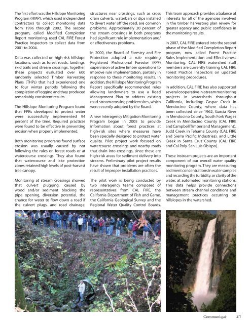
Data was collected on high-risk hillslope<br />
locations, such as forest roads, landings,<br />
skid trails and stream crossings. Together,<br />
these projects evaluated over 600<br />
randomly selected Timber Harvesting<br />
Plans (THPs) that had experienced one<br />
to four winter periods following the<br />
completion <strong>of</strong> logging and they produced<br />
remarkably consistent results.<br />
The Hillslope Monitoring Program found<br />
that FPRs developed to protect water<br />
were successfully implemented 94<br />
percent <strong>of</strong> the time. Required practices<br />
were found to be eff ective in preventing<br />
erosion when properly implemented.<br />
Both monitoring programs found surface<br />
erosion was usually caused by not<br />
following the rules on forest roads or at<br />
watercourse crossings. They also found<br />
that watercourse and lake protection<br />
zones retained high levels <strong>of</strong> post-harvest<br />
tree canopy.<br />
Monitoring at stream crossings showed<br />
that culvert plugging, caused by<br />
wood and/or sediment blocking the<br />
pipe opening, diversion potential, the<br />
chance for water to fl ow down a road if<br />
the culvert plugs, and road drainage,<br />
structures near crossings, such as cross<br />
drain culverts, waterbars or dips installed<br />
to divert water <strong>of</strong>f the road, are common<br />
problems. Approximately 20 percent <strong>of</strong><br />
the stream crossings in both programs<br />
had signifi cant rule implementation and/<br />
or eff ectiveness problems.<br />
In 2000, the Board <strong>of</strong> Forestry and <strong>Fire</strong><br />
Protection adopted a rule requiring<br />
Registered Pr<strong>of</strong>essional Forester (RPF)<br />
supervision <strong>of</strong> active timber operations to<br />
improve rule implementation, partially in<br />
response to these monitoring results. In<br />
addition, the Hillslope Monitoring Program<br />
Report specifi cally recommended rules<br />
allowing landowners to use a Road<br />
Management Plan to address existing<br />
road-stream crossing problem sites, which<br />
were recently adopted by the Board.<br />
A new Interagency Mitigation Monitoring<br />
Program began in 2005 to provide<br />
information about forest practices at<br />
high-risk sites where measures have<br />
been specially designed to protect water<br />
quality. Pilot project work focused on<br />
watercourse crossings and nearby roads<br />
that drain into crossings, since these are<br />
high-risk areas for sediment delivery into<br />
streams. Preliminary pilot project results<br />
have shown that problems are <strong>of</strong>ten the<br />
result <strong>of</strong> improper installation practices.<br />
The pilot work is being conducted by<br />
two interagency teams composed <strong>of</strong><br />
representatives from CAL FIRE, the<br />
<strong>Cal</strong>ifornia Department <strong>of</strong> Fish and Game,<br />
the <strong>Cal</strong>ifornia Geological Survey and the<br />
Regional Water Quality Control Boards.<br />
This team approach provides a balance <strong>of</strong><br />
interests for all <strong>of</strong> the agencies involved<br />
in the timber harvesting plan review for<br />
greater agency and public confi dence in<br />
the monitoring results.<br />
In 2007, CAL FIRE entered into the second<br />
phase <strong>of</strong> the Modifi ed Completion Report<br />
program, now called Forest Practice<br />
Rules Implementation and Eff ectiveness<br />
Monitoring. CAL FIRE watershed staff<br />
members are currently training CAL FIRE<br />
Forest Practice Inspectors on updated<br />
monitoring procedures.<br />
In addition, CAL FIRE has also supported<br />
several cooperative in-stream monitoring<br />
projects in watersheds throughout<br />
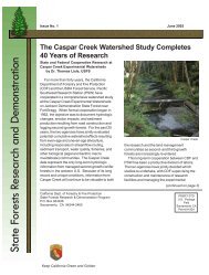
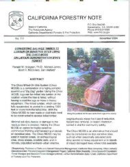
<strong>Cal</strong>ifornia, including: Caspar Creek in<br />
Mendocino County, where data has<br />
been collected since 1962, Garcia River<br />
in Mendocino County, South Fork Wages<br />
Creek in Mendocino County (CAL FIRE<br />
and Campbell Timberland Management),<br />
Judd Creek in Tehama County (CAL FIRE<br />
and Sierra Pacifi c Industries), and Little<br />
Creek in Santa Cruz County (CAL FIRE<br />
and <strong>Cal</strong> Poly-San Luis Obispo).<br />
These instream projects are an important<br />
component <strong>of</strong> our overall water quality<br />
monitoring program. They are measuring<br />
sediment concentrations in water samples<br />
and recording the turbidity, or clarity <strong>of</strong> the<br />
water, at automated monitoring stations.<br />
This data helps provide connections<br />
between stream channel conditions and<br />
management practices occurring on<br />
hillslopes in the watershed.<br />
<strong>Communiqué</strong><br />
21