diggers rest precinct structure plan - Growth Areas Authority
diggers rest precinct structure plan - Growth Areas Authority
diggers rest precinct structure plan - Growth Areas Authority
You also want an ePaper? Increase the reach of your titles
YUMPU automatically turns print PDFs into web optimized ePapers that Google loves.
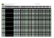
Code<br />
UGZ Area<br />
(ha)<br />
Proposed Precinct Area 'A'<br />
NDA (65%<br />
of UGZ)<br />
Dwelling<br />
Projection<br />
(15 dwl/ha)<br />
Population<br />
Projection<br />
(2.8 P/H)<br />
A1 172.95 112.42 1686 4722<br />
A2 124.21 80.74 1211 3391<br />
A3 170.92 111.10 1666 4666<br />
A4 254.71 165.56 2483 6954<br />
A5 83.32 54.16 812 2275<br />
A6 143.93 93.55 1403 3929<br />
A7* 13.19 8.57 129 360<br />
A8* 12.72 8.27 124 347<br />
A9* 4.28 2.78 42 117<br />
A10* 4.7 3.06 46 128<br />
A11 45.61 29.65<br />
A12* 33.16 21.55 323 905<br />
Total 1063.7 691.41 9926 27794<br />
Proposed Precinct Area 'B'<br />
B1 189.06 122.89 1843 5161<br />
B2 90.27 58.68 880 2464<br />
B3 24.74 16.08 241 675<br />
B4* 121.92 79.25 1189 3328<br />
B5* 89.96 58.474<br />
Total 515.95 335.37 4153 11630<br />
Proposed Precinct Area 'C'<br />
C1 108.28 70.38 1056 2956<br />
C2 51.62 33.55 503 1409<br />
C3 188.74 122.68 1840 5153<br />
C4* 3.17 2.06<br />
C5 390.85 254.05 3811 10670<br />
C6* 57.56 37.41 561 1571<br />
C7* 36.65 23.82 357 1001<br />
Total 836.87 543.97 8129 22760<br />
Proposed Precinct Area 'D'<br />
D1 86.64 56.32 845 2365<br />
D2 145.05 94.28 1414 3960<br />
D3 40.37 26.24 394 1102<br />
D4* 26.29 17.09 256 718<br />
Total 298.35 193.93 2909 8145<br />
Total 2715 1765 25117 70328<br />
Potential for rail crossing.<br />
Current rail alignment sits<br />
within a 3.5m cutting<br />
<strong>plan</strong> 1<br />
metropolitan & regional context<br />
<strong>diggers</strong> <strong>rest</strong> background report<br />
Calder Freeway<br />
Riddell Road<br />
Gap Road<br />
Diggers Rest<br />
Precinct Structure<br />
Plan<br />
Potential for rail crossing.<br />
Current rail alignment sits<br />
within a 7m cutting<br />
Vineyard Road<br />
36.8ha<br />
SUNBURY<br />
TOWNSHIP<br />
Watsons Road<br />
Existing level<br />
rail crossing<br />
Potential Watsons<br />
Road Extension<br />
DIGGERS REST<br />
TOWNSHIP<br />
45.7ha<br />
Lanceeld Road<br />
Opportunity for ‘terraced’<br />
Active Open Space to<br />
maximise usability<br />
Existing level<br />
rail crossing<br />
Existing level<br />
rail crossing<br />
Activity Centre to cater for existing<br />
rolling meadows community &<br />
proposed F1 & A1 neighbourhoods<br />
75.6ha<br />
Sunbury Road<br />
200m<br />
Creek Buer<br />
BULLA<br />
TOWNSHIP<br />
Rockbank Precinct Structure Plan Area<br />
Major Road Network<br />
OMR<br />
Railway Line<br />
Existing Road<br />
Proposed Road<br />
Railway Line & Station<br />
Sunbury Town Centre<br />
Major Activity Centre (MAC)<br />
Local Town Centre (NAC)<br />
Employment<br />
Urban <strong>Growth</strong> Zone<br />
Public Use Zone<br />
Farming Zone<br />
Open Space<br />
OMR Alignment<br />
1:25000 @ A1<br />
1:50000 @ A3<br />
0 250 500 750 1000 1250


