

ballan road precinct structure plan - Growth Areas Authority
ballan road precinct structure plan - Growth Areas Authority
ballan road precinct structure plan - Growth Areas Authority

Create successful ePaper yourself
Turn your PDF publications into a flip-book with our unique Google optimized e-Paper software.
Non-Govt.<br />
PS<br />
LTC<br />
Govt. SC 7-12<br />
CC<br />
Govt. PS<br />
P-6<br />
Amendment C171 to the Wyndham Planning Scheme<br />
BALLAN ROAD<br />
PRECINCT STRUCTURE PLAN<br />
April 2013<br />
1
ii<br />
BALLAN ROAD PRECINCT STRUCTURE PLAN<br />
3 April 2013 3:14 PM
CONTENTS<br />
PLANS<br />
BALLAN ROAD PRECINCT STRUCTURE PLAN<br />
1.0 INTRODUCTION 3<br />
1.1 How to Read This Document 5<br />
1.2 Land to Which This PSP Applies 5<br />
1.3 Development Contributions Plan 5<br />
1.4 Native Vegetation Precinct Plan 5<br />
1.5 Background Information 5<br />
2.0 OUTCOMES 7<br />
2.1 Vision 7<br />
2.2 Objectives 8<br />
2.3 Summary Land Budget 9<br />
3.0 IMPLEMENTATION 13<br />
3.1 Image, Character, Housing & Heritage 13<br />
3.2 Employment and Town Centres 18<br />
3.3 Open Space and Community Facilities 25<br />
3.4 Biodiversity, Threatened Species & Bushfire Management 33<br />
3.5 Transport and Movement 37<br />
3.6 Integrated Water Management & Utilities 45<br />
3.7 Precinct Infra<strong>structure</strong> Plan & Staging 50<br />
4.0 APPENDICES 55<br />
APPENDIX 1 Property Specific Land Use Budget 55<br />
APPENDIX 2 Town Centre Design Principles 58<br />
APPENDIX 3 Open Space Delivery Guide 62<br />
APPENDIX 4 Street Cross Sections 64<br />
Plan 1 Precinct Location & Features 4<br />
Plan 2 Future Urban Structure 6<br />
Plan 3 Land Use Budget 10<br />
Plan 4 Image, Character & Housing 12<br />
Plan 5 Open Space & Community Facilities 24<br />
Plan 6 Biodiversity & Bushfire Management 32<br />
Plan 7 Public Transport & Trail Network 36<br />
Plan 8 Street Network & Inter Parcel Connections 40<br />
Plan 9 Integrated Water Management 44<br />
Plan 10 Utilities 48<br />
TABLES<br />
Table 1 Summary Land Use Budget and Lot Yield 11<br />
Table 2 Housing Type by Lot Size 16<br />
Table 3 Anticipated Employment Creation in Precinct 21<br />
Table 4 Open Space Delivery Guide 25<br />
Table 5 Retarding Basin 47<br />
Table 6 Precinct Infra<strong>structure</strong> Plan 51<br />
1
2<br />
BALLAN ROAD PRECINCT STRUCTURE PLAN<br />
3 April 2013 3:14 PM
1.0 INTRODUCTION<br />
BALLAN ROAD PRECINCT STRUCTURE PLAN<br />
The Ballan Road Precinct Structure Plan (PSP) has been prepared by the <strong>Growth</strong> <strong>Areas</strong> <strong>Authority</strong> (GAA) with<br />
the assistance of Wyndham City, Government agencies, service authorities and major stakeholders.<br />
The PSP is a long-term <strong>plan</strong> for urban development. It describes how the land is expected to be developed,<br />
and how and where services are <strong>plan</strong>ned to support development.<br />
The PSP:<br />
• Sets out <strong>plan</strong>s to guide the delivery of quality urban environments in accordance with the Victorian<br />
Government guidelines.<br />
• Enables the transition of non-urban land to urban land.<br />
• Sets the vision for how the land should be developed and the outcomes to be achieved.<br />
• Outlines the projects required to ensure that future residents, visitors and workers within the area can<br />
be provided with timely access to services and transport necessary to support a quality and affordable<br />
lifestyle.<br />
• Sets out objectives, requirements and guidelines for land use, development and subdivision.<br />
• Provides Government agencies, the Council, developers, investors and local communities with certainty<br />
about future development.<br />
• Addresses the requirements of the Environment Protection and Biodiversity Conservation Act 1999<br />
(EPBC Act 1999) in accordance with an endorsed program under Part 10 of the act.<br />
The PSP is informed by:<br />
• The State Planning Policy Framework set out in the Wyndham Planning Scheme;<br />
• The <strong>Growth</strong> Corridor Plans: Managing Melbourne’s <strong>Growth</strong> (<strong>Growth</strong> <strong>Areas</strong> <strong>Authority</strong>, June 2012);<br />
• Local Planning Policy Framework of the Wyndham Planning Scheme;<br />
• The draft Biodiversity Conservation Strategy and Sub Regional Species Strategies for Melbourne’s<br />
<strong>Growth</strong> <strong>Areas</strong> (Department of Sustainability and Environment, 2011);<br />
• The Precinct Structure Planning Guidelines (<strong>Growth</strong> <strong>Areas</strong> <strong>Authority</strong>, 2009).<br />
The following <strong>plan</strong>ning documents have been developed in parallel with the PSP to inform and direct the<br />
future <strong>plan</strong>ning and development of the Precinct:<br />
• The Ballan Road Native Vegetation Precinct Plan (NVPP) sets out requirements for the protection and<br />
management of native vegetation within the PSP area.<br />
• The Wyndham West Development Contributions Plan (DCP) applies the requirements for development<br />
proponents to make a contribution toward infra<strong>structure</strong> required to support the development of the<br />
Precinct.<br />
• The Wyndham West Background Report (Background Report).<br />
• The Draft Wyndham Precinct Structure Plans 40, 92, 1088 and 1091: Conservation Management Plan,<br />
Wyndham Vale and Tarneit, Victoria (Werribee River CMP) sets out the management requirements for<br />
areas protected for the Growling Grass Frog (GGF).<br />
3
Scale:<br />
Date:<br />
BALLAN ROAD PRECINCT STRUCTURE PLAN<br />
Major Town Centre<br />
(Manor Lakes)<br />
Plan 1<br />
Precinct Location & Features<br />
<strong>ballan</strong> <strong>road</strong> <strong>precinct</strong> <strong>structure</strong> <strong>plan</strong><br />
1:20,000 @ A4; N.T.S. @ A3<br />
March 2013<br />
0 100 250 500m<br />
4Plan<br />
11 Precinct Location & Features<br />
Presidents Park<br />
Precinct Structure Plan Area<br />
Waterway / Dam / Waterbodies<br />
Existing Trees<br />
Ridge Line (With High Point)<br />
Low Point<br />
Contours (0.50m Intervals)<br />
Existing Dry Stone Wall to be Retained<br />
Existing Views<br />
Public Transport Reservation<br />
Regional Rail Link<br />
Railway Station<br />
Future Railway Station<br />
Property Parcel Boundary<br />
Existing Place of Worship<br />
Werribee River<br />
Heritage Site / Open Space (Aboriginal)<br />
3 April 2013 3:14 PM<br />
Copyright, <strong>Growth</strong> <strong>Areas</strong> <strong>Authority</strong>, 2013 The state of Victoria does not warrant the accuracy or completeness of information in this publication and any person using or relying upon such information does so on the basis that the State of Victoria shall bear no responsibility or liability whatsoever for any errors, faults, defects or omission in the information.
1.1 How to Read This Document<br />
BALLAN ROAD PRECINCT STRUCTURE PLAN<br />
This Precinct Structure Plan (PSP) guides land use and development where a <strong>plan</strong>ning permit is required<br />
under the Urban <strong>Growth</strong> Zone or other provision that references this <strong>structure</strong> <strong>plan</strong>.<br />
A <strong>plan</strong>ning application and a <strong>plan</strong>ning permit must implement the outcomes of the PSP. The outcomes are<br />
expressed as the Vision and Objectives.<br />
Each element of the PSP contains Requirements, Guidelines and Conditions as relevant.<br />
REQUIREMENTS must be adhered to in developing the land. Where they are not demonstrated in a permit<br />
application, requirements will usually be included as a condition on a <strong>plan</strong>ning permit whether or not they<br />
take the same wording as in this <strong>structure</strong> <strong>plan</strong>. A requirement may reference a <strong>plan</strong>, table or figure in the<br />
<strong>structure</strong> <strong>plan</strong>.<br />
GUIDELINES express how discretion will be exercised by the Responsible <strong>Authority</strong> in certain matters that<br />
require a <strong>plan</strong>ning permit. If the Responsible <strong>Authority</strong> is satisfied that an application for an alternative to<br />
a guideline implements the outcomes, the Responsible <strong>Authority</strong> may consider the alternative. A guideline<br />
may include or reference a <strong>plan</strong>, table or figure in the PSP.<br />
CONDITIONS must be included in a <strong>plan</strong>ning permit.<br />
Meeting these requirements, guidelines and conditions will implement the outcomes of the PSP.<br />
Development must also comply with other Acts and approvals where relevant e.g. the Environment<br />
Protection and Biodiversity Conservation Act 1999 in the case of biodiversity or the Aboriginal Heritage Act<br />
2006 in the case of cultural heritage, amongst others.<br />
Not every aspect of the land’s use, development or subdivision is addressed in this <strong>structure</strong> <strong>plan</strong>. A<br />
Responsible <strong>Authority</strong> may manage development and issue permits as relevant under its general discretion.<br />
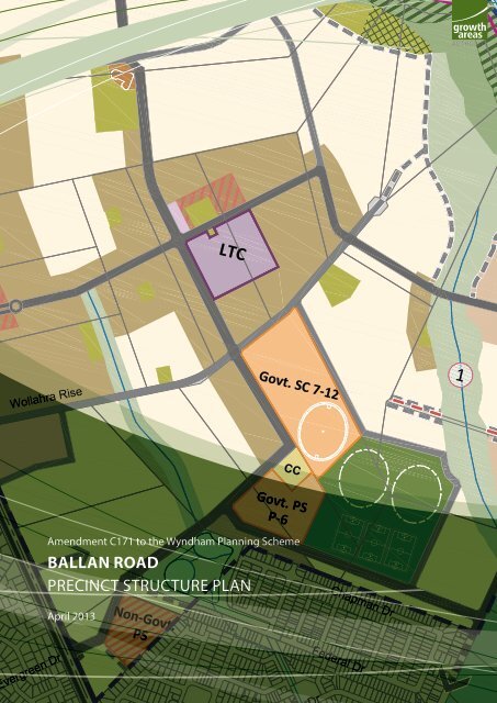
1.2 Land to Which This PSP Applies<br />
The PSP applies to approximately 540 hectares of land as shown on Plan 1. The PSP area is bound by Hobbs<br />
Road to the west, Werribee River to the north, McGrath Road and the existing residential area to the east<br />
and Ballan Road to the south.<br />
Plan 1 identifies the key features of the land.<br />
1.3 Development Contributions Plan<br />
Development proponents within the Ballan Road Precinct will be bound by the Wyndham West Development<br />
Contributions Plan (DCP). The DCP sets out requirements for infra<strong>structure</strong> funding across the wider<br />
Wyndham West region.<br />
Once complete, the DCP will be a separate document.<br />
Development proponents wishing to commence works prior to incorporation of this DCP can enter into<br />
agreements with Wyndham City under Section 173 of the Planning and Environment Act 1987 to expedite<br />
contributions.<br />
1.4 Native Vegetation Precinct Plan<br />
The Ballan Road Native Vegetation Precinct Plan (NVPP) has also been prepared concurrently with the PSP.<br />
The NVPP identifies:<br />
• Native vegetation which may be removed without a <strong>plan</strong>ning permit; and<br />
• The offsets that must be provided by development proponents wishing to commence works prior to<br />
removing the native vegetation which can be removed.<br />
The NVPP is a separate document that will be incorporated in the Wyndham Planning Scheme.<br />
1.5 Background Information<br />
Background information on the PSP area including its local and metropolitan context, history, biodiversity,<br />
landform and topography, waterways, open space and community facilities are contained in the background<br />
report. This information has informed the preparation of the PSP.<br />
5
Major Town Centre<br />
(Manor Lakes)<br />
Plan 2<br />
Future Urban Structure Plan<br />
<strong>ballan</strong> <strong>road</strong> <strong>precinct</strong> <strong>structure</strong> <strong>plan</strong><br />
6<br />
Scale:<br />
Date:<br />
BALLAN ROAD PRECINCT STRUCTURE PLAN<br />
1:20,000 @ A4, N.T.S. @ A3<br />
March 2013<br />
0 100 250 500m<br />
Govt. PS<br />
P-6<br />
CC<br />
Plan 12 Future Urban Structure<br />
CC<br />
LTC<br />
Non-Govt.<br />
PS<br />
Precinct Structure Plan Boundary<br />
Local Town Centre<br />
Local Convenience Centre<br />
Mixed Use Employment / Commercial<br />
Community Facility<br />
Government Education Facility<br />
Non-Government Primary School<br />
High Density Housing (Avg. 35 Dwell NDHa)<br />
Medium Density Housing (Avg. 25 Dwell NDHa)<br />
Conventional Density Housing (Avg. 15 Dwell NDHa)<br />
Lower Density Housing (Avg. 11 Dwell NDHa)<br />
Active Open Space/Playing Fields (Unencumbered)<br />
Passive Open Space (Unencumbered Delivered via Clause 52.01)<br />
Govt. SC 7-12<br />
CC<br />
Govt. PS<br />
P-6<br />
1<br />
Presidents Park<br />
Waterway (Encumbered)<br />
GGF Conservation Area<br />
Werribee River<br />
Werribee River Breakaway Waterway<br />
Proposed Werribee Township Regional Park - Drainage<br />
(Encumbered)<br />
Proposed Werribee Township Regional Park<br />
(Unencumbered)<br />
Proposed Werribee Township Regional Park<br />
GGF Conservation Area (Encumbered)<br />
Heritage Site (Aboriginal)<br />
Proposed Railway Stabling Yard / Rail Corridor<br />
Regional Rail Link<br />
Railway Station<br />
Future Railway Station<br />
Major Arterial Road (Ballan Road)<br />
Arterial Road - Hobbs / Armstrong Rd.<br />
Connector Street - Boulevard<br />
Connector Street<br />
Key Access Street - Level 2<br />
Key Access Street - Level 2 (Parcel Access)<br />
Key Access Street - Level 1<br />
Dry Stone Wall Access Street - Level 1<br />
Roundabout<br />
Potential Vehicle Crossing (Subject to Satisfaction of CFA)<br />
Werribee River Shared Trail (Indicative Location)<br />
Existing Road Reserve<br />
Existing Urban Area<br />
Future Urban Area<br />
NOTE: Refer Plan 7, 8 and Cross Sections (Appendix 4)<br />
for required <strong>road</strong> reserve widths<br />
Copyright, <strong>Growth</strong> <strong>Areas</strong> <strong>Authority</strong>, 2013 The state of Victoria does not warrant the accuracy or completeness of information in this publication and any person using or relying upon such information does so on the basis that the State of Victoria shall bear no responsibility or liability whatsoever for any errors, faults, defects or omission in the information.<br />
1<br />
3 April 2013 3:14 PM
2.0 OUTCOMES<br />
2.1 Vision<br />
BALLAN ROAD PRECINCT STRUCTURE PLAN<br />
Ballan Road will be a diverse urban residential community that will integrate cohesively with existing<br />
development and provide future residents with opportunities to live, work, shop and recreate locally. The<br />
<strong>structure</strong> of the <strong>precinct</strong> will be b<strong>road</strong>ly based around four key civic elements:<br />
• a local town centre,<br />
• a northern community hub,<br />
• a southern community hub; and<br />
• the Werribee River.<br />
The Precinct will provide a transition of development from more intensive urban forms on Ballan Road,<br />
within the walking catchment of Wyndham Vale train station and around the local town centre to more<br />
conventional and some lower densities in proximity to the Werribee River. Multi-unit and small-lot housing<br />
will also be located at places of high amenity.<br />
Neighbourhood design will build upon the landscape amenity provided by the Werribee River corridor and<br />
ensure the protection of cultural and biodiversity assets retained within this area while providing for passive<br />
recreation uses. The Werribee Township Regional Park will ultimately be created from those areas abutting<br />
the Werribee River that are south of the Hobbs /Armstrong Road extension.<br />
The Werribee River and the creek corridors that traverse the PSP will underpin the landscape values and<br />
character of the Precinct and be reinforced by landscape outcomes created along the arterial and connector<br />
<strong>road</strong> networks. Public open space in the Precinct will provide a range of both passive and active recreation<br />
opportunities and encourage an active and healthy living environment.<br />
Neighbourhood movement networks will facilitate safe, permeable and convenient local transport options<br />
for vehicles, bicycles and pedestrians while facilitating the extension and expansion of Ballan and Hobbs /<br />
Armstrong Roads.<br />
Local business and employment opportunities will be located in the Local Town Centre (LTC) servicing local<br />
needs, as well as the Ballan Road Commercial Area that will integrate with residential development and<br />
complement and build on the Manor Lakes Major Town Centre (MTC).<br />
7
8<br />
BALLAN ROAD PRECINCT STRUCTURE PLAN<br />
2.2 Objectives<br />
IMAGE, CHARACTER, HERITAGE & HOUSING<br />
O1 To create an attractive urban environment that has a strong sense of place.<br />
O2<br />
To provide consistent landscape treatments along the length of Ballan Road and Hobbs / Armstrong<br />
Roads respectively.<br />
O3 To ensure development positively addresses all public open spaces.<br />
O4 To create streetscapes, parks and public spaces, with significant canopy tree cover.<br />
O5<br />
O6<br />
O7<br />
Promote greater housing choice through the delivery of a range of lots capable of accommodating<br />
a variety of dwelling typologies.<br />
To deliver a density of housing that underpins the viability of town centres, community services, and<br />
public infra<strong>structure</strong>.<br />
To ensure medium and higher density residential development is prioritised in locations proximate<br />
to high amenity, such as public transport, community facilities, town centres and open space.<br />
TOWN CENTRES & EMPLOYMENT<br />
O8<br />
O9<br />
O10<br />
O11<br />
O12<br />
To provide a b<strong>road</strong> range of retailing and business activities to meet the local retail and service<br />
needs of the future community.<br />
To provide opportunities for small office, mixed use and home based businesses within and on the<br />
periphery of the Local Town Centre (LTC).<br />
To ensure the LTC design integrates and prioritises public streets and open spaces as the primary<br />
pedestrian movement and activity spaces.<br />
To provide services and employment opportunities for new residents by facilitating the timely<br />
delivery of the LTC, commercial area, community hubs, schools and other community facilities.<br />
To facilitate commercial and retail development along the Ballan Road interface to Manor Lakes<br />
Major Town Centre (MTC) to reflect the scale of Manor Lakes MTC and the arterial <strong>road</strong> location.<br />
OPEN SPACE & COMMUNITY FACILITIES<br />
O13<br />
To ensure community, educational and other public buildings are sited and designed as prominent<br />
features in the urban landscape.<br />
To provide a range of well located community and education facilities that efficiently delivers local<br />
O14 infra<strong>structure</strong> and services.<br />
O15 To create an integrated open space network that delivers a diverse range of park sizes and designs.<br />
BIODIVERSITY, THREATENED SPECIES & BUSHFIRE MANAGEMENT<br />
O16<br />
O17<br />
O18<br />
O19<br />
O20<br />
To <strong>plan</strong> for the long term conservation of significant heritage, vegetation and fauna habitat areas,<br />
including the Growling Grass Frog (GGF) Conservation Area.<br />
To create an urban landscape that integrates with the existing biodiversity, cultural heritage,<br />
drainage and landscape values along the Werribee River and internal waterway corridors.<br />
To identify areas where bushfire hazard requires specified bushfire protection measures for<br />
subdivision and buildings and works to be implemented.<br />
To ensure that the location, design and construction of development consider the need to<br />
implement bushfire protection measures.<br />
To ensure development does not proceed unless the risk to life and property from bushfire can be<br />
reduced to an acceptable level.<br />
3 April 2013 3:14 PM
TRANSPORT & MOVEMENT<br />
O21<br />
O22<br />
O23<br />
O24<br />
O25<br />
O26<br />
BALLAN ROAD PRECINCT STRUCTURE PLAN<br />
To create an excellent cycle and pedestrian network that ensures users can travel safely and directly<br />
by foot and bicycle throughout the Precinct and to key destinations such as the LTC, Wyndham Vale<br />
train station, schools, open space and community facilities.<br />
To recognise the strategic importance of the Hobbs / Armstrong Road crossing of the Werribee River<br />
and the need to provide this <strong>road</strong> reservation as early in the life of the development as practicable.<br />
To create a subdivision design that achieves an integrated, connected, legible and permeable street<br />
network and ensures excellent inter-parcel connections across cadastral (property) boundaries.<br />
To encourage non noise-sensitive land uses to be located adjoining the RRL corridor / public<br />
transport reservation.<br />
To protect the amenity of residential areas adjacent to the RRL corridor / public transport<br />
reservation.<br />
To create an arterial and local <strong>road</strong> network that functions effectively as an easily navigable network<br />
with a clear and identifiable hierarchy.<br />
INTEGRATED WATER MANAGEMENT & UTILITIES<br />
O27<br />
To deliver integrated water management systems that reduce reliance on reticulated potable water<br />
and increase the re-use of alternative water (storm and / or waste) and contribute to a sustainable<br />
and green urban environment.<br />
PRECINCT INFRASTRUCTURE PLAN & STAGING<br />
O28<br />
O29<br />
To ensure that development staging is co-ordinated with the delivery of key local and state<br />
infra<strong>structure</strong>.<br />
To provide for a non-government school site to meet a strategically justified need for a Catholic<br />
primary school in the area.<br />
2.3 Summary Land Budget and Lot Yield<br />
The Net Developable Area (NDA) is established by deducting the land requirements for major <strong>road</strong>s,<br />
servicing, community facilities and open space from the overall Precinct area. The estimated NDA for the<br />
Precinct is 333 hectares representing approximately 62% of the PSP area.<br />
State Planning Policy currently aims to achieve a minimum of 15 dwellings per hectare of NDA. The PSP<br />
is expected to exceed the minimum dwelling density and yield approximately 5,600 dwellings with an<br />
average dwelling density of 17 dwellings per hectare of NDA.<br />
An average household size of 2.8 persons for conventional density housing (based on Victoria in Future<br />
2012) is used to estimate the future population of the PSP area. On this basis the future population of the<br />
PSP is estimated at approximately 15,700 residents. The PSP is expected to also yield approximately 1,200<br />
ongoing jobs for future residents.<br />
The table below sets out the land area and summary lot yield for various uses in the future urban <strong>structure</strong>.<br />
9
Plan 3<br />
Land Use Budget<br />
11<br />
12<br />
Road Reserve 1<br />
Plan 13 Land Use Budget<br />
9<br />
8<br />
1<br />
4<br />
2 3<br />
5<br />
Major Town Centre<br />
(Manor Lakes)<br />
<strong>ballan</strong> <strong>road</strong> <strong>precinct</strong> <strong>structure</strong> <strong>plan</strong><br />
10<br />
Scale:<br />
Date:<br />
Inset map<br />
BALLAN ROAD PRECINCT STRUCTURE PLAN<br />
1:20,000 @ A4, N.T.S. @ A3<br />
March 2013<br />
0 100 250 500m<br />
Govt. PS<br />
P-6<br />
CC<br />
6<br />
CC<br />
LTC<br />
18<br />
Non-Govt.<br />
29PS<br />
Precinct Structure Plan Boundary<br />
Net Developable Area<br />
Local Town Centre<br />
Local Convenience Centre<br />
Community Facility<br />
Government Education Facility<br />
Non-Government Primary School<br />
Active Open Space/Playing Fields (Unencumbered)<br />
Passive Open Space (Unencumbered Delivered via Clause 52.01)<br />
Waterway (Encumbered)<br />
Werribee River<br />
10 20<br />
13<br />
14<br />
3<br />
15 17<br />
16<br />
Road Reserve 2<br />
27<br />
7<br />
26<br />
19<br />
28 31<br />
Govt. 24 SC 7-12<br />
25<br />
30<br />
CC<br />
Govt. PS<br />
P-6<br />
21<br />
23<br />
22<br />
34<br />
Road Reserve 4<br />
32<br />
Road Reserve 3<br />
33<br />
8<br />
Proposed Werribee Township Regional Park - Drainage<br />
(Encumbered)<br />
Proposed Werribee Township Regional Park<br />
(Unencumbered)<br />
GGF Conservation Area<br />
Proposed Werribee Township Regional Park<br />
GGF Conservation Area (Encumbered)<br />
Heritage Site (Aboriginal)<br />
Proposed Railway Stabling Yard / Rail Corridor<br />
Regional Rail Link<br />
Railway Station<br />
Future Railway Station<br />
Arterial Road Widening / new reservation<br />
Major Arterial Road (Ballan Road)<br />
Arterial Road - Hobbs / Armstrong Rd.<br />
Connector Street - Boulevard<br />
Connector Street<br />
Key Access Street - Level 2<br />
Key Access Street - Level 2 (Parcel Access)<br />
Key Access Street - Level 1<br />
Dry Stone Wall Access Street - Level 1<br />
Property / Parcel with PSP property number<br />
NOTE: Refer Plan 7, 8 and Cross Sections (Appendix 4)<br />
for required <strong>road</strong> reserve widths<br />
Presidents Park<br />
3 April 2013 3:14 PM<br />
Copyright, <strong>Growth</strong> <strong>Areas</strong> <strong>Authority</strong>, 2013 The state of Victoria does not warrant the accuracy or completeness of information in this publication and any person using or relying upon such information does so on the basis that the State of Victoria shall bear no responsibility or liability whatsoever for any errors, faults, defects or omission in the information.
e<br />
Table 1 Summary Land Use Budget and Lot Yield<br />
DESCRIPTION Hectares<br />
TOTAL PRECINCT AREA (ha) 540.31<br />
TRANSPORT<br />
BALLAN ROAD PRECINCT STRUCTURE PLAN<br />
% of Total<br />
Area<br />
% of NDA<br />
6 Lane Arterial Road / Widening 1.47 0.27% 0.44%<br />
4 Lane Arterial Road / Widening 5.79 1.07% 1.74%<br />
Road Reserve Not Available for Development 11.59 2.15% 3.48%<br />
Railway Corridors / Easements 1.45 0.27% 0.44%<br />
SUB-TOTAL 20.30 3.76% 6.10%<br />
COMMUNITY FACILITIES<br />
Community Services Facilities 1.20 0.22% 0.36%<br />
SUB-TOTAL 1.20 0.22% 0.36%<br />
EDUCATION<br />
Government Schools 15.40 2.85% 4.62%<br />
Non-Government Schools 2.58 0.48% 0.78%<br />
SUB-TOTAL 17.98 3.33% 5.40%<br />
OPEN SPACE<br />
ENCUMBERED LAND AVAILABLE FOR RECREATION<br />
Waterway / Drainage Line / Wetland / Retarding 43.51 8.05% 13.07%<br />
Waterway / Drainage Line / Wetland / Retarding (witihn WRTP) 27.58 5.10% 8.28%<br />
Heritage (Aboriginal) 0.74 0.14% 0.22%<br />
Conservation Area (Werribee River Interface) 17.17 3.18% 5.16%<br />
Conservation Area (Werribee River Interface within WRTP) 38.12 7.06% 11.45%<br />
SUB-TOTAL<br />
UNENCUMBERED LAND AVAILABLE FOR RECREATION<br />
127.12 23.53% 38.17%<br />
Active Open Space* 23.33 4.32% 7.01%<br />
Passive Open Space (Residential)** 10.20 1.89% 3.06%<br />
SUB-TOTAL<br />
OTHER LAND AVAILABLE FOR RECREATION<br />
33.53 6.21% 10.07%<br />
Proposed Werribee Township Regional Park 7.16 1.33% 2.15%<br />
SUB-TOTAL 7.16 1.33% 2.15%<br />
TOTALS OPEN SPACE 167.82 31.06% 50.39%<br />
NET DEVELOPABLE AREA (NDA) ha 333.01 61.63%<br />
Estimated dwelling yield and typologies<br />
DESCRIPTION NDA (Ha) Dwell / NDHa Dwellings<br />
RETAIL, EMPLOYMENT & OTHER<br />
Activity Centre / Commercial 4.00<br />
Other 8.58<br />
SUBTOTAL<br />
RESIDENTIAL<br />
12.58<br />
Residential - Conventional Density 206.93 15 3,104<br />
Residential - Medium Density 77.21 23 1,776<br />
Residential - High Density 11.73 35 410<br />
Residential - Town Centre / Lower Density 33.14 10 331<br />
SUBTOTAL 329.01 17.09 5,622<br />
*Active open space percentage calculated on NRDA<br />
** Passive open space (residential) percentage calculated on NRDA<br />
*** Passive open space (employment) percentage calculated on NEDA<br />
NOTE: Encumbered available for recreation does not comprise public open space for the purpose of<br />
clause 52.01 of the Wyndham Planning Scheme. While the land is not set aside for recreation, as<br />
a consequence of it being open space, it is likely to afford enjoyment to people using the <strong>precinct</strong>.<br />
11
1<br />
Major Town Centre<br />
(Manor Lakes)<br />
Plan 4<br />
Image, Character Housing & Heritage<br />
<strong>ballan</strong> <strong>road</strong> <strong>precinct</strong> <strong>structure</strong> <strong>plan</strong><br />
12<br />
Scale:<br />
Date:<br />
BALLAN ROAD PRECINCT STRUCTURE PLAN<br />
1:20,000 @ A4; N.T.S. @ A3<br />
March 2013<br />
0 100 250 500m<br />
5<br />
Plan 14 Image, Character & Housing<br />
6<br />
5<br />
6<br />
5<br />
5<br />
2<br />
1<br />
3<br />
6<br />
2<br />
2<br />
5<br />
5<br />
5<br />
5<br />
2<br />
2<br />
5<br />
1<br />
2<br />
3<br />
4<br />
5<br />
6<br />
5<br />
Precinct Structure Plan Boundary<br />
Key Unified Landscape Streetscapes<br />
Arterial Large Canopy Trees Character<br />
Indigenous / native Character<br />
Boulevard Canopy Treatment with trees in median<br />
Existing Canopy Trees integration where possible &<br />
supplemented with new <strong>plan</strong>ting of same species.<br />
Other Key Unified Avenues with Large Canopy Trees<br />
Commercial / Residential Interface Key unified Avenue<br />
Treatment<br />
Highlight Landscape Feature<br />
5<br />
4<br />
2<br />
2<br />
5<br />
5<br />
5<br />
2 &<br />
2<br />
3<br />
2<br />
High Density Housing (Avg. 35 Dwell NDHa)<br />
Medium Density Housing (Avg. 25 Dwell NDHa)<br />
Conventional Density Housing (Avg. 15 Dwell NDHa)<br />
Lower Density Housing (Avg. 11 Dwell NDHa)<br />
Mixed Use Employment / Commercial<br />
Town Centre<br />
Local Convenience Centre<br />
Council Community Facilities<br />
Government Primary School<br />
Non-Government Primary School<br />
Precinct Open Space Network<br />
Waterway (Encumbered)<br />
Proposed Railway Stabling Yard / Rail Corridor<br />
Regional Rail Link<br />
Railway Station<br />
Future Railway Station<br />
Dry Stone Wall (To be Retained)<br />
Note. Colouring of Road Indicates Extent of each Unified<br />
Landscape Corridor Section<br />
2<br />
Presidents Park<br />
3 April 2013 3:14 PM<br />
Copyright, <strong>Growth</strong> <strong>Areas</strong> <strong>Authority</strong>, 2013 The state of Victoria does not warrant the accuracy or completeness of information in this publication and any person using or relying upon such information does so on the basis that the State of Victoria shall bear no responsibility or liability whatsoever for any errors, faults, defects or omission in the information.
3.0 IMPLEMENTATION<br />
3.1 Image, Character, Housing & Heritage<br />
IMAGE & CHARACTER<br />
R1<br />
R2<br />
R3<br />
R4<br />
R5 *<br />
R6<br />
BALLAN ROAD PRECINCT STRUCTURE PLAN<br />
Canopy trees (native, indigenous and exotic) in parks and streets must be:<br />
• Larger species wherever space allows (to facilitate continuous canopy coverage);<br />
• Suitable for local conditions; and<br />
• Planted in modified and improved soil as required to support tree longevity.<br />
REQUIREMENTS<br />
Street trees must be <strong>plan</strong>ted on both sides of all <strong>road</strong>s and streets (excluding laneways) at regular<br />
intervals appropriate to tree size at maturity and not exceeding:<br />
INTERVAL TREE SIZE<br />
8 – 10 metres Small trees (less than 10 metres)<br />
10 – 12 metres Medium trees (10 – 15 metres)<br />
10 – 15 metres Large trees (15 metres or greater)<br />
Subdivision layout must maximise the number of streets perpendicular to, or with direct views to,<br />
the Werribee River and other waterways.<br />
Suitable street frontages must be provided on educational and community sites to allow buildings<br />
to front the street while allowing for vehicular access.<br />
A use or development that contains a bedroom and is located on land that is reasonably likely, in<br />
the opinion of the Responsible <strong>Authority</strong>, to be impacted by noise from the train operations in the<br />
RRL corridor / public transport reservation must be designed to ensure that internal noise levels in<br />
bedrooms is less than 65 dB LAMAX and 40 dB Leq9h(night) .<br />
A boulevard street treatment with a distinct, unified and consistent landscape treatment, with<br />
canopy trees within the central median, must be created along the connector <strong>road</strong> between the LTC<br />
and the Manor Lakes MTC.<br />
*This requirement does not apply where a Design and Development Overlay Schedule (DDO) is included in the<br />
Wyndham Planning Scheme to manage noise effects from train operations on the Regional Rail Link and the<br />
DDO is applied to relevant land in this Precinct.<br />
13
14<br />
BALLAN ROAD PRECINCT STRUCTURE PLAN<br />
G1<br />
G2<br />
G3<br />
G4<br />
G5<br />
G6<br />
G7<br />
G8<br />
G9<br />
G10<br />
G11<br />
G12<br />
G13<br />
G14<br />
G15<br />
Opportunities for <strong>plan</strong>ting larger canopy trees within and beside arterial <strong>road</strong>s should be<br />
maximised.<br />
GUIDELINES<br />
Streets should be oriented to maximise direct connections and views to key destinations including<br />
the LTC, Manor Lakes MTC, the Werribee River, schools, community facilities, public spaces and<br />
waterway corridors.<br />
Street furniture and public street lighting should have a unified (consistent) character across the<br />
Precinct, appropriate to the type and role of street or public space, unless otherwise approved by<br />
the Responsible <strong>Authority</strong>.<br />
Salvaged rocks should be incorporated in the design and construction of waterways, retaining<br />
<strong>structure</strong>s, walls, fences and other landscape features.<br />
Where long term viability is likely, trees, windrows and dry stone walls with high integrity should be<br />
retained within public spaces and reserves including <strong>road</strong> reserves.<br />
Highlight <strong>plan</strong>ting should be utilised to accentuate the arrival and departure from civic elements<br />
within the Precinct and provide transition between different corridors and landscape treatments.<br />
Sites in prominent locations such as within and approaching the LTC or the Manor Lakes MTC and<br />
/ or on street corners intersecting with key arterial and connector <strong>road</strong>s of the Precinct, should be<br />
developed to respond to their strategic location and preferably have greater height, density and<br />
reduced setbacks.<br />
The selection of street trees and landscaping should reinforce the movement hierarchy and be<br />
consistent with the Wyndham Street Tree Species List.<br />
Front fences abutting open space areas and waterway corridors should be visually permeable and<br />
not more than 1.2m high.<br />
Dwellings on corner lots should:<br />
• provide a positive address to both frontages, and<br />
• restrict boundary fencing forward of the front wall of the dwelling to not more than 1.2m in<br />
height.<br />
To provide sustainable and robust landscapes, with extensive tree canopy cover, Water Sensitive<br />
Urban Design (WSUD) initiatives should be implemented to direct runoff water into nature strips,<br />
medians and other <strong>plan</strong>ted areas.<br />
Where Plan 2 shows residential land abutting the RRL corridor, consider provision for non-sensitive<br />
land use along the RRL corridor.<br />
High quality and cohesive landscape treatments should be provided throughout the Precinct, in<br />
particular:<br />
• Across parcel boundaries<br />
• Along Key Unified Landscape Corridors<br />
• Along the entire length of the proposed rail stabling yards and the Hobbs/ Armstrong Road<br />
corridor to minimise the visual impacts of the RRL corridor and proposed metropolitan rail<br />
stabling facility.<br />
• Roads immediately abutting and intersecting with the Werribee River corridor (including the<br />
Werribee Township Regional Park, GGF Conservation Area and the Werribee River breakaway<br />
waterway corridor), using indigenous species and where practical, matching the relevant<br />
Ecological Vegetation Class.<br />
The existing stand of Sugar Gums that runs from Ballan Road to the proposed Government primary<br />
school in the south of the Precinct should be retained and incorporated within the public realm<br />
and form part of the connector <strong>road</strong> reservation, where practical; subject to the expert advice of a<br />
qualified arborist and satisfaction of the Responsible <strong>Authority</strong>.<br />
The future subdivision and development of PSP Property 28 (Lot 9 LP126153, 481- 523 McGrath<br />
Road) should retain and incorporate significant trees within the public realm, where practical;<br />
subject to the expert advice of a qualified arborist and satisfaction of the Responsible <strong>Authority</strong>.<br />
3 April 2013 3:14 PM
HOUSING<br />
R7<br />
R8<br />
R9<br />
R10<br />
R11<br />
R12<br />
G16<br />
G17<br />
G18<br />
G19<br />
G20<br />
G21<br />
BALLAN ROAD PRECINCT STRUCTURE PLAN<br />
REQUIREMENTS<br />
Development must achieve a minimum average density of 17 dwellings per Net Developable<br />
Hectare (NDHa) across the Precinct.<br />
Development applications must demonstrate how they contribute to the achievement of the<br />
density target outlined in R7.<br />
Development applications must demonstrate how the proposal will contribute to delivery of a<br />
diversity of housing types.<br />
Subdivision applications must identify sites capable of delivering higher density housing adjacent to<br />
the LTC and within the primary catchment (approximately 800 metres) of the Wyndham Vale train<br />
station.<br />
Dwellings with abuttal to the RRL / public transport reservation must front a <strong>road</strong> unless otherwise<br />
agreed by the Responsible <strong>Authority</strong>.<br />
Development abutting Hobbs / Armstrong and Hobbs Road north of the arterial <strong>road</strong> extension over<br />
the Werribee River must be directly fronted to those <strong>road</strong>s.<br />
GUIDELINES<br />
Where a subdivision proposal represents a single stage or limited number of stages, proponents<br />
should demonstrate how the subdivision will contribute to the eventual satisfaction of the<br />
guidance in the property specific yield table (Appendix 1).<br />
Development applications should, for each stage, cater for the provision of three or more dwelling<br />
types listed in Table 2, as appropriate, or, demonstrate an alternative lot range that achieves the<br />
housing diversity objectives.<br />
Within the general boundary of each density category shown on Plan 4, Table 2 and Appendix 1 a<br />
range of lot sizes should be provided. For example, lots less than 300sqm within the conventional<br />
density areas and lots greater than 500sqm in medium density areas.<br />
Subdivision of land close to town centres and or public transport routes should create a lot range<br />
suitable for the delivery of medium and higher density housing types listed in Table 2.<br />
Lots capable of supporting conventional and lower density housing are encouraged closer to the<br />
Werribee River and the Werribee Township Regional Park.<br />
Specialised housing forms such as retirement living or aged care should be:<br />
• Integrated into the wider urban <strong>structure</strong>.<br />
• Located in close proximity to town centres and community hubs.<br />
• Accessible by public transport.<br />
15
16<br />
BALLAN ROAD PRECINCT STRUCTURE PLAN<br />
Table 2 Housing Type by Lot Size<br />
The following table provides an example of the typical housing types that might be provided on a range of<br />
lot sizes that support the housing diversity objectives.<br />
HOUSING TYPE TYPICAL LOT SIZE (M2)<br />
DETACHED HOUSING<br />
SMALL DETACHED HOUSING<br />
SEMI-DETACHED, DUPLEXES<br />
ROW HOUSES<br />
TERRACES<br />
MULTI-UNIT HOUSING<br />
APARTMENTS<br />
0 - 150 150 – 250 250-350 350-450 450+<br />
COLOUR KEY:<br />
STANDARD DENSITY MEDIUM DENSITY HIGH DENSITY<br />
HERITAGE<br />
R13<br />
R14<br />
REQUIREMENTS<br />
Retained dry stone walls must:<br />
• Be situated within public open space or <strong>road</strong> reserve to the satisfaction of the Responsible<br />
<strong>Authority</strong><br />
• Have a suitable landscape interface to minimise maintenance requirements (for example<br />
mulch, garden bed or gravel) and which does not encourage public access immediately<br />
adjacent the retained walls.<br />
• Be checked by a professional craftsperson for any loose stones. Any loose stones are to be<br />
reinstated in the wall in secure positions.<br />
• Retain post and wire or post and rail fences situated within the walls, with any wire<br />
protruding beyond the vertical face of the wall reinstated to its original position or removed.<br />
• Be incorporated into subdivision design to minimise disturbance to the walls (e.g. utilisation of<br />
existing openings for vehicle and pedestrian access).<br />
Installation of services across the alignment of retained dry stone walls is to be undertaken by<br />
boring rather than open trenching. If open trenching or disturbance to the wall is unavoidable, a<br />
minimum section of wall may be temporarily removed and then reinstated to original condition.<br />
Any reinstatement or repair of walls is to be undertaken by a professional craftsperson and is to be<br />
consistent with the construction style of the original wall and reconstructed to the satisfaction of<br />
the Responsible <strong>Authority</strong>. Reinstatement is to use stone from (in order of priority):<br />
• The original wall in that location (including fallen stone adjacent to the wall).<br />
• A nearby section of the wall approved to be removed<br />
• From the adjacent paddock<br />
• From walls approved to be removed in the nearby area (including stone stockpiled by Council)<br />
A list of professional craftspeople can be obtained by Council and the Dry Stone Walls Association<br />
of Australia.<br />
3 April 2013 3:14 PM
G22<br />
G23<br />
G24<br />
G25<br />
BALLAN ROAD PRECINCT STRUCTURE PLAN<br />
GUIDELINES<br />
Where retention of dry stone walls in their current state is not feasible, walls (or parts of walls) in<br />
high profile and / or strategic locations should be re-built by a master craftsperson to integrate<br />
with the development and subject to the satisfaction of the Responsible <strong>Authority</strong>.<br />
Where existing dry stone walls are to be removed, land owners should consult with Council to<br />
determine whether the material may be used internally within the Precinct or transferred for<br />
landscaping purposes.<br />
The dry stone wall located on the southern boundary of PSP Property 34 (Lot 1, LP 133394, 575<br />
McGrath Road, Wyndham Vale) should be integrated into the future subdivision design of the land<br />
and retained within a median within the future <strong>road</strong> reserve as demonstrated on Cross Section 12<br />
in Appendix 4 to the satisfaction of the Responsible <strong>Authority</strong>.<br />
The dry stone wall located on the eastern boundaries of PSP properties 32 and 33 (Lot 9 LP126153,<br />
481- 523 McGrath Road and Lot 10 LP126153, 525- 559 McGrath Road, Wyndham Vale) should be<br />
integrated into the future subdivision design of the land and ensure that the integrity of the <strong>structure</strong><br />
is retained, where practical, to the satisfaction of the Responsible <strong>Authority</strong>.<br />
17
18<br />
BALLAN ROAD PRECINCT STRUCTURE PLAN<br />
3.2 Employment and Town Centres<br />
Figure 1 Local Town Centre Concept Plan<br />
Connector Road<br />
Connector Road (Local Town Centre Zone)<br />
Access Street<br />
At-Grade Carpark<br />
Car Park Access<br />
Anchor Retail<br />
Specialty Retail<br />
Commercial/Soho<br />
Active Frontage<br />
Features of interest to be<br />
incorporated into the built form<br />
Town Square<br />
Covered Plaza<br />
Key Circulation<br />
School<br />
Medium Density Residential<br />
High Density Residential<br />
Local Park<br />
Landscaping<br />
Landscape Node<br />
WOLLAHRA RISE<br />
3 April 2013 3:14 PM<br />
Connector Road<br />
Connector Road (Local Town Centre<br />
Access Street<br />
At-Grade Carpark<br />
Car Park Access<br />
Anchor Retail<br />
Specialty Retail<br />
Commercial/Soho<br />
Active Frontage<br />
Features of interest to be<br />
incorporated into the built form<br />
Town Square<br />
Covered Plaza<br />
Key Circulation<br />
School<br />
Medium Density Residential<br />
High Density Residential<br />
Local Park<br />
Landscaping<br />
Landscape Node<br />
NORTH<br />
NOT TO SCALE<br />
BALLAN ROAD<br />
LOCAL TOWN CENTRE
LOCAL TOWN CENTRE<br />
R15<br />
R16<br />
G26<br />
BALLAN ROAD PRECINCT STRUCTURE PLAN<br />
REQUIREMENTS<br />
Subdivision and development within the Local Town Centre must respond to the relevant concept<br />
<strong>plan</strong> shown in Figure 1.<br />
Subdivision and development within the Local Town Centres must address the design principles and<br />
performance criteria outlined in Appendix 2.<br />
Retail floorspace should be limited to approximately 5,000sqm with additional allowance for<br />
ancillary uses including office and service industry.<br />
G27 Footpaths in the main street should be a minimum width of 4.0 metres.<br />
G28<br />
G29<br />
GUIDELINES<br />
Large expanses of blank walls along streets should be avoided. Blank walls should be treated to<br />
discourage graffiti.<br />
Planning permits should address and resolve the management of local <strong>road</strong>s and town squares to<br />
ensure appropriate management outcomes.<br />
LOCAL CONVENIENCE CENTRE<br />
R17<br />
R18<br />
G30<br />
REQUIREMENTS<br />
Land use and development of the Local Convenience Centre (LCC) must be generally in accordance<br />
with the Local Convenience Centre Concept Plan shown in Figure 2.<br />
Subdivision and development within Local Convenience Centres must address the design principles<br />
and performance criteria outlined in Appendix 2.<br />
GUIDELINES<br />
Retail floor space should be limited to approximately 500sqm with additional allowance for ancillary<br />
uses including office and service industry.<br />
G31 Footpaths should allow for increased pedestrian activity and on-street dining.<br />
G32<br />
G33<br />
Large expanses of blank walls along streets should be avoided. Blank walls should be treated to<br />
discourage graffiti.<br />
Development of the LCC should create opportunities for the long term development of high and<br />
medium density housing.<br />
19
20<br />
BALLAN ROAD PRECINCT STRUCTURE PLAN<br />
Figure 2 Local Convenience Centre Concept Plan<br />
PROPOSED<br />
METROPOLITAN<br />
RAILWAY<br />
STABLING YARD<br />
BALLAN ROAD<br />
LOCAL CONVENIENCE CENTRE<br />
Arterial Road<br />
Connector Road<br />
Access Street<br />
Signalised Intersection (ultimate)<br />
At Grade Carpark<br />
Carpark Access<br />
Retail<br />
Commercial<br />
HOBBS/ARMSTRONG ROAD<br />
Medium Density Residential<br />
Conventional Residential<br />
Key Circulation<br />
Landscaping<br />
Features of Interest to be incorporated<br />
into the built form<br />
Active Frontage<br />
NORTH<br />
NOT TO SCALE<br />
3 April 2013 3:14 PM
BALLAN ROAD PRECINCT STRUCTURE PLAN<br />
Projected employment opportunities within the Ballan Road PSP are as follows:<br />
Table 3 Anticipated Employment Creation in Precinct<br />
LAND USE BASED EMPLOYMENT MEASURE JOBS QTY IN PSP EST. JOBS<br />
Council Kindergarten Jobs/centre 10 2 20<br />
Multi Purpose Community Centre Jobs/centre 10 2 20<br />
Govt Primary School Jobs/school 40 2 80<br />
Govt Secondary School Jobs/school 90 1 90<br />
Non-Govt Primary School Jobs/school 40 1 40<br />
Retail 1 job/30sqm 30 5,500 183<br />
Office/Commercial (LTC) 1 job/20sqm 20 2,000 100<br />
Medical Centre Jobs/practitioner 3 6 18<br />
Private Child Care Centre Jobs/100 places 15 2 30<br />
Home Based Business Jobs/dwelling 0.05 5,622 281<br />
Mixed Use/Employment Jobs/ha 40 8.28 331<br />
TOTAL ESTIMATED 1,193<br />
Given the location of Ballan Road PSP within the Wyndham growth area, further employment opportunities<br />
will be available in close proximity to the PSP. These employment opportunities include the Manor Lakes<br />
Major Town Centre, future metropolitan rail stabling facility, Ison Road Employment Area, the town centre<br />
co-located with future train station at Black Forest Road and the Tarneit West Major Town Centre.<br />
21
22<br />
BALLAN ROAD PRECINCT STRUCTURE PLAN<br />
Figure 3 Ballan Road Commercial Area Concept Plan<br />
WYNDHAM<br />
VALE<br />
RAIL<br />
STATION<br />
ARMSTRONG ROAD<br />
HOBBS/ARMSTRONG ROAD<br />
BALLAN ROAD<br />
COMMERCIAL AREA<br />
Arterial Road<br />
Connector Road<br />
Access Street<br />
Service Road<br />
1 Typical Commercial/Residential Interface<br />
Cross Section 1a(Refer to Appendix 4)<br />
2 Typical Commercial/Residential Interface<br />
Cross Section 1b(Refer to Appendix 4)<br />
Signalised Intersection (ultimate)<br />
Regional Rail Link<br />
Public Transport Reservation<br />
Office/Commercial<br />
Showroom/Bulky Goods<br />
Major Town Centre<br />
Residential<br />
Open Space<br />
Existing/Approved Development<br />
Key Circulation<br />
2<br />
Superclinic/<br />
Medical Centre<br />
2<br />
MANOR LAKES<br />
TOWN CENTRE<br />
1<br />
MANOR LAKES BOULEVARD<br />
BALLAN ROAD 1<br />
COMMERCIAL AREA<br />
1<br />
Arterial Road<br />
Connector Road<br />
Access Street<br />
Service Road<br />
1 Typical Commercial/Residential Interface<br />
Cross Section 1a(Refer to Appendix 4)<br />
2 Typical Commercial/Residential Interface<br />
Cross Section 1b(Refer to Appendix 4)<br />
Signalised Intersection (ultimate)<br />
Regional Rail Link<br />
Public Transport Reservation<br />
Office/Commercial<br />
Showroom/Bulky Goods<br />
Major Town Centre<br />
Residential<br />
Open Space<br />
Existing/Approved Development<br />
Key Circulation<br />
Features of Interest to be incorporated<br />
into the built form<br />
(refer Commercial Area Site Specific Guidelines)<br />
Active Frontage<br />
WOLLAHRA RISE<br />
BALLAN ROAD<br />
NORTH<br />
NOT TO SCALE<br />
3 April 2013 3:14 PM
BALLAN ROAD COMMERCIAL AREA<br />
R19<br />
R20<br />
R21<br />
R22<br />
R23<br />
BALLAN ROAD PRECINCT STRUCTURE PLAN<br />
REQUIREMENTS<br />
Land use and development must be generally in accordance with the Ballan Road Commercial Area<br />
Concept shown in Figure 3.<br />
Key locations within the Ballan Road Commercial Area must incorporate features of interest into the<br />
built form and surrounding landscape (refer to Figure 3). Features of interest include:<br />
• Minimum two storey construction or elements of two storey construction (such as higher<br />
floor to ceiling heights, parapets, awnings, shade <strong>structure</strong>s or roof elements);<br />
• Sculptured facades which include recesses and projections to provide variation and<br />
segmentation to the building facade;<br />
• Strong vertical elements;<br />
• Balconies;<br />
• Roof and/or wall articulation; and/or<br />
• Feature colours and materials which are sympathetic to the sites surrounds.<br />
Vehicular access to properties fronting Ballan Road to the Employment Area must be from service<br />
lanes, internal loop <strong>road</strong>s or rear laneways .<br />
Water tanks, service infra<strong>structure</strong> and other <strong>structure</strong>s that are not part of a building must be<br />
located behind the building line; or where this is not possible behind constructed screening using<br />
durable and attractive materials to the satisfaction of the Responsible <strong>Authority</strong>.<br />
Development proponents must consider Crime Prevention Through Environmental Design (CPTED)<br />
and Safer Design Guidelines when designing employment areas.<br />
R24 Land uses must complement the role and function of the Manor Lakes MTC.<br />
R25<br />
Buildings must be setback no more than 22 metres from the Ballan Road <strong>road</strong> reserve and comply<br />
with the Ballan Road Commercial Area Concept shown in Figure 3.<br />
R26 All buildings must provide an active frontage and primary access from Ballan Road to the building.<br />
R27 Articulated frontages must address all side and / or rear streets.<br />
R28<br />
Secondary access points to buildings from side and / or rear streets may be considered in addition<br />
to primary access to the building from Ballan Road.<br />
R29 Provide a Local Access Level 2 interface <strong>road</strong> adjacent to residential development.<br />
G34<br />
G35<br />
GUIDELINES<br />
Fencing to the Ballan Road interface should be visually permeable and no greater than 1.2 metres in<br />
height.<br />
Preferred land uses are office, commercial, restricted retail, allied health and food and drink<br />
premises. Medium and higher density dwellings may be considered as part of a mixed use<br />
development.<br />
23
P3<br />
Govt. PS<br />
P-6<br />
CC<br />
P12<br />
Major Town Centre<br />
(Manor Lakes)<br />
P17<br />
P4<br />
P1<br />
P2<br />
P5<br />
P6<br />
P13<br />
Plan 5<br />
Open space and Community Facilities<br />
<strong>ballan</strong> <strong>road</strong> <strong>precinct</strong> <strong>structure</strong> <strong>plan</strong><br />
24<br />
Scale:<br />
Date:<br />
BALLAN ROAD PRECINCT STRUCTURE PLAN<br />
1:20,000 @ A4; N.T.S. @ A3<br />
March 2013<br />
0 100 250 500m<br />
Plan 15 Open Space & Community Facilities<br />
P9<br />
P14<br />
P8<br />
P7<br />
P10<br />
LTC<br />
Precinct Structure Plan Boundary Heritage Site (Aboriginal)<br />
Non-Govt.<br />
PS<br />
Active Open Space/Playing Fields (Unencumbered)<br />
Passive Open Space (Unencumbered Delivered via Clause 52.01)<br />
Proposed Werribee Township Regional Park<br />
(Unencumbered)<br />
Existing Council Open Space<br />
Waterway (Encumbered)<br />
Werribee River<br />
Proposed Werribee Township Regional Park - Drainage<br />
(Encumbered)<br />
GGF Conservation Area<br />
Proposed Werribee Township Regional Park<br />
GGF Conservation Area (Encumbered)<br />
P15<br />
Govt. SC 7-12<br />
CC<br />
Govt. PS<br />
P-6<br />
P11<br />
P18<br />
P16<br />
CC<br />
P2<br />
Residential<br />
Presidents Park<br />
Council Community Facilities<br />
Other Development<br />
Local Convenience Centre<br />
Proposed Railway Stabling Yard / Rail Corridor<br />
Regional Rail Link<br />
Railway Station<br />
Future Railway Station<br />
Major Arterial Road (Ballan Road)<br />
Arterial Road - Hobbs / Armstrong Rd.<br />
Connector Street - Boulevard<br />
Connector Street<br />
Key Access Street - Level 2<br />
Key Access Street - Level 2 (Parcel Access)<br />
Key Access Street - Level 1<br />
Dry Stone Wall Access Street - Level 1<br />
Existing Off Road Shared Path<br />
(Within Road or Open Space Reserve)<br />
Off Road Shared Path (Within Road Reserve)<br />
Off Road Shared Path (within Open Space Reserve)<br />
Werribee River Shared Trail (Indicative Location)<br />
Shared Paths / Werribee River Shared Trail Connections<br />
Park Number (Refer Table 4)<br />
NOTE: Refer Plan 7, 8 and Cross Sections (Appendix 4)<br />
for required <strong>road</strong> reserve widths<br />
3 April 2013 3:14 PM<br />
Copyright, <strong>Growth</strong> <strong>Areas</strong> <strong>Authority</strong>, 2013 The state of Victoria does not warrant the accuracy or completeness of information in this publication and any person using or relying upon such information does so on the basis that the State of Victoria shall bear no responsibility or liability whatsoever for any errors, faults, defects or omission in the information.
3.3 Open Space and Community Facilities<br />
BALLAN ROAD PRECINCT STRUCTURE PLAN<br />
The following table sets out the open space provision expected to be delivered within the PSP area. The<br />
table is linked to Appendix 3, Open Space Delivery Guide.<br />
Table 4 Open Space Delivery Guide<br />
Park ID Size (Ha)<br />
Unencumbered<br />
P1* 0.70 Neighbourhood<br />
Passive Recreation Park<br />
P2* 0.75 Neighbourhood<br />
Passive Recreation Park<br />
P3 1.00 Neighbourhood<br />
Passive Recreation Park<br />
P4* 0.40 Neighbourhood<br />
Passive Recreation Park<br />
P5 2.00 District Passive<br />
Recreation Park<br />
P6* 0.20 Neighbourhood<br />
Passive Recreation Park<br />
P7* 0.20 Neighbourhood<br />
Passive Recreation Park<br />
P8* 0.20 Neighbourhood<br />
Passive Recreation Park<br />
P9* 0.50 Neighbourhood<br />
Passive Recreation Park<br />
Park Function Location & Other attributes Responsibility<br />
Adjoins the northern waterway<br />
corridor and tributary to the<br />
Werribee River.<br />
Anchored to the waterway trail<br />
network.<br />
Anchored to Aboriginal cultural<br />
heritage values.<br />
Anchored to Aboriginal cultural<br />
heritage values.<br />
Wyndham City<br />
Wyndham City<br />
Wyndham City<br />
Wyndham City<br />
Wyndham City<br />
Wyndham City<br />
Wyndham City<br />
Wyndham City<br />
Anchored to the local town centre. Wyndham City<br />
P10 0.05 Town Square Wyndham City<br />
P11 0.9 Neighbourhood Location enables incorporation of Wyndham City<br />
Passive Recreation Park existing semi-mature trees.<br />
P12* 1.00 Neighbourhood<br />
Passive Recreation Park<br />
Wyndham City<br />
P13* 0.50 Neighbourhood Anchored to the south-west side Wyndham City<br />
Passive Recreation Park of the Werribee West waterway<br />
corridor.<br />
P14* 0.60 Neighbourhood Adjoins the south-west side of the Wyndham City<br />
Passive Recreation Park Werribee West waterway corridor.<br />
P15* 0.1 Neighbourhood Anchored to Werribee River Wyndham City<br />
Passive Recreation Park Conservation Area<br />
P16 12.63 Sports<br />
May incorporate: football, cricket, Wyndham City<br />
Reserve(Southern) and soccer sports facilities.<br />
Co-located with government<br />
primary and secondary schools and<br />
community centre.<br />
P17 10.70 Sports<br />
May incorporate: football, cricket, Wyndham City<br />
Reserve(Northern) netball and lawn bowls sports<br />
facilities.<br />
Co-located with government<br />
primary school and community<br />
centre.<br />
* The location of these parks is flexible provided 95% of all dwellings are within 400m safe walking distance<br />
of a park, subject to the approval of the Responsible <strong>Authority</strong>.<br />
25
26<br />
BALLAN ROAD PRECINCT STRUCTURE PLAN<br />
OPEN SPACE<br />
R30 Open space design and delivery must have regard to Table 4 and Appendix 3.<br />
R31<br />
R32<br />
R33<br />
REQUIREMENTS<br />
The open space network must:<br />
• Provide flexible recreational opportunities that allow for the anticipated range of active and<br />
passive recreational needs of the community.<br />
• Maximise the amenity and value of encumbered open space, in particular waterway, heritage<br />
and habitat conservation open spaces.<br />
All public land, including streets, must be designed to provide robust and attractive landscaping,<br />
that can be viably maintained, to the satisfaction of the Responsible <strong>Authority</strong>.<br />
Parks and open spaces must contain extensive <strong>plan</strong>ting of large canopy scale trees, native,<br />
indigenous and exotic, that are suitable for urban environments, the local climate, soil conditions,<br />
and to the satisfaction of the Responsible <strong>Authority</strong>.<br />
R34<br />
Open space (including active, passive, encumbered land and waterways) must be separated from<br />
development either by a <strong>road</strong> interface or lots with rear laneway access and a 3m wide shared<br />
path unless otherwise agreed in writing by the Responsible <strong>Authority</strong>.<br />
R35 The town square must be delivered via the Clause 52.01 passive open space contributions.<br />
R36<br />
R37<br />
R38<br />
R39<br />
R40<br />
R41<br />
Development abutting open space must be designed to provide passive surveillance, through the<br />
appropriate siting of windows, balconies and pedestrian access points.<br />
Fencing of parkland must be low scale and/or visually permeable to facilitate public safety and<br />
surveillance.<br />
Design and construction of any infra<strong>structure</strong> or trails located within the Werribee River open<br />
space corridor must be consistent with:<br />
• The Werribee River CMP.<br />
• The Werribee River Shared Trail Strategy<br />
• Any relevant approved Cultural Heritage Management Plan.<br />
If local parks interface with a waterway corridor or encompass remnant native vegetation the<br />
design of that open space must demonstrate integration of the relevant environmental and<br />
waterway values.<br />
A <strong>plan</strong>ning permit application involving the Werribee River or tributaries must be accompanied by the<br />
following information (as appropriate):<br />
• A summary of the Aboriginal cultural heritage implications related to the development of the<br />
Corridor within the specific permit area.<br />
• An analysis of the ecological, landscape and geomorphic values of the Corridor within the<br />
specific permit area.<br />
• A <strong>plan</strong> clearly demonstrating the recreation facilities to be provided within the Corridor within<br />
the specific permit area.<br />
• A <strong>plan</strong> demonstrating the stormwater facilities to be provided in the Corridor within the<br />
specific permit area and how this is compliant with the approved drainage strategy.<br />
• A <strong>plan</strong> identifying the retention of vegetation and re-vegetation proposed within the corridor.<br />
Where appropriate, the development proponent may be required to prepare an Environmental<br />
Management Plan for the Corridor within the specific permit area prior to the commencement of<br />
works.<br />
Where single passive parks are located across multiple existing property parcels, the first development<br />
proponent to lodge a permit application must undertake a master <strong>plan</strong> for the entire park to the<br />
satisfaction of the Responsible <strong>Authority</strong>, or unless otherwise approved by the Responsible <strong>Authority</strong>.<br />
3 April 2013 3:14 PM
G36<br />
G37<br />
G38<br />
G39<br />
G40<br />
G41<br />
G42<br />
G43<br />
G44<br />
G45<br />
BALLAN ROAD PRECINCT STRUCTURE PLAN<br />
Active recreation reserves should be designed to maximise co-location opportunities between<br />
complementary sports and adjoining school facilities.<br />
GUIDELINES<br />
The design and layout of open space should maximise water use efficiency, storm water quality<br />
and long term viability of vegetation through the use of Water Sensitive Urban Design (WSUD)<br />
initiatives.<br />
Passive parks should cater for a b<strong>road</strong> range of users and support both <strong>structure</strong>d and informal<br />
recreation activities.<br />
The design of waterways, wetlands (other than GGF wetlands), retarding basins and other<br />
encumbered land should maximise the potential for passive and / or active recreation uses where<br />
this does not conflict with the primary function of the land.<br />
Passive parks within and adjacent to the Werribee River corridor should provide clear delineation of<br />
areas of conservation or cultural heritage significance.<br />
Design of sporting reserves should orientate playing fields in a generally north / south direction to<br />
minimise interference to play by direct sun.<br />
The indicative layout of schools and open space as illustrated in Figure 4 and Figure 5 may be<br />
altered to the satisfaction of the Responsible <strong>Authority</strong>.<br />
In addition to the pedestrian crossings shown on Plan 10, development proponents should provide<br />
waterway crossings at intervals no greater than 400m.<br />
The proponent delivering a master <strong>plan</strong> for a local passive park that traverses multiple property<br />
parcels, should consult with the landowners of parcels also covered by the park, to ensure an<br />
integrated design.<br />
Design and construction of any infra<strong>structure</strong> or trails located within the Werribee River open space<br />
corridor should be guided by the Desktop and Standard Aboriginal Cultural Heritage Assessment<br />
(Aboriginal Affairs Victoria project number 11896).<br />
27
28<br />
BALLAN ROAD PRECINCT STRUCTURE PLAN<br />
PASSIVE OPEN SPACE CONTRIBUTIONS<br />
R42<br />
REQUIREMENTS<br />
Further to the public open space contribution required by Clause 52.01 of the Wyndham Planning<br />
Scheme, this provision sets out the amount of land to be contributed by each property in the<br />
Precinct and consequently where a cash contribution is required in lieu of land.<br />
All land owners must provide a public open space contribution equal to 3.06% of NDA upon<br />
subdivision of land in accordance with the following:<br />
• Where the passive open space shown on the lot in Plan 5 of this Precinct Structure Plan is<br />
equal to 3.06% of the lot’s NDA that land must to be transferred to Council at no cost to<br />
Council.<br />
• Where the passive open space shown on the lot in Plan 5 of this Precinct Structure Plan is<br />
equal to 0% or less than 3.06% of the lot’s NDA:<br />
• the relevant land must be transferred to Council at no cost to Council<br />
• a cash contribution must to be made to Council to bring total open space contribution<br />
(land and cash) to a value equal to 3.06% of NDA. The cash contribution is to be made<br />
at a rate of $630,000 per NDHa (as at July 1 2012, indexed annually to All Groups CPI;<br />
Melbourne ABS 6401, Table 5).<br />
• Where the passive open space shown on the land in Plan 5 of this Precinct Structure Plan<br />
is greater than 3.06% of NDA, Council will pay to the subdivider, at a time to be agreed,<br />
$630,000 per net NDHa (as at July 1 2012, indexed annually to All Groups CPI; Melbourne ABS<br />
6401, Table 5) for the relevant land in excess of 3.06% of NDA where the land is provided in<br />
accordance with this Precinct Structure Plan.<br />
Refer to the Property Specific Land Use Budget (Appendix 1) for detailed individual property open<br />
space land areas and percentages specified by this Precinct Structure Plan.<br />
The Responsible <strong>Authority</strong> may alter the distribution of passive open space as shown in this Precinct<br />
Structure Plan provided the relevant vision and objectives of this Precinct Structure Plan are met.<br />
A subdivider may provide additional passive open space in a subdivision to the satisfaction of the<br />
Responsible <strong>Authority</strong>. There is no onus on Council, the Responsible <strong>Authority</strong> or any other party<br />
to provide compensation for open space provided above that required by Clause 52.01 and this<br />
Precinct Structure Plan.<br />
3 April 2013 3:14 PM
Figure 4 Southern Active Open Space (P15) and Community Hub Framework<br />
Residential<br />
Government SC 7-12<br />
(8.4 Ha)<br />
Community<br />
Facility (0.8 Ha)<br />
Government PS 6<br />
(3.5 Ha)<br />
160 Car parking spaces<br />
BALLAN ROAD PRECINCT STRUCTURE PLAN<br />
Full size<br />
AFL Field<br />
Residential<br />
Access Street<br />
Copyright, <strong>Growth</strong> <strong>Areas</strong> <strong>Authority</strong>, 2013 The state of Victoria does not warrant the accuracy or completeness of information in this publication and any person using or relying upon such information does so on the basis that the State of Victoria shall bear no responsibility or liability whatsoever for any errors, faults, defects or omission in the information.<br />
20.0<br />
20.0<br />
Pavilion<br />
165.0<br />
Total = 12.6 Ha<br />
Space for 3x<br />
Soccer<br />
Football courts<br />
Connector Street<br />
143.0<br />
Full size<br />
AFL Field<br />
Figure 5 Northern Active Open Space (P16) and Community Hub Framework<br />
Future<br />
Metropolitan Rail<br />
Stabling Yard<br />
4 Lane Arterial Road (Hobbs / Armstrong Road)<br />
Retarding Basin<br />
Residential<br />
Residential<br />
Space for 4x<br />
Netball courts<br />
Space for Lawn bowls<br />
Full size<br />
AFL Field<br />
Residential<br />
Pavilion<br />
Pavilion<br />
Total = 10.7 Ha<br />
Government PS 6<br />
(3.5 Ha)<br />
Connector Street<br />
Full size<br />
AFL Field<br />
Community<br />
Facility<br />
Car parking<br />
Connector Street<br />
Access Street<br />
Passive<br />
Open Space<br />
Residential<br />
Residential<br />
Copyright, <strong>Growth</strong> <strong>Areas</strong> <strong>Authority</strong>, 2013 The state of Victoria does not warrant the accuracy or completeness of information in this publication and any person using or relying upon such information does so on the basis that the State of Victoria shall bear no responsibility or liability whatsoever for any errors, faults, defects or omission in the information.<br />
Road Reserve (McGrath Road)<br />
29
30<br />
BALLAN ROAD PRECINCT STRUCTURE PLAN<br />
This page has been left intentionally blank<br />
3 April 2013 3:14 PM
COMMUNITY FACILITIES<br />
R43<br />
R44<br />
R45<br />
R46<br />
BALLAN ROAD PRECINCT STRUCTURE PLAN<br />
Community and education facilities must provide efficiency through the co-location of:<br />
• shared buildings, car parking and other infra<strong>structure</strong><br />
• active open space and associated facilities.<br />
REQUIREMENTS<br />
The siting and design of community facilities must ensure a strong street address to their primary<br />
street frontage and any adjoining public spaces or other public uses.<br />
Where the Responsible <strong>Authority</strong> is satisfied that land shown as a non-government school site is<br />
unlikely to be used for a non-government school, that land may be used for an alternative purpose<br />
which is generally consistent with the surrounding land uses and the provisions of the applied zone.<br />
Schools and community centres must be designed to front and be directly accessed from a public<br />
street with car parks located to the side and / or rear of the allotment.<br />
G46 Community facility sites should be provided with at least two street frontages.<br />
G47 Schools should be provided with three street frontages, where practicable.<br />
G48<br />
G49<br />
G50<br />
G51<br />
GUIDELINES<br />
Community facilities should be <strong>plan</strong>ned and designed with the flexibility and capacity to meet the<br />
changing needs of the community and provide for a range of community uses.<br />
Community, education and commercial buildings should incorporate design and construction<br />
measures to minimise resource use.<br />
Any private childcare, medical, or similar facility should be located proximate to any Local Town<br />
Centre, Local Convenience Centre or nominated community hub as appropriate.<br />
Where a community centre is co-located with public open space, efficiency of land use should be<br />
maximised through the sharing and overall reduction of car parking.<br />
31
11<br />
12<br />
Road Reserve 1<br />
9<br />
8<br />
Plan 16 Biodiversity & Bushfire Management<br />
1<br />
4<br />
2 3<br />
5<br />
Major Town Centre<br />
(Manor Lakes)<br />
6<br />
10 20<br />
13<br />
14<br />
15 17<br />
16<br />
Road Reserve 2<br />
Plan 6<br />
Biodiversity and Bushfire Management<br />
<strong>ballan</strong> <strong>road</strong> <strong>precinct</strong> <strong>structure</strong> <strong>plan</strong><br />
32<br />
Scale:<br />
Date:<br />
BALLAN ROAD PRECINCT STRUCTURE PLAN<br />
1:20,000 @ A4; N.T.S. @ A3<br />
March 2013<br />
0 100 250 500m<br />
27<br />
7<br />
18<br />
26<br />
19<br />
28 31<br />
29<br />
25<br />
30<br />
24<br />
21<br />
23<br />
22<br />
34<br />
Road Reserve 4<br />
32<br />
Road Reserve 3<br />
33<br />
8<br />
Precinct Structure Plan Area<br />
Property / Parcel Boundary with PSP<br />
Area where the Conservation Management Plan<br />
applies (Growling Grass Frog Category 1 Habitat)<br />
Growling Grass Frog Category 2 Habitat<br />
(Other suitable habitat requiring offset if cleared)<br />
Native Golden Sun Moth Habitat & assumes<br />
presence of Spiny Rice Flower<br />
Non-native Golden Sun Moth habitat<br />
Public Transport Reservation<br />
Future Rail Line (With station - preferred site)<br />
Spiny Rice Flower<br />
New Growling Grass Frog wetland<br />
Existing waterbody to be enhanced as<br />
Growling Grass Frog wetland<br />
Suitable zone for Alternative Growling<br />
Grass Frog wetland locations<br />
Fire Threat Edge<br />
Interim Fire Threat Edge (Land adjacent to Public Transport Res.)<br />
NOTE<br />
The entire <strong>precinct</strong> is Striped Legless Lizard habitat.<br />
Refer to NVPP for details on native vegetation.<br />
The land covered by the Public Transport Reservation<br />
has a separate approval process for threatened<br />
species.<br />
Presidents Park<br />
3 April 2013 3:14 PM<br />
Copyright, <strong>Growth</strong> <strong>Areas</strong> <strong>Authority</strong>, 2013 The state of Victoria does not warrant the accuracy or completeness of information in this publication and any person using or relying upon such information does so on the basis that the State of Victoria shall bear no responsibility or liability whatsoever for any errors, faults, defects or omission in the information.<br />
Growling Grass Frog<br />
Conservation Area
3.4 Biodiversity, Threatened Species & Bushfire Management<br />
BIODIVERSITY & THREATENED SPECIES<br />
R47<br />
R48<br />
G52<br />
G53<br />
G54<br />
G55<br />
G56<br />
BALLAN ROAD PRECINCT STRUCTURE PLAN<br />
REQUIREMENTS<br />
Development within the Conservation Management Plan area must be in accordance with the<br />
approved Werribee River CMP to the satisfaction of Melbourne Water and the Department of<br />
Sustainability and Environment.<br />
Design, baffle and locate adjoining lighting to prevent light spill and glare adjacent to Growling<br />
Grass Frog wetlands (as described in the Werribee River CMP).<br />
GUIDELINES<br />
Where appropriate co-locate public recreation and open space areas to assist in buffering significant<br />
conservation reserves and waterways.<br />
Landscaping adjacent to the Werribee River, waterway corridors and retained indigenous vegetation<br />
should be complementary to the natural environment and should use indigenous <strong>plan</strong>ting, where<br />
appropriate.<br />
Where practical, subdivision applications should have regard to the Wyndham City’s Landscape<br />
Context Guidelines.<br />
Where located adjacent or nearby each other, maximise the integration of linear and conservation<br />
open space with local parks.<br />
Street trees and public open space landscaping should contribute to habitat for indigenous fauna<br />
species, in particular arboreal animals and birds.<br />
33
34<br />
BALLAN ROAD PRECINCT STRUCTURE PLAN<br />
BUSHFIRE MANAGEMENT<br />
R49<br />
R50<br />
REQUIREMENTS<br />
Unless a subdivision meets the standards set out in either G57 or G58, it must provide defendable<br />
space between a fire threat edge identified on Plan 6 in this Precinct Structure Plan and a dwelling<br />
to the satisfaction of the Country Fire <strong>Authority</strong> (CFA).<br />
Where a lot contains defendable space the following applies:<br />
Before the statement of compliance is issued under the Subdivision Act 1988 the owner must<br />
enter into an agreement with the Responsible <strong>Authority</strong> under Section 173 of the Planning and<br />
Environment Act 1987 and make application to the Registrar of Titles to have the agreement<br />
registered on the title to the land under Section 181 of the Act. The agreement must set out the<br />
following matters:<br />
A building envelope and that a building must not be constructed outside of the building envelope.<br />
That a building must not be constructed on the lot unless it is constructed to 12.5 BAL.<br />
The area of defendable space applicable to the lot with the following restrictions on vegetation<br />
during a declared fire danger period:<br />
Within 10 metres of a building, flammable objects (such as <strong>plan</strong>ts, mulches and fences) must not be<br />
located close to the vulnerable parts of the building (such as windows, decks and eaves).<br />
Grass must be no more than five centimetres in height.<br />
Trees must not overhang or touch any part of a building.<br />
Leaves and vegetation debris must be removed at regular intervals.<br />
Shrubs must not be <strong>plan</strong>ted under trees.<br />
Plants greater than ten centimetres in height at maturity must not be placed directly in front of a<br />
window or other glass feature.<br />
A tree canopy must not be closer than two metres to another tree canopy.<br />
Total tree canopies must cover no more than 15% of the area of the lot at maturity.<br />
That the agreement ends upon the issue of a certificate of occupancy for a building on the lot.<br />
This does not apply where the CFA states in writing that a Section 173 agreement is not required<br />
for the subdivision or lot.<br />
R51 Provide a <strong>road</strong> network that enables at least two safe egress routes away from the fire hazard.<br />
R52<br />
R53<br />
For the purposes of Clause 56.06-7, the requirements of the relevant fire authority are, unless<br />
otherwise approved by the CFA:<br />
Constructed <strong>road</strong>s must be a minimum of 7.3m trafficable width where cars park on both sides, or:<br />
A minimum of 5.4m in trafficable width where cars may park on one side only.<br />
A minimum of 3.5m width with no parking and 0.5m clearance to <strong>structure</strong>s on either side, and if<br />
this width applies, there must be passing bays at least 20m long, 6m wide, and located not more<br />
than 200m apart.<br />
Roads must be constructed so that they are capable of accommodating a vehicle of 15 tonnes for<br />
the trafficable <strong>road</strong> width.<br />
The average grade of a <strong>road</strong> must be no more than 1 in 7 (14.4% or 8.1°).<br />
The steepest grade on a <strong>road</strong> must be no more than 1 in 5 (20% or 11.3°) with this grade<br />
continuing for no more than 50 metres at any one point.<br />
Dips in a <strong>road</strong> must have no more than a 1 in 8 grade (12.5% or 7.1°) entry and exit angle.<br />
Constructed dead end <strong>road</strong>s more than 60 m in length from the nearest intersection must have a<br />
turning circle with a minimum radius of 8 m (including roll-over curbs if they are provided).<br />
Planting in streets and public spaces within defendable space must be designed to take into<br />
account impact on fire risk.<br />
3 April 2013 3:14 PM
R54<br />
R55<br />
G57<br />
G58<br />
BALLAN ROAD PRECINCT STRUCTURE PLAN<br />
Before the commencement of works for a stage of subdivision a Construction Management Plan<br />
that addresses Bushfire Risk Management must be submitted to and approved by the Responsible<br />
<strong>Authority</strong> and the CFA. The CMP must specify, amongst other things:<br />
Measures to reduce the risk from fire within the surrounding rural landscape and protect residents<br />
from the threat of fire.<br />
A separation buffer, consistent with the separation distances specified in AS3959-2009, between<br />
the edge of development and non-urban areas.<br />
How adequate opportunities for access and egress will be provided for early residents, construction<br />
workers and emergency vehicles.<br />
A Construction or Engineering Plan required under a subdivision permit must show:<br />
• The location of static water supplies for fire fighting purposes that are:<br />
• Accessible to fire fighting vehicles<br />
• Have sufficient volume to support effective fire fighting<br />
or<br />
• Strategically positioned fire hydrants installed on the potable water supply system in addition<br />
to the fire hydrants installed on the recycled water supply system (where present).<br />
and<br />
• Water supply design, connections and flow rates.<br />
All to the satisfaction of the CFA.<br />
GUIDELINES<br />
Where a lot capable of accommodating a dwelling is proposed up slope or on flat land and<br />
adjacent to a fire threat edge identified on Plan 6 in this Precinct Structure Plan, a <strong>plan</strong> of<br />
subdivision must provide for defendable space in the form of a 19 metre wide <strong>road</strong> reserve<br />
between the edge of the fire threat and the lot on which a dwelling may be developed.<br />
A restriction on a <strong>plan</strong> of subdivision registered under the Subdivision Act 1988 must specify that a<br />
dwelling constructed on land within 60 metres of a fire threat edge shown on Plan 6 in this Precinct<br />
Structure Plan must not be constructed to a standard less than BAL 12.5.<br />
Where a lot capable of accommodating a dwelling is proposed down slope and adjacent to a fire<br />
threat edge identified on Plan 6 in this Precinct Structure Plan, a <strong>plan</strong> of subdivision must provide<br />
for defendable space comprising a <strong>road</strong> reserve of at least 19 metres width between the edge<br />
of the fire threat and the lot on which a dwelling may be developed plus the additional width of<br />
defendable space specified below. The additional defendable space may be on public or private<br />
land:<br />
Down slope (degrees) Additional defendable (m) Total defendable space (m)<br />
>0-5 3 22<br />
>5-10 6 25<br />
>10-15 9 28<br />
>15-20 13 32<br />
>20 to the satisfaction of the relevant fire authority.<br />
Where defendable space is proposed on a lot capable of accommodating a dwelling requirement R50 in<br />
this Precinct Structure Plan applies.<br />
35
Major Town Centre<br />
(Manor Lakes)<br />
Plan 7<br />
Public Transport & Trail Network<br />
<strong>ballan</strong> <strong>road</strong> <strong>precinct</strong> <strong>structure</strong> <strong>plan</strong><br />
36<br />
Scale:<br />
Date:<br />
BALLAN ROAD PRECINCT STRUCTURE PLAN<br />
1:20,000 @ A4; N.T.S. @ A3<br />
March 2013<br />
0 100 250 500m<br />
Plan 17 Public Transport & Trail Network<br />
NOTE<br />
96% of Residential Dwellings are within<br />
400m of a Potential Bus Route<br />
Precinct Structure Plan Boundary<br />
Other Development / Open spaces<br />
Local Town Centre<br />
Local Convenience Centre<br />
Mixed Use Employment / Commercial<br />
Community Facility<br />
Government Education Facility<br />
Non-Government Primary School<br />
Proposed Railway Stabling Yard / Rail Corridor<br />
Regional Rail Link<br />
Railway Station<br />
Future Railway Station<br />
Residential Area beyond 400m<br />
from Bus Capable Road<br />
400m Walkable Catchment from<br />
Potential Bus Capable Road<br />
Bus Capable Road<br />
Existing Bus Route<br />
On-Road Bike Lane (both sides)<br />
Werribee River Shared Trail within PSP boundary<br />
(delivered by Developers)<br />
Werribee River Shared Trail<br />
(within PSP Boundary Delivered by Nominated Park Manager)<br />
Existing Off Road Shared Path<br />
(Within Road or Open Space Reserve)<br />
Off Road Shared Path (Within Road Reserve)<br />
Off Road Shared Path (within Open Space Reserve)<br />
Shared Paths / Werribee River Shared Trail Connections<br />
NOTE: Road reserves containing shared landscape trails<br />
shall have the following widths and cross section references:<br />
Connector level = 31m - refer cross section 4<br />
Key access level 2 = 25.5m - refer cross section 7<br />
Key access level 2 (Wollahra Rise) = 24m<br />
- refer cross section 9 & 9a<br />
Key Access Level 1 = 21.5m - refer cross section 11<br />
Presidents Park<br />
3 April 2013 3:14 PM<br />
Copyright, <strong>Growth</strong> <strong>Areas</strong> <strong>Authority</strong>, 2013 The state of Victoria does not warrant the accuracy or completeness of information in this publication and any person using or relying upon such information does so on the basis that the State of Victoria shall bear no responsibility or liability whatsoever for any errors, faults, defects or omission in the information.
3.5 Transport and Movement<br />
PUBLIC TRANSPORT<br />
R56<br />
R57<br />
R58<br />
BALLAN ROAD PRECINCT STRUCTURE PLAN<br />
REQUIREMENTS<br />
A <strong>road</strong> nominated on Plan 7 as a bus capable <strong>road</strong> must be constructed (including any partial<br />
construction where relevant) in accordance with its corresponding cross section in this Precinct<br />
Structure Plan.<br />
Any roundabouts or other <strong>road</strong> management devices on potential bus routes must be constructed<br />
to accommodate ultra low floor buses in accordance with the Public Transport Guidelines for Land<br />
Use and Development; and<br />
Prior to the issue of a Statement of Compliance for any subdivision stage, bus stop hard stands with<br />
direct and safe pedestrian access to a pedestrian path must be constructed unless otherwise agreed<br />
by Public Transport Victoria:<br />
• In accordance with the Public Transport Guidelines for Land Use and Development; and<br />
Compliant with the Disability Discrimination Act – Disability Standards for Accessible Public<br />
Transport 2002; and<br />
• At locations approved by Public Transport Victoria, at no cost to Public Transport Victoria and<br />
to the satisfaction of Public Transport Victoria.<br />
Bus stop facilities must be designed as an integral part of town centres and activity generating land<br />
uses, such as schools, sports fields and employment areas.<br />
37
38<br />
BALLAN ROAD PRECINCT STRUCTURE PLAN<br />
This page has been left intentionally blank<br />
3 April 2013 3:14 PM
WALKING & CYCLING<br />
R59<br />
R60<br />
R61<br />
R62<br />
R63<br />
R64<br />
R65<br />
R66<br />
R67<br />
R68<br />
R69<br />
R70<br />
R71<br />
R72<br />
G59<br />
G60<br />
G61<br />
BALLAN ROAD PRECINCT STRUCTURE PLAN<br />
REQUIREMENTS<br />
Pedestrian paths must be provided on both sides of connector and access streets in accordance<br />
with the cross sections in this Precinct Structure Plan.<br />
Safe, accessible and convenient pedestrian and cycle crossing points must be provided at all<br />
intersections and on key desire lines.<br />
Shared trails, paths and any pedestrian walkway along waterways must be above the 1:10 year<br />
flood level, and all waterway crossings must be above the 1:100 year flood level, to the satisfaction<br />
of Melbourne Water. Any pedestrian crossings must be a bridge or boardwalk construction. All<br />
waterway crossings, including <strong>road</strong>s and pedestrian bridges must maintain hydraulic function<br />
of the waterway and be designed to the satisfaction of Melbourne Water and the Responsible<br />
<strong>Authority</strong>.<br />
Bicycle parking facilities must be provided by development proponents in safe and convenient<br />
locations at key destinations such as parks and town centres, to the satisfaction of the Responsible<br />
<strong>Authority</strong>.<br />
Where Plan 7 shows developer delivery of the Werribee River Shared Trail, the path must be at least<br />
3 metres wide in accordance with the Werribee River Shared Trail Strategy.<br />
The bicycle path network must be designed to allow for the safe and convenient transition between<br />
on-<strong>road</strong> and off-<strong>road</strong> routes.<br />
Any public infra<strong>structure</strong> or trails located within the Werribee River corridor must be designed to<br />
minimise disturbance to existing and / or created Growling Grass Frog habitat areas.<br />
All shared pathways in waterway corridors must be at least 3m wide and capable of withstanding<br />
vehicular traffic. All trails and crossings must be designed to the satisfaction of Melbourne Water.<br />
Pedestrian crossings of waterways must be provided by development proponents in the locations as<br />
shown on Plan 7 to the satisfaction of the Responsible <strong>Authority</strong>.<br />
Lighting must be installed along all major pedestrian and cycle paths to the satisfaction of the<br />
Responsible <strong>Authority</strong>.<br />
Cut-off or similar light fittings must generally be utilised to minimise light spill beyond paths, <strong>road</strong>s<br />
and bridges, except where required for safety purposes.<br />
Shared paths within <strong>road</strong> reserves must be delivered on the same side of the <strong>road</strong> across interparcel<br />
boundaries.<br />
The shared trail from the intersection of Ballan Road and Armstrong Road to the Werribee River<br />
must be provided either within the <strong>road</strong> reserve, within dedicated rail reserve or within open space<br />
subject to the satisfaction of the Responsible <strong>Authority</strong>.<br />
A shared trail must be incorporated within the median strip required to retain the dry stone wall as<br />
shown and described on Plan 7 and the relevant cross section in Appendix 4.<br />
Location of pedestrian and cycle paths should make the best use of opportunities for passive<br />
surveillance.<br />
GUIDELINES<br />
Lighting should not illuminate natural areas beyond paths, <strong>road</strong>s and bridges paths, except where<br />
required for safety purposes.<br />
In addition to those shown on Plan 7, connections to the Werribee River Shared Trail should be<br />
provided at approximately 400 metre intervals<br />
39
Key Access Street<br />
Conveyancing Stormwater<br />
must Connect to the Siphon<br />
outfall Provided under the<br />
Regional Rail Link<br />
Major Town Centre<br />
(Manor Lakes)<br />
Plan 8<br />
Street Network & Inter-Parcel Connections<br />
<strong>ballan</strong> <strong>road</strong> <strong>precinct</strong> <strong>structure</strong> <strong>plan</strong><br />
Scale:<br />
Date:<br />
1:20,000 @ A4; N.T.S. @ A3<br />
March 2013<br />
0 100 250 500m<br />
DRAFT - Subject to revision<br />
40<br />
BALLAN ROAD PRECINCT STRUCTURE PLAN<br />
Plan 18 Street Network & Inter Parcel Connections<br />
Precinct Structure Plan Boundary<br />
Other Development / Open Spaces<br />
Local Town Centre<br />
Local Convenience Centre<br />
Mixed Use Employment / Commercial<br />
Community Facility<br />
Government Education Facility<br />
Non-Government Primary School<br />
Proposed Werribee Township<br />
Regional Park - Drainage (Encumbered)<br />
Regional Rail Link<br />
Railway Station<br />
Future Railway Station<br />
STREET NETWORK<br />
Major Arterial Road (Ballan Road)<br />
Arterial Road - Hobbs / Armstrong Rd.<br />
Connector Street - Boulevard<br />
Connector Street<br />
Key Access Street - Level 2<br />
Key Access Street - Level 2 (Parcel Access)<br />
Proposed Werribee Township Regional Park<br />
(Unencumbered) Key Access Street - Level 1<br />
Proposed Railway Stabling Yard / Rail Corridor<br />
Dry Stone Wall Access Street - Level 1<br />
General Alignment of Key Access Level Streets<br />
for Stormwater Conveyance<br />
Interparcel Connection<br />
NOTE: Road reserves containing shared landscape trails<br />
shall have the following widths and cross section references:<br />
Connector level = 31m - refer cross section 4<br />
Key access level 2 = 25.5m - refer cross section 7<br />
Key access level 2 (Wollahra Rise) = 24m<br />
- refer cross section 9 & 9a<br />
Key Access Level 1 = 21.5m - refer cross section 11<br />
Refer to Plan 7 for Street Containing Shared Landscaped Trails<br />
Signalised Intersection - Interim and Ultimate<br />
Full Movement - Interim, Left in Left out - Ultimate<br />
Full Movement - Interim, Closure & Removed - Ultimate<br />
Roundabout - Interim, Left in Left out - Ultimate<br />
NOTE: Access for heavy vehicles from Hobbs / Armstrong<br />
Road to the Proposed Railway Stabling Yard may be<br />
required in the Future.<br />
Presidents Park<br />
3 April 2013 3:14 PM<br />
Copyright, <strong>Growth</strong> <strong>Areas</strong> <strong>Authority</strong>, 2013 The state of Victoria does not warrant the accuracy or completeness of information in this publication and any person using or relying upon such information does so on the basis that the State of Victoria shall bear no responsibility or liability whatsoever for any errors, faults, defects or omission in the information.
3.5.1 Street Network and Inter-Parcel Connections<br />
STREET NETWORK & INTER-PARCEL CONNECTIONS<br />
R73<br />
R74<br />
R75<br />
R76<br />
R77<br />
R78<br />
R79<br />
R80<br />
R81<br />
BALLAN ROAD PRECINCT STRUCTURE PLAN<br />
REQUIREMENTS<br />
Street layouts of individual subdivisions must integrate to:<br />
• Form a coherent movement network across the wider <strong>precinct</strong>.<br />
• Ensure no dwelling is disadvantaged by poor access to open space, community facilities and<br />
town centres.<br />
Development proponents must ensure the timely construction of connector <strong>road</strong> bridges as early in<br />
the development of the land as is practicable.<br />
Subdivision design must achieve an integrated, connected, legible and permeable street network<br />
that ensures excellent inter-parcel connections across cadastral boundaries.<br />
Development must provide a local <strong>road</strong> interface to the Werribee Township Regional Park and<br />
Growling Grass Frog Conservation Area.<br />
Where a subdivision contains more than one Connector Street, the ‘standard’ cross section for<br />
Connector Streets outlined in Appendix 4 is to be applied to no more than 70% of the total number<br />
of Connector streets in a subdivision. Alternative cross section treatments are to be applied to<br />
the remaining Connector streets such as the variation examples provided in Appendix 4, to the<br />
satisfaction of the Responsible <strong>Authority</strong>. For the purposes of this requirement, a single Connector<br />
Street is defined as the length of <strong>road</strong> between intersections with other Connector Streets and<br />
Arterial Roads<br />
Where a subdivision contains more than one Local Access Level 2 Street, the ‘standard’ cross section<br />
for Local Access Level 2 streets outlined in Appendix 4 is to be applied to no more than 70% of the<br />
total number of Local Access Level 2 streets in a subdivision. Alternative cross section treatments<br />
are to be applied to the remaining Local Access Level 2 streets such as the variation examples<br />
provided in Appendix 4, to the satisfaction of the Responsible <strong>Authority</strong>. For the purposes of this<br />
requirement, a Local Access Level 2 street is defined as the length of <strong>road</strong> between intersections<br />
with other Local Access Level 2 streets, connector streets and / or arterial <strong>road</strong>s<br />
The ‘standard’ cross section for Local Access Level 1 streets outlined in Appendix 4 is to be<br />
applied to no more than 70% of the total number of Local Access Level 1 streets in a subdivision.<br />
Alternative cross section treatments are to be applied to the remaining Local Access Level 1 streets<br />
such as the variation examples provided in Appendix 4, to the satisfaction of the Responsible<br />
<strong>Authority</strong>.<br />
Vehicle access to residential lots fronting Ballan Road and the arterial <strong>road</strong> portion of Hobbs/<br />
Armstrong Road must be provided from internal loop <strong>road</strong>s or rear lanes only.<br />
Vehicle access to a lot with six metres or less frontage in width must be from a side frontage or rear<br />
laneway and (or sideage if on a corner) generally in accordance with the Wyndham City Residential<br />
Design Guidelines Element:”Rear Loaded” Lots.<br />
Streets must be constructed to property boundaries where an inter-parcel connection is intended<br />
or indicated in the <strong>structure</strong> <strong>plan</strong>, by any date or stage of development required or approved by the<br />
Responsible <strong>Authority</strong>.<br />
A frontage <strong>road</strong> along the proposed metropolitan rail stabling yard / public transport reservation<br />
must be provided unless otherwise agreed by the Responsible <strong>Authority</strong>.<br />
41
42<br />
BALLAN ROAD PRECINCT STRUCTURE PLAN<br />
This page has been left intentionally blank<br />
3 April 2013 3:14 PM
G62<br />
G63<br />
G64<br />
G65<br />
G66<br />
G67<br />
G68<br />
G69<br />
BALLAN ROAD PRECINCT STRUCTURE PLAN<br />
Street layouts should be legible and provide multiple routes by all modes of transport to key<br />
destinations, such as the LTC, LCC and community facilities.<br />
GUIDELINES<br />
Residential block lengths should not exceed 200 metres. Intervals between blocks may take the<br />
form of either a trafficable street or pedestrian passage of not less than four metres in width.<br />
A cul-de-sac should only be used when there is no practical alternative and not detract from<br />
convenient pedestrian and vehicular connections.<br />
Intersections of local connector streets and arterial <strong>road</strong>s should be designed to facilitate the safe and<br />
convenient movement of all transport modes.<br />
Around the LTC and LCC, provide increased permeability in the <strong>road</strong> network including via shorter<br />
block lengths and avoiding cul-de-sacs.<br />
Where practicable, the frequency of vehicular crossovers on the boulevard connector <strong>road</strong> should be<br />
reduced by the use of a combination of:<br />
• Rear loaded lots with laneway access.<br />
• Side street placement to enable lot sideage.<br />
Variation and flexibility of the <strong>road</strong> layout in Plan 8 may be considered so long as the intended<br />
performance and function of the network is maintained to the satisfaction of Council and VicRoads.<br />
Interim and ultimate access to Ballan and Hobbs / Armstrong Roads should be in accordance with<br />
Plan 8; to the satisfaction of VicRoads and Council as applicable.<br />
43
Retarding Basin 1<br />
Key Access Street<br />
Conveyancing Stormwater<br />
must Connect to the Siphon<br />
outfall Provided under the<br />
Regional Rail Link<br />
Plan 19 Integrated Water Management<br />
1<br />
3<br />
Major Town Centre<br />
(Manor Lakes)<br />
CW1<br />
SECTION 1<br />
Plan 9<br />
Integrated Water Management<br />
<strong>ballan</strong> <strong>road</strong> <strong>precinct</strong> <strong>structure</strong> <strong>plan</strong><br />
44<br />
Scale:<br />
Date:<br />
BALLAN ROAD PRECINCT STRUCTURE PLAN<br />
1:20,000 @ A4; N.T.S. @ A3<br />
March 2013<br />
0 100 250 500m<br />
3<br />
GGF Wetland 19<br />
3<br />
2<br />
SECTION 1 SECTION 2<br />
NOTES:<br />
Urban catchments that are to provide treated stormwater as the<br />
water supply for Growling Grass Frog (GGF) wetlands along the<br />
Werribee River are outlined on this <strong>plan</strong>.<br />
For catchments associated with Growling Grass Frog Wetlands 15<br />
and 18, if at the time of subdivision the Growling Grass Frog<br />
wetlands have not been constructed, the discharge point to the<br />
Werribee River for treated stormwater is to be located in proximity<br />
to these GGF wetland locations<br />
CW2<br />
SECTION 3<br />
GGF Wetland 15<br />
GGF Wetland 14<br />
Retarding Basin 2<br />
1. Urban catchment to provide treated stormwater<br />
supply for Growling Grass Frog Wetland 18.<br />
Stormwater is to be treated via subdivision level<br />
water quality works<br />
2. Urban catchment to provide treated stormwater<br />
supply for Growling Grass Frog Wetland 15.<br />
Stormwater is to be treated via subdivision level<br />
water quality works<br />
Precinct Structure Plan Area<br />
Waterway (Encumbered)<br />
GGF Conservation Area<br />
Other Development / Open Spaces<br />
Public Transport Reservation<br />
Regional Rail Link<br />
Railway Station<br />
Future Railway Station<br />
Catchment Boundary<br />
Direction of Drainage<br />
Interparcel Connection<br />
Contours (0.50m Intervals)<br />
Drainage Line<br />
Existing Waterbody To be Removed as part of the Strathaird<br />
Park Development Services Scheme Associated with CW1<br />
Werribee River (Natural Waterway)<br />
Urban Catchment to provide treated stormwater<br />
supply for Growling Grass Frog wetlands<br />
New Growling Grass Frog wetland<br />
Existing waterbody to be enhanced as<br />
Growling Grass Frog wetland<br />
Suitable zone for Alternative Growling<br />
Grass Frog wetland locations<br />
Melbourne Water Waterway to provide treated<br />
stormwater supply for Growling Grass Frog wetlands.<br />
Constructed Waterway<br />
Natural Waterway<br />
CW1 Constructed Waterway ID<br />
General Alignment of Key Access Level Streets<br />
for Stormwater Conveyance<br />
GGF Wetland 10<br />
GGF Wetland 4<br />
3. Urban catchment to provide treated stormwater supply for Growling Grass<br />
Frog Wetland 15. Stormwater is to be treated via subdivision level water<br />
quality works or via wetland associated in Retarding Basin 1 before being<br />
discharged to Melbourne Water drainage channel. Melbourne Water<br />
drainage channel to then provide treated stormwater supply for Growling<br />
Grass Frog Wetland 14.<br />
GGF Wetland 5<br />
4. Urban catchment to provide treated stormwater supply for Growling Grass<br />
Presidents Park<br />
Frog Wetlands 4 and 5. Stormwater is to be treated via subdivision level<br />
water quality works before being discharged to Melbourne Water drainage<br />
channel. Melbourne Water drainage channel to then provide treated<br />
stormwater supply for Growling Grass Frog Wetlands 5 and 6.<br />
5. The owner / operator of the proposed Metropolitan rail stabling yard must<br />
ensure all stormwater conveyance and treatment requirements generated<br />
by the land must be managed within the reserve to the satisfaction of<br />
Melbourne Water<br />
Copyright, <strong>Growth</strong> <strong>Areas</strong> <strong>Authority</strong>, 2013 The state of Victoria does not warrant the accuracy or completeness of information in this publication and any person using or relying upon such information does so on the basis that the State of Victoria shall bear no responsibility or liability whatsoever for any errors, faults, defects or omission in the information.<br />
4<br />
4<br />
4<br />
3 April 2013 3:14 PM
3.6 Integrated Water Management & Utilities<br />
INTEGRATED WATER MANAGEMENT<br />
R82<br />
R83<br />
R84<br />
R85<br />
R86<br />
R87<br />
R88<br />
R89<br />
G70<br />
G71<br />
BALLAN ROAD PRECINCT STRUCTURE PLAN<br />
REQUIREMENTS<br />
Final design of constructed waterways (including widths), retarding basins, waterway corridors, the<br />
Werribee River and its tributaries, and associated footpaths, boardwalks, bridges and <strong>plan</strong>ting, must<br />
be to the satisfaction of Melbourne Water and the Responsible <strong>Authority</strong>.<br />
Subdivision applications must demonstrate how waterways and integrated water management<br />
design enables land to be used for multiple recreation and environmental purposes.<br />
Treatment standards for water draining to the Werribee River specified in the Werribee River CMP<br />
must be met to the satisfaction of the Department of Sustainability and Environment.<br />
Development staging must provide for delivery of ultimate waterway and drainage infra<strong>structure</strong><br />
including stormwater quality treatment. Where this is not possible, development must<br />
demonstrate how any interim solution adequately manages and treats stormwater generated<br />
from the development and how this will enable delivery of an ultimate drainage solution, all to the<br />
satisfaction of Melbourne Water.<br />
Development must meet best practice stormwater quality treatment prior to discharge to receiving<br />
waterways as outlined in Plan 9, unless otherwise approved by Melbourne Water.<br />
The final design, depth of fill and extent of developable area related to the land currently within the<br />
1:100 ARI flood line and associated with the Werribee River breakaway creek corridor (refer Plan 2)<br />
must be approved to the satisfaction of Melbourne Water.<br />
Subdivision applications must demonstrate how:<br />
• Overland flow paths and piping within <strong>road</strong> reserves will be connected and integrated across<br />
property / parcel boundaries.<br />
• Melbourne Water freeboard requirements for overland flow paths will be adequately<br />
contained within <strong>road</strong> reserves.<br />
Storm water conveyance and treatment must be designed in accordance with the relevant<br />
Development Services Scheme established by Melbourne Water.<br />
GUIDELINES<br />
Where practical, development should include IWM initiatives to reduce reliance on potable water<br />
and increase the utilisation of storm and waste water that contributes to a sustainable and green<br />
urban environment.<br />
Where practical, IWM systems should be designed to:<br />
• maximise habitat values for local flora and fauna species, and<br />
• enable future harvesting and / or treatment and re-use of stormwater.<br />
G72 Road design should consider provisions for WSUD to the satisfaction of the Responsible <strong>Authority</strong>.<br />
G73<br />
G74<br />
Development should exceed best practice environmental standards for stormwater treatment prior<br />
to discharge into receiving waters, where practical.<br />
The design and layout of open space should maximise water use efficiency and long term viability<br />
of vegetation through the use of WSUD initiatives, including use of locally treated stormwater for<br />
irrigation purposes.<br />
G75<br />
Development should have regard to relevant policies and strategies being implemented by the<br />
Responsible <strong>Authority</strong>, Melbourne Water and the Water Retail <strong>Authority</strong>, including any approved<br />
Integrated Water Management Plan.<br />
G76 Setbacks along waterways should be in accordance with Melbourne Water guidelines.<br />
G77<br />
Where practical, and where primary waterway, conservation or recreation functions are not<br />
adversely affected, land required for integrated water management initiatives (such as stormwater<br />
harvesting, aquifer storage and recharge, sewer mining, grey water recycling etc) should be<br />
incorporated within the Precinct open space system as depicted on Plan 5, subject to the<br />
satisfaction of the Responsible <strong>Authority</strong>.<br />
45
46<br />
BALLAN ROAD PRECINCT STRUCTURE PLAN<br />
This page has been left intentionally blank<br />
3 April 2013 3:14 PM
Table 5 Retarding Basin<br />
ID Description Location Area (Ha) &/or Corridor<br />
Widths<br />
RB1 Strathaird Park Drain<br />
Retarding Basin<br />
RB2 Werribee West Drain<br />
Retarding Basin<br />
CW1 Strathaird Park DSS<br />
Constructed Waterway<br />
CW2 Werribee West Drain DSS<br />
Constructed Waterway<br />
Adjacent to northern<br />
Active Open Space (P16)<br />
as shown on Plan 9<br />
Adjacent to Werribee<br />
West Drain as shown on<br />
Plan 9<br />
; Portion located outside<br />
PSP area in 445-479<br />
McGrath Road existing<br />
development<br />
Constructed waterway<br />
from RB2 to downstream<br />
end of constructed<br />
waterway near Werribee<br />
River<br />
Constructed waterway<br />
corridor from central<br />
east-west connector<br />
street to RB2 as shown<br />
on Plan 9<br />
BALLAN ROAD PRECINCT STRUCTURE PLAN<br />
Responsibility<br />
5.3 Melbourne Water<br />
3.7 (within PSP area)<br />
; 1.1 (portion outside PSP<br />
area)<br />
; 4.8 (total footprint)<br />
As shown on Plan 9,<br />
subject to detailed<br />
design:<br />
50m wide minimum<br />
(Section 1).<br />
As shown on Plan 9,<br />
subject to detailed design<br />
: 45m wide (Section 1)<br />
; 50m wide (Section 2)<br />
; 60m wide (Section 3).<br />
Melbourne Water<br />
Melbourne Water<br />
Melbourne Water<br />
47
Key Access Street<br />
Conveyancing Stormwater<br />
must Connect to the Siphon<br />
outfall Provided under the<br />
Regional Rail Link<br />
Ex.G Ex.G Ex.G Ex.G<br />
Ex.W Ex.W Ex.W<br />
To Proposed potable &<br />
recycled water tank site<br />
Plan 10<br />
Utilities<br />
66 Kv<br />
Subtransmission<br />
Ex.W Ex.W Ex.W<br />
Ex.G Ex.G Ex.G Ex.G Ex.G Ex.G Ex.G Ex.G Ex.G Ex.G<br />
Plan 20 Utilities<br />
Ex.G Ex.G Ex.G Ex.G Ex.G Ex.G Ex.G Ex.G Ex.G Ex.G Ex.G<br />
Major Town Centre<br />
(Manor Lakes)<br />
<strong>ballan</strong> <strong>road</strong> <strong>precinct</strong> <strong>structure</strong> <strong>plan</strong><br />
48<br />
Scale:<br />
Date:<br />
BALLAN ROAD PRECINCT STRUCTURE PLAN<br />
Plan 10 - Utilities<br />
1:20,000 @ A3, N.T.S. @ A4<br />
March 2013<br />
0 100 250 500m<br />
300mm Ø<br />
180mm Ø<br />
Ex.G<br />
375mm Ø<br />
Ex.W<br />
Ex.W<br />
Ex.E<br />
Ex.G<br />
Presidents Park<br />
Precinct Structure Plan Area<br />
Proposed Recycled Water Mains<br />
Existing Potable Water Mains<br />
Proposed Potable Water Mains<br />
Existing Sewer<br />
Proposed Sewer<br />
Existing Electrical<br />
Proposed Electrical (with substation)<br />
Existing Gas<br />
Proposed Gas<br />
Waterway (Encumbered)<br />
GGF Conservation Area<br />
Other / Open Spaces<br />
Public Transport Reservation<br />
Regional Rail Link<br />
Railway Station<br />
Future Railway Station<br />
Contours (0.50m Intervals)<br />
Werribee River<br />
General Alignment of Key Access Level Streets<br />
for Stormwater Conveyance<br />
Copyright, <strong>Growth</strong> <strong>Areas</strong> <strong>Authority</strong>, 2013 The state of Victoria does not warrant the accuracy or completeness of information in this publication and any person using or relying upon such information does so on the basis that the State of Victoria shall bear no responsibility or liability whatsoever for any errors, faults, defects or omission in the information.<br />
3 April 2013 3:14 PM
UTILITIES<br />
R90<br />
R91<br />
R92<br />
R93<br />
R94<br />
R95<br />
BALLAN ROAD PRECINCT STRUCTURE PLAN<br />
REQUIREMENTS<br />
Before development commences on a property, <strong>plan</strong>s are to be submitted of the <strong>road</strong> network<br />
showing the location of all:<br />
• Underground services<br />
• Driveways / crossovers<br />
• Street lights<br />
• Street trees<br />
A typical cross section of each street is also to be submitted showing above and below ground<br />
placement of services, street lights and trees.<br />
The <strong>plan</strong>s and cross sections are to demonstrate how services, driveways and street lights will be<br />
placed so as to achieve the <strong>road</strong> reserve width (consistent with the <strong>road</strong> cross sections outlined in<br />
this PSP) and accommodate the minimum level of street tree <strong>plan</strong>ning (as outlined in this PSP). If<br />
required, the <strong>plan</strong>s and cross sections will nominate which services will be placed under footpaths<br />
or <strong>road</strong> pavement. The <strong>plan</strong>s and cross sections are to be approved by the Responsible <strong>Authority</strong><br />
and all relevant service authorities before development commences.<br />
Delivery of underground services must be coordinated, located and bundled (utilising common<br />
trenching) to facilitate tree and other <strong>plan</strong>ting within <strong>road</strong> verges.<br />
All new electricity supply infra<strong>structure</strong> (excluding substations and cables with voltage greater than<br />
66kv) must be provided underground.<br />
New electricity substations and sewer pump stations must be identified at the subdivision design<br />
response stage to ensure effective integration with the surrounding land uses and to minimise<br />
amenity impacts.<br />
Electricity substations must be located outside of key view lines, screened with vegetation and<br />
designed to minimise visual impacts.<br />
Substations and other utilities services must not be in public open space, conservation or waterway<br />
open space unless otherwise agreed by the land owner / manager.<br />
R96 Third pipe recycled water infra<strong>structure</strong> must be provided to each lot.<br />
R97<br />
R98<br />
R99<br />
R100<br />
R101<br />
G78<br />
G79<br />
Subject to City West Water agreeing to do so, the developer must enter into an agreement with<br />
City West Water requiring the subdivision to be reticulated with a dual pipe recycled water system<br />
to provide for the supply of recycled water from a suitable source or scheme to all lots and open<br />
space reserves provided in the subdivision.<br />
Irrespective of whether City West Water has entered into an agreement as contemplated, any <strong>plan</strong><br />
of subdivision must contain a restriction which provides that no dwelling or commercial building<br />
may be constructed on any allotment unless the building incorporates dual plumbing for recycled<br />
water supply for toilet flushing and garden watering use if it is to become available.<br />
Design and placement of utilities services within or adjacent to retarding basins and waterway<br />
corridors must be to the satisfaction of Melbourne Water.<br />
Utilities must be placed outside of natural waterway corridors and any areas shown as protected for<br />
conservation on Plan 6.<br />
Where existing above ground electricity cables are retained along <strong>road</strong> ways (excluding cables with a<br />
voltage greater than 66kv), underground conduits are to be provided as part of the upgrade of these<br />
<strong>road</strong>s for future undergrounding of the electricity supply.<br />
GUIDELINES<br />
The design of subdivision electricity infra<strong>structure</strong> should consider the practicality of removing<br />
existing above ground electricity lines in the local and arterial <strong>road</strong> network both within and<br />
abutting the subdivision and re-routing lines underground through the subdivision.<br />
Existing above ground electricity cables should be removed and re-routed underground as part of a<br />
subdivision (excluding cables greater than 66kv).<br />
49
50<br />
BALLAN ROAD PRECINCT STRUCTURE PLAN<br />
3.7 Precinct Infra<strong>structure</strong> Plan<br />
The Precinct Infra<strong>structure</strong> Plan (PIP) at Table 6 below sets out the infra<strong>structure</strong> and services required to<br />
meet the needs of development of the Precinct. The infra<strong>structure</strong> items and services are to be provided<br />
through a number of mechanisms including:<br />
• Subdivision construction works by developers;<br />
• Agreements under Section 173 of the Planning and Environment Act 1987;<br />
• Utility service provider requirements;<br />
• The Wyndham West Development Contributions Plan, including separate charge areas for local items;<br />
• Relevant development contributions from adjoining areas; and<br />
• Capital works projects by Council, State government agencies and non-government organisations.<br />
3 April 2013 3:14 PM
BALLAN ROAD PRECINCT STRUCTURE PLAN<br />
Table 6 Precinct Infra<strong>structure</strong> Plan<br />
Table 6 Precinct Infra<strong>structure</strong> Plan<br />
DCP<br />
INCLUDED IN THE<br />
WYNDHAM WEST DCP?<br />
TIMING<br />
S = 2013–2015<br />
M = 2016–2025<br />
L = 2025+<br />
GROUP CATEGORY TITLE DESCRIPTION LEAD AGENCY<br />
BALLAN ROAD PRECINCT STRUCTURE PLAN<br />
ROAD PROJECTS<br />
Land for ultimate expansion of existing <strong>road</strong> reserve and construction of ultimate<br />
Transport Road Ballan Road<br />
VicRoads M-L No<br />
confi guration<br />
Transport Road Hobbs/ Armstrong Road Land for ultimate confi guration and construction of fi rst carriageway Wyndham City S-M Yes<br />
Transport Road Hobbs/ Armstrong Road Construction of ultimate confi guration Wyndham City L No<br />
Transport Bridge Hobbs/ Armstrong Road over Werribee River Land for ultimate confi guration and construction of fi rst carriageway Wyndham City S-M Yes (50%)<br />
Transport Bridge Hobbs/ Armstrong Road over Werribee River Construction of ultimate confi guration VicRoads M-L No<br />
Waterway Southern connector street crossing of Werribee West Drain<br />
Transport<br />
Allowance for bridge or culvert construction Wyndham City S-M Yes<br />
crossing constructed waterway<br />
Waterway Existing McGrath Road crossing of Werribee River breakaway<br />
Transport<br />
Allowance for bridge or culvert construction Wyndham City L No<br />
crossing natural waterway - southern<br />
Waterway Connector street crossing of Werribee River breakaway<br />
Transport<br />
Allowance for bridge or culvert construction Wyndham City S-M Yes<br />
crossing natural waterway - northern<br />
Waterway North-south connector street crossing of Strathaird Park<br />
Transport<br />
Allowance for bridge or culvert construction Wyndham City L No<br />
crossing constructed waterway<br />
Waterway Hobbs / Armstrong Road crossing of Strathaird Park<br />
Transport<br />
Allowance for bridge or culvert construction Wyndham City S-M Yes<br />
crossing constructed waterway<br />
Pedestrian<br />
Transport<br />
Pedestrian bridge over Werribee River Construction of pedestrian bridge over Werribee River to north east of Wollahra Rise Wyndham City L Yes (50%)<br />
Bridge<br />
INTERSECTION PROJECTS<br />
Ballan Road / North-South Connector Intersection at<br />
Transport Intersection<br />
Land for ultimate confi guration and construction of interim signalised intersection Wyndham City S-M Yes<br />
Evergreen Drive<br />
Ballan Road / North-South Connector Intersection at<br />
Transport Intersection<br />
Construction of ultimate confi guration VicRoads M-L No<br />
Evergreen Drive<br />
Transport Intersection Ballan Road / Wollahra Rise diversion at Manor Lakes Blvd Land for ultimate confi guration and construction of interim signalised intersection Wyndham City S-M Yes<br />
Transport Intersection Ballan Road / Wollahra Rise diversion at Manor Lakes Blvd Construction of ultimate confi guration VicRoads M-L No<br />
Transport Intersection Ballan Road / North-South Connector Land for ultimate confi guration and construction of interim signalised intersection Wyndham City S-M Yes<br />
Transport Intersection Ballan Road / North-South Connector Construction of ultimate confi guration VicRoads M-L No<br />
Transport Intersection Ballan Road / Armstrong/Hobbs Road Land for ultimate confi guration and construction of interim signalised intersection Wyndham City S-M Yes<br />
Transport Intersection Ballan Road / Armstrong/Hobbs Road Construction of ultimate confi guration VicRoads M-L No<br />
Transport Intersection Hobbs/Armstrong Road / East-West Connector Land for ultimate confi guration and construction of interim signalised intersection Wyndham City S-M Yes<br />
Transport Intersection Hobbs/Armstrong Road / East-West Connector Construction of ultimate confi guration Wyndham City M-L No<br />
Transport Intersection Hobbs/Armstrong Road / North-South Connector Land for ultimate confi guration and construction of interim signalised intersection Wyndham City S-M Yes<br />
Transport Intersection Hobbs/Armstrong Road / North-South Connector Construction of ultimate confi guration Wyndham City M-L No<br />
51
52<br />
BALLAN ROAD PRECINCT STRUCTURE PLAN<br />
Table 6 Precinct Infra<strong>structure</strong> Plan (cont.)<br />
BALLAN ROAD PRECINCT STRUCTURE PLAN<br />
DCP<br />
INCLUDED IN THE<br />
WYNDHAM WEST DCP?<br />
TIMING<br />
S = 2013–2015<br />
M = 2016–2025<br />
L = 2025+<br />
GROUP CATEGORY TITLE DESCRIPTION LEAD AGENCY<br />
TRANSPORT SERVICES<br />
Public<br />
Public Transport<br />
Transport<br />
Bus services Delivery of bus services<br />
M-L No<br />
Transport<br />
Victoria<br />
COMMUNITY SERVICES<br />
Land and construction of northern multipurpose community centre including<br />
Community Community Level 1 Children’s Centre<br />
Wyndham City S-M Yes<br />
kindergarten rooms<br />
Land and construction of southern multipurpose community centre including<br />
Community Community Level 2 Children’s Centre<br />
Wyndham City S-M Yes<br />
kindergarten rooms and maternal child health<br />
Community Education Primary School Land and construction of a government P-6 school DEECD S-M No<br />
Community Education Secondary School Land and construction of a government 7-12 school DEECD M-L No<br />
M-L No<br />
Catholic Education<br />
O ffi c e<br />
Community Education Primary School Land and construction of a non-government P-6 school<br />
ACTIVE RECREATION RESERVES<br />
Wyndham City S-M Yes<br />
Land for active open space including 2x AFL / cricket ovals, 4x netball courts and 4x lawn<br />
bowl greens, pavilions, car parking and associated facilities<br />
Open Space Active Northern Reserve<br />
Wyndham City S-M Yes<br />
Land for active open space including 2x AFL / cricket ovals, 3x soccer fi elds, pavilions, car<br />
parking and associated facilities<br />
Open Space Active Southern Reserve<br />
3 April 2013 3:14 PM
DEVELOPMENT STAGING<br />
R102<br />
BALLAN ROAD PRECINCT STRUCTURE PLAN<br />
REQUIREMENTS<br />
Development proponents must comply with the Wyndham City Strategy to deliver <strong>road</strong>s included<br />
in the Wyndham West DCP.<br />
R103 Staging of subdivisions must provide for the timely connection of connector <strong>road</strong> bridges.<br />
R104<br />
R105<br />
G80<br />
G81<br />
Development staging must ensure timely provision for and delivery of:<br />
• Connector streets.<br />
• Road links between properties.<br />
• Connection of the off-<strong>road</strong> pedestrian and bicycle network.<br />
• The Hobbs / Armstrong Road arterial <strong>road</strong> reservation.<br />
Streets must be constructed to property boundaries where inter-parcel connections are indicated in<br />
the <strong>structure</strong> <strong>plan</strong> and delivered in a timely manner.<br />
GUIDELINES<br />
Staging will be determined largely by the development program of proponents within the Precinct<br />
and the availability of infra<strong>structure</strong> services. Within this context, the following should be achieved:<br />
• Development staging should not create circumstances in which residents will be<br />
unreasonably isolated from community facilities or public transport.<br />
• Development staging should, to the extent practicable, be integrated with adjoining<br />
developments, including the timely provision of connecting <strong>road</strong>s and walking/ cycling paths.<br />
• Access to each new lot is to be via a sealed <strong>road</strong>.<br />
Development should proceed abutting areas where there is established housing.<br />
The early delivery of active open space, community facilities, local parks and playgrounds is<br />
encouraged within each neighbourhood and may be delivered in stages.<br />
53
54<br />
BALLAN ROAD PRECINCT STRUCTURE PLAN<br />
SUBDIVISION WORKS BY DEVELOPERS<br />
R106<br />
R107<br />
R108<br />
General<br />
REQUIREMENTS<br />
As part of subdivision construction works, new development must meet the total cost of delivering<br />
the following infra<strong>structure</strong> (except where provided for in a Development Contributions Plan<br />
applying to the land):<br />
• Connector <strong>road</strong>s and local streets.<br />
• Local bus stop infra<strong>structure</strong> (where locations have been agreed in writing by Public<br />
Transport Victoria).<br />
• Landscaping of all existing and future <strong>road</strong>s and local streets.<br />
• Intersection works and traffic management measures along arterial <strong>road</strong>s, connector streets,<br />
and local streets.<br />
• Council approved fencing and landscaping (where required) along arterial <strong>road</strong>s.<br />
• Local pedestrian and bicycle paths along local arterial <strong>road</strong>s, connector <strong>road</strong>s and local<br />
streets and within local open space including bridges, intersections and barrier crossing<br />
points.<br />
• Appropriately scaled lighting along all <strong>road</strong>s major pedestrian thoroughfares traversing<br />
public open space and shared paths.<br />
• The Werribee River Shared Trail and connections to it.<br />
• The RRL shared trail and connections to it.<br />
• Basic improvements to local parks/open space (refer to Open Space Delivery below).<br />
• Local waterway systems.<br />
• Infra<strong>structure</strong> as required by utility services providers including water, sewerage, waterway<br />
(except where the item is funded through a Development Services Scheme (DSS)), electricity,<br />
gas and telecommunications.<br />
• Remediation and / or reconstruction of dry stone walls where required.<br />
Open Space Delivery<br />
All public open space (where not otherwise provided via a Development Contributions Plan) must<br />
be finished to the standard to the satisfaction of the Responsible <strong>Authority</strong> prior to the transfer of<br />
the space to Council, including but not limited to:<br />
• Removal of all existing disused <strong>structure</strong>s, foundations, pipelines or stockpiles.<br />
• Cleared of rubbish and environmental weeds, levelled, topsoiled and grassed with warm<br />
climate grass (unless conservation reserve requirements dictate otherwise).<br />
• Provision of water tapping, potable and recycled water connection points. Sewer and gas<br />
connection points must also be provided to land identified as an active reserve.<br />
• Trees and other <strong>plan</strong>tings.<br />
• Vehicles exclusion devices (fence, bollards or other suitable method) and maintenance access<br />
points.<br />
• Construction of a 2.5 metre (except where shown in Plan 7) shared path (concrete unless<br />
otherwise approved by the Responsible <strong>Authority</strong>) around the perimeter of the reserve,<br />
connecting and linking into any other surrounding paths or points of interest, and<br />
• Installation of park furniture including BBQs, shelters, tables, local scale playgrounds and<br />
other local scale play elements such as ½ basketball courts and hit-up walls, rubbish bins and<br />
appropriate paving to support these facilities.<br />
• For town squares and urban spaces – paving and <strong>plan</strong>ters, furniture including seating,<br />
shelters and bollards, tree and other <strong>plan</strong>ting, lighting, waterway and water tapping.<br />
Active open space required to be set aside by a Development Contributions Plan must be vested in<br />
the relevant authority in the following condition:<br />
• Free from surface / protruding rocks and <strong>structure</strong>s;<br />
• Reasonably graded and / or topsoiled to create a safe and regular surface (with a maximum<br />
1:6 gradient); and<br />
Bare, patchy and newly graded areas seeded, top-dressed with drought resistant grass.<br />
3 April 2013 3:14 PM
4.0 APPENDICES<br />
APPENDIX 1<br />
Property Specific Land Use Budget<br />
BALLAN ROAD PRECINCT STRUCTURE PLAN<br />
NOTE: The NDA for each property outlined in the Property Specific Land Budget does not make allowance<br />
for land required to meet best practice stormwater quality treatment requirements under Clause 56.07 of<br />
the Wyndham Planning Scheme. The NDA for each property will therefore need to be adjusted as necessary<br />
to meet Clause 56.07 requirements.<br />
The Property Specific Land Budget sets of the NDA for every property included in the PSP. The NDA will not<br />
be amended to respond to minor changes to land budgets that may result from the subdivision process<br />
for any other reason than that stated above, unless the variation is agreed by the Responsible <strong>Authority</strong>.<br />
55
56<br />
BALLAN ROAD PRECINCT STRUCTURE PLAN<br />
KEY PERCENTAGES<br />
UNENCUMBERED LAND FOR<br />
RECREATION<br />
TRANSPORT COMMUNITY & EDUCATION ENCUMBERED LAND AVAILABLE FOR RECREATION<br />
TOTAL PASSIVE<br />
& ACTIVE OPEN<br />
SPACE %<br />
PASSIVE OPEN<br />
SPACE % NDA<br />
ACITVE OPEN<br />
SPACE% NDA<br />
NET DEVPT AREA<br />
% OF PROPERTY<br />
TOTAL NET<br />
DEVELOPABLE AREA<br />
(HECTARES)<br />
PROPOSED WTRP<br />
PASSIVE OPEN<br />
SPACE<br />
ACTIVE OPEN SPACE<br />
CONSERVATION<br />
AREA (GROWLING<br />
GRASS FROG)<br />
WITHIN WTRP<br />
CONSERVATION<br />
AREA (GROWLING<br />
GRASS FROG)<br />
HERITAGE<br />
(ABORIGINAL)<br />
WATERWAY<br />
/ DRAINAGE<br />
WITHIN WTRP<br />
WATERWAY /<br />
DRAINAGE LINE<br />
/ WETLAND /<br />
RETARDING<br />
NON-<br />
GOVERNMENT<br />
EDUCATION<br />
GOVERNMENT<br />
EDUCATION<br />
COMMUNITY<br />
FACILITIES<br />
RAILWAY<br />
CORRIDORS /<br />
EASEMENTS<br />
ROAD<br />
RESERVE NOT<br />
AVAILABLE FOR<br />
DEVELOPMENT<br />
6 LANE ARTERIAL<br />
ROAD /<br />
WIDENING<br />
4 LANE ARTERIAL<br />
ROAD /<br />
WIDENING<br />
TOTAL AREA (HECTARES)<br />
PROPERTY NUMBER<br />
1 1.46 1.45 0.01 0.00 0.00% 0.00% 0.00% 0.00%<br />
2 22.08 3.43 10.51 8.13 36.83% 0.00% 0.00% 0.00%<br />
3 0.04 0.04 0.00 0.00% 0.00% 0.00% 0.00%<br />
4 5.69 0.16 1.20 0.70 3.63 63.76% 0.00% 19.29% 19.29%<br />
5 41.21 3.48 0.26 1.33 5.41 2.75 1.07 26.92 65.31% 0.00% 0.00% 0.00%<br />
6 40.56 0.58 0.07 6.43 1.31 4.17 10.70 4.07 13.22 32.61% 80.91% 0.00% 80.91%<br />
7 12.83 2.08 2.48 8.16 0.11 0.00 0.00% 0.00% 0.00% 0.00%<br />
8 40.05 0.76 0.40 3.43 4.55 1.02 0.44 0.75 0.28 28.42 70.96% 0.00% 2.64% 2.64%<br />
9 0.66 0.08 0.58 87.32% 0.00% 0.00% 0.00%<br />
10 43.15 0.63 1.74 0.44 0.39 1.37 0.24 38.33 88.84% 0.00% 3.59% 3.59%<br />
11 0.24 0.16 0.09 35.72% 0.00% 0.00% 0.00%<br />
12 0.05 0.05 0.00 0.00% 0.00% 0.00% 0.00%<br />
13 43.76 0.09 0.10 0.27 0.30 0.54 3.03 39.44 90.13% 0.00% 7.67% 7.67%<br />
14 12.36 0.18 1.00 11.18 90.43% 0.00% 8.95% 8.95%<br />
15 12.15 0.22 0.50 11.43 94.08% 0.00% 0.00% 0.00%<br />
16 12.15 0.17 1.08 0.50 10.39 85.54% 0.00% 4.81% 4.81%<br />
17 12.17 0.60 11.57 95.07% 0.00% 5.18% 5.18%<br />
18 12.17 0.55 11.62 95.48% 0.00% 4.74% 4.74%<br />
19 12.17 12.17 100.00% 0.00% 0.00% 0.00%<br />
20 12.53 0.01 0.24 0.85 11.44 91.29% 0.00% 0.00% 0.00%<br />
21 12.20 2.61 3.54 1.18 0.54 4.33 35.51% 0.00% 0.00% 0.00%<br />
22 12.40 3.89 0.94 0.20 7.38 59.51% 0.00% 0.00% 0.00%<br />
23 12.15 0.01 0.23 0.90 11.01 90.64% 2.06% 8.17% 10.24%<br />
24 12.09 8.40 3.69 0.00 0.00% 0.00% 0.00% 0.00%<br />
25 12.14 0.80 2.43 1.68 7.23 59.55% 23.19% 0.00% 23.19%<br />
26 12.10 1.07 2.24 0.60 8.19 67.72% 0.00% 7.32% 7.32%<br />
27 12.15 0.20 11.94 98.32% 0.00% 0.00% 0.00%<br />
28 12.08 0.24 0.34 11.51 95.27% 0.00% 0.00% 0.00%<br />
29 5.69 0.30 2.58 2.81 49.42% 0.00% 0.00% 0.00%<br />
30 0.84 0.84 100.00% 0.00% 0.00% 0.00%<br />
31 3.71 3.71 0.00 0.00% 0.00% 0.00% 0.00%<br />
32 12.14 0.63 4.06 7.46 61.43% 54.36% 0.00% 54.36%<br />
33 12.15 3.56 2.98 5.61 46.15% 53.20% 0.00% 53.20%<br />
34 59.39 8.04 14.96 20.06 0.20 16.13 27.16% 0.00% 1.24% 1.24%<br />
SUB-TOTAL 528.72 5.79 1.47 1.45 1.20 15.40 2.58 43.51 27.58 0.74 17.17 38.12 23.33 10.20 7.16 333.01 62.98% 7.01% 3.06% 10.069%<br />
EXISTING ROAD RESERVES<br />
R1 (Hobbs/Armstrong Rd) 6.33 6.33<br />
R2 (Wollahra Rise) 3.39 3.39<br />
R3 (McGrath Road West) 0.55 0.55<br />
R4 (McGrath Road East) 1.32 1.32<br />
SUB-TOTAL 11.59 0.00 0.00 11.59 0.00 0.00 0.00 0.00 0.00 0.00 0.00 0.00 0.00 0.00 0.00 0.00 0.00 0.00% 0.00% 0.00% 0.000%<br />
TOTAL 540.31 5.79 1.47 11.59 1.45 1.20 15.40 2.58 43.51 27.58 0.74 17.17 38.12 23.33 10.20 7.16 333.01 61.63% 0.00% 0.00% 0.00%<br />
3 April 2013 3:14 PM
TOTAL AREA (HECTARES)<br />
TOTAL COMBINED<br />
RESIDENTIAL -<br />
URBAN DENSITY<br />
RESIDENTIAL -<br />
HIGH DENSITY<br />
RESIDENTIAL -<br />
MEDIUM DENSITY<br />
RESIDENTIAL -<br />
CONVENTIONAL DENSITY<br />
TOTAL NET RESIDENTIAL<br />
AREA HA (NRA)<br />
OTHER LAND USES<br />
DWELLINGS<br />
DWELL / NRHA<br />
DWELLINGS<br />
DWELL / NRHA<br />
DWELLINGS<br />
DWELL / NRHA<br />
DWELLINGS<br />
DWELL / NRHA<br />
DWELLINGS<br />
DWELL / NRHA<br />
OTHER<br />
EMPLOYMENT<br />
ACTIVITY<br />
CENTRE /<br />
COMMERCIAL<br />
EQUIV LAND AREA<br />
DIFFERENCE<br />
OPEN SPACE DEL TARGET<br />
%<br />
TOTAL AREA (HECTARES)<br />
PROPERTY NUMBER<br />
NDHA<br />
NDHA<br />
NDHA<br />
NDHA<br />
NDHA<br />
BALLAN ROAD PRECINCT STRUCTURE PLAN<br />
1 1.46 3.06% 0.00% 0.000 0.000 15 0 23 0 35 0 10 0 0.000 0<br />
2 22.08 3.06% -3.06% -0.249 8.132 2.882 15 43 23 0 35 0 5.250 10 52 8.132 11.77 96 11.77<br />
3 0.04 3.06% -3.06% 0.000 0.000 15 0 23 0 35 0 10 0 0.000 #DIV/0!<br />
4 5.69 3.06% 16.22% 0.589 3.629 0.759 15 11 23 0 35 0 2.871 10 29 3.629 11.05 40 11.05<br />
5 41.21 3.06% -3.06% -0.824 26.916 20.416 15 306 23 0 35 0 6.500 10 65 26.916 13.79 371 13.79<br />
6 40.56 3.06% -3.06% -0.405 13.224 7.213 15 108 23 0 35 0 6.011 10 60 13.224 12.73 168 12.73<br />
7 12.83 3.06% -3.06% -0.000 0.000 0.000 15 0 23 0 35 0 10 0 0.000 15.00 0 15.00<br />
8 40.05 3.06% -0.42% -0.120 28.420 20.449 15 307 7.922 23 182 35 0 0.048 10 0 20.497 14.99 307 10.81<br />
9 0.66 3.06% -3.06% -0.018 0.577 0.577 15 9 23 0 35 0 10 0 0.577 15.00 9 15.00<br />
10 43.15 3.06% 0.52% 0.201 38.334 34.090 15 511 4.106 23 94 0.138 35 5 10 0 34.228 15.08 516 13.47<br />
11 0.24 3.06% -3.06% -0.003 0.086 15 0 23 0 0.086 35 3 10 0 0.086 35.00 3 35.00<br />
12 0.05 3.06% -3.06% 0.000 0.000 15 0 23 0 35 0 10 0 0.000 #DIV/0! 0 #DIV/0!<br />
13 43.76 3.06% 4.61% 1.817 39.443 22.375 15 336 12.823 23 295 4.245 35 149 10 0 26.620 18.19 484 12.28<br />
14 12.36 3.06% 5.88% 0.658 2.061 11.177 5.571 15 84 3.047 23 70 2.559 35 90 10 0 8.131 21.30 173 15.49<br />
15 12.15 3.06% -3.06% -0.350 1.339 11.429 2.215 15 33 5.789 23 133 3.425 35 120 10 0 5.640 27.14 153 13.40<br />
16 12.15 3.06% 1.75% 0.182 1.571 10.395 2.295 15 34 8.099 23 186 35 0 10 0 2.295 15.00 34 3.31<br />
17 12.17 3.06% 2.12% 0.245 11.574 4.395 15 66 7.180 23 165 35 0 10 0 4.395 15.00 66 5.70<br />
18 12.17 3.06% 1.67% 0.194 2.474 0.271 9.141 0.271 15 4 8.310 23 191 0.560 35 20 10 0 0.831 28.47 24 2.04<br />
19 12.17 3.06% -3.06% -0.373 1.526 10.643 0.000 15 0 9.931 23 228 0.711 35 25 10 0 0.711 34.99 25 2.05<br />
20 12.53 3.06% -3.06% -0.350 11.439 8.384 15 126 3.055 23 70 35 0 10 0 8.384 15.00 126 10.99<br />
21 12.20 3.06% -3.06% -0.133 4.331 4.331 15 65 23 0 35 0 10 0 4.331 15.00 65 15.00<br />
22 12.40 3.06% -3.06% -0.226 7.382 6.960 15 104 0.422 23 10 35 0 10 0 6.960 15.00 104 14.14<br />
23 12.15 3.06% 5.11% 0.563 11.014 10.374 15 156 0.639 23 15 35 0 10 0 10.374 15.00 156 14.13<br />
24 12.09 3.06% -3.06% -0.000 0.000 0.000 15 0 23 0 35 0 10 0 0.000 15.00 0 15.00<br />
25 12.14 3.06% -3.06% -0.221 7.229 3.349 15 50 3.880 23 89 35 0 10 0 3.349 15.00 50 6.95<br />
26 12.10 3.06% 4.26% 0.349 8.192 6.598 15 99 1.594 23 37 35 0 10 0 6.598 15.00 99 12.08<br />
27 12.15 3.06% -3.06% -0.366 3.339 11.941 11.941 15 179 23 0 35 0 10 0 11.941 15.00 179 15.00<br />
28 12.08 3.06% -3.06% -0.353 11.510 11.510 15 173 23 0 35 0 10 0 11.510 15.00 173 15.00<br />
29 5.69 3.06% -3.06% -0.086 2.812 2.812 15 42 23 0 35 0 10 0 2.812 15.00 42 15.00<br />
30 0.84 3.06% -3.06% -0.026 0.845 0.845 15 13 23 0 35 0 10 0 0.845 15.00 13 15.00<br />
31 3.71 3.06% -3.06% 0.000 0.000 0.000 15 0 23 0 35 0 10 0 0.000 #DIV/0! 0 #DIV/0!<br />
32 12.14 3.06% -3.06% -0.229 7.460 7.460 15 112 23 0 35 0 10 0 7.460 15.00 112 15.00<br />
33 12.15 3.06% -3.06% -0.172 5.609 2.836 15 43 23 0 35 0 2.773 10 28 5.609 12.53 70 12.53<br />
34 59.39 3.06% -1.82% -0.294 16.127 6.026 15 90 0.413 23 9 35 0 9.689 10 97 15.715 11.92 187 11.61<br />
SUB-TOTAL 528.72 3.06% 7.01% 0.000 4.000 8.579 329.010 206.934 15 3104 77.209 23 1776 11.725 35 410 33.141 10 331 251.80 22.33 5622 16.88<br />
EXISTING ROAD RESERVES<br />
R1 (Hobbs/Armstrong Rd) 6.33<br />
R2 (Wollahra Rise) 3.39<br />
R3 (McGrath Road West) 0.55<br />
R4 (McGrath Road East) 1.32<br />
SUB-TOTAL 11.59 0.00% 0.00% 0.000 0.000 0.000 0.000 0.000 15 0 23 0 35 0 10 0 0.000 0 0.00<br />
TOTAL 540.31 4.000 8.579 329.010 206.934 15 3104 77.209 23 1776 11.725 35 410 33.141 10 331 251.80 15.27 3846 11.55<br />
57
58<br />
BALLAN ROAD PRECINCT STRUCTURE PLAN<br />
APPENDIX 2 Town Centre Design Principles<br />
Local Town Centre Principles<br />
BALLAN ROAD PRECINCT STRUCTURE PLAN<br />
4.3 Local Town Centre Design Guidelines<br />
• Deliver a fi ne grain distribution pattern of highly accessible Local Town Centres generally on a scale of one Local Town Centre for every neighbourhood of 8,000 to 10,000 people.<br />
• Locate Local Town Centres with a distribution pattern of around one Local Town Centre for every square mile (2.58km2) of residential development.<br />
• Deliver a network of economically viable Local Town Centres including a supermarket and supporting competitive local shopping business, medical, leisure, recreation and community needs while allowing<br />
opportunities for local specialisation.<br />
PRINCIPLE 1<br />
Provide every neighbourhood with a<br />
viable Local Town Centre as a focus of the<br />
community with a fi ne grain, closely spaced<br />
distribution pattern.<br />
• Locate the Local Town Centre on an arterial/connector intersection and ensure that the Local Town Centre is central to the residential catchment that it services while optimising opportunities for passing trade.<br />
• Locate the Local Town Centre with future railway stations or other forms of transit stops to benefi t the Local Town Centre and to offer convenience for public transport passengers.<br />
• Other Local Town Centre locations may be considered where the location results in the Local Town Centre being central to the residential catchment that it serves and/or the location incorporates natural or<br />
cultural landscape features such as rivers and creeks, tree rows, topographic features or other heritage <strong>structure</strong>s which assist in creating a sense of place.<br />
PRINCIPLE 2<br />
Locate Local Town Centres on a connector<br />
street intersection with access to an arterial<br />
<strong>road</strong> and transit stop.<br />
• Ensure that 80-90% of households are within a 1km walkable catchment of a local or higher order Town Centre.<br />
• Locate Local Town Centres in attractive settings and incorporate natural or cultural landscape features such creeks and waterways, linear open space, pedestrian and cycle links and areas of high aesthetic value.<br />
• The design of the Local Town Centre should respect existing views and vistas to and from the Local Town Centre location.<br />
PRINCIPLE 3<br />
Locate Local Town Centres in an attractive<br />
setting so that most people live within a<br />
walkable catchment of a Local Town Centre<br />
and relate to the centre as the focus of the<br />
neighbourhood.<br />
• Land uses should be located generally in accordance with the locations and general land use terms identifi ed on the Local Town Centre Concept Plan.<br />
• The design of the Local Town Centre should facilitate development with a high degree of community interaction and provide a vibrant and viable mix of retail, recreation and community facilities.<br />
• The creation of land use <strong>precinct</strong>s within the centre is encouraged to facilitate the clustering of uses. For example a ‘medical <strong>precinct</strong>’ where similar or synergistic uses should be sited together to promote<br />
stronger trading patterns.<br />
• The design of the Local Town Centre should also encourage a pattern of smaller scale individual tenancies and land ownership patterns within the Local Town Centre to attract investment and encourage greater<br />
diversity and opportunities for local business investment.<br />
• The Local Town Centre should generally be anchored by one full line supermarket and supported by specialty stores unless otherwise noted on the Local Town Centre Concept Plan.<br />
• Supermarkets and other commercial or community anchors or secondary anchors within the Local Town Centre should be located diagonally opposite one another across the main street and/or town square to<br />
promote desire lines that maximise pedestrian movement within the public realm.<br />
• A small access mall that address a supermarket/other ‘large box uses’ may be considered as part of the overall design. Such access malls may have a limited number of internalised shops. The primary access to<br />
the mall should be from the main street and/or the town square.<br />
• Active building frontages should address the main street and town square to maximise exposure to passing trade, and promote pedestrian interaction.<br />
• Shopfronts should have varying widths and fl oor space areas to promote a diversity of trading opportunities throughout the Local Town Centre.<br />
• Flexible fl oor spaces (including fl oor to ceiling heights) should be incorporated into building design to enable localised commercial uses to locate amongst the activity of the Local Town Centre.<br />
• Mixed Use <strong>precinct</strong>s should provide retail and/or offi ce at ground level, and offi ce, commercial and residential above ground level.<br />
• Childcare, medical centres and specialised accommodation (e.g. aged care/nursing home, student accommodation, and serviced apartments) should be located within the Local Town Centre and at the edge of<br />
the Local Town Centre to contribute to the activity of the centre and so these uses are close to the services offered by the centre.<br />
• Car parking areas should be located centrally to the site and to the rear and or side of street based retail frontages.<br />
• Car parking areas should be designed to accommodate fl exible uses and allow for long term development opportunities.<br />
• Public toilets should be provided in locations which are safe and accessible and within the managed area of the property.<br />
PRINCIPLE 4<br />
Provide a full range of local community and<br />
other facilities including a supermarket,<br />
shops, medical and recreation uses<br />
3 April 2013 3:14 PM
BALLAN ROAD PRECINCT STRUCTURE PLAN<br />
• A public space which acts as the central meeting place within the Local Town Centre must be provided. This public space may take the form of a town square, town park, public plaza space, public market place<br />
or a similar locally responsive option.<br />
• The public space should be located in a position where the key uses of the Local Town Centre are directly focused on this public space to ensure that it is a dynamic and activated space.<br />
• The public space should be designed to function as the identifi able ‘centre’ or ‘heart’ with a distinctive local character for both the Local Town Centre and the b<strong>road</strong>er residential catchment.<br />
• The public space should be designed as a fl exible and adaptable space so that a range of uses can occur within this space at any one time. Such uses may include people accessing their daily shopping and<br />
business needs as well as providing a space where social interaction, relaxation, celebrations and temporary uses (such as stalls, exhibitions and markets) can occur.<br />
• The public space should be well integrated with pedestrian and cycle links around and through the Local Town Centre so that the public space acts as a ‘gateway’ to the activity of the centre.<br />
• The main public space or town square within the Local Town Centre should have a minimum area of 500sq m. Smaller public spaces which are integrated within the built form design, are surrounded by active<br />
frontages and facilitate high levels of pedestrian movement are also encouraged.<br />
• Footpath widths within and around the public space as well as along the main street should be suffi cient to provide for pedestrian and mobility access as well as provide for outdoor dining and smaller<br />
gathering spaces.<br />
PRINCIPLE 5<br />
Focus on a public space as the centre of<br />
community life.<br />
• A variety of employment and business opportunities should be <strong>plan</strong>ned through the provision of a b<strong>road</strong> mix of land uses and commercial activities.<br />
• A range of options and locations for offi ce based businesses should be provided within the Local Town Centre.<br />
• Services and facilities to support home based and smaller businesses are encouraged within the Local Town Centre.<br />
• Appropriate locations for small offi ce/home offi ce (‘SOHO’) housing options which maximise the access and exposure to the activity of the Local Town Centre should be considered as part of the design process.<br />
PRINCIPLE 6<br />
Integrate local employment and service<br />
opportunities in a business friendly<br />
environment.<br />
• Medium and high density housing in and around the Local Town Centre is required to provide passive surveillance, contribute to the life of the centre and to maximise the amenity of the centre.<br />
• Medium and high density housing should establish in locations of high amenity around the Local Town Centre and be connected to the activity of the Local Town Centre through strong pedestrian and cycle<br />
links.<br />
• A range of housing types for a cross section of the community (such as retirement living) should be included in and around the Local Town Centre.<br />
• Specialised accommodation (such as aged/nursing care, student accommodation and serviced apartments) is encouraged at the edge of Local Town Centres with strong pedestrian and cycle links to the central<br />
activity area of the Town Centre.<br />
• The Local Town Centre design should avoid potential land use confl icts between residential and commercial uses by focusing on retail operations on the main street and around the town square and locating<br />
residential uses predominantly at the edge of the Local Town Centre and/or on upper levels.<br />
• Refer to the Small Lot Housing Code for further information about housing requirements for small lots around Local Town Centres.<br />
PRINCIPLE 7<br />
Include a range of medium and high<br />
density housing and other forms of<br />
residential uses within and surrounding the<br />
Local Town Centre.<br />
BALLAN ROAD PRECINCT STRUCTURE PLAN<br />
• The Local Town Centre should be easily, directly and safely accessible for pedestrians, cyclists, public transport modes, private vehicles, service and delivery vehicles with priority given to pedestrian movement,<br />
amenity, convenience and safety.<br />
• The Local Town Centre should provide a permeable network of streets, walkways and public spaces that provide linkages throughout the centre and designated pedestrian crossing points.<br />
• The main street should be designed to comply with the relevant cross sections found within the Precinct Structure Plan.<br />
• A speed environment of 40km/h or less should be designed for the length of the main street.<br />
• Public transport infra<strong>structure</strong>/facilities should be <strong>plan</strong>ned for commuter friendly/convenient locations within the Local Town Centre.<br />
• Bus stops should be provided in accordance with the Department of Transport Public Transport Guidelines for Land Use and Development, to the satisfaction of the Department of Transport.<br />
• Bicycle parking should be provided within the street network and public spaces in highly visible locations and close to pedestrian desire lines and key destinations.<br />
• Supermarket and other ‘large format’ buildings should not impede on the movement of people around the Local Town Centre.<br />
• Key buildings within the Local Town Centre should be located to encourage pedestrian movement along the length of the street through public spaces.<br />
• The design of buildings within the Local Town Centre should have a relationship with and should interface to the public street network.<br />
• Car parking areas should be designated to ensure passive surveillance and public safety through adequate positioning and lighting.<br />
• Car parking areas should be designed to provide dedicated pedestrian routes and areas of landscaping.<br />
• On street car parking should be provided either as parallel or angle parking to encourage short stay parking.<br />
• Car parking ingress and egress crossovers should be grouped and limited.<br />
• Car parking ingress or egress and car parking areas accommodating heavy vehicle movements should be designed to limit the pedestrian/vehicle confl ict.<br />
• Heavy vehicle movements (i.e. loading and deliveries) should be located to the rear and or side of street based retail frontages<br />
• Streets, public spaces and car parks should be well lit to Australian standards and with pedestrian friendly (generally white) light. Lighting should be designed to avoid unnecessary spill to the side or above.<br />
• All public spaces should respond appropriately to the design for mobility access principles.<br />
PRINCIPLE 8<br />
Design the Local Town Centre to be<br />
pedestrian friendly and accessible by all<br />
modes including public transport, while<br />
enabling private vehicle access.<br />
59
BALLAN ROAD PRECINCT STRUCTURE PLAN<br />
60<br />
BALLAN ROAD PRECINCT STRUCTURE PLAN<br />
• Development should complement and enhance the character of the surrounding area by responding appropriately to key visual cues associated with the topography of the Local Town Centre location and its<br />
surrounds.<br />
• The Local Town Centre design should seek to minimise amenity and noise impacts resulting from the mix of uses by maintaining separation and transitional areas between retail and housing activities, such as<br />
open space, <strong>road</strong> networks and community facilities.<br />
• The design of each building should contribute to a cohesive and legible character for the Local Town Centre as a whole.<br />
• Sites in prominent locations (such as at key intersections, surrounding public spaces and terminating key view lines and vistas) should be identifi ed for signifi cant buildings or landmark <strong>structure</strong>s.<br />
• The design of building frontages should incorporate the use of a consistent covered walkway or verandah to provide for weather protection.<br />
• The built form should defi ne the main street and be aligned with the property boundary.<br />
• Street facades and all visible side or rear facades should be visually rich, interesting and well articulated and be fi nished in suitable materials and colours that contribute to the character of the Local Town Centre.<br />
• Corner sites, where the main street meets an intersecting and/or arterial <strong>road</strong> should:<br />
• Be designed to provide built form that anchors the main street to the intersecting <strong>road</strong>. This can be achieved through increased building height, scale and articulated frontages;<br />
• Incorporate either 2 storey building or 2 storey elements (such as awnings and roof lines);<br />
• Be developed to have a ground fl oor active frontage and active fl oor space component to the main street frontage; and<br />
• Not be developed for standard single storey fast food outcomes.<br />
• Materials and design elements should be compatible with the environment and landscape character of the b<strong>road</strong>er <strong>precinct</strong>.<br />
• The supermarket and secondary anchors should have frontages that directly address the main street and/or town square so that the use integrates with and promotes activity within the main street and public<br />
spaces/thoroughfares.<br />
• Supermarkets or large format retail uses with a frontage to the main street should use clear glazing to allow view lines into the store from the street. (Planning permits for buildings and works should condition<br />
against the use of white washed windows, excessive window advertising and obtrusive internal shelving or ‘false walls’ offset from the glazing).<br />
• Secondary access to the supermarket from car parking areas should be considered where it facilitates convenient trolley access and does not diminish the role of the primary access from the main street and or<br />
town square.<br />
• The design and siting of supermarkets and other ‘large format retail uses’ should provide an appropriate response to the entire public domain. This includes but is not limited to car parking areas, predominantly<br />
routes and streets.<br />
• Retail uses along street frontages should generally include access points at regular intervals to encourage activity along the length of the street.<br />
• Retail and commercial buildings within the Local Town Centre should generally be built to the property line.<br />
• Public spaces should be oriented to capture north sun and protect from prevailing winds and weather.<br />
• Landscaping of all interface areas should be of a high standard as an important element to complement the built form design.<br />
• Urban art should be incorporated into the design of the public realm.<br />
• Street furniture should be located in areas that are highly visible and close to or adjoining pedestrian desire lines/gathering spaces and designed to add visual interest to the Local Town Centre.<br />
• Wrapping of car parking edges with built form, to improve street interface, should be maximised.<br />
• Car parking areas should provide for appropriate landscaping with <strong>plan</strong>ting of canopy trees and dedicated pedestrian thoroughfares.<br />
• Screening of centralised waste collection points should minimise amenity impacts with adjoining areas and users of the centre.<br />
• Where service areas are accessible from car parks, they should present a well designed and secure facade to public areas.<br />
• Mechanical <strong>plan</strong>t and service <strong>structure</strong> roofs should be included within roof lines or otherwise hidden from view.<br />
PRINCIPLE 9<br />
Create a sense of place with high quality<br />
engaging urban design.<br />
• The Local Town Centre should promote the localisation of services which will contribute to a reduction of travel distance to access local services and less dependence on the car.<br />
• The Local Town Centre should be designed to be sympathetic to its natural surrounds by:<br />
• Investigating the use of energy effi cient design and construction methods for all buildings;<br />
• Including Water Sensitive Urban Design principles such as integrated stormwater retention and reuse (e.g. toilet fl ushing and landscape irrigation);<br />
• Promoting safe and direct accessibility and mobility within and to and from the Local Town Centre;<br />
• Including options for shade and shelter through a combination of landscape and built form treatments;<br />
• Ensuring buildings are naturally ventilated to reduce the reliance on <strong>plan</strong>t equipment for heating and cooling;<br />
• Promoting passive solar orientation in the confi guration and distribution of built form and public spaces;<br />
• Grouping waste collection points to maximise opportunities for recycling and reuse;<br />
• Promoting solar energy for water and space heating, electricity generation and internal and external lighting; and<br />
• Investigating other opportunities for the built form to reduce greenhouse gas emissions associated with the occupation and the ongoing use of buildings.<br />
• Encourage building design which can be adapted to accommodate a variety of uses over time.<br />
• Ensure the Local Town Centre has an inbuilt capacity for growth and change to enable adaptation and the intensifi cation of uses as the needs of the community evolve.<br />
PRINCIPLE 10<br />
Promote localisation, sustainability and<br />
adaptability.<br />
3 April 2013 3:14 PM<br />
11 April 2013 12:11 PM<br />
52
Local Convenience Centre Principles<br />
Local Convenience Centre Design Guidelines<br />
• Deliver a fi ne grain distribution pattern of highly accessible Local Town Centres generally on a scale of one Local Town Centre for every neighbourhood of 8,000 to 10,000 people.<br />
• Locate Local Town Centres with a distribution pattern of around one Local Town Centre for every square mile (2.58km2) of residential development.<br />
• Deliver a network of economically viable Local Town Centres including a supermarket and supporting competitive local shopping business, medical, leisure, recreation and community needs while<br />
allowing opportunities for local specialisation.<br />
PRINCIPLE 1<br />
Provide every neighbourhood with a<br />
viable Local Town Centre as a focus of<br />
the community with a fi ne grain, closely<br />
spaced distribution pattern.<br />
• Locate the Local Town Centre on an arterial/connector intersection and ensure that the Local Town Centre is central to the residential catchment that it services while optimising opportunities for<br />
passing trade.<br />
• Locate the Local Town Centre with future railway stations or other forms of transit stops to benefi t the Local Town Centre and to offer convenience for public transport passengers.<br />
• Other Local Town Centre locations may be considered where the location results in the Local Town Centre being central to the residential catchment that it serves and/or the location incorporates<br />
natural or cultural landscape features such as rivers and creeks, tree rows, topographic features or other heritage <strong>structure</strong>s which assist in creating a sense of place.<br />
PRINCIPLE 2<br />
Locate Local Town Centres on a connector<br />
street intersection with access to an<br />
arterial <strong>road</strong> and transit stop.<br />
• Ensure that 80-90% of households are within a 1km walkable catchment of a local or higher order Town Centre.<br />
• Locate Local Town Centres in attractive settings and incorporate natural or cultural landscape features such creeks and waterways, linear open space, pedestrian and cycle links and areas of high<br />
aesthetic value.<br />
• The design of the Local Town Centre should respect existing views and vistas to and from the Local Town Centre location.<br />
PRINCIPLE 3<br />
Locate Local Town Centres in an attractive<br />
setting so that most people live within<br />
a walkable catchment of a Local Town<br />
Centre and relate to the centre as the<br />
focus of the neighbourhood.<br />
PRINCIPLE 4<br />
Provide a full range of local community<br />
and other facilities including a<br />
supermarket, shops, medical and<br />
recreation uses.<br />
BALLAN ROAD PRECINCT STRUCTURE PLAN<br />
• Development should complement and enhance the character of the surrounding area by responding appropriately to key visual cues associated with the topography of the Local Convenience Centre<br />
location and its surrounds.<br />
• The Local Convenience Centre design should seek to minimise amenity and noise impacts resulting from the mix of uses by maintaining separation and transitional areas between retail and housing<br />
activities, such as open space, <strong>road</strong> networks and community facilities.<br />
• The design of each building should contribute to a cohesive and legible character for the Local Convenience Centre as a whole.<br />
• Sites in prominent locations (such as at key intersections, surrounding public spaces and terminating key view lines and vistas) should be identifi ed for signifi cant buildings or landmark <strong>structure</strong>s.<br />
• The design of building frontages should incorporate the use of a consistent covered walkway or verandah to provide for weather protection.<br />
• The built form should defi ne the primary street frontage and be aligned with the property boundary.<br />
• Street facades and all visible side or rear facades should be visually rich, interesting and well articulated and be fi nished in suitable materials and colours that contribute to the character of the Local<br />
Convenience Centre.<br />
• Materials and design elements should be compatible with the environment and landscape character of the b<strong>road</strong>er <strong>precinct</strong>.<br />
• If a supermarket is proposed, the supermarket should have a frontage that directly address the primary street frontage so that the use integrates with and promotes activity within the public realm.<br />
• Supermarkets with a frontage to the primary street frontage should use clear glazing to allow view lines into the store from the street. (Planning permits for buildings and works should condition<br />
against the use of white washed windows, excessive window advertising and obtrusive internal shelving or ‘false walls’ offset from the glazing).<br />
• Secondary access to a supermarket from car parking areas should be considered where it facilitates convenient trolley access and does not diminish the role of the primary access from the primary<br />
street frontage.<br />
• The design and siting of supermarkets should provide an appropriate response to the entire public domain. This includes but is not limited to car parking areas, predominantly routes and streets.<br />
• Retail uses along street frontages should generally include access points at regular intervals to encourage activity along the length of the street.<br />
• Retail and commercial buildings within the Local Convenience Centre should generally be built to the property line.<br />
• Public spaces should be oriented to capture north sun and protect from prevailing winds and weather.<br />
• Landscaping of all interface areas should be of a high standard as an important element to complement the built form design.<br />
• Urban art should be incorporated into the design of the public realm.<br />
• Street furniture should be located in areas that are highly visible and close to or adjoining pedestrian desire lines/gathering spaces and designed to add visual interest to the Local Convenience Centre.<br />
• Wrapping of car parking edges with built form, to improve street interface, should be maximised.<br />
• Car parking areas should provide for appropriate landscaping with <strong>plan</strong>ting of canopy trees and dedicated pedestrian thoroughfares.<br />
• Screening of centralised waste collection points should minimise amenity impacts with adjoining areas and users of the centre.<br />
• Where service areas are accessible from car parks, they should present a well designed and secure facade to public areas.<br />
• Mechanical <strong>plan</strong>t and service <strong>structure</strong> roofs should be included within roof lines or otherwise hidden from view.<br />
• The Local Convenience Centre should promote the localisation of services which will contribute to a reduction of travel distance to access local services and less dependence on the car.<br />
• The Local Convenience Centre should be designed to be sympathetic to its natural surrounds by:<br />
• Investigating the use of energy effi cient design and construction methods for all buildings;<br />
• Including Water Sensitive Urban Design principles such as integrated stormwater retention and reuse (e.g. toilet fl ushing and landscape irrigation);<br />
• Promoting safe and direct accessibility and mobility within and to and from the Local Convenience Centre;<br />
• Including options for shade and shelter through a combination of landscape and built form treatments;<br />
• Ensuring buildings are naturally ventilated to reduce the reliance on <strong>plan</strong>t equipment for heating and cooling;<br />
• Promoting passive solar orientation in the confi guration and distribution of built form and public spaces;<br />
• Grouping waste collection points to maximise opportunities for recycling and reuse;<br />
• Promoting solar energy for water and space heating, electricity generation and internal and external lighting; and<br />
• Investigating other opportunities for the built form to reduce greenhouse gas emissions associated with the occupation and the ongoing use of buildings.<br />
• Encourage building design which can be adapted to accommodate a variety of uses over time.<br />
PRINCIPLE 5<br />
Promote localisation, sustainability and<br />
adaptability.<br />
61
62<br />
BALLAN ROAD PRECINCT STRUCTURE PLAN<br />
APPENDIX 3<br />
Open Space Delivery Guide<br />
WYNDHAM CITY COUNCIL DRAFT PARK CLASSIFICATIONS & EMBELLISHMENT LIST<br />
PASSIVE RECREATION PARK<br />
Passive Recreation Park that provides opportunities for a variety of recreational and social activities in a<br />
green space setting. Passive Recreation park’s come in a variety of landforms, and in many cases provide<br />
opportunities to protect and enhance landscape amenity.<br />
NEIGHBOURHOOD<br />
• Passive recreation park suitable for local recreation/social activities<br />
• Junior play emphasis<br />
• Attracts users from the local area (ie 400m catchment)<br />
• Recreational/social facilities suitable for local activities/events.<br />
• Minimal support facilities (seats, bin etc)<br />
• Footpath/bikeway links<br />
DISTRICT (1HA OR GREATER)<br />
• Passive recreation park suitable for district-level recreation/social activities<br />
• Junior and youth play emphasis<br />
• Attracts users from the district (ie 2km catchment)<br />
• Recreational/social facilities suitable for district activities/events.<br />
• Basic support facilities eg amenities , BBQ, Picnic tables, shelters, seats etc)<br />
• Footpath/bikeway links<br />
MUNICIPAL (5HA OR GREATER)<br />
• Major passive recreation park suitable for Citywide recreation/social events<br />
• Attracts users from municipality and adjacent municipalities<br />
• Capacity to sustain high level recreational/social use (5000+) over long periods<br />
• High level recreational/social facilities suitable for Citywide events.<br />
• Junior and youth play emphasis<br />
• High level support facilities eg parking, amenities (toilets), signage<br />
• Footpath/bikeway links<br />
• Public transport<br />
• Car spaces (on and off street)<br />
• Bus Spaces (on and off street)<br />
REGIONAL<br />
• Major passive recreation park suitable for regional recreation/social events<br />
• Attracts users from Melbourne/Geelong and surrounding municipalities<br />
• Capacity to sustain high level recreational/social use (10000+) over long periods<br />
• High level recreational/social facilities suitable for regional events.<br />
• Junior and youth play emphasis<br />
• High level support facilities eg parking, amenities, signage<br />
• Footpath/bikeway links<br />
• Public transport<br />
• Car spaces (off street)<br />
• Bus Spaces (off street)<br />
3 April 2013 3:14 PM
LINEAR PARK<br />
To provide pedestrian/cyclist links in a parkland setting.<br />
BALLAN ROAD PRECINCT STRUCTURE PLAN<br />
A park that is developed and used for pedestrian and cyclist access, both recreational and commuter,<br />
between residential areas and key community destinations such as recreational facilities, schools and other<br />
community facilities, public transport and places of work. Linear Reserves are generally linear in nature and<br />
follow existing corridors such as water courses and <strong>road</strong>s. They usually contain paths or tracks (either formal<br />
or informal) that form part of a wider path/track network. While the primary function of Linear Reserve<br />
is pedestrian & cyclist access, these parks may serve additional purpose such as storm water conveyance,<br />
fauna movement and ecological/biodiversity protection.<br />
NEIGHBOURHOOD<br />
• Park corridor that provides local link<br />
• Attracts users from the local area (ie 400m catchment)<br />
• Capacity to sustain low level accessibility over short periods<br />
• Minor access facilities eg path<br />
• Footpath/bikeway links<br />
DISTRICT<br />
• Major park corridor that provides district link<br />
• Attracts users from the district (ie 2 km catchment)<br />
• Capacity to sustain moderate level accessibility over long periods<br />
• Basic access facilities eg path, signage<br />
• Footpath/bikeway links<br />
MUNICIPAL<br />
• Major park corridor that provides metropolitan link<br />
• Attracts users from municipality and adjacent municipalities<br />
• Capacity to sustain high level accessibility over long periods<br />
• High level access facilities eg paths, signage, shade, water fountains<br />
• Footpath/bikeway links<br />
• Public transport<br />
• Car spaces (on street)<br />
• Bus Spaces (on street)<br />
REGIONAL<br />
• Major park corridor that provides regional link<br />
• Attracts users from Melbourne/Geelong and surrounding municipalities<br />
• Capacity to sustain high level accessibility over long periods<br />
• High level access facilities eg paths, signage, shade, water fountains<br />
• Footpath/bikeway links<br />
• Public transport<br />
• Car spaces (on and off street)<br />
• Bus Spaces (on and off street)<br />
TOWN SQUARE/URBAN PARK<br />
(Area equal to or less than 0.3ha or unless otherwise designated)<br />
A passive recreation park providing opportunities for a variety of recreational and social activities in an<br />
urban setting. They are located predominantly in medium to high density residential area and mixed use<br />
centres or corridors. They provide an important role in meeting the passive recreation needs of residents,<br />
workers and visitors in activity centres and/or medium to high density residential areas.<br />
Town squares are to be predominately hard landscaped, while urban parks have less hardstand than town<br />
squares, but more than traditional neighbourhood passive recreation parks. Urban parks also offer the<br />
opportunity for low key kick and throw activities a small turfed area.<br />
63
<strong>Growth</strong> <strong>Areas</strong> <strong>Authority</strong> Level 29, 35 Collins Street MELBOURNE VIC 3000<br />
www.gaa.vic.gov.au<br />
partners in creating new communities


