Lampen Stream - Canterbury City Council
Lampen Stream - Canterbury City Council
Lampen Stream - Canterbury City Council

Create successful ePaper yourself
Turn your PDF publications into a flip-book with our unique Google optimized e-Paper software.
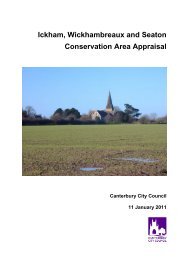
<strong>Lampen</strong> <strong>Stream</strong><br />
Conservation Area Appraisal<br />
<strong>Canterbury</strong> <strong>City</strong> <strong>Council</strong><br />
15 September 2009
Table of Contents<br />
1. Introduction 2<br />
1.1 KEY CHARACTERISTICS 3<br />
1.2 PLANNING POLICY FRAMEWORK 3<br />
National Policy Guidance 3<br />
Regional and County Guidance 3<br />
<strong>Canterbury</strong> <strong>City</strong> <strong>Council</strong> Local Plan 4<br />
Heritage, Archaeology and Conservation Supplementary Planning Document 4<br />
2. Location and Background 4<br />
2.1 TOPOGRAPHY 5<br />
2.2 BIODIVERSITY ASSESSMENT 5<br />
Stodmarsh SSSI/NNR 5<br />
Preserving and enhancing the wildlife interest 5<br />
3. Archaeology and Historic Development. 6<br />
3.1 ARCHAEOLOGY/EVOLUTION 6<br />
3.2 RECENT HISTORY 6<br />
4. Character and Landscape Setting 8<br />
5. Recommendations 10<br />
5.1 PRIMARY ISSUES 10<br />
5.2 BOUNDARY ASSESSMENT 10<br />
6. Management and Improvement 10<br />
7. Statement of Consultation 11<br />
Appendices 12<br />
1. LISTED BUILDINGS DETAILS 12<br />
1
1. Introduction<br />
This appraisal examines the key elements that contribute to the special architectural,<br />
natural and historic character of <strong>Lampen</strong> <strong>Stream</strong> Conservation Area. The character of any<br />
area is determined by its topography, location, buildings, natural features and open<br />
spaces. At <strong>Lampen</strong> <strong>Stream</strong> the combination of all these factors has created a rare<br />
watered valley unique in this area of Kent.<br />
Conservation areas were first introduced in 1967 and are currently defined as ‘areas of<br />
special architectural or historic interest, the character or appearance of which it is<br />
desirable to preserve or enhance’ (Section 69 (1) of the Planning (Listed Buildings and<br />
Conservation Areas) Act 1990).<br />
The original conservation area was designated on 21 July 1992 to protect the <strong>Lampen</strong><br />
<strong>Stream</strong> and environs. Rather than extending the Stodmarsh and Elbridge House<br />
Conservation Areas the <strong>City</strong> <strong>Council</strong> decided that it would designate the area bordering<br />
the stream as a new Conservation Area in its own right. This would provide protection to<br />
its special character, which stems from the mix of natural and man-made features<br />
bordering the <strong>Lampen</strong> <strong>Stream</strong>. These have survived despite the modern agricultural<br />
methods, which have been adopted nearby. Although there are few buildings within the<br />
Conservation Area, the designation gives recognition to the special quality of this strip of<br />
countryside. The Conservation Area includes the particularly attractive meadowland and<br />
woodland on either side of the lower stretches of <strong>Lampen</strong> <strong>Stream</strong> and groups of farm<br />
buildings some of which are listed.<br />
© © Crown copyright. All rights reserved. <strong>Canterbury</strong> <strong>City</strong><br />
<strong>Council</strong> Licence No 100019614 (2004). Additional overlaid<br />
information is copyright of <strong>Canterbury</strong> <strong>City</strong> <strong>Council</strong><br />
Stodmarsh<br />
Conservation Area<br />
<strong>Lampen</strong> <strong>Stream</strong><br />
Conservation Area<br />
Figure 1: <strong>Lampen</strong> <strong>Stream</strong> Conservation Area<br />
2
The <strong>City</strong> <strong>Council</strong> considers that the ‘special interest’ justifying designation of a<br />
conservation area should be defined and analysed in a written appraisal of its character<br />
and appearance. This document will be a background paper to the <strong>City</strong> <strong>Council</strong>’s Local<br />
Development Framework.<br />
1.1 Key Characteristics<br />
This appraisal concludes that the most significant features of the <strong>Lampen</strong> <strong>Stream</strong><br />
Conservation Area are:<br />
• The small stream winding through a flat valley<br />
floor<br />
• Man made features that border the stream<br />
• Pockets of woodland and individual trees within<br />
the valley<br />
• Meadows and fields sloping down to the stream<br />
• Isolated listed farmhouses and associated<br />
buildings<br />
• The historic division of fields and meadows<br />
• Providing the rural backdrop to the Stodmarsh<br />
Conservation Area and providing farmland<br />
views from the Elbridge Conservation Area.<br />
• Natural wildlife habitat and corridor value of the<br />
stream and associated vegetation<br />
1.2 Planning Policy Framework<br />
National Policy Guidance<br />
Government advice on the control of conservation areas and historic buildings is set out in<br />
Planning (Listed Buildings and Conservation Areas) Act 1990 and Planning Policy<br />
Guidance Note 15 – Planning and the Historic Environment.<br />
Planning Policy Guidance Notes 12 & 16, the draft South East Plan (March 2006),<br />
Regional Spatial Strategy, Kent and Medway Structure Plan policies and Kent Design<br />
Guide provide the general strategic policy context under which the policies in the local<br />
plan function.<br />
Regional and County Guidance<br />
The new draft South East plan places importance on the protection of the historic<br />
environment and acknowledges the role that the historic environment plays in contributing<br />
towards sustainable development, regeneration, tourism and social inclusion. Policy BE7<br />
requires local authorities to adopt policies and proposals, which support conservation and<br />
enhancement of the historic environment. RPG9 sets out key principles for development<br />
in the South East Region.<br />
The Kent & Medway Structure Plan policies also provide the general strategic policy<br />
context. It provides strategic planning polices for the whole county, and includes policies<br />
that are particularly relevant to rural areas. Policy QL6: Conservation Areas, sets out<br />
specific policy with respect to conservation areas.<br />
The Kent Design Guide provides a starting point for good design that is well considered<br />
and contextually sympathetic amongst other things. It emphasises the need for the layout<br />
and appearance of new development to be based on an appraisal of the existing<br />
character.<br />
3
<strong>Canterbury</strong> <strong>City</strong> <strong>Council</strong> Local Plan<br />
The primary means by which the <strong>City</strong><br />
<strong>Council</strong> ensures the preservation and<br />
enhancement of the conservation<br />
area is through the development<br />
control process and by applying the<br />
policies of the <strong>Canterbury</strong> District<br />
Local Plan (2001 – 2011). The Local<br />
Plan, adopted in July 2006, sets out<br />
the spatial strategy for the <strong>Canterbury</strong><br />
District. It includes policies on<br />
housing, the economy, rural housing,<br />
the natural and built environment,<br />
community infrastructure and many<br />
others. A number of designations are<br />
particularly relevant to Elbridge,<br />
including those relating to<br />
conservation areas and protected<br />
natural areas.<br />
© © Crown copyright. All rights reserved. <strong>Canterbury</strong> <strong>City</strong><br />
<strong>Council</strong> Licence No 100019614 (2004). Additional overlaid<br />
information is copyright of <strong>Canterbury</strong> <strong>City</strong> <strong>Council</strong><br />
Figure 2: Excerpt from Local Plan Proposals Maps<br />
Paragraphs 6.83-6.93 of the Local Plan deal with conservation areas and include policies<br />
BE7, BE8, BE9 and NE5. Policy BE7 provides the primary guidance to developers about<br />
conservation areas.<br />
The planning system has recently changed and ultimately a Local Development<br />
Framework (LDF) will replace the Local Plan. The LDF consists of a collection of Local<br />
Development Documents, including the Core Strategy, Proposals Maps, Area Action<br />
Plans, and other development plan documents, which may deal with conservation issues<br />
as well as Supplementary Planning Documents.<br />
Heritage, Archaeology and Conservation Supplementary Planning Document<br />
The Heritage, Archaeology and Conservation Supplementary Planning Document was<br />
approved in October 2007. Chapter 4 explains the features that make up a general<br />
conservation and are Chapter 5 provides detailed guidance for developments in<br />
Conservation Areas.<br />
2. Location and Background<br />
The <strong>Lampen</strong> <strong>Stream</strong> issues 700 metres<br />
south of the <strong>Canterbury</strong> Littlebourne Road<br />
and flows in a north-easterly direction to<br />
enter the Great Stour north of Stodmarsh.<br />
The stream flows through the Elbridge<br />
House and <strong>Lampen</strong> <strong>Stream</strong> Conservation<br />
Areas and is a very attractive natural<br />
feature. The stream leaves the Elbridge<br />
Conservation Area and flows through the<br />
valley between Stodmarsh Road and<br />
Hollybush Lane. It also flows past the<br />
present Stodmarsh Conservation Area and<br />
is important to the setting of this historic<br />
village.<br />
4
The conservation area does not include any built-up areas or settlements. The built<br />
environment consists of three isolated farmsteads and cottages, the rest of the<br />
conservation area is fields and meadows bounding the <strong>Lampen</strong> <strong>Stream</strong>.<br />
2.1 Topography<br />
The <strong>Lampen</strong> <strong>Stream</strong> is a weathered valley<br />
landscape consisting of a wooded stream valley<br />
with fields sloping down to a shallow valley floor on<br />
either side of the stream. Narrow country lanes run<br />
along the top ridgelines on either side of the valley.<br />
The base of valley is flat and has obviously been<br />
formed by the stream changing course over many<br />
thousands of years.<br />
2.2 Biodiversity Assessment<br />
The Conservation Area incorporates 7 hectares of the 250 ha Stodmarsh National Nature<br />
Reserve and 623 ha Site of Special Scientific Interest. Units 10 (Standing open water and<br />
canals at Grid reference TR219613) and 11 (Fen, marsh and swamp - lowland at grid<br />
reference TR223617) of the SSSI both fall partly within the conservation area. The<br />
northeasterly edge of the conservation area is mapped in the 2003 Habitat Survey and<br />
there are good habitat linkages through swamp, grassland, pastureland, and broadleaved<br />
woodland and opportunities for species transgression (“green corridors”) throughout the<br />
conservation area.<br />
The Trenleypark Wood and Swanton Aerial Site broadleaved woodland Local Wildlife<br />
Sites (LWS) are situated 700 - 1000m to the west of the Conservation Area on the<br />
western and southern edges of Elbridge Conservation Area.<br />
Stodmarsh SSSI/NNR<br />
Stodmarsh is a wetland site located in the Stour valley, which contains a wide range of<br />
habitats including open water, extensive reedbeds, scrub, and alder carr which together<br />
support a rich flora and fauna. The vegetation is a good example of a southern eutrophic<br />
flood plain and a number of rare plants are found here. The invertebrate fauna is varied<br />
and several scarce moths have been recorded in recent years. The site is also of<br />
ornithological interest with its diverse breeding bird community. Two rare British birds<br />
cetti’s warbler and bearded tit, regularly breed in nationally significant numbers. Unit 10 is<br />
mainly standing open water and canals where there has been extensive recent works to<br />
manage the ditches and control scrub encroachment. Bitterns, Marsh and Hen Harriers<br />
have all been identified in this habitat area. Unit 11 consists of extensive reed bed. The<br />
areas of SSSI and NNR habitat within the conservation area have been subject to<br />
extensive management works and are being maintained in favourable ecological<br />
conditions within the habitat terms for which it is designated SSSI. Natural England must<br />
be contacted on all “Operations likely to damage the special interest”. A list of these<br />
operations may be sourced from the Natural England website.<br />
Preserving and enhancing the wildlife interest<br />
The structural diversity and water quality of water bodies must be maintained in<br />
accordance with the adjoining grassland, scrubland and woodland habitats to provide<br />
plant and invertebrate abundance and diversity, both of which are important food sources<br />
for a range of birds and mammals.<br />
The following must be carefully managed to avoid disturbance to the series of special<br />
habitats present in the conservation area, and should be considered as part of the<br />
management of any development (following relevant good practice where protected<br />
species (e.g. water voles) are present):<br />
5
• Introduction of species<br />
• Control of alien species<br />
• Water table levels<br />
• Management of scrub<br />
• Field margins and hedges<br />
• Sensitive public access<br />
• Impact and management of leisure<br />
activities<br />
• Use of chemicals<br />
• Nutritional enrichment<br />
• Control or removal of aquatic plants<br />
• Provision of scrapes and ponds<br />
• Coppice management<br />
• Maintenance of ditches and water channels to provide shallowly sloping margins to<br />
provide habitat for dragonfly and damselfly species<br />
• Sediments entering a nearby or connected water body<br />
• Rotational cutting of reedbeds outside of the bird nesting season<br />
• Rotational cutting or intermittent grassland grazing<br />
• Frequency and extent of flooding providing beneficial impacts on habitats<br />
• Maintenance of an identified balance between groundwater and floodwater levels<br />
• Periodical removal of ditch sediment and vegetation<br />
• Sensitive use of machinery (avoid ground compression in sensitive areas)<br />
• Management of veteran and prominent trees in woodland areas and the landscape<br />
All developments directly or indirectly having an impact upon valued habitats must obtain<br />
an ecological survey by a suitably qualified ecologist. Protected species should always be<br />
considered as part of any development. The impact of a development on biodiversity<br />
should always be considered and the biodiversity value enhanced where possible.<br />
There are also a number of agricultural hedgerows within the conservation area that<br />
provide valuable habitat for a number of species. It should be noted that countryside<br />
hedgerows (those not associated with the curtilage of a dwelling) are protected by the<br />
Hedgerow Regulations 1997. These hedgerows cannot be altered (beyond general<br />
maintenance) or removed without 6 weeks prior formal notice being given to the local<br />
planning authority. It should also be noted that the all trees are provided some degree of<br />
protection by the Conservation Area. Any tree located in the conservation area may not be<br />
removed without 6 weeks notice being given to <strong>Council</strong>.<br />
3. Archaeology and Historic Development.<br />
3.1 Archaeology/Evolution<br />
There is an ancient pattern of fields, boundaries and shaves about the <strong>Lampen</strong> <strong>Stream</strong><br />
Valley and a number of antiquities were unearthed in 1854 in a Saxon barrow in the south<br />
side of Stodmarsh Road opposite Stodmarsh Court just within the <strong>Lampen</strong> <strong>Stream</strong><br />
Conservation Area. The objects included a spoon, several buckets and some ornamental<br />
objects. It has been conjectured that the spoon was used for magical purposes. There is a<br />
well-defined tumulus just west of the barrow some 40’ in diameter and 4’ high, which was<br />
also excavated in 1854. This is thought to be of Saxon origin.<br />
3.2 Recent History<br />
The configuration of fields, the presence of well-defined hedged boundaries and the<br />
interesting mixture of arable, pasture and woodland all indicate that this section of a rare<br />
6
"watered" valley in north-east Kent has changed little over a period of time that may be<br />
measured in hundreds of years.<br />
A comparison of the post 1843 maps with modern maps and aerial photos supports the<br />
assertion that little has been little change in this landscape in the last 150 years. Many of<br />
the natural and historic man made features that border the stream remain to this day<br />
unaffected by modern agricultural practices.<br />
© © Crown copyright. All rights reserved. <strong>Canterbury</strong> <strong>City</strong> <strong>Council</strong> Licence No 100019614 (2004).<br />
Additional overlaid information is copyright of <strong>Canterbury</strong> <strong>City</strong> <strong>Council</strong><br />
Figure 4: Aerial<br />
photo 2003<br />
Figure 3: Historic map<br />
1843<br />
© © Crown copyright. All rights reserved. <strong>Canterbury</strong> <strong>City</strong> <strong>Council</strong> Licence No 100019614 (2004).<br />
Additional overlaid information is copyright of <strong>Canterbury</strong> <strong>City</strong> <strong>Council</strong><br />
Stodmarsh<br />
Conservation Area<br />
<strong>Lampen</strong> <strong>Stream</strong><br />
Conservation Area<br />
7
4. Character and Landscape Setting<br />
The valley of <strong>Lampen</strong> <strong>Stream</strong> is a particularly attractive feature in this area especially by<br />
contrast with the arable land in intensive monoculture farming on the plateaus on either<br />
side of the valley. It is unusual in that it retains traditional meadows on the slopes into the<br />
valley and specimen trees as well as copses of woodland providing a traditional parkland<br />
landscape. The meadows are broken up into smaller fields with the boundaries defined by<br />
hedgerows and chestnut wood and wire fences. The ambiance and aspect of the<br />
conservation area is one of isolated rural farmland with all of the noises and smells that<br />
goes with it.<br />
Once the stream leaves Elbridge Park it flows along the edge of sloping meadows dotted<br />
with specimen trees, the area is almost park-like in appearance. An attractive belt of<br />
woodland runs along the southern bank of the stream as far as Burnt House Hill. The<br />
meadowland on the slopes within the Conservation area boundary is particularly fine. The<br />
strip of woodland finishes at Burnt House Hill where<br />
the road bridges the stream, there is a more<br />
extensive area of woodland running up to Kingsley<br />
House. From this point onwards the land becomes<br />
marshier and below Waterham Cottage there are<br />
many willows.<br />
The pastureland rises steeply towards Stodmarsh<br />
Court Farm with a series of bumps and undulations<br />
and scattered trees. <strong>Lampen</strong> <strong>Stream</strong> skirts the<br />
southern edge of Stodmarsh Village threading its<br />
way through a marshy area with pockets of trees as<br />
it approaches Waterham Cottage. Beyond this<br />
point there is a strip of woodland alongside and<br />
then the stream runs into an area of reed beds,<br />
dykes and flood walls with woodland, which is the<br />
Stodmarsh National Nature Reserve and an area of<br />
Special Scientific Interest. Undertrees Farmstead<br />
over looking the reserve is a typical marshland<br />
farmstead that sits attractively against the wood.<br />
The area within the boundary is of particularly high scenic value and a large part of the<br />
streamside meadowland to the south of Stodmarsh is an important part of the setting to<br />
Stodmarsh Conservation Area. The trees, both specimen trees and wooded copses along<br />
the course of the stream and adjacent meadows, are particularly important in an area,<br />
which is otherwise rather bleak.<br />
8
5. Recommendations<br />
5.1 Primary Issues<br />
For a seemingly sleepy rural area there are a number of potential issues facing the<br />
<strong>Lampen</strong> <strong>Stream</strong> conservation area.<br />
The primary issue facing the <strong>Lampen</strong> <strong>Stream</strong> would be the loss of the stream due to water<br />
take for domestic or irrigation purposes. This would impact on the surrounding vegetation<br />
and landscape changing the nature of the conservation area. Adjacent intensive farming<br />
practices (especially dairy farming) even outside of the conservation area could also<br />
impact upon the health of the stream through nutrification and topsoil run off. Protection of<br />
water flows and the health of the stream<br />
is vitally important in protecting the<br />
values of this conservation area.<br />
A more visible feature of the<br />
conservation area is the single specimen<br />
trees, hedgerows and wooded copses<br />
lining the valley slopes and floor.<br />
Retention of these trees especially the<br />
single standards is important.<br />
A particular threat to this landscape<br />
would be the subdivision or<br />
amalgamation of plots causing the loss<br />
of field boundaries or more buildings.<br />
Large-scale intensive farming and amalgamation of fields would result in the bare<br />
landscape seen on the plateaus surrounding the valley. Increasing pressure for expansion<br />
and modernisation from <strong>Canterbury</strong>’s increasing population, and the general wish to live in<br />
the countryside not far from town and cities centres, may, in the future, put pressure on<br />
this area for building plots and reuse of farm buildings as dwellings.<br />
5.2 Boundary assessment<br />
The <strong>Lampen</strong> <strong>Stream</strong> Conservation Area is unusual in that it is not centred around the built<br />
environment or even a cluster of buildings, rather it affords protection for a primarily<br />
natural landscape that provides the setting for the two adjacent conservation areas of<br />
Stodmarsh and Elbridge House. In this respect, although the conservation area includes<br />
large areas of meadows, trees and rural hinterland, the boundary does appear to take in<br />
all of the area necessary to protect the stream, its banks and setting as well as the setting<br />
of the three listed buildings within the conservation area and the setting of the adjacent<br />
conservation areas.<br />
6. Management and Improvement<br />
There is a need to ensure that all future developments in the conservation area respect<br />
the local distinctiveness of <strong>Lampen</strong> <strong>Stream</strong> Conservation Area, hence some guidance has<br />
been provided below. The key issue is maintenance and improvement of those aspects<br />
that contribute to the character and quality of the scenery.<br />
• The water flows and health of the stream and its immediate surrounds should not be<br />
impacted upon by removal of water from the stream and/or use of adjacent land.<br />
• Protection of the stream and its environs including the meadows and swampland.<br />
• Protection of the views into, across and out of all parts of this conservation area.<br />
10
• The woodlands, hedgerows and individual trees within the Conservation Area should<br />
be retained and protected as they make up an important part of the setting.<br />
• Any new development should have a visual understanding of the historic roots of the<br />
conservation area as a rural watered valley and all that that entails.<br />
• Current field boundaries should be retained and maintained and fields and meadows<br />
should not be amalgamated or subdivided.<br />
• Boundary treatments should be traditional such as hedges or wire and chestnut post<br />
fences where these are appropriate.<br />
• It is important that any change or enlargement to buildings does not swamp the few<br />
existing buildings.<br />
• Any new development should have close regard to the traditional building styles,<br />
forms, materials and techniques characteristic of this area, including the very low<br />
intensity of development. The height, size, design, roofspace, plot width and visual<br />
appearance of new development and the design of any new vehicle access should<br />
respect the character of the conservation area.<br />
• The Land Drainage byelaws that apply to this stream must be adhered to.<br />
• A management/maintenance scheme could be put in place to protect the health of<br />
the stream.<br />
When considering new development this need not necessarily mean exact copying of<br />
earlier styles in new work though on occasion this may be the only way. But it does<br />
require developer and designer to come to an understanding of, and a respect for, the<br />
character of the area when drawing up their proposals. Every new proposal within the<br />
conservation area should be backed up by a thorough analysis of the site and its historic<br />
context. This exercise should ‘inform’ the design process and be part of a design<br />
statement submitted with a planning application.<br />
7. Statement of Consultation<br />
A copy of the draft Conservation Area Appraisal has been sent to the Parish <strong>Council</strong>, all<br />
residents, interest groups and local councillors. The formal period for consultation is 29<br />
May 2009 to 26 June 2009 and responses were received up until 28 July 2009. Two<br />
responses were received.<br />
The draft Conservation Area Appraisal was reported to the <strong>Canterbury</strong> <strong>City</strong> <strong>Council</strong> Rural<br />
Area Members Panel on 16 June 2009 for their comment. The Conservation Area<br />
Appraisal was then amended in light of the consultation and presented to the<br />
Development Control Committee along with a summary of any responses received on 15<br />
September 2009. One speaker was heard at the meeting. The Development Control<br />
Committee formally adopted the document as a ‘material consideration’.<br />
All persons who responded to the consultation were informed of their right to attend and<br />
speak at the committee meetings.<br />
11
1. Listed Buildings details<br />
Waterham Cottage Grade II Listed 30.1.67<br />
Kingsley House Grade II Listed<br />
Barn at Undertrees Farm Grade II Listed 02.10.00<br />
Appendices<br />
12