Memo Format Template Multi Page - NSW Government
Memo Format Template Multi Page - NSW Government
Memo Format Template Multi Page - NSW Government

Create successful ePaper yourself
Turn your PDF publications into a flip-book with our unique Google optimized e-Paper software.
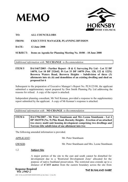
TO: ALL COUNCILLORS<br />
FROM: EXECUTIVE MANAGER, PLANNING DIVISION<br />
DATE: 12 June 2008<br />
SUBJECT: Items on Agenda for Planning Meeting No. 10/08 – 18 June 2008<br />
Additional information with NO CHANGE to Recommendation<br />
ITEM 5 DA/1467/2003 - Further Report - B & G Surveying Pty Ltd - Lot 32 DP<br />
14070, Lot 10 DP 232642, Pt Lot 33 DP 14070 (Nos. 120, 122 & 122X)<br />
Berowra Waters Road, Berowra Heights - Subdivision of three (3)<br />
allotments into six (6) and demolition of an existing dwelling and shed on<br />
proposed lot 6<br />
Subsequent to the preparation of Executive Manager’s Report No. PLN125/08, the applicant<br />
submitted a supplementary report prepared by Don Smith Planning Pty Ltd addressing the<br />
reasons for refusal. A copy of the report is attached.<br />
Independent planning consultant, Mr Neil Kennan, provided a response to the supplementary<br />
report submitted by the applicant. A copy of Mr Kennan’s response is attached.<br />
Additional information with NO CHANGE to Recommendation<br />
ITEM 6 DA/1796/2007 - Mr Peter Stumbaum and Mrs Leona Stumbaum - Lot 4<br />
DP 1043578 (No. 9) Pike Road, Hornsby Heights - Erection of an attached<br />
two storey multi unit housing development comprising two dwellings and<br />
Torrens title subdivision of one allotment into two<br />
The following amended information is provided.<br />
APPLICANT: Mr. Peter Stumbaum<br />
OWNER: Mr. Peter Stumbaum and Mrs. Leone Stumbaum<br />
1.2 Subject Site<br />
A major portion of the site to the east and south cannot be disturbed for<br />
development due to a ‘Restricted Development Zone’ allocated for the<br />
purpose of native bushland preservation. The restricted area extends up to a<br />
distance of 67.035 metres from the eastern boundary across the site from<br />
(HSC~H:\DevArch\DIVISION\MEMOS\2008\Late Item <strong>Memo</strong> - 12 June 08)
Items on Agenda for Planning Meeting No. 10/08 – 18 June 2008 <strong>Page</strong> 2<br />
north to south, and between the southern bank of the watercourse and the<br />
boundary adjacent to Pike Road (refers to Section 1.1 for further details).<br />
1.3 Proposed Development<br />
Proposed Lot 4A: 1546 m 2 irregular shaped allotment.<br />
Proposed Lot 4B: 1546 m 2 irregular shaped allotment.<br />
3. DEVELOPMENT SPECIFICS<br />
_____Compliance_____<br />
Prescriptive Element<br />
Item Proposed Required Measure Objective<br />
Allotment Size:*<br />
Proposed Lot 4A 1546m 2<br />
Proposed Lot 4B 1546m 2<br />
Gross Floor Area:<br />
575 m 2<br />
575 m 2<br />
Yes Yes<br />
Yes Yes<br />
Unit 1 144 m 2 N/A N/A N/A<br />
Unit 2 170 m2 N/A N/A N/A<br />
Private Open Space: ***<br />
Dwelling Lot 4A 120 m 2 +<br />
2<br />
100m<br />
Dwelling Lot 4B 120 m 2 +<br />
2<br />
120m<br />
Yes Yes<br />
Yes Yes<br />
5.3 LIKELY IMPACTS OF DEVELOPMENT<br />
(Section 79C(1)(b) & (d) Environmental Planning & Assessment Act, 1979)<br />
Setting, Siting & Design<br />
Fencing<br />
The following information has been submitted by the applicant addressing the objection in<br />
relation fencing:<br />
“The information needs to be added that the fence is at least 3 metres outside the subject<br />
site’s boundary on Council’s 7 metre wide nature strip. It does not belong to he owners of the<br />
subject property. Council’s investigations revealed that ‘under DA 96/1998 a condition was<br />
imposed that required a 1.8 nm high chain wire fence to be erected around a ‘restricted<br />
development zone’ located within the subject property. The subject fence was erected to<br />
satisfy this condition of consent.’”<br />
Utilities
Items on Agenda for Planning Meeting No. 10/08 – 18 June 2008 <strong>Page</strong> 3<br />
Comment: The proposal does not require the relocation of a sewer line. A portion of the<br />
dwelling will be built over the existing sewer line. Necessary approvals from Sydney Water<br />
have been provided with the application.<br />
Attachment: Please find the amended front page of the report attached.<br />
Additional information with NO CHANGE to recommendation<br />
ITEM 8 DA/1046/2007 - Downing Project Management - Lot 2 DP 367373 (Nos.<br />
103-109) New Line Road, Cherrybrook - Alterations and additions to<br />
existing West Pennant Hills Sports Club including new car park,<br />
relocation of bowling greens, tennis courts and cricket nets and the<br />
erection of one sign<br />
Correction, Section 5.3 of the report under the heading Safety, Security & Crime<br />
Submissions raised concerns that the proposal will exacerbate adverse impacts arising from<br />
patrons frequenting the club, specifically social impacts relating to potential alcohol and<br />
gaming abuse and anti-social activities of patrons leaving the premises.<br />
Whilst application includes an extension to the club’s hours of operation, the club is not<br />
proposing to expand the number of gaming machines on the premises as part of this<br />
application. In the event that the club seeks to increase the number of gaming machines at its<br />
premises it will need to prepare a Social Impact Assessment with its application to the Liquor<br />
Administration Board. The Statement of Environmental Effects addresses the social and<br />
economic impact of the proposal with no adverse impacts envisaged.<br />
The <strong>NSW</strong> Police require appropriate conditions to be imposed with regards to the acoustic<br />
amenity of the development.<br />
The existing development has a repeated history of anti-social behaviour which warrants the<br />
preparation of a security management plan and the imposition of stringent conditions of<br />
development consent. Draft conditions are recommended to control hours of operation,<br />
noise, visual and environmental impacts to improve current operating conditions.<br />
A Security Management Plan relating to strategies to be adopted to control noise and<br />
antisocial behaviour on the club premises and within the immediate environs (Edward<br />
Bennett Oval and surrounding streets), should be submitted to Council for further<br />
consideration in consultation with <strong>NSW</strong> Police before approval of the application is<br />
anticipated.<br />
This report recommends that the application be deferred and that the applicant be requested to<br />
provide a Security Management Plan to address the potential for anti-social behaviour<br />
affecting neighbouring residents. Such plan is to be prepared in conjunction with Council<br />
and the <strong>NSW</strong> Police Department for submission to the earliest available Planning Meeting.<br />
Correction, Section 5.3 of the report under the heading Acoustics<br />
Paragraph 1 in the Comment section should read:
Items on Agenda for Planning Meeting No. 10/08 – 18 June 2008 <strong>Page</strong> 4<br />
Comment: The proposed noise attenuation measures will ensure that noise emissions from<br />
mechanical plant and from the operations of the Club meet specific Design Goals as<br />
recommended by the applicant’s Acoustic Consultants. With regard to noise from patrons<br />
leaving the Club, this report recommends that the applicant be requested to provide a<br />
Security Management Plan relating to strategies to be adopted to control noise and<br />
antisocial behaviour on the club premises and within the immediate environs (Edward<br />
Bennett Oval and surrounding streets). It is recommended that the Security Management<br />
Plan should be submitted to Council for further consideration in consultation with <strong>NSW</strong><br />
Police before approval of the application. Notwithstanding, the adjoining residents have<br />
recourse to action under the Protection of the Environment Operations Act 1997, if adverse<br />
noise impacts persist.<br />
Correction, Section 5.3 of the report under the heading Landscaping, the last line should<br />
read:-<br />
and recommends conditions Nos. 3 and 121 to 130.<br />
Correction, under the heading RECOMMENDATION<br />
THAT<br />
A. Development Application No. 1046/2007 for alterations and additions to existing<br />
West Pennant Hills Sports Club including new car park and relocation of bowling<br />
greens, tennis courts and cricket nets and erection of one sign be deferred.<br />
B. The applicant be requested to provide a Security Management Plan to address the<br />
potential for anti-social behaviour affecting neighbouring residents. Such plan is to<br />
detail the strategies to be adopted to control noise and antisocial behaviour on the club<br />
premises and within the immediate environs (Edward Bennett Oval and surrounding<br />
streets) and is to be prepared in conjunction with Council and the <strong>NSW</strong> Police<br />
Department for submission to the earliest available Planning Meeting.<br />
C. Development Application No. 1046/2007 for alterations and additions to existing<br />
West Pennant Hills Sports Club including new car park and relocation of bowling<br />
greens, tennis courts and cricket nets and erection of one sign be considered in<br />
conjunction with the submitted Security Management Plan and determined<br />
accordingly.<br />
Additional information with NO CHANGE to Recommendation<br />
ITEM 12 F2007/00599-03 – Executive Manager’s Report No. PLN130/08 – Ku-ringgai<br />
and Hornsby Subregional Employment Study<br />
Executive Manager’s Report No. PLN130/08 presents the findings of the draft Ku-ring-gai<br />
and Hornsby Subregional Employment Study and seeks endorsement of the Study for public<br />
exhibition.
Items on Agenda for Planning Meeting No. 10/08 – 18 June 2008 <strong>Page</strong> 5<br />
At a joint presentation of the draft Study at Ku-ring-gai Council on 3 June 2008, the<br />
consultant was asked to clarify comments concerning the Dural Service Centre, contained<br />
within Table Nos. 2, 42 and 45. It was noted that Table 2 (pg 20) and Table 45 (pg 192)<br />
recommend the IN2 and B2 zones for Dural Service Centre. However, the notes provided as<br />
commentary within the tables comment (in part) that:<br />
“In order to introduce some additional variety of local service uses, a part of the<br />
Dural Service Centre could be zoned B2 or B5.”<br />
It was also noted that Table 42 (page 171) of the draft Study comments that:<br />
“Recommended zoning for the Dural Service Centre is IN2 – Light Industrial. In<br />
order to allow a wider range of uses a specific area could be set aside as B2 Local<br />
Centre and/or B5 Business Development to permit additional desirable uses that are<br />
not permissible in the IN2 zone.”<br />
At the joint presentation the consultant gave an undertaking to review the notes within the<br />
Tables in respect of their consistency with the Study’s recommendation of the application<br />
template zones IN2 and B2. The consultant has reviewed the notes within the Tables and<br />
provides the following comments in respect of SGS’s consideration of the B5 zone, in lieu of<br />
the B2 zone recommended in the draft Study:<br />
We recommend reinforcing the local service role of the Dural Service Centre-<br />
broadening its local service function without jeopardising the economic growth of<br />
centres that are better placed with respect to public transport infrastructure and<br />
therefore better suited as employment destinations. We initially considered applying<br />
an industrial zone to Dural Service Centre with additional permissible uses, and<br />
another more conventional industrial zone to all other industrial areas in the Local<br />
<strong>Government</strong> Area (LGA). We decided against this as one industrial zone applied to<br />
all other industrial areas did not properly account for the different functions these<br />
industrial areas perform. IN2 Light Industrial plus B5 Business Development zoning<br />
was considered. A B5 zone was specifically considered as this would take account of<br />
the existing mixed nature of activity within the Dural Service Centre (DSC).<br />
There are three issues with applying a B5 zone at Dural Service Centre:<br />
(i) The DSC context is very different to the locations where B5 is applied<br />
elsewhere in the LGA;<br />
(ii) The final range of permissible land uses (still to be determined) for the B5<br />
zone may not support the intended range of service functions; and<br />
(iii) Permissible uses under the B5 zone have the potential to draw trade from a<br />
wide catchment, this is at odds with the poor public transport infrastructure<br />
access at DSC.<br />
Each of these issues is discussed below.<br />
Other areas where the B5 zone is applied in the LGA are very different in character<br />
and function from the DSC and it is difficult to imagine a scenario whereby the one<br />
zoning could be applied to these areas and the Dural Service Centre. In particular<br />
the use of additional zone objectives (to tailor the B5 zone for the needs of Hornsby
Items on Agenda for Planning Meeting No. 10/08 – 18 June 2008 <strong>Page</strong> 6<br />
LGA) is likely to be compromised by the inclusion of disparate areas under the same<br />
zoning.<br />
Another key consideration in utilizing the B5 zoning is to ensure that application does<br />
not detract from the viability of existing centres. A possible means of ensuring that<br />
B5 zoned land performs a different economic role to existing centres is to limit the<br />
range of permissible retail uses. Such restrictions are likely to result in a zone that is<br />
not ideally suited to a local service function.<br />
It is understood that the intention behind the B5 zone is to provide a more relaxed<br />
planning framework that would permit opportunities for a range for office, warehouse<br />
and retail development, in locations where this mix of use is appropriate. The zoning<br />
would therefore permit a broad range of employment activities, including those with<br />
relatively high employment densities. It follows then that application of the zoning<br />
should be limited to those locations that are in, or near, existing centres, or are well<br />
served by public transport.<br />
For the purpose of consistency with the draft Study recommendations, Tables Nos. 2 and 45<br />
have been reissued by the consultant without reference to the zone B5 in respect of the Dural<br />
Service Centre. The commentary in both tables now reads:<br />
“There is no zone within the Standard Instrument that, either through its objectives or<br />
compulsory permissible land uses, reflects the current range of land uses permissible<br />
under the Business E zoning that currently applies to the Dural Service Centre. The<br />
recommended strategy for future zoning of this area would be to apply the IN2 zoning<br />
and as far as is possible including as many permissible land uses in the zone that<br />
would be desirable in this area, bearing in mind that these uses would then also be<br />
permissible on all other IN2 zoned land. In order to introduce some additional<br />
variety of local service uses, a part of the Dural Service Centre could be zoned B2<br />
Local Centre. The area of land with commercial zoning should be limited so as not to<br />
encourage significant additional employment and services in an ‘out of centre’<br />
location. In addition to the permissible uses (with consent) in the LEP standard<br />
instrument, we have added a range of additional retail and local service uses.<br />
Additional zone objectives should be introduced to reflect the broader range of<br />
anticipated uses.”<br />
The comments within Table 43 have also been reissued for consistency and now read:<br />
“Recommended zoning for the Dural Service Centre is IN2 – Light Industrial. In<br />
order to allow a wider range of uses a specific area could be set aside as B2 Local<br />
Centre to permit additional desirable uses that are not permissible in the IN2 zone.”<br />
The reissued tables (copy attached) would form part of the Study should Council resolve to<br />
progress the Study to exhibition.
Items on Agenda for Planning Meeting No. 10/08 – 18 June 2008 <strong>Page</strong> 7<br />
PETER HINTON<br />
Executive Manager<br />
Planning Division<br />
F2005/01146 - DA/1467/2006 - F2007/00599-03 - DA/1046/2007 - DA/1796/2007<br />
Attachments: Item 5 Report prepared by Don Smith Planning Pty Ltd (15 pages)<br />
Response prepared by Nexus Environmental Planning Pty Ltd<br />
(4 pages)<br />
Item 6 Amended 1 st <strong>Page</strong> of Report No. PLN123/08 (1 page)<br />
Item 12 Revisions to table nos. 2, 42 and 43 (4 pages)