Presentations. - Permanent Committee on Cadastre in the European ...
Presentations. - Permanent Committee on Cadastre in the European ...
Presentations. - Permanent Committee on Cadastre in the European ...

Create successful ePaper yourself
Turn your PDF publications into a flip-book with our unique Google optimized e-Paper software.
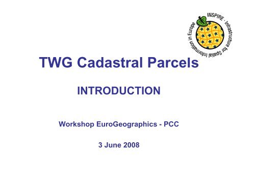
TWG Cadastral Parcels<br />
INTRODUCTION<br />
Workshop EuroGeographics - PCC<br />
3 June 2008
INSPIRE TWG
Data specificati<strong>on</strong>s: a two steps<br />
approach<br />
• 2005 – 2008:<br />
– comm<strong>on</strong> framework for data specificati<strong>on</strong>s<br />
– by DT DS (Draft<strong>in</strong>g Team Data Specificati<strong>on</strong>s)<br />
• 2008 – 2011<br />
– Harm<strong>on</strong>ised specificati<strong>on</strong>s for <strong>the</strong> 34 Annexes<br />
<strong>the</strong>mes<br />
• for Annex I <strong>the</strong>mes: dur<strong>in</strong>g 2008 -2009<br />
• for Annexes II and III: from 2009 to 2011
Possible scenarios<br />
• Scenario 1 : already harm<strong>on</strong>ised specificati<strong>on</strong>s =><br />
SDIC/LMO<br />
• Scenario 2 : no harm<strong>on</strong>ised specificati<strong>on</strong>s but raw<br />
Reference Material =>TWG with experts from<br />
SDIC/LMO<br />
• Scenario 3 : noth<strong>in</strong>g => TWG with experts paid by<br />
<strong>the</strong> Commissi<strong>on</strong><br />
All <strong>the</strong>mes <strong>in</strong> annex I are under scenario 2
General pr<strong>in</strong>ciples<br />
INSPIRE must be based <strong>on</strong> exist<strong>in</strong>g data<br />
Harm<strong>on</strong>isati<strong>on</strong> <strong>in</strong> INSPIRE must be d<strong>on</strong>e <strong>on</strong>ly if<br />
<strong>the</strong>re are user requirements:<br />
- pan-european use cases<br />
- cross-border use cases<br />
- l<strong>in</strong>ked with envir<strong>on</strong>ment<br />
Harm<strong>on</strong>isati<strong>on</strong> has to be feasible and cost-benefits<br />
have to be analysed.
INSPIRE stakeholders<br />
• Thematic Work<strong>in</strong>g Groups: TWG<br />
• Pilot<strong>in</strong>g actors:<br />
– CT/JRC<br />
– DT DS (compliance to DT DS documents)<br />
– EIONET (user requirements)<br />
• Support<strong>in</strong>g actors<br />
– SDIC/LMO<br />
– Projects (e.g. eC<strong>on</strong>tent + projects)
Role of INSPIRE TWGs<br />
• C<strong>on</strong>tribute to <strong>the</strong> elaborati<strong>on</strong> of Implement<strong>in</strong>g Rules for<br />
data specificati<strong>on</strong>s<br />
• TWGs have to def<strong>in</strong>e DPS (Data Product Specificati<strong>on</strong>s)<br />
• DPS will be c<strong>on</strong>verted <strong>in</strong>:<br />
– B<strong>in</strong>d<strong>in</strong>g Implement<strong>in</strong>g Rules<br />
– N<strong>on</strong>-b<strong>in</strong>d<strong>in</strong>g guidel<strong>in</strong>es<br />
– Document <strong>on</strong> this topic to be prepared so<strong>on</strong> by CT + DT DS
General Methodology<br />
Requirements<br />
Requirements<br />
As - is analysis<br />
Gap analysis<br />
(for all TWGs)<br />
Use Use Case<br />
Case<br />
Development<br />
Development<br />
Requirements<br />
Requirements<br />
and and Feature Sp.Object Feature Types<br />
Types<br />
Identificati<strong>on</strong><br />
Identificati<strong>on</strong><br />
Data Data Product<br />
Specificati<strong>on</strong><br />
App App Schema<br />
Schema<br />
Development<br />
Development<br />
Development<br />
Implementati<strong>on</strong> Implementati<strong>on</strong> ,<br />
,<br />
test<strong>in</strong>g test<strong>in</strong>g and<br />
and<br />
validati<strong>on</strong> validati<strong>on</strong><br />
validati<strong>on</strong><br />
validati<strong>on</strong> ( us<strong>in</strong>g WFS)
• Kick-off meet<strong>in</strong>g: 14-15/02/08<br />
Roadmap<br />
• Evaluati<strong>on</strong> of user requirements: June 2008<br />
• As-it analysis and gap analysis: August 2008<br />
• First draft of data product specificati<strong>on</strong>: September 2008<br />
• Internal review of first draft (DT DS, CT, EIONET): October 2008<br />
• Sec<strong>on</strong>d draft of data product specificati<strong>on</strong>: November 2008<br />
• Review by SDIC/LMO: January 2009<br />
• Test<strong>in</strong>g, revised DPS: March 2009<br />
• Submissi<strong>on</strong> to <strong>the</strong> INSPIRE <str<strong>on</strong>g>Committee</str<strong>on</strong>g>: May 2009
TWGs Reference Material<br />
• Framework prepared by DT DS:<br />
– D2.3: descripti<strong>on</strong> of <strong>the</strong>mes and scope<br />
– D2.5: Generic C<strong>on</strong>ceptual Model<br />
– D2.6 : Methodology<br />
– D2.7: Data exchange, encod<strong>in</strong>g<br />
• Reference Material provided by SDIC/LMO<br />
• Results of <strong>the</strong> user requirement survey launched<br />
by JRC <strong>in</strong> February 2008.
TWGs compositi<strong>on</strong><br />
• Facilitator<br />
– Chairpers<strong>on</strong><br />
– Work based <strong>on</strong> INSPIRE methodology<br />
• Editor<br />
– UML modell<strong>in</strong>g, ISO standards<br />
– Work based <strong>on</strong> INSPIRE Generic C<strong>on</strong>ceptual Model<br />
• Thematic experts<br />
– Doma<strong>in</strong> expertise<br />
• JRC c<strong>on</strong>tact po<strong>in</strong>t
TWGs organisati<strong>on</strong><br />
• Some comm<strong>on</strong> physical meet<strong>in</strong>gs or telec<strong>on</strong><br />
– Kick-off meet<strong>in</strong>g (14-15/02/2008) – Ispra<br />
– Tra<strong>in</strong><strong>in</strong>g sessi<strong>on</strong> for editors (02/04/08)<br />
– Telec<strong>on</strong> editors-facilitators- JRC (02/04/08)<br />
– Jo<strong>in</strong>t meet<strong>in</strong>g facilitators- editors – DT DS<br />
• 20/05/08 (Warsaw)<br />
• 24/06/08 (Maribor)<br />
– Comment Resoluti<strong>on</strong> Workshop (February 2009) – Ispra<br />
• For each TWG<br />
– Physical meet<strong>in</strong>gs to be decided by TWG<br />
– Telec<strong>on</strong> every 2 weeks
TWG CADASTRAL<br />
PARCELS ACTIONS
Team members<br />
• Dom<strong>in</strong>ique Laurent (IGN France) Facilitator<br />
• André Bernath (Switzerland) Editor<br />
• Gyula Ivan (NMA – Hungary)<br />
• Tarja Myllymäki (NLS – F<strong>in</strong>land)<br />
• Amalia Velasco (<strong>Cadastre</strong>- Spa<strong>in</strong>)<br />
• Olav Jenssen (NMA - Norway)<br />
• Peter van Oosterom (TUD/Kadaster Ne<strong>the</strong>rlands)<br />
• Soren Riff Alexandersen (NMCA – Denmark)<br />
• Wim Devos (JRC)<br />
Thematic<br />
experts
Team members
TWG ma<strong>in</strong> events<br />
• Kick-off meet<strong>in</strong>g : 14-15/02/08 (Ispra)<br />
• Meet<strong>in</strong>g 14-15/04/08 (Palma)<br />
• Workshop with EuroGeographics and PCC<br />
(03/06/08)
Kick-off meet<strong>in</strong>g<br />
- First c<strong>on</strong>tact between TWG members<br />
- Identificati<strong>on</strong> of ma<strong>in</strong> stakeholders:<br />
– PCC<br />
– EuroGeographics Expert Group <strong>on</strong> <strong>Cadastre</strong><br />
– FIG<br />
– UN WPLA<br />
– EURODIN (eC<strong>on</strong>tent + project)<br />
• Identificati<strong>on</strong> of relevant standards : LADM a new work<br />
item proposal to ISO/TC 211 (by FIG)
Kick-off meet<strong>in</strong>g<br />
• Discussi<strong>on</strong> about <strong>the</strong> l<strong>in</strong>ks with o<strong>the</strong>r<br />
INSPIRE <strong>the</strong>mes ; <strong>the</strong> ma<strong>in</strong> <strong>on</strong>e be<strong>in</strong>g<br />
probably with adm<strong>in</strong>istrative units<br />
• Presentati<strong>on</strong> and discussi<strong>on</strong> about <strong>the</strong><br />
descripti<strong>on</strong> of cadastral parcels <strong>in</strong> D2.3
Kick-off meet<strong>in</strong>g<br />
• Identificati<strong>on</strong> of ma<strong>in</strong> Reference Material:<br />
<strong>the</strong> survey c<strong>on</strong>ducted by WG-CPI about<br />
cadastral parcels <strong>in</strong> INSPIRE (and NSDI)<br />
– Identificati<strong>on</strong> of 5 key elements:<br />
• Identifier<br />
• Boundaries<br />
• Surface<br />
• Georeferencement<br />
• Orig<strong>in</strong>/history<br />
– Widely available am<strong>on</strong>g <strong>European</strong> countries<br />
– Probably required by users
Kick-off meet<strong>in</strong>g<br />
• Few Reference Material (e.g. nati<strong>on</strong>al<br />
specificati<strong>on</strong>s) <strong>on</strong> cadastral parcels; official<br />
list not yet available<br />
• Results of <strong>the</strong> user requirement survey<br />
c<strong>on</strong>ducted by JRC expected at <strong>the</strong><br />
beg<strong>in</strong>n<strong>in</strong>g of March
Kick-off meet<strong>in</strong>g<br />
• Establish work plan<br />
– Beg<strong>in</strong> with what is available<br />
– Use <strong>the</strong> survey d<strong>on</strong>e by WG-CPI as start<strong>in</strong>g<br />
po<strong>in</strong>t<br />
– Decided acti<strong>on</strong>s<br />
• As-it analysis (countries <strong>in</strong>volved <strong>in</strong> TWG CP)<br />
• Descripti<strong>on</strong> of CAP (Comm<strong>on</strong> Agriculture Policy)<br />
use case<br />
• With focus <strong>on</strong> <strong>the</strong> 5 key elements identified by this<br />
survey (+ metadata/quality + delivery)
Then …<br />
• Preparati<strong>on</strong> of discussi<strong>on</strong> papers <strong>on</strong> each<br />
element<br />
– Results from <strong>the</strong> as-it analysis<br />
– User requirements (ma<strong>in</strong>ly CAP use case)<br />
– LADM standard + DT DS documents<br />
– Ma<strong>in</strong> c<strong>on</strong>clusi<strong>on</strong>s<br />
• More detailed state-of-play<br />
• Identify harm<strong>on</strong>isati<strong>on</strong> issues and possible<br />
soluti<strong>on</strong>s
• Requirements<br />
– Agriculture use case<br />
– INSPIRE (D2.5)<br />
– TWG CP members expertise<br />
• As-it analysis<br />
Ma<strong>in</strong> sources<br />
– General overview (from WG-CPI survey <strong>in</strong> 2005)<br />
– More detailed <strong>in</strong>formati<strong>on</strong> <strong>on</strong> 11 countries<br />
• Ne<strong>the</strong>rlands - Denmark<br />
• Norway - F<strong>in</strong>land<br />
• France - Spa<strong>in</strong><br />
• Hungary - Belgium<br />
• Switzerland - Austria<br />
• Czech Republic
First loop<br />
The iterative approach proposed by <strong>the</strong> RISE project<br />
=> TWG CP decided to make a first loop (requirements, as-it,<br />
gap analysis)
• Objectives - Agenda<br />
April meet<strong>in</strong>g<br />
– Discussi<strong>on</strong> based <strong>on</strong> <strong>the</strong> results of previous<br />
steps<br />
– Initiate <strong>the</strong> use case development
April meet<strong>in</strong>g<br />
A first c<strong>on</strong>clusi<strong>on</strong><br />
• A ma<strong>in</strong> issue: vector/raster data<br />
– Vector data better for users<br />
– But some countries have <strong>on</strong>ly raster data<br />
• Acti<strong>on</strong>s:<br />
– Investigate which countries will still have (<strong>on</strong>ly) raster<br />
data <strong>in</strong> 2016 (INSPIRE deadl<strong>in</strong>e for cadastral parcels)<br />
– If any, ask <strong>the</strong>m how <strong>the</strong>ir raster data looks like<br />
– Questi<strong>on</strong>naire sent to c<strong>on</strong>cerned countries<br />
• which declared to have raster data dur<strong>in</strong>g <strong>the</strong> WG-CPI survey<br />
• which did no answer to this survey
April meet<strong>in</strong>g<br />
Use case development<br />
• First selecti<strong>on</strong> of relevant use cases:<br />
– 6 <strong>European</strong> <strong>on</strong>es<br />
– 9 nati<strong>on</strong>al (but potentially <strong>European</strong> or cross-border)<br />
<strong>on</strong>es<br />
– From user requirement survey and from TWG CP<br />
members<br />
• How to analyse <strong>the</strong>m<br />
– Identify requirements (by fill<strong>in</strong>g <strong>the</strong> check-list adapted<br />
from <strong>the</strong> DT DS methodology)
Sec<strong>on</strong>d loop<br />
=> TWG CP decided to make a sec<strong>on</strong>d loop (requirements,<br />
as-it, gap analysis)
Then …<br />
• User requirement capture<br />
– Get more <strong>in</strong>formati<strong>on</strong> about <strong>the</strong> use case<br />
– C<strong>on</strong>tact users<br />
– Fill <strong>the</strong> check-list<br />
• Need for<br />
• us<strong>in</strong>g Reference Material, if any<br />
• by <strong>the</strong> user himself<br />
• with help from TWG CP (e.g. ph<strong>on</strong>e <strong>in</strong>terview)<br />
– Additi<strong>on</strong>al use cases<br />
– Classificati<strong>on</strong> of use cases
Use case development status<br />
Ma<strong>in</strong> issues<br />
• Use cases are more or less <strong>in</strong>terest<strong>in</strong>g for INSPIRE<br />
– <strong>European</strong>/cross-border or just nati<strong>on</strong>al examples<br />
• How to deal with nati<strong>on</strong>al examples?<br />
• => try to have several examples to make comparis<strong>on</strong><br />
– Legal framework (e.g. envir<strong>on</strong>mental Directives)<br />
– L<strong>in</strong>k with o<strong>the</strong>r Annex <strong>the</strong>mes<br />
– Input from CT expected<br />
• General issues<br />
– Users difficult to identify and to c<strong>on</strong>tact<br />
– Unclear answers, <strong>in</strong>complete answers<br />
– Users expla<strong>in</strong><strong>in</strong>g current situati<strong>on</strong> ra<strong>the</strong>r than requirements
Use case development status<br />
• Use a classificati<strong>on</strong> based <strong>on</strong> <strong>the</strong> <strong>on</strong>e provided<br />
by WG -CPI survey<br />
– Land market - Agriculture<br />
– Envir<strong>on</strong>ment - Spatial plann<strong>in</strong>g<br />
– Infrastructures - Public adm<strong>in</strong>istrati<strong>on</strong><br />
– Public safety - Socio-ec<strong>on</strong>omic analysis
Use case development status<br />
• Land market<br />
– Not an INSPIRE use case<br />
– But possible l<strong>in</strong>k with EULIS would be f<strong>in</strong>e<br />
• Agriculture<br />
– <strong>European</strong> LPIS (Land Parcel Identificati<strong>on</strong><br />
system)<br />
– Nati<strong>on</strong>al v<strong>in</strong>eyard cadastre (Spa<strong>in</strong>-Hungary)<br />
– Ragweed m<strong>on</strong>itor<strong>in</strong>g (Hungary)
Use case development status<br />
• Envir<strong>on</strong>ment<br />
– Soil Protecti<strong>on</strong><br />
- Directive <strong>European</strong> level<br />
- Public law restricti<strong>on</strong>s, Nati<strong>on</strong>al implementati<strong>on</strong><br />
(Ne<strong>the</strong>rlands)<br />
– Protected sites<br />
• TWG PS?<br />
• Nature GIS?
Use case development status<br />
• Spatial plann<strong>in</strong>g<br />
– Urban plann<strong>in</strong>g (France – Spa<strong>in</strong>)<br />
– Data producti<strong>on</strong> (land use) for GMES?<br />
– Indicators <strong>on</strong> land use (Belgium)<br />
• Infrastructures<br />
– Road database (Belgium)<br />
– Nati<strong>on</strong>al examples (Spa<strong>in</strong>-France-<br />
Ne<strong>the</strong>rlands)
Use case development status<br />
• Public adm<strong>in</strong>istrati<strong>on</strong><br />
– Public land management<br />
• General use case (FIG workshop <strong>on</strong> this topic <strong>in</strong> September<br />
2008)<br />
• Nati<strong>on</strong>al example (France)<br />
• Public safety<br />
– Flood Directive?<br />
• Socio-ec<strong>on</strong>omic analysis<br />
– Nati<strong>on</strong>al example (Spa<strong>in</strong>)
Next events<br />
• TWG meet<strong>in</strong>g <strong>in</strong> Brussels <strong>on</strong> 04/06/08<br />
• Presentati<strong>on</strong> dur<strong>in</strong>g EuroGeographics Interproject meet<strong>in</strong>g<br />
(12/06/08)<br />
• Panel presentati<strong>on</strong>/discussi<strong>on</strong> of TWG dur<strong>in</strong>g <strong>the</strong> INSPIRE<br />
c<strong>on</strong>ference (23/06/08) <strong>in</strong> Maribor-Slovenia<br />
• Jo<strong>in</strong>t meet<strong>in</strong>g (editors-facilitators-DT DS) dur<strong>in</strong>g <strong>the</strong><br />
INSPIRE c<strong>on</strong>ference (24/06/08)<br />
• Presentati<strong>on</strong> dur<strong>in</strong>g PCC meet<strong>in</strong>g (26/06/08)<br />
• TWG meet<strong>in</strong>g <strong>in</strong> September
TWG Cadastral Parcels<br />
FIRST RESULTS<br />
Workshop EuroGeographics - PCC<br />
3 June 2008
Sources<br />
• Temporary state-of-play based <strong>on</strong> previous steps<br />
– Requirements<br />
• INSPIRE (D2.5)<br />
• Available check-lists<br />
• TWG CP members expertise<br />
– As-is analysis<br />
• General overview (from WG-CPI survey <strong>in</strong> 2005)<br />
• More detailed <strong>in</strong>formati<strong>on</strong> <strong>on</strong> 11 countries<br />
• First results of <strong>the</strong> raster questi<strong>on</strong>naire<br />
– Gap analysis/first proposals<br />
• Discussi<strong>on</strong> papers<br />
• Discussi<strong>on</strong> dur<strong>in</strong>g TWG CP meet<strong>in</strong>g <strong>in</strong> April 2008
Ma<strong>in</strong> first c<strong>on</strong>clusi<strong>on</strong>s<br />
• Scope of INSPIRE cadastral parcels<br />
– Core elements<br />
– Geometry - Surface<br />
– Identifier - Georeferencement<br />
– Temporal <strong>in</strong>formati<strong>on</strong><br />
– Possible additi<strong>on</strong>al elements<br />
– ParcelSet (e.g. municipalities, secti<strong>on</strong>s): name, code, level,<br />
metadata <strong>in</strong>fo<br />
– L<strong>in</strong>k with addresses<br />
– L<strong>in</strong>k with rights/owners<br />
– O<strong>the</strong>r attributes <strong>on</strong> parcels (e.g. rural/urban, land value,<br />
public/private )<br />
– Boundary l<strong>in</strong>es<br />
– Survey po<strong>in</strong>ts<br />
– Sub-parcels, “over-parcels” (e.g. real estate)
First ma<strong>in</strong> c<strong>on</strong>clusi<strong>on</strong>s<br />
The raster issue<br />
• A ma<strong>in</strong> issue: vector/raster data<br />
– Vector data better for users<br />
– But some countries have <strong>on</strong>ly raster data<br />
• However, vectorisati<strong>on</strong> is l<strong>on</strong>g and costly<br />
⇒ difficult to impose it to MS<br />
⇒ TWG CP envisaged to propose <strong>the</strong> 2 opti<strong>on</strong>s vector/raster<br />
• Questi<strong>on</strong>naire launched by TWG CP about cadastral<br />
raster data
First ma<strong>in</strong> c<strong>on</strong>clusi<strong>on</strong>s<br />
The raster issue<br />
• WG-CPI results :<br />
– Raster data <strong>in</strong> England, Italy, Portugal, France, Czech<br />
Republic, Croatia, Ireland<br />
– No <strong>in</strong>formati<strong>on</strong> for Malta, Poland, Bulgaria<br />
• TWG CP questi<strong>on</strong>naire/work results<br />
– Full vector data now or before 2016: Italy, England,<br />
Czech Republic, Malta, Cyprus, Poland (?)<br />
– Vectorisati<strong>on</strong> <strong>in</strong> progress but may be still raster data<br />
<strong>in</strong> 2016: France<br />
– No answer: Croatia, Portugal, Bulgaria, Ireland
First ma<strong>in</strong> c<strong>on</strong>clusi<strong>on</strong>s<br />
The raster issue<br />
• Decisi<strong>on</strong> from Commissi<strong>on</strong> (dur<strong>in</strong>g workshop <strong>on</strong><br />
<strong>the</strong> transpositi<strong>on</strong>)<br />
– Vectorisati<strong>on</strong> is c<strong>on</strong>sidered as new data capture<br />
– MS (with raster data) d<strong>on</strong>’t have to vectorise before<br />
2016<br />
• To be discussed <strong>in</strong> TWG CP: is it worth to<br />
propose <strong>the</strong> raster opti<strong>on</strong>?
First ma<strong>in</strong> c<strong>on</strong>clusi<strong>on</strong>s<br />
Def<strong>in</strong>iti<strong>on</strong> of parcel<br />
• In <strong>the</strong> INSPIRE Directive:<br />
– “areas def<strong>in</strong>ed by cadastral registers or equivalent”<br />
– not very explicit (specially for MS hav<strong>in</strong>g sub-parcels<br />
or “over-parcels”)<br />
• TWG CP explanati<strong>on</strong><br />
– “a s<strong>in</strong>gle part of <strong>the</strong> earth surface under<br />
homogeneous real property rights and ownership »
• closed polyg<strong>on</strong>s<br />
PARCEL GEOMETRY<br />
REQUIREMENTS<br />
• clean topology (gaps and overlaps are an issue)<br />
• currently, general use of 2D data<br />
• <strong>in</strong> future, <strong>in</strong>terest to comb<strong>in</strong>e parcels with Digital<br />
Terra<strong>in</strong> Model ⇒ 2,5 D parcels better<br />
• curves/breakl<strong>in</strong>es:<br />
– Generally just breakl<strong>in</strong>es (l<strong>in</strong>ear <strong>in</strong>terpolati<strong>on</strong>)<br />
– Depends <strong>on</strong> exist<strong>in</strong>g data (e.g. Ne<strong>the</strong>rlands)
PARCEL GEOMETRY<br />
AS-IS-ANALYSIS<br />
• Provided <strong>in</strong> different ways<br />
– Vector/raster data<br />
– For vector data :<br />
• Topological structure or not<br />
o Public doma<strong>in</strong> (e.g. roads)<br />
o Gaps and overlaps<br />
• Ma<strong>in</strong>ly 2D data, some 2,5 D or even 3D data<br />
• Curves/breakl<strong>in</strong>es:<br />
– Generally just breakl<strong>in</strong>es<br />
– Some countries have o<strong>the</strong>r k<strong>in</strong>ds of curves
PARCEL IDENTIFIER<br />
REQUIREMENTS<br />
• INSPIRE Generic C<strong>on</strong>ceptual model<br />
– Unique and persistent identifiers<br />
– Composed of:<br />
• Namespace: beg<strong>in</strong>n<strong>in</strong>g by country code, up to each MS<br />
• Local identifier<br />
– Lexical rules: limited set of characters<br />
• Users requirements<br />
– L<strong>in</strong>k with nati<strong>on</strong>al cadastral register (rights/owners)<br />
– L<strong>in</strong>k with EULIS
PARCEL IDENTIFIER<br />
AS-IS-ANALYSIS<br />
• Available <strong>in</strong> all <strong>European</strong> countries (except Iceland)<br />
• In a very heterogeneous way:<br />
– Structured identifiers/UUID<br />
– If structured, different k<strong>in</strong>ds of structure<br />
- Hieratical cadastral divisi<strong>on</strong><br />
- Some l<strong>in</strong>eage<br />
- Indicati<strong>on</strong> of type of parcel<br />
- Fixed/variable length, separators (‘,’, ‘/’, ‘-’, ‘ ’, …),
PARCEL IDENTIFIER<br />
FIRST CONCLUSIONS<br />
• namespace to be def<strong>in</strong>ed by MS<br />
– country code (as recommended by WG-CPI) generally may be<br />
enough<br />
– Possible excepti<strong>on</strong> if same identifier used for o<strong>the</strong>r feature types<br />
(e.g. build<strong>in</strong>gs)<br />
• possible issue with separators (“/” not allowed by GCM)<br />
• Interest of “short name” (last part of identifier) for portrayal<br />
purposes
PARCEL SURFACE<br />
FIRST CONCLUSIONS<br />
• Official/registered surface (likely) to be provided <strong>in</strong> m 2<br />
• Calculated surface depends <strong>on</strong> <strong>the</strong> CRS and <strong>on</strong> <strong>the</strong> tool<br />
(GIS): probably better to let <strong>the</strong> calculati<strong>on</strong> <strong>on</strong> <strong>the</strong> user side<br />
• Surface accuracy<br />
– Str<strong>on</strong>g requirement about <strong>the</strong> from CAP use case<br />
– Recommended also by WG-CPI<br />
– But may be not so easy to provide (e.g. depends <strong>on</strong> <strong>the</strong> parcel<br />
form)
• Users<br />
GEOREFERENCEMENT<br />
REQUIREMENTS<br />
– Current use of cadastral data <strong>in</strong> nati<strong>on</strong>al CRS<br />
– To work with distances or surfaces, need for a projecti<strong>on</strong> offer<strong>in</strong>g<br />
few l<strong>in</strong>ear alterati<strong>on</strong><br />
• INSPIRE TWG “Reference Systems”<br />
– ETRS89 for countries <strong>on</strong> <strong>the</strong> <strong>European</strong> tect<strong>on</strong>ic plaque<br />
– Noth<strong>in</strong>g yet about projecti<strong>on</strong>s
GEOREFERENCEMENT<br />
AS-IT-ANALYSIS<br />
• Widely available (except Iceland, part of Romania, miss<strong>in</strong>g<br />
<strong>in</strong>formati<strong>on</strong> for Est<strong>on</strong>ia)<br />
• Generally <strong>in</strong> nati<strong>on</strong>al CRS<br />
• Transformati<strong>on</strong> between nati<strong>on</strong>al CRS and ETRS89<br />
generally well-def<strong>in</strong>ed and of good quality (exact or better<br />
than 1 m)<br />
The CRS transformati<strong>on</strong>s may have impact <strong>on</strong> <strong>the</strong> positi<strong>on</strong>al<br />
accuracy of parcels (as large scale data)
TEMPORAL INFORMATION<br />
• User requirements:<br />
– Date of last update<br />
– “Parent-parcel”<br />
• As-is analysis<br />
FIRST CONCLUSIONS<br />
– Different update frequency<br />
– Different life-cycle rules (but generally well-def<strong>in</strong>ed)<br />
• TWG CP proposal: ma<strong>in</strong> relevant <strong>in</strong>formati<strong>on</strong><br />
• Date of last update (parcel level)<br />
• Date of publicati<strong>on</strong> <strong>in</strong> INSPIRE (data set level)
• Requirements<br />
– By some use cases<br />
PARCEL SET<br />
FIRST CONCLUSIONS<br />
– For data query<strong>in</strong>g/search<strong>in</strong>g<br />
– For carry<strong>in</strong>g metadata<br />
• As-is analysis<br />
– Widely available<br />
– But <strong>in</strong> heterogeneous way<br />
• TWG CP proposal<br />
– Based <strong>on</strong> <strong>the</strong> LADM method<br />
– ParcelSet with code, name, level
• Requirements<br />
QUALITY<br />
FIRST CONCLUSIONS<br />
– Str<strong>on</strong>g requirements <strong>on</strong> positi<strong>on</strong>al accuracy by use case<br />
“agriculture”<br />
– O<strong>the</strong>r quality elements also quoted (up-to-dateness, semantic<br />
accuracy, completeness)<br />
• As-is analysis<br />
– Heterogeneous (positi<strong>on</strong>al accuracy, up-to-dateness)<br />
– No <strong>in</strong>formati<strong>on</strong> about semantic accuracy and completeness<br />
• INSPIRE recommendati<strong>on</strong><br />
– D<strong>on</strong>’t ask for m<strong>in</strong>imum quality levels<br />
– Just make recommendati<strong>on</strong>s
• Requirements<br />
– Not yet analysed<br />
• As-is analysis<br />
METADATA<br />
FIRST CONCLUSIONS<br />
– 3 elements widely available:<br />
• Orig<strong>in</strong>al Map scale<br />
• Positi<strong>on</strong>al accuracy<br />
• Producti<strong>on</strong> mode
• Requirements<br />
– Users : not yet analysed<br />
DATA TRANSFER<br />
FIRST CONCLUSIONS<br />
– INSPIRE D2.7 : GML (+ additi<strong>on</strong>al formats, if required)<br />
• As-is analysis<br />
– Nati<strong>on</strong>al formats<br />
– GIS formats (shape, MIF/MID, DXF/DWG, …)<br />
– Classical media (file, paper) and Web services <strong>in</strong> some countries
PORTRAYAL<br />
FIRST CONCLUSIONS<br />
• INSPIRE requirements: for view services<br />
• Users current practice<br />
– Parcels displayed as background data<br />
• Discrete symbology<br />
– Parcels c<strong>on</strong>tours <strong>in</strong> black or grey<br />
– Parcel numbers <strong>in</strong> black or grey<br />
– Parcels displayed with orthophoto as background<br />
• Need for brighter colours
• TWG CP<br />
INSPIRE AND LADM<br />
– Use LADM as a tool<br />
• For modell<strong>in</strong>g (e.g. for “ParcelSet”)<br />
• As glossary<br />
– Use <strong>on</strong>ly a subset of LADM<br />
• LADM<br />
– Good will<strong>in</strong>g to take TWG CP results <strong>in</strong>to account<br />
• Some modificati<strong>on</strong>s already proposed<br />
• Align <strong>the</strong>ir roadmap with <strong>the</strong> TWG CP <strong>on</strong>e<br />
• Jo<strong>in</strong>t meet<strong>in</strong>g <strong>in</strong> September?
INSPIRE AND EuroGeographics-<br />
• Communicati<strong>on</strong> TWG CP<br />
PCC<br />
– Workshop (Brussels) <strong>on</strong> 03/06/08<br />
– Interproject meet<strong>in</strong>g (12/06/08)<br />
– PCC meet<strong>in</strong>g (26/06/08)<br />
• Help from EuroGeographics – PCC<br />
– Discussi<strong>on</strong> and comments<br />
• dur<strong>in</strong>g today workshop<br />
• or later (dom<strong>in</strong>ique.laurent@ign.fr)<br />
– Enlarge <strong>the</strong> as-is-analysis (by fill<strong>in</strong>g <strong>the</strong> check-list)<br />
– Possible <strong>in</strong>volvement of EURADIN and/or ESDIN projects for<br />
test<strong>in</strong>g
INSPIRE AND EuroGeographics-<br />
PCC<br />
DISCUSSION ON FEASIBILITY ISSUES<br />
• Some m<strong>in</strong>imum requirements (to be c<strong>on</strong>form to<br />
INSPIRE)<br />
– (probably) vector data<br />
– Georeferencement <strong>in</strong> ETRS89<br />
– Identifier<br />
– GML as exchange formats
INSPIRE AND EuroGeographics-<br />
PCC<br />
DISCUSSION ON FEASIBILITY ISSUES<br />
• Quality improvements<br />
- Positi<strong>on</strong>al accuracy<br />
- improvement<br />
- have it <strong>on</strong> a c<strong>on</strong>venient way (directly <strong>on</strong> parcels ra<strong>the</strong>r than <strong>on</strong> survey<br />
po<strong>in</strong>ts)<br />
- Accurate CRS transformati<strong>on</strong> from nati<strong>on</strong>al CRS to ETRS89<br />
- Update frequency<br />
- Topology (no gaps nor overlaps)
INSPIRE AND EuroGeographics-<br />
PCC<br />
DISCUSSION ON FEASIBILITY ISSUES<br />
• Quality <strong>in</strong>formati<strong>on</strong> (metadata)<br />
– Positi<strong>on</strong>al accuracy<br />
• For parcel boundaries<br />
• For parcel surface<br />
– Temporal <strong>in</strong>formati<strong>on</strong><br />
• Date of last update (at parcel level)<br />
– Nati<strong>on</strong>al profile of DPS (e.g. chosen opti<strong>on</strong>s, populated<br />
attributes, nati<strong>on</strong>al specificities)<br />
• 2,5 D parcels (later)
GLOSSARY<br />
CAP: Comm<strong>on</strong> Agriculture Policy<br />
CRS : Coord<strong>in</strong>ate Reference System<br />
DPS: Data Product Specificati<strong>on</strong><br />
GCM : Generic C<strong>on</strong>ceptual Model (D2.5)<br />
GIS : Geographic Informati<strong>on</strong> System<br />
GML: Geographic Markup Language<br />
LADM: Land Adm<strong>in</strong>istrati<strong>on</strong> Doma<strong>in</strong> Model<br />
MS: Member State<br />
PCC: <str<strong>on</strong>g>Permanent</str<strong>on</strong>g> <str<strong>on</strong>g>Committee</str<strong>on</strong>g> <strong>on</strong> <strong>Cadastre</strong><br />
TWG CP : Thematic Work<strong>in</strong>g Group Cadastral Parcel<br />
UUID : Unique Universal IDentifier<br />
WG-CPI : Work<strong>in</strong>g Group <strong>on</strong> Cadastral Parcel <strong>in</strong> INSPIRE
Agriculture<br />
1. Council Regulati<strong>on</strong> EC 2003R1782<br />
2. Commissi<strong>on</strong> Regulati<strong>on</strong> EC 2004R0796<br />
3 June 2008
C<strong>on</strong>text<br />
• Comm<strong>on</strong> Agricultural Policy Aid to <strong>the</strong> farmer’s is<br />
decoupled from producti<strong>on</strong> but area based<br />
• To manage aid, MS have to set up an Integrated<br />
Adm<strong>in</strong>istrati<strong>on</strong> and C<strong>on</strong>trol System (IACS) with:<br />
– (a) a computerised data base,<br />
– (b) an identificati<strong>on</strong> system for agricultural parcels<br />
(LPIS),<br />
– (c) a system for <strong>the</strong> identificati<strong>on</strong> and registrati<strong>on</strong> of<br />
payment entitlements,<br />
– (d) aid applicati<strong>on</strong>s,<br />
– (e) an <strong>in</strong>tegrated c<strong>on</strong>trol system,<br />
– (f) a s<strong>in</strong>gle system to record <strong>the</strong> identity of each farmer<br />
who submits an aid applicati<strong>on</strong>
C<strong>on</strong>text 2<br />
• 2004R0796 6: 1. The identificati<strong>on</strong> system for<br />
agricultural parcels shall operate at reference<br />
parcel level such as cadastral parcel, or<br />
producti<strong>on</strong> block<br />
• 2003R1782 44. Use of payment entitlements<br />
– 1 Any payment entitlement accompanied by an eligible<br />
hectare shall give right to <strong>the</strong> payment of <strong>the</strong> amount<br />
fixed by <strong>the</strong> payment entitlement.<br />
– 2. ‘Eligible hectare’ shall mean any agricultural area of<br />
<strong>the</strong> hold<strong>in</strong>g taken up by arable land and permanent<br />
pasture except areas under permanent crops, forests or<br />
used for n<strong>on</strong> agricultural activities
Spatial Elements<br />
key spatial objects and <strong>the</strong>ir properties<br />
Stable over<br />
time<br />
Area officially<br />
known<br />
Reference Parcel (RP)<br />
LPIS custodian<br />
Locates<br />
[claimed] land<br />
123xyz<br />
1.23ha<br />
Eligibility (cover)<br />
recorded officially<br />
Prevents<br />
Double<br />
Declarati<strong>on</strong><br />
unique<br />
identifier<br />
Boundary<br />
<strong>in</strong> GIS<br />
Agricultural Parcel (AP)<br />
farmer and <strong>in</strong>spectors<br />
May be<br />
unstable over<br />
time<br />
Area<br />
claimed<br />
by farmer<br />
“C<strong>on</strong>tracted<br />
” area <strong>in</strong><br />
applicati<strong>on</strong><br />
123xyz<br />
1.10ha<br />
1.23ha<br />
Payment<br />
calculati<strong>on</strong><br />
Use<br />
declared by<br />
farmer<br />
123xyzA:<br />
locati<strong>on</strong> <strong>in</strong><br />
applicati<strong>on</strong><br />
C<strong>on</strong>trolled<br />
object
Nati<strong>on</strong>al implementati<strong>on</strong>s<br />
LPIS type (2006) An example<br />
PT<br />
ES<br />
IE<br />
UK<br />
FR<br />
BEf<br />
BEw<br />
LU<br />
NL<br />
DE<br />
IT<br />
DK<br />
MT<br />
AT<br />
SI<br />
CZ<br />
5 agriculture parcel<br />
3 cadastral parcel + 1<br />
4 farmer block<br />
8 physical block + 1<br />
1 varies by Laender<br />
2 MS <strong>in</strong> accessi<strong>on</strong><br />
4 MS have recently switched<br />
type of reference parcel<br />
SE<br />
HU<br />
PL<br />
SK<br />
GR<br />
LT<br />
LV<br />
EE<br />
FI<br />
CY
Interest for INSPIRE<br />
• 2003R1782 3 Ma<strong>in</strong> requirements: a farmer<br />
receiv<strong>in</strong>g direct payments shall respect <strong>the</strong><br />
statutory management requirements …, and <strong>the</strong><br />
good agricultural and envir<strong>on</strong>mental c<strong>on</strong>diti<strong>on</strong>...<br />
– Statutory Management Requirements (SMRs): 18<br />
Community legislative acts <strong>in</strong> <strong>the</strong> areas of envir<strong>on</strong>ment,<br />
public, animal and plant health and animal welfare<br />
– Good Agricultural and Envir<strong>on</strong>mental C<strong>on</strong>diti<strong>on</strong>s<br />
(GAECs): def<strong>in</strong>ed by MS <strong>in</strong> a comm<strong>on</strong> framework<br />
cover<strong>in</strong>g<br />
• soil erosi<strong>on</strong><br />
• soil organic matter<br />
• soil structure<br />
• m<strong>in</strong>imum level of ma<strong>in</strong>tenance<br />
• Ma<strong>in</strong>tenance of land under permanent pasture
Users<br />
• Farmers: annual declarati<strong>on</strong> of land use<br />
– Identify agricultural parcel (AP) by reference parcel (RP)<br />
– Quantify area of agricultural parcel<br />
• Inspectors:<br />
– 100% adm<strong>in</strong>strative checks<br />
– 5% of <strong>the</strong> farms eligibilty and area<br />
– 1% of <strong>the</strong> hold<strong>in</strong>gs for SMR and GAEC<br />
• Adm<strong>in</strong>istrati<strong>on</strong>s (LPIS custodians)<br />
– Provide prepr<strong>in</strong>ted forms with cartographic references<br />
– Collect and process “correcti<strong>on</strong>s” <strong>on</strong> AP area and<br />
boundary changes of RP
ud LPIS Use Cases 1<br />
Name:<br />
Package:<br />
Versi<strong>on</strong>:<br />
Author:<br />
Farmer<br />
LPIS Use Cases 1<br />
Use Cases<br />
1.a<br />
JRC GeoCAP<br />
IACS<br />
Aid applicati<strong>on</strong> use case<br />
UC400<br />
Calculate<br />
payment<br />
UC201<br />
Furnish<strong>in</strong>g<br />
of farmer's<br />
applicati<strong>on</strong><br />
«<strong>in</strong>clude»<br />
«fragment»<br />
UC103 Provide<br />
spatial refernce<br />
<strong>on</strong> CC<br />
UC200 Lodge<br />
aid<br />
applicati<strong>on</strong><br />
LPIS (Technical View)<br />
LPIS (Functi<strong>on</strong>al View)<br />
«<strong>in</strong>clude»<br />
«<strong>in</strong>clude»<br />
«fragment»<br />
UC102 Determ<strong>in</strong>e<br />
eligible area<br />
«<strong>in</strong>clude»<br />
«<strong>in</strong>clude»<br />
UC302 OTSC,<br />
CwRS, CC<br />
«<strong>in</strong>clude»<br />
«<strong>in</strong>clude»<br />
UC300<br />
Process aid<br />
applicati<strong>on</strong>s<br />
«fragment»<br />
UC101 Identify<br />
and localize AgrP<br />
«<strong>in</strong>clude»<br />
«<strong>in</strong>clude»<br />
«<strong>in</strong>clude»<br />
UC301<br />
Adm<strong>in</strong>istrative<br />
cross-checks<br />
LPIS custodian<br />
Pay<strong>in</strong>g Agency
Aid to farmers (area based)<br />
EU budget of €35 billi<strong>on</strong> to 8.7 milli<strong>on</strong> aid applicati<strong>on</strong>s (2007)<br />
adm<strong>in</strong>istrati<strong>on</strong>s<br />
field <strong>in</strong>spectors<br />
farmers<br />
custodian<br />
EC DG. ENV DG SANCO<br />
DG AGRI / CAP<br />
Envir<strong>on</strong>ment<br />
directives<br />
Overview<br />
Public/Animal<br />
health&welfar<br />
e<br />
1st PILLAR<br />
SPS / SAPS + direct aid<br />
Statutory Management Requirements Good Agricultural & Envir<strong>on</strong>mental C<strong>on</strong>diti<strong>on</strong><br />
Cross-Compliance<br />
Land Parcel Identificati<strong>on</strong> System<br />
2nd PILLAR<br />
Rural Development<br />
Eligibility Land use/ area checks<br />
yearly declarati<strong>on</strong> 5 year commitment<br />
IACS
Requirements towards<br />
• Applicati<strong>on</strong> schema:<br />
cadastral parcels<br />
- Cadastral parcels (ra<strong>the</strong>r Reference Parcels)<br />
- Identifier (parcel number)<br />
- Official/polyg<strong>on</strong>/gross area<br />
- Maximum Eligible/net area<br />
• Term<strong>in</strong>ology<br />
- Terms def<strong>in</strong>ed <strong>in</strong> Regulati<strong>on</strong>s (multil<strong>in</strong>gual)
Requirements towards<br />
• Geometry/topology<br />
cadastral parcels<br />
– 3 RP subtypes accord<strong>in</strong>g to boundary/orig<strong>in</strong>:<br />
• cadastral block: ownership/cadastre<br />
• physical block: topographic feature/adm<strong>in</strong>istrati<strong>on</strong><br />
• farmer’s block: land user/farmer<br />
– Planar vector boundaries<br />
• scale: > 1/10.000<br />
• <strong>in</strong>eligibility <strong>in</strong>clusi<strong>on</strong>s ≤ 100 m2
Requirements towards<br />
cadastral parcels<br />
- Temporal <strong>in</strong>formati<strong>on</strong><br />
- Annual campaign, modificati<strong>on</strong>s should be<br />
validated before payment<br />
- <str<strong>on</strong>g>Permanent</str<strong>on</strong>g> features last 5 years<br />
- Eligibility (land cover) +/- 5 years<br />
- For SAPS: land under GAEC <strong>on</strong> 30/6/2003
Requirements towards<br />
cadastral parcels<br />
• Identifier management<br />
- Unique and persistent identifier<br />
- To make <strong>the</strong> n<strong>on</strong>-coterm<strong>in</strong>ous l<strong>in</strong>k with<br />
agricultural parcel <strong>in</strong> <strong>the</strong> aid applicati<strong>on</strong><br />
- Indicated <strong>on</strong> <strong>the</strong> “prepr<strong>in</strong>ted” form
Requirements towards<br />
cadastral parcels<br />
• Coord<strong>in</strong>ate Reference System<br />
– planar coord<strong>in</strong>ates are c<strong>on</strong>sidered, required to<br />
be <strong>in</strong> "nati<strong>on</strong>al geodetic system", <strong>in</strong>terpreted as<br />
a Nati<strong>on</strong>al CRS<br />
• Units of measurement<br />
– hectare (0.00ha)<br />
• Metadata<br />
- not addressed at EU level,<br />
- often implemented at MS level,<br />
- periodic audit questi<strong>on</strong>naires descripti<strong>on</strong> of data
Requirements towards<br />
cadastral parcels<br />
• Quality<br />
- Positi<strong>on</strong>al accuracy: 2.5m RMS<br />
- Area accuracy: better than 1.5 x perimeter<br />
- Thematic accuracy (of areas): <strong>in</strong>eligibilty<br />
<strong>in</strong>clusi<strong>on</strong>s 100m2 + 75%/90% rule<br />
- Temporal accuracy: synchr<strong>on</strong>ised with<br />
campaign<br />
- Completeness: 100% of submitted AP must<br />
have RP,<br />
• Data transfer: digital systems<br />
– Pre-pr<strong>in</strong>ted form with cartographic material<br />
– E-services allowed
Requirements towards<br />
cadastral parcels<br />
• Portrayal<br />
– simplicity expected for <strong>the</strong> pre-pr<strong>in</strong>ted form: RP<br />
boundaries and identificati<strong>on</strong> required<br />
– aerial photographs (less <strong>the</strong> 5 years old)<br />
recommended<br />
• C<strong>on</strong>sistency between data (o<strong>the</strong>r <strong>the</strong>mes)<br />
- Auditors expect:<br />
- match RP boundary with eligibility (exclude build<strong>in</strong>gs,<br />
roads, forest, water)<br />
- match RP boundary with orthoimagery (1.5 pixel)
c<strong>on</strong>clud<strong>in</strong>g c<strong>on</strong>siderati<strong>on</strong>s<br />
• <strong>Cadastre</strong> is an explicit opti<strong>on</strong><br />
• Focus is <strong>on</strong> accurate area data (detail 0.01 ha)<br />
as this accounts for <strong>the</strong> f<strong>in</strong>ancial value of <strong>the</strong> aid<br />
– farmer must be facilitated to create a true aid<br />
applicati<strong>on</strong> (locati<strong>on</strong> and size of agricultural parcel),<br />
and provide <strong>in</strong>fo <strong>on</strong> change<br />
– <strong>in</strong>spector must be able to identify and measure <strong>the</strong><br />
agricultural parcel <strong>in</strong> <strong>the</strong> field or <strong>on</strong> RS imagery<br />
• DG Agri audits IACS<br />
• significant <strong>in</strong>teracti<strong>on</strong>s with many (large scale)<br />
INSPIRE <strong>the</strong>mes
Soil Protecti<strong>on</strong><br />
1. EC, Soil Protecti<strong>on</strong> Directive,<br />
2. The Ne<strong>the</strong>rlands, Wkpb (public law restricti<strong>on</strong>s)˫<br />
Bruxels, 3 June 2008
1. EC, Soil Protecti<strong>on</strong> Directive<br />
(based <strong>on</strong> slides Amalia Velasco, Spa<strong>in</strong>)˫
The role of cadastral parcels <strong>in</strong><br />
<strong>the</strong> applicati<strong>on</strong> of <strong>the</strong> <strong>European</strong><br />
Envir<strong>on</strong>mental Policies<br />
One of <strong>the</strong> ma<strong>in</strong> objectives of <strong>the</strong> <strong>European</strong> Uni<strong>on</strong> Policy<br />
is to promote measures at <strong>in</strong>ternati<strong>on</strong>al level to deal with<br />
envir<strong>on</strong>mental problems.<br />
The Community <strong>in</strong>stituti<strong>on</strong>s are now obliged to take<br />
account of envir<strong>on</strong>mental c<strong>on</strong>siderati<strong>on</strong>s <strong>in</strong> all <strong>the</strong>ir<br />
o<strong>the</strong>r policies.<br />
– How cadastral <strong>in</strong>formati<strong>on</strong> can be used for<br />
manag<strong>in</strong>g envir<strong>on</strong>mental problems?
Proposal for a Directive<br />
of <strong>the</strong> EU Parliament & Council<br />
establish<strong>in</strong>g a framework for <strong>the</strong> protecti<strong>on</strong> of soil<br />
and amend<strong>in</strong>g Directive 2004/35/EC<br />
• establish<strong>in</strong>g a system that allows <strong>the</strong> identificati<strong>on</strong> of<br />
precise risk z<strong>on</strong>es,<br />
• with <strong>the</strong> purpose of easily <strong>in</strong>terven<strong>in</strong>g over <strong>the</strong> same with<br />
preventi<strong>on</strong> and mitigati<strong>on</strong> acti<strong>on</strong>s, and if necessary,<br />
restorati<strong>on</strong> of <strong>the</strong> soils that have been c<strong>on</strong>tam<strong>in</strong>ated.<br />
• Member States will establish an “<strong>in</strong>ventory of<br />
c<strong>on</strong>tam<strong>in</strong>ated soils”
The <strong>in</strong>ventory shall be made public and reviewed at least<br />
every five years<br />
This <strong>in</strong>ventory will give place to several public acti<strong>on</strong>s,<br />
accord<strong>in</strong>g to what is established <strong>in</strong> <strong>the</strong> Proposal.
The most significant effects that will<br />
derive from this Directive are:<br />
• when <strong>the</strong>re is an <strong>in</strong>tenti<strong>on</strong> of sell<strong>in</strong>g a parcel of land<br />
where <strong>on</strong>e of <strong>the</strong> potentially c<strong>on</strong>tam<strong>in</strong>at<strong>in</strong>g activities<br />
is tak<strong>in</strong>g or has taken place<br />
• <strong>the</strong> member States will ensure that <strong>the</strong> possible<br />
buyer receives a report regard<strong>in</strong>g <strong>the</strong> situati<strong>on</strong> of <strong>the</strong><br />
soil, issued by an authorised pers<strong>on</strong> or public<br />
organisati<strong>on</strong> that will def<strong>in</strong>e <strong>the</strong> situati<strong>on</strong> regard<strong>in</strong>g<br />
its alleged c<strong>on</strong>tam<strong>in</strong>ati<strong>on</strong>.
C<strong>on</strong>siderati<strong>on</strong> 25<br />
“In order to assist <strong>in</strong> <strong>the</strong> rapid identificati<strong>on</strong> of<br />
c<strong>on</strong>tam<strong>in</strong>ated sites, <strong>the</strong> owner of a site where,<br />
accord<strong>in</strong>g to official records such as nati<strong>on</strong>al<br />
registers or cadastres, a soil pollut<strong>in</strong>g activity has<br />
taken or is tak<strong>in</strong>g place, or <strong>the</strong> prospective buyer<br />
should, prior to complet<strong>in</strong>g <strong>the</strong> land transacti<strong>on</strong>,<br />
provide relevant <strong>in</strong>formati<strong>on</strong> <strong>on</strong> <strong>the</strong> status of <strong>the</strong><br />
soil to <strong>the</strong> competent authority and to <strong>the</strong> o<strong>the</strong>r<br />
party <strong>in</strong> <strong>the</strong> transacti<strong>on</strong>...”.<br />
The importance of <strong>the</strong> effects this Directive will<br />
have over <strong>the</strong> real-estate market act<strong>in</strong>g <strong>in</strong> this<br />
type of soils is evident
General Adm<strong>in</strong>istrati<strong>on</strong> of <strong>the</strong> State is resp<strong>on</strong>sible<br />
of establish<strong>in</strong>g <strong>the</strong> opportune criteri<strong>on</strong> and<br />
procedures <strong>in</strong> order for <strong>the</strong> M<strong>in</strong>istry of Envir<strong>on</strong>ment<br />
to create <strong>the</strong> <strong>in</strong>ventory of potentially c<strong>on</strong>tam<strong>in</strong>ated soils<br />
def<strong>in</strong>ed by <strong>the</strong> Directive proposal,<br />
us<strong>in</strong>g for this and toge<strong>the</strong>r with <strong>the</strong> envir<strong>on</strong>mental data<br />
that is def<strong>in</strong>ed, <strong>the</strong> cadastral <strong>in</strong>formati<strong>on</strong> that is esteemed<br />
necessary.
Result<br />
The cadastral <strong>in</strong>formati<strong>on</strong> must be <strong>the</strong> support of<br />
<strong>the</strong> envir<strong>on</strong>mental <strong>in</strong>formati<strong>on</strong> because <strong>the</strong><br />
mesh of property distributi<strong>on</strong> and o<strong>the</strong>r<br />
cadastral data are needed. (<strong>in</strong>teroperability)˫
Cadastral maps are served us<strong>in</strong>g standard WMS<br />
that allow external geographical systems to overlay<br />
Cadastral <strong>in</strong>formati<strong>on</strong> <strong>on</strong>to <strong>the</strong>ir own cartographies,<br />
add<strong>in</strong>g to <strong>the</strong> <strong>in</strong>formati<strong>on</strong> about polluti<strong>on</strong> (or fires or ..) all<br />
<strong>the</strong> current associated cadastral <strong>in</strong>formati<strong>on</strong>: owner, rights,<br />
surface, land uses, land cover, value …
Besides, it would be possible to <strong>in</strong>corporate<br />
this <strong>in</strong>formati<strong>on</strong> <strong>in</strong>to <strong>the</strong> certificati<strong>on</strong> or to<br />
elaborate ano<strong>the</strong>r type of report availably by<br />
<strong>in</strong>ternet.<br />
BORRADOR<br />
DATOS DEL INMUEBLE<br />
D O MIC IL IO T R IB U T A R IO<br />
P o líg o n o 6 P ar ce la 2 0<br />
REFERENCIA CATASTRAL DEL INMUEBLE<br />
08020 A0 06000200000O O<br />
M A S T RA BA L . BEG UES ( BA RC EL O NA )<br />
U S O L OC A L P R IN C IPA L<br />
V A L O R S U E L O (E u r)<br />
26 .80 0,84<br />
A g r ar io<br />
C OE F IC IE N T E D E P A R T IC IPA C I ÓN<br />
100 ,0 000 00<br />
DATOS DE TITULARIDAD<br />
A P E L L ID O S Y N O MB R E/ R A ZÓ N S OC IA L<br />
A Y UNT A M IEN TO DE BA RC EL O NA<br />
D O MIC IL IO F IS C A L<br />
P Z S A NT JAU M E<br />
BA RC EL ON A 0 8 00 2-BA RC EL O NA<br />
D E R E C H O<br />
1 00,00% d e P r o pie d ad<br />
V A L OR C ON ST R U CC IÓN (E u r)<br />
0,00<br />
A Ñ O C O N S T R U C C IÓ N<br />
- -<br />
S U P E R FI C IE C ON S T R U ID A (m ²)<br />
- -<br />
V AL OR CA T A S T R A L (E u r)<br />
26 .8 00,84<br />
DATOS DE LA FINCA A LA QUE PERTENECE EL INMUEBLE<br />
S IT U A C IÓ N<br />
P o líg o n o 6 P ar ce la 2 0<br />
M A S T RA BA L . BEG UES ( BA RC EL O NA )<br />
S U P E R FIC IE C ON S T R U IDA (m ²)<br />
--<br />
SU P ER FIC IE S U E L O (m ²)<br />
1.878.39 2<br />
T IP O D E FI N CA<br />
- -<br />
A Ñ O V A L OR<br />
20 07<br />
N IF<br />
P 080 190 0B<br />
CERTIFICACIÓN CATASTRAL DESCRIPTIVA Y GRÁFICA<br />
BIENES INMUEBLES RÚSTICOS<br />
Municipio de BEGUES Prov<strong>in</strong>cia de BARCELONA<br />
IN F O R M A C IÓ N GR Á F IC A E : 1/ 30 000<br />
4.575.000<br />
4.574.000<br />
4.573.000<br />
4.572.000<br />
9<br />
6<br />
7<br />
2 1<br />
d<br />
8<br />
b<br />
a<br />
006<br />
20<br />
3<br />
e f<br />
i<br />
g<br />
n q p<br />
408.000 409.000 410.000<br />
L a p r e s e n te c e r ti fi c a c i ón se e x p id e a l o s s o lo s e fe c to s d e l u s o s o l ic ita d o , y re fle ja l os d a to s<br />
i n c o r p o r a d o s a l c a ta s tro d e e s ta G e r e n c i a , e n la fe c h a d e s u e x p e d i c i ón .<br />
410.000 C oor denadas U T M , en metr os .<br />
L ím ite Z <strong>on</strong>a V er de<br />
Ac er as<br />
M obiliar io<br />
j<br />
h<br />
c<br />
k<br />
4<br />
ml<br />
En B a rc e l<strong>on</strong>a , a miérc oles , 25 de abr il de 20 07<br />
2r8 5
2. Wet kenbaarheid publiekrechtelijke<br />
beperk<strong>in</strong>gen (Wkpb, law access to public<br />
law restricti<strong>on</strong>s), The Ne<strong>the</strong>rlands
C<strong>on</strong>text<br />
• Use case proposed by Dutch M<strong>in</strong>istry of<br />
Hous<strong>in</strong>g, Spatial Plann<strong>in</strong>g and Envir<strong>on</strong>ment<br />
(VROM)˫<br />
• Uniform access to all <strong>the</strong> registered public<br />
restricti<strong>on</strong>s (limitati<strong>on</strong>s <strong>on</strong> <strong>the</strong> use of<br />
property imposed by government) by<br />
owners or buyers of properties<br />
• Registrati<strong>on</strong> of state, prov<strong>in</strong>cial, water board<br />
imposed restricti<strong>on</strong>s by cadastre, but<br />
municipalities must have own registrati<strong>on</strong>
Spatial aspects restricti<strong>on</strong>s<br />
• Two opti<strong>on</strong>s:<br />
– Have own geometry (<strong>the</strong>n it would become<br />
close to situati<strong>on</strong> as <strong>in</strong> protected sides), opti<strong>on</strong><br />
<strong>in</strong> <strong>the</strong> 2 nd phase of <strong>the</strong> law<br />
– Use cadastral parcels (this is <strong>the</strong> more comm<strong>on</strong><br />
situati<strong>on</strong>)<br />
• Us<strong>in</strong>g cadastral parcels is scope of this use<br />
case<br />
• Nati<strong>on</strong>wide coverage with detail as <strong>in</strong> Dutch<br />
cadastral map (1:1,000)˫
Interest for INSPIRE<br />
• All types of restricti<strong>on</strong>s are <strong>in</strong>cluded (some<br />
are envir<strong>on</strong>mental; e.g. soil protecti<strong>on</strong>)˫<br />
• Nati<strong>on</strong>al use case based <strong>on</strong> nati<strong>on</strong>al laws,<br />
but <strong>in</strong> future perhaps also <strong>the</strong> related to <strong>the</strong><br />
EC directive for soil protecti<strong>on</strong> (which is<br />
currently blocked by a m<strong>in</strong>ority oppositi<strong>on</strong> <strong>in</strong><br />
EU parliament)˫<br />
• L<strong>in</strong>ks o<strong>the</strong>r <strong>the</strong>mes<br />
• Addresses<br />
• Adm<strong>in</strong>istrative units (municipalities)˫<br />
• Land use (restricti<strong>on</strong>s due to spatial plann<strong>in</strong>g)˫
Users<br />
• Governmental organizati<strong>on</strong>s:<br />
– Enter<strong>in</strong>g restricti<strong>on</strong>s <strong>in</strong> <strong>the</strong> system us<strong>in</strong>g<br />
cadastral parcels as basis and add specifics:<br />
type of restricti<strong>on</strong>, legal source, durati<strong>on</strong>, etc.<br />
(perhaps after overlay with own geometry to<br />
select <strong>the</strong> right set of parcel)˫<br />
– Gett<strong>in</strong>g notificati<strong>on</strong>s <strong>on</strong> parcel changes (to<br />
potentially update ‘attached’ restricti<strong>on</strong>s)˫<br />
• Owners, buyers of properties: want<strong>in</strong>g to<br />
obta<strong>in</strong> <strong>in</strong>formati<strong>on</strong> <strong>on</strong> public restricti<strong>on</strong>s from<br />
<strong>the</strong> system before transacti<strong>on</strong> takes place
Municipality<br />
User<br />
UML Use case diagrams<br />
new PR <strong>in</strong>fo<br />
provide<br />
publ. restricti<strong>on</strong>s<br />
specify<br />
request<br />
process new<br />
parcels<br />
Register new<br />
publ. restricti<strong>on</strong><br />
Manage<br />
parcel changes<br />
Publish public<br />
restricti<strong>on</strong>s<br />
parcel updates<br />
provide parcels<br />
provide parcels and<br />
publ. restricti<strong>on</strong>s<br />
<strong>Cadastre</strong>
Requirements towards<br />
• Applicati<strong>on</strong> schema:<br />
- Cadastral parcels<br />
cadastral parcels<br />
- Identifier (parcel number)˫<br />
- Cadastral boundary<br />
- L<strong>in</strong>e geometry<br />
- ParcelSet (municipalities)˫<br />
- Name<br />
- Code<br />
• Term<strong>in</strong>ology<br />
- Public restricti<strong>on</strong>s (limitati<strong>on</strong>s) def<strong>in</strong>ed <strong>in</strong> list with codes<br />
- Use of cadastral terms as def<strong>in</strong>ed by <strong>the</strong> cadastral data<br />
providers
Requirements towards<br />
• Geometry/topology<br />
cadastral parcels<br />
– As <strong>in</strong> Dutch cadastral map (topology based)˫<br />
– Circular arcs and straight l<strong>in</strong>e segments<br />
– Use of 2D data<br />
– No gaps and overlaps between parcels<br />
– Use of raster data is not acceptable
Requirements towards<br />
cadastral parcels<br />
- Temporal <strong>in</strong>formati<strong>on</strong><br />
- With<strong>in</strong> a day, attached restricti<strong>on</strong> should be<br />
available to users (buyers)˫<br />
- Parcel geometry changes should be make<br />
available as so<strong>on</strong> as possible (typically 1-2<br />
m<strong>on</strong>ths after change)˫<br />
- Keep adm<strong>in</strong>istrati<strong>on</strong> of public law restricti<strong>on</strong>s<br />
c<strong>on</strong>sistent with <strong>the</strong> cadastral parcels<br />
need for update delivery
Requirements towards<br />
cadastral parcels<br />
• Identifier management<br />
- Unique and persistent identifier<br />
- To make <strong>the</strong> l<strong>in</strong>k with rights/owners <strong>in</strong> <strong>the</strong><br />
cadastral register<br />
Users access <strong>the</strong> system via parcel<br />
identifier, or address or map (coord<strong>in</strong>ates)<br />
via ‘Kadaster Onl<strong>in</strong>e’
Requirements towards<br />
cadastral parcels<br />
• Coord<strong>in</strong>ate Reference System<br />
– RD (Dutch nati<strong>on</strong>al reference system)˫<br />
• Dates<br />
– expressed <strong>in</strong> days (2 nd phase hours, m<strong>in</strong>utes)˫<br />
• Metadata<br />
- No o<strong>the</strong>r than attached to Dutch cadastral map
- Quality<br />
Requirements towards<br />
cadastral parcels<br />
- Accuracy 10-50 cm, typically: urban area’s 20<br />
cm, rural area’s 40 cm)˫<br />
- Completeness and up-to-dateness very<br />
important<br />
• Data transfer<br />
– XML/SOAP based, Dutch standard StUF2<br />
www.vrom.nl/Docs/publicaties/w863.pdf<br />
– Both synchr<strong>on</strong>ous (questi<strong>on</strong>/answer) and<br />
asynchr<strong>on</strong>ous (change notificati<strong>on</strong>s)<br />
communicati<strong>on</strong>
Requirements towards<br />
cadastral parcels<br />
• Portrayal<br />
– At least cadastral boundaries (black l<strong>in</strong>es) and<br />
parcel numbers (black text, can be rotated and<br />
‘offset’ with stick)˫<br />
– O<strong>the</strong>r reference <strong>in</strong>formati<strong>on</strong> <strong>on</strong> cadastral maps<br />
<strong>in</strong>cludes: build<strong>in</strong>gs (red l<strong>in</strong>es) and house<br />
numbers and street names (black text can be<br />
rotated)˫<br />
• C<strong>on</strong>sistency between data (o<strong>the</strong>r <strong>the</strong>mes)˫<br />
- Addresses<br />
- Adm<strong>in</strong>istrative areas (municipalities)˫
Spatial Plann<strong>in</strong>g<br />
GéoPLU – GéoSUP - GéoADS<br />
France<br />
3 June 2008
GéoPLU – GéoSUP - GéoADS<br />
France
C<strong>on</strong>text<br />
• Use case proposed by DGUHC based <strong>on</strong> results<br />
French Work<strong>in</strong>g Group - urban plann<strong>in</strong>g<br />
• Objective<br />
To def<strong>in</strong>e guidel<strong>in</strong>es to help local authorities and/or<br />
governmental agencies to provide urbanism documents<br />
as digital data for <strong>the</strong> delivery of c<strong>on</strong>structi<strong>on</strong> permits<br />
• Legal framework<br />
– New nati<strong>on</strong>al law <strong>on</strong> urbanism (13/12/2000)<br />
• Better balance between social and private habitat<br />
• New urbanism documents
Interest for INSPIRE<br />
• Nati<strong>on</strong>al use cases based <strong>on</strong> nati<strong>on</strong>al laws<br />
• But:<br />
– Str<strong>on</strong>g l<strong>in</strong>ks with annex III <strong>the</strong>mes<br />
• Land use<br />
• probably Regulated areas<br />
– Potential cross-border applicati<strong>on</strong>s
Use case descripti<strong>on</strong>
Cadastral data<br />
Topographic data,<br />
orthophotography<br />
C<strong>on</strong>text<br />
GéoPLU<br />
L<strong>in</strong>k with land use (Annex III)<br />
Spatial<br />
Plann<strong>in</strong>g<br />
Maps
Legal def<strong>in</strong>iti<strong>on</strong><br />
of public<br />
easements<br />
Reference data<br />
(cadastre,<br />
orthophoto,<br />
topography)<br />
C<strong>on</strong>text<br />
GéoSUP<br />
L<strong>in</strong>k with regulated areas <strong>in</strong> Annex III<br />
Public<br />
easement<br />
maps
Request for<br />
c<strong>on</strong>structi<strong>on</strong><br />
permit<br />
Urbanism maps<br />
Use case descripti<strong>on</strong><br />
GéoADS<br />
Decisi<strong>on</strong> <strong>on</strong><br />
request for<br />
c<strong>on</strong>structi<strong>on</strong><br />
permit
Requirements towards cadastral<br />
• Applicati<strong>on</strong> schema:<br />
- Cadastral parcels<br />
- Identifier<br />
- Official surface<br />
parcels<br />
- ParcelSet (municipalities, secti<strong>on</strong>s)<br />
- Name<br />
- Code<br />
• Term<strong>in</strong>ology<br />
- Use of cadastral terms as def<strong>in</strong>ed by <strong>the</strong> cadastral data providers
Requirements towards cadastral<br />
• Geometry/topology<br />
– Closed polyg<strong>on</strong>s<br />
– Only l<strong>in</strong>ear <strong>in</strong>terpolati<strong>on</strong><br />
– Now, use of 2D data<br />
parcels<br />
– But 2,5D parcels comb<strong>in</strong>ed with 3D build<strong>in</strong>gs may be of <strong>in</strong>terest <strong>in</strong><br />
future (for visibility easements)<br />
– Gaps and overlaps between parcels may occur; it is an issue <strong>in</strong> a<br />
very weak % of cases<br />
– Use of raster data<br />
• May work as parcels have centroid po<strong>in</strong>t carry<strong>in</strong>g <strong>the</strong> parcel identifier<br />
• Black and white radiometry well adapted<br />
• Less c<strong>on</strong>venient (<strong>on</strong>ly for view<strong>in</strong>g)
Requirements towards cadastral<br />
- Temporal <strong>in</strong>formati<strong>on</strong><br />
parcels<br />
- Need to keep <strong>the</strong> l<strong>in</strong>k between c<strong>on</strong>structi<strong>on</strong> permit<br />
dossier and <strong>the</strong> parcel(s) it applies<br />
- Identifier (but may change)<br />
- Geometry<br />
- We can work with yearly updates as provided now or<br />
so<strong>on</strong> by cadastral data providers<br />
- Ma<strong>in</strong> issues <strong>on</strong> areas with big changes (e.g. urbanism<br />
projects)<br />
- Ideally, direct access to c<strong>on</strong>t<strong>in</strong>uously updated cadastral<br />
database
Requirements towards cadastral<br />
parcels<br />
• Identifier management<br />
- Unique and persistent identifier<br />
- To make <strong>the</strong> l<strong>in</strong>k with rights/owners <strong>in</strong> <strong>the</strong><br />
cadastral register<br />
- For INSPIRE, would be better to have<br />
separators between <strong>the</strong> different parts of <strong>the</strong><br />
identifier (municipality code, secti<strong>on</strong> code, …)
Requirements towards cadastral<br />
parcels<br />
• Coord<strong>in</strong>ate Reference System<br />
– RGF93 (part of ETRS89) for metropolitan area<br />
– O<strong>the</strong>r official CRS for over-sea territories<br />
– Work with surfaces and distances => need for<br />
projecti<strong>on</strong>s with few l<strong>in</strong>ear alterati<strong>on</strong><br />
• Measure units<br />
– Meter for distances<br />
– Hectare and are for surfaces
Requirements towards cadastral<br />
parcels<br />
• Metadata<br />
- Use of adm<strong>in</strong>istrative units to search data<br />
- Need for temporal <strong>in</strong>formati<strong>on</strong><br />
- At least, date of publicati<strong>on</strong> (+ data provider)<br />
- Date of last update for each parcel would be useful<br />
- Specificati<strong>on</strong> of cadastral data<br />
- Quality<br />
- Need for metric positi<strong>on</strong>al accuracy<br />
- Accuracy <strong>on</strong> surface also important, c<strong>on</strong>flicts between official<br />
surface and surface measured by GPS<br />
- Completeness required (and available)<br />
- Topological correctness would be better<br />
- Data currency is important
Requirements towards cadastral<br />
• Data transfer<br />
– For vector data<br />
parcels<br />
• use of GIS formats (MIF/MID or shapefile) more<br />
c<strong>on</strong>venient<br />
• No experience with GML<br />
– For raster data<br />
• TIF + georeferencement files, tiles 1km x 1 km :<br />
current use<br />
• Only <strong>on</strong>e tile <strong>in</strong> ECW would be more c<strong>on</strong>venient
Requirements towards cadastral<br />
parcels<br />
• Portrayal<br />
– Discrete symbology<br />
• C<strong>on</strong>tour of parcels <strong>in</strong> th<strong>in</strong> grey or black l<strong>in</strong>e<br />
• Parcel number as a grey or black label<br />
• C<strong>on</strong>sistency between data<br />
- Inc<strong>on</strong>sistencies with adm<strong>in</strong>istrative areas due to<br />
different validity dates<br />
+ C<strong>on</strong>sistency is ensured between roads and<br />
parcels