A Framework for Coastal Water Resource Monitoring in Florida
A Framework for Coastal Water Resource Monitoring in Florida
A Framework for Coastal Water Resource Monitoring in Florida

Create successful ePaper yourself
Turn your PDF publications into a flip-book with our unique Google optimized e-Paper software.
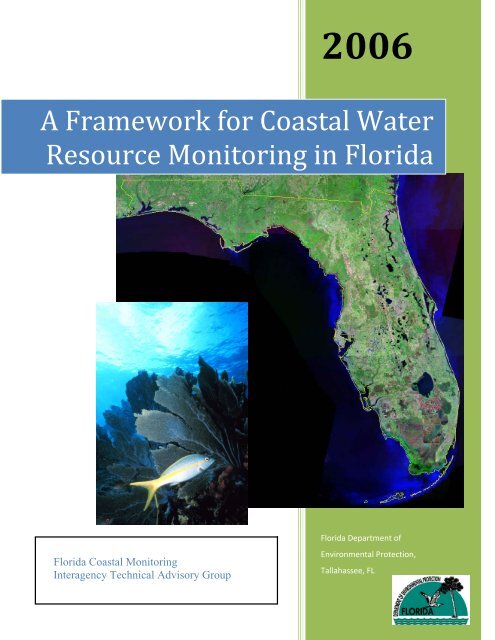
2006<br />
A <strong>Framework</strong> <strong>for</strong> <strong>Coastal</strong> <strong>Water</strong><br />
<strong>Resource</strong> <strong>Monitor<strong>in</strong>g</strong> <strong>in</strong> <strong>Florida</strong><br />
<strong>Florida</strong> <strong>Coastal</strong> <strong>Monitor<strong>in</strong>g</strong><br />
Interagency Technical Advisory Group<br />
<strong>Florida</strong> Department of<br />
Environmental Protection,<br />
Tallahassee, FL
<strong>Florida</strong> <strong>Coastal</strong> <strong>Monitor<strong>in</strong>g</strong> <strong>Framework</strong><br />
This page empty<br />
ii
<strong>Florida</strong> <strong>Coastal</strong> <strong>Monitor<strong>in</strong>g</strong> – Interagency Technical Advisory Group<br />
A <strong>Framework</strong> <strong>for</strong> <strong>Coastal</strong> <strong>Water</strong><br />
<strong>Resource</strong> <strong>Monitor<strong>in</strong>g</strong> <strong>in</strong> <strong>Florida</strong><br />
<strong>Florida</strong> <strong>Coastal</strong> <strong>Monitor<strong>in</strong>g</strong><br />
Technical Advisory Group<br />
Co‐Chair: Steven H. Wolfe <strong>Coastal</strong> and Aquatic Managed Areas, <strong>Florida</strong> Dept. of Environmental<br />
Protection<br />
Co‐Chair: Ellen McCarron <strong>Coastal</strong> and Aquatic Managed Areas, <strong>Florida</strong> Dept. of Environmental<br />
Protection<br />
Members:<br />
Bart Bibler <strong>Florida</strong> Dept. of Health<br />
Chris Brooks<br />
<strong>Florida</strong> Dept. of Agriculture and Consumer Services<br />
Paul Carlson, Ph.D. Fish & Wildlife Research Institute,<br />
<strong>Florida</strong> Fish & Wildlife Conservation Comm.<br />
Richard Dodge, Ph.D. Nova Southeastern University<br />
Samir Elmir <strong>Florida</strong> Dept. of Health<br />
Tim Fitzpatrick Central Laboratory, <strong>Florida</strong> Dept. of Environmental Protection<br />
Russ Frydenborg Central Laboratory, <strong>Florida</strong> Dept. of Environmental Protection<br />
Doug Gilbert <strong>Water</strong> <strong>Resource</strong>s Management, <strong>Florida</strong> Dept. of Environmental<br />
Protection<br />
David Heil <strong>Florida</strong> Dept. of Agriculture and Consumer Services<br />
Mark Luther, Ph.D. Mar<strong>in</strong>e Sciences Center, University of South<br />
<strong>Florida</strong><br />
John Macauley U.S. Environmental Protection Agency<br />
Gil McRae Fish & Wildlife Research Institute, <strong>Florida</strong> Fish & Wildlife Conservation<br />
Comm.<br />
Denise Miller Central Laboratory, <strong>Florida</strong><br />
Dept. of Environmental Protection,<br />
Andy Reich <strong>Florida</strong> Dept. of Health<br />
Mike Shirley, Ph.D. <strong>Coastal</strong> and Aquatic Managed Areas, <strong>Florida</strong> Dept. of Environmental Protection<br />
Jay Silvanima <strong>Water</strong> <strong>Resource</strong>s Management, <strong>Florida</strong> Dept. of Environmental Protection<br />
Gail Sloane <strong>Water</strong> <strong>Resource</strong>s Management,<br />
<strong>Florida</strong> Dept. of Environmental Protection<br />
Bob V<strong>in</strong>cent<br />
<strong>Florida</strong> Dept. of Health<br />
David Whit<strong>in</strong>g Central Laboratory, <strong>Florida</strong> Dept. of Environmental Protection<br />
Lori Wolfe Central Laboratory, <strong>Florida</strong> Dept. of Environmental Protection<br />
i
<strong>Florida</strong> <strong>Coastal</strong> <strong>Monitor<strong>in</strong>g</strong> <strong>Framework</strong><br />
Table of Contents<br />
<strong>Florida</strong> <strong>Coastal</strong> <strong>Monitor<strong>in</strong>g</strong> Technical Advisory Group .................................................................. i<br />
Table of Contents ................................................................................................................................ ii<br />
A. Executive Summary .......................................................................................................................1<br />
B. Introduction and Overview ...........................................................................................................2<br />
1) Statement of Intent................................................................................................................. 2<br />
2) Process description ................................................................................................................ 2<br />
3) Goals ...................................................................................................................................... 2<br />
4) Types of <strong>Monitor<strong>in</strong>g</strong> .............................................................................................................. 2<br />
5) Hurdles................................................................................................................................... 3<br />
6) Approach ............................................................................................................................... 3<br />
C. <strong>Coastal</strong> <strong>Monitor<strong>in</strong>g</strong> <strong>Framework</strong> ...................................................................................................3<br />
1) <strong>Coastal</strong> Tier 1: Broad-scale <strong>Monitor<strong>in</strong>g</strong> ................................................................................. 3<br />
a) Scale ................................................................................................................................... 3<br />
b) Timeframe ......................................................................................................................... 4<br />
c) Methods ............................................................................................................................. 4<br />
2) <strong>Coastal</strong> Tier 2: Local-scale <strong>Monitor<strong>in</strong>g</strong> and Assessment ....................................................... 4<br />
a) Scale ................................................................................................................................... 4<br />
b) Timeframe ......................................................................................................................... 5<br />
c) Methods ............................................................................................................................. 5<br />
d) Integration and coord<strong>in</strong>ation .............................................................................................. 6<br />
3) <strong>Coastal</strong> Tier 3: Site-specific <strong>Monitor<strong>in</strong>g</strong> ................................................................................ 6<br />
a) Scale ................................................................................................................................... 6<br />
b) Timeframe ......................................................................................................................... 6<br />
c) Methods ............................................................................................................................. 6<br />
D. Report<strong>in</strong>g .........................................................................................................................................7<br />
ii
<strong>Florida</strong> <strong>Coastal</strong> <strong>Monitor<strong>in</strong>g</strong> – Interagency Technical Advisory Group<br />
A <strong>Framework</strong> <strong>for</strong><br />
<strong>Coastal</strong> <strong>Water</strong>‐<strong>Resource</strong>s <strong>Monitor<strong>in</strong>g</strong><br />
<strong>in</strong> <strong>Florida</strong><br />
A. Executive Summary<br />
The <strong>Coastal</strong> <strong>Monitor<strong>in</strong>g</strong> <strong>Framework</strong> provides an organizational structure with<strong>in</strong> which to<br />
develop an <strong>in</strong>tegrated network <strong>for</strong> monitor<strong>in</strong>g <strong>Florida</strong>’s coastal waters, the <strong>Florida</strong><br />
<strong>Coastal</strong> <strong>Monitor<strong>in</strong>g</strong> Network. This framework describes a means to weave exist<strong>in</strong>g<br />
monitor<strong>in</strong>g ef<strong>for</strong>ts <strong>in</strong>to a cooperative monitor<strong>in</strong>g system. After any gaps <strong>in</strong> exist<strong>in</strong>g<br />
coverage are addressed, this system will provide <strong>in</strong><strong>for</strong>mation useful at local, regional, and<br />
national scales.<br />
This document describes the framework and the general goals and methods by which this<br />
<strong>in</strong>tegration can be achieved. This framework acknowledges that exist<strong>in</strong>g monitor<strong>in</strong>g<br />
ef<strong>for</strong>ts are generally designed and conducted to meet the needs of the entity fund<strong>in</strong>g the<br />
monitor<strong>in</strong>g, and that these needs will rema<strong>in</strong> the driv<strong>in</strong>g <strong>for</strong>ce beh<strong>in</strong>d the entity’s<br />
<strong>in</strong>volvement.<br />
Detailed implementation plans are needed to complete the guidance <strong>for</strong> establish<strong>in</strong>g this<br />
monitor<strong>in</strong>g network. Development of such plans is mov<strong>in</strong>g <strong>for</strong>ward under the auspices of<br />
the <strong>Florida</strong> <strong>Water</strong> <strong>Resource</strong>s <strong>Monitor<strong>in</strong>g</strong> Council. 1<br />
1) What and Why one monitors is driven by each agency’s mission and the<br />
<strong>in</strong><strong>for</strong>mation they need to assess how well they are accomplish<strong>in</strong>g that mission.<br />
2) Indicators (i.e., measures) of conditions are what one monitors. Indicators are<br />
chosen <strong>for</strong> their ability to tell one about some larger community or condition.<br />
Generally, one is <strong>in</strong>terested <strong>in</strong> what the <strong>in</strong>dicator’s status—or change <strong>in</strong> status —tells<br />
about the larger community that the <strong>in</strong>dicator represents, not necessarily about the<br />
<strong>in</strong>dicator itself.<br />
3) How the station locations <strong>for</strong> sampl<strong>in</strong>g (i.e., where one takes measurements of the<br />
<strong>in</strong>dicators) are determ<strong>in</strong>ed is driven by which <strong>in</strong>dicators are selected and the type of<br />
question that is be<strong>in</strong>g answered.<br />
1<br />
Completed December 2008. <strong>Monitor<strong>in</strong>g</strong>-Coord<strong>in</strong>ation Action Plan available at<br />
www.dep.state.fl.us/coastal/<strong>Water</strong><strong>Monitor<strong>in</strong>g</strong>Council/<br />
1
B. Introduction and Overview<br />
<strong>Florida</strong> <strong>Coastal</strong> <strong>Monitor<strong>in</strong>g</strong> <strong>Framework</strong><br />
1) Statement of Intent<br />
Develop<strong>in</strong>g a framework <strong>for</strong> a comprehensive coastal water resources monitor<strong>in</strong>g<br />
network is a Secretarial Strategic Priority of the Department of Environmental Protection.<br />
This document has been drafted <strong>in</strong> response to this high priority call <strong>for</strong> greater protection<br />
of <strong>Florida</strong>’s coastal and mar<strong>in</strong>e environments.<br />
<strong>Florida</strong>’s coasts and ocean waters are the basis <strong>for</strong> a significant portion of the state’s<br />
economy. Documented decl<strong>in</strong>es <strong>in</strong> coastal water quality and reduction <strong>in</strong> available<br />
resources such as <strong>in</strong> the sport and commercial fishery prompt FDEP to establish<br />
expanded monitor<strong>in</strong>g along <strong>Florida</strong>’s entire coastl<strong>in</strong>e and adjacent waters. The goal is to<br />
<strong>in</strong>corporate exist<strong>in</strong>g monitor<strong>in</strong>g ef<strong>for</strong>ts, where appropriate, as part of <strong>for</strong>m<strong>in</strong>g a new and<br />
more comprehensive ef<strong>for</strong>t and to <strong>in</strong>tegrate the coastal monitor<strong>in</strong>g with <strong>Florida</strong>’s<br />
freshwater Integrated <strong>Water</strong> <strong>Resource</strong> <strong>Monitor<strong>in</strong>g</strong> network.<br />
This framework document will be followed with a more detailed monitor<strong>in</strong>g plan lay<strong>in</strong>g<br />
out implementation details and strategies <strong>for</strong> each part of the <strong>Monitor<strong>in</strong>g</strong> <strong>Framework</strong>.<br />
2) Process description<br />
FDEP assembled a Technical Advisory Group (TAG) <strong>for</strong>med of representatives from<br />
state and federal agencies, and academia to provide <strong>in</strong>put on creat<strong>in</strong>g a framework around<br />
which to build the coastal monitor<strong>in</strong>g network.<br />
The state’s monitor<strong>in</strong>g needs were assessed as a function of the state agencies’ previously<br />
established Management Needs. A master list of these needs was compiled by the<br />
<strong>Florida</strong> Oceans and <strong>Coastal</strong> Council as part of their ef<strong>for</strong>t to prioritize research needs<br />
around <strong>Florida</strong>’s coasts. From this master list was extracted a subset of the Management<br />
Needs of the state agencies with coastal resource management responsibilities and those<br />
NGOs (non-governmental organizations) that are <strong>in</strong>volved <strong>in</strong> similar ef<strong>for</strong>ts. The TAG<br />
also considered the needs of cooperative programs such as those the state currently has<br />
with the U.S. Environmental Protection Agency (EPA) and the National Oceanic and<br />
Atmospheric Adm<strong>in</strong>istration (NOAA).<br />
3) Goals<br />
One goal established <strong>for</strong> the monitor<strong>in</strong>g framework was to implement a monitor<strong>in</strong>g<br />
network that, at a m<strong>in</strong>imum, provided <strong>in</strong><strong>for</strong>mation about both status (the condition of the<br />
resource at the time of sampl<strong>in</strong>g) and trend (the change <strong>in</strong> status over time). The network<br />
will be based on the referenced Management Needs of the member agencies and will<br />
provide an annual “Report Card” of easily understood <strong>in</strong><strong>for</strong>mation about the status and<br />
trends of coastal water resources <strong>for</strong> each of the “Report<strong>in</strong>g Areas” that are identified.<br />
4) Types of <strong>Monitor<strong>in</strong>g</strong><br />
<strong>Monitor<strong>in</strong>g</strong> can provide <strong>in</strong><strong>for</strong>mation on physical-chemical factors (<strong>for</strong> <strong>in</strong>stance, sal<strong>in</strong>ity,<br />
temperature, contam<strong>in</strong>ant concentrations), habitat (<strong>for</strong> <strong>in</strong>stance, the size of seagrass beds,<br />
changes <strong>in</strong> coral reef coverage), and measurements that reveal the overall condition of the<br />
ecosystem (<strong>for</strong> <strong>in</strong>stance, <strong>in</strong><strong>for</strong>mation on the relative health of a biological community).<br />
2
<strong>Florida</strong> <strong>Coastal</strong> <strong>Monitor<strong>in</strong>g</strong> – Interagency Technical Advisory Group<br />
5) Hurdles<br />
Different state and federal agencies operate with different goals and duties. It is not<br />
reasonable to expect them to all have the same monitor<strong>in</strong>g needs or to want to change<br />
their ongo<strong>in</strong>g monitor<strong>in</strong>g unless there is benefit to their programs.<br />
6) Approach<br />
An overall monitor<strong>in</strong>g structure was developed that will be <strong>in</strong>itially populated with<br />
monitor<strong>in</strong>g that is useful by multiple agencies. The framework will be populated with<br />
exist<strong>in</strong>g monitor<strong>in</strong>g programs and fund<strong>in</strong>g will be sought to fill <strong>in</strong> where present<br />
programs leave gaps <strong>in</strong> the network coverage. To the extent possible, present programs<br />
will be expanded to fill gaps rather than new programs be<strong>in</strong>g <strong>in</strong>itiated. The <strong>Florida</strong> <strong>Water</strong><br />
<strong>Resource</strong>s <strong>Monitor<strong>in</strong>g</strong> Council will provide the vehicle by which agency participation <strong>in</strong><br />
the monitor<strong>in</strong>g network is coord<strong>in</strong>ated.<br />
The monitor<strong>in</strong>g structure allows other agencies to add their agency-specific monitor<strong>in</strong>g<br />
programs to the network if they operate--or can be adjusted to operate--<strong>in</strong> a manner that<br />
allows them to be <strong>in</strong>corporated <strong>in</strong>to the report card program. This could require changes<br />
<strong>in</strong> their QA/QC procedures or sampl<strong>in</strong>g methodology to provide necessary compatibility.<br />
C. <strong>Coastal</strong> <strong>Monitor<strong>in</strong>g</strong> <strong>Framework</strong><br />
1) <strong>Coastal</strong> Tier 1: Broad-scale <strong>Monitor<strong>in</strong>g</strong><br />
a) Scale<br />
Tier 1 monitor<strong>in</strong>g is <strong>in</strong>tended to provide <strong>in</strong><strong>for</strong>mation regard<strong>in</strong>g the overall status and<br />
trends <strong>for</strong> areas rang<strong>in</strong>g from statewide to regional. For <strong>in</strong>stance, this monitor<strong>in</strong>g will<br />
allow one to know what the status or trend of conditions are “on average” <strong>for</strong> the state<br />
as a whole and to determ<strong>in</strong>e if those conditions differ among regions, <strong>for</strong> <strong>in</strong>stance<br />
between the <strong>Florida</strong> panhandle and southeast <strong>Florida</strong>. Each region (or the statewide<br />
monitor<strong>in</strong>g) will constitute a report<strong>in</strong>g area because the reported <strong>in</strong><strong>for</strong>mation will<br />
generally describe the area as a whole, not places with<strong>in</strong> the area. This monitor<strong>in</strong>g<br />
generally will not provide useful <strong>in</strong><strong>for</strong>mation about status or trends at particular<br />
locations with<strong>in</strong> the report<strong>in</strong>g area, with the exception of monitor<strong>in</strong>g that—<strong>for</strong><br />
example—<strong>in</strong>corporates biological assessment methods. Some methods or application<br />
of methods, such as bioassessment methods, may provide <strong>in</strong><strong>for</strong>mation that is useable<br />
<strong>in</strong> multiple Tiers.<br />
The report<strong>in</strong>g areas <strong>for</strong> Tier 1 will separate the coastal waters <strong>in</strong>to two major types:<br />
those waters <strong>for</strong> which state management actions can be expected to readily affect the<br />
exist<strong>in</strong>g conditions of that area (e.g., water quality status and trends), and those <strong>for</strong><br />
which conditions may depend substantially on factors beyond state control. For<br />
water-quality parameters, this would generally separate <strong>in</strong>tracoastal, bay, estuary, and<br />
nearshore waters (with<strong>in</strong> approximately 1-3 miles of the coastl<strong>in</strong>e, depend<strong>in</strong>g on the<br />
part of the state) from offshore waters (those where water quality is dom<strong>in</strong>ated by<br />
<strong>in</strong>fluences outside state control). For non-water-quality parameters (e.g., fishery or<br />
3
<strong>Florida</strong> <strong>Coastal</strong> <strong>Monitor<strong>in</strong>g</strong> <strong>Framework</strong><br />
habitat measures), where the <strong>in</strong>fluence of human activities extends farther offshore,<br />
this separation may not be appropriate with<strong>in</strong> waters of the state.<br />
b) Timeframe<br />
Tier 1 monitor<strong>in</strong>g will provide annual statements of status and trends at its <strong>in</strong>tended<br />
scale. Some monitor<strong>in</strong>g may be concentrated on sampl<strong>in</strong>g occurr<strong>in</strong>g once per year<br />
dur<strong>in</strong>g a period deemed to be that <strong>in</strong> which the ecosystem is most stressed or which<br />
otherwise provides the best <strong>in</strong><strong>for</strong>mation on system health.<br />
Additional Tier 1 <strong>in</strong><strong>for</strong>mation may be generated by comb<strong>in</strong><strong>in</strong>g Tier 2 data from a<br />
region or the entire state once a Tier 2 monitor<strong>in</strong>g program is fully established <strong>for</strong> that<br />
report<strong>in</strong>g area. This annual report may <strong>in</strong>clude statements about status and trends at<br />
seasonal or other shorter <strong>in</strong>tervals.<br />
c) Methods<br />
The sampl<strong>in</strong>g methods used will be appropriate <strong>for</strong> the measures that are selected <strong>for</strong><br />
this Tier. Measures will be selected to help address the Management Needs of the<br />
agencies as submitted to the <strong>Florida</strong> Oceans and <strong>Coastal</strong> <strong>Resource</strong>s Council and<br />
generally fall <strong>in</strong>to one of more categories of physical, chemical and/or biological<br />
types.<br />
Methods will be selected which provide the most cost-effective collection of the<br />
necessary <strong>in</strong><strong>for</strong>mation. For Tier 1 assessments, probabilistic, stratified-random<br />
sampl<strong>in</strong>g methods similar to those used by U.S. EPA’s EMAP, FWC’s IMAP, and<br />
DEP’s freshwater IWRM Tier 1 monitor<strong>in</strong>g program may be appropriate <strong>in</strong> many<br />
cases <strong>for</strong> assess<strong>in</strong>g status. Fixed station locations may be necessary <strong>in</strong> addition to<br />
help assess trend.<br />
Note: Intensive Studies<br />
The <strong>in</strong>tensive studies described below <strong>for</strong> Tier 2 will also be used to optimize<br />
placement of Tier 1 fixed trend stations.<br />
2) <strong>Coastal</strong> Tier 2: Local-scale <strong>Monitor<strong>in</strong>g</strong> and Assessment<br />
a) Scale<br />
Tier 2 monitor<strong>in</strong>g is <strong>in</strong>tended to provide <strong>in</strong><strong>for</strong>mation regard<strong>in</strong>g the status and trends<br />
<strong>for</strong> areas that are relatively small as compared to Tier 1. <strong>Monitor<strong>in</strong>g</strong> at this scale will<br />
provide <strong>in</strong><strong>for</strong>mation about the range of conditions with<strong>in</strong> the monitored area as well<br />
as the overall condition.<br />
For <strong>in</strong>stance, Tier 2 monitor<strong>in</strong>g will produce <strong>in</strong><strong>for</strong>mation about status and trends of<br />
waters with<strong>in</strong> a s<strong>in</strong>gle estuary, such as describ<strong>in</strong>g conditions <strong>in</strong> different functional<br />
parts of the estuary. The estuary or other area be<strong>in</strong>g monitored will constitute a<br />
report<strong>in</strong>g area and monitor<strong>in</strong>g will be expected to provide useful <strong>in</strong><strong>for</strong>mation about<br />
status or trends at particular locations or regions with<strong>in</strong> the report<strong>in</strong>g area. The goal<br />
of Tier 2 monitor<strong>in</strong>g is enabl<strong>in</strong>g the assessment of the health of the different parts of<br />
4
<strong>Florida</strong> <strong>Coastal</strong> <strong>Monitor<strong>in</strong>g</strong> – Interagency Technical Advisory Group<br />
the ecosystem with<strong>in</strong> the report<strong>in</strong>g area. These parts can be aggregated to make<br />
statements about the entire estuary/area, similar to the manner <strong>in</strong> which specific<br />
reaches with<strong>in</strong> a watershed (WBIDS) are agglomerated <strong>in</strong> the 305b reports.<br />
b) Timeframe<br />
Tier 2 monitor<strong>in</strong>g will provide annual statements of status and trends <strong>for</strong> the areas<br />
assessed plus as many regions with<strong>in</strong> the area as are necessary to provide <strong>in</strong><strong>for</strong>mation<br />
regard<strong>in</strong>g changes <strong>in</strong> system health of the report<strong>in</strong>g unit as a whole. This annual<br />
report may <strong>in</strong>clude statements about status and trends at seasonal or other shorter<br />
<strong>in</strong>tervals.<br />
c) Methods<br />
The sampl<strong>in</strong>g methods used will be appropriate <strong>for</strong> the measures that are selected <strong>for</strong><br />
this Tier. Measures will be selected to help address the Management Needs of the<br />
agencies as submitted to the <strong>Florida</strong> Oceans and <strong>Coastal</strong> <strong>Resource</strong>s Council. Tier 2<br />
monitor<strong>in</strong>g will take place <strong>in</strong> two phases:<br />
1. Intensive study:<br />
The first year of monitor<strong>in</strong>g <strong>in</strong> an area (<strong>for</strong> <strong>in</strong>stance, a bay, estuary, or coastal<br />
segment) will be with <strong>in</strong>tensive sampl<strong>in</strong>g regimes <strong>in</strong>tended to provide an<br />
understand<strong>in</strong>g of the overall system of habitats and physical-chemical conditions<br />
found with<strong>in</strong> the area. For those areas where the <strong>in</strong><strong>for</strong>mation collected dur<strong>in</strong>g the<br />
Intensive Study is already available, this phase can be skipped and one can move<br />
on to the description below under “Long term”.<br />
A comb<strong>in</strong>ation of sampl<strong>in</strong>g from mobile vessels and from fixed monitor<strong>in</strong>g sites<br />
(established <strong>in</strong> conjunction with the Integrated Ocean Observ<strong>in</strong>g Systems) will be<br />
per<strong>for</strong>med to allow creation of circulation (i.e., hydrodynamic) models <strong>in</strong> those<br />
areas where suitable ones are not already available. It is the <strong>in</strong>tent to eventually<br />
also generate water quality models <strong>for</strong> these areas (models describ<strong>in</strong>g and<br />
<strong>for</strong>ecast<strong>in</strong>g the changes <strong>in</strong> physical-chemical parameters as water flows through<br />
the system).<br />
At the f<strong>in</strong>ish of this first year, the <strong>in</strong><strong>for</strong>mation ga<strong>in</strong>ed will be used to identify the<br />
best locations <strong>for</strong> fixed monitor<strong>in</strong>g sites <strong>for</strong> Tier 1 trend monitor<strong>in</strong>g and to design<br />
a long-term Tier 2 monitor<strong>in</strong>g program optimized <strong>for</strong> that area. Excess fixed<br />
monitor<strong>in</strong>g stations (i.e., those not stay<strong>in</strong>g beh<strong>in</strong>d as part of the permanent fixed<br />
station network) and sampl<strong>in</strong>g equipment will then be transferred to a new area<br />
<strong>for</strong> <strong>in</strong>tensive study.<br />
2. Long-term:<br />
Initially, exist<strong>in</strong>g monitor<strong>in</strong>g programs will be used to provide Tier 2 monitor<strong>in</strong>g.<br />
Once an area has received a year of Intensive Study, a monitor<strong>in</strong>g program will be<br />
designed to provide the most cost-effective monitor<strong>in</strong>g of status and trends <strong>for</strong><br />
that area.<br />
5
<strong>Florida</strong> <strong>Coastal</strong> <strong>Monitor<strong>in</strong>g</strong> <strong>Framework</strong><br />
d) Integration and coord<strong>in</strong>ation<br />
Tier 2 monitor<strong>in</strong>g is <strong>in</strong>tended to be both <strong>in</strong>tegrated with <strong>Florida</strong>’s freshwater<br />
Integrated <strong>Water</strong> <strong>Resource</strong> <strong>Monitor<strong>in</strong>g</strong> network (IWRM) and coord<strong>in</strong>ated with the<br />
Impaired <strong>Water</strong>s Program.<br />
The coastal Tier 2 sampl<strong>in</strong>g times and locations will be, to the extent possible,<br />
complementary to the IWRM sampl<strong>in</strong>g schedule to maximize our understand<strong>in</strong>g of<br />
the effects of freshwater flow on the coastal receiv<strong>in</strong>g waters and to help identify<br />
cause-effect relationships between <strong>in</strong>flow<strong>in</strong>g water quality and the receiv<strong>in</strong>g water’s<br />
biological assemblages.<br />
The coastal Tier 2 sampl<strong>in</strong>g will also be coord<strong>in</strong>ated with the 5-yr rotat<strong>in</strong>g-bas<strong>in</strong><br />
schedule of the Impaired <strong>Water</strong>s Program and its ef<strong>for</strong>ts to identify if water bodies are<br />
impaired and to develop Total Maximum Daily Loads (TMDLs) <strong>for</strong> those that are.<br />
The one-year <strong>in</strong>tensive surveys of the coastal monitor<strong>in</strong>g program will be coord<strong>in</strong>ated<br />
to co<strong>in</strong>cide with the year of sampl<strong>in</strong>g and data collection that takes place dur<strong>in</strong>g the<br />
second year of the Impaired <strong>Water</strong>s Program’s five-year rotat<strong>in</strong>g schedule.<br />
3) <strong>Coastal</strong> Tier 3: Site-specific <strong>Monitor<strong>in</strong>g</strong><br />
Tier 3 monitor<strong>in</strong>g is <strong>in</strong>tended to be that which is per<strong>for</strong>med to address site-specific issues,<br />
<strong>in</strong>clud<strong>in</strong>g permit-related monitor<strong>in</strong>g, identification of cause-effect relationships, sources<br />
of impacts, and similar studies, <strong>in</strong>clud<strong>in</strong>g assessment of anthropogenic <strong>in</strong>fluences.<br />
In<strong>for</strong>mation gathered <strong>in</strong> Tier 3 monitor<strong>in</strong>g ef<strong>for</strong>ts that occur with<strong>in</strong> a Tier 2 report<strong>in</strong>g unit<br />
will be <strong>in</strong>cluded among the data analyzed <strong>in</strong> creat<strong>in</strong>g the report card <strong>for</strong> that area.<br />
a) Scale<br />
Determ<strong>in</strong>ed by needs of agency carry<strong>in</strong>g out monitor<strong>in</strong>g.<br />
b) Timeframe<br />
Determ<strong>in</strong>ed by needs of agency carry<strong>in</strong>g out monitor<strong>in</strong>g.<br />
c) Methods<br />
Determ<strong>in</strong>ed by needs of agency carry<strong>in</strong>g out monitor<strong>in</strong>g.<br />
6
<strong>Florida</strong> <strong>Coastal</strong> <strong>Monitor<strong>in</strong>g</strong> – Interagency Technical Advisory Group<br />
D. Report<strong>in</strong>g<br />
Annual Report Cards will present easily-<strong>in</strong>terpreted <strong>in</strong><strong>for</strong>mation about the status and<br />
trends of the Report<strong>in</strong>g Area. Components of the <strong>Coastal</strong> and Mar<strong>in</strong>e <strong>Resource</strong>s Annual<br />
Report Card could <strong>in</strong>clude:<br />
• “Landscape” Report - a resource characterization/atlas, <strong>in</strong>clud<strong>in</strong>g but not limited to:<br />
o the latest <strong>in</strong>fo on population densities along coastal areas<br />
o land uses<br />
o mapped water classifications<br />
o coastal land ownership <strong>in</strong><strong>for</strong>mation<br />
o the Landscape Development Intensity Index values<br />
o % change from last annual report <strong>in</strong> above categories<br />
• Public Health Report – specific measurements of <strong>in</strong>terest to public health<br />
o Beach advisory data<br />
o Shellfish harvest<strong>in</strong>g area data<br />
o Fish consumption advisory data<br />
o Fish kill data<br />
o Red tide/harmful algal bloom data<br />
o Oil plume data<br />
• Targeted Species and Habitats Report – <strong>for</strong> species or resources of special concern<br />
o Manatee data<br />
o Commercial fisheries data<br />
o Endangered species data<br />
o Seagrass data<br />
o Corals data<br />
o <strong>Coastal</strong> wetlands data<br />
o Sea turtles<br />
o Mercury data<br />
o Oil plume data<br />
• <strong>Water</strong> Quality Report<br />
o Physical/Chemical monitor<strong>in</strong>g data - status & trends (nutrient levels,<br />
dissolved oxygen, etc.)<br />
• Ecological Indicators Report<br />
o <strong>Coastal</strong>/Mar<strong>in</strong>e Indexes of Biotic Integrity –this will require research to<br />
develop but will be an important element of ecosystem management. Once<br />
developed, these <strong>in</strong>dexes will be added to the develop<strong>in</strong>g coastal water<br />
quality monitor<strong>in</strong>g network.<br />
• <strong>Coastal</strong>/Mar<strong>in</strong>e Environmental Issues Report<br />
o TMDL list<strong>in</strong>gs & other <strong>in</strong>fo<br />
o Exotics/Invasives data<br />
o Beach erosion/renourishment data<br />
o Hurricane effects<br />
o Sediment contam<strong>in</strong>ation<br />
o Mar<strong>in</strong>e debris<br />
o Dredge & fill<br />
o Sea level rise<br />
7