IC14. Geology of the Baraboo District, Wisconsin: A description and ...
IC14. Geology of the Baraboo District, Wisconsin: A description and ...
IC14. Geology of the Baraboo District, Wisconsin: A description and ...

Create successful ePaper yourself
Turn your PDF publications into a flip-book with our unique Google optimized e-Paper software.
GEOLOGY OF THE BAMBOO DISTRICT, WISCONSIN<br />
A Description <strong>and</strong> Field Guide Incorporating<br />
Structural Analysis <strong>of</strong> <strong>the</strong> Precambrian Rocks<br />
<strong>and</strong><br />
Sedimentologic Studies <strong>of</strong> <strong>the</strong> Paleozoic Strata<br />
I. W. D. Dalziel<br />
Columbia University, New York<br />
<strong>and</strong><br />
R. H. Dott, Jr.<br />
The University <strong>of</strong> <strong>Wisconsin</strong>, Madison<br />
With Summaries <strong>of</strong> <strong>the</strong><br />
GLACIAL GEOLOGY<br />
R. F. Black<br />
University <strong>of</strong> Connecticut<br />
<strong>and</strong><br />
PUNT ECOWGY OF THE BAMBOO HILLS<br />
J. H. Zimmerman<br />
University <strong>of</strong> <strong>Wisconsin</strong> Arboretum, Madison<br />
Information Circular<br />
Number 14<br />
Available from <strong>the</strong> Geological <strong>and</strong> Natural History Survey, 1815 University<br />
Avenue, Madison, <strong>Wisconsin</strong>, 53706. Price $8.00
GEOIQGY OF THE BARABOO DISTRICT. WISCONSIN<br />
Table <strong>of</strong> Contents<br />
FOREWORD ........................................................<br />
INTRODUCTION (Dalziel <strong>and</strong> Dott) ..................................<br />
Regional Geologic Setting ...................................<br />
History <strong>of</strong> Research .........................................<br />
Economic <strong>Geology</strong> ............................................<br />
PRECAMBRIAN GEOIQGY ..............................................<br />
..............<br />
Relationships <strong>and</strong> Ages <strong>of</strong> <strong>the</strong> Precambrian Rocks<br />
(Dalziel <strong>and</strong> Dott)<br />
Petrology (Dalziel) ........................................<br />
Sedimentology <strong>of</strong> <strong>the</strong> <strong>Baraboo</strong> Quartzite (Dott) ...............<br />
Structural History (Dalziel) ................................<br />
Structural Geometry (Dalziel)<br />
Genesis <strong>of</strong> <strong>the</strong> <strong>Baraboo</strong> Syncline (Dalziel)<br />
PALEOZOIC GEOIQGY (Dott)<br />
..............................<br />
...................<br />
.........................................<br />
Stratigraphic Summary ........................................<br />
....................<br />
Cambrian Sedimentology <strong>and</strong> Paleogeography<br />
Importance <strong>of</strong> Rare Events ....................................<br />
GLACIAL GEOIQGY (Black) ..........................................<br />
Introduction .................................................<br />
Terminal moraine <strong>of</strong> Late Woodfordian (Cary) Age<br />
Features Associated with <strong>the</strong> Terminal Moraine<br />
Evidence <strong>of</strong> Greater Deployment <strong>of</strong> <strong>the</strong> Ice<br />
..............<br />
................<br />
....................<br />
Synopsis <strong>of</strong> Glacial History <strong>and</strong> Evolution <strong>of</strong> Some Major L<strong>and</strong>-<br />
forms ...................................................<br />
....................<br />
PLANT ECOLQGY OF THE BARABOO HILLS (Zimmerman)<br />
Geologic Influences on <strong>the</strong> Biota .............................<br />
Ecologic Diversity ...........................................<br />
Human Occupation .............................................<br />
LIST OF REFERENCES ................................................<br />
FIELD TRIP ROAD LOG (Dalziel <strong>and</strong> Dott) ...........................<br />
APPENDIX .. SUPPLENENTARY STOPS (Dalziel <strong>and</strong> Dott) ...............<br />
Page<br />
1
ILLUSTRATIONS<br />
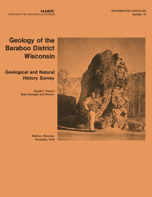
Cover. Stanley A. Tyler by Van Hise Rock (STOP 2).<br />
Figure 1. Regional tectonic <strong>and</strong> index map <strong>of</strong> <strong>the</strong> Great Lakes Region ..<br />
2. Orientation <strong>of</strong> cross stratification in <strong>the</strong> <strong>Baraboo</strong> Quartzite<br />
3. Cross section <strong>of</strong> <strong>the</strong> <strong>Baraboo</strong> syncline .....................<br />
4. Relations <strong>of</strong> main-phase mesoscopic structures ..............<br />
5. Photomicrographs <strong>of</strong> cleavages in <strong>the</strong> <strong>Baraboo</strong> Quartzite .....<br />
6. Mechanical significance <strong>of</strong> main-phase cleavage accord-<br />
ing to <strong>the</strong> isc cons in school" <strong>of</strong> structural geologists .<br />
7. Suggested mode <strong>of</strong> origin <strong>of</strong> <strong>the</strong> longrain <strong>and</strong> <strong>the</strong> late main-<br />
phase crenulations <strong>and</strong> cleavage (SIL) ..................<br />
8. Dynamic (stress) analysis <strong>of</strong> <strong>the</strong> <strong>Baraboo</strong> syncline .........<br />
9. Photographs <strong>of</strong> some typical Cambrian sediments .............<br />
10. Types <strong>of</strong> cross stratification recognized in this study .....<br />
11. Thickness changes within one set <strong>of</strong> trough cross beds that<br />
produces opposite plunge directions <strong>of</strong> trough axes .....<br />
12. Cross bedding orientations north <strong>of</strong> <strong>the</strong> <strong>Baraboo</strong> Ranges .....<br />
13. Hypo<strong>the</strong>tical paleogeographic map <strong>of</strong> <strong>the</strong> <strong>Baraboo</strong> isl<strong>and</strong>s in<br />
Late Cambrian (Franconian) time ........................<br />
14. Photographs <strong>of</strong> prominent glacial features - Late Woodfordian<br />
(Cary) end moraine <strong>and</strong> Devils Lake ....................<br />
15. Topographic map <strong>of</strong> East Bluff, Devils Lake ................<br />
16. Sketch map <strong>of</strong> pothole area, East Bluff, Devils Lake . . . . ....<br />
17. Hypo<strong>the</strong>tical preglacial <strong>and</strong> present drainage maps <strong>of</strong> <strong>the</strong><br />
<strong>Baraboo</strong> region ........................................<br />
18. Route <strong>and</strong> location map for field trip road log .............<br />
19. Bedding/cleavage relations, west side <strong>of</strong> Lower Narrows<br />
(STOP 1 <strong>and</strong> Supplementary Stop A) .....................<br />
20. Stereoplot for Precambrian rocks at Lower Narrows<br />
(STOP 1 <strong>and</strong> Supplementary Stop A) ....................<br />
21. Geologic map <strong>of</strong> Upper Narrows (Rock Springs) area<br />
(STOPS 2 <strong>and</strong> 3; Supplementary Stops B <strong>and</strong> C) ..........<br />
Page
Figure 22 . Cross section <strong>of</strong> Upper Narrows <strong>of</strong> <strong>Baraboo</strong> River ......... 101<br />
.<br />
.........<br />
23 Sketch <strong>of</strong> structures in Van Hise Rock (STOP 2) 103<br />
24 . Stereoplot for <strong>Baraboo</strong> Quartzite. west side <strong>of</strong><br />
Upper Narrows (STOP 2) ............................. 103<br />
25 . Stereoplot for <strong>Baraboo</strong> Quartzite in <strong>the</strong> West Jlange<br />
(STOP 4) ........................................... 108<br />
26 . Geologic map <strong>of</strong> Devils Lake-Parfreys Glen area<br />
(STOPS 5 <strong>and</strong> 11; Supplementary Stops F <strong>and</strong> I) ....... 113<br />
27 . Sketches <strong>of</strong> field structural relations at <strong>the</strong> nor<strong>the</strong>ast<br />
corner <strong>of</strong> Devils Lake (STOP 5) ..................... 114<br />
28 . Stereoplot for <strong>Baraboo</strong> Quartzite <strong>of</strong> Devils Lake area<br />
(STOP 5) ........................................... 115<br />
29 . Structure in <strong>the</strong> phyllitic zone <strong>of</strong> <strong>the</strong> <strong>Baraboo</strong> Quartzite.<br />
Skillet Creek (STOP 6) ............................. 121<br />
30 . Stereoplot for <strong>Baraboo</strong> Quartzite <strong>of</strong> <strong>the</strong> Skillet Creek<br />
area (STOP 6) ...................................... 123<br />
31 . Geologic map <strong>of</strong> <strong>the</strong> La Rue Quarry area (STOP 7) ........ 125<br />
32 . Sketches <strong>of</strong> Cambrian-Precambrian unconfomity in<br />
La Rue Quarry (STOP 7) ............................. 126<br />
33 . Sketches <strong>of</strong> structural relations in <strong>Baraboo</strong> Quartzite<br />
at La Rue Quarry (STOP 7) .......................... 127<br />
34 . Stereoplot for <strong>Baraboo</strong> Quartzite at La Rue Quarry<br />
(STOP 7) ........................................... 127<br />
35 . Geologic map <strong>of</strong> <strong>the</strong> Hemlock Draw-Lel<strong>and</strong> area (STOPS<br />
8 <strong>and</strong> 9) ........................................... 132<br />
36 . Festoon cross bedding cut by Scolithus tubes. Hemlock<br />
Draw (STOP 8) ...................................... 133<br />
37 . Geologic map <strong>of</strong> Denzer area showing anomalous structures<br />
in Paleozoic strata (STOP 10) ...................... 137<br />
38 . Disharmonic folds in Oneota Formation (STOP 10) ......... 138<br />
39 . Faulted fold in Jordan <strong>and</strong> Oneota Formations (STOP 10) .. 138<br />
40 . Sketch <strong>of</strong> east face <strong>of</strong> Parfreys Glen (STOP 11) .......... 142<br />
41 . Bedding/cleavage relations on east side <strong>of</strong> Upper Narrows<br />
(Supplementary Stop B) ............................. 146<br />
42 . Stereoplot for <strong>Baraboo</strong> Quartzite. east side Upper Narrows<br />
(Supplementary Stop B) .............................. 146
Figure 43.<br />
44.<br />
45.<br />
46.<br />
47.<br />
48.<br />
Map <strong>of</strong> flagstone quarry in Rock Springs showing large-<br />
scale trough cross bedding (Supplementary STOP C) .... 148<br />
Sketch <strong>of</strong> face <strong>of</strong> flagstone quarry (Supplementary<br />
STQP C) .............................................. 149<br />
Stereoplot for <strong>Baraboo</strong> Quartzite at Narrows Creek<br />
(Supplementary Stop D) ............................... 150<br />
Secondary folds <strong>and</strong> cleavage in Diamond Hill area<br />
(Supplementary Stop E) ............................... 151<br />
Stereoplot for <strong>Baraboo</strong> Quartzite <strong>of</strong> Diamond Hill area<br />
(Supplementary Stop E) ............................... 152<br />
Structural relations in phyllitic zone <strong>of</strong> <strong>Baraboo</strong><br />
Quartzite at <strong>the</strong> northwest entrance to Devils Lake<br />
State Park (Supplementary Stop F) 153<br />
....................<br />
Structural relations in phyllitic zone <strong>of</strong> <strong>Baraboo</strong><br />
Quartzite at U.S. Highway 12 roadcut (Supplementary<br />
Stop G) .............................................. 155<br />
Stereoplot for <strong>Baraboo</strong> Quartzite at U.S. Highway 12<br />
locality (Supplementary Stop G) ...................... 156<br />
Secondary phase structures in phyllitic zone <strong>of</strong> <strong>the</strong><br />
<strong>Baraboo</strong> Quartzite near Happy Hill School<br />
(Supplementary Stop H) 157<br />
...............................<br />
Stereoplot for <strong>Baraboo</strong> Quartzite, western part <strong>of</strong> <strong>the</strong><br />
South Range (near SlDP 8 <strong>and</strong> Supplementary Stop H) 157<br />
Stereoplot for Precambrian rocks in <strong>the</strong> eastern part<br />
<strong>of</strong> <strong>the</strong> South Range (Supplementary Stops J, K, <strong>and</strong> L) . 159<br />
Tension gashes <strong>and</strong> cleavage in quartzite near east end<br />
<strong>of</strong> South Range (Supplementary Stop L) ................ 161<br />
Stereoplot for <strong>Baraboo</strong> Quartzite at Eastern Closure<br />
<strong>of</strong> <strong>the</strong> syncline (Supplementary Stop M) ............... 162<br />
...
(Plates are in pocket)<br />
Plate I. Geologic map <strong>of</strong> <strong>the</strong> <strong>Baraboo</strong> region.<br />
11. Cross sections <strong>of</strong> <strong>the</strong> <strong>Baraboo</strong> region.<br />
111. General structure map <strong>of</strong> Precambrian rocks <strong>of</strong> <strong>the</strong> <strong>Baraboo</strong><br />
syncline.<br />
IV. Minorstructures map <strong>of</strong> Precambrian rocks <strong>of</strong> <strong>the</strong> <strong>Baraboo</strong><br />
syncline.<br />
V. Structural data (stereoplots) for Precambrian rocks.<br />
VI. Conglomerate-size data for lower Paleozoic rocks <strong>of</strong> <strong>the</strong><br />
<strong>Baraboo</strong> region.<br />
VII. Cross bedding orientation data for <strong>the</strong> lower Paleozoic<br />
strata <strong>of</strong> <strong>the</strong> <strong>Baraboo</strong> region.<br />
TABLES<br />
Page<br />
Table 1. Precambrian stratigraphy <strong>of</strong> <strong>the</strong> <strong>Baraboo</strong> <strong>District</strong> ......... 3<br />
2. Rubidium-strontium <strong>and</strong> potassium argon data used in<br />
age calculations ..................................... 9<br />
3. Mesoscopic structures in <strong>the</strong> <strong>Baraboo</strong> Quartzite (summary).. 18<br />
4. Comparison <strong>of</strong> terminology used for mesoscopic structures . 2 0<br />
5. Paleozoic stratigraphy <strong>of</strong> <strong>the</strong> <strong>Baraboo</strong> region ............. 40<br />
6. Major silicate minerals <strong>of</strong> s<strong>and</strong>stones <strong>of</strong> <strong>the</strong> <strong>Baraboo</strong> region 43<br />
7. Principal heavy accessory minerals <strong>of</strong> s<strong>and</strong>stones <strong>of</strong> <strong>the</strong><br />
<strong>Baraboo</strong> region ...................................... 44<br />
8. Size-distribution data for Paleozoic s<strong>and</strong>stones <strong>of</strong> <strong>the</strong><br />
<strong>Baraboo</strong> region ...................................... 45<br />
9. Estimates <strong>of</strong> Cambrian dynamic wave parameters from<br />
boulder dimensions .................................. 5 6<br />
10. Regional lower Paleozoic cross stratification orientation<br />
data for western <strong>Wisconsin</strong> <strong>and</strong> nor<strong>the</strong>rn Illinois ..... 60<br />
11. Summary <strong>of</strong> natural plant communities <strong>of</strong> <strong>the</strong> <strong>Baraboo</strong> hills 79<br />
12. Sedimentary data for Supplementary Stop C at Rock Springs<br />
(Flagstone quarry in Galesville S<strong>and</strong>stone) ........... 149<br />
13. Key to stereoplot symbols for field trip localities ...... 164
FOREWORD<br />
For more than half a century, <strong>the</strong> <strong>Baraboo</strong> district has been an<br />
unusually important geological laboratory that has contributed to <strong>the</strong><br />
education <strong>of</strong> countless thous<strong>and</strong>s <strong>of</strong> students representing at least 100<br />
different colleges. The list <strong>of</strong> teachers <strong>and</strong> research workers who have<br />
been drawn to <strong>the</strong> <strong>Baraboo</strong> hills reads like a "who's who" <strong>of</strong> American<br />
geology. Yet, in spite <strong>of</strong> all <strong>of</strong> <strong>the</strong> long-st<strong>and</strong>ing interest in <strong>the</strong><br />
region, a satisfactory modern geologic map <strong>and</strong> detailed syn<strong>the</strong>sis <strong>of</strong><br />
<strong>Baraboo</strong> geology has not been available. It was to rectify this omission<br />
that this study was undertaken under <strong>the</strong> direction <strong>of</strong> <strong>the</strong> <strong>Wisconsin</strong><br />
Geological <strong>and</strong> Natural History Survey, <strong>the</strong> Univ. <strong>of</strong> <strong>Wisconsin</strong>-Extension.<br />
We hope to have presented new data <strong>and</strong> ideas that will stimulate <strong>the</strong><br />
fur<strong>the</strong>r interest <strong>of</strong> both students <strong>and</strong> pr<strong>of</strong>essional geologists.<br />
At <strong>the</strong> same time that this guide to <strong>the</strong> geology <strong>of</strong> <strong>the</strong> <strong>Baraboo</strong> dis-<br />
trict is presented, we wish to voice a strong plea to preserve <strong>the</strong> price-<br />
less key outcrops from <strong>the</strong> onslaught <strong>of</strong> geology hammers in <strong>the</strong> h<strong>and</strong>s <strong>of</strong><br />
eager but unthinking visitors. Rock outcrops, too, sometimes require<br />
conservation-mindedness lest <strong>the</strong> hills be peneplaned by none o<strong>the</strong>r than<br />
geologists! Ironically, -nothing is to be gained by hammering at such<br />
localities, for <strong>the</strong> structural relationships are best seen on wea<strong>the</strong>red<br />
surf aces.<br />
We are most grateful to George F. Hanson, State Geologist, <strong>and</strong> to<br />
Meredith E. Ostrom, Associate State Geologist, for <strong>the</strong>ir continual interest<br />
throughout <strong>the</strong> study <strong>and</strong> for <strong>the</strong>ir critical readings <strong>of</strong> <strong>the</strong> manuscript.<br />
Some financial support in addition to that <strong>of</strong> <strong>the</strong> Survey was provided by<br />
<strong>the</strong> <strong>Wisconsin</strong> Alumni Research Foundation (research grants to R.H. Dott, Jr.),<br />
<strong>the</strong> National Science Foundation (grant GA 12926 to I.W.D. Dalziel at<br />
Lamont-Doherty Geological Observatory <strong>of</strong> Columbia University), <strong>and</strong> Columbia<br />
University (field expenses to I.W.D. Dalziel).<br />
Many <strong>of</strong> our colleagues at <strong>the</strong> University <strong>of</strong> <strong>Wisconsin</strong> <strong>and</strong> at Columbia<br />
University helped us in one way or ano<strong>the</strong>r. In particular we thank Sturges<br />
Bailey (for unpublished X-ray data), Carl E. Dutton <strong>of</strong> <strong>the</strong> U. S. Geological<br />
Survey in Madison, Campbell Craddock, Marshall Kay, Charles V. Guidott i ,<br />
Gerry L. Stirewalt (for permission to use unpublished microscopic data),<br />
<strong>and</strong> Richard E. Bischke. Kenneth 0. Stanley assisted with petrographic<br />
work <strong>and</strong> Robert Blodgett <strong>and</strong> Paul Wells performed some <strong>of</strong> <strong>the</strong> size analyses.<br />
Unpublished geologic maps by Enis Usbug, Dennis Howe, Douglas Hackbarth,<br />
<strong>and</strong> Sharon Kreutzman were very helpful, as was some unpublished sediment-<br />
ologic data obtained by Mary Roshardt.<br />
Drafting was done in <strong>the</strong> University <strong>of</strong> <strong>Wisconsin</strong> Cartographic Labora-<br />
tory by M. Czechanski, A.L. LeBlanc, <strong>and</strong> S.J. Thompson under <strong>the</strong> direction<br />
<strong>of</strong> R<strong>and</strong>all D. Sale, in-charge <strong>of</strong> Cartography for <strong>the</strong> Geological <strong>and</strong> Natural<br />
History Survey. We also wish to thank Kenneth I. Lange, Naturalist at<br />
Devils Lake State Park, Peter Monkmeyer, University <strong>of</strong> <strong>Wisconsin</strong> College<br />
<strong>of</strong> Engineering, Robert L. Miller <strong>of</strong> <strong>the</strong> University <strong>of</strong> Chicago, <strong>and</strong> Grant<br />
Cottam <strong>of</strong> <strong>the</strong> University <strong>of</strong> <strong>Wisconsin</strong> Department <strong>of</strong> Botany for assistance<br />
in criticizing <strong>the</strong> manuscript.
ISOTOPIC DATE PROVINCES OF THE GREAT LAKES REGION -<br />
!<br />
i 5 U ~ ~ ~ \ O R<br />
'. -.<br />
J?-,<br />
,, 2.4-2.6 b.V.<br />
7<br />
WATERLOO<br />
P"<br />
PROVINCE<br />
140 Rb-Sr date<br />
1 2 K-Ar date<br />
R rhyolite<br />
G granitic rocks<br />
Ga gabbroic rocks<br />
Gn gneiss<br />
S schist<br />
100 200<br />
miles<br />
Figure 1. Regional tectonic <strong>and</strong> index map <strong>of</strong> <strong>the</strong> Great Lakes Regions, showing <strong>the</strong> <strong>Baraboo</strong> <strong>and</strong> Waterloo<br />
Quartzites with respect to major Precambrian isotopic-date <strong>and</strong> tectonic provinces. Note also limits<br />
<strong>of</strong> Paleozoic strata. Individual isotopic dates are included in <strong>the</strong> Mazatzal Province, which encom-<br />
passes <strong>the</strong> <strong>Baraboo</strong> region. The north-south-trending <strong>Wisconsin</strong> arch is shown in sou<strong>the</strong>rn <strong>Wisconsin</strong>.<br />
(Adapted from Goldich, et al, 1966).<br />
--
(Dalziel <strong>and</strong> Dott)<br />
Regional Geologic Setting<br />
Precambrian basement rocks are locally exposed along <strong>the</strong> axis <strong>of</strong> <strong>the</strong><br />
<strong>Wisconsin</strong> Arch as inliers in <strong>the</strong> flat-lying lower Paleozoic sediments. The<br />
largest <strong>and</strong> best known <strong>of</strong> <strong>the</strong>se inliers occurs in Columbia <strong>and</strong> Sauk Counties,<br />
south-central <strong>Wisconsin</strong>, where Precambrian rocks -- mainly quartzite -- form<br />
an elongate ring <strong>of</strong> hills known as <strong>the</strong> <strong>Baraboo</strong> Ranges (Fig. 1). The hills<br />
rise to a maximum elevation <strong>of</strong> 700-800 feet above <strong>the</strong> level <strong>of</strong> <strong>the</strong> <strong>Wisconsin</strong><br />
River Valley (pl. I). Sedimentary rocks <strong>of</strong> Cambrian <strong>and</strong> Ordovician ages<br />
unconformably overlie <strong>the</strong> Precambrian basement <strong>and</strong> contain spectacular basal<br />
conglomerates in many places.<br />
The <strong>Baraboo</strong> Ranges are exhumed monadnocks <strong>of</strong> massive, pink, maroon or<br />
purple-colored <strong>Baraboo</strong> Quartzite. This conspicuous rock unit is certainly<br />
more than 4,000 feet thick, <strong>and</strong> appears to rest stratigraphically upon poorly<br />
exposed acidic igneous rocks. Precambrian metasedimentary rock units over-<br />
lying <strong>the</strong> <strong>Baraboo</strong> Quartzite-have been recorded in drill <strong>and</strong> iron mining re-<br />
cords (Weidman, 1904; A. Leith, 1935; Schmidt, 1951), but have not been<br />
positively identified in outcrop. The Precambrian succession in <strong>the</strong> <strong>Baraboo</strong><br />
district inferred from subsurface as well as surface data is shown in Table 1.<br />
TABLE 1<br />
PRECAMBRIAN STRATIGRAPHY OF THE BAMBOO DISTRICT<br />
Rowley Creek Slate (maximum known thickness 149 feet)<br />
Dake Quartzite (maximum known thickness 214 feet)<br />
(Unconf ormity?)<br />
Freedom Formation (dolomite <strong>and</strong> ferruginous slate;<br />
minimum thickness 1000 feet)<br />
Seeley Slate (maximum known thickness 370 feet)<br />
<strong>Baraboo</strong> Quartzite (thickness over 4000 feet)<br />
(Unconf ormity?)<br />
Rhyolitic "basement" (thickness unknown)<br />
Subsurface information suggests that in places <strong>the</strong> Dake Quartzite rests<br />
on <strong>the</strong> lower (ferruginous slate) member <strong>of</strong> <strong>the</strong> Freedom Formation. This led<br />
A. Leith (1935) to propose an unconformity beneath <strong>the</strong> Freedom Formation. How-
ever, according to Leith, <strong>the</strong> records have been lost <strong>and</strong> <strong>the</strong> cores destroyed.<br />
He reported that 42 diamond drill cores in <strong>the</strong> eastern part <strong>of</strong> <strong>the</strong> basin<br />
penetrated <strong>the</strong> Dake Quartzite, <strong>and</strong> suggested that an outcrop on a low ridge<br />
nor<strong>the</strong>ast <strong>of</strong> <strong>Baraboo</strong>, <strong>and</strong> ano<strong>the</strong>r in a railroad cut southwest <strong>of</strong> <strong>Baraboo</strong>,<br />
might be <strong>of</strong> Dake Quartzite. However, only a local pebbly unit in <strong>the</strong> for-<br />
mer is unlike typical <strong>Baraboo</strong> Quartzite, <strong>and</strong> <strong>the</strong>re is no strong reason for<br />
believing that <strong>the</strong> Dake Quartzite, if it exists, does indeed crop out.<br />
The entire Precambrian succession has been folded into a complex<br />
doubly-plunging asymmetric syncline with an axial surface striking approxi-<br />
mately east-nor<strong>the</strong>ast-west-southwest <strong>and</strong> dipping steeply north-northwest.<br />
At <strong>the</strong> present level <strong>of</strong> erosion, <strong>the</strong> syncline is about 25 miles long <strong>and</strong><br />
has a maximum width <strong>of</strong> 10 miles. The north limb is nearly vertical <strong>and</strong><br />
<strong>the</strong> south limb dips gently northwards.<br />
The Precambrian rocks form a structural <strong>and</strong> topographic basin infilled<br />
with Paleozoic <strong>and</strong> Pleistocene sediments.<br />
Historv <strong>of</strong> Research<br />
The very existence <strong>of</strong> an inlier <strong>of</strong> metamorphic <strong>and</strong> igneous rocks in<br />
<strong>the</strong> region probably would have attracted much attention from geologists.<br />
However, <strong>the</strong> work <strong>of</strong> C. R. Van Hise, C. K. Leith <strong>and</strong> W. J. Mead (best<br />
known <strong>of</strong> <strong>the</strong> isco cons in school" <strong>of</strong> structural geologists), in <strong>the</strong> latter<br />
part <strong>of</strong> <strong>the</strong> nineteenth <strong>and</strong> early part <strong>of</strong> <strong>the</strong> twentieth centuries, has<br />
made <strong>the</strong> beautifully-displayed structures in <strong>the</strong> deformed metasediments<br />
at <strong>Baraboo</strong> famous to structural geologists throughout <strong>the</strong> world.<br />
The earliest recorded geological observations at <strong>Baraboo</strong> were those<br />
<strong>of</strong> Shumard (1852) reported by Owen in his account <strong>of</strong> a survey <strong>of</strong> Minnesota,<br />
Iowa <strong>and</strong> <strong>Wisconsin</strong>. Percival (1856), in his report <strong>of</strong> geological survey<br />
commissioned by <strong>the</strong> State <strong>of</strong> <strong>Wisconsin</strong>, remarked on <strong>the</strong> similarity <strong>of</strong> <strong>the</strong><br />
quartzite forming <strong>the</strong> North <strong>and</strong> South ranges at <strong>Baraboo</strong>, <strong>and</strong> suggested<br />
that <strong>the</strong>y might in fact be part <strong>of</strong> <strong>the</strong> same formation. He regarded <strong>the</strong><br />
quartzite as <strong>the</strong> metamorphic equivalent <strong>of</strong> <strong>the</strong> lower Paleozoic sediments.<br />
Hall (1862) first correctly assigned <strong>the</strong> quartzite to <strong>the</strong> Precambrian<br />
<strong>and</strong> correlated it with <strong>the</strong> Huronian <strong>of</strong> Ontario. Winchell (1864) reported<br />
Cambrian fossils near Devils Lake, but it was left to Irving (1872) during<br />
<strong>the</strong> first extensive study <strong>of</strong> <strong>the</strong> area to prove <strong>the</strong> unconfomable relation-<br />
ship between <strong>the</strong> quartzite <strong>and</strong> <strong>the</strong> Cambrian sediments. Irving also made<br />
<strong>the</strong> first detailed structural observations, recording <strong>the</strong> general attitude<br />
<strong>of</strong> <strong>the</strong> cleavage in phyllitic lenses within <strong>the</strong> quartzite in <strong>the</strong> South<br />
Range (Irving, 1877). Like Chamberlin (1873) he published a tentative<br />
-<br />
cross section in which he inferred <strong>the</strong> quartzite <strong>of</strong> both <strong>the</strong> North <strong>and</strong><br />
South Ranges to lie on <strong>the</strong> north limb <strong>of</strong> a broad upright anticline.<br />
Irving <strong>and</strong> Chamberlin apparently were misled by <strong>the</strong> overturned north-<br />
dipping beds on <strong>the</strong> north limb <strong>of</strong> <strong>the</strong> syncline in <strong>the</strong> vicinity <strong>of</strong> <strong>the</strong><br />
Upper <strong>and</strong> Lower Narrows <strong>of</strong> <strong>the</strong> <strong>Baraboo</strong> River (Pl. I). Salisbury <strong>and</strong><br />
Atwood (1903) were similarly misled. Although <strong>the</strong>y showed <strong>the</strong> synclinal<br />
relations <strong>of</strong> <strong>the</strong> quartzite beds on <strong>the</strong> North <strong>and</strong> South Ranges, <strong>the</strong>y in-<br />
correctly showed a tight anticline within <strong>the</strong> North Range.
The most comprehensive account <strong>of</strong> <strong>the</strong> <strong>Baraboo</strong> Quartzite <strong>and</strong> <strong>the</strong> structural<br />
geometry <strong>of</strong> <strong>the</strong> <strong>Baraboo</strong> syncline is that <strong>of</strong> Weidman (1904). A. Leith (1935)<br />
later described <strong>the</strong> lithology <strong>of</strong> <strong>the</strong> overlying Precambrian units after extensive<br />
drill records became available. Weidman also seems to have been <strong>the</strong> first<br />
worker to record correctly <strong>the</strong> structural geometry <strong>of</strong> <strong>the</strong> quartzite; he based<br />
his interpretation on extensive observations <strong>of</strong> dip <strong>and</strong> strike. However, it is<br />
generally accepted that Van Hise was first to appreciate fully <strong>the</strong> structural<br />
configuration <strong>of</strong> <strong>the</strong> quartzite on <strong>the</strong> basis <strong>of</strong> bedding/cleavage relations.<br />
Van Hise, C. K. Leith <strong>and</strong> Mead largely concerned <strong>the</strong>mselves with studies <strong>of</strong><br />
I? rock cleavage1' <strong>and</strong> correlation <strong>of</strong> <strong>the</strong> succession at <strong>Baraboo</strong> with Precambrian<br />
stratigraphy in <strong>the</strong> Lake Superior region to <strong>the</strong> north. As a result <strong>of</strong> this<br />
work <strong>the</strong>y came to be recognized as <strong>the</strong> isco cons in school" <strong>of</strong> structural geolo-<br />
gists. The igneous rocks underlying <strong>the</strong> quartzite at <strong>Baraboo</strong> were assigned to<br />
<strong>the</strong> Archean, while <strong>the</strong> metasediments were correlated with <strong>the</strong> "~uronian", now<br />
1 I ~nimikean", <strong>of</strong> <strong>the</strong> Lake Superior region (Van Hise <strong>and</strong> C. K. Leith, 1911).<br />
Numerous University <strong>of</strong> <strong>Wisconsin</strong> <strong>the</strong>ses have been written on <strong>the</strong> structure<br />
<strong>of</strong> <strong>the</strong> <strong>Baraboo</strong> Quartzite, particularly <strong>the</strong> western end. These have proved<br />
particularly valuable in <strong>the</strong> present study for locating critical outcrops, but<br />
most contain no information on mesoscopicl structures o<strong>the</strong>r than bedding. An<br />
exception is <strong>the</strong> exhaustive study by Adair (1956) <strong>of</strong> <strong>the</strong> so-called "anomalous"<br />
structures <strong>of</strong> <strong>the</strong> syncline (secondary phase structures <strong>of</strong> this paper). Schmidt<br />
(1951) compiled a valuable syn<strong>the</strong>sis <strong>of</strong> <strong>the</strong> subsurface data. O<strong>the</strong>r <strong>the</strong>ses<br />
include those <strong>of</strong> Damm <strong>and</strong> Mees (1943) on <strong>the</strong> northwestern end <strong>of</strong> <strong>the</strong> syncline,<br />
Gates (1942) on <strong>the</strong> Baxter Hollow granite, Griesell (1937) on <strong>the</strong> west end <strong>of</strong><br />
<strong>the</strong> South Range, Mayer (1934), Wenberg (1936) <strong>and</strong> Kemmer <strong>and</strong> Kovac (1937) on<br />
<strong>the</strong> West Range, <strong>and</strong> C. K. Leith (1941) on <strong>the</strong> South Range. Ostenso (1953)<br />
<strong>and</strong> Hinze (1957) carried out magnetic <strong>and</strong> gravity surveys respectively.<br />
An extremely valuable structural analysis <strong>of</strong> <strong>the</strong> <strong>Baraboo</strong> Quartzite, mainly<br />
on <strong>the</strong> microscopic scale, was carried out by Riley (1947). The extensive data<br />
obtained during his study <strong>of</strong> <strong>the</strong> deformed quartz grains has been valuable in<br />
<strong>the</strong> interpretation <strong>of</strong> subsequent experimental work (e.g. Raleigh <strong>and</strong> Christie,<br />
1963; Friedman, 1964; Carter <strong>and</strong> Friedman, 1965).<br />
The most recent published work on <strong>the</strong> Precambrian rocks <strong>of</strong> <strong>the</strong> area prior<br />
to <strong>the</strong> present study is that <strong>of</strong> Hendrix <strong>and</strong> Schaiowitz (1964), who studied <strong>the</strong><br />
geometry <strong>and</strong> field relations <strong>of</strong> mesoscopic structures in phyllitic layers near<br />
<strong>the</strong> top <strong>of</strong> <strong>the</strong> quartzite exposed on <strong>the</strong> south limb <strong>of</strong> <strong>the</strong> syncline.<br />
Paleozoic rocks also were observed, <strong>of</strong> course, by <strong>the</strong> earliest workers,<br />
but <strong>the</strong>y received less attention than <strong>the</strong> Precambrian. Irving <strong>and</strong> Weidman<br />
recognized <strong>the</strong> pr<strong>of</strong>ound unconformity between <strong>the</strong> two sequences <strong>and</strong> noted <strong>the</strong><br />
spectacular coarse basal Paleozoic conglomerates. Weidman had a clear appre-<br />
ciation <strong>of</strong> pr<strong>of</strong>ound mountain building <strong>and</strong> deep erosion prior to Cambrian<br />
deposition. He noted that <strong>the</strong> most resistant Precambrian rocks in <strong>Wisconsin</strong><br />
remained as isl<strong>and</strong>s or monadnocks, <strong>and</strong> estimated that <strong>the</strong> <strong>Baraboo</strong> monadnocks<br />
must have been from 1000 to 1600 feet above <strong>the</strong> surrounding plain. He also<br />
recognized <strong>the</strong> unusually close control <strong>of</strong> <strong>the</strong> late Precambrian-Cambrian topo-<br />
graphy upon that <strong>of</strong> <strong>the</strong> present day. The general stratigraphy <strong>and</strong> several<br />
fossil localities became widely known among Upper Mississippi Valley geologists<br />
1. Mesoscopic structures are those on h<strong>and</strong> specimen or single outcrop scales.
during <strong>the</strong> first quarter <strong>of</strong> <strong>the</strong> century. Stratigraphic names borrowed from<br />
eastern states, such as Potsdam S<strong>and</strong>stone <strong>and</strong> Trenton Limestone, gradually<br />
were displaced by newer Mississippi Valley terminology after 1920 (See Table 5)<br />
At <strong>the</strong> same time, <strong>the</strong> district was being used for field trips by many schools,<br />
<strong>and</strong> it figured in <strong>the</strong> great stratigraphic controversy promulgated by E. 0.<br />
Ulrich. Based upon his interpretation <strong>of</strong> some stratigraphic relationships<br />
around <strong>Baraboo</strong> <strong>and</strong> Madison, as well as in Missouri, Ulrich proposed an entire<br />
new Ozarkian System between <strong>the</strong> Cambrian <strong>and</strong> Ordovician. A bitter controversy<br />
ensued between Ulrich <strong>and</strong> o<strong>the</strong>r stratigraphers such as Twenh<strong>of</strong>el. By 1935,<br />
<strong>the</strong> Ozarkian was discredited by <strong>the</strong> demonstration <strong>of</strong> several mis-correlations<br />
<strong>of</strong> lower Paleozoic formations, which had resulted from erroneous age assign-<br />
ments to certain critical faunal assemblages, including some from <strong>the</strong> <strong>Baraboo</strong><br />
district.<br />
By 1930, geologists who visited <strong>the</strong> area frequently, such as W. H.<br />
Twenh<strong>of</strong>el, G. 0. Raasch, F. T. Thwaites, A. C. Trowbridge, <strong>and</strong> J. H. Bretz,<br />
were well versed in <strong>the</strong> stratigraphy around <strong>Baraboo</strong>, but this knowledge was<br />
not generally available until J. M. Wanenmacher mapped <strong>and</strong> described <strong>the</strong><br />
Paleozoic formations in detail for a Ph.D. dissertation in 1932. Published<br />
stratigraphic syn<strong>the</strong>ses for <strong>the</strong> area appeared soon <strong>the</strong>reafter (Wanenmacher,<br />
--<br />
et al., 1934; Raasch, 1935). Two Bachelor's <strong>the</strong>ses done at <strong>the</strong> University<br />
<strong>of</strong> <strong>Wisconsin</strong> (H. F. Nelson, 1940; Oetking, 1943) dealt with <strong>the</strong> Paleozoic<br />
rocks a few miles south <strong>of</strong> <strong>the</strong> syncline, <strong>and</strong> a recent Master's <strong>the</strong>sis (Usbug,<br />
1968) treated <strong>the</strong> northwestern portion <strong>of</strong> <strong>the</strong> syncline. With extensive<br />
checking <strong>and</strong> additional mapping by Dott, maps included in <strong>the</strong>se reports,<br />
that <strong>of</strong> Wanenmacher, three unpublished maps prepared as student independent<br />
study projects at <strong>the</strong> University in Madison by Douglas Hackbarth (south-<br />
eastern <strong>Baraboo</strong> hills), Dennis Howe (southwestern <strong>Baraboo</strong> hills), <strong>and</strong><br />
Sharon S. Kreutzman (eastern haif <strong>of</strong> syncline), <strong>and</strong> old unpublished field maps<br />
in <strong>the</strong> files <strong>of</strong> <strong>the</strong> <strong>Wisconsin</strong> Survey were used in preparing <strong>the</strong> accompanying<br />
geologic map (Pl. I). Recent revisions <strong>of</strong> stratigraphic nomenclature proposed<br />
by <strong>the</strong> <strong>Wisconsin</strong> Geological <strong>and</strong> Natural History Survey (Ostrom, 1967) are<br />
adopted herein.<br />
The origin <strong>of</strong> <strong>the</strong> Paleozoic sediments <strong>of</strong> <strong>the</strong> <strong>Baraboo</strong> area has received<br />
far less attention than has <strong>the</strong> general stratigraphy, a circumstance typical<br />
--<br />
<strong>of</strong> <strong>the</strong> entire Mississippi Valley region. Comments in Wanenmacher, et al.<br />
(1934), Raasch (1958), <strong>and</strong> Farkas (1960) are practically <strong>the</strong> only specific<br />
references, <strong>and</strong> <strong>the</strong>y are very general. On a regional scale, however, Ostrom<br />
(1964) <strong>and</strong> Raasch <strong>and</strong> Unfer (1964) interpret Cambro-Ordovician cyclic patterns<br />
<strong>of</strong> sedimentation that should have affected sedimentation in <strong>the</strong> <strong>Baraboo</strong> area;<br />
Hamblin (1961) <strong>and</strong> hrich (1966) have provided regional paleocurrent data.<br />
Because <strong>the</strong> stratigraphy is now well known,<strong>the</strong> sedimentology is emphasized in<br />
this monograph, for <strong>the</strong> <strong>Baraboo</strong> area <strong>of</strong>fers unusual opportunities for detailed<br />
analysis <strong>of</strong> ancient sedimentary environments <strong>and</strong> paleogeography. Results <strong>of</strong><br />
recent sedimentologic investigations provide new data for interpretations<br />
presented here.<br />
The Pleistocene geology <strong>of</strong> <strong>the</strong> <strong>Baraboo</strong> area has received almost as much<br />
attention as have <strong>the</strong> Precambrian rocks. The Devils Lake area, especially,<br />
provides unusually clear features easily comprehended by <strong>the</strong> neophyte, thus<br />
it has been for years a favorite for student trips; <strong>the</strong> origin <strong>of</strong> <strong>the</strong> lake is<br />
so readily demonstrable as to delight even <strong>the</strong> most casual tourist. Besides
<strong>the</strong> obvious terminal moraine looping around <strong>the</strong> Devils Lake valley <strong>and</strong> <strong>the</strong>nce<br />
northwestward through <strong>the</strong> west edge <strong>of</strong> <strong>Baraboo</strong>, striated rock surfaces, outwash<br />
deposits, <strong>and</strong> glacial lake sediments are well displayed in <strong>the</strong> district. The<br />
topographic contrast between <strong>the</strong> recently-glaciated eastern half <strong>and</strong> <strong>the</strong> western<br />
portion <strong>of</strong> <strong>the</strong> syncline region is indeed striking, <strong>and</strong> was noted by early<br />
workers (e.g., Weidman). This contrast, <strong>of</strong> which <strong>the</strong> <strong>Baraboo</strong> area provides a<br />
sample, is <strong>of</strong> regional extent, <strong>and</strong> long ago led to <strong>the</strong> concept <strong>of</strong> <strong>the</strong> famous<br />
Driftless Area <strong>of</strong> southwestern <strong>Wisconsin</strong>.<br />
Comprehensive reports on geomorphology <strong>and</strong> Pleistocene deposits include<br />
early ones by Salisbury <strong>and</strong> Atwood (1897; 1900) <strong>and</strong> Alden (1918), while later<br />
ones were by Martin (1932), Smith (1937), Thwaites (1935; l958), <strong>and</strong> Powers<br />
(1960). More specific local reports have dealt with Devils Lake (Trowbridge,<br />
1917; Twenh<strong>of</strong>el <strong>and</strong> McKelvey, 1939; <strong>and</strong> Black, 1967, 1968) <strong>and</strong> with glacial<br />
Lake Merrimac, which surrounded <strong>the</strong> eastern end <strong>of</strong> <strong>the</strong> district (Bretz, 1950).<br />
Black's paper is especially designed to lead ei<strong>the</strong>r <strong>the</strong> layman or pr<strong>of</strong>essional<br />
to specific features that bear on <strong>the</strong> late Pleistocene history <strong>of</strong> <strong>the</strong> Devils<br />
Lake area. It provides a valuable supplement to <strong>the</strong> brief discussion <strong>of</strong><br />
Pleistocene geology in this guidebook.<br />
Economic <strong>Geology</strong><br />
The <strong>Baraboo</strong> quartzite was used originally for macadam aggregate <strong>and</strong><br />
paving blocks. It was later quarried extensively for metallurgical (re-<br />
fractory) purposes. Now <strong>the</strong> main use is for railroad ballast, with some<br />
also being used for grinding pebbles.<br />
Extensive accounts <strong>of</strong> <strong>the</strong> history <strong>of</strong> iron mining in <strong>the</strong> <strong>Baraboo</strong> district<br />
are available in Weidman (19041, Van Hise <strong>and</strong> C. K. Leith (1911), <strong>and</strong> Schmidt<br />
(1951). T. C. Chamberlin is generally credited with first recognizing <strong>the</strong><br />
possibility <strong>of</strong> <strong>the</strong>re being iron ore in <strong>the</strong> <strong>Baraboo</strong> district in 1882. He<br />
based his suggestion on <strong>the</strong> presence <strong>of</strong> iron minerals in quartz veins. Iron<br />
formation was discovered in Freedom Township (T.llN., R.5E.) in 1887 <strong>and</strong><br />
during <strong>the</strong> period 1889-1899 it was mined just west <strong>of</strong> La Rue for paint pig-<br />
ment by <strong>the</strong> Chicago <strong>and</strong> Northwestern Railway Company. It was in April 1900<br />
that W. G. La Rue struck ore-grade iron on <strong>the</strong> same property.<br />
Mining was confined to <strong>the</strong> area south <strong>of</strong> <strong>Baraboo</strong> <strong>and</strong> North Freedom. The<br />
locations <strong>of</strong> <strong>the</strong> Illinois, Sauk <strong>and</strong> Cahoon mines, from which all <strong>the</strong> ore was<br />
shipped, are shown on <strong>the</strong> geologic map (Pl. I). The ore was mined from <strong>the</strong><br />
lower member <strong>of</strong> <strong>the</strong> Freedom Formation, which is at least 400-500 feet thick<br />
in places (Pl. 11). It was mostly red hematite with a small amount <strong>of</strong> limonite.<br />
The average iron content in 1,517 analyses <strong>of</strong> samples from <strong>the</strong> Illinois mine<br />
was 36.4% (Van Hise <strong>and</strong> C. K. Leith, 1911). At <strong>the</strong> end <strong>of</strong> 1909 only 0.06% <strong>of</strong><br />
all <strong>the</strong> iron ore obtained from Precambrian sediments in <strong>the</strong> Lake Superior region<br />
had come from <strong>the</strong> <strong>Baraboo</strong> district, but it was estimated that <strong>the</strong>re were re-<br />
serves<strong>of</strong> 910 billion tons <strong>of</strong> ore with 35% or more <strong>of</strong> iron (Van Hise <strong>and</strong> C. K.<br />
Leith, 1911, p. 461 <strong>and</strong> 492). The Illinois mine operated from 1904-1908, <strong>the</strong>n<br />
briefly from stockpiles in 1916, finally closing down <strong>the</strong> same year after pro-<br />
ducing 315,350 tons <strong>of</strong> ore. The Cahoon mine operated from 1916-1925 (except<br />
1919 <strong>and</strong> 1921) <strong>and</strong> produced 327,683 tons. Records from <strong>the</strong> Sauk mine are not<br />
available. Flooding apparently was a major factor in causing <strong>the</strong> closure <strong>of</strong><br />
all three mines (Schmidt, 1951). Unfortunately, Weidman's belief (1904,<br />
p. 152) that <strong>the</strong> district would become as important as some <strong>of</strong> <strong>the</strong> areas<br />
around Lake Superior was not fulfilled.
PRECAMBRIAN GEOLOGY<br />
Relationships <strong>and</strong> Ages <strong>of</strong> <strong>the</strong> Precambrian Rocks<br />
(Dalziel <strong>and</strong> Dott)<br />
The determination <strong>of</strong> <strong>the</strong> age <strong>of</strong> <strong>the</strong> <strong>Baraboo</strong> Quartzite <strong>and</strong> associated rocks<br />
is conjectural because <strong>of</strong> isolation from <strong>the</strong> Great Lakes Precambrian rocks,<br />
wherein <strong>the</strong> st<strong>and</strong>ard time scale has been established for North America. Hall<br />
(1862) suggested a correlation with <strong>the</strong> Huronian <strong>of</strong> Ontario. Because <strong>of</strong> <strong>the</strong><br />
presence <strong>of</strong> b<strong>and</strong>ed iron ores closely associated with dolomite, <strong>and</strong> all under-<br />
lain by quartzite, correlation with Middle Precambrian (Animikean) rocks on<br />
<strong>the</strong> north <strong>and</strong> south sides <strong>of</strong> Lake Superior has been generally assumed ever<br />
since. But this type <strong>of</strong> correlation is tenuous at best, hence we judged it<br />
desirable to attempt to bracket <strong>the</strong> <strong>Baraboo</strong> sequence by establishing iso-<br />
topically <strong>the</strong> ages both <strong>of</strong> slightly older <strong>and</strong> slightly younger rocks.<br />
Relative age relations <strong>of</strong> <strong>the</strong> plutonic rocks around Denzer (southwest<br />
side <strong>of</strong> <strong>the</strong> syncline, P1. I) to <strong>the</strong> sediments are ambiguous, so <strong>the</strong>se rocks<br />
are <strong>of</strong> little value for establishing an older age limit as is borne out by<br />
<strong>the</strong> large scatter in Rb-Sr analyses <strong>of</strong> <strong>the</strong> Baxter Hollow granite (Table 2).<br />
The rhyolite complex <strong>of</strong>fers more hope, for it underlies <strong>the</strong> <strong>Baraboo</strong> Quartzite<br />
concordantly on both limbs <strong>of</strong> <strong>the</strong> syncline, <strong>and</strong> nowhere shows <strong>of</strong>fshoots pene-<br />
trating <strong>the</strong> quartzite. Local rhyolite masses alleged to overlie <strong>the</strong> quartzite<br />
are, in our opinion, glacial erratics. The rhyolite has flow-b<strong>and</strong>ing <strong>and</strong><br />
fragmental textures exactly like those characteristic <strong>of</strong> extrusive tuff breccias<br />
<strong>and</strong> rhyolitic glasses as Weidman noted many years ago (1895)) <strong>and</strong> Stark more<br />
recently (1930; 1932). The rhyolites at <strong>Baraboo</strong> are strikingly similar to<br />
widely scattered dark rhyolites in central <strong>Wisconsin</strong>. Asquith (1964) studied<br />
<strong>the</strong> latter <strong>and</strong> found that several had microscopic shard <strong>and</strong> axiolitic structures<br />
characteristic <strong>of</strong> welded tuffs (ignimbrites). He did not detect such structures<br />
in <strong>the</strong> more deformed <strong>Baraboo</strong> rhyolites, but we have subsequently found clear<br />
axiolitic <strong>and</strong> faint shard-like relicts in a number <strong>of</strong> thin sections. Toge<strong>the</strong>r<br />
with megascopic textures, <strong>the</strong>se features prove not only a volcanic origin <strong>of</strong><br />
<strong>the</strong> rhyolite around <strong>Baraboo</strong>, but probably a welded tuff origin for much <strong>of</strong> it.<br />
Several workers (following Weidman, 1904) have claimed that small rhyo-<br />
lite pebbles occur in <strong>the</strong> basal <strong>Baraboo</strong> Quartzite, but we have been unable to<br />
confirm this. What Weidman referred to in 1904 as a basal rhyolite-bearing con-<br />
glomerate is in reality <strong>the</strong> breccia that he earlier had interpreted correctly<br />
as <strong>of</strong> volcanic origin <strong>and</strong> belonging to <strong>the</strong> older rhyolite complex (see Stark,<br />
1932). Most <strong>of</strong> <strong>the</strong> small, dark pebbles in <strong>the</strong> <strong>Baraboo</strong> appear to be jasper,<br />
although in fine particles without obvious phenocrysts <strong>the</strong>se can be impossible<br />
to distinguish from red, devitrified rhyolitic glass fragments.<br />
In spite <strong>of</strong> <strong>the</strong> lack <strong>of</strong> proven rhyolite pebbles in <strong>the</strong> quartzite, <strong>the</strong>re<br />
was no doubt in our minds that <strong>the</strong> rhyolite is older. Therefore, we had Rb-Sr<br />
analyses performed for five specimens <strong>of</strong> rhyolite from three localities around<br />
<strong>the</strong> <strong>Baraboo</strong> syncline. The results (Table 2) allowed an isochron to be drawn<br />
whose slope indicated an age <strong>of</strong> 1.54 (k0.04) b.y. The similar appearing<br />
rhyolites <strong>of</strong> central <strong>Wisconsin</strong> (Fig. 1) have yielded dates <strong>of</strong> 1.30 to 1.60<br />
(Goldich, et al., 1966), a range too large ei<strong>the</strong>r to prove or disprove a<br />
direct age relation.
TABLE 2: Rubidium-strontium <strong>and</strong> potassium-argon data used in age calculations.<br />
RUBIDIUM-STRONTIUM ANALYSES (by M. Halpern, The University <strong>of</strong> Texas, Dallas;<br />
September, 1968) :<br />
Volcanic Rocks:<br />
0-4 0.7580 0.214 0.0881 2.49<br />
Baxter Hollow Granite:<br />
POTASSIUM-ARGON ANALYSES (by Geochron Laboratories, March, 1968) :<br />
Phyllite in <strong>Baraboo</strong> Quartzite:<br />
- *Norallzed to ~ r ~ / -10 S r <strong>of</strong> ~ 0.1104. ~ At t, <strong>of</strong> thorn -ly8e8 ,a nodizad ~ r ~ &lo ~<br />
<strong>of</strong> tb. Wwtt8 fnrtituk <strong>of</strong> Teelmology st<strong>and</strong>ard SlCg (L# 482327) ma8ured arr 0.7084 2<br />
0.00026 (mom <strong>of</strong> 7 analpar).<br />
/ ~ r<br />
ACE = 1 [, he+A@ x A#" +1J<br />
he<br />
T
A younger age limit for <strong>Baraboo</strong> Precambrian rocks first was approached<br />
by attempting to date micaceous minerals in phyllite zones within <strong>the</strong> quartzite<br />
by <strong>the</strong> K-Ar method, which might pinpoint <strong>the</strong> date <strong>of</strong> later metamorphism. Re-<br />
sults (Table 2) indicated a date seemingly too young (760 + 50 m.y.) to relate<br />
to <strong>the</strong> known tectonic history <strong>of</strong> <strong>the</strong> Great Lakes region, thus it is a minimal<br />
age at best. We attach no significance to it because a great excess <strong>of</strong> K-free<br />
pyrophyllite over K-bearing muscovite in <strong>the</strong> phyllites made <strong>the</strong> K percentage<br />
so small that <strong>the</strong> analyses were done to <strong>the</strong> limits <strong>of</strong> sensitivity <strong>of</strong> <strong>the</strong><br />
methods employed.<br />
As an alternative, we turned to <strong>the</strong> identical appearing Waterloo quartzite,<br />
which is exposed in ano<strong>the</strong>r but smaller inlier 25 miles east <strong>of</strong> Madison (Fig. 1).<br />
Here previous dating <strong>of</strong> a pegmatite dike cutting <strong>the</strong> quartzite (1.44 b.y.;<br />
Aldrich, et al., 1959) <strong>and</strong> <strong>of</strong> a muscovite-rich phyllite zone within <strong>the</strong> quartzite<br />
(1.41 b.y.; Goldich, -- et al., 1966) seems to limit quartzite deposition to<br />
some time prior to 1.4 b.y. ago. By extrapolation between Waterloo <strong>and</strong> <strong>Baraboo</strong><br />
it appears that deposition occurred between about 1.45 <strong>and</strong> 1.5 b.y. ago, followed<br />
by deformation that produced <strong>the</strong> fold structures <strong>and</strong> metamorphism about<br />
1.4-1.45 bey. ago.<br />
If our admittedly circuitous interpretations are correct, <strong>and</strong> if <strong>the</strong>re has<br />
been no wholesale re-setting <strong>of</strong> whole-rock isotopic clocks, <strong>the</strong>n <strong>the</strong> <strong>Baraboo</strong>-<br />
Waterloo Quartzite masses are younger than both <strong>the</strong> Middle Precambrian Animi-<br />
kean <strong>and</strong> Huronian rocks with which <strong>the</strong>y have long been correlated. They even<br />
appear to postdate <strong>the</strong> well-known Penokean orogeny (1.6-1.9 b.y. ago), which<br />
affected at least <strong>the</strong> nor<strong>the</strong>rn half <strong>of</strong> <strong>Wisconsin</strong>. Thus one could read some<br />
suggestion from our results <strong>of</strong> a post-Penokean orogenic event (circa 1.4-1.5;<br />
roughly Elsonian in <strong>the</strong> Canadian Survey or Mazatzal in western U. S. termin-<br />
ology) that has been suggested by several workers, but which is not yet fully<br />
accepted as valid (see Goldich, et al., 1966).<br />
--<br />
Rb-Sr analyses <strong>of</strong> <strong>the</strong> long-enigmatic Baxter Hollow granite nor<strong>the</strong>ast <strong>of</strong><br />
Denzer suggest that it will remain enigmatic somewhat longer. It has been<br />
argued that <strong>the</strong> granite is younger than <strong>the</strong> quartzite (Gates, 1942), but this<br />
is not certain, <strong>and</strong> Stark (1932) believed it to be older. The two are separated<br />
by a narrow zone <strong>of</strong> sheared rock, rendering <strong>the</strong>ir relations ra<strong>the</strong>r ambiguous.<br />
Rb-Sr ratios were so similar in all samples <strong>of</strong> <strong>the</strong> granite analyzed that an<br />
isochron could not be constructed. Calculation <strong>of</strong> dates for individual<br />
samples indicates a total possible spread <strong>of</strong> values so large (1.36-1.67 b.y.)<br />
that <strong>the</strong> rock could as well be related to <strong>the</strong> post-<strong>Baraboo</strong> orogenic event or to<br />
<strong>the</strong> pre-<strong>Baraboo</strong> rhyolitic volcanism. Obviously "fur<strong>the</strong>r study is indicated."<br />
Petrology<br />
(Dalziel)<br />
Only a brief <strong>description</strong> <strong>of</strong> <strong>the</strong> various Precambrian rock types will be<br />
presented here. More extensive accounts <strong>of</strong> <strong>the</strong> igneous rocks <strong>and</strong> <strong>the</strong> <strong>Baraboo</strong><br />
Quartzite are given by Weidman (1904), Stark (1932) <strong>and</strong> Gates (1942), <strong>and</strong> <strong>of</strong><br />
<strong>the</strong> overlying Precambrian metasediments by Weidman (1904) <strong>and</strong> A. Leith (1935).<br />
The following <strong>description</strong>s are partly condensed from <strong>the</strong>ir articles.<br />
-
Rhyolite. Much <strong>of</strong> <strong>the</strong> rhyolite is fine-grained, dark gray or red in color,<br />
crudely b<strong>and</strong>ed, <strong>and</strong> contains small quartz <strong>and</strong> feldspar phenocrysts. At some<br />
localities, however, it has <strong>the</strong> appearance <strong>of</strong> a volcanic breccia, <strong>and</strong> local<br />
tuffaceous s<strong>and</strong>stones also occur (Stark, 1930). In o<strong>the</strong>rs compositional<br />
layering (presumably flow b<strong>and</strong>ing) is well developed. It shows relict micro-<br />
scopic textures typical <strong>of</strong> welded tuffs. A number <strong>of</strong> structural surfaces,<br />
some marked by <strong>the</strong> alignment <strong>of</strong> deformed phenocrysts, can be observed.<br />
Diorite. Two small outcrops <strong>of</strong> diorite occur near Denzer (Pl. I). No field<br />
relations can be seen. The rock is massive, medium-grained, <strong>and</strong> reddish in<br />
color. It consists largely <strong>of</strong> plagioclase (70-8590), hornblende (10-20%) <strong>and</strong><br />
quartz; mica, apatite <strong>and</strong> iron oxide are minor constituents, <strong>and</strong> some <strong>of</strong> <strong>the</strong><br />
hornblende is altered to chlorite.<br />
Granite. A few outcrops <strong>of</strong> granite are located on <strong>the</strong> south side <strong>of</strong> <strong>the</strong> south<br />
range in Baxter Hollow on <strong>the</strong> main branch <strong>of</strong> Otter Creek (Pl. I). The rock is<br />
medium to fine-grained <strong>and</strong> consists <strong>of</strong> plagioclase feldspar (50-75%), quartz<br />
20-45%), mica, hornblende <strong>and</strong> apatite. The granite is sheared adjacent to <strong>the</strong><br />
<strong>Baraboo</strong> quartzite, <strong>and</strong> jointing is common in all outcrops.<br />
<strong>Baraboo</strong> Quartzite. The quartzite is a massive, vitreous rock, typically pink,<br />
maroon or purple, but locally white or gray. It is comprised <strong>of</strong> more than 80<br />
percent quartz, which occurs as medium to coarse s<strong>and</strong>-size grains <strong>and</strong> sporadic<br />
rounded granules <strong>and</strong> fine pebbles. There is no pronounced basal conglomerate;<br />
ra<strong>the</strong>r, fine pebble b<strong>and</strong>s <strong>and</strong> lenses are common throughout. The pebbles are<br />
predominantly white quartz, <strong>and</strong> rarely exceed one inch in diameter. In most<br />
outcrops, bedding parting parallel to pebble layers or argillaceous zones is<br />
pronounced, but in low, glaciated outcrops it may be obscure. Where such<br />
surfaces are well exposed, excellent ripple marks may be seen. Current bed-<br />
ding is almost universal. An intricate color b<strong>and</strong>ing is confusing. In some<br />
cases it follows bedding or current bedding surfaces, but commonly it is in-<br />
dependent <strong>of</strong> both (See Weidman, 1904, p. 24) <strong>and</strong> forms circular, elliptical,<br />
<strong>and</strong> irregular patterns on planar joint surfaces (Fig. 27c; STOP 5). Joints<br />
are ubiquitous <strong>and</strong> mostly steeply dipping.<br />
Numerous layers or lenses <strong>of</strong> more argillaceous material occur within <strong>the</strong><br />
quartzite. Most are only a few inches thick, but some reach several feet.<br />
They have been referred to in <strong>the</strong> literature variously as argillite, slate,<br />
schist <strong>and</strong> quartz-schist. X-ray diffraction studies <strong>of</strong> specimens from a<br />
number <strong>of</strong> localities have been carried out by S. W. Bailey <strong>of</strong> <strong>the</strong> University<br />
<strong>of</strong> <strong>Wisconsin</strong>-Madison. He reports that <strong>the</strong>y chiefly consist <strong>of</strong> pyrophyllite<br />
<strong>and</strong> quartz with minor quantities <strong>of</strong> muscovite <strong>and</strong> hematite (personal communi-<br />
cation). They will be referred to here as phyllitic-quartzite, quartz-phyllite<br />
or phyllite because <strong>the</strong>y exhibit more pronounced recrystallization <strong>and</strong> less<br />
regular foliation than a slate, but are finer grained than a Schist.<br />
The quartz-pyrophyllite-(muscovite)-(hematite) assemblage <strong>of</strong> <strong>the</strong> phyllitic<br />
layers indicates that <strong>the</strong> Raraboo Quartzite reached <strong>the</strong> lower greenschist<br />
facies <strong>of</strong> regional metamorphism. Some idea <strong>of</strong> <strong>the</strong> temperature involved can be<br />
obtained from experimental data. According to Kerrick (1968) <strong>the</strong> upper stability<br />
limit <strong>of</strong> pyrophyllite is 410-430~~ at 2-4 lb. water pressure. It is inter<br />
esting to note that Weidman (1904, p. 49) mentions that <strong>and</strong>alusite is<br />
11<br />
probably" present in <strong>the</strong> Seeley Slate. If this could be confirmed it would<br />
mean that <strong>the</strong> metamorphism reached <strong>the</strong> upper greenschist facies, <strong>and</strong> <strong>the</strong>
temperature must have been higher than that <strong>of</strong> <strong>the</strong> upper stability field <strong>of</strong><br />
pyrophyllite, at least locally. Weidman also mentions <strong>the</strong> presence <strong>of</strong><br />
If<br />
kaolinite" in <strong>the</strong> Precambrian metasediments. Although this could, if confirmed,<br />
indicate lower temperatures, it should be borne in mind that <strong>the</strong> term<br />
was used very generally in Weidman's time; kaolinite could be hydro<strong>the</strong>rmal in<br />
origin (see Bailey <strong>and</strong> Tyler, 1960 <strong>and</strong> discussion <strong>of</strong> breccia zone in Upper<br />
Narrows at <strong>Baraboo</strong>, STOP 2.) An unusual, nickeliferous phosphate mineral, lamlite,occurs<br />
in veinlets sou<strong>the</strong>ast <strong>of</strong> Devils Lake (Olsen, 1962).<br />
At a number <strong>of</strong> localities on <strong>the</strong> south limb <strong>of</strong> <strong>the</strong> syncline (e.g., north-<br />
east entrance to Devils Lake State Park, Skillet Creek, Highway 12 <strong>and</strong> Happy<br />
Hill School; STOPS 5 <strong>and</strong> 6, Supplementary Stops G <strong>and</strong> H respectively) <strong>the</strong>re<br />
are outcrops <strong>of</strong> phyllite up to 10 feet thick containing thin quartzite beds.<br />
As <strong>the</strong>se localities all occur at a high stratigraphic level in <strong>the</strong> <strong>Baraboo</strong><br />
Quartzite <strong>and</strong> are roughly on strike with one ano<strong>the</strong>r (Pl. 111), <strong>the</strong>y probably<br />
represent <strong>the</strong> same phyllit ic zone.<br />
A breccia consisting <strong>of</strong> relatively coarse, angular quartzite fragments<br />
in a quartz matrix containing dickite forms a prominent zone 150 yards wide<br />
on <strong>the</strong> west side <strong>of</strong> <strong>the</strong> Upper Narrows (Ableman's Gorge: STOP 2) in <strong>the</strong> North<br />
Range, <strong>and</strong> has figured extensively in <strong>the</strong> literature (e.g., Weidman, 1904,<br />
p. 25). A few narrower brecciated zones occur elsewhere, some containing<br />
kaolinite in <strong>the</strong> matrix (S.W. Bailey, personal communication).<br />
Seeley Slate. The slate is described (Weidman, 1904; A. Leith, 1935) as gray<br />
or green in color, consisting <strong>of</strong> alternating b<strong>and</strong>s varying slightly in texture<br />
<strong>and</strong> color, <strong>and</strong> being uniform in its appearance. A fine stratification <strong>and</strong> a<br />
well developed cleavage are both commonly present.<br />
Freedom Formation. Frequently referred to as <strong>the</strong> Freedom Dolomite, this forma-<br />
tion consists <strong>of</strong> a number <strong>of</strong> different rock types, slate, chert <strong>and</strong> iron ore<br />
in addition to dolomite (Weidman, 1904). Minerals present in varying propor-<br />
tions are quartz, dolomite, hematite <strong>and</strong> clay minerals. Dolomite forms <strong>the</strong><br />
upper member <strong>and</strong> various types <strong>of</strong> ferruginous rocks form <strong>the</strong> lower member. A<br />
ferruginous slate is present at <strong>the</strong> base representing a transition from <strong>the</strong><br />
Seeley Slate. Compositional b<strong>and</strong>ing is prominent throughout <strong>the</strong> formation;<br />
secondary cleavage is poorly developed, but filled fractures are common.<br />
Dake Wartzite. This is reported from drill cores to be a coarse-grained<br />
quartzite with a high proportion <strong>of</strong> chlorite <strong>and</strong> sericite as a matrix (A.<br />
Leith, 1935). Pebbles, sometimes angular, are common, <strong>and</strong> consist only <strong>of</strong><br />
quartz <strong>and</strong> quartzite. The matrix <strong>of</strong> <strong>the</strong> rock is ferruginous near <strong>the</strong> base.<br />
Rowley Creek Slate is a gray quartz-chlorite-sericite slate. Bedding <strong>and</strong><br />
cleavage are present <strong>and</strong> <strong>the</strong> rock oxidizes to a reddish color on <strong>the</strong>se<br />
surfaces. (A. Leith, 1935).<br />
Sedimentologv <strong>of</strong> <strong>the</strong> <strong>Baraboo</strong> Buartzite<br />
Composition <strong>and</strong> Texture. Besides quartz grains (0.25-2.0 mm) <strong>the</strong> <strong>Baraboo</strong><br />
contains zircon, rutile, iron oxides, chlorite, pyrophyllite <strong>and</strong> sericite<br />
as accessories (see Tables 6, 7 for compositional data). Most quartz s<strong>and</strong>
grains in <strong>the</strong> formation have very thin films <strong>of</strong> iron oxide (chiefly hematite),<br />
which gives rise to <strong>the</strong> characteristic reddish color. Conglomerates consist<br />
<strong>of</strong> more than 90 percent clear to milky, well-rounded <strong>and</strong> well-sorted quartz<br />
granules <strong>and</strong> pebbles, about 5 percent dark red jasper, <strong>and</strong> a few percent <strong>of</strong><br />
o<strong>the</strong>r dark lithic fragments, which tend to be more angular. The maximum<br />
pebble size known is about 3 centimeters, but most are less than 1.5 cm.<br />
Approximate proportions <strong>of</strong> <strong>the</strong> original lithic types within <strong>the</strong> formation<br />
are: 85% well-sorted s<strong>and</strong>; 5% argillaceous fine s<strong>and</strong> <strong>and</strong> silt; <strong>and</strong> 10%<br />
conglomerate. Finest units occur chiefly in <strong>the</strong> upper <strong>Baraboo</strong>, whereas con-<br />
glomerate is ra<strong>the</strong>r uniformly distributed in lenticular units a few inches<br />
to a foot thick.<br />
Sedimentary Structures. Stratification is discernible in most <strong>Baraboo</strong> out-<br />
crops, although ei<strong>the</strong>r secondary color b<strong>and</strong>ing or shearing obscures it in<br />
some cases. Over most <strong>of</strong> <strong>the</strong> syncline "master" or true bedding is revealed<br />
by essentially parallel parting planes assumed to have been originally<br />
horizontal; <strong>the</strong> majority <strong>of</strong> beds are from 6 to 12 inches thick. Asymmetrical<br />
ripple marks occur widely on <strong>the</strong> bedding surfaces, but are especially well<br />
displayed in quarries along <strong>the</strong> north (vertical) limb <strong>of</strong> <strong>the</strong> syncline.<br />
Cross stratification <strong>and</strong> associated small scour features, reflected by<br />
slight variations <strong>of</strong> color <strong>and</strong> texture, are prominent internal sedimentary<br />
structures. Individual inclined laminae average about one-fourth inch in<br />
thickness. Roughly 60 percent <strong>of</strong> <strong>the</strong> exposed cross-stratified units are<br />
bounded by parallel, planar truncation surfaces, here termed master strati-<br />
fication or master bedding (generally abbreviated simply to bedding). The<br />
amplitude <strong>of</strong> most inclined sets <strong>of</strong> cross laminae is from 6 to 12 inches,<br />
while small-scale cross laminae with amplitudes on <strong>the</strong> order <strong>of</strong> one or two<br />
inches occur in some fine-grained units. The remainder <strong>of</strong> <strong>the</strong> strata show<br />
inclined truncation surfaces that produce wedge-shaped bodies with amplitudes<br />
<strong>of</strong> up to three or four feet. In <strong>the</strong> latter cases, <strong>the</strong> master bedding may be<br />
impossible to detect, making interpretation <strong>of</strong> structural measurements some-<br />
what hazardous. Conversely, structurally-induced cleavages may be easily<br />
mistaken for cross bedding in certain cases. Typical cross stratification is<br />
most easily studied at <strong>the</strong> U. S. Highway 12 locality (Supplementary Stop G)<br />
<strong>the</strong> Upper Narrows (Stop 2), <strong>and</strong> in <strong>the</strong> bluffs at Devils Lake (STOP 5).<br />
Brett (1955) described <strong>the</strong> cross bedding as mostly straight in cross<br />
section, thus with only slightly tangential bases (formerly known as <strong>the</strong><br />
I?<br />
torrential type"). Common lack <strong>of</strong> a clearly tangential base makes topbottom<br />
determinations difficult in many outcrops, but classic, curved,<br />
tangential bases also are well displayed. Brett noted that very rare foresets<br />
are as much as 7 to 10 feet long, <strong>the</strong>se being low-angle types. In<br />
general, <strong>the</strong> foresets are much shorter <strong>and</strong> show angles <strong>of</strong> inclination from<br />
0.<br />
about 12 to as much as 54 degrees. Repose angles greater than 35 in wellsorted<br />
<strong>and</strong> rounded s<strong>and</strong>stones have been steepened structurally after deposition.<br />
Contortions clearly formed during or just after deposition are characterized<br />
by disharmonic folding <strong>of</strong> laminae in patterns geometrically unrelated to <strong>the</strong><br />
syncline. In o<strong>the</strong>r cases, however, <strong>the</strong> origin <strong>of</strong> overturning <strong>of</strong> <strong>the</strong> tops <strong>of</strong><br />
cross sets is less obvious. Brett (1955) <strong>and</strong> Pettijohn (1957) have noted that<br />
cross sets should be flattened on <strong>the</strong> north limb <strong>of</strong> <strong>the</strong> syncline <strong>and</strong> steepened<br />
on <strong>the</strong> south by differential slip between strata during folding; Brett found<br />
a 5-degree difference between average inclinations on <strong>the</strong> two limbs. This is<br />
oversimplifying <strong>the</strong> case <strong>and</strong>, needless to say, careful structural observations<br />
are required to separate cases <strong>of</strong> synsedimentary deformation from later<br />
structural deformation (see p. 16).
Because <strong>of</strong> <strong>the</strong> induration <strong>of</strong> <strong>the</strong> quartzite, cross stratification is<br />
rarely seen in three-dimensions except on talus blocks. This fact, coupled<br />
with a limited underst<strong>and</strong>ing <strong>of</strong> cross stratification prior to 1960, naturally<br />
led to an assumption that <strong>Baraboo</strong> cross bedding is practically all <strong>of</strong> <strong>the</strong><br />
17 textbook type", namely, simple uniformly inclined planes (see Fig. 10).<br />
But close examination in favorable outcrops (e.g., U. S. 12 roadcut, Supple-<br />
mentary Stop G) reveals that trough or scoop-shaped cross sets are not only<br />
common, but may be <strong>the</strong> dominant form, as is typical <strong>of</strong> many s<strong>and</strong>stones.<br />
Trough shapes are especially prominent where truncation surfaces are non-<br />
parallel, producing <strong>the</strong> well-known wedge-trough or "festoon" stratification<br />
(Fig. 10).<br />
Paleocurrent analysis by Brett showed a pronounced average preferred<br />
dip <strong>of</strong> cross strata toward <strong>the</strong> south-sou<strong>the</strong>ast (Fig. 2). Apparently Brett<br />
did not recognize <strong>the</strong> possible importance <strong>of</strong> trough-type sets, which are<br />
difficult to measure, <strong>and</strong> his number <strong>of</strong> readings per locality was small (at<br />
only 5 <strong>of</strong> 45 localities were 10 or more readings reported). For simplicity<br />
<strong>of</strong> restoration to horizontality, he also assumed that folding had not rotated<br />
<strong>the</strong> foresets in <strong>the</strong> plan-view sense. In view <strong>of</strong> <strong>the</strong> fact that <strong>the</strong> strike <strong>of</strong><br />
<strong>the</strong> cross-sets <strong>and</strong> <strong>the</strong> fold axis are near parallel, this seems reasonable.<br />
In spite <strong>of</strong> <strong>the</strong>se possible shortcomings, Brett was able to verify <strong>the</strong> appar-<br />
ent mean foreset inclination direction with 21 asymmetrical ripple orienta-<br />
tions; <strong>the</strong>re was only a 22O difference between <strong>the</strong>ir mean orientations, <strong>and</strong><br />
locally <strong>the</strong> agreement was within 5 degrees. Qualitative observation by our-<br />
selves at many localities leaves no doubt <strong>of</strong> a general north-to-south average<br />
current flow during <strong>Baraboo</strong> deposition as reported by Brett.<br />
Sedimentary <strong>and</strong> Tectonic Environments. We have no reason to question <strong>the</strong><br />
long-assumed aqueous deposition <strong>of</strong> <strong>the</strong> Precambrian sediments, although cri-<br />
teria are almost totally lacking. Brett (1955) states that <strong>the</strong> ripple-mark<br />
index (amplitude divided by wave length) is characteristic for water depo-<br />
sition, but structural modifications preclude <strong>the</strong> use <strong>of</strong> cross-lamination <strong>and</strong><br />
ripple inclination for environmental determination (see Fig. 33b, STOP 7).<br />
As usual, one must argue by indirect analogy with o<strong>the</strong>r strata whose environ-<br />
ments are well established, which leads to <strong>the</strong> conclusion that <strong>the</strong> entire<br />
Precambrian sequence was deposited in shallow marine water. During <strong>Baraboo</strong><br />
deposition vigorous current agitation prevailed, as attested by texture <strong>and</strong><br />
stratification. Mud, carbonate, iron <strong>and</strong> silica deposition followed but pre-<br />
sumably still in relatively shallow marine water.<br />
The great purity <strong>and</strong> volume <strong>of</strong> preserved <strong>Baraboo</strong> s<strong>and</strong>stones is indeed<br />
impressive. For example, <strong>the</strong> quartzite is 40 or 50 times thicker than <strong>the</strong><br />
mineralogically similar Ordovician St. Peter S<strong>and</strong>stone. The contrast is<br />
even more staggering, however, when we consider that both <strong>the</strong> <strong>Baraboo</strong> <strong>and</strong><br />
Waterloo Quartzite are but local remnants <strong>of</strong> what was presumably a much<br />
larger original body <strong>of</strong> s<strong>and</strong>stone! Such pure s<strong>and</strong>stones generally have been<br />
considered most characteristic <strong>of</strong> stable cratonic regions, but <strong>the</strong> <strong>Baraboo</strong><br />
apparently formed within a mobile tectonic belt, or at least was caught up<br />
in such a belt soon after deposition. Toge<strong>the</strong>r with several o<strong>the</strong>r pure<br />
quartzites <strong>of</strong> Middle <strong>and</strong> Late Precambrian ages in <strong>the</strong> Great Lakes region,<br />
which also occur within mobile belts, it constitutes inescapable evidence<br />
<strong>of</strong> a long <strong>and</strong> complex history <strong>of</strong> repeated wea<strong>the</strong>ring <strong>and</strong> depositional<br />
episodes. Fur<strong>the</strong>rmore, such voluminous ancient pure quartz s<strong>and</strong>stone<br />
attests to existence <strong>of</strong> still-larger volumes <strong>of</strong> quartz-bearing continental
crustal parent rocks early in earth history (i.e., by 2.0 to 2.5 b.y. ago).<br />
To what extent <strong>the</strong> quartzites reflect peculiarities <strong>of</strong> Precambrian wea<strong>the</strong>r<br />
ing due to <strong>the</strong> nature <strong>of</strong> <strong>the</strong> early atmosphere <strong>and</strong> a lack <strong>of</strong> l<strong>and</strong> vegetation<br />
is not clear. The presence <strong>of</strong> very aluminous pyrophyllite suggests extremely<br />
thorough wea<strong>the</strong>ring <strong>of</strong> soils in source areas.<br />
Presence <strong>of</strong> <strong>the</strong> but-slightly-older rhyolite complex, plutonic rocks,<br />
<strong>and</strong> deformation <strong>and</strong> metamorphism <strong>of</strong> <strong>the</strong> sedimentary sequence itself, all<br />
attest to <strong>the</strong> development <strong>of</strong> <strong>the</strong> Precambrian sequence within a mobile<br />
tectonic belt that extended east-west across <strong>Wisconsin</strong>. The great thick-<br />
ness <strong>of</strong> <strong>the</strong> strata, which apparently all formed in shallow-water environ-<br />
ments, indicates pr<strong>of</strong>ound subsidence within that belt. Based upon litho-<br />
logic <strong>and</strong> thickness similarities, as well as recent isotopic dating, it<br />
appears that <strong>the</strong> <strong>Baraboo</strong> is part <strong>of</strong> a very large quartzite mass <strong>of</strong> late<br />
Middle or early Late Precambrian age (circa. 1.5 b.y. old) extending at<br />
least from South Dakota to Lake Michigan (see Fig. 1).<br />
Figure 2. Restored dip orientations <strong>of</strong> cross stratification in <strong>the</strong> <strong>Baraboo</strong><br />
Quartzite showing a north-to-south paleocurrent pattern. G. W. Brett,<br />
JOURNAL OF GEOLOGY, 1955, Fig. 1, from p. 145. Copyright, The University<br />
<strong>of</strong> Chicago Press. All rights reserved (published with permission).
Structural History<br />
(Dalziel)<br />
The Precambrian rocks <strong>of</strong> <strong>the</strong> <strong>Baraboo</strong> district were tectonically deformed<br />
in a Precambrian mobile belt. In common with <strong>the</strong> metasediments <strong>of</strong> all mobile<br />
belts investigated in detail to date, <strong>the</strong>y show <strong>the</strong> effects <strong>of</strong> polyphase<br />
ductile deformation. Most <strong>of</strong> <strong>the</strong> mesoscopic structures observed can be<br />
ascribed to <strong>the</strong> effects <strong>of</strong> one main deformation episode during which <strong>the</strong><br />
<strong>Baraboo</strong> syncline was formed. O<strong>the</strong>r structures seen only in <strong>the</strong> phyllitic<br />
layers can be shown to have resulted from one, or possibly two, later but<br />
not necessarily unrelated phases. The structures are summarized in Table 3;<br />
in Table 4 <strong>the</strong>y are correlated with those recorded by Riley (1947), Hendrix<br />
<strong>and</strong> Schaiowitz (l964), <strong>and</strong> earlier workers.<br />
There is certainly no reason to suppose that <strong>the</strong> different sets <strong>of</strong><br />
structures described here are <strong>the</strong> result <strong>of</strong> more than one orogeny. For<br />
example, in <strong>the</strong> Appalachian-Caledonian orogen, <strong>the</strong> Taconian <strong>and</strong> <strong>the</strong> Acadian<br />
orogenies in <strong>the</strong> Appalachians, <strong>and</strong> <strong>the</strong> first <strong>and</strong> second phases (early<br />
Ordovician <strong>and</strong> late Silurian) <strong>of</strong> <strong>the</strong> Caledonian orogeny in <strong>the</strong> British<br />
Isles, each resulted in similar sequences <strong>of</strong> structures (Dalziel,<br />
1969b; Dewey, 1969a <strong>and</strong> 1969b). In fact, while <strong>the</strong> sequence <strong>of</strong> structural<br />
development outlined in Table 3 can be demonstrated clearly on <strong>the</strong> basis <strong>of</strong><br />
criteria such as <strong>the</strong> deformation <strong>of</strong> a slaty cleavage by a later crenulation<br />
cleavage, <strong>the</strong>re is good reason to believe that all <strong>the</strong> events distinguished<br />
were part <strong>of</strong> <strong>the</strong> progressive deformation <strong>of</strong> <strong>the</strong> Precambrian succession at<br />
<strong>Baraboo</strong> in response to one regional stress system. The various structures<br />
merely record certain stages within a continuous strain history.<br />
Pre-tectonic structures. Master bedding (S ) <strong>and</strong> current bedding in <strong>the</strong><br />
quartzite were, to some extent at least, active elements during tectonic<br />
deformation for both types <strong>of</strong> surfaces are commonly slickensided. The<br />
importance <strong>of</strong> this type <strong>of</strong> deformation in <strong>the</strong> overall strain <strong>of</strong> <strong>the</strong><br />
<strong>Baraboo</strong> Quartzite is discussed later.<br />
Oversteepening, overturning, <strong>and</strong> distortion <strong>of</strong> <strong>the</strong> cross-stratification<br />
is considered to be dominantly synsedimentary. Distortion is confined to<br />
discrete beds, <strong>and</strong> overturning <strong>of</strong> southward facing foresets occurs even in<br />
vertical beds on <strong>the</strong> north limb <strong>of</strong> <strong>the</strong> syncline where it is unlikely to have<br />
resulted from rotational strain during folding. Overturning <strong>of</strong> <strong>the</strong> foresets<br />
at <strong>the</strong> top <strong>of</strong> <strong>the</strong> beds on this limb is down dip to <strong>the</strong> south. The rotational<br />
strain must have been in <strong>the</strong> opposite direction, <strong>the</strong> higher beds moving up<br />
dip to <strong>the</strong> nor,th out <strong>of</strong> <strong>the</strong> core <strong>of</strong> <strong>the</strong> syncline (see Fig. 3).<br />
Preferred orientation <strong>of</strong> some pebbles in <strong>the</strong> quartzite may be primary.<br />
They lie with <strong>the</strong>ir longest <strong>and</strong> intermediate axes in <strong>the</strong> bedding or current<br />
bedding surfaces, <strong>and</strong> in some cases also have a crude, linear preferred<br />
orientation. Dimensional orientation <strong>of</strong> smaller quartz grains is probably<br />
largely tectonic.<br />
Migration <strong>of</strong> solutions through <strong>the</strong> sediments to produce <strong>the</strong> complex<br />
color b<strong>and</strong>ing was post-depositional, but presumably predated metamorphism<br />
<strong>and</strong> deformation, as it is not structurally controlled (see Fig. 27c).
Main Phase Structures. Mesoscopic structures assigned to <strong>the</strong> main phase <strong>of</strong><br />
deformation are <strong>the</strong> most common minor structures in <strong>the</strong> metasediments <strong>and</strong><br />
are clearly related to <strong>the</strong> macroscopic2 <strong>Baraboo</strong> syncline (Fig. 3).<br />
Cleavage <strong>and</strong> cleavage/bedding intersections are best developed <strong>and</strong> most<br />
widely recognizable.<br />
There is a great deal <strong>of</strong> confusion over cleavage terminology generally,<br />
but <strong>the</strong> <strong>Baraboo</strong> area is associated in <strong>the</strong> minds <strong>of</strong> all structural geologists<br />
with classical studies <strong>of</strong> rock cleavage. The new names applied in this<br />
account have been selected in order to avoid genetic implications <strong>and</strong> do<br />
not conform to <strong>the</strong> classical terminology.<br />
Early workers (Irving, 1877; Steidtman, 1910; C.K. Leith, 1913, 1923)<br />
recognized "strike joints" in <strong>the</strong> quartzite (near vertical on <strong>the</strong> south<br />
limb, near horizontal on <strong>the</strong> north limb), which were refracted into a north<br />
dipping "fracture cleavage" in <strong>the</strong> more phyllitic beds. In fact <strong>the</strong>ir<br />
I l<br />
joints" are parallel to a more subtle, closely-spaced parting (S1' on Tables<br />
3 <strong>and</strong> 4; Figs. 3 <strong>and</strong> 4), which pervades <strong>the</strong> quartzite <strong>of</strong> <strong>the</strong> <strong>Baraboo</strong> Ranges.<br />
This is apparently controlled by tectonically-flattened quartz grains <strong>and</strong><br />
aligned phyllosillicates at least in impure quartzite beds (Fig. 5B). O<strong>the</strong>r-<br />
wise it is merely a closely spaced parting. The "fracture cleavage" referred<br />
to consists <strong>of</strong> very closely spaced, but none<strong>the</strong>less discrete, surfaces formed<br />
by concentrations <strong>of</strong> aligned phyllosilicates (S1 on Tables 3 <strong>and</strong> 4; Figs. 3,<br />
4, <strong>and</strong> 5a). Often slight displacements can be observed along <strong>the</strong>se surfaces<br />
(see Fig. 27, <strong>and</strong> C. K. Leith, 1923, Fig. 54) which appear to deform<br />
(slightly crenulate) phyllosilicates forming a much more penetrative sur-<br />
face in <strong>the</strong> phyllitic beds, which is very faint in <strong>the</strong> field but readily<br />
visible in thin section (SIE on Table 3, see Figs. 3, 4 <strong>and</strong> 5a).<br />
Here <strong>the</strong> closely spaced parting in <strong>the</strong> quartzite (Sit) is termed simply<br />
<strong>the</strong> quartzite cleavage, <strong>and</strong> <strong>the</strong> "fracture cleavage" <strong>of</strong> C. K. Leith <strong>and</strong> o<strong>the</strong>rs<br />
is called phyllitic cleavage (S1). As Ramsay (1967, p. 180) points out,<br />
<strong>the</strong>re can only be one true slaty cleavage in a tectonite (i.e. a completely<br />
penetrative cleavage, affecting all <strong>the</strong> platy minerals in <strong>the</strong> rock). In <strong>the</strong><br />
<strong>Baraboo</strong> Quartzite this is <strong>the</strong> somewhat obscure SIE surface formed by <strong>the</strong><br />
scattered phyllosilicates in ra<strong>the</strong>r quartzose phyllites <strong>and</strong> deformed by slip<br />
on <strong>the</strong> more discrete surfaces <strong>of</strong> <strong>the</strong> (~1) phyllitic cleavage.<br />
2. Macroscopic structures are those that occur on <strong>the</strong> scale <strong>of</strong> more than<br />
one outcrop. Hence <strong>the</strong>ir elucidation involves extrapolation from one<br />
outcrop to <strong>the</strong> next.<br />
3. A "penetrative" structure is one which is closely spaced throughout<br />
<strong>the</strong> rock. The definition is <strong>the</strong>refore dependent on scale.
Primary<br />
AGE<br />
Post -sediment at ion,<br />
pretectonic<br />
Early Main Phase<br />
Main Phase<br />
Late Main Phase<br />
Secondary Phase<br />
Late Phase<br />
Table 3<br />
MESOSCOPIC STRUCTURES IN THE BARABOO QUARTZITE<br />
STRUCTURES<br />
So Bedding (master bedding)<br />
(also current bedding, <strong>and</strong><br />
perhaps some preferred<br />
grain <strong>and</strong> pebble orienta-<br />
tion)<br />
Color b<strong>and</strong>ing<br />
SIE *Slaty cleavage<br />
(phyllite)<br />
S1 Phyllitic cleav-<br />
age (phyllite), de-<br />
forming SIE<br />
Axial surfaces <strong>of</strong> tight<br />
asymmetric minor folds<br />
(folding So)<br />
Sl*<br />
Quart -<br />
I zite<br />
cleavage<br />
( quart -<br />
zite)<br />
SIL Faint strain-slip or<br />
crenulation cleavage<br />
(deforming S1 in phyllite)<br />
S2 Strain-slip or crenula-<br />
tion cleavage (conjugate;<br />
deforming So <strong>and</strong>, mainly,<br />
S1 in phyllite)<br />
Axial surfaces <strong>of</strong> minor<br />
chevron folds (deforming<br />
So, S1, <strong>and</strong> sl*)<br />
Axial surf aces <strong>of</strong> open<br />
minor folds (deforming<br />
So. S1 <strong>and</strong> S2)<br />
Ripple marks<br />
?Some preferred grain<br />
<strong>and</strong> pebble orienta-<br />
tion<br />
So/SIE intersection<br />
(indistinct)<br />
SdSl inter-<br />
section<br />
Axes <strong>of</strong> tight<br />
asymmetric<br />
minor folds<br />
-<br />
So& '<br />
inter-<br />
sec-<br />
tion<br />
Longrain<br />
(mineral align-<br />
ment) in S1 trans-<br />
(phyllite) ition-<br />
Slickensides a 1<br />
on So (quart-<br />
zite)<br />
Boudin axes<br />
Axes <strong>of</strong> fine crenula-<br />
tions (deforming S1<br />
in phyllite)<br />
Axes <strong>of</strong> crenulations<br />
(deforming So <strong>and</strong>,<br />
minly, S1 in phyllite)<br />
Axes <strong>of</strong> minor chevron<br />
folds deforming So,<br />
S1 <strong>and</strong> Sl*)<br />
Axes <strong>of</strong> open minor<br />
folds
'arious<br />
-<br />
bubt f ul<br />
TABLE 3 (contd.)<br />
Joints, some quartz-filled;<br />
quartz "veins", including<br />
en echelon tension gashes in<br />
b<strong>and</strong>s, some deformed gashes<br />
probably post-second phase)<br />
Breccia zones <strong>and</strong> faults (?)<br />
Local highly penetrative<br />
cleavage in quartzite<br />
Second cleavage<br />
(closely spaced jointing)<br />
in quartzite<br />
O<strong>the</strong>r cleavages<br />
(closely spaced jointing)<br />
in quartzite<br />
Slickensides on bedding,<br />
current bedding, fracture<br />
cleavage <strong>and</strong> joint surface,<br />
Boudin Axes<br />
* For definitions <strong>of</strong> cleavage terminology used here see text.<br />
b.<br />
Intersection <strong>of</strong> highly<br />
penetrative cleavage in<br />
quartzite with bedding<br />
Intersection <strong>of</strong> second<br />
cleavage in quartzite<br />
with bedding<br />
Intersect ion <strong>of</strong> o<strong>the</strong>r<br />
cleavages in quartzite<br />
with bedding<br />
NNW SS E<br />
(crenulation cleavage)<br />
C.<br />
(quartzite cleavage)<br />
North limb South limb<br />
Figure 3. Diagrammatic cross-section <strong>of</strong> <strong>the</strong> <strong>Baraboo</strong> syncline showing <strong>the</strong><br />
attitudes <strong>and</strong> relationships <strong>of</strong> cleavages.<br />
,
Table 4<br />
COMPARISON OF TERMINOLOGY USED FOR MESOSCOPIC STRUCTURES<br />
IN THE BARABOO QUARTZITE<br />
Dalziel (this paper) Riley (1947) Hendrix & Schaiowitz (19e<br />
1<br />
(So) Bedding<br />
(master bedding)<br />
EARLY MA IN PHASE<br />
STRUCTURES<br />
(S ) Slaty cleavage*<br />
1 E<br />
(SdSIE) Bedding/slaty<br />
cleavage intersection<br />
(indistinct)<br />
MAIN PHASE STRUCTURES<br />
Bedding <strong>and</strong> bedding plane<br />
foliation (principal<br />
foliation <strong>of</strong> south limb)<br />
Bedding<br />
-<br />
-<br />
(S ) Phyllitic<br />
1<br />
cleavage**<br />
Axial plane foliation<br />
(north limb only)<br />
Normal rock or fracture<br />
cleavage<br />
I (S, ') Quartzite<br />
cl&avage ***<br />
I<br />
Shear fracture<br />
I<br />
--cSo/S1)~edding<br />
phylli- Bedding/axial plan foliation/<br />
tic cleavage intersectionlintersection<br />
---<br />
I<br />
Bedding/quart- I~edding/shear fracture<br />
zite cleavage 1 intersection I --intersection<br />
Axial surfaces <strong>of</strong><br />
tight minor folds<br />
Longrain (mineral<br />
elongation lineation)<br />
Slickensides on<br />
bedding<br />
Boudin axes<br />
1<br />
---<br />
Grain elongation (?)<br />
-- -<br />
-- -<br />
Axial planes <strong>of</strong> normal<br />
drag folds<br />
-- -<br />
- a lineation on bedding<br />
l~oudin axes<br />
-<br />
LATE MAIN PHASE<br />
STRUCTURES<br />
(SIL Faint strain-<br />
slip or crenulation<br />
cleavage<br />
Axes <strong>of</strong> fine<br />
crenulations<br />
---<br />
-- -<br />
- - -<br />
---<br />
Y
(S ) Strain-slip or<br />
2<br />
crenulation cleavage<br />
I Axial surfaces <strong>of</strong> I<br />
minor chevron folds<br />
Axes <strong>of</strong> crenulations<br />
<strong>and</strong> minor chevron folds<br />
LATE PHASE STRUCI'URES<br />
Axial surfaces <strong>of</strong> open<br />
minor folds<br />
Axes <strong>of</strong> open minor folds<br />
I STRUCI'URES OF VARIOUS AGES<br />
doints; quartz-f illed<br />
ioints<br />
Quartz "veins" ; quartz<br />
filled tension gashes<br />
in b<strong>and</strong>s, some deformed<br />
Breccia zones<br />
STRUCTURES OF DOUBTFUL AGE<br />
Cleavages in quartzite<br />
o<strong>the</strong>r than Sit<br />
TABLE 4 (contd.)<br />
Reverse slip or rock<br />
cleavage; reverse<br />
21<br />
-- -<br />
l~xial planes <strong>of</strong> revers<br />
]drag folds<br />
I<br />
Crests <strong>and</strong> troughs <strong>of</strong> IAxes <strong>of</strong> reverse drag<br />
chevron or buckling folds folds<br />
Joints; quartz-f illed<br />
joints<br />
Slickensides<br />
Quartz veins; quartz<br />
filled ladder tension<br />
fractures ; deformed <strong>and</strong><br />
S-shaped quartz filled<br />
gash veins<br />
Breccia zones I<br />
Shear fractures (?)<br />
Joints<br />
Slickensides<br />
* For definitions <strong>of</strong> cleavage terminology used here see text.<br />
I<br />
Quartz filled joints<br />
** "~racture<br />
cleavage" <strong>of</strong> Van Hise, C. K. Leith <strong>and</strong> o<strong>the</strong>r geologists <strong>of</strong><br />
<strong>the</strong> isc cons in school."<br />
* "strike jointingw <strong>of</strong> geologists <strong>of</strong> <strong>the</strong> isco cons in school".<br />
- --
s1 Crenulation cleavage<br />
Slickensides with chatter marks<br />
facing up dip (south )<br />
\<br />
Figure 4. Block diagram showing <strong>the</strong> relations <strong>of</strong> main phase mesoscopic<br />
structures on <strong>the</strong> south limb <strong>of</strong> <strong>the</strong> <strong>Baraboo</strong> syncline.
It will be noted that <strong>the</strong> term "axial plane cleavage" has been avoided.<br />
This is because all three cleavages discussed up to this point are related to<br />
<strong>the</strong> formation <strong>of</strong> <strong>the</strong> <strong>Baraboo</strong> syncline but none are strictly axial planar<br />
(Fig. 3). The slaty cleavage (SIE) converges on <strong>the</strong> axial surface, <strong>the</strong><br />
phyllitic cleavage (S1), though sometimes axial planar, is variable in<br />
attitude within a single bed, <strong>and</strong> quartzite cleavage (S ') is variable over<br />
<strong>the</strong> syncline. It is everywhere nearly at right angles io <strong>the</strong> master bedding<br />
<strong>and</strong> hence axial planar only in <strong>the</strong> hinge zones.<br />
On <strong>the</strong> phyllitic cleavage surfaces, a fine mineral alignment lineation<br />
can sometimes be discerned almost at right angles to <strong>the</strong> horizontal (east-<br />
nor<strong>the</strong>ast-west-southwest) S /S intersection (Fig. 4). This is <strong>the</strong> structure<br />
It 0<br />
known as longrain" in slates.' It is intimately related to <strong>the</strong> phyllitic<br />
cleavage as part <strong>of</strong> what Flinn (1965) has called an L-S system, <strong>the</strong> lineation<br />
being formed by <strong>the</strong> linear preferred orientation <strong>of</strong> <strong>the</strong> crystals that form<br />
<strong>the</strong> S surface. It can be traced from thin phyllite beds, in which S lies<br />
1<br />
close to S into slickensides on <strong>the</strong> bedding surfaces <strong>of</strong> <strong>the</strong> quartziie<br />
0 '<br />
(Fig. 4). The genetic implications <strong>of</strong> <strong>the</strong>se two types <strong>of</strong> lineation will be<br />
discussed later, but <strong>the</strong>y are clearly related directly to <strong>the</strong> S <strong>and</strong> S '<br />
1<br />
cleavages. In some places a fine crenulation <strong>of</strong> <strong>the</strong> phyllosilicates lying<br />
in <strong>the</strong> main phyllitic cleayage (S ) parallels <strong>the</strong> longrain <strong>and</strong> <strong>the</strong> slicken-<br />
1<br />
sides on <strong>the</strong> bedding surfaces (Fig. 4). This can be observed, for example,<br />
at <strong>the</strong> nor<strong>the</strong>ast end <strong>of</strong> Devils Lake, <strong>the</strong> northwest entrance to <strong>the</strong> Devil's<br />
Lake State Park, <strong>and</strong> <strong>the</strong> east bank <strong>of</strong> Skillet Creek (STOP 5, Supplementary<br />
Stop F, <strong>and</strong> Stop 6, respectively).<br />
The crenulation results in a faint, discontinuous strain-slip or crenu-<br />
lation4 cleavage in phyllitic layers. It clearly postdates <strong>the</strong> formation <strong>of</strong><br />
<strong>the</strong> (S ) phyllitic cleavage, but none<strong>the</strong>less is intimately related geo-<br />
1<br />
metrically to <strong>the</strong> longrain in Sl<strong>and</strong> <strong>the</strong> slickensides on S <strong>and</strong> can be<br />
0'<br />
genetically explained on this basis (see Fig. 7). No case was observed<br />
where <strong>the</strong> fine crenulation is at an angle to ei<strong>the</strong>r <strong>of</strong> those li~lear structures.<br />
The associated strain-slip or crenulation cleavage is termed S (Fig. 4).<br />
1 L<br />
All <strong>of</strong> <strong>the</strong> structural elements mentioned so far can be related directly<br />
to <strong>the</strong> formation <strong>of</strong> <strong>the</strong> <strong>Baraboo</strong> syncline <strong>and</strong> record particular stages in <strong>the</strong><br />
progressive strain <strong>of</strong> <strong>the</strong> <strong>Baraboo</strong> Quartzite during its main phase <strong>of</strong> deformation.<br />
Three sets <strong>of</strong> structures resulting from this deformation phase can be<br />
recognized in <strong>the</strong> phyllitic layers (S S1 <strong>and</strong> S see Table 31, but only<br />
E' 1 ~ ;<br />
one in <strong>the</strong> quartzite (S ' ) . The quar&zite cleavage (S ' ) is refracted into<br />
<strong>the</strong> phyllitic cleavage 1.9 , but it may have originate& earlier, perhaps<br />
1<br />
when S was being formed in <strong>the</strong> phyllitic layers.<br />
1 E<br />
Mesoscopic folds resulting from <strong>the</strong> main phase <strong>of</strong> deformation are found<br />
at only two localities, both on <strong>the</strong> south limb <strong>of</strong> <strong>the</strong> syncline in <strong>the</strong> thick<br />
phyllite zone containing thin quartzite beds. At Skillet Creek (STOP 6,<br />
See Fig. 29b) <strong>and</strong> <strong>the</strong> northwest entrance to Devils Lake State Park<br />
(Supplementary Stop F, See Fig. 48), <strong>the</strong> phyllitic cleavage (S1) is axial<br />
planar to folds with nearhorizontal axes <strong>and</strong> a sou herly vergence (direction<br />
5<br />
<strong>of</strong> overturning). These are <strong>the</strong> "normal drag folds" <strong>of</strong> Hendrix <strong>and</strong><br />
4. Strain-slip or crenulation cleavage is used here to describe a closely spaced<br />
parting marking an alignment <strong>of</strong> phyllosilicates resulting from <strong>the</strong> deforma-<br />
tion <strong>of</strong> a pre-existing more penetrative structural surface (i.e., slaty or<br />
phyllitic cleavage.<br />
5. Minor folds such as <strong>the</strong>se most <strong>of</strong>ten originate from processes o<strong>the</strong>r than<br />
frictional "drag".
Schaiowitz (1964) in that <strong>the</strong>y are congruent with <strong>the</strong> macroscopic geometry<br />
<strong>of</strong> <strong>the</strong> <strong>Baraboo</strong> syncline. The thin quartzite beds within <strong>the</strong> phyllitic<br />
layers have reacted in a much less ductile fashion than <strong>the</strong> phyllite. They<br />
form boudins with east-west axes crossed by tension gashes <strong>and</strong> fractures.<br />
Some <strong>of</strong> <strong>the</strong> boudins are deformed by secondary phase structures.<br />
Secondary Phase Structures. Structures that postdate main phase structural<br />
elements, <strong>and</strong> are less obviously related to <strong>the</strong> formation <strong>of</strong> <strong>the</strong> <strong>Baraboo</strong><br />
syncline, have been assigned to a secondary phase <strong>of</strong> deformation (see<br />
Table 3). At a number <strong>of</strong> localities on <strong>the</strong> south limb <strong>of</strong> <strong>the</strong> main syncline,<br />
<strong>and</strong> at one locality on <strong>the</strong> north limb, coarse east-nor<strong>the</strong>ast - west-southwest<br />
striking crenulation cleavages associated with chevron folds can be seen to<br />
deform <strong>the</strong> main cleavage <strong>of</strong> <strong>the</strong> phyllitic horizons (S ) as well as bedding<br />
1<br />
(see Fig. 3). Many <strong>of</strong> <strong>the</strong> chevron folds, which have nearhorizontal axes,<br />
are overturned to <strong>the</strong> north on <strong>the</strong> south limb, hence <strong>the</strong>y have long been<br />
called "reverse drag folds" (see Hendrix <strong>and</strong> Schaiowitz, 1964) as <strong>the</strong>y are<br />
not congruent with <strong>the</strong> geometry <strong>of</strong> <strong>the</strong> syncline. It can be shown that <strong>the</strong>re<br />
are conjugate crenulation cleavages on <strong>the</strong> south limb, dipping both northnorthwest<br />
<strong>and</strong> south-sou<strong>the</strong>ast (Fig. 3).<br />
While <strong>the</strong> main phase phyllitic cleavage can readily be traced into a<br />
cleavage in <strong>the</strong> quartzite, this is not true <strong>of</strong> <strong>the</strong> second phase crenulation<br />
cleavages. There are, however, a number <strong>of</strong> o<strong>the</strong>r structural surfaces in<br />
<strong>the</strong> quartzite at some localities, one or more <strong>of</strong> which may be equivalent<br />
to <strong>the</strong> crenulation cleavages in <strong>the</strong> phyllite.<br />
Late Phase Structures. At two localities on <strong>the</strong> south limb (Skillet Creek,<br />
Stop 6, <strong>and</strong> <strong>the</strong> U. S. Highway 12 roadcut, supplementary Stop G) minor structures<br />
can be observed that appear to deform <strong>the</strong> second crenulation cleavages. These<br />
structures are ra<strong>the</strong>r open minor folds (Fig. 29e <strong>and</strong> 49d). They are rare, <strong>and</strong><br />
<strong>the</strong>ir origin is ra<strong>the</strong>r problematical because <strong>of</strong> <strong>the</strong> complex geometry <strong>of</strong> <strong>the</strong><br />
conjugate secondary crenulation cleavages (Fig. 49b, c <strong>and</strong> d).<br />
O<strong>the</strong>r Structures. Structures that result from brittle deformation <strong>of</strong> rocks<br />
are more difficult to relate in time than ductile structures. For instance,<br />
two joint surfaces merely intersecting one ano<strong>the</strong>r most <strong>of</strong>ten yield no evi-<br />
dence <strong>of</strong> <strong>the</strong>ir age relations, but a crenulation cleavage can be deduced un-<br />
equivocally to postdate a slaty cleavage because it deforms it.<br />
Joints are common throughout <strong>the</strong> quartzite. Their attitude <strong>and</strong> tectonic<br />
significance will be discussed later. None are seen to be deformed so <strong>the</strong>y<br />
are all likely to have developed late in (or after) <strong>the</strong> main phase <strong>of</strong> synclinal<br />
development.<br />
Some <strong>of</strong> <strong>the</strong> joints are filled with recrystallized white or pale pink<br />
quartz. Numerous en echelon b<strong>and</strong>s <strong>of</strong> quartz-filled tension gashes occur, <strong>and</strong> are<br />
locally conjugateF The gashes commonly have a sigmoid shape due to continued<br />
displacement along <strong>the</strong> b<strong>and</strong>s. The (S ') quartzite cleavage is deformed in <strong>the</strong><br />
1<br />
same sense (Fig. 54b). The gashes postdate <strong>the</strong> development <strong>of</strong> this cleavage,<br />
which cannot be traced through <strong>the</strong>m (Fig. 54a).<br />
Certain slickensides <strong>and</strong> boudins can clearly be related to <strong>the</strong> main<br />
phase <strong>of</strong> deformation (see above), but o<strong>the</strong>rs cannot. Nearly all structural
Figure 5. Photomicrographs showing <strong>the</strong> nature <strong>of</strong> cleavages in <strong>the</strong><br />
<strong>Baraboo</strong> Quartzite.<br />
A. Quartz-phyllite layer in quartzite at nor<strong>the</strong>ast corner <strong>of</strong> Devils<br />
Lake (STOP 5, see Figs. 3, 4 <strong>and</strong> 27a). Two discrete phyllitic<br />
cleavage (S1) surfaces dip north (left on photograph) at a higher<br />
angle than <strong>the</strong> faint but much more penetrative slaty cleavage<br />
(S~E) which <strong>the</strong>y crenulate slightly. Plane polarized light.<br />
B. Quartzite cleavage (~1') in specimen from <strong>the</strong> quarry on <strong>the</strong> east<br />
side <strong>of</strong> <strong>the</strong> Upper Narrows (STOP 3). Alignment <strong>of</strong> phyllosilicate<br />
minerals <strong>and</strong> quartz grains in <strong>the</strong> cleavage is well developed, <strong>the</strong><br />
quartzite being relatively impure. Crossed-nicols.<br />
C. Bedding <strong>and</strong> phyllitic cleavage (almost parallel) deformed by second-<br />
ary crenulation cleavage (S2) which dips south (right on photograph).<br />
Phyllitic zone <strong>of</strong> <strong>the</strong> <strong>Baraboo</strong> Quartzite, U.S. Highway 12 roadcut<br />
(Supplementary Stop G, see Figs. 3 <strong>and</strong> 49a). Plane polarized light.<br />
D. Phyllitic cleavage deformed by secondary strain-slip cleavage. Note<br />
complexity <strong>of</strong> strain-slip cleavage in detail <strong>and</strong> very faint conjugate<br />
surfaces. East side <strong>of</strong> Upper Narrows (Supplementary Stop B, see Fig.<br />
3). Plane polarized light.
surfaces in <strong>the</strong> quartzite (master bedding, current bedding, jointing, '<br />
S1<br />
cleavage) show slickensides. These may have formed at different times.<br />
Finally, <strong>the</strong>re are two types <strong>of</strong> structures whose relationship has not<br />
been resolved. At a number <strong>of</strong> localities near <strong>the</strong> east end <strong>of</strong> <strong>the</strong> syncline,<br />
a faint but persistent cleavage can be discerned in <strong>the</strong> quartzite that seems<br />
to be more penetrative than <strong>the</strong> S ' cleavage, <strong>and</strong> may represent ano<strong>the</strong>r<br />
1<br />
stage in <strong>the</strong> progressive main phase deformation <strong>of</strong> <strong>the</strong> quartzite. Also, a<br />
number <strong>of</strong> partings less penetrative than S ' can be observed at different<br />
1<br />
localities. Some <strong>of</strong> <strong>the</strong>se may be merely localized, closely-spaced jointing.<br />
O<strong>the</strong>rs may be related to <strong>the</strong> conjugate second-phase crenulation cleavages.<br />
Only in one area, <strong>the</strong> Upper Narrows (Figs. 24, 41, 42), does such a cleavage<br />
have a consistent attitude. It has not proved possible to determine <strong>the</strong> age<br />
relations <strong>of</strong> <strong>the</strong> surfaces.
Structural Geometry<br />
(Dalziel)<br />
General Structural Configuration. Comparison <strong>of</strong> Weidman's structural map<br />
(1904, P1 VI) with those accompanying <strong>the</strong> present account (Pls. I11 <strong>and</strong> IV)<br />
shows that <strong>the</strong> essentials <strong>of</strong> <strong>the</strong> structural geometry <strong>of</strong> <strong>the</strong> <strong>Baraboo</strong> syncline<br />
can be established from observations <strong>of</strong> dip <strong>and</strong> strike alone. Weidman was<br />
able to demonstrate <strong>the</strong> synclinal configuration <strong>of</strong> <strong>the</strong> quartzite by making<br />
observations all <strong>the</strong> way around <strong>the</strong> Ranges ra<strong>the</strong>r than just on <strong>the</strong> north <strong>and</strong><br />
south synclinal limbs as Irving (18771, Chamberlin (1873),<strong>and</strong> Salisbury <strong>and</strong><br />
Atwood (1903) had done.<br />
The geometry <strong>of</strong> <strong>the</strong> syncline is fur<strong>the</strong>r refined here not only by a still<br />
larger number <strong>of</strong> measurements <strong>of</strong> <strong>the</strong> attitude <strong>of</strong> <strong>the</strong> bedding in <strong>the</strong> quartzite,<br />
but also by <strong>the</strong> facing direction <strong>of</strong> <strong>the</strong> metasediments, mesoscopic structures,<br />
<strong>and</strong> subsurface data (Schmidt, 1951). This has resulted in <strong>the</strong> following<br />
changes in <strong>the</strong> picture previously presented:<br />
The intermediate-scale folds nor<strong>the</strong>ast <strong>of</strong> <strong>Baraboo</strong> shown by Weidman (1904,<br />
P1. VI), Wanenmacher (1932),<strong>and</strong> A. Leith (1935, Fig. 2161, <strong>and</strong> later<br />
(following <strong>the</strong>m) by Riley (1947, Fig. 14) <strong>and</strong> Hendrix <strong>and</strong> Schaiowitz (1964,<br />
Fig. 11, do not exist (see Pls. I1 <strong>and</strong> 111).<br />
On <strong>the</strong> south limb <strong>of</strong> <strong>the</strong> syncline west <strong>of</strong> Devils Lake, two additional<br />
open folds are recognized with axial surface traces parallel to those <strong>of</strong><br />
<strong>the</strong> Pine Creek anticline <strong>and</strong> <strong>the</strong> adjacent syncline to <strong>the</strong> northwest<br />
mapped by Weidman (1904, p. 33) (see Pls. 11 <strong>and</strong> 111).<br />
The structure in <strong>the</strong> west is more complex than Weidman's data suggest. At<br />
<strong>the</strong> west end <strong>of</strong> <strong>the</strong> South Range, <strong>the</strong> bedding steepens to near vertical <strong>and</strong><br />
swings around to strike nearly north-south (as shown by Riley, 1947, Fig.<br />
14) while facing west. If <strong>the</strong>re is a syncline between here <strong>and</strong> <strong>the</strong> West<br />
Range, it must be a very tight fold. Alternatively, a nor<strong>the</strong>ast-southwest-<br />
trending fault may be present between <strong>the</strong> South <strong>and</strong> West Ranges as suggested<br />
in a number <strong>of</strong> University <strong>of</strong> <strong>Wisconsin</strong> <strong>the</strong>ses.<br />
A fault just north <strong>of</strong> North Freedom recognized in <strong>the</strong> subsurface (Schmidt,<br />
1951) has a downthrow to <strong>the</strong> south <strong>of</strong> at least 1200 feet, <strong>and</strong> confines <strong>the</strong><br />
upper units <strong>of</strong> <strong>the</strong> Precambrian sequence to <strong>the</strong> immediate trough <strong>of</strong> <strong>the</strong><br />
<strong>Baraboo</strong> syncline.<br />
The general configuration <strong>of</strong> <strong>the</strong> <strong>Baraboo</strong> syncline <strong>and</strong> <strong>the</strong> geometry <strong>of</strong> <strong>the</strong><br />
important mesoscopic structures can readily be understood from <strong>the</strong> geologic<br />
map <strong>and</strong> sections (Pls. I <strong>and</strong> 111, <strong>the</strong> structural map (Pl. III), <strong>the</strong> map <strong>of</strong> main<br />
phase structures (Pl. IV), <strong>and</strong> <strong>the</strong> stereoplots <strong>of</strong> structural data. The area<br />
has been divided into four structural domains (Pl. 1111, comprising <strong>the</strong> north<br />
<strong>and</strong> south limbs <strong>of</strong> <strong>the</strong> syncline, <strong>the</strong> eastern closure, <strong>and</strong> <strong>the</strong> generally east-<br />
dipping strata <strong>of</strong> <strong>the</strong> West Range. While <strong>the</strong>se domains are statistically homo-<br />
geneous with respect to <strong>the</strong> bedding <strong>and</strong> all later structures, a number <strong>of</strong><br />
smaller domains could be established in <strong>the</strong> west where <strong>the</strong> intermediate-scale<br />
folds develop. However, <strong>the</strong> geometry <strong>of</strong> <strong>the</strong>se structures is quite clear from<br />
<strong>the</strong> maps <strong>of</strong> bedding attitudes <strong>and</strong> <strong>the</strong> cross sections, <strong>and</strong> establishing more<br />
domains seems unnecessary.
The bedding on <strong>the</strong> north limb <strong>of</strong> <strong>the</strong> fold is locally overturned <strong>and</strong><br />
dips northward at angles as low as 55', but statistically it is essentially<br />
vertical with a strike <strong>of</strong> 80'. There are two 6% maxima on Plate V, represen-<br />
ting sou<strong>the</strong>asterly dips <strong>of</strong> 20' <strong>and</strong> 60' <strong>and</strong> <strong>the</strong> smaller maximum representing<br />
a dip <strong>of</strong> 30° to <strong>the</strong> northwest. These maxima reflect attitudes in <strong>the</strong> extreme<br />
west <strong>of</strong> <strong>the</strong> domain in <strong>the</strong> Narrows Creek area where <strong>the</strong> bedding starts to swing<br />
into <strong>the</strong> West Range <strong>and</strong> is affected by intermediate-scale folding.<br />
The stereoplot <strong>of</strong> bedding from <strong>the</strong> south limb shows a pronounced maximum<br />
representing a dip <strong>of</strong> 150/340° (i.e., dip amount 15O, dip direction 340').<br />
The partial girdle about a horizontal axis trending about 50a reflects <strong>the</strong><br />
presence <strong>of</strong> <strong>the</strong> intermediate-scale folds in <strong>the</strong> west. In <strong>the</strong> hinge zone <strong>of</strong><br />
<strong>the</strong> fold in <strong>the</strong> east, <strong>the</strong> bedding dips 40°/2350, <strong>and</strong> in <strong>the</strong> West Range it<br />
dips approximately 30°/9S0.<br />
Main Phase Structures. Most <strong>of</strong> <strong>the</strong> cleavage in <strong>the</strong> quartzite <strong>of</strong> <strong>the</strong> north<br />
limb (Sll) is flat lying, <strong>and</strong> <strong>the</strong>refore ra<strong>the</strong>r variable in strike. The<br />
spread <strong>of</strong> poles to S1' (Pl. V) on a vertical girdle trending 350' results<br />
from refraction on a mesoscopic scale into <strong>the</strong> phyllitic cleavage (S1),<br />
which dips steeply north (Fig. 31, <strong>and</strong> also from steeply-dipping S1' cleavage<br />
in quartzite on <strong>the</strong> flatter limbs <strong>of</strong> <strong>the</strong> intermediate-scale folds in <strong>the</strong> Diamond<br />
Hill area. Intersection <strong>of</strong> cleavage (both S1 <strong>and</strong> Sll) with bedding plunges<br />
at low angles to SO0 or 260'. The spread <strong>of</strong> S0/Sl1 intersections to a more<br />
nor<strong>the</strong>asterly trend once again reflects <strong>the</strong> situation near <strong>the</strong> west end <strong>of</strong><br />
<strong>the</strong> north range.<br />
On <strong>the</strong> south limb, <strong>the</strong> S1' cleavage is very consistent, a strong stat-<br />
istical maximum indicating a dip <strong>of</strong> 80°/1700. The phyllitic cleavage dips<br />
at 35O/335O, <strong>the</strong> more north-easterly strike here (65') reflecting <strong>the</strong> fact<br />
that phyllitic layers are exposed mainly in <strong>the</strong> western part <strong>of</strong> <strong>the</strong> South<br />
Range. Bedding/cleavage intersections mainly plunge east-nor<strong>the</strong>ast or west-<br />
southwest at angles <strong>of</strong> less than 20'. More nor<strong>the</strong>asterly trends occur in<br />
<strong>the</strong> west.<br />
Phyllitic layers are not common in <strong>the</strong> vicinity <strong>of</strong> <strong>the</strong> eastern closure<br />
or in <strong>the</strong> West Range. Hence cleavage in <strong>the</strong>se domains is largely confined to<br />
quartzite cleavage, which dips at 65' or 70°/3500, approximately parallel to<br />
<strong>the</strong> axial surface <strong>of</strong> <strong>the</strong> <strong>Baraboo</strong> syncline. Bedding/cleavage intersections<br />
plunge 25"/275O in <strong>the</strong> east <strong>and</strong> 25O/75O in <strong>the</strong> west.<br />
The early penetrative slaty cleavage (SIE) has <strong>the</strong> same strike as <strong>the</strong><br />
S1 surfaces <strong>and</strong> has a variable dip. On <strong>the</strong> north limb it dips more steeply<br />
than S1 (e.g., at Van Hise Rock, Stop 2); on <strong>the</strong> south limb it is ei<strong>the</strong>r<br />
flatter than S1 (as at <strong>the</strong> nor<strong>the</strong>ast end <strong>of</strong> Devils Lake, Stop 5) or steeper<br />
(as at La Rue quarry, Stop 7). At <strong>the</strong> latter locality it even dips steeply<br />
south-sou<strong>the</strong>ast .<br />
The attitude <strong>of</strong> <strong>the</strong> longrain in S1 <strong>and</strong> <strong>the</strong> slickensides on bedding<br />
throughout <strong>the</strong> area is shown on Plates IV <strong>and</strong> V. With <strong>the</strong> exception <strong>of</strong> a<br />
few slickensides on near-vertical beds on <strong>the</strong> north limb <strong>of</strong> <strong>the</strong> syncline,<br />
<strong>the</strong>y mostly plunge at angles between 15' <strong>and</strong> 45O to <strong>the</strong> northwest <strong>of</strong> north-<br />
northwest. As would be expected, <strong>the</strong> plunge is steeper on <strong>the</strong> north limb.
At <strong>the</strong> few localities where it could be measured, <strong>the</strong> fine crenulation<br />
cleavage (SIL) is near vertical, <strong>and</strong> strikes north-northwest-east-sou<strong>the</strong>ast.<br />
The axes <strong>of</strong> <strong>the</strong> crenulations are, as previously mentioned, parallel to <strong>the</strong><br />
longrain in <strong>the</strong> slaty cleavage.<br />
Secondary Structures. On <strong>the</strong> north limb <strong>of</strong> <strong>the</strong> syncline only one secondary<br />
phase crenulation cleavage occurs <strong>and</strong> can be seen in <strong>the</strong> field. This dips<br />
at 60' to 80e to <strong>the</strong> south. The axes <strong>of</strong> <strong>the</strong> crenulations have a plunge<br />
varying from 65O/262O to 780/250°, being controlled by <strong>the</strong> So/S intersection.<br />
A faint conjugate cleavage can be seen in this section (Fig. 5~f. On <strong>the</strong><br />
south limb <strong>the</strong>re are two conjugate crenulation cleavages. These dip at O0-<br />
40' to <strong>the</strong> sou<strong>the</strong>ast <strong>and</strong> 45O-80' to <strong>the</strong> northwest (Pl. v). The crenulation<br />
axes <strong>of</strong> both sets have a low plunge (generally less than 20').<br />
Late Phase Structures. Very few late-phase structures have been found. They<br />
are folds with axial surfaces dipping steeply just west <strong>of</strong> north <strong>and</strong> hinge<br />
lines that are ra<strong>the</strong>r more variable in attitude, but plunge at low angles<br />
east <strong>and</strong> west <strong>and</strong> low to moderate angles nor<strong>the</strong>ast (Pl. V).<br />
Joints. The <strong>Baraboo</strong> quartzite is intensely fractured. Over 700 joints were<br />
measured on a purely r<strong>and</strong>om basis, a few <strong>of</strong> <strong>the</strong> most prominent surfaces at<br />
each locality being recorded. The results are surprisingly consistent (Pl.<br />
V). Throughout <strong>the</strong> area, joints approximately normal to <strong>the</strong> hinge line <strong>of</strong><br />
11 11<br />
<strong>the</strong> fold (so-called ac joints) are by far <strong>the</strong> most common. Flat-lying<br />
joints are sparsely developed, <strong>and</strong> are most common on <strong>the</strong> north limb <strong>of</strong> <strong>the</strong><br />
syncline where <strong>the</strong> quartzite cleavage (S1') is nearly horizontal. There are<br />
steeply-dipping joints striking east-nor<strong>the</strong>ast-west-southwest <strong>and</strong> nor<strong>the</strong>astsouthwest<br />
only on <strong>the</strong> south limb, where <strong>the</strong> quartzite cleavage has this<br />
orientation. Hence some <strong>of</strong> <strong>the</strong> joints, but not a large proportion, are a<br />
megascopic manifestation <strong>of</strong> <strong>the</strong> Sll cleavage in <strong>the</strong> quartzite.<br />
Faults. Owing to <strong>the</strong> lack <strong>of</strong> marker horizons, it is difficult to prove <strong>the</strong><br />
presence <strong>of</strong> major faults in <strong>the</strong> <strong>Baraboo</strong> Quartzite. The important North<br />
Freedom fault recognized on <strong>the</strong> basis <strong>of</strong> subsurface data has already been<br />
mentioned. A. Leith (1935) interpreted a north-south fault, downthrown to <strong>the</strong><br />
east, to lie in <strong>the</strong> Lower Narrows, apparently on <strong>the</strong> basis <strong>of</strong> subsurface<br />
information now missing. A fault through <strong>the</strong> Narrows Creek gorge in <strong>the</strong> West end<br />
<strong>of</strong> <strong>the</strong> syncline is indicated by a swing in <strong>the</strong> strike <strong>of</strong> <strong>the</strong> quartzite (Pls.<br />
I <strong>and</strong> 1111, but o<strong>the</strong>r faults, which have been postulated in <strong>the</strong> Upper Narrows<br />
area on <strong>the</strong> basis <strong>of</strong> <strong>the</strong> occurrence <strong>of</strong> breccia zones in <strong>the</strong> quartzite, are<br />
doubtful. The breccia seems more likely to be <strong>the</strong> result <strong>of</strong> explosive<br />
hydro<strong>the</strong>rmal activity than cataclasis (see Stop 2). An important fault may<br />
well be present in <strong>the</strong> extreme southwestern corner <strong>of</strong> <strong>the</strong> <strong>Baraboo</strong> basin cutting<br />
out <strong>the</strong> <strong>Baraboo</strong> syncline <strong>and</strong> Diamond Hill anticline, but this cannot be verified<br />
on <strong>the</strong> basis <strong>of</strong> available data.
North South<br />
Figure 6. Mechanical significance <strong>of</strong> main-phase cleavage in <strong>the</strong><br />
<strong>Baraboo</strong> Quartzite according to <strong>the</strong> isc cons in school" <strong>of</strong><br />
structural geologists (after Steidtman, 1910). The diagram<br />
shows <strong>the</strong> approximate attitude <strong>of</strong> bedding (So) <strong>and</strong> main<br />
phase cleavage (S1) on <strong>the</strong> north (left) <strong>and</strong> south (right)<br />
limbs <strong>of</strong> <strong>the</strong> <strong>Baraboo</strong> syncline.<br />
It was assumed that <strong>the</strong> square abcd was deformed in each limb<br />
by interbed slip (upper beds moving out <strong>of</strong> <strong>the</strong> synclinal<br />
trough relative to those below) to become <strong>the</strong> parallelogram<br />
efgh. The diagram shows <strong>the</strong> shape <strong>of</strong> <strong>the</strong> ellipse (dotted<br />
lines) created by distortion <strong>of</strong> <strong>the</strong> inscribed circle <strong>of</strong> abcd.<br />
The bedding <strong>and</strong> cleavage were considered to be conjugate shear<br />
failure surfaces <strong>and</strong> to coincide with <strong>the</strong> "planes <strong>of</strong> no dis-<br />
tortion" (LM <strong>and</strong> XY) in <strong>the</strong> ellipse just prior to failure.<br />
Refraction <strong>of</strong> <strong>the</strong> S1' quartzite cleavage (strike joints <strong>of</strong><br />
Steidtman <strong>and</strong> <strong>of</strong> C.K. Leith, 1913 <strong>and</strong> 1923) into <strong>the</strong> S1<br />
phyllitic cleavage (strike cleavage <strong>of</strong> Steidtman <strong>and</strong> fracture<br />
cleavage <strong>of</strong> Leith) was held to be <strong>the</strong> result <strong>of</strong> greater<br />
relative rotation <strong>of</strong> <strong>the</strong> "planes <strong>of</strong> no distortion" in <strong>the</strong><br />
more ductile phyllitic layers prior to failure (see discussion<br />
in text <strong>of</strong> genesis <strong>of</strong> <strong>the</strong> <strong>Baraboo</strong> syncline).
fine<br />
crenulation<br />
longrain-<br />
Figure 7. Block diagrams illustrating <strong>the</strong> suggested mode <strong>of</strong> origin <strong>of</strong><br />
<strong>the</strong> longrain, phyllitic cleavage (S1), <strong>and</strong> <strong>the</strong> late main-phase crenu-<br />
lations <strong>and</strong> cleavage (SIL) in phyllitic layers <strong>of</strong> <strong>the</strong> <strong>Baraboo</strong> Quartz-<br />
ite. The diagrams show <strong>the</strong> situation on <strong>the</strong> south limb <strong>of</strong> <strong>the</strong> syncline.<br />
The three principal sections <strong>of</strong> <strong>the</strong> finite strain ellipsoid result-<br />
ing from deformation <strong>of</strong> an original reference sphere are shown in<br />
each diagram. Where flattening alone was involved (a) a phyllitic<br />
cleavage without any longrain would be developed. Where <strong>the</strong> ellip-<br />
soid was triaxial, however (i.e., where <strong>the</strong>re was some shortening<br />
parallel to <strong>the</strong> hinge line <strong>of</strong> <strong>the</strong> <strong>Baraboo</strong> syncline), <strong>the</strong> phyllo-<br />
silicates would tend to have been aligned parallel to <strong>the</strong> longest<br />
axis <strong>of</strong> <strong>the</strong> finite strain ellipsoid (b). More extreme shortening<br />
parallel to <strong>the</strong> hinge line would have led to crenulation <strong>of</strong> <strong>the</strong> S1<br />
surface about axes parallel to <strong>the</strong> longrain (c), resulting in <strong>the</strong><br />
formation <strong>of</strong> <strong>the</strong> SIL crenulation cleavage.<br />
Note: (i) The use <strong>of</strong> <strong>the</strong> strain ellipsoid here as an indicator <strong>of</strong><br />
<strong>the</strong> deformation does not assume any mechanical significance for <strong>the</strong><br />
cleavage surfaces as in Figure 6.<br />
(ii) It is not possible at present to be certain whe<strong>the</strong>r or<br />
not significant rotational strain was involved in <strong>the</strong> formation <strong>of</strong><br />
S1. If S1 did not form in <strong>the</strong> principal section <strong>of</strong> <strong>the</strong> finite<br />
strain ellipsoid normal to <strong>the</strong> maximum shortening axis, it would<br />
have rotated towards this section (see text). The longrain <strong>and</strong><br />
crenulations would have developed in <strong>the</strong> same way as that outlined<br />
above even if S1 did not come to lie normal to <strong>the</strong> maximum short-<br />
ening axis. They would be parallel to <strong>the</strong> longest axis <strong>of</strong> <strong>the</strong><br />
elliptical section <strong>of</strong> <strong>the</strong> finite strain ellipsoid in which S1 lay.
Genesis <strong>of</strong> <strong>the</strong> <strong>Baraboo</strong> Syncline<br />
(Dalziel<br />
The <strong>Baraboo</strong> syncline developed when a thick pile <strong>of</strong> Precambrian sediments<br />
was subjected to regional tectonic stress in a mobile belt under conditions<br />
that favored ductile behavior. The sedimentary pile now exposed was aniso-<br />
tropic <strong>and</strong> inhomogeneous, consisting <strong>of</strong> arenaceous material with pronounced<br />
stratification (<strong>and</strong> cross stratification), containing numerous thin argillac-<br />
eous partings, <strong>and</strong> overlain by o<strong>the</strong>r lithic units. Hence no matter how<br />
homogeneous <strong>the</strong> regional tectonic stress field may have been, <strong>the</strong> pattern <strong>of</strong><br />
stress <strong>and</strong> <strong>of</strong> resultant strain within <strong>the</strong> deforming sediments must have been<br />
complex. Moreover, it must have been constantly changing as <strong>the</strong> fold developed.<br />
Reinterpretation <strong>of</strong> Riley's data (1967) on <strong>the</strong> orientation <strong>of</strong> quartz de-<br />
formation lamellae throughout <strong>the</strong> <strong>Baraboo</strong> Quartzite in <strong>the</strong> light <strong>of</strong> experimental<br />
studies (Carter <strong>and</strong> Friedman, 1965; see Fig. 8) shows that <strong>the</strong> lamellae were<br />
formed by a stress system in whichcl <strong>and</strong> c3 (respectively <strong>the</strong> greatest <strong>and</strong><br />
least compressive principal stresses) lay in a vertical plane striking north-<br />
northwest--east-sou<strong>the</strong>ast. At a number <strong>of</strong> different localities where b<strong>and</strong>s<br />
<strong>of</strong> quartz-filled tension gashes form distinct conjugate b<strong>and</strong>s, <strong>the</strong> attitude<br />
<strong>and</strong> shear sense indicate that <strong>the</strong> gashes resulted from a stress system in<br />
which Cl <strong>and</strong> 6 (intermediate compressive principal stress) lay in <strong>the</strong> same<br />
plane (Fig. 8, Balziel, l969a). These interpretations are not at variance.<br />
Recent studies indicate that deformation lamellae characteristically reflect<br />
<strong>the</strong> stress field early in <strong>the</strong> fold history (Dieterich <strong>and</strong> Carter, 1969).<br />
Shear along <strong>the</strong> tension gash b<strong>and</strong>s at <strong>Baraboo</strong> has deformed <strong>the</strong> (Sll) cleavage<br />
in <strong>the</strong> quartzite (Fig. 54; Dalziel, 1969a), which is locally marked by<br />
deformed quartz grains. Hence <strong>the</strong> tension gashes probably reflect <strong>the</strong> stress<br />
system at a later stage in <strong>the</strong> progressive development <strong>of</strong> <strong>the</strong> syncline than<br />
do <strong>the</strong> deformation lamellae.<br />
The available evidence, <strong>the</strong>refore, indicates a regional stress system<br />
consistent with <strong>the</strong> over-all geometry <strong>of</strong> <strong>the</strong> <strong>Baraboo</strong> syncline. The plane<br />
normal to <strong>the</strong> hinge-line <strong>of</strong> <strong>the</strong> syncline, <strong>the</strong> hinge lines <strong>of</strong> <strong>the</strong> minor<br />
folds, <strong>and</strong> <strong>the</strong> strike <strong>of</strong> <strong>the</strong> quartzite, slaty, phyllitic, <strong>and</strong> secondary phase<br />
cleavages was <strong>the</strong> plane early in <strong>the</strong> fold history <strong>and</strong> later <strong>the</strong><br />
r1/r2 plane. The orientation <strong>of</strong> Cl within this plane was variable (Fig.<br />
81, probably in time as well as in space. The dominant joints in <strong>the</strong> quartzite<br />
(striking north-northwest--south-sou<strong>the</strong>ast <strong>and</strong> vertical, P1. V) may have<br />
formed as extension fractures normal to r3 at approximately <strong>the</strong> same stage<br />
in <strong>the</strong> fold history as <strong>the</strong> tension gashes. Some are quartz-filled. No<br />
o<strong>the</strong>r joint sets consistent enough to warrant dynamic interpretation were<br />
distinguished.<br />
In attempting to explain <strong>the</strong> process <strong>of</strong> folding in rocks in response to<br />
tectonic stress, geologists have tended to invoke relatively simple mechanisms<br />
that can account for recognizable fold shapes <strong>and</strong> associated small-scale struc-<br />
tures such as slickensides <strong>and</strong> axial surface cleavage. However, it should be<br />
borne in mind that just as <strong>the</strong> various mesoscopic structures in <strong>the</strong> <strong>Baraboo</strong><br />
Quartzite represent only recognizable stages in <strong>the</strong> progressive strain <strong>of</strong> <strong>the</strong><br />
lithic units in which <strong>the</strong>y occur, so <strong>the</strong> various mechanisms that can be called<br />
upon to explain <strong>the</strong>m represent only <strong>the</strong> readily distinguishable components<br />
<strong>of</strong> a much more complex deformation. These components must be integrated in
time <strong>and</strong> space before <strong>the</strong> strain is completely portrayed. Some possible<br />
components can be expressed in terms <strong>of</strong> slip or flow parallel to <strong>and</strong> across<br />
layer boundaries, giving rise to <strong>the</strong> terms flexural slip, flexural flow,<br />
passive slip <strong>and</strong> passive flow (Donath <strong>and</strong> Parker, 19641, which are commonly<br />
used to approximate <strong>the</strong> movement <strong>of</strong> material in layered rocks during folding.<br />
The remainder <strong>of</strong> this section is devoted to a brief discussion <strong>of</strong> <strong>the</strong><br />
possible mechanical significance <strong>of</strong> <strong>the</strong> most important mesoscopic structures<br />
in <strong>the</strong> <strong>Baraboo</strong> Quartzite during <strong>the</strong> genesis <strong>of</strong> <strong>the</strong> syncline. It should be<br />
emphasized that this discussion is largely based on field work. Detailed<br />
study <strong>of</strong> <strong>the</strong> structures under <strong>the</strong> microscope was started only recently.<br />
The geometry <strong>of</strong> folded quartzite layers within <strong>the</strong> phyllitic zone on <strong>the</strong><br />
south limb <strong>and</strong> <strong>of</strong> intermediate-scale folds at <strong>the</strong> west end <strong>of</strong> <strong>the</strong> syncline is<br />
essentially concentric. Slickensides on <strong>the</strong> bedding surfaces indicate active<br />
bedding slip during folding, <strong>the</strong> upper beds having moved up-dip towards<br />
anticlinal crests relative to those below. Thus a "flexural slip1' component<br />
operated, <strong>and</strong> must have resulted in re-orientation <strong>of</strong> <strong>the</strong> principal stresses<br />
at <strong>and</strong> near layer boundaries.<br />
I1<br />
Movement on cleavage surfaces across bedding (i.e., a passive slipll<br />
component) is revealed by very slight displacements along S1 <strong>and</strong> Sll (Fig.<br />
27a <strong>and</strong> .b). The effect <strong>of</strong> this component was probably insignificant in <strong>the</strong><br />
formation <strong>of</strong> <strong>the</strong> syncline, but it may have been significant in opening up<br />
partings <strong>and</strong> even joints along <strong>the</strong> cleavage surfaces. Joints parallel to<br />
Sll in <strong>the</strong> quartzite are common.<br />
Flow within individual layers is much harder to define. Theoretical<br />
studies reveal a complex pattern <strong>and</strong> history <strong>of</strong> stress <strong>and</strong> strain even within<br />
folding layers that behave as viscous fluids (Chapple, 1968; Dieterich <strong>and</strong><br />
Carter, 1969). In <strong>the</strong> <strong>Baraboo</strong> Quartzite <strong>the</strong> preferred orientation <strong>of</strong> phyl-<br />
losilicate minerals <strong>and</strong> locally <strong>of</strong> quartz grains, slickensides on cross<br />
stratification surfaces, <strong>and</strong> <strong>the</strong> presence <strong>of</strong> quartz deformation lamellae,<br />
all reveal ductile flow within individual layers. However, in <strong>the</strong> absence <strong>of</strong><br />
reliable indicators <strong>of</strong> finite strain, <strong>and</strong> without information on <strong>the</strong> variation<br />
in orientation <strong>of</strong> 0- within <strong>the</strong> plane normal to <strong>the</strong> hinge line <strong>of</strong> <strong>the</strong> fold,<br />
<strong>the</strong> mechanical signi$icance <strong>of</strong> <strong>the</strong> cleavages within <strong>the</strong> individual beds must<br />
remain in doubt.<br />
In <strong>the</strong> field <strong>and</strong> in some thin sections, <strong>the</strong> quartzite cleavage (Sll)<br />
11 6<br />
appears to be a classic fracture1' cleavage . Towards <strong>the</strong> more phyllitic<br />
margins <strong>of</strong> <strong>the</strong> quartzite beds <strong>and</strong> in less pure quartzite, however, it is con-<br />
trolled by <strong>the</strong> alignment <strong>of</strong> phyllosilicates <strong>and</strong> inequidimensional quartz<br />
'1<br />
grains (Fig. 5b) <strong>and</strong> is refracted1' into <strong>the</strong> phyllitic cleavage. Geologists<br />
11<br />
<strong>of</strong> <strong>the</strong> <strong>Wisconsin</strong> ~chool" interpreted both <strong>the</strong>se cleavages as conjugate sur-<br />
11<br />
faces <strong>of</strong> shear failure <strong>and</strong> equated <strong>the</strong>m with <strong>the</strong> planes <strong>of</strong> no distortion"<br />
in a plane strain ellipsoid immediately prior to failure (see Fig. 6). There<br />
are many problems with this type <strong>of</strong> interpretation, as was pointed out by<br />
Griggs as early as 1935 (see also Leith, 1937). Principally, however, <strong>the</strong>re<br />
is no sound basis for assuming that ei<strong>the</strong>r <strong>of</strong> <strong>the</strong> cleavages is a surface <strong>of</strong><br />
shear failure, or that ei<strong>the</strong>r originated in its present orientation with<br />
'~racture cleavage is used here as a close1 y-spaced parting not controlled<br />
by mineral alignment.
Figure 8. Dynamic (stress) analysis <strong>of</strong> <strong>the</strong> <strong>Baraboo</strong> syncline.<br />
A<br />
HINGE<br />
TENSION GASHES RILEY'S DATA<br />
Figure 8a. Stereoplots showing <strong>the</strong> orientation <strong>of</strong> principal stress axes<br />
as deduced from tension gash b<strong>and</strong>s (Dalziel, 1969a),<strong>and</strong> Riley's data<br />
(1947) on <strong>the</strong> orientation <strong>of</strong> quartz deformation lamellae (for inter<br />
pretation <strong>of</strong> Riley's data, see Carter <strong>and</strong> Friedman, 1965).<br />
The greatest compressive principal stress axes (61) are denoted by<br />
<strong>the</strong> figure 1, <strong>the</strong> intermediate compressive principal stress axes (62)<br />
by 2 <strong>and</strong> <strong>the</strong> least compressive principal stress axes (0-3) by 3. The<br />
tension gash data was obtained from a number <strong>of</strong> b<strong>and</strong>s at various localities<br />
around <strong>the</strong> syncline. For each <strong>the</strong> orientation <strong>of</strong> Cl, 03, <strong>and</strong><br />
6-3, is plotted. Where <strong>the</strong> exact attitude <strong>of</strong> 0-1, <strong>and</strong> 62, within <strong>the</strong><br />
plane normal to63 could not be deduced (e.g., on a smooth glaciated<br />
surface), <strong>the</strong> strike <strong>of</strong> <strong>the</strong>q/cT2 plane is denoted by 1-2 on <strong>the</strong><br />
stereoplot. Each black dot on <strong>the</strong> stereoplot <strong>of</strong> Riley's data denotes<br />
<strong>the</strong> r3 axis determined from <strong>the</strong> microscopic analysis <strong>of</strong> one specimen.<br />
1-3 is <strong>the</strong> r1/r3 plane, <strong>and</strong> 2 <strong>the</strong> orientation <strong>of</strong> 62 determined<br />
from this data.
(dashed lhne Dalzid* ldd data)<br />
Figure 8b. Stereoplots showing <strong>the</strong> relationship <strong>of</strong> <strong>the</strong> stress axes<br />
(deduced from Riley's data <strong>and</strong> <strong>the</strong> tension gash data) to <strong>the</strong> bed-<br />
ding <strong>and</strong> quartzite cleavage. The arrows are drawn from Riley's<br />
"a" axes ( c 3 <strong>of</strong> Carter <strong>and</strong> Friedman, 1965) <strong>and</strong> <strong>the</strong> crl axes<br />
determined from <strong>the</strong> tension gashes, to <strong>the</strong> pole to bedding or<br />
quartzite cleavage. They show no consistent angular relationship<br />
between <strong>the</strong> principal stress axes <strong>and</strong> <strong>the</strong>se structural elements.
espect to bedding. Rotation <strong>of</strong> S1 in <strong>the</strong> ductile phyllitic layers after<br />
its formation would certainly be expected.<br />
Most studies <strong>of</strong> <strong>the</strong> relationship <strong>of</strong> principal stress axes to <strong>the</strong> geometry<br />
<strong>of</strong> simple folds indicate that r1 lay in or close to <strong>the</strong> bedding, <strong>and</strong> at right<br />
angles to <strong>the</strong> hinge line <strong>of</strong> <strong>the</strong> fold, at <strong>the</strong> time when <strong>the</strong> lamellae formed,<br />
probably early in <strong>the</strong> fold history (Carter <strong>and</strong> Friedman, 1965; Dieterich <strong>and</strong><br />
Carter, 1969). Therefore, as <strong>the</strong> S1' cleavage is almost invariably at right<br />
angles to bedding, it is possible that it may have formed essentially normal<br />
to rl, <strong>and</strong> normal to <strong>the</strong> direction <strong>of</strong> maximum shortening in <strong>the</strong> quartzite<br />
beds at an early stage in <strong>the</strong> folding. No consistent geometric relationship<br />
exists between <strong>the</strong> principal stresses that can be inferred from Riley's<br />
deformation lamellae data (1947) <strong>and</strong> <strong>the</strong> quartzite cleavage <strong>and</strong> bedding<br />
(Fig. 8). The exact location <strong>of</strong> <strong>the</strong> specimens studied by Riley is however<br />
unknown, <strong>and</strong> <strong>the</strong> problem is being studied at <strong>the</strong> present time using material<br />
collected on <strong>the</strong> basis <strong>of</strong><strong>the</strong> field studies. The mechanical significance <strong>of</strong><br />
Sl' is still uncertain.<br />
The slaty (SIE) <strong>and</strong> phyllitic cleavages in <strong>the</strong> phyllitic layers are both<br />
marked by aligned phyllosilicates. The former, however, is very penetrative<br />
<strong>and</strong> <strong>the</strong> latter formed by more discrete surfaces in which <strong>the</strong> deformed phyl-<br />
losilicates aligned in SIE appear to have been concentrated (Fig. 5a). The<br />
continuation <strong>of</strong> S1' surfaces in <strong>the</strong> quartzite into S1 in <strong>the</strong> phyllite (Figs.<br />
4 <strong>and</strong> 29a) point to a close relationship between <strong>the</strong> development <strong>of</strong> <strong>the</strong> two<br />
surf aces.<br />
Some structures may develop homogeneously throughout a multilayered seq-<br />
uence early in <strong>the</strong> strain history <strong>and</strong> later may undergo local heterogeneous<br />
strain, being deformed, for example, near layer boundaries. O<strong>the</strong>rs may orig-<br />
inate at various times as a result <strong>of</strong> only localized stress fields such as<br />
those near layer boundaries. Hence <strong>the</strong> presence, nature, <strong>and</strong><br />
attitude <strong>of</strong> <strong>the</strong> slaty (SIE) <strong>and</strong> phyllitic cleavages in <strong>the</strong> phyllitic layers<br />
may result in part from <strong>the</strong> rotation <strong>and</strong> modification <strong>of</strong> pre-existing struc-<br />
tural surfaces that formed at a high angle to bedding (like <strong>the</strong> S1' cleavage<br />
in <strong>the</strong> quartzite), <strong>and</strong> in part from <strong>the</strong> stress field that must have been set<br />
up in <strong>the</strong> thin layers <strong>of</strong> more ductile phyllitic material between quartzite<br />
beds during folding. Once formed both surfaces would tend to rotate towards<br />
<strong>the</strong> principal section <strong>of</strong> <strong>the</strong> finite strain ellipsoid in <strong>the</strong> phyllitic layers<br />
normal to <strong>the</strong> direction <strong>of</strong> maximum shortening even if <strong>the</strong>y did not originate<br />
in this position (Flinn, 1962; Ramsay, 1967). The phyllitic cleavage (S1)<br />
is shown in this principal section in Figure 7, but may not have reached it<br />
in all phyllitic layers. It is important to note that <strong>the</strong> strain ellipsoid<br />
is used here purely as a measure <strong>of</strong> <strong>the</strong> deformation undergone by a reference<br />
sphere in <strong>the</strong> rocks <strong>and</strong> does not assume <strong>the</strong> mechanical significance <strong>of</strong> <strong>the</strong><br />
cleavage surfaces.<br />
Alignment <strong>of</strong> layer silicates to form a longrain lineation in S1 nearly<br />
normal to <strong>the</strong> bedding/cleavage intersection, <strong>and</strong> <strong>the</strong> presence <strong>of</strong> <strong>the</strong> fine<br />
crenulation cleavage (SIL) indicate that <strong>the</strong> finite strain ellipsoid within<br />
<strong>the</strong> phyllitic layers was triaxial ra<strong>the</strong>r than oblate, <strong>the</strong> lineation probably<br />
representing <strong>the</strong> direction <strong>of</strong> maximum finite elongation within <strong>the</strong> S1 surface.<br />
This would be possible even if Sl had not come to lie in a principal section<br />
<strong>of</strong> <strong>the</strong> ellipsoid (see Fig. 7). The fine crenulation on <strong>the</strong> phyllitic cleavage<br />
surfaces, which also plunges down-dip exactly parallel to <strong>the</strong> longrain, may be
<strong>the</strong> result <strong>of</strong> a minor amount <strong>of</strong> shortening parallel to <strong>the</strong> bedding/cleavage<br />
intersection (Fig. 7). This shortening, being parallel to <strong>the</strong> hinge line<br />
<strong>of</strong> <strong>the</strong> <strong>Baraboo</strong> syncline, could account for <strong>the</strong> fact that <strong>the</strong> structure is<br />
doubly plunging.<br />
Numerous mechanical explanations <strong>of</strong> <strong>the</strong> secondary phase structures have<br />
been put forward (see Adair, 1956, for a summary). Hendrix <strong>and</strong> Schaiowitz<br />
(1964) suggested on <strong>the</strong> basis <strong>of</strong> <strong>the</strong> nor<strong>the</strong>rly vergence <strong>of</strong> <strong>the</strong> associated<br />
folds on <strong>the</strong> south limbs that <strong>the</strong>y were <strong>the</strong> result <strong>of</strong> gravitational sliding<br />
<strong>of</strong> <strong>the</strong> upper beds back into <strong>the</strong> trough <strong>of</strong> syncline after relaxation <strong>of</strong> <strong>the</strong><br />
regional stress system. Structures <strong>of</strong> this type are, however, very common as<br />
late stage compressional features in mobile belts (Dewey, 1969b). Moreover,<br />
<strong>the</strong>ir conjugate geometry, which was not recognized by Hendrix <strong>and</strong> Schaiowitz,<br />
11<br />
removes <strong>the</strong> appeal <strong>of</strong> an explanation based on reverse" simple shear resulting<br />
from gravitational slumping. The fact that <strong>the</strong> axes <strong>of</strong> most <strong>of</strong> <strong>the</strong> secondary<br />
crenulations <strong>and</strong> associated folds are parallel to <strong>the</strong> hinge line <strong>of</strong> <strong>the</strong> <strong>Baraboo</strong><br />
syncline suggests that <strong>the</strong>y may be related to <strong>the</strong> same regional stress<br />
system.<br />
There is no reason to assume that <strong>the</strong> secondary structures on <strong>the</strong> north<br />
<strong>and</strong> south limbs need be synchronous. They merely both postdate <strong>the</strong> formation<br />
<strong>of</strong> <strong>the</strong> phyllitic cleavage.<br />
The <strong>Baraboo</strong> syncline has as much to <strong>of</strong>fer structural geologists today<br />
as it did nearly 100 years ago when Irving (1877) first described <strong>the</strong> cleavage<br />
in <strong>the</strong> phyllitic layer at <strong>the</strong> nor<strong>the</strong>ast corner <strong>of</strong> Devils Lake. One <strong>of</strong> <strong>the</strong><br />
reasons for this is <strong>the</strong> fact that <strong>the</strong> response <strong>of</strong> <strong>the</strong> <strong>Baraboo</strong> Quartzite to<br />
<strong>the</strong> application <strong>of</strong> a regional stress field was in part ductile <strong>and</strong> in part<br />
brittle. Hence <strong>the</strong> area affords an opportunity to study <strong>the</strong> relationship<br />
between structures resulting from a whole range <strong>of</strong> rheologic behavior. More-<br />
over, <strong>the</strong> metamorphism did not result in complete recrystallization <strong>of</strong> <strong>the</strong><br />
quartz grains, making it possible to analyze <strong>the</strong> structures in terms <strong>of</strong> <strong>the</strong><br />
causative stress system by utilizing data on intracrystalline deformation.<br />
Hopefully this <strong>description</strong> <strong>of</strong> <strong>the</strong> structures in <strong>the</strong> <strong>Baraboo</strong> Quartzite,<br />
<strong>and</strong> <strong>the</strong> numerous problems raised, will re-awaken <strong>the</strong> interest on <strong>the</strong> part<br />
<strong>of</strong> structural geologists that this classic area used to enjoy, <strong>and</strong> which it<br />
so fully deserves.
Figure 9. Photographs <strong>of</strong> some typical Cambrian sediments:<br />
Large-amplitude trough cross bedding with parallel, planar truncation<br />
surfaces typical <strong>of</strong> <strong>the</strong> Galesville S<strong>and</strong>stone. (NW~, Sec.<br />
31, T. 12N., R.4E.) (Photo by Enis Usbug).<br />
Complex medium-amplitude wedge trough cross bedding typical <strong>of</strong><br />
<strong>the</strong> Tunnel City Formation. Note <strong>the</strong> great variability <strong>of</strong> appar-<br />
ent dips <strong>of</strong> cross sets <strong>and</strong> a few reversals at trough axes. Pen<br />
near center provides scale. (One-eighth mile north <strong>of</strong> County<br />
Road V, SW~, Sec. 7, T.lON., R.8E.).<br />
Photomicrograph <strong>of</strong> typical Galesville S<strong>and</strong>stone from <strong>the</strong> Martin-<br />
Marietta Co. S<strong>and</strong> quarry just south <strong>of</strong> Portage, <strong>Wisconsin</strong>, 5 miles<br />
east <strong>of</strong> <strong>the</strong> <strong>Baraboo</strong> syncline. Note <strong>the</strong> perfection <strong>of</strong> rounding <strong>of</strong><br />
large grains <strong>and</strong> a conspicuous bi-modality <strong>of</strong> size distribution.<br />
(Crossed nicols; largest grains are 2 millimeters across).<br />
Typical crudely-stratified conglomerate <strong>of</strong> rounded quartzite<br />
pebbles <strong>and</strong> cobbles with a glauconitic s<strong>and</strong> matrix deposited very<br />
near <strong>the</strong> outer side <strong>of</strong> a quartzite isl<strong>and</strong>. Largest cobbles are<br />
about 5 or 6 inches in diameter. (In deep valley in NE~, Sec. 36,<br />
T. 12N., R. 4E. ) (Photo by Enis Usbug).
PALEOZOI C GEOLOGY<br />
(Dott )<br />
Stratigraphic Summary<br />
General. Table 5 summarizes <strong>the</strong> Paleozoic stratigraphic succession <strong>of</strong><br />
<strong>the</strong> <strong>Baraboo</strong> region. Wanenmacher, et al., (1934) discussed <strong>the</strong> local physical<br />
<strong>and</strong> bio-stratigraphy extensively <strong>and</strong> presented stratigraphic sections.<br />
Wanenmacher (1932) mapped <strong>the</strong> Paleozoic rocks, but his results were not<br />
portrayed on a topographic base map. Berg (19541, Berg, et al., (19561,<br />
C.A. Nelson (19561, <strong>and</strong> Ostrom (1964) presented <strong>the</strong> most up-to-date regional<br />
stratigraphic syn<strong>the</strong>ses. Because <strong>the</strong> chief objective here is to elucidate<br />
paleogeography <strong>and</strong> sediment genesis, only brief stratigraphic comments will<br />
be made as necessary to update terminology <strong>and</strong> to indicate criteria used in<br />
mapping <strong>the</strong> formations. Biostratigraphy is not treated. In general, <strong>the</strong><br />
Paleozoic units are very uniform even within <strong>the</strong> <strong>Baraboo</strong> basin (that is <strong>the</strong><br />
Cambrian lagoon that was surrounded by quartzite isl<strong>and</strong>s). Only very near<br />
<strong>the</strong> quartzite is <strong>the</strong>ir identity completely masked by conglomerate; in such<br />
areas <strong>the</strong> formations were not mapped separately. Earlier workers (e.g.<br />
Wanenmacher, 1932) recognized that several formations became conglomeratic<br />
near <strong>the</strong> isl<strong>and</strong>s <strong>and</strong> also showed initial dips, but <strong>the</strong>y did not map such<br />
features .<br />
The oldest Late Cambrian formations generally recognized in western Wis-<br />
consin, <strong>the</strong> Mt. Simon <strong>and</strong> Eau Claire, are not exposed in <strong>the</strong> <strong>Baraboo</strong> region,<br />
but <strong>the</strong>y have been tentatively identified by F. T. Thwaites from drill cuttings<br />
(unpublished file reports <strong>of</strong> <strong>the</strong> Wis. Geol. <strong>and</strong> Nat. Hist. Survey). Regional<br />
studies have suggested that <strong>the</strong> Eau Claire does not extend into this area,<br />
<strong>and</strong> it is entirely possible that <strong>the</strong> samples assigned by Thwaites to <strong>the</strong> Eau<br />
Claire actually represent a shaly part <strong>of</strong> <strong>the</strong> Mt. Simon Formation.<br />
The Galesville S<strong>and</strong>stone is <strong>the</strong> oldest exposed Paleozoic unit (see Table<br />
5, footnote 3). It is characterized in most outcrops by its white to gray<br />
color <strong>and</strong> very friable nature in contrast to darker-wea<strong>the</strong>ring <strong>and</strong> more<br />
resistant overlying strata. The Galesville is unfossiliferous in <strong>the</strong> area,<br />
<strong>and</strong> is comprised <strong>of</strong> well-rounded <strong>and</strong> well-sorted medium to coarse pure quartz<br />
s<strong>and</strong>stone (Tables 6, 8; Fig. 9). The Ironton unit (see Table 5, footnote 21,<br />
which normally overlies <strong>the</strong> Galesville <strong>and</strong> contains fossil shell debris, is<br />
not clearly discernible in <strong>the</strong> immediate syncline area, but occurs a few<br />
miles to <strong>the</strong> northwest (e.g. along County Road H, Sec. 25,T.l3N., R.4E.,<br />
north <strong>of</strong> Reedsburg).<br />
Cross stratification is universal, being chiefly <strong>of</strong> <strong>the</strong> trough type with<br />
parallel truncation surfaces (Figs. 9, 101, although in certain localities<br />
(e.g. around <strong>the</strong> Upper Narrows -- Stop 2 <strong>and</strong> Supplementary Stop C), wedge<br />
truncations are prominent. Amplitudes up to 8 or 10 feet are knowqbut <strong>the</strong><br />
average is about 6-8 inches; trough widths are from 1-10 feet. Accessible<br />
localities where Galesville S<strong>and</strong>stone is well exposed include <strong>the</strong> Upper<br />
Narrows, Skillet Creek Falls (Pewits Nest), Fox Glen (NE Sec .22,T. 12N.,<br />
R.8E.1, around Lel<strong>and</strong>, nor<strong>the</strong>ast <strong>of</strong> Reedsburg (especially in a road cut in<br />
north-central Sec.11, T.l2N., R.4E.1, <strong>and</strong> along <strong>the</strong> <strong>Wisconsin</strong> Dells 6-10<br />
miles north <strong>of</strong> <strong>the</strong> syncline.<br />
The Tunnel City was formerly called <strong>the</strong> Franconia Formation, but <strong>the</strong>
I<br />
Late<br />
Cambrian<br />
or<br />
Croixan<br />
0<br />
C<br />
- - --<br />
[ Jordan S<strong>and</strong>stone<br />
I<br />
St. Lawrence<br />
Formation Earth<br />
1 Member<br />
Tunnel City Formation2<br />
Galesville Formation3<br />
Eau Claire Format ion<br />
A (Subsurface onlv if present)<br />
i It. Simon Formation<br />
(Subsurface only)<br />
U K C O N F O R M I T Y<br />
P R E P A L E O Z O I C<br />
- - - -- -<br />
ERA<br />
AGE FORMATIONAL IINI TS<br />
CHARACTER1 ST1 CS<br />
I<br />
Alluvium<br />
Undifferentiated gravels, <strong>and</strong> o<strong>the</strong>r fluvial<br />
c<br />
<strong>and</strong> eolian deposits<br />
CENOZOIC Pleistocene<br />
Unsorted moraine, outwash, <strong>and</strong> fine lake<br />
Quaternar. ") 484<br />
sediments J U N C O N F O R M I T Y -<br />
Champlainian<br />
1 Platteville Limestone<br />
Doubtfully present on Gilbralter Rock .<br />
t-<br />
I<br />
Tan to brown, well sorted <strong>and</strong> rounded, pure<br />
quartz s<strong>and</strong>stone: variable cross stratifit-<br />
Chazyan<br />
St. Peter S<strong>and</strong>stone<br />
cation; only locally preserved on tops <strong>of</strong> a<br />
few high hills (T = 100 - 120 ft)<br />
U N C O N F O R M I T Y -<br />
ORDOVICIAN Not present in this arca)<br />
I Resistant tan dolomite with white chert<br />
Prairie du<br />
nodules; oolite in lower part; some quartz<br />
I Canadian<br />
Chien Group<br />
s<strong>and</strong>stone; rare fossil molds, small strom-<br />
Oneota Dolomite atolites. Caprock on many hilltops.<br />
(T= 80 - 100 ft)<br />
- -- -- ~<br />
-<br />
-- - ~<br />
White or brown, well rounded <strong>and</strong> sorted, medium,<br />
pure quartz s<strong>and</strong>stone; variable cross<br />
stratification: burrows locallv abundant.<br />
(T = 30 - 50 ft)<br />
icaceous dolomitic siltstone <strong>and</strong> tine s<strong>and</strong>stone<br />
<strong>and</strong> thin dolornite(T = 10 - 15 ft)<br />
Trilobites; hleristomes, ctc.)<br />
!ray to buff, wavy-bedded dolomite<strong>and</strong> siltstone;<br />
locally fossiliferous (siromatolites,<br />
burrows, shells). (T = 15 - 20 ft)<br />
Buff, dolomitic <strong>and</strong> glauconitic tine<br />
s<strong>and</strong>stone <strong>and</strong> thin dolomite; glauconite<br />
variable, but increases upward; rare skeletal<br />
debris, burrows common; trough - wedge cross<br />
stratif icntion universal ("festoon").<br />
(T = 100 - 150 ft)<br />
White, unfossiliferous, well rounded <strong>and</strong><br />
sorted, medium, pure quartz s<strong>and</strong>stone;<br />
trough cross stratification with dominant<br />
parallel truncation surfaces. (T = 100 ft. +)<br />
Glauconitic siltstone, fine s<strong>and</strong>stone <strong>and</strong><br />
shale; fossiliferous. (T = 200 - 250 ft)<br />
S<strong>and</strong>stone, some conglomerate, <strong>and</strong> miner<br />
shale. (T = 200 ft ?)<br />
1. After <strong>Wisconsin</strong> Geological <strong>and</strong> Natural History Survey Information Circular No. 8 (Ostrom, 1967). Thicknesses (T)<br />
are maxima for <strong>the</strong> <strong>Baraboo</strong> region; all units thin to zero against quartzite hills. Several additional un-<br />
conformities not shown have been postulated, but <strong>the</strong>y would appear to be <strong>of</strong> relatively short duration -- if<br />
valid at all.<br />
2. On a regional stratigraphic basis, Ostrom (1967) suggested Tunnel City as a group rank with two subdivisions,<br />
<strong>the</strong> Llazomanie <strong>and</strong> thc glauconite-rich Lone Rock Formations, which have complex mutual facies relationships.<br />
In <strong>the</strong> <strong>Baraboo</strong> region <strong>the</strong> Lone Rock is not clearly represented, <strong>the</strong>refore, <strong>the</strong> Tunnel City has been treated<br />
here as one formational unit.<br />
3. Ostrom (1967) suggested a new name -- <strong>the</strong> Wonewoc Formation -- to include Galesville <strong>and</strong> Ironton Jlembers. In<br />
<strong>the</strong> <strong>Baraboo</strong> region, however, <strong>the</strong> Ironton can not be mapped, <strong>the</strong>refore <strong>the</strong> Galesville has been treated here as<br />
a formational unit.
latter name has been restricted by <strong>the</strong> <strong>Wisconsin</strong> Survey as a time-stratigra-<br />
phic (Stage) name (Ostrom, 1967); stratigraphic nomenclature for this inter-<br />
val is in a state <strong>of</strong> transition (see Table 5, footnote 2). At many localities,<br />
<strong>the</strong> Tunnel City is disconformable on <strong>the</strong> Galesville (see Stop 91, but <strong>the</strong>re<br />
is no pro<strong>of</strong> that a single, major, widespread unconformity exists. The Tunnel<br />
City consists largely <strong>of</strong> subangular to subrounded, fine to medium quartz<br />
s<strong>and</strong>stone (Table 8) with appreciable dolomitic cement <strong>and</strong> rare, thin dolomite<br />
layers. Presence <strong>of</strong> <strong>the</strong> carbonate makes <strong>the</strong> strata more resistant than ad-<br />
jacent units; <strong>the</strong> Tunnel City also is darker-wea<strong>the</strong>ring. Glauconite is a<br />
conspicuous accessory mineral, but at only a few localities in this area is<br />
it abundant enough to form greens<strong>and</strong>s (e.g. more than 50% <strong>of</strong> grains); it is<br />
least common inside <strong>the</strong> <strong>Baraboo</strong> basin. In general, glauconite increases in<br />
abundance upward in <strong>the</strong> formation.<br />
Cross stratification is universal, <strong>and</strong> is invariably <strong>of</strong> <strong>the</strong> trough-<br />
wedge (llfestoonl') type (Figs. 9, 10) as Farkas showed (1960). Amplitudes<br />
average from 4 to 6 inches <strong>and</strong>, where fully exposed, troughs are generally<br />
1-2 feet wide <strong>and</strong> have very gently-plunging axes; oppositely-plunging troughs<br />
appear to be ra<strong>the</strong>r common (Fig. 11). A spectacular zone <strong>of</strong> convolute lamin-<br />
ation 6-8 inches thick occurs along Wall Street in <strong>the</strong> NW, SW, Sec.25, T.l2N.,<br />
R.7E. at about 1,020 feet elevation. Apparently it formed by temporary lique-<br />
faction <strong>of</strong> <strong>the</strong> strata with convolutions produced while in a quick state; it<br />
is <strong>the</strong> only such feature noted anywhere around <strong>Baraboo</strong>.<br />
Intra-formational ("rip-dptl) conglomerates consisting <strong>of</strong> flat dolomite<br />
or dolomitic siltstone clasts are characteristic <strong>of</strong> <strong>the</strong> Tunnel City. Quartzite<br />
conglomerates are most common <strong>and</strong> comprise a greater total volume in <strong>the</strong><br />
Tunnel City than in any o<strong>the</strong>r strata, although most were mapped within a<br />
separate lithologic unit <strong>of</strong> variable age. Most <strong>of</strong> <strong>the</strong> Tunnel City strata<br />
<strong>of</strong> <strong>the</strong> <strong>Baraboo</strong> area were assigned to <strong>the</strong> relatively non-glauconitic <strong>and</strong><br />
prominently cross-stratified Mazomanie subdivision by Berg (1954) (see Table<br />
5, footnote 2). Far<strong>the</strong>r west, contemporaneous strata are more glauconitic<br />
<strong>and</strong> less cross stratified, apparently reflecting <strong>of</strong>fshore deposition in less<br />
agitated water. Tunnel City strata are extensively burrowed, <strong>and</strong> <strong>the</strong>y contain<br />
widely scattered fragmental trilobite, brachiopod, graptolite, <strong>and</strong> echinoderm<br />
(cystoid?) material, proving a marine origin. Extensive biostratigraphic<br />
zoning <strong>of</strong> <strong>the</strong> formation was attempted in <strong>the</strong> 19301s, but it has been shown<br />
that <strong>the</strong> zones are discordant regionally with lithic subdivisions (Berg, 1954).<br />
Inside <strong>the</strong> <strong>Baraboo</strong> basin, a significant unconformity within <strong>the</strong> formation was<br />
postulated by Wanenmacher, -- et a1 (19341, but seemingly on biostratigraphic<br />
criteria alone; <strong>the</strong> formation is thinner within <strong>the</strong> basin.<br />
The Tunnel City unit is widely exposed both inside <strong>and</strong> outside <strong>the</strong> western<br />
half <strong>of</strong> <strong>the</strong> syncline area, <strong>and</strong> is well exposed one-half mile east <strong>of</strong> <strong>the</strong> Lower<br />
Narrows inside <strong>the</strong> syncline as well as on many hills sou<strong>the</strong>ast <strong>of</strong> <strong>the</strong> syncline.<br />
The Trempealeau Group, consisting <strong>of</strong> <strong>the</strong> St. Lawrence Formation below <strong>and</strong><br />
<strong>the</strong> Jordan S<strong>and</strong>stone above, overlies Tunnel City strata with apparent conform-<br />
ity. Only a ra<strong>the</strong>r abrupt upward increase <strong>of</strong> dolomite distinguishes <strong>the</strong> Black<br />
Earth Dolomite Member <strong>of</strong> <strong>the</strong> St. Lawrence from <strong>the</strong> underlying unit. The<br />
Black Earth is a useful datum for mapping in <strong>the</strong> <strong>Baraboo</strong> area, although it<br />
-- 11<br />
crops out only sporadically. Wanenmacher, et a1 (19341, postulated a discon-<br />
formity at <strong>the</strong> base <strong>of</strong> <strong>the</strong> dolomite on <strong>the</strong> basis <strong>of</strong> a basal" greens<strong>and</strong> con-<br />
glomerate. But, as <strong>the</strong>re are dozens <strong>of</strong> similar conglomerates well down in <strong>the</strong><br />
Tunnel City, <strong>the</strong>re seems no reason to attach greater significance to that at
SHAPE OF -<br />
CROSS SETS: PLANAR<br />
TRUNCATIONS: PARALLEL<br />
surtacn<br />
(Master Beddlns)<br />
PLANAR<br />
WEDGE<br />
TROUGH<br />
PARALLEL<br />
TROUGH<br />
WEDGE<br />
("FESTOON-)<br />
Figure 10. Types <strong>of</strong> cross stratification <strong>and</strong> geometric parameters recog-<br />
nized in this study. Trough cross sets with parallel planar trunca-<br />
tions (or master bedding) characterize <strong>the</strong> Galesville S<strong>and</strong>stone, trough<br />
sets with inclined or wedge truncations ("festoon" cross bedding)<br />
typify Tunnel City strata, <strong>and</strong> mixtures <strong>of</strong> <strong>the</strong> two occur in <strong>the</strong> Jordan<br />
<strong>and</strong> St. Peter s<strong>and</strong>stones as well as in <strong>the</strong> <strong>Baraboo</strong> Quartzite.<br />
Figure 11. Diagrammatic portrayal <strong>of</strong> thickness changes vertically within<br />
one set <strong>of</strong> trough cross beds that produces opposite plunge directions<br />
<strong>of</strong> troughs in closely associated laminae. This phenomenon has been<br />
observed most clearly in Tunnel City strata, as have oppositely-<br />
plunging separate, but adjacent troughs. A few individual canoe-<br />
shaped troughs plunging from both ends toward <strong>the</strong>ir center have been<br />
observed in <strong>the</strong> Galesville S<strong>and</strong>stone. (Compare data <strong>of</strong> Fig. 12 <strong>and</strong><br />
P1. VII).
TABLF: 6. MAJOR SILICATE MINERALS OF SANDSTONES OF THE BARABOO REGION<br />
FORMATION<br />
(Collectively accounting for 95-99 percent <strong>of</strong> <strong>the</strong><br />
rocks except for <strong>the</strong> Tunnel City Formation, which<br />
has about 30 percent carbonate. N = 35 thin sec-<br />
tions, 300 points per section)<br />
Unstrained<br />
Jordan S<strong>and</strong>stone 76%<br />
Tunnel City<br />
Format ion<br />
Galesvi lle<br />
S<strong>and</strong>st one<br />
<strong>Baraboo</strong><br />
Quartzite*** trace<br />
Waterloo<br />
Quartzite***<br />
PUIUCONITE<br />
QUAR?Z TYPES<br />
FELDSPAR<br />
(in part<br />
I aut hi -<br />
* Largely quartzite granules; all o<strong>the</strong>r data for s<strong>and</strong>-sizes only.<br />
** Varies among individual strata from 0 to 90 percent.<br />
*** Also includes about 1%-8% muscovite, about 2% opaque metallic<br />
grains, <strong>and</strong> traces <strong>of</strong> zircon <strong>and</strong> chert (jasper) grains.
TABLE 7: PRINCIPAL HEAVY ACCESSORY MINERALS OF SANDSTONES OF TKE BARABOO REGION*<br />
(D - Dominant, C - Common, R - Rare, VR - Very are)<br />
ST. PETER SANDSTONE (Wanenmacher, 1932; Tyler, 1936):<br />
Zircon (Dl<br />
Tourmaline (C)<br />
Ilmenite-Leucoxene (C)<br />
Garnet (R-C)<br />
JORDAN SANDSTONE (Ockerman, 1930; Wanenmacher, 1932):<br />
Garne t ( D)<br />
Zircon (C)<br />
Tourmaline (C)<br />
Ilmenite-Leucoxene (R)<br />
TUNNEL CITY FORMATION (Pentl<strong>and</strong>, 1931; Wanenmacher, 1932):<br />
Garne t ( D)<br />
Zircon (C)<br />
Tourmaline ( C)<br />
Ilmenite-Leucoxene (R)<br />
Calcium phosphate shell debris (variable)<br />
Rutile (VR)<br />
Magnetite (VR)<br />
GALESVILLE SANDSTONE (Wilgus, 1933; Wanenmacher, 1932; Emrich, 1966):<br />
Zircon (Dl<br />
Ilmenite-Leucoxene (C)<br />
Tourmaline (C)<br />
Garnet (R)<br />
Rutile (VR)<br />
BARABOO QUARTZITE (Becker, 1931; Wanenmacher, 1932) :<br />
Zircon (Dl<br />
Magnetite (C)<br />
Pyrite (R)<br />
Rutile (VR)<br />
Barite (VR)<br />
(Only 1 grain <strong>of</strong> garnet, <strong>and</strong> no tourmaline)<br />
*Differences <strong>of</strong> proportions among heavy mineral suites <strong>of</strong> <strong>the</strong> different<br />
Cambrian s<strong>and</strong>stones suggested by investigations under <strong>the</strong> direction <strong>of</strong> W. H.<br />
Twenh<strong>of</strong>el in <strong>the</strong> 1930's are <strong>of</strong> doubtful statistical significance. First, <strong>the</strong><br />
range <strong>of</strong> variation <strong>of</strong> abundance <strong>of</strong> many species was large within each forma-<br />
tion. Secondly, garnet was <strong>the</strong> principal species that showed major variations<br />
between formations, but clear evidence <strong>of</strong> differential leaching <strong>of</strong> it casts doubt<br />
upon absolute abundance being <strong>of</strong> primary stratigraphic significance. (Andrew,<br />
1965).
TABLE 8: SIZE DISTRIBUTION DATA FOR PALEOZOIC SANDSTONES OF THE BARABOO REGION<br />
FORMATION<br />
ST. PETER SANDSTONE:<br />
Gibralter Rock<br />
(N = 2)<br />
JORDAN SANDSTONE:<br />
Outside West End<br />
<strong>of</strong> Syncline<br />
(N = 9)<br />
Inside West End<br />
<strong>of</strong> Syncline<br />
(N = 4)<br />
TUNNEL CITY FORMATION:<br />
Outside West End<br />
<strong>of</strong> Syncline<br />
(N =25)<br />
Inside West End<br />
<strong>of</strong> Syncline<br />
(N = 16)<br />
GALES VI LLE SANDSTONE :<br />
Portage Quarry,<br />
5 miles east <strong>of</strong><br />
syncline<br />
(N = 11)<br />
Outside West End<br />
<strong>of</strong> Syncline<br />
(N = 26)<br />
Inside West End<br />
<strong>of</strong> Syncline<br />
(N = 25)<br />
COARSEST MEDIAN<br />
1 PERCENTILE DIAMETER DIAMETER<br />
6 -- means <strong>and</strong> ranges <strong>of</strong> Phi Scale values<br />
SORTING SKEWNESS<br />
45
<strong>the</strong> base <strong>of</strong> <strong>the</strong> Black Earth. It is referred here to <strong>the</strong> underlying formation.<br />
Like <strong>the</strong> Tunnel City, lithic subdivisions <strong>of</strong> <strong>the</strong> Trempealeau Group have been<br />
shown to cross faunal zones regionally (C.A. Nelson, 1956).<br />
The two members <strong>of</strong> <strong>the</strong> St. Lawrence Formation were not differentiated<br />
in mapping because <strong>of</strong> <strong>the</strong>ir thinness, but <strong>the</strong>y are very distinctive where<br />
exposed. The Black Earth Member is an impure, tan-colored dolomite with thin,<br />
wavy bedding. Glauconite is common in <strong>the</strong> basal portion. At <strong>the</strong> Wood's<br />
&uarry (SW sec.10, T.llN., R.6E.1, spectacular cylindrical algal strom-<br />
atolites 1 to 3 feet in diameter <strong>and</strong> up to 4 feet high occur. Smaller strom-<br />
atolites are present elsewhere, as are abundant burrow structures. The<br />
Black Earth was earlier known as <strong>the</strong> Mendota Dolomite (named for exposures<br />
on Lake Mendota in Madison). On <strong>the</strong> basis <strong>of</strong> fossil molds at <strong>the</strong> old Wood's<br />
<strong>and</strong> Eikie's quarries within <strong>the</strong> <strong>Baraboo</strong> basin (see geologic map, P1. I),<br />
E. 0. Ulrich considered <strong>the</strong> dolomite to be post-Trempealeau <strong>and</strong> a part <strong>of</strong><br />
-- I I<br />
his Ozarkian System. Wanenmacher, et a1 (1934) showed that both localities<br />
belong to <strong>the</strong> basal Trempealeau, <strong>and</strong> that Ulrich's Devils Lake s<strong>and</strong>stone",<br />
alleged to be basal Ozarkian, actually represents both Franconian <strong>and</strong> Trem-<br />
pealeauan strata.<br />
The Black Earth grades insensibly upward, as well as nor<strong>the</strong>astward, into<br />
<strong>the</strong> Lodi Member, which is comprised <strong>of</strong> tan to gray, calcareous <strong>and</strong> micaceous<br />
siltstone, fine s<strong>and</strong>stone, <strong>and</strong> very thin impure dolomite. The Lodi is fossil-<br />
iferous, being especially famous for Dikelocephalus <strong>and</strong> meristome fragments. It<br />
is seen only in a few artificial exposures.<br />
The Jordan S<strong>and</strong>stone is much like <strong>the</strong> Galesville (Tables 6, 81, but is<br />
coarser grained, contains more conglomerate <strong>and</strong> burrow structures near old<br />
quartzite hills, <strong>and</strong> is generally darker in <strong>the</strong> <strong>Baraboo</strong> area. Also it is<br />
more cemented, especially in its upper part where silicification has occurred<br />
due to apparent release <strong>of</strong> silica by wea<strong>the</strong>ring <strong>of</strong> <strong>the</strong> overlying cherty Oneota<br />
Dolomite. Thin red <strong>and</strong> green shale laminae occur within <strong>the</strong> Jordan locally.<br />
Regionally <strong>the</strong> lower Jordan (Norwalk Member) is finer-grained than <strong>the</strong> upper<br />
(Van Oser Member). This also seems to be true around <strong>Baraboo</strong>, as is well<br />
displayed in new cuts on a gravel road just north <strong>of</strong> <strong>the</strong> syncline (sou<strong>the</strong>ast<br />
corner <strong>of</strong> Sec.15, T.l2N., R.5E). These subdivisions could not be mapped,<br />
but <strong>the</strong> upper Jordan -- <strong>the</strong> only portion widely exposed around <strong>Baraboo</strong> --<br />
is everywhere characterized by coarse-grained s<strong>and</strong>stone with quartz overgrowth~<br />
<strong>and</strong> quartzitic cement. Scattered oolitic spherules, which commonly are hollow,<br />
occur locally in <strong>the</strong> top few inches. Trough cross stratification is ubiquitous;<br />
both parallel <strong>and</strong> wedge truncations are about equally common.<br />
The Sunset Point Member (formerly Madison S<strong>and</strong>stone) at <strong>the</strong> top <strong>of</strong> <strong>the</strong> Jordan<br />
was not differentiated by us in <strong>the</strong> <strong>Baraboo</strong> area. Wanenmacher, (1932) mapped -.<br />
a ad is on <strong>and</strong>s stone" unit, but apparently it included all <strong>of</strong> <strong>the</strong> Jordan.<br />
The Sunset Point is erratic in south-central <strong>Wisconsin</strong>, <strong>and</strong> is too thin to<br />
map at <strong>the</strong> 1:62,500 scale. We find none <strong>of</strong> <strong>the</strong> characteristic, thinlystratified,<br />
very fine, dolomitic s<strong>and</strong>stone <strong>and</strong> fine dolomite with abundant<br />
burrow structures that typify <strong>the</strong> Sunset Point at its type locality in Madison.<br />
Instead, <strong>the</strong> upper contact <strong>of</strong> relatively coarse quartz s<strong>and</strong>stone containing<br />
scattered oolites, which probably represents Sunset Point-equivalent strata,<br />
is overlain directly by <strong>the</strong> Oneota Dolomite. The exact position <strong>of</strong> <strong>the</strong><br />
Cambrian-Ordovician boundary is still debated, but apparently it falls within<br />
<strong>the</strong> interval represented by <strong>the</strong> Sunset Point.
The Oneota Dolomite, basal unit <strong>of</strong> <strong>the</strong> Early Ordovician Prairie du Chien<br />
Group, occurs at widely scattered localities, but is most extensive around <strong>the</strong><br />
southwestern part <strong>of</strong> <strong>the</strong> syncline as a resistant caprock on many ridges.<br />
Numerous quarries have been opened in it to obtain road material. Only one<br />
exposure is known inside <strong>the</strong> east end <strong>of</strong> <strong>the</strong> syncline (SW, SE Sec. 30, T.l2N.,<br />
R. 8E.1, but <strong>the</strong> Oneota occurs on several ridge-tops south <strong>of</strong> <strong>the</strong> eastern<br />
half <strong>of</strong> <strong>the</strong> syncline (see geologic map). Although a disconformity has been<br />
postulated at its base (e.g. Wanenmacher, -- et al, 1934; Raasch <strong>and</strong> Unfer, 19641,<br />
we find no compelling physical evidence in <strong>the</strong> <strong>Baraboo</strong> area itself o<strong>the</strong>r<br />
than an abrupt lithologic change. The Oneota is comprised <strong>of</strong> hard gray<br />
dolomite <strong>and</strong> considerable dolomitic quartz s<strong>and</strong>stone. Small pebbles <strong>of</strong> red<br />
quartzite occur rarely. Silicified oolite is common in <strong>the</strong> lower 20-30 feet<br />
as are white-wea<strong>the</strong>ring chert nodules. Dessication cracks <strong>and</strong> ripple marks<br />
are present, but algal stromatolites characteristic <strong>of</strong> <strong>the</strong> formation elsewhere<br />
are not prominent here. Unusual disturbed stratification occurs in <strong>the</strong><br />
Denzer Quarry (Stop 10; south-central Sec. 14, T. lON., R. 5 E.). The overlying<br />
Shakopee Formation is not present in <strong>the</strong> <strong>Baraboo</strong> area.<br />
The St. Peter S<strong>and</strong>stone is <strong>the</strong> youngest Paleozoic formation preserved.<br />
It is known to cap Pine Bluff <strong>and</strong> Gibralter Rock in <strong>the</strong> east part <strong>of</strong> <strong>the</strong> region,<br />
<strong>and</strong> may form unexposed outliers in <strong>the</strong> southwest (see geologic map). In<br />
addition, <strong>the</strong> topographically highest quartzite-conglomerate facies probably<br />
contains St. Peter age-equivalents, but <strong>the</strong>y are impossible to differentiate<br />
from Jordan equivalents. The St. Peter here, as elsewhere, consists <strong>of</strong> brown-<br />
wea<strong>the</strong>ring, fine to coarse, pure quartz s<strong>and</strong>stone. It has trough cross<br />
stratification in some exposures, but essentially parallel flat lamination<br />
in o<strong>the</strong>rs. It is moderately well cemented.<br />
Younger Paleozoic Strata. It has been claimed that Middle Ordovician<br />
Platteville Limestone occurs above <strong>the</strong> St. Peter on Gibralter Rock (Wanen-<br />
--<br />
macher, et al, 19341, but we find no such material in place today. A few<br />
pieces <strong>of</strong> limestone near <strong>the</strong> summit could be Platteville remnants, but <strong>the</strong><br />
bluff has been glaciated, so all loose blocks are suspect. Silurian fossil-<br />
iferous chert pebbles have been found in potholes on <strong>the</strong> East Bluffs at<br />
Devils Lake. The nearest in-place Silurian today is on Blue Mounds 25 miles<br />
south at an elevation <strong>of</strong> about 1700 feet, while <strong>the</strong> highest <strong>of</strong> <strong>the</strong> <strong>Baraboo</strong><br />
Hills is 1600 feet. It is virtually certain from regional stratigraphic rela-<br />
tionships, however, that Late Ordovician <strong>and</strong> younger strata formerly covered<br />
<strong>the</strong> <strong>Baraboo</strong> region.<br />
Cambrian Sedimentology <strong>and</strong> Paleogeography<br />
General Setting. Late Cambrian marine transgression <strong>of</strong> <strong>the</strong> North American<br />
craton began about 500 million years ago, <strong>and</strong> general submergence <strong>of</strong> most <strong>of</strong><br />
<strong>the</strong> craton continued for about 50 million years until an equally extensive,<br />
but relatively brief, regression occurred at <strong>the</strong> end <strong>of</strong> Early Ordovician<br />
(i.e. pre-St. Peter) time when <strong>the</strong> entire craton again became emergent. The<br />
quartz-rich s<strong>and</strong>stones <strong>and</strong> dolomites that formed in sou<strong>the</strong>rn <strong>Wisconsin</strong> in <strong>the</strong><br />
If<br />
Cambro-Ordovician epeiric sea comprise <strong>the</strong> typef' lithostratigraphic Sauk<br />
Sequence <strong>of</strong> Sloss (1963). Within <strong>the</strong> Sauk Sequence, several lesser trans-<br />
ff<br />
gressive-regressive cyclesn have been recognized (Ostrom, 1964) .<br />
Cambrian s<strong>and</strong>stones are noteworthy for <strong>the</strong>ir extreme purity <strong>and</strong> textural<br />
maturity (Tables 6, 7, 8). Shales, too, though not abundant, are characterized
y a simple mineralogy dominated by illite with minor kaolinite <strong>and</strong> K feld-<br />
spar (Emrich, 1966; S. S. Bailey, personal communication). The mineralogic<br />
maturity long has been interpreted as evidence <strong>of</strong> derivation from older,<br />
already pure s<strong>and</strong>s, which in turn apparently had been formed by countless<br />
re-cyclings <strong>of</strong> still older s<strong>and</strong>s whose ultimate sources were largely granitic<br />
terranes (Tyler, 1936). This long-st<strong>and</strong>ing concept has been verified recently<br />
by extensive studies by Blatt (1967). Purification presumably was favored<br />
by long emergence <strong>of</strong> most <strong>of</strong> <strong>the</strong> continent in Late Precambrian time (for 500<br />
to 800 million years), <strong>and</strong> absence <strong>of</strong> a l<strong>and</strong> plant cover to impede sediment<br />
transport <strong>and</strong> abrasion. Unusually high rounding values in <strong>the</strong> Cambrian s<strong>and</strong>-<br />
stones (Fig. 9) indicate an important wind history, for recent experiments<br />
show that wind is 100 times more effective than water as a rounding agent<br />
(Kuenen, 1960). After abundant l<strong>and</strong> plants appeared in Late Devonian time,<br />
such well-rounded s<strong>and</strong>stones did not form on a large scale.<br />
Mature Middle Precambrian quartzites similar to <strong>the</strong> <strong>Baraboo</strong> are widely<br />
scattered around <strong>the</strong> Great Lakes region, <strong>and</strong> probably provided much <strong>of</strong> <strong>the</strong><br />
Cambrian s<strong>and</strong>. Isl<strong>and</strong>s are known to have existed in <strong>the</strong> epeiric sea around<br />
Waterloo, <strong>Wisconsin</strong> (Fig. 11, near Taylor's Falls, Minnesota, <strong>and</strong> in nor<strong>the</strong>rn<br />
Michigan, as well as at <strong>Baraboo</strong>. Many o<strong>the</strong>rs, now buried, must have existed.<br />
The <strong>Baraboo</strong> isl<strong>and</strong>s contributed obvious local gravel, but comparison <strong>of</strong> heavy<br />
mineral suites between Cambrian s<strong>and</strong>stones <strong>and</strong> <strong>the</strong> <strong>Baraboo</strong> Quartzite (Table<br />
7) suggests that very little <strong>of</strong> <strong>the</strong> s<strong>and</strong> was locally derived. Petrographic<br />
analysis <strong>of</strong> quartz types (Table 6) <strong>and</strong> preliminary studies <strong>of</strong> s<strong>and</strong> grain-<br />
size distributions in Cambrian s<strong>and</strong>s near <strong>the</strong> old quartzite hills both confirm<br />
this conclusion. Therefore, we concur with most earlier authors that <strong>the</strong> bulk<br />
<strong>of</strong> <strong>the</strong> s<strong>and</strong> came from far<strong>the</strong>r away (see also discussion for STOP 7).<br />
Regional Sediment Dispersal. Early Paleozoic marine current <strong>and</strong> wind<br />
indicators in <strong>Wisconsin</strong> have been studied by Raasch (19581, Farkas (19601,<br />
Hamblin (19611, <strong>and</strong> Emrich (19661, <strong>and</strong> results have been reviewed by 0strom<br />
(1964). All authors have concluded that <strong>the</strong> general average s<strong>and</strong> transport<br />
direction was sou<strong>the</strong>rly, which is probably correct, but most <strong>of</strong> <strong>the</strong>ir data<br />
show so much scatter that any interpretation <strong>of</strong> an average direction requires<br />
a large measure <strong>of</strong> faith, statistical significance tests not-withst<strong>and</strong>ing.<br />
Emrich's data for <strong>the</strong> Ironton S<strong>and</strong>stone showed an opposite (nor<strong>the</strong>ast) mean<br />
transport direction for western <strong>Wisconsin</strong>, <strong>and</strong> were r<strong>and</strong>om for <strong>Wisconsin</strong><br />
<strong>and</strong> nor<strong>the</strong>rn Illinois combined. Roshardt (1965) also found a r<strong>and</strong>om pattern<br />
<strong>of</strong> cross set orientations for <strong>the</strong> St. Peter S<strong>and</strong>stone in southwestern <strong>Wisconsin</strong>.<br />
Figure 12 shows representative orientation data for cross strata north <strong>of</strong> <strong>the</strong><br />
<strong>Baraboo</strong> hills, which should be relatively free <strong>of</strong> any influence <strong>of</strong> <strong>the</strong> old<br />
isl<strong>and</strong>s. It suggests a dominant sou<strong>the</strong>rly transport, but <strong>the</strong> scatter is large.<br />
Popular secondary inferences <strong>of</strong> paleoslopes from current-structure orien-<br />
tations in epeiric sea deposits tax one's faith even more than do average<br />
flow directions, for currents on shallow shelves today are controlled not<br />
nearly so much by regional bottom slopes as by wind directions <strong>and</strong> topo-<br />
graphic obstructions (see for example Klein, 1967). Tides, monsoonal climates,<br />
tsunamis, <strong>and</strong> storms -- especially in low latitudes -- also influence sediment<br />
dispersal more than paleoslope. The very shallow North Sea provides one <strong>of</strong><br />
<strong>the</strong> most sobering modern examples, for <strong>the</strong>re currents make a 360° rotary<br />
circulation parallel to shorelines on all sides.<br />
Cross stratification orientation studies <strong>of</strong> epeiric sea <strong>and</strong> some eolian<br />
deposits are more difficult to perform <strong>and</strong> to interpret than for any o<strong>the</strong>r
Cross Laminae:<br />
Trough Axes:<br />
number <strong>of</strong> read~ngs<br />
fl<br />
CAMBRIAN CROSS STRATIFICATION BEYOND THE BARABOO ISLANDS<br />
COON BLUFF<br />
(7 mi. north)<br />
L REEDSBURG<br />
(5 mi. north)<br />
Jordan S<strong>and</strong>stone 0<br />
Tunnel City Formation<br />
Galesville S<strong>and</strong>stone I<br />
TH E DELLS (8-10 mi. north)<br />
WEST OF LAKE DELTON<br />
(5 mi. north)<br />
ELEPHANTS BACK (13 mi. north)<br />
PORTAGE (5 mi. east)<br />
Troughs: i=215"(f50°SD)(RS~10-20)<br />
Crosssets: ? = 25" (* 12O0SD)(RS>.O5)<br />
Combined: E = 2 2 0 " ( * 9 0 " ~ ~ ) ( ~ ~ < 1 0 - ~ )<br />
h<br />
Figure 12. Representative cross bedding orientations north <strong>of</strong> <strong>the</strong> <strong>Baraboo</strong> Ranges. Although dispersion<br />
is fairly large, a north-to-south preferred orientation is evident. (Hamblin, 1961; hrich, 1966).<br />
This data provides a st<strong>and</strong>ard for comparison <strong>of</strong> that from among <strong>and</strong> south <strong>of</strong> <strong>the</strong> quartzite isl<strong>and</strong>s,<br />
which shows much greater scatter (see P1. VII).
types <strong>of</strong> deposits. Besides <strong>the</strong> above influences, <strong>the</strong> Coriolis Effect at<br />
certain latitude <strong>and</strong> depth combinations produces amarked deflection <strong>of</strong> wind-<br />
driven currents from <strong>the</strong> surface down to <strong>the</strong> bottom where current structures<br />
form; at some critical depth <strong>the</strong>re is a complete reversal <strong>of</strong> direction (Von<br />
Arx, 1962, p. 113). Because <strong>of</strong> <strong>the</strong>se complications, grain-size gradients<br />
<strong>and</strong> gross regional facies patterns are <strong>the</strong> best indicators <strong>of</strong> regional sediment<br />
dispersal in many deposits. As noted above, it appears from Roshardt's work<br />
(1965) that no preferred dispersal can be proven for <strong>the</strong> St. Peter S<strong>and</strong>stone<br />
in sou<strong>the</strong>rn <strong>Wisconsin</strong> from current structures, but Dapples (1955) demonstrated<br />
a southwestwardly St. Peter S<strong>and</strong>stone dispersal from regional facies <strong>and</strong> grain-<br />
size trends. H<strong>of</strong>fman (1953) reported from well samples finer Cambrian sed-<br />
iments concentrated on <strong>the</strong> southwestern sides <strong>of</strong> old Precambrian isl<strong>and</strong>s in<br />
<strong>Wisconsin</strong>, <strong>and</strong> he interpreted this to indicate <strong>the</strong> leeward direction. I have<br />
not been able to confirm this data from surface outcrops south <strong>of</strong> <strong>the</strong> <strong>Baraboo</strong><br />
hills, however.<br />
Sediments supplied from local isl<strong>and</strong>s in <strong>the</strong> Cambrian epeiric sea would<br />
provide an indicator <strong>of</strong> overall average sediment transport independent <strong>of</strong>,<br />
<strong>and</strong> less ambiguous than, current structures. Easily recognized red quartzite<br />
I1<br />
gravel is as good a tagff in <strong>the</strong> Cambrian strata as <strong>the</strong> painted or radioactive<br />
particles used today by oceanographers. Raasch (1958) first noted that fine<br />
<strong>Baraboo</strong> Quartzite pebbles occur over a large region immediately south <strong>of</strong> <strong>the</strong><br />
<strong>Baraboo</strong> syncline, but are very rare more than a half mile to <strong>the</strong> north.7 I<br />
consider <strong>the</strong> pebble train, as he called it, a better indicator <strong>of</strong> average<br />
regional sediment dispersal toward <strong>the</strong> south than any paleocurrent feature.<br />
As Raasch noted, paleomagnetic studies suggest that <strong>Wisconsin</strong> lay in <strong>the</strong><br />
tropics during early Paleozoic time (see Fig. 13). <strong>Baraboo</strong> would have been<br />
in a Trade Winds belt, <strong>the</strong> paleoequator having extended <strong>the</strong>n from nor<strong>the</strong>rn<br />
Greenl<strong>and</strong> to central Mexico. For <strong>the</strong> indicated paleomagnetic restoration,<br />
<strong>the</strong> Trade Winds here would have blown from north to south in terms <strong>of</strong> present<br />
coordinates (east to west in inferred Cambrian coordinates). Raasch interprets<br />
<strong>the</strong> quartzite pebble train to be <strong>the</strong> result <strong>of</strong> dispersal by shallow currents<br />
driven by trade winds. While <strong>the</strong> sedimentologic data do not uniquely prove<br />
<strong>the</strong> validity <strong>of</strong> <strong>the</strong> paleomagnetic interpretation, <strong>the</strong>y are consistent with it.<br />
Sedimentary Environments. The Late Cambrian transgression <strong>of</strong> <strong>the</strong> central<br />
craton was not a simple, continuous event as evidenced by several vertical<br />
<strong>and</strong> lateral alternations <strong>of</strong> pure quartz s<strong>and</strong>stones, glauconitic s<strong>and</strong>stones,<br />
shale, <strong>and</strong> dolomite. Repetitive lith<strong>of</strong>acies patterns <strong>and</strong> missing faunal zones,<br />
especially along <strong>the</strong> <strong>Wisconsin</strong> Arch where <strong>Baraboo</strong> is situated (Fig. 11, have<br />
suggested <strong>the</strong> presence <strong>of</strong> several widespread disconformities supposed to re-<br />
flect transgressive-regressive oscillations. Such fluctuations seem m<strong>and</strong>atory<br />
to account for <strong>the</strong> widespread but thin, tabular nature <strong>of</strong> <strong>the</strong> s<strong>and</strong>stones.<br />
Dietz (1963) argues convincingly that most s<strong>and</strong> on <strong>the</strong> outer parts <strong>of</strong> modern<br />
shelves is relict from former low st<strong>and</strong>s <strong>of</strong> sea level.. He concludes that<br />
widespread thin sheets <strong>of</strong> cross stratified s<strong>and</strong> must have been deposited in<br />
<strong>the</strong> littoral <strong>and</strong> inner neritic zones during transgression <strong>and</strong> regression.<br />
''such pebbles are present at Lake Kegonsa (50 miles south-sou<strong>the</strong>ast), at<br />
Madison (35 miles sou<strong>the</strong>ast), <strong>and</strong> south <strong>of</strong> Spring Green (30 miles south-<br />
southwest). Pebbles so far from <strong>the</strong> <strong>Baraboo</strong> syncline, however, could have<br />
come from o<strong>the</strong>r isl<strong>and</strong>s such as that at Waterloo (Fig. 1).
At least three transgressive "cyclest' are recognized at <strong>Baraboo</strong> , but<br />
more are postulated elsewhere (Raasch <strong>and</strong> Unfer, 1964; Ostrom, 1964). The<br />
Eau Claire, Black Earth <strong>and</strong> Oneota dolomitic units seem to represent <strong>the</strong> maximum<br />
transgressions evidenced around <strong>Baraboo</strong>. Workers have differed in <strong>the</strong>ir desig-<br />
1'<br />
nation <strong>of</strong> <strong>the</strong> number <strong>of</strong> cycles1', <strong>and</strong> <strong>of</strong> <strong>the</strong> disconformities assumed to separate<br />
<strong>the</strong>m, for example, <strong>the</strong> Galesville S<strong>and</strong>stone is interpreted by many workers<br />
--<br />
(e.g. Wanenmacher, et al, 1934; Berg, 1954; Raasch <strong>and</strong> Unfer, 1964) as a non-<br />
marine, regressive deposit that terminated a Dresbachian transgressive phase.<br />
Ostrom (1964), on <strong>the</strong> o<strong>the</strong>r h<strong>and</strong>, argues by analogy with nor<strong>the</strong>rn Gulf <strong>of</strong><br />
Mexico shelf sediments that it is largely a marine s<strong>and</strong>, which inaugurated<br />
a transgressive episode that culminated with deposition <strong>of</strong> Tunnel City <strong>and</strong><br />
Black Earth strata.<br />
With <strong>the</strong> possible exception <strong>of</strong> <strong>the</strong> Galesville S<strong>and</strong>stone, all <strong>of</strong> <strong>the</strong> ex-<br />
posed Cambro-Ordovician sediments around <strong>Baraboo</strong> are considered to represent<br />
ei<strong>the</strong>r littoral or neritic marine deposits. Fossils <strong>and</strong> glauconite demonstrate<br />
a marine origin, <strong>and</strong> structures formed by benthonic algae indicate maximum<br />
possible water depths on <strong>the</strong> order <strong>of</strong> 300 feet, but probably much less. The<br />
association <strong>of</strong> dessication cracks, flat-pebble conglomerates formed by <strong>the</strong><br />
ripping up <strong>of</strong> shrinkage polygons, <strong>and</strong> evidence <strong>of</strong> <strong>the</strong> presence <strong>of</strong> primitive<br />
filamentous algae suggest, by analogy, with modern sediments, that, vast<br />
tidal <strong>and</strong> supratidal flats may have existed for long periods. Although<br />
burrow structures are common everywhere in Tunnel City <strong>and</strong> Black Earth strata,<br />
<strong>the</strong>ir greater abundance near <strong>the</strong> quartzite isl<strong>and</strong>s, suggests <strong>the</strong> littoral zone<br />
as an optimum habitat for <strong>the</strong> creatures that formed <strong>the</strong>m. Vertical tubes<br />
are most common, but some curved <strong>and</strong> a few horizont a1 types also are present.<br />
Many recent studies elsewhere confirm that such Scolithus-type trace fossils<br />
are most characteristic <strong>of</strong> littoral <strong>and</strong> shallow neritic zones.<br />
Tunnel City, St. Lawrence, <strong>and</strong> Oneota strata are <strong>the</strong> most clearly marine.<br />
Regionally <strong>the</strong> first two possess <strong>of</strong>fshore facies to <strong>the</strong> southwest <strong>of</strong> <strong>Baraboo</strong>,<br />
where s<strong>and</strong>s are finer textured, cross stratification is somewhat less prominent,<br />
<strong>and</strong> <strong>the</strong>re is more dolomite <strong>and</strong> glauconite. The Oneota is <strong>the</strong> most homo-<br />
geneous unit, apparently reflecting <strong>the</strong> regional "high water mark"<br />
for <strong>the</strong> Sauk Sequence <strong>of</strong> Sloss (1963). The processes <strong>and</strong> environments <strong>of</strong><br />
deposition <strong>of</strong> <strong>the</strong> Galesville <strong>and</strong> some <strong>of</strong> <strong>the</strong> Jordan <strong>and</strong> St. Peter s<strong>and</strong>stones<br />
in south-central <strong>Wisconsin</strong> are not fully established.<br />
As noted above, most earlier workers tended to regard <strong>the</strong> Galesville as<br />
non-marine. Hamblin (1961), however, interpreted it all as very shallow marine<br />
(littoral <strong>and</strong> neritic), while Seel<strong>and</strong> (1969) argued that much is eolian <strong>and</strong> some<br />
marine. Through a series <strong>of</strong> student sedimentology class projects, I have<br />
attempted to resolve <strong>the</strong>se questions by modern grain-size analysis techniques.<br />
Various empirical plots <strong>of</strong> size statistics (e.g. Passega, 1957; Friedman, 1961;<br />
Sahu, 1964) do not provide unique solutions; <strong>the</strong>y consistently suggest ei<strong>the</strong>r<br />
-<br />
wind or surf as <strong>the</strong> depositional process for all <strong>of</strong> <strong>the</strong> s<strong>and</strong>stones investi-<br />
gated (i.e. Galesville, Tunnel City, Jordan <strong>and</strong> St. Peter), which include some<br />
obviously marine ones! Wind, which was noted above to have been important<br />
during <strong>the</strong> early history <strong>of</strong> <strong>the</strong> s<strong>and</strong>s, is such an efficient s<strong>and</strong> sorting agent<br />
that apparently any lower-energy process such as surf <strong>and</strong> shallow marine currents,<br />
could not significantly change <strong>the</strong> size distributions. We assume that most <strong>of</strong><br />
<strong>the</strong> s<strong>and</strong>s were re-worked <strong>and</strong> last deposited by marine agents, but apparently<br />
all <strong>of</strong> <strong>the</strong>m were so texturally mature already, <strong>and</strong> new sediment was added so<br />
slowly, that <strong>the</strong>ir original size distributions were not modified significantly.
Alternatively, perhaps st<strong>and</strong>ard techniques <strong>of</strong> size analysis are not sensitive<br />
enough to discriminate unambiguously among <strong>the</strong> products <strong>of</strong> different Cambro-<br />
Ordovician processes. The dip angle <strong>of</strong> cross strata, cited in older litera-<br />
ture as diagnostic <strong>of</strong> aqueous versus wind deposition, is likewise unreliable<br />
because <strong>of</strong> <strong>the</strong> great geometric complexity <strong>of</strong> <strong>the</strong> cross sets. The average<br />
inclination <strong>of</strong> 15O-20° (see Table 10) would tend, if anything, to support<br />
aqueous deposition for all <strong>of</strong> <strong>the</strong> s<strong>and</strong>stones.<br />
O<strong>the</strong>r criteria suggest that, at least locally adjacent to <strong>the</strong> old quart-<br />
zite hills, <strong>the</strong> Galesville s<strong>and</strong>s may have been wind deposited. There is <strong>the</strong><br />
negative evidence <strong>of</strong> a complete lack <strong>of</strong> fossils, but more significant is <strong>the</strong><br />
fact that <strong>the</strong> Galesville contains negligible quartzite debris even directly<br />
adjacent to <strong>the</strong> buried cliffs (see STOP 2 discussion). Wanenmacher, et al.,<br />
--<br />
(1934) argued that this should not be so if <strong>the</strong> s<strong>and</strong>s were surf deposits,<br />
for overlying proven marine strata contain much conglomerate produced by surf<br />
attack. At <strong>the</strong> Upper Narrows (STOP 2), one might argue that <strong>the</strong> lack <strong>of</strong><br />
quartzite gravel is not due to wind but ra<strong>the</strong>r to <strong>the</strong> presence <strong>the</strong>re <strong>of</strong> nearly<br />
vertical cliffs <strong>and</strong> adjacent moderately deep water during Galesville deposi-<br />
tion such that waves would not break with force against <strong>the</strong> cliffs (i.e., a<br />
sea wall effect). At o<strong>the</strong>r localities, however, <strong>the</strong> last argument does not<br />
seem to hold (e.g. STOP 7), for it appears that Galesville s<strong>and</strong> simply infil-<br />
trated <strong>and</strong> passively buried angular quartzite blocks as though transported by<br />
wind that was not competent to move <strong>the</strong> large debris. Much <strong>of</strong> <strong>the</strong> Galesville<br />
s<strong>and</strong> also is characterized by a distinctive bimodal texture (Fig. 9) that<br />
Folk (1968) has argued is indicative <strong>of</strong> eolian processes, specifically a<br />
mixture <strong>of</strong> dune <strong>and</strong> inter-dune s<strong>and</strong>s.<br />
Palzogeographic Conclusions. From <strong>the</strong> preceding critique, we conclude<br />
that during Galesville deposition, <strong>and</strong> perhaps earlier as well, <strong>the</strong> local<br />
str<strong>and</strong> lay slightly <strong>of</strong>fshore from <strong>the</strong> quartzite hills so that surf was un-<br />
able to attack <strong>the</strong> cliffs. A narrow zone <strong>of</strong> s<strong>and</strong> beaches <strong>and</strong> eolian dunes<br />
presumably lay between. Occasional angular blocks <strong>of</strong> quartzite that tumbled<br />
from <strong>the</strong> cliffs simply were buried in s<strong>and</strong> without being moved <strong>and</strong> rounded.<br />
Beginning with Tunnel City deposition, transgression brought <strong>the</strong> str<strong>and</strong> to<br />
<strong>the</strong> cliffs, where surf eroded, rounded, <strong>and</strong> dispersed large quantities <strong>of</strong><br />
quartzite gravel. Erosion prior to Cambrian transgression had produced a<br />
complex topography so that <strong>the</strong>re were many valleys among <strong>the</strong> quartzite hills,<br />
which became straits <strong>and</strong> coves upon inundation (Fig. 13). As transgression<br />
proceeded, sedimentation gradually buried <strong>the</strong> isl<strong>and</strong>s. Presence <strong>of</strong> <strong>the</strong> "<strong>of</strong>f-<br />
shore" dolomite lith<strong>of</strong>acies (Black Earth <strong>and</strong> Oneota) even within <strong>the</strong> <strong>Baraboo</strong><br />
basin suggests that much <strong>of</strong> <strong>the</strong> time <strong>the</strong> main regional shoreline lay far to<br />
<strong>the</strong> north, <strong>and</strong> that a trade-wind fetch well in excess <strong>of</strong> 100 miles probably<br />
existed during much <strong>of</strong> latest Cambrian time (see Hamblin, 1961, for regional<br />
paleogeographic maps). A maximum depth <strong>of</strong> water in <strong>the</strong> vicinity <strong>of</strong> <strong>the</strong><br />
isl<strong>and</strong>s on <strong>the</strong> order <strong>of</strong> 150 to 200 feet can be estimated from initial dips<br />
<strong>of</strong> up to 5O-lo0 in marine s<strong>and</strong>stones adjacent to <strong>the</strong> quartzite isl<strong>and</strong>s,<br />
but flattening to lo or less within one-quarter to one-half mile away from<br />
<strong>the</strong> quartzite. The large stromatolites in <strong>the</strong> Black Earth Dolomite at <strong>the</strong><br />
old Woods Quarry (2 miles south <strong>of</strong> <strong>the</strong> west edge <strong>of</strong> <strong>Baraboo</strong>) must have formed<br />
in very shallow, clear water less than one-quarter mile from shore.<br />
The presence <strong>of</strong> clearly-delineated ancient isl<strong>and</strong>s in <strong>the</strong> <strong>Baraboo</strong> area<br />
provides a unique opportunity to make detailed environmental studies <strong>of</strong><br />
ancient sediments. Generally, paleogeography is <strong>the</strong> major "unknown" in <strong>the</strong>
sedimentologist's equations. At <strong>Baraboo</strong>, however, where it is a "knownt',<br />
we can investigate detailed variations <strong>of</strong> o<strong>the</strong>r parameters, such as <strong>the</strong><br />
distribution <strong>of</strong> size <strong>and</strong> shape <strong>of</strong> gravels <strong>and</strong> <strong>of</strong> current structures with<br />
respect to proximity to <strong>the</strong> isl<strong>and</strong>s, position inside or outside <strong>the</strong><br />
central lagoon, <strong>and</strong> position to windward or leeward. The probable effects<br />
<strong>of</strong> storms also can be investigated, <strong>and</strong> <strong>the</strong> vigor <strong>of</strong> surf can be estimated.<br />
Figure 13. Hypo<strong>the</strong>tical paleogeographic map <strong>of</strong> <strong>the</strong> <strong>Baraboo</strong> isl<strong>and</strong>s near <strong>the</strong><br />
middle <strong>of</strong> Late Cambrian time (i.e. Franconian), showing inferred normal<br />
current patterns <strong>and</strong> some possible storm tracks. Map is drawn according<br />
to paleomagnetic restorations for North America, which suggest that <strong>the</strong><br />
<strong>Baraboo</strong> region lay at about lo0 South latitude <strong>and</strong> was rotated 90° relative<br />
to <strong>the</strong> paleoequator. The gravel train represents fine quartzite<br />
pebbles dispersed toward <strong>the</strong> left by trade-wind-driven "normal" currents<br />
after <strong>the</strong>se were intermittently swept from <strong>the</strong> shores <strong>of</strong> <strong>the</strong> isl<strong>and</strong>s by<br />
11<br />
rare" ston waves. (Adapted in part from Raasch, 1958).
Conglomerate Distribution. Plate VI shows <strong>the</strong> distribution <strong>of</strong> clasts<br />
<strong>of</strong> conglomerate in Cambrian strata with respect to <strong>the</strong> present Precambrian<br />
outcrop, which also is a fair approximation <strong>of</strong> isl<strong>and</strong> configuration during<br />
Franconian <strong>and</strong> Trempealeauan time; most <strong>of</strong> <strong>the</strong> data shown represent conglom-<br />
erate <strong>of</strong> those ages. Note that both relative size <strong>and</strong> rounding <strong>of</strong> clasts<br />
are indicated. Besides showing a general concentration <strong>of</strong> largest boulders<br />
nearest buried quartzite contacts <strong>and</strong> a crudely exponential diminution <strong>of</strong><br />
size with distance from those contacts, <strong>the</strong> largest boulders <strong>and</strong> <strong>the</strong> greatest<br />
lateral extent <strong>of</strong> conglomerate occur along <strong>the</strong> outer sou<strong>the</strong>rn side <strong>of</strong> <strong>the</strong><br />
old isl<strong>and</strong> complex. Inside <strong>the</strong> basin <strong>and</strong> on <strong>the</strong> outer north side, nearly<br />
all cobbles <strong>and</strong> boulders (regardless <strong>of</strong> size) are confined to <strong>the</strong> immediate<br />
proximity <strong>of</strong> quartzite contacts. On <strong>the</strong> o<strong>the</strong>r h<strong>and</strong>, gravel extends far<strong>the</strong>r<br />
to <strong>the</strong> south <strong>of</strong> <strong>the</strong> isl<strong>and</strong>s. On <strong>the</strong> inner (north) side <strong>of</strong> <strong>the</strong> sou<strong>the</strong>rn<br />
isl<strong>and</strong>s, cobble <strong>and</strong> boulder conglomerate is just a thin veneer covering sloping<br />
quartzite surfaces where Cambrian formations overlap <strong>the</strong>m (STOP 7; P1. 11).<br />
As noted above, <strong>the</strong> greater southward extent <strong>of</strong> locally-derived quart-<br />
zite debris is consistent with <strong>the</strong> postulated average pattern <strong>of</strong> north- to-<br />
south paleocurrents, but <strong>the</strong> great volume <strong>and</strong> coarseness on <strong>the</strong> presumed<br />
leeward side <strong>of</strong> <strong>the</strong> old quartzite atoll is unexpected. Several factors<br />
seem involved. On both limbs <strong>of</strong> <strong>the</strong> syncline, intersections <strong>of</strong> bedding with<br />
joints, controlled by cleavage, created blocks ready-made for surf attack.<br />
But <strong>the</strong> combination <strong>of</strong> a gentle nor<strong>the</strong>rly dip <strong>of</strong> bedding <strong>and</strong> <strong>the</strong> steep south-<br />
dipping joints made <strong>the</strong> south face <strong>of</strong> <strong>the</strong> isl<strong>and</strong>s especially susceptible to<br />
wastage by gravity collapse <strong>and</strong> wave attack. Bedding planes apparently were<br />
<strong>the</strong> most susceptible surfaces to surf erosion, thus vertical bedding in <strong>the</strong><br />
north limb <strong>of</strong> <strong>the</strong> syncline produced nearly sheer cliffs <strong>and</strong> a straighter coast<br />
less susceptible to collapse <strong>of</strong> large joint blocks. It is <strong>the</strong>refore not<br />
surprising to find more evidence <strong>of</strong> buried sea stacks <strong>and</strong> immense angular<br />
quartzite talus blocks along <strong>the</strong> outer south side <strong>of</strong> <strong>the</strong> syncline; such fea-<br />
tures are especially well displayed north <strong>of</strong> Lel<strong>and</strong> <strong>and</strong> Denzer (see STOP 8).<br />
On <strong>the</strong> summits <strong>of</strong> <strong>the</strong> nor<strong>the</strong>rn isl<strong>and</strong>s, a few large, rounded boulders up to<br />
8 feet in diameter are found. When <strong>the</strong>se old isl<strong>and</strong>s finally were overrun<br />
by surf, large joint blocks formerly untouched were abraded, <strong>and</strong> <strong>the</strong> smaller<br />
<strong>of</strong> <strong>the</strong>se were spread as far as a half-mile away from <strong>the</strong> old isl<strong>and</strong>s.<br />
In general, boulders larger than 4 or 5 feet in diameter are not rounded,<br />
although locally a few exceptions up to 8 <strong>and</strong> 9 feet in diameter exist.<br />
Angular blocks much larger than 5 feet occur near <strong>the</strong> unconformity at many<br />
localities. The largest found is that at STOP 8, which is more than 25 feet<br />
long, but several from 10 to 20 feet in longest dimension are scattered else-<br />
where along <strong>the</strong> south side <strong>of</strong> <strong>the</strong> South Range (Pl. VI). Clearly most <strong>of</strong><br />
<strong>the</strong>se very large angular blocks could not be moved by Cambrian surf even<br />
during storms. Probably most originated by tumbling <strong>and</strong> sliding from sea<br />
cliffs <strong>and</strong> stacks into <strong>the</strong> sea or onto beaches where <strong>the</strong>y were simply buried<br />
with little or no fur<strong>the</strong>r movement. Wave erosion was accelerated wherever<br />
cavitation or sudden compression <strong>of</strong> air in cracks in <strong>the</strong> cliffs occurred,<br />
especially along low-dipping bedding planes. Undercutting <strong>of</strong> cliffs doubt-<br />
less caused collapse <strong>of</strong> large masses <strong>of</strong> quartzite, while scour <strong>of</strong> s<strong>and</strong> or<br />
fine gravel from beneath blocks already resting on beaches would cause tipping<br />
<strong>and</strong> splitting by impacts. Rounding by such processes, however, would be minor.<br />
Excellent rounding <strong>and</strong> presence <strong>of</strong> percussion marks on many boulders up<br />
to 4 feet in diameter attest to vigorous collisions. I infer that abrasion<br />
<strong>of</strong> <strong>the</strong> boulders was accomplished chiefly in <strong>the</strong> following ways:
1. Grinding <strong>and</strong> chipping between <strong>the</strong> boulders <strong>the</strong>mselves through move-<br />
ment induced by impact <strong>of</strong> large breaking waves <strong>and</strong> by backwash.<br />
2. Barraging <strong>of</strong> stationary larger boulders by small quartzite pebbles<br />
<strong>and</strong> cobbles thrown against <strong>the</strong>m by waves -- anvil effect.<br />
3. Abrasion by s<strong>and</strong> carried in suspension in waves -- s<strong>and</strong> blast.<br />
4. Some abrasion in streams draining <strong>the</strong> isl<strong>and</strong>s (but valleys could have<br />
been only 1-2 miles long with gradients <strong>of</strong> about 200 feet per mile).<br />
Presence <strong>of</strong> a broad spectrum <strong>of</strong> clast sizes <strong>and</strong> <strong>the</strong> clear discontinuity in<br />
rounding versus boulder size provides a rare opportunity to estimate <strong>the</strong><br />
competence <strong>of</strong> ancient ocean waves that pounded <strong>the</strong> old isl<strong>and</strong>s. If rounding<br />
<strong>of</strong> <strong>the</strong> boulders was accomplished largely by tumbling <strong>of</strong> <strong>the</strong> blocks <strong>the</strong>m-<br />
selves (1. above), <strong>the</strong>n it would appear that Cambrian breaking waves ra<strong>the</strong>r<br />
commonly could move blocks up to one ton, <strong>and</strong> rarely those weighing several<br />
tons (Table 9). But blocks weighing more than 10 tons apparently were never<br />
tumbled. It is important to note that <strong>the</strong> nature <strong>of</strong> <strong>the</strong> bed upon which bould-<br />
ers rested would greatly affect <strong>the</strong>ir ease <strong>of</strong> movement. A pile <strong>of</strong> inter<br />
locked boulders or scattered boulders on s<strong>and</strong> would be harder to rotate than<br />
scattered boulders resting on a more or less smooth, hard surface. Signifi-<br />
cantly, <strong>the</strong> largest rounded boulders (4-10 feet in diameter) almost exclusive-<br />
ly are found directly upon-quartzite bedrock at <strong>the</strong> sub-Cambrian unconformity.<br />
While little quantitative empirical data exists on <strong>the</strong> competence <strong>of</strong><br />
waves in nature to move large boulders, some observations <strong>of</strong> catastrophic<br />
river floods <strong>and</strong> empirical equations developed from flume experiments pro-<br />
vide a basis for order-<strong>of</strong>-magnitude estimates <strong>of</strong> water velocities necessary<br />
to pivot <strong>and</strong> round <strong>the</strong> quartzite boulders. It is well known that as oscil-<br />
latory waves enter shoalwaters, <strong>the</strong>y are converted to solitary waves. When<br />
<strong>the</strong>y break, <strong>the</strong>y become translation waves in which much <strong>of</strong> <strong>the</strong> water mass is<br />
carried l<strong>and</strong>ward in a manner closely analogous to an ordinary unidirectional<br />
current. Similarly, <strong>the</strong> return flow <strong>of</strong> water after surf has struck a beach<br />
(<strong>the</strong> backwash) also can be treated as a unidirectional current. To rotate<br />
a quartzite cube 3 feet on a side, a threshold velocity <strong>of</strong> about 10 miles<br />
per hour is required (Table 9). As boulders become more rounded, <strong>of</strong> course,<br />
this velocity would decrease somewhat, <strong>and</strong> <strong>the</strong> velocity on a smooth, hard<br />
surface would be less than a rough surface. Maximum velocities that have<br />
been measured systematically for large rivers are on <strong>the</strong> order <strong>of</strong> 20 mph<br />
--<br />
(Leopold, et all 1964), but velocities at least twice as great are known<br />
for catastrophic floods (Malde, 1968). From Table 9, we conclude that <strong>the</strong><br />
maximum water velocity in <strong>the</strong> largest Cambrian breaking (translation) waves<br />
at <strong>Baraboo</strong> would have to have been between 15 <strong>and</strong> 20 mph in order to move<br />
<strong>the</strong> largest well-rounded boulders.<br />
Next we must ask if breaking-wave velocities <strong>of</strong> <strong>the</strong> magnitude suggested<br />
in Table 9 would be possible in <strong>the</strong> shallow Cambrian epeiric sea. Today<br />
<strong>the</strong> largest waves known in <strong>the</strong> deep oceans are generated in <strong>the</strong> circum-<br />
Antarctic seas where unusually persistent <strong>and</strong> strong winds -- <strong>the</strong> Roaring<br />
Forties -- produce deep-water waves at least 50 feet high with wave lengths<br />
<strong>of</strong> <strong>the</strong> order <strong>of</strong> 1,800 feet. When such waves move across <strong>the</strong> Pacific, <strong>the</strong>y<br />
produce translational surf waves up to 40 feet high under <strong>the</strong> unusually<br />
favorable circumstances <strong>of</strong> very long fetch <strong>and</strong> narrow shelves along certain<br />
coastlines (e.g. Hawaii, sou<strong>the</strong>rn Australia <strong>and</strong> South Africa). In <strong>the</strong> shallow<br />
Cambrian epeiric sea, however, with assumed continental shelf depths less<br />
than 600 feet extending for at least 500 miles in all directions from <strong>the</strong><br />
<strong>Baraboo</strong> region, such large deep-water waves would be damped by conversion to<br />
shallow-water ones as <strong>the</strong>y felt bottom at depths less than one-half <strong>the</strong>ir
QUARTZ ITE BOULDER SIZE<br />
(Diameter)<br />
3.3 ft. (1 meter)<br />
4 ft. (1.2 m)<br />
(Maximum commonly rounded)<br />
5 ft. (1.5m)<br />
10 ft. (3.3m)<br />
(Absolute maximum rounded)<br />
12 ft. (3.6 m)<br />
--<br />
20 ft. (6 m)<br />
TABLE 9. ESTIMATES OF CAMBRIAN DYNAMIC WAVE PARAMETERS FROM QUARTZITE BOULDER PROPERTIES.<br />
APPROX .<br />
MASS<br />
( Tons)<br />
THRESHOLD VEWCITY ( Vt ) *<br />
APPROX. DEPTH AND HEIGHT FOR BREAKING<br />
TRANSLATION WAVES OF SPECIFIED MAXIMUM<br />
WATER VEIBCITY**<br />
* Water velocity required to initiate rolling or sliding from two empirical formulae (ranges represent values given<br />
by each) : I<br />
USBR (Peterka, et al, 1956) : Vt = 9 x d)<br />
- Nevin-Hjulstrom (Fahnestock, 1963): Vt = 10 x d s<br />
** Maximum water velocity on bottom for breaking solitary wave (see Wiegel, 1964 for fuller treatment):<br />
D Ug= g b <strong>and</strong> Hb = .78Db<br />
Z<br />
13 ft.
wave lengths. Thus it is improbable that surf <strong>of</strong> <strong>the</strong> maximum magnitude<br />
cited above could have broken frequently upon <strong>the</strong> <strong>Baraboo</strong> isl<strong>and</strong>s unless<br />
our estimates <strong>of</strong> depth <strong>of</strong> <strong>the</strong> Cambrian Sea are too small. Yet, large, very<br />
destructive waves generated by storms in <strong>the</strong> North Atlantic are legendary,<br />
producing stories <strong>of</strong> water engulfing lighthouses more than 100 feet high<br />
<strong>and</strong> <strong>of</strong> large cobbles being hurled through lighthouse windows; breakwater<br />
blocks weighing hundreds <strong>of</strong> tons also have been moved (Bascom (1964). But<br />
most <strong>of</strong> <strong>the</strong> sites where <strong>the</strong>se dramatic phenomena have been observed are<br />
nearer to <strong>the</strong> edge <strong>of</strong> <strong>the</strong> continental shelf than was <strong>the</strong> <strong>Baraboo</strong> region.<br />
Moreover, such phenomena probably involve unusual local concentrations <strong>of</strong><br />
energy, thus represent events <strong>of</strong> very low probability. A more realistic<br />
indication <strong>of</strong> large waves around <strong>the</strong> Cambrian isl<strong>and</strong>s may be provided by<br />
<strong>the</strong> New Engl<strong>and</strong> coast, where breakers on <strong>the</strong> order <strong>of</strong> 20 feet high have been<br />
observed at Cape Cod. They are formed by winter "~or'easters" blowing<br />
steadily for several days over <strong>the</strong> Atlantic shelf (R. L. Miller, personal<br />
communication). Such waves seemingly would be competent to move <strong>the</strong> rounded<br />
quartzite boulders up to 4 feet in diameter (Table 9).<br />
From <strong>the</strong> above comparisons, it appears that very unusual conditions<br />
would be required to roll <strong>the</strong> largest rounded quartzite boulders at ~araboo<br />
(e.g. those greater than 5 feet in diameter <strong>and</strong> weighing more than one ton).<br />
It suggests ei<strong>the</strong>r that much <strong>of</strong> <strong>the</strong> rounding <strong>of</strong> <strong>the</strong>se blocks was accomplished<br />
through bombardment by cobbles, pebbles <strong>and</strong> s<strong>and</strong>, or that local topographic<br />
circumstances may have produced unusual concentrations <strong>of</strong> wave energy suffi-<br />
cient to tumble <strong>the</strong>m on rare occasions. Still, we can not rule out rare,<br />
severe storm waves <strong>and</strong> tsunamis. If <strong>the</strong> tropical latitude suggested by<br />
paleomagnetic evidence is correct (Fig. 13), major tropical storms such as<br />
hurricanes with wind velocities on <strong>the</strong> order <strong>of</strong> 100 miles per hour could be<br />
expected. And storms like <strong>the</strong> New Engl<strong>and</strong> "~or'easters", which sustain high<br />
winds for longer periods, even if <strong>of</strong> lesser velocity, actually could produce<br />
larger waves than do hurricanes. Violent storms also raise <strong>the</strong> sea surface<br />
in local surges or "tidal waves". Under certain conditions <strong>the</strong>se may ad-<br />
vance as bores as in <strong>the</strong> Bay <strong>of</strong> Bengal where initial waves 30-40 feet high<br />
have wrecked havoc on <strong>the</strong> coast (Bascom, 1964). Finally, catastrophic<br />
tsunami waves must be considered. The tectonic stability <strong>of</strong> <strong>the</strong> craton it-<br />
self indicates that such waves would have been generated at least 500-600<br />
miles to <strong>the</strong> south or east in <strong>the</strong> Appalachian mobile belt; travel <strong>of</strong> such<br />
waves across <strong>the</strong> shallow epeiric sea would have damped <strong>the</strong>m somewhat.<br />
Waves produced by prevailing trade winds would have been refracted around<br />
<strong>the</strong> isl<strong>and</strong> atoll, causing much dissipation <strong>of</strong> energy before breaking on <strong>the</strong><br />
present south faces <strong>of</strong> <strong>the</strong> isl<strong>and</strong>s. Yet, that is where <strong>the</strong>re seems to have<br />
been <strong>the</strong> greatest absolute wave energy. To explain this seeming anomaly, I<br />
postulate that many major storm waves or tsunamis approached from directions<br />
in <strong>the</strong> sou<strong>the</strong>rly half <strong>of</strong> <strong>the</strong> compass in terms <strong>of</strong> present map coordinates<br />
(Fig. 13). Such a multiplicity <strong>of</strong> wave approach directions is common today<br />
on many coasts. Hawaii provides a useful example because it lies in <strong>the</strong><br />
trade winds belt where steady waves <strong>of</strong> moderate power approach from <strong>the</strong> east.<br />
Less frequent but more powerful storm waves approach from <strong>the</strong> south <strong>and</strong><br />
northwest. Hawaiian beach s<strong>and</strong> textures on different sides <strong>of</strong> <strong>the</strong> isl<strong>and</strong>s<br />
reflect <strong>the</strong>se differences (Moberley, -- et al., 1965).<br />
Episodic behavior <strong>of</strong> powerful Cambrian wave <strong>and</strong> current action is re-<br />
flected at several localities around <strong>Baraboo</strong>. Most notable is Parfreys<br />
Glen (STOP ll), where discrete layers <strong>of</strong> conglomerate with clasts up to 4
feet in diameter alternate with nearly pebble-free cross stratified s<strong>and</strong>-<br />
stone at a position at least one-quarter mile seaward from <strong>the</strong> ancient sea<br />
cliff. Pebble <strong>and</strong> cobble layers extending still far<strong>the</strong>r seaward at o<strong>the</strong>r<br />
localities (Pl. VI) also attest to intermittent, unusually competent pro-<br />
cesses (particularly during Franconian time). Such occurrences are inter<br />
preted as <strong>the</strong> results <strong>of</strong> episodic strong storms, which moved coarse mater<br />
ial unusually far during brief intervals <strong>of</strong> time. The 4 feet diameter<br />
boulders at Parfreys Glen <strong>and</strong> at Hemlock Draw -- both overlain <strong>and</strong> under-<br />
lain by s<strong>and</strong>stone -- prove that, at least on rare occasions, waves or<br />
currents occurred that could roll boulders weighing nearly one ton some<br />
distance. Breaking waves tend to push s<strong>and</strong> <strong>and</strong> gravel shoreward, <strong>the</strong>re-<br />
fore <strong>the</strong>se large boulders probably were swept <strong>of</strong>fshore by <strong>the</strong> backwash<br />
<strong>of</strong> exceptionally large waves such as <strong>the</strong> bores noted above in <strong>the</strong> Bay <strong>of</strong><br />
Bengal. Whenever normal conditions resumed, dominated by <strong>the</strong> inferred<br />
less vigorous north-to-south current regime, only s<strong>and</strong> <strong>and</strong> small pebbles<br />
up to 1 inch in diameter could be transported far<strong>the</strong>r than about 1 mile<br />
from shore (although exceptional 4 inch cobbles occur as much as two<br />
miles from present quartzite outcrops near Lel<strong>and</strong>). Apparently it was<br />
under <strong>the</strong> latter regime that <strong>the</strong> fine quartzite fragments -- probably<br />
originally made available by storms -- were dispersed for many miles to<br />
<strong>the</strong> south (see discussion for STOP 11).<br />
There is additional evidence <strong>of</strong> vigorous (storm?) agitation induced<br />
from <strong>the</strong> south. Unusual stirring <strong>of</strong> <strong>the</strong> deeper sea bottom southwest <strong>of</strong><br />
<strong>the</strong> <strong>Baraboo</strong> isl<strong>and</strong>s, where glauconite formed in abundance, seems required<br />
to have transported that mineral nor<strong>the</strong>astward because it is found around<br />
<strong>Baraboo</strong> in <strong>the</strong> Tunnel City Formation; in rare cases, glauconite became con-<br />
centrated in placer-like deposits. Flat pebble rip-up conglomerates wide-<br />
spread in Tunnel City strata also represent vigorous episodic scour <strong>of</strong><br />
newly-deposited, cohesive sediments, most likely by storm-induced agita-<br />
tion. Finally, many <strong>of</strong> <strong>the</strong> most prominent <strong>and</strong> laterally extensive flat<br />
truncation planes in some <strong>of</strong> <strong>the</strong> cross stratified s<strong>and</strong>stones may represent<br />
episodic planing <strong>of</strong>f by storm waves <strong>of</strong> <strong>the</strong> submarine s<strong>and</strong> dunes within<br />
which <strong>the</strong> cross sets had formed.<br />
Analysis <strong>of</strong> Paleocurrents. The types <strong>of</strong> features formed by currents<br />
<strong>and</strong> <strong>the</strong> problems <strong>of</strong> paleocurrent interpretation from <strong>the</strong>m in sou<strong>the</strong>rn Wis-<br />
consin were summarized above. Previous authors (Farkas, 1960; Hamblin,<br />
1961; Emrich, 1966) have noted <strong>the</strong> predominance <strong>of</strong> trough type cross<br />
stratification in <strong>the</strong> Cambrian s<strong>and</strong>stones, but <strong>the</strong> variability <strong>of</strong> this<br />
form has received little attention. It is somewhat surprising in view <strong>of</strong><br />
<strong>the</strong> fact that this type may be <strong>the</strong> most prevalent in nature. Only <strong>the</strong><br />
very small-scale cross lamination associated with simple ripplemarks typi-<br />
cal <strong>of</strong> fine s<strong>and</strong>s is commonly <strong>of</strong> <strong>the</strong> "textbook" planar type (Fig. lo),<br />
although some important exceptions are known on a larger scale (e.g.<br />
Meckel, 1967).<br />
Several classifications <strong>of</strong> cross stratification have been proposed,<br />
some <strong>of</strong> which are so complex as to be <strong>of</strong> little practical value, <strong>and</strong> <strong>the</strong><br />
principle that <strong>the</strong> "least possible classification is <strong>the</strong> best classifica-<br />
tion" seems to apply. Because <strong>the</strong> geometric variations represent a contin-<br />
uous spectrum, I prefer <strong>the</strong> simple, flexible scheme shown in Figure 10,<br />
o<strong>the</strong>rwise, a separate formal pigeon-hole must be erected for practically<br />
every cross set encountered. The most significant parameters are shape <strong>and</strong><br />
orientation <strong>of</strong> <strong>the</strong> cross laminae <strong>the</strong>mselves, shape <strong>and</strong> orientation <strong>of</strong> <strong>the</strong>
truncation surfaces separating cross sets, <strong>the</strong> amplitude <strong>of</strong> sets, <strong>the</strong><br />
maximum angles <strong>of</strong> inclination <strong>of</strong> <strong>the</strong> sets, <strong>and</strong> <strong>the</strong> plunge <strong>of</strong> trough<br />
axes (if present). Quantitative dimensions can be specified for each<br />
<strong>of</strong> <strong>the</strong>se parameters (Table 10) supplemented as necessary by descriptive<br />
notations (e.g. tangency <strong>of</strong> sets,asymmetry <strong>of</strong> laminae within troughs,<br />
grain-size variations within laminae, etc.).<br />
As noted above, Galesville cross stratification in <strong>the</strong> <strong>Baraboo</strong>-<br />
Dells region is <strong>of</strong> greater amplitude than that <strong>of</strong> <strong>the</strong> o<strong>the</strong>r formations<br />
(Fig. 9). Also, parallel or near-parallel truncations, while not<br />
universal, tend to be most common in <strong>the</strong> Galesville. They are practic-<br />
ally unknown in <strong>the</strong> Tunnel City, whereas <strong>the</strong> Jordan has mixed types.<br />
I r<br />
Hamblin (1961) notes that <strong>the</strong> scale <strong>of</strong> trough sets in ~resbach" s<strong>and</strong>-<br />
stones (including <strong>the</strong> Galesville) are largest in nor<strong>the</strong>rn Michigan,<br />
where troughs up to 600 feet wide occur, <strong>and</strong> troughs are present at <strong>the</strong><br />
<strong>Wisconsin</strong> Dells, around Rock Springs (STOP 2; Supplementary STOP C), <strong>and</strong><br />
at Reedsburg as noted above. Trough cross sets in <strong>the</strong> Tunnel City <strong>and</strong><br />
Jordan Formations are uniformly <strong>of</strong> smaller scale. Many are asymmetrical<br />
in cross section, which, toge<strong>the</strong>r with prevalence <strong>of</strong> wedge truncations,<br />
produces a chaotic looking mosaic <strong>of</strong> inclined surfaces in outcrops <strong>of</strong><br />
<strong>the</strong>se two formations (Fig. 9).<br />
No exhaustive evaluation <strong>of</strong> <strong>the</strong> large dispersion <strong>of</strong> cross stratification<br />
orientation data has been attempted as yet for <strong>the</strong> lower Paleozoic<br />
s<strong>and</strong>stones <strong>of</strong> <strong>the</strong> Mississippi Valley region. Enrich (1966) made<br />
one study <strong>of</strong> local variations through time in <strong>the</strong> type section <strong>of</strong> <strong>the</strong><br />
Galesville, where he found little variation through 150 feet <strong>of</strong> strata.<br />
Farkas (1960) believed that <strong>the</strong>re was greater dispersion <strong>of</strong> cross set<br />
orientations in <strong>the</strong> Tunnel City Formation south <strong>of</strong> <strong>the</strong> <strong>Baraboo</strong> isl<strong>and</strong>s<br />
than elsewhere, but <strong>the</strong> contrast is not especially striking on his map.<br />
The st<strong>and</strong>ard deviation for a uniform (i.e. non-oriented) distribution<br />
is 104O, thus any value greater than this cannot be considered to show<br />
a statistically significant orientation. The published range <strong>of</strong> st<strong>and</strong>ard<br />
deviations from - + 81' to - + 113O (Table 10) suggests a very low degree<br />
<strong>of</strong> regional preferred orientation. Such large st<strong>and</strong>ard deviation values<br />
are by no means exceptional for data from cross strata. In general,<br />
linear features (e. g. flutes, oriented pebbles or graptolites, etc.)<br />
yield data with smaller deviations than do cross sets. This is due<br />
both to inherently greater geometric complexity <strong>of</strong> <strong>the</strong> latter <strong>and</strong> also<br />
to greater difficulties in determining true orientations from threedimensional<br />
surfaces than from linear features. Meckel (1967) showed<br />
that tabular cross sets may have only half as much dispersion as associated<br />
trough sets, <strong>the</strong>refore <strong>the</strong> problem in <strong>Wisconsin</strong> is accentuated<br />
by <strong>the</strong> fact that practically all <strong>of</strong> <strong>the</strong> data are from trough type cross<br />
stratification. Obviously if trough-axis orientations were observed<br />
instead <strong>of</strong> many cross sets disposed around <strong>the</strong> limbs <strong>of</strong> <strong>the</strong> troughs,<br />
a smaller dispersion would result (Fig. 12). A more faithful current<br />
indication also should be obtained, for elongate trough axes tend to<br />
parallel <strong>the</strong> flow direction. In <strong>the</strong> literature, only Hamblin (1961)<br />
seems to have made this distinction for Cambrian s<strong>and</strong>stones heret<strong>of</strong>ore;<br />
<strong>the</strong> effect is indicated by a 50 percent smaller st<strong>and</strong>ard deviation for<br />
his "~ranconia" data than for that <strong>of</strong> o<strong>the</strong>r workers (Table 10).<br />
Attempts have been made to characterize empirically depositional
St. Peter S<strong>and</strong>stone<br />
(Roshardt, 1965) <strong>Wisconsin</strong><br />
(potter & Pryor, 1961)<br />
Jordan S<strong>and</strong>stone<br />
(Farkas, 1960)<br />
(This study)<br />
Tunnel City Formation<br />
("Franconia")<br />
(Farkas, 1960)<br />
(Hamblin, 1961)<br />
(This Study)<br />
Ironton <strong>and</strong> Galesville S<strong>and</strong>stones<br />
(combined)<br />
(Emrich, 1966)<br />
Galesville S<strong>and</strong>stone<br />
(Farkas. 1960)<br />
(This Study)<br />
"~resbach" <strong>of</strong> Hamblin (1961)<br />
(includes Galesville)<br />
TABLE 10: REGIONAL CROSS STRATIFICATION DATA FOR WESTERN WISCONSIN AND NORTHERN ILLINOIS<br />
R -- Range <strong>of</strong> values where reported<br />
A.WLITUDE OF<br />
SETS<br />
------<br />
19"<br />
(R = 2 - 120")<br />
"Large scale"<br />
AVERAGE<br />
DIP ANGLE<br />
OF SETS<br />
MEAN DIP DIRECTIONS*<br />
(21 st<strong>and</strong>ard dev.)<br />
ies0 (+i32)<br />
vector magnitude = 8%)<br />
220' (Illinois)<br />
151' (31)<br />
Southwest (~44)<br />
South<br />
VARIANCES (s2) OF DIP<br />
DIRECTIONS<br />
*Chiefly attitudes <strong>of</strong> trough limbs, although Hamblin (1961) included trough-axis plunge directions wherever obser-<br />
vable. Note that st<strong>and</strong>ard deviation for a uniform or non-oriented circular distribution is 2104' (variance is<br />
10,800); any larger value indicates no significant preferred orientation.
processes or "environments" by <strong>the</strong> relative dispersion <strong>of</strong> cross strata as<br />
measured by st<strong>and</strong>ard deviations (variance, which is <strong>the</strong> square <strong>of</strong> st<strong>and</strong>ard<br />
deviation, can be used if one wishes to magnify differences). A summary by<br />
Potter <strong>and</strong> Pettijohn (1963, Table 4-2) shows values between 42' <strong>and</strong> 8' for<br />
many fluvial <strong>and</strong> deltaic s<strong>and</strong>s, between 53O<strong>and</strong> 77O for a few eolian s<strong>and</strong>s,<br />
<strong>and</strong> between 71° <strong>and</strong> 86O for a few shallow marine ones (excluding <strong>the</strong> Cambro-<br />
Ordovician s<strong>and</strong>stones <strong>of</strong> <strong>the</strong> Great Lakes region). Wermund (1965) determined<br />
a st<strong>and</strong>ard deviation <strong>of</strong> 10l0 for an Eocene neritic bar s<strong>and</strong>. St<strong>and</strong>ard devia-<br />
tion ranges for <strong>Wisconsin</strong> s<strong>and</strong>stones exceed all <strong>of</strong> <strong>the</strong>se, verifying my earlier<br />
claim that <strong>the</strong>ir cross stratification is indeed exceptionally dispersed.<br />
Paleocurrent analyses have proliferated in <strong>the</strong> past 15 years, <strong>and</strong> a<br />
variety <strong>of</strong> techniques have been developed (see Potter <strong>and</strong> Pettijohn, 1963).<br />
The object <strong>of</strong> most such studies heret<strong>of</strong>ore has been to define regional<br />
average sediment dispersal patterns, but certain <strong>of</strong> <strong>the</strong> now ra<strong>the</strong>r st<strong>and</strong>ard<br />
practices used for regional reconnaissance studies can be misleading if<br />
subtle, local patterns are <strong>of</strong> interest. Calculated mean directions, especially<br />
if not accompanied by some indication <strong>of</strong> magnitude <strong>of</strong> dispersion <strong>of</strong> <strong>the</strong><br />
data, can be especially deceptive. In some cases <strong>the</strong> mean direction is<br />
purely a ma<strong>the</strong>matical artifa~t.~ Lumping <strong>of</strong> data ei<strong>the</strong>r stratigraphically<br />
or geographically also can obscure geologically significant information.<br />
Some years ago I undertook an analysis <strong>of</strong> trough cross stratification<br />
that would investigate its complexity <strong>of</strong> orientations <strong>and</strong>, hopefully, might<br />
reveal meaningful geologic information that I suspected was being lost.<br />
Several Cambro-Ordovician s<strong>and</strong>stones <strong>of</strong> sou<strong>the</strong>rn <strong>Wisconsin</strong> were investigated<br />
as class projects. The <strong>Baraboo</strong> area <strong>of</strong>fered an unusual opportunity to docu-<br />
ment <strong>the</strong> great complexity <strong>of</strong> currents to be expected around an old isl<strong>and</strong><br />
complex. I wished to see if by careful measurement <strong>and</strong> avoidance <strong>of</strong> <strong>the</strong><br />
11<br />
averaging syndromew (which, <strong>of</strong> course, is unavoidable in regional studies)<br />
one actually could map some <strong>of</strong> <strong>the</strong> local complexities in ancient s<strong>and</strong>stones.<br />
From Farkas' work <strong>and</strong> that <strong>of</strong> Roshardt (1965) in <strong>the</strong> St. Peter S<strong>and</strong>stone, it<br />
seemed entirely possible that I would find a hopelessly r<strong>and</strong>om pattern at<br />
most stations around <strong>Baraboo</strong>, but that too could be a useful demonstration.<br />
This fear seemed fully borne out by <strong>the</strong> rude experience at <strong>the</strong> outset <strong>of</strong> <strong>the</strong><br />
study <strong>of</strong> detecting what appeared to be portions <strong>of</strong> oppositely-plunging troughs<br />
in <strong>the</strong> same outcrop (Fig. 11). Later fully exposed <strong>and</strong> complete doubly-<br />
plunging troughs were found at <strong>the</strong> Dells.<br />
Results <strong>of</strong> <strong>the</strong> <strong>Baraboo</strong> cross bedding study are summarized in Plate VII.<br />
The data are plotted in numberfrequency histograms to avoid <strong>the</strong> possible<br />
aberrations <strong>of</strong> percentage or close-number data, <strong>and</strong> for more realistic com-<br />
parisons among samples <strong>of</strong> different sizes. At most localities at least 30<br />
cross set readings were taken, this being commonly designated by statisticians<br />
as a large sample. Sampling was done only where three dimensional orienta-<br />
8 A mean azimuth may be both geologically <strong>and</strong> statistically meaningless,<br />
especially if <strong>the</strong> data are polymodal as is expected with trough cross sets<br />
(Fig. 12). For widely dispersed data, <strong>the</strong> vector mean (Curray, 1956) is<br />
superior to a simple arithmetic mean, but even it may be nullified by poly-<br />
modality. Certain measures <strong>of</strong> dispersion also can be misleading. The<br />
commonly used confidence interval is so sensitive to sample size that <strong>the</strong><br />
interval is narrowed drastically simply by greatly increasing <strong>the</strong> number <strong>of</strong><br />
observations even while true dispersion remains unchanged! Ei<strong>the</strong>r <strong>the</strong><br />
st<strong>and</strong>ard deviation or a polar histogram <strong>of</strong> <strong>the</strong> total sample is, <strong>the</strong>refore,<br />
preferable.
tions <strong>and</strong> trough axes could be seen through an average vertical interval <strong>of</strong><br />
about 10-20 feet. Care was taken to measure cross sets representing all<br />
portions <strong>of</strong> <strong>the</strong> troughs wherever possible. Replications at several locali-<br />
ties yielded similar results. Cross set orientations are shown in <strong>the</strong><br />
histograms <strong>and</strong>, where observable, trough axes are shown for comparison by<br />
arrows proportional in length to <strong>the</strong> number <strong>of</strong> readings with a given azi-<br />
muth. A very great complexity <strong>of</strong> orientations <strong>of</strong> both features is immediately<br />
apparent. Close examination reveals that a stronger orientation exists for<br />
<strong>the</strong> trough-axis plunges, which are taken to be more useful for paleocurrent<br />
interpretation than cross sets regardless <strong>of</strong> how large a sampling is made <strong>of</strong><br />
<strong>the</strong> latter. At a number <strong>of</strong> localities, <strong>the</strong> expected bi-modal cross set<br />
orientations perpendicular to <strong>the</strong> trough axes are apparent, but in many<br />
o<strong>the</strong>r cases, no such idealized relation exists. Asymmetry <strong>of</strong> sets is re-<br />
vealed in some cases, which also can be observed visually in <strong>the</strong> field, <strong>and</strong><br />
a larger number <strong>of</strong> trough-head than trough-flank cross set readings are re-<br />
vealed in o<strong>the</strong>r cases. Data from north <strong>of</strong> <strong>the</strong> <strong>Baraboo</strong> "atoll", where <strong>the</strong><br />
isl<strong>and</strong>s should have had little or no influence on currents (Fig. 12), shows<br />
a general sou<strong>the</strong>rly preferred orientation, although dispersion is large<br />
<strong>the</strong>re too. Near <strong>the</strong> isl<strong>and</strong>s, <strong>the</strong>re is some evidence <strong>of</strong> deflection <strong>of</strong><br />
currents parallel to old shores, as expected, but it is by no means univer<br />
sal. Inside <strong>the</strong> <strong>Baraboo</strong> basin <strong>the</strong>re is great variation, but at a number <strong>of</strong><br />
localities currents apparently flowed south across <strong>the</strong> lagoon directly to-<br />
ward <strong>the</strong> sou<strong>the</strong>rn isl<strong>and</strong>s. South <strong>of</strong> <strong>the</strong> "atoll", great dispersion is <strong>the</strong><br />
rule near <strong>the</strong> isl<strong>and</strong>s, but a weak sou<strong>the</strong>asterly orientation seems to exist<br />
more than 2 miles away (especially sou<strong>the</strong>ast <strong>of</strong> <strong>the</strong> <strong>Wisconsin</strong> River).<br />
Figure 13 summarizes <strong>the</strong>se inferences, but it is apparent that a still more<br />
detailed bed-by-bed analysis <strong>of</strong> very small areas would be necessary to<br />
realize fully <strong>the</strong> original objectives.<br />
Fluid Mechanics Interpretations. For many years, most large-scale trough<br />
<strong>and</strong> wedge cross stratification was interpreted uncritically as <strong>of</strong> eolian<br />
origin, <strong>and</strong> eolian dunes were <strong>the</strong> only features cited as modern analogues.<br />
Yet, large s<strong>and</strong> waves or dunes were known in some rivers <strong>and</strong> estuaries 100<br />
years ago, <strong>and</strong> studies <strong>of</strong> marine sediments have revealed recently that<br />
large-amplitude submarine dunes are common on shallow banks (e.g. Bahamas<br />
<strong>and</strong> Georges Banks) <strong>and</strong> in several straits (e.g. <strong>the</strong> English Channel).<br />
Flume studies also verify that relatively large <strong>and</strong> complex dune forms can<br />
be produced by flowing water (see Simons, -- et al, 1965, Fig. 6). Thus,<br />
cross stratification alone is a reflection <strong>of</strong> dune forms, <strong>and</strong> is not a<br />
diagnostic process or environmental indicator. Determination <strong>of</strong> <strong>the</strong> final<br />
environment <strong>of</strong> deposition <strong>of</strong> many lower Paleozoic cross-bedded s<strong>and</strong>stones<br />
<strong>of</strong> <strong>the</strong> Upper Mississippi Valley is particularly difficult because <strong>of</strong> <strong>the</strong><br />
probability <strong>of</strong> mixing <strong>of</strong> eolian, surf, <strong>and</strong> shallow-marine products. The<br />
trough cross bedding in s<strong>and</strong>stones <strong>of</strong> <strong>the</strong> Tunnel City Formation is duplicated<br />
both in scale <strong>and</strong> form in near-shore Pleistocene marine s<strong>and</strong>s that<br />
I have seen on elevated marine terraces in Oregon. Both appear to be <strong>the</strong><br />
internal relict structures <strong>of</strong> submarine dunes or s<strong>and</strong> waves on a smaller<br />
scale than those on <strong>the</strong> modern Gr<strong>and</strong> Banks (Jordan, 1962) or around Great<br />
Britain (Stride, 1963). The Galesville, Jordan, <strong>and</strong> St. Peter s<strong>and</strong>stones<br />
may include also some coastal eolian dunes more or less reworked during<br />
transgression much as has occurred on <strong>the</strong> Gr<strong>and</strong> Banks during <strong>the</strong> late<br />
Pleistocene rise <strong>of</strong> sea level.<br />
Underst<strong>and</strong>ing <strong>of</strong> ripple <strong>and</strong> dune forms, <strong>of</strong> which cross stratification<br />
is <strong>the</strong> preserved internal remnant, has been greatly augmented by experi-<br />
mental studies in recent years. Ever since G. K. Gilbert's milestone
experiments in 1941, a sequence <strong>of</strong> bed forms from smooth to rippled back to<br />
smooth has been known to accompany a velocity increase. At certain combinations<br />
<strong>of</strong> discharge, depth, <strong>and</strong> granular sediment, <strong>the</strong> fluid-sediment interface<br />
becomes unstable, <strong>and</strong> rippling occurs much like <strong>the</strong> Helmholtz Effect<br />
between two immiscible flowing fluids. When rippling commences, <strong>the</strong> flow<br />
has become turbulent, <strong>and</strong> as velocity <strong>and</strong> turbulence increase, <strong>the</strong> scale <strong>of</strong><br />
rippling tends to increase as well until finally bedforms disappear at<br />
high velocity. With long-continued flow, straight ripples perpendicular to<br />
flow change to complex linguoid <strong>and</strong> lunate ridge forms roughly parallel to<br />
flow (Simons, -- et al. 1965; Allen, 1963). Cross stratification, representing<br />
as it does fossil slip faces <strong>of</strong> ripples <strong>and</strong> dunes, changes correspondingly<br />
from <strong>the</strong> planar type to increasingly complex trough forms. Trough cross sets<br />
apparently represent <strong>the</strong> fill from <strong>the</strong> head or from one or both sides in<br />
elongate depressions between dune ridges migrating more or less parallel to<br />
flow. Flow near <strong>the</strong> bed <strong>of</strong> <strong>the</strong> troughs may-involve very complex helical<br />
turbulence roughly parallel to flow. Apparently <strong>the</strong> ridges are too ephemeral<br />
to be preserved in ancient sediments so that only <strong>the</strong> truncated trough fillings<br />
survive.<br />
Doubly-plunging troughs around <strong>Baraboo</strong> apparently represent <strong>the</strong> fill <strong>of</strong><br />
elongate depressions between coalescing elongate dune ridges <strong>and</strong> mounds<br />
(i.e. inter-dune depressions closed at both ends). Such troughs may not be<br />
so unusual as <strong>the</strong>y at first seem, <strong>and</strong> should be sought elsewhere. The<br />
extreme complexity <strong>of</strong> <strong>the</strong> trough cross sets around <strong>Baraboo</strong> probably reflects<br />
oscillatory agitation <strong>of</strong> <strong>the</strong> bottom by waves as well as rippling by current<br />
flow near <strong>the</strong> old isl<strong>and</strong>s. Recent experiments with oscillatory flow produced<br />
very complex three-dimensional equilibrium dunes with ill-defined<br />
(i.e. not strongly linear) crests <strong>and</strong> troughs (Carstens, -- et al, 1969). The<br />
troughs or depressions so developed are geometrically very similar to many<br />
<strong>of</strong> <strong>the</strong> Cambrian trough cross sets. Oscillatory wave <strong>and</strong> tide-produced cross<br />
stratification may be common in many very shallow-marine s<strong>and</strong>stones, <strong>and</strong><br />
where this is so, conventional paleocurrent determination is obscured. Tidal<br />
currents would have influenced <strong>the</strong> bedforms around <strong>the</strong> <strong>Baraboo</strong> isl<strong>and</strong>s.<br />
Cross bedding orientation diagrams for some modern tidal sediments (e.g.<br />
Klein, 1967) resemble closely <strong>the</strong> polymodal patterns for many <strong>of</strong> <strong>the</strong> Cambrian<br />
localities. At <strong>the</strong> time <strong>of</strong> writing, however, criteria in <strong>the</strong> s<strong>and</strong>stones <strong>of</strong><br />
tidal influences had not been fully evaluated.<br />
From <strong>the</strong> fact that <strong>the</strong> maximum size clast transported more than a mile<br />
from <strong>the</strong> ancient isl<strong>and</strong>s was only about 1 inch in diameter (<strong>and</strong> generally<br />
less rounded than associated s<strong>and</strong>), even though a wide range <strong>of</strong> gravel sizes<br />
was available, we can estimate <strong>the</strong> maximum velocity <strong>of</strong> bottom currents <strong>of</strong>fshore<br />
as <strong>of</strong> <strong>the</strong> order <strong>of</strong> 5-10 feet per second (3-7 mph). Projecting <strong>the</strong><br />
initial dips <strong>of</strong> Cambrian littoral s<strong>and</strong>s, most <strong>of</strong> which are on <strong>the</strong> order <strong>of</strong><br />
5 degrees, we estimate that <strong>the</strong> maximum depth <strong>of</strong> water a mile or more <strong>of</strong>fshore<br />
was about 100 to 150 feet. Intuition alone tells us that, whenever<br />
cross stratified s<strong>and</strong>s were deposited, <strong>the</strong> flow was turbulent, but from <strong>the</strong><br />
velocity <strong>and</strong> depth estimates, we can estimate <strong>the</strong> order <strong>of</strong> magnitude <strong>of</strong> turbulence.<br />
The Reynolds Number (N,), a dimensionless quantity that relates<br />
inertial to viscous forces in fluid flow, is useful for defining relative<br />
turbulence (turbulent flow develops above Nr = 600). For <strong>the</strong> conditions<br />
estimated here, Nr would be on <strong>the</strong> order <strong>of</strong> 300,000 to 500,000, indicating<br />
a high degree <strong>of</strong> turbulence. It is dangerous to extrapolate, except in <strong>the</strong><br />
most tentative way, <strong>the</strong> results from recent flume studies <strong>of</strong> flow (e.g.<br />
Simons, -- et al, 1965) to large-scale marine current regimes; such extrapolation<br />
is all <strong>the</strong> more difficult if oscillatory flow also were important, as
surely was <strong>the</strong> case around <strong>Baraboo</strong>. None<strong>the</strong>less, from such studies, it<br />
seems clear that ripples <strong>and</strong> dunes would be <strong>the</strong> predicted bed forms under<br />
<strong>the</strong> conditions specified, <strong>and</strong> current flow would be within <strong>the</strong> "lower flow<br />
regime" as defined by such studies.<br />
Widespread smooth bed surfaces reflected by persistent parallel truncations<br />
<strong>of</strong> cross sets may have developed during storms when fluid dynamic<br />
conditions temporarily favored extensive scour, <strong>and</strong> dune forms could not<br />
persist. Commonly <strong>the</strong>re are thin, coarse s<strong>and</strong> or very fine pebble lag concentrations<br />
along <strong>the</strong>se truncations. Probably <strong>the</strong> flow at such times was<br />
in <strong>the</strong> "upper flow regime" <strong>of</strong> Simons, -- et al, (1965). After conditions returned<br />
to normal, dunes again formed <strong>and</strong> produced new sets <strong>of</strong> cross strata.<br />
Stokes (1968) suggested that such widespread truncations also could develop<br />
by deflation <strong>of</strong> eolian dunes down to a very shallow water table where moisture<br />
would give <strong>the</strong> s<strong>and</strong> sufficient cohesion to resist scour. Perhaps this<br />
mechanism was important in producing at least some <strong>of</strong> <strong>the</strong> planar truncations<br />
around <strong>Baraboo</strong>, notably those in <strong>the</strong> Galesville S<strong>and</strong>stone.<br />
Importance <strong>of</strong> Rare Events<br />
The <strong>Baraboo</strong> district is an unusually good laboratory for demonstrating<br />
paleogeography <strong>and</strong> for investigating ancient sedimentary processes in an<br />
epeiric sea. The complexity <strong>of</strong> cross stratification orientations is almost<br />
without precedent in <strong>the</strong> current literature, but surely it is not unique<br />
in nature. Detailed studies in o<strong>the</strong>r very shallow-marine s<strong>and</strong>stones can<br />
be expected to show similar patterns.<br />
There is much evidence <strong>of</strong> <strong>the</strong> importance <strong>of</strong> storms on sedimentation<br />
around <strong>the</strong> <strong>Baraboo</strong> isl<strong>and</strong>s, which raises <strong>the</strong> fundamental question <strong>of</strong><br />
whe<strong>the</strong>r <strong>the</strong> sedimentary record is one largely <strong>of</strong> average, day-to-day pro-<br />
cesses -- a kind <strong>of</strong> strict uniformitarian viewpoint -- or <strong>of</strong> less fre-<br />
quent, more violent events (Gretener, 1967). Judging from many modern<br />
coasts <strong>and</strong> continental shelves, so-called rare events probably are respon-<br />
sible for most <strong>of</strong> <strong>the</strong> geologic work evidenced in <strong>the</strong> sedimentary record<br />
(e.g. Hayes, 1967). Following this more "catastrophic" point <strong>of</strong> view, one<br />
might regard every major stratification plane in <strong>the</strong> Cambrian clastic<br />
sediments as reflecting such a rare event. In interpreting <strong>the</strong> paleocurrent<br />
<strong>and</strong> paleowind data, one also must consider <strong>the</strong> rare event. Under certain<br />
conditions, as in <strong>the</strong> Mojave Desert (Sharp, 1966), storm winds <strong>and</strong> o<strong>the</strong>r<br />
factors leave more imprint on dunes than do prevailing winds. In o<strong>the</strong>r<br />
cases, however, as on <strong>the</strong> Oregon coast, prevailing summer northwest winds are<br />
so strong <strong>and</strong> steady that <strong>the</strong>y impose a greater influence on coastal dunes<br />
than do strong but brief sou<strong>the</strong>rn winter storm winds (Cooper, 1958). The<br />
great amount <strong>of</strong> winter moisture in <strong>the</strong> latter region may stabilize <strong>the</strong> dunes<br />
seasonally so that <strong>the</strong>y are little-affected by <strong>the</strong> storms.<br />
Although it is challenging to <strong>the</strong> imagination, <strong>the</strong>re is much circum-<br />
stantial evidence <strong>of</strong> independent kinds to suggest that 500 million years<br />
ago, <strong>the</strong> <strong>Baraboo</strong> isl<strong>and</strong>s lay in a Trade Winds belt about 10 degrees south<br />
<strong>of</strong> <strong>the</strong> equator, <strong>and</strong> that <strong>the</strong>y were pounded periodically by vigorous waves,<br />
which very likely were produced by tropical storms (Fig. 13). If <strong>the</strong><br />
implications <strong>of</strong> a shorter length <strong>of</strong> day in Cambrian time suggested by<br />
paleontologic criteria (Wells, 1963) <strong>and</strong> a suggested closer proximity <strong>of</strong><br />
<strong>the</strong> moon to <strong>the</strong> earth prove to be correct, <strong>the</strong>n seemingly <strong>the</strong> <strong>Baraboo</strong><br />
isl<strong>and</strong>s may also have experienced very large tidal current effects.<br />
Perhaps we can look forward to fur<strong>the</strong>r insights into ancient sediment-<br />
ologic phenomena from this remarkable natural laboratory.
GLACIAL GEOLQGY<br />
(Black)<br />
Introduction<br />
<strong>Wisconsin</strong> was among <strong>the</strong> first <strong>of</strong> <strong>the</strong> states to have an over-all map<br />
<strong>of</strong> its glacial deposits, including drifts <strong>of</strong> different ages (Chamberlin,<br />
11<br />
1882, P1. 11). That map clearly portrayed a boundary between <strong>the</strong> ~econd",<br />
or younger, Drift <strong>and</strong> <strong>the</strong> Driftless Area, west <strong>of</strong> Devils Lake in <strong>the</strong> <strong>Baraboo</strong><br />
area. Later <strong>the</strong> boundary was moved eastward on <strong>the</strong> relatively detailed maps<br />
<strong>and</strong> in <strong>the</strong> reports by Salisbury <strong>and</strong> Atwood (1900), Trowbridge (19171, <strong>and</strong><br />
Alden (1918). Those reports provided us with lucid accounts, including<br />
geomorphology, <strong>of</strong> an area now famous for its intricate pattern <strong>of</strong> moraines<br />
<strong>and</strong> for its variety <strong>of</strong> o<strong>the</strong>r features. Chamberlin (1878 <strong>and</strong> 1883 a <strong>and</strong> b),<br />
Weidman (1904), Smith (19311, Martin (1932), Thwaites (1935, 1958, <strong>and</strong> 19601,<br />
Bretz (1950), Powers (1960), Black (1964 <strong>and</strong> 1967-681, Black, -- et al. (1965,<br />
p. 76-78), <strong>and</strong> Bachhuber (19661, among o<strong>the</strong>rs, added new data on <strong>the</strong><br />
geomorphology <strong>and</strong> glacial history <strong>of</strong> <strong>the</strong> area.<br />
No field study <strong>of</strong> <strong>the</strong> geomorphology or glacial geology <strong>of</strong> <strong>the</strong> area <strong>of</strong><br />
Plate 1 has been attempted for this report. Only <strong>the</strong> position <strong>of</strong> <strong>the</strong> prom-<br />
inent terminal moraine (Pl. 3) <strong>of</strong> Late Woodfordian (Cary) age (perhaps<br />
13,000--16,000 radiocarbon years B.P.) was refined by aerial photographic<br />
interpretation <strong>and</strong> limited field checks. Thus, this note largely is a<br />
syn<strong>the</strong>sis <strong>of</strong> <strong>the</strong> literature. A brief <strong>description</strong> <strong>of</strong> <strong>the</strong> terminal moraine<br />
is followed in turn by <strong>description</strong>s <strong>of</strong> features associated with that moraine,<br />
by evidence <strong>of</strong> greater deployment <strong>of</strong> <strong>the</strong> ice, <strong>and</strong> by a synopsis <strong>of</strong> <strong>the</strong> glacial<br />
history, including <strong>the</strong> geomorphic evolution <strong>of</strong> some major l<strong>and</strong> forms.<br />
Terminal Moraine <strong>of</strong> Late Woodfordian (Carv) Aee<br />
The terminal moraine (Fig. 14a) <strong>of</strong> Late Woodfordian (Cary) age extends<br />
generally southward in a series <strong>of</strong> arcs from <strong>the</strong> vicinity <strong>of</strong> <strong>the</strong> <strong>Wisconsin</strong><br />
Dells to <strong>the</strong> vicinity <strong>of</strong> Sauk City. The locally-crenulated border in <strong>the</strong><br />
<strong>Baraboo</strong> Range is <strong>the</strong> most striking <strong>and</strong> clearest example to be found along<br />
<strong>the</strong> entire former margin <strong>of</strong> <strong>the</strong> Late Woodfordian ice sheet. That border has<br />
been traced from <strong>the</strong> Great Plains to <strong>the</strong> Atlantic Ocean. The deployment <strong>of</strong><br />
<strong>the</strong> ice, as marked by <strong>the</strong> front, <strong>and</strong> <strong>the</strong> direction indicators <strong>and</strong> deposits<br />
behind it, show clearly <strong>the</strong> struggle <strong>of</strong> <strong>the</strong> ice to surmount <strong>the</strong> topographic<br />
irregularities in its path. Although <strong>the</strong> moraine can be traced essentially<br />
without break in <strong>the</strong> area <strong>of</strong> Plate I <strong>and</strong> has been considered to be <strong>the</strong> limit<br />
achieved by <strong>the</strong> ice as it flanked <strong>the</strong> Driftless Area, o<strong>the</strong>r evidence now<br />
available indicates that earlier ice went fur<strong>the</strong>r westward into <strong>the</strong> Drift-<br />
less Area as Chamberlin (1882, Pl. 11) showed. That evidence, including<br />
deposits <strong>of</strong> distinct glacial origin <strong>and</strong> distinctive l<strong>and</strong> forms, is cited<br />
later.<br />
In <strong>the</strong> map area, <strong>the</strong> moraine is a narrow ridge generally less than 300<br />
feet wide <strong>and</strong> commonly only 20 to 60 feet high (Fig. 14a). The morainal ridge<br />
is wider <strong>and</strong> higher locally, as in <strong>the</strong> lowl<strong>and</strong>s between <strong>Wisconsin</strong> Dells <strong>and</strong><br />
<strong>Baraboo</strong>, <strong>and</strong> is smaller on <strong>the</strong> <strong>Baraboo</strong> upl<strong>and</strong>s <strong>and</strong> in <strong>the</strong> <strong>Wisconsin</strong> River<br />
valley to <strong>the</strong> south. The moraine is so symmetrically developed, on <strong>the</strong> up-<br />
l<strong>and</strong> surfaces particularly, that it resembles a railroad right <strong>of</strong> way. A<br />
youthful appearing, sharply linear ridge is <strong>the</strong> rule, but multiple parallel<br />
ridges are present locally. The outer moraine is characterized by a paucity
1<br />
Figure 14. Photographs <strong>of</strong><br />
prominent features:<br />
A. Top <strong>of</strong> Late-Woodfordian<br />
(Cary) end moraine on <strong>the</strong><br />
East Bluff <strong>of</strong> Devils Lake<br />
about one-quart er mile<br />
southwest <strong>of</strong> <strong>Wisconsin</strong><br />
Highway 113, looking<br />
nor<strong>the</strong>astward.<br />
(Photo taken March, 1966)<br />
B. Air view looking south-<br />
ward <strong>of</strong> Devils Lake, <strong>the</strong><br />
morainal plug in <strong>the</strong> fore-<br />
ground <strong>of</strong> Late Woodfordian<br />
age, <strong>and</strong> <strong>the</strong> distant broad<br />
flat <strong>of</strong> <strong>the</strong> <strong>Wisconsin</strong><br />
River at <strong>the</strong> Badger<br />
Ordnance works.<br />
(Photo taken Sept . , 1966)
<strong>of</strong> pits <strong>and</strong> hollows. Knob <strong>and</strong> swafe topography characterizes <strong>the</strong> area<br />
behind <strong>the</strong> moraine <strong>and</strong> <strong>the</strong> interlobate areas.<br />
Although stone counts in many gravel pits in <strong>the</strong> area have been made over<br />
<strong>the</strong> years (results are largely in <strong>the</strong> files <strong>of</strong> <strong>the</strong> <strong>Wisconsin</strong> State Geological<br />
<strong>and</strong> Natural History Survey), no detailed study <strong>of</strong> <strong>the</strong> composition <strong>of</strong> <strong>the</strong> till<br />
has been attempted. The till is generally stony <strong>and</strong> s<strong>and</strong>y, but highly<br />
variable in texture, composition <strong>and</strong> color. Some scattered stone counts in<br />
<strong>the</strong> outer moraine show a high proportion <strong>of</strong> crystalline rocks from <strong>the</strong> Pre-<br />
cambrian shield to <strong>the</strong> north. However, in recessional moraines, some removed<br />
as much as several miles from <strong>the</strong> terminus, local dolomite <strong>and</strong> s<strong>and</strong> <strong>of</strong> Cambro-<br />
Ordovician age predominate.<br />
Features Associated with <strong>the</strong> Terminal Moraine<br />
Devils Lake. Devils Lake (Fig. 14b) is <strong>the</strong> only large natural lake today<br />
associated with <strong>the</strong> terminal moraine in <strong>the</strong> <strong>Baraboo</strong> area. It is a classic<br />
example <strong>of</strong> morainal damming on both ends <strong>of</strong> a former stream valley or gorge<br />
through <strong>the</strong> south flank <strong>of</strong> <strong>the</strong> <strong>Baraboo</strong> Range (Salisbury <strong>and</strong> Atwood, 1900).<br />
The lake is about 1.3 miles long, 0.4 to 0.6 miles wide, <strong>and</strong> generally 30<br />
to 40 feet deep. Its surfac-e elevation averages 963 feet. A shallow shelf<br />
extends south from <strong>the</strong> north shore a distance <strong>of</strong> about 500 feet. A narrow<br />
shelf surrounds <strong>the</strong> south end. The east <strong>and</strong> west sides drop abruptly into<br />
deep water. The water is s<strong>of</strong>t <strong>and</strong> clear--on <strong>the</strong> border between eutrophic <strong>and</strong><br />
oligotrophic (Twenh<strong>of</strong>el <strong>and</strong> McKelvey, 1939).<br />
The lake has only two small streams entering it--Messenger Creek on<br />
<strong>the</strong> southwest <strong>and</strong> <strong>the</strong> smaller creek from Hells Canyon on <strong>the</strong> nor<strong>the</strong>ast (see<br />
Fig. 26). The total drainage basin is only about 5.5 square miles. No streams<br />
flow out <strong>of</strong> Devils Lake. Evaporation <strong>and</strong> seepage control <strong>the</strong> losses. The<br />
water table is perched at present lake level presumably by <strong>the</strong> fine sediments<br />
<strong>and</strong> organic matter in <strong>the</strong> lake basin (Thwaites, 1958, p. 157).<br />
The sediments around <strong>the</strong> north <strong>and</strong> south shores are mostly clean, light-<br />
yellow, medium-grained s<strong>and</strong> with some pebbles <strong>of</strong> glacial origin. The sed-<br />
iments become finer <strong>and</strong> darker as water depth increases. The bottom <strong>of</strong> <strong>the</strong><br />
lake, below about 25 feet <strong>of</strong> water, is covered with fine black organic muds<br />
(Twenh<strong>of</strong>el <strong>and</strong> McKelvey, 1939).<br />
Deltaic deposits <strong>and</strong> glacial outwash s<strong>and</strong> <strong>and</strong> gravel near <strong>the</strong> south end<br />
<strong>of</strong> <strong>the</strong> lake were penetrated in a well to a depth <strong>of</strong> 383 feet without reaching<br />
bedrock (Thwaites, 1958). A complex sequence <strong>of</strong> events is only partially re-<br />
corded by <strong>the</strong> glacial drift "plugstt at <strong>the</strong> north <strong>and</strong> sou<strong>the</strong>ast passes in <strong>the</strong><br />
quartzite (Thwaites, 1958).<br />
Drained Lakes. Glacial Lake <strong>Baraboo</strong> occupied <strong>the</strong> lowl<strong>and</strong> west <strong>of</strong> <strong>the</strong> town<br />
<strong>of</strong> <strong>Baraboo</strong> when <strong>the</strong> ice frontstood at <strong>the</strong> terminal moraine <strong>of</strong> Late Woodfor-<br />
dian age (Alden, 1918). Its water level stood at least to an elevation <strong>of</strong><br />
980 feet above sea leve1,making a lake well over 100 feet deep in places,<br />
but with numerous isl<strong>and</strong>s. The lake enlarged eastward as <strong>the</strong> ice retreated<br />
<strong>and</strong> merged more fully with Glacial Lake <strong>Wisconsin</strong> to <strong>the</strong> north with which it<br />
apparently had been connected by narrow passages. The much larger Glacial<br />
Lake <strong>Wisconsin</strong> reached an elevation <strong>of</strong> about 1,000 feet <strong>and</strong> drained westward<br />
into <strong>the</strong> Black River, about 78 miles northwest <strong>of</strong> <strong>Baraboo</strong>. Few shoreline<br />
features <strong>of</strong> <strong>the</strong>se lakes are seen, but thick sediments with buried organic
matter at 145 feet <strong>and</strong> a wea<strong>the</strong>red zone at 215 feet are reported from wells<br />
near <strong>Baraboo</strong> (Thwaites, 1958) <strong>and</strong> from various o<strong>the</strong>r places (Alden, 1918).<br />
An organic-rich clayey zone is buried at 154 feet in sediments <strong>of</strong> Glacial<br />
Lake <strong>Wisconsin</strong> <strong>and</strong> is radiocarbon dated at more than 34,000 years B.P.<br />
(W--2052). Thus, it seems clear that both those glacial lakes had a long<br />
<strong>and</strong> complex history <strong>of</strong> which only <strong>the</strong> latest part can be related to <strong>the</strong> Late<br />
Woodfordian ice. They were drained completely after that as ice retreated<br />
to clear <strong>the</strong> east end <strong>of</strong> <strong>the</strong> <strong>Baraboo</strong> Range (Bretz, 1950).<br />
During ice retreat, Glacial Lake Merrimac came into existence south <strong>of</strong><br />
<strong>the</strong> ranges (Bretz, 1950). That lake was short lived <strong>and</strong> is evidenced by a<br />
torrential delta that formed when <strong>the</strong> waning Glacial Lake <strong>Wisconsin</strong> remnant<br />
north <strong>of</strong> <strong>the</strong> range suddenly burst through <strong>the</strong> drift at <strong>the</strong> east end <strong>of</strong> <strong>the</strong><br />
ranges (Bretz, 1950). Glacial Lake Merrimac had an elevation <strong>of</strong> about 860<br />
feet <strong>and</strong> was held in by <strong>the</strong> morainal dam in <strong>the</strong> <strong>Wisconsin</strong> River valley near<br />
Sauk City. One major ab<strong>and</strong>oned channel through <strong>the</strong> moraine may have been<br />
produced during <strong>the</strong> discharge that built <strong>the</strong> delta.<br />
Proglacial lakes were formed immediately in front <strong>of</strong> <strong>the</strong> moraine in places<br />
by Devils Lake Park. All <strong>of</strong> <strong>the</strong>se former lakes have been drained, but <strong>the</strong>ir<br />
sediments remain behind. One unnamed lake formerly existed 1.3 miles south-<br />
east <strong>of</strong> Devils Lake on <strong>the</strong> north side <strong>of</strong> Devils Nose (Fig. 26). Similar<br />
but larger lakes were present in Sections 16, 17, <strong>and</strong> 18, nor<strong>the</strong>ast <strong>of</strong> Devils<br />
Lake. Peck <strong>and</strong> Steinke Glacial Lakes were named early, <strong>and</strong> Black (1967-68)<br />
gave <strong>the</strong> name Ott Lake to <strong>the</strong> easternmost <strong>and</strong> smallest basin in <strong>the</strong> Sauk Point<br />
loop. At one time those basins probably were merged into one lake that must<br />
have drained into Glacial Devils Lake via Hells Canyon. As <strong>the</strong> ice<br />
border retreated somewhat from <strong>the</strong> end moraine position shown on Plate I,<br />
<strong>the</strong> water level dropped <strong>and</strong> <strong>the</strong> lakes became isolated.<br />
Trowbridge (1917) calculated that six miles <strong>of</strong> ice front drained into<br />
Steinke Lake, depositing over 2.5 billion cubic feet <strong>of</strong> debris. About 0.5<br />
miles <strong>of</strong> ice front contributed at least 142 million cubic feet <strong>of</strong> debris to<br />
Peck Basin. The Devils Lake Gap between <strong>the</strong> two morainal dams on <strong>the</strong> north<br />
<strong>and</strong> sou<strong>the</strong>ast contains over 2 billion cubic feet <strong>of</strong> debris. These deposits<br />
were derived from 11 miles <strong>of</strong> <strong>the</strong> Cary (Late Woodfordian) ice front, which<br />
may have contributed 1.5 billion cubic feet <strong>of</strong> water per year to <strong>the</strong> area <strong>of</strong><br />
Devils Lake. The Devils Lake basin alone has a capacity to <strong>the</strong> discharge<br />
level at Skillet Creek on <strong>the</strong> west side <strong>of</strong> about 7.5 billion cubic feet.<br />
Thus, only five years roughly was needed to fill Devils Lake Gorge to over-<br />
flowing. That <strong>the</strong> ice stood in <strong>the</strong> vicinity for some time is demonstrated by<br />
<strong>the</strong> work <strong>of</strong> Bachhuber (1966) on Hansen Marsh. Rhythmically-bedded lacustrine<br />
sediments at least 25 feet thick were laid down along <strong>the</strong> ice margin <strong>and</strong> re-<br />
present at least 600 years <strong>of</strong> time, if <strong>the</strong>se are truly varved. Presumably,<br />
water drained through Skillet Creek for some time. Erratics up to <strong>the</strong> level<br />
<strong>of</strong> <strong>the</strong> Skillet Creek divide at 1155 feet have been found by Trowbridge (1917).<br />
Mowever, Thwaites (1958) claimedtfiat no pro<strong>of</strong> exists that Devils Lake ever<br />
overflowed into Skillet Creek <strong>and</strong> suggested that water drained westward between<br />
<strong>the</strong> ice <strong>and</strong> West Bluff. I see no o<strong>the</strong>r mechanism for removing large angular<br />
quartzite blocks from <strong>the</strong> Skillet Creek gorge, than torrential discharge from<br />
overflow.<br />
Outwash. In <strong>the</strong> lowl<strong>and</strong> areas between <strong>Wisconsin</strong> Dells <strong>and</strong> <strong>Baraboo</strong> <strong>and</strong> in<br />
<strong>the</strong> <strong>Wisconsin</strong> River Valley, <strong>the</strong> terminal moraine <strong>of</strong> <strong>the</strong> Late Woodfordian ice
fronts on prominent outwash aprons (in part deltaic) composed mainly <strong>of</strong><br />
s<strong>and</strong>. These extend one to several miles beyond <strong>the</strong> terminus as distinct<br />
topographic forms only slightly dissected. Wells in <strong>the</strong> town <strong>of</strong> Prairie<br />
du Sac disclose up to 182 feet <strong>of</strong> clean material without reaching bed-<br />
rock. Locally wood <strong>and</strong> o<strong>the</strong>r organic matter are reported at depths<br />
<strong>the</strong>re, as in deposits <strong>of</strong> similar thickness at <strong>Baraboo</strong>.<br />
Stagnant Ice Features. The retreat <strong>of</strong> <strong>the</strong> ice from Sauk Point at <strong>the</strong><br />
crest <strong>of</strong> <strong>the</strong> south <strong>Baraboo</strong> Range was by melting -- in situ, for it left<br />
behind typical ice stagnation features with knob <strong>and</strong> swale topography.<br />
Many knobs are small kames <strong>of</strong> poorly-sorted but waterdeposited s<strong>and</strong> <strong>and</strong><br />
gravel. The depressions are almost invariably kettles produced by <strong>the</strong><br />
melting out <strong>of</strong> buried ice blocks in <strong>the</strong> debris. Numerous ice stagnation<br />
features are found behind <strong>the</strong> terminal moraine. The lowl<strong>and</strong> areas contain<br />
<strong>the</strong> largest <strong>and</strong> best developed features.<br />
Contours in feet from ossumed<br />
elevotion at junction <strong>of</strong> rim<br />
troil <strong>and</strong> shortcut troil<br />
0 Pot hole<br />
A Polished boulder<br />
0 50<br />
Figure 15. Generalized topo-<br />
graphic map <strong>of</strong> East Bluff,<br />
Devils Lake Park, modified<br />
from <strong>the</strong> U.S. Geological<br />
Survey Topographic Quad-<br />
rangle--<strong>Baraboo</strong>. Trails<br />
are partly diagrammatic<br />
(from Black, 1964, fig. 1).<br />
Figure 16. Sketch <strong>of</strong> pothole<br />
area, East Bluff, Devils Lake<br />
Park. Solid black circles<br />
represent locations <strong>of</strong> known<br />
Windrow Formation below quart-<br />
zite rubble; open circles<br />
where <strong>the</strong> Windrow was not<br />
found. (from Black, 1964,<br />
fig. 2).
Potholes <strong>and</strong> Associated Windrow Formation. Black (1964) described <strong>and</strong> mapped<br />
<strong>the</strong> famous potholes on <strong>the</strong> East Bluff <strong>of</strong> Devils Lake (Fig. 15 & 16).<br />
They lie directly above <strong>the</strong> morainal plug east <strong>of</strong> <strong>the</strong> south end <strong>of</strong> Devils<br />
Lake. Some potholes are carved in bedding plane surfaces <strong>of</strong> <strong>the</strong> <strong>Baraboo</strong><br />
Quartzite -- in situ on <strong>the</strong> upl<strong>and</strong>. O<strong>the</strong>rs are in loose blocks <strong>of</strong> quartzite<br />
that are scattered irregularly on <strong>the</strong> beveled upl<strong>and</strong> surface. Still o<strong>the</strong>rs<br />
mark a former cascade down <strong>the</strong> south face <strong>of</strong> East Bluff. Polished chert<br />
<strong>and</strong> siliceous metamorphic rocks <strong>of</strong> gravel size from <strong>the</strong> East Bluff Member<br />
<strong>of</strong> <strong>the</strong> Windrow Formation <strong>of</strong> Cretaceous age are associated with those potholes<br />
in situ on <strong>the</strong> upl<strong>and</strong> <strong>and</strong> have been found in <strong>the</strong>m (Salisbury, 1895;<br />
Andrews, 1958). The Windrow Formation on East Bluff apparently is confined<br />
to <strong>the</strong> area above <strong>the</strong> 1460-foot contour <strong>and</strong> does not occupy all <strong>of</strong> that<br />
area. The Formation is sporadic but widespread in <strong>the</strong> Upper Mississippi<br />
Valley region (Andrews, 1958).<br />
I dug two pits <strong>and</strong> used a power auger to drill 13 holes through <strong>the</strong><br />
quartzite rubble scattered over <strong>the</strong> highest part <strong>of</strong> East Bluff <strong>and</strong> into<br />
clay with Windrow pebbles (Fig. 15). The holes were only 2.2 to 7.5 feet<br />
deep. Numerous o<strong>the</strong>r attempts failed to penetrate <strong>the</strong> rubble, or encount-<br />
ered no Windrow Formation to depths <strong>of</strong> 4 feet. Six <strong>of</strong> <strong>the</strong> general areas<br />
without Windrow pebbles are shown also on Figure 15. Maximum thickness<br />
known is 16 feet in a dug well at <strong>the</strong> trail junction northwest <strong>of</strong> <strong>the</strong> pot-<br />
hole area (Salisbury, 1895) (Fig. 15).<br />
The East Bluff Member <strong>of</strong> <strong>the</strong> Windrow Formation encountered in <strong>the</strong><br />
auger holes is silty clay with minor s<strong>and</strong> <strong>and</strong> about 5 to 10 percent well<br />
rounded <strong>and</strong> polished siliceous pebbles (but no <strong>Baraboo</strong> Quartzite) scatter<br />
ed uniformly throughout. The clay samples exp<strong>and</strong>ed many fold <strong>and</strong> gelled<br />
markedly when a sodium-rich solvent was used to aid disaggregation. Fred<br />
Madison (written communication, 1966) by X-ray study <strong>of</strong> two <strong>of</strong> my samples<br />
confirmed a marked concentration <strong>of</strong> montmorillonite <strong>and</strong> a variety <strong>of</strong> clay<br />
minerals, some kaolin <strong>and</strong> clay-sized quartz. Kaolin dominates in all o<strong>the</strong>r<br />
clayey Windrow sites (Andrews, 1958).<br />
Black (1964) concluded that <strong>the</strong> pebbly clay on East Bluff might be an<br />
ancient glacial deposit. The high polish in <strong>the</strong> potholes attests to <strong>the</strong>ir<br />
recency <strong>of</strong> formation or <strong>of</strong> exhumation. The dating <strong>of</strong> <strong>the</strong> time <strong>of</strong> <strong>the</strong> for<br />
mation <strong>of</strong> <strong>the</strong> potholes <strong>and</strong> <strong>of</strong> <strong>the</strong> pebbly clay deposit is still open from<br />
Precambrian time to <strong>the</strong> Pleistocene. The gravel on <strong>the</strong> edge <strong>of</strong> <strong>the</strong> bluff<br />
seems to be a lag concentrated from <strong>the</strong> clay during <strong>the</strong> Pleistocene. The<br />
initial clay deposit is not considered fluvial in origin. However, an<br />
electron microscopic study <strong>of</strong> surface textures <strong>of</strong> <strong>the</strong> s<strong>and</strong> grains from two<br />
samples <strong>of</strong> <strong>the</strong> Windrow Formation from <strong>the</strong> vicinity <strong>of</strong> <strong>the</strong> cistern, revealed<br />
11 ...<br />
no evidence <strong>of</strong> glacial action. What we do find is a good deal <strong>of</strong> mech-<br />
anical action, probably violent fluvial action in a highly energetic envir-<br />
onment; in o<strong>the</strong>r words, <strong>the</strong> s<strong>and</strong> grains were probably rolled around <strong>and</strong><br />
battered in water with a great deal <strong>of</strong> turbulence." (David Krinsley,<br />
written communication, May 22, 1970). The s<strong>and</strong> grains, thus, confirm <strong>the</strong><br />
multigenetic history <strong>of</strong> <strong>the</strong> well rounded pebbles. Both toge<strong>the</strong>r make up<br />
less than 10 percent <strong>of</strong> <strong>the</strong> clay deposit in which <strong>the</strong>y are found, but both<br />
are obviously not now in an environment <strong>of</strong> deposition (<strong>the</strong> clay) in which<br />
<strong>the</strong>y were rounded. This leaves <strong>the</strong> origin <strong>of</strong> <strong>the</strong> deposit still open.<br />
Windrow-type pebbles similar to those at East Bluff are found in<br />
many places west <strong>of</strong> U.S. Highway 12 in <strong>the</strong> <strong>Baraboo</strong> area on <strong>the</strong> Precambrian
<strong>and</strong> Paleozoic rocks. Such pebbles are intimately intermixed with <strong>the</strong> thin<br />
soil. Their presence on easily eroded s<strong>and</strong>stones with relatively steep<br />
slopes poses problems if <strong>the</strong>y are simply down-wasted products from an anc-<br />
ient Mesozoic l<strong>and</strong>scape. Some soil pr<strong>of</strong>iles in <strong>the</strong> <strong>Baraboo</strong> silt loam<br />
--<br />
(Geib, et al., 1925) locally west <strong>of</strong> U.S. Highway 12 are strongly oxidized<br />
<strong>and</strong> red, suggesting a Sangamon age in contrast to <strong>the</strong> yellow-brown <strong>and</strong> gray<br />
pr<strong>of</strong>iles <strong>of</strong> <strong>the</strong> <strong>Baraboo</strong> silt loam soil on <strong>the</strong> upl<strong>and</strong> east <strong>of</strong> Devils Lake.<br />
Potholes in <strong>Baraboo</strong> Quartzite also are found near <strong>the</strong> east nose <strong>of</strong> <strong>the</strong><br />
<strong>Baraboo</strong> Range (Black, 1967-68; see <strong>description</strong> <strong>of</strong> supplementary stop M).<br />
One contains s<strong>and</strong>stone like that <strong>of</strong> <strong>the</strong> lower Paleozoic adhering firmly to<br />
its walls. Some <strong>of</strong> <strong>the</strong>se potholes show high polish; some were striated in-<br />
side <strong>the</strong>ir lips by <strong>the</strong> Late Woodfordian ice. It is not known how <strong>the</strong>se<br />
relate to <strong>the</strong> potholes at Devils Lake.<br />
Periglacial Features. Periglacial processes are those particularly involving<br />
frost action. Frost riving <strong>and</strong> gravity movements were especially important<br />
in <strong>the</strong> <strong>Baraboo</strong> area. Stabilized talus, block concentrations <strong>and</strong> block<br />
strewn slopes, choked valleys <strong>and</strong> block cascades are found in <strong>the</strong> <strong>Baraboo</strong><br />
region (Smith, 1949; Black, 1967-68). The talus accumulations in <strong>the</strong> Devils<br />
Lake gorge are among <strong>the</strong> most striking features <strong>of</strong> <strong>the</strong> <strong>Baraboo</strong> region. The<br />
talus slopes are sumnountea by pinnacles <strong>and</strong> monuments, also considered<br />
derived by frost action. Talus (excluding quarry detritus) <strong>and</strong> rocky cliffs<br />
are found in <strong>the</strong> gorge <strong>of</strong> <strong>the</strong> Upper Narrows north <strong>of</strong> Rock Springs <strong>and</strong> along<br />
<strong>the</strong> bluffs <strong>of</strong> <strong>the</strong> Lower Narrows, nor<strong>the</strong>ast <strong>of</strong> <strong>Baraboo</strong>. Talus is more abund-<br />
ant outside <strong>the</strong> area covered by <strong>the</strong> Late Woodfordian ice than inside. How-<br />
ever, it does not necessarily follow that all pinnacles <strong>and</strong> monuments are<br />
much older, if any, than that ice.<br />
Evidence <strong>of</strong> Greater Deployment <strong>of</strong> <strong>the</strong> Ice<br />
Evidence <strong>of</strong> deployment <strong>of</strong> ice <strong>of</strong> presumed Woodfordian age beyond or<br />
west <strong>of</strong> <strong>the</strong> prominent terminal moraine shown on Plate I consists <strong>of</strong> features<br />
or material interpreted as kettles, an esker, till, a kame, <strong>and</strong> erratics.<br />
Three depressions interpreted as kettles are found well beyond <strong>the</strong> limits<br />
<strong>of</strong> <strong>the</strong> terminal moraine. One adjoining <strong>Wisconsin</strong> Highway 33, in <strong>the</strong> SE~,<br />
NW&, Section 18, T.l2N., R.6E., is several hundred feet across <strong>and</strong> approximately<br />
15 feet deep. A permanent small pond occupies its center. It<br />
lies west-southwest <strong>of</strong> a prominent ridge on <strong>the</strong> nor<strong>the</strong>ast side <strong>of</strong> <strong>Wisconsin</strong><br />
Highway 33 (sw&, NE&, Section 18, T.12N., R.6E.). The ridge, 1,000 feet<br />
long, 150 feet wide, <strong>and</strong> 30 feet high, resembles <strong>the</strong> curving form <strong>of</strong> an<br />
esker; much material has been removed for road aggregate. The stratification<br />
<strong>and</strong> lithology <strong>of</strong> <strong>the</strong> material <strong>of</strong> which it is comprised is similar to <strong>the</strong><br />
general outwash adjoining it; it contains more gravel than <strong>the</strong> outwash.<br />
Ano<strong>the</strong>r large gentle depression in <strong>the</strong> outwash west <strong>of</strong> U. S. Highway<br />
12, in <strong>the</strong> west central part <strong>of</strong> Section 16, T.l2N., R.6E., has relief <strong>of</strong><br />
only a few feet. Its maximum enclosure shown by <strong>the</strong> contour line is<br />
1,500 feet. These three features are respectively 4.3, 4.0, <strong>and</strong> 1.5 miles<br />
west <strong>of</strong> <strong>the</strong> prominent terminal moraine. They lie just north <strong>of</strong> <strong>the</strong> North<br />
Range <strong>of</strong> quartzite <strong>and</strong> in <strong>the</strong> headward reaches <strong>of</strong> <strong>the</strong> drainage flowing north-<br />
westward into <strong>the</strong> Mirror Lake valley. The outwash plain in <strong>the</strong> vicinity <strong>of</strong><br />
<strong>the</strong>se topographic forms has been only slightly dissected by run<strong>of</strong>f.
A third prominent depression interpreted as a kettle lies south <strong>of</strong><br />
<strong>the</strong> <strong>Baraboo</strong> Ranges in <strong>the</strong> vicinity <strong>of</strong> <strong>the</strong> Badger Ordnance Works, on <strong>the</strong><br />
grounds <strong>of</strong> <strong>the</strong> Mt. Ida Convent (sw~, NEa, Section 15, T.lON., R.6E.). This<br />
sharp kettle is about 500 feet in diameter <strong>and</strong> 30 feet deep. It lies in<br />
outwash s<strong>and</strong>s, but is underlain with till (Thwaites, 1958, p. 157). It is<br />
one mile west <strong>of</strong> <strong>the</strong> terminal moraine.<br />
Glacial deposits west <strong>of</strong> <strong>the</strong> terminal moraine <strong>and</strong> not directly related<br />
to <strong>the</strong> outwash or to lacustrine action are found locally. For example, south<br />
<strong>of</strong> <strong>Wisconsin</strong> Dells in <strong>the</strong> northwest portion <strong>of</strong> Section 27, T. 13N., R.6E.,<br />
three power-auger holes up to 4 mile west <strong>of</strong> <strong>the</strong> prominent terminal moraine<br />
disclosed till-like debris below outwash <strong>and</strong> lacustrine sediments in each <strong>of</strong><br />
<strong>the</strong> three holes. The till-like material rests directly on bedrock. It has<br />
not been studied in <strong>the</strong> laboratory.<br />
Two miles nor<strong>the</strong>ast <strong>of</strong> North Freedom (sE~, Section 25, T.l2N., R.5E.)<br />
are distinctive gravel deposits; <strong>the</strong>y are 3.4 miles west <strong>of</strong> <strong>the</strong> terminal<br />
moraine. They have been recognized for many years (Sailsbury <strong>and</strong> Atwood,<br />
1900, p. 130; Weidman, 1904; Alden, 1918; Thwaites, 1958, p. 154), <strong>and</strong> have<br />
been interpreted both as ice-rafted debris <strong>and</strong> as deposits laid down directly<br />
by glacial ice. They are interpreted here as kames deposited directly from<br />
ice on <strong>the</strong> basis <strong>of</strong> <strong>the</strong>ir volume, stratification, <strong>and</strong> texture. Some 40,000<br />
cubic yards <strong>of</strong> aggregate have been removed from one pit alone for road construction<br />
purposes. The material ranges in size from boulders <strong>of</strong> various<br />
Precambrian rocks several feet in diameter to clay. It is poorly sorted, but<br />
discrete foreset beds at <strong>the</strong> angle <strong>of</strong> repose are made up <strong>of</strong> poorly sorted,<br />
fine to very coarse units. The foreset beds indicate that water flowed westerly.<br />
These deposits lie just below <strong>the</strong> level attained by Glacial Lake<br />
<strong>Baraboo</strong>. Occasional ice-rafted or wave-rolled stones <strong>and</strong> boulders at <strong>the</strong><br />
former shore may also be seen in <strong>the</strong> upper walls <strong>of</strong> nearby pits in bedrock.<br />
The deposit, however, is too large to ascribe to ice rafting or to wave or<br />
current modification <strong>of</strong> ice-rafted debris.<br />
Ano<strong>the</strong>r deposit <strong>of</strong> buried erratics is distinct above <strong>the</strong> level <strong>of</strong><br />
glacial Lake <strong>Baraboo</strong>, on <strong>the</strong> northwest side <strong>of</strong> <strong>the</strong> West Bluff <strong>of</strong> Devils<br />
Lake. This site also is outside <strong>the</strong> area <strong>of</strong> impoundment in Devils Lake gorge.<br />
A bulldozer in 1967 exposed numerous large boulders <strong>of</strong> dolomite <strong>and</strong> mafic<br />
<strong>and</strong> acidic igneous rocks one-tenth mile east <strong>of</strong> <strong>Wisconsin</strong> Highway 123 at<br />
an elevation <strong>of</strong> 1,140 feet (sE~, NEa, Section 14, T.llN., R.6E.). These<br />
were below 1 foot to 4 feet <strong>of</strong> soil with apparently undisturbed soil pro-<br />
files. They are 150 feet above <strong>the</strong> level attained by Glacial Lake <strong>Baraboo</strong><br />
<strong>and</strong> 200 feet above <strong>the</strong> terminal moraine one-quarter mile to <strong>the</strong> north <strong>and</strong><br />
nor<strong>the</strong>ast. They are too numerous <strong>and</strong> too large to have been transported by<br />
man without heavy equipment, <strong>and</strong> <strong>the</strong>ir position under a normal soil pr<strong>of</strong>ile<br />
belies recent burial.<br />
Identification <strong>of</strong> local rock types as erratic material now strati-<br />
graphically higher than source areas, present problems in interpretation.<br />
Black (1964 <strong>and</strong> 1967-68) has concluded that many quartzite blocks on <strong>the</strong><br />
highest surfaces <strong>of</strong> <strong>the</strong> <strong>Baraboo</strong> Ranges are true glacial erratics deposited<br />
directly from <strong>the</strong> ice. These include boulders up to 85 tons that seemingly<br />
have been moved up slope. Hundreds <strong>of</strong> quartzite boulders also lie on <strong>the</strong>
Windrow Formation <strong>of</strong> supposed Cretaceous age (Andrews, 19581, which caps <strong>the</strong><br />
highest part <strong>of</strong> East Bluff (Black, 1964) (Fig. 15). No higher quartzite<br />
surface is nearby. Quartzite blocks are common in <strong>the</strong> Cambrian s<strong>and</strong>stone,<br />
but <strong>the</strong>y cannot be let down on Cretaceous material. Glaciation just beyond<br />
<strong>the</strong> prominent terminal moraine seems <strong>the</strong> only reasonable interpretation.<br />
Some <strong>of</strong> <strong>the</strong> residual chert west <strong>of</strong> Devils Lake is associated with Wind-<br />
row-type pebbles in rubbly zones on <strong>the</strong> <strong>Baraboo</strong> Quartzite or o; Cambro-<br />
Ordovician strata. Many <strong>of</strong> <strong>the</strong>se deposits are considered to be glacial<br />
erratic material, too.<br />
Svno~sis <strong>of</strong> Glacial Historv<br />
<strong>and</strong> Evolution <strong>of</strong> Some Major L<strong>and</strong>forms<br />
Many interpretations by <strong>the</strong> earlier workers <strong>of</strong> <strong>the</strong> glacial history <strong>of</strong><br />
<strong>the</strong> <strong>Baraboo</strong> area are plausible <strong>and</strong> may be correct. However, we are con-<br />
strained by relatively few facts in our interpretations. A simple sequence<br />
<strong>of</strong> events does no justice ei<strong>the</strong>r to <strong>the</strong> credibility <strong>of</strong> <strong>the</strong> reader or to <strong>the</strong><br />
facts as we know <strong>the</strong>m. Several alternative sequences are just as viable<br />
as any one we might select. It becomes necessary, <strong>the</strong>n, to list some<br />
representative interpretations that have been proposed without attempting to<br />
negate or defend any one because <strong>of</strong> lack <strong>of</strong> space.<br />
In 1882, T. C. Chamberlin's map <strong>of</strong> <strong>the</strong> glacial deposits <strong>of</strong> <strong>Wisconsin</strong><br />
showed drift <strong>of</strong> <strong>the</strong> Second Glacial Epoch fronting on a line west <strong>of</strong> Devils<br />
Lake, from Sauk City northward to <strong>Wisconsin</strong> Dells (formerly Kilbourn City).<br />
The edge <strong>of</strong> <strong>the</strong> drift extended, in some instances, several miles west <strong>of</strong><br />
prominent moraines (<strong>the</strong> outermost <strong>of</strong> which corresponds closely to that <strong>of</strong><br />
Plate I. Alden ( 1918, p. 194) stated, he relations <strong>of</strong> <strong>the</strong> fronts <strong>of</strong> ei<strong>the</strong>r<br />
<strong>the</strong> Illinoian or <strong>the</strong> early <strong>Wisconsin</strong> glaciers to <strong>the</strong> <strong>Baraboo</strong> quartzite range<br />
are not known, <strong>and</strong> positive statement as to <strong>the</strong> age <strong>of</strong> <strong>the</strong> deposits in <strong>the</strong><br />
<strong>Baraboo</strong> basin <strong>and</strong> in <strong>the</strong> <strong>Wisconsin</strong> Valley north <strong>of</strong> <strong>the</strong> quartzite range is<br />
11<br />
not possible.. .<br />
We have not changed materially our status <strong>of</strong> knowledge <strong>of</strong> <strong>the</strong> <strong>Baraboo</strong><br />
area during <strong>the</strong> last half century. A major question which Black (1967-68<br />
<strong>and</strong> this note) has attempted to answer in part is: a as glacial ice gone<br />
far<strong>the</strong>r westward into <strong>the</strong> Driftless Area in <strong>the</strong> <strong>Baraboo</strong> area than indicated<br />
by <strong>the</strong> prominent terminal moraine"? Numerous features in <strong>the</strong> <strong>Baraboo</strong> area<br />
<strong>and</strong> elsewhere in southwest <strong>Wisconsin</strong> (Frye, Willman <strong>and</strong> Black, 1965) would<br />
indicate that it has. Weidman (1904) listed evidence for an earlier ice ad-<br />
vance beyond <strong>the</strong> Late Woodfordian moraine. (Thwaites, 1958) rejected that<br />
evidence, but accepted <strong>the</strong> concept. Black (1967-68 <strong>and</strong> in this note) suggest-<br />
ed that ice only slightly older than that which built <strong>the</strong> moraine went several<br />
miles westward. One or more older glaciations probably <strong>of</strong> early Pleistocene<br />
age are indicated also by wea<strong>the</strong>ring <strong>of</strong> some <strong>of</strong> <strong>the</strong> unusual deposits in south-<br />
west <strong>Wisconsin</strong>.<br />
In <strong>the</strong> Earaboo area <strong>the</strong> Late Woodfordian ice left numerous prominent<br />
surface features like moraines, outwash plains, <strong>and</strong> lake deposits. Buried<br />
lake deposits <strong>and</strong> outwash should be attributed in large part to <strong>the</strong> pre-<br />
Late Woodfordian ice, if our interpretations <strong>of</strong> buried organic matter in <strong>the</strong><br />
local deposits <strong>and</strong> <strong>of</strong> partly dated stratigraphy associated with <strong>the</strong> Late<br />
Woodfordian front elsewhere in <strong>Wisconsin</strong> are correct (Black <strong>and</strong> Rubin, 1967-<br />
68).
It seems logical to correlate <strong>the</strong> time <strong>of</strong> <strong>the</strong> most frost action yield-<br />
ing talus, monuments, pinnacles, <strong>and</strong> <strong>the</strong> natural bridge near Denzer (Black,<br />
1959) with <strong>the</strong> permafrost climate when ice wedges formed in Woodfordian<br />
time (Black, 1965). Bachhuber (1966) by pollen studies documents <strong>the</strong> rapid<br />
warming <strong>of</strong> <strong>the</strong> climate subsequently. How many times cold-climate processes<br />
<strong>and</strong> glaciers directly affected <strong>the</strong> <strong>Baraboo</strong> area during <strong>the</strong> Pleistocene thus<br />
seems debatable--from once to many times. Certainly ice passed by or over<br />
<strong>the</strong> area many times during <strong>the</strong> Pleistocene on its way into Illinois (Frye,<br />
Willman, <strong>and</strong> Black, 1965). This situation <strong>the</strong>n leaves open <strong>the</strong> time <strong>of</strong><br />
origin <strong>of</strong> many major l<strong>and</strong>forms in <strong>the</strong> <strong>Baraboo</strong> area (Thwaites, 1958).<br />
The story <strong>of</strong> <strong>the</strong> <strong>Baraboo</strong> area must begin a billion years or so ago, in<br />
Precambrian time, with deposition in shallow seas <strong>of</strong> many hundreds <strong>of</strong> feet<br />
<strong>of</strong> very clean quartz s<strong>and</strong>, which became <strong>the</strong> <strong>Baraboo</strong> Quartzite. That chapter<br />
has been covered thoroughly by Dott. So too have those chapters on sub-<br />
sequent burial, metamorphism, tectonism, erosion <strong>and</strong> reburial under <strong>the</strong> Cambro-<br />
Ordovician sea.<br />
Some unknown time after <strong>the</strong> folding <strong>and</strong> uplift <strong>of</strong> <strong>the</strong> <strong>Baraboo</strong> Range,<br />
subaerial erosion (Trowbridge, 1917), <strong>and</strong> probably marine erosion also<br />
(Thwaites, 1958), developed relief <strong>of</strong> a thous<strong>and</strong> feet between <strong>the</strong> top <strong>of</strong><br />
<strong>the</strong> Range <strong>and</strong> <strong>the</strong> surrounding beveled Precambrian igneous <strong>and</strong> metamorphic<br />
rocks. Such relief was considered by <strong>the</strong>m as due almost entirely to <strong>the</strong><br />
great resistance <strong>of</strong> wea<strong>the</strong>ring <strong>and</strong> erosion <strong>of</strong> <strong>the</strong> quartzite. That relief<br />
obviously had a pronounced influence on <strong>the</strong> arcuate deployment <strong>of</strong> <strong>the</strong> ice<br />
front <strong>and</strong> <strong>the</strong> formation <strong>of</strong> opposed lobes as <strong>the</strong> ice was diverted around <strong>the</strong><br />
north <strong>and</strong> south sides <strong>of</strong> <strong>the</strong> Ranges during <strong>the</strong> Pleistocene.<br />
Beveling <strong>of</strong> <strong>the</strong> upl<strong>and</strong> quartzite obliquely across <strong>the</strong> bedding produced<br />
surfaces that look smooth to <strong>the</strong> eye <strong>and</strong> have long been called peneplains<br />
(Thwaites, 1960). However, <strong>the</strong> interpretation that <strong>the</strong> region was in <strong>the</strong><br />
end-stage <strong>of</strong> one or more cycles <strong>of</strong> erosion is now discredited (Thwaites,<br />
1958 <strong>and</strong> 1960). None<strong>the</strong>less, <strong>the</strong> mode <strong>of</strong> beveling <strong>of</strong> <strong>the</strong> resistant quartzite<br />
at such marked elevations above <strong>the</strong> surrounding plains is not truly under-<br />
stood. A possible wave-cut terrace lies on <strong>the</strong> nor<strong>the</strong>ast part <strong>of</strong> Happy Hill,<br />
six miles west <strong>of</strong> Devi 1s Lake (Thwaites , 1958) .<br />
Several gaps are cut to <strong>the</strong> level <strong>of</strong> <strong>the</strong> surrounding plain through <strong>the</strong><br />
narrow, steep North Range; only one is known, that with Devils Lake, in <strong>the</strong><br />
broader south Range (e.g., Salisbury <strong>and</strong> Atwood, 1900; Trowbridge, 1917; <strong>and</strong><br />
Alden, 1918, p. 105-107). Some, such as part <strong>of</strong> Devils Lake gap, are<br />
definitely pre-Late Cambrian in age, at least in part, for <strong>the</strong>y contain<br />
Cambrian s<strong>and</strong>stone; Thwaites (1958, p. 145) attributes <strong>the</strong> north part <strong>of</strong> <strong>the</strong><br />
gorge <strong>and</strong> several o<strong>the</strong>rs (e.g., Upper Narrows, Narrows Creek, Lower Narrows,<br />
<strong>and</strong> entrance to Baxter Hollow) to <strong>the</strong> Paleozoic cycle <strong>of</strong> erosion; o<strong>the</strong>rs<br />
likely are post-Paleozoic, <strong>and</strong> still o<strong>the</strong>rs were modified by streams as young<br />
as Pleistocene to Recent age (Black, 1964 <strong>and</strong> 1967-68). Hence diagrams like<br />
Figure 17 are essentially hypo<strong>the</strong>tical. We do not really know by what stream<br />
or when many gaps were cut--from <strong>the</strong> Precambrian to <strong>the</strong> Pleistocene.<br />
Eaton (1872) credited Increase A. Lapham, (famous naturalist <strong>and</strong> at that<br />
time Secretary <strong>of</strong> <strong>the</strong> <strong>Wisconsin</strong> Academy <strong>of</strong> Sciences, Arts <strong>and</strong> Letters) with<br />
<strong>the</strong> idea that <strong>the</strong> <strong>Baraboo</strong> River once ran through <strong>the</strong> Devils Lake gorge but
Kilbourn<br />
I Prairie du Sac<br />
Figure 17. Hypo<strong>the</strong>tical preglacial (a) <strong>and</strong> present drainage (b) in <strong>the</strong><br />
<strong>Baraboo</strong> Ranges (from Alden, 1932, fig. 3). (Kilbourn is now<br />
<strong>Wisconsin</strong> Dells).
Was diverted by glacial drift. Irving (1877, p. 508) believed <strong>the</strong> Devils<br />
Lake gap was more recent than <strong>the</strong> Potsdam (Cambrian) period <strong>and</strong> suggested<br />
it was cut by <strong>the</strong> <strong>Wisconsin</strong> River that also flowed through <strong>the</strong> Lower Narrows<br />
11<br />
<strong>and</strong> was diverted by <strong>the</strong> ice <strong>of</strong> <strong>the</strong> Glacial period" to its present position.<br />
T. C. Chamberlin (1883b, p. 284-285) <strong>and</strong> Salisbury <strong>and</strong> Atwood (1897, p. 141)<br />
accepted Irving's suggestion. Later, Salisbury <strong>and</strong> Atwood (1900, p. 68)<br />
showed that <strong>the</strong> gap existed in Precambrian time, but <strong>the</strong>y made clear <strong>the</strong>y<br />
did not wish to assert that <strong>the</strong> gorge was as deep <strong>the</strong>n as now. Trowbridge<br />
(1917) discusses at length various possibilities in <strong>the</strong> timing <strong>and</strong> <strong>the</strong><br />
position <strong>of</strong> former streams that cut <strong>the</strong> gorge without strongly favoring<br />
any one. He says that nei<strong>the</strong>r <strong>the</strong> Lower nor <strong>the</strong> Upper Narrows seems large<br />
enough to be correlative with Devils Lake gap <strong>and</strong> <strong>the</strong>y have not been proven<br />
to be <strong>of</strong> pre-Late Cambrian age (See discussions <strong>of</strong> STOPS 2 <strong>and</strong> 3). On <strong>the</strong><br />
o<strong>the</strong>r h<strong>and</strong>, he cites <strong>the</strong> freshness <strong>of</strong> <strong>the</strong> gaps as an indication that <strong>the</strong>y probably<br />
were cut at <strong>the</strong> same time during some post-Silurian period. He points<br />
to a broad, continuous stream gap filled with Cambrian sediments through <strong>the</strong><br />
North Range northwest <strong>of</strong> <strong>Baraboo</strong> as a possible correlative with <strong>the</strong> Devils<br />
Lake gorge. Alden (1918, p. 105-107) also showed that at least part <strong>of</strong> <strong>the</strong><br />
gorge was cut before <strong>the</strong> Cambrian s<strong>and</strong>s were deposited in it <strong>and</strong> suggested<br />
that <strong>the</strong> <strong>Wisconsin</strong> River much later found that zone <strong>of</strong> weakness to reoccupy<br />
<strong>the</strong> gorge. He assigned <strong>the</strong> cutting <strong>of</strong> potholes <strong>and</strong> <strong>the</strong> deposition <strong>of</strong> <strong>the</strong><br />
Windrow gravel on East Bluff to <strong>the</strong> time when <strong>the</strong> ancient river flowed at <strong>the</strong><br />
summit level. Deep bedrock gorges lead from both <strong>the</strong> Upper <strong>and</strong> Lower Narrows<br />
to Devils Lake, but Martin (1932, p. 90) believed that <strong>the</strong> <strong>Wisconsin</strong> River was<br />
superposed on <strong>the</strong> quartzite at <strong>the</strong> Lower Narrows <strong>and</strong> Devils Lake gorge after<br />
cutting down through <strong>the</strong> Niagaran limestone <strong>and</strong> o<strong>the</strong>r Paleozoic rocks. Exhumation<br />
<strong>of</strong> <strong>the</strong> quartzite <strong>and</strong> restoration <strong>of</strong> <strong>the</strong> <strong>Baraboo</strong> Range to its former<br />
topographic prominence came simultaneously with <strong>the</strong> cutting <strong>of</strong> <strong>the</strong> Devils<br />
Lake gap. Thwaites (1958) <strong>and</strong> o<strong>the</strong>rs have generally accepted Alden's (1918)<br />
interpretation. However, <strong>the</strong> writer suggests that o<strong>the</strong>r interpretations<br />
still seem equally plausible.<br />
Hanging valleys in <strong>the</strong> quartzite <strong>of</strong> <strong>the</strong> south flank are anomalous also.<br />
They are broad <strong>and</strong> gently dipping in <strong>the</strong>ir upper reaches <strong>and</strong> plunge precipi-<br />
tously to <strong>the</strong> buried Precambrian surface hundreds <strong>of</strong> feet below. Some are<br />
filled partly in <strong>the</strong>ir upper reaches with Cambrian s<strong>and</strong>stone so date from <strong>the</strong><br />
pre-Late Cambrian erosion cycle; some also have narrow notches cut into <strong>the</strong>m<br />
that must postdate <strong>the</strong> Paleozoic. Pine Hollow, Parfreys Glen, Durwards Glen,<br />
<strong>and</strong> Fox Glen are typical.<br />
A variety <strong>of</strong> drainage changes from glaciation characterize <strong>the</strong> <strong>Baraboo</strong><br />
area from <strong>the</strong> supposed major shift <strong>of</strong> <strong>the</strong> <strong>Wisconsin</strong> River out <strong>of</strong> <strong>the</strong> Devils<br />
Lake gorge to <strong>the</strong> minor shifting <strong>of</strong> portions <strong>of</strong> streams like Skillet Creek<br />
(Salisbury <strong>and</strong> Atwood, 1900, p. 138-139). The <strong>Wisconsin</strong> Dells, north <strong>of</strong> <strong>the</strong><br />
area <strong>of</strong> Plate 1, is perhaps <strong>the</strong> most famous example <strong>of</strong> relocated drainage in<br />
<strong>the</strong> region (Salisbury <strong>and</strong> Atwood, 1900; Martip,1932, p. 345-353). (See Fig.<br />
17). The main bedrock channel lies east <strong>of</strong> <strong>the</strong> present drainage, <strong>and</strong> <strong>the</strong><br />
present route is considered to be entirely a postglacial channel eroded in<br />
Cambrian s<strong>and</strong>stone after <strong>the</strong> draining <strong>of</strong> Glacial Lake <strong>Wisconsin</strong>. Only <strong>the</strong><br />
one major channel around Blackhawk Isl<strong>and</strong> is mentioned generally as an ab<strong>and</strong>on<br />
ed route occupied before <strong>the</strong> present narrow gorge was established by stream<br />
capture (Martin, 1932, p. 349). Air photos <strong>and</strong> aerial inspection disclose<br />
a veritable labyrinth <strong>of</strong> shallow ab<strong>and</strong>oned water courses at <strong>the</strong> Dells. Some,<br />
like Rocky Arbor, seem to have been occupied by water more than once <strong>and</strong>
also have had <strong>the</strong>ir direction <strong>of</strong> flow reversed. No detailed studies <strong>of</strong> <strong>the</strong><br />
area have been attempted in <strong>the</strong> last half century, <strong>and</strong> <strong>the</strong> full story is not<br />
7<br />
yet available .<br />
During deglaciation <strong>of</strong> <strong>the</strong> area about 12,500 radiocarbon years ago<br />
(Black <strong>and</strong> Rubin, 1967-68), man seemingly appeared on <strong>the</strong> scene. Concen-<br />
trations <strong>of</strong> charcoal in apparent hearths at Raddatz Rockshelter, Sk5,<br />
beneath <strong>the</strong> natural bridge near Denzer suggest man's presence along <strong>the</strong><br />
front <strong>of</strong> <strong>the</strong> Late Woodfordian ice (Black, 1959; Black <strong>and</strong> Wittry, 1959;<br />
<strong>and</strong> Wittry, 1964); artifacts appeared later in <strong>the</strong> depositional sequence<br />
(Wittry, 1959; Parmalee, 1959). The lower concentrations <strong>of</strong> charcoal in<br />
<strong>the</strong> shelter are among <strong>the</strong> first indications <strong>of</strong> forests in <strong>Wisconsin</strong> since<br />
about 30,000 radiocarbon years ago (Black <strong>and</strong> Rubin, 1967-68). Periglacial<br />
climates seem to have precluded <strong>the</strong>ir development during <strong>the</strong> long interval<br />
from 30,000 to 12,500 radiocarbon years ago, even though some ice-free areas<br />
are thought to have been available in southwestern <strong>Wisconsin</strong> (Black, 1969).<br />
An extensive lake in Honey Creek Valley was present in Late Woodfordian time,<br />
but probably was drained shortly <strong>the</strong>reafter (Alden, 1918). An arm or bay lay<br />
immediately southwest <strong>of</strong> <strong>the</strong> shelter. Man apparently followed <strong>the</strong> forest<br />
into <strong>the</strong> area while looking for deer; at least his late'r diet indicates that<br />
late-winter <strong>and</strong> early spring hunting <strong>of</strong> white-tailed deer dominated his<br />
seasonal migrations to <strong>the</strong> shelter (Parmalee, 1959).<br />
Since glaciation, gravity <strong>and</strong> frost have moved many large blocks <strong>of</strong><br />
quartzite down slope. The present rate is very slow. Man's unsightly<br />
activities are now more important. Railroad <strong>and</strong> o<strong>the</strong>r construction, large<br />
pits for aggregates, <strong>and</strong> farming have left <strong>the</strong>ir marks. At present <strong>the</strong> most<br />
serious threats to <strong>the</strong> l<strong>and</strong>scape are <strong>the</strong> rapidly increasing numbers <strong>of</strong><br />
tourists <strong>and</strong> students. Inclusion <strong>of</strong> part <strong>of</strong> <strong>the</strong> area in <strong>the</strong> National Ice<br />
Age Scientific Reserve will help. However, immediate far-sighted planning<br />
<strong>and</strong> perhaps re-zoning <strong>of</strong> <strong>the</strong> whole <strong>Baraboo</strong> district is needed if many features<br />
<strong>and</strong> <strong>the</strong> es<strong>the</strong>tic value <strong>of</strong> <strong>the</strong> area are to be preserved in a form suitable<br />
both for scientists <strong>and</strong> tourists.
PLANT ECOIBGY OF THE BARABOO HILLS<br />
(Zimmerman)<br />
Influences on <strong>the</strong> Biota<br />
The diversity <strong>of</strong> rock types, <strong>of</strong> topography, <strong>and</strong> <strong>of</strong> local microclimatic<br />
gradients in <strong>the</strong> <strong>Baraboo</strong> region have had a marked effect upon <strong>the</strong> present<br />
biota. The soils <strong>of</strong> <strong>the</strong> region are very diverse, reflecting <strong>the</strong> variety<br />
<strong>of</strong> parent materials such as glacial till, lake deposits, eolian s<strong>and</strong>,<br />
dolomite, s<strong>and</strong>stone, quartzite, <strong>and</strong> talus. Topographic influences are<br />
equally diverse. Larger valleys with talus slopes include <strong>the</strong> Upper <strong>and</strong><br />
Lower Narrows, Narrows Creek, <strong>and</strong> Devils Lake valley. Narrow, shaded gorges<br />
include Pewits Nest, Parfreys Glen, Durwards Glen, Fox Glen, Pine Hollow,<br />
<strong>and</strong> a host <strong>of</strong> smaller unnamed glens along both Ranges (Pl. I). Broader<br />
valleys with bouldery swamp basins include Pine Creek <strong>and</strong> <strong>the</strong> valleys<br />
southwest <strong>and</strong> nor<strong>the</strong>ast <strong>of</strong> Devils Lake. Intermediate between <strong>the</strong>se, <strong>and</strong><br />
including some features <strong>of</strong> each, are both forks <strong>of</strong> Honey-Creek, Hemlock Draw,<br />
<strong>and</strong> Baxters Hollow in <strong>the</strong> southwest; Seeley Creek in <strong>the</strong> western end <strong>and</strong><br />
Rowley Creek in <strong>the</strong> eastern end <strong>of</strong> <strong>the</strong> central basin between <strong>the</strong> Ranges<br />
also are examples. Because <strong>of</strong> <strong>the</strong> richness <strong>of</strong> geology, plant <strong>and</strong> animal<br />
life, <strong>and</strong> archaeological history, many <strong>of</strong> <strong>the</strong>se areas are in various<br />
stages <strong>of</strong> preservation as natural <strong>and</strong> scientific areas for specialized,<br />
limited teaching <strong>and</strong> research use. They require pnotection from over-<br />
use as well as abuse! Trampling away from trails by flower photographers<br />
<strong>and</strong> geologists is just as harmful as <strong>the</strong> air pollutants from Badger<br />
Ordinance Works, which have killed pines <strong>and</strong> rare lichens in <strong>the</strong> South Range.<br />
Ecolonic Diversitv<br />
The unusual biotic diversity <strong>of</strong> <strong>the</strong> <strong>Baraboo</strong> hills -- indicated by a<br />
floral count alone <strong>of</strong> over 600 species in almost any square mile area --<br />
is due to <strong>the</strong> abundance <strong>of</strong> different microhabitats combined with a varied<br />
climatic history, all <strong>of</strong> which left many relic populations in favorable<br />
sites (see Table 11). The famous Driftless area, <strong>of</strong> which <strong>the</strong> western half<br />
<strong>of</strong> <strong>the</strong> <strong>Baraboo</strong> district is a part, acted as a biotic refugium at least dur-<br />
ing <strong>the</strong> last (<strong>Wisconsin</strong>an) glacial stage. It provided a topographic isl<strong>and</strong><br />
within which many organisms survived <strong>the</strong> last major glacial advance. And<br />
because <strong>of</strong> <strong>the</strong> great topographic diversity <strong>of</strong> <strong>the</strong> region, a much wider range<br />
<strong>of</strong> microhabitats existed than if it had been a flat terrain. In <strong>the</strong> <strong>Baraboo</strong><br />
hills, we find an especially rich collection <strong>of</strong> relic plant communities.<br />
The latitude is such that nor<strong>the</strong>rn <strong>and</strong> sou<strong>the</strong>rn species overlap to an un-<br />
usual degree. More than half <strong>of</strong> <strong>the</strong> species <strong>of</strong> vascular plants <strong>of</strong> Wis-<br />
consin are found here, for example. A few species even represent outposts<br />
<strong>of</strong> Rocky Mountain forms. At least 100 species <strong>of</strong> birds nest in <strong>the</strong> region,<br />
<strong>and</strong> <strong>the</strong>re are thirty species <strong>of</strong> mammals, six turtles, about 15 snakes, some<br />
lizards, amphibians <strong>and</strong> fish as well as many invertebrate animals.<br />
Glens contain <strong>the</strong> most exotic floras characterized by many nor<strong>the</strong>rn<br />
forms. The most common trees on north- <strong>and</strong> east-facing slopes include sugar<br />
maple, yellow birch, basswood, <strong>and</strong>, in <strong>the</strong> most deeply-shaded areas, hemlock.<br />
Pine <strong>and</strong> oak are more common on sou<strong>the</strong>rn <strong>and</strong> western slopes (Table 11).<br />
Smaller plants include ferns, mosses, liverworts, <strong>and</strong> a variety <strong>of</strong> flowers
TABU 11. SUMMARY OF NATURAL PLANT COMMUNITIES OF THE BARABOO HILLS<br />
-- - -<br />
TOPOGRAPHY<br />
Ridge Tops<br />
Cliffs :<br />
North-f acing<br />
South-f acing<br />
Slopes :<br />
North-f acing<br />
South-f acing<br />
Valley Bottoms:<br />
Stream banks<br />
Flood plains<br />
Terraces<br />
Swamps<br />
-<br />
SOIL TYPES<br />
Loess-Silt Clay S<strong>and</strong> Rocky<br />
------- Prairie flora ------ Pine flora-----------------<br />
Sugar maple flora Yellow birch-basswood Ferns,lichens<br />
Oak flora Juniper <strong>and</strong> cactus Oak flora<br />
Note: Additional modifying factors include extra moisture (due to local<br />
seepage, poor drainage, <strong>and</strong> shading <strong>of</strong> some valley bottoms) <strong>and</strong><br />
also fires, logging <strong>and</strong> farming.<br />
For a comprehensive discussion <strong>of</strong> <strong>the</strong> <strong>Wisconsin</strong> floras <strong>and</strong> post<br />
glacial changes <strong>the</strong>rein, as well as a summary <strong>of</strong> man's effects,<br />
see J. T. Curtis (1959) The Vegetation <strong>of</strong> <strong>Wisconsin</strong>, Univ. <strong>of</strong><br />
Wis. Press, 657 p.
that are quite rare for <strong>the</strong> general region. The conifers <strong>and</strong> yellow birch<br />
commonly grow in seemingly inhospitable s<strong>and</strong>, talus <strong>and</strong> even in cracks in<br />
cliffs along <strong>the</strong> glen walls. Yellow birch roots can be seen grasping cliff<br />
faces like <strong>the</strong> arms <strong>of</strong> an octopus. Besides <strong>the</strong> local hemlock groves, dripping-cliff<br />
floras occupy <strong>the</strong> most unique microhabitats in <strong>the</strong> glens. The<br />
glen floras are favored by combinations <strong>of</strong> deep shade, moisture seepage, <strong>and</strong><br />
<strong>the</strong> drainage <strong>of</strong> cool air into <strong>the</strong> valley bottoms. Temperature data for three<br />
April days at Pine Hollow showed valley bottom minima <strong>of</strong> lgO - 28O~ <strong>and</strong> maxima<br />
<strong>and</strong> maxima were<br />
<strong>of</strong> 54O - 62O~, while at <strong>the</strong> valley top, minima were 24O - 32O~<br />
72O - 77O~ (Kopitzke, 1966). Besides being always warmer, <strong>the</strong> valley top<br />
not surprisingly also has more than a lo0 greater diurnal variation.<br />
Above <strong>the</strong> gorges <strong>and</strong> on tops <strong>of</strong> bluffs, especially on south-facing slopes,<br />
many <strong>of</strong> <strong>the</strong> plants are postglacial invaders from <strong>the</strong> south. Oaks, shag-bark<br />
hickory, sumac, dogwood, <strong>and</strong> bracken fern are conspicuous. On very dry, s<strong>and</strong>y<br />
or rocky sou<strong>the</strong>rn hillsides, juniper <strong>and</strong> prickly pear cactus occur, <strong>and</strong> in<br />
several areas in <strong>the</strong> <strong>Baraboo</strong> hills, small relic prairie foras <strong>of</strong> blue-stem<br />
grass, shooting-star, lead-plant, Baptisia, <strong>and</strong> o<strong>the</strong>rs can be found. As if<br />
this were not enough, <strong>the</strong> several glacial outwash terraces along <strong>the</strong> <strong>Wisconsin</strong><br />
River Valley to <strong>the</strong> south provide an additional array <strong>of</strong> biotas, including<br />
extensive s<strong>and</strong> prairies that for three millenia contained stabilized <strong>and</strong><br />
enriched s<strong>and</strong> dune areas. When agriculture allowed <strong>the</strong> moisture-holding<br />
prairie organic matter to oxidize without replenishment, farming declined de-<br />
spite <strong>the</strong> introduction <strong>of</strong> pine windbreaks to hold snow <strong>and</strong> reduce evaporation.<br />
Then <strong>the</strong> ab<strong>and</strong>oned l<strong>and</strong>s, being too dry for European weeds, went right back<br />
to prairie vegetation.<br />
Human Occupation<br />
Man came to <strong>the</strong> <strong>Baraboo</strong> region more than 12,000 years ago. Archaeologic<br />
<strong>and</strong> geologic studies <strong>of</strong> <strong>the</strong> Raddatz <strong>and</strong> Durst Archaic Indian rockshelters<br />
near Lel<strong>and</strong> (See Fig. 35) indicate <strong>the</strong> presence <strong>of</strong> man at least by <strong>the</strong> time<br />
<strong>the</strong> Late Woodfordian (Cary) glacier began to melt in <strong>the</strong> eastern part <strong>of</strong> <strong>the</strong><br />
region (see preceding section on Glacial <strong>Geology</strong>). The Effigy Mound Builders,<br />
a group <strong>of</strong> Woodl<strong>and</strong> Indians, lived in <strong>the</strong> <strong>Baraboo</strong> region from approximately<br />
700 to 1200 A.D. They built many mounds in sou<strong>the</strong>rn <strong>Wisconsin</strong>, most <strong>of</strong> which<br />
have <strong>the</strong> shapes <strong>of</strong> animals or birds, including several on <strong>the</strong> moraine north<br />
<strong>of</strong> Devils Lake. Man Mound east <strong>of</strong> <strong>Baraboo</strong> is unique for its human shape. In<br />
historic times, Sioux, Winnebago, Chippewa <strong>and</strong> Sauk Indians all lived within<br />
<strong>the</strong> district.<br />
The first white men to view <strong>the</strong> <strong>Baraboo</strong> Ranges were French voyageurs <strong>and</strong><br />
missionaries, who first entered <strong>the</strong> region in <strong>the</strong> 1630's from <strong>the</strong> Great Lakes<br />
<strong>and</strong> Fox River Valley. Undoubtedly <strong>the</strong>y explored at least <strong>the</strong> sou<strong>the</strong>astern<br />
<strong>Baraboo</strong> hills during canoe trips down <strong>the</strong> <strong>Wisconsin</strong> River to <strong>the</strong> Mississippi.<br />
Their passage through <strong>the</strong> region is memorialized in such local names as<br />
Portage <strong>and</strong> Prairie du Sac. Following <strong>the</strong> last Black Hawk Indian War, New<br />
Engl<strong>and</strong>ers began to settle here about 1835, soon to be followed by European<br />
immigrants. A Scottish community is remembered by <strong>the</strong> names Caledonia, Alloa,<br />
<strong>and</strong> Durward, just sou<strong>the</strong>ast <strong>of</strong> <strong>the</strong> hills.
Needless to say, white man's agricultural <strong>and</strong> industrial activities have<br />
altered <strong>the</strong> local ecology markedly, though less than might be expected;<br />
many local l<strong>and</strong>owners have resisted attempts at "development." Not all <strong>of</strong><br />
<strong>the</strong> effects, however, would be obvious to <strong>the</strong> layman. Whereas prairie fires<br />
had tended formerly to suppress oak <strong>and</strong> o<strong>the</strong>r trees -- thus preserving <strong>the</strong><br />
prairies -- when agricultural practices began, burning virtually ceased.<br />
Then oak saplings quickly sprang up on unfarmable hills so that in sou<strong>the</strong>rn<br />
<strong>Wisconsin</strong>, woods have exp<strong>and</strong>ed greatly over <strong>the</strong> past century due to farming.<br />
On <strong>the</strong> o<strong>the</strong>r h<strong>and</strong>, cessation <strong>of</strong> marginal farming on <strong>the</strong> rockier slopes <strong>of</strong><br />
<strong>the</strong> <strong>Baraboo</strong> hills also has allowed large areas to return to woodl<strong>and</strong>s.<br />
Pines <strong>and</strong> junipers, especially, have exp<strong>and</strong>ed on many cliffs <strong>and</strong> bluffs.<br />
Heret<strong>of</strong>ore, such changes have been unplanned, but as stress on <strong>the</strong> environment<br />
increases, enlightened management w i l l be required if <strong>the</strong> priceless natural<br />
ecology <strong>of</strong> <strong>the</strong> region is to be preserved.
LIST OF REFERENCES<br />
Adair, D.C., 1956. Anomalous structures <strong>of</strong> <strong>the</strong> <strong>Baraboo</strong> basin. Unpub.<br />
Master's <strong>the</strong>sis, <strong>Wisconsin</strong> Univ.<br />
Alden, William C., 1918, The Quaternary geology <strong>of</strong> sou<strong>the</strong>astern <strong>Wisconsin</strong>:<br />
U. S. Geol. Survey Pr<strong>of</strong>. Paper 106, 356 p.<br />
Alden, William C., 1932, Glacial geology <strong>of</strong> <strong>the</strong> central states: Intern.<br />
Geol. Congress Guidebook 26, Excursion e3, 54 p.<br />
Aldrich, L.T., We<strong>the</strong>rill, G.W., Bass, M.N., Compston, W., Davis, G.L.,<br />
<strong>and</strong> Tilton, G.R., 1959, Mineral age measurements: - in Annual Rept. <strong>of</strong><br />
<strong>the</strong> Director <strong>of</strong> <strong>the</strong> Dept. <strong>of</strong> Terrestrial Magnetism--Carnegie Institution<br />
<strong>of</strong> Washington Yearbook 58, p. 246-247.<br />
Allen, J.R.L., 1963, Asymmetrical ripple marks <strong>and</strong> <strong>the</strong> origin <strong>of</strong> water<br />
laid cosets <strong>of</strong> cross strata: Liverpool <strong>and</strong> Manchester Geol. Jour.,<br />
v. 3, p. 187-236.<br />
Andrew, J.A., 1965, Size distribution <strong>of</strong> <strong>the</strong> s<strong>and</strong> <strong>and</strong> heavy minerals in<br />
<strong>the</strong> Ironton S<strong>and</strong>stone (Franconian Stage) <strong>of</strong> western <strong>Wisconsin</strong>: Unpub.<br />
Master's <strong>the</strong>sis, <strong>Wisconsin</strong> Univ., 49 p.<br />
Andrews, George W., 1958, Windrow formation <strong>of</strong> upper Mississippi Valley<br />
region--a sedimentary <strong>and</strong> stratigraphic study: Jour. Geol., v. 66,<br />
p. 597-624.<br />
Asquith, G.B., 1964, Origin <strong>of</strong> <strong>the</strong> Precambrian <strong>Wisconsin</strong> rhyolites: Jour.<br />
Geol., v. 72, p. 835-847.<br />
Bachhuber, Frederick W., 1966, Pollen analysis from Hansen March--An upl<strong>and</strong><br />
site, southcentral <strong>Wisconsin</strong>: Unpub. Master's <strong>the</strong>sis, <strong>Wisconsin</strong> Univ.,<br />
30 p.<br />
Bailey, S.W., <strong>and</strong> S.A. Tyler, 1960, Clay minerals associated with <strong>the</strong> Lake<br />
Superior iron ores: Econ. Geol., v. 55, p. 150-175.<br />
Bascom, Willard, 1964, Waves <strong>and</strong> beaches: Anchor Science Study Series<br />
(S 34), Doubleday <strong>and</strong> Co., New York, 267 p.<br />
Becker, H., 1931, A study <strong>of</strong> <strong>the</strong> heavy minerals <strong>of</strong> <strong>the</strong><br />
Paleozoic rocks <strong>of</strong> <strong>the</strong> <strong>Baraboo</strong> Range, <strong>Wisconsin</strong>:<br />
logy, v. 1, p. 91-95.<br />
Berg, R.R., 1954, Franconia Formation <strong>of</strong> Minnesota <strong>and</strong><br />
Soc. Amer. Bull., v. 65, p. 857-882.<br />
Precambrian <strong>and</strong><br />
Jour. Sed. Petro-<br />
<strong>Wisconsin</strong>: Geol.<br />
Berg, R.R., Nelson, C.A., <strong>and</strong> Bell, W.C., 1956, Upper Cambrian rocks in<br />
sou<strong>the</strong>astern Minnesota: Geol. Soc. Amer. Field Trip Guidebook No. 2,<br />
Minneapolis, p. 1-23.<br />
Black, Rohert F., 1959, <strong>Geology</strong> <strong>of</strong> Raddatz Rockshelter, SK5, <strong>Wisconsin</strong>:<br />
Wis. Archeologist, v. 40, no. 2, p. 69-82.
Black, Robert F., 1964, Potholes <strong>and</strong> associated gravel <strong>of</strong> Devils Lake<br />
State Park: Wis. Acad. Sci., Arts <strong>and</strong> Letters Trans. V. 53,<br />
p. 165-175.<br />
Black, Robert F., 1965, Ice wedge casts <strong>of</strong> <strong>Wisconsin</strong>: Wis. Acad. Sci.,<br />
Arts <strong>and</strong> Letters trans.,^. 54, p. 187-222.<br />
Black, Robert F., 1967-68, Geomorphology <strong>of</strong> Devils Lake area, <strong>Wisconsin</strong>:<br />
Wis. Acad. Sci., Arts <strong>and</strong> Letters Trans., v. 56, p. 117-148.<br />
Black, Robert F., Hole, Francis D., Maher, Louis J., <strong>and</strong> Freeman, Joan E.,<br />
1965, Guidebook for Field Conference C, <strong>Wisconsin</strong>: Intern. Assoc.<br />
Quaternary Res., 7th Congress, p. 56-81.<br />
Black, Robert F., <strong>and</strong> Rubin, Meyer, 1967-68, Radiocarbon dates <strong>of</strong><br />
<strong>Wisconsin</strong>: Wis. Acad. Sci., Arts <strong>and</strong> Letters Trans., v. 56,<br />
p. 99-115.<br />
Black, Robert F., 1969, Climatically significant fossil periglacial<br />
phenomena in northcentral United States: Biuletyn Peryglac jalny ,<br />
No. 20, p. 225-238.<br />
Black, Robert F., <strong>and</strong> Wittry, Warren L., 1959, Pleistocene man in south-<br />
central <strong>Wisconsin</strong>: Geol. Soc. America Bull., v. 70, p. 1570-1571.<br />
Blatt, H., 1967, Original characteristics <strong>of</strong> clastic quartz grains: Jour.<br />
Sed. Petrology, v. 37, p. 401-424.<br />
Brett, G.W., 1955, Cross-bedding in <strong>the</strong> <strong>Baraboo</strong> Quartzite, <strong>Wisconsin</strong>:<br />
Jour. Geol., v. 63, p. 143-148.<br />
Bretz, J. Harlen, 1950, Glacial Lake Merrimac: Ill. Acad. Sci. Trans.,<br />
v. 43, p. 132-136.<br />
Carstens, M.R., Neilsen, F.M., <strong>and</strong> Altinbilek, H.D., 1969, Bed forms<br />
generated in <strong>the</strong> laboratory under an oscillatory flow: analytical<br />
<strong>and</strong> experimental study: U.S. Army Corps <strong>of</strong> Engineers Coastal<br />
Engineering Res. Center, Tech. Mem. 28, 39 p. <strong>and</strong> appendices.<br />
Carter, N.L., <strong>and</strong> Friedman, M., 1965, Dynamic analysis <strong>of</strong> deformed quartz<br />
<strong>and</strong> calcite from <strong>the</strong> Dry Ridge Creek anticline, Montana: her.<br />
Jour. Sci., v. 263, p. 747-785.<br />
Chamberlin, J.C., 1873, Some evidences bearing upon <strong>the</strong> methods <strong>of</strong> up-<br />
heaval <strong>of</strong> <strong>the</strong> quartzites <strong>of</strong> Sauk <strong>and</strong> Columbia Counties: Wis.<br />
Acad. Sci., Arts <strong>and</strong> Letters Trans., v. 2, p. 129-132.<br />
Chamberlin, T.C., 1878, On <strong>the</strong> extent <strong>and</strong> ~ignificance <strong>of</strong> <strong>the</strong> <strong>Wisconsin</strong><br />
kettle moraine: Wis. Acad. Sci., Arts <strong>and</strong> Letters Trans., v. 4,<br />
p. 201-234.<br />
Chamberlin, T.C., 1882, Atlas accompanying volumes I <strong>and</strong> IV, Geological<br />
Survey <strong>of</strong> <strong>Wisconsin</strong>: Milwaukee Litho. & Engr. Co.<br />
Chamberlin, T.C., 1883a, Terminal moraine <strong>of</strong> <strong>the</strong> second glacial epoch:<br />
U. S. Geol. Survey Third Ann. Rept . , p. 291-402.
Chamberlin, T. C., 1883b, Quaternary age: p. 271-291 - in <strong>Geology</strong> <strong>of</strong> <strong>Wisconsin</strong>,<br />
Survey <strong>of</strong> 1873-1879, v. 1, 725 p.<br />
Chapple, W.M., 1968, A ma<strong>the</strong>matical <strong>the</strong>ory <strong>of</strong> finite amplitude folding:<br />
Geol. Soc. America Bull., v. 79, p. 48-68.<br />
Christie, J.M., <strong>and</strong> Raleigh, C.B., 1959, The origin <strong>of</strong> deformation lamellae<br />
in quartz: her. Jour. Sci., v. 257, p. 385-407.<br />
Cooper, W.S., 1958, Coastal s<strong>and</strong> dunes <strong>of</strong> Oregon <strong>and</strong> Washington: Geol. Soc.<br />
Amer. Memoir 72, 169 p.<br />
Curray, J. R., 1956, The analysis <strong>of</strong> two-dimensional data: Jour. Geol . ,<br />
v. 64, p. 117-131.<br />
Dalziel, I.W.D., 1969a, Kinematic <strong>and</strong> dynamic analysis <strong>of</strong> <strong>Baraboo</strong> Quartzite,<br />
<strong>Wisconsin</strong>, from tension gash b<strong>and</strong>s: her. Geophys. Union, v. 50,<br />
p. 323.<br />
Dalziel, I.W.D., 1969b, The pre-Permian history <strong>of</strong> <strong>the</strong> British Isles: a<br />
summary: in Kay (Ed.), North Atlantic: <strong>Geology</strong> <strong>and</strong> mntinental<br />
Drift, Am.Assoc. Petroleum Geol., Mem. 12, p. 5-31.<br />
Damm, J.N., <strong>and</strong> Mees, E.C., 1943, The geology <strong>of</strong> an area west <strong>of</strong> Ableman,<br />
<strong>Wisconsin</strong>: Unpub. Bachelor's <strong>the</strong>sis, <strong>Wisconsin</strong> Univ.<br />
Dapples, E.C., 1955, General lith<strong>of</strong>acies relationship <strong>of</strong> St. Peter S<strong>and</strong>-<br />
stone <strong>and</strong> Simpson Group: her. Assoc. Petroleum Geologists Bull.,<br />
v. 39, p. 444-467.<br />
Dewey, J. E., 1969a, Evolution <strong>of</strong> <strong>the</strong> Appalachian-Caledonian orogen: Nature,<br />
v. 222, p. 124-129.<br />
Dewey, J.E., 1969b, Structure <strong>and</strong> sequence in paratectonic British<br />
Caledonides: in Kay (Ed.), North Atlantic: <strong>Geology</strong> <strong>and</strong> Continental<br />
Drift, Am. ASS=. Petroleum Geologists, Mem. 12, p. 309-335.<br />
Dietz, R. S. , 1963, Wave-base, marine pr<strong>of</strong>ile <strong>of</strong> equilibrium, <strong>and</strong> wave-<br />
built terraces: A critical appraisal: Geol. Soc. her. Bull.,<br />
v. 74, p. 971-990.<br />
Dieterich, J.H., <strong>and</strong> Carter, N.L., 1969, Stress history <strong>of</strong> folding: Amer.<br />
Jour. Sci., v. 267, p. 129-155.<br />
Donath, F.A., <strong>and</strong> Parker, R.B., 1964, Folds <strong>and</strong> folding: Geol. Soc.<br />
America Bull., v. 75, p. 45-62.<br />
Eaton, James H., 1872, Report on <strong>the</strong> geology <strong>of</strong> <strong>the</strong> region about Devils<br />
Lake: Wis. Acad. Sci., Arts <strong>and</strong> Letters Trans., v. 1, p. 124-128.<br />
Emrich, G.H., 1966, Ironton <strong>and</strong> Galesville (Cambrian) s<strong>and</strong>stones in<br />
Illinois <strong>and</strong> adjacent areas: Illinois Geol. Survey Circular 403,<br />
55 p.
Fahnestock, R. K. , 1963, Morphology <strong>and</strong> hydrology <strong>of</strong> a glacial stream--<br />
White River, Mount Rainier, Washington: U. S. Geol . Survey Pr<strong>of</strong>.<br />
Paper 422-A, p. A1-A70.<br />
Farkas, S.E., 1960, Cross-lamination analysis in <strong>the</strong> Upper Cambrian<br />
Franconia Formation <strong>of</strong> <strong>Wisconsin</strong>: Jour. Sed. Petrology, v. 30,<br />
p. 447-458.<br />
Flinn, D., 1965, On <strong>the</strong> symmetry principle <strong>and</strong> <strong>the</strong> deformation ellipsoid:<br />
Geol. Mag., v. 102, p. 36-45.<br />
Flinn, D., 1962, On folding during three-dimensional progressive deforma-<br />
tion: Quart. Jour. Geol. Soc. London, v. 118, p. 385-433.<br />
Folk, R.L., 1968, Bi-modal supermature s<strong>and</strong>stones: products <strong>of</strong> <strong>the</strong><br />
desert floor: 23d Int . Geol . Congress (Prague), Proc. , v. 8, p. 9- 32.<br />
Friedman, G.L., 1961, Distinction between dune, beach, <strong>and</strong> river s<strong>and</strong>s<br />
from <strong>the</strong>ir textural characteristics: Jour. Sed. Petrology, v. 31,<br />
p. 514-529.<br />
Friedman, M., 1964, Petr<strong>of</strong>abric techniques for <strong>the</strong> determination <strong>of</strong><br />
principal stress directions in rocks: - in Judd (Ed.), State <strong>of</strong><br />
Stress in <strong>the</strong> Earth's Crust: Elsevier, New York, 732 p.<br />
Frye, John C., Willman, H.B., <strong>and</strong> Black, Robert F., 1965, Glacial geology<br />
<strong>of</strong> Illinois <strong>and</strong> <strong>Wisconsin</strong>: in Quaternary <strong>of</strong> <strong>the</strong> United States,<br />
Princeton Univ. Press, p. 43-61.<br />
Gates, R.M., 1942, Baxter Hollow granite cupalo: her. Mineralogist,<br />
v. 27, p. 699-711.<br />
Geib, W.J., et al., 1925, Soil survey <strong>of</strong> Sauk County, <strong>Wisconsin</strong>: U.S.<br />
Dept. Agriculture, No. 29, 32 p.<br />
Goldich, S., Lidiak, E.G., Hedge, C.E., <strong>and</strong> Walthall, F.G., 1966,<br />
Geochronology <strong>of</strong> <strong>the</strong> Midcontinent region, United States - Part 2.<br />
Nor<strong>the</strong>rn Area: Jour. Geophys. Res., v. 71, p. 5389-5408.<br />
Gretener, P.E., 1967, Significance <strong>of</strong> <strong>the</strong> rare event in geology: Amer.<br />
Assoc. Petroleum Geologists Bull., v. 51, p. 2197-2206.<br />
Griesell, J.A., 1937, Structural features <strong>of</strong> <strong>the</strong> quartzite in <strong>the</strong><br />
<strong>Baraboo</strong> Southwest Range: Unpub. Bachelor's <strong>the</strong>sis, <strong>Wisconsin</strong> Univ.<br />
Griggs, D.I., 1935, The strain ellipsoid as a <strong>the</strong>ory <strong>of</strong> rupture: Amer.<br />
Jour. Sci. (5th Series), v. 30, p. 121-137.<br />
Hall, J., 1862, Physical geography <strong>and</strong> general geology: Rept. <strong>of</strong> <strong>the</strong><br />
Geol. Survey <strong>of</strong> <strong>the</strong> State <strong>of</strong> <strong>Wisconsin</strong>, v. 1, 455 p.<br />
Hamblin, W.K., 1961, Paleogeographic evolution <strong>of</strong> <strong>the</strong> Lake Superior<br />
Region from Late Keweenawan to Late Cambrian time: Geol. Soc.<br />
Amer. Bull., v. 72, p. 1-18.
Hayes, M.O., 1967, Hurricanes as geologic agents: Case studies <strong>of</strong><br />
Hurricanes Carla, 1961, <strong>and</strong> Cindy, 1963: Bur. <strong>of</strong> Econ. Geol., Univ.<br />
<strong>of</strong> Texas, Report <strong>of</strong> Investig. No. 61, 54 p.<br />
Hendrix, T.E., <strong>and</strong> Schaiowitz, M., 1964, Gravitational structures in <strong>the</strong><br />
<strong>Baraboo</strong> Quartzite near <strong>Baraboo</strong>, <strong>Wisconsin</strong>: Geol. Soc. America Bull.,<br />
v. 75, p. 1045-1050.<br />
Hinze, W. J., 1957, A gravity investigation <strong>of</strong> <strong>the</strong> <strong>Baraboo</strong> syncline region:<br />
Unpub. Doctor's <strong>the</strong>sis, <strong>Wisconsin</strong> Univ.<br />
H<strong>of</strong>fman, H.R., 1953, The aerial distribution <strong>of</strong> lithology <strong>of</strong> <strong>the</strong> Upper<br />
Cambrian <strong>of</strong> <strong>Wisconsin</strong>: Unpub. Master's <strong>the</strong>sis, <strong>Wisconsin</strong> Univ.,<br />
24 p.<br />
Irving, R.D., 1872, On <strong>the</strong> age <strong>of</strong> <strong>the</strong> quartz schist <strong>and</strong> conglomerates <strong>of</strong><br />
Sauk County: Amer. Jour. Sci., (3rd Series), v. 3, p. 93-99.<br />
Irving, R.D., 1877, The <strong>Baraboo</strong> Quartzite Ranges: Geol. <strong>of</strong> <strong>Wisconsin</strong>,<br />
v. 2, p. 504-519.<br />
Jordan, G.F., 1962, Large submarine s<strong>and</strong> waves: Science, v. 136, p. 839-<br />
848.<br />
Kemmer, G.H., <strong>and</strong> Kovac, M.S., 1937, Structural features <strong>of</strong> <strong>the</strong> quartzite<br />
<strong>of</strong> <strong>the</strong> <strong>Baraboo</strong> West Range: Unpub. Ph. M. <strong>the</strong>sis, <strong>Wisconsin</strong> Univ.<br />
Kerrick, D.M., 1968, Experiments on <strong>the</strong> upper stability limit <strong>of</strong> pyro-<br />
phyllite at 1.8 kilobars <strong>and</strong> 3.9 kilobars water pressure: her. Jour.<br />
Sci., v. 266, ~~'204-214.<br />
Klein, G. deVries, 1967, Paleocurrent analysis in relation to modern<br />
Marine sediment dispersal patterns: her. Assoc. Petroleum Geologists<br />
Bull., v. 51, p. 366-382.<br />
Kopitzke, D., 1966, Climate <strong>and</strong> phenology in <strong>the</strong> <strong>Baraboo</strong> Hills Natural<br />
Area: Univ. Wis. M.S. <strong>the</strong>sis (unpub.) 53 p.<br />
Kuenen, Ph. H. , 1960, Experimental abrasion: 4. Eolian action: Jour.<br />
Geol., v. 68, p. 427-444.<br />
Leith, A,, 1935, The Precambrian <strong>of</strong> <strong>the</strong> Lake Superior region, <strong>the</strong><br />
<strong>Baraboo</strong> district, <strong>and</strong> o<strong>the</strong>r isolated areas in <strong>the</strong> Upper Mississippi<br />
Valley: - in Kansas Geol. Soc. Guidebook, Ninth Annual Field Conference,<br />
p. 320-332.<br />
Leith, A., 1937, The strain ellipsoid: Amer. Jour. Sci., (5th Series)<br />
v. 33, p. 360-368.<br />
Leith, C.J., 1941, Structural features <strong>of</strong> <strong>the</strong> quartzite in an area in <strong>the</strong><br />
<strong>Baraboo</strong> South Range: Unpub. Master's <strong>the</strong>sis, <strong>Wisconsin</strong> Univ.<br />
Leith, C.K., 1905, Rock cleavage: U.S. Geol. Survey Bull. 239, 216 p.
Leith, C.K., 1913, Structural geology: Henry Holt <strong>and</strong> Company, New York,<br />
169 p.<br />
Leith, C.K., 1923, Structural geology (revised edition); Henry Holt <strong>and</strong><br />
Company, New York, 390 p.<br />
Leith, C.K., Lund, R.J., <strong>and</strong> Leith A., 1935, Precambrian rocks <strong>of</strong> <strong>the</strong> Lake<br />
Superior region: U. S. Geol. Survey Pr<strong>of</strong>. Paper 184, 34 p.<br />
Leopold, L.B., Wolman, M.G., <strong>and</strong> Miller, J.P., 1964, Fluvial processes<br />
in geomorphology: W.H. Freeman, San Francisco, 522 p.<br />
Malde, H.E., 1968, The catastrophic Late Pleistocene Bonneville flood in<br />
<strong>the</strong> Snake River Plain, Idaho: U. S. Geol. Survey Pr<strong>of</strong>. Paper 596,<br />
52 p.<br />
Martin, Lawrence, 1932, The Physical Geography <strong>of</strong> <strong>Wisconsin</strong>: 2nd Ed.,<br />
<strong>Wisconsin</strong> Geol. <strong>and</strong> Natural Hist. Survey Bull. 36, 608 p. Reprinted<br />
1965, Univ. Wis. Press.<br />
Mayer, E.A., 1934, The structural trend lines in <strong>the</strong> western end <strong>of</strong> <strong>the</strong><br />
<strong>Baraboo</strong> syncline: Unpub. Master's <strong>the</strong>sis, <strong>Wisconsin</strong> Univ.<br />
Mead, W. J. , 1940, Folding, rock flowage <strong>and</strong> foliate structures: Jour.<br />
<strong>Geology</strong>, v. 48, p. 1007-1021.<br />
Meckel, L. D., 1967, Tabular <strong>and</strong> trough cross-bedding: comparison <strong>of</strong> dip<br />
azimuth variability: Jour. Sed. Petrology, v. 37, p. 80-86.<br />
Moberley, R., Jr., Baver, L.D., Jr., <strong>and</strong> Morrison, A.K., 1965, Source<br />
<strong>and</strong> variation <strong>of</strong> Hawaiian littoral s<strong>and</strong>: Jour. Sed. Petrology,<br />
v. 35, p. 589-598.<br />
Nelson, C.A., 1956, Upper Croixan stratigraphy: Geol. Soc. Amer. Bull.,<br />
v. 67, p. 165-184.<br />
Nelson, H.F., 1940, <strong>Geology</strong> <strong>of</strong> <strong>the</strong> south half <strong>of</strong> <strong>the</strong> <strong>Baraboo</strong> Quadrangle:<br />
Unpub. Bachelor's <strong>the</strong>sis, <strong>Wisconsin</strong> Univ. 38 p.<br />
Ockerman, J.W., 1930, Petrology <strong>of</strong> Madison <strong>and</strong> Jordan s<strong>and</strong>stone: Jour.<br />
Geol., v. 38, p. 343-353.<br />
Oetking, P.E., 1943, A part <strong>of</strong> <strong>the</strong> Denzer Quadrangle: Unpub. Bachelor's<br />
<strong>the</strong>sis, <strong>Wisconsin</strong> Univ., 27 p.<br />
Olsen, E.J., 1962, Nickeliferous lazulite from <strong>Baraboo</strong>, <strong>Wisconsin</strong>: The<br />
Amer. Mineralogist, v. 47, p. 773-774.<br />
Ostenso, N.L., 1953, Magnetic studies <strong>of</strong> <strong>the</strong> <strong>Baraboo</strong> syncline: Unpub.<br />
Master's <strong>the</strong>sis, <strong>Wisconsin</strong> Univ.<br />
Ostrom, M.E., 1964, Pre-Cincinnatian Paleozoic cyclic sediments in <strong>the</strong><br />
Upper Mississippi Valley: a discussion: - in Kansas Geol. Survey<br />
Bull. 169, p. 381-398.<br />
Ostrom, M.E., 1967, Paleozoic stratigraphic nomenclature for <strong>Wisconsin</strong>:<br />
Wis. Geol. <strong>and</strong> Natural History Survey, Information Circular 8.
Parmalee, Paul W., 1959, Animal remains from <strong>the</strong> Raddatz Rockshelter,<br />
Sk5, <strong>Wisconsin</strong>: Wis. Archeologist, v. 40, p. 83-90.<br />
Passega, R., 1957, Texture as a characteristic <strong>of</strong> clastic deposition:<br />
Amer. Assoc. Petroleum Geologists Bull., v. 41, p. 1952-1984.<br />
Pentl<strong>and</strong>, A., 1931, The heavy minerals <strong>of</strong> <strong>the</strong> Franconia <strong>and</strong> Mazomanie<br />
s<strong>and</strong>stones, <strong>Wisconsin</strong>: Jour. Sed.~ Petrology, v. 1, p. 23-26.<br />
Percival, J.G., 1865, On sou<strong>the</strong>rn <strong>Wisconsin</strong>, including <strong>the</strong> iron, lead<br />
<strong>and</strong> zinc district, with an account <strong>of</strong> <strong>the</strong> metamorphic <strong>and</strong> primitive<br />
rocks: Ann. Rept. <strong>Wisconsin</strong> Geol. Surv., 1856, 111 p.<br />
Peterka, A.J., Ball, J.W., <strong>and</strong> Martin, H.M., 1956, Stilling basin perform-<br />
ance studies-an aid in determining riprap sizes: U.S. Bureau<br />
Reclamation Hydraulics Lab. Rept., Hyd-409, 7 p.<br />
Pettijohn, F.J., 1957, Paleocurrents <strong>of</strong> Lake Superior Precambrian quartz-<br />
ites: Geol. Soc. Amer. Bull., v. 68, p. 469-480.<br />
Potter, P.E., <strong>and</strong> Pettijohn, F.J., 1963, Paleocurrents <strong>and</strong> basin analysis:<br />
Academic Press, New York, 296 p.<br />
Potter, P.E., <strong>and</strong> Pryor, W.A., 1961, Dispersal centers <strong>of</strong> Paleozoic <strong>and</strong><br />
late clastics <strong>of</strong> <strong>the</strong> Upper Mississippi Valley <strong>and</strong> adjacent areas:<br />
Geol. Soc. her. Bull., v. 72, p. 1195-1250.<br />
Powers, William E., 1960, Physiography <strong>of</strong> nor<strong>the</strong>rn Illinois <strong>and</strong> sou<strong>the</strong>rn<br />
<strong>Wisconsin</strong>: Ill. Geog. Soc., Bull. (Dec.), p. 8-32.<br />
Raasch, G.O., 1935, Paleozoic strata <strong>of</strong> <strong>the</strong> <strong>Baraboo</strong> area: Kansas Geol.<br />
Soc. Guidebook, 9th Annual Field Conference, p. 405-415.<br />
Raasch, G.O., 1958, <strong>Baraboo</strong> monadnock <strong>and</strong> paleo-wind direction: Jour.<br />
Alberta Soc. Petroleum Geologists, v. 6, p. 183-187.<br />
Raasch, G.O., <strong>and</strong> Unf er, L., Jr., 1964, Transgressive-regressive cycle<br />
in Croixan sediments (Upper Cambrian), <strong>Wisconsin</strong>: - in Kansas Geol.<br />
Survey Bull. 169, p. 427-440.<br />
Ramsay, J.G., 1967, Folding <strong>and</strong> fracturing <strong>of</strong> rocks: McGraw-Hill Book<br />
Co., New York, 568 p.<br />
Riley, N. A., 1947, Structural petrology <strong>of</strong> <strong>the</strong> <strong>Baraboo</strong> Quartzite: Jour.<br />
<strong>Geology</strong>, v. 55, p. 453-475.<br />
Roshardt, M.A., 1965, Paleocurrent <strong>and</strong> textural analysis <strong>of</strong> <strong>the</strong> St.<br />
Peter S<strong>and</strong>stone in a portion <strong>of</strong> south-central <strong>Wisconsin</strong>: Unpub.<br />
Master's <strong>the</strong>sis, <strong>Wisconsin</strong> Univ., 40 p.<br />
Sahu, B.K., 1964, Depositional mechanisms from <strong>the</strong> size analysis <strong>of</strong><br />
clastic sediments: Jour. Sed. Petrology, v. 34, p. 73-83.
Salisbury, R.D., 1895, Preglacial gravels on <strong>the</strong> quartzite range near<br />
<strong>Baraboo</strong>, <strong>Wisconsin</strong>: Jour. <strong>Geology</strong>, v. 3, p. 655-667.<br />
Salisbury, R.D., <strong>and</strong> Atwood, W.W., 1897, Drift phenomena in <strong>the</strong> vicinity<br />
<strong>of</strong> Devils Lake <strong>and</strong> <strong>Baraboo</strong>, <strong>Wisconsin</strong>: Jour. <strong>Geology</strong>, v. 5, p. 131-<br />
147.<br />
Salisbury, R.D., <strong>and</strong> Atwood, W.W., 1900, The geography <strong>of</strong> <strong>the</strong> region about<br />
Devils Lake <strong>and</strong> Dalles <strong>of</strong> <strong>the</strong> <strong>Wisconsin</strong>: <strong>Wisconsin</strong> Geol. <strong>and</strong> Natural<br />
Hist. Survey Bull. 5, 151 p.<br />
Salisbury, R. D., <strong>and</strong> Atwood, W.W., 1903, The geology <strong>of</strong> Devils Lake<br />
<strong>and</strong> <strong>the</strong> Dalles <strong>of</strong> <strong>the</strong> <strong>Wisconsin</strong>: <strong>Wisconsin</strong> Geol. <strong>and</strong> Natural<br />
Hist. Survey Bull., v. 5, 151 p.<br />
Seel<strong>and</strong>, D.A., 1969, Cambrian winds <strong>of</strong> <strong>the</strong> north-central <strong>and</strong> nor<strong>the</strong>ast<br />
United States (abstract) : Geol. Soc. Amer. Abstracts for 1969-<br />
part 7, p. 203-204.<br />
Schmidt, R.G., 1951, The subsurface geology <strong>of</strong> Freedom Township in <strong>the</strong><br />
<strong>Baraboo</strong> iron-bearing district <strong>of</strong> <strong>Wisconsin</strong>: Unpub. Master's<br />
<strong>the</strong>sis, <strong>Wisconsin</strong> Univ.<br />
Sharp, R.P., 1966, Kelso dunes, Mojave Desert, California: Geol. Soc.<br />
Amer. Bull., v. 77, p. 1045-1074.<br />
Shwnard, B.F., 1852, Geological report <strong>of</strong> local detailed observations<br />
in <strong>the</strong> valleys <strong>of</strong> <strong>the</strong> Minnesota, Mississippi <strong>and</strong> <strong>Wisconsin</strong> Rivers:<br />
- in Owen, Report <strong>of</strong> a Geological Survey <strong>of</strong> <strong>Wisconsin</strong>, Iowa <strong>and</strong><br />
Minnesota: Lippincott , Cranbo <strong>and</strong> Co. , Philadelphia, p. 481-531.<br />
Simons, D.B., Richardson, E.V., <strong>and</strong> Nordin, C.F., Jr., 1965, Sedimentary<br />
structures generated by flow in alluvial channels: - in Soc. Economic<br />
Paleontologists <strong>and</strong> Mineralogists Spec. Publ. 12, p. 34-52.<br />
Sloss, L.L., 1963, Sequences in <strong>the</strong> cratonic interior: Geol. Soc. Amer.<br />
Bull., v. 74, p. 93-114.<br />
Smith, Guy-Harold, 1931, Physiography <strong>of</strong> <strong>Baraboo</strong> Range <strong>of</strong> <strong>Wisconsin</strong>:<br />
Pan-her. Geologist, v. 56, p. 123-140.<br />
Smith, H.T.U., 1949, Periglacial features in <strong>the</strong> Driftless Area <strong>of</strong><br />
sou<strong>the</strong>rn <strong>Wisconsin</strong>: Jour. <strong>Geology</strong>, v. 57, p. 196-215.<br />
Stark, J.T., 1932, Igneous rocks in <strong>the</strong> <strong>Baraboo</strong> <strong>District</strong>, <strong>Wisconsin</strong>:<br />
Jour. Geol., v. 40, p. 119-139.<br />
Stark, J.T., 1930, Pre-Cambrian waterlaid tuff in <strong>the</strong> <strong>Baraboo</strong>,<br />
<strong>Wisconsin</strong>, <strong>District</strong>: Jour. Geol., v. 38, p. 466-471.<br />
Steidtman, E., 1910, The secondary structures <strong>of</strong> <strong>the</strong> eastern part <strong>of</strong><br />
<strong>the</strong> <strong>Baraboo</strong> Quartzite Range, <strong>Wisconsin</strong>: Jour. <strong>Geology</strong>, v. 18,<br />
p. 259-270.
Stokes, W.L., 1968, Multiple parallel-truncation bedding planes - a<br />
feature <strong>of</strong> wind-deposited s<strong>and</strong>stone formation: Jour. Sed. Petrology,<br />
v. 38, p. 510-515.<br />
Stride, A.H., 1963, Current-Swept sea floors near <strong>the</strong> sou<strong>the</strong>rn half <strong>of</strong><br />
Great Britain: Geol. Soc. London Quart. Jour., v. 119, p. 175-199.<br />
Swanson, C.O., 1927, Notes on stress, strain, <strong>and</strong> joints: Jour. <strong>Geology</strong><br />
v. 35, p. 193-223.<br />
Thwaites, F.T., 1935, Physiography <strong>of</strong> <strong>the</strong> <strong>Baraboo</strong> district, <strong>Wisconsin</strong>:<br />
Kansas Geol. Soc. Guidebook, Ninth Ann. Field Conf., p. 395-404.<br />
Thwaites, F.T., 1958, L<strong>and</strong> forms <strong>of</strong> <strong>the</strong> <strong>Baraboo</strong> district, <strong>Wisconsin</strong>:<br />
Wis. Acad. Sci., Arts, <strong>and</strong> Letters Trans., v. 47, p. 137-159.<br />
Thwaites, F.T., 1960, Evidences <strong>of</strong> dissected erosion surfaces in <strong>the</strong><br />
Driftless Area: Wis. Acad. Sci., Arts <strong>and</strong> Letters Trans., v. 49,<br />
p. 17-49.<br />
Trowbridge, Arthur C., 1917, The history <strong>of</strong> Devils Lake, <strong>Wisconsin</strong>:<br />
Jour. <strong>Geology</strong>, v. 25, p. 344-372.<br />
Twenh<strong>of</strong>el, William H., <strong>and</strong> McKelvey, Vincent E., 1939, The sediments <strong>of</strong><br />
Devils Lake, a eutrophic-oligotrophic lake <strong>of</strong> sou<strong>the</strong>rn <strong>Wisconsin</strong>:<br />
Jour. Sed. Petrology, v. 9, p. 105-121.<br />
Tyler, S.A., 1936, Heavy minerals <strong>of</strong> <strong>the</strong> St. Peter S<strong>and</strong>stone in <strong>Wisconsin</strong>:<br />
Jour. Sed. Petrology, v. 6, p. 55-84.<br />
Usbug, E., 1968, The geology <strong>of</strong> <strong>the</strong> western end <strong>of</strong> <strong>the</strong> <strong>Baraboo</strong> syncline:<br />
Unpub. Master's <strong>the</strong>sis, <strong>Wisconsin</strong> Univ., 50 p.<br />
Van Hise, C.R., 1893, Some dynamic phenomena shown by <strong>the</strong> <strong>Baraboo</strong> Quartzite<br />
Ranges <strong>of</strong> central <strong>Wisconsin</strong>: Jour. <strong>Geology</strong>, v. 1, p. 347-353.<br />
Van Hise, C.R., <strong>and</strong> Leith, C.K., 1911, The geology <strong>of</strong> <strong>the</strong> Lake Superior<br />
region: U. S. Geol. Survey Monograph 52, p. 359-364.<br />
Von Arx, W.S., 1962, Introduction to physical oceanography: Addison-<br />
Wesley, Reading, 422 p.<br />
Wanenmacher, J.M., 1932, Paleozoic strata <strong>of</strong> <strong>the</strong> <strong>Baraboo</strong> area, <strong>Wisconsin</strong>:<br />
Unpub. Doctor's <strong>the</strong>sis, <strong>Wisconsin</strong> Univ., 104 p.<br />
Wanenmacher, J.M., Twenh<strong>of</strong>el, W.H., <strong>and</strong> Raasch, G.O., 1934, The Paleozoic<br />
strata <strong>of</strong> <strong>the</strong> <strong>Baraboo</strong> area, <strong>Wisconsin</strong>: Am. Jour. Sci., 5th Ser.,<br />
v. 28, p. 1-30.<br />
Weidman, S., 1895, On <strong>the</strong> quartz-keratophyre <strong>and</strong> associated rocks <strong>of</strong> <strong>the</strong><br />
North Range <strong>of</strong> <strong>the</strong> <strong>Baraboo</strong> bluffs: Bull. Univ. <strong>of</strong> <strong>Wisconsin</strong>, Sci.<br />
Ser., v. 1, p. 35-56.<br />
Weidman, Samuel, 1904, The <strong>Baraboo</strong> iron-bearing district <strong>of</strong> <strong>Wisconsin</strong>:<br />
<strong>Wisconsin</strong> Geol. <strong>and</strong> Natural Hist. Survey Bull. 13, 190 p.
Wells, J.W., 1963, Coral growth <strong>and</strong> geochronometry: Nature, v. 197,<br />
p. 948-950.<br />
Wenberg, E.H., 1936, A map <strong>of</strong> <strong>the</strong> pre-Cambrian geology <strong>of</strong> a part <strong>of</strong> <strong>the</strong><br />
<strong>Baraboo</strong> region: Unpub. Master's <strong>the</strong>sis, <strong>Wisconsin</strong> Univ.<br />
Wermund, E. G. , 1965, Cross-bedding in <strong>the</strong> Meridian s<strong>and</strong>: Sedimentology ,<br />
v. 5, p. 69-79.<br />
Wiegel, R.L., 1964, Oceanographical engineering: Prentice-Hall,<br />
Englewood Cliffs, 532 p.<br />
Wilgus, W.L., 1933, Heavy minerals <strong>of</strong> <strong>the</strong> Dresbach S<strong>and</strong>stone <strong>of</strong> western<br />
<strong>Wisconsin</strong>: Jour. Sed. Petrology, v. 3, p. 83-91.<br />
Wittry, Warren L., 1959, The Raddatz Rockshelter, Sk5, <strong>Wisconsin</strong>: Wis.<br />
Archeologist, v. 40, p. 33-69.<br />
Wittry, Warren L., 1964, Earliest man in upper Great Lakes area:<br />
Cranbrook Inst. Sci. News Letter, v. 34, no. 3, p. 34-40.
Road Log<br />
(Dalziel <strong>and</strong> Dott)<br />
FIRST DAY<br />
Road log starts at corner <strong>of</strong> East Washington Avenue <strong>and</strong> Capitol<br />
Square. Drive east from <strong>the</strong> Square on East Washington Avenue<br />
(U.S. 151).<br />
Madison is situated on an isthmus between two lakes. The lakes<br />
represent former drainage ways modified by glaciation. The last<br />
ice began retreating from <strong>the</strong> Madison area between 12,000 <strong>and</strong><br />
13,000 years ago. Glacial deposits overlie approximately 600-800<br />
feet <strong>of</strong> Lower Ordovician dolomite <strong>and</strong> Upper Cambrian s<strong>and</strong>stones,<br />
which unconformably overlie Precambrian basement. Madison's water<br />
supply is derived from wells approximately 800 feet deep in Upper<br />
Cambrian s<strong>and</strong>stone, which yield 1,000-3,000 gallons per minute.<br />
From several hills in <strong>the</strong> city where glacial drift is thin, early<br />
settlers quarried dolomite <strong>and</strong> s<strong>and</strong>stone for some <strong>of</strong> <strong>the</strong> older<br />
buildings on <strong>the</strong> University campus <strong>and</strong> downtown. The north-south-<br />
trending <strong>Wisconsin</strong> Arch passes just west <strong>of</strong> Madison; <strong>the</strong> <strong>Baraboo</strong><br />
Precambrian inlier lies on its axis (see Fig. 1). Paleozoic rocks<br />
tend to thin slightly across <strong>the</strong> arch, <strong>and</strong> <strong>the</strong>y dip very gently<br />
away from it to <strong>the</strong> east toward Lake Michigan <strong>and</strong> to <strong>the</strong> southwest<br />
toward <strong>the</strong> Mississippi River.<br />
Madison East High School on left.<br />
Junction <strong>Wisconsin</strong> Highway 30.<br />
Junction U.S. 51.<br />
Howard Johnson's on left ahead; note outcrop <strong>of</strong> Cambrian rocks<br />
(Jordan Formation) behind gas station just west <strong>of</strong> motel.<br />
Junction Interstate 90/94.<br />
Turn on to Interstate westbound.<br />
From here to <strong>the</strong> east for many miles <strong>the</strong>re are fine examples <strong>of</strong><br />
drumlins. They are oriented nor<strong>the</strong>ast-southwest, clearly reflecting<br />
<strong>the</strong> southwesterly movement <strong>of</strong> <strong>the</strong> Green Bay lobe <strong>of</strong> glacial ice.<br />
From here to <strong>the</strong> <strong>Baraboo</strong> area we travel over glacial deposits <strong>of</strong><br />
Late <strong>Wisconsin</strong>an age.<br />
Gravel pits on left in kames associated with stagnating ice ra<strong>the</strong>r<br />
than recessional moraines as mapped by Alden (1918).<br />
On left <strong>and</strong> right America's Dairyl<strong>and</strong>!<br />
Hummocky morainal topography.<br />
Crossing <strong>Wisconsin</strong> River, which is dammed up at <strong>the</strong> town <strong>of</strong> Prairie<br />
du Sac about fifteen miles downstream. Former Glacial Lake Merrimac<br />
flooded all <strong>of</strong> this region to an elevation <strong>of</strong> approximately 900 feet.
East end <strong>of</strong> <strong>Baraboo</strong> Ranges at eleven o'clock. <strong>Wisconsin</strong> River now<br />
flows around <strong>the</strong> east end <strong>of</strong> <strong>the</strong> <strong>Baraboo</strong> Ranges, but prior to glacia-<br />
tion apparently crossed through <strong>the</strong> eastern part <strong>of</strong> <strong>the</strong> <strong>Baraboo</strong> basin<br />
(see Fig. 17) .<br />
Junction with <strong>Wisconsin</strong> 78. Continue on Interstate.<br />
The wooded ridge on <strong>the</strong> left is formed by <strong>the</strong> extreme eastern end <strong>of</strong><br />
<strong>the</strong> <strong>Baraboo</strong> Syncline.<br />
Leave Interstate on <strong>Wisconsin</strong> 33.<br />
Proceed west on 33 across <strong>the</strong> Interstate toward <strong>the</strong> <strong>Baraboo</strong> Ranges.<br />
Figure 18 shows our route through <strong>the</strong> <strong>Baraboo</strong> district.<br />
Road to left leads to Fox Glen. One <strong>of</strong> <strong>the</strong> better stratigraphic<br />
sections <strong>of</strong> <strong>the</strong> Cambrian rocks is exposed in Fox Glen, where a<br />
steep-gradient stream flows across Cambrian strata in a series <strong>of</strong><br />
picturesque waterfalls.<br />
Pigtail Alley Road<br />
For <strong>the</strong> next few miles we travel at <strong>the</strong> foot <strong>of</strong> <strong>the</strong> North Range,<br />
which is held up by near-vertical, south-facing <strong>Baraboo</strong> Quartzite<br />
on <strong>the</strong> north limb <strong>of</strong> <strong>the</strong> <strong>Baraboo</strong> syncline. Cambrian s<strong>and</strong>stone<br />
<strong>and</strong> conglomerate abut against <strong>the</strong> quartzite in <strong>the</strong> lower wooded<br />
hills immediately to <strong>the</strong> left; each <strong>of</strong> <strong>the</strong> more prominent valleys<br />
exposes <strong>the</strong>m.<br />
Small road to left with a cliff <strong>of</strong> Galesville S<strong>and</strong>stone (Dresbach-<br />
ian) visible just back from highway. To <strong>the</strong> right, <strong>the</strong> low flat<br />
plain <strong>of</strong> Glacial Lake <strong>Wisconsin</strong> is visible, with <strong>the</strong> modern course<br />
<strong>of</strong> <strong>the</strong> <strong>Wisconsin</strong> River in <strong>the</strong> distance.<br />
'Narrow Bridge1 sign at right: disembark.<br />
STOP 1 -- LOWER NARROWS -- East Side.<br />
From <strong>the</strong> roadside at this point one can see through <strong>the</strong> Lower Narrows<br />
<strong>of</strong> <strong>the</strong> <strong>Baraboo</strong> River into <strong>the</strong> basin to <strong>the</strong> south formed by <strong>the</strong> <strong>Baraboo</strong> synlt<br />
cline. The Iower Narrows is one <strong>of</strong> several water gaps" in <strong>the</strong> area. There<br />
is much evidence that many present valleys in <strong>the</strong> area are exhumed early<br />
Paleozoic ones. It is probable that <strong>the</strong> Lower Narrows is such an old valley,<br />
although clear evidence is lacking here.<br />
This gap is cut in <strong>the</strong> south-facing <strong>and</strong> near-vertical or steeply north-<br />
dipping quartzite beds <strong>of</strong> <strong>the</strong> north limb <strong>of</strong> <strong>the</strong> <strong>Baraboo</strong> syncline. On <strong>the</strong><br />
basis <strong>of</strong> subsurface data, now missing, A. Leith (1935) drew a north-south<br />
fault through <strong>the</strong> gap. On <strong>the</strong> north slopes <strong>of</strong> <strong>the</strong> North Range on ei<strong>the</strong>r<br />
side <strong>of</strong> <strong>the</strong> Narrows are <strong>the</strong> most extensive outcrops <strong>of</strong> rhyolite in <strong>the</strong> area<br />
The rhyolite structurally overlies <strong>the</strong> inverted quartzite, but <strong>the</strong> contact<br />
is not visible, <strong>and</strong> no rhyolite pebbles have been positively identified in<br />
<strong>the</strong> quartzite (see general discussion <strong>of</strong> ages <strong>and</strong> relationships <strong>of</strong> Pre-<br />
cambrian rocks).
Norlh<br />
p !W, j<br />
Sec<strong>and</strong> q:ar~ile cleavage<br />
or close spaced jointing<br />
figure 20. Stereoplot <strong>of</strong> structural<br />
data from <strong>the</strong> <strong>Baraboo</strong> Quartzite<br />
<strong>and</strong> underlying rhyolite at <strong>the</strong><br />
Lower Narrows (STOP 1 <strong>and</strong> Supple-<br />
mentary Stop A). For key, see<br />
Table 13.<br />
Figure 19. Bedding/cleavage relations<br />
high on <strong>the</strong> west side <strong>of</strong> <strong>the</strong><br />
Lower Narrows (STOP 1 <strong>and</strong> Supple-<br />
mentary Stop A). Compare with<br />
those at Van Hise Rock (STOP 2,<br />
see Frontispiece <strong>and</strong> Fig. 23).<br />
STOP 1<br />
Lower Narrows <strong>and</strong> Vic~n~ty I SUPPLEMENTARY
Cross <strong>the</strong> road - but watch out for fast-moving traffic - <strong>and</strong> proceed to<br />
rhyolite outcrops in low cliff to <strong>the</strong> east <strong>of</strong> <strong>the</strong> house.<br />
The red, quartz-veined rhyolite at this locality (elsewhere it is<br />
black; see Supplementary Stop K) can be taken for quartzite at first glance!<br />
It is cut by a number <strong>of</strong> sets <strong>of</strong> structural surfaces, some flat-lying like<br />
<strong>the</strong> cleavage in <strong>the</strong> quartzite at <strong>the</strong> Lower Narrows (see Figs. 19 <strong>and</strong> 201,<br />
but <strong>the</strong>re is no sound basis for correlation.<br />
A north-dipping compositional layering, probably flow b<strong>and</strong>ing, can<br />
best be seen in wea<strong>the</strong>red outcrops in <strong>the</strong> field above <strong>the</strong> roadcut. Angular<br />
clasts <strong>of</strong> various sizes can be seen to be aligned in this surface. Appar-<br />
ently clasts like <strong>the</strong>se led Weidman (1904) to re-interpret erroneously his<br />
earlier-postulated (1895) volcanic breccia as a basal conglomerate <strong>of</strong> <strong>the</strong><br />
<strong>Baraboo</strong> Quartzite containing rhyolite pebbles (see Stark, 1932, <strong>and</strong> discus-<br />
sion in text). Thin section study shows definite volcanic textures typical<br />
<strong>of</strong> welded tuffs, <strong>and</strong> <strong>the</strong> fragmental rock is, indeed, a rhyolite breccia as<br />
Weidman originally thought.<br />
Continue on <strong>Wisconsin</strong> Highway 33 across bridge over <strong>Baraboo</strong> River.<br />
Junction County U at end <strong>of</strong> bridge; County U <strong>and</strong> an unnamed road<br />
provide access to main rhyolite exposures west <strong>of</strong> <strong>the</strong> Lower Narrows<br />
(see Supplementary Stop A).<br />
Proceed through Lower Narrows. Note to <strong>the</strong> left outcrops <strong>of</strong> over-<br />
turned beds <strong>of</strong> <strong>Baraboo</strong> Quartzite dipping steeply to <strong>the</strong> north.<br />
Some flat-lying joint surfaces also are visible. Overturning, which<br />
produced steep north dips, is common along <strong>the</strong> north side <strong>of</strong> <strong>the</strong><br />
nor<strong>the</strong>rn limb <strong>of</strong> <strong>the</strong> syncline.<br />
42.9 Looking back <strong>and</strong> to <strong>the</strong> right, <strong>the</strong> upper surfaces <strong>of</strong> beds in <strong>the</strong><br />
<strong>Baraboo</strong> Quartzite can be seen in a large quarry where <strong>the</strong> quartzite<br />
is being mined to produce g~inding balls. In <strong>the</strong> quarry excellent<br />
ripple marks <strong>and</strong> many <strong>of</strong> <strong>the</strong> structural elements <strong>of</strong> <strong>the</strong><br />
<strong>Baraboo</strong> Quartzite can be observed. Here we enter <strong>the</strong> synclinal<br />
basin. Flat-lying Cambrian <strong>and</strong> Ordovician strata filled this basin,<br />
which was surrounded by an atoll-like ring <strong>of</strong> quartzite isl<strong>and</strong>s<br />
(Fig. 13). In this part <strong>of</strong> <strong>the</strong> basin, Paleozoic strata are largely<br />
concealed by glacial deposits, but in <strong>the</strong> western portion we shall<br />
see many exposures <strong>of</strong> <strong>the</strong>m. Directly ahead on <strong>the</strong> skyline is <strong>the</strong><br />
South Range <strong>of</strong> <strong>the</strong> <strong>Baraboo</strong> hills in which <strong>the</strong> quartzite dips northward<br />
(toward us) at 25O. Hence, <strong>the</strong> syncline here at <strong>the</strong> eastern<br />
end is a simple asymmetric structure with a north-dipping axial<br />
surf ace.<br />
43.5 Junction County X to left.<br />
This road provides access into <strong>the</strong> east end <strong>of</strong> <strong>the</strong> basin (see<br />
Supplementary Stop M). High wooded ridge on skyline to left (east)<br />
is Pine Bluff. Its steep south face has exposed at <strong>the</strong> top flat-<br />
lying St. Peter S<strong>and</strong>stone, which is <strong>the</strong> youngest Paleozoic forma-<br />
tion preserved in <strong>the</strong> area.<br />
Continue on Highway 33 toward <strong>Baraboo</strong>.<br />
43.6 Glacial erratic boulders on left. Glacial deposits cover bedrock<br />
over most <strong>of</strong> <strong>the</strong> eastern basin; numerous striated pavements demon-<br />
strate east-to-west ice movement.
Very flat valley bottom at left (south) may have been <strong>the</strong> bed <strong>of</strong> a<br />
temporary glacial lake formed during early stages <strong>of</strong> ice retreat.<br />
It could have connected with Glacial Lake <strong>Wisconsin</strong> through <strong>the</strong><br />
Lower Narrows. Travelling straight west toward <strong>Baraboo</strong>, one can see<br />
<strong>the</strong> North <strong>and</strong> South Ranges on ei<strong>the</strong>r side; in o<strong>the</strong>r words, <strong>the</strong><br />
two limbs <strong>of</strong> <strong>the</strong> syncline.<br />
The low ridge half a mile north <strong>of</strong> <strong>the</strong> road is called Man Mound.<br />
It is one <strong>of</strong> <strong>the</strong> larger outcrop areas <strong>of</strong> <strong>Baraboo</strong> Quartzite within<br />
<strong>the</strong> basin; beds are vertical, <strong>and</strong> face south. The odd name <strong>of</strong> <strong>the</strong><br />
ridge derives from a man-shaped Indian mound on <strong>the</strong> north side<br />
built by Effigy Mound Indians, who lived in <strong>the</strong> region from about<br />
700 to 1200 A.D.<br />
At two o'clock <strong>the</strong>re is ano<strong>the</strong>r low, wooded, quartzite ridge. The<br />
outcrops on this ridge have been said to be formed by one <strong>of</strong> <strong>the</strong><br />
higher formations <strong>of</strong> <strong>the</strong> Precambrian, <strong>the</strong> Dake Quartzite (A. Leith,<br />
1935). It has been positively identified only in drill cores now<br />
destroyed. Apart from a somewhat anomalous cleavage attitude, <strong>and</strong><br />
at one place a ra<strong>the</strong>r unusual conglomerate,<strong>the</strong> rock looks like<br />
<strong>Baraboo</strong> Quartzite.<br />
Rocky Point Road to right.<br />
Notch in South Range at about ten o'clock on left is <strong>the</strong> valley<br />
in which Devils Lake is located. At STOP 5, <strong>the</strong> last today, we<br />
shall see <strong>the</strong> lake. It has long been felt that <strong>the</strong> pre-glacial<br />
route <strong>of</strong> <strong>the</strong> <strong>Wisconsin</strong> River was from <strong>the</strong> Lower Narrows across<br />
<strong>the</strong> basin to <strong>the</strong> present Devils Lake valley <strong>and</strong> out to <strong>the</strong> south.<br />
After glaciation, however, this route was blocked by morainal<br />
material so that <strong>the</strong> river sought its present route around <strong>the</strong><br />
east end <strong>of</strong> <strong>the</strong> <strong>Baraboo</strong> hills, <strong>and</strong> <strong>the</strong> <strong>Baraboo</strong> River was diverted<br />
through <strong>the</strong> Lower Narrows to join <strong>the</strong> <strong>Wisconsin</strong> nor<strong>the</strong>ast <strong>of</strong> <strong>the</strong><br />
syncline. Re-routing <strong>of</strong> <strong>the</strong> post-glacial river also caused <strong>the</strong><br />
cutting <strong>of</strong> <strong>the</strong> Dells <strong>of</strong> <strong>the</strong> <strong>Wisconsin</strong> 12 miles to <strong>the</strong> north<br />
(Fig. 17).<br />
Junction County T to north provides access to <strong>the</strong> North Range.<br />
Fairgrounds on left. Hill beyond on <strong>the</strong> south skyline (with<br />
houses) is underlain by Cambrian s<strong>and</strong>stones with a veneer <strong>of</strong><br />
glacial drift.<br />
Proceed west through <strong>the</strong> north side <strong>of</strong> <strong>the</strong> city <strong>of</strong> <strong>Baraboo</strong>.<br />
<strong>Baraboo</strong> was <strong>the</strong> original winter home <strong>of</strong> <strong>the</strong> famous Ringling<br />
Bro<strong>the</strong>rs Circus, <strong>and</strong> it has today a fine museum <strong>of</strong> circus history<br />
Yellow <strong>and</strong> white Ringling Mansion on main road at corner <strong>of</strong> Ash<br />
Street is an example <strong>of</strong> elegant late-nineteenth-century mid-<br />
western architecture.<br />
Junction with <strong>Wisconsin</strong> Highways 113 <strong>and</strong> 123. Proceed straight<br />
ahead.
49.3 Ochsner Park on left. Note wall built <strong>of</strong> glacial erratic boulders,<br />
many <strong>of</strong> which are dark red <strong>Baraboo</strong> Quartzite<br />
50.1 Junction U.S. Highway 12.<br />
Proceed straight ahead; leave <strong>Wisconsin</strong> Highway 33 <strong>and</strong> follow Wis-<br />
consin Highway 136.<br />
<strong>Baraboo</strong> River visible to left. Ridge we climb straight ahead is<br />
<strong>the</strong> Late <strong>Wisconsin</strong>an (Late Woodfordian, or Cary, terminal moraine).<br />
Note erratic boulders <strong>and</strong> gravel pits. As we proceed west from <strong>the</strong><br />
moraine, note <strong>the</strong> contrast in topography with that far<strong>the</strong>r east.<br />
This is <strong>the</strong> boundary between <strong>the</strong> glaciated region to <strong>the</strong> east <strong>and</strong><br />
<strong>the</strong> famous driftless area <strong>of</strong> southwestern <strong>Wisconsin</strong>. However,<br />
small patches <strong>of</strong> driftlike material <strong>and</strong> large, erratic boulders<br />
occur as much as five miles west <strong>of</strong> <strong>the</strong> moraine. These <strong>and</strong> o<strong>the</strong>r<br />
features suggest to R. F. Black that much <strong>of</strong> <strong>the</strong> driftless area<br />
-<br />
was glaciated during an earlier stage <strong>of</strong> <strong>the</strong> Pleistocene by thin<br />
ice that contained very little rock debris <strong>and</strong> did not modify <strong>the</strong><br />
topography appreciably. Glacial Lake <strong>Baraboo</strong> filled <strong>the</strong> valley<br />
ahead <strong>of</strong> us to at least 980 or 1,000 feet elevation above sea level;<br />
<strong>the</strong> valley floor is about 860 feet.<br />
The wooded knoll on <strong>the</strong> right is ano<strong>the</strong>r major quartzite inlier with-<br />
in <strong>the</strong> basin. There is a small quarry at <strong>the</strong> west end. The beds are<br />
vertical, <strong>and</strong> face south.<br />
<strong>Baraboo</strong> River on left; note <strong>the</strong> flat valley bottom beyond. Much <strong>of</strong><br />
<strong>the</strong> western part <strong>of</strong> <strong>the</strong> basin through which <strong>the</strong> river now flows<br />
was flooded by Glacial Lake <strong>Baraboo</strong> .<br />
The North Range <strong>of</strong> <strong>the</strong> basin is ra<strong>the</strong>r subdued in this area. There<br />
are only a few small quartzite inliers. This may have been an area<br />
with few, if any, isl<strong>and</strong>s during early Paleozoic time; thus, it<br />
may have provided <strong>the</strong> main access <strong>of</strong> <strong>the</strong> sea to <strong>the</strong> interior <strong>of</strong> <strong>the</strong><br />
basin (see Fig. 13). It also may have been a pre-glacial route <strong>of</strong><br />
<strong>the</strong> <strong>Wisconsin</strong> River.<br />
The low, flat Lake <strong>Baraboo</strong> plain is visible to left.<br />
Road to right leads to small quarry in <strong>the</strong> Upper Cambrian Lodi<br />
Siltstone Member <strong>of</strong> <strong>the</strong> St. Lawrence Formation (see Table 5).<br />
Just north <strong>of</strong> <strong>the</strong> quarry <strong>the</strong>re is a large deposit <strong>of</strong> s<strong>and</strong> <strong>and</strong> gravel<br />
considered to be a kame by Black. F.T. Thwaites believed that <strong>the</strong>se<br />
were lake-beach gravels with some large ice-rafted erratics.<br />
Junction County PF on left, which leads to <strong>the</strong> town <strong>of</strong> North Freedom.<br />
Proceed on Highway 136.<br />
Roadcut at right on summit <strong>of</strong> wooded ridge exposes <strong>the</strong> Jordan S<strong>and</strong>-<br />
stone, which is <strong>the</strong> uppermost unit in <strong>the</strong> Trempealeau Group; <strong>the</strong><br />
Oneota Dolomite directly overlies it, <strong>and</strong> is <strong>the</strong> youngest Paleo-<br />
zoic formation within this part <strong>of</strong> <strong>the</strong> basin (Table 5). As we go
down <strong>the</strong> hill, we get a fine view <strong>of</strong> <strong>the</strong> southwestern portion <strong>of</strong><br />
<strong>the</strong> basin. The skyline approximately delimits <strong>the</strong> quartzite outcrop<br />
along <strong>the</strong> south <strong>and</strong> west margins <strong>of</strong> <strong>the</strong> <strong>Baraboo</strong> syncline. Cambrian<br />
strata form most <strong>of</strong> <strong>the</strong> hills in <strong>the</strong> middle distance.<br />
Small outcrop <strong>of</strong> Galesville S<strong>and</strong>stone in roadcut on left.<br />
Entering Rock Springs (formerly known as Ableman). To right, up<br />
valley, is a prominent outcrop <strong>of</strong> Galesville S<strong>and</strong>stone.<br />
Approaching railroad tracks. Outcrop on right <strong>of</strong> Galesville S<strong>and</strong>-<br />
s tone.<br />
Crossing <strong>Baraboo</strong> River.<br />
Center <strong>of</strong> Rock Springs. Turn right on Highway 136 to Upper Narrows<br />
<strong>of</strong> <strong>Baraboo</strong> River (also known as Ablemans Gorge). We shall drive<br />
through <strong>the</strong> Narrows <strong>and</strong> <strong>the</strong>n walk back (see Fig. 21). As we start<br />
to drive through, note at left old quarries in Galesville S<strong>and</strong>stone<br />
(formerly known as <strong>the</strong> "White Rock" <strong>and</strong> Gall Stone Quarries).<br />
Rock Springs Park,-behind which is a large old quarry in <strong>the</strong> <strong>Baraboo</strong><br />
Quartzite (Figs. 21 <strong>and</strong> 22). Note <strong>the</strong> vertical bedding <strong>of</strong> <strong>the</strong><br />
quartzite throughout <strong>the</strong> gorge <strong>and</strong> local thin Cambrian sediments on<br />
top (Fig. 22). Across river to east is a large active quarry in <strong>the</strong><br />
quartzite, which we shall visit later (STOP 3).<br />
Straight ahead at north end <strong>of</strong> gorge is an excellent exposure <strong>of</strong><br />
Cambrian conglomerates on top <strong>of</strong> <strong>the</strong> vertical quartzite. Those<br />
conglomerates are equivalent in age ei<strong>the</strong>r to <strong>the</strong> Tunnel City or<br />
Jordan strata.<br />
The prominent rock on <strong>the</strong> right h<strong>and</strong> side <strong>of</strong> <strong>the</strong> road is <strong>the</strong> famous<br />
Van Hise Rock in which <strong>the</strong> cleavages in <strong>the</strong> quartzite <strong>and</strong> a more<br />
argillaceous layer are beautifully displayed (see Cover Photo <strong>and</strong><br />
Fig. 23). We shall look at <strong>the</strong> rock in more detail on our walk<br />
back through <strong>the</strong> gorge. It was named by friends <strong>of</strong> C. R. Van Hise<br />
at <strong>the</strong> University <strong>of</strong> <strong>Wisconsin</strong>, where he was a pr<strong>of</strong>essor <strong>of</strong> geology<br />
<strong>and</strong> later president. It commemorates <strong>the</strong> contributions made by that<br />
great geologist to our underst<strong>and</strong>ing to <strong>the</strong> Precambrian geology <strong>of</strong><br />
<strong>the</strong> Lake Superior region <strong>and</strong> <strong>of</strong> structures such as those seen in<br />
<strong>the</strong> <strong>Baraboo</strong> Quartzite. On <strong>the</strong> far side <strong>of</strong> <strong>the</strong> gorge, <strong>the</strong> cliffs<br />
described in Supplementary Stop B can be seen.<br />
STOP 2 -- Just short <strong>of</strong> <strong>the</strong> bridge over <strong>Baraboo</strong> River. Leave buses<br />
<strong>and</strong> walk back through gorge.<br />
The Upper Narrows <strong>of</strong> <strong>the</strong> <strong>Baraboo</strong> River provides <strong>the</strong> best possible intro-<br />
duction to <strong>the</strong> bedrock geology <strong>of</strong> <strong>the</strong> area, for it illustrates most <strong>of</strong> <strong>the</strong><br />
critical structural features <strong>of</strong> <strong>the</strong> <strong>Baraboo</strong> Quartzite <strong>and</strong> displays admirably<br />
<strong>the</strong> general nature <strong>of</strong> Cambrian sedimentation near an old quartzite hill. Based<br />
upon evidence to be seen at STOP 3, it is probably that <strong>the</strong> Narrows is an<br />
exhumed Cambrian valley, although it may not have been so deep as it is now.<br />
Disembark at <strong>the</strong> north end <strong>of</strong> <strong>the</strong> Narrows by a highway bridge. Visible
Figure 21. Geologic map <strong>of</strong> Upper Narrows (Rock Springs) area, which includes<br />
STOPS 2 <strong>and</strong> 3 <strong>and</strong> Supplementary Stops B <strong>and</strong> C. On west side <strong>of</strong> gorge: VH -<br />
Van Hise Rock; P - polished quartzite surface; B - breccia zone. Note init-<br />
ial dips <strong>and</strong> distribution <strong>of</strong> conglomeratic facies in Cambrian rocks. (For-<br />
mational symbols same as P1. I: P8b - <strong>Baraboo</strong> Quartzite; Qg - Galesville<br />
S<strong>and</strong>stone; Gtc - Tunnel City Formation; 8t - Trempealeau Group; €S.I - undif-<br />
ferentiatsd conglomeratic s<strong>and</strong>stones; Qal - river alluvium; Q1 - glacial<br />
lake beds). (Modified from Usbug, 1968).
Q<br />
w<br />
0<br />
Li
on <strong>the</strong> north bank <strong>of</strong> <strong>the</strong> river across <strong>the</strong> railroad tracks is a cliff <strong>of</strong><br />
Galesville S<strong>and</strong>stone with large-scale cross stratification overlain by<br />
conglomerate lateral1 y equivalent ei<strong>the</strong>r to Tunnel City ("Franconian") or<br />
Jordan strata. Note <strong>the</strong> initial dip to <strong>the</strong> northwest (Figs. 21, 22). The<br />
Galesville contains only a very few angular cobbles <strong>and</strong> boulders even though<br />
it abuts at right angles against a buried cliff <strong>of</strong> <strong>Baraboo</strong> Quartzite in <strong>the</strong><br />
trees just above <strong>the</strong> railroad trestle, a relatfon sometimes described as a<br />
buttress unconformity. The overlying conglomerate, however, laps across <strong>the</strong><br />
truncated quartzite as can be seen high on <strong>the</strong> river bluff to <strong>the</strong> east<br />
(Fig. 22); it contains boulders up to 5 feet in diameter on <strong>the</strong> unconformity,<br />
--<br />
but most clasts are <strong>of</strong> cobble size. Wanenmacher, et al., (1934) interpreted<br />
<strong>the</strong> Galesville here as wind deposited because <strong>of</strong> <strong>the</strong> near-absence <strong>of</strong> conglom-<br />
erate next to <strong>the</strong> quartzite as well as <strong>the</strong> perfection <strong>of</strong> rounding <strong>and</strong> sorting<br />
<strong>of</strong> <strong>the</strong> s<strong>and</strong> (see general discussion <strong>of</strong> Cambrian sedimentation). In an old<br />
quarry north <strong>of</strong> <strong>the</strong> railroad one-eight <strong>of</strong> a mile west <strong>and</strong> extending west for<br />
several miles, <strong>the</strong> conglomerate contains a glauconitic s<strong>and</strong> matrix, <strong>and</strong> has<br />
s<strong>and</strong>stone lenses rich in fossils (burrows). Those strata are equivalent to<br />
<strong>the</strong> Tunnel City Formation; similar ones can be traced for 5 miles to <strong>the</strong><br />
west. The Tunnel City rocks clearly are marine, <strong>and</strong> that conglomerate was<br />
rounded <strong>and</strong> spread laterally by surf.<br />
From here we shall walk back to <strong>the</strong> south through <strong>the</strong> Narrows. Be<br />
careful along <strong>the</strong> highway!<br />
--<br />
Van Hise Rock. The fame <strong>of</strong> this monolith is justified. Please do not<br />
hammer this rock! It is best for a large group to examine it from <strong>the</strong> eastern<br />
side away from <strong>the</strong> traffic! The rock consists <strong>of</strong> two current-bedded massive<br />
vertical quartzite beds, which face south <strong>and</strong> s<strong>and</strong>wich a darker, fine-grained<br />
argillaceous layer (Cover Photo <strong>and</strong> Fig. 23). We will call <strong>the</strong> latter <strong>the</strong><br />
phyllitic layer here by way <strong>of</strong> contrast <strong>and</strong> in view <strong>of</strong> <strong>the</strong> cleavage developed<br />
in it, but it is seen to be surprisingly arenaceous in thin section, <strong>and</strong> is<br />
phyllitic quartzite.<br />
Is Van Hise Rock in place? Examining <strong>the</strong> outcrops west <strong>of</strong> <strong>the</strong> road<br />
along strike reveals no equivalent phyllitic bed. However, two massive<br />
quartzite beds wall a vertical cleft <strong>and</strong> pinch toge<strong>the</strong>r westwards. Presumably<br />
<strong>the</strong> phyllitic layer formed a lens <strong>of</strong> sedimentary or tectonic origin, which<br />
has been wea<strong>the</strong>red away. The structural elements in Van Hise Rock have<br />
exactly <strong>the</strong> attitudes <strong>of</strong> <strong>the</strong>ir counterparts elsewhere in <strong>the</strong> North Range.<br />
In fact <strong>the</strong>re is a "smaller edition'' <strong>of</strong> Van Hise Rock,clearly in place, high<br />
on <strong>the</strong> west side <strong>of</strong> <strong>the</strong> Lower Narrows (see Fig. 19 <strong>and</strong> <strong>description</strong> <strong>of</strong><br />
Supplementary Stop A).<br />
The structures visible in Van Hise Rock are shown'diagrammatically in<br />
Figure 23. It is <strong>the</strong> beautifully displayed cleavage refraction that has led<br />
this locality to figure so prominently in <strong>the</strong> literature. Well developed<br />
cleavage dipping gently south in <strong>the</strong> quartzite is refracted into a phyllitic<br />
cleavage dipping north at about 40° in <strong>the</strong> darker bed (for definitions <strong>of</strong><br />
cleavage terminology used here, see general discussion <strong>of</strong> structural geology).<br />
X-ray patterns <strong>of</strong> powdered samples from <strong>the</strong> phyllitic layer here <strong>and</strong> o<strong>the</strong>rs<br />
in <strong>the</strong> <strong>Baraboo</strong> Quartzite reveal an assemblage quartz-pyrophyllite- (muscovite)-<br />
(hematite). This is indicative <strong>of</strong> <strong>the</strong> lower greenschist facies <strong>of</strong> regional<br />
metamorphism <strong>and</strong> temperatures not greater than 410-430°C (see general dis-<br />
cussion <strong>of</strong> petrology).<br />
-
Figure 24. Stereoplot <strong>of</strong><br />
structural data from <strong>the</strong><br />
<strong>Baraboo</strong> Quartzite on <strong>the</strong><br />
west side <strong>of</strong> <strong>the</strong> Upper<br />
Narrows (STOP 2). (See<br />
Table 13 for key).<br />
Upper Narrows<br />
Figure 23. Sketch <strong>of</strong> structures in<br />
Van Hise Rock as seen from <strong>the</strong><br />
east (STOP 2).<br />
I<br />
STOP 2
Van Hise (1896), Steidtman (1910), C.K. Leith (1913, 1923), Swanson (19%<br />
A. Leith (1935), Mead (1940) <strong>and</strong> o<strong>the</strong>rs regarded <strong>the</strong> partings along <strong>the</strong> bed-<br />
ding <strong>and</strong> <strong>the</strong> cleavages as conjugate surfaces <strong>of</strong> shear failure. They equated<br />
<strong>the</strong>m with <strong>the</strong> planes <strong>of</strong> no distortion (i.e., circular sections) <strong>of</strong> a triaxial<br />
strain ellipsoid portraying <strong>the</strong> state <strong>of</strong> strain immediately prior to failure<br />
(Fig. 6). There are, however, serious objections to this use <strong>of</strong> <strong>the</strong> strain<br />
ellipsoid, <strong>and</strong> <strong>the</strong> cleavages cannot be so easily explained. Their origin is<br />
discussed in <strong>the</strong> section on <strong>the</strong> genesis <strong>of</strong> <strong>the</strong> <strong>Baraboo</strong> Syncline.<br />
The phyllitic <strong>and</strong> quartzite cleavages in Van Hise Rock are correlated<br />
with <strong>the</strong> prominent cleavage surfaces seen in phyllitic <strong>and</strong> quartzitic strata<br />
respectively throughout <strong>the</strong> syncline <strong>and</strong> here designated S1 <strong>and</strong> S1'. Their<br />
attitudes are typical <strong>of</strong> <strong>the</strong> North Range <strong>and</strong> <strong>the</strong>re can be no doubt that <strong>the</strong>y<br />
are closely related to <strong>the</strong> formation <strong>of</strong> <strong>the</strong> <strong>Baraboo</strong> Syncline (see general<br />
discussion <strong>of</strong> structural geology). Closer examination <strong>of</strong> <strong>the</strong> phyllitic layer<br />
in Van Hise Rock reveals a slaty type <strong>of</strong> cleavage (SIEon Fig. 23), more<br />
penetrative than Sir, dipping north at a higher angle (50'). A similar<br />
structural surface on <strong>the</strong> south limb <strong>of</strong> <strong>the</strong> syncline can be shown to pre-date<br />
S1 (Fig. 5). The geometric relationship <strong>of</strong> this cleavage to <strong>the</strong> syncline<br />
(Fig. 3) indicates that it developed during an early phase in <strong>the</strong> folding<br />
process ra<strong>the</strong>r than being an unrelated earlier tectonic structure.<br />
On <strong>the</strong> more prominent S1 phyllitic cleavage surface a lineation plunging<br />
down-dip can be observed (most easily on top <strong>of</strong> <strong>the</strong> rock <strong>and</strong> on a very thin<br />
dark phyllitic layer on <strong>the</strong> north side <strong>of</strong> <strong>the</strong> nor<strong>the</strong>rly quartzite bed).<br />
This lineation is seen to be both a mineral alignment lineation <strong>and</strong> (in<br />
<strong>the</strong> most phyllitic parts) a fine crenulation. It is suggested that <strong>the</strong>y<br />
mark <strong>the</strong> direction <strong>of</strong> maximum finite extension within <strong>the</strong> phyllitic layers<br />
(see Fig. 7 <strong>and</strong> general discussion <strong>of</strong> structural geology).<br />
Note that <strong>the</strong> bedding/cleavage intersections are near horizontal <strong>and</strong><br />
oriented east-west, normal to a set <strong>of</strong> joints (sometimes quartz-filled),<br />
which are very prominent in <strong>the</strong> quartzite. These "ac" joints normal to <strong>the</strong><br />
hinge <strong>of</strong> <strong>the</strong> syncline are statistically <strong>the</strong> most common, by far, in <strong>the</strong><br />
area (see Plate V). They are interpreted as extension fractures normal<br />
to <strong>the</strong> regional least compressive principal stress.<br />
A closely spaced jointing dips at a lower angle than <strong>the</strong> Sl cleavage<br />
in <strong>the</strong> phyllitic layer, <strong>and</strong> <strong>the</strong>re are structural surfaces in many o<strong>the</strong>r<br />
orientations. A second cleavage or closely spaced jointing is commonly<br />
developed in <strong>the</strong> quartzite <strong>of</strong> <strong>the</strong> Upper Narrows (see Figs. 24, 41, <strong>and</strong> 421,<br />
for instance here <strong>and</strong> on <strong>the</strong> west side <strong>of</strong> <strong>the</strong> road at <strong>the</strong> (dangerous!)<br />
bend 45 yards north <strong>of</strong> Van Hise Rock.<br />
Finally, note <strong>the</strong> tension gash b<strong>and</strong> on <strong>the</strong> north side <strong>of</strong> <strong>the</strong> north-<br />
erly quartzite b<strong>and</strong>. Most <strong>of</strong> <strong>the</strong>se b<strong>and</strong>s in <strong>the</strong> vicinity fall into two<br />
steeply dipping conjugate sets striking northwest-sou<strong>the</strong>ast <strong>and</strong> north-north-<br />
west-south-sou<strong>the</strong>ast <strong>and</strong> indicating right <strong>and</strong> left lateral motion respec-<br />
tively. (see Fig. 8 <strong>and</strong> general discussion <strong>of</strong> structural geology).<br />
Through <strong>the</strong> rest <strong>of</strong> <strong>the</strong> gorge, cleavage in <strong>the</strong> quartzite (Sly) <strong>and</strong><br />
in scarcer phyllitic layers (S1) can be found with attitudes similar to<br />
those observed in Van Hise Rock (Fig. 24).
Just south <strong>of</strong> Van Hise Rock on <strong>the</strong> west side <strong>of</strong> <strong>the</strong> road is a<br />
unique, highly polished face on quartzite in which cross stratification<br />
shows clearly. The polish probably was produced by Pleistocene s<strong>and</strong><br />
abrasion ei<strong>the</strong>r by water or wind, but we cannot rule out <strong>the</strong> possibility<br />
<strong>of</strong> Cambrian s<strong>and</strong>-abrasion if <strong>the</strong> gorge was as deep <strong>the</strong>n as now.<br />
At <strong>the</strong> "Rock Springs City ~ i m i t " sign, walk up lane to right (west)<br />
into an old quartzite quarry. Above <strong>and</strong> to <strong>the</strong> right is a ripple-marked<br />
vertical face in <strong>the</strong> quartzite. To <strong>the</strong> far right is a curious breccia<br />
zone in <strong>the</strong> quartzite. This is best developed on <strong>the</strong> spur separating this<br />
quarry from <strong>the</strong> larger one to <strong>the</strong> south (0.25 miles south <strong>of</strong> Van Hise<br />
Rock).<br />
Breccia Zone. The occurrence <strong>of</strong> brecciated quartzite at this locality<br />
has been known for many years. Blocks <strong>of</strong> red quartzite from $ inch up to<br />
two feet across <strong>and</strong> mostly very angular, are set in a stockwork <strong>of</strong> white<br />
quartz crystals. The latter are encrusted with dickite, a two layered,<br />
monoclinic mineral <strong>of</strong> <strong>the</strong> kaolinite group, especially in vugs. Some <strong>of</strong><br />
<strong>the</strong>se vugs now form cavities a few feet deep in <strong>the</strong> quarry walls.<br />
The breccia zone is over 100 yards wide <strong>and</strong> runs vertically to <strong>the</strong><br />
top <strong>of</strong> <strong>the</strong> cliff. Similar breccia occurs 100 yards fur<strong>the</strong>r north on <strong>the</strong><br />
east side <strong>of</strong> <strong>the</strong> Upper Narrows leading to suggestions <strong>of</strong> a north-south<br />
fault through <strong>the</strong> Narrows. There are also occurrences one mile to <strong>the</strong><br />
west in an inlier on <strong>the</strong> south side <strong>of</strong> <strong>the</strong> North Range, in <strong>the</strong> Chicago<br />
<strong>and</strong> Northwestern Railroad Quarry (STOP 31, <strong>and</strong> at <strong>the</strong> sou<strong>the</strong>ast end <strong>of</strong><br />
<strong>the</strong> Narrows Creek gorge (Supplementary Stop D). In <strong>the</strong> past faults<br />
have been drawn along <strong>the</strong> North Range in <strong>the</strong> Upper Narrows-Narrows Creek<br />
area, <strong>and</strong> through <strong>the</strong> Upper Narrows, on <strong>the</strong> basis <strong>of</strong> <strong>the</strong> breccia occurren-<br />
ces. There are certainly highly slickensided surfaces at <strong>the</strong> present<br />
locality. For instance, <strong>the</strong>re are horizontal slickensides on <strong>the</strong> north<br />
wall <strong>of</strong> <strong>the</strong> spur between <strong>the</strong> two quarries, on a steep northwest-sou<strong>the</strong>ast<br />
trending face. Slickensides also are common on all types <strong>of</strong> surface<br />
within <strong>the</strong> quartzite throughout <strong>the</strong> district, however, <strong>and</strong> we know <strong>of</strong> no<br />
data that indicate a significant displacement along <strong>the</strong> breccia zone.<br />
Moreover <strong>the</strong>re is no sign <strong>of</strong> cataclastic deformation (mechanical break-<br />
down) <strong>of</strong> <strong>the</strong> blocks. Without <strong>the</strong> quartz matrix <strong>the</strong>y would fit back to-<br />
ge<strong>the</strong>r like a jig-saw puzzle.<br />
S.W. Bailey <strong>of</strong> <strong>the</strong> University <strong>of</strong> <strong>Wisconsin</strong> in Madison, who identified<br />
<strong>the</strong> dickite by X-ray techniques, reports that fluid inclusions in <strong>the</strong> quartz<br />
crystals indicate a temperature <strong>of</strong> 105-107"C, which is consistent with<br />
that required for <strong>the</strong> formation <strong>of</strong> dickite (~ersonal communication). The<br />
matrix <strong>of</strong> <strong>the</strong> breccia in <strong>the</strong> quarry on <strong>the</strong> east side <strong>of</strong> <strong>the</strong> gorge contains<br />
kaolinite, not dickite; so too does a similar breccia observed by Associate<br />
State Geologist M.E. Ostrom in an inlier <strong>of</strong> Precambrian quartzite similar<br />
to <strong>the</strong> <strong>Baraboo</strong> Quartzite in nor<strong>the</strong>rn Adams County, <strong>Wisconsin</strong> (Bailey,<br />
personal communication).<br />
It <strong>the</strong>refore seems possible that <strong>the</strong>se breccias are associated with<br />
<strong>the</strong> hydro<strong>the</strong>rmal activity that Bailey <strong>and</strong> Tyler (1960) suggested was res-<br />
ponsible for <strong>the</strong> occurrence <strong>of</strong> kaolinite, dickite <strong>and</strong> o<strong>the</strong>r clay minerals<br />
in <strong>the</strong> Lake Superior iron ores. While a fault would provide a logical<br />
pathway for hydro<strong>the</strong>rmal solutions, <strong>the</strong>re is no strong evidence <strong>of</strong> faulting<br />
in <strong>the</strong> breccia zones.
Large. Old Quartzite Quarry behind Rock Springs Park. This quarry<br />
(Fig. 22) exposes <strong>the</strong> vertical bedding in <strong>the</strong> quartzite; cross stratifica-<br />
tion can be seen, <strong>and</strong> excellent large ripple surfaces occur on <strong>the</strong> south<br />
face. In <strong>the</strong> west wall, close examination will reveal <strong>the</strong> quartzite<br />
cleavage <strong>and</strong> a little <strong>of</strong> <strong>the</strong> phyllitic cleavage seen at Van Hise Rock (<strong>the</strong><br />
very early penetrative slaty cleavage is not visible here). Note <strong>the</strong> Cam-<br />
brian conglomerate veneer on top <strong>of</strong> <strong>the</strong> south <strong>and</strong> west walls. It is only<br />
a few feet thick for <strong>the</strong> most part, but fissures as much as 5-10 feet deep<br />
are filled with boulders (see south face). Clasts range up to three feet<br />
in diameter, <strong>and</strong> are rounded.<br />
South End <strong>of</strong> Narrows. Cambrian Galesville S<strong>and</strong>stone (locally known as<br />
w White Rock") is exposed in <strong>the</strong> old Gall Stone quarry just southwest <strong>of</strong><br />
Rock Springs Park. Identical outcrops occur on <strong>the</strong> opposite side <strong>of</strong> <strong>the</strong> river<br />
as well. The s<strong>and</strong>stone here was depositedinside <strong>the</strong> <strong>Baraboo</strong> basin <strong>and</strong> next<br />
to a steep quartzite cliff; it shows initial dips up to lo0. Only two or<br />
three angular blocks <strong>of</strong> quartzite about 1 foot in diameter are visible in<br />
it here; apparently <strong>the</strong>y simply fell from <strong>the</strong> cliff onto a s<strong>and</strong>y bottom<br />
<strong>and</strong> could not be abraded enough to become well rounded. We infer that ei<strong>the</strong>r<br />
<strong>the</strong> s<strong>and</strong> was deposited here as wind dunes, or as marine s<strong>and</strong> in moderate<br />
depths <strong>of</strong> water next to a nearly vertical wall-like cliff against which waves<br />
could not break with great force. In ei<strong>the</strong>r case, <strong>the</strong> location is in <strong>the</strong> lee<br />
<strong>of</strong> <strong>the</strong> quartzite hill.<br />
Walk 200 yards north across a small stream to <strong>the</strong> base <strong>of</strong> <strong>the</strong> cliff<br />
forming <strong>the</strong> south end <strong>of</strong> <strong>the</strong> large quartzite quarry. This is <strong>the</strong> ancient<br />
buried cliff, <strong>and</strong> spectacular blocks <strong>of</strong> quartzite up to six feet long occur<br />
in a matrix <strong>of</strong> tan Galesville S<strong>and</strong>stone. The jumbled, unstratified nature<br />
<strong>of</strong> <strong>the</strong> boulders suggests little lateral transport, ra<strong>the</strong>r only infiltration<br />
<strong>and</strong> burial -- in situ by s<strong>and</strong>. Step carefully up this slope as it is steep<br />
<strong>and</strong> can be slippery.<br />
Return to Rock Springs Park.<br />
Lunch at Rock Springs Park; potable artesian spring water available.<br />
Proceed south on Highway 136 back to Rock Springs.<br />
Turn - left with Highway 136 in center <strong>of</strong> Rock Springs back across<br />
<strong>Baraboo</strong> River, <strong>and</strong> cross two <strong>of</strong> <strong>the</strong> three railroad tracks.<br />
Turn sharp left on gravel road between tracks. Proceed north.<br />
Galesville S<strong>and</strong>stone at right.<br />
Road up hill to right leads to Chicago & Northwestern Railroad<br />
Quarry (see Fig. 21).<br />
STOP 3 -- UPPER NARROWS -- East side (Chicago & Northwestern<br />
Railroad Quarry).<br />
The large, active quarry on <strong>the</strong> top <strong>of</strong> <strong>the</strong> east side <strong>of</strong> <strong>the</strong> gorge is<br />
operated to provide ballast for railroad tracks. Quartzite is admirable<br />
for that purpose because <strong>of</strong> its physical <strong>and</strong> chemical durability. S<strong>and</strong>-<br />
stone along <strong>the</strong> road grade leading up <strong>the</strong> hill to <strong>the</strong> quarry is <strong>of</strong> <strong>the</strong><br />
Upper Galesville <strong>and</strong> Tunnel City Formations, <strong>and</strong> was deposited inside <strong>the</strong><br />
<strong>Baraboo</strong> basin (Fig. 21). It contains only scattered quartzite fragments
7 I<br />
much like <strong>the</strong> old White ~ock" flagstone quarry seen across <strong>the</strong> river. The<br />
railroad quarry itself contains excellent exposures <strong>of</strong> <strong>the</strong> stratification <strong>and</strong><br />
ripple marks in vertical quartzite. The quartz-filled breccia zone has been<br />
observed, <strong>and</strong> phyllitic <strong>and</strong> crenulation cleavages occur locally in 4 to 6<br />
inch phyllitic zones on <strong>the</strong> eastern wall (see Supplementary Stop B). Please<br />
----<br />
do not climb <strong>the</strong> quarry walls:<br />
Most spectacular is a Cambrian boulder conglomerate 15-25 feet thick<br />
(probably <strong>of</strong> Trempealeauan age) resting unconformably upon <strong>the</strong> summit <strong>of</strong> <strong>the</strong><br />
quartzite hill; probably <strong>the</strong> surface was wave-cut at least in part. Identical<br />
deposits also occur on <strong>the</strong> west side <strong>of</strong> <strong>the</strong> gorge (Fig. 22). Intersection<br />
<strong>of</strong> joints <strong>and</strong> bedding produced rectangular blocks <strong>of</strong> quartzite that were<br />
readily moved <strong>and</strong> rounded as gradual flooding <strong>of</strong> <strong>the</strong> area brought this hill<br />
into <strong>the</strong> surf zone. The stratified conglomerate seen previously at <strong>the</strong><br />
north end <strong>of</strong> <strong>the</strong> gorge resulted from lateral spreading <strong>of</strong> gravel by surf<br />
<strong>and</strong> currents as <strong>the</strong> top <strong>of</strong> <strong>the</strong> isl<strong>and</strong> was flooded. Note that many boulder<br />
surfaces show percussion marks. These, toge<strong>the</strong>r with <strong>the</strong> large boulder sizes<br />
<strong>and</strong> well rounded shapes, attest to vigorous movement <strong>and</strong> powerful impacts<br />
during deposition. Note also that <strong>the</strong> basal conglomerate grades abruptly<br />
upward into cross-stratified s<strong>and</strong>stone with abundant 't~colithus'' tubes, which<br />
can be seen at <strong>the</strong> entrance to <strong>the</strong> quarry opposite <strong>the</strong> main crusher (this is<br />
presumed to be <strong>the</strong> Jordan S<strong>and</strong>stone). Initial (?) dip <strong>of</strong> <strong>the</strong> s<strong>and</strong>stone toward<br />
<strong>the</strong> gorge suggests that a valley <strong>of</strong> some sort already existed here in Late<br />
Cambrian time, although it may not have been very deep.<br />
Return to buses.<br />
Proceed south back to center <strong>of</strong> Rock Springs.<br />
Proceed west on Highway 154 from junction with Highway 136.<br />
Across river to right <strong>the</strong>re is a small active flagstone quarry in<br />
Galesville S<strong>and</strong>stone with excellent large-scale festoon cross<br />
bedding.<br />
Large-scale cross bedding visible across valley to right (north)<br />
in Galesville S<strong>and</strong>stone; vertical quartzite occurs in <strong>the</strong> trees<br />
to <strong>the</strong> left <strong>of</strong> that outcrop.<br />
House on right has a small flagstone quarry in Galesville on its<br />
western side with spectacular large-scale festoon cross bedding<br />
(see Supplementary Stop C).<br />
Turn left (south) on County D.<br />
Highway 154 straight ahead passes through Narrows Creek, <strong>the</strong> third<br />
major gorge in <strong>the</strong> North Range (see Supplementary Stop Dl. The<br />
quartzite is again essentially vertical, <strong>and</strong> has swung round to a<br />
more nor<strong>the</strong>asterly strike at <strong>the</strong> western extremity <strong>of</strong> <strong>the</strong> range.<br />
Local diversion in <strong>the</strong> strike <strong>of</strong> <strong>the</strong> quartzite near Narrows Creek<br />
may indicate <strong>the</strong> presence <strong>of</strong> a fault along <strong>the</strong> gorge. Coarse<br />
conglomerate occurs in Cambrian strata at both ends <strong>of</strong> <strong>the</strong> gorge.<br />
Small outcrop <strong>of</strong> <strong>Baraboo</strong> Quartzite in bank to right <strong>of</strong> road. This<br />
is part <strong>of</strong> a small inlier where <strong>the</strong> Ablemans Syncline (see P1. 111)
can be traced in <strong>the</strong> woods. It is one <strong>of</strong> a number <strong>of</strong> smaller-scale<br />
folds that toge<strong>the</strong>r compose <strong>the</strong> <strong>Baraboo</strong> Syncline in <strong>the</strong> west.<br />
S<strong>and</strong>stones <strong>of</strong> <strong>the</strong> Tunnel City Formation ("~ranconia") occur on<br />
both sides <strong>of</strong> <strong>the</strong> road, <strong>and</strong> are almost totally lacking in <strong>Baraboo</strong><br />
pebbles in contrast with equivalent-aged strata both at Upper<br />
Narrows <strong>and</strong> Narrows Creek less than a mile away.<br />
This flat upl<strong>and</strong> surface is underlain by Trempealeau Group s<strong>and</strong>stones<br />
(Jordan Formation) .<br />
County D swings left; go straight ahead <strong>and</strong>, after fifty yards,<br />
turn right on unnamed road.<br />
Jordan S<strong>and</strong>stone in roadcut.<br />
Jordan S<strong>and</strong>stone in quarry on right.<br />
Turn - left on unnamed road (hardtop changes to gravel within a few<br />
hundred yards 1.<br />
Gravel road turns 90' <strong>and</strong> heads south.<br />
Road junction - proceed straight ahead.<br />
STOP 4 -- W est Range.<br />
Cross <strong>the</strong> field to right. Two hundred yards west <strong>of</strong> <strong>the</strong> road <strong>the</strong>re is a<br />
series <strong>of</strong> quartzite outcrops strung out in a north-south line. The quartzite<br />
dips gently (15-25') east. It is cut by a strong cleavage (S17) dipping<br />
60-70' to <strong>the</strong> north, approximately parallel to <strong>the</strong> axial surface <strong>of</strong> <strong>the</strong><br />
<strong>Baraboo</strong> Syncline (Fig. 25). In fact we are here close to <strong>the</strong> axial surface<br />
trace <strong>of</strong> Ablemans Syncline, which we crossed on County D, just southwest <strong>of</strong><br />
Rock Springs (Mileage 61.7; see P1. 111).<br />
West Range STOP 4<br />
Figure 25. Stereoplot <strong>of</strong><br />
structural data from <strong>the</strong><br />
<strong>Baraboo</strong> Quartzite in <strong>the</strong><br />
West Range (STOP 4).<br />
(See Table 13 for key).
In <strong>the</strong> outcrop immediately west <strong>of</strong> <strong>the</strong> gate into <strong>the</strong> field where <strong>the</strong><br />
buses are parked, <strong>the</strong>re are a few small tension gash b<strong>and</strong>s that tend to form<br />
conjugate sets/striking northwest <strong>and</strong> nor<strong>the</strong>ast. The orientation <strong>of</strong> <strong>the</strong><br />
gashes indicates a clockwise (right-lateral) sense <strong>of</strong> shear along <strong>the</strong> northwest<br />
trending b<strong>and</strong>s <strong>and</strong> an anticlockwise (left lateral) sense along those<br />
striking nor<strong>the</strong>ast. Hence if we assume that <strong>the</strong>y are contemporaneous, <strong>the</strong>y<br />
resulted from a stress system with <strong>the</strong> greatest <strong>and</strong> intermediate compressive<br />
principal stresses oriented in a north-south vertical plane <strong>and</strong> <strong>the</strong> least<br />
compressive principal stress parallel to <strong>the</strong> hinge line <strong>of</strong> <strong>the</strong> syncline<br />
(see Fig. 8, <strong>and</strong> discussion <strong>of</strong> general structural geology).<br />
66.2<br />
67.2<br />
67.6<br />
68.2<br />
69.3<br />
69.6<br />
70.7<br />
70.9<br />
Proceed south on gravel road.<br />
Turn right (west) at T junction.<br />
In field to <strong>the</strong> left about a hundred yards east <strong>of</strong> <strong>the</strong> road, <strong>the</strong>re<br />
is a quartzite outcrop with a northwest-sou<strong>the</strong>ast strike. Between<br />
this locality <strong>and</strong> STOP 4 <strong>the</strong>re is an open syncline that may cor-<br />
relate with Ablemans Syncline at Rock Springs (Plate 111).<br />
Turn - left (south) on gravel road.<br />
Blocks <strong>of</strong> Jordan S<strong>and</strong>stone visible at head <strong>of</strong> valley just north <strong>of</strong><br />
junction; Jordan underlies this entire upl<strong>and</strong> area.<br />
Turn left (east) at T junction on winding gravel road.<br />
Junction with County D.<br />
Turn right (south).<br />
In roadcut on east side <strong>of</strong> junction, reddish-brown soil with chert<br />
<strong>and</strong> quartz geode blocks is typical residuum <strong>of</strong> <strong>the</strong> Oneota Formation.<br />
Similar material is widespread around <strong>the</strong> southwestern end <strong>of</strong> <strong>the</strong><br />
syncline.<br />
The low, wooded ridge behind <strong>the</strong> field to <strong>the</strong> left is <strong>the</strong> nor<strong>the</strong>rn<br />
part <strong>of</strong> <strong>the</strong> largest quartzite inlier in <strong>the</strong> West Range. Several<br />
folds occur <strong>the</strong>re.<br />
Junction with road to Zion Lu<strong>the</strong>ran Church. This road goes through<br />
a gap at <strong>the</strong> narrowest part <strong>of</strong> <strong>the</strong> quartzite inlier where <strong>the</strong>re is<br />
an east-plunging syncline. In <strong>the</strong> stream bed far<strong>the</strong>r east, Cambrian<br />
conglomerate lies as a thin veneer over <strong>the</strong> quartzite. This is<br />
ano<strong>the</strong>r example <strong>of</strong> <strong>the</strong> close conformance between modern <strong>and</strong> pre-Late<br />
Cambrian topography.<br />
Junction County W. At right, Elder Ridge School.<br />
Turn - left on W.<br />
We are here in <strong>the</strong> gap between <strong>the</strong> West <strong>and</strong> South Ranges. Exposure<br />
<strong>of</strong> <strong>the</strong> quartzite is very poor. Although it reaches <strong>the</strong> road on <strong>the</strong><br />
left, <strong>the</strong>re are practically no more outcrops until <strong>the</strong> South Range<br />
is reached on <strong>the</strong> right.
A fault may be present in <strong>the</strong> gap, or else a tight syncline, part <strong>of</strong><br />
rl<br />
<strong>the</strong> synclinorium that comprises <strong>the</strong> west end <strong>of</strong> <strong>the</strong> <strong>Baraboo</strong> syn-<br />
cline" (see general discussion <strong>of</strong> structural geology). In <strong>the</strong> field<br />
below <strong>the</strong> road (right) conglomeratic Cambrian strata are exposed.<br />
Their elevation suggests that <strong>the</strong>y are <strong>of</strong> Trempealeauan age, <strong>and</strong><br />
<strong>the</strong>y grade abruptly eastward into normal, non-conglomeratic strata.<br />
Roadcut on left going downhill exposes <strong>the</strong> Tunnel City Formation<br />
with only minor interbedded conglomerate.<br />
Junction - bear - left down winding valley <strong>of</strong> Upper Seeley Creek.<br />
Cliff <strong>of</strong> Tunnel City S<strong>and</strong>stone just above road to left (north).<br />
Junction DD on left.<br />
The gravel road on left leads to <strong>the</strong> Diamond Hill quartzite in-<br />
lier where <strong>the</strong>re are a number <strong>of</strong> fairly tight macroscopic folds<br />
(Pls. I1 <strong>and</strong> 111; see Supplementary Stop El. Good outcrop <strong>of</strong><br />
Galesville S<strong>and</strong>stone with large-amplitude cross bedding by farm<br />
at left (north). Continue east on W.<br />
Junction County PF.<br />
Turn left (east) on PF <strong>and</strong> W.<br />
Ridge on right has Galesville S<strong>and</strong>stone. Note large s<strong>and</strong>stone<br />
block called evils chair" (<strong>the</strong> work <strong>of</strong> <strong>the</strong> Devil is everywhere<br />
in evidence).<br />
Junction; turn - left 90".<br />
Junction with PF.<br />
Turn right 90" on W.<br />
Bridge over Seeley Creek; Galesville S<strong>and</strong>stone at left dipping<br />
south 4O.<br />
We are here driving along <strong>the</strong> north side <strong>of</strong> <strong>the</strong> South Range, with<br />
<strong>the</strong> <strong>Baraboo</strong> Quartzite dipping northward toward us at a low angle.<br />
The structure <strong>of</strong> <strong>the</strong> South Range is here complicated by a number<br />
<strong>of</strong> relatively open folds (Pls. I1 <strong>and</strong> 111). Far<strong>the</strong>r east it is a<br />
simple homocline. Along <strong>the</strong> lower nor<strong>the</strong>rn slopes <strong>of</strong> <strong>the</strong> South<br />
Range <strong>the</strong>re is Cambrian conglomerate resting on quartzite. It<br />
appears to be <strong>of</strong> both Trempealeauan <strong>and</strong> Franconian ages. The<br />
conglomeratic facies ends in outcrops just south (right) <strong>of</strong> Highway<br />
w .<br />
Junction with Rock Hill Road to left (north).<br />
Rock Hill is capped by <strong>the</strong> Trempealeau Group <strong>and</strong> may have a trace<br />
<strong>of</strong> <strong>the</strong> Oneota Formation. Black Earth Dolomite has been seen in<br />
<strong>the</strong> ditch below Rock Hill Cemetery, while Jordan S<strong>and</strong>stone crops<br />
out just above <strong>the</strong> cemetery on <strong>the</strong> south face <strong>of</strong> <strong>the</strong> hill.
Large cliff <strong>of</strong> Galesville S<strong>and</strong>stone on right; note dip.<br />
Junction Lehman Road to right (south).<br />
Bridge over Skillet Creek. Cliff <strong>of</strong> Galesville S<strong>and</strong>stone.<br />
Pewits Nest, a picturesque waterfall, is about 1/8 mile upstream.<br />
At that point Skillet Creek runs over excellent outcrops <strong>of</strong> <strong>the</strong><br />
Galesville S<strong>and</strong>stone. Ano<strong>the</strong>r mile upstream, <strong>the</strong> contact <strong>of</strong> <strong>the</strong><br />
Galesville with <strong>the</strong> Tunnel City Formation can be seen.<br />
Rolling hills on right in glacial outwash gravels, which are ex-<br />
posed along road for next mile. This area is <strong>the</strong> face <strong>of</strong> a delta<br />
built into Glacial Lake <strong>Baraboo</strong> from <strong>the</strong> Late Woodfordian terminal<br />
moraine.<br />
Highway W turns to right (east).<br />
Terminal moraine.<br />
Turn right on U.S. 12.<br />
Margin <strong>of</strong> terminal moraine again. From here we drive onto <strong>the</strong> out-<br />
wash plain. Moraine is clearly visible to <strong>the</strong> left (sou<strong>the</strong>ast).<br />
Skillet Creek again.<br />
Turn - left (east) on 159.<br />
Skillet Creek Farm on right. (We shall stop here tomorrow).<br />
Immediately past <strong>the</strong> farm, we climb up <strong>the</strong> terminal moraine.<br />
Junction with Highway W <strong>and</strong> 123.<br />
Turn right.<br />
Bear left on 123 to Devils Lake State Park.<br />
Park entrance; see Figure 26.<br />
On sharp right bend, trail to Supplementary Stop F goes up hill<br />
on right. Here <strong>the</strong>re is an exposure <strong>of</strong> <strong>the</strong> prominent phyllitic<br />
zone near <strong>the</strong> top <strong>of</strong> <strong>the</strong> <strong>Baraboo</strong> Quartzite on <strong>the</strong> south limb <strong>of</strong><br />
<strong>the</strong> syncline. Within this zone, phyllitic cleavage <strong>of</strong> <strong>the</strong> main<br />
phase <strong>of</strong> deformation <strong>and</strong> conjugate crenulation cleavages <strong>of</strong> <strong>the</strong><br />
secondary phase are well developed. There also is a large scale<br />
11<br />
so-called normal drag fold" to which <strong>the</strong> phyllitic cleavage is<br />
axial planar (See Fig. 48). Driving on from this point <strong>the</strong> north<br />
dip <strong>of</strong> <strong>the</strong> thick quartzite beds is readily seen on <strong>the</strong> right.<br />
Small exposure on <strong>the</strong> right <strong>of</strong> Cambrian conglomerate <strong>and</strong> s<strong>and</strong>stone.<br />
This is one <strong>of</strong> several isolated patches <strong>of</strong> such rocks around <strong>the</strong><br />
Devils Lake area. Its presence at this relatively low elevation<br />
strongly suggests here, as elsewhere, that <strong>the</strong>re was an old valley<br />
in this area filled with Cambrian sediments. The s<strong>and</strong>stone here<br />
is quartzitic, which is commonly <strong>the</strong> case near <strong>the</strong> boundary with<br />
<strong>the</strong> Precambrian. This suggests that somehow silica has moved in
solution from <strong>the</strong> quartzite into Cambrian strata. Besides being<br />
quartzitic, <strong>the</strong> s<strong>and</strong>stone is pink-colored, making it easily con-<br />
fused with <strong>the</strong> <strong>Baraboo</strong>.<br />
87.5 West Bluff Trail. At <strong>the</strong> top <strong>of</strong> <strong>the</strong> bluff just north <strong>of</strong> <strong>the</strong> trail<br />
is a large patch <strong>of</strong> Cambrian conglomerate with boulders up to six<br />
feet in diameter.<br />
88.0 Park headquarters; <strong>the</strong> Nature Center in <strong>the</strong> park contains excellent<br />
dioramas <strong>and</strong> o<strong>the</strong>r geological <strong>and</strong> biological displays.<br />
Continue straight ahead across railroad.<br />
Turn right through parking areas to <strong>the</strong> most extreme sou<strong>the</strong>astern<br />
lot.<br />
88.4 STOP 5 -- just beyond restroom on left <strong>and</strong> on top <strong>of</strong> East Bluff<br />
(Fig. 26).<br />
STOP 5 -- NORTHEASTERN CORNER OF DEVILS 'LAKE AND FZEPHANT ROCK<br />
This stop provides an introduction to South Range geology <strong>and</strong> rounds out<br />
<strong>the</strong> highlights <strong>of</strong> geomorphology. Devils Lake occupies a portion <strong>of</strong> a pre-<br />
glacial valley now dammed at both ends by <strong>the</strong> Late Woodfordian (Cary) ter-<br />
minal moraine. The lake is fed by two small streams; <strong>the</strong> only outlet is by<br />
seepage.<br />
The buses will park in <strong>the</strong> easternmost parking lot, <strong>and</strong> we shall proceed<br />
to <strong>the</strong> foot <strong>of</strong> <strong>the</strong> East Bluff nearby to see structures in <strong>the</strong> <strong>Baraboo</strong> Quartz-<br />
ite (just beyond restrooms). Then we shall climb <strong>the</strong> East Bluff Trail by a<br />
stairway for a panoramic view <strong>of</strong> <strong>the</strong> geomorphology <strong>of</strong> <strong>the</strong> lake basin <strong>and</strong> an<br />
examination <strong>of</strong> well-exposed lower Paleozoic conglomerate <strong>and</strong> s<strong>and</strong>stone resting<br />
upon quartzite in Elephant Rock. Those who do not wish to climb <strong>the</strong> East<br />
Bluff may visit <strong>the</strong> Nature Center instead.<br />
Quartzite structure<br />
At <strong>the</strong> base <strong>of</strong> <strong>the</strong> cliff to <strong>the</strong> east <strong>of</strong> <strong>the</strong> road (some 35 yards north<br />
<strong>of</strong> <strong>the</strong> entrance to <strong>the</strong> final parking lot) is a locality which, like Van Hise<br />
Rock, has figured widely in <strong>the</strong> literature concerning <strong>the</strong> origin <strong>of</strong> cleavage.<br />
S<strong>and</strong>wiched between massive quartzite beds up to nine feet thick, which dip<br />
gently northwards, are two thin (eight inches) <strong>and</strong> finely-bedded layers <strong>of</strong><br />
quartz phyllite (Fig. 27). DO NOT HAMMER THIS ROCK!<br />
The quartzite is cross stratified, but care has to be taken in identi-<br />
fying <strong>the</strong> cross stratification because a fine color b<strong>and</strong>ing, which is common<br />
in <strong>the</strong> <strong>Baraboo</strong> Quartzite, does not everywhere follow ei<strong>the</strong>r <strong>the</strong> bedding, <strong>the</strong><br />
cross stratification, or <strong>the</strong> tectonic structures. It frequently forms el-<br />
liptical patterns on smooth joint surfaces (Fig. 271, <strong>and</strong> is generally taken<br />
to be <strong>the</strong> result <strong>of</strong> <strong>the</strong> migration <strong>of</strong> iron-rich ground water through <strong>the</strong> partly-<br />
lithified s<strong>and</strong>stone after deposition but prior to deformation <strong>and</strong> metamorphism.<br />
Oversteepening <strong>of</strong> <strong>the</strong> cross stratification is common. It could be ei<strong>the</strong>r<br />
syn-sedimentary or tectonic in origin here as <strong>the</strong> vast majority <strong>of</strong> <strong>the</strong> fore-<br />
sets dip south <strong>and</strong> <strong>the</strong> displacement <strong>of</strong> overlying beds during formation <strong>of</strong> <strong>the</strong><br />
syncline was also in this direction (but see general discussion <strong>of</strong> structural<br />
geology).
C.<br />
quartzite<br />
North<br />
Figure 27. Sketches <strong>of</strong> field relations at <strong>the</strong> nor<strong>the</strong>ast corner <strong>of</strong> Devils<br />
Lake (STOP 5).<br />
South<br />
South<br />
a. <strong>and</strong> b. Bedding/cleavage relations in <strong>the</strong> phyllitic layers <strong>and</strong> adjacent<br />
quartzite (for block diagram see Fig. 4; Photomicrograph, Fig. 5A).<br />
c. Color b<strong>and</strong>ing in quartzite independent <strong>of</strong> bedding <strong>and</strong> cross stratifica-<br />
tion . This can be seen high on <strong>the</strong> cliff above <strong>the</strong> phyllitic layers shown<br />
in a <strong>and</strong> b.
Remarkably penetrative cleavage (Sll) in <strong>the</strong> quartzite dips steeply<br />
south <strong>and</strong> is refracted into a phyllitic cleavage (S1), which dips north<br />
at various angles as it curves through <strong>the</strong> quartz-phyllitic layers (Fig.<br />
27a <strong>and</strong> b). The cleavage at this exposure, as at Van Hise Rock, was formerly<br />
interpreted as a surface <strong>of</strong> shear failure (see Fig. 6, discussion <strong>of</strong> Stop<br />
2, <strong>and</strong> text section on <strong>the</strong> genesis <strong>of</strong> <strong>the</strong> <strong>Baraboo</strong> syncline.<br />
Closer examination <strong>of</strong> <strong>the</strong> phyllitic layers reveals <strong>the</strong> presence <strong>of</strong> a<br />
slaty cleavage (SIE), fainter but much more penetrative than S1, dipping north<br />
at a lower angle than <strong>the</strong> prominent S1 surfaces (Fig. 27a <strong>and</strong> b). Examination<br />
<strong>of</strong> this rock in thin section (Fig. 5 ~ reveals ) that <strong>the</strong> S1 surfaces are actually<br />
discrete zones in which layer silicates aligned in SIE throughout <strong>the</strong><br />
rock are deformed <strong>and</strong> concentrated. Thus SIE is assigned to an early phase<br />
in <strong>the</strong> development <strong>of</strong> <strong>the</strong> <strong>Baraboo</strong> syncline. Intersections <strong>of</strong> all three<br />
cleavages (SIE, Sl, Slt) with bedding are horizontal <strong>and</strong> trend east-west<br />
(Fig. 28).<br />
(k<br />
KX<br />
Dev~l's Lake Area<br />
L L<br />
F<br />
F<br />
A<br />
A A<br />
;t<br />
. STOP 5<br />
SUPPLEMENTARY<br />
A<br />
Figure 28. Stereoplot <strong>of</strong> structural<br />
data for <strong>the</strong> <strong>Baraboo</strong> Quartzite<br />
<strong>of</strong> <strong>the</strong> Devils Lake area (STOP 5).<br />
(See Table 13 for key).<br />
There is a faint down-dip lineation on <strong>the</strong> discrete S1 surfaces, caused<br />
in part by a longrain (or mineral alignment) lineation, but more by a fine<br />
crenulation <strong>of</strong> <strong>the</strong> layer silicates forming <strong>the</strong> S1 surface. Slickensides on<br />
bedding planes <strong>of</strong> <strong>the</strong> quartzite also plunge down-dip. It is suggested (see<br />
general discussion <strong>of</strong> structural geology) that <strong>the</strong>se structures result from<br />
<strong>the</strong> following mechanisms:<br />
Slickensides on bedding planes - s lip along bedding during folding.<br />
Longrain - linear alignment <strong>of</strong> layer silicates in direction <strong>of</strong> maximum<br />
finite extension within phyllitic cleavage surfaces.<br />
Fine crenulation - slight shortening parallel to <strong>the</strong> hinge line <strong>of</strong> <strong>the</strong><br />
syncline (Fig. 7)<br />
The fine crenulation actually forms a very faint steeply dipping <strong>and</strong> north-<br />
northwest - south-sou<strong>the</strong>ast trending crenulation cleavage in <strong>the</strong> thin zones<br />
<strong>of</strong> concentrated layer silicates forming <strong>the</strong> discrete S1 surfaces (Fig. 4).
Fin .ally, <strong>the</strong> prominent vertical north-south striking joint surfaces<br />
lr 11<br />
forming <strong>the</strong> cliff are again <strong>the</strong> - ac joints most common throughout <strong>the</strong> syncline.<br />
From <strong>the</strong> top <strong>of</strong> <strong>the</strong> East Bluff, <strong>the</strong> dip <strong>of</strong> <strong>the</strong> quartzite is apparent<br />
across <strong>the</strong> lake. Intersection <strong>of</strong> bedding <strong>and</strong> jointing has favored <strong>the</strong> for-<br />
mation <strong>of</strong> large talus accumulations not commonly seen in this part <strong>of</strong> <strong>the</strong><br />
continent. It is felt that most <strong>of</strong> <strong>the</strong> talus formed as a periglacial phen-<br />
omenon, <strong>and</strong> <strong>the</strong> abundance <strong>of</strong> large trees growing on <strong>the</strong> slope indicates little<br />
new accumulation at least during <strong>the</strong> past century. The terminal moraine<br />
dam at <strong>the</strong> north is apparent in <strong>the</strong> wooded ridge directly north <strong>of</strong> <strong>the</strong> lake-<br />
shore pavilion. On a clear day one can discern <strong>the</strong> moraine extending north-<br />
northwestward across <strong>the</strong> synclinal basin. The morainal dam at <strong>the</strong> sou<strong>the</strong>ast<br />
end <strong>of</strong> <strong>the</strong> lake is not visible from here, but will be seen enroute back to<br />
Madison.<br />
Several potholes <strong>of</strong> different types occur in <strong>the</strong> quartzite near <strong>the</strong><br />
south end <strong>of</strong> <strong>the</strong> East Bluff Trail (Fig. 16). Their age <strong>and</strong> geomorphic sig-<br />
nificance have been controversial for years. Similar potholes at <strong>the</strong> east<br />
end <strong>of</strong> <strong>the</strong> syncline contain indurated lower Paleozoic-type s<strong>and</strong>stone. (See<br />
general discussion <strong>of</strong> glacial geology by Black, <strong>and</strong> <strong>description</strong> <strong>of</strong> Supplemen-<br />
tary Stop MI.<br />
Color-b<strong>and</strong>ing easily confused with stratification is displayed in <strong>the</strong><br />
quartzite in this area. Along <strong>the</strong> trail in <strong>the</strong> cliff called Elephant Rock,<br />
we see a well-exposed example <strong>of</strong> Paleozoic basal conglomerate resting upon<br />
<strong>the</strong> quartzite in a low-angle unconformity. Quartzite boulders up to 5 or 6<br />
feet in diameter occur at <strong>the</strong> base, but size decreases upward, <strong>and</strong> above 15<br />
feet, <strong>the</strong>re is only tan quartz s<strong>and</strong>stone. This locality is typical <strong>of</strong> <strong>the</strong> un-<br />
conformity relationships along most <strong>of</strong> <strong>the</strong> north side <strong>of</strong> <strong>the</strong> South Range, that<br />
is <strong>the</strong> basal conglomerate is not very thick at any one point, <strong>and</strong> boulders<br />
more than about 2 feet in diameter occur only on <strong>the</strong> unconformity itself.<br />
Moreover, because <strong>of</strong> <strong>the</strong> low angle <strong>of</strong> <strong>the</strong> unconformity surface, <strong>the</strong> breadth<br />
<strong>of</strong> <strong>the</strong> conglomeratic facies in plan view may be more than a mile (unlike <strong>the</strong><br />
rr buttressr' effect in <strong>the</strong> Upper Narrows seen at STOP 2).<br />
No fossils are known here, but <strong>the</strong> elevation <strong>of</strong> 1200 feet is such that<br />
Elephant Rock may be laterally equivalent ei<strong>the</strong>r to <strong>the</strong> Jordan or St. Peter<br />
S<strong>and</strong>stones, which are virtually identical lithologically. As we have seen,<br />
near <strong>the</strong> old quartzite hills, initial dips up to 10 degrees are common in<br />
<strong>the</strong> Paleozoic strata. Therefore, elevation alone must be used with caution<br />
in correlating <strong>the</strong> atypical conglomeratic rocks with <strong>the</strong> more typical Cambro-<br />
Ordovician succession deposited far<strong>the</strong>r from <strong>the</strong> quartzite hills. It is<br />
largely for this reason that <strong>the</strong> conglomeratic facies is shown as a separate<br />
map unit <strong>of</strong> variable age (Pls. I <strong>and</strong> 11).<br />
Return down <strong>the</strong> trail to <strong>the</strong> buses.<br />
Turn around in parking lot<br />
89.3 Return north to main road through park; proceed north at railroad<br />
crossing.<br />
89.7 Turn - left on County DL.<br />
Cross <strong>Wisconsin</strong> 123.
Junction with South Shore Road<br />
Turn - left<br />
Large blocks <strong>of</strong> conglomeratic s<strong>and</strong>stone in field at right. This<br />
is part <strong>of</strong> a large area <strong>of</strong> such sediments that lap onto <strong>the</strong> north<br />
side <strong>of</strong> <strong>the</strong> South Range quartzite. Here <strong>the</strong>y are probably equiv-<br />
alent to <strong>the</strong> Jordan Formation.<br />
Cross topographic divide, which is considered by some to have been<br />
an overflow outlet <strong>of</strong> Glacial Devils Lake into Skillet Creek toward<br />
<strong>the</strong> northwest.<br />
Road swings left down to south shore <strong>of</strong> Devils Lake. From this<br />
turn all <strong>the</strong> way down to <strong>the</strong> lake, we are travelling over Cambrian<br />
conglomerate, which apparently filled an old valley within <strong>the</strong><br />
South Range. Quartzite occurs both to <strong>the</strong> north <strong>and</strong> south. (See<br />
Fig. 26).<br />
Large slumped blocks <strong>of</strong> conglomeratic s<strong>and</strong>stone at <strong>the</strong> south end <strong>of</strong><br />
<strong>the</strong> West Bluff Trail; none are in place.<br />
Southwest shore <strong>of</strong> Devils Lake with an excellent panoramic view <strong>of</strong><br />
<strong>the</strong> East Bluff across <strong>the</strong> lake (See Fig. 15). The nor<strong>the</strong>rn dip <strong>of</strong><br />
<strong>the</strong> quartzite is evident as is <strong>the</strong> prominent jointing. The joint-<br />
ing dips steeply south, <strong>and</strong> is probably a megascopic manifestation<br />
<strong>of</strong> <strong>the</strong> S1' cleavage, which it parallels. Note <strong>the</strong> large talus blocks<br />
controlled by <strong>the</strong> intersection <strong>of</strong> bedding <strong>and</strong> joints. The terminal<br />
moraine can be seen blocking <strong>the</strong> valley behind <strong>the</strong> pavilion at <strong>the</strong><br />
north end <strong>of</strong> <strong>the</strong> lake, <strong>and</strong> similarly east <strong>of</strong> <strong>the</strong> south end <strong>of</strong> <strong>the</strong><br />
lake. The course <strong>of</strong> <strong>the</strong> moraine between <strong>the</strong>se two points is a<br />
complex double arc over <strong>the</strong> East Bluff, extending out <strong>of</strong> sight ap-<br />
proximately three miles to <strong>the</strong> east. (See Fig. 26).<br />
South end <strong>of</strong> Devils Lake. Extremely large talus blocks on right <strong>of</strong><br />
road. On <strong>the</strong> South Bluffs quartzite -- in situ is now confined to <strong>the</strong><br />
very top <strong>of</strong> <strong>the</strong> ridge. Note dense growth <strong>of</strong> large trees demonstrating<br />
that this talus slope has been inactive for a long period.<br />
Note also, <strong>the</strong> contrast in density <strong>of</strong> vegetation on this northfacing<br />
talus slope with <strong>the</strong> bare south-facing <strong>and</strong> west-facing ones<br />
across <strong>the</strong> lake (see summary <strong>of</strong> Ecology <strong>of</strong> <strong>the</strong> <strong>Baraboo</strong> Hills).<br />
South Shore campground<br />
Cross <strong>the</strong> summit <strong>of</strong> <strong>the</strong> terminal moraine east <strong>of</strong> <strong>the</strong> lake. The<br />
bulk <strong>of</strong> <strong>the</strong> material exposed in pits is outwash <strong>and</strong> deltaic s<strong>and</strong><br />
<strong>and</strong> gravel.<br />
Large quarry <strong>of</strong> quartzite on cliff face to <strong>the</strong> left. The bluffs<br />
east <strong>of</strong> here were glaciated by <strong>the</strong> ice that deposited <strong>the</strong> debris<br />
in <strong>the</strong> valley. The terminal moraine is on <strong>the</strong> upl<strong>and</strong> to <strong>the</strong> left<br />
(north) (see Fig. 26).<br />
Cliffs at eleven o'clock are <strong>of</strong> Cambrian s<strong>and</strong>stone overlying<br />
<strong>Baraboo</strong> Quartzite, which is exposed in <strong>the</strong> woods below.
Junction with <strong>Wisconsin</strong> Highway 113<br />
Turn right (south)<br />
Junction with road to Parfreys Glen on left (possible detour for<br />
high buses; seemile98.3). At two o'clock, north-dipping quartzite<br />
on Devils Nose, <strong>the</strong> east end <strong>of</strong> <strong>the</strong> ridge south <strong>of</strong> Devils Lake,<br />
can be seen in railroad cuts (see Fig. 26). The terminal moraine<br />
arcs over <strong>the</strong> top <strong>of</strong> <strong>the</strong> Nose.<br />
Water at left is a bay <strong>of</strong> Lake <strong>Wisconsin</strong> formed by a dam on <strong>the</strong><br />
<strong>Wisconsin</strong> Ri.ver near Prairie du Sac.<br />
Junction with <strong>Wisconsin</strong> Highway 78 (Just before junction is an<br />
underpass with only 10.5 feet clearance; larger buses must detour<br />
east on Parfreys Glen Road <strong>and</strong> south to Merrimac, which is 2.5<br />
miles east <strong>of</strong> this junction).<br />
Turn right (west) on 78<br />
For <strong>the</strong> next six miles we shall be crossing irregular topography<br />
produced by stagnant ice behind <strong>the</strong> terminal moraine; erratic<br />
boulders are fairly common.<br />
Lake <strong>Wisconsin</strong> (<strong>Wisconsin</strong> River) on left.<br />
Grounds <strong>of</strong> Badger Ordnance Works behind fence on right.<br />
Junction with Business Route U.S. 12; bear left on 12 <strong>and</strong> 78.<br />
Abrupt change in topography marks <strong>the</strong> boundary <strong>of</strong> <strong>the</strong> terminal<br />
moraine (to <strong>the</strong> north <strong>and</strong> east) with an extensive outwash plain to<br />
<strong>the</strong> west. Here <strong>the</strong> present course <strong>of</strong> <strong>the</strong> <strong>Wisconsin</strong> River passes<br />
along <strong>the</strong> east side <strong>of</strong> this old outwash plain. At this point <strong>the</strong><br />
terminal moraine crossed <strong>the</strong> river <strong>and</strong> dammed it up in immediate<br />
post-glacial time to form Glacial Lake Merrimac. Eventually <strong>the</strong><br />
dam was breached <strong>and</strong> <strong>the</strong> lake drained, only to be partially "restored"<br />
later by a man-made dam. (The elevation <strong>of</strong> <strong>the</strong> present dam is 774<br />
feet whereas Lake Merrimac reached 1000 feet.)<br />
Entering Prairie du Sac. Lower bluffs on opposite side <strong>of</strong> river<br />
are in glacial s<strong>and</strong> <strong>and</strong> gravel; upper bluffs are Cambrian s<strong>and</strong>-<br />
stones capped by <strong>the</strong> Oneota Formation. The nor<strong>the</strong>rnmost, Blackhawks<br />
Bluff, was named for a famous chief who led <strong>the</strong> last Indian up-<br />
risings in <strong>the</strong> region (1832). Many <strong>Wisconsin</strong> names, such as Prairie<br />
du Sac, reflect <strong>the</strong> early entry <strong>of</strong> French fur traders <strong>and</strong> mission-<br />
aries into <strong>Wisconsin</strong> (1634). The French travelled by canoe from<br />
<strong>the</strong> Great Lakes <strong>and</strong> Green Bay to <strong>the</strong> Fox River; <strong>the</strong>y portaged<br />
from <strong>the</strong> Fox River across to <strong>the</strong> <strong>Wisconsin</strong> River just east <strong>of</strong> <strong>the</strong><br />
<strong>Baraboo</strong> Ranges, <strong>and</strong> <strong>the</strong>nce boated down <strong>the</strong> <strong>Wisconsin</strong> to <strong>the</strong> Mississ-<br />
I1 vv<br />
ippi River. The name is cons in" derives, via <strong>the</strong> French Ouiscon-<br />
77<br />
sin", from an Indian word interpreted to mean ga<strong>the</strong>ring <strong>of</strong> <strong>the</strong><br />
ri<br />
waters.<br />
Entering Sauk City, named for <strong>the</strong> Sauk Indians, who had an important<br />
village here.
Junction U.S. 12<br />
Turn left, crossing <strong>Wisconsin</strong> River, <strong>and</strong> proceed south on 12.<br />
Junction; large s<strong>and</strong> pit at left in glacial outwash material.<br />
Travelling over outwash plain. Here we parallel approximately <strong>the</strong><br />
terminal moraine, which is not so obvious in this area, but it can<br />
be traced south for many tens <strong>of</strong> miles; it is obvious again west <strong>of</strong><br />
Madison, On <strong>the</strong> way back to Madison we shall be travelling over<br />
glacial material in which erratic boulders can be seen. Only locally<br />
do Paleozoic rocks appear as outcrops within this region.<br />
Roadcut in Oneota Dolomite at left.<br />
Roadcut in Oneota Dolomite with a pronounced eastward dip.<br />
Outcrop <strong>of</strong> brown St. Peter S<strong>and</strong>stone in hill just west <strong>of</strong> red barn<br />
on right.<br />
Middleton city limits.<br />
We descend a small hill onto <strong>the</strong> flat bed <strong>of</strong> Glacial Lake Middleton.<br />
The lake extended approximately two miles west, <strong>and</strong> drained to <strong>the</strong><br />
west unlike present Lake Mendota (located one mile east <strong>of</strong> here),<br />
which drains sou<strong>the</strong>ast.<br />
Major junction: To go into Madison - exit from four lane road to<br />
right <strong>and</strong> turn left on University Avenue; to go south to Illinois,<br />
stay straight ahead on U.S. 12/14 bypass; to go west toward Miss-<br />
issippi River, turn right <strong>and</strong> follow U.S. 14.<br />
End <strong>of</strong> First Day Road Log.<br />
SECOND DAY<br />
Road log begins in Middleton at junction <strong>of</strong> U.S. Highways 12 <strong>and</strong><br />
14 with University Avenue.<br />
Drive north on U.S. 12 (route to Sauk City is same as that for<br />
first day's return to Madison).<br />
Center <strong>of</strong> Sauk City<br />
Continue west on U.S. 12.<br />
Highway 12 swings to <strong>the</strong> north. Consult Figure 18 for today's<br />
route. Travelling across <strong>the</strong> outwash plain again. Small rise ahead<br />
is a river terrace covered with pine trees about 25 feet higher than<br />
<strong>the</strong> level at <strong>the</strong> curve. Old dunes, now stabilized, cover <strong>the</strong> terrace.<br />
Coming up onto <strong>the</strong> terrace, <strong>the</strong> South Range appears straight ahead.<br />
Divided highway begins.
To <strong>the</strong> left (west) on <strong>the</strong> skyline are wooded, mesa-like hills<br />
underlain by Cambrian s<strong>and</strong>stone capped by Oneota Dolomite (see<br />
P1. I).<br />
Badger Ordnance Works straight ahead.<br />
At eleven o'clock is <strong>the</strong> mouth <strong>of</strong> Baxters Hollow, wherein a granite<br />
<strong>and</strong> diorite complex lies structurally beneath <strong>the</strong> <strong>Baraboo</strong> Quartzite.<br />
Relative age relations are somewhat uncertain, as are Rb-Sr dating<br />
results (see Table 2).<br />
Enter roadcut in <strong>the</strong> quartzite escarpment. Outcrops by roadside<br />
are highly fractured, <strong>and</strong> are veined with quartz.<br />
Small outcrop <strong>of</strong> Cambrian conglomeratic s<strong>and</strong>stone on left side. This<br />
is ano<strong>the</strong>r example <strong>of</strong> fill in an ancient valley that notched <strong>the</strong> en-<br />
tire sou<strong>the</strong>rn quartzite ridge.<br />
Divided highway ends.<br />
Supplementary Stop G.<br />
Large outcrop <strong>of</strong> quartzite to right <strong>of</strong> road, with exceptionally<br />
clear current bedding, some <strong>of</strong> which is <strong>the</strong> trough type. In <strong>the</strong><br />
south end <strong>of</strong> <strong>the</strong> exposure, <strong>the</strong>re are several zones <strong>of</strong> contorted<br />
cross stratification formed by synsedimehtary deformation (probably<br />
resulting from loose packing <strong>and</strong> shear by a sudden current pulse).<br />
This outcrop exemplifies <strong>the</strong> north-to-south paleocurrent pattern <strong>of</strong><br />
<strong>the</strong> <strong>Baraboo</strong> Quartzite as a whole (see Fig. 2). Above <strong>the</strong> small<br />
quartzite cliff (<strong>and</strong> also on <strong>the</strong> west side <strong>of</strong> <strong>the</strong> road) <strong>the</strong> phyl-<br />
litic zone in <strong>the</strong> upper <strong>Baraboo</strong> Quartzite has well developed struc-<br />
tures <strong>of</strong> all phases <strong>of</strong> deformation clearly exposed (see <strong>description</strong><br />
<strong>of</strong> Supplementary Stop GI.<br />
Junction with <strong>Wisconsin</strong> 159.<br />
Turn right on 159.<br />
Reminder that terminal moraine again is just ahead <strong>of</strong> us.<br />
Entrance to Skillet Creek Farm.<br />
STOP 6 -- Skillet Creek - East Side.<br />
After obtaining permission from <strong>the</strong> owners <strong>of</strong> <strong>the</strong> property, we shall drive<br />
as far south as possible down <strong>the</strong> west side <strong>of</strong> Skillet Creek to <strong>the</strong> turning<br />
circle in <strong>the</strong> campground. Cross <strong>the</strong> creek (at present <strong>the</strong>re is a convenient<br />
fallen tree at this point) <strong>and</strong> proceed 100 yards upstream (south) <strong>and</strong> sixty-<br />
five yards east. This valley may have been <strong>the</strong> outlet <strong>of</strong> Devils Lake during<br />
its maximum-fill stage. We come to a large outcrop consisting <strong>of</strong> a massive<br />
quartzite overlain by a zone 6-8 feet thick <strong>of</strong> phyllite with interbedded<br />
quartzite layers up to a foot thick, <strong>and</strong> finally a zone <strong>of</strong> almost pure phy-<br />
llite also 6-8 feet thick (Fig. 29a). DO NOT HAMMER THIS LOCALITY!
Figure 29. Structures in <strong>the</strong> phyllitic zone <strong>of</strong> <strong>the</strong> <strong>Baraboo</strong> Quartzite at Skillet Creek ( S ~ 6). P<br />
a. Diagram (modified after Adair, 1956) showing <strong>the</strong> outcrop on <strong>the</strong> east side <strong>of</strong> Skillet Creek.<br />
b. Main phase minor fold with axial planar phyllitic (S1) <strong>and</strong> quartzite (S1') cleavages, <strong>the</strong> former de-<br />
formed by a crenulation cleavage (S2).<br />
c. Synclinal main phase fold with axial planar S1 cleavage deformed by S2.<br />
d. Synclinal main phase minor fold with fanning axial planar S1 cleavage deformed by conjugate S2<br />
crenulation cleavages.<br />
e. S1 cleavage in phyllitic layer deformed by S2 crenulation cleavage. The S2 cleavage also appears<br />
to be deformed by what is here called a late phase minor fold (Table 3).
It should be noted that <strong>the</strong> phyllite here is part <strong>of</strong> a zone at <strong>the</strong> top <strong>of</strong><br />
<strong>the</strong> exposed <strong>Baraboo</strong> Quartzite on <strong>the</strong> south limb <strong>of</strong> <strong>the</strong> syncline which can<br />
be traced sou<strong>the</strong>astward from here to Happy Hill (Supplementary Stop H) (see<br />
P1. 111). This is a true phyllite, unlike <strong>the</strong> layers previously seen at<br />
Van Hise Rock (STOP 2) <strong>and</strong> <strong>the</strong> nor<strong>the</strong>ast corner <strong>of</strong> Devils Lake (STOP 51,<br />
which are merely significantly phyllitic by contrast with <strong>the</strong> massive quart-<br />
zite beds.<br />
The bedding here dips north at 20-35*. The Sll cleavage is best seen<br />
in <strong>the</strong> lower massive quartzite zone, where it is nearly vertical <strong>and</strong> strikes<br />
east-west. Apparently strain in <strong>the</strong> thinner quartzite layers within <strong>the</strong><br />
phyllite was taken up largely by buckling, for <strong>the</strong> cleavage is not obvious<br />
in <strong>the</strong>m (see discussion <strong>of</strong> general structural geology).<br />
In <strong>the</strong> interbedded phyllite/quartzite zone near <strong>the</strong> sou<strong>the</strong>rn end <strong>of</strong><br />
<strong>the</strong> outcrop under an overh<strong>and</strong>, <strong>the</strong>re is a small asymmetric fold with a south-<br />
erly vergence (sense <strong>of</strong> overturning) <strong>and</strong> a sheared middle limb (Fig. 29b).<br />
rr<br />
This has been called a normal drag fold" because its vergence is congruent<br />
with its situation on <strong>the</strong> south limb <strong>of</strong> <strong>the</strong> <strong>Baraboo</strong> Syncline. Cleavage in<br />
<strong>the</strong> phyllite (S1 is axial planar to this fold, <strong>and</strong> it undoubtedly was formed<br />
during <strong>the</strong> main phase <strong>of</strong> deformation <strong>of</strong> <strong>the</strong> <strong>Baraboo</strong> Quartzite. The term<br />
I?<br />
drag fold1', however, is to be avoided because structures such as this may<br />
form in o<strong>the</strong>r ways (for instance by buckling) <strong>and</strong> in fact probably do in<br />
most cases.<br />
In <strong>the</strong> core <strong>of</strong> <strong>the</strong> anticlinal portion <strong>of</strong> this fold <strong>the</strong> phyllitic cleav-<br />
age apparently was protected from fur<strong>the</strong>r deformation by <strong>the</strong> quartzite layer.<br />
Tracing S1 down-dip, however, it is seen to be deformed by a south-dipping<br />
crenulation or strain-slip cleavage (Fig. 29b). This cleavage is prominent<br />
in <strong>the</strong> phyllitic zone here, <strong>and</strong> is axial planar to a set <strong>of</strong> asymmetric 'lchevronll<br />
style folds with a nor<strong>the</strong>rly vergence. The term "reverse drag folds" has<br />
been applied to <strong>the</strong>se folds for many years because <strong>the</strong>y are not congruent<br />
with <strong>the</strong> geometry <strong>of</strong> <strong>the</strong> syncline. They clearly represent a later phase<br />
1) f V<br />
<strong>of</strong> deformation than <strong>the</strong> so-called normal drag folds, <strong>the</strong> phyllitic cleavage,<br />
<strong>and</strong> <strong>the</strong> quartzite cleavage. Once again, use <strong>of</strong> <strong>the</strong> term "drag foldst1 is<br />
inadvisable for <strong>the</strong>se secondary folds.<br />
Although <strong>the</strong> secondary structures mostly have south-dipping axial<br />
surfaces, at many places in <strong>the</strong> phyllite outcrop <strong>the</strong>re is a less obvious<br />
conjugate set <strong>of</strong> north-dipping crenulations (see Fig. 29, <strong>and</strong> Fig. 3 for<br />
diagrammatic representation <strong>of</strong> crenulation cleavage geometry). Numerous<br />
I I f v<br />
explanations <strong>of</strong> <strong>the</strong> reverse" or anomalousn structures <strong>of</strong> <strong>the</strong> phyllitic<br />
zone in <strong>the</strong> upper <strong>Baraboo</strong> Quartzite have been put forward (see Adair, 1956).<br />
Most recently gravitational gliding <strong>of</strong> <strong>the</strong> upper beds back towards <strong>the</strong> core<br />
<strong>of</strong> <strong>the</strong> syncline on relaxation <strong>of</strong> regional stress has been proposed (Hendrix<br />
<strong>and</strong> Schaiowitz, 1964). This type <strong>of</strong> structure is a common compressional<br />
feature in <strong>the</strong> later stages <strong>of</strong> <strong>the</strong> polyphase deformational history <strong>of</strong> mobile<br />
belts, however, <strong>and</strong> <strong>the</strong> conjugate geometry makes an explanation such as that<br />
proposed by Hendrix <strong>and</strong> Schaiowitz less appealing (see general discussion <strong>of</strong><br />
structural geology).<br />
While <strong>the</strong> chevron folds <strong>and</strong> associated crenulation cleavages are here<br />
assigned to a secondary deformation phase because <strong>the</strong>y deform S1, <strong>the</strong> par-<br />
allelism <strong>of</strong> <strong>the</strong>ir axes with that <strong>of</strong> <strong>the</strong> syncline suggest that <strong>the</strong>y merely<br />
may represent a later stage in a continuous deformation process.
Beneath <strong>the</strong> main phase fold shown in Figure 29a, <strong>the</strong>re is some slight<br />
warping <strong>of</strong> <strong>the</strong> crenulation cleavage indicative <strong>of</strong> a still later phase <strong>of</strong><br />
deformation (see Fig. 29e add Table 3).<br />
Down-dip slickensides on <strong>the</strong> bedding, longrain, <strong>and</strong> fine crenulations<br />
on S1 are visible as at Van Hise Rock (STOP 2) <strong>and</strong> <strong>the</strong> nor<strong>the</strong>ast corner <strong>of</strong><br />
Devils Lake (STOP 5).<br />
Lower down <strong>the</strong> outcrop (north) <strong>the</strong>re are many isolated synclinal cores<br />
<strong>of</strong> main-phase folds to which S1 is axial planar (Fig. 29). Apparently <strong>the</strong><br />
anticlinal cores have been sheared out. One <strong>of</strong> <strong>the</strong> synclines at <strong>the</strong> ex-<br />
treme nor<strong>the</strong>rn end is deformed by an open secondary phase fold.<br />
Figure 30. Stereoplot <strong>of</strong> struc-<br />
tural data from <strong>the</strong> <strong>Baraboo</strong><br />
Quartzite <strong>of</strong> <strong>the</strong> Skillet<br />
Creek area (STOP 6). (See<br />
Table 13 for key).<br />
Boudinage <strong>of</strong> <strong>the</strong> thin quartzitic layers in <strong>the</strong> phyllite is common.<br />
Some <strong>of</strong> <strong>the</strong> boudins were deformed by second-phase folds, <strong>and</strong> at least<br />
partially recrystallized to give rise to white quartz lenses in <strong>the</strong> cren-<br />
ulated phyllite. The boudins have near horizontal east-west axes.<br />
Return west on <strong>Wisconsin</strong> 159.<br />
32.6 Junction U.S. 12.<br />
Turn right (north) on U.S. 12.<br />
33.1 Turn left on Gasser Road.<br />
33.2 Crossing Skillet Creek again.<br />
33.3 Ridge to left is capped by Black Earth blomite <strong>and</strong> has <strong>the</strong> old<br />
Woods Quarry at <strong>the</strong> south end exposing spectacular cylindrical<br />
algal stromatolites four feet tall. The dolomite <strong>the</strong>re figures<br />
in <strong>the</strong> famous E.O. Ulrich stratigraphic controversy over <strong>the</strong><br />
f*<br />
Cambrian-Ordovician boundary. It was considered Lower Magnesian<br />
If<br />
Limestone, i.e., Oneota, by early workers (see discussion <strong>of</strong><br />
Paleozoic stratigraphy).
T Junction.<br />
Turn right on Lehman Road.<br />
T. Junction.<br />
Turn - left on County W.<br />
For <strong>the</strong> next 5.4 miles we are retracing yesterday's route between<br />
mileages 76.9 <strong>and</strong> 82.3.<br />
-<br />
T Junction - continue on County W to left.<br />
-<br />
Continue on County W to right (west).<br />
The road to <strong>the</strong> south at this junction leads to Supplementary<br />
Stop H southwest <strong>of</strong> Happy Hill School where excellent secondary<br />
phase structure can be seen in <strong>the</strong> phyllitic zone <strong>of</strong> <strong>the</strong> upper<br />
<strong>Baraboo</strong> Quartzite (Fig. 51). The same road also crosses <strong>the</strong> South<br />
Range <strong>and</strong> provides a short cut to <strong>the</strong> town <strong>of</strong> Denzer (gravel most<br />
<strong>of</strong> way).<br />
Junction <strong>of</strong> County PF <strong>and</strong> W.<br />
Continue straight ahead on PF.<br />
Galesville S<strong>and</strong>stone on <strong>the</strong> left as we enter La Rue.<br />
Cross Seeley Creek.<br />
Turn left on un-named road. Large quartzite quarry in distance<br />
on slope <strong>of</strong> South Range is our next STOP.<br />
Entrance to La Rue Quarry. Galesville S<strong>and</strong>stone on left.<br />
STOP 7 -- LA RUE QUARRY.<br />
The railroad spur, which runs into <strong>the</strong> quarry from North Freedom, was formerly<br />
used for <strong>the</strong> quarry <strong>and</strong> <strong>the</strong> iron mining industry, but is now used for steam<br />
train excursions. It is knownfrom subsurface investigations that two Pre-<br />
cambrian lithic units overlie <strong>the</strong> <strong>Baraboo</strong> Quartzite in <strong>the</strong> La Rue area.<br />
These are <strong>the</strong> Seeley Slate <strong>and</strong> <strong>the</strong> Freedom Formation (Pl. 11). The Freedom<br />
Formation is unconformably overlain by Cambrian sediments, <strong>and</strong> its lower part<br />
is iron bearing. The Illinois <strong>and</strong> Sauk mines were operated near here (<strong>and</strong><br />
<strong>the</strong> Cahoon mine 7 miles east) early in <strong>the</strong> century.<br />
This old quartzite quarry (see Fig. 31) provides spectacular exposures<br />
<strong>of</strong> <strong>the</strong> Cambrian-Precambrian unconformity, <strong>of</strong> structures in <strong>the</strong> upper <strong>Baraboo</strong><br />
phyllitic zone, joints, <strong>and</strong> an unusual wea<strong>the</strong>red rind on <strong>the</strong> quartzite.<br />
The western part <strong>of</strong> <strong>the</strong> quarry exposes <strong>the</strong> unconformity high on its south<br />
face; angular blocks up to six feet long <strong>and</strong> rounded boulders up to 4 feet<br />
in diameter occur in a conglomerate lens within s<strong>and</strong>stone that is equivalent<br />
laterally to <strong>the</strong> Tunnel City Formation (Fig. 32a). On <strong>the</strong> opposite, low<br />
north face <strong>of</strong> <strong>the</strong> quarry, a jumble <strong>of</strong> angular blocks up to four feet long<br />
occurs along an undulating contact.
Figure 31. Geologic map <strong>of</strong> <strong>the</strong> La Rue quarry area (STOP 71, showing three<br />
quartzite hills surrounded by Cambrian strata. Two <strong>of</strong> <strong>the</strong> three iron<br />
mines <strong>of</strong> <strong>the</strong> <strong>Baraboo</strong> <strong>District</strong> were located just north <strong>of</strong> this map area.<br />
(See Fig. 21 or P1. I for key to symbols). (Modified from Usbug, 1968).
126<br />
Figure 32. Sketches <strong>of</strong> Cambrian-Precambrian unconformity in La Rue Quarry:<br />
0 10 20 Feet<br />
A. High southwest face <strong>of</strong> old quarry showing conglomerate <strong>and</strong> s<strong>and</strong>stone<br />
probably equivalent to Tunnel City Formation) resting upon <strong>Baraboo</strong> Quartzite.<br />
Note large, angular quartzite clasts near buried knob at left <strong>and</strong> conglomerate<br />
tongue extending to west (right). Smaller quartzite clasts are all well<br />
rounded <strong>and</strong> clearly were transported.<br />
0 10 20 Feet<br />
B. East face <strong>of</strong> quarry showing non-conglomeratic Galesville S<strong>and</strong>stone onlapped<br />
over angular quartzite blocks that rest upon <strong>the</strong> unconformity (note deep fissure<br />
filled with quartzite blocks at right). Note bleached, wea<strong>the</strong>red rinds on both<br />
quartzite bedrock <strong>and</strong> blocks discussed in text.
Figure 33. Sketches <strong>of</strong> structural relations at La Rue Quarry (STOP 7).<br />
a. Bedding/cleavage relations<br />
in phyllitic quartzite, south-<br />
west corner <strong>of</strong> eastern part <strong>of</strong><br />
quarry.<br />
127<br />
b. Relations <strong>of</strong> bedding, cross<br />
stratification <strong>and</strong> ripple marks,<br />
illustrating modification <strong>of</strong><br />
ripple marks by slight slip<br />
along cross stratification sur-<br />
faces during tectonic deforma-<br />
tion. This can be seen on some<br />
<strong>of</strong> <strong>the</strong> large blocks high on <strong>the</strong><br />
slope behind <strong>the</strong> south end <strong>of</strong><br />
<strong>the</strong> eastern part <strong>of</strong> <strong>the</strong> quarry.<br />
Figure 34. Stereoplot <strong>of</strong> structural data from <strong>the</strong> <strong>Baraboo</strong> Quartzite at <strong>the</strong><br />
La Rue Quarry. (See Table 13 for key).
In <strong>the</strong> eastern part <strong>of</strong> <strong>the</strong> quarry, <strong>the</strong> unconformity is most spectac-<br />
ular. Here <strong>the</strong> quartzite dips 30'-40' to <strong>the</strong> north, <strong>and</strong> is prominently<br />
jointed; cross stratification also is apparent. White Galesville S<strong>and</strong>stone<br />
overlies <strong>the</strong> quartzite in <strong>the</strong> nor<strong>the</strong>ast corner, <strong>and</strong> contains very few<br />
<strong>Baraboo</strong> fragments <strong>the</strong>re. In <strong>the</strong> east face, however, Galesville strata<br />
lap higher <strong>and</strong> higher onto <strong>the</strong> sloping quartzite surface, <strong>and</strong> a jumbled<br />
zone 10-20 feet thick <strong>of</strong> angular quartzite rubble with blocks up to 8<br />
or 10 feet long rests along <strong>the</strong> unconformity (Fig. 32B). Near <strong>the</strong> middle<br />
<strong>of</strong> <strong>the</strong> sheer east face <strong>of</strong> <strong>the</strong> quarry, a V-shaped fissure extending about<br />
20 feet down into <strong>the</strong> quartzite is filled with angular blocks as well.<br />
At <strong>the</strong> top <strong>of</strong> <strong>the</strong> cliff to <strong>the</strong> sou<strong>the</strong>ast, brown s<strong>and</strong>stone represents <strong>the</strong><br />
Tunnel City Formation, which finally buried this quartzite hill.<br />
The abruptness with which <strong>the</strong> basal conglomerate passes northward<br />
into clean, white s<strong>and</strong>stone is remarkable. This feature, toge<strong>the</strong>r with <strong>the</strong><br />
angularity even <strong>of</strong> <strong>the</strong> smaller boulders--as contrasted with most <strong>of</strong> <strong>the</strong><br />
conglomerate at previous stops <strong>and</strong> on <strong>the</strong> high, south face <strong>of</strong> <strong>the</strong> quarry<br />
here--reflects ei<strong>the</strong>r infiltration <strong>of</strong> talus by wind-blown Galesville s<strong>and</strong>,<br />
or by water-borne s<strong>and</strong> in a situation where physical energy <strong>of</strong> waves was<br />
not competent to move <strong>the</strong> boulders (see general discussion <strong>of</strong> Cambrian<br />
sedimentology).<br />
Bleached white, friable wea<strong>the</strong>red rind from one to two inches thick<br />
on quartzite joint surfaces <strong>and</strong> on conglomerate fragments is a curious<br />
phenomenon at this locality. Wea<strong>the</strong>ring somehow has broken down interst-<br />
itial silica so that individual s<strong>and</strong> grains st<strong>and</strong> out in relief. The<br />
age <strong>of</strong> <strong>the</strong> wea<strong>the</strong>ring is as uncertain as is <strong>the</strong> mechanism. Likely it was<br />
post-Cambrian, for <strong>the</strong> conglomerate boulders show it as well as underlying<br />
quartzite joint surfaces. If <strong>the</strong> wea<strong>the</strong>ring were all before Late Cambrian,<br />
one might expect some <strong>of</strong> <strong>the</strong> rind to have been removed from <strong>the</strong> boulders<br />
by abrasion. M.E. Ostrom (1966) feels that this locality indicates a<br />
probability that <strong>the</strong> <strong>Baraboo</strong> Quartzite was broken down sufficiently to<br />
provide much <strong>of</strong> <strong>the</strong> local Cambrian s<strong>and</strong>s. He has observed similar wea<strong>the</strong>ring<br />
<strong>of</strong> quartzites at Rib Hill <strong>and</strong> Barron in <strong>Wisconsin</strong>, <strong>and</strong> at New Ulm, Minnesota.<br />
But this is an unusual locality for <strong>the</strong> <strong>Baraboo</strong> district, <strong>and</strong> petrologic<br />
evidence suggests that <strong>the</strong> Quartzite provided very little s<strong>and</strong> (see Tables<br />
6-71 .<br />
Structures in <strong>the</strong> Quartzite (PLEASE DO NOT HAMMER HERE)<br />
The general attitude <strong>of</strong> structures in <strong>the</strong> north-dipping quartzite <strong>of</strong><br />
<strong>the</strong> quarry is shown in Figure 34. In <strong>the</strong> southwest corner <strong>of</strong> <strong>the</strong> eastern<br />
portion <strong>of</strong> <strong>the</strong> quarry, a well developed cleavage is refracted through suc-<br />
cessive impure quartzite layers, <strong>and</strong> subsidiary shear zones <strong>and</strong> crenulations<br />
developed (Fig. 33a). The amount <strong>of</strong> layer silicates (mostly pyrophyllite)<br />
crystallized along <strong>the</strong> cleavage planes is surprising, for <strong>the</strong> rock between<br />
<strong>the</strong> discrete cleavage surfaces looks like a pure quartzite (see general<br />
discussion <strong>of</strong> quartzite lithology). There is no real distinction between<br />
<strong>the</strong> quartzite <strong>and</strong> phyllitic cleavages here. Down-dip longrain <strong>and</strong> slick-<br />
ensides are present, <strong>and</strong> close examination reveals SIE in <strong>the</strong> rock between<br />
<strong>the</strong> discrete white S1f/S1 surfaces.<br />
On <strong>the</strong> talus slope above this part <strong>of</strong> <strong>the</strong> quarry, <strong>the</strong>re is a bewildering<br />
variety <strong>of</strong> deformed ripple marks. Both cross bedding <strong>and</strong> ripple-marked
edding surfaces are invariably slickensided, <strong>and</strong> slip along <strong>the</strong> ripplemarked<br />
surfaces, <strong>and</strong> in particular along cross bedding surfaces, tended<br />
to distort <strong>the</strong> ripples (Fig. 33b). Bedding/cleavage intersections also<br />
modify <strong>the</strong> appearance <strong>of</strong> ripple marks, but <strong>the</strong>y do not appear to have ref?<br />
f7<br />
sulted in any pseudo-ripples.<br />
Return north to County PF.<br />
-<br />
42.0 Turn left on County PF.<br />
42.1 Railroad crossing -- look out for steam trains!<br />
42.5 Quarry in Galesville S<strong>and</strong>stone, which lacks <strong>Baraboo</strong> pebbles at<br />
this locality even though it is very close to <strong>the</strong> South Range.<br />
On <strong>the</strong> floor <strong>of</strong> <strong>the</strong> quarry, festoon cross-stratification is<br />
exposed in plan view.<br />
43 .O Fleeting view <strong>of</strong> La Rue Quarry to left (east).<br />
At this elevation we are crossing <strong>the</strong> Tunnel City Formation,<br />
which is not well exposed <strong>the</strong>re.<br />
44.5 Highway makes right angle bend to west.<br />
Upl<strong>and</strong> surface here is underlain by cherty residuum <strong>of</strong> <strong>the</strong> Oneota<br />
Formation <strong>and</strong> by <strong>the</strong> Jordan S<strong>and</strong>stone. Quartzite lies a short<br />
distance to <strong>the</strong> left (sou<strong>the</strong>ast).<br />
47.7 In <strong>the</strong> woods to our left (sou<strong>the</strong>ast) as <strong>the</strong> road takes a right<br />
angle bend to <strong>the</strong> west (at a junction) are <strong>the</strong> most westerly<br />
outcrops <strong>of</strong> <strong>the</strong> large quartzite inlier <strong>of</strong> <strong>the</strong> South Range. We<br />
drive due west into more open country again underlain by <strong>the</strong><br />
Oneota Formation. Note on <strong>the</strong> map <strong>the</strong> strike <strong>of</strong> <strong>the</strong> quartzite<br />
in this vicinity, which swings ra<strong>the</strong>r sharply to a nor<strong>the</strong>ast-<br />
southwest trend.<br />
Scattered blocks <strong>of</strong> quartzitic s<strong>and</strong>stone on <strong>the</strong> highest part <strong>of</strong><br />
this large upl<strong>and</strong> may represent St. Peter S<strong>and</strong>stone; however, no<br />
actual outcrops are known.<br />
Junction with County D.<br />
Continue - left on County PF.<br />
In <strong>the</strong> valley <strong>of</strong> Honey Creek, half a mile west <strong>of</strong> this junction,<br />
<strong>the</strong> <strong>Baraboo</strong> Quartzite can be seen in <strong>the</strong> stream bed forming what<br />
is known in <strong>the</strong> geologic literature as Weidman Falls (see Thwaites,<br />
1958). This is <strong>the</strong> southwesternmost outcrop <strong>of</strong> <strong>the</strong> quartzite;<br />
it strikes north-south, is nearly vertical, <strong>and</strong> faces west.<br />
Clearly, <strong>the</strong> structural trend <strong>of</strong> <strong>the</strong> quartzite is substantially<br />
changed from that seen throughout most <strong>of</strong> <strong>the</strong> <strong>Baraboo</strong> district.<br />
The Weidman Falls inlier is surrounded <strong>and</strong> overlain by <strong>the</strong> upper<br />
Tunnel City Formation with local conglomerate; Black Earth Dol-<br />
omite directly overlies <strong>the</strong> latter.
At a sharp bend in <strong>the</strong> road, basal contact <strong>of</strong> <strong>the</strong> Oneota Dolomite<br />
<strong>and</strong> <strong>the</strong> Jordan S<strong>and</strong>stone at right; oolite is present at <strong>the</strong> con-<br />
tact. Steep grade for <strong>the</strong> next mile (taking us out <strong>of</strong> <strong>the</strong> <strong>Baraboo</strong><br />
basin) passes down over Jordan S<strong>and</strong>stone, St. Lawrence Formation<br />
(poorly exposed), <strong>and</strong> <strong>the</strong> Tunnel City Formation, which contains<br />
some conglomerate.<br />
At <strong>the</strong> bottom <strong>of</strong> <strong>the</strong> grade, we see excellent exposures <strong>of</strong> <strong>the</strong><br />
Galesville S<strong>and</strong>stone, which is almost completely free <strong>of</strong> conglom-<br />
erate. Typical Galesville trough cross bedding sets can be seen<br />
(right) separated by parallel, planar truncation surfaces.<br />
Junction with Bluff Road to left (<strong>Wisconsin</strong> Society <strong>of</strong> Ornithol-<br />
ogists' swamp preserve to right). Keep ahead on PF, but note cliffs<br />
along Bluff Road: <strong>the</strong> lower white rock is <strong>the</strong> Galesville; <strong>the</strong> upper<br />
buff-colored rocks are Tunnel City strata. The contact is con-<br />
spicuous all along <strong>the</strong> Honey Creek valley. The Tunnel City is<br />
more resistant, so forms a cap rock above sheer cliffs. Honey<br />
Creek Valley was flooded temporarily by a lake as Late Woodfordian<br />
ice melted far<strong>the</strong>r east. The lake was dammed by glacial outwash<br />
debris in <strong>the</strong> <strong>Wisconsin</strong> River Valley about 10 miles sou<strong>the</strong>ast <strong>of</strong><br />
here.<br />
Ridge to <strong>the</strong> right (west) again shows Galesville-Tunnel City con-<br />
tact very clear1 y.<br />
Junction with County C. This valley is part <strong>of</strong> <strong>the</strong> Late Wiscon-<br />
sinan lake bed, which contains many tens <strong>of</strong> feet <strong>of</strong> sediments with<br />
buried organic layers. Mammoth remains were discovered a few years<br />
ago three miles downstream.<br />
Turn - left on C into town <strong>of</strong> Lel<strong>and</strong> where we shall lunch in <strong>the</strong><br />
town park. Water is available from an old fashioned pump; o<strong>the</strong>r<br />
't<br />
fluids at city hall" across street.<br />
After lunch, proceed nor<strong>the</strong>ast on Highway C.<br />
Junction; turn left on Bluff Road (see Fig. 35).<br />
Roadcut in upper Galesville S<strong>and</strong>stone; Tunnel City Formation just<br />
up <strong>the</strong> hill in <strong>the</strong> woods.<br />
Junction -- keep going straight ahead. Across <strong>the</strong> valley at ten<br />
o'clock in Galesville S<strong>and</strong>stone (in woods) is <strong>the</strong> Durst Archaic<br />
Indian rock shelter. I t is a small, amphi<strong>the</strong>atre-shaped cave much<br />
like <strong>the</strong> larger cliff shelters <strong>of</strong> <strong>the</strong> Southwest.<br />
Lane to right leads up <strong>the</strong> east side <strong>of</strong> <strong>the</strong> valley to Hemlock<br />
Draw; we leave <strong>the</strong> buses here <strong>and</strong> walk approximately one mile to<br />
STOP 8.<br />
STO'P 8 -- LOWER HEMLOCK DRAW<br />
This is our first stop outside <strong>the</strong> <strong>Baraboo</strong> basin to <strong>the</strong> south.
At <strong>the</strong> mouth <strong>of</strong> Hemlock Draw <strong>the</strong>re is an example <strong>of</strong> a buried quartzite<br />
sea stack <strong>and</strong> spectacular coarse conglomerate. We must walk about one-<br />
half mile up an ab<strong>and</strong>oned road <strong>and</strong> through woods to see this locality, but<br />
we think that you will agree that it is worth it. Our botanist colleagues,<br />
who have had <strong>the</strong> hollow designated a State Scientific Area, hope that we<br />
will not trample <strong>the</strong> undergrowth unduly. This <strong>and</strong> o<strong>the</strong>r similar deep<br />
valleys in <strong>the</strong> area contain examples <strong>of</strong> an exotic hemlock-yellow birch<br />
flora (see discussion <strong>of</strong> Ecology <strong>of</strong> <strong>the</strong> <strong>Baraboo</strong> Hills).<br />
On our right as we start up <strong>the</strong> old road is a cliff <strong>of</strong> Galesville<br />
S<strong>and</strong>stone in which <strong>Baraboo</strong> pebbles are rare <strong>and</strong> <strong>of</strong> small size. About<br />
one-third <strong>of</strong> a mile up, we cross <strong>the</strong> creek (Fig. 35); 100 yards up <strong>the</strong> creek<br />
from <strong>the</strong> old bridge, at least 15 feet <strong>of</strong> conglomerate is exposed on <strong>the</strong><br />
north bank, with rounded boulders up to 2.5 feet in diameter. It is a lat-<br />
eral facies <strong>of</strong> <strong>the</strong> non-conglomeratic s<strong>and</strong>stone we have just passed; <strong>the</strong><br />
gradation between must be remarkably abrupt.<br />
Continue on <strong>the</strong> old road, which bears right <strong>and</strong> uphill to a large<br />
quartzite outcrop completely surrounded by Cambrian strata. We interpret<br />
this as a buried sea stack; it is one-half mile from <strong>the</strong> nearest larger<br />
exposures <strong>of</strong> quartzite. A few o<strong>the</strong>r probable stacks are exposed nearby<br />
to <strong>the</strong> sou<strong>the</strong>ast (Fig. 35). The quartzite dips northwest at between 15<br />
<strong>and</strong> 30°, <strong>and</strong> <strong>the</strong> essentially vertical S1' cleavage has a strike <strong>of</strong> about<br />
30°, which indicates that this mass is in place. Note that <strong>the</strong> regional<br />
strike <strong>of</strong> <strong>the</strong> Precambrian rocks swings to nor<strong>the</strong>ast-southwest in this<br />
southwesternmost exposed portion <strong>of</strong> <strong>the</strong> <strong>Baraboo</strong> syncline (Fig. 35 <strong>and</strong> P1.<br />
111). A few thin phyllitic partings occur with cleavage (S1) dipping north-<br />
west at 50-60'. Bedding/cleavage intersections are nearly horizontal <strong>and</strong><br />
trend northwest-sou<strong>the</strong>ast. A few tension gash b<strong>and</strong>s are visible.<br />
We leave <strong>the</strong> road at <strong>the</strong> quartzite stack to follow <strong>the</strong> topographic<br />
contour westward through woods; walking will be a bit rough on this steep,<br />
south-facing slope. The next outcrops are <strong>of</strong> Cambrian S<strong>and</strong>stone with<br />
conglomerate zones containing rounded boulders up to four feet in diameter;<br />
percussion marks can be seen on some boulders. These rocks are roughly<br />
equivalent to both <strong>the</strong> Tunnel City <strong>and</strong> Trempealeau strata, <strong>and</strong> are overlain<br />
on <strong>the</strong> upl<strong>and</strong> surface 100 feet above <strong>and</strong> north, by residuum <strong>of</strong> <strong>the</strong> Oneota<br />
Formation. Moving on west we find similar strata, some <strong>of</strong> which show ex-<br />
I I<br />
cellent cross stratification. About 200 or 250 yards west <strong>of</strong> <strong>the</strong> stack",<br />
we see <strong>the</strong> largest quartzite boulder known in <strong>the</strong> region -- it is more<br />
than 20 feet long <strong>and</strong> is angular. S<strong>and</strong>stone with finer rounded conglomer-<br />
ate fragments surrounds it completely. Several o<strong>the</strong>r blocks from 6 to 10<br />
feet long occur nearby. Apparently <strong>the</strong> quartzite blocks larger than about<br />
six feet fell from sea cliffs <strong>and</strong> became buried with little or no movement<br />
or abrasion by wave action. The largest blocks probably fell from a now-<br />
buried cliff very nearby to <strong>the</strong> north ra<strong>the</strong>r than from <strong>the</strong> "stack" seen<br />
to <strong>the</strong> east. Occasional breaking waves with high velocities must have<br />
pounded <strong>the</strong> cliffs in this area, <strong>and</strong> were able to move <strong>and</strong> round boulders<br />
up to 4 feet in diameter, but were unable to move larger ones (see discussion<br />
<strong>of</strong> Cambrian sedimentology, especially Table 9).<br />
Far<strong>the</strong>r west <strong>and</strong> south, <strong>the</strong> conglomerate becomes finer <strong>and</strong> less ab-<br />
undant; festoon cross bedding <strong>and</strong> Scolithus tubes are well displayed (Fig.<br />
36). These are interpreted as littoral zone deposits.
Figure 35. Geologic map <strong>of</strong> Hemlock Draw-Lel<strong>and</strong> area (STOPS 8 <strong>and</strong> 9). (See<br />
Fig. 21 or PI. I for key to symbols).
Return directly downhill (south) through <strong>the</strong> woods back to <strong>the</strong> old<br />
road, <strong>and</strong> <strong>the</strong>nce to <strong>the</strong> buses.<br />
Figure 36. Cross section sketch <strong>of</strong> festoon cross bedding cut by Scolithus<br />
tubes west <strong>of</strong> <strong>the</strong> largest quartzite boulder at STOP 3, mouth <strong>of</strong> Hemlock<br />
Draw. These conglomeratic strata probably are equivalent in age to <strong>the</strong><br />
Jordan S<strong>and</strong>stone (Trempealeau Group).<br />
Continue on to end <strong>of</strong> road.<br />
55.4 Turn vehicles at farm <strong>and</strong> return south to Highway C at Lel<strong>and</strong>.<br />
57.5 Turn left on Highway C.<br />
Note butte at eleven o'clock capped by Tunnel City Formation.<br />
58.3 Entrance to Natural Bridge (privately owned). The bridge is cut<br />
from slightly conglomerate Tunnel City Formation s<strong>and</strong>stone. An<br />
Archaic Indian rock shelter (Raddatz, Sk-51, which was occupied<br />
first nearly 13,000 years ago, also is present under <strong>the</strong> bridge<br />
(see Black, 1959).<br />
59.3 STOP 9 - Contact <strong>of</strong> Tunnel City Formation on Galesville S<strong>and</strong>stone.<br />
STOP 9 -- HIGHWAY C ROADCUT (Between Denzer <strong>and</strong> el <strong>and</strong>)<br />
The roadcut on <strong>the</strong> north side exposes <strong>the</strong> Galesville-Tunnel City con-<br />
tact <strong>and</strong> illustrates several aspects <strong>of</strong> Cambrian sedimentation south <strong>of</strong><br />
<strong>the</strong> syncline; keep in mind that this locality is nearly a mile from any<br />
exposed quartzite (see Fig. 35), <strong>and</strong> note <strong>the</strong> contrast with STOP 8 in<br />
Hemlock Draw 1.5 miles northwest.
As seen here, this contact is typical for <strong>the</strong> Lel<strong>and</strong>-Denzer region.<br />
The lower, white, very friable s<strong>and</strong>stone is Galesville with medium-amplitude<br />
cross strata faintly visible. Though it is not very clear here cross<br />
sets in this formation are generally truncated by parallel, planar surfaces.<br />
The s<strong>and</strong> is medium to coarse, well-rounded, pure quartz (maximum 0.8 mm)<br />
with very rare, angular granules <strong>and</strong> pebbles up to 1 cm <strong>of</strong> <strong>Baraboo</strong> material<br />
concentrated along a single two-inch zone. Angularity <strong>of</strong> <strong>the</strong> coarser (quartzite)<br />
clasts represents an inversion <strong>of</strong> <strong>the</strong> normal or expected rounding versus<br />
size relationship, <strong>and</strong> is fur<strong>the</strong>r evidence <strong>of</strong> a marked difference <strong>of</strong> history<br />
(thus origin) <strong>of</strong> <strong>the</strong> quartz s<strong>and</strong> from that <strong>of</strong> <strong>the</strong> coarser, local <strong>Baraboo</strong><br />
detritus (in general, rounding should increase with grain size). The top<br />
few inches <strong>of</strong> <strong>the</strong> white s<strong>and</strong>stone just below <strong>the</strong> wavy contact contains many<br />
11<br />
tan-colored ~colithus" borings, which are practically unknown in <strong>the</strong> typical<br />
Galesville. We presume that <strong>the</strong>y were formed by organisms during a time<br />
<strong>of</strong> scour or non-deposition just before Tunnel City deposition. Immediately<br />
above <strong>the</strong> Scolithus zone is a sharp contact with 6-18 inches <strong>of</strong> brown rock<br />
containing white cobbles <strong>of</strong> Galesville s<strong>and</strong>stone up to 4 inches long. This<br />
interval represents scour <strong>and</strong> a marked change in sedimentation; because <strong>of</strong><br />
<strong>the</strong> contrast in lithology across it, it is taken as <strong>the</strong> base <strong>of</strong> <strong>the</strong> Tunnel<br />
City Formation. Note that <strong>the</strong> rounded s<strong>and</strong>stone pebbles indicate that <strong>the</strong><br />
Galesville somehow had gained at least slight cohesion prior to scour; <strong>the</strong><br />
amount <strong>of</strong> time represented by <strong>the</strong> unconformity is, <strong>of</strong> course, impossible to<br />
estimate with any accuracy, <strong>and</strong> many similar scour surfaces <strong>and</strong> rip-up conglomerates<br />
characterize <strong>the</strong> Tunnel City Formation. The remainder <strong>of</strong> <strong>the</strong><br />
cliff above is typical buff-brown wea<strong>the</strong>ring, very dolomitic s<strong>and</strong>stone with<br />
sporadic glauconitic zones. Cross bedding is <strong>of</strong> <strong>the</strong> trough type with amplitudes<br />
between 4 <strong>and</strong> 6 inches (rarely up to 12 inches). Truncations between<br />
most sets are nei<strong>the</strong>r planar nor parallel; <strong>the</strong> medium-scale festoon type<br />
cross bedding here is very typical <strong>of</strong> <strong>the</strong> Tunnel City (see Figs. 9 <strong>and</strong> 10).<br />
Orientations both <strong>of</strong> individual cross sets <strong>and</strong> <strong>of</strong> trough axes are extremely<br />
variable, with adjacent troughs plunging at right angles to one ano<strong>the</strong>r on<br />
<strong>the</strong> hill just north <strong>of</strong> this cut. Opposite plunge directions are ra<strong>the</strong>r common<br />
(see Fig. 11 <strong>and</strong> P1. VII).<br />
The Tunnel City contains little conglomerate here, but lfgrit" zones<br />
can be seen both at <strong>the</strong> east end <strong>of</strong> <strong>the</strong> crop above <strong>the</strong> fence post <strong>and</strong> west-<br />
ward to <strong>the</strong> top <strong>of</strong> <strong>the</strong> hill. On <strong>the</strong> wooded hill south <strong>of</strong> <strong>the</strong> road, however,<br />
<strong>Baraboo</strong> cobbles up to 4 inches are present, as <strong>the</strong>y are also in <strong>the</strong> Natural<br />
Bridge three-quarters <strong>of</strong> a mile west, <strong>and</strong> on a ridge 1.5 miles west <strong>of</strong> Lel<strong>and</strong>.<br />
Only one mile north <strong>of</strong> here, near <strong>the</strong> quartzite outcrops in Hemlock Draw<br />
<strong>and</strong> Pine Hollow, strata equivalent to <strong>the</strong> Tunnel City have much more conglo-<br />
merate, which contains clasts up to 3.5 feet in diameter. Thus this general<br />
area illustrates how abruptly quartzite gravels disappear away from <strong>the</strong>ir<br />
source (see P1. VI) .<br />
Continue on Highway C<br />
59.9 Pine Hollow Road. On <strong>the</strong> wooded hill one-quarter <strong>of</strong> a mile north-<br />
east <strong>of</strong> this junction, <strong>the</strong>re is one <strong>of</strong> two inliers <strong>of</strong> Precambrian<br />
diorite. Relative age with respect to <strong>the</strong> quartzite <strong>and</strong> rhyolite<br />
is unknown because both inliers are surrounded by Cambrian sediments<br />
<strong>and</strong> <strong>the</strong> contact is not exposed. Pine Hollow Road extends for two<br />
miles up to <strong>the</strong> south face <strong>of</strong> <strong>the</strong> South Range (not recommended for
uses). Pine Hollow exposes excellent outcrops <strong>of</strong> Cambrian con-<br />
glomerate deposited next to an ancient quartzite sea cliff sim-<br />
ilar to that at Hemlock Draw (STOP 8). Like Hemlock Draw <strong>the</strong><br />
Hollow itself is very scenic because <strong>of</strong> groves <strong>of</strong> exotic hemlock<br />
white pine, yellow birch <strong>and</strong> small ground plants growing on<br />
picturesque cliffs. The Nature Conservancy has been active in<br />
acquiring ecologically-choice sites in this region, including<br />
Pine Hollow, Hemlock Draw <strong>and</strong> Baxter's Hollow. It is hoped that<br />
more <strong>of</strong> <strong>the</strong> <strong>Baraboo</strong> region can be put under <strong>the</strong> supervision <strong>of</strong><br />
<strong>the</strong> <strong>Wisconsin</strong> Department <strong>of</strong> Natural Resources, <strong>the</strong> University<br />
<strong>of</strong> <strong>Wisconsin</strong> Arboretum, or o<strong>the</strong>r conservation organizations.<br />
61.2 Crossroads in Denzer - continue straight ahead; see Fig. 37. Denzer<br />
like Lel<strong>and</strong>, lies on glacial lakebeds <strong>of</strong> Late <strong>Wisconsin</strong>an age.<br />
Road to left (north) is ano<strong>the</strong>r shortcut up over <strong>the</strong> South Range to<br />
La Rue.<br />
61.9 Junction at bend in road.<br />
Small quarry nor-<strong>the</strong>ast <strong>of</strong> junction exposes contact <strong>of</strong> Galesville<br />
<strong>and</strong> Tunnel City Formations; considerable glauconite <strong>and</strong> some<br />
conglomerate occurs in <strong>the</strong> Tunnel City <strong>the</strong>re (Fig. 37).<br />
62.2 Turn - left on gravel road to Denzer Quarry.<br />
This is one <strong>of</strong> many quarries in this region from which Oneota<br />
dolomite is extracted for crushed rock for road materials.<br />
STOP 10 -- DENZER QUARRY<br />
This quarry exposes <strong>the</strong> uppermost Jordan S<strong>and</strong>stone (Trempealeau Group)<br />
<strong>and</strong> <strong>the</strong> lower Oneota Formation, which caps many <strong>of</strong> <strong>the</strong> butte-like hills in<br />
this area (Fig. 37). The Cambro-Ordovician boundary occurs somewhere within<br />
this interval. The lithologies visible here are typical <strong>of</strong> <strong>the</strong>se formations<br />
for <strong>the</strong> <strong>Baraboo</strong> region (<strong>the</strong> Sunset Point Member <strong>of</strong> <strong>the</strong> Jordan is not clearly<br />
developed in <strong>the</strong> <strong>Baraboo</strong> area, if indeed it is present at all). Unique struc-<br />
tural features make this quarry <strong>of</strong> special interest--<strong>and</strong> puzzlement.<br />
In <strong>the</strong> south part <strong>of</strong> <strong>the</strong> quarry, you will note a north dip <strong>of</strong> 10' in well-<br />
bedded, buff dolomite with thin, white chert <strong>and</strong> dolomitic s<strong>and</strong>stone layers.<br />
The Oneota here contains very sparse red quartzite pebbles up to 2 centimeters<br />
long, suggesting ei<strong>the</strong>r that some quartzite isl<strong>and</strong>s still existed in Early<br />
Ordovician time or that Cambrian conglomerates were being re-worked. A small<br />
anticline near <strong>the</strong>middle<strong>of</strong> <strong>the</strong> quarry <strong>and</strong> ano<strong>the</strong>r along <strong>the</strong> road just below<br />
<strong>the</strong> quarry entrance expose white Jordan s<strong>and</strong>stone <strong>and</strong> green siltstone. In<br />
<strong>the</strong> nor<strong>the</strong>ast part <strong>of</strong> <strong>the</strong> quarry, spectacular disharmonic folds occur in fine<br />
dolomite that overlies a thick dolomite breccia, <strong>the</strong> latter <strong>of</strong> which is a<br />
ra<strong>the</strong>r common lithology in <strong>the</strong> lower Oneota-upper Jordan interval. The crud-<br />
ely-stratified breccia also shows anomalous dips in <strong>the</strong> north end <strong>of</strong> <strong>the</strong> quarry.<br />
Some lenses <strong>of</strong> laminated <strong>and</strong> porous dolomite (fenestral texture) interbedded<br />
with <strong>the</strong> breccias suggest a supratidal environment by analogy with o<strong>the</strong>r,<br />
better-known carbonate rocks; <strong>the</strong> laminae may have been formed by algae (L.C.<br />
Pray, personal communication). Definite algal stromatolites, dessication poly-<br />
gons, <strong>and</strong> intraformational flat-pebble conglomerates common elsewhere in <strong>the</strong>
Oneota suggest extensive intertidal environments as well during Early Ordov-<br />
ician time. That <strong>the</strong> quartzite isl<strong>and</strong>s were very subdued by <strong>the</strong>n is indicated<br />
by extensive dolomite very close to quartzite outcrops both in <strong>the</strong> west <strong>and</strong><br />
east parts <strong>of</strong> <strong>the</strong> syncline (P1. I).<br />
The origin <strong>of</strong> <strong>the</strong> folding here (<strong>and</strong> extending for a least one-half mile<br />
to <strong>the</strong> east; Fig. 37) has been a puzzle to local geologists--some favoring a<br />
tectonic origin <strong>and</strong> o<strong>the</strong>rs (probably <strong>the</strong> majority) favoring some sort <strong>of</strong><br />
primary or syn-sedimentary processes. At least <strong>the</strong> structures in <strong>the</strong> north-<br />
east corner <strong>of</strong> <strong>the</strong> quarry must be syn-sedimentary because <strong>of</strong> <strong>the</strong> clear evidence<br />
<strong>of</strong> ductility <strong>and</strong> <strong>of</strong> intraformational truncations (Fig. 38). Proximity to<br />
known ancient hills <strong>of</strong> Precambrian rocks (Fig. 37) has suggested <strong>the</strong> possibil-<br />
ity <strong>of</strong> initial dips <strong>and</strong> thickness variations followed by differential com-<br />
paction; however, <strong>the</strong> lithologies visible here could not have been compacted<br />
significantly. Also appealing is <strong>the</strong> postulate <strong>of</strong> sea floor irregularities<br />
related to small algal reefs, which are not actually seen here but which are<br />
common in <strong>the</strong> Oneota elsewhere. The stratified breccias suggest material<br />
torn by waves from a supratidal or shoal-water carbonate prominence, while<br />
<strong>the</strong> disharmonically-folded <strong>and</strong> truncated fine-grained dolomite above points<br />
to syn-sedimentary slipping <strong>of</strong> cohesive sediments down <strong>the</strong> flank <strong>of</strong> such a<br />
prominence. The larger-scale folding <strong>of</strong> <strong>the</strong> Jordan <strong>and</strong> Oneota strata is more<br />
puzzling, especially near <strong>the</strong> top <strong>of</strong> <strong>the</strong> road grade where s<strong>and</strong>stone clearly<br />
is faulted against dolomite (Fig. 39). Such brittle behavior could be inter-<br />
preted as a post-sedimentation feature, thus tectonic. However, lithification<br />
<strong>of</strong> carbonate rocks may occur very early, making brittle failure possible<br />
even during early post-depositional disturbances. We favor <strong>the</strong> interpretation<br />
that all <strong>of</strong> <strong>the</strong> structures here are essentially syn-sedimentary, <strong>and</strong> are <strong>the</strong><br />
result <strong>of</strong> differential diapiric upward movement <strong>of</strong> unlithified, water-laden<br />
s<strong>and</strong> sealed beneath semi-lithified carbonates. Gravity-induced failures around<br />
prominences <strong>of</strong> <strong>the</strong> cohesive carbonate strata occurred at <strong>the</strong> depositional<br />
interface. While ei<strong>the</strong>r an algal reef or a basement hill could have been <strong>the</strong><br />
ultimate cause, through initial draping <strong>of</strong> sediments, it seems more probable<br />
to us that excess pore-fluid pressure in sealed, water~saturated Jordan s<strong>and</strong>s<br />
was <strong>the</strong> initial cause <strong>of</strong> instability.<br />
Proceed south on Highway C.<br />
63.2 Straight ahead on Prairie Road. Junction with Prairie Road; one<br />
mile nor<strong>the</strong>ast <strong>of</strong> <strong>the</strong> last stop <strong>the</strong>re is an outcrop <strong>of</strong> rhyolite<br />
(I<br />
<strong>and</strong> associated tuffaceous s<strong>and</strong>stone known informally as <strong>the</strong> Denzer<br />
tuff". It was first described <strong>and</strong> identified by Stark (1930; 19321,<br />
<strong>and</strong> is a part <strong>of</strong> <strong>the</strong> pre-quartzite rhyolite volcanic sequence.<br />
64.0 Junction to left (contact <strong>of</strong> Galesville <strong>and</strong> glauconitic Tunnel City<br />
Formation just above junction in ditch).<br />
Keep right.<br />
64.4 Junction -- bear left on Prairie Road.<br />
65.4 Junction -- keep straight ahead.<br />
66.5 Junction -- keep straight ahead.
Figure 37. Geologic map <strong>of</strong> <strong>the</strong> Denzer area, containing STOP 10 (Denzer<br />
Quarry or "gravel pits''). Note <strong>the</strong> anomalously steep dips <strong>and</strong> folds<br />
at <strong>the</strong> quarry <strong>and</strong> to <strong>the</strong> nor<strong>the</strong>ast. Also note Precambrian diorite<br />
<strong>and</strong> rhyolite north <strong>of</strong> Denzer. The latter includes <strong>the</strong> "Eenzer tuff"<br />
<strong>of</strong> Stark (1930, 1932). (See Fig. 21 or P1. I for key to symbols).
Figure 38. Sketch <strong>of</strong> disharmonic folds in fine dolomite overlying faintly-<br />
stratified dolomite breccias in <strong>the</strong> Oneota Formation at STOP 10. Ductile<br />
behavior evidenced by <strong>the</strong> folds <strong>and</strong> <strong>the</strong> intra-formational truncation at-<br />
test to syn-sedimentary gravity failure--apparently a slump toward <strong>the</strong><br />
right. (Nor<strong>the</strong>ast corner <strong>of</strong> Denzer Quarry).<br />
Figure 39. Faulted fold in uppermost Jordan <strong>and</strong> lowest Oneota strata in<br />
roadcut at entrance to Denzer Quarry, STOP 10. Faulting at left attests<br />
to brittle behavior in contrast to Fig. 38. (See accompanying discussion).
67.5 Tunnel City in cliff at left with excellent exposure <strong>of</strong> troughtype<br />
cross bedding. The farmer is friendly. Exposures <strong>of</strong> Black<br />
Earth Dolomite, Lodi Siltstone, Jordan S<strong>and</strong>stone, <strong>and</strong> Oneota<br />
dolomites occur up <strong>the</strong> hill (north) in old quarries. This area<br />
I?<br />
provides a useful local stratigraphic st<strong>and</strong>ardn for <strong>the</strong> region<br />
south <strong>of</strong> <strong>the</strong> syncline.<br />
68.4 T Junction -- bear - left (north).<br />
69.6 U.S. Highway 12.<br />
Stay straight ahead on County Z <strong>and</strong> City 12. We are recrossing<br />
<strong>the</strong> outwash plain; terminal moraine is evident ahead at <strong>the</strong> break<br />
in topography.<br />
70.7 Junction <strong>Wisconsin</strong> 78 <strong>and</strong> Business 12.<br />
Bear - left on 78.<br />
Terminal moraine crosses Highway at junction. We now are going<br />
to retrace our route <strong>of</strong> <strong>the</strong> first (late) afternoon in reverse<br />
order (between mileages 96.0 <strong>and</strong> 104.3).<br />
76.7 Turn - left (north) on 113 (if buses cannot clear 10.5 feet high<br />
underpass at left, a detour can be made east 2.5 miles to Merrimac<br />
<strong>and</strong> north 2.5 miles to Parfreys Glen Road, <strong>the</strong>nce to<br />
STOP 11; see Fig. 18). Now approaching <strong>the</strong> ra<strong>the</strong>r poorly exposed<br />
eastern part <strong>of</strong> <strong>the</strong> South Range; we shall turn east along <strong>the</strong> bottom<br />
<strong>of</strong> <strong>the</strong> escarpment. Refer to Figure 26.<br />
78.6 The large quarry at ten o'clock shows a strike section <strong>of</strong> <strong>the</strong><br />
<strong>Baraboo</strong> Quartzite dipping away from us to <strong>the</strong> north.<br />
79.1 Junction Parfreys Glen Road (mileage 96.0 <strong>of</strong> first day's log).<br />
Turn right (east), leaving route <strong>of</strong> first day.<br />
79.3 Kame deposits <strong>of</strong> s<strong>and</strong> <strong>and</strong> gravel on right.<br />
80.3 Gravel road to left leads uphill a quarter <strong>of</strong> a mile to Supple-<br />
mentary Stop I, where spectacular Cambrian conglomerate with<br />
boulders 10 feet long can be seen resting upon in-place <strong>Baraboo</strong><br />
Quartzite (see Fig. 26).<br />
81.1 Turn <strong>of</strong>f to Parfreys Glen State Scientific Area.<br />
STOP 11 -- Buses proceed to parking area. We shall walk up <strong>the</strong><br />
Glen about half a mile.<br />
STOP 11 -- PARF'REYS GmN<br />
Parfreys Glen Scientific Area is typical <strong>of</strong> many picturesque narrow<br />
gorges that notch <strong>the</strong> outer steep faces <strong>of</strong> <strong>the</strong> <strong>Baraboo</strong> Ranges, <strong>and</strong> contains<br />
<strong>the</strong> exotic yellow birch flora. Because <strong>the</strong> present streams are very small<br />
in proportion to <strong>the</strong>ir valleys <strong>and</strong> are choked with boulders that <strong>the</strong>y cannot
move, it is assumed that most <strong>of</strong> <strong>the</strong> gorges were cut in <strong>the</strong> past by glacial<br />
meltwater. Most <strong>of</strong> <strong>the</strong> cutting may be as young as <strong>the</strong> last 10,000 years.<br />
Remnants <strong>of</strong> large potholes in <strong>the</strong> upper gorge walls are relicts <strong>of</strong> <strong>the</strong> down-<br />
cutting history.<br />
Gorges such as Parfreys Glen provide excellent exposures <strong>of</strong> Cambrian<br />
strata (see discussion for STOP 5). In several o<strong>the</strong>r examples, such as<br />
Supplementary Stop I only 1.5 miles west <strong>of</strong> here (Fig. 26), <strong>the</strong> Cambrian-<br />
Precambrian unconformity is perfectly exposed with very coarse angular or<br />
rounded basal conglomerate boulders above it. Far<strong>the</strong>r from <strong>the</strong> Precambrian<br />
contact, as at Parfreys Glen, largest conglomerate fragments rarely exceed<br />
four feet in diameter, but tend to be well rounded (PI. VI). Associated finer<br />
pebbles, however, are less rounded, a contrast characteristic <strong>of</strong> normal gravels.<br />
The Glen is so located as to expose conglomerate facies with a nearly<br />
one-to-one conglomerate-s<strong>and</strong>stone ratio (Fig. 40). Based upon elevation alone,<br />
<strong>the</strong> strata should represent <strong>the</strong> Trempealeau Group, but <strong>the</strong> southward dip <strong>of</strong><br />
6 O to 10' here makes it probable that Tunnel City equivalents also are present;<br />
<strong>the</strong>re is no basis for separating <strong>the</strong> two here at <strong>the</strong> lower end <strong>of</strong> <strong>the</strong> gorge.<br />
Note pocked wea<strong>the</strong>ring <strong>of</strong> s<strong>and</strong>stone due to irregular silica cementation.<br />
Orientation <strong>of</strong> <strong>the</strong> prominent cross bedding shows that Cambrian currents<br />
flowed toward <strong>the</strong> sou<strong>the</strong>ast here (See P1. VII). Movement was nearly parallel<br />
to <strong>the</strong> general shoreline, which lay less than a mile to <strong>the</strong> north. The dis-<br />
tribution <strong>of</strong> conglomerate in discrete, relatively thin layers separated by<br />
s<strong>and</strong>stone records episodic sedimentation processes. For purposes <strong>of</strong> argument,<br />
if we assume that <strong>the</strong> entire sequence exposed here (a maximum <strong>of</strong> nearly 100<br />
feet) represents say 10 million years, <strong>the</strong>n <strong>the</strong> average apparent rate <strong>of</strong><br />
accumulation was only about 10 feet per million years; even a rate twice as<br />
fast for a total interval <strong>of</strong> 5 million years would be geologically slow:<br />
11<br />
Regardless <strong>of</strong> <strong>the</strong> total time interval represented, averaget' rates are clearly<br />
misleading. Geologists probably have tended to assume that most sequences <strong>of</strong><br />
strata, especially in cratons, record <strong>the</strong> normal or continuous conditions<br />
I'<br />
<strong>of</strong> <strong>the</strong> past. Parfreys Glen, however, records chiefly <strong>the</strong> results <strong>of</strong> unusual"<br />
ff<br />
or episodic conditions. Probably <strong>the</strong> averagetr condition involved very minor<br />
transport <strong>of</strong> s<strong>and</strong>, but was interrupted by violent events, such as storms.<br />
The latter produced enough wave <strong>and</strong> current energy to sweep quartzite boulders<br />
up to about 1500 pounds from <strong>the</strong> foot <strong>of</strong> <strong>the</strong> nearby sea cliffs <strong>of</strong>fshore for<br />
at least one-quarter <strong>of</strong> a mile. The gravel was spread out as thin layers,<br />
winnowed to produce lag gravels, <strong>and</strong> <strong>the</strong>n buried by migrating submarine<br />
s<strong>and</strong> dunes (or s<strong>and</strong> waves) now reflected by cross bedding (Fig. 40).<br />
Parfreys Glen, toge<strong>the</strong>r with <strong>the</strong> regional pattern <strong>of</strong> conglomerate-size<br />
distribution (Pl. VI), provides considerable insight into <strong>the</strong> Cambrian paleo-<br />
geography <strong>and</strong> history <strong>of</strong> sedimentation. The local source <strong>of</strong> gravels pro-<br />
vided by <strong>the</strong> <strong>Baraboo</strong> isl<strong>and</strong>s makes it possible to see clearly <strong>the</strong> eplsodic<br />
nature <strong>of</strong> Paleozoic deposition here, which almost certainly also prevailed<br />
over much <strong>of</strong> <strong>the</strong> rest <strong>of</strong> <strong>the</strong> craton where its effects may be less obvious.<br />
Comparison with <strong>the</strong> modern oceans, especially in areas <strong>of</strong> violent tropical<br />
storms or <strong>of</strong> large tsunamis, provides fur<strong>the</strong>r insight that leads one to wonder<br />
? f<br />
if most <strong>of</strong> <strong>the</strong> stratigraphic record may not record episodic unusualt' violent<br />
events ra<strong>the</strong>r than "averaget' tranquil conditions (see Gretener, 1967, <strong>and</strong><br />
Hayes, 1967). Yet, one is forced to wonder if 20 or 30 violent hurricanes<br />
per century, such as characterizes much <strong>of</strong> our Gulf Coast, are really geolog-<br />
t '<br />
ically very rare (see discussion <strong>of</strong> Cambrian sedimentology). How rare is raret'?
0 10 20 feet<br />
Figure 40. Sketch <strong>of</strong> east face <strong>of</strong> Parfreys Glen (STOP 11) showing thin zones<br />
<strong>of</strong> rounded quartzite cobbles <strong>and</strong> boulders (up to 4 feet diameter) inter-<br />
stratified with cross-bedded quartz s<strong>and</strong>stones (upper Tunnel City or<br />
Trempealeau Group equivalents). This locality is especially notable for<br />
evidence <strong>of</strong> episodic dispersal <strong>of</strong> coarse gravel for considerable distances<br />
<strong>of</strong>fshore from old isl<strong>and</strong>s.
The suggested return route is by a steep trail from <strong>the</strong> waterfall up<br />
<strong>the</strong> east bank, <strong>and</strong> <strong>the</strong>nce south along <strong>the</strong> top <strong>of</strong> <strong>the</strong> gorge back to <strong>the</strong><br />
parking lot. The initial steep climb will be more than compensated by<br />
<strong>the</strong> view back down into <strong>the</strong> Glen. The rest <strong>of</strong> <strong>the</strong> group will be anxious<br />
to reach Milwaukee promptly, so do not step too close to <strong>the</strong> edge on <strong>the</strong><br />
slippery pine needles. Moreover, defacing <strong>of</strong> <strong>the</strong> glen is prohibited, this<br />
being a Scientific Area.<br />
Return to Parfreys Glen Road <strong>and</strong> proceed east (left).<br />
Junction -- proceed straight ahead.<br />
Climbing hill with Tunnel City <strong>and</strong> St. Lawrence Formations very<br />
poorly exposed.<br />
Yum Yum Hill campground road to left<br />
Junction with Highway 78.<br />
Proceed straight ahead on 78.<br />
Rolling hills to right (south) <strong>of</strong> road are underlain entirely by<br />
glacial deposits, but <strong>the</strong> wooded ridge on <strong>the</strong> south skyline has<br />
good exposures <strong>of</strong> Cambrian strata.<br />
Junction Durwards Glen Road to left. Durwards Glen (three-quarters<br />
<strong>of</strong> a mile northwest) is almost as picturesque as Parfreys Glen, <strong>and</strong><br />
it also exposes <strong>the</strong> conglomeratic facies <strong>of</strong> Cambrian strata. The<br />
Glen was settled <strong>and</strong> named about 1860 by an early Scottish immigrant<br />
family; it is now a Catholic Novitiate, but <strong>the</strong> grounds are open to<br />
<strong>the</strong> public.<br />
Junction with Messer Road on left. Messer Road leads to Supplementary<br />
Stop J, where excellent examples <strong>of</strong> conjugate tension gash b<strong>and</strong>s<br />
occur in <strong>the</strong> <strong>Baraboo</strong> Quartzite.<br />
Supplementary Stop K; Caledonia United Presbyterian Church (formerly<br />
Alloal--more Scottish influence! There is an excellent exposure <strong>of</strong><br />
rhyolite here with folded <strong>and</strong> cleaved steeply north-dipping compos-<br />
itional layering. Much <strong>of</strong> <strong>the</strong> layering appears to be flow b<strong>and</strong>ing;<br />
coarse fragmental material also is present, <strong>and</strong> in thin section,<br />
textures typical <strong>of</strong> welded tuffs can be seen. The contact with<br />
<strong>the</strong> quartzite to <strong>the</strong> north is not exposed, although <strong>the</strong> two are<br />
only about 30 yards apart.<br />
Junction with Beich Road.<br />
Continue, turning right on 78.<br />
Beich Road leads to Supplementary Stops L <strong>and</strong> M. At Supplementary<br />
Stop K, on <strong>the</strong> south limb <strong>of</strong> <strong>the</strong> <strong>Baraboo</strong> syncline, an example <strong>of</strong><br />
sigmoidally deformed tension gashes occurs where <strong>the</strong> Sl' cleavage<br />
in <strong>the</strong> quartzite is also seen to be deformed (see Fig. 54). Just<br />
sou<strong>the</strong>ast <strong>of</strong> L is a long series <strong>of</strong> excellent glaciated exposures <strong>of</strong>
Cambrian conglomerate <strong>and</strong> s<strong>and</strong>stone, <strong>and</strong> a half mile north <strong>of</strong> L<br />
along <strong>the</strong> roadside, glaciated basal conglomerate also is well ex-<br />
posed. At Supplementary Stop M, <strong>the</strong> strike <strong>of</strong> <strong>the</strong> quartzite can<br />
be followed around <strong>the</strong> east-closing <strong>and</strong> west-plunging hinge <strong>of</strong> <strong>the</strong><br />
syncline. The surface <strong>of</strong> <strong>the</strong> quartzite has potholes, some <strong>of</strong><br />
which contain indurated quartz s<strong>and</strong>stone <strong>of</strong> lower Paleozoic type.<br />
91.2 Junction with Interstate 90/94.<br />
Proceed onto <strong>the</strong> Interstate - east bound for 27 miles. Where 1-90<br />
<strong>and</strong> 1-94 split just east <strong>of</strong> Madison, follow 1-94 east-bound to<br />
Milwaukee (75 miles).<br />
For <strong>the</strong> first two-thirds <strong>of</strong> <strong>the</strong> Madison-Milwaukee route we cross<br />
typical rolling, glaciated terrain consisting chiefly <strong>of</strong> ground<br />
moraine, drumlins, <strong>and</strong> swamps. This entire region was traversed<br />
by <strong>the</strong> Late <strong>Wisconsin</strong>an (Cary) Green Bay ice lobe, which moved<br />
south-westward across eastern <strong>Wisconsin</strong>. The terminal moraine at<br />
<strong>Baraboo</strong> <strong>and</strong> west <strong>of</strong> Madison formed along its western margin.<br />
About 25 miles west <strong>of</strong> Milwaukee, we cross <strong>the</strong> Kettle Interlobate<br />
Moraine. The Kettle Moraine State Forest to <strong>the</strong> north is proposed<br />
to be included in <strong>the</strong> Ice Age National Scientific Reserve. This<br />
moraine formed between <strong>the</strong> Green Bay ice lobe on <strong>the</strong> west <strong>and</strong> <strong>the</strong><br />
Lake Michigan lobe on <strong>the</strong> east. Milwaukee itself lies on <strong>the</strong><br />
slightly younger Lake Border <strong>and</strong> Valderan moraines <strong>and</strong> glacial lake<br />
deposits. Silurian <strong>and</strong> Devonian dolomites, which dip gently east-<br />
ward toward <strong>the</strong> Michigan Basin, underlie those deposits.<br />
End <strong>of</strong> Second Day Road Log. We hope that you have a pleasant <strong>and</strong><br />
stimulating stay in Milwaukee.
GUIDE TO SUPPLEMENTARY STOPS<br />
(Dalziel <strong>and</strong> Dott)<br />
SUPPLEMENTARY STOP A -- Lower Narrows - West Side<br />
Locat ion: SW~, Sec. 23, T.l2N, R.7E; North Range immediately west <strong>of</strong><br />
<strong>Wisconsin</strong> Highway 33.<br />
Access : From <strong>Wisconsin</strong> Highway 33 turn north along County U at <strong>the</strong><br />
bridge over <strong>the</strong> <strong>Baraboo</strong> River (see Road Log, First Day,<br />
Mileage 41.6). Drive 0.1 mile on U <strong>and</strong> turn left along an<br />
unnamed gravel road. Park at <strong>the</strong> first fence line on <strong>the</strong><br />
left (0.3 mile west <strong>of</strong> County U). The farmer who owns <strong>the</strong><br />
field, <strong>and</strong> from whom permission to enter should be obtained,<br />
lives in <strong>the</strong> house on <strong>the</strong> southwest corner <strong>of</strong> <strong>the</strong> junction<br />
<strong>of</strong> County U with <strong>the</strong> gravel road. Go south along <strong>the</strong> fence<br />
line <strong>and</strong> continue south up <strong>the</strong> shoulder <strong>of</strong> <strong>the</strong> North Range.<br />
Features to<br />
be Seen: A short distance below <strong>the</strong> summit <strong>of</strong> <strong>the</strong> range you will reach<br />
a slight depression where sheared rhyolite <strong>and</strong> quartzite are<br />
--<br />
seen in situ within 5 or 6 yards <strong>of</strong> each o<strong>the</strong>r. Both dip<br />
steeply north here. There is a pebbly zone at <strong>the</strong> base <strong>of</strong> <strong>the</strong><br />
quartzite, but no pronounced basal conglomerate, <strong>and</strong> no obvious<br />
rhyolite pebbles. Continue over <strong>the</strong> crest <strong>of</strong> <strong>the</strong> spur <strong>and</strong><br />
skirt south round <strong>the</strong> embayment in <strong>the</strong> North Range overlooking<br />
<strong>the</strong> Narrows. The bedding in <strong>the</strong> quartzite is near vertical<br />
<strong>and</strong> flat lying S1' cleavage is prominent. Locally it can<br />
be seen to steepen into north-dipping cleavage (S1) in thin<br />
phyllitic b<strong>and</strong>s. Large quartz veins are common. At <strong>the</strong> top<br />
<strong>of</strong> <strong>the</strong> range <strong>the</strong>re is a thin veneer <strong>of</strong> Cambrian conglomerate<br />
with rounded boulders up to six feet in diameter. Again<br />
<strong>the</strong> present topography closely approximates that <strong>of</strong> <strong>the</strong> Early<br />
Cambrian.<br />
At a point on top <strong>of</strong> <strong>the</strong> next eastward spur on <strong>the</strong> range<br />
<strong>the</strong>re is a long, low, outcrop where a structural situation<br />
essentially similar to that seen at Van Rise Rock (Cover<br />
photo <strong>and</strong> Fig. 23, see STOP 2) can be observed (see Fig. 191,<br />
thus helping to prove that <strong>the</strong> latter is in place. (The best<br />
way to find this locality is perhaps to climb to <strong>the</strong> top <strong>of</strong><br />
<strong>the</strong> spur from <strong>the</strong> floor <strong>of</strong> <strong>the</strong> Lower Narrows twenty yards<br />
south <strong>of</strong> <strong>the</strong> fence line at <strong>the</strong> point where <strong>Wisconsin</strong> Highway<br />
33 converges with <strong>the</strong> western wall <strong>of</strong> <strong>the</strong> Narrows).<br />
Please do not hammer this!
SUPPLEMENTARY STOP B -- Upper Narrows - East Side<br />
(see cautionarv note below)<br />
Locat ion : NW$, SW~, Sec. 28, T.l2N, R.5E; on east side <strong>of</strong> <strong>Baraboo</strong> River<br />
opposite Van Hise Rock (see Fig. 21).<br />
Access : Drive north from Highway 136 at Rock Springs along <strong>the</strong> gravel<br />
road between <strong>the</strong> railroad tracks just east <strong>of</strong> <strong>the</strong> <strong>Baraboo</strong><br />
River bridge (same as for access to STOP 3, Road hg, First<br />
Day, Mileage 60.0). Continue on foot beyond Chicago <strong>and</strong> North-<br />
western Railroad quarry along east side <strong>of</strong> railroad tracks <strong>and</strong><br />
down <strong>the</strong> hill beside <strong>the</strong> <strong>Baraboo</strong> River at <strong>the</strong> railroad bridge<br />
135 yards south <strong>of</strong> Van Hise Rock. 150 yards beyond <strong>the</strong> bridge,<br />
<strong>the</strong>re is (at time <strong>of</strong> writing, anyway!) a north-facing light-<br />
colored cliff with ripple marked quartzite surfaces above it<br />
(geographically <strong>and</strong> stratigraphically). Proceed to <strong>the</strong> base<br />
<strong>of</strong> this cliff 25 yards east <strong>of</strong> <strong>the</strong> dirt road.<br />
Features to<br />
be Seen:<br />
CAUTION:<br />
present time <strong>the</strong> top <strong>of</strong> <strong>the</strong> cliff is being quarried from<br />
behind <strong>and</strong>, even apart from blasting, is highly dangerous.<br />
The only reason for mentioning this locality is that it is <strong>the</strong><br />
only one on <strong>the</strong> North Range where secondary-phase structures<br />
occur as far as we are aware. Certainly <strong>the</strong> quarry manager<br />
should be approached concerning possible imminent blasting.<br />
At <strong>the</strong> base <strong>of</strong> <strong>the</strong> light colored face a thin phyllitic layer<br />
with well developed cleavage (S1) is discernible. This cleavage<br />
is deformed by a strain-slip cleavage assigned to <strong>the</strong> secondary<br />
phase. This is <strong>the</strong> only locality on <strong>the</strong> north limb where such<br />
a structure has been observed (apart from <strong>the</strong> quarry itself on<br />
<strong>the</strong> o<strong>the</strong>r side <strong>of</strong> <strong>the</strong> rock wall, Stop 3). Its geometry is<br />
shown diagrammatically on Figure 3. In thin section it is seen<br />
to be faintly conjugate (Fig. 5D).<br />
About 25 yards north <strong>of</strong> this locality <strong>and</strong> halfway up <strong>the</strong> cliff<br />
(climb <strong>the</strong> pile <strong>of</strong> talus from old quarrying operations), <strong>the</strong><br />
Slr cleavage in quartzite can be seen refracting into cleavage<br />
(S1) in a thin phyllitic b<strong>and</strong> (Fig. 41). There is a second<br />
cleavage (or closely spaced jointing) in <strong>the</strong> quartzite whose<br />
relative age is unknown although it is surmised to be a later<br />
structure <strong>and</strong> could be related to <strong>the</strong> secondary cleavage in<br />
<strong>the</strong> phylli,tic layers.<br />
Note also that brecciated quartzite similar to that seen at<br />
STOP 2 is located near <strong>the</strong> railroad bridge.
Remarks : It is important to emphasize <strong>the</strong> nature <strong>of</strong> <strong>the</strong> structural time<br />
scale set up here (Table 3). Crenulation or strain-slip cleav-<br />
ages can be recognized on <strong>the</strong> north <strong>and</strong> south limbs <strong>of</strong> <strong>the</strong><br />
<strong>Baraboo</strong> Syncline (<strong>and</strong> in <strong>the</strong> south associated mesoscopic folds).<br />
In both cases <strong>the</strong> (S1) cleavage in <strong>the</strong> more phyllitic layers is<br />
deformed <strong>and</strong> <strong>the</strong> (S2) crenulation or strain-slip cleavages<br />
I?<br />
can <strong>the</strong>refore be assigned to a secondaryt' phase <strong>of</strong> deformation.<br />
tl<br />
This need not mean that <strong>the</strong> secondary1? structures are neces-<br />
sarily synchronous on both limbs nor that <strong>the</strong>y are unrelated<br />
to <strong>the</strong> development <strong>of</strong> <strong>the</strong> syncline (see general discussion <strong>of</strong><br />
structural geology).<br />
J<br />
North<br />
Figure 42. Stereoplot <strong>of</strong> structural<br />
data from <strong>the</strong> <strong>Baraboo</strong> Quartzite<br />
on <strong>the</strong> east side <strong>of</strong> <strong>the</strong> Upper<br />
Narrows (Supplementary Stop B).<br />
(See Table 13 for key).<br />
Figure 41. Sketch <strong>of</strong> bedding/cleav-<br />
age relations on <strong>the</strong> east side<br />
<strong>of</strong> <strong>the</strong> Upper Narrows (Supplemen-<br />
tary Stop B).<br />
Upper Narrows<br />
East Side<br />
STOP 3<br />
C W<br />
STOP B
147<br />
SUPPLEMENTARY STOP C -- Flagstone Quarry at West Edge <strong>of</strong> Rock Springs<br />
Locat ion :<br />
Access :<br />
Features to<br />
be Seen:<br />
Remarks :<br />
NE*, NW*, Sec. 32, T.l2N, R. 5E. : 0.6 mile west <strong>of</strong> junction<br />
<strong>Wisconsin</strong> Highways 154 <strong>and</strong> 136 in <strong>the</strong> center <strong>of</strong> Rock Springs.<br />
(See Figure 21).<br />
Via <strong>Wisconsin</strong> Highway 154 (Road Log, First Day, Mileage 61.3);<br />
ask for permission at house next to quarry, <strong>and</strong> climb steps from<br />
driveway into quarry (spare <strong>the</strong> fence along highway); see<br />
accompanying detailed map (Fig. 43).<br />
This quarry, like several o<strong>the</strong>rs in Rock Springs, is in unusually<br />
well-indurated Galesville S<strong>and</strong>stone that has large festoon<br />
cross strata clearly displayed both in section <strong>and</strong> plan (Figs.<br />
43, 44). They suggest sou<strong>the</strong>rly-flowing currents (Table 12).<br />
The larger troughs are from 20 to 60 feet wide <strong>and</strong> a few are<br />
exposed for as much as 40 feet in length. Typical amplitudes<br />
<strong>of</strong> trough cross sets are 2 or 3 feet (maximum 8 feet). Many<br />
individual cross laminae thin toward <strong>the</strong> trough axes, suggesting<br />
that filling was largely from <strong>the</strong> sides ra<strong>the</strong>r than <strong>the</strong> ends.<br />
There is no consistent relationship between s<strong>and</strong>-grain size <strong>and</strong><br />
thickness <strong>of</strong> laminae. Rare ripple marks near <strong>the</strong> west edge<br />
<strong>of</strong> <strong>the</strong> quarry have an average amplitude <strong>of</strong> 1 centimeter <strong>and</strong> wave<br />
length <strong>of</strong> 3 centimenters. The s<strong>and</strong>stone is medium-grained,<br />
very well sorted, <strong>and</strong> very well rounded (Table 12). Thin zones<br />
<strong>of</strong> fine quartzite <strong>and</strong> vein-quartz pebbles are present (mostly<br />
3 to 10 mm, but one 3 cm in diameter). One prominent granule<br />
zone occurs in <strong>the</strong> lower strata (Fig. 441, <strong>and</strong> o<strong>the</strong>r concentra-<br />
tions occur in <strong>the</strong> upper edges <strong>of</strong> trough structures; <strong>the</strong>y re-<br />
present lag concentrations only one granule thick.<br />
The festoon cross stratification represents truncated fillings<br />
<strong>of</strong> troughs formed between cusp-like features, most likely migrating<br />
elongate dunes or s<strong>and</strong> waves. Their geometric relationships<br />
may be exceedingly complex (Fig. 43). Large festoons with<br />
low-dipping laminae <strong>of</strong> <strong>the</strong> sort seen here have been taken both<br />
as evidence <strong>of</strong> wind dunes <strong>and</strong> <strong>of</strong> beach cusps. But in light <strong>of</strong><br />
recent oceanographic studies <strong>of</strong> very shallow marine s<strong>and</strong> banks<br />
<strong>and</strong> rivers, it is clear that subaqueous s<strong>and</strong> waves <strong>of</strong> identical<br />
type also exist (see general discussion <strong>of</strong> Cambrian sedimentology).<br />
Graphical plots <strong>of</strong> size-distribution parameters by M.<br />
Roshardt in 1964 yielded conflicting results for <strong>the</strong> s<strong>and</strong>s at<br />
this quarry. The empirical plots <strong>of</strong> Friedman (1961) tended to<br />
'1<br />
show eolian dune'' characteristics, whereas those <strong>of</strong> Passega<br />
11<br />
(1957) suggested beach" deposition, thus diagnostic environ-<br />
mental criteria seem to be lacking at this locality. Nearby in<br />
<strong>the</strong> Upper Narrows (STOP 21, <strong>the</strong>re is independent evidence sug-<br />
gesting eolian deposition <strong>of</strong> <strong>the</strong> Galesville s<strong>and</strong>stones against<br />
quartzite cliffs, but <strong>the</strong> pebbles, <strong>the</strong> ripple mark index, <strong>and</strong><br />
<strong>the</strong> low angles <strong>of</strong> cross set inclination in <strong>the</strong> s<strong>and</strong>stones here<br />
at <strong>the</strong> quarry all suggest aqueous processes. Perhaps this was<br />
a s<strong>and</strong> shoal in a strait less than a mile wide between two quartz-<br />
ite isl<strong>and</strong>s (see Figs. 13 <strong>and</strong> 21). In such a constriction,
Figure 43. Pace <strong>and</strong> compass map <strong>of</strong> flagstone quarry at <strong>the</strong> west edge <strong>of</strong> Rock<br />
Springs (Supplementary Stop C) showing relationships in plan <strong>of</strong> well ex-<br />
posed large cross-bed troughs in Galesville S<strong>and</strong>stone. (After M. Roshardt,<br />
1964, unpublished student project report).
Orientation Data for Crorr Strrta<br />
Pkn Dip Dimation <strong>of</strong> 32 Crorr Iaminaer 218' (Stuldud daviationrf3e0)<br />
Hem Dip Angle <strong>of</strong> Crorr Setr: 10.5' (St<strong>and</strong>ud dwiation:f~.3~)<br />
Pkn Plunge Dinotion <strong>of</strong> B Trowh h 8: l9@ (hgor 14S0 - 245O)<br />
Ihn Strib <strong>of</strong> 4 Ripple W k Setrt 800<br />
Sise Dirtributian hta<br />
(*Ait.r PL Rodmrdt, 1984, unpubli8h.l student project)<br />
Bend in Quarry Face<br />
Quartz granule zone- - - . - .<br />
- - -<br />
-<br />
: Figure 44. Sketch <strong>of</strong> main face <strong>of</strong> flagstone quarry at Supplementary Stop C,<br />
showing large trough (or festoon) cross bedding in section view. (See<br />
Fig. 43).<br />
SE
Locat ion:<br />
Access :<br />
Features to<br />
be Seen:<br />
Remarks :<br />
current velocities <strong>and</strong> turbulence might have been considerable,<br />
thus explaining <strong>the</strong> presence <strong>of</strong> unusually large s<strong>and</strong> waves.<br />
(See general discussion <strong>of</strong> Cambrian sedimentology for fur<strong>the</strong>r<br />
details).<br />
STOP D -- Narrows Creek<br />
Figure 45. Stereoplot <strong>of</strong><br />
for <strong>Baraboo</strong> Quartzite<br />
Supplementary Stop D.<br />
Table 13).<br />
NW~, Sec. 31, T.l2N, R.5E. Alongside <strong>Wisconsin</strong> Highway 154<br />
in Narrows Creek gorge, ano<strong>the</strong>r gap cut through <strong>the</strong> North<br />
Range.<br />
Drive west on <strong>Wisconsin</strong> Highway 154 for 1.2 miles from junction<br />
with County D (see Road Log, First Day, Mileage 61.5); park at<br />
Wayside on right.<br />
The strike <strong>of</strong> <strong>the</strong> quartzite has a more nor<strong>the</strong>asterly trend<br />
here than in <strong>the</strong> Upper Narrows as it swings around into <strong>the</strong><br />
West Range (Pl. 111, Figs. 21, 45). Quartzite cleavage<br />
(Sit) is well developed as are o<strong>the</strong>r sets <strong>of</strong> closely spaced<br />
structural surfaces (Fig. 45).<br />
A number <strong>of</strong> former University <strong>of</strong> <strong>Wisconsin</strong> students have<br />
proposed in <strong>the</strong>ses that a northwest-sou<strong>the</strong>ast-trending fault<br />
passes through Narrows Creek gorge. Deflection <strong>of</strong> <strong>the</strong> highly<br />
inclined bedding tends to support this idea. Horizontal<br />
shift, if any, would be left-lateral.<br />
structural data<br />
at Narrows Creek,<br />
(For key see<br />
Narrows Creek , SUPPLEMENTARY STOP D
SUPPLEMENTARY STOP E -- Diamond Hill School Ridge<br />
Locat ion : NW~, SW~, Sec. 3, T.llN, R.5E. Helmer Erickson farm on ridge<br />
running nor<strong>the</strong>ast from Diamond Hill School at intersection <strong>of</strong><br />
two unnamed gravel roads 1.1 miles north <strong>of</strong> County Highway W.<br />
Access : Drive north from County D along gravel road (Road Log, First<br />
Day, Mileage 76.5) 1.1 miles to intersection at Diamond Hill<br />
School <strong>and</strong> a far<strong>the</strong>r 0.2 mile to Helmer Erickson farm road on<br />
right. Drive up to farm <strong>and</strong> ask permission to look at <strong>the</strong><br />
rocks on <strong>the</strong> hillock nor<strong>the</strong>ast <strong>of</strong> <strong>the</strong> barn.<br />
Features to<br />
be Seen: There is a small svncline in <strong>the</strong> quartzite at this localitv. ".<br />
on <strong>the</strong> crest <strong>of</strong> <strong>the</strong> dominantly anticlinal structure <strong>of</strong> <strong>the</strong><br />
sou<strong>the</strong>astern Diamond Hill area (see P1. 11, section B - B').<br />
On top <strong>of</strong> <strong>the</strong> ridge <strong>the</strong>re are excellent examples <strong>of</strong> deformed<br />
current bedding similar to those visible at <strong>the</strong> U.S. Highway<br />
12 roadcut on <strong>the</strong> South Range (Supplementary Stop GI. The deformation<br />
is probably synsedimentary, being confined to discrete<br />
sets. On <strong>the</strong> sou<strong>the</strong>ast slope <strong>of</strong> <strong>the</strong> ridge northwest-dipping<br />
phyllitic cleavage with a down-dip longrain type <strong>of</strong> lineation<br />
is deformed by <strong>the</strong> best developed secondary crenulation <strong>and</strong><br />
strain-slip cleavage in <strong>the</strong> area (Fig. 46). This is essentially<br />
flat lying.<br />
Figure 46. Secondary folds <strong>and</strong><br />
associated cleavage in <strong>the</strong><br />
Diamond Hi1 1 area (Suppl emen-<br />
tary Stop El.
Remarks : The Diamond Hill area comprises <strong>the</strong> most complex zone <strong>of</strong><br />
folds exposed in <strong>the</strong> <strong>Baraboo</strong> district. Unfortunately, <strong>the</strong><br />
exposure is ra<strong>the</strong>r poor. Older literature tends to over-<br />
emphasize <strong>the</strong> "competent" behavior <strong>of</strong> <strong>the</strong> <strong>Baraboo</strong> Quartzite.<br />
The quartzite beds are certainly competent with respect to<br />
<strong>the</strong> more phyllitic layers, but <strong>the</strong> closure <strong>of</strong> a number <strong>of</strong><br />
relatively tight folds can be seen in <strong>the</strong> Diamond Hill area,<br />
<strong>and</strong> thin-section studies such as that <strong>of</strong> Riley (1947) have<br />
revealed considerable deformation <strong>of</strong> quartz crystals in <strong>the</strong><br />
massive quartzite beds by intracrystalline flow (see general<br />
discussion <strong>of</strong> structural geology).<br />
Diamond Hill SUPPLEMENTARY STOP E<br />
Figure 47. Stereoplot <strong>of</strong><br />
structural data for <strong>the</strong><br />
<strong>Baraboo</strong> Quartzite from<br />
Diamond Hill, Supplementary<br />
Stop E. (For key,<br />
see Table 13).<br />
. X<br />
X X<br />
X<br />
. **-<br />
+<br />
A :y<br />
X<br />
x<br />
. .<br />
L<br />
v*-.<br />
d-u . , A<br />
SUPPLEMENTARY STOP F -- Northwest Entrance to Devils Lake State Park<br />
Locat ion: SW&, NW~, Sec.l3,TllN, R.6E. On west side <strong>of</strong> main road through<br />
Devils Lake State Park (<strong>Wisconsin</strong> Highway 1231, 200 yards from<br />
northwest entrance (Fig. 26).<br />
Access : Drive into park on <strong>Wisconsin</strong> 123 <strong>and</strong> stop on first right bend<br />
200 yards inside (see Road Log, First Day, Mileage 77.2). There<br />
is space to park safely on <strong>the</strong> left (east) side <strong>of</strong> <strong>the</strong> one-way<br />
road. Walk up path on right (west) side <strong>of</strong> road.<br />
Features to<br />
be Seen: A structure unique to this locality in <strong>the</strong> phyllitic zone <strong>of</strong><br />
<strong>the</strong> upper <strong>Baraboo</strong> Quartzite is a large asymmetric fold in a<br />
quartzite layer approximately one foot thick enclosed by<br />
phyllite (Fig. 48). The fold (approximately 75 yards up<br />
11<br />
<strong>the</strong> trail) has been called a normal drag fold" (see discussion
<strong>of</strong> STOP 6) because its sou<strong>the</strong>rly vergence (sense <strong>of</strong> overturning)<br />
is congruent with <strong>the</strong> geometry <strong>of</strong> <strong>the</strong> <strong>Baraboo</strong> Syncline. Phyllitic<br />
cleavage (S1), which dips north at a higher angle than <strong>the</strong> bed-<br />
ding, is axial planar to this main-phase fold <strong>and</strong> is deformed<br />
by dominantly southward dipping secondary crenulation cleavage<br />
axial planar to a few asymmetric "reverse drag folds" (i.e.,<br />
secondary minor folds whose vergence is not congruent with <strong>the</strong><br />
syncline). Elsewhere in <strong>the</strong> outcrop, north-dipping crenulation<br />
cleavage also is present, thus forming a conjugate secondary<br />
structure. The hinge lines <strong>of</strong> <strong>the</strong> main-phase ("normal drag")<br />
folds, all bedding/cleavage intersections, <strong>and</strong> <strong>the</strong> axes <strong>of</strong><br />
secondary crenulations, are all nearly horizontal <strong>and</strong> trend<br />
east-west (Fig. 28). In <strong>the</strong> core <strong>of</strong> <strong>the</strong> anticlinal portion<br />
<strong>of</strong> <strong>the</strong> so-called "drag fold" is ano<strong>the</strong>r one-foot-thick quartzite<br />
layer isoclinally folded. Lineations that curve across this<br />
layer in <strong>the</strong> hinge zone appear to be secondary structures<br />
crenulating <strong>the</strong> main phase phyllitic cleavage (sl) developed at<br />
<strong>the</strong> quartzite/phyllite interface (Fig. 48). Boudinage (on axes<br />
again nearly horizontal <strong>and</strong> east-west trending) <strong>and</strong> quartz veins<br />
(nearly at right angles to bedding) are well developed in <strong>the</strong><br />
quartzite layer. Some boudins are deformed by <strong>the</strong> secondary<br />
phase asymmetric folds. DO NOT HAMMER THIS ROCK!<br />
South<br />
Figure 48. Structural relations in <strong>the</strong> phyllitic zone <strong>of</strong> <strong>the</strong> Barabbo<br />
Quartzite at <strong>the</strong> northwest entrance to Devils Lake State Park<br />
(Supplementary Stop F).
SUPPLEMENTARY STOP G -- U.S. Highway 12 Roadcut<br />
Location:<br />
Access :<br />
Features to<br />
be Seen:<br />
SW~, NW~, Sec. 15, T.llN,<br />
Highway 12 0.6 mile south<br />
159 (see Road Log, Second<br />
R.6E. Low cliff on east side <strong>of</strong> U.S.<br />
<strong>of</strong> junction with <strong>Wisconsin</strong> Highway<br />
Day, Mileage 30.8).<br />
There is space to park safely on ei<strong>the</strong>r side <strong>of</strong> <strong>the</strong> Highway,<br />
but <strong>the</strong> traffic is fast <strong>and</strong> heavy, <strong>and</strong> <strong>the</strong>re is a blind corner<br />
to <strong>the</strong> north. Take care:<br />
As mentioned in <strong>the</strong> road log, this locality exemplifies <strong>the</strong> dom-<br />
inantly north-to-south current direction revealed by cross-strat-<br />
ification <strong>of</strong> <strong>the</strong> <strong>Baraboo</strong> Quartzite (see Fig. 2). Oversteepen-<br />
ing <strong>and</strong> contortion <strong>of</strong> <strong>the</strong> crossbedding is common <strong>and</strong> probably<br />
synsedimentary in origin, contortion being confined to dis-<br />
crete sets <strong>of</strong> cross laminae.<br />
Very thin phyllitic partings occur in <strong>the</strong> quartzite <strong>and</strong> S<br />
cleavage is near parallel to <strong>the</strong> gently north-dipping bedaing<br />
<strong>and</strong> at right angles to <strong>the</strong> steeply south-dipping S1' cleavage<br />
in <strong>the</strong> quartzite (as in Fig. 6). This is an excellent locality<br />
at which to observe <strong>the</strong> essentially parallel down-dip lineations<br />
on <strong>the</strong> surfaces <strong>of</strong> <strong>the</strong> phyllitic cleavage (longrain <strong>and</strong> fine<br />
crenulation) <strong>and</strong> bedding (slickensides). The chatter marks on<br />
<strong>the</strong> upper bedding surfaces face up-dip <strong>and</strong> seem to be <strong>the</strong> result<br />
<strong>of</strong> bedding/cleavage intersection in this case as elsewhere (e.g.,<br />
La Rue Quarry, STOP 7). DO NOT HAMMER THIS ROCK!<br />
Above <strong>the</strong> prominent quartzite cliff is <strong>the</strong> phyllitic zone <strong>of</strong><br />
<strong>the</strong> upper <strong>Baraboo</strong> Quartzite. This can also be seen on top <strong>of</strong><br />
<strong>the</strong> hill west <strong>of</strong> <strong>the</strong> highway 100 yards nor<strong>the</strong>ast <strong>of</strong> <strong>the</strong> farm.<br />
Secondary chevron folds with a south-dipping axial planar cren-<br />
ulation cleavage (S2) deform <strong>the</strong> phyllitic cleavage (S1).<br />
Locally - as at road level to <strong>the</strong> north <strong>of</strong> <strong>the</strong> quartzite outcrop -<br />
one can see <strong>the</strong> conjugate north-dipping crenulation cleavage.<br />
The north <strong>and</strong> south-dipping S2 surfaces have an interesting<br />
relationship to boudins in thin quartzitic layers within <strong>the</strong><br />
phyllite (Fig. 49a). Note that some <strong>of</strong> <strong>the</strong>se boudins are deformed<br />
by <strong>the</strong> chevron folds <strong>and</strong> <strong>the</strong>refore related to an earlier phase<br />
<strong>of</strong> <strong>the</strong> deformation.<br />
At <strong>the</strong> extreme upper (<strong>and</strong> sou<strong>the</strong>astern) corner <strong>of</strong> <strong>the</strong> outcrop<br />
<strong>the</strong>re is a fascinating <strong>and</strong> perplexing structure in <strong>the</strong> phyllite<br />
(Fig. 49b, c, dl.<br />
Bedding can be recognized in <strong>the</strong> adjacent quartzite layers,<br />
<strong>and</strong> phyllitic cleavage (S1) deforming <strong>the</strong> margin <strong>of</strong> <strong>the</strong> quartz-<br />
ite beds. This cleavage is deformed by secondary crenulation<br />
cleavage in <strong>the</strong> phyllite <strong>and</strong> in places <strong>the</strong> secondary cleavage<br />
is apparently itself deformed by ra<strong>the</strong>r open minor folds.<br />
Due to <strong>the</strong> nature <strong>of</strong> <strong>the</strong> S2 cleavage it looks as if those<br />
open folds have an axial planar foliation, but in fact this<br />
is <strong>the</strong> S1 cleavage, which occupies an axial planar orientation.
Figure 49. Structural relations in <strong>the</strong> phyllitic zone <strong>of</strong> <strong>the</strong> <strong>Baraboo</strong> Quartz-<br />
ite at <strong>the</strong> U.S. Highway 12 roadcut (Supplementary Stop G).<br />
Quartz Phvllite<br />
1 6 inches I<br />
a. Secondary crenulation cleavages (S2) in phyllite showing commonly<br />
observed relationship to boudins in adjacent quartzite layer (at north<br />
end <strong>of</strong> outcrop, road level).<br />
b. Highly complex structure in phyllite adjacent to quartzite layers<br />
(south end <strong>of</strong> outcrop above road level).<br />
c. In part <strong>the</strong> structure shown in b consists <strong>of</strong> conjugate S2 crenulation<br />
cleavages. (See b for location <strong>of</strong> this diagrammed area).<br />
d. Elsewhere <strong>the</strong> crenulation cleavages appear to be deformed by what<br />
are here called late-phase folds (see Table 3). (Area <strong>of</strong> d is identified<br />
in b).
I?<br />
However, some question remains as to whe<strong>the</strong>r <strong>the</strong>se late<br />
phase folds" really exist. Could this complex structure be<br />
<strong>the</strong> result <strong>of</strong> interfering sets <strong>of</strong> conjugate S2 cleavages<br />
deforming <strong>the</strong> S1 cleavage in a zone <strong>of</strong> heterogeneous strain<br />
between a quartzite layer <strong>and</strong> a quartzite boudin?<br />
U.S Hiqhwa~ 12 Roadcut . SUPPLEMENTARY<br />
Figure 50. Stereoplot <strong>of</strong> structural A<br />
data for <strong>the</strong> <strong>Baraboo</strong> Quartzite from<br />
<strong>the</strong> U.S. Highway 12 locality,<br />
Supplementary Stop G. (For key<br />
A~cF<br />
9 - 0<br />
see Table 13). A<br />
SUFPLEMENTARY STOP H -- Happy Hill<br />
Location:<br />
Access :<br />
matures to<br />
be Seen:<br />
. . "<br />
f e X L ,<br />
NW~, SE~, Sec. 25, T.llN, R.5E. 0.4 mile southwest <strong>of</strong> Happy<br />
Hill School.<br />
Drive south from junction <strong>of</strong> County Highways PF <strong>and</strong> W south<br />
<strong>of</strong> North Freedom (see Road Log, Second Day, Mileage 39.0).<br />
Road is paved at first, becomes gravel far<strong>the</strong>r on. Take first<br />
gravel road on left (at 3.3 miles) towards Happy Hill School<br />
<strong>and</strong> drive east to point where power line crosses road (0.5<br />
miles). Park <strong>and</strong> walk south along overgrown trail <strong>and</strong> fence<br />
line for 300 yards. The outcrops lie along a low cliff on <strong>the</strong><br />
north slope <strong>of</strong> a heavily wooded valley.<br />
This stop also is located in <strong>the</strong> phyllitic layer <strong>of</strong> <strong>the</strong> upper<br />
<strong>Baraboo</strong> Quartzite. The phyllitic cleavage is deformed by num-<br />
erous asymmetric secondary phase folds (Figs. 51 <strong>and</strong> 52) with<br />
r r<br />
south dipping axial planes <strong>and</strong> near-horizontal axes (<strong>the</strong> re-<br />
verse drag folds" <strong>of</strong> Hendrix <strong>and</strong> Schaiowitz (1964) who described<br />
<strong>the</strong>m extensively). Please do not use rock hammers!
SSE NNW<br />
Figure 51. Secondary phase struc- Figure 52. Stereoplot <strong>of</strong> struc-<br />
tures in <strong>the</strong> phyllitic zone tural data from <strong>the</strong> <strong>Baraboo</strong><br />
<strong>of</strong> <strong>the</strong> <strong>Baraboo</strong> Quartzite near Quartzite, in <strong>the</strong> western<br />
Happy Hill school (Supplemen- part <strong>of</strong> <strong>the</strong> South Range near<br />
tary Stop HI. STOP 8 <strong>and</strong> Supplementary<br />
Stop H. (For key see Table<br />
13).<br />
SUPPLEMENTARY STOP I -- Halweg Farm Glen<br />
Iocat ion :<br />
Access :<br />
Features to<br />
be Seen:<br />
SE~, SW~, Sec. 22, T.llN, R.7E. 4 miles east <strong>of</strong> <strong>the</strong> SE corner<br />
<strong>of</strong> Devils Lake <strong>and</strong> 1 mile SW <strong>of</strong> Parfreys Glen.<br />
Via steep gravel side road to left (Road Iog, Second Day, Mileage<br />
80.3) that intersects Parfreys Glen Road 1.2 miles east <strong>of</strong><br />
<strong>Wisconsin</strong> Highway 113 (see Fig. 26). Park at second (upper)<br />
hairpin curve, <strong>and</strong> walk 200 feet southwest into <strong>the</strong> small, wooded<br />
valley over a low cliff. With a large group, one should inquire<br />
at <strong>the</strong> farm to <strong>the</strong> north.<br />
Just below <strong>the</strong> road is a 20-feet-high cliff <strong>of</strong> s<strong>and</strong>stone with<br />
few pebbles, but conglomerate increases abruptly downward. In<br />
--<br />
<strong>the</strong> valley bottom <strong>and</strong> on <strong>the</strong> northwest b<strong>and</strong>, in-situ quartzite<br />
crops out. Up <strong>the</strong> east fork <strong>of</strong> <strong>the</strong> valley about 100 yards <strong>and</strong><br />
just below <strong>the</strong> road, <strong>the</strong> Cambrian-Precambrian unconformity is<br />
exposed with angular boulders up to 12 feet long resting upon<br />
it. One rounded slab 9 feet long <strong>and</strong> many rounded boulders A<br />
to 6 feet in diameter are present.
Remarks : This locality is similar to Elephant Rock on <strong>the</strong> East Bluff <strong>of</strong><br />
Devils Lake (STOP 5). It provides a fine, accessible complement<br />
to nearby Parfreys Glen where <strong>the</strong> unconformity <strong>and</strong> quartzite are<br />
not exposed. It is useful to let students discover both <strong>the</strong><br />
quartzite <strong>and</strong> <strong>the</strong> unconformity here, <strong>and</strong> to interpret <strong>the</strong> rela-<br />
tionship without coaching. Finally, <strong>the</strong> contrast <strong>of</strong> shape<br />
between <strong>the</strong> larger <strong>and</strong> smaller boulders is noteworthy with respect<br />
to interpreting ancient surf conditions (see general discussion<br />
<strong>of</strong> Cambrian sedimentology).<br />
SUPPLEMENTARY SlQP J -- Zamzow Farm Hill<br />
Locat ion :<br />
Access :<br />
Features to<br />
be Seen:<br />
Remarks :<br />
SE~, SE~, Sec.32, T.12NJ R.8E. Spur high on eastern side <strong>of</strong><br />
valley nor<strong>the</strong>ast <strong>of</strong> Zamzow farm valley drained by a left-bank<br />
tributary <strong>of</strong> Rowley Creek.<br />
Drive north from <strong>Wisconsin</strong> 78 along Messer Road (see Road Log,<br />
Second Day, Mileage 86.3). After three right angle turns (1.15<br />
miles total) <strong>the</strong>re is a farm set back from <strong>the</strong> road to <strong>the</strong> north.<br />
Walk to <strong>the</strong> nor<strong>the</strong>ast corner <strong>of</strong> <strong>the</strong> field behind <strong>the</strong> farm (400<br />
yards) <strong>and</strong> <strong>the</strong>n north along <strong>the</strong> east wall <strong>of</strong> <strong>the</strong> valley. There<br />
are three prominent quartzite spurs. Go on to <strong>the</strong> nor<strong>the</strong>rnmost<br />
one immediately beyond an east-west barbed wire fence.<br />
Sets <strong>of</strong> quartz-filled tension gashes occur on a glaciated surface<br />
<strong>of</strong> quartzite beds dipping gently north. The prominent sigmoid<br />
tension gashes in <strong>the</strong> quartzite form conjugate sets, S-shaped<br />
trending nor<strong>the</strong>ast-southwest <strong>and</strong> Z-shaped trending northwest-<br />
sou<strong>the</strong>ast. Less prominent sets occur in o<strong>the</strong>r orientations.<br />
Assuming synchroneity, <strong>the</strong> prominent gashes can be interpreted<br />
as having resulted from a least compressive principal stress<br />
parallel to <strong>the</strong> hinge line <strong>of</strong> <strong>the</strong> syncline <strong>and</strong> <strong>the</strong> greatest<br />
<strong>and</strong> intermediate compressive principal stresses in a north-<br />
south vertical plane (<strong>the</strong> smooth outcrop makes it difficult<br />
to measure attitude). This is <strong>the</strong> picture which emerges when-<br />
ever any geometric pattern is discernible in <strong>the</strong> tension gashes<br />
<strong>of</strong> <strong>the</strong> quartzite (see STOPS 2 <strong>and</strong> 4, <strong>and</strong> general discussion <strong>of</strong><br />
structural geology).<br />
SUPPLEMENTARY STOP K -- Caledonia Church (formerly Alloa)<br />
Locat ion : NWa, NE~, Sec. 3, T.11NJR.8E. Just <strong>of</strong>f <strong>Wisconsin</strong> Highway 78,<br />
250 yards nor<strong>the</strong>ast <strong>of</strong> Caledonia United Church.<br />
Access : Leave <strong>Wisconsin</strong> Highway 78 (Road Log, Second Day, Mileage 88.3)<br />
<strong>and</strong> park at <strong>the</strong> church. The best way to <strong>the</strong> locality is through<br />
<strong>the</strong> yard <strong>of</strong> <strong>the</strong> house to <strong>the</strong> east <strong>of</strong> <strong>the</strong> church <strong>and</strong> across <strong>the</strong><br />
small creek in <strong>the</strong> valley behind <strong>the</strong> house. Ask permission<br />
first!
Features to<br />
be Seen: Compositional layering in dark-colored rhyolite dips north<br />
at a moderate angle concordant with that <strong>of</strong> <strong>the</strong> quartzite to<br />
<strong>the</strong> north. The rock has <strong>the</strong> appearance <strong>of</strong> a brecciated extru-<br />
sive (see Stark, 1932). Microscopic features typical <strong>of</strong> welded<br />
tuffs (e.g., axiolitic structures) have been observed here. The<br />
attitude <strong>of</strong> <strong>the</strong> compositional layering is variable due to <strong>the</strong><br />
presence <strong>of</strong> a few small folds to which <strong>the</strong>re is an east-west<br />
trending axial surface foliation. Quartzite overlain by very<br />
coarse Cambrian conglomerate <strong>and</strong> conglomeratic s<strong>and</strong>stone can be<br />
seen in <strong>the</strong> woods to <strong>the</strong> north. One quartzite block just above<br />
<strong>the</strong> unconformity is nearly 20 feet long. Ib not hammer exces-<br />
sively here.<br />
Remarks : The axial plane foliation is roughly parallel to <strong>the</strong> S1' cleavage<br />
in <strong>the</strong> quartzite to <strong>the</strong> north on <strong>the</strong> south limb <strong>of</strong> <strong>the</strong> syncline<br />
(Fig. 531, <strong>and</strong> <strong>the</strong>re is every reason to believe that <strong>the</strong> rhy-<br />
olite has been deformed with <strong>the</strong> <strong>Baraboo</strong> Quartzite.<br />
Eastern Part <strong>of</strong> , SUPPLEMENTARY STOPS<br />
Figure 53. Stereoplot <strong>of</strong><br />
structural data for <strong>the</strong><br />
<strong>Baraboo</strong> Quartzite <strong>and</strong><br />
under1 ying rhyolite<br />
from <strong>the</strong> eastern part <strong>of</strong><br />
<strong>the</strong> South Range (Supple-<br />
mentary Stops J, K, <strong>and</strong><br />
L) . (For key see Table<br />
13).
SUPPLEMENTARY STOP L-1 -- Beich Road<br />
hcat ion:<br />
Access :<br />
Features to<br />
be Seen:<br />
Remarks :<br />
SUPPLEMENTARY STOP L-2<br />
SE~, NE~, Sec. 34, T.l2N, R.8E. Field on east side <strong>of</strong> Beich<br />
Road at crest <strong>of</strong> hill as it climbs <strong>the</strong> South Range.<br />
Drive north along Beich Road from <strong>Wisconsin</strong> Highway 78 (Road<br />
Log, Second Day, Mileage 89.2). Continue round <strong>the</strong> hairpin<br />
bend <strong>and</strong> stop just beyond <strong>the</strong> following left bend at <strong>the</strong> crest<br />
<strong>of</strong> <strong>the</strong> hill (1.0 mile). Parking is not easy here, but traffic<br />
is fairly light. Enter <strong>the</strong> field to <strong>the</strong> east at <strong>the</strong> bend in<br />
<strong>the</strong> road <strong>and</strong> stop at <strong>the</strong> outcrops immediately across <strong>the</strong> fence.<br />
In <strong>the</strong> quartzite, which dips north at 40-50°, <strong>the</strong>re are tension<br />
gashes. Some are undeformed, o<strong>the</strong>rs are sigmoid (Fig. 54).<br />
Quartz crystals in <strong>the</strong> gashes tend to be oriented normal to<br />
<strong>the</strong> boundaries <strong>of</strong> <strong>the</strong> gashes. The trace <strong>of</strong> <strong>the</strong> steeply-<br />
dipping <strong>and</strong> east-west-trending quartzite cleavage stops at<br />
<strong>the</strong> boundaries <strong>of</strong> all gashes. Where <strong>the</strong> gashes are deformed<br />
into a sigmoid shape, <strong>the</strong> cleavage is distorted in <strong>the</strong> same<br />
sense. Please do not hammer this rock:<br />
Presumably <strong>the</strong> sigmoid tension gashes result from continued<br />
rotational strain along <strong>the</strong> discrete shear zones marked by<br />
<strong>the</strong> gash b<strong>and</strong>s. Thus we are able to deduce that formation<br />
<strong>of</strong> <strong>the</strong> S1' quartzite cleavage at least predated continued<br />
movement along <strong>the</strong> gash b<strong>and</strong>s, <strong>and</strong> likely initial formation<br />
<strong>of</strong> <strong>the</strong> b<strong>and</strong>s, also, as it does not cross <strong>the</strong> gashes. Hence<br />
<strong>the</strong> horizontal east-west orientation <strong>of</strong> least compressive prin-<br />
cipal stress deduced from <strong>the</strong> attitude <strong>of</strong>, <strong>and</strong> sense <strong>of</strong><br />
displacement along, conjugate tension gash b<strong>and</strong>s at a number<br />
<strong>of</strong> localities may reflect <strong>the</strong> stress system at a late stage<br />
in <strong>the</strong> tectonic history <strong>of</strong> <strong>the</strong> syncline (see general discussion<br />
<strong>of</strong> structural geology).<br />
Cambrian conglomerate <strong>and</strong> s<strong>and</strong>stone in open field about 300<br />
yards sou<strong>the</strong>ast <strong>of</strong> <strong>the</strong> quartzite outcrop above; at crest <strong>of</strong><br />
steep, wooded slope (elevation about 1100 feet). Probably<br />
equivalent to Jordan s<strong>and</strong>stone.<br />
Features to<br />
be Seen: Festoon cross stratification <strong>of</strong> medium-scale is very well<br />
exposed in plan by glaciation (widths <strong>of</strong> troughs 2-3 feet;<br />
amplitudes about 6-10 inches). Color variations emphasize<br />
<strong>the</strong> different laminae. The plunge orientation <strong>of</strong> <strong>the</strong> troughs<br />
is dominantly toward <strong>the</strong> east here, which is parallel to <strong>the</strong><br />
old quartzite isl<strong>and</strong>s. Conglomerate also is conspicuous,<br />
especially just below <strong>the</strong> slope break at <strong>the</strong> upper edge <strong>of</strong><br />
<strong>the</strong> woods near <strong>the</strong> eastern end <strong>of</strong> <strong>the</strong> crops. A few angular<br />
boulders are up to 12 <strong>and</strong> 15 feet long, but most are 1-4 feet<br />
in diameter, <strong>and</strong> rounded.
Figure 54. Tension gashes <strong>and</strong> quartzite cleavage (S1') near <strong>the</strong> east end <strong>of</strong><br />
<strong>the</strong> South Range (Supplementary Stop Ll) seen in plan view.<br />
a. Planar tension gashes <strong>and</strong> undeformed quartzite cleavage. Note that<br />
<strong>the</strong> cleavage does not pass through <strong>the</strong> gashes, which are formed <strong>of</strong><br />
quartz crystals aligned perpendicular to <strong>the</strong> gash margins.<br />
b. Sigmoid tension gashes <strong>and</strong> curviplanar quartzite cleavage. The<br />
curvature <strong>of</strong> both structures is interpreted to be <strong>the</strong> result <strong>of</strong> contin-<br />
ued shear along <strong>the</strong> tension gash b<strong>and</strong> after initial gash formation.<br />
North
Figure 55. Stereoplot <strong>of</strong> structural<br />
data for <strong>the</strong> <strong>Baraboo</strong> Quartzite<br />
from <strong>the</strong> Eastern Closure <strong>of</strong> <strong>the</strong><br />
syncline (Supplementary Stop MI.<br />
(For key see Table 13).
Remarks : This is an excellent place for students to study festoon cross<br />
stratification three-dimensionally. Also it is a fine locality<br />
for <strong>the</strong>m to make a paleogeographic interpretation before <strong>the</strong>y<br />
--<br />
have seen <strong>the</strong>nearby quartzite in situ. As at several o<strong>the</strong>r<br />
localities, some <strong>of</strong> <strong>the</strong> largest quartzite boulders can stimulate<br />
a debate over whe<strong>the</strong>r <strong>the</strong>y are, in fact, boulders or <strong>the</strong> tops<br />
<strong>of</strong> buried hills. The stratigraphic facing direction criteria<br />
within <strong>the</strong> boulders (e.g., truncated tops <strong>of</strong> cross sets) in com-<br />
parison with <strong>the</strong> main synclinal structure provide a clue.<br />
SUPPLEMENTARY STOP M -- Eastern Closure<br />
Locat ion: *, Sec. 26, T.l2N, R.8E. The top <strong>of</strong> <strong>the</strong> eastern extremity <strong>of</strong><br />
<strong>the</strong> <strong>Baraboo</strong> Ranges above Interstate 90/94.<br />
Access : Continue north on Beich Road from Supplementary Stop L. Turn<br />
right (north) at junction with County W (1.0 mile) <strong>and</strong> right<br />
again (east) on Rowley Road (after .3 mile). Drive to <strong>the</strong> end<br />
<strong>of</strong> Rowley Road (ano<strong>the</strong>r 1.5 miles). The outcrops at this locality<br />
can be seen-$ mile north <strong>of</strong> <strong>the</strong> farmhouse across <strong>the</strong> field. At<br />
<strong>the</strong> time <strong>of</strong> writing, <strong>the</strong>re was an access problem at this locality.<br />
The property was part <strong>of</strong> an estate being settled <strong>and</strong> no one lived<br />
<strong>the</strong>re, but <strong>the</strong> local sheriffwasapt to greet you on your return to<br />
your car! This will hopefully clear up soon, but it is best to<br />
check at <strong>the</strong> farm 1/3 mile west at <strong>the</strong> turn to Sky High Campground.<br />
Features to<br />
be Seen: The quartzite can be traced around <strong>the</strong> east-closing <strong>and</strong> west-<br />
plunging (20-30°) hinge <strong>of</strong> <strong>the</strong> <strong>Baraboo</strong> Syncline by following <strong>the</strong><br />
strike for a few hundred yards to <strong>the</strong> north <strong>and</strong> east. Quartzite<br />
cleavage (Sl ' ) is prominent, dipping north at 35-55O rough1 y<br />
parallel to <strong>the</strong> axial surface <strong>of</strong> <strong>the</strong> syncline. Displacements<br />
<strong>of</strong> <strong>the</strong> bedding along <strong>the</strong> cleavage are clearly visible near <strong>the</strong><br />
sou<strong>the</strong>rn edge <strong>of</strong> <strong>the</strong> group <strong>of</strong> outcrops. There seems to be more<br />
than one penetrative quartzite cleavage present, but only one<br />
(identified here as Sll) can be consistently recognized. At<br />
<strong>the</strong> sou<strong>the</strong>rn edge <strong>of</strong> <strong>the</strong> outcrop, <strong>the</strong>re are potholes on <strong>the</strong><br />
surface <strong>of</strong> <strong>the</strong> quartzite. One is lined with brown-wea<strong>the</strong>ring<br />
arenaceous sediment <strong>of</strong> lower Paleozoic type, <strong>and</strong> <strong>the</strong>se are<br />
<strong>the</strong>refore likely to be Cambrian or Ordovician potholes. Once<br />
again, <strong>the</strong> present topography is coincident with that <strong>of</strong> <strong>the</strong><br />
Cambrian. Please use restraint with rock hammers.<br />
Remarks : The question <strong>of</strong> <strong>the</strong>re being more than one cleavage in <strong>the</strong> quartzite<br />
arises in a number <strong>of</strong> localities around <strong>the</strong> syncline (see<br />
'1<br />
STOP 2, Supplementary Stops B <strong>and</strong> Dl. In some places a second<br />
quartzite cleavagev1 probably is only late-stage local jointing<br />
unusually closely spaced. Elsewhere one may be observing a surface<br />
developed at a particular stage in <strong>the</strong> fold history due to local<br />
heterogeneities.
TABLE 13<br />
TABLE 13<br />
KEY TO STEREOPLOTS FOR FIELD TRl P LOCALITI ES<br />
Pole to bedding (So)<br />
Pole to compositional layering in rhyolite<br />
Pole to slaty cleavage (S,,)<br />
Pole to phyllitic cleavage (S1 ) <strong>and</strong> / or axial surface <strong>of</strong> main phase minor fold<br />
Bedding / phyllitic cleavage (So /S1 ) intersection <strong>and</strong> hinge lines <strong>of</strong> a few main phase minor folds.<br />
Pole to quartzite cleavage (S1 ' )<br />
Bedding /quartzite cleavage (So/ S1 ' ) intersection<br />
Longrain (mineral elongation lineation) in phyllitic cleavage<br />
Slickensides on bedding<br />
Pole to faint strain-slip or crenulation cleavage (S,,)<br />
Axes <strong>of</strong> fine crenulations in phyllitic cleavage<br />
Pole to strain - slip or crenulation cleavage (S2) <strong>and</strong>/ or axial surface <strong>of</strong> secondary phase<br />
minor fold<br />
Axis <strong>of</strong> crenulation <strong>and</strong> /or secondary phase minor fold<br />
Pole to axial surface <strong>of</strong> late phase minor fold<br />
Hinge line <strong>of</strong> late phase minor fold<br />
Pole to cleavage in rhyolite<br />
Pole to second quartzite cleavage (closely spaced jointing)<br />
Bedding / second quartzite cleavage intersection