ENVIRONMENTAL CODES OF PRACTICE - pmgsy
ENVIRONMENTAL CODES OF PRACTICE - pmgsy
ENVIRONMENTAL CODES OF PRACTICE - pmgsy

You also want an ePaper? Increase the reach of your titles
YUMPU automatically turns print PDFs into web optimized ePapers that Google loves.
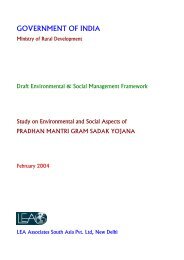
GOVERNMENT <strong>OF</strong> INDIA<br />
PRADHAN MANTRI GRAM SADAK YOJANA<br />
Environmental and Social Management Framework<br />
for<br />
RURAL ROADS PROJECT II<br />
<strong>ENVIRONMENTAL</strong> <strong>CODES</strong> <strong>OF</strong> <strong>PRACTICE</strong><br />
July 2010<br />
National Rural Roads Development Agency<br />
Ministry of Rural Development
Table of Contents<br />
Table of Contents ................................................................................................................................. 2<br />
List of Annexures ……………………...…………………..…………….…….……………...….…...3<br />
Abbreviations………………………………………..………………………………......………….…4<br />
ECOP-1.0 PROJECT PLANNING AND DESIGN<br />
ECOP-2.0 SITE PREPRATION<br />
ECOP-3.0 CONSTRUCTION CAMPS<br />
ECOP-4.0 ALTERNATE MATERIALS FOR CONSTRUCTION<br />
ECOP-5.0 BORROW AREAS<br />
ECOP.6.0 TOPSOIL SALVAGE, STORAGE AND REPLACEMENT<br />
ECOP-7.0 QUARRY MANAGEMENT<br />
ECOP-8.0 WATER FOR CONSTRUCTION<br />
ECOP-9.0 SLOPE STABILITY AND EROSION CONTROL<br />
ECOP-9A.0 BIO-ENGINEERING<br />
ECOP-10.0 WASTE MANAGENENT<br />
ECOP-11.0 WATER BODIES<br />
ECOP-12.0 DRAINAGE<br />
ECOP-13.0 CONSTRUCTION PLANT AND EQUIPMENT MANAGEMENT<br />
ECOP-14.0 PUBLIC AND WORKER’S HEALTH AND SAFETY<br />
ECOP-15.0 CULTURAL PROPERTIES<br />
ECOP-16.0 TREE PLANTATION<br />
ECOP-17.0 MANAGING INDUCED DEVELOPMEMT<br />
ECOP-18.0 ENVIRONMENT AUDIT<br />
ECOP-19.0 NATURAL HABITAT<br />
ECOP-19 A. BIO-DIVERSITY<br />
ECOP-20.0 CONSULTATION FOR ENVIRONMENT ASPECTS<br />
2
Abbreviations<br />
AAV Aggregate Abrasion Value<br />
BoQ Bill of Quantities<br />
CD Structures Cross Drainage Structures<br />
CPCB Central Pollution Control Board<br />
DPR Detailed Project Report<br />
ECoP Environmental Code of Practice<br />
GP Gram Panchayat<br />
GS Gram Sabha<br />
GSB Granular Sub- Grade<br />
HFL High Flood Level<br />
IRC Indian Roads Congress<br />
IS Indian Standards<br />
MoEF Ministry of Environment and Forest<br />
MoRD The Ministry of Rural Development<br />
MoRT&H Ministry of Road Transport and Highways<br />
MoU Memorandum of Understanding<br />
NOC No-Objection Certificate<br />
NREGA National Rural Employment Act<br />
NQM National Quality Monitor<br />
O & M Operation and Maintenance<br />
ODR Other District Roads<br />
OM Operations Manual<br />
PIU Programme Implementation Units<br />
PMGSY Pradhan Mantri Gram Sadak Yojana<br />
POL Petrol, Oil and Lubricants<br />
PRIs Panchayat Raj Institutions<br />
PSV Polished Stone Value<br />
PUC Pollution under Control<br />
PWD Public Works Department<br />
RoW Right of Way<br />
S W Plains South West Plains<br />
SP Special Publications<br />
SPCB State Pollution Control Board<br />
WBM Water Bound Macadam<br />
3
ECoP-1.0 Planning and Design<br />
1.1 General<br />
1.1.1 This code of practice details the factors to be considered during project preparation to<br />
avoid/address environmental concerns through modifications in project design and incorporation<br />
of mitigation measures. Guidelines specified in the IRC: SP-20:2002 and SP-48 for project<br />
preparation are to be followed in conjunction with the measures suggested as part of this ECoP.<br />
1.2 Finalization of Alignment<br />
1.2.1 All requirements of Section 1.5 of IRC: SP-20: 2002 in selection of alignment should be met<br />
with. In addition, adequate consultations with the communities to identify the concerns and<br />
preferences need to be taken up during selection of the alignment. Rural roads, being low<br />
volume roads, shall be aligned to follow the natural topography. Finalisation of alignment<br />
shall be carried out in accordance with the<br />
provisions presented below.<br />
The alignment should be…<br />
1.2.2.1 Alignment shall conform to the natural<br />
topography as far as possible to avoid<br />
• Short<br />
excessive cut and fill. In case of hill areas the • Easy and safe to construct and maintain<br />
alignment selection should extend to<br />
incorporate the provisions of IRC: SP-<br />
48:1998, “Hill Road Manual”.<br />
•<br />
•<br />
Economical<br />
Laid on firm ground<br />
1.2.2.2 Special care should be taken to align the roads<br />
• Aesthetic and<br />
along the hill side which is stable and where<br />
cutting on hill side causes least disturbance.<br />
• Having least adverse environmental impacts.<br />
The geologist shall investigate the disturbance likely to be caused keeping the geology of hill<br />
slope in view. He shall also study the affect of earthquake on the slope gradient.<br />
High Impact Road Low Impact Road<br />
4
High standard roads<br />
• Good geometrics<br />
• Moves large volume of traffic rapidly and safely.<br />
• Huge cuts and fills, stability of slopes<br />
• Damage to vegetation, and<br />
• Disruption to natural drainage patterns<br />
5<br />
Low standard roads<br />
• Conforms to the natural topography<br />
• Suitable for low volume rural roads and low travel<br />
speeds<br />
• Reduced environmental impacts<br />
o Reduces the cut and fill,<br />
o Reduces damage to vegetation<br />
o Minimise changes to natural drainage patterns.<br />
1.2.2 An inventory of all environmental features along the proposed road is to be prepared and marked<br />
on a revenue map. This would be conducted by the PIU in co-ordination with the local<br />
community and the revenue officials through transects. Consultations with the local<br />
communities are to be conducted during these transects to obtain their suggestions and<br />
incorporate their concerns to address the potential environmental impacts. Suggestions of the<br />
community during the transect walk are to be incorporated, to the extent possible, while<br />
finalising the alignment. The methodology for conduct of transect shall be as per ECoP-20.0,<br />
“Consultations for Environmental Aspects”.<br />
Prepare an Inventory of the following …<br />
• Trees<br />
• Forests if any<br />
• Drainage lines, rivers and water crossings<br />
• Irrigation water courses<br />
• Water bodies<br />
• Grazing lands<br />
• Cultural properties<br />
• Utilities<br />
• Community facilities<br />
• Schools<br />
• Hospitals<br />
• Major junctions<br />
• Seasonal markets or cultural congregations<br />
• Location for Ramps, Cattle Crossing and Bus Bay<br />
• Location for stacking maintenance material<br />
• Location for ducts for threading agricultural pipes<br />
Route Alignment to avoid felling trees<br />
1.2.3 In case of flood prone areas and/or areas with very flat slopes, hydrological surveys have to be<br />
conducted before alignment finalisation. Inputs derived from these surveys such as the need for<br />
provision of culverts/bridges or other cross/roadside drainage structures should be considered in<br />
the alignment finalisation. Routes involving higher costs on drainage compared to alternative<br />
routes should be avoided. In case of hill areas, geological studies have to be conducted to<br />
determine locations of loose rock, soil or potential sites for landslides.<br />
1.3 Design considerations<br />
1.3.1 All the road designs should conform to the specifications of IRC:SP-20:2002, “Rural Roads<br />
Manual”. Additional measures suggested for minimisation of environmental impacts, safety of<br />
road users and for enhancement of community benefits are indicated in this ECoP. Where it is<br />
necessary to deviate from the IRC specifications, the following design considerations shall be<br />
the absolute minimum.
1.3.2 Design Speed: Ruling design speed<br />
may be reduced to 40 km/hr from 50<br />
km/hr in plain and 35 km/hr in rolling<br />
terrain. This speed is to be followed in<br />
link roads less than 10km length<br />
without any further relaxation. Ruling<br />
speed of 25 km/hr and minimum speed<br />
of 10 km/hr shall be followed for all<br />
the newly aligned roads in hilly areas.<br />
The minimum speed may however be<br />
relaxed (on case to case basis) in case<br />
of existing alignment where it may not<br />
be possible to realign the roads as it<br />
may involve excessive cutting or<br />
filling.<br />
Recommended Practices for Alignment<br />
Finalisation…<br />
• Utilise existing revenue tracts as far as possible<br />
• Follow natural topography<br />
• Conform alignment to within property boundaries within<br />
village areas<br />
• Adopt geometrics that do not compromise on safety<br />
requirements<br />
• Avoid crossing power transmission lines, water mains, gas<br />
lines etc<br />
• Avoid alignments affecting vegetation and felling of trees<br />
• Avoid alignments close to streams<br />
• Avoid encroachment of water bodies and<br />
• Avoid passing through natural habitats as designated forests,<br />
sanctuaries, national parks and wetlands<br />
1.3.3 Road Land Width: If larger widths are available the existing standards of IRC:SP-20:2002<br />
should be followed. The minimum standard road land width may be reduced to 12 m in plains in<br />
areas where it is difficult to obtain 15 m, keeping local conditions in view and after assigning<br />
reasons of keeping reduced width. The requirement may be further reduced to 9 m in areas under<br />
intensive irrigation and where traffic is less than 100 vehicles/day. But in such cases, the<br />
roadway width shall also be reduced to 6 m.. Normally a land width of 12m shall be attempted in<br />
case of hill roads. It may be reduced to 9m only in exceptional cases.<br />
Alignment selection criteria in hill roads …<br />
• The road should cross the ridges at their lowest elevation. Relative economics are to be worked out before<br />
deciding upon the alignment.<br />
• Hairpin bends are to be kept to a minimum. If unavoidable the alignment should be such that a flat hill<br />
slope is obtained for its location.<br />
• Unstable hill slopes to be avoided, as such slopes are prone to landslides and are subject to seepage or<br />
flow from streams.<br />
• Avoid encroaching on wetlands or water bodies.<br />
• Provide adequate cross-drainage structures to ensure that natural drainage patterns are not altered<br />
1.3.4 Roadway Width (Formation width): The<br />
minimum of 7.5 m of roadway may be<br />
reduced to 6 m incase of hilly terrain 1 Low embankment height reduces…<br />
and<br />
short link village roads connecting single<br />
habitations. This would result in reducing<br />
the need of larger road land width and<br />
reduce quantity of soil required for<br />
embankments. A minimum of 9 m of<br />
•<br />
•<br />
•<br />
•<br />
Quantity of earth work<br />
Redevelopment costs of borrow areas<br />
Dune sand accumulation in desert areas and<br />
Requirement of land for construction of road<br />
formation / roadway width shall be adopted for cutting section in deserts areas to avoid<br />
roadblocks normally caused by dune sand accumulation where reduced width is provided.<br />
1 In the stretches where obligatory to obtain a road land width of only 6m due to reasons of land availability,<br />
minimum roadway width of 5.2m shall be provided.<br />
6
1.3.5 Carriageway Width: Standard carriageway width of 3.75 m is to be adopted on all roads. It<br />
may be however be reduced to 3.0 m in exceptional cases such as hilly terrain or as per<br />
provisions of IRC: SP-20: 2002. Hard shoulders of 1 m width may be provided on either side<br />
only in case longer routes or “through” village roads connecting many habitations to cater for the<br />
expected increase in traffic intensity<br />
1.3.6 Embankment height: Lower embankment height of 0.3 – 0.4m to be provided in case of arid<br />
and sandy areas. In case of desert areas, the embankment height could be reduced since no<br />
overtopping is anticipated. In flood prone areas, height of embankment shall not be reduced and<br />
shall be a minimum of 0.6m above expected highest water level. (Based on data of last five<br />
years)<br />
1.3.7 Geometrics: (i) In plain and rolling terrain the alignment should be designed for maximum<br />
possible radius of curves. Minimum absolute curve radius of 50m @ 40 km/hr and 38m @ 35<br />
km/hr should be adopted without further relaxation due to safety reasons. (ii) Junction design of<br />
access road with collector road should be in conformity with IRC: SP-20: 2002 for both sight<br />
distance and flaring requirements. Generally a minimum radius of 14m shall be provide in case<br />
of design of hill roads but in exceptional cases it may be reduced to 12m to reduce excessive<br />
cost.<br />
1.3.8 Drainage: For large catchment areas with low ground slopes, the accumulation of water causes<br />
flooding on the up-stream of the road. The increased velocity of water passing through the<br />
culverts causes scour on the down-stream and alters natural ground levels and scour of land.<br />
Hydrological studies are to be conducted in large catchment areas to limit the afflux and provide<br />
adequate waterway for cross-drainage structures.<br />
Align Road Away from Drainage Channels Provide Adequate Openings<br />
1.3.9 Built up areas: It should be ensured that the road level in built up areas is lower than the plinth<br />
of the adjoining houses and drains are provided to drain the storm water.<br />
7
1.3.10 Enhancements<br />
OVERRALL WIDTH BETWEEN CONTROL LINES<br />
OVERALL WIDTH BETWEEN CONTROL LINES<br />
ROAD LAND WIDTH<br />
ROADWAY<br />
CARRIAGEWAY<br />
ROAD LAND BOUNDARY,BUILDING LINES AND CONTROL LINES<br />
OVERRALL WIDTH BETWEEN CONTROL LINES<br />
OVERALL WIDTH BETWEEN CONTROL LINES<br />
ROAD LAND WIDTH<br />
ROADWAY<br />
CARRIAGEWAY<br />
Typical Cross Sections - PMGSY Road<br />
i. Cattle crossings to be provided at normal crossing routes for safety of both cattle and road<br />
user.<br />
ii. Ramps for access to and from agriculture lands for cross traffic are to be provided to avoid<br />
damage to embankment and roadside drain.<br />
iii. All CD works shall have steps constructed for inspection, repair and maintenance purpose.<br />
iv. Shoulders should be paved at destination/roadside villages and provide bus bays to avoid<br />
traffic obstruction and to provide for turning radius wherever feasible.<br />
8
v. Where possible, the embankment should be widened to provide a platform for stacking<br />
material for maintenance and to ensure that the shoulders are kept free for movement of<br />
traffic.<br />
vi. Where ever required 300mm ducts should be provided to enable cultivators to thread<br />
agricultural pipes for irrigating their fields lying on either side of the proposed road. The<br />
invert level of such ducts shall be about 300mm above high flood level.<br />
vii. On hill roads, passing places are required to facilitate crossing of vehicles. These shall be<br />
provided at a rate of at least two per kilometer and exact location to be based on sight<br />
condition. The length of passing places shall be about 15-20m with carriageway of 5m.<br />
Ramp for Lateral Traffic/ Cattle crossing<br />
9<br />
Widening of Shoulders for Storing<br />
Maintenance Materials<br />
1.3.11 Community Concerns: Community concerns, expressed during consultations are to be<br />
addressed to the extent possible in the design of the road. The concerns need to be documented<br />
(format in annexure). In case any of the measures are not incorporated, the same needs to be<br />
intimated to the community with<br />
adequate explanation<br />
finalization.<br />
after design<br />
Key environmental concerns to be mitigated…<br />
1.3.12 Road Signage: Adequate informatory,<br />
cautionary and warning road signs<br />
should be provided to ensure traffic<br />
safety, especially in the event of adoption<br />
of lower standards. The signboards<br />
should be placed such that they do not<br />
block the line of sight.<br />
• Land, including loss of productive topsoil<br />
• Drainage<br />
• Land use and livelihood<br />
• Vegetation, cutting of trees<br />
• Forests, wild life, fisheries and aquatic habitat<br />
• Water bodies and water quality<br />
• Slope stability<br />
• Wetlands<br />
1.4 Environmental Considerations • Structures and<br />
• Common property resources<br />
1.4.1 Environmental considerations for various<br />
activities and sub-activities in the project<br />
• Disposal of excess material from cut sections<br />
are presented in the Table 1-4. Measures for the same are to be incorporated in the project<br />
preparation stage to offset environmental impacts in the subsequent stages (Table 1-3). The<br />
measures shall be in conformance with the ECoP referred against the activities.
1.4.2 Corridors prioritized as per the core network shall be subjected to screening 2 as per the screening<br />
checklist (Annexure 1-1). The roads so screened as per the checklist shall be subjected to greater<br />
analysis in the DPR for the issue/s due to which it is screened.<br />
1.4.3 Environmental concerns of the community shall be incorporated to the extent possible in the<br />
project preparation and in the subsequent stages of the project. This is achieved through various<br />
consultation tools by PIU or Contractor as per the Table 1-1.<br />
Sl.No. Stage/Activities<br />
1 Project Prioritization<br />
1.1<br />
Dissemination of<br />
Core network<br />
2 Project Preparation<br />
2.1<br />
2.2<br />
2.3<br />
2.4<br />
Dissemination of<br />
project information<br />
Finalisation of<br />
Alignment<br />
Formal Consultations<br />
with PAPs<br />
Formal Consultation<br />
with Flood Control/<br />
Irrigation Department<br />
3 Implementation Stage<br />
3.1<br />
3.2<br />
3.3<br />
3.4<br />
3.5<br />
Table 1-1: Consultations to be conducted in various stages of the project<br />
Responsible<br />
Agencies<br />
PIU<br />
Stakeholders<br />
Community /<br />
PRI<br />
PIU Community<br />
PIU<br />
Consultations for<br />
temporary use of land Contractor<br />
Consultations for<br />
extraction of water<br />
Consultations for<br />
relocation<br />
Consultation for tree<br />
plantation<br />
Consultation for<br />
avoiding induced<br />
development<br />
Community /<br />
PRI<br />
PIU Community<br />
10<br />
Tools &<br />
Techniques<br />
Display of list of<br />
villages and length<br />
of corridor maps at<br />
gram panchayat<br />
Distribution of<br />
Project<br />
Information<br />
Brochure<br />
Transect Walk<br />
Focus group<br />
discussions, public<br />
meetings<br />
PIU PRI/PIU Focus discussion<br />
Contractor<br />
PIU<br />
PIU<br />
PIU<br />
Community /<br />
land owner<br />
Community /<br />
Well owner<br />
Community /<br />
PRI<br />
Community /<br />
PRI<br />
Community /<br />
PRI<br />
Individual<br />
consultations<br />
Individual<br />
consultation<br />
Consultation<br />
Consultation<br />
Consultation<br />
Desired Outputs Reference<br />
• Increasing awareness of<br />
community about PMGSY<br />
• Transparency in selection of<br />
roads<br />
• Sensitisation of communities<br />
• Increasing awareness of<br />
community about roles and<br />
responsibilities<br />
• Inventory of environmental<br />
features, identification of sites<br />
for voluntary donation,<br />
identification of PAPs<br />
• Disseminate information on<br />
environmental concerns<br />
incorporated/not incorporated<br />
into design<br />
• Information about the Flood<br />
Prone areas<br />
• Seeking consent on temporary<br />
use of land and setting terms<br />
of use<br />
• Seeking consent on extraction<br />
of water<br />
• Area for relocation of utilities<br />
and cultural properties<br />
• Identification of persons for<br />
tree plantation<br />
• Location for plantation<br />
• Sensitizing PRI on effects of<br />
Induced development<br />
• Identification of locations for<br />
avoiding/promoting induced<br />
development on community<br />
land<br />
2 Screening is not meant to be deterrent for selection of a road. The screening process is intended to facilitate<br />
identification of scope for analysis in the DPR stage.<br />
Resettlement<br />
Framework<br />
Resettlement<br />
Framework<br />
ECoP-1<br />
Annexure<br />
20 -2<br />
ECoP 1A<br />
ECoP-3.0<br />
ECoP-5.0<br />
ECoP-6.0<br />
ECoP-10.0<br />
ECoP-13.0<br />
ECoP-14.0<br />
ECoP-8.0<br />
ECoP-2.0<br />
ECoP-15.0<br />
ECoP-16.0<br />
ECoP-17.0
1.4.4 Towards implementation of the environmental provisions by the contractor as per the ECoPs, he<br />
shall nominate one of his senior personnel to ensure that the construction practices comply with<br />
the ECoPs.<br />
1.5 Compliance to Legal Requirements<br />
1.5.1 The clearance requirements as per the various legislations in force towards the conservation of<br />
the environment during the various project stages, as applicable to the project are presented in<br />
Table 1-2.<br />
Project<br />
Stage<br />
Preconstruction<br />
Construction<br />
Table 1-2: Environmental Clearance Requirements - PMGSY<br />
Activity requiring<br />
clearance<br />
Road Projects in<br />
Hilly areas & Forests<br />
Diversion of Forest<br />
Land<br />
Alignment through<br />
Sensitive Areas<br />
Alignment through<br />
Flood prone areas<br />
Water for<br />
Construction<br />
Wild Life Protection<br />
Agency from whom<br />
clearance to be sought<br />
State Forest office/<br />
state pollution control<br />
Board<br />
11<br />
Legislative requirement Responsibility<br />
Environmental Clearance by forest departments<br />
for rural roads if the alignment traverses forest<br />
areas<br />
State forest department Forest Conservation Act 1980 PIU<br />
Forest department,<br />
Flood Control/<br />
Irrigation Department<br />
GWB, Irrigation<br />
department/ Village<br />
councils<br />
Wild Life Department/<br />
Forest Department<br />
Transfer of Land Forest (Conservation) Act<br />
1980, Forest (Conservation) Rule 1980<br />
Irrigation Acts of the states eg ‘Bihar Irrigation<br />
Act 1997’ & “The Bihar Irrigation, Flood<br />
Management & Drainage Rules 2003’<br />
PIU<br />
PIU<br />
PIU<br />
Control on Setting up of Tube Wells Contractor<br />
Wild life Protection Acts if alignment passes<br />
through Protected Areas<br />
Quarry Area Plan Mining Department Mining Act of the state Contractor<br />
Setting up and O&M<br />
of Hot Mix Plants<br />
Noise from<br />
construction<br />
Blasting operation<br />
Operation of<br />
equipment and<br />
machinery<br />
State Pollution Control<br />
Board<br />
State Pollution Control<br />
Board<br />
Indian Explosives<br />
Mining Department<br />
Road Transport Office,<br />
Pollution Control Board<br />
Air (Prevention and Control of Pollution) Act<br />
1981<br />
Municipal Solid Waste Management Rules,<br />
2000 & Hazardous Waste Management &<br />
Handling Rules, 2000<br />
PIU<br />
Contractor<br />
Environment Protection Rules 1986 Contractor<br />
Indian Explosive Rules 1983 Contractor<br />
Motor Vehicles Act, Emission Norms and<br />
Standards<br />
Contractor<br />
Labour laws Department of Labour Minimum Wages Act/ Other Labour Laws Contractor<br />
Quarry area materials<br />
extraction<br />
Mining department Mining Act Contractor<br />
1.5.2 The bid document shall include the various applicable clearances pertaining to environmental<br />
management and shall contain the necessary procedures for compliance of the same.<br />
1.5.3 The site for construction shall be handed over to the contractor, free from encumbrances and<br />
encroachments. Forest clearances, if required shall be obtained prior to start of the project and<br />
utilities shall be relocated before handing over the site.
1.6 Integrating Environmental Provisions in Bid Documents<br />
1.6.1 The design and environmental considerations discussed above have to be incorporated suitably<br />
in the DPR and the bid document to<br />
ensure implementation. Towards this<br />
end, the following steps should be<br />
taken by the PIU:<br />
1.6.1.1 Detailed Drawings if any for the<br />
environmental provisions as per the<br />
environmental codes of practice, as<br />
required, are to be included in the DPR<br />
viz., ECoP-1.0 (Project Planning &<br />
Design) Widening of carriageway for<br />
bus stops and bus-bays, widening at<br />
junctions, ECoP-3.0, Construction<br />
Camp, ECoP-11.0, Water bodies and<br />
ECoP-15.0, Cultural Properties.. The drawings are to include specifications of the materials used<br />
and also the detailed bill of quantities in the bid document.<br />
1.6.1.2 Cost implications of environmental measures suggested by the environmental codes of practice<br />
have to be included in the estimates for the project but the state government are expected to<br />
make land available free of all encumbrance. Cost of restoration of common property resources,<br />
as detailed in social management plan, are expected to be met by the state government<br />
1.6.1.3 Monitoring arrangements towards the<br />
implementation of the environmental<br />
provisions are to be specified. The<br />
reporting formats are provided as per<br />
the ECoP-18.0, “Environment Audit”.<br />
1.6.1.4 As per clause 26 of the Standard<br />
Bidding Document of MoRD, the<br />
contractor is expected to submit for<br />
approval of the engineer, the general<br />
methods, arrangements, orders and<br />
timing for all the activities in the<br />
works along with monthly cash flow.<br />
In scheduling the construction works,<br />
Construction scheduling – factors to consider…<br />
• Overall scheduling to incorporate climatic factors,<br />
snow fall, harsh weather conditions<br />
• Agricultural practices and harvesting seasons<br />
• Timing of specific activities to avoid special<br />
weather conditions<br />
• Events of importance in the project area as festive<br />
seasons etc<br />
• Availability of local labour during harvest seasons<br />
Timing of activities - factors to consider…<br />
• If there is a time lag (more than a fortnight) between<br />
WBM and black-topping, the surface needs to be<br />
suitably blinded and may have to be rerolled as per<br />
the instructions of the Engineer of the PIU.<br />
• The time lag between the prime coat and the final<br />
black-topping shall be minimum and in any event be<br />
not more than 3 days.<br />
• Sealed coat shall immediately follow the 20mm<br />
carpet on the same day.<br />
it is expected that the contractor considers all the risks and schedule the activities, which are<br />
likely to be impacted by weather phenomenon in a period in which these phenomenon are<br />
unlikely to occur. This would also need review and final approval of the engineer. In view of the<br />
above approval, the milestones indicated at Para 19 of “Standards Bidding Document-Contract<br />
Data to General Conditions of Contract”, to be achieved during the contract period may be<br />
suitably amended.<br />
1.6.2 The environmental concerns to be addressed in the preparation of DPR are detailed out in the<br />
Table 1-3 and Table 1-4.<br />
12
Widening of Carriageway at Destination<br />
Raised Shoulder for<br />
Passengers Disembarking<br />
Widening of Carriageway for Turning Radius at the Stops<br />
Widening for Bus-Bays on Routes<br />
13<br />
25<br />
5m<br />
15<br />
Drain
Toe Line<br />
Sight Line<br />
7.5<br />
20 50<br />
20<br />
3.75 Carriage-Way<br />
25<br />
Widening of Carriage-way at<br />
Junctions for achieving<br />
adequate Turning Radii<br />
(15Meters min.) Extra Widening of Carriage-way at<br />
Junctions for achieving adequate<br />
Turning Radii (15 meters minimum)<br />
T – Junction for Widening of CW, Provides Turning Radius and Merges with Main Lane of single lane<br />
14<br />
20<br />
3.75<br />
1.125<br />
1.125
Table 1-3: Environmental concerns in DPR preparation<br />
S.No. Activity Items to consider Measures to address<br />
1.0 Transact Walk<br />
2.0 Detailed Surveys<br />
3.0<br />
4.0<br />
Identification of<br />
material sources<br />
Assessment of<br />
environmental<br />
impacts<br />
Trees<br />
Forests<br />
Drainage lines / Rivers / water crossings<br />
Flood prone areas if any<br />
Irrigation water courses<br />
Water bodies<br />
Grazing lands<br />
Cultural properties<br />
Utilities<br />
Community facilities<br />
Major junctions<br />
Seasonal markets or cultural<br />
congregations<br />
Location for Ramps, Cattle Crossing and<br />
Bus Bay<br />
Location for stacking maintenance<br />
material<br />
Location of areas for disposal of debris<br />
Location for ducts for threading<br />
agricultural pipes<br />
Geological, geotechnical studies in hill<br />
areas<br />
Assessment of angle of hill slopes<br />
Topographical surveys<br />
Hydrological surveys in flood prone areas<br />
Borrow material<br />
Quarry material<br />
Water availability<br />
Climatic factors<br />
Water bodies<br />
Stability of slopes<br />
15<br />
Inventorisation of environmental features<br />
Avoidance, design modifications to minimize adverse<br />
environmental impacts<br />
Incorporating community concerns into finalizing<br />
alignment<br />
Stability analysis and measures to address slope<br />
instability in hill slopes and high banks<br />
Working out requirement of cut and fill<br />
Identification of flood prone areas and measures to avoid<br />
high afflux<br />
Identification of agricultural use of land<br />
Detailed<br />
in<br />
ECoP 1.0/<br />
1.0A<br />
ECoP<br />
1.0/1A<br />
Utilizing alternative materials ECoP 4.0<br />
Minimize requirements through design modifications<br />
Location criteria<br />
ECoP 5.0<br />
Utilizing alternative materials ECoP 4.0<br />
Material extraction from existing quarries ECoP 7.0<br />
Identification of perennial/community/private sources<br />
Scheduling construction to suit water availability<br />
Utilizing community water sources without conflict of<br />
uses<br />
Scheduling construction considering the special weather<br />
phenomena<br />
Provision of silt fencing<br />
Rehabilitation of water bodies<br />
Measures for slope stabilization including bioengineering<br />
practices<br />
ECoP 8.0<br />
ECoP 1.0<br />
ECoP 11.0<br />
ECoP 20.0<br />
ECoP 9.0/<br />
/9.0A<br />
Soil erosion Erosion control measures ECoP 9.0<br />
Land use changes<br />
Agriculture lands<br />
Land use control measures adjacent to the road<br />
Empowering Gram Panchayat / Road Authority to<br />
regulate development along road side<br />
Avoidance from setting up construction camps, borrow<br />
areas<br />
Conservation of top soil<br />
ECoP 17.0<br />
ECoP 3.0,<br />
ECoP 5.0<br />
ECoP 6.0
S.No. Activity Items to consider Measures to address<br />
5.0<br />
6.0<br />
7.0<br />
8.0<br />
9.0<br />
Precautionary<br />
measures during<br />
construction to<br />
avoid<br />
environmental<br />
impacts<br />
Consultations with<br />
community<br />
Finalization of<br />
alignment<br />
Preparation of<br />
detailed drawings<br />
Cultural properties<br />
Common Property Resources<br />
16<br />
Site restoration after construction<br />
Avoidance through design modifications<br />
Planning for Relocation & rehabilitation<br />
Avoidance through design modification<br />
Planning for Relocation of consultation with community<br />
Detailed<br />
in<br />
ECoP 15.0<br />
ECoP 1.0<br />
Drainage Provision of adequate number of CD Structures ECoP 12.0<br />
Trees<br />
Forest areas<br />
Natural Habitats/ Bio-diversity<br />
Compensatory plantation & arrangements for roadside<br />
plantation<br />
Avoidance through design modifications<br />
ECoP 16.0<br />
ECoP 16.0<br />
ECoP 19.0<br />
Environment Management measures during construction ECoP 13.0<br />
Avoidance through design modification or formulating<br />
additional measures for avoiding impacts<br />
ECoP 19.0<br />
/ 19.0A/<br />
Top soil Stockpile topsoil and preservation ECoP 6.0<br />
Construction sites<br />
Construction camps<br />
Borrow areas<br />
Provision of pollution control measures ECoP 13.0<br />
All measures to ensure public & worker’s health/safety ECoP 14.0<br />
Water Management ECoP 10.0<br />
Criteria for identification of sites and Infrastructure<br />
arrangements<br />
ECoP 3.0<br />
Safe disposal of all wastes ECoP 10.0<br />
Enforcement of pollution control measures ECoP 13.0<br />
Arrangements with land owners to include<br />
redevelopment<br />
ECoP 5.0<br />
Quarry areas Rehabilitation of quarry areas if new quarries are opened ECoP 7.0<br />
Public/workers health & safety<br />
Personal Protective Equipment to be provided<br />
Public safety at construction sites to be undertaken<br />
Measures for worker’s health & hygiene at construction<br />
camps<br />
ECoP 14.0<br />
ECoP 3.0<br />
Land for borrowing Agreement to include borrow area rehabilitation ECoP 5.0<br />
Water for construction Agreements with owners/community for utilizing water ECoP 8.0<br />
Site for construction camps Rehabilitation of the land after construction ECoP 3.0<br />
Removal of trees Tree Plantation as per Roadside Plantation plan ECoP 16.0<br />
Cultural properties<br />
Common property resources<br />
Avoidance through modification of alignment ECoP 15.0<br />
Relocation costs to be covered in the project, if needs<br />
relocation<br />
ECoP 15.0<br />
ECoP 20.0<br />
Avoidance through modification of alignment ECoP 2.0<br />
Relocation, if needed in consultation with community ECoP 2.0<br />
Traffic during construction Provision of alternate routes or prior notice to the users ECoP 14.0<br />
Concerns of community Community concerns to be incorporated ECoP 1.0<br />
Environmental impacts identified<br />
Design aspects<br />
All concerns/impacts identified<br />
Impacts identified are to be mitigated by incorporation of<br />
provisions as per ECoPs<br />
Impacts that can be mitigated through design<br />
modifications should be incorporated<br />
Designs for enhancements and mitigation measures<br />
including cost provisions<br />
All ECoPs<br />
ECoP 1.0<br />
All ECoPs<br />
Monitoring of<br />
Progress All environmental aspects identified Monitoring implementation of Environmental measures ECoP 18.0
Sl.No.<br />
Table 1-4: Environmental Concerns during project implementation (to be identified in DPR)<br />
Activity and<br />
Sub Activity<br />
A Pre-construction Activities<br />
Impact/s Measure/s<br />
A1.0 Alignment marking -Nil- (i) Co-ordination with Revenue Department<br />
17<br />
ECoP<br />
Applicable<br />
ECoP 1.0<br />
ECoP 2.0<br />
Impact on current usage (i) Identification of relocation site in advance ECoP 2.0<br />
A2.0 Relocation of utilities<br />
(ii)<br />
Scheduling the activity in consonance with the community<br />
usage pattern<br />
ECoP 2.0<br />
A3.0 Tree Felling<br />
A4.0 Clearance of land<br />
A5.0<br />
A6.0<br />
A7.0<br />
A8.0<br />
A9.0<br />
A10.0<br />
A 11.0<br />
Diversion of forest<br />
land<br />
Transfer of land<br />
ownership<br />
Location of Storage<br />
Yards, labour camps,<br />
and construction sites<br />
Procurement of<br />
equipments and<br />
machinery<br />
Identification and<br />
Selection of Material<br />
Sources<br />
Compliance with Forest Act in case trees are on<br />
forest land<br />
(i) Prior clearance from Forest Department ECoP 1.0<br />
Loss of canopy (ii) Tree plantation as per roadside plantation plan ECoP 16.0<br />
Affect on livelihood (i) As per project provisions ECoP 2.0<br />
Affect on standing crops (ii) Scheduling of activity and coordination ECoP 1.0<br />
Affect on cultural properties (iii)<br />
Affect on natural habitats (iv)<br />
Compliance with Forest Act (i)<br />
Modification of alignment or Relocation of the cultural<br />
properties<br />
Avoidance of natural habitats or preparation of Natural<br />
Habitat Management Plan<br />
Activity scheduling to avoid delays, conformance to legal<br />
requirements<br />
ECoP 15.0<br />
ECoP 19.0<br />
ECoP 1.0<br />
Affect on flora (ii) Precautionary measures during construction in forest areas All ECoPs<br />
Pollution from construction activities (iii) Precautions while operating equipment/machinery ECoP 13.0<br />
Grievances from community (i)<br />
Addressal through Grievance Redressal Mechanisms &<br />
Consultations<br />
ECoP 1.0<br />
ECoP 20.0<br />
Affect on livelihood (ii) Provision of entitlements as per resettlement framework ECoP 1.0<br />
Pollution from construction camps, storage yards<br />
(i) Location criteria to be adopted<br />
& labour camps<br />
ECoP 3.0<br />
ECoP 20.0<br />
(ii) Obtain clearances from SPCB ECoP 1.0<br />
Pressure on local infrastructure (iii) Infrastructure arrangements to be as per guidelines ECoP 3.0<br />
Machinery likely to cause pollution at<br />
settlements and natural habitats<br />
(i)<br />
Machinery to be procured shall be in conformance with<br />
noise and emission standards of CPCB<br />
ECoP 13.0<br />
ECoP 19.0<br />
Safety concerns in machinery operation (ii) Safety equipment for workers ECoP 14.0<br />
Conflict of uses in case of water (i)<br />
Borrowing causes depressed lands (ii)<br />
Pollution due to material extraction from borrow<br />
and quarry areas to surrounding environment<br />
(iii)<br />
Disturbance to Natural Habitats (iv)<br />
Identification of<br />
Pollution due to location close to settlements,<br />
designated locations of<br />
water bodies & other sensitive areas<br />
waste disposal<br />
Information to<br />
community<br />
B Construction Activities<br />
B1.0 Site Clearance<br />
B1.1<br />
B1.2<br />
B2.0<br />
Clearing and<br />
Grubbing<br />
Dismantling of<br />
existing culverts and<br />
structures, if any<br />
Effect on roadside vegetation (i)<br />
Consultations and arrangements at contractor-individual<br />
levels, documentation of agreement<br />
Consultations and arrangements at contractor-individual<br />
levels, documentation of agreement<br />
Precautionary measures during siting of borrow areas and<br />
quarry areas<br />
Avoidance of location of material sources in Natural<br />
Habitats<br />
ECoP 8.0<br />
ECoP 20.0<br />
ECoP 5.0<br />
ECoP 5.0<br />
ECoP 7.0<br />
ECoP 19.0<br />
(i) Site selection in conformance to criteria provided ECoP 10.0<br />
(i)<br />
Keeping local community informed about the construction<br />
schedule<br />
Restricting movement of machinery/equipment over<br />
adjacent fields<br />
ECoP. 2.0<br />
ECoP 2.0<br />
ECoP 13.0<br />
Debris generation creating unsightly conditions (ii) Disposal / storage of grubbing waste and possible reuse ECoP 10.0<br />
Generation of Debris creating unsightly<br />
conditions<br />
Flooding due to interception to drainage paths (ii)<br />
(i) Disposal of waste and likely reuse ECoP 10.0<br />
Provision of diversion channels and/or scheduling<br />
construction of culverts preferably in dry months<br />
ECoP 12.0<br />
Planning Traffic<br />
Trampling of vegetation along traffic diversions (i) Activity scheduling, identification of alternative track ECoP 14.0<br />
diversions and Detours<br />
B3.0 Material Procurement<br />
Loss of topsoil (i) Stripping & Storing topsoil ECoP 6.0<br />
Formation of stagnant water pools due to<br />
borrowing/quarrying<br />
(ii)<br />
Illegal quarrying / sand mining (iii)<br />
Uncontrolled blasting at quarries (iv)<br />
Restoration plan for borrow areas & quarry areas (new<br />
quarry)<br />
Conformance of quarries selected to the SPCB<br />
requirements, including quarry rehabilitation plans<br />
Controlled blasting to the extent required. Conformance to<br />
blasting rules as per the Indian Explosives Act<br />
ECoP 5.0<br />
ECoP 7.0<br />
ECoP 7.0<br />
ECoP 7.0
Sl.No.<br />
B4.0<br />
Activity and<br />
Sub Activity<br />
Transport of materials<br />
to site<br />
B5.0 Materials handling<br />
B5.1 Storage of materials<br />
B5.2 Handling of earth<br />
B5.3 Handling of fly ash<br />
B5.4<br />
B5.5<br />
Handling of granular<br />
material<br />
Handling of<br />
bituminous materials<br />
B5.6 Handling of oil/diesel<br />
B5.7 Waste management<br />
B5.8<br />
B5.9<br />
Operation of<br />
construction<br />
equipments and<br />
machinery<br />
Movement of<br />
Machinery<br />
B6.0 Earthworks<br />
B6.1<br />
B6.2<br />
B6.3<br />
B6.4<br />
B7.0<br />
Cutting<br />
Embankment<br />
construction<br />
Maintenance at<br />
construction camp<br />
Cutting embankments<br />
of surface water<br />
bodies<br />
Sub-Base & Base<br />
courses<br />
Impact/s Measure/s<br />
Fugitive emissions from transport trucks (i)<br />
18<br />
Covering of material with tarpaulin or use of covered box<br />
trucks during transport<br />
ECoP<br />
Applicable<br />
ECoP 10.0<br />
Dust emissions from haul roads (ii) Haul road management ECoP 13.0<br />
Contamination to water sources, leaching into<br />
ground water<br />
Dust rising and increase in particulate<br />
concentration in ambient air<br />
Increase of particulate concentration and<br />
contamination of nearby areas<br />
(i) Provision of impervious base to storage areas ECoP 3.0<br />
(ii) Use of dust suppressants ECoP 13.0<br />
(iii) Use of dust suppressants ECoP 4.0<br />
Risk of injury to workers (iv) Use of Personal Protective Equipment ECoP 14.0<br />
Leaching of materials, contamination of water<br />
sources<br />
(v) Provision of impervious base at bitumen storage areas ECoP 10.0<br />
Air pollution (vi) Control of emissions from mixing ECoP 13.0<br />
Contamination from accidental spills (vii)<br />
Prevention of accidental spills, affecting cleaning<br />
immediately after spill<br />
Ensure complete combustion of fuel through regular<br />
Pollution due to incomplete burning (viii)<br />
maintenance of equipment<br />
Littering of debris at construction site (ix)<br />
Contamination of surroundings due to runoff<br />
from construction site<br />
Waste to be disposed at disposal locations only/ utilized in<br />
pavement as capping layer/ in sub-base or base course<br />
ECoP 13.0<br />
ECoP 13.0<br />
ECoP 10.0<br />
(x) Prevention of runoff from entering water bodies ECoP 11.0<br />
Air & Noise pollution (xi) Conformance to Emission standards and norms ECoP 13.0<br />
Operational safety of workers (xii)<br />
Conformance to Safety concerns of the road users and<br />
workers in operation, first aid provision and mandatory<br />
provision of Personal Protective Equipment<br />
ECoP 14.0<br />
Trampling of vegetation (xiii) Restriction of movement within ROW ECoP 13.0<br />
Damage to flora & natural habitats (xiv) Minimizing impact on vegetation<br />
Damage to road side properties (xv)<br />
Minimizing impacts on private and common properties,<br />
including religious structures<br />
ECoP 13.0<br />
ECoP 19.0<br />
ECoP 13.0<br />
ECoP 15.0<br />
Uncontrolled blasting in case of rock cutting (i) Controlled blasting to be made mandatory ECoP 7.0<br />
Loss of topsoil (ii) Preservation of topsoil for reuse ECoP 6.0<br />
Waste generation (iii) Safe disposal of waste & possible reuse ECoP 10.0<br />
Interruption to drainage (i)<br />
Drainage channels to be provided with culverts in advance<br />
to embankment construction as far as possible<br />
ECoP 12.0<br />
Dust Rising (ii) Dust suppression with water ECoP 13.0<br />
Excess water/material usage (iii) Minimising height of embankment ECoP 1.0<br />
Erosion causing impact on embankment/slope<br />
stability<br />
(iv)<br />
Scheduling embankment construction preferably in wet<br />
months, if possible<br />
ECoP 1.0<br />
(v) Compaction with vibratory rollers is suggested ECoP 1.0<br />
(v)<br />
Formation of rills / gullies (vi)<br />
Slope stabilization measures as seeding, mulching & bioengineering<br />
techniques<br />
Construction of temporary erosion control structures as per<br />
requirements<br />
ECoP 9.0<br />
ECoP 9.0<br />
Contamination of water bodies/ water courses (vii) Control measures as silt fencing, vegetative barriers etc ECoP 9.0<br />
Avoiding disposal of liquid wastes into natural water<br />
(viii)<br />
courses<br />
ECoP 11.0<br />
Collection of rainwater in construction camps (ix) Temporary drains during construction ECoP 3.0<br />
Waste water from labour camps (x) Disposal of waste water into soak pits ECoP 3.0<br />
Contamination of soil (xi) Removal of oil / other chemical spills & wastes ECoP 3.0<br />
Impact on the drainage flows in and out of the<br />
water body<br />
(xii) Restoration of drainage channels ECoP 11.0<br />
Embankment stability (xiii) Design of slopes of the water bodies, slope protection etc ECoP 9.0<br />
B7.1 Granular sub-base Extensive extraction of quarry materials (i)<br />
Use of locally available materials (licensed quarry) Use of<br />
cut material<br />
ECoP 4.0/<br />
ECoP 10.0<br />
B7.2 Wet mix macadam Extensive water requirement (ii) Scheduling the activity preferably in wet months ECoP 1.0<br />
B7.3<br />
(iii)<br />
Avoiding conflict of uses due to water extraction from<br />
construction<br />
ECoP 8.0<br />
Shoulders treatment Movement of Machinery for compaction (iv) Restricting movement on adjacent lands ECoP 13.0<br />
Slope Protection Slope stability Bio-engineering practices ECoP 9.0A
Sl.No.<br />
B8.0<br />
Activity and<br />
Sub Activity<br />
Culverts and Minor<br />
Bridge Works<br />
B9.0 Surfacing<br />
B9.1<br />
B9.2<br />
Bituminous surface<br />
Impact/s Measure/s<br />
19<br />
ECoP<br />
Applicable<br />
Interruption to water flow (i) Provision of diversion channels ECoP 12.0<br />
Pollution of water channels during construction (ii) Control of sediment runoff ECoP 12.0<br />
Safety of Workers (iii) Mandatory use of Personal Protective Equipment ECoP 14.0<br />
Worker’s safety during handling of hot mix (i) Mandatory use of Personal Protective Equipment ECoP 14.0<br />
Damage to vegetation (burning/ cutting) (ii)<br />
Contamination due to bituminous wastes (iv)<br />
Impacts on Air quality (v)<br />
Concrete surfacing for<br />
Contamination of surroundings due to concrete<br />
roads crossing built up<br />
mixing<br />
areas<br />
B10.0 Road<br />
furniture/Signage<br />
Avoiding use of wood as fuel for heating bitumen as far as<br />
possible<br />
ECoP 13.0<br />
(iii) Hot mix plant location to be preferably on waste lands ECoP 13.0<br />
(vi)<br />
Reuse or Land filling of bituminous wastes or use in subbase<br />
Ensuring compliance of hotmix plants with the CPCB<br />
emission standards<br />
Mixing concrete at designated locations away from<br />
habitation and agriculture lands<br />
-Nil- (i) To be provided as per design<br />
B11.0 Shoulder protection Requires material extraction from quarries<br />
B12.0 Enhancements -Nil- (i) To be included in DPR<br />
B13.0<br />
Monitoring<br />
environmental<br />
conditions<br />
C Post Construction Activities<br />
C1.0<br />
Clearing of<br />
construction camps<br />
C1.1 Campsite restoration<br />
C1.2<br />
C2.0<br />
C3.0<br />
C4.0<br />
C 5.0<br />
Dismantling of<br />
campsite<br />
Clearing of Water<br />
Channels, side drains<br />
and culverts<br />
Rehabilitation of<br />
borrow areas<br />
Clearing of<br />
encroachments<br />
Maintenance of<br />
vegetation<br />
ECoP 10.0<br />
ECoP 13.0<br />
ECoP 3.0<br />
(i) Use locally available material (licensed quarry) ECoP 4.0<br />
(ii)<br />
Ensure that all shoulders are clear of debris or construction<br />
materials<br />
ECoP 13.0<br />
ECoP 1.0<br />
ECoP 20.0<br />
-Nil- (i) To be as per the codes of environmental practice ECoP 18.0<br />
Change of land use due to setting up of<br />
construction camp<br />
(i)<br />
Campsite to be restored to its original condition as per the<br />
rehabilitation plan<br />
ECoP 3.0<br />
(ii) Restoration of top soil ECoP 6.0<br />
Waste generation at the construction site (iii) Disposal of waste at designated locations ECoP 10.0<br />
Generation of debris & silt (i) Removal of Debris and disposal<br />
ECoP 11.0<br />
ECoP 12.0<br />
-Nil- (i) Top soil restoration, re-vegetation ECoP 5.0<br />
Loss of livelihood (i) Precautionary measures to avoid encroachments ECoP 17.0<br />
Loss of green cover<br />
To ensure that there is no gap of time after handing over<br />
and proper maintenance of plants and other vegetation<br />
ECoP 16.0/<br />
ECop 9.0A
ECoP-2.0 Site Preparation<br />
2.1 General<br />
2.1.1 The preparation of site for construction involves: (i) Marking and clearance of the required RoW<br />
of all encroachments by the PIU prior to mobilization of Contractor; (ii) Informing the local<br />
community about construction schedule and (iii) Site preparation by the contractor prior to<br />
commencement of construction. Scope of this ECoP includes only the measures to address<br />
environmental concerns expected during the site preparation. The land acquisition and<br />
resettlement issues involved are to be addressed by PIU as per the provisions of the Resettlement<br />
and Participatory Framework for the project.<br />
2.2 Site Preparation Activities by the PIU<br />
2.2.1 After obtaining the consent of the community/ Gram Sabha on the alignment, the PIU shall be<br />
responsible to stake out the alignment. It shall be the responsibility of the PIU to take over the<br />
possession of the proposed RoW and hand over the land width required clear of all encumbrances<br />
to the Contractor who shall establish<br />
bench marks on ground.<br />
PIU’s responsibilities before handing over site…<br />
2.2.2 Activities pertaining to the clearance of<br />
land and relocation of utilities need to be<br />
initiated by the PIU well in advance to by<br />
contact with water supply, irrigation<br />
electricity and other concerned<br />
departments to avoid any delays in<br />
handing over of site to the Contractor.<br />
Assistance of the Revenue Department<br />
shall be sought in accomplishing the task.<br />
A MoU to this effect could be signed<br />
between the PIU and the Revenue<br />
Department (sample format provided in<br />
Annexure 2-1).<br />
2.3 Site Preparation Activities by the Contractor<br />
2.3.1 The contractor shall submit the schedules and methods of operations for various items during the<br />
construction operations to the PIU for approval. The Contractor shall commence operations at<br />
site only after the approval of the schedules by the PIU. He shall also keep the community/<br />
village council informed about the likely mile-stones of the achievement and causes of delays, if<br />
any.<br />
2.3.2 The activities to be undertaken by the contractor during the clearing and grubbing of the site are<br />
as follows:<br />
2.3.3 The clearance of site shall involve the removal of all materials such as trees, bushes, shrubs,<br />
stumps, roots, grass, weeds, part of topsoil and rubbish. Towards this end, the Contractor shall<br />
adopt the following measures: (i) Limiting the surface area of erodable earth material exposed by<br />
clearing and grubbing (ii) Conservation of top soil and stock piling as per the provisions of<br />
specifications or ECoP-6.0, “Topsoil Salvage, Storage and Replacement” and (iii) Carry out<br />
necessary backfilling of pits resulting from uprooting of trees and stumps with excavated or<br />
approved materials to the required compaction conforming to the surrounding area.<br />
20<br />
• Clearance of encroachments within proposed RoW<br />
• Initiation of process for legal transfer of land title<br />
• Alignment modification or relocation of common<br />
property resources in consultation with the local<br />
community<br />
• Alignment modification or relocation/removal of<br />
utilities in consultation with the various government<br />
departments and<br />
• Obtain clearances required from government agencies<br />
for felling of trees and diversion of forest land parcel.<br />
• Informing the community and local village councils<br />
about the likely schedule of construction
2.3.4 To minimize the adverse impact on flora and vegetation, only ground cover/shrubs that impinge<br />
directly on the permanent works shall be removed. Cutting of trees and vegetation outside the<br />
working area shall be avoided under all circumstances. In case the alignment passes through<br />
forest areas, Forest Ranger shall be consulted for identification of presence of any<br />
rare/endangered species with in the proposed road way. Protection of such species if found shall<br />
be as per the directions of the Forest Department.<br />
2.3.5 The locations for disposal of grubbing waste shall be finalized prior to the start of the works on<br />
any particular section of the road. The selection of the site shall be approved by the PIU. The<br />
criteria for disposal of wastes shall be in accordance with ECoP-10.0, “Waste management”.<br />
2.3.6 In locations where erosion or sedimentation is likely to be a problem, clearing and grubbing<br />
operations should be so scheduled and performed that grading operations and permanent erosion<br />
and sedimentation control features can follow immediately, if the project conditions permit.<br />
2.3.7 Dismantling of CD structures and culverts shall be carried out in a manner as not to damage the<br />
remaining required portion of structures and other surrounding properties. The disposal of<br />
wastes shall be in accordance with the provisions of ECoP-10.0, “Waste management”. The<br />
following precautions shall be adopted: (i) The waste generated shall not be disposed off in<br />
watercourses, to avoid hindrance to the flow, and (ii) All necessary measures shall be taken<br />
while working close to cross drainage channels to prevent earthwork, stonework as well as the<br />
method of operation from impeding cross drainage at rivers, streams, water canals and existing<br />
irrigation and drainage systems.<br />
2.3.8 The designated sites duly approved by Implementing Agency shall be cleared of its existing<br />
cover for setting up of the construction sites, camps and related infrastructure facilities, borrow<br />
areas and other locations identified for temporary use during construction. The contractor shall<br />
comply with all safety requirements in consideration as specified in ECoP-14.0, “Public &<br />
Worker’s Health and Safety”. Before initiation of site preparation activities along these lands to<br />
be used temporarily during construction, it shall be the responsibility of the Contractor to submit<br />
and obtain approval of the site restoration plan from the implementing agency. The<br />
letter/contract agreement between the owner(s) of the land parcel for temporary usage shall<br />
include site restoration to its original status. The guidelines for the same are furnished in ECoP-<br />
13.0, “Construction Plants & Equipment Management”; ECoP-3.0, “Construction Camps”; and<br />
ECoP-5.0, “Borrow areas”.<br />
2.3.9 Site preparation shall involve formation of the road base wherein it is ready for construction of<br />
protective/drainage works, carriageway, shoulders, parapets and other road furniture. In hilly<br />
terrain, trace cut are already undertaken by the PIU during surveys for alignment marking and<br />
design preparation. Implementing Agency shall transfer the land for civil works to the<br />
Contractor. Peg marking of the alignment and setting out for the proposed roadwork shall be<br />
carried out by the contractor as per detailed drawings and got checked by the supervising<br />
engineers.<br />
2.3.10 Use of blasting for rock cutting shall be resorted to only if absolutely necessary. It need also to<br />
be ensured that the blasting operation do not cause undue instability of existing slopes or<br />
movement of rock mass. The BoQ shall provide for controlled blasting to prevent collapse of<br />
side slopes and where fly-off of debris are likely to cause damage to other properties. The<br />
community shall be informed in advance. Warning signs shall be displayed about the timing of<br />
blasting operation. Adequate care should be taken during storage, transport and use of<br />
explosives. The shot-firers must be adequately trained and licensed. Suggestions for supervision<br />
and observing safety during blasting are detailed in Annexure 2-2. A note on Safety aspects in<br />
21
lasting has also been appended as Annexure-300.2 in the MoRD Specifications for Rural Roads<br />
(Clause 304: Rock Cutting)<br />
2.3.11 All regulatory clearances shall be obtained before actual start of work on any stretch of road,<br />
including entry permits/inner line permits for non-residents as is required for some northerneastern<br />
states. The contractors shall seek compliance of the applicable regulation/s prior to<br />
mobilization.<br />
22
ECoP-3.0 Construction Camps<br />
3.1 General<br />
3.1.1 The terms and conditions of this Code of Practice pertain to the siting, development,<br />
management and restoration of construction camps to avoid or mitigate impacts on the<br />
environment. The area requirement for the construction camp shall depend upon the size of<br />
contract, number of labourers employed and the extent of machinery deployed.<br />
3.2 Pre-construction stage<br />
3.2.1 The Contractor shall identify the site for construction camp in consultation with the individual<br />
owners in case of private lands and the Gram Panchayat in case of Gram Sabha (GS) lands. The<br />
suitable sites shall be selected and finalized in consultation with the PIU. Location of<br />
construction camps very close to habitations may social hazards and may have impact on life<br />
style of local population.<br />
3.2.2 The contractor will work out arrangements for setting up his facilities during the duration of<br />
construction with the land owner/Gram Panchayat. The arrangements will include the restoration<br />
of the site after the completion of construction. The arrangements will be verified by the PIU.<br />
Selection of construction camp/site locations<br />
Avoid the following … Prefer the following …<br />
• Lands close to habitations (nearer than 500m)<br />
• Irrigated agricultural lands<br />
• Lands belonging to small farmers<br />
• Lands under village forests<br />
• Lands within 100m of community water bodies and<br />
water sources as rivers<br />
• Lands within 100m of watercourses<br />
• Low lying lands<br />
• Lands supporting dense vegetation<br />
• Grazing lands and lands with tenure rights<br />
• Lands where there is no willingness of the<br />
landowner to permit its use<br />
3.2.3 After finalization of the site, the contractor<br />
shall submit to the PIU a detailed layout plan<br />
for development of the construction camp,<br />
indicating the various structures to be<br />
constructed including the temporary structures<br />
to be put up, drainage and other facilities. The<br />
plan will include the redevelopment of sites to<br />
pre-construction stage. The campsite should<br />
cover an area of about 3000 sq.m for 60<br />
number of workers.<br />
23<br />
• Waste lands<br />
• Lands belonging to owners who look upon the<br />
temporary use as a source of income<br />
• Community lands or government land not<br />
used for beneficial purposes<br />
• Private non-irrigated lands where the owner is<br />
willing and<br />
• Lands with an existing access road<br />
Arrangements with landowners…<br />
Contractor shall submit to PIU the following:<br />
• Written No-objection certificate of the<br />
owner/cultivator<br />
• Extent of land required and duration of the<br />
agreement<br />
• Photograph of the site in original condition<br />
• Details of site redevelopment after completion<br />
3.2.4 Accommodation: The contractor shall provide,<br />
free of cost in the camp site, temporary accommodation to all the workers employed by him for<br />
such a period as the construction work is in progress.
3.2.5 Drinking Water: Towards the provision and storage of drinking water at the construction camp,<br />
the contractor shall ensure the following provisions:<br />
• The contractor shall provide for a sufficient supply of potable water in the construction<br />
camp, in earthen pots. The contractor shall identify suitable community water sources as<br />
hand pumps for procuring drinking water, in consultation with the Gram Sabha.<br />
• Every water supply or storage shall be at a distance of not less than 15m from any<br />
wastewater / sewage drain or other source of pollution. Water sources within 15m<br />
proximity of toilet, drain or any source of pollution will not be used as a source of<br />
drinking water.<br />
3.2.6 In every site, adequate and suitable facilities for washing clothes and utensils shall be provided<br />
and maintained for the use of contract labor employed therein. Separate and adequate bathing<br />
facilities shall be provided for the use of male and female workers. Such facilities shall be<br />
conveniently accessible and shall be kept in clean and hygienic conditions.<br />
3.2.7 Sanitary arrangements, latrines and urinals shall be provided in every work place on the<br />
following scale:<br />
• Where female workers are employed, there shall be at least one latrine for every 25<br />
females or part thereof.<br />
• Where males are employed, there shall be at least one latrine for every 25 males or part<br />
thereof.<br />
• Every latrine shall be under cover and so partitioned off as to secure privacy, and shall<br />
have a proper door and fastenings.<br />
• Where workers of both sexes are employed, there shall be displayed outside each block of<br />
latrine and urinal, a notice in the language understood by the majority of the workers “For<br />
Men Only” or “For Women Only” as the case may be.<br />
• The latrines and urinals shall be adequately lighted and shall be maintained in a clean<br />
sanitary condition at all times.<br />
• Water shall be provided in or near the latrines and urinals by storage in suitable<br />
containers.<br />
3.2.8 Arrangements for Waste Disposal<br />
• Disposal of sanitary wastes and excreta shall be into septic tanks.<br />
• Kitchen wastes shall be disposed into soak pits. Wastewater from campsites will be<br />
discharged and disposed in a kitchen sump located preferably at least 15 meters from any<br />
body of water. Sump capacity should be at least 1.3 times the maximum volume of<br />
wastewater discharged per day. The bottom of the pit should be filled with coarse gravel<br />
and the sides shored up with board, etc. to prevent erosion and collapse of the pit.<br />
• Solid wastes generated in the construction site shall be reused if recyclable or disposed off<br />
in pre-identified/pre-approved locations.<br />
3.2.9 First Aid Facilities<br />
• First Aid Box will be provided at every construction campsite and under the charge of a<br />
responsible person who shall always be readily available during working hours of the<br />
work place. He shall be adequately trained in administering first aid-treatment.<br />
Arrangement shall be prescribed to carry injured person or person suddenly taken ill to the<br />
nearest hospital.<br />
24
3.2.10 Storage Site<br />
• Storage of Petrol/Oil/Lubricants: Brick or sand flooring will be provided at the storage<br />
places of Petrol/Oil/Lubricants to avoid soil and water contamination due to spillage.<br />
• Storage of cement: Damp-proof flooring, as per IS codes would be required.<br />
• Storage of blasting materials: Shall be as per the specific provisions of law.<br />
3.2.11 Fire fighting arrangement<br />
• Demarcation of area susceptible to fires with cautionary signage<br />
• Portable fire extinguishers and/or sand baskets shall be provided at easily accessible<br />
locations in the event of fire<br />
• Workers shall be trained on the usage of such equipment/s.<br />
3.2.12 Prevention of spread of HIV/AIDs<br />
• The contractor/ PIU shall inform the District Health authorities / State AIDS control<br />
organizations about the location of the construction camp and the number of workers<br />
likely to reside in such camps. They shall arrange to hold awareness training of the<br />
workers. They will provide all assistance to the states AIDS control organization to carry<br />
out effective surveillance.<br />
3.3 Construction Stage<br />
3.3.1 Construction camps shall be maintained free from litter and in hygienic condition. It should be<br />
kept free from spillage of oil, grease or bitumen. Any spillage should be cleaned immediately to<br />
avoid pollution of soil, water stored or adjacent water bodies. Following precautions need to be<br />
taken in construction camps:<br />
• Measures to ensure that no leaching of oil and grease into water bodies or underground<br />
water takes place<br />
• Wastewater should not be disposed into water bodies<br />
• Regular collection and safe disposal of solid wastes should be undertaken.<br />
• All consumables such as the first aid equipment, cleaning equipment for maintaining<br />
hygiene and sanitation should be recouped promptly.<br />
3.3.2 PIU will monitor the cleanliness of construction campsites and ensure that the sites are properly<br />
maintained throughout the period of the contract.<br />
3.4 Post Construction Stage<br />
3.4.1 At the completion of construction, all construction camp facilities shall be dismantled and<br />
removed from the site. The site shall be restored to a condition in no way inferior to the<br />
condition prior to commencement of the works. Various activities to be carried out for site<br />
restoration are:<br />
• Oil and fuel contaminated soil shall be removed and transported and buried in pre-approved<br />
waste disposal areas.<br />
• Soak pits and septic tanks shall be covered and effectively sealed off.<br />
• The contractor shall execute all works to restore the site and land cleared of all debris and<br />
shall hand over to the community/land owner or lesser in clean condition without any<br />
encumbrance.<br />
25
ECoP-4.0 Alternate Materials for Construction<br />
4.1 General<br />
4.1.1 The use of alternate materials for construction focuses on the management and reuse of waste<br />
materials locally available in the project area with the added advantage of economizing the<br />
project cost incase lead for usual road materials is high. Potential waste materials that can be<br />
used in PMGSY include: fly ash, blast furnace slag, marble slurry, quarry overburden, and other<br />
industrial wastes. Lime or mechanical stabilization techniques should be utilized in case the<br />
materials available around the project area are not suitable for construction in its original<br />
condition. The guidelines for the use of waste materials in rural roads construction are laid down<br />
in IRC:SP-20:2002.<br />
4.2 Project Preparation Stage<br />
4.2.1.1 During the DPR stage, the sources and suitability of alternate materials should be identified. In<br />
case of availability of alternate materials, the DPR shall specify the following: (i) Characteristics<br />
and availability of the material (ii) Possibility of use in the project (iii) Methods of testing,<br />
specifications, recommended usage and (iv) Mechanism for procuring and transporting to the<br />
site. The feasibility of its use shall be based on the lead from the project corridor, suitability of<br />
the material and the extent of use.<br />
4.2.1.2 The PIU must ensure that provision shall be made in bid document under special conditions of<br />
contract specifying the use of fly ash, if available in the vicinity of the project area as per the<br />
central government directive on the said subject.<br />
4.2.1.3 A separate BoQ should be included for alternate materials in case they are available in the<br />
proximity of the project area and the PIU proposes to include their use for a particular subproject.<br />
4.3 Pre-construction Stage<br />
4.3.1 Testing shall be done as per IS specifications, in order to evaluate suitability of the alternate<br />
materials. In case test results do not match the specifications; option of blending the material<br />
with standard materials to meet the required specifications should be explored. The PIU must<br />
ensure that the use of alternate material is as per specifications<br />
4.3.2 The Contractor shall approach the supplier identified based on lead and material suitability and<br />
shall sign an agreement specifying the quantity of the material to be procured.<br />
4.4 Construction Stage<br />
4.4.1 Care should be taken that all the loose material (fly ash, quarry overburden) are covered to avoid<br />
fugitive emissions and spillage during transportation.<br />
4.4.2 In case of transporting slag as well as marble slurry, free board should be maintained and<br />
tailboard should be properly closed and sealed.<br />
4.4.3 While storing the alternate material, Contractor shall undertake all precautionary measures to<br />
prevent leaching/spillage of the materials.<br />
26
4.5 Description of Alternate Materials<br />
4.5.1 Blast Furnace Slag: The iron and steel plants produce large quantities of waste known as blast<br />
furnace slag. While producing 1 ton of steel, nearly an equivalent amount of slag is generated.<br />
Hence, the disposal of this slag is of great concern. The engineering properties of this material<br />
reflect high bearing capacity as well as good interlocking between slag and aggregate.<br />
4.5.2 Blast furnace slag after testing can be used as pavement material as a base or sub-base, either<br />
bound or unbound. IRC:SP-20:2002, Chapter 9, gives a brief description of different types of<br />
slag available and test method to check their suitability.<br />
4.5.3 Fly Ash: Detailed design specifications for the use of fly ash are given in IRC:SP-20:2002,<br />
Chapter 9. General requirements of the material for embankment construction with fly ash is<br />
given in IRC:SP-58:2001.<br />
4.5.4 With the reference to the IRC:SP-20:2002, Chapter 9, Figure 9.3 “Typical cross-section of the<br />
embankment with core of fly ash”, considering the formation width 7.5 m and base / sub base<br />
height 0.33 m, only at those places where embankment height in greater than 0.83 m fly ash as<br />
an alternate material can be used.<br />
4.5.5 Quarry Over-Burden: While procuring the aggregates, sand and sub-base material from the<br />
quarries, large amount of overburden is generated that can be utilized as fill material for<br />
construction of embankment, bridge approaches as well as during the construction of pipe<br />
culverts as a cushion.<br />
4.5.6 In case quarry operator is other than the Contractor, it is the sole responsibility of the Contractor<br />
to procure the overburden. The Contractor must sign an agreement with the quarry owner<br />
specifying the details of type of overburden, quantity and the responsibility to transport the<br />
overburden. A copy of the agreement has to be submitted to the PIU.<br />
4.5.7 Marble Slurry: It is a waste product of the marble industry can be successfully used in:<br />
• Construction of road pavement layers<br />
• Construction of embankments<br />
• Back fill material for retaining walls and<br />
• In mass concrete work as a replacement of fine aggregate i.e. sand upto 40%<br />
4.5.8 Locally available bamboos in form of wattle mats can be used for stabilizing slopes and for<br />
erosion control measure.<br />
4.5.9 Use of Construction Scrap / Waste:<br />
• ECoP-10.0, “Waste Management” identifies commonly generated construction waste that can be<br />
utilized during the construction of PMGSY road. Care shall be taken to segregate waste from the<br />
mix before reuse.<br />
• Soil Stabilisation: In soils as black cotton or clayey soils, stabilization techniques as per IRC:SP-<br />
20:2002 shall be adopted.<br />
27
ECoP-5.0 Borrow Areas<br />
5.1 General<br />
5.1.1 Embankment fill material is to be procured from borrow areas designated for the purpose. The<br />
properties of the borrow material shall be got tested and recorded on Format 4.1 of IRC:SP-<br />
20:2002. Scope of this ECoP extends to measures that need to be incorporated during borrow<br />
area identification, material extraction and rehabilitation with regard to environment<br />
management.<br />
5.2 Project Planning and Design Stage<br />
Earth requirement can be reduced through…<br />
Measure<br />
Reduction of formation width from 7.5 m to 6.0 m in stretches where<br />
traffic volume is low<br />
Restriction of embankment height to 0.3-0.5 m in areas receiving annual<br />
rainfall less than 400mm or at locations where natural drainage is not<br />
obstructed and the finished level of the pavement is 0.6-0.8m above the<br />
adjoining ground<br />
Use of flyash as an alternate fill material, within a radius of 100 km of<br />
Coal or Lignite based thermal power plant as per MoEF Notification, Part<br />
II, Section 3, Sub-section (ii), 2002, S.O. 1164(E)<br />
Industrial and quarry wastes will be utilized as fill material in<br />
embankments where suitable material is available.<br />
28<br />
Extent of reduction of<br />
earth requirement<br />
23 %.<br />
24%<br />
15 %<br />
Varies dependent upon<br />
the nature of material<br />
5.2.1 Design measures for reduction in quantity of earth work will have to be undertaken to reduce the<br />
quantity of material extracted and consequently decrease the borrow area requirement.<br />
5.2.2 Borrow area siting should be in compliance with IRC:10-1961. The DPR shall contain (i)<br />
Guidelines for locating site of borrow areas (ii) The arrangements to be worked out with the land<br />
owner/community for the site and (iii) Sample designs for redevelopment of borrow areas.<br />
5.3 Pre-construction stage<br />
5.3.1 The contractor shall identify the borrow area locations in consultation with the individual owners<br />
in case of private lands and the Gram Panchayat in case of Gram Sabha lands, after assessing the<br />
suitability of the material. The suitable sites shall be selected and finalised in consultation with<br />
the PIU.
Borrowing to be avoided on… Practices to avoid…<br />
• Lands close to toe line, but in no case less<br />
than 1.5m<br />
• Irrigated agricultural lands<br />
• Grazing land<br />
• Lands within 0.8km of settlements<br />
• Environmentally sensitive areas<br />
o Designated protected areas / forests<br />
o Unstable side-hills<br />
o Water-bodies<br />
o Wetlands<br />
o Streams and seepage areas<br />
o Areas supporting rare plant/ animal<br />
species<br />
• Borrowing adjoining road embankment<br />
5.3.2 The Contractor will work out arrangements for borrowing with the land owner/Gram Panchayat.<br />
The arrangements will include the redevelopment after completion of borrowing. The<br />
arrangements will be verified by the PIU /GS to enable redressal of grievances at a later stage of<br />
the project. The Engineer of PIU shall approve the borrow area after inspection of the site to<br />
verify the reclamation plan and its suitability with the contractor and landowner. The contractor<br />
shall commence borrowing soil only after the approval by the PIU.<br />
Arrangements with landowners… Redevelopment plan to address…<br />
• Contractor shall submit to PIU<br />
• Written No-objection certificate of the<br />
owner/cultivator<br />
• Extent of land required and duration of the<br />
agreement<br />
• Photograph of the site in original condition<br />
• Details of site redevelopment after completion<br />
5.4 Construction stage<br />
29<br />
• Land use objectives and agreed post-borrowing<br />
activities<br />
• Physical aspects (landform stability, erosion,<br />
re-establishment of drainage)<br />
• Biological aspects (species richness, plant<br />
density,) for areas of native re-vegetation<br />
• Water quality and soil standards<br />
• Public safety issues<br />
5.4.1 No borrow area shall be operated without permission of the Engineer. The procurement of<br />
borrow material should be in conformity to the guidelines laid down in IRC:10-1961. In<br />
addition, the contractor should adopt the following precautionary measures to minimise any<br />
adverse impacts on the environment:<br />
i). The unpaved surfaces used for haulage of borrow materials will be maintained dust free by<br />
the contractor through sprinkling of water twice a day during the period of use.<br />
ii). To avoid any embankment slippage, the borrow areas will not be dug continuously, and the<br />
size and shape of borrow pits will be decided by the Engineer.<br />
iii). Borrow pits situated less than 0.8 km (if unavoidable) from villages and settlements should<br />
not be dug for more than 30 cm after removing 15cm of topsoil and should be drained.<br />
iv). The Contractor shall maintain erosion and drainage control in the vicinity of all borrow pits<br />
and make sure that surface drains do not affect the adjacent land or future reclamation. This<br />
needs to be rechecked by the engineer of the PIU.<br />
v). In case the borrow pit is on agricultural land, the depth of borrow pits shall not exceed 45<br />
cm and may be dug out to a depth of not more than 30 cm after stripping the 15 cm top soil
aside. Incase of stripping and stockpiling of topsoil, provisions of ECoP-6.0, “Topsoil<br />
Salvage, Storage and Replacement” need to be followed.<br />
vi). To prevent damages to adjacent properties, the Contractor shall ensure that an undisturbed<br />
buffer zone exists between the distributed borrow areas and adjacent land. Buffer zone shall<br />
be 3 m wide or equal to the depth of excavation whichever is greater.<br />
vii). In case of riverside, borrow pit should be located not less than 15m from the toe of the bank,<br />
distance depending on the magnitude and duration of flood to be withstood.<br />
viii). In no case shall be borrow pit be within 5 mts. from the Toe line of the proposed<br />
embankment.<br />
ix). The reclamation of borrow area shall<br />
begin within one month after<br />
earthworks are complete in any stretch<br />
that is served from a particular source.<br />
5.5 Post Construction Stage<br />
5.5.1 It needs to be ensured that all reclamation<br />
has been carried out in accordance with the<br />
redevelopment plan. The site shall be<br />
inspected by the PIU after implementation<br />
of the reclamation plan.<br />
5.5.2 Certificate of Completion of Reclamation is<br />
to be obtained by the Contractor from the<br />
landowner that “the land is restored to his satisfaction”. The final payment shall be made after<br />
the verification by PIU.<br />
30<br />
Checklist of items for inspection by PIU …<br />
• Compliance of post-borrowing activities and<br />
land use with the reclamation plan<br />
• Vegetation density targeted, density achieved<br />
in case of re-vegetation, species planted as per<br />
reclamation plan<br />
• Drainage measures taken for inflow and<br />
outflows in case borrow pit is developed as a<br />
detention pond<br />
• Decrease of risk to public due to reclamation<br />
• Condition of the reclaimed area in comparison<br />
with the pre-borrowing conditions
ECoP-6.0 Top-soil Salvage, Storage and Replacement<br />
6.1 General<br />
6.1.1 Loss of topsoil is a long term impact along PMGSY roads due to (i) site clearance and widening<br />
for road formation (ii) development of borrow areas (iii) temporary construction activities as<br />
construction camps, material storage locations, diversion routes etc. Scope of this ECoP includes<br />
removal, conservation and replacement of topsoil.<br />
6.2 Project Planning & Design Stage<br />
6.2.1 The alignment finalization shall be done to minimize uptake of productive land, as laid down in<br />
ECoP–1.0, “Project Planning and Design”. Stripping of top soil may however be difficult in case<br />
of rocky strata and hill slopes.<br />
6.2.2 At the project preparation stage, the following shall be estimated: (i) Extent of loss of top soil<br />
due to widening and siting of construction activities (ii) Estimates of borrowing requirements<br />
and (iii) area requirement for topsoil conservation. The bid document shall include provisions<br />
that necessitate the removal and conservation of topsoil at all locations opened up for<br />
construction by the Contractor. An item should be provided in the BoQ to cover this activity.<br />
6.3 Pre-construction Stage<br />
6.3.1 The arrangements for temporary usage of land, borrowing of earth and materials by the<br />
Contractor with the land owner/Gram<br />
Sabha shall include the conservation/<br />
preservation of topsoil.<br />
6.4 Construction Stage<br />
6.4.1 It shall be the responsibility of the<br />
Contractor to strip the topsoil at all<br />
locations opened up for construction. The<br />
stripped topsoil should be carefully<br />
stockpiled at suitable accessible locations approved by the PIU. In case of hilly and desert areas,<br />
topsoil with humus wherever encountered while opening up the site for construction shall be<br />
stripped and stockpiled. (Refer MoRD -<br />
Technical Specification no. 301.5.3 and<br />
for measurement for payment 301.12)<br />
6.4.2 The stockpiles for storing the topsoil<br />
shall be designed such that the slope<br />
does not exceed 1:2 (vertical to<br />
horizontal), and the height of the pile is<br />
restricted to 2m. A minimum distance of<br />
1m is required between stockpiles of different materials.<br />
6.4.3 In cases where the topsoil has to be preserved for more than a month, the stockpile is to be<br />
stabilized within 7 days. The stabilisation shall be carried out through temporary seeding. It<br />
consists of planting rapid-growing annual grasses or small grains, to provide initial, temporary<br />
cover for erosion control.<br />
31<br />
Locate stockpiles in …<br />
• A secure area away from<br />
o Grade, Subsoil & Overburden materials;<br />
o Pit activities; and<br />
o Day-to-day operations.<br />
• Areas that do not interfere with future pit expansion<br />
• Areas away from drainage paths and uphill of sediment<br />
barriers.<br />
Vegetative material for stockpile stabilisation…<br />
• Must consist of grasses, legumes, herbaceous, or<br />
woody plants or a mixture thereof<br />
• Selection & use of vegetative cover to take into account<br />
soil and site characteristics such as drainage, pH,<br />
nutrient availability, and climate to ensure permanent<br />
growth
6.4.4 After spreading the topsoil on disturbed areas, it must be ensured that topsoil is seeded, and<br />
mulched within 30 days of final grading.<br />
6.4.5 During construction, if erosion occurs from stockpiles due to their location in small drainage<br />
paths, the sediment-laden runoff should<br />
be prevented from entering nearby Preserving stockpiles – Precautions<br />
watercourses.<br />
6.4.6 The Contractor shall preserve the<br />
stockpile material for later use on slopes<br />
or shoulders as instructed by the<br />
Engineer.<br />
6.5 Post Construction Stage<br />
6.5.1 The topsoil shall be re-laid on the area<br />
after taking the borrow earth to maintain fertility of the agricultural field, finishing it to the<br />
required levels and satisfaction of the farmer.<br />
6.5.2 The area to be covered with vegetation shall be prepared to the required levels and slope as<br />
detailed in the DPR. The stockpile material shall be spread evenly to a depth of 5-15cm to the<br />
designed slopes and watering the same as required. The growth of the vegetation shall be<br />
monitored at frequent intervals.<br />
6.5.3 All temporary arrangements made for stockpile preservation and erosion control are to be<br />
removed after reusing the stockpile material.<br />
32<br />
• Stockpiles will not be surcharged or otherwise loaded and<br />
multiple handling will be kept to a minimum to ensure<br />
that no compaction will occur.<br />
• Divert runoff around stockpiles unavoidably located in<br />
drainage paths using a perimeter bank uphill.<br />
• The stockpiles shall be covered with gunny bags or<br />
tarpaulin immediately in case they are not stored for<br />
periods longer than one month.
ECoP-7.0 Quarry Management<br />
7.1 General<br />
7.1.1 This code of practice pertains to the measures to address environmental concerns in quarries.<br />
The general practice adopted is to procure materials from existing quarries operating with the<br />
requisite permits. Scope of this ECoP extends to management measures in the event of the<br />
Contractor starting up new quarry 3 for extraction of material for this project only.<br />
7.2 Project Planning and Design Stage<br />
7.2.1 The PIU shall provide in the DPR, a list of licensed quarries operating within the district and<br />
adjoining districts. In addition, the DPR shall contain the following: (i) Lead from the various<br />
existing quarries and (ii) Adequacy of materials for the project in these quarries.<br />
7.2.2 Only in the event of non-availability of existing quarries, shall the Contractor open a new quarry<br />
in accordance with Mines and Minerals (Development & Regulation) Act, 1957. The bid<br />
document shall include the exhaust quarry redevelopment as per needs of the landowner /<br />
community.<br />
7.2.3 In the hilly areas, hard stone available from cutting can be utilized and debris put to productive<br />
use as stated in ECoP-10 “Waste Management”<br />
7.3 Pre-construction Stage<br />
7.3.1 In cases where the contractor plans to use existing quarry for procuring materials, only licensed<br />
quarry shall be selected and used.<br />
7.3.2 The Contractor shall establish a new quarry only with the prior consent of the PIU only in cases<br />
when: (i) Lead from existing quarries is uneconomical and (ii) Alternative material sources are<br />
not available. The Contractor shall prepare a Redevelopment Plan for the quarry site and get it<br />
approved by the PIU and other regulating agencies. No redevelopment shall be required if the<br />
material available from cutting is utilized in the road construction.<br />
7.3.3 The construction schedule and operations plans to be submitted to the PIU prior to<br />
commencement of work shall contain a detailed work plan for procuring materials that includes<br />
procurement, transportation and storage of quarry materials.<br />
Operations and Redevelopment Plan (if a new quarry is opened)….<br />
• Photograph of the quarry site prior to commencement.<br />
• The quarry boundaries as well as location of the materials deposits, working equipments, stockpiling,<br />
access roads and final shape of the pit.<br />
• Drainage and erosion control measures at site.<br />
• Safety Measures during quarry operation.<br />
• Design for redevelopment of exhausted site.<br />
3 The management of environmental concerns in the existing quarries or the redevelopment of exhausted quarries is<br />
outside the purview of the Contractor’s scope. This is due to: (i) SPCBs are the nodal agencies for ensuring the quality of<br />
air and water, and (ii) The mandate for the monitoring of redevelopment of exhausted quarries is vested with the<br />
Government agency issuing permits. Therefore, the quarry operator is not bound to adhere to any additional environmental<br />
requirements laid down by the project for the entire quarry operations, as the project is one of the many users of the quarry.<br />
33
Option A: Re-vegetating the quarry to merge with surrounding landscape: This is done by conserving<br />
and re-applying the topsoil for the vegetative growth.<br />
Option B: Developing exhausted quarries as water bodies: The pit shall be reshaped and developed into<br />
pond, for harvesting rainwater. This option shall only be considered where the location of quarry is at the<br />
lowest point, i.e. surrounding areas / natural drainage slopes towards it or in cases where local people seek<br />
water storage for irrigation or other purposes.<br />
7.4 Construction Stage<br />
7.4.1 Site Development: To minimize the adverse impact during excavation of material following<br />
measures are need to be undertaken:<br />
i) Adequate drainage system shall be provided to prevent the flooding of the excavated area<br />
ii) At the stockpiling locations, the Contractor shall construct sediment barriers to prevent the<br />
erosion of excavated material due to runoff.<br />
iii) Construction of offices, laboratory, workshop and rest places shall be done in the up-wind of the<br />
plant to minimize the adverse impact due to dust and noise.<br />
iv) The access road to the plant shall be constructed taking into consideration location of units and<br />
also slope of the ground to regulate the vehicle movement within the plant.<br />
v) In case of storage of blasting material, all precautions shall be taken as per The Explosive Rules,<br />
1983.<br />
7.4.2 Quarry Operations<br />
i) Overburden shall be removed and disposed as per ECoP-10.0, “Waste Management”.<br />
ii) During excavation, slopes shall be flatter than 20 degrees to prevent their sliding. In cases where<br />
quarry strata are good and where chances of sliding are less, this restriction can be over-looked.<br />
iii) In case of blasting, the procedure and safety measures shall be taken as per The Explosive Rules,<br />
1983<br />
iv) The Contractor shall ensure that all workers related safety measures shall be done as per ECoP-<br />
14.0, “Public & Workers Health & Safety”.<br />
v) The Contractor shall ensure maintenance of crushers regularly as per manufacturer’s<br />
recommendation.<br />
7.4.3 Stockpiling of the top-soil, if any shall be done as per ECoP-6.0, “Topsoil Salvage, Storage &<br />
Replacement.”<br />
7.4.4 During transportation of the material, measures shall be taken as per ECoP-13.0, “Construction<br />
Plants and Equipment Management” to minimize the generation of dust and to prevent/reduce<br />
the likelihood of accidents.<br />
7.4.5 The PIU and the Technical Examiner shall review the quarry site for the management measures<br />
during quarry operation, including the compliance to pollution norms.<br />
7.5 Post Construction Stage<br />
7.5.1 The Contractor shall restore all haul roads used for transporting the material from the quarry to<br />
construction site to their original state.<br />
7.5.2 The rehabilitation of the quarry site shall be completed as per the approved plan in case the<br />
Contractor has opened-up a new quarry for the project purpose.<br />
34
ECoP-8.0 Water for Construction<br />
8.1 General<br />
8.1.1 The terms and conditions of this Code of Practice pertain to obtaining water required for<br />
construction. Except bituminous works, water is required during all stages of road construction<br />
such as Embankment Sub-Grade; Granular sub-base (GSB) and Water Bound Macadam<br />
(WBM).<br />
8.2 Project Planning and Design Stage<br />
8.2.1 The Detailed Project Report shall contain the following information:<br />
• Estimate of water requirement based on construction schedule of various stages of the project<br />
• Identification of potential sources of water for construction<br />
• Arrangements to be worked out by the contractor with individual owners, when water is obtained<br />
from private sources (which would then be reflected in the Bidding Documents)<br />
• Permits required, if any for opening up new sources, as per the requirements of the existing<br />
statutory provisions, and<br />
• Whether scarcity of water would have any impact on schedule of construction.<br />
In water-scarce regions, provide the following additional information in DPR…<br />
• Exploring possibilities for use of existing perennial sources, through interactions with water user groups<br />
as the villagers, relevant Panchayat Raj Institutions (PRIs) and the Government Department, keeping in<br />
view that the water extraction does not infringe upon the usufruct rights of the existing water users.<br />
• Identification of potable water source for domestic use of workers and for use in cement - based<br />
construction such as cement concrete roads, culverts and other cross drainage works.<br />
8.2.2 Scheduling Construction in Water Scarce Areas: As part of the project preparation, PIU shall<br />
conduct an assessment of water requirement and availability in water scarce regions. As far as<br />
possible, schedule for construction in these water scarce areas shall be prepared such that<br />
earthwork for embankment is carried out just before monsoon, so that water requirement for<br />
subsequent construction works such as granular sub-base and water bound macadam are met in<br />
monsoon and post-monsoon season, which would depend upon the amount of rainfall and<br />
prevalence of dry spells in between such that the construction work can be carried out without<br />
much disruption.<br />
8.3 Pre-construction stage<br />
8.3.1 Prior to commencement of extraction of water for construction, the contractor shall work out<br />
arrangements as specified in the DPR.<br />
35
Arrangements for procuring water by contractor…<br />
• In case of community water sources, the Contractor will carry out consultations and obtain written consent of Gram<br />
Panchayat for extraction of water through written arrangements with the PRI towards the same.<br />
• In case of private water sources, the Contractor shall not commence procurement of water from a source unless and<br />
until the written consent of all current registered owners of the parcel or parcels on which the source is located has<br />
been obtained.<br />
• In case of new tube-wells, the Contractor shall obtain clearances required from the Ground Water Board as<br />
required. The siting of such tube-wells shall be at a distance of not less than 20m from any septic tank/soak pit or<br />
other source of pollution.<br />
• In case of perennial sources, the Contractor shall adhere to all administrative procedures pertaining to procurement<br />
of water from such sources.<br />
8.4 Construction Stage<br />
8.4.1 During construction, the Contractor shall be responsible to monitor the following:<br />
• The arrangements worked out with the PRI/individual land owners for water extraction is<br />
adhered to.<br />
• Extraction of water is restricted to construction requirement and for domestic use of construction<br />
workers.<br />
• Water requirement for curing of concrete shall be minimized by pooling of water over the<br />
concrete or by covering with wet gunny bags.<br />
• The potable water used for drinking purposes of construction workers shall be as per the Indian<br />
Standard for Drinking Water IS: 10500, 1991.<br />
8.4.2 Prior to issuing project completion certificate to the contractor, the PIU shall verify that the<br />
premises of water extraction points are restored to their original status after construction.<br />
36
ECoP-9.0 Slope Stability and Erosion Control<br />
9.1 General<br />
9.1.1 Stability of slopes is a major concern in hill areas and locations of high embankment. In cases of<br />
high embankment, water retention at the embankment base initially causes toe failure and<br />
subsequently failure of the whole embankment. Soil erosion is consequent to high runoff on hill<br />
slopes High wind velocities cause erosion of embankments made up of cohesion-less sandy<br />
soils. Embankments made up of silty and sandy soils are eroded, in the absence of vegetative<br />
cover, when the slopes are steep, say more than 20 degrees.<br />
9.1.2 Erosion control is provided to prevent soil damage done by moving water, either by<br />
displacement of soil by water in motion or deposit of soil by sedimentation at points of low<br />
velocity. Erosion in hilly areas occurs when the natural slopes are affected due to cutting or due<br />
to ingress of water in the rock mass and leeching/ weakening of jointing compounds.<br />
9.1.3 The scope of this ECoP includes measures to minimize the adverse environmental impacts on<br />
slope stability and soil erosion due to the construction of roads. The adverse environmental<br />
impact can be: (i) damage to adjacent land, (ii) silting of ponds and lakes disturbing the aquatic<br />
habitat (iii) erosion of rich and top fertile top layer of soil (iv) contamination of surface water<br />
bodies and (v) reduction in road formation width due to erosion of shoulders/berms.<br />
9.2 Project Planning and Design Stage<br />
9.2.1 During the detailed project preparation phase, the following investigations shall be carried out<br />
prior to finalization of alignment.<br />
(a) Topographical<br />
(b) Hydrological : Interruption and disruption due to existing drainage system<br />
(c) Geo-technical<br />
(d) Geological Investigation (particularly, slide prone areas of hill roads) and<br />
(e) Aesthetic consideration.<br />
9.2.2 The rock profile, other information and geologically critical sections are identified based on<br />
surveys carried out by Geological Survey of India. Map of the critical areas shall be used as a<br />
base for further investigation.<br />
9.2.3 Slope stability analysis for retaining / breast walls of height greater than 5m shall be carried out<br />
in hilly areas. The stability analysis shall be as per IRC: SP-48: 1998. Based on these<br />
investigations slope stabilisation measures are to be incorporated for finalizing the alignment<br />
design.<br />
9.2.4 In addition to the slope stability analysis the alignment should be such that (i) Steep as well as<br />
heavy cuts are avoided, (ii) Flora and fauna of the area are disturbed to a minimum possible<br />
extent and (iii) Natural drainage pattern is not obstructed.<br />
9.2.5 For high embankments, geo-technical investigations to determine the density of the available<br />
material need to be conducted to check its suitability as fill material.<br />
37
9.3 Pre-construction stage<br />
9.3.1 Interceptor ditches are<br />
constructed in hill areas to<br />
protect the road bench and<br />
hillside slope from erosion due<br />
to heavy rainfall and runoff.<br />
Interceptor ditches are very<br />
effective in the areas of high<br />
intensity rainfall and where the<br />
slopes are exposed. These are the<br />
structures designed to intercept<br />
and carry surface run-off away<br />
from erodible areas and slopes,<br />
thus reducing the potential<br />
surface erosion. Figure 9.1<br />
shows typical installation of<br />
interceptor ditch structure as well<br />
as ditch lining types. The PIU<br />
must ensure that the layout and<br />
siting of ditches is as per<br />
guideline on Road Drainage<br />
IRC:SP-42:1994.<br />
9.4 Construction Stage<br />
LINED DITCH FOR<br />
TEMPORARY USE ON<br />
STEEP SLOPES AND<br />
ERODIBLE SOILS<br />
Typical Interceptor Ditch/Catch-water Drain Construction<br />
and Application<br />
9.4.1 When alternative material such as fly ash is used for embankment formation, it needs to be<br />
ensured that sufficient filter bed is provided along with the top cap. All tests as per IS: 2720<br />
(Parts: 4, 5, 8 & 40) and IRC: SP: 20-2002 are to be conducted on the embankment to keep a<br />
check on the compaction achieved.<br />
9.4.2 Slope stabilisation techniques and erosion control measures as mentioned below are to be<br />
undertaken in hill areas.<br />
Specifications for Vegetative cover<br />
Description<br />
The vegetative cover should be planted in the region where the soil has the capacity to support the plantation and at<br />
locations where meteorological conditions favours vegetative growth.<br />
Site Preparation<br />
• To prevent the seeds from being washed away subsequent to sowing, the area should be protected with surface<br />
roughening and diversions.<br />
• Soil samples should be taken from the site and analyzed for fertilizer and lime requirements.<br />
Seed Application<br />
• The seed should be sown uniformly as soon as preparation of the seedbed has been completed.<br />
• No seed should be sown during windy weather, or when the ground surface is wet, or when not tillable.<br />
Maintenance<br />
During first six weeks, the planting should be inspected by the PIU, to check if the growth is uniform and dense.<br />
Appropriate moisture levels shall be maintained. There may be requirement of watering the plantings regularly during<br />
the dry seasons. Fertilizer and pest control applications may also be needed from time to time.<br />
38
• Increasing vegetation: On side slopes in hills, immediately after cutting is completed and debris is<br />
removed, vegetative growth has to be initiated by planting fast growing species of grass. This would<br />
prevent high velocities of runoff and resultant gully formation as well as pounding of water on the<br />
road bench. .<br />
• Sausage Walls / Gabions: Sausage wall (commonly termed as Gabions) are being used extensively in<br />
hilly areas. The sausage wall are made by forming sausages of galvanized iron or steel wire netting of<br />
4 mm dia having 10 cm square or hexagonal opening and filling the sausages with hard local boulders<br />
/ stones and wrapping the wire net at the top. The sausage walls can withstand large deformation<br />
without cracking and are flexible. Further, due to the open structure, they allow free drainage of<br />
water. Sausage Walls shall be shall be constructed in-situ as per IRC: SP: 48-1998.<br />
100 cm x 60cm<br />
GABIONS OR SAUSAGE<br />
CRATE IN GI WIRE OR GEOGRID<br />
(a) Retaining / Breast Wall (b) Toe / Check Wall<br />
39<br />
100cm<br />
Sausage Wall / Gabion<br />
40cm<br />
GABIONS OR SAUSAGE<br />
CRATE IN GI WIRE OR GEOGRID<br />
80cm x 30cm<br />
• Bally Benching: To control the erosion on slopes as well as for arresting the shallow movement of<br />
top mantle slide mass at the construction location; the Contractor should provide Bally Benching.<br />
This method is also very effective in preventing gully erosion. Bally benching shall be installed as per<br />
IRC: SP: 48-1998.
1.0 TO 1.2m<br />
BOULDER<br />
1.0-1.5m<br />
1.5-2.0m<br />
RUNNERS<br />
(NAILED OR BRACED)<br />
40<br />
0.6-1.2m<br />
8 TO 10cm Ø<br />
Layout and Design Specification for Bally Benching<br />
12 TO 15cm Ø<br />
• Check dams: Sheet and channel erosion on hill slopes gentler than 1(V):12(H) can be prevented<br />
effectively through construction of check dams.<br />
Check Dam<br />
General<br />
A check dam is a small dam constructed in a drainage way to mitigate sheet and channel erosion by<br />
restricting the flow velocity. On steeper slopes greater than 1: 12 (H:V), check dams are not effective.<br />
Basic Design Criteria<br />
• Check dams are usually constructed of riprap, logs, sandbags, and/or straw bales.<br />
• The maximum check dam height should be 0.6 m.<br />
• The centre of the check dam should be a minimum of 25 cm lower than the ends to act as a spillway for runoff, as<br />
illustrated in Figure 9.3<br />
• Overflow areas should be stabilised to resist erosion.<br />
• Stone check dams should use 7.5 cm or larger stone with side slopes of 2:1 (H:V) or flatter and should be keyed into<br />
the sides and bottom of the channel for a minimum depth of 0.6 m. The drainage area for a stone check dam should<br />
not exceed 0.2 Sq Km<br />
PLAN SECTIONS<br />
Check Dam Specification<br />
Multiple check dams should be spaced so that the bottom elevation of the upper dam is the same as the top elevation of the<br />
next dam downstream, as illustrated above.
Description<br />
Detailed Specifications for Silt Fencing<br />
Silt fencing is a temporary sediment barrier made of woven, synthetic filter fabric supported by steel or wood post. The<br />
purpose of the silt fence is to prevent sediment carried by sheet flow from leaving the site and entering to natural drainage or<br />
any other water body located near the construction site. Silt fencing encourages the sheet flow and reduces the potential for<br />
development of rills and gullies. Care should be taken that silt fences are not installed across streams, ditches, waterways or<br />
other concentrated flow areas. All silt fencing should be installed along the contour, never up or down a slope. Where all the<br />
sheet flow run off is to be stored behind the silt fence, maximum slope length should not exceed as shown in the table below.<br />
Criteria For Silt Fence Placement<br />
Land Slope (%) Maximum Slope Length (Above the fence in m)<br />
< 2 30.0<br />
2 to 5 22.5<br />
5 to 10 15.0<br />
10 to 20 7.5<br />
> 20* 4.5<br />
* In areas where slope is greater than 20 %, a flat area length of 3.0 m between the toe of the slope and the<br />
fence should be provided<br />
Construction Specification<br />
Silt fencing consists of 1.0 m wide filter fabric and should be placed on the contour. Incase runoff flow or velocities are very<br />
high or where slope exceed vertical height of 3.0 m, silt fencing should be wire reinforced as shown in the Figure 9.5. The<br />
contractor should purchase silt fencing in a continuous roll to the length of the barrier to avoid the use of joint. Incase of<br />
joints, filter cloth should be spliced together only at supporting post, with minimum 15 cm overlap and securely sealed. The<br />
pile is to be driven to a depth of 300 mm into the ground by pressing from the top. The frame will be installed at the edge of<br />
stockpiles and at the water bodies along which construction is in progress.<br />
Inspection<br />
The PIU will inspect location as well as efficiency of silt fencing. The inspection should be done after every 15 days and<br />
incase of storm water, within 24 hours after the end of rain.<br />
Maintenance<br />
The contractor should remove sediments, once they have accumulated to one-half the original height of the fence. Filter<br />
fabric should be replaced whenever it has deteriorated to such an extent that the efficacy of the fabric is reduced. Silt fence<br />
should remain in place until disturbed areas have been permanently stabilized. All the sediments accumulated should be<br />
properly disposed of before the fence is removed. The operation of removing and disposing have to be monitored by the PIU.<br />
Cross-section of Silt Fencing<br />
41<br />
PLAN
Description<br />
Erosion Control Matting<br />
The design specifications as well as locations should be finalised during the Project Preparation Phase. During the<br />
execution period in post-construction stage, PIU must ensure that all the guidelines are to be followed as per<br />
specifications during the site preparation and installation of erosion control matting. Following are the steps need to<br />
be followed for the placing erosion control matting:<br />
Site Preparation<br />
• The areas should be fertilized and seeded.<br />
• A smooth surface free of depressions that allows water to collect or flow under matting is required.<br />
• The soil should be left with loose surface after seeding.<br />
• The material should be steel wire formed into “U” shape and should be 15 cm to 25 cm long.<br />
Installation<br />
• Filter fabric made of biodegradable material (eg. Jute) should be placed horizontally on the slope less than 2:1<br />
• Prior to netting, a 10 cm anchor trench should be dug at the top and toe of the slope with the top trench placed<br />
30 cm back from the crown, or a berm over which the fabric can be carried.<br />
• For horizontal application, work must proceed from the bottom towards the top of the slope with a 10 cm<br />
overlap. Cutting material should be folded less than 7.5 cm to 10 cm at the end, stapled and covered.<br />
• Staples should be placed at a spacing of 22.5 cm to 30 cm apart in the trenches along the horizontal lap joints.<br />
9.4.3 Soil erosion shall be controlled on high embankments by the following techniques:<br />
Description<br />
• Silt Fencing<br />
• In regions of intensive rainfall, locations of steep slopes, regions of high soil erosion potential<br />
and regions of short growing seasons, erosion control matting should be provided.<br />
• Brush Barrier<br />
Detailed Specification for Brush Barrier<br />
A brush barrier is a temporary barrier used to control sediment transport by using the residue materials available<br />
from clearing and grubbing.<br />
Design and Construction Criteria<br />
• Brush should be cut and windrowed approximately 3 m from the toe of the slope. The brush barrier should be<br />
packed densely and should be a minimum of 1.2 m high before compressing. This may be accomplished<br />
during clearing and grubbing by having equipment push the brush, tree trimmings, shrubs, stones, root mats,<br />
and other materials into a mounded row on the contour. Logs placed within the barrier, parallel to the toe, can<br />
help reduce failures.<br />
• A brush barrier may be compressed by running a bulldozer along the top of the windrow. The compressed<br />
barrier should be 0.9 m to 1.5 m high and 1.5 m to 3.0 m wide. The top of the barrier should be at least 1.5 m<br />
below the finished roadway<br />
• A brush barrier may be left in place after construction unless it is in an aesthetically sensitive area or it is<br />
indicated otherwise on plans.<br />
Maintenance<br />
Inspect a brush barrier after each rainfall and make necessary repairs. Sediment deposits should be removed when<br />
they reach approximately half the barrier's height.<br />
42
9.5 Post Construction Stage<br />
9.5.1 All the exposed slopes shall preferably be covered with vegetation using grasses, brushes etc.<br />
Locally available species possessing the properties of (i) good growth (ii) dense ground cover<br />
and (iii) deep root shall be used for stabilization.<br />
9.5.2 In case of steep and bare slopes require stabilization, in order to retain the seedling to the<br />
ground, asphalt mulch treatment shall be given. Seedling are covered with asphalt emulsion and<br />
spread into a thin layer. The asphalt film gradually disintegrates and a carpet of green vegetation<br />
and deep-rooted species of grass and clovers, takes its place. (For details refer IRC: SP 48-1998,<br />
Chapter 11)<br />
9.5.3 Anchoring shall be carried out as per IRC: SP: 48-1998, Chapter 11 in case of rocks.<br />
9.5.4 Regular inspection of check dams and repositioning/replacement of dislodged or stolen stones<br />
need to be carried out.<br />
9.5.5 Repair and maintenance of eroded side drain inverts is to be done in order to arrest retrogation of<br />
levels in side drains. Slopes of high embankment can give a fertile base for growth of vegetative<br />
cover/sodding.<br />
43
ECoP-9A : Bio-Engineering<br />
9A.1 General<br />
9A.1.1 Bio-Engineering is the use of living plants for engineering purposes. Vegetation is carefully<br />
selected for the functions it can serve in stabilising roadside slopes and for its suitability at<br />
site. Soil bioengineering provides attractive cost-effective and environmentally compatible<br />
ways to protect slopes against surface erosion and shallow mass movement.<br />
9A.1.2 This code of practice envisages the use of Bio-Engineering techniques to be undertaken for<br />
protection of slopes against erosion either alone or in conjunction with civil engineering<br />
structures. It can also help in reducing planer movement, can be used to improve drainage and<br />
reduce slumping. A holistic approach to bioengineering incorporates the use of individual<br />
dormant un-rooted bundles of branches (live fascines), dormant unbundled branches (brush<br />
layering), and combinations with live transplanting<br />
How does bio-engineering work?<br />
and seeding.<br />
9A.1.3. Normally Bio-engineering alone is mostly used for<br />
relatively small-scale works, such as armouring<br />
bare cuts and fill slopes against erosion, catching<br />
debris to reduce drain blockages and so on. They<br />
are effective at depths of up to 500mm below the<br />
depth.<br />
9A.1.4 The Bio-Engineering techniques in conjunction with<br />
civil engineering structures can be designed for<br />
armouring of slopes against slope failures. Where<br />
the better quality engineering solution is being<br />
sought, designs that incorporate bio-engineering<br />
are usually most effective and the most economic<br />
solutions for the shallow-seated problems listed above. Obviously, the use of bio-engineering<br />
solutions costs more in the short term than ‘do-nothing’ approach. But in the long term, there<br />
should be additional benefits from reduced maintenance costs. Some examples of use of Bioengineering<br />
are given below:<br />
Scope/ Examples of use of Bio-Engineering<br />
• Prevention of scour around drains and<br />
culvert discharge points<br />
• Prevention of scour around civil<br />
engineering structures, particularly at the<br />
soil/structure interface<br />
• Protection against debris blocking the<br />
side drains<br />
• Protection against debris coming on to<br />
the carriageway<br />
• Protection of un-compacted spoil<br />
• Protection of embankments and fill areas<br />
• Protection of bare cut slopes<br />
44<br />
Bio-engineering systems work by<br />
fulfilling the engineering functions<br />
required for the protection and<br />
stabilizing of slopes. The difference<br />
between re-vegetation and bioengineering<br />
is that that the plant must<br />
provide one or more of the roles of<br />
catching debris, armouring the surface,<br />
reinforcing the soil, anchoring the<br />
surface layer, supporting the slope or<br />
draining the material. This means<br />
serving an engineering function.<br />
• Protection of bare surfaces on rehabilitated<br />
land slides<br />
• Protection of slope toes from erosion, where<br />
undercutting and over-steepening may arise<br />
• Stabilising of gullies<br />
• Rehabilitation of quarries and borrow pits<br />
• Prevention of shallow planer failures (less<br />
than 0.5 m deep)<br />
• Prevention of shallow slumps (less than 0.5<br />
m deep)<br />
• Reduction of minor falls in weak, shattered<br />
rock<br />
• Reduction of debris creep on steep,<br />
unconsolidated colluvial slopes.
9A.2. Project Planning and Design<br />
• Bio-engineering works are planned in the same manner as other works. Unstable hill, cut slopes and<br />
likely location of unstable/vulnerable sites slides shall be identified on the basis of geological inputs<br />
and local information about the occurrence of slips.<br />
• The technique of civil engineering or bio-engineering to be adopted shall be based on the hill slope<br />
angle as well as the local geology and optimum technique designed to stabilize such unstable slopes.<br />
The slope sites can then be divided into various segments and most appropriate technique chosen.<br />
• The planning shall involve selection of the technique of Bio-engineering appropriate to the biophysical<br />
conditions of the region, integration with standard civil engineering measures, the role of<br />
vegetation, plant species selection, propagation and construction techniques.<br />
• Select the right species of plant or shrub for use, in each case, for the site keeping in view technique,<br />
propagation and suitability.<br />
9A.3. Pre-construction Stage<br />
• The schedule of implementation of bio-engineering works shall be scheduled precisely in line with<br />
the season. It should also take into account the time taken for vegetation to become established and<br />
reach full strength.<br />
• It shall be ensured that the site have been prepared for plantation and slopes trimmed to receive the<br />
saplings or grasses.<br />
• Calculate the quantities of seeds or numbers of saplings required for the work and identify the source<br />
of procurement.<br />
• Work out the requirement of water that may be required for sprinkling on the newly planted saplings.<br />
• Identify the location of waste disposal.<br />
9A.4 Construction Stage<br />
• It shall be ensured that all planting stock is of high quality ad is vigorous enough to grow on the site<br />
to be planted. The plants and cutting used shall be disease resistant<br />
• Debris generated from the clearance operations shall be deposited only at pre-identified waste<br />
disposal locations. .<br />
• Plantation shall be scheduled immediately after the first rain when there is sufficient moisture and the<br />
grasses/saplings get established. These may have to be protected for some time from grazing cattle or<br />
other such factors. It shall also be ensured that the plants do not get dislodged due to other<br />
construction activities. The area may need to be fenced till the plants become established.<br />
• It needs to be checked that the work has been completed to a high standard and the progress of<br />
growth monitored. Weeding may be carried out as required.<br />
9A.5. Post Construction Stage<br />
• It also takes time for the vegetation to become established and reach full strength. It is therefore<br />
important to ensure that the works have been completed to a high standard at the site and the sites are<br />
completely covered without any gap. This must be verified at site before finalization of the contract.<br />
• The maintenance of bio-engineering works is a part of the road side maintenance. Like other elements<br />
of maintenance the contractor would be responsible for routine and preventive maintenance activities<br />
of all such structures.<br />
• The progress of growth of the plants needs to be monitored by the supervisory staff and re-plantation<br />
carried out to replace any dead stock.<br />
45
ECoP-10.0 Waste Management<br />
10.1 General<br />
10.1.1 This code of practice describes procedures for handling, reuse and disposal of waste materials<br />
during construction. The waste materials generated can be classified into (i) Construction Waste<br />
and (ii) Domestic waste.<br />
10.2 Project Planning and Design Stage<br />
10.2.1 As part of DPR preparation, PIU shall carry out the following:<br />
• Finalize road design and alignment to minimize waste generation through balancing of cut and<br />
fill operations rather than aligning the entire road width in cutting and minimizing excess cuts<br />
requiring disposal.<br />
• Identify the type of wastes as well as sources of waste during construction and suggest options<br />
for possible reuse. Assess the quantity of cut material that can be used in construction of the<br />
parking spaces, passing places and other facilities.<br />
• In case debris generated from cutting in hill areas cannot be reused, these need to be disposed off<br />
properly. One possible option involves construction of gabion walls on valley side at ridge<br />
locations to form a trough for waste disposal. As the ridge locations usually have streams<br />
flowing through, length of pipe provided at the culvert should be extended to let runoff flow out<br />
of the disposal location. After filling up of the disposal site, it can be suitably vegetated to<br />
prevent erosion of the disposed soil.<br />
• Examine the possibility of utilizing the hard stones and other cut materials for pavement<br />
construction, retaining or protection walls, lining of side and chute drains, stabilizing sub-base,<br />
head walls, wing walls parapets etc.<br />
• Provide guidelines to the contractor for locating waste disposal sites for non-toxic wastes<br />
• Identify locations, in consultation with the community, to use the waste material for leveling of<br />
playgrounds of village schools.<br />
• Utilizing the cut material for laying and compacting a capping layer on full width of formation<br />
• Identify existing landfill sites if available for disposal of toxic materials.<br />
• Incase no existing landfill sites are available, identification of landfill site as well as<br />
decommissioning of these site should be undertaken. Towards this, identify the clearance<br />
requirements.<br />
• Include in the bid document under the Special Conditions of Contract, a clause stating that all<br />
provisions of Environmental Codes of Practice shall be applicable to the locations of disposal of<br />
wastes. These shall include: ECoP-6.0, “Topsoil Salvage, Storage and Replacement”, ECoP-9.0,<br />
“Slope Stability and Erosion Control” and ECoP-12.0, “Drainage”.<br />
10.2.2. Disposal sites shall be identified at the project planning stage and the location shall be marked on<br />
the plans. But it should not restrict the contractor from disposal of the waste material at alternate<br />
site after obtaining approval of the competent authority and without any extra investment. He is<br />
expected to carry out site protection measures (including toe wall protection, slope stabilizing as<br />
may be necessary) and to ensure that no leeching of toxic materials take place. No Objection<br />
certificate from the land owner shall be in place if the land belongs to any individual. The<br />
contractor shall also ensure that the debris do not spill over to the valleys. It shall be ensured that<br />
the leaching from the fill, if any, is properly drained and do not cause damage to adjoining<br />
properties or agricultural fields.<br />
46
10.3 Pre-construction Stage<br />
10.3.1 The contractor shall identify the activities during construction, that have the potential to generate<br />
waste and work out measures for the same in the construction schedule. A sequential listing of<br />
the activities during road construction and the nature of wastes together with the possible options<br />
for reuse are specified in Table 10-2. For the disposal of excess cut and unsuitable (non-toxic)<br />
materials, the contractor shall identify the location for disposal in consultation with the<br />
community/Gram Sabha. Any toxic materials<br />
shall be disposed in existing landfill sites that<br />
comply with legislative requirements. Prior<br />
to disposal of wastes onto private/community<br />
land, it shall be the responsibility of the<br />
Contractor to obtain a No-objection<br />
Certificate (NOC) from the land<br />
owner/community. The NOC shall be<br />
submitted to the PIU prior to commencement<br />
of disposal.<br />
10.3.2 The Contractor shall educate his workforce on issues related to disposal of waste, the location of<br />
disposal site as well as the specific requirement for the management of these sites.<br />
10.4 Construction Stage<br />
10.4.1 The contractor shall either re-use or dispose the waste generated during construction depending<br />
upon the nature of waste. The re-use of waste shall be carried out by the contractor only after<br />
carrying out the specific tests and ascertaining the quality of the waste materials used, and<br />
getting the same approved by the PIU.<br />
10.4.2 Wastes that could not re-used shall be disposed off safely by the contractor. The contractor shall<br />
adopt the following precautions while reusing wastes for construction:<br />
• In case of bituminous wastes, dumping will be carried out over a 60 mm thick layer of rammed clay so as to<br />
eliminate any chances of leaching.<br />
• In case of filling of low-lying areas with wastes, it needs to be ensured that the level matches with the<br />
surrounding areas. In such a case, care should be taken that these low lying areas are not used for rainwater<br />
storage.<br />
• The heaps of waste materials, if any, shall be properly benched and sloped to ensure that the material does<br />
not spread over the adjoining areas causing damages to property or agricultural crops. Proper toe walls may<br />
be constructed to contain the waste to remain within the identified site.<br />
10.4.3 The waste management practices adopted by the Contractor, including the management of<br />
wastes at construction camps etc shall be reviewed by the PIU during the progress of<br />
construction.<br />
10.5 Post Construction stage<br />
10.5.1 After decommissioning of construction sites, the Contractor shall hand over the site after<br />
clearing the site of all debris/wastes to the PIU. The site shall be inspected by the PIU. In case of<br />
disposal of wastes on private land, certificate of Completion of Reclamation is to be obtained by<br />
the Contractor from the landowner that “the land is restored to his satisfaction”. The same is to<br />
be submitted to the PIU before final payment is claimed.<br />
47<br />
Practices to avoid – waste disposal …<br />
• Tipping of waste into stream channels, water<br />
bodies, forests and vegetated slopes<br />
• Non-cleaning of wastes after day’s work<br />
• Leaching of wastes<br />
• Littering in construction camps / sites<br />
• Storing wastes on private land.
Table 10-1: Type of Wastes and Scope for Re-use<br />
S.No Activity Type of Waste Scope for Possible Reuse Disposal of Waste<br />
I CONSTRUCTION WASTES<br />
1<br />
Site Clearance and<br />
grubbing Unsuitable material in<br />
embankment foundation<br />
2 Earthworks<br />
i<br />
Overburden of borrow<br />
areas<br />
ii Overburden of quarries<br />
iii<br />
iv<br />
v<br />
Accidental spillages<br />
during handling<br />
Embankment construction<br />
Construction of earthen<br />
drains<br />
3 Concrete structures<br />
i Storage of materials<br />
Vegetative cover and top soil Vegetating embankment slopes -<br />
48<br />
Embankment Fill<br />
Low lying areas<br />
Land fill sites<br />
Vegetative cover and soil Vegetating embankment slopes -<br />
Vegetative cover and soil Vegetating embankment slopes -<br />
Granular material Embankment Fill, Pitching -<br />
Dust - -<br />
Soil and Granular Material Embankment Fill -<br />
Soil Embankment Fill -<br />
Dust, Cement, Sand,<br />
Constructing temporary structure,<br />
embankment fill<br />
Metal Scrap Scrap Yard<br />
ii Handling of materials Dust -<br />
iii Residual wastes<br />
4 Reconstruction works<br />
i<br />
ii<br />
Dismantling of existing<br />
pavement<br />
Dismantling of cross<br />
drainage structures<br />
Organic matter Manure, Revegetation -<br />
Cement, sand<br />
Constructing temporary structure,<br />
embankment fill<br />
Metal scrap Diversion sign, Guard Rail -<br />
Bitumen Mix (broken to less<br />
than 75mm size), granular<br />
material<br />
Concrete<br />
Sub-base -<br />
Road sub-base, reuse in concrete,<br />
fill material and as rip rap on roads<br />
Guard rail sign post, guard stone Reuse for same -<br />
Granular material & bricks<br />
Constructing temporary structure,<br />
embankment fill<br />
Metal scrap Diversion sign, Guard Rail -<br />
Pipes Culvert -<br />
-<br />
-<br />
-<br />
-
S.No Activity Type of Waste Scope for Possible Reuse Disposal of Waste<br />
5 Decommissioning of sites<br />
i<br />
Dismantling of temporary<br />
structures<br />
6 Hill Roads<br />
i) Hill cutting<br />
ii) Clearance of slides<br />
7 Maintenance operations<br />
Granular material and bricks<br />
49<br />
Constructing temporary structure,<br />
embankment fill<br />
Vegetative cover Vegetating embankment slopes -<br />
Soil & granular material Embankment Fill -<br />
Vegetative cover Vegetating embankment slopes -<br />
Soil, granular material & rocky<br />
material<br />
Embankment Fill, sub-base,<br />
gabions. Hard stones can be used as<br />
road material for WBM layers after<br />
proper screening.<br />
i Desilting of side drains Organic matter and soil Revegetation -<br />
II OIL AND FLUIDS<br />
1<br />
Construction machinery –<br />
maintenance and refueling<br />
Oil and Grease Incineration, Cooking, Illumination -<br />
2 Bituminous works - - -<br />
i Storage Bitumen Low Grade Bitumen Mix -<br />
ii Mixing and handling<br />
Bitumen Low Grade Bitumen Mix -<br />
Bitumen Mix<br />
iii Rejected bituminous mix Bitumen Mix<br />
III DOMESTIC WASTES<br />
1 Construction camps<br />
Sub-base, Paving access & cross<br />
roads<br />
Sub-base, Paving access & cross<br />
roads<br />
Organic waste Manure -<br />
Plastic and metal scrap - Scrap Yard<br />
-<br />
-<br />
-<br />
-
ECoP-11.0 Water Bodies<br />
11.1 General<br />
Water bodies may be impacted when the road construction is adjacent to it or the runoff to the water<br />
body is affected by change of drainage pattern due to construction of embankment. The following<br />
activities are likely to have an adverse impact on the ecology of the area:<br />
• Earth moving<br />
• Removal of vegetation<br />
• Vehicle/Machine operation and maintenance<br />
• Handling and laying of asphalt and<br />
• Waste disposal from construction camps<br />
11.2 Project Planning and Design Stage<br />
11.2.1 All efforts are to be taken to avoid the alignments passing adjacent or close to water bodies.<br />
Where possible, it should be realigned away from the water body without cutting its<br />
embankment, decreasing the storage area or impairing the catchment area. Adequate drainage<br />
arrangements as per IRC:SP-20:2002<br />
have to be provided. Stream bank<br />
characteristics and hydrology of the area<br />
are to be studied before finalizing the<br />
alignment, the profile and cross-drainage<br />
structures.<br />
11.2.2 If it is not possible to shift the alignment<br />
and the road is located on the banks of a<br />
drinking water pond, the camber shall be<br />
away from water body. The embankment<br />
slopes shall be protected from erosion by<br />
providing slope protection measures.<br />
11.2.3 The decision on shifting the alignment or provision of erosion control measures on<br />
embankments cutting water bodies shall be taken by the PIU. However, it shall be ensured by the<br />
PIU that no adverse affect on the water body shall take place during construction stage.<br />
11.2.4 The PIU after an assessment of the likely impacts on the water body and review of the<br />
provisions of this ECoP shall include measures for rectifying the likely negative impact due to<br />
the construction of the rural road.<br />
11.2.5 Complete filling of water body with soil shall not be carried out.<br />
11.2.6 Besides the following measures, the rehabilitation plan should include activities which are<br />
required as per statutory provisions applicable in the state:<br />
• If storage area is lost, then the water body is to be deepened / widened to regain an equivalent<br />
volume. Deepening of the pond is to be done when the pond is dry.<br />
• Locations of erosion protection works and silt fencing should be provided to prevent sediment<br />
laden runoff caused by construction activities, entering the water body.<br />
• Location of side drains (temporary or otherwise) to collect runoff from the embankment before<br />
entering the water body in accordance with IRC:SP-20:2002<br />
50<br />
Construction near water bodies impairs …<br />
• Catchment area of the water body<br />
• Drainage system<br />
• Flood level and water logging<br />
• Flora and fauna dependant on the water body<br />
• Ground water recharging<br />
• Animal husbandry as water bodies are used by<br />
animals<br />
• Water quality &<br />
• Runoff (increase/decrease)
• Work program should be prepared in relation to the anticipated season of flooding/overflowing<br />
of the water body<br />
• Reconstruction and stabilization of embankment in case it is impacted<br />
• Drawings indicating the landscape details along with species of trees / bushes to be planted in the<br />
surrounding environs of the water body.<br />
• Costs of rehabilitation.<br />
11.2.7 Concurrence of the community has to be sought on the Rehabilitation Plan and community<br />
concerns, if any have to be incorporated into the plan by the PIU.<br />
11.2.8 Cost estimates to mitigate impacts on water bodies through the rehabilitation plan or otherwise<br />
shall be incorporated into the DPR.<br />
Steps for addressing impacts on Water Bodies in DPR<br />
Step 1: Capture following details during Transect Walk:<br />
• Location of pond in relation to existing alignment.<br />
• Approximate size and depth of the water body in meters ‘m’.<br />
• Designated use of the water body – Household Use/Drinking/Irrigation.<br />
• Visual inspection of the quality of water.<br />
Step 2: Consult people regarding alternate routes that were devised to avoid the pond. If alternate<br />
routes are not available, consent of the villagers is to be sought for affecting the pond and also<br />
the measures that would be taken to mitigate the impacts.<br />
Step 3: If impacting the pond, the extent of impact is to be clearly indicated on a separate drawing<br />
showing blown up portion of the pond.<br />
Step 4: Prepare rehabilitation plan if water body is getting adversely impacted.<br />
Step 5: Precautionary measures while working close to the water body are to be incorporated into the<br />
Detailed Project Report .<br />
11.3 Pre-construction stage<br />
11.3.1 When there is interruption to regular activities of villagers near water body due to construction<br />
or rehabilitation work, following are the Contractor’s responsibilities:<br />
• Restriction on use of water during construction, if any, should be intimated to the community in<br />
advance.<br />
• Alternate access to the water body is to<br />
be provided in case there is interruption<br />
to use of exiting access. The access<br />
provided should be convenient for use of<br />
all the existing users whether community<br />
or cattle<br />
• If the water body affected is a drinking<br />
water source for a habitation, alternate<br />
sources of water are to be provided to the<br />
users during the period for which its use is affected.<br />
51<br />
Working near Water Bodies – Precautions<br />
• Avoid locating roads on pond embankment<br />
• Collect road runoff before entering the water bodies<br />
• Runoff to be filtered of sediments before letting into<br />
water bodies<br />
• Avoid debris disposal into water bodies<br />
• Avoid disposal of oil/grease/other contaminants into<br />
water bodies
11.4 Construction Stage<br />
11.4.1 It should be ensured by the contractor that the runoff from construction site entering the water<br />
body is generally free from sediments.<br />
11.4.2 Silt/sediment should be collected and stockpiled for possible reuse as surfacing of slopes where<br />
they have to be re-vegetated.<br />
11.4.3 Cutting of embankment reduces the water retention capacity and also weakens it, hence:<br />
• The contractor should ensure that the decrease in water retention should not lead to flooding of<br />
the construction site and surroundings causing submergence and interruption to construction<br />
activities.<br />
• Any perceived risks of embankment failure and consequent loss/damage to the property shall be<br />
assessed and the contractor should undertake necessary precautions as provision of toe<br />
protection, erosion protection, sealing of cracks in embankments. Failure to do so and<br />
consequences arising out of embankment failure shall be the responsibility of the contractor. The<br />
PIU shall monitor regularly whether safe construction practices near water bodies are being<br />
followed.<br />
11.4.4 Alternate drain inlets and outlets shall be provided in the event of closure of existing drainage<br />
channels of the water body.<br />
11.4.5 Movement of machinery and workforce shall be restricted around the water body, and no waste<br />
from construction camps or sites shall be disposed into it.<br />
11.5 Post construction stage<br />
11.5.1 The precincts of the water body have to be left clean and tidy with the completion of<br />
construction.<br />
11.5.2 PIU will check if drainage channels of adequate capacity, have been provided for the impacted<br />
water body.<br />
52
ECoP-12.0 Drainage<br />
12.1 General<br />
12.1.1 Drainage is designed for and installed on roads to direct surface or subsurface flow away from<br />
structural elements of a roadway and then to convey it to a safe outfall without damage to the<br />
road structure, adjoining property or agricultural fields.<br />
12.1.2 A road with good drainage is a good road. Inadequate and faulty drainage arrangements result in<br />
obstruction to natural drainage pattern. The problem is further aggravated in the low-lying areas<br />
and flood plains receiving high intensity rainfall, which can lead to the instability of<br />
embankment, damage to pavement, sinking of foundation, soil erosion, safety hazards and<br />
disruption in traffic. Provision of cross-drainage and longitudinal drainage increases the life of<br />
the road and consequently reduces water logging and related environmental impacts. The<br />
functioning of the drainage system is therefore a vital condition for a satisfactory road.<br />
12.1.3 However, construction or up-gradation of CD structures and longitudinal side drains is likely to<br />
increase sediments, scour the banks, change water level and flow, and affect the ecology of the<br />
surrounding area.<br />
12.1.4 The present code seeks to address the environmental concerns related to drainage aspects during<br />
different stages of the project execution. Engineering aspects brought out in this chapter are for<br />
sake of clarity. The design shall however be covered b relevant IRC codes / guidelines.<br />
12.2 Project Planning and Design<br />
12.2.1 It is mandatory to prepare a drainage plan especially when finalization of roads in hilly regions.<br />
The drainage plan shall clearly identify longitudinal drains, outfalls, existing and proposed<br />
drainage arrangements<br />
12.2.2 Drainage shall be broadly taken up as (i) Cross-Drainage and (ii) Longitudinal Drainage both<br />
surface & sub-surface drainage. The alignment shall be routed such that minimum drainage<br />
crossings are encountered. Also the geometric design criteria as per IRC:SP-20:2002, for<br />
effective surface drainage should be ensured.<br />
12.2.3 All drains crossing the alignment shall be identified on site and marked on map while<br />
undertaking transect walk. Basic information on the width of channel, frequency of traffic<br />
holdup and flow would provide inputs into screening of alternate alignments as well as fixing the<br />
alignment. Consultations with the community shall provide information on the HFL in the area.<br />
12.2.4 In areas of high and medium intensity rainfall (>400 mm/year), flood prone areas and hilly areas<br />
design of CD structures shall be prepared to avoid scouring on the downstream side and afflux<br />
on the upstream side. In areas where the Technical Audit identifies likely incidences of<br />
flooding/scouring, additional hydrological studies will need to be conducted and designs updated<br />
accordingly. For bridges and other drainage structures the studies shall be conducted as per IRC:<br />
SP-13: 1973 “Guidelines for the Design of Small Bridges & Culverts” and IRC: SP-33:1989<br />
“Guidelines on Supplemental Measures for Design, Detailing & Durability of Important Bridge<br />
Structures”.<br />
12.2.5 Design of cross-drainage structures shall be based on the inputs from the hydrological studies as<br />
per clause 12.2.3 and in other areas, the C-D structure design shall be as per IRC:SP-20:2002.<br />
53
12.2.6 Design of C-D structure shall be such that:<br />
• Normal alignment of the road is followed even if it results in a skew construction of culverts and stream<br />
bank protection are incorporated<br />
• Afflux generated is limited to 45 cm in plains with flat land slopes as it may cause flooding of upstream<br />
areas<br />
• The fish friendly – fish passage is not interrupted either in upstream or downstream direction<br />
• Adequate openings are provided along with adequate scour protection measures for stream bank, roadway<br />
fill as head walls, wing walls and aprons as per provisions of IRC guidelines.<br />
• Reinforced road bed (of concrete or rock) for protection against overflow in case of low water crossing<br />
(fords/causeways) is included<br />
• The design of C-D structure should have steps leading to the bed of the drainage channel, for regular<br />
inspection of the sub-structure.<br />
12.2.7 Schedule of construction of C-D structures should preferably be carried out during dry months to<br />
avoid contamination of streams.<br />
12.2.8 Longitudinal drains are to be designed to drain runoff from highest anticipated rainfall as per<br />
hydrological analysis in high rainfall areas (annual rainfall > 1000 mm) and hill areas (refer<br />
Appendix “Heaviest Rainfall in One Hour (mm) IRC:SP-13: 1998, “Guidelines for the Design of<br />
Small Bridges and Culverts” for rainfall data). For design of longitudinal drains in other areas,<br />
the design shall be as per IRC: SP-20: 2002.<br />
12.2.9 Outfall of the roadside drains shall be into the nearby stream or culvert or existing depressions in<br />
the ground. The outfall should be at such a level that there would be no backflow into the<br />
roadside drain. Wherein pond/low lying areas exist in the vicinity, the flow may be diverted into<br />
them for possible ground water recharge.<br />
12.2.10 In case of Hilly areas, if no natural drainage system is found appropriate for roadside drain<br />
outfall, water-harvesting structures shall be considered to collect the runoff. The location shall<br />
be determined based on the size of the structure (which in turn depends on the discharge<br />
anticipated) imperviousness of the strata and willingness of the landowner who would be<br />
utilizing the collected water. These shall be determined by the PIU in consultation with the<br />
landowner during project preparation stage.<br />
12.2.11 The roadside drains in high rainfall areas (annual rainfall > 1000mm) and in hill areas, shall be<br />
lined to protect from runoff of high velocities. Suitable cross-drainage culverts or scuppers, at<br />
least three per kilometer, shall be provided to direct the discharge to the valley side. The outfall<br />
of these culverts shall be suitably canalized so that the discharge does not cause erosion or<br />
damage to the agricultural fields or orchards on the valley side<br />
12.2.12 In case of high embankment or bridge approaches, lined channels shall be provided to drain the<br />
surface runoff, prevent erosion from the slopes and avoid damage to shoulders and berms.<br />
Detailed specifications shall be in accordance with IRC SP 42:1992, Guidelines on Road<br />
Drainage and IRC: SP-20: 2002, Rural Road Manual.<br />
12.3 Pre-Construction Stage<br />
12.3.1 Following measures are to be undertaken by the contractor prior to the commencement of<br />
CD/Bridge construction in case it affects the surface or sub surface flow through the stream /<br />
nallah:<br />
• The downstream as well as upstream user shall be informed one month in advance<br />
• The contractor shall schedule the activities based on the nature of flow in the stream.<br />
• The contractor should inform the concerned departments about the scheduling of work. This shall form part<br />
of the overall scheduling of the civil works to be approved by PIU.<br />
54
• Erosion and sediment control devises if site conditions so warrant, are to be installed prior to the start of the<br />
civil works.<br />
• Interceptor drains to be dug prior to slope cutting to avoid high runoff from slopes entering construction<br />
sites in case of hill roads<br />
• Runoff from temporary drains and interceptor drains to be directed into natural drainage system in hill roads<br />
• In case of up-gradation of the existing CD Structures, temporary route / traffic control shall be made for the<br />
safe passage of the traffic, depending upon the nature of the stream and volume of traffic.<br />
• All the safety/warning signs are to be installed by the contractor before start of construction<br />
12.3.2 In case of utilization of water from the stream, for the construction of the CD structures, the<br />
contractor has to take the consent from the concerned department (refer ECoP-8.0, “Water for<br />
Construction”).<br />
12.4 Construction Phase<br />
12.4.1 Drainage structures at construction site shall be provided at the earliest to ensure proper<br />
compaction at the bridge approach and at the junction of bridge span and bridge approach.<br />
12.4.2 In hill areas sub-surface drains, if required, shall be provided immediately after cutting the<br />
slopes and forming the roadbed (sub grade).<br />
12.4.3 Velocity of runoff to be controlled to avoid formation of rills/gullies as per ECoP-9.0, “Slope<br />
stability & erosion control”<br />
12.4.4 While working on drainage channels, sediment control measures if required shall be provided. In<br />
such case Silt fencing / brush barrier (as per the detailed specifications given in Box 9-3 and 9-5<br />
respectively of ECoP-9.0, “Slope Stability & Erosion Control”) shall be provided across the<br />
stream that carries sediment.<br />
12.4.5 Safety devises and flood warning signs to be erected while working over streams and canals.<br />
12.5 Post Construction<br />
12.5.1 Inspection and cleaning of drain shall be done regularly to remove any debris or vegetative<br />
growth that may interrupt the flow.<br />
12.5.2 HFL should be marked as per hydrological data on all drainage structures<br />
12.5.3 Temporary structures constructed during construction shall be removed before handing over to<br />
ensure free flow through the channels.<br />
12.5.4 The piers and abutments should be examined for excessive scour and make good the same, if<br />
required.<br />
12.5.5 In case of Causeway, following aspects shall be taken into consideration:<br />
• Dislocation of stones in stone set pavements, scouring of filler material due to eddy currents.<br />
• Floating debris block the vents. In case of large amount of floating material, debris arrestor shall be<br />
provided in upstream side.<br />
• Damage to guide stones, information boards shall be inspected and replaced accordingly.<br />
12.5.6 Schedule of inspection shall be drawn up for checking cracks, settlements and unusual<br />
backpressures. It must be ensured that all the rectification shall be undertaken as and when<br />
required. Following are broadly the items to be checked:<br />
• Settlement of piers/abutments & settlement of approach slabs have to be checked<br />
• Cracks in C-D structures or RCC slabs<br />
• Drainage from shoulders to be ensured<br />
• Ditches & drains to be kept clean of debris or vegetation growth<br />
• Repairs to parapet of culverts whenever required are to be undertaken<br />
55
ECoP-13.0 Construction Plants and Equipment Management<br />
13.1 General<br />
13.1.1 During execution of the project, construction equipments, machinery and plants always have<br />
impact on the environment. The impact can be due to the gaseous emissions, dust, noise and oil<br />
spills that concern the safety and health of the workers, surrounding settlements and environment<br />
as a whole. This code of practice describes the activities during the project stages where<br />
pollution control measures are required.<br />
13.2 Project Planning and Design Stage<br />
13.2.1 Selection criteria for setting up a plant area and parking lot for equipments and vehicles shall be<br />
done as per siting criteria for construction camp specified in ECoP-3.0, “Construction Camps”<br />
13.3 Pre-construction Stage<br />
13.3.1 The Contractor must educate the workers to undertake safety precaution while working at the<br />
plant / site as well as around heavy equipments as per Clause 14.3.2, Section 14.3, ECoP-14.0,<br />
“Public and Worker’s Health & Safety”.<br />
13.3.2 Before setting up the crusher and hot-mix plant the contractor shall acquire “Consents” from the<br />
State Pollution Control Board as per Air (Prevention and Control of Pollution) Act, 1981,<br />
Chapter IV, Section 21.<br />
13.3.3 The Contractor must ensure that all machinery, equipments, and vehicles shall comply with the<br />
existing Central Pollution Control Board (CPCB) noise and emission norms, as applicable.<br />
13.3.4 The Contractor shall submit a copy of the approvals and PUC Certificates, as applicable to the<br />
PIU before the start of relevant work.<br />
13.4 Construction Stage<br />
13.4.1 The Contractor shall undertake measures (as mentioned in table below) to minimize -the dust<br />
generation, emissions, noise, oil spills, residual waste and accidents at the plant site as well as<br />
during transportation of material to construction site.<br />
Table 13-1: Measures at Plant Site<br />
Concern Causes Measures<br />
Dust<br />
Generation<br />
Emissions<br />
Vehicle Movement<br />
• Water sprinkling<br />
Crushers • Water Sprinkling<br />
• Fine Materials shall be Transported in Bags or Covered by Tarpaulin<br />
during Transportation<br />
• Tail board shall be properly closed and sealed<br />
Concrete-Mix Plant • Educate the workers for following good practices while material handling<br />
Hot-Mix Plant<br />
• Site Selection as per Clause 6.5.2, Section 6.5, IRC’s Manual for<br />
Construction & Supervision of Bitumen Work<br />
• Regular maintenance of Dust Collector as per manufacture’s<br />
recommendations<br />
Vehicles • Regular maintenance as per manufacture’s recommendation<br />
Generators • Exhaust vent of long length<br />
56
Concern Causes Measures<br />
Noise<br />
Heavy Load Vehicles • Exhaust silencer, Regular maintenance as per manufacture schedule<br />
Crushers • Siting as per ECoP-3.0, “Construction Camps”<br />
Generators<br />
Oil Spills Storage and Handling<br />
Residual<br />
waste<br />
Concrete<br />
waste<br />
Bitumen and<br />
bitumen mix<br />
Dust Collector and<br />
Pits<br />
• Shall be kept in a room that is acoustically enclosed. 4 There shall be<br />
regular maintenance as per manufacture’s recommendation.<br />
• Good practice,<br />
• ECoP-10.0, “Waste Management”<br />
• ECoP-10.0, “Waste Management”<br />
Concrete-Mix plant • ECoP-10.0, “Waste Management”<br />
Hot-mix Plant • ECoP-10.0, “Waste Management”<br />
Stone chips Crushers • ECoP-10.0, “Waste Management”<br />
Safety<br />
Trajectory of<br />
Equipments<br />
Movable Parts of<br />
Equipments<br />
• Caution Sign, awareness among workers<br />
• Caution Sign, awareness among workers<br />
Plant Area / Site • Caution Sign, Safety Equipments<br />
Accidents / Health • First Aid Box and Emergency Response Plan<br />
Break down of<br />
vehicles<br />
• Arrangement for towing and bringing it to the workshop<br />
13.4.2 During excavation, water sprinkling shall be done to minimize dust generation.<br />
13.4.3 Frequent water sprinkling shall be done on the haul roads to minimize dust generation. In case of<br />
loose soils, compaction shall be done prior to water sprinkling.<br />
13.4.4 Cautionary and informatory sign<br />
shall be provided at all locations<br />
specifying the type of operation<br />
in progress.<br />
13.4.5 The contractor must ensure that<br />
there is minimum generation of<br />
dust and waste while unloading<br />
the materials from trucks.<br />
13.4.6 The equipments, which are<br />
required to move forward and<br />
backward, shall be equipped with<br />
alarm for backward movement. It<br />
shall be ensure that the workers<br />
shall remain away from the<br />
working areas at such times.<br />
13.4.7 The PIU shall carry out periodic<br />
inspections to ensure that all the<br />
Safety Measures During Bitumen Construction Work…<br />
• The Contractor shall ensure that bitumen storing, handling as<br />
well as mixing shall be done at hot-mix plant or designated<br />
areas 5 to prevent contamination of soil and ground water.<br />
• Skilled labour shall be used while hand placing the pre-mixed<br />
bitumen material. The hand placing of pre-mixed bituminous<br />
material shall be done only in following circumstances:<br />
o For laying profile corrective courses of irregular shape and<br />
varying thickness<br />
o In confined spaces where it is impracticable for a paver to<br />
operate and<br />
o For filling potholes<br />
• The Contractor shall provide safety equipments i.e. gumboots<br />
and gloves to the workers while handling bitumen.<br />
• While applying Tack Coat, spraying of bitumen shall be done in<br />
the wind direction. The labour shall wear jacket while spraying<br />
the bitumen.<br />
• All the bituminous work shall be done as per IRC’s Manual for<br />
Construction and Supervision of Bituminous Works.<br />
4 As per Environmental (Protection) Rules, 1986, Rule 3, Schedule – I, Item 83 B.<br />
5 Designated area refers to paved surfaces and barren parcels of land, with adequate drainage and disposal<br />
system. It must be ensure that these are away from agriculture land, water body and other sensitive areas.<br />
57
pollution control systems are appropriately installed and comply with existing emission and<br />
noise norms.<br />
13.5 Post-construction Stage<br />
13.5.1 In case any haul road is damaged while transporting construction material or wastes, the<br />
contractor shall restore the road to its original condition.<br />
13.5.2 The PIU must ensure that the decommissioning of plant shall be done in environmentally sound<br />
fashion and the area to brought to its original state.<br />
58
ECoP-14.0 Public and Worker’s Health and Safety<br />
14.1 General<br />
14.1.1 The safety and health of the workers and the public is impacted due to the hazards created during<br />
the construction of road. This code of practice describes the measures that need to be taken to<br />
mitigate the impacts.<br />
14.2 Project Planning and Design Stage<br />
14.2.1 To address the safety concerns to road user during operational phase, the DPR shall contain the<br />
following:<br />
• Selection and location of regulatory<br />
as well as informatory signs as per<br />
IRC: 67-2001, depending upon the<br />
geometry of the road.<br />
• In case of hill roads, provision of<br />
passing places and parapet wall<br />
shall be included in road design.<br />
14.3 Pre-construction stage<br />
14.3.1 In order to incorporate public health<br />
and safety concerns, the PIU and the<br />
Contractor shall disseminate the<br />
following information to the<br />
community:<br />
• Location of construction camps,<br />
borrow areas and quarry areas.<br />
• Extent of work<br />
• Time of construction<br />
• Diversions, if any<br />
• Involvement of local labours in the road construction<br />
• Health issues - water stagnation, exposure to dust, communicable diseases<br />
• Location and use of first aid kits<br />
• Location, names, and phone numbers to the nearest clinic/ hospital /doctor<br />
14.3.2 The Contractor must bring awareness to the workers to undertake the health and safety<br />
precautions. Through regular meetings, as may be necessary, contractor shall generate awareness<br />
amongst the workers regarding:<br />
• Personal safety measures and location of safety devices.<br />
• Interaction with the host community<br />
• Protection of environment with respect to:<br />
Safety Concerns on…<br />
General Public due to:<br />
o Trampling of vegetation and cutting of trees for cooking<br />
o Restriction of activities in forest areas, including hunting<br />
o Water bodies protection<br />
o Storage and handling of materials<br />
o Disposal of construction waste<br />
• Improper scheduling of construction activities especially<br />
near the settlements and sensitive areas<br />
• Parking of equipments and vehicles at the end of the day<br />
is likely to cause accidents to the public especially during<br />
night hours.<br />
• Transportation of uncovered loose material or spillage of<br />
material increases the chances of accidents to road users<br />
and surrounding settlements.<br />
Workers due to:<br />
• Improper handling of materials like bitumen, oil and other<br />
flammable material at construction sites, likely to cause<br />
safety concerns to the workers.<br />
• Lack of safety measures such as alarm, awareness and<br />
safety equipment result in accidents, especially working<br />
with or around heavy machinery / equipments.<br />
59
14.4 Construction Stage<br />
14.4.1 During the progress of work, following are the safety requirements that need to be undertaken by<br />
the contractor at the construction site:<br />
FIRST AID FACILITIES<br />
• Personal safety equipments (such as<br />
footwear, gloves and eye protection • First Aid Kit, distinctly marked with Red Cross on white<br />
devices, helmets etc.) for the workers. back ground and shall contain minimum of following:<br />
• Additional provisions need to be o 6 small-sterilized dressings<br />
undertaken for safety at site:<br />
o 3 medium and large sterilized dressings<br />
o Adequate lighting arrangement<br />
o 1 (30 ml.) bottles containing 2 % alcoholic solution of<br />
o Adequate drainage system to<br />
iodine<br />
avoid any stagnation of water<br />
o 1(30 ml) bottle containing salvolatile<br />
o Lined surface with slope 1:40 o 1 snakebite lancet<br />
o<br />
(V:H) and provision of lined pit at<br />
the bottom, at the storage and<br />
handling area of bitumen and oil,<br />
as well as at the location of<br />
generator (grease trap).<br />
Facilities for administering first<br />
aid<br />
o<br />
o<br />
o<br />
o<br />
o<br />
1 pair sterilized scissors<br />
1 copy of first-aid leaflet issued by the Director<br />
General, Factory Service & Labour Institute,<br />
Government of India<br />
100 tablets of aspirin<br />
Ointment for burns<br />
A suitable surgical antiseptic solution<br />
14.4.2 The following measures need to be • Adequate arrangement shall be made for immediate<br />
adopted by the contractor to address recoupment of the equipments, whenever necessary.<br />
public safety concerns:<br />
• A trained personnel incharge of first aid treatment to be<br />
readily available during working hours at construction site<br />
• The Contractor shall schedule the<br />
construction activities taking into<br />
consideration factors such as:<br />
• Suitable transport to the nearest approachable hospital<br />
should be made available.<br />
o Sowing of crops<br />
o Harvesting<br />
o Local hindrances such as festivals etc.<br />
o Availability of labour during particular periods<br />
• All the cautionary signs as per IRC: 67-2001 and traffic control devices (such as barricades, etc) shall be<br />
placed as soon as construction activity get started and shall remain in place till the activities get completed.<br />
• Following case specific measures need to be followed during the progress of the activity:<br />
o In case of blasting, the Contractor must follow The Explosives Rules, 1983.<br />
o If construction of road is within the settlement, the contractor must ensure there shall not be any<br />
unauthorized parking as well as storage of material, adjacent to road.<br />
o Approved methods to be used to prevent breeding of mosquitoes and other disease-causing organisms,<br />
at all the water logging areas.<br />
14.4.3 The PIU shall carry out periodic inspections in order to ensure that all the measures are being<br />
undertaken as per this ECoP.<br />
14.5 Post-construction Stage<br />
14.5.1 During this stage, a major concern is on road user safety. Following are the measures that need<br />
to be undertaken by the PIU to ensure safer roads:<br />
• Inspection and maintenance of installed regulatory and informatory signs.<br />
• Ensure that the location of signage does not obstruct the visibility<br />
• In case of hill roads, maintenance of parapet wall as well as of overtaking zones.<br />
14.5.2 The construction site shall be cleaned of all debris, scrap materials and machinery on completion<br />
of construction for the safety of public and road users, as per the ECoP-3.0, “Construction<br />
Camp” and ECoP-10.0, “Waste Management.”<br />
60
ECoP-15.0 Cultural Properties<br />
15.1 General<br />
15.1.1 The cultural properties located close to the road are likely to be impacted by the road<br />
construction. However, so far in the PMGSY programme implementation, most of the properties<br />
have been protected/saved during finalization of the alignment itself.<br />
15.2 Project Planning and Design Stage<br />
15.2.1 Measures for mitigation of impacts on cultural properties during project preparation shall be as<br />
per the following steps:<br />
• Identification of locally significant cultural properties should be done<br />
• Assessment of likely impacts on each cultural property due to project implementation<br />
• The extent of impact on the identified culture property should be assessed and possible measures<br />
for avoidance should be devised based on the site investigation.<br />
15.2.2 In case impact is not avoidable,<br />
identification of alternative routes or<br />
possibility of relocation of the culture<br />
property shall be assessed in consultation<br />
with the local public.<br />
15.2.3 In case a relocation is unavoidable, the site<br />
for relocation should be identified in<br />
consultation with local people and the size<br />
of relocated structure should at least be<br />
equal to the original structure.<br />
15.2.4 A detailed design of the relocated structure<br />
and its site plan along with the necessary<br />
BoQ are to be presented DPR.<br />
15.2.5 The relocation shall be carried out before<br />
the start of the road work.<br />
15.2.6 It must be ensured by the PIU that the required BoQ is incorporated into the contract document.<br />
15.3 Construction Stage<br />
15.3.1 Major impacts on the properties during this stage are mainly due to movement of construction<br />
machinery as well as due to construction activity near the cultural property. Following are<br />
precautionary measures that need to be undertaken by the contractor while working near these<br />
structures:<br />
• Provision of temporary barricades to isolate the precincts of the cultural property from the<br />
construction site to avoid impacts.<br />
• Restrict movement of heavy machinery near the structure.<br />
• Avoid disposal or tipping of earth near the structure.<br />
• Access to these properties shall be kept clear from dirt and grit.<br />
15.3.2 During earth excavation, if any property is unearthed and seems to be culturally significant or<br />
likely to have archeological significance, the same shall be intimated to the Engineer. Work shall<br />
61<br />
Information to be collected…<br />
• Location<br />
• Direction (North/ South/East/West) With Respect<br />
to Road<br />
• Distance of the structure from existing centerline of<br />
the road<br />
• Type of Property eg: temple/mosque/shrine/dargah<br />
etc<br />
• Plan of the structure<br />
• Importance of the structure –<br />
historical/social/archeological<br />
• Ownership of the property<br />
• Probable loss to the property<br />
• Specific periods/durations in which large<br />
congregations as festivals/mela take place causing<br />
hindrance to vehicular movement<br />
• Choice of community, issue of relocation
e suspended until further orders from PIU. The State Archeological Department shall be<br />
intimated of the chance find and the Engineer shall carry out a joint inspection with the<br />
department. Actions as appropriate shall be intimated to the Contractor along with the probable<br />
date for resuming the work.<br />
15.3.3 The PIU must ensure that the contractor implements the precautionary measures as suggested.<br />
15.4 Post Construction Stage<br />
15.4.1 Immediately after completion of construction, the Contractor will affect clearance of the<br />
precincts of cultural properties.<br />
15.4.2 In case access to any of the cultural properties is severed during construction, it needs to be<br />
restored at the earliest.<br />
15.4.3 The PIU shall certify relocated structure construction quality and restoration of access, as the<br />
case may be, before payment is made to the Contractor.<br />
62
ECoP-16.0 Tree Plantation<br />
16.1 General<br />
16.1.1 PMGSY guidelines (Section 21.4) specifies that the state governments would take up the<br />
planting of fruit bearing and other suitable trees, on both sides of the roads from their own funds.<br />
Besides improving aesthetics and ecology of the area, the trees provide fuel wood, act as noise<br />
barriers, provide visual screen for sensitive areas and also generate revenue by sale of its<br />
produce. However, certain precautions must be taken in design of avenue or cluster plantation so<br />
that the trees do not have an adverse impact on road maintenance and/or on safety of the road<br />
users. This code of practice elaborates on the approach towards planting trees on PMGSY roads.<br />
Emphasis has been laid on a greater involvement of communities and Gram Panchayats in<br />
planting and maintenance of roadside trees.<br />
16.2 Project Planning and Design Stage<br />
16.2.1 During alignment finalization, due consideration shall be given to minimize the loss of existing<br />
tree cover, encroachment of forest areas / protected areas etc as specified in ECoP-1.0, “Project<br />
Preparation”. Tree felling, if unavoidable, shall be done only after compensatory plantation of at<br />
least three saplings for every tree cut is done. This<br />
shall be carried out by the PIU immaterial of the<br />
legal requirements of the state.<br />
16.2.2 A roadside plantation plan may be prepared by the<br />
PIU as part of the DPR, and finalised in<br />
consultation with the State Forest Department and<br />
PRI. The plantations shall be in accordance with the IRC:SP:21-1979 Manual on Landscaping<br />
and IRC:66-1976. The plan may be in the form of avenue trees or cluster plantation. It should be<br />
ensured that plantation is carried out only in areas where water can be made available during dry<br />
seasons and the plant can be protected during the initial stages of their growth. The species shall<br />
be identified in consultation with officials of forest department, giving due importance to local<br />
flora. It is recommended to plant mixed species in case of both avenue or cluster plantation. The<br />
saplings for plantation shall be supplied by the Forest Department at a nominal cost or the<br />
community can develop its own nursery.<br />
16.2.3 Consultations shall include the role of the PRIs in maintaining and managing the trees to be<br />
planted in the project. A MoU shall be signed between the Gram Panchayat, PIU and Forest<br />
Department towards maintenance of the trees, and empowering the PRIs to be entitled to any<br />
revenue generated out of these trees. Alternately the need for close cooperation shall be covered<br />
by a government order. It shall be the responsibility of the Gram Panchayats through the<br />
Development Committees to work out institutional mechanisms for managing the plantation and<br />
upkeep of trees.<br />
16.2.4 The plantation strategy shall suggest the<br />
planting of fruit bearing trees and other<br />
suitable trees. Development of cluster<br />
plantations will be encouraged in the Gram<br />
Sabha lands, at locations desired by the<br />
community. The choice of species will be based on the preferences of the community.<br />
16.2.5 In arid areas, shelter belt plantation shall be propose as wind breaks, through plantation of local<br />
hardy shrubs and grass species in preference to plantation of trees. The location of these belts<br />
63<br />
Plant trees along roads where there is…<br />
• Availability of land for planting<br />
• Availability of water<br />
• Willingness of PRI to nurture the saplings<br />
Do not plant trees …<br />
• Within the line of sight around junctions<br />
• On the inside of curves<br />
• Within 5 m of the proposed centre line
plantation shall be decided by the PIU in consultation with the PRI and State Forest Departments<br />
after considering the wind direction, velocity and likely movement of sand dunes.<br />
16.2.6 The nurseries shall be developed as per landscape plan and subsequent upkeep. The maintenance<br />
of trees shall be the responsibility of PRI or the authority designated by them. The expenditure<br />
can be met either from their own resources or wage component from any employment generating<br />
programme such as National Rural Employment Guarantee Act (NREGA) and Sampoorana<br />
Grameen Rozgar Yojana.<br />
16.3 Post-construction stage<br />
16.3.1 Planting of saplings from the nurseries as per the plantation plan and the subsequent<br />
maintenance of the trees planted may be carried out by the PRI, with its own funds. Planting<br />
shall be undertaken immediately after rainy season or initial weeks of spring. The activities to be<br />
taken up by the PRI as part of maintenance shall include (i) cutting/lopping branches up to a<br />
height of 2.5m above ground level to ensure visibility (ii) Removal of dead wood from the<br />
roadway and storing away from roads, and (iii) Weed cutting from shoulders and keeping the<br />
shoulders free from any growth of vegetation. In addition, the PRI is to ensure a healthy survival<br />
rate by planting replacement saplings in cases where the survival rate is less than 80%.<br />
16.3.2 Watering of trees during the initial period of two to three years shall be the responsibility of the<br />
PRI or the agency designated by it. Final payment, if any, shall be on the basis of the number of<br />
trees surviving at the end of three years of initial plantation. The shoulders of the road shall be<br />
kept clear of weeds or any undesirable undergrowth, which may hinder free flow of traffic.<br />
16.3.3 It needs to be ensured that the branches of the trees do not obstruct clear view of the<br />
informatory and caution signs.<br />
Note: The species of trees to be planted has not been suggested, as this should be decided in consultation<br />
with the State Forest Department for the particular region.<br />
64
ECoP-17.0 Managing Induced Development<br />
17.1 General<br />
17.1.1 Rural lands have a distinct character consisting of productive farmlands with natural areas and<br />
limited residential settlement. Development allowed to grow along the village roads, unless<br />
planned and regulated, has the potential to generate traffic and pedestrian movements that can<br />
lead to unsafe traffic conditions. Lack of planning controls in the rural areas has allowed<br />
roadside development, ranging from individual commercial establishments to continuous<br />
stretches of ribbon developments. This code of practice provides measures for regulating the<br />
land uses along the roads and tackling induced developments likely along the PMGSY roads.<br />
The measures suggest a greater involvement of the Village Panchayats and the Road Authorities<br />
for the PMGSY roads. The measures suggested are in accordance with the roles and<br />
responsibilities of the PRIs as suggested in the 73 rd Amendment Act, 1992 and the respective<br />
State Panchayat Acts.<br />
17.2 Project Planning and Design Stage<br />
17.2.1 As part of the design stage, the PIU may identify areas that are susceptible to induced<br />
development impacts. These locations will<br />
be finalized in consultation with the Gram<br />
Sabha. It is suggested that the PIU may take<br />
initiative in educating the community on the<br />
safety issues due to ribbon development.<br />
17.2.2 The design of access points to the road shall<br />
as far as possible conform to certain<br />
minimum geometric standards.<br />
17.3 Operation stage<br />
17.3.1 The Gram Panchayat / Road authority/<br />
village council which ever is applicable,<br />
shall lay down restrictions on building<br />
activities along the rural roads. Towards<br />
this, the recommended standards for<br />
building lines and control lines may be<br />
followed as stipulated in Table 2.4 of IRC:<br />
SP: 20-2002.<br />
17.3.2 Development of Residential Sites outside<br />
Existing Settlement: Apart from the<br />
adoption of the recommended standards for building lines, the Gram Sabha/ village council shall<br />
encourage local development through education to the communities to construct property with<br />
setback from the road rather than on the road.<br />
17.3.3 Development of Repair Shops, Petty Shops at Junctions: A road junction, especially at locations<br />
where the village road meets a district road is a typical site where such repair shops, petty shops<br />
tend to come up. The Gram Panchayat/ village council or other regulatory authority shall ensure<br />
that no such shops or structures come up within the line of sight. Areas for their development<br />
65<br />
Locations vulnerable to induced<br />
development…<br />
• Lands within 50m of junctions<br />
• Agricultural lands within 100m of settlements<br />
• Stretches within 100m of temples, weekly fairs and<br />
locations of community mass gatherings<br />
Possible development activities along<br />
PMGSY roads…<br />
• Residential sites<br />
• Repair shops & Petty shops<br />
• Commercial establishments within settlements<br />
• Basic amenities – health, education, water pumps<br />
etc<br />
• Village level public buildings<br />
• Selling of produce, informal markets<br />
• Developments around specific areas as water<br />
bodies, cultural properties<br />
• Formal markets & agro-processing units
shall be demarcated and parking facilities shall be provided to encourage them developing away<br />
from the road.<br />
17.3.4 While deciding upon the location of community assets, the following preventive measures to<br />
address possible induced impacts shall be taken up:<br />
• The area around the bus stops has the potential to induce growth of kiosks and petty shops.<br />
While this is unavoidable and desirable (to minimize the impact on the road), such growth needs<br />
to be encouraged away from the road.<br />
• Community sources of water such as hand pumps are generally sited on the shoulders. It shall be<br />
the responsibility of the Gram Sabha to identify lands outside the RoW and identify any suitable<br />
gram Sabha land accessible from the road. This approach would achieve (i) Safety and (ii)<br />
Damage to the road due to water logging, usually around such water sources.<br />
17.3.5 The Gram Sabha shall follow the principles given hereunder while planning and developing<br />
small markets / fairs, which include the selling of agricultural produce:<br />
• Restricting or planning the activity to one side of the road to minimise pedestrians crossing the<br />
road<br />
• Provide parking areas if necessary, and clearly delineating the parking areas from the road<br />
• Providing a good visibility on the approaches to the market area.<br />
• These sites should not be within 150m of the access or egress points of a major junction.<br />
• The commercial areas should be preferably planned lateral to the road than in parallel direction<br />
17.3.6 In each state road boundary width and control width will be fixed by the road authority after its<br />
declaration as a scheduled road. The information about these parameters should me made<br />
available to the community and they be motivated towards avoidance of encroachments on the<br />
roads. Encroachments along the road length may become cause of accident by reducing sight<br />
distance and affect free flow of traffic.<br />
17.3.7 The Gram Sabha/ Village Council shall take up appropriate measures towards the removal of<br />
encroachments onto the public land.<br />
17.3.8 The concerns of the communities, about the traffic speed and/or volume through the villages are<br />
usually addressed through traffic calming schemes such as road humps or speed breakers/rumble<br />
strips along the road. The PIU, where applicable shall incorporate traffic calming schemes in the<br />
design aimed at changing the driver’s visual perception of the road environment, as they enter<br />
the village, so that they adjust their driving style to better navigate any obstacles encountered.<br />
However, such calming devices shall be provided along with provision of adequate signage and<br />
pavement marking.<br />
66
ECoP-18.0 Environmental Monitoring and Audit<br />
18.1 General<br />
18.1.1 Environmental Monitoring provides a systematic review of planning, designing, construction<br />
practice and operation activities that may have adverse impact on the surrounding environment.<br />
Environmental monitoring enables identification<br />
of:<br />
• Degradation/improvement of surrounding<br />
ecology<br />
• Damage to surrounding habitation and<br />
• Extent of compliance with ECoPs and other<br />
regulatory provisions<br />
18.1.2 PIU should assess whether construction activities<br />
comply with environmental standards and other<br />
regulatory requirements, by monitoring and<br />
conducting an Environmental Audit. These need<br />
to be carried out on a periodic basis.<br />
18.2 Monitoring Procedure<br />
18.2.1 PIU/Technical Examiner shall be responsible for<br />
conduct of the periodical environmental<br />
monitoring. It will be conducted in phases<br />
corresponding to the phases of the project such as<br />
(i) DPR Preparation, (ii) Pre-Construction (iii)<br />
Construction and (iv) Post Construction.<br />
Concurrent audit can be undertaken along with<br />
quality assurance checks that need to be<br />
conducted by the Technical Examiner.<br />
18.2.2 Environmental audit shall be as per the Checklists<br />
1 and 2 provided in the ECoP. Audit for project<br />
preparation, pre-construction and postconstruction<br />
stages shall be one time, while for<br />
construction stage, quarterly monitoring shall be undertaken. Audit for DPR preparation as per<br />
Checklist 1 will be conducted by the PIU and for the other project stages, audit shall be<br />
conducted by the TA consultant. The audit findings shall be reported to the State implementing<br />
Authorities.<br />
67<br />
Aspects for Audit…<br />
• Alignment finalization<br />
• Site preparation<br />
• Material management<br />
• Drainage<br />
• Slope protection and erosion control<br />
• Water management and economy of use<br />
• Waste generation, management and disposal<br />
• Tree cutting and compensatory plantation<br />
• Siting construction camps, plants and<br />
equipments<br />
• Induced Development<br />
Benefits of Audit<br />
• Determines the efficiency of practices<br />
followed during execution of the work<br />
• Determines the performance of<br />
environmental measures suggested<br />
• Assesses the need to undertake additional<br />
measures to minimize any adverse<br />
environmental impacts identified during the<br />
project period<br />
• Audit develops the potential of waste<br />
minimization and adoption of recycling and<br />
reuse of waste.<br />
• Assist in complying with local, state and<br />
national laws and regulation
Sl. No. Items for inclusion in DPR<br />
I. Transect Walk<br />
1<br />
Checklist 1: Audit Checklist for DPR Preparation<br />
Is transect walk conducted for finalizing the<br />
alignment?<br />
II. Initial Consultations<br />
2<br />
2.1<br />
2.2<br />
3<br />
Are consultations conducted with community<br />
village council before alignment finalisation<br />
Suggestions received on the proposed<br />
alignment<br />
Consent of land owners towards voluntary land<br />
uptake.<br />
Are suggestions received from community been<br />
incorporated into design<br />
3.1 Only few suggestions are incorporated<br />
3.2<br />
3.3<br />
Are reasons for not incorporating suggestions<br />
been communicated to the community<br />
Has action been taken for making necessary<br />
corrections in lad records?<br />
III. Identification of PAPs<br />
4<br />
Are type and extent of losses due to project<br />
identified<br />
5 Are PAPs due to the project identified<br />
6<br />
6.1 BPL<br />
6.2<br />
Are vulnerable PAPs identified with respect to<br />
following:<br />
Marginal land owner (less than 3-1/8 acres and<br />
losing 10% of residual land)<br />
6.3 WHH<br />
6.4 SC/ST<br />
6.5 Handicapped<br />
68<br />
Response<br />
Yes No NA<br />
Indicate<br />
number<br />
Attachments<br />
Map of Transect Walk<br />
Suggestions received from community<br />
Write up on suggestions received and<br />
response of PIU<br />
Attach gift deeds/MoU<br />
Reasons for not incorporating<br />
suggestions from community<br />
Indicate reference<br />
List of PAPs and loss suffered due to<br />
the project<br />
7 Are grievances reported List of grievances and PAPs<br />
7.1 Type of concerns or grievances Mechanism for grievance redressal<br />
7.2 Residual grievances if any Reasons for non addressal<br />
IV. R&R actions<br />
8 Are provisions for losses been made<br />
8.1<br />
8.2<br />
8.3<br />
Are provisions of alternate land site made for<br />
the identified entitled/vulnerable PAPs losing<br />
land and structure<br />
Are provisions made for alternate land for ST<br />
in scheduled areas under PESA<br />
Are provisions made for inclusion of PAPs<br />
losing land/shelter/livelihood under any<br />
ongoing Rural Development scheme<br />
Details of Entitled PAPs and<br />
provisions<br />
Details of PAPs and land provided<br />
Details of PAPs and type of provisions<br />
as per PESA<br />
Details of PAPs and schemes under<br />
which they are included
Sl. No. Items for inclusion in DPR<br />
8.4 Are provisions made for illegal occupants<br />
9<br />
Any consultation during implementation work<br />
9.1 Migrant labourers and construction camps<br />
9.2 Health issues including HIV/AIDS<br />
V. Environmental Clearances<br />
10<br />
10.1 SPCB<br />
Environmental clearances to be obtained, if<br />
required<br />
10.2 Forest Department<br />
10.3 MoEF if required<br />
VI. Surveys Conducted<br />
69<br />
Response<br />
Yes No NA<br />
Indicate<br />
number<br />
Attachments<br />
List of encroachers/squatters and<br />
provisions<br />
Type of consultation & issues<br />
addressed<br />
Copy of Clearance obtained<br />
Copy of application form submitted if<br />
clearance is pending<br />
11 Are detailed surveys conducted for the project Information presented in DPR<br />
11.1 Geological Studies<br />
11.2 Hydrological Studies<br />
11.3 Topographical Studies<br />
11.4<br />
Was peg marking carried out to delineate the<br />
proposed alignment<br />
VII. Loss of common property resources<br />
12<br />
13<br />
Are provisions made to community losing<br />
common property or assets, if any<br />
Are provisions for relocation of cultural<br />
properties been made<br />
VIII. Material source identification, extraction and rehabilitation<br />
14<br />
15<br />
16<br />
17<br />
17.1<br />
Are provisions made in specifications for<br />
identification of borrow areas to reduce cost<br />
and use waste materials<br />
Are provisions made for rehabilitation of<br />
borrow areas in the DPR/Specifications<br />
Were sources of alternate materials explored or<br />
provisions made for utilizing them, incase lead<br />
for stone ballast is excessive, to reduce cost and<br />
use waste materials.<br />
Is material from existing quarries in sufficient<br />
quantities for the project<br />
If answer to No. 17 is no, then are arrangements<br />
made for identification, extraction,<br />
rehabilitation of new quarries as per ECoP<br />
18 Is the project area water scarce?<br />
18.1<br />
18.2<br />
If answer to No. 18 is yes, are possibilities of<br />
use of existing water sources identified in<br />
consultation with the villagers, PRI or Govt.<br />
Departments? (Community water sources to be<br />
used only with their consent)<br />
Are provisions in the specifications made for<br />
identification, procurement and rehabilitation<br />
arrangements to be carried out by the contractor<br />
as per ECoP<br />
Type of loss and arrangements made<br />
Properties of alternative materials and<br />
extent of utilization<br />
List of existing perennial sources<br />
prepared
Sl. No. Items for inclusion in DPR<br />
IX. Water Bodies<br />
19<br />
19.1<br />
19.2<br />
19.3<br />
19.4<br />
Does the alignment cut across or passing<br />
adjacent to water body?<br />
Are consultation conducted with community for<br />
seeking consent and measures to be taken to<br />
mitigated impacts<br />
Are detailed designs prepared indicating pond<br />
to be affected<br />
Are provisions made for control of pollution of<br />
pond water during construction<br />
Are provisions made for rehabilitation of the<br />
water body, if affected<br />
X. Slope Stability, Soil Erosion & Top soil<br />
conservation<br />
20<br />
21<br />
22<br />
23<br />
24<br />
24.1<br />
24.2<br />
24.3<br />
XI. Drainage<br />
25<br />
25.1<br />
25.2<br />
25.3<br />
26<br />
27<br />
Is stability analysis carried out for the breast<br />
walls/retaining walls<br />
Are slope stabilization bio-engineering<br />
measures included in the DPR<br />
Are erosion control measures included in the<br />
DPR<br />
Are species of vegetation to be grown over the<br />
steep slopes determined<br />
Are provisions made for conservation of topsoil<br />
in stockpiles<br />
Are stockpile preservation techniques included<br />
in the specifications for the activities of the<br />
contractor<br />
Is reuse of topsoil by been included in the<br />
special conditions of contract<br />
Has special provisions such as chutes been<br />
made to protect high banks<br />
Does hydrological studies indicate afflux<br />
greater than 450mm due to construction of<br />
cross drainage structures<br />
Are culverts at such locations designed to<br />
handle the afflux and to ensure that upstream<br />
areas do not get flooded and excessive scour<br />
caused on downstream nor fields affected<br />
Are outfalls identified for discharge from the<br />
openings capable of disposing it<br />
In case existing outfalls are not adequate, are<br />
alternate locations for discharge identified<br />
Are provisions for stone lined side drains in<br />
high rainfall areas and hill areas made in the<br />
DPR<br />
Are provisions for channel drains in case of<br />
high embankments ( > 1.5m) been made in the<br />
DPR<br />
28 Are contractor's responsibilities as per ECoP-13<br />
70<br />
Response<br />
Yes No NA<br />
Indicate<br />
number<br />
Attachments<br />
Detailed blown up drawing indicating<br />
the pond<br />
Information to be included in DPR<br />
Locations of measures where required<br />
along with the measures suggested<br />
Locations of measures required and<br />
measures suggested<br />
List of species along with the growth<br />
& root characteristics, water<br />
requirements<br />
Locations, height of afflux and<br />
discharge expected<br />
Reasons for not providing culverts<br />
Information on alternate discharge<br />
outfalls to be presented<br />
Locations where specified
Sl. No. Items for inclusion in DPR<br />
29<br />
30<br />
in Pre-construction and construction stages<br />
included as part of specifications<br />
Are provisions made in the DPR for erection of<br />
safety devises, flood warning signs and warning<br />
posts at construction locations over drainage<br />
channels<br />
Has provision been made for construction of<br />
siphons for irrigation channels and PAPs<br />
informed about it<br />
XII. Forests & Tree Plantation<br />
31<br />
31.1<br />
Are trees being cut by the project, if yes<br />
indicate number of trees felled<br />
Is clearance from the forest department<br />
obtained<br />
31.2 Is land identified for compensatory plantation<br />
31.3<br />
31.4<br />
Is roadside plantation being taken up? If yes<br />
indicate number of trees being planted<br />
Are arrangements for supply of saplings from<br />
forest department and maintenance by PRI<br />
being made?<br />
32 Is any forest land being diverted for the project<br />
32.1<br />
32.2<br />
32.3<br />
If yes to No. 32, is clearance from forest<br />
department obtained?<br />
Is land identified for handing over to forest<br />
department<br />
Are provisions made in the specifications to<br />
avoid setting up of construction camps/borrow<br />
areas and new quarry areas in the forest areas?<br />
XIII. Natural Habitat<br />
33<br />
33.1<br />
33.2<br />
Does any natural habitat as per ECoP 19 exists<br />
along the project corridor<br />
Is inventorization of ecological features being<br />
done during transect walk<br />
Are provision for road design made as per<br />
ECoP<br />
71<br />
Response<br />
Yes No NA<br />
Indicate<br />
number<br />
Attachments<br />
Clearance from Forest Department<br />
Details of land use/area of land<br />
identified<br />
33.3 Is Natural habitat Management Plan prepared Natural Habitat Management Plan<br />
33.3.1<br />
If yes, are all aspect as per ECoP 19, Clause<br />
19.2.7<br />
XIV. Pollution Prevention measures<br />
34<br />
35<br />
XV. Safety<br />
36<br />
37<br />
Are provisions made for administering<br />
pollution control measures at construction sites<br />
as per ECoP<br />
Are provisions made for safe disposal of wastes<br />
from construction sites<br />
Are provisions made for worker's health &<br />
hygiene at construction camps<br />
Are provisions made for traffic diversions<br />
during construction<br />
Location of disposal sites and<br />
arrangements made for safe disposal<br />
Layout of construction camp with<br />
arrangements for health & hygiene of<br />
workers<br />
Provide in bid document
Sl. No. Items for inclusion in DPR<br />
37.1<br />
38<br />
39<br />
40<br />
Are traffic diversions / closure of traffic been<br />
intimated to the public<br />
Are provisions made for signage, demarcating<br />
cones and tapes during construction on tracks<br />
being utilized by traffic at present<br />
Are provisions made for supply of Personal<br />
Protective Equipment to the workers<br />
Are provisions made for construction of parapet<br />
walls on hill roads for safety of road user<br />
XVI. Finalization of Alignment<br />
41<br />
41.1<br />
41.2<br />
41.3<br />
41.4<br />
41.5<br />
41.6<br />
42<br />
42.1<br />
42.2<br />
42.3<br />
42.4<br />
43<br />
44<br />
45<br />
Are designs conforming to IRC standards, if no<br />
then are the following criteria adopted. Indicate<br />
RoW<br />
Design speed considered is not be less than 40<br />
km/hr in plain areas and 35 km/hr in rolling<br />
terrain<br />
Roadway width of 6m for link routes & 9m in<br />
cutting sections in desert areas<br />
Carriageway width of 3.75m to be adopted<br />
universally.<br />
Embankment Height of 0.3 to 0.4 m in arid &<br />
sandy areas. Follows natural topography in<br />
desert areas<br />
Minimum absolute curve radius of 50m @ 40<br />
km/hr and 38 m @ 35 km/hr<br />
Junction design in conformance to IRC: SP-20:<br />
2002<br />
Are enhancements mentioned in ECoP<br />
provided in the design - mention details against<br />
each given below<br />
Cattle crossings at their normal crossing routes<br />
for safety of cattle and road user<br />
Cross roads for access to & from agriculture<br />
lands to avoid damage to embankment and<br />
roadside drain<br />
Paved shoulders at destination and villages enroute<br />
and provide bus bays<br />
Widening of embankment where possible to<br />
provide a platform for storing maintenance<br />
materials<br />
XVII. Induced Development<br />
Are provisions made for demarcating lands for<br />
use of service shops<br />
Are provisions made for avoiding<br />
encroachments onto the available road width<br />
Are provisions made for control of<br />
development along the road near locations<br />
vulnerable to induced development<br />
XVIII, Debris Disposal<br />
46.1<br />
Has site for disposal of construction debris (if<br />
any) been identified<br />
72<br />
Response<br />
Yes No NA<br />
Indicate<br />
number<br />
Attachments<br />
Reference to the bill of quantities<br />
Locations where provided<br />
Design & locations<br />
Design & locations<br />
Locations where provided<br />
Location & area<br />
Show location on the plans in DPR
Sl. No. Items for inclusion in DPR<br />
46.2<br />
Has provision been made to ensure that the<br />
debris do not spill over in the valleys and there<br />
is no leeching from toxic waste<br />
XVIII. Monitoring<br />
47<br />
48<br />
Are provisions made for supervision of<br />
implementation of the environmental measures<br />
as per ECoP<br />
Are steps provided for inspection of the bridges<br />
and culverts<br />
73<br />
Response<br />
Yes No NA<br />
Indicate<br />
number<br />
Attachments<br />
Show protection measures
ECoP-19.0 Natural Habitats<br />
19.1 General<br />
19.1.1 This code of practice envisages measures to be undertaken during blacktopping / widening of<br />
PMGSY Road passing through natural habitats. These measures shall be undertaken in addition<br />
to the measures laid down in the other ECoPs.<br />
19.1.2 As per the World Bank OP 4.04, the conservation of<br />
natural habitats 6 , like other measures that protect and<br />
enhance the environment, is essential for long-term<br />
sustainable development. A precautionary approach to<br />
natural resource management to ensure opportunities<br />
for environmentally sustainable development has been<br />
adopted for the project.<br />
Main features of the Bank’s Natural Habitats Policy (OP 4.04)<br />
The policy on natural habitats contains two major provisions with respect to biodiversity<br />
conservation and EA. Firstly, it prohibits Bank involvement in projects, which involve<br />
significant conversion or degradation of critical natural habitats. These include: existing<br />
protected areas and adjoining or linked areas or resources (such as water sources) on which the<br />
protected areas depend; and sites identified as meriting protection. Secondly, where natural<br />
habitats out-side protected areas are within a project’s area of influence, the project must not<br />
convert them significantly unless:<br />
• There are no feasible alternatives<br />
• The EA demonstrates that benefits substantially outweigh the costs<br />
• Mitigation measures acceptable to the Bank are implemented, which would normally<br />
include support for one or more compensatory protected areas that are ecologically<br />
similar to, and no smaller than, the natural habitats adversely affected by the project<br />
19.2 Project Planning and Design<br />
19.2.1 To minimize the adverse impact on the ecology of the natural habitats, selection of alignment<br />
should be as per ECoP-1.0, “Project Planning & Design”.<br />
19.2.2 A detailed inventory of ecological features along the proposed rural road shall be prepared with<br />
the help of experts/Forest Department.<br />
19.2.3 The nature and type of impact on natural habitats due to road construction shall be identified.<br />
Magnitude of the impact to the extent feasible on the ecological features shall also be assessed.<br />
6 Natural habitats are land and water areas where (i) the ecosystems’ biological communities are formed<br />
largely by native plant and animal species, and (ii) human activity has not essentially modified the areas<br />
primary ecological functions.<br />
74<br />
Natural Habitats means…<br />
• National Park<br />
• Reserve Forest<br />
• Sanctuaries<br />
• Notified Wetlands<br />
• Fisheries and Aquatic Habitats
Ecological Features…<br />
• Area of affected habitat<br />
• Type and number of<br />
endangered species of<br />
flora and fauna<br />
• Stream and water bodies<br />
• Breeding ground and<br />
seasons<br />
• Migration season of bird<br />
species<br />
• Animal crossing<br />
19.2.4 Impacts identified on the natural habitats shall be minimized. Minimization shall be through<br />
precautionary measures or through appropriate mitigation measures. Following are the measures<br />
undertaken along the road passing through natural habitats:<br />
• Constricting the road width to 6.0 m to minimize the extent of diversion of forest land and<br />
cutting of trees<br />
• Traffic calming devices shall be introduced where necessary.<br />
• Signage (viz. speed limit, animal crossing, switch of headlight etc) shall be provided as per<br />
IRC: 67-2001 Code of Practice for road sign.<br />
19.2.5 In addition to the above measures, specific impacts identified on site shall be mitigated as per the<br />
recommendation of the forest department / officer in charge of the identified natural habitat.<br />
19.2.6 Incase proposed alignment falls within the catchment of a water body or a stream, a flush<br />
causeway shall be constructed without impacting the drainage system. The length of the<br />
causeway shall be as per the existing water spread. The causeway shall be strictly in compliance<br />
with IRC:SP-20:2002. In no circumstances a water body within the natural habitat shall be cut<br />
across or filled for the purpose of laying the road.<br />
19.2.7 A Natural Habitat Management Plan shall be prepared for the stretch passing through the natural<br />
habitat covering the following aspects:<br />
• Project Description, describing the project background along with project objective and<br />
benefits.<br />
• Policy, legal & Administrative framework: highlighting the institutional setting and legal<br />
framework along with the clearance required for the project.<br />
• Baseline environmental / ecological profile highlighting the existing scenario along the<br />
PMGSY Road as well as in its influential area.<br />
• Analysis of Alternatives describing design alternatives and analyze them to evaluate best-fit<br />
option.<br />
• Identification and Assessment of Impact: adverse impact shall be identified and evaluated in<br />
compliance with ECoP’s for the best-fit option.<br />
• Management Plan describing the avoidance as well as mitigation measures shall be<br />
suggested along with the monitoring and implementation mechanism.<br />
• Budgetary Provision describing the costs associated with the management measures.<br />
75<br />
Adverse Impacts…<br />
Direct Impacts Indirect Impacts<br />
• Diversion of land<br />
• Fragmentation of ecosystem<br />
• Cutting of trees<br />
• Trampling of vegetation<br />
• Contamination of water due to<br />
the usage of water from the<br />
source within the natural habitat<br />
• Loss of breeding grounds<br />
• Interruption to animal crossings<br />
leading to collision with animals<br />
• Interruption of biochemical<br />
cycle<br />
• Increased accessibility<br />
causing modification of<br />
ecosystem<br />
• Contamination of biota:<br />
Increased humans activity<br />
• Motor vehicles introduce<br />
the potential for<br />
contamination of water, air,<br />
and soil.<br />
• Fires due to increased<br />
human activity.<br />
• Transmission of disease<br />
which may have impact on<br />
the plant and animal life.
19.3 Pre-construction Stage<br />
19.3.1 No Construction Camps, Stockyards, Concrete Batching or Hot Mix Plants shall be located<br />
within the natural habitat or within 500m from its boundary.<br />
19.3.2 Contractor in consultation with forest ranger or any other concerned authority shall prepare a<br />
schedule of construction with in the natural habitat. Due consideration shall be given to the time<br />
of migration, time of crossing, breeding habits and any other special phenomena taking place in<br />
the area for the concerned flora or fauna.<br />
19.4 Construction Stage<br />
19.4.1 Procurement of any kind of construction material (as quarry or borrow material) from within the<br />
natural habitat shall be strictly prohibited<br />
19.4.2 No water resources within the natural habitat shall be tapped for road construction.<br />
19.4.3 Use of mechanized equipment shall be kept minimum within the natural habitat. Contractor must<br />
ensure that there will be no parking of vehicles machine and equipment within the natural<br />
habitat.<br />
19.4.4 Disposal of construction waste within the natural habitat shall be strictly prohibited and as far as<br />
possible reuse shall be undertaken as per Table 10-2 type of waste of ECoP-10.0, “Waste<br />
Management”.<br />
19.4.5 PIU shall nominate one expert to carry out audit at all stages of project in accordance with<br />
Checklist A, B and C of ECoP-18.0, “Environmental Audit” to ensure all provision are followed<br />
as per ECoPs.<br />
19.5 Post Construction Stage<br />
19.5.1 The road passing through the natural habitat shall be declared as a silence zone and provisions as<br />
per clause 19.2.4 of this ECoP shall be made.<br />
19.5.2 Compensatory tree plantation within the available Right of Way shall be done.<br />
19.5.3 The PIU must ensure maintenance of drainage structure as per ECoP-12.0, “Drainage”.<br />
76
ECoP-20.0 Consultations for Environmental Aspects<br />
20.1 General<br />
20.1.1 All stages of project planning, preparation and implementation will involve interaction with the<br />
community. Consultations with community or other stakeholders are an integral part of the<br />
project activities. These would in general<br />
be conducted by the PIU in prioritization<br />
and project preparation and postconstruction<br />
stages. This ECoP is<br />
intended to provide guidelines for the<br />
PIU/Contractor for conducting the<br />
consultations.<br />
20.2 Project Preparation Stage<br />
20.2.1 The proposed PMGSY roads under core<br />
network shall be displayed at Zilla<br />
Parishad headquarters. Thereafter, each<br />
road shall be taken up for preparation of<br />
DPR as per the priority formula adopted<br />
by the State Government.<br />
20.2.2 During the DPR stage, information on the<br />
connectivity and other provisions of<br />
ESMF shall be disseminated at the village<br />
Panchayat of the concerned habitation in<br />
the form of Brochure as presented in<br />
Annexure 20-1. It shall indicate the need for adequate land width and voluntary land donation.<br />
20.2.3 To enable incorporation of environmental and social concerns into the project preparation, an<br />
inventory of environmental and social features of the road needs to be prepared. This is done<br />
through a Transect Walk. The transect walk shall be a participatory process organized by the<br />
PIU in co-ordination with the Gram Panchayat and the revenue officials at the village level. In<br />
case, the proposed alignment is likely to pass through a natural habitat (as per ECoP-19.0,<br />
“Natural Habitats”) then an official from Forest Department would also be accompanying the<br />
team. Details of the conduct of transect walk are as per Annexure 20-2.<br />
20.2.4 Within one week of conduct of transect walk, the output of transect shall be disseminated by the<br />
PIU indicting how the concerns of community have been incorporated. If due to technical or<br />
other reasons, the choices of the community are not incorporated, the reasons for not accepting<br />
any suggestion shall be communicated and subsequently alignment shall be finalized. Format for<br />
recording the consultation outputs is presented as Annexure 20-3.<br />
20.3 Pre-Construction Stage<br />
20.3.1 Consultations during this stage will be towards seeking consent of landowners for clearance of<br />
the Road land width, temporary use of land and material provision for construction.<br />
20.3.2 The consultations to be conducted during this stage and aspects to be covered are presented in<br />
the individual ECoP prepared for each aspect.<br />
77<br />
Consultations to be conducted …<br />
• Information dissemination about proposed PMGSY<br />
roads under core network<br />
During Project Preparation for ….<br />
• Dissemination of project information<br />
• For finalizing alignment<br />
• For disseminating information on incorporation/nonincorporation<br />
of environmental concerns into project<br />
design<br />
During Implementation for…<br />
• Seeking consent on temporary use of land for setting<br />
up construction facilities, borrowing, traffic<br />
diversions and disposal of wastes<br />
• Seeking consent on extraction of water for<br />
construction, relocation of common property<br />
resources and cultural properties<br />
• Encouraging tree plantation and<br />
• Avoiding / minimizing induced development
20.3.3 PIU will be conducting the consultations towards clearance of the proposed road land width,<br />
while Contractor will be conducting consultations for temporary use of land and for material<br />
provision for construction. Table 20-1 summarizes the consultations to be conducted and<br />
provisions made in the individual ECoPs along with the responsibilities.<br />
Table 20-1: Consultations during Pre-Construction Stage<br />
Sl.No. Aspects of Consultation Desired Outputs<br />
1 Consultations for Clearance of Road land width<br />
1.1<br />
Consultation for Relocation of<br />
Common Property Resources (CPR)<br />
1.2 Relocation of Cultural Properties<br />
2 Consultations for Temporary use of Land<br />
2.1 Setting up Construction Camp<br />
2.2 Land for Borrowing<br />
2.3 Disposal of Wastes<br />
2.4 Diversion of Traffic<br />
3 Consultations for material extraction<br />
3.1 Extraction of water<br />
3.2 Borrowing of earth<br />
20.4 Construction Stage<br />
• Consent for relocation of CPR<br />
• Identify area for relocation<br />
• Consent for relocation of cultural property<br />
• Discussion on design for relocated structures<br />
• Identify area for relocation<br />
• Consent for setting up the camp<br />
• Terms of use as: free of cost, payment of rent for<br />
use or any other<br />
• Rehabilitation options for the land subsequent to its<br />
use<br />
• Consent for use of land for borrowing<br />
• Location for storage of Topsoil<br />
• Rehabilitation options for the land subsequent to<br />
borrowing<br />
• Consent for use of land for waste disposal<br />
• Type of wastes to be disposed<br />
• Rehabilitation of land subsequent to waste disposal<br />
• Consent for use of land for temporary traffic<br />
diversion<br />
• Site preparation as removal of topsoil along the<br />
route for temporary diversion<br />
• Rehabilitation of land subsequent to completion of<br />
construction in the stretch<br />
• Seeking consent on extraction of water<br />
• Terms of use as: free of cost or payment for water<br />
used<br />
• Seeking consent for borrowing<br />
• Terms of use as: free of cost or payment for earth,<br />
depth of borrowing<br />
78<br />
Referenc<br />
e<br />
ECoP-2.0<br />
ECoP-<br />
15.0<br />
ECoP-3.0<br />
ECoP-5.0<br />
ECoP-<br />
10.0<br />
ECoP-<br />
14.0<br />
ECoP-8.0<br />
ECoP-5.0<br />
20.4.1 The Site Engineer in charge of the road shall settle any grievances raised by the community<br />
during this stage. If grievances remain unaddressed, they shall be referred to the concerned<br />
senior officers of PIU (Assistant Engineer and Executive Engineer) and shall be addressed as per<br />
the Grievance Redressal Mechanism devised in the Resettlement Framework.<br />
20.4.2 The PIU shall consult the community and PRI in identifying people volunteering for Tree<br />
plantation. All aspects of tree plantation and maintenance shall be briefed to them towards the<br />
end of construction period as per the ECoP-16.0, “Tree Plantation”.
Sl.No Activity<br />
20.5 Post-Construction Stage<br />
20.5.1 The PIU shall conduct consultation with the PRI and community on induced development<br />
aspects along the roads constructed. Awareness on impacts likely due to induced development<br />
will be generated during the consultations. Measures to be undertaken for its control and avoid<br />
encroachments shall be discussed and necessary arrangements shall be notified as per the ECoP-<br />
17.0, “Induced Development”.<br />
20.6 Consultation Schedule<br />
20.6.1 Consultations to be conducted at various stages of the project and agencies responsible shall be<br />
as per the schedule given in Table 20-2 below.<br />
1 Prioritization<br />
1.1<br />
PMGSY road under<br />
Core Network<br />
2 Project Preparation<br />
2.1<br />
2.2<br />
Project Information &<br />
ESMF<br />
Finalization of<br />
Alignment<br />
Main<br />
Responsible<br />
Agency<br />
Table 20-2: Schedule of Consultations<br />
Other<br />
Agency /<br />
Department<br />
Involved<br />
Consultation<br />
Tool<br />
79<br />
Stakeholders<br />
PIU Dissemination Pubic<br />
PIU Dissemination<br />
PIU<br />
PRI, RD &<br />
FD<br />
Transect Walk<br />
2.3 Follow up PIU Consultation<br />
3 Pre-Construction Stage<br />
3.1 Clearance of Road land width<br />
3.1.1<br />
3.1.2<br />
Relocation of<br />
Common Property<br />
Resource<br />
Relocation of Culture<br />
Property<br />
3.2 Temporary Usage of Land<br />
3.2.1<br />
Setting up of<br />
Construction Camp<br />
PIU Consultation<br />
PIU Consultation<br />
Contractor Consultation<br />
3.2.2 Diversion of Traffic Contractor Consultation<br />
3.2.3 Disposal of Wastes Contractor Consultation<br />
3.3 Material Extraction<br />
3.3.1 Borrowing of Earth Contractor Consultation<br />
3.3.2 Extraction of Water Contractor Consultation<br />
4 Construction Stage<br />
4.1<br />
Redressal of<br />
Grievances<br />
5 Post Construction Stage<br />
5.1<br />
5.2<br />
Identification for<br />
Voluntary Tree<br />
Plantation<br />
Induce Development<br />
Aspect<br />
Contractor PIU Consultation<br />
PIU PRI Consultation<br />
PIU PRI Consultation<br />
Village<br />
Community<br />
Village<br />
Community<br />
Village<br />
Community<br />
Village<br />
Community<br />
Village<br />
Community<br />
Property<br />
Owner / PRI<br />
Property<br />
Owner / PRI<br />
Property<br />
Owner / PRI<br />
Property<br />
Owner / PRI<br />
Property<br />
Owner / PRI<br />
Property Owner<br />
/ Community<br />
Village<br />
Community<br />
Village<br />
Community<br />
Pre-<br />
DPR Preparation<br />
Post<br />
Construction<br />
selection<br />
1 2 3 4 5 6 7 8 9 10 11 12 13