Draft Assessment of Current Conditions - pmgsy
Draft Assessment of Current Conditions - pmgsy
Draft Assessment of Current Conditions - pmgsy

Create successful ePaper yourself
Turn your PDF publications into a flip-book with our unique Google optimized e-Paper software.
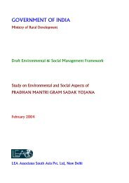
GOVERNMENT OF INDIA<br />
Ministry <strong>of</strong> Rural Development<br />
<strong>Draft</strong> <strong>Assessment</strong> <strong>of</strong> <strong>Current</strong> <strong>Conditions</strong><br />
Study on Environmental and Social Aspects <strong>of</strong><br />
PRADHAN MANTRI GRAM SADAK YOJANA<br />
February 2004<br />
LEA Associates South Asia Pvt. Ltd, New Delhi
TABLE OF CONTENTS<br />
1. INTRODUCTION ............................................................................................................. 1<br />
1.1 Study Background ........................................................................................................... 1<br />
1.2 Process follow ed.............................................................................................................. 1<br />
1.3 Field Visits........................................................................................................................ 3<br />
1.4 Consultations conducted on site ..................................................................................... 6<br />
2. REVIEW OF LEGISLATION, POLICIES AND DESIGN STANDARDS ........................ 8<br />
2.1 Legal provisions – Environmental Management ............................................................. 8<br />
2.2 Legal provisions – Resettlement ..................................................................................... 9<br />
2.3 World Bank Safeguard Policies Applicable ................................................................... 11<br />
2.4 Review <strong>of</strong> Design Standards ......................................................................................... 12<br />
3. ASSESSMENT OF CURRENT CONDITION ............................................................... 15<br />
A) Rajasthan............................................................................................................................. 15<br />
3.1 Introduction .................................................................................................................... 15<br />
3.2 Environment................................................................................................................... 16<br />
3.3 Socio- Economic environment....................................................................................... 23<br />
B) Uttar Pradesh...................................................................................................................... 34<br />
3.1 Introduction .................................................................................................................... 34<br />
3.2 Environment................................................................................................................... 34<br />
3.3 Socio- Economic environment....................................................................................... 40<br />
C) Himachal Pradesh............................................................................................................... 50<br />
3.1 Introduction .................................................................................................................... 50<br />
3.2 Environment................................................................................................................... 50<br />
3.3 Socio- Economic environment....................................................................................... 55<br />
D) Jharkhand............................................................................................................................ 67<br />
3.1 Introduction .................................................................................................................... 67<br />
3.2 Environment................................................................................................................... 67<br />
3.3 Socio-Economic Environment ....................................................................................... 72<br />
4. ENVIRONM ENT AND SOCIAL ISSUES ...................................................................... 82
Table 1.1: Selection criteria for districts<br />
Table 1.2: Districts selected for Site visits<br />
LIST OF TABLES<br />
Table 1.3: Existing characteristics for the districts for PMGSY in the project states<br />
Table 1.4: Roads Studied<br />
Table 3.1: Existing Land categories in Rajasthan<br />
Table 3.2: Pr<strong>of</strong>ile <strong>of</strong> the PAPs in the state <strong>of</strong> Rajasthan<br />
Table 3.3: Existing Land categories in Uttar Pradesh<br />
Table 3.4: Pr<strong>of</strong>ile <strong>of</strong> the PAPs in the state <strong>of</strong> Uttar Pradesh<br />
Table 3.5: Existing Land categories in Himachal Pradesh<br />
Table 3.6: Types <strong>of</strong> land use and property rights regimes according to law and custom in<br />
Tribal Areas<br />
Table 3.7: Existing Land Width available along sub-projects in sample districts <strong>of</strong><br />
Himachal Pradesh<br />
Table 3.8: Pr<strong>of</strong>ile <strong>of</strong> the PAPs in the state <strong>of</strong> Himachal Pradesh<br />
Table 3.9: Existing Land categories in Uttar Pradesh<br />
Table 3.10: Pr<strong>of</strong>ile <strong>of</strong> the PAPs in the state <strong>of</strong> Jharkhand<br />
Table 4-1: Environmental and social issues in the four states
<strong>Draft</strong> <strong>Assessment</strong> <strong>of</strong> <strong>Current</strong> <strong>Conditions</strong><br />
Pradhan Mantri Gram Sadak Yojna<br />
1. INTRODUCTION<br />
1.1 Study Background<br />
The Pradhan Mantri Gram Sadak Yojana (PMGSY) was launched in December 2000 to provide all weather<br />
road connectivity to 1.6 lakh unconnected Habitations with population <strong>of</strong> 500 persons or more in the rural<br />
areas by end <strong>of</strong> the 10th Plan Period (2007) at an estimated cost <strong>of</strong> Rs. 60,000 Crores. Ministry <strong>of</strong> Rural<br />
Development (MoRD) executes the programme as a centrally sponsored scheme in all the States and Union<br />
Territories.<br />
The GoI has approached the World Bank for financial assistance for the PMGSY activities carried out in the<br />
states <strong>of</strong> Rajasthan, Uttar Pradesh, Himachal Pradesh and Jharkhand. The MoRD has appointed M/s LEA<br />
Associates South Asia Pvt. Ltd as consultants to undertake this study to provide with (i) an unbiased review <strong>of</strong><br />
the environmental and social aspects <strong>of</strong> the PMGSY (ii) identify potential environmental and social risks in<br />
PMGSY and (iii) recommend associated mitigation mechanisms for the identified risks. The three stages <strong>of</strong> the<br />
study are:<br />
Stage I: Review & <strong>Assessment</strong> <strong>of</strong> current practices/policies and guidelines<br />
Stage II:<br />
Recommendation & Formulation <strong>of</strong> Environmental & Social Management Framework<br />
(ESMF)<br />
Stage III: Preparation <strong>of</strong> EMP/RAP/IPDP for first year corridors in accordance with ESMF<br />
The present report pertains to the findings <strong>of</strong> the stage I, Review and <strong>Assessment</strong> <strong>of</strong> the current practices in<br />
the four states. These findings form the base for identification <strong>of</strong> the key environmental & social impacts<br />
and Safeguard risks. This review has been based on site visits to 105 contracts taken up / proposed to be<br />
taken up under the PMGSY program and the review <strong>of</strong> the available guidelines for the project.<br />
1.2 Process followed<br />
1.2.1 Selection <strong>of</strong> sample districts<br />
For the study, a representative sample <strong>of</strong> 18 districts has been chosen based on environmental, social and<br />
economic characteristics (Table 1.1).<br />
Table 1-1: Selection criteria for districts<br />
Environmental characteristics<br />
Physiography<br />
Climate<br />
Sensitive areas<br />
Literacy rates<br />
Social characteristics<br />
Tribal districts<br />
Access to infrastructure (Social)<br />
Level <strong>of</strong> urbanisation<br />
Economic characteristics Agriculture productivity<br />
Investment levels<br />
The selection process ensures that the environmental and social characteristics <strong>of</strong> the different regions in these<br />
states are represented. The districts identified for study were finalized after discussion with the MoRD/WB<br />
1
<strong>Draft</strong> <strong>Assessment</strong> <strong>of</strong> <strong>Current</strong> <strong>Conditions</strong><br />
Pradhan Mantri Gram Sadak Yojna<br />
and their observations are incorporated into fine tuning <strong>of</strong> selection criteria. The districts selected are<br />
presented in Table 1.2.<br />
Table 1-2: Districts selected for Site visits<br />
State Districts<br />
Churu<br />
Banswara<br />
Rajasthan<br />
Bhilwara<br />
Uttar Pradesh<br />
Himachal Pradesh<br />
Jharkhand<br />
Bundi<br />
Jhalawar<br />
Rampur<br />
Etah<br />
Hardoi<br />
Bahraich<br />
Azamgarh<br />
Banda<br />
Mirzapur<br />
Kullu<br />
Lahul & Spiti<br />
Mandi<br />
Hazaribag<br />
Dumka<br />
West Singhbhum<br />
To identify the development level <strong>of</strong> each physiographic region, the current environmental, social, economic<br />
and infrastructure development indicators were analyzed. Though same parameters are taken for each<br />
physiographic division, the level <strong>of</strong> development is dependent on the significance level <strong>of</strong> a particular aspect in<br />
that region. It provided the ground for identification <strong>of</strong> intra-region distinctions <strong>of</strong> the existing development<br />
levels. Table 1.3 gives the parameters taken into account and analysed to arrive at the districts to be selected<br />
for site visits. Annexure-1 presents the social, economic and infrastructure development indicators for each<br />
district.<br />
In Rajasthan, Bundi, Bhilwara, Banswara and Churu are the districts selected that reveal poor levels <strong>of</strong> growth<br />
in developmental sectors <strong>of</strong> social and economic aspects. Jhalawar is at the developing stage where<br />
infrastructure development index is low. Banswara represents the tribal district in the state while Churu is the<br />
district having desert topography marked by sand dunes.<br />
In Himachal Pradesh, districts from each <strong>of</strong> the three physiographic regions have been selected. These districts<br />
also represent different levels <strong>of</strong> development in terms <strong>of</strong> social, economic and infrastructure. Kullu being a<br />
tourist destination with low levels <strong>of</strong> social infrastructure indices, moderate economic development represents<br />
a developing scenario. Lahul and Spiti represent the backward region <strong>of</strong> the state with poor levels <strong>of</strong> social,<br />
economic and infrastructure development indices. Mandi being a main marketing hub reveals moderate rates<br />
<strong>of</strong> social, economic and infrastructure development indices.<br />
Uttar Pradesh has varied physiographic regions and developmental levels. Most <strong>of</strong> the districts in the state that<br />
are selected can be classified as backward in terms <strong>of</strong> developmental rates except for Hardoi and Mirzapur that<br />
are identified as the developing regions.<br />
West Singhbhum, Hazaribagh and Dumka are the districts selected from Jharkhand. Despite economic<br />
expansion owing to mineral exploitation, low levels <strong>of</strong> social development indices are observed in West<br />
Singhbhum. On the other hand, Hazaribag has poor economic rates <strong>of</strong> growth and high forest cover while<br />
Dumka has considerable size <strong>of</strong> tribal population.<br />
2
<strong>Draft</strong> <strong>Assessment</strong> <strong>of</strong> <strong>Current</strong> <strong>Conditions</strong><br />
Pradhan Mantri Gram Sadak Yojna<br />
1.2.2 Selection <strong>of</strong> roads for the visit<br />
PMGSY project provides for construction <strong>of</strong> all weather roads to provide for the following: New<br />
connectivity to unconnected settlements;<br />
Upgradation and widening <strong>of</strong> existing earthen tracks;<br />
Widening <strong>of</strong> existing roads; and<br />
The selection <strong>of</strong> roads for site visit were finalized after discussion with the district <strong>of</strong>ficials and was taken to<br />
select roads that pass through sensitive areas. Major environmental and social issues that were considered for<br />
selection <strong>of</strong> the roads are: (i) forests (ii) geologically unstable areas (iii) procurement <strong>of</strong> materials (iv) loss <strong>of</strong><br />
trees, (v) water bodies (vi) tribal population and (vii) problem areas in land take / voluntary donation. A<br />
representative sample under each <strong>of</strong> the above proposals undergoing in the district, under various stages <strong>of</strong><br />
implementation are chosen for the study.<br />
1.3 Field Visits<br />
With a view to assess the current environment and social issues and to drawup standards to be adopted to<br />
address them, site visits were undertaken in selected districts. The site visits are aimed at testing the compliance<br />
<strong>of</strong> the standards (Government and CRRI etc) during project preparation and implementation on a sample<br />
basis.<br />
Contracts within the chosen districts were preferred on the basis <strong>of</strong> their representation <strong>of</strong> the existing status<br />
<strong>of</strong> implementation <strong>of</strong> PMGSY projects in the district. Teams were formed who visited the states in view to<br />
identify issues pertaining to the environmental and social aspects based on their observations and consultations<br />
with local groups in June and July 2003. These teams comprised <strong>of</strong> experts from environmental and social<br />
background. Table 1.4 presents the number <strong>of</strong> roads studied under each stage <strong>of</strong> the project. Aspects studied<br />
in these roads are broadly classified under the following heads.<br />
Selection: Methodology adopted by the PIU in selection <strong>of</strong> the roads for construction is studied<br />
closely. This also included review <strong>of</strong> the District Rural Roads Plan (DRRP) and Core network.<br />
Project Preparation & Approval: The methodology <strong>of</strong> preparation <strong>of</strong> the Detailed Project Report<br />
(DPR) and items included as part <strong>of</strong> the design are reviewed. Role <strong>of</strong> various authorities in<br />
preparation & approval <strong>of</strong> the DPR are also studied. Extent <strong>of</strong> scrutiny by the PIU/STA is assessed<br />
for each district.<br />
Construction Practices: Environmental and social issues arising/considered under each stage <strong>of</strong> the<br />
project are identified. <strong>Current</strong> practices <strong>of</strong> the contractor in dealing with likely issues are studied.<br />
Availability <strong>of</strong> Land: Since majority <strong>of</strong> issues are arising out <strong>of</strong> land availability, this is given a special<br />
attention in the study. The process <strong>of</strong> land take and issues arising are identified.<br />
3
<strong>Draft</strong> <strong>Assessment</strong> <strong>of</strong> <strong>Current</strong> <strong>Conditions</strong><br />
Pradhan Mantri Gram Sadak Yojna<br />
State ACRP Region Districts<br />
Rajasthan<br />
Uttar Pradesh<br />
Southern Plains Bhilwara<br />
Eastern Plains Bundi<br />
Western Arid Churu<br />
Southern Plateau Jhalawar<br />
Southern Plains Banswara<br />
North Eastern Plains<br />
Table 1-3: Existing characteristics for the districts for PM GSY in the project states<br />
Bahraich<br />
Region 4(2) Azamgarh<br />
Vindhyan Mirzapur<br />
Central plains Hardoi<br />
North Western Plains Rampur<br />
Reasons for Selection<br />
Environmental Aspects Social Aspects<br />
Low level <strong>of</strong> urbanisation, female<br />
Economic Aspects Infrastructure Development<br />
Plain topography with few marked<br />
hillocks and considerable area<br />
under wasteland (27%)<br />
literacy and gender ratio and high<br />
rural poverty along with Tribal<br />
population and density <strong>of</strong><br />
population<br />
Economically developing district<br />
based on textile industries<br />
Well developed infrastructure but<br />
lacks in access to medical facilities<br />
Flat terrain, balanced utilisation <strong>of</strong><br />
water but prone to occasional<br />
floods<br />
Arid region with no forests, desert<br />
soil, low water holding capacity<br />
and soil erosion<br />
Undulating terrain with<br />
considerable forest area<br />
Flat terrain with undulations in<br />
form <strong>of</strong> hillocks and considerable<br />
area under wasteland<br />
Flat terrain with significant area<br />
under cropping with meager land<br />
under forest<br />
Flat terrain with insignificant area<br />
under forest cover<br />
Undulating terrain marked by hills<br />
with dense forest cover<br />
Flat terrain marked by vast area<br />
under cultivation and meagre<br />
forest cover<br />
Plain topography with agriculture<br />
as predominant land use and no<br />
forest cover<br />
Low literacy levels especially in<br />
rural areas and lower urbanisation<br />
rates<br />
Lower levels <strong>of</strong> social<br />
development especially in literacy<br />
Moderate levels <strong>of</strong> social<br />
development characterized lower<br />
rates <strong>of</strong> urbanization and literacy<br />
Tribal district with significant<br />
numbers <strong>of</strong> tribal population<br />
having low level <strong>of</strong> urbanisation,<br />
female literacy and gender ratio<br />
and high rural poverty<br />
Socially backward district with<br />
poor gender ratio, literacy rates<br />
and urbanisation levels<br />
Under developed society with low<br />
literacy and urbanisation levels<br />
Developing society in social terms<br />
with low levels <strong>of</strong> urbanisation<br />
Moderate level <strong>of</strong> social<br />
development<br />
Low level <strong>of</strong> social development<br />
Considerable agriculture and<br />
mineral output representing a<br />
growing economy<br />
Needs investment in economy<br />
along with low value <strong>of</strong><br />
production and animal husbandry<br />
is prevalent<br />
Moderate levels <strong>of</strong> economic<br />
development representing a<br />
growing district economy<br />
Moderate levels <strong>of</strong> value <strong>of</strong><br />
production but poor credit and<br />
deposit rates<br />
Economically under developed<br />
districts with low per capita bank<br />
deposits and credits<br />
Economically developing in terms<br />
<strong>of</strong> value <strong>of</strong> production but poor<br />
levels <strong>of</strong> deposit and credit ratios<br />
Economically developing base<br />
with moderate rates <strong>of</strong> bank<br />
deposits and credits<br />
Economically developing base<br />
with growing agricultural base<br />
Agriculture based economy with<br />
low rates <strong>of</strong> bank deposits and<br />
credit<br />
High infrastructure development<br />
index<br />
Poor infrastructure development<br />
index and access to facilities<br />
Though poor development index,<br />
accessibility to health and<br />
educational facilities is satisfactory<br />
Low level <strong>of</strong> infrastructure<br />
development<br />
Lowest infrastructure<br />
development index in state with<br />
poor access to facilities<br />
Poor in terms <strong>of</strong> infrastructure<br />
development index, need for<br />
improvement in health and<br />
educational facilities<br />
Moderate level <strong>of</strong> infrastructure<br />
development<br />
Low level <strong>of</strong> infrastructure<br />
development with inadequate<br />
medical facilities<br />
Moderate level <strong>of</strong> infrastructure<br />
development<br />
4
<strong>Draft</strong> <strong>Assessment</strong> <strong>of</strong> <strong>Current</strong> <strong>Conditions</strong><br />
Pradhan Mantri Gram Sadak Yojna<br />
State ACRP Region Districts<br />
Jharkhand<br />
Himachal Pradesh<br />
South Western Plains Etah<br />
Bundelkhand Banda<br />
Chhota Nagpur Hills<br />
Chhota Nagpur Plateau<br />
Hazaribag<br />
West Singbhum<br />
Dumka<br />
Region 1 Mandi<br />
Region 2 Kullu<br />
Region 3 Lahul and Spiti<br />
Reasons for Selection<br />
Environmental Aspects Social Aspects Economic Aspects Infrastructure Development<br />
Plain topography with meager<br />
forest area and vast agriculture<br />
land<br />
Moderately developed district in<br />
terms <strong>of</strong> social aspects<br />
Economically poor developed<br />
with moderate rates <strong>of</strong> value <strong>of</strong><br />
production and low bank deposits<br />
and credits<br />
Infrastructure development is<br />
moderate<br />
Plateau region marked by<br />
undulating terrain and ravines<br />
Low levels <strong>of</strong> social development<br />
Economically under developed as<br />
low per capita bank deposits and<br />
credits<br />
Poor infrastructure development<br />
Undulating terrain with steep<br />
slopes marked by soil erosion,<br />
significant forest cover and rich in<br />
mineral base<br />
Developing society in terms <strong>of</strong><br />
literacy, urbanisation and other<br />
social aspects<br />
Inspite <strong>of</strong> rich mineral base, low<br />
rates <strong>of</strong> economic development as<br />
evident form low per capita bank<br />
deposits and credit<br />
Low infrastructure development<br />
index<br />
Undulating topography marked by<br />
hills with significant area under<br />
wasteland, natural vegetation and<br />
rich in mineral resources<br />
Moderate levels <strong>of</strong> social<br />
development with low rural<br />
literacy<br />
Though economically developing<br />
district, low value <strong>of</strong> bank deposits<br />
and value <strong>of</strong> production<br />
Low infrastructure development<br />
index<br />
Plain topography with small<br />
hillocks with considerable area<br />
covered by natural vegetation and<br />
forests<br />
Backward in terms <strong>of</strong> social<br />
development, urbanisation and<br />
sizeable tribal population<br />
Economically under developed<br />
Very low infrastructure<br />
development<br />
Low hills with considerable area<br />
under forests and natural<br />
vegetation<br />
Lower rates <strong>of</strong> urbanisation and<br />
literacy<br />
Economically developed as main<br />
market centre<br />
Infrastructure development is<br />
considerable<br />
High hills with considerable area<br />
under forests and natural<br />
vegetation, prone to soil erosion<br />
and landslides<br />
Alpine region with high hills and<br />
Pressure on land as tourist<br />
destination and moderate social<br />
development levels<br />
Moderately growing economic<br />
base<br />
Poor road connectivity and low<br />
infrastructure development index<br />
steep slopes, landslides, glacial<br />
movements and soil erosion are<br />
common, vast area under dense<br />
forest<br />
Socially advancing society though<br />
lower literacy rates compared to<br />
state<br />
Economically under developed<br />
Moderate level <strong>of</strong> infrastructure<br />
development and accessibility<br />
5
<strong>Draft</strong> <strong>Assessment</strong> <strong>of</strong> <strong>Current</strong> <strong>Conditions</strong><br />
Pradhan Mantri Gram Sadak Yojna<br />
Table 1-4: Roads Studied<br />
States<br />
Completed<br />
Stages <strong>of</strong> Projects<br />
Under construction Proposed<br />
Total<br />
Rajasthan 18 7 14 39<br />
Uttar Pradesh 14 14 8 36<br />
Himachal Pradesh 7 5 7 19<br />
Jharkhand 3 7 3 13<br />
Total 40 33 31 107<br />
1.4 Consultations conducted on site<br />
The site visits carried out for the selected four states constituted interactions with the implementing agency<br />
(Public Works Department, Rural Engineering Services, Rural Engineering Organization and Department <strong>of</strong><br />
Rural Development), contractors and local community. List <strong>of</strong> <strong>of</strong>ficials met during the site visits is presented<br />
in Annexure 1.2. PWD <strong>of</strong>ficials for each district detailed out the procedure involved for the contracts<br />
selection and implementation and accompanied the teams during site visits as well. The local population was<br />
also consulted in order to understand the issues and problems faced by them during and after implementation<br />
<strong>of</strong> the project. An understanding <strong>of</strong> the role <strong>of</strong> PRI was also studied by meeting the village Pradhan and<br />
Sarpanch.<br />
Along each <strong>of</strong> the corridors, focus group discussions/village meetings were conducted. The following issues<br />
were discussed:<br />
1. Whether any consultation was conducted by the PIU or any other agency regarding alignment fixation and<br />
road construction?<br />
2. If yes, who were the participants in the meetings?<br />
Man/Women/PRI members/Representative <strong>of</strong> the implementing agency/Any other agency<br />
3. What were the main points <strong>of</strong> discussions?<br />
4. What was the process involved for approval <strong>of</strong> alignment?<br />
5. Was documentation <strong>of</strong> the discussion undertaken?<br />
6. Was peg marking carried out before initiation <strong>of</strong> construction work?<br />
7. Did any villager lose his land during construction <strong>of</strong> the road?<br />
8. What is the extent <strong>of</strong> land lost?<br />
9. What was the process adopted for land donation in such instances?<br />
10. Did it involve legal transfer <strong>of</strong> land?<br />
11. Has land donation affected your livelihood/source <strong>of</strong> income?<br />
12. Were any community land, property, and religious structures affected?<br />
6
<strong>Draft</strong> <strong>Assessment</strong> <strong>of</strong> <strong>Current</strong> <strong>Conditions</strong><br />
Pradhan Mantri Gram Sadak Yojna<br />
13. Was tree cutting involved during construction?<br />
14. Any other impact identified due to the project?<br />
15. Any environmental and social issues felt by the community due to construction work (Borrow area,<br />
Construction waste, location <strong>of</strong> camping sites, Movement <strong>of</strong> heavy machineries, others.)<br />
16. If yes, details and what are their suggestions?<br />
17. Whether the villager’s skill and knowledge incorporated for mitigation measures?<br />
18. Were villagers employed in the construction work?<br />
19. If yes, what kind <strong>of</strong> work undertaken?<br />
20. Were women also employed during construction work?<br />
21. What was the wage structure and whether timely payment <strong>of</strong> wages?<br />
22. Whether suggestions and demand <strong>of</strong> villagers incorporated?<br />
23. Were there any health impacts owing to the project work or migrant labourers?<br />
24. Any social conflicts due to migrant laborers during construction work?<br />
7
2. REVIEW OF LEGISLATION, POLICIES AND DESIGN<br />
STANDARDS<br />
2.1 Legal provisions – Environmental Management<br />
A review <strong>of</strong> the legislations <strong>of</strong> Government <strong>of</strong> India (GoI) as well as other state level laws applicable for<br />
PMGSY regarding environmental and social aspects is carried out and their applicability is presented in the<br />
following sections.<br />
2.1.1 Environmental Clearance from MoEF<br />
In April 1997, a notification was issued by MOEF amending Schedule-I <strong>of</strong> the EIA Notification, 1994 that<br />
lists projects requiring Environmental Clearance. MoEF is the responsible agency for implementing the<br />
provisions <strong>of</strong> the notification. The 1997 Notification states:<br />
“…Environmental Clearance from the MoEF is not required for Highway projects relating to improvement work including<br />
widening and strengthening <strong>of</strong> roads with marginal land acquisition 1 along the existing alignments provided the highways do not<br />
pass through ecologically sensitive areas such as National Parks, Sanctuaries, Tiger Reserve, Reserve Forests etc.”<br />
Applicability: It is important to note that the width <strong>of</strong> land required for the sub-projects is less than 12m<br />
and does not exceed the marginal land acquisition specified. Therefore, as a rule, all sub-projects are<br />
exempted from environmental clearance apart from roads through ecologically sensitive areas. Also, the EIA<br />
notification would be applied to sub-projects involving construction <strong>of</strong> Tarred roads in Himachal Pradesh<br />
exceeding a length <strong>of</strong> 5 km.<br />
2.1.2 Forest Clearances<br />
The Forest (Conservation) Act 1980 (as amended 1998) pertains to the cases <strong>of</strong> diversion <strong>of</strong> forest area and<br />
felling <strong>of</strong> roadside plantation.<br />
Applicability: Restrictions and clearance procedure proposed in the Forest (Conservation) Act applies<br />
wholly to the sub-projects requiring diversion <strong>of</strong> natural forest areas, even in case the protected/designated<br />
forest area does not have any vegetation cover.<br />
2.1.3 Water (Prevention and Control <strong>of</strong> Pollution) Act 1974, as amended in 1988<br />
The Water (Prevention and Control <strong>of</strong> Pollution) Act 1974 is enacted to prevent pollution <strong>of</strong> water sources<br />
through the industrial or any other construction activity and for maintaining or restoring <strong>of</strong> wholesomeness<br />
<strong>of</strong> water.<br />
1 Marginal land acquisition is defined by the MoEF as “land acquisition not exceeding 20m on either side <strong>of</strong> the existing right-<strong>of</strong>-way”.<br />
8
<strong>Draft</strong> <strong>Assessment</strong> <strong>of</strong> <strong>Current</strong> <strong>Conditions</strong><br />
Pradhan Mantri Gram Sadak Yojna<br />
Applicability: Project includes setting up <strong>of</strong> worker’s camp and other construction equipment. The<br />
Contractor needs to take consent for setting up and also consent for operation <strong>of</strong> the equipment/worker’s<br />
camp.<br />
2.2 Legal provisions – Resettlement<br />
2.2.1 73 rd Constitution Amendment Act, 1992<br />
In 1992, the Indian Constitution was amended through the 73 rd Constitution Amendment Act to empower<br />
the Panchayati Raj Institutions in preparation and implementation <strong>of</strong> development programs.<br />
Applicability: Provides involvement <strong>of</strong> the PRIs especially, the Gram Sabha/Panchayat during project<br />
preparation and implementation. The provisions under the Act empower the PRIs at the appropriate levels to<br />
implement the project activities.<br />
2.2.2 Panchayats (Extension to Scheduled Areas) Act, 1996<br />
The Panchayats (Extension to Scheduled Areas) Act, 1996 is enacted to safeguard and preserve traditions and<br />
customs <strong>of</strong> tribal community and prevent alienation from their homelands.<br />
Applicability: The Approval <strong>of</strong> plans, land acquisition and safeguard mechanism consistent with the existing<br />
customary laws and practices through Gram Panchayat will achieve legal sanctity through this act. The PRIs<br />
will be the responsible agency to implement the tasks involved as per the provisions <strong>of</strong> the Act.<br />
2.2.3 Freedom <strong>of</strong> Information Act, 2002<br />
The Freedom <strong>of</strong> Information Act, 2002, is enacted to secure access to information under the control <strong>of</strong><br />
public authorities.<br />
Applicability: It empowers people to obtain information on the project. To facilitate project stakeholders<br />
obtain requisite project information PMGSY provides for dissemination <strong>of</strong> information and procedures,<br />
entitlements, project costs, selection criteria for contractor etc. The PI will be the responsible agency to<br />
provide the required information pertaining to the project to the desired individual. The information<br />
dissemination will also be undertaken by the PIU through the PRIs at the grass root/village level.<br />
2.2.4 Other State Level legislations<br />
Apart from the above, the acts applicable at State level in the project states, especially for land reforms and<br />
for empowering Panchayati Raj Institutions are as listed below.<br />
For Land Reforms:<br />
Rajasthan Tenancy Act, 1955<br />
An Act to consolidate and amend the law relating to tenancies <strong>of</strong> agricultural lands and to provide<br />
for certain measures <strong>of</strong> land reforms and matters connected therewith.<br />
9
<strong>Draft</strong> <strong>Assessment</strong> <strong>of</strong> <strong>Current</strong> <strong>Conditions</strong><br />
Pradhan Mantri Gram Sadak Yojna<br />
Applicability: Under the terms <strong>of</strong> lease, the lessee has the right to transfer his rights and shall have<br />
all rights <strong>of</strong> a lessor as per the Tenancy Act. In such case, the MoU for voluntary donation <strong>of</strong> land<br />
shall be between the PIU/ Government and the lessee.<br />
UP Land Zamindari Abolition and Land Reform Act, 1950<br />
The Act abolishes the zamindari system involving intermediaries between the State and cultivators. It<br />
empowers the tillers <strong>of</strong> the soil to have propitiatory rights over the land they till.<br />
Applicability: The transfer <strong>of</strong> land parcel likely to be affected shall be in accordance to the legal<br />
rights <strong>of</strong> the land tenure holder. The provision <strong>of</strong> the Act prohibits the division <strong>of</strong> the holding that<br />
is 3 1/8 acres or less (Uneconomic Holding). Restriction on transfer <strong>of</strong> land by SC/ST by way <strong>of</strong><br />
sale, gift, mortgage or lease any land to a person not belonging to SC/ST.<br />
Chota Nagpur Tenancy Act, 1908 for restricting transfer <strong>of</strong> land <strong>of</strong> SC/ST in Jharkhand<br />
Restricts or prohibits transfer <strong>of</strong> land by SC/ST/ backward classes to any member <strong>of</strong> non-SC/ST.<br />
However, for public purposes the land can be donated to the “State” in the name <strong>of</strong> the Governor.<br />
Applicability: Transfer <strong>of</strong> tribal land shall be done through these provisions.<br />
Santhal Paraganas Tenancy (Supplementary Provisions) Act, 1949 for restricting transfer <strong>of</strong> land in<br />
Jharkhand<br />
The act codifies the customary laws relating to exchange <strong>of</strong> raiyati2 lands in six districts <strong>of</strong><br />
Jharkhand3 . The act provides that no transfer by a raiyat <strong>of</strong> his right on his holding or portion<br />
there<strong>of</strong> by sale, gift, mortgage, will lease or an other contract or agreement, express or implied, shall<br />
be valid unless the right <strong>of</strong> transfer has been recorded in the record-<strong>of</strong>-rights, to the extent to which<br />
such right is so recorded. The Act does not allow the transfer <strong>of</strong> land to the state even for public<br />
purposes.<br />
Applicability: Same procedures can be used in case <strong>of</strong> PMGSY for transfer <strong>of</strong> land.<br />
For Panchayati Raj Institutions:<br />
Rajasthan Panchayati Raj Amendment Act, 1994<br />
Authorises the Panchayat to act as the agencies involved during programme planning and<br />
implementation.<br />
Applicability:<br />
Provides for PRI involvement in R&R planning<br />
Approval <strong>of</strong> rural road plan and core network by Intermediate & District Panchayat.<br />
Involvement <strong>of</strong> gram sabha during:<br />
o Finalisation <strong>of</strong> alignment<br />
o Identification <strong>of</strong> entitled persons<br />
o Disbursement <strong>of</strong> assistance<br />
2 Raiy at means a person not being a landlor d, who has acquired a right to hold land for the purpose <strong>of</strong> cultivating it by himself or by members <strong>of</strong><br />
his family or by hired servants; and includes the successor in interest <strong>of</strong> a person who has acquired such a right.<br />
3 Districts <strong>of</strong> Ranchi, Singhbhum, Latehar sub-division & Bhandari block <strong>of</strong> Garhwa sub-division in Palamu, Dumka, Pakur, Rajmahal & Jamtara<br />
sub-division, Sundar Pahari & Baorijor blocks <strong>of</strong> Godda sub-division in Santhal Paragana district.<br />
10
<strong>Draft</strong> <strong>Assessment</strong> <strong>of</strong> <strong>Current</strong> <strong>Conditions</strong><br />
Pradhan Mantri Gram Sadak Yojna<br />
o Monitoring <strong>of</strong> R&R implementation<br />
Himachal Pradesh Panchayati Raj Act, 1992<br />
Authorises the Panchayats to act as the agencies involved during programme planning and<br />
implementation.<br />
Applicability:<br />
Provides for PRI involvement in R&R planning<br />
Approval <strong>of</strong> rural road plan and core network by Intermediate & District Panchayat.<br />
Involvement <strong>of</strong> gram sabha during:<br />
o Finalization <strong>of</strong> alignment<br />
o Identification <strong>of</strong> entitled persons<br />
o Disbursement <strong>of</strong> assistance<br />
o Monitoring <strong>of</strong> R&R implementation<br />
Kshetra Samiti and Zilla Parishad Adhiniyam Amendment, 1994 in case <strong>of</strong> Uttar Pradesh for<br />
regularizing Panchayati Raj Institutions.<br />
Authorises the Panchayats to act as agencies involved during programme planning and<br />
implementation. The State Government shall establish for each block a Kshetra Panchayat while the<br />
Zila Parishad acts the channel between the Government and local institutions at the grass root level.<br />
Applicability:<br />
Identification <strong>of</strong> private land likely to be impacted and their legal and tenurial rights during transect<br />
walk. Any land width accretion shall be in consultation and approval <strong>of</strong> the Gram Sabha. The<br />
identification and allocation <strong>of</strong> alternate land site for the vulnerable PAPs impacted shall be through<br />
the Gram Sabha.<br />
The Gram Sabha shall be involved in:<br />
Finalisation <strong>of</strong> alignment<br />
Identification <strong>of</strong> entitled persons<br />
Disbursement <strong>of</strong> assistance<br />
Monitoring <strong>of</strong> R&R implementation<br />
State Panchayati Raj Act, 2001, Jharkhand<br />
Authorises the Panchayats to act as the agencies involved during programme planning and<br />
implementation.<br />
Applicability:<br />
Provides for PRI involvement in R&R planning<br />
Approval <strong>of</strong> rural road plan and core network by Intermediate & District Panchayat.<br />
Involvement <strong>of</strong> gram sabha during:<br />
o Finalisation <strong>of</strong> alignment<br />
o Identification <strong>of</strong> entitled persons<br />
o Disbursement <strong>of</strong> assistance<br />
o Monitoring <strong>of</strong> R&R implementation<br />
2.3 World Bank Safeguard Policies Applicable<br />
The WB safeguard policies applicable to the project are as presented in the Table 2-1.<br />
11
<strong>Draft</strong> <strong>Assessment</strong> <strong>of</strong> <strong>Current</strong> <strong>Conditions</strong><br />
Pradhan Mantri Gram Sadak Yojna<br />
Table 2-1: World Bank Safeguard Policies applicable<br />
S. No. World Bank Policy Applicable due to<br />
Project is likely to have impacts on environmental and<br />
1. Environmental <strong>Assessment</strong> OP4.01<br />
social components as on water bodies, existing slopes in<br />
case <strong>of</strong> hill areas and on trees along the road<br />
2. Involuntary Resettlement OP 4.12 Involves affect on assets and livelihood<br />
3. Indigenous Peoples OD 4.20<br />
Presence <strong>of</strong> people belonging to Scheduled Tribes and<br />
Scheduled Castes<br />
4. Natural Habitats OP4.04 Project passes adjacent to forest areas<br />
5. Forests OP 4.36<br />
Project likely to have efects on health and quality <strong>of</strong><br />
forests<br />
6. Cultural Properties <strong>Draft</strong> OP4.11<br />
The project entails risk / damage to cultural properties<br />
and has likelihood <strong>of</strong> finding archeological properties<br />
Apart from compliance to the above policies, the project will need to comply with the bank procedure,<br />
BP17.50. Disclosure shall need to be carried out at all stages <strong>of</strong> the project as at planning stage, prioritization<br />
stage, project preparation stage and implementation stages.<br />
2.4 Review <strong>of</strong> Design Standards<br />
IRC:SP-20:2002, lays down guidelines for the various aspects <strong>of</strong> rural roads. The standards laid down are<br />
suggestions to be followed in the planning, design, construction and maintenance <strong>of</strong> rural roads. It further<br />
lays down uniform standards for adoption across the states. It has been stated that the guidelines should be<br />
applied taking local experience into consideration. But the states have not tailored guidelines to suit the states<br />
varying conditions.<br />
The planning and design <strong>of</strong> PMGSY roads are mandated to follow the IRC:SP-20:2002. However, it is<br />
observed that these standards could not be followed in any <strong>of</strong> the four states. The non-compliance was with<br />
respect to Roadway width, Radius <strong>of</strong> curves and other features. It is therefore necessary to have a re-look at<br />
the standards and to-restate the same keeping the environment issues and diverse nature <strong>of</strong> requirement in<br />
the various regions <strong>of</strong> the country. Some <strong>of</strong> the issues identified due to inadequacies <strong>of</strong> design are as under.<br />
2.4.1 Design Speed<br />
The design speed prescribed in IRC:SP-20:2002 is as given in Table 2-2<br />
Road Classification<br />
Rural Roads (ODR<br />
and VR)<br />
Table 2-2: Design Speed as per IRC:SP-20:2002<br />
Design Speed (km/h)<br />
Plain Terrain Rolling Terrain<br />
Mountainous<br />
Terrain<br />
Steep Terrain<br />
Ruling Min. Ruling Min. Ruling Min. Ruling Min.<br />
50 40 40 35 25 20 25 20<br />
The design speed governs the geometric designs <strong>of</strong> the roads and laying down the minimum radius <strong>of</strong> curves<br />
but these design norms could not be complied with for want <strong>of</strong> adequate land width.<br />
12
<strong>Draft</strong> <strong>Assessment</strong> <strong>of</strong> <strong>Current</strong> <strong>Conditions</strong><br />
Pradhan Mantri Gram Sadak Yojna<br />
2.4.2 Road Land Width/ Right <strong>of</strong> Way:<br />
The recommendations <strong>of</strong> IRC SP20 for land width are indicated in Table 2-3<br />
Road<br />
Classification<br />
Rural Roads<br />
(ODR and VR)<br />
Table 2-3: Roadway Width as per IRC:SP-20:2002<br />
PMGSY programme provides for aligning the roads along revenue tracts and for voluntary donation by the<br />
land owner. Land width <strong>of</strong> 15-25m <strong>of</strong> or full formation <strong>of</strong> 7.5m is not available at most <strong>of</strong> the places.<br />
2.4.3 Height <strong>of</strong> Road embankment:<br />
The minimum height <strong>of</strong> embankment adopted on most <strong>of</strong> the PMGSY roads was observed as 0.60m even in<br />
arid and sandy areas. Reduction <strong>of</strong> average height <strong>of</strong> embankment in such places would reduce the quantity <strong>of</strong><br />
earth needed for the road construction and would consequently result in lesser width and depth <strong>of</strong> borrow<br />
pits. The deep borrow pits become breeding places for mosquitoes and redevelopement <strong>of</strong> these areas is not<br />
being carried out.<br />
2.4.4 Minimum Radii <strong>of</strong> Curves<br />
In view <strong>of</strong> the land restrictions, it has not been possible to adhere to IRC standards for minimum radius <strong>of</strong><br />
curves in most <strong>of</strong> the cases.<br />
2.4.5 Side slopes & Road shoulders<br />
The guidelines for side slopes are indicated in Table 2.7 <strong>of</strong> IRC:SP-20:2002 but these are not generally<br />
observed for want <strong>of</strong> roadway width. The side slopes have been recommended on the basis <strong>of</strong> the property <strong>of</strong><br />
local soil utilised for embankment but in most <strong>of</strong> the DPR only the value <strong>of</strong> CBR had been indicated but full<br />
details soil pr<strong>of</strong>ile not indicated. Local borrow soils must be tested as required in the Format 4.1 This would<br />
provide a rough check on the value <strong>of</strong> CBR and also ensure use <strong>of</strong> local soil with or without any modification.<br />
It would reduce transport <strong>of</strong> soil in case <strong>of</strong> clayey soil areas. The slopes as well as the embankments get<br />
eroded during rainy season effecting road safety. It should be mandatory to mark the toe-lines and compact<br />
full width <strong>of</strong> the embankment from the sub-grade level and to ensure that the guidelines <strong>of</strong> IRC:SP-20:2002<br />
are strictly followed.<br />
The shoulders are not protected from erosion and compaction leading to their failure under load and under<br />
heavy rains.<br />
2.4.6 Design <strong>of</strong> Cross-Drainage Works<br />
Plain and Rolling Terrain Mountainous and Steep Terrain<br />
Open Area Built-up Area Open Area Built-up Area<br />
Normal Range Normal Range Normal Exceptional Normal Exceptional<br />
15 15-25 15 15-25 12 12 12 9<br />
For small catchments areas IRC:SP-20:2002 has specified size and number <strong>of</strong> pipes without taking the<br />
topography <strong>of</strong> the area into account and without calculating the likely afflux. In plain terrain with low ground<br />
13
<strong>Draft</strong> <strong>Assessment</strong> <strong>of</strong> <strong>Current</strong> <strong>Conditions</strong><br />
Pradhan Mantri Gram Sadak Yojna<br />
slopes the rise <strong>of</strong> water cause flooding on the up-stream. The increase <strong>of</strong> velocity <strong>of</strong> water passing through<br />
the pipes cause scour on the down-stream and disturb natural ground. There is a need to properly study the<br />
hydrology, to limit the afflux and provide adequate waterways.<br />
2.4.7 Provision <strong>of</strong> Cattle- Crossings:<br />
Cattle wealth is an important asset for villagers and the cattle is moved between various paddocks for grazing.<br />
Many <strong>of</strong> the new roads may cross their normal routes. However, no cattle crossings for safety <strong>of</strong> the catle as<br />
well as for the road users are provided. Crossing <strong>of</strong> cattle and other farm equipment from the embankment<br />
sides damages the embankment.<br />
2.4.8 Intersection with other roads<br />
Rural roads meet the collector roads <strong>of</strong> higher category. Design <strong>of</strong> the junctions as per the IRC:SP-20:2002,<br />
are not designed. The DPR also does not provide for such junction designs.<br />
2.4.9 Hill roads<br />
Following are some <strong>of</strong> the issues identified specifically in hill roads:<br />
Alignments passing through sensitive areas as forests;<br />
Soil erosion and alteration <strong>of</strong> drainage;<br />
Soil strata becoming unstable during construction due to absence <strong>of</strong> thorough geological studies<br />
indicating location <strong>of</strong> loose strata; and<br />
Risks due to blasting<br />
14
3. ASSESSMENT OF CURRENT CONDITION<br />
A) Rajasthan<br />
3.1 Introduction<br />
The population distribution and density in Rajasthan varies across the physio-geographical regions. The<br />
population is comparatively dense in the semi-arid and southeastern plains as against the low density in the<br />
arid regions. More than 50% <strong>of</strong> the workers are engaged in cultivation.<br />
Western arid region, characterized by desert topography and low rainfall, has less density <strong>of</strong> people. This<br />
region experiences very low rainfall and is prone to droughts. Due to absence <strong>of</strong> irrigation sources the<br />
cultivation is rain fed and restricted to the months <strong>of</strong> June to September. This region is witnessing a serious<br />
drought for the past three years.<br />
The plains and plateau regions have considerable population density with major concentration <strong>of</strong> settlements<br />
and agricultural activities in areas served by rivers and canals. These represent highly productive regions<br />
owing to productive soil, adequate rainfall and irrigation facilities. Various regions <strong>of</strong> the state are identified in<br />
Map 2-1.<br />
Map 2- 1: Various agroclimatic region in the state are presented in Map<br />
15
<strong>Draft</strong> <strong>Assessment</strong> <strong>of</strong> <strong>Current</strong> <strong>Conditions</strong><br />
Pradhan Mantri Gram Sadak Yojna<br />
Western Arid Region Characterising Desert<br />
Topography<br />
3.2 Environment<br />
3.2.1 Climate<br />
Rich Agricultural Area and Plain Topography<br />
Rajasthan experiences a tropical climate varying from semi arid to arid conditions with a maximum<br />
temperature <strong>of</strong> upto 45 o C in June to a minimum <strong>of</strong> 3 o C in January. The average annual rainfall is as low as<br />
150 mm in extreme arid zones and as high as 1000 mm in the southeastern part <strong>of</strong> the State. Most <strong>of</strong> the<br />
rainfall (60-80%) is received with the Southwest monsoon in the period from July to September.<br />
Climatic factors affecting construction work are:<br />
Shifting dunes accumulate sand on construction site in arid areas as Churu. This sand is to be towed<br />
away for restarting the work<br />
Movement <strong>of</strong> machinery is not allowed in the post-monsoon as affect is likely on sown area<br />
Heavy rains during monsoon<br />
Sand dunes along the roads in Churu Sand piled up along the roadside on Gadesar –<br />
Sonpalsar road in Churu<br />
16
<strong>Draft</strong> <strong>Assessment</strong> <strong>of</strong> <strong>Current</strong> <strong>Conditions</strong><br />
Pradhan Mantri Gram Sadak Yojna<br />
3.2.2 Topography<br />
Relief and topography <strong>of</strong> the state varies from flat terrain in western and northwestern region to elevated<br />
plains in the southern area. Desert or arid areas marked by hillocks and sand dunes characterize flat terrain.<br />
Whereas, elevated plains are characterized with the Aravalli Range as most conspicuous topographic feature<br />
with elevated plains forming a plateau.<br />
Natural gradient followed along PMGSY roads as<br />
evident in Churu<br />
Ravine area observed along some sections <strong>of</strong> PMGSY<br />
roads in Bundi<br />
In the arid regions, the alignments are routed along existing tracks and the natural gradient is followed. Only<br />
in cases where a pr<strong>of</strong>ile correction is required, cut and fill operations are planned. Therefore, no major<br />
impacts on the general topography are witnessed.<br />
Desert topography along Ribariya-Mehra-Vanasar<br />
road in Churu<br />
Proposed road to Huwaliyan passing through flat area<br />
in Bundi<br />
17
<strong>Draft</strong> <strong>Assessment</strong> <strong>of</strong> <strong>Current</strong> <strong>Conditions</strong><br />
Pradhan Mantri Gram Sadak Yojna<br />
3.2.3 Geology<br />
The geological formations in the state ranges from the<br />
oldest Archaean, Metamorphites (Schists or Quartzites), in<br />
the plains and plateau sub-recent, alluvium and sand in the<br />
western and northwestern parts <strong>of</strong> the state..<br />
No separate studies conducted as regards the geological<br />
formation but inputs, which are based on some other<br />
studies conducted, are taken into consideration during the<br />
design stage.<br />
3.2.4 Soil Characteristics<br />
Private mining area for Quartz on LHS <strong>of</strong><br />
approach road to Luhari Khurd in Bhilwara<br />
Broad soil characteristics fixed by the PWD are used for<br />
design. Due to time constraints no specific tests are conducted to determine the soil characteristics. Also no<br />
topsoil conservation is carried out as revealed by the field visits. In 28 <strong>of</strong> 39 corridors topsoil conservation is<br />
not done and in rest <strong>of</strong> the corridors, no topsoil is available.<br />
Delays caused by sand deposited by strong winds<br />
cleared by tractors on Gadesar –Sonpalsar road in<br />
Churu<br />
3.2.5 Ambient air quality<br />
Retaining wall provided to avoid sand from coming to<br />
the road approach road to Gadesar – Sonpalsar road<br />
Consultations with the contractor and visit to sites under construction revealed that no dust suppression<br />
measures are being undertaken during earthwork. As a result, high dust concentrations around the<br />
construction sites are prevalent. Use <strong>of</strong> water for dust suppression is not a viable option due to scarcity <strong>of</strong><br />
water. The bitumen and aggregates for several PMGSY roads in a package are procured from a centralised<br />
hot-mix plant, crusher set up by the contractor. As these are sited away from habitations, no significant<br />
pollution from these sources is witnessed.<br />
During operation, the project roads are not characterized by high volume <strong>of</strong> traffic. Therefore, no significant<br />
increase <strong>of</strong> pollutants as CO, SOx, SPM etc are anticipated.<br />
18
<strong>Draft</strong> <strong>Assessment</strong> <strong>of</strong> <strong>Current</strong> <strong>Conditions</strong><br />
Pradhan Mantri Gram Sadak Yojna<br />
3.2.6 Ambient noise levels<br />
The increased noise levels during construction due to<br />
operation <strong>of</strong> heavy vehicles and machinery is a<br />
temporary impact. Apart from settlements, there are<br />
usually no sensitive receptors as schools and hospitals<br />
adjoining the corridors. No management <strong>of</strong> noisy<br />
construction activities or regulation <strong>of</strong> timing <strong>of</strong><br />
construction is currently being followed.<br />
During the operation stage, the noise levels along the<br />
project roads are low as there is no heavy vehicular<br />
traffic. Therefore, no significant impact due to vehicular<br />
noise is expected.<br />
3.2.7 Water quality and availability<br />
Water is a very scarce commodity in arid areas <strong>of</strong> Rajasthan. The availability <strong>of</strong> ground water varies across<br />
regions and the water table is very deep in the arid districts <strong>of</strong> Churu. The contractor obtains water for<br />
construction from community sources or private wells/tube well owners. In corridors close to major water<br />
sources as dams etc., (as in the case <strong>of</strong> Mahi dam rest house to Kankanseja corridor in district Banswara<br />
falling under plans <strong>of</strong> Rajasthan) water is procured from the dam reservoir.<br />
Tests as per the project guidelines are conducted for validating the physical parameters such as hardness etc.<br />
Most <strong>of</strong> the water is obtained either from local village sources or transported by tankers. No deterioration <strong>of</strong><br />
water quality in the water bodies along project corridors is evident.<br />
Vented causeway on seasonal river Manasi with Anicut on<br />
LHS gets submerged under rain water (Chandma road in<br />
Bhilwara)<br />
Sand obtained from the riverbed for construction<br />
work in Bundi<br />
Vented causeway along seasonal nallah on<br />
approach road to Borda in Bhilwara<br />
19
<strong>Draft</strong> <strong>Assessment</strong> <strong>of</strong> <strong>Current</strong> <strong>Conditions</strong><br />
Pradhan Mantri Gram Sadak Yojna<br />
3.2.8 Drainage<br />
Drainage is not an issue in the arid regions, which witness<br />
very low rains and frequent droughts. Remaining part <strong>of</strong><br />
the state is prone to occasional floods and proper drainage<br />
needs to be provided for its uninterrupted flow. Though<br />
there exist provisions for longitudinal drainage, these<br />
drains are not continuous and are blocked, resulting in<br />
water logging at certain sections. Cross-drainage structures<br />
provided to discharge the floodwater across the road are<br />
inadequate and cause water logging at certain locations.<br />
During monsoons, the approach road to Huwaliyan gets<br />
submerged under water upto 6ft. It drains into the Rajput<br />
Pond at approximately 100m on the RHS. According to the<br />
Area usually submerged under water after heavy<br />
rains along Huwaliyan in Bundi, A minor Bridge<br />
proposed for the section<br />
PWD <strong>of</strong>ficials, the site requires a minor bridge, which they may plan to execute under, the state funds if not<br />
permitted under PMGSY.<br />
In areas <strong>of</strong> the western part <strong>of</strong> state as in Churu district, no drainage channels exist; hence there is no<br />
provision for CD structures in the corridors. No alteration <strong>of</strong> drainage pattern is envisaged in the corridors<br />
visited.<br />
Proposed site for upgrading CD structure along the<br />
Luhari Khurd road in Bhilwara<br />
Flush causeway in section where water flows overtop<br />
the approach road to Gathila Kheda in Bhilwara<br />
Proposed site for culvert on approach road to<br />
Huwaliyan, waiting for forest clearance<br />
Side drains draining out water in vented causeway,<br />
on approach road to Baland in Bhilwara District<br />
20
<strong>Draft</strong> <strong>Assessment</strong> <strong>of</strong> <strong>Current</strong> <strong>Conditions</strong><br />
Pradhan Mantri Gram Sadak Yojna<br />
3.2.9 Flora and Fauna<br />
The arid areas are not rich in vegetation and the natural vegetation is <strong>of</strong> desert shrubs apart from dry bushes<br />
and grass. Acacia and a few thorny tree species is characteristic flora <strong>of</strong> the region. The southern and eastern<br />
part <strong>of</strong> the state has Dry Forest and Tropical Forest with Teak and Boswellia Sarata are the predominant<br />
species.<br />
Forest area along the Chandma in Bhilwara Thorn bushes along roads are common site in the<br />
state<br />
Roads passing through the forest are avoided from selection wherever possible. However, along certain<br />
sections where the acquisition <strong>of</strong> forestland is inevitable, clearances are being obtained in accordance with the<br />
provisions <strong>of</strong> the Forest Conservation Act (1980). The felling <strong>of</strong> trees is minimized to the extent possible. In<br />
certain cases, trees are left without clearing within the roadway.<br />
3.2.10 Land utilization<br />
Agriculture is the pre dominant land use in the semi arid regions while in the western arid region it is<br />
uncultivable wastelands. Resistance from the landowners to provide the required land can be seen in the<br />
fertile soil areas.<br />
The ownership or status <strong>of</strong> the land is not ascertained while planning or implementation <strong>of</strong> the project. So<br />
there is no special consideration for the grazing land..<br />
3.2.11 Procurement <strong>of</strong> construction material<br />
Locally available materials are used in the construction <strong>of</strong> the PMGSY roads. In majority <strong>of</strong> the PMGSY<br />
roads, material for earthwork has been from the roadside while the other construction material is brought<br />
from the quarries notified by the Government or PWD. There is no resistance from the local population in<br />
taking material from private lands in western arid parts while in the other regions <strong>of</strong> the state, borrowing<br />
from private lands is an issue <strong>of</strong> concern.<br />
21
<strong>Draft</strong> <strong>Assessment</strong> <strong>of</strong> <strong>Current</strong> <strong>Conditions</strong><br />
Pradhan Mantri Gram Sadak Yojna<br />
Borrow area long road side left without redevelopment<br />
as acts as natural water source after rains<br />
Stagnant water in the borrow areas along roads left<br />
without redevelopment<br />
No redevelopment <strong>of</strong> the borrow areas is proposed as part <strong>of</strong> the contractor’s scope <strong>of</strong> work. In case <strong>of</strong><br />
Jhalawara district, Pipaliya to Aroliya road people have started filling the borrow areas with quarry wastes<br />
from the stones mines which are dumped by the quarry owners without any cost.<br />
3.2.12 Safety Concerns<br />
There are no provisions for public safety concerns in the project. During construction either the traffic gets<br />
blocked or try passing through the stretch under construction, as no diversions are proposed. Provision <strong>of</strong><br />
guide stones and parapets in undulating topography are not considered under the project.<br />
In the case <strong>of</strong> Moyakhari road in Jhalawar district there is a siphon <strong>of</strong> the irrigation department crossing the<br />
road. The walls <strong>of</strong> the siphon used to be higher than the road level. With the road construction under<br />
PMGSY, the road is elevated over the siphon wall. But no effort has been taken to increase the height <strong>of</strong> the<br />
siphon wall. The villagers are facing problems as animals are falling into the siphon. Irrigation department as<br />
well as the PWD is shifting the responsibility to each other for increasing the siphon wall.<br />
3.2.13 Worker’s safety<br />
The skilled workers are usually provided houses taken on rent in the villages. At times, schools and other<br />
buildings are used as labour camps. The contractor provides for the accommodation, and the labourers have<br />
to make their own arrangement for food and other requirements. Majority <strong>of</strong> the unskilled labour are from<br />
the same village or nearby villages as this provides them with additional sources <strong>of</strong> income. No sanitary and<br />
other facilities are provided in both the cases. Personal safety devices for construction laborers were found<br />
generally lacking. Even in cases where provision <strong>of</strong> such equipments, as helmets, boots were available, the<br />
usage amongst the laborers was not significant. Though there are no regular health check up facilities, tie-ups<br />
with existing health facilities by the contractors was observed to take care <strong>of</strong> emergencies and accidents on<br />
site.<br />
22
<strong>Draft</strong> <strong>Assessment</strong> <strong>of</strong> <strong>Current</strong> <strong>Conditions</strong><br />
Pradhan Mantri Gram Sadak Yojna<br />
3.3 Socio- Economic environment<br />
3.3.1 Land Categories in the state<br />
The existing land categories in the state can be broadly classified into the following categories;<br />
Private Land: These are land, which are under individual ownership and can be transferred through the<br />
existing legislation except for land owned by tribals where it can be sold to the tribals.<br />
Gram Sabha land includes<br />
Lal dora: In Rajasthan, land reserved for residential purpose is known as Lal dora. In case <strong>of</strong> such<br />
lands the people residing in such land are the entitled to usufruct rights but do not have title for the<br />
plot <strong>of</strong> land. In such cases under the present regulation system, these people are not eligible to any<br />
compensation under the Land Acquisition Act in case their lands are acquired for “public purpose1”.<br />
Grazing lands: The grazing lands in Rajasthan called pasuchar, are usually protected land but can be<br />
transferred for public purpose under notification <strong>of</strong> the Governor.<br />
Government Lands: The title <strong>of</strong> these lands rest with the Government, they can be transferred from to the<br />
Government for “public purpose”.<br />
Government Department Lands: Land under the ownership <strong>of</strong> different departments can be transferred to<br />
the PWD for public purpose under the existing laws.<br />
The legal status <strong>of</strong> each land category is presented in Table 3.1.<br />
Land Category Legal Status<br />
Table 3-1: Existing Land categories in Rajasthan<br />
Private Land Individual property heritable rights vested with owner, can be transferred as per present laws<br />
Gram Sabha Land Land can be transferred for public uses as per notification <strong>of</strong> Governor for public purposes<br />
Government Land Different government institutions can transfer land as per existing laws<br />
3.3.2 Land Availability in sub-projects<br />
In the state <strong>of</strong> Rajasthan, The revenue tracks have been in existence for long and have been the traditional<br />
routes <strong>of</strong> communication for the villages. Though the available width is <strong>of</strong> the range 6-8m, the effective width<br />
available for movement is between 3-5m, and is encroached upon by the agricultural landowners. This<br />
practice is witnessed in most <strong>of</strong> the contracts visited.<br />
1 The Public Purpose as defined in Section 3(f) vii <strong>of</strong> the Land Acquisition Act 1894 as “the provision <strong>of</strong> land for any other schemes sponsored<br />
by the Government , or with prior approval <strong>of</strong> the appropriate Government, by a local authority”<br />
23
<strong>Draft</strong> <strong>Assessment</strong> <strong>of</strong> <strong>Current</strong> <strong>Conditions</strong><br />
Pradhan Mantri Gram Sadak Yojna<br />
3.3.3 Need for land width accretion<br />
Unconnected villages with an exiting revenue track are taken up for implementation under Phase – I. The<br />
width <strong>of</strong> these revenue tracks varies between 6-8m. As no new connectivity on a fresh formation is envisaged,<br />
the requirement <strong>of</strong> procuring private lands has been minimized. The need for additional private land arises<br />
when the existing revenue track is not sufficient to accommodate the proposed cross-sections, along the rural<br />
sections. In case <strong>of</strong> village areas, the width <strong>of</strong> the road is always restricted to the available width between the<br />
structures.<br />
Road section in village Huwaliyan where width<br />
constricted by land availability<br />
The extent <strong>of</strong> additional private land taken up for road construction in the various contracts visited varies<br />
upto a maximum <strong>of</strong> 2-3m. There is no case <strong>of</strong> displacement due to PMGSY apart from the encroachments,<br />
which are removed along the project roads and the revenue tracks.<br />
Issues related to procuring the additional land differs markedly between the arid regions and rest <strong>of</strong> the State.<br />
In arid areas there has been no marked issues related to the local population pertaining to land and property<br />
affected. This can be attributed to the fact that since the land is sandy and unproductive, there is no resistance<br />
from the local people in parting with the land.<br />
In other areas, along certain corridors there are instances <strong>of</strong> farmers not willing to part with their land.<br />
Though not a serious concern <strong>of</strong> these farmers, lack <strong>of</strong> provisions <strong>of</strong> compensation for land acquired was<br />
questioned.<br />
3.3.4 Minimization <strong>of</strong> impacts<br />
Availability <strong>of</strong> land width in village section in<br />
Sameliya<br />
The proposed carriageway width is 3.75m with shoulders <strong>of</strong> 1.5m. At places where the land availability is less,<br />
the c/w width is maintained at 3.75m while the width <strong>of</strong> shoulders are modified as per the land available. In<br />
the village sections, the pavement width is constricted according to the land available.<br />
Even along the rural sections, there are instances where the cross-section is constricted due to non-availability<br />
<strong>of</strong> the desired land width <strong>of</strong> 6-8m. Several examples can be sited as in the case <strong>of</strong> approach road to<br />
24
<strong>Draft</strong> <strong>Assessment</strong> <strong>of</strong> <strong>Current</strong> <strong>Conditions</strong><br />
Pradhan Mantri Gram Sadak Yojna<br />
Bhamarbore in Banswara district where the road is constructed in ‘S’ shape with blind curves to avoid<br />
displacement.<br />
Approach road to Bhamarbore in Banswara and Approach road to Vanasar in Churu following the available<br />
revenue track to avoid impact on private land<br />
There has been a dispute <strong>of</strong> land ownership for 100m<br />
<strong>of</strong> land on LHS <strong>of</strong> the corridor where the old village<br />
track was passing through private land. The landowner<br />
who was a farmer complained to the contractor and<br />
approached the PWD <strong>of</strong>ficials in Bundi. Since the<br />
farmer was not ready to donate the land and asked for<br />
due compensation, the Revenue Department was<br />
approached to do peg marking and identify the revenue<br />
track. As a result the alignment has been shifted.<br />
.<br />
Farmer not ready to part with his land without<br />
compensation for construction <strong>of</strong> road<br />
The revenue tracks have been in existence for long and have been the traditional routes <strong>of</strong> communication<br />
for the villages. Though the available width is <strong>of</strong> the range <strong>of</strong> 6-8m, the effective width available for<br />
movement is between 3-5m, and is encroached upon by the agricultural landowners.<br />
Existing revenue tracks representing long established routes for village connectivity taken up for PMGSY<br />
25
<strong>Draft</strong> <strong>Assessment</strong> <strong>of</strong> <strong>Current</strong> <strong>Conditions</strong><br />
Pradhan Mantri Gram Sadak Yojna<br />
3.3.5 Community Pr<strong>of</strong>ile and Characteristics <strong>of</strong> PAPs including Tribal Community<br />
In the state <strong>of</strong> Rajasthan, the natural regions range from the Desert topography in the western districts to well<br />
irrigated districts in northern and central areas. The eastern, central and southern portion has nearly plain<br />
topography with few hillocks. A very narrow belt <strong>of</strong> undulating topography characterized by Aravalli in the<br />
Southwest and plateau in the southern most parts <strong>of</strong> the state.<br />
The districts and villages in the plain areas <strong>of</strong> southern and eastern region have higher concentration <strong>of</strong><br />
population owing to flat terrain, fertile soil and a comparatively adequate supply <strong>of</strong> water provided by<br />
Ghaggar, Luni-Jawai aand Chambal- Banas drainage systems. On the contrary the southern plateau region is<br />
marked by scattered but high population concentrations. The district <strong>of</strong> Banswara is a notified Scheduled<br />
Tribal Area with approximately 75% population belonging to tribal community. In addition, several pockets<br />
<strong>of</strong> tribal population have been observed in villages <strong>of</strong> Bhilwara and Bundi.<br />
3.3.6 Project Affected Persons<br />
The community consultations in the 39 villages <strong>of</strong> the 5 districts visited revealed that the PAPs belonged to<br />
the vulnerable groups <strong>of</strong> SC and ST. There has been impact in terms <strong>of</strong> donation <strong>of</strong> land by BPL and<br />
households with uneconomic land holding in the state. Majority <strong>of</strong> the PAPs are cultivators and also working<br />
as agricultural labourers. Table 3.2 provides provide the pr<strong>of</strong>ile <strong>of</strong> the PAPs consulted during community<br />
consultation in the state.<br />
Churu<br />
District<br />
No <strong>of</strong><br />
Corridors<br />
visited<br />
Table 3-2: Pr<strong>of</strong>ile <strong>of</strong> the PAPs in the state <strong>of</strong> Rajasthan<br />
No <strong>of</strong> PAPs HH Scheduled<br />
Caste<br />
Scheduled<br />
Tribe<br />
Vulnerable Households<br />
Below<br />
Poverty<br />
Line<br />
Women<br />
Headed<br />
Households<br />
Handicap Uneconomic<br />
Land Holding<br />
Banswara 1 0 1 0 0 0 1<br />
Bhilwara 0 0 0 0 0 0 0<br />
Bundi 2 1 1 2 0 0 1<br />
Jhalawar 0 0 0 0 0 0 0<br />
Source: Community Consultations in villages along project corridors.<br />
3.3.7 Project Displaced Persons<br />
Along no corridor, there has been displacement <strong>of</strong> any person or asset due to the project.<br />
3.3.8 Indigenous People<br />
Consultations in the villages along project in tribal areas had no formal consultations with the PIU to<br />
ascertain concerns related to PMGSY road in tribal areas. No studies assessing the socio-economic, cultural<br />
characteristics or other laws and policies governing their systems and identifying their tenural rights have been<br />
conducted. No tribal development plans are prepared to address the issues that would arise during<br />
26
<strong>Draft</strong> <strong>Assessment</strong> <strong>of</strong> <strong>Current</strong> <strong>Conditions</strong><br />
Pradhan Mantri Gram Sadak Yojna<br />
construction. No specific plans / measures are taken in these regions to avoid or mitigate impacts on these<br />
communities as they are positively impacted due to the project.<br />
3.3.9 Nature and Extent <strong>of</strong> Impact<br />
3.3.9.1 Land<br />
The state <strong>of</strong> Rajasthan has varied topography and climate which is reflected in the land holding size. In the<br />
sandy district <strong>of</strong> Churu, the average land holding size is 7-10ha with PAPs having a land holding <strong>of</strong> 4-6ha. In<br />
Bhilwara it varies from 2-3ha while in rest <strong>of</strong> the districts visited it ranges from 1-2ha. Along majority <strong>of</strong> the<br />
corridors, the average land width required for donation has been between 1-2m without marginalizing any <strong>of</strong><br />
the landowners land holding. The farmers in the fertile areas pose resistance to donation <strong>of</strong> land and ask for<br />
compensation <strong>of</strong> land taken for the project. In the tribal district <strong>of</strong> Banswara, there has been donation <strong>of</strong> land<br />
as reported during consultation by 1 tribal person.<br />
3.3.9.2 Structure<br />
There has been no impact on the structures along the PMGSY corridors in the state <strong>of</strong> Uttar Pradesh<br />
3.3.9.3 Livelihood<br />
The impact on the livelihood <strong>of</strong> the villagers has been negligible. This can be attributed to the construction <strong>of</strong><br />
road & related activities during non-harvesting season. As a result, the standing crops are not affected by the<br />
project. In the plain and plateau regions <strong>of</strong> the State, villagers do not allow construction works when the<br />
crops are ready for harvest. This causes delay in commencement <strong>of</strong> construction works. No impacts are<br />
identified on the standing crops due to the project.<br />
3.3.9.4 Issues due to borrowing /material procurement<br />
The earth for construction is usually obtained by borrowing earth from within the existing revenue track.<br />
Along stretches where the land required for borrowing is not available, the contractor procures borrow<br />
material from the adjoining lands. The landowner has little option for resenting this action as it is usually<br />
communicated that the construction will be abandoned if the earth is not given. As the redevelopment or<br />
flattening <strong>of</strong> the borrow area is not done, the utility <strong>of</strong> the land parcels for sowing/cultivation is reduced.<br />
An instance in Bundi district has been known where the farmer did not allow the contractor to take material<br />
from his filed for earthwork along approach road to Anthara. Only after the pressure from the Sarpanch and<br />
PWD <strong>of</strong>ficials, they agreed to it. The topsoil in this case was piled up in the field and later spread back.<br />
27
<strong>Draft</strong> <strong>Assessment</strong> <strong>of</strong> <strong>Current</strong> <strong>Conditions</strong><br />
Pradhan Mantri Gram Sadak Yojna<br />
Material for earthwork taken from the agricultural land along the Kota Khurd road in Bundi<br />
3.3.9.5 Irrigation Facilities<br />
The irrigation facility to agricultural lands on either side <strong>of</strong> the track is connected through pipes below the<br />
revenue tracks. During site visits and interactions with the community, it was revealed that these links are<br />
maintained and consideration for laying new pipes is also given to the farmers prior to stabilization <strong>of</strong> the<br />
embankments.<br />
Irrigation facility un-interrupted along project roads<br />
28
<strong>Draft</strong> <strong>Assessment</strong> <strong>of</strong> <strong>Current</strong> <strong>Conditions</strong><br />
Pradhan Mantri Gram Sadak Yojna<br />
3.3.9.6 Drainage issues – post construction<br />
With the level <strong>of</strong> road is raised, water flows into<br />
the houses in absence <strong>of</strong> side drains in village<br />
portion where stone pitching has been done.<br />
3.3.9.7 Other Assets<br />
Impact on common property resources<br />
The common properties such as wells, water taps,<br />
hand pumps, and ponds were avoided while<br />
constructing the roads. Also, any other property<br />
or open land that is valuable for local community<br />
to hold festivals etc are also avoided.<br />
Impact on cultural properties<br />
Religious structures such as temples and<br />
mazaars along the roads have been avoided<br />
through change in alignments, constriction <strong>of</strong><br />
the proposed cross-sections etc. The project<br />
roads do not involve either removal or shifting<br />
<strong>of</strong> any <strong>of</strong> these properties.<br />
Mazaar in field avoided along Chandma road in<br />
Bhilwara<br />
Raised platform levels in Raithal Village<br />
Dismantling or shifting <strong>of</strong> hand pump avoided along<br />
Gathila Kheda road in Bhilwara<br />
A temple located at the carriageway edge on Raithal –<br />
Aibra road in Bundi<br />
29
<strong>Draft</strong> <strong>Assessment</strong> <strong>of</strong> <strong>Current</strong> <strong>Conditions</strong><br />
Pradhan Mantri Gram Sadak Yojna<br />
Impact on Access to Minor Forest Produce / Common Property Resource<br />
Along no corridor in the tribal areas or village with tribal population has been impacted in terms <strong>of</strong> restriction<br />
or loss <strong>of</strong> access to CPRs and MFPs.<br />
3.3.9.8 Temporary Impacts<br />
Disruption to normal Traffic<br />
As the existing track is blocked for construction and these tracks are the only connections to the habitations,<br />
no alternate routes for movement <strong>of</strong> vehicles exist. The vehicles ply on the existing track after the work stops<br />
for the day.<br />
Quality <strong>of</strong> Life during construction<br />
These included increased noise levels during construction, dust due to earthworks etc and are experienced for<br />
a very short duration. Though these impacts were not raised by the communities, consideration <strong>of</strong> these<br />
issues by the contractor through regulating timings <strong>of</strong> usage <strong>of</strong> heavy equipments, dust suppression etc will<br />
minimize the extent <strong>of</strong> impacts.<br />
Employment for local population<br />
Unskilled labour is being engaged from the villages along the alignment. Participation <strong>of</strong> people in<br />
construction activities is present in all packages and is engaged at Rs. 60 - 80 per day. Female also worked on<br />
road construction. Increased employment opportunities and diversification into construction activities from<br />
the seasonal agricultural activities is seen in the villages. Along one corridor, there has been delays in<br />
payments to the villagers who worked as unskilled ;labour during construction work.<br />
Issues related to movement <strong>of</strong> vehicles and machinery<br />
The PMGSY guidelines specify use <strong>of</strong> pavers and other heavy equipments for construction to ensure the<br />
quality <strong>of</strong> construction. Many <strong>of</strong> these equipments require a turning radius <strong>of</strong> upto 10m, which is usually not<br />
available along the project roads. Use <strong>of</strong> such machinery would impact the surrounding land due to trampling.<br />
Impacts on Land and people during construction<br />
Movement <strong>of</strong> construction machinery as rollers and earthmoving equipment on the adjacent lands have<br />
temporary impacts during construction. No other impacts are occurring to the people during this stage.<br />
Labour is available from the local villages but skilled labour stays in the nearby areas. The villagers in these<br />
cases cooperate with the resident labour and there is healthy interaction. No conflict <strong>of</strong> uses is identified, as<br />
the numbers <strong>of</strong> such labour are small.<br />
30
<strong>Draft</strong> <strong>Assessment</strong> <strong>of</strong> <strong>Current</strong> <strong>Conditions</strong><br />
Pradhan Mantri Gram Sadak Yojna<br />
Safety and Health Impacts<br />
The aspect <strong>of</strong> road safety and health has not been<br />
considered in the villages.<br />
Pedestrian safety especially at settlement<br />
stretches and sharp curves is poor and no<br />
signages were erected.<br />
The PMGSY provides for cement concrete<br />
roads with v-shaped drains in village sections<br />
around the water sources. This has been done to<br />
avoid damage to the pavement structure. In the<br />
absence <strong>of</strong> any definite outfall <strong>of</strong> these drains,<br />
these drains are connected to a low-lying area.<br />
The resultant water logging forms a breeding<br />
ground for mosquitoes and vectors.<br />
The borrow areas are not rehabilitated after<br />
construction. Though not very deep, there are<br />
locations where animals crossing the road may<br />
fall. Water logging along these borrow locations<br />
is an issue in the plains.<br />
No communicable diseases have spread due to contact with people outside the village so far. As revealed<br />
from the consultations with the local population, there has been no instance involving spread <strong>of</strong> any disease<br />
due to the migrant construction labourer.<br />
3.3.10 Process for Land Accretion<br />
3.3.10.1 Identification <strong>of</strong> locations<br />
Initial survey conducted by the PIU is based on the visual observation during verification <strong>of</strong> existing revenue<br />
track. The procedure adopted for verification <strong>of</strong> the land does not involve revenue department. The<br />
assessment <strong>of</strong> adequacy <strong>of</strong> the existing land width available involves the identification <strong>of</strong> locations for<br />
additional land width accretion.<br />
3.3.10.2 Ownership verification<br />
Sharp curves in rural sections without any signboards<br />
There has been no process involving verification <strong>of</strong> the existing alignment through revenue records, as the<br />
involvement <strong>of</strong> the revenue department is absent or at times minimal. Only in case <strong>of</strong> any issue raised by the<br />
landowner along the proposed corridor, the patwari is approached to verify the land ownership <strong>of</strong> the<br />
impacted or likely to be impacted land parcel.<br />
31
<strong>Draft</strong> <strong>Assessment</strong> <strong>of</strong> <strong>Current</strong> <strong>Conditions</strong><br />
Pradhan Mantri Gram Sadak Yojna<br />
3.3.10.3 Dissemination <strong>of</strong> process<br />
At no stage <strong>of</strong> project implementation, the information pertaining to the project features, alignment details<br />
and schedule <strong>of</strong> work is formally disseminated among the community.<br />
3.3.10.4 Process <strong>of</strong> Land Transfer/Donation<br />
Interactions with the communities who have willingly parted with their land parcels (1-2m), revealed no major<br />
resentment towards the voluntary donation <strong>of</strong> land, realizing the subsequent benefits from the project.<br />
However, there is a general perception that the component <strong>of</strong> compensation needs to be built in the project.<br />
This is more significant in the fertile regions, where the productivity is high and the land holdings are small.<br />
The process <strong>of</strong> land donation is usually done after the mobilization <strong>of</strong> the contractor. The decision to donate<br />
land is ensured by the contractor through village meetings and discussions, usually in the presence <strong>of</strong> the<br />
Sarpanch (head <strong>of</strong> the village). There is no evidence in the form <strong>of</strong> documents to review the process or<br />
transfer the ownership <strong>of</strong> land to the PWD or updating revenue records.<br />
3.3.11 Non-Titleholders<br />
While partial encroachments (Of about 2m into the revenue tracks) are cleared by the contractor usually with<br />
the consent <strong>of</strong> the landowners, complete encroachments are usually cleared by involving <strong>of</strong>ficials <strong>of</strong> PWD,<br />
Revenue dept, Sarpanch and Police assistance, if required.<br />
Encroachments cleared from the revenue track rom the approach to Bhojaan in Churu<br />
3.3.12 Consultation Process and Information Dissemination<br />
The concerns <strong>of</strong> the villagers are considered prior to approval <strong>of</strong> the project roads at the district level. The<br />
approvals <strong>of</strong> the proposals are done at the block level from the Panchayat Samity members and from Zilla<br />
Parishad at the district level. The resolution passed in those meetings for the approval is documented. After<br />
that, there are no efforts made to access or include the concerns <strong>of</strong> any other stakeholders. There was no<br />
public consultation in the village before initiation <strong>of</strong> the work in the village.<br />
32
<strong>Draft</strong> <strong>Assessment</strong> <strong>of</strong> <strong>Current</strong> <strong>Conditions</strong><br />
Pradhan Mantri Gram Sadak Yojna<br />
Community Consultation in villages connected by PMGSY roads in Bundi and Bhilwara<br />
3.3.12.1 Verify any Tribal Development Plans are prepared<br />
Banswara (73%) and Dungarpur (66%) are designated as Tribal Districts. In other districts, there are blocks<br />
where concentration <strong>of</strong> tribal population is considerable. There were no tribal development plans prepared<br />
for any <strong>of</strong> the project road in these districts. Impact <strong>of</strong> the project on the tribals is not ascertained.<br />
Population belonging to Scheduled Tribes & Other Backward Classes benefited from PMGSY<br />
3.3.13 Grievance Redressal Mechanism<br />
The grievances raised at the village level are resolved through involvement <strong>of</strong> the srapanch, patwari and the<br />
PIU <strong>of</strong>ficial. There is no formal mechanism <strong>of</strong> addressing the grievances except when the aggrieved person<br />
has a written document detailing hi concern. The PIU does not maintain any records <strong>of</strong> the issues raised by<br />
the community or an individual.<br />
33
<strong>Draft</strong> <strong>Assessment</strong> <strong>of</strong> <strong>Current</strong> <strong>Conditions</strong><br />
Pradhan Mantri Gram Sadak Yojna<br />
B) Uttar Pradesh<br />
3.1 Introduction<br />
The state <strong>of</strong> Uttar Pradesh is divided broadly into The Ganga Plains and The UP Uplands. The Ganga Plains<br />
consists <strong>of</strong> vast flat terrain while The UP Uplands are dissected and rugged plateau, which slopes towards<br />
North-east, with an average altitude less than 300 m. The land is gently sloping from Shiwalik hills in northwestern<br />
region (274 m) towards the eastern Terai region (78 m) <strong>of</strong> the state. The soil <strong>of</strong> the state is divided into<br />
Bhabhar, Tarai, and Central Ganga Alluvium plain.<br />
The state constitutes 166 million persons distributed over an area <strong>of</strong> 143327.09 sq km, out <strong>of</strong> which 19.9 %<br />
constitute urbanized population. The rural population is highly concentrated in eastern Uttar Pradesh and<br />
some district <strong>of</strong> western Uttar Pradesh while it is moderate in the central region. The ST population is minimal<br />
in entire state while SC population constitutes 21 % <strong>of</strong> the entire population.<br />
There are 30.19 million workers engaged in primary activities out <strong>of</strong> which 53.27 % are cultivators and 18.94 %<br />
are agriculture labourers, constituting 72.88 % <strong>of</strong> the total main workers in the state.<br />
3.2 Environment<br />
3.2.1 Climate<br />
The climate in the state ranges from moist, sub humid to dry arid in the North Eastern plains. The state has an<br />
annual rainfall <strong>of</strong> 997 mm with a maximum <strong>of</strong> 1214 mm in Bahraich to a minimum <strong>of</strong> 721 mm in Etah in SW<br />
plains.<br />
34
<strong>Draft</strong> <strong>Assessment</strong> <strong>of</strong> <strong>Current</strong> <strong>Conditions</strong><br />
Pradhan Mantri Gram Sadak Yojna<br />
Generally the contractors stop work during adverse climate conditions. The targets for completion <strong>of</strong> the<br />
PMGSY contracts are for 9 to 11 months irrespective <strong>of</strong> the starting season. In the absence <strong>of</strong> detailed<br />
construction schedule to accommodate the harvesting and rainy season, construction activities are also being<br />
carried out during rainy season to meet the targets, affecting quality <strong>of</strong> work.<br />
3.2.2 Geology<br />
The Gangetic Plain covers about three quarters <strong>of</strong> the state, gently dropping from 365 m above MSL in the<br />
northwest to 80 m above MSL in the east at Varanasi (Benaras). Due to this geological setup, the quarry<br />
material is usually available in the north <strong>of</strong> UP – in Haldwani or near Fatehpur sikri. Rest <strong>of</strong> the state being<br />
under Gangetic plain consisting mainly <strong>of</strong> alluvial deposits, hard rock with acceptable quality for the<br />
construction purposes is a scarce resource, which needs to be transported for long distances. There are no<br />
separate studies conducted on geological formation in the area for the project.<br />
3.2.3 Soil Characteristics<br />
Soil types <strong>of</strong> the visited areas can be divided into:<br />
Bhabhar, consisting <strong>of</strong> boulders and alluvium. Water table in these areas is at considerable depth;<br />
Tarai, consists at the upper end the perennial springs and merges with the alluvium plane <strong>of</strong> the<br />
Ganges. This supports very high diversity vegetation and dense forests. It consists <strong>of</strong> clay, sand,<br />
pebbles, and boulders; and<br />
Central Ganga Alluvium plain, consists <strong>of</strong> sands and clay with pockets <strong>of</strong> gravel and kankar. This area<br />
has the most problems <strong>of</strong> water scarcity.<br />
As per the guidelines, the tests are conducted on the soil used for subgrade (embankment) during preparation<br />
<strong>of</strong> DPR. There is in-house soil testing facility in PMGSY Dept. Various tests are recommended to meet the<br />
standards set under the project. However, PMGSY stipulates use <strong>of</strong> soil adjacent to the proposed alignment<br />
for filling, if the soil is suitable, to reduce the costs in transportation. Hence, fertile agricultural soil from the<br />
fields is being used as borrow material.<br />
3.2.4 Ambient air quality<br />
PMGSY roads is the only connectivity to villages and do not effect the air quality. Only source <strong>of</strong> the air<br />
pollution is Mentha oil extraction in parts <strong>of</strong> central Uttar Pradesh. Large numbers <strong>of</strong> such extraction units are<br />
found along the rural roads. However, emissions from these units are localised and do not have large<br />
dispersion over the area. Clean environment is observed along most <strong>of</strong> the sample based visited corridors.<br />
There is no provision <strong>of</strong> ambient air quality monitoring during construction / operation <strong>of</strong> the project.<br />
Contractors are also not aware about the distance <strong>of</strong> hot mix plant from the village etc. Since the motorised<br />
traffic is very less, air pollution due to traffic sources is insignificant.<br />
3.2.5 Ambient noise levels<br />
There is no source <strong>of</strong> noise pollution along PMGSY roads in UP, because most <strong>of</strong> the roads are in interiors<br />
having few motorized vehicles. There is no provision <strong>of</strong> noise level monitoring in the construction / operation<br />
<strong>of</strong> the project roads. Contractors are also not aware <strong>of</strong> any precautionary measures for control <strong>of</strong> noise from<br />
construction machineries and protection measures for workers. Even with the completion <strong>of</strong> the road, traffic is<br />
limited as most <strong>of</strong> the roads are approach roads to one or two villages. Due to less traffic and a large<br />
proportion <strong>of</strong> it being non - motorised, noise generated would be insignificant.<br />
35
<strong>Draft</strong> <strong>Assessment</strong> <strong>of</strong> <strong>Current</strong> <strong>Conditions</strong><br />
Pradhan Mantri Gram Sadak Yojna<br />
3.2.6 Availability <strong>of</strong> water<br />
Water availability for construction <strong>of</strong> PMGSY roads is not a concern in the state <strong>of</strong> Uttar Pradesh. Water table<br />
in the visited areas is 10 to 15m and Irrigation canals and rivers are found in Rampur, Bahraich and Etah<br />
districts in plain areas. Due to fertile agricultural land, farmers installed tube wells for extraction <strong>of</strong> water for<br />
irrigation. So water is usually obtained from these wells with the consent <strong>of</strong> the farmers for construction.<br />
Alternatively, the contractor gets water from nearest canal/river, if available. Contractors make payments to<br />
the owner (Individual or Panchayat) <strong>of</strong> the tube well if water is used from their wells. There has been no<br />
impact on the existing water bodies due to the project in the state.<br />
3.2.7 Drainage<br />
Water logging is a common feature in the districts <strong>of</strong> Rampur and Hardoi, & areas <strong>of</strong> Terai Region due to high<br />
water table and some areas are flood prone. The requirement and design <strong>of</strong> the CD structures and drains are<br />
worked out by the PIU based on PMGSY guidelines. The STA scrutinises the designs prepared for the roads.<br />
Number <strong>of</strong> CD structures provided is generally not adequate as no supporting data is provided for justification<br />
<strong>of</strong> their opening size. Hence could not be sanctioned by the STA.<br />
On the contrary, in Banda district, people resist construction <strong>of</strong> culverts fearing submergence <strong>of</strong> their fields<br />
from the heavy flows in the region. Concrete roads are constructed with longitudinal drains and pucca roadside<br />
drains are provided in Hardoi. But at some places villagers are <strong>of</strong> the opinion that the CD structures are not as<br />
per requirement. In settlements where the road is sloping towards the structures, drainage is poor and villagers<br />
are dissatisfied with the drainage provided. Water logging in the borrow trenches occurs and these are adjacent<br />
to the road within the farmers field.<br />
Poor drainage within village at Baharaich Poor cross drainage at Etah<br />
People resist construction <strong>of</strong> culvert Water logged on other side <strong>of</strong> culvert<br />
36
<strong>Draft</strong> <strong>Assessment</strong> <strong>of</strong> <strong>Current</strong> <strong>Conditions</strong><br />
Pradhan Mantri Gram Sadak Yojna<br />
3.2.8 Flora and Fauna<br />
Forests constitute about 7.0% <strong>of</strong> the total geographical area <strong>of</strong> the state. In case <strong>of</strong> Mirzapur district,<br />
settlements exist within the forest areas. A 6 km proposed road connecting Kharihat Kalan passes through<br />
patches <strong>of</strong> notified forests at 4 locations, 200 m each. Permission is sought from the forest department for<br />
transfer <strong>of</strong> land to revenue department. Though permission was not granted, the PWD was asked to remit the<br />
amount equivalent to the cost <strong>of</strong> construction <strong>of</strong> the road within the stretch and forest department will<br />
construct the road. At present no permission is obtained and hence the 800m stretches have been left out from<br />
construction while the remaining 5.2 Km has been completed.<br />
Mango tree plantation was found along the road in Bahraich. Though tree cutting was avoided but at some<br />
places shrubs and few trees were removed. In case <strong>of</strong> Banda, 200 Babool trees are cut but no permission from<br />
forest department is sought as they are on private lands. In Azamgarh district, a dry tree in the middle <strong>of</strong> the<br />
pavement is seen along approach road to Khuthana as the forest department has not issued clearance for<br />
cutting the Tree. Officials <strong>of</strong> PMGSY at Hardoi are planning for roadside tree plantation from other funds,<br />
involving local people.<br />
Trees in Middle <strong>of</strong> Road at Azamgarh<br />
3.2.9 Agricultural Practice<br />
Tree felling avoided in Rampur<br />
Most <strong>of</strong> the land along the visited roads is fertile. Major crops along the project corridor are sugarcane, maize,<br />
rice, arhar, etc. Start <strong>of</strong> works will be delayed if there are standing crops as earth needs to be excavated for<br />
raising / forming new embankment as per technical specifications. Hence, it is necessary to schedule the<br />
construction activities keeping in view the harvesting time and rainy season to avoid delays in the works<br />
execution.<br />
37
<strong>Draft</strong> <strong>Assessment</strong> <strong>of</strong> <strong>Current</strong> <strong>Conditions</strong><br />
Pradhan Mantri Gram Sadak Yojna<br />
Agriculture Practices along proposed corridor in Bahraich Agriculture Practices along corridor under construction in<br />
Rampur<br />
3.2.10 Grazing Land<br />
Existing revenue tracks have been selected for PMGSY project in UP. Existing width <strong>of</strong> village roads taken up<br />
for PMGSY varies from 3.5m-8m. Requirement <strong>of</strong> additional 2-3 m land for widening, is not affecting the<br />
grazing land. But at some places borrowing <strong>of</strong> earth for embankment is done from nearby grazing land.<br />
The borrow area on the side <strong>of</strong> Khutana road in Azamgarh<br />
District<br />
3.2.11 Land utilization<br />
Most <strong>of</strong> the PMGSY roads in UP are aligned on Chak roads,<br />
which are usually on fertile agricultural land. Few roads are<br />
passing through barren land in Etah. Commercial activities<br />
have come up after the road has been constructed. No<br />
consideration is given to the type <strong>of</strong> land use and the impact<br />
<strong>of</strong> construction activities on the fertile agricultural land.<br />
Grazing land along proposed corridor at Hardoi<br />
Shop on Shoulder <strong>of</strong> PMGSY road<br />
38
<strong>Draft</strong> <strong>Assessment</strong> <strong>of</strong> <strong>Current</strong> <strong>Conditions</strong><br />
Pradhan Mantri Gram Sadak Yojna<br />
3.2.12 Availability <strong>of</strong> construction material<br />
Due to a number <strong>of</strong> road projects going-on in UP i.e. Ambedkar<br />
Gram Sadak Yojana, UP State Highways Project etc, at times<br />
contractors face shortage <strong>of</strong> construction materials.<br />
The proposals in the district are made as per availability <strong>of</strong><br />
construction material in the district. But still there are cases <strong>of</strong><br />
delay <strong>of</strong> the projects due to non-availability <strong>of</strong> materials in the<br />
districts <strong>of</strong> Banda, Hardoi and Etah. There are instances <strong>of</strong><br />
transporting materials from long distances like the ballast for<br />
Banda and Azamgarh districts are brought from Mirzapur district.<br />
3.2.13 Handling <strong>of</strong> earth work<br />
Machines such as excavators carry out earthwork for embankments in the PMGSY project. The farmers do<br />
not allow the earthwork when the crops are standing on the field. Spillage <strong>of</strong> the construction activities to the<br />
adjacent lands causing damage has been observed in some instances.<br />
3.2.14 Conservation <strong>of</strong> topsoil and reuse<br />
The soil throughout UP is very fertile. Top layer <strong>of</strong> the soil is being used for rising the embankment leading to<br />
loss <strong>of</strong> topsoil. More serious loss <strong>of</strong> topsoil is evident when the farmer try to level their field by towing in soil<br />
into the borrow trenches thereby losing the fertile layer containing residues <strong>of</strong> the fertilizers used. Usually<br />
villagers donate the soil from their agricultural land up to maximum one-meter depth. PMGSY <strong>of</strong>ficials are<br />
also not aware <strong>of</strong> the topsoil conservation.<br />
3.2.15 Use <strong>of</strong> quarries<br />
Quarry materials are taken from nearby licensed quarries. Quarry materials are taken from Lalkuna quarry in<br />
Rampur and Hardoi whereas Fatehpur Sikri is the only approved quarry for Etah District, but Archaeological<br />
Survey <strong>of</strong> India has declared Fatehpur Sikri as a protected area. Blasting activities has been stopped in this area.<br />
Now only manual mining is in practice. But this quarry does not fulfil the material requirement <strong>of</strong> the project,<br />
resulting in delays.<br />
3.2.15.1 Borrow areas and their rehabilitation<br />
Construction stopped due to shortage <strong>of</strong><br />
sand<br />
All the visited PMGSY roads pass through plain terrain. Borrow material for earthwork is taken from<br />
roadsides. No redevelopment <strong>of</strong> these areas is proposed as part <strong>of</strong> the contractor’s scope <strong>of</strong> work hence these<br />
are left as it is. Villagers fill these pits at the time <strong>of</strong> ploughing <strong>of</strong> their agricultural fields.<br />
39
<strong>Draft</strong> <strong>Assessment</strong> <strong>of</strong> <strong>Current</strong> <strong>Conditions</strong><br />
Pradhan Mantri Gram Sadak Yojna<br />
Borrow pits along the project corridor at Rampur Field borrow pits by the villegers at Etah<br />
3.2.16 Worker’s safety<br />
The labour force employed by the contractors consists <strong>of</strong> both<br />
locals as well as residents. But mostly skilled labourers are migrants<br />
from Bihar. The unskilled labourers including women are also<br />
employed doing the construction work. Out side labourers stay in<br />
nearby school buildings, abandoned govt / private buildings etc.<br />
Only a tarpaulin is provided for about 20 to 30 workers that too<br />
only in case <strong>of</strong> rain while no sanitary or other facilities are provided<br />
at some places. Throughout the construction sites visited, it has<br />
been observed that no adequate safety measures are being followed<br />
during construction.<br />
3.3 Socio- Economic environment<br />
3.3.1 Land Categories in the state<br />
The land can be broadly classified into the following categories and the legal status are tabulated in Table 3.3;<br />
Private Land: These are land, which are under individual ownership and can be transferred through the<br />
existing legislation except for land owned by tribals where it can be sold to the tribals.<br />
Gram Sabha land includes<br />
Tarpaulin only in case <strong>of</strong> Rain<br />
Abadi Land: In Uttar Pradseh, land reserved for residential purpose is known as Abadi Land. In case<br />
<strong>of</strong> such lands the people residing in such land are the entitled to usufruct rights but do not have title<br />
for the plot <strong>of</strong> land. In such cases under the present regulation system, these people are not eligible to<br />
any compensation under the Land Acquisition Act in case their lands are acquired for “public<br />
purpose1”.<br />
Grazing lands: The grazing lands in Uttar Pradesh called pasuchar, are usually protected land but can<br />
be transferred for public purpose under notification <strong>of</strong> the Governor.<br />
1 The Public Purpose as defined in Section 3(f) vii <strong>of</strong> the Land Acquisition Act 1894 as “the provision <strong>of</strong> land for any other<br />
schemes sponsored by the Government , or with prior approval <strong>of</strong> the appropriate Government, by a local authority”<br />
40
<strong>Draft</strong> <strong>Assessment</strong> <strong>of</strong> <strong>Current</strong> <strong>Conditions</strong><br />
Pradhan Mantri Gram Sadak Yojna<br />
Government Lands: The title <strong>of</strong> these lands rest with the Government, they can be transferred from to the<br />
Government for “public purpose”.<br />
Government Department Lands: Land under the ownership <strong>of</strong> different departments can be transferred to<br />
the PWD for public purpose under the existing laws.<br />
Land Category Legal Status<br />
Table 3.3: Existing Land categories in Uttar Pradesh<br />
Private Land Individual property heritable rights vested with owner, can be transferred as per present laws<br />
Gram Sabha Land Land can be transferred for public uses as per notification <strong>of</strong> Governor for public purposes<br />
Government Land Different government institutions can transfer land as per existing laws<br />
3.3.2 Land Availability in sub-projects<br />
The existing Chak roads (revenue tracks) are taken up under PMGSY. In majority <strong>of</strong> the areas, existing land<br />
width for the project varies between 4.5m-6.5 m, which is inadequate as per the PMGSY guidelines.<br />
Encroachments onto the revenue tracks, if any, are cleared to provide for the required width wherever the land<br />
available is inadequate. To accommodate the proposed cross-section, a land width <strong>of</strong> 2-3 m is procured on<br />
either side. Peg marking <strong>of</strong> the alignment is being carried out only at the time <strong>of</strong> mobilization <strong>of</strong> machinery for<br />
the earthwork on the site. As the actual area <strong>of</strong> land loss is known with peg marking, landowners put up<br />
resistance to construction.<br />
3.3.3 Need for land width accretion<br />
Though in majority <strong>of</strong> the areas, the existing chak roads are followed and inadequate land width is available for<br />
the project (4.5m-6.5 m) as per the PMGSY guidelines. Also, several small stretches where the existing width is<br />
about 3.0m have been sited.<br />
PMGSY roads are constructed till the point it enters the habitation / settlement in Rampur district, as a result,<br />
there is very less probability <strong>of</strong> affecting any structure in the settlement section. But in Etah, Hardoi and<br />
Bahraich districts the road crosses the village. The width <strong>of</strong> the road is reduced to the available width to reduce<br />
any additional land requirement and to avoid any displacement.<br />
In case <strong>of</strong> Hardoi, where land is highly fertile, people resist voluntary donation. The<br />
landowners are hassled to donate the land required for PMGSY road by the Sarpanch<br />
and Tehsildar. Project work has stopped for approach road to Mohammadpur village<br />
wherein stay order from High Court has been obtained by the landowner on<br />
construction <strong>of</strong> the proposed road. Similarly, construction work has stopped at take<strong>of</strong>f<br />
point (due to no apparent benefits for him, being nearer to the corridor) along<br />
Khanpura corridor <strong>of</strong> Banda district due to a stay order. In certain corridors, as in<br />
Barouli Azam in Banda, w idth <strong>of</strong> the c/s has to be reduced to 5 m from 7.5m for about<br />
30% <strong>of</strong> the length due to people’s resistance to voluntary donation (Plate I).<br />
Plate I Land not donated by<br />
people<br />
41
<strong>Draft</strong> <strong>Assessment</strong> <strong>of</strong> <strong>Current</strong> <strong>Conditions</strong><br />
Pradhan Mantri Gram Sadak Yojna<br />
Plate II Land not donated due<br />
to communal Problems<br />
3.3.4 Minimization <strong>of</strong> impacts<br />
Com m unal disputes in Azam garh along corridor connecting to Godhana is one <strong>of</strong> the<br />
reason to avoid donation <strong>of</strong> land. The take<strong>of</strong>f point is in a muslim village benefiting a<br />
hindu village hence land is not donated. The corridor is brick pitched in the disputed land<br />
(Plate II).<br />
In Azamgarh district, corridor connecting,<br />
Khutahna land dispute occurred and work is<br />
stopped due to a stay order at the take<strong>of</strong>f point.<br />
But w ith the intervention <strong>of</strong> the district collector,<br />
the ow ner is allotted an alternate piece <strong>of</strong> land as<br />
compensation and work has resumed (Plate III)<br />
Plate III Disputed land in Azamgarh<br />
Land width accretion has been minimised to the extent possible in roads passing through agriculture lands. In<br />
settlement sections the c/w width is maintained at 3.75m. No geometric corrections to the alignment are made<br />
to minimise land requirement, and also to avoid impacts on farmers. The cross section <strong>of</strong> the proposed<br />
corridor is restricted within the available land width especially in the settlement sections.<br />
3.3.4.1 Alignment Selection<br />
During selection <strong>of</strong> the alignment, PWD <strong>of</strong>ficials notify the Zilla Parishad Members, MLA’s and MP about the<br />
project and seek their opinion on the alignment. The people’s representatives in turn express their opinion.<br />
The proposal, finalized by the PIU satisfying the PMGSY guidelines is presented in Zilla Panchayat for<br />
approval. With the approval <strong>of</strong> Zilla Panchayat, it is sent to the Department <strong>of</strong> Rural Development, which<br />
sends it to the Ministry <strong>of</strong> Rural development Government <strong>of</strong> India for sanctioning the project. After the<br />
approval from the Ministry <strong>of</strong> Rural Development the PWD prepares a detailed project report (DPR) and<br />
detailed cost estimates. The DPR is subjected to the unbiased scrutiny <strong>of</strong> the STA for its approval for<br />
construction. Comments <strong>of</strong> STA if any shall be incorporated. With the approval <strong>of</strong> the DPR by the STA, the<br />
PWD requests the State standing committee for implementation.<br />
3.3.5 Community Pr<strong>of</strong>ile and Characteristics <strong>of</strong> PAPs including Tribal Community<br />
Uttar Pradesh has marked variation in the distribution <strong>of</strong> population. The region <strong>of</strong> eastern UP has higher<br />
concentration <strong>of</strong> rural population, which decreases towards the western regions. Amongst the western districts<br />
those in close proximity to Delhi have high density <strong>of</strong> population. In the Tarai region and southern plateau,<br />
population is sparse.<br />
The state is developed in terms <strong>of</strong> irrigation facilities, agriculture and industries. The economy is primarily<br />
agrarian as more than 70% <strong>of</strong> the workers are engaged in primary activities. In the rural areas, 85% <strong>of</strong> work<br />
force participation is in the primary sector, especially agriculture. The tribal population in the state is<br />
insignificant and no tribal population has been affected due to the project.<br />
3.3.5.1 Project Affected Persons<br />
Majority <strong>of</strong> the PAPs are Scheduled Castes with 80% <strong>of</strong> the total impacted households. There is no person<br />
belonging to ST impacted due to the project, as their concentration is negligible in the state. 22 <strong>of</strong> the 110<br />
42
<strong>Draft</strong> <strong>Assessment</strong> <strong>of</strong> <strong>Current</strong> <strong>Conditions</strong><br />
Pradhan Mantri Gram Sadak Yojna<br />
PAPs are below poverty line with 2 households headed by women. In no case the impacted household has<br />
been marginalized due to the project as reported during the community consultations. Since the state is rich in<br />
productive soil, the main occupation <strong>of</strong> the PAPs is farmers with few PAPs working as agricultural labourers.<br />
Table 3.4 provides the details <strong>of</strong> the PAPs consulted during community consultation in the state.<br />
District<br />
No <strong>of</strong><br />
Corridors<br />
v isited<br />
Table 3.4: Pr<strong>of</strong>ile <strong>of</strong> the PAPs in the state <strong>of</strong> Uttar Pradesh<br />
No <strong>of</strong> PAPs HH<br />
Scheduled<br />
Caste<br />
Scheduled<br />
Tribe<br />
Vulnerable Households<br />
Below<br />
Poverty<br />
Line<br />
Women<br />
Headed<br />
Households<br />
Handicap Uneconomic<br />
Land Holding<br />
Azamgarh 24 22 0 9 0 0 3<br />
Banda 13 8 0 3 0 0 1<br />
Hardoi 10 3 0 1 1 0 2<br />
Rampur 16 10 0 2 0 0 1<br />
Etah 13 8 0 2 1 0 2<br />
Bahraich 5 2 0 0 0 0 1<br />
Mirzapur 29 17 0 5 0 0 3<br />
Source: Community Consultations in villages along project corridors.<br />
3.3.5.2 Project Displaced Persons<br />
There has been no person displaced owing to the process <strong>of</strong> voluntary land donation.<br />
3.3.6 Nature and Extent <strong>of</strong> Impact<br />
3.3.6.1 Land<br />
There has been resistance from the local community for land donation as the state is rich in agricultural<br />
produce. Owing to its high population density, the average land holding size is between 1.0ha to 1.5ha in 5<br />
districts except for Azamgarh and Mirzapur where it varies from 1.0 ha to 2.0ha. The average land donated by<br />
the PAPs is 1-2m with less than 1m in the fertile areas <strong>of</strong> the central and western plains. Along 9 <strong>of</strong> the 36<br />
corridors visited, there has been donation <strong>of</strong> land by farmers with uneconomic land holding. There has been<br />
marginal impact on the land holding size as only 0.5-1.0m <strong>of</strong> land is taken for PMGSY. Predominantly, the<br />
land donated for the project is cultivated land belonging to private landowners.<br />
3.3.6.2 Structure<br />
There has been no impact on the structures along the PMGSY corridors in the state <strong>of</strong> Uttar Pradesh.<br />
3.3.6.3 Livelihood<br />
There has been no case <strong>of</strong> any villager or farmer loosing its livelihood due to construction <strong>of</strong> PMGSY road.<br />
<strong>Assessment</strong> <strong>of</strong> impacts on standing crops has been addressed by avoiding damage to the standing crops. Since<br />
43
<strong>Draft</strong> <strong>Assessment</strong> <strong>of</strong> <strong>Current</strong> <strong>Conditions</strong><br />
Pradhan Mantri Gram Sadak Yojna<br />
the construction period is for one year, scheduling construction considering the harvesting and sowing seasons<br />
would minimise delays.<br />
3.3.6.4 Assets<br />
Impact on common property resources<br />
No common property resources are impacted along the PMGSY roads. Along Khutana road in Azamgarh<br />
District, a part <strong>of</strong> the grazing land has been taken to take material for earthwork. No wells or hand pumps are<br />
removed as part <strong>of</strong> the project. However, excavation is carried out nearer to hand pump (Umri Dhari link<br />
marg, Bahraich) causing water logging near it. This is likely to cause damage to inner pipes <strong>of</strong> hand pump and<br />
also contaminate water due to the standing water.<br />
Impact on cultural properties<br />
Alignments have been slightly swerved to protect the cultural property along the c/w edge. Since the<br />
modifications in the alignment are minor, no <strong>of</strong>ficial procedures have been adopted to approve these changes.<br />
In one <strong>of</strong> the corridor <strong>of</strong> Banda District, road has been slightly shifted to the left to avoid an old temple.<br />
Efforts have been made to avoid pond and few trees by slight realignment as observed along the approach<br />
road to Manra in Azamgarh district.<br />
Temple along the proposed corridor at Baharaich Avoided relocation <strong>of</strong> Mazar along coridor at Rampur<br />
3.3.6.5 Temporary Impacts<br />
Disruption to normal Traffic<br />
No alternate routes for movement <strong>of</strong> vehicles are identified while the construction work is in progress.<br />
However, this is insignificant considering the low traffic volumes and the anticipated benefits due to the<br />
project.<br />
Quality <strong>of</strong> Life during construction<br />
These included increased noise levels during construction, dust due to earthworks etc are experienced for a<br />
short duration. Consideration <strong>of</strong> these issues by the contractor through regulating timings <strong>of</strong> usage <strong>of</strong> heavy<br />
equipments, dust suppression etc will minimize the extent <strong>of</strong> impacts.<br />
Construction Camps<br />
The skilled labour for the project is external workforce. The contractor at times provide accommodation in<br />
rented houses inside the village such as Panchayat buildings and schools etc. These workers are totally<br />
44
<strong>Draft</strong> <strong>Assessment</strong> <strong>of</strong> <strong>Current</strong> <strong>Conditions</strong><br />
Pradhan Mantri Gram Sadak Yojna<br />
dependent on the village for their daily basic requirements. But no instance <strong>of</strong> resentment from the host<br />
community has been confronted with in any <strong>of</strong> the districts visited.<br />
Employment for local population<br />
Unskilled labour is being engaged from the villages along the alignment. Participation <strong>of</strong> people in construction<br />
activities is present in all packages and are engaged at Rs. 60 - 80 per day. Female also worked on road<br />
construction. Increased employment opportunities and diversification into construction activities from the<br />
seasonal agricultural activities is seen in the villages.<br />
3.3.6.6 Safety and Health Impacts<br />
The community has not reported <strong>of</strong> any sort <strong>of</strong> health issues such as dust, noise etc while the work is in<br />
progress or after the project road has been completed.<br />
Issues related to movement <strong>of</strong> vehicles and machinery<br />
Usually earthwork is done after harvesting or before sowing season. Consequently, there is no impact on the<br />
standing crops but the land is used for movement <strong>of</strong> vehicle. In Mirzapur district, the bitumen mixing is<br />
carried out on site. This not only increases the chance <strong>of</strong> affecting some patch <strong>of</strong> land but also air pollution in<br />
the vicinity <strong>of</strong> the road.<br />
Impacts on Land and people during construction<br />
Movement <strong>of</strong> the machinery as rollers and earthmoving equipment on the adjacent lands have insignificant<br />
during construction. The short-term impacts are <strong>of</strong>ten ignored by the implementing agency unless the people<br />
raise an objection to that, then only some mitigation measures are adopted to reduce the impacts. There has<br />
been no provision <strong>of</strong> alternate routes while the construction work is in progress.<br />
3.3.7 Process for Land Accretion<br />
3.3.7.1 Identification <strong>of</strong> locations<br />
The identification <strong>of</strong> the locations for additional land uptake is undertaken by the PIU during initial survey <strong>of</strong><br />
identifying the existing chak roads. It involves no peg marking <strong>of</strong> the alignment and checking <strong>of</strong> the revenue<br />
records.<br />
3.3.7.2 Ownership verification<br />
Along the corridors visited, no peg marking <strong>of</strong> RoW has been carried out before implementation <strong>of</strong> the<br />
project. The lands taken up along the PMGSY roads are mostly private lands and Gram Sabha lands. Instances<br />
<strong>of</strong> Gram Sabha lands where individuals carry out cultivations are observed in several districts <strong>of</strong> Uttar Pradesh.<br />
In most <strong>of</strong> the cases, it was observed (based on the consultations) that these cultivators own other parcels <strong>of</strong><br />
land. Requirement <strong>of</strong> grazing lands has not been observed along the corridors visited, but there is a likelihood<br />
<strong>of</strong> these lands getting impacted in other roads to be taken up in future.<br />
Similarly, the transfer <strong>of</strong> Abadi land was not observed along the corridors visited either due to roads usually<br />
end at the start <strong>of</strong> the habitation and these designated Abadi lands are within the habitations or road within the<br />
habitation is designed to accommodate within the existing building lines and there is no impact on structures.<br />
45
<strong>Draft</strong> <strong>Assessment</strong> <strong>of</strong> <strong>Current</strong> <strong>Conditions</strong><br />
Pradhan Mantri Gram Sadak Yojna<br />
Apart from forestlands, there are no lands belonging to other government departments, impacted in the<br />
project. Any uptake <strong>of</strong> such lands will need to be carried out through the requisite clearance procedures <strong>of</strong> the<br />
concerned departments. Clearance <strong>of</strong> forest lands by the individual state departments are being carried out<br />
through the provisions <strong>of</strong> the Forest Conservation Act by the implementing agencies.<br />
Updating the revenue records has not been carried out in case <strong>of</strong> transfer or donation <strong>of</strong> land. Revenue<br />
department is not aware <strong>of</strong> the location <strong>of</strong> Chak and PMGSY roads, which reveals that they are oblivious <strong>of</strong><br />
their role in this project.<br />
3.3.7.3 Dissemination <strong>of</strong> process<br />
During survey <strong>of</strong> the corridor for DPR preparation, the concerned Junior Engineer undertakes informal<br />
consultations with the villagers / Sarpanch about the requirement and voluntary donation <strong>of</strong> land. Basing on<br />
this enquiry the PIU gives a certificate in the final DPR to STA stating, “For all proposed roads, Land is<br />
available and no provision for land compensation made in the proposed project”<br />
There is no formal disclosure as to the extent <strong>of</strong> social impacts and land requirement prior to the start <strong>of</strong> the<br />
construction. However, interactions with the villagers along proposed stretches indicate that they are informed<br />
<strong>of</strong> the proposed alignments through interactions with PIU. There has been no formal consultation and<br />
information dissemination pertaining to the project and alignment details and schedule <strong>of</strong> the construction<br />
work.<br />
3.3.7.4 Process <strong>of</strong> Land Transfer/Donation<br />
Due to fertile nature <strong>of</strong> the area, the farmers whose lands are adjoining the PMGSY roads are not readily<br />
willing to part with their lands. During the entire process <strong>of</strong> project preparation, there have been no efforts to<br />
identify the number <strong>of</strong> persons affected by the project and to compensate them.<br />
The PIU is not involved in the handing over <strong>of</strong> the site to the contractor prior to start <strong>of</strong> construction. Along<br />
several stretches, it has been observed that it has been the responsibility <strong>of</strong> the contractor to procure land for<br />
the project. The Contractor carries out interaction with the Pradhan and the affected persons and secures land<br />
for construction. The characteristics <strong>of</strong> the land holding and the status <strong>of</strong> the affected person are not<br />
considered. In isolated cases, there have been instances <strong>of</strong> the contractor paying token assistances in case <strong>of</strong><br />
severe grievances. Along the corridors visited, there are instances where people take stay orders from the court<br />
for stopping the construction along a particular stretch. Such instances along the roads visited are at:<br />
Khanpura link road <strong>of</strong> Banda District.<br />
Khutahna Link Road2 <strong>of</strong> Azamgarh District<br />
Godhana Link Road <strong>of</strong> Azamgarh District<br />
Kasada Link Road <strong>of</strong> Mirzapur District (In this case the corridor is in Package No – UP 5305. The<br />
tender is awarded to the contractor on 22.04.02 and due to the unwillingness <strong>of</strong> the landowner he has<br />
filed a case and got a stay order on 14.11.02)<br />
No transfer <strong>of</strong> land as per the provisions <strong>of</strong> the UP ZA&LR Act, 1950 taken up.<br />
2 Constru ction w ork resu m ed at the corridor Khutahna Link Road <strong>of</strong> Azamgarh District after intervention <strong>of</strong> the district<br />
<strong>of</strong>ficial. The landowner at the <strong>of</strong>f take point has taken a stay order from Court for not allowing construction <strong>of</strong> the road.<br />
Construction work at the corridor stopped for three months. Work again started in June 2003 after intervention by the<br />
Collector. The person who had got the stay withdrawn the stay after the District Collector arranged a patch <strong>of</strong> land as<br />
compensation.<br />
46
<strong>Draft</strong> <strong>Assessment</strong> <strong>of</strong> <strong>Current</strong> <strong>Conditions</strong><br />
Pradhan Mantri Gram Sadak Yojna<br />
3.3.8 Non-Titleholders<br />
Encroachments along the PMGSY roads have been reported along few <strong>of</strong> the visited corridors. The most<br />
common form has been the inclusion <strong>of</strong> revenue track within the agricultural field. In most <strong>of</strong> the cases, the<br />
contractor with the consent <strong>of</strong> the landowners clears encroachments at the time <strong>of</strong> construction. While<br />
involvement <strong>of</strong> <strong>of</strong>ficials <strong>of</strong> PWD, Revenue department, Sarpanch and Police assistance, is required in some<br />
cases.<br />
3.3.9 Consultation Process and Information Dissemination<br />
There has been no public consultation in the village before the initiation <strong>of</strong> the work. There were interaction<br />
with the villagers while implementation <strong>of</strong> the work but there has been no documentation <strong>of</strong> the proceedings.<br />
The approvals <strong>of</strong> the proposals are done from Zilla Parisad at the district level in the presence <strong>of</strong> local Gram<br />
Pradhan, MLAs, MPs, CDO and Officials <strong>of</strong> PMGSY. The resolution passed in those meetings for the<br />
approval is documented. Concerns <strong>of</strong> the villagers are put forward by the village pradhan to the PIU <strong>of</strong>ficials<br />
for consideration during fixing the alignment. No documentation exists for these consultations.<br />
3.3.10 Grievance Redressal Mechanism<br />
There exists no formal mechanism for addressing the concerns and issues raised by the community. The<br />
engineer, contractor and sarpanch resolve the grievances <strong>of</strong> the impacted person or community. No record or<br />
documentation <strong>of</strong> the existing procedure <strong>of</strong> grievance redressal is undertaken depicting the type <strong>of</strong> grievances<br />
and how resolved. In maximum possible cases the contractor tries to solve the problem on site through<br />
dialogue. But in case <strong>of</strong> legal order, the PWD and revenue department have been involved. This many a times<br />
causes delays in the completion <strong>of</strong> earthwork. In few cases, some patches have been left without any<br />
construction as the landowners have got stay order from the court. The following instances indicate the delays<br />
due to non-availability <strong>of</strong> land.<br />
3.3.11 <strong>Assessment</strong> <strong>of</strong> Land use / land utilization pattern and Induced Development<br />
The land along the project is primarily a cultivated area. Land use has not been a factor for consideration while<br />
choosing and preparing the proposals. No environmental or social issues have been considered as part <strong>of</strong><br />
project preparation. Commercial activities have started along completed stretches <strong>of</strong> PMGSY. Construction <strong>of</strong><br />
a shop on the shoulder is observed in Pakadia – Ranipur corridor <strong>of</strong> Azamgarh district. Construction <strong>of</strong><br />
houses is also observed in corridor connecting Manra in Azamgarh. Such developments are likely with the<br />
construction <strong>of</strong> the road. No controls exist at present to avoid such developments. The land not being owned<br />
by the Revenue department, effective measures to control induced development are to be developed which<br />
provides for adequate enforcement powers even when the land is privately owned.<br />
47
<strong>Draft</strong> <strong>Assessment</strong> <strong>of</strong> <strong>Current</strong> <strong>Conditions</strong><br />
Pradhan Mantri Gram Sadak Yojna<br />
Shop on Shoulder, Pakadia – Ranipur, Azamgarh Houses being constructed, Manra Azamgarh<br />
3.3.12 Construction Debris<br />
Construction wastes from the road construction are left on the<br />
roadside after completion <strong>of</strong> construction. Contractor when<br />
consulted assured <strong>of</strong> the clearance after completion <strong>of</strong> construction.<br />
3.3.13 Implementation Arrangements<br />
3.3.13.1 Agencies Involved<br />
Construction waste on roadside<br />
State PWD / RES: The state PWD / RES is the executing agency<br />
for the project. It is responsible for procurement <strong>of</strong> contractors and disbursement <strong>of</strong> funds. PWD at district<br />
level under the Executive engineer supervises the project preparation and construction activities. In some<br />
cases, detailed project preparation is done through procurement <strong>of</strong> services <strong>of</strong> an external consulting agency.<br />
Role <strong>of</strong> STA: Ceiling on fund allocation for a PMGSY road is sometimes hampering the road quality,<br />
especially in case <strong>of</strong> drainage. Funds allotted for c-d structures are inadequate in flood prone areas. Due to the<br />
upper cap on budget allocation and inadequate information on proposed CD structures, STA tries to reduce<br />
the cost by cutting down the number <strong>of</strong> CD structures. Restriction by STA on length <strong>of</strong> concrete pavement in<br />
a flood prone area due to high initial cost is likely to decrease life <strong>of</strong> the road. There have been indications on<br />
the inadequate role <strong>of</strong> STA in the project. They sanction the project on the basis <strong>of</strong> their academic experience<br />
and do not carry out site visits.<br />
3.3.13.2 Supervision and Monitoring<br />
There has been continuous monitoring <strong>of</strong> the project throughout its planning and implementation by the<br />
PWD. Frequency <strong>of</strong> field visits <strong>of</strong> the executive engineer to the construction sites varies from once a week to<br />
once a fortnight. There have been visits <strong>of</strong> the National Quality Monitors to the roads under construction.<br />
Their suggestions are coming in the advanced stages <strong>of</strong> the project implementation. Hence, the contractor /<br />
PWD is able to implement the suggestions in the subsequent corridors only. In this state the Online<br />
Monitoring System is operational in few districts.<br />
3.3.13.3 Reporting<br />
The reporting <strong>of</strong> progress <strong>of</strong> work is being done as per the guidelines <strong>of</strong> PMGSY. Slight modifications to the<br />
formats are carried out to suit the field conditions. The formats are the basis <strong>of</strong> costing the work done and also<br />
48
<strong>Draft</strong> <strong>Assessment</strong> <strong>of</strong> <strong>Current</strong> <strong>Conditions</strong><br />
Pradhan Mantri Gram Sadak Yojna<br />
for release <strong>of</strong> payments to the contractor. No environmental and social factors are incorporated into these<br />
formats.<br />
3.3.13.4 Capacity Building<br />
There have been no workshops organized for providing training to the <strong>of</strong>ficials at any stage <strong>of</strong> the PMGSY<br />
scheme. This is one <strong>of</strong> the reasons for lack <strong>of</strong> awareness about the scheme among the various <strong>of</strong>ficials and<br />
authorities involved in the implementation <strong>of</strong> the scheme. It is claimed that the staff have difficulty in feeding<br />
and retrieving data into the online system as also other aspects <strong>of</strong> analysis using computers. The<br />
implementation staff is adequately trained in technical and engineering aspects and hence they are able to<br />
follow and implement the guidelines.<br />
49
<strong>Draft</strong> <strong>Assessment</strong> <strong>of</strong> <strong>Current</strong> <strong>Conditions</strong><br />
Pradhan Mantri Gram Sadak Yojna<br />
C) Himachal Pradesh<br />
3.1 Introduction<br />
The territory <strong>of</strong> Himachal Pradesh is wholly mountainous.<br />
Physiography <strong>of</strong> the state is characterized with hilly terrain<br />
and reflects an intricate mosaic <strong>of</strong> hills, valleys, and<br />
splendid mountain ranges having altitude ranging from<br />
450m to 6500m above msl. The state can be broadly<br />
classified into three zones as: (i) valleys and low hills, (ii)<br />
high hills between 2000-3000 m, (iii) and the alpine zone<br />
above 3500 m covering three districts. The broad<br />
characteristics <strong>of</strong> these regions are as follows:<br />
Region 1: Valleys and low hills: Mainly lies along the<br />
southern borders <strong>of</strong> the state, and experience climatic<br />
Lahul Valley - a View<br />
condition similar to plains.<br />
Region 2: High hills: Mainly the central parts <strong>of</strong> the state <strong>of</strong> Himachal experience temperate summer and<br />
extreme cold winters.<br />
Region 3: Alpine zone: Also known as the cold deserts <strong>of</strong> India. Experiences extreme winters and heavy<br />
snowfall. Practically cut<strong>of</strong>f for about eight months through motorable roads from the rest <strong>of</strong> the state.<br />
Experience out-migration <strong>of</strong> people from these regions in winter.<br />
3.2 Environment<br />
3.2.1 Climate<br />
The climate in the state ranges from wet sub temperate to humid sub tropic. The low and high hills experience<br />
humid sub temperate conditions, and alpine zone is dry temperate. The annual rainfall in the state varies from<br />
522 mm in alpine zone 1569 mm in Kangra valley. In winter months temperatures drop down below – 20 0 C<br />
in the alpine region. This effectively reduces the working season to only 4 months.<br />
50
<strong>Draft</strong> <strong>Assessment</strong> <strong>of</strong> <strong>Current</strong> <strong>Conditions</strong><br />
Pradhan Mantri Gram Sadak Yojna<br />
In the Regions <strong>of</strong> Lower hills and hills and pleatues, work<br />
is hampered for a period <strong>of</strong> less than two months during<br />
winter, but it gets disrupted for about 3 months during<br />
rainy season. As the contractor is forced to implement the<br />
project within specified duration, there are instances <strong>of</strong><br />
blacktopping being carried out outside the summer<br />
seasons, thereby resulting a compromise in quality. These<br />
instances are indicative <strong>of</strong> the contractor not scheduling<br />
his construction activities as per the prevailing climatic<br />
conditions.<br />
As per the recent amendments in PMGSY for hill areas in<br />
CD Structure Proposed along a corridor<br />
particular the construction work has been extended for a<br />
period <strong>of</strong> 2 years. The base work is finished in one year and the blacktopping is done in the next season. This<br />
also gives sufficient time for the base to stabilize.<br />
3.2.2 Topography<br />
The state has a deeply broken topography and complex geological structures. The undulating topography has<br />
an important role in the planning and design <strong>of</strong> roads in Himachal. Elevation in the state generally increases<br />
from southwest to northeast. In the low & high hill regions due to the vegetation cover, soil is relatively stable<br />
whereas in the alpine zone soil strata is unbound without any vegetation cover. In the low & high hills, soil<br />
slips are frequent in rainy season on locations <strong>of</strong> fresh cutting. The problem is aggravated in corridors where<br />
slope/erosion control structures are not proposed at required locations.<br />
Studies related to the required gradient, cut & fill options are conducted during the planning stage. Efforts are<br />
made to balance the cut and fill quantities and in cases wherein the surplus is left, the same are disposed into<br />
the nearby nalas/streams. Slope protection measures are taken up only in few corridors.<br />
3.2.3 Geology<br />
The Shivaliks consists predominantly <strong>of</strong> tertiary formations and this belt <strong>of</strong> rocks is considered to be the<br />
youngest in age. The zones <strong>of</strong> lower Himalayas, great Himalayas and trans Himalayas are composed <strong>of</strong> granite<br />
& crystalline rocks; snow clad mountains; and young soils with thin depths respectively. No studies are<br />
conducted in relation to the geological aspects.<br />
Spiti Region – unbounded strata Illegal slate quarry in Mandi District<br />
51
<strong>Draft</strong> <strong>Assessment</strong> <strong>of</strong> <strong>Current</strong> <strong>Conditions</strong><br />
Pradhan Mantri Gram Sadak Yojna<br />
3.2.4 Soil Characteristics<br />
The soils in the state can be broadly classified under the category <strong>of</strong> brown forest soils. Of the districts taken<br />
for the sample surveys, Kullu and Mandi districts fall under the highly fertile Brown alluvial soils. Alpine region<br />
has mountainous skeletal soils, which are young and thin; any depth in them whatsoever occurs is in the valleys<br />
or on gently sloping inclined hill slopes.<br />
The undulating topography further aggravates the problem <strong>of</strong> slope stability and erosion thereby making them<br />
more vulnerable to landslides / soil slips. In Alpine zone the required depth for construction <strong>of</strong> slope<br />
stabilization structures is much more in comparison to the other two regions due to sparse vegetation cover,<br />
unbound strata etc. In few instances the depth <strong>of</strong> retaining wall is provided up to the bed <strong>of</strong> the stream for<br />
better stability. This leads to escalation in per unit costs.<br />
3.2.5 Quality <strong>of</strong> water<br />
The general quality <strong>of</strong> water in the major rivers and its<br />
tributaries remains within the designated best use<br />
category 1 <strong>of</strong> A to B only. During the monsoon, the<br />
turbidity levels increase due to siltation in the upper<br />
reaches. As per the guidelines, tests related to the pH,<br />
hardness, etc along with other tests are conducted by the<br />
PWD.<br />
3.2.6 Availability <strong>of</strong> water & Impact on<br />
water bodies<br />
Water availability for construction is not a concern in the state. Of the sample sites / corridors visited there<br />
were no conflicts arising out <strong>of</strong> the sharing <strong>of</strong> water resources with the local population. The contractor<br />
procures water from the nearest source and transported it in tankers to the site. At certain locations, the<br />
contractor is required to pay to the owner in case <strong>of</strong> private sources. No impacts are observed on water bodies<br />
due to procurement <strong>of</strong> water.<br />
3.2.7 Flood drainage<br />
While designs are prepared for Cross Drainage<br />
structures, the factors like HFL levels are taken into<br />
consideration <strong>of</strong> the various streams and nallahs, as per<br />
the IRC: SP-20:2002<br />
3.2.8 Alteration <strong>of</strong> drainage patterns<br />
Quick, efficient and well-connected drainage system is<br />
considered the backbone <strong>of</strong> roads in the hilly terrains.<br />
Being an undulating terrain, alterations to the drainage<br />
pattern are sometimes severe. The alpine region is made<br />
CD Structure under construction<br />
CD Structure could not be constructed due to local<br />
resistance<br />
1 Designated best use category as per Central Pollution Control Board. Category A corresponds to quality <strong>of</strong> a drinking water source without<br />
conventional treatment but after disinfection and Category B corresponds to quality <strong>of</strong> water suitable for outdoor bathing.<br />
52
<strong>Draft</strong> <strong>Assessment</strong> <strong>of</strong> <strong>Current</strong> <strong>Conditions</strong><br />
Pradhan Mantri Gram Sadak Yojna<br />
up <strong>of</strong> mainly high mountain peaks, large glaciers, and vast snowfields. The vegetation exists in patches mainly<br />
as pasturelands. Design <strong>of</strong> Cross Drainage structures is <strong>of</strong> concern in this region as damages occur to a great<br />
extent due to the glacier movements and avalanche.<br />
There have been instances wherein the proposed number <strong>of</strong> CD structures differs from what was provided on<br />
the ground due to local peoples resistance to the excess flow <strong>of</strong> water flooding their parcel <strong>of</strong> land. In such<br />
cases, the drainage patterns are altered by construction <strong>of</strong> additional catch pits to divert the flow <strong>of</strong> water to<br />
other parcel <strong>of</strong> lands, generally into the existing streams.<br />
Provision <strong>of</strong> drainage in majority <strong>of</strong> the corridors is found to be satisfactory but in some corridors it is<br />
unsatisfactory and needs improvment.<br />
3.2.9 Flora and Fauna<br />
The low & high hill regions are fertile areas whereas in<br />
alpine region the vegetation exists in patches mainly the<br />
pasturelands. The fodder that is grown is cut before the<br />
snow starts in the region and is used for the rest <strong>of</strong> the<br />
year around 7-8 months. The slopes become gentler<br />
having fields and green pastures, within proximity <strong>of</strong><br />
confluence <strong>of</strong> Chandra and Bhaga Rivers.<br />
The steep mountain slopes are covered with coniferous<br />
and broad-leaved forests, meadows, pasturelands and<br />
terraces. The north face <strong>of</strong> Shiwalik Mountains is<br />
marked by sal forest due to high moisture contents,<br />
scrub forest cover the south face <strong>of</strong> the mountains.<br />
Miscellaneous broad-leaved forests are found on the<br />
other faces <strong>of</strong> the Shiwalik hills.<br />
No studies regarding the rare or endangered species in<br />
the area are carried out. During the site visits none <strong>of</strong> the<br />
issues related to the same were noticed.<br />
Felling <strong>of</strong> trees is avoided to the extent possible in<br />
Trees at edges prone to damage<br />
aligning the road. In case no options are available then<br />
the permission is sought from the forest department. In case <strong>of</strong> the trees on the private parcel <strong>of</strong> land the<br />
owners are encouraged to cut the same. There have been instances where forest department have refused to<br />
cut the trees and they still exist at the edge <strong>of</strong> the carriage way or even on the paved portion. In Himachal<br />
Pradesh, most <strong>of</strong> the land is forestland. In such a case probability <strong>of</strong> road cutting into forestland is quiet high.<br />
3.2.10 Agricultural Practice<br />
Panaromic view <strong>of</strong> Spiti valley<br />
Sal forest in Kullu District.<br />
Agriculture is the predominant occupation <strong>of</strong> the people and quality patato is the main cash crop. The alpine<br />
region is without snow cover for only four months so the cash crops grown in the area are peas, hopps (flower<br />
used for the production <strong>of</strong> Beer). Most <strong>of</strong> the agricultural production is done around the villages. In district <strong>of</strong><br />
Kullu, wheat, rice fields and orchards <strong>of</strong> plum, cherry and apple line the valley floor. There is resistance to<br />
voluntary donation <strong>of</strong> land in low and high hills due to fertile agriculture land and small size <strong>of</strong> land holding. In<br />
case <strong>of</strong> Orchards, even a slight increase in land requirement will reqire felling <strong>of</strong> a row <strong>of</strong> trees. Horticulture<br />
53
<strong>Draft</strong> <strong>Assessment</strong> <strong>of</strong> <strong>Current</strong> <strong>Conditions</strong><br />
Pradhan Mantri Gram Sadak Yojna<br />
Department values each full-grown Apple tree at Rs. 30, 000 and sapling (1-2yr old) at Rs. 2, 000. Due to such<br />
high value, land is not readily donated.<br />
Apple orchards along proposed corridor PMGSY road cut for providing access to irrigation<br />
drains/channels<br />
3.2.11 Grazing Land<br />
Taking animals for grazing to higher reaches is prevalent<br />
in the state. Given the extent <strong>of</strong> land uptake, the extent<br />
<strong>of</strong> loss <strong>of</strong> grazing land is not likely to be significant.<br />
However, the changes to the natural hill slopes,<br />
especially due to the vertical cuts along new alignment<br />
has the potential to change the traditional routes<br />
adopted for grazing.<br />
3.2.12 Handling <strong>of</strong> earth work<br />
Mainly Bulldozers are used for earthwork in the PMGSY<br />
project. Haphazard cutting <strong>of</strong> the slopes is reported. Soil<br />
slips occur along the new cutting areas in the corridors. This damages the adjoining parcel <strong>of</strong> lands. This has<br />
also lead to increased resistance from the locals to the donating <strong>of</strong> land under PMGSY in the low and high hill<br />
regions.<br />
3.2.13 Conservation <strong>of</strong> topsoil and reuse<br />
The concept <strong>of</strong> topsoil conservation is not relevant in<br />
case <strong>of</strong> alpine region due to its very thin depth.In case <strong>of</strong><br />
Kullu and Mandi districts no efforts are made to<br />
conserve the topsoil.<br />
3.2.14 Use <strong>of</strong> quarries<br />
The material for construction is obtained from existing<br />
quarries. The quarry areas do not get exhausted after the<br />
removal <strong>of</strong> the materials in case <strong>of</strong> designated sites so<br />
the contractor undertakes no restoration efforts.<br />
High erosion potential on completed road in Kullu<br />
district<br />
Surplus materials after blasting disposed into Stream<br />
54
<strong>Draft</strong> <strong>Assessment</strong> <strong>of</strong> <strong>Current</strong> <strong>Conditions</strong><br />
Pradhan Mantri Gram Sadak Yojna<br />
3.2.15 Borrow areas and their rehabilitation<br />
The cutting and filling materials are generally balanced and in case <strong>of</strong> surplus, the materials are dumped into<br />
the nearby nallahs/streams. The cutting <strong>of</strong> rocks is carried out either by blasting or in manually in case loose<br />
strata is present. No new borrow areas are dug up for the project. The provision <strong>of</strong> passing places is not<br />
considered in design <strong>of</strong> most <strong>of</strong> the corridors in the state.<br />
3.2.16 Safety Concerns<br />
Narrow road width, steep grades, sharp curves and steep dangerous valleys characterize hill roads. There are<br />
no provisions for safety measures in form <strong>of</strong> parapets and guide stones in the project. At certain locations the<br />
construction <strong>of</strong> parapet walls etc are undertaken wherein the requirement is felt along the road particularly<br />
along the valley side.<br />
3.2.17 Worker’s safety<br />
The labour force employed by the contractors is both<br />
local as well as migrants but mostly migrant. But mostly<br />
migrant labour is from states <strong>of</strong> Rajasthan, Bihar, Orissa<br />
etc. In Spiti the contractor has taken houses on rent in<br />
the villages for the labors and in some cases the make<br />
shift arrangements made by the contractor for the labors<br />
are not sufficient enough. No basic infrastructure<br />
facilities are provided to them at these camps. These<br />
observations highlight the concern for the public’s safety<br />
as well as the worker’s safety on site. Socio- Economic<br />
environment<br />
Himachal Pradesh being a hilly area has main population concentration in the villages. Since approximately<br />
90% <strong>of</strong> the total population resides in the rural areas, the provision <strong>of</strong> accessibility to these regions becomes<br />
important. Relief, fertility <strong>of</strong> soils, favorable climatic conditions and transportation, mainly governs the<br />
distribution <strong>of</strong> people. Throughout the entire state, the population is densely concentrated in river valleys,<br />
basins and lower slopes <strong>of</strong> hills.<br />
The highland areas have sparse concentration <strong>of</strong> people with high and rugged topography and harsh climatic<br />
conditions. The north and eastern part <strong>of</strong> the state are very thinly populated. The absence <strong>of</strong> the road<br />
networks in the tribal district <strong>of</strong> Lahul and Spiti has been one <strong>of</strong> the reasons for low levels <strong>of</strong> socio-economic<br />
development. The lower hills and valley region <strong>of</strong> the state has considerable population density with major<br />
concentration <strong>of</strong> settlements and economic activities. These are highly agriculturally productive regions owing<br />
to productive soil and adequate rainfall along with orchards.<br />
3.3 Socio- Economic environment<br />
3.3.1 Land Categories in the state<br />
The various land categories in the state <strong>of</strong> HP are as follows:<br />
Labour camps along with material dumps<br />
Private land: The revenue settlement clearly defines agricultural land as private, Irrigated – ropa; and Nonirrigated<br />
– chait. The full property rights are vested in the head <strong>of</strong> the household and the rights are heritable.<br />
55
<strong>Draft</strong> <strong>Assessment</strong> <strong>of</strong> <strong>Current</strong> <strong>Conditions</strong><br />
Pradhan Mantri Gram Sadak Yojna<br />
Natour land: The HPCLVU Act (1974), also known as the Natour Lands Act, was enacted to redistribute<br />
land to the landless or land poor but was discontinued in 1980. The redistributed land was granted from land<br />
classified by the revenue department as wastelands. The Natour land must be cultivated by the grantee and<br />
cannot be sold for 15 years. After the 15-year period the natour land is considered to be the same as any other<br />
agricultural land.<br />
Kuth: Kuth held by a collective (lineages), and each lineage paid taxes to the revenue department for their kuth<br />
2land. Due to the decrease in population due the earthquake, the village population was reduced and it was no<br />
longer necessary to cultivate kuth land. The land was allowed to revert to pasture and trees but was recorded as<br />
land belonging to individual landholders at the time <strong>of</strong> the revenue settlement.<br />
The development <strong>of</strong> property rights for kuth is different from that <strong>of</strong> the irrigated and non-irrigated land. The<br />
difference was that agricultural land was split among the descendants <strong>of</strong> the person in whom the right in land<br />
was originally vested. As kuth ceased to be cultivated, it was retained by the lineage and not split among the<br />
descendants. Lineages became responsible for setting the rules on exclusion, management and alienation,<br />
access having been determined by the original settlement report. Some lineages divided the land among all the<br />
male descendants so that each could plant orchard on their share <strong>of</strong> the land. Land, which was held in<br />
common by lineages, is now under going a process <strong>of</strong> converting to private land.<br />
Paht: Paht was an area <strong>of</strong> land over which members <strong>of</strong> a lineage held rights to cut grass for fodder, commonly<br />
known in English as hay. Haying lands were found to provide a parallel to kuth as the right to cut grass was<br />
held by a lineage. Haying lands were different from kuth because kuth is a right in land as settled under the<br />
revenue settlement, whereas paht was settled under the forest settlement as an individual usufruct right to cut<br />
grass on forest lands where a customary right previously existed. The haying right was recorded as an<br />
individual right but became a collective right as the lineage increased in number.<br />
Thach and Theli: Thach refers to a forest meadow, or a clearing in a forest, which is used for grazing and<br />
acts as a campsite for shepherds. Theli refers to alpine meadows. The right to graze in the forest and on alpine<br />
meadows was recorded as an individual usufruct right under the forest settlement. Although the grazing right<br />
was recorded as one <strong>of</strong> the ‘great rights’, village consultants said that the right was limited and extinguishable.<br />
The original right holder was given the right to graze a fixed number <strong>of</strong> sheep in the village forest, in a summer<br />
grazing area and a winter grazing area based upon a pre-colonial practice <strong>of</strong> such a right. The permit was then<br />
split among the descendants. The permit was extinguishable once the shepherd family stopped grazing sheep.<br />
Undemarcated Protected Forest (UPF): Previous to The HPCLVU Act (1974), the ‘wastelands’, as<br />
classified by the revenue department, were considered as shamlat land or village commons by the village. The<br />
land was not utilized for agriculture because it was <strong>of</strong> poor quality and was best suited for grazing village<br />
ani m al s and col l ecti ng f i rew ood f rom the scru b f orest. The sam e l and w as consi d ered as UPF (Class III) by the<br />
Forest Department after The HPCLVU Act (1974). Under The Act, shamlat land was classified as allotable<br />
land to be given to the landless, or non-allotable land to be given to the Forest Department. Non-allotable land<br />
was that "...on which tree growth is thick..."(ODA 1994). This process was not completed so ownership<br />
remained vested in the revenue department for those lands not allocated to the landless. UPF or ‘wasteland’<br />
was partially privatized and partially made into open-access as neither the village, Forest Department nor<br />
revenue department had clear rights to the land.<br />
2 In the past, when the local population was greater, forest land at a higher elevation than agricultural land was cleared and<br />
utilized as cultivated land. That land was known as kuth.<br />
56
<strong>Draft</strong> <strong>Assessment</strong> <strong>of</strong> <strong>Current</strong> <strong>Conditions</strong><br />
Pradhan Mantri Gram Sadak Yojna<br />
Grazing on the UPF land was regulated through the practice <strong>of</strong> moving all cattle except milk cows to higher<br />
grazing grounds in the summer. The government effectively created a situation <strong>of</strong> open-access upon heavily<br />
used land and at the same time limited the ability <strong>of</strong> the village to regulate the use <strong>of</strong> UPF land. In spite <strong>of</strong> this,<br />
customary village property rights over sacred trees, village groves and grazing allowed the village to implement<br />
some management practices and prevent the total degradation <strong>of</strong> UPF lands.<br />
Demarcated Protected Forest (DPF): The rights <strong>of</strong> villagers in Law for DPF products were similarly limited<br />
to a right <strong>of</strong> usufruct and held by the individual not the village. The specific rights <strong>of</strong> each village and the DPF<br />
areas to which they correspond were prescribed in the forest settlement report and vary between villages.<br />
Some <strong>of</strong> these rights, such as grass cutting and grazing were previously described above. Additional rights such<br />
as lopping <strong>of</strong> branches <strong>of</strong> trees, collection <strong>of</strong> fodder and collection <strong>of</strong> bedding were described in Table 3.5.<br />
Reserved Forest: All reserved forest rights were limited gathering rights for deadwood and there are no<br />
customary property rights for this type <strong>of</strong> land use.<br />
The following table 3.5 presents the legal provisions for transfer <strong>of</strong> land under each category while table 3.6<br />
shows the customary and traditional rights <strong>of</strong> tribal community over various land categories in Himachal<br />
Pradesh.<br />
Land Category Legal Status<br />
Table 3.5: Existing Land categories in Himachal Pradesh<br />
Private Land Individual property heritable rights vested with owner, can be transferred as per present laws<br />
Gram Sabha Land Land can be transferred for public uses as per notification <strong>of</strong> Governor for public purposes<br />
Government Land Different government institutions can transfer land as per existing laws<br />
Demarcated Protected Forest Rights <strong>of</strong> villagers were limited to right <strong>of</strong> usufruct held by an individual not village<br />
Majority <strong>of</strong> the land (impacted or likely to be impacted) is under cultivation owned by individuals along with<br />
encroachment <strong>of</strong> Gram Sabha land. In no instance, the land within the settlement has been taken due to the<br />
following reasons, firstly, the road rather ends outside the village and secondly, the design <strong>of</strong> the PMGSY road<br />
is as per the land width available within the settlement.<br />
Table 3.6: Types <strong>of</strong> land use and property rights regimes according to law and custom in Tribal Areas<br />
Land Use<br />
Village Rights to Resources<br />
1 Local Name<br />
Access Exclusion Management Alienation<br />
Irrigated Agricultural land Ropa<br />
<br />
Non-irrigated agricultural land Chait<br />
Redistributed land Natour<br />
Lineage based grazing land Kuth1<br />
Lineage based haying areas 2 Paht<br />
Forest grazing Thache<br />
Alpine grazing Theh<br />
Un-demarcated Protected forest<br />
Demarcated Protected forest<br />
Reserved forest<br />
<br />
<br />
De facto De facto De facto<br />
<br />
<br />
<br />
De facto De facto<br />
De facto De facto<br />
De facto De facto<br />
De facto De facto<br />
De facto De facto -<br />
3<br />
- - -<br />
-<br />
-<br />
-<br />
57
<strong>Draft</strong> <strong>Assessment</strong> <strong>of</strong> <strong>Current</strong> <strong>Conditions</strong><br />
Pradhan Mantri Gram Sadak Yojna<br />
Note: The symbol () denotes that a village hold de facto (in law) rights for that land type. De facto rights, although unrecognized by law, are rights that have been acquired by the community and<br />
recognized by other resource users and are considered to be held in custom.<br />
1: Kuth is a local and type surrounded by either undemarcated or demarcated forest. Its classification as private is unclear on the part <strong>of</strong> both local villagers and the local forest department.<br />
2: Rights to cut grass are held by a kin group.<br />
3: Some limited gathering rights (eg. Deadwood) apply to Reserved Forests.<br />
3.3.2 Land Availability in sub-projects<br />
In the state <strong>of</strong> Himachal, the existing revenue tracks are generally the shortest paths followed over the years,<br />
which sometimes are not possible to be made motorable without major modifications. The land requirement<br />
increases in case <strong>of</strong> fresh alignments while for minor improvements like grade improvements, hairpin bend<br />
improvements etc the required width varies from 1-2 meters. The existing average land width available along<br />
the sub projects in the state ranges between 3.5-5.0m, less than the required PMGSY guidelines. Table 3.7<br />
reveals the existing width available for PMGSY roads both in open area and village section <strong>of</strong> the project<br />
corridor.<br />
Table 3.7: Existing Land Width available along sub-projects in sample districts <strong>of</strong> Himachal Pradesh<br />
Land Width (m)<br />
Open Area Built Up Area<br />
Standard Existing Standard Existing<br />
Plain Hilly Plain Hilly Plain Hilly Plain Hilly<br />
15 15 9-12 6-9 15 12 5-9 5-7<br />
Source: Based on field observations and interactions with HP PWD<br />
3.3.3 Need for land width accretion<br />
The roads that were taken up under the project were motarable to certain extent and very few are complete<br />
fresh alignments. The average width <strong>of</strong> the revenue tracks varies from 3.5 to 5.0 meters across the state which<br />
is generally not adequate as per the IRC: SP:20 standards for hilly terrains. Moreover, the land requirements are<br />
higher at the curves, passing places and locations where grade improvements are need. The additional land<br />
required is taken through land donation wherein the private or government land is transferred from the owner<br />
to the PIU (HP PWD) for construction <strong>of</strong> the road.<br />
No formal process for land width accretion has been adopted by the PWD through which identification <strong>of</strong><br />
additional land requirement ascertained and documented. The PWD has taken private land and maintained a<br />
list <strong>of</strong> impacted land parcels in the form <strong>of</strong> affidavits (mentioning that the landowner has no objection in<br />
donating land for the project) collected from landowners before the project implementation. However, there<br />
are no records as to how much land the individual parcel owners will be donating is documented. Detailed<br />
layout plan depicting the likely impacted land parcels and PAPs is not undertaken by the PIU. The process is<br />
entirely based on-field visual observations and assessment by the PIU <strong>of</strong>ficials.<br />
As per the Government Notification (Refer Box 1), new roads will only be constructed if land is donated<br />
Box 1 Himachal Government Notification No. PBW(B) A(7) 2-7/2000-II<br />
According to the notification <strong>of</strong> Himachal Government No. PBW(B) A(7) 2-7/2000-II on land acquisition<br />
“New roads to be constructed only’ if communities give land free <strong>of</strong> cost, work to start only after land is<br />
transferred to the government.”<br />
Alternative land to be allotted to those who become landless or otherwise eligible subject to availability <strong>of</strong><br />
land with government.<br />
voluntarily.<br />
58
<strong>Draft</strong> <strong>Assessment</strong> <strong>of</strong> <strong>Current</strong> <strong>Conditions</strong><br />
Pradhan Mantri Gram Sadak Yojna<br />
There is no case <strong>of</strong> displacement as evident from the site observations and the interactions with the PWD<br />
<strong>of</strong>ficials wherein the land donor is left without any land after donating for the project. The socio-economic<br />
status <strong>of</strong> the likely persons donating the land for construction is not taken into account as to how land<br />
donation is likely to impact on their livelihoods.<br />
3.3.4 Minimization <strong>of</strong> impacts<br />
Due to the hilly and undulating terrain in the state, the options available for modifying the alignment is<br />
minimal. In majority <strong>of</strong> the cases, the existing revenue track is followed with additional land (where less than<br />
PMGSY guidelines) from the private landowners. Maintaining appropriate grades, slopes etc along the<br />
alignment restrict any alterations in the alignment, thereby resulting in land width accretion from private<br />
landowners.<br />
Due to the resistance in land donation process in the low & high hills, at certain locations a compromise has<br />
been made with the geometric designs and grades due to non-availability <strong>of</strong> land. This problem doesn’t arise in<br />
the village sections due to relatively flatter parcels <strong>of</strong> land near to the habitation. The problem is more severe in<br />
case <strong>of</strong> road alignment passing through the orchards where a slight increase in land donation may take a toll <strong>of</strong><br />
another row <strong>of</strong> trees. The problem is not so acute in the district <strong>of</strong> alpine region being sparsely populated areas<br />
and not very fertile land parcels. No encroaches and squatters are also observed in the corridors.<br />
3.3.5 Community Pr<strong>of</strong>ile and Characteristics <strong>of</strong> PAPs including Tribal Community<br />
Approximately 90% <strong>of</strong> the total population resides in the rural areas, the provision <strong>of</strong> accessibility to these<br />
regions becomes important. Relief, fertility <strong>of</strong> soils, favorable climatic conditions and transportation, mainly<br />
governs the distribution <strong>of</strong> people. Throughout the entire state, the population is densely concentrated in river<br />
valleys, basins and lower slopes <strong>of</strong> hills.<br />
The highland areas have sparse concentration <strong>of</strong> people with high and rugged topography and harsh climatic<br />
conditions. The north and eastern part <strong>of</strong> the state are very thinly populated. The absence <strong>of</strong> the road<br />
networks in the tribal district <strong>of</strong> Lahul and Spiti has been one <strong>of</strong> the reasons for low levels <strong>of</strong> socio-economic<br />
development. The lower hills and valley region <strong>of</strong> the state has considerable population density with major<br />
concentration <strong>of</strong> settlements and economic activities. These are highly agriculturally productive regions owing<br />
to productive soil and adequate rainfall along with orchards.<br />
In winter months temperatures drop down below – 200 C in the alpine region. This effectively reduces the<br />
working season to only 4 months. The low & high hill regions are fertile areas whereas in alpine region the<br />
vegetation exists in patches mainly the pasturelands. The fodder that is grown is cut before the snow starts in<br />
the region and is used for the rest <strong>of</strong> the year around 7-8 months. The slopes become gentler having fields and<br />
green pastures, within proximity <strong>of</strong> confluence <strong>of</strong> Chandra and Bhaga Rivers.<br />
Due to the noticeable seasonal variations in climatic conditions the main source <strong>of</strong> livelihood are orchards and<br />
livestock rearing. The gender ratio is also low in the Alpine region due to out migration <strong>of</strong> male population for<br />
employment. In the Lower Hills region & Hills and Plateaus, significant percentage <strong>of</strong> village population is<br />
engaged in agricultural practices. Kullu has a significant SC population (25% to 30% while Lahul and Spiti<br />
district is a scheduled tribal area.<br />
59
<strong>Draft</strong> <strong>Assessment</strong> <strong>of</strong> <strong>Current</strong> <strong>Conditions</strong><br />
Pradhan Mantri Gram Sadak Yojna<br />
3.3.5.1 Project Affected Persons<br />
The PAPs in the state are predominantly Scheduled Castes w ith 70% and Scheduled Tribes<br />
accounting for 30% <strong>of</strong> the total PAP households. The percentage share <strong>of</strong> ST is higher in the<br />
tribal district <strong>of</strong> Lahul and Spiti w here 60% <strong>of</strong> PAPs belong to ST. 3 <strong>of</strong> the 13 corridors visited<br />
involved land donation by households ow ning marginal land holding especially Mandi district,<br />
w hile 7 <strong>of</strong> the households are below poverty line. Majority <strong>of</strong> the landow ners are engaged in<br />
agriculture and have orchards. The tribal district <strong>of</strong> Lahul and Spiti have cultivators and animal<br />
husbandry as main the occupation <strong>of</strong> the population w ith high rate <strong>of</strong> migrations.<br />
District<br />
No <strong>of</strong><br />
Corridors<br />
v isited<br />
Table 3.8: Pr<strong>of</strong>ile <strong>of</strong> the PAPs in the state <strong>of</strong> Himachal Pradesh<br />
No <strong>of</strong> PAPs HH Scheduled<br />
Caste<br />
Scheduled<br />
Tribe<br />
Vulnerable Households<br />
Below<br />
Poverty<br />
Line<br />
Women<br />
Headed<br />
Households<br />
Handicap Uneconomic<br />
Land Holding<br />
Kullu 3 9 5 0 5 0 0 2<br />
Lahul and Spit 7 1 0 4 0 1 0 0<br />
Mandi 9 2 2 0 7 0 0 3<br />
Source: Community Consultations in villages along project corridors.<br />
3.3.5.2 Project Displaced Persons<br />
Along no corridor, there has been displacement <strong>of</strong> any person or asset due to the project.<br />
3.3.5.3 Indigenous People<br />
The tribal areas <strong>of</strong> the state form 42.6% <strong>of</strong> states total area yet contain only 3.2% <strong>of</strong> the population <strong>of</strong> the<br />
state. The district <strong>of</strong> Lahul and Spiti have 204 kms <strong>of</strong> road maintained under the Border Roads Organization<br />
program. Apart from the selection criteria for roads as per PMGSY guidelines, for tribal areas (which is even<br />
otherwise applicable to the entire hilly state <strong>of</strong> HP), there are no special plans or provisions for development<br />
<strong>of</strong> tribal areas. The tribals in the area are Buddhists following Buddhist cultures and traditions. The women<br />
folk have a key role to play in the day to day activities but the decision making is not women’s domain. Review<br />
<strong>of</strong> final choice <strong>of</strong> road.<br />
No consultations in the tribal areas has been undertaken by the PIU to ascertain concerns related to PMGSY<br />
road in tribal areas. No studies have been conducted to identify their tenural rights, socio-economic, cultural<br />
characteristics or other laws and policies governing their systems. No tribal development plans are prepared to<br />
address the issues that would arise during construction. No specific plans / measures are taken in these regions<br />
to avoid or mitigate impacts on these communities as they are positively impacted due to the project. Land<br />
uptake in the Schedule V Areas in the state has not considered PESA provisions, PR acts as well as the tenurial<br />
rights <strong>of</strong> the tribal community on the existing resources.<br />
60
<strong>Draft</strong> <strong>Assessment</strong> <strong>of</strong> <strong>Current</strong> <strong>Conditions</strong><br />
Pradhan Mantri Gram Sadak Yojna<br />
3.3.6 Nature and Extent <strong>of</strong> Impact<br />
3.3.6.1 Land<br />
There has been resistance from the local community for land donation as the land available is restricted owing<br />
to the hilly and undulating terrain. The average land holding size is between 0.5ha to 1.5ha while the average<br />
land donated is 1-2m. 3 <strong>of</strong> the 13 corridors visited in the state involved donation <strong>of</strong> land by farmers with<br />
uneconomic land holding. The land category impacted predominantly orchards providing livelihood to the<br />
PAPs.<br />
3.3.6.2 Structure<br />
No built up structures have been impacted in any <strong>of</strong> the corridors. There have been instances wherein the<br />
work has stopped due to the rivalry between the opposite land owners or because <strong>of</strong> induced negative impacts<br />
on the rest <strong>of</strong> the parcel as no mitigation measures are proposed.<br />
3.3.6.3 Livelihood<br />
Agriculture is the predominant occupation <strong>of</strong> the<br />
people and quality patato is the main cash crop. The<br />
alpine region is without snow cover for only four<br />
months so the cash crops grown in the area are peas,<br />
hopps (flower used for the production <strong>of</strong> Beer). Most<br />
<strong>of</strong> the agricultural production is done around the<br />
villages. In district <strong>of</strong> Kullu, wheat, rice fields and<br />
orchards <strong>of</strong> plum, cherry and apple line the valley floor.<br />
There is resistance to voluntary donation <strong>of</strong> land in low<br />
and high hills due to fertile agriculture land and small<br />
size <strong>of</strong> land holding. In case <strong>of</strong> Orchards, even a slight<br />
increase in land requirement will reqire felling <strong>of</strong> a row<br />
<strong>of</strong> trees. Horticulture Department values each full-grown<br />
Apple tree at Rs. 30, 000 and sapling (1-2yr old) at Rs. 2,<br />
000. Due to such high value, land is not readily donated.<br />
Taking animals for grazing to higher reaches is prevalent<br />
in the state. Given the extent <strong>of</strong> land uptake, the extent <strong>of</strong><br />
loss <strong>of</strong> grazing land is not likely to be significant.<br />
However, the changes to the natural hill slopes, especially<br />
due to the vertical cuts along new alignment has the<br />
potential to change the traditional routes adopted for<br />
grazing.<br />
The land holding sizes are not considered in the present<br />
process <strong>of</strong> voluntary land donation for the project.<br />
Damage due to not providing soil stabilization<br />
Soil slips in recent rains a common phenomena<br />
(Mandi District)<br />
Though there has been no instance wherein the land donor has lost substantial part <strong>of</strong> their land holding, there<br />
are instances where the existing land holding size is lesser than the Minimum Economic Holding (MEH).<br />
Impacts on such marginal land holdings are not covered.<br />
61
<strong>Draft</strong> <strong>Assessment</strong> <strong>of</strong> <strong>Current</strong> <strong>Conditions</strong><br />
Pradhan Mantri Gram Sadak Yojna<br />
As a consequence <strong>of</strong> undulating topography the existing land under agricultural / orchards is very precious.<br />
Since the land holding size is small, people are not willing to part with their land. In case <strong>of</strong> orchards wherein<br />
the farmer donating land is very likely to lose some part <strong>of</strong> his income due to cutting <strong>of</strong> trees, no efforts are<br />
made to assess the impacts <strong>of</strong> the process <strong>of</strong> land donation on the source <strong>of</strong> his income. There are cases where<br />
the residual land holding is less than the MEH. But effort has been made to compensate them in any way.<br />
In the district <strong>of</strong> Lahul and Spiti, complete loss / impact <strong>of</strong> livelihood has not been found in any <strong>of</strong> the<br />
corridors visited. In all the three regions visited none <strong>of</strong> the corridors have impacted to extent that complete<br />
loss <strong>of</strong> livelihood is reported.<br />
3.3.6.4 Assets<br />
Of the sample sites / corridors visited there were no conflicts arising out <strong>of</strong> the sharing <strong>of</strong> water resources<br />
with the local population. At certain locations, the contractor is required to pay to the owner in case <strong>of</strong> private<br />
sources.<br />
Impact on common property resources<br />
Along the corridors visited by the team, wherever common property resources has been impacted, the<br />
Panchayat takes the decision regarding its shifting or any other measure. This was observed in all the three<br />
districts i.e. Kullu, Mandi and Lahul & Spiti visited by the team. Hence the issue is not severe in any <strong>of</strong> the<br />
regions.<br />
In Lahul and Spiti district, observations onsite revealed that the villagers are cutting small drains on to the<br />
paved portion <strong>of</strong> the road for providing access to water into their fields after the construction <strong>of</strong> the road is<br />
completed. In another corridor the PWD has taken this concern into consideration by providing additional<br />
hume pipes <strong>of</strong> smaller diameter for irrigation purposes.<br />
Impact on cultural properties<br />
As regards the impact on religious property along the PMGSY corridors visited during surveys, such kind <strong>of</strong><br />
issue has never arose. If the need arises, alignments are modified in a manner not to disturb the religious<br />
structures.<br />
Impact on Access to MFPs<br />
There have been no impacts in access to the common properties and MFPs in the state as revealed by the<br />
villagers belonging to the ST in the state. In no, the grazing or pastureland has been significantly impacted to<br />
restrict or alienate the tribal rights <strong>of</strong> access on such lands. The tribal population practicing transhumance has<br />
not been impacted in the state due to the project.<br />
3.3.6.5 Temporary Impacts<br />
Disruption to normal Traffic<br />
During construction time the temporary disruptions to the local traffic occur. No alternate routes are planned<br />
for villages for the construction period. Disruptions during the construction period will be observed at the<br />
time <strong>of</strong> use <strong>of</strong> pavers as constricted by inadequate land width in hilly tracts <strong>of</strong> the state.<br />
62
<strong>Draft</strong> <strong>Assessment</strong> <strong>of</strong> <strong>Current</strong> <strong>Conditions</strong><br />
Pradhan Mantri Gram Sadak Yojna<br />
Quality <strong>of</strong> Life during construction<br />
These include increased noise levels during construction, dust due to earthworks etc and are experienced for a<br />
very short duration not having significant impacts. Though these impacts are not raised by the communities,<br />
consideration <strong>of</strong> these issues by the contractor through regulating timings <strong>of</strong> usage <strong>of</strong> heavy machinery, dust<br />
suppression etc will minimize the extent <strong>of</strong> impacts.<br />
Employment for local population<br />
Consultation with the local population revealed that the people are not willing to work under the contractor.<br />
Rather they would prefer working for the project if provided job in PWD. Due to the fact that the wages in<br />
PWD are much higher as compared to the contractor. In the alpine region workers are migrant who can work<br />
for a limited period <strong>of</strong> four months. The region remains cut<strong>of</strong>f by road for the rest <strong>of</strong> the year because <strong>of</strong> the<br />
heavy snow in the area. Hence participation <strong>of</strong> local labour is parochially absent in the state.<br />
Construction Camps<br />
The skilled labour for the project is external workforce. The contractor at times provide accommodation in<br />
rented houses inside the village such as Panchayat buildings and schools etc. These workers are totally<br />
dependent on the village for their daily basic requirements. But no instance <strong>of</strong> resentment from the host<br />
community has been confronted with in any <strong>of</strong> the districts visited.<br />
Issues related to movement <strong>of</strong> vehicles and machinery<br />
At times, heavy machinery like Pavers finds it difficult to move in the hilly tracts due to presence <strong>of</strong> narrow<br />
widths, hairpin bends and steep gradients. Apart from the huge size, a Paver generally requires a turning radius<br />
<strong>of</strong> 8-10 meters, which requires the road to be blocked for the normal traffic. Hence the use <strong>of</strong> Paver for<br />
construction work is restricted in the state.<br />
Impacts on Land and people during construction<br />
Short-term impacts like damages to built-up property, soil slips in terraced farm lands etc are <strong>of</strong>ten ignored by<br />
the implementing agency i.e. the HPPWD, unless impacted landowners raise an objection to the same.<br />
Subsequently some mitigation measures are adopted to nullify / reduce the impacts. The impacts cause more<br />
problems to the people in the lower & high hills than in alpine zone because <strong>of</strong> the relatively high population<br />
density in the first two districts as compared to the later.<br />
Such short-term impacts are more prevalent in the lower & higher hills. The alpine regions being sparsely<br />
populated, this problem does not arise.<br />
63
<strong>Draft</strong> <strong>Assessment</strong> <strong>of</strong> <strong>Current</strong> <strong>Conditions</strong><br />
Pradhan Mantri Gram Sadak Yojna<br />
Soil Slips and high erosion potential in Kullu district Soil slips in Spiti valley along constructed road<br />
3.3.6.6 Safety and Health Impacts<br />
The aspect <strong>of</strong> road safety and health has not been considered during project implementation stage. No efforts<br />
were made to establish the health impacts <strong>of</strong> the project on the people <strong>of</strong> the area. Interactions with the<br />
villagers in the completed corridor have reported positive impacts in terms <strong>of</strong> the reduced time and cost<br />
factors especially at the time <strong>of</strong> emergency. There have been no reported cases <strong>of</strong> any disease/s during<br />
community consultations in the beneficiary villages neither due to project work nor due to migrant labour.<br />
There have been no case <strong>of</strong> outbreak or spread <strong>of</strong> any disease due to construction camps. Resentment <strong>of</strong> the<br />
village community for siting <strong>of</strong> labour camps has not been reported along any <strong>of</strong> the corridors. The same<br />
feedback has also been highlighted by the construction workers related to safety and health concerns. Hence<br />
no negative impacts are emerged on health <strong>of</strong> local people. No information boards on nearest medical facilities<br />
in order to provide immediate care incase <strong>of</strong> accidents exists on the project roads. No heath impacts are<br />
visualized while moving on the corridors in different stages <strong>of</strong> its implementation except on the health <strong>of</strong> the<br />
workers wherein the contractor does not provide safety equipments.<br />
In the districts <strong>of</strong> Kullu, Mandi and Lahul and Spiti, addressing the safety issue, parapet wall has been provided<br />
in the designs and proposals particularly on the valley sides along the project corridors. In a few cases, due to<br />
limited funds and lack <strong>of</strong> land availability, construction <strong>of</strong> parapets is not taken up.<br />
3.3.7 Process for Land Accretion<br />
As per the general topography <strong>of</strong> the area, there are agricultural fields and orchards along the road. In the<br />
fertile areas <strong>of</strong> lower hills and valleys, the farmers are not willing to part with their land, as cultivation is the<br />
main source <strong>of</strong> livelihood, thereby resistance <strong>of</strong> local population donating land for the project roads has been a<br />
concern. This has been not been an issue in the highland areas <strong>of</strong> Lahul and Spiti which are predominantly<br />
rocky wastelands.<br />
The PWD undertakes initial reconnaissance survey <strong>of</strong> the proposed alignment to identify the existing revenue<br />
track and land width available. Along few corridors, in case <strong>of</strong> additional land requirement, the PIU <strong>of</strong>ficials<br />
inform the Gram Panchayat about land donation for construction <strong>of</strong> PMGSY road (as per the Himachal<br />
Government Notification No. PBW(B) A(7) 2-7/2000-II). The land is donated by the landowner through<br />
Affidavits in the name <strong>of</strong> the PIU without any legal transfer <strong>of</strong> land ownership.<br />
64
<strong>Draft</strong> <strong>Assessment</strong> <strong>of</strong> <strong>Current</strong> <strong>Conditions</strong><br />
Pradhan Mantri Gram Sadak Yojna<br />
3.3.7.1 Identification <strong>of</strong> locations<br />
In the case <strong>of</strong> Himachal not much options are available with the design team to change the alignments due to<br />
topographic limitations thereby usually following the available track. Small changes are taken up while<br />
implementation <strong>of</strong> the project to save cultural properties, wells and tube wells. The projects that are approved<br />
in the year 2003–04, the provision <strong>of</strong> tarring is not there, it is to the extent <strong>of</strong> WBM road only. The existing<br />
revenue tracks in Himachal are sometimes not motorable as these were followed based on the shortest path<br />
but while considering the same road for upgradation the improvements are undertaken in the form <strong>of</strong> grade<br />
improvements and cross-pin bends improvements, turning radius etc. The reconnaissance survey conducted<br />
along few corridors by the PIU provides initial assessment <strong>of</strong> locations and extent for additional land<br />
requirement.<br />
3.3.7.2 Ownership verification<br />
In the state <strong>of</strong> Himachal Pradesh, land has been donated voluntarily (as per the PMGSY guidelines), the PWD<br />
has maintained a list <strong>of</strong> impacted land parcels. There are no records pertaining to the extent <strong>of</strong> loss by a PAP.<br />
The socio-economic pr<strong>of</strong>ile <strong>of</strong> the PAPs has not been considered to assess the impact <strong>of</strong> the loss <strong>of</strong> asset on<br />
the livelihoods <strong>of</strong> the PAPs. Only in few corridors, the verification <strong>of</strong> land ownership has been undertaken,<br />
restricted to locations where land requirement was foreseen and objection has been raised by the landowner.<br />
The status <strong>of</strong> the land ownership in case it belongs to the PWD is verified only in case <strong>of</strong> any objection raised<br />
by any person likely to be an encroacher. No verification <strong>of</strong> alignment fixed is undertaken and also no peg<br />
marking is being carried out.<br />
3.3.7.3 Dissemination <strong>of</strong> process<br />
The community consultation in the villages revealed that there has been no formal dissemination <strong>of</strong><br />
information pertaining to the project activities, alignment details or process <strong>of</strong> voluntary land donation. It is<br />
only along few corridors along which there is need for land transfer that the Gram Panchayat is approached<br />
for donation <strong>of</strong> land. The instructions issued regarding the land acquisition in Himachal states that “ New roads<br />
to be constructed only if communities give land free <strong>of</strong> cost, work to start only after the land is transferred to the government” is<br />
provided to the community to encourage them for voluntary land donation.<br />
3.3.7.4 Process <strong>of</strong> Land Transfer/Donation<br />
The current procedure for Voluntary Land Donation involved identification <strong>of</strong> locations for additional land<br />
requirement only after commencing <strong>of</strong> construction works. The landowners provide Affidavits as pro<strong>of</strong> <strong>of</strong><br />
land donation to the PWD prior to mobilising the machinery by the contractor. There has been no updating <strong>of</strong><br />
the revenue records <strong>of</strong> land parcels donated voluntarily as the land is still in the name <strong>of</strong> the original<br />
landowner.<br />
Only after initialization <strong>of</strong> construction works, during mobilization <strong>of</strong> machines for the earthwork, the<br />
contractor encounters resistance from the landowners as it affects the stability <strong>of</strong> the surrounding parcels <strong>of</strong><br />
land if immediate measures are not taken for soil stability.<br />
3.3.8 Non-Titleholders<br />
No inventory <strong>of</strong> the encroachments is carried out by the PIU during the initial reconnaissance survey except<br />
mentioning in the DPR, availability <strong>of</strong> land free <strong>of</strong> encroachments. In case <strong>of</strong> minor encroachments, cleared by<br />
the Contractor either on his won or with assistance <strong>of</strong> the PWD if required.<br />
65
<strong>Draft</strong> <strong>Assessment</strong> <strong>of</strong> <strong>Current</strong> <strong>Conditions</strong><br />
Pradhan Mantri Gram Sadak Yojna<br />
3.3.9 Consultation Process and Information Dissemination<br />
The concern <strong>of</strong> the villagers has been considered prior to approval <strong>of</strong> the project roads at the district level. The<br />
approvals <strong>of</strong> the proposals are done at the block level from the Panchayat Samiti members and from Zilla<br />
Parishad at the district level. After that, there is no effort made to assess or include the concern <strong>of</strong> any <strong>of</strong> the<br />
stakeholders. The resolution passed in those meetings for the approval is documented. The concern/s <strong>of</strong> the<br />
local government is considered while approval <strong>of</strong> the corridors at the district level. After that there is no effort<br />
made to assess or include the concerns <strong>of</strong> any other stakeholders. The local politicians have a key role in<br />
influencing the prioritization <strong>of</strong> the roads in the same class interval <strong>of</strong> population.<br />
There has been no public consultation in the village before the initiation <strong>of</strong> the work in the village. There were<br />
consultations with the villagers during the implementation but there has been no documentation <strong>of</strong> the<br />
proceedings by the PIU. Participation <strong>of</strong> women in decision-making has been negligible as evident from village<br />
consultations. The people are approached through the Panchayats i.e. Panchayat are informed about the<br />
project. Generally the interactions take place during the start <strong>of</strong> the implementation.<br />
3.3.10 Grievance Redressal Mechanism<br />
The current procedure for addressing the issues raised by the community is through mutual agreement with<br />
the involvement <strong>of</strong> the Sarpnach and village elders. There has been no effort to establish the direct or indirect<br />
impacts <strong>of</strong> the project due to land transfer. It is taken up only in cases wherein the people threaten to take legal<br />
steps against the implementing agency. At present, there is no formal mechanism for addressing the<br />
grievances <strong>of</strong> the community, generally resolved by the Gram Panchayat.<br />
66
<strong>Draft</strong> <strong>Assessment</strong> <strong>of</strong> <strong>Current</strong> <strong>Conditions</strong><br />
Pradhan Mantri Gram Sadak Yojna<br />
D) Jharkhand<br />
3.1 Introduction<br />
The state <strong>of</strong> Jharkhand is characterized by dense natural vegetation and rugged topography. Geologically the<br />
state consists <strong>of</strong> Deccan Lava with an average elevation <strong>of</strong> 1100 m. Number <strong>of</strong> rivers and rivulets viz. barakar,<br />
damodar, north koel and south koel, etc. flow down through the hilly terrains and valleys.<br />
Jharkhand with a total area 79,714 sq km, provide habitation to approximately about 3 Crore people. Out <strong>of</strong><br />
the total Population, the tribal population in the Jharkhand State consists <strong>of</strong> 54 lakh people, representing 27.8<br />
per cent <strong>of</strong> entire population <strong>of</strong> the state. About one third <strong>of</strong> the total population engaged in agriculture and<br />
allied activities. Secondary sector also employ considerable workers, as the state is rich in minerals and related<br />
industries.<br />
The infrastructure availability for the population is poor through out the state. The villages lack any form <strong>of</strong><br />
communication facilities along with poor level <strong>of</strong> transport facility. Medical facilities and drinking water<br />
sources are absent in many <strong>of</strong> the villages.<br />
3.2 Environment<br />
3.2.1 Climate<br />
Climate in Jharkhand is moist humid to sub-humid. Average rainfall in the area ranges from 1315mm to<br />
1404mm. Due to heavy rainfall in the area, construction work is stopped in few locationsby the contractor. It<br />
not only causes delay, but also earthwork <strong>of</strong> uncompacted embankment gets washed away. Contractor had<br />
67
<strong>Draft</strong> <strong>Assessment</strong> <strong>of</strong> <strong>Current</strong> <strong>Conditions</strong><br />
Pradhan Mantri Gram Sadak Yojna<br />
generally not taken into account these adverse climatic conditions during while scheduling construction<br />
activities.<br />
Soil Erosion due to run<strong>of</strong>f, Kothia to Chandubathan,<br />
Dumka<br />
3.2.2 Topography<br />
Jharkhand is characterised by undulating terrain in the<br />
north(Chota – Nagpur Hills) and relatively plain southern<br />
portion ( Chota – Nagpur plateau). Changes in topography<br />
due to the PMGSY is only localised due to the formation <strong>of</strong><br />
borrow trenches along the roads taken up. No adverse<br />
impacts are identified on the topography due to the project.<br />
3.2.3 Geology<br />
The physiographic regions, Chota-Nagpur Hills and Chota-<br />
Nagpur Plateau are low-lying hills with occasional hill<br />
outcrops. No major hill cutting is involved along the project<br />
roads visited in general except in one corridor in Hazaribag.<br />
Hence, no impacts on geology <strong>of</strong> the region are observed<br />
along the PMGSY corridors.<br />
3.2.4 Soil characteristics<br />
Soil in Jharkhand in general is red sandy, red and yellow, red<br />
loamy soil. The texture is loosely bound. Due to low binding<br />
properties, and low bearing capacity, the soil spreads on<br />
application <strong>of</strong> load under damp conditions. Hence, erosion <strong>of</strong><br />
soil is a common phenomenon in the region. Slope protection<br />
Plain Terrain, Kordha mode to Karudin, Dumka<br />
measures as stone pitching or sidewalls for retaining earth are not carried out even for embankments as high as<br />
2m.<br />
3.2.5 Ambient air quality<br />
Borrow Trenches, Kustey Garaha to Bhubhai in<br />
Hazaribag<br />
Hill cutting, Jarjara to Badam via Dokatam<br />
Pasaria, Hazaribag<br />
The existing air quality along completed roads is observed to be pristine. No source <strong>of</strong> pollution is identified in<br />
the region. During construction, the consultations did not reveal any perceptible change in air quality. Dust<br />
rising if any, is for the limited time period i.e., during excavation for borrowing material. During rest <strong>of</strong> the<br />
68
<strong>Draft</strong> <strong>Assessment</strong> <strong>of</strong> <strong>Current</strong> <strong>Conditions</strong><br />
Pradhan Mantri Gram Sadak Yojna<br />
time, the embankment material gets moistened for consolidation and is subsequently laid with the road metal.<br />
Hence, dust nuisance during construction is also limited in extent and time.<br />
Borrowed earth exposing fresh soil, Lipiya to<br />
Korambeym, Hazaribag<br />
3.2.6 Ambient noise levels<br />
Red & Yellow soil in Kordha mode to Karudih,<br />
Dumka<br />
Except at locations connecting the major roads, higher noise levels are not observed along the PMGSY roads.<br />
Since most <strong>of</strong> the construction is done manually, noise due to machinery is not observed except during rolling<br />
<strong>of</strong> embankment and pavement. Only one roller is being used for the stretch under construction, hence, noise<br />
during construction is not having perceptible impacts. Due to the low volume <strong>of</strong> traffic, impacts due to noise<br />
from traffic in the operation period would be insignificant.<br />
3.2.7 Water quality and availability<br />
Water is a scarce resource in the eastern part <strong>of</strong> Chota-Nagpur hills. The contractor in this region has to wait<br />
for the rainy season due to non-availability <strong>of</strong> water during dry months. In rest <strong>of</strong> the region, water is available<br />
from the nearby rivers and ponds.<br />
No impacts are observed on water bodies due to procurement and sharing <strong>of</strong> water resources from the nearby<br />
rivers and ponds. Sedimentation is increasing in the pond water <strong>of</strong> Chota Nagpur Plateau along the PMGSY<br />
corridors due to soil erosion elsewhere being deposited in water bodies.<br />
3.2.8 Drainage<br />
Due to rolling terrain in the northern part <strong>of</strong> Jharkhand, water immediately drains after rains. No drainage<br />
problems exist in this region. In the southern districts i.e., in Chota-Nagpur plateau and in eastern parts <strong>of</strong> the<br />
state, improper drainage causes problems during rains. Longitudinal drains are provided to collect the run<strong>of</strong>f<br />
from the road surface. Only cross-drainage structures are provided to discharge the floodwater across the<br />
road. This effects the embankment due to erosion caused by run<strong>of</strong>f generated by the undulating terrain. The<br />
provisions made in most <strong>of</strong> the cases are satisfactory except for the damage due to run<strong>of</strong>f to the<br />
embankments.<br />
69
<strong>Draft</strong> <strong>Assessment</strong> <strong>of</strong> <strong>Current</strong> <strong>Conditions</strong><br />
Pradhan Mantri Gram Sadak Yojna<br />
3.2.9 Forests<br />
The undulating terrain and steep hills <strong>of</strong> Chota-Nagpur have significant area under forests. Hazaribag is one <strong>of</strong><br />
the districts in this region and is having reserved forests. The PMGSY corridors do not pass through reserved<br />
forests. However, PMGSY road passes through notified forests in village sections in Jarjara to Badam via<br />
Dukatarn Paseria in Barakagoan Block in Hazaribag.<br />
Few trees occurring along the alignment as Palash, Khajoor<br />
etc and small shrubs are cut for the project. However, no<br />
trees like Sal are removed for road construction. Tribals in<br />
the region worship the trees and do not allow their<br />
removal for road. Though the PMGSY road in Hazaribagh<br />
pass through notified forest (Pasaria forest), the Govt. <strong>of</strong><br />
Jharkhand has permitted blacktopping <strong>of</strong> existing roads but<br />
without widening. No tree plantation is being planned as<br />
part <strong>of</strong> the project implementation.<br />
3.2.10 Fauna<br />
Notified Forest area along PMGSY Corridor, Bhalki<br />
to Simra, Dumka<br />
The state as a whole has good forest cover and is having<br />
potentially higher faunal population in the reserved forests. Corridors that are passing through reserved forests<br />
are not taken up under PMGSY and hence there shall be no impact on fauna.<br />
3.2.11 Agricultural practices<br />
Food crops as paddy, maize, yellow gram, leafy<br />
vegetables, potatoes etc., are cultivated in the region.<br />
These were being locally consumed due to absence <strong>of</strong><br />
connectivity to markets and perishable nature <strong>of</strong> the<br />
products. With the construction <strong>of</strong> the roads, there is<br />
increased access to markets and consequently, more<br />
diversified agricultural practices are likely to be<br />
implemented. The existing products are fetching higher<br />
prices with the improved quality <strong>of</strong> the produce due to<br />
easy marketability.<br />
In few corridors, which are under different stages <strong>of</strong><br />
implementation, no impacts are observed on the standing crops in the parcel <strong>of</strong> land adjoining proposed roads.<br />
3.2.12 Induced Development<br />
Agricultural activities adjacent to corridor, Jarjara to<br />
Badam via Dokatam Paseria, Hazaribag<br />
In few corridors at the junction <strong>of</strong> the corridor with major roads, land use is tending to change from<br />
agriculture to commercial. Though no instances <strong>of</strong> ribbon development along the PMGSY corridors are<br />
observed, these are likely to occur if the corridor passes through the settlements. Growth <strong>of</strong> the settlement in<br />
such cases, may occur along the road, leading to land use changes. Commercial activities have started coming<br />
up along completed stretches <strong>of</strong> PMGSY. Weekly markets were seen on Kothia to Chandaubatham in<br />
Sariyahat block in Dumka district.<br />
70
<strong>Draft</strong> <strong>Assessment</strong> <strong>of</strong> <strong>Current</strong> <strong>Conditions</strong><br />
Pradhan Mantri Gram Sadak Yojna<br />
3.2.13 Availability <strong>of</strong> construction material<br />
Quarry material is available from existing sources, which are<br />
being used for other construction activities as well. Due to<br />
pressure on the resources, sometimes there is shortage <strong>of</strong><br />
construction material.<br />
Water is scarce in the Chhota nagpur plateau and in parts <strong>of</strong><br />
Chhota nagpur hills during summer. Hence, construction<br />
works are delayed. In rest <strong>of</strong> the year, water is obtained from<br />
nearby rivers and ponds. No conflict <strong>of</strong> uses with those <strong>of</strong><br />
domestic users is observed due to water extraction, as the<br />
sources are located away from settlements.<br />
3.2.14 Handling <strong>of</strong> earthwork<br />
Earthwork during construction is mostly confined to borrowing in adjacent fields. But due to limitation <strong>of</strong><br />
available land width, earth has to be extracted from the adjacent fields, trampling the existing vegetation.<br />
3.2.15 Conservation <strong>of</strong> topsoil and reuse<br />
The implementation agencies in the state/district are not aware <strong>of</strong> the concept <strong>of</strong> topsoil conservation and<br />
reuse. Soil is borrowed for fill material and along with it topsoil is also utilised. The farmers are filling the<br />
trenches by turning over the topsoil in their fields into the trenches, losing their fertile soil. There is a need for<br />
awareness on topsoil conservation to retain good fertility levels in adjoining fields.<br />
3.2.16 Quarry & Borrow areas and their<br />
rehabilitation<br />
Material from the quarry areas and borrow areas is being<br />
extracted for the project. There is no provision for<br />
rehabilitation <strong>of</strong> these areas either in the mandate <strong>of</strong> PWD or<br />
in the contractor’s works. Hence, the borrow trenches are<br />
being left as it is, which constitute a safety hazard.<br />
Space constraint and Spill over <strong>of</strong> construction<br />
acitivities to adjacent land, Patratu to Palu,<br />
Hazaribag<br />
3.2.17 Public safety<br />
No rehabilitation <strong>of</strong> Borrow areas, Saraiya hat to<br />
Godighopa, Dumka<br />
Safety <strong>of</strong> public during construction is not being considered<br />
during planning <strong>of</strong> construction works. No diversions are provided for the road users even in hilly terrain.<br />
People try to move over the road works in progress, or try to move adjacent to the construction work leading<br />
to accidents, raising a safety concern.<br />
71
<strong>Draft</strong> <strong>Assessment</strong> <strong>of</strong> <strong>Current</strong> <strong>Conditions</strong><br />
Pradhan Mantri Gram Sadak Yojna<br />
Chaibasa Rly crossing to Roro river, West Singhbhum Construction Debris along road side, Kustegarha to<br />
Bhubhai, Hazaribag<br />
3.2.18 Labour camps & Worker’s safety<br />
Most <strong>of</strong> the labourers working in the construction activities are local labour living nearby. The skilled labour is<br />
outstation labour and residential arrangements are needed for them. Labourers in most <strong>of</strong> the cases stayed in<br />
nearby schools. In case <strong>of</strong> Dumka, the contractor constructed temporary huts for the labour. No other sanitary<br />
arrangements are made available.<br />
The contractors do not provide for safety <strong>of</strong> worker’s at the construction site. Worker’s engaged for bitumen<br />
heating and application <strong>of</strong> seal coat are also not provided with adequate protection gear.<br />
The participation <strong>of</strong> women is in the form <strong>of</strong> unskilled labour. Due to the low per capita incomes, working as<br />
daily wage labourers acts as an additional source <strong>of</strong> income for the villagers in most <strong>of</strong> the corridors.<br />
3.2.19 Construction Debris Management<br />
Construction debris is left out along the roadsides and is not cleared. Consultation with the contractor reveals<br />
that cleaning <strong>of</strong> debris after completion <strong>of</strong> construction is a part <strong>of</strong> his terms <strong>of</strong> contract, but it has to be<br />
ensured that clearing is effected before finalizing the claims <strong>of</strong> the contractor.<br />
3.3 Socio-Economic Environment<br />
3.3.1 Land Categories in the state<br />
The following categories <strong>of</strong> land were identified along the project corridors:<br />
Private land: These are land, which are under individual ownership and can be transferred through the<br />
existing legislation except for land owned by tribals where it can be sold to the tribals.<br />
Government Lands: Gair Majua (GM) Khas and Gair Majua (GM) Aam: In the state <strong>of</strong> Jharkhand, the<br />
Government Lands are demarcated as the Gair Majua (GM) Khas and Gair Majua (GM) Aam1 land in the<br />
1 The origin <strong>of</strong> these terms originate in the Zamindari System where the land which was owned by the Zamindar was<br />
known as the Khas land and those given to the people for their use against some tax was known as aam land. Before the<br />
abolition <strong>of</strong> the Zamindari System some <strong>of</strong> the land was donated to the people by the Zamindars in such cases they<br />
becam e the titleholder <strong>of</strong> the land. Som e <strong>of</strong> the land which were under the possession <strong>of</strong> the Zamindar at the time <strong>of</strong> the<br />
abolition <strong>of</strong> the Zamindari system were transferred to the Government and were subsequently known as GM Land<br />
72
<strong>Draft</strong> <strong>Assessment</strong> <strong>of</strong> <strong>Current</strong> <strong>Conditions</strong><br />
Pradhan Mantri Gram Sadak Yojna<br />
Revenue Records. Since the title <strong>of</strong> these lands rest with the Government, they can be transferred from to the<br />
Government for “public purpose”.<br />
Government Department Lands: Land under the ownership <strong>of</strong> different departments can be transferred to<br />
the PWD for public purpose under the existing laws.<br />
In Dumka, contractor with the help <strong>of</strong> REO <strong>of</strong>ficials took in writing from villagers that the village land shall<br />
be made available for realignment <strong>of</strong> Kordha mode to Karuddin Corridor in Saraiyahat block. Any transfer <strong>of</strong><br />
the land taken for the project to the PWD is not possible as per the provisions <strong>of</strong> the Santhal Parganas Act.<br />
Interactions with the District Revenue <strong>of</strong>ficers and the PIU revealed that the realignment suggested does not<br />
pass through tribal lands.<br />
Though transfer <strong>of</strong> tribal lands for PMGSY roads in Jharkhand was not witnessed along the corridors visited,<br />
there is a likelihood <strong>of</strong> land requirement in other projects, which would need to be planned considering the<br />
provisions <strong>of</strong> the Chota Nagpur and Santhal Paraganas Acts. The legal status <strong>of</strong> each land category is presented<br />
in Table 3.9.<br />
Table 3.9: Existing Land categories in Uttar Pradesh<br />
Land Category Legal Status<br />
Private Land Individual property heritable rights vested with owner, can be transferred as per present laws<br />
Gram Sabha Land Land can be transferred for public uses as per notification <strong>of</strong> Governor for public purposes<br />
Government Land Different government institutions can transfer land as per existing laws<br />
3.3.2 Land Availability in sub-projects<br />
The roads with a clear land availability <strong>of</strong> 5-8 m have been taken up for the PMGSY. In the plateau region<br />
generally, the width <strong>of</strong> the roads selected was found sufficient to accommodate the proposed improvements;<br />
therefore, no land uptake was required. In the other regions private land has been taken up at several locations,<br />
through voluntary land donation. The width <strong>of</strong> land uptake has been upto a maximum <strong>of</strong> 2-3m on either side.<br />
3.3.3 Need for land width accretion<br />
In the state <strong>of</strong> Jharkhand, PMGSY has been taken up where land is available. Though along few corridors,<br />
need for private land has been identified upto 2-3 metres, locations where (i) curve improvements, (ii) passing<br />
places, (iii) design improvements for safety, and (iv) any suggestion by the community. The land requirements<br />
are accomplished through voluntary land donation in case <strong>of</strong> private land transfer and inter-departmental<br />
transfers for Government land.<br />
3.3.4 Minimization <strong>of</strong> impacts<br />
The likely impacts on the sensitive environmental and social locations have been addressed through alterations<br />
in the alignment <strong>of</strong> the corridor. Design modifications <strong>of</strong> the proposed road have been undertaken in plateau<br />
region. The cross section <strong>of</strong> the proposed corridor is restricted within the available land width especially in the<br />
settlement sections.<br />
73
<strong>Draft</strong> <strong>Assessment</strong> <strong>of</strong> <strong>Current</strong> <strong>Conditions</strong><br />
Pradhan Mantri Gram Sadak Yojna<br />
3.3.5 Alignment selection<br />
Selection <strong>of</strong> villages is done on the basis <strong>of</strong> ‘core network 2 ’ <strong>of</strong> District Rural Road Plan (DRRP). Villages with<br />
population above 1000 arranged in descending order, connected with kachha road and also lack all weather<br />
road, not connected from any side, are given priority. Proposals are sent to the MLAs & MP <strong>of</strong> the respective<br />
constituencies for their opinion and comments received are incorporated as per the guidelines. List <strong>of</strong> selected<br />
villages are sent to the Secretary, Department <strong>of</strong> Rural Development, Ranchi who in turn sends list to the<br />
Ministry <strong>of</strong> Rural Development, Govt. <strong>of</strong> India, for confirmation. Once, the confirmation is received Detailed<br />
Project Report (DPR) is prepared by the <strong>of</strong>fice <strong>of</strong> the Executive Engineer. The DPR is send to State Technical<br />
Agency (STA) BIT Mesra, who scrutinises the relevance <strong>of</strong> expenses on the basis <strong>of</strong> inspection & site visit.<br />
The DPRs scrutinised are sent further to Department <strong>of</strong> Rural Development, Ranchi & Ministry <strong>of</strong> Rural<br />
Development Govt. <strong>of</strong> India for approval and release <strong>of</strong> fund. Length <strong>of</strong> roads ranges from 3.5 to 21.5 km in<br />
the districts <strong>of</strong> Hazaribag, West Singhbhum and Dumka and cover number <strong>of</strong> villages throughout the length<br />
that feature in core network <strong>of</strong> the DRRP.<br />
PMGSY road passes through Pachkatia village in kordha mode to Banbara Corridor in Jarmundi<br />
block in Dumka. The contractor in consultation with REO <strong>of</strong>fice and the villagers has constructed<br />
the road from outside the village, bypassing the habitation area to avoid impact on structures in the<br />
village. Here farmers have provided land for the proposed the PMGSY road to save their structures.<br />
Rural Engineering Organization tries to select roads such that all blocks get equal road length. But the interests<br />
<strong>of</strong> the villagers are not taken into consideration while developing the core network. If sensitive environmental<br />
features as trees and ponds are present, the alignment shall be slightly shifted to avoid the impacts.<br />
Constriction <strong>of</strong> the cross section is being considered if any impacts on trees are involved by following the<br />
cross section as per guidelines. No alternative materials for construction are sought for in the project.<br />
Shifting <strong>of</strong> alignment due to Pond, Singhpura to<br />
Asuria, West Singhbhum<br />
Table 1<br />
Constriction <strong>of</strong> alignment to save trees, Kuster<br />
Garaha to Bhulehai corridor in Hazaribag<br />
2 villages are surveyed, important roads, habitation & other lands are identified and branches <strong>of</strong> roads are also investigated<br />
& marked & a status report <strong>of</strong> the village is prepared<br />
74
<strong>Draft</strong> <strong>Assessment</strong> <strong>of</strong> <strong>Current</strong> <strong>Conditions</strong><br />
Pradhan Mantri Gram Sadak Yojna<br />
3.3.6 Community Pr<strong>of</strong>ile and Characteristics <strong>of</strong> PAPs including Tribal Community<br />
The districts visited namely Hazaribag, West Singhbhum and Dumka are developing regions in terms <strong>of</strong><br />
literacy, urbanization and social development. Hazaribag has rich mineral base, Dumka is a religious centre<br />
with a famous temple like Basukinath Shiv temple. Large numbers <strong>of</strong> devotees visit the temple and there is<br />
influx <strong>of</strong> economic activities due to the pilgrims. Low infrastructure development Low value <strong>of</strong> bank deposits<br />
and low value <strong>of</strong> production are observed in the area. West Singhbhum and Dumka have large tribal<br />
population; hence, these are reserved parliamentary constituencies for the Scheduled Tribes.<br />
The infrastructure availability for the population is poor through out the state. The villages lack any form <strong>of</strong><br />
communication facilities along with poor level <strong>of</strong> transport facility. Medical facilities and drinking water<br />
sources are absent in many <strong>of</strong> the villages.<br />
Food crops as paddy, maize, yellow gram, leafy vegetables, potatoes etc., are cultivated in the region. These<br />
were being locally consumed due to absence <strong>of</strong> connectivity to markets and perishable nature <strong>of</strong> the products.<br />
With the construction <strong>of</strong> the roads, there is increased access to markets and consequently, more diversified<br />
agricultural practices are likely to be implemented. The existing products are fetching higher prices with the<br />
improved quality <strong>of</strong> the produce due to easy marketability.<br />
In few corridors, which are under different stages <strong>of</strong> implementation, no impacts are observed on the standing<br />
crops in the parcel <strong>of</strong> land adjoining proposed roads.<br />
3.3.6.1 Project affected people<br />
The number <strong>of</strong> people whose land is to be affected is not ascertained prior to mobilisation <strong>of</strong> the contractor.<br />
The contractor usually manages any grievances related to compensation. As revealed from the community<br />
consultations, there are project-affected households along 4 <strong>of</strong> the 13 corridors visited. Out <strong>of</strong> the 29 PAPs<br />
(participants during consultations during site visits), the percentage share <strong>of</strong> ST is approximately 60% as the<br />
tribal population is significant in the tribal districts <strong>of</strong> Hazaribagh and Dumka with 61% and 50% respectively.<br />
Nearly 30% <strong>of</strong> the PAP households are SC with 10% <strong>of</strong> PAPs belonging to BPL category. Only 2 <strong>of</strong> the 29<br />
impacted households have uneconomic land holdings. Nearly 85%<strong>of</strong> the PAPs are engaged in agriculture and<br />
related activities such as animal rearing etc. Table 3.10 provides provide the pr<strong>of</strong>ile <strong>of</strong> the PAPs consulted<br />
during community consultation in the state.<br />
No <strong>of</strong><br />
Corridors<br />
visited<br />
Table 3.10: Pr<strong>of</strong>ile <strong>of</strong> the PAPs in the state <strong>of</strong> Jharkhand<br />
No <strong>of</strong><br />
PAPs<br />
HH<br />
Vulnerable Households<br />
District<br />
Below Women<br />
Uneconomic<br />
Scheduled Scheduled<br />
Poverty Headed Handicap Land<br />
Caste Tribe<br />
Line Households<br />
Holding<br />
Hazaribagh 5 23 7 14 2 0 0 0<br />
Pashchimi<br />
Singhbhum<br />
4 0 0 0 0 0 0 0<br />
Dumka 4 6 2 3 1 0 0 2<br />
Source: Community Consultations in villages along project corridors.<br />
75
<strong>Draft</strong> <strong>Assessment</strong> <strong>of</strong> <strong>Current</strong> <strong>Conditions</strong><br />
Pradhan Mantri Gram Sadak Yojna<br />
3.3.6.2 Project Displaced People<br />
Since the land requirement is marginal, none <strong>of</strong> the project-affected people are displaced. There is no loss <strong>of</strong><br />
livelihood to the agricultural labourers also. Farmers restore the affected land with the completion <strong>of</strong><br />
construction by filling the borrow trenches, and hence regaining most <strong>of</strong> the land donated for borrowing. This<br />
does not affect even the vulnerable groups.<br />
3.3.6.3 Indigenous People<br />
Consultations in the West Singhbhum and Dumka (designated as Tribal Districts) reveal 60% <strong>of</strong> the PAPs as<br />
ST households with no formal consultations done by the PIU to ascertain concerns related to PMGSY road in<br />
tribal areas. No tribal development plans are prepared to address the issues that would arise during<br />
construction. No specific plans / measures are taken in these regions to avoid or mitigate impacts on these<br />
communities as they are positively impacted due to the project.<br />
No studies have been conducted to identify their tenural rights, socio-economic, cultural characteristics or<br />
other laws and policies governing their systems. Consultations are conducted as in other places to understand<br />
their willingness and necessity for the project implementation in their regions before the start <strong>of</strong> the project or<br />
before its initial sanction from the government. Land uptake in the Schedule V Areas in the state has not<br />
considered PESA provisions, the Santhal Paraganas Act and Chota Nagpur Tenancy Act. Conformity to the<br />
existing land tenural rights if any, has not been given any considerations.<br />
3.3.7 Nature and Extent <strong>of</strong> Impact<br />
3.3.7.1 Land<br />
The land use along the corridor visited is primarily cultivated area with patches open land. The average land<br />
holding size along the corridors is between 0.5 ha to 2ha, varying from 0.5-2.5ha in the district <strong>of</strong> Hazaribagh<br />
and 1-2ha in other two districts <strong>of</strong> West Singhbhum and Dumka. On an average 1-2m <strong>of</strong> the total land holding<br />
has been donated by the landowner for PMGSY as evident from the extent <strong>of</strong> loss <strong>of</strong> land along 4 corridors in<br />
the state. Majority <strong>of</strong> the impacted land is open barren area and agricultural land without any major impact on<br />
the productive land holding size <strong>of</strong> the PAPs.<br />
3.3.7.2 Structure<br />
There has been no reported instance <strong>of</strong> loss <strong>of</strong> structures during the construction <strong>of</strong> PMGSY roads. This can<br />
attributed to the fact the designs <strong>of</strong> the alignments are as per the available land width in the settlements and<br />
also as the roads are not passing through the habitation.<br />
3.3.7.3 Livelihood<br />
As per the findings <strong>of</strong> the community consultation including PAPs shows that there has been no loss <strong>of</strong><br />
livelihood due to the project and through land donation. Due consideration is given to the harvesting seasons<br />
to avoid any impact on the standing crops along the project corridors. Also, along any corridor the grazing or<br />
pastureland has been impacted to the extent <strong>of</strong> loss <strong>of</strong> its utility or access especially in the areas with tribal<br />
population.<br />
76
<strong>Draft</strong> <strong>Assessment</strong> <strong>of</strong> <strong>Current</strong> <strong>Conditions</strong><br />
Pradhan Mantri Gram Sadak Yojna<br />
3.3.7.4 Assets<br />
Impact on common property resources<br />
Common property resources such as ponds, hand-pumps exist along the roads, but none <strong>of</strong> these are being<br />
affected due to the project. The contractor with slight realignments has avoided impacts on the common<br />
properties wherever they occur. Relocation <strong>of</strong> these assets was not found necessary as per the community<br />
consultation since not impacted. No implementation measures such as enhancement <strong>of</strong> these properties, is<br />
being under taken.<br />
Impact on cultural properties<br />
No instance <strong>of</strong> impacts on cultural or religious property has been reported during consultation with the<br />
community. As per the PIU, alignments have been modified to circumvent any impacts on such structures.<br />
Temple along roadside, Kustegarha to Bhubhai,<br />
Hazaribag<br />
3.3.7.5 Temporary Impacts<br />
Disruption to normal Traffic<br />
Hand pump along the road, Bhalki to Simra, Dumka<br />
During construction time the temporary disruptions to the local traffic occur. No alternate routes are planned<br />
for villages for the construction period. Disruptions during the construction period will be observed at the<br />
time <strong>of</strong> use <strong>of</strong> pavers as constricted by inadequate land width in hilly tracts <strong>of</strong> the state.<br />
Quality <strong>of</strong> Life during construction<br />
These included increased noise levels during construction, dust due to earthworks etc are experienced for a<br />
short duration. Consideration <strong>of</strong> these issues by the contractor through regulating timings <strong>of</strong> usage <strong>of</strong> heavy<br />
equipments, dust suppression etc will minimize the extent <strong>of</strong> impacts.<br />
Construction Camps<br />
77
<strong>Draft</strong> <strong>Assessment</strong> <strong>of</strong> <strong>Current</strong> <strong>Conditions</strong><br />
Pradhan Mantri Gram Sadak Yojna<br />
The skilled labour for the project is external workforce. The contractor at times provide accommodation in<br />
rented houses inside the village such as Panchayat buildings and schools etc. These workers are totally<br />
dependent on the village for their daily basic requirements. But no instance <strong>of</strong> resentment from the host<br />
community has been confronted with in any <strong>of</strong> the districts visited.<br />
Employment for local population<br />
Unskilled labour is being engaged from the villages along the alignment. Participation <strong>of</strong> people in construction<br />
activities is present in all packages and is engaged at Rs. 60 - 80 per day. Female also worked on road<br />
construction. Increased employment opportunities and diversification into construction activities from the<br />
seasonal agricultural activities is seen in the villages.<br />
3.3.7.6 Safety and Health Impacts<br />
The increase <strong>of</strong> access to health facilities is a positive benefit to the villagers. But none <strong>of</strong> the villagers are<br />
aware <strong>of</strong> any adverse health affects due to the increased access. No communicable diseases have spread due to<br />
contact with people outside the village so far. As revealed from the consultations with the local population,<br />
there has been no instance involving spread <strong>of</strong> any disease due to the migrant construction labourer. The<br />
migrant labourer has not faced any form <strong>of</strong> resentment from the village community during the construction<br />
work for the project. The contractor has neglected the safety <strong>of</strong> the labourers during construction.<br />
Impacts on Land and people during construction<br />
Movement <strong>of</strong> construction machinery as rollers and earthmoving equipment on the adjacent lands have<br />
temporary impacts during construction. No other impacts are occurring to the people during this stage. Labour<br />
is available from the local villages but skilled labour stays in the nearby areas. The villagers in these cases<br />
cooperate with the resident labour and there is healthy interaction. No conflict <strong>of</strong> uses is identified, as the<br />
numbers <strong>of</strong> such labour are small.<br />
3.3.8 Process for Land Accretion<br />
People in the interior parts <strong>of</strong> the state especially in the tribal dominated areas are lacking adequate<br />
infrastructure facilities. The existing revenue tracks get submerged during heavy rains, cutting the<br />
communication with rest <strong>of</strong> the communities and areas. Hence they feel the project to be <strong>of</strong> immense value to<br />
their village in improving their quality <strong>of</strong> life. Realising this they donate the land for the project with out any<br />
resistance or hesitation. No confrontations for land availability are observed in the state. Consultations with<br />
the people reveal their willingness for voluntary donation and also transfer <strong>of</strong> ownership <strong>of</strong> the land parcel<br />
donated to the PMGSY. In most <strong>of</strong> the cases people are cooperative and are inclined to see that road is<br />
constructed for their benefit.<br />
3.3.8.1 Identification <strong>of</strong> locations<br />
The locations for additional land width required is undertaken by the PIU through initial field visit. There has<br />
been no involvement <strong>of</strong> the revenue department (<strong>of</strong>ficial, records or maps) during the process <strong>of</strong> identification<br />
<strong>of</strong> existing revenue track to be taken up under PMGSY.<br />
78
<strong>Draft</strong> <strong>Assessment</strong> <strong>of</strong> <strong>Current</strong> <strong>Conditions</strong><br />
Pradhan Mantri Gram Sadak Yojna<br />
3.3.8.2 Ownership verification<br />
No regular land records are maintained with the revenue department to identify the land ownership. Status <strong>of</strong><br />
ownership or verification <strong>of</strong> RoW is not undertaken either during the identification <strong>of</strong> existing revenue track or<br />
at the design stage. As the Panchayat Raj system is not as regular as in other states, in most <strong>of</strong> the villages there<br />
are no Pradhan or Mukhiya. There has absence <strong>of</strong> any sort <strong>of</strong> interactions between the PIU and the village<br />
community at any stage <strong>of</strong> project implementation. In case <strong>of</strong> any issue pertaining to land ownership, these are<br />
sorted out by the contractor/engineer through dialogue with the community.<br />
3.3.8.3 Dissemination <strong>of</strong> process<br />
There has been no formal dissemination <strong>of</strong> information about the project details prior to the finalization <strong>of</strong> the<br />
alignment. It is only through consultation with the village head and at times the community (in case <strong>of</strong> land<br />
width requirement or impact on any cultural / common property) that the villagers are consulted. Any<br />
information related to the details <strong>of</strong> the alignment and construction schedule are not shared by the PIU /<br />
Contractor with the community.<br />
3.3.8.4 Process <strong>of</strong> Land Transfer/Donation<br />
Interactions with the communities during the field visits revealed no resentment from the communities in<br />
parting with the land parcels. Also, as the land holdings are large and the extent <strong>of</strong> land required is small, there<br />
is no resentment to voluntarily donate land for the project. No regular land records are maintained with the<br />
revenue department. The status <strong>of</strong> ownership or verification <strong>of</strong> RoW is also not verified during the planning<br />
and design stage. Along 5 <strong>of</strong> the 12 corridors visited, the contractor has obtained a written confirmation as a<br />
pro<strong>of</strong> <strong>of</strong> donation <strong>of</strong> land from the communities. In other locations, if any problems <strong>of</strong> ownership arise these<br />
are sorted out by the contractor/engineer with the concerned landowner. Interactions with the communities in<br />
the tribal district <strong>of</strong> Dumka revealed that the processes do not differ in the tribal districts.<br />
Villagers <strong>of</strong> Pachkatia, Kordha mode to Karuddin Corridor in Saraiyahat block in Dumka assembled<br />
at local temple and vowed to give land wherever required at village sections for PMGSY road. The<br />
contractor with the help <strong>of</strong> Assistant Engineer <strong>of</strong> REO took in writing from them that village land is<br />
shall be made available for road construction. Likewise, in Kustegarha to Bhubai village corridor in<br />
Gola Block, contractor managed to take in writing from villagers that land will be made available for<br />
PMGSY road. Such type <strong>of</strong> exercise was done to avoid any future controversy in land being taken for<br />
PMGSY road.<br />
The transfer <strong>of</strong> the strip <strong>of</strong> land taken up for road construction is not initiated in any <strong>of</strong> the stretches visited. It<br />
is only through identification <strong>of</strong> locations for additional land requirement through field observation by the<br />
PIU, subsequently consulting the concerned landowner who later on submits a written document for<br />
voluntarily donating the land is undertaken in the state.<br />
79
<strong>Draft</strong> <strong>Assessment</strong> <strong>of</strong> <strong>Current</strong> <strong>Conditions</strong><br />
Pradhan Mantri Gram Sadak Yojna<br />
Tribals in PMGSY villages, Kordha Mode to Karudih,<br />
Dumka<br />
3.3.9 Non-Titleholders<br />
Table 2<br />
Tribals in PMGSY villages, Kustegarha to Bhubhai,<br />
Hazaribag<br />
No inventory <strong>of</strong> the encroachments is carried out by the PIU during the initial reconnaissance survey.<br />
Encroachers were cleared by the Contractor with assistance <strong>of</strong> the REO if required.<br />
3.3.10 Consultation Process and Information Dissemination<br />
Interactions are held with beneficiaries either in villages or in REO <strong>of</strong>fice. There is no formal documentation<br />
<strong>of</strong> these consultations with REO. However, District Rural Development Agency maintains documentations <strong>of</strong><br />
their <strong>of</strong>ficial proceedings. Engineers consult villagers during survey for the proposed road. No photographs <strong>of</strong><br />
the consultations are being taken and are not a practice in the consultation process. There has been no formal<br />
consultation and information dissemination about the project features, activities and impacts undertaken.<br />
3.3.10.1 Addressal <strong>of</strong> concerns <strong>of</strong> stakeholders<br />
Villagers consult the field staff in case <strong>of</strong> any concerns and get sorted out through them. Executive engineer is<br />
consulted only in case <strong>of</strong> major issues. All the villagers are aware <strong>of</strong> the benefits that would accrue due to the<br />
project and hence are enthusiastic in taking part in the construction activities. No separate consultations with<br />
vulnerable groups are held. However, concerns <strong>of</strong> small farmers are considered and brought to notice <strong>of</strong> the<br />
concerned authorities for appropriate action by the field staff.<br />
3.3.11 Grievance Redressal Mechanism<br />
There exists no formal mechanism for addressing the concerns and issues raised by the community. The<br />
contractor and the engineer on site resolve the grievances <strong>of</strong> the impacted person or community. No record or<br />
documentation <strong>of</strong> the existing procedure <strong>of</strong> grievance redressal is undertaken depicting the type <strong>of</strong> grievances<br />
and how resolved. In some places contractor with the help <strong>of</strong> REO <strong>of</strong>ficials took in writing from villagers that<br />
the village / private land shall be available for PMGSY road.<br />
3.3.12 Implementation Arrangements<br />
3.3.12.1 Agencies Involved<br />
District Rural Development Agency: Lands are identified during meeting with District Rural Development<br />
Agency (DRDA). PMGSY cell <strong>of</strong> Rural Engineering Organisation (REO) inform the villager and the Pradhan<br />
80
<strong>Draft</strong> <strong>Assessment</strong> <strong>of</strong> <strong>Current</strong> <strong>Conditions</strong><br />
Pradhan Mantri Gram Sadak Yojna<br />
regarding proposed road construction and agricultural land to be taken for increasing the width <strong>of</strong> the road.<br />
With the oral consent <strong>of</strong> the villagers, work will be scheduled for construction. There is no Panchyati Raj<br />
administration in Jharkhand. No single case <strong>of</strong> encroachment on kachha road could be found.<br />
Revenue Department has no role to play in terms <strong>of</strong> updating the revenue records in this state. In Dumka<br />
village survey in the district is in process, which will take into account the PMGSY and rest <strong>of</strong> village records.<br />
State Technical Agency (STA): BIT (Mesra) is appointed as the STA for the PMGSY. It accords clearance<br />
to the packages prepared, based on its academic experience and field visits. STA did not have an active role in<br />
the Phase I as it was mobilized a bit late, however; its role is strengthened in Phase II.<br />
Other Departments involved: Presence <strong>of</strong> sensitive features as trees will necessitate intimation to the forest<br />
department. Forest Deptt. is supposed to fell if the trees are a part <strong>of</strong> roadside plantations. However, in<br />
practice villagers themselves cut the tree if the trees and shrubs are obstacles in road construction. Few trees<br />
namely Palash and Khajoor etc. and shrubs have been cut for PMGSY road construction in Jharkhand.<br />
The above arrangements are in place at present and are functioning as per the guidelines. However, as per the<br />
<strong>of</strong>ficial’s working under PMGSY infrastructure and facilities provided to the department and staff are<br />
inadequate. This results in difficulties in movement <strong>of</strong> <strong>of</strong>ficials and delays in reaching the site.<br />
3.3.12.2 Supervision and Monitoring<br />
Specific formats for monthly progress reports are submitted to the government at various levels. However,<br />
formats for reporting are slightly modified to suit the conditions in the district w.r.t providing a number <strong>of</strong><br />
culverts, road height, embankment slope, turfing etc. The Executive Engineer undertakes field visits every<br />
month for monitoring physical and financial progress. The Central Monitoring Agency (CRRI) has monitored<br />
the project and has provided necessary guidance. No online monitoring system is present in the State.<br />
3.3.12.3 Capacity Building<br />
No workshops so far have been organized for providing training to the <strong>of</strong>ficials at any stage <strong>of</strong> the PMGSY<br />
scheme. This is one <strong>of</strong> the reasons for lack <strong>of</strong> awareness about the environmental / social aspects in the<br />
project among <strong>of</strong>ficials and authorities involved in the implementation <strong>of</strong> the scheme.<br />
81
4. ENVIRONMENT AND SOCIAL ISSUES<br />
Site visits conducted as part <strong>of</strong> the study have enabled identification <strong>of</strong> environmental and social issues in<br />
each Physiographic region. Since the corridors chosen for field visits are in different stages <strong>of</strong> project, issues<br />
at various stages are identified. It is observed that most <strong>of</strong> the issues arising in construction stage is due to<br />
poor / inadequate project preparation. With the improvement in project preparation activities the<br />
construction and monitoring practices are to be streamlined to avoid impacts on environment / roadside<br />
properties. The environmental and social issues that are likely during all stages <strong>of</strong> the project are presented in<br />
the Table 4-1. Avoidance/mitigation measures are worked out for the issues identified.<br />
Table 4-1: Environmental and social issues in the four states<br />
Sl.No. Environmental & Social issues Rajasthan<br />
Uttar<br />
Pradesh Himachal<br />
Pradesh<br />
Jharkhand<br />
1<br />
Scheduling <strong>of</strong> Construction without climatic<br />
considerations<br />
<br />
2 Changes in topography due to hill cutting X X X<br />
3 Impacts on geology due to quarrying in sensitive areas X X X<br />
4 Conservation <strong>of</strong> top soil X <br />
5 Water extraction for construction in dry seasons <br />
6<br />
Cross drainage, road side drainage inadequacy and water<br />
logging<br />
<br />
7<br />
Identification and conservation <strong>of</strong> rare/endangered<br />
flora/fauna in sensitive areas<br />
X X <br />
8 Tree cutting and absence <strong>of</strong> afforestation <br />
9 Induced development and change in Landuse <br />
10<br />
Occupational health safeguards <strong>of</strong> workers, traffic safety<br />
and public safety during construction<br />
<br />
11 Debris Disposal inadequate <br />
12 Quarry area rehabilitation in case new quarries are opened <br />
13<br />
Minimisation <strong>of</strong> Resettlement Impacts through design<br />
modifications, analysis <strong>of</strong> alternatives<br />
Extent <strong>of</strong> compliance to existing legal processes /<br />
<br />
14<br />
constitutional provisions<br />
- Voluntary land donation, PESA provisions, Tribal land<br />
uptake in Schedule V Areas, land tenural rights if any.<br />
<br />
15<br />
Non Involvement <strong>of</strong> affected communities prior to project<br />
finalisation<br />
Identification and planning <strong>of</strong> resettlement. Transparency<br />
<br />
in<br />
16 - The process <strong>of</strong> voluntary land donation<br />
- Entitlement provisions and identification <strong>of</strong> Entitled<br />
Persons<br />
<br />
17<br />
<strong>Assessment</strong> <strong>of</strong> extent and magnitude <strong>of</strong> impacts (loss <strong>of</strong><br />
livelihood, vulnerability etc)<br />
<br />
18 Measures to avoid /mitigate impacts on tribal population <br />
19 Provision for compensating assets lost <br />
20<br />
Entitlement provisions for project affected and vulnerable<br />
groups<br />
<br />
21<br />
Implementation Arrangements for disbursal <strong>of</strong><br />
entitlements<br />
<br />
22 Financial provisions for land uptake <br />
24 Participatory mechanisms for projects in Tribal districts <br />
25 Disclosure <strong>of</strong> project information <br />
82
Annexure - 1: Social, Economic and Infrastructure Indicators used for selecting districts<br />
Social Parameters Economic Parameters<br />
Avergae<br />
Value <strong>of</strong> Value <strong>of</strong><br />
State/region District<br />
Population<br />
Gender Ratio Female<br />
Urbanisation Literacy<br />
Female<br />
Rural % SC % ST Land Bank Deposits<br />
Value <strong>of</strong><br />
Agicultural Mineral Bank Deposits Credit (Rs<br />
Density<br />
(Females/1000 Population<br />
(%)<br />
(%)<br />
Literacy(<br />
Literacy (%) Population Population Holding (% share)<br />
production<br />
production production (Rs PC)<br />
PC)<br />
males)<br />
(%)<br />
%)<br />
Size (ha)<br />
(Rs/ha)<br />
(Rs PC) (Rs PC)<br />
Credit to<br />
Agriculture (Rs<br />
PC)<br />
Credit to<br />
Industry<br />
(Rs PC)<br />
Main Workers<br />
(%)<br />
Marginal<br />
Workers (%)<br />
Non Workers (%) IDI<br />
Primary<br />
Hospital & Primary Middle/High<br />
Health<br />
Dispenary Schools er Schools<br />
Centes<br />
(/lakh pop) (/lakh pop) (/lakh pop)<br />
(/lakh pop)<br />
Rajasthan 129 910 47.64 22.88 38.55 20.44 30.37 17.29 12.44 3.95 2.93 4876 1998 67.72 3811 1878 399 717 31.6 7.2 61.1 87.27 3.16 67.52 29.12<br />
North arid Ganganagar 127 877 46.73 21.05 41.82 26.39 35.75 29.58 0.34 6.70 15.44 7392 4850 59.19 3348 1946 849 410 30.2 7.1 62.8 95.29 1.44 18.86 64.28 33.25<br />
Southern plains Banswara 229 969 49.22 7.72 26.00 13.42 21.46 5.00 73.47 1.76 5.59 4466 1181 4.77 2732 848 219 264 32.5 13.9 53.6 84.86 4.28 0.15 89.39 30.26<br />
Bhilwara 1095 945 48.58 19.53 31.65 16.50 24.31 17.12 9.02 2.12 7.53 7025 1929 35.62 2824 3583 395 2473 40.4 6.3 53.3 100.11 3.91 0.11 80.39 30.98<br />
Chittaurgarh 137 950 48.71 15.61 34.28 17.15 27.80 14.63 20.28 2.43 7.56 7505 2673 217.78 3066 1172 387 334 41.5 7.6 51.0 99.93 3.74 24.39 132.83 29.05<br />
Pali 120 956 48.88 21.75 35.50 16.97 30.13 18.15 5.40 3.97 7.17 3826 1704 2.00 2976 1028 268 300 31.5 6.6 61.9 94.74 4.11 39.47 62.33 27.67<br />
Sirohi 127 949 48.70 19.51 31.94 16.99 23.05 19.24 23.39 2.81 4.87 5215 1577 123.85 4473 1792 294 929 31.3 7.1 61.6 105.55 3.69 32.62 50.95 22.40<br />
Udaipur 167 965 49.12 17.10 34.38 19.00 25.81 8.32 36.79 1.68 23.46 5317 848 365.57 4817 225 156 1252 33.0 10.3 56.7 90.63 2.66 0.18 77.22 27.54<br />
Dungarpur NA<br />
Eastern plains Ajmer 204 918 47.87 40.69 52.34 34.50 35.10 18.50 2.30 2.17 19.18 3519 893 38.46 6689 1926 334 681 35.8 3.8 60.4 90.89 2.38 0.21 75.40 28.87<br />
Alwar 274 880 46.81 13.95 43.09 22.54 38.02 17.78 8.06 1.92 12.45 7577 2157 0.26 3075 2114 428 1237 30.4 10.0 59.6 92.50 2.91 0.37 66.32 36.03<br />
Bharatpur 326 832 45.41 19.42 42.96 19.60 37.84 21.64 2.31 1.95 6.83 7643 2446 0.45 3209 1582 876 270 27.0 7.7 65.2 91.63 3.74 0.46 82.70 51.18<br />
Bundi 139 889 47.05 17.36 32.75 16.13 26.02 18.79 2.25 2.44 2.93 8713 3446 35.71 2137 1256 757 168 34.2 6.0 59.8 107.96 3.09 0.44 79.75 41.47<br />
Dholpur 247 795 44.30 17.19 35.09 12.25 31.01 20.17 4.59 1.66 2.00 8018 27.5 2.1 70.4 93.58<br />
Jaipur 336 891 47.13 39.53 47.88 28.69 34.49 16.23 11.26 3.32 74.39 4885 1056 11.35 8497 5302 521 2099 30.1 4.1 65.8 94.45 1.55 0.38 50.53 30.94<br />
Kota 163 887 47.01 36.43 47.88 29.50 34.93 19.72 14.20 3.08 15.80 6061 1511 33.42 4399 2610 740 187 31.4 4.8 63.8 98.23 1.26 0.29 58.80 30.98<br />
S.Madhopur 186 854 46.07 14.84 36.27 14.64 32.01 21.86 22.59 2.07 6.09 7242 2006 3.64 1780 1044 522 66 30.2 8.2 61.6 77.14 2.29 0.09 62.60 29.32<br />
Tonk 136 923 48.01 19.53 33.67 15.24 28.29 20.20 11.89 3.55 3.41 4921 2436 0.72 2052 928 468 88 35.9 5.7 58.5 86.59 3.96 1.08 73.32 32.12<br />
Southern plateau Jhalawar 154 918 47.86 15.78 32.94 16.18 26.32 17.23 11.89 2.72 2.45 4322 1902 1523 726 330 156 38.2 5.4 56.3 87.99 3.25 30.89 92.32 26.91<br />
West arid Barmar 51 891 47.11 10.04 22.97 7.68 18.79 15.70 5.87 13.77 3.34 629 644 5.09 1333 424 158 110 33.6 10.8 55.6 75.47 3.90 16.40 96.37 27.66<br />
Bikaner 44 885 46.95 39.73 41.73 27.03 24.07 18.64 0.26 12.06 10.97 1239 986 34.53 4760 1476 390 331 29.9 6.0 64.2 92.11 2.47 0.67 147.02 32.15<br />
Churu 70 937 48.81 29.22 21.86 9.81 14.62 20.13 0.51 10.86 7.58 1155 933 0.15 2766 748 336 65 30.0 8.6 61.4 71.13 3.31 0.66 51.18 24.82<br />
Jaisalmer 9 807 44.65 15.56 30.05 11.28 23.10 14.55 4.85 15.44 1.55 2603 2026 186.92 2383 952 269 257 29.5 7.4 63.1 73.60 3.77 76.75 106.19 35.55<br />
Jalor 107 942 48.50 7.28 23.76 7.75 21.36 17.79 8.43 6.24 2.94 2642 1704 0.90 1488 548 309 47 32.0 9.3 58.8 91.83 4.03 51.78 51.76 21.81<br />
Jhunjhunu 265 931 48.22 20.54 47.60 25.54 44.65 15.37 1.93 3.07 8.61 2513 805 390.45 3069 92 340 217 24.4 9.0 66.6 82.73 3.98 0.54 56.91 33.65<br />
Jodhpur 94 891 47.13 35.50 40.69 22.58 26.00 15.27 2.82 9.25 19.99 1389 758 5283 2049 150 908 30.7 5.8 63.5 79.56 2.91 0.36 55.37 16.77<br />
Nagaur 121 942 48.50 15.98 31.80 13.29 28.14 19.73 0.22 6.21 6.94 2617 1483 12.15 1814 507 168 88 33.4 6.3 60.3 78.74 3.48 0.36 51.86 20.12<br />
Sikar 238 946 48.60 21.03 42.49 19.88 39.03 14.00 2.65 3.37 9.63 3113 956 6.04 2889 684 242 93 25.1 6.6 68.3 84.47 3.10 29.07 55.36 23.69<br />
Uttar Pradesh 473 879 46.78 19.84 41.60 25.31 36.66 21.05 0.21 0.89 10.08 10690 1800 38.35 4218 1311 258 501 29.7 2.5 67.8 112.04 2.47 50.11 58.06 12.82<br />
North Eastern Plains Bahraich 402 841 45.68 7.85 24.39 10.73 22.01 16 0.34 0.87 7.18 5541 1288 1521 508 244 69 33.0 5.8 61.2 68.38 26.93 53.25 7.67<br />
Basti 639 916 47.80 6.42 35.54 17.82 33.74 21 0.01 0.73 9.89 9338 1537 2120 670 157 302 29.6 3.3 67.1 80.00 33.78 55.07 12.82<br />
Deoria 815 967 49.15 7.35 37.30 18.75 35.30 15 0.01 0.61 18.27 10032 1332 2374 480 145 110 27.5 3.7 68.8 82.65 17.54 48.71 9.54<br />
Gonda 486 873 46.61 7.41 27.34 12.58 24.67 16 0.43 0.74 14.01 7062 1241 2275 726 200 321 33.0 3.7 63.2 69.90 32.68 56.80 10.16<br />
Gorakhpur 922 924 48.03 18.76 43.30 24.49 37.25 0 0.00 0.68 26.41 8594 1015 5034 1144 142 320 27.1 1.7 71.3 84.35 72.20 47.83 10.90<br />
Region 4(2) Azamgarh 748 1007 50.17 7.16 39.22 22.67 37.68 26 0.01 0.57 17.45 11034 1571 3231 388 127 53 26.1 3.8 70.1 97.83 29.85 44.26 10.37<br />
Ballia 757 946 48.62 9.91 43.89 26.13 41.99 15 0.01 0.72 13.21 9167 1267 3411 553 177 57 26.7 1.5 71.8 103.59 35.62 55.75 13.46<br />
Faizabad 660 924 48.01 11.66 39.90 22.97 36.84 23 0.00 0.60 15.89 11205 1635 3166 664 143 119 29.8 1.9 68.3 103.80 44.06 51.51 13.42<br />
Ghazipur 716 957 48.91 7.38 43.27 24.38 41.46 21 0.02 0.80 14.21 10130 1489 3449 501 148 103 27.0 2.2 70.8 107.62 27.12 53.98 13.22<br />
Jaunpur 994 49.85 6.89 42.22 22.39 40.79 22 0.00 0.48 17.79 10629 1314 3193 645 204 114 25.5 2.5 72.1 121.58<br />
Varanasi 955 47.25 27.20 47.70 28.87 41.95 18 0.00 0.52 49.60 10305 923 5729 1697 124 749 102.87 77.19 37.96 9.42<br />
Vindhyan Mirzapur 335 46.91 13.80 39.68 22.32 36.54 26 0.00 1.05 8.55 10785 1698 2850 1257 261 442 83.87 34.89 62.43 11.29<br />
Central plains Allahabad 678 875 46.66 20.77 42.60 23.45 34.96 24 0.04 0.75 43.01 9867 1168 0.63 4958 1058 156 281 31.5 2.2 66.2 101.24 77.12 40.05 10.28<br />
Barabanki 551 858 46.17 9.28 30.42 15.41 28.53 27 0.01 0.72 7.67 9835 1779 1888 622 161 198 33.9 1.6 64.5 96.69 23.24 65.83 12.88<br />
Fatehpur 457 882 46.85 9.90 44.69 27.25 42.87 25 0.02 0.88 5.72 8892 1695 1807 457 197 79 32.2 4.8 63.0 96.13 28.12 71.04 14.24<br />
Hardoi 459 818 45.00 11.74 36.30 19.75 33.82 32 0.00 0.92 7.65 8972 1801 1671 740 234 318 31.0 1.0 67.9 85.06 20.36 63.16 14.50<br />
Lucknow 1093 866 46.40 62.66 57.49 46.88 35.15 22 0.04 0.79 10.86 6689 442 19797 4303 193 1367 28.7 0.9 70.4 124.00 165.21 37.88 6.95<br />
Pilibhit 367 853 46.04 18.46 32.10 17.22 27.90 16 0.10 1.18 4.90 15225 3256 2198 1080 548 295 28.9 1.3 69.8 118.79 36.24 60.02 12.00<br />
Rae Bareli 504 931 48.20 9.04 37.78 21.01 35.40 30 0.06 0.68 9.03 7685 1258 2298 590 166 226 31.5 3.8 64.7 114.24<br />
Sitapur 497 833 45.44 12.03 31.41 16.90 27.98 32 0.01 0.81 9.23 10273 1934 1921 498 226 94 31.4 0.8 67.8 80.47 40.35 58.92 14.03<br />
Sultanpur 577 934 48.28 4.46 38.69 20.84 37.32 22 0.01 0.57 11.18 7511 1181 2547 634 202 151 29.4 2.3 68.3 98.37 41.28 57.69 11.71<br />
Unnao 483 873 46.61 13.60 38.70 23.62 35.64 31 0.11 0.77 9.42 6867 1224 2572 459 172 65 30.8 2.7 66.5 95.77 26.55 72.46 16.88<br />
Kheri 315 842 45.71 10.66 29.71 16.35 26.48 27 1.19 1.10 8.37 12037 3030 2035 1094 304 260 31.1 0.8 68.1 88.72 24.93 71.10 12.72<br />
Pratapgarh 595 987 49.67 5.52 40.40 20.48 38.97 21 0.00 0.50 10.18 8079 1137 2729 416 122 52 29.1 2.8 68.1 102.27 39.26 76.48 13.72<br />
North western plains Bareilly 688 839 45.63 32.79 32.78 19.85 24.67 13 0.02 0.89 19.40 10484 1715 4005 1375 324 490 28.7 0.4 70.8 108.36 64.50 53.18 12.42<br />
Infrastructure<br />
Bijnor 521 871 46.56 25.07 40.53 26.47 38.56 21 0.08 1.34 13.10 20568 3469 3082 1363 414 649 27.6 0.8 71.6 104.84 25.53 75.38 12.83<br />
Bulandshahar 655 856 46.12 20.80 44.71 24.30 42.56 21 0.00 1.24 15.28 10247 1966 3217 1067 369 375 26.6 2.4 71.0 120.07 28.20 54.22 8.80<br />
Ghaziabad 1042 832 45.41 46.16 55.22 38.81 48.15 18 0.01 1.03 63.44 15579 1475 12056 6028 249 4170 27.2 3.0 69.8 117.88 33.00 31.15 8.14<br />
Meerut 882 852 46.00 37.02 51.30 35.62 46.44 17 0.00 1.21 34.91 18698 2509 5929 2102 261 998 28.4 2.1 69.5 122.05 60.03 45.60 9.94<br />
Moradabad 691 852 46.01 27.65 31.03 18.34 24.39 16 0.01 1.07 26.12 12603 2143 3569 1660 326 768 28.1 1.1 70.8 109.50 31.51 45.95 8.32<br />
Muzaffarnagar 702 860 46.22 24.60 44.00 29.12 40.62 14 0.00 1.19 18.78 21287 3461 3816 1840 335 1134 30.0 3.4 66.6 118.79 26.88 45.83 9.73<br />
Rampur 635 858 46.18 26.14 25.37 15.37 19.17 13 0.00 1.08 5.07 13555 2729 1942 1277 642 280 29.3 1.7 69.0 111.14 34.68 53.18 7.71<br />
Saharanpur 598 851 45.98 25.54 42.11 28.10 35.96 23 0.01 1.32 15.44 16264 2864 3861 1398 363 572 28.9 0.7 70.4 111.36 49.08 55.86 9.62<br />
Shahjahanpur 434 816 44.93 20.73 32.07 18.59 27.15 18 0.02 0.99 8.26 11674 3118 2496 1080 472 323 30.9 0.3 68.8 101.21 31.51 69.18 12.87
Social Parameters Economic Parameters<br />
Avergae<br />
Value <strong>of</strong> Value <strong>of</strong><br />
State/region District<br />
Population<br />
Gender Ratio Female<br />
Urbanisation Literacy<br />
Female<br />
Rural % SC % ST Land Bank Deposits<br />
Value <strong>of</strong><br />
Agicultural Mineral Bank Deposits Credit (Rs<br />
Density<br />
(Females/1000 Population<br />
(%)<br />
(%)<br />
Literacy(<br />
Literacy (%) Population Population Holding (% share)<br />
production<br />
production production (Rs PC)<br />
PC)<br />
males)<br />
(%)<br />
%)<br />
Size (ha)<br />
(Rs/ha)<br />
(Rs PC) (Rs PC)<br />
Credit to<br />
Agriculture (Rs<br />
PC)<br />
Credit to<br />
Industry<br />
(Rs PC)<br />
Main Workers<br />
(%)<br />
Marginal<br />
Workers (%)<br />
Non Workers (%) IDI<br />
Infrastructure<br />
Primary<br />
Hospital & Primary Middle/High<br />
Health<br />
Dispenary Schools er Schools<br />
Centes<br />
(/lakh pop) (/lakh pop) (/lakh pop)<br />
(/lakh pop)<br />
South western plains Agra 683 832 45.40 40.39 48.58 30.83 40.71 23 0.01 1.32 35.29 10842 1368 7623 2171 375 736 27.4 0.7 71.9 107.70 93.60 48.58 12.05<br />
Aligarh 657 842 45.73 25.14 45.21 27.17 41.22 23 0.00 1.08 23.99 8821 1544 4172 1234 496 318 27.4 2.6 70.1 116.20 61.68 127.86 11.88<br />
Etah 505 824 45.19 16.72 40.15 22.91 37.08 17 0.00 0.94 7.71 8549 1800 2062 725 391 79 28.5 2.3 69.2 102.22 29.78 55.24 16.31<br />
Etawah 491 831 45.39 15.71 53.69 38.34 51.28 25 0.00 0.96 8.62 9613 1878 2417 2520 225 81 27.3 0.1 72.6 98.61 41.09 62.93 17.72<br />
Farrukhabad 571 835 45.52 18.63 47.13 31.97 44.79 18 0.03 0.73 10.28 12212 2065 2457 800 331 155 29.1 0.6 70.3 103.16 35.96 54.40 18.84<br />
Kanpur Dehat 416 843 45.74 5.71 50.71 35.92 50.09 25 0.03 0.96 6.35 10266 2218 1771 1000 314 486 29.1 0.2 70.7 108.30 14.78 63.74 17.83<br />
Kanpur Nagar 2325 824 45.18 84.24 68.75 58.82 49.56 14 0.04 0.85 67.02 9283 302 16527 5787 80 3110 26.5 0.0 73.5 124.21 181.41 46.07 12.93<br />
Mainpuri 477 833 45.46 13.21 50.21 33.05 47.87 19 0.00 0.76 4.95 10211 2088 2235 826 359 185 27.3 0.4 72.3 112.62 28.73 75.71 25.64<br />
Mathura 507 816 44.93 23.57 45.03 23.04 40.82 20 0.01 1.63 14.55 10825 2263 4434 1674 496 610 27.8 1.3 70.8 117.58 83.07 62.38 11.39<br />
Bundelkhand Banda 244 841 45.70 12.86 35.70 16.44 32.01 23 0.00 1.49 5.02 5565 1648 0.19 1611 521 222 72 36.0 7.2 56.8 77.09 36.28 73.81 17.02<br />
Not Classified<br />
Hamirpur 205 841 45.69 17.36 39.64 20.88 35.83 25 0.00 1.95 4.53 4120 1439 1831 596 354 62 33.3 6.8 60.0 72.53 21.36 113.75 21.16<br />
Jalaun 267 829 45.31 22.08 50.72 31.60 46.91 27 0.00 1.67 4.78 4266 1212 2307 669 275 92 29.6 4.0 66.4 87.53 43.32 80.73 22.67<br />
Jhansi 285 863 46.32 39.61 51.60 33.76 41.09 29 0.01 1.62 12.21 4396 1013 4966 1293 240 364 30.1 4.8 65.1 87.62 118.64 63.40 16.58<br />
Lalitpur 149 863 46.32 14.03 32.12 16.62 26.41 25 0.05 1.96 2.82 5747 1932 2120 657 354 73 32.7 9.1 58.2 82.68 47.74 74.57 15.66<br />
Ambedkar Nagar NA<br />
Auraiya NA<br />
Baghpat NA<br />
Balrampur NA<br />
Budaun 474 810 44.75 17.62 24.64 12.82 20.75 17 0.00 0.92 6.14 8210.00 1951.00 1472.00 639.00 358.00 30.6 1.0 68.4 92.76 32.33 56.82 10.96<br />
Chandauli NA<br />
Chitrakoot NA<br />
Firozabad 649 832 45.41 26.58 46.30 29.85 42.13 0 0.00 1.43 8.39 9793.00 1538.00 3251.00 991.00 374.00 274.00 27.1 0.2 72.6 118.39 25.88 50.35 13.06<br />
Gautam Buddha Nagar NA<br />
Hathras NA<br />
Jyotiba Phule Nagar NA<br />
Kannauj NA<br />
Kaushambi NA<br />
Kushinagar NA<br />
Maharajganj 569 909 47.62 4.95 28.90 10.28 27.35 19 0.16 0.67 4.95 11936.00 2303.00 1726.00 402.00 187.00 40.00 34.1 4.2 61.7 97.85 9.99 47.55 8.14<br />
Mahoba NA<br />
Mau 837 974 49.78 16.88 43.80 27.86 40.26 22 0.00 0.67 8.27 9357.00 1224.00 3342.00 408.00 108.00 70.00 27.8 5.4 66.8 112.32 36.37 46.71 12.83<br />
Sant Kabir Nagar NA<br />
Sant Ravidas Nagar NA<br />
Shravasti NA<br />
Siddharthnagar 580 913 47.71 3.48 27.09 11.84 26.13 17 0.00 0.74 4.79 8264.00 1656.00 1644.00 358.00 175.00 60.00 32.6 4.1 63.3 87.02 20.51 51.81 9.51<br />
Sonbhadra 169 46.29 13.40 34.40 18.65 27.92 42 0.01 1.30 7.42 4971.00 1017.00 3816.00 1493.00 246.00 950.00 79.23 35.58 71.80 8.66<br />
Jharkhand 497 911 47.67 13.14 38.48 13.62 38.48 14.55 7.66 0.93 4.43 7864 808 371.38 3027 830 145 304 29.7 2.5 67.8 91.31 2.35 55.88 13.37<br />
Chhota Nagpur hills Deoghar 376 911 47.68 13.41 37.92 19.74 32.11 12.4 13.07 2.16 4.79 2096 29.5 5.4 65.1 66.99<br />
Dhanbad 893 826 45.22 51.26 55.47 37.88 41.32 15.5 27.27 1.10 22.10 2936 86 4780 1236 28 558 26.2 1.5 72.4 65.27<br />
Giridih 323 939 48.43 15.45 35.96 17.65 30.30 13.3 28.96 1.13 25.59 5160 167 3675 605 121 156 28.0 5.8 66.2 62.63<br />
Godda 408 922 47.97 2.74 34.02 18.00 32.92 8.5 23.43 1.92 2.37 2439 32.6 7.0 60.4 66.31<br />
Hazaribagh 255 932 48.23 18.06 38.00 21.24 31.33 18.9 26.89 1.18 17.63 4448 243 3523 558 129 91 28.6 4.7 66.7 67.54<br />
Sahibganj 382 937 48.37 7.30 27.03 16.32 23.68 5.4 54.14 1.44 3.87 6968 34.1 6.2 59.7 62.01<br />
Chhota Nagpur plateau Gumla 127 987 49.68 4.53 39.67 27.48 37.87 5.3 82.77 2.64 3.63 3496 818 1909 371 140 26 36.9 9.8 53.3 61.08<br />
Not Classified<br />
Lohardaga 194 971 49.27 10.99 40.79 26.11 35.96 3.8 16.78 1.72 1.19 5209 861 2505 632 272 85 35.0 6.0 59.0 75.72<br />
Palamu 192 930 48.20 5.35 31.10 16.15 29.03 25.1 47.66 1.54 8.56 4051 355 75.67 2004 480 143 63 30.8 4.5 64.7 69.13 28.14<br />
Ranchi 288 921 47.94 33.00 51.52 36.57 37.28 5.6 10.47 1.92 27.61 3433 575 7572 3132 181 1802 33.0 6.3 60.7 73.04 140.31<br />
Pashchimi Singhbhum 180 906 49.12 15.80 38.92 22.44 32.46 5.0 10.79 NA 9.93 6943 36.0 8.3 55.7 68.33<br />
Purb Singhbhum 457 965 47.53 52.69 59.05 45.50 38.20 4.8 48.35 NA 31.68 13901 30.7 3.6 65.7 75.70<br />
Bokaro NA<br />
Garwha NA<br />
Pakaur NA<br />
Dumka 241 955 48.85 6.08 34.02 17.91 31.49 7.0 65.08 1.86 4.77 36.0 9.2 54.8 60.62<br />
Kodarma NA<br />
Chatra NA<br />
Himachal pradesh 93 976 49.38 8.69 63.86 75.36 49.85 25.34 4.22 1.2 0.75 6801 1187 43.03 2279 243 822 34.4 8.4 57.2 113.88 5.00 165.69 136.5 18.25<br />
Region (1) Bilaspur 253 102 50.05 5.67 67.17 56.55 66.08 25.82 2.70 1.18 3.02 6001 1155 528.46 1193 204 140 31.0 13.6 55.4 116.36 19.17<br />
Chamba 60 949 48.70 7.60 44.70 28.57 41.39 19.75 28.35 0.91 3.20 7531 1052 1015 80 196 32.6 16.0 51.4 98.59 19.88<br />
Hamirpur 330 1105 52.50 6.15 74.88 65.90 74.09 23.68 0.06 1.17 6.44 6801 1263 1381 212 168 29.9 12.0 58.1 115.11 13.12<br />
Kangra 205 1024 50.60 5.05 70.57 61.39 70.04 21.17 0.14 1.01 18.77 5237 903 9743 1469 187 341 27.5 6.8 65.6 119.54 14.46<br />
Kullu 55 920 47.91 6.95 54.82 38.53 52.37 28.93 3.61 0.80 3.59 4958 915 6856 2185 336 286 42.4 5.5 52.1 96.32 14.35<br />
Mandi 197 1013 50.31 7.18 62.74 49.12 60.80 29.98 1.21 0.90 7.06 7964 1566 2.79 5475 1317 200 125 37.5 8.3 54.3 111.14 15.56<br />
Shimla 120 894 47.21 20.43 64.61 51.75 58.61 27.13 0.71 1.40 16.91 3451 538 16434 4519 389 1635 43.1 5.5 51.4 115.1 25.74<br />
Sirmur 134 897 47.28 10.03 51.62 38.45 48.27 3.18 1.61 2.33 2.68 6212 1176 159.36 4159 1950 209 902 40.1 6.5 53.4 118.63 21.79<br />
Solan 197 909 47.62 12.37 63.30 50.69 60.18 31.27 0.64 2.03 6.36 5757 926 9.90 9651 6787 429 4571 35.0 10.1 54.9 131.94 20.26<br />
Una 246 117 50.41 8.53 70.91 61.01 70.26 22.46 0.01 1.48 6.12 6563 1157 9815 1781 231 676 27.5 6.0 66.5 116.05 14.99<br />
Region (2) Kinnaur 11 856 46.13 58.36 42.04 58.36 26.87 55.58 1.37 0.72 1874 226 6098 2196 346 931 47.3 5.1 47.6 140.26 37.79<br />
Lahul & Spiti 2 817 44.96 56.82 38.05 56.82 7.11 76.98 1.58 0.53 2088 223 12031 1410 395 127 54.2 10.8 35.1 167.96 74.63