Soil & Water Conservation District Guidebook 2008 - Minnesota ...
Soil & Water Conservation District Guidebook 2008 - Minnesota ...
Soil & Water Conservation District Guidebook 2008 - Minnesota ...

Create successful ePaper yourself
Turn your PDF publications into a flip-book with our unique Google optimized e-Paper software.
A stormwater management plan<br />
for Grand Marais was developed through the SWCD’s<br />
partnership with the City of Grand Marais, County of<br />
Cook, and MN Lake Superior Coastal Program. The group<br />
contracted an Engineer/Hydrologist to model stormwater<br />
fl ow and write the plan. Input was received from 65 citizens,<br />
elected offi cials, and agency staff to identify and prioritize<br />
improvement projects. Over the last three years, 15 of 23<br />
projects were completed and six others are in progress.<br />
The SWCD collaborated with the U of MN Seagrant to use<br />
NEMO for public presentations on storm water.<br />
Two bioengineering streambank<br />
projects were completed, partly funded by a $15,000<br />
MN Lake Superior Coastal grant. Each were 75-foot<br />
bioengineered streambank projects, a native planting with<br />
signage, live-staking of dogwood and willow by junior high<br />
classes, and classroom tours of the projects and watershed.<br />
Stormwater studies were funded by a MN Lake<br />
Superior Coastal Program grant for a hydrology study to<br />
solve downtown fl ooding. Another grant was used to compile<br />
existing topography layers and create a GIS database for the<br />
approximately 3,000 acres in the Grand Marais watershed.<br />
The Cook County Property Owner’s<br />
Resource Guide was developed to help property owners<br />
understand the County Land Use Ordinance. It contains<br />
helpful information on purchasing property, building a<br />
home, installing and maintaining sewage treatment systems,<br />
managing stormwater runoff, building a driveway, protecting<br />
your home from wildfi re, and protecting water quality<br />
through shoreline ordinance.<br />
<strong>Conservation</strong> education programs include the County Fair<br />
booth, 5th Grade Poster Contest, and erosion control workshops<br />
for contractors,<br />
The rain and Lake Superior snow monitor network involves<br />
30 landowners who supply daily precipitation readings<br />
and phrenology observations to the SWCD. Data has been<br />
collected since 1988 as a local source of weather and is<br />
forwarded to the U of MN State Climatology. Cook SWCD<br />
is also connecting volunteers to a state study of snow<br />
patterns in a fi ve-mile band along Lake Superior’s north<br />
shore.<br />
Top 5 Natural Resource Concerns<br />
1.<br />
2.<br />
3.<br />
4.<br />
5.<br />
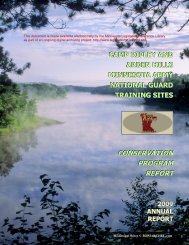
Cook <strong>Soil</strong> & <strong>Water</strong> <strong>Conservation</strong> <strong>District</strong><br />
<strong>Water</strong> quality concerns -- eroding<br />
streambanks on Lake Superior’s North Shore<br />
rivers, mercury impairment of inland lakes,<br />
nutrient loading on developed lakes. Only 8%<br />
of county is owned privately and much of this<br />
private land is riparian.<br />
Concern for cumulative effects of wetland<br />
loss in shoreland areas and in pockets<br />
on forested hillsides due to high rate of<br />
development and wetland exemptions.<br />
Concern for increased stormwater runoff and<br />
gullying along roads on steep hills near lakes,<br />
streams and wetlands. Development pressure on<br />
marginal sites characterized by steep forested<br />
slopes, thin soils, and wetlands. Cumulative<br />
impacts of erosion at construction sites.<br />
Need for public education on the importance<br />
of sound land use and the land-use laws that<br />
protect water quality.<br />
Need for incentives for local food production.<br />
County terrain is not amenable to large farms.<br />
Future Projects<br />
Streambank stabilization -- Cook SWCD is<br />
managing a $350,000 Clean <strong>Water</strong> Legacy grant<br />
to repair a large eroding bank on the Poplar River<br />
(impaired - turbidity). SWCD technical staff and<br />
Joint Powers Engineer are assisting the landowner,<br />
Lutsen Mountains. Construction will include a bank<br />
stabilization and revegetation to reduce sediment<br />
transport into the river and Lake Superior. This will<br />
reduce / divert peak fl ow to prevent further bank<br />
degradation. SWCD staff and one supervisor meet<br />
monthly with a landowner group working to remove<br />
the river from the impaired waters list.<br />
Roadside erosion control near a trout stream -- The<br />
5-county Joint Powers Engineer and County Highway<br />
staff will upgrade a culvert, install rock in an eroding ditch<br />
channel, and vegetate a clay bank near an intermittent<br />
stream near the Flute Reed River.<br />
35