Soil & Water Conservation District Guidebook 2008 - Minnesota ...
Soil & Water Conservation District Guidebook 2008 - Minnesota ...
Soil & Water Conservation District Guidebook 2008 - Minnesota ...

Create successful ePaper yourself
Turn your PDF publications into a flip-book with our unique Google optimized e-Paper software.
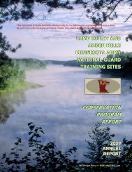
Pictured: A CREP wetland restoration site in Blue Earth County.<br />
CREP I went from 1998-2002, creating 172 permanent<br />
easements totaling 5,329 acres and spending 4.5 million state<br />
dollars in Blue Earth County. Over 100,000 acres across<br />
the <strong>Minnesota</strong> River basin were enrolled into the program.<br />
Many projects had landowners that went together to create<br />
much larger conservation areas. One group project involved<br />
six different landowners who enrolled 340 acres for a large<br />
wetland restoration project. Some project work is still being<br />
done today along with routine maintenance to many of<br />
the easements. The program brought together local, state,<br />
and federal offi cials, conservation groups, and interested<br />
landowners to work collectively on restoring the <strong>Minnesota</strong><br />
River watershed.<br />
The Greater Blue Earth River <strong>Water</strong>shed<br />
Initiative began in 2003 through the SWCD’s partnership<br />
with Three Rivers RC&D. A grant from the U.S. EPA was<br />
received to promote the installation of conservation practices<br />
by offering enrollment incentives as well as cost share<br />
incentives. Blue Earth County SWCD encumbered and<br />
received $49,469 in grant dollars that enrolled 117.5 acres<br />
with a soil loss reduction of 587.5 tons per acre / year and a<br />
phosphorus reduction of 1175 pounds /year. This grant is a<br />
good example of how multiple agencies such as the SWCD,<br />
Three Rivers RC&D, FSA and NRCS can accomplish a<br />
lot when partnering together toward a common goal of<br />
improved water quality.<br />
The Maple River <strong>Water</strong>shed Improvement<br />
project is sponsored by Blue Earth County, with project<br />
management and leadership held by the Blue Earth SWCD.<br />
Faribault County conservation and environmental staff are<br />
Top 5 Natural Resource Concerns<br />
1.<br />
2.<br />
3.<br />
4.<br />
5.<br />
Blue Earth <strong>Soil</strong> & <strong>Water</strong> <strong>Conservation</strong> <strong>District</strong><br />
also actively engaged in this project. The Maple River has<br />
a drainage area of 340 square miles. Numerous project<br />
committees assist to implement project work plans for<br />
surface water quality improvement through conservation<br />
practices. Monitoring of the Maple River began in 2003<br />
with one site and has since expanded to two sites. This<br />
project will continue implementation, monitoring, and<br />
educational activities through 2009. The project’s main<br />
objective is to reduce the levels of sediment, nitrates, and<br />
phosphates in the river. Funding sources include in-kind<br />
contributions (about $335,000) from over 10 groups,<br />
cash support from Blue Earth County and a Clean <strong>Water</strong><br />
Partnership implementation grant of $474,100.<br />
Classic or ephemeral gully control<br />
<strong>Water</strong> resource protection<br />
Wastewater & feedlot runoff control<br />
Sheet & rill erosion<br />
Wind erosion<br />
Future Projects<br />
Cobb River <strong>Water</strong>shed Project: The Cobb River<br />
<strong>Water</strong>shed Project is an effort by the Greater Blue<br />
Earth River Basin Alliance and Blue Earth County<br />
SWCD to concentrate Agricultural and Drainage<br />
best-management practices within the Cobb River<br />
watershed. The project has funding to hire one fulltime<br />
employee, working with the Blue Earth SWCD<br />
for 2 1/2 years. There is also over $200,000 in cost<br />
share assistance available to land owners for implementation<br />
of the varying BMPs within the watershed.<br />
An additional $15,000 is available to the Drainage<br />
Authorities in each of the four counties in the watershed.<br />
This funding is for upgrading the current<br />
drainage information management systems. All while<br />
increasing cooperation of local agencies throughout<br />
the watershed. With the cost-share funding we hope<br />
to implement several BMP projects throughout the<br />
watershed. These projects will help in reducing the<br />
sediment load as well as several, all too common,<br />
pollutants in the watershed.<br />
17