Soil & Water Conservation District Guidebook 2008 - Minnesota ...
Soil & Water Conservation District Guidebook 2008 - Minnesota ... Soil & Water Conservation District Guidebook 2008 - Minnesota ...
Pipestone Soil & Water Conservation District Agricultural Forest Grass/Shrub/Wetland Water Impervious 122 SWCD Guidebook 2008-2009 119 2nd Avenue SW, Suite 13 Pipestone, MN 56164 PHONE: (507) 825-4268 FAX: (507) 825-6782 www.pipestone-county.com/ departments/planning/SWCD.htm SWCD board meetings: 1st Thursday of month at 9 a.m. Pipestone County Land Cover Recent Projects / Accomplishments SWCD Board of Supervisors Through its Septic Loan Program, Pipestone County designated $200,000 of reserve funds for loans to be made to producers who are in need of updating their septic system. SWCD staff developed and administers this loan program along with other loan funds made available through MPCA. 2005 Expenditures by category Monitoring / Research $5,000 Education / Outreach $8,000 Wetland Conservation Act $20,000 Cost Share / project construction, implementation and maintenance $27,000 Planning/ other local water management duties $21,000 Conservation easement funding / assistance $35,000 Programs and Operations $25,000 Total $201,315 Name Position Address Phone Elected LeRoy Stensgaard Chairman 135 Aetna Street, Box 118, Ruthton 507-658-3681 1997 Ed Loll Vice-Chair 1696 60th Avenue, Pipestone 507-825-2732 2005 Anna Mae Fritz Sec/Treas 1310 141st Street, Holland 507-825-4058 1999 Cal Spronk Programs 84 130th Avenue, Edgerton 507-442-5334 2001 Ian Cunningham PR & I 565 81st Street, Pipestone 507-825-2296 2001
Pictured: Pipestone Creek. The Pipestone Creek TMDL Study was completed by staff of the Pipestone SWCD working cooperatively with MPCA. SWCD staff coordinated the water quality monitoring of Pipestone Creek with the Pipestone National Monument who collected and submitted water samples to the Department of Health lab for analysis. A local advisory board was created and local meetings were held for input on the creek’s water quality and potential contributing sources. SWCD staff conducted a complete watershed fi eld survey. The watershed was driven and data was collected and stored as a graphic layer on arc-gis in the fi eld with a tablet PC. Information collected included: locations where fi lter strips are needed, pasture livestock numbers, pasture management practices, potential runoff concerns from livestock facilities, Individual Sewage Treatment System (a survey was conducted with residents of the watershed to determine type of system, compliance and if discharging where sewage is discharged), crop, tillage, and residue management, and other watershed water quality contributing sources were identifi ed. This data along with monitoring and rating curve data was compiled and the Pipestone Creek TMDL Study was created. Local review meetings were published and held for local input. MPCA review was then completed and the Study is currently awaiting EPA approval. Top 5 Natural Resource Concerns 1. 2. 3. 4. 5. Pipestone Soil & Water Conservation District The SWCD maintains and provides Geographic Information Systems assistance to Pipestone County. Supervisors have allowed staff to attend GIS classes held by the GIS Department at Southwest Minnesota State University in Marshall. A county GIS committee was created to provide direction and information to the County Commissioners and other County departments on uses and benefi ts of GIS. The SWCD has been creating and making available many useful layers to county departments and the public. Layers include road maps, commissioner districts, SWCD supervisor districts, other committee districts, county zoning layer districts, feedlot layer, gravel pit layer, and others, a county parcel map is currently being created through a contract with 6E RDC. Staff also have created and made available GIS projects for the staff at the courthouse to utilize through Arc-reader software. Water Quality Feedlot Runoff Soil Erosion Nutrient Management Planning Grazing Management Practices Future Projects Pipestone Creek and Rock River TMDL Implementation plans: The Pipestone Creek TMDL Implementation Plan is currently being written by the SWCD and will soon be submitted to the MPCA for approval. The SWCD also serves on the Rock River TMDL committee which is also in the process of developing a TMDL implementation plan. Feedlot Level 3 Inventory: SWCD staff are conducting site visits on all county registered feedlots and collecting site data. Mnfarm is then run on sites to determine pollution potential. A complete level 3 inventory is anticipated to be completed by the end of 2008. 123
- Page 74 and 75: Koochiching Soil & Water Conservati
- Page 76 and 77: Lac qui Parle Soil & Water Conserva
- Page 78 and 79: Lake Soil & Water Conservation Dist
- Page 80 and 81: Lake of the Woods Soil & Water Cons
- Page 82 and 83: Le Sueur Soil & Water Conservation
- Page 84 and 85: Lincoln Soil & Water Conservation D
- Page 86 and 87: Lyon Soil & Water Conservation Dist
- Page 88 and 89: Mahnomen Soil & Water Conservation
- Page 90 and 91: Marshall Soil & Water Conservation
- Page 92 and 93: Marshall-Beltrami Soil & Water Cons
- Page 94 and 95: Martin Soil & Water Conservation Di
- Page 96 and 97: McLeod Soil & Water Conservation Di
- Page 98 and 99: Meeker Soil & Water Conservation Di
- Page 100 and 101: Mille Lacs Soil & Water Conservatio
- Page 102 and 103: Morrison Soil & Water Conservation
- Page 104 and 105: Mower Soil & Water Conservation Dis
- Page 106 and 107: Murray Soil & Water Conservation Di
- Page 108 and 109: Nicollet Soil & Water Conservation
- Page 110 and 111: Nobles Soil & Water Conservation Di
- Page 112 and 113: Norman Soil & Water Conservation Di
- Page 114 and 115: Olmsted Soil & Water Conservation D
- Page 116 and 117: Otter Tail-East Soil & Water Conser
- Page 118 and 119: Otter Tail-West Soil & Water Conser
- Page 120 and 121: Pennington Soil & Water Conservatio
- Page 122 and 123: Pine Soil & Water Conservation Dist
- Page 126 and 127: East Polk Soil & Water Conservation
- Page 128 and 129: West Polk Soil & Water Conservation
- Page 130 and 131: Pope Soil & Water Conservation Dist
- Page 132 and 133: Ramsey Conservation District 130 SW
- Page 134 and 135: Red Lake Soil & Water Conservation
- Page 136 and 137: Redwood Soil & Water Conservation D
- Page 138 and 139: Renville Soil & Water Conservation
- Page 140 and 141: Rice Soil & Water Conservation Dist
- Page 142 and 143: Rock Soil & Water Conservation Dist
- Page 144 and 145: Root River Soil & Water Conservatio
- Page 146 and 147: Roseau Soil & Water Conservation Di
- Page 148 and 149: Scott Soil & Water Conservation Dis
- Page 150 and 151: Sherburne Soil & Water Conservation
- Page 152 and 153: Sibley Soil & Water Conservation Di
- Page 154 and 155: St. Louis-North Soil & Water Conser
- Page 156 and 157: St. Louis-South Soil & Water Conser
- Page 158 and 159: Stearns Soil & Water Conservation D
- Page 160 and 161: Steele Soil & Water Conservation Di
- Page 162 and 163: Stevens Soil & Water Conservation D
- Page 164 and 165: Swift Soil & Water Conservation Dis
- Page 166 and 167: Todd Soil & Water Conservation Dist
- Page 168 and 169: Traverse Soil & Water Conservation
- Page 170 and 171: Wabasha Soil & Water Conservation D
- Page 172 and 173: Wadena Soil & Water Conservation Di
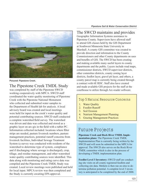
Pictured: Pipestone Creek.<br />
The Pipestone Creek TMDL Study<br />
was completed by staff of the Pipestone SWCD<br />
working cooperatively with MPCA. SWCD staff<br />
coordinated the water quality monitoring of Pipestone<br />
Creek with the Pipestone National Monument<br />
who collected and submitted water samples to<br />
the Department of Health lab for analysis. A local<br />
advisory board was created and local meetings<br />
were held for input on the creek’s water quality and<br />
potential contributing sources. SWCD staff conducted<br />
a complete watershed fi eld survey. The watershed<br />
was driven and data was collected and stored as a<br />
graphic layer on arc-gis in the fi eld with a tablet PC.<br />
Information collected included: locations where fi lter<br />
strips are needed, pasture livestock numbers, pasture<br />
management practices, potential runoff concerns from<br />
livestock facilities, Individual Sewage Treatment<br />
System (a survey was conducted with residents of the<br />
watershed to determine type of system, compliance<br />
and if discharging where sewage is discharged), crop,<br />
tillage, and residue management, and other watershed<br />
water quality contributing sources were identifi ed. This<br />
data along with monitoring and rating curve data was<br />
compiled and the Pipestone Creek TMDL Study was<br />
created. Local review meetings were published and held<br />
for local input. MPCA review was then completed and<br />
the Study is currently awaiting EPA approval.<br />
Top 5 Natural Resource Concerns<br />
1.<br />
2.<br />
3.<br />
4.<br />
5.<br />
Pipestone <strong>Soil</strong> & <strong>Water</strong> <strong>Conservation</strong> <strong>District</strong><br />
The SWCD maintains and provides<br />
Geographic Information Systems assistance to<br />
Pipestone County. Supervisors have allowed staff<br />
to attend GIS classes held by the GIS Department<br />
at Southwest <strong>Minnesota</strong> State University in<br />
Marshall. A county GIS committee was created to<br />
provide direction and information to the County<br />
Commissioners and other County departments on uses<br />
and benefi ts of GIS. The SWCD has been creating<br />
and making available many useful layers to county<br />
departments and the public. Layers include road maps,<br />
commissioner districts, SWCD supervisor districts,<br />
other committee districts, county zoning layer<br />
districts, feedlot layer, gravel pit layer, and others, a<br />
county parcel map is currently being created through<br />
a contract with 6E RDC. Staff also have created<br />
and made available GIS projects for the staff at the<br />
courthouse to utilize through Arc-reader software.<br />
<strong>Water</strong> Quality<br />
Feedlot Runoff<br />
<strong>Soil</strong> Erosion<br />
Nutrient Management Planning<br />
Grazing Management Practices<br />
Future Projects<br />
Pipestone Creek and Rock River TMDL Implementation<br />
plans: The Pipestone Creek TMDL<br />
Implementation Plan is currently being written by the<br />
SWCD and will soon be submitted to the MPCA for<br />
approval. The SWCD also serves on the Rock River<br />
TMDL committee which is also in the process of<br />
developing a TMDL implementation plan.<br />
Feedlot Level 3 Inventory: SWCD staff are conducting<br />
site visits on all county registered feedlots and<br />
collecting site data. Mnfarm is then run on sites to determine<br />
pollution potential. A complete level 3 inventory<br />
is anticipated to be completed by the end of <strong>2008</strong>.<br />
123


