Soil & Water Conservation District Guidebook 2008 - Minnesota ...
Soil & Water Conservation District Guidebook 2008 - Minnesota ...
Soil & Water Conservation District Guidebook 2008 - Minnesota ...

Create successful ePaper yourself
Turn your PDF publications into a flip-book with our unique Google optimized e-Paper software.
SWCD<br />
<strong>Soil</strong> & <strong>Water</strong> <strong>Conservation</strong> <strong>District</strong> <strong>Guidebook</strong> <strong>2008</strong>
About____________2<br />
Aitkin ___________4<br />
Anoka ___________6<br />
Becker ___________8<br />
Beltrami _________10<br />
Benton __________12<br />
Big Stone ________14<br />
Blue Earth _______16<br />
Brown __________18<br />
Carlton __________20<br />
Carver __________22<br />
Cass ____________24<br />
Chippewa _______26<br />
Chisago _________28<br />
Clay ____________30<br />
Clearwater _______32<br />
Cook ___________34<br />
Cottonwood ______36<br />
Crow Wing ______38<br />
Dakota __________40<br />
Dodge __________42<br />
Douglas _________44<br />
Faribault ________46<br />
Fillmore _________48<br />
Freeborn ________50<br />
Goodhue ________52<br />
Grant ___________54<br />
Hennepin ________56<br />
Hubbard _________58<br />
Isanti ___________60<br />
Itasca ___________62<br />
Table of Contents<br />
Jackson _________64<br />
Kanabec _________66<br />
Kandiyohi _______68<br />
Kittson __________70<br />
Koochiching _____72<br />
Lac qui Parle _____74<br />
Lake ____________76<br />
Lake of the Woods 78<br />
Le Sueur ________80<br />
Lincoln _________82<br />
Lyon ___________84<br />
Mahnomen ______86<br />
Marshall ________88<br />
Marshall-Beltrami _90<br />
Martin __________92<br />
McLeod _________94<br />
Meeker _________96<br />
Mille Lacs _______98<br />
Morrison _______100<br />
Mower _________102<br />
Murray _________104<br />
Nicollet ________106<br />
Nobles _________108<br />
Norman ________ 110<br />
Olmsted ________ 112<br />
Otter Tail-East ___ 114<br />
Otter Tail-West __ 116<br />
Pennington _____ 118<br />
Pine ___________120<br />
Pipestone _______122<br />
East Polk _______124<br />
West Polk _______ 126<br />
Pope____________ 128<br />
Ramsey _________ 130<br />
Red Lake ________ 132<br />
Redwood ________ 134<br />
Renville _________ 136<br />
Rice ____________ 138<br />
Rock ___________ 140<br />
Root River _______ 142<br />
Roseau __________ 144<br />
Scott ___________ 146<br />
Sherburne _______ 148<br />
Sibley __________ 150<br />
St. Louis-North ___ 152<br />
St. Louis-South ___ 154<br />
Stearns __________ 156<br />
Steele ___________ 158<br />
Stevens _________ 160<br />
Swift ___________ 162<br />
Todd ___________ 164<br />
Traverse _________ 166<br />
Wabasha ________ 168<br />
Wadena _________ 170<br />
Waseca _________ 172<br />
Washington ______ 174<br />
Watonwan _______ 176<br />
Wilkin __________ 178<br />
Winona _________ 180<br />
Wright __________ 182<br />
Yellow Medicine __ 184
About<br />
The <strong>Soil</strong> & <strong>Water</strong> <strong>Conservation</strong> <strong>District</strong> <strong>Guidebook</strong><br />
Maps created by the Remote Sensing and Geospatial Analysis<br />
Laboratory, University of <strong>Minnesota</strong> in cooperation with the<br />
<strong>Minnesota</strong> Pollution Control Agency. Available at:<br />
http://www.land.umn.edu/maps/impervious/landbrowse.php<br />
<strong>Minnesota</strong><br />
County Land Cover Maps<br />
Agricultural<br />
Forest<br />
Grass/Shrub/Wetland<br />
<strong>Water</strong><br />
Impervious<br />
2 SWCD <strong>Guidebook</strong> <strong>2008</strong>-2009<br />
The Board of <strong>Water</strong> and <strong>Soil</strong> Resources (BWSR)<br />
and <strong>Minnesota</strong> Association of <strong>Soil</strong> and <strong>Water</strong><br />
<strong>Conservation</strong> <strong>District</strong>s (MASWCD) have<br />
prepared this guidebook as a component of<br />
requirements in <strong>Minnesota</strong> Statutes 103C.401.<br />
Each SWCD has provided content to BWSR on<br />
the following subjects:<br />
•<br />
•<br />
•<br />
•<br />
Top 5 Natural Resource Concerns<br />
Board of Supervisors Contact Information<br />
Recent Projects / Accomplishments and<br />
photos<br />
Future Projects<br />
The “2005 Expenditures by category” are based<br />
on a 2006 survey of SWCDs that was completed<br />
by the Offi ce of the Legislative Auditor. For<br />
more detailed fi nancial information please<br />
contact the appropriate SWCD.<br />
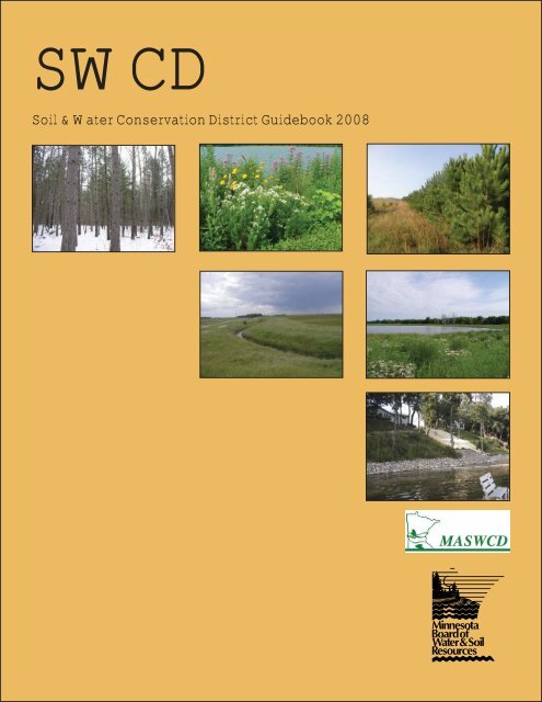
Cover photos (top row, left): Privately owned land with<br />
a Forest Stewardship Plan-Wadena SWCD, Shoreline<br />
restoration project on Loon Lake-Waseca SWCD, Field<br />
Windbreak-Isanti SWCD, (2nd row) Native Vegetation<br />
Buffer-Grant SWCD, Wetland Restoration-Blue Earth<br />
SWCD, (3rd row) Gully Repair Project-Douglas SWCD.
The following summary of SWCDs<br />
is from the <strong>Minnesota</strong> Association of <strong>Soil</strong> and <strong>Water</strong><br />
<strong>Conservation</strong> <strong>District</strong>s (www.maswcd.org):<br />
<strong>Soil</strong> and <strong>Water</strong> <strong>Conservation</strong> <strong>District</strong>s<br />
(SWCDs) are political subdivisions of the State<br />
established under <strong>Minnesota</strong> Statute 103C. Each<br />
SWCD is governed by a board of elected supervisors.<br />
There are 91 SWCDs in <strong>Minnesota</strong>,<br />
providing 100% coverage of the state. There is at least<br />
one SWCD in each of the 87 counties, and a few of<br />
the larger counties have more than one: East and West<br />
Otter Tail SWCDs; East and West Polk SWCDs; North<br />
and South St. Louis SWCDs; and Marshall-Beltrami<br />
SWCD which consists of the northwestern most portion<br />
of Beltrami County, and a portion of eastern Marshall<br />
County.<br />
The fi rst SWCD in <strong>Minnesota</strong> was created in<br />
1938 to encourage landowners to conserve soil and<br />
water resources. Statewide, 75% of <strong>Minnesota</strong> lands<br />
are in private ownership. In agricultural regions, the<br />
number is quite often 95%.<br />
SWCDs fi ll the crucial niche of providing<br />
land and water conservation services to owners of<br />
private lands. Managing private lands in a way that<br />
promotes a sound economy and sustains and enhances<br />
natural resources is key to <strong>Minnesota</strong>’s environmental<br />
health. Private landowners trust SWCDs to provide<br />
needed technology, funding and educational services<br />
because they are established in each community,<br />
governed by local leaders and focused on conservation<br />
of local soil and water resources.<br />
<strong>Soil</strong> & <strong>Water</strong> <strong>Conservation</strong> <strong>District</strong> <strong>Guidebook</strong><br />
SWCDs work to reduce non-point<br />
source pollution to make <strong>Minnesota</strong>’s lakes<br />
and rivers fi shable and swimmable. Non-point<br />
source (NPS) pollution is a term for polluted runoff.<br />
<strong>Water</strong> washing over the land, whether from rain,<br />
car washing, or the watering of crops or lawns,<br />
picks up an array of contaminants, including oil and<br />
sand from roadways, agricultural chemicals from<br />
farmland, and nutrients and toxic materials from<br />
urban and suburban areas. This runoff fi nds its way<br />
into our waterways, either directly or through storm<br />
drain collection systems. The term non-point is used<br />
to distinguish this type of diffuse pollution from<br />
point source pollution, which comes from specifi c<br />
sources, such as sewage treatment plants or industrial<br />
facilities.<br />
Landowners across <strong>Minnesota</strong> count<br />
on SWCD technical assistance with conservation<br />
practices that protect the quality of <strong>Minnesota</strong>’s<br />
greatest treasure - our natural resources.<br />
3
Aitkin<br />
<strong>Soil</strong> & <strong>Water</strong> <strong>Conservation</strong> <strong>District</strong><br />
Aitkin County<br />
Land Cover<br />
Agricultural<br />
Forest<br />
Grass/Shrub/Wetland<br />
<strong>Water</strong><br />
Impervious<br />
4 SWCD <strong>Guidebook</strong> <strong>2008</strong>-2009<br />
SWCD Board of Supervisors<br />
130 Southgate Drive<br />
Aitkin, MN 56431<br />
PHONE: (218) 927-6565<br />
FAX: (218) 927-6014<br />
SWCD board meetings:<br />
3rd Tuesday of month at 10 a.m.<br />
Recent Projects / Accomplishments<br />
A Shoreland Performance Worksheet<br />
to mitigate native shoreland impacts was developed<br />
by SWCD staff and Aitkin County Environmental<br />
Services. This worksheet is required for all variance<br />
applications, and the impacts are mitigated through<br />
vegetative buffers, runoff diversion, rain gardens or<br />
other shoreland protection tools.<br />
2005 Expenditures by category<br />
Monitoring / Research $8,000<br />
Education / Outreach $84,800<br />
Wetland <strong>Conservation</strong> Act $36,000<br />
Cost Share / project construction,<br />
implementation and maintenance<br />
$6,200<br />
Planning/ other local water management duties $28,400<br />
<strong>Conservation</strong> easement funding / assistance $2,400<br />
Programs and Operations $26,000<br />
Total $191,800<br />
Name Position Address Phone Elected<br />
Franklin Turnock Chair 13196 360th Street, McGregor (218) 768-2713 1976<br />
Donna Rae Asp Vice-Chair 20053 180th Street, McGrath (320) 592-3391 1999<br />
Russell Ruud Secretary 43454 Nature Avenue, Palisade (218) 768-4300 1972<br />
Mike Lentz Treasurer 41188 - 650 Street, Swatara (218) 697-8214 1991<br />
Bob Janzen Reporter 523 1st Street NW, Aitkin (218) 927-2477 2001
Pictured: (above) A lake protected by a conservation easement<br />
and (above right) students participating in the “Farm Olympics”<br />
at the 2007 Aitkin County Fair.<br />
A third party certifi cation for private<br />
forests was recently completed by the SWCD for<br />
landowners that are enrolled in the SWCD’s forest<br />
stewardship program. Landowners who choose to<br />
enroll are Smartwood Certifi ed under the Aitkin County<br />
SWCD umbrella. This is one of few SWCDs -- or<br />
possibly the only one -- in the nation to provide the<br />
certifi cation option to landowners.<br />
High priority lakeshore acres in<br />
Aitkin County are protected through the SWCD’s<br />
<strong>Conservation</strong> Easement program. The SWCD is the<br />
grantee for <strong>Conservation</strong> Easements, which allows<br />
landowners to convey restrictions on their property to<br />
protect against future subdivision or development.<br />
Two watershed projects (Big Sandy<br />
<strong>Water</strong>shed and Mille Lacs <strong>Water</strong>shed) are coordinated<br />
by the SWCD, including a TMDL study on Big Sandy.<br />
1.<br />
2.<br />
3.<br />
4.<br />
5.<br />
Aitkin <strong>Soil</strong> & <strong>Water</strong> <strong>Conservation</strong> <strong>District</strong><br />
Top 5 Natural Resource Concerns<br />
Shoreland development (too fast and too<br />
much) -- enforce ordinances<br />
Protecting or restoring water quality in lakes<br />
and rivers<br />
Providing forest management assistance<br />
Reducing impervious surface impacts to water<br />
quality<br />
Protecting high-priority wetlands<br />
Future Projects<br />
The SWCD plans to coordinate repair and<br />
maintenance of the six-mile long Aitkin Flood<br />
Diversion Channel. This channel was constructed<br />
shortly after the 1950 fl oods. A mechanism to fund<br />
the repair and maintenance will have to be created.<br />
Several county departments, the Aitkin County<br />
Board and the SWCD are working together on this<br />
project.<br />
5
Anoka<br />
<strong>Conservation</strong> <strong>District</strong><br />
Anoka County<br />
Land Cover<br />
Agricultural<br />
Forest<br />
Grass/Shrub/Wetland<br />
<strong>Water</strong><br />
Impervious<br />
6 SWCD <strong>Guidebook</strong> <strong>2008</strong>-2009<br />
16015 Central Ave. NE, Suite 103<br />
Ham Lake, MN 55304<br />
PHONE: (763) 434-2030<br />
FAX: (763) 434-2094<br />
www.anokaswcd.org<br />
www.anokanaturalresources.com<br />
SWCD board meetings:<br />
3rd Monday of month at 5 p.m.<br />
Recent Projects / Accomplishments<br />
SWCD Board of Supervisors<br />
Pictured: The Rum River Central Regional Park<br />
riverbank stabilization including root wads,<br />
submerged rock vanes, erosion blanket and riparian<br />
buffer of deep rooted native species.<br />
ACD secured an LCCMR grant<br />
to work with four communities to encourage<br />
natural resource planning. Nearing its end, the<br />
2 1/2-year project resulted in work products being<br />
prepared for the City of Ham Lake, Burn Township,<br />
Linwood Township and the City of East Bethel.<br />
2005 Expenditures by category<br />
Monitoring / Research $75,598<br />
Education / Outreach $28,146<br />
Wetland <strong>Conservation</strong> Act $92,664<br />
Cost Share / project construction,<br />
implementation and maintenance<br />
$190,776<br />
Planning/ other local water management duties $115,169<br />
<strong>Conservation</strong> easement funding / assistance $17,535<br />
Programs and Operations $35,204<br />
Total $564,040<br />
Name Position Address Phone Elected<br />
Kim Kovich Chair 3688 168th Lane NW, Andover (763) 208-8646 1995<br />
Sean Sullivan Vice Chair 20160 Quapaw Street NW, Oak Grove (763) 753-8335 1999<br />
Vici Nass Treasurer 23340 Isetta Street NE, East Bethel (763) 462-3923 1992<br />
Mary Jo Truchon Member 12917 Buchanan Street NE, Blaine (763) 757-3084 1995<br />
Sandra DeLaForest Member 12859 Zilla Street NW, Coon Rapids (763) 712-1191 2007
Pictured: An ACD employee seeds land in St. Francis with<br />
native savanna plant species. The landowner intends to deed<br />
the 68.5-acre property to the ACD.<br />
Property within wildlife hubs and<br />
corridors has been protected by a program initiated by the<br />
ACD. The ACD currently holds easements on two properties<br />
-- 55 acres in Burns Township and 200 acres along the Rum<br />
River in Anoka. In addition to this, a landowner intends to<br />
deed ACD his 68.5-acre property in St. Francis (pictured)<br />
and has already established a conservation easement with<br />
the MN Land Trust. Several acres of prairie, oak woodland,<br />
and oak savanna have been restored on this land, which<br />
was decimated by oak wilt, and a control burn was done in<br />
a wetland area. Funding for this project also came from the<br />
USDA Natural Resources <strong>Conservation</strong> Service, US Fish<br />
and Wildlife Service, MN DNR, Great River Greening, and<br />
volunteer labor was provided by the Boy Scouts.<br />
Hundreds of conservation projects have been<br />
accomplished by two ACD employees who serve the seven-county<br />
metro area. Over the last three years, their accomplishments include<br />
248 BMP designs, 133 project installations, 183 educational<br />
presentations, 14 projects involving under-served clients, and 353<br />
maintenance inspections. The program began in the spring of 2000.<br />
A “Build Your Own Rain Garden Workshop”<br />
was recently held by the ACD with 26 attendees. The event<br />
promoted rain garden benefi ts and included a hands-on<br />
demonstration of how to install the components of a rain<br />
garden. The ACD also presented rain garden information<br />
1.<br />
2.<br />
3.<br />
4.<br />
5.<br />
Anoka <strong>Conservation</strong> <strong>District</strong><br />
during a Low Impact Development conference in<br />
December 2007.<br />
An ACD supervisor held an open house<br />
to promote the work of ACD staff, supervisors and<br />
elected offi cials. The event was part of a larger effort<br />
by ACD supervisors and staff toward becoming more<br />
visible among county commissioners and other local<br />
government organizations.<br />
Top 5 Natural Resource Concerns<br />
Preserve/Enhance Natural Habitats: Natural<br />
Communities, Wildlife Connectivity,<br />
Wetlands<br />
Improve <strong>Water</strong> Quality – Wetland, Lakes,<br />
Streams & Groundwater<br />
Development (Minimize Impact): Provide<br />
guidance, Assistance, Education & Local<br />
Accountability<br />
Private Land Stewardship: Promote<br />
easements, Lakeshore/Stream Restorations &<br />
Rain Gardens<br />
Infl uencing Public Policy: State legislature,<br />
City ordinances<br />
Future Projects<br />
• ACD is currently working with the Upper<br />
Rum River WMO to aid them in the completion of<br />
water quality, wetland, and infi ltration standards for<br />
their second generation water plan.<br />
• ACD has been working to build a partnership<br />
with several cities and water management<br />
organization in southern another county to coordinate<br />
efforts in the area of suburban water quality retrofi ts.<br />
This partnership recently submitted a Clean <strong>Water</strong><br />
Legacy grant application to fund a joint position to<br />
facilitate the design and installation of retrofi t BMPs.<br />
Retrofi tting old neighborhood is not required under<br />
non-degradation, SWPPP, or NPDES standards but<br />
is critical to meet some of the goals associated with<br />
TMDLs.<br />
7
Becker<br />
<strong>Soil</strong> & <strong>Water</strong> <strong>Conservation</strong> <strong>District</strong><br />
Becker County<br />
Land Cover<br />
8 SWCD <strong>Guidebook</strong> <strong>2008</strong>-2009<br />
809 - 8th Street SE<br />
Detroit Lakes, MN 56501<br />
PHONE: (218) 846-7360<br />
FAX: (218) 847-8910<br />
www.co.becker.mn.us/soil_water_<br />
conservation/d_soil_water.html<br />
SWCD board meetings:<br />
3rd Wednesday of month at 8 a.m.<br />
Agricultural<br />
Forest<br />
Grass/Shrub/Wetland<br />
<strong>Water</strong><br />
Impervious<br />
Recent Projects / Accomplishments<br />
SWCD Board of Supervisors<br />
Pictured: A shoreline stabilization project on Eagle<br />
Lake near Frazee.<br />
The Buffalo-Red <strong>Water</strong>shed <strong>District</strong><br />
has awarded the Becker SWCD over $60,000 over<br />
the past several years to augment its cost-share programs.<br />
These dollars are used to assist landowners<br />
wishing to install conservation measures on their<br />
lands. The funds are used in conjunction with State<br />
Cost-Share and Federal EQIP dollars to allow for<br />
more conservation to be placed on the land.<br />
2005 Expenditures by category<br />
Monitoring / Research $5,027<br />
Education / Outreach $12,064<br />
Wetland <strong>Conservation</strong> Act $51,522<br />
Cost Share / project construction,<br />
implementation and maintenance<br />
$87,491<br />
Planning/ other local water management duties $83,761<br />
<strong>Conservation</strong> easement funding / assistance --<br />
Programs and Operations $71,841<br />
Total $311,706<br />
Name Position Address Phone Elected<br />
Jerome Flottemesch Chairman 20235 County Highway 14, Callaway 218-375-2141 1968<br />
Don Lefebvre Vice-chair 21252 U.S. Highway 59, Detroit Lakes 218-847-8745 1972<br />
Roger Tychsen Secretary 40153 Meadow Bay, Frazee 218-334-2590 2004<br />
Duane Grossman Treasurer 14355 Grossman Road, Audubon 218-439-6356 2000<br />
Dale Lubitz Member 44124 100th Street, Frazee 218-346-4020 1983
Pictured: Tile being installed as part of a sediment basin project.<br />
A shoreline stabilization project was completed<br />
in 2007 at the Sunnyside Care Center, where the ever<br />
rising water level of Boyer Lake has been causing shoreline<br />
erosion. In the summer of 2006, staff from the Becker SWCD,<br />
USDA Natural Resources <strong>Conservation</strong> Service, and the West<br />
Central <strong>Minnesota</strong> Joint Powers Board engineering technician<br />
viewed the site to determine what could be done to repair and<br />
prevent further erosion. A combination of rip rap on the higher<br />
steeper portion and a buffer of native vegetation on the lower<br />
portion was determined to be the most effective solution. The<br />
total construction cost was $38,950 with $27,400 of cost-share<br />
being provided from the Becker SWCD, Buffalo-Red <strong>Water</strong>shed<br />
<strong>District</strong> and the DNR Shoreland Habitat Program.<br />
60 abandoned wells have been sealed<br />
recently by the SWCD in the city of Ogema (population<br />
127). In 2005 and 2006 the city was awarded grants and<br />
loans to install a city water system. A problem unique to the<br />
city is the high number of fl owing wells that had previously<br />
been used by residents. Upon installation of the water system<br />
the Becker County Commissioners awarded $12,720 to the<br />
SWCD to assist the city to properly seal these wells.<br />
About 25 permit applications in shoreland<br />
areas within the Pelican River <strong>Water</strong>shed <strong>District</strong> (PRWD)<br />
are reviewed each year by the SWCD. Due to limited staff,<br />
the PRWD contracts with the Becker SWCD to provide<br />
permit application review for persons proposing shoreline<br />
alterations, such as ice ridge repair, ice jacking damage, sand<br />
blanket, rip rap, etc. By working together the PRWD is better<br />
able to serve its clients in a timely manner on permit issues.<br />
The SWCD has been providing this service since 2004.<br />
Top 5 Natural Resource Concerns<br />
1.<br />
2.<br />
3.<br />
4.<br />
5.<br />
Becker <strong>Soil</strong> & <strong>Water</strong> <strong>Conservation</strong> <strong>District</strong><br />
3 water retention dams were repaired<br />
in 2007 through efforts of the SWCD and the NRCS.<br />
Funding was provided through the State Cost-Share program<br />
and the Buffalo-Red <strong>Water</strong>shed <strong>District</strong>.<br />
Surface <strong>Water</strong> Quality<br />
Stormwater Management<br />
Ground <strong>Water</strong> Quality: Current water quality data<br />
refl ects that the quality of the ground water in<br />
Becker County is generally good. However with two<br />
signifi cant sand plain areas in the county along with<br />
the large number of lakes and ISTS systems groundwater<br />
quality will continue to be a resource concern.<br />
<strong>Soil</strong> erosion<br />
Development Pressures: Traditional agricultural areas<br />
have experienced an increase in the development<br />
of nonfarm housing, along with increased development<br />
pressures being placed on many of the county’s<br />
small remote lakes. For these reasons development<br />
concerns have been identifi ed as a resource concern.<br />
Future Projects<br />
Restoration of Rice Lake: The SWCD is a co-sponsor<br />
with the Pelican River <strong>Water</strong>shed <strong>District</strong>, the City<br />
of Detroit Lakes and NRCS to restore the Rice Lake<br />
Wetland complex and land treatment along Campbell<br />
Creek in Becker County. Implementation of the plan<br />
would reduce the amount of down stream sedimentation<br />
in several lakes as well as restore the hydrology to<br />
the drained areas and is expected to reduce the amount<br />
of phosphorus loading to the lakes downstream. It is<br />
hoped that implementation will begin in <strong>2008</strong>.<br />
Feedlot Runoff Control: Install a total feedlot runoff<br />
and manure management plan for a 1,000 animal feedlot<br />
in Becker County. Plans have been completed with<br />
construction expected in <strong>2008</strong>.<br />
Sediment and Erosion Control: Sediment and erosion<br />
control continue to be a high priority with the SWCD<br />
and NRCS. Seventeen sediment and erosion control<br />
basins are currently scheduled to be installed in <strong>2008</strong><br />
through the EQIP and State Cost-share Programs.<br />
9
Beltrami<br />
<strong>Soil</strong> & <strong>Water</strong> <strong>Conservation</strong> <strong>District</strong><br />
Beltrami<br />
County<br />
Land Cover<br />
10 SWCD <strong>Guidebook</strong> <strong>2008</strong>-2009<br />
3217 Bemidji Ave N Ste 3<br />
Bemidji, MN 56601-4328<br />
PHONE: (218) 755-4339<br />
FAX: (218) 755-4342<br />
www.beltramiswcd.org<br />
SWCD board meetings:<br />
Last Thursday of month at 9 a.m.<br />
Agricultural<br />
Forest<br />
Grass/Shrub/Wetland<br />
<strong>Water</strong><br />
Impervious<br />
Recent Projects / Accomplishments<br />
SWCD Board of Supervisors<br />
Technical leadership and support<br />
is provided by the Beltrami SWCD in implementing<br />
Beltrami County’s Comprehensive Local <strong>Water</strong><br />
Management Plan (CLWMP). A tremendous number<br />
of accomplishments are credited to the CLWP.<br />
Annual surface water testing has gathered water<br />
quality information on over 75 lakes and rivers.<br />
Educational programs have taught students about<br />
water protection. Special funding opportunities are<br />
pursued to increase the local success of the CLWP.<br />
Other outcomes include the well-sealing cost-share<br />
program, riparian erosion control assistance, urban<br />
runoff and stormwater management, and wellhead<br />
protection assistance to the City of Bemidji for<br />
protecting drinking water.<br />
The Healthy Lakes and Rivers<br />
Partnership program was recently completed in<br />
cooperation with the Northwest <strong>Minnesota</strong> Foundation.<br />
The program facilitated education and civic<br />
leadership for interested lakeshore owners’ groups<br />
that resulted in milestone accomplishments and<br />
culminated in a management plan for the water of<br />
concern. These groups are now able to work with<br />
other interested landowner groups to develop lake<br />
management plans for other waters of concern.<br />
2005 Expenditures by category<br />
Monitoring / Research $22,800<br />
Education / Outreach $3,800<br />
Wetland <strong>Conservation</strong> Act $17,500<br />
Cost Share / project construction,<br />
implementation and maintenance<br />
$11,000<br />
Planning/ other local water management duties $161,400<br />
<strong>Conservation</strong> easement funding / assistance $400<br />
Programs and Operations $113,600<br />
Total $330,000<br />
Name Position Address Phone Elected<br />
Wesley Frenzel Chair 34503 Frenzel Road NE, Northome 218-647-8474 1979<br />
Ruth Trask Treasurer 14194 Grange Road NW, Pinewood 218-243-2749 1999<br />
John Persell II Secretary 2435 Staghorn Lane SE, Bemidji 218-751-2770 2005<br />
Jerome Geerdes Vice-chair 18934 Harvey Road NE, Blackduck 218-835-4508 2004<br />
Shane Bowe Leg & PR 15761 High School Drive, Red Lake 218-679-3959 2007
Pictured: A shoreline restoration project on the Lake Bemidji<br />
campus of Bemidji State University. Aggressive ice and wave<br />
action resulted in up to six feet of shoreline loss in 2000.<br />
Bio-engineering re-vegetation techniques and traditional rock<br />
toe protection resulted in project that prevents erosion and<br />
provides wildlife habitat and an opportunity for education.<br />
Lake Bemidji has been a priority water body since<br />
the late 1970s, when water testing suggested lake water<br />
quality was deteriorating. In 1992, an EPA 319 Clean <strong>Water</strong><br />
Partnership Grant was received through the Beltrami SWCD<br />
to conduct a watershed-based assessment of water quality indicators,<br />
and to compile a listing of potential sources of water<br />
quality degradation. The Lake Bemidji <strong>Water</strong>shed Clean <strong>Water</strong><br />
Partnership has concluded its nine-year effort to study water<br />
quality issues within the watershed and to implement priority<br />
strategies to improve the water quality entering Lake Bemidji.<br />
This project received the prestigious “Technical Excellence<br />
Award” in 1996 from the North American Lake Management<br />
Society, and was voted the <strong>Minnesota</strong> Local <strong>Water</strong> Planning<br />
“Outstanding Surface <strong>Water</strong> Project” in <strong>Minnesota</strong> in 1997.<br />
A property management handbook for<br />
lakeshore owners and a Shoreline Buffer Restoration Guide<br />
were written and published by the SWCD in 2006. The publications<br />
provide clear information on implementing stewardship-based<br />
management on the lakeshore. Over 2,000 copies<br />
of each publication have been distributed.<br />
The stewardship forestry program encompasses<br />
a number of initiatives. Approximately 40 species<br />
of low-cost trees and shrubs are available each spring for use<br />
in windbreaks, shelterbelts, wildlife habitat plantations or<br />
other conservation practices. Many of these species are potentially<br />
high-value for wildlife, and they are non-invasive,<br />
and they have acclimated seed sources and well-established<br />
root systems. The SWCD has provided more than 1 million<br />
trees during the life of the tree program.<br />
1.<br />
2.<br />
3.<br />
4.<br />
5.<br />
Beltrami <strong>Soil</strong> & <strong>Water</strong> <strong>Conservation</strong> <strong>District</strong><br />
A native seed mix for shoreline restoration<br />
efforts was developed by the SWCD. This perennial mix<br />
contains 19 species of native forbs and fi ve species of native<br />
grasses selected for their erosion control and wildlife<br />
habitat characteristics. The mix has species that will do<br />
well in a variety of site conditions, including part sun to<br />
full sun, and sandy to organic soils.<br />
Over 15,000 acres of jack pine forest<br />
was defoliated by budworm in Beltrami County in 2003. In<br />
2004, the outbreak area expanded into neighboring counties,<br />
affecting an additional 43,500 acres. The defoliation<br />
killed the already stressed trees, leaving thousands of acres<br />
of standing dead jack pine and a potentially serious fi re<br />
hazard. The seriousness of the fi re hazard is compounded<br />
because people have made their homes within the jack pine<br />
dominated landscape. Of the 1,600 homes assessed, 23%<br />
ranked as high risk. The SWCD identifi ed problem areas,<br />
recommended ways to reduce the risk, provided assistance<br />
in fi xing the problems, and helped shoulder the costs.<br />
Top 5 Natural Resource Concerns<br />
<strong>Water</strong> Quality and Quantity Management<br />
Erosion Control<br />
Forage Management<br />
Forest Management<br />
Wildlife Habitat Management<br />
Future Projects<br />
A surface water assessment program was initiated<br />
in 2007 to help citizens collect water quality data<br />
on 36 lakes to help MPCA to assess these lakes for<br />
impairments. This successful program completed the<br />
fi rst year of its 2-year timeline. Interest has also been<br />
sparked among lake samplers to consider establishing<br />
lake associations on their respective lakes.<br />
An initiative to address the Mississippi River<br />
Headwaters dissolved oxygen impairment is underway.<br />
Certain areas of the Mississippi River contain<br />
dissolved oxygen levels too low to support life, and<br />
are subsequently listed as impaired for fi sheries. The<br />
SWCD is aggressively seeking funding to determine<br />
the effects of this impairment to the health and vitality<br />
of downstream lakes Irving and Bemidji.<br />
11
Benton<br />
<strong>Soil</strong> & <strong>Water</strong> <strong>Conservation</strong> <strong>District</strong><br />
Benton County<br />
Land Cover<br />
12 SWCD <strong>Guidebook</strong> <strong>2008</strong>-2009<br />
14 Second Avenue West<br />
Foley, MN 56329<br />
PHONE: (320) 968-5300<br />
FAX: (320) 968-5304<br />
www.soilandwater.org<br />
SWCD board meetings:<br />
3rd Wednesday of month at 8:30 a.m.<br />
Agricultural<br />
Forest<br />
Grass/Shrub/Wetland<br />
<strong>Water</strong><br />
Impervious<br />
Recent Projects / Accomplishments<br />
SWCD Board of Supervisors<br />
The SWCD is conducting a TMDL<br />
for Little Rock Creek in Benton and Morrison<br />
Counties, which has a biological impairment for<br />
its fi shery. The Benton SWCD has partnered with<br />
the MPCA and several other agencies to conduct<br />
a Total Maximum Daily Load (TMDL) study<br />
which will identify the cause and solutions to the<br />
trout and warm water fi shery problems. We are<br />
currently in phase two of a three phase process<br />
to complete the TMDL. Phase two includes<br />
gathering physical, chemical and biological data<br />
from the stream and watershed. This information<br />
will be used by technical experts, a consultant<br />
and stakeholders in the community to identify<br />
the cause of the impairment. The SWCD is<br />
nearing the end of the data collection part of<br />
phase two and has started meeting with the<br />
technical experts and stakeholders to identify<br />
the causes of the impairment. When the causes<br />
of the impairment are identifi ed, phase three<br />
will identify load allocations and develop<br />
an implementation plan for correcting the<br />
impairment.<br />
2005 Expenditures by category<br />
Monitoring / Research $2,630<br />
Education / Outreach $4,975<br />
Wetland <strong>Conservation</strong> Act $5,400<br />
Cost Share / project construction,<br />
implementation and maintenance<br />
$129,146<br />
Planning/ other local water management duties --<br />
<strong>Conservation</strong> easement funding / assistance --<br />
Programs and Operations $87,682<br />
Total $229,833<br />
Name Position Address Phone Elected<br />
Duane Tadych Secretary 6059 45th Street NE, Sauk Rapids 320-252-0674 2003<br />
Joseph Jordan Chairperson 575 190th Avenue SE, Princeton 763-856-3192 1997<br />
Phillip Grosland Member 15828 185th Avenue, Foreston 320-983-2094 2007<br />
Mike Gans Treasurer 13846 Highway 25 N, Rice 320-393-2454 2005<br />
Rodney Bemboom Vice Chairperson 3545 Little Rock Road NE, Sauk Rapids 320-252-7897 1999
AFTER BEFORE<br />
Pictured: This 4.9-acre wetland and upland buffer was restored<br />
through the MPCA 319 grant.<br />
The Elk River <strong>Water</strong>shed Association is<br />
a partnership formed 13 years ago by Benton and Sherburne<br />
SWCDs and counties. The many accomplishments of the association<br />
include the MPCA 319 grant “Elk River <strong>Water</strong>shed<br />
Priority Lakes Phosphorus Reduction.” This grant focused on<br />
managing agricultural and lakeshore activities including:<br />
1) Installing high visibility manure management BMP demonstration<br />
plots to illustrate that proper manure management improves<br />
water quality and is profi table;<br />
2) Installing fi lter strips and buffer strips in highly sensitive riparian<br />
areas;<br />
3) Installing low-cost, common sense feedlot practices on small to medium<br />
sized lots to reduce phosphorus discharged into surface waters;<br />
4) Demonstrating the re-establishment of natural shoreline vegetation<br />
and implementing projects to reduce runoff from developed<br />
areas using fi lter strips and methods to promote infi ltration.<br />
The Benton SWCD installed many projects with this program. One<br />
of the main successes was to install 41 manure management test<br />
plots. These test plots were customized for each farmer and com-<br />
Benton <strong>Soil</strong> & <strong>Water</strong> <strong>Conservation</strong> <strong>District</strong><br />
pared Best Management Practices for nutrient management<br />
to the farmers’ normal nutrient management strategies.<br />
For users of poultry manure, in nearly all cases the manure<br />
spreaders being used were not capable of spreading<br />
chicken manure at a rate low enough to reduce the nutrient<br />
application to recommended rates for crop needs. To overcome<br />
this barrier a special manure spreader was purchased<br />
with this project and used by cooperators. This proved to<br />
be a key component in assisting users of poultry manure<br />
to adopt manure management BMPs. Benton County has<br />
the highest density of broiler chickens in the state. Yield<br />
checks were completed on the plots in the fall to demonstrate<br />
that BMP’s maintain yields and are profi table.<br />
Top 5 Natural Resource Concerns<br />
1.<br />
2.<br />
3.<br />
4.<br />
5.<br />
Groundwater<br />
Feedlot/manure management<br />
Development<br />
<strong>Water</strong> quality in the Little Rock Lake <strong>Water</strong>shed<br />
<strong>Water</strong> quality and quantity in the Elk River<br />
<strong>Water</strong>shed<br />
Future Projects<br />
Clean <strong>Water</strong> Legacy: In 2007 the Benton SWCD<br />
received funding from the <strong>Minnesota</strong> Board of <strong>Water</strong><br />
and <strong>Soil</strong> Resources through the Clean <strong>Water</strong> Legacy<br />
Program. The goal of this project is to provide farmers<br />
in Benton County the opportunity to manage feedlots<br />
and manure in an environmentally responsible manner<br />
that is consistent with state rules. Benton County<br />
has one of the highest densities of feedlots in the state.<br />
The SWCD hired an employee to address these issues<br />
and is completing pollution potential assessments of<br />
feedlots and designing low-cost treatment systems<br />
where applicable. We began our work with the registered<br />
feedlots that have signed a 2005/2010 open lot<br />
agreement with the MPCA. Additionally, the SWCD<br />
has expanded the very popular manure management<br />
test plot program to the entire county.<br />
Little Rock Lake TMDL: Little Rock Lake had a Trophic<br />
State Index over 80 in 2007, experienced extremely<br />
severe algae blooms and is considered impaired for nutrients.<br />
The Benton SWCD is working with the MPCA to<br />
complete a TMDL study over the next two to three years.<br />
13
Big Stone<br />
<strong>Soil</strong> & <strong>Water</strong> <strong>Conservation</strong> <strong>District</strong><br />
Agricultural<br />
Forest<br />
Grass/Shrub/Wetland<br />
<strong>Water</strong><br />
Impervious<br />
14 SWCD <strong>Guidebook</strong> <strong>2008</strong>-2009<br />
342 NW 2nd Street<br />
Ortonville, MN 56278<br />
PHONE: (320) 839-6149<br />
FAX: (320) 839-3313<br />
SWCD board meetings:<br />
1st Tuesday of month at 4 p.m.<br />
Big Stone County Land Cover<br />
Recent Projects / Accomplishments<br />
SWCD Board of Supervisors<br />
This weir regulates the water level for a restored 45acre<br />
wetland in Big Stone County.<br />
Several conservation easements<br />
in Big Stone County are showcases for the<br />
<strong>Conservation</strong> Reserve Enhancement Program<br />
(CREP). These easements total approximately 450<br />
acres, including 156 wetland acres. The designs<br />
of the restorations were completed by the Board<br />
of <strong>Water</strong> and <strong>Soil</strong> Resources, with the SWCD<br />
being instrumental in administering the CREP<br />
program and assisting BWSR with surveying and<br />
construction supervision.<br />
2005 Expenditures by category<br />
Monitoring / Research $1,000<br />
Education / Outreach $2,150<br />
Wetland <strong>Conservation</strong> Act $20,000<br />
Cost Share / project construction,<br />
implementation and maintenance<br />
$22,719<br />
Planning/ other local water management duties $1,900<br />
<strong>Conservation</strong> easement funding / assistance $2,750<br />
Programs and Operations $86,609<br />
Total $137,128<br />
Name Position Address Phone Elected<br />
Irvin Adelman Chairman 629 Pomroy Street, Ortonville 320-839-6259 1999<br />
Todd Dybdahl Vice Chairman 67385 – 320th Street, Ortonville 320-325-5285 1999<br />
Lon Moen Treasurer 414 – 2nd Street East, Odessa 320-273-2279 1999<br />
Vernon Johnson Member 34761 – 760th Avenue, Ortonville 320-325-5507 2005<br />
Scott Gillespie Member 22671 County Highway 21, Graceville 320-748-7149 2007
A wetland and native prairie restoration in<br />
Artichoke township was named for and dedicated to Charles<br />
Hanson, lifelong resident and conservationist of that area. More<br />
than 200 acres of land were restored, which includes two restored<br />
wetlands totaling 110 acres that were drained more than 50 years<br />
ago. The project was made possible by the CREP program and the<br />
cooperation of fi ve different landowners. The Big Stone SWCD<br />
coordinated the project, and cooperating agencies included USDA<br />
Farm Service Agency, USDA Natural Resources <strong>Conservation</strong><br />
Service, Big Stone County Highway Department, Artichoke<br />
Township, Stevens Township (in Stevens County) and the Upper<br />
<strong>Minnesota</strong> River <strong>Water</strong>shed <strong>District</strong>, along with area fourth grade<br />
students. Surveying, design, and construction supervision were<br />
provided by the Board of <strong>Water</strong> and <strong>Soil</strong> Resources. Construction<br />
was provided by Commerford Construction Inc. The restored<br />
wetlands fi lter sediment and pollutants from runoff water before<br />
it enters Artichoke Lake. The upland areas and wetland fringes<br />
have been seeded to native grasses. The area will be a permanent<br />
tribute to Charles Hanson’s legacy.<br />
An 8-foot gully prompted a local landowner, the<br />
SWCD and NRCS to work together to complete a grade<br />
stabilization structure and waterway project. A cable-crete drop<br />
structure stabilized the washout area. A grassed waterway (200<br />
feet upstream and 500 feet downstream) stabilized the existing<br />
waterway. A CRP fi lter strip was also placed along the waterway.<br />
NRCS designed the structure and waterway. Approximate funding<br />
breakdown was $17,500 State Cost-Share, $4,250 EQIP, $1,600<br />
Local <strong>Water</strong> Plan funds, and $11,500 landowner.<br />
The combined efforts of the SWCD, NRCS,<br />
Resource <strong>Conservation</strong> and Development, and local fi re<br />
departments have surveyed, designed and installed six dry<br />
hydrants over the past four years.<br />
Top 5 Natural Resource Concerns<br />
1.<br />
2.<br />
3.<br />
4.<br />
5.<br />
Big Stone <strong>Soil</strong> & <strong>Water</strong> <strong>Conservation</strong> <strong>District</strong><br />
<strong>Water</strong> quality of principle waters of the County:<br />
Big Stone, Toqua, Artichoke and Long Tom<br />
lakes; the <strong>Minnesota</strong> River and Stony Run Creek<br />
Pesticide and nutrient runoff from ag land and<br />
fertilizer absorption from fl ooded cropland<br />
<strong>Soil</strong> Erosion<br />
Increasing the amount of buffer and fi lter strips<br />
in Big Stone County<br />
Invasive and Exotic species -- Keeping prairie<br />
lands from becoming overrun with trees and<br />
shrubs, and keeping our naturally wooded areas<br />
regenerating with native trees (Oak, Basswood,<br />
Hackberry, Ash, etc.), not species such as<br />
Siberian Elm and Buckthorn<br />
Future Projects<br />
A 78.4-acre conservation easement project is underway.<br />
The SWCD is currently working with the Board of<br />
<strong>Water</strong> and <strong>Soil</strong> Resources and the NRCS on this wetland<br />
restoration project, funded through the Reinvest In<br />
<strong>Minnesota</strong> and Wetlands Reserve Program (RIM / WRP)<br />
partnership. The project will restore nine small basins to 17<br />
acres of wetlands, and the remaining acres will be an upland<br />
buffer seeded with a diverse mix of native grasses and forbs.<br />
Incentive payments on fi lter strips and conservation<br />
easements are being offered through the Working Lands<br />
Initiative program. The SWCD, DNR, U.S. Fish &<br />
Wildlife Service and NRCS are combining efforts on this<br />
program to support innovative conservation projects and<br />
rural sustainability. Conservative grazing practices are also<br />
options for landowners under this program. A local work<br />
group continues to develop program options that meet the<br />
conservation and economic needs of the local landowners.<br />
The SWCD is working with a landowner on a wetland<br />
restoration plan to potentially be funded through the<br />
local road replacement / wetland banking program.<br />
Continued challenges for the Big Stone SWCD are<br />
stable funding for basic operations, the diffi culty in<br />
selling conservation programs and practices which do<br />
not compete fi nancially with land values and commodity<br />
prices, and selling conservation programs in an<br />
agricultural county that currently has 27 percent of its<br />
land in some type of conservation cover.<br />
15
Blue Earth<br />
<strong>Soil</strong> & <strong>Water</strong> <strong>Conservation</strong> <strong>District</strong><br />
Agricultural<br />
Forest<br />
Grass/Shrub/Wetland<br />
<strong>Water</strong><br />
Impervious<br />
16 SWCD <strong>Guidebook</strong> <strong>2008</strong>-2009<br />
1160 Victory Drive, Suite 3<br />
Mankato, MN 56001-5307<br />
PHONE: (507) 345-4744<br />
FAX: (507) 345-6036<br />
www.blueearthswcd.org<br />
SWCD board meetings:<br />
1st Thursday after 1st Monday of<br />
the month at 4 p.m.<br />
Blue Earth County Land Cover<br />
Recent Projects / Accomplishments<br />
SWCD Board of Supervisors<br />
Pictured: A CREP wetland restoration site that was<br />
completed after six landowners each enrolled some<br />
of their land in a permanent conservation easement.<br />
172 permanent easements<br />
have been established on privately<br />
owned lands in Blue Earth County through the<br />
<strong>Conservation</strong> Reserve Enhancement Program.<br />
This initiative has improved water quality, reduced<br />
soil erosion, and created wildlife habitat in the<br />
<strong>Minnesota</strong> River basin. The signup period for<br />
2005 Expenditures by category<br />
Monitoring / Research $19,000<br />
Education / Outreach --<br />
Wetland <strong>Conservation</strong> Act $8,000<br />
Cost Share / project construction,<br />
implementation and maintenance<br />
$65,000<br />
Planning/ other local water management duties $8,000<br />
<strong>Conservation</strong> easement funding / assistance --<br />
Programs and Operations $49,785<br />
Total $149,785<br />
Name Position Address Phone Elected<br />
Allen Marble Chair 16602 578th Avenue, Good Thunder 507-278-3139 2005<br />
Bill Gardner Jr. Vice Chair 20675 515th Avenue, Lake Crystal 507-726-2696 1998<br />
Harold Loeffl er PR&I 19266 610th Avenue, Mankato 507-245-3424 2001<br />
Julie Bach Sec/Treas 61188 103rd Street, <strong>Minnesota</strong> Lake 507-462-3256 2001<br />
John Rollings Supervisor 409 1st Street East, Vernon Center 507-549-3652 1991
Pictured: A CREP wetland restoration site in Blue Earth County.<br />
CREP I went from 1998-2002, creating 172 permanent<br />
easements totaling 5,329 acres and spending 4.5 million state<br />
dollars in Blue Earth County. Over 100,000 acres across<br />
the <strong>Minnesota</strong> River basin were enrolled into the program.<br />
Many projects had landowners that went together to create<br />
much larger conservation areas. One group project involved<br />
six different landowners who enrolled 340 acres for a large<br />
wetland restoration project. Some project work is still being<br />
done today along with routine maintenance to many of<br />
the easements. The program brought together local, state,<br />
and federal offi cials, conservation groups, and interested<br />
landowners to work collectively on restoring the <strong>Minnesota</strong><br />
River watershed.<br />
The Greater Blue Earth River <strong>Water</strong>shed<br />
Initiative began in 2003 through the SWCD’s partnership<br />
with Three Rivers RC&D. A grant from the U.S. EPA was<br />
received to promote the installation of conservation practices<br />
by offering enrollment incentives as well as cost share<br />
incentives. Blue Earth County SWCD encumbered and<br />
received $49,469 in grant dollars that enrolled 117.5 acres<br />
with a soil loss reduction of 587.5 tons per acre / year and a<br />
phosphorus reduction of 1175 pounds /year. This grant is a<br />
good example of how multiple agencies such as the SWCD,<br />
Three Rivers RC&D, FSA and NRCS can accomplish a<br />
lot when partnering together toward a common goal of<br />
improved water quality.<br />
The Maple River <strong>Water</strong>shed Improvement<br />
project is sponsored by Blue Earth County, with project<br />
management and leadership held by the Blue Earth SWCD.<br />
Faribault County conservation and environmental staff are<br />
Top 5 Natural Resource Concerns<br />
1.<br />
2.<br />
3.<br />
4.<br />
5.<br />
Blue Earth <strong>Soil</strong> & <strong>Water</strong> <strong>Conservation</strong> <strong>District</strong><br />
also actively engaged in this project. The Maple River has<br />
a drainage area of 340 square miles. Numerous project<br />
committees assist to implement project work plans for<br />
surface water quality improvement through conservation<br />
practices. Monitoring of the Maple River began in 2003<br />
with one site and has since expanded to two sites. This<br />
project will continue implementation, monitoring, and<br />
educational activities through 2009. The project’s main<br />
objective is to reduce the levels of sediment, nitrates, and<br />
phosphates in the river. Funding sources include in-kind<br />
contributions (about $335,000) from over 10 groups,<br />
cash support from Blue Earth County and a Clean <strong>Water</strong><br />
Partnership implementation grant of $474,100.<br />
Classic or ephemeral gully control<br />
<strong>Water</strong> resource protection<br />
Wastewater & feedlot runoff control<br />
Sheet & rill erosion<br />
Wind erosion<br />
Future Projects<br />
Cobb River <strong>Water</strong>shed Project: The Cobb River<br />
<strong>Water</strong>shed Project is an effort by the Greater Blue<br />
Earth River Basin Alliance and Blue Earth County<br />
SWCD to concentrate Agricultural and Drainage<br />
best-management practices within the Cobb River<br />
watershed. The project has funding to hire one fulltime<br />
employee, working with the Blue Earth SWCD<br />
for 2 1/2 years. There is also over $200,000 in cost<br />
share assistance available to land owners for implementation<br />
of the varying BMPs within the watershed.<br />
An additional $15,000 is available to the Drainage<br />
Authorities in each of the four counties in the watershed.<br />
This funding is for upgrading the current<br />
drainage information management systems. All while<br />
increasing cooperation of local agencies throughout<br />
the watershed. With the cost-share funding we hope<br />
to implement several BMP projects throughout the<br />
watershed. These projects will help in reducing the<br />
sediment load as well as several, all too common,<br />
pollutants in the watershed.<br />
17
Brown<br />
<strong>Soil</strong> & <strong>Water</strong> <strong>Conservation</strong> <strong>District</strong><br />
Brown County Land Cover<br />
18 SWCD <strong>Guidebook</strong> <strong>2008</strong>-2009<br />
300 2nd Avenue SW<br />
Sleepy Eye, MN 56085<br />
PHONE: (507) 794-2553<br />
FAX: (507) 794-5553<br />
SWCD board meetings:<br />
4th Monday of month at 7:30 p.m.<br />
Agricultural<br />
Forest<br />
Grass/Shrub/Wetland<br />
<strong>Water</strong><br />
Impervious<br />
Recent Projects / Accomplishments<br />
SWCD Board of Supervisors<br />
More than 10,000 feet of<br />
terraces have been installed in Brown<br />
County in the last two years. Terraces are a<br />
best management practice installed to control<br />
soil erosion to include sheet, rill and gully<br />
erosion. A terrace is an earthen embankment a<br />
few feet high around a hillside that stops water<br />
fl ow and stores it or guides it safely off a fi eld.<br />
There are two basic types of terraces --<br />
storage terraces and gradient terraces. Brown<br />
SWCD started building terraces in 1958 and<br />
it reached the milestone of 500,000 feet in<br />
1984. The SWCD continues to build terraces<br />
today and after 50 years has constructed over<br />
600,000 feet. All of these most recent projects<br />
were tile outlet, farmable terraces. Interested<br />
landowners receive State Cost-Share to help<br />
pay for these practices.<br />
2005 Expenditures by category<br />
Monitoring / Research --<br />
Education / Outreach --<br />
Wetland <strong>Conservation</strong> Act --<br />
Cost Share / project construction,<br />
implementation and maintenance<br />
$75,565<br />
Planning/ other local water management duties $136,485<br />
<strong>Conservation</strong> easement funding / assistance --<br />
Programs and Operations $1,082<br />
Total $213,132<br />
Name Position Address Phone Elected<br />
Ervin Windschitl Chair 31197 185th Street, Sleepy Eye (507) 794-6278 1983<br />
Jack Vogel Vice Chair 10630 County Road 3, Comfrey (507) 723-5486 2001<br />
Ralph Stadick Treasurer 16508 170th Avenue, New Ulm (507) 359-9863 1999<br />
Dick Schroepfer Secretary 13258 State Highway 4, Sleepy Eye (507) 794-7751 2000<br />
Greg Roiger PR&I 22170 Heritage Road, Sleepy Eye (507) 794-3526 1997
BEFORE AFTER<br />
A wetland restoration project was<br />
completed in 2005 that restored 10 wetland basins on<br />
225 acres (pictured). The project was funded through the<br />
<strong>Conservation</strong> Reserve Enhancement Program. The Brown<br />
SWCD assisted 125 landowners in enrolling 4,968 acres into<br />
the program. Included are 26 wetland restoration projects<br />
with 975 acres of restored wetlands.<br />
The Reinvest In <strong>Minnesota</strong> (RIM) Reserve<br />
Program began in 1986 with 10-year and permanent easements.<br />
In 1987 and 1988 20-year and permanent easements were<br />
offered. Three 20-year easements with 61.4 acres were<br />
enrolled. From 1986-1996 Brown County landowners enrolled<br />
1,242.2 acres (43 contracts) into permanent easements.<br />
The Wellner-Hageman Dam was discussed for<br />
three decades prior to its construction in Section 30 of Stately<br />
Township. The SWCD and <strong>Soil</strong> <strong>Conservation</strong> Service (NRCS)<br />
were heavily involved during this timeframe working with<br />
landowners, engineers, permitting agencies, funding sources<br />
and the public for project approval. The project was designed<br />
to provide signifi cant fl ood control, water supply, recreation,<br />
1.<br />
2.<br />
3.<br />
4.<br />
5.<br />
Brown <strong>Soil</strong> & <strong>Water</strong> <strong>Conservation</strong> <strong>District</strong><br />
tourism and economic benefi ts to the County. The structure<br />
is 56 feet in height and creates a pool of 69 acres with<br />
normal depth of 27 feet. Approximately 250 acres were<br />
acquired for the structure and fl ood pool and an additional<br />
49 acres was purchased for the creation of Mound Creek<br />
Park. The lake has been stocked with game fi sh and the<br />
park has both a public beach and boat launch. It also has<br />
picnic tables, shelters, disk golf and hiking trails. The<br />
project cost approximately $2 million and was constructed<br />
over a two-year period beginning in 1991 with completion<br />
in 1992. The project and adjoining park are a huge success.<br />
<strong>Conservation</strong> education is an important<br />
role for the SWCD. About 200 5th and 6th grade<br />
students each year enter the <strong>District</strong>’s poster contest<br />
with a conservation theme. For many years each entrant<br />
received a free cherry tree, so each spring they can be<br />
seen blooming all over Brown County. Students are now<br />
presented an evergreen seedling. Also, each year a South<br />
Central <strong>Minnesota</strong> Envirothon is held at Lake Hanska<br />
County Park. This environmental learning competition<br />
for high school students consists of stations based on the<br />
topics of soil, water quality, forestry, wildlife, a current<br />
event topic and an oral presentation. Brown County has<br />
sent a team to the state competition almost every year<br />
since its inception and had one team win the State Contest<br />
and compete in the National Canon Envirothon.<br />
Top 5 Natural Resource Concerns<br />
<strong>Soil</strong> erosion<br />
Pesticide and fertilizer use<br />
Septic systems<br />
<strong>Water</strong> quality and quantity<br />
Drainage and fl ooding<br />
Future Projects<br />
Cost-Share projects: Projects that will soon be<br />
completed by the Brown SWCD include three Grass<br />
<strong>Water</strong>ways and one Wastewater and Feedlot Runoff<br />
Control Project.<br />
Brown SWCD’s 50th Anniversary Event on April<br />
9, <strong>2008</strong>: The SWCD will have an Open House for<br />
the public to learn about and celebrate 50 years of<br />
successful conservation efforts.<br />
19
Carlton<br />
<strong>Soil</strong> & <strong>Water</strong> <strong>Conservation</strong> <strong>District</strong><br />
20 SWCD <strong>Guidebook</strong> <strong>2008</strong>-2009<br />
115 5th Street South, PO Box 29<br />
Carlton, MN 55718-0029<br />
PHONE: (218) 384-3891<br />
FAX: (218) 384-9730<br />
Carltonswcd.org<br />
SWCD board meetings:<br />
2nd Monday of month at 4 p.m.<br />
Carlton County Land Cover<br />
Agricultural<br />
Forest<br />
Grass/Shrub/Wetland<br />
<strong>Water</strong><br />
Impervious<br />
Recent Projects / Accomplishments<br />
SWCD Board of Supervisors<br />
A forestry services program has<br />
been built by the Carlton SWCD, which includes<br />
forest stewardship planning, tree planting plans<br />
and implementation, and in <strong>2008</strong> the SWCD will<br />
conduct its own tree seedling sale. In the past<br />
the sale was conducted in conjunction with the<br />
South St. Louis SWCD. The SWCD also provides<br />
wetland determination services and erosion control<br />
site review services.<br />
2005 Expenditures by category<br />
Monitoring / Research $7,800<br />
Education / Outreach $14,000<br />
Wetland <strong>Conservation</strong> Act $18,000<br />
Cost Share / project construction,<br />
implementation and maintenance<br />
$75,500<br />
Planning/ other local water management duties $15,000<br />
<strong>Conservation</strong> easement funding / assistance $2,000<br />
Programs and Operations $72,648<br />
Total $204,948<br />
Name Position Address Elected<br />
Barbara Dahl Chair 124 Prairie Lake Road, Wright 4/7/97<br />
Merrill Loy Treasurer PO Box 567, Carlton 1/1/97<br />
Larry Sampson Secretary 10 Maple Drive, Esko 6/12/06<br />
Mark Thell Vice Chair 2553 County Road. 3, Wrenshall 1/1/01<br />
Carol Hauck PR 3828 County Road. 4, Mahtowa 1/1/99
Pictured: This trail is part of the Carlton SWCD’s school forest<br />
project, giving nearly 5,000 students access to a hands-on<br />
environmental education facility.<br />
A 40-acre school forest project for the<br />
Carlton School <strong>District</strong> has been developed by the<br />
SWCD. The MN DNR Lake Superior Coastal Program<br />
has provided funding support of over $70,000, which<br />
was matched by a local share of over $70,000 to build<br />
a trail system, construct a gathering pavilion and rest<br />
room facility, and construct a ready-to-use, multi-grade/<br />
multi-discipline environmental education curriculum<br />
for the facility. 4,800 students from surrounding school<br />
districts will have access to the facility.<br />
Annual EQIP signup has been strong.<br />
The SWCD leads the Local Work Group to set priorities<br />
and refers landowners to the program for conservation<br />
implementation. The SWCD also provides technical assistance<br />
to EQIP program participants for project design and<br />
implementation. The SWCD assists in allocation of over<br />
$200,000 in EQIP funds in addition to the SWCD’s annual<br />
state Cost-Share allocation of $12,000. The SWCD also<br />
applies for and often receives special allocations for specifi<br />
c projects such as the Midway River and Nemadji River<br />
watershed projects.<br />
A farm bill technician was hired to work<br />
for the Carlton SWCD and two neighboring SWCDs. The<br />
Carlton SWCD led the effort to jointly hire this employee,<br />
who focuses on delivering technical assistance to the agriculture<br />
sector.<br />
Top 5 Natural Resource Concerns<br />
1.<br />
2.<br />
3.<br />
4.<br />
5.<br />
Carlton <strong>Soil</strong> & <strong>Water</strong> <strong>Conservation</strong> <strong>District</strong><br />
The Nemadji River Basin project is<br />
wrapping up its fourth grant and beginning to plan for the<br />
TMDL work ahead. The SWCD will lead the TMDL study<br />
project for a turbidity TMDL on the entire Nemadji River<br />
Basin. The study project is scheduled for three phases and<br />
should be completed in 5-6 years. The study project will<br />
be followed by a focused implementation effort to address<br />
load allocation issues identifi ed in the study.<br />
The SWCD maintains good working<br />
relationships with the Carlton County Board of Commissioners<br />
and Carlton County department staff as partners<br />
in conservation implementation. The SWCD has provided<br />
design assistance and funding for erosion control<br />
measures on county highway improvement projects. The<br />
SWCD holds tour and meetings to highlight conservation<br />
projects throughout the county.<br />
Nemadji River turbidity TMDL<br />
Private Land Forest Management county wide<br />
Livestock Management county wide<br />
Midway River water temperature issues<br />
Big Sandy <strong>Water</strong>shed management<br />
Future Projects<br />
Biomass utilization: The SWCD will be working<br />
with partners to develop a biomass utilization project.<br />
There is a lot of biomass in the form of grasses, brush,<br />
and larger woody products available for harvest if a<br />
processing facility was in place to utilize it. Post-processing<br />
markets for the energy or pellet-type products<br />
also need to be developed. The SWCD can provide<br />
sources of the biomass materials and provide land<br />
management planning in conjunction with supply<br />
contracts.<br />
Green building for SWCD and partner agencies:<br />
The SWCD will also be pursuing construction of a<br />
“green building” to house SWCD and partner agency<br />
operations. The plan is to include geothermal, wind,<br />
and solar energy components. Green energy concepts<br />
will be demonstrated at a small business size level and<br />
promoted through live web links to real time energy<br />
use data, facility tours, and informational seminars.<br />
21
Carver<br />
<strong>Soil</strong> & <strong>Water</strong> <strong>Conservation</strong> <strong>District</strong><br />
Carver County Land Cover<br />
22 SWCD <strong>Guidebook</strong> <strong>2008</strong>-2009<br />
219 East Frontage Road<br />
Waconia, MN 55387-1862<br />
PHONE: (952) 442-5101<br />
FAX: (952) 442-5497<br />
www.co.carver.mn.us/<br />
departments/LWS/swcd.asp<br />
SWCD board meetings:<br />
3rd Thursday of month at 8:30 a.m.<br />
Agricultural<br />
Forest<br />
Grass/Shrub/Wetland<br />
<strong>Water</strong><br />
Impervious<br />
Recent Projects / Accomplishments<br />
SWCD Board of Supervisors<br />
Construction site inspections are<br />
done each year by the Carver SWCD through the<br />
Construction Site Erosion & Sediment Control<br />
Project. Since 2001, the Carver SWCD has been<br />
partnering with the Carver County Land and <strong>Water</strong><br />
Services Division on inspecting construction<br />
sites for best management practices. About 400<br />
site inspections are completed each year, and currently<br />
there are more than 90 construction sites in<br />
Carver County that are at least 1 acre in size. One<br />
site is the new Highway 212 project – a 12-mile<br />
stretch of brand new, four-lane highway. SWCD<br />
inspections have signifi cantly reduced water pollution<br />
by controlling erosion at these sites.<br />
About 200,000 acres in Carver<br />
County have been mapped as of December 2007<br />
through the <strong>Minnesota</strong> Land Cover Classifi cation<br />
System mapping process. Land cover is identifi<br />
ed and mapped into a GIS system, creating land<br />
cover maps that are used to identify high quality<br />
natural resources, run watershed models, and identify<br />
corridor areas.<br />
2005 Expenditures by category<br />
Monitoring / Research --<br />
Education / Outreach $31,643<br />
Wetland <strong>Conservation</strong> Act $22,950<br />
Cost Share / project construction,<br />
implementation and maintenance<br />
$310,785<br />
Planning/ other local water management duties $69,352<br />
<strong>Conservation</strong> easement funding / assistance $24,412<br />
Programs and Operations $149,364<br />
Total $608,506<br />
Name Position Address Phone Elected<br />
Ted Beise Chair 1412 Fairway Court, Chaska 952-448-4008 2000 (appointed)<br />
Russ Schlegelmilch Vice Chair 15040 114th Street, Young America 962-467-2125 1997-2002; 2006-<br />
Bob Burandt Sec/Treas. 1340 Waconia Parkway South, Waconia 952-442-4216 1997<br />
Harlan Dobratz Member 17690 42nd Street, New Germany 952-353-2428 2005<br />
Mark Zabel Member 8464 Pine Court, Victoria 952-443-3116 2003
Pictured: A 10-acre wetland and 20-acre upland buffer before<br />
(top) and after (below) construction. This project was funded<br />
through Continuous CRP. Project costs were less than $6,500.<br />
Continuous CRP promotion by SWCD<br />
staff has led to the establishment of more than 500 acres<br />
of buffer strips and wetland restorations during the past<br />
two years.<br />
Feedlot improvement projects completed<br />
by the SWCD include 12 complete ag waste systems<br />
installed in the past 10 years. Dozens of smaller scale<br />
feedlot fi xes have been accomplished to stop feedlot<br />
runoff from entering into surface waters.<br />
1.<br />
2.<br />
3.<br />
4.<br />
5.<br />
Carver <strong>Soil</strong> & <strong>Water</strong> <strong>Conservation</strong> <strong>District</strong><br />
About 325 open tile intakes have been<br />
replaced with rock inlets. Rock inlets save about 80<br />
percent of total suspended solids and 50 percent of<br />
total phosphorus over open tile intakes.The Carver<br />
SWCD was one of the fi rst organizations to promote<br />
and install rock inlets as an alternative to open tile<br />
intakes. A grant from the Met Council allowed the<br />
SWCD to cost-share with landowners on these<br />
projects.<br />
Top 5 Natural Resource Concerns<br />
Preserving natural resources in the urbanizing<br />
areas<br />
Protecting and enhancing water quality in<br />
urban areas<br />
Maintaining agriculture production while<br />
protecting water quality<br />
Identifying impaired waters and the sources<br />
Implementing TMDL’s in the impaired watersheds<br />
Future Projects<br />
Clean <strong>Water</strong> Legacy project, implementing TM-<br />
DL’s – The Carver SWCD in partnership with the<br />
Carver County Land & <strong>Water</strong> Services received a<br />
grant to implement TMDL’s in the Carver, Bevens,<br />
and Silver Creek <strong>Water</strong>sheds. The SWCD recently<br />
hired a Marketing Technician to promote BMP’s in<br />
selected subwatersheds. The goal is to visit with each<br />
individual landowner to let them know how they can<br />
improve the water quality in their watershed.<br />
Foxford Road rainwater gardens – The Carver<br />
SWCD received a grant from the Met Council to design<br />
and install an alternative stormwater system for<br />
a neighborhood in Chanhassen. Rainwater gardens<br />
have been designed with assistance of the Association<br />
of Metropolitan <strong>Soil</strong> and <strong>Water</strong> <strong>Conservation</strong><br />
<strong>District</strong>s and installation is planned for fall 2007.<br />
23
Cass<br />
<strong>Soil</strong> & <strong>Water</strong> <strong>Conservation</strong> <strong>District</strong><br />
Agricultural<br />
Forest<br />
Grass/Shrub/Wetland<br />
<strong>Water</strong><br />
Impervious<br />
24 SWCD <strong>Guidebook</strong> <strong>2008</strong>-2009<br />
Cass County<br />
Land Cover<br />
SWCD Board of Supervisors<br />
300 <strong>Minnesota</strong> Avenue<br />
PO Box 3000<br />
Walker, MN 56484<br />
PHONE: (218) 547-7399<br />
FAX: (218) 547-2440<br />
SWCD board meetings:<br />
1st Thursday of month at 10 a.m.<br />
www.co.cass.mn.us/soil_conservation/soil_water.html<br />
Recent Projects / Accomplishments<br />
The SWCD initiated a shoreland<br />
buffer demonstration program to<br />
teach lakeshore owners and lake associations the<br />
value of buffers for water quality protection. The<br />
SWCD board allocated funding to establish fi ve<br />
demonstration sites throughout the county. Cass County<br />
Environmental Services hired a student intern to<br />
coordinate site preparation, planting, and maintenance.<br />
Lake associations will “adopt” the sites for ongoing<br />
maintenance.<br />
2005 Expenditures by category<br />
Monitoring / Research --<br />
Education / Outreach $4,000<br />
Wetland <strong>Conservation</strong> Act --<br />
Cost Share / project construction,<br />
implementation and maintenance<br />
$3,575<br />
Planning/ other local water management duties --<br />
<strong>Conservation</strong> easement funding / assistance --<br />
Programs and Operations $23,510<br />
Total $31,085<br />
Name Position Address Phone Elected<br />
Tom Kuschel Chairman 3288 84th Avenue SW, Sebeka 218.587.2910 1990<br />
Willard Pehling Vice Chair PO Box 665, Walker 218.547.3173 2007<br />
James Ballenthin Secretary 1897 East Ponto Lake Road NW, Backus 218.682.2055 2004<br />
J. David Harder Treasurer 6300 County 125 NE, Longville 218.363.2213 1988<br />
Calvin Martin Member 10420 49th Avenue SW, Pillager 218.746.3918 1994
Pictured: The Rookery wetland banking site.<br />
Two townships were initially<br />
targeted for a small woodlot management program<br />
that was started by the SWCD. The program is for<br />
landowners with 5-20 acres of woodland that is not<br />
currently being managed, and the main goal is to<br />
improve wildlife habitat and market usable wood fi ber.<br />
All owners with woodlot acreages were contacted to<br />
offer assistance with timber assessments -- services<br />
provided by private foresters.<br />
Pasture management workshops to<br />
demonstrate good forage management have been cosponsored<br />
by the SWCD, USDA Natural Resources<br />
<strong>Conservation</strong> Service, University of <strong>Minnesota</strong><br />
Extension Service, and a local Lions club. This includes<br />
an annual tour of farms that have undertaken various<br />
pasture management techniques -- plantings, fencing,<br />
watering facilities. This group also sponsors a pasture<br />
management tour to the University of <strong>Minnesota</strong><br />
Experiment Station at Grand Rapids, Minn.<br />
A strategic plan for the SWCD was<br />
developed as part of the Initiative Foundation’s<br />
Healthy Organizations Program. Two “visioning”<br />
meetings were held to gain input from cooperating<br />
agencies, county offi cials and citizens. This plan<br />
serves as a working guide for SWCD operations.<br />
Top 5 Natural Resource Concerns<br />
1.<br />
2.<br />
3.<br />
4.<br />
5.<br />
Cass <strong>Soil</strong> & <strong>Water</strong> <strong>Conservation</strong> <strong>District</strong><br />
Under a formal working agreement<br />
that has been established by the Cass SWCD and<br />
Cass County, the county provides all staff and<br />
support services to the SWCD in order to carry out<br />
its program. In exchange, the Cass County Board has<br />
assigned the SWCD responsibility for administering<br />
certain activities, such as feedlot regulation. The<br />
SWCD also seats members on the Environmental<br />
Services Citizens Advisory Committee (water plan<br />
committee) and the Board of Adjustment.<br />
Shoreline protection on all public waters<br />
Sustainable forestry management<br />
Reducing agricultural impacts on receiving<br />
waters<br />
Stormwater management<br />
Wetland preservation<br />
Future Projects<br />
1. Completion of shoreland buffer<br />
demonstration areas—expand to 15 sites.<br />
2. Expand small woodlot program countywide.<br />
3. Complete planning and construction of a<br />
wetland banking site in southern Cass.<br />
25
Chippewa<br />
<strong>Soil</strong> & <strong>Water</strong> <strong>Conservation</strong> <strong>District</strong><br />
Chippewa County Land Cover<br />
26 SWCD <strong>Guidebook</strong> <strong>2008</strong>-2009<br />
629 North 11th Street<br />
Montevideo, MN 56265<br />
PHONE: (320) 269-2139<br />
FAX: (320) 269-8593<br />
www.chippewaswcd.org<br />
SWCD board meetings:<br />
1st Monday of month at 3 p.m.<br />
Agricultural<br />
Forest<br />
Grass/Shrub/Wetland<br />
<strong>Water</strong><br />
Impervious<br />
Recent Projects / Accomplishments<br />
SWCD Board of Supervisors<br />
A wetland restoration was recently completed<br />
by the SWCD on a local landowner’s property<br />
(pictured). The three-acre wetland provides habitat for<br />
ducks, geese, and numerous species of shore birds. A<br />
timely rain completely fi lled the site shortly after construction.<br />
The seven-acre upland area provides excellent<br />
nesting habitat for waterfowl and other species of<br />
wildlife. The upland also acts as a buffer protecting the<br />
water quality of the wetland from chemical contaminants<br />
and sedimentation. Financial assistance for the<br />
project was provided through CRP, which is administered<br />
by the USDA-Farm Service Agency. Funding was<br />
also contributed by the Hawk Creek <strong>Water</strong>shed Project.<br />
2005 Expenditures by category<br />
Monitoring / Research $3,000<br />
Education / Outreach $23,000<br />
Wetland <strong>Conservation</strong> Act $35,000<br />
Cost Share / project construction,<br />
implementation and maintenance<br />
$81,500<br />
Planning/ other local water management duties $38,500<br />
<strong>Conservation</strong> easement funding / assistance $3,000<br />
Programs and Operations $38,000<br />
Total $222,000<br />
Name Position Address Phone Elected<br />
Steve Nokleby chairman 3035 Highway 40 NW, Montevideo 320-269-6669 2001<br />
Robert Dirksen Vice-Chair 7080 160th Avenue SE, Clara City 320-847-2384 2001<br />
Larry Kittelson Secretary 8020 150th Avenue NW, Milan 320-734-4645 1987<br />
Dawn Schuler Treasurer 10070 Palmer Creek Road, Granite Falls 320-269-7861 1983<br />
Steve Sunderland PR&I/Leg. 2030 20th Avenue, Montevideo 320-269-9618 1988
Chippewa River bank erosion near Big<br />
Bend Church has been a concern of church members for<br />
many years. The erosion problem was most severe near the<br />
church cemetery, where many graves were in danger of sliding<br />
into the river. The Chippewa SWCD and the Montevideo<br />
Field Offi ce of the USDA Natural Resources <strong>Conservation</strong><br />
Service offered their assistance when asked by a group of<br />
church members. The project was recently completed after<br />
the U.S. Army Corp of Engineers became involved, bringing<br />
the additional funding that was necessary. The project stabilized<br />
a 60-foot bluff on 900 linear feet of streambank, which<br />
in turn protected 300 graves. Nearly 9,000 tons of rip-rap<br />
were used and 1,700 tons of topsoil were placed. The total<br />
cost of the project was $572,000. Other cooperating partners<br />
were Chippewa County, Swift SWCD, DNR, the Chippewa<br />
River <strong>Water</strong>shed Project, and the Big Bend Lutheran Church.<br />
The Local <strong>Water</strong> Management Plan for Chippewa<br />
County is in its third generation, and the Chippewa SWCD<br />
has been involved with the planning and implementation process<br />
since it began in 1991. SWCD staff and supervisors have<br />
always been active on Chippewa County’s Local <strong>Water</strong> Plan<br />
Committee. The committee has continued to develop, approve,<br />
and implement new programs that are locally driven. The local<br />
water plan has given fi nancial assistance to best management<br />
practices, administered through the SWCD to local landowners.<br />
A balanced livestock grazing program<br />
was developed for a local couple by the SWCD and the<br />
USDA Natural Resources <strong>Conservation</strong> Service (NRCS).<br />
Funding for the program became available several years<br />
ago from the Environmental Quality Incentives Program<br />
(EQIP). An extensive grazing plan was developed by<br />
Chippewa <strong>Soil</strong> & <strong>Water</strong> <strong>Conservation</strong> <strong>District</strong><br />
NRCS staff, which balanced the number of head of<br />
livestock with available feed and forage. The plan<br />
included all of the conservation practices needed to<br />
develop a complete grazing land resource management<br />
system, including fencing, livestock pipeline,<br />
and water tanks for use by the livestock. In addition, a<br />
prescribed grazing practice was initiated. This ensures<br />
that all of the other practices were supplemental to the<br />
treatment of the actual grazing land resource. Since the<br />
system began, fi eld windbreaks were added adjacent to<br />
many of the grazing pastures. Two years ago the couple<br />
began a nutrient management plan, which brings all<br />
elements of the grazing system full circle to complete<br />
all parts of a true resource management system.<br />
Top 5 Natural Resource Concerns<br />
1.<br />
2.<br />
3.<br />
4.<br />
5.<br />
Improve water quality<br />
Reduce soil erosion from wind/water<br />
Reduce sedimentation entering the county’s<br />
rivers, lakes, and streams<br />
Protect and restore wetlands<br />
Reduce agricultural runoff from cropland and<br />
feedlots<br />
Future Projects<br />
Rain gardens: The City of Montevideo is planning<br />
on installing trial rain gardens on city and residential<br />
property. Therefore, the planning process is underway.<br />
Partners include the Chippewa SWCD, Chippewa<br />
River <strong>Water</strong>shed Project, and the Chippewa<br />
County Land and Resource Management Offi ce.<br />
Maintenance of the Shakopee Creek structure:<br />
Chippewa County in the late 1950s and early 60s had<br />
a pilot watershed project. Shakopee Creek, a subwatershed<br />
of the Chippewa River <strong>Water</strong>shed Project,<br />
had a retention dam to store high fl ows of runoff. The<br />
structure is in need of repair along with the downstream<br />
discharge area. The ditch below the structure<br />
has major erosion and needs to be stabilized. The<br />
fl ood control of this structure still remains a vital part<br />
of this project and needs to be maintained. Planning<br />
and obtaining necessary funds are underway.<br />
27
Chisago<br />
<strong>Soil</strong> & <strong>Water</strong> <strong>Conservation</strong> <strong>District</strong><br />
Chisago<br />
County<br />
Land Cover<br />
Agricultural<br />
Forest<br />
Grass/Shrub/Wetland<br />
<strong>Water</strong><br />
Impervious<br />
2005 Expenditures by category<br />
Monitoring / Research --<br />
Education / Outreach $20,000<br />
Wetland <strong>Conservation</strong> Act $10,000<br />
Cost Share / project construction,<br />
implementation and maintenance<br />
$78,606<br />
Planning/ other local water management duties $96,000<br />
<strong>Conservation</strong> easement funding / assistance --<br />
Programs and Operations $60,000<br />
Total $264,606<br />
28 SWCD <strong>Guidebook</strong> <strong>2008</strong>-2009<br />
SWCD Board of Supervisors<br />
38814 Third Avenue<br />
North Branch, MN 55056<br />
PHONE: (651) 674-2333<br />
FAX: (651) 674-8828<br />
www.chisagoswcd.org<br />
SWCD board meetings: 2nd Tuesday of month<br />
•<br />
•<br />
5 p.m. November - March<br />
7 p.m. April - October<br />
Recent Projects / Accomplishments<br />
Pictured: John Frank - DNR Fisheries, shows 5th graders live<br />
and replica fi sh during the annual <strong>Water</strong> Festival.<br />
The Chisago County Children’s <strong>Water</strong><br />
Festival is a day-long event that provides a hands-on, out<br />
of the classroom, educational experience about the water cycle,<br />
watersheds, and aquatic life for all 5th grade students in Chisago<br />
County. Partners include Chisago County and the <strong>Minnesota</strong> DNR.<br />
Name Position Address Phone Elected<br />
Joan Barnes Member PO Box 214, Lindstrom 651/257-2570 1989<br />
Jim Birkholz Secretary 17325 Pleasant Valley Road, Shafer 651/257-9159 2006<br />
Roland Cleveland Treasurer PO Box 307, North Branch 651/674-8580 1987<br />
Mary Ann Jay Vice Chair 7628 460th Street, Harris 651/674-2224 2003<br />
Craig Mold Chair 8336 490th Street, Rush City 320/358-3423 2003
Pictured: This 50-plus -acre wetland enhancement was<br />
completed in the fall of 2006. The wetland is home to a<br />
nesting pair of Trumpeter Swans along with many other wildlife<br />
species. In the background is a newly planted native grass<br />
fi eld and tree planting enrolled into the <strong>Conservation</strong> Reserve<br />
Program in 2006. This is one of two 2006 General CRP<br />
contracts on this wetland. Partners include Pheasants Forever,<br />
USFWS, IMPACK6, NRCS, and the DNR.<br />
A streambank stabilization and rain garden<br />
project was completed by the SWCD and partners on the Sunrise<br />
River. The streambank was stabilized using cedar reventments,<br />
native plants and installing a series of rain gardens that<br />
collect, treat and slow down the runoff before it reaches the<br />
newly stabilized and vegetated slope. Partners included U.S.<br />
Fish and Wildlife Service, USDA Natural Resources <strong>Conservation</strong><br />
Service, and the IMPACK 6 Joint Powers Board.<br />
A Wetland Restoration/Native Grass<br />
planting project was completed on the property of three<br />
neighboring landowners. The project required two <strong>Conservation</strong><br />
Reserve Program native grass plantings (24 acres of<br />
native grasses were established) and one 50-acre wetland<br />
restoration. Partners included Pheasants Forever, USFWS,<br />
NRCS, FSA, MN DNR and the IMPACK 6 JPB.<br />
A vegetative fi lter strip and other best management<br />
practices recently were established at a local dairy<br />
farm. Utilizing a combination of State Cost-Share, Feedlot<br />
<strong>Water</strong> Quality Management Grant, and EQIP funds, the<br />
SWCD installed the fi lter strip along 1/2 mile of shoreline, a<br />
520,000-gallon manure storage facility, and an earthen berm<br />
and fi lter strip to capture and treat all feedlot runoff. The<br />
dairy now implements nutrient and pest management plans.<br />
Partners included USDA NRCS and the IMPACK 6 JPB.<br />
Chisago <strong>Soil</strong> & <strong>Water</strong> <strong>Conservation</strong> <strong>District</strong><br />
The SWCD provides a staff forester<br />
to assist landowners with management of their forestry<br />
resources. Programs include forest stewardship plans,<br />
technical and fi nancial assistance for the control of oak<br />
wilt and other shade tree pest, and a spring tree and shrub<br />
sale. Partners include the <strong>Minnesota</strong> DNR.<br />
<strong>Water</strong> Quality Monitoring is done by<br />
SWCD staff on six streams in Chisago County. The<br />
SWCD collects water quality data at nine sampling locations,<br />
keeps the data locally and makes it available to the<br />
<strong>Minnesota</strong> Pollution Control Agency to assess the health<br />
of local streams. Partners include Chisago County, the<br />
<strong>Minnesota</strong> DNR and the MPCA.<br />
Top 5 Natural Resource Concerns<br />
1.<br />
2.<br />
3.<br />
4.<br />
5.<br />
Protecting/Restoring <strong>Water</strong> Quality in the St.<br />
Croix River<br />
Promote Environmentally Sound Land Practices<br />
Lakeshore/Streambank Restoration/Preservation<br />
Protection of Ag Base/Open Space Land<br />
General Public Awareness of SWCD Programs<br />
Future Projects<br />
North Branch of the Sunrise River fecal coliform<br />
reduction project -- In 1998 the MPCA listed the<br />
North Branch of the Sunrise River as an impaired water<br />
due to elevated levels of fecal coliform. In 2006,<br />
Clean <strong>Water</strong> Legacy funds were received by Chisago<br />
County which will allow the Chisago SWCD to work<br />
with rural landowners to promote and install best<br />
management practices on their property, which will<br />
reduce fecal coliform runoff into the North Branch of<br />
the Sunrise River.<br />
Renewable energy study -- The Chisago SWCD<br />
will be assisting Chisago County with a state funded<br />
feasibility study of the economic and technical viability<br />
of developing a multistream renewable energy<br />
biofuels demonstration facility in Chisago, Isanti, or<br />
Pine County. A fi nal report is due to the Legislature<br />
no later than February 1, 2009.<br />
29
Clay<br />
<strong>Soil</strong> & <strong>Water</strong> <strong>Conservation</strong> <strong>District</strong><br />
Clay County Land Cover<br />
30 SWCD <strong>Guidebook</strong> <strong>2008</strong>-2009<br />
1615 30th Avenue South<br />
Moorhead, MN 56560<br />
PHONE: (218) 287-2255<br />
FAX: (218) 287-1787<br />
www.co.clay.mn.us/Depts/<br />
<strong>Soil</strong>Watr/<strong>Soil</strong>Watr.htm<br />
SWCD board meetings:<br />
2nd Thursday of month at 7 p.m.<br />
Agricultural<br />
Forest<br />
Grass/Shrub/Wetland<br />
<strong>Water</strong><br />
Impervious<br />
A $1.5 million project to restore a wetland<br />
and reconstruct the Dalen Coulee received the 2003 Project of<br />
the Year Award from the <strong>Minnesota</strong> Association of <strong>Water</strong>shed<br />
<strong>District</strong>s. The SWCD was one of many organizations that<br />
contributed funding and staff time to complete this project. The<br />
Dalen Coulee is a natural waterway located in Clay and Norman<br />
counties on the fl oor of the Red River Valley. Frequent fl ooding<br />
caused some landowners to seek help to reduce damage to crops,<br />
while other people felt that farming too close to the coulee was<br />
the cause of the fl ooding. The project goal was to fi nd a solution<br />
that would reduce agricultural fl ood damages while maintaining<br />
the ecological integrity of the waterway.<br />
Project implementation took advantage of numerous funding<br />
resources (Reinvest In <strong>Minnesota</strong> Reserve/CRP, Ducks Unlimited,<br />
Wild Rice <strong>Water</strong>shed <strong>District</strong>, MPCA, Red River Basin Flood<br />
Damage Work Group, Red River <strong>Water</strong>shed Management Board,<br />
DNR, local landowners, and U.S. Fish and Wildlife Service).<br />
Major features of the completed project include:<br />
1) 1 1/2 miles of sinuous (meandered) channel construction/<br />
reconstruction<br />
2) Flow diversion structure, reducing runoff into Dalen Coulee<br />
3) Selective channel clearing, cleaning, and grubbing<br />
4) Wetland retention structure, creating 82 acres of permanent<br />
pool and wildlife enhancements and fl ood storage totaling 370<br />
acre feet for a 100-year, 2-hour storm event<br />
5) Structure removal, replacement and low water crossings<br />
6) Over 470 acres of land set-aside, wildlife habitat, and fl ood<br />
easements<br />
Over 70 acres of wetlands were restored<br />
in an 87.4-acre perpetual conservation easement for public road<br />
mitigation projects. The Brantner Wetland Bank was established<br />
by the Clay SWCD, Board of <strong>Water</strong> and <strong>Soil</strong> Resources, and a<br />
Clay County landowner, who worked cooperatively to restore<br />
this wetland and upland buffer with diverse native vegetation.<br />
SWCD Board of Supervisors<br />
Recent Projects / Accomplishments<br />
Name Position Address Phone Elected<br />
Paul Krabbenhoft Chair 1119 25th Avenue South, Moorhead 218-233-0313 1985<br />
Carol Schoff Vice-Chair 8142 200th Street North, Hawley 218-483-4248 1999<br />
Ken Schellack Treasurer 13077 70th Avenue South, Glyndon 218-498-2103 1973<br />
Duane Janssen Secretary 21533 120th Avenue South, Barnesville 218-937-5486 1995<br />
Steve Dalen Reporter 18059 40th Street North, Georgetown 218-790-0567 2005
AFTER BEFORE<br />
Pictured: Streambank restoration project along the<br />
Buffalo River.<br />
Severe streambank erosion was repaired<br />
along a stretch of the Buffalo River that runs through the city<br />
of Hawley’s public golf course. Numerous fl ood events were<br />
undercutting the river bank along this sharp bend in the Buffalo<br />
River. A 12-foot vertical bank was formed. A series of six stream<br />
barbs, using up to 12-inch diameter rocks, were strategically<br />
placed to steer the river’s current away from the outer bend of the<br />
river and direct its energy towards the center of the stream. This<br />
project also involved the use of shaping, seeding, and mulching<br />
the river bank. Once established, the grass seeding will provide<br />
the reinforcement needed to sustain long-term soil protection.<br />
The SWCD’s two No-Till Drills have<br />
been used to plant over 26,000 acres since 1993. To educate<br />
landowners to the benefi ts of using reduced tillage in their<br />
farming operation, the Clay SWCD purchased the drills<br />
and rent them out to interested farmers. Through 2007, 24<br />
farmers have taken advantage of the Ag BMP Low Interest<br />
Loan Program and purchased their own no-till drills after<br />
renting the SWCD’s drills.<br />
1.<br />
2.<br />
3.<br />
4.<br />
5.<br />
Monitoring / Research $4,127<br />
Education / Outreach $37,142<br />
Wetland <strong>Conservation</strong> Act $49,523<br />
Cost Share / project construction,<br />
implementation and maintenance<br />
$127,934<br />
Planning/ other local water management duties $76,836<br />
<strong>Conservation</strong> easement funding / assistance $24,761<br />
Programs and Operations $92,367<br />
Total $412,690<br />
<strong>Water</strong> Quality<br />
Natural Resource Enhancement & Protection<br />
Erosion<br />
Flood Damage Reduction<br />
Restore <strong>Water</strong> Quality & Reduce Sedimentation<br />
in the Wolverton Creek/Comstock Coulee<br />
Future Projects<br />
Clay <strong>Soil</strong> & <strong>Water</strong> <strong>Conservation</strong> <strong>District</strong><br />
2005 Expenditures by category<br />
Top 5 Natural Resource Concerns<br />
Whisky Creek Tributaries <strong>Water</strong> Resource Management<br />
Project (2006 MAWD Project of the Year): The<br />
Buffalo Red River <strong>Water</strong>shed <strong>District</strong> Mediation Project<br />
Team spearheaded this project, which features a multifaceted<br />
approach to achieve fl ood damage reduction and<br />
natural resource enhancement, including fl ood water<br />
retention through an impoundment, stream channel<br />
restoration, set-back levees, ring dikes for key homes,<br />
buffer strips and two large wetland restorations. The<br />
SWCD is working with landowners in the impoundment<br />
area to enroll over 120 acres of CREP II easements.<br />
Wolverton Creek <strong>Water</strong>shed Sedimentation Reduction<br />
Clean <strong>Water</strong> Legacy Project: The Clay SWCD<br />
recently partnered with the Wilkin SWCD to secure<br />
$289,000 to address the water resource needs of the<br />
Wolverton Creek <strong>Water</strong>shed. These funds will be<br />
used in conjunction with existing programs to address<br />
erosion, sedimentation and fl ood damage reduction<br />
by establishing buffer and fi eld windbreaks, side inlet<br />
pipes, grade stabilization, and outlet protection.<br />
31
Clearwater<br />
<strong>Soil</strong> & <strong>Water</strong> <strong>Conservation</strong> <strong>District</strong><br />
312 Main Avenue North Suite 3 The Bagley Urban Runoff<br />
Bagley, MN 56621<br />
PHONE: (218) 694-6845 Pond Project was a joint effort with the<br />
FAX: (218) 694-6845<br />
Red Lake <strong>Water</strong>shed <strong>District</strong>, City of Bagley,<br />
Clearwater SWCD and MN DOT to design and<br />
construct three urban runoff ponds within the<br />
SWCD board meetings:<br />
City limits of Bagley. The total project cost came<br />
3rd Thursday of month at 9 a.m.<br />
in just over $200,000 and would not have been<br />
accomplished without the cooperation of all<br />
agencies involved. This project has served as a<br />
pilot project and example for several other small<br />
cities in the northern half of the state.<br />
32 SWCD <strong>Guidebook</strong> <strong>2008</strong>-2009<br />
Clearwater County<br />
Land Cover<br />
Agricultural<br />
Forest<br />
Grass/Shrub/Wetland<br />
<strong>Water</strong><br />
Impervious<br />
Recent Projects / Accomplishments<br />
SWCD Board of Supervisors<br />
A Forest Stewardship<br />
Education Grant was received by<br />
the district which helped fund 6 educational<br />
workshops held at the Clearwater County SWCD<br />
<strong>Conservation</strong> Farm east of Leonard. Topics<br />
included wildlife and bird management, wetland<br />
values and restorations, tree planting site prep,<br />
private woodland evaluation tools, forest ecology<br />
and fi nancial assistance programs available.<br />
2005 Expenditures by category<br />
Monitoring / Research $8,425<br />
Education / Outreach $34,963<br />
Wetland <strong>Conservation</strong> Act $13,411<br />
Cost Share / project construction,<br />
implementation and maintenance<br />
$11,302<br />
Planning/ other local water management duties $54,368<br />
<strong>Conservation</strong> easement funding / assistance $37,844<br />
Programs and Operations $42,433<br />
Total $202,746<br />
Name Position Address Phone Elected<br />
Robert Bilden Secretary 25387 Stockyard Road, Bagley 218-657-2233 1971<br />
Harlan Strandlien Treasurer 26865 310th Street, Shevlin 218-785-2412 1988<br />
Leonard Stinar Chair 520 5th Street NE, Bagley 218-694-6195 1995<br />
Paul Imle Vice Chair 48987 State 92, Gonvick 218-487-5759 1993<br />
Paul Rydeen Member 49499 199th Avenue, Clearbrook 218-776-3338 2003
The Eddy Township Stream Restoration<br />
(pictured) was a joint project with the Red Lake <strong>Water</strong>shed<br />
<strong>District</strong>, U.S. Fish & Wildlife, Clearwater County<br />
Commissioners, Eddy Township Board and Clearwater<br />
SWCD to restore a portion of the Silver Creek to its natural<br />
channel fl ow. This was a turn back road to the Township<br />
and a continuous problem site due to culvert wash outs and<br />
overfl ow. Past project fi xes by the DNR and others had been<br />
unsuccessful. The solution had been to keep dumping gravel<br />
into the Silver Creek to temporarily fi x the situation. The<br />
project was completed in 2007 with a total cost of $42,658.<br />
A Feedlot <strong>Water</strong> Quality Management<br />
Grant and EQIP funds recently helped the SWCD complete<br />
a project on a local farm with 113 dairy cows and 145<br />
beef cows. The owners /operators constructed a manure<br />
storage pit and milk house waste pond to treat all materials,<br />
composting barn, several clean water diversions; stream<br />
1.<br />
2.<br />
3.<br />
4.<br />
5.<br />
Clearwater <strong>Soil</strong> & <strong>Water</strong> <strong>Conservation</strong> <strong>District</strong><br />
crossing, several windbreaks, and put in place a rotational<br />
grazing for both dairy and beef operations as well as<br />
residue management practices.<br />
A 4-year buffer education program,<br />
the RRBC Silver Creek 319 Buffer Initiative, was<br />
administered by the Red River Basin Commission,<br />
and the Clearwater SWCD participated along with the<br />
MPCA. The <strong>District</strong> received approximately $50,000<br />
to work on a survey of residents within the watershed,<br />
landowner contracts, educational and promotional pieces<br />
encouraging BMP’s within the watershed.<br />
Top 5 Natural Resource Concerns<br />
Protection of surface waters on lands engaged<br />
in agricultural practices<br />
Urban runoff and solutions for small cities<br />
Restoration, protection and education in<br />
Silver Creek <strong>Water</strong>shed (Silver Creek, Lost<br />
River, Ruffy Brook & Clearwater River from<br />
Ruffy Brook to West County line)<br />
SSTS concerns<br />
Shoreland protection and education<br />
Future Projects<br />
The SWCD is in the process of completing the<br />
fi rst phase of an urban runoff plan for the City of<br />
Clearbrook. The fi nal component in this part of the<br />
project will include a proposed design of ponds and<br />
locations for the City of Clearbrook by the North<br />
Central JPB Engineer. The Red Lake <strong>Water</strong>shed<br />
<strong>District</strong> has been actively involved with the project<br />
and would like to see the implementation phase of the<br />
project be adopted by the RLWSD Board.<br />
The SWCD will be completing its Clean <strong>Water</strong><br />
Legacy projects in <strong>2008</strong>. There are four stream bank<br />
restorations within the Silver Creek <strong>Water</strong>shed. North<br />
Central JPB and Clearwater SWCD are completing<br />
plan specifi cations and design work this fall with<br />
actual construction taking place spring of <strong>2008</strong>.<br />
33
Cook<br />
<strong>Soil</strong> & <strong>Water</strong> <strong>Conservation</strong> <strong>District</strong><br />
34 SWCD <strong>Guidebook</strong> <strong>2008</strong>-2009<br />
411 W 2nd Street<br />
Grand Marais, MN 55604<br />
PHONE: (218) 387-3647<br />
FAX: (218) 387-3042<br />
www.co.cook.mn.us/sw<br />
SWCD board meetings:<br />
1st Thursday of month at 1 p.m.<br />
Cook County Land Cover<br />
Agricultural<br />
Forest<br />
Grass/Shrub/Wetland<br />
<strong>Water</strong><br />
Impervious<br />
Name Position Address Phone Elected<br />
Don Sivertson Public Relations PO Box 123, Lutsen 55612 218-663-7360 2000<br />
Jim Hall Chair 256 Hall Road, Lutsen 55612 218-663-7377 2002<br />
Jeanne Wright Secretary 221 CR 44, Grand Marais 55604 218-387-2968 2004<br />
David Berglund Treasurer 140 CR 56, Grand Marais 55604 218-387-2591 2006<br />
Roger Haertel Vice Chair PO Box 28, Hovland 55606 218-475-2649 2006<br />
Recent Projects / Accomplishments<br />
SWCD Board of Supervisors<br />
On-The-Ground Projects<br />
constructed over the last four years included:<br />
two 2-acre stormwater retention basins, 350 feet<br />
of vegetated ditches, 150 feet of stream bank<br />
erosion control, a 680-foot containment berm,<br />
easement purchases, and a City-County agreement<br />
for maintenance. Cook SWCD managed grants<br />
totaling $640,300, partnering with the City of<br />
Grand Marais, Cook County, MN Lake Superior<br />
Coastal Program, and MN DNR Flood Damage<br />
Reduction to complete these projects.<br />
2005 Expenditures by category<br />
Monitoring / Research --<br />
Education / Outreach $5,218<br />
Wetland <strong>Conservation</strong> Act $4,991<br />
Cost Share / project construction,<br />
implementation and maintenance<br />
$43,773<br />
Planning/ other local water management duties $33,670<br />
<strong>Conservation</strong> easement funding / assistance --<br />
Programs and Operations $10,915<br />
Total $98,567
A stormwater management plan<br />
for Grand Marais was developed through the SWCD’s<br />
partnership with the City of Grand Marais, County of<br />
Cook, and MN Lake Superior Coastal Program. The group<br />
contracted an Engineer/Hydrologist to model stormwater<br />
fl ow and write the plan. Input was received from 65 citizens,<br />
elected offi cials, and agency staff to identify and prioritize<br />
improvement projects. Over the last three years, 15 of 23<br />
projects were completed and six others are in progress.<br />
The SWCD collaborated with the U of MN Seagrant to use<br />
NEMO for public presentations on storm water.<br />
Two bioengineering streambank<br />
projects were completed, partly funded by a $15,000<br />
MN Lake Superior Coastal grant. Each were 75-foot<br />
bioengineered streambank projects, a native planting with<br />
signage, live-staking of dogwood and willow by junior high<br />
classes, and classroom tours of the projects and watershed.<br />
Stormwater studies were funded by a MN Lake<br />
Superior Coastal Program grant for a hydrology study to<br />
solve downtown fl ooding. Another grant was used to compile<br />
existing topography layers and create a GIS database for the<br />
approximately 3,000 acres in the Grand Marais watershed.<br />
The Cook County Property Owner’s<br />
Resource Guide was developed to help property owners<br />
understand the County Land Use Ordinance. It contains<br />
helpful information on purchasing property, building a<br />
home, installing and maintaining sewage treatment systems,<br />
managing stormwater runoff, building a driveway, protecting<br />
your home from wildfi re, and protecting water quality<br />
through shoreline ordinance.<br />
<strong>Conservation</strong> education programs include the County Fair<br />
booth, 5th Grade Poster Contest, and erosion control workshops<br />
for contractors,<br />
The rain and Lake Superior snow monitor network involves<br />
30 landowners who supply daily precipitation readings<br />
and phrenology observations to the SWCD. Data has been<br />
collected since 1988 as a local source of weather and is<br />
forwarded to the U of MN State Climatology. Cook SWCD<br />
is also connecting volunteers to a state study of snow<br />
patterns in a fi ve-mile band along Lake Superior’s north<br />
shore.<br />
Top 5 Natural Resource Concerns<br />
1.<br />
2.<br />
3.<br />
4.<br />
5.<br />
Cook <strong>Soil</strong> & <strong>Water</strong> <strong>Conservation</strong> <strong>District</strong><br />
<strong>Water</strong> quality concerns -- eroding<br />
streambanks on Lake Superior’s North Shore<br />
rivers, mercury impairment of inland lakes,<br />
nutrient loading on developed lakes. Only 8%<br />
of county is owned privately and much of this<br />
private land is riparian.<br />
Concern for cumulative effects of wetland<br />
loss in shoreland areas and in pockets<br />
on forested hillsides due to high rate of<br />
development and wetland exemptions.<br />
Concern for increased stormwater runoff and<br />
gullying along roads on steep hills near lakes,<br />
streams and wetlands. Development pressure on<br />
marginal sites characterized by steep forested<br />
slopes, thin soils, and wetlands. Cumulative<br />
impacts of erosion at construction sites.<br />
Need for public education on the importance<br />
of sound land use and the land-use laws that<br />
protect water quality.<br />
Need for incentives for local food production.<br />
County terrain is not amenable to large farms.<br />
Future Projects<br />
Streambank stabilization -- Cook SWCD is<br />
managing a $350,000 Clean <strong>Water</strong> Legacy grant<br />
to repair a large eroding bank on the Poplar River<br />
(impaired - turbidity). SWCD technical staff and<br />
Joint Powers Engineer are assisting the landowner,<br />
Lutsen Mountains. Construction will include a bank<br />
stabilization and revegetation to reduce sediment<br />
transport into the river and Lake Superior. This will<br />
reduce / divert peak fl ow to prevent further bank<br />
degradation. SWCD staff and one supervisor meet<br />
monthly with a landowner group working to remove<br />
the river from the impaired waters list.<br />
Roadside erosion control near a trout stream -- The<br />
5-county Joint Powers Engineer and County Highway<br />
staff will upgrade a culvert, install rock in an eroding ditch<br />
channel, and vegetate a clay bank near an intermittent<br />
stream near the Flute Reed River.<br />
35
Cottonwood<br />
<strong>Soil</strong> & <strong>Water</strong> <strong>Conservation</strong> <strong>District</strong><br />
Agricultural<br />
Forest<br />
Grass/Shrub/Wetland<br />
<strong>Water</strong><br />
Impervious<br />
36 SWCD <strong>Guidebook</strong> <strong>2008</strong>-2009<br />
339 9th Street<br />
Windom, MN 56101<br />
PHONE: (507) 831-1153<br />
FAX: (507) 831-2928<br />
SWCD board meetings:<br />
4th Thursday of month at<br />
9:30 a.m. (Nov.-March, June-Aug.) or<br />
8 p.m. (April, May, Sept., Oct.)<br />
Cottonwood County Land Cover<br />
Recent Projects / Accomplishments<br />
SWCD Board of Supervisors<br />
Seven Feedlot Runoff Control<br />
projects have been completed through federal,<br />
state and local cost-share. These projects have<br />
accomplished 100 percent runoff control for<br />
feedlot waste on these locations. Pictured is a<br />
Mono-Slope Roof Structure.<br />
2005 Expenditures by category<br />
Monitoring / Research $7,058<br />
Education / Outreach $21,098<br />
Wetland <strong>Conservation</strong> Act $10,176<br />
Cost Share / project construction,<br />
implementation and maintenance<br />
$163,027<br />
Planning/ other local water management duties $14,703<br />
<strong>Conservation</strong> easement funding / assistance $57,947<br />
Programs and Operations $63,201<br />
Total $337,210<br />
Name Position Address Phone Elected<br />
Tom Muller Chairman 41238 County Road 13, Windom 507-831-2031 1999<br />
Jim Bloch Vice Chair 34310 330th Street, Westbrook 507-274-6477 1999<br />
Clark Lingbeek Secretary 26992 570th Avenue, Comfrey 507-877-2753 1997<br />
Ron Tibodeau Treasurer 641 18th Street, Windom 507-831-5429 1997<br />
Verlyn Nickel PR & I 34332 530th Avenue, Mountain Lake 507-427-2084 1977
Pictured: This CREP easement near Mountain Lake features a<br />
trail and rain garden to increase environmental awareness.<br />
An MPCA Clean <strong>Water</strong> Partnership<br />
Project was completed by the Cottonwood SWCD, the city<br />
of Mountain Lake and the Lake Commission. Mountain Lake<br />
is the largest body of water in Cottonwood County. About 30<br />
acres of critical area fi lter strip seeding was completed, and<br />
conservation easements were established through CREP on<br />
72 acres of highly erodible land immediately upstream and<br />
adjacent to Mountain Lake. A storm sewer sediment removal<br />
plunge pool was added for the Mountain Lake municipal<br />
storm sewer. A 5.2-mile trail was built around the lake to<br />
increase environmental awareness, and a rain garden was<br />
constructed adjacent to the lake and trail.<br />
103 easements totaling 3,317 acres of<br />
environmentally sensitive land were successfully enrolled<br />
in the <strong>Minnesota</strong> River <strong>Conservation</strong> Reserve Enhancement<br />
Program. These projects include: wetland restorations, fi lter<br />
and riparian buffer strips. All projects are now complete with<br />
a conservation cover of native trees, grasses and restored<br />
wetlands.<br />
Over 34,000 trees have been planted<br />
per year over the last fi ve years through the SWCD’s Tree<br />
Program. The Cottonwood SWCD has planted these trees to<br />
establish fi eld windbreaks, farmstead windbreaks, wildlife<br />
plantings, riparian buffers and living snow fences.<br />
Top 5 Natural Resource Concerns<br />
1.<br />
2.<br />
3.<br />
4.<br />
5.<br />
Cottonwood <strong>Soil</strong> & <strong>Water</strong> <strong>Conservation</strong> <strong>District</strong><br />
Wellhead Protection Plans for drinking<br />
water supply wells have been completed with the SWCD’s<br />
participation in the development of the Red Rock Rural<br />
<strong>Water</strong> System, City of Jeffers and the City of Windom.<br />
<strong>Water</strong> quality concerns throughout Cottonwood<br />
County with a focus on the Des Moines<br />
River and Watonwan River <strong>Water</strong>sheds<br />
Residue Management<br />
Feedlot runoff and manure application<br />
Groundwater concerns as defi ned by the<br />
Drinking <strong>Water</strong> Supply Management Areas in<br />
Cottonwood County<br />
<strong>Soil</strong> loss countywide through sheet, rill and<br />
wind erosion<br />
Future Projects<br />
As of June 2006 the Cottonwood <strong>Soil</strong> and <strong>Water</strong><br />
<strong>Conservation</strong> <strong>District</strong> has contracted with the Greater<br />
Blue Earth River Basin Alliance (GERBA) to allow<br />
Kay Clark and David Bucklin to assume the roles of<br />
Administrative Coordinator and Technical Coordinator<br />
for the Alliance. These positions will give the<br />
Cottonwood SWCD the opportunity to work closely<br />
with the SWCD and county staff in eight participating<br />
counties located in the basin.<br />
During 2007 GBERBA was awarded through the<br />
Clean <strong>Water</strong> Legacy $317,000 in loans and cost-share<br />
and $510,000 for technical assistance. Through this<br />
funding a Nutrient Management Specialist, Urban<br />
Outreach Specialist and a <strong>Conservation</strong> Agronomist<br />
were hired to work in areas of the watershed. Also,<br />
$379,000 was secured through the MPCA 319 grant<br />
process to hire a technician for the Big Cobb River<br />
<strong>Water</strong>shed and supply funding for cost-share and<br />
drainage system management.<br />
Work has continued with the completion of the Greater<br />
Blue Earth River <strong>Water</strong>shed Fecal Coliform TMDL<br />
Implementation Plan for submission to MPCA.<br />
37
Crow Wing<br />
<strong>Soil</strong> & <strong>Water</strong> <strong>Conservation</strong> <strong>District</strong><br />
Crow Wing County Land Cover<br />
38 SWCD <strong>Guidebook</strong> <strong>2008</strong>-2009<br />
7118 Clearwater Road<br />
Baxter, MN 56425<br />
PHONE: (218) 828-6197<br />
FAX: (218) 828-6095<br />
www.mn.nrcs.usda.gov/<br />
partnerships/crowwing<br />
SWCD board meetings:<br />
3rd Tuesday of month at 9 a.m.<br />
Agricultural<br />
Forest<br />
Grass/Shrub/Wetland<br />
<strong>Water</strong><br />
Impervious<br />
Recent Projects / Accomplishments<br />
SWCD Board of Supervisors<br />
Pictured (above and next page): Rain Gardens have<br />
been established to treat stormwater.<br />
A Rain Garden Demonstration<br />
Project was recently completed with assistance<br />
from the Crow Wing County (CWC) <strong>Water</strong> Plan,<br />
Crow Wing SWCD, University of <strong>Minnesota</strong><br />
Extension and the Master Gardener program,<br />
CWC Planning and Zoning, and the CWC Parks<br />
Department. The CWC Biorentention (Rain<br />
Garden) Demonstration Areas are located around<br />
the perimeter of the county public parking lot<br />
2005 Expenditures by category<br />
Monitoring / Research $838<br />
Education / Outreach $13,073<br />
Wetland <strong>Conservation</strong> Act $57,859<br />
Cost Share / project construction,<br />
implementation and maintenance<br />
$21,604<br />
Planning/ other local water management duties $88,851<br />
<strong>Conservation</strong> easement funding / assistance $209<br />
Programs and Operations $81,316<br />
Total $263,750<br />
Name Position Address Phone Elected<br />
Robert Becker Chair 11341 Swanburg Lane, Pine River 218-543-6655 2000<br />
Robert Albrecht Vice Chair 22 3rd Street NW, Crosby 218-546-6633 1988<br />
Diane Jacobson Secretary 10287 County Road 8, Brainerd 218-764-3365 2006<br />
Leonard Koering Treasurer 2397 65th Avenue, Fort Ripley 218-829-8237 1974<br />
Roger Waytashek Reporter 28877 Fools Lake Road, Crosby 218-546-2871 2006
of the new Jail and Judicial Center. The bioretention area<br />
achieves two purposes; public education and the reduction of<br />
stormwater runoff that reaches the Missisppi River.<br />
Due to severe drought conditions<br />
in 2006, and authorization by the Board of <strong>Water</strong> & <strong>Soil</strong><br />
Resources (BWSR) under the authority of the Governor’s<br />
Executive Order 06-11, the Crow Wing SWCD used costshare<br />
funds to assist 23 livestock producers with the cost of<br />
installing various types of livestock watering facilities.<br />
The Army Compatible Use Buffer<br />
(ACUB) program has been a successful cooperation of the<br />
Crow Wing SWCD, Camp Ripley, Morrison SWCD, Cass<br />
SWCD, and BWSR. The goal is to protect the viability<br />
of Camp Ripley as a military training base by allowing<br />
surrounding landowners to place an easement on their<br />
property that restricts residential, commercial, and industrial<br />
development in the future. The SWCD works directly with<br />
the interested landowners using a manner similar to Reinvest<br />
In <strong>Minnesota</strong> (RIM) Reserve, with similar payment rates and<br />
forms. The ACUB program works to protect undeveloped<br />
land whether it is in agricultural production or forested.<br />
The Construction Stormwater Partnership<br />
with MPCA has assisted the SWCD and other local<br />
government units with administering the NPDES program.<br />
The Crow Wing SWCD is one of the 10 pilot governmental<br />
entities in this partnership. By providing educational<br />
opportunities, conducting inspections on construction sites,<br />
and enforcement support, the SWCD has dramatically<br />
improved stormwater control during construction projects.<br />
1.<br />
2.<br />
3.<br />
4.<br />
5.<br />
Crow Wing <strong>Soil</strong> & <strong>Water</strong> <strong>Conservation</strong> <strong>District</strong><br />
WCA Administration and Technical<br />
Assistance is administered by the Crow Wing SWCD in<br />
most of the municipalities and outside of shoreland areas<br />
within the county. The SWCD also provides technical<br />
assistance to landowners, the City of Pequot Lakes, the City<br />
of Brainerd, and to Crow Wing County in shoreland areas.<br />
A <strong>Soil</strong> Survey Update started in 2005 by<br />
USDA Natural Resources <strong>Conservation</strong> Service, BWSR,<br />
Crow Wing County, and the Crow Wing SWCD. The<br />
current Crow Wing County soil survey was published<br />
in 1965 and does not meet current standards. Only a<br />
small portion of the county was completed in detail. The<br />
Legislative Citizens Commission on <strong>Minnesota</strong> Resources<br />
is providing a signifi cant amount of funding for this<br />
project. The goal is to complete the survey in format that<br />
is compatible with GIS and in a timely manner.<br />
Top 5 Natural Resource Concerns<br />
Protecting and restoring surface water quality.<br />
Protecting groundwater quality and quantity.<br />
Proper management of stormwater runoff from<br />
commercial and riparian developments.<br />
Protection and enhancement of wetlands.<br />
Protect marginal lands from development by<br />
promoting the use of conservation easements.<br />
Future Projects<br />
Thirty Lakes <strong>Water</strong>shed <strong>District</strong> Cooperative<br />
Cost-Share: The <strong>Water</strong>shed <strong>District</strong> and the SWCD<br />
are creating a cost-share program within the watershed<br />
district boundaries. The watershed district would<br />
provide the funds and the SWCD would assist them<br />
with the erosion and stormwater projects.<br />
Crow Wing County Comprehensive Local <strong>Water</strong><br />
Plan (CLWP) update: This update will incorporate<br />
the Clean <strong>Water</strong> Legacy into the CLWP. The Priority<br />
concerns that were selected are: Protect Surface <strong>Water</strong><br />
Quality, Address and Minimize Stormwater Runoff,<br />
Protect Ground <strong>Water</strong> Quality/Quantity, Address<br />
wastewater needs throughout the county, Protect<br />
Marginal Land and address Shoreland Ordinance<br />
Violations, and Promote Environmental Education.<br />
39
Dakota<br />
<strong>Soil</strong> & <strong>Water</strong> <strong>Conservation</strong> <strong>District</strong><br />
Agricultural<br />
Forest<br />
Grass/Shrub/Wetland<br />
<strong>Water</strong><br />
Impervious<br />
40 SWCD <strong>Guidebook</strong> <strong>2008</strong>-2009<br />
4100 220th St. West, Suite 102<br />
Farmington, MN 55024<br />
PHONE: (651) 480-7777<br />
FAX: (651) 480-7775<br />
www.dakotacountyswcd.org<br />
SWCD board meetings:<br />
1st Thursday of month at 9 a.m.<br />
Dakota County Land Cover<br />
Recent Projects / Accomplishments<br />
SWCD Board of Supervisors<br />
A feedlot improvement project<br />
in the Cannon River <strong>Water</strong>shed improved<br />
a dairy operation located less than 150 feet<br />
from a tributary. The project included the<br />
installation of a 120 x 150 earthen manure<br />
pit, a concrete diversion to trap the runoff<br />
from the feedlot, a manure transfer system to<br />
the pit, and fencing to exclude livestock from<br />
the tributary.<br />
The project will prevent approximately 80<br />
pounds of phosphorus from entering the<br />
intermittent tributary stream during a 4.8inch<br />
rainfall event. The project cost was<br />
approximately $111,400. The landowner<br />
secured USDA EQIP funding, general<br />
State Cost-Share funding, Feedlot <strong>Water</strong><br />
Quality Grant funding, and North Cannon<br />
River WMO funding. The landowner was<br />
responsible for approximately 27 percent of<br />
total project costs.<br />
2005 Expenditures by category<br />
Monitoring / Research $57,093<br />
Education / Outreach $75,250<br />
Wetland <strong>Conservation</strong> Act $53,370<br />
Cost Share / project construction,<br />
implementation and maintenance<br />
$487,720<br />
Planning/ other local water management duties $103,894<br />
<strong>Conservation</strong> easement funding / assistance $27,019<br />
Programs and Operations $114,920<br />
Total $919,267<br />
Name Position Address Phone Elected<br />
Scott A. Holm Secretary 3745 Drexel Court, Eagan 651-681-1902 2007<br />
Marian Brown PR / Info Offi cer 7754 142nd Street West, Apple Valley 952-432-7707 2005<br />
Kevin Chamberlain Chair 9620 132nd Street East, Hastings 651-437-9135 1991<br />
Chris Nielsen Vice-Chair 25756 Galaxie Avenue West, Farmington 651-463-7116 2005<br />
Joe Meyers Treasurer 11502 240th Street East, Hampton 651-437-1746 1993
Blue Thumb – Planting for Clean<br />
<strong>Water</strong> TM workshops are coordinated by the Dakota<br />
SWCD in suburban communities throughout the<br />
county. This new program<br />
is a collaborative effort,<br />
created by the Rice Creek<br />
<strong>Water</strong>shed <strong>District</strong>,<br />
which allows partnering<br />
organizations to join forces<br />
and train homeowners how<br />
to “plant for clean water.”<br />
Blue Thumb makes it easy to plan, purchase, design,<br />
and plant native gardens, rain gardens and stable shorelines.<br />
The SWCD, in cooperation with Dakota County,<br />
cities, and the Gun Club Lake WMO, held six Blue<br />
Thumb trainings for homeowners in the spring of 2007.<br />
Over 140 residents attended the introductory workshops<br />
and 50 of these participants got more specifi c<br />
training through a detailed design course.<br />
These classes resulted in the creation of 36 new rain<br />
gardens and seven native plant gardens. Because<br />
these landscape features help lessen the harmful<br />
affects of storm water runoff, the SWCD provides<br />
cost-share funding for most of these projects through<br />
the Community Cost Share Program. Helping large<br />
groups rather than individual landowners is an effective<br />
and effi cient way for the SWCD to concentrate<br />
their technical assistance. This program also helps<br />
to streamline the SWCD’s Community Cost Share<br />
funding assistance program, getting the money “in the<br />
ground” and making a difference!<br />
A project to inventory and assess the<br />
condition of wetlands and streams within the Vermillion and<br />
Cannon River <strong>Water</strong>sheds was completed by the SWCD in<br />
2006-2007. The project was initiated because existing databases<br />
used to locate and evaluate the condition of these resources<br />
was outdated and unsystematic. This project creates a new GIS<br />
database for Dakota County, which can be continuously updated<br />
as projects and fi eldwork occur. Ultimately, water quality data<br />
will be integrated with the assessment in order to prioritize<br />
future protection efforts and detect trends. This project was<br />
funded through the Vermillion River <strong>Water</strong>shed Joint Powers<br />
Organization and the Metropolitan Council.<br />
Top 5 Natural Resource Concerns<br />
1.<br />
2.<br />
3.<br />
4.<br />
5.<br />
Improving and protecting water quality in all<br />
surface waters<br />
Reducing agricultural runoff from cropland and<br />
feedlots<br />
Reducing stormwater runoff volumes in urban areas<br />
Protecting and enhancing natural areas, buffers, and<br />
greenway corridors<br />
Promoting the use of effective standards and criteria<br />
in watershed management<br />
Future Projects<br />
Dakota <strong>Soil</strong> & <strong>Water</strong> <strong>Conservation</strong> <strong>District</strong><br />
Rural Land Incentive Program - A Clean <strong>Water</strong> Legacy<br />
grant helped fund a new program that will provide funding<br />
for the installation of buffers and the creation of nutrient<br />
management plans and total farm conservation plans.<br />
Beginning in 2007 and continuing through June 2009, the<br />
SWCD will work with individual landowners to plan for<br />
better resource management and buffer installations, often<br />
augmenting existing USDA NRCS funding programs and<br />
providing further incentives for change.<br />
Heritage Library Rain Garden - Through a cooperative<br />
partnership with the City of Lakeville, Dakota County, and the<br />
SWCD, a rain garden will be installed to capture stormwater<br />
runoff from two parking lots. This project is part of the County’s<br />
Stormwater Retrofi t Program, which is part of its MS4<br />
Permit, coordinated by the SWCD. This project will receive<br />
funding from the SWCD’s Community Cost Share program.<br />
41
Dodge<br />
<strong>Soil</strong> & <strong>Water</strong> <strong>Conservation</strong> <strong>District</strong><br />
Dodge County Land Cover<br />
42 SWCD <strong>Guidebook</strong> <strong>2008</strong>-2009<br />
916 2nd Street SE<br />
Dodge Center, MN 55927-9601<br />
PHONE: (507) 374-6364<br />
FAX: (507) 374-6333<br />
SWCD board meetings:<br />
3rd Thursday of the month at<br />
• 7:15 p.m. April - October and<br />
• 1:15 p.m. November - March<br />
Agricultural<br />
Forest<br />
Grass/Shrub/Wetland<br />
<strong>Water</strong><br />
Impervious<br />
Recent Projects / Accomplishments<br />
SWCD Board of Supervisors<br />
11 conservation easements<br />
have recently been enrolled in Dodge<br />
County through the <strong>Conservation</strong> Reserve<br />
Enhancement Program (CREP II). These<br />
contracts include one on excessively eroded<br />
cropland, one Wetland Restoration and nine<br />
vegetative buffers along Riparian Areas.<br />
State Cost-Share contracts that<br />
have been implemented in Dodge County<br />
from 2004-2006 include 19 Grass <strong>Water</strong>ways<br />
(D-6), 4 Sediment Basins (D-8) and two<br />
Streambank Protection (D-9) projects.<br />
2005 Expenditures by category<br />
Monitoring / Research $420<br />
Education / Outreach $1,459<br />
Wetland <strong>Conservation</strong> Act $703<br />
Cost Share / project construction,<br />
implementation and maintenance<br />
$114,956<br />
Planning/ other local water management duties $11,116<br />
<strong>Conservation</strong> easement funding / assistance $19,000<br />
Programs and Operations $28,504<br />
Total $176,158<br />
Name Position Address Phone Elected<br />
Muriel French Chairperson 56330 State Highway 57, Dodge Center 507-635-5619 2004<br />
Darrel Faulkner Vice-Chairman 18339 County Highway 24, West Concord 507-527-2537 2004<br />
David Livingston Secretary 67432 State Highway 56, Dodge Center 507-374-6876 2006<br />
Glenn Hahn PR&I 24402 Dodge/Mower Road, Sargeant 507-365-8608 2006<br />
John Kvasnicka Treasurer 20915 604th Street, Dodge Center 507-635-5600 2007
AFTER BEFORE<br />
Pictured: This recently completed bio-fi lter demonstration<br />
project will be monitored for the next fi ve years to<br />
show how these practices signifi cantly reduce nitrates<br />
in surface water.<br />
Dodge <strong>Soil</strong> & <strong>Water</strong> <strong>Conservation</strong> <strong>District</strong><br />
Top 5 Natural Resource Concerns<br />
1.<br />
2.<br />
3.<br />
4.<br />
5.<br />
<strong>Soil</strong> Erosion<br />
Non-Point Source Pollution<br />
<strong>Water</strong> Quality<br />
Forestry Management<br />
Wildlife Habitat <strong>Conservation</strong><br />
Future Projects<br />
The Dodge SWCD has partnered with the<br />
Zumbro <strong>Water</strong>shed Partnership on a tile water<br />
bio-fi lter demonstration project (pictured). The<br />
bio-fi lter with be monitored by the SWCD for<br />
the next fi ve years. The goal of the project is to<br />
demonstrate how by running tile water through<br />
a bio-fi lter, a signifi cant reduction of nitrates<br />
will occur thus reducing nitrates released into<br />
surface water.<br />
The Dodge SWCD is an active participant<br />
of the newly formed Cedar River <strong>Water</strong>shed<br />
<strong>District</strong>. SWCD Supervisor David Livingston is<br />
an advisor to the CRWD. The WD is currently<br />
working to secure CWL funds and is in the<br />
process of preparing a 10-year comprehensive<br />
plan.<br />
43
Douglas<br />
<strong>Soil</strong> & <strong>Water</strong> <strong>Conservation</strong> <strong>District</strong><br />
Douglas County Land Cover<br />
44 SWCD <strong>Guidebook</strong> <strong>2008</strong>-2009<br />
900 Robert Street, Suite 102<br />
Alexandria, MN 56308<br />
PHONE: (320) 763-3191<br />
FAX: (320) 762-5502<br />
www.mn.nrcs.usda.gov/partnerships/<br />
douglas/index.html<br />
SWCD board meetings:<br />
2nd Monday of month at<br />
• 8 p.m. (April-October) or<br />
• 3 p.m. (November-March)<br />
Agricultural<br />
Forest<br />
Grass/Shrub/Wetland<br />
<strong>Water</strong><br />
Impervious<br />
Recent Projects / Accomplishments<br />
SWCD Board of Supervisors<br />
A good working relationship<br />
with the Douglas County Commissioners over the<br />
last 15 years, and the resignation of the County<br />
<strong>Water</strong> Plan Coordinator in 2004, led to the water<br />
planning duties being transferred from Douglas<br />
County to the Douglas SWCD. Since 2005, much<br />
work has been done with the Douglas County<br />
Coalition of Lakes Association, through in-lake<br />
water testing, Day of the Lakes Open House and<br />
Awake the Lakes Events. Also technical assistance<br />
has been provided to many landowners on designs<br />
for lakescaping. The SWCD is also very involved<br />
with providing technical assistance to the Douglas<br />
County Land and Resource Management Offi ce on<br />
preliminary Plats and Land Use Permits.<br />
The SWCD also has an excellent working relationship<br />
with the Chippewa River <strong>Water</strong>shed Group. The<br />
group has been successful in securing cost-share for<br />
erosion control projects. Over the last two years the<br />
SWCD has been able to use over $42,000 of these<br />
funds, which were typically piggy-backed with either<br />
federal EQIP cost-share or state cost-share through<br />
the SWCD. These additional dollars have allowed the<br />
SWCD to work with more landowners and get best<br />
management practices on the ground.<br />
2005 Expenditures by category<br />
Monitoring / Research $5,100<br />
Education / Outreach $24,825<br />
Wetland <strong>Conservation</strong> Act $51,785<br />
Cost Share / project construction,<br />
implementation and maintenance<br />
$38,341<br />
Planning/ other local water management duties $105,486<br />
<strong>Conservation</strong> easement funding / assistance $4,600<br />
Programs and Operations $114,609<br />
Total $344,746<br />
Name Position Address Phone<br />
Gary Thoennes Chairman 856 East Lake Cowdry Road NW, Alexandria 320-763-4811<br />
Paul Barsness Vice-Chairman 3067 County Road 15 NW, Brandon 320-834-4680<br />
Doug Rutten Treasurer 2901 Ottertail Trail NE, Osakis 320-859-4406<br />
Glenn Matejka Employee Relations 10769 Big Chip Road NW, Brandon 320-834-2818<br />
Jon Schneider Secretary 311 East Lake Geneva Road NE, Alexandria 320-759-1564
AFTER BEFORE<br />
A gully repair project on Lake Miltona is<br />
the largest project that the Douglas SWCD has worked on<br />
in the past 18 years (pictured). The gully formed by the<br />
ground slumping in April of 2002. Douglas County had<br />
experienced extremely warm weather and heavy rain that<br />
melted approximately 2 feet of snow in less than a 24-hour<br />
period. With these conditions and the soils at this site, water<br />
moved horizontally through the soil and supersaturated the<br />
toe of the bluff causing it to slump into the lake. The gully<br />
was approximately 40 feet wide by 12-15 deep from the top<br />
of the bluff to the lake and was within 25 feet of a home.<br />
With the help of the NRCS Area Offi ce and NRCS State<br />
Offi ce Engineering and <strong>Soil</strong>s Staff, an engineering plan was<br />
put together to re-establish the bluff and provide drainage of<br />
the soils to prevent this from happening again. Funding for<br />
this project was a cooperative effort of the two landowners<br />
whose properties were affected, the Douglas SWCD<br />
through regular State Cost-Share and Special Project Cost-<br />
Share (previously applied for to work in the Lake Miltona<br />
<strong>Water</strong>shed) and from the Lake Miltona Association.<br />
A project to create sensitive area maps<br />
of lakes in Douglas County was completed in 2007 by<br />
Douglas County and the Douglas SWCD. These maps<br />
identify bluffs, wetlands, and sensitive soils around all lakes<br />
Top 5 Natural Resource Concerns<br />
1.<br />
2.<br />
3.<br />
4.<br />
5.<br />
Douglas <strong>Soil</strong> & <strong>Water</strong> <strong>Conservation</strong> <strong>District</strong><br />
of Douglas County. The project began in 2003 with a grant<br />
from BWSR. Since the grant ended, Douglas County has<br />
funded this staff position, which is now combined with the<br />
<strong>Water</strong> Planner position. In 2007 the maps were adopted<br />
by the Douglas County Commissioners and are now<br />
part of the Ordinances of Douglas County. These maps<br />
are being used as tools for setting stricter restrictions on<br />
development within the sensitive areas.<br />
Development pressures and impacts on<br />
Douglas County <strong>Water</strong> Resources<br />
Stormwater/drainage management in urban<br />
and rural areas of Douglas County<br />
Reducing cropland erosion on highly erodible<br />
land watershed with TMDL plans<br />
Establishing buffers on riparian lands in both<br />
agriculture and urban areas<br />
Upgrading of failing septic systems in<br />
riparian areas of Douglas County<br />
Future Projects<br />
Douglas County has many partially drained shallow lake<br />
basins that have been drained by private ditches or County<br />
Ditches. Presently the SWCD is working with three<br />
private landowners and the MN DNR, who own parts of a<br />
shallow lake basin that has been drained by a County ditch<br />
and tile. The SWCD is working with the landowners to<br />
secure conservation easements and to restore the wetland<br />
to its previous state. If this restoration is completed, approximately<br />
85 acres of drained wetland will be restored.<br />
The Douglas SWCD has just started the process of updating<br />
the <strong>Water</strong> Plan for Douglas County and will complete<br />
the update in late <strong>2008</strong>. With the projected growth<br />
within Douglas County over the next 20 years, the local<br />
water plan will play an important role in protecting and<br />
preserving the natural resources of Douglas County.<br />
Since the SWCD has a strong working relationship with<br />
the Douglas County Land and Resource Management<br />
Offi ce, recommendations from the revised <strong>Water</strong> Plan<br />
can be incorporated into the Douglas County Ordinances<br />
to further protect the resources of Douglas County.<br />
45
Faribault<br />
<strong>Soil</strong> & <strong>Water</strong> <strong>Conservation</strong> <strong>District</strong><br />
Faribault County Land Cover<br />
46 SWCD <strong>Guidebook</strong> <strong>2008</strong>-2009<br />
415 South Grove Street, Suite 8<br />
Blue Earth, MN 56013<br />
PHONE: (507) 526-2388<br />
FAX: (507) 526-2508<br />
www.faribaultcountyswcd.com<br />
SWCD board meetings:<br />
2nd Monday of month at 8:30 a.m.<br />
Agricultural<br />
Forest<br />
Grass/Shrub/Wetland<br />
<strong>Water</strong><br />
Impervious<br />
SWCD Board of Supervisors<br />
Septic System Upgrades have<br />
been the focus of a partnership of the Faribault<br />
County SWCD and the county Planning and<br />
Zoning Offi ce. Staff in both organizations<br />
have been actively involved in establishing a<br />
plan to get all non-compliant septic systems<br />
throughout the county upgraded, including<br />
all unincorporated areas. Faribault County<br />
recently adopted an SSTS Ordinance, which<br />
requires system upgrade at property transfer<br />
and upon application of a building permit.<br />
This ordinance will enhance the current 12year<br />
plan and work to increase the current 50<br />
percent compliance rate. The SWCD/Planning<br />
and Zoning partnership has also been actively<br />
involved with an ongoing wastewater project<br />
in the unincorporated village of Huntley.<br />
This project involves piping wastewater<br />
from 50 homes and 10 businesses to a nearby<br />
municipal wastewater treatment facility. The<br />
project is currently under construction and<br />
scheduled to be completed by Spring <strong>2008</strong>.<br />
2005 Expenditures by category<br />
Monitoring / Research $9,275<br />
Education / Outreach $10,971<br />
Wetland <strong>Conservation</strong> Act $20,000<br />
Cost Share / project construction,<br />
implementation and maintenance<br />
$145,576<br />
Planning/ other local water management duties $51,246<br />
<strong>Conservation</strong> easement funding / assistance $5,565<br />
Programs and Operations $16,500<br />
Total $259,132<br />
Name Position Address Phone Elected<br />
Don Ziegler PR/Info Offi cer 4915 400th Avenue, Blue Earth 507-943-3377 2004<br />
Larry Wigern Chair 2958 570th Avenue, Kiester 507-294-3864 2006<br />
Jim Robertson Treasurer 631 Cleveland Avenue, Winnebago 507-893-4507 1984<br />
Bill Anderson Secretary 46722 220th Street, Delavan 507-787-2394 2006<br />
Jean Millmann Vice Chair 13882 390th Avenue, Blue Earth 507-526-7172 2006<br />
Recent Projects / Accomplishments
Judicial Ditch 10 wetland restoration<br />
This project (pictured) restored two large drained wetland basins<br />
along the upper reaches of the JD 10 drainage system. The system<br />
drains approximately 2,920 acres of land before emptying into nearby<br />
Rice Lake in northwestern Faribault County. The state of <strong>Minnesota</strong>,<br />
through the Board of <strong>Water</strong> and <strong>Soil</strong> Resources, working with the<br />
Faribault County SWCD, local drainage authority, and several<br />
landowners partnered on this project. The intended functions of the<br />
project are fl ood control, drainage system improvement, improved<br />
water quality, wildlife habitat, and improved drainage benefi ts for<br />
this public drainage system. The project was an alternative to a major<br />
repair or drainage improvement of the JD 10 system. BWSR, through<br />
the CREP program, secured four perpetual conservation easements<br />
from two landowners covering 156 acres to facilitate this project.<br />
‘Guide To Rural Living’ This website educates new,<br />
existing, and potential rural homeowners within Faribault County<br />
on the rules and regulations that exist regarding rural living. The<br />
website, produced by the SWCD, addresses some of the many<br />
concerns and issues that rural residents face, such as zoning,<br />
building, septic systems, wells, solid waste, etc. Individuals<br />
looking at building or purchasing a home in a rural setting need to<br />
be informed of factors to consider. In providing this information<br />
prior to purchase, the SWCD hopes to minimize after-the-fact<br />
issues, concerns, and problems.<br />
A joint powers agreement between the SWCD and<br />
Faribault County’s Planning and Zoning Department allows for<br />
stable funding for Comprehensive Local <strong>Water</strong> Management<br />
Planning. The SWCD is also the county water plan coordinator<br />
Faribault County <strong>Soil</strong> & <strong>Water</strong> <strong>Conservation</strong> <strong>District</strong><br />
and recently completed the 2007-2016 Local <strong>Water</strong><br />
Management Plan.<br />
Rock Tile Inlets have been installed by<br />
the SWCD in recent years through its Alternative<br />
Tile Inlet Program. Various funding sources have<br />
contributed to the success of this program, which<br />
provides an alternative to traditional open intakes and<br />
provide multiple water quality benefi ts.<br />
Top 5 Natural Resource Concerns<br />
1.<br />
2.<br />
3.<br />
4.<br />
5.<br />
<strong>Water</strong> quality concerns (surface, ground,<br />
lake watershed, wastewater, non point source<br />
pollution)<br />
Stormwater management including<br />
stormwater control, LID and fl ood damage<br />
reductions<br />
Drainage management including agricultural<br />
fl ood damage reduction, public drainage and<br />
water retention<br />
Erosion control (soil, streambank and construction<br />
site)<br />
Agricultural concerns (animal agriculture,<br />
manure management, nutrient management)<br />
Future Projects<br />
Urban Outreach Specialist - Faribault County<br />
SWCD received grant funding through the Clean<br />
<strong>Water</strong> Legacy and the 319 funding programs<br />
to hire an Urban Outreach Specialist to assist<br />
the communities of Faribault County with their<br />
stormwater needs. This position was created in<br />
response to the impaired waters issue, and the<br />
contribution of urban runoff to the problem. The<br />
SWCD is currently working with city staff, elected<br />
offi cials, and street supervisors to identify the needs<br />
of each community and determine the best way to<br />
assist them in their stormwater efforts. The cities will<br />
all be taking part in a campaign to raise awareness<br />
about basic water quality problems and solutions.<br />
The urban outreach effort will include initiating and<br />
designing some projects to demonstrate the use of<br />
innovative stormwater management techniques, and<br />
bringing training opportunities on best management<br />
practices, LID, NPDES permitting, and other topics.<br />
47
Fillmore<br />
<strong>Soil</strong> & <strong>Water</strong> <strong>Conservation</strong> <strong>District</strong><br />
Fillmore County Land Cover<br />
48 SWCD <strong>Guidebook</strong> <strong>2008</strong>-2009<br />
900 Washington Street NW<br />
Preston, MN 55965<br />
PHONE: (507) 765-3878<br />
FAX: (507) 765-4415<br />
www.fi llmoreswcd.org<br />
SWCD board meetings:<br />
2nd Wednesday or Thursday at 7<br />
a.m. (spring and fall), 6:30 a.m.<br />
(summer) or 4:30 p.m. (winter)<br />
Agricultural<br />
Forest<br />
Grass/Shrub/Wetland<br />
<strong>Water</strong><br />
Impervious<br />
Recent Projects / Accomplishments<br />
SWCD Board of Supervisors<br />
The Ag BMP Loan Program<br />
has enabled Fillmore SWCD to distribute $1.18<br />
million from 2004 to 2006. Of that amount, about<br />
$267,000 was used for septic system upgrades,<br />
$521,000 for feedlot fi xes, $134,000 for ag waste<br />
equipment, and $254,000 for conservation tillage.<br />
In 2007, the Fillmore SWCD received another<br />
$234,000 in new allocations plus about $212,000<br />
in revolving funds available for loans to implement<br />
more of these best management practices.<br />
A <strong>Conservation</strong> Partnership grant<br />
of $20,000 from the DNR was received by the<br />
SWCD in 2005 to complete pond restorations,<br />
which involved removing accumulated sediments in<br />
existing conservation ponds to restore their capacity<br />
for retaining sediment during runoff events. Nine<br />
ponds were restored to their original holding<br />
capacity at a total cost of $48,000. Landowners<br />
received 50 percent cost-share up to a maximum<br />
of $6,000. The grant covered $20,000 of the costs.<br />
About 20 acres of disturbed areas were also planted<br />
to a native grass mix recommended by the DNR<br />
Wildlife Biologist for improved wildlife habitat.<br />
2005 Expenditures by category<br />
Monitoring / Research $4,078<br />
Education / Outreach $10,526<br />
Wetland <strong>Conservation</strong> Act $20,252<br />
Cost Share / project construction,<br />
implementation and maintenance<br />
$371,508<br />
Planning/ other local water management duties $1,375<br />
<strong>Conservation</strong> easement funding / assistance $8,175<br />
Programs and Operations $68,954<br />
Total $484,868<br />
Name Position Address Phone<br />
Timothy Gossman Chair Route 1 Box 110, Chatfi eld (507) 867-3129<br />
Brian Hazel Member Route 2 Box 166A, Lanesboro (507) 467-3470<br />
Pamela Mensink Treasurer Route 2 Box 170, Preston (507) 765-3384<br />
Margaret Ness Secretary Route 1 Box 26, Chester, IA (507) 561-4926<br />
Richard O’ Connor Vice Chair Route 1 Box 236, Mabel (507) 493-5460
More than 22 feedlot pollution control<br />
projects have been completed in the last four years by the<br />
SWCD, working in cooperation with the County Feedlot<br />
Offi cer and the USDA Natural Resources <strong>Conservation</strong><br />
Service. The Fillmore SWCD has been one of the top recipients<br />
in the state over the last several years for cost-share funds for<br />
feedlot projects. Feedlot owners receive 75 percent cost-share<br />
up to a maximum of $50,000 for manure storage structures and<br />
other runoff control measures. Smaller non-engineered feedlot<br />
fi xes have been completed on 73 sites with less than 300<br />
animal units. The producer receives 50 percent cost-share up<br />
to a maximum of $2,000 which helps them to meet the MPCA<br />
requirement for control of runoff from their site by 2010.<br />
A septic system pilot project is underway<br />
to inventory and fi x systems that are an imminent public<br />
health threat by 2009. Fillmore County is one of three counties<br />
to receive a $240,000 MPCA grant for this project. The<br />
Fillmore SWCD is assisting the County Zoning Offi ce and<br />
the SE MN Wastewater Initiative by providing staff for GIS<br />
support and inspections, assisting with education, and administering<br />
low-interest loans for upgrading septic systems.<br />
The Fillmore SWCD is the lead agency<br />
for the South Branch Root River <strong>Water</strong>shed Project, which<br />
began with a Clean <strong>Water</strong> Partnership Diagnostic Study in<br />
1998. In 2004, the project received a Federal Clean <strong>Water</strong> Act<br />
Section 319 grant for implementation of best management<br />
practices to reduce fecal coliform bacteria levels by 20 percent<br />
and reduce turbidity by 10 percent in three years. It was designated<br />
as a pilot project for Governor Pawlenty’s Clean <strong>Water</strong><br />
Initiative in 2003. The project is sponsored by Fillmore County<br />
and involves multiple partners: Mower SWCD, Mower County<br />
Environmental Services, Fillmore County Zoning, MN DNR,<br />
Fillmore <strong>Soil</strong> & <strong>Water</strong> <strong>Conservation</strong> <strong>District</strong><br />
MPCA, MDA, NRCS, MN Land Trust, and many citizen<br />
volunteers who do monitoring and help to guide the project.<br />
State Cost-Share dollars disbursed in recent<br />
years by the SWCD include $74,000 for grassed waterways,<br />
$9,473 for farmstead windbreaks, $11,700 for control basins<br />
and $39,570 for terraces. These dollars have translated into<br />
55 miles of grassed waterways, six miles of windbreaks,<br />
two control basins and six miles of terraces. Furthermore,<br />
the Fillmore SWCD has leveraged federal dollars through a<br />
strong working relationship with the USDA FSA and NRCS.<br />
Top 5 Natural Resource Concerns<br />
1.<br />
2.<br />
3.<br />
4.<br />
5.<br />
<strong>Soil</strong> erosion and runoff control to protect drinking<br />
water and source water<br />
Human sewage treatment<br />
Sinkholes and karst hydrology<br />
Fertilizer and pesticide use<br />
Feedlots and manure management<br />
Future Projects<br />
Root River Grazing Management: Fillmore SWCD is<br />
the fi scal agent for a Clean <strong>Water</strong> Legacy grant awarded<br />
to the Root River watershed to encourage and improve<br />
grazing management practices in the watershed. The<br />
grant funds have been used to hire a Grazing Management<br />
Specialist for two years who is doing grazing<br />
plans that meet NRCS standards for producers in the<br />
fi ve counties with land draining to the Root River.<br />
He also provides education and information through<br />
grazing days, newspaper articles, radio interviews, and<br />
personal visits, and is assisting the MN Department of<br />
Agriculture with monitoring for a grazing study.<br />
Nutrient Management Planning: Fillmore SWCD<br />
houses one of two Nutrient Management Specialists<br />
hired for two years through a Clean <strong>Water</strong> Legacy grant<br />
awarded to the SE MN Technical Support Joint Powers<br />
Board, of which the Fillmore SWCD is a member. The<br />
Nutrient Management Specialist works with producers<br />
to develop plans for utilizing livestock manure in the<br />
most effi cient manner along with commercial fertilizer<br />
applications, if needed. Producers getting EQIP funding<br />
receive plans that meet NRCS standards. The plans also<br />
meet MPCA and county feedlot program requirements.<br />
49
Freeborn<br />
<strong>Soil</strong> & <strong>Water</strong> <strong>Conservation</strong> <strong>District</strong><br />
Freeborn County Land Cover<br />
50 SWCD <strong>Guidebook</strong> <strong>2008</strong>-2009<br />
1400 West Main Street<br />
Albert Lea, MN 56007<br />
PHONE: (507) 373-5607<br />
FAX: (507) 373-7654<br />
www.freebornswcd.org<br />
SWCD board meetings:<br />
2nd Thursday of the month at<br />
•<br />
•<br />
7:30 p.m. (April-November) or<br />
1:30 p.m. (December-March)<br />
Agricultural<br />
Forest<br />
Grass/Shrub/Wetland<br />
<strong>Water</strong><br />
Impervious<br />
Recent Projects / Accomplishments<br />
SWCD Board of Supervisors<br />
A water and sediment control<br />
basin (pictured) was recently constructed that<br />
solved a critical gully erosion problem on the<br />
shoreline of one of our shallow lakes. The basin<br />
ridge (foreground) temporarily stores runoff<br />
water until the PVC inlet can remove it safely<br />
underground. This eliminated the gully problem<br />
keeping sediment out of the wetland. State Cost<br />
Share Funds helped pay for this installation.<br />
2005 Expenditures by category<br />
Monitoring / Research $1,200<br />
Education / Outreach $2,000<br />
Wetland <strong>Conservation</strong> Act $5,500<br />
Cost Share / project construction,<br />
implementation and maintenance<br />
$45,646<br />
Planning/ other local water management duties $6,200<br />
<strong>Conservation</strong> easement funding / assistance --<br />
Programs and Operations $174,323<br />
Total $234,869<br />
Name Position Address Phone Elected<br />
Don Kropp Chairman 2005 Tower Road, Albert Lea 507-373-1925 1986<br />
Cole Pestorious Vice-Chair 20770 707 Avenue, Albert Lea 507-373-6758 2002<br />
Obert Haldorson Secretary 87861 170 Street, Austin 507-351-5094 1994<br />
David Ausen Treasurer 69128 260 Street, Alden 507-863-2165 2004<br />
Chris Dahl Member 27296 730 Avenue, Albert Lea 507-826-3463 2007 (Appointed)
13 water and sediment control basins<br />
were installed on land<br />
owned by fi ve different<br />
landowners working<br />
in partnership with<br />
the Greater Blue Earth<br />
River Basin Alliance<br />
(GBERBA). Just under<br />
$20,000 was paid to<br />
landowners as cost-share<br />
to encourage them to<br />
install needed erosion<br />
control measures.<br />
About 100,000 acres<br />
of the northwest corner<br />
of Freeborn County is<br />
part of the <strong>Minnesota</strong><br />
The black horizontal strip visible<br />
behind the orange tile inlet pipe is<br />
the ridge of a water and sediment<br />
control basin in this fi eld. Parallel<br />
ridges are spaced 180 feet apart<br />
and help protect a CREP wetland<br />
restoration below.<br />
River <strong>Water</strong>shed. The SWCD is a member of the alliance<br />
that seeks out and administers grants aimed at improving<br />
water quality and reducing soil erosion in the watershed. An<br />
SWCD staff member and supervisor meet regularly with its<br />
Technical and Executive Committees.<br />
A Clean <strong>Water</strong> Legacy Act grant received<br />
by GBERBA has made an additional $19,000 in cost share<br />
dollars available to promote soil erosion abatement efforts in<br />
Freeborn County. The grant addresses a Turbidity TMDL in<br />
the Blue Earth River Basin. Landowners in the Cobb River<br />
<strong>Water</strong>shed of northwest Freeborn County can now receive<br />
cost share for a number of traditional conservation practice<br />
installations. A separate CWLA grant was received by SE<br />
<strong>Minnesota</strong> Technical Support JPB. This grant addresses a<br />
Fecal Coliform TMDL for the Cedar River <strong>Water</strong>shed. Cost<br />
share funds for small feedlot fi xes and landowner assistance<br />
in Nutrient Management Planning is available as part of the<br />
SWCD’s participation and partnership in this JPB.<br />
A wetland restoration project was<br />
completed with engineering assistance from the SE MN<br />
Technical Support JPB. The end of a deep open ditch<br />
was stabilized and a wetland adjacent to it was restored<br />
by installing an Aluminum Toe Wall Drop Structure. The<br />
landowner had a 10-acre wetland that was degrading because<br />
the outlet was eroding. The SE MN JPB Engineer provided<br />
technical support, designing a structure that controls the<br />
outlet for a 350-plus acre watershed. The water level in the<br />
wetland was raised and the outlet end was protected from<br />
Freeborn <strong>Soil</strong> & <strong>Water</strong> <strong>Conservation</strong> <strong>District</strong><br />
further erosion and degradation. A number of wetland<br />
restorations have now been fi nished as a result of the<br />
CREP signup that ended in 2002 in the <strong>Minnesota</strong> River<br />
<strong>Water</strong>shed. Freeborn has 18 easements covering over 500<br />
acres that have converted marginal ag land into productive<br />
wetlands from that sign-up. The native grasses and forbs<br />
planted on the fringe areas are now well established and<br />
depict the original prairie/pothole landscape that covered<br />
much of the county. CREP II ended in 2007, and Freeborn<br />
SWCD has applications from 12 landowners currently to<br />
enroll over 500 acres of marginal ag land. Five of these<br />
applications are contiguous and will produce a signifi cant<br />
wetland restoration area.<br />
Top 5 Natural Resource Concerns<br />
1.<br />
2.<br />
3.<br />
4.<br />
5.<br />
<strong>Soil</strong> erosion caused by surface water run-off<br />
Surface <strong>Water</strong> Quality<br />
Ground <strong>Water</strong> Quality<br />
Wildlife Habitat<br />
Flood Mitigation<br />
Future Projects<br />
Five landowners in Riceland Township have enrolled<br />
over 300 acres of contiguous ag land into a single<br />
CREP II Wetland Restoration Project. Agreements for<br />
conservation easements have all been signed and the<br />
restoration work will begin in <strong>2008</strong>.<br />
Preliminary engineering plans have been completed for<br />
a large embankment structure complemented by several<br />
smaller ones. The large structure will probably have<br />
draw-down capabilities and thus provide some storage<br />
for fl ood mitigation in the Turtle Creek <strong>Water</strong>shed,<br />
and more specifi cally for the City of Hollandale. The<br />
smaller embankments will restore additional wetlands<br />
outside the pool area created by the large structure.<br />
When the easements are done, BWSR Engineers can<br />
fi nalize the plans for the restoration work. As with all<br />
CREP easements, the wetland restorations will feature<br />
native grass and forb seedings. Food plots and tree<br />
plantings are also being planned for this project. This<br />
project is being done in cooperation with the Turtle<br />
Creek <strong>Water</strong>shed Board of Managers, The local Farm<br />
Service Agency, NRCS and our SWCD. A portion of the<br />
construction cost may be paid by the watershed board.<br />
51
Goodhue<br />
<strong>Soil</strong> & <strong>Water</strong> <strong>Conservation</strong> <strong>District</strong><br />
Agricultural<br />
Forest<br />
Grass/Shrub/Wetland<br />
<strong>Water</strong><br />
Impervious<br />
52 SWCD <strong>Guidebook</strong> <strong>2008</strong>-2009<br />
104 East 3rd Avenue, PO Box 335<br />
Goodhue, MN 55027<br />
PHONE: (651) 923-5300<br />
FAX: (651) 923-5304<br />
www.goodhueswcd.org<br />
SWCD board meetings:<br />
4th Monday of month at 7:30 p.m.<br />
Goodhue County Land Cover<br />
Recent Projects / Accomplishments<br />
SWCD Board of Supervisors<br />
The <strong>Conservation</strong> Reserve<br />
Enhancement Program has been<br />
promoted and administered by SWCD staff<br />
in cooperation with the Board of <strong>Water</strong> and<br />
<strong>Soil</strong> Resources and USDA. This conservation<br />
easement program offers fi nancial incentives<br />
for long-term set-aside of marginal cropland<br />
with the establishment of conserving plants.<br />
More than 425 acres have been enrolled in<br />
CREP in Goodhue County.<br />
The SWCD promotes the<br />
establishment of vegetative<br />
buffers along all streams and rivers to fi lter<br />
out and trap pollutants before they enter the<br />
surface water. Working with Goodhue County<br />
and local townships, SWCD staff have helped<br />
many landowners understand the benefi ts and<br />
requirements for these buffers.<br />
2005 Expenditures by category<br />
Monitoring / Research --<br />
Education / Outreach $8,000<br />
Wetland <strong>Conservation</strong> Act $38,000<br />
Cost Share / project construction,<br />
implementation and maintenance<br />
$300,982<br />
Planning/ other local water management duties $149,052<br />
<strong>Conservation</strong> easement funding / assistance $30,000<br />
Programs and Operations $93,842<br />
Total $619,876<br />
Name Position Address Phone Elected<br />
Paul Voxland Chair 43625 County 30 Boulevard, Kenyon 507-789-6410 1985<br />
Edward McNamara Vice Chair 37299 171 Avenue, Goodhue 651-923-4777 1995<br />
Lawrence Thomforde Treasurer 17468 Sugarloaf Parkway, Zumbrota 507-732-7074 2005<br />
Donald Banks Reporter 1310 North 6th Street, Cannon Falls 507-263-5540 1961<br />
John Jaeger Secretary 33202 County 2 Boulevard, Red Wing 651-388-3977 1991
A County Feedlot Offi cer works as<br />
part of the SWCD staff to administer all parts of the<br />
County Feedlot Program. The SWCD works closely<br />
with county land-use staff on permitting issues when<br />
necessary.<br />
Feedlot technical assistance is provided<br />
by an engineer through the Non-Point Engineering<br />
Assistance program. This gives landowners technical<br />
assistance on complex feedlot runoff control projects.<br />
The Goodhue SWCD also has on staff an engineering<br />
technician dedicated to assisting on similar projects and<br />
completing Nutrient Management Planning assistance<br />
1.<br />
2.<br />
3.<br />
4.<br />
5.<br />
Goodhue <strong>Soil</strong> & <strong>Water</strong> <strong>Conservation</strong> <strong>District</strong><br />
with manure spreader calibration equipment.<br />
Through the SWCD’s No-Till Drill<br />
Program, the SWCD provides a John Deere<br />
1590 no-till drill with an appropriate seed mix for<br />
use on newly constructed grass waterways. Seeding<br />
is done into the fi rm untilled soil to reduce erosion<br />
potential, and is a time saver to landowners who<br />
do not have to purchase small amounts of seed and<br />
locate a small drill that fi ts their new waterway.<br />
Top 5 Natural Resource Concerns<br />
Erosion Control on agricultural lands<br />
Reducing runoff from animal feedlots<br />
Protection and restoration of wetlands<br />
Surface <strong>Water</strong> Quality protection of rivers and<br />
streams<br />
Promotion of Forestry Stewardship Management<br />
practices<br />
Future Projects<br />
Feedlot runoff control practice installations<br />
-- SWCD staff are working with small feedlot<br />
owners who qualify for the “Open Lot Agreement”<br />
provision of the State Feedlot Rules. This<br />
option allows small feedlots with less than 300<br />
animal units to fi x their lots in stages, with full<br />
compliance by 2010. Cost-share funding from<br />
several sources has been secured to help pay for<br />
these projects, which can include:<br />
•<br />
•<br />
•<br />
Fencing livestock out of sensitive areas<br />
Installing rain gutters or clean water diversions<br />
to keep clean water away from the<br />
feedlot, so that less water needs to be treated<br />
Construction of curbs to keep animal manure<br />
from leaving the feedlot<br />
53
Grant<br />
<strong>Soil</strong> & <strong>Water</strong> <strong>Conservation</strong> <strong>District</strong><br />
Grant County Land Cover<br />
54 SWCD <strong>Guidebook</strong> <strong>2008</strong>-2009<br />
712 Industrial Park Boulevard<br />
Elbow Lake, MN 56531-0177<br />
PHONE: (218) 685-5395<br />
FAX: (218) 685-6631<br />
SWCD board meetings:<br />
4th Thursday of month at 9 a.m.<br />
Agricultural<br />
Forest<br />
Grass/Shrub/Wetland<br />
<strong>Water</strong><br />
Impervious<br />
Recent Projects / Accomplishments<br />
SWCD Board of Supervisors<br />
Grant County’s Buffer Initiative<br />
has enrolled more than 18,000 acres in various<br />
buffer programs since 1998. Much of the<br />
success can be attributed to the willingness of<br />
Township board members, County Commissioners,<br />
and SWCD Supervisors who actively<br />
participated in the buffer initiative and promoted<br />
the program to their constituents.<br />
2005 Expenditures by category<br />
Monitoring / Research $2,000<br />
Education / Outreach $20,219<br />
Wetland <strong>Conservation</strong> Act $20,000<br />
Cost Share / project construction,<br />
implementation and maintenance<br />
$58,695<br />
Planning/ other local water management duties $63,434<br />
<strong>Conservation</strong> easement funding / assistance $20,000<br />
Programs and Operations $44,121<br />
Total $228,468<br />
Name Position Address Phone Elected<br />
Randy Larson Chair 27507 State Highway 27, Herman 320-677-2763 1996<br />
Arley Ellingson Vice-Chair 18193 100th Avenue South, Hoffman 320-986-2773 1992<br />
Odell Christenson Treasurer 24389 270th Avenue, Wendell 218-458-2267 1994<br />
Theo Myron Pers Director 32869 230th Avenue, Elbow Lake 218-589-8546 1993<br />
Joel Hildebrandt Pub Relations 13571 State Highway 27, Hoffman 320-986-2232 2007
A water quality monitoring project that<br />
began in the early 1990s has enabled the SWCD and other<br />
local agencies to develop a Trophic State Index for many<br />
of the local lakes. This data indicated that the lakes were all<br />
threatened or impaired. Local offi cials noted that implementing<br />
buffers through the CRP would be a good way to address<br />
the water quality problems. SWCD staff worked closely with<br />
staff from the Grant County Department of Land Management<br />
to develop a proposal and plan for implementing a buffer strip<br />
initiative. Grant County Commissioners, County Planning<br />
Commission, and the SWCD Board of Supervisors adopted the<br />
proposal in 1998 and work began in earnest.<br />
Using a challenge grant from BWSR, the SWCD was able to<br />
provide a technician to identify potential buffer sites. By assuming<br />
a 100-foot buffer between cropland and each bank of<br />
a lake, river, or stream, the SWCD and the county developed a<br />
program goal of 12,000 acres of new riparian buffers and fi lter<br />
strips. This goal was based on the buffer acreage that would<br />
be needed directly along streams, rivers, and lakes to offer the<br />
greatest water quality improvement. A number of landowners<br />
with land along other sensitive areas also qualifi ed for and participated<br />
in the buffer program. Therefore, although the SWCD<br />
has met its acreage goal, it plans to continue working with<br />
landowners to implement buffers along all primary waterways.<br />
The cooperation of all the local agencies<br />
played a key role in the program’s success. Local agencies,<br />
including the SWCD, FSA, NRCS, and County government,<br />
worked very well together to develop and implement<br />
the program. All of the conservation district supervisors and<br />
county commissioners that owned agricultural land in the<br />
<strong>District</strong> implemented buffers. Almost all of the township<br />
Grant <strong>Soil</strong> & <strong>Water</strong> <strong>Conservation</strong> <strong>District</strong><br />
level offi cials that owned agricultural land followed suit.<br />
The example set by the local offi cials communicated to<br />
many landowners that the buffer program was a good idea<br />
and would prove benefi cial.<br />
Top 5 Natural Resource Concerns<br />
1.<br />
2.<br />
3.<br />
4.<br />
5.<br />
Controlling water and wind erosion<br />
Reducing sedimentation<br />
Protecting and improving surface water quality<br />
Protecting ground water quality<br />
Improving wildlife habitat<br />
Future Projects<br />
Grant County Working Lands Initiative: Grant<br />
SWCD is acting as the Project team leader in a partnership<br />
of State, Federal, Local agencies, and organizations<br />
to improve water quality, fi sh and wildlife<br />
habitat, and reduce fl ood damages. This effort will<br />
be achieved by carrying out water level management<br />
activities on selected shallow lakes and implementing<br />
BMPs that reduce polluted runoff from agricultural<br />
land, acquiring long-term easements that protect<br />
existing grassland habitat and agricultural lands from<br />
development pressures, and enrolling selected ag land<br />
parcels into 10 to 15 year contracts to restore wetland<br />
and grassland habitat within the lake shed.<br />
This project will prioritize three shallow lakes (Big<br />
Lake, Kube/Swift, and Stoney/Ash) and their lake<br />
sheds; where completing a water level control project<br />
will improve fi sh and wildlife habitat. Data will be collected<br />
to determine the amount and types of land use,<br />
land management and lake management changes needed<br />
to provide improved waterfowl habitat, improved<br />
water quality and fl ood damage reduction. In cooperation<br />
with landowner and agency representatives, a lake<br />
management plan will be developed that is benefi cial to<br />
water quality, wildlife and fl ood damage reduction.<br />
When the previous items have been completed, SWCD<br />
staff will meet with all landowners within the lake shed to<br />
explain which conservation projects will be required, fi -<br />
nancial incentives available, and the extent these projects<br />
will need to be implemented before draw down can occur.<br />
55
Hennepin<br />
<strong>Conservation</strong> <strong>District</strong><br />
56 SWCD <strong>Guidebook</strong> <strong>2008</strong>-2009<br />
417 North 5th Street, Suite 200<br />
Minneapolis, MN 55401-1397<br />
PHONE: 612-348-9938<br />
www.hcd.hennepin.mn.us<br />
SWCD board meetings:<br />
2nd Monday of month at 7 p.m.<br />
Hennepin County Land Cover<br />
Agricultural<br />
Forest<br />
Grass/Shrub/Wetland<br />
<strong>Water</strong><br />
Impervious<br />
SWCD Board of Supervisors<br />
A cooperative agreement was<br />
signed in November of 2006 by HCD and<br />
Hennepin County Environmental Services<br />
(HCES). As of March 2007 HCD has no<br />
employees and the work load for HCD is<br />
provided by HCES staff. HCD board meetings<br />
2005 Expenditures by category<br />
Monitoring / Research $2,055<br />
Education / Outreach $4,650<br />
Wetland <strong>Conservation</strong> Act $38,428<br />
Cost Share / project construction,<br />
implementation and maintenance<br />
$6,310<br />
Planning/ other local water management duties --<br />
<strong>Conservation</strong> easement funding / assistance $1,000<br />
Programs and Operations $27,599<br />
Total $80,042<br />
Name Position Address Phone Elected<br />
Kim Boyce Chair 3501 McNair Drive, Robbinsdale 763-521-0036 2005<br />
Mike Wyatt Vice Chair 2905 Dean Parkway #205, Minneapolis 612-817-7427 2005<br />
Dan Jones Secretary 12914 Sunset Trail, Plymouth 763-591-0661 2005<br />
Stephen Jenkins Treasurer 6417 Nordic Circle, Edina 734-834-7282 2007<br />
Phil Willkie 2625 Wewton Street Minneapolis 612-822-0522 2007<br />
Recent projects / accomplishments<br />
Pictured (above and next page): the Midtown Rain<br />
Garden in Minneapolis was completed by HCD and<br />
Hennepin County Environmental Services staff.
are held at HCES and storage of HCD fi les is also<br />
provided by HCES. Due to this cooperative agreement<br />
HCD and HCES were able to provide a system for<br />
dealing with the Clean <strong>Water</strong> Legacy Act dollars. There<br />
are currently two projects one in the city of Plymouth<br />
and the second is Lake Independence TMDL.<br />
<strong>Conservation</strong> of wetlands is a high priority<br />
of the Hennepin <strong>Conservation</strong> <strong>District</strong> (HCD). HCD<br />
assists other state and local units of government in<br />
monitoring legal and illegal impacts to wetlands. WCA<br />
activity includes issuing cease and desist orders, which<br />
leads to meetings with landowners to outline corrective<br />
actions. HCD staff also participate in Technical<br />
Evaluation Panels and suggest ways that projects can<br />
avoid impacting wetlands.<br />
Monitoring conservation easements<br />
is completed by HCD staff each year. There are 22<br />
easements that have been established in previous<br />
years through HCD staff’s efforts in recent years<br />
through the state Reinvest In <strong>Minnesota</strong> (RIM)<br />
program. These annual inspections are necessary to<br />
Top 5 Natural Resource Concerns<br />
1.<br />
2.<br />
3.<br />
4.<br />
5.<br />
Impaired waters<br />
Restoring wetlands<br />
Improving surface water management<br />
Reducing runoff<br />
Improved stormwater management<br />
Future Projects<br />
Hennepin <strong>Conservation</strong> <strong>District</strong><br />
verify that landowners are honoring the terms of<br />
the conservation easements on their properties. All<br />
inspection reports have been fi led with the <strong>Minnesota</strong><br />
Board of <strong>Water</strong> and <strong>Soil</strong> Resources (BWSR).<br />
Environmental education represents a<br />
wise investment in youth and conservation knowledge.<br />
HCD provides staff support for the Envirothon,<br />
an environmental education program that has local,<br />
state and national competitions for high school students.<br />
Participating students form teams and prepare<br />
an oral presentation and complete exams on environmental<br />
topics. The Envirothon mission is to develop<br />
knowledgeable, skilled and dedicated citizens who<br />
are willing and prepared to work toward achieving<br />
and maintaining a natural balance between the quality<br />
of life and the quality of the environment.<br />
Cost-Share project with the Shriners in western<br />
Hennepin County. This site has been an area of water<br />
quality concern for over a decade, and under the cooperative<br />
agreement this project was funded by HCD<br />
Cost-Share funds and Hennepin County Environmental<br />
Services Natural Resource Incentives for Critical<br />
Habitat funds. With both funding sources the project<br />
was able to begin. Estimated to be competed in <strong>2008</strong><br />
or early 2009.<br />
57
Hubbard<br />
<strong>Soil</strong> & <strong>Water</strong> <strong>Conservation</strong> <strong>District</strong><br />
Hubbard County Land Cover<br />
58 SWCD <strong>Guidebook</strong> <strong>2008</strong>-2009<br />
212 1/2 - 2nd Street West<br />
Park Rapids, MN 56470<br />
PHONE: (218) 732-0121<br />
FAX: (218) 732-3994<br />
SWCD board meetings:<br />
2nd Tuesday of month at<br />
•<br />
•<br />
8 a.m. (March – October),<br />
8:30 a.m. (November - February)<br />
Agricultural<br />
Forest<br />
Grass/Shrub/Wetland<br />
<strong>Water</strong><br />
Impervious<br />
Recent Projects / Accomplishments<br />
SWCD Board of Supervisors<br />
The Healthy Lakes and Rivers<br />
Partnership has been a successful program that the<br />
Hubbard County SWCD has had the opportunity to<br />
participate in over the last few years. This project<br />
works with local lake and river associations to identify<br />
priority areas on their lake/river and then complete<br />
and implement a lake or river management plan to<br />
address those priorities. Since 2004, Hubbard SWCD<br />
has worked with 11 lakes in conjunction with the<br />
Initiative Foundation, the Northwest <strong>Minnesota</strong><br />
Foundation, the McKnight Foundation, the MN DNR<br />
and numerous other partners. This program fosters<br />
a stronger connection between lake communities by<br />
sharing successes and identifying common areas of<br />
concern. The “Big 3” concerns that were consistently<br />
identifi ed in Hubbard County were: water quality, land<br />
use zoning/management, and aquatic invasive species.<br />
Not only have numerous lakes benefi ted from this<br />
program individually, but it has led to an Aquatic<br />
Invasive Species Task Force within the county,<br />
organized by the Hubbard County Coalition of<br />
Lake Associations. This group has accomplished<br />
an incredible amount in a short period of time. The<br />
AIS Task Force implemented a signage program,<br />
2005 Expenditures by category<br />
Monitoring / Research $7,146<br />
Education / Outreach $7,242<br />
Wetland <strong>Conservation</strong> Act $5,000<br />
Cost Share / project construction,<br />
implementation and maintenance<br />
$1,012<br />
Planning/ other local water management duties $18,557<br />
<strong>Conservation</strong> easement funding / assistance --<br />
Programs and Operations $103,971<br />
Total $136,928<br />
Name Position Address Phone Elected<br />
Doug Ralston Chair 25628 Aspen Drive, Menahga 218-732-0485 2004<br />
Duane Splittstoesser Vice Chair 21608 County 12, Akeley 218-652-2722 2004<br />
Don Rettinger Secretary 49537 County 3, Bemidji 218-854-7306 2000<br />
Carol Berg Treasurer 29394 450th Street, Laporte 218-224-2127 1995<br />
Don Sells PR & I 13672 County 18, Park Rapids 218-732-5910 2006
AFTER BEFORE<br />
Pictured: A cost-share erosion control project at Camp<br />
Wilderness Boy Scout Camp on Bad Axe Lake.<br />
partnering with other agencies to sponsor billboards around<br />
the area warning against aquatic invasive species, and<br />
developing its own, smaller signs to place throughout the<br />
county. Emphasis has also been placed on training volunteers<br />
to inspect watercraft at various lake accesses, working with<br />
resorts and campgrounds in Hubbard County to educate their<br />
guests, and actively engaging the local units of government<br />
in an ongoing discussion of how best to protect the waters of<br />
Hubbard County from aquatic invasive species.<br />
The Local <strong>Water</strong> Management Plan<br />
update for Hubbard County was approved in January of 2007<br />
by the Board of <strong>Water</strong> and <strong>Soil</strong> Resources. A task force,<br />
made up of county residents and agency representatives,<br />
had worked on the plan for months, with the Hubbard<br />
SWCD coordinating the effort. The purpose of the plan is to<br />
focus on water and related land resource issues within the<br />
Hubbard <strong>Soil</strong> & <strong>Water</strong> <strong>Conservation</strong> <strong>District</strong><br />
county. Through the plan update process, three priority<br />
concerns were identifi ed: Groundwater-based Drinking<br />
<strong>Water</strong> Protection, Surface <strong>Water</strong> Quality and Quantity<br />
Protection, and Wetlands and Habitat Protection.<br />
The Wetland <strong>Conservation</strong> Act in<br />
Hubbard County is administered by the SWCD, which<br />
took on this role in 2007. Most of the <strong>District</strong>’s programs<br />
are offering services to landowners, so the new role of<br />
administering state law has been a daunting task. The<br />
transition has gone relatively smoothly, however, with the<br />
end result being conservation of the county’s wetlands.<br />
The Freshwater Festival has been put<br />
on by the SWCD for the last eight years. This Festival<br />
is a day-long event for 6th graders in the county and<br />
surrounding areas to learn the importance of good<br />
stewardship for our lakes and rivers. The event takes place<br />
at Camp Wilderness, a Boy Scout camp, and presentations<br />
are given by numerous agencies, as well as the Science<br />
Museum of <strong>Minnesota</strong>, and a professional environmental<br />
educator. Support for the Freshwater Festival comes from<br />
throughout the community, but especially the Hubbard<br />
County Coalition of Lake Associations which donates<br />
both money and volunteer time to the event.<br />
Top 5 Natural Resource Concerns<br />
1.<br />
2.<br />
3.<br />
4.<br />
5.<br />
Groundwater-based Drinking <strong>Water</strong> Protection<br />
Surface <strong>Water</strong> Quality Protection and<br />
Improvement<br />
Surface <strong>Water</strong> Quantity Protection<br />
Wetlands Protection<br />
Habitat Fragmentation<br />
Future Projects<br />
The Hubbard County <strong>Soil</strong> and <strong>Water</strong> <strong>Conservation</strong><br />
<strong>District</strong> has been looking to implement a long-term<br />
groundwater quality monitoring network. The soils in the<br />
southern third of the county are very sandy, and therefore<br />
especially susceptible to leaching contaminants. At this<br />
time, the main concern is the level of nitrates in citizens’<br />
drinking water. The SWCD puts on a free nitrate testing<br />
clinic each year for landowners, but would like to begin<br />
a monitoring network to track the trends of nitrates and<br />
other contaminants, including pesticides.<br />
59
Isanti<br />
<strong>Soil</strong> & <strong>Water</strong> <strong>Conservation</strong> <strong>District</strong><br />
Agricultural<br />
Forest<br />
Grass/Shrub/Wetland<br />
<strong>Water</strong><br />
Impervious<br />
60 SWCD <strong>Guidebook</strong> <strong>2008</strong>-2009<br />
380 Garfi eld Street South<br />
Cambridge, MN 55008<br />
PHONE: (763) 689-3224<br />
FAX: (763) 689-2309<br />
SWCD board meetings:<br />
3rd Tuesday of month at 8 a.m.<br />
Isanti County Land Cover<br />
Recent Projects / Accomplishments<br />
The Isanti <strong>Conservation</strong> <strong>District</strong> works with the<br />
Local Isanti County Pheasants Forever Chapter<br />
to establish habitat in Isanti County.<br />
2005 Expenditures by category<br />
Monitoring / Research --<br />
Education / Outreach $10,000<br />
Wetland <strong>Conservation</strong> Act $5,000<br />
Cost Share / project construction,<br />
implementation and maintenance<br />
$30,625<br />
Planning/ other local water management duties $38,913<br />
<strong>Conservation</strong> easement funding / assistance --<br />
Programs and Operations $148,824<br />
Total $233,362<br />
SWCD Board of Supervisors<br />
Name Position Address Phone Elected<br />
Wayne Calander Chairman 4019 - 311th Avenue NE, Cambridge 763-689-4771 2000<br />
Clifford Edblad Vice-Chairman 2100 County Road 6 NW, Cambridge Unlisted 1998<br />
Raymond Marsh Secretary 4690 - 285th Avenue NE, Isanti 763-444-5461 2004<br />
Allan Koczur Treasurer 1255 South Adams Street, Cambridge 763-689-4993 2004<br />
Earle Stoeckel Public Relations 6910 - 253rd Avenue NW, St. Francis 763-444-5789 1981
The <strong>District</strong> helped with a streambank biostabilization project<br />
in Spencer Brook Township in 2002.<br />
Field windbreak<br />
Native prairie seeding<br />
Wetland restoration<br />
1.<br />
2.<br />
3.<br />
4.<br />
5.<br />
Isanti <strong>Soil</strong> & <strong>Water</strong> <strong>Conservation</strong> <strong>District</strong><br />
Top 5 Natural Resource Concerns<br />
Restoring water quality in North Branch of<br />
the Sunrise River <strong>Water</strong>shed<br />
Native Prairie seeding in Metro wildlife<br />
corridor<br />
Restoring water quality on impaired waters<br />
in Isanti County<br />
Protecting wetlands<br />
Restoring wetlands<br />
Future Projects<br />
1. Streambank Erosion Control-project in progress<br />
2. Wastewater for Feed lot Diversion and grass<br />
fi lter strips-project in<br />
progress<br />
61
Itasca<br />
<strong>Soil</strong> & <strong>Water</strong> <strong>Conservation</strong> <strong>District</strong><br />
Agricultural<br />
Forest<br />
Grass/Shrub/Wetland<br />
<strong>Water</strong><br />
Impervious<br />
62 SWCD <strong>Guidebook</strong> <strong>2008</strong>-2009<br />
1889 East Highway 2<br />
Grand Rapids, MN 55744<br />
PHONE: (218) 326-0017<br />
FAX: (218) 326-8938<br />
itascaswcd.org<br />
SWCD board meetings:<br />
1st Tuesday of month at 9 a.m.<br />
Itasca County Land Cover<br />
Recent Projects / Accomplishments<br />
SWCD Board of Supervisors<br />
A lake sensitivity model is<br />
being developed by the Itasca SWCD to be<br />
used in guiding development and shoreland<br />
management strategies for protecting lake<br />
water quality into the future. In addition<br />
to the more immediate benefi ts to lake<br />
management, updating this resource<br />
information has long-term benefi ts for<br />
evaluating wetland protection strategies,<br />
establishing a solid baseline inventory of<br />
wetland resources, and evaluating wetland<br />
impairments.<br />
The annual Native Plant Sale<br />
is a popular program with landowners.<br />
The purpose of the sale is to provide Itasca<br />
County landowners a source for smaller<br />
quantities of conservation grade trees,<br />
shrubs, wildfl owers, grasses and sedges. The<br />
SWCD only offers species that are native<br />
to <strong>Minnesota</strong> and are well adapted to Itasca<br />
County growing conditions.<br />
2005 Expenditures by category<br />
Monitoring / Research $50,620<br />
Education / Outreach $12,000<br />
Wetland <strong>Conservation</strong> Act $61,296<br />
Cost Share / project construction,<br />
implementation and maintenance<br />
$6,441<br />
Planning/ other local water management duties $41,854<br />
<strong>Conservation</strong> easement funding / assistance $4,000<br />
Programs and Operations $12,756<br />
Total $178,167<br />
Name Position Address Phone Elected<br />
Charles Isaacs Chairman 38180 County Road 44, Deer River 246-9119 1986<br />
Ted Lovdahl, Jr. Vice Chair 34486 County Road 40, Effi e 743-3686 1986<br />
Terry Tillotson Secretary 15042 County Road 564, Nashwauk 885-1451 1994<br />
Donald C. Simons Treasurer 12506 River Road, Grand Rapids 326-2184 1990<br />
Darrell Lauber Reporter 32340 LaPlant Road, Grand Rapids 326-5791 2000
AFTER BEFORE<br />
An oil spill recovery and mitigation<br />
project recently was completed by Itasca SWCD staff. A large<br />
crude oil transport line ruptured in a wetland adjoining the<br />
Mississippi River on July 4, 2002. 6,000 barrels of crude oil<br />
(330,000 gallons) were spilled, impacting more than 11 acres<br />
of wetlands. The area was then burned to reduce the amount of<br />
free oil on site, the remaining oil was recovered through the use<br />
of suction pumps, oil absorbent booms, and ultimately through<br />
the excavation of the contaminated soil. The restoration effort<br />
has included the removal of earth berms to re-establish area<br />
hydrology, the area has been seeded and planted with native<br />
species, Native trees and shrubs have also been added. Although<br />
this area will never be the same as it was prior to this event, it is<br />
currently a functioning wetland.<br />
Top 5 Natural Resource Concerns<br />
1.<br />
2.<br />
3.<br />
4.<br />
5.<br />
Itasca <strong>Soil</strong> & <strong>Water</strong> <strong>Conservation</strong> <strong>District</strong><br />
Shoreland Revegetation Workshops<br />
teach area residents about natural, potentially low<br />
cost, wave action erosion prevention options, such as<br />
willow-wattles and live stakes. These workshops have<br />
helped many property owners who are losing shoreline<br />
because of wave action erosion.<br />
The <strong>Water</strong> Plan Update (2007-2017)<br />
for Itasca County addresses the water-related issues<br />
across the entire county, regardless of jurisdictional,<br />
political, municipal or watershed boundaries. This plan<br />
provides a means of consistency across the county and<br />
is consistent with other state, regional and local planning<br />
processes. It will look at ground and surface water<br />
and those activities that may infl uence water quality<br />
or quantity. The plan will look specifi cally at the top<br />
six priority concerns that were developed through the<br />
SWCD’s scoping process. The concerns that were<br />
identifi ed are addressed as county wide, however,<br />
when necessary or applicable they will be implemented<br />
on a watershed-wide basis.<br />
<strong>Water</strong> Quality Protection/Restoration<br />
Shoreland Stabilization<br />
Forest Stewardship / Firewise<br />
Wetland <strong>Conservation</strong><br />
Upgrading of non-compliant septic systems<br />
Future Projects<br />
<strong>Minnesota</strong> Steel Industries: This is the construction<br />
of a new steel mill, taconite pellet<br />
plant, new open pit mine development and all<br />
of its related infrastructure including roads,<br />
railways, and utilities.<br />
Other ongoing projects:<br />
• Development of local wetland mitigation<br />
banks.<br />
• Development of the Jessie Lake TMDL<br />
study.<br />
63
Jackson<br />
<strong>Soil</strong> & <strong>Water</strong> <strong>Conservation</strong> <strong>District</strong><br />
Agricultural<br />
Forest<br />
Grass/Shrub/Wetland<br />
<strong>Water</strong><br />
Impervious<br />
64 SWCD <strong>Guidebook</strong> <strong>2008</strong>-2009<br />
603 South Highway 86<br />
Lakefi eld, MN 56150-3295<br />
PHONE: (507) 662-6682<br />
FAX: (507) 662-5600<br />
SWCD board meetings:<br />
3rd Monday of month at 7 p.m.<br />
Jackson County Land Cover<br />
Recent Projects / Accomplishments<br />
SWCD Board of Supervisors<br />
A long-standing relationship<br />
with Pheasants Forever has led to<br />
many successful initiatives. Since 1998, the SWCD<br />
has partnered with the Jackson County PF Chapter<br />
on the planting of over 119,000 trees on nearly 400<br />
acres at a cost of $81,394.46. These projects have<br />
been on General CRP, Continuous CRP and RIM<br />
contracts. PF has also been a huge supporter of the<br />
Farm Bill Assistance Technician, a staff position<br />
at the Jackson SWCD that promotes conservation<br />
options to landowners. In 1999 the Jackson SWCD<br />
was nominated as the local “<strong>Conservation</strong>ist of the<br />
Year” for coordination of the Switchgrass Seed<br />
Distribution Project. The SWCD also developed the<br />
Max Habitat Program for CREP II which a short<br />
time later was adopted for the entire CREP II signup.<br />
The rock inlet / alternative tile<br />
intake program has been a big success. Since<br />
its inception in 1999, over 350 rock inlets have<br />
been installed in Jackson County. These low-cost<br />
projects have been a favorite with many farmers<br />
who have now replaced all of their open tile<br />
intakes with rock inlets.<br />
2005 Expenditures by category<br />
Monitoring / Research --<br />
Education / Outreach $6,191<br />
Wetland <strong>Conservation</strong> Act $5,000<br />
Cost Share / project construction,<br />
implementation and maintenance<br />
$49,592<br />
Planning/ other local water management duties $8,500<br />
<strong>Conservation</strong> easement funding / assistance --<br />
Programs and Operations $79,195<br />
Total $148,478<br />
Name Position Address Phone Elected<br />
Paul E. Nelson Chair 71202 Petersburg Road, Jackson 507-847-3203 1997<br />
Dan Riley Vice Chair 33762 760th Street, Round Lake 507-945-6560 2002<br />
Larry G. Hansen Treasurer 87247 520th Avenue, Jackson 507-847-2617 1983<br />
Dave Hussong Secretary 84926 380th Avenue, Okabena 507-853-4660 2005<br />
Dennis Daberkow PR&I 44331 860th Street, Lakefi eld 507-662-5320 2005
The <strong>Conservation</strong> Reserve<br />
Enhancement Program (CREP II) has been<br />
a staff priority since its beginning in June of 2005. SWCD<br />
staff are processing 29 contracts on over 800 acres of land<br />
in Jackson County. These contracts vary in size from a 1.1acre<br />
fi lter strip to a 110-acre wetland restoration. Nearly<br />
47 percent of the CREP contracts being enrolled are in the<br />
Heron Lake <strong>Water</strong>shed. The Des Moines River has also been<br />
a priority area, and 29 percent of the acres are either adjacent<br />
to the river or within its watershed. The SWCD has also<br />
worked closely with the MN DNR Working Lands Initiative.<br />
The two programs have been a perfect fi t for the goals of the<br />
SWCD, the DNR and the landowner.<br />
Top 5 Natural Resource Concerns<br />
1.<br />
2.<br />
3.<br />
4.<br />
5.<br />
Jackson <strong>Soil</strong> & <strong>Water</strong> <strong>Conservation</strong> <strong>District</strong><br />
Project eligibility and feasibility can<br />
easily be determined thanks to LIDAR data acquired<br />
in 2007. The SWCD and the Local <strong>Water</strong> Plan staff<br />
cooperated with the Iowa DNR and the Iowa Natural<br />
Heritage Foundation to acquire the LIDAR data for<br />
Jackson County’s portion of the Iowa Great Lakes<br />
<strong>Water</strong>shed. This data, covering over 25,000 acres of<br />
the county, provides us with 1-foot contours as well<br />
as high resolution photos.<br />
Prevention of <strong>Soil</strong> Erosion<br />
Improvement of Surface <strong>Water</strong> Quality<br />
Drainage Management<br />
Ground <strong>Water</strong> Management<br />
Feedlots<br />
Future Projects<br />
CREP II wetland restorations will require<br />
much of the SWCD’s attention in the immediate<br />
future. There are 274.7 acres of wetland to restore<br />
on nine contracts. These projects will result in almost<br />
540 additional acres of new wildlife habitat<br />
that will also reduce soil erosion, increase water<br />
quality and provide a multitude of other benefi ts.<br />
These acres will be a welcomed addition to the<br />
already existing 2,300 acres of Reinvest In <strong>Minnesota</strong><br />
(RIM) Reserve in Jackson County.<br />
Construction will soon begin on a feedlot runoff<br />
control system for a 375-head beef operation<br />
in Sioux Valley Township. This $140,000 pollution<br />
abatement system is adjacent to a Type IV<br />
wetland. The FLEVAL score was high on this<br />
site and corrective action needed to be taken. The<br />
EQIP program will provide $70,000 worth of fi -<br />
nancial assistance; State Cost-Share will provide<br />
an additional $30,000; and the landowner will<br />
pay the balance.<br />
65
Kanabec<br />
<strong>Soil</strong> & <strong>Water</strong> <strong>Conservation</strong> <strong>District</strong><br />
Agricultural<br />
Forest<br />
Grass/Shrub/Wetland<br />
<strong>Water</strong><br />
Impervious<br />
66 SWCD <strong>Guidebook</strong> <strong>2008</strong>-2009<br />
<strong>2008</strong> Mahogany Street, Suite 3<br />
Mora, MN 55051<br />
PHONE: (320) 679-3982<br />
FAX: (320) 679-4692<br />
SWCD board meetings:<br />
2nd Tuesday of month at 4:30 p.m.<br />
Kanabec County Land Cover<br />
Recent Projects / Accomplishments<br />
Rip Rap /<br />
Tree Revetment<br />
Trees stapled<br />
to river bank<br />
Rip Rap<br />
SWCD Board of Supervisors<br />
Pictured: A riverbank protection project.<br />
A Clean <strong>Water</strong> Legacy Grant<br />
was received by the SWCD to hire a vegetation<br />
restoration specialist position for two years.<br />
Through the Non-Point Engineering Assistance<br />
(NPEA) Technical Service Area, this vegetation<br />
restoration specialist provides technical assistance<br />
to landowners to implement native vegetative<br />
buffers along riparian areas.<br />
2005 Expenditures by category<br />
Monitoring / Research $2,111<br />
Education / Outreach $350<br />
Wetland <strong>Conservation</strong> Act $10,000<br />
Cost Share / project construction,<br />
implementation and maintenance<br />
$11,860<br />
Planning/ other local water management duties $2,653<br />
<strong>Conservation</strong> easement funding / assistance $180<br />
Programs and Operations $62,117<br />
Total $89,271<br />
Name Position Address Phone Elected<br />
Paul Larson Chairman 2564 Pheasant Street, Brook Park 320-679-3593 2004<br />
Karen Longerbone member 2328 250th Avenue, Mora 320-679-0040 2006<br />
Kevin Belkholm member 1438 Melody Street, Braham 320-679-2491 2004<br />
Jeff Gryskiewicz Sec./Treasurer 3169 310th Avenue, Brook Park 320-384-0180 2000<br />
Ralph Wahlstrom Vice Chair 1175 Garden Street, Ogilvie 320-272-4241 1982
Feedlot upgrade project<br />
Groundhouse<br />
River<br />
The SWCD has a very strong<br />
working relationship with the local <strong>Water</strong>shed<br />
Management Organization. The partnership has enabled the<br />
two organizations to leverage funds for the implementation<br />
of conservation projects, including surface water monitoring<br />
and educational programs. Ten recent projects that were<br />
completed through this partnership accomplished the<br />
following pollution reduction estimates:<br />
•<br />
•<br />
•<br />
•<br />
Filter strip<br />
Stacking<br />
slab<br />
Pictured: This feedlot upgrade project borders the<br />
Groundhouse River. Good participation for the Ag BMP Loan<br />
Program has enabled the SWCD to complete many septic<br />
system upgrades and other projects, purchase conservation<br />
equipment and install conservation practices.<br />
85 tons/year of soil loss reduction<br />
106 pounds/year of phosphorus reduction<br />
6,174 pounds/year of chemical oxygen demand reduction<br />
1,661 lineal feet of streambank and lakeshore protection<br />
from erosion<br />
Kanabec SWCD has been cooperating<br />
on an impaired waters study for the Groundhouse River<br />
watershed, called a Total Maximum Daily Load (TMDL).<br />
This study is in the process of being completed in cooperation<br />
with the MPCA, Dept. of Natural Resources, Private<br />
Consultant, Snake River <strong>Water</strong>shed Management Board and<br />
Kanabec County. A new TMDL study will also begin for the<br />
Ann River <strong>Water</strong>shed in the near future.<br />
The SWCD has worked well with Kanabec<br />
County to implement the Wetland <strong>Conservation</strong> Act and<br />
Kanabec <strong>Soil</strong> & <strong>Water</strong> <strong>Conservation</strong> <strong>District</strong><br />
to develop and implement the county’s Comprehensive<br />
Local <strong>Water</strong> Management plan.<br />
A reforestation pilot program is<br />
underway through the SWCD’s involvement with the<br />
DNR Forest Stewardship Program. The SWCD, along<br />
with the <strong>Minnesota</strong> Forest Resources Council and the East<br />
Central Landscape Committee, promotes reforestation and<br />
provides technical and fi nancial assistance to landowners<br />
in a changing and declining forest landscape.<br />
Top 5 Natural Resource Concerns<br />
1.<br />
2.<br />
3.<br />
4.<br />
5.<br />
Protecting surface and groundwater quality<br />
near lakes, streams and wetlands, by<br />
implementing conservation practices and<br />
providing technical assistance<br />
Streambank and lakeshore protection and<br />
stabilization<br />
Feedlot runoff control and nutrient<br />
management<br />
Well sealing and abandonment<br />
Ag. BMP Loan program<br />
Future Projects<br />
Ann Lake erosion control project: The SWCD<br />
received a Special Projects Grant from the Board of<br />
<strong>Water</strong> and <strong>Soil</strong> Resources for a “cooperative erosion<br />
control and runoff project” to improve the water quality<br />
of Ann Lake in Kanabec County. The project partners<br />
include the local Sportmen’s Club, private landowners,<br />
a business, DNR Trails and <strong>Water</strong>ways, and the County<br />
Highway Department. This is a very visible project to<br />
the public. The project includes improvements to the<br />
DNR public access and adjoining lands.<br />
Floodplain erosion control project: The SWCD is<br />
working with a local township, Kanabec County, a<br />
private consultant, and landowners to control erosion<br />
and runoff in a fl oodplain area. The project will help<br />
protect a township road and stabilize the river banks<br />
of an impaired stream.<br />
67
Kandiyohi<br />
<strong>Soil</strong> & <strong>Water</strong> <strong>Conservation</strong> <strong>District</strong><br />
Agricultural<br />
Forest<br />
Grass/Shrub/Wetland<br />
<strong>Water</strong><br />
Impervious<br />
68 SWCD <strong>Guidebook</strong> <strong>2008</strong>-2009<br />
1005 High Avenue NE<br />
Willmar, MN 56201<br />
PHONE: 320. 235.3906<br />
FAX: 320. 235.0984<br />
SWCD board meetings:<br />
3rd Tuesday of month<br />
•<br />
•<br />
7:30 p.m. May - October<br />
10 a.m. November - April<br />
Kandiyohi County Land Cover<br />
Recent projects / accomplishments<br />
SWCD Board of Supervisors<br />
Five sediment blocks were installed<br />
to reduce soil erosion and improve water quality,<br />
especially benefi ting Eagle Lake and other<br />
downstream waters. During rain events prior to<br />
the installation of the sediment blocks, water<br />
was overtopping the township road adjacent to<br />
the project and creating farming problems. Since<br />
the completion of the project, erosion has been<br />
eliminated and water volume has been controlled.<br />
Funding for the project came from State Cost-Share,<br />
Hawk Creek <strong>Water</strong>shed Project and Kandiyohi<br />
County <strong>Water</strong> Plan funds.<br />
2005 Expenditures by category<br />
Monitoring / Research $3,040<br />
Education / Outreach $27,356<br />
Wetland <strong>Conservation</strong> Act $9,118<br />
Cost Share / project construction,<br />
implementation and maintenance<br />
$115,501<br />
Planning/ other local water management duties $6,080<br />
<strong>Conservation</strong> easement funding / assistance $60,790<br />
Programs and Operations $117,394<br />
Total $303,951<br />
Name Position Address Phone Elected<br />
Douglas L. Hanson Chairman 1601 8th Street SW, Willmar 320.235.0938 2000<br />
Sherman Mankell Vice-Chairman 17197 County Road 5 NW, New London 320.354.2690 1980<br />
Roger Rasmussen Secretary 6409 County Road 1 NW, Pennock 320.599.4461 1984<br />
Kevin Clough Treasurer 11299 195th Street SE, Lake Lillian 320.974.3085 1998<br />
Terry Schaefer PR & Info 28820 175th Street NE, Paynesville 320.243.5022 1997
AFTER BEFORE<br />
A streambank stabilization project (pictured) was<br />
recently completed to control erosion occurring near a feedlot and farm<br />
site. Stabilizing the bank in turn improves water quality downstream<br />
to Rice and Koronis Lakes. The project has a direct impact on water<br />
quality and public safety by decreasing total suspended solids and<br />
total phosphorous entering the North Fork Crow River. Funding for<br />
this project included: State Cost-Share, Kandiyohi County <strong>Water</strong> Plan,<br />
Crow Joint Powers, Rice and Koronis lake associations, and Crow<br />
River Organization of <strong>Water</strong> (CROW) <strong>Water</strong>shed Project.<br />
A wetland restoration to alleviate fl ooding<br />
problems in the city of Kandiyohi was completed in June 2007.<br />
This was a joint project with the Kandiyohi SWCD, U.S. Fish<br />
and Wildlife Service, Natural Resources <strong>Conservation</strong> Service<br />
(NRCS), Kandiyohi County <strong>Water</strong> Plan and the city of Kandiyohi.<br />
The project restored four wetlands totaling 23 acres, two<br />
grassland areas totaling 16 acres, restored wildlife habitat and<br />
diverted overfl ow to an adjacent system that bypassed the city.<br />
Design and construction of an ag waste pit was<br />
recently completed by the SWCD at a local farm. The synthetic-lined pit<br />
is designed to hold the manure from the dairy barn and the runoff from<br />
the feedlots. Wastewater from the milk house is also emptied into the pit.<br />
Along with SWCD assistance, the landowner received EQIP cost sharing<br />
from the USDA Natural Resources <strong>Conservation</strong> Service and cost sharing<br />
from one of the watershed projects. This also included assistance on a manure<br />
pump and a Comprehensive Nutrient Management Plan.<br />
Kandiyohi <strong>Soil</strong> & <strong>Water</strong> <strong>Conservation</strong> <strong>District</strong><br />
A Living Snow Fence pilot project<br />
grant of $20,000 was received from the Board of<br />
<strong>Water</strong> and <strong>Soil</strong> Resources (BWSR), along with a<br />
Federal Emergency Management Agency (FEMA)<br />
Grant of $111,609 and <strong>Conservation</strong> Reserve Program<br />
(CRP) funds to establish living snow fences (LSF) to<br />
reduce the costs associated with snow removal and<br />
energy reduction. Other benefi ts of LSF’s include<br />
safer driving conditions, soil erosion, protection for<br />
livestock, habitat for wildlife and landscape aesthetics.<br />
Top 5 Natural Resource Concerns<br />
1.<br />
2.<br />
3.<br />
4.<br />
5.<br />
Improve and protect water quality in lakes,<br />
wetlands, rivers, streams and ditches<br />
Decrease stormwater runoff from urban and<br />
agricultural land, including feedlots and<br />
cropland<br />
Reduce wind and water erosion on cropland<br />
to tolerable levels<br />
Protect and improve wildlife habitat and<br />
control invasive species<br />
Promote responsible development<br />
Future Projects<br />
Grass Lake Prairie Wetland restoration -- The<br />
1,200 acre site is located in the headwaters of the<br />
South Fork Crow <strong>Water</strong>shed, southeast and adjacent<br />
to the city of Willmar. Efforts are currently underway<br />
to restore the drained lakebed for the purposes<br />
of improving downstream water quality, providing<br />
downstream fl ood reduction, and restoring wildlife<br />
habitat benefi ts. The Kandiyohi SWCD, county, city<br />
and other project partners have agreed to cooperate<br />
and undertake this project to help secure the remaining<br />
easements, conduct the necessary drainage<br />
proceedings, and make the necessary site modifi cations<br />
to restore the drained lakebed. Just over 1,100<br />
acres of land have been previously secured under<br />
permanent Reinvest In <strong>Minnesota</strong> (RIM) Reserve<br />
easements to facilitate the Grass Lake Restoration.<br />
Restoration work could begin as soon as property<br />
rights are secured on the remaining six properties affecting<br />
approximately 400 additional acres.<br />
69
Kittson<br />
<strong>Soil</strong> & <strong>Water</strong> <strong>Conservation</strong> <strong>District</strong><br />
70 SWCD <strong>Guidebook</strong> <strong>2008</strong>-2009<br />
410 S 5th Street, Suite 106<br />
Hallock, MN 56728<br />
PHONE: (218) 843-2619<br />
FAX: (218) 843-2772<br />
www.nwmnswcd.org<br />
SWCD board meetings:<br />
2nd Thursday of month at 7 a.m.<br />
(8 a.m. in winter months)<br />
Kittson County Land Cover<br />
Agricultural<br />
Forest<br />
Grass/Shrub/Wetland<br />
<strong>Water</strong><br />
Impervious<br />
Name Position Address Phone Elected<br />
Greg Peterson Chairman 3471 270th Avenue, Lancaster 218-762-7461 2000<br />
Scott Klein Vice chair 1946 200th Avenue, Hallock 218-843-2752 2004<br />
Joe Wilebski Treasurer 3988 320th Avenue, Lancaster 218-762-7251 2000<br />
Justin Dagen Secretary 1148 360th Avenue, Karlstad 218-436-2156 2002<br />
Ron Anderson Public Relations 1371 430th Avenue, Karlstad 218-436-2164 2006<br />
Recent Projects / Accomplishments<br />
SWCD Board of Supervisors<br />
Pictured: Before (top) and after an erosion control<br />
project at the Two Rivers Golf Club in Hallock<br />
2005 Expenditures by category<br />
Monitoring / Research $25,000<br />
Education / Outreach $2,600<br />
Wetland <strong>Conservation</strong> Act $8,225<br />
Cost Share / project construction,<br />
implementation and maintenance<br />
$6,000<br />
Planning/ other local water management duties $25,000<br />
<strong>Conservation</strong> easement funding / assistance --<br />
Programs and Operations $83,175<br />
Total $150,308
Countywide zoning and the Ag<br />
Inspection programs for Kittson County are<br />
administered by the Kittson SWCD. The SWCD also<br />
administers the traditional SWCD programs, including<br />
tree planting, local water management, feedlot upgrades,<br />
Wetland <strong>Conservation</strong> Act, shoreland stabilization, and ISTS<br />
replacement.<br />
Seven perpetual conservation easements<br />
through the Reinvest in <strong>Minnesota</strong> (RIM) program have been<br />
established by the SWCD on privately owned lands in Kittson<br />
County.<br />
Nearly $270,000 was loaned through the<br />
Ag BMP program at an interest rate of 3 percent in 2006. The<br />
program helps landowners pay for best management practices,<br />
including equipment and septic systems. Nearly $1.9 million<br />
has been loaned out of the Kittson SWCD revolving loan account<br />
since 1997.<br />
Rain gauge monitoring is done by 25 volunteers<br />
who report rainfall amounts from April through October each<br />
year. The information is compiled through the SWCD offi ce<br />
and forwarded to the <strong>Minnesota</strong> Climatology Offi ce. This is<br />
essential baseline data acquired for Kittson County through the<br />
help of volunteer landowners.<br />
The Kittson SWCD sponsors the Public<br />
Law-566 project proposed by the Two Rivers <strong>Water</strong>shed<br />
<strong>District</strong>. The SWCD sponsors this and other such projects by<br />
providing technical assistance, cost share or by donating work<br />
space for staff working on these projects.<br />
The Springbrook erosion control project is<br />
one example of how the cost-share funds are used to improve<br />
water quality. The project included the installation of fl ow<br />
control, resloping road ditches, relocating dikes away from<br />
waterway edges and seeding grass buffers. The outcomes are to<br />
reduce highly erosive water velocities, prevent bank sloughing,<br />
increase ditch-holding capacity, and improve water quality.<br />
Educational events include the Envirothon, the<br />
Northwest <strong>Minnesota</strong> <strong>Water</strong> Festival, Arbor Day presentations,<br />
Riverwatch, Crop Improvement, and Kittson County Fair<br />
booths and career days at local schools.<br />
Top 5 Natural Resource Concerns<br />
1.<br />
2.<br />
3.<br />
4.<br />
5.<br />
Kittson <strong>Soil</strong> & <strong>Water</strong> <strong>Conservation</strong> <strong>District</strong><br />
Forty-fi ve wells have been sealed through<br />
the Kittson SWCD since 2000, with a combination of<br />
funding from EQIP, State Cost-Share and CLWP Cost-<br />
Share.<br />
Livestock producers have<br />
received over $4,000 from the SWCD to help with<br />
the expense of disposing of dead animals through the<br />
dead animal pickup cost share program since 2000.<br />
Reduce erosion<br />
Protect and restore water quality<br />
Promote wildlife management<br />
Educate the public on natural resource issues<br />
Administer cost share to accomplish established<br />
priorities<br />
Future Projects<br />
The Kittson SWCD recently received a Local <strong>Water</strong><br />
Management challenge grant for a project at the<br />
Greenwood Cemetery, Hallock. A work group has been<br />
formed to help deal with the details of the rotational<br />
failure, and to work with TSA 1 Engineer Jim Hest. The<br />
project will have several phases, with the fi rst phase being<br />
the removal of several graves in danger of falling into the<br />
nearby Two Rivers.<br />
A streambank stabilization project has been surveyed<br />
and designed by Hest on another stretch of the Two Rivers.<br />
This project is designed to save a cabin on a bluff that<br />
has been severely eroding over the past few years. Once a<br />
permit has been obtained from the DNR, the project will<br />
begin.<br />
The Riverside Cemetery in Lake Bronson is another<br />
streambank stabilization project in which the SWCD<br />
is involved. A survey and design will be completed in the<br />
fall/winter of 2007-<strong>2008</strong>.<br />
The SWCD is also currently working with landowners<br />
in the sealing of 10 wells.<br />
71
Koochiching<br />
<strong>Soil</strong> & <strong>Water</strong> <strong>Conservation</strong> <strong>District</strong><br />
Koochiching County Land Cover<br />
72 SWCD <strong>Guidebook</strong> <strong>2008</strong>-2009<br />
715 4th Street<br />
International Falls, MN 56649<br />
PHONE: (218) 283-1174<br />
FAX: (218) 283-1176<br />
co.koochiching.mn.us/dept/soil_&_<br />
water/soilwatermain.htm<br />
SWCD board meetings: 1st Monday of month at 7 p.m.<br />
(November-April) or 6:30 p.m. (May-October)<br />
Agricultural<br />
Forest<br />
Grass/Shrub/Wetland<br />
<strong>Water</strong><br />
Impervious<br />
The Renewable Energy Clean Air<br />
Project (RECAP) utilizes the environmentally<br />
clean technology of plasma gasifi cation to produce<br />
synthetic gasses and other value-added by-products.<br />
This process uses all forms of biomass as feedstock,<br />
including municipal solid waste. RECAP is the<br />
fi rst project of its kind in North America. Located<br />
in International Falls, RECAP is administered by<br />
a partnership of the Koochiching County Board,<br />
Laurentian RC&D, CORONAL and the SWCD. The<br />
project received state funds through the Legislature<br />
and Gov. Tim Pawlenty. Many environmental<br />
outcomes are projected, including: reducing the<br />
need for landfi lls, increasing recycling, reducing<br />
the amount of mercury that goes into landfi lls, and<br />
reducing methane generation, a greenhouse gas<br />
that is produced by existing landfi lls. This will also<br />
create a green energy source for businesses in the<br />
International Falls area. The project fi ts nicely with<br />
the SWCD’s mission of protecting and ensuring the<br />
sustainability of our natural resources.<br />
The Margie Cemetery, located along<br />
the state-designated trout steam Diner Creek,<br />
was experiencing severe erosion that had been<br />
Monitoring / Research --<br />
Education / Outreach $16,661<br />
Wetland <strong>Conservation</strong> Act $20,678<br />
Cost Share / project construction,<br />
implementation and maintenance<br />
$30,853<br />
Planning/ other local water management duties --<br />
<strong>Conservation</strong> easement funding / assistance --<br />
Programs and Operations $50,537<br />
Total $118,729<br />
Name Position Address Phone Elected<br />
Ralph Lewis Treasurer 10990 Highway 11, Birchdale 218-634-2048 1969<br />
Troy Promersberger Chair 5410 T.R. 249, Littlefork 218-278-4234 2005<br />
Eldon Voigt Member 2216 Crabtree Boulevard, International Falls 218-285-7870 2007<br />
Bernard Uran Secretary 11881 Highway 71, Northome 218-897-5586 2000<br />
Allen Linder Vice Chair 3309 Highway 217, Ray 218-875-2195 1994<br />
Recent Projects / Accomplishments<br />
SWCD Board of Supervisors<br />
2005 Expenditures by category
AFTER BEFORE<br />
undercutting the bank, felling trees, and endangering grave<br />
sites. Funding for the project included State Cost-Share<br />
through the Koochiching SWCD and supplemental funding<br />
through the Koochiching County Board. The North Central<br />
MN Joint Powers Board provided engineering services,<br />
and construction was completed in the fall of 2005, using<br />
a variety of restoration measures including clearing and<br />
grubbing, bank shaping, geo-textile fabric, rock riprap,<br />
seeding, erosion control blankets, and critical area plantings<br />
of trees and shrubs. This erosion control project continues to<br />
hold steady and appears to have provided much needed relief<br />
to an environmentally and emotionally sensitive area.<br />
A Natural Resources Video was produced by<br />
the Koochiching County Board and the Koochiching SWCD,<br />
working with Rat Root River Enterprises. This locally<br />
produced video focuses on natural resource management<br />
efforts by local landowners and various agencies. This<br />
educational video is used to promote natural resource<br />
awareness and provide viewers with a comprehensive<br />
overview of Koochiching County. The local Chamber of<br />
Commerce has utilized this video as a promotional tool for<br />
Koochiching <strong>Soil</strong> & <strong>Water</strong> <strong>Conservation</strong> <strong>District</strong><br />
individuals and businesses looking to relocate to the area.<br />
The Voyageurs National Park Bike<br />
Trail was recently completed with assistance from the<br />
Koochiching SWCD. At the request of Voyageurs National<br />
Park, the SWCD provided wetland delineation assistance<br />
to facilitate the construction of a bike trail leading from<br />
Highway 11 to the Rainy Lake Visitor Center. Established<br />
in 1975, Voyageurs National Park provides year-round<br />
activities for visitors, and this project will provide bicyclists,<br />
pedestrians and automobile drivers with safe access to the<br />
visitor center while protecting the park’s natural resources.<br />
Top 5 Natural Resource Concerns<br />
1.<br />
2.<br />
3.<br />
4.<br />
5.<br />
Shoreline Stabilization/Restoration along Rainy<br />
River, Rainy Lake, and Littlefork River<br />
Forest Management Education/Stewardship<br />
Planning<br />
Wetland Education/Technical Assistance<br />
Sedimentation/Erosion Control<br />
Wildlife Habitat Improvement<br />
Future Projects<br />
Wetland Banking and Shoreland Restoration<br />
Workshops: With a staff of just two, the Koochiching<br />
SWCD relies on valued partnerships with multiple<br />
agencies to accomplish shared goals. In the spring<br />
and summer of <strong>2008</strong>, the SWCD looks forward<br />
to partnering with the Army Corps of Engineers,<br />
MN Extension Service, Board of <strong>Water</strong> and <strong>Soil</strong><br />
Resources, Lake of the Woods SWCD, Department of<br />
Natural Resources, and the Environmental Services<br />
Department to deliver two hands-on workshops:<br />
• The spring workshop will provide a<br />
comprehensive look at wetland banking that will<br />
offer participants a realistic view of the time,<br />
materials, site feasibility, and agency requirements<br />
necessary to create high-value wetland banks.<br />
• The summer workshop on site preparation and<br />
planting will allow participants an opportunity to<br />
“get their hands dirty” by working on an actual<br />
shoreline revegetation project. The workshop will<br />
offer information on erosion control methods and<br />
other shoreland management options.<br />
73
Lac qui Parle<br />
<strong>Soil</strong> & <strong>Water</strong> <strong>Conservation</strong> <strong>District</strong><br />
Agricultural<br />
Forest<br />
Grass/Shrub/Wetland<br />
<strong>Water</strong><br />
Impervious<br />
74 SWCD <strong>Guidebook</strong> <strong>2008</strong>-2009<br />
122 8th Avenue South, Ste 1<br />
Madison, MN 56256<br />
PHONE: (320) 598-7321<br />
FAX: (320) 598-3432<br />
SWCD board meetings:<br />
1st Thursday of month at 8 a.m.<br />
Lac qui Parle County Land Cover<br />
Recent Projects / Accomplishments<br />
SWCD Board of Supervisors<br />
Ten dry hydrants have been installed in Lac<br />
qui Parle County by the SWCD, working with Prairie<br />
Country Resource <strong>Conservation</strong> & Development, and<br />
local fi re departments. Dry hydrants provide yearround<br />
emergency water sources to fi ght fi res.<br />
2005 Expenditures by category<br />
Monitoring / Research $8,000<br />
Education / Outreach $13,597<br />
Wetland <strong>Conservation</strong> Act $10,000<br />
Cost Share / project construction,<br />
implementation and maintenance<br />
$209,617<br />
Planning/ other local water management duties $3,000<br />
<strong>Conservation</strong> easement funding / assistance $32,830<br />
Programs and Operations $41,636<br />
Total $318,680<br />
Name Position Address Phone Elected<br />
John Rebehn Chairman 3211 221st Avenue, Louisburg 320-568-2280 1989<br />
Ed Radermacher Vice-Chair 1144 330th Street, Bellingham 320-568-2110 1995<br />
Bob Ludvigson Treasurer 1979 Highway 212, Madison 320-598-7897 2005<br />
LeRoy Schuelke Secretary 1181 335th Street, Boyd 320-855-2590 2003<br />
Jeff Johnson PR & I 2195 361st Avenue, Montevideo 320-769-4674 2007
Several youth education programs are<br />
popular in Lac qui Parle County. An SWCD employee visits<br />
every K-6 classroom in the county to introduce the SWCD’s<br />
coloring contest (K-2), picture contest (grades 3-4), and<br />
poster and essay contest (grades 5-6). The theme is based<br />
on the contests promoted by the <strong>Minnesota</strong> Association of<br />
SWCDs (MASWCD), and the SWCD develops an interactive<br />
presentation on the theme. Recent topics have included<br />
“Community <strong>Water</strong>s” and “Trees – Rooted in Our Future.”<br />
The SWCD created a Living Snow<br />
Fence project using funds generated by the <strong>Minnesota</strong><br />
River <strong>Conservation</strong> Reserve Enhancement Program (CREP).<br />
Eligible landowners enroll in Continuous CRP and receive<br />
a one-time payment (like CREP) for an additional 15-year<br />
easement with the county for a total of 30 years. The county<br />
highway department identifi es the sites and reimburses the<br />
SWCD for half the costs.<br />
Trees lost to Dutch elm disease have<br />
been replaced through the efforts of the SWCD and<br />
the city of Madison. The city and SWCD received a MN<br />
ReLeaf grant of $12,000 and developed a Cooperative Working<br />
Agreement. The SWCD did the education, promotion,<br />
Lac qui Parle <strong>Soil</strong> & <strong>Water</strong> <strong>Conservation</strong> <strong>District</strong><br />
grant management and planting event management. The<br />
project was so successful that the SWCD has received<br />
three additional requests for future projects.<br />
The fi rst-ever Lac qui Parle Outdoor<br />
Expo was held in 2007. The SWCD worked with the city<br />
of Madison Chamber of Commerce, the Lac qui Parle-<br />
Yellow Bank Clean <strong>Water</strong> Partnership coordinator and other<br />
partners to put on the event at the county fair grounds April<br />
28-29. Tony Dean, James Meger and a wide variety of other<br />
speakers gave presentation on topics such as rain gardens,<br />
dog training and fi rst aid, bird watching 101, healthy<br />
soil, healthy plants, healthy people, and others. Outdoor<br />
activities like a kids fi shing derby, archery and sporting<br />
clay shooting were offered. Approximately 1,200 attended<br />
and plans are underway for <strong>2008</strong>. By working closely with<br />
these partners, the SWCD was able to focus the event on<br />
the mission to increase awareness of relationships between<br />
people, wildlife and a healthy environment, and to build<br />
appreciation of western <strong>Minnesota</strong> resources.<br />
Top 5 Natural Resource Concerns<br />
1.<br />
2.<br />
3.<br />
4.<br />
5.<br />
Protect/restore soil health<br />
Protect/restore water quality (reducing priority<br />
pollutants)<br />
Improve surface water management<br />
Establish/maintain quality conservation tree<br />
plantings<br />
Coordination and partnering to get the most out<br />
of fi nancial resources to help landowners protect<br />
their natural resources<br />
Future Projects<br />
Lac qui Parle County Highway 31 Project --<br />
The SWCD received a Clean <strong>Water</strong> Legacy grant to<br />
stabilize the bank of the Lac qui Parle River near the<br />
bridge where it crosses LqP CSAH 31. The project will<br />
be completed in the spring of <strong>2008</strong>.<br />
Field Day -- Because of the quality of our Summer<br />
Success fi eld days (since 2004), the elementary principal<br />
for the Appleton/Milan school has asked us to sponsor a<br />
fi eld day at Lac qui Parle Valley School’s Emily Creek<br />
Environmental Learning Center for grades K-4.<br />
75
Lake<br />
<strong>Soil</strong> & <strong>Water</strong> <strong>Conservation</strong> <strong>District</strong><br />
76 SWCD <strong>Guidebook</strong> <strong>2008</strong>-2009<br />
616 3rd Avenue<br />
Two Harbors, MN 55616<br />
PHONE: (218) 834-8370<br />
FAX: (218) 834-8545<br />
www.co.lake.mn.us.<br />
countydepartment.soil&water<br />
Lake County<br />
Land Cover<br />
Agricultural<br />
Forest<br />
Grass/Shrub/Wetland<br />
<strong>Water</strong><br />
Impervious<br />
Top 5 Natural Resource Concerns<br />
1.<br />
2.<br />
3.<br />
4.<br />
5.<br />
Lake<br />
Superior<br />
SWCD board meetings:<br />
2nd Thursday of month at 7 p.m.<br />
Improving stormwater management<br />
Improving erosion and sediment control on<br />
construction sites<br />
Protecting surface water quality<br />
Assist Lake County with enforcement of existing landuse<br />
laws and use of BMPs in development activities and<br />
forest management activities<br />
Natural resources education on land and water issues<br />
Recent Projects / Accomplishments<br />
SWCD Board of Supervisors<br />
Pictured: Skunk Creek before a recent stream<br />
stabilization project. (See next page)<br />
An award-winning education program<br />
implemented by the Lake SWCD includes:<br />
Natural Resources Field Day for 6th graders,<br />
Making Paper Activity for 6th graders,<br />
Participation in the Lake County Fair,<br />
Administered Envirothon natural resources<br />
competition for high school students for 13 years,<br />
Lake County Demonstration forest for six years, and<br />
Erosion Control Workshops for contractors for three<br />
years.<br />
Monitoring / Research $500<br />
Education / Outreach $11,020<br />
Wetland <strong>Conservation</strong> Act $10,000<br />
Cost Share / project construction,<br />
implementation and maintenance<br />
$15,908<br />
Planning/ other local water management duties $31,667<br />
<strong>Conservation</strong> easement funding / assistance $3,800<br />
Programs and Operations $40,986<br />
Total $110,081<br />
Name Position Address Phone Elected<br />
Brenda K. VanBergen Public Relations 5157 Silver Hill Drive, Finland 218-353-7604 1988<br />
David W. Falk Secretary 842 Larsmont Road, Two Harbors 218-834-7021 1998<br />
Don E. Warner Treasurer 4760 Highway 3, Silver Bay 218-226-4858 1973<br />
Phillip R. Goutermont Chair 4651 Highway 3, Silver Bay 218-226-3015 2001<br />
Thomas R. Gelineau Vice-Chair 110 South Avenue, Two Harbors 218-834-4432 2003<br />
•<br />
•<br />
•<br />
•<br />
•<br />
•<br />
2005 Expenditures by category
Future Projects<br />
Lake <strong>Soil</strong> & <strong>Water</strong> <strong>Conservation</strong> <strong>District</strong><br />
Pictured: Skunk Creek stream stabilization project before (above left) and after (above middle and right) construction.<br />
A Stormwater Management Plan<br />
was developed in 2001 by the city of Two Harbors with<br />
leadership and assistance from the Lake County SWCD.<br />
This plan laid out a template of specifi c actions the city<br />
could take to minimize the negative impacts from storm<br />
water runoff. Major efforts were targeted along Skunk<br />
Creek to control streambank erosion, fl ooding, property<br />
damage, and public safety concerns. Since the public water<br />
intake for the city of Two Harbors is located 1/2 mile from<br />
the mouth of Skunk Creek, contaminants discharged from<br />
storm water runoff into Skunk Creek can quickly move into<br />
Lake Superior and enter the public water supply system. To<br />
date the accomplishments have included the development<br />
of an Urban Forest Management Plan, and the design and<br />
construction of four projects – Cemetery Storm <strong>Water</strong><br />
Detention Basin, 19th Street Storm <strong>Water</strong> Detention Basin,<br />
Segog Diversion, and Skunk Creek Streambank Stabilization<br />
Project. Partners have included the city of Two Harbors,<br />
Lake County Highway, <strong>Minnesota</strong>’s Lake Superior Coastal<br />
Program, Great Lakes Commission, MnDOT, and University<br />
of <strong>Minnesota</strong> Extension.<br />
The Lake County Demonstration Forest<br />
was established in 2001 by the Lake County Board. The<br />
board designated 400 acres of tax-forfeited property<br />
for the demonstration forest to increase awareness and<br />
understanding of sound forest management practices. The<br />
forest is located eight miles northwest of Two Harbors<br />
and is situated in the headwaters of the Knife and Stewart<br />
rivers. The forest contains a broad mix of forest types, a<br />
variety of wetlands, and has a colorful history including<br />
railroading, gravel mining, logging, a railroad camp, and<br />
an old homestead. Thanks to the efforts of a 12-member<br />
committee and grant support from <strong>Minnesota</strong>’s Lake<br />
Superior Coastal Program, the forest now has over 4.5 miles<br />
of hiking trails, two interpretive brochures, two rest<br />
rooms, an informational KIOSK, trail signage, a restored<br />
gravel pit for parking, and a Forest Management Plan.<br />
Partners include: Lake SWCD, Lake County Forestry,<br />
Lake County Highway, <strong>Minnesota</strong> <strong>Conservation</strong> Corps,<br />
Louisiana Pacifi c Corp., Hedstrom Lumber, <strong>Minnesota</strong><br />
DNR, Superior Hiking Trail, and University of <strong>Minnesota</strong><br />
Extension.<br />
‘Property Owner’s Resource Guide<br />
… A Place in Lake County’ is an award-winning booklet<br />
that was developed to help property owners understand<br />
the Lake County Land-Use Ordinance. It contains helpful<br />
information on purchasing property, building a home,<br />
installing and maintaining sewage treatment systems,<br />
managing stormwater runoff, building a driveway,<br />
protecting your home from wildfi re, and protecting water<br />
quality. Through the use of checklists, helpful hints, and<br />
commonly asked questions, readers can get answers<br />
to real-life questions to help them make good land-use<br />
decisions. Residents and out-of-area property owners are<br />
using the guide because it contains practical information<br />
and is arranged in a format that is easy to read.<br />
Lake County Demonstration Forest -- The SWCD’s<br />
vision is to assist in developing a comprehensive<br />
natural resources education program for elementary<br />
and secondary students from the Lake Superior<br />
School <strong>District</strong>. In addition to the current facilities<br />
at the site, a pavilion for classroom and recreational<br />
activities is being planned to promote year-round use.<br />
77
Lake of the Woods<br />
<strong>Soil</strong> & <strong>Water</strong> <strong>Conservation</strong> <strong>District</strong><br />
Lake of the Woods County<br />
Land Cover<br />
78 SWCD <strong>Guidebook</strong> <strong>2008</strong>-2009<br />
PO Box 217<br />
Baudette, MN 56623<br />
PHONE: (218) 634-1842<br />
FAX: (218) 634-1726<br />
SWCD board meetings:<br />
2nd Thursday of month at 6 p.m.<br />
Agricultural<br />
Forest<br />
Grass/Shrub/Wetland<br />
<strong>Water</strong><br />
Impervious<br />
Recent Projects / Accomplishments<br />
SWCD Board of Supervisors<br />
The Rainy River Basin River Watch<br />
Program began in 2006, when the LOW SWCD<br />
staff teamed up with the Lake of the Woods School<br />
<strong>District</strong> staff to assemble and coordinate a volunteer<br />
group of students (pictured) to assist in water<br />
quality testing. This testing gathers baseline data<br />
on two tributaries of the Rainy River. The testing<br />
will provide students and citizens with hands-on<br />
opportunities, which will raise the level of awareness<br />
about the Rainy River Basin <strong>Water</strong>shed within the<br />
community and surrounding region.<br />
2005 Expenditures by category<br />
Monitoring / Research $5,000<br />
Education / Outreach $6,141<br />
Wetland <strong>Conservation</strong> Act $10,355<br />
Cost Share / project construction,<br />
implementation and maintenance<br />
$109,148<br />
Planning/ other local water management duties $4,480<br />
<strong>Conservation</strong> easement funding / assistance $1,500<br />
Programs and Operations $37,431<br />
Total $174,054<br />
Name Position Address Phone Elected<br />
Marshall Nelson Chair 1942 - 23rd Street SW, Baudette (218) 634-1209 2006<br />
Roger Krause Vice Chair 2980 Main Street W, Baudette (218) 634-1691 1992<br />
Russ Hansen Treasurer 1501 - 59th Street SW, Baudette (218) 634-2164 1990<br />
John Sonstegard Secretary 693 20th Ave NW, Baudette (218) 634-2474 2007 (appointed)<br />
Scott Pieper Promotion 7696 - 40th Street NW, Williams (218) 783-4041 2004
Thousands of feet of shoreline have been<br />
stabilized through State Cost-Share and technical assistance<br />
from the North Central MN JPB Engineers. The need for<br />
assistance compounded following major fl ooding in 2002.<br />
Projects have ranged from DNR recommended rip rap along<br />
the southern shore of Lake of the Woods to bioengineering<br />
projects along the Rainy and Rapid Rivers. A vegetated<br />
buffer component has been recently added as an eligibility<br />
requirement for cost-share assistance. In addition to this, handson<br />
workshops held in conjunction with U of MN Extension<br />
Service have assisted both landowners and local natural<br />
resource staff in learning bioengineering techniques, while<br />
putting projects on the ground.<br />
An increase in SWCD staff has been<br />
possible through the SWCD and the County working<br />
together. In 2002, the SWCD offi ce consisted of one fulltime<br />
employee. In 2004, the County Environmental Services<br />
offi ce and the SWCD created a joint manager position.<br />
The goal of this merger is to better serve landowners<br />
by streamlining the permitting process and to improve<br />
cooperation between the County and SWCD. In addition to<br />
adding the joint <strong>District</strong> manager position, the SWCD has<br />
increased its staff to two full-time resource technicians.<br />
Low-interest ISTS loans for local residents<br />
are available, thanks to a partnership with Border State Bank<br />
of Baudette, the SWCD and the Department of Agriculture.<br />
Starting in 2006, these loans have been offered through the<br />
AgBMP Loan Program. Prior to this, the ISTS component<br />
was not available to most residents within the county. The<br />
SWCD also increased promotion of the AgBMP Program<br />
through its newly established newsletter and notices<br />
published in the local papers. The AgBMP Loan Program, in<br />
conjunction with the NRCS EQIP program, has encouraged<br />
local farmers to make the switch to no-till farming.<br />
Bringing feedlots into MPCA compliance<br />
has been facilitated with cost-share assistance through the<br />
Lake of the Woods <strong>Soil</strong> & <strong>Water</strong> <strong>Conservation</strong> <strong>District</strong><br />
SWCD. Since 2003, the SWCD has received over $200,000<br />
through the Feedlot <strong>Water</strong> Quality Management Grant<br />
Program (FWQMG) to assist local livestock producers in<br />
minimizing feedlot runoff and improving water quality.<br />
To help livestock producers upgrade their feedlots, the<br />
SWCD has been working with farmers to provide up to 75<br />
percent cost-share to construct windbreaks, install grassed<br />
waterways, provide alternative watering sources, and create<br />
clean water diversions. This assistance gives producers<br />
the opportunity to improve their operation and come into<br />
compliance without breaking the bank.<br />
Top 5 Natural Resource Concerns<br />
1.<br />
2.<br />
3.<br />
4.<br />
5.<br />
Erosion, sedimentation, fl ood damage reduction<br />
Land use management<br />
Individual Sewage Treatment Systems<br />
<strong>Water</strong> Quality<br />
Education<br />
Future Projects<br />
Bostic <strong>Water</strong>shed Investigation: In 2007 the<br />
county partnered with the SWCD and received a<br />
BWSR Challenge Grant to explore erosion and<br />
sedimentation issues within the Bostic <strong>Water</strong>shed.<br />
Historical ditching and channelization of ditches has<br />
caused major issues within the watershed. The NC<br />
MN JPB Engineer has begun working on a study of<br />
the project area to provide a plan of action for future<br />
implementation projects. This watershed is a priority<br />
outlined in both the Rainy River Basin Plan and the<br />
LOW Comprehensive Local <strong>Water</strong> Management Plan.<br />
Future projects may include: wetland restorations,<br />
ditch maintenance, establishment of a meandering<br />
stream with set back levies, water retention, and more.<br />
Baudette Estuary TMDL: MPCA has contracted<br />
with the SWCD to investigate the Baudette River<br />
<strong>Water</strong>shed as part of a TMDL study. The Baudette<br />
River is on the MPCA’s impaired waters list for<br />
low dissolved oxygen. <strong>District</strong> staff will assist with<br />
surface water monitoring, storm water runoff and<br />
sediment analysis, and hydrological modeling.<br />
Data acquired over <strong>2008</strong> and 2009 will be used in<br />
conjunction with the current TMDL report to address<br />
additional concerns within the watershed.<br />
79
Le Sueur<br />
<strong>Soil</strong> & <strong>Water</strong> <strong>Conservation</strong> <strong>District</strong><br />
Agricultural<br />
Forest<br />
Grass/Shrub/Wetland<br />
<strong>Water</strong><br />
Impervious<br />
80 SWCD <strong>Guidebook</strong> <strong>2008</strong>-2009<br />
181 West <strong>Minnesota</strong> Street<br />
Le Center, MN 56057<br />
PHONE: (507) 357-4879<br />
FAX: (507) 357-6982<br />
SWCD board meetings:<br />
2nd Tuesday of month at 9 a.m.<br />
Le Sueur County Land Cover<br />
Recent Projects / Accomplishments<br />
SWCD Board of Supervisors<br />
Buffers were established along<br />
all of the ditches reaching Lake Volney. The<br />
SWCD worked with all landowners to install<br />
the buffers, and the landowners received reimbursement<br />
through the Clean <strong>Water</strong> Partnership<br />
and enrolled into the CRP program.<br />
2005 Expenditures by category<br />
Monitoring / Research $4,800<br />
Education / Outreach $15,000<br />
Wetland <strong>Conservation</strong> Act $50,000<br />
Cost Share / project construction,<br />
implementation and maintenance<br />
$59,000<br />
Planning/ other local water management duties $51,596<br />
<strong>Conservation</strong> easement funding / assistance $20,000<br />
Programs and Operations $35,000<br />
Total $235,396<br />
Name Position Address Phone Elected<br />
Glendon Braun Chairman 25842-340th Street, Le Center 507-665-3758 1966<br />
Alvin Dietz Vice Chairman 30731-151st Avenue, New Prague 952-758-4682 1959<br />
Jerry Regenscheid Secretary 31224 State Highway 99, St. Peter 507-934-5419 1991<br />
Charles Gregor Treasurer 940 <strong>Water</strong>ville Road, <strong>Water</strong>ville 507-362-8362 1971<br />
Robert Riebel PR&I 27548-376th Street, Le Sueur 507-665-2868 1983
A dam was restored near Rice Lake<br />
in Elysian Township which has slowed the water<br />
running into the Cannon River and reduced sediment<br />
fl ow. The original dam and dike failed, and landowners<br />
were using the area for hay. The SWCD worked with<br />
landowners to replace the dam and build a dike to<br />
restore Rice Lake.<br />
Living snow fences have been installed<br />
in Montgomery Township and Kilkenny Township. The<br />
SWCD worked with two landowners to install living<br />
snow fences along state highways. <strong>District</strong> employees,<br />
supervisors and landowners planted shrubs and stapled<br />
matting down for weed reduction. The snow fences<br />
measure 800 feet by 500 feet and are doing very well.<br />
1.<br />
2.<br />
3.<br />
4.<br />
5.<br />
Le Sueur <strong>Soil</strong> & <strong>Water</strong> <strong>Conservation</strong> <strong>District</strong><br />
The SWCD employees completed a<br />
study on all county ditches (200+ miles). The study<br />
including inspecting, walking, using the GPS unit to<br />
mark all inlets, roads, driveways, buffers, culverts,<br />
etc., and then information was placed in Arcview.<br />
Top 5 Natural Resource Concerns<br />
<strong>Soil</strong> erosion<br />
Restoring water quality in County lakes<br />
Reducing runoff<br />
Preserving ag land from development<br />
Preserving wetlands<br />
Future Projects<br />
Restoration of Renneberg Lake – The SWCD<br />
is teaming up with landowners, Zone 10, US<br />
Fish & Wildlife Service and Le Sueur County<br />
to refurbish the dam that deteriorated over time<br />
in Rennenberg Lake. In the 1980s, water began<br />
to go around the dam and lower the lake. Landowners<br />
requested repairs and the US F&WS<br />
are securing funds for surveying, designing and<br />
installation of the new dam.<br />
81
Lincoln<br />
<strong>Soil</strong> & <strong>Water</strong> <strong>Conservation</strong> <strong>District</strong><br />
Lincoln County<br />
Land Cover<br />
82 SWCD <strong>Guidebook</strong> <strong>2008</strong>-2009<br />
PO Box 32<br />
Ivanhoe, MN 56142<br />
PHONE: (507) 694-1630<br />
FAX: (507) 694-1850<br />
www.lincolnswcd.net<br />
SWCD board meetings:<br />
3rd Wednesday of month<br />
•<br />
•<br />
Agricultural<br />
Forest<br />
Grass/Shrub/Wetland<br />
<strong>Water</strong><br />
Impervious<br />
7 a.m. (April - October)<br />
10 a.m. (November - March)<br />
Top 5 Natural Resource Concerns<br />
1. Groundwater protection for the Verdi well fi eld<br />
2. Surface water quality deterioration focusing on two TMDL sites:<br />
Lake Shaokatan and the South Branch of the Yellow Medicine River<br />
3. Erosion and sediment control on agricultural land, with several<br />
priority areas being the South Branch of the Yellow Medicine River<br />
<strong>Water</strong>shed, Norwegian Creek, Coon Creek, Lake Benton Lake and<br />
Dead Coon Lake<br />
4. Lake management improvement (water quality) and recreational<br />
opportunities targeting lakes Benton, Shaokatan, and Hendricks<br />
5. Addressing surface water runoff volume and water quality<br />
through drainage management<br />
Recent Projects / Accomplishments<br />
SWCD Board of Supervisors<br />
A Farm Bill Assistant works for the<br />
SWCD through a partnership with Pheasant’s Forever,<br />
the DNR, BWSR and the SWCD. By promoting<br />
conservation programs directly to landowners,<br />
the SWCD has completed many projects to im-<br />
prove water quality and wildlife habitat, including:<br />
• Two joint wetland restoration projects funded by<br />
CREP and U.S. Fish & Wildlife Service. One restored<br />
60-plus-acre wetland basin between the two<br />
properties. The other restored more than 50 acres.<br />
• Enrolled two Working Lands Initiative Projects<br />
into state easements which will be restored in <strong>2008</strong>.<br />
• Designed a Buffer Initiative support letter, asked<br />
and received County Commissioner endorsement<br />
and sent out endorsement letters to 533<br />
landowners involved with a county drainage<br />
system. This was done in part through the <strong>Water</strong><br />
Plan Challenge Grant-Lincoln County Drainage<br />
Ditch Survey and Management Plan.<br />
• Worked with landowners on promoting the different<br />
options available by enrolling areas into CRP<br />
and helping to design plans to fi t what they wanted.<br />
• In the past year, developed over 240 new conservation<br />
plans for new and expiring CRP contacts.<br />
Name Position Address Phone Elected<br />
Daniel Christianson Chairman 3479 County Road 101, Hendricks 507-275-3460 1971<br />
Glen Sorensen Vice-Chairman 2777 County Road 125, Arco 507-487-5771 1985<br />
Conrad Schardin Secretary 1638 State Highway 14, Lake Benton 507-368-4876 2003<br />
Joseph Weber Treasurer 1978 County Highway 13, Lake Benton 507-368-4681 1995<br />
John Boulton PR&I 2589 State Highway 68, Porter 507-296-4668 1967
The TMDL plan for Lake Shaokatan<br />
has led to efforts to promote and install best management<br />
practices in the <strong>Water</strong>shed including the South Branch of<br />
the Yellow Medicine River and Lake Shaokatan <strong>Water</strong>shed,<br />
in cooperation with the Yellow Medicine River <strong>Water</strong>shed<br />
<strong>District</strong>. Practices installed through the SWCD’s<br />
efforts include:<br />
•<br />
•<br />
•<br />
20-Rock/blind intakes<br />
A drainage tile diversion and wetland enhancement<br />
project installed in cooperation with Lake Shaokatan<br />
Sportsman’s Club and a private landowner<br />
A wetland restoration on a 48-acre pasture site, where<br />
tile was re-routed to a wetland for fi ltering before<br />
entering the lake, and a control structure was added to<br />
the outlet of the wetland to control nutrients from entering<br />
the lake. This project was done in cooperation<br />
with DNR, Lake Shaokatan Sportsmen Club, Yellow<br />
Medicine River <strong>Water</strong>shed <strong>District</strong>, Lincoln County<br />
Parks and Southwest Prairie Technical Service Area.<br />
The <strong>Water</strong> Management Plan for Lincoln<br />
County is implemented by the SWCD. More than 600<br />
wells have been sealed through these efforts. Conserving<br />
Use Acres Program annually provides dollars to six<br />
landowners to plant small grain for summer construction<br />
of approximately 15-25 water and sediment control basins.<br />
Nearly 30 Rock Inlets have been installed to date. A<br />
Drainage Ditch Survey and Management Plan through a<br />
Challenge Grant was completed through the SWCD and<br />
Lincoln County GIS specialist.<br />
Lincoln <strong>Soil</strong> & <strong>Water</strong> <strong>Conservation</strong> <strong>District</strong><br />
Lincoln County has the second highest<br />
number of acres of living snow fences in which the SWCD<br />
utilizes county highway department funds for this project,<br />
administered in partnership with MN DOT. Over the past fi ve<br />
years 50,000 - 104,000 trees have been planted per year.<br />
The SWCD’s Wetland <strong>Conservation</strong> Act<br />
duties have led to some development project being modifi ed<br />
to avoid impacting wetlands. On one recent project, SWCD<br />
staff worked with golf course designers in Tyler in 2002.<br />
The SWCD’s involvement ensured that the course did not<br />
substantially alter the hydrology of existing wetlands, and a<br />
diverse mix of native vegetation was planted to enhance the<br />
ecological and aesthetic value of the existing wetlands.<br />
2005 Expenditures by category<br />
Monitoring / Research --<br />
Education / Outreach $10,837<br />
Wetland <strong>Conservation</strong> Act $20,000<br />
Cost Share / project construction,<br />
implementation and maintenance<br />
$229,803<br />
Planning/ other local water management duties $7,438<br />
<strong>Conservation</strong> easement funding / assistance $39,123<br />
Programs and Operations $166,889<br />
Total $474,090<br />
Future Projects<br />
Clean <strong>Water</strong> Legacy Grant: 1) Work with the Lyon<br />
and Yellow Medicine SWCDs and the Yellow Medicine<br />
River <strong>Water</strong>shed <strong>District</strong> to install conservation practices<br />
throughout the TMDL designated sites in the Yellow<br />
Medicine River <strong>Water</strong>shed area. 2) Work with the<br />
Redwood Cottonwood Rivers Control Area (RCRCA) and<br />
the SWCDs in the RCRCA area on a Clean <strong>Water</strong> Legacy<br />
Grant.<br />
WCA: Five projects to construct new dams or repair<br />
existing dams in cooperation with Area II MN River<br />
Basin, the DNR, NRCS and RCRCA.<br />
Living Snow Fences: install approximately 2 miles of<br />
living snow fences planned for State Highways 14 & 75.<br />
83
Lyon<br />
<strong>Soil</strong> & <strong>Water</strong> <strong>Conservation</strong> <strong>District</strong><br />
Agricultural<br />
Forest<br />
Grass/Shrub/Wetland<br />
<strong>Water</strong><br />
Impervious<br />
84 SWCD <strong>Guidebook</strong> <strong>2008</strong>-2009<br />
1424 East College Drive, Suite 600<br />
Marshall, MN 56258<br />
PHONE: (507) 537-0396<br />
FAX: (507) 532-7479<br />
SWCD board meetings:<br />
4th Tuesday of month at 10 a.m. (November<br />
- March) or 7 p.m. (April - October)<br />
Lyon County Land Cover<br />
Recent Projects / Accomplishments<br />
SWCD Board of Supervisors<br />
Eight Ag Waste systems have<br />
recently been completed in Lyon County. The<br />
SWCD provided grants and low-interest loans to<br />
landowners to complete these projects. Cost-Share<br />
funds of nearly $200,000 provided 25 percent<br />
of the costs. Low-interest loans were given that<br />
totaled $400,000. To date Lyon SWCD has over<br />
$1.2 million in low-interest AgBMP loans for ag<br />
waste facilities, manure handling equipment, conservation<br />
tillage equipment and upgrades of septic<br />
systems. These funds are used often in partnership<br />
with watershed, federal and state programs.<br />
2005 Expenditures by category<br />
Monitoring / Research $4,366<br />
Education / Outreach $22,974<br />
Wetland <strong>Conservation</strong> Act $21,667<br />
Cost Share / project construction,<br />
implementation and maintenance<br />
$267,582<br />
Planning/ other local water management duties --<br />
<strong>Conservation</strong> easement funding / assistance $22,377<br />
Programs and Operations $38,119<br />
Total $377,084<br />
Name Position Address Phone Elected<br />
Otto Nyquist Chairman 3246 County Road 2, Tracy 507-629-4844 1969<br />
Mark Meulebroeck VChairman 1767 230th Avenue, Balaton 507-823-4696 2004<br />
Jon Mohn Sec/Treas 275 East 4 Street, Cottonwood 507-423-6678 2006<br />
Gary Crowley PR&I 2994 210 Ave, Marshall 507-428-3827 2006<br />
Steve Prairie Member 1062 200th Avenue, Balaton 507-734-4374 1998
Pictured: A wetland restoration done through the <strong>Conservation</strong><br />
Reserve Enhancement Program (CREP).<br />
Impaired waters and TMDL are high priorities<br />
for the Lyon SWCD. The SWCD is working closely<br />
with the watershed organizations to address this in our<br />
county. Three Clean <strong>Water</strong> Legacy grants are in place that<br />
are in the process of being encumbered and implemented.<br />
Serving on governing boards of Joint Powers<br />
agencies has enabled the Lyon SWCD Supervisors to establish<br />
strong working partnerships with organizations including Redwood<br />
Cottonwood Rivers Control Area (RCRCA), the SW MN Technical<br />
Service Area, the Resource <strong>Conservation</strong> & Development (RC&D).<br />
Supervisors also serve on advisory boards for the Lyon County<br />
<strong>Water</strong> Plan and the Yellow Medicine River <strong>Water</strong>shed <strong>District</strong>.<br />
Partnership projects with the Yellow Medicine<br />
River <strong>Water</strong>shed <strong>District</strong>, Lyon County <strong>Water</strong> Task Force,<br />
Area II, RCRCA and area sportsman groups have made many<br />
projects possible in the county. A few projects include: a<br />
stream bank stabilization that saved a township road from<br />
serious erosion and a major safety concern, wildlife enhancement<br />
projects with wetland restorations and tree plantings,<br />
and installation and repairs of small impoundment structures<br />
that reduce sediment loading and provide fl ood water storage.<br />
An Environmental Fair for 6th grade students<br />
is sponsored by SWCDs in the 14-county SW area. Average<br />
attendance is more than 2,000 students each year for this<br />
two-day, hands-on event. Support is given by the SWCD<br />
supervisors, NRCS, and local businesses and agencies to<br />
continue this popular event for over 10 years.<br />
Lyon <strong>Soil</strong> & <strong>Water</strong> <strong>Conservation</strong> <strong>District</strong><br />
A Certifi ed Wetland Delineator and a<br />
Certifi ed Nutrient Management Planner are employed by<br />
the Lyon SWCD; and the SWCD is designated as the Local<br />
Government Unit for the Wetland <strong>Conservation</strong> Act.<br />
Top 5 Natural Resource Concerns<br />
1.<br />
2.<br />
3.<br />
4.<br />
5.<br />
Addressing impaired waters: those identifi ed at<br />
this time Yellow Medicine, Redwood, Cottonwood<br />
watersheds<br />
Reduction of sediment and pollutants entering water<br />
resources and erosion of soil by wind and water<br />
Preserve and restore wetlands<br />
Promotion and program implementation of<br />
Nutrient management plans, feedlot run-off control<br />
projects and septic system upgrades<br />
Education of residents in the importance of<br />
protection and preserving our resources<br />
Future Projects<br />
Clean <strong>Water</strong> Legacy streambank restoration and<br />
stabilization project: The SWCD will complete a<br />
project in <strong>2008</strong> that partners funding from the Clean<br />
<strong>Water</strong> Legacy grant with in-kind work and funds from<br />
the partnership of the Yellow Medicine River <strong>Water</strong>shed<br />
<strong>District</strong>, city of Minneota, and engineering assistance<br />
from the SW MN Technical Service Area. This project<br />
is located in Minneota on the Yellow Medicine River.<br />
The area is located next to a ball park that is used by the<br />
school and private groups. Stabilizing the streambank<br />
will protect the water quality and reduce the sediment<br />
from erosion. It will also address safety issues for the<br />
children and public utilizing the park and several privately<br />
owned buildings on the other side of the river.<br />
Education Program: The SWCD entered into a<br />
contract agreement with Yellow Medicine SWCD<br />
to share an education coordinator. Lyon SWCD will<br />
be implementing a program that has activities and<br />
workshops for all schools, organizations and age groups<br />
in the area. The education coordinator will also facilitate<br />
education workshops with neighboring SWCDs in<br />
areas where the schools have students from neighboring<br />
counties to provide programs that do not overlap and are<br />
even better because of the partnering.<br />
85
Mahnomen<br />
<strong>Soil</strong> & <strong>Water</strong> <strong>Conservation</strong> <strong>District</strong><br />
123 West Monroe Avenue, PO Box 381<br />
A feedlot runoff control<br />
Mahnomen, MN 56557<br />
PHONE: (218) 935-2987<br />
practice was designed as a roof runoff<br />
FAX: (218) 935-5221<br />
management system for a 273 animal unit<br />
nwmnswcd.org<br />
beef operation. The SWCD was awarded<br />
a Feedlot <strong>Water</strong> Quality Management<br />
SWCD board meetings:<br />
2nd Tuesday of month at 7 a.m. April<br />
Grant, based on a FLEVAL rating of 59.<br />
- October, 8 a.m. November - March<br />
Total cost of the project was $53,949, and<br />
the FWQMG provided 67 percent costshare.<br />
Mahnomen County Land Cover<br />
Agricultural<br />
Forest<br />
Grass/Shrub/Wetland<br />
<strong>Water</strong><br />
Impervious<br />
86 SWCD <strong>Guidebook</strong> <strong>2008</strong>-2009<br />
Recent projects / accomplishments<br />
SWCD Board of Supervisors<br />
A Joint Powers Agreement<br />
between fi ve SWCDs and one watershed<br />
district received $13,000 for the Beaver<br />
Damage Control Program Challenge<br />
Grant. The grant provides 50 percent<br />
cost-share on prevention, beaver removal<br />
and dam removal projects.<br />
2005 Expenditures by category<br />
Monitoring / Research $3,805<br />
Education / Outreach $8,599<br />
Wetland <strong>Conservation</strong> Act $22,189<br />
Cost Share / project construction,<br />
implementation and maintenance<br />
$60,007<br />
Planning/ other local water management duties $10,756<br />
<strong>Conservation</strong> easement funding / assistance $18,409<br />
Programs and Operations $29,270<br />
Total $153,044<br />
Name Position Address Phone Elected<br />
Everett Kjelbertson Chair 27238 County Rd. #4, Naytahwaush 935-9177 1999<br />
Pete Revier Vice Chair 2354 250th Street, Mahnomen 473-2653 1983<br />
Victor Eiynck Secretary 2856 120th Avenue, Mahnomen 473-2589 2007<br />
Terry McCollum Treasurer 1468 170th Avenue, Bejou 935-2468 1995<br />
Daniel McNamee PR & I 1851 220th Avenue, Mahnomen 935-2391 2005
AFTER BEFORE<br />
Pictured: Rock rip-rap shoreline protection project on<br />
Tulaby Lake.<br />
Five water and sediment control basins<br />
and one grade stabilization structure were completed by<br />
combining the State Cost-Share Program with an EQIP<br />
project. Together these practices will control storm<br />
runoff fl ows from a 180-acre drainage area, reducing<br />
erosion and improving water quality. Total cost of the<br />
project was $49,094. The SWCD provided 15 percent<br />
cost-share on top of the EQIP 50 percent to help reduce<br />
costs for the landowner.<br />
A Farm Bill Assistance Grant was split<br />
by the Mahnomen and Norman SWCDs. Our goals<br />
were surpassed with 1,360 contacts, 106 contracts and<br />
3,927 acres enrolled into CRP/CCRP. Mahnomen’s<br />
1,680 acres of CRP will bring landowners approximately<br />
$974,400 in 10 years of annual payments.<br />
1.<br />
2.<br />
3.<br />
4.<br />
5.<br />
Mahnomen <strong>Soil</strong> & <strong>Water</strong> <strong>Conservation</strong> <strong>District</strong><br />
Top 5 Natural Resource Concerns<br />
Restoring water quality in the White Earth<br />
River.<br />
Restoring water quality in Marsh Creek.<br />
Developing wellhead protection plans for<br />
public water supply areas.<br />
Sealing unused, unsealed wells in wellhead<br />
protection areas.<br />
Implementing erosion control practices where<br />
soil loss is impacting water resources.<br />
Future Projects<br />
South Twin Lake Shoreline Protection Project:<br />
A Clean <strong>Water</strong> Legacy pre-proposal was denied, but<br />
the Mahnomen SWCD didn’t give up and received<br />
50 percent cost-share from the Wild Rice <strong>Water</strong>shed<br />
<strong>District</strong> for the South Twin Lake Shoreline Protection<br />
Project. A 715-foot rock rip-rap project will be<br />
installed to reduce sedimentation of surface waters<br />
due to shoreline degradation. The total cost of the<br />
project will be $22,308 and it should be installed by<br />
the fall of <strong>2008</strong>. The project will provide valuable<br />
benefi ts to Mahnomen County’s natural resources.<br />
With estimated 19.01 tons / year sediment reduction<br />
and 16.16 pounds / year phosphorus reduction, local<br />
water management goals will be achieved.<br />
87
Marshall<br />
<strong>Soil</strong> & <strong>Water</strong> <strong>Conservation</strong> <strong>District</strong><br />
Marshall SWCD<br />
Marshall County Land Cover<br />
88 SWCD <strong>Guidebook</strong> <strong>2008</strong>-2009<br />
PO Box 74<br />
Warren, MN 56772<br />
PHONE: (218) 745-5010<br />
FAX: (218) 745-6806<br />
www.nwmnswcd.org<br />
SWCD board meetings:<br />
3rd Tuesday of month at 8 a.m.<br />
Agricultural<br />
Forest<br />
Grass/Shrub/Wetland<br />
<strong>Water</strong><br />
Impervious<br />
Marshall-<br />
Beltrami SWCD<br />
Top 5 Natural Resource Concerns<br />
1.<br />
2.<br />
3.<br />
4.<br />
5.<br />
Controlling wind erosion<br />
<strong>Water</strong> quality<br />
Reducing agricultural runoff<br />
Maintaining of existing wetlands and wetland<br />
restoration<br />
Awareness of conservation issues through<br />
educational programs<br />
Recent Projects / Accomplishments<br />
SWCD Board of Supervisors<br />
More than 50,000 trees have<br />
been planted by the Marshall SWCD in the<br />
past two years. The trees were sold for fi eld,<br />
farmstead and wildlife plantings. The SWCD<br />
provides a complete tree-care maintenance<br />
program by offering Tubex Treeshelters<br />
(pictured above), chemical weed control and<br />
mechanical weed control through the use of<br />
its tractor and weed badger machine.<br />
2005 Expenditures by category<br />
Monitoring / Research --<br />
Education / Outreach $8,231<br />
Wetland <strong>Conservation</strong> Act $11,787<br />
Cost Share / project construction,<br />
implementation and maintenance<br />
$117,601<br />
Planning/ other local water management duties --<br />
<strong>Conservation</strong> easement funding / assistance --<br />
Programs and Operations $47,994<br />
Total $185,613<br />
Name Position Address Phone Elected<br />
Earl McGregor Chairman 25464 270th Street NW, Warren 218-745-5610 2003<br />
Leif Aakre Vice-Chairman 36299 440th Avenue NW, Stephen 218-478-3086 1999<br />
Wallace Bengtson Secretary 15855 390th Street NE Middle River 218-222-3345 2003<br />
Larry Kuznia Treasurer 25737 270th Avenue NW Argyle 218-437-8190 2002<br />
Stuart Nordling PR&I 27142 420th Avenue NW Warren 218-745-4958 2007
A project planting a warm-season<br />
grass cover between tree rows is underway in<br />
Marshall County. The purpose of the project is to<br />
see how permanent grass cover between tree rows<br />
affects erosion control, weed suppression, snow<br />
catch, wildlife use and other environmental benefi ts.<br />
The grass was broadcast, harrowed and then packed<br />
with a roller. A tour was held in the summer of 2007<br />
to see the progress on this project. The SWCD has<br />
worked closely with the USDA Natural Resources<br />
<strong>Conservation</strong> Service (NRCS); the Plant Materials<br />
Center in Bismarck, N.D.; and the Area I Plant<br />
Materials Committee.<br />
A fi lter strip buffer area is being established<br />
along the Middle River. The SWCD and Middle-<br />
Snake-Tamarac River <strong>Water</strong>shed <strong>District</strong> are working<br />
with 12-15 landowners to plant native grasses and<br />
shrubs to control sloughing and fi lter runoff. Other<br />
partners in this project include the local electrical<br />
company (PKM and Minnkota Power), the Pembina<br />
Trail Resource <strong>Conservation</strong> & Development (RC&D),<br />
and Marshall County’s Comprehensive Local <strong>Water</strong><br />
Plan Coordinator.<br />
A planting of 17,000 trees for fi ber production<br />
was completed by the SWCD on a Red River<br />
Valley Set Aside contract in the spring of 2007.<br />
Marshall <strong>Soil</strong> & <strong>Water</strong> <strong>Conservation</strong> <strong>District</strong><br />
Two WHIP contracts in the county<br />
have been completed, and the SWCD will be<br />
working with another landowner on a project in<br />
the spring of <strong>2008</strong>. The completed projects involved<br />
planting 9,600 trees. The project for the spring of<br />
<strong>2008</strong> involves planting 7.9 acres to native grass and<br />
approximately 2,000 trees will be planted. The SWCD is<br />
working with the NRCS on this project.<br />
<strong>Conservation</strong> education throughout<br />
the county is a high priority of the SWCD. The<br />
SWCD works very closely with all of the schools<br />
in Marshall County. The SWCD has presented<br />
information on the poster and mural contest<br />
sponsored by <strong>Minnesota</strong> Association of <strong>Soil</strong> and<br />
<strong>Water</strong> <strong>Conservation</strong> <strong>District</strong>s and has given black<br />
hills spruce seedlings to the kindergarten classes.<br />
Annual conservation education programs that are<br />
coordinated with other SWCDs in the area include<br />
the Northwest <strong>Minnesota</strong> <strong>Water</strong> Festival and the<br />
local Envirothon competition. The SWCD donates<br />
trees each year for the local Boy Scout auction fund<br />
raiser. The SWCD also donated trees to the new 4-H<br />
members in cooperation with the County Extension<br />
Service. <strong>Soil</strong> stewardship materials are presented to<br />
the churches throughout the county. The SWCD also<br />
holds a banquet each year to honor our conservation<br />
cooperator, farmstead beautifi cation award winner,<br />
and winners of our local poster and essay contest.<br />
In 2007 the Marshall SWCD celebrated its 50th<br />
anniversary.<br />
Future Projects<br />
Warm season grass cover project: The SWCD will<br />
continue to monitor the seeding of the warm season<br />
grass cover project between tree rows as a possible<br />
future cost share item available to landowners.<br />
Tree planting changes: The SWCD will be planting<br />
Black Cherry trees as a test plot starting in <strong>2008</strong> as<br />
an alternative to Green Ash trees to reduce the risk of<br />
potential ash borer damage.<br />
89
Marshall-Beltrami<br />
<strong>Soil</strong> & <strong>Water</strong> <strong>Conservation</strong> <strong>District</strong><br />
Marshall County Beltrami County<br />
Marshall-Beltrami SWCD<br />
Land Cover<br />
Monitoring / Research $4,000<br />
Education / Outreach $534<br />
Wetland <strong>Conservation</strong> Act $28,968<br />
Cost Share / project construction,<br />
implementation and maintenance<br />
$108,799<br />
Planning/ other local water management duties $9,057<br />
<strong>Conservation</strong> easement funding / assistance --<br />
Programs and Operations $85,200<br />
Total $236,558<br />
90 SWCD <strong>Guidebook</strong> <strong>2008</strong>-2009<br />
Agricultural<br />
Forest<br />
Grass/Shrub/Wetland<br />
<strong>Water</strong><br />
Impervious<br />
2005 Expenditures by category<br />
SWCD Board of Supervisors<br />
231 East State Street<br />
Grygla, MN 56727<br />
PHONE: (218) 294-6144<br />
FAX: (218) 294- 6182<br />
nwmnswcd.org<br />
SWCD board meetings: 4th Tuesday of month<br />
•<br />
•<br />
Recent Projects / Accomplishments<br />
8 a.m. (April - October)<br />
9 a.m. (November - March)<br />
A FIREWISE grant was received by<br />
the Marshall-Beltrami SWCD, working with<br />
the Grygla Fire Department, the DNR Forestry<br />
Division and local townships. FIREWISE is a<br />
federally funded program to help communities<br />
assess their vulnerability to wildfi re. Priorities<br />
identifi ed were the growing number of cabin<br />
owners in forested areas and large acreage of<br />
<strong>Conservation</strong> Reserve Program (CRP) land.<br />
Accomplishments through the FIREWISE<br />
program included two mass mailings and<br />
articles in two newsletters to all landowners<br />
in the Grygla Fire Department area, six<br />
newspaper articles, displays at two Firemen’s<br />
Suppers, a display at the Grygla Fall<br />
Festival and installation of one dry hydrant.<br />
Additionally, 446 on-site assessments were<br />
made to evaluate a 30-foot perimeter around<br />
the building site. The landowner received<br />
educational materials and suggested corrective<br />
measures, if needed.<br />
Name Position Address Phone Elected<br />
Wallace Byklum Chairman 39651 Heron Road NW, Grygla 218-294-6352 1998<br />
Lloyd Wiseth Vice- Chairman 21833 State Highway 219 NE, Goodridge 218-378-4117 1971<br />
Milton Anderson Secretary 45388 370th Avenue NE, Gatzke 218-425-7573 1990<br />
Sheldon Peterson Treasurer 119 South Marshall, Grygla 218-294-6176 2004<br />
Orvis Byklum Reporter 68770 Highway 89 NW, Grygla 218-294-6252 1994
BEFORE<br />
AFTER<br />
Pictured: The SWCD re-sloped and stabilized both banks of the<br />
Moose River near the impoundment outlet.<br />
Cleaning up the Moose River is listed as a<br />
priority for the Marshall-Beltrami SWCD and was also<br />
deemed a priority area by the Environmental Quality<br />
Incentives Program (EQIP) local work group committee.<br />
The river was added to the MPCA impaired waters list in<br />
2006. Projects along the Moose River are compounded<br />
by the river being the north outlet for the Moose River<br />
Impoundment and multi-agency jurisdictions.<br />
The Marshall-Beltrami SWCD has been working with other<br />
local governmental entities to stabilize the banks on both<br />
sides of the Moose River. In 2002, The SWCD matched<br />
funds from the Red Lake <strong>Water</strong>shed <strong>District</strong> with funds from<br />
the State Cost-share Program to rip-rap a portion of the river<br />
bank. Engineering assistance was provided by the Beltrami<br />
County Highway Department. In 2005, another portion of<br />
the bank was stabilized with fi nancial assistance from the<br />
State Cost-share Program, the Red Lake <strong>Water</strong>shed <strong>District</strong><br />
and the Beltrami County Con-Con funds. Engineering<br />
assistance was again provided by the Beltrami County<br />
Highway Department.<br />
A funding request for a third phase of the stream bank<br />
stabilization of the Moose River through the Clean <strong>Water</strong><br />
Legacy was not funded. The SWCD is continuing to work<br />
on the possibility of completing a portion of that project.<br />
In 2005, the SWCD also utilized State Cost-share funds with<br />
local landowners to install two grade stabilization structures<br />
and a grassed waterway adjacent to another portion of the<br />
Moose River.<br />
Marshall-Beltrami <strong>Soil</strong> & <strong>Water</strong> <strong>Conservation</strong> <strong>District</strong><br />
Wetland delineation was done by<br />
the Marshall-Beltrami SWCD on proposed<br />
All-Terrain Vehicle trails in 2005. The SWCD<br />
entered into a contract with the DNR to<br />
delineate these wetlands.<br />
Top 5 Natural Resource Concerns<br />
1.<br />
2.<br />
3.<br />
4.<br />
5.<br />
Addressing water quality impairments on<br />
the Thief River.<br />
Addressing water quality impairments on<br />
the Mud River.<br />
Addressing water quality impairments on<br />
the Moose River.<br />
Reducing sediment from agricultural land<br />
and feedlots.<br />
Addressing wetland issues through the<br />
Wetland <strong>Conservation</strong> Act.<br />
Future Projects<br />
Culvert inventory: The Marshall-Beltrami<br />
SWCD will be starting the fi rst year of a project<br />
to conduct a culvert inventory in northwestern<br />
Beltrami County. There are approximately 450<br />
miles of drainage ditches in the 12 township area.<br />
Culverts will be GPS mapped and a worksheet<br />
showing location, size, length, type, condition<br />
and other characteristics will be noted and<br />
ultimately entered onto a computerized data<br />
base system with the Beltrami County Highway<br />
Department. This project is scheduled to be<br />
completed by June 30, 2010.<br />
Moose River Riparian and Stabilization: The<br />
Marshall-Beltrami SWCD is in the initial planning<br />
stages of a riparian and stabilization project along<br />
a curve in the upper reaches of the Moose River.<br />
This project was submitted for funding through<br />
the Clean <strong>Water</strong> Legacy and consisted of 7 vortex<br />
weirs and biological engineering to stabilize the<br />
banks. Without CWL funding, a smaller project<br />
with rip-rap and possibly some bio-engineering<br />
practices is being looked at.<br />
91
Martin<br />
<strong>Soil</strong> & <strong>Water</strong> <strong>Conservation</strong> <strong>District</strong><br />
Martin County Land Cover<br />
92 SWCD <strong>Guidebook</strong> <strong>2008</strong>-2009<br />
923 North State Street, Suite 170<br />
Fairmont, MN 56031<br />
PHONE: (507) 235-6680<br />
FAX: (507) 235-8171<br />
www.martinswcd.net<br />
SWCD board meetings:<br />
2nd Thursday of month at 9 a.m.<br />
Agricultural<br />
Forest<br />
Grass/Shrub/Wetland<br />
<strong>Water</strong><br />
Impervious<br />
Recent Projects / Accomplishments<br />
SWCD Board of Supervisors<br />
A native planting was done by the<br />
SWCD at the Martin County Courthouse<br />
(pictured) to celebrate their Centennial in June<br />
of 2007. The county commissioners requested a<br />
small planting of native plants on the courthouse<br />
lawn. It turned out to be a huge project of<br />
selecting the proper plants for the location and<br />
planting on three sides of the courthouse. Each<br />
plant has been labeled. This will be a great<br />
educational tool for many people that visit the<br />
courthouse each day. The SWCD plans to add<br />
plants in the coming years.<br />
2005 Expenditures by category<br />
Monitoring / Research $27,200<br />
Education / Outreach $21,000<br />
Wetland <strong>Conservation</strong> Act $20,000<br />
Cost Share / project construction,<br />
implementation and maintenance<br />
$55,733<br />
Planning/ other local water management duties $32,218<br />
<strong>Conservation</strong> easement funding / assistance $137,700<br />
Programs and Operations $92,512<br />
Total $386,363<br />
Name Position Address Phone Elected<br />
Darwin Roberts Chair 1838 260th Avenue, Granada (507) 447-2281 2004<br />
Duane Petrowiak Vice-Chair 14 Carol Lane, Fairmont (507) 235-5745 1988<br />
Wendell Rode Member 1311 105th Street, Welcome (507) 728-8576 2002<br />
Linda Meschke Member 3824 Cedar Creek Court, Fairmont (507) 235-3127 2006<br />
Steve Flohrs Member 1056 230th Street, Ormsby (507) 639-3071 2002
Elm Creek Township - wetland restoration<br />
Through the <strong>Conservation</strong> Reserve<br />
Enhancement Program (CREP I and CREP II)<br />
the Martin SWCD -- in partnership with the USDA Natural<br />
Resources <strong>Conservation</strong> Service and Farm Service Agency,<br />
U.S. Fish and Wildlife Service, and the Board of <strong>Water</strong> and<br />
<strong>Soil</strong> Resources -- enrolled 150 contracts and 4,547 acres<br />
into the CREP I Program. Of these 150 contracts the CP-23<br />
Wetland Restoration Practice was installed on 93 contracts<br />
for 1,965 acres. These restorations were a huge workload for<br />
the district. The SWCD also seeded most of the upland acres<br />
in native prairie plantings. Several easements in Elm Creek<br />
Township are being monitored by the University of <strong>Minnesota</strong><br />
for water quality and water retention. Martin County is intensively<br />
farmed and has highly productive soils. It was not an<br />
easy job convincing landowners that a better use for their wet<br />
areas would be a wetland restoration. The district has also been<br />
working hard to enroll land into the CREP II Program. SWCD<br />
staff are pleased with the results, having enrolled 12 enrollments<br />
in the Des Moines River Basin.<br />
A Clean <strong>Water</strong> Partnership Project has<br />
entered its second phase starting in June 2006 and continuing<br />
through June 2009. The Lily and Center Creek and Blue Earth<br />
River <strong>Water</strong>shed Clean <strong>Water</strong> Partnership Project has primarily<br />
targeted implementation, education, monitoring and technical<br />
assistance efforts with the Center and Lily Creek sub-watershed.<br />
Citizen monitoring and septic upgrade loan funds will<br />
be offered throughout the Blue Earth River <strong>Water</strong>shed.<br />
Top 5 Natural Resource Concerns<br />
1.<br />
2.<br />
3.<br />
4.<br />
5.<br />
Martin <strong>Soil</strong> & <strong>Water</strong> <strong>Conservation</strong> <strong>District</strong><br />
Wetland restoration funded through CREP.<br />
Impaired <strong>Water</strong> and Total Maximum Daily<br />
Loads (TMDL)<br />
Drainage System Management<br />
Best Management Practices (BMP’s)<br />
Wetland Protection and Restoration<br />
<strong>Water</strong> Quality in Area Lakes<br />
Future Projects<br />
Drainage Issues are one of the areas identifi ed in our<br />
<strong>Water</strong> Plan. Martin County is a leader in the State of<br />
<strong>Minnesota</strong> for re-determination of public ditches and<br />
repair of these ditches. The <strong>District</strong> is going to become<br />
involved at the request of the County to assist in the<br />
establishment or re-establishment of buffers on all<br />
these ditches.<br />
An LCCMR Grant Proposal will be submitted this fall<br />
and other grants will continue to be pursued with a<br />
goal of buffering all drainage ditches (both public and<br />
private) in Martin County. An estimate is 127 miles<br />
that need buffering.<br />
The Martin SWCD has a goal to become more involved<br />
with water quality in our area lakes. In the city<br />
limits of Fairmont there is a chain of fi ve lakes which<br />
are used for recreation, fi shing and are heavily developed.<br />
We are going to begin this fall with a series<br />
of educational workshops for citizens and also city<br />
offi cials learn more about shore land issues.<br />
93
McLeod<br />
<strong>Soil</strong> & <strong>Water</strong> <strong>Conservation</strong> <strong>District</strong><br />
Agricultural<br />
Forest<br />
Grass/Shrub/Wetland<br />
<strong>Water</strong><br />
Impervious<br />
94 SWCD <strong>Guidebook</strong> <strong>2008</strong>-2009<br />
2570 9th Street East<br />
PO Box 160<br />
Glencoe, MN 55336<br />
PHONE: (320) 864-5176<br />
FAX: (320) 864-5737<br />
SWCD board meetings:<br />
1st Wednesday of month at 9 a.m.<br />
McLeod County Land Cover<br />
42 wells have been sealed in McLeod<br />
County utilizing the state Cost-Share program. While<br />
working on their drinking water supply management<br />
plan, the city of Hutchinson noted several abandoned<br />
wells within their management area. Many of the<br />
42 that have been sealed are within the management<br />
area, and several each year are sealed as we move<br />
forward with our plan to seal each abandoned well<br />
within their management area.<br />
The Sumter Township Board was<br />
trying to protect their citizens when they replaced a<br />
bridge in their township. Little did they know that<br />
they would cause a problem for the downstream<br />
neighbor. After the bridge was replaced, it became<br />
apparent that the bridge focused water at the<br />
neighbors’ streambank with their home placed<br />
directly on top. The McLeod SWCD, the Crow River<br />
Organization of <strong>Water</strong> (CROW), Buffalo Creek<br />
<strong>Water</strong>shed <strong>District</strong>, and Sumter Township set out to<br />
correct the problem. Engineering services came from<br />
the watershed district, and funding was provided by<br />
the SWCD, CROW, and the township. About 400<br />
feet of streambank was protected by this project,<br />
which installed peakstone and bendway weirs.<br />
Monitoring / Research --<br />
Education / Outreach $2,500<br />
Wetland <strong>Conservation</strong> Act $11,942<br />
Cost Share / project construction,<br />
implementation and maintenance<br />
$16,920<br />
Planning/ other local water management duties --<br />
<strong>Conservation</strong> easement funding / assistance $2,823<br />
Programs and Operations $118,711<br />
Total $152,896<br />
Name Position Address Phone Elected<br />
Roger Schultz Chair 1424 Queen Avenue North, Glencoe 320-864-5451 1997<br />
Charles Mathews Vice Chair 14918 Bergen Road, Glencoe 320-395-2137 1997<br />
Joseph Paffel Secretary 14738 230th Street, Hutchinson 320-587-5707 2005<br />
Mark Schnobrich Reporter 24209 Unit Avenue, Hutchinson 320-587-3760 2005<br />
Joey Schuft Treasurer 14007 20th Street, Brownton 320-328-4262 2005<br />
Recent projects / accomplishments<br />
SWCD Board of Supervisors<br />
2005 Expenditures by category
BEFORE AFTER<br />
This wetland was restored through the <strong>Conservation</strong> Reserve<br />
Enhancement Program (CREP).<br />
A manure pit was constructed in<br />
Hutchinson Township to allow the owner’s open lot to be<br />
collected prior to reaching a tributary to the Crow River. While<br />
collecting runoff from this open lot, it was also constructed<br />
to contain all manure produced on this site. The immediate<br />
collection does not allow the phosphorus and fecal coliform<br />
to reach the stream, and it allows the owner timely application<br />
of this manure. It gives the landowner a chance to incorporate<br />
this, while reducing runoff from his cropland fi elds.<br />
The SWCD worked with the city of<br />
Glencoe, Crow River Organization of <strong>Water</strong>s (CROW),<br />
and the Buffalo Creek <strong>Water</strong>shed <strong>District</strong> on stabilizing a<br />
streambank adjacent to the city’s wastewater treatment plant.<br />
Nearly 300 feet of streambank was protected by rip-rap, bioengineering,<br />
and bendway weirs. Along with the 110 cubic<br />
yards of rock, 1 acre of seeding took place above the rock,<br />
and 200 live stakes were placed among the seeding.<br />
1.<br />
2.<br />
3.<br />
4.<br />
5.<br />
McLeod <strong>Soil</strong> & <strong>Water</strong> <strong>Conservation</strong> <strong>District</strong><br />
Top 5 Natural Resource Concerns<br />
Sediment and Erosion Control<br />
Wastewater and Stormwater Control<br />
Wetland Preservation and Restoration<br />
Manure Management<br />
ISTS systems<br />
Future Projects<br />
A Clean <strong>Water</strong> Legacy grant to the Buffalo<br />
Creek <strong>Water</strong>shed <strong>District</strong> is funding two<br />
streambank restoration projects that are<br />
underway. The SWCD has been working with the<br />
watershed district on completing plans to allow<br />
for this construction. Depending on project costs,<br />
the SWCD has identifi ed another section of the<br />
Buffalo Creek that we would like to restore to the<br />
original channel, while protecting the streambank<br />
above and below this cut.<br />
A housing development on Hook Lake directed<br />
large amounts of sediment into the lake. The<br />
SWCD has been working with two landowners in<br />
the development who have taken the initiative to<br />
fi x the problem. The McLeod SWCD along with<br />
the Joint Powers Area 5 engineers have created<br />
a plan for a large waterway to be constructed,<br />
which will correct the erosion problem and allow<br />
others to enjoy the lake.<br />
95
Meeker<br />
<strong>Soil</strong> & <strong>Water</strong> <strong>Conservation</strong> <strong>District</strong><br />
Meeker County Land Cover<br />
96 SWCD <strong>Guidebook</strong> <strong>2008</strong>-2009<br />
916 East St. Paul Street<br />
Litchfi eld, MN 55355-5300<br />
PHONE: (320) 693-7287<br />
FAX: (320) 693-5823<br />
SWCD board meetings:<br />
1st Tuesday of month at 8 a.m.<br />
Agricultural<br />
Forest<br />
Grass/Shrub/Wetland<br />
<strong>Water</strong><br />
Impervious<br />
Recent Projects / Accomplishments<br />
SWCD Board of Supervisors<br />
A Feedlot Improvement Project<br />
was completed in the shoreland district of Schultz<br />
Lake, which is a direct tributary to Jewetts Creek,<br />
which is an impaired water. To correct the runoff<br />
problem a manure basin was created (pictured).<br />
The fi nal project involved reducing the size of the<br />
open lots, planting grass between the lake and the<br />
feedlot, constructing an access lane to the pasture<br />
and an HDPE lined manure basin. The manure basin<br />
has capacity for all runoff from the open lots and<br />
12 months of manure, and it allows the producer to<br />
better manage the nutrients from the manure for his<br />
2005 Expenditures by category<br />
Monitoring / Research $2,000<br />
Education / Outreach $3,500<br />
Wetland <strong>Conservation</strong> Act $36,000<br />
Cost Share / project construction,<br />
implementation and maintenance<br />
$23,838<br />
Planning/ other local water management duties $6,000<br />
<strong>Conservation</strong> easement funding / assistance $7,000<br />
Programs and Operations $127,416<br />
Total $205,754<br />
Name Position Address Phone Elected<br />
Robert Schiefelbein Chairman 35359 732nd Ave. Kimball 320.398.8400 1998<br />
Douglas Carlson Vice-Chair 70228 218th St. Dassel 320.275.3288 1996<br />
Thomas Burr Secretary 51941 CSAH 20 Paynesville 320.276.8341 1998<br />
Fred Behnke Treasurer 57263 260th St. Grove City 320.693.3883 1994<br />
Dan Barka Member 61056 CSAH 28 Litchfi eld 320.693.8073 1996
Pictured: Big Swan Lake Shoreline Stabilization Project.<br />
crops. With the installation of the basin over 8 pounds of<br />
phosphorous have been prevented from reaching Schultz<br />
Lake. The project was completed with cooperation of<br />
producer, NRCS and the EQIP program, and Meeker SWCD<br />
and the FWQMG program.<br />
A <strong>Water</strong>way was established on a site<br />
located in the shoreland district of Lake Koronis. Sediment<br />
from a gully was accumulating in a county road ditch and<br />
then entering a culvert that discharged into the lake. The<br />
project involved fi lling in the gully, installing a concrete drop<br />
structure for high fl ows, and redirecting low fl ow runoff.<br />
<strong>Water</strong> from the farmsteads and pasture is now directed into<br />
the waterway, to the road ditch and is bypassed from Lake<br />
Koronis to the North Fork of the Crow River. The installation<br />
of this project has reduced 140 pounds of phosphorous<br />
from entering Lake Koronis, which is considered a General<br />
Development Lake by MN DNR with many public accesses<br />
and a Joint County Park for Stearns and Meeker counties.<br />
This project was completed with the cooperation of<br />
producer, Meeker SWCD, NRCS, Meeker County Highway<br />
Department, and the Koronis Lake Association.<br />
Big Swan Lakeshore Restorations have<br />
been completed on eight sites. The lake is a fl ow-through,<br />
Recreational Development Lake with a very large watershed.<br />
The outlet of Big Swan is the North Fork of the Crow River.<br />
Numerous slope failures have occurred due to the fl uctuation<br />
of the water level of 6-8 feet combined with the bluffs that<br />
surround the lake. These projects have prevented 20 pounds<br />
of phosphorous per site from discharging into the lake. These<br />
projects have been completed with the cooperation of the<br />
Meeker <strong>Soil</strong> & <strong>Water</strong> <strong>Conservation</strong> <strong>District</strong><br />
landowners, Meeker SWCD, Joint Powers Board Area 5,<br />
MN DNR, and Meeker County.<br />
Top 5 Natural Resource Concerns<br />
1.<br />
2.<br />
3.<br />
4.<br />
5.<br />
Protecting lake water quality<br />
Protecting stream and river water quality<br />
Assisting producers with agricultural runoff<br />
Protecting and restoring wetlands<br />
Assisting all landowners with resource needs and<br />
concerns<br />
Future Projects<br />
Manannah Township Feedlot Improvement: This<br />
site is located wholly in shoreland, and partially in the<br />
fl oodplain of a tributary to Vails Lake in the Sauk River<br />
<strong>Water</strong>shed. The proposed plan would direct all open lot<br />
runoff and pump it uphill onto a fi lter strip. With the<br />
proposed changes to the system there is an expected<br />
reduction of 56 pounds of phosphorous. This project is<br />
being completed with the cooperation of the producer,<br />
NRCS and the EQIP program, and Meeker SWCD and<br />
the FWQMG program.<br />
Forest Prairie Township Feedlot Improvement: This<br />
site is located in the shoreland of the Clearwater River.<br />
This site contributes open lot runoff to County Ditch 44<br />
which is a direct headwaters/tributary to the Clearwater<br />
River, which is an impaired water. The plan for the site<br />
is to direct all open lot runoff into a temporary holding<br />
basin, then using a picket fence, discharge the runoff<br />
into a fi lter strip. With the proposed changes to the<br />
system there is an expected 31 pounds of phosphorous<br />
reduction. This project is being completed with the<br />
cooperation of the producer, Meeker SWCD and the<br />
FWQMG program, the Joint Powers Board Area 5, and<br />
the Clearwater River <strong>Water</strong>shed <strong>District</strong>.<br />
Forest City Township Drop Structure: This site is a<br />
ditch with a 400-acre watershed that has an active gully<br />
at the head of the ditch. The ditch is a direct tributary<br />
to the North Fork of the Crow <strong>Water</strong>shed which is<br />
an impaired water. The proposal is to install a 6-foot<br />
aluminum drop structure to eliminate the gully. The<br />
project is being completed with the cooperation of the<br />
landowner, Meeker SWCD and the NRCS.<br />
97
Mille Lacs<br />
<strong>Soil</strong> & <strong>Water</strong> <strong>Conservation</strong> <strong>District</strong><br />
Mille Lacs County<br />
Land Cover<br />
Agricultural<br />
Forest<br />
Grass/Shrub/Wetland<br />
<strong>Water</strong><br />
Impervious<br />
98 SWCD <strong>Guidebook</strong> <strong>2008</strong>-2009<br />
1016 5th Street SE, Milaca, MN 56353<br />
PHONE: (320) 983-2160 ▪ FAX: (320) 983-2107<br />
www.millelacsSWCD.org<br />
SWCD board meetings:<br />
2nd Tuesday of month at 5:30 p.m. (Nov. - April)<br />
or 7 p.m. (May - Oct.)<br />
Recent Projects / Accomplishments<br />
The Milaca Library rainwater<br />
garden project was a joint venture between The<br />
Friends of the Library, The City of Milaca and the<br />
Mille Lacs SWCD. A Local <strong>Water</strong> Management<br />
Challenge Grant through the Board of <strong>Water</strong> and<br />
<strong>Soil</strong> Resources funded the project, which had a twofold<br />
goal. First, to treat stormwater runoff. Increases<br />
in stormwater runoff rates and volume have been<br />
shown to have a detrimental effect on stream quality<br />
and habitat. During typical rains, the rainwater<br />
garden will infi ltrate the runoff generated from this<br />
site and use it to sustain the native plantings. The<br />
rainwater garden will also function to remove much<br />
of the pollutant load as well. Second, the project will<br />
act as an educational tool and demonstration model, showing how collecting stormwater<br />
runoff into a rainwater garden can benefi t water quality. The site chosen was at<br />
the new Milaca Public Library, next to the City Government Center. This site has an<br />
educational benefi t because the location will be highly visible to the public.<br />
Top 5 Natural Resource Concerns<br />
1.<br />
2.<br />
3.<br />
4.<br />
5.<br />
Encourage development patterns that protect, enhance, maintain or restore<br />
surface and groundwater quality<br />
Improve stormwater runoff quality throughout the County<br />
Maintain or improve groundwater quality throughout the County<br />
Assess the ability of water resources in Mille Lacs County to meet their<br />
designated uses<br />
Work with land managers, land owners and operators in the County, regardless<br />
of land use to encourage best management practices<br />
SWCD Board of Supervisors<br />
Name Position Address Phone Elected<br />
Kurt Beckstrom Chair 17466 60th Avenue, Milaca, MN 56353 320/556-3403 1987<br />
Ray Schultz Vice Chair 12429 250th Street, Milaca, MN 56353 320/983-3442 1997<br />
Gene Gerth Treasurer 4181 60th Avenue, Princeton, MN 55371 763/389-2979 1996<br />
Marcella Hoefert Secretary 35445 State Hwy 47, Isle, MN 56342 320/676-3177 2002<br />
Barb Eller Member 12722 350th Street, Onamia, MN 56359 320/532-4946 2006 (appointed)
The Mille Lacs SWCD strives to<br />
partner with all local governments and county departments<br />
to coordinate effective assistance to Mille Lacs County<br />
residents. We are providing assistance to the Mille Lacs<br />
County Zoning and Environmental Services offi ce with<br />
feedlot requirements, water management plan activities,<br />
and Wetland <strong>Conservation</strong> Act requirements. Mille<br />
Lacs County has also appointed the County Agricultural<br />
Inspector (CAI) position out of the SWCD offi ce. Through<br />
the CAI position assistance is provided to the Mille Lacs<br />
County Highway Department, townships and cities by offering<br />
technical expertise for targeted noxious and invasive<br />
weed management based on site specifi c planning.<br />
The noxious weed leafy spurge<br />
(Euphorbia esula) continues to be one of the most diffi cult<br />
noxious weeds in Mille Lacs County to control. Leafy<br />
spurge is toxic to most livestock and poses a serious economic<br />
threat to grazing and hay crops, as well as detrimental<br />
environmental impacts. A variety of management plans<br />
are in place including biological control where appropriate.<br />
A hands-on small acreage horse<br />
pasture workshop was offered June 14, 2007. Recommendations<br />
were provided to correct over-grazed areas including<br />
stocking rates, rotational grazing, and pasture rest periods.<br />
Participants were taught how to identify plants in their pasture<br />
and how to control weeds. Presenters from the USDA<br />
Natural Resources <strong>Conservation</strong> Service and the University<br />
of <strong>Minnesota</strong> Extension Service discussed managed grazing,<br />
fencing options and watering systems for horse owners.<br />
Free nitrate well water testing clinics<br />
are held by the SWCD at local fairs and business expos.<br />
The clinics increase public awareness of nitrates in<br />
rural drinking and livestock water supplies. Participants<br />
receive results from the testing, along with information<br />
about the dangers of high nitrate levels, where nitrates<br />
come from and how to protect our groundwater supplies.<br />
Stormwater runoff was the educational theme<br />
for the 2006 County Fair display. The SWCD built a<br />
model representing a stormwater tunnel that kids could<br />
walk through. The tunnel depicted how leaves, grass<br />
clippings and litter deposited on city streets can wash<br />
into storm drains and end up in our rivers. The message<br />
encouraged efforts to collect grass clippings and leaves<br />
before they are washed into storm drains.<br />
Mille Lacs <strong>Soil</strong> & <strong>Water</strong> <strong>Conservation</strong> <strong>District</strong><br />
2005 Expenditures by category<br />
Monitoring / Research $300<br />
Education / Outreach $9,000<br />
Wetland <strong>Conservation</strong> Act $10,000<br />
Cost Share / project construction,<br />
implementation and maintenance<br />
$9,025<br />
Planning/ other local water management duties $11,077<br />
<strong>Conservation</strong> easement funding / assistance $240<br />
Programs and Operations $50,258<br />
Total $89,900<br />
Future Projects<br />
A streambank and shoreline restoration project is in<br />
progress on the bank of the Rum River in Milaca Riverview<br />
Park. The shoreline shows considerable erosion and exhibits<br />
large areas of bare and eroding soil. This project proposes to<br />
incorporate both hard and green engineering to stabilize the<br />
site. The eroded bank will be reshaped as necessary to place<br />
the rip rap. Native shrubs will be incorporated into the riprap<br />
and riverbank. The project also includes approximately 2,500<br />
square feet of upland native buffer to improve runoff water<br />
quality. Because this area is used by walleye and smallmouth<br />
bass as a nursery and spawning area, this project will also<br />
provide habitat improvement.<br />
A Mille Lacs Lake shoreland restoration demonstration<br />
project has a twofold goal. First, this project will function to<br />
restore fi sh habitat and treat runoff along 100 feet of shoreland,<br />
and to treat highway runoff that fl ows directly into the lake<br />
through a 240-foot channel. Second, the project will be used as<br />
demonstration model, showing how the restoration of shoreland<br />
will benefi t fi sh habitat and water quality in a visually<br />
beautiful and functional manner. The lakeshore and channel<br />
can be restored using soft engineering techniques incorporating<br />
both rock and native vegetation. Aquatic habitat and water<br />
quality treatment will be improved by restoring the natural<br />
vegetation to this channel and lakeshore. The DNR has agreed<br />
to provide in-kind assistance with the vegetative plans due<br />
to the site’s habitat importance. The SWCD plans to partner<br />
with the Mille Lacs <strong>Water</strong>shed Management Group to host a<br />
demonstration workshop on the site both during planting and<br />
the following seasons to demonstrate important maintenance<br />
techniques critical to the success of a project.<br />
99
Morrison<br />
<strong>Soil</strong> & <strong>Water</strong> <strong>Conservation</strong> <strong>District</strong><br />
Agricultural<br />
Forest<br />
Grass/Shrub/Wetland<br />
<strong>Water</strong><br />
Impervious<br />
100 SWCD <strong>Guidebook</strong> <strong>2008</strong>-2009<br />
16776 Heron Road<br />
Little Falls, MN 56345<br />
PHONE: (320) 616-2479<br />
FAX: (320) 616-5401<br />
Morrisonswcd.org<br />
SWCD board meetings:<br />
4th Thursday of month at 9 a.m.<br />
Morrison County Land Cover<br />
Recent Projects / Accomplishments<br />
SWCD Board of Supervisors<br />
An “On the <strong>Water</strong>” assessment<br />
of Lake Shamineau was conducted by the Morrison<br />
SWCD to assist the County Local <strong>Water</strong> Plan<br />
effort. This is the second lake to be completed, the<br />
other being Crook Neck Lake. The sites of each lot<br />
are GPS located, photographed and documented<br />
for the conditions of the bank and any structures.<br />
Recommendations will be made to the association on<br />
Best Management Practices and funds will be made<br />
available for shoreline restoration for riparian buffers.<br />
The SWCD conducted 26<br />
environmental reviews for the<br />
Morrison County Planning and Feedlot Offi cer<br />
between 2006 and 2007. The county requires any<br />
feedlot producer changing their livestock operation<br />
either with a new building or increasing their animal<br />
numbers to a different tier to have a review. This<br />
enables the SWCD and the county to assure that<br />
adequate acres are available for manure application,<br />
as well as any environmental concerns addressed<br />
prior to a permit granted. The SWCD been doing<br />
these reviews for approximately 10 years, and it has<br />
successfully assisted the Planning Commission and<br />
the County Board in the permitting process.<br />
2005 Expenditures by category<br />
Monitoring / Research $1,600<br />
Education / Outreach $8,000<br />
Wetland <strong>Conservation</strong> Act $70,000<br />
Cost Share / project construction,<br />
implementation and maintenance<br />
$113,031<br />
Planning/ other local water management duties $75,722<br />
<strong>Conservation</strong> easement funding / assistance --<br />
Programs and Operations $117,394<br />
Total $396,951<br />
Name Position Address Phone Elected<br />
Robert Holmgren Chairman 5979 230th Street, Randall 320-749-2487 1993<br />
Tom Brutscher V. Chair 20386 175th Avenue, Little Falls 320-745-2280 2004<br />
Cynthia Anez Secretary 12229 125th Street, Little Falls 320-632-9085 1993<br />
Marvin Stangl Treasurer P.O. Box 368, Pierz 320-468-6170 1984<br />
Claude Dahmen Public Relations 16724 295th Avenue, Pierz 320-468-6523 1984
This Feedlot <strong>Water</strong> Quality project was completed in 2007. The<br />
FLEVAL rating was 70, and the SWCD allocated $46,000 for<br />
the project. The receiving water is the Platte River, which is<br />
just beyond the feedlot, and there was a wetland basin in the<br />
feedlot that had to be addressed.<br />
Many feedlots have been upgraded by<br />
the SWCD through Feedlot <strong>Water</strong> Quality Grants from BWSR,<br />
and the SWCD has continued to submit applications with high<br />
pollution ratings in riparian areas. However, the ability to clean<br />
up some very problematic sites on other rivers will be reduced,<br />
because new rules require those funds to be used only in TMDL<br />
watersheds. The Little Rock Lake watershed is the only TMDL in<br />
the county. Most of the feedlot problems in that watershed were<br />
dealt with using Challenge Grant money over the past 10 years.<br />
This change of direction for the FWQ funding is going to affect<br />
the SWCD’s ability to address the Open Lot Agreement producers.<br />
Work began in the Swan River <strong>Water</strong>shed<br />
with the 319 grant that the Morrison SWCD received from<br />
the <strong>Minnesota</strong> Pollution Control Agency. Several hundred<br />
letters were sent to residents in the watershed in Morrison<br />
and Todd Counties to solicit projects and to announce funding<br />
available to assist with erosion control and nutrient management<br />
planning. The Swan River was formerly listed as a<br />
TMDL but de-listed due to the efforts of the SWCD in assisting<br />
feedlot producers with their pollution problems. There is<br />
still an interest in reducing the amount of phosphorus in the<br />
watershed, mainly due to the vast number of poultry producers<br />
spreading their manure on too few acres. Landowners<br />
are coming forward at this time and both Todd and Morrison<br />
SWCD technicians are developing plans for producers.<br />
Top 5 Natural Resource Concerns<br />
1.<br />
2.<br />
3.<br />
4.<br />
5.<br />
Morrison <strong>Soil</strong> & <strong>Water</strong> <strong>Conservation</strong> <strong>District</strong><br />
The Army Compatible Use Buffer<br />
(ACUB) program has been a successful conservation easement<br />
program of the SWCDs in Morrison, Cass and Crow<br />
Wing counties near Camp Ripley. Camp Ripley is one of the<br />
few remaining soldier-readiness training sites in the country,<br />
and the U.S. Department of Defense is attempting to secure<br />
the 3-mile radius around it from further encroachment of<br />
residential development. The three SWCDs stepped up to the<br />
plate to convey the easements using the Reinvest In <strong>Minnesota</strong><br />
(RIM) Reserve profi le. The work in <strong>Minnesota</strong> is being<br />
profi led across the country as a model for other ACUB sites.<br />
SWCD staff are an integral part of the<br />
county’s comprehensive land-use planning and the re-writing<br />
of county ordinances. SWCD staff provided feedback<br />
based on their work with feedlot producers to the county<br />
that has driven several changes in the permitting process.<br />
The SWCD’s recognition of environmental concerns on<br />
shoreland use permits has also been well received.<br />
Wetland <strong>Conservation</strong> Act administration<br />
has required an increasing amount of SWCD staff time.<br />
Morrison had 65 violations in 2006 and 40 to date for<br />
2007. The SWCD resolved all of the 2006 with Restoration<br />
Orders and did not have any appeals. This year, Morrison<br />
has had two appeals to BWSR on the Restoration Orders,<br />
which has required enormous time and staffi ng to resolve.<br />
Reducing ag run-off<br />
Protecting wetlands<br />
Protecting surface waters<br />
Nutrient management planning<br />
Protecting ag land<br />
Future Projects<br />
The Swan River 319 grant will be completed in the next<br />
3 years. An inventory of the tributaries is being conducted<br />
in 2007-<strong>2008</strong>, and that should locate erosion-control needs<br />
within the watershed. Several landowners have enrolled<br />
for nutrient management planning and are working with<br />
SWCD staff, NRCS specialists, and private consultants<br />
to begin a better job of applying their manure with proper<br />
calibrations of their spreaders and the use of soil testing.<br />
101
Mower<br />
<strong>Soil</strong> & <strong>Water</strong> <strong>Conservation</strong> <strong>District</strong><br />
Mower County Land Cover<br />
102 SWCD <strong>Guidebook</strong> <strong>2008</strong>-2009<br />
1408 21st Avenue NW, Suite 2<br />
Austin, MN 55912<br />
PHONE: (507) 434-2603<br />
FAX: (507) 434-2680<br />
www.mowerswcd.org<br />
SWCD board meetings:<br />
2nd Wednesday of month at 8:30 a.m.<br />
Agricultural<br />
Forest<br />
Grass/Shrub/Wetland<br />
<strong>Water</strong><br />
Impervious<br />
Recent Projects / Accomplishments<br />
SWCD Board of Supervisors<br />
Pictured: Aerial view of a recently completed wetland<br />
restoration and fl ood reduction project along<br />
Cedar River.<br />
Flooding issues have been a signifi -<br />
cant concern in Mower County. In response to<br />
the fl ooding challenges, the district took the<br />
lead on the initiative to establish a watershed<br />
district in the Cedar River <strong>Water</strong>shed. The watershed<br />
district was created in May 2007, with<br />
the SWCD joining in a unique partnership as<br />
coordinator and administration.<br />
2005 Expenditures by category<br />
Monitoring / Research $3,755<br />
Education / Outreach $48,700<br />
Wetland <strong>Conservation</strong> Act $40,190<br />
Cost Share / project construction,<br />
implementation and maintenance<br />
$180,455<br />
Planning/ other local water management duties $30,967<br />
<strong>Conservation</strong> easement funding / assistance $40,441<br />
Programs and Operations $46,288<br />
Total $390,796<br />
Name Position Address Phone Elected<br />
James Gebhardt Chair 31776 State Highway 56, Waltham 507-477-2184 1991<br />
William Lonergan Jr. Vice Chair 15443 570th Avenue, Austin 507-433-4875 1973<br />
Jon Erichson Secretary/Treasurer 911 18th Street SW, Austin 507-437-2437 2005<br />
Rick Gehling Member 73498 300th Street, Grand Meadow 507-754-5851 2005<br />
John Grass Member 76742 115th Street, LeRoy 507-324-5805 2007
Pictured: (Above) Installation of a water retention structure for<br />
a controlled drainage project and (below) a wetland restoration<br />
project funded through CREP II.<br />
Researching the benefi ts of controlled<br />
drainage systems is a recent initiative for the<br />
Mower SWCD. In 2006, the district entered into a cooperative<br />
initiative with the MN Department of Agriculture and<br />
the University of <strong>Minnesota</strong> Extension to study the benefi ts<br />
related to water quality of controlled drainage systems on<br />
agricultural land. <strong>District</strong> staff targeted suitable areas and<br />
recruited willing participants, and they have also participated<br />
in the monitoring efforts and local education of the benefi ts.<br />
The CREP II program has been a challenge and<br />
fell short of the target goals. Mower County did have relative<br />
success delivering the program to the public. The district<br />
enrolled approximately 30 contracts for 680 acres. Although this<br />
was far short of the program goals, Mower County will fi nish<br />
with the top counties for acres and contracts.<br />
Top 5 Natural Resource Concerns<br />
1.<br />
2.<br />
3.<br />
4.<br />
5.<br />
Mower <strong>Soil</strong> & <strong>Water</strong> <strong>Conservation</strong> <strong>District</strong><br />
All wetland questions from Mower County<br />
landowners are directed to the Mower SWCD. A contribution<br />
agreement with the USDA Natural Resources<br />
<strong>Conservation</strong> Service has delegated the federal farm<br />
program wetland workload to the district. The goal was<br />
to provide the public with a “one-stop-shop” for providing<br />
compliance reviews for all wetland issues, whether<br />
they are addressed in the state Wetland <strong>Conservation</strong> Act<br />
or in the federal farm program. The district also serves<br />
as the WCA Local Government Unit for Mower County.<br />
The project has been very successful. Landowners have<br />
a primary contact in the county for all wetland projects,<br />
and the district has been addressing the federal and state<br />
wetland challenges in an effi cient manner.<br />
Agriculture runoff<br />
Improving surface water management<br />
Flood reduction<br />
Protecting and restoring wetlands<br />
Restoring water quality in the Cedar River<br />
watershed<br />
Future Projects<br />
TMDL in Cedar River <strong>Water</strong>shed: MPCA has approached<br />
the district about coordinating the development<br />
of the TMDL for turbidity in the Cedar River<br />
<strong>Water</strong>shed. This would be a coordinated effort between<br />
the Shell Rock, Turtle Creek and Cedar River watershed<br />
districts. This project is currently in the planning stages.<br />
The Mower SWCD is continuing to look into how they<br />
can contribute or possibly coordinate this effort.<br />
<strong>Water</strong> Monitoring: The Mower SWCD is looking to<br />
accelerate the water monitoring programs in the county.<br />
The district currently is monitoring Turbidity, PH, Dissolved<br />
Oxygen, Organic Phosphates, Total Phosphates,<br />
Chlorides. <strong>Water</strong> monitoring has been fairly limited in<br />
the past. With the potential opportunities of working<br />
with local watershed districts and the needs for additional<br />
water quality data, the SWCD is working with MPCA<br />
to target areas for additional area to acquire this data.<br />
103
Murray<br />
<strong>Soil</strong> & <strong>Water</strong> <strong>Conservation</strong> <strong>District</strong><br />
Murray County Land Cover<br />
104 SWCD <strong>Guidebook</strong> <strong>2008</strong>-2009<br />
2740 22nd Street, Suite 3<br />
Slayton, MN 56172<br />
PHONE: (507) 836-6990<br />
FAX: (507) 836-6697<br />
SWCD board meetings:<br />
2nd Thursday of month at 1:30 p.m.<br />
Agricultural<br />
Forest<br />
Grass/Shrub/Wetland<br />
<strong>Water</strong><br />
Impervious<br />
Recent Projects / Accomplishments<br />
SWCD Board of Supervisors<br />
412 wetland acres were restored<br />
along Murray County Ditch 65. SWCD<br />
staff worked with multiple landowners over<br />
a period of several years to enroll the land<br />
in permanent conservation easements. This<br />
project has improved water quality, improved<br />
the fl ood storage benefi ts of the ditch system<br />
and created wildlife habitat. Engineering for<br />
the project was provided by the Southwest<br />
Prairie JPO and BWSR.<br />
2005 Expenditures by category<br />
Monitoring / Research $1,680<br />
Education / Outreach $7,917<br />
Wetland <strong>Conservation</strong> Act $20,000<br />
Cost Share / project construction,<br />
implementation and maintenance<br />
$21,150<br />
Planning/ other local water management duties --<br />
<strong>Conservation</strong> easement funding / assistance $750<br />
Programs and Operations $136,616<br />
Total $188,113<br />
Name Position Address Phone Elected<br />
Gary Brinks PR/Info 1577 US Highway 59, Slayton 507-763-3775 1999<br />
Shannon Cohrs Vice-Chair 244 Hanes St., Westbrook 507-274-5531 2005<br />
Arland Moger Chair 709 280th Ave, Fulda 507-274-5131 1983<br />
Paul Posthuma Treasurer 1609 State Highway 91, Lake Wilson 507-879-3102 1999<br />
Roger Steinman Secretary 710 Normal Ave, Lake Wilson 507-879-3194 1987
Pictured: Several water control structures (above) were<br />
installed to manage the water level in the wetland area<br />
created by the Murray County Ditch 65 project, and (right)<br />
native seeding and rip rap were some of the techniques<br />
used to prevent erosion in the areas surrounding the<br />
restored wetland.<br />
A shared storage shed to house the district’s<br />
fi eld equipment was built by the SWCD in partnership<br />
with Murray County.<br />
The SWCD developed its own<br />
special cost-share program to help fund<br />
implementation of best management practices after the<br />
state cost-share funding ran out.<br />
The <strong>District</strong> offers to county<br />
landowners a Vi-con spreader and a land<br />
packer to assist them in seeding down small areas for<br />
CCRP and CREP programs.<br />
1.<br />
2.<br />
3.<br />
4.<br />
5.<br />
Murray <strong>Soil</strong> & <strong>Water</strong> <strong>Conservation</strong> <strong>District</strong><br />
Top 5 Natural Resource Concerns<br />
Improve Surface <strong>Water</strong><br />
Protect Ground <strong>Water</strong><br />
Storm water Retention<br />
Wind and <strong>Water</strong> Erosion<br />
Feedlots<br />
Future Projects<br />
The SWCD is pursuing the idea of developing<br />
demonstration plots of native grasses for<br />
cellulosic ethanol production, as this type of<br />
biomass is currently being pursued as a viable<br />
sustainable energy source.<br />
105
Nicollet<br />
<strong>Soil</strong> & <strong>Water</strong> <strong>Conservation</strong> <strong>District</strong><br />
Nicollet County Land Cover<br />
106 SWCD <strong>Guidebook</strong> <strong>2008</strong>-2009<br />
424 South <strong>Minnesota</strong> Avenue<br />
St. Peter, MN 56082<br />
PHONE: (507) 931-2550<br />
FAX: (507) 931-3792<br />
www.nicolletswcd.org<br />
SWCD board meetings:<br />
1st Wednesday of month at 6:30 p.m.<br />
Agricultural<br />
Forest<br />
Grass/Shrub/Wetland<br />
<strong>Water</strong><br />
Impervious<br />
Recent Projects / Accomplishments<br />
SWCD Board of Supervisors<br />
An earthen manure pit was constructed<br />
in Bernadotte Township to store all manure,<br />
feedlot runoff, and milk house waste for 12<br />
months. The earthen manure pit is designed to hold<br />
1.4 million gallons of waste, which includes manure,<br />
milk house wastewater, bedding, and yearly<br />
feedlot runoff. Total project cost was $109,566.<br />
State Cost-Share paid $10,000, $54,050 was paid<br />
by the USDA Environmental Quality Incentive<br />
Program, and $45,516 was paid by operator.<br />
2005 Expenditures by category<br />
Monitoring / Research --<br />
Education / Outreach $2,956<br />
Wetland <strong>Conservation</strong> Act $7,367<br />
Cost Share / project construction,<br />
implementation and maintenance<br />
$45,166<br />
Planning/ other local water management duties $27,700<br />
<strong>Conservation</strong> easement funding / assistance $5,235<br />
Programs and Operations $37,430<br />
Total $125,855<br />
Name Position Address Phone Elected<br />
Gerald Rodning Chair 45996 350th Street, Gaylord 507-246-5215 1975<br />
John Kral Vice Chair 64325 County Road 21, New Ulm 507-354-6592 1994<br />
Eldon Brown Treasurer 38603 460th Street, St. Peter 507-934-1523 1987<br />
William Hohenstein Secretary 40997 425th Avenue, St. Peter 507-931-1186 2002<br />
Bruce Hulke PR/Member 51589 County Road 21, Courtland 507-359-2788 1996
Pictured: One of 25 sedimentation reduction projects<br />
that were recently completed in the upland areas of<br />
State Highway 169 in Nicollet County.<br />
Sedimentation problems along State<br />
Highway 169 between Mankato and Le Sueur led the<br />
<strong>Minnesota</strong> Department of Transportation (MNDOT)<br />
offi ce in Mankato to seek assistance from the SWCD<br />
and USDA Natural Resources <strong>Conservation</strong> Service.<br />
It was determined that to be successful in reducing<br />
the sedimentation along State Highway 169 the<br />
projects needed to be implemented in upland areas<br />
of the watersheds, with cost-share incentives for the<br />
participating landowners. The NRCS and SWCD<br />
spent many hours in the engineering and construction<br />
inspection. If that work had been done by a private fi rm,<br />
those engineering costs would have exceeded $40,000.<br />
The SWCD and NRCS worked with seven local<br />
landowners to complete 25 sedimentation reduction<br />
projects. Total construction costs were $153,607. The<br />
estimated tons of soil saved per year is 657, and total<br />
reduction of peak fl ow is 150 percent.<br />
A wetland Restoration project was<br />
recently completed in the northeast quarter of Belgrade<br />
Township. The restoration included native grass seeding<br />
and re-routing county tile #58. This restored wetland<br />
on the public drainage system has proven to be an<br />
effective way to treat Nitrogen, resulting in improved<br />
downstream water quality.<br />
Top 5 Natural Resource Concerns<br />
1.<br />
2.<br />
3.<br />
4.<br />
5.<br />
Nicollet <strong>Soil</strong> & <strong>Water</strong> <strong>Conservation</strong> <strong>District</strong><br />
Thousands of feet of terraces were<br />
installed in New Sweden Township to reduce<br />
sediment from entering receiving waters. The<br />
SWCD along with NRCS completed 3,900 feet of<br />
terraces. The total project cost was $53,270, $19,177<br />
of which was funded through the State Cost-Share<br />
Program, $15,000 was funded through the USDA<br />
Environmental Quality Incentive Program, and<br />
$19,093 was paid by the operator.<br />
Reducing agricultural runoff from cropland<br />
and feedlots<br />
Maintain, enhance and increase wetlands<br />
within the county<br />
Reduce stormwater runoff<br />
Drainage management<br />
Filter strips along riparian corridors, bluff<br />
land interface and drainage ditches<br />
Future Projects<br />
Integrating solar/wind powered pumps with<br />
restored wetlands to treat agricultural drainage<br />
water: The SWCD along with the Brown - Nicollet<br />
<strong>Water</strong> Quality Joint Powers Board will be using<br />
restored wetlands to pump water from an existing<br />
drainage system to the wetland using solar/wind<br />
powered pumps. This project will demonstrate new<br />
technologies and engineering to reduce nitrate loads<br />
at the watershed scale.<br />
107
Nobles<br />
<strong>Soil</strong> & <strong>Water</strong> <strong>Conservation</strong> <strong>District</strong><br />
Agricultural<br />
Forest<br />
Grass/Shrub/Wetland<br />
<strong>Water</strong><br />
Impervious<br />
108 SWCD <strong>Guidebook</strong> <strong>2008</strong>-2009<br />
13454 200th Street, Suite #3<br />
Worthington, MN 56187<br />
PHONE: (507) 376-9150<br />
FAX: (507) 372-7751<br />
SWCD board meetings:<br />
3rd Wednesday of month at 7:30 a.m.<br />
Nobles County Land Cover<br />
Recent Projects / Accomplishments<br />
SWCD Board of Supervisors<br />
A rain garden was recently created next to the<br />
St. Mary’s School building and parking lot. Students<br />
from Worthington High School, St. Mary’s School,<br />
and staff from the USDA Natural Resources <strong>Conservation</strong><br />
Service helped to design and plant the rain garden.<br />
Stormwater runoff from this area will now slowly<br />
fi lter through the rain garden into the ground before<br />
it gets to the city storm sewers. The SWCD provided<br />
funds for the project, and materials were also donated<br />
by local businesses. This project will be used as a<br />
demonstration plot for future rain gardens in the city.<br />
2005 Expenditures by category<br />
Monitoring / Research $575<br />
Education / Outreach $10,720<br />
Wetland <strong>Conservation</strong> Act $20,000<br />
Cost Share / project construction,<br />
implementation and maintenance<br />
$70,792<br />
Planning/ other local water management duties $8,750<br />
<strong>Conservation</strong> easement funding / assistance $33,000<br />
Programs and Operations $79,839<br />
Total $223,676<br />
Name Position Address Phone Elected<br />
Lynn Darling Chairman 26197 260th Street, Rushmore 478-4185 1989<br />
Paul Langseth Vice-Chair 35505 280th Street, Worthington 376-5686 1997<br />
Vern Suedkamp Secretary 26028 State Highway 91, Adrian 483-2782 1999<br />
James Knips Treasurer 13510 Chaney Avenue, Lismore 475-8231 1981<br />
Richard Nelsen PR&I 12947 US Highway 59, Fulda 425-3193 2007
Pictured: This diverse mix of native grasses along the<br />
Kanaranzi Creek was restored to protect Topeka Shiner<br />
habitat and for other environmental and educational<br />
benefi ts.<br />
A segment of the highly erodible and<br />
fl ood-prone Kanaranzi Creek was restored to native<br />
grasses for educational purposes and to protect Topeka<br />
Shiner habitat. Over the last three years the Nobles<br />
SWCD, Kanaranzi Little Rock <strong>Water</strong>shed <strong>District</strong>, City<br />
of Adrian, Nobles NRCS, and Adrian High School’s<br />
advanced biology class worked cooperatively on the<br />
project. The seven-acre site had been seeded to native<br />
prairie. A small manmade wetland was created on the<br />
site along with walking paths, a creek crossing, and<br />
several hundred native shrubs and oaks planted along<br />
the streambank for additional stabilization. The Nobles<br />
NRCS and SWCD has organized an educational session<br />
utilizing the Adrian High School’s advanced biology<br />
class to provide a learning opportunity for several 5th<br />
grade classes in the area.<br />
As part of the Wellhead Protection Plan<br />
for the city of Adrian, the Nobles SWCD sought out<br />
landowners to follow best management practices to<br />
protect the vulnerable Adrian Wellhead Area. The<br />
Nobles SWCD worked with a single landowner to<br />
protect the wellhead area. With the cooperation of the<br />
city of Adrian and Nobles NRCS and Farm Service<br />
Agency, a 2,500-foot waterway was constructed to<br />
1.<br />
2.<br />
3.<br />
4.<br />
5.<br />
Nobles <strong>Soil</strong> & <strong>Water</strong> <strong>Conservation</strong> <strong>District</strong><br />
control and prevent surface runoff of chemicals,<br />
fertilizers and soil into the areas adjacent to the city’s<br />
wells. The landowner worked with SWCD personnel<br />
to enrolled 30 additional acres of land that is highly<br />
vulnerable to nutrient leaching, into land that is<br />
enrolled in CRP.<br />
Top 5 Natural Resource Concerns<br />
<strong>Water</strong> Quality Protection<br />
<strong>Water</strong> Erosion Control<br />
Wind Erosion Control<br />
Flood Control<br />
Resource Management Education<br />
Future Projects<br />
Feedlot Improvement Project -- The Nobles<br />
SWCD working with NRCS will be assisting<br />
a Feedlot owner/operator to control runoff and<br />
construct a manure storage area. Using State<br />
cost-share funds paired with EQIP dollars corrective<br />
measures will be taken on the site to<br />
protect a DNR Protected Stream course.<br />
Raingardens -- The Nobles SWCD and cities<br />
within Nobles County are working together<br />
on an RC&D project proposal to install 10<br />
raingardens in urban areas of the county, as an<br />
educational tool. Projects are presently being<br />
planned with the Worthington Lakes Association<br />
for public lands draining into Lake Okabena.<br />
<strong>Minnesota</strong> West and Technical colleges<br />
are also planning to install raingardens on each<br />
of their fi ve campuses.<br />
109
Norman<br />
<strong>Soil</strong> & <strong>Water</strong> <strong>Conservation</strong> <strong>District</strong><br />
Norman County Land Cover<br />
110 SWCD <strong>Guidebook</strong> <strong>2008</strong>-2009<br />
100 Main Avenue East, PO Box 60<br />
Twin Valley, MN 56584<br />
PHONE: (218) 584-5169<br />
FAX: (218) 584-5667<br />
nwmnswcd.org<br />
SWCD board meetings:<br />
2nd Tuesday of month at 8 a.m.<br />
Agricultural<br />
Forest<br />
Grass/Shrub/Wetland<br />
<strong>Water</strong><br />
Impervious<br />
Recent Projects / Accomplishments<br />
SWCD Board of Supervisors<br />
Pictured: A streambank restoration project to<br />
prevent the loss of this home into the river.<br />
Major fl ood damages have led to<br />
numerous requests for streambank restoration<br />
projects. During the most recent fl oods, the river<br />
moved 200 feet closer to one home, leaving about<br />
60 feet of the yard bordering the river. Before the<br />
project was fi nished, the fl oodwaters reached the<br />
top of the bank. Cooperation from USDA, Wild<br />
Rice <strong>Water</strong>shed <strong>District</strong>, West Central MN Joint<br />
Powers Board, and the SWCD made this project a<br />
success.<br />
2005 Expenditures by category<br />
Monitoring / Research $500<br />
Education / Outreach $11,200<br />
Wetland <strong>Conservation</strong> Act $14,793<br />
Cost Share / project construction,<br />
implementation and maintenance<br />
$89,700<br />
Planning/ other local water management duties $9,000<br />
<strong>Conservation</strong> easement funding / assistance $10,000<br />
Programs and Operations $45,193<br />
Total $265,277<br />
Name Position Address Phone Elected<br />
Ron Thorsrud Chairman PO Box 111, Twin Valley 584-8448 2004<br />
John Jossund Vice Chair 1053 140th Street, Perley 861-6631 1998<br />
Kelly Skaurud Reporter 4494 State Highway 200, Gary 356-8772 1995<br />
Gene Ueland Secretary 2952 180th Street, Ada 886-8570 2005<br />
Chuck Hopwood Treasurer 1757 300th Street, Ada 784-4643 2004
Pictured: (Above) A fi eld windbreak being planted and (below)<br />
Tree matting is used to establish the windbreak to control<br />
weeds and conserve moisture for tree survival.<br />
Establishing fi eld windbreaks across<br />
the county has reduced wind erosion, provided wildlife<br />
habitat and improved water quality. The SWCD has<br />
worked with many Norman County landowners to<br />
install windbreaks.<br />
Norman County SWCD has successfully<br />
worked together with many agencies to implement<br />
small-scale conservation projects. SWCD staff work<br />
with landowners to identify water quality / quantity<br />
problems and work with the watershed district to<br />
obtain funding, permitting and construction dollars to<br />
implement these projects.<br />
Top 5 Natural Resource Concerns<br />
1.<br />
2.<br />
3.<br />
4.<br />
5.<br />
Norman <strong>Soil</strong> & <strong>Water</strong> <strong>Conservation</strong> <strong>District</strong><br />
Pictured: Maintenance is being done to extend the life of a<br />
Multi Purpose Dam<br />
Install practices that will reduce wind erosion<br />
on agricultural land in Norman County<br />
Promote and install small fl ood storage projects<br />
Educate residents on appropriate uses of natural<br />
resources<br />
Reduce stormwater runoff to improve water<br />
quality<br />
Increase the number of wetlands in the county<br />
Future Projects<br />
Moccasin Creek Restoration: This project will restore<br />
the channel of Moccasin Creek and protect it with buffers<br />
and wetland restorations. The SWCD will work<br />
with adjoining landowners, townships, counties, watershed<br />
district, DNR, USDA Natural Resources <strong>Conservation</strong><br />
Service, private environmental groups, state and<br />
federal government agencies to complete the project in<br />
the next three years.<br />
Home Lake <strong>Water</strong> Storage Project: The Norman<br />
County SWCD will work with the Wild Rice <strong>Water</strong>shed<br />
<strong>District</strong>, Norman County, Home Lake Township and local<br />
landowners to install a structure to control the lake<br />
level for water storage and create an erosion-free outlet.<br />
111
Olmsted<br />
<strong>Soil</strong> & <strong>Water</strong> <strong>Conservation</strong> <strong>District</strong><br />
Olmsted County Land Cover<br />
112 SWCD <strong>Guidebook</strong> <strong>2008</strong>-2009<br />
1485 Industrial Drive NW,<br />
Room 102<br />
Rochester, MN 55901<br />
PHONE: (507) 280-2850<br />
FAX: (507) 280-2858<br />
SWCD board meetings:<br />
4th Thursday of month at 8 a.m.<br />
Agricultural<br />
Forest<br />
Grass/Shrub/Wetland<br />
<strong>Water</strong><br />
Impervious<br />
Recent Projects / Accomplishments<br />
SWCD Board of Supervisors<br />
A wetland restoration project that<br />
was included in the state wetland banking program<br />
was completed by Olmsted SWCD staff working<br />
cooperatively with a landowner and a consultant.<br />
Hydrology and hydrophytic plant communities<br />
were successfully established by creating a unique<br />
infi ltration channel system that took advantage of<br />
both the ground and surface water regime. The<br />
project restored 17.88 acres of wetlands, which<br />
provides replacement credits to be used as mitigation.<br />
2005 Expenditures by category<br />
Monitoring / Research --<br />
Education / Outreach --<br />
Wetland <strong>Conservation</strong> Act $11,683<br />
Cost Share / project construction,<br />
implementation and maintenance<br />
$84,418<br />
Planning/ other local water management duties --<br />
<strong>Conservation</strong> easement funding / assistance --<br />
Programs and Operations $268,714<br />
Total $364,815<br />
Name Position Address Phone Elected<br />
Steve Connelly Supervisor PO Box 681, Byron 507-261-4386 2001<br />
George Poch Supervisor 1639 6th Avenue SE, Rochester 507-282-7022 2003<br />
Paul Uecker Supervisor 5219 70th Avenue NE, Rochester 507-282-2419 2003<br />
Andy Hart Supervisor 10723 County Road 11 NE, Elgin 507-876-2256 2003<br />
John Keefe Supervisor 15963 Highway 14 East, Dover 507-932-4656 2007
Pictured: 319 Grazing Grant water quality monitoring site in<br />
Pleasant Grove Township. Sites were selected in response to<br />
fi ndings of the regional TMDL study identifying fecal coliform<br />
impairments in area streams. Olmsted and Fillmore SWCD<br />
have partnered with MDA to provide ongoing monitoring on<br />
four sites in two counties.<br />
A conservation plan was developed<br />
for two young farmers in Marion Township that resulted<br />
in many best management practices being installed. Two<br />
brothers purchased a 200-acre farm that had been farmed<br />
conventionally for decades. They approached the Olmsted<br />
SWCD for assistance in developing a conservation plan that<br />
would help rebuild the soil and place smart conservation<br />
practices on the land. A plan was developed by SWCD and<br />
NRCS staff to assist the landowners with the installation of<br />
8,250 feet of terraces, 2,100 feet of grassed waterways and<br />
a grade stabilization structure to reduce erosion, improve<br />
soil condition and improve water quality.<br />
The <strong>Conservation</strong> Reserve Enhancement<br />
Program (CREP II) has created long-term wildlife habitat,<br />
protected erosion-prone soils and improved water while<br />
retiring about 73 acres of cropland. Olmsted SWCD is<br />
working in conjunction with the southeast <strong>Minnesota</strong><br />
conservation districts, USDA Farm Service Agency, NRCS<br />
and the Board of <strong>Water</strong> and <strong>Soil</strong> Resources to provide the<br />
landowners of Olmsted County with an opportunity to enroll<br />
their most marginal acreages into conservation easements. The<br />
program offers landowners a 15-year USDA - CRP contract<br />
with a 30 percent incentive on soil rental rates, as well as a<br />
one-time easement payment from the state of <strong>Minnesota</strong>.<br />
Olmsted SWCD has contracts with seven landowners enrolling<br />
73.2 acres of land into long-term conservation easements.<br />
Top 5 Natural Resource Concerns<br />
1.<br />
2.<br />
3.<br />
4.<br />
5.<br />
<strong>Water</strong> quality improvement<br />
Reduce erosion and sediment delivery to streams<br />
Stormwater management and urbanization<br />
<strong>Conservation</strong> education to public<br />
Work with feedlot owners to comply with MPCA<br />
feedlot regulations<br />
Future Projects<br />
Olmsted <strong>Soil</strong> & <strong>Water</strong> <strong>Conservation</strong> <strong>District</strong><br />
Hundreds of acres of native prairie have<br />
been restored by the SWCD in recent years. Olmsted SWCD<br />
has assisted 117 landowners with planting 381 acres of native<br />
prairie in the county since 2001. These plantings have been<br />
completed using conservation program cost sharing as well<br />
as private money and interest in restoring wildlife habitat for<br />
personal enjoyment and aesthetics.<br />
Zumbro <strong>Water</strong>shed Partnership: Bear Creek target<br />
watershed –The SWCD is working with watershed residents<br />
to install erosion control measures and improve water quality<br />
as part of a targeted vision of the larger Zumbro <strong>Water</strong>shed<br />
Partnership. Five volunteers are monitoring the stream as part<br />
of the MPCA’s Citizen Stream Monitoring Program and will<br />
help provide the baseline information needed for the turbidity<br />
TMDL study to be completed June 2009.<br />
319 Grant Grazing Project with MDA: Olmsted SWCD<br />
has been working with a producer in Pleasant Grove<br />
township in conjunction with <strong>Minnesota</strong> Department of<br />
Agriculture and Fillmore SWCD to place a water quality<br />
monitoring station on rotational pasture to monitor nutrient<br />
discharge from the pastured site.<br />
Quarry Hill Nature Center Rain Garden Project: Nature<br />
center staff, City of Rochester, Zumbro <strong>Water</strong>shed Partnership,<br />
Olmsted SWCD, a retired NRCS soil scientist and local<br />
landscape architect are partnering to survey, design, construct<br />
and plant a rain garden. This will collect water from part of<br />
the nature center for treatment before it discharges into Silver<br />
Creek. The rain garden will reduce basement fl ooding in the<br />
nature center and provide educational opportunities to local<br />
citizens who are interested in creating a rain garden. A “how to”<br />
brochure on rain gardens will be created during the process.<br />
113
Otter Tail-East<br />
<strong>Soil</strong> & <strong>Water</strong> <strong>Conservation</strong> <strong>District</strong><br />
801 Jenny Avenue SW, Suite 2 Nearly 70,000 acres are irrigated<br />
Perham, MN 56573<br />
in Otter Tail County, making it the highest<br />
PHONE: (218) 346-4260<br />
number of acres in <strong>Minnesota</strong>. With this in<br />
FAX: (218) 346-4262<br />
mind the EOT SWCD adopted the Irrigation<br />
www.eotswcd.org<br />
Scheduler Program to provide a service to<br />
help area producers manage their irrigated<br />
SWCD board meetings:<br />
3rd Wednesday of month at<br />
acres using the irrigation checkbook com-<br />
• 7:30 a.m. April - October<br />
puter program developed by the University of<br />
• 8:30 a.m. November - March<br />
<strong>Minnesota</strong> that tracks crop water use for the<br />
specifi c crops, and crop stage.<br />
Otter Tail County Land Cover<br />
Agricultural<br />
Forest<br />
Grass/Shrub/Wetland<br />
<strong>Water</strong><br />
Impervious<br />
114 SWCD <strong>Guidebook</strong> <strong>2008</strong>-2009<br />
Recent Projects / Accomplishments<br />
SWCD Board of Supervisors<br />
Through its Farm Bill<br />
Assistance Program the SWCD promotes<br />
federal and state conservation programs to<br />
landowners with a focus on increasing the<br />
grassland and wetland acres enrolled into<br />
the farm bill conservation programs. This is<br />
done through direct mailings to landowners<br />
explaining the opportunities that they may<br />
have on their properties along with various<br />
news releases to media outlets in the area on<br />
program opportunities.<br />
2005 Expenditures by category<br />
Monitoring / Research $2,490<br />
Education / Outreach $2,073<br />
Wetland <strong>Conservation</strong> Act $41,000<br />
Cost Share / project construction,<br />
implementation and maintenance<br />
$249,775<br />
Planning/ other local water management duties $6,250<br />
<strong>Conservation</strong> easement funding / assistance $30,000<br />
Programs and Operations $47,594<br />
Total $466,465<br />
Name Position Address Phone Elected<br />
Lyle Dittmann Chair 54589 County Highway 58, New York Mills 218-385-2392 1997<br />
Steve Inwards Vice-Chair 14159 County Highway 42, Parkers Prairie 218-338-5866 1999<br />
Gary Cruff Treasurer 33483 Sybil Shores Drive, Vergas 218-342-3344 2001<br />
Gary Zeise PR/Information Offi cer 28386 600th Avenue, Wadena 218-462-2424 2001<br />
Marion Gill Secretary 40122 Aeroville Road, Perham 218-346-7295 2007
With 1,048 lakes and many miles of<br />
streams and rivers that have been rapidly developed there are<br />
many water quality and shoreland erosion issues that need to<br />
be addressed. In 2006 The EOT SWCD approached the WOT<br />
SWCD, the Otter Tail County Commissioners, and area lake<br />
associations to establish a joint effort to provide technical<br />
assistance to shoreland landowners with water quality<br />
and erosion issues. Through this partnership a shoreland<br />
specialist was hired in 2007 who is located in the EOT<br />
SWCD offi ce and provides technical assistance countywide.<br />
The shoreland specialist has visited more than 60 sites, given<br />
12 presentations to various organizations, and installed 7<br />
lakescaping demonstration projects, with many more in the<br />
works for <strong>2008</strong>. These lakescaping demonstration projects<br />
are being partially funded through a County <strong>Water</strong> Plan costshare<br />
assistance program. Through developing a working<br />
relationship with the various resource agencies we hope that<br />
this position will be able to assist landowners in the various<br />
stages of applying conservation practices to their properties.<br />
Participating producers report weekly<br />
rainfall and irrigation amounts for their specifi c fi elds.<br />
These fi elds are also visited weekly by the SWCD irrigation<br />
technician to check in-fi eld soil moisture conditions. With<br />
this information the SWCD produces a weekly soil moisture<br />
graph for each fi eld that is provided to the producer. These<br />
graphs project the crop water used and help producers decide<br />
if and when to irrigate. This helps them to maintain healthy<br />
crops while conserving water, energy, and preventing the<br />
leaching of nutrients and pesticides due to over-irrigation. In<br />
1.<br />
2.<br />
3.<br />
4.<br />
5.<br />
East Otter Tail <strong>Soil</strong> & <strong>Water</strong> <strong>Conservation</strong> <strong>District</strong><br />
2007 this program was used by over 30 producers to help<br />
them directly manage well over 10,000 irrigated acres<br />
on 118 different fi elds. The EOT SWCD has also set up<br />
an “ET” (Evapo-Transpiration) Hotline. This recorded<br />
message provides information on daily crop water use<br />
for the various crops commonly grown in the area. This<br />
hotline is accessible to the general public.<br />
Top 5 Natural Resource Concerns<br />
Development Pressure - Protecting agricultural<br />
land, lakes, streams, wetlands and forested<br />
areas that are being developed for housing and<br />
recreational purposes.<br />
Ground <strong>Water</strong> Quality – Maintaining the quality<br />
and quantity of ground water for residential,<br />
industrial and agricultural uses.<br />
Surface <strong>Water</strong> Quality – Protect, preserve, and<br />
improve surface water quality through the use<br />
of various conservation practices like fi lter<br />
strips, conservation tillage, feedlot and manure<br />
management.<br />
Wind Erosion<br />
Forest Land Improvement and reestablishment<br />
Future Projects<br />
Lakescaping Demonstration Projects – Through the<br />
Otter Tail County <strong>Water</strong> Plan we have set aside cost-share<br />
funding to establish Lakescaping Demo Projects on different<br />
lakes throughout the county. These demonstration<br />
projects will be used for future training or fi eld tours for the<br />
SWCD’s and lake association groups. One project will be<br />
located in Amor Park on Otter Tail Lake. We plan to have<br />
educational signs or displays in Amor Park that explain the<br />
benefi t of having native vegetation on the shoreline.<br />
<strong>Minnesota</strong> Master Naturalist Program – This program<br />
is an educational program through the University<br />
of <strong>Minnesota</strong> Extension Service that trains adult volunteer’s<br />
about <strong>Minnesota</strong>’s natural resources, teaching<br />
them how to educate others, and provides opportunities<br />
to do conservation projects. An EOT SWCD staff member<br />
has been certifi ed as an instructor and will be offering<br />
classes in conjunction with the Douglas SWCD.<br />
115
Otter Tail-West<br />
<strong>Soil</strong> & <strong>Water</strong> <strong>Conservation</strong> <strong>District</strong><br />
The Pomme De Terre<br />
watershed improvement project is<br />
underway in an effort to improve water<br />
quality. The Otter Tail County board signed<br />
an agreement to participate with surrounding<br />
counties in the watershed to implement a<br />
TMDL work plan.<br />
Agricultural<br />
Forest<br />
Grass/Shrub/Wetland<br />
<strong>Water</strong><br />
Impervious<br />
116 SWCD <strong>Guidebook</strong> <strong>2008</strong>-2009<br />
506 Western Avenue North<br />
Fergus Falls, MN 56537<br />
PHONE: (218) 739-1308<br />
FAX: (218) 739-1309<br />
www.mn.nrcs.usda.gov/<br />
partnerships/wottertail<br />
SWCD board meetings:<br />
3rd Wednesday of month at May-<br />
Oct. 9:00 a.m., Nov.-April 9:30 a.m.<br />
Otter Tail County Land Cover<br />
Recent Projects / Accomplishments<br />
SWCD Board of Supervisors<br />
A living snow fence<br />
demonstration area was installed<br />
adjacent to interstate 94 in the city of Fergus<br />
Falls. The area is open to the public and<br />
features native prairie seeding to promote<br />
these options for landowners.<br />
2005 Expenditures by category<br />
Monitoring / Research $10,000<br />
Education / Outreach $11,000<br />
Wetland <strong>Conservation</strong> Act $30,000<br />
Cost Share / project construction,<br />
implementation and maintenance<br />
$83,000<br />
Planning/ other local water management duties $9,000<br />
<strong>Conservation</strong> easement funding / assistance $11,000<br />
Programs and Operations $30,000<br />
Total $184,000<br />
Name Position Address Phone Elected<br />
Richard Viger Chair 12598 US HWY 59 Fergus Falls 218-589-8782 1992<br />
Rod Wenstrom Secretary 25811 Co HWY 18 Fergus Falls 218-739-9578 1990<br />
Julian Sjostrom V. Chair 17890 Co HWY 28 Pelican Rapids 218-863-7785 1984<br />
Charles Piekarski Treasure 24678 Co HWY 11 Fergus Falls 218-736-7918 2006<br />
John Walkup Publ. Rel. 11301 150th Ave Campbell 218-739-2580 2006
Pictured: Before (top) and after photos of a lake shore<br />
stabilization project.<br />
Construction of Amor Park was part of a<br />
lake shore restoration project. Amor Park is owned by<br />
Amor Township on Otter Tail Lake, which has been<br />
made available for public use. The West Otter Tail<br />
SWCD with cooperation with East Otter Tail SWCD,<br />
<strong>Minnesota</strong> DNR and Otter Tail County commissioners<br />
constructed the park, and in 2006 the SWCD installed<br />
wave protection along the park’s 310 feet of shoreline.<br />
In 2007 and <strong>2008</strong> the SWCD will be stabilizing the<br />
upland bank, using various lake landscaping techniques.<br />
Permanent signs will be placed describing each<br />
conservation practice along with contact information.<br />
West Otter Tail <strong>Soil</strong> & <strong>Water</strong> <strong>Conservation</strong> <strong>District</strong><br />
Top 5 Natural Resource Concerns<br />
1.<br />
2.<br />
3.<br />
4.<br />
5.<br />
Surface and Ground <strong>Water</strong> Quality<br />
<strong>Water</strong> Erosion<br />
Wind Erosion<br />
Wetland Preservation<br />
Education and Information<br />
Future Projects<br />
Lightning Lake <strong>Water</strong>shed project- In the<br />
WOT SWCD in cooperation with DNR, NRCS,<br />
and U.S. Fish and Wildlife Service received<br />
funding for the working lands initiative. Upper<br />
Lighting Lake watershed was chosen as a<br />
target area because of its importance to nesting<br />
waterfowl and wildlife. There is an importance<br />
to install buffers around the watershed in<br />
order to clean the lake. The SWCD will use<br />
grant funds to increase CCRP payments to<br />
landowners within this high-priority watershed.<br />
The district signed an agreement in April of<br />
2007 with state of <strong>Minnesota</strong>. The goals of this<br />
round of funding are to enroll 150-200 acres<br />
of CCRP contracts that consists of buffer strips<br />
and wetland conservation project areas.<br />
117
Pennington<br />
<strong>Soil</strong> & <strong>Water</strong> <strong>Conservation</strong> <strong>District</strong><br />
Pennington<br />
County<br />
Land Cover<br />
Monitoring / Research $5,379<br />
Education / Outreach $16,683<br />
Wetland <strong>Conservation</strong> Act $15,760<br />
Cost Share / project construction,<br />
implementation and maintenance<br />
$85,425<br />
Planning/ other local water management duties $25,791<br />
<strong>Conservation</strong> easement funding / assistance $60<br />
Programs and Operations $26,642<br />
Total $175,380<br />
118 SWCD <strong>Guidebook</strong> <strong>2008</strong>-2009<br />
201 Sherwood Avenue South<br />
Thief River Falls, MN 56701<br />
PHONE: (218) 683-7075<br />
FAX: (218) 681-3259<br />
nwmnswcd.org<br />
SWCD board meetings:<br />
3rd Monday of month at 9 a.m.<br />
Agricultural<br />
Forest<br />
Grass/Shrub/Wetland<br />
<strong>Water</strong><br />
Impervious<br />
2005 Expenditures by category<br />
SWCD Board of Supervisors<br />
Name Position Address Phone Elected<br />
Linda Hanson Chair 35400 State Highway 1, Goodridge 378-4588 1998<br />
Brenda Szymanski Vice-Chair 34866 120th Street NE, Goodridge 378-4119 2005<br />
Greg Hilgeman Treasurer 32470 140th Street SE, Oklee 796-5395 2000<br />
Ricky Peterson PR&I 16642 State Highway 1 NE, Thief River Falls 681-2895 <strong>2008</strong> (appointed)<br />
Ray Olson Secretary 15648 200th Street NW, Thief River Falls 681-2259 1974<br />
Recent Projects / Accomplishments<br />
More than one mile of coulee<br />
was restored on a section land in Pennington<br />
County (pictured). Over the last 50 years, the<br />
coulee has been modifi ed and farmed so that its<br />
capacity had been greatly reduced. <strong>Water</strong> would<br />
fl ow out of bank during runoff events, cutting<br />
gullies into the cropland where water would fi nd<br />
a new path. The landowner obtained a contract<br />
with the USDA Natural Resources <strong>Conservation</strong><br />
Service (NRCS) through the Environmental<br />
Quality Incentives Program (EQIP) to restore<br />
the coulee. A contribution agreement was made<br />
between NRCS and the Pennington SWCD to<br />
develop a plan and design. SWCD Technical<br />
Service Area (TSA) 1 engineering services<br />
surveyed, designed and provided construction<br />
inspection for the project. The coulee had been<br />
reduced to about 20 feet in width between top<br />
slopes. The bottom width was increased to 14<br />
feet with 3:1 side slopes and averaged 2.5 feet in<br />
depth. A one-rod buffer strip was installed on each<br />
side, making the total width almost 60 feet. The<br />
total project cost was $30,761.13. The project was<br />
funded 50 percent through EQIP, 25 percent from<br />
State Cost-Share and the landowner provided 25<br />
percent.
Pictured: <strong>Water</strong> quality monitoring has been done by Pennington<br />
SWCD for 10 years on nine sites. Data is compiled and sent to<br />
the MPCA each year for further analysis. This information helped<br />
the MPCA to determine that the Thief River is impaired for turbidity<br />
and the Clearwater River is impaired for dissolved oxygen.<br />
A streambank stabilization project on the<br />
Thief River was completed to control surface water runoff from<br />
the Thief River Golf Club’s paved parking lot (pictured). Instead<br />
of forming a gully, the fl ow saturated the steep river bank to the<br />
point of sliding into the river. The slope of the river bank was<br />
fl attened, causing the golf club to lose about 20 feet of parking lot<br />
along that side. A 300-foot curb was installed between the parking<br />
lot and the river bank to capture the water. The river bank was<br />
seeded, and willow stakes were installed to provide additional<br />
stability. The SWCD TSA 1 provided survey information for<br />
the project. Total project cost was $52,256.50. Funding partners<br />
were the SWCD, Pembina Trail Resource <strong>Conservation</strong> and<br />
Development (RC&D) and the Red Lake <strong>Water</strong>shed <strong>District</strong>.<br />
Top 5 Natural Resource Concerns<br />
1.<br />
2.<br />
3.<br />
4.<br />
5.<br />
Pennington <strong>Soil</strong> & <strong>Water</strong> <strong>Conservation</strong> <strong>District</strong><br />
<strong>Conservation</strong> education is one main focus<br />
of the SWCD. Starting as young as kindergarten, students<br />
learn the importance of trees by receiving their own<br />
seedling to plant and nurture. Sixth graders get handson<br />
learning with the Outdoor Education Day. Some of<br />
their experiences include the Adventures of a Raindrop,<br />
making an Incredible Edible Landfi ll, Tree Bingo, and<br />
surviving the Deer Population Game. Other education<br />
activities the SWCD is involved with include: NW <strong>Water</strong><br />
Festival, <strong>Conservation</strong> Poster and Mural Contest, local<br />
Essay Contest, Envirothon, Science Fair, sponsoring a<br />
<strong>Minnesota</strong> Science Museum presentation, and sending<br />
two youth to Long Lake <strong>Conservation</strong> Camp.<br />
Improve water quality by carrying out the<br />
objectives in the Comprehensive Local <strong>Water</strong><br />
Management Plan<br />
Educate youth and general public of soil and water<br />
conservation practices<br />
Increase productivity of ag producers through<br />
conservation practices<br />
Promote conservation of wildlife and wetland areas<br />
Implement economic assistance programs<br />
Future Projects<br />
Jerome Street Group – The Pennington SWCD has<br />
been working with a group six landowners, commonly<br />
referred to as the Jerome Street Group, who live along the<br />
Red Lake River in Thief River Falls. They live below the<br />
Power Dam where ice and high water fl ows have undercut<br />
this bank to point of cracking the top slope. A stream<br />
bank protection project has been surveyed, designed and<br />
agreed to by the landowners as a viable project. Stabilizing<br />
the toe and restoring the fl oodplain will allow the<br />
construction without removing existing vegetation. The<br />
$85,000 price tag to restore this 700 feet of shoreline is<br />
out of sight for the SWCD and the landowners. The Red<br />
Lake <strong>Water</strong>shed <strong>District</strong> is aware of this project and is<br />
willing to cooperate. With homes as close as 20 feet to<br />
the top of the bank, SWCD staff are seeking additional<br />
funding opportunities as soon as possible.<br />
119
Pine<br />
<strong>Soil</strong> & <strong>Water</strong> <strong>Conservation</strong> <strong>District</strong><br />
Pine County Land Cover<br />
120 SWCD <strong>Guidebook</strong> <strong>2008</strong>-2009<br />
260 Morris Avenue North<br />
Hinkley, MN 55037<br />
PHONE: (320) 384-7431<br />
FAX: (320) 384-6763<br />
www.pineswcd.org<br />
SWCD board meetings:<br />
4th Tuesday of month at 4:30 p.m.<br />
Agricultural<br />
Forest<br />
Grass/Shrub/Wetland<br />
<strong>Water</strong><br />
Impervious<br />
Recent Projects / Accomplishments<br />
SWCD Board of Supervisors<br />
Shoreland Planting Workshops<br />
were held in 2006 on the Snake River watershed<br />
near Pine City in conjunction with the University<br />
of MN Extension Service. At the fi rst site, 180 feet<br />
of shoreline was planted with native plants. Fabric<br />
and coconut fi ber logs were also used (pictured)<br />
and funded by a DNR Shoreland Grant. At the second<br />
site, 50 feet of rock gabion tube was installed.<br />
A soil survey is underway in Pine<br />
County. Light Detection and Ranging Imagery photos<br />
were recently fl own. Pine is one of the fi rst counties<br />
in <strong>Minnesota</strong> to have this new 3-D photo technology<br />
which will speed up the overall mapping process.<br />
2005 Expenditures by category<br />
Monitoring / Research $2,492<br />
Education / Outreach $14,544<br />
Wetland <strong>Conservation</strong> Act $71,782<br />
Cost Share / project construction,<br />
implementation and maintenance<br />
$28,960<br />
Planning/ other local water management duties $2,639<br />
<strong>Conservation</strong> easement funding / assistance --<br />
Programs and Operations $25,310<br />
Total $145,727<br />
Name Position Address Phone Elected<br />
Paul Olesen Public Relations 61715 Beaver Tail Road, Askov 320-838-3435 2003<br />
Norman Nelson Vice-Chair 43979 Fleming Logging Road, Hinckley 320-384-6067 1979<br />
Basil Serfi n Chair 12914 Rutledge Road, Finlayson 320-233-7781 2001<br />
Douglas Odegard Secretary 31159 St. Croix Road, Pine City 320-629-6502 2007<br />
Kelly Osterdyk Treasurer 16539 Henriette Road, Pine City 320-629-7180 1999
Pictured: Pine River streambank<br />
restoration project.<br />
The heavy rains in June 2003 caused some<br />
streambank on the Pine River to fall in (pictured - left). The<br />
eroded area was about 60 feet wide and was a drainage area<br />
where water seeped through the bank. At the tow of the bank,<br />
30 cubic yards of rock rip-rap and fi ll were placed, and tile<br />
installed. Erosion control fabric was placed and trees, shrubs,<br />
and native plants were planted (pictured - right). Pine SWCD<br />
funded this project through State Cost-Share dollars and through<br />
the Pokegama Lake Association.<br />
Several streambank, lakeshore, and gully<br />
erosion projects have been completed in the Pokegama Lake<br />
watershed by the SWCD, working closely with the Pokegama<br />
Lake Association. The SWCD in partnership with NRCS, has<br />
also completed numerous nutrient and ag waste management<br />
practices. The PLA has donated nearly $100,000 to help offset<br />
the landowners’ portion of their projects which are being costshared<br />
at 75 percent by the NRCS EQIP <strong>Conservation</strong> Priority<br />
Area funding. The PLA provided funding by donating an<br />
additional 15 percent to bring the total amount of cost-share to<br />
90 percent for those conservation practices.<br />
The Snake River <strong>Water</strong>shed Management<br />
Board and Pine SWCD have worked very closely to<br />
complete several streambank, lakeshore, and gully erosion<br />
projects in the Snake River watershed. Funding by both<br />
agencies has been used on most projects, providing each<br />
landowner close to 75 percent cost-sharing.<br />
Fill, rock and native seed were used to<br />
stabilize the slope for three sites of the Lower Snake River.<br />
In October 2005, heavy rains caused several spots on the<br />
streambank to slump, give way and fall into the river.<br />
A geological atlas and sinkhole study for<br />
Pine County was completed in 2004 with the assistance from<br />
the U of M, <strong>Minnesota</strong> Geological Survey, and funding from<br />
Pine SWCD. Ten maps on geology and hydrogeology are<br />
available for land-use planning.<br />
Top 5 Natural Resource Concerns<br />
1.<br />
2.<br />
3.<br />
4.<br />
5.<br />
Protect and improve the surface water quality<br />
Assure an adequate supply of safe ground water<br />
Reduce the phosphorous concentrations in<br />
Pokegama Lake<br />
Reduce nuisance algae and invasive aquatic plant<br />
growth in Cross Lake<br />
Protect sinkholes from contamination<br />
Future Projects<br />
Pine <strong>Soil</strong> & <strong>Water</strong> <strong>Conservation</strong> <strong>District</strong><br />
The ‘Guide to Rural Living,’ produced<br />
in 1999, was recently revised. The original guide was<br />
intended to provide resource information to new landowners<br />
with smaller parcels of land. The guide includes<br />
a variety of topics such as land issues and zoning, wetland<br />
and wildlife management, small acreage farming<br />
and living in rural areas among many others. A resource<br />
directory is included, which features an extensive list<br />
and contact information for many federal, state and local<br />
public service agencies, educational resources and more.<br />
The guide is available on CD for $5 or can be accessible<br />
on-line for free at www.extension.umn.edu/ruralliving<br />
Clean <strong>Water</strong> Legacy Project - Nordrum Dairy<br />
nutrient management – CWL funds will be used to<br />
complete Phase I (sediment basin and fi lter strip) for<br />
a dairy operation in the Snake River <strong>Water</strong>shed. CWL<br />
funds will cost-share at 25 percent in addition to NRCS<br />
EQIP dollars at 50 percent.<br />
Nelson nutrient management – A Feedlot <strong>Water</strong> Quality<br />
Grant was received for this applicant for installation of a<br />
fi lter strip and stacking slab for his beef operation. These<br />
funds will cost-share at approximately 25 percent in addition<br />
to NRCS EQIP dollars at approximately 50 percent.<br />
Grindstone River <strong>Water</strong> Monitoring – A water monitoring<br />
project has just begun on the Grindstone River, which<br />
is on the MPCA Impaired <strong>Water</strong>s List. This preliminary<br />
monitoring will provide data that can be used for a TMDL<br />
(Total Maximum Daily Load) study when funding becomes<br />
available for this area. Monitoring data being collected are<br />
solids, phosphorous, chloride, E-coli, and nitrogen. A River<br />
Watch Program is also planned to be initiated by possibly<br />
using local high school students to do monitoring.<br />
121
Pipestone<br />
<strong>Soil</strong> & <strong>Water</strong> <strong>Conservation</strong> <strong>District</strong><br />
Agricultural<br />
Forest<br />
Grass/Shrub/Wetland<br />
<strong>Water</strong><br />
Impervious<br />
122 SWCD <strong>Guidebook</strong> <strong>2008</strong>-2009<br />
119 2nd Avenue SW, Suite 13<br />
Pipestone, MN 56164<br />
PHONE: (507) 825-4268<br />
FAX: (507) 825-6782<br />
www.pipestone-county.com/<br />
departments/planning/SWCD.htm<br />
SWCD board meetings:<br />
1st Thursday of month at 9 a.m.<br />
Pipestone County Land Cover<br />
Recent Projects / Accomplishments<br />
SWCD Board of Supervisors<br />
Through its Septic Loan Program,<br />
Pipestone County designated $200,000<br />
of reserve funds for loans to be made to<br />
producers who are in need of updating their<br />
septic system. SWCD staff developed and<br />
administers this loan program along with other<br />
loan funds made available through MPCA.<br />
2005 Expenditures by category<br />
Monitoring / Research $5,000<br />
Education / Outreach $8,000<br />
Wetland <strong>Conservation</strong> Act $20,000<br />
Cost Share / project construction,<br />
implementation and maintenance<br />
$27,000<br />
Planning/ other local water management duties $21,000<br />
<strong>Conservation</strong> easement funding / assistance $35,000<br />
Programs and Operations $25,000<br />
Total $201,315<br />
Name Position Address Phone Elected<br />
LeRoy Stensgaard Chairman 135 Aetna Street, Box 118, Ruthton 507-658-3681 1997<br />
Ed Loll Vice-Chair 1696 60th Avenue, Pipestone 507-825-2732 2005<br />
Anna Mae Fritz Sec/Treas 1310 141st Street, Holland 507-825-4058 1999<br />
Cal Spronk Programs 84 130th Avenue, Edgerton 507-442-5334 2001<br />
Ian Cunningham PR & I 565 81st Street, Pipestone 507-825-2296 2001
Pictured: Pipestone Creek.<br />
The Pipestone Creek TMDL Study<br />
was completed by staff of the Pipestone SWCD<br />
working cooperatively with MPCA. SWCD staff<br />
coordinated the water quality monitoring of Pipestone<br />
Creek with the Pipestone National Monument<br />
who collected and submitted water samples to<br />
the Department of Health lab for analysis. A local<br />
advisory board was created and local meetings<br />
were held for input on the creek’s water quality and<br />
potential contributing sources. SWCD staff conducted<br />
a complete watershed fi eld survey. The watershed<br />
was driven and data was collected and stored as a<br />
graphic layer on arc-gis in the fi eld with a tablet PC.<br />
Information collected included: locations where fi lter<br />
strips are needed, pasture livestock numbers, pasture<br />
management practices, potential runoff concerns from<br />
livestock facilities, Individual Sewage Treatment<br />
System (a survey was conducted with residents of the<br />
watershed to determine type of system, compliance<br />
and if discharging where sewage is discharged), crop,<br />
tillage, and residue management, and other watershed<br />
water quality contributing sources were identifi ed. This<br />
data along with monitoring and rating curve data was<br />
compiled and the Pipestone Creek TMDL Study was<br />
created. Local review meetings were published and held<br />
for local input. MPCA review was then completed and<br />
the Study is currently awaiting EPA approval.<br />
Top 5 Natural Resource Concerns<br />
1.<br />
2.<br />
3.<br />
4.<br />
5.<br />
Pipestone <strong>Soil</strong> & <strong>Water</strong> <strong>Conservation</strong> <strong>District</strong><br />
The SWCD maintains and provides<br />
Geographic Information Systems assistance to<br />
Pipestone County. Supervisors have allowed staff<br />
to attend GIS classes held by the GIS Department<br />
at Southwest <strong>Minnesota</strong> State University in<br />
Marshall. A county GIS committee was created to<br />
provide direction and information to the County<br />
Commissioners and other County departments on uses<br />
and benefi ts of GIS. The SWCD has been creating<br />
and making available many useful layers to county<br />
departments and the public. Layers include road maps,<br />
commissioner districts, SWCD supervisor districts,<br />
other committee districts, county zoning layer<br />
districts, feedlot layer, gravel pit layer, and others, a<br />
county parcel map is currently being created through<br />
a contract with 6E RDC. Staff also have created<br />
and made available GIS projects for the staff at the<br />
courthouse to utilize through Arc-reader software.<br />
<strong>Water</strong> Quality<br />
Feedlot Runoff<br />
<strong>Soil</strong> Erosion<br />
Nutrient Management Planning<br />
Grazing Management Practices<br />
Future Projects<br />
Pipestone Creek and Rock River TMDL Implementation<br />
plans: The Pipestone Creek TMDL<br />
Implementation Plan is currently being written by the<br />
SWCD and will soon be submitted to the MPCA for<br />
approval. The SWCD also serves on the Rock River<br />
TMDL committee which is also in the process of<br />
developing a TMDL implementation plan.<br />
Feedlot Level 3 Inventory: SWCD staff are conducting<br />
site visits on all county registered feedlots and<br />
collecting site data. Mnfarm is then run on sites to determine<br />
pollution potential. A complete level 3 inventory<br />
is anticipated to be completed by the end of <strong>2008</strong>.<br />
123
East Polk<br />
<strong>Soil</strong> & <strong>Water</strong> <strong>Conservation</strong> <strong>District</strong><br />
Polk County Land Cover<br />
124 SWCD <strong>Guidebook</strong> <strong>2008</strong>-2009<br />
PO Box 57<br />
Mcintosh, MN 56556<br />
PHONE: (218) 563-2777<br />
FAX: (218) 563-2978<br />
nwmnswcd.org<br />
SWCD board meetings:<br />
2nd Thursday of month at 9 a.m.<br />
West Polk SWCD East Polk SWCD<br />
Agricultural<br />
Forest<br />
Grass/Shrub/Wetland<br />
<strong>Water</strong><br />
Impervious<br />
Recent Projects / Accomplishments<br />
SWCD Board of Supervisors<br />
Win-E-Mac School students<br />
helped the SWCD install a grade<br />
stabilization/grass waterway on school property.<br />
Prior to building a new school along Highway<br />
#59 north of Erskine, the site was enrolled into the<br />
<strong>Conservation</strong> Reserve Program. The site is located<br />
on a hill overlooking Oak Lake, which includes<br />
the school, bus garage, athletic fi elds, play ground<br />
and large parking lot.<br />
When water erosion became a concern, instructor<br />
Bob Nephew contacted the SWCD to come up<br />
with a solution that would provide an opportunity<br />
for his environmental science class to have<br />
hands on learning experience. The Northwest<br />
Joint Powers engineer was called upon to assist.<br />
The site was evaluated with different options to<br />
remedy the problem. The students helped survey,<br />
determine fl ow rates, culverts sizing, safety issues,<br />
aesthetics, maintenance, cost factors, and water<br />
quality issues. The plan design included a grass<br />
waterway with a drop inlet structure. The students<br />
were involved completely in the project from start<br />
to fi nish. Total project cost: $13,000.<br />
2005 Expenditures by category<br />
Monitoring / Research $522<br />
Education / Outreach $5,604<br />
Wetland <strong>Conservation</strong> Act $31,800<br />
Cost Share / project construction,<br />
implementation and maintenance<br />
$10,000<br />
Planning/ other local water management duties $9,000<br />
<strong>Conservation</strong> easement funding / assistance $1,807<br />
Programs and Operations $2,000<br />
Total $58,733<br />
Name Position Address Phone Elected<br />
Lawrence Vettleson Chairman 39391 270th Street SE, Gully 218-268-4079 1991<br />
Scott Balstad Vice Chairman 33393 420th Street SE, Fosston 218-435-2173 2005<br />
Al Bauer Secretary 22118 370th Street SE, Erskine 218-687-5357 2000<br />
Kenneth Pederson Treasure 11574 380th Street SE, Fertile 218-574-2476 1978<br />
Bruce Grundyson Public Relations 27258 330th Street SE, McIntosh 218-563-4353 1990
The lakeshore on a Union Lake property was<br />
eroding due to high water, loss of vegetation, ice and wave action,<br />
so the SWCD completed a lakeshore stabilization project on the<br />
site. Rock riprap and sod was placed on the shoreland with riprap<br />
extending out into the water. Riprap placed into the water also<br />
served as a fi sh spooning area. Total project cost: $6,500.<br />
The SWCD completed a shoreland restoration<br />
on Lake Sarah recently. Due to high water and fl ooding for several<br />
years, all aquatic and lakeshore plants were lost. The landowner’s<br />
goal was to restore the buffer zone and lake area with native<br />
species. The fi rst step included a shoreland revegetation workshop<br />
that covered environmental and regulatory considerations.<br />
Classroom participants looked at suitable plant materials for<br />
the different shoreland zones, quantities needed, and erosion<br />
control materials and techniques. This was done with the help of<br />
the University of <strong>Minnesota</strong> Extension Shoreland Program. The<br />
second phase included hands-on planting of over 6,000 square feet<br />
of lakeshore to native trees, shrubs, fl ora, and fauna. Project cost:<br />
approximately $3,000.<br />
Several best management practices were installed<br />
on an existing drainage system that began to displace soil directly<br />
into Union Lake due to land-use changes. A grade stabilization<br />
structure was designed to use a depression area by installing a<br />
berm perpendicular to the fl ow and piping the water to a discharge<br />
point approximately 80 feet from the lake. The pipe drop-down<br />
structure consists of a 24-inch drop tube and 70 feet of 18-inch<br />
dual wall plastic pipe. An existing waterway was upgraded to take<br />
the fl ow from the new discharge point to the lake. Rock riprap<br />
will protect the outlet of the structure. Total cost: $6,500.<br />
East Polk <strong>Soil</strong> & <strong>Water</strong> <strong>Conservation</strong> <strong>District</strong><br />
A grade stabilization structure<br />
with 1,800 feet of 24-inch dual wall tile was completed<br />
at a cost estimate of $45,000. There are numerous<br />
sediment basins included with this project. The site was<br />
in a priority area as it drains into the Sand Hill River.<br />
Top 5 Natural Resource Concerns<br />
1.<br />
2.<br />
3.<br />
4.<br />
5.<br />
Surface water quality, specifi cally as it<br />
pertains to the human impacts on the lakes<br />
Quantity of water passing through the<br />
county by evaluating the drainage systems<br />
Preservation and enhancement of the<br />
county’s natural resources through county,<br />
state, and federal programs<br />
Reduce wind and water erosion from<br />
agricultural and urban areas<br />
Inspect feedlots within shoreland /<br />
fl oodplain areas<br />
Future Projects<br />
Union Lake Erosion Control: Property owners<br />
on Union Lake came to the SWCD concerning<br />
sediment loading of the lake. The existing<br />
waterway has deep gullies and eroded banks<br />
resulting in the loss of soil, trees, and shrubs. The<br />
proposed improvements to the waterway may<br />
include sloping, grading, and seeding. Other best<br />
management practices such as drop structures,<br />
cable concrete, and rock riprap may be included.<br />
The immediate drainage area has been farmed<br />
intensively. Land above the project has been<br />
enrolled into the <strong>Conservation</strong> Reserve Program.<br />
Sediment loading will be reduced resulting in<br />
better water quality. Cost estimate is $100,000.<br />
Grade Stabilization Structure: <strong>Soil</strong> erosion has<br />
been occurring in the fi eld with moderate slopes.<br />
The ditch has incised resulting in sediment issues<br />
in the county ditch. A drop grade stabilization<br />
will be designed to reduce fi eld erosion in the<br />
existing ditch system and improved water quality.<br />
Cost estimate is $17,500.<br />
125
West Polk<br />
<strong>Soil</strong> & <strong>Water</strong> <strong>Conservation</strong> <strong>District</strong><br />
Polk County Land Cover<br />
126 SWCD <strong>Guidebook</strong> <strong>2008</strong>-2009<br />
528 Strander Avenue<br />
Crookston, MN 56716<br />
PHONE: (218) 281-6070<br />
FAX: (218) 281-6071<br />
nwmnswcd.org<br />
SWCD board meetings:<br />
3rd Thursday of month at 7 a.m.<br />
West Polk SWCD East Polk SWCD<br />
Agricultural<br />
Forest<br />
Grass/Shrub/Wetland<br />
<strong>Water</strong><br />
Impervious<br />
Recent Projects / Accomplishments<br />
SWCD Board of Supervisors<br />
Sand Hill River Restoration & City<br />
of Climax Trail Crossings Project<br />
West Polk SWCD, in partnership with the City<br />
of Climax, <strong>Minnesota</strong> Pollution Control Agency<br />
and American Crystal Sugar Inc., have been<br />
implementing a restoration project on the Sand<br />
Hill River as well as promoting fi sh passage on the<br />
Sand Hill River by replacing two Texas-crossings<br />
associated with the City’s trail system with<br />
removable, fl oating bridges.<br />
2005 Expenditures by category<br />
Monitoring / Research --<br />
Education / Outreach $5,357<br />
Wetland <strong>Conservation</strong> Act $42,138<br />
Cost Share / project construction,<br />
implementation and maintenance<br />
$86,232<br />
Planning/ other local water management duties $17,173<br />
<strong>Conservation</strong> easement funding / assistance --<br />
Programs and Operations $74,370<br />
Total $225,271<br />
Name Position Address Phone Elected<br />
Todd Radi Chair 20110 320th Avenue SW Fisher 218.281.1769 2002<br />
Dale Peterson Vice-Chair 18717 Highway 75 NW Warren 218.745.4923 1991<br />
Russ Severson Treasurer 28247 160th Avenue SW Crookston 218.281.3248 1994<br />
Mark McWalter Secretary 506 12th ST NW East Grand Forks 218.773.8053 1994<br />
Ben Larson PR&I 35781 State Highway 220 SW Climax 218.857.3303 2004
Northwest<br />
<strong>Minnesota</strong><br />
<strong>Water</strong><br />
Festival<br />
The Northwest<br />
<strong>Minnesota</strong> <strong>Water</strong><br />
Festival was<br />
established in 2002<br />
to provide an annual<br />
hands-on water<br />
resources learning opportunity for fourth grade students in<br />
Northwest <strong>Minnesota</strong>. Funding<br />
and coordination is provided by northwest area soil and<br />
water conservation districts. Approximately 640 students and<br />
their teachers attend every year.<br />
Area I Website—nwmnswcd.org<br />
In 2006 SWCDs in Area I jointly established<br />
the Area I Website. This website is a portal-based website<br />
which makes it exceptionally user-friendly for the public<br />
user as well as the webmaster. The Area I website can be<br />
accessed at: nwmnswcd.org<br />
Geist’s Streambank Restoration and<br />
Stabilization Project, Burnham Creek<br />
This was a streambank stabilization project along Burnham<br />
Creek south of Crookston. The eroding bank toe was<br />
causing bank failure and subsequent sedimentation of the<br />
creek. The failure was occurring at a fairly rapid rate and<br />
put the landowners home in jeopardy. This project used<br />
bio-engineering practices to help establish a stable bank.<br />
<strong>Minnesota</strong> State Cost-Share money was used in this project.<br />
Partners include the Technical Service Area I and the Red<br />
Lake <strong>Water</strong>shed <strong>District</strong>.<br />
West Polk SWCD Tree Program<br />
West Polk SWCD promotes and implements a successful tree<br />
program offering <strong>Minnesota</strong> State Cost-Share to landowners<br />
who want to install fi eld and farmstead windbreaks for the<br />
purpose of reducing erosion. An estimated 275,000 trees<br />
have been installed in western Polk County over the past 5<br />
years. The <strong>District</strong>, through the tree program, also offers a<br />
Tree Maintenance Program which includes the installation of<br />
fabric mat weed barrier, tube/stake enclosures, and chemical<br />
weed-control applications for landowners.<br />
1.<br />
2.<br />
3.<br />
4.<br />
5.<br />
West Polk <strong>Soil</strong> & <strong>Water</strong> <strong>Conservation</strong> <strong>District</strong><br />
Top 5 Natural Resource Concerns<br />
Monitoring, protecting and where needed,<br />
restoring surface water quality<br />
Assessing water quantity by inventorying,<br />
assessing and evaluating the drainage<br />
infrastructure of minor watersheds<br />
Preservation and enhancement of natural<br />
resources within the Glacial Lake Agassiz<br />
Beach Ridge area<br />
Reduction of soil erosion through the<br />
implementation of living snow fences, fi eld<br />
windbreaks, as well as conservation tillage<br />
practices<br />
Reduction of agricultural runoff by<br />
promoting Best Management Practices<br />
Future Projects<br />
Clean <strong>Water</strong> Legacy Projects:<br />
The West Polk SWCD will be partnering with<br />
the Nature Conservancy, the East Polk <strong>Soil</strong><br />
and <strong>Water</strong> <strong>Conservation</strong> <strong>District</strong> and the Red<br />
Lake <strong>Soil</strong> and <strong>Water</strong> <strong>Conservation</strong> <strong>District</strong> on<br />
restoration of a stream to its historical function<br />
by reestablishing menders and streambanks.<br />
Funding will be sought through the Clean <strong>Water</strong><br />
Legacy Grant process.<br />
Junior Envirothon:<br />
The West Polk <strong>Soil</strong> and <strong>Water</strong> <strong>Conservation</strong><br />
<strong>District</strong> would like to initiate a Junior<br />
Envirothon for students in 6th, 7th and 8th<br />
grade. Currently the <strong>District</strong> sponsors and<br />
participates in the Rydell Area Envirothon for<br />
high school students and West Polk County<br />
schools have been active participants and we<br />
would like to expand on that success with a<br />
Junior Envirothon.<br />
127
Pope<br />
<strong>Soil</strong> & <strong>Water</strong> <strong>Conservation</strong> <strong>District</strong><br />
128 SWCD <strong>Guidebook</strong> <strong>2008</strong>-2009<br />
1680 Franklin Street North<br />
Glenwood, MN 56334<br />
PHONE: (320) 634-5327<br />
FAX: (320) 634-4278<br />
www.popeswcd.org<br />
SWCD board meetings:<br />
3rd Tuesday of month at 7 a.m.<br />
Pope County Land Cover<br />
Agricultural<br />
Forest<br />
Grass/Shrub/Wetland<br />
<strong>Water</strong><br />
Impervious<br />
Recent Projects / Accomplishments<br />
SWCD Board of Supervisors<br />
A manure pit was constructed to collect<br />
all of the runoff from the feedlot on the Nate<br />
Walter farm. The pit is designed to hold all of the<br />
feedlot runoff from a 25-year, 24-hour rainfall<br />
event (4.5” rainfall over 24 hours), preventing<br />
phosphorus from entering nearby water resources.<br />
The total cost of the project is $84,000. Funding<br />
is provided by State Cost-Share (through the<br />
Board of <strong>Water</strong> and <strong>Soil</strong> Resources), Sauk River<br />
<strong>Water</strong>shed <strong>District</strong>, EQIP (through the USDA<br />
Natural Resources <strong>Conservation</strong> Service), and by<br />
the local landowner.<br />
2005 Expenditures by category<br />
Monitoring / Research $2,490<br />
Education / Outreach $3,247<br />
Wetland <strong>Conservation</strong> Act $35,502<br />
Cost Share / project construction,<br />
implementation and maintenance<br />
$90,956<br />
Planning/ other local water management duties $170,848<br />
<strong>Conservation</strong> easement funding / assistance $11,024<br />
Programs and Operations $78,376<br />
Total $392,443<br />
Name Position Address Phone Elected<br />
Keith Nygaard Chairman 27378 180th Street, Starbuck 320-239-4279 2002<br />
D. Gary Reents Vice-Chair 15821 County Road 29, Villard 320-554-3328 1988<br />
Ralph Peterson Secretary 960 East <strong>Minnesota</strong> Avenue, Glenwood 320-554-3328 2004<br />
Randy Anderson Treasurer 27458 County Road 13 Starbuck 320-239-2579 2002<br />
Mark Halls Public Relations 30523 State Highway 104, Brooten 320-278-3285 2002
Our mission: The Mission of Pope SWCD is to promote, guide,<br />
and provide high quality technical assistance for Pope County<br />
and for the enhancement and protection of land and water<br />
resources through implementation that will lead toward<br />
effective conservation of soil and water.<br />
The 20th Anniversary of CRP saw huge<br />
success. About 285 people attended the banquet for the<br />
event. Other activities included a conservation tour, fi ve<br />
seminars, 18 booths, a conservation forum, and a wonderful<br />
locally grown meal. Pope County was the only location<br />
to hold an event of this magnitude. This type of event says<br />
a lot about this area. The day was sponsored by Pheasants<br />
Forever, Inc.; Pope County Pheasant Restoration; Gobblers<br />
of Glacial Ridge; Harrison Company; Agassiz Seed; Glacial<br />
Ridge Cattleman’s Association; Arnie Gerzewski; and Lakeland<br />
Foods, Inc. This event was coordinated by the Pope<br />
SWCD in conjunction with USDA’s Farm Service Agency<br />
and the Natural Resources <strong>Conservation</strong> Service.<br />
A portion of Judicial Ditch 4 (JD4) in the<br />
Chippewa River <strong>Water</strong>shed was stabilized with rock rip rap.<br />
JD4 is located near Lake Leven and is contributing sediment<br />
from the erosion of the banks. Lake Leven is one of the lakes<br />
in Pope County that is on the Pollution Control Agency’s<br />
impaired waters list for excess nutrients. The project estimate<br />
was $38,610. This project was a joint effort between the<br />
Pope SWCD and Pope County Land and Resource Department.<br />
Pope SWCD did the survey and assisted with the<br />
implementation phase. Engineering was done by <strong>Minnesota</strong><br />
River Joint Powers Board out of Montevideo.<br />
Top 5 Natural Resource Concerns<br />
1.<br />
2.<br />
3.<br />
4.<br />
5.<br />
To improve water quality in our lakes,<br />
streams, and water bodies<br />
Help reduce water, soil, and wind erosion to<br />
improve water quality<br />
Reduce non-point source pollution from<br />
agricultural runoff<br />
Reduce point source pollution from feedlots.<br />
Continue to promote and educate the public on<br />
conservation practices<br />
Future Projects<br />
Pope <strong>Soil</strong> & <strong>Water</strong> <strong>Conservation</strong> <strong>District</strong><br />
<strong>Water</strong> and sediment control basins<br />
are the most used practice for controlling sedimentation and<br />
erosion from water and wind action. The Pope SWCD works<br />
with landowners to install these conservation practices to<br />
prevent gully erosion. A total of 15 basins were completed<br />
in 2007 in Pope County. These projects involved repairing<br />
gullies ranging from 400 to 2,920 feet and at least one foot<br />
deep and two feet wide. About 200 tons of soil loss each year<br />
is prevented by these projects, which prevents hundreds of<br />
pounds of phosphorous from entering surface water.<br />
The Johnshoy grass waterway project will be done to<br />
correct gully erosion. The erosion is moving sediment<br />
into the outlet of outlet creek which eventually ends up<br />
in Lake Emily. Lake Emily is currently on the MPCA’s<br />
impaired waters list for excess nutrients. This project will<br />
help clean up the waters by correcting the gully erosion.<br />
Three ag waste management systems are being<br />
planned. One system is for the Martin Jenniges farm.<br />
The runoff from the operation runs into the Chippewa<br />
River and into Lake Gilchrist causing nutrients including<br />
phosphorus to end up in the lake. An ag waste management<br />
system is also planned for the Roger & Jason<br />
Mrnak farm, which will help with the nutrient runoff<br />
that ends up in Lake Villard. Roger & Matt Mattson are<br />
also working on a plan for an ag waste management system<br />
that will help control runoff into Pike Lake, which<br />
outlets into the west branch of the Chippewa River.<br />
Many sediment and water control basins and other<br />
projects will be completed by the Pope SWCD.<br />
129
Ramsey<br />
<strong>Conservation</strong> <strong>District</strong><br />
130 SWCD <strong>Guidebook</strong> <strong>2008</strong>-2009<br />
1425 Paul Kirkwold Drive<br />
Arden Hills, MN 55112<br />
PHONE: (651) 266-7270<br />
FAX: (651) 266-7276<br />
www.ramseyconservation.org<br />
SWCD board meetings:<br />
3rd Thursday of month at 10 a.m.<br />
Ramsey County Land Cover<br />
Agricultural<br />
Forest<br />
Grass/Shrub/Wetland<br />
<strong>Water</strong><br />
Impervious<br />
Recent Projects / Accomplishments<br />
Assistance on native plant best<br />
management practices (BMPs) has been provided<br />
annually to nearly 100 customers, including public<br />
sector organizations and private landowners, by<br />
Ramsey <strong>Conservation</strong> <strong>District</strong> (RCD) staff over the<br />
last three years. The RCD provides cost-share, design<br />
assistance and installation of native plant BMPs<br />
through the Native plant Alternatives Towards Urban<br />
Restoration and the Environment (NATURE) program.<br />
Native plant BMPs protect surface water quality and<br />
recharge groundwater through storm water infi ltration,<br />
enhance and diversify urban wildlife habitat, and<br />
stabilize/restore eroding lake shoreline.<br />
2005 Expenditures by category<br />
Monitoring / Research $4,800<br />
Education / Outreach $3,300<br />
Wetland <strong>Conservation</strong> Act $19,000<br />
Cost Share / project construction,<br />
implementation and maintenance<br />
$20,990<br />
Planning/ other local water management duties $ 237,971<br />
<strong>Conservation</strong> easement funding / assistance --<br />
Programs and Operations $87,500<br />
Total $373,561<br />
Name Position<br />
SWCD Board of Supervisors<br />
Address Phone Elected<br />
Karen Eckman Treasurer 966 Cobb Road, Shoreview 651-483-8460 2007<br />
Joe Fox Chair 1821 Myrtle Street, Maplewood 651-777-6514 1997 (appointed)<br />
Maryjane Reagan P. R.& I. 1917 Pine Hurst Ave., St. Paul 651-698-1038 1997<br />
Dorothy Waltz Vice-Chair 1666 Coffman Street, Apt. 313, Falcon Heights 651-917-0930 2005<br />
Jill Wilkinson Secretary 1019 Fremont Ave., St. Paul 651-210-2546 2005
A premier waterfowl breeding and migration<br />
sanctuary was established on a former community gardening<br />
site in Roseville. The project, called the Woodview Marsh<br />
Wetland Restoration (pictured), was funded through a $250,000<br />
Wetland Road Replacement grant from the Board of <strong>Water</strong> and<br />
<strong>Soil</strong> Resources and additional funding from the Capitol Region<br />
<strong>Water</strong>shed <strong>District</strong>. The RCD and the Ramsey County Public<br />
Works Department created 20 acres of new-wetland habitat<br />
and Public Value Credit wetland habitat. Construction of a weir<br />
and removal of 30,000 cubic yards of soil has restored wetland<br />
hydrology on the site, and a supplemental planting established<br />
diverse wetland plant materials.<br />
Two rainwater gardens have been retrofi t<br />
within existing storm sewer systems that previously<br />
conveyed polluted storm water directly to Lake Phalen and<br />
the Mississippi River. Both projects were completed by the<br />
RCD in cooperation with the city of St. Paul. Urban runoff<br />
management is the greatest challenge to protecting and<br />
improving water quality in an urban land-use environment.<br />
Infi ltrating stormwater runoff has proven to be a cost-effective<br />
best management practice for surface water quality protection.<br />
Through a joint powers agreement with<br />
the <strong>Minnesota</strong> Pollution Control Agency, the RCD routinely<br />
inspects over 250 active construction sites within Ramsey<br />
County for compliance with permit requirements of the<br />
National Pollution Discharge Elimination System (NPDES).<br />
When necessary, the RCD assists the MPCA with regulatory<br />
enforcement and compliance. Nationwide, sediment is the<br />
number one non-point source pollutant affecting our water<br />
resources, and the NPDES permit program dramatically<br />
reduces sediment runoff from construction sites. The RCD<br />
is one of only 10 local government units that has this kind of<br />
joint powers agreement with the MPCA.<br />
Top 5 Natural Resource Concerns<br />
1.<br />
2.<br />
3.<br />
4.<br />
5.<br />
Groundwater quality/quantity protection<br />
Surface water quality protection/improvement<br />
Wetland and open space restoration/protection<br />
Urban runoff management through lowimpact-development<br />
BMPs<br />
Environmental stewardship education<br />
Future Projects<br />
Ramsey <strong>Conservation</strong> <strong>District</strong><br />
Wellhead protection plans for the cities of<br />
North St. Paul and Saint Anthony Village were developed<br />
by RCD staff as a pilot project to implement the Ramsey<br />
County Groundwater Quality Protection Plan. The plans will<br />
be used by city offi cials to insure that their fi elds containing<br />
municipal potable water wells will remain operational and<br />
free of contamination into the future. The plans contain<br />
an assessment of the geographic area from which the<br />
public wells “pull” water (wellhead protection zones)<br />
and establishes controls within theses areas to prevent the<br />
movement of potential pollutants into water supply wells.<br />
Crosby Bluff Restoration -- Crosby Farm Park is a large regional<br />
park managed by the city of St. Paul. The park is located on<br />
the north bank of the Mississippi River, bellow West 7th Street,<br />
between the 35E and Mendota bridges. A large portion of the<br />
park’s landscape is a very steep escarpment that has been severely<br />
eroded/denuded by poorly managed urban runoff that has been<br />
allowed to fl ow over the bluff. Many invasive weed species have<br />
further destabilized the bluff. As a follow-up to the Crosby Farm<br />
Park Bluff Stabilization/Restoration Study, commissioned by the<br />
RCD, the RCD will partner with the City of St. Paul Parks Department<br />
and other agencies to develop and implement construction<br />
plans to divert stormwater away from the bluff and restore<br />
the native plant community and the bluff to a stable condition.<br />
Revision of the Ramsey County Groundwater Quality Protection<br />
Plan -- With pilot funding from the Board of <strong>Water</strong> and <strong>Soil</strong><br />
Resources, the RCD prepared a comprehensive groundwater<br />
quality protection plan for the citizens’ Ramsey County Board<br />
in the early 1990s. Since this plan was adopted by the Ramsey<br />
County Board and put into effect in late 1996, many changes have<br />
occurred in groundwater use. Better information is now available<br />
on past contamination sources, the extent to which contamination<br />
has spread, and of the hydro-geologic conditions of the aquifers<br />
beneath Ramsey County. In <strong>2008</strong>, the RCD hopes to revise the<br />
current plan to refl ect the changes to our groundwater system.<br />
131
Red Lake<br />
<strong>Soil</strong> & <strong>Water</strong> <strong>Conservation</strong> <strong>District</strong><br />
Red Lake<br />
County<br />
Land Cover<br />
Monitoring / Research $5,034<br />
Education / Outreach $15,987<br />
Wetland <strong>Conservation</strong> Act $17,882<br />
Cost Share / project construction,<br />
implementation and maintenance<br />
$34,364<br />
Planning/ other local water management duties $20,189<br />
<strong>Conservation</strong> easement funding / assistance $5,920<br />
Programs and Operations $37,074<br />
Total $136,449<br />
132 SWCD <strong>Guidebook</strong> <strong>2008</strong>-2009<br />
2602 Wheat Drive<br />
Red Lake Falls, MN 56750<br />
PHONE: (218) 253-2593<br />
FAX: (218) 253-4112<br />
www.nwmnswcd.org<br />
SWCD board meetings:<br />
2nd Monday of month at 8 a.m.<br />
Agricultural<br />
Forest<br />
Grass/Shrub/Wetland<br />
<strong>Water</strong><br />
Impervious<br />
2005 Expenditures by category<br />
SWCD Board of Supervisors<br />
Recent Projects / Accomplishments<br />
The Northwest <strong>Minnesota</strong> <strong>Water</strong> Festival<br />
is an educational opportunity for fourth grade students<br />
to learn about <strong>Minnesota</strong>’s water resources.<br />
Students participate in a series of hands-on activities<br />
throughout the day, which teach them about ground<br />
water, water quality, watersheds, fl ooding, and much,<br />
much more.<br />
Red Lake SWCD staff organize the two-day event<br />
along with SWCD staff in Norman, Polk, Kittson,<br />
Marshall-Beltrami, Marshall and Pennington counties.<br />
About 600 students attend this event each year.<br />
Name Position Address Phone Elected<br />
David Miller Chairman 15885 200th Street SE, Red Lake Falls 218-253-4337 1994<br />
Les Hofstad Vice-Chairman 25514 180th Street SE, Plummer 218-465-4427 1999<br />
Orville Knott Secretary 10905 170th Street SE, Red Lake Falls 218-253-2804 1997<br />
David Bachand Treasurer 706 <strong>Minnesota</strong> 222, Oklee 218-796-5765 1988<br />
Mark LaCrosse Reporter 1005 Chicago Avenue SW, Red Lake Falls 218-253-4124 2001
A wetland restoration project was recently<br />
completed by SWCD staff in Red Lake Falls Township,<br />
Section 13. It is a 5-acre wetland mitigation site<br />
for the Ditch #10 Project in Red Lake County.<br />
The River Watch Program is geared toward<br />
providing high school students “hands-on” experience in<br />
water quality and quantity monitoring. The program helps<br />
educate students in several scientifi c areas such as chemistry,<br />
biology, geology, and hydrology. Another major benefi t of<br />
the program is the collection of meaningful natural resource<br />
data. Lafayette High School (pictured) and Red Lake County<br />
Central High School participate in the River Watch Program<br />
in Red Lake County.<br />
Top 5 Natural Resource Concerns<br />
1.<br />
2.<br />
3.<br />
4.<br />
5.<br />
Red Lake <strong>Soil</strong> & <strong>Water</strong> <strong>Conservation</strong> <strong>District</strong><br />
The city of Red Lake Falls is working<br />
on developing additional lots within the city limits.<br />
The Red Lake County SWCD has assisted the city<br />
with wetland mitigation planning. Also, the SWCD<br />
will be assisting the city with a future city park<br />
within the development area.<br />
Flooding<br />
Erosion Control<br />
Surface <strong>Water</strong> Quality<br />
Ground <strong>Water</strong> Quality<br />
Drainage Maintenance<br />
Future Projects<br />
Red River Corridor Enhancement Project<br />
-- Red Lake County SWCD will begin to participate<br />
with the Red River Corridor Enhancement<br />
Project. This project aims to protect and restore<br />
the river’s natural corridor to enhance water quality<br />
and fi sh and wildlife habitat that will provide<br />
for educational, recreational and economic opportunities.<br />
The specifi c goal resulting from the<br />
SWCD’s most recent efforts is to produce culturally<br />
and environmentally sensitive planning and<br />
design documents for boat access points, city and<br />
county parkland and trails, and a geographic information<br />
system focusing on a 5-mile-wide corridor<br />
from Lower Red Lake to East Grand Forks.<br />
Other projects include:<br />
Updating the Red Lake County Comprehensive<br />
Local <strong>Water</strong> Management Plan.<br />
Assisting the USDA Natural Resources <strong>Conservation</strong><br />
<strong>District</strong> (NRCS) with surveying and<br />
design work on several Environmental Quality<br />
Incentive Program (EQIP) projects in the future.<br />
Continuing to assist the City of Red Lake Falls<br />
with its city development project.<br />
133
Redwood<br />
<strong>Soil</strong> & <strong>Water</strong> <strong>Conservation</strong> <strong>District</strong><br />
Agricultural<br />
Forest<br />
Grass/Shrub/Wetland<br />
<strong>Water</strong><br />
Impervious<br />
134 SWCD <strong>Guidebook</strong> <strong>2008</strong>-2009<br />
1241 E Bridge Street, Suite C<br />
Redwood Falls, MN 56283<br />
PHONE: (507) 637-2427<br />
FAX: (507) 637-6002<br />
www.redwoodswcd.org<br />
SWCD board meetings:<br />
2nd Thursday of month at 8 a.m.<br />
Redwood County Land Cover<br />
Recent Projects / Accomplishments<br />
SWCD Board of Supervisors<br />
With wetland restoration programs<br />
such as Reinvest In <strong>Minnesota</strong> (RIM) Reserve, CREP<br />
and FWP, the Redwood SWCD has restored more<br />
than 4,000 acres of wetlands. These restorations along<br />
with other grassland plantings have helped to improve<br />
water quality and wildlife habitat in the county.<br />
Redwood County is located within the prairie pothole<br />
region in <strong>Minnesota</strong>. Since the 1950s many of the<br />
potholes have been drained, leaving Redwood County<br />
with only six percent of the wetlands remaining.<br />
2005 Expenditures by category<br />
Monitoring / Research $10,634<br />
Education / Outreach $49,118<br />
Wetland <strong>Conservation</strong> Act $22,218<br />
Cost Share / project construction,<br />
implementation and maintenance<br />
$92,198<br />
Planning/ other local water management duties $62,109<br />
<strong>Conservation</strong> easement funding / assistance $28,730<br />
Programs and Operations $76,963<br />
Total $340,971<br />
Name Position Address Phone Elected<br />
Tom Daub Chair 26376 280th Street, Wabasso (507) 342-5493 1989<br />
Mike Hewitt Vice-Chair 13027 Duncan Avenue, Walnut Grove (507) 859-2406 1999<br />
Thomas Morley Secretary 152 Baker Drive, Redwood Falls (507) 637-3742 2007<br />
Donald Steffen Treasurer 31382 120th Street, Sanborn (507) 648-3485 2002<br />
Ralph Heiling PR & I 41802 State Highway 68, Morgan (507) 249-3568 1998
AFTER BEFORE<br />
The highest rate of sedimentation problems in<br />
Redwood County are found in fi ve sub-watersheds in the southwest<br />
corner. A diagnostic study confi rmed the amount of sediment that<br />
was loading into these fi ve sub-watersheds. As a result of the study,<br />
the SWCD has been concentrating on the establishment of conservation<br />
practices in this area. In the last fi ve years, the SWCD has<br />
been able to secure approximately 70 conservation easements that<br />
provide cover to some of the most vulnerable areas. The SWCD has<br />
also installed 33 best management practices that have reduced the<br />
amount of sediment from entering the surface water. This year, there<br />
are 13 additional best management practices that will be installed.<br />
‘Taking the Offi ce on the Road’ has generated<br />
a renewed interest in protecting and conserving Redwood<br />
County’s natural resources. The SWCD offi ce is located at the<br />
north end of the county, so the SWCD has set up places to meet<br />
in six of the 14 communities in hopes of informing more people<br />
about conservation. About 10 days before going to the different<br />
communities, SWCD staff placed posters in about 30 locations<br />
in the county, placed news releases in the fi ve county newspapers<br />
and had programs on the radio that mentioned the meeting times<br />
and locations. The meetings were a huge success as we met with<br />
53 individuals who would not have traveled all the way across<br />
the county to attend an SWCD meeting.<br />
Top 5 Natural Resource Concerns<br />
1.<br />
2.<br />
3.<br />
4.<br />
5.<br />
Redwood <strong>Soil</strong> & <strong>Water</strong> <strong>Conservation</strong> <strong>District</strong><br />
Restore water quality in the <strong>Minnesota</strong>,<br />
Cottonwood and Redwood Rivers<br />
Address impaired waters by major watershed<br />
for priority pollutants: phosphorus,<br />
nitrogen, and fecal coliform bacteria<br />
Control erosion and sedimentation by addressing<br />
residue management and installation<br />
of fi lter strips county wide<br />
Control gully and concentrated fl ows<br />
in the southwest portion of the county<br />
through terraces, basins, and waterways<br />
Reduce potential for fl ooding by wetland<br />
restorations<br />
Future Projects<br />
Clean <strong>Water</strong> Legacy: Redwood SWCD along<br />
with fi ve other SWCDs received a Clean <strong>Water</strong> Legacy<br />
Grant in 2006 to work on the Dissolved Oxygen<br />
TMDL in the Redwood and Cottonwood River <strong>Water</strong>shed.<br />
Practices that will be implemented include<br />
a variety of best management practices, alternative<br />
intakes, no-till incentives and nutrient management<br />
incentives. This will be part of an on-going program<br />
to improve water quality in both rivers.<br />
Best Management Practices Used As Teaching<br />
Tool: Southwest Research and Outreach<br />
Center, a division of the University of <strong>Minnesota</strong><br />
has entered into an agreement to address their<br />
resources concern. Starting the fall of 2007 they<br />
will be installing 8,100 feet of grassed waterway<br />
and 4,150 feet of terraces. Once these practices<br />
are installed, it is estimated that 106 tons of<br />
sediment will be prevented from entering the<br />
Cottonwood River each year. Not only will they<br />
help to improve water quality, but the practices<br />
will continue to be a teaching tool. The staff will<br />
monitor the practices to show their effectiveness<br />
in protecting water quality as well as being part<br />
of the tours conducted at the station.<br />
135
Renville<br />
<strong>Soil</strong> & <strong>Water</strong> <strong>Conservation</strong> <strong>District</strong><br />
Renville County Land Cover<br />
Agricultural<br />
Forest<br />
Grass/Shrub/Wetland<br />
<strong>Water</strong><br />
Impervious<br />
2005 Expenditures by category<br />
Monitoring / Research $12,500<br />
Education / Outreach $62,000<br />
Wetland <strong>Conservation</strong> Act $14,631<br />
Cost Share / project construction,<br />
implementation and maintenance<br />
$51,500<br />
Planning/ other local water management duties $80,096<br />
<strong>Conservation</strong> easement funding / assistance $27,500<br />
Programs and Operations $40,000<br />
Total $288,227<br />
136 SWCD <strong>Guidebook</strong> <strong>2008</strong>-2009<br />
Recent Projects / Accomplishments<br />
SWCD Board of Supervisors<br />
1008 West Lincoln<br />
Olivia MN, 56277<br />
PHONE: (320) 523-1559<br />
FAX: (320) 523-2389<br />
www.renvilleswcd.com<br />
SWCD board meetings:<br />
2nd Thursday of month at 7 a.m.,<br />
Ag Services Building, Olivia<br />
Pictured: This CREP easement in Renville County<br />
borders the <strong>Minnesota</strong> River.<br />
Renville boasts the largest number<br />
of conservation easement acres through Reinvest<br />
In <strong>Minnesota</strong> (RIM) Reserve and CREP in<br />
<strong>Minnesota</strong>. SWCD staff continue to work with<br />
landowners on maintenance and improvement<br />
of their easement acres. In addition to offering<br />
advice and technical assistance, staff assist<br />
landowners with the process of obtaining funding<br />
from various sources. This requires a positive<br />
working relationship and partnership with<br />
USDA offi ces, U.S. Fish and Wildlife Service<br />
personnel and DNR private lands specialists.<br />
Name Position Address Phone Elected<br />
Loyal Fisher Chair PO Box 222, Renville 320-329-3925 1998<br />
Marc Iverson Sec/Treas 420 Pine Avenue, Bird Island 320-365-4354 2006<br />
Kathryn K. Kelly PR&I 402 South 10th Street, Olivia 320-523-1283 2005<br />
Bill Radermacher Vice Chair 38544 County Road 2, Franklin 507-557-8213 2000<br />
James Schafer Member 51777 780th Avenue, Hector 320-833-2083 1970
A Farm Bill Technician at the Renville<br />
SWCD works full-time promoting the conservation<br />
programs in the USDA Farm Bill. Through his<br />
promotion efforts, Renville County continues to enroll<br />
acres in the Continuous <strong>Conservation</strong> Reserve Program<br />
(CCRP). Workloads for SWCD employees and the<br />
USDA Natural Resources <strong>Conservation</strong> Service staff<br />
prevent them from doing the one-on-one contacts<br />
with landowners that are essential in keeping them<br />
informed of possible CCRP projects. The position is<br />
funded through the Board of <strong>Water</strong> and <strong>Soil</strong> Resources,<br />
Pheasants Forever and through matching funds from<br />
the SWCD.<br />
An outdoor event called WALK<br />
(<strong>Water</strong>*Air*Land*Knowledge) is coordinated each year<br />
by the Renville SWCD. WALK is an event for sixth<br />
graders that teaches them about wise land use and how<br />
human decisions affect wildlife populations. Students<br />
hike through cropland areas and conservation easement<br />
acres. In 2007 four school districts attended with a total<br />
of 200 students. SWCD staff are assisted by employees<br />
from Renville County, Hawk Creek <strong>Water</strong>shed Project,<br />
NRCS and the DNR.<br />
Renville SWCD successfully partners<br />
with Renville County in several areas. SWCD staff<br />
provide the feedlot inspections required by MPCA<br />
Chapter 7020 (2003). SWCD staff have been able to<br />
help landowners correct problems with noncompliant<br />
feedlots by assisting them in obtaining cost-share<br />
from various sources, including EQIP, State Cost-<br />
Share, <strong>Water</strong>shed project funds, and Ag BMP loans.<br />
These funds have enabled feedlot operators to pay<br />
for projects that control runoff, which results in<br />
improved water quality in Renville County.<br />
1.<br />
2.<br />
3.<br />
4.<br />
5.<br />
Future Projects<br />
Renville <strong>Soil</strong> & <strong>Water</strong> <strong>Conservation</strong> <strong>District</strong><br />
Top 5 Natural Resource Concerns<br />
Protect rare and unique species and landscapes<br />
within the <strong>Minnesota</strong> River Corridor<br />
Reduce nutrient runoff into ditches, streams and<br />
rivers by installing buffer strips<br />
Reduce ag waste runoff by inspecting and correcting<br />
all animal feedlot runoff in Renville County<br />
Reduce wind erosion through conservation tillage<br />
methods<br />
Improve water quality through wetland restorations<br />
and critical area seeding, and by enrolling poor<br />
and marginal ag land into perpetual conservation<br />
easements<br />
Granite Rock Outcrop and associated wetland easements<br />
-- Renville SWCD partnered with<br />
Redwood SWCD to submit an<br />
LCCMR grant application for<br />
a RIM-like easement program.<br />
The project was funded and will<br />
provide $563,000 to protect<br />
Granite Rock Outcrops and<br />
associated wetlands in the<br />
<strong>Minnesota</strong> River Valley. In mid-<br />
2007 staff began the process<br />
of promoting the easements to<br />
landowners. This is a two-year<br />
grant that will require SWCD<br />
staff involvement<br />
in promotion,<br />
easement processing<br />
and practice<br />
implementation<br />
over the coming<br />
years. The SWCDs<br />
have prepared and<br />
submitted a Phase II<br />
grant proposal to the<br />
Renville SWCD staff also partner with Renville<br />
County by providing assistance to landowners who<br />
are required by county zoning rules to install rain<br />
gardens. Staff assist landowners with location and<br />
design and then approve the project for the zoning<br />
offi ce. SWCD staff also work with mining companies<br />
on reviewing and approving reclamation plans that<br />
are required as part of the permitting process.<br />
LCCMR for funding<br />
to protect additional<br />
acres.<br />
Pictured: Prickly pear cactus and other<br />
rare plants thrive in Granite Rock Outcrops<br />
like this one in Renville County.<br />
137
Rice<br />
<strong>Soil</strong> & <strong>Water</strong> <strong>Conservation</strong> <strong>District</strong><br />
Agricultural<br />
Forest<br />
Grass/Shrub/Wetland<br />
<strong>Water</strong><br />
Impervious<br />
138 SWCD <strong>Guidebook</strong> <strong>2008</strong>-2009<br />
1810 N.W. 30th Street<br />
Faribault, MN 55021<br />
PHONE: (507) 332-5408<br />
Fax: (507) 332-9892<br />
www.riceswcd.org<br />
SWCD board meetings:<br />
3rd Wednesday of month at 1 p.m.<br />
Rice County Land Cover<br />
Recent Projects / Accomplishments<br />
SWCD Board of Supervisors<br />
Installing water and sediment<br />
control basins on cropland results in a<br />
continued reduction in soil erosion and sediment<br />
control. In the last several years, the Rice SWCD<br />
has averaged more than 100 new basins per year.<br />
Most of the funding for this work is provided<br />
through the USDA Natural Resources <strong>Conservation</strong><br />
Service EQIP program.<br />
2005 Expenditures by category<br />
Monitoring / Research $57,093<br />
Education / Outreach $75,250<br />
Wetland <strong>Conservation</strong> Act $53,370<br />
Cost Share / project construction,<br />
implementation and maintenance<br />
$487,720<br />
Planning/ other local water management duties $103,893<br />
<strong>Conservation</strong> easement funding / assistance $27,019<br />
Programs and Operations $114,919<br />
Total $919,267<br />
Name Elected Position Address Phone<br />
Gary Wagenbach 1999 Chair 10400 Jenkins Trail, Nerstrand 507-645-8549<br />
Robert Duban 1995 Vice-Chair 12084 Bagley Avenue, Dundas 507-645-8024<br />
Richard Huston 2005 Treasurer 4425 195th Street, Faribault 507-332-8533<br />
Robert Borchert 2003 Secretary 1319 Highland Place, Faribault 507-334-9835<br />
Wally Hildebrandt 1959 PR / Info 10810 East 240th Street, Kenyon 507-789-6703
A feedlot runoff control project was<br />
completed in 2006 near Lonsdale. In 2004, the feedlot was<br />
identifi ed as a signifi cant pollution problem. Runoff from the<br />
lot drained into a ravine, which led directly to a small lake.<br />
Engineering was provided by the Southeast <strong>Minnesota</strong> Joint<br />
Powers Board Technical Support group. The Rice SWCD<br />
secured a grant through the State <strong>Water</strong> Quality Management<br />
program to provide funding for the project, which was completed<br />
in 2006. The lot was relocated further away from the<br />
discharge point, and a grassed fi lter strip was installed to fi lter<br />
the runoff from the lot before it is released to the ravine.<br />
A large gully erosion problem on Cedar<br />
Lake was repaired in 2005. The Rice SWCD assisted a lake<br />
property owner whose land had a large gully that had formed<br />
over many years and has been contributing large amounts of<br />
sediment into Cedar Lake. With state Cost-Share dollars and<br />
engineering help from the Southeast MN Joint Powers Board<br />
Technical Support group, the SWCD installed a grade stabilizer<br />
and protected the lake from further degradation in this area.<br />
Education and assistance at construction<br />
sites in Rice County began in December 2004 as a pilot project<br />
with the <strong>Minnesota</strong> Pollution Control Agency. This project has<br />
focused heavily on educating contractors and developers about<br />
the National Pollutant Discharge Elimination System (NPDES)<br />
rules and identifying areas on their sites that need attention. Rice<br />
SWCD employees inspect an average of 120 permits annually,<br />
and this project has led to a large gain in compliance with the<br />
NPDES permit rules. This means less sediment, nutrients, and<br />
other chemicals are entering surface waters.<br />
Strong partnerships with conservation<br />
groups have led to many successful projects. One<br />
in particular is the Cannon River <strong>Water</strong>shed Partnership<br />
(CRWP), an organization that has been very active<br />
in seeking grants for conservation and water quality<br />
projects. The Rice SWCD and other organizations have<br />
recently worked together on the Straight River Fecal<br />
Coliform Reduction project, which was funded partly<br />
through a grant that was secured by the CRWP. The<br />
SWCD’s role was to identify sites where conservation<br />
practices are needed and contact the landowners to<br />
discuss what they can do to reduce fecal coliform levels<br />
in the Straight River. Like most grants with CRWP, the<br />
project was a success, and many new fi lter strips are yet<br />
to come from this effort. Working together with groups<br />
like CRWP has enabled the Rice SWCD to accomplish<br />
its goals much faster than if they were not part of the<br />
conservation movement.<br />
1.<br />
2.<br />
3.<br />
4.<br />
5.<br />
Rice <strong>Soil</strong> & <strong>Water</strong> <strong>Conservation</strong> <strong>District</strong><br />
Top 5 Natural Resource Concerns<br />
Gully and ephemeral erosion control<br />
<strong>Water</strong> quality protection<br />
Wetland restoration and preservation<br />
Feedlot runoff control and nutrient management<br />
Construction site erosion and sediment control<br />
Future Projects<br />
A wetland restoration project that involves four<br />
landowners and about 96 acres of land is currently<br />
underway. The project, funded through the <strong>Conservation</strong><br />
Reserve Enhancement Program (CREP<br />
II), will abandon a portion of a county ditch and<br />
allow sediment and nutrients from the upland<br />
areas to settle out before entering the ditch.<br />
A feedlot adjacent to a small stream will be<br />
fi xed using Feedlot <strong>Water</strong> Quality Grant funding<br />
within the next year. Curbing the yard, separating<br />
clean water, and installing a fi lter strip will greatly<br />
improve the quality of the stream.<br />
139
Rock<br />
<strong>Soil</strong> & <strong>Water</strong> <strong>Conservation</strong> <strong>District</strong><br />
Rock County Land Cover<br />
140 SWCD <strong>Guidebook</strong> <strong>2008</strong>-2009<br />
311 W Gabrielson Road<br />
Luverne, MN 56156<br />
PHONE: (507) 283-8862<br />
FAX: (507) 283-5006<br />
www.mn.nrcs.usda.gov/<br />
partnerships/rock/index.htm<br />
SWCD board meetings:<br />
3rd Monday of month at<br />
•<br />
•<br />
9:30 a.m. November - March<br />
7:30 a.m. April - October<br />
Agricultural<br />
Forest<br />
Grass/Shrub/Wetland<br />
<strong>Water</strong><br />
Impervious<br />
Recent Projects / Accomplishments<br />
SWCD Board of Supervisors<br />
The Land Management Offi ce<br />
for Rock County was created through a Joint Powers<br />
Agreement in 1996 between the Rock SWCD and Rock<br />
County. The SWCD promotes and supports the Federal<br />
Environmental Quality Incentives Program (EQIP) and<br />
State Cost-Share programs to eligible landowners, plants<br />
shelterbelts and windbreaks, and promotes riparian<br />
buffers and streambank stabilization projects. The offi ce<br />
and its staff assist in new construction and expansion<br />
of animal feedlots. The offi ce has been the key contact<br />
point for conservation easement programs. The offi ce is<br />
also involved in providing technical assistance for SRFfunded<br />
conservation practices and coordinates with the<br />
Southwest Prairie Joint Powers Organization (SWPJPO)<br />
for engineering and technical assistance services to<br />
landowners. The Land Management Offi ce is also the<br />
local contact for Rock County Planning and Zoning,<br />
the <strong>Minnesota</strong> Delegated Feedlot Program, County<br />
Ag Inspection, Comprehensive Local <strong>Water</strong>planning,<br />
Countywide Geographic Information System (GIS),<br />
Individual Septic Treatment Systems (ISTS), and<br />
<strong>Conservation</strong> and Environmental Education Programs.<br />
A grant to provide technical and<br />
engineering expertise to area landowners has enabled<br />
2005 Expenditures by category<br />
Monitoring / Research --<br />
Education / Outreach $800<br />
Wetland <strong>Conservation</strong> Act --<br />
Cost Share / project construction,<br />
implementation and maintenance<br />
$266,863<br />
Planning/ other local water management duties $485<br />
<strong>Conservation</strong> easement funding / assistance --<br />
Programs and Operations $8,545<br />
Total $276,693<br />
Name Position Address Phone Elected<br />
Vicky Smook Chair 1707 181st Street, Luverne 507-283-4565 1996<br />
Don Reker Vice-Chair 496 181st Street, Jasper 507-348-7476 1996<br />
Alan Leuthold Secretary 149 60th Avenue, Hills 507-962-3412 1994<br />
Eugene Cragoe Treasurer 402 South Fairview, Luverne 507-283-1839 1978<br />
Norman Overgaard P R & I 584 170th Avenue, Luverne 507-283-8267 2000
Pictured: A feedlot upgrade project under construction.<br />
the Rock County Land Management Offi ce to hire an employee<br />
for this purpose. The offi ce has been participating in this Non-<br />
Point Engineering Assistance (NPEA) Grant since 2004 with the<br />
Southwest Prairie Joint Powers Organization (SWPJPO). The<br />
staff person also works with the other nine SWCDs in the area.<br />
A major portion of 90 feedlots have been<br />
brought into compliance with the State Feedlot Rules. These<br />
feedlots were identifi ed as environmental concerns through<br />
a countywide Level III Feedlot Inventory, conducted from<br />
June 2002 to December of 2004. Rock County has helped to<br />
provide several thousand dollars in federal and State Cost-<br />
Share dollars to producers for corrections to feedlot runoff<br />
concerns. Engineering has been provided by the NPEA grant.<br />
Projects to stabilize streambanks along<br />
the Rock River have been completed by the Rock County Land<br />
Management Offi ce, in partnership with U.S. Fish and Wildlife<br />
Service and the <strong>Minnesota</strong> DNR. The Rock River is a federally<br />
impaired surface water, with turbidity identifi ed as one of the<br />
pollutants. Streambank erosion (sloughing off) is a contributing<br />
factor to turbidity. The Rock River has also been identifi ed as<br />
habitat for the federally endangered Topeka Shiner.<br />
140 acres in the Wellhead Protection<br />
Area of the Rock County Rural <strong>Water</strong> Systems were enrolled<br />
in conservation easements through the CREP II program. The<br />
Rock SWCD has been involved in the promotion of the CREP<br />
II program. These enrolled acres were considered extremely<br />
sensitive, due to the shallow aquifer involved in providing a<br />
safe supply of drinking water to many of the rural residents<br />
and farmsteads in Rock County. This rural water system<br />
provides drinking water alone to at least 25 percent of the<br />
residents of Rock County.<br />
1.<br />
2.<br />
3.<br />
4.<br />
5.<br />
Rock <strong>Soil</strong> & <strong>Water</strong> <strong>Conservation</strong> <strong>District</strong><br />
Top 5 Natural Resource Concerns<br />
Protect groundwater quality and quantity,<br />
especially in the designated Drinking <strong>Water</strong><br />
Supply Management Area<br />
Feedlot program management through the<br />
<strong>Minnesota</strong> Delegated Feedlot Program to help<br />
promote and ensure countywide compliance<br />
with the 7020 Feedlot Rules<br />
Protect surface water quality<br />
Restore surface water quality in the Impaired<br />
<strong>Water</strong>s through TMDL Assessment and<br />
Implementation planning<br />
Reduce agricultural runoff from cropland and<br />
feedlots<br />
Future Projects<br />
The Rock County Land Management Offi ce is<br />
leading the planning and development of the<br />
TMDL involving the Rock River, which is on the<br />
federal impaired waters list. The ongoing process<br />
includes monitoring and sampling water in seven<br />
locations within the county. The process involves<br />
bi-monthly meetings with Rock SWCD and County<br />
Environmental Services Offi ces staff and staff from<br />
the other participating counties of Nobles, Murray,<br />
and Pipestone, as well as staff from the MPCA and<br />
<strong>Minnesota</strong> State University (Mankato). The group<br />
will develop an overall Implementation Plan to<br />
submit to the EPA, obtain federal approval, apply<br />
for grant dollars, including Clean <strong>Water</strong> Legacy<br />
funds, and work to install conservation practices to<br />
ultimately de-list the river.<br />
The SWCD is working with various partners, including<br />
Rock County, the City of Luverne, U.S. Fish<br />
and Wildlife Services, and <strong>Minnesota</strong> DNR in a dam<br />
removal project on the Rock River, within the city<br />
limits of Luverne. There have been two drownings<br />
associated with it, and it has proven to be a substantial<br />
sediment trap, quite likely an additional factor<br />
to the impairment of the Rock River. It has also<br />
been an impediment to the natural movement of the<br />
Topeka Shiner, an endangered species.<br />
141
Root River<br />
<strong>Soil</strong> & <strong>Water</strong> <strong>Conservation</strong> <strong>District</strong><br />
Agricultural<br />
Forest<br />
Grass/Shrub/Wetland<br />
<strong>Water</strong><br />
Impervious<br />
142 SWCD <strong>Guidebook</strong> <strong>2008</strong>-2009<br />
805 N Hwy 44/76, Suite 1<br />
Caledonia, MN 55921<br />
PHONE: (507) 724-5261<br />
FAX: (507) 724-5448<br />
SWCD board meetings:<br />
2nd Wednesday of month at 9 a.m.<br />
Houston County Land Cover<br />
Recent Projects / Accomplishments<br />
SWCD Board of Supervisors<br />
A multi-purpose water retention<br />
structure was recently completed. An earthen dam<br />
was installed, controlling a 960-acre drainage<br />
area, with 31.9 acre feet of storage volume. The<br />
effective fi ll height is 25 feet. This structure<br />
provides fl ood control, sediment reduction, erosion<br />
control and wildlife habitat. The $49,000 cost was<br />
shared by USDA EQIP funds, State Cost-share<br />
and landowner contributions. Technical assistance<br />
was provided by USDA – Natural Resources<br />
<strong>Conservation</strong> Service and Root River SWCD.<br />
2005 Expenditures by category<br />
Monitoring / Research $282<br />
Education / Outreach $5,066<br />
Wetland <strong>Conservation</strong> Act $17,497<br />
Cost Share / project construction,<br />
implementation and maintenance<br />
$333,903<br />
Planning/ other local water management duties $4,432<br />
<strong>Conservation</strong> easement funding / assistance $3,318<br />
Programs and Operations $35,445<br />
Total $398,943<br />
Name Position Address Phone Elected<br />
Vernon Fruechte Chairman 18418 Simmental Road, Caledonia (507) 724-2524 1999<br />
Glen Kinneberg Treasurer 14824 County Road 17, Spring Grove (507) 498-5157 2001<br />
Joe McManimon Vice-Chair 21860 County Road 13, Houston (507) 864-7439 1972<br />
Doug Meyer Secretary 906 Redwood East, La Crescent (507) 895-8879 1968<br />
Tony Becker Reporter 11721 Ridgeview Road, Hokah (507) 894-2437 2007
Sixth Grade<br />
Education Day<br />
is one of several resource<br />
conservation education<br />
activities that are among<br />
the Root River SWCD’s<br />
top priorities. This very<br />
popular event is held early<br />
each fall, and students are<br />
invited from area schools<br />
to attend the outdoor<br />
classroom event. The<br />
intent of this program is to<br />
increase their knowledge<br />
and awareness of the many<br />
natural resources that surround them. Resource experts from<br />
various fi elds work with the students discussing important<br />
issues and incorporating material that makes for a fun day.<br />
Learning stations have included wildlife, forestry, water,<br />
soils, fi sheries, outdoor safety, and much, much more.<br />
Between 200-300 enthusiastic students participate each year.<br />
The hands-on learning experience has been very successful<br />
and a great educational tool for our district.<br />
The Push-up Pond program in Houston<br />
County has been a huge success, due in part to conservationminded<br />
landowners and the Citizen Advisory Committee<br />
for Houston County’s comprehensive water plan. The<br />
program goal is to provide resource protection by reducing<br />
stormwater runoff, gully erosion, and sedimentation loads,<br />
while at the same time creating additional benefi ts such as<br />
wildlife habitat, livestock watering, and improved water<br />
quality. The program provides $300-500 in exchange<br />
for meeting certain program requirements. Over the last<br />
fi ve years the SWCD has constructed 77 ponds! That was<br />
achieved despite 2003 budget cuts that resulted in the<br />
cancellation of push-up pond incentive payments that year.<br />
Open lot agreement technical assistance is<br />
provided through the cooperation of Houston County,<br />
SE MN <strong>Water</strong> Resources Board, and MPCA. The Root<br />
River SWCD offered technical assistance to landowners<br />
in registering their feedlots and developing plans to meet<br />
MPCA’s Open Lot agreement.<br />
Top 5 Natural Resource Concerns<br />
1.<br />
2.<br />
3.<br />
4.<br />
5.<br />
Root River <strong>Soil</strong> & <strong>Water</strong> <strong>Conservation</strong> <strong>District</strong><br />
Changes in Agriculture and Affects on <strong>Water</strong><br />
Resource<br />
Sensitivity of the Karst Topography and<br />
Changes to Land Use and Development<br />
Recreational Uses of <strong>Water</strong> and Impact to the<br />
Environment<br />
Education and Awareness of Resources and<br />
Sensitivity<br />
Ground <strong>Water</strong> Sensitivity in Karst<br />
Topography<br />
Future Projects<br />
Bobwhite Quail Release: In an on going effort to<br />
increase Bob White Quail in <strong>Minnesota</strong>, Root River<br />
SWCD has joined forces with several partners to<br />
promote establishments of critical Bob White Quail<br />
habitat. In addition to technical and fi nancial assistance<br />
with USDA’s CRP program, the SWCD had<br />
offered several promotional and educational events<br />
to encourage partnership in Habitat development.<br />
Partners included are USFWS, Houston County Quail<br />
Forever, MN Pheasants Forever, USDA NRCS and<br />
FSA, private sponsors and more.<br />
Winnebago <strong>Water</strong>shed Flood Control: Root River<br />
SWCD is currently working on a group of large<br />
retention structures to address fl ooding in the Winnebago<br />
<strong>Water</strong>shed. When a USDA-Small <strong>Water</strong>shed<br />
Assistance project (PL-566) was denied, Root River<br />
SWCD and Houston County started looking for other<br />
ways to fund fl ood control measures in this watershed.<br />
Currently, 5 structures are planned with a variety<br />
of partners including USDA-NRCS Technical Assistance,<br />
Townships of Caledonia, Wilmington and<br />
Winnebago, Houston County DOT, Houston County<br />
<strong>Water</strong> Plan and private landowners. Funding from a<br />
variety of sources includes EQIP, State Cost-Share,<br />
Township Road & Bridge funds and Clean <strong>Water</strong><br />
Legacy (applied for).<br />
143
Roseau<br />
<strong>Soil</strong> & <strong>Water</strong> <strong>Conservation</strong> <strong>District</strong><br />
Roseau<br />
County<br />
Land Cover<br />
144 SWCD <strong>Guidebook</strong> <strong>2008</strong>-2009<br />
502 - 7th Street SW, Suite 8<br />
Roseau, MN 56751<br />
PHONE: (218) 463-1903<br />
FAX: (218) 463-3919<br />
nwmnswcd.org<br />
SWCD board meetings:<br />
2nd Tuesday of month at 7 a.m.<br />
Agricultural<br />
Forest<br />
Grass/Shrub/Wetland<br />
<strong>Water</strong><br />
Impervious<br />
2005 Expenditures by category<br />
Monitoring / Research $14,311<br />
Education / Outreach --<br />
Wetland <strong>Conservation</strong> Act $26,461<br />
Cost Share / project construction,<br />
implementation and maintenance<br />
$42,861<br />
Planning/ other local water management duties $43,931<br />
<strong>Conservation</strong> easement funding / assistance --<br />
Programs and Operations $97,912<br />
Total $224,884<br />
Two Grade Stabilization projects<br />
were recently completed with cost-share and<br />
technical assistance provided by the Roseau SWCD.<br />
One was on the Warroad River located within the<br />
Warroad River <strong>Water</strong>shed. The project utilized a<br />
combination<br />
of rock riprap<br />
and woody<br />
vegetative<br />
planting<br />
for erosion<br />
control,<br />
as well as<br />
stabilizing<br />
the bank and<br />
residents’<br />
home. The<br />
second was<br />
located on the<br />
Roseau River<br />
within the<br />
Roseau River<br />
<strong>Water</strong>shed.<br />
This project (pictured above) was needed to repair<br />
river bank damage from fl ooding in 2002. Repair<br />
was done by pulling back sloughed materials and<br />
placing fabric and large rock riprap to hold and<br />
stabilize the river bank.<br />
Tree plantings of shelterbelts and<br />
windbreaks and Side <strong>Water</strong> Inlets have also recently<br />
been completed by the SWCD.<br />
Drought assistance was provided in 2007<br />
by the SWCD in the form of cost-share for wells and<br />
pond reclamation during drought conditions, and the<br />
SWCD assisted with EQIP program of Mulch till and<br />
No-Till as well as grazing rotations plan.<br />
Name Position Address Phone Elected<br />
Glenn Darst Chairperson 21797 230th Street, Greenbush 782-2746 2001<br />
Jay Estling V. Chair 32935 690th Avenue, Roosevelt 442-7972 1988<br />
Gary Johnson Secretary 23014 County Road 13, Roseau 424-7510 1984<br />
Warren Ulvin Treasurer 306 5th Street SE, Roseau 463-2866 2001<br />
John Gaukerud Public Relations 27841 County Road 119, Badger 528-3529 2003<br />
Recent Projects / Accomplishments<br />
SWCD Board of Supervisors
Pictured: An erosion control project in Roseau County.<br />
Tree Programs<br />
• 46,000 trees sold for conservation practices in the county.<br />
• 228 people bought 14,428 trees through general orders<br />
• 29 people each purchased over 200 trees, which totaled<br />
8,132 trees<br />
State Cost-Share Program<br />
• Farmstead shelterbelts – 11<br />
• Field windbreaks – 1<br />
• Replants – 1<br />
• Well decommissioning – 5<br />
• Grade stabilization –1<br />
WCA: 64 landowner or wetland contacts<br />
• 23 contacts needed no further work<br />
• 35 contacts avoided all wetlands<br />
• 6 contacts minimized wetland impacts<br />
• 4 Cease and Desist Orders issued<br />
• 4 Restoration Orders issued<br />
• Continue to work on completing the Wetland Bank in county<br />
Rainfall Monitoring Program<br />
• 32 townships, 33 individuals and local governments<br />
• Program in full operation from April through October<br />
• A few individuals measure water in snowfall over winter<br />
• Rainfall data is very important to County Commissioners,<br />
Extension, Farm Service Agency, State Climatology<br />
Offi ce, and people in times of farm disaster and<br />
fl ood control issues<br />
1.<br />
2.<br />
3.<br />
4.<br />
5.<br />
Roseau <strong>Soil</strong> & <strong>Water</strong> <strong>Conservation</strong> <strong>District</strong><br />
River <strong>Water</strong> Analysis / Well <strong>Water</strong> Clinics,<br />
Analysis / Rainfall Network<br />
• 13 river sites were monitored for 4 months using Hach<br />
and Sonde equipment. Sites are on Roseau River, Warroad<br />
River, Sprague Creek, Hay Creek and Pine Creek<br />
• A certifi ed laboratory tests river water samples for fecal<br />
coliform counts, total phosphorus and nitrate<br />
• Roseau SWCD water monitoring parameters are stage<br />
depth, pH, air and water temperature, conductivity,<br />
turbidity, and dissolved oxygen<br />
• 2 Nitrate Clinics were held in the <strong>District</strong> booth at the<br />
Roseau County Fair with a total of 14 water samples<br />
being tested<br />
• Provided funding for fair booth rental<br />
• Supplies for calibrating water monitoring equipment<br />
was obtained<br />
• Well water test kits are continually on hand for anyone<br />
needing to test their water<br />
Top 5 Natural Resource Concerns<br />
Work with cooperators in reducing erosion<br />
from wind and water with emphasis on<br />
critical areas in the county<br />
Protect and improve surface and groundwater<br />
quality<br />
Provide professional services, skills and<br />
leadership for all Roseau County residents<br />
Provide technical and administrative<br />
assistance for eligible landowners who signup<br />
for conservation assistance<br />
Ensure no net loss in wetlands remaining in<br />
the county<br />
Future Projects<br />
32 people, Roseau River WMA, Hayes Lake State<br />
Park and the US Customs are currently participating<br />
in the SWCD Rainfall Monitoring Network, which<br />
is used by the State Climatology Offi ce, Emergency<br />
Services, and the Farm Service Agency.<br />
145
Scott<br />
<strong>Soil</strong> & <strong>Water</strong> <strong>Conservation</strong> <strong>District</strong><br />
Scott County Land Cover<br />
146 SWCD <strong>Guidebook</strong> <strong>2008</strong>-2009<br />
7151 West 190th Street Suite 125<br />
Jordan, MN 55352-2103<br />
PHONE: (952) 492-5425<br />
FAX: (952) 492-5422<br />
www.scottswcd.org<br />
SWCD board meetings:<br />
2nd Wednesday of month at 8 a.m.<br />
Agricultural<br />
Forest<br />
Grass/Shrub/Wetland<br />
<strong>Water</strong><br />
Impervious<br />
SWCD Board of Supervisors<br />
The 21st annual Outdoor<br />
Education Day was hosted by the<br />
SWCD in 2007 at the John Bisek Farms in New<br />
Prague. Approximately 1,140 students from<br />
14 different Scott County schools attended<br />
the event. The days<br />
included seven<br />
learning stations on<br />
environmental health,<br />
plants, soils, forestry,<br />
waters, wildlife and<br />
mosquito control.<br />
Cooperating agencies<br />
included: Mosquito<br />
Control, Scott County<br />
Environmental Health,<br />
CLIMB Theatre, USDA<br />
– Natural Resources <strong>Conservation</strong> Service, Scott<br />
County Master Gardener’s, City of Shakopee,<br />
MN Naturalist, DNR – Forestry, DNR – <strong>Water</strong>s,<br />
Scott County Natural Resources, Prior Lake/<br />
Spring Lake <strong>Water</strong>shed <strong>District</strong> and U.S. Fish &<br />
Wildlife Service.<br />
Monitoring / Research $99,204<br />
Education / Outreach $30,600<br />
Wetland <strong>Conservation</strong> Act $35,459<br />
Cost Share / project construction,<br />
implementation and maintenance<br />
$263,478<br />
Planning/ other local water management duties $152,531<br />
<strong>Conservation</strong> easement funding / assistance $1,739<br />
Programs and Operations $196,432<br />
Total $779,432<br />
Name Position Address Phone Elected<br />
Ewald Gruetzmacher Chair 12775 Belle Plaine Trail, Belle Plaine (952) 873-2918 1999<br />
Paul Krueger Vice-Chair 17746 Fairlawn Avenue, Prior Lake (952) 447-9412 1999<br />
Jim Schwingler Secretary/Treasurer 7989 Old Highway 169, Jordan (952) 492-6184 1995<br />
Jim Fitzsimmons Member 14704 Glendale Avenue, Prior Lake (952) 447-6492 2003<br />
Scott Tracy Member 22761 Forest Ridge Drive, Lakeville (952) 985-5916 2005<br />
Recent Projects / Accomplishments<br />
2005 Expenditures by category
Pictured: This<br />
streambank<br />
stabilization<br />
project repaired<br />
a water body<br />
that was sending<br />
255 tons of soil<br />
through erosion<br />
each year into the<br />
<strong>Minnesota</strong> River.<br />
A streambank stabilization project<br />
was constructed on a DNR public watercourse in Belle<br />
Plaine Township that outlets directly into the <strong>Minnesota</strong><br />
River. The site was unstable and hazardous to farming<br />
equipment; the banks were a vertical drop ranging up to<br />
20 feet. This was causing a soil loss of about 255 tons<br />
per year and 400 pounds of phosphorus per year. The<br />
stream channel was stabilized through a series of six<br />
weir dams and rock chutes. The banks were reshaped,<br />
mulched, seeded to grasses to stabilize the side slopes.<br />
The contractor who completed the project was Jeff<br />
Klehr Construction, and the total project cost was<br />
$79,400. Cost-Share Funds were provided by a<br />
Metropolitan Environmental Partnership Grant and the<br />
Environmental Quality Incentive Program.<br />
The Scott SWCD hosts the NPEAP<br />
for the Metro area. In 2007 the Scott SWCD secured 13<br />
contracts to establish conservation protection projects<br />
including six grade stabilization, seven streambank<br />
Scott <strong>Soil</strong> & <strong>Water</strong> <strong>Conservation</strong> <strong>District</strong><br />
stabilization, one wetland restoration and one lakeshore<br />
stabilization project totaling funds of $56,500. In the<br />
past seven years the <strong>District</strong> has worked diligently to<br />
administer this program for the seven metro area districts.<br />
Top 5 Natural Resource Concerns<br />
1.<br />
2.<br />
3.<br />
4.<br />
5.<br />
Agricultural Land Management – Reduce soil<br />
erosion (sheet, rill, wind, gully and streambank)<br />
on agricultural land to recommended “T” value or<br />
below<br />
Surface <strong>Water</strong> Quality – Protect to the greatest<br />
extent possible, all surface and groundwater<br />
resources from soil erosion, sedimentation,<br />
nutrient and chemical contamination<br />
Storm <strong>Water</strong>/Flood Management – Encourage<br />
coordination between cities and township with<br />
implementation of the Scott WMO, Prior Lake<br />
Spring Lake WD, and Vermillion River WMO<br />
Comprehensive <strong>Water</strong> Resource Management<br />
rules, on developing lands, which address storm<br />
water and downstream assessment of water<br />
conveyance systems<br />
Wetland Management – Preserve, protect and<br />
enhance areas to improve water quality, prevent<br />
fl ooding and erosion from surface fl ows, protect<br />
fi sh and wildlife habitat and promote groundwater<br />
recharge<br />
Urban Land Development – Encourage the<br />
protection and preservation of prime and<br />
important farmland and the reduction of soil<br />
erosion (sheet, rill, wind, gully) from urban land<br />
disturbing activities<br />
Future Projects<br />
Massive slope failures in Spring of 2006 and<br />
2007 have resulted in an estimated 560 tons of<br />
soil lost directly into Sand Creek. Unstable soils<br />
are the primary cause of the failure. The proposed<br />
corrective measures include stabilizing the hillside,<br />
re-constructing the hillside in geo-grid layers, and<br />
installing perimeter drains behind and under the<br />
project area.<br />
147
Sherburne<br />
<strong>Soil</strong> & <strong>Water</strong> <strong>Conservation</strong> <strong>District</strong><br />
Sherburne County Land Cover<br />
148 SWCD <strong>Guidebook</strong> <strong>2008</strong>-2009<br />
14855 Highway 10<br />
Elk River, MN 55330<br />
PHONE: (763) 241-1170<br />
FAX: (763) 241-1162<br />
www.sherburneswcd.org<br />
SWCD board meetings:<br />
1st Monday of month at 3 p.m.<br />
Agricultural<br />
Forest<br />
Grass/Shrub/Wetland<br />
<strong>Water</strong><br />
Impervious<br />
Recent Projects / Accomplishments<br />
SWCD Board of Supervisors<br />
Pictured: A rain garden and fi lter strip were installed<br />
in Lake Orono Park by SWCD staff. The lower photo<br />
shows the rain garden during construction.<br />
A stormwater runoff treatment<br />
project was recently completed by the Sherburne<br />
SWCD. Staff installed a rain garden and fi lter strip<br />
to treat runoff from a road and parking areas.<br />
Prairie restoration projects have been<br />
completed on nearly 70 sites totaling more than<br />
300 acres.<br />
Name Position Address Phone Elected<br />
Debra Seeley Chair 9728 River Road SE, Clear Lake 320-259-1527 1988<br />
Leander Schlosser Vice Chair 15945 227 Avenue NW, Elk River 763-263-3444 2003<br />
Larry Goenner Secretary 6526 75 Avenue SE, St. Cloud 320-743-3224 1996<br />
Douglas Manthei Treasurer 23130 112 Street, Elk River 763-441-6352 2004<br />
William Harju Reporter 10733 201 Circle NW, Elk River 763-441-5617 2005
A Pollinator Day Celebration recently highlighted<br />
the critical role of pollination in healthy and productive<br />
ecosystems.The SWCD held this event in partnership with Sherburne<br />
County History Center, The U.S. Postal Service, USDA,<br />
and Co-Evolution Institute to celebrate National Pollinator Week.<br />
The event featured the unveiling of a Pollinator Garden (pictured<br />
above) installed at the History Centers interactive trail system.<br />
A two-year water quality monitoring<br />
project, the Briggs Lake Chain - Phosphorous Mass Balance<br />
Study, was recently completed by the SWCD and the Briggs<br />
Lake Chain Association.<br />
The SWCD has installed 10 projects<br />
on six lakes through the Shoreland Buffer and Revegetation<br />
Demonstration Project.<br />
Sherburne <strong>Soil</strong> & <strong>Water</strong> <strong>Conservation</strong> <strong>District</strong><br />
2005 Expenditures by category<br />
Monitoring / Research $4,482<br />
Education / Outreach $28,176<br />
Wetland <strong>Conservation</strong> Act $28,816<br />
Cost Share / project construction,<br />
implementation and maintenance<br />
$122,611<br />
Planning/ other local water management duties $77,484<br />
<strong>Conservation</strong> easement funding / assistance --<br />
Programs and Operations $120,112<br />
Total $381,682<br />
Top 5 Natural Resource Concerns<br />
1.<br />
2.<br />
3.<br />
4.<br />
5.<br />
Impaired and degraded lakes and streams in<br />
the Elk River <strong>Water</strong>shed<br />
Increasing urban and residential land use<br />
causing increasing runoff<br />
Quality and quantity of riparian and aquatic<br />
vegetation<br />
Loss of native vegetation and habitat<br />
Wind erosion on cropland, water erosion,<br />
stormwater runoff on construction sites<br />
Future Projects<br />
Prairie restoration project: The SWCD plans to<br />
restore native prairie on 20 acres surrounding the new<br />
Sherburne County Public Works building.<br />
Lake Julia erosion control project: Stormwater<br />
runoff best management projects will be installed on<br />
a high-priority soil erosion and water quality problem<br />
site on Lake Julia.<br />
TMDL Study: The SWCD has prepared an<br />
application for a TMDL Study with MPCA on<br />
selected reaches of the Elk River and Mayhew<br />
Creek, and is partnering with Sherburne and<br />
Benton Counties, Benton SWCD and the Elk<br />
River <strong>Water</strong>shed Joint Powers Board for outreach,<br />
education and projects in the Elk River <strong>Water</strong>shed.<br />
149
Sibley<br />
<strong>Soil</strong> & <strong>Water</strong> <strong>Conservation</strong> <strong>District</strong><br />
Sibley County Land Cover<br />
1.<br />
2.<br />
3.<br />
4.<br />
5.<br />
150 SWCD <strong>Guidebook</strong> <strong>2008</strong>-2009<br />
111 6th Street, PO Box 161<br />
Gaylord, MN 55334<br />
PHONE: (507) 237-5435<br />
FAX: (507) 237-5249<br />
SWCD board meetings:<br />
2nd Tuesday of month at 4 p.m.<br />
Agricultural<br />
Forest<br />
Grass/Shrub/Wetland<br />
<strong>Water</strong><br />
Impervious<br />
Top 5 Natural Resource Concerns<br />
Maintain and improve water quality<br />
Reduce soil loss in critical areas of Sibley County<br />
Promote education on the wise use of soil and water<br />
resources<br />
Promote preservation and protection of wetlands<br />
Improve wetland and upland wildlife habitat<br />
Recent Projects / Accomplishments<br />
SWCD Board of Supervisors<br />
Structural erosion control measures;<br />
terraces, water and sediment control basins,<br />
diversions, and waterways have been established by<br />
the Sibley SWCD through its annual State Cost-<br />
Share allocation. Combining state funding with<br />
the USDA EQIP funding has brought about the<br />
implementation of several multi-terrace projects,<br />
which would have taken several years to complete<br />
if using only the state monies. Since 2005, sealing<br />
of unused wells has been added to the cost-share<br />
docket. About 30 wells have been sealed to-date.<br />
2005 Expenditures by category<br />
Monitoring / Research --<br />
Education / Outreach $7,382<br />
Wetland <strong>Conservation</strong> Act $30,650<br />
Cost Share / project construction,<br />
implementation and maintenance<br />
$13,524<br />
Planning/ other local water management duties $1,500<br />
<strong>Conservation</strong> easement funding / assistance $5,585<br />
Programs and Operations $142,370<br />
Total $201,011<br />
Name Position Address Phone Elected<br />
David Trebelhorn Chairman 501 North Carver, Winthrop 507-647-5518 1992<br />
John Paulmann Vice-Chairman 45543 216 Avenue, Gaylord 507-964-5543 1975<br />
Thomas Pfarr Treasurer 23906 387 Avenue, Arlington 507-964-2537 2007<br />
Gerald Smith Secretary 28118 Scenic Byway, Belle Plaine 952-873-6409 2004<br />
Gary Schafer Reporter 780 Birch Avenue, Gibbon 507-834-6474 1995
Pictured: This 161.3-acre project is a highly visible easement<br />
along State Highway #19. The project was funded through the<br />
<strong>Conservation</strong> Reserve Enhancement Program (CREP).<br />
A wetland restoration was constructed and<br />
completed in 2003 through the <strong>Conservation</strong> Reserve<br />
Enhancement Program (CREP). This 161.3-acre project<br />
(pictured) includes 69.8 acres of native prairie upland<br />
vegetation and 91.5 acres of wetland restorations/<br />
enhancements. This is the third largest easement that<br />
the SWCD manages, and the largest wetland restoration<br />
in Sibley County. The location is along State Highway<br />
#19 and is highly visible to the passing motorist.<br />
<strong>Conservation</strong> tillage practices have been<br />
monitored and promoted by SWCD staff since 1978.<br />
In those early years, less than 5 percent of the county’s<br />
cropland was planted into what could be considered<br />
conservation tillage. Today more than half of the<br />
planted acres are using some form of reduced tillage.<br />
Thirty percent are practicing conservation tillage,<br />
leaving 30 percent or greater residue after planting.<br />
Sibley <strong>Soil</strong> & <strong>Water</strong> <strong>Conservation</strong> <strong>District</strong><br />
Educational fi eld days, demonstration<br />
plots, one-on-one interaction with cooperators, and<br />
utilization of Agricultural Best Management Practice<br />
Loan Program funds to purchase equipment have<br />
brought about positive changes. For the money,<br />
conservation tillage offers the best conservation<br />
bang-for-the-buck of any soil saving, soil and water<br />
quality practice out there.<br />
<strong>Water</strong>shed projects completed<br />
recently include a water and sediment control basin<br />
that was designed by SWCD staff and constructed<br />
using High Island Creek <strong>Water</strong>shed Clean <strong>Water</strong><br />
Partnership Phase II Implementation funds. The<br />
project is located near a major county highway,<br />
just outside of the city of Arlington. It is hoped<br />
that this visibility will generate further interest in<br />
conservation work throughout the watershed.<br />
Surface inlet improvement projects<br />
have been promoted by SWCD staff as alternatives<br />
to open tile intakes. Rock tile inlets, slotted riser<br />
pipes, and more intensive tile patterning are the<br />
methods being used to replace the traditional open<br />
inlet. With an estimated density of one open intake<br />
for every eight acres of cropland, there is plenty of<br />
work remaining to be treated in Sibley County. It<br />
is felt that the open intake is playing a large role in<br />
sediment delivery to the surface waters of the county.<br />
Incentive monies are available to producers in the<br />
Rush River and High Island Creek <strong>Water</strong>sheds of<br />
Sibley, Nicollet, and McLeod Counties, to bring<br />
about positive changes.<br />
Future Projects<br />
Three water and sediment control basins and one<br />
diversion project are currently on the drawing board<br />
and will likely be installed this season.<br />
151
St. Louis-North<br />
<strong>Soil</strong> & <strong>Water</strong> <strong>Conservation</strong> <strong>District</strong><br />
152 SWCD <strong>Guidebook</strong> <strong>2008</strong>-2009<br />
307 First Street South, Suite 114<br />
Virginia, MN 55792-5601<br />
PHONE: (218) 742-9504<br />
FAX: (218) 741-9407<br />
www.nslswcd.org<br />
St. Louis County<br />
Land Cover<br />
Top 5 Natural Resource Concerns<br />
1.<br />
2.<br />
3.<br />
4.<br />
5.<br />
SWCD board meetings:<br />
2nd Thursday of month at noon<br />
Agricultural<br />
Forest<br />
Grass/Shrub/Wetland<br />
<strong>Water</strong><br />
Impervious<br />
Protect streams, inland lakes and the Lake Superior<br />
Basin<br />
Reduce, mitigate or eliminate environmental impacts<br />
caused by development including implementation of<br />
the Wetland <strong>Conservation</strong> Act<br />
Educating all age groups regarding priority soil and<br />
water conservation issues<br />
Provide forest management assistance to private<br />
property owners<br />
Protect and improve ground water quality<br />
Recent Projects / Accomplishments<br />
SWCD Board of Supervisors<br />
Pictured: Youth from the Minneapolis/St. Paul area<br />
planting seedlings at Camp Vermillion where trees<br />
had been harvested. This annual activity is part of<br />
their Forest Stewardship Plan and EQIP contract.<br />
Educational programs and activities<br />
for youth in the area are being increased with each<br />
passing year. In <strong>2008</strong> the Area III Envirothon is being<br />
split due to the increasing number of teams participating,<br />
so staff in the North and South St. Louis SWCDs<br />
are co-coordinating this event to be held at the Cloquet<br />
Forestry Center on May 5, <strong>2008</strong>.<br />
2005 Expenditures by category<br />
Monitoring / Research $5,000<br />
Education / Outreach $8,102<br />
Wetland <strong>Conservation</strong> Act $30,000<br />
Cost Share / project construction,<br />
implementation and maintenance<br />
$3,575<br />
Planning/ other local water management duties $2,898<br />
<strong>Conservation</strong> easement funding / assistance --<br />
Programs and Operations $22,920<br />
Total $117,174<br />
Name Position Address Phone Elected<br />
Margaret Pearson Chair 1302 Samuelson Road, Angora (218) 666-5424 1998<br />
Sharon Chadwick Vice-Chair 2869 Elliot Lake Road, Eveleth (218) 744-4141 2000<br />
Lizbeth Voelker Sec./Treasurer 11252 Kekke Road, Chisholm (218) 254-3190 2002<br />
Jerome Flaschberger Board Member 4577 Spirit Lake Road, Mt. Iron (218) 744-1942 2004<br />
Gary Rantala Board Member 4790 Salo Road, Embarrass (218) 984-3601 2004
The SWCD and CCLNS Joint Powers Board<br />
#3 worked in cooperation with the U.S. Forest Service to<br />
protect 108 lineal feet of shoreline on Birch Lake (pictured)<br />
for lease holder Joe Caulfi eld. The U.S. Forest Service<br />
covered the loading and hauling of material for the riprap<br />
shoreline stabilization project. The SWCD provided $8,681<br />
of State Cost-Share funds, which was 75 percent of the land<br />
occupier’s expenses to install the project.<br />
Forest Stewardship planning assistance<br />
to private property owners has been successful for many<br />
years now due to grant funds received through the MN DNR<br />
Forestry Division. The SWCD does not have a certifi ed<br />
forester on staff, so foresters are hired on a contract basis for<br />
this assistance. For fi scal year 2007 the SWCD assisted in<br />
the management of 1,617 acres in northern St. Louis County<br />
paying private foresters a combined total of $9,230. To satisfy<br />
the incoming requests for these services, the SWCD will<br />
continue to submit grant applications annually.<br />
Through the Coastal Implementation<br />
Grant intended to implement nonpoint source technical assistance,<br />
an enhanced level of fi eld reviews was made possible<br />
with the use of a Global Positioning System (GPS) and<br />
a Geographic Information System (GIS). SWCD staff use<br />
these tools to make technical recommendations to landowners<br />
and local government units regarding erosion control, riparian<br />
plantings, nutrient runoff management, wetland conservation<br />
and the enhancement of wildlife habitat. A laptop purchased<br />
under this grant has been used in the fi eld and will provide the<br />
educational tools necessary for PowerPoint presentations in<br />
the future to audiences of all ages. Field review and technical<br />
assistance has been provided to 10 private landowners, one<br />
ATV/Snowmobile Association and one township.<br />
St. Louis-North <strong>Soil</strong> & <strong>Water</strong> <strong>Conservation</strong> <strong>District</strong><br />
With the Drought Disaster Relief funds<br />
made available to landowners by the state of <strong>Minnesota</strong> in<br />
2007, the SWCD was able to provide technical assistance via<br />
the USDA Natural Resources <strong>Conservation</strong> Service to restore<br />
fi ve stock ponds for one producer and complete a well drilling<br />
and stock pond project for another, both in Iron. A total<br />
of $9,000 in Cost-Share was provided through the SWCD to<br />
cover 50 percent of the expenses for these projects.<br />
‘Road, Building Layout’ educational sessions<br />
were conducted in Hackensack and Zim by the<br />
SWCD Resource <strong>Conservation</strong>ist Klingsporn to inform<br />
loggers of conservation issues regarding temporary crossings.<br />
The <strong>Minnesota</strong> Erosion Control Association, <strong>Minnesota</strong><br />
Logger Education Program, and the Board of <strong>Water</strong><br />
and <strong>Soil</strong> Resources requested these educational efforts.<br />
Future Projects<br />
A Clean <strong>Water</strong> Legacy Act grant and work began in<br />
2007. Barber and Dempsey Creeks, located within the<br />
Upper East Swan <strong>Water</strong>shed, are targeted for reduction<br />
in the amount of runoff in efforts to reduce the amount<br />
of sediment loading and in turn reducing the temperature<br />
to benefi t overall water quality. The SWCD and<br />
cooperating agencies (CCLNS JPB#3, MN DNR Fisheries<br />
and MPCA) put together a work plan to compile a<br />
minimum of fi ve riparian forest buffers, fi ve forest stewardship<br />
plans and one open land reforestation project.<br />
The Tree Program is an important service to citizens of<br />
northern St. Louis County. The county water plan may<br />
require, as part of the planning phase for land owners, revegetation<br />
plans for shorelines, riverbanks and areas where<br />
wetland impacts may be allowed. Many of these re-vegetation<br />
plans require the services of the SWCD to review a<br />
property owner’s plan to stabilize shoreland impact zones,<br />
riparian areas, or wetlands. The seedlings offered through<br />
the SWCD Tree Program is one place where these individuals<br />
can get the trees they need at a reasonable cost. Landowners<br />
enrolled in the federal Environmental Quality Incentives<br />
Program (EQIP) or Wildlife Habitat Improvement<br />
Program (WHIP) also utilize the tree sales for their habitat<br />
planting requirements. The priority resource concerns in<br />
the area as determined by the Local Work Group include 1)<br />
Sharp-tail management areas, using the lek shapefi le from<br />
the MN DNR and 2) Barber Dempsey Creek <strong>Water</strong>shed.<br />
153
St. Louis-South<br />
<strong>Soil</strong> & <strong>Water</strong> <strong>Conservation</strong> <strong>District</strong><br />
154 SWCD <strong>Guidebook</strong> <strong>2008</strong>-2009<br />
215 North 1st Ave. East, Room 301<br />
Duluth, MN 55802<br />
PHONE: (218) 723-4867<br />
FAX: (218) 723-4731<br />
www.southstlouisswcd.org<br />
SWCD board meetings: 3rd Wednesday of month at 7 p.m.<br />
South St. Louis SWCD<br />
St. Louis County<br />
Land Cover<br />
Agricultural<br />
Forest<br />
Grass/Shrub/Wetland<br />
<strong>Water</strong><br />
Impervious<br />
SWCD Board of Supervisors<br />
2005 Expenditures by category<br />
Monitoring / Research $27,849<br />
Education / Outreach $5,364<br />
Wetland <strong>Conservation</strong> Act $30,000<br />
Cost Share / project construction,<br />
implementation and maintenance<br />
$38,890<br />
Planning/ other local water management duties $123,000<br />
<strong>Conservation</strong> easement funding / assistance $3,800<br />
Programs and Operations $45,446<br />
Total $280,549<br />
Name Position Address Phone Elected<br />
David Davis Chair 5916 Morris Thomas Road, Duluth (218) 624-7901 1988<br />
Albert Moline Secretary 6515 Highway 29, Floodwood (218) 476-2712 2002<br />
Hartley Sandstrom Treasurer 9090 Overton Road, Meadowlands (218) 427-2383 1968<br />
Marcia Stromgren Member 6179 Lakewood Road, Duluth (218) 525-5008 2002<br />
Debra Taylor Vice Chair 4415 Regent Street, Duluth (218) 525-3820 1996<br />
Recent Projects / Accomplishments<br />
The South St Louis SWCD is working<br />
on many projects to address resource<br />
concerns. Some highlights include:<br />
•Recently completed an innovative<br />
stormwater control project.<br />
•Working with several landowners to<br />
correct erosion problems on streams and<br />
lakes.<br />
•Partnering with the Pollution Control<br />
Agency on construction site erosion and<br />
sediment control.<br />
•Preparing Forest Stewardship Plans for<br />
private landowners.<br />
•Working on impaired waters<br />
investigations and restorations.
Streambank Stabilization<br />
Whiteface River<br />
Rain Garden Construction<br />
North Shore School<br />
Lake Superior Erosion Control<br />
Glensheen Historic Mansion<br />
1.<br />
2.<br />
3.<br />
4.<br />
5.<br />
South St. Louis <strong>Soil</strong> & <strong>Water</strong> <strong>Conservation</strong> <strong>District</strong><br />
Innovative Stormwater Demonstration<br />
Lake Superior College<br />
Top 5 Natural Resource Concerns<br />
Lake Superior water quality protection<br />
Protecting trout streams<br />
Protecting other streams and lakes<br />
Managing forest land<br />
Conserving wetlands<br />
Future Projects<br />
A major focus for us over the coming years will<br />
be the issue of impaired water.<br />
The SWCD has nearly completed the Total<br />
Maximum Daily Load (TMDL) study for the<br />
Knife River. A similar study is under way for<br />
Miller Creek.<br />
Over the next several years we will continue to<br />
work with partners to endure restoration efforts<br />
on these streams continues.<br />
155
Stearns<br />
<strong>Soil</strong> & <strong>Water</strong> <strong>Conservation</strong> <strong>District</strong><br />
Stearns County Land Cover<br />
156 SWCD <strong>Guidebook</strong> <strong>2008</strong>-2009<br />
110 Second Street South, Suite 128<br />
Waite Park, MN 56387<br />
PHONE: (320) 251-7800<br />
FAX: (320) 251-9171<br />
www.soilandwater.co.stearns.mn.us<br />
SWCD board meetings:<br />
2nd Tuesday of month at 9 a.m.<br />
Agricultural<br />
Forest<br />
Grass/Shrub/Wetland<br />
<strong>Water</strong><br />
Impervious<br />
Recent Projects / Accomplishments<br />
SWCD Board of Supervisors<br />
Pictured: Volunteers at Lions Park restoring a<br />
mowed shoreline to a native plant buffer.<br />
A native plant buffer was<br />
established by the Stearns County SWCD<br />
working with the city of Cold Spring and<br />
volunteers at Lions Park.The group restored<br />
what had been a mowed shoreline to a native<br />
plant buffer. Three rain gardens were also<br />
established to capture the fi rst fl ush of runoff<br />
from the site and infi ltrate it into the ground.<br />
2005 Expenditures by category<br />
Monitoring / Research $84,049<br />
Education / Outreach $102,259<br />
Wetland <strong>Conservation</strong> Act $39,596<br />
Cost Share / project construction,<br />
implementation and maintenance<br />
$821,875<br />
Planning/ other local water management duties $232,729<br />
<strong>Conservation</strong> easement funding / assistance $7,919<br />
Programs and Operations $164,727<br />
Total $1,453,155<br />
Name Position Address Phone Elected<br />
Jerome Bechtold Treasurer 24353 125th Avenue, St. Cloud 320-685-3213 1957<br />
David Brinkman Vice-Chair 14317 County Road 180, Paynesville 320-243-4296 2004<br />
Larry Salzer Reporter 5549 398th Street, Rice 320-654-9002 2003<br />
Urban Spanier Secretary 26501 County Road 175, Belgrade 320-987-3384 1966<br />
Chuck Uphoff Chair 35319 315th Avenue, Melrose 320-837-5204 1999
A waste storage facility near a lake was designed and installed<br />
with assistance from the Stearns County SWCD.<br />
Unpermitted manure storage basin<br />
investigations are completed by an SWCD licensed<br />
professional soil scientist and the Technical Service Area<br />
Five professional engineer. This is one of several MPCA/EPA<br />
319 grants administered by the SWCD which include funds<br />
to provide technical assistance to farmers. The investigation<br />
includes an examination of the basin liner and separation<br />
distance to the water table to determine if the basin can be<br />
permitted by the MPCA. These investigations have been<br />
very successful in identifying basins in ecologically sensitive<br />
areas that may leak contaminants into the groundwater. The<br />
SWCD also provides technical and cost-share assistance to<br />
the landowners who choose to repair or abandon the manure<br />
storage basins that do not meet MPCA’s specifi cations.<br />
A partnership with Pheasants Forever<br />
(and watershed districts and lake associations) has enabled<br />
the SWCD to successfully promote the CRP program to<br />
landowners. The partnership also includes the USDA NRCS<br />
and FSA, DNR, BWSR, Sauk River <strong>Water</strong>shed <strong>District</strong>,<br />
Clearwater River <strong>Water</strong>shed <strong>District</strong> and North Fork Crow<br />
River <strong>Water</strong>shed <strong>District</strong>. The partnership helps support a<br />
Pheasants Forever Farm Bill Biologist who works closely with<br />
the watershed districts to identify and prioritize ecologically<br />
sensitive areas for the promotion of Continuous CRP (CCRP),<br />
which gives landowners additional incentives for enrolling<br />
windbreaks, fi lter strips, farmed wetlands, and buffers.<br />
A stormwater pilot program is underway<br />
in an effort to educate and assist local developers,<br />
contractors, and excavators, in complying with the National<br />
Pollutant Discharge Elimination System and protecting our<br />
Top 5 Natural Resource Concerns<br />
1.<br />
2.<br />
3.<br />
4.<br />
5.<br />
Stearns County <strong>Soil</strong> & <strong>Water</strong> <strong>Conservation</strong> <strong>District</strong><br />
natural resources. The SWCD and the Stearns County<br />
Environmental Services Department received an MPCA<br />
grant to assist with the implementation of the NPDES<br />
General Stormwater Permit for Construction Activity. The<br />
MPCA is using the pilot program to evaluate the feasibility<br />
of allowing local staff to conduct site inspections in Stearns<br />
County for the MPCA.<br />
Improve water quality in impaired waters areas in<br />
the county and adjacent watersheds<br />
Provide source water protection for safe drinking<br />
water for all residents<br />
Protect natural resources from residential and<br />
commercial development<br />
Protect groundwater quality and quantity through<br />
nutrient & pesticide management, irrigation water<br />
management, and related programs<br />
Provide urban conservation assistance to cities to<br />
identify and protect natural resources<br />
Future Projects<br />
Treating Feedlot Runoff with Woodchip Biofi lter<br />
Demonstration: Animal agriculture has the potential<br />
to adversely affect surface water quality through the<br />
uncontrolled overland conveyance of manure particulates<br />
from feedlots to adjacent water bodies during the melting<br />
of the winter snow pack or from storm-water generated<br />
runoff. An MPCA/EPA 319 grant has provided funds to<br />
construct a prototype woodchip biofi lter and assess its<br />
performance at a feedlot site near Melrose.<br />
Manure Storage Basin Abandonment Alternatives and<br />
<strong>Water</strong> Quality Improvement Demonstration: As the<br />
number of farm operations is decreasing, the number of<br />
unused manure storage basins is increasing. This study will<br />
develop a low-cost effective abandonment procedure to ensure<br />
landowner participation and protect the integrity of our<br />
ground water. Basins in the study will have all the manure<br />
removed along with a portion of the contaminated soil, the<br />
berms pushed in, and contaminated soil reapplied over the<br />
top of the basin and seeded with an aggressive plant species.<br />
The Risk-Based Site Evaluation process will be used<br />
to determine effectiveness of the bioremediation procedure.<br />
157
Steele<br />
<strong>Soil</strong> & <strong>Water</strong> <strong>Conservation</strong> <strong>District</strong><br />
Steele County Land Cover<br />
158 SWCD <strong>Guidebook</strong> <strong>2008</strong>-2009<br />
235 Cedardale Drive SE<br />
Owatonna, MN 55060-4417<br />
PHONE: (507) 451-6730<br />
FAX: (507) 444-2421<br />
SWCD board meetings:<br />
2nd Wednesday of month at 7 p.m.<br />
Agricultural<br />
Forest<br />
Grass/Shrub/Wetland<br />
<strong>Water</strong><br />
Impervious<br />
Recent Projects / Accomplishments<br />
SWCD Board of Supervisors<br />
Pictured: A drainage ditch with buffers in<br />
Steele County.<br />
The SWCD’s vigorous promotion<br />
of the Continuous <strong>Conservation</strong> Reserve<br />
Program has led to Steele having the most<br />
CCRP contracts in MASWCD Area VII. The<br />
SWCD has focused on establishing buffers<br />
adjacent to all surface waters in Steele County.<br />
2005 Expenditures by category<br />
Monitoring / Research $428<br />
Education / Outreach $642<br />
Wetland <strong>Conservation</strong> Act $9,200<br />
Cost Share / project construction,<br />
implementation and maintenance<br />
$23,180<br />
Planning/ other local water management duties $48,010<br />
<strong>Conservation</strong> easement funding / assistance $3,539<br />
Programs and Operations $172,441<br />
Total $257,441<br />
Name Position Address Phone Elected<br />
Mark Ihlenfeld Chairman 6148 NW 50th Street, Owatonna 507-451-5864 1991<br />
Doug Pirkl Vice-Chairman 4202 SW 28th Street, Owatonna 507-451-4670 2000<br />
James Klecker Secretary 10263 SE 24th Ave., Owatonna 507-451-0129 1988<br />
Dan Hansen Treasurer 7111 SW 75th St., Ellendale 507-451-1191 2000<br />
Kyle Wolfe Reporter 2980 Northridge Lane NE, Owatonna 507-451-6139 2007
The Straight River Marsh Wetland<br />
Restoration Project has been very successful in restoring<br />
1,600 acres of wetland and associated adjacent uplands.<br />
The Steele SWCD has been instrumental in facilitating this<br />
project with the assistance of several other agencies and<br />
groups including the Board of <strong>Water</strong> and <strong>Soil</strong> Resources and<br />
the USDA Natural Resources <strong>Conservation</strong> Service. This<br />
project began in 1997, and 27 landowners have enrolled in<br />
permanent easements to accomplish this unique project. The<br />
SWCD was recently awarded a grant from the National Fish<br />
and Wildlife Foundation for its dedication to this project.<br />
A 319 Total Maximum Daily Load<br />
Grant recently expired in Steele County. The SWCD in<br />
cooperation with the Cannon River <strong>Water</strong>shed Partnership,<br />
MPCA, and Steele County completed an effort to reduce<br />
fecal coliform levels in the Straight River. The SWCD’s<br />
responsibility for implementation of this grant was to focus<br />
on assisting landowners with the implementation of buffers<br />
and fi lters through the CCRP. From 2004-2006, conservation<br />
practices have been installed on more than 1,800 total acres.<br />
Accomplishments are as follows:<br />
Year 2004 2005 2006<br />
Landowner Contacts 195 229 123<br />
New Contracts 52 40 52<br />
Farmed Wetland Program acres 873 229.2 211<br />
Acres of Filter Strips 73.3 52.5 57.9<br />
Acres of Grassed <strong>Water</strong>ways 2.2 10.4 15.3<br />
Steele <strong>Soil</strong> & <strong>Water</strong> <strong>Conservation</strong> <strong>District</strong><br />
The Ellendale Wetland Restoration<br />
Project was facilitated by the SWCD in cooperation with<br />
Steele County, NRCS, and the Board of <strong>Water</strong> and <strong>Soil</strong><br />
Resources. The City of Ellendale had been experiencing<br />
fl ooding and degraded drainage because of a failed<br />
County drainage system (Public Tile #11). The solution<br />
to the problem included restoring a large wetland and rerouting<br />
the public tile resulting in better drainage and less<br />
fl ooding in the City of Ellendale.<br />
A No-Till Drill Program is offered by the<br />
SWCD to cooperators for native prairie and waterway<br />
seedlings. The SWCD Board and staff feel it is important<br />
to make these drills available because most landowners do<br />
not have drills capable of seeding the fl uffy native seed.<br />
Top 5 Natural Resource Concerns<br />
1.<br />
2.<br />
3.<br />
4.<br />
5.<br />
Maintain and improve ground water quality through<br />
promotion and application of conservation practices<br />
which reduce soil erosion by water to tolerable<br />
levels on all land in the county.<br />
Reduce wind erosion to tolerable levels on all land<br />
in the county.<br />
Reduce water erosion to tolerable levels on all land<br />
in the county.<br />
Assist with restoring wetlands in designated areas in<br />
the county.<br />
Educating general public of the need of protecting<br />
and restoring our natural resources in the county.<br />
Future Projects<br />
Easement Maintenance Program: The SWCD<br />
is planning to establish an easement maintenance<br />
program. SWCD staff have identifi ed the need for<br />
maintenance to existing permanent conservation<br />
easements. Many of the people that own permanent<br />
easements are absentee owners that have no<br />
equipment or other means of maintaining their<br />
easements on their own. The focus will be to offer<br />
the service of spot spraying trees and brush that are<br />
encroaching on the easements.<br />
159
Stevens<br />
<strong>Soil</strong> & <strong>Water</strong> <strong>Conservation</strong> <strong>District</strong><br />
Agricultural<br />
Forest<br />
Grass/Shrub/Wetland<br />
<strong>Water</strong><br />
Impervious<br />
160 SWCD <strong>Guidebook</strong> <strong>2008</strong>-2009<br />
12 Highway 28 East, Suite 2<br />
Morris, MN 56267-9505<br />
PHONE: (320) 589-4886, ext 3<br />
FAX: (320) 589-8836<br />
www.co.stevens.mn.us/SWCD/Main.html<br />
SWCD board meetings:<br />
3rd Tuesday of month at 9:30 a.m.<br />
Stevens County Land Cover<br />
Recent Projects / Accomplishments<br />
Stevens SWCD Board of Supervisors<br />
Planting native vegetation along<br />
waterways helps reduce runoff and improves<br />
water quality. The Stevens SWCD, with the<br />
purchase of a 20-foot, no-till drill, has seeded<br />
just shy of 3,000 acres in Wetlands Reserve<br />
Program and <strong>Conservation</strong> Reserve Program in<br />
the last three years. Large tracts of natives provide<br />
excellent habitat for numerous species of birds<br />
and animals.<br />
2005 Expenditures by category<br />
Monitoring / Research $6,530<br />
Education / Outreach $10,486<br />
Wetland <strong>Conservation</strong> Act $5,000<br />
Cost Share / project construction,<br />
implementation and maintenance<br />
$521,129<br />
Planning/ other local water management duties $5,000<br />
<strong>Conservation</strong> easement funding / assistance $3,800<br />
Programs and Operations $117,394<br />
Total $669,339<br />
Name Elected Position Address Phone<br />
Don Huntley 2005 Chair 40402 230th Street, Cyrus 320-795-2491<br />
Dave Lonergan 2001 Vice Chair 14802 470th Avenue, Donnelly 320-589-4559<br />
George Libbon 1981 Secretary 62574 130th Street, Chokio 320-677-2777<br />
Mary Ann Scharf 2001 Treasurer 17733 US Highway 59, Morris 320-589-4688<br />
Jim Krosch 2004 Reporter 56407 320th Street, Alberta 320-324-2520
Two stream barb projects in Stevens County<br />
have recently been completed on sensitive areas of the<br />
Pomme de Terre and Chippewa Rivers. Stream barbs are low<br />
rock structures installed on a meandering stream to protect<br />
the outside edge of the bank from washing away as water<br />
fl ows around a curve.<br />
The rock structures transfer the fl ow of the stream from the<br />
outside edge to the middle of the stream, which deepens the<br />
fl ow in that area and causes silt to fi ll in behind the barbs.<br />
The concentrated fl ow in the middle makes the stream<br />
become narrower and cuts down the erosion on the bank.<br />
Stevens SWCD assisted with the planning and funding for<br />
the projects. Grant funds for 75% of project costs were<br />
secured through the Board of <strong>Water</strong> and <strong>Soil</strong> Resources. The<br />
SWCD is promoting ongoing efforts to add stream barbs in<br />
other locations along both rivers.<br />
<strong>Conservation</strong> education for both<br />
youth and adults has become an important focus.<br />
Many of our educational efforts are done in partnership with<br />
one or more other SWCD offi ces in the area. Most of the<br />
opportunities we provide are outdoor, hands-on sessions<br />
for youth. Examples include <strong>Water</strong> Fest, <strong>Conservation</strong> Day<br />
and the Area II Envirothon, which Stevens SWCD has<br />
coordinated for over 10 years.<br />
Working with the Morris Area Schools, we’ve begun a<br />
partnership through their Serve America program that<br />
enables us to teach students of all ages about various<br />
environmental topics, including nitrates, water testing,<br />
watersheds, and community tree planting, while meeting the<br />
state graduation standards.<br />
Working trees make agriculture<br />
systems more sustainable by protecting<br />
crops and livestock, conserving natural resources and<br />
improving environments. Tree planting practices include:<br />
•<br />
•<br />
Field, farmstead and livestock windbreaks<br />
Riparian forest buffers along streams and ditches<br />
Most trees that are planted by the Stevens SWCD are<br />
shelter belts for farmsteads. These help reduce heating<br />
costs in the home and shelter livestock from cold and<br />
wind. They also improve habitat for deer, pheasants,<br />
rabbits, squirrels and other small animals. Field<br />
windbreaks and riparian buffers help reduce or eliminate<br />
wind and water erosion, and protect soil from loss of<br />
valuable nutrients, organic matter and soil structure.<br />
1.<br />
2.<br />
3.<br />
4.<br />
5.<br />
Stevens <strong>Soil</strong> & <strong>Water</strong> <strong>Conservation</strong> <strong>District</strong><br />
Top 5 Natural Resource Concerns<br />
Protecting wetlands and controlling urban<br />
erosion and sedimentation<br />
Reducing soil erosion<br />
Reducing runoff from cropland and feedlots<br />
Protecting and enhancing greenways<br />
Decreasing stormwater runoff<br />
Future Projects<br />
Rain Gardens slow and fi lter surface water run-off,<br />
recharging the aquifer and preventing erosion and<br />
fl ooding. The Stevens SWCD has begun to promote rain<br />
gardens and is seeking funding sources to help interested<br />
cities and individuals pay for the installation costs.<br />
Biological Weed Control - The Stevens SWCD<br />
has acquired some weevils from the <strong>Minnesota</strong><br />
Department of Agriculture that attack the root of the<br />
spotted knapweed plant. It takes about three years for<br />
the population of the weevils to build up to a level<br />
where knapweed decreases signifi cantly. This form of<br />
weed control has been found to work better than other<br />
methods such as herbicides, grazing and re-vegetation<br />
with desirable, competitive plants. This is one of<br />
several biological weed controls that the SWCD is<br />
using as an alternative to chemical herbicides.<br />
161
Swift<br />
<strong>Soil</strong> & <strong>Water</strong> <strong>Conservation</strong> <strong>District</strong><br />
Swift County<br />
Land Cover<br />
162 SWCD <strong>Guidebook</strong> <strong>2008</strong>-2009<br />
1430 Utah Avenue North<br />
Benson, MN 56215<br />
PHONE: (320) 842-7201<br />
FAX: (320) 843-4168<br />
www.swiftswcd.org<br />
SWCD board meetings:<br />
2nd Thursday of month at 8 a.m.<br />
Agricultural<br />
Forest<br />
Grass/Shrub/Wetland<br />
<strong>Water</strong><br />
Impervious<br />
2005 Expenditures by category<br />
Monitoring / Research $6,530<br />
Education / Outreach $ 10,486<br />
Wetland <strong>Conservation</strong> Act $5,000<br />
Cost Share / project construction,<br />
implementation and maintenance<br />
$521,129<br />
Planning/ other local water management duties $5,000<br />
<strong>Conservation</strong> easement funding / assistance $3,800<br />
Programs and Operations $117,394<br />
Total $669,339<br />
Recent Projects / Accomplishments<br />
SWCD Board of Supervisors<br />
Pictured: Grassed waterways and stream barbs<br />
(next page) are some of the conservation<br />
practices that have been installed by the Swift<br />
SWCD.<br />
The Swift SWCD works closely<br />
with the USDA Natural Resources <strong>Conservation</strong><br />
Service to get conservation implemented on<br />
the land through contribution agreements.<br />
This is work done by the SWCD offi ce to do<br />
conservation work in their counties. Swift<br />
SWCD works on contribution agreements<br />
mostly with the EQIP and CRP programs.<br />
Living snow fences have been<br />
installed by the Swift SWCD, working with<br />
the Swift County Highway Department and<br />
local landowners. The SWCD and Highway<br />
Department staff have mapped all snow<br />
problem areas in the county and continue to<br />
work with landowners to install living snow<br />
fences. Incentive funds are set aside by the<br />
county to use on projects each year, up to $500<br />
per acre for eligible projects.<br />
Name Position Address Phone Elected<br />
Mark Weimerskirch Chairman 1155 150th Avenue SE, Kerkhoven 320-264-5167 1987<br />
Orvin Gronseth Vice Chair 425 140th Avenue NE, Murdock 320-366-3754 1986<br />
Sheldon Ahrndt Treasurer 600 10th Street South, Benson 320-843-3516 2003<br />
Dale Schlieman Secretary 1470 30th Street NW, Holloway 320-394-2445 2007<br />
Clinton Schuerman PR & I 945 60th Street SW, Danvers 320-567-2136 1978
The Chippewa River <strong>Water</strong>shed Project<br />
local work group meets monthly to discuss which conservation<br />
projects to fund in the watershed. The Swift SWCD technician<br />
is a member of the work group. In 2005-2007, wetland<br />
restoration and enhancements were completed as well as buffer<br />
strip incentives in the East Branch of the Chippewa River.<br />
<strong>Water</strong> quality and quantity monitoring<br />
has been done by the SWCD from 2004-2007 in the Pomme<br />
de Terre River. In 2007, the local work group applied for a<br />
grant to continue monitoring work in the Pomme de Terre<br />
River <strong>Water</strong>shed and to provide incentives to landowners for<br />
implementation projects.<br />
Construction of 123 wetland restorations<br />
has been completed by the Swift SWCD through the<br />
<strong>Minnesota</strong> River CREP program. These 123 wetland<br />
restorations restored about 1,115 acres.<br />
The third annual water festival was held<br />
September 14, 2007. The Swift SWCD has been one of the<br />
sponsors of the annual water festival since its initiation in<br />
2005. Other collaborating groups include the City of Benson,<br />
DNR, Chippewa River <strong>Water</strong>shed Project, KSAX Channel<br />
5 TV, Swift County Environmental Services, Swift County<br />
Pheasants Forever, Shakopee Creek <strong>Water</strong>shed Project,<br />
Prairie Country Resource <strong>Conservation</strong> and Development,<br />
and many other local businesses and volunteers. Continued<br />
community support has made the water festival a success.<br />
Through various activities, students learn what they can do<br />
to conserve our water and soil resources, reduce pollution,<br />
and learn about wildlife and the environment.<br />
Top 5 Natural Resource Concerns<br />
1.<br />
2.<br />
3.<br />
4.<br />
5.<br />
<strong>Water</strong> quality: Clean up the Chippewa and<br />
Pomme de Terre Rivers by reducing the amount of<br />
sediment and excess nutrients entering the rivers.<br />
<strong>Soil</strong> Erosion: Restore wetlands and associated<br />
upland buffers along drainage ways leading to the<br />
river. Increase the level of conservation tillage in<br />
the county by encouraging no-till, mulch till, and<br />
strip tillage.<br />
Nutrient Management: Work with livestock<br />
producers to implement Best Management<br />
Practices on the land and follow Nutrient<br />
Management Plans for their farm. Educate the<br />
public on the effects of over-applying fertilizer<br />
and water quality degradation.<br />
Wildlife Habitat: Work with producers to install<br />
buffer strips, tree and shrub plantings, wetland<br />
restorations, and native grass seeding through the<br />
various programs available such as CRP, WRP,<br />
FWP, EQIP, etc. Work with local conservation<br />
organizations to use program funds along with<br />
local dollars for projects.<br />
Economic development: Promote conservation<br />
practices and hunting and fi shing opportunities in<br />
the county. Encourage the public to invest money<br />
into green space and restoring open spaces for<br />
public use.<br />
Future Projects<br />
Swift <strong>Soil</strong> & <strong>Water</strong> <strong>Conservation</strong> <strong>District</strong><br />
The Swift SWCD is working closely with<br />
the Chippewa River <strong>Water</strong>shed to get manure<br />
management plans installed. Incentive funds are<br />
available to producers who qualify.<br />
The SWCD is working the Pomme de Terre River<br />
<strong>Water</strong>shed and WES MIN RC&D to secure funds for<br />
projects to improve water quality. Currently, there is<br />
an application in to secure funds for implementation<br />
projects as well as continued monitoring.<br />
Another goal of the Swift SWCD is to work with<br />
livestock producers in the county to become<br />
permitted feedlots.<br />
163
Todd<br />
<strong>Soil</strong> & <strong>Water</strong> <strong>Conservation</strong> <strong>District</strong><br />
Todd County<br />
Land Cover<br />
164 SWCD <strong>Guidebook</strong> <strong>2008</strong>-2009<br />
607 9th Street NE<br />
Long Prairie, MN 56347<br />
PHONE: (320) 732-2644<br />
FAX: (320) 732-2565<br />
www.toddswcd.com<br />
SWCD board meetings:<br />
3rd Thursday of month at 9:30 A.M.<br />
in January, March & December<br />
9:00 A.M. in April, June, July,<br />
August, September, & October<br />
Agricultural<br />
Forest<br />
Grass/Shrub/Wetland<br />
<strong>Water</strong><br />
Impervious<br />
Recent Projects / Accomplishments<br />
SWCD Board of Supervisors<br />
Enviro-Fest is an all-day environmental<br />
education experience for all 6th grade students<br />
in Todd County. Learning stations are set up<br />
in a rural location, providing a “hands on”<br />
experience, in a variety of environmental<br />
and natural resource subjects, including<br />
the <strong>Minnesota</strong> Science Museum. The 2007<br />
Enviro-Fest was the 13th annual and is usually<br />
held the 4th Thursday of September.<br />
2005 Expenditures by category<br />
Monitoring / Research $10,561<br />
Education / Outreach $5,307<br />
Wetland <strong>Conservation</strong> Act $36,983<br />
Cost Share / project construction,<br />
implementation and maintenance<br />
$261,898<br />
Planning/ other local water management duties $5,000<br />
<strong>Conservation</strong> easement funding / assistance --<br />
Programs and Operations $128,564<br />
Total $474,061<br />
Name Position Address Phone<br />
Lee Buchholz Chairman 27817 170th St, Grey Eagle 320-285-5401<br />
Kenny Pesta Vice Chair P O Box 11, Clarissa 218-756-3724<br />
Norm Krause Secretary 43035 County 21, Staples 218-894-5165<br />
Tom Williamson Treasurer 20805 133rd Ave, Osakis 320-859-2727<br />
Gerry Ruda Member 315 2nd Ave N, Long Prairie 320-732-2437
The Todd SWCD 2007 Grazing Tour<br />
was attended by 51 participants, and consisted of a<br />
bus tour of three farms in various stages of developing<br />
rotational grazing plans & feedlot pollution control<br />
practices for livestock production. The 1st site had a<br />
nearly complete grazing plan in place, the 2nd site was<br />
just starting to convert cropland to rotational grazing<br />
paddocks, and the 3rd site had installed a feedlot fi lter<br />
strip along with his grazing plan, to bring his livestock<br />
operation into compliance with the feedlot regulations.<br />
As part of the TMDL implementation plan<br />
for the Long Prairie Rive <strong>Water</strong>shed, the Todd and<br />
Douglas SWCDs are working in close partnership to<br />
install rain gardens and shoreland restorations in high<br />
priority shore land sites, in addition to regular BMPs.<br />
A complete survey of culvert elevations<br />
for all Todd County ditches was completed through a<br />
joint effort of the Todd SWCD, the Todd County GIS<br />
Department, and the Todd Public Works Department,<br />
and partially funded with a Challenge Grant from<br />
BWSR.<br />
Todd <strong>Soil</strong> & <strong>Water</strong> <strong>Conservation</strong> <strong>District</strong><br />
A three-year LCCMR project for<br />
nitrogen reduction to improve water quality on<br />
central <strong>Minnesota</strong> sands was initiated in July<br />
2005, and has both research and demonstration<br />
components. The major focus of the project is to<br />
determine the potential for a polymer coasted urea<br />
to reduce nitrate leaching in potato and edible bean<br />
production, and whether deep tillage is needed for<br />
edible bean production. A new cover crop (Caliente<br />
Mustard) is also being evaluated for nitrogen<br />
recovery following short season crops as well as<br />
for disease suppression in subsequent crops. The<br />
research phase is being conducted at two sites; the<br />
Central Lakes College Agricultural Center in Staples<br />
and the Sand Plain Research Farm in Becker. Onfarm<br />
demonstrations are being conducted in Long<br />
Prairie, Verndale and Perham.<br />
Top 5 Natural Resource Concerns<br />
1.<br />
2.<br />
3.<br />
4.<br />
5.<br />
TMDL implementation and clean water<br />
legacy in the Long Prairie River <strong>Water</strong>shed<br />
Initiate and complete TMDL studies for<br />
impaired waters in the Sauk and Swan River<br />
watersheds<br />
Bring livestock operations into compliance<br />
through feedlot systems and grazing plans<br />
The development and installations of ag and<br />
shoreland BMPs throughout Todd County<br />
Orderly growth and development in rural,<br />
urban and shoreland areas<br />
Future Projects<br />
The Todd SWCD received a combination of<br />
grants from Clean <strong>Water</strong> Legacy to fund the<br />
development and installation of BMP’s, for<br />
erosion and pollution control, for forestry<br />
stewardship plans, and for low-interest loans for<br />
conservation tillage and to update failing septic<br />
systems.<br />
165
Traverse<br />
<strong>Soil</strong> & <strong>Water</strong> <strong>Conservation</strong> <strong>District</strong><br />
Agricultural<br />
Forest<br />
Grass/Shrub/Wetland<br />
<strong>Water</strong><br />
Impervious<br />
166 SWCD <strong>Guidebook</strong> <strong>2008</strong>-2009<br />
1700 Third Ave. South, Room 205<br />
Wheaton, MN 56296<br />
PHONE: (320) 563-8218<br />
FAX: (320) 563-8219<br />
www.traverseswcd.org<br />
SWCD board meetings:<br />
1st Thursday of month at 7:30 a.m.<br />
Traverse County Land Cover<br />
Recent Projects / Accomplishments<br />
SWCD Board of Supervisors<br />
The Traverse SWCD arranged<br />
a feedlot siting and Wetland <strong>Conservation</strong> Act<br />
rule training for township supervisors in March<br />
of 2007. Almost 50 people attended the workshop<br />
at the Wheaton American Legion. Guest speakers<br />
came from the MN Department of Agriculture<br />
and the U of M Extension Service and addressed<br />
some concerns from the recent proposal of large<br />
feedlots in Traverse County. The SWCD manager<br />
also spoke to the group of township offi cials about<br />
Wetland <strong>Conservation</strong> Act Rules.<br />
2005 Expenditures by category<br />
Monitoring / Research $650<br />
Education / Outreach $18,550<br />
Wetland <strong>Conservation</strong> Act $10,000<br />
Cost Share / project construction,<br />
implementation and maintenance<br />
$163,000<br />
Planning/ other local water management duties $20,520<br />
<strong>Conservation</strong> easement funding / assistance $38,400<br />
Programs and Operations $68,503<br />
Total $319,623<br />
Name Position Address Phone Elected<br />
Paul Kruger President 5908 550th St, PO Box 143, Beardsley 320-265-6265 2004<br />
Greg Hoppe Vice President 5084 County Road 9, Graceville 320-748-7934 1986<br />
Carol Johnson Secretary 6257 720th Ave, Wheaton 320-563-8063 2006<br />
Alan Bruce Treasurer 6413 760th St, Wheaton 320-563-4032 1968<br />
David Rinke PR&I 6738 610th St, Wheaton 320-563-4864 2001
Traverse SWCD Manager Sara Gronfeld receives a plaque<br />
from Pete Waller, Board of <strong>Water</strong> and <strong>Soil</strong> Resources, to<br />
recognize the SWCD’s 50 years of conservation delivery.<br />
More than 75 people attended an open<br />
house for the Traverse SWCD’s 50th anniversary in<br />
2007. The SWCD was presented with plaques from<br />
the USDA Natural Resources <strong>Conservation</strong> Service<br />
and the Board of <strong>Water</strong> and <strong>Soil</strong> Resources for this<br />
achievement.<br />
A program for the proper sealing<br />
of abandoned and un-used wells is an example<br />
of the Traverse SWCD’s grant funding from the<br />
Comprehensive Local <strong>Water</strong> Plan for priority water<br />
resource protection/improvement projects. The<br />
funding is allocated from the Local <strong>Water</strong> Plan<br />
grant. In 2006, 10 abandoned wells were sealed<br />
with cost-share assistance from these funds. In<br />
2007, 10 additional abandoned wells are scheduled<br />
to be sealed. This practice is a priority in Traverse<br />
County because abandoned wells are one of the<br />
primary sources of contamination to groundwater<br />
aquifers used for drinking water in our region. In<br />
2007, funding from the Local <strong>Water</strong> Plan grant was<br />
provided to the City of Browns Valley for studying a<br />
solution for the remediation of the fl ooding problems<br />
that occurred in the city earlier in the year. Reduction<br />
of local fl ood damage is also a top priority of the<br />
Local <strong>Water</strong> Plan and the Traverse SWCD.<br />
1.<br />
2.<br />
3.<br />
4.<br />
5.<br />
Traverse <strong>Soil</strong> & <strong>Water</strong> <strong>Conservation</strong> <strong>District</strong><br />
The SWCD has established excellent<br />
working relationships with the Traverse County Board of<br />
Commissioners and the Bois de Sioux <strong>Water</strong>shed <strong>District</strong>.<br />
The SWCD manager provides technical advice to the<br />
county’s Planning Commission and Board of Adjustment.<br />
The SWCD manager also serves on work groups for the<br />
watershed district as needed. The SWCD and watershed<br />
district work together to share information to benefi t the<br />
natural resources of Traverse County as well as landowners.<br />
The SWCD administers county programs including<br />
the Wetland <strong>Conservation</strong> Act, the Comprehensive Local<br />
<strong>Water</strong> Management Plan, and the Feedlot Program.<br />
County board members and watershed district managers<br />
are faithful participants at quarterly Local <strong>Water</strong> Plan<br />
meetings. The county board pledges consistent fi nancial<br />
support to the Traverse SWCD.<br />
Top 5 Natural Resource Concerns<br />
Reduction of Erosion by Wind and <strong>Water</strong><br />
Reduction of Regional and Local Flood Damage<br />
Reduction of Contaminated Runoff<br />
Prevention of Groundwater Contamination<br />
Improvement of <strong>Water</strong> Quality and Wildlife Habitat<br />
Future Projects<br />
Responsibility for the county’s planning and zoning,<br />
shoreland, and septic system programs has recently<br />
been transferred to the Traverse SWCD. The transition<br />
of administrative duties offi cially began on September<br />
1, 2007. The SWCD manager will assist county staff<br />
with site inspections of proposed construction and ensure<br />
that county ordinances and state rules are being met.<br />
Responsibility of these additional duties will be shared<br />
between all SWCD staff.<br />
The Traverse SWCD is working to address water erosion<br />
problems adjacent to a DNR-protected wetland in the southern<br />
part of the county. The Natural Resources <strong>Conservation</strong><br />
Service is providing technical designs and fi nancial assistance<br />
for two sediment collection basins. The Local <strong>Water</strong> Plan<br />
funds will match fi nancial assistance provided through the<br />
Environmental Quality Incentive Program to cover up to 75%<br />
of the project’s expenses.<br />
167
Wabasha<br />
<strong>Soil</strong> & <strong>Water</strong> <strong>Conservation</strong> <strong>District</strong><br />
Wabasha County Land Cover<br />
168 SWCD <strong>Guidebook</strong> <strong>2008</strong>-2009<br />
611 Broadway Ave Ste 10,<br />
Wabasha, MN 55981-1600<br />
PHONE: (651) 565-4673<br />
FAX: (651) 565-2630<br />
wabashaswcd.org<br />
SWCD board meetings:<br />
3rd Tuesday of month at 9 a.m.<br />
Agricultural<br />
Forest<br />
Grass/Shrub/Wetland<br />
<strong>Water</strong><br />
Impervious<br />
Recent Projects / Accomplishments<br />
SWCD Board of Supervisors<br />
Pictured: This Wabasha County farm features a<br />
variety of conservation practices, including contour<br />
strips and waterways.<br />
<strong>Water</strong>ways have been installed<br />
to help control the eroding gullies while<br />
allowing productive farming.<br />
2005 Expenditures by category<br />
Monitoring / Research $1,557<br />
Education / Outreach $4,018<br />
Wetland <strong>Conservation</strong> Act $12,454<br />
Cost Share / project construction,<br />
implementation and maintenance<br />
$557,636<br />
Planning/ other local water management duties $73,165<br />
<strong>Conservation</strong> easement funding / assistance $3,114<br />
Programs and Operations $14,107<br />
Total $666,049<br />
Name Position Address Phone Elected<br />
Nate Arendt Chair 66272 430th Avenue, Mazeppa 5072738411 2004<br />
Ralph Breuer Vice Chair 69022 310th Avenue, Lake City 6513453551 2000<br />
Chuck Fick Secretary 57569 275th Avenue, Plainview 5075342289 2000<br />
Tom Gosse member 511 E 2nd Street, Wabasha 6515654795 1997<br />
Roland Wood Treasurer 22060 County Road 27, Plainview 5075342384 2006
Pictured: Aerial view of conservation practices in Wabasha County.<br />
Contour strips have been installed by<br />
the SWCD on highly erodible cropland. About 72 percent<br />
of the land in Wabasha County has an erosion problem<br />
(138,824 acres of a total 194,063). Contour strips have the<br />
potential to decrease up to 75 percent of the soil erosion on<br />
a site.<br />
Grade stabilization embankments<br />
structures help control the eroding gullies and create<br />
wetlands.<br />
Sink hole sealing and abandoned well sealing<br />
are high priorities for the SWCD. If not sealed properly,<br />
sink holes and abandoned wells can be a direct conduit for<br />
ground water pollution.<br />
Manure management and small feed lot<br />
assistance has been successful with Wabasha County’s<br />
456 feedlots that have between 50-300 animal units. The<br />
SWCD has been providing technical assistance to these<br />
landowners to design and install low-cost feedlot fi xes.<br />
In addition the SWCD has been assisting with low-cost,<br />
cost-share programs through the Southeast <strong>Minnesota</strong><br />
Top 5 Natural Resource Concerns<br />
1.<br />
2.<br />
3.<br />
4.<br />
5.<br />
Wabasha <strong>Soil</strong> & <strong>Water</strong> <strong>Conservation</strong> <strong>District</strong><br />
<strong>Water</strong> Resource Board (SEMNWRB), Resource<br />
<strong>Conservation</strong> and Development (RC&D), and the<br />
County Feedlot Program.<br />
<strong>Soil</strong> (Productive soil, eroding steep<br />
topography subject to fl ash fl ood storm<br />
events)<br />
<strong>Water</strong> (quality of surface and ground water<br />
in an area subject to nutrient / manure<br />
runoff)<br />
Ground water (Protection from<br />
contaminants to water in sinkhole prone,<br />
karst area)<br />
Woodland and pasture (productivity with<br />
concern of soil / runoff to water systems)<br />
Impaired waters<br />
Future Projects<br />
Riparian Buffer Project: Partner with local<br />
watershed groups to assess buffer needs,<br />
conduct farm visits, and install buffers to<br />
improve water quality<br />
Volunteer Nitrate Program: A volunteer<br />
project that tests the nitrate content of private<br />
wells throughout the county in an effort to<br />
better understand the ground water quality<br />
in southeastern <strong>Minnesota</strong>. Sponsored by the<br />
SEMNWRB and partnered with Wabasha<br />
County.<br />
169
Wadena<br />
<strong>Soil</strong> & <strong>Water</strong> <strong>Conservation</strong> <strong>District</strong><br />
Wadena County Land Cover<br />
170 SWCD <strong>Guidebook</strong> <strong>2008</strong>-2009<br />
4 Alfred Street NE<br />
Wadena, MN 56482-2303<br />
PHONE: (218) 631-3195<br />
FAX: (218) 631-1625<br />
www.mn.nrcs.usda.gov/<br />
partnerships/wadena<br />
SWCD board meetings:<br />
3rd Monday of month at<br />
•<br />
•<br />
1 p.m. (November-March) or<br />
7:30 p.m. (April -October)<br />
Agricultural<br />
Forest<br />
Grass/Shrub/Wetland<br />
<strong>Water</strong><br />
Impervious<br />
Recent Projects / Accomplishments<br />
SWCD Board of Supervisors<br />
A Forest Stewardship Program<br />
was started by the Wadena SWCD with grant<br />
funds. A full-time Forester on staff is writing<br />
and implementing Forest Stewardship Plans for<br />
landowners. Funding for this program is from<br />
the DNR Forest Stewardship Program and Clean<br />
<strong>Water</strong> Legacy Grant funds. The program is so<br />
popular that there is a waiting list of interested<br />
landowners, and there are several who are doing<br />
tree pruning, planting, bud capping, fi re breaks and<br />
other practices.<br />
2005 Expenditures by category<br />
Monitoring / Research $3,014<br />
Education / Outreach $5,515<br />
Wetland <strong>Conservation</strong> Act $24,544<br />
Cost Share / project construction,<br />
implementation and maintenance<br />
$13,757<br />
Planning/ other local water management duties $44,725<br />
<strong>Conservation</strong> easement funding / assistance --<br />
Programs and Operations $191,342<br />
Total $282,896<br />
Name Position Address Phone Elected<br />
Ken Berg Treasurer 10869 255th Avenue, Sebeka 218-894-3384 1999<br />
Melvin Kinnunen Chairman 34730 County Road 23, Menahga 218-564-4334 1995<br />
Marvin Runyan Vice Chair 10293 County Road 23, Verndale 218-445-5810 1983<br />
Nancy Benson PR & I 23064 County Road 26, Verndale 218-472-3232 2007<br />
Tom Schulz Secretary 27027 County Road 23, Sebeka 218-837-5728 1975
The <strong>Conservation</strong> and Wildlife Expo<br />
in Wadena County is a new event that has been organized<br />
by the SWCD for the last two years. Each year about 2,250<br />
people attended the event, which includes vendors, archery<br />
competition, clay pigeon shooting competition, dog trial<br />
training and educational seminars on WCA Rules, Rotational<br />
Grazing, Organic Farming, <strong>Water</strong> Quality, <strong>Soil</strong>s Interpretation,<br />
Food Plot Mixes, Pheasant Habitat, Forestry, and <strong>Conservation</strong><br />
Programs and You. Educational events for children such as<br />
presentations from the MN Zoo (pictured) were also available.<br />
This three-day event is an excellent opportunity for the SWCD<br />
to inform a very large group of people about the conservation<br />
projects and programs that are available.<br />
400-500 5th and 6th grade students<br />
and teachers attend <strong>Conservation</strong> Days at the Old Wadena<br />
County Park each year in September. Seven stations are<br />
set up around the park with speakers on subjects like <strong>Soil</strong>s,<br />
<strong>Water</strong>, Nature, Wildlife, Forestry, History of the Park and<br />
“Babou” -- a Voyageur from the 18th century. This three-day<br />
event is very much appreciated by the teachers and students.<br />
The Spirit Lake Stormwater Pond was<br />
developed three years ago in the City of Menahga. The Pond<br />
is the fi rst of its kind in Wadena County and was put to the<br />
test in 2007 during a heavy rain event while a Highway 71<br />
construction project was in progress. About 130 gallons of<br />
oil and tar fl owed into the pond and coated the rocks and<br />
plants with a tight seal. The pond held the material and<br />
nothing got into the lake. The pond had to be excavated out<br />
and resurfaced, but it did its job and held the oil and tar.<br />
1.<br />
2.<br />
3.<br />
4.<br />
5.<br />
Wadena <strong>Soil</strong> & <strong>Water</strong> <strong>Conservation</strong> <strong>District</strong><br />
A feedlot water quality project was<br />
recently completed in North Germany Township. A large<br />
beef and dairy operation had a barnyard very close to the<br />
Red Eye River, so a slab was installed in the barnyard and<br />
a diversion was installed between the barnyard and the<br />
river, which diverted the runoff to a hay fi eld.<br />
Several WCA violations have occurred in<br />
the past few years. Landowners have been very cooperative<br />
and replaced or repaired any wetlands that were disturbed.<br />
A volunteer monitoring program has<br />
collected data on all of the county’s lakes and streams.<br />
Thanks to the efforts of 85 volunteers from around the<br />
county, the SWCD has water quality data on clarity,<br />
temperature, phosphorus and other chemicals.<br />
Top 5 Natural Resource Concerns<br />
Erosion Control<br />
Nutrient Management<br />
<strong>Water</strong> Resource Protection<br />
Forest Management<br />
Grazing<br />
Future Projects<br />
The SWCD is working with the DNR on a newly<br />
established Shoreline Habitat Block Grant project to<br />
complete seven projects on Spirit Lake and one on<br />
Stocking Lake. These are shoreline restoration projects<br />
that will be installed on private property, and a different<br />
type of control on each project will be used to fi nd out<br />
what works best in the sandy soil of northern Wadena<br />
County. Some types of materials are native trees,<br />
shrubs, plants and seeds; temporary biodegradable toe<br />
protection; and erosion control fabric and mulch.<br />
The SWCD is also working on a CWL Spirit Lake<br />
Stormwater Abatement Grant to minimize the quantity<br />
of stormwater runoff and improve the quality of<br />
stormwater that enters the storm drains by bringing the<br />
treatment of stormwater up into the watershed through<br />
low-impact design and BMPs such as rain barrels,<br />
rain gardens, swales and innovative technologies. The<br />
SWCD is also working with the Laestadian Church to<br />
showcase stormwater treatment in their parking lot area.<br />
171
Waseca<br />
<strong>Soil</strong> & <strong>Water</strong> <strong>Conservation</strong> <strong>District</strong><br />
Waseca County Land Cover<br />
Agricultural<br />
Forest<br />
Grass/Shrub/Wetland<br />
<strong>Water</strong><br />
Impervious<br />
172 SWCD <strong>Guidebook</strong> <strong>2008</strong>-2009<br />
105 22nd Avenue NE<br />
Waseca, MN 56093<br />
PHONE: (507) 835-4800<br />
FAX: (507) 835-7895<br />
SWCD board meetings:<br />
2nd Thursday of month at 6:30 p.m.<br />
Recent Projects / Accomplishments<br />
An 80-acre farm was recently donated to the<br />
Pheasants Forever Land Trust, and the SWCD had the<br />
opportunity to work with the owner to restore the native<br />
prairie and wetlands. Paul Miller, a life-long farmer of<br />
Waseca County, donated the land because of his passion<br />
for natural resources. He was a small operator from a time<br />
long gone when small family farms ruled the day in rural<br />
America. Only 65 of his 80 acres were tillable, and that’s all<br />
he farmed to make a living. Over the past several years the<br />
SWCD had been looking for a program that would accommodate<br />
his goals and wishes. The area will be posted for no<br />
hunting and maintained by the local PF chapter. This was<br />
the fi rst tract to be enrolled in Pheasants Forever’s “Forever<br />
Land Trust” program.<br />
Top 5 Natural Resource Concerns<br />
Preserving and protecting the remaining forest<br />
areas<br />
Restoring wetlands<br />
Protect ground and surface water from contamination<br />
due to land use practices<br />
Restoring water quality in lakes and stream<br />
reaches identifi ed on the MN PCA 303 (d) list of<br />
Impaired <strong>Water</strong>s<br />
Maintain high quality RIM easement areas<br />
Name Position<br />
SWCD Board of Supervisors<br />
Address Phone Elected<br />
Wayne Cords Chairman 37341 35th Street, Janesville 507.234.6165 2000<br />
Roger Androli Vice-chair 43067 78th Street, Janesville 507.362.4866 2004<br />
Ron Purcell Treasurer 809 7th Avenue N.W., Waseca 507.835.4757 2004<br />
Jurgen Peters Secretary 30529 128th Street, Waseca 507.835.4117 2002<br />
Bob Drager Member 20870 10th Street, <strong>Minnesota</strong> Lake 507.462.3627 2002<br />
1.<br />
2.<br />
3.<br />
4.<br />
5.
Pictured: This shoreline restoration on Loon Lake is one of<br />
many projects where the SWCD works with landowners to<br />
install conservation practices that improve water quality.<br />
Over 8,000 aquatic and upland native<br />
forbs and grasses were planted with the volunteer help of<br />
the local Garden club, Waseca Lakes Association members,<br />
and the Loon Lake Lakeshed committee to restore an area<br />
of degraded shoreline on Loon Lake. In 2002 the Waseca<br />
SWCD submitted a DNR Shoreline Habitat Restoration<br />
grant requesting to restore this area. The project proposal<br />
was submitted with the cooperation of the Waseca Lakes<br />
Association and the city of Waseca. The established width<br />
of the 1,100 feet of shoreline buffer was 35 feet. As a result<br />
of the success of that project, the SWCD continues to work<br />
with landowners annually on Loon Lake with projects<br />
installed at various stages. The SWCD has also completed<br />
several shoreline restoration sites on Clear Lake and Lake<br />
Elysian.<br />
The Waseca SWCD has partnered<br />
with SWCD offi ces in Freeborn, Blue Earth and Faribault<br />
Counties to focus on the Big Cobb watershed located in<br />
portions of all four counties. The 303(d) list of Impaired<br />
<strong>Water</strong>s has listed reaches within the Big Cobb watershed<br />
for biota. The grant will provide Cost-Share funding to<br />
landowners to install conservation practices, including water<br />
retention ponds and funding for technical services provided<br />
by the Zone 10 Joint Powers staff. The Big Cobb is the top<br />
contributor to the LeSueur River for Total Suspended Solids<br />
and total phosphorus.<br />
Waseca <strong>Soil</strong> & <strong>Water</strong> <strong>Conservation</strong> <strong>District</strong><br />
2005 Expenditures by category<br />
Monitoring / Research --<br />
Education / Outreach $7,872<br />
Wetland <strong>Conservation</strong> Act $29,750<br />
Cost Share / project construction,<br />
implementation and maintenance<br />
$79,578<br />
Planning/ other local water management duties $5,000<br />
<strong>Conservation</strong> easement funding / assistance $36,795<br />
Programs and Operations $59,603<br />
Total $213,598<br />
Future Projects<br />
Wetland restoration near Iosco Creek -- The<br />
Iosco watershed is located in the northern portion<br />
of Waseca County and is a major contributor to<br />
Lake Elysian. Historically the Iosco Creek was<br />
used by fi sh to move upstream to spawning areas<br />
throughout the watershed. Working cooperatively<br />
with the DNR, the Waseca SWCD has installed<br />
fi sh ladders downstream of culverts that have<br />
caused barriers for fi sh. The SWCD now has an<br />
opportunity to work with a landowner to restore a<br />
30-acre partially drained wetland. A downstream<br />
culvert through a township road was lowered<br />
15 years ago to allow the wetland to drain. The<br />
installation of rock cross veins and weirs downstream<br />
of the wetland will help eliminate the<br />
downcutting of the creek and allow suspended<br />
sediment to settle out and re-establish the original<br />
creek bed.<br />
<strong>Conservation</strong> projects at local dairy operation<br />
-- Currently the <strong>District</strong> and staff from Zone 10<br />
JPO are working with a dairy farm with 300 head<br />
of cattle. With the decrease of dairy farms in<br />
Waseca County, the district has prioritized funding<br />
for producers, to continue to operate. The<br />
staff will look at correcting and treating the milk<br />
house waste, feedlot runoff and silage stacks.<br />
173
Washington<br />
<strong>Conservation</strong> <strong>District</strong><br />
174 SWCD <strong>Guidebook</strong> <strong>2008</strong>-2009<br />
1380 W Frontage Road Hwy 36<br />
Stillwater, MN 55082<br />
PHONE: (651) 275-1136<br />
FAX: (651) 275-1254<br />
www.mnwcd.org<br />
Washington County<br />
Land Cover<br />
Top 5 Natural Resource Concerns<br />
1.<br />
2.<br />
3.<br />
4.<br />
5.<br />
SWCD board meetings:<br />
2nd Wednesday of month at 1 p.m.<br />
Agricultural<br />
Forest<br />
Grass/Shrub/Wetland<br />
<strong>Water</strong><br />
Impervious<br />
Monitoring, protecting, and enhancing the surface<br />
water and groundwater quality<br />
Urban and rural runoff, erosion, and sedimentation<br />
issues<br />
Preservation and reconstruction of natural ecosystems<br />
(prairies, forests, savannas, water bodies)<br />
Wetland issues<br />
Outreach and education<br />
Recent Projects / Accomplishments<br />
SWCD Board of Supervisors<br />
Several Best Management<br />
Practice (BMP) installations<br />
each year are facilitated by the WCD by making<br />
technical and fi nancial assistance available<br />
to landowners. The benefi ts of BMP projects<br />
include improved surface water quality, reduced<br />
erosion and sedimentation, enhanced groundwater<br />
recharge, and reduced stormwater runoff. Recently<br />
installed BMPs include grassed waterways, feedlot<br />
runoff management systems, bioretention systems<br />
(including rain gardens), wetland restorations,<br />
gully stabilizations, and shoreline stabilizations.<br />
Cost-share funding is provided by state grants<br />
through the Board of <strong>Water</strong> and <strong>Soil</strong> Resources,<br />
WCD, local government units, federal agricultural<br />
programs, and other sources.<br />
A comprehensive education and<br />
outreach program within Washington County – the<br />
East Metro <strong>Water</strong> Resource Education Program<br />
(EMWREP) – is a partnership formed by the<br />
WCD, fi ve watershed organizations, six cities,<br />
and Washington County. The goal of EMWREP<br />
is to reduce non-point source water pollution<br />
2005 Expenditures by category<br />
Monitoring / Research $290,808<br />
Education / Outreach $22,200<br />
Wetland <strong>Conservation</strong> Act $62,337<br />
Cost Share / project construction,<br />
implementation and maintenance<br />
$311,900<br />
Planning/ other local water management duties $148,434<br />
<strong>Conservation</strong> easement funding / assistance $1,000<br />
Programs and Operations $174,287<br />
Total $1,012,969<br />
Name Position Address Phone Elected<br />
Louise Smallidge Chair 10992 Point Douglas Road, Hastings 651.459.5600 1996<br />
Tom Armstrong Vice Chair 8280 15th Street North, Lake Elmo 651.738.2450 2003<br />
Tom Meyer Treasurer 7079 Sherwood Court, Woodbury 651.470.3301 2003<br />
Gary Baumann Secretary 10600 Joliet Avenue North, Stillwater 651.653.6922 2003<br />
Rosemary Wallace PR and Information 580 Eagle Ridge Trail, Stillwater 651.342.0077 2005
DURING CONSTRUCTION ONE YEAR AFTER PLANTING<br />
Pictured: Washington <strong>Conservation</strong> <strong>District</strong> staff designed,<br />
supervised construction, and even helped with the installation<br />
of four rain gardens on the Washington County Fairgrounds.<br />
from stormwater runoff and illicit discharges by educating<br />
citizens, municipal staff and offi cials, developers and<br />
businesses.<br />
The WCD water monitoring program<br />
is one of the largest local government monitoring programs in<br />
<strong>Minnesota</strong>. Current activities include monitoring 37 stream,<br />
stormwater discharge, and/or water quality sampling sites,<br />
55 lake water quality monitoring sites, over 100 lake gauges<br />
for monitoring lake elevation, and four infi ltration monitoring<br />
sites. Yearly summary reports allow partner organizations<br />
to make sound water resource decisions. Monitoring budgets<br />
and plans may be modifi ed on a yearly basis to address<br />
changes in resource priorities and water quality concerns.<br />
The WCD’s Wetland Specialist provides<br />
Future Projects<br />
Washington <strong>Conservation</strong> <strong>District</strong><br />
technical assistance to many local units of government<br />
on issues related to wetlands. Of the nearly 30 local units<br />
of government in Washington County that have authority<br />
for administering the Wetland <strong>Conservation</strong> Act (WCA),<br />
six have their own staff dedicated to WCA. The others<br />
rely on the WCD Wetland Specialist. Considering the<br />
documented impacts, approved mitigation plans and nonregulatory<br />
wetland restoration since 1996, Washington<br />
County has achieved no-net-loss of wetlands.<br />
The <strong>Minnesota</strong> Land Cover Classifi cation<br />
System (MLCCS) is a method of GIS land cover mapping<br />
that describes what is on the ground based on the type of<br />
vegetation and the amount of impervious surface. WCD has<br />
collaborated with public agencies and private fi rms since<br />
2004 to obtain countywide coverage, including an update<br />
that was completed in 2007. WCD is working with several<br />
communities that will use the MLCCS data for natural<br />
resource decision-making and comprehensive planning.<br />
Afton-Lakeland Gully – WCD staff, working with<br />
the Middle St. Croix <strong>Water</strong> Management Organization,<br />
obtained $8,500 in engineering design funds from the<br />
AMSWCD NPEA Program and a $75,000 BWSR<br />
Challenge Grant to stabilize an actively eroding gully.<br />
The proposed project includes increasing upstream<br />
water capacity and stabilizing the side slopes and<br />
bottom of the gully.<br />
Impaired Biota TMDL – Brown’s Creek is the fi rst<br />
stream solely within Washington County to have<br />
a TMDL performed. The work is being done in<br />
cooperation with the Brown’s Creek <strong>Water</strong>shed <strong>District</strong>,<br />
WCD, Emmons and Olivier Resources, <strong>Minnesota</strong><br />
Pollution Control Agency, <strong>Minnesota</strong> Department of<br />
Natural Resources, and the University of <strong>Minnesota</strong>.<br />
The TMDL will address a lack of macroinvertebrate<br />
population and diversity as well as the lack of a<br />
coldwater fi sh assemblage within a designated trout<br />
stream. The project has been broken into multiple phases<br />
to address particular sections within the TMDL process.<br />
Phase 1 of the study is complete and included monitoring<br />
and stressor identifi cation on the creek. The remaining<br />
phase(s) will address determining load allocations and<br />
implementation to meet water quality standards.<br />
175
Watonwan<br />
<strong>Soil</strong> & <strong>Water</strong> <strong>Conservation</strong> <strong>District</strong><br />
Watonwan County Land Cover<br />
176 SWCD <strong>Guidebook</strong> <strong>2008</strong>-2009<br />
823 1st Avenue South, Suite 2<br />
St. James, MN 56081<br />
PHONE: (507) 375-3104<br />
FAX: (507) 375-3193<br />
SWCD board meetings:<br />
3rd Monday of month at 8:30 a.m.<br />
Agricultural<br />
Forest<br />
Grass/Shrub/Wetland<br />
<strong>Water</strong><br />
Impervious<br />
Board member information not available.<br />
Recent Projects / Accomplishments<br />
SWCD Board of Supervisors<br />
A series of sediment basins and<br />
streambank stabilization sites have been installed<br />
on a 1-mile section of Watonwan County JD #7 to<br />
reduce sediment and phosphorous from entering<br />
the Watonwan River. Six sediment basins have<br />
been constructed for a total of 1,300 feet and<br />
three riprap sites have been installed for a total<br />
of 1,100 feet. Also a 1 rod fi lter strip has been<br />
established on this 1 mile section. This project will<br />
have a sediment reduction of 27 tons per year and<br />
a phosphorous reduction of 29 pounds per year.<br />
2005 Expenditures by category<br />
Monitoring / Research $14,148<br />
Education / Outreach $5,895<br />
Wetland <strong>Conservation</strong> Act $8,733<br />
Cost Share / project construction,<br />
implementation and maintenance<br />
$80,223<br />
Planning/ other local water management duties $4,244<br />
<strong>Conservation</strong> easement funding / assistance $35,739<br />
Programs and Operations $53,661<br />
Total $202,643
Pictured: A local family browses the displays at Green<br />
Saturday.<br />
This project was funded through the Greater Blue Earth<br />
River Basin Alliance, EPA <strong>Water</strong>shed Initiative grant and the<br />
Environmental Quality Incentives Program.<br />
A 10-acre tree and shrub planting in<br />
Long Lake Township is enrolled in the Third Crop program,<br />
a 10-year easement program that is funded through the Blue<br />
Earth river Basin Initiative (BERBI). This planting consists<br />
of many different woody perennials that include dogwood,<br />
willow, cranberry, spruce, cedar, pine, walnut, and poplar. As<br />
these woody perennials mature they will be used in the 3rd<br />
Crop industry. This is a well maintained easement with weed<br />
fabric installed on all plants, tree protectors installed on the<br />
hardwood trees, and wire mesh installed on the pines. Native<br />
grasses and forbs were seeded between the rows.<br />
The Goose Lake wetland restoration<br />
project is a 438-acre <strong>Conservation</strong> Reserve Enhancement<br />
Program (CREP) easement. This project has been proposed<br />
many times over the years by different organizations.<br />
When the CREP program became available it was the right<br />
program for this land. There is a large basin, approximately<br />
95 acres, on this easement and three smaller basins of<br />
approximately 20 acres each that were restored on the south<br />
side. Many hours of work by many different people went<br />
into getting this easement on the ground.<br />
Two educational opportunities have been<br />
developed for area residents. Green Saturday was started to<br />
Top 5 Natural Resource Concerns<br />
1.<br />
2.<br />
3.<br />
4.<br />
5.<br />
Watonwan <strong>Soil</strong> & <strong>Water</strong> <strong>Conservation</strong> <strong>District</strong><br />
introduce environmental issues to the general public and<br />
the Habitat Workshop targets property owners who have<br />
developed wildlife habitat on their property. Each year the<br />
SWCD also does programs for local schools. An Arbor<br />
Day Program is given to all the county fi rst grade students<br />
and an Environmental Awareness Program is conducted<br />
for the sixth grade students.<br />
Wind and water erosion on crop land – reduce<br />
erosion by using more conservation tillage<br />
practices<br />
Surface water protection – increase water<br />
quality by implementing BMP’s<br />
Implement more water storage projects<br />
Tree plantings – living snow fence and fi eld<br />
windbreaks<br />
Youth and adult education<br />
Future Projects<br />
Riverdale Feedlot Improvement Project: The<br />
feedlot in Riverdale Township is a 200-head beef<br />
cattle feeding operation. The work that needs to<br />
be done includes relocating the existing well to<br />
the proper setback from the feedlot, constructing<br />
two new feeding fl oors with two-foot side walls<br />
to divert runoff, constructing a concrete reception<br />
pit, constructing a 600-foot long fi lter strip, and<br />
constructing a new access road to the reception pit.<br />
This project should be completed in <strong>2008</strong>.<br />
Antrim Township Sediment Basins to Protect<br />
Perch Creek: The Antrim Township project is a<br />
series of 4 sediment basins that will protect the<br />
water quality of Perch Creek. The 4 sediment basins<br />
range from 400-500 feet long and will be farmable<br />
basins. These 4 basins will save many tons of soil and<br />
sediment from entering Perch Creek and also reduce<br />
phosphorous. This project is a combination of EQIP<br />
and state cost share. This project should be completed<br />
in the near future.<br />
177
Wilkin<br />
<strong>Soil</strong> & <strong>Water</strong> <strong>Conservation</strong> <strong>District</strong><br />
Wilkin County<br />
Land Cover<br />
Agricultural<br />
Forest<br />
Grass/Wetland<br />
<strong>Water</strong><br />
Impervious<br />
178 SWCD <strong>Guidebook</strong> <strong>2008</strong>-2009<br />
1150 Highway 75 North<br />
Breckenridge, MN 56520<br />
PHONE: (218) 643-2933<br />
FAX: (218) 643-8823<br />
www.co.wilkin.mn.us/conservationhome.asp<br />
SWCD board meetings:<br />
2nd Tuesday of month at 8 a.m.<br />
Recent Projects / Accomplishments<br />
SWCD Board of Supervisors<br />
A TMDL report and TMDL plan<br />
for the Otter Tail River has been developed<br />
by the SWCD and the <strong>Minnesota</strong> Pollution<br />
Control Agency (MPCA). Since 2002, SWCD<br />
and MPCA staff have monitored the water<br />
quality of the Otter Tail River, located in westcentral<br />
<strong>Minnesota</strong> with the mouth of the river at<br />
Breckenridge. The MPCA has listed the lower<br />
8.2 mile section of the Lower Otter Tail River<br />
as impaired for exceeding the turbidity standard<br />
for aquatic life. The SWCD will implement<br />
activities to reduce erosion, sedimentation,<br />
and turbidity with funds received from the<br />
Clean <strong>Water</strong> Legacy (CWL) program. CWL<br />
funds will be used in conjunction with existing<br />
state and federal conservation funds to install<br />
conservation practices that reduce erosion,<br />
sediment, and turbidity. All of these programs<br />
will be targeted in high-priority areas of the<br />
watershed where they will have the most<br />
benefi cial impact on the impaired reach of the<br />
Lower Otter Tail River itself.<br />
2005 Expenditures by category<br />
Monitoring / Research $1,230<br />
Education / Outreach $21,300<br />
Wetland <strong>Conservation</strong> Act $10,000<br />
Cost Share / project construction,<br />
implementation and maintenance<br />
$163,400<br />
Planning/ other local water management duties $25,000<br />
<strong>Conservation</strong> easement funding / assistance $42,669<br />
Programs and Operations $24,275<br />
Total $265,374<br />
Name Position Address Phone Elected<br />
Dennis Larson Chairman 718 South 3rd Street, Breckenridge 218-643-2596 1992<br />
Ross Aigner Vice Chair 1689 160th Avenue, Wolverton 218-995-2173 2003<br />
Karlo Etten Treasurer 3138 370th Street, Foxhome 218-643-5864 2003<br />
Richard Kruse Jr. Secretary 2788 320th Street, Foxhome 218-643-3621 2005<br />
Pam Hendrickson PR & I 2062 State Highway 9, Rothsay 218-867-2592 2007
5 1/2 miles of living snow fences<br />
have been installed along State Highway 210 in Wilkin<br />
County since 2002. The Wilkin SWCD has partnered with<br />
the United States Department of Agriculture’s Natural<br />
Resources <strong>Conservation</strong> Service and Farm Services Agency,<br />
the <strong>Minnesota</strong> Department of Transportation, and the Federal<br />
Emergency Management Agency to install the living snow<br />
fences. The Wilkin SWCD is responsible for more than half<br />
of the living snow fences in <strong>Minnesota</strong>.<br />
Some primary benefi ts of living snow fences include:<br />
•<br />
•<br />
•<br />
•<br />
•<br />
•<br />
•<br />
•<br />
•<br />
Preventing big drifts that lead to stranded motorists,<br />
Improving driver visibility to reduce vehicle accidents,<br />
Reducing use of public funds by reducing plowing,<br />
Lessening the impacts on our environment with less salt<br />
use, fewer truck trips and less fuel consumption.<br />
Some secondary benefi ts of living snow fences include:<br />
Control soil erosion and reduce springtime fl ooding,<br />
Improve water quality,<br />
Provide wildlife habitat,<br />
Sequester carbon to reduce atmospheric carbon dioxide.<br />
Top 5 Natural Resource Concerns<br />
1.<br />
2.<br />
3.<br />
4.<br />
5.<br />
Reduce erosion and sedimentation<br />
Improve the quality of surface water<br />
Control runoff and reduce fl ood damages<br />
Improve fi sh and wildlife habitat<br />
Protect ground water resources<br />
Wilkin <strong>Soil</strong> & <strong>Water</strong> <strong>Conservation</strong> <strong>District</strong><br />
Pictured: Living snow fences near Foxhome (left) and<br />
side inlet structures (above), which greatly reduce<br />
sedimentation to ditches and streams by metering<br />
runoff from fi elds and fi eld drainage ditches.<br />
Future Projects<br />
Lower Otter Tail Clean <strong>Water</strong> Legacy Project:<br />
In 2007 the Wilkin SWCD received a Clean <strong>Water</strong><br />
Legacy grant to reduce sedimentation levels in the<br />
Otter Tail River. Project goals / accomplishments<br />
as of December 2007 are as follows:<br />
CWL Project Goals: Accomplishments to date:<br />
750 acres of no-till ................................. 0 acres<br />
2,250 acres of minimum tillage ............ 1,118.7 acres<br />
1,000 acres of cover crops .................... 4,873.4 acres<br />
15 miles of windbreaks ......................... 6.25 miles<br />
200 acres of buffer strips ....................... 8.2 acres<br />
Bio-fi ber rolls in 10 fi eld ditches .......... 3 ditches<br />
Stream barbs to restore<br />
3,200 feet of streambank ....................... 0 feet<br />
Sediment control structures 8 miles of dikes<br />
in 4 ditches ............................................ and 50 side-inlets<br />
15 side inlets ......................................... 15 side inlets<br />
179
Winona<br />
<strong>Soil</strong> & <strong>Water</strong> <strong>Conservation</strong> <strong>District</strong><br />
Winona County Land Cover<br />
Agricultural<br />
Forest<br />
Grass/Shrub/Wetland<br />
<strong>Water</strong><br />
Impervious<br />
2005 Expenditures by category<br />
Monitoring / Research $5,342<br />
Education / Outreach $4,500<br />
Wetland <strong>Conservation</strong> Act $10,000<br />
Cost Share / project construction,<br />
implementation and maintenance<br />
$391,549<br />
Planning/ other local water management duties $16,026<br />
<strong>Conservation</strong> easement funding / assistance $15,000<br />
Programs and Operations $66,511<br />
Total $508,928<br />
180 SWCD <strong>Guidebook</strong> <strong>2008</strong>-2009<br />
SWCD Board of Supervisors<br />
PO Box 39<br />
Lewiston, MN 55952<br />
PHONE: (507) 523-2171<br />
FAX: (507) 523-3717<br />
www.winonaswcd.org<br />
SWCD board meetings:<br />
2nd Wednesday of month at 9 a.m.<br />
The <strong>Conservation</strong> Reserve<br />
Enhancement Program (CREP II) has been<br />
a huge success. Of the 39 counties that<br />
participated in CREP II, Winona County had<br />
the third highest number of acres enrolled.<br />
This replaced cropland on highly erodible<br />
land with native grasses and forbes on over<br />
600 acres. The program also protected seven<br />
sinkholes which could lead to groundwater<br />
contamination if left alone. In one contract,<br />
over 100 acres were protected in the upland<br />
of Knopp Valley, which is a developed valley<br />
near Winona. These long-term conservation<br />
easements will improve water quality for<br />
generations to come.<br />
A good working relationship with<br />
the Winona County Planning Offi ce has led to<br />
good conservation outcomes. The SWCD was<br />
helpful in choosing a fi rm to help with rewriting<br />
the zoning rules for the county. Also, one<br />
SWCD Supervisor is on the County Planning<br />
Commission which decides conditional use<br />
permits in the county. SWCD staff assist County<br />
staff with stormwater issues by reviewing any<br />
soil or technical related stormwater plans.<br />
Name Position Address Phone Elected<br />
Rudie Spitzer Chair 23847 County Road 37, St. Charles 507-932-3658 1996<br />
Dave Rupprecht Vice Chair 18172 Highway 14, Lewiston 507-523-3156 2003<br />
Victor Ormsby Secretary/Treasurer 32063 Wiscoy Co-op Lane, Winona 507-454-7676 1996<br />
Dale Marmsoler 25273 Little Trout Valley Road, Winona 507-643-6965 2003<br />
John Bronk 26636 Highway 14, Winona 507-454-3568 2007<br />
Recent Projects / Accomplishments
Pictured: This photo of a feedlot runoff control system was<br />
taken after a 17-inch rainfall.<br />
A runoff control system was designed to control<br />
the release of liquids and solids by means of a picket fence and<br />
a buffer area to effect adequate treatment of feedlot effl uent on<br />
a local farm (pictured). A curb wall was constructed to direct<br />
liquids through the picket fence where most of the solids are<br />
collected. Liquids then enter a rock level spreader where more<br />
solids are collected, and the remainder of the liquids are spread<br />
out and enter the buffer at a level sheet. A milk house waste<br />
irrigation system was also installed, with two irrigation zones<br />
to alternate infi ltration areas. This project is a design from the<br />
University of <strong>Minnesota</strong>.<br />
A project to stabilize a closed landfi ll<br />
site was completed by the SWCD working with Winona<br />
County Environmental Services. The project area was about<br />
30 acres, and it involved installation of numerous structures<br />
including rock chutes, water and sediment control structures,<br />
diversions, and fi nal vegetative cover of native prairie. The<br />
SWCD was also involved with the stabilization of the landfi ll<br />
site during the recent cell replacement project, and another<br />
25-acre restoration project was completed in the fall of 2007.<br />
A project to fi lter milk house waste<br />
was developed by the SWCD, University of Minn.<br />
Extension and MPCA. This demonstration project included<br />
experimental practices like bark bed fi ltration of waste, and<br />
a sprinkler system to distribute waste evenly across crop<br />
ground according to soil type. This project resulted in being<br />
a component of the cost-share program through EQIP.<br />
Top 5 Natural Resource Concerns<br />
1.<br />
2.<br />
3.<br />
4.<br />
5.<br />
Winona <strong>Soil</strong> & <strong>Water</strong> <strong>Conservation</strong> <strong>District</strong><br />
Erosion from wind and water on steep slopes<br />
Sedimentation that adversely affects water resources<br />
from a quality and quantity perspective<br />
Feedlots in high priority areas within 300 feet<br />
from a water resource or sinkhole<br />
Promoting soil and water conservation and<br />
environmental protection through landowner<br />
assistance<br />
Coordinating public and private efforts by<br />
serving as a forum on natural resource issues<br />
Future Projects<br />
Prairie Sustainable Bionergy Project: Winona<br />
County has a unique opportunity to be a distributor<br />
of energy from biomass. Eric Kreidermacher owns<br />
Pork and Plants nursery in the Whitewater watershed<br />
in Winona County. He currently uses 20,000 bushels<br />
of corn to burn in his boiler to keep the greenhouses<br />
heated. Because of the high cost of corn and input<br />
costs, he researched another source of fuel to heat<br />
his greenhouses. He chose to grow perennial native<br />
grasses on marginal and prime farmland to reduce his<br />
dependence on high-input corn. He has planted and<br />
harvested the native grasses on his land, pelletized<br />
them, and now burns them in his boiler to heat his<br />
greenhouses. A biofuel committee was formed by<br />
the Winona SWCD to help expand this project. The<br />
committee is seeking grants to study the effects of<br />
this project on wildlife habitat, soil, and economics.<br />
Eric and the Winona SWCD see this project as an<br />
opportunity to start small; have research completed<br />
by Winona State University to answer many different<br />
questions; and then potentially develop contracts<br />
with electrical energy producers to supply those<br />
companies with perennial biomass as an alternative<br />
fuel for electrical generation. This will be the pilot<br />
project for larger alternative energy production in<br />
Winona County, and be a demonstration area for the<br />
rest of the state to follow.<br />
181
Wright<br />
<strong>Soil</strong> & <strong>Water</strong> <strong>Conservation</strong> <strong>District</strong><br />
Wright County Land Cover<br />
182 SWCD <strong>Guidebook</strong> <strong>2008</strong>-2009<br />
311 Brighton Avenue South Suite C<br />
Buffalo, MN 55313<br />
PHONE: (763) 682-1970<br />
FAX: (763) 682-0262<br />
www.mn.nrcs.usda.gov/partnerships/<br />
wright/index.htm<br />
SWCD board meetings:<br />
2nd Monday of month at 4:30 p.m.<br />
Agricultural<br />
Forest<br />
Grass/Shrub/Wetland<br />
<strong>Water</strong><br />
Impervious<br />
Recent Projects / Accomplishments<br />
SWCD Board of Supervisors<br />
A project in the Granite Lake<br />
watershed was installed to capture all the water<br />
from a 30-plus acre watershed, hold it on a sandy<br />
fi eld and allow it to infi ltrate into the ground. The<br />
soils are a sandy loam conducive to infi ltration<br />
so the entire runoff is captured and infi ltrated on<br />
most storms. This project has basically eliminated<br />
phosphorus input into the lake from this area.<br />
An Educational Field Day<br />
is offered to all fi fth grade students in Wright<br />
County through a partnership of the SWCD and<br />
the Wright County Parks Department. Young<br />
people are exposed to the outdoors and a myriad<br />
of topics associated with resource issues. Ney<br />
County Park has served as the location of the<br />
Field Day for many years and the event has<br />
grown from a two-day spring event to a spring<br />
and fall session comprised of six days. Serving<br />
about 1,300 students every year this is the major<br />
educational activity the SWCD undertakes with<br />
the schools. The SWCD Board and the Parks<br />
Department realize that the children of today will<br />
be the leaders of tomorrow, and an appreciation of<br />
2005 Expenditures by category<br />
Monitoring / Research $16,000<br />
Education / Outreach $28,000<br />
Wetland <strong>Conservation</strong> Act $98,000<br />
Cost Share / project construction,<br />
implementation and maintenance<br />
$164,000<br />
Planning/ other local water management duties $72,400<br />
<strong>Conservation</strong> easement funding / assistance $5,000<br />
Programs and Operations $118,018<br />
Total $501,418<br />
Name Position Address Phone Elected<br />
Chris Uecker Chairman 3328 County Road 6 NW, Annandale 320-963-6732 2000<br />
Mark McNamara Vice-Chairman 315 Prairie Road, Monticello 763-295-8272 2000<br />
Duane Dahlman Secretary-Treasurer 3624 County Road 3 SW, Cokato 320-286-5913 1988<br />
Mary Wetter Member 180 Ibarra Avenue SE, Buffalo 763-477-5723 2002<br />
Michael Zieska Member 11803 Gulden Ave NW, Maple Lake 320-963-6082 2002
Pictured: The Granite Lake project after a rapid snow melt.<br />
Pictured: <strong>Water</strong> Management Specialist Jacobs instructing using<br />
the Stream Table at the Field Day<br />
the outdoors and the environment will pay dividends in the<br />
future.<br />
Intensive monitoring is being conducted with the<br />
help of the MPCA on Wright County lakes that are on the impaired<br />
waters list. The SWCD has partnered with the Initiative<br />
Foundation and various lake associations to help these entities<br />
gain consensus on priorities, create plans around those priorities<br />
and put them into action. These efforts give people who live on<br />
and near the lake the opportunity to learn about lake issues and<br />
potential actions to deal with identifi ed problems. This has led<br />
to a cooperative monitoring program where volunteers have<br />
been gathering water quality data on 33 lakes for fi ve years.<br />
By hiring an Urban <strong>Conservation</strong>ist and<br />
as cities have stepped up their activity related to the Wetland<br />
<strong>Conservation</strong> Act, construction sites have had much better<br />
compliance with stormwater concerns and other environmental<br />
priorities.<br />
As the lead Wetland <strong>Conservation</strong> Act<br />
administrator and a reviewer on all county permits the<br />
SWCD has fostered review of these issues on wetland<br />
applications and county land-use applications. The Wright<br />
SWCD and DNR enforcement have been serious with<br />
wetland issues in the county, and many violations have<br />
been dealt with. Numerous water impoundments, wetland<br />
restorations and improved stormwater projects have been<br />
built into applications as a result of these efforts.<br />
Wright <strong>Soil</strong> & <strong>Water</strong> <strong>Conservation</strong> <strong>District</strong><br />
A buffer program has been created<br />
by the SWCD, Pheasants Forever, lake associations and the<br />
Clearwater River <strong>Water</strong>shed <strong>District</strong> (CRWD) to further<br />
enhance payments to landowners that replace cropland<br />
with buffers of native vegetation. This program can be used<br />
as a stand-alone program to encourage buffers that can be<br />
harvested or as an incentive program for the use of CRP. The<br />
program can also be used on tile intakes that lead to ditches<br />
or streams that fl ow to these lakes which are not currently<br />
eligible for CRP. Since 1999 almost $62,000 has been used to<br />
replace cropland in critical areas with narrow strips of grass.<br />
Top 5 Natural Resource Concerns<br />
1.<br />
2.<br />
3.<br />
4.<br />
5.<br />
<strong>Water</strong> quality and quantity concerns<br />
<strong>Soil</strong> erosion and resulting damage to soil resources<br />
Wetlands protection and enhancement activities<br />
Urban development problems (erosion and<br />
sediment control)<br />
Loss of farmland to development and other uses<br />
Future Projects<br />
The Sugar Lake gully project has been in the works for a<br />
number of years. It appears the project will be constructed<br />
in <strong>2008</strong>. A lined waterway with a rock center for low<br />
fl ow and rock check dams has been designed. A small<br />
water and sediment basin will also be a component of the<br />
project. The plan was designed around a wooded wetland<br />
which should be enhanced by the project. Funding is being<br />
secured and fi nal design plans are being drawn up.<br />
The SWCD is undertaking a TMDL process on Ann<br />
Lake in southern Wright County. Stream fl ow stations<br />
have been established in some areas and samples are<br />
being taken. Ann Lake is fed by a 20,000-acre watershed<br />
directed by County Ditch 10. This watershed<br />
contributes to the North Fork of the Crow River and<br />
has been identifi ed as a problem for that river system as<br />
well. When sampling is completed a phosphorus budget<br />
will be established and internal loading will be compared<br />
to the load delivered from the watershed and that<br />
leaving the lake. If it is determined that improvements<br />
are possible, agricultural lands will need to be targeted<br />
with some type of new program to garner enough reduction<br />
in phosphorus loads to realize improvements.<br />
183
Yellow Medicine<br />
<strong>Soil</strong> & <strong>Water</strong> <strong>Conservation</strong> <strong>District</strong><br />
Yellow Medicine County Land Cover<br />
Agricultural<br />
Forest<br />
Grass/Shrub/Wetland<br />
<strong>Water</strong><br />
Impervious<br />
Top 5 Natural Resource Concerns<br />
1.<br />
2.<br />
3.<br />
4.<br />
5.<br />
Protect and improve the soil resources and surface water quality in<br />
the county by reducing erosion and sediment problems to sustainable<br />
levels by promoting the use of Best Management Practices (BMPs)<br />
Enhance and restore the county’s water quality by reducing priority<br />
pollutants to sustainable levels with concentration on the Lac<br />
qui Parle <strong>Water</strong>shed, Yellow Medicine <strong>Water</strong>shed and Redwood<br />
<strong>Water</strong>shed TMDL listing of impaired waters in each watershed<br />
Implement sound surface water and drainage management<br />
strategies in the county by applying watershed-based principles<br />
while properly managing drainage systems<br />
Promote and educate the public on the SWCD’s ongoing programs<br />
Protect and improve the quality and quantity of groundwater in the<br />
county by supporting good land-use decisions, assisting with wellhead<br />
protection planning, and expanding groundwater monitoring<br />
184 SWCD <strong>Guidebook</strong> <strong>2008</strong>-2009<br />
SWCD Board of Supervisors<br />
1000 - 10th Avenue, PO Box 545<br />
Clarkfi eld, MN 56223<br />
PHONE: (320) 669-4442<br />
FAX: (320) 669-6011<br />
SWCD board meetings:<br />
4th Thursday of month at 7 p.m.<br />
(6 p.m. in winter)<br />
Recent projects /<br />
accomplishments<br />
A Farm Bill Assistant<br />
(FBA) continues working for the<br />
SWCD through a partnership with the<br />
Board of <strong>Water</strong> and <strong>Soil</strong> Resources,<br />
DNR, and Pheasants Forever. This<br />
FBA gives the SWCD an employee<br />
who is able to devote time to meet<br />
one-on-one with the landowner<br />
to explain all of the options for<br />
establishing conservation practices<br />
and wildlife habitat. This also<br />
provides a critical link connecting<br />
the landowner and/or operator with<br />
available conservation programs that<br />
best fi t their operation. In the last<br />
fi ve years the FBA has enrolled over<br />
4,178 acres into CRP.<br />
Name Position Address Phone Elected<br />
Menno Fokken Chairperson 201 2nd Street West, Canby 507-223-7707 1981<br />
Dennis Kruger Vice-chairman 4623 290th Avenue, Clarkfi eld 320-669-7363 1995<br />
Norris Peterson Secretary 2412 260th Avenue, Canby 507-223-5457 1994<br />
Burton Kuehn Treasurer 1521 630th Street, Belview 507-925-4389 1993<br />
Steve Hubbard P.R. & I 710 9th Avenue, Clarkfi eld 320-669-4916 2007
Pictured: Terraces like this one collect runoff from fi elds, catching<br />
sediment to prevent it from being carried into water bodies.<br />
The SWCD has been very successful<br />
in promoting, implementing and installing conservation<br />
practices, reducing the amount of sediment and pollutants<br />
entering water bodies in our county. In the last fi ve years the<br />
SWCD has spent $233,375 ($208,655 through the State Cost-<br />
Share Program and $24,720 of local dollars), resulting in:<br />
•<br />
•<br />
•<br />
•<br />
•<br />
•<br />
24,713 feet of terraces<br />
4,905 feet of fi eld windbreaks<br />
4,100 feet of sediment control basins<br />
49 acres of farmstead windbreaks<br />
2.6 acres of grass waterways<br />
1 streambank stabilization project<br />
According to the state e-LINK reporting system, by installing<br />
the above practices, Yellow Medicine County showed a soil<br />
loss reduction of 543.2 tons/acre, sediment reduction of 454.9<br />
tons/acre and phosphorus reduction of 506.3 lbs/acre. The<br />
SWCD also utilized dollars from the federal Environmental<br />
Quality Incentives Program (EQIP), the <strong>Conservation</strong> Reserve<br />
Program (CRP), the Yellow Medicine <strong>Water</strong>shed Clean <strong>Water</strong><br />
Partnership, the Redwood Clean <strong>Water</strong> Partnership and the<br />
Lac qui Parle <strong>Water</strong>shed Clean <strong>Water</strong> Partnership to install:<br />
•<br />
•<br />
•<br />
•<br />
•<br />
•<br />
•<br />
•<br />
2,707 feet of terraces<br />
75,495 feet of fi eld windbreak<br />
4,850 feet of sediment control basins<br />
60 acres of farmstead windbreaks<br />
54 acres of grass waterways<br />
9,050 feet of living snow fences<br />
302,819 feet of fabric mulch<br />
97.6 acres of wildlife plantings<br />
Yellow Medicine <strong>Soil</strong> & <strong>Water</strong> <strong>Conservation</strong> <strong>District</strong><br />
Future Projects<br />
The SWCD will continue to provide technical and<br />
fi nancial support to assist with implementing the Yellow<br />
Medicine <strong>Water</strong>shed and the Lac qui Parle <strong>Water</strong>shed<br />
Clean <strong>Water</strong> Partnership Grants. The SWCD will also<br />
assist with the implementation of the Clean <strong>Water</strong> Legacy<br />
dollars received for the Yellow Medicine <strong>Water</strong>shed and the<br />
Redwood <strong>Water</strong>shed by contacting landowners and promoting<br />
the installation of groundwater infi ltration practices and<br />
phosphorus reducing practices that will help achieve the<br />
TMDL. Priority practices include: installation of conservation<br />
BMP projects that will slow the fl ow of water during rainfall<br />
events, (basins, waterways, etc.); encourage the producers to<br />
apply only needed amounts of fertilizers (including manure)<br />
and pesticides and to leave residue on cropland to hold soil<br />
and water in place; and to promote the establishment of<br />
buffers that will fi lter and slow down water runoff.<br />
The SWCD assisted the Lac qui Parle <strong>Water</strong>shed in<br />
applying for Clean <strong>Water</strong> Legacy dollars in 2007. The<br />
SWCD worked closely with the Lac qui Parle <strong>Water</strong>shed<br />
<strong>District</strong>, Lac qui Parle SWCD, and Lincoln SWCD to<br />
develop a work plan for the Lac qui Parle <strong>Water</strong>shed’s<br />
TMDL. The SWCD will have a major role in the<br />
implementation of this plan, promoting and installing<br />
conservation practices that will assist in improving the<br />
impaired water in this watershed.<br />
The SWCD is currently working on designing a website<br />
and plans to publish it in 2007. This will be another means of<br />
getting out the conservation message and sharing information<br />
with landowners, governmental agencies and organizations. The<br />
SWCD plans on developing a campaign to increase the SWCD’s<br />
visibility. Educating the public, landowners, land operators,<br />
elected offi cials, teachers, students and all citizens of the county<br />
is the number one priority of the board of supervisors.<br />
2005 Expenditures by category<br />
Monitoring / Research --<br />
Education / Outreach $9,419<br />
Wetland <strong>Conservation</strong> Act $22,723<br />
Cost Share / project construction,<br />
implementation and maintenance<br />
$117,768<br />
Planning/ other local water management duties $5,388<br />
<strong>Conservation</strong> easement funding / assistance $43,806<br />
Programs and Operations $62,288<br />
Total $261,393<br />
185