RPT - ONE PAGERS - Minnesota State Legislature
RPT - ONE PAGERS - Minnesota State Legislature RPT - ONE PAGERS - Minnesota State Legislature
Schedule: Environmental Document Approval Date: 2010 Municipal Consent Approval Date: Dec-10 Geometric Layout Approval Date: Oct-10 Construction Limits Established Date: Pending Approval Original Letting Date: 2011/2014 Current Letting Date: 2012 Construction Season: Stage 1 - 2012 Estimated Substantial Completion: Project History: Nisswa to Pine River State Project No. 1810-92 http://www.dot.state.mn.us/d3/projects/hwy371/index.html Final Environmental Impact Statement and Record of Decision were issued in 2005. In 2007, Pequot Lakes formally reversed its previous decision to have the new highway utilize the existing highway corridor and requested Mn/DOT to change preferred alignment to a bypass of the community. This caused the need for a supplement to the completed Environmental Impact Statement. This process was completed in 2010. Funding constraints have caused Mn/DOT to delay this project several times since initiating the project in 2002. Project Benefits: Improved safety, reduced congestion, correction of design deficiencies Project Risks: Pequot Lakes bypass controversial, supplemental Environmental Impact Statement may be challenged, budget constraints may continue to delay project to an undetermined times, turnover of community leadership may cause significant changes, continued development along the existing corridor has the potential to cause significant changes to the chosen alignment or increase cost of required R/W Annual Report on Major Highway Projects Minnesota Department of Transportation PROJECT SUMMARY Hwy. 371 Project Description: Expansion of 16 miles of existing two-lane medium priority Interregional Corridor to a divided four-lane highway facility. Project limits include the communities of Nisswa and Pequot Lakes (Stage 1 & 2) and Jenkins and Pine River (Stage 3 - not programmed). Environmental Impact Statement level environmental documentation required as well as Municipal Consent for each of the affected communities. Total Project Cost Estimate (millions) 29 78 114 Cass 17 Lake Shore Date in which the project entered into the STIP: Construction Letting: Other Construction Elements: Engineering: Right of Way: Recent Changes and Updates: 77 Jenkins 145 112 16 Pequot Lakes 168 11 Nisswa Crow Wing Layout: Bypass of Pequot Lakes, elimination of grade separated interchanges It was delayed over the years because of department/district priorities and emphasis on preservation. A Supplemental Final EIS was completed in 2010. Municipal consent was granted in Pequot Lakes in Dec 2010. A small project has been scheduled for 2012 in coordination with realignment of crow wing county Road 18 in Nisswa. Key Cost Estimate Assumptions: 92.0 18.4 17.7 28.8 107 Baseline Est. Current Est. Total: $ 156.9 Breezy Point Construction cost estimates are adjusted to the mid-year of construction, using inflation rates provided by OCPPM. Alignment studied in Supplemental Environmental Impact Statement will not have significant changes, 300' R/W corridor, R/W donation and spray irrigation field mitigation by Pequot Lakes, no interchanges, turnback of existing Hwy. 371 alignment to County Pequot Lakes $ $ $ $ Minnesota Department of Transportation District 3 7694 Industrial Boulevard (218) 828-5700 District Engineer: Robert Busch Project Manager: Jim Hallgren Original date of Posting: Jan 2009 Revised Date: 1/15/2011 18 Page C7
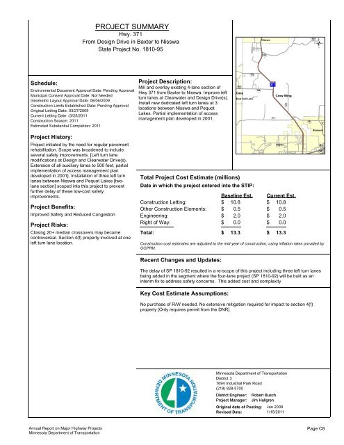
Schedule: Environmental Document Approval Date: Pending Approval Municipal Consent Approval Date: Not Needed Geometric Layout Approval Date: 08/06/2009 Construction Limits Established Date: Pending Approval Original Letting Date: 03/27/2009 Current Letting Date: (3/25/2011 Construction Season: 2011 Estimated Substantial Completion: 2011 Project History: Project initiated by the need for regular pavement rehabilitation. Scope was broadened to include several safety improvements. [Left turn lane modifications at Design and Clearwater Drive(s), Extension of all auxiliary lanes to 500 feet, partial implementation of access management plan developed in 2001]. Installation of three left turn lanes between Nisswa and Pequot Lakes [twolane section] scoped into this project to prevent further delay of these low-cost safety improvements. Project Benefits: Improved Safety and Reduced Congestion Project Risks: Closing 20+ median crossovers may become controversial. Section 4(f) property involved at one left turn lane location. Annual Report on Major Highway Projects Minnesota Department of Transportation PROJECT SUMMARY Hwy. 371 From Design Drive in Baxter to Nisswa State Project No. 1810-95 Project Description: Mill and overlay existing 4-lane section of Hwy 371 from Baxter to Nisswa. Improve left turn lanes at Clearwater and Design Drive(s). Install new dedicated left turn lanes at 3 locations between Nisswa and Pequot Lakes. Partial implementation of access management plan developed in 2001. 105 Cass 126 East Gull Lake Total Project Cost Estimate (millions) Date in which the project entered into the STIP: Recent Changes and Updates: 125 Nisswa 115 77 Crow Wing Baseline Est. Current Est. Construction Letting: $ 10.8 $ 10.8 Other Construction Elements: $ 0.5 $ 0.5 Engineering: $ 2.0 $ 2.0 Right of Way: $ 0.0 $ 0.0 The delay of SP 1810-92 resulted in a re-scope of this project including three left turn lanes being added in the segment where the four-lane project (SP 1810-92) will be built as an interim fix to address safety concerns. This added cost and complexity Key Cost Estimate Assumptions: No purchase of R/W needed. No extensive mitigation required for impact to section 4(f) property [Only requires permit from the DNR] Baxter Total: $ 13.3 $ 13.3 146 49 127 5 Brainerd Construction cost estimates are adjusted to the mid-year of construction, using inflation rates provided by OCPPM. Minnesota Department of Transportation District 3 7694 Industrial Park Road (218) 828-5700 District Engineer: Robert Busch Project Manager: Jim Hallgren Original date of Posting: Jan 2009 Revised Date: 1/15/2011 20 48 Page C8
- Page 1 and 2: This document is made available ele
- Page 3 and 4: Table of Contents Report Costs Page
- Page 5 and 6: Cost of completing this report The
- Page 7 and 8: Annual Report on Major Highway Proj
- Page 9 and 10: Highway Investment Plan Process The
- Page 11 and 12: Abbreviations to Annual Report on M
- Page 13 and 14: ANNUAL REPORT ON MAJOR HIGHWAY PROJ
- Page 15 and 16: ANNUAL REPORT ON MAJOR HIGHWAY PROJ
- Page 17 and 18: !! ! ! ! ! ! ! ! ! ! ! ! ! ! ! ! !
- Page 19 and 20: District Project Summary District 1
- Page 21 and 22: Schedule: Environmental Document Ap
- Page 23 and 24: Schedule: Environmental Document Ap
- Page 25 and 26: Schedule: Environmental Document Ap
- Page 27 and 28: Schedule: Environmental Document Ap
- Page 29 and 30: Schedule: Environmental Document Ap
- Page 31 and 32: Schedule: Environmental Document Ap
- Page 33 and 34: District Project Summary District 2
- Page 35 and 36: Schedule: Environmental Document Ap
- Page 37 and 38: Schedule: Environmental Document Ap
- Page 39 and 40: PROJECT SUMMARY Hwy. 71 3.0 miles s
- Page 41 and 42: Perham ?gA@ ?¬A@ )i ?aA@ ! ! ?ýA@
- Page 43 and 44: Schedule: Environmental Document Ap
- Page 45 and 46: Schedule: Environmental Document Ap
- Page 47: Schedule: Environmental Document Ap
- Page 52 and 53: Schedule: Environmental Document Ap
- Page 54 and 55: PROJECT SUMMARY Hwy. 59 North of TH
- Page 56 and 57: Schedule: Environmental Document Ap
- Page 58 and 59: District Project Summary District 6
- Page 60 and 61: Schedule: Environmental Document Ap
- Page 62 and 63: Schedule: Elk Run interchange State
- Page 64 and 65: Schedule: Environmental Document Ap
- Page 66 and 67: Schedule: Environmental Document Ap
- Page 68 and 69: From 2.2 Miles east of Hwy. 74 to w
- Page 70 and 71: ?«A@ ?ÁA@ )x ?ÀA@ )x Pipestone ?
- Page 72 and 73: Schedule: PROJECT SUMMARY Hwy. 14 B
- Page 74 and 75: Schedule: Environmental Document Ap
- Page 76 and 77: Schedule: Environmental Document Ap
- Page 78 and 79: Schedule: Environmental Document Ap
- Page 80 and 81: Schedule: Environmental Document Ap
- Page 82 and 83: Schedule: Environmental Document Ap
- Page 84 and 85: District Project Summary District 8
- Page 86 and 87: Schedule: Environmental Document Ap
- Page 88 and 89: ! ! %&h( %&h( !"b$ %&d( %&f( %&c( %
- Page 90 and 91: Schedule: Environmental Document Ap
- Page 92 and 93: Schedule: Environmental Document Ap
- Page 94 and 95: Schedule: Environmental Document Ap
- Page 96 and 97: Schedule: Environmental Document Ap
Schedule:<br />
Environmental Document Approval Date: Pending Approval<br />
Municipal Consent Approval Date: Not Needed<br />
Geometric Layout Approval Date: 08/06/2009<br />
Construction Limits Established Date: Pending Approval<br />
Original Letting Date: 03/27/2009<br />
Current Letting Date: (3/25/2011<br />
Construction Season: 2011<br />
Estimated Substantial Completion: 2011<br />
Project History:<br />
Project initiated by the need for regular pavement<br />
rehabilitation. Scope was broadened to include<br />
several safety improvements. [Left turn lane<br />
modifications at Design and Clearwater Drive(s),<br />
Extension of all auxiliary lanes to 500 feet, partial<br />
implementation of access management plan<br />
developed in 2001]. Installation of three left turn<br />
lanes between Nisswa and Pequot Lakes [twolane<br />
section] scoped into this project to prevent<br />
further delay of these low-cost safety<br />
improvements.<br />
Project Benefits:<br />
Improved Safety and Reduced Congestion<br />
Project Risks:<br />
Closing 20+ median crossovers may become<br />
controversial. Section 4(f) property involved at one<br />
left turn lane location.<br />
Annual Report on Major Highway Projects<br />
<strong>Minnesota</strong> Department of Transportation<br />
PROJECT SUMMARY<br />
Hwy. 371<br />
From Design Drive in Baxter to Nisswa<br />
<strong>State</strong> Project No. 1810-95<br />
Project Description:<br />
Mill and overlay existing 4-lane section of<br />
Hwy 371 from Baxter to Nisswa. Improve left<br />
turn lanes at Clearwater and Design Drive(s).<br />
Install new dedicated left turn lanes at 3<br />
locations between Nisswa and Pequot<br />
Lakes. Partial implementation of access<br />
management plan developed in 2001.<br />
105<br />
Cass<br />
126<br />
East Gull Lake<br />
Total Project Cost Estimate (millions)<br />
Date in which the project entered into the STIP:<br />
Recent Changes and Updates:<br />
125<br />
Nisswa<br />
115<br />
77<br />
Crow Wing<br />
Baseline Est. Current Est.<br />
Construction Letting: $ 10.8<br />
$ 10.8<br />
Other Construction Elements: $ 0.5<br />
$ 0.5<br />
Engineering: $ 2.0<br />
$ 2.0<br />
Right of Way: $ 0.0<br />
$ 0.0<br />
The delay of SP 1810-92 resulted in a re-scope of this project including three left turn lanes<br />
being added in the segment where the four-lane project (SP 1810-92) will be built as an<br />
interim fix to address safety concerns. This added cost and complexity<br />
Key Cost Estimate Assumptions:<br />
No purchase of R/W needed. No extensive mitigation required for impact to section 4(f)<br />
property [Only requires permit from the DNR]<br />
Baxter<br />
Total: $ 13.3 $ 13.3<br />
146<br />
49<br />
127<br />
5<br />
Brainerd<br />
Construction cost estimates are adjusted to the mid-year of construction, using inflation rates provided by<br />
OCPPM.<br />
<strong>Minnesota</strong> Department of Transportation<br />
District 3<br />
7694 Industrial Park Road<br />
(218) 828-5700<br />
District Engineer: Robert Busch<br />
Project Manager: Jim Hallgren<br />
Original date of Posting: Jan 2009<br />
Revised Date: 1/15/2011<br />
20<br />
48<br />
Page C8


